Quick filters:
Calaveras county map Stock Photos and Images
 Calaveras County Fairgrounds in Angels Camp, California, USA. 12th September, 2015. A map of the Butte Fire in California USA as of the morning of September 13 2015 Credit: John Crowe/Alamy Live News Stock Photohttps://www.alamy.com/image-license-details/?v=1https://www.alamy.com/stock-photo-calaveras-county-fairgrounds-in-angels-camp-california-usa-12th-september-87445596.html
RMF27DN0–Calaveras County Fairgrounds in Angels Camp, California, USA. 12th September, 2015. A map of the Butte Fire in California USA as of the morning of September 13 2015 Credit: John Crowe/Alamy Live News
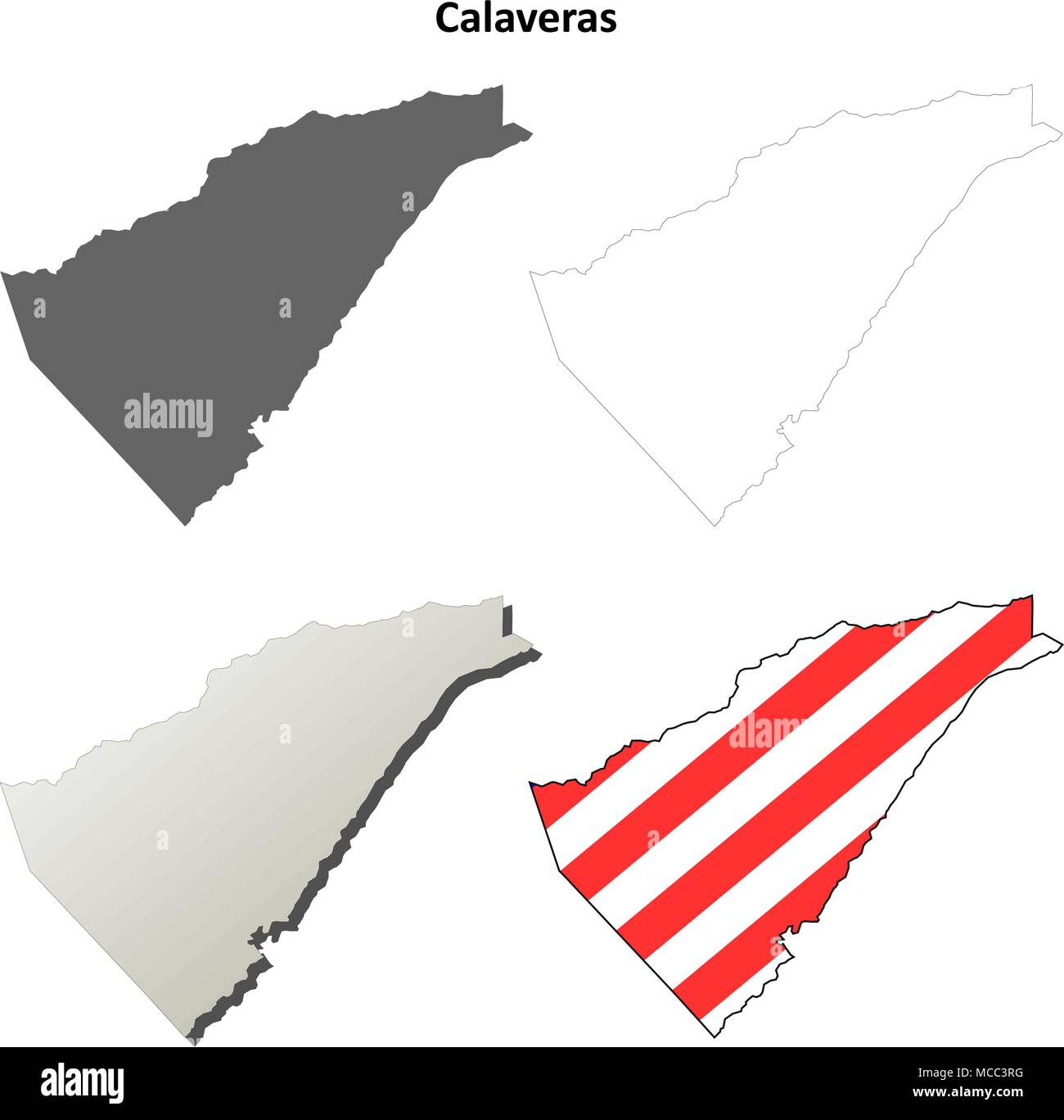 Calaveras County, California outline map set Stock Vectorhttps://www.alamy.com/image-license-details/?v=1https://www.alamy.com/calaveras-county-california-outline-map-set-image179745988.html
RFMCC3RG–Calaveras County, California outline map set
 Dorrington, Calaveras County, US, United States, California, N 38 18' 4'', S 120 16' 37'', map, Cartascapes Map published in 2024. Explore Cartascapes, a map revealing Earth's diverse landscapes, cultures, and ecosystems. Journey through time and space, discovering the interconnectedness of our planet's past, present, and future. Stock Photohttps://www.alamy.com/image-license-details/?v=1https://www.alamy.com/dorrington-calaveras-county-us-united-states-california-n-38-18-4-s-120-16-37-map-cartascapes-map-published-in-2024-explore-cartascapes-a-map-revealing-earths-diverse-landscapes-cultures-and-ecosystems-journey-through-time-and-space-discovering-the-interconnectedness-of-our-planets-past-present-and-future-image621277273.html
RM2Y2NHE1–Dorrington, Calaveras County, US, United States, California, N 38 18' 4'', S 120 16' 37'', map, Cartascapes Map published in 2024. Explore Cartascapes, a map revealing Earth's diverse landscapes, cultures, and ecosystems. Journey through time and space, discovering the interconnectedness of our planet's past, present, and future.
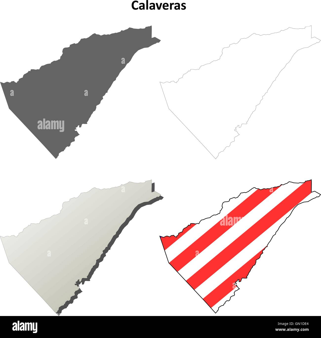 Calaveras County, California outline map set Stock Vectorhttps://www.alamy.com/image-license-details/?v=1https://www.alamy.com/stock-photo-calaveras-county-california-outline-map-set-116202524.html
RFGN1DE4–Calaveras County, California outline map set
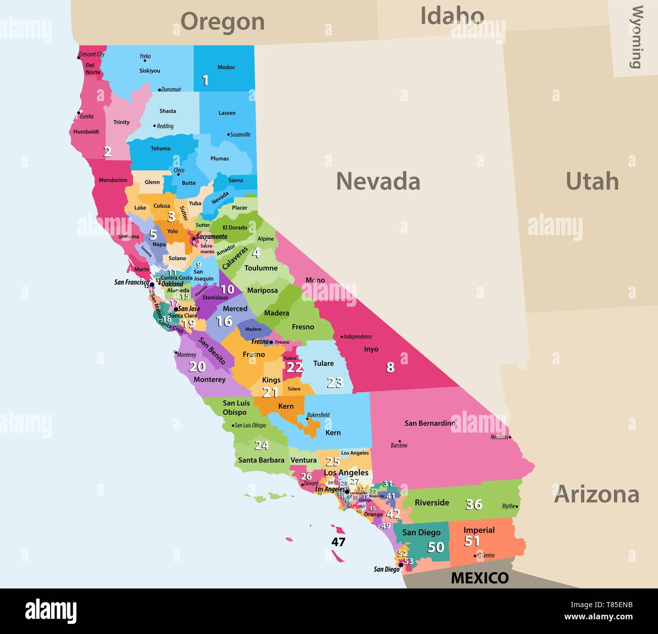 vector high detailed map of California's Congressional districts since 2013. Stock Vectorhttps://www.alamy.com/image-license-details/?v=1https://www.alamy.com/vector-high-detailed-map-of-californias-congressional-districts-since-2013-image245983735.html
RFT85ENB–vector high detailed map of California's Congressional districts since 2013.
 Map showing ancient channel system of Calaveras County 1894 by Storms, William H., 1859- Stock Photohttps://www.alamy.com/image-license-details/?v=1https://www.alamy.com/map-showing-ancient-channel-system-of-calaveras-county-1894-by-storms-william-h-1859-image633124032.html
RM2YP184G–Map showing ancient channel system of Calaveras County 1894 by Storms, William H., 1859-
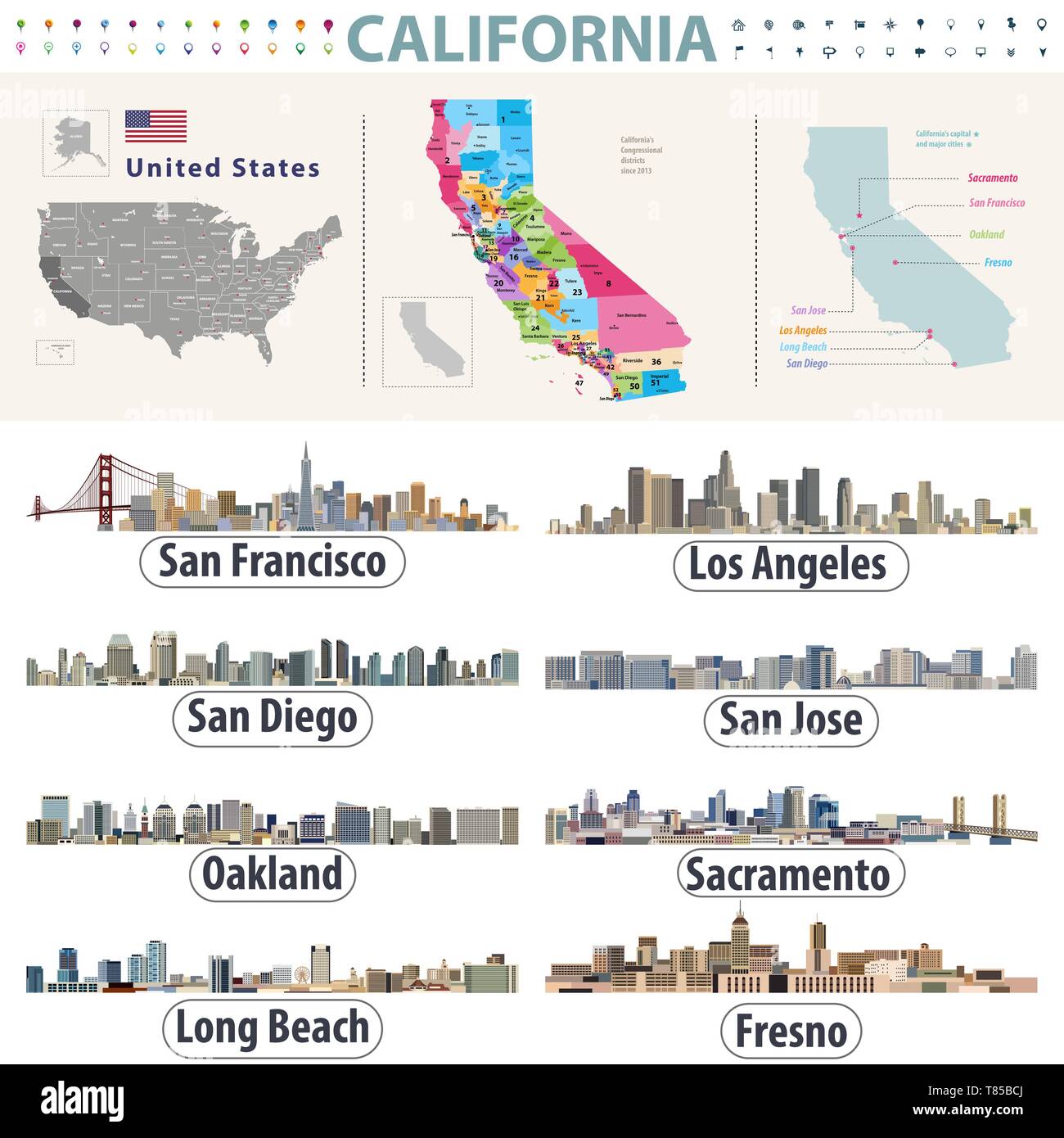 California's vector high detailed map showing counties formations. Skylines of major cities of California Stock Vectorhttps://www.alamy.com/image-license-details/?v=1https://www.alamy.com/californias-vector-high-detailed-map-showing-counties-formations-skylines-of-major-cities-of-california-image245981138.html
RFT85BCJ–California's vector high detailed map showing counties formations. Skylines of major cities of California
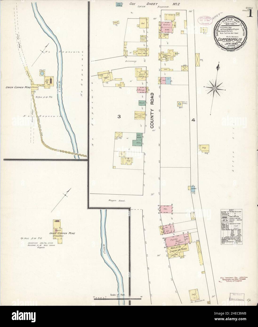 Sanborn Fire Insurance Map from Copperopolis, Calaveras County, California. Stock Photohttps://www.alamy.com/image-license-details/?v=1https://www.alamy.com/sanborn-fire-insurance-map-from-copperopolis-calaveras-county-california-image456347511.html
RM2HECBWB–Sanborn Fire Insurance Map from Copperopolis, Calaveras County, California.
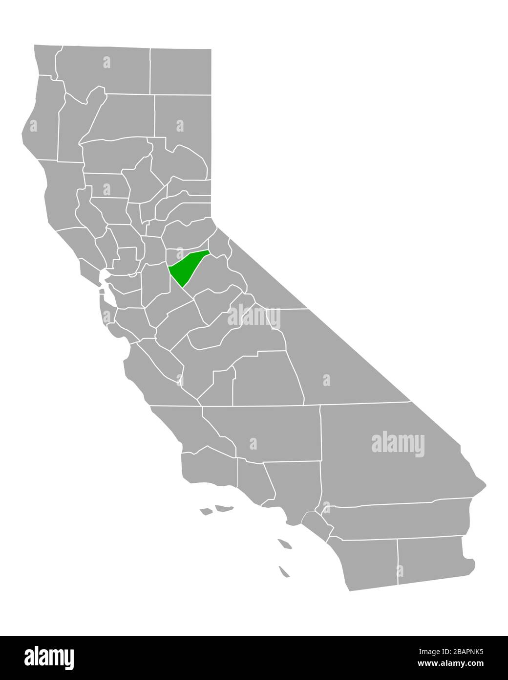 Map of Calaveras in California Stock Photohttps://www.alamy.com/image-license-details/?v=1https://www.alamy.com/map-of-calaveras-in-california-image350853865.html
RF2BAPNK5–Map of Calaveras in California
 Calaveras County, California (Counties in California, United States of America,USA, U.S., US) map vector illustration, scribble sketch Calaveras map Stock Vectorhttps://www.alamy.com/image-license-details/?v=1https://www.alamy.com/calaveras-county-california-counties-in-california-united-states-of-americausa-us-us-map-vector-illustration-scribble-sketch-calaveras-map-image242004144.html
RFT1M6N4–Calaveras County, California (Counties in California, United States of America,USA, U.S., US) map vector illustration, scribble sketch Calaveras map
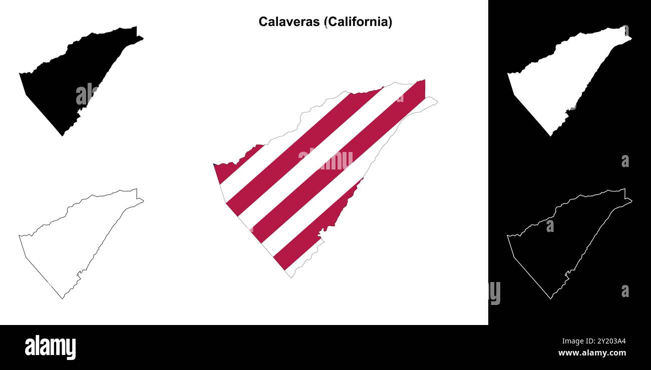 Calaveras County (California) outline map set Stock Vectorhttps://www.alamy.com/image-license-details/?v=1https://www.alamy.com/calaveras-county-california-outline-map-set-image620805196.html
RF2Y203A4–Calaveras County (California) outline map set
 . Bibliography of marine geology and oceanography, California coast. Submarine geology; Coasts; Oceanography. Q ;rous gravel con andesite detritui Valley Springs formation Auriferous stream grave! of interbtddid itream gractt and ttntieutar rhijnliir tuff Base map enlarged from San Andreas quadrangle Mapped by U S. Geological Survey, 1945. GEOLOGIC AND ECONOMIC MAP CALAVERITAS QUADRANGLE CALAVERAS COUNTY, CALIFORNIA 20*30' Geology by Lorin D. Clark, 1950-52 dtrtvtd from irrptnttnt. ' oebiro and hybri a Calaveras formation Inlrrbtddid black prapnttie tcAul and quart rcplaerd by ftmgvunit cher Stock Photohttps://www.alamy.com/image-license-details/?v=1https://www.alamy.com/bibliography-of-marine-geology-and-oceanography-california-coast-submarine-geology-coasts-oceanography-q-rous-gravel-con-andesite-detritui-valley-springs-formation-auriferous-stream-grave!-of-interbtddid-itream-gractt-and-ttntieutar-rhijnliir-tuff-base-map-enlarged-from-san-andreas-quadrangle-mapped-by-u-s-geological-survey-1945-geologic-and-economic-map-calaveritas-quadrangle-calaveras-county-california-2030-geology-by-lorin-d-clark-1950-52-dtrtvtd-from-irrptnttnt-oebiro-and-hybri-a-calaveras-formation-inlrrbtddid-black-prapnttie-tcaul-and-quart-rcplaerd-by-ftmgvunit-cher-image234728999.html
RMRHTR6F–. Bibliography of marine geology and oceanography, California coast. Submarine geology; Coasts; Oceanography. Q ;rous gravel con andesite detritui Valley Springs formation Auriferous stream grave! of interbtddid itream gractt and ttntieutar rhijnliir tuff Base map enlarged from San Andreas quadrangle Mapped by U S. Geological Survey, 1945. GEOLOGIC AND ECONOMIC MAP CALAVERITAS QUADRANGLE CALAVERAS COUNTY, CALIFORNIA 20*30' Geology by Lorin D. Clark, 1950-52 dtrtvtd from irrptnttnt. ' oebiro and hybri a Calaveras formation Inlrrbtddid black prapnttie tcAul and quart rcplaerd by ftmgvunit cher
 Map of Calaveras in California Stock Photohttps://www.alamy.com/image-license-details/?v=1https://www.alamy.com/map-of-calaveras-in-california-image385534594.html
RF2DB6H8J–Map of Calaveras in California
 Geological map of the Mother Lode region. Covers parts of Eldorado, Amador, Calaveras, Tuolumne, and Mariposa Counties. Oriented with north to the upper left. Also shows mining claims. Includes list of mining claims by counties. Stamped: Compliments of Lewis E. Aubury, State Mineralogist. First issued with the Mining Bureau's 10th annual report... Mother Lode region. Mother Lode region, California , Calaveras ,county , Mother Lode Acres ,area Stock Photohttps://www.alamy.com/image-license-details/?v=1https://www.alamy.com/geological-map-of-the-mother-lode-region-covers-parts-of-eldorado-amador-calaveras-tuolumne-and-mariposa-counties-oriented-with-north-to-the-upper-left-also-shows-mining-claims-includes-list-of-mining-claims-by-counties-stamped-compliments-of-lewis-e-aubury-state-mineralogist-first-issued-with-the-mining-bureaus-10th-annual-report-mother-lode-region-mother-lode-region-california-calaveras-county-mother-lode-acres-area-image502737094.html
RM2M5WJ86–Geological map of the Mother Lode region. Covers parts of Eldorado, Amador, Calaveras, Tuolumne, and Mariposa Counties. Oriented with north to the upper left. Also shows mining claims. Includes list of mining claims by counties. Stamped: Compliments of Lewis E. Aubury, State Mineralogist. First issued with the Mining Bureau's 10th annual report... Mother Lode region. Mother Lode region, California , Calaveras ,county , Mother Lode Acres ,area
 Murphys, Calaveras County, US, United States, California, N 38 8' 15'', S 120 27' 39'', map, Cartascapes Map published in 2024. Explore Cartascapes, a map revealing Earth's diverse landscapes, cultures, and ecosystems. Journey through time and space, discovering the interconnectedness of our planet's past, present, and future. Stock Photohttps://www.alamy.com/image-license-details/?v=1https://www.alamy.com/murphys-calaveras-county-us-united-states-california-n-38-8-15-s-120-27-39-map-cartascapes-map-published-in-2024-explore-cartascapes-a-map-revealing-earths-diverse-landscapes-cultures-and-ecosystems-journey-through-time-and-space-discovering-the-interconnectedness-of-our-planets-past-present-and-future-image621179005.html
RM2Y2H44D–Murphys, Calaveras County, US, United States, California, N 38 8' 15'', S 120 27' 39'', map, Cartascapes Map published in 2024. Explore Cartascapes, a map revealing Earth's diverse landscapes, cultures, and ecosystems. Journey through time and space, discovering the interconnectedness of our planet's past, present, and future.
 The ancient channel system between San Andreas and Mokelumne Hill, Calavaras Co. 1894 Stock Photohttps://www.alamy.com/image-license-details/?v=1https://www.alamy.com/the-ancient-channel-system-between-san-andreas-and-mokelumne-hill-calavaras-co-1894-image633124047.html
RM2YP1853–The ancient channel system between San Andreas and Mokelumne Hill, Calavaras Co. 1894
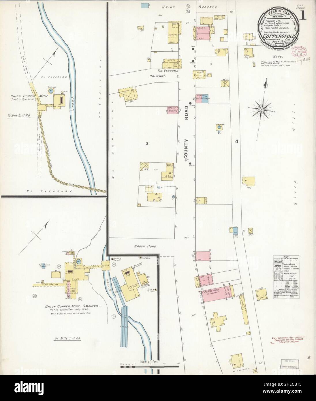 Sanborn Fire Insurance Map from Copperopolis, Calaveras County, California. Stock Photohttps://www.alamy.com/image-license-details/?v=1https://www.alamy.com/sanborn-fire-insurance-map-from-copperopolis-calaveras-county-california-image456347477.html
RM2HECBT5–Sanborn Fire Insurance Map from Copperopolis, Calaveras County, California.
 Map of Calaveras in California Stock Photohttps://www.alamy.com/image-license-details/?v=1https://www.alamy.com/map-of-calaveras-in-california-image348974354.html
RF2B7N49P–Map of Calaveras in California
 Calaveras County, California (Counties in California, United States of America,USA, U.S., US) map vector illustration, scribble sketch Calaveras map Stock Vectorhttps://www.alamy.com/image-license-details/?v=1https://www.alamy.com/calaveras-county-california-counties-in-california-united-states-of-americausa-us-us-map-vector-illustration-scribble-sketch-calaveras-map-image246735573.html
RFT9BNMN–Calaveras County, California (Counties in California, United States of America,USA, U.S., US) map vector illustration, scribble sketch Calaveras map
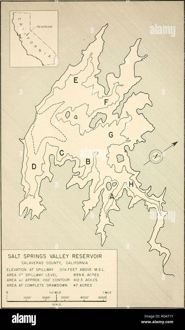 . California fish and game. Fisheries -- California; Game and game-birds -- California; Fishes -- California; Animal Population Groups; Pêches; Gibier; Poissons. 8 CALIFORNIA FISH AND GAME. SALT SPRINGS VALLEY RESERVOIR CALAVERAS COUNTY, CALIFORNIA ELEVATION AT SPILLWAY 1074 FEET ABOVE M.S.L. AREA AT SPILLWAY LEVEL 899.6 ACRES AREA AT APPROX. 1062' CONTOUR 412.3 ACRES AREA AT COMPLETE DRAWDOWN 47 ACRES 1000 2000' 3000 FIGURE 1. Map of Salt Springs Valley Reservoir, Calaveras County, California. Please note that these images are extracted from scanned page images that may have been digitally en Stock Photohttps://www.alamy.com/image-license-details/?v=1https://www.alamy.com/california-fish-and-game-fisheries-california-game-and-game-birds-california-fishes-california-animal-population-groups-pches-gibier-poissons-8-california-fish-and-game-salt-springs-valley-reservoir-calaveras-county-california-elevation-at-spillway-1074-feet-above-msl-area-at-spillway-level-8996-acres-area-at-approx-1062-contour-4123-acres-area-at-complete-drawdown-47-acres-1000-2000-3000-figure-1-map-of-salt-springs-valley-reservoir-calaveras-county-california-please-note-that-these-images-are-extracted-from-scanned-page-images-that-may-have-been-digitally-en-image233662631.html
RMRG471Y–. California fish and game. Fisheries -- California; Game and game-birds -- California; Fishes -- California; Animal Population Groups; Pêches; Gibier; Poissons. 8 CALIFORNIA FISH AND GAME. SALT SPRINGS VALLEY RESERVOIR CALAVERAS COUNTY, CALIFORNIA ELEVATION AT SPILLWAY 1074 FEET ABOVE M.S.L. AREA AT SPILLWAY LEVEL 899.6 ACRES AREA AT APPROX. 1062' CONTOUR 412.3 ACRES AREA AT COMPLETE DRAWDOWN 47 ACRES 1000 2000' 3000 FIGURE 1. Map of Salt Springs Valley Reservoir, Calaveras County, California. Please note that these images are extracted from scanned page images that may have been digitally en
 Map of Calaveras in California Stock Photohttps://www.alamy.com/image-license-details/?v=1https://www.alamy.com/map-of-calaveras-in-california-image385554863.html
RF2DB7F4F–Map of Calaveras in California
 Altaville, Calaveras County, US, United States, California, N 38 5' 1'', S 120 33' 42'', map, Cartascapes Map published in 2024. Explore Cartascapes, a map revealing Earth's diverse landscapes, cultures, and ecosystems. Journey through time and space, discovering the interconnectedness of our planet's past, present, and future. Stock Photohttps://www.alamy.com/image-license-details/?v=1https://www.alamy.com/altaville-calaveras-county-us-united-states-california-n-38-5-1-s-120-33-42-map-cartascapes-map-published-in-2024-explore-cartascapes-a-map-revealing-earths-diverse-landscapes-cultures-and-ecosystems-journey-through-time-and-space-discovering-the-interconnectedness-of-our-planets-past-present-and-future-image621499788.html
RM2Y33N90–Altaville, Calaveras County, US, United States, California, N 38 5' 1'', S 120 33' 42'', map, Cartascapes Map published in 2024. Explore Cartascapes, a map revealing Earth's diverse landscapes, cultures, and ecosystems. Journey through time and space, discovering the interconnectedness of our planet's past, present, and future.
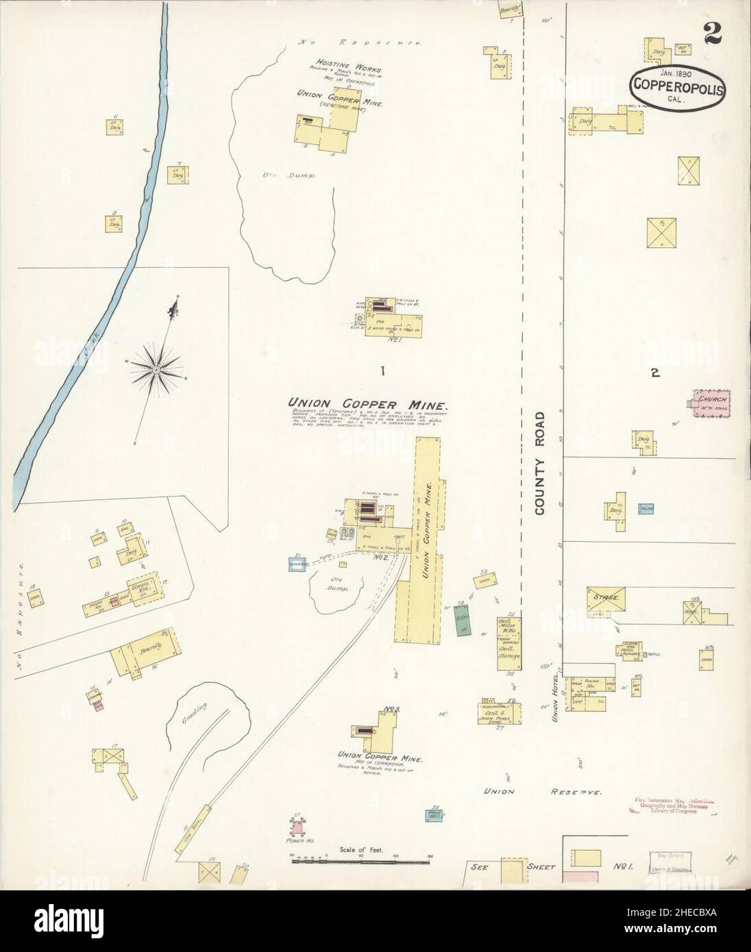 Sanborn Fire Insurance Map from Copperopolis, Calaveras County, California. Stock Photohttps://www.alamy.com/image-license-details/?v=1https://www.alamy.com/sanborn-fire-insurance-map-from-copperopolis-calaveras-county-california-image456347538.html
RM2HECBXA–Sanborn Fire Insurance Map from Copperopolis, Calaveras County, California.
 Map of Calaveras in California Stock Photohttps://www.alamy.com/image-license-details/?v=1https://www.alamy.com/map-of-calaveras-in-california-image351283846.html
RF2BBEA3J–Map of Calaveras in California
 Calaveras County, California (Counties in California, United States of America,USA, U.S., US) map vector illustration, scribble sketch Calaveras map Stock Vectorhttps://www.alamy.com/image-license-details/?v=1https://www.alamy.com/calaveras-county-california-counties-in-california-united-states-of-americausa-us-us-map-vector-illustration-scribble-sketch-calaveras-map-image244877706.html
RFT6B40A–Calaveras County, California (Counties in California, United States of America,USA, U.S., US) map vector illustration, scribble sketch Calaveras map
 Map of Calaveras in California Stock Photohttps://www.alamy.com/image-license-details/?v=1https://www.alamy.com/map-of-calaveras-in-california-image363376559.html
RF2C356E7–Map of Calaveras in California
 Copperopolis, Calaveras County, US, United States, California, N 37 58' 51'', S 120 38' 30'', map, Cartascapes Map published in 2024. Explore Cartascapes, a map revealing Earth's diverse landscapes, cultures, and ecosystems. Journey through time and space, discovering the interconnectedness of our planet's past, present, and future. Stock Photohttps://www.alamy.com/image-license-details/?v=1https://www.alamy.com/copperopolis-calaveras-county-us-united-states-california-n-37-58-51-s-120-38-30-map-cartascapes-map-published-in-2024-explore-cartascapes-a-map-revealing-earths-diverse-landscapes-cultures-and-ecosystems-journey-through-time-and-space-discovering-the-interconnectedness-of-our-planets-past-present-and-future-image621436699.html
RM2Y30TRR–Copperopolis, Calaveras County, US, United States, California, N 37 58' 51'', S 120 38' 30'', map, Cartascapes Map published in 2024. Explore Cartascapes, a map revealing Earth's diverse landscapes, cultures, and ecosystems. Journey through time and space, discovering the interconnectedness of our planet's past, present, and future.
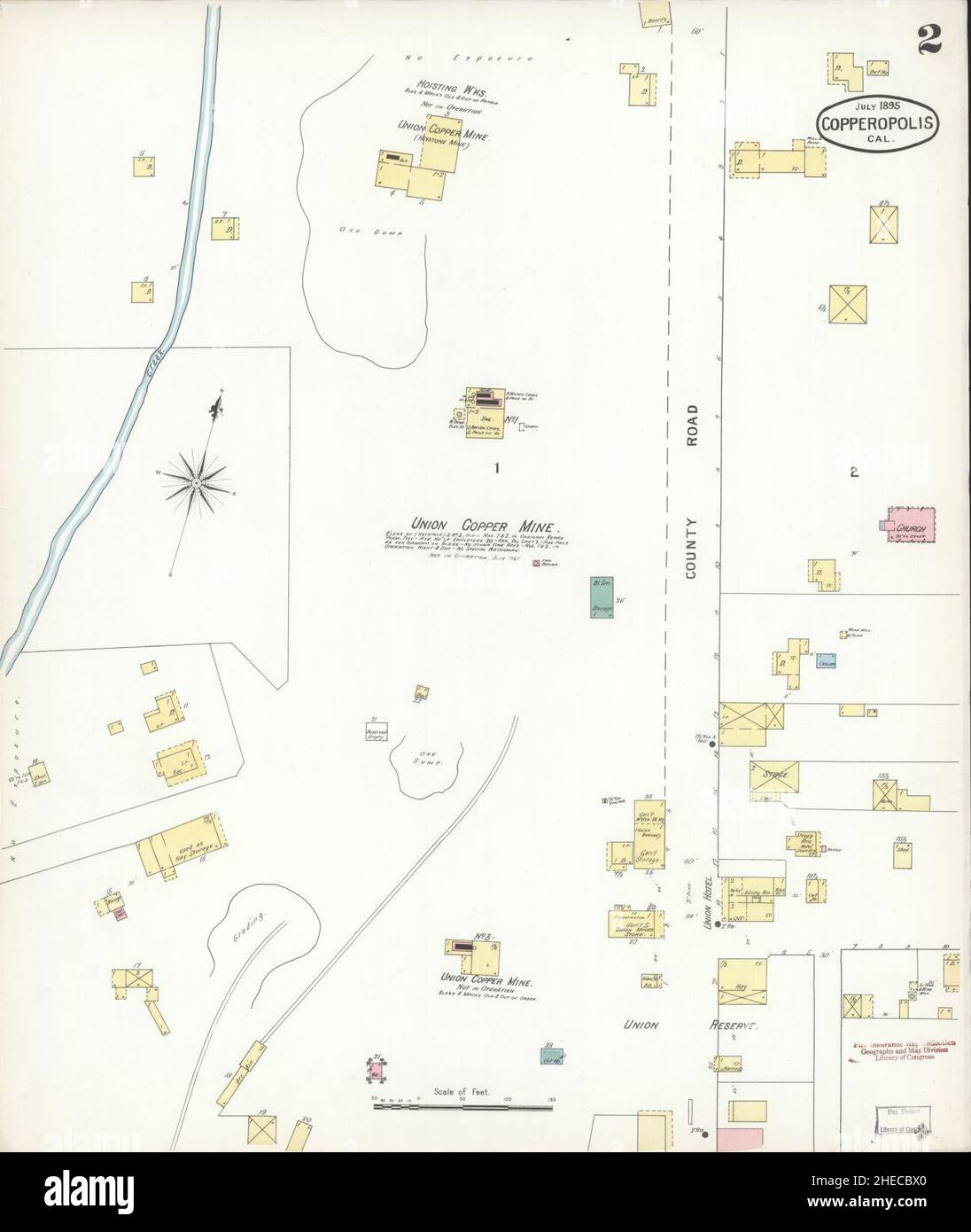 Sanborn Fire Insurance Map from Copperopolis, Calaveras County, California. Stock Photohttps://www.alamy.com/image-license-details/?v=1https://www.alamy.com/sanborn-fire-insurance-map-from-copperopolis-calaveras-county-california-image456347528.html
RM2HECBX0–Sanborn Fire Insurance Map from Copperopolis, Calaveras County, California.
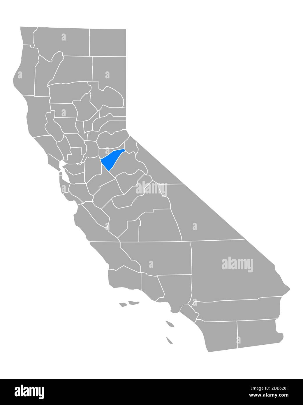 Map of Calaveras in California Stock Photohttps://www.alamy.com/image-license-details/?v=1https://www.alamy.com/map-of-calaveras-in-california-image385522831.html
RF2DB628F–Map of Calaveras in California
 Hams, Calaveras County, US, United States, California, N 38 22' 26'', S 120 27' 43'', map, Cartascapes Map published in 2024. Explore Cartascapes, a map revealing Earth's diverse landscapes, cultures, and ecosystems. Journey through time and space, discovering the interconnectedness of our planet's past, present, and future. Stock Photohttps://www.alamy.com/image-license-details/?v=1https://www.alamy.com/hams-calaveras-county-us-united-states-california-n-38-22-26-s-120-27-43-map-cartascapes-map-published-in-2024-explore-cartascapes-a-map-revealing-earths-diverse-landscapes-cultures-and-ecosystems-journey-through-time-and-space-discovering-the-interconnectedness-of-our-planets-past-present-and-future-image621175088.html
RM2Y2GY4G–Hams, Calaveras County, US, United States, California, N 38 22' 26'', S 120 27' 43'', map, Cartascapes Map published in 2024. Explore Cartascapes, a map revealing Earth's diverse landscapes, cultures, and ecosystems. Journey through time and space, discovering the interconnectedness of our planet's past, present, and future.
 Sanborn Fire Insurance Map from Altaville, Calaveras County, California. Stock Photohttps://www.alamy.com/image-license-details/?v=1https://www.alamy.com/sanborn-fire-insurance-map-from-altaville-calaveras-county-california-image456290470.html
RM2HE9R46–Sanborn Fire Insurance Map from Altaville, Calaveras County, California.
 Map of Calaveras in California Stock Photohttps://www.alamy.com/image-license-details/?v=1https://www.alamy.com/map-of-calaveras-in-california-image363388532.html
RF2C35NNT–Map of Calaveras in California
 Avery, Calaveras County, US, United States, California, N 38 12' 15'', S 120 22' 11'', map, Cartascapes Map published in 2024. Explore Cartascapes, a map revealing Earth's diverse landscapes, cultures, and ecosystems. Journey through time and space, discovering the interconnectedness of our planet's past, present, and future. Stock Photohttps://www.alamy.com/image-license-details/?v=1https://www.alamy.com/avery-calaveras-county-us-united-states-california-n-38-12-15-s-120-22-11-map-cartascapes-map-published-in-2024-explore-cartascapes-a-map-revealing-earths-diverse-landscapes-cultures-and-ecosystems-journey-through-time-and-space-discovering-the-interconnectedness-of-our-planets-past-present-and-future-image621156681.html
RM2Y2G3K5–Avery, Calaveras County, US, United States, California, N 38 12' 15'', S 120 22' 11'', map, Cartascapes Map published in 2024. Explore Cartascapes, a map revealing Earth's diverse landscapes, cultures, and ecosystems. Journey through time and space, discovering the interconnectedness of our planet's past, present, and future.
 Sanborn Fire Insurance Map from Altaville, Calaveras County, California. Stock Photohttps://www.alamy.com/image-license-details/?v=1https://www.alamy.com/sanborn-fire-insurance-map-from-altaville-calaveras-county-california-image456290467.html
RM2HE9R43–Sanborn Fire Insurance Map from Altaville, Calaveras County, California.
 Map of Calaveras in California Stock Photohttps://www.alamy.com/image-license-details/?v=1https://www.alamy.com/map-of-calaveras-in-california-image363422725.html
RF2C379B1–Map of Calaveras in California
 Sandoz, Calaveras County, US, United States, California, N 38 20' 52'', S 120 25' 49'', map, Cartascapes Map published in 2024. Explore Cartascapes, a map revealing Earth's diverse landscapes, cultures, and ecosystems. Journey through time and space, discovering the interconnectedness of our planet's past, present, and future. Stock Photohttps://www.alamy.com/image-license-details/?v=1https://www.alamy.com/sandoz-calaveras-county-us-united-states-california-n-38-20-52-s-120-25-49-map-cartascapes-map-published-in-2024-explore-cartascapes-a-map-revealing-earths-diverse-landscapes-cultures-and-ecosystems-journey-through-time-and-space-discovering-the-interconnectedness-of-our-planets-past-present-and-future-image621458300.html
RM2Y31TB8–Sandoz, Calaveras County, US, United States, California, N 38 20' 52'', S 120 25' 49'', map, Cartascapes Map published in 2024. Explore Cartascapes, a map revealing Earth's diverse landscapes, cultures, and ecosystems. Journey through time and space, discovering the interconnectedness of our planet's past, present, and future.
 Sanborn Fire Insurance Map from Milton, Calaveras County, California. Stock Photohttps://www.alamy.com/image-license-details/?v=1https://www.alamy.com/sanborn-fire-insurance-map-from-milton-calaveras-county-california-image456439393.html
RM2HEGH2W–Sanborn Fire Insurance Map from Milton, Calaveras County, California.
 Felix, Calaveras County, US, United States, California, N 38 1' 41'', S 120 42' 56'', map, Cartascapes Map published in 2024. Explore Cartascapes, a map revealing Earth's diverse landscapes, cultures, and ecosystems. Journey through time and space, discovering the interconnectedness of our planet's past, present, and future. Stock Photohttps://www.alamy.com/image-license-details/?v=1https://www.alamy.com/felix-calaveras-county-us-united-states-california-n-38-1-41-s-120-42-56-map-cartascapes-map-published-in-2024-explore-cartascapes-a-map-revealing-earths-diverse-landscapes-cultures-and-ecosystems-journey-through-time-and-space-discovering-the-interconnectedness-of-our-planets-past-present-and-future-image621397308.html
RM2Y2Y2H0–Felix, Calaveras County, US, United States, California, N 38 1' 41'', S 120 42' 56'', map, Cartascapes Map published in 2024. Explore Cartascapes, a map revealing Earth's diverse landscapes, cultures, and ecosystems. Journey through time and space, discovering the interconnectedness of our planet's past, present, and future.
 Sanborn Fire Insurance Map from Valley Spring, Calaveras County, California. Stock Photohttps://www.alamy.com/image-license-details/?v=1https://www.alamy.com/sanborn-fire-insurance-map-from-valley-spring-calaveras-county-california-image456506117.html
RM2HEKJ5W–Sanborn Fire Insurance Map from Valley Spring, Calaveras County, California.
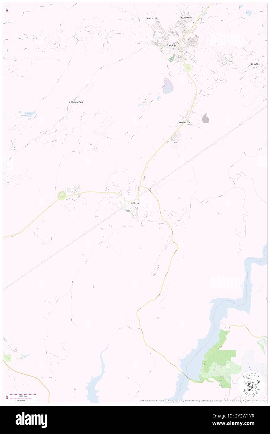 Vallecito, Calaveras County, US, United States, California, N 38 5' 24'', S 120 28' 24'', map, Cartascapes Map published in 2024. Explore Cartascapes, a map revealing Earth's diverse landscapes, cultures, and ecosystems. Journey through time and space, discovering the interconnectedness of our planet's past, present, and future. Stock Photohttps://www.alamy.com/image-license-details/?v=1https://www.alamy.com/vallecito-calaveras-county-us-united-states-california-n-38-5-24-s-120-28-24-map-cartascapes-map-published-in-2024-explore-cartascapes-a-map-revealing-earths-diverse-landscapes-cultures-and-ecosystems-journey-through-time-and-space-discovering-the-interconnectedness-of-our-planets-past-present-and-future-image621352923.html
RM2Y2W1YR–Vallecito, Calaveras County, US, United States, California, N 38 5' 24'', S 120 28' 24'', map, Cartascapes Map published in 2024. Explore Cartascapes, a map revealing Earth's diverse landscapes, cultures, and ecosystems. Journey through time and space, discovering the interconnectedness of our planet's past, present, and future.
 Sanborn Fire Insurance Map from Valley Spring, Calaveras County, California. Stock Photohttps://www.alamy.com/image-license-details/?v=1https://www.alamy.com/sanborn-fire-insurance-map-from-valley-spring-calaveras-county-california-image456506158.html
RM2HEKJ7A–Sanborn Fire Insurance Map from Valley Spring, Calaveras County, California.
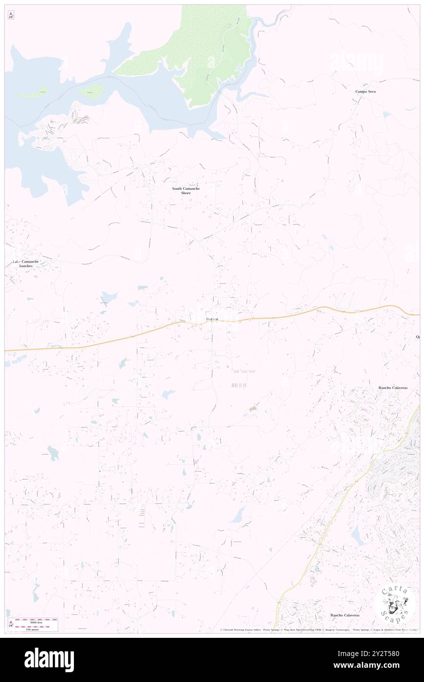 Burson, Calaveras County, US, United States, California, N 38 11' 1'', S 120 53' 25'', map, Cartascapes Map published in 2024. Explore Cartascapes, a map revealing Earth's diverse landscapes, cultures, and ecosystems. Journey through time and space, discovering the interconnectedness of our planet's past, present, and future. Stock Photohttps://www.alamy.com/image-license-details/?v=1https://www.alamy.com/burson-calaveras-county-us-united-states-california-n-38-11-1-s-120-53-25-map-cartascapes-map-published-in-2024-explore-cartascapes-a-map-revealing-earths-diverse-landscapes-cultures-and-ecosystems-journey-through-time-and-space-discovering-the-interconnectedness-of-our-planets-past-present-and-future-image621333552.html
RM2Y2T580–Burson, Calaveras County, US, United States, California, N 38 11' 1'', S 120 53' 25'', map, Cartascapes Map published in 2024. Explore Cartascapes, a map revealing Earth's diverse landscapes, cultures, and ecosystems. Journey through time and space, discovering the interconnectedness of our planet's past, present, and future.
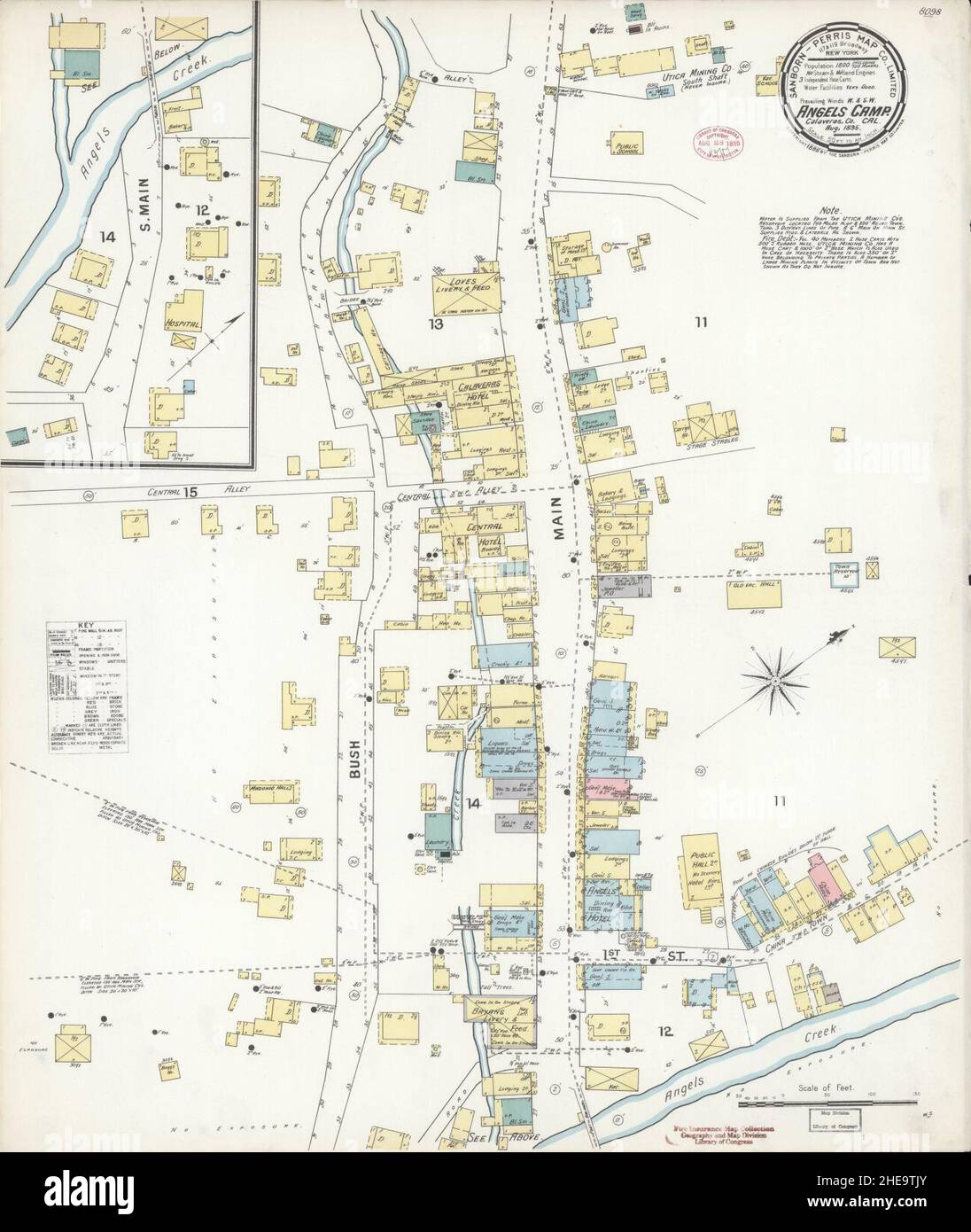 Sanborn Fire Insurance Map from Angels Camp, Calaveras County, California. Stock Photohttps://www.alamy.com/image-license-details/?v=1https://www.alamy.com/sanborn-fire-insurance-map-from-angels-camp-calaveras-county-california-image456291667.html
RM2HE9TJY–Sanborn Fire Insurance Map from Angels Camp, Calaveras County, California.
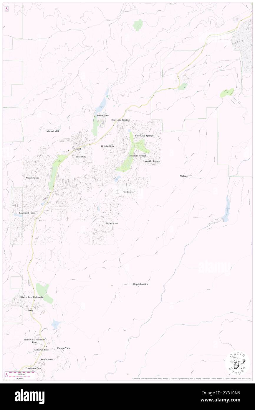 Pinebrook, Calaveras County, US, United States, California, N 38 14' 30'', S 120 19' 50'', map, Cartascapes Map published in 2024. Explore Cartascapes, a map revealing Earth's diverse landscapes, cultures, and ecosystems. Journey through time and space, discovering the interconnectedness of our planet's past, present, and future. Stock Photohttps://www.alamy.com/image-license-details/?v=1https://www.alamy.com/pinebrook-calaveras-county-us-united-states-california-n-38-14-30-s-120-19-50-map-cartascapes-map-published-in-2024-explore-cartascapes-a-map-revealing-earths-diverse-landscapes-cultures-and-ecosystems-journey-through-time-and-space-discovering-the-interconnectedness-of-our-planets-past-present-and-future-image621439765.html
RM2Y310N9–Pinebrook, Calaveras County, US, United States, California, N 38 14' 30'', S 120 19' 50'', map, Cartascapes Map published in 2024. Explore Cartascapes, a map revealing Earth's diverse landscapes, cultures, and ecosystems. Journey through time and space, discovering the interconnectedness of our planet's past, present, and future.
 Sanborn Fire Insurance Map from San Andreas, Calaveras County, California. Stock Photohttps://www.alamy.com/image-license-details/?v=1https://www.alamy.com/sanborn-fire-insurance-map-from-san-andreas-calaveras-county-california-image456469307.html
RM2HEHY77–Sanborn Fire Insurance Map from San Andreas, Calaveras County, California.
 Meadowmont, Calaveras County, US, United States, California, N 38 14' 46'', S 120 22' 8'', map, Cartascapes Map published in 2024. Explore Cartascapes, a map revealing Earth's diverse landscapes, cultures, and ecosystems. Journey through time and space, discovering the interconnectedness of our planet's past, present, and future. Stock Photohttps://www.alamy.com/image-license-details/?v=1https://www.alamy.com/meadowmont-calaveras-county-us-united-states-california-n-38-14-46-s-120-22-8-map-cartascapes-map-published-in-2024-explore-cartascapes-a-map-revealing-earths-diverse-landscapes-cultures-and-ecosystems-journey-through-time-and-space-discovering-the-interconnectedness-of-our-planets-past-present-and-future-image621487747.html
RM2Y335XY–Meadowmont, Calaveras County, US, United States, California, N 38 14' 46'', S 120 22' 8'', map, Cartascapes Map published in 2024. Explore Cartascapes, a map revealing Earth's diverse landscapes, cultures, and ecosystems. Journey through time and space, discovering the interconnectedness of our planet's past, present, and future.
 Sanborn Fire Insurance Map from San Andreas, Calaveras County, California. Stock Photohttps://www.alamy.com/image-license-details/?v=1https://www.alamy.com/sanborn-fire-insurance-map-from-san-andreas-calaveras-county-california-image456469333.html
RM2HEHY85–Sanborn Fire Insurance Map from San Andreas, Calaveras County, California.
 Skyhigh, Calaveras County, US, United States, California, N 38 25' 35'', S 120 5' 58'', map, Cartascapes Map published in 2024. Explore Cartascapes, a map revealing Earth's diverse landscapes, cultures, and ecosystems. Journey through time and space, discovering the interconnectedness of our planet's past, present, and future. Stock Photohttps://www.alamy.com/image-license-details/?v=1https://www.alamy.com/skyhigh-calaveras-county-us-united-states-california-n-38-25-35-s-120-5-58-map-cartascapes-map-published-in-2024-explore-cartascapes-a-map-revealing-earths-diverse-landscapes-cultures-and-ecosystems-journey-through-time-and-space-discovering-the-interconnectedness-of-our-planets-past-present-and-future-image621218327.html
RM2Y2JX8R–Skyhigh, Calaveras County, US, United States, California, N 38 25' 35'', S 120 5' 58'', map, Cartascapes Map published in 2024. Explore Cartascapes, a map revealing Earth's diverse landscapes, cultures, and ecosystems. Journey through time and space, discovering the interconnectedness of our planet's past, present, and future.
 Sanborn Fire Insurance Map from San Andreas, Calaveras County, California. Stock Photohttps://www.alamy.com/image-license-details/?v=1https://www.alamy.com/sanborn-fire-insurance-map-from-san-andreas-calaveras-county-california-image456469289.html
RM2HEHY6H–Sanborn Fire Insurance Map from San Andreas, Calaveras County, California.
 Wallace, Calaveras County, US, United States, California, N 38 11' 38'', S 120 58' 40'', map, Cartascapes Map published in 2024. Explore Cartascapes, a map revealing Earth's diverse landscapes, cultures, and ecosystems. Journey through time and space, discovering the interconnectedness of our planet's past, present, and future. Stock Photohttps://www.alamy.com/image-license-details/?v=1https://www.alamy.com/wallace-calaveras-county-us-united-states-california-n-38-11-38-s-120-58-40-map-cartascapes-map-published-in-2024-explore-cartascapes-a-map-revealing-earths-diverse-landscapes-cultures-and-ecosystems-journey-through-time-and-space-discovering-the-interconnectedness-of-our-planets-past-present-and-future-image621453396.html
RM2Y31J44–Wallace, Calaveras County, US, United States, California, N 38 11' 38'', S 120 58' 40'', map, Cartascapes Map published in 2024. Explore Cartascapes, a map revealing Earth's diverse landscapes, cultures, and ecosystems. Journey through time and space, discovering the interconnectedness of our planet's past, present, and future.
 Sanborn Fire Insurance Map from Angels Camp, Calaveras County, California. Stock Photohttps://www.alamy.com/image-license-details/?v=1https://www.alamy.com/sanborn-fire-insurance-map-from-angels-camp-calaveras-county-california-image456291677.html
RM2HE9TK9–Sanborn Fire Insurance Map from Angels Camp, Calaveras County, California.
 Lombardi, Calaveras County, US, United States, California, N 38 26' 45'', S 120 3' 58'', map, Cartascapes Map published in 2024. Explore Cartascapes, a map revealing Earth's diverse landscapes, cultures, and ecosystems. Journey through time and space, discovering the interconnectedness of our planet's past, present, and future. Stock Photohttps://www.alamy.com/image-license-details/?v=1https://www.alamy.com/lombardi-calaveras-county-us-united-states-california-n-38-26-45-s-120-3-58-map-cartascapes-map-published-in-2024-explore-cartascapes-a-map-revealing-earths-diverse-landscapes-cultures-and-ecosystems-journey-through-time-and-space-discovering-the-interconnectedness-of-our-planets-past-present-and-future-image621452369.html
RM2Y31GRD–Lombardi, Calaveras County, US, United States, California, N 38 26' 45'', S 120 3' 58'', map, Cartascapes Map published in 2024. Explore Cartascapes, a map revealing Earth's diverse landscapes, cultures, and ecosystems. Journey through time and space, discovering the interconnectedness of our planet's past, present, and future.
 Sanborn Fire Insurance Map from Angels Camp, Calaveras County, California. Stock Photohttps://www.alamy.com/image-license-details/?v=1https://www.alamy.com/sanborn-fire-insurance-map-from-angels-camp-calaveras-county-california-image456291656.html
RM2HE9TJG–Sanborn Fire Insurance Map from Angels Camp, Calaveras County, California.
 Tamarack, Calaveras County, US, United States, California, N 38 26' 19'', S 120 4' 33'', map, Cartascapes Map published in 2024. Explore Cartascapes, a map revealing Earth's diverse landscapes, cultures, and ecosystems. Journey through time and space, discovering the interconnectedness of our planet's past, present, and future. Stock Photohttps://www.alamy.com/image-license-details/?v=1https://www.alamy.com/tamarack-calaveras-county-us-united-states-california-n-38-26-19-s-120-4-33-map-cartascapes-map-published-in-2024-explore-cartascapes-a-map-revealing-earths-diverse-landscapes-cultures-and-ecosystems-journey-through-time-and-space-discovering-the-interconnectedness-of-our-planets-past-present-and-future-image621284094.html
RM2Y2NX5J–Tamarack, Calaveras County, US, United States, California, N 38 26' 19'', S 120 4' 33'', map, Cartascapes Map published in 2024. Explore Cartascapes, a map revealing Earth's diverse landscapes, cultures, and ecosystems. Journey through time and space, discovering the interconnectedness of our planet's past, present, and future.
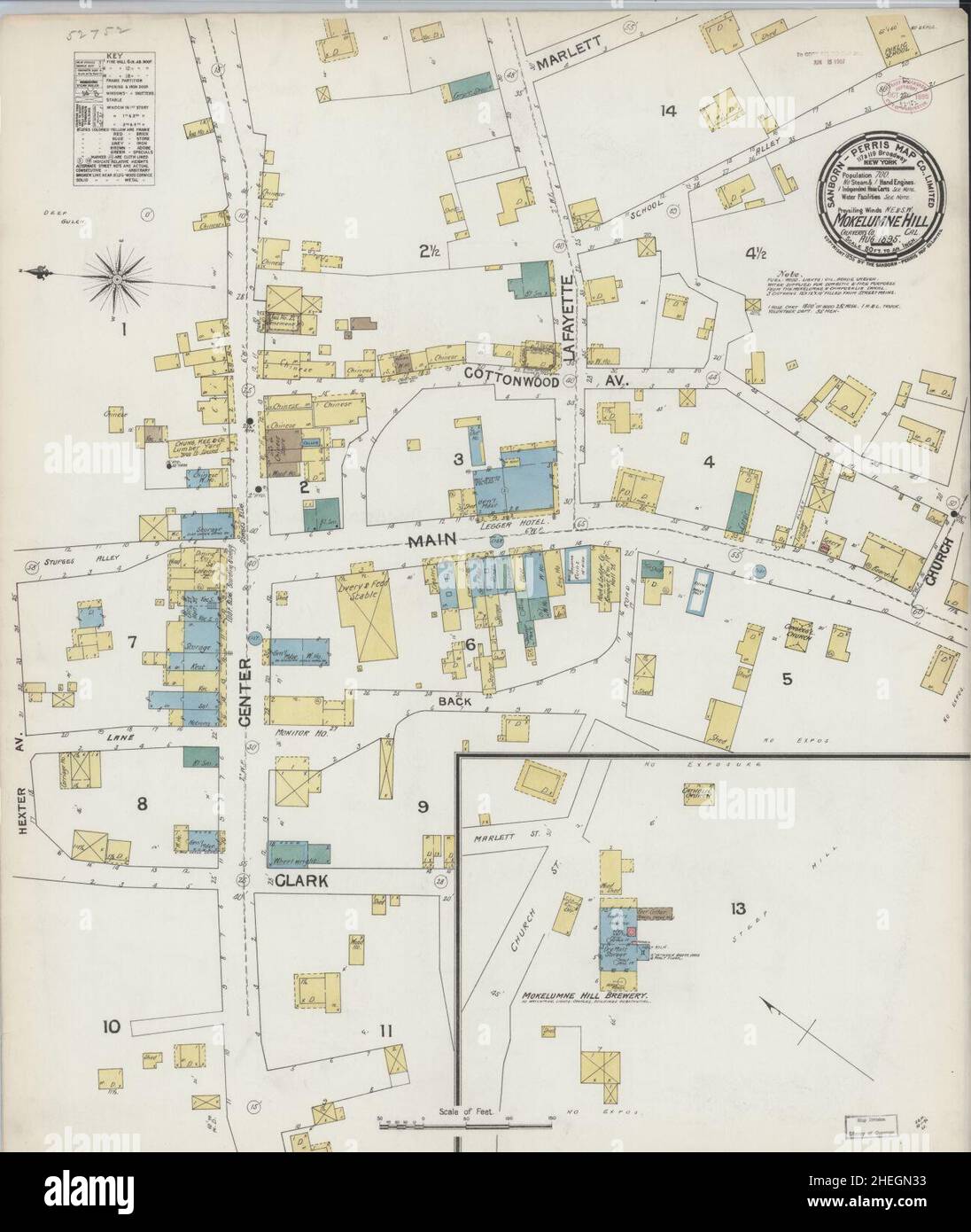 Sanborn Fire Insurance Map from Mokelumne Hill, Calaveras County, California. Stock Photohttps://www.alamy.com/image-license-details/?v=1https://www.alamy.com/sanborn-fire-insurance-map-from-mokelumne-hill-calaveras-county-california-image456442535.html
RM2HEGN33–Sanborn Fire Insurance Map from Mokelumne Hill, Calaveras County, California.
 Wyldewood, Calaveras County, US, United States, California, N 38 8' 44'', S 120 27' 14'', map, Cartascapes Map published in 2024. Explore Cartascapes, a map revealing Earth's diverse landscapes, cultures, and ecosystems. Journey through time and space, discovering the interconnectedness of our planet's past, present, and future. Stock Photohttps://www.alamy.com/image-license-details/?v=1https://www.alamy.com/wyldewood-calaveras-county-us-united-states-california-n-38-8-44-s-120-27-14-map-cartascapes-map-published-in-2024-explore-cartascapes-a-map-revealing-earths-diverse-landscapes-cultures-and-ecosystems-journey-through-time-and-space-discovering-the-interconnectedness-of-our-planets-past-present-and-future-image621417283.html
RM2Y3002B–Wyldewood, Calaveras County, US, United States, California, N 38 8' 44'', S 120 27' 14'', map, Cartascapes Map published in 2024. Explore Cartascapes, a map revealing Earth's diverse landscapes, cultures, and ecosystems. Journey through time and space, discovering the interconnectedness of our planet's past, present, and future.
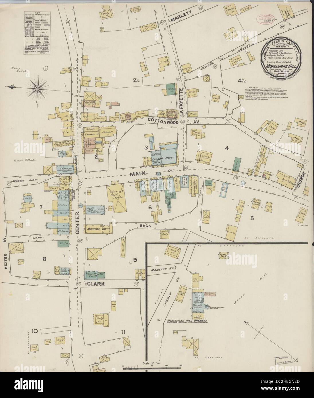 Sanborn Fire Insurance Map from Mokelumne Hill, Calaveras County, California. Stock Photohttps://www.alamy.com/image-license-details/?v=1https://www.alamy.com/sanborn-fire-insurance-map-from-mokelumne-hill-calaveras-county-california-image456442517.html
RM2HEGN2D–Sanborn Fire Insurance Map from Mokelumne Hill, Calaveras County, California.
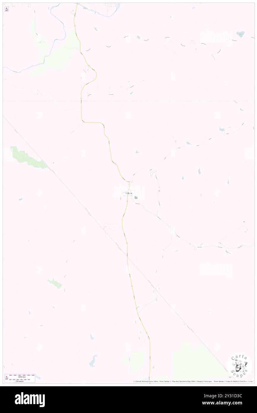 Milton, Calaveras County, US, United States, California, N 38 1' 54'', S 120 51' 7'', map, Cartascapes Map published in 2024. Explore Cartascapes, a map revealing Earth's diverse landscapes, cultures, and ecosystems. Journey through time and space, discovering the interconnectedness of our planet's past, present, and future. Stock Photohttps://www.alamy.com/image-license-details/?v=1https://www.alamy.com/milton-calaveras-county-us-united-states-california-n-38-1-54-s-120-51-7-map-cartascapes-map-published-in-2024-explore-cartascapes-a-map-revealing-earths-diverse-landscapes-cultures-and-ecosystems-journey-through-time-and-space-discovering-the-interconnectedness-of-our-planets-past-present-and-future-image621449456.html
RM2Y31D3C–Milton, Calaveras County, US, United States, California, N 38 1' 54'', S 120 51' 7'', map, Cartascapes Map published in 2024. Explore Cartascapes, a map revealing Earth's diverse landscapes, cultures, and ecosystems. Journey through time and space, discovering the interconnectedness of our planet's past, present, and future.
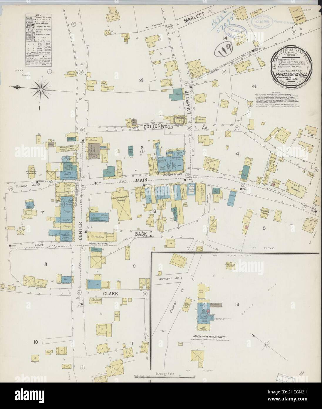 Sanborn Fire Insurance Map from Mokelumne Hill, Calaveras County, California. Stock Photohttps://www.alamy.com/image-license-details/?v=1https://www.alamy.com/sanborn-fire-insurance-map-from-mokelumne-hill-calaveras-county-california-image456442521.html
RM2HEGN2H–Sanborn Fire Insurance Map from Mokelumne Hill, Calaveras County, California.
 Bummerville, Calaveras County, US, United States, California, N 38 24' 4'', S 120 30' 20'', map, Cartascapes Map published in 2024. Explore Cartascapes, a map revealing Earth's diverse landscapes, cultures, and ecosystems. Journey through time and space, discovering the interconnectedness of our planet's past, present, and future. Stock Photohttps://www.alamy.com/image-license-details/?v=1https://www.alamy.com/bummerville-calaveras-county-us-united-states-california-n-38-24-4-s-120-30-20-map-cartascapes-map-published-in-2024-explore-cartascapes-a-map-revealing-earths-diverse-landscapes-cultures-and-ecosystems-journey-through-time-and-space-discovering-the-interconnectedness-of-our-planets-past-present-and-future-image621272543.html
RM2Y2NBD3–Bummerville, Calaveras County, US, United States, California, N 38 24' 4'', S 120 30' 20'', map, Cartascapes Map published in 2024. Explore Cartascapes, a map revealing Earth's diverse landscapes, cultures, and ecosystems. Journey through time and space, discovering the interconnectedness of our planet's past, present, and future.
 Toyon, Calaveras County, US, United States, California, N 38 12' 17'', S 120 45' 55'', map, Cartascapes Map published in 2024. Explore Cartascapes, a map revealing Earth's diverse landscapes, cultures, and ecosystems. Journey through time and space, discovering the interconnectedness of our planet's past, present, and future. Stock Photohttps://www.alamy.com/image-license-details/?v=1https://www.alamy.com/toyon-calaveras-county-us-united-states-california-n-38-12-17-s-120-45-55-map-cartascapes-map-published-in-2024-explore-cartascapes-a-map-revealing-earths-diverse-landscapes-cultures-and-ecosystems-journey-through-time-and-space-discovering-the-interconnectedness-of-our-planets-past-present-and-future-image621411809.html
RM2Y2YN2W–Toyon, Calaveras County, US, United States, California, N 38 12' 17'', S 120 45' 55'', map, Cartascapes Map published in 2024. Explore Cartascapes, a map revealing Earth's diverse landscapes, cultures, and ecosystems. Journey through time and space, discovering the interconnectedness of our planet's past, present, and future.
 Ganns, Calaveras County, US, United States, California, N 38 24' 15'', S 120 9' 32'', map, Cartascapes Map published in 2024. Explore Cartascapes, a map revealing Earth's diverse landscapes, cultures, and ecosystems. Journey through time and space, discovering the interconnectedness of our planet's past, present, and future. Stock Photohttps://www.alamy.com/image-license-details/?v=1https://www.alamy.com/ganns-calaveras-county-us-united-states-california-n-38-24-15-s-120-9-32-map-cartascapes-map-published-in-2024-explore-cartascapes-a-map-revealing-earths-diverse-landscapes-cultures-and-ecosystems-journey-through-time-and-space-discovering-the-interconnectedness-of-our-planets-past-present-and-future-image621393010.html
RM2Y2XW3E–Ganns, Calaveras County, US, United States, California, N 38 24' 15'', S 120 9' 32'', map, Cartascapes Map published in 2024. Explore Cartascapes, a map revealing Earth's diverse landscapes, cultures, and ecosystems. Journey through time and space, discovering the interconnectedness of our planet's past, present, and future.
 Paloma, Calaveras County, US, United States, California, N 38 15' 33'', S 120 45' 47'', map, Cartascapes Map published in 2024. Explore Cartascapes, a map revealing Earth's diverse landscapes, cultures, and ecosystems. Journey through time and space, discovering the interconnectedness of our planet's past, present, and future. Stock Photohttps://www.alamy.com/image-license-details/?v=1https://www.alamy.com/paloma-calaveras-county-us-united-states-california-n-38-15-33-s-120-45-47-map-cartascapes-map-published-in-2024-explore-cartascapes-a-map-revealing-earths-diverse-landscapes-cultures-and-ecosystems-journey-through-time-and-space-discovering-the-interconnectedness-of-our-planets-past-present-and-future-image621182052.html
RM2Y2H818–Paloma, Calaveras County, US, United States, California, N 38 15' 33'', S 120 45' 47'', map, Cartascapes Map published in 2024. Explore Cartascapes, a map revealing Earth's diverse landscapes, cultures, and ecosystems. Journey through time and space, discovering the interconnectedness of our planet's past, present, and future.
 Hanford Hill, Calaveras County, US, United States, California, N 38 10' 27'', S 120 24' 12'', map, Cartascapes Map published in 2024. Explore Cartascapes, a map revealing Earth's diverse landscapes, cultures, and ecosystems. Journey through time and space, discovering the interconnectedness of our planet's past, present, and future. Stock Photohttps://www.alamy.com/image-license-details/?v=1https://www.alamy.com/hanford-hill-calaveras-county-us-united-states-california-n-38-10-27-s-120-24-12-map-cartascapes-map-published-in-2024-explore-cartascapes-a-map-revealing-earths-diverse-landscapes-cultures-and-ecosystems-journey-through-time-and-space-discovering-the-interconnectedness-of-our-planets-past-present-and-future-image621231243.html
RM2Y2KEP3–Hanford Hill, Calaveras County, US, United States, California, N 38 10' 27'', S 120 24' 12'', map, Cartascapes Map published in 2024. Explore Cartascapes, a map revealing Earth's diverse landscapes, cultures, and ecosystems. Journey through time and space, discovering the interconnectedness of our planet's past, present, and future.
 Big Meadow, Calaveras County, US, United States, California, N 38 24' 53'', S 120 6' 54'', map, Cartascapes Map published in 2024. Explore Cartascapes, a map revealing Earth's diverse landscapes, cultures, and ecosystems. Journey through time and space, discovering the interconnectedness of our planet's past, present, and future. Stock Photohttps://www.alamy.com/image-license-details/?v=1https://www.alamy.com/big-meadow-calaveras-county-us-united-states-california-n-38-24-53-s-120-6-54-map-cartascapes-map-published-in-2024-explore-cartascapes-a-map-revealing-earths-diverse-landscapes-cultures-and-ecosystems-journey-through-time-and-space-discovering-the-interconnectedness-of-our-planets-past-present-and-future-image621193593.html
RM2Y2HPND–Big Meadow, Calaveras County, US, United States, California, N 38 24' 53'', S 120 6' 54'', map, Cartascapes Map published in 2024. Explore Cartascapes, a map revealing Earth's diverse landscapes, cultures, and ecosystems. Journey through time and space, discovering the interconnectedness of our planet's past, present, and future.
 West Point, Calaveras County, US, United States, California, N 38 23' 56'', S 120 31' 38'', map, Cartascapes Map published in 2024. Explore Cartascapes, a map revealing Earth's diverse landscapes, cultures, and ecosystems. Journey through time and space, discovering the interconnectedness of our planet's past, present, and future. Stock Photohttps://www.alamy.com/image-license-details/?v=1https://www.alamy.com/west-point-calaveras-county-us-united-states-california-n-38-23-56-s-120-31-38-map-cartascapes-map-published-in-2024-explore-cartascapes-a-map-revealing-earths-diverse-landscapes-cultures-and-ecosystems-journey-through-time-and-space-discovering-the-interconnectedness-of-our-planets-past-present-and-future-image621445473.html
RM2Y31815–West Point, Calaveras County, US, United States, California, N 38 23' 56'', S 120 31' 38'', map, Cartascapes Map published in 2024. Explore Cartascapes, a map revealing Earth's diverse landscapes, cultures, and ecosystems. Journey through time and space, discovering the interconnectedness of our planet's past, present, and future.
 Campo Seco, Calaveras County, US, United States, California, N 38 13' 37'', S 120 51' 11'', map, Cartascapes Map published in 2024. Explore Cartascapes, a map revealing Earth's diverse landscapes, cultures, and ecosystems. Journey through time and space, discovering the interconnectedness of our planet's past, present, and future. Stock Photohttps://www.alamy.com/image-license-details/?v=1https://www.alamy.com/campo-seco-calaveras-county-us-united-states-california-n-38-13-37-s-120-51-11-map-cartascapes-map-published-in-2024-explore-cartascapes-a-map-revealing-earths-diverse-landscapes-cultures-and-ecosystems-journey-through-time-and-space-discovering-the-interconnectedness-of-our-planets-past-present-and-future-image621415456.html
RM2Y2YWN4–Campo Seco, Calaveras County, US, United States, California, N 38 13' 37'', S 120 51' 11'', map, Cartascapes Map published in 2024. Explore Cartascapes, a map revealing Earth's diverse landscapes, cultures, and ecosystems. Journey through time and space, discovering the interconnectedness of our planet's past, present, and future.
 Canyon View, Calaveras County, US, United States, California, N 38 11' 32'', S 120 21' 23'', map, Cartascapes Map published in 2024. Explore Cartascapes, a map revealing Earth's diverse landscapes, cultures, and ecosystems. Journey through time and space, discovering the interconnectedness of our planet's past, present, and future. Stock Photohttps://www.alamy.com/image-license-details/?v=1https://www.alamy.com/canyon-view-calaveras-county-us-united-states-california-n-38-11-32-s-120-21-23-map-cartascapes-map-published-in-2024-explore-cartascapes-a-map-revealing-earths-diverse-landscapes-cultures-and-ecosystems-journey-through-time-and-space-discovering-the-interconnectedness-of-our-planets-past-present-and-future-image621453913.html
RM2Y31JPH–Canyon View, Calaveras County, US, United States, California, N 38 11' 32'', S 120 21' 23'', map, Cartascapes Map published in 2024. Explore Cartascapes, a map revealing Earth's diverse landscapes, cultures, and ecosystems. Journey through time and space, discovering the interconnectedness of our planet's past, present, and future.
 Sheep Ranch, Calaveras County, US, United States, California, N 38 12' 33'', S 120 27' 50'', map, Cartascapes Map published in 2024. Explore Cartascapes, a map revealing Earth's diverse landscapes, cultures, and ecosystems. Journey through time and space, discovering the interconnectedness of our planet's past, present, and future. Stock Photohttps://www.alamy.com/image-license-details/?v=1https://www.alamy.com/sheep-ranch-calaveras-county-us-united-states-california-n-38-12-33-s-120-27-50-map-cartascapes-map-published-in-2024-explore-cartascapes-a-map-revealing-earths-diverse-landscapes-cultures-and-ecosystems-journey-through-time-and-space-discovering-the-interconnectedness-of-our-planets-past-present-and-future-image621350733.html
RM2Y2TY5H–Sheep Ranch, Calaveras County, US, United States, California, N 38 12' 33'', S 120 27' 50'', map, Cartascapes Map published in 2024. Explore Cartascapes, a map revealing Earth's diverse landscapes, cultures, and ecosystems. Journey through time and space, discovering the interconnectedness of our planet's past, present, and future.
 Big Valley, Calaveras County, US, United States, California, N 38 7' 54'', S 120 25' 40'', map, Cartascapes Map published in 2024. Explore Cartascapes, a map revealing Earth's diverse landscapes, cultures, and ecosystems. Journey through time and space, discovering the interconnectedness of our planet's past, present, and future. Stock Photohttps://www.alamy.com/image-license-details/?v=1https://www.alamy.com/big-valley-calaveras-county-us-united-states-california-n-38-7-54-s-120-25-40-map-cartascapes-map-published-in-2024-explore-cartascapes-a-map-revealing-earths-diverse-landscapes-cultures-and-ecosystems-journey-through-time-and-space-discovering-the-interconnectedness-of-our-planets-past-present-and-future-image621275875.html
RM2Y2NFM3–Big Valley, Calaveras County, US, United States, California, N 38 7' 54'', S 120 25' 40'', map, Cartascapes Map published in 2024. Explore Cartascapes, a map revealing Earth's diverse landscapes, cultures, and ecosystems. Journey through time and space, discovering the interconnectedness of our planet's past, present, and future.
 Forest Meadows, Calaveras County, US, United States, California, N 38 10' 6'', S 120 24' 23'', map, Cartascapes Map published in 2024. Explore Cartascapes, a map revealing Earth's diverse landscapes, cultures, and ecosystems. Journey through time and space, discovering the interconnectedness of our planet's past, present, and future. Stock Photohttps://www.alamy.com/image-license-details/?v=1https://www.alamy.com/forest-meadows-calaveras-county-us-united-states-california-n-38-10-6-s-120-24-23-map-cartascapes-map-published-in-2024-explore-cartascapes-a-map-revealing-earths-diverse-landscapes-cultures-and-ecosystems-journey-through-time-and-space-discovering-the-interconnectedness-of-our-planets-past-present-and-future-image621263365.html
RM2Y2MYN9–Forest Meadows, Calaveras County, US, United States, California, N 38 10' 6'', S 120 24' 23'', map, Cartascapes Map published in 2024. Explore Cartascapes, a map revealing Earth's diverse landscapes, cultures, and ecosystems. Journey through time and space, discovering the interconnectedness of our planet's past, present, and future.
 Lakeside Terrace, Calaveras County, US, United States, California, N 38 15' 5'', S 120 19' 15'', map, Cartascapes Map published in 2024. Explore Cartascapes, a map revealing Earth's diverse landscapes, cultures, and ecosystems. Journey through time and space, discovering the interconnectedness of our planet's past, present, and future. Stock Photohttps://www.alamy.com/image-license-details/?v=1https://www.alamy.com/lakeside-terrace-calaveras-county-us-united-states-california-n-38-15-5-s-120-19-15-map-cartascapes-map-published-in-2024-explore-cartascapes-a-map-revealing-earths-diverse-landscapes-cultures-and-ecosystems-journey-through-time-and-space-discovering-the-interconnectedness-of-our-planets-past-present-and-future-image621238338.html
RM2Y2KRRE–Lakeside Terrace, Calaveras County, US, United States, California, N 38 15' 5'', S 120 19' 15'', map, Cartascapes Map published in 2024. Explore Cartascapes, a map revealing Earth's diverse landscapes, cultures, and ecosystems. Journey through time and space, discovering the interconnectedness of our planet's past, present, and future.
 Brownsville (Historical), Calaveras County, US, United States, California, N 38 7' 45'', S 120 26' 17'', map, Cartascapes Map published in 2024. Explore Cartascapes, a map revealing Earth's diverse landscapes, cultures, and ecosystems. Journey through time and space, discovering the interconnectedness of our planet's past, present, and future. Stock Photohttps://www.alamy.com/image-license-details/?v=1https://www.alamy.com/brownsville-historical-calaveras-county-us-united-states-california-n-38-7-45-s-120-26-17-map-cartascapes-map-published-in-2024-explore-cartascapes-a-map-revealing-earths-diverse-landscapes-cultures-and-ecosystems-journey-through-time-and-space-discovering-the-interconnectedness-of-our-planets-past-present-and-future-image621304709.html
RM2Y2PTDW–Brownsville (Historical), Calaveras County, US, United States, California, N 38 7' 45'', S 120 26' 17'', map, Cartascapes Map published in 2024. Explore Cartascapes, a map revealing Earth's diverse landscapes, cultures, and ecosystems. Journey through time and space, discovering the interconnectedness of our planet's past, present, and future.
 Big Bar, Calaveras County, US, United States, California, N 38 18' 42'', S 120 43' 11'', map, Cartascapes Map published in 2024. Explore Cartascapes, a map revealing Earth's diverse landscapes, cultures, and ecosystems. Journey through time and space, discovering the interconnectedness of our planet's past, present, and future. Stock Photohttps://www.alamy.com/image-license-details/?v=1https://www.alamy.com/big-bar-calaveras-county-us-united-states-california-n-38-18-42-s-120-43-11-map-cartascapes-map-published-in-2024-explore-cartascapes-a-map-revealing-earths-diverse-landscapes-cultures-and-ecosystems-journey-through-time-and-space-discovering-the-interconnectedness-of-our-planets-past-present-and-future-image621441923.html
RM2Y313EB–Big Bar, Calaveras County, US, United States, California, N 38 18' 42'', S 120 43' 11'', map, Cartascapes Map published in 2024. Explore Cartascapes, a map revealing Earth's diverse landscapes, cultures, and ecosystems. Journey through time and space, discovering the interconnectedness of our planet's past, present, and future.
 Jenny Lind, Calaveras County, US, United States, California, N 38 5' 41'', S 120 52' 11'', map, Cartascapes Map published in 2024. Explore Cartascapes, a map revealing Earth's diverse landscapes, cultures, and ecosystems. Journey through time and space, discovering the interconnectedness of our planet's past, present, and future. Stock Photohttps://www.alamy.com/image-license-details/?v=1https://www.alamy.com/jenny-lind-calaveras-county-us-united-states-california-n-38-5-41-s-120-52-11-map-cartascapes-map-published-in-2024-explore-cartascapes-a-map-revealing-earths-diverse-landscapes-cultures-and-ecosystems-journey-through-time-and-space-discovering-the-interconnectedness-of-our-planets-past-present-and-future-image621259648.html
RM2Y2MR0G–Jenny Lind, Calaveras County, US, United States, California, N 38 5' 41'', S 120 52' 11'', map, Cartascapes Map published in 2024. Explore Cartascapes, a map revealing Earth's diverse landscapes, cultures, and ecosystems. Journey through time and space, discovering the interconnectedness of our planet's past, present, and future.
 Ponderosa Park, Calaveras County, US, United States, California, N 38 11' 9'', S 120 22' 7'', map, Cartascapes Map published in 2024. Explore Cartascapes, a map revealing Earth's diverse landscapes, cultures, and ecosystems. Journey through time and space, discovering the interconnectedness of our planet's past, present, and future. Stock Photohttps://www.alamy.com/image-license-details/?v=1https://www.alamy.com/ponderosa-park-calaveras-county-us-united-states-california-n-38-11-9-s-120-22-7-map-cartascapes-map-published-in-2024-explore-cartascapes-a-map-revealing-earths-diverse-landscapes-cultures-and-ecosystems-journey-through-time-and-space-discovering-the-interconnectedness-of-our-planets-past-present-and-future-image621191604.html
RM2Y2HM6C–Ponderosa Park, Calaveras County, US, United States, California, N 38 11' 9'', S 120 22' 7'', map, Cartascapes Map published in 2024. Explore Cartascapes, a map revealing Earth's diverse landscapes, cultures, and ecosystems. Journey through time and space, discovering the interconnectedness of our planet's past, present, and future.
 Jesus Maria, Calaveras County, US, United States, California, N 38 17' 7'', S 120 38' 50'', map, Cartascapes Map published in 2024. Explore Cartascapes, a map revealing Earth's diverse landscapes, cultures, and ecosystems. Journey through time and space, discovering the interconnectedness of our planet's past, present, and future. Stock Photohttps://www.alamy.com/image-license-details/?v=1https://www.alamy.com/jesus-maria-calaveras-county-us-united-states-california-n-38-17-7-s-120-38-50-map-cartascapes-map-published-in-2024-explore-cartascapes-a-map-revealing-earths-diverse-landscapes-cultures-and-ecosystems-journey-through-time-and-space-discovering-the-interconnectedness-of-our-planets-past-present-and-future-image621420901.html
RM2Y304KH–Jesus Maria, Calaveras County, US, United States, California, N 38 17' 7'', S 120 38' 50'', map, Cartascapes Map published in 2024. Explore Cartascapes, a map revealing Earth's diverse landscapes, cultures, and ecosystems. Journey through time and space, discovering the interconnectedness of our planet's past, present, and future.
 West Point, Calaveras County, US, United States, California, N 38 23' 56'', S 120 31' 38'', map, Cartascapes Map published in 2024. Explore Cartascapes, a map revealing Earth's diverse landscapes, cultures, and ecosystems. Journey through time and space, discovering the interconnectedness of our planet's past, present, and future. Stock Photohttps://www.alamy.com/image-license-details/?v=1https://www.alamy.com/west-point-calaveras-county-us-united-states-california-n-38-23-56-s-120-31-38-map-cartascapes-map-published-in-2024-explore-cartascapes-a-map-revealing-earths-diverse-landscapes-cultures-and-ecosystems-journey-through-time-and-space-discovering-the-interconnectedness-of-our-planets-past-present-and-future-image621407197.html
RM2Y2YF65–West Point, Calaveras County, US, United States, California, N 38 23' 56'', S 120 31' 38'', map, Cartascapes Map published in 2024. Explore Cartascapes, a map revealing Earth's diverse landscapes, cultures, and ecosystems. Journey through time and space, discovering the interconnectedness of our planet's past, present, and future.
 Angels Camp, Calaveras County, US, United States, California, N 38 4' 5'', S 120 32' 22'', map, Cartascapes Map published in 2024. Explore Cartascapes, a map revealing Earth's diverse landscapes, cultures, and ecosystems. Journey through time and space, discovering the interconnectedness of our planet's past, present, and future. Stock Photohttps://www.alamy.com/image-license-details/?v=1https://www.alamy.com/angels-camp-calaveras-county-us-united-states-california-n-38-4-5-s-120-32-22-map-cartascapes-map-published-in-2024-explore-cartascapes-a-map-revealing-earths-diverse-landscapes-cultures-and-ecosystems-journey-through-time-and-space-discovering-the-interconnectedness-of-our-planets-past-present-and-future-image621308440.html
RM2Y2R174–Angels Camp, Calaveras County, US, United States, California, N 38 4' 5'', S 120 32' 22'', map, Cartascapes Map published in 2024. Explore Cartascapes, a map revealing Earth's diverse landscapes, cultures, and ecosystems. Journey through time and space, discovering the interconnectedness of our planet's past, present, and future.
 Carson Hill, Calaveras County, US, United States, California, N 38 1' 41'', S 120 30' 23'', map, Cartascapes Map published in 2024. Explore Cartascapes, a map revealing Earth's diverse landscapes, cultures, and ecosystems. Journey through time and space, discovering the interconnectedness of our planet's past, present, and future. Stock Photohttps://www.alamy.com/image-license-details/?v=1https://www.alamy.com/carson-hill-calaveras-county-us-united-states-california-n-38-1-41-s-120-30-23-map-cartascapes-map-published-in-2024-explore-cartascapes-a-map-revealing-earths-diverse-landscapes-cultures-and-ecosystems-journey-through-time-and-space-discovering-the-interconnectedness-of-our-planets-past-present-and-future-image621169542.html
RM2Y2GM2E–Carson Hill, Calaveras County, US, United States, California, N 38 1' 41'', S 120 30' 23'', map, Cartascapes Map published in 2024. Explore Cartascapes, a map revealing Earth's diverse landscapes, cultures, and ecosystems. Journey through time and space, discovering the interconnectedness of our planet's past, present, and future.
 Carmen City, Calaveras County, US, United States, California, N 38 2' 50'', S 120 41' 26'', map, Cartascapes Map published in 2024. Explore Cartascapes, a map revealing Earth's diverse landscapes, cultures, and ecosystems. Journey through time and space, discovering the interconnectedness of our planet's past, present, and future. Stock Photohttps://www.alamy.com/image-license-details/?v=1https://www.alamy.com/carmen-city-calaveras-county-us-united-states-california-n-38-2-50-s-120-41-26-map-cartascapes-map-published-in-2024-explore-cartascapes-a-map-revealing-earths-diverse-landscapes-cultures-and-ecosystems-journey-through-time-and-space-discovering-the-interconnectedness-of-our-planets-past-present-and-future-image621424688.html
RM2Y309ET–Carmen City, Calaveras County, US, United States, California, N 38 2' 50'', S 120 41' 26'', map, Cartascapes Map published in 2024. Explore Cartascapes, a map revealing Earth's diverse landscapes, cultures, and ecosystems. Journey through time and space, discovering the interconnectedness of our planet's past, present, and future.
 Camanche (historical), Calaveras County, US, United States, California, N 38 12' 47'', S 120 56' 6'', map, Cartascapes Map published in 2024. Explore Cartascapes, a map revealing Earth's diverse landscapes, cultures, and ecosystems. Journey through time and space, discovering the interconnectedness of our planet's past, present, and future. Stock Photohttps://www.alamy.com/image-license-details/?v=1https://www.alamy.com/camanche-historical-calaveras-county-us-united-states-california-n-38-12-47-s-120-56-6-map-cartascapes-map-published-in-2024-explore-cartascapes-a-map-revealing-earths-diverse-landscapes-cultures-and-ecosystems-journey-through-time-and-space-discovering-the-interconnectedness-of-our-planets-past-present-and-future-image621348406.html
RM2Y2TT6E–Camanche (historical), Calaveras County, US, United States, California, N 38 12' 47'', S 120 56' 6'', map, Cartascapes Map published in 2024. Explore Cartascapes, a map revealing Earth's diverse landscapes, cultures, and ecosystems. Journey through time and space, discovering the interconnectedness of our planet's past, present, and future.
 Quail Oaks, Calaveras County, US, United States, California, N 38 10' 49'', S 120 50' 19'', map, Cartascapes Map published in 2024. Explore Cartascapes, a map revealing Earth's diverse landscapes, cultures, and ecosystems. Journey through time and space, discovering the interconnectedness of our planet's past, present, and future. Stock Photohttps://www.alamy.com/image-license-details/?v=1https://www.alamy.com/quail-oaks-calaveras-county-us-united-states-california-n-38-10-49-s-120-50-19-map-cartascapes-map-published-in-2024-explore-cartascapes-a-map-revealing-earths-diverse-landscapes-cultures-and-ecosystems-journey-through-time-and-space-discovering-the-interconnectedness-of-our-planets-past-present-and-future-image621413226.html
RM2Y2YPWE–Quail Oaks, Calaveras County, US, United States, California, N 38 10' 49'', S 120 50' 19'', map, Cartascapes Map published in 2024. Explore Cartascapes, a map revealing Earth's diverse landscapes, cultures, and ecosystems. Journey through time and space, discovering the interconnectedness of our planet's past, present, and future.
 Happy Valley, Calaveras County, US, United States, California, N 38 17' 59'', S 120 41' 1'', map, Cartascapes Map published in 2024. Explore Cartascapes, a map revealing Earth's diverse landscapes, cultures, and ecosystems. Journey through time and space, discovering the interconnectedness of our planet's past, present, and future. Stock Photohttps://www.alamy.com/image-license-details/?v=1https://www.alamy.com/happy-valley-calaveras-county-us-united-states-california-n-38-17-59-s-120-41-1-map-cartascapes-map-published-in-2024-explore-cartascapes-a-map-revealing-earths-diverse-landscapes-cultures-and-ecosystems-journey-through-time-and-space-discovering-the-interconnectedness-of-our-planets-past-present-and-future-image621429785.html
RM2Y30G0W–Happy Valley, Calaveras County, US, United States, California, N 38 17' 59'', S 120 41' 1'', map, Cartascapes Map published in 2024. Explore Cartascapes, a map revealing Earth's diverse landscapes, cultures, and ecosystems. Journey through time and space, discovering the interconnectedness of our planet's past, present, and future.
 Douds Landing, Calaveras County, US, United States, California, N 38 12' 45'', S 120 19' 31'', map, Cartascapes Map published in 2024. Explore Cartascapes, a map revealing Earth's diverse landscapes, cultures, and ecosystems. Journey through time and space, discovering the interconnectedness of our planet's past, present, and future. Stock Photohttps://www.alamy.com/image-license-details/?v=1https://www.alamy.com/douds-landing-calaveras-county-us-united-states-california-n-38-12-45-s-120-19-31-map-cartascapes-map-published-in-2024-explore-cartascapes-a-map-revealing-earths-diverse-landscapes-cultures-and-ecosystems-journey-through-time-and-space-discovering-the-interconnectedness-of-our-planets-past-present-and-future-image621167518.html
RM2Y2GHE6–Douds Landing, Calaveras County, US, United States, California, N 38 12' 45'', S 120 19' 31'', map, Cartascapes Map published in 2024. Explore Cartascapes, a map revealing Earth's diverse landscapes, cultures, and ecosystems. Journey through time and space, discovering the interconnectedness of our planet's past, present, and future.
 Toyanza Subdivision, Calaveras County, US, United States, California, N 38 11' 15'', S 120 40' 18'', map, Cartascapes Map published in 2024. Explore Cartascapes, a map revealing Earth's diverse landscapes, cultures, and ecosystems. Journey through time and space, discovering the interconnectedness of our planet's past, present, and future. Stock Photohttps://www.alamy.com/image-license-details/?v=1https://www.alamy.com/toyanza-subdivision-calaveras-county-us-united-states-california-n-38-11-15-s-120-40-18-map-cartascapes-map-published-in-2024-explore-cartascapes-a-map-revealing-earths-diverse-landscapes-cultures-and-ecosystems-journey-through-time-and-space-discovering-the-interconnectedness-of-our-planets-past-present-and-future-image621357017.html
RM2Y2W761–Toyanza Subdivision, Calaveras County, US, United States, California, N 38 11' 15'', S 120 40' 18'', map, Cartascapes Map published in 2024. Explore Cartascapes, a map revealing Earth's diverse landscapes, cultures, and ecosystems. Journey through time and space, discovering the interconnectedness of our planet's past, present, and future.
 Mumbert Acres, Calaveras County, US, United States, California, N 38 16' 4'', S 120 19' 10'', map, Cartascapes Map published in 2024. Explore Cartascapes, a map revealing Earth's diverse landscapes, cultures, and ecosystems. Journey through time and space, discovering the interconnectedness of our planet's past, present, and future. Stock Photohttps://www.alamy.com/image-license-details/?v=1https://www.alamy.com/mumbert-acres-calaveras-county-us-united-states-california-n-38-16-4-s-120-19-10-map-cartascapes-map-published-in-2024-explore-cartascapes-a-map-revealing-earths-diverse-landscapes-cultures-and-ecosystems-journey-through-time-and-space-discovering-the-interconnectedness-of-our-planets-past-present-and-future-image621415469.html
RM2Y2YWNH–Mumbert Acres, Calaveras County, US, United States, California, N 38 16' 4'', S 120 19' 10'', map, Cartascapes Map published in 2024. Explore Cartascapes, a map revealing Earth's diverse landscapes, cultures, and ecosystems. Journey through time and space, discovering the interconnectedness of our planet's past, present, and future.
 Manuel Mill, Calaveras County, US, United States, California, N 38 15' 39'', S 120 21' 39'', map, Cartascapes Map published in 2024. Explore Cartascapes, a map revealing Earth's diverse landscapes, cultures, and ecosystems. Journey through time and space, discovering the interconnectedness of our planet's past, present, and future. Stock Photohttps://www.alamy.com/image-license-details/?v=1https://www.alamy.com/manuel-mill-calaveras-county-us-united-states-california-n-38-15-39-s-120-21-39-map-cartascapes-map-published-in-2024-explore-cartascapes-a-map-revealing-earths-diverse-landscapes-cultures-and-ecosystems-journey-through-time-and-space-discovering-the-interconnectedness-of-our-planets-past-present-and-future-image621388219.html
RM2Y2XK0B–Manuel Mill, Calaveras County, US, United States, California, N 38 15' 39'', S 120 21' 39'', map, Cartascapes Map published in 2024. Explore Cartascapes, a map revealing Earth's diverse landscapes, cultures, and ecosystems. Journey through time and space, discovering the interconnectedness of our planet's past, present, and future.
 Sherman Acres, Calaveras County, US, United States, California, N 38 26' 49'', S 120 4' 18'', map, Cartascapes Map published in 2024. Explore Cartascapes, a map revealing Earth's diverse landscapes, cultures, and ecosystems. Journey through time and space, discovering the interconnectedness of our planet's past, present, and future. Stock Photohttps://www.alamy.com/image-license-details/?v=1https://www.alamy.com/sherman-acres-calaveras-county-us-united-states-california-n-38-26-49-s-120-4-18-map-cartascapes-map-published-in-2024-explore-cartascapes-a-map-revealing-earths-diverse-landscapes-cultures-and-ecosystems-journey-through-time-and-space-discovering-the-interconnectedness-of-our-planets-past-present-and-future-image621172441.html
RM2Y2GRP1–Sherman Acres, Calaveras County, US, United States, California, N 38 26' 49'', S 120 4' 18'', map, Cartascapes Map published in 2024. Explore Cartascapes, a map revealing Earth's diverse landscapes, cultures, and ecosystems. Journey through time and space, discovering the interconnectedness of our planet's past, present, and future.
 Lost City, Calaveras County, US, United States, California, N 38 5' 11'', S 120 44' 58'', map, Cartascapes Map published in 2024. Explore Cartascapes, a map revealing Earth's diverse landscapes, cultures, and ecosystems. Journey through time and space, discovering the interconnectedness of our planet's past, present, and future. Stock Photohttps://www.alamy.com/image-license-details/?v=1https://www.alamy.com/lost-city-calaveras-county-us-united-states-california-n-38-5-11-s-120-44-58-map-cartascapes-map-published-in-2024-explore-cartascapes-a-map-revealing-earths-diverse-landscapes-cultures-and-ecosystems-journey-through-time-and-space-discovering-the-interconnectedness-of-our-planets-past-present-and-future-image621401635.html
RM2Y2Y83F–Lost City, Calaveras County, US, United States, California, N 38 5' 11'', S 120 44' 58'', map, Cartascapes Map published in 2024. Explore Cartascapes, a map revealing Earth's diverse landscapes, cultures, and ecosystems. Journey through time and space, discovering the interconnectedness of our planet's past, present, and future.
 Angels Camp, Calaveras County, US, United States, California, N 38 4' 5'', S 120 32' 22'', map, Cartascapes Map published in 2024. Explore Cartascapes, a map revealing Earth's diverse landscapes, cultures, and ecosystems. Journey through time and space, discovering the interconnectedness of our planet's past, present, and future. Stock Photohttps://www.alamy.com/image-license-details/?v=1https://www.alamy.com/angels-camp-calaveras-county-us-united-states-california-n-38-4-5-s-120-32-22-map-cartascapes-map-published-in-2024-explore-cartascapes-a-map-revealing-earths-diverse-landscapes-cultures-and-ecosystems-journey-through-time-and-space-discovering-the-interconnectedness-of-our-planets-past-present-and-future-image621239762.html
RM2Y2KWJA–Angels Camp, Calaveras County, US, United States, California, N 38 4' 5'', S 120 32' 22'', map, Cartascapes Map published in 2024. Explore Cartascapes, a map revealing Earth's diverse landscapes, cultures, and ecosystems. Journey through time and space, discovering the interconnectedness of our planet's past, present, and future.
 White Pines, Calaveras County, US, United States, California, N 38 15' 57'', S 120 20' 26'', map, Cartascapes Map published in 2024. Explore Cartascapes, a map revealing Earth's diverse landscapes, cultures, and ecosystems. Journey through time and space, discovering the interconnectedness of our planet's past, present, and future. Stock Photohttps://www.alamy.com/image-license-details/?v=1https://www.alamy.com/white-pines-calaveras-county-us-united-states-california-n-38-15-57-s-120-20-26-map-cartascapes-map-published-in-2024-explore-cartascapes-a-map-revealing-earths-diverse-landscapes-cultures-and-ecosystems-journey-through-time-and-space-discovering-the-interconnectedness-of-our-planets-past-present-and-future-image621280898.html
RM2Y2NP3E–White Pines, Calaveras County, US, United States, California, N 38 15' 57'', S 120 20' 26'', map, Cartascapes Map published in 2024. Explore Cartascapes, a map revealing Earth's diverse landscapes, cultures, and ecosystems. Journey through time and space, discovering the interconnectedness of our planet's past, present, and future.
 Timber Trails, Calaveras County, US, United States, California, N 38 11' 48'', S 120 23' 58'', map, Cartascapes Map published in 2024. Explore Cartascapes, a map revealing Earth's diverse landscapes, cultures, and ecosystems. Journey through time and space, discovering the interconnectedness of our planet's past, present, and future. Stock Photohttps://www.alamy.com/image-license-details/?v=1https://www.alamy.com/timber-trails-calaveras-county-us-united-states-california-n-38-11-48-s-120-23-58-map-cartascapes-map-published-in-2024-explore-cartascapes-a-map-revealing-earths-diverse-landscapes-cultures-and-ecosystems-journey-through-time-and-space-discovering-the-interconnectedness-of-our-planets-past-present-and-future-image621174688.html
RM2Y2GXJ8–Timber Trails, Calaveras County, US, United States, California, N 38 11' 48'', S 120 23' 58'', map, Cartascapes Map published in 2024. Explore Cartascapes, a map revealing Earth's diverse landscapes, cultures, and ecosystems. Journey through time and space, discovering the interconnectedness of our planet's past, present, and future.
 Cottage Springs, Calaveras County, US, United States, California, N 38 21' 21'', S 120 12' 42'', map, Cartascapes Map published in 2024. Explore Cartascapes, a map revealing Earth's diverse landscapes, cultures, and ecosystems. Journey through time and space, discovering the interconnectedness of our planet's past, present, and future. Stock Photohttps://www.alamy.com/image-license-details/?v=1https://www.alamy.com/cottage-springs-calaveras-county-us-united-states-california-n-38-21-21-s-120-12-42-map-cartascapes-map-published-in-2024-explore-cartascapes-a-map-revealing-earths-diverse-landscapes-cultures-and-ecosystems-journey-through-time-and-space-discovering-the-interconnectedness-of-our-planets-past-present-and-future-image621449355.html
RM2Y31CYR–Cottage Springs, Calaveras County, US, United States, California, N 38 21' 21'', S 120 12' 42'', map, Cartascapes Map published in 2024. Explore Cartascapes, a map revealing Earth's diverse landscapes, cultures, and ecosystems. Journey through time and space, discovering the interconnectedness of our planet's past, present, and future.
 Telegraph City, Calaveras County, US, United States, California, N 37 56' 3'', S 120 44' 23'', map, Cartascapes Map published in 2024. Explore Cartascapes, a map revealing Earth's diverse landscapes, cultures, and ecosystems. Journey through time and space, discovering the interconnectedness of our planet's past, present, and future. Stock Photohttps://www.alamy.com/image-license-details/?v=1https://www.alamy.com/telegraph-city-calaveras-county-us-united-states-california-n-37-56-3-s-120-44-23-map-cartascapes-map-published-in-2024-explore-cartascapes-a-map-revealing-earths-diverse-landscapes-cultures-and-ecosystems-journey-through-time-and-space-discovering-the-interconnectedness-of-our-planets-past-present-and-future-image621225702.html
RM2Y2K7M6–Telegraph City, Calaveras County, US, United States, California, N 37 56' 3'', S 120 44' 23'', map, Cartascapes Map published in 2024. Explore Cartascapes, a map revealing Earth's diverse landscapes, cultures, and ecosystems. Journey through time and space, discovering the interconnectedness of our planet's past, present, and future.
 Cave City, Calaveras County, US, United States, California, N 38 12' 8'', S 120 30' 30'', map, Cartascapes Map published in 2024. Explore Cartascapes, a map revealing Earth's diverse landscapes, cultures, and ecosystems. Journey through time and space, discovering the interconnectedness of our planet's past, present, and future. Stock Photohttps://www.alamy.com/image-license-details/?v=1https://www.alamy.com/cave-city-calaveras-county-us-united-states-california-n-38-12-8-s-120-30-30-map-cartascapes-map-published-in-2024-explore-cartascapes-a-map-revealing-earths-diverse-landscapes-cultures-and-ecosystems-journey-through-time-and-space-discovering-the-interconnectedness-of-our-planets-past-present-and-future-image621206715.html
RM2Y2JBE3–Cave City, Calaveras County, US, United States, California, N 38 12' 8'', S 120 30' 30'', map, Cartascapes Map published in 2024. Explore Cartascapes, a map revealing Earth's diverse landscapes, cultures, and ecosystems. Journey through time and space, discovering the interconnectedness of our planet's past, present, and future.
 Mountain Retreat, Calaveras County, US, United States, California, N 38 15' 11'', S 120 19' 36'', map, Cartascapes Map published in 2024. Explore Cartascapes, a map revealing Earth's diverse landscapes, cultures, and ecosystems. Journey through time and space, discovering the interconnectedness of our planet's past, present, and future. Stock Photohttps://www.alamy.com/image-license-details/?v=1https://www.alamy.com/mountain-retreat-calaveras-county-us-united-states-california-n-38-15-11-s-120-19-36-map-cartascapes-map-published-in-2024-explore-cartascapes-a-map-revealing-earths-diverse-landscapes-cultures-and-ecosystems-journey-through-time-and-space-discovering-the-interconnectedness-of-our-planets-past-present-and-future-image621156168.html
RM2Y2G30T–Mountain Retreat, Calaveras County, US, United States, California, N 38 15' 11'', S 120 19' 36'', map, Cartascapes Map published in 2024. Explore Cartascapes, a map revealing Earth's diverse landscapes, cultures, and ecosystems. Journey through time and space, discovering the interconnectedness of our planet's past, present, and future.
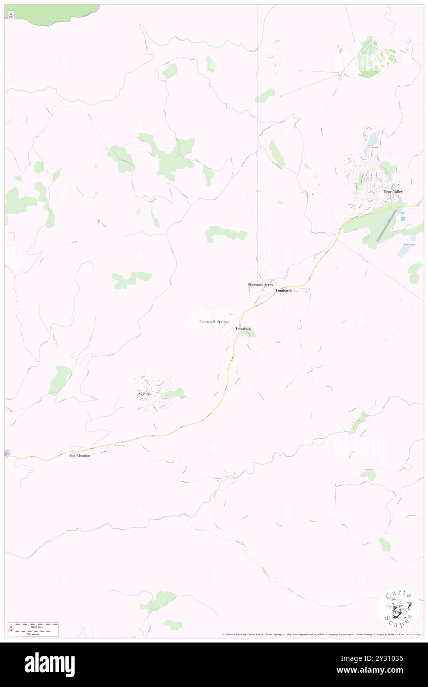 Tamarack Springs, Calaveras County, US, United States, California, N 38 26' 24'', S 120 4' 58'', map, Cartascapes Map published in 2024. Explore Cartascapes, a map revealing Earth's diverse landscapes, cultures, and ecosystems. Journey through time and space, discovering the interconnectedness of our planet's past, present, and future. Stock Photohttps://www.alamy.com/image-license-details/?v=1https://www.alamy.com/tamarack-springs-calaveras-county-us-united-states-california-n-38-26-24-s-120-4-58-map-cartascapes-map-published-in-2024-explore-cartascapes-a-map-revealing-earths-diverse-landscapes-cultures-and-ecosystems-journey-through-time-and-space-discovering-the-interconnectedness-of-our-planets-past-present-and-future-image621439258.html
RM2Y31036–Tamarack Springs, Calaveras County, US, United States, California, N 38 26' 24'', S 120 4' 58'', map, Cartascapes Map published in 2024. Explore Cartascapes, a map revealing Earth's diverse landscapes, cultures, and ecosystems. Journey through time and space, discovering the interconnectedness of our planet's past, present, and future.
 Red Apple, Calaveras County, US, United States, California, N 38 10' 43'', S 120 22' 53'', map, Cartascapes Map published in 2024. Explore Cartascapes, a map revealing Earth's diverse landscapes, cultures, and ecosystems. Journey through time and space, discovering the interconnectedness of our planet's past, present, and future. Stock Photohttps://www.alamy.com/image-license-details/?v=1https://www.alamy.com/red-apple-calaveras-county-us-united-states-california-n-38-10-43-s-120-22-53-map-cartascapes-map-published-in-2024-explore-cartascapes-a-map-revealing-earths-diverse-landscapes-cultures-and-ecosystems-journey-through-time-and-space-discovering-the-interconnectedness-of-our-planets-past-present-and-future-image621170957.html
RM2Y2GNW1–Red Apple, Calaveras County, US, United States, California, N 38 10' 43'', S 120 22' 53'', map, Cartascapes Map published in 2024. Explore Cartascapes, a map revealing Earth's diverse landscapes, cultures, and ecosystems. Journey through time and space, discovering the interconnectedness of our planet's past, present, and future.
 Angels City, Calaveras County, US, United States, California, N 38 2' 5'', S 120 35' 8'', map, Cartascapes Map published in 2024. Explore Cartascapes, a map revealing Earth's diverse landscapes, cultures, and ecosystems. Journey through time and space, discovering the interconnectedness of our planet's past, present, and future. Stock Photohttps://www.alamy.com/image-license-details/?v=1https://www.alamy.com/angels-city-calaveras-county-us-united-states-california-n-38-2-5-s-120-35-8-map-cartascapes-map-published-in-2024-explore-cartascapes-a-map-revealing-earths-diverse-landscapes-cultures-and-ecosystems-journey-through-time-and-space-discovering-the-interconnectedness-of-our-planets-past-present-and-future-image621375869.html
RM2Y2X379–Angels City, Calaveras County, US, United States, California, N 38 2' 5'', S 120 35' 8'', map, Cartascapes Map published in 2024. Explore Cartascapes, a map revealing Earth's diverse landscapes, cultures, and ecosystems. Journey through time and space, discovering the interconnectedness of our planet's past, present, and future.