Canajoharie Cut Out Stock Images
 Canajoharie, Montgomery County, US, United States, New York, N 42 54' 20'', S 74 34' 18'', map, Cartascapes Map published in 2024. Explore Cartascapes, a map revealing Earth's diverse landscapes, cultures, and ecosystems. Journey through time and space, discovering the interconnectedness of our planet's past, present, and future. Stock Photohttps://www.alamy.com/image-license-details/?v=1https://www.alamy.com/canajoharie-montgomery-county-us-united-states-new-york-n-42-54-20-s-74-34-18-map-cartascapes-map-published-in-2024-explore-cartascapes-a-map-revealing-earths-diverse-landscapes-cultures-and-ecosystems-journey-through-time-and-space-discovering-the-interconnectedness-of-our-planets-past-present-and-future-image621395728.html
RM2Y2Y0GG–Canajoharie, Montgomery County, US, United States, New York, N 42 54' 20'', S 74 34' 18'', map, Cartascapes Map published in 2024. Explore Cartascapes, a map revealing Earth's diverse landscapes, cultures, and ecosystems. Journey through time and space, discovering the interconnectedness of our planet's past, present, and future.
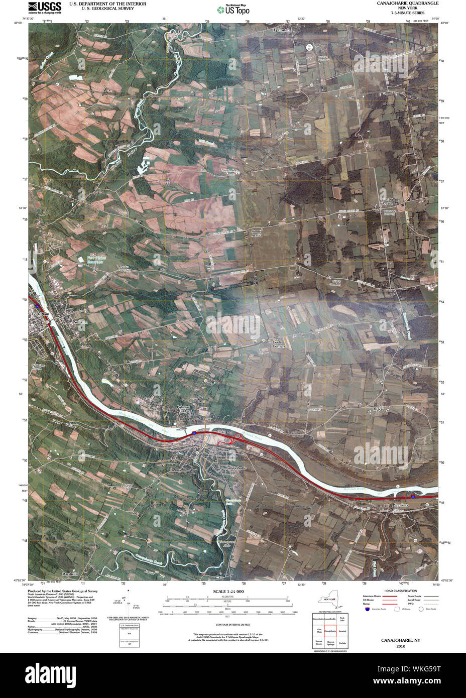
 New York NY Canajoharie 20100415 TM Restoration Stock Photohttps://www.alamy.com/image-license-details/?v=1https://www.alamy.com/new-york-ny-canajoharie-20100415-tm-restoration-image270189412.html
RMWKG59T–New York NY Canajoharie 20100415 TM Restoration
 The National cyclopædia of American biography : being the history of the United States as illustrated in the lives of the founders, builders, and defenders of the republic, and of the men and women who are doing the work and moulding the thought of the present time, edited by distinguished biographers, selected from each state, revised and approved by the most eminent historians, scholars, and statesmen of the day . 220 THE NATIONAL CYCLOPJEDIA. /clli^u2j^Mc4 CONKLING, Boscoe, statesman, was bom inAlbany, N. Y., Oct. 30, 1839, the son of AlfredConkllng, who practised law at Canajoharie in thee Stock Photohttps://www.alamy.com/image-license-details/?v=1https://www.alamy.com/the-national-cyclopdia-of-american-biography-being-the-history-of-the-united-states-as-illustrated-in-the-lives-of-the-founders-builders-and-defenders-of-the-republic-and-of-the-men-and-women-who-are-doing-the-work-and-moulding-the-thought-of-the-present-time-edited-by-distinguished-biographers-selected-from-each-state-revised-and-approved-by-the-most-eminent-historians-scholars-and-statesmen-of-the-day-220-the-national-cyclopjedia-clliu2jmc4-conkling-boscoe-statesman-was-bom-inalbany-n-y-oct-30-1839-the-son-of-alfredconkllng-who-practised-law-at-canajoharie-in-thee-image340230568.html
RM2ANERFM–The National cyclopædia of American biography : being the history of the United States as illustrated in the lives of the founders, builders, and defenders of the republic, and of the men and women who are doing the work and moulding the thought of the present time, edited by distinguished biographers, selected from each state, revised and approved by the most eminent historians, scholars, and statesmen of the day . 220 THE NATIONAL CYCLOPJEDIA. /clli^u2j^Mc4 CONKLING, Boscoe, statesman, was bom inAlbany, N. Y., Oct. 30, 1839, the son of AlfredConkllng, who practised law at Canajoharie in thee
 1939 U.S. advertisement for Beech-Nut chewing gum. Stock Photohttps://www.alamy.com/image-license-details/?v=1https://www.alamy.com/1939-us-advertisement-for-beech-nut-chewing-gum-image438529644.html
RM2GDCN10–1939 U.S. advertisement for Beech-Nut chewing gum.
 Town of Canajoharie, Montgomery County, US, United States, New York, N 42 51' 56'', S 74 36' 18'', map, Cartascapes Map published in 2024. Explore Cartascapes, a map revealing Earth's diverse landscapes, cultures, and ecosystems. Journey through time and space, discovering the interconnectedness of our planet's past, present, and future. Stock Photohttps://www.alamy.com/image-license-details/?v=1https://www.alamy.com/town-of-canajoharie-montgomery-county-us-united-states-new-york-n-42-51-56-s-74-36-18-map-cartascapes-map-published-in-2024-explore-cartascapes-a-map-revealing-earths-diverse-landscapes-cultures-and-ecosystems-journey-through-time-and-space-discovering-the-interconnectedness-of-our-planets-past-present-and-future-image633827736.html
RM2YR59MT–Town of Canajoharie, Montgomery County, US, United States, New York, N 42 51' 56'', S 74 36' 18'', map, Cartascapes Map published in 2024. Explore Cartascapes, a map revealing Earth's diverse landscapes, cultures, and ecosystems. Journey through time and space, discovering the interconnectedness of our planet's past, present, and future.
 Village of Canajoharie, Montgomery County, US, United States, New York, N 42 53' 59'', S 74 34' 11'', map, Cartascapes Map published in 2024. Explore Cartascapes, a map revealing Earth's diverse landscapes, cultures, and ecosystems. Journey through time and space, discovering the interconnectedness of our planet's past, present, and future. Stock Photohttps://www.alamy.com/image-license-details/?v=1https://www.alamy.com/village-of-canajoharie-montgomery-county-us-united-states-new-york-n-42-53-59-s-74-34-11-map-cartascapes-map-published-in-2024-explore-cartascapes-a-map-revealing-earths-diverse-landscapes-cultures-and-ecosystems-journey-through-time-and-space-discovering-the-interconnectedness-of-our-planets-past-present-and-future-image633863123.html
RM2YR6XTK–Village of Canajoharie, Montgomery County, US, United States, New York, N 42 53' 59'', S 74 34' 11'', map, Cartascapes Map published in 2024. Explore Cartascapes, a map revealing Earth's diverse landscapes, cultures, and ecosystems. Journey through time and space, discovering the interconnectedness of our planet's past, present, and future.
 Town of Canajoharie, Montgomery County, US, United States, New York, N 42 51' 56'', S 74 36' 18'', map, Cartascapes Map published in 2024. Explore Cartascapes, a map revealing Earth's diverse landscapes, cultures, and ecosystems. Journey through time and space, discovering the interconnectedness of our planet's past, present, and future. Stock Photohttps://www.alamy.com/image-license-details/?v=1https://www.alamy.com/town-of-canajoharie-montgomery-county-us-united-states-new-york-n-42-51-56-s-74-36-18-map-cartascapes-map-published-in-2024-explore-cartascapes-a-map-revealing-earths-diverse-landscapes-cultures-and-ecosystems-journey-through-time-and-space-discovering-the-interconnectedness-of-our-planets-past-present-and-future-image633806873.html
RM2YR4B3N–Town of Canajoharie, Montgomery County, US, United States, New York, N 42 51' 56'', S 74 36' 18'', map, Cartascapes Map published in 2024. Explore Cartascapes, a map revealing Earth's diverse landscapes, cultures, and ecosystems. Journey through time and space, discovering the interconnectedness of our planet's past, present, and future.
 Village of Canajoharie, Montgomery County, US, United States, New York, N 42 53' 59'', S 74 34' 11'', map, Cartascapes Map published in 2024. Explore Cartascapes, a map revealing Earth's diverse landscapes, cultures, and ecosystems. Journey through time and space, discovering the interconnectedness of our planet's past, present, and future. Stock Photohttps://www.alamy.com/image-license-details/?v=1https://www.alamy.com/village-of-canajoharie-montgomery-county-us-united-states-new-york-n-42-53-59-s-74-34-11-map-cartascapes-map-published-in-2024-explore-cartascapes-a-map-revealing-earths-diverse-landscapes-cultures-and-ecosystems-journey-through-time-and-space-discovering-the-interconnectedness-of-our-planets-past-present-and-future-image633902191.html
RM2YR8MKY–Village of Canajoharie, Montgomery County, US, United States, New York, N 42 53' 59'', S 74 34' 11'', map, Cartascapes Map published in 2024. Explore Cartascapes, a map revealing Earth's diverse landscapes, cultures, and ecosystems. Journey through time and space, discovering the interconnectedness of our planet's past, present, and future.
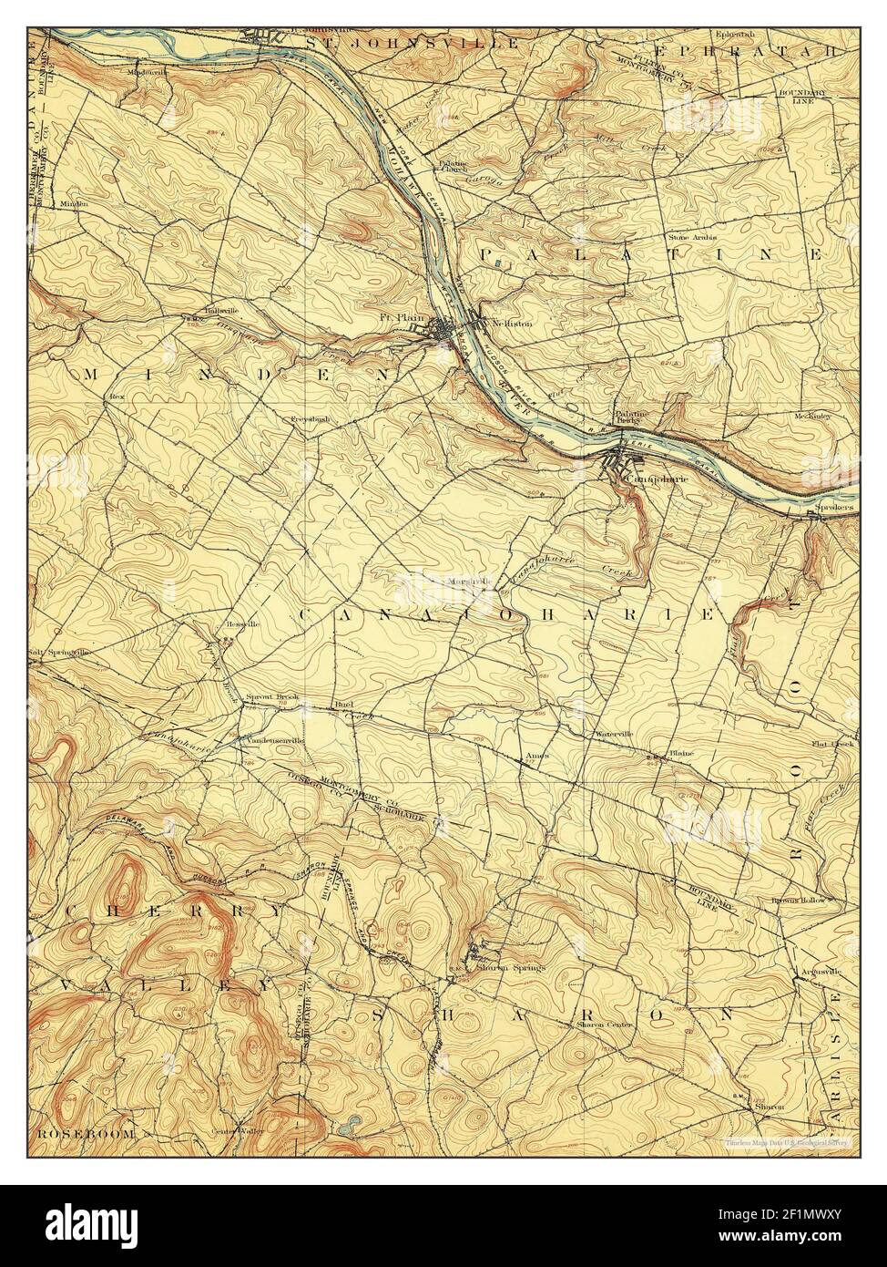
 Canajoharie, New York, map 1900, 1:62500, United States of America by Timeless Maps, data U.S. Geological Survey Stock Photohttps://www.alamy.com/image-license-details/?v=1https://www.alamy.com/canajoharie-new-york-map-1900-162500-united-states-of-america-by-timeless-maps-data-us-geological-survey-image414122887.html
RM2F1MWY3–Canajoharie, New York, map 1900, 1:62500, United States of America by Timeless Maps, data U.S. Geological Survey
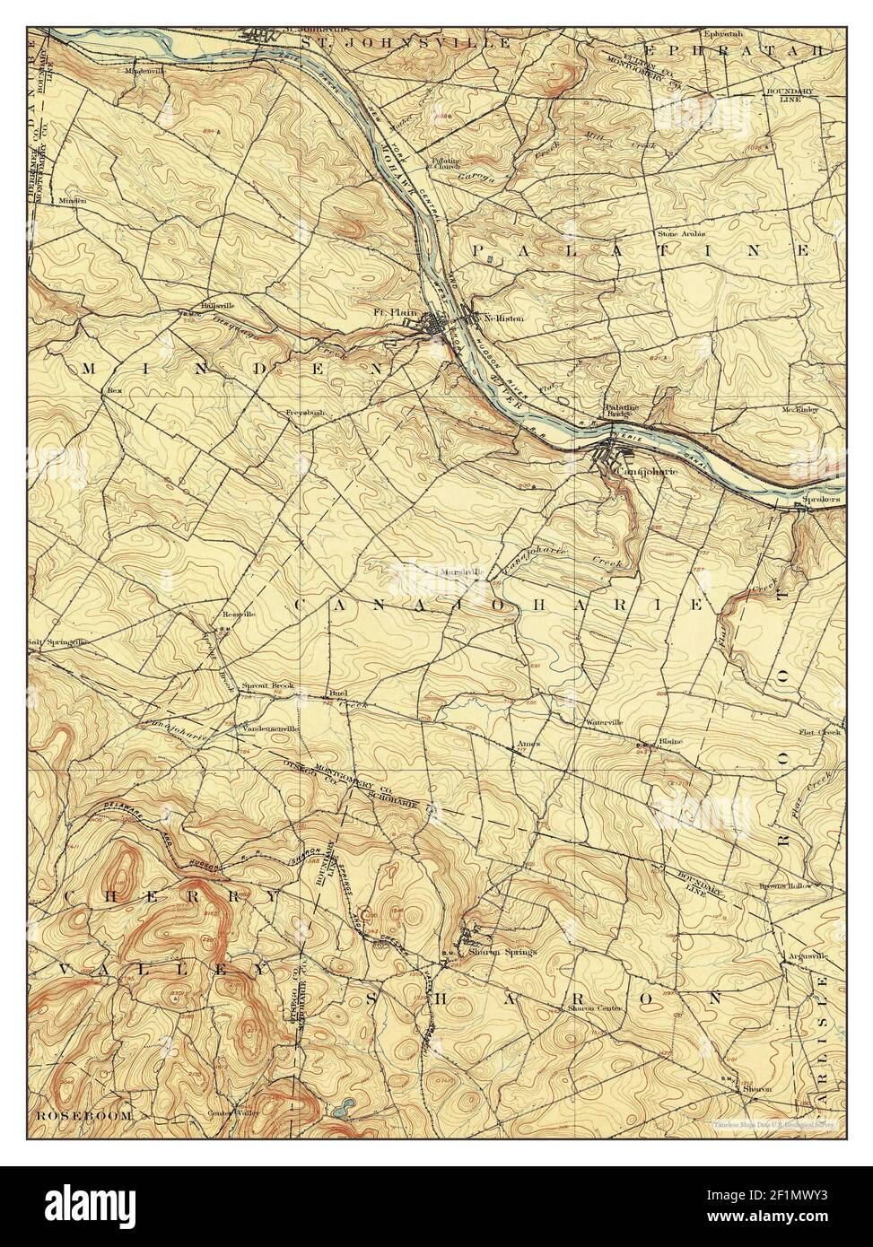
 Canajoharie, New York, map 1902, 1:62500, United States of America by Timeless Maps, data U.S. Geological Survey Stock Photohttps://www.alamy.com/image-license-details/?v=1https://www.alamy.com/canajoharie-new-york-map-1902-162500-united-states-of-america-by-timeless-maps-data-us-geological-survey-image414122883.html
RM2F1MWXY–Canajoharie, New York, map 1902, 1:62500, United States of America by Timeless Maps, data U.S. Geological Survey
 Canajoharie, New York, map 1902, 1:62500, United States of America by Timeless Maps, data U.S. Geological Survey Stock Photohttps://www.alamy.com/image-license-details/?v=1https://www.alamy.com/canajoharie-new-york-map-1902-162500-united-states-of-america-by-timeless-maps-data-us-geological-survey-image414122914.html
RM2F1MX02–Canajoharie, New York, map 1902, 1:62500, United States of America by Timeless Maps, data U.S. Geological Survey
 Canajoharie, New York, map 1898, 1:62500, United States of America by Timeless Maps, data U.S. Geological Survey Stock Photohttps://www.alamy.com/image-license-details/?v=1https://www.alamy.com/canajoharie-new-york-map-1898-162500-united-states-of-america-by-timeless-maps-data-us-geological-survey-image414122819.html
RM2F1MWTK–Canajoharie, New York, map 1898, 1:62500, United States of America by Timeless Maps, data U.S. Geological Survey
 Canajoharie, New York, map 1902, 1:62500, United States of America by Timeless Maps, data U.S. Geological Survey Stock Photohttps://www.alamy.com/image-license-details/?v=1https://www.alamy.com/canajoharie-new-york-map-1902-162500-united-states-of-america-by-timeless-maps-data-us-geological-survey-image414122884.html
RM2F1MWY0–Canajoharie, New York, map 1902, 1:62500, United States of America by Timeless Maps, data U.S. Geological Survey
 Canajoharie, New York, map 1944, 1:24000, United States of America by Timeless Maps, data U.S. Geological Survey Stock Photohttps://www.alamy.com/image-license-details/?v=1https://www.alamy.com/canajoharie-new-york-map-1944-124000-united-states-of-america-by-timeless-maps-data-us-geological-survey-image406919691.html
RM2EJ0P63–Canajoharie, New York, map 1944, 1:24000, United States of America by Timeless Maps, data U.S. Geological Survey
 Canajoharie, New York, map 1944, 1:24000, United States of America by Timeless Maps, data U.S. Geological Survey Stock Photohttps://www.alamy.com/image-license-details/?v=1https://www.alamy.com/canajoharie-new-york-map-1944-124000-united-states-of-america-by-timeless-maps-data-us-geological-survey-image406919684.html
RM2EJ0P5T–Canajoharie, New York, map 1944, 1:24000, United States of America by Timeless Maps, data U.S. Geological Survey
 Canajoharie, New York, map 1902, 1:62500, United States of America by Timeless Maps, data U.S. Geological Survey Stock Photohttps://www.alamy.com/image-license-details/?v=1https://www.alamy.com/canajoharie-new-york-map-1902-162500-united-states-of-america-by-timeless-maps-data-us-geological-survey-image414122908.html
RM2F1MWYT–Canajoharie, New York, map 1902, 1:62500, United States of America by Timeless Maps, data U.S. Geological Survey
 Canajoharie, New York, map 1902, 1:62500, United States of America by Timeless Maps, data U.S. Geological Survey Stock Photohttps://www.alamy.com/image-license-details/?v=1https://www.alamy.com/canajoharie-new-york-map-1902-162500-united-states-of-america-by-timeless-maps-data-us-geological-survey-image414122982.html
RM2F1MX2E–Canajoharie, New York, map 1902, 1:62500, United States of America by Timeless Maps, data U.S. Geological Survey
 Canajoharie, New York, map 1902, 1:62500, United States of America by Timeless Maps, data U.S. Geological Survey Stock Photohttps://www.alamy.com/image-license-details/?v=1https://www.alamy.com/canajoharie-new-york-map-1902-162500-united-states-of-america-by-timeless-maps-data-us-geological-survey-image414122881.html
RM2F1MWXW–Canajoharie, New York, map 1902, 1:62500, United States of America by Timeless Maps, data U.S. Geological Survey
 Canajoharie, New York, map 1946, 1:31680, United States of America by Timeless Maps, data U.S. Geological Survey Stock Photohttps://www.alamy.com/image-license-details/?v=1https://www.alamy.com/canajoharie-new-york-map-1946-131680-united-states-of-america-by-timeless-maps-data-us-geological-survey-image414122876.html
RM2F1MWXM–Canajoharie, New York, map 1946, 1:31680, United States of America by Timeless Maps, data U.S. Geological Survey