Quick filters:
Carthage map Stock Photos and Images
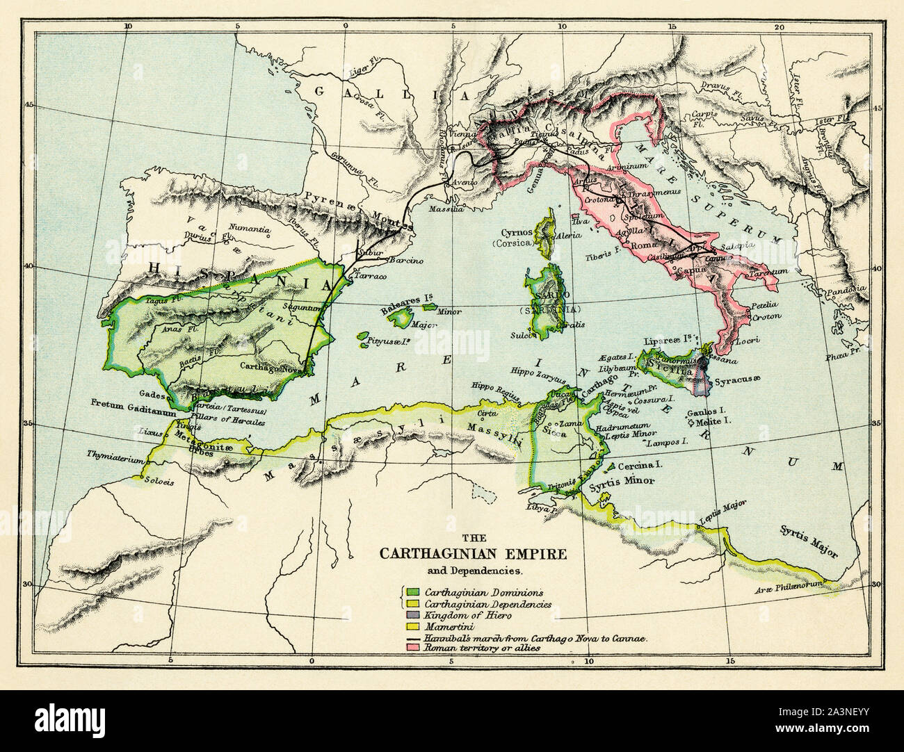 Carthaginian Empire, 3rd century BC. Color lithograph Stock Photohttps://www.alamy.com/image-license-details/?v=1https://www.alamy.com/carthaginian-empire-3rd-century-bc-color-lithograph-image329313711.html
RM2A3NEYY–Carthaginian Empire, 3rd century BC. Color lithograph
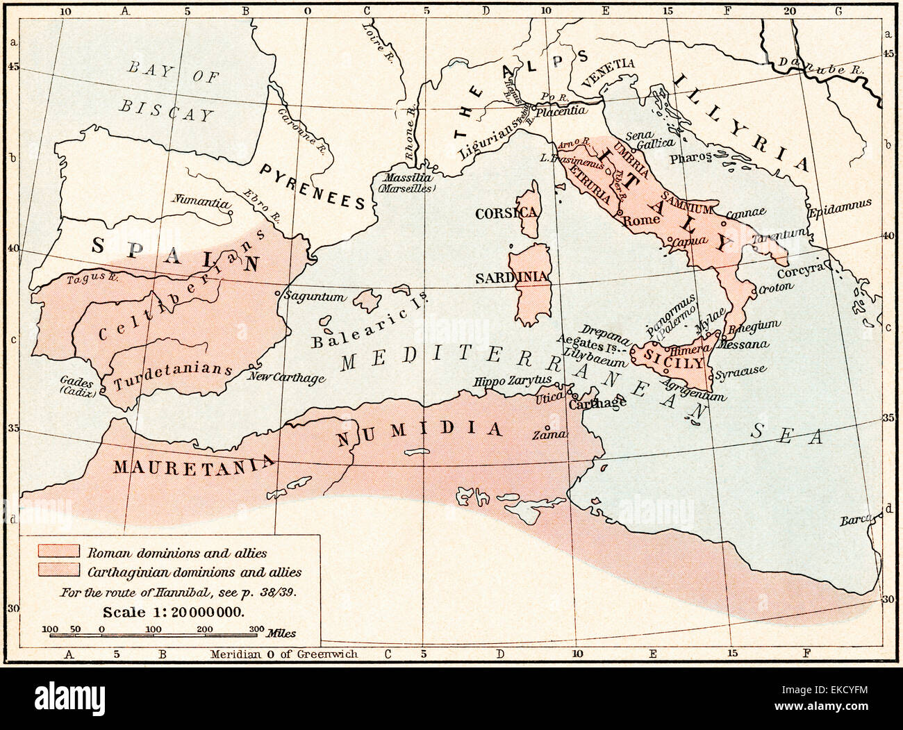 Map of Rome and Carthage at the beginning of the Second Punic War, 218 BC. Stock Photohttps://www.alamy.com/image-license-details/?v=1https://www.alamy.com/stock-photo-map-of-rome-and-carthage-at-the-beginning-of-the-second-punic-war-80804968.html
RMEKCYFM–Map of Rome and Carthage at the beginning of the Second Punic War, 218 BC.
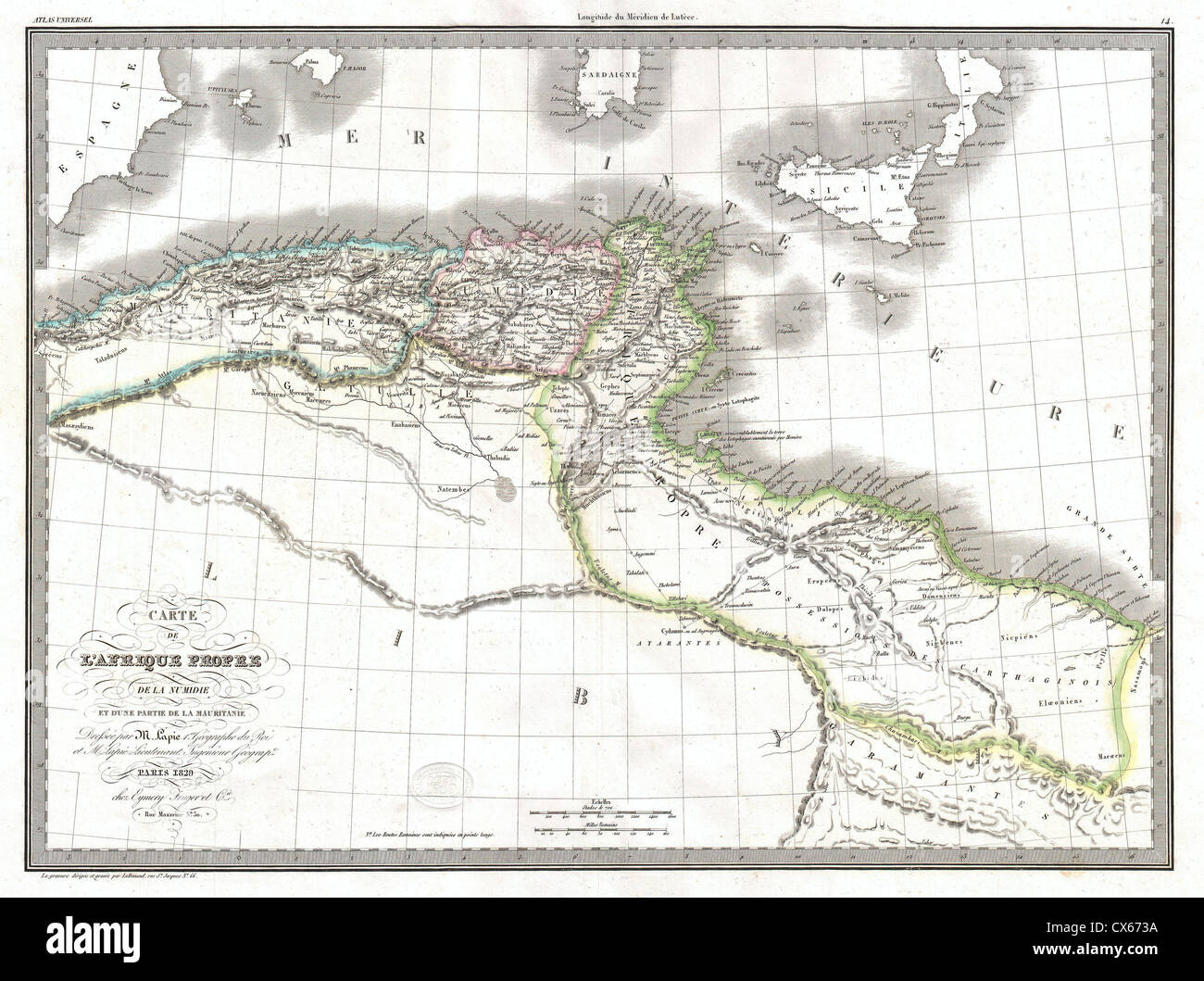 1829 Lapie Historical Map of Empire of Carthage ( Modern Tunisia ) Stock Photohttps://www.alamy.com/image-license-details/?v=1https://www.alamy.com/stock-photo-1829-lapie-historical-map-of-empire-of-carthage-modern-tunisia-50539086.html
RMCX673A–1829 Lapie Historical Map of Empire of Carthage ( Modern Tunisia )
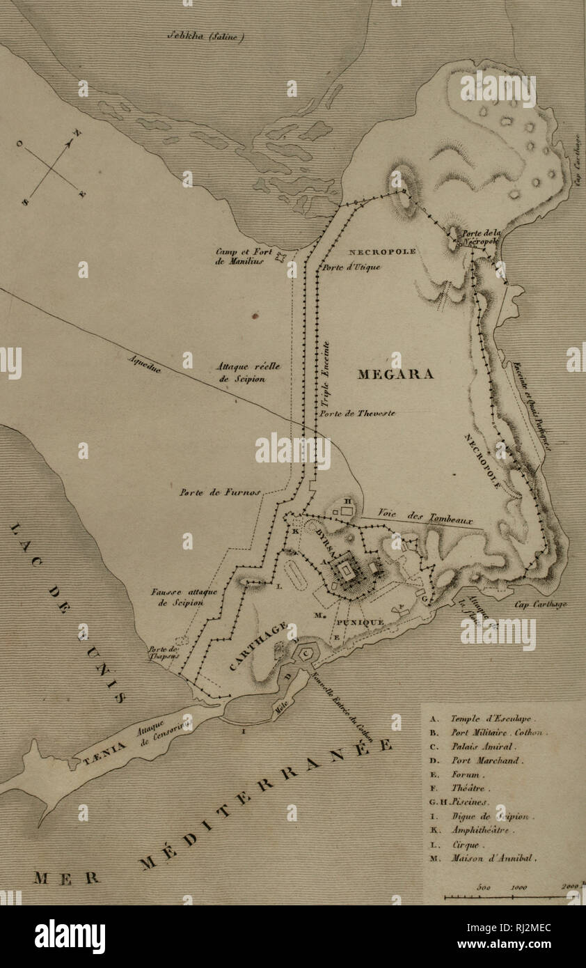 Map of Carthage and the Peninsula. Engraving. Panorama Universal. History of Carthage, 1850. Stock Photohttps://www.alamy.com/image-license-details/?v=1https://www.alamy.com/map-of-carthage-and-the-peninsula-engraving-panorama-universal-history-of-carthage-1850-image234858580.html
RMRJ2MEC–Map of Carthage and the Peninsula. Engraving. Panorama Universal. History of Carthage, 1850.
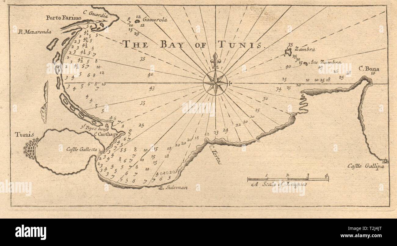 'The bay of Tunis'. Carthage. Tunisia. MOUNT & PAGE sea chart 1747 old map Stock Photohttps://www.alamy.com/image-license-details/?v=1https://www.alamy.com/the-bay-of-tunis-carthage-tunisia-mount-page-sea-chart-1747-old-map-image242573264.html
RFT2J4JT–'The bay of Tunis'. Carthage. Tunisia. MOUNT & PAGE sea chart 1747 old map
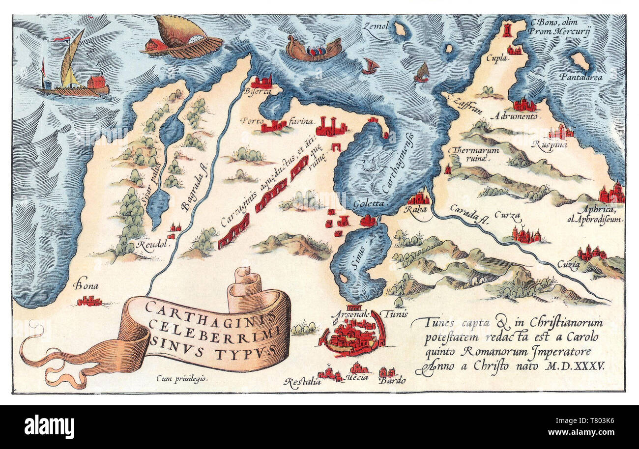 Theatrum Orbis Terrarum, Carthage Harbor, 1570 Stock Photohttps://www.alamy.com/image-license-details/?v=1https://www.alamy.com/theatrum-orbis-terrarum-carthage-harbor-1570-image245865290.html
RMT803K6–Theatrum Orbis Terrarum, Carthage Harbor, 1570
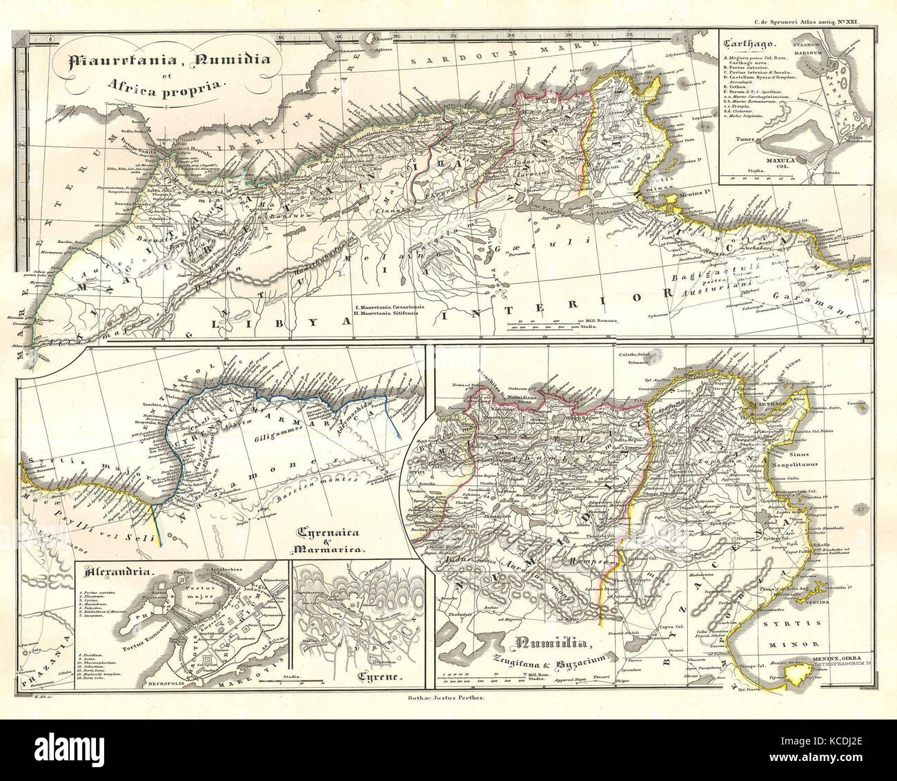 1855, Spruneri Map of North Africa in Ancient Times, Carthage, Numidia, Alexandria Stock Photohttps://www.alamy.com/image-license-details/?v=1https://www.alamy.com/stock-image-1855-spruneri-map-of-north-africa-in-ancient-times-carthage-numidia-162568742.html
RMKCDJ2E–1855, Spruneri Map of North Africa in Ancient Times, Carthage, Numidia, Alexandria
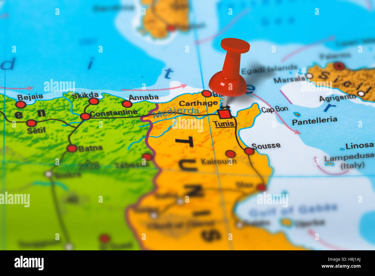 Carthage Tunisia map Stock Photohttps://www.alamy.com/image-license-details/?v=1https://www.alamy.com/stock-photo-carthage-tunisia-map-125786042.html
RFH8J1AJ–Carthage Tunisia map
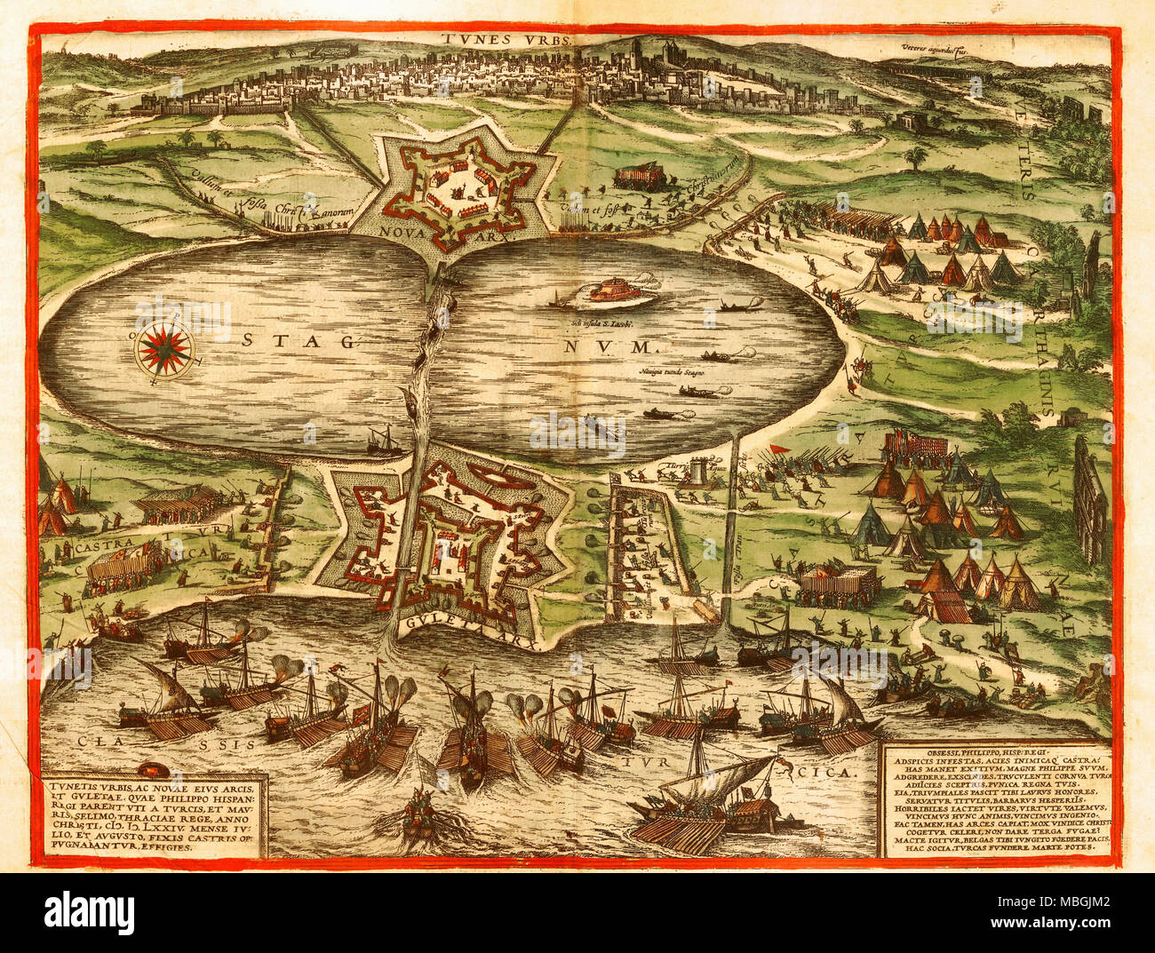 Tunis, Carthage, Tunisia Stock Photohttps://www.alamy.com/image-license-details/?v=1https://www.alamy.com/tunis-carthage-tunisia-image179230802.html
RMMBGJM2–Tunis, Carthage, Tunisia
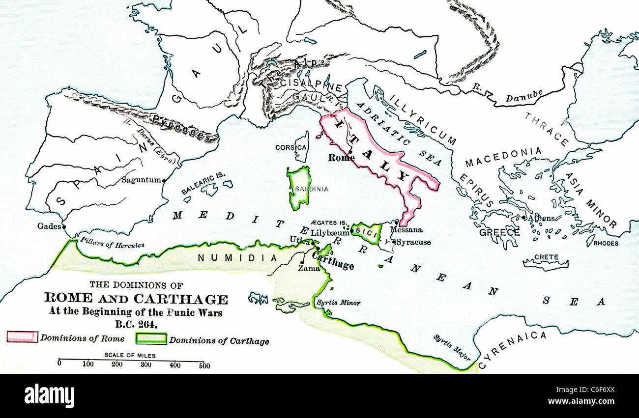 This map shows the lands under Roman control (pink) and under Carthaginian control (green) at the beginning of First Punic War. Stock Photohttps://www.alamy.com/image-license-details/?v=1https://www.alamy.com/stock-photo-this-map-shows-the-lands-under-roman-control-pink-and-under-carthaginian-38443410.html
RFC6F6XX–This map shows the lands under Roman control (pink) and under Carthaginian control (green) at the beginning of First Punic War.
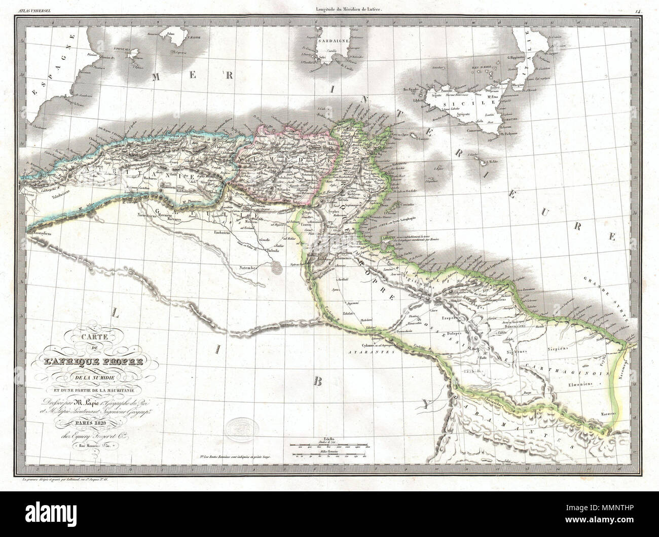 . English: An unusual and attractive 1829 map of the ancient empires of Mauritania, Carthage, and Numidia. Depicts what is today known as the Barbary Coast around 200 BC. This map illustrates a crucial turning point early in the Second Punic War. The Carthaginian Empire dominated much of the region, until Numidia, the Kingdom to the west of Carthage, allied itself with Rome in 206 BC leading the Roman conquest of the region in 201 BC. Exhibits the typical detail and scientific precision of Lapie maps. Notes various trade routes, topographical features, and Oases. Prepared as plate no. 14 for Stock Photohttps://www.alamy.com/image-license-details/?v=1https://www.alamy.com/english-an-unusual-and-attractive-1829-map-of-the-ancient-empires-of-mauritania-carthage-and-numidia-depicts-what-is-today-known-as-the-barbary-coast-around-200-bc-this-map-illustrates-a-crucial-turning-point-early-in-the-second-punic-war-the-carthaginian-empire-dominated-much-of-the-region-until-numidia-the-kingdom-to-the-west-of-carthage-allied-itself-with-rome-in-206-bc-leading-the-roman-conquest-of-the-region-in-201-bc-exhibits-the-typical-detail-and-scientific-precision-of-lapie-maps-notes-various-trade-routes-topographical-features-and-oases-prepared-as-plate-no-14-for-image184877106.html
RMMMNTHP–. English: An unusual and attractive 1829 map of the ancient empires of Mauritania, Carthage, and Numidia. Depicts what is today known as the Barbary Coast around 200 BC. This map illustrates a crucial turning point early in the Second Punic War. The Carthaginian Empire dominated much of the region, until Numidia, the Kingdom to the west of Carthage, allied itself with Rome in 206 BC leading the Roman conquest of the region in 201 BC. Exhibits the typical detail and scientific precision of Lapie maps. Notes various trade routes, topographical features, and Oases. Prepared as plate no. 14 for
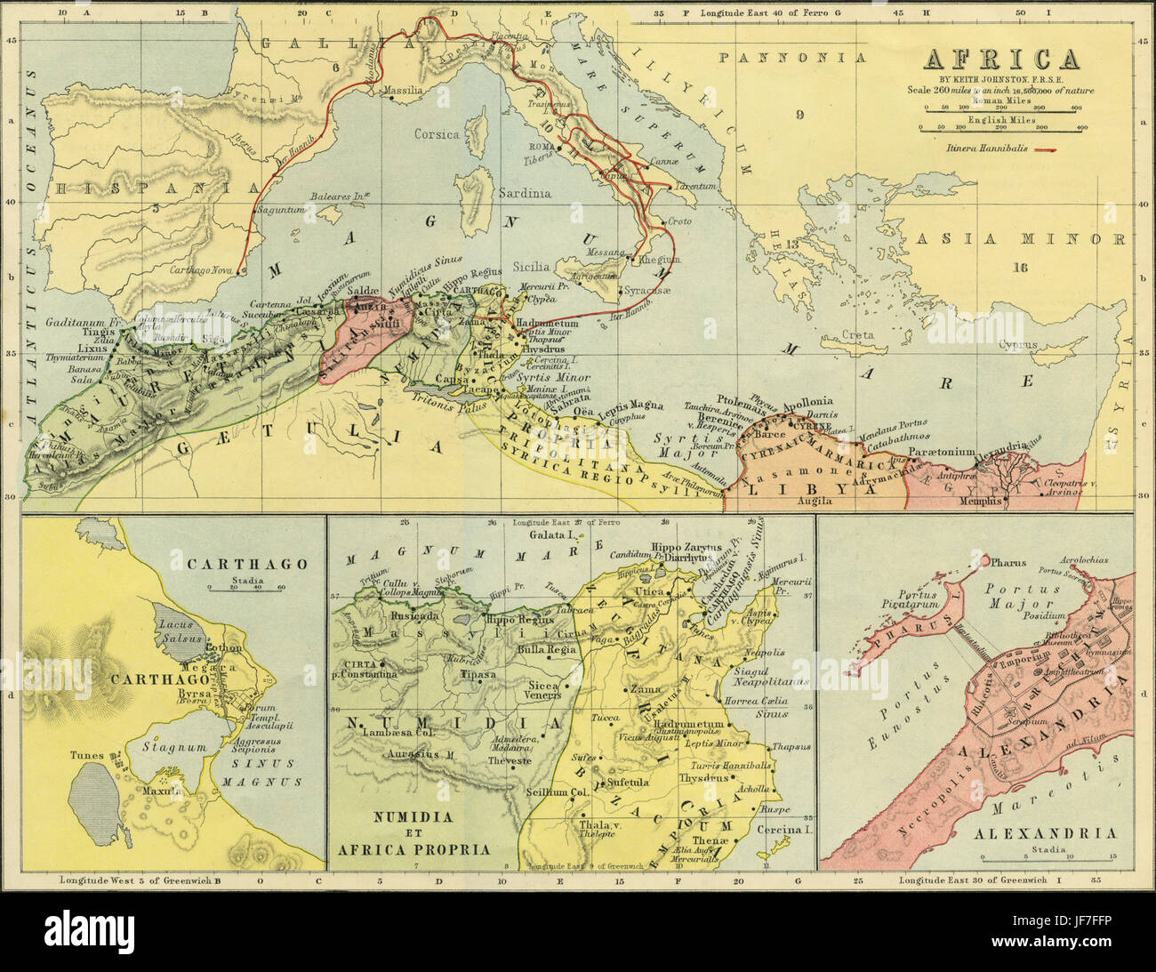 Maps of Africa in classical antiquity - map showing Hannibal 's route from Carthage into Italy and Spain, crossing the Alps ( 3rd Century BC ). Maps of Carthage, Alexandria, and Numidia and Africa Propria. Drawn by Keith Johnston F.R.S.E. Published in The Unrivalled Classical Atlas by W. and A.K. Johnston in 1877. Stock Photohttps://www.alamy.com/image-license-details/?v=1https://www.alamy.com/stock-photo-maps-of-africa-in-classical-antiquity-map-showing-hannibal-s-route-147068650.html
RMJF7FFP–Maps of Africa in classical antiquity - map showing Hannibal 's route from Carthage into Italy and Spain, crossing the Alps ( 3rd Century BC ). Maps of Carthage, Alexandria, and Numidia and Africa Propria. Drawn by Keith Johnston F.R.S.E. Published in The Unrivalled Classical Atlas by W. and A.K. Johnston in 1877.
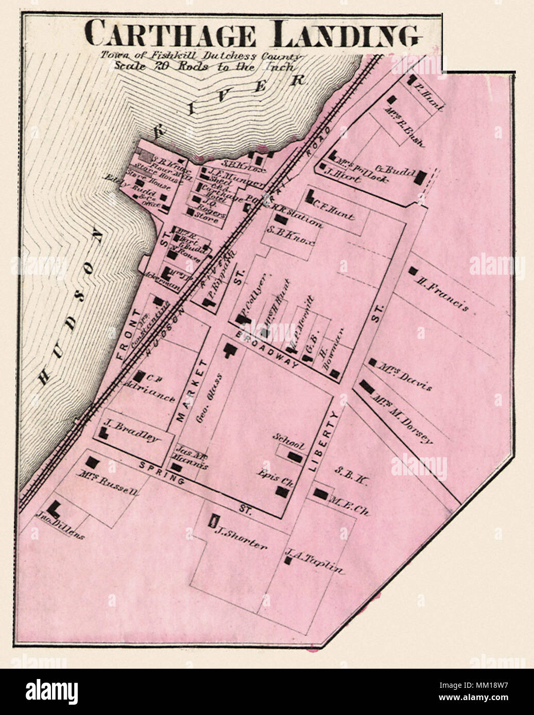 Map of Carthage Landing. 1867 Stock Photohttps://www.alamy.com/image-license-details/?v=1https://www.alamy.com/map-of-carthage-landing-1867-image184425731.html
RMMM18W7–Map of Carthage Landing. 1867
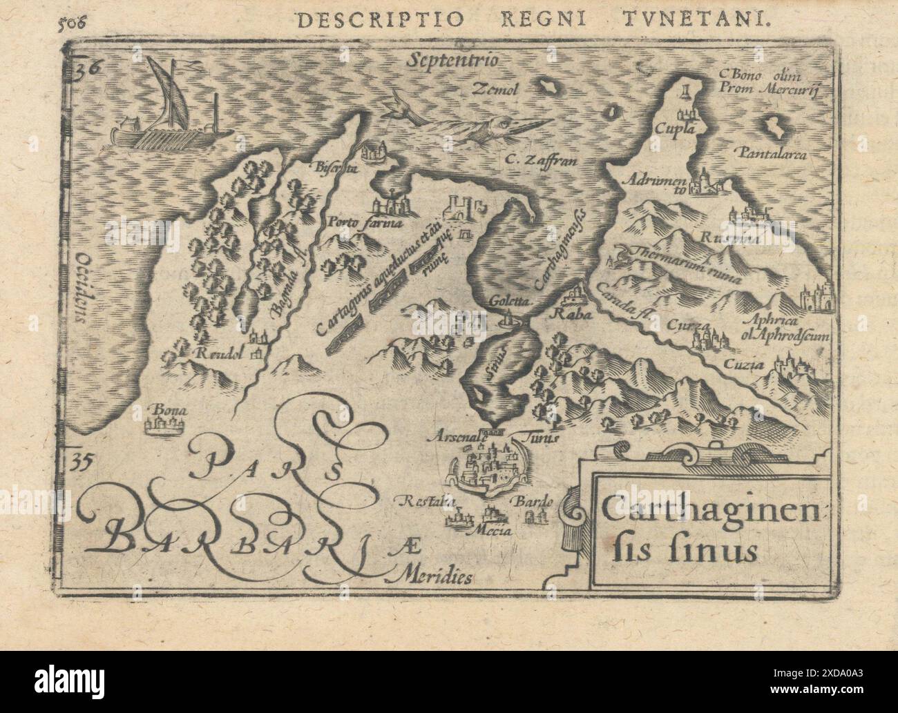 Carthaginensis sinus by Bertius. Kingdom of Tunis & Gulf of Carthage 1603 map Stock Photohttps://www.alamy.com/image-license-details/?v=1https://www.alamy.com/carthaginensis-sinus-by-bertius-kingdom-of-tunis-gulf-of-carthage-1603-map-image610573211.html
RF2XDA0A3–Carthaginensis sinus by Bertius. Kingdom of Tunis & Gulf of Carthage 1603 map
 Carthage Texas USA shown on a Geography map or Road map Stock Photohttps://www.alamy.com/image-license-details/?v=1https://www.alamy.com/carthage-texas-usa-shown-on-a-geography-map-or-road-map-image433906576.html
RM2G5X47C–Carthage Texas USA shown on a Geography map or Road map
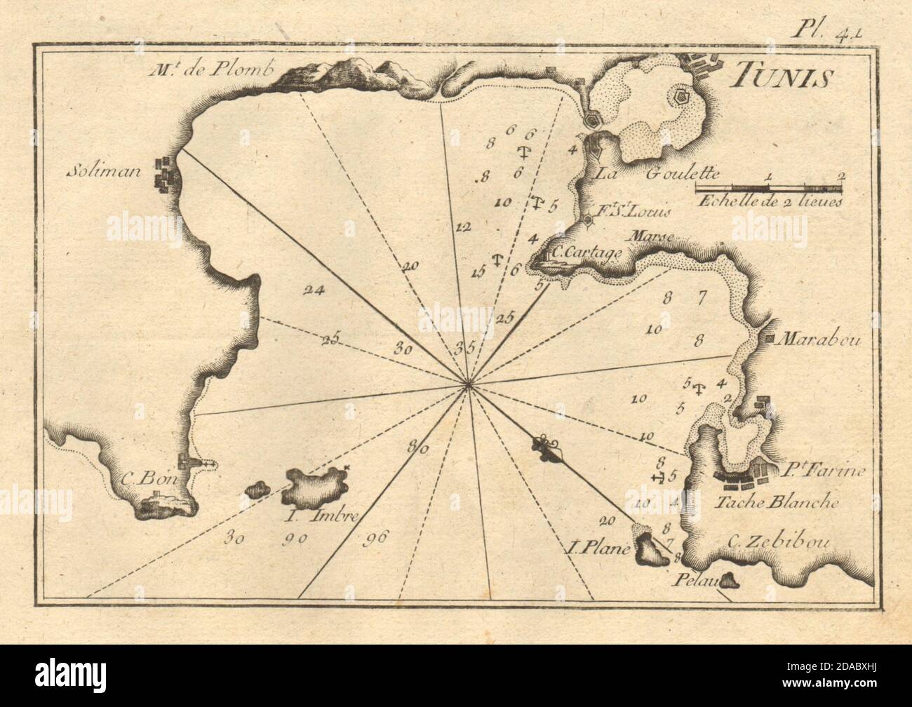 Plan of the Gulf of Tunis. Carthage. Tunisia. ROUX 1804 old antique map chart Stock Photohttps://www.alamy.com/image-license-details/?v=1https://www.alamy.com/plan-of-the-gulf-of-tunis-carthage-tunisia-roux-1804-old-antique-map-chart-image385037006.html
RF2DABXHJ–Plan of the Gulf of Tunis. Carthage. Tunisia. ROUX 1804 old antique map chart
 Carthage Missouri USA shown on a Geography map or road map Stock Photohttps://www.alamy.com/image-license-details/?v=1https://www.alamy.com/carthage-missouri-usa-shown-on-a-geography-map-or-road-map-image426432323.html
RM2FNNJNR–Carthage Missouri USA shown on a Geography map or road map
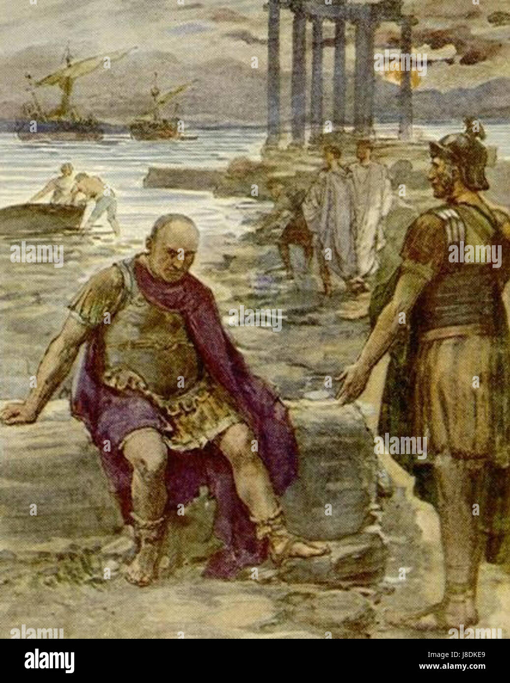 Marius in exile at the ruins of Carthage Stock Photohttps://www.alamy.com/image-license-details/?v=1https://www.alamy.com/stock-photo-marius-in-exile-at-the-ruins-of-carthage-142900865.html
RMJ8DKE9–Marius in exile at the ruins of Carthage
 Map showing the ancient site of Carthage, Utica, and the Gulf of Carthage, plus the horizontal section of the lesser set of cisterns in the ruins of the ancient city of Carthage. Stock Photohttps://www.alamy.com/image-license-details/?v=1https://www.alamy.com/map-showing-the-ancient-site-of-carthage-utica-and-the-gulf-of-carthage-plus-the-horizontal-section-of-the-lesser-set-of-cisterns-in-the-ruins-of-the-ancient-city-of-carthage-image608450229.html
RM2X9W8D9–Map showing the ancient site of Carthage, Utica, and the Gulf of Carthage, plus the horizontal section of the lesser set of cisterns in the ruins of the ancient city of Carthage.
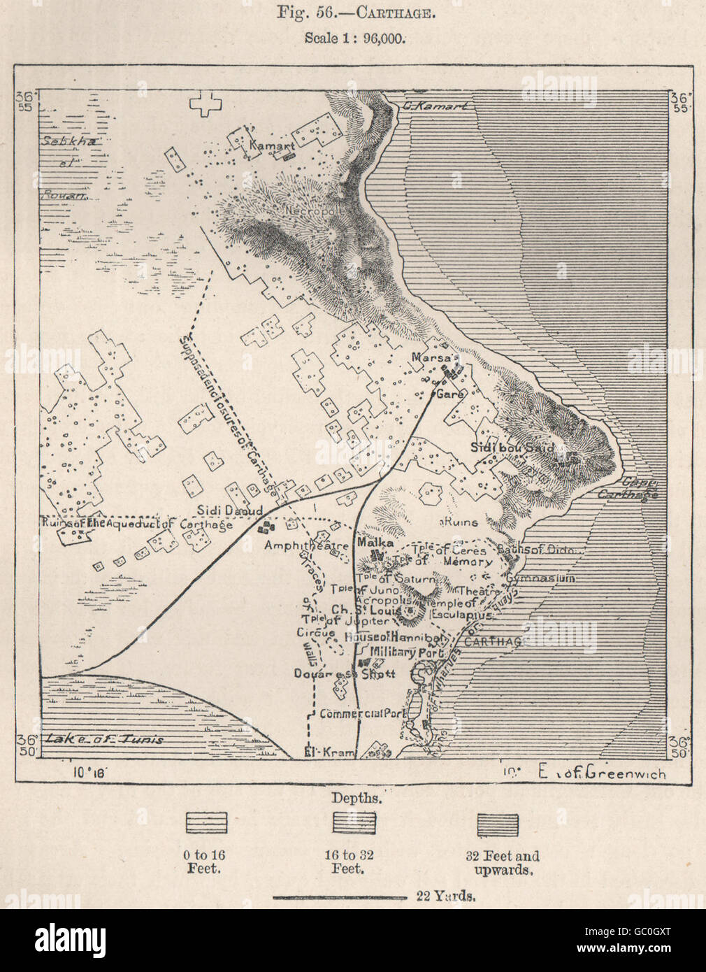 Carthage. Tunisia, 1885 antique map Stock Photohttps://www.alamy.com/image-license-details/?v=1https://www.alamy.com/stock-photo-carthage-tunisia-1885-antique-map-110651376.html
RFGC0GXT–Carthage. Tunisia, 1885 antique map
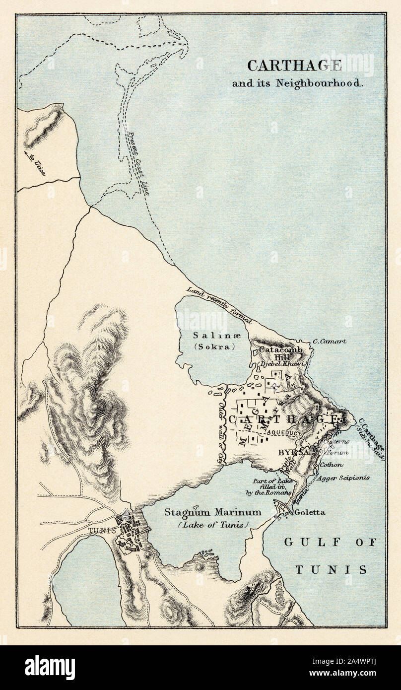 Ancient Carthage, 3rd century BC. Color lithograph Stock Photohttps://www.alamy.com/image-license-details/?v=1https://www.alamy.com/ancient-carthage-3rd-century-bc-color-lithograph-image330022354.html
RM2A4WPTJ–Ancient Carthage, 3rd century BC. Color lithograph
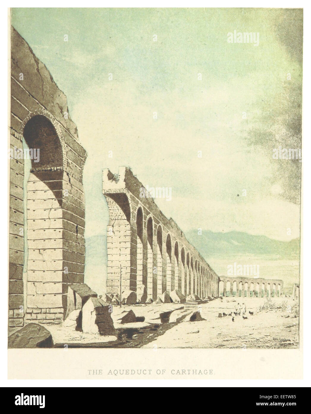 GRAHAM(1887) p067 THE AQUEDUCT OF CARTHAGE Stock Photohttps://www.alamy.com/image-license-details/?v=1https://www.alamy.com/stock-photo-graham1887-p067-the-aqueduct-of-carthage-77993333.html
RMEETW85–GRAHAM(1887) p067 THE AQUEDUCT OF CARTHAGE
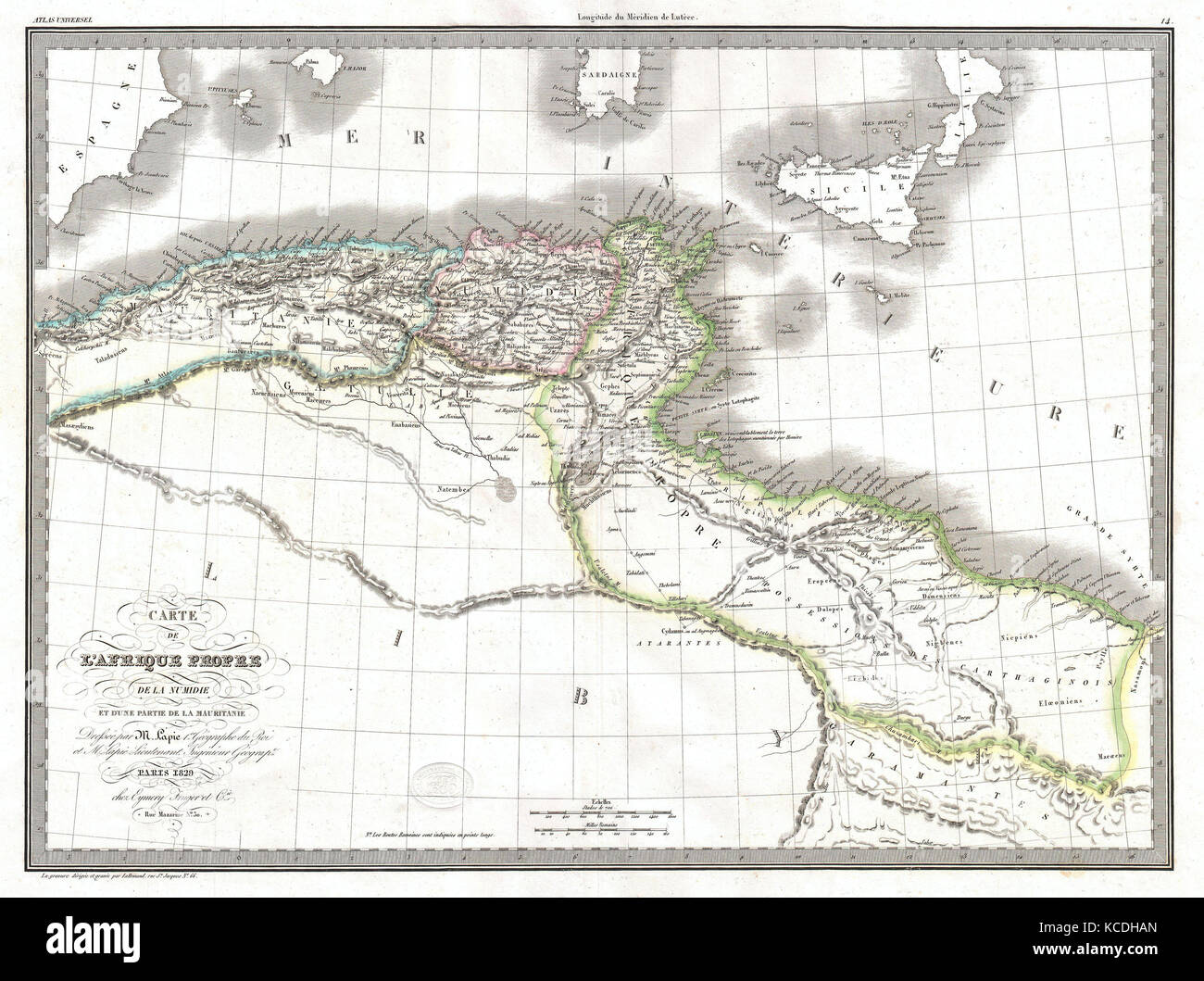 1829, Lapie Historical Map of Empire of Carthage, Modern Tunisia Stock Photohttps://www.alamy.com/image-license-details/?v=1https://www.alamy.com/stock-image-1829-lapie-historical-map-of-empire-of-carthage-modern-tunisia-162568189.html
RMKCDHAN–1829, Lapie Historical Map of Empire of Carthage, Modern Tunisia
 Carthage, Smith County, US, United States, Tennessee, N 36 15' 8'', S 85 57' 5'', map, Cartascapes Map published in 2024. Explore Cartascapes, a map revealing Earth's diverse landscapes, cultures, and ecosystems. Journey through time and space, discovering the interconnectedness of our planet's past, present, and future. Stock Photohttps://www.alamy.com/image-license-details/?v=1https://www.alamy.com/carthage-smith-county-us-united-states-tennessee-n-36-15-8-s-85-57-5-map-cartascapes-map-published-in-2024-explore-cartascapes-a-map-revealing-earths-diverse-landscapes-cultures-and-ecosystems-journey-through-time-and-space-discovering-the-interconnectedness-of-our-planets-past-present-and-future-image621149053.html
RM2Y2FNXN–Carthage, Smith County, US, United States, Tennessee, N 36 15' 8'', S 85 57' 5'', map, Cartascapes Map published in 2024. Explore Cartascapes, a map revealing Earth's diverse landscapes, cultures, and ecosystems. Journey through time and space, discovering the interconnectedness of our planet's past, present, and future.
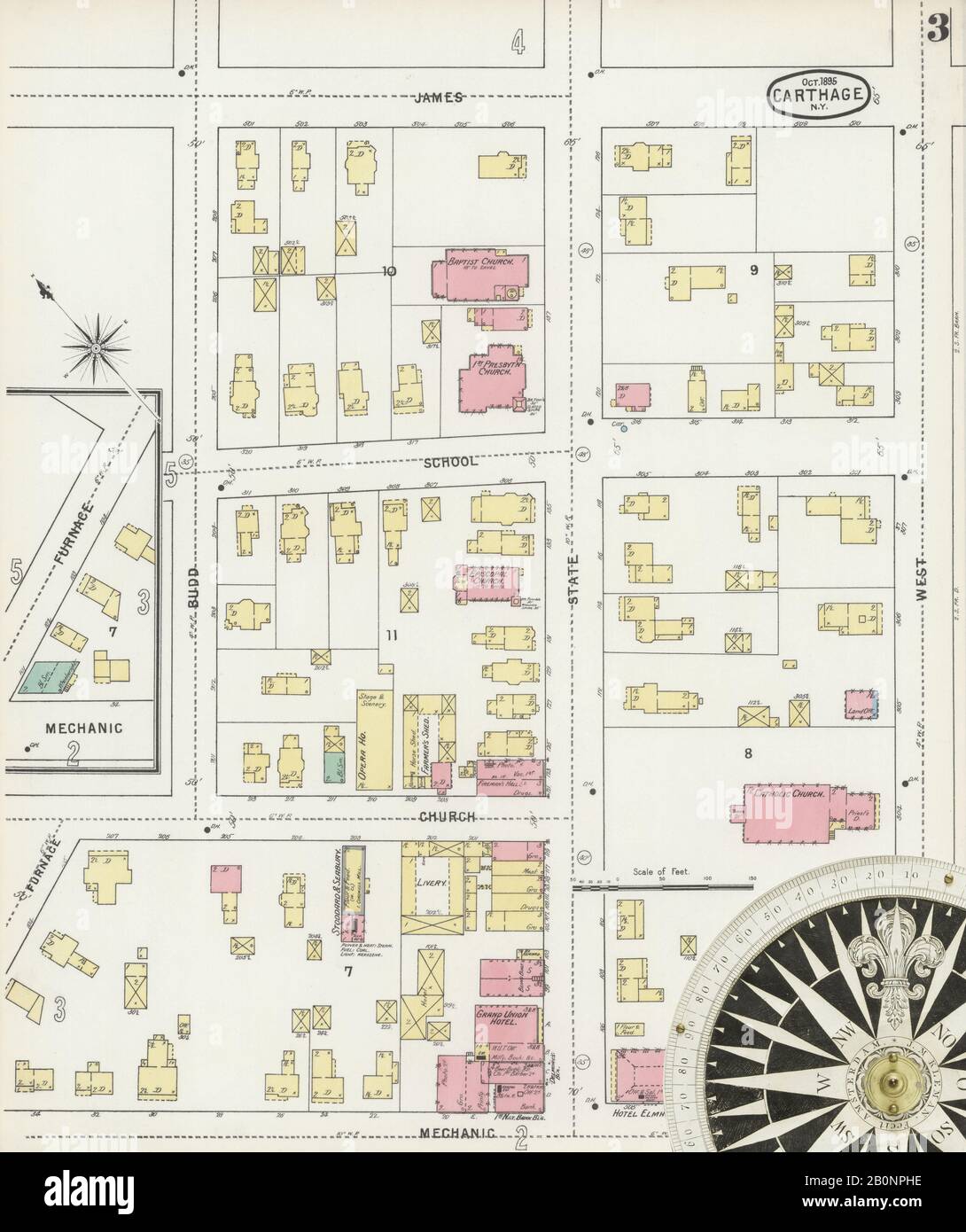 Image 3 of Sanborn Fire Insurance Map from Carthage, Jefferson County, New York. Oct 1895. 8 Sheet(s), America, street map with a Nineteenth Century compass Stock Photohttps://www.alamy.com/image-license-details/?v=1https://www.alamy.com/image-3-of-sanborn-fire-insurance-map-from-carthage-jefferson-county-new-york-oct-1895-8-sheets-america-street-map-with-a-nineteenth-century-compass-image344686090.html
RM2B0NPHE–Image 3 of Sanborn Fire Insurance Map from Carthage, Jefferson County, New York. Oct 1895. 8 Sheet(s), America, street map with a Nineteenth Century compass
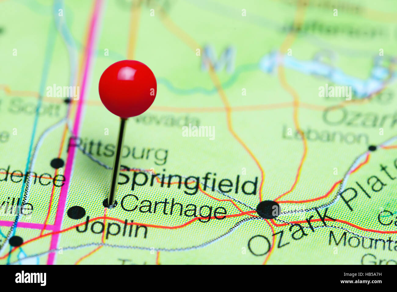 Carthage pinned on a map of Missouri, USA Stock Photohttps://www.alamy.com/image-license-details/?v=1https://www.alamy.com/stock-photo-carthage-pinned-on-a-map-of-missouri-usa-127351605.html
RFHB5A7H–Carthage pinned on a map of Missouri, USA
 Beautiful woodcut pages from the 1493 Nuremberg Chronicle, which is an enyclodpedia of world events, mythology and christian history. This extra-ordinary work was one of the earliest books ever printed and the first to successfully integrate text and images. These pages show latin text and an engraving of the town of Carthage Stock Photohttps://www.alamy.com/image-license-details/?v=1https://www.alamy.com/beautiful-woodcut-pages-from-the-1493-nuremberg-chronicle-which-is-an-enyclodpedia-of-world-events-mythology-and-christian-history-this-extra-ordinary-work-was-one-of-the-earliest-books-ever-printed-and-the-first-to-successfully-integrate-text-and-images-these-pages-show-latin-text-and-an-engraving-of-the-town-of-carthage-image598932140.html
RM2WPBM1G–Beautiful woodcut pages from the 1493 Nuremberg Chronicle, which is an enyclodpedia of world events, mythology and christian history. This extra-ordinary work was one of the earliest books ever printed and the first to successfully integrate text and images. These pages show latin text and an engraving of the town of Carthage
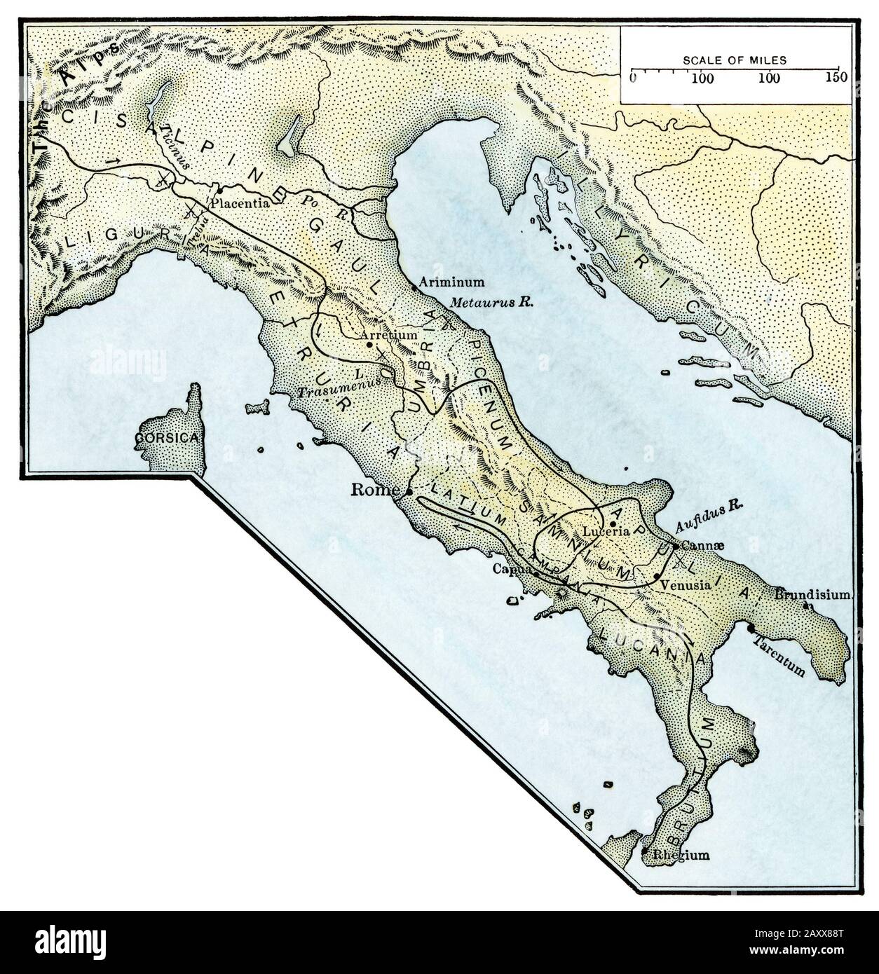 Hannibal's route to invade Rome, Punic Wars. Hand-colored woodcut Stock Photohttps://www.alamy.com/image-license-details/?v=1https://www.alamy.com/hannibals-route-to-invade-rome-punic-wars-hand-colored-woodcut-image343555320.html
RM2AXX88T–Hannibal's route to invade Rome, Punic Wars. Hand-colored woodcut
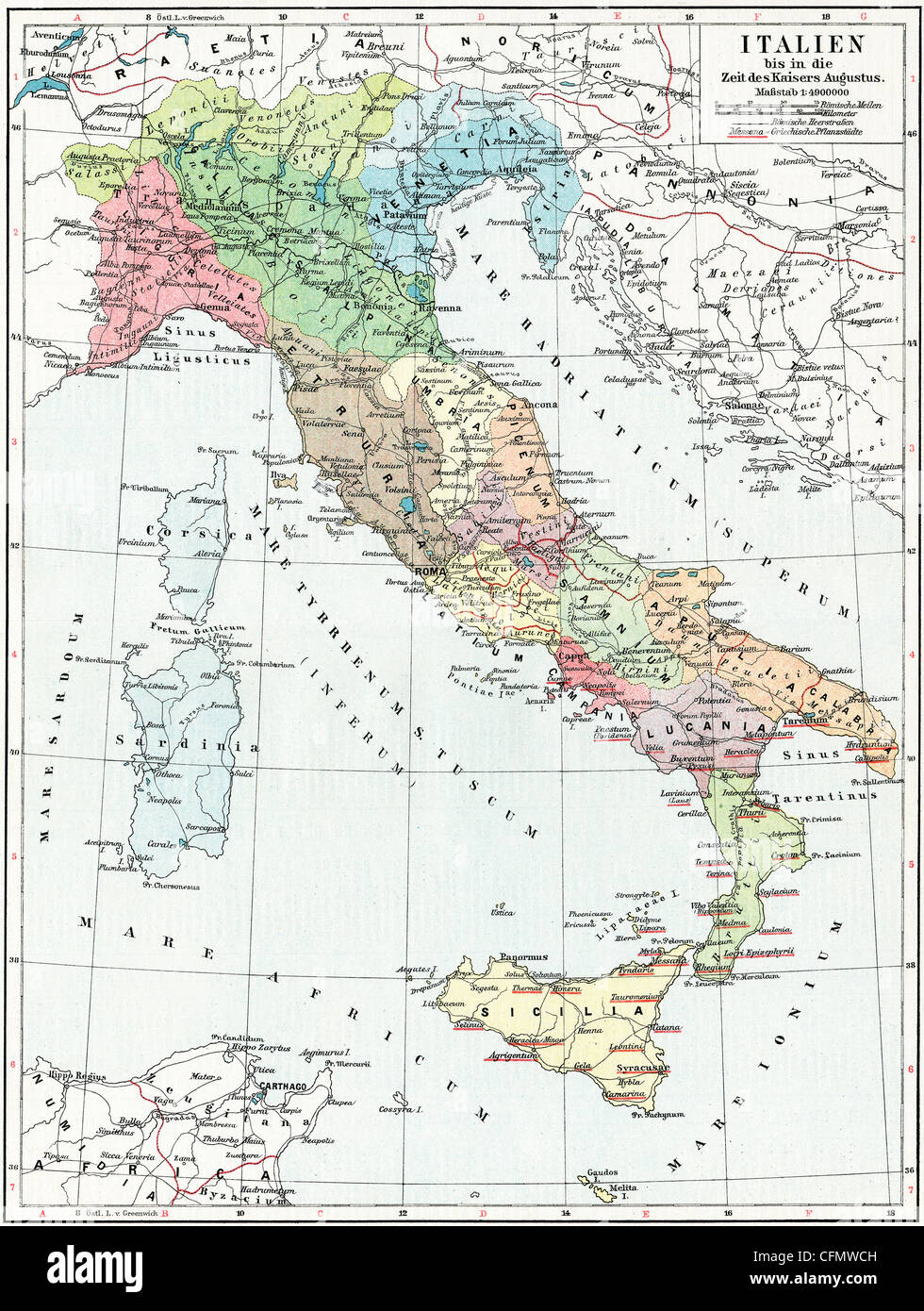 Map of Italy, the time of Emperor Augustus. Stock Photohttps://www.alamy.com/image-license-details/?v=1https://www.alamy.com/stock-photo-map-of-italy-the-time-of-emperor-augustus-44099569.html
RFCFMWCH–Map of Italy, the time of Emperor Augustus.
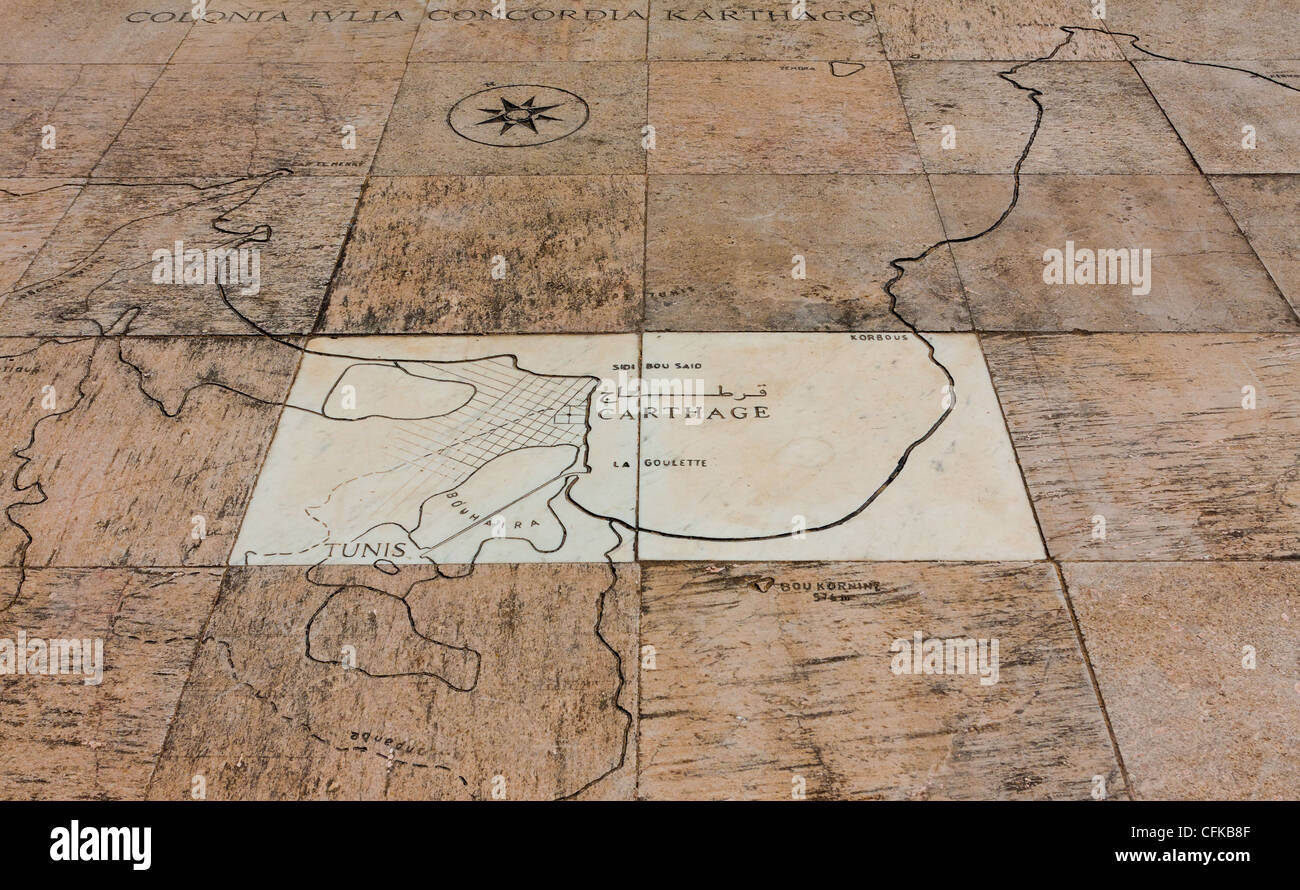 Map on the rock in museum of Carthage Stock Photohttps://www.alamy.com/image-license-details/?v=1https://www.alamy.com/stock-photo-map-on-the-rock-in-museum-of-carthage-44066527.html
RMCFKB8F–Map on the rock in museum of Carthage
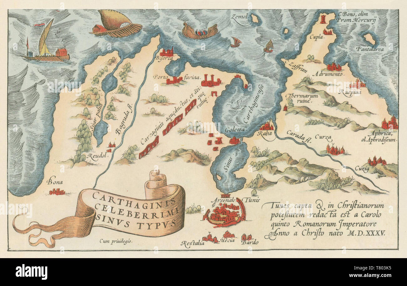 Theatrum Orbis Terrarum, Carthage Harbor, 1570 Stock Photohttps://www.alamy.com/image-license-details/?v=1https://www.alamy.com/theatrum-orbis-terrarum-carthage-harbor-1570-image245865289.html
RMT803K5–Theatrum Orbis Terrarum, Carthage Harbor, 1570
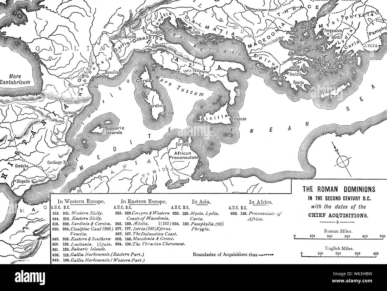 A map illustrating Roman Dominions in the 2nd Century BCE. Fresh from its victories in the Second Punic War, the Roman Republic continued its expansion into neighboring territories, eventually annexing Greece and the North African coast, after destroying the city of Carthage at the end of the Third Punic War. Rome's influence was also felt in the Near East, as crumbling Hellenistic states like the Seleucid Empire were forced to make treaties on Roman terms to avoid confrontation with the new masters of the western Mediterranean. Stock Photohttps://www.alamy.com/image-license-details/?v=1https://www.alamy.com/a-map-illustrating-roman-dominions-in-the-2nd-century-bce-fresh-from-its-victories-in-the-second-punic-war-the-roman-republic-continued-its-expansion-into-neighboring-territories-eventually-annexing-greece-and-the-north-african-coast-after-destroying-the-city-of-carthage-at-the-end-of-the-third-punic-war-romes-influence-was-also-felt-in-the-near-east-as-crumbling-hellenistic-states-like-the-seleucid-empire-were-forced-to-make-treaties-on-roman-terms-to-avoid-confrontation-with-the-new-masters-of-the-western-mediterranean-image261922973.html
RMW63HBW–A map illustrating Roman Dominions in the 2nd Century BCE. Fresh from its victories in the Second Punic War, the Roman Republic continued its expansion into neighboring territories, eventually annexing Greece and the North African coast, after destroying the city of Carthage at the end of the Third Punic War. Rome's influence was also felt in the Near East, as crumbling Hellenistic states like the Seleucid Empire were forced to make treaties on Roman terms to avoid confrontation with the new masters of the western Mediterranean.
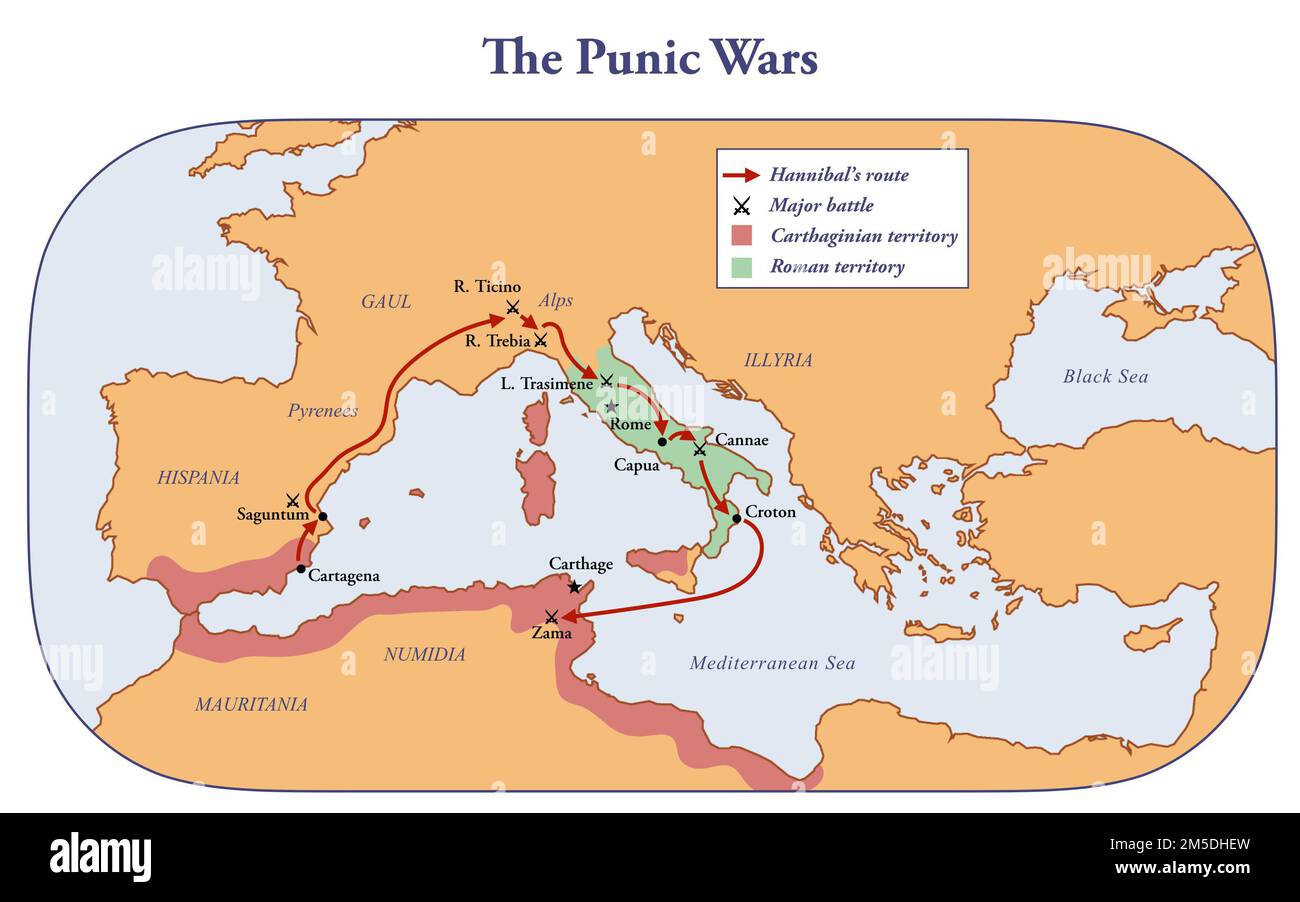 Map of the territories controlled by Rome and Carthage during the Punic wars Stock Photohttps://www.alamy.com/image-license-details/?v=1https://www.alamy.com/map-of-the-territories-controlled-by-rome-and-carthage-during-the-punic-wars-image502473073.html
RF2M5DHEW–Map of the territories controlled by Rome and Carthage during the Punic wars
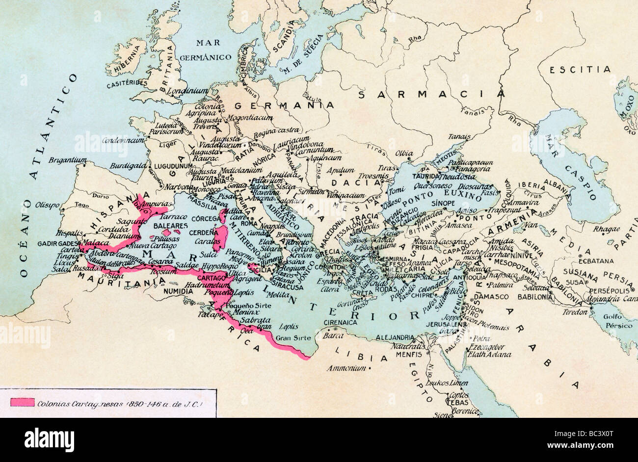 Carthaginian colonies and area of influence in the Mediterranean 850 to 146 B C. Stock Photohttps://www.alamy.com/image-license-details/?v=1https://www.alamy.com/stock-photo-carthaginian-colonies-and-area-of-influence-in-the-mediterranean-850-24672504.html
RMBC3X0T–Carthaginian colonies and area of influence in the Mediterranean 850 to 146 B C.
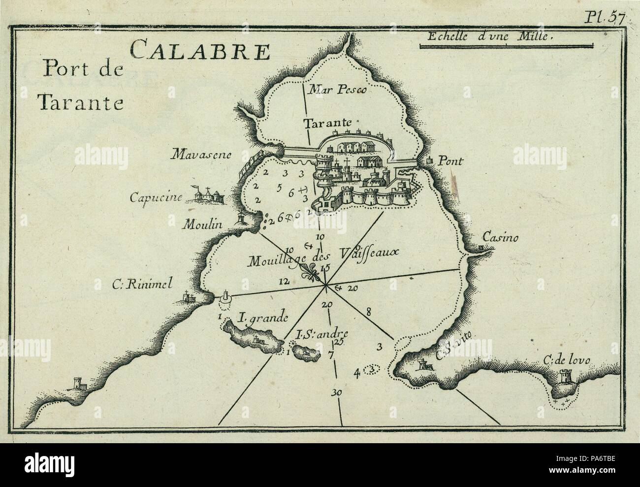 Port of Taranto (Tarentum). Museum: PRIVATE COLLECTION. Stock Photohttps://www.alamy.com/image-license-details/?v=1https://www.alamy.com/port-of-taranto-tarentum-museum-private-collection-image212821826.html
RMPA6TBE–Port of Taranto (Tarentum). Museum: PRIVATE COLLECTION.
 Tunisia outline map set Stock Vectorhttps://www.alamy.com/image-license-details/?v=1https://www.alamy.com/tunisia-outline-map-set-image177775788.html
RFM96AR8–Tunisia outline map set
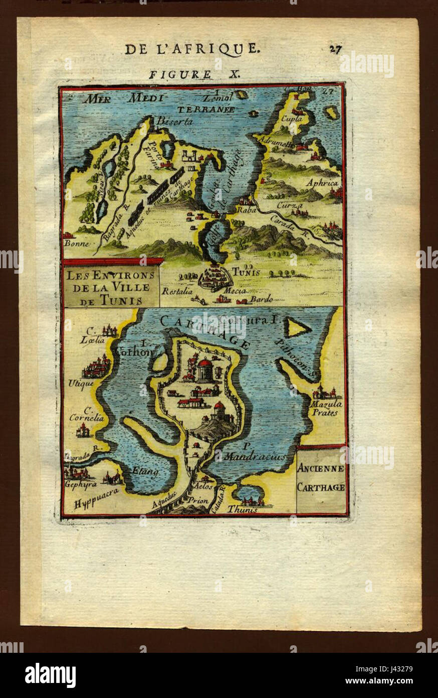 Map of Tunis and Carthage, 1683 Stock Photohttps://www.alamy.com/image-license-details/?v=1https://www.alamy.com/stock-photo-map-of-tunis-and-carthage-1683-140209197.html
RMJ43279–Map of Tunis and Carthage, 1683
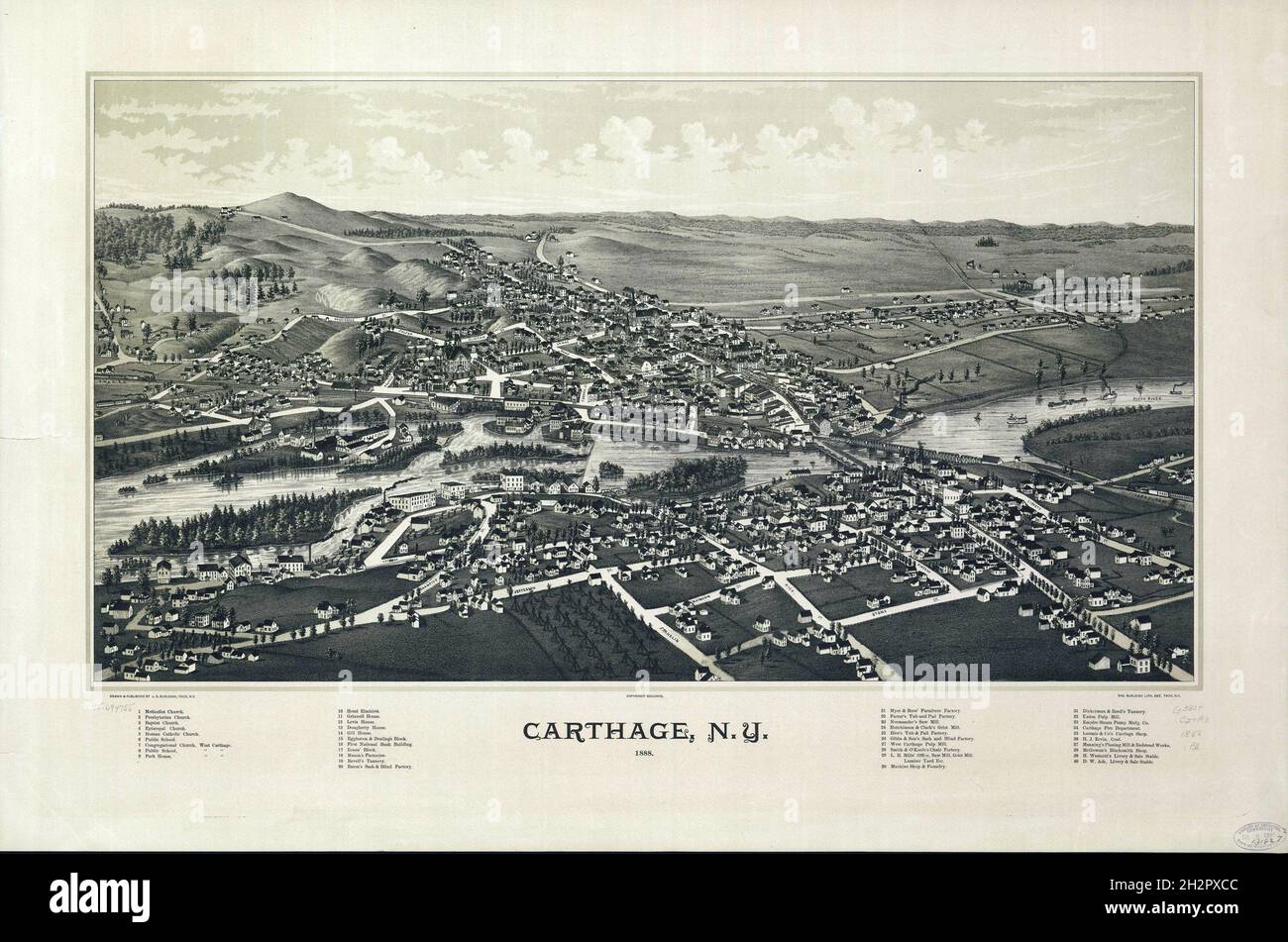 Historical map of Carthage, NY - 1888 Stock Photohttps://www.alamy.com/image-license-details/?v=1https://www.alamy.com/historical-map-of-carthage-ny-1888-image449202556.html
RF2H2PXCC–Historical map of Carthage, NY - 1888
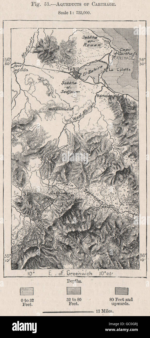 Aqueducts of Carthage. Tunisia, 1885 antique map Stock Photohttps://www.alamy.com/image-license-details/?v=1https://www.alamy.com/stock-photo-aqueducts-of-carthage-tunisia-1885-antique-map-110651286.html
RFGC0GRJ–Aqueducts of Carthage. Tunisia, 1885 antique map
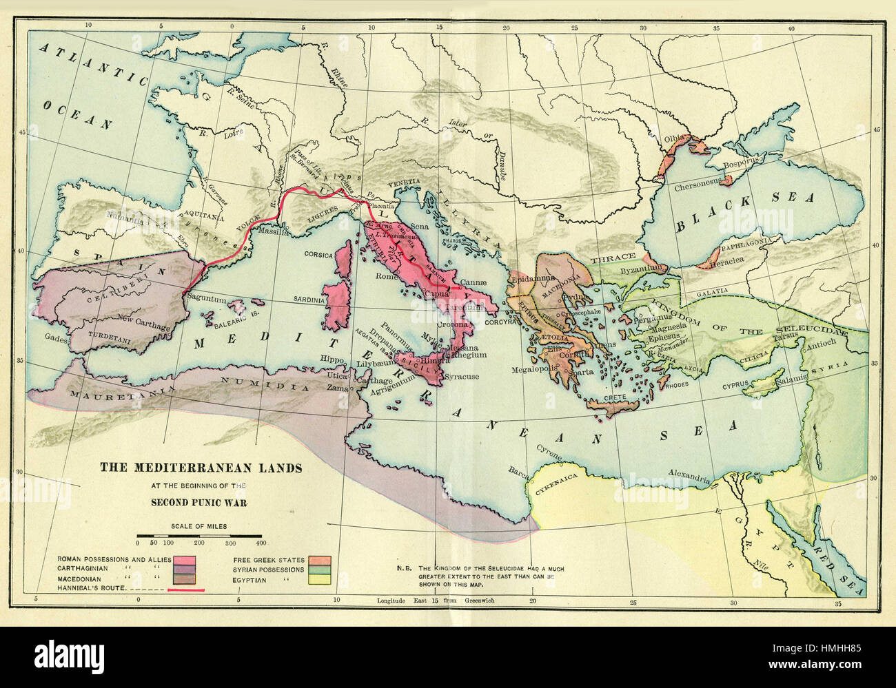 map of europe Stock Photohttps://www.alamy.com/image-license-details/?v=1https://www.alamy.com/stock-photo-map-of-europe-133152437.html
RFHMHH85–map of europe
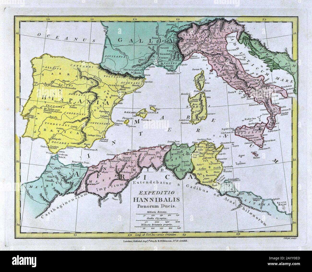 1808 Wilkinson Map Hannibal Route Europe Alps Hispania Gallia Italy North Africa Stock Photohttps://www.alamy.com/image-license-details/?v=1https://www.alamy.com/1808-wilkinson-map-hannibal-route-europe-alps-hispania-gallia-italy-north-africa-image344185813.html
RM2AYY0ED–1808 Wilkinson Map Hannibal Route Europe Alps Hispania Gallia Italy North Africa
![Carthage Business Directory. ; Carthage [Village] 1864 by Beers, D. G. (Daniel G.) Stock Photo Carthage Business Directory. ; Carthage [Village] 1864 by Beers, D. G. (Daniel G.) Stock Photo](https://c8.alamy.com/comp/2YPEBB5/carthage-business-directory-carthage-village-1864-by-beers-d-g-daniel-g-2YPEBB5.jpg) Carthage Business Directory. ; Carthage [Village] 1864 by Beers, D. G. (Daniel G.) Stock Photohttps://www.alamy.com/image-license-details/?v=1https://www.alamy.com/carthage-business-directory-carthage-village-1864-by-beers-d-g-daniel-g-image633411945.html
Carthage Business Directory. ; Carthage [Village] 1864 by Beers, D. G. (Daniel G.) Stock Photohttps://www.alamy.com/image-license-details/?v=1https://www.alamy.com/carthage-business-directory-carthage-village-1864-by-beers-d-g-daniel-g-image633411945.htmlRM2YPEBB5–Carthage Business Directory. ; Carthage [Village] 1864 by Beers, D. G. (Daniel G.)
 Carthage, Hamilton County, US, United States, Ohio, N 39 11' 49'', S 84 28' 44'', map, Cartascapes Map published in 2024. Explore Cartascapes, a map revealing Earth's diverse landscapes, cultures, and ecosystems. Journey through time and space, discovering the interconnectedness of our planet's past, present, and future. Stock Photohttps://www.alamy.com/image-license-details/?v=1https://www.alamy.com/carthage-hamilton-county-us-united-states-ohio-n-39-11-49-s-84-28-44-map-cartascapes-map-published-in-2024-explore-cartascapes-a-map-revealing-earths-diverse-landscapes-cultures-and-ecosystems-journey-through-time-and-space-discovering-the-interconnectedness-of-our-planets-past-present-and-future-image621411669.html
RM2Y2YMWW–Carthage, Hamilton County, US, United States, Ohio, N 39 11' 49'', S 84 28' 44'', map, Cartascapes Map published in 2024. Explore Cartascapes, a map revealing Earth's diverse landscapes, cultures, and ecosystems. Journey through time and space, discovering the interconnectedness of our planet's past, present, and future.
 Image 1 of Sanborn Fire Insurance Map from Carthage, Jefferson County, New York. Jul 1884. 4 Sheet(s), America, street map with a Nineteenth Century compass Stock Photohttps://www.alamy.com/image-license-details/?v=1https://www.alamy.com/image-1-of-sanborn-fire-insurance-map-from-carthage-jefferson-county-new-york-jul-1884-4-sheets-america-street-map-with-a-nineteenth-century-compass-image344686062.html
RM2B0NPGE–Image 1 of Sanborn Fire Insurance Map from Carthage, Jefferson County, New York. Jul 1884. 4 Sheet(s), America, street map with a Nineteenth Century compass
 Carthage pinned on a map of Illinois, USA Stock Photohttps://www.alamy.com/image-license-details/?v=1https://www.alamy.com/stock-photo-carthage-pinned-on-a-map-of-illinois-usa-126641857.html
RFHA10YD–Carthage pinned on a map of Illinois, USA
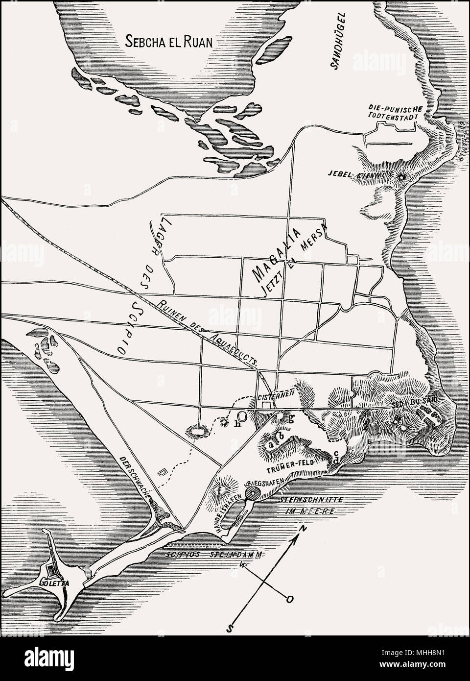 City plan of ancient Phoenician city of Carthage, North Africa Stock Photohttps://www.alamy.com/image-license-details/?v=1https://www.alamy.com/city-plan-of-ancient-phoenician-city-of-carthage-north-africa-image182932877.html
RMMHH8N1–City plan of ancient Phoenician city of Carthage, North Africa
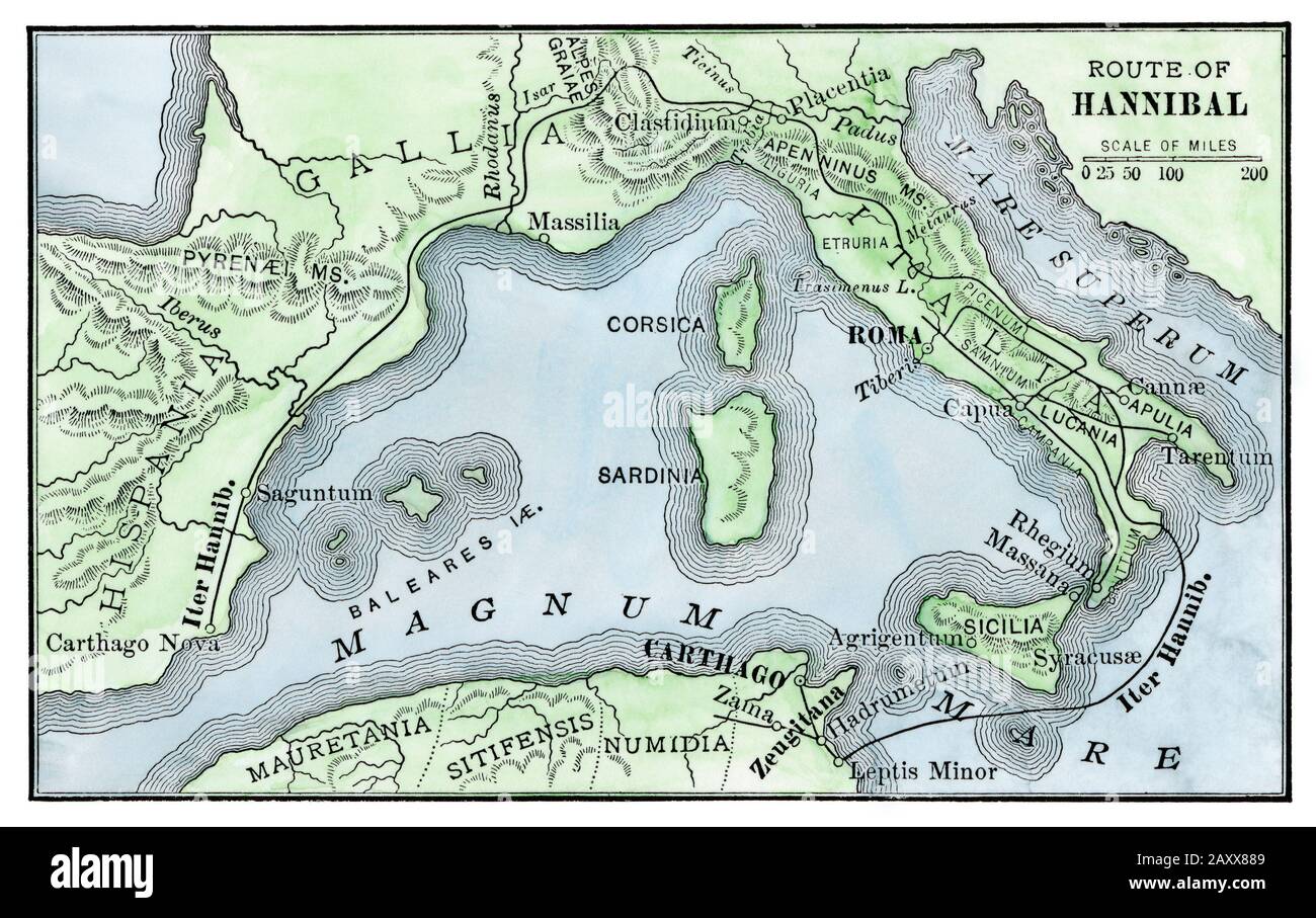 Hannibal's route to invade Rome. Hand-colored woodcut Stock Photohttps://www.alamy.com/image-license-details/?v=1https://www.alamy.com/hannibals-route-to-invade-rome-hand-colored-woodcut-image343555305.html
RM2AXX889–Hannibal's route to invade Rome. Hand-colored woodcut
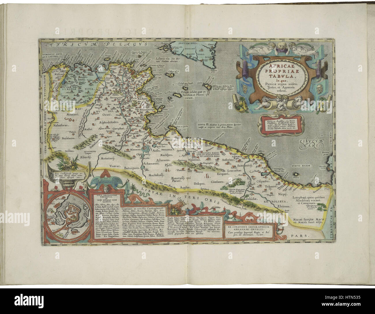 Map of Roman Africa and inset map of Carthage by Abraham Ortelius Stock Photohttps://www.alamy.com/image-license-details/?v=1https://www.alamy.com/stock-photo-map-of-roman-africa-and-inset-map-of-carthage-by-abraham-ortelius-135689321.html
RMHTN535–Map of Roman Africa and inset map of Carthage by Abraham Ortelius
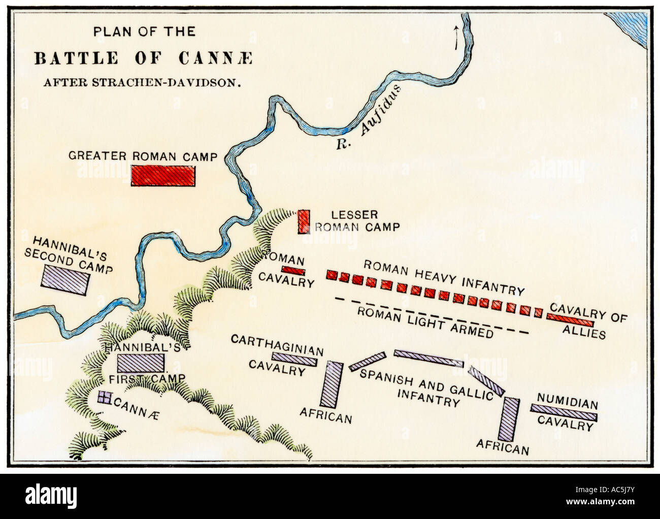 Map of the Battle of Cannae in which Hannibal defeated the Romans during the Second Punic War 216 BC. Hand-colored woodcut Stock Photohttps://www.alamy.com/image-license-details/?v=1https://www.alamy.com/stock-photo-map-of-the-battle-of-cannae-in-which-hannibal-defeated-the-romans-13048766.html
RMAC5J7Y–Map of the Battle of Cannae in which Hannibal defeated the Romans during the Second Punic War 216 BC. Hand-colored woodcut
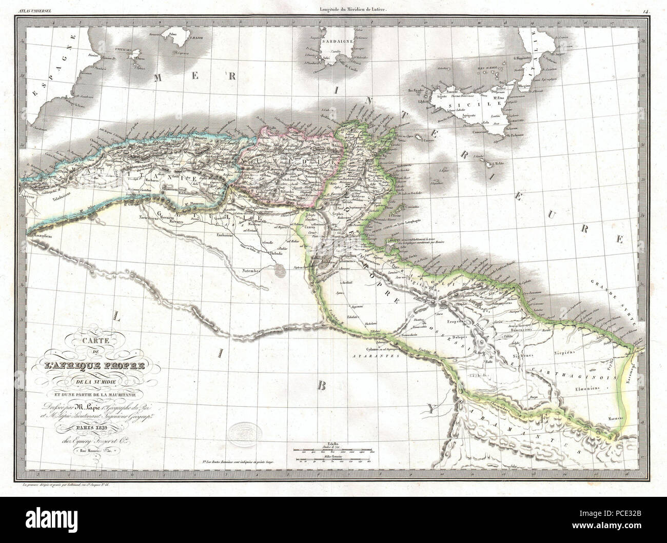 7 1829 Lapie Historical Map of Empire of Carthage ( Modern Tunisia ) - Geographicus - AfriqueiPropre-lapie-1829 Stock Photohttps://www.alamy.com/image-license-details/?v=1https://www.alamy.com/7-1829-lapie-historical-map-of-empire-of-carthage-modern-tunisia-geographicus-afriqueipropre-lapie-1829-image214210035.html
RMPCE32B–7 1829 Lapie Historical Map of Empire of Carthage ( Modern Tunisia ) - Geographicus - AfriqueiPropre-lapie-1829
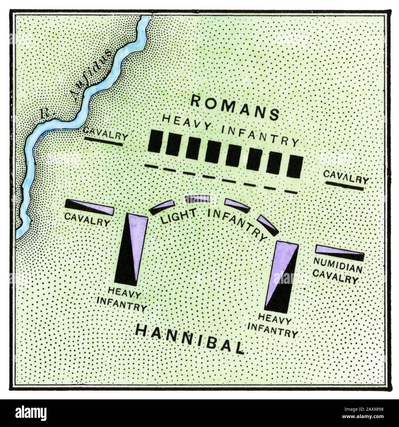 Hannibal's army facing the Romans, battle of Cannae, 216 BC. Hand-colored woodcut Stock Photohttps://www.alamy.com/image-license-details/?v=1https://www.alamy.com/hannibals-army-facing-the-romans-battle-of-cannae-216-bc-hand-colored-woodcut-image343555332.html
RM2AXX898–Hannibal's army facing the Romans, battle of Cannae, 216 BC. Hand-colored woodcut
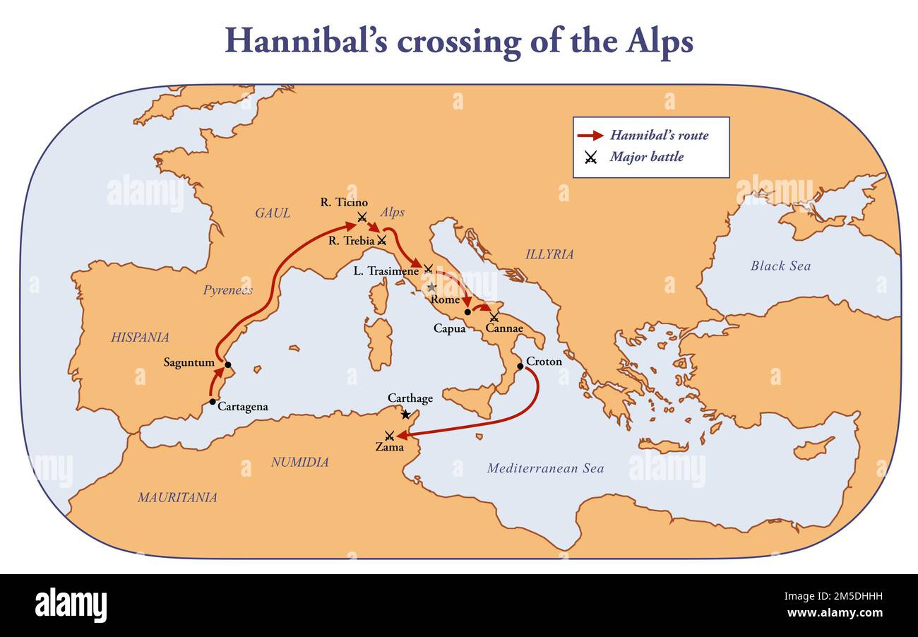 Map with the route of Hannibal crossing of the Alps Stock Photohttps://www.alamy.com/image-license-details/?v=1https://www.alamy.com/map-with-the-route-of-hannibal-crossing-of-the-alps-image502473149.html
RF2M5DHHH–Map with the route of Hannibal crossing of the Alps
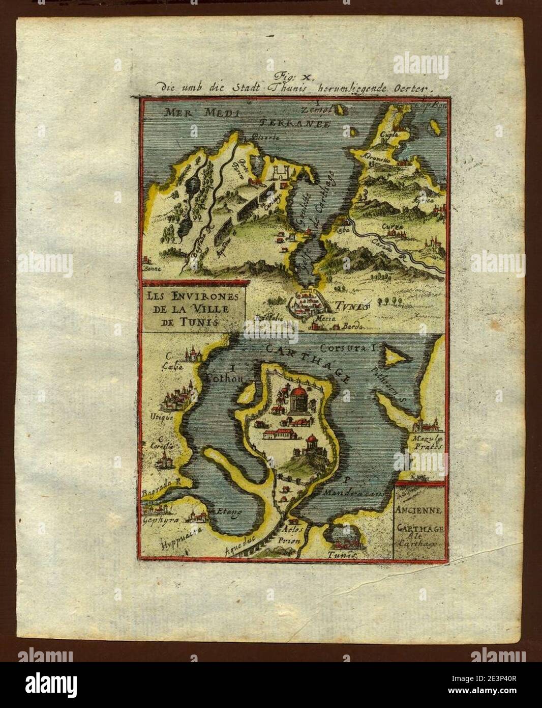 Map of Tunis and Carthage, 1719. Stock Photohttps://www.alamy.com/image-license-details/?v=1https://www.alamy.com/map-of-tunis-and-carthage-1719-image398168535.html
RM2E3P40R–Map of Tunis and Carthage, 1719.
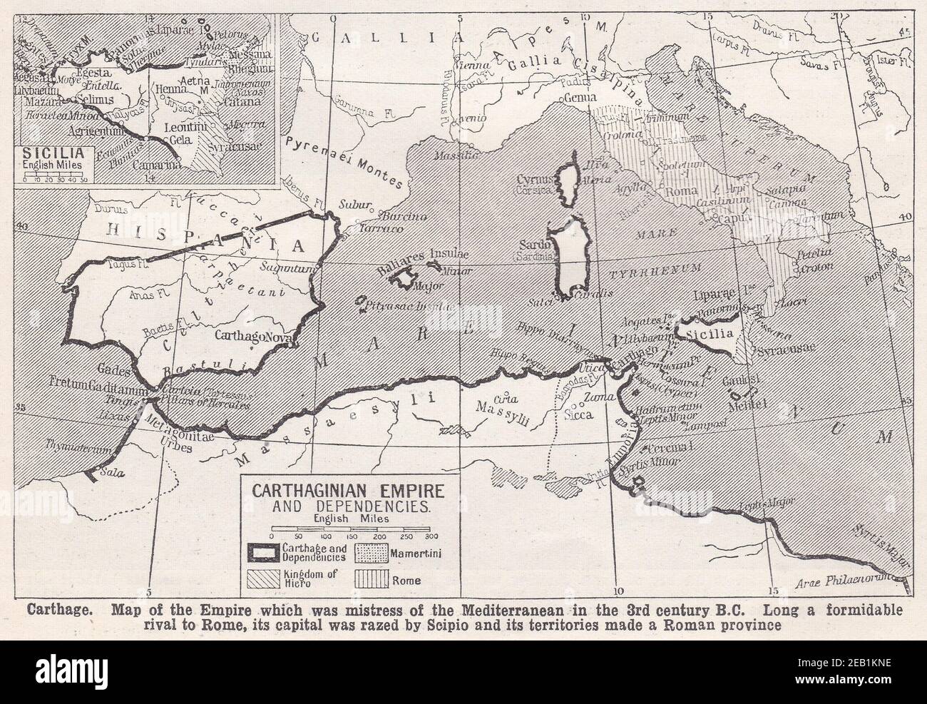 Vintage map of Carthage Empire and Dependencies 1940s. Stock Photohttps://www.alamy.com/image-license-details/?v=1https://www.alamy.com/vintage-map-of-carthage-empire-and-dependencies-1940s-image402637130.html
RF2EB1KNE–Vintage map of Carthage Empire and Dependencies 1940s.
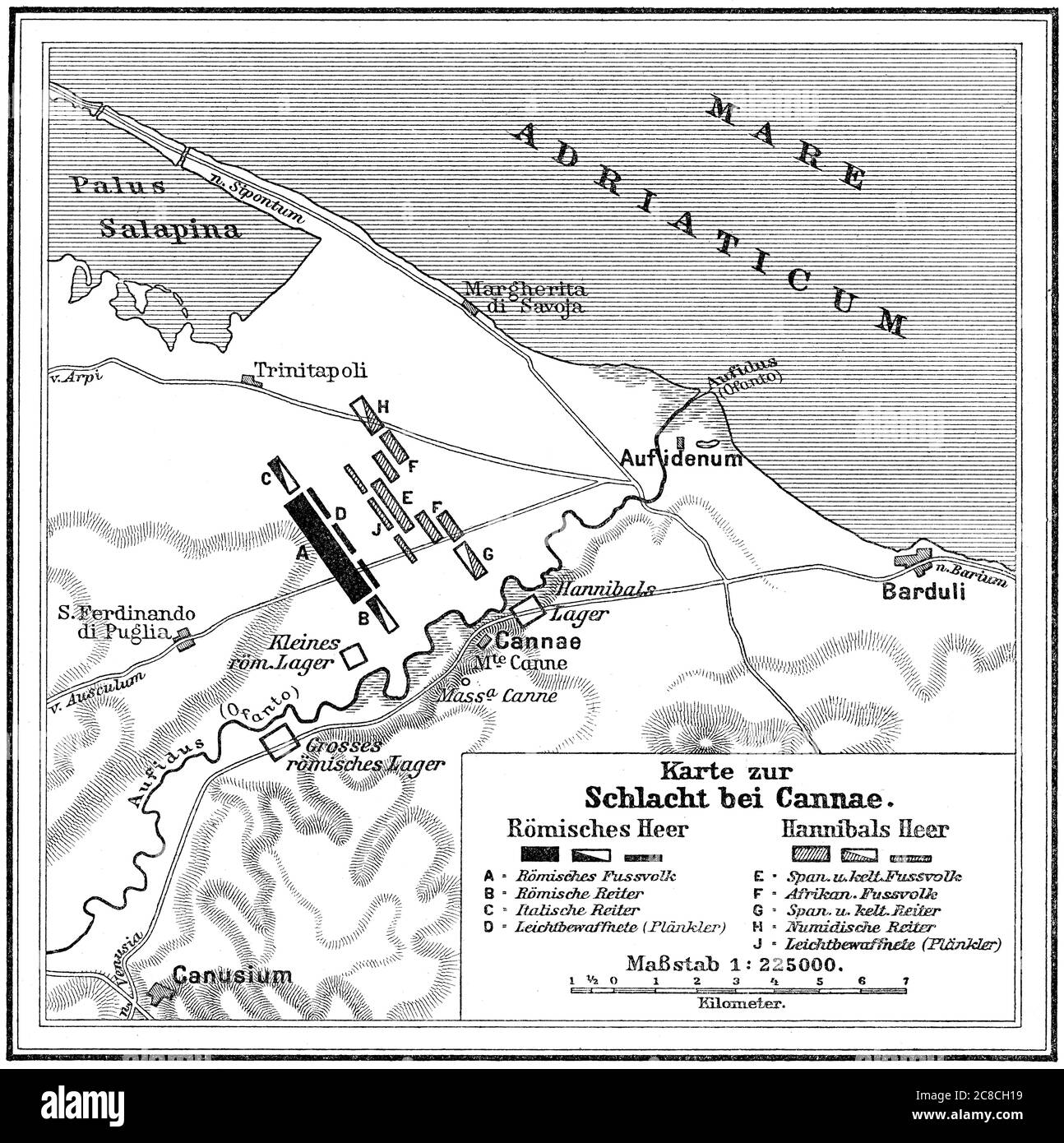 Battle of Cannae, Second Punic War on 2 August 216 BC Stock Photohttps://www.alamy.com/image-license-details/?v=1https://www.alamy.com/battle-of-cannae-second-punic-war-on-2-august-216-bc-image366611765.html
RM2C8CH19–Battle of Cannae, Second Punic War on 2 August 216 BC
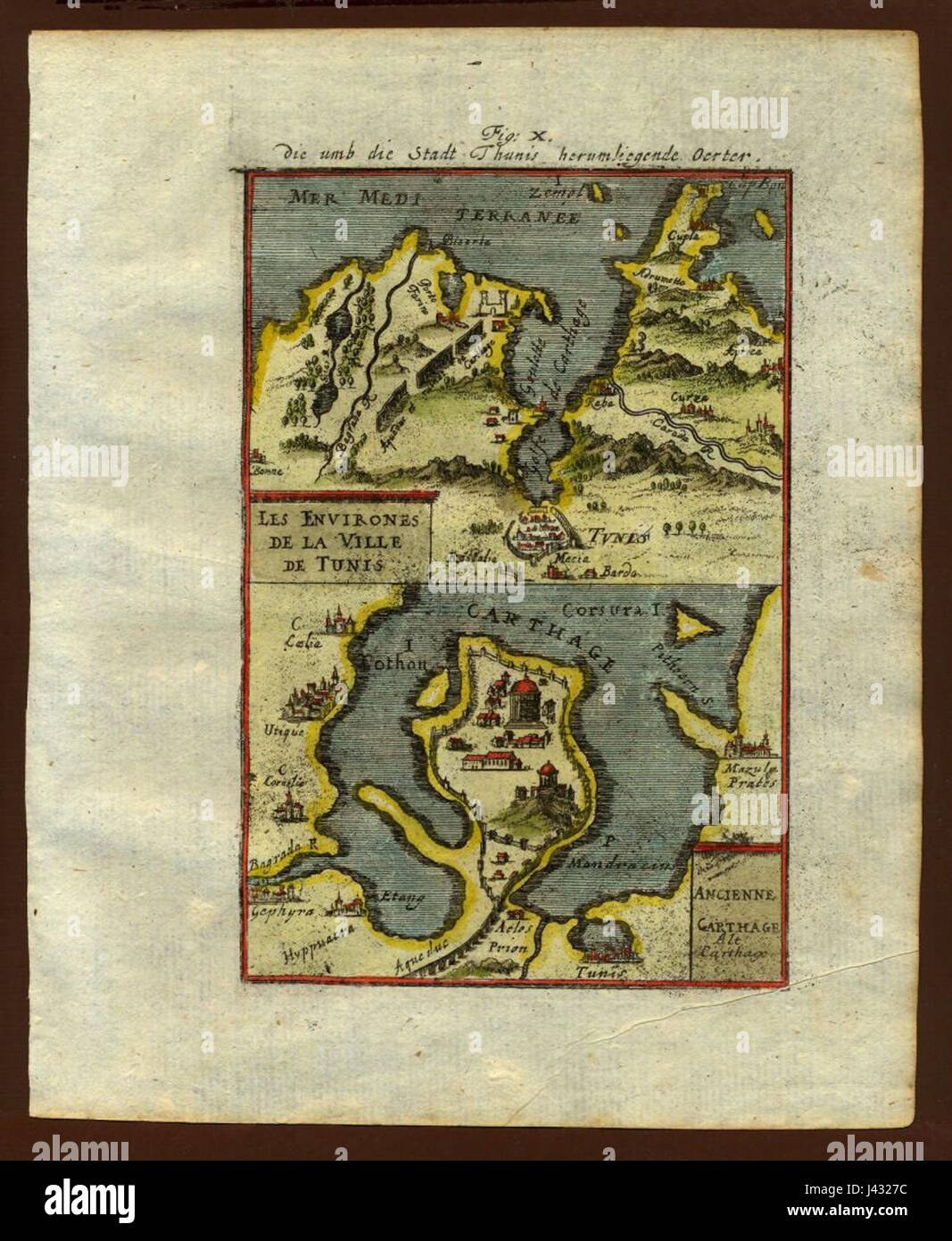 Map of Tunis and Carthage, 1719 Stock Photohttps://www.alamy.com/image-license-details/?v=1https://www.alamy.com/stock-photo-map-of-tunis-and-carthage-1719-140209200.html
RMJ4327C–Map of Tunis and Carthage, 1719
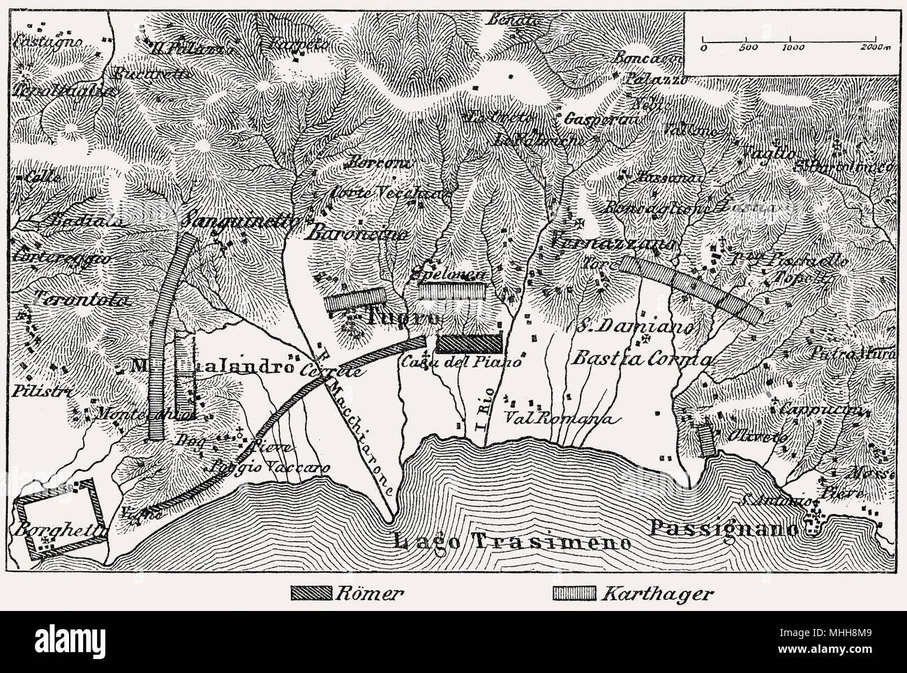 Battle of Lake Trasimene plan, Second Punic War, 217 BC Stock Photohttps://www.alamy.com/image-license-details/?v=1https://www.alamy.com/battle-of-lake-trasimene-plan-second-punic-war-217-bc-image182932857.html
RMMHH8M9–Battle of Lake Trasimene plan, Second Punic War, 217 BC
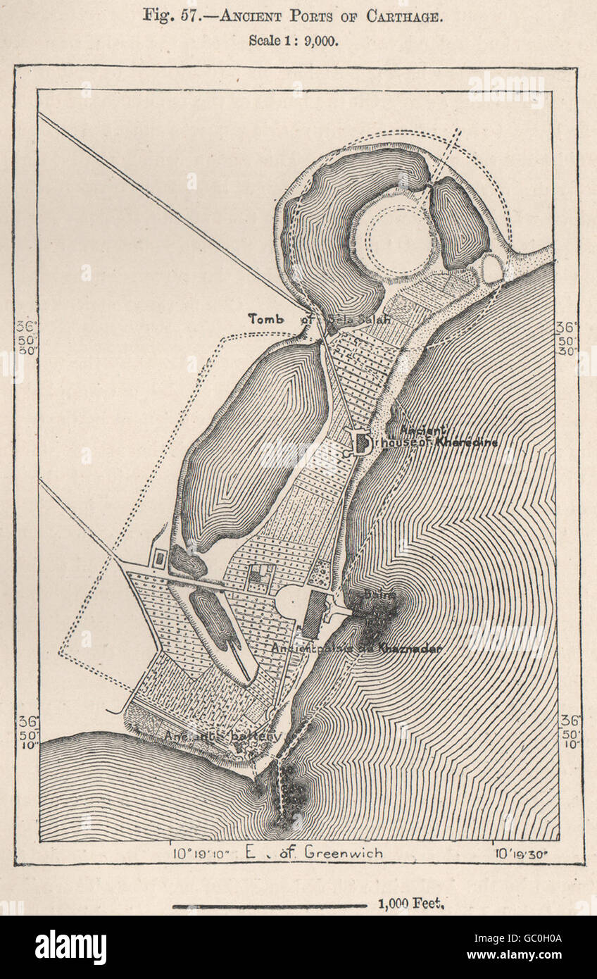 Ancient Ports of Carthage. Tunisia, 1885 antique map Stock Photohttps://www.alamy.com/image-license-details/?v=1https://www.alamy.com/stock-photo-ancient-ports-of-carthage-tunisia-1885-antique-map-110651418.html
RFGC0H0A–Ancient Ports of Carthage. Tunisia, 1885 antique map
 Demostratio Artis Geometricae Ex Multis Voluminibus Digestum. Schematic map of the Iberian Peninsula. 11th century. Depicts the Iberian Peninsula in a pentagon invested. Manuscript of the Monastery of Ripoll, 106, fol. 82r. Archive of the Crown of Aragon. Barcelona. Spain. Stock Photohttps://www.alamy.com/image-license-details/?v=1https://www.alamy.com/demostratio-artis-geometricae-ex-multis-voluminibus-digestum-schematic-map-of-the-iberian-peninsula-11th-century-depicts-the-iberian-peninsula-in-a-pentagon-invested-manuscript-of-the-monastery-of-ripoll-106-fol-82r-archive-of-the-crown-of-aragon-barcelona-spain-image209565875.html
RMP4XFBF–Demostratio Artis Geometricae Ex Multis Voluminibus Digestum. Schematic map of the Iberian Peninsula. 11th century. Depicts the Iberian Peninsula in a pentagon invested. Manuscript of the Monastery of Ripoll, 106, fol. 82r. Archive of the Crown of Aragon. Barcelona. Spain.
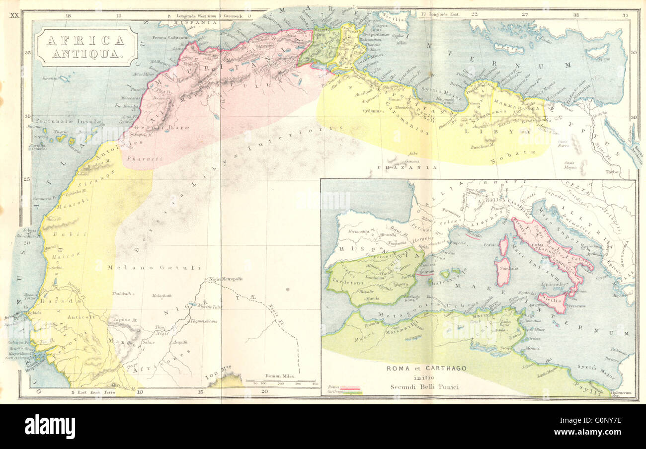 AFRICA: Antiqua; Rome Carthage, start Punic War, 1908 antique map Stock Photohttps://www.alamy.com/image-license-details/?v=1https://www.alamy.com/stock-photo-africa-antiqua-rome-carthage-start-punic-war-1908-antique-map-103744578.html
RFG0NY7E–AFRICA: Antiqua; Rome Carthage, start Punic War, 1908 antique map
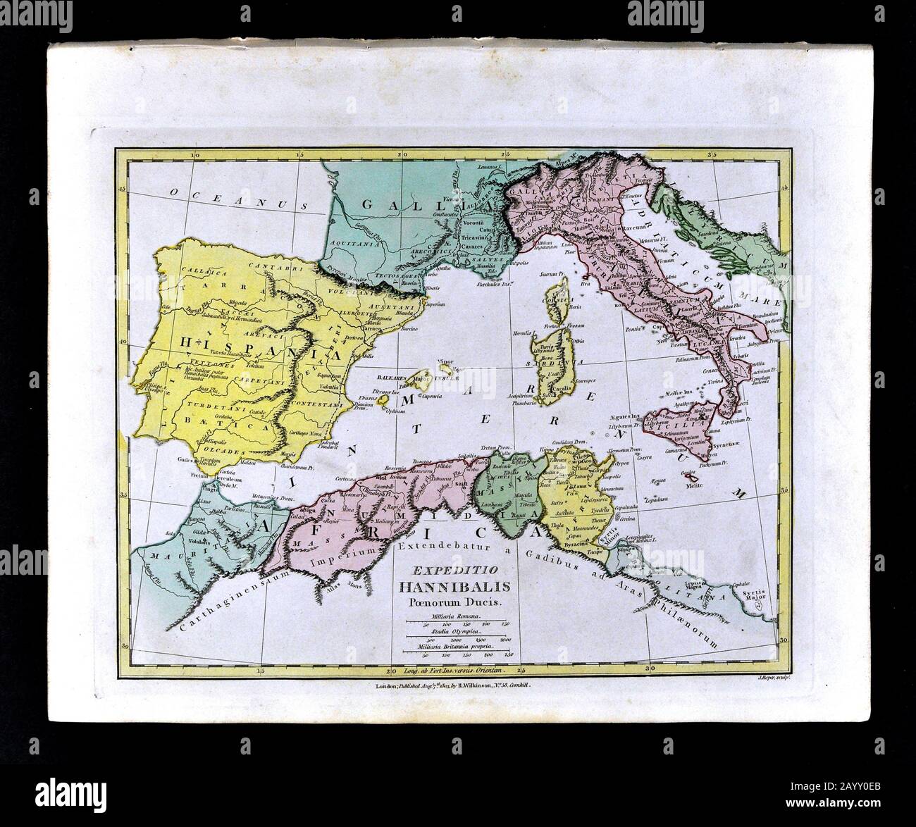 1808 Wilkinson Map Hannibal Route Europe Alps Hispania Gallia Italy North Africa Stock Photohttps://www.alamy.com/image-license-details/?v=1https://www.alamy.com/1808-wilkinson-map-hannibal-route-europe-alps-hispania-gallia-italy-north-africa-image344185811.html
RM2AYY0EB–1808 Wilkinson Map Hannibal Route Europe Alps Hispania Gallia Italy North Africa
 Carthage, Franklin County, US, United States, Maine, N 44 37' 27'', S 70 28' 23'', map, Cartascapes Map published in 2024. Explore Cartascapes, a map revealing Earth's diverse landscapes, cultures, and ecosystems. Journey through time and space, discovering the interconnectedness of our planet's past, present, and future. Stock Photohttps://www.alamy.com/image-license-details/?v=1https://www.alamy.com/carthage-franklin-county-us-united-states-maine-n-44-37-27-s-70-28-23-map-cartascapes-map-published-in-2024-explore-cartascapes-a-map-revealing-earths-diverse-landscapes-cultures-and-ecosystems-journey-through-time-and-space-discovering-the-interconnectedness-of-our-planets-past-present-and-future-image621146776.html
RM2Y2FK1C–Carthage, Franklin County, US, United States, Maine, N 44 37' 27'', S 70 28' 23'', map, Cartascapes Map published in 2024. Explore Cartascapes, a map revealing Earth's diverse landscapes, cultures, and ecosystems. Journey through time and space, discovering the interconnectedness of our planet's past, present, and future.
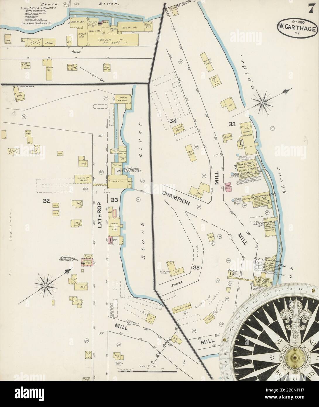 Image 7 of Sanborn Fire Insurance Map from Carthage, Jefferson County, New York. May 1890. 7 Sheet(s), America, street map with a Nineteenth Century compass Stock Photohttps://www.alamy.com/image-license-details/?v=1https://www.alamy.com/image-7-of-sanborn-fire-insurance-map-from-carthage-jefferson-county-new-york-may-1890-7-sheets-america-street-map-with-a-nineteenth-century-compass-image344686083.html
RM2B0NPH7–Image 7 of Sanborn Fire Insurance Map from Carthage, Jefferson County, New York. May 1890. 7 Sheet(s), America, street map with a Nineteenth Century compass
 AFRICA: Classical Punic war Rome Carthage; Hall, 1861 antique map Stock Photohttps://www.alamy.com/image-license-details/?v=1https://www.alamy.com/stock-photo-africa-classical-punic-war-rome-carthage-hall-1861-antique-map-100151436.html
RFFPX850–AFRICA: Classical Punic war Rome Carthage; Hall, 1861 antique map
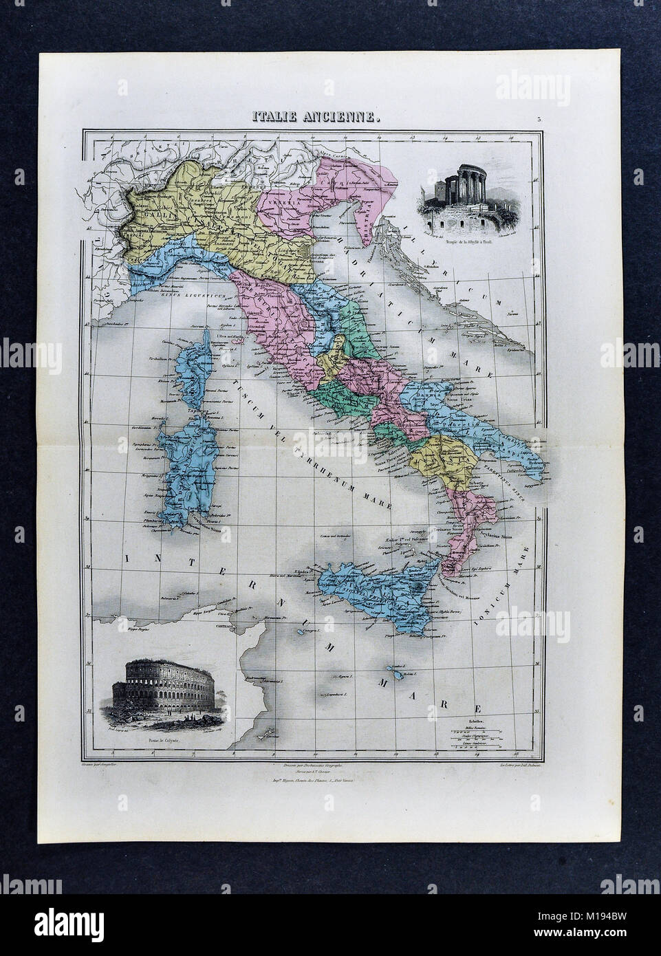 1877 Migeon Map - Ancient Italy during Roman Period with Vignettes of the Colosseum and Temple of Vesta at Tivoli Stock Photohttps://www.alamy.com/image-license-details/?v=1https://www.alamy.com/stock-photo-1877-migeon-map-ancient-italy-during-roman-period-with-vignettes-of-172919373.html
RFM194BW–1877 Migeon Map - Ancient Italy during Roman Period with Vignettes of the Colosseum and Temple of Vesta at Tivoli
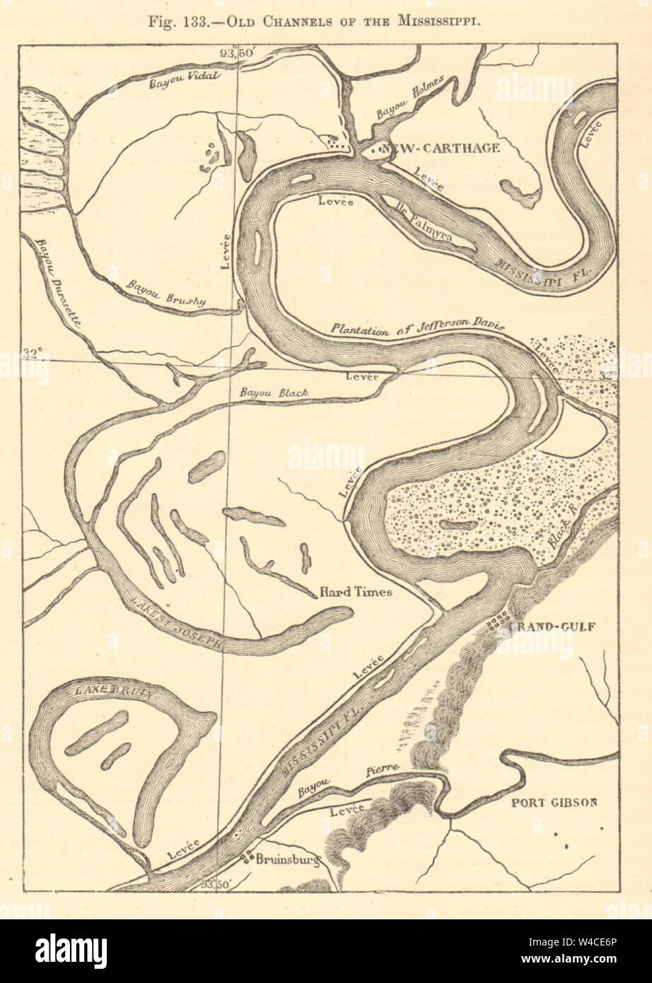 Mississippi old channels. New Carthage Bruinsburg Grand Gulf. Sketch map 1886 Stock Photohttps://www.alamy.com/image-license-details/?v=1https://www.alamy.com/mississippi-old-channels-new-carthage-bruinsburg-grand-gulf-sketch-map-1886-image260888734.html
RFW4CE6P–Mississippi old channels. New Carthage Bruinsburg Grand Gulf. Sketch map 1886
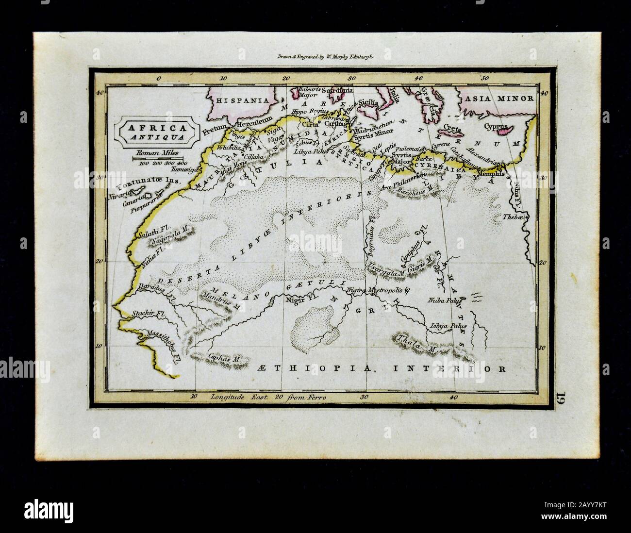 1832 Murphy Map Ancient North Africa Mauritania Numidia Morocco Egypt Sahara Desert Stock Photohttps://www.alamy.com/image-license-details/?v=1https://www.alamy.com/1832-murphy-map-ancient-north-africa-mauritania-numidia-morocco-egypt-sahara-desert-image344191452.html
RM2AYY7KT–1832 Murphy Map Ancient North Africa Mauritania Numidia Morocco Egypt Sahara Desert
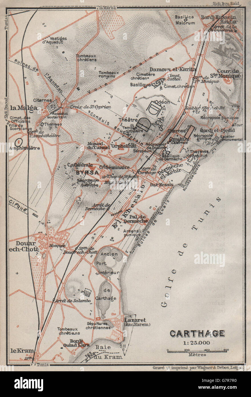 CARTHAGE ground plan. Ancient Carthage ruins. Tunisia carte. BAEDEKER, 1911 map Stock Photohttps://www.alamy.com/image-license-details/?v=1https://www.alamy.com/stock-photo-carthage-ground-plan-ancient-carthage-ruins-tunisia-carte-baedeker-108075828.html
RFG7R7R0–CARTHAGE ground plan. Ancient Carthage ruins. Tunisia carte. BAEDEKER, 1911 map
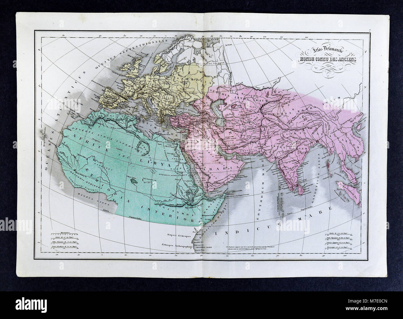 1858 Delamarche Map of Ancient World or World Known to the Ancients: Europe, Asia, Africa and Middle East Stock Photohttps://www.alamy.com/image-license-details/?v=1https://www.alamy.com/stock-photo-1858-delamarche-map-of-ancient-world-or-world-known-to-the-ancients-176713957.html
RFM7E0CN–1858 Delamarche Map of Ancient World or World Known to the Ancients: Europe, Asia, Africa and Middle East
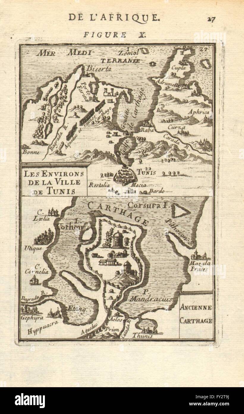 TUNISIA: Ancient Carthage. Tunis environs. 'Ancienne Carthage'.MALLET, 1683 map Stock Photohttps://www.alamy.com/image-license-details/?v=1https://www.alamy.com/stock-photo-tunisia-ancient-carthage-tunis-environs-ancienne-carthagemallet-1683-102710542.html
RFFY2T9J–TUNISIA: Ancient Carthage. Tunis environs. 'Ancienne Carthage'.MALLET, 1683 map
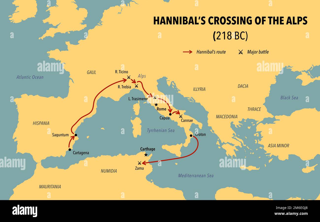 Modern map with the route of Hannibal crossing of the Alps Stock Photohttps://www.alamy.com/image-license-details/?v=1https://www.alamy.com/modern-map-with-the-route-of-hannibal-crossing-of-the-alps-image503108992.html
RF2M6EGJ8–Modern map with the route of Hannibal crossing of the Alps
 TUNIS & environs. Ariana Carthage La Goulette. Tunisia carte. BAEDEKER, 1896 map Stock Photohttps://www.alamy.com/image-license-details/?v=1https://www.alamy.com/stock-photo-tunis-environs-ariana-carthage-la-goulette-tunisia-carte-baedeker-114411886.html
RFGJ3WEP–TUNIS & environs. Ariana Carthage La Goulette. Tunisia carte. BAEDEKER, 1896 map
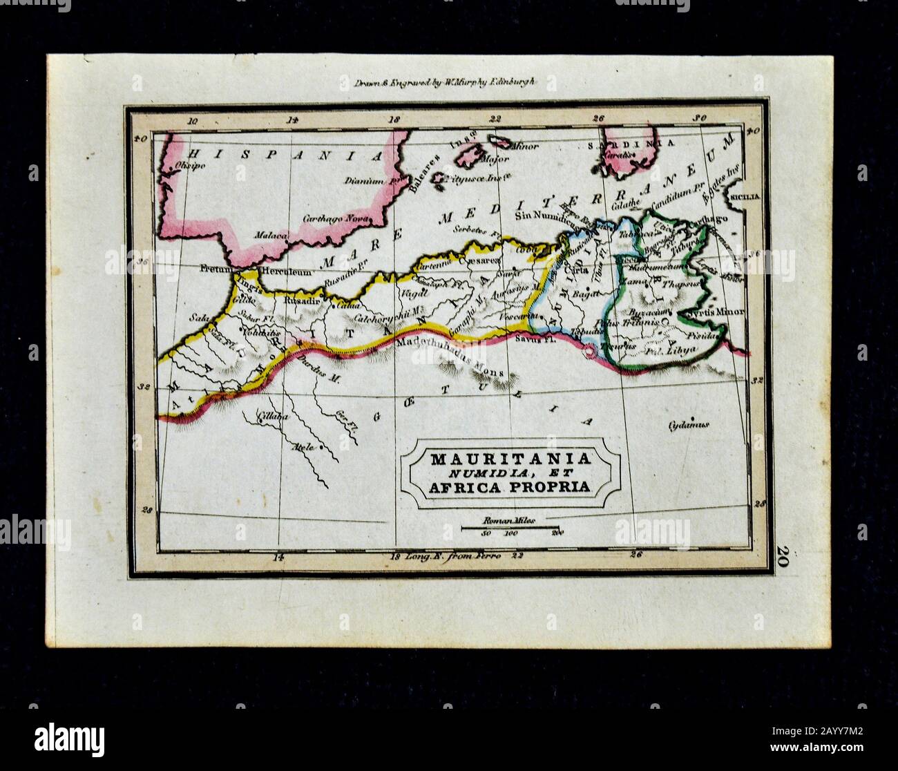 1832 Murphy Map Ancient North Africa Mauritania Numidia et Africa Propria Morocco Algiers Tunis Stock Photohttps://www.alamy.com/image-license-details/?v=1https://www.alamy.com/1832-murphy-map-ancient-north-africa-mauritania-numidia-et-africa-propria-morocco-algiers-tunis-image344191458.html
RM2AYY7M2–1832 Murphy Map Ancient North Africa Mauritania Numidia et Africa Propria Morocco Algiers Tunis
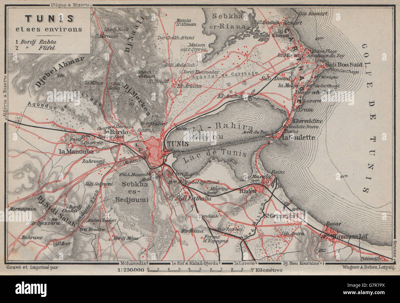 TUNIS & environs. Ariana Carthage La Goulette. Tunisia carte. BAEDEKER, 1911 map Stock Photohttps://www.alamy.com/image-license-details/?v=1https://www.alamy.com/stock-photo-tunis-environs-ariana-carthage-la-goulette-tunisia-carte-baedeker-108075826.html
RFG7R7PX–TUNIS & environs. Ariana Carthage La Goulette. Tunisia carte. BAEDEKER, 1911 map
 1829 Lapie Historical Map of Empire of Carthage ( Modern Tunisia ) - Geographicus - AfriqueiPropre-lapie-1829 Stock Photohttps://www.alamy.com/image-license-details/?v=1https://www.alamy.com/stock-photo-1829-lapie-historical-map-of-empire-of-carthage-modern-tunisia-geographicus-139473419.html
RMJ2WFNF–1829 Lapie Historical Map of Empire of Carthage ( Modern Tunisia ) - Geographicus - AfriqueiPropre-lapie-1829
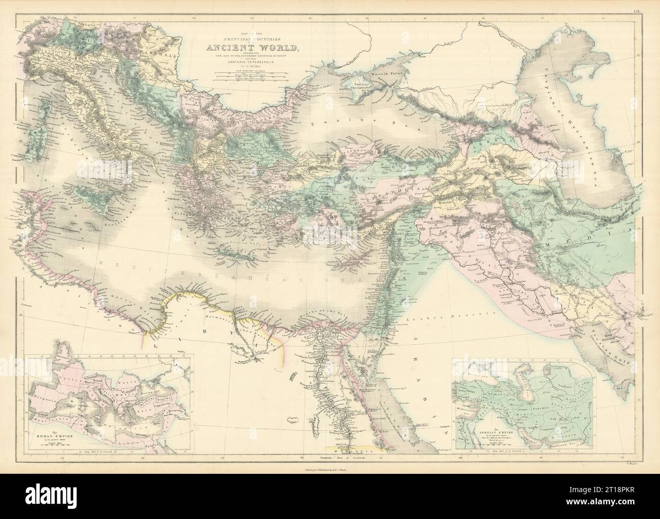 Countries of the Ancient World… from the Alps… to Persepolis. HUGHES 1854 map Stock Photohttps://www.alamy.com/image-license-details/?v=1https://www.alamy.com/countries-of-the-ancient-world-from-the-alps-to-persepolis-hughes-1854-map-image568750219.html
RF2T18PKR–Countries of the Ancient World… from the Alps… to Persepolis. HUGHES 1854 map
![Carthage Landing [Village]; Hughsonville [Village]; Fishkill P.O. [Village] 1876 by O.W. Gray & Son Stock Photo Carthage Landing [Village]; Hughsonville [Village]; Fishkill P.O. [Village] 1876 by O.W. Gray & Son Stock Photo](https://c8.alamy.com/comp/2YP93C8/carthage-landing-village-hughsonville-village-fishkill-po-village-1876-by-ow-gray-son-2YP93C8.jpg) Carthage Landing [Village]; Hughsonville [Village]; Fishkill P.O. [Village] 1876 by O.W. Gray & Son Stock Photohttps://www.alamy.com/image-license-details/?v=1https://www.alamy.com/carthage-landing-village-hughsonville-village-fishkill-po-village-1876-by-ow-gray-son-image633295944.html
Carthage Landing [Village]; Hughsonville [Village]; Fishkill P.O. [Village] 1876 by O.W. Gray & Son Stock Photohttps://www.alamy.com/image-license-details/?v=1https://www.alamy.com/carthage-landing-village-hughsonville-village-fishkill-po-village-1876-by-ow-gray-son-image633295944.htmlRM2YP93C8–Carthage Landing [Village]; Hughsonville [Village]; Fishkill P.O. [Village] 1876 by O.W. Gray & Son
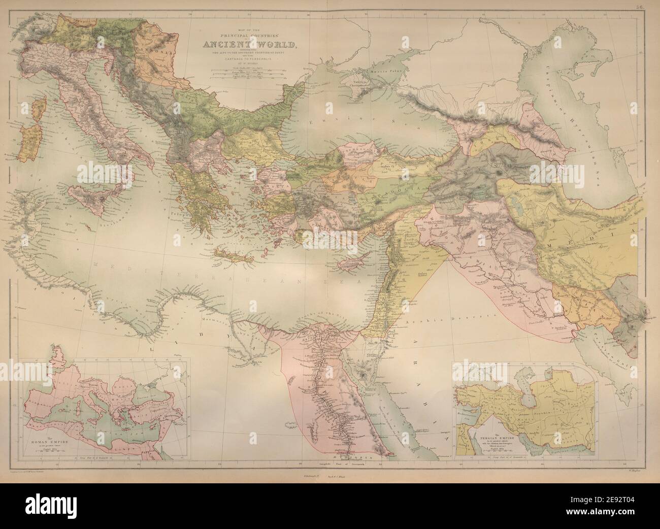 Ancient World. Eastern Mediterranean & Middle East. BARTHOLOMEW 1870 old map Stock Photohttps://www.alamy.com/image-license-details/?v=1https://www.alamy.com/ancient-world-eastern-mediterranean-middle-east-bartholomew-1870-old-map-image401433092.html
RF2E92T04–Ancient World. Eastern Mediterranean & Middle East. BARTHOLOMEW 1870 old map
 . The Bologna edition of Ptolemy's Geographia: Tunisia and western Libya; Carthage English: Map 13 Latina: Tabula 13 . 1477. Bodleian Libraries, Tunisia, western Libya, Sardinia and Sicily Stock Photohttps://www.alamy.com/image-license-details/?v=1https://www.alamy.com/the-bologna-edition-of-ptolemys-geographia-tunisia-and-western-libya-carthage-english-map-13-latina-tabula-13-1477-bodleian-libraries-tunisia-western-libya-sardinia-and-sicily-image184935202.html
RMMMTEMJ–. The Bologna edition of Ptolemy's Geographia: Tunisia and western Libya; Carthage English: Map 13 Latina: Tabula 13 . 1477. Bodleian Libraries, Tunisia, western Libya, Sardinia and Sicily
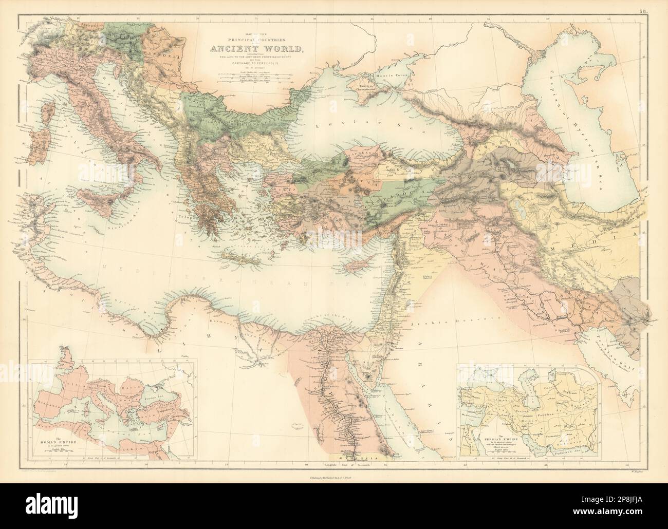 Ancient World. Eastern Mediterranean & Middle East. BARTHOLOMEW 1862 old map Stock Photohttps://www.alamy.com/image-license-details/?v=1https://www.alamy.com/ancient-world-eastern-mediterranean-middle-east-bartholomew-1862-old-map-image538846066.html
RF2P8JFJA–Ancient World. Eastern Mediterranean & Middle East. BARTHOLOMEW 1862 old map
 Carthage, Franklin County, US, United States, Maine, N 44 37' 27'', S 70 28' 23'', map, Cartascapes Map published in 2024. Explore Cartascapes, a map revealing Earth's diverse landscapes, cultures, and ecosystems. Journey through time and space, discovering the interconnectedness of our planet's past, present, and future. Stock Photohttps://www.alamy.com/image-license-details/?v=1https://www.alamy.com/carthage-franklin-county-us-united-states-maine-n-44-37-27-s-70-28-23-map-cartascapes-map-published-in-2024-explore-cartascapes-a-map-revealing-earths-diverse-landscapes-cultures-and-ecosystems-journey-through-time-and-space-discovering-the-interconnectedness-of-our-planets-past-present-and-future-image621335258.html
RM2Y2T7CX–Carthage, Franklin County, US, United States, Maine, N 44 37' 27'', S 70 28' 23'', map, Cartascapes Map published in 2024. Explore Cartascapes, a map revealing Earth's diverse landscapes, cultures, and ecosystems. Journey through time and space, discovering the interconnectedness of our planet's past, present, and future.
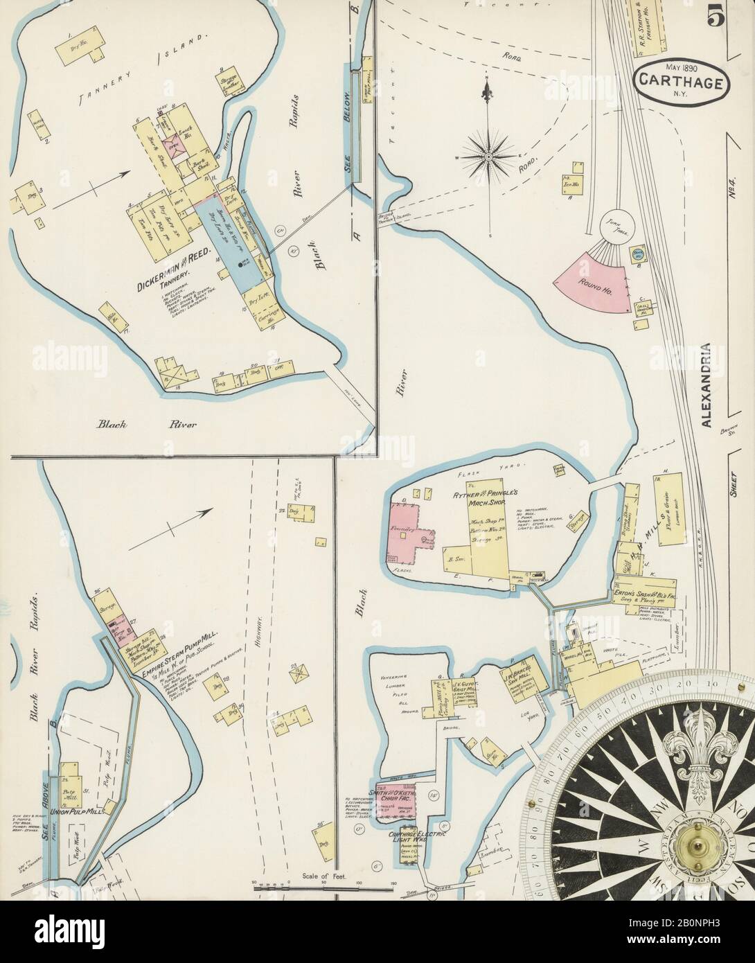 Image 5 of Sanborn Fire Insurance Map from Carthage, Jefferson County, New York. May 1890. 7 Sheet(s), America, street map with a Nineteenth Century compass Stock Photohttps://www.alamy.com/image-license-details/?v=1https://www.alamy.com/image-5-of-sanborn-fire-insurance-map-from-carthage-jefferson-county-new-york-may-1890-7-sheets-america-street-map-with-a-nineteenth-century-compass-image344686079.html
RM2B0NPH3–Image 5 of Sanborn Fire Insurance Map from Carthage, Jefferson County, New York. May 1890. 7 Sheet(s), America, street map with a Nineteenth Century compass
 Fannie Ratchford 1970 101 0263 Stock Photohttps://www.alamy.com/image-license-details/?v=1https://www.alamy.com/fannie-ratchford-1970-101-0263-image68785539.html
RMDYWCJB–Fannie Ratchford 1970 101 0263
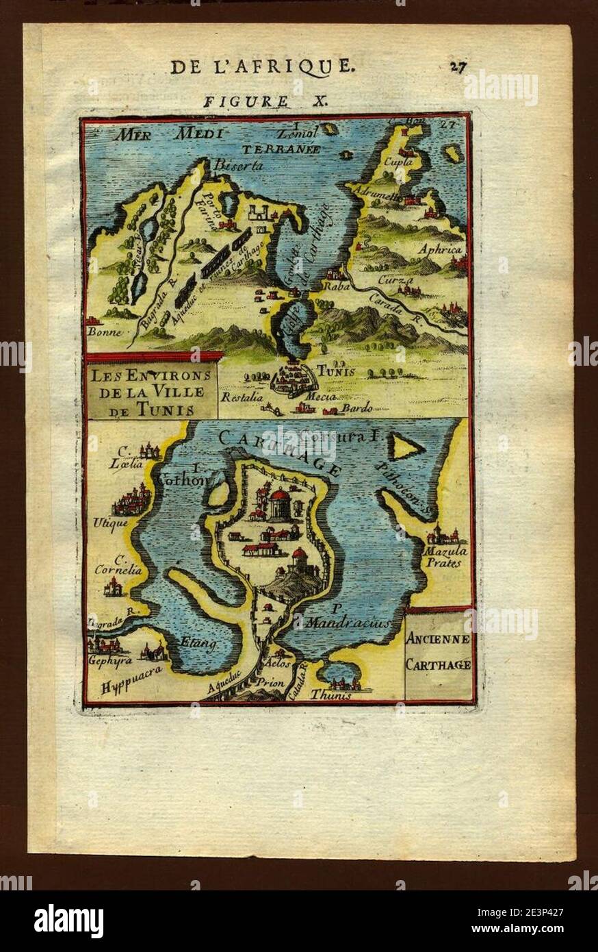 Map of Tunis and Carthage, 1683. Stock Photohttps://www.alamy.com/image-license-details/?v=1https://www.alamy.com/map-of-tunis-and-carthage-1683-image398168575.html
RM2E3P427–Map of Tunis and Carthage, 1683.
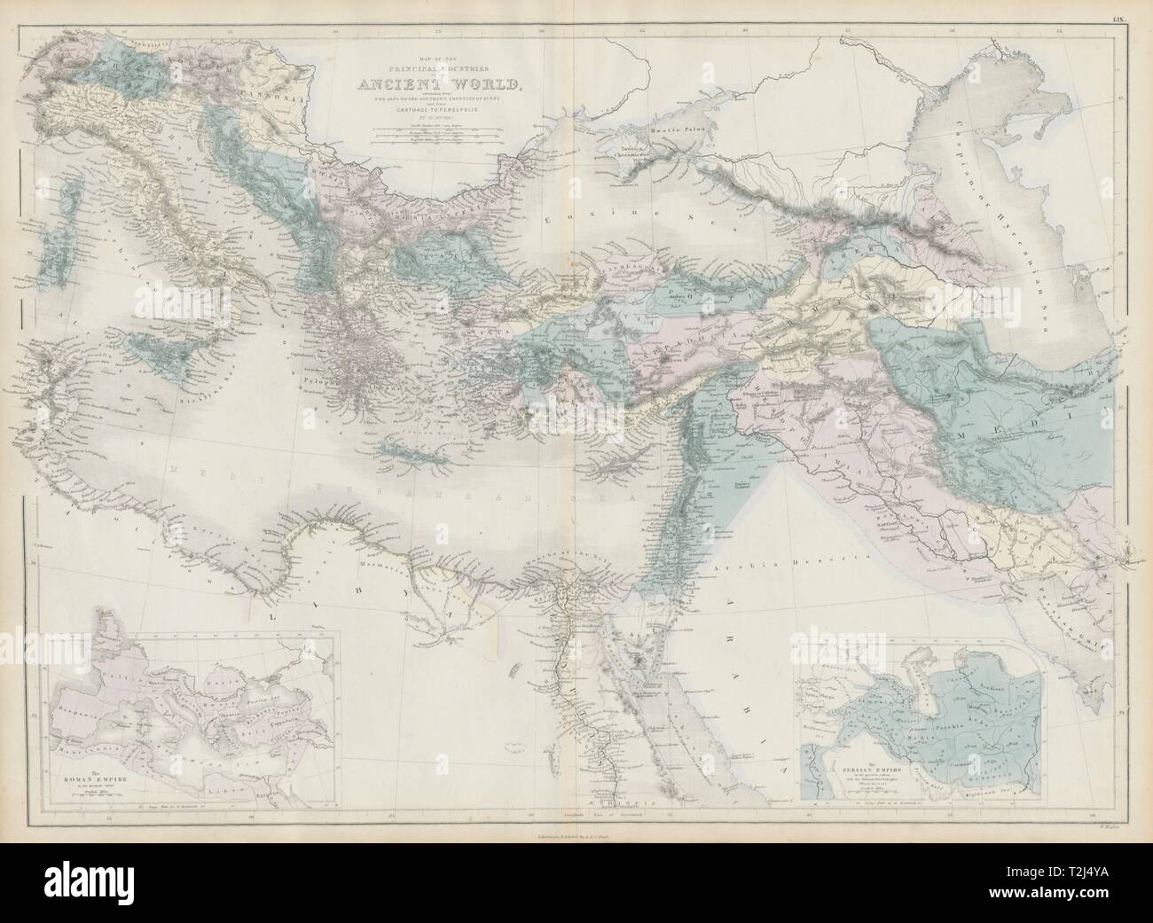 Countries of the Ancient World… from the Alps… to Persepolis. HUGHES 1856 map Stock Photohttps://www.alamy.com/image-license-details/?v=1https://www.alamy.com/countries-of-the-ancient-world-from-the-alps-to-persepolis-hughes-1856-map-image242573502.html
RFT2J4YA–Countries of the Ancient World… from the Alps… to Persepolis. HUGHES 1856 map
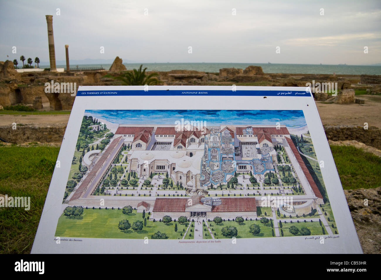 Information map at the ruins of Antonine baths Carthage Tunis Tunisia Stock Photohttps://www.alamy.com/image-license-details/?v=1https://www.alamy.com/stock-photo-information-map-at-the-ruins-of-antonine-baths-carthage-tunis-tunisia-41294563.html
RMCB53HR–Information map at the ruins of Antonine baths Carthage Tunis Tunisia
 Map of current Tunisia and eastern Algeria in an ornamental frame. Top left the city of Hippo, Carthage right. On both sides putti, the one with a pair of compasses and a globe, the other with a pair of binoculars, and a armillarium. In the left background a classical building and garden vase, right in the background a piramide. Manufacturer : printmaker, Noah van der Meer (II) (listed building) Place manufacture: Leiden Date: 1751 - 1822 Physical features: etching; text in the letterpress on verso material: paper Technique: etching / letterpress dimensions: sheet: h 105 mm × W 167 mm Subject: Stock Photohttps://www.alamy.com/image-license-details/?v=1https://www.alamy.com/map-of-current-tunisia-and-eastern-algeria-in-an-ornamental-frame-top-left-the-city-of-hippo-carthage-right-on-both-sides-putti-the-one-with-a-pair-of-compasses-and-a-globe-the-other-with-a-pair-of-binoculars-and-a-armillarium-in-the-left-background-a-classical-building-and-garden-vase-right-in-the-background-a-piramide-manufacturer-printmaker-noah-van-der-meer-ii-listed-building-place-manufacture-leiden-date-1751-1822-physical-features-etching-text-in-the-letterpress-on-verso-material-paper-technique-etching-letterpress-dimensions-sheet-h-105-mm-w-167-mm-subject-image348486569.html
RM2B6XX4W–Map of current Tunisia and eastern Algeria in an ornamental frame. Top left the city of Hippo, Carthage right. On both sides putti, the one with a pair of compasses and a globe, the other with a pair of binoculars, and a armillarium. In the left background a classical building and garden vase, right in the background a piramide. Manufacturer : printmaker, Noah van der Meer (II) (listed building) Place manufacture: Leiden Date: 1751 - 1822 Physical features: etching; text in the letterpress on verso material: paper Technique: etching / letterpress dimensions: sheet: h 105 mm × W 167 mm Subject:
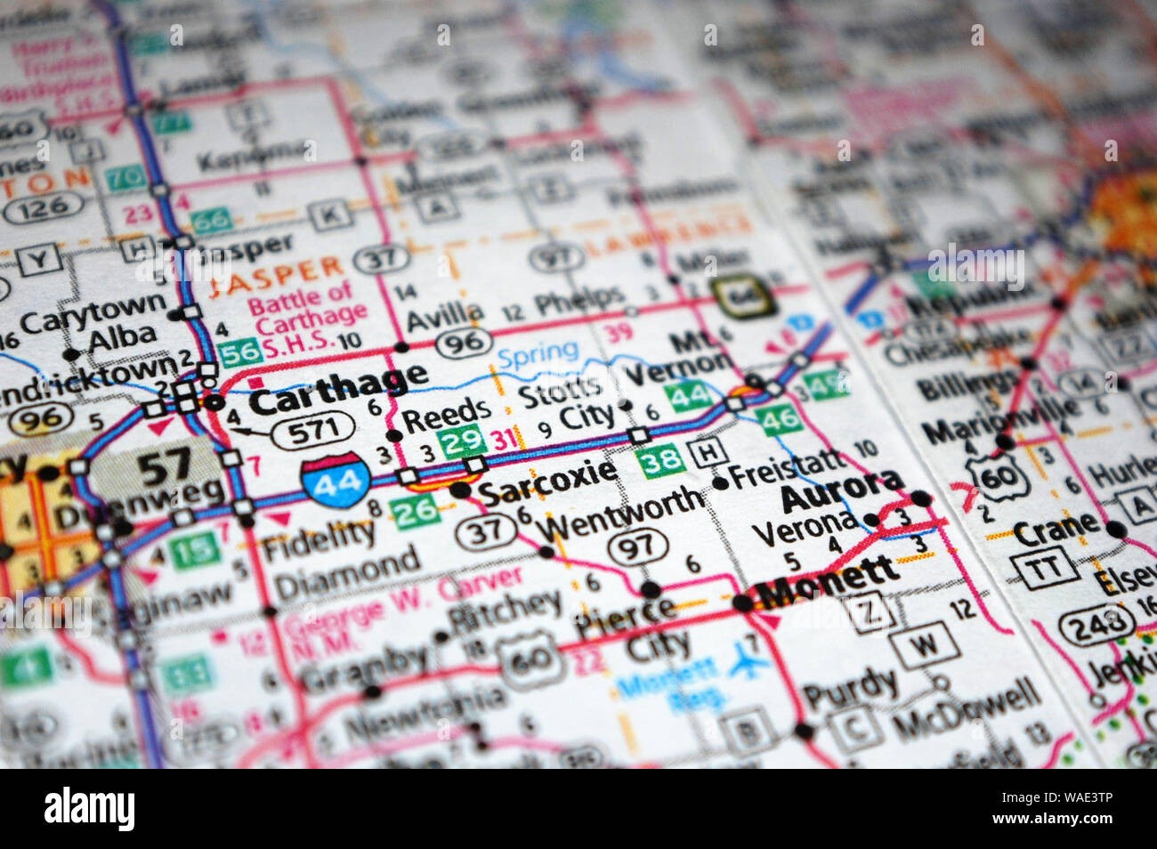 Extreme close-up of Carthage, Missouri in a map. Stock Photohttps://www.alamy.com/image-license-details/?v=1https://www.alamy.com/extreme-close-up-of-carthage-missouri-in-a-map-image264612454.html
RFWAE3TP–Extreme close-up of Carthage, Missouri in a map.
 North Africa American Cemetery, Carthage, Tunis, Tunisia. March 8, 2023. Map showing battles at the North Africa American Cemetery in Carthage. Stock Photohttps://www.alamy.com/image-license-details/?v=1https://www.alamy.com/north-africa-american-cemetery-carthage-tunis-tunisia-march-8-2023-map-showing-battles-at-the-north-africa-american-cemetery-in-carthage-image572884296.html
RF2T813NC–North Africa American Cemetery, Carthage, Tunis, Tunisia. March 8, 2023. Map showing battles at the North Africa American Cemetery in Carthage.
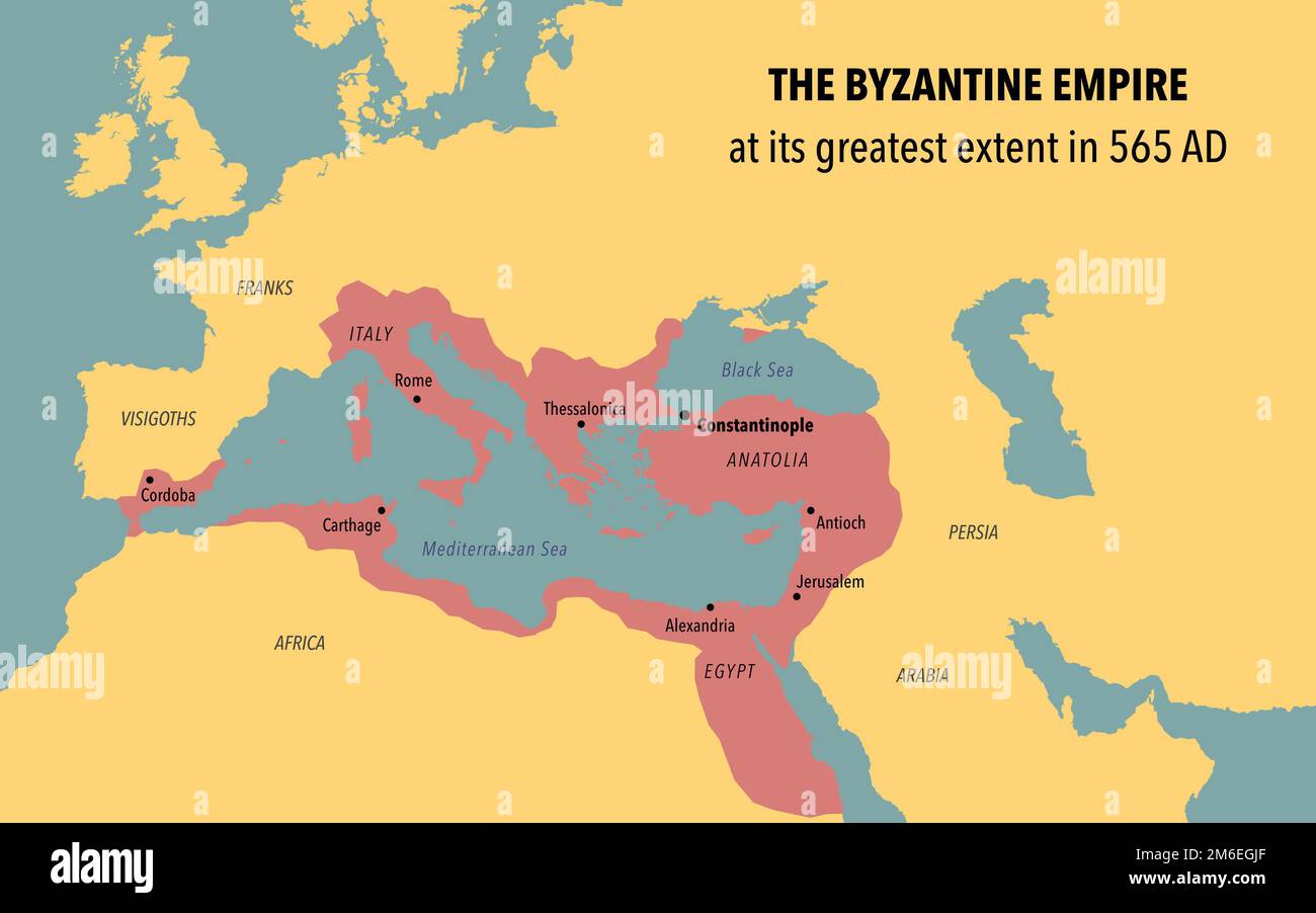 Map of Byzantine Empire at its greatest extent in 565 AD Stock Photohttps://www.alamy.com/image-license-details/?v=1https://www.alamy.com/map-of-byzantine-empire-at-its-greatest-extent-in-565-ad-image503108999.html
RF2M6EGJF–Map of Byzantine Empire at its greatest extent in 565 AD
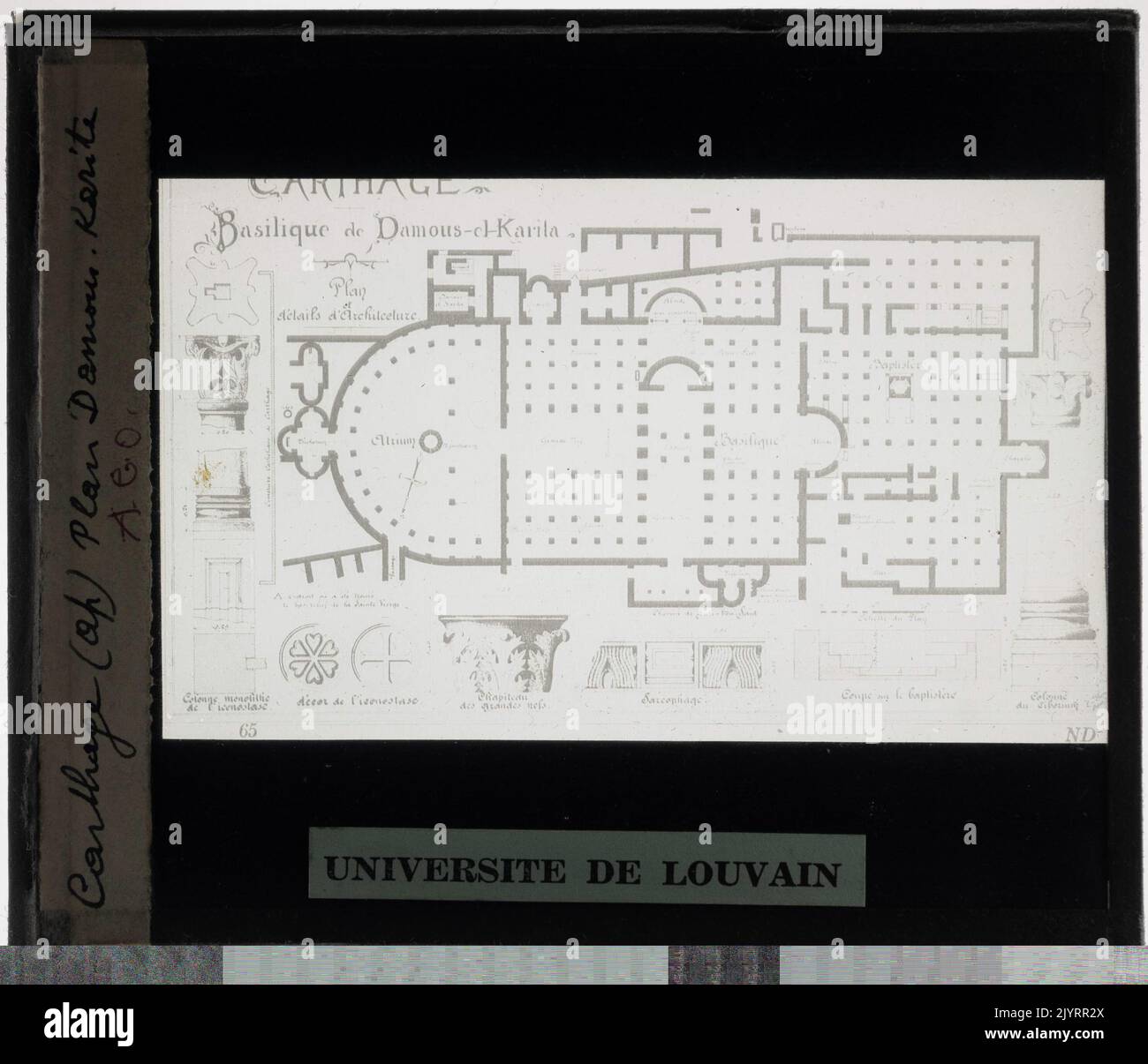 Carthage. Basilica Damus El Karita map Stock Photohttps://www.alamy.com/image-license-details/?v=1https://www.alamy.com/carthage-basilica-damus-el-karita-map-image481798658.html
RM2JYRR2X–Carthage. Basilica Damus El Karita map
 Map of present -day Tunisia and east of Algeria, Noah van der Meer (II), 1751 - 1822 print Map of present -day Tunisia and east of Algeria in an ornamental list. At the top left of the city of Hippo, at the top right Carthage. Putti on either side, one with a passer and a globe, the other with binoculars and an Armillarium. Left in the background a classic structure and a garden vase, a pyramid on the right in the background. Leiden paper etching / letterpress printing maps of separate countries or regions. armillary sphere, skeleton celestial globe. compasses. architectural detail (+ classica Stock Photohttps://www.alamy.com/image-license-details/?v=1https://www.alamy.com/map-of-present-day-tunisia-and-east-of-algeria-noah-van-der-meer-ii-1751-1822-print-map-of-present-day-tunisia-and-east-of-algeria-in-an-ornamental-list-at-the-top-left-of-the-city-of-hippo-at-the-top-right-carthage-putti-on-either-side-one-with-a-passer-and-a-globe-the-other-with-binoculars-and-an-armillarium-left-in-the-background-a-classic-structure-and-a-garden-vase-a-pyramid-on-the-right-in-the-background-leiden-paper-etching-letterpress-printing-maps-of-separate-countries-or-regions-armillary-sphere-skeleton-celestial-globe-compasses-architectural-detail-classica-image594832125.html
RM2WFMXCD–Map of present -day Tunisia and east of Algeria, Noah van der Meer (II), 1751 - 1822 print Map of present -day Tunisia and east of Algeria in an ornamental list. At the top left of the city of Hippo, at the top right Carthage. Putti on either side, one with a passer and a globe, the other with binoculars and an Armillarium. Left in the background a classic structure and a garden vase, a pyramid on the right in the background. Leiden paper etching / letterpress printing maps of separate countries or regions. armillary sphere, skeleton celestial globe. compasses. architectural detail (+ classica
 Tunisia outline map set Stock Vectorhttps://www.alamy.com/image-license-details/?v=1https://www.alamy.com/stock-photo-tunisia-outline-map-set-116001451.html
RFGMM90Y–Tunisia outline map set
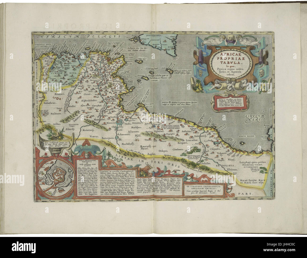 Map of Roman Africa and inset map of Carthage by Abraham Ortelius Stock Photohttps://www.alamy.com/image-license-details/?v=1https://www.alamy.com/stock-photo-map-of-roman-africa-and-inset-map-of-carthage-by-abraham-ortelius-148514700.html
RMJHHC0C–Map of Roman Africa and inset map of Carthage by Abraham Ortelius
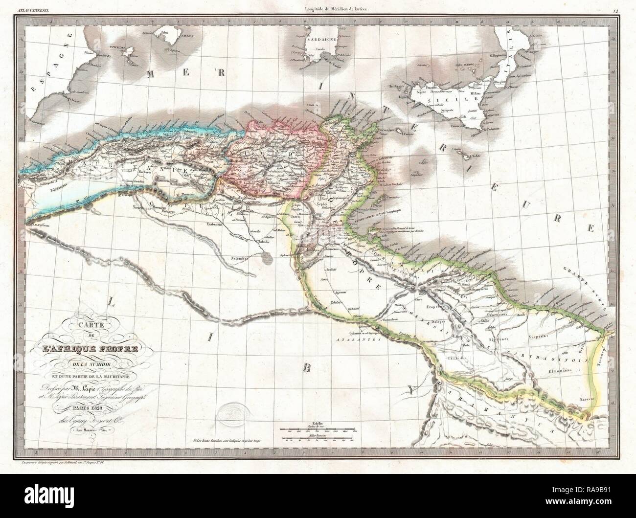 1829, Lapie Historical Map of Empire of Carthage, Modern Tunisia . Reimagined by Gibon. Classic art with a modern reimagined Stock Photohttps://www.alamy.com/image-license-details/?v=1https://www.alamy.com/1829-lapie-historical-map-of-empire-of-carthage-modern-tunisia-reimagined-by-gibon-classic-art-with-a-modern-reimagined-image230087789.html
RFRA9B91–1829, Lapie Historical Map of Empire of Carthage, Modern Tunisia . Reimagined by Gibon. Classic art with a modern reimagined
![Evans Mills [Village]; Philadelphia Business Directory. ; Evans Business Directory. ; Philadelphia [Village]; Champion Business Directory. ; Great Bend Business Directory. ; Champion [Village]; Great Bend [Village]; West Carthage [Village]; Tylerville [Village]; West Carthage Business Directory. 1864 by Beers, D. G. (Daniel G.) Stock Photo Evans Mills [Village]; Philadelphia Business Directory. ; Evans Business Directory. ; Philadelphia [Village]; Champion Business Directory. ; Great Bend Business Directory. ; Champion [Village]; Great Bend [Village]; West Carthage [Village]; Tylerville [Village]; West Carthage Business Directory. 1864 by Beers, D. G. (Daniel G.) Stock Photo](https://c8.alamy.com/comp/2YPEB8R/evans-mills-village-philadelphia-business-directory-evans-business-directory-philadelphia-village-champion-business-directory-great-bend-business-directory-champion-village-great-bend-village-west-carthage-village-tylerville-village-west-carthage-business-directory-1864-by-beers-d-g-daniel-g-2YPEB8R.jpg) Evans Mills [Village]; Philadelphia Business Directory. ; Evans Business Directory. ; Philadelphia [Village]; Champion Business Directory. ; Great Bend Business Directory. ; Champion [Village]; Great Bend [Village]; West Carthage [Village]; Tylerville [Village]; West Carthage Business Directory. 1864 by Beers, D. G. (Daniel G.) Stock Photohttps://www.alamy.com/image-license-details/?v=1https://www.alamy.com/evans-mills-village-philadelphia-business-directory-evans-business-directory-philadelphia-village-champion-business-directory-great-bend-business-directory-champion-village-great-bend-village-west-carthage-village-tylerville-village-west-carthage-business-directory-1864-by-beers-d-g-daniel-g-image633411879.html
Evans Mills [Village]; Philadelphia Business Directory. ; Evans Business Directory. ; Philadelphia [Village]; Champion Business Directory. ; Great Bend Business Directory. ; Champion [Village]; Great Bend [Village]; West Carthage [Village]; Tylerville [Village]; West Carthage Business Directory. 1864 by Beers, D. G. (Daniel G.) Stock Photohttps://www.alamy.com/image-license-details/?v=1https://www.alamy.com/evans-mills-village-philadelphia-business-directory-evans-business-directory-philadelphia-village-champion-business-directory-great-bend-business-directory-champion-village-great-bend-village-west-carthage-village-tylerville-village-west-carthage-business-directory-1864-by-beers-d-g-daniel-g-image633411879.htmlRM2YPEB8R–Evans Mills [Village]; Philadelphia Business Directory. ; Evans Business Directory. ; Philadelphia [Village]; Champion Business Directory. ; Great Bend Business Directory. ; Champion [Village]; Great Bend [Village]; West Carthage [Village]; Tylerville [Village]; West Carthage Business Directory. 1864 by Beers, D. G. (Daniel G.)
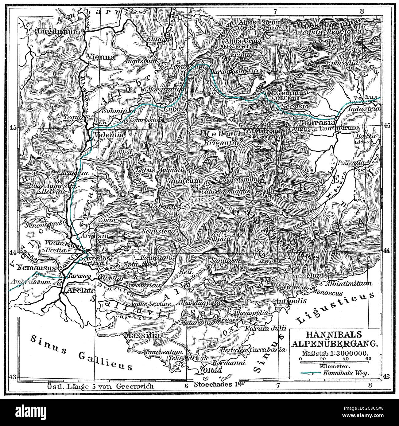 Hannibal Barkas, c. 246-183 BC, Carthaginian military commander trekking across the Alps Stock Photohttps://www.alamy.com/image-license-details/?v=1https://www.alamy.com/hannibal-barkas-c-246-183-bc-carthaginian-military-commander-trekking-across-the-alps-image366611680.html
RM2C8CGX8–Hannibal Barkas, c. 246-183 BC, Carthaginian military commander trekking across the Alps
 . Mississippi River Grand Gulf, Turner’s Point, New Carthage Reconnaissance for the use of the Mississippi Squadron . English: This is a beautiful hand colored 1864 United States Costal Survey chart or map of a sinuous part of the Mississippi River from Grand Gulf, Mississippi to New Carthage, Louisiana. The bends in the river are named, as are the many river islands shown. Notes towns, wood lots, landings and farms, many of which are shown with family names. This map is especially important for Civil War buffs as it includes the Jefferson Davis Plantation. This map was created under the dire Stock Photohttps://www.alamy.com/image-license-details/?v=1https://www.alamy.com/mississippi-river-grand-gulf-turners-point-new-carthage-reconnaissance-for-the-use-of-the-mississippi-squadron-english-this-is-a-beautiful-hand-colored-1864-united-states-costal-survey-chart-or-map-of-a-sinuous-part-of-the-mississippi-river-from-grand-gulf-mississippi-to-new-carthage-louisiana-the-bends-in-the-river-are-named-as-are-the-many-river-islands-shown-notes-towns-wood-lots-landings-and-farms-many-of-which-are-shown-with-family-names-this-map-is-especially-important-for-civil-war-buffs-as-it-includes-the-jefferson-davis-plantation-this-map-was-created-under-the-dire-image188898182.html
RMMY91FJ–. Mississippi River Grand Gulf, Turner’s Point, New Carthage Reconnaissance for the use of the Mississippi Squadron . English: This is a beautiful hand colored 1864 United States Costal Survey chart or map of a sinuous part of the Mississippi River from Grand Gulf, Mississippi to New Carthage, Louisiana. The bends in the river are named, as are the many river islands shown. Notes towns, wood lots, landings and farms, many of which are shown with family names. This map is especially important for Civil War buffs as it includes the Jefferson Davis Plantation. This map was created under the dire
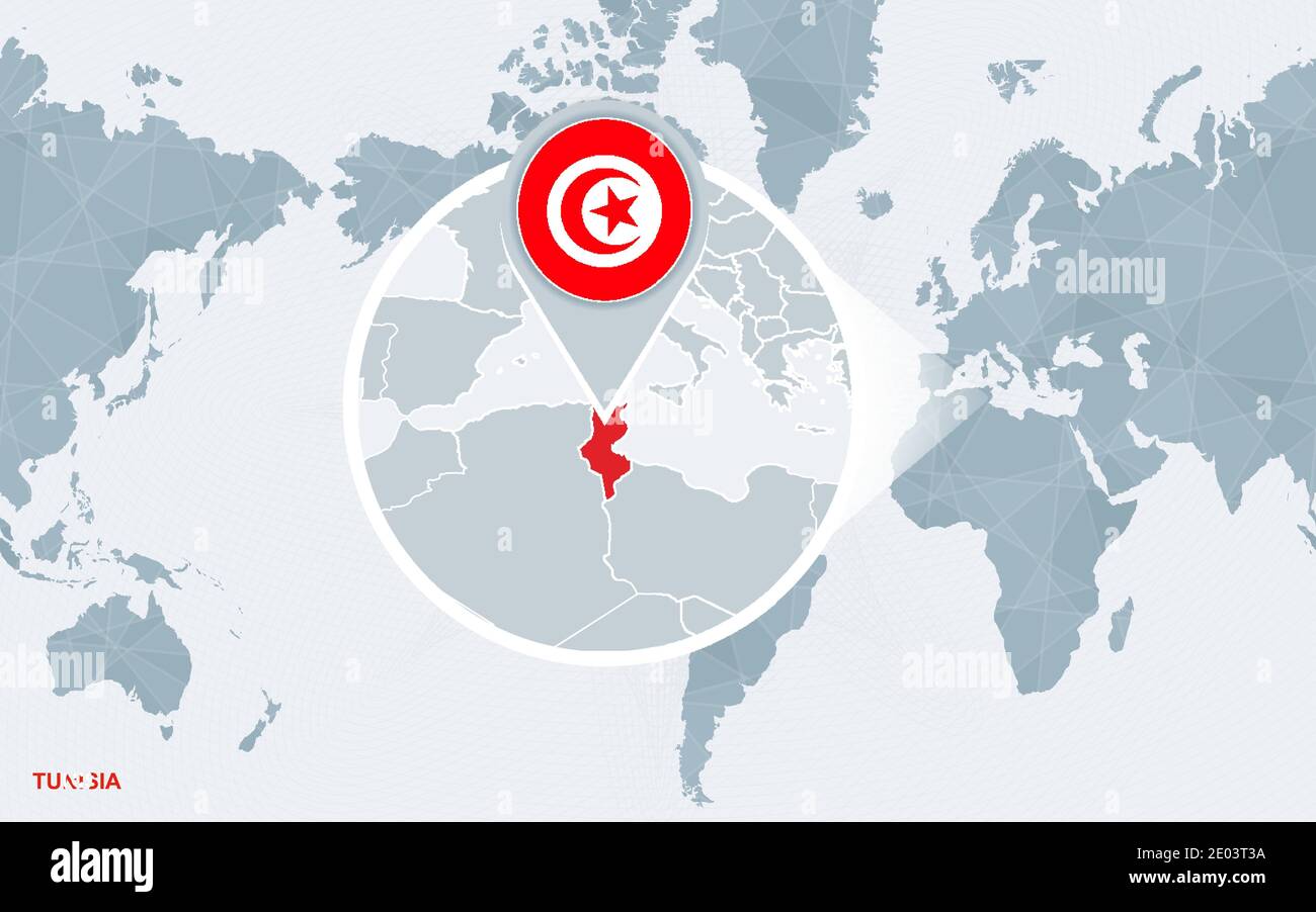 World map centered on America with magnified Tunisia. Blue flag and map of Tunisia. Abstract vector illustration. Stock Vectorhttps://www.alamy.com/image-license-details/?v=1https://www.alamy.com/world-map-centered-on-america-with-magnified-tunisia-blue-flag-and-map-of-tunisia-abstract-vector-illustration-image395923230.html
RF2E03T3A–World map centered on America with magnified Tunisia. Blue flag and map of Tunisia. Abstract vector illustration.
 Carthage, Leake County, US, United States, Mississippi, N 32 43' 57'', S 89 32' 10'', map, Cartascapes Map published in 2024. Explore Cartascapes, a map revealing Earth's diverse landscapes, cultures, and ecosystems. Journey through time and space, discovering the interconnectedness of our planet's past, present, and future. Stock Photohttps://www.alamy.com/image-license-details/?v=1https://www.alamy.com/carthage-leake-county-us-united-states-mississippi-n-32-43-57-s-89-32-10-map-cartascapes-map-published-in-2024-explore-cartascapes-a-map-revealing-earths-diverse-landscapes-cultures-and-ecosystems-journey-through-time-and-space-discovering-the-interconnectedness-of-our-planets-past-present-and-future-image621391994.html
RM2Y2XRR6–Carthage, Leake County, US, United States, Mississippi, N 32 43' 57'', S 89 32' 10'', map, Cartascapes Map published in 2024. Explore Cartascapes, a map revealing Earth's diverse landscapes, cultures, and ecosystems. Journey through time and space, discovering the interconnectedness of our planet's past, present, and future.