Chamberlain map Cut Out Stock Images
 Chamberlain River, , AU, Australia, Western Australia, S 15 51' 28'', N 127 54' 15'', map, Cartascapes Map published in 2024. Explore Cartascapes, a map revealing Earth's diverse landscapes, cultures, and ecosystems. Journey through time and space, discovering the interconnectedness of our planet's past, present, and future. Stock Photohttps://www.alamy.com/image-license-details/?v=1https://www.alamy.com/chamberlain-river-au-australia-western-australia-s-15-51-28-n-127-54-15-map-cartascapes-map-published-in-2024-explore-cartascapes-a-map-revealing-earths-diverse-landscapes-cultures-and-ecosystems-journey-through-time-and-space-discovering-the-interconnectedness-of-our-planets-past-present-and-future-image625793971.html
RM2YA3AGK–Chamberlain River, , AU, Australia, Western Australia, S 15 51' 28'', N 127 54' 15'', map, Cartascapes Map published in 2024. Explore Cartascapes, a map revealing Earth's diverse landscapes, cultures, and ecosystems. Journey through time and space, discovering the interconnectedness of our planet's past, present, and future.
 USGS TOPO Map Idaho ID Chamberlain Mountain 20110208 TM Restoration Stock Photohttps://www.alamy.com/image-license-details/?v=1https://www.alamy.com/usgs-topo-map-idaho-id-chamberlain-mountain-20110208-tm-restoration-image245699881.html
RMT7MGKN–USGS TOPO Map Idaho ID Chamberlain Mountain 20110208 TM Restoration
 Minneapolis-St Paul Airport stamp. Airport of Minneapolis round logo with location on United States map marked by airplane. Vector illustration. Stock Vectorhttps://www.alamy.com/image-license-details/?v=1https://www.alamy.com/minneapolis-st-paul-airport-stamp-airport-of-minneapolis-round-logo-with-location-on-united-states-map-marked-by-airplane-vector-illustration-image516653081.html
RF2N0FG7N–Minneapolis-St Paul Airport stamp. Airport of Minneapolis round logo with location on United States map marked by airplane. Vector illustration.
 Chamberlain Plantation, , AU, Australia, South Australia, S 34 46' 2'', N 138 43' 28'', map, Cartascapes Map published in 2024. Explore Cartascapes, a map revealing Earth's diverse landscapes, cultures, and ecosystems. Journey through time and space, discovering the interconnectedness of our planet's past, present, and future. Stock Photohttps://www.alamy.com/image-license-details/?v=1https://www.alamy.com/chamberlain-plantation-au-australia-south-australia-s-34-46-2-n-138-43-28-map-cartascapes-map-published-in-2024-explore-cartascapes-a-map-revealing-earths-diverse-landscapes-cultures-and-ecosystems-journey-through-time-and-space-discovering-the-interconnectedness-of-our-planets-past-present-and-future-image625576888.html
RM2Y9NDKM–Chamberlain Plantation, , AU, Australia, South Australia, S 34 46' 2'', N 138 43' 28'', map, Cartascapes Map published in 2024. Explore Cartascapes, a map revealing Earth's diverse landscapes, cultures, and ecosystems. Journey through time and space, discovering the interconnectedness of our planet's past, present, and future.
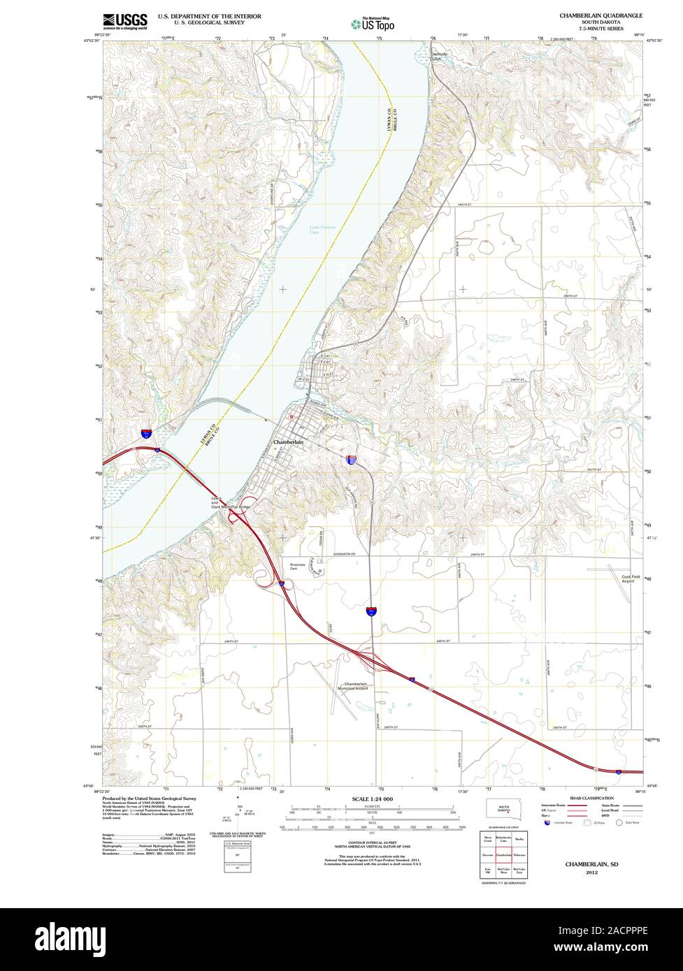 USGS TOPO Map South Dakota SD Chamberlain 20120628 TM Restoration Stock Photohttps://www.alamy.com/image-license-details/?v=1https://www.alamy.com/usgs-topo-map-south-dakota-sd-chamberlain-20120628-tm-restoration-image334873686.html
RM2ACPPPE–USGS TOPO Map South Dakota SD Chamberlain 20120628 TM Restoration
 Chamberlain Reserve, , AU, Australia, South Australia, S 34 46' 1'', N 138 43' 23'', map, Cartascapes Map published in 2024. Explore Cartascapes, a map revealing Earth's diverse landscapes, cultures, and ecosystems. Journey through time and space, discovering the interconnectedness of our planet's past, present, and future. Stock Photohttps://www.alamy.com/image-license-details/?v=1https://www.alamy.com/chamberlain-reserve-au-australia-south-australia-s-34-46-1-n-138-43-23-map-cartascapes-map-published-in-2024-explore-cartascapes-a-map-revealing-earths-diverse-landscapes-cultures-and-ecosystems-journey-through-time-and-space-discovering-the-interconnectedness-of-our-planets-past-present-and-future-image625414708.html
RM2Y9E2RG–Chamberlain Reserve, , AU, Australia, South Australia, S 34 46' 1'', N 138 43' 23'', map, Cartascapes Map published in 2024. Explore Cartascapes, a map revealing Earth's diverse landscapes, cultures, and ecosystems. Journey through time and space, discovering the interconnectedness of our planet's past, present, and future.
 USGS TOPO Map Montana MT Chamberlain Mountain 20110613 TM Restoration Stock Photohttps://www.alamy.com/image-license-details/?v=1https://www.alamy.com/usgs-topo-map-montana-mt-chamberlain-mountain-20110613-tm-restoration-image333364464.html
RM2AAA1NM–USGS TOPO Map Montana MT Chamberlain Mountain 20110613 TM Restoration
 Chamberlain River, , AU, Australia, Western Australia, S 15 58' 0'', N 127 54' 0'', map, Cartascapes Map published in 2024. Explore Cartascapes, a map revealing Earth's diverse landscapes, cultures, and ecosystems. Journey through time and space, discovering the interconnectedness of our planet's past, present, and future. Stock Photohttps://www.alamy.com/image-license-details/?v=1https://www.alamy.com/chamberlain-river-au-australia-western-australia-s-15-58-0-n-127-54-0-map-cartascapes-map-published-in-2024-explore-cartascapes-a-map-revealing-earths-diverse-landscapes-cultures-and-ecosystems-journey-through-time-and-space-discovering-the-interconnectedness-of-our-planets-past-present-and-future-image625439081.html
RM2Y9F5X1–Chamberlain River, , AU, Australia, Western Australia, S 15 58' 0'', N 127 54' 0'', map, Cartascapes Map published in 2024. Explore Cartascapes, a map revealing Earth's diverse landscapes, cultures, and ecosystems. Journey through time and space, discovering the interconnectedness of our planet's past, present, and future.
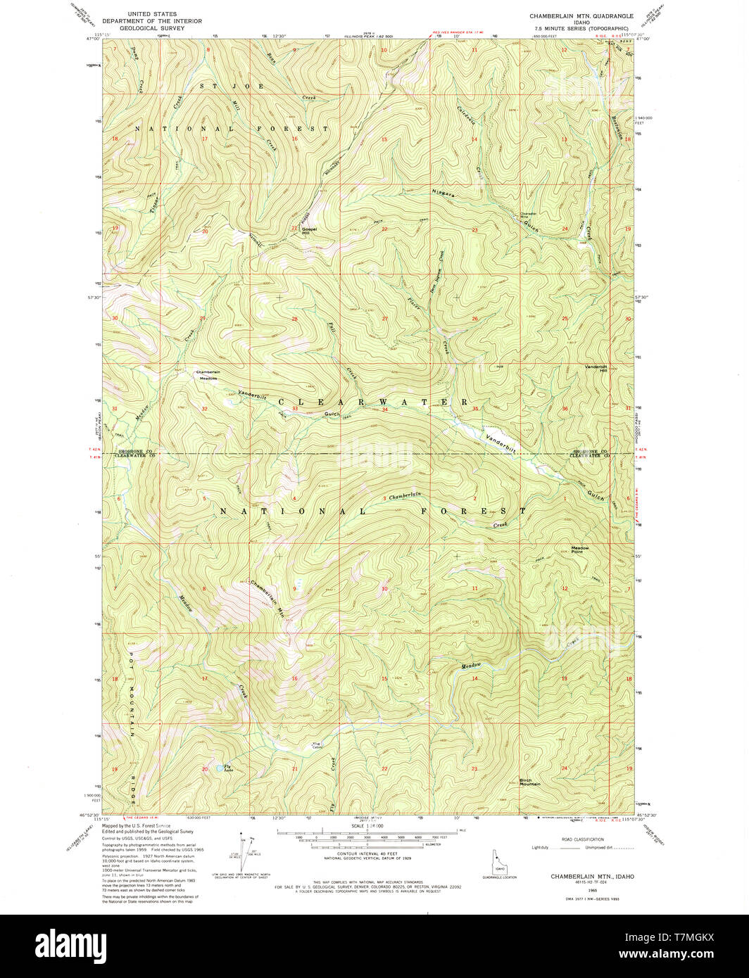 USGS TOPO Map Idaho ID Chamberlain Mtn 235657 1965 24000 Restoration Stock Photohttps://www.alamy.com/image-license-details/?v=1https://www.alamy.com/usgs-topo-map-idaho-id-chamberlain-mtn-235657-1965-24000-restoration-image245699886.html
RMT7MGKX–USGS TOPO Map Idaho ID Chamberlain Mtn 235657 1965 24000 Restoration
 Chamberlain Park, , AU, Australia, New South Wales, S 33 50' 54'', N 150 58' 34'', map, Cartascapes Map published in 2024. Explore Cartascapes, a map revealing Earth's diverse landscapes, cultures, and ecosystems. Journey through time and space, discovering the interconnectedness of our planet's past, present, and future. Stock Photohttps://www.alamy.com/image-license-details/?v=1https://www.alamy.com/chamberlain-park-au-australia-new-south-wales-s-33-50-54-n-150-58-34-map-cartascapes-map-published-in-2024-explore-cartascapes-a-map-revealing-earths-diverse-landscapes-cultures-and-ecosystems-journey-through-time-and-space-discovering-the-interconnectedness-of-our-planets-past-present-and-future-image625496425.html
RM2Y9HR21–Chamberlain Park, , AU, Australia, New South Wales, S 33 50' 54'', N 150 58' 34'', map, Cartascapes Map published in 2024. Explore Cartascapes, a map revealing Earth's diverse landscapes, cultures, and ecosystems. Journey through time and space, discovering the interconnectedness of our planet's past, present, and future.
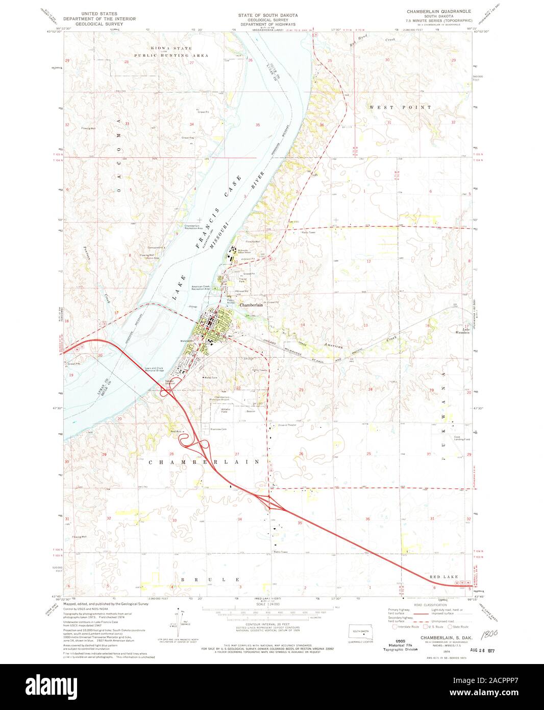 USGS TOPO Map South Dakota SD Chamberlain 342902 1974 24000 Restoration Stock Photohttps://www.alamy.com/image-license-details/?v=1https://www.alamy.com/usgs-topo-map-south-dakota-sd-chamberlain-342902-1974-24000-restoration-image334873679.html
RM2ACPPP7–USGS TOPO Map South Dakota SD Chamberlain 342902 1974 24000 Restoration
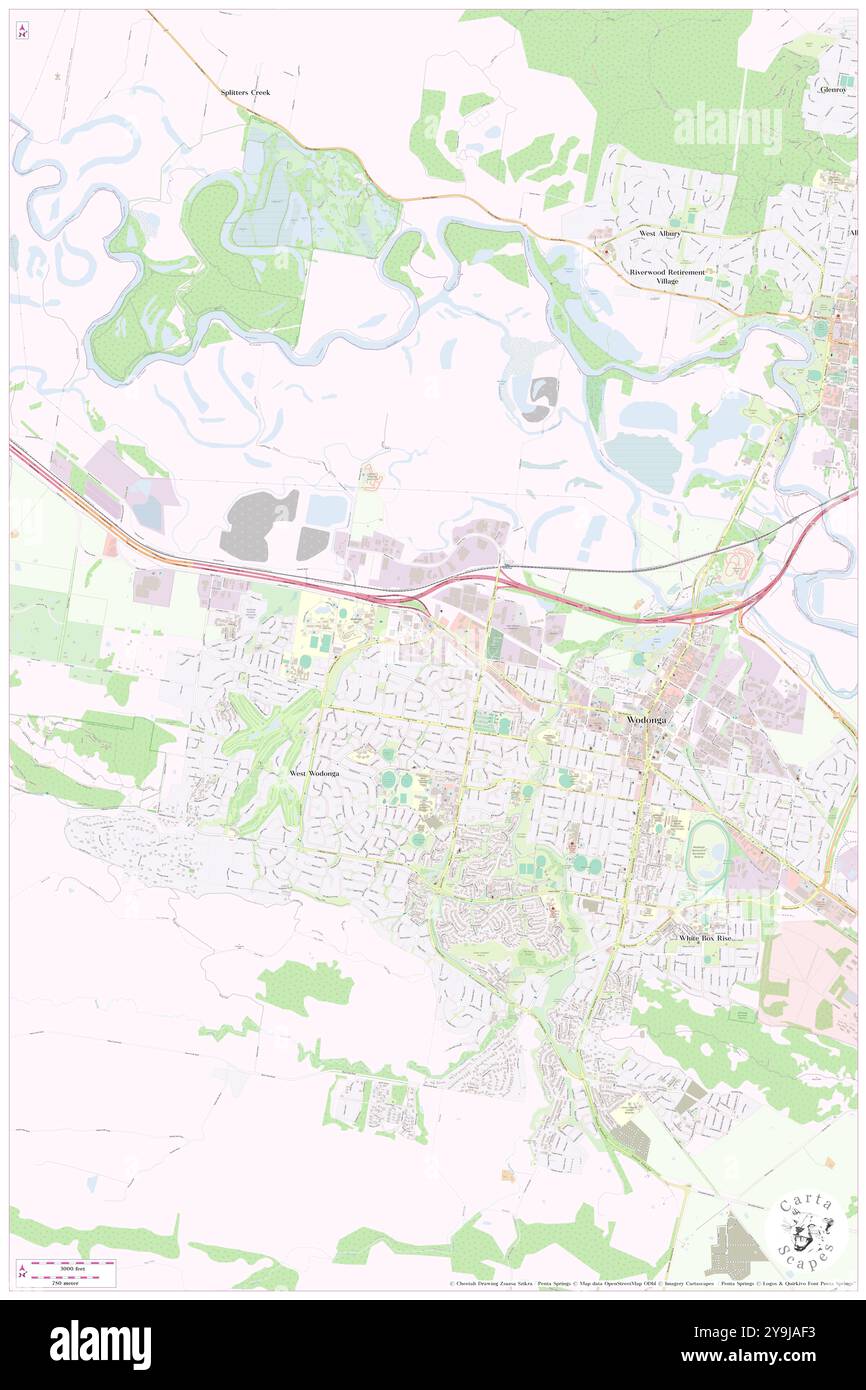 Rex Chamberlain Park, Wodonga, AU, Australia, Victoria, S 36 6' 50'', N 146 51' 46'', map, Cartascapes Map published in 2024. Explore Cartascapes, a map revealing Earth's diverse landscapes, cultures, and ecosystems. Journey through time and space, discovering the interconnectedness of our planet's past, present, and future. Stock Photohttps://www.alamy.com/image-license-details/?v=1https://www.alamy.com/rex-chamberlain-park-wodonga-au-australia-victoria-s-36-6-50-n-146-51-46-map-cartascapes-map-published-in-2024-explore-cartascapes-a-map-revealing-earths-diverse-landscapes-cultures-and-ecosystems-journey-through-time-and-space-discovering-the-interconnectedness-of-our-planets-past-present-and-future-image625508551.html
RM2Y9JAF3–Rex Chamberlain Park, Wodonga, AU, Australia, Victoria, S 36 6' 50'', N 146 51' 46'', map, Cartascapes Map published in 2024. Explore Cartascapes, a map revealing Earth's diverse landscapes, cultures, and ecosystems. Journey through time and space, discovering the interconnectedness of our planet's past, present, and future.
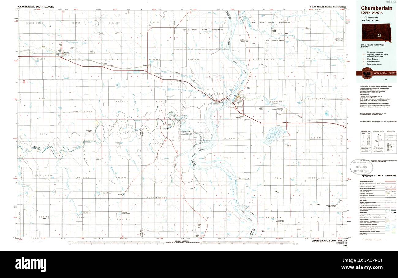 USGS TOPO Map South Dakota SD Chamberlain 344666 1986 100000 Restoration Stock Photohttps://www.alamy.com/image-license-details/?v=1https://www.alamy.com/usgs-topo-map-south-dakota-sd-chamberlain-344666-1986-100000-restoration-image334874177.html
RM2ACPRC1–USGS TOPO Map South Dakota SD Chamberlain 344666 1986 100000 Restoration
 Chamberlain, Hubbard County, US, United States, Minnesota, N 46 54' 18'', S 94 43' 18'', map, Cartascapes Map published in 2024. Explore Cartascapes, a map revealing Earth's diverse landscapes, cultures, and ecosystems. Journey through time and space, discovering the interconnectedness of our planet's past, present, and future. Stock Photohttps://www.alamy.com/image-license-details/?v=1https://www.alamy.com/chamberlain-hubbard-county-us-united-states-minnesota-n-46-54-18-s-94-43-18-map-cartascapes-map-published-in-2024-explore-cartascapes-a-map-revealing-earths-diverse-landscapes-cultures-and-ecosystems-journey-through-time-and-space-discovering-the-interconnectedness-of-our-planets-past-present-and-future-image621446829.html
RM2Y319NH–Chamberlain, Hubbard County, US, United States, Minnesota, N 46 54' 18'', S 94 43' 18'', map, Cartascapes Map published in 2024. Explore Cartascapes, a map revealing Earth's diverse landscapes, cultures, and ecosystems. Journey through time and space, discovering the interconnectedness of our planet's past, present, and future.
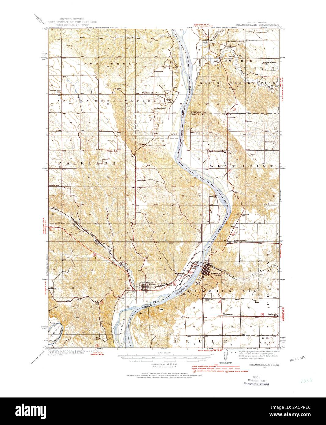 USGS TOPO Map South Dakota SD Chamberlain 344605 1935 62500 Restoration Stock Photohttps://www.alamy.com/image-license-details/?v=1https://www.alamy.com/usgs-topo-map-south-dakota-sd-chamberlain-344605-1935-62500-restoration-image334874244.html
RM2ACPREC–USGS TOPO Map South Dakota SD Chamberlain 344605 1935 62500 Restoration
 Chamberlain, Lincoln County, US, United States, Maine, N 43 53' 31'', S 69 28' 38'', map, Cartascapes Map published in 2024. Explore Cartascapes, a map revealing Earth's diverse landscapes, cultures, and ecosystems. Journey through time and space, discovering the interconnectedness of our planet's past, present, and future. Stock Photohttps://www.alamy.com/image-license-details/?v=1https://www.alamy.com/chamberlain-lincoln-county-us-united-states-maine-n-43-53-31-s-69-28-38-map-cartascapes-map-published-in-2024-explore-cartascapes-a-map-revealing-earths-diverse-landscapes-cultures-and-ecosystems-journey-through-time-and-space-discovering-the-interconnectedness-of-our-planets-past-present-and-future-image621458517.html
RM2Y31TK1–Chamberlain, Lincoln County, US, United States, Maine, N 43 53' 31'', S 69 28' 38'', map, Cartascapes Map published in 2024. Explore Cartascapes, a map revealing Earth's diverse landscapes, cultures, and ecosystems. Journey through time and space, discovering the interconnectedness of our planet's past, present, and future.
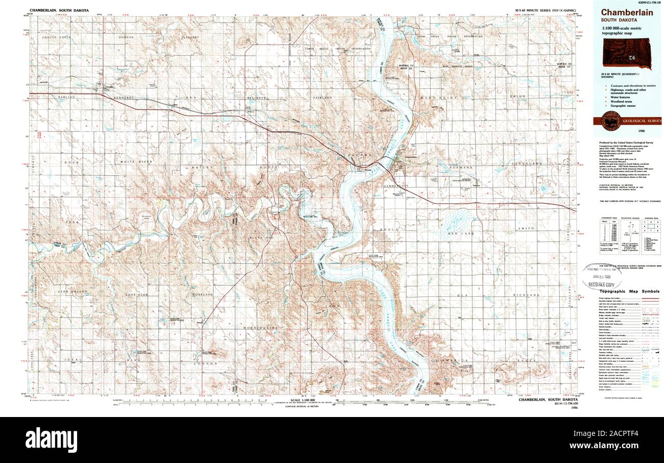 USGS TOPO Map South Dakota SD Chamberlain 344667 1986 100000 Restoration Stock Photohttps://www.alamy.com/image-license-details/?v=1https://www.alamy.com/usgs-topo-map-south-dakota-sd-chamberlain-344667-1986-100000-restoration-image334875048.html
RM2ACPTF4–USGS TOPO Map South Dakota SD Chamberlain 344667 1986 100000 Restoration
 Chamberlain, Saint Joseph County, US, United States, Michigan, N 42 3' 57'', S 85 44' 34'', map, Cartascapes Map published in 2024. Explore Cartascapes, a map revealing Earth's diverse landscapes, cultures, and ecosystems. Journey through time and space, discovering the interconnectedness of our planet's past, present, and future. Stock Photohttps://www.alamy.com/image-license-details/?v=1https://www.alamy.com/chamberlain-saint-joseph-county-us-united-states-michigan-n-42-3-57-s-85-44-34-map-cartascapes-map-published-in-2024-explore-cartascapes-a-map-revealing-earths-diverse-landscapes-cultures-and-ecosystems-journey-through-time-and-space-discovering-the-interconnectedness-of-our-planets-past-present-and-future-image621425886.html
RM2Y30B1J–Chamberlain, Saint Joseph County, US, United States, Michigan, N 42 3' 57'', S 85 44' 34'', map, Cartascapes Map published in 2024. Explore Cartascapes, a map revealing Earth's diverse landscapes, cultures, and ecosystems. Journey through time and space, discovering the interconnectedness of our planet's past, present, and future.
 Chamberlain, Saint Joseph County, US, United States, Michigan, N 42 3' 57'', S 85 44' 34'', map, Cartascapes Map published in 2024. Explore Cartascapes, a map revealing Earth's diverse landscapes, cultures, and ecosystems. Journey through time and space, discovering the interconnectedness of our planet's past, present, and future. Stock Photohttps://www.alamy.com/image-license-details/?v=1https://www.alamy.com/chamberlain-saint-joseph-county-us-united-states-michigan-n-42-3-57-s-85-44-34-map-cartascapes-map-published-in-2024-explore-cartascapes-a-map-revealing-earths-diverse-landscapes-cultures-and-ecosystems-journey-through-time-and-space-discovering-the-interconnectedness-of-our-planets-past-present-and-future-image621264781.html
RM2Y2N1FW–Chamberlain, Saint Joseph County, US, United States, Michigan, N 42 3' 57'', S 85 44' 34'', map, Cartascapes Map published in 2024. Explore Cartascapes, a map revealing Earth's diverse landscapes, cultures, and ecosystems. Journey through time and space, discovering the interconnectedness of our planet's past, present, and future.
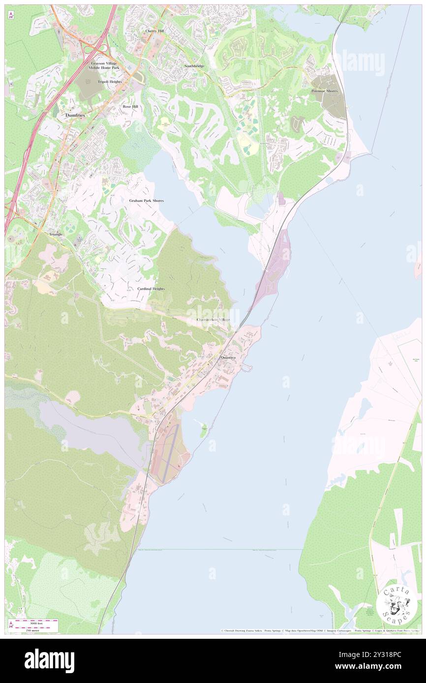 Chamberlain Village, Prince William County, US, United States, Virginia, N 38 31' 44'', S 77 17' 40'', map, Cartascapes Map published in 2024. Explore Cartascapes, a map revealing Earth's diverse landscapes, cultures, and ecosystems. Journey through time and space, discovering the interconnectedness of our planet's past, present, and future. Stock Photohttps://www.alamy.com/image-license-details/?v=1https://www.alamy.com/chamberlain-village-prince-william-county-us-united-states-virginia-n-38-31-44-s-77-17-40-map-cartascapes-map-published-in-2024-explore-cartascapes-a-map-revealing-earths-diverse-landscapes-cultures-and-ecosystems-journey-through-time-and-space-discovering-the-interconnectedness-of-our-planets-past-present-and-future-image621446068.html
RM2Y318PC–Chamberlain Village, Prince William County, US, United States, Virginia, N 38 31' 44'', S 77 17' 40'', map, Cartascapes Map published in 2024. Explore Cartascapes, a map revealing Earth's diverse landscapes, cultures, and ecosystems. Journey through time and space, discovering the interconnectedness of our planet's past, present, and future.
 Chamberlain, , NZ, New Zealand, Canterbury, S 44 14' 18'', N 170 46' 12'', map, Cartascapes Map published in 2024. Explore Cartascapes, a map revealing Earth's diverse landscapes, cultures, and ecosystems. Journey through time and space, discovering the interconnectedness of our planet's past, present, and future. Stock Photohttps://www.alamy.com/image-license-details/?v=1https://www.alamy.com/chamberlain-nz-new-zealand-canterbury-s-44-14-18-n-170-46-12-map-cartascapes-map-published-in-2024-explore-cartascapes-a-map-revealing-earths-diverse-landscapes-cultures-and-ecosystems-journey-through-time-and-space-discovering-the-interconnectedness-of-our-planets-past-present-and-future-image633944239.html
RM2YRAJ9K–Chamberlain, , NZ, New Zealand, Canterbury, S 44 14' 18'', N 170 46' 12'', map, Cartascapes Map published in 2024. Explore Cartascapes, a map revealing Earth's diverse landscapes, cultures, and ecosystems. Journey through time and space, discovering the interconnectedness of our planet's past, present, and future.
 Lake Chamberlain, , NZ, New Zealand, Southland, S 45 22' 42'', N 167 3' 36'', map, Cartascapes Map published in 2024. Explore Cartascapes, a map revealing Earth's diverse landscapes, cultures, and ecosystems. Journey through time and space, discovering the interconnectedness of our planet's past, present, and future. Stock Photohttps://www.alamy.com/image-license-details/?v=1https://www.alamy.com/lake-chamberlain-nz-new-zealand-southland-s-45-22-42-n-167-3-36-map-cartascapes-map-published-in-2024-explore-cartascapes-a-map-revealing-earths-diverse-landscapes-cultures-and-ecosystems-journey-through-time-and-space-discovering-the-interconnectedness-of-our-planets-past-present-and-future-image634031126.html
RM2YREH4P–Lake Chamberlain, , NZ, New Zealand, Southland, S 45 22' 42'', N 167 3' 36'', map, Cartascapes Map published in 2024. Explore Cartascapes, a map revealing Earth's diverse landscapes, cultures, and ecosystems. Journey through time and space, discovering the interconnectedness of our planet's past, present, and future.
 Chamberlain Stream, , NZ, New Zealand, Canterbury, S 44 15' 30'', N 170 45' 36'', map, Cartascapes Map published in 2024. Explore Cartascapes, a map revealing Earth's diverse landscapes, cultures, and ecosystems. Journey through time and space, discovering the interconnectedness of our planet's past, present, and future. Stock Photohttps://www.alamy.com/image-license-details/?v=1https://www.alamy.com/chamberlain-stream-nz-new-zealand-canterbury-s-44-15-30-n-170-45-36-map-cartascapes-map-published-in-2024-explore-cartascapes-a-map-revealing-earths-diverse-landscapes-cultures-and-ecosystems-journey-through-time-and-space-discovering-the-interconnectedness-of-our-planets-past-present-and-future-image634052808.html
RM2YRFGR4–Chamberlain Stream, , NZ, New Zealand, Canterbury, S 44 15' 30'', N 170 45' 36'', map, Cartascapes Map published in 2024. Explore Cartascapes, a map revealing Earth's diverse landscapes, cultures, and ecosystems. Journey through time and space, discovering the interconnectedness of our planet's past, present, and future.
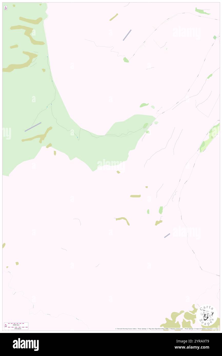 Chamberlain Stream, , NZ, New Zealand, Canterbury, S 44 17' 18'', N 170 43' 12'', map, Cartascapes Map published in 2024. Explore Cartascapes, a map revealing Earth's diverse landscapes, cultures, and ecosystems. Journey through time and space, discovering the interconnectedness of our planet's past, present, and future. Stock Photohttps://www.alamy.com/image-license-details/?v=1https://www.alamy.com/chamberlain-stream-nz-new-zealand-canterbury-s-44-17-18-n-170-43-12-map-cartascapes-map-published-in-2024-explore-cartascapes-a-map-revealing-earths-diverse-landscapes-cultures-and-ecosystems-journey-through-time-and-space-discovering-the-interconnectedness-of-our-planets-past-present-and-future-image633950921.html
RM2YRAXT9–Chamberlain Stream, , NZ, New Zealand, Canterbury, S 44 17' 18'', N 170 43' 12'', map, Cartascapes Map published in 2024. Explore Cartascapes, a map revealing Earth's diverse landscapes, cultures, and ecosystems. Journey through time and space, discovering the interconnectedness of our planet's past, present, and future.
 Chamberlain, Greater London, GB, United Kingdom, England, N 51 30' 40'', S 0 4' 29'', map, Cartascapes Map published in 2024. Explore Cartascapes, a map revealing Earth's diverse landscapes, cultures, and ecosystems. Journey through time and space, discovering the interconnectedness of our planet's past, present, and future. Stock Photohttps://www.alamy.com/image-license-details/?v=1https://www.alamy.com/chamberlain-greater-london-gb-united-kingdom-england-n-51-30-40-s-0-4-29-map-cartascapes-map-published-in-2024-explore-cartascapes-a-map-revealing-earths-diverse-landscapes-cultures-and-ecosystems-journey-through-time-and-space-discovering-the-interconnectedness-of-our-planets-past-present-and-future-image604204044.html
RM2X2YTBT–Chamberlain, Greater London, GB, United Kingdom, England, N 51 30' 40'', S 0 4' 29'', map, Cartascapes Map published in 2024. Explore Cartascapes, a map revealing Earth's diverse landscapes, cultures, and ecosystems. Journey through time and space, discovering the interconnectedness of our planet's past, present, and future.
 Chamberlain Creek, Masterton District, NZ, New Zealand, Wellington, S 40 43' 13'', N 175 29' 49'', map, Cartascapes Map published in 2024. Explore Cartascapes, a map revealing Earth's diverse landscapes, cultures, and ecosystems. Journey through time and space, discovering the interconnectedness of our planet's past, present, and future. Stock Photohttps://www.alamy.com/image-license-details/?v=1https://www.alamy.com/chamberlain-creek-masterton-district-nz-new-zealand-wellington-s-40-43-13-n-175-29-49-map-cartascapes-map-published-in-2024-explore-cartascapes-a-map-revealing-earths-diverse-landscapes-cultures-and-ecosystems-journey-through-time-and-space-discovering-the-interconnectedness-of-our-planets-past-present-and-future-image633987879.html
RM2YRCJ07–Chamberlain Creek, Masterton District, NZ, New Zealand, Wellington, S 40 43' 13'', N 175 29' 49'', map, Cartascapes Map published in 2024. Explore Cartascapes, a map revealing Earth's diverse landscapes, cultures, and ecosystems. Journey through time and space, discovering the interconnectedness of our planet's past, present, and future.
 Chamberlain, Brule County, US, United States, South Dakota, N 43 48' 38'', S 99 19' 50'', map, Cartascapes Map published in 2024. Explore Cartascapes, a map revealing Earth's diverse landscapes, cultures, and ecosystems. Journey through time and space, discovering the interconnectedness of our planet's past, present, and future. Stock Photohttps://www.alamy.com/image-license-details/?v=1https://www.alamy.com/chamberlain-brule-county-us-united-states-south-dakota-n-43-48-38-s-99-19-50-map-cartascapes-map-published-in-2024-explore-cartascapes-a-map-revealing-earths-diverse-landscapes-cultures-and-ecosystems-journey-through-time-and-space-discovering-the-interconnectedness-of-our-planets-past-present-and-future-image620827954.html
RM2Y214AX–Chamberlain, Brule County, US, United States, South Dakota, N 43 48' 38'', S 99 19' 50'', map, Cartascapes Map published in 2024. Explore Cartascapes, a map revealing Earth's diverse landscapes, cultures, and ecosystems. Journey through time and space, discovering the interconnectedness of our planet's past, present, and future.
 City of Chamberlain, Brule County, US, United States, South Dakota, N 43 47' 8'', S 99 19' 35'', map, Cartascapes Map published in 2024. Explore Cartascapes, a map revealing Earth's diverse landscapes, cultures, and ecosystems. Journey through time and space, discovering the interconnectedness of our planet's past, present, and future. Stock Photohttps://www.alamy.com/image-license-details/?v=1https://www.alamy.com/city-of-chamberlain-brule-county-us-united-states-south-dakota-n-43-47-8-s-99-19-35-map-cartascapes-map-published-in-2024-explore-cartascapes-a-map-revealing-earths-diverse-landscapes-cultures-and-ecosystems-journey-through-time-and-space-discovering-the-interconnectedness-of-our-planets-past-present-and-future-image633796479.html
RM2YR3WTF–City of Chamberlain, Brule County, US, United States, South Dakota, N 43 47' 8'', S 99 19' 35'', map, Cartascapes Map published in 2024. Explore Cartascapes, a map revealing Earth's diverse landscapes, cultures, and ecosystems. Journey through time and space, discovering the interconnectedness of our planet's past, present, and future.
 Chamberlain, Brule County, US, United States, South Dakota, N 43 48' 38'', S 99 19' 50'', map, Cartascapes Map published in 2024. Explore Cartascapes, a map revealing Earth's diverse landscapes, cultures, and ecosystems. Journey through time and space, discovering the interconnectedness of our planet's past, present, and future. Stock Photohttps://www.alamy.com/image-license-details/?v=1https://www.alamy.com/chamberlain-brule-county-us-united-states-south-dakota-n-43-48-38-s-99-19-50-map-cartascapes-map-published-in-2024-explore-cartascapes-a-map-revealing-earths-diverse-landscapes-cultures-and-ecosystems-journey-through-time-and-space-discovering-the-interconnectedness-of-our-planets-past-present-and-future-image620668258.html
RM2Y1NTKE–Chamberlain, Brule County, US, United States, South Dakota, N 43 48' 38'', S 99 19' 50'', map, Cartascapes Map published in 2024. Explore Cartascapes, a map revealing Earth's diverse landscapes, cultures, and ecosystems. Journey through time and space, discovering the interconnectedness of our planet's past, present, and future.
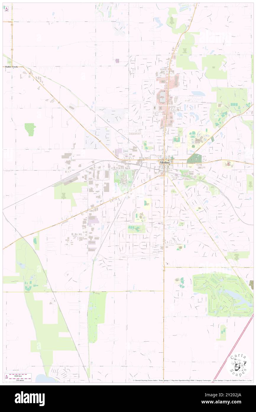 Chamberlain (historical), Medina County, US, United States, Ohio, N 41 7' 45'', S 81 52' 42'', map, Cartascapes Map published in 2024. Explore Cartascapes, a map revealing Earth's diverse landscapes, cultures, and ecosystems. Journey through time and space, discovering the interconnectedness of our planet's past, present, and future. Stock Photohttps://www.alamy.com/image-license-details/?v=1https://www.alamy.com/chamberlain-historical-medina-county-us-united-states-ohio-n-41-7-45-s-81-52-42-map-cartascapes-map-published-in-2024-explore-cartascapes-a-map-revealing-earths-diverse-landscapes-cultures-and-ecosystems-journey-through-time-and-space-discovering-the-interconnectedness-of-our-planets-past-present-and-future-image620804642.html
RM2Y202JA–Chamberlain (historical), Medina County, US, United States, Ohio, N 41 7' 45'', S 81 52' 42'', map, Cartascapes Map published in 2024. Explore Cartascapes, a map revealing Earth's diverse landscapes, cultures, and ecosystems. Journey through time and space, discovering the interconnectedness of our planet's past, present, and future.
 Township of Chamberlain, Brule County, US, United States, South Dakota, N 43 48' 11'', S 99 17' 15'', map, Cartascapes Map published in 2024. Explore Cartascapes, a map revealing Earth's diverse landscapes, cultures, and ecosystems. Journey through time and space, discovering the interconnectedness of our planet's past, present, and future. Stock Photohttps://www.alamy.com/image-license-details/?v=1https://www.alamy.com/township-of-chamberlain-brule-county-us-united-states-south-dakota-n-43-48-11-s-99-17-15-map-cartascapes-map-published-in-2024-explore-cartascapes-a-map-revealing-earths-diverse-landscapes-cultures-and-ecosystems-journey-through-time-and-space-discovering-the-interconnectedness-of-our-planets-past-present-and-future-image633873031.html
RM2YR7BEF–Township of Chamberlain, Brule County, US, United States, South Dakota, N 43 48' 11'', S 99 17' 15'', map, Cartascapes Map published in 2024. Explore Cartascapes, a map revealing Earth's diverse landscapes, cultures, and ecosystems. Journey through time and space, discovering the interconnectedness of our planet's past, present, and future.
 Compton Chamberlain, Wiltshire, GB, United Kingdom, England, N 51 2' 59'', S 1 57' 0'', map, Cartascapes Map published in 2024. Explore Cartascapes, a map revealing Earth's diverse landscapes, cultures, and ecosystems. Journey through time and space, discovering the interconnectedness of our planet's past, present, and future. Stock Photohttps://www.alamy.com/image-license-details/?v=1https://www.alamy.com/compton-chamberlain-wiltshire-gb-united-kingdom-england-n-51-2-59-s-1-57-0-map-cartascapes-map-published-in-2024-explore-cartascapes-a-map-revealing-earths-diverse-landscapes-cultures-and-ecosystems-journey-through-time-and-space-discovering-the-interconnectedness-of-our-planets-past-present-and-future-image604177288.html
RM2X2XJ88–Compton Chamberlain, Wiltshire, GB, United Kingdom, England, N 51 2' 59'', S 1 57' 0'', map, Cartascapes Map published in 2024. Explore Cartascapes, a map revealing Earth's diverse landscapes, cultures, and ecosystems. Journey through time and space, discovering the interconnectedness of our planet's past, present, and future.
 Chamberlain, Canada, Saskatchewan, N 50 51' 0'', W 105 34' 4'', map, Timeless Map published in 2021. Travelers, explorers and adventurers like Florence Nightingale, David Livingstone, Ernest Shackleton, Lewis and Clark and Sherlock Holmes relied on maps to plan travels to the world's most remote corners, Timeless Maps is mapping most locations on the globe, showing the achievement of great dreams Stock Photohttps://www.alamy.com/image-license-details/?v=1https://www.alamy.com/chamberlain-canada-saskatchewan-n-50-51-0-w-105-34-4-map-timeless-map-published-in-2021-travelers-explorers-and-adventurers-like-florence-nightingale-david-livingstone-ernest-shackleton-lewis-and-clark-and-sherlock-holmes-relied-on-maps-to-plan-travels-to-the-worlds-most-remote-corners-timeless-maps-is-mapping-most-locations-on-the-globe-showing-the-achievement-of-great-dreams-image457855696.html
RM2HGW3H4–Chamberlain, Canada, Saskatchewan, N 50 51' 0'', W 105 34' 4'', map, Timeless Map published in 2021. Travelers, explorers and adventurers like Florence Nightingale, David Livingstone, Ernest Shackleton, Lewis and Clark and Sherlock Holmes relied on maps to plan travels to the world's most remote corners, Timeless Maps is mapping most locations on the globe, showing the achievement of great dreams
 Chamberlain, Timiskaming District, Canada, Ontario, N 47 51' 24'', W 79 54' 18'', map, Timeless Map published in 2021. Travelers, explorers and adventurers like Florence Nightingale, David Livingstone, Ernest Shackleton, Lewis and Clark and Sherlock Holmes relied on maps to plan travels to the world's most remote corners, Timeless Maps is mapping most locations on the globe, showing the achievement of great dreams Stock Photohttps://www.alamy.com/image-license-details/?v=1https://www.alamy.com/chamberlain-timiskaming-district-canada-ontario-n-47-51-24-w-79-54-18-map-timeless-map-published-in-2021-travelers-explorers-and-adventurers-like-florence-nightingale-david-livingstone-ernest-shackleton-lewis-and-clark-and-sherlock-holmes-relied-on-maps-to-plan-travels-to-the-worlds-most-remote-corners-timeless-maps-is-mapping-most-locations-on-the-globe-showing-the-achievement-of-great-dreams-image457855656.html
RM2HGW3FM–Chamberlain, Timiskaming District, Canada, Ontario, N 47 51' 24'', W 79 54' 18'', map, Timeless Map published in 2021. Travelers, explorers and adventurers like Florence Nightingale, David Livingstone, Ernest Shackleton, Lewis and Clark and Sherlock Holmes relied on maps to plan travels to the world's most remote corners, Timeless Maps is mapping most locations on the globe, showing the achievement of great dreams
 Chamberlain Settlement, Gloucester County, Canada, New Brunswick, N 47 34' 18'', W 65 37' 43'', map, Timeless Map published in 2021. Travelers, explorers and adventurers like Florence Nightingale, David Livingstone, Ernest Shackleton, Lewis and Clark and Sherlock Holmes relied on maps to plan travels to the world's most remote corners, Timeless Maps is mapping most locations on the globe, showing the achievement of great dreams Stock Photohttps://www.alamy.com/image-license-details/?v=1https://www.alamy.com/chamberlain-settlement-gloucester-county-canada-new-brunswick-n-47-34-18-w-65-37-43-map-timeless-map-published-in-2021-travelers-explorers-and-adventurers-like-florence-nightingale-david-livingstone-ernest-shackleton-lewis-and-clark-and-sherlock-holmes-relied-on-maps-to-plan-travels-to-the-worlds-most-remote-corners-timeless-maps-is-mapping-most-locations-on-the-globe-showing-the-achievement-of-great-dreams-image457846108.html
RM2HGTKAM–Chamberlain Settlement, Gloucester County, Canada, New Brunswick, N 47 34' 18'', W 65 37' 43'', map, Timeless Map published in 2021. Travelers, explorers and adventurers like Florence Nightingale, David Livingstone, Ernest Shackleton, Lewis and Clark and Sherlock Holmes relied on maps to plan travels to the world's most remote corners, Timeless Maps is mapping most locations on the globe, showing the achievement of great dreams
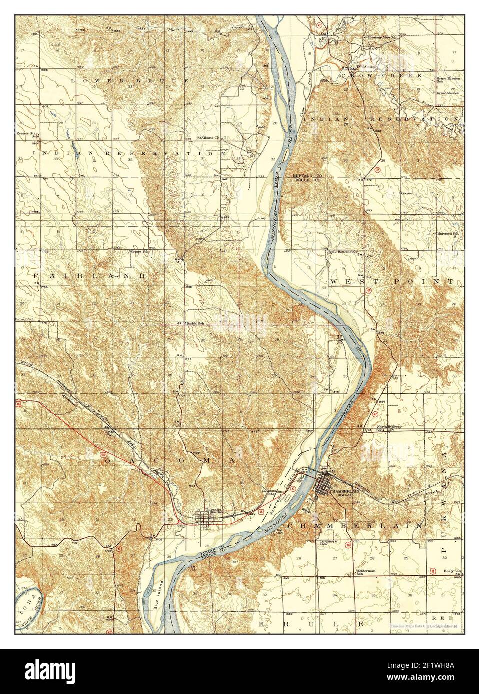 Chamberlain, South Dakota, map 1939, 1:62500, United States of America by Timeless Maps, data U.S. Geological Survey Stock Photohttps://www.alamy.com/image-license-details/?v=1https://www.alamy.com/chamberlain-south-dakota-map-1939-162500-united-states-of-america-by-timeless-maps-data-us-geological-survey-image414225850.html
RM2F1WH8A–Chamberlain, South Dakota, map 1939, 1:62500, United States of America by Timeless Maps, data U.S. Geological Survey
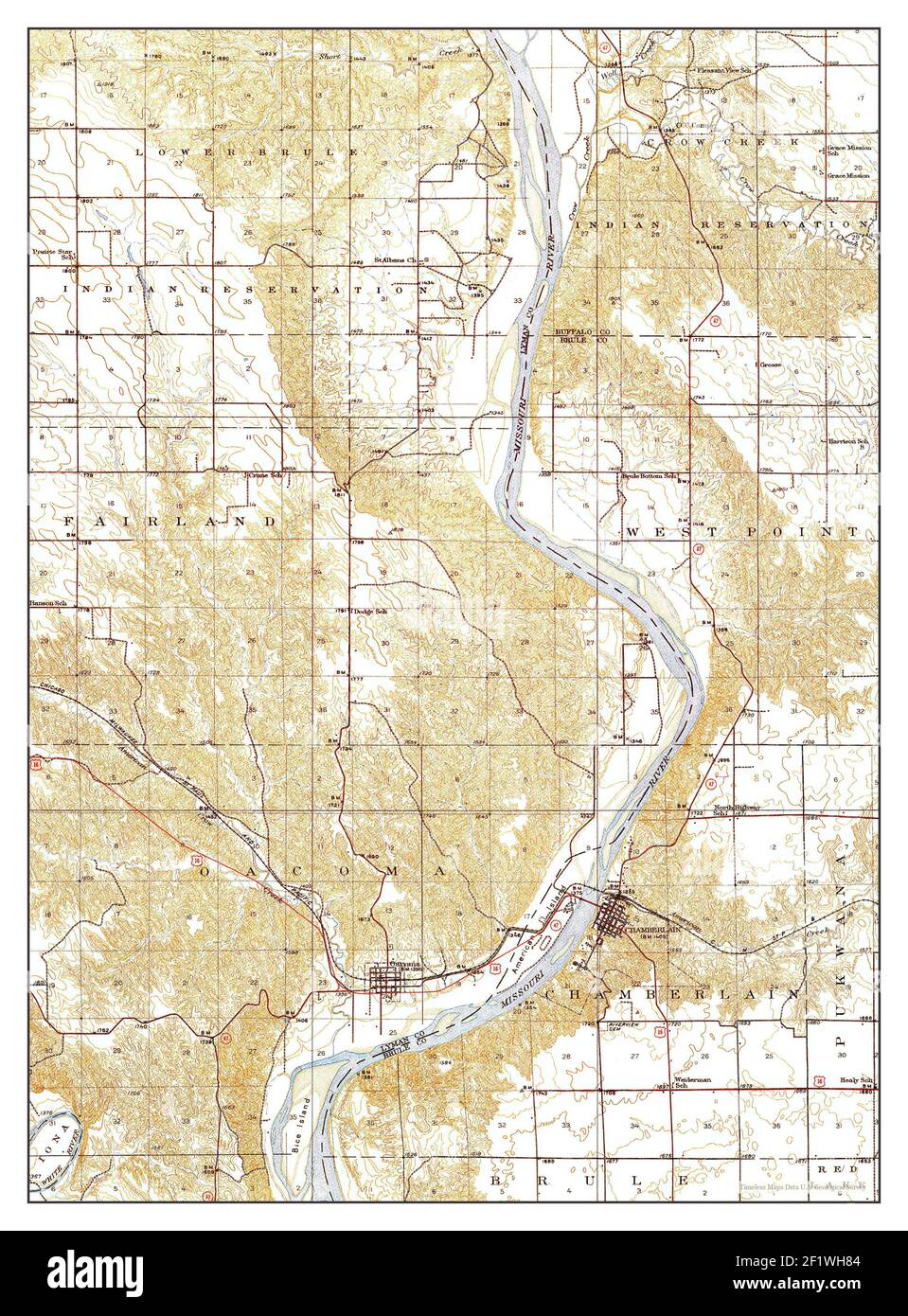 Chamberlain, South Dakota, map 1935, 1:62500, United States of America by Timeless Maps, data U.S. Geological Survey Stock Photohttps://www.alamy.com/image-license-details/?v=1https://www.alamy.com/chamberlain-south-dakota-map-1935-162500-united-states-of-america-by-timeless-maps-data-us-geological-survey-image414225844.html
RM2F1WH84–Chamberlain, South Dakota, map 1935, 1:62500, United States of America by Timeless Maps, data U.S. Geological Survey
 Chamberlain Lake, Maine, map 1994, 1:100000, United States of America by Timeless Maps, data U.S. Geological Survey Stock Photohttps://www.alamy.com/image-license-details/?v=1https://www.alamy.com/chamberlain-lake-maine-map-1994-1100000-united-states-of-america-by-timeless-maps-data-us-geological-survey-image406653629.html
RM2EHGJRW–Chamberlain Lake, Maine, map 1994, 1:100000, United States of America by Timeless Maps, data U.S. Geological Survey
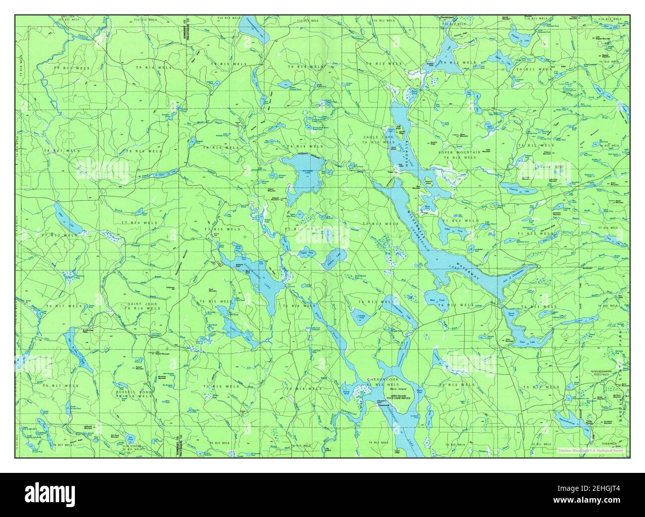 Chamberlain Lake, Maine, map 1986, 1:100000, United States of America by Timeless Maps, data U.S. Geological Survey Stock Photohttps://www.alamy.com/image-license-details/?v=1https://www.alamy.com/chamberlain-lake-maine-map-1986-1100000-united-states-of-america-by-timeless-maps-data-us-geological-survey-image406653636.html
RM2EHGJT4–Chamberlain Lake, Maine, map 1986, 1:100000, United States of America by Timeless Maps, data U.S. Geological Survey
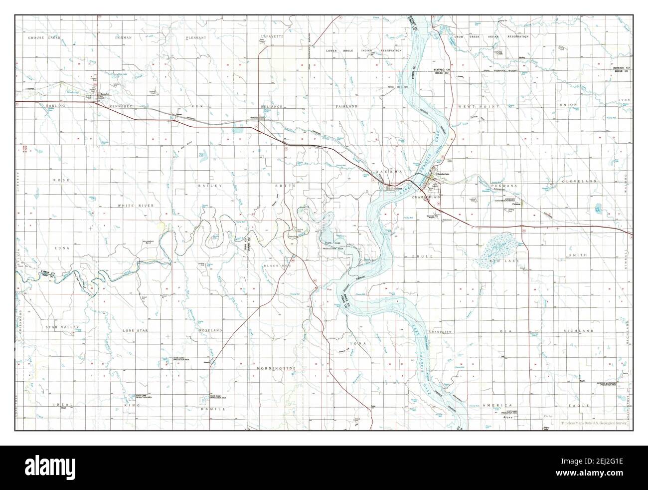 Chamberlain, South Dakota, map 1986, 1:100000, United States of America by Timeless Maps, data U.S. Geological Survey Stock Photohttps://www.alamy.com/image-license-details/?v=1https://www.alamy.com/chamberlain-south-dakota-map-1986-1100000-united-states-of-america-by-timeless-maps-data-us-geological-survey-image406958762.html
RM2EJ2G1E–Chamberlain, South Dakota, map 1986, 1:100000, United States of America by Timeless Maps, data U.S. Geological Survey
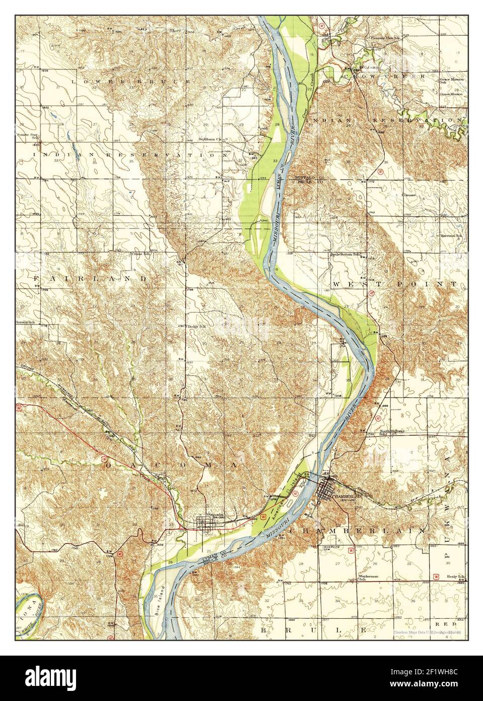 Chamberlain, South Dakota, map 1939, 1:62500, United States of America by Timeless Maps, data U.S. Geological Survey Stock Photohttps://www.alamy.com/image-license-details/?v=1https://www.alamy.com/chamberlain-south-dakota-map-1939-162500-united-states-of-america-by-timeless-maps-data-us-geological-survey-image414225852.html
RM2F1WH8C–Chamberlain, South Dakota, map 1939, 1:62500, United States of America by Timeless Maps, data U.S. Geological Survey
 Chamberlain, South Dakota, map 1986, 1:100000, United States of America by Timeless Maps, data U.S. Geological Survey Stock Photohttps://www.alamy.com/image-license-details/?v=1https://www.alamy.com/chamberlain-south-dakota-map-1986-1100000-united-states-of-america-by-timeless-maps-data-us-geological-survey-image406958763.html
RM2EJ2G1F–Chamberlain, South Dakota, map 1986, 1:100000, United States of America by Timeless Maps, data U.S. Geological Survey