Quick filters:
Clearfield county Stock Photos and Images
 Clearfield, Clearfield County Pennsylvania., 1895 Stock Photohttps://www.alamy.com/image-license-details/?v=1https://www.alamy.com/stock-photo-clearfield-clearfield-county-pennsylvania-1895-83147153.html
RMER7K15–Clearfield, Clearfield County Pennsylvania., 1895
 Image 4 of Sanborn Fire Insurance Map from Houtzdale, Clearfield County, Pennsylvania. Oct 1894. 6 Sheet(s), America, street map with a Nineteenth Century compass Stock Photohttps://www.alamy.com/image-license-details/?v=1https://www.alamy.com/image-4-of-sanborn-fire-insurance-map-from-houtzdale-clearfield-county-pennsylvania-oct-1894-6-sheets-america-street-map-with-a-nineteenth-century-compass-image344697733.html
RM2B0P9D9–Image 4 of Sanborn Fire Insurance Map from Houtzdale, Clearfield County, Pennsylvania. Oct 1894. 6 Sheet(s), America, street map with a Nineteenth Century compass
 Oshanter, Clearfield County, US, United States, Pennsylvania, N 40 56' 7'', S 78 27' 41'', map, Cartascapes Map published in 2024. Explore Cartascapes, a map revealing Earth's diverse landscapes, cultures, and ecosystems. Journey through time and space, discovering the interconnectedness of our planet's past, present, and future. Stock Photohttps://www.alamy.com/image-license-details/?v=1https://www.alamy.com/oshanter-clearfield-county-us-united-states-pennsylvania-n-40-56-7-s-78-27-41-map-cartascapes-map-published-in-2024-explore-cartascapes-a-map-revealing-earths-diverse-landscapes-cultures-and-ecosystems-journey-through-time-and-space-discovering-the-interconnectedness-of-our-planets-past-present-and-future-image621364053.html
RM2Y2WG59–Oshanter, Clearfield County, US, United States, Pennsylvania, N 40 56' 7'', S 78 27' 41'', map, Cartascapes Map published in 2024. Explore Cartascapes, a map revealing Earth's diverse landscapes, cultures, and ecosystems. Journey through time and space, discovering the interconnectedness of our planet's past, present, and future.
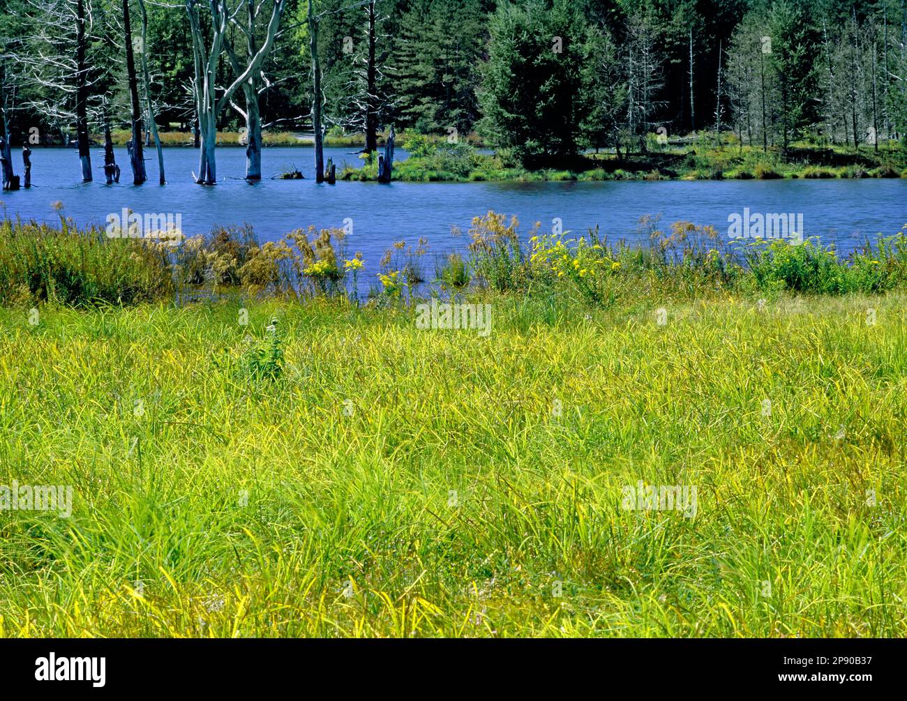 Shaggers Inn Water Impoundment in Moshannon State Forest in Clearfield County Pennsylvania is a wildlife habitat project Stock Photohttps://www.alamy.com/image-license-details/?v=1https://www.alamy.com/shaggers-inn-water-impoundment-in-moshannon-state-forest-in-clearfield-county-pennsylvania-is-a-wildlife-habitat-project-image539062027.html
RM2P90B37–Shaggers Inn Water Impoundment in Moshannon State Forest in Clearfield County Pennsylvania is a wildlife habitat project
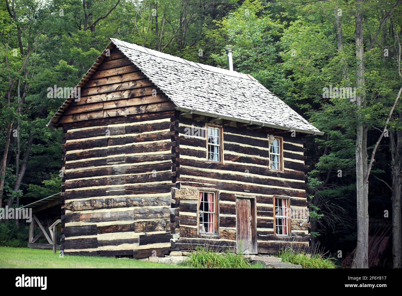 Bloody Knox Cabin in Curwensville, Clearfield County Pennsylvania, historical building for civil war resistance Stock Photohttps://www.alamy.com/image-license-details/?v=1https://www.alamy.com/bloody-knox-cabin-in-curwensville-clearfield-county-pennsylvania-historical-building-for-civil-war-resistance-image417335779.html
RF2F6Y817–Bloody Knox Cabin in Curwensville, Clearfield County Pennsylvania, historical building for civil war resistance
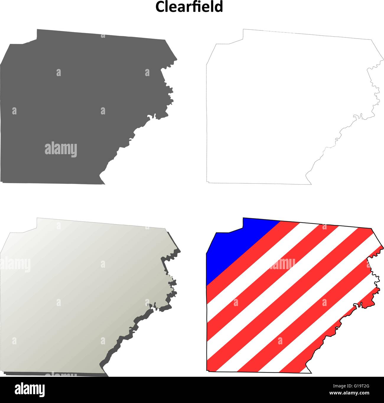 Clearfield County, Pennsylvania outline map set Stock Vectorhttps://www.alamy.com/image-license-details/?v=1https://www.alamy.com/stock-photo-clearfield-county-pennsylvania-outline-map-set-104093320.html
RFG19T2G–Clearfield County, Pennsylvania outline map set
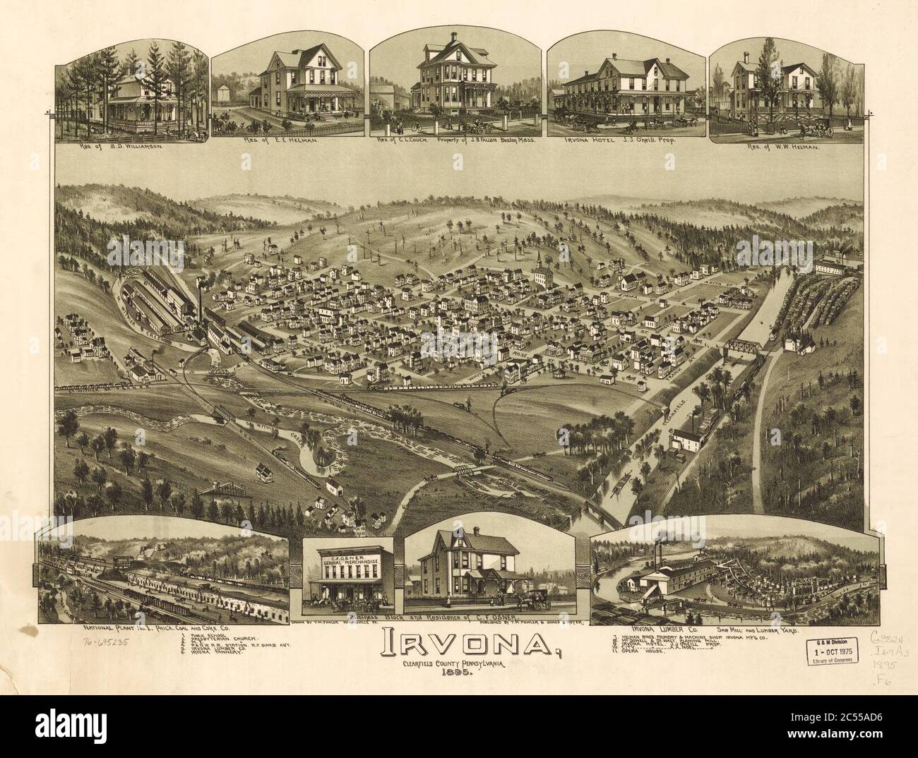 Irvona, Clearfield County, Pennsylvania. Stock Photohttps://www.alamy.com/image-license-details/?v=1https://www.alamy.com/irvona-clearfield-county-pennsylvania-image364608978.html
RM2C55AD6–Irvona, Clearfield County, Pennsylvania.
 . Robot disassembling mock-up to practice for work on contaminated nuclear research facility in what is now Quehanna Wild Area in Clearfield County, Pennsylvania in the United States. The former reactor facility in Quehanna Wild Area was so contaminated with radioactive material that parts of it had to be dismantled remotely by a robot. The area where the robot worked was so radioactive that no photos were taken of it there (only grainy videos), so this is the best image of how it operated. Taken between 2003 when the robot started work at the facility, and 2004, when it finished its work.. Pe Stock Photohttps://www.alamy.com/image-license-details/?v=1https://www.alamy.com/robot-disassembling-mock-up-to-practice-for-work-on-contaminated-nuclear-research-facility-in-what-is-now-quehanna-wild-area-in-clearfield-county-pennsylvania-in-the-united-states-the-former-reactor-facility-in-quehanna-wild-area-was-so-contaminated-with-radioactive-material-that-parts-of-it-had-to-be-dismantled-remotely-by-a-robot-the-area-where-the-robot-worked-was-so-radioactive-that-no-photos-were-taken-of-it-there-only-grainy-videos-so-this-is-the-best-image-of-how-it-operated-taken-between-2003-when-the-robot-started-work-at-the-facility-and-2004-when-it-finished-its-work-pe-image208041248.html
RMP2D2MG–. Robot disassembling mock-up to practice for work on contaminated nuclear research facility in what is now Quehanna Wild Area in Clearfield County, Pennsylvania in the United States. The former reactor facility in Quehanna Wild Area was so contaminated with radioactive material that parts of it had to be dismantled remotely by a robot. The area where the robot worked was so radioactive that no photos were taken of it there (only grainy videos), so this is the best image of how it operated. Taken between 2003 when the robot started work at the facility, and 2004, when it finished its work.. Pe
 Trees in a forest, Bilger's Rocks, Grampian, Clearfield County, Pennsylvania, USA Stock Photohttps://www.alamy.com/image-license-details/?v=1https://www.alamy.com/trees-in-a-forest-bilgers-rocks-grampian-clearfield-county-pennsylvania-usa-image330234774.html
RM2A57DR2–Trees in a forest, Bilger's Rocks, Grampian, Clearfield County, Pennsylvania, USA
 Clearfield, Clearfield County Pennsylvania., 1895 Stock Photohttps://www.alamy.com/image-license-details/?v=1https://www.alamy.com/clearfield-clearfield-county-pennsylvania-1895-image264535441.html
RMWAAHJ9–Clearfield, Clearfield County Pennsylvania., 1895
 State Street, Curwensville Pennsylvania USA, approx 1910s postcard. unidentified photographer Stock Photohttps://www.alamy.com/image-license-details/?v=1https://www.alamy.com/state-street-curwensville-pennsylvania-usa-approx-1910s-postcard-unidentified-photographer-image618828856.html
RM2XXP2EG–State Street, Curwensville Pennsylvania USA, approx 1910s postcard. unidentified photographer
 Clearfield, Clearfield County Pennsylvania., 1895 LCCN2003681813 Stock Photohttps://www.alamy.com/image-license-details/?v=1https://www.alamy.com/stock-photo-clearfield-clearfield-county-pennsylvania-1895-lccn2003681813-176663796.html
RMM7BMD8–Clearfield, Clearfield County Pennsylvania., 1895 LCCN2003681813
 Rendering of a green 3d highway sign for Clearfield County Stock Photohttps://www.alamy.com/image-license-details/?v=1https://www.alamy.com/rendering-of-a-green-3d-highway-sign-for-clearfield-county-image334397848.html
RF2AC13T8–Rendering of a green 3d highway sign for Clearfield County
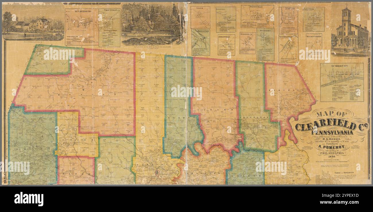 Map of Clearfield Co., Pennsylvania : from actual surveys & official records 1866 by Beers, D. G. (Daniel G.) Stock Photohttps://www.alamy.com/image-license-details/?v=1https://www.alamy.com/map-of-clearfield-co-pennsylvania-from-actual-surveys-official-records-1866-by-beers-d-g-daniel-g-image633423433.html
RM2YPEX1D–Map of Clearfield Co., Pennsylvania : from actual surveys & official records 1866 by Beers, D. G. (Daniel G.)
 Clearfield County, Commonwealth of Pennsylvania (U.S. county, United States of America, USA, U.S., US) map vector illustration, scribble sketch Clearf Stock Vectorhttps://www.alamy.com/image-license-details/?v=1https://www.alamy.com/clearfield-county-commonwealth-of-pennsylvania-us-county-united-states-of-america-usa-us-us-map-vector-illustration-scribble-sketch-clearf-image414379362.html
RF2F24H2X–Clearfield County, Commonwealth of Pennsylvania (U.S. county, United States of America, USA, U.S., US) map vector illustration, scribble sketch Clearf
 History of the Alleghany Evangelical Lutheran synod of Pennsylvania, together with a topical handbook of the Evangelical Lutheran church, its ancestry, origin and development . from the mission, and EastRidge, in Burnside Township, Clearfield County, and Butter-baugh settlement in Indiana County, and Cherrytree constitutedthe charge. Rev. C. A. Fetzer, a licentiate of the AlleghanySynod, was appointed the missionary of the new field. He beganlabors in 1855. He reported four congregations, forty additions,three prayer meetings and three Sunday schools. By permission434 MT. ZION, GLASGOW of Syno Stock Photohttps://www.alamy.com/image-license-details/?v=1https://www.alamy.com/history-of-the-alleghany-evangelical-lutheran-synod-of-pennsylvania-together-with-a-topical-handbook-of-the-evangelical-lutheran-church-its-ancestry-origin-and-development-from-the-mission-and-eastridge-in-burnside-township-clearfield-county-and-butter-baugh-settlement-in-indiana-county-and-cherrytree-constitutedthe-charge-rev-c-a-fetzer-a-licentiate-of-the-alleghanysynod-was-appointed-the-missionary-of-the-new-field-he-beganlabors-in-1855-he-reported-four-congregations-forty-additionsthree-prayer-meetings-and-three-sunday-schools-by-permission434-mt-zion-glasgow-of-syno-image340030442.html
RM2AN5M8A–History of the Alleghany Evangelical Lutheran synod of Pennsylvania, together with a topical handbook of the Evangelical Lutheran church, its ancestry, origin and development . from the mission, and EastRidge, in Burnside Township, Clearfield County, and Butter-baugh settlement in Indiana County, and Cherrytree constitutedthe charge. Rev. C. A. Fetzer, a licentiate of the AlleghanySynod, was appointed the missionary of the new field. He beganlabors in 1855. He reported four congregations, forty additions,three prayer meetings and three Sunday schools. By permission434 MT. ZION, GLASGOW of Syno
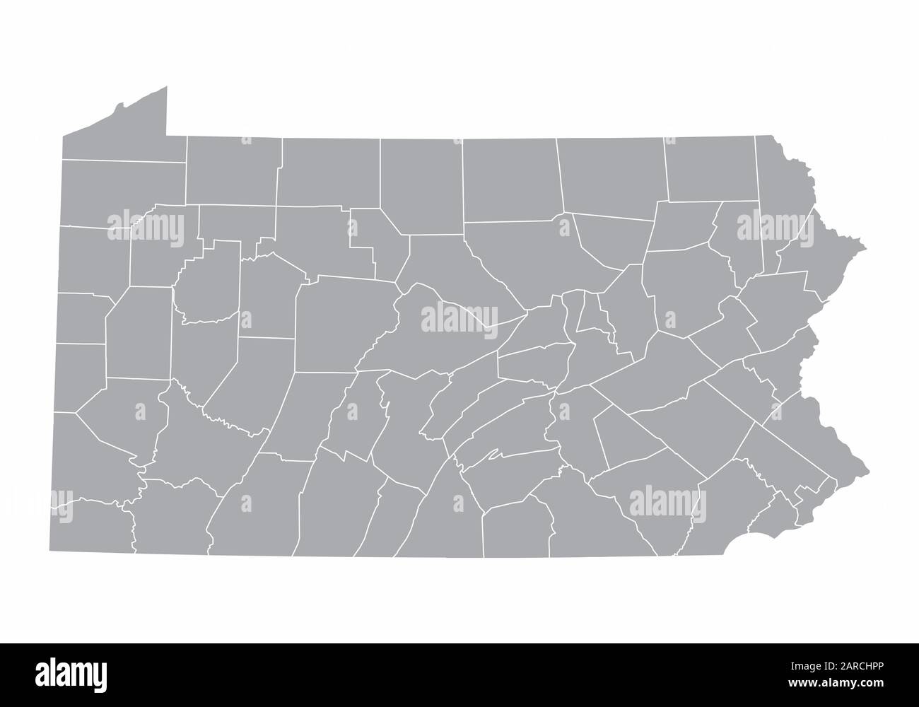 Map of Pennsylvania Stock Vectorhttps://www.alamy.com/image-license-details/?v=1https://www.alamy.com/map-of-pennsylvania-image341411470.html
RF2ARCHPP–Map of Pennsylvania
 Map of Clearfield in Pennsylvania Stock Photohttps://www.alamy.com/image-license-details/?v=1https://www.alamy.com/map-of-clearfield-in-pennsylvania-image385793913.html
RF2DBJC21–Map of Clearfield in Pennsylvania
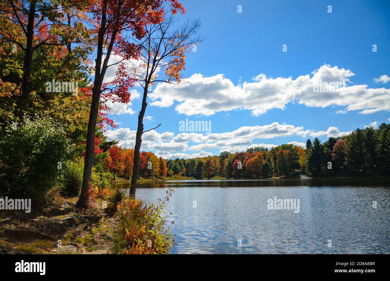 Parker Dam State Park Stock Photohttps://www.alamy.com/image-license-details/?v=1https://www.alamy.com/parker-dam-state-park-image383771467.html
RF2D8A8BR–Parker Dam State Park
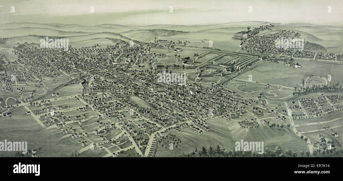 DuBois, Clearfield County Pennsylvania., 1895 Stock Photohttps://www.alamy.com/image-license-details/?v=1https://www.alamy.com/stock-photo-dubois-clearfield-county-pennsylvania-1895-83147154.html
RMER7K16–DuBois, Clearfield County Pennsylvania., 1895
 Image 6 of Sanborn Fire Insurance Map from Houtzdale, Clearfield County, Pennsylvania. Oct 1894. 6 Sheet(s), America, street map with a Nineteenth Century compass Stock Photohttps://www.alamy.com/image-license-details/?v=1https://www.alamy.com/image-6-of-sanborn-fire-insurance-map-from-houtzdale-clearfield-county-pennsylvania-oct-1894-6-sheets-america-street-map-with-a-nineteenth-century-compass-image344697737.html
RM2B0P9DD–Image 6 of Sanborn Fire Insurance Map from Houtzdale, Clearfield County, Pennsylvania. Oct 1894. 6 Sheet(s), America, street map with a Nineteenth Century compass
 Croft, Clearfield County, US, United States, Pennsylvania, N 41 4' 44'', S 78 20' 4'', map, Cartascapes Map published in 2024. Explore Cartascapes, a map revealing Earth's diverse landscapes, cultures, and ecosystems. Journey through time and space, discovering the interconnectedness of our planet's past, present, and future. Stock Photohttps://www.alamy.com/image-license-details/?v=1https://www.alamy.com/croft-clearfield-county-us-united-states-pennsylvania-n-41-4-44-s-78-20-4-map-cartascapes-map-published-in-2024-explore-cartascapes-a-map-revealing-earths-diverse-landscapes-cultures-and-ecosystems-journey-through-time-and-space-discovering-the-interconnectedness-of-our-planets-past-present-and-future-image621165778.html
RM2Y2GF82–Croft, Clearfield County, US, United States, Pennsylvania, N 41 4' 44'', S 78 20' 4'', map, Cartascapes Map published in 2024. Explore Cartascapes, a map revealing Earth's diverse landscapes, cultures, and ecosystems. Journey through time and space, discovering the interconnectedness of our planet's past, present, and future.
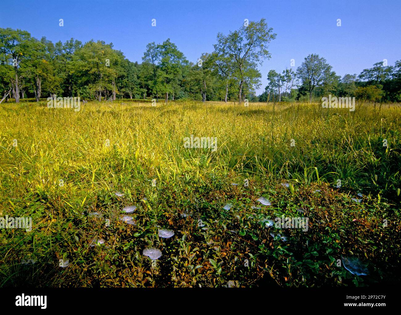 Shhetweb spider webs with dew at Wallace Sphagnum Bog, Moshannon State Forest, Pennsylvania Stock Photohttps://www.alamy.com/image-license-details/?v=1https://www.alamy.com/shhetweb-spider-webs-with-dew-at-wallace-sphagnum-bog-moshannon-state-forest-pennsylvania-image537877535.html
RM2P72C7Y–Shhetweb spider webs with dew at Wallace Sphagnum Bog, Moshannon State Forest, Pennsylvania
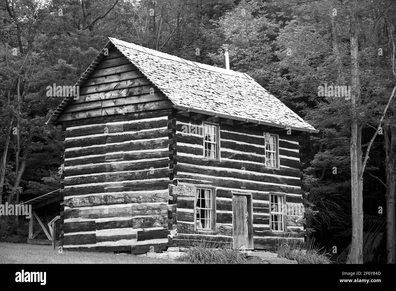 Bloody Knox Cabin in Curwensville, Clearfield County Pennsylvania, historical building for civil war resistance Stock Photohttps://www.alamy.com/image-license-details/?v=1https://www.alamy.com/bloody-knox-cabin-in-curwensville-clearfield-county-pennsylvania-historical-building-for-civil-war-resistance-image417335869.html
RF2F6Y84D–Bloody Knox Cabin in Curwensville, Clearfield County Pennsylvania, historical building for civil war resistance
 Clearfield County (Pennsylvania) outline map set Stock Vectorhttps://www.alamy.com/image-license-details/?v=1https://www.alamy.com/clearfield-county-pennsylvania-outline-map-set-image620962195.html
RF2Y277H7–Clearfield County (Pennsylvania) outline map set
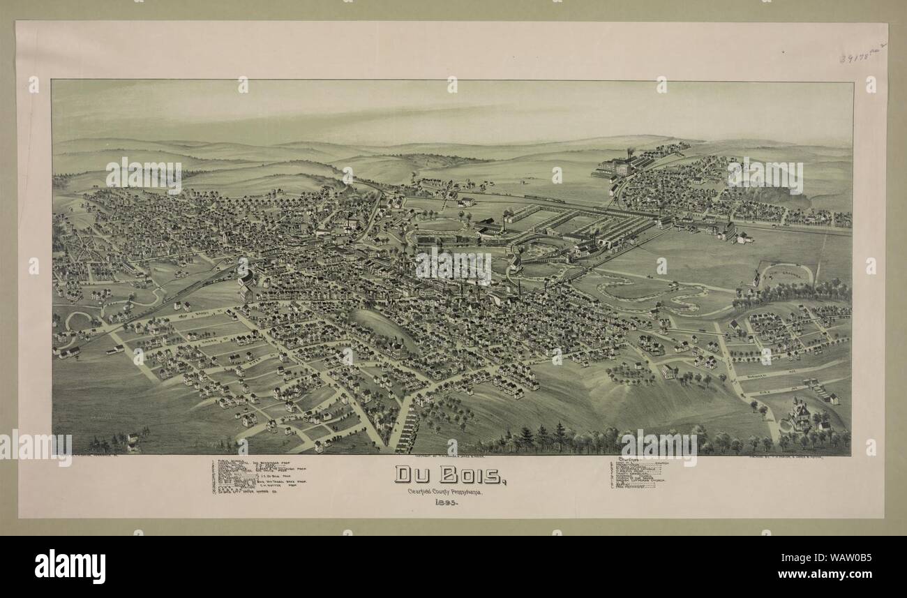 DuBois, Clearfield County Pennsylvania., 1895 Stock Photohttps://www.alamy.com/image-license-details/?v=1https://www.alamy.com/dubois-clearfield-county-pennsylvania-1895-image264851193.html
RMWAW0B5–DuBois, Clearfield County Pennsylvania., 1895
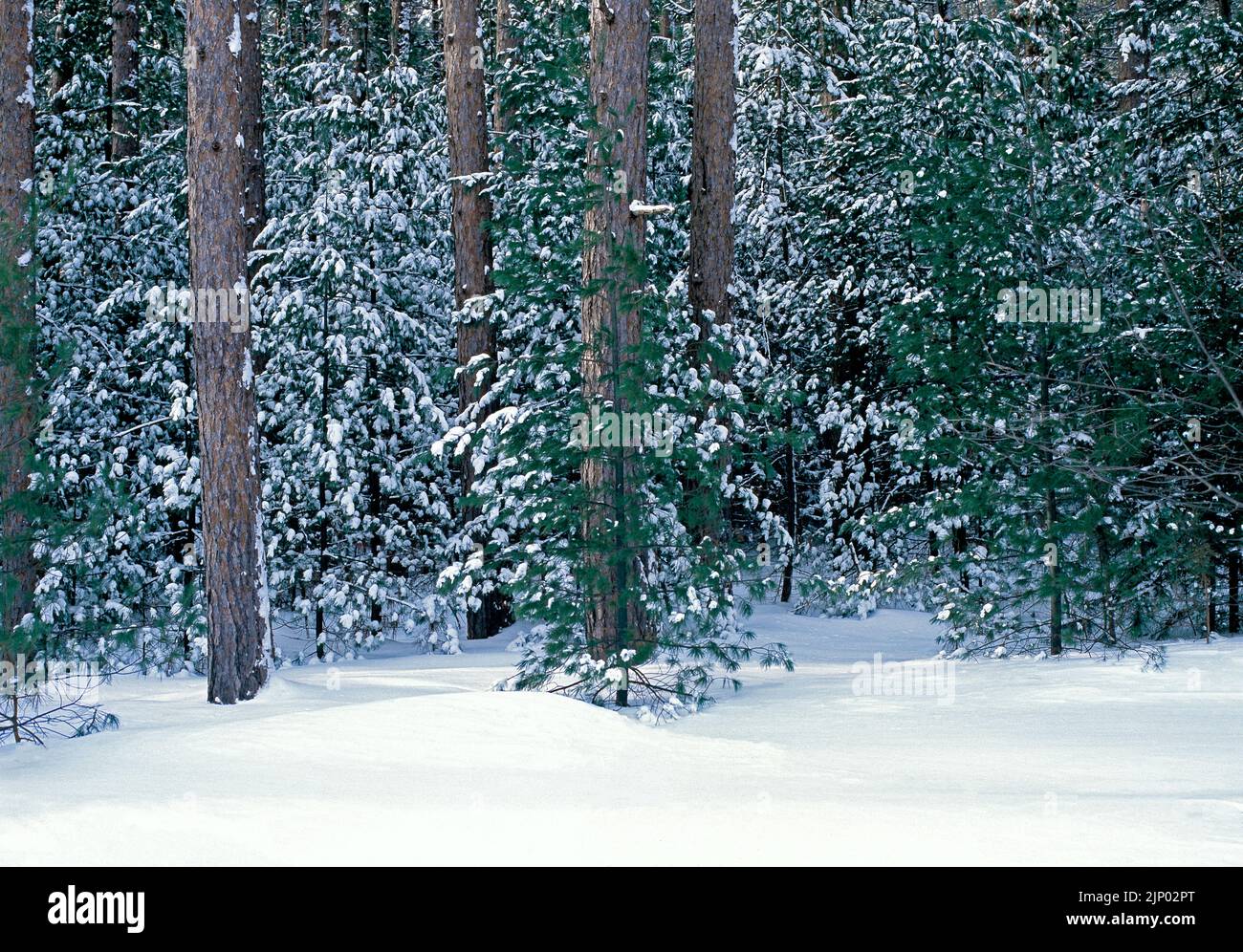 A snow covered pine forest in winter at Simon B. Elliott State Park in Pennsylvania Stock Photohttps://www.alamy.com/image-license-details/?v=1https://www.alamy.com/a-snow-covered-pine-forest-in-winter-at-simon-b-elliott-state-park-in-pennsylvania-image478204576.html
RM2JP02PT–A snow covered pine forest in winter at Simon B. Elliott State Park in Pennsylvania
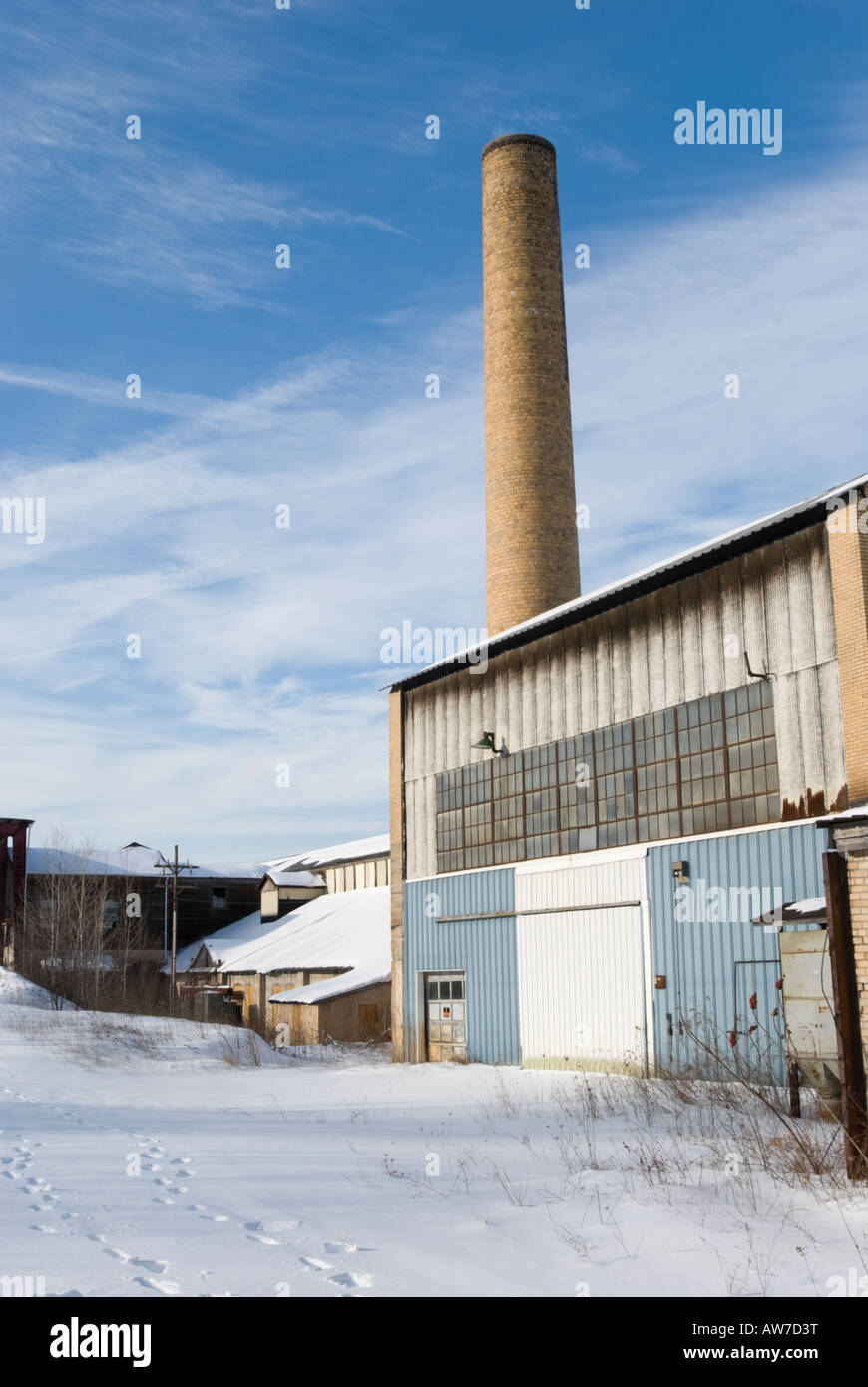 American factory closed down and abandoned, industry blighted by economic recession, Pennsylvania PA, USA. Stock Photohttps://www.alamy.com/image-license-details/?v=1https://www.alamy.com/stock-photo-american-factory-closed-down-and-abandoned-industry-blighted-by-economic-16490363.html
RMAW7D3T–American factory closed down and abandoned, industry blighted by economic recession, Pennsylvania PA, USA.
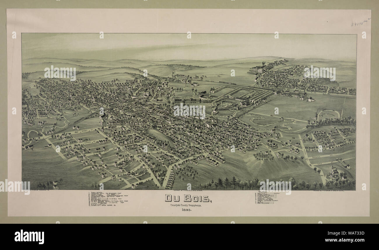 DuBois, Clearfield County Pennsylvania., 1895 Stock Photohttps://www.alamy.com/image-license-details/?v=1https://www.alamy.com/dubois-clearfield-county-pennsylvania-1895-image264831377.html
RMWAT33D–DuBois, Clearfield County Pennsylvania., 1895
 Rockface is alive with lichen, moss and fern. Stock Photohttps://www.alamy.com/image-license-details/?v=1https://www.alamy.com/rockface-is-alive-with-lichen-moss-and-fern-image605010878.html
RF2X48HFA–Rockface is alive with lichen, moss and fern.
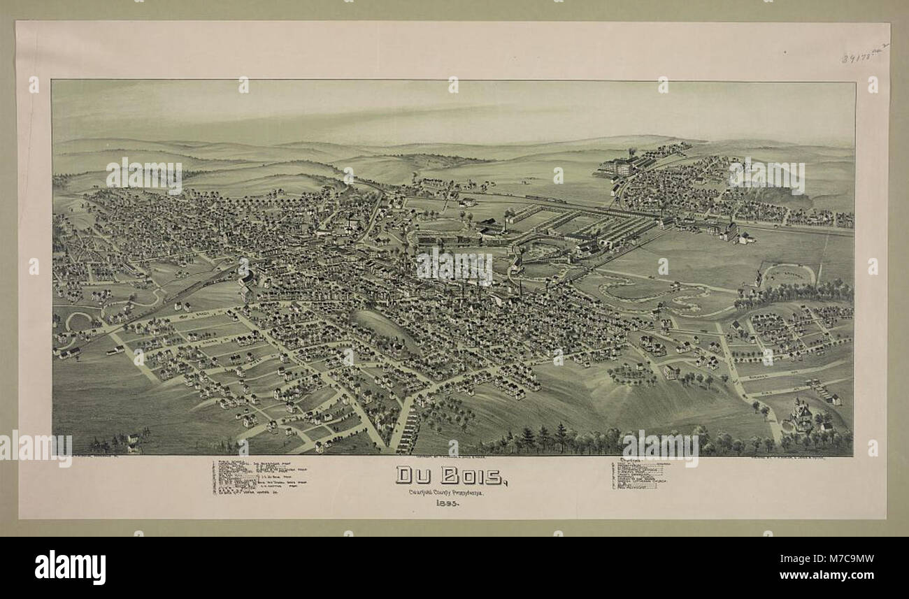 DuBois, Clearfield County Pennsylvania., 1895 LCCN2003681814 Stock Photohttps://www.alamy.com/image-license-details/?v=1https://www.alamy.com/stock-photo-dubois-clearfield-county-pennsylvania-1895-lccn2003681814-176677337.html
RMM7C9MW–DuBois, Clearfield County Pennsylvania., 1895 LCCN2003681814
 Rendering of a green 3d highway sign for Clearfield County Stock Photohttps://www.alamy.com/image-license-details/?v=1https://www.alamy.com/rendering-of-a-green-3d-highway-sign-for-clearfield-county-image334397845.html
RF2AC13T5–Rendering of a green 3d highway sign for Clearfield County
 Bronco Busting. 1909 Stock Photohttps://www.alamy.com/image-license-details/?v=1https://www.alamy.com/bronco-busting-1909-image567273077.html
RM2RXWEGN–Bronco Busting. 1909
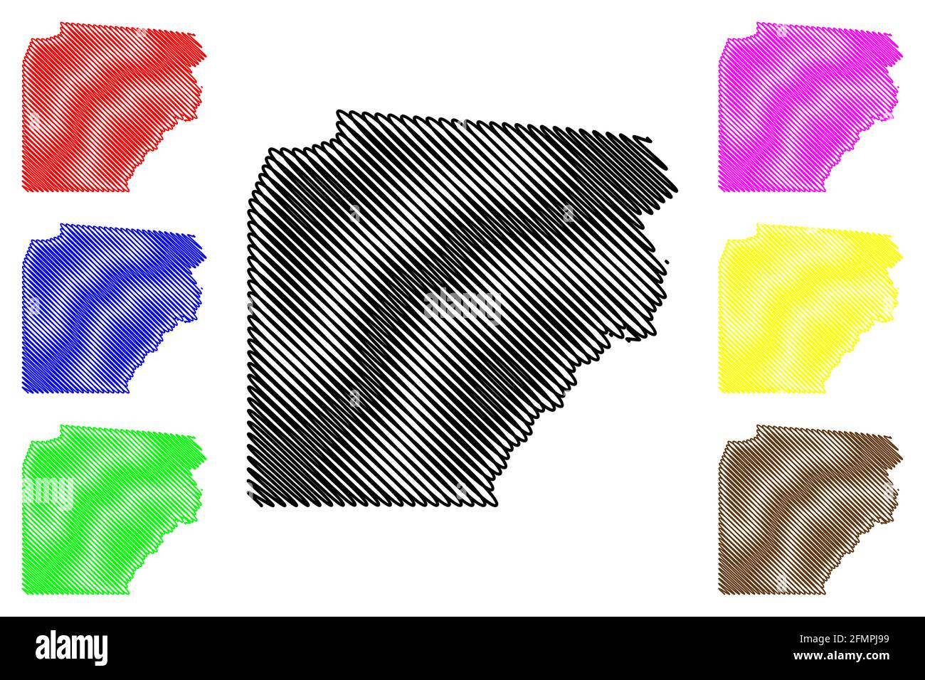 Clearfield County, Commonwealth of Pennsylvania (U.S. county, United States of America, USA, U.S., US) map vector illustration, scribble sketch Clearf Stock Vectorhttps://www.alamy.com/image-license-details/?v=1https://www.alamy.com/clearfield-county-commonwealth-of-pennsylvania-us-county-united-states-of-america-usa-us-us-map-vector-illustration-scribble-sketch-clearf-image425839269.html
RF2FMPJ99–Clearfield County, Commonwealth of Pennsylvania (U.S. county, United States of America, USA, U.S., US) map vector illustration, scribble sketch Clearf
 History of the Alleghany Evangelical Lutheran synod of Pennsylvania, together with a topical handbook of the Evangelical Lutheran church, its ancestry, origin and development . thisschool. Later on this school was transferred to the St. PaulsLutheran place of worship soon after the organization of thecongregation. During more recent years it became a Lutheranschool, having adopted a Lutheran constitution and using theAugsburg literature. St. Peters Evangelical Lutheran Churchluthersr.urg, brady township, clearfield county, pa.This is another and the last of the original congregationswhich Rev. Stock Photohttps://www.alamy.com/image-license-details/?v=1https://www.alamy.com/history-of-the-alleghany-evangelical-lutheran-synod-of-pennsylvania-together-with-a-topical-handbook-of-the-evangelical-lutheran-church-its-ancestry-origin-and-development-thisschool-later-on-this-school-was-transferred-to-the-st-paulslutheran-place-of-worship-soon-after-the-organization-of-thecongregation-during-more-recent-years-it-became-a-lutheranschool-having-adopted-a-lutheran-constitution-and-using-theaugsburg-literature-st-peters-evangelical-lutheran-churchluthersrurg-brady-township-clearfield-county-pathis-is-another-and-the-last-of-the-original-congregationswhich-rev-image342734780.html
RM2AWGWKT–History of the Alleghany Evangelical Lutheran synod of Pennsylvania, together with a topical handbook of the Evangelical Lutheran church, its ancestry, origin and development . thisschool. Later on this school was transferred to the St. PaulsLutheran place of worship soon after the organization of thecongregation. During more recent years it became a Lutheranschool, having adopted a Lutheran constitution and using theAugsburg literature. St. Peters Evangelical Lutheran Churchluthersr.urg, brady township, clearfield county, pa.This is another and the last of the original congregationswhich Rev.
 Young pretty cowgirl with beautiful long blond hair wearing a cowboy hat, loose and flowing in natural late afternoon sunlight. Stock Photohttps://www.alamy.com/image-license-details/?v=1https://www.alamy.com/stock-photo-young-pretty-cowgirl-with-beautiful-long-blond-hair-wearing-a-cowboy-33207525.html
RMBX0MF1–Young pretty cowgirl with beautiful long blond hair wearing a cowboy hat, loose and flowing in natural late afternoon sunlight.
 Map of Clearfield in Pennsylvania Stock Photohttps://www.alamy.com/image-license-details/?v=1https://www.alamy.com/map-of-clearfield-in-pennsylvania-image443822510.html
RF2GP1T3X–Map of Clearfield in Pennsylvania
 Parker Dam State Park Stock Photohttps://www.alamy.com/image-license-details/?v=1https://www.alamy.com/parker-dam-state-park-image383771405.html
RF2D8A89H–Parker Dam State Park
 . Extinct Pennsylvania animals. Zoology. SETH IREDELL NELSON (1809-1905) Who Killed a Wolf in Clearfield County When He Was in His 83d Year.. Please note that these images are extracted from scanned page images that may have been digitally enhanced for readability - coloration and appearance of these illustrations may not perfectly resemble the original work.. Shoemaker, Henry W. (Henry Wharton), b. 1880. [Altoona, Pa. The Altoona Tribune Publishing Co Stock Photohttps://www.alamy.com/image-license-details/?v=1https://www.alamy.com/extinct-pennsylvania-animals-zoology-seth-iredell-nelson-1809-1905-who-killed-a-wolf-in-clearfield-county-when-he-was-in-his-83d-year-please-note-that-these-images-are-extracted-from-scanned-page-images-that-may-have-been-digitally-enhanced-for-readability-coloration-and-appearance-of-these-illustrations-may-not-perfectly-resemble-the-original-work-shoemaker-henry-w-henry-wharton-b-1880-altoona-pa-the-altoona-tribune-publishing-co-image216373393.html
RMPG0JD5–. Extinct Pennsylvania animals. Zoology. SETH IREDELL NELSON (1809-1905) Who Killed a Wolf in Clearfield County When He Was in His 83d Year.. Please note that these images are extracted from scanned page images that may have been digitally enhanced for readability - coloration and appearance of these illustrations may not perfectly resemble the original work.. Shoemaker, Henry W. (Henry Wharton), b. 1880. [Altoona, Pa. The Altoona Tribune Publishing Co
 Image 4 of Sanborn Fire Insurance Map from Clearfield, Clearfield County, Pennsylvania. Apr 1892. 5 Sheet(s), America, street map with a Nineteenth Century compass Stock Photohttps://www.alamy.com/image-license-details/?v=1https://www.alamy.com/image-4-of-sanborn-fire-insurance-map-from-clearfield-clearfield-county-pennsylvania-apr-1892-5-sheets-america-street-map-with-a-nineteenth-century-compass-image344694777.html
RM2B0P5KN–Image 4 of Sanborn Fire Insurance Map from Clearfield, Clearfield County, Pennsylvania. Apr 1892. 5 Sheet(s), America, street map with a Nineteenth Century compass
 Drane, Clearfield County, US, United States, Pennsylvania, N 40 52' 44'', S 78 16' 47'', map, Cartascapes Map published in 2024. Explore Cartascapes, a map revealing Earth's diverse landscapes, cultures, and ecosystems. Journey through time and space, discovering the interconnectedness of our planet's past, present, and future. Stock Photohttps://www.alamy.com/image-license-details/?v=1https://www.alamy.com/drane-clearfield-county-us-united-states-pennsylvania-n-40-52-44-s-78-16-47-map-cartascapes-map-published-in-2024-explore-cartascapes-a-map-revealing-earths-diverse-landscapes-cultures-and-ecosystems-journey-through-time-and-space-discovering-the-interconnectedness-of-our-planets-past-present-and-future-image621206717.html
RM2Y2JBE5–Drane, Clearfield County, US, United States, Pennsylvania, N 40 52' 44'', S 78 16' 47'', map, Cartascapes Map published in 2024. Explore Cartascapes, a map revealing Earth's diverse landscapes, cultures, and ecosystems. Journey through time and space, discovering the interconnectedness of our planet's past, present, and future.
 Map of Clearfield in Pennsylvania Stock Photohttps://www.alamy.com/image-license-details/?v=1https://www.alamy.com/map-of-clearfield-in-pennsylvania-image358070528.html
RF2BPFEH4–Map of Clearfield in Pennsylvania
 The black and white administrative maps of Pennsylvania, USA Stock Vectorhttps://www.alamy.com/image-license-details/?v=1https://www.alamy.com/the-black-and-white-administrative-maps-of-pennsylvania-usa-image604424356.html
RF2X39WC4–The black and white administrative maps of Pennsylvania, USA
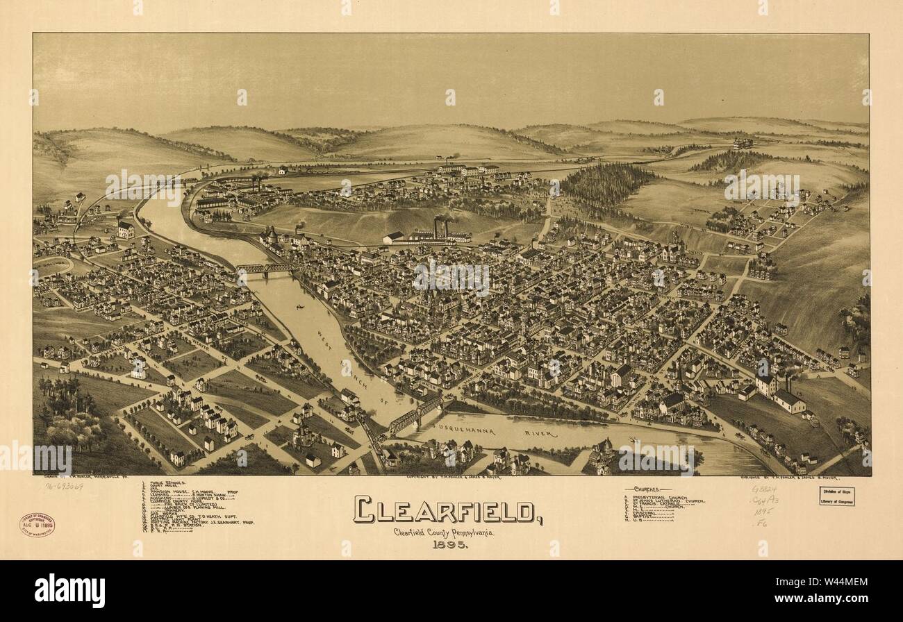 Clearfield, Clearfield County, Pennsylvania. 1895. Stock Photohttps://www.alamy.com/image-license-details/?v=1https://www.alamy.com/clearfield-clearfield-county-pennsylvania-1895-image260718044.html
RMW44MEM–Clearfield, Clearfield County, Pennsylvania. 1895.
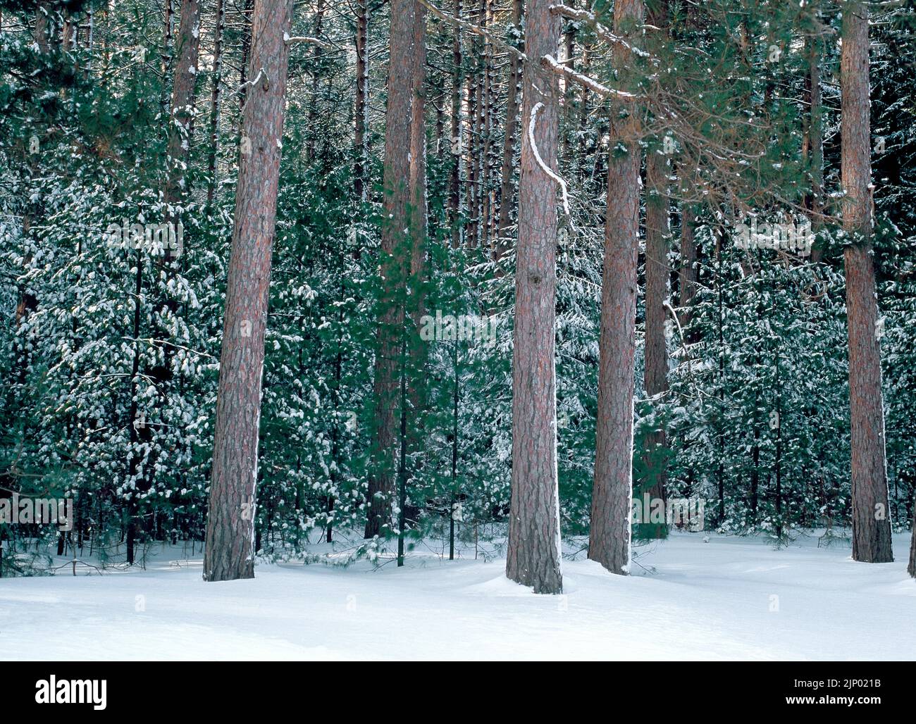 A snow covered pine forest in winter at Simon B. Elliott State Park in Pennsylvania Stock Photohttps://www.alamy.com/image-license-details/?v=1https://www.alamy.com/a-snow-covered-pine-forest-in-winter-at-simon-b-elliott-state-park-in-pennsylvania-image478203975.html
RM2JP021B–A snow covered pine forest in winter at Simon B. Elliott State Park in Pennsylvania
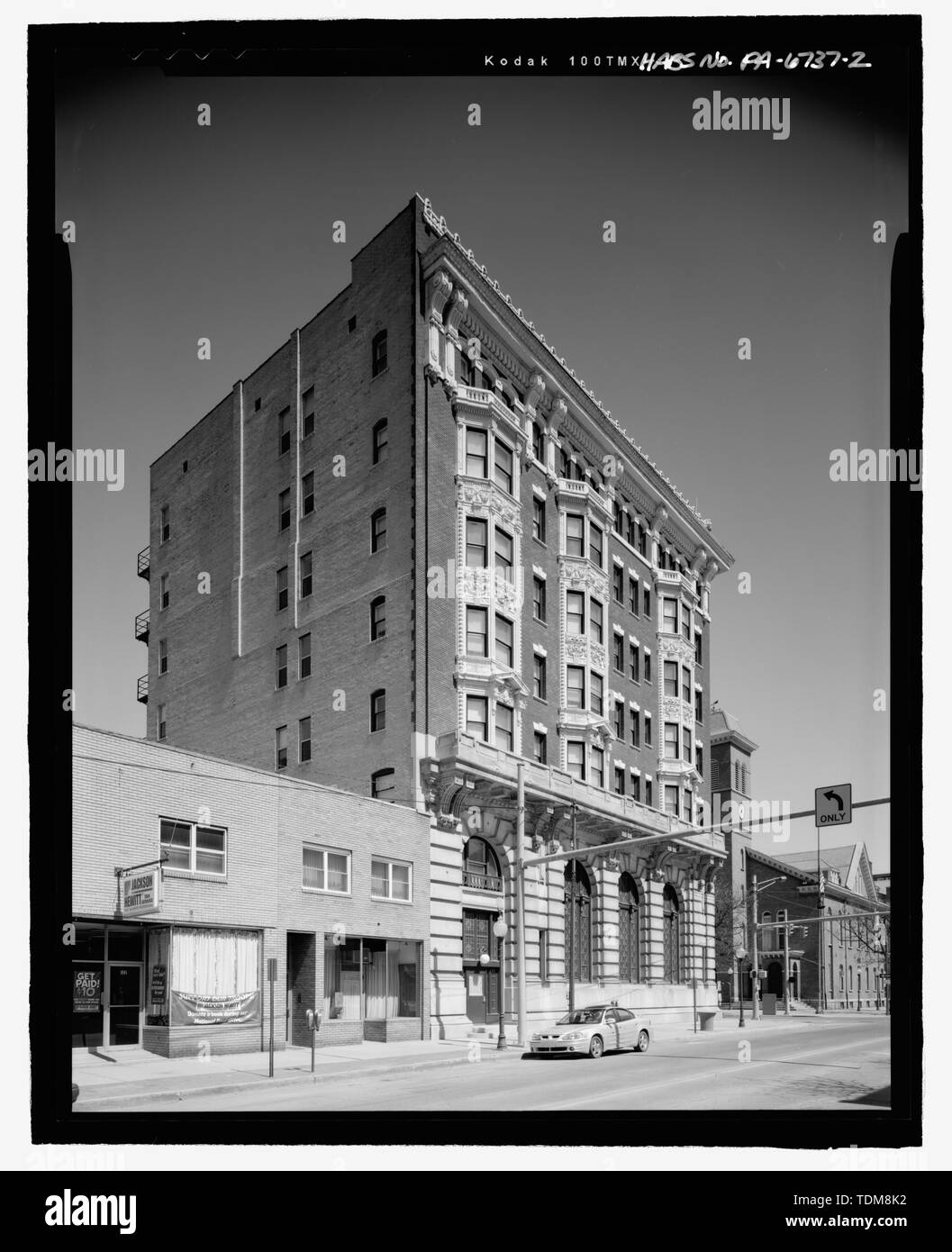 PERSPECTIVE VIEW OF SOUTH AND EAST FACADES OF CLEARFIELD COUNTY NATIONAL BANK-DIMELING HOTEL. - Clearfield County National Bank and Dimeling Hotel, 1 North Second Street, Clearfield, Clearfield County, PA Stock Photohttps://www.alamy.com/image-license-details/?v=1https://www.alamy.com/perspective-view-of-south-and-east-facades-of-clearfield-county-national-bank-dimeling-hotel-clearfield-county-national-bank-and-dimeling-hotel-1-north-second-street-clearfield-clearfield-county-pa-image249381526.html
RMTDM8K2–PERSPECTIVE VIEW OF SOUTH AND EAST FACADES OF CLEARFIELD COUNTY NATIONAL BANK-DIMELING HOTEL. - Clearfield County National Bank and Dimeling Hotel, 1 North Second Street, Clearfield, Clearfield County, PA
 A Civilian Conservation Corp era plantation of Red Pine with naturalizing Norway Spruce in the Moshannon State Forest, Pennsylvania. Stock Photohttps://www.alamy.com/image-license-details/?v=1https://www.alamy.com/a-civilian-conservation-corp-era-plantation-of-red-pine-with-naturalizing-norway-spruce-in-the-moshannon-state-forest-pennsylvania-image345866643.html
RM2B2KGC3–A Civilian Conservation Corp era plantation of Red Pine with naturalizing Norway Spruce in the Moshannon State Forest, Pennsylvania.
 Canyon-like passage between giant sandstone boulders. Stock Photohttps://www.alamy.com/image-license-details/?v=1https://www.alamy.com/canyon-like-passage-between-giant-sandstone-boulders-image605011165.html
RF2X48HWH–Canyon-like passage between giant sandstone boulders.
 Clearfield County, Commonwealth of Pennsylvania (U.S. county, United States of America, USA, U.S., US) map vector illustration, scribble sketch Clearf Stock Vectorhttps://www.alamy.com/image-license-details/?v=1https://www.alamy.com/clearfield-county-commonwealth-of-pennsylvania-us-county-united-states-of-america-usa-us-us-map-vector-illustration-scribble-sketch-clearf-image387828382.html
RF2DEY31J–Clearfield County, Commonwealth of Pennsylvania (U.S. county, United States of America, USA, U.S., US) map vector illustration, scribble sketch Clearf
 . Reports of the Inspectors of Mines of the anthracite and bituminous coal regions of Pennsylvania, for the year 1893. j^wcc—. tcoocic ?jugpiooi; JO ajuci o a Official, Document, No. 10. FOURTH BITUMINOUS DISTRICT. (MoKeau, Iotter, Tioga, Uradfurd, fciullivau, Lycoming, Cliutou, Cam-eron and Ellv counties and all those mines in Clearfield county adja-cent to tlie Low Grade Division of the Allegheny Valley Railroad;also the mines adjacent to the Clearfield and Susquehanna J>ranchof the Pennsylvania Railroad; also the mines adjacent to the Buf-falo, Rochester and Iittsburg Railroad in Jeffers Stock Photohttps://www.alamy.com/image-license-details/?v=1https://www.alamy.com/reports-of-the-inspectors-of-mines-of-the-anthracite-and-bituminous-coal-regions-of-pennsylvania-for-the-year-1893-jwcc-tcoocic-jugpiooi-jo-ajuci-o-a-official-document-no-10-fourth-bituminous-district-mokeau-iotter-tioga-uradfurd-fciullivau-lycoming-cliutou-cam-eron-and-ellv-counties-and-all-those-mines-in-clearfield-county-adja-cent-to-tlie-low-grade-division-of-the-allegheny-valley-railroadalso-the-mines-adjacent-to-the-clearfield-and-susquehanna-jgtranchof-the-pennsylvania-railroad-also-the-mines-adjacent-to-the-buf-falo-rochester-and-iittsburg-railroad-in-jeffers-image336864425.html
RM2AG1E09–. Reports of the Inspectors of Mines of the anthracite and bituminous coal regions of Pennsylvania, for the year 1893. j^wcc—. tcoocic ?jugpiooi; JO ajuci o a Official, Document, No. 10. FOURTH BITUMINOUS DISTRICT. (MoKeau, Iotter, Tioga, Uradfurd, fciullivau, Lycoming, Cliutou, Cam-eron and Ellv counties and all those mines in Clearfield county adja-cent to tlie Low Grade Division of the Allegheny Valley Railroad;also the mines adjacent to the Clearfield and Susquehanna J>ranchof the Pennsylvania Railroad; also the mines adjacent to the Buf-falo, Rochester and Iittsburg Railroad in Jeffers
 Profile of a young girl with long blond hair wearing a cowboy hat, looking to the side. Stock Photohttps://www.alamy.com/image-license-details/?v=1https://www.alamy.com/stock-photo-profile-of-a-young-girl-with-long-blond-hair-wearing-a-cowboy-hat-33207524.html
RMBX0MF0–Profile of a young girl with long blond hair wearing a cowboy hat, looking to the side.
 Map of Clearfield in Pennsylvania Stock Photohttps://www.alamy.com/image-license-details/?v=1https://www.alamy.com/map-of-clearfield-in-pennsylvania-image385815706.html
RF2DBKBTA–Map of Clearfield in Pennsylvania
 Parker Dam State Park Stock Photohttps://www.alamy.com/image-license-details/?v=1https://www.alamy.com/stock-photo-parker-dam-state-park-126933367.html
RFHAE8PF–Parker Dam State Park
 Abandoned old gas station in decline surrounded by fresh winter snow, with a missing roof, Pennsylvania, USA. Stock Photohttps://www.alamy.com/image-license-details/?v=1https://www.alamy.com/stock-photo-abandoned-old-gas-station-in-decline-surrounded-by-fresh-winter-snow-33360278.html
RMBX7KAE–Abandoned old gas station in decline surrounded by fresh winter snow, with a missing roof, Pennsylvania, USA.
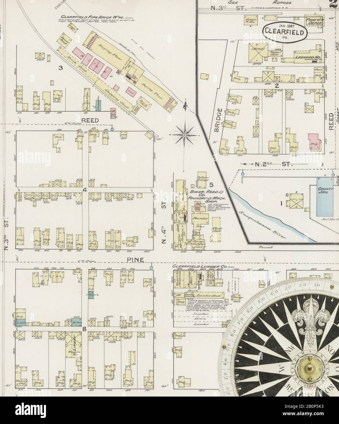 Image 2 of Sanborn Fire Insurance Map from Clearfield, Clearfield County, Pennsylvania. Jan 1887. 5 Sheet(s), America, street map with a Nineteenth Century compass Stock Photohttps://www.alamy.com/image-license-details/?v=1https://www.alamy.com/image-2-of-sanborn-fire-insurance-map-from-clearfield-clearfield-county-pennsylvania-jan-1887-5-sheets-america-street-map-with-a-nineteenth-century-compass-image344694759.html
RM2B0P5K3–Image 2 of Sanborn Fire Insurance Map from Clearfield, Clearfield County, Pennsylvania. Jan 1887. 5 Sheet(s), America, street map with a Nineteenth Century compass
 Morrisdale, Clearfield County, US, United States, Pennsylvania, N 40 56' 56'', S 78 13' 31'', map, Cartascapes Map published in 2024. Explore Cartascapes, a map revealing Earth's diverse landscapes, cultures, and ecosystems. Journey through time and space, discovering the interconnectedness of our planet's past, present, and future. Stock Photohttps://www.alamy.com/image-license-details/?v=1https://www.alamy.com/morrisdale-clearfield-county-us-united-states-pennsylvania-n-40-56-56-s-78-13-31-map-cartascapes-map-published-in-2024-explore-cartascapes-a-map-revealing-earths-diverse-landscapes-cultures-and-ecosystems-journey-through-time-and-space-discovering-the-interconnectedness-of-our-planets-past-present-and-future-image621220047.html
RM2Y2K0E7–Morrisdale, Clearfield County, US, United States, Pennsylvania, N 40 56' 56'', S 78 13' 31'', map, Cartascapes Map published in 2024. Explore Cartascapes, a map revealing Earth's diverse landscapes, cultures, and ecosystems. Journey through time and space, discovering the interconnectedness of our planet's past, present, and future.
 Map of Clearfield in Pennsylvania Stock Photohttps://www.alamy.com/image-license-details/?v=1https://www.alamy.com/map-of-clearfield-in-pennsylvania-image359542348.html
RF2BTXFX4–Map of Clearfield in Pennsylvania
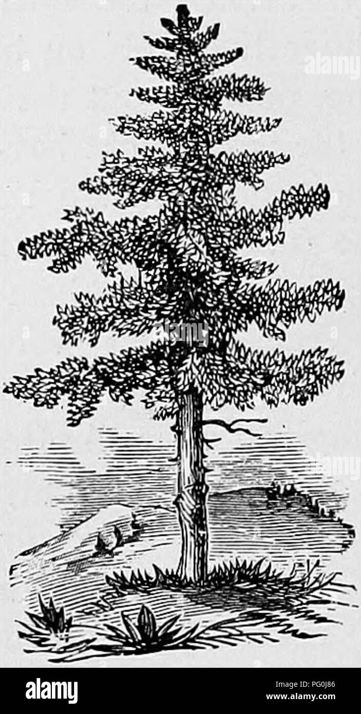 . Extinct Pennsylvania animals. Zoology. 116 WOLF DAYS IN PENNSYLVANIA. be living in the Cameron County wilds today, he be- lieves, but for forest fires, the lack of food supply, •and, above all, reckless poisoning. According to Seth Iredell Nelson, a man named William Bonsai, while riding horseback through a forest in Clearfield Coun- ty, killed a wolf with a club; that was about 1891 or 1892. J. E. Cleveland, of Bradford County, driving a pair of fractious colts from Fox Centre, Sullivan County, to his home in Canton in the fall of 1877, en- countered a large wolf in the road which badly fri Stock Photohttps://www.alamy.com/image-license-details/?v=1https://www.alamy.com/extinct-pennsylvania-animals-zoology-116-wolf-days-in-pennsylvania-be-living-in-the-cameron-county-wilds-today-he-be-lieves-but-for-forest-fires-the-lack-of-food-supply-and-above-all-reckless-poisoning-according-to-seth-iredell-nelson-a-man-named-william-bonsai-while-riding-horseback-through-a-forest-in-clearfield-coun-ty-killed-a-wolf-with-a-club-that-was-about-1891-or-1892-j-e-cleveland-of-bradford-county-driving-a-pair-of-fractious-colts-from-fox-centre-sullivan-county-to-his-home-in-canton-in-the-fall-of-1877-en-countered-a-large-wolf-in-the-road-which-badly-fri-image216373254.html
RMPG0J86–. Extinct Pennsylvania animals. Zoology. 116 WOLF DAYS IN PENNSYLVANIA. be living in the Cameron County wilds today, he be- lieves, but for forest fires, the lack of food supply, •and, above all, reckless poisoning. According to Seth Iredell Nelson, a man named William Bonsai, while riding horseback through a forest in Clearfield Coun- ty, killed a wolf with a club; that was about 1891 or 1892. J. E. Cleveland, of Bradford County, driving a pair of fractious colts from Fox Centre, Sullivan County, to his home in Canton in the fall of 1877, en- countered a large wolf in the road which badly fri
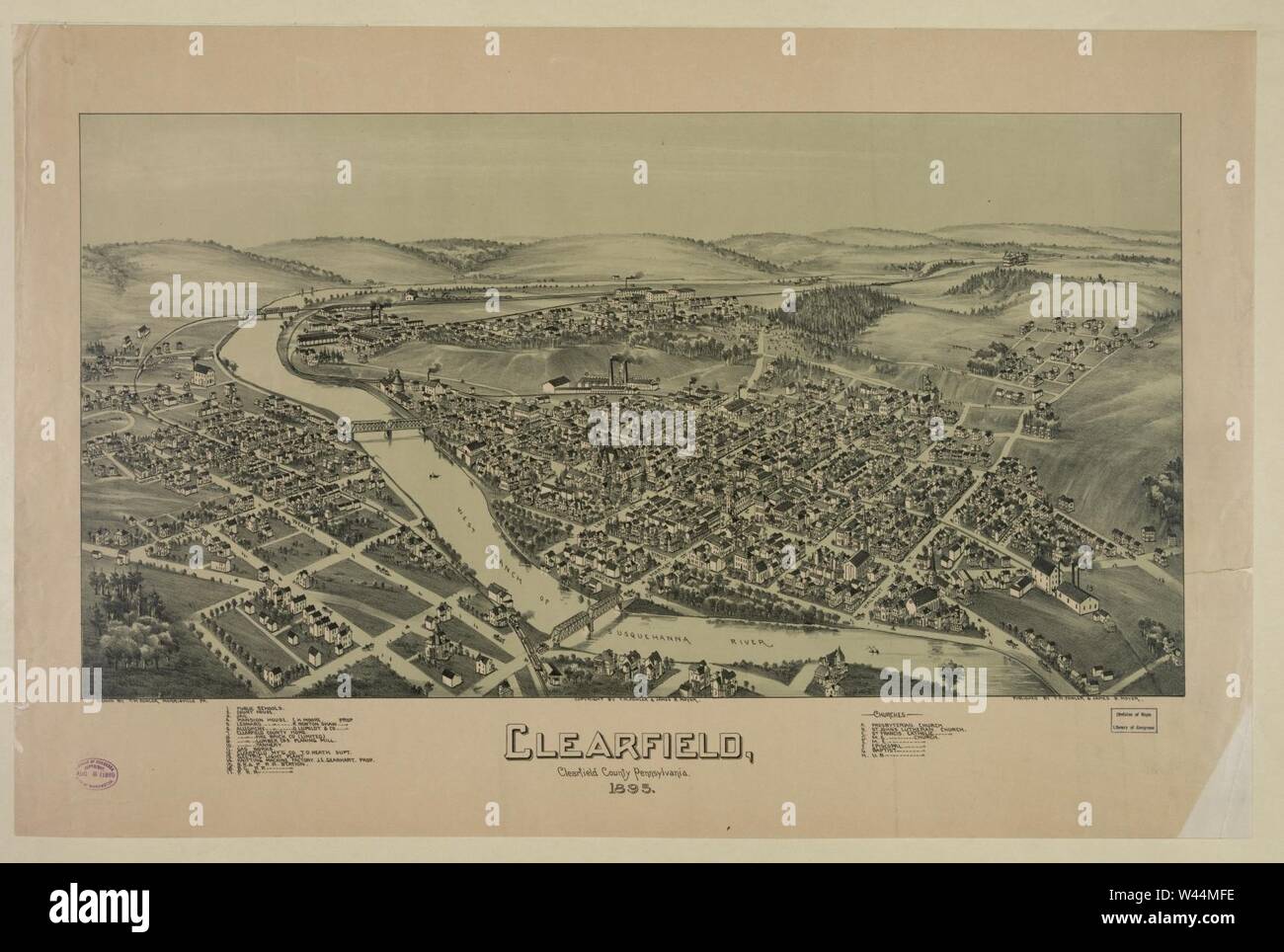 Clearfield, Clearfield County Pennsylvania., 1895 Stock Photohttps://www.alamy.com/image-license-details/?v=1https://www.alamy.com/clearfield-clearfield-county-pennsylvania-1895-image260718066.html
RMW44MFE–Clearfield, Clearfield County Pennsylvania., 1895
 PERSPECTIVE VIEW OF EAST AND NORTH FACADES OF CLEARFIELD COUNTY NATIONAL BANK-DIMELING HOTEL. - Clearfield County National Bank and Dimeling Hotel, 1 North Second Street, Clearfield, Clearfield County, PA Stock Photohttps://www.alamy.com/image-license-details/?v=1https://www.alamy.com/perspective-view-of-east-and-north-facades-of-clearfield-county-national-bank-dimeling-hotel-clearfield-county-national-bank-and-dimeling-hotel-1-north-second-street-clearfield-clearfield-county-pa-image249379996.html
RMTDM6MC–PERSPECTIVE VIEW OF EAST AND NORTH FACADES OF CLEARFIELD COUNTY NATIONAL BANK-DIMELING HOTEL. - Clearfield County National Bank and Dimeling Hotel, 1 North Second Street, Clearfield, Clearfield County, PA
 Wall-like boulder covered in moss in a pennsylvanian hemlock forest Stock Photohttps://www.alamy.com/image-license-details/?v=1https://www.alamy.com/wall-like-boulder-covered-in-moss-in-a-pennsylvanian-hemlock-forest-image605010622.html
RF2X48H66–Wall-like boulder covered in moss in a pennsylvanian hemlock forest
 . History of Mount Union, Shirleysburg and Shirley Township. rneQuipment. GEORGE SHAPIRO Geo. Shapiro, who is one of MoimtUnions up-to-date and industriousclothing merchants, was born in Wep-per in the state of Kovno, Russia,Oct. 14, 1881. Mr. Shapiro came toAmerica 13 years ago (1896), andsettled with his parents in hock Hav-en, Pa., where to this day his fatheris in the clothing business. His boy-hood days were s^ient in Russia,where he attended the public schoolsand also assisted his father, who wasa lumbe; dealer and miller. FromLock Haven. Mr. Shapiro went toGram-pian, Clearfield County, Stock Photohttps://www.alamy.com/image-license-details/?v=1https://www.alamy.com/history-of-mount-union-shirleysburg-and-shirley-township-rnequipment-george-shapiro-geo-shapiro-who-is-one-of-moimtunions-up-to-date-and-industriousclothing-merchants-was-born-in-wep-per-in-the-state-of-kovno-russiaoct-14-1881-mr-shapiro-came-toamerica-13-years-ago-1896-andsettled-with-his-parents-in-hock-hav-en-pa-where-to-this-day-his-fatheris-in-the-clothing-business-his-boy-hood-days-were-sient-in-russiawhere-he-attended-the-public-schoolsand-also-assisted-his-father-who-wasa-lumbe-dealer-and-miller-fromlock-haven-mr-shapiro-went-togram-pian-clearfield-county-image337099310.html
RM2AGC5H2–. History of Mount Union, Shirleysburg and Shirley Township. rneQuipment. GEORGE SHAPIRO Geo. Shapiro, who is one of MoimtUnions up-to-date and industriousclothing merchants, was born in Wep-per in the state of Kovno, Russia,Oct. 14, 1881. Mr. Shapiro came toAmerica 13 years ago (1896), andsettled with his parents in hock Hav-en, Pa., where to this day his fatheris in the clothing business. His boy-hood days were s^ient in Russia,where he attended the public schoolsand also assisted his father, who wasa lumbe; dealer and miller. FromLock Haven. Mr. Shapiro went toGram-pian, Clearfield County,
 Parker Dam State Park Stock Photohttps://www.alamy.com/image-license-details/?v=1https://www.alamy.com/parker-dam-state-park-image383771475.html
RF2D8A8C3–Parker Dam State Park
 Abandoned old gas station in decline surrounded by fresh winter snow, with a missing roof, Pennsylvania, USA. Stock Photohttps://www.alamy.com/image-license-details/?v=1https://www.alamy.com/stock-photo-abandoned-old-gas-station-in-decline-surrounded-by-fresh-winter-snow-33360270.html
RMBX7KA6–Abandoned old gas station in decline surrounded by fresh winter snow, with a missing roof, Pennsylvania, USA.
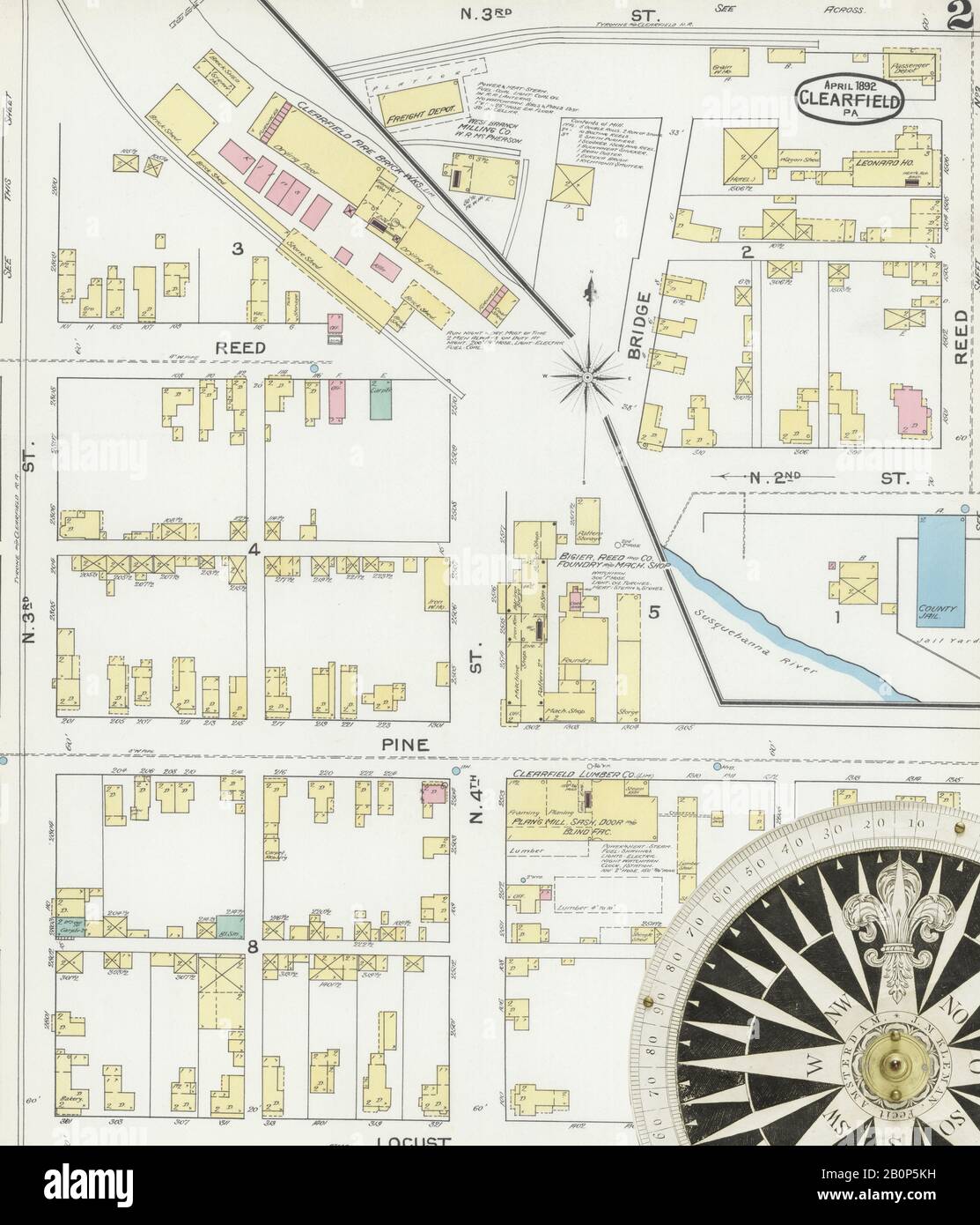 Image 2 of Sanborn Fire Insurance Map from Clearfield, Clearfield County, Pennsylvania. Apr 1892. 5 Sheet(s), America, street map with a Nineteenth Century compass Stock Photohttps://www.alamy.com/image-license-details/?v=1https://www.alamy.com/image-2-of-sanborn-fire-insurance-map-from-clearfield-clearfield-county-pennsylvania-apr-1892-5-sheets-america-street-map-with-a-nineteenth-century-compass-image344694773.html
RM2B0P5KH–Image 2 of Sanborn Fire Insurance Map from Clearfield, Clearfield County, Pennsylvania. Apr 1892. 5 Sheet(s), America, street map with a Nineteenth Century compass
 Irishtown, Clearfield County, US, United States, Pennsylvania, N 40 58' 34'', S 78 39' 57'', map, Cartascapes Map published in 2024. Explore Cartascapes, a map revealing Earth's diverse landscapes, cultures, and ecosystems. Journey through time and space, discovering the interconnectedness of our planet's past, present, and future. Stock Photohttps://www.alamy.com/image-license-details/?v=1https://www.alamy.com/irishtown-clearfield-county-us-united-states-pennsylvania-n-40-58-34-s-78-39-57-map-cartascapes-map-published-in-2024-explore-cartascapes-a-map-revealing-earths-diverse-landscapes-cultures-and-ecosystems-journey-through-time-and-space-discovering-the-interconnectedness-of-our-planets-past-present-and-future-image621288329.html
RM2Y2P3GW–Irishtown, Clearfield County, US, United States, Pennsylvania, N 40 58' 34'', S 78 39' 57'', map, Cartascapes Map published in 2024. Explore Cartascapes, a map revealing Earth's diverse landscapes, cultures, and ecosystems. Journey through time and space, discovering the interconnectedness of our planet's past, present, and future.
 Pretty blonde girl on chestnut horse enjoying a ride, horseback riding close up portrait. Stock Photohttps://www.alamy.com/image-license-details/?v=1https://www.alamy.com/stock-photo-pretty-blonde-girl-on-chestnut-horse-enjoying-a-ride-horseback-riding-33207523.html
RMBX0MEY–Pretty blonde girl on chestnut horse enjoying a ride, horseback riding close up portrait.
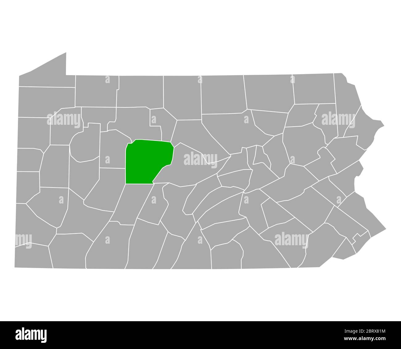 Map of Clearfield in Pennsylvania Stock Photohttps://www.alamy.com/image-license-details/?v=1https://www.alamy.com/map-of-clearfield-in-pennsylvania-image358921520.html
RF2BRX81M–Map of Clearfield in Pennsylvania
 Du Bois, Clearfield County, Pennsylvania, 1895. Stock Photohttps://www.alamy.com/image-license-details/?v=1https://www.alamy.com/du-bois-clearfield-county-pennsylvania-1895-image264850534.html
RMWATYFJ–Du Bois, Clearfield County, Pennsylvania, 1895.
 PERSPECTIVE VIEW OF SOUTH AND WEST FACADES OF CLEARFIELD COUNTY NATIONAL BANK-DIMELING HOTEL. THIS STRUCTURE WAS DESIGNED AND BUILT BY THE BEEZER BROTHERS IN 1904. - Clearfield County National Bank and Dimeling Hotel, 1 North Second Street, Clearfield, Clearfield County, PA Stock Photohttps://www.alamy.com/image-license-details/?v=1https://www.alamy.com/perspective-view-of-south-and-west-facades-of-clearfield-county-national-bank-dimeling-hotel-this-structure-was-designed-and-built-by-the-beezer-brothers-in-1904-clearfield-county-national-bank-and-dimeling-hotel-1-north-second-street-clearfield-clearfield-county-pa-image249381587.html
RMTDM8N7–PERSPECTIVE VIEW OF SOUTH AND WEST FACADES OF CLEARFIELD COUNTY NATIONAL BANK-DIMELING HOTEL. THIS STRUCTURE WAS DESIGNED AND BUILT BY THE BEEZER BROTHERS IN 1904. - Clearfield County National Bank and Dimeling Hotel, 1 North Second Street, Clearfield, Clearfield County, PA
 A city of boulders hidden under the forest canopy. Stock Photohttps://www.alamy.com/image-license-details/?v=1https://www.alamy.com/a-city-of-boulders-hidden-under-the-forest-canopy-image605011201.html
RF2X48HXW–A city of boulders hidden under the forest canopy.
 Our College Times . rshey 1, C. M. Wenger1, Geyer 3. Alumni Notes. Mr. B. F. Waltz, 14, has accepted aposition as teacher of German andFrench at Dubois, Clearfield county,Pa. Mr. H. K. Eby, 14, is teaching inthe High School at Hollidaysburg, Pa. Mr. Jacob E. Myers, 14, is teachingthe subjects of Latin and German inthe Chester High School, Chester, Pa. Miss Lillian Falkenstein, 11, is nowteaching the Third Grade in the PublicSchools of Elizabethtown. Mrs. Nellie Hartman Schuler, 06,is the happy mother of a little babyboy, Jack Hartman Schuler, who willbe three months old on November 16. During Stock Photohttps://www.alamy.com/image-license-details/?v=1https://www.alamy.com/our-college-times-rshey-1-c-m-wenger1-geyer-3-alumni-notes-mr-b-f-waltz-14-has-accepted-aposition-as-teacher-of-german-andfrench-at-dubois-clearfield-countypa-mr-h-k-eby-14-is-teaching-inthe-high-school-at-hollidaysburg-pa-mr-jacob-e-myers-14-is-teachingthe-subjects-of-latin-and-german-inthe-chester-high-school-chester-pa-miss-lillian-falkenstein-11-is-nowteaching-the-third-grade-in-the-publicschools-of-elizabethtown-mrs-nellie-hartman-schuler-06is-the-happy-mother-of-a-little-babyboy-jack-hartman-schuler-who-willbe-three-months-old-on-november-16-during-image342964867.html
RM2AWYB57–Our College Times . rshey 1, C. M. Wenger1, Geyer 3. Alumni Notes. Mr. B. F. Waltz, 14, has accepted aposition as teacher of German andFrench at Dubois, Clearfield county,Pa. Mr. H. K. Eby, 14, is teaching inthe High School at Hollidaysburg, Pa. Mr. Jacob E. Myers, 14, is teachingthe subjects of Latin and German inthe Chester High School, Chester, Pa. Miss Lillian Falkenstein, 11, is nowteaching the Third Grade in the PublicSchools of Elizabethtown. Mrs. Nellie Hartman Schuler, 06,is the happy mother of a little babyboy, Jack Hartman Schuler, who willbe three months old on November 16. During
 Parker Dam State Park Stock Photohttps://www.alamy.com/image-license-details/?v=1https://www.alamy.com/stock-photo-parker-dam-state-park-126933359.html
RFHAE8P7–Parker Dam State Park
 Image 2 of Sanborn Fire Insurance Map from Clearfield, Clearfield County, Pennsylvania. Sep 1897. 6 Sheet(s), America, street map with a Nineteenth Century compass Stock Photohttps://www.alamy.com/image-license-details/?v=1https://www.alamy.com/image-2-of-sanborn-fire-insurance-map-from-clearfield-clearfield-county-pennsylvania-sep-1897-6-sheets-america-street-map-with-a-nineteenth-century-compass-image344694784.html
RM2B0P5M0–Image 2 of Sanborn Fire Insurance Map from Clearfield, Clearfield County, Pennsylvania. Sep 1897. 6 Sheet(s), America, street map with a Nineteenth Century compass
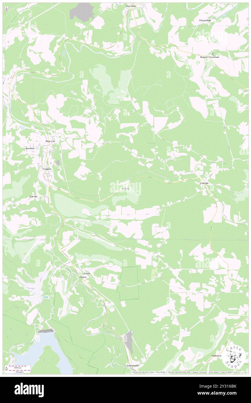 Heverly, Clearfield County, US, United States, Pennsylvania, N 40 44' 30'', S 78 30' 8'', map, Cartascapes Map published in 2024. Explore Cartascapes, a map revealing Earth's diverse landscapes, cultures, and ecosystems. Journey through time and space, discovering the interconnectedness of our planet's past, present, and future. Stock Photohttps://www.alamy.com/image-license-details/?v=1https://www.alamy.com/heverly-clearfield-county-us-united-states-pennsylvania-n-40-44-30-s-78-30-8-map-cartascapes-map-published-in-2024-explore-cartascapes-a-map-revealing-earths-diverse-landscapes-cultures-and-ecosystems-journey-through-time-and-space-discovering-the-interconnectedness-of-our-planets-past-present-and-future-image621444199.html
RM2Y316BK–Heverly, Clearfield County, US, United States, Pennsylvania, N 40 44' 30'', S 78 30' 8'', map, Cartascapes Map published in 2024. Explore Cartascapes, a map revealing Earth's diverse landscapes, cultures, and ecosystems. Journey through time and space, discovering the interconnectedness of our planet's past, present, and future.
 Curwensville, Clearfield County, Pennsylvania 1895. Stock Photohttps://www.alamy.com/image-license-details/?v=1https://www.alamy.com/curwensville-clearfield-county-pennsylvania-1895-image261671187.html
RMW5M47F–Curwensville, Clearfield County, Pennsylvania 1895.
 Columns of sandstone seem to push up from the forest floor Stock Photohttps://www.alamy.com/image-license-details/?v=1https://www.alamy.com/columns-of-sandstone-seem-to-push-up-from-the-forest-floor-image605010965.html
RF2X48HJD–Columns of sandstone seem to push up from the forest floor
![A.GCurtin vsSeth HYocumContested election from the twentieth congressional district of PennsylvaniaContestant's brief . ted vote—Cnrtin 87; Yocum 111. ^Admitted by contestant. NEW WASHINGTON BOROUGH • ? 1 jWm. Mehaffey Non-residence 21601730-32 1 1 j Total 1 Official vote—Curtin 29; Yocum 21. Printed testimony 629.Corrected vote—Curtin 28; Yocum 21. WALLACETON BOROUGH. Not. Abram Hummel Non-payment of tax] 2159 1i Total 1 -2165 1 1 1 1 Official vole—Curtin 28 ; Yocum 3, Printsd testimony 629.Corrected vote—Curtin 27 i Yocum 3. f;i;mm vs. yocum. 39 BECCAUIA TOVVXdHIP—CLEARFIELD COUNTY. H^ .2Si Stock Photo A.GCurtin vsSeth HYocumContested election from the twentieth congressional district of PennsylvaniaContestant's brief . ted vote—Cnrtin 87; Yocum 111. ^Admitted by contestant. NEW WASHINGTON BOROUGH • ? 1 jWm. Mehaffey Non-residence 21601730-32 1 1 j Total 1 Official vote—Curtin 29; Yocum 21. Printed testimony 629.Corrected vote—Curtin 28; Yocum 21. WALLACETON BOROUGH. Not. Abram Hummel Non-payment of tax] 2159 1i Total 1 -2165 1 1 1 1 Official vole—Curtin 28 ; Yocum 3, Printsd testimony 629.Corrected vote—Curtin 27 i Yocum 3. f;i;mm vs. yocum. 39 BECCAUIA TOVVXdHIP—CLEARFIELD COUNTY. H^ .2Si Stock Photo](https://c8.alamy.com/comp/2AXGCT3/agcurtin-vsseth-hyocumcontested-election-from-the-twentieth-congressional-district-of-pennsylvaniacontestants-brief-ted-votecnrtin-87-yocum-111-admitted-by-contestant-new-washington-borough-1-jwm-mehaffey-non-residence-21601730-32-1-1-j-total-1-official-votecurtin-29-yocum-21-printed-testimony-629corrected-votecurtin-28-yocum-21-wallaceton-borough-not-abram-hummel-non-payment-of-tax-2159-1i-total-1-2165-1-1-1-1-official-volecurtin-28-yocum-3-printsd-testimony-629corrected-votecurtin-27-i-yocum-3-fimm-vs-yocum-39-beccauia-tovvxdhipclearfield-county-h-2si-2AXGCT3.jpg) A.GCurtin vsSeth HYocumContested election from the twentieth congressional district of PennsylvaniaContestant's brief . ted vote—Cnrtin 87; Yocum 111. ^Admitted by contestant. NEW WASHINGTON BOROUGH • ? 1 jWm. Mehaffey Non-residence 21601730-32 1 1 j Total 1 Official vote—Curtin 29; Yocum 21. Printed testimony 629.Corrected vote—Curtin 28; Yocum 21. WALLACETON BOROUGH. Not. Abram Hummel Non-payment of tax] 2159 1i Total 1 -2165 1 1 1 1 Official vole—Curtin 28 ; Yocum 3, Printsd testimony 629.Corrected vote—Curtin 27 i Yocum 3. f;i;mm vs. yocum. 39 BECCAUIA TOVVXdHIP—CLEARFIELD COUNTY. H^ .2Si Stock Photohttps://www.alamy.com/image-license-details/?v=1https://www.alamy.com/agcurtin-vsseth-hyocumcontested-election-from-the-twentieth-congressional-district-of-pennsylvaniacontestants-brief-ted-votecnrtin-87-yocum-111-admitted-by-contestant-new-washington-borough-1-jwm-mehaffey-non-residence-21601730-32-1-1-j-total-1-official-votecurtin-29-yocum-21-printed-testimony-629corrected-votecurtin-28-yocum-21-wallaceton-borough-not-abram-hummel-non-payment-of-tax-2159-1i-total-1-2165-1-1-1-1-official-volecurtin-28-yocum-3-printsd-testimony-629corrected-votecurtin-27-i-yocum-3-fimm-vs-yocum-39-beccauia-tovvxdhipclearfield-county-h-2si-image343339363.html
A.GCurtin vsSeth HYocumContested election from the twentieth congressional district of PennsylvaniaContestant's brief . ted vote—Cnrtin 87; Yocum 111. ^Admitted by contestant. NEW WASHINGTON BOROUGH • ? 1 jWm. Mehaffey Non-residence 21601730-32 1 1 j Total 1 Official vote—Curtin 29; Yocum 21. Printed testimony 629.Corrected vote—Curtin 28; Yocum 21. WALLACETON BOROUGH. Not. Abram Hummel Non-payment of tax] 2159 1i Total 1 -2165 1 1 1 1 Official vole—Curtin 28 ; Yocum 3, Printsd testimony 629.Corrected vote—Curtin 27 i Yocum 3. f;i;mm vs. yocum. 39 BECCAUIA TOVVXdHIP—CLEARFIELD COUNTY. H^ .2Si Stock Photohttps://www.alamy.com/image-license-details/?v=1https://www.alamy.com/agcurtin-vsseth-hyocumcontested-election-from-the-twentieth-congressional-district-of-pennsylvaniacontestants-brief-ted-votecnrtin-87-yocum-111-admitted-by-contestant-new-washington-borough-1-jwm-mehaffey-non-residence-21601730-32-1-1-j-total-1-official-votecurtin-29-yocum-21-printed-testimony-629corrected-votecurtin-28-yocum-21-wallaceton-borough-not-abram-hummel-non-payment-of-tax-2159-1i-total-1-2165-1-1-1-1-official-volecurtin-28-yocum-3-printsd-testimony-629corrected-votecurtin-27-i-yocum-3-fimm-vs-yocum-39-beccauia-tovvxdhipclearfield-county-h-2si-image343339363.htmlRM2AXGCT3–A.GCurtin vsSeth HYocumContested election from the twentieth congressional district of PennsylvaniaContestant's brief . ted vote—Cnrtin 87; Yocum 111. ^Admitted by contestant. NEW WASHINGTON BOROUGH • ? 1 jWm. Mehaffey Non-residence 21601730-32 1 1 j Total 1 Official vote—Curtin 29; Yocum 21. Printed testimony 629.Corrected vote—Curtin 28; Yocum 21. WALLACETON BOROUGH. Not. Abram Hummel Non-payment of tax] 2159 1i Total 1 -2165 1 1 1 1 Official vole—Curtin 28 ; Yocum 3, Printsd testimony 629.Corrected vote—Curtin 27 i Yocum 3. f;i;mm vs. yocum. 39 BECCAUIA TOVVXdHIP—CLEARFIELD COUNTY. H^ .2Si
 Parker Dam State Park Stock Photohttps://www.alamy.com/image-license-details/?v=1https://www.alamy.com/stock-photo-parker-dam-state-park-126933358.html
RFHAE8P6–Parker Dam State Park
 Image 2 of Sanborn Fire Insurance Map from Houtzdale, Clearfield County, Pennsylvania. Jul 1887. 2 Sheet(s), America, street map with a Nineteenth Century compass Stock Photohttps://www.alamy.com/image-license-details/?v=1https://www.alamy.com/image-2-of-sanborn-fire-insurance-map-from-houtzdale-clearfield-county-pennsylvania-jul-1887-2-sheets-america-street-map-with-a-nineteenth-century-compass-image344697722.html
RM2B0P9CX–Image 2 of Sanborn Fire Insurance Map from Houtzdale, Clearfield County, Pennsylvania. Jul 1887. 2 Sheet(s), America, street map with a Nineteenth Century compass
 Faunce, Clearfield County, US, United States, Pennsylvania, N 40 54' 44'', S 78 26' 8'', map, Cartascapes Map published in 2024. Explore Cartascapes, a map revealing Earth's diverse landscapes, cultures, and ecosystems. Journey through time and space, discovering the interconnectedness of our planet's past, present, and future. Stock Photohttps://www.alamy.com/image-license-details/?v=1https://www.alamy.com/faunce-clearfield-county-us-united-states-pennsylvania-n-40-54-44-s-78-26-8-map-cartascapes-map-published-in-2024-explore-cartascapes-a-map-revealing-earths-diverse-landscapes-cultures-and-ecosystems-journey-through-time-and-space-discovering-the-interconnectedness-of-our-planets-past-present-and-future-image621461691.html
RM2Y320MB–Faunce, Clearfield County, US, United States, Pennsylvania, N 40 54' 44'', S 78 26' 8'', map, Cartascapes Map published in 2024. Explore Cartascapes, a map revealing Earth's diverse landscapes, cultures, and ecosystems. Journey through time and space, discovering the interconnectedness of our planet's past, present, and future.
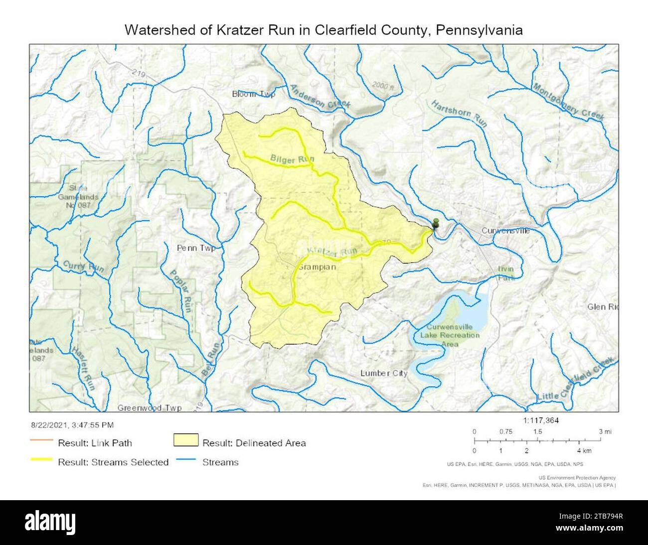 Watershed of Kratzer Run in Clearfield County, Pennsylvania. Stock Photohttps://www.alamy.com/image-license-details/?v=1https://www.alamy.com/watershed-of-kratzer-run-in-clearfield-county-pennsylvania-image574864215.html
RM2TB794R–Watershed of Kratzer Run in Clearfield County, Pennsylvania.
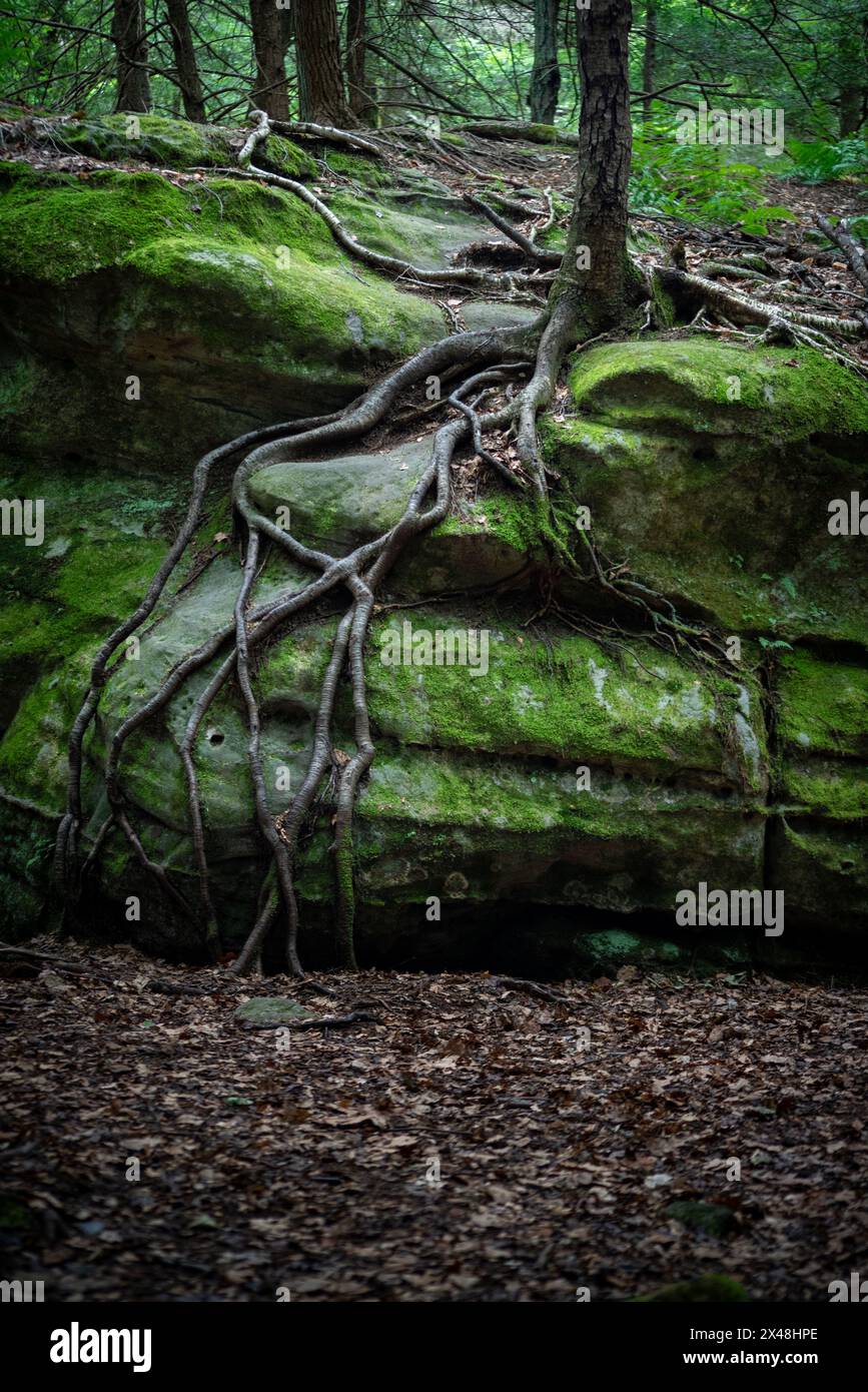 A black birch tree has persisted on exposed rock by sending roots to the forest floor below. Stock Photohttps://www.alamy.com/image-license-details/?v=1https://www.alamy.com/a-black-birch-tree-has-persisted-on-exposed-rock-by-sending-roots-to-the-forest-floor-below-image605011078.html
RF2X48HPE–A black birch tree has persisted on exposed rock by sending roots to the forest floor below.
 Monthly review of the Dairy and Food Division : issued monthly . off paidsame to Jas. Foust. Clearfield County, 1909. Oneida Co. Criminal, P. Gallagher, Case adjusted upon the pay- Dec. 15. 1908, Agent H. Brand, Price Os c e o1 a ment of a fine of $50. L. Banzhoff paid & Lucas, Mills. same to Jas. Foust. Alleghen y , Pa. Brand: Price Criminal, P. Gallagher, Case adjusted upon the pay- Dec. 19, 1908, Agent H. & Lucas. Os c e o 1 a ment of a fine of $50. L. Banzhoff paid Mills. same to Jas. Foust. Jefferson County, 1909. Brand: Price I Criminal, & Lucas Co., (Cider Vine- | gar), Alle- i gheny, P Stock Photohttps://www.alamy.com/image-license-details/?v=1https://www.alamy.com/monthly-review-of-the-dairy-and-food-division-issued-monthly-off-paidsame-to-jas-foust-clearfield-county-1909-oneida-co-criminal-p-gallagher-case-adjusted-upon-the-pay-dec-15-1908-agent-h-brand-price-os-c-e-o1-a-ment-of-a-fine-of-50-l-banzhoff-paid-lucas-mills-same-to-jas-foust-alleghen-y-pa-brand-price-criminal-p-gallagher-case-adjusted-upon-the-pay-dec-19-1908-agent-h-lucas-os-c-e-o-1-a-ment-of-a-fine-of-50-l-banzhoff-paid-mills-same-to-jas-foust-jefferson-county-1909-brand-price-i-criminal-lucas-co-cider-vine-gar-alle-i-gheny-p-image342897523.html
RM2AWT983–Monthly review of the Dairy and Food Division : issued monthly . off paidsame to Jas. Foust. Clearfield County, 1909. Oneida Co. Criminal, P. Gallagher, Case adjusted upon the pay- Dec. 15. 1908, Agent H. Brand, Price Os c e o1 a ment of a fine of $50. L. Banzhoff paid & Lucas, Mills. same to Jas. Foust. Alleghen y , Pa. Brand: Price Criminal, P. Gallagher, Case adjusted upon the pay- Dec. 19, 1908, Agent H. & Lucas. Os c e o 1 a ment of a fine of $50. L. Banzhoff paid Mills. same to Jas. Foust. Jefferson County, 1909. Brand: Price I Criminal, & Lucas Co., (Cider Vine- | gar), Alle- i gheny, P
 Parker Dam State Park Stock Photohttps://www.alamy.com/image-license-details/?v=1https://www.alamy.com/stock-photo-parker-dam-state-park-126933362.html
RFHAE8PA–Parker Dam State Park
 Image 1 of Sanborn Fire Insurance Map from Clearfield, Clearfield County, Pennsylvania. Sep 1897. 6 Sheet(s), America, street map with a Nineteenth Century compass Stock Photohttps://www.alamy.com/image-license-details/?v=1https://www.alamy.com/image-1-of-sanborn-fire-insurance-map-from-clearfield-clearfield-county-pennsylvania-sep-1897-6-sheets-america-street-map-with-a-nineteenth-century-compass-image344694782.html
RM2B0P5KX–Image 1 of Sanborn Fire Insurance Map from Clearfield, Clearfield County, Pennsylvania. Sep 1897. 6 Sheet(s), America, street map with a Nineteenth Century compass
 Sandy, Clearfield County, US, United States, Pennsylvania, N 41 6' 28'', S 78 46' 16'', map, Cartascapes Map published in 2024. Explore Cartascapes, a map revealing Earth's diverse landscapes, cultures, and ecosystems. Journey through time and space, discovering the interconnectedness of our planet's past, present, and future. Stock Photohttps://www.alamy.com/image-license-details/?v=1https://www.alamy.com/sandy-clearfield-county-us-united-states-pennsylvania-n-41-6-28-s-78-46-16-map-cartascapes-map-published-in-2024-explore-cartascapes-a-map-revealing-earths-diverse-landscapes-cultures-and-ecosystems-journey-through-time-and-space-discovering-the-interconnectedness-of-our-planets-past-present-and-future-image621145680.html
RM2Y2FHJ8–Sandy, Clearfield County, US, United States, Pennsylvania, N 41 6' 28'', S 78 46' 16'', map, Cartascapes Map published in 2024. Explore Cartascapes, a map revealing Earth's diverse landscapes, cultures, and ecosystems. Journey through time and space, discovering the interconnectedness of our planet's past, present, and future.
 Course of Kratzer Run in Clearfield County, Pennsylvania. Stock Photohttps://www.alamy.com/image-license-details/?v=1https://www.alamy.com/course-of-kratzer-run-in-clearfield-county-pennsylvania-image635600782.html
RM2YX237X–Course of Kratzer Run in Clearfield County, Pennsylvania.
 Waterfall of roots cascade down rockface. Stock Photohttps://www.alamy.com/image-license-details/?v=1https://www.alamy.com/waterfall-of-roots-cascade-down-rockface-image605011014.html
RF2X48HM6–Waterfall of roots cascade down rockface.
 . History of Huntingdon and Blair counties, Pennsylvania . mained till1856, when he returned to the scenes of his boyhoodin Huntingdon County, where he has since resided. Honest industry being one of the cardinal princi-ples of his life, he was soon engrossed in business onhis own account, engaging in the mercantile business,manufacture and sale of lumber, brick, and other ma-terial, and in the mean time became the owner oflarge coal-fields in Clearfield County in this State.Disposing of his mercantile, lumber, brick, and otherinterests, he engaged with the United States govern-ment as one of Stock Photohttps://www.alamy.com/image-license-details/?v=1https://www.alamy.com/history-of-huntingdon-and-blair-counties-pennsylvania-mained-till1856-when-he-returned-to-the-scenes-of-his-boyhoodin-huntingdon-county-where-he-has-since-resided-honest-industry-being-one-of-the-cardinal-princi-ples-of-his-life-he-was-soon-engrossed-in-business-onhis-own-account-engaging-in-the-mercantile-businessmanufacture-and-sale-of-lumber-brick-and-other-ma-terial-and-in-the-mean-time-became-the-owner-oflarge-coal-fields-in-clearfield-county-in-this-statedisposing-of-his-mercantile-lumber-brick-and-otherinterests-he-engaged-with-the-united-states-govern-ment-as-one-of-image370022344.html
RM2CDYY7M–. History of Huntingdon and Blair counties, Pennsylvania . mained till1856, when he returned to the scenes of his boyhoodin Huntingdon County, where he has since resided. Honest industry being one of the cardinal princi-ples of his life, he was soon engrossed in business onhis own account, engaging in the mercantile business,manufacture and sale of lumber, brick, and other ma-terial, and in the mean time became the owner oflarge coal-fields in Clearfield County in this State.Disposing of his mercantile, lumber, brick, and otherinterests, he engaged with the United States govern-ment as one of
 Parker Dam State Park Stock Photohttps://www.alamy.com/image-license-details/?v=1https://www.alamy.com/parker-dam-state-park-image383771470.html
RF2D8A8BX–Parker Dam State Park
 Image 1 of Sanborn Fire Insurance Map from Houtzdale, Clearfield County, Pennsylvania. Jul 1887. 2 Sheet(s), America, street map with a Nineteenth Century compass Stock Photohttps://www.alamy.com/image-license-details/?v=1https://www.alamy.com/image-1-of-sanborn-fire-insurance-map-from-houtzdale-clearfield-county-pennsylvania-jul-1887-2-sheets-america-street-map-with-a-nineteenth-century-compass-image344697720.html
RM2B0P9CT–Image 1 of Sanborn Fire Insurance Map from Houtzdale, Clearfield County, Pennsylvania. Jul 1887. 2 Sheet(s), America, street map with a Nineteenth Century compass
 Bridgeport, Clearfield County, US, United States, Pennsylvania, N 40 58' 31'', S 78 33' 4'', map, Cartascapes Map published in 2024. Explore Cartascapes, a map revealing Earth's diverse landscapes, cultures, and ecosystems. Journey through time and space, discovering the interconnectedness of our planet's past, present, and future. Stock Photohttps://www.alamy.com/image-license-details/?v=1https://www.alamy.com/bridgeport-clearfield-county-us-united-states-pennsylvania-n-40-58-31-s-78-33-4-map-cartascapes-map-published-in-2024-explore-cartascapes-a-map-revealing-earths-diverse-landscapes-cultures-and-ecosystems-journey-through-time-and-space-discovering-the-interconnectedness-of-our-planets-past-present-and-future-image621361366.html
RM2Y2WCNA–Bridgeport, Clearfield County, US, United States, Pennsylvania, N 40 58' 31'', S 78 33' 4'', map, Cartascapes Map published in 2024. Explore Cartascapes, a map revealing Earth's diverse landscapes, cultures, and ecosystems. Journey through time and space, discovering the interconnectedness of our planet's past, present, and future.
 Course of Bilger Run in Clearfield County, Pennsylvania. Stock Photohttps://www.alamy.com/image-license-details/?v=1https://www.alamy.com/course-of-bilger-run-in-clearfield-county-pennsylvania-image635600745.html
RM2YX236H–Course of Bilger Run in Clearfield County, Pennsylvania.
 . Jefferson County, Pennsylvania : her pioneers and people, 1800-1915. e, and served as dis-trict deputy of the order for three terms.Since his death his widow has continued tomaintain her home at Beechtree, and she issustained and comforted in the devotion of herchildren and the gracious association of manyold friends. Of the three children the eldestis Clara Bell, who is the wife of WallaceOHara, of DuBois, Clearfield county; Jen-nie W. is the wife of Roy Patton, of DuBois;Edith Pearl is tin- wife of .Robert N. Moore,of the same city. Mrs. Loughrey is a daughter of Elijah andlane (Stewart) S Stock Photohttps://www.alamy.com/image-license-details/?v=1https://www.alamy.com/jefferson-county-pennsylvania-her-pioneers-and-people-1800-1915-e-and-served-as-dis-trict-deputy-of-the-order-for-three-termssince-his-death-his-widow-has-continued-tomaintain-her-home-at-beechtree-and-she-issustained-and-comforted-in-the-devotion-of-herchildren-and-the-gracious-association-of-manyold-friends-of-the-three-children-the-eldestis-clara-bell-who-is-the-wife-of-wallaceohara-of-dubois-clearfield-county-jen-nie-w-is-the-wife-of-roy-patton-of-duboisedith-pearl-is-tin-wife-of-robert-n-mooreof-the-same-city-mrs-loughrey-is-a-daughter-of-elijah-andlane-stewart-s-image370383824.html
RM2CEGC9M–. Jefferson County, Pennsylvania : her pioneers and people, 1800-1915. e, and served as dis-trict deputy of the order for three terms.Since his death his widow has continued tomaintain her home at Beechtree, and she issustained and comforted in the devotion of herchildren and the gracious association of manyold friends. Of the three children the eldestis Clara Bell, who is the wife of WallaceOHara, of DuBois, Clearfield county; Jen-nie W. is the wife of Roy Patton, of DuBois;Edith Pearl is tin- wife of .Robert N. Moore,of the same city. Mrs. Loughrey is a daughter of Elijah andlane (Stewart) S
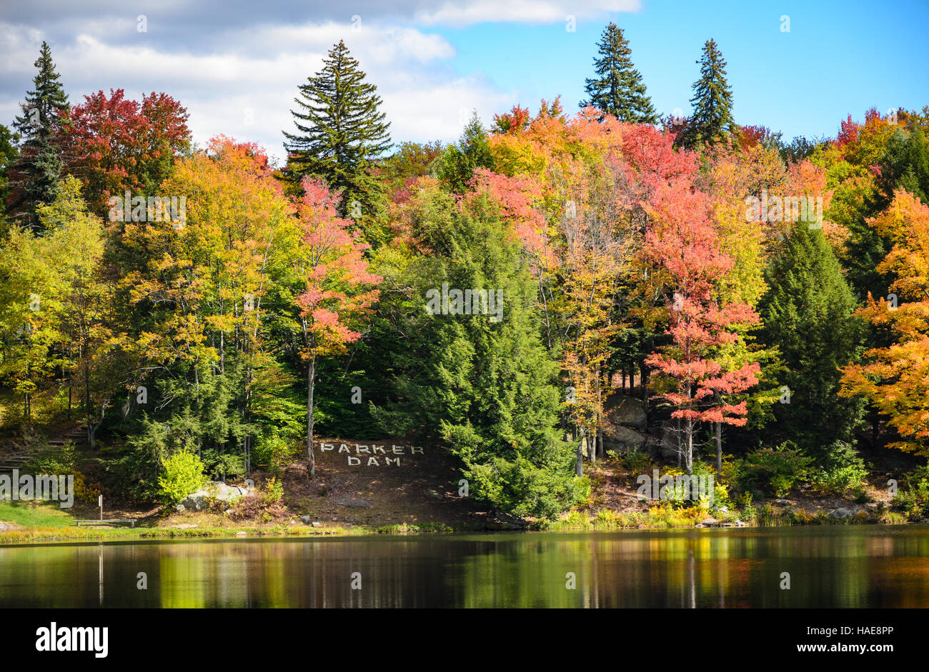 Parker Dam State Park Stock Photohttps://www.alamy.com/image-license-details/?v=1https://www.alamy.com/stock-photo-parker-dam-state-park-126933374.html
RFHAE8PP–Parker Dam State Park
 Image 5 of Sanborn Fire Insurance Map from Clearfield, Clearfield County, Pennsylvania. Apr 1892. 5 Sheet(s), America, street map with a Nineteenth Century compass Stock Photohttps://www.alamy.com/image-license-details/?v=1https://www.alamy.com/image-5-of-sanborn-fire-insurance-map-from-clearfield-clearfield-county-pennsylvania-apr-1892-5-sheets-america-street-map-with-a-nineteenth-century-compass-image344694781.html
RM2B0P5KW–Image 5 of Sanborn Fire Insurance Map from Clearfield, Clearfield County, Pennsylvania. Apr 1892. 5 Sheet(s), America, street map with a Nineteenth Century compass
 Peale, Clearfield County, US, United States, Pennsylvania, N 40 59' 52'', S 78 4' 53'', map, Cartascapes Map published in 2024. Explore Cartascapes, a map revealing Earth's diverse landscapes, cultures, and ecosystems. Journey through time and space, discovering the interconnectedness of our planet's past, present, and future. Stock Photohttps://www.alamy.com/image-license-details/?v=1https://www.alamy.com/peale-clearfield-county-us-united-states-pennsylvania-n-40-59-52-s-78-4-53-map-cartascapes-map-published-in-2024-explore-cartascapes-a-map-revealing-earths-diverse-landscapes-cultures-and-ecosystems-journey-through-time-and-space-discovering-the-interconnectedness-of-our-planets-past-present-and-future-image621311507.html
RM2Y2R54K–Peale, Clearfield County, US, United States, Pennsylvania, N 40 59' 52'', S 78 4' 53'', map, Cartascapes Map published in 2024. Explore Cartascapes, a map revealing Earth's diverse landscapes, cultures, and ecosystems. Journey through time and space, discovering the interconnectedness of our planet's past, present, and future.
 Watershed of Coupler Run in Clearfield County, Pennsylvania. Stock Photohttps://www.alamy.com/image-license-details/?v=1https://www.alamy.com/watershed-of-coupler-run-in-clearfield-county-pennsylvania-image574864202.html
RM2TB794A–Watershed of Coupler Run in Clearfield County, Pennsylvania.
 . Jefferson County, Pennsylvania : her pioneers and people, 1800-1915. wnship offices. About threeyears prior to his death he removed again toTroutville, Clearfield county, and there hepassed away on the 25th of February, 1875, atthe age of seventy years. In Germany hewedded Eleanora Schoch, who was born andreared in the Kingdom of Bavaria, and at thetime of their immigration to America theyhad two children, Henry L. and Barbara. Mrs.Weaver continued her residence in Clearfieldcounty until her death, in 1885. at the age ofseventy-eight years. Of their children theeldest, Henry L., married Eliz Stock Photohttps://www.alamy.com/image-license-details/?v=1https://www.alamy.com/jefferson-county-pennsylvania-her-pioneers-and-people-1800-1915-wnship-offices-about-threeyears-prior-to-his-death-he-removed-again-totroutville-clearfield-county-and-there-hepassed-away-on-the-25th-of-february-1875-atthe-age-of-seventy-years-in-germany-hewedded-eleanora-schoch-who-was-born-andreared-in-the-kingdom-of-bavaria-and-at-thetime-of-their-immigration-to-america-theyhad-two-children-henry-l-and-barbara-mrsweaver-continued-her-residence-in-clearfieldcounty-until-her-death-in-1885-at-the-age-ofseventy-eight-years-of-their-children-theeldest-henry-l-married-eliz-image370376408.html
RM2CEG2TT–. Jefferson County, Pennsylvania : her pioneers and people, 1800-1915. wnship offices. About threeyears prior to his death he removed again toTroutville, Clearfield county, and there hepassed away on the 25th of February, 1875, atthe age of seventy years. In Germany hewedded Eleanora Schoch, who was born andreared in the Kingdom of Bavaria, and at thetime of their immigration to America theyhad two children, Henry L. and Barbara. Mrs.Weaver continued her residence in Clearfieldcounty until her death, in 1885. at the age ofseventy-eight years. Of their children theeldest, Henry L., married Eliz