Cohasset massachusetts map Stock Photos and Images
(52)See cohasset massachusetts map stock video clipsQuick filters:
Cohasset massachusetts map Stock Photos and Images
 Cohasset Massachusetts USA Shown on a Geography map or road map Stock Photohttps://www.alamy.com/image-license-details/?v=1https://www.alamy.com/cohasset-massachusetts-usa-shown-on-a-geography-map-or-road-map-image424972027.html
RM2FKB44B–Cohasset Massachusetts USA Shown on a Geography map or road map
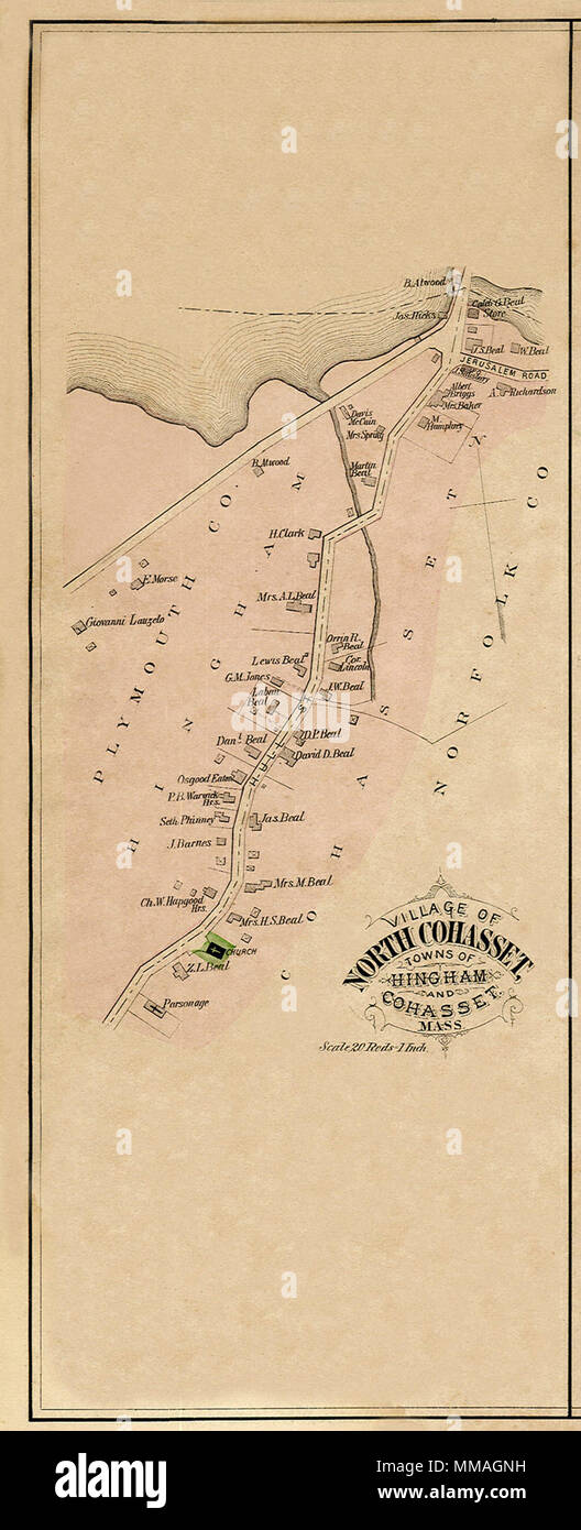 Map of North Cohasset. 1879 Stock Photohttps://www.alamy.com/image-license-details/?v=1https://www.alamy.com/map-of-north-cohasset-1879-image184629469.html
RMMMAGNH–Map of North Cohasset. 1879
 North Cohasset, Norfolk County, US, United States, Massachusetts, N 42 15' 30'', S 70 50' 33'', map, Cartascapes Map published in 2024. Explore Cartascapes, a map revealing Earth's diverse landscapes, cultures, and ecosystems. Journey through time and space, discovering the interconnectedness of our planet's past, present, and future. Stock Photohttps://www.alamy.com/image-license-details/?v=1https://www.alamy.com/north-cohasset-norfolk-county-us-united-states-massachusetts-n-42-15-30-s-70-50-33-map-cartascapes-map-published-in-2024-explore-cartascapes-a-map-revealing-earths-diverse-landscapes-cultures-and-ecosystems-journey-through-time-and-space-discovering-the-interconnectedness-of-our-planets-past-present-and-future-image621436513.html
RM2Y30TH5–North Cohasset, Norfolk County, US, United States, Massachusetts, N 42 15' 30'', S 70 50' 33'', map, Cartascapes Map published in 2024. Explore Cartascapes, a map revealing Earth's diverse landscapes, cultures, and ecosystems. Journey through time and space, discovering the interconnectedness of our planet's past, present, and future.
 . (Sketch A No. 3) Minots Ledge Off Boston Harbor. English: A rare hand colored 1853 coastal chart of the Minots Ledge, just off Boston Harbor, Massachusetts. Features The Cohasset Salt Works, Old Harbor, Brig Harbor, The Glades, Cohasset Harbor, and various islands. Published under the supervision of A. D. Bache for the 1853 Report of the Superintendent of the U.S. Coast Survey. . 1853 (dated) 8 1853 U.S.C.S. Map of Minots Ledge, near Boston Harbor ( Cohasset ) - Geographicus - MinotsLedge2-uscs-1853 Stock Photohttps://www.alamy.com/image-license-details/?v=1https://www.alamy.com/sketch-a-no-3-minots-ledge-off-boston-harbor-english-a-rare-hand-colored-1853-coastal-chart-of-the-minots-ledge-just-off-boston-harbor-massachusetts-features-the-cohasset-salt-works-old-harbor-brig-harbor-the-glades-cohasset-harbor-and-various-islands-published-under-the-supervision-of-a-d-bache-for-the-1853-report-of-the-superintendent-of-the-us-coast-survey-1853-dated-8-1853-uscs-map-of-minots-ledge-near-boston-harbor-cohasset-geographicus-minotsledge2-uscs-1853-image188134104.html
RMMX26Y4–. (Sketch A No. 3) Minots Ledge Off Boston Harbor. English: A rare hand colored 1853 coastal chart of the Minots Ledge, just off Boston Harbor, Massachusetts. Features The Cohasset Salt Works, Old Harbor, Brig Harbor, The Glades, Cohasset Harbor, and various islands. Published under the supervision of A. D. Bache for the 1853 Report of the Superintendent of the U.S. Coast Survey. . 1853 (dated) 8 1853 U.S.C.S. Map of Minots Ledge, near Boston Harbor ( Cohasset ) - Geographicus - MinotsLedge2-uscs-1853
 Town of Hingham Plymouth County, Mass : from recent and actual surveys. Cadastral map. Includes business listings. Includes three insets: Downer Landing, Liberty Plain, and North Cohasset.... , Massachusetts , Plymouth ,county , Hingham Stock Photohttps://www.alamy.com/image-license-details/?v=1https://www.alamy.com/town-of-hingham-plymouth-county-mass-from-recent-and-actual-surveys-cadastral-map-includes-business-listings-includes-three-insets-downer-landing-liberty-plain-and-north-cohasset-massachusetts-plymouth-county-hingham-image502691070.html
RM2M5RFGE–Town of Hingham Plymouth County, Mass : from recent and actual surveys. Cadastral map. Includes business listings. Includes three insets: Downer Landing, Liberty Plain, and North Cohasset.... , Massachusetts , Plymouth ,county , Hingham
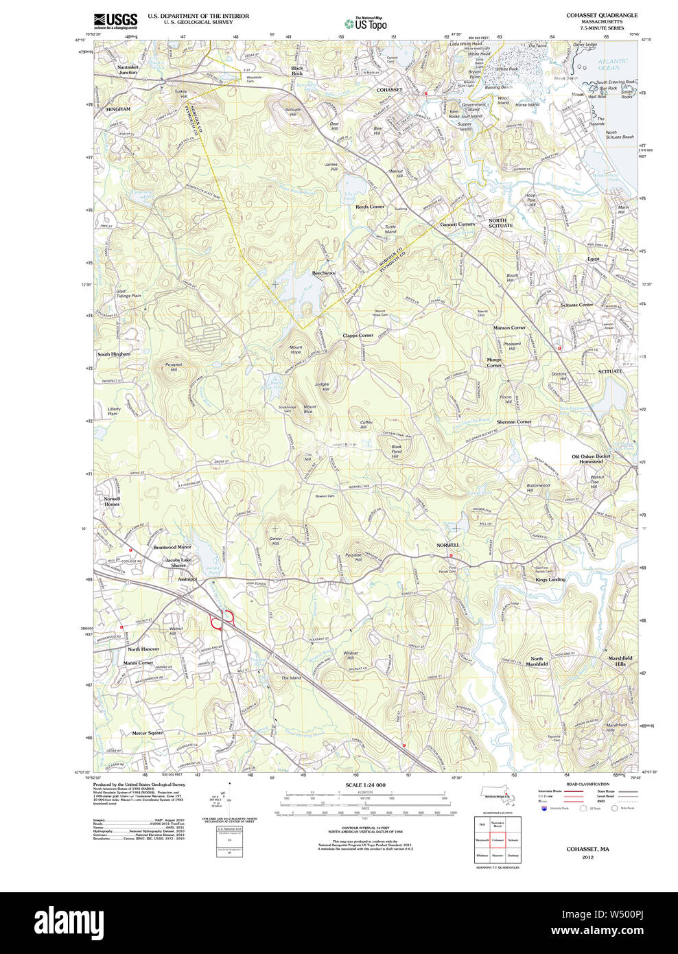 Massachusetts USGS Historical Topo Map MA Cohasset 20120527 TM Restoration Stock Photohttps://www.alamy.com/image-license-details/?v=1https://www.alamy.com/massachusetts-usgs-historical-topo-map-ma-cohasset-20120527-tm-restoration-image261229434.html
RMW500PJ–Massachusetts USGS Historical Topo Map MA Cohasset 20120527 TM Restoration
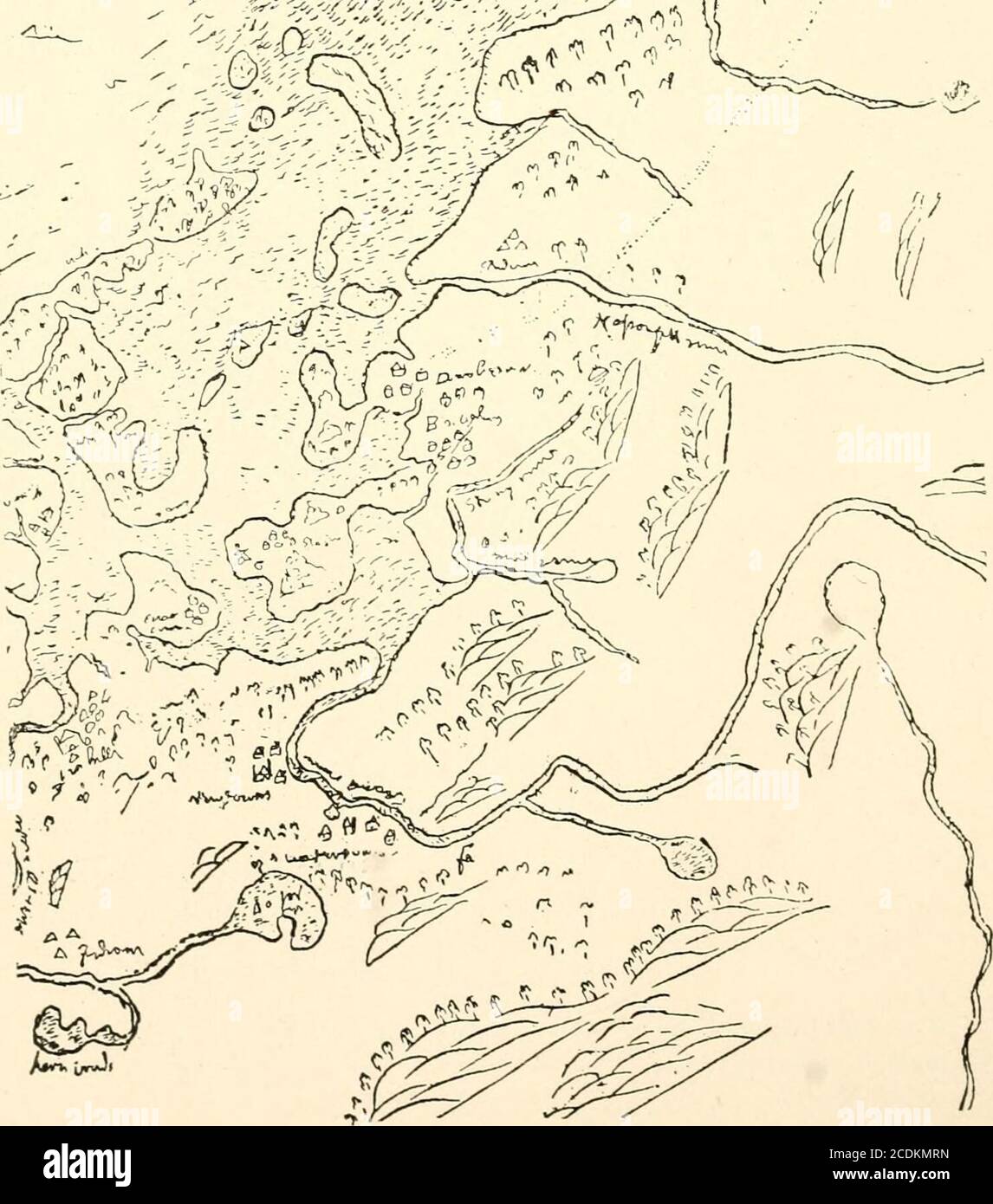 . A narrative history of the town of Cohasset, Massachusetts . < ou o z o <! oJ Q i/»)i THE QUONAHASSIT PIONEERS. ioi by boat to Wessagusset, and rescued the colony afterhaving stabbed the two bragging braves, Wituwamat andPecksuot.* Many pioneers must have passed silently and alone overthe Indian trails of Cohasset, and many without leavingany written record must have explored in boats our Cove,as well as other inlets and rivers of Massachusetts Bay.The characteristic rocks of our Cohasset shore are shownupon Alexanders map as early as the year 1624.J Besides this, at least one good map Stock Photohttps://www.alamy.com/image-license-details/?v=1https://www.alamy.com/a-narrative-history-of-the-town-of-cohasset-massachusetts-lt-ou-o-z-o-lt!-oj-q-ii-the-quonahassit-pioneers-ioi-by-boat-to-wessagusset-and-rescued-the-colony-afterhaving-stabbed-the-two-bragging-braves-wituwamat-andpecksuot-many-pioneers-must-have-passed-silently-and-alone-overthe-indian-trails-of-cohasset-and-many-without-leavingany-written-record-must-have-explored-in-boats-our-coveas-well-as-other-inlets-and-rivers-of-massachusetts-baythe-characteristic-rocks-of-our-cohasset-shore-are-shownupon-alexanders-map-as-early-as-the-year-1624j-besides-this-at-least-one-good-map-image369841689.html
RM2CDKMRN–. A narrative history of the town of Cohasset, Massachusetts . < ou o z o <! oJ Q i/»)i THE QUONAHASSIT PIONEERS. ioi by boat to Wessagusset, and rescued the colony afterhaving stabbed the two bragging braves, Wituwamat andPecksuot.* Many pioneers must have passed silently and alone overthe Indian trails of Cohasset, and many without leavingany written record must have explored in boats our Cove,as well as other inlets and rivers of Massachusetts Bay.The characteristic rocks of our Cohasset shore are shownupon Alexanders map as early as the year 1624.J Besides this, at least one good map
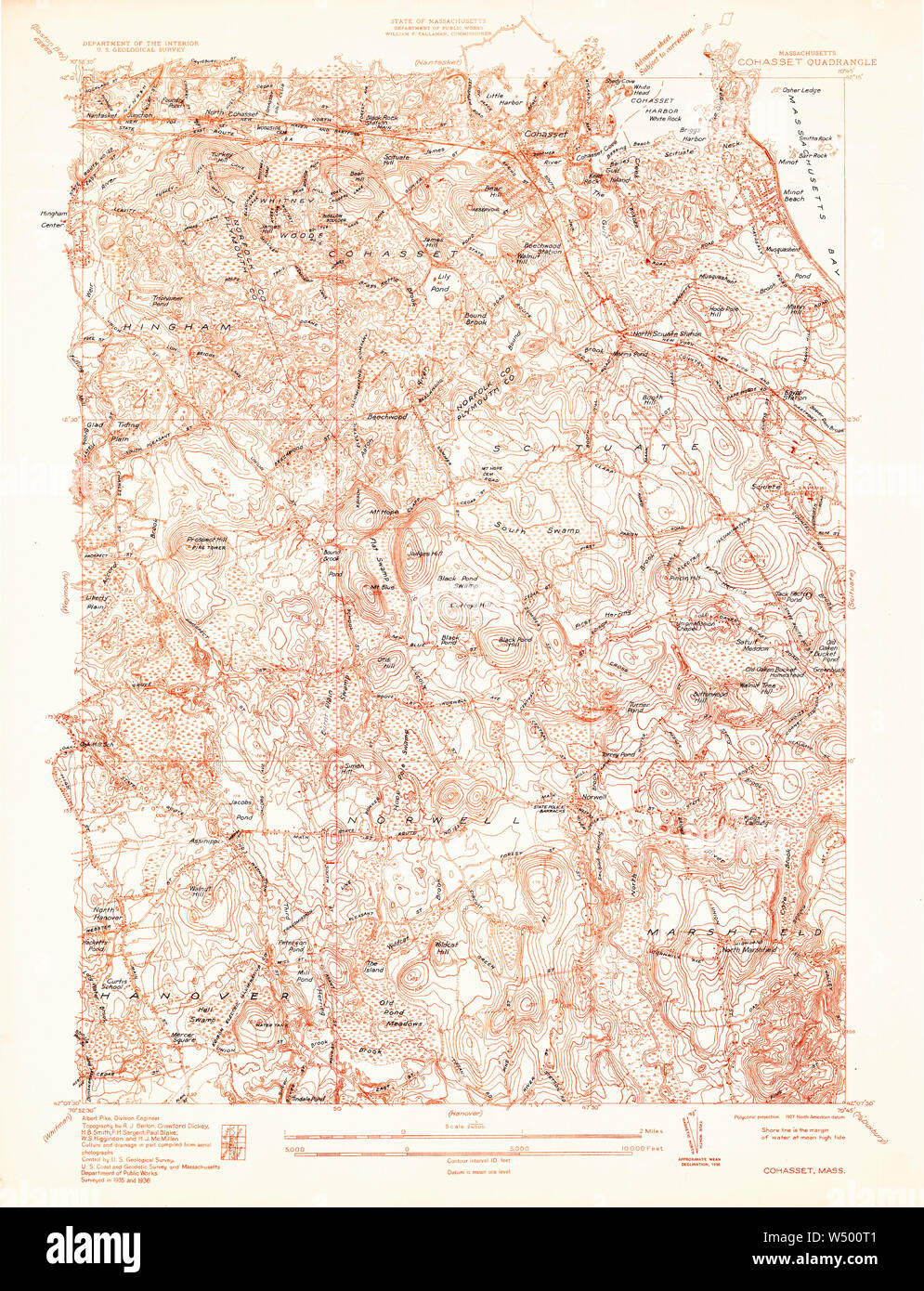 Massachusetts USGS Historical Topo Map MA Cohasset 350067 1936 24000 Restoration Stock Photohttps://www.alamy.com/image-license-details/?v=1https://www.alamy.com/massachusetts-usgs-historical-topo-map-ma-cohasset-350067-1936-24000-restoration-image261229473.html
RMW500T1–Massachusetts USGS Historical Topo Map MA Cohasset 350067 1936 24000 Restoration
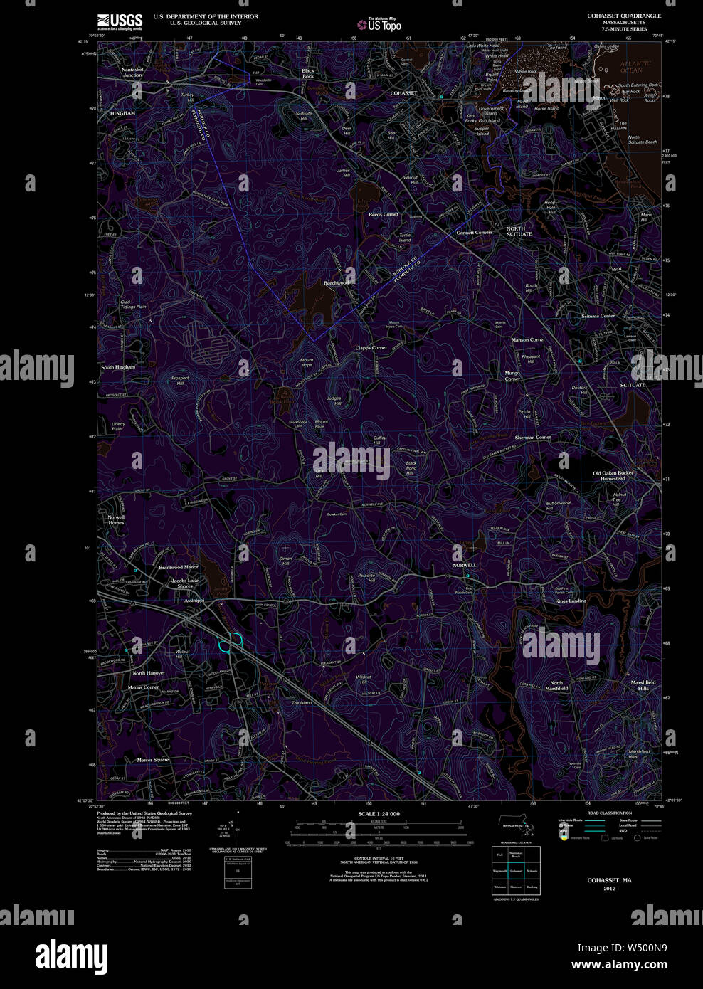 Massachusetts USGS Historical Topo Map MA Cohasset 20120527 TM Inverted Restoration Stock Photohttps://www.alamy.com/image-license-details/?v=1https://www.alamy.com/massachusetts-usgs-historical-topo-map-ma-cohasset-20120527-tm-inverted-restoration-image261229397.html
RMW500N9–Massachusetts USGS Historical Topo Map MA Cohasset 20120527 TM Inverted Restoration
 Massachusetts USGS Historical Topo Map MA Cohasset 351614 1941 31680 Restoration Stock Photohttps://www.alamy.com/image-license-details/?v=1https://www.alamy.com/massachusetts-usgs-historical-topo-map-ma-cohasset-351614-1941-31680-restoration-image261229951.html
RMW501D3–Massachusetts USGS Historical Topo Map MA Cohasset 351614 1941 31680 Restoration
 Cohasset, Norfolk County, US, United States, Massachusetts, N 42 14' 30'', S 70 48' 13'', map, Cartascapes Map published in 2024. Explore Cartascapes, a map revealing Earth's diverse landscapes, cultures, and ecosystems. Journey through time and space, discovering the interconnectedness of our planet's past, present, and future. Stock Photohttps://www.alamy.com/image-license-details/?v=1https://www.alamy.com/cohasset-norfolk-county-us-united-states-massachusetts-n-42-14-30-s-70-48-13-map-cartascapes-map-published-in-2024-explore-cartascapes-a-map-revealing-earths-diverse-landscapes-cultures-and-ecosystems-journey-through-time-and-space-discovering-the-interconnectedness-of-our-planets-past-present-and-future-image620765043.html
RM2Y1X843–Cohasset, Norfolk County, US, United States, Massachusetts, N 42 14' 30'', S 70 48' 13'', map, Cartascapes Map published in 2024. Explore Cartascapes, a map revealing Earth's diverse landscapes, cultures, and ecosystems. Journey through time and space, discovering the interconnectedness of our planet's past, present, and future.
RMMX28YE–. Massachusetts Boston Bay Sheet. English: One of the more sought after topographical maps produced by the U.S. Geological Survey. The 1900 edition of the U.S.G.S. Survey Map of Boston Bay covers from Salem to Waymouth, Hingham and Cohasset. Offers extraordinary detail to the level of streets and often individual buildings. Includes Boston area communities of Marblehead, Lynn, Swampscott, Lynn, Salem, Revere, Winthrop, Quincy, Weymouth, Hingham, Hull and Cohasset. Identifies numerous other points of interest including Windmill Point, the Narrows Lighthouse, the Dear Island Beacon, the Great F
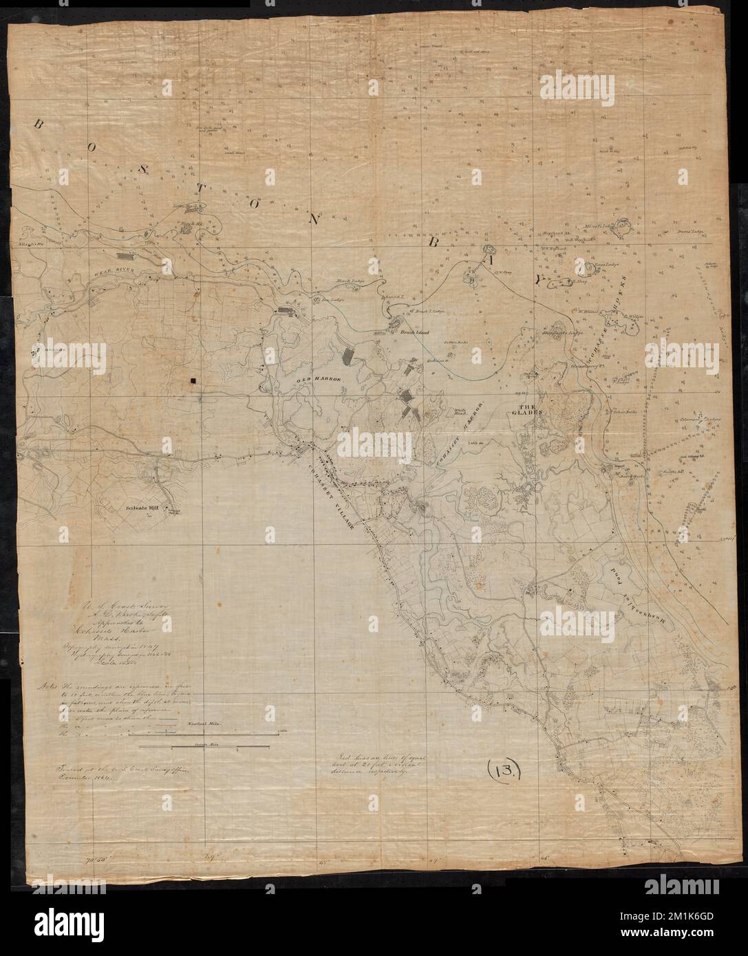 Approaches to Cohasset Harbor Mass. : topography surveyed in 1847 ; hydrography surveyed in 1846-'56 , Coasts, Massachusetts, Cohasset, Maps, Harbors, Massachusetts, Cohasset, Maps, Cohasset Mass., Maps, Manuscript maps Norman B. Leventhal Map Center Collection Stock Photohttps://www.alamy.com/image-license-details/?v=1https://www.alamy.com/approaches-to-cohasset-harbor-mass-topography-surveyed-in-1847-hydrography-surveyed-in-1846-56-coasts-massachusetts-cohasset-maps-harbors-massachusetts-cohasset-maps-cohasset-mass-maps-manuscript-maps-norman-b-leventhal-map-center-collection-image500137581.html
RM2M1K6GD–Approaches to Cohasset Harbor Mass. : topography surveyed in 1847 ; hydrography surveyed in 1846-'56 , Coasts, Massachusetts, Cohasset, Maps, Harbors, Massachusetts, Cohasset, Maps, Cohasset Mass., Maps, Manuscript maps Norman B. Leventhal Map Center Collection
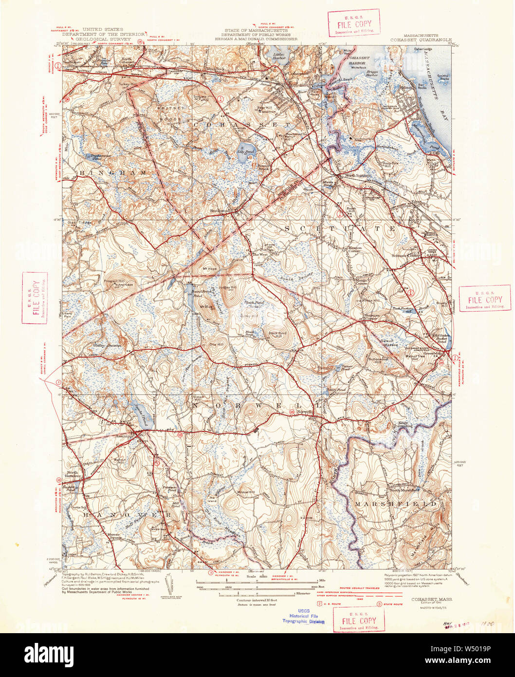 Massachusetts USGS Historical Topo Map MA Cohasset 351611 1941 31680 Restoration Stock Photohttps://www.alamy.com/image-license-details/?v=1https://www.alamy.com/massachusetts-usgs-historical-topo-map-ma-cohasset-351611-1941-31680-restoration-image261229858.html
RMW5019P–Massachusetts USGS Historical Topo Map MA Cohasset 351611 1941 31680 Restoration
 Cohasset, Norfolk County, US, United States, Massachusetts, N 42 14' 30'', S 70 48' 13'', map, Cartascapes Map published in 2024. Explore Cartascapes, a map revealing Earth's diverse landscapes, cultures, and ecosystems. Journey through time and space, discovering the interconnectedness of our planet's past, present, and future. Stock Photohttps://www.alamy.com/image-license-details/?v=1https://www.alamy.com/cohasset-norfolk-county-us-united-states-massachusetts-n-42-14-30-s-70-48-13-map-cartascapes-map-published-in-2024-explore-cartascapes-a-map-revealing-earths-diverse-landscapes-cultures-and-ecosystems-journey-through-time-and-space-discovering-the-interconnectedness-of-our-planets-past-present-and-future-image620831177.html
RM2Y218E1–Cohasset, Norfolk County, US, United States, Massachusetts, N 42 14' 30'', S 70 48' 13'', map, Cartascapes Map published in 2024. Explore Cartascapes, a map revealing Earth's diverse landscapes, cultures, and ecosystems. Journey through time and space, discovering the interconnectedness of our planet's past, present, and future.
RMMW6XY9–. Massachusetts Boston Bay Sheet. English: One of the more sought after topographical maps produced by the U.S. Geological Survey. The 1900 edition of the U.S.G.S. Survey Map of Boston Bay covers from Salem to Waymouth, Hingham and Cohasset. Offers extraordinary detail to the level of streets and often individual buildings. Includes Boston area communities of Marblehead, Lynn, Swampscott, Lynn, Salem, Revere, Winthrop, Quincy, Weymouth, Hingham, Hull and Cohasset. Identifies numerous other points of interest including Windmill Point, the Narrows Lighthouse, the Dear Island Beacon, the Great F
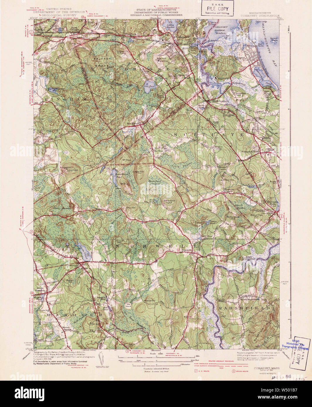 Massachusetts USGS Historical Topo Map MA Cohasset 351612 1941 31680 Restoration Stock Photohttps://www.alamy.com/image-license-details/?v=1https://www.alamy.com/massachusetts-usgs-historical-topo-map-ma-cohasset-351612-1941-31680-restoration-image261229899.html
RMW501B7–Massachusetts USGS Historical Topo Map MA Cohasset 351612 1941 31680 Restoration
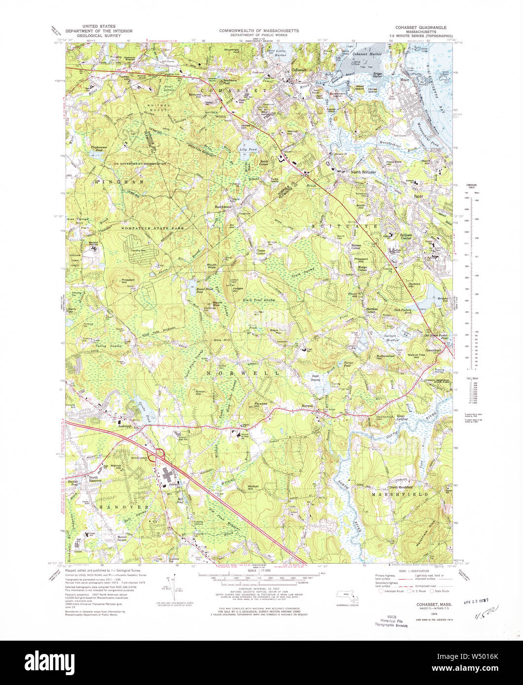 Massachusetts USGS Historical Topo Map MA Cohasset 350909 1974 25000 Restoration Stock Photohttps://www.alamy.com/image-license-details/?v=1https://www.alamy.com/massachusetts-usgs-historical-topo-map-ma-cohasset-350909-1974-25000-restoration-image261229771.html
RMW5016K–Massachusetts USGS Historical Topo Map MA Cohasset 350909 1974 25000 Restoration
 Town of Cohasset, Norfolk County, US, United States, Massachusetts, N 42 14' 24'', S 70 48' 54'', map, Cartascapes Map published in 2024. Explore Cartascapes, a map revealing Earth's diverse landscapes, cultures, and ecosystems. Journey through time and space, discovering the interconnectedness of our planet's past, present, and future. Stock Photohttps://www.alamy.com/image-license-details/?v=1https://www.alamy.com/town-of-cohasset-norfolk-county-us-united-states-massachusetts-n-42-14-24-s-70-48-54-map-cartascapes-map-published-in-2024-explore-cartascapes-a-map-revealing-earths-diverse-landscapes-cultures-and-ecosystems-journey-through-time-and-space-discovering-the-interconnectedness-of-our-planets-past-present-and-future-image633875287.html
RM2YR7EB3–Town of Cohasset, Norfolk County, US, United States, Massachusetts, N 42 14' 24'', S 70 48' 54'', map, Cartascapes Map published in 2024. Explore Cartascapes, a map revealing Earth's diverse landscapes, cultures, and ecosystems. Journey through time and space, discovering the interconnectedness of our planet's past, present, and future.
 . (Sketch A No. 3) Minots Ledge Off Boston Harbor. English: A rare hand colored 1853 coastal chart of the Minots Ledge, just off Boston Harbor, Massachusetts. Features The Cohasset Salt Works, Old Harbor, Brig Harbor, The Glades, Cohasset Harbor, and various islands. Published under the supervision of A. D. Bache for the 1853 Report of the Superintendent of the U.S. Coast Survey. . 1853 (dated) 7 1853 U.S.C.S. Map of Minots Ledge, near Boston Harbor ( Cohasset ) - Geographicus - MinotsLedge2-uscs-1853 Stock Photohttps://www.alamy.com/image-license-details/?v=1https://www.alamy.com/sketch-a-no-3-minots-ledge-off-boston-harbor-english-a-rare-hand-colored-1853-coastal-chart-of-the-minots-ledge-just-off-boston-harbor-massachusetts-features-the-cohasset-salt-works-old-harbor-brig-harbor-the-glades-cohasset-harbor-and-various-islands-published-under-the-supervision-of-a-d-bache-for-the-1853-report-of-the-superintendent-of-the-us-coast-survey-1853-dated-7-1853-uscs-map-of-minots-ledge-near-boston-harbor-cohasset-geographicus-minotsledge2-uscs-1853-image188897894.html
RMMY915A–. (Sketch A No. 3) Minots Ledge Off Boston Harbor. English: A rare hand colored 1853 coastal chart of the Minots Ledge, just off Boston Harbor, Massachusetts. Features The Cohasset Salt Works, Old Harbor, Brig Harbor, The Glades, Cohasset Harbor, and various islands. Published under the supervision of A. D. Bache for the 1853 Report of the Superintendent of the U.S. Coast Survey. . 1853 (dated) 7 1853 U.S.C.S. Map of Minots Ledge, near Boston Harbor ( Cohasset ) - Geographicus - MinotsLedge2-uscs-1853
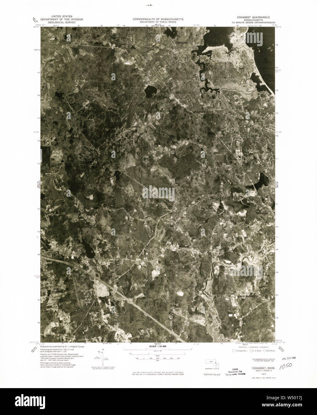 Massachusetts USGS Historical Topo Map MA Cohasset 350910 1977 25000 Restoration Stock Photohttps://www.alamy.com/image-license-details/?v=1https://www.alamy.com/massachusetts-usgs-historical-topo-map-ma-cohasset-350910-1977-25000-restoration-image261229798.html
RMW5017J–Massachusetts USGS Historical Topo Map MA Cohasset 350910 1977 25000 Restoration
 Massachusetts USGS Historical Topo Map MA Cohasset 350070 1961 24000 Restoration Stock Photohttps://www.alamy.com/image-license-details/?v=1https://www.alamy.com/massachusetts-usgs-historical-topo-map-ma-cohasset-350070-1961-24000-restoration-image261229584.html
RMW50100–Massachusetts USGS Historical Topo Map MA Cohasset 350070 1961 24000 Restoration
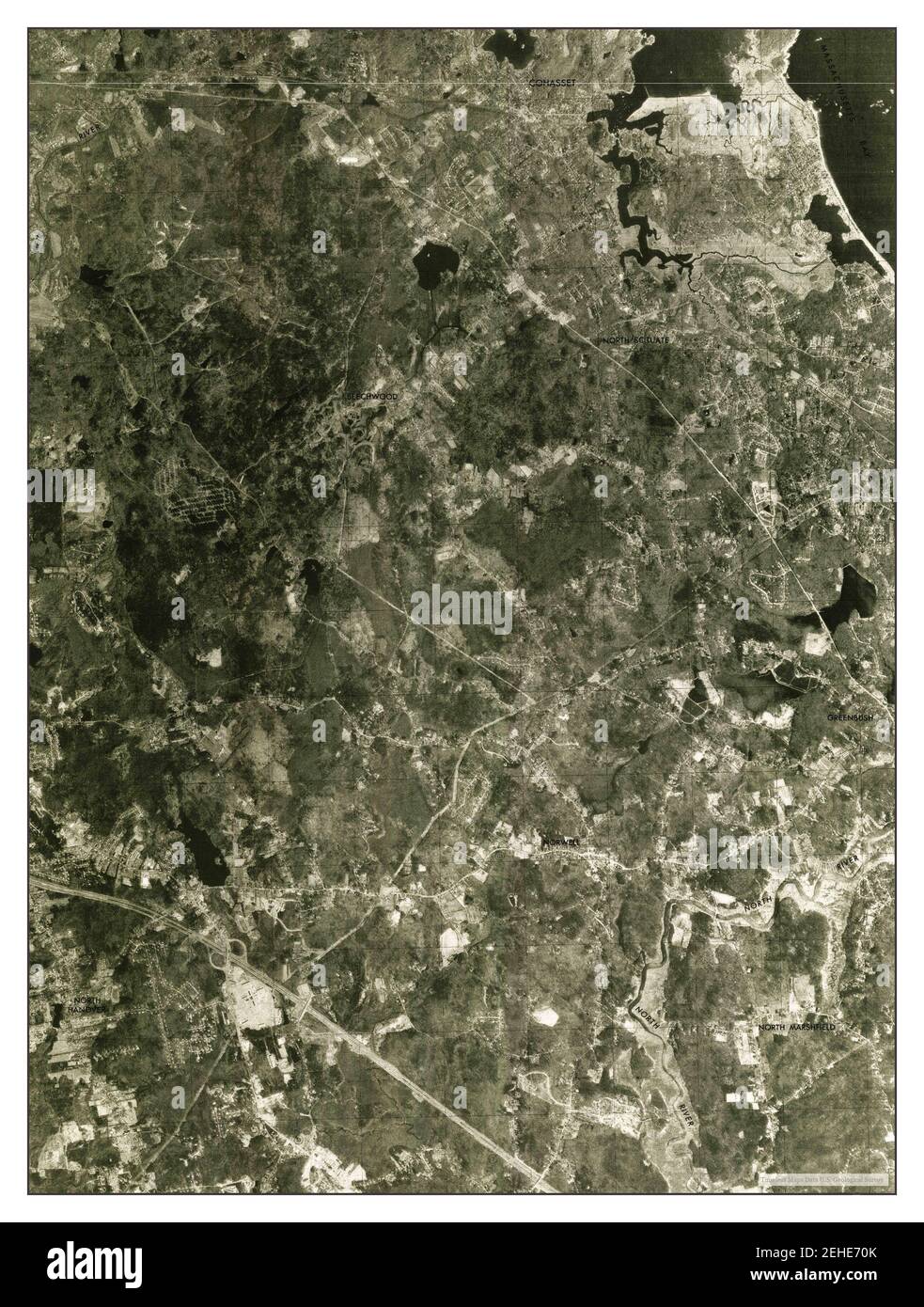 Cohasset, Massachusetts, map 1977, 1:25000, United States of America by Timeless Maps, data U.S. Geological Survey Stock Photohttps://www.alamy.com/image-license-details/?v=1https://www.alamy.com/cohasset-massachusetts-map-1977-125000-united-states-of-america-by-timeless-maps-data-us-geological-survey-image406600451.html
RM2EHE70K–Cohasset, Massachusetts, map 1977, 1:25000, United States of America by Timeless Maps, data U.S. Geological Survey
 . (Sketch A No. 3) Minots Ledge Off Boston Harbor. English: A rare hand colored 1853 coastal chart of the Minots Ledge, just off Boston Harbor, Massachusetts. Features The Cohasset Salt Works, Old Harbor, Brig Harbor, The Glades, Cohasset Harbor, and various islands. Published under the supervision of A. D. Bache for the 1853 Report of the Superintendent of the U.S. Coast Survey. . 1853 (dated) 8 1853 U.S.C.S. Map of Minots Ledge, near Boston Harbor ( Cohasset ) - Geographicus - MinotsLedge2-uscs-1853 Stock Photohttps://www.alamy.com/image-license-details/?v=1https://www.alamy.com/sketch-a-no-3-minots-ledge-off-boston-harbor-english-a-rare-hand-colored-1853-coastal-chart-of-the-minots-ledge-just-off-boston-harbor-massachusetts-features-the-cohasset-salt-works-old-harbor-brig-harbor-the-glades-cohasset-harbor-and-various-islands-published-under-the-supervision-of-a-d-bache-for-the-1853-report-of-the-superintendent-of-the-us-coast-survey-1853-dated-8-1853-uscs-map-of-minots-ledge-near-boston-harbor-cohasset-geographicus-minotsledge2-uscs-1853-image187621835.html
RMMW6WFR–. (Sketch A No. 3) Minots Ledge Off Boston Harbor. English: A rare hand colored 1853 coastal chart of the Minots Ledge, just off Boston Harbor, Massachusetts. Features The Cohasset Salt Works, Old Harbor, Brig Harbor, The Glades, Cohasset Harbor, and various islands. Published under the supervision of A. D. Bache for the 1853 Report of the Superintendent of the U.S. Coast Survey. . 1853 (dated) 8 1853 U.S.C.S. Map of Minots Ledge, near Boston Harbor ( Cohasset ) - Geographicus - MinotsLedge2-uscs-1853
 Massachusetts USGS Historical Topo Map MA Cohasset 350071 1961 24000 Restoration Stock Photohttps://www.alamy.com/image-license-details/?v=1https://www.alamy.com/massachusetts-usgs-historical-topo-map-ma-cohasset-350071-1961-24000-restoration-image261229630.html
RMW5011J–Massachusetts USGS Historical Topo Map MA Cohasset 350071 1961 24000 Restoration
 Cohasset, Massachusetts, map 1941, 1:31680, United States of America by Timeless Maps, data U.S. Geological Survey Stock Photohttps://www.alamy.com/image-license-details/?v=1https://www.alamy.com/cohasset-massachusetts-map-1941-131680-united-states-of-america-by-timeless-maps-data-us-geological-survey-image414056704.html
RM2F1HWFC–Cohasset, Massachusetts, map 1941, 1:31680, United States of America by Timeless Maps, data U.S. Geological Survey
 . English: A rare hand colored 1853 coastal chart of the Minots Ledge, just off Boston Harbor, Massachusetts. Features The Cohasset Salt Works, Old Harbor, Brig Harbor, The Glades, Cohasset Harbor, and various islands. Published under the supervision of A. D. Bache for the 1853 Report of the Superintendent of the U.S. Coast Survey. (Sketch A No. 3) Minots Ledge Off Boston Harbor.. 1853 (dated). 8 1853 U.S.C.S. Map of Minots Ledge, near Boston Harbor ( Cohasset ) - Geographicus - MinotsLedge2-uscs-1853 Stock Photohttps://www.alamy.com/image-license-details/?v=1https://www.alamy.com/english-a-rare-hand-colored-1853-coastal-chart-of-the-minots-ledge-just-off-boston-harbor-massachusetts-features-the-cohasset-salt-works-old-harbor-brig-harbor-the-glades-cohasset-harbor-and-various-islands-published-under-the-supervision-of-a-d-bache-for-the-1853-report-of-the-superintendent-of-the-us-coast-survey-sketch-a-no-3-minots-ledge-off-boston-harbor-1853-dated-8-1853-uscs-map-of-minots-ledge-near-boston-harbor-cohasset-geographicus-minotsledge2-uscs-1853-image184877436.html
RMMMNW1G–. English: A rare hand colored 1853 coastal chart of the Minots Ledge, just off Boston Harbor, Massachusetts. Features The Cohasset Salt Works, Old Harbor, Brig Harbor, The Glades, Cohasset Harbor, and various islands. Published under the supervision of A. D. Bache for the 1853 Report of the Superintendent of the U.S. Coast Survey. (Sketch A No. 3) Minots Ledge Off Boston Harbor.. 1853 (dated). 8 1853 U.S.C.S. Map of Minots Ledge, near Boston Harbor ( Cohasset ) - Geographicus - MinotsLedge2-uscs-1853
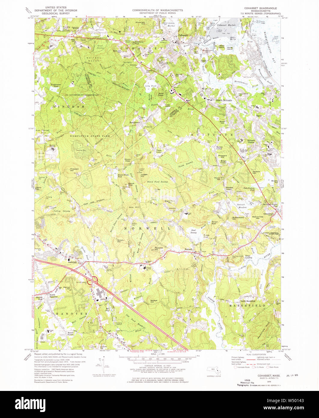 Massachusetts USGS Historical Topo Map MA Cohasset 350072 1974 24000 Restoration Stock Photohttps://www.alamy.com/image-license-details/?v=1https://www.alamy.com/massachusetts-usgs-historical-topo-map-ma-cohasset-350072-1974-24000-restoration-image261229699.html
RMW50143–Massachusetts USGS Historical Topo Map MA Cohasset 350072 1974 24000 Restoration
 Cohasset, Massachusetts, map 1947, 1:24000, United States of America by Timeless Maps, data U.S. Geological Survey Stock Photohttps://www.alamy.com/image-license-details/?v=1https://www.alamy.com/cohasset-massachusetts-map-1947-124000-united-states-of-america-by-timeless-maps-data-us-geological-survey-image406600434.html
RM2EHE702–Cohasset, Massachusetts, map 1947, 1:24000, United States of America by Timeless Maps, data U.S. Geological Survey
 . (Sketch A No. 3) Minots Ledge Off Boston Harbor. English: A rare hand colored 1853 coastal chart of the Minots Ledge, just off Boston Harbor, Massachusetts. Features The Cohasset Salt Works, Old Harbor, Brig Harbor, The Glades, Cohasset Harbor, and various islands . Published under the supervision of A. D. Bache for the 1853 Report of the Superintendent of the U.S. Coast Survey. . 1853 8 1853 U.S.C.S. Map of Minots Ledge, near Boston Harbor ( Cohasset ) - Geographicus - MinotsLedge-uscs-1853 Stock Photohttps://www.alamy.com/image-license-details/?v=1https://www.alamy.com/sketch-a-no-3-minots-ledge-off-boston-harbor-english-a-rare-hand-colored-1853-coastal-chart-of-the-minots-ledge-just-off-boston-harbor-massachusetts-features-the-cohasset-salt-works-old-harbor-brig-harbor-the-glades-cohasset-harbor-and-various-islands-published-under-the-supervision-of-a-d-bache-for-the-1853-report-of-the-superintendent-of-the-us-coast-survey-1853-8-1853-uscs-map-of-minots-ledge-near-boston-harbor-cohasset-geographicus-minotsledge-uscs-1853-image188134100.html
RMMX26Y0–. (Sketch A No. 3) Minots Ledge Off Boston Harbor. English: A rare hand colored 1853 coastal chart of the Minots Ledge, just off Boston Harbor, Massachusetts. Features The Cohasset Salt Works, Old Harbor, Brig Harbor, The Glades, Cohasset Harbor, and various islands . Published under the supervision of A. D. Bache for the 1853 Report of the Superintendent of the U.S. Coast Survey. . 1853 8 1853 U.S.C.S. Map of Minots Ledge, near Boston Harbor ( Cohasset ) - Geographicus - MinotsLedge-uscs-1853
 Massachusetts USGS Historical Topo Map MA Cohasset 350069 1947 24000 Restoration Stock Photohttps://www.alamy.com/image-license-details/?v=1https://www.alamy.com/massachusetts-usgs-historical-topo-map-ma-cohasset-350069-1947-24000-restoration-image261229567.html
RMW500YB–Massachusetts USGS Historical Topo Map MA Cohasset 350069 1947 24000 Restoration
 Massachusetts USGS Historical Topo Map MA Cohasset 350067 1936 24000 Inverted Restoration Stock Photohttps://www.alamy.com/image-license-details/?v=1https://www.alamy.com/massachusetts-usgs-historical-topo-map-ma-cohasset-350067-1936-24000-inverted-restoration-image261229423.html
RMW500P7–Massachusetts USGS Historical Topo Map MA Cohasset 350067 1936 24000 Inverted Restoration
 Massachusetts USGS Historical Topo Map MA Cohasset 351611 1941 31680 Inverted Restoration Stock Photohttps://www.alamy.com/image-license-details/?v=1https://www.alamy.com/massachusetts-usgs-historical-topo-map-ma-cohasset-351611-1941-31680-inverted-restoration-image261229859.html
RMW5019R–Massachusetts USGS Historical Topo Map MA Cohasset 351611 1941 31680 Inverted Restoration
 Cohasset, Massachusetts, map 1936, 1:24000, United States of America by Timeless Maps, data U.S. Geological Survey Stock Photohttps://www.alamy.com/image-license-details/?v=1https://www.alamy.com/cohasset-massachusetts-map-1936-124000-united-states-of-america-by-timeless-maps-data-us-geological-survey-image406600399.html
RM2EHE6XR–Cohasset, Massachusetts, map 1936, 1:24000, United States of America by Timeless Maps, data U.S. Geological Survey
 . English: A rare hand colored 1853 coastal chart of the Minots Ledge, just off Boston Harbor, Massachusetts. Features The Cohasset Salt Works, Old Harbor, Brig Harbor, The Glades, Cohasset Harbor, and various islands . Published under the supervision of A. D. Bache for the 1853 Report of the Superintendent of the U.S. Coast Survey. (Sketch A No. 3) Minots Ledge Off Boston Harbor.. 1853. 8 1853 U.S.C.S. Map of Minots Ledge, near Boston Harbor ( Cohasset ) - Geographicus - MinotsLedge-uscs-1853 Stock Photohttps://www.alamy.com/image-license-details/?v=1https://www.alamy.com/english-a-rare-hand-colored-1853-coastal-chart-of-the-minots-ledge-just-off-boston-harbor-massachusetts-features-the-cohasset-salt-works-old-harbor-brig-harbor-the-glades-cohasset-harbor-and-various-islands-published-under-the-supervision-of-a-d-bache-for-the-1853-report-of-the-superintendent-of-the-us-coast-survey-sketch-a-no-3-minots-ledge-off-boston-harbor-1853-8-1853-uscs-map-of-minots-ledge-near-boston-harbor-cohasset-geographicus-minotsledge-uscs-1853-image184877435.html
RMMMNW1F–. English: A rare hand colored 1853 coastal chart of the Minots Ledge, just off Boston Harbor, Massachusetts. Features The Cohasset Salt Works, Old Harbor, Brig Harbor, The Glades, Cohasset Harbor, and various islands . Published under the supervision of A. D. Bache for the 1853 Report of the Superintendent of the U.S. Coast Survey. (Sketch A No. 3) Minots Ledge Off Boston Harbor.. 1853. 8 1853 U.S.C.S. Map of Minots Ledge, near Boston Harbor ( Cohasset ) - Geographicus - MinotsLedge-uscs-1853
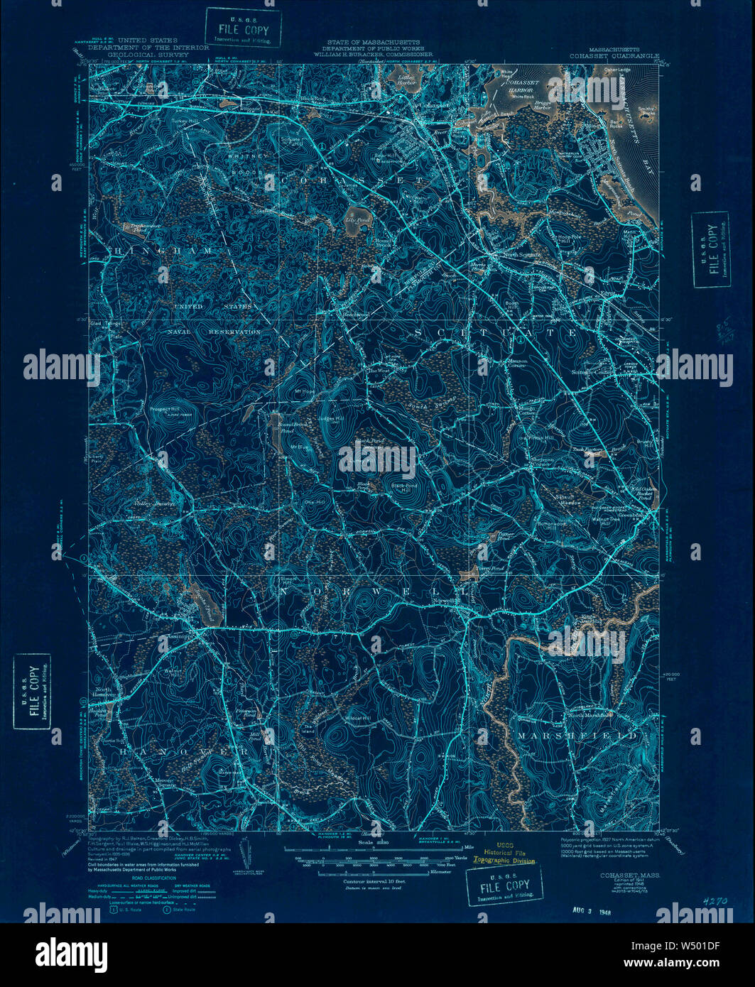 Massachusetts USGS Historical Topo Map MA Cohasset 351614 1941 31680 Inverted Restoration Stock Photohttps://www.alamy.com/image-license-details/?v=1https://www.alamy.com/massachusetts-usgs-historical-topo-map-ma-cohasset-351614-1941-31680-inverted-restoration-image261229963.html
RMW501DF–Massachusetts USGS Historical Topo Map MA Cohasset 351614 1941 31680 Inverted Restoration
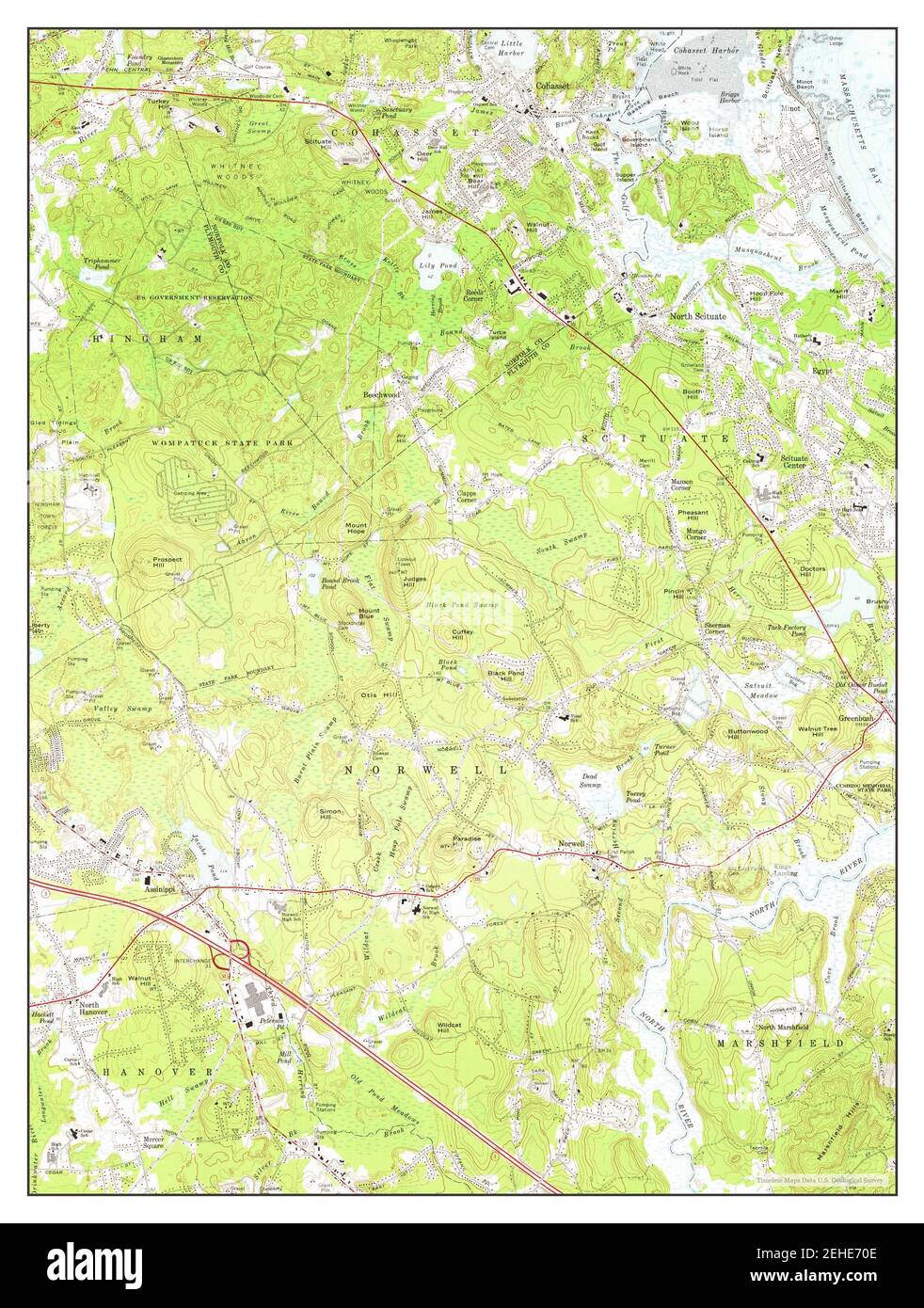 Cohasset, Massachusetts, map 1974, 1:24000, United States of America by Timeless Maps, data U.S. Geological Survey Stock Photohttps://www.alamy.com/image-license-details/?v=1https://www.alamy.com/cohasset-massachusetts-map-1974-124000-united-states-of-america-by-timeless-maps-data-us-geological-survey-image406600446.html
RM2EHE70E–Cohasset, Massachusetts, map 1974, 1:24000, United States of America by Timeless Maps, data U.S. Geological Survey
 . (Sketch A No. 3) Minots Ledge Off Boston Harbor. English: A rare hand colored 1853 coastal chart of the Minots Ledge, just off Boston Harbor, Massachusetts. Features The Cohasset Salt Works, Old Harbor, Brig Harbor, The Glades, Cohasset Harbor, and various islands . Published under the supervision of A. D. Bache for the 1853 Report of the Superintendent of the U.S. Coast Survey. . 1853 7 1853 U.S.C.S. Map of Minots Ledge, near Boston Harbor ( Cohasset ) - Geographicus - MinotsLedge-uscs-1853 Stock Photohttps://www.alamy.com/image-license-details/?v=1https://www.alamy.com/sketch-a-no-3-minots-ledge-off-boston-harbor-english-a-rare-hand-colored-1853-coastal-chart-of-the-minots-ledge-just-off-boston-harbor-massachusetts-features-the-cohasset-salt-works-old-harbor-brig-harbor-the-glades-cohasset-harbor-and-various-islands-published-under-the-supervision-of-a-d-bache-for-the-1853-report-of-the-superintendent-of-the-us-coast-survey-1853-7-1853-uscs-map-of-minots-ledge-near-boston-harbor-cohasset-geographicus-minotsledge-uscs-1853-image188897895.html
RMMY915B–. (Sketch A No. 3) Minots Ledge Off Boston Harbor. English: A rare hand colored 1853 coastal chart of the Minots Ledge, just off Boston Harbor, Massachusetts. Features The Cohasset Salt Works, Old Harbor, Brig Harbor, The Glades, Cohasset Harbor, and various islands . Published under the supervision of A. D. Bache for the 1853 Report of the Superintendent of the U.S. Coast Survey. . 1853 7 1853 U.S.C.S. Map of Minots Ledge, near Boston Harbor ( Cohasset ) - Geographicus - MinotsLedge-uscs-1853
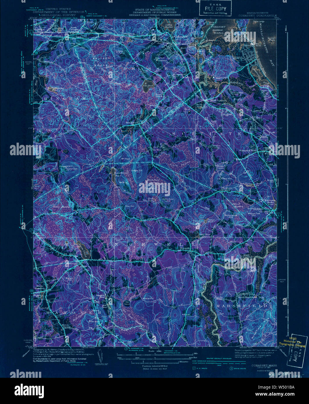 Massachusetts USGS Historical Topo Map MA Cohasset 351612 1941 31680 Inverted Restoration Stock Photohttps://www.alamy.com/image-license-details/?v=1https://www.alamy.com/massachusetts-usgs-historical-topo-map-ma-cohasset-351612-1941-31680-inverted-restoration-image261229902.html
RMW501BA–Massachusetts USGS Historical Topo Map MA Cohasset 351612 1941 31680 Inverted Restoration
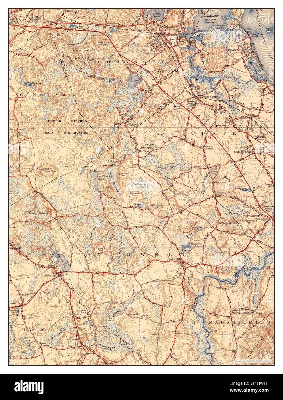 Cohasset, Massachusetts, map 1941, 1:31680, United States of America by Timeless Maps, data U.S. Geological Survey Stock Photohttps://www.alamy.com/image-license-details/?v=1https://www.alamy.com/cohasset-massachusetts-map-1941-131680-united-states-of-america-by-timeless-maps-data-us-geological-survey-image414056709.html
RM2F1HWFH–Cohasset, Massachusetts, map 1941, 1:31680, United States of America by Timeless Maps, data U.S. Geological Survey
 . (Sketch A No. 3) Minots Ledge Off Boston Harbor. English: A rare hand colored 1853 coastal chart of the Minots Ledge, just off Boston Harbor, Massachusetts. Features The Cohasset Salt Works, Old Harbor, Brig Harbor, The Glades, Cohasset Harbor, and various islands . Published under the supervision of A. D. Bache for the 1853 Report of the Superintendent of the U.S. Coast Survey. . 1853 8 1853 U.S.C.S. Map of Minots Ledge, near Boston Harbor ( Cohasset ) - Geographicus - MinotsLedge-uscs-1853 Stock Photohttps://www.alamy.com/image-license-details/?v=1https://www.alamy.com/sketch-a-no-3-minots-ledge-off-boston-harbor-english-a-rare-hand-colored-1853-coastal-chart-of-the-minots-ledge-just-off-boston-harbor-massachusetts-features-the-cohasset-salt-works-old-harbor-brig-harbor-the-glades-cohasset-harbor-and-various-islands-published-under-the-supervision-of-a-d-bache-for-the-1853-report-of-the-superintendent-of-the-us-coast-survey-1853-8-1853-uscs-map-of-minots-ledge-near-boston-harbor-cohasset-geographicus-minotsledge-uscs-1853-image187621832.html
RMMW6WFM–. (Sketch A No. 3) Minots Ledge Off Boston Harbor. English: A rare hand colored 1853 coastal chart of the Minots Ledge, just off Boston Harbor, Massachusetts. Features The Cohasset Salt Works, Old Harbor, Brig Harbor, The Glades, Cohasset Harbor, and various islands . Published under the supervision of A. D. Bache for the 1853 Report of the Superintendent of the U.S. Coast Survey. . 1853 8 1853 U.S.C.S. Map of Minots Ledge, near Boston Harbor ( Cohasset ) - Geographicus - MinotsLedge-uscs-1853
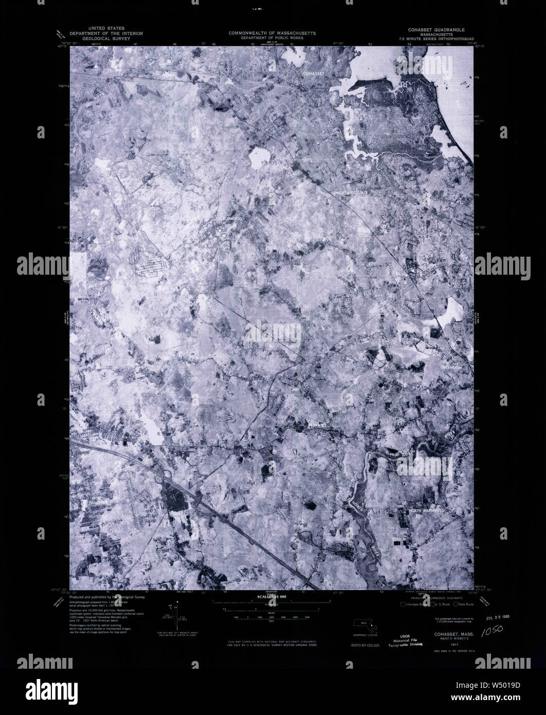 Massachusetts USGS Historical Topo Map MA Cohasset 350910 1977 25000 Inverted Restoration Stock Photohttps://www.alamy.com/image-license-details/?v=1https://www.alamy.com/massachusetts-usgs-historical-topo-map-ma-cohasset-350910-1977-25000-inverted-restoration-image261229849.html
RMW5019D–Massachusetts USGS Historical Topo Map MA Cohasset 350910 1977 25000 Inverted Restoration
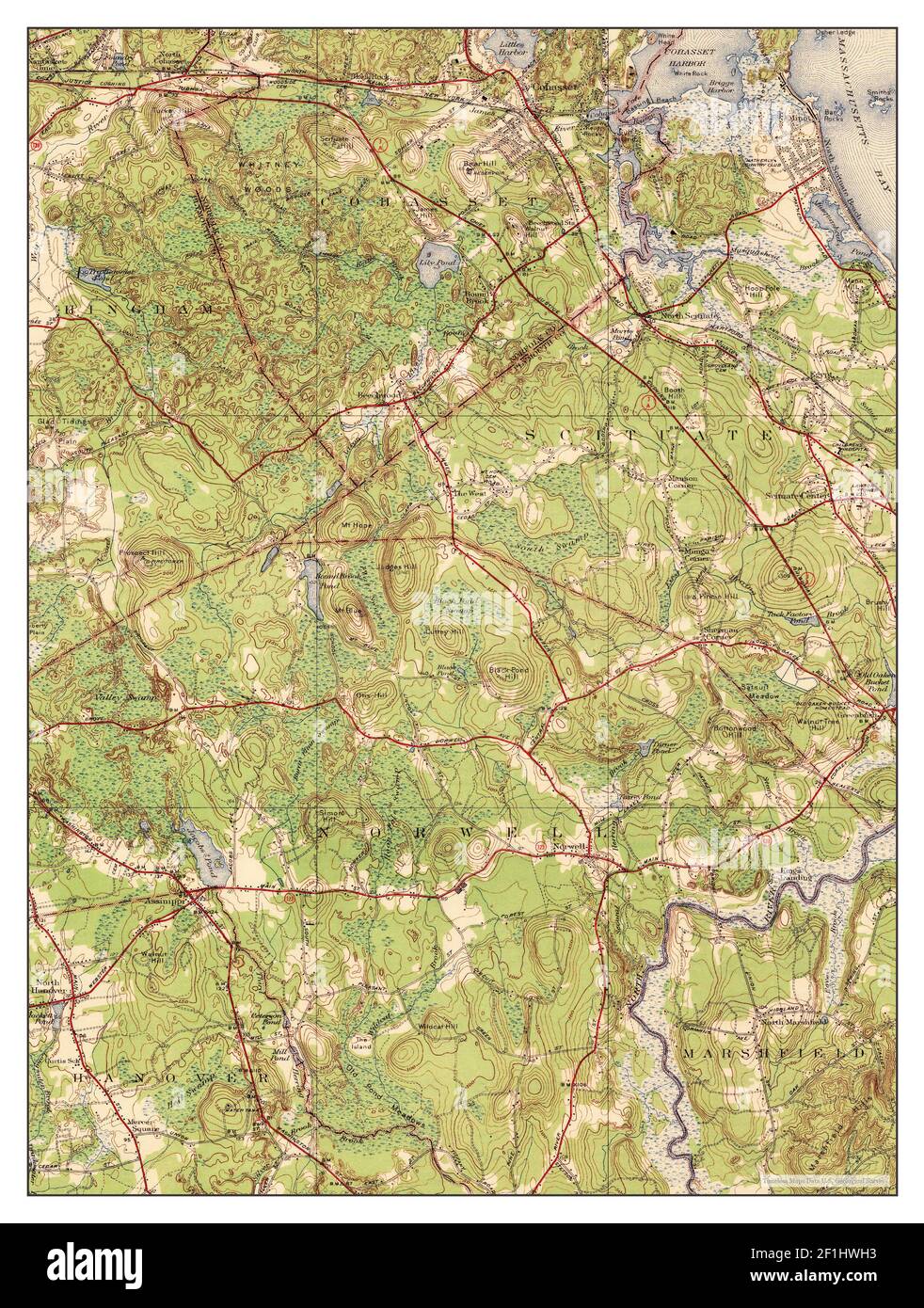 Cohasset, Massachusetts, map 1941, 1:31680, United States of America by Timeless Maps, data U.S. Geological Survey Stock Photohttps://www.alamy.com/image-license-details/?v=1https://www.alamy.com/cohasset-massachusetts-map-1941-131680-united-states-of-america-by-timeless-maps-data-us-geological-survey-image414056751.html
RM2F1HWH3–Cohasset, Massachusetts, map 1941, 1:31680, United States of America by Timeless Maps, data U.S. Geological Survey
RMMY92GF–. Massachusetts Boston Bay Sheet. English: One of the more sought after topographical maps produced by the U.S. Geological Survey. The 1900 edition of the U.S.G.S. Survey Map of Boston Bay covers from Salem to Waymouth, Hingham and Cohasset. Offers extraordinary detail to the level of streets and often individual buildings. Includes Boston area communities of Marblehead, Lynn, Swampscott, Lynn, Salem, Revere, Winthrop, Quincy, Weymouth, Hingham, Hull and Cohasset. Identifies numerous other points of interest including Windmill Point, the Narrows Lighthouse, the Dear Island Beacon, the Great F
 Massachusetts USGS Historical Topo Map MA Cohasset 350909 1974 25000 Inverted Restoration Stock Photohttps://www.alamy.com/image-license-details/?v=1https://www.alamy.com/massachusetts-usgs-historical-topo-map-ma-cohasset-350909-1974-25000-inverted-restoration-image261229743.html
RMW5015K–Massachusetts USGS Historical Topo Map MA Cohasset 350909 1974 25000 Inverted Restoration
 Massachusetts USGS Historical Topo Map MA Cohasset 350070 1961 24000 Inverted Restoration Stock Photohttps://www.alamy.com/image-license-details/?v=1https://www.alamy.com/massachusetts-usgs-historical-topo-map-ma-cohasset-350070-1961-24000-inverted-restoration-image261229550.html
RMW500XP–Massachusetts USGS Historical Topo Map MA Cohasset 350070 1961 24000 Inverted Restoration
 Cohasset, Massachusetts, map 1961, 1:24000, United States of America by Timeless Maps, data U.S. Geological Survey Stock Photohttps://www.alamy.com/image-license-details/?v=1https://www.alamy.com/cohasset-massachusetts-map-1961-124000-united-states-of-america-by-timeless-maps-data-us-geological-survey-image406600432.html
RM2EHE700–Cohasset, Massachusetts, map 1961, 1:24000, United States of America by Timeless Maps, data U.S. Geological Survey
 Massachusetts USGS Historical Topo Map MA Cohasset 350072 1974 24000 Inverted Restoration Stock Photohttps://www.alamy.com/image-license-details/?v=1https://www.alamy.com/massachusetts-usgs-historical-topo-map-ma-cohasset-350072-1974-24000-inverted-restoration-image261229706.html
RMW5014A–Massachusetts USGS Historical Topo Map MA Cohasset 350072 1974 24000 Inverted Restoration
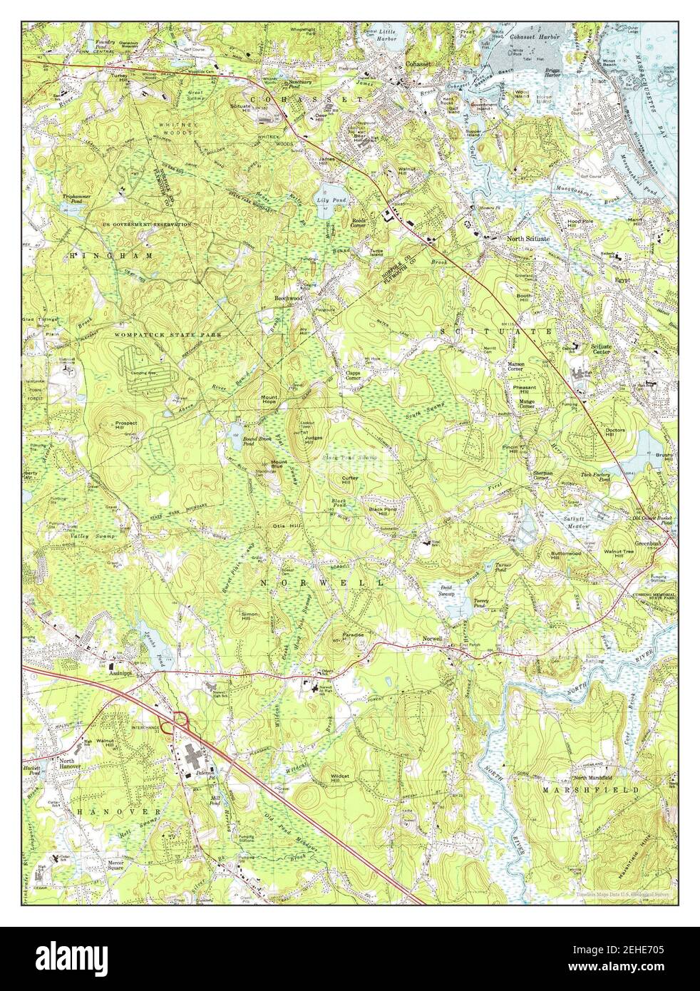 Cohasset, Massachusetts, map 1974, 1:25000, United States of America by Timeless Maps, data U.S. Geological Survey Stock Photohttps://www.alamy.com/image-license-details/?v=1https://www.alamy.com/cohasset-massachusetts-map-1974-125000-united-states-of-america-by-timeless-maps-data-us-geological-survey-image406600437.html
RM2EHE705–Cohasset, Massachusetts, map 1974, 1:25000, United States of America by Timeless Maps, data U.S. Geological Survey
 Massachusetts USGS Historical Topo Map MA Cohasset 350069 1947 24000 Inverted Restoration Stock Photohttps://www.alamy.com/image-license-details/?v=1https://www.alamy.com/massachusetts-usgs-historical-topo-map-ma-cohasset-350069-1947-24000-inverted-restoration-image261229502.html
RMW500W2–Massachusetts USGS Historical Topo Map MA Cohasset 350069 1947 24000 Inverted Restoration
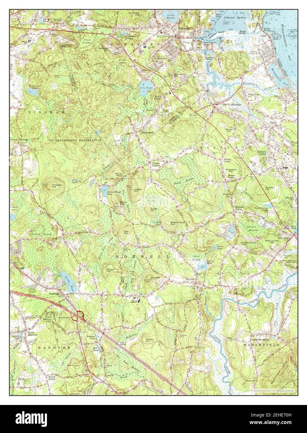 Cohasset, Massachusetts, map 1961, 1:24000, United States of America by Timeless Maps, data U.S. Geological Survey Stock Photohttps://www.alamy.com/image-license-details/?v=1https://www.alamy.com/cohasset-massachusetts-map-1961-124000-united-states-of-america-by-timeless-maps-data-us-geological-survey-image406600449.html
RM2EHE70H–Cohasset, Massachusetts, map 1961, 1:24000, United States of America by Timeless Maps, data U.S. Geological Survey
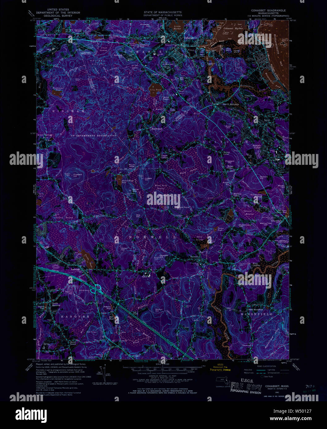 Massachusetts USGS Historical Topo Map MA Cohasset 350071 1961 24000 Inverted Restoration Stock Photohttps://www.alamy.com/image-license-details/?v=1https://www.alamy.com/massachusetts-usgs-historical-topo-map-ma-cohasset-350071-1961-24000-inverted-restoration-image261229647.html
RMW50127–Massachusetts USGS Historical Topo Map MA Cohasset 350071 1961 24000 Inverted Restoration