Quick filters:
Earths surface Stock Photos and Images
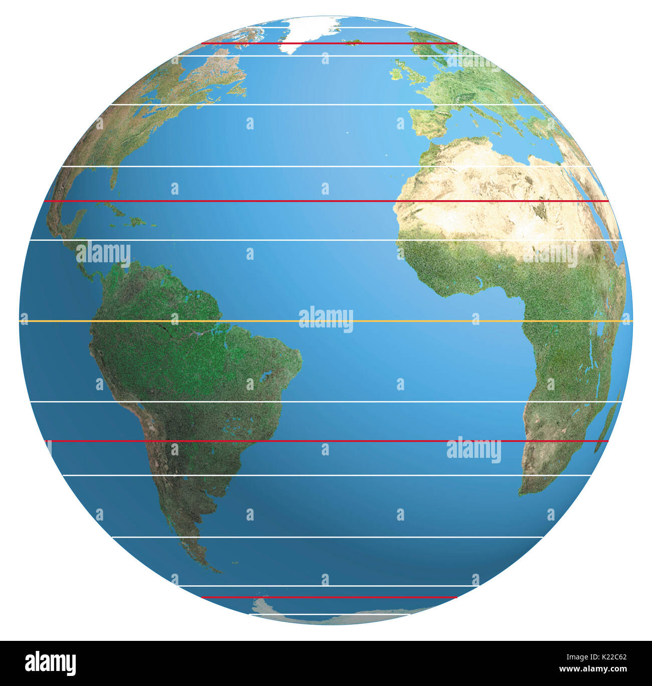 Coordinate of a point on the Earth’s surface indicating, in degrees, its distance from the Equator. Stock Photohttps://www.alamy.com/image-license-details/?v=1https://www.alamy.com/coordinate-of-a-point-on-the-earths-surface-indicating-in-degrees-image156176106.html
RMK22C62–Coordinate of a point on the Earth’s surface indicating, in degrees, its distance from the Equator.
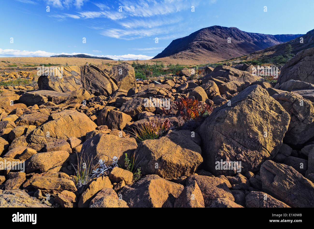 TABLELANDS. Peridotite rock is rare at earth's surface reason for World Heritage Site designation by UNESCO. Gros Morne Stock Photohttps://www.alamy.com/image-license-details/?v=1https://www.alamy.com/stock-photo-tablelands-peridotite-rock-is-rare-at-earths-surface-reason-for-world-70027591.html
RME1X0WB–TABLELANDS. Peridotite rock is rare at earth's surface reason for World Heritage Site designation by UNESCO. Gros Morne
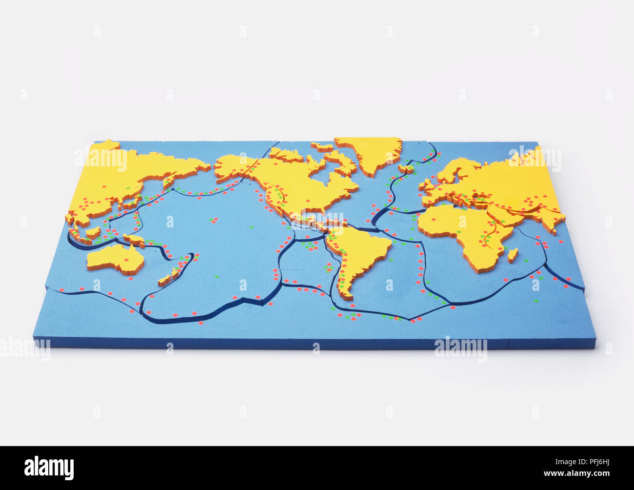 Model of the Earth showing the plates on the earth's surface, red dots showing eruptions of volcanoes Stock Photohttps://www.alamy.com/image-license-details/?v=1https://www.alamy.com/model-of-the-earth-showing-the-plates-on-the-earths-surface-red-dots-showing-eruptions-of-volcanoes-image216144590.html
RMPFJ6HJ–Model of the Earth showing the plates on the earth's surface, red dots showing eruptions of volcanoes
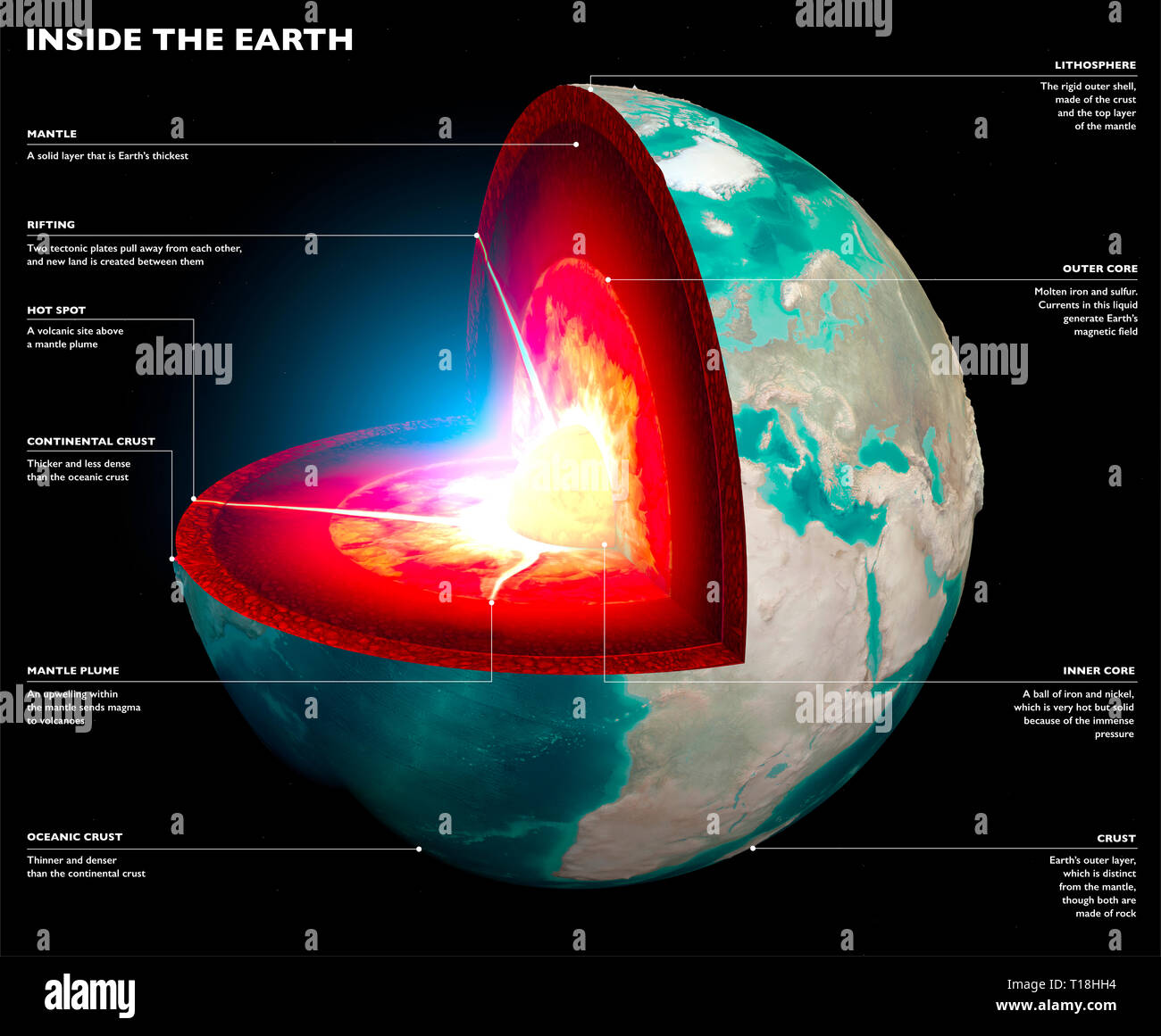 Section of the Earth, globe. Core and soil layers. Earth's surface and ground section Stock Photohttps://www.alamy.com/image-license-details/?v=1https://www.alamy.com/section-of-the-earth-globe-core-and-soil-layers-earths-surface-and-ground-section-image241749232.html
RFT18HH4–Section of the Earth, globe. Core and soil layers. Earth's surface and ground section
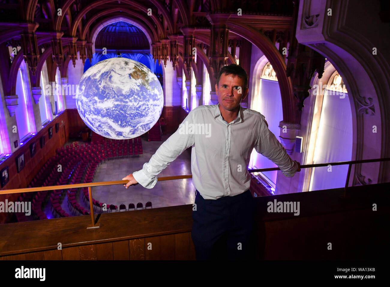 A general view of Luke Jerram's Gaia, depicting detailed NASA imagery of the Earth's surface Stock Photohttps://www.alamy.com/image-license-details/?v=1https://www.alamy.com/a-general-view-of-luke-jerrams-gaia-depicting-detailed-nasa-imagery-of-the-earths-surface-image264326927.html
RMWA13KB–A general view of Luke Jerram's Gaia, depicting detailed NASA imagery of the Earth's surface
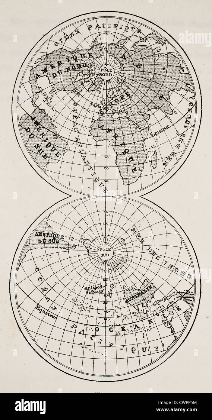 Continents and oceans on earth's surface Stock Photohttps://www.alamy.com/image-license-details/?v=1https://www.alamy.com/stock-photo-continents-and-oceans-on-earths-surface-50287488.html
RFCWPP5M–Continents and oceans on earth's surface
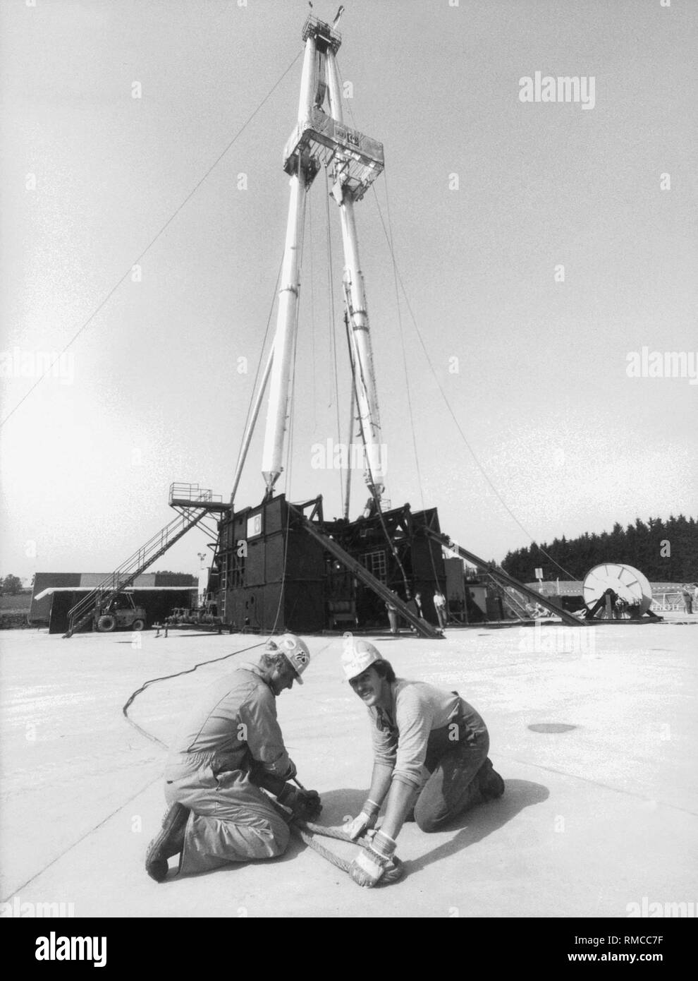 The deepest hole in the world is drilled at Windischenschenbach : the scientists want to bore their way 14 kilometers into the earth's crust. Aim of the project: investigation of the state and development of the Earth's crust. The German Continental Deep Drilling Program (KTB) is part of the 'International Lithosphere Program', in which various states participate. Stock Photohttps://www.alamy.com/image-license-details/?v=1https://www.alamy.com/the-deepest-hole-in-the-world-is-drilled-at-windischenschenbach-the-scientists-want-to-bore-their-way-14-kilometers-into-the-earths-crust-aim-of-the-project-investigation-of-the-state-and-development-of-the-earths-crust-the-german-continental-deep-drilling-program-ktb-is-part-of-the-international-lithosphere-program-in-which-various-states-participate-image236300947.html
RMRMCC7F–The deepest hole in the world is drilled at Windischenschenbach : the scientists want to bore their way 14 kilometers into the earth's crust. Aim of the project: investigation of the state and development of the Earth's crust. The German Continental Deep Drilling Program (KTB) is part of the 'International Lithosphere Program', in which various states participate.
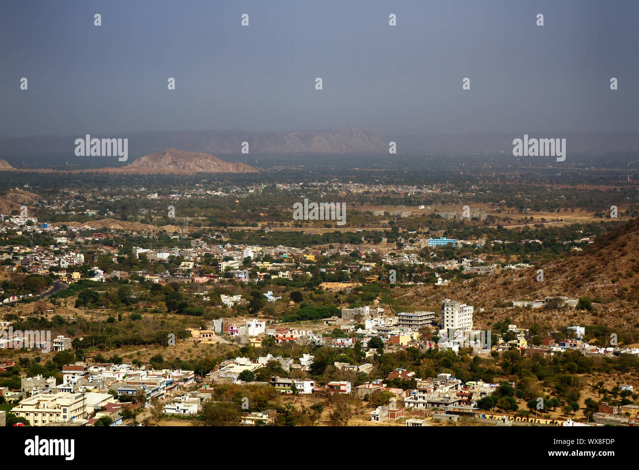 Indian Cities of different sizes cover earth's surface to horizon Stock Photohttps://www.alamy.com/image-license-details/?v=1https://www.alamy.com/indian-cities-of-different-sizes-cover-earths-surface-to-horizon-image274324338.html
RMWX8FDP–Indian Cities of different sizes cover earth's surface to horizon
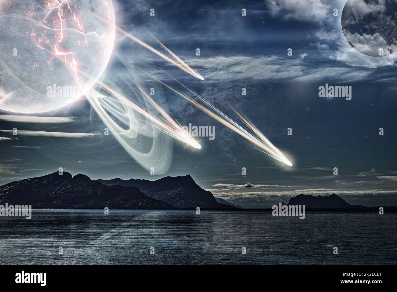 Traversing the galaxy. Tranquil seascape in Norway with a ghostly planet flinging objects onto the earths surface. Stock Photohttps://www.alamy.com/image-license-details/?v=1https://www.alamy.com/traversing-the-galaxy-tranquil-seascape-in-norway-with-a-ghostly-planet-flinging-objects-onto-the-earths-surface-image483436745.html
RF2K2ECE1–Traversing the galaxy. Tranquil seascape in Norway with a ghostly planet flinging objects onto the earths surface.
 Composing, globe, rotate, earth's surface, euro banknotes, planet, ground, banknotes, the European Union, single currency, currency, money, torsion, motion Stock Photohttps://www.alamy.com/image-license-details/?v=1https://www.alamy.com/stock-photo-composing-globe-rotate-earths-surface-euro-banknotes-planet-ground-122906236.html
RMH3XT4C–Composing, globe, rotate, earth's surface, euro banknotes, planet, ground, banknotes, the European Union, single currency, currency, money, torsion, motion
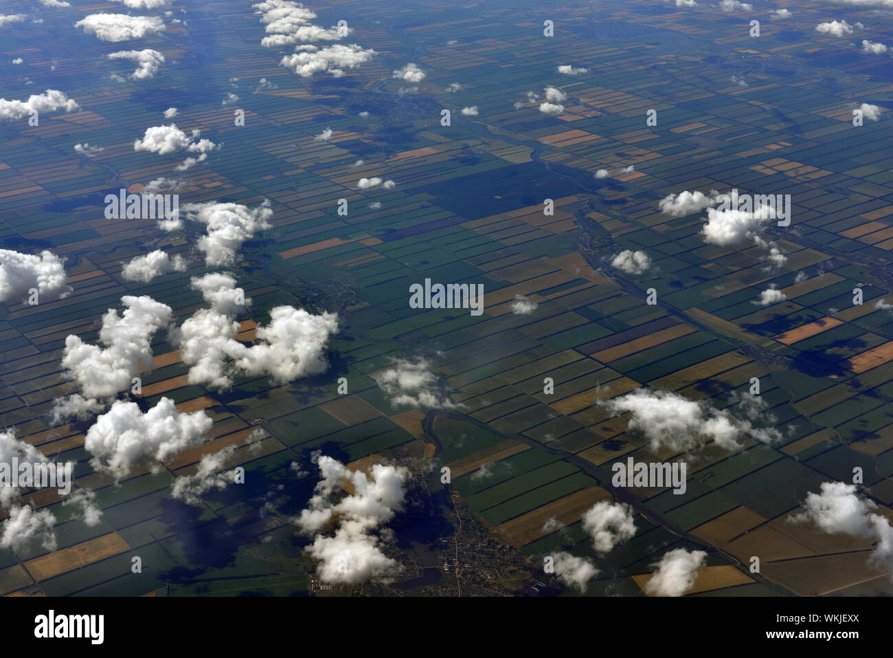 Earth's surface and clouds. Top view of aircraft Stock Photohttps://www.alamy.com/image-license-details/?v=1https://www.alamy.com/earths-surface-and-clouds-top-view-of-aircraft-image270240850.html
RFWKJEXX–Earth's surface and clouds. Top view of aircraft
 Close up of big light bulb standing with earths surface in it Stock Photohttps://www.alamy.com/image-license-details/?v=1https://www.alamy.com/stock-photo-close-up-of-big-light-bulb-standing-with-earths-surface-in-it-57673431.html
RFD9R71B–Close up of big light bulb standing with earths surface in it
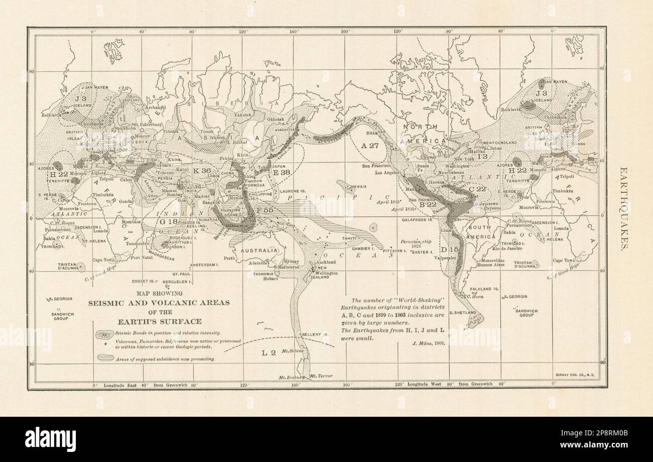 Earthquakes. Map Showing Seismic & Volcanic Areas of Earth's Surface 1907 Stock Photohttps://www.alamy.com/image-license-details/?v=1https://www.alamy.com/earthquakes-map-showing-seismic-volcanic-areas-of-earths-surface-1907-image538959243.html
RF2P8RM0B–Earthquakes. Map Showing Seismic & Volcanic Areas of Earth's Surface 1907
 ETOPO1 is a global relief model of Earth's surface showing land topography and ocean bathymetry. Stock Photohttps://www.alamy.com/image-license-details/?v=1https://www.alamy.com/stock-photo-etopo1-is-a-global-relief-model-of-earths-surface-showing-land-topography-24914500.html
RMBCEXKG–ETOPO1 is a global relief model of Earth's surface showing land topography and ocean bathymetry.
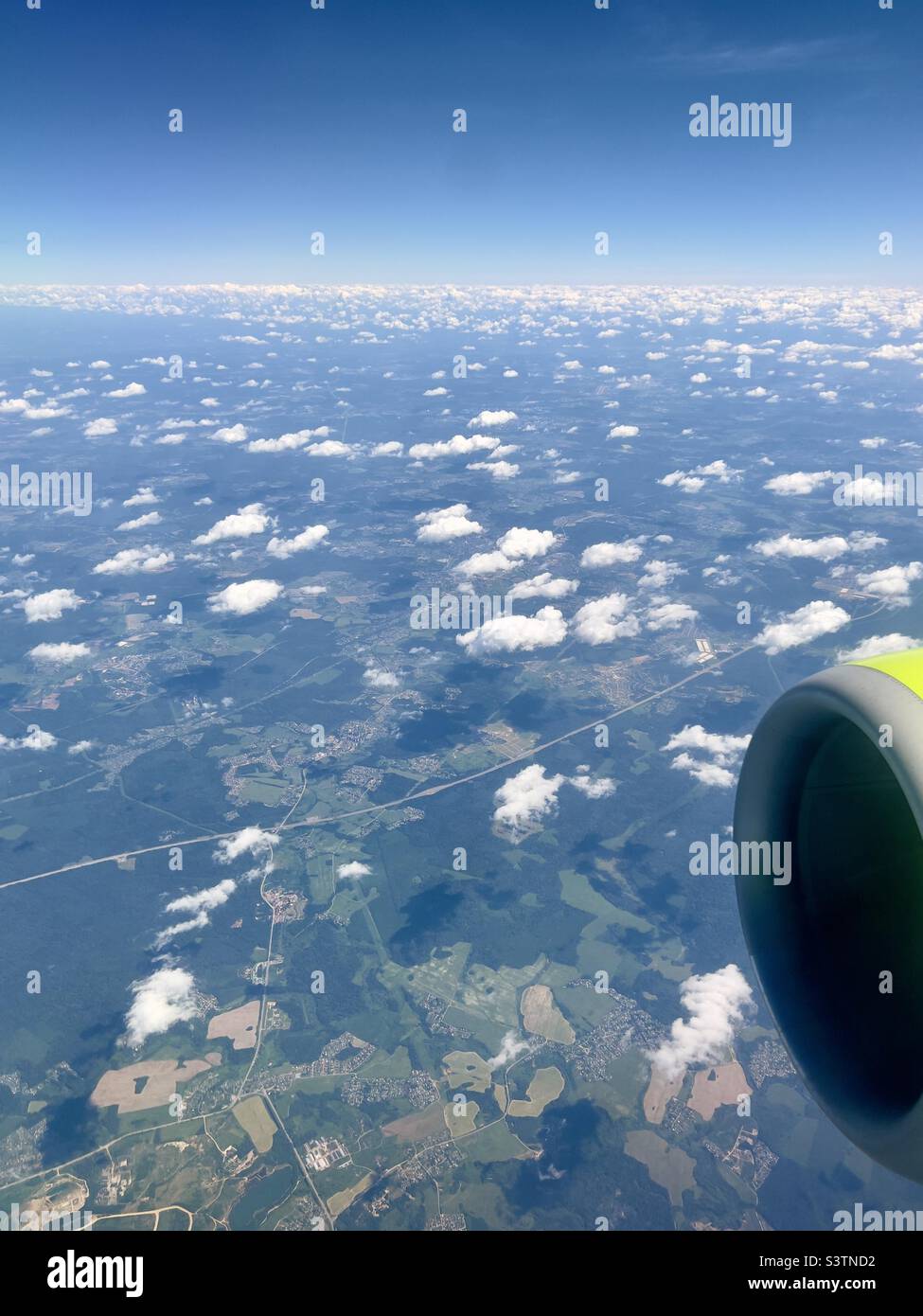 bird's-eye view of earth's surface. shot from an airplane taking off. houses, clouds and a green round aircraft engine in shot. vacation concept. Stock Photohttps://www.alamy.com/image-license-details/?v=1https://www.alamy.com/birds-eye-view-of-earths-surface-shot-from-an-airplane-taking-off-houses-clouds-and-a-green-round-aircraft-engine-in-shot-vacation-concept-image312174270.html
RFS3TND2–bird's-eye view of earth's surface. shot from an airplane taking off. houses, clouds and a green round aircraft engine in shot. vacation concept.
 Studies on the conformation of the earth's surface; First part: Europe, from Marmocchi Atlas, Florence, Italy 1838 Stock Photohttps://www.alamy.com/image-license-details/?v=1https://www.alamy.com/studies-on-the-conformation-of-the-earths-surface-first-part-europe-from-marmocchi-atlas-florence-italy-1838-image503668615.html
RF2M7C2CR–Studies on the conformation of the earth's surface; First part: Europe, from Marmocchi Atlas, Florence, Italy 1838
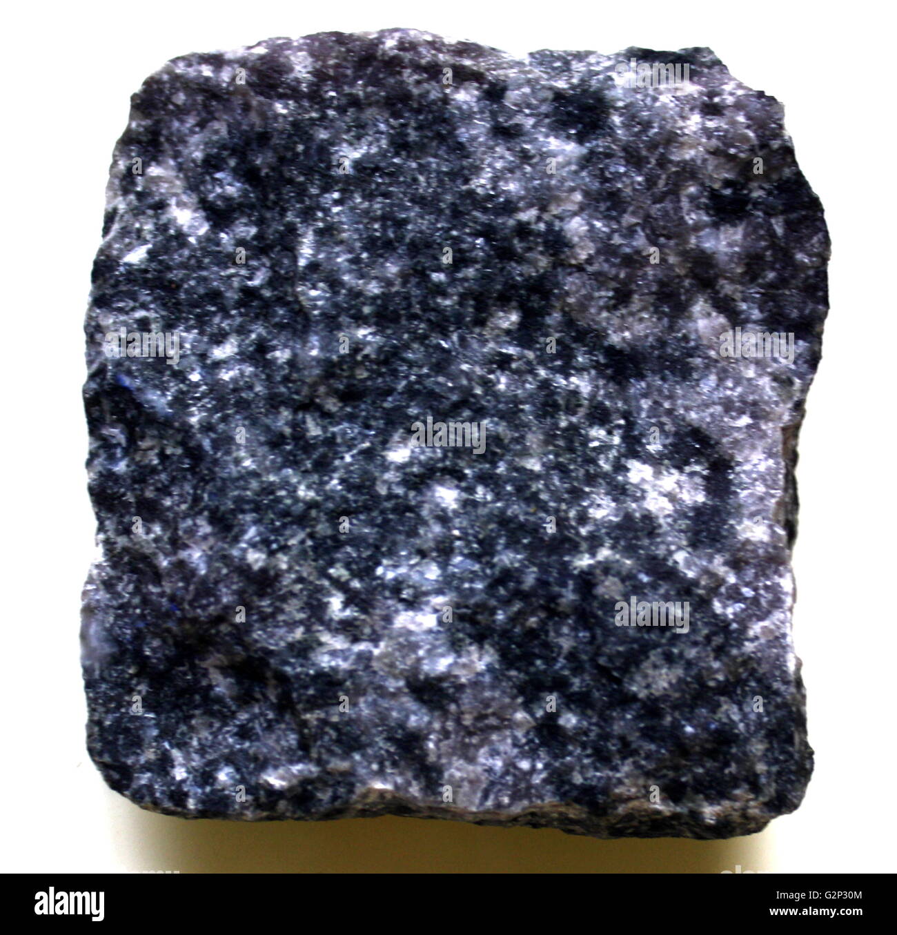 A square of Gabbro, A mafic igneous rock which is dark and coarse grained. Equivalent chemically to Basalt. This rock underlays the vast majority of Earth's surface. Stock Photohttps://www.alamy.com/image-license-details/?v=1https://www.alamy.com/stock-photo-a-square-of-gabbro-a-mafic-igneous-rock-which-is-dark-and-coarse-grained-104976836.html
RMG2P30M–A square of Gabbro, A mafic igneous rock which is dark and coarse grained. Equivalent chemically to Basalt. This rock underlays the vast majority of Earth's surface.
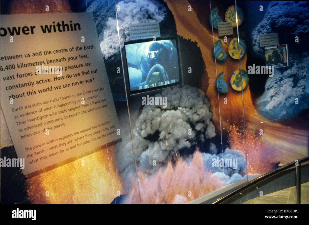 Earth's Restless Surface Stock Photohttps://www.alamy.com/image-license-details/?v=1https://www.alamy.com/earths-restless-surface-image66745443.html
RMDTGEDR–Earth's Restless Surface
 Mar. 22, 2012 - NEW SCIENCE BEING DEVELOPED: A new science is now being developed. Called ''terradynamics'' it deals with the probing of the earth's surface. Related to the field of geology, the science is designed to help man in his endless search for water, oil, and minerals beneath the earth. Under the new method, a rocket is impacted in the ground from a high altitude. Scientific date transmitted from the rocket's impact gives information about what lies under the earth Stock Photohttps://www.alamy.com/image-license-details/?v=1https://www.alamy.com/mar-22-2012-new-science-being-developed-a-new-science-is-now-being-image69540300.html
RME13RA4–Mar. 22, 2012 - NEW SCIENCE BEING DEVELOPED: A new science is now being developed. Called ''terradynamics'' it deals with the probing of the earth's surface. Related to the field of geology, the science is designed to help man in his endless search for water, oil, and minerals beneath the earth. Under the new method, a rocket is impacted in the ground from a high altitude. Scientific date transmitted from the rocket's impact gives information about what lies under the earth
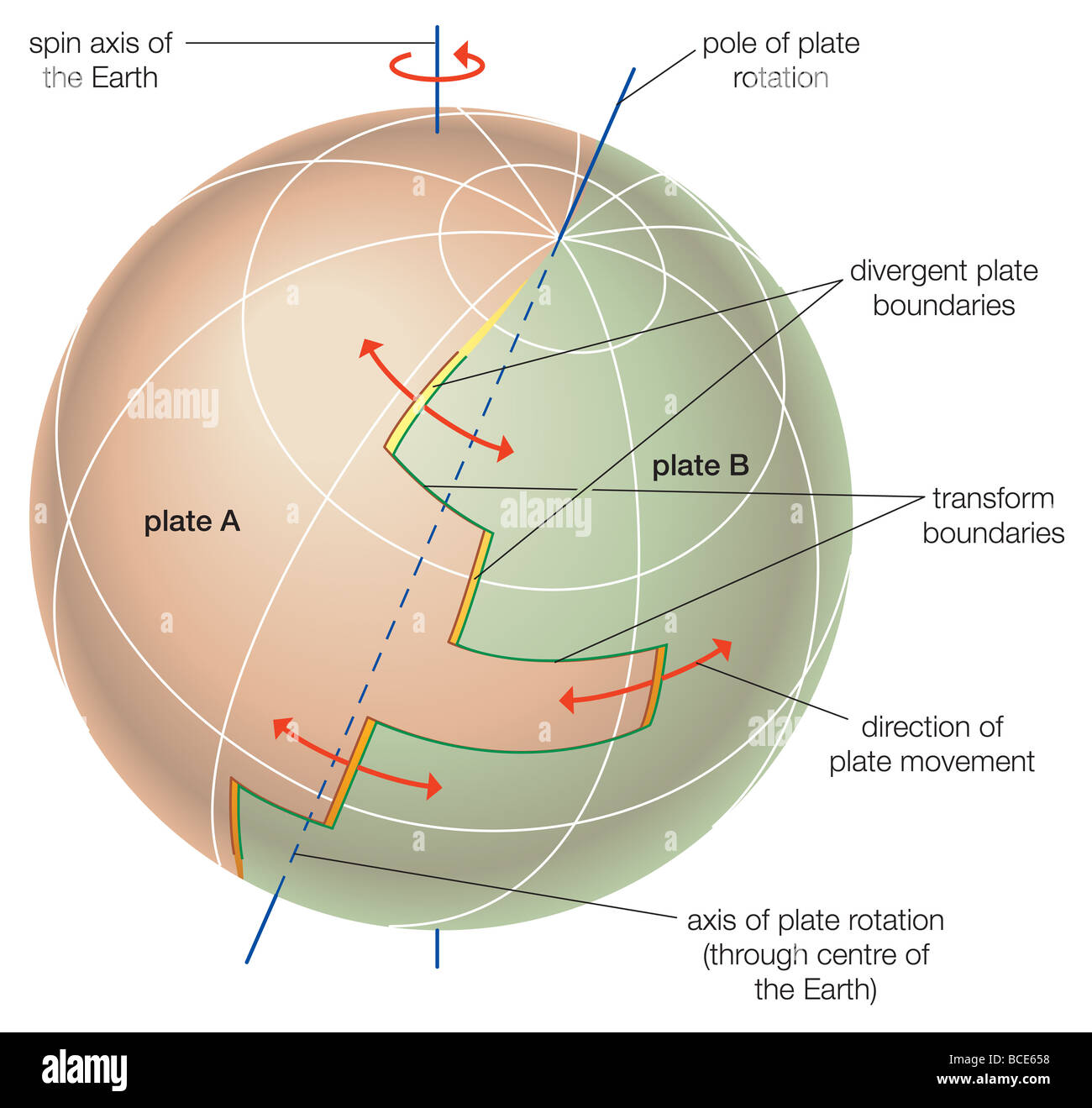 Theoretical depiction of the movement of tectonic plates across Earth's surface. Stock Photohttps://www.alamy.com/image-license-details/?v=1https://www.alamy.com/stock-photo-theoretical-depiction-of-the-movement-of-tectonic-plates-across-earths-24898420.html
RMBCE658–Theoretical depiction of the movement of tectonic plates across Earth's surface.
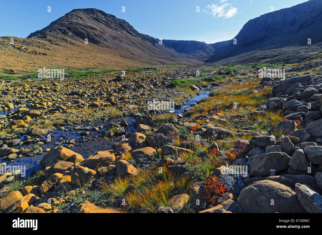 TABLELANDS Peridotite rock is rare at earth's surface reason for World Heritage Site designation by UNESCO. Gros Morne Stock Photohttps://www.alamy.com/image-license-details/?v=1https://www.alamy.com/stock-photo-tablelands-peridotite-rock-is-rare-at-earths-surface-reason-for-world-70027592.html
RME1X0WC–TABLELANDS Peridotite rock is rare at earth's surface reason for World Heritage Site designation by UNESCO. Gros Morne
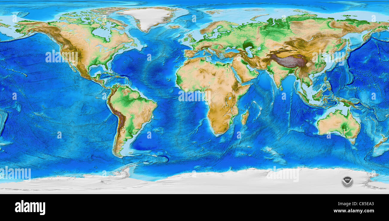 ETOPO1 is a 1 arc-minute global relief model of Earth's surface that integrates land topography and ocean bathymetry. Stock Photohttps://www.alamy.com/image-license-details/?v=1https://www.alamy.com/stock-photo-etopo1-is-a-1-arc-minute-global-relief-model-of-earths-surface-that-39459003.html
RMC85EA3–ETOPO1 is a 1 arc-minute global relief model of Earth's surface that integrates land topography and ocean bathymetry.
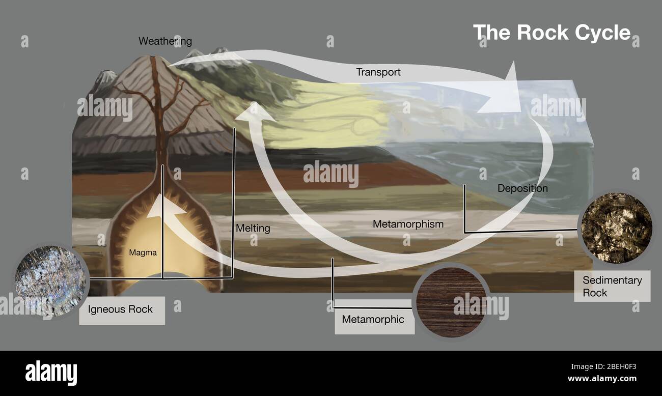 Rock Cycle Stock Photohttps://www.alamy.com/image-license-details/?v=1https://www.alamy.com/rock-cycle-image353186151.html
RM2BEH0F3–Rock Cycle
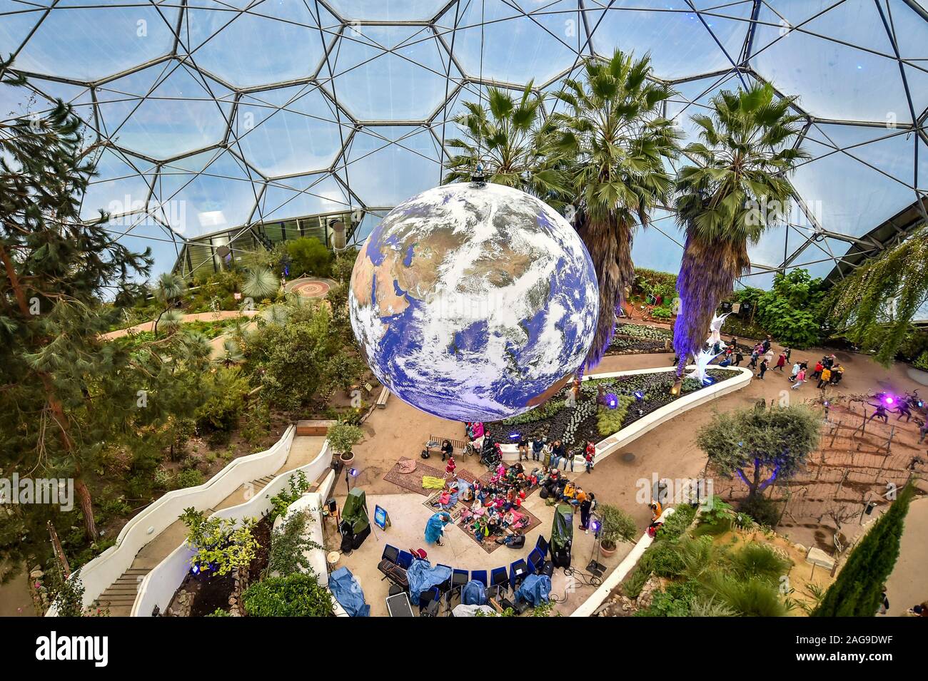 Luke Jerram's art installation 'Gaia', a replica of planet earth created using detailed NASA imagery of the Earth's surface, hangs on display at the Eden Project in St Austell, Cornwall. Stock Photohttps://www.alamy.com/image-license-details/?v=1https://www.alamy.com/luke-jerrams-art-installation-gaia-a-replica-of-planet-earth-created-using-detailed-nasa-imagery-of-the-earths-surface-hangs-on-display-at-the-eden-project-in-st-austell-cornwall-image337039963.html
RM2AG9DWF–Luke Jerram's art installation 'Gaia', a replica of planet earth created using detailed NASA imagery of the Earth's surface, hangs on display at the Eden Project in St Austell, Cornwall.
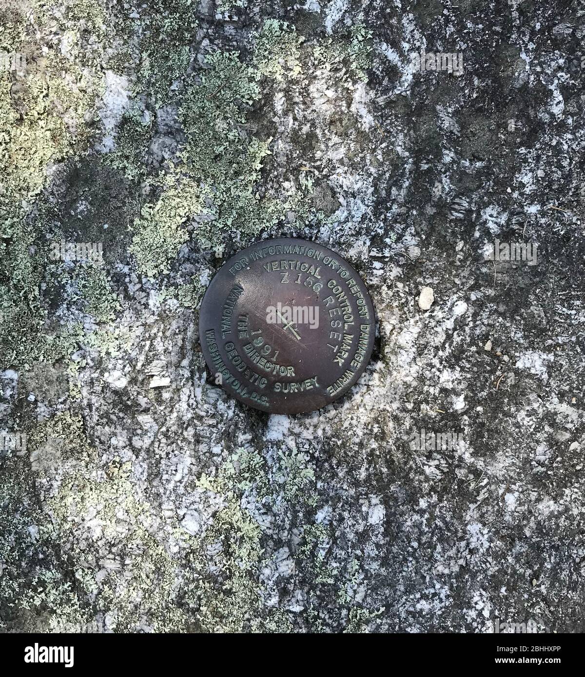 This National Geodetic Survey marker is on the ledge in Boothbay Harbor, Maine, at the Department of Marine Resources. The text on the marker reads (by line from top to bottom): FOR INFORMATION OR TO REPORT DAMAGE WRITE /VERTICAL CONTROL MARK/Z 156 RESET/1991/THE DIRECTOR/NATIONAL GEODETIC SURVEY/WASHINGTON, D.C. This photo dates to July 1, 2018. Stock Photohttps://www.alamy.com/image-license-details/?v=1https://www.alamy.com/this-national-geodetic-survey-marker-is-on-the-ledge-in-boothbay-harbor-maine-at-the-department-of-marine-resources-the-text-on-the-marker-reads-by-line-from-top-to-bottom-for-information-or-to-report-damage-write-vertical-control-markz-156-reset1991the-directornational-geodetic-surveywashington-dc-this-photo-dates-to-july-1-2018-image355050718.html
RF2BHHXPP–This National Geodetic Survey marker is on the ledge in Boothbay Harbor, Maine, at the Department of Marine Resources. The text on the marker reads (by line from top to bottom): FOR INFORMATION OR TO REPORT DAMAGE WRITE /VERTICAL CONTROL MARK/Z 156 RESET/1991/THE DIRECTOR/NATIONAL GEODETIC SURVEY/WASHINGTON, D.C. This photo dates to July 1, 2018.
 Vintage archival photograph taken in 1965 Stock Photohttps://www.alamy.com/image-license-details/?v=1https://www.alamy.com/vintage-archival-photograph-taken-in-1965-image220489099.html
RMPPM42K–Vintage archival photograph taken in 1965
 Catastrophic pollution of the atmosphere and transformation of the Earth's surface Stock Photohttps://www.alamy.com/image-license-details/?v=1https://www.alamy.com/catastrophic-pollution-of-the-atmosphere-and-transformation-of-the-earths-surface-image335020033.html
RM2AD1DD5–Catastrophic pollution of the atmosphere and transformation of the Earth's surface
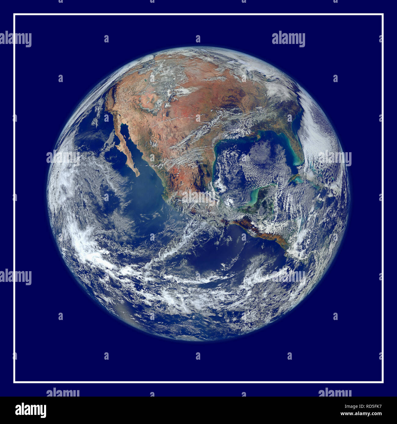 A view of most of North America taken from a low orbit of about 826 km altitude. The whole hemisphere is not visible owing to the low orbit, and the horizon is at a distance of about 3,300 km, while the radius of the planet is 6,371 km. The diameter seen from this height is about 125 degrees. An image of the Earth taken from the VIIRS instrument aboard NASA's Earth-observing research satellite, Suomi NPP. This composite image uses a number of swaths of the Earth's surface taken on 4 January 2012. The NPP satellite was renamed 'Suomi NPP' on 24 January 2012 to honour the late Verner E. Suomi of Stock Photohttps://www.alamy.com/image-license-details/?v=1https://www.alamy.com/a-view-of-most-of-north-america-taken-from-a-low-orbit-of-about-826-km-altitude-the-whole-hemisphere-is-not-visible-owing-to-the-low-orbit-and-the-horizon-is-at-a-distance-of-about-3300-km-while-the-radius-of-the-planet-is-6371-km-the-diameter-seen-from-this-height-is-about-125-degrees-an-image-of-the-earth-taken-from-the-viirs-instrument-aboard-nasas-earth-observing-research-satellite-suomi-npp-this-composite-image-uses-a-number-of-swaths-of-the-earths-surface-taken-on-4-january-2012-the-npp-satellite-was-renamed-suomi-npp-on-24-january-2012-to-honour-the-late-verner-e-suomi-of-image231847371.html
RMRD5FK7–A view of most of North America taken from a low orbit of about 826 km altitude. The whole hemisphere is not visible owing to the low orbit, and the horizon is at a distance of about 3,300 km, while the radius of the planet is 6,371 km. The diameter seen from this height is about 125 degrees. An image of the Earth taken from the VIIRS instrument aboard NASA's Earth-observing research satellite, Suomi NPP. This composite image uses a number of swaths of the Earth's surface taken on 4 January 2012. The NPP satellite was renamed 'Suomi NPP' on 24 January 2012 to honour the late Verner E. Suomi of
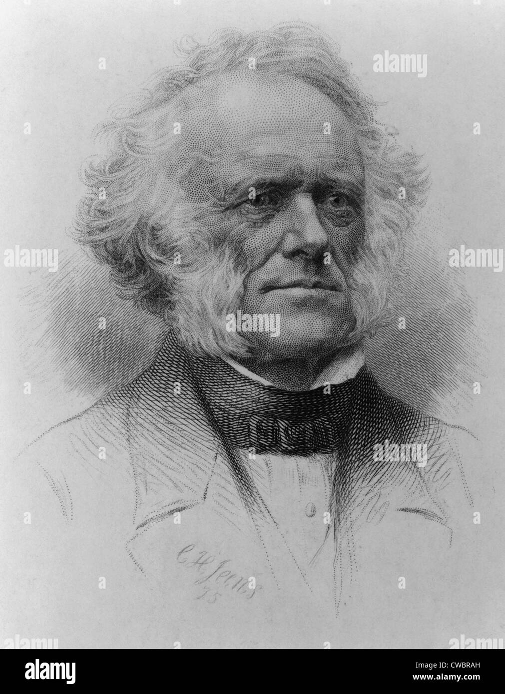 Sir Charles Lyell (1797-1875), Scottish geologist published PRINCIPLES OF GEOLOGY in 1830, and established the Earth's surface Stock Photohttps://www.alamy.com/image-license-details/?v=1https://www.alamy.com/stock-photo-sir-charles-lyell-1797-1875-scottish-geologist-published-principles-50046937.html
RMCWBRAH–Sir Charles Lyell (1797-1875), Scottish geologist published PRINCIPLES OF GEOLOGY in 1830, and established the Earth's surface
![Infographics in the incidence of ultraviolet rays on Earth's surface and the effects on living beings. [Adobe Illustrator (.ai); 2480x3248]. Stock Photo Infographics in the incidence of ultraviolet rays on Earth's surface and the effects on living beings. [Adobe Illustrator (.ai); 2480x3248]. Stock Photo](https://c8.alamy.com/comp/2NECA68/infographics-in-the-incidence-of-ultraviolet-rays-on-earths-surface-and-the-effects-on-living-beings-adobe-illustrator-ai-2480x3248-2NECA68.jpg) Infographics in the incidence of ultraviolet rays on Earth's surface and the effects on living beings. [Adobe Illustrator (.ai); 2480x3248]. Stock Photohttps://www.alamy.com/image-license-details/?v=1https://www.alamy.com/infographics-in-the-incidence-of-ultraviolet-rays-on-earths-surface-and-the-effects-on-living-beings-adobe-illustrator-ai-2480x3248-image525187664.html
Infographics in the incidence of ultraviolet rays on Earth's surface and the effects on living beings. [Adobe Illustrator (.ai); 2480x3248]. Stock Photohttps://www.alamy.com/image-license-details/?v=1https://www.alamy.com/infographics-in-the-incidence-of-ultraviolet-rays-on-earths-surface-and-the-effects-on-living-beings-adobe-illustrator-ai-2480x3248-image525187664.htmlRM2NECA68–Infographics in the incidence of ultraviolet rays on Earth's surface and the effects on living beings. [Adobe Illustrator (.ai); 2480x3248].
 226 Out-cropping of coal veins near earth's surface along the banks of a stream, Scranton, Pa., U.S.A, from Robert N. Dennis collection of stereoscopic views Stock Photohttps://www.alamy.com/image-license-details/?v=1https://www.alamy.com/226-out-cropping-of-coal-veins-near-earths-surface-along-the-banks-of-a-stream-scranton-pa-usa-from-robert-n-dennis-collection-of-stereoscopic-views-image208641985.html
RMP3CCYD–226 Out-cropping of coal veins near earth's surface along the banks of a stream, Scranton, Pa., U.S.A, from Robert N. Dennis collection of stereoscopic views
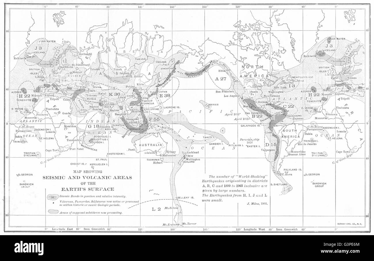 Map showing Seismic and Volcanic areas of the Earth's surface, 1907 Stock Photohttps://www.alamy.com/image-license-details/?v=1https://www.alamy.com/stock-photo-map-showing-seismic-and-volcanic-areas-of-the-earths-surface-1907-105600284.html
RFG3PE6M–Map showing Seismic and Volcanic areas of the Earth's surface, 1907
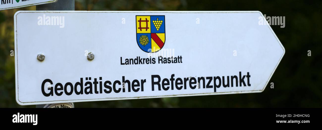 Sign Geodetic Reference Point Rastatt, Black Forest, Kaltenbronn, Baden-Wuerttemberg, Germany Stock Photohttps://www.alamy.com/image-license-details/?v=1https://www.alamy.com/sign-geodetic-reference-point-rastatt-black-forest-kaltenbronn-baden-wuerttemberg-germany-image447852764.html
RF2H0HCNG–Sign Geodetic Reference Point Rastatt, Black Forest, Kaltenbronn, Baden-Wuerttemberg, Germany
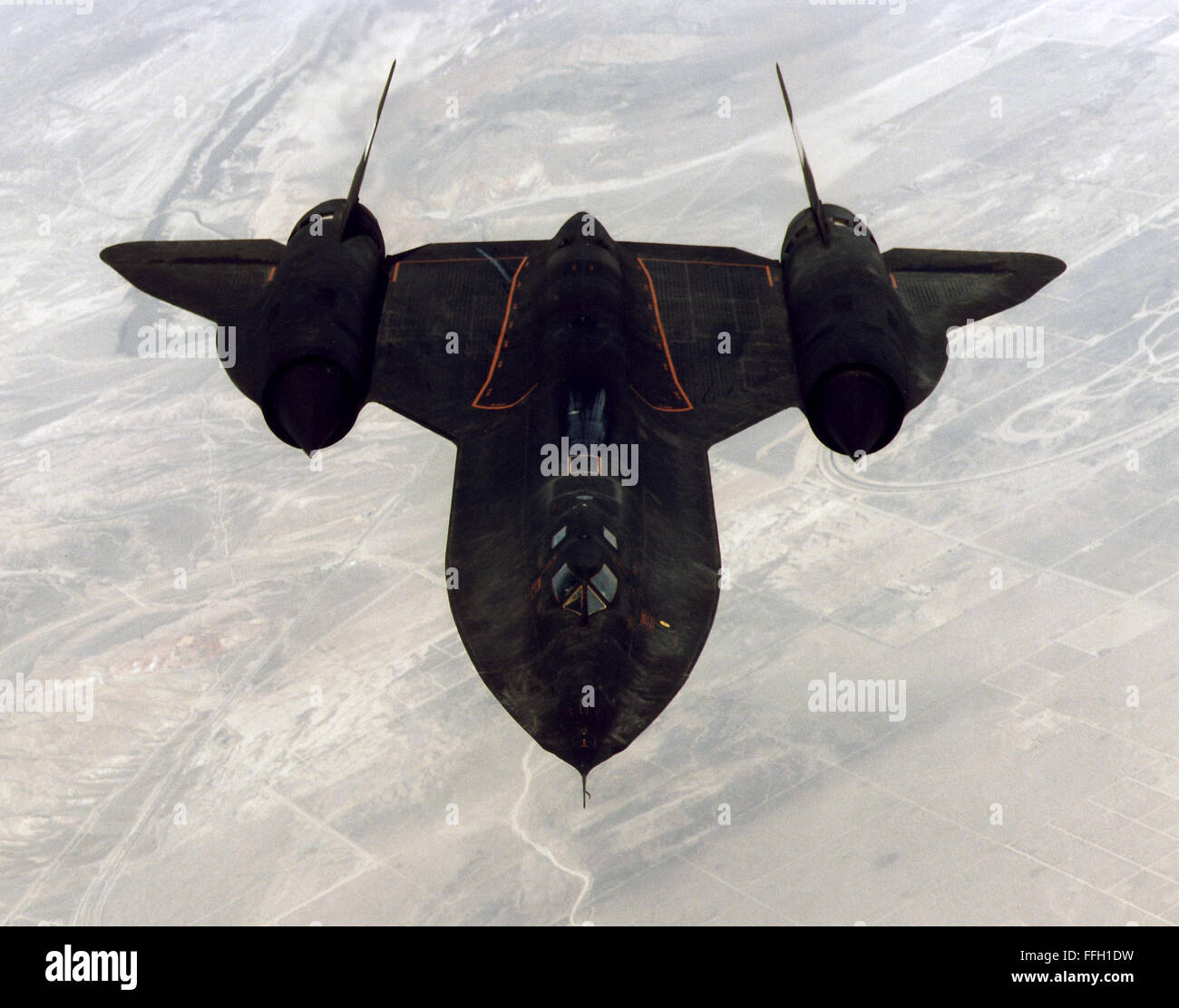 At 80,000 feet, the SR-71 was capable of surveying 100,000 square miles of Earth’s surface per hour. In mid-1976, an SR-71 set two world records for its class, with a speed record of about 2,193 mph and an altitude record of sustained flight at about 85,069 feet. Stock Photohttps://www.alamy.com/image-license-details/?v=1https://www.alamy.com/stock-photo-at-80000-feet-the-sr-71-was-capable-of-surveying-100000-square-miles-95646037.html
RMFFH1DW–At 80,000 feet, the SR-71 was capable of surveying 100,000 square miles of Earth’s surface per hour. In mid-1976, an SR-71 set two world records for its class, with a speed record of about 2,193 mph and an altitude record of sustained flight at about 85,069 feet.
 Out cropping of coal veins near earth's surface along the banks of a stream, Scranton, Pa., U.S.A, from Robert N. Dennis collection of stereoscopic views Stock Photohttps://www.alamy.com/image-license-details/?v=1https://www.alamy.com/stock-image-out-cropping-of-coal-veins-near-earths-surface-along-the-banks-of-163974559.html
RMKENK67–Out cropping of coal veins near earth's surface along the banks of a stream, Scranton, Pa., U.S.A, from Robert N. Dennis collection of stereoscopic views
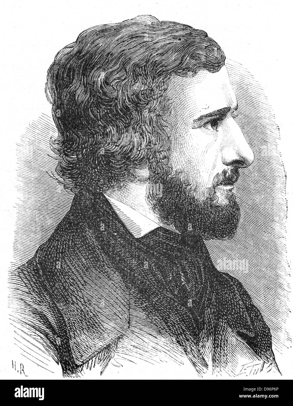 Hippolyte Fizeau (1819-1896) French physicist. Measured the velocity of light on the earth's surface (1849). Used Doppler principle to determine velocity of stars in line of sight. Confirmed the wave theory of light. From 'Les Merveilles de la Science', Louis Figuier, (Paris, 1870). Engraving. Stock Photohttps://www.alamy.com/image-license-details/?v=1https://www.alamy.com/stock-photo-hippolyte-fizeau-1819-1896-french-physicist-measured-the-velocity-57312158.html
RMD96P6P–Hippolyte Fizeau (1819-1896) French physicist. Measured the velocity of light on the earth's surface (1849). Used Doppler principle to determine velocity of stars in line of sight. Confirmed the wave theory of light. From 'Les Merveilles de la Science', Louis Figuier, (Paris, 1870). Engraving.
 Opencast coal mining. Workers extracting coal from the earth's surface using large vehicles. ;February 1947 ;P017826 Stock Photohttps://www.alamy.com/image-license-details/?v=1https://www.alamy.com/stock-photo-opencast-coal-mining-workers-extracting-coal-from-the-earths-surface-20357605.html
RMB53A99–Opencast coal mining. Workers extracting coal from the earth's surface using large vehicles. ;February 1947 ;P017826
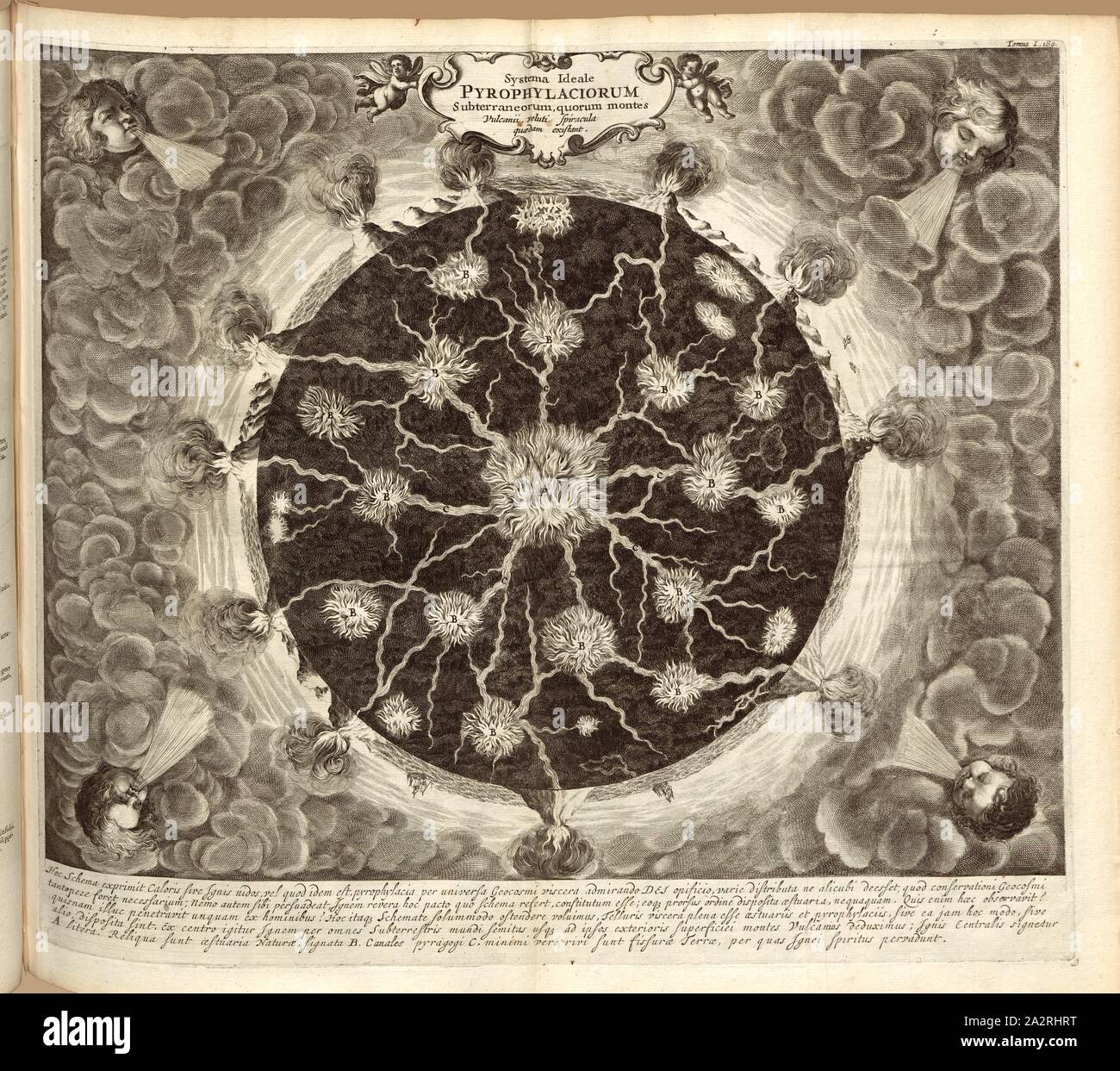 Systema Ideale pyrophylaciorum Subterraneorum, of which the Vulcanii the mountains, as it were, the existence of a kind of the vents, Cross-section of the earth with underground streams of fire and volcanoes on the earth's surface from the 17th century, Fig. 1, after p. 180, 1665, Anthanasius Kircher: Mundus subterraneus. Tomus I. Amstelodami: apud Ioannem Ianssonium & Elizeum Weyerstraten, 1664 Stock Photohttps://www.alamy.com/image-license-details/?v=1https://www.alamy.com/systema-ideale-pyrophylaciorum-subterraneorum-of-which-the-vulcanii-the-mountains-as-it-were-the-existence-of-a-kind-of-the-vents-cross-section-of-the-earth-with-underground-streams-of-fire-and-volcanoes-on-the-earths-surface-from-the-17th-century-fig-1-after-p-180-1665-anthanasius-kircher-mundus-subterraneus-tomus-i-amstelodami-apud-ioannem-ianssonium-elizeum-weyerstraten-1664-image328745196.html
RM2A2RHRT–Systema Ideale pyrophylaciorum Subterraneorum, of which the Vulcanii the mountains, as it were, the existence of a kind of the vents, Cross-section of the earth with underground streams of fire and volcanoes on the earth's surface from the 17th century, Fig. 1, after p. 180, 1665, Anthanasius Kircher: Mundus subterraneus. Tomus I. Amstelodami: apud Ioannem Ianssonium & Elizeum Weyerstraten, 1664
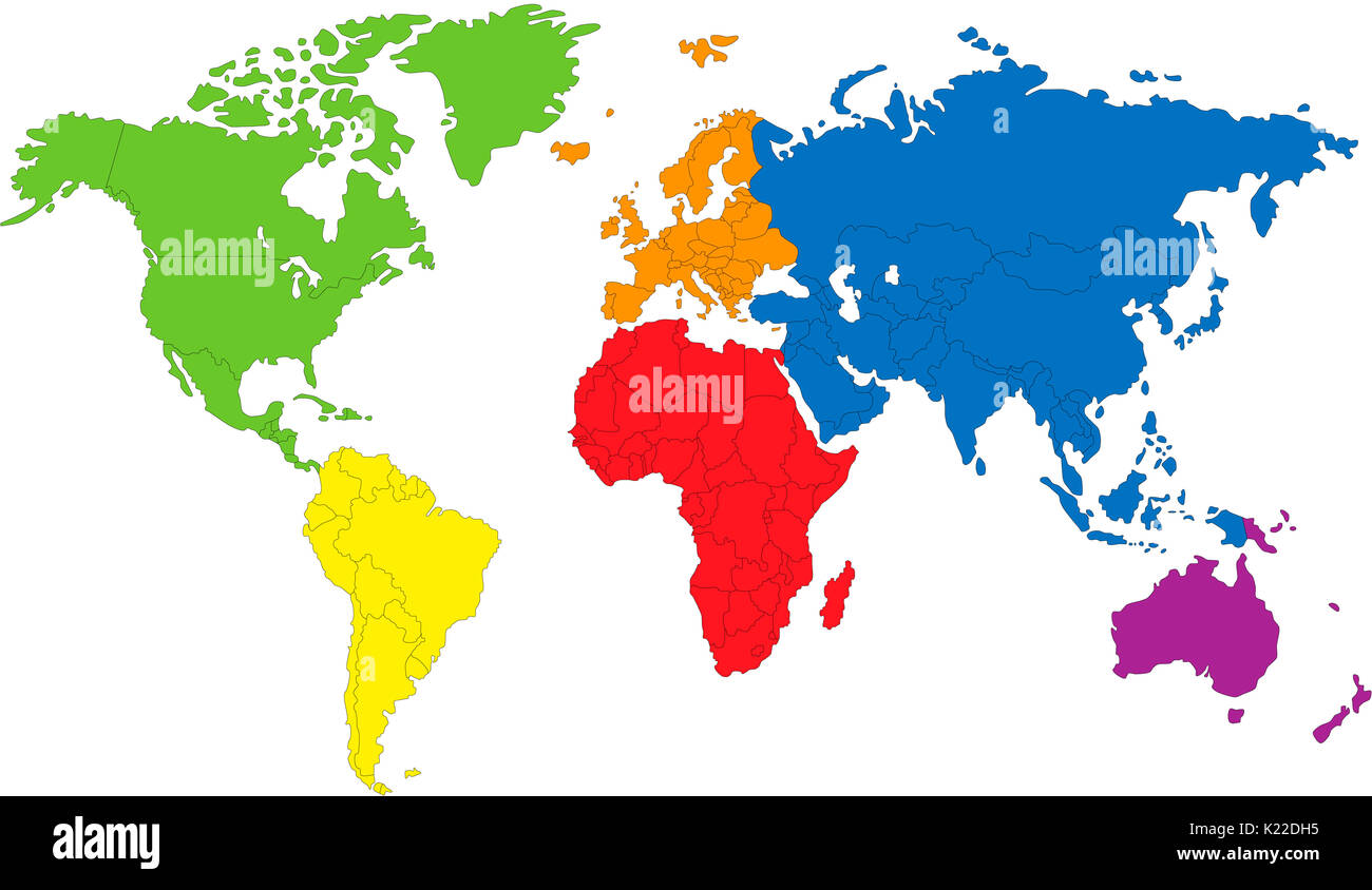 The continents are vast tracts of land surrounded by water; they cover about 30% of the Earth's surface. Stock Photohttps://www.alamy.com/image-license-details/?v=1https://www.alamy.com/the-continents-are-vast-tracts-of-land-surrounded-by-water-they-cover-image156177201.html
RMK22DH5–The continents are vast tracts of land surrounded by water; they cover about 30% of the Earth's surface.
 TABLELANDS. Peridotite rock is rare at earth's surface reason for World Heritage Site designation by UNESCO. Gros Morne Stock Photohttps://www.alamy.com/image-license-details/?v=1https://www.alamy.com/stock-photo-tablelands-peridotite-rock-is-rare-at-earths-surface-reason-for-world-70027586.html
RME1X0W6–TABLELANDS. Peridotite rock is rare at earth's surface reason for World Heritage Site designation by UNESCO. Gros Morne
 Cape Canaveral and the Kennedy Space Center along the coast of Florida in the United States as the International Space Station orbited 261 miles above the Earths surface. Stock Photohttps://www.alamy.com/image-license-details/?v=1https://www.alamy.com/cape-canaveral-and-the-kennedy-space-center-along-the-coast-of-florida-in-the-united-states-as-the-international-space-station-orbited-261-miles-above-the-earths-surface-image399539193.html
RF2E60G8W–Cape Canaveral and the Kennedy Space Center along the coast of Florida in the United States as the International Space Station orbited 261 miles above the Earths surface.
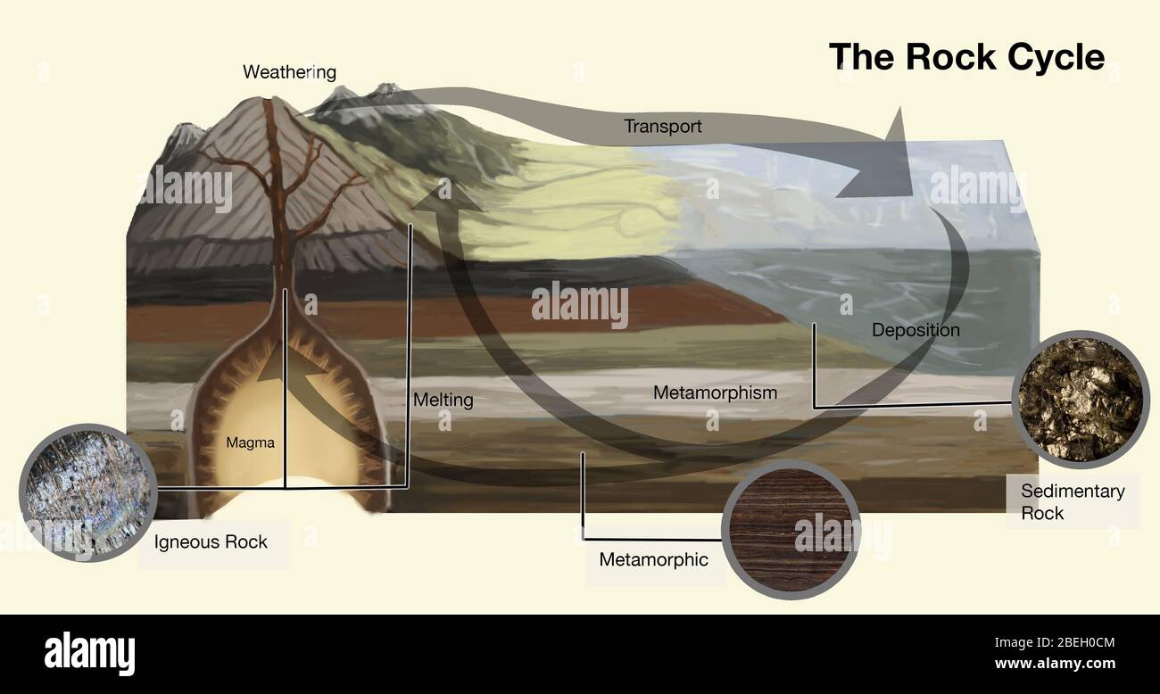 Rock Cycle Stock Photohttps://www.alamy.com/image-license-details/?v=1https://www.alamy.com/rock-cycle-image353186084.html
RM2BEH0CM–Rock Cycle
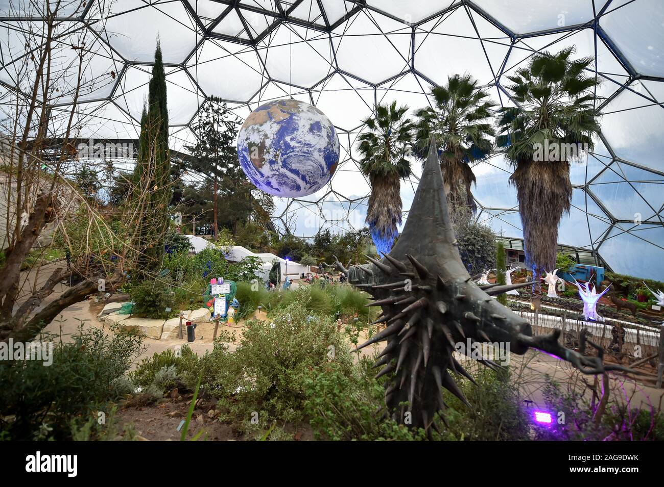 Luke Jerram's art installation 'Gaia', a replica of planet earth created using detailed NASA imagery of the Earth's surface, hangs on display at the Eden Project in St Austell, Cornwall. Stock Photohttps://www.alamy.com/image-license-details/?v=1https://www.alamy.com/luke-jerrams-art-installation-gaia-a-replica-of-planet-earth-created-using-detailed-nasa-imagery-of-the-earths-surface-hangs-on-display-at-the-eden-project-in-st-austell-cornwall-image337039967.html
RM2AG9DWK–Luke Jerram's art installation 'Gaia', a replica of planet earth created using detailed NASA imagery of the Earth's surface, hangs on display at the Eden Project in St Austell, Cornwall.
 Out-cropping of coal veins near earth's surface along the banks of a stream, Scranton, Pa, USA, from Robert N Dennis collection of stereoscopic views Stock Photohttps://www.alamy.com/image-license-details/?v=1https://www.alamy.com/out-cropping-of-coal-veins-near-earths-surface-along-the-banks-of-a-stream-scranton-pa-usa-from-robert-n-dennis-collection-of-stereoscopic-views-image260003029.html
RMW304ED–Out-cropping of coal veins near earth's surface along the banks of a stream, Scranton, Pa, USA, from Robert N Dennis collection of stereoscopic views
 Vintage archival photograph taken in 1965 Stock Photohttps://www.alamy.com/image-license-details/?v=1https://www.alamy.com/vintage-archival-photograph-taken-in-1965-image217041020.html
RMPH3210–Vintage archival photograph taken in 1965
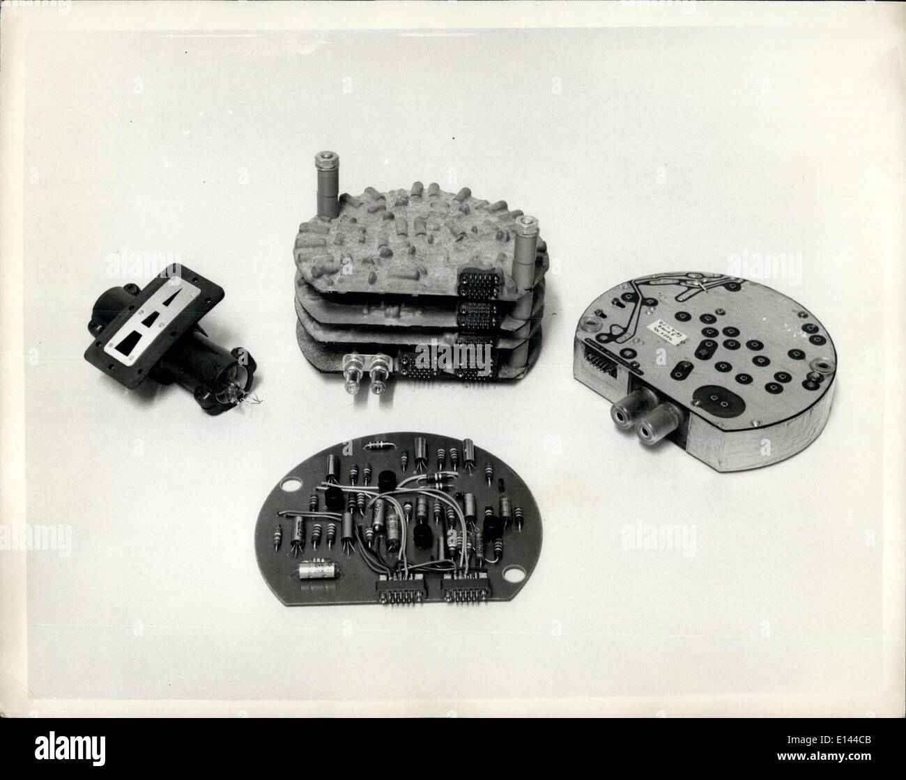 Apr. 04, 2012 - Instruments For The First British Satellite To Be Launched By The U.S. Scout Rocket: The Space Research Group of the Department of Physics of University College, London, led by Dr. R.L.F. Boyd and working under professor Sir Harry Massey have designed these instruments to make a variety of measurements in the earth's ionosphere between 200 and 600 miles above the earth's surface. Stock Photohttps://www.alamy.com/image-license-details/?v=1https://www.alamy.com/apr-04-2012-instruments-for-the-first-british-satellite-to-be-launched-image69547419.html
RME144CB–Apr. 04, 2012 - Instruments For The First British Satellite To Be Launched By The U.S. Scout Rocket: The Space Research Group of the Department of Physics of University College, London, led by Dr. R.L.F. Boyd and working under professor Sir Harry Massey have designed these instruments to make a variety of measurements in the earth's ionosphere between 200 and 600 miles above the earth's surface.
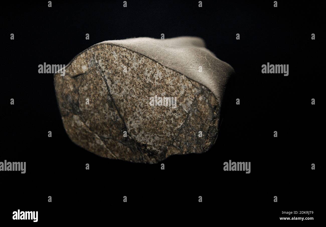 Meteorite Simmern, Rheinland-Pfalz, Germany. H5 class. Fallen to the earth's surface on July 1, 1920. Stock Photohttps://www.alamy.com/image-license-details/?v=1https://www.alamy.com/meteorite-simmern-rheinland-pfalz-germany-h5-class-fallen-to-the-earths-surface-on-july-1-1920-image390826249.html
RM2DKRJT9–Meteorite Simmern, Rheinland-Pfalz, Germany. H5 class. Fallen to the earth's surface on July 1, 1920.
 Image of the Earth taken from NASA's Earth observing satellite, Suomi NPP. It is a composite image of the Earth's surface. Stock Photohttps://www.alamy.com/image-license-details/?v=1https://www.alamy.com/stock-photo-image-of-the-earth-taken-from-nasas-earth-observing-satellite-suomi-50062328.html
RMCWCF08–Image of the Earth taken from NASA's Earth observing satellite, Suomi NPP. It is a composite image of the Earth's surface.
![Infographics of the fall and a meteorite on Earth's surface and the classification of meteorites. [Adobe Illustrator (.ai); 2480x3248]. Stock Photo Infographics of the fall and a meteorite on Earth's surface and the classification of meteorites. [Adobe Illustrator (.ai); 2480x3248]. Stock Photo](https://c8.alamy.com/comp/2NEC7WF/infographics-of-the-fallanda-meteoriteon-earths-surfaceand-the-classificationof-meteorites-adobe-illustrator-ai-2480x3248-2NEC7WF.jpg) Infographics of the fall and a meteorite on Earth's surface and the classification of meteorites. [Adobe Illustrator (.ai); 2480x3248]. Stock Photohttps://www.alamy.com/image-license-details/?v=1https://www.alamy.com/infographics-of-the-fallanda-meteoriteon-earths-surfaceand-the-classificationof-meteorites-adobe-illustrator-ai-2480x3248-image525185851.html
Infographics of the fall and a meteorite on Earth's surface and the classification of meteorites. [Adobe Illustrator (.ai); 2480x3248]. Stock Photohttps://www.alamy.com/image-license-details/?v=1https://www.alamy.com/infographics-of-the-fallanda-meteoriteon-earths-surfaceand-the-classificationof-meteorites-adobe-illustrator-ai-2480x3248-image525185851.htmlRM2NEC7WF–Infographics of the fall and a meteorite on Earth's surface and the classification of meteorites. [Adobe Illustrator (.ai); 2480x3248].
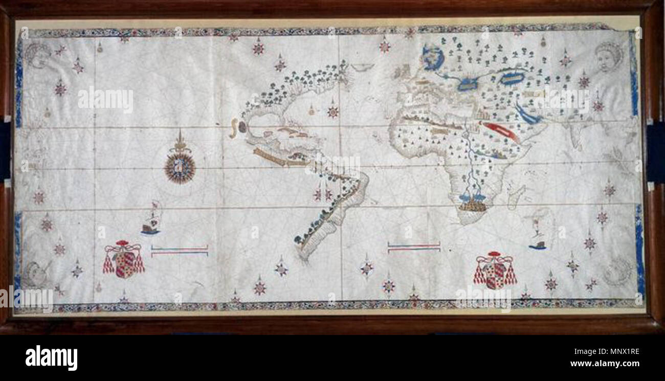 . English: A world map from 1526 which shows the Spanish view of the Earth's surface at the time and includes the eastern coasts of North and South America. 1526. Nuno Garcia de Toreno c 1525 1088 Salviati Planisphere Stock Photohttps://www.alamy.com/image-license-details/?v=1https://www.alamy.com/english-a-world-map-from-1526-which-shows-the-spanish-view-of-the-earths-surface-at-the-time-and-includes-the-eastern-coasts-of-north-and-south-america-1526-nuno-garcia-de-toreno-c-1525-1088-salviati-planisphere-image185583650.html
RMMNX1RE–. English: A world map from 1526 which shows the Spanish view of the Earth's surface at the time and includes the eastern coasts of North and South America. 1526. Nuno Garcia de Toreno c 1525 1088 Salviati Planisphere
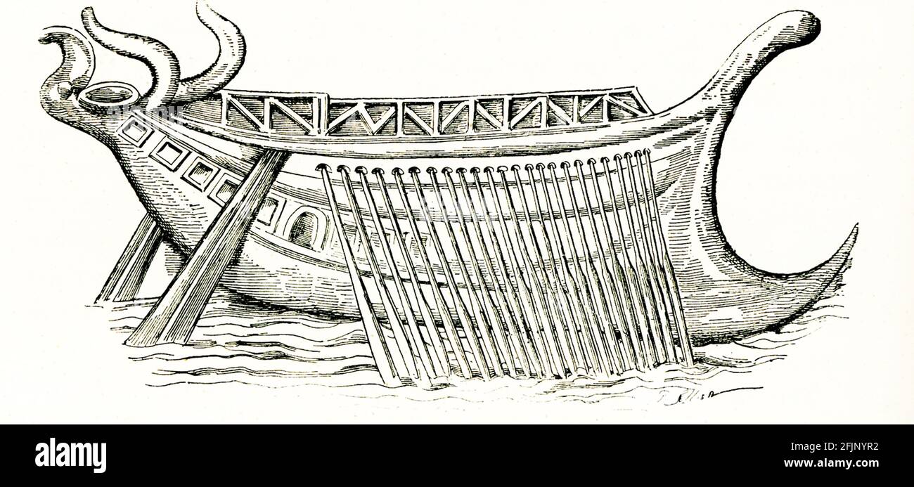 Long Ship with 50 oars from mosaic found near Pozzuoli. Roman warships (naves longae) derived from Greek galley designs. In the ocean-going fleets, the three main designs were trireme, quadrireme, and quinquereme. During the Republic, the quinquereme was the standard ship. After the battle of Actium at the start of the Empire, the trireme became the main ship. Pozzuoli was an ancient seaside town probably best known for its bradyseism, a raising and lowering of the Earth’s surface due to underground volcanic activity. Stock Photohttps://www.alamy.com/image-license-details/?v=1https://www.alamy.com/long-ship-with-50-oars-from-mosaic-found-near-pozzuoli-romanwarships-naves-longae-derived-from-greek-galley-designs-in-the-ocean-going-fleets-the-three-main-designs-were-trireme-quadrireme-and-quinquereme-during-the-republic-the-quinquereme-was-the-standardship-after-the-battle-of-actium-at-the-start-of-the-empire-the-trireme-became-the-mainship-pozzuoli-was-an-ancient-seaside-town-probably-best-known-for-its-bradyseism-a-raising-and-lowering-of-the-earths-surface-due-to-underground-volcanic-activity-image424595446.html
RF2FJNYR2–Long Ship with 50 oars from mosaic found near Pozzuoli. Roman warships (naves longae) derived from Greek galley designs. In the ocean-going fleets, the three main designs were trireme, quadrireme, and quinquereme. During the Republic, the quinquereme was the standard ship. After the battle of Actium at the start of the Empire, the trireme became the main ship. Pozzuoli was an ancient seaside town probably best known for its bradyseism, a raising and lowering of the Earth’s surface due to underground volcanic activity.
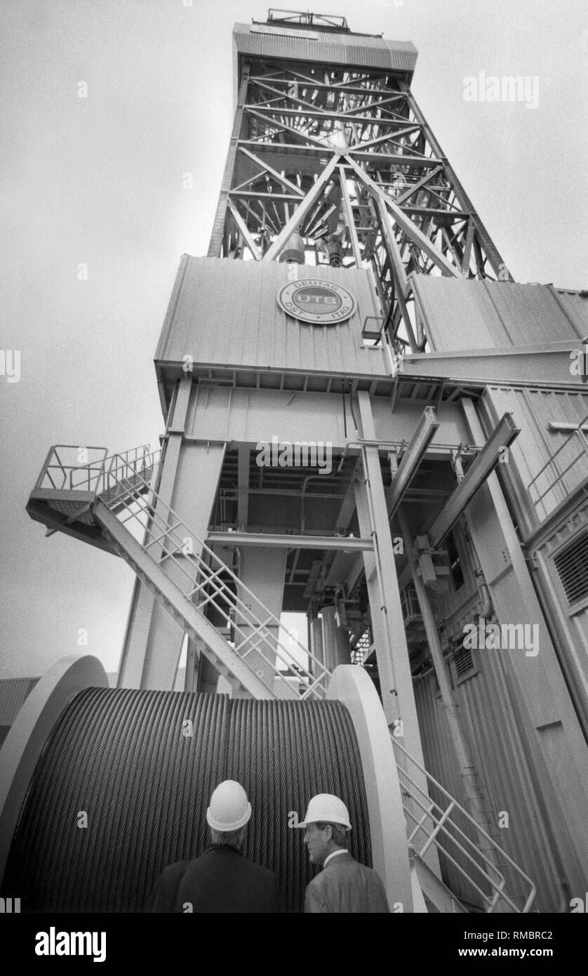 The German Continental Deep Drilling Program (KTB) in the Upper Palatinate. In the background, the borehole. Stock Photohttps://www.alamy.com/image-license-details/?v=1https://www.alamy.com/the-german-continental-deep-drilling-program-ktb-in-the-upper-palatinate-in-the-background-the-borehole-image236287746.html
RMRMBRC2–The German Continental Deep Drilling Program (KTB) in the Upper Palatinate. In the background, the borehole.
 Seasonal Changes in Earth's Surface Albedo 5278071440 o Stock Photohttps://www.alamy.com/image-license-details/?v=1https://www.alamy.com/stock-photo-seasonal-changes-in-earths-surface-albedo-5278071440-o-111968863.html
RMGE4HBY–Seasonal Changes in Earth's Surface Albedo 5278071440 o
 Concept map Water and Its Patterns on Earth's Surface Stock Photohttps://www.alamy.com/image-license-details/?v=1https://www.alamy.com/stock-image-concept-map-water-and-its-patterns-on-earths-surface-169321215.html
RMKRD6X7–Concept map Water and Its Patterns on Earth's Surface
 Engraving depicting Pouillet's Pyrheliometer, used to measure the amount of solar heat reaching the earth's surface. Claude Pouillet (1790-1868) a French physicist and a professor of physics at the Sorbonne and member of the French Academy of Sciences. Dated 19th Century Stock Photohttps://www.alamy.com/image-license-details/?v=1https://www.alamy.com/stock-image-engraving-depicting-pouillets-pyrheliometer-used-to-measure-the-amount-165993658.html
RMKJ1JGX–Engraving depicting Pouillet's Pyrheliometer, used to measure the amount of solar heat reaching the earth's surface. Claude Pouillet (1790-1868) a French physicist and a professor of physics at the Sorbonne and member of the French Academy of Sciences. Dated 19th Century
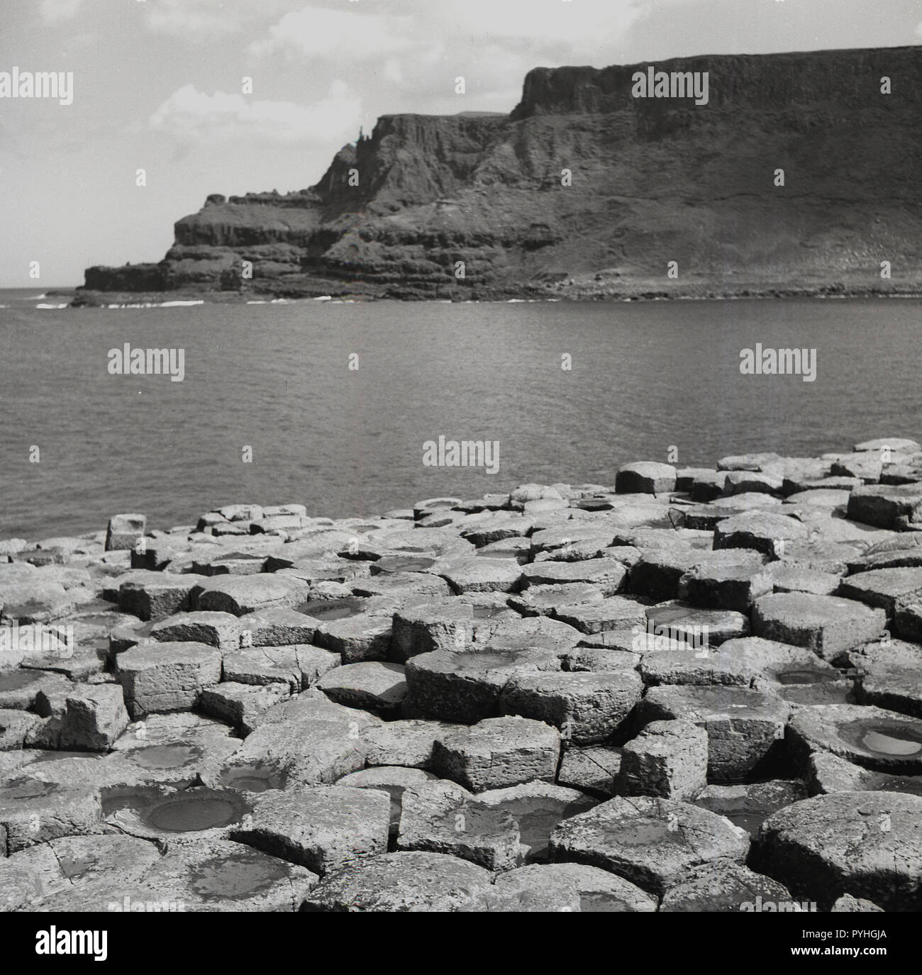 1950s, historical, the unique basalt stones at the coast at the Giant's Causeway in Co. Antrim, Northern Ireland. These basalt columns were ormed by a volcanic eruption, the rapid cooling of lava onto the earth's surface. Stock Photohttps://www.alamy.com/image-license-details/?v=1https://www.alamy.com/1950s-historical-the-unique-basalt-stones-at-the-coast-at-the-giants-causeway-in-co-antrim-northern-ireland-these-basalt-columns-were-ormed-by-a-volcanic-eruption-the-rapid-cooling-of-lava-onto-the-earths-surface-image223506370.html
RMPYHGJA–1950s, historical, the unique basalt stones at the coast at the Giant's Causeway in Co. Antrim, Northern Ireland. These basalt columns were ormed by a volcanic eruption, the rapid cooling of lava onto the earth's surface.
 Hydrological Cycle: The continuous movement of water between the Earth's surface and atmosphere. Stock Photohttps://www.alamy.com/image-license-details/?v=1https://www.alamy.com/hydrological-cycle-the-continuous-movement-of-water-between-the-earths-surface-and-atmosphere-image564168319.html
RF2RNT2CF–Hydrological Cycle: The continuous movement of water between the Earth's surface and atmosphere.
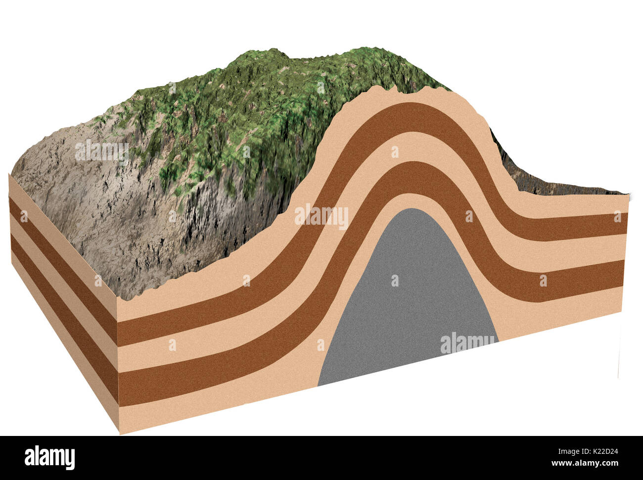 Magma that rises toward Earth’s surface accumulates in gigantic magmatic chambers. If the molten rock is not ejected by a volcanic eruption, it raises the rocky strata on the surface into dome shapes. Stock Photohttps://www.alamy.com/image-license-details/?v=1https://www.alamy.com/magma-that-rises-toward-earths-surface-accumulates-in-gigantic-magmatic-image156176780.html
RMK22D24–Magma that rises toward Earth’s surface accumulates in gigantic magmatic chambers. If the molten rock is not ejected by a volcanic eruption, it raises the rocky strata on the surface into dome shapes.
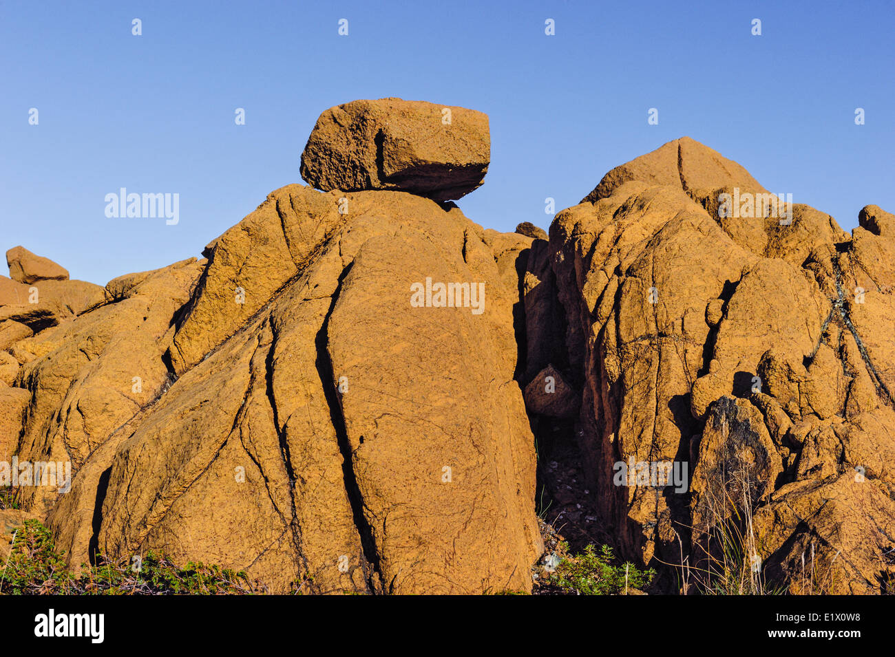 TABLELANDS. Peridotite rock is rare at earth's surface reason for World Heritage Site designation by UNESCO. Gros Morne Stock Photohttps://www.alamy.com/image-license-details/?v=1https://www.alamy.com/stock-photo-tablelands-peridotite-rock-is-rare-at-earths-surface-reason-for-world-70027588.html
RME1X0W8–TABLELANDS. Peridotite rock is rare at earth's surface reason for World Heritage Site designation by UNESCO. Gros Morne
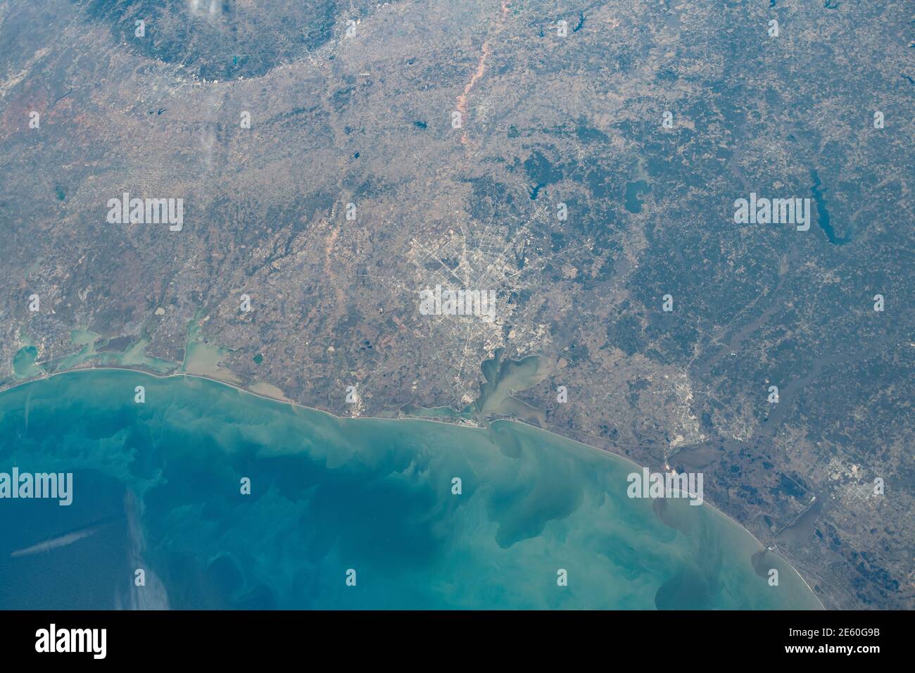 Cape Canaveral and the Kennedy Space Center along the coast of Florida in the United States as the International Space Station orbited 261 miles above the Earths surface. Stock Photohttps://www.alamy.com/image-license-details/?v=1https://www.alamy.com/cape-canaveral-and-the-kennedy-space-center-along-the-coast-of-florida-in-the-united-states-as-the-international-space-station-orbited-261-miles-above-the-earths-surface-image399539207.html
RF2E60G9B–Cape Canaveral and the Kennedy Space Center along the coast of Florida in the United States as the International Space Station orbited 261 miles above the Earths surface.
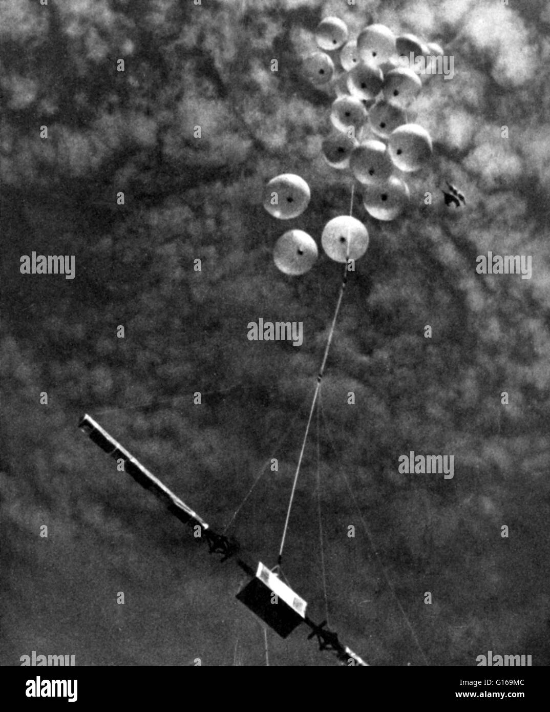 Cosmic rays are very high-energy particles, mainly originating outside the Solar System. They may produce showers of secondary particles that penetrate and impact the Earth's atmosphere and sometimes even reach the surface. Comprised primarily of high-energy protons and atomic nuclei, their origin has, until recently, been a mystery. With data from the Fermi space telescope published in February 2013, it is now known that cosmic rays primarily originate from the supernovae of massive stars. During the years from 1930 to 1945, a wide variety of investigations confirmed that the primary cosmic r Stock Photohttps://www.alamy.com/image-license-details/?v=1https://www.alamy.com/stock-photo-cosmic-rays-are-very-high-energy-particles-mainly-originating-outside-104016204.html
RMG169MC–Cosmic rays are very high-energy particles, mainly originating outside the Solar System. They may produce showers of secondary particles that penetrate and impact the Earth's atmosphere and sometimes even reach the surface. Comprised primarily of high-energy protons and atomic nuclei, their origin has, until recently, been a mystery. With data from the Fermi space telescope published in February 2013, it is now known that cosmic rays primarily originate from the supernovae of massive stars. During the years from 1930 to 1945, a wide variety of investigations confirmed that the primary cosmic r
 Artist Luke Jerram stands beneath his huge art installation 'Gaia', measuring seven metres in diameter and composed of incredibly detailed NASA imagery of the Earth's surface, as it hangs in the Great Hall at the University of Bristol. Stock Photohttps://www.alamy.com/image-license-details/?v=1https://www.alamy.com/artist-luke-jerram-stands-beneath-his-huge-art-installation-gaia-measuring-seven-metres-in-diameter-and-composed-of-incredibly-detailed-nasa-imagery-of-the-earths-surface-as-it-hangs-in-the-great-hall-at-the-university-of-bristol-image264206072.html
RMW9RHF4–Artist Luke Jerram stands beneath his huge art installation 'Gaia', measuring seven metres in diameter and composed of incredibly detailed NASA imagery of the Earth's surface, as it hangs in the Great Hall at the University of Bristol.
 UPHEAVAL DOME, ONE OF THE MOST REMARKABLE GEOLOGICAL PHENOMENA IN THE CANYONLANDS. IT CONSISTS OF A MILE-WIDE CRATER CONTAINING A DOME OF MULTI-LAYERED ROCK. ALL THE ROCK FORMATIONS OF THE AREA ARE EXPOSED HERE. THE ORIGIN IS THOUGHT TO HAVE BEEN THE THRUSTING-UP OF A SALT DOME FROM BENEATH THE EARTH'S SURFACE Stock Photohttps://www.alamy.com/image-license-details/?v=1https://www.alamy.com/upheaval-dome-one-of-the-most-remarkable-geological-phenomena-in-the-canyonlands-it-consists-of-a-mile-wide-crater-containing-a-dome-of-multi-layered-rock-all-the-rock-formations-of-the-area-are-exposed-here-the-origin-is-thought-to-have-been-the-thrusting-up-of-a-salt-dome-from-beneath-the-earths-surface-image262301301.html
RMW6MRYH–UPHEAVAL DOME, ONE OF THE MOST REMARKABLE GEOLOGICAL PHENOMENA IN THE CANYONLANDS. IT CONSISTS OF A MILE-WIDE CRATER CONTAINING A DOME OF MULTI-LAYERED ROCK. ALL THE ROCK FORMATIONS OF THE AREA ARE EXPOSED HERE. THE ORIGIN IS THOUGHT TO HAVE BEEN THE THRUSTING-UP OF A SALT DOME FROM BENEATH THE EARTH'S SURFACE
 New York, USA. 20th Feb, 2020. Dutch architect Rem Koolhaas (C) talks with visitors at the 'Countryside, The Future' exhibition at Solomon R. Guggenheim Museum in New York, the United States, Feb. 20, 2020. China's rural revitalization strategy is emerging as a model for the sustainable development of the world's countryside, or the 98 percent of Earth's surface not occupied by cities, Rem Koolhaas has said. TO GO WITH 'Interview: China's rural revitalization a model for world's countryside development -- Dutch architect' Credit: Wang Ying/Xinhua/Alamy Live News Stock Photohttps://www.alamy.com/image-license-details/?v=1https://www.alamy.com/new-york-usa-20th-feb-2020-dutch-architect-rem-koolhaas-c-talks-with-visitors-at-the-countryside-the-future-exhibition-at-solomon-r-guggenheim-museum-in-new-york-the-united-states-feb-20-2020-chinas-rural-revitalization-strategy-is-emerging-as-a-model-for-the-sustainable-development-of-the-worlds-countryside-or-the-98-percent-of-earths-surface-not-occupied-by-cities-rem-koolhaas-has-said-to-go-with-interview-chinas-rural-revitalization-a-model-for-worlds-countryside-development-dutch-architect-credit-wang-yingxinhuaalamy-live-news-image345276362.html
RM2B1MKEJ–New York, USA. 20th Feb, 2020. Dutch architect Rem Koolhaas (C) talks with visitors at the 'Countryside, The Future' exhibition at Solomon R. Guggenheim Museum in New York, the United States, Feb. 20, 2020. China's rural revitalization strategy is emerging as a model for the sustainable development of the world's countryside, or the 98 percent of Earth's surface not occupied by cities, Rem Koolhaas has said. TO GO WITH 'Interview: China's rural revitalization a model for world's countryside development -- Dutch architect' Credit: Wang Ying/Xinhua/Alamy Live News
 Apr. 04, 2012 - Instruments For The First British Satellite To Be Launched By The U.S. Scout Rocket: The Space Research Group of the Department of Physics of University College, London, led by Dr. R.L.F. Boyd and working under professor Sir Harry Massey have designed these instruments to make a variety of measurements in the earth's ionosphere between 200 and 600 miles above the earth's surface. determining the orientation of the satellite relative to the sun. Stock Photohttps://www.alamy.com/image-license-details/?v=1https://www.alamy.com/apr-04-2012-instruments-for-the-first-british-satellite-to-be-launched-image69547417.html
RME144C9–Apr. 04, 2012 - Instruments For The First British Satellite To Be Launched By The U.S. Scout Rocket: The Space Research Group of the Department of Physics of University College, London, led by Dr. R.L.F. Boyd and working under professor Sir Harry Massey have designed these instruments to make a variety of measurements in the earth's ionosphere between 200 and 600 miles above the earth's surface. determining the orientation of the satellite relative to the sun.
 Blue Marble A 'Blue Marble' image of the Earth taken from the VIIRS instrument aboard NASA's most recently launched Earth-observing satellite - Suomi NPP. This composite image uses a number of swaths of the Earth's surface taken on January 4, 2012. The NPP satellite was renamed 'Suomi NPP' on January 24, 2012 to honor the late Verner E. Suomi of the University of Wisconsin. Suomi NPP is NASA's next Earth-observing research satellite. It is the first of a new generation of satellites that will observe many facets of our changing Earth. Stock Photohttps://www.alamy.com/image-license-details/?v=1https://www.alamy.com/stock-photo-blue-marble-a-blue-marble-image-of-the-earth-taken-from-the-viirs-43249346.html
RMCEA4YE–Blue Marble A 'Blue Marble' image of the Earth taken from the VIIRS instrument aboard NASA's most recently launched Earth-observing satellite - Suomi NPP. This composite image uses a number of swaths of the Earth's surface taken on January 4, 2012. The NPP satellite was renamed 'Suomi NPP' on January 24, 2012 to honor the late Verner E. Suomi of the University of Wisconsin. Suomi NPP is NASA's next Earth-observing research satellite. It is the first of a new generation of satellites that will observe many facets of our changing Earth.
 World War 1. Somme Offensive. The most desolate region of the Somme Battlefield near Ovillers-la-Boiselle, an obliterated village. The whole earths surface is torn with shell holes and seamed with lines of trenches, all white, because the soil here is chalk. Splintered trees in the right background are where the town used to be. July-August 1916. (BSLOC 2013 1 133) Stock Photohttps://www.alamy.com/image-license-details/?v=1https://www.alamy.com/stock-photo-world-war-1-somme-offensive-the-most-desolate-region-of-the-somme-170552995.html
RMKWDA2B–World War 1. Somme Offensive. The most desolate region of the Somme Battlefield near Ovillers-la-Boiselle, an obliterated village. The whole earths surface is torn with shell holes and seamed with lines of trenches, all white, because the soil here is chalk. Splintered trees in the right background are where the town used to be. July-August 1916. (BSLOC 2013 1 133)
 METEORITE. Nenntmannsdorf. Fallen on the earth's surface in 1872. Museum fur Naturkunde. Berlin. Germany. Europe. Stock Photohttps://www.alamy.com/image-license-details/?v=1https://www.alamy.com/meteorite-nenntmannsdorf-fallen-on-the-earths-surface-in-1872-museum-fur-naturkunde-berlin-germany-europe-image220175765.html
RMPP5TC5–METEORITE. Nenntmannsdorf. Fallen on the earth's surface in 1872. Museum fur Naturkunde. Berlin. Germany. Europe.
 . Out-cropping of coal veins near earth's surface along the banks of a stream, Scranton, Pa., U.S.A. Published: c1905. Coverage: 1870?-1915?. Source Imprint: 1870?-1915?. Digital item published 8-31-2005; updated 2-13-2009. 226 Out-cropping of coal veins near earth's surface along the banks of a stream, Scranton, Pa., U.S.A, from Robert N. Dennis collection of stereoscopic views Stock Photohttps://www.alamy.com/image-license-details/?v=1https://www.alamy.com/out-cropping-of-coal-veins-near-earths-surface-along-the-banks-of-a-stream-scranton-pa-usa-published-c1905-coverage-1870-1915-source-imprint-1870-1915-digital-item-published-8-31-2005-updated-2-13-2009-226-out-cropping-of-coal-veins-near-earths-surface-along-the-banks-of-a-stream-scranton-pa-usa-from-robert-n-dennis-collection-of-stereoscopic-views-image208641983.html
RMP3CCYB–. Out-cropping of coal veins near earth's surface along the banks of a stream, Scranton, Pa., U.S.A. Published: c1905. Coverage: 1870?-1915?. Source Imprint: 1870?-1915?. Digital item published 8-31-2005; updated 2-13-2009. 226 Out-cropping of coal veins near earth's surface along the banks of a stream, Scranton, Pa., U.S.A, from Robert N. Dennis collection of stereoscopic views
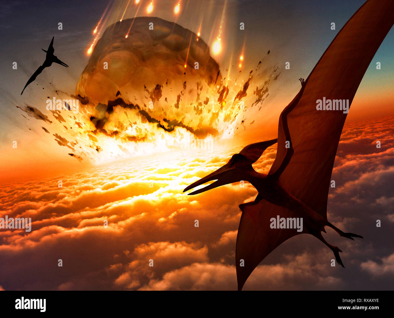 Asteroid approaching Earth's surface, illustration Stock Photohttps://www.alamy.com/image-license-details/?v=1https://www.alamy.com/asteroid-approaching-earths-surface-illustration-image239956514.html
RFRXAXYE–Asteroid approaching Earth's surface, illustration
![Continental deep drilling (KTB) in the Upper Palatinate. In the foreground a drill bit, in the background the derrick. [automated translation] Stock Photo Continental deep drilling (KTB) in the Upper Palatinate. In the foreground a drill bit, in the background the derrick. [automated translation] Stock Photo](https://c8.alamy.com/comp/2FNF7RP/continental-deep-drilling-ktb-in-the-upper-palatinate-in-the-foreground-a-drill-bit-in-the-background-the-derrick-automated-translation-2FNF7RP.jpg) Continental deep drilling (KTB) in the Upper Palatinate. In the foreground a drill bit, in the background the derrick. [automated translation] Stock Photohttps://www.alamy.com/image-license-details/?v=1https://www.alamy.com/continental-deep-drilling-ktb-in-the-upper-palatinate-in-the-foreground-a-drill-bit-in-the-background-the-derrick-automated-translation-image426292042.html
Continental deep drilling (KTB) in the Upper Palatinate. In the foreground a drill bit, in the background the derrick. [automated translation] Stock Photohttps://www.alamy.com/image-license-details/?v=1https://www.alamy.com/continental-deep-drilling-ktb-in-the-upper-palatinate-in-the-foreground-a-drill-bit-in-the-background-the-derrick-automated-translation-image426292042.htmlRM2FNF7RP–Continental deep drilling (KTB) in the Upper Palatinate. In the foreground a drill bit, in the background the derrick. [automated translation]
 This is what an artist envisioned the Solar Power Satellite would look like. Shown is the assembly of a microwave transmission antenna. The solar power satellite was to be located in a geosynchronous orbit, 36,000 miles above the Earth's surface. Image # : 76-HC-632 Stock Photohttps://www.alamy.com/image-license-details/?v=1https://www.alamy.com/stock-photo-this-is-what-an-artist-envisioned-the-solar-power-satellite-would-111968940.html
RMGE4HEM–This is what an artist envisioned the Solar Power Satellite would look like. Shown is the assembly of a microwave transmission antenna. The solar power satellite was to be located in a geosynchronous orbit, 36,000 miles above the Earth's surface. Image # : 76-HC-632
 NASA image acquired July 10, 2005 Viewed from space, the most striking feature of our planet is the water. In both liquid and frozen form, it covers 75 of the Earth’s surface. It fills the sky with clouds. Water is practically everywhere on Earth, from inside the rocky crust to inside our cells. This detailed, photo-like view of Earth is based largely on observations from the Moderate Resolution Imaging Spectroradiometer (MODIS) on NASA’s Terra satellite. It is one of many images of our watery world featured in a new story examining water in all of its forms and functions. Here is an excerpt: Stock Photohttps://www.alamy.com/image-license-details/?v=1https://www.alamy.com/stock-image-nasa-image-acquired-july-10-2005-viewed-from-space-the-most-striking-169435266.html
RMKRJCBE–NASA image acquired July 10, 2005 Viewed from space, the most striking feature of our planet is the water. In both liquid and frozen form, it covers 75 of the Earth’s surface. It fills the sky with clouds. Water is practically everywhere on Earth, from inside the rocky crust to inside our cells. This detailed, photo-like view of Earth is based largely on observations from the Moderate Resolution Imaging Spectroradiometer (MODIS) on NASA’s Terra satellite. It is one of many images of our watery world featured in a new story examining water in all of its forms and functions. Here is an excerpt:
 Old cross section of earth's surface and temperatures at 600 and 900 meters underground. By unidentified author, published on Magasin Pittoresque, Par Stock Photohttps://www.alamy.com/image-license-details/?v=1https://www.alamy.com/old-cross-section-of-earths-surface-and-temperatures-at-600-and-900-image150188576.html
RFJM9K1M–Old cross section of earth's surface and temperatures at 600 and 900 meters underground. By unidentified author, published on Magasin Pittoresque, Par
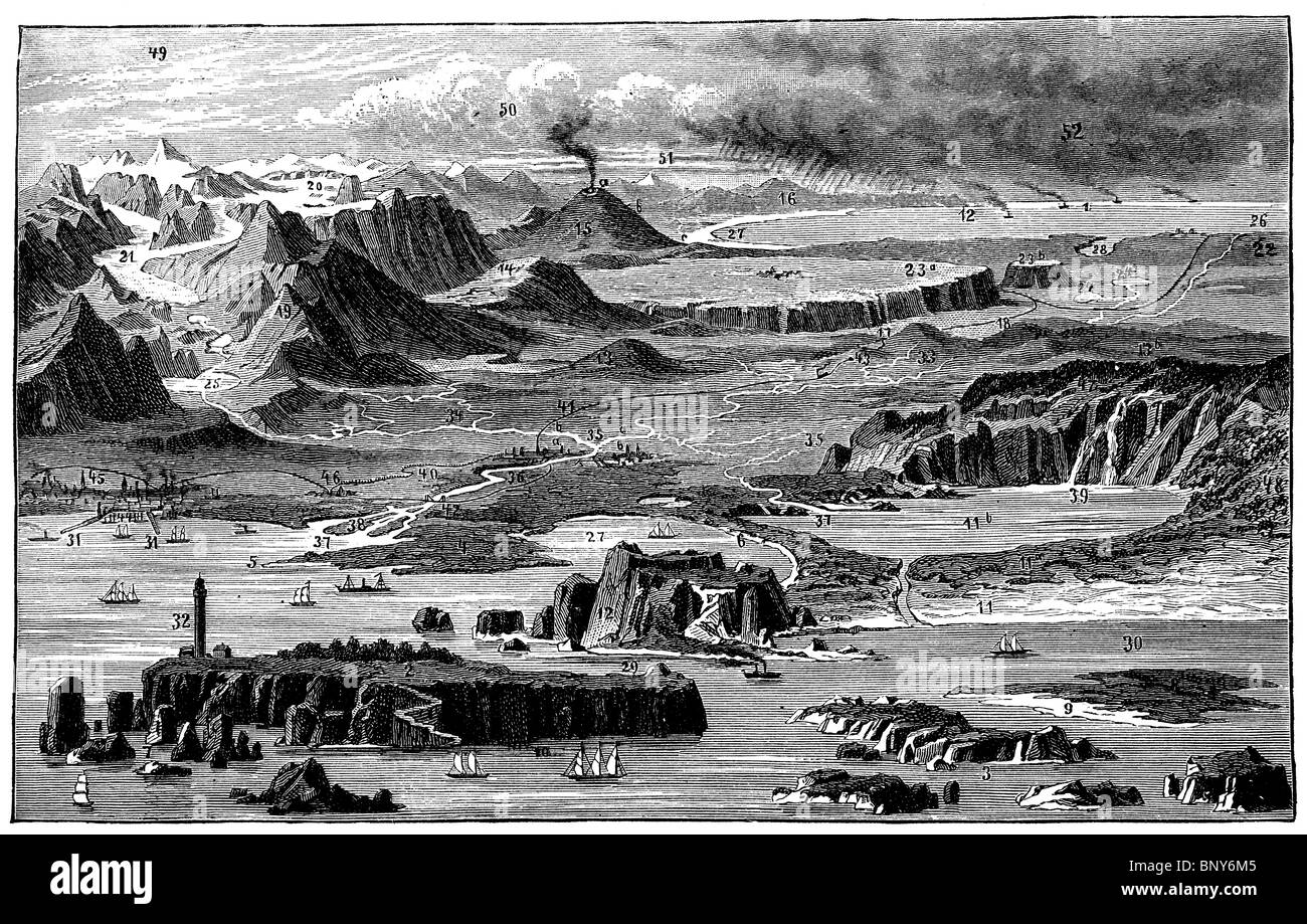 Scheme: Main manifestations of the earth's surface Stock Photohttps://www.alamy.com/image-license-details/?v=1https://www.alamy.com/stock-photo-scheme-main-manifestations-of-the-earths-surface-30716117.html
RMBNY6M5–Scheme: Main manifestations of the earth's surface
 The sea, the world ocean or simply the ocean is the connected body of salty water that covers over 70% of Earth's surface Stock Photohttps://www.alamy.com/image-license-details/?v=1https://www.alamy.com/the-sea-the-world-ocean-or-simply-the-ocean-is-the-connected-body-of-salty-water-that-covers-over-70-of-earths-surface-image333997402.html
RF2ABAW2J–The sea, the world ocean or simply the ocean is the connected body of salty water that covers over 70% of Earth's surface
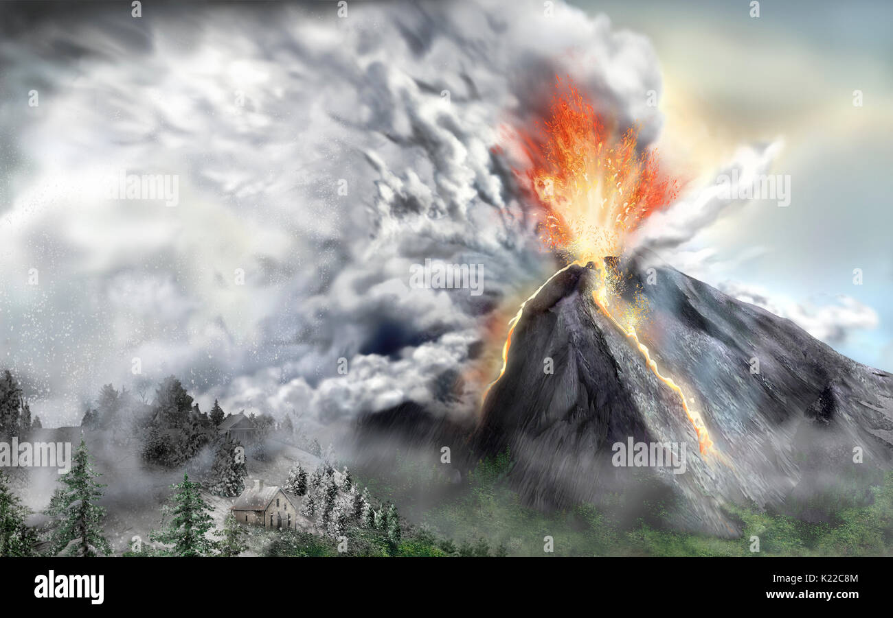 Every year, approximately 60 volcanoes on Earth become active. Some release large amounts of gas, ashes, and dust into the atmosphere. Blown by winds, these particles may float around in the atmosphere for months, even years. Forming clouds, the volcanic material stops some of the Sun’s rays from reaching Earth’s surface. This can cause a slight drop in temperatures worldwide. Stock Photohttps://www.alamy.com/image-license-details/?v=1https://www.alamy.com/every-year-approximately-60-volcanoes-on-earth-become-active-some-image156176180.html
RMK22C8M–Every year, approximately 60 volcanoes on Earth become active. Some release large amounts of gas, ashes, and dust into the atmosphere. Blown by winds, these particles may float around in the atmosphere for months, even years. Forming clouds, the volcanic material stops some of the Sun’s rays from reaching Earth’s surface. This can cause a slight drop in temperatures worldwide.
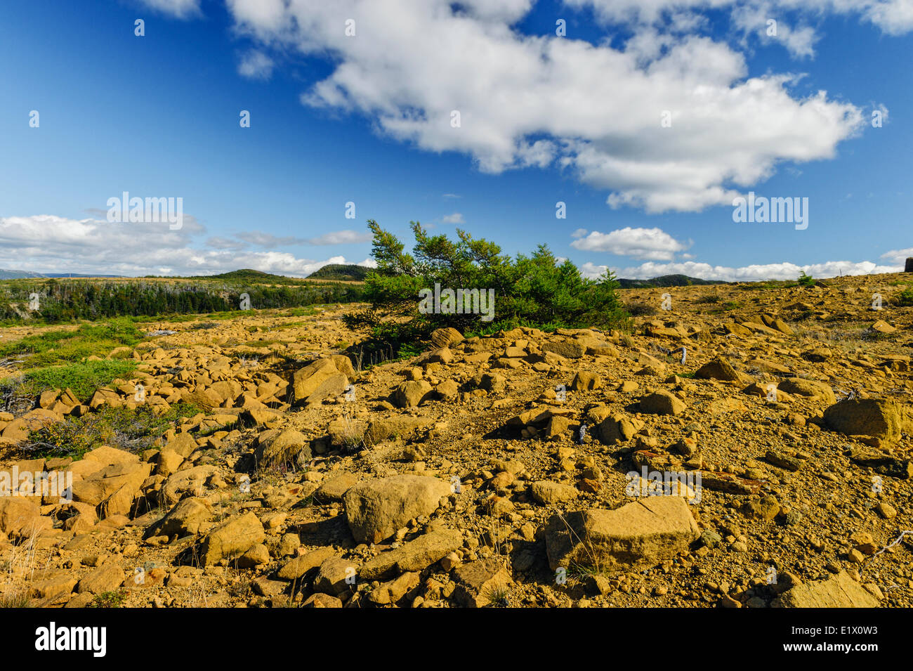 TABLELANDS. Peridotite rock is rare at earth's surface reason for World Heritage Site designation by UNESCO. Gros Morne Stock Photohttps://www.alamy.com/image-license-details/?v=1https://www.alamy.com/stock-photo-tablelands-peridotite-rock-is-rare-at-earths-surface-reason-for-world-70027583.html
RME1X0W3–TABLELANDS. Peridotite rock is rare at earth's surface reason for World Heritage Site designation by UNESCO. Gros Morne
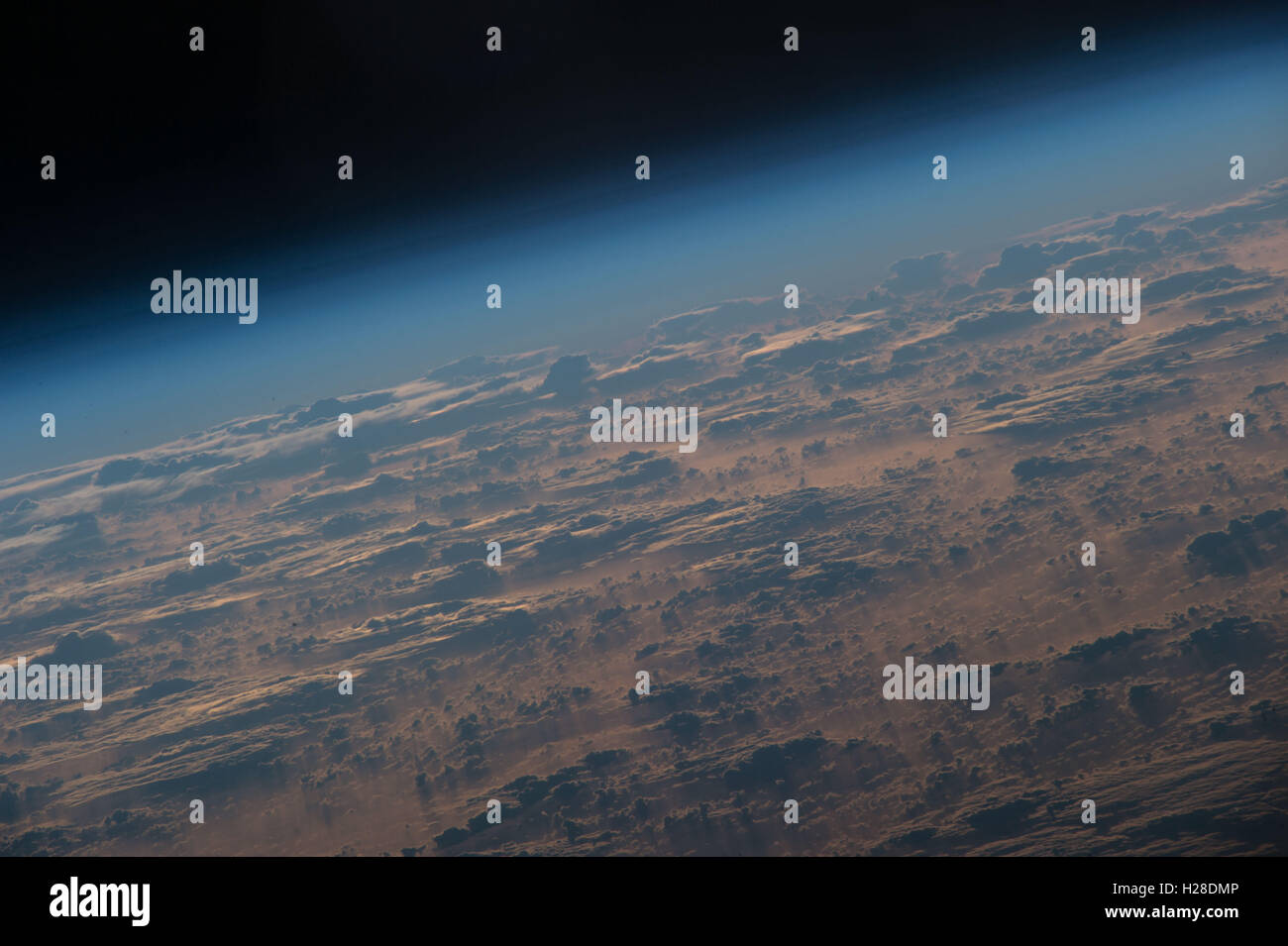 International Space Station Expedition 49 crew members capture multi-hued clouds 250 miles above the Earths surface September 19, 2016 while overhead in Earth Orbit. Stock Photohttps://www.alamy.com/image-license-details/?v=1https://www.alamy.com/stock-photo-international-space-station-expedition-49-crew-members-capture-multi-121888278.html
RMH28DMP–International Space Station Expedition 49 crew members capture multi-hued clouds 250 miles above the Earths surface September 19, 2016 while overhead in Earth Orbit.
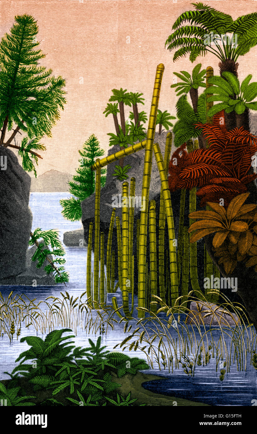 Illustration from 1896 depicting the primary plants present during the formation of the Keuper layer of rock strata beneath the earth's surface. The Keuper is one of three layers that makes up the Triassic period. Plants shown in this image include; conif Stock Photohttps://www.alamy.com/image-license-details/?v=1https://www.alamy.com/stock-photo-illustration-from-1896-depicting-the-primary-plants-present-during-103999073.html
RMG15FTH–Illustration from 1896 depicting the primary plants present during the formation of the Keuper layer of rock strata beneath the earth's surface. The Keuper is one of three layers that makes up the Triassic period. Plants shown in this image include; conif
 A staff member looks at Luke Jerram's artwork Gaia, a replica of planet Earth created using detailed NASA imagery of the Earth's surface, as it goes on display in the Painted Hall of the Old Royal Naval College, Greenwich, London, as part of the 2020 Greenwich+Docklands International Festival. Stock Photohttps://www.alamy.com/image-license-details/?v=1https://www.alamy.com/a-staff-member-looks-at-luke-jerrams-artwork-gaia-a-replica-of-planet-earth-created-using-detailed-nasa-imagery-of-the-earths-surface-as-it-goes-on-display-in-the-painted-hall-of-the-old-royal-naval-college-greenwich-london-as-part-of-the-2020-greenwichdocklands-international-festival-image369747268.html
RM2CDFCBG–A staff member looks at Luke Jerram's artwork Gaia, a replica of planet Earth created using detailed NASA imagery of the Earth's surface, as it goes on display in the Painted Hall of the Old Royal Naval College, Greenwich, London, as part of the 2020 Greenwich+Docklands International Festival.
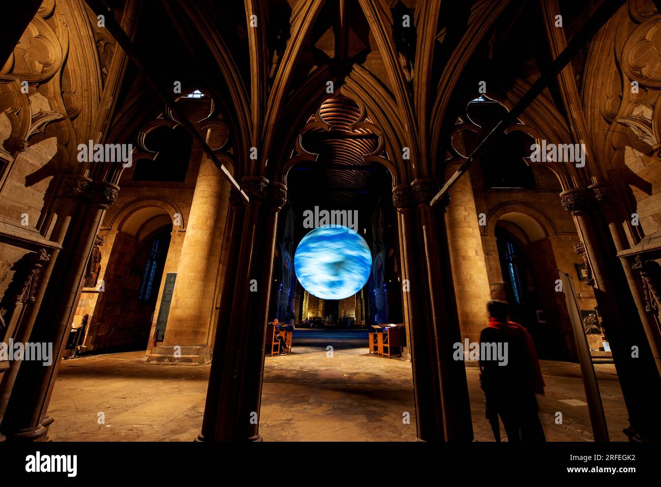 Southwell, UK. 2nd Aug 2023. Luke Jerram's 'Gaia' installation suspended from the ceiling of Southwell Minster. The seven-metre diameter rotating Gaia features high resolution NASA imagery of the earth's surface. Credit: Neil Squires/Alamy Live News Stock Photohttps://www.alamy.com/image-license-details/?v=1https://www.alamy.com/southwell-uk-2nd-aug-2023-luke-jerrams-gaia-installation-suspended-from-the-ceiling-of-southwell-minster-the-seven-metre-diameter-rotating-gaia-features-high-resolution-nasa-imagery-of-the-earths-surface-credit-neil-squiresalamy-live-news-image560272022.html
RM2RFEGK2–Southwell, UK. 2nd Aug 2023. Luke Jerram's 'Gaia' installation suspended from the ceiling of Southwell Minster. The seven-metre diameter rotating Gaia features high resolution NASA imagery of the earth's surface. Credit: Neil Squires/Alamy Live News
 (200226) -- NEW YORK, Feb. 26, 2020 (Xinhua) -- Dutch architect Rem Koolhaas poses for a photo in front of the area introducing China's countryside development at the 'Countryside, The Future' exhibition at Solomon R. Guggenheim Museum in New York, the United States, Feb. 20, 2020. China's rural revitalization strategy is emerging as a model for the sustainable development of the world's countryside, or the 98 percent of Earth's surface not occupied by cities, Rem Koolhaas has said. TO GO WITH 'Interview: China's rural revitalization a model for world's countryside development -- Dutch archite Stock Photohttps://www.alamy.com/image-license-details/?v=1https://www.alamy.com/200226-new-york-feb-26-2020-xinhua-dutch-architect-rem-koolhaas-poses-for-a-photo-in-front-of-the-area-introducing-chinas-countryside-development-at-the-countryside-the-future-exhibition-at-solomon-r-guggenheim-museum-in-new-york-the-united-states-feb-20-2020-chinas-rural-revitalization-strategy-is-emerging-as-a-model-for-the-sustainable-development-of-the-worlds-countryside-or-the-98-percent-of-earths-surface-not-occupied-by-cities-rem-koolhaas-has-said-to-go-with-interview-chinas-rural-revitalization-a-model-for-worlds-countryside-development-dutch-archite-image345276348.html
RM2B1MKE4–(200226) -- NEW YORK, Feb. 26, 2020 (Xinhua) -- Dutch architect Rem Koolhaas poses for a photo in front of the area introducing China's countryside development at the 'Countryside, The Future' exhibition at Solomon R. Guggenheim Museum in New York, the United States, Feb. 20, 2020. China's rural revitalization strategy is emerging as a model for the sustainable development of the world's countryside, or the 98 percent of Earth's surface not occupied by cities, Rem Koolhaas has said. TO GO WITH 'Interview: China's rural revitalization a model for world's countryside development -- Dutch archite
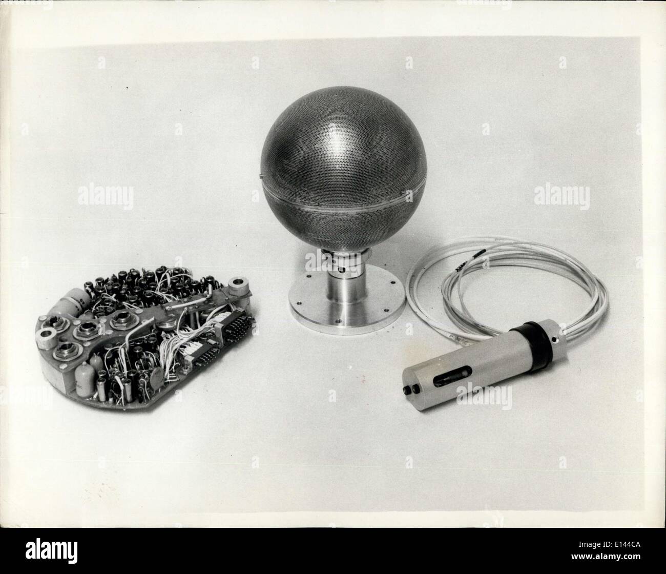 Apr. 04, 2012 - Instruments For The First British Satellite To Be Launched By The U.S. Scout Rocket: The Space Research Group of the Department of Physics of University College, London, led by Dr. R.L.F. Boyd and working under professor Sir Harry Massey have designed these instruments to make a variety of measurements in the earth's ionosphere between 200 and 600 miles above the earth's surface. A mass spectrometer unit for determining the temperature and density of positive ions and also the relative concentration of these ions in the earth's ionosphere. Stock Photohttps://www.alamy.com/image-license-details/?v=1https://www.alamy.com/apr-04-2012-instruments-for-the-first-british-satellite-to-be-launched-image69547418.html
RME144CA–Apr. 04, 2012 - Instruments For The First British Satellite To Be Launched By The U.S. Scout Rocket: The Space Research Group of the Department of Physics of University College, London, led by Dr. R.L.F. Boyd and working under professor Sir Harry Massey have designed these instruments to make a variety of measurements in the earth's ionosphere between 200 and 600 miles above the earth's surface. A mass spectrometer unit for determining the temperature and density of positive ions and also the relative concentration of these ions in the earth's ionosphere.
 The Earth's surface Stock Vectorhttps://www.alamy.com/image-license-details/?v=1https://www.alamy.com/the-earths-surface-image446360347.html
RF2GX5D4Y–The Earth's surface
 Pushkar area low-rise building, India Stock Photohttps://www.alamy.com/image-license-details/?v=1https://www.alamy.com/pushkar-area-low-rise-building-india-image274299496.html
RMWX7BPG–Pushkar area low-rise building, India
 METEORITE, Menow. Fall on the Earth's surface on October 7, 1862. Museum fur Naturkunde. Berlin. Germany. Europe. Stock Photohttps://www.alamy.com/image-license-details/?v=1https://www.alamy.com/meteorite-menow-fall-on-the-earths-surface-on-october-7-1862-museum-fur-naturkunde-berlin-germany-europe-image220175769.html
RMPP5TC9–METEORITE, Menow. Fall on the Earth's surface on October 7, 1862. Museum fur Naturkunde. Berlin. Germany. Europe.
 Planing a trip around the world. Stock Photohttps://www.alamy.com/image-license-details/?v=1https://www.alamy.com/planing-a-trip-around-the-world-image344074687.html
RF2AYNXNK–Planing a trip around the world.
 Digital globe with interconnected data points and holographic interfaces Stock Photohttps://www.alamy.com/image-license-details/?v=1https://www.alamy.com/digital-globe-with-interconnected-data-points-and-holographic-interfaces-image609262469.html
RF2XB68DW–Digital globe with interconnected data points and holographic interfaces
 Relief map with heights of Germany Stock Photohttps://www.alamy.com/image-license-details/?v=1https://www.alamy.com/relief-map-with-heights-of-germany-image363015826.html
RF2C2GPAX–Relief map with heights of Germany
 (October 13, 1972) "Space Flower" was the first of the 9-meter (30-foot) diameter antennas for the Application Technology Satellites (ATS). The ATS program was initiated in 1966 to demonstrate the feasibility and capability of placing a satellite in geostationary (geosynchronous) orbit over a fixed location on the Earth's surface. The saucer-shaped antenna, built at Lockheed Missiles and Space Co., Sunnyvale, California, are constructed of aluminum ribs and Dacron mesh that are copper plated and coated with silicone. Also shown is the mold on which the mesh is sewn to the flexible ri Stock Photohttps://www.alamy.com/image-license-details/?v=1https://www.alamy.com/stock-photo-october-13-1972-quotspace-flowerquot-was-the-first-of-the-9-meter-111968957.html
RMGE4HF9–(October 13, 1972) "Space Flower" was the first of the 9-meter (30-foot) diameter antennas for the Application Technology Satellites (ATS). The ATS program was initiated in 1966 to demonstrate the feasibility and capability of placing a satellite in geostationary (geosynchronous) orbit over a fixed location on the Earth's surface. The saucer-shaped antenna, built at Lockheed Missiles and Space Co., Sunnyvale, California, are constructed of aluminum ribs and Dacron mesh that are copper plated and coated with silicone. Also shown is the mold on which the mesh is sewn to the flexible ri
 Gaia is a touring artwork by UK artist Luke Jerram and can be seen in the Martini church in the Dutch town of Franeker. Measuring seven meters in diameter and created from 120dpi detailed NASA imagery of the Earth’s surface, the artwork provides the opportunity to see our planet, floating in three dimensions. On May 21st, 2022. (Photo by Romy Arroyo Fernandez/NurPhoto) Stock Photohttps://www.alamy.com/image-license-details/?v=1https://www.alamy.com/gaia-is-a-touring-artwork-by-uk-artist-luke-jerram-and-can-be-seen-in-the-martini-church-in-the-dutch-town-of-franeker-measuring-seven-meters-in-diameter-and-created-from-120dpi-detailed-nasa-imagery-of-the-earths-surface-the-artwork-provides-the-opportunity-to-see-our-planet-floating-in-three-dimensions-on-may-21st-2022-photo-by-romy-arroyo-fernandeznurphoto-image490115478.html
RM2KDAK86–Gaia is a touring artwork by UK artist Luke Jerram and can be seen in the Martini church in the Dutch town of Franeker. Measuring seven meters in diameter and created from 120dpi detailed NASA imagery of the Earth’s surface, the artwork provides the opportunity to see our planet, floating in three dimensions. On May 21st, 2022. (Photo by Romy Arroyo Fernandez/NurPhoto)
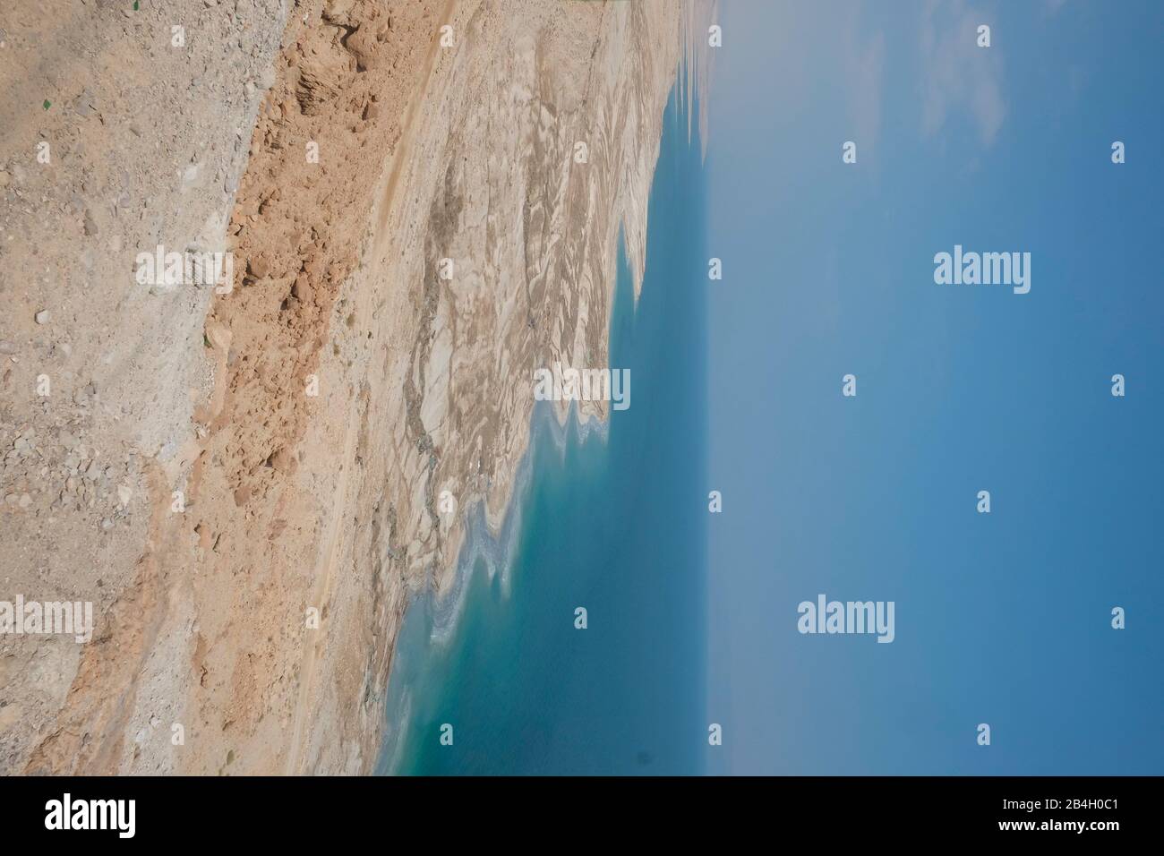 The Dead Sea is a salt lake bordered by Jordan to the east and Israel and the West Bank to the west. It lies in the Jordan Rift Valley, and its main tributary is the Jordan River. Its surface and shores are 430.5 metres below sea level, Earth's lowest elevation on land. Stock Photohttps://www.alamy.com/image-license-details/?v=1https://www.alamy.com/the-dead-sea-is-a-salt-lake-bordered-by-jordan-to-the-east-and-israel-and-the-west-bank-to-the-west-it-lies-in-the-jordan-rift-valley-and-its-main-tributary-is-the-jordan-river-its-surface-and-shores-are-4305-metres-below-sea-level-earths-lowest-elevation-on-land-image347039505.html
RM2B4H0C1–The Dead Sea is a salt lake bordered by Jordan to the east and Israel and the West Bank to the west. It lies in the Jordan Rift Valley, and its main tributary is the Jordan River. Its surface and shores are 430.5 metres below sea level, Earth's lowest elevation on land.
 Scheme: Main manifestations of the earth's surface Stock Photohttps://www.alamy.com/image-license-details/?v=1https://www.alamy.com/stock-photo-scheme-main-manifestations-of-the-earths-surface-36798075.html
RMC3T88Y–Scheme: Main manifestations of the earth's surface
 The sea, the world ocean or simply the ocean is the connected body of salty water that covers over 70% of Earth's surface Stock Photohttps://www.alamy.com/image-license-details/?v=1https://www.alamy.com/the-sea-the-world-ocean-or-simply-the-ocean-is-the-connected-body-of-salty-water-that-covers-over-70-of-earths-surface-image330519317.html
RF2A5MCN9–The sea, the world ocean or simply the ocean is the connected body of salty water that covers over 70% of Earth's surface
 Human-made lights highlight particularly developed or populated areas of the Earths surface, including the seaboards of Europe, the eastern United States, and Japan. Stock Photohttps://www.alamy.com/image-license-details/?v=1https://www.alamy.com/human-made-lights-highlight-particularly-developed-or-populated-areas-of-the-earths-surface-including-the-seaboards-of-europe-the-eastern-united-states-and-japan-image213652565.html
RMPBGM0N–Human-made lights highlight particularly developed or populated areas of the Earths surface, including the seaboards of Europe, the eastern United States, and Japan.
 TABLELANDS. Peridotite rock is rare at earth's surface reason for World Heritage Site designation by UNESCO. Gros Morne Stock Photohttps://www.alamy.com/image-license-details/?v=1https://www.alamy.com/stock-photo-tablelands-peridotite-rock-is-rare-at-earths-surface-reason-for-world-70027587.html
RME1X0W7–TABLELANDS. Peridotite rock is rare at earth's surface reason for World Heritage Site designation by UNESCO. Gros Morne
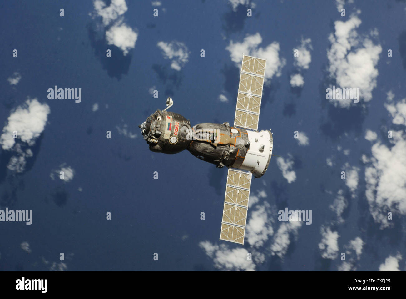 The Soyuz TMA-08M spacecraft travels towards the Earth's surface after undocking from the International Space Station September 10, 2013. Onboard the rocket is Expedition 35 crew members NASA astronaut Chris Cassidy, and Russian Roscosmos cosmonauts Pavel Vinogradov and Alexander Misurkin. Stock Photohttps://www.alamy.com/image-license-details/?v=1https://www.alamy.com/stock-photo-the-soyuz-tma-08m-spacecraft-travels-towards-the-earths-surface-after-119587277.html
RMGXFJP5–The Soyuz TMA-08M spacecraft travels towards the Earth's surface after undocking from the International Space Station September 10, 2013. Onboard the rocket is Expedition 35 crew members NASA astronaut Chris Cassidy, and Russian Roscosmos cosmonauts Pavel Vinogradov and Alexander Misurkin.
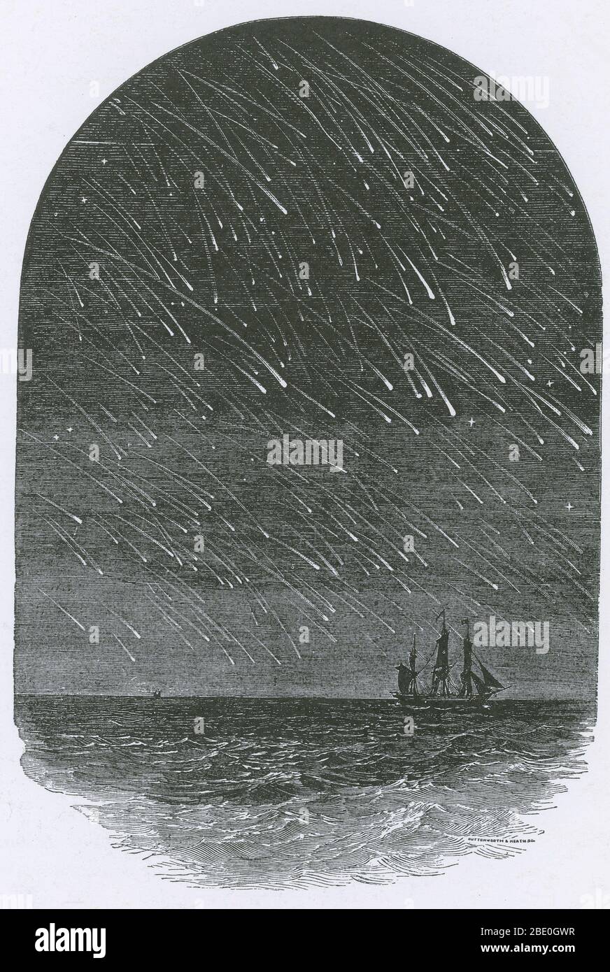 As astronomers began to explore the physical nature of comets, they found that meteors came from dust left by comets. A meteor shower is a celestial event in which a number of meteors are observed to radiate, or originate, from one point in the night sky. These meteors are caused by streams of cosmic debris called meteoroids entering Earth's atmosphere at extremely high speeds on parallel trajectories. Most meteors are smaller than a grain of sand, so almost all of them disintegrate and never hit the Earth's surface. Major meteor showers such as the Leonids, seen here as they appeared on Novem Stock Photohttps://www.alamy.com/image-license-details/?v=1https://www.alamy.com/as-astronomers-began-to-explore-the-physical-nature-of-comets-they-found-that-meteors-came-from-dust-left-by-comets-a-meteor-shower-is-a-celestial-event-in-which-a-number-of-meteors-are-observed-to-radiate-or-originate-from-one-point-in-the-night-sky-these-meteors-are-caused-by-streams-of-cosmic-debris-called-meteoroids-entering-earths-atmosphere-at-extremely-high-speeds-on-parallel-trajectories-most-meteors-are-smaller-than-a-grain-of-sand-so-almost-all-of-them-disintegrate-and-never-hit-the-earths-surface-major-meteor-showers-such-as-the-leonids-seen-here-as-they-appeared-on-novem-image352825811.html
RM2BE0GWR–As astronomers began to explore the physical nature of comets, they found that meteors came from dust left by comets. A meteor shower is a celestial event in which a number of meteors are observed to radiate, or originate, from one point in the night sky. These meteors are caused by streams of cosmic debris called meteoroids entering Earth's atmosphere at extremely high speeds on parallel trajectories. Most meteors are smaller than a grain of sand, so almost all of them disintegrate and never hit the Earth's surface. Major meteor showers such as the Leonids, seen here as they appeared on Novem
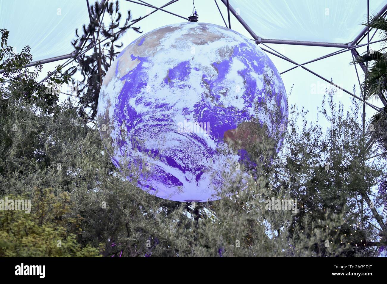 Luke Jerram's art installation 'Gaia', a replica of planet earth created using detailed NASA imagery of the Earth's surface, hangs on display at the Eden Project in St Austell, Cornwall. Stock Photohttps://www.alamy.com/image-license-details/?v=1https://www.alamy.com/luke-jerrams-art-installation-gaia-a-replica-of-planet-earth-created-using-detailed-nasa-imagery-of-the-earths-surface-hangs-on-display-at-the-eden-project-in-st-austell-cornwall-image337039776.html
RM2AG9DJT–Luke Jerram's art installation 'Gaia', a replica of planet earth created using detailed NASA imagery of the Earth's surface, hangs on display at the Eden Project in St Austell, Cornwall.