Quick filters:
Ephraim map Stock Photos and Images
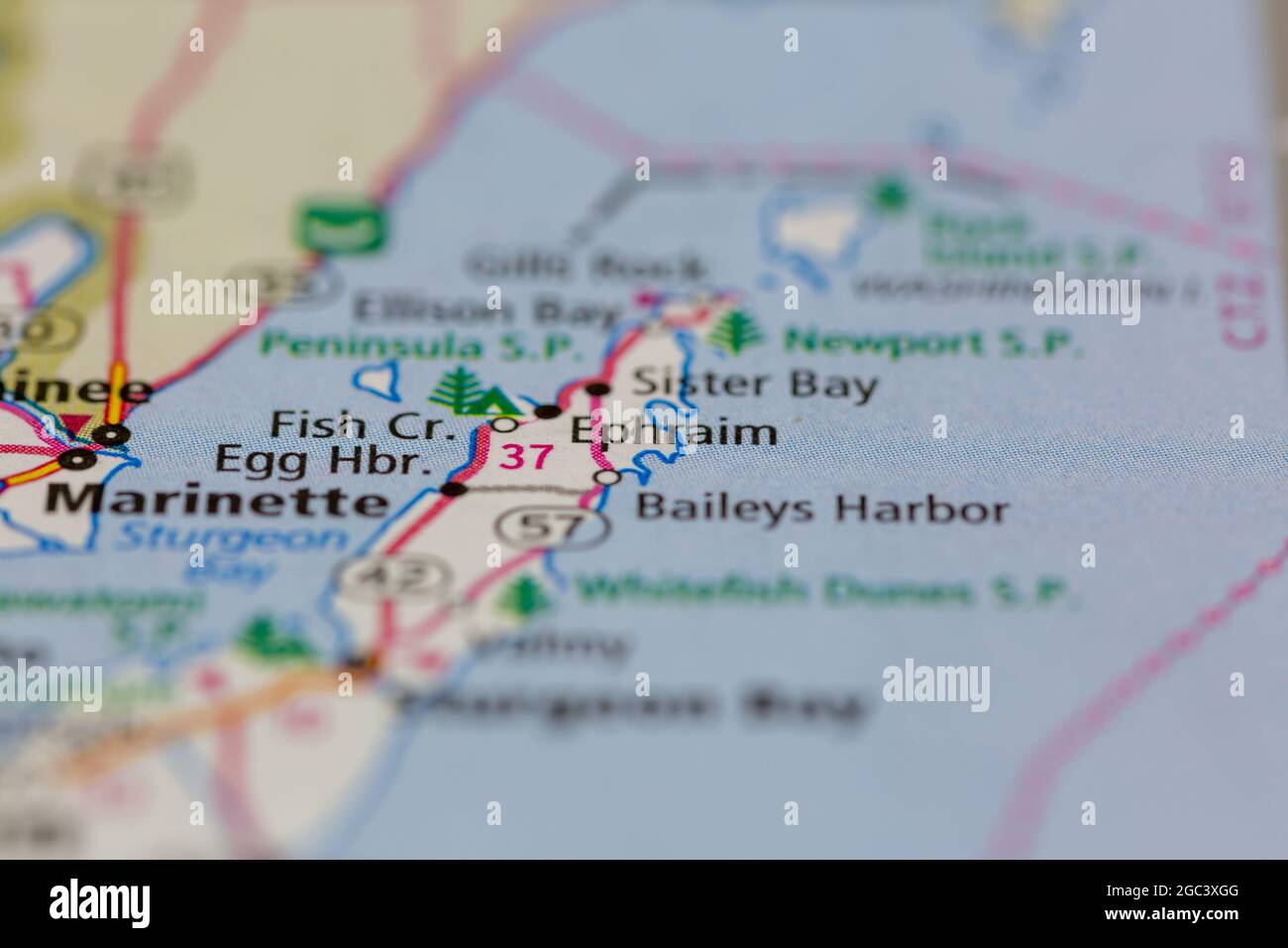 Ephraim Wisconsin USA shown on a road map or Geography map Stock Photohttps://www.alamy.com/image-license-details/?v=1https://www.alamy.com/ephraim-wisconsin-usa-shown-on-a-road-map-or-geography-map-image437721776.html
RM2GC3XGG–Ephraim Wisconsin USA shown on a road map or Geography map
 Ephraim-Palais, DE, Germany, Berlin, N 52 30' 57'', N 13 24' 25'', map, Cartascapes Map published in 2024. Explore Cartascapes, a map revealing Earth's diverse landscapes, cultures, and ecosystems. Journey through time and space, discovering the interconnectedness of our planet's past, present, and future. Stock Photohttps://www.alamy.com/image-license-details/?v=1https://www.alamy.com/ephraim-palais-de-germany-berlin-n-52-30-57-n-13-24-25-map-cartascapes-map-published-in-2024-explore-cartascapes-a-map-revealing-earths-diverse-landscapes-cultures-and-ecosystems-journey-through-time-and-space-discovering-the-interconnectedness-of-our-planets-past-present-and-future-image629698149.html
RM2YGD6BH–Ephraim-Palais, DE, Germany, Berlin, N 52 30' 57'', N 13 24' 25'', map, Cartascapes Map published in 2024. Explore Cartascapes, a map revealing Earth's diverse landscapes, cultures, and ecosystems. Journey through time and space, discovering the interconnectedness of our planet's past, present, and future.
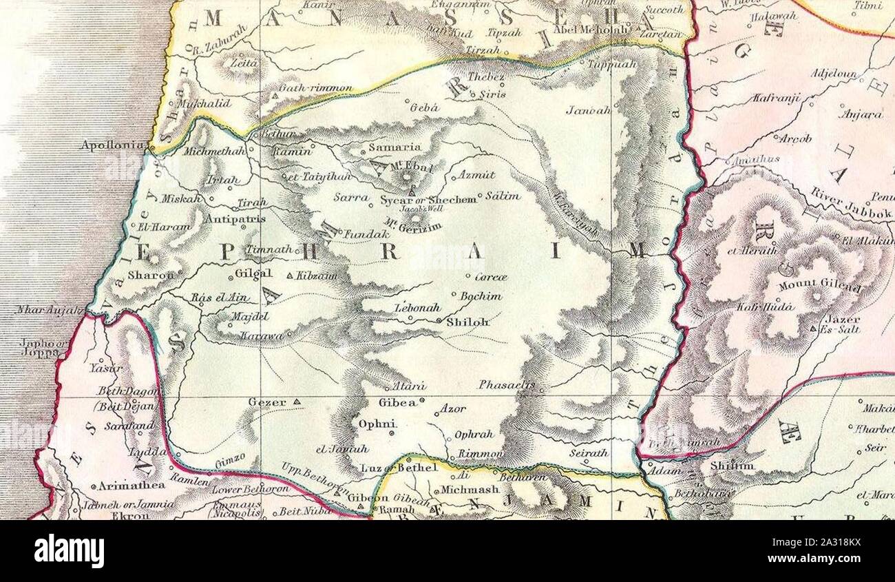 Ephraim. 1852 Philip Map of Palestine - Israel - Holy Land - Geographicus - Palestine-philip-1852. Stock Photohttps://www.alamy.com/image-license-details/?v=1https://www.alamy.com/ephraim-1852-philip-map-of-palestine-israel-holy-land-geographicus-palestine-philip-1852-image328869742.html
RM2A318KX–Ephraim. 1852 Philip Map of Palestine - Israel - Holy Land - Geographicus - Palestine-philip-1852.
 Ephraim Kanoe Stock Photohttps://www.alamy.com/image-license-details/?v=1https://www.alamy.com/stock-photo-ephraim-kanoe-139795531.html
RMJ3C6HF–Ephraim Kanoe
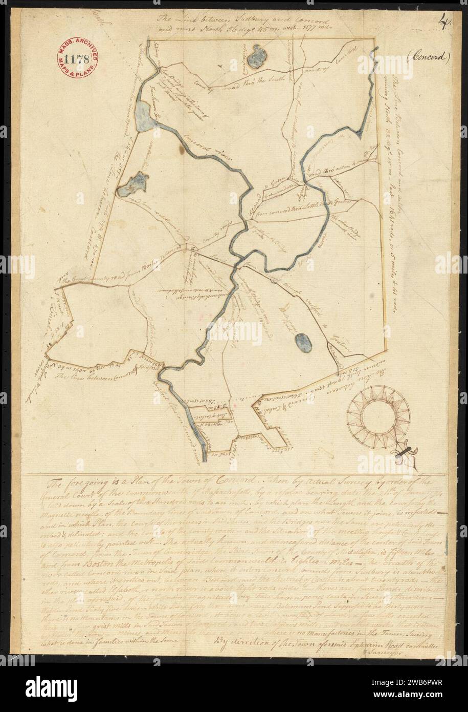 1794–1795 map of Concord, Massachusetts, by Ephraim Wood, Stock Photohttps://www.alamy.com/image-license-details/?v=1https://www.alamy.com/17941795-map-of-concord-massachusetts-by-ephraim-wood-image592063411.html
RM2WB6PWR–1794–1795 map of Concord, Massachusetts, by Ephraim Wood,
 Ephraim Carlebach Stock Photohttps://www.alamy.com/image-license-details/?v=1https://www.alamy.com/stock-photo-ephraim-carlebach-139764646.html
RMJ3AR6E–Ephraim Carlebach
 1847–1859 Map of the Alton & Springfield railroad, in Illinois, showing its connection with other roads and proposed roads leading to the eastern cities, by Ephraim W. Bouvé, Stock Photohttps://www.alamy.com/image-license-details/?v=1https://www.alamy.com/18471859-map-of-the-alton-springfield-railroad-in-illinois-showing-its-connection-with-other-roads-and-proposed-roads-leading-to-the-eastern-cities-by-ephraim-w-bouv-image592065002.html
RM2WB6TXJ–1847–1859 Map of the Alton & Springfield railroad, in Illinois, showing its connection with other roads and proposed roads leading to the eastern cities, by Ephraim W. Bouvé,
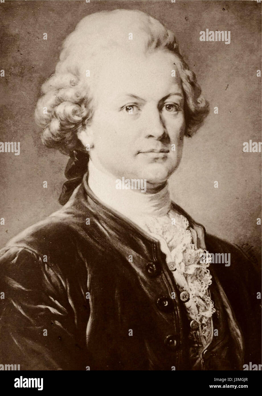 Gotthold Ephraim Lessing. Stock Photohttps://www.alamy.com/image-license-details/?v=1https://www.alamy.com/stock-photo-gotthold-ephraim-lessing-139979023.html
RMJ3MGJR–Gotthold Ephraim Lessing.
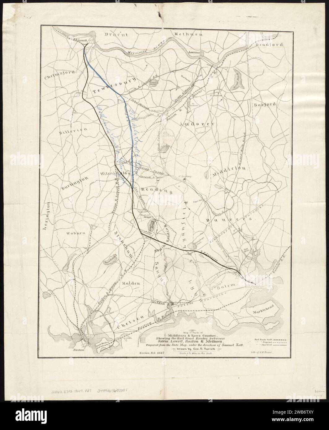 1847 Map of parts of Middlesex & Essex counties, showing the rail road routes between Salem, Lowell, Boston & Methuen, by George B. Parrott, Samuel Nott, Ephraim W. Bouvé, Stock Photohttps://www.alamy.com/image-license-details/?v=1https://www.alamy.com/1847-map-of-parts-of-middlesex-essex-counties-showing-the-rail-road-routes-between-salem-lowell-boston-methuen-by-george-b-parrott-samuel-nott-ephraim-w-bouv-image592065011.html
RM2WB6TXY–1847 Map of parts of Middlesex & Essex counties, showing the rail road routes between Salem, Lowell, Boston & Methuen, by George B. Parrott, Samuel Nott, Ephraim W. Bouvé,
 Sidney Lanier by Ephraim Keyser Stock Photohttps://www.alamy.com/image-license-details/?v=1https://www.alamy.com/stock-photo-sidney-lanier-by-ephraim-keyser-140516741.html
RMJ4H2F1–Sidney Lanier by Ephraim Keyser
 Julia Ann Sumner ; Res. of Ephraim Sumner, Darien TP., Genesee Co., N.Y. ; Ephraim Sumner Cartographic. Atlases, Maps. 1876. Lionel Pincus and Princess Firyal Map Division. Genesee County (N.Y.), Real property , New York (State) Stock Photohttps://www.alamy.com/image-license-details/?v=1https://www.alamy.com/julia-ann-sumner-res-of-ephraim-sumner-darien-tp-genesee-co-ny-ephraim-sumner-cartographic-atlases-maps-1876-lionel-pincus-and-princess-firyal-map-division-genesee-county-ny-real-property-new-york-state-image484331420.html
RM2K3Y5JM–Julia Ann Sumner ; Res. of Ephraim Sumner, Darien TP., Genesee Co., N.Y. ; Ephraim Sumner Cartographic. Atlases, Maps. 1876. Lionel Pincus and Princess Firyal Map Division. Genesee County (N.Y.), Real property , New York (State)
 Manasse teegen Ephraim door Jacobus Sceperus Stock Photohttps://www.alamy.com/image-license-details/?v=1https://www.alamy.com/stock-photo-manasse-teegen-ephraim-door-jacobus-sceperus-142850450.html
RMJ8BB5P–Manasse teegen Ephraim door Jacobus Sceperus
 Ephraim Island, , AU, Australia, Queensland, S 27 53' 9'', N 153 24' 5'', map, Cartascapes Map published in 2024. Explore Cartascapes, a map revealing Earth's diverse landscapes, cultures, and ecosystems. Journey through time and space, discovering the interconnectedness of our planet's past, present, and future. Stock Photohttps://www.alamy.com/image-license-details/?v=1https://www.alamy.com/ephraim-island-au-australia-queensland-s-27-53-9-n-153-24-5-map-cartascapes-map-published-in-2024-explore-cartascapes-a-map-revealing-earths-diverse-landscapes-cultures-and-ecosystems-journey-through-time-and-space-discovering-the-interconnectedness-of-our-planets-past-present-and-future-image625630684.html
RM2Y9RX90–Ephraim Island, , AU, Australia, Queensland, S 27 53' 9'', N 153 24' 5'', map, Cartascapes Map published in 2024. Explore Cartascapes, a map revealing Earth's diverse landscapes, cultures, and ecosystems. Journey through time and space, discovering the interconnectedness of our planet's past, present, and future.
 George John Ephraim Triptychon fragment Sinai 14th century Stock Photohttps://www.alamy.com/image-license-details/?v=1https://www.alamy.com/stock-photo-george-john-ephraim-triptychon-fragment-sinai-14th-century-139867807.html
RMJ3FEPR–George John Ephraim Triptychon fragment Sinai 14th century
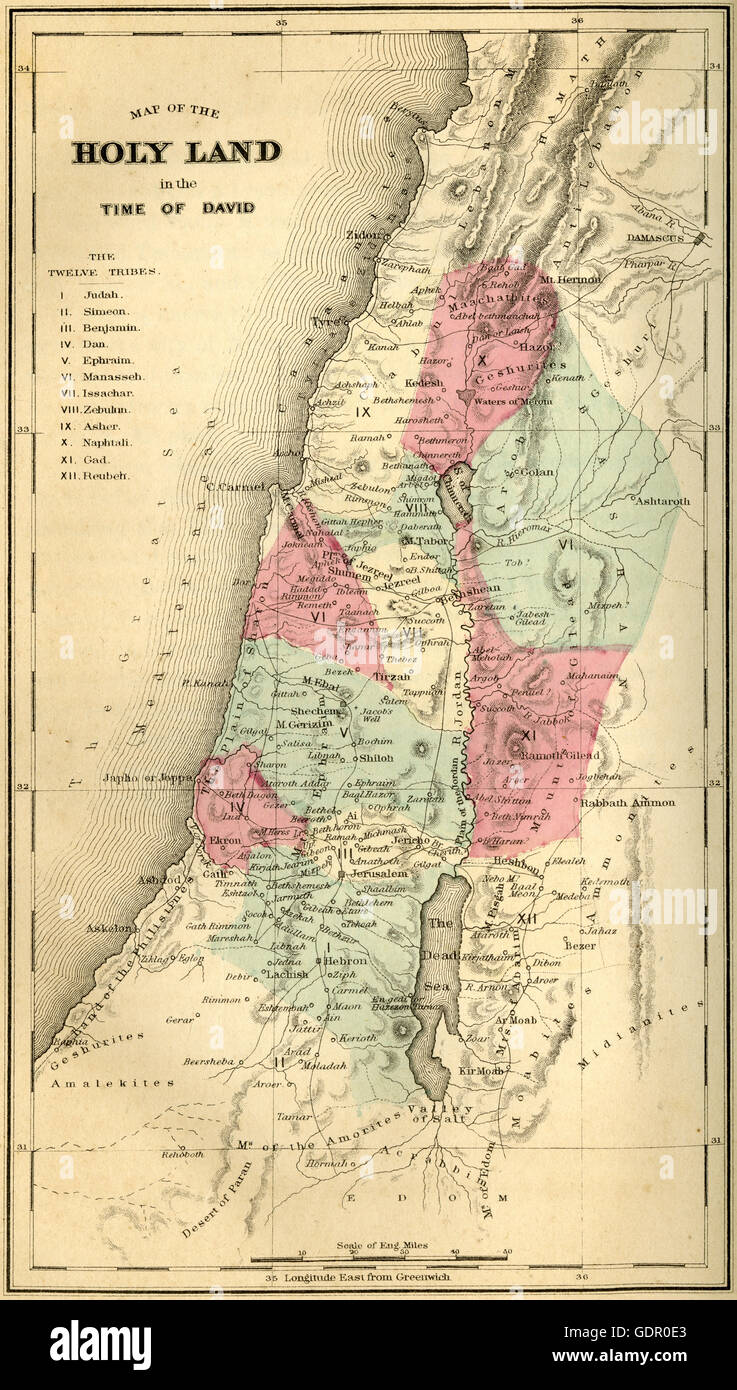 Antique 1867 engraving, Map of the Holy Land in the Time of David, showing the Twelve Tribes of Judah, Simeon, Benjamin, Dan, Ephraim, Manasseh, Issachar, Zebulun, Asher, Naphtali, Gad, and Reuben. SOURCE: ORIGINAL STEEL ENGRAVING. Stock Photohttps://www.alamy.com/image-license-details/?v=1https://www.alamy.com/stock-photo-antique-1867-engraving-map-of-the-holy-land-in-the-time-of-david-showing-111758027.html
RMGDR0E3–Antique 1867 engraving, Map of the Holy Land in the Time of David, showing the Twelve Tribes of Judah, Simeon, Benjamin, Dan, Ephraim, Manasseh, Issachar, Zebulun, Asher, Naphtali, Gad, and Reuben. SOURCE: ORIGINAL STEEL ENGRAVING.
 Gotthold Ephraim Lessing grave Dom und Magnifriedhof Braunschweig, Germany DSC04244 Stock Photohttps://www.alamy.com/image-license-details/?v=1https://www.alamy.com/stock-photo-gotthold-ephraim-lessing-grave-dom-und-magnifriedhof-braunschweig-142928122.html
RMJ8EX7P–Gotthold Ephraim Lessing grave Dom und Magnifriedhof Braunschweig, Germany DSC04244
 N/A. English: Map of Central America taken from page 8 of Honduras: descriptive, historical, and statistical (British Library HMNTS 10481.pp.2), being a reprint of the chapters on Honduras contained in the book The States of Central America . 1871. Ephraim George Squier (1821–1888) 30 1871 map of Central America showing its political divisions Stock Photohttps://www.alamy.com/image-license-details/?v=1https://www.alamy.com/na-english-map-of-central-america-taken-from-page-8-of-honduras-descriptive-historical-and-statistical-british-library-hmnts-10481pp2-being-a-reprint-of-the-chapters-on-honduras-contained-in-the-book-the-states-of-central-america-1871-ephraim-george-squier-18211888-30-1871-map-of-central-america-showing-its-political-divisions-image210015732.html
RMP5K15T–N/A. English: Map of Central America taken from page 8 of Honduras: descriptive, historical, and statistical (British Library HMNTS 10481.pp.2), being a reprint of the chapters on Honduras contained in the book The States of Central America . 1871. Ephraim George Squier (1821–1888) 30 1871 map of Central America showing its political divisions
 Ephraim. 1852 Philip Map of Palestine - Israel - Holy Land - Geographicus - Palestine-philip-1852 Stock Photohttps://www.alamy.com/image-license-details/?v=1https://www.alamy.com/stock-photo-ephraim-1852-philip-map-of-palestine-israel-holy-land-geographicus-134915319.html
RMHRDWT7–Ephraim. 1852 Philip Map of Palestine - Israel - Holy Land - Geographicus - Palestine-philip-1852
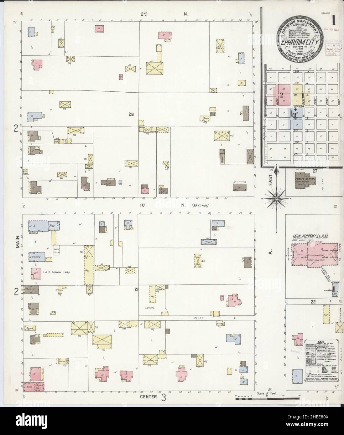 Sanborn Fire Insurance Map from Ephraim, Sanpete County, Utah. Stock Photohttps://www.alamy.com/image-license-details/?v=1https://www.alamy.com/sanborn-fire-insurance-map-from-ephraim-sanpete-county-utah-image456388378.html
RM2HEE80X–Sanborn Fire Insurance Map from Ephraim, Sanpete County, Utah.
 Julia Ann Sumner ; Res. of Ephraim Sumner, Darien TP., Genesee Co., N.Y. ; Ephraim Sumner 1876 by Everts, Ensign & Everts Stock Photohttps://www.alamy.com/image-license-details/?v=1https://www.alamy.com/julia-ann-sumner-res-of-ephraim-sumner-darien-tp-genesee-co-ny-ephraim-sumner-1876-by-everts-ensign-everts-image633412015.html
RM2YPEBDK–Julia Ann Sumner ; Res. of Ephraim Sumner, Darien TP., Genesee Co., N.Y. ; Ephraim Sumner 1876 by Everts, Ensign & Everts
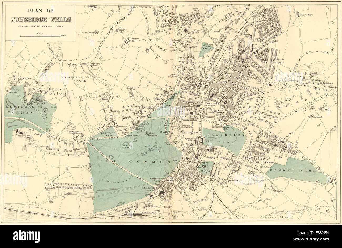 TUNBRIDGE WELLS: Ferndale Ephraim Sion Camden. Town plan. GW BACON, 1883 map Stock Photohttps://www.alamy.com/image-license-details/?v=1https://www.alamy.com/stock-photo-tunbridge-wells-ferndale-ephraim-sion-camden-town-plan-gw-bacon-1883-92900521.html
RFFB3YFN–TUNBRIDGE WELLS: Ferndale Ephraim Sion Camden. Town plan. GW BACON, 1883 map
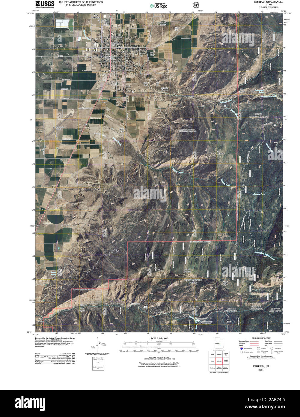 UT Ephraim 20110310 TM Restoration Stock Photohttps://www.alamy.com/image-license-details/?v=1https://www.alamy.com/ut-ephraim-20110310-tm-restoration-image333915517.html
RM2AB74J5–UT Ephraim 20110310 TM Restoration
 . The Auk. Birds. Vol. XXXIl 1914 J Strong, Habits of the Herring Gull. 23 July, 1907, when I visited a breeding colony at Gull Island in Lake Superior, near Marquette, Michigan. On June 20, 1911, I made a preliminary exploring trip in Green Bay starting from my headquarters at Ephraim, Wisconsin. With the aid of a motor boat, the Strawberry Islands, the Sister Islands,. Fig. 1. Map showing locations of Gull colonies in region of GreeaBay, Wisconsin. and Hat Island were all ^•isited during the da', and colonies of Herring Gulls were found breeding on all of these islands except at the largest Stock Photohttps://www.alamy.com/image-license-details/?v=1https://www.alamy.com/the-auk-birds-vol-xxxil-1914-j-strong-habits-of-the-herring-gull-23-july-1907-when-i-visited-a-breeding-colony-at-gull-island-in-lake-superior-near-marquette-michigan-on-june-20-1911-i-made-a-preliminary-exploring-trip-in-green-bay-starting-from-my-headquarters-at-ephraim-wisconsin-with-the-aid-of-a-motor-boat-the-strawberry-islands-the-sister-islands-fig-1-map-showing-locations-of-gull-colonies-in-region-of-greeabay-wisconsin-and-hat-island-were-all-isited-during-the-da-and-colonies-of-herring-gulls-were-found-breeding-on-all-of-these-islands-except-at-the-largest-image235322235.html
RMRJRRWF–. The Auk. Birds. Vol. XXXIl 1914 J Strong, Habits of the Herring Gull. 23 July, 1907, when I visited a breeding colony at Gull Island in Lake Superior, near Marquette, Michigan. On June 20, 1911, I made a preliminary exploring trip in Green Bay starting from my headquarters at Ephraim, Wisconsin. With the aid of a motor boat, the Strawberry Islands, the Sister Islands,. Fig. 1. Map showing locations of Gull colonies in region of GreeaBay, Wisconsin. and Hat Island were all ^•isited during the da', and colonies of Herring Gulls were found breeding on all of these islands except at the largest
 Ephraim, Sanpete County, US, United States, Utah, N 39 21' 34'', S 111 35' 10'', map, Cartascapes Map published in 2024. Explore Cartascapes, a map revealing Earth's diverse landscapes, cultures, and ecosystems. Journey through time and space, discovering the interconnectedness of our planet's past, present, and future. Stock Photohttps://www.alamy.com/image-license-details/?v=1https://www.alamy.com/ephraim-sanpete-county-us-united-states-utah-n-39-21-34-s-111-35-10-map-cartascapes-map-published-in-2024-explore-cartascapes-a-map-revealing-earths-diverse-landscapes-cultures-and-ecosystems-journey-through-time-and-space-discovering-the-interconnectedness-of-our-planets-past-present-and-future-image621376462.html
RM2Y2X40E–Ephraim, Sanpete County, US, United States, Utah, N 39 21' 34'', S 111 35' 10'', map, Cartascapes Map published in 2024. Explore Cartascapes, a map revealing Earth's diverse landscapes, cultures, and ecosystems. Journey through time and space, discovering the interconnectedness of our planet's past, present, and future.
 Gotthold Ephraim Lessing grave Dom und Magnifriedhof Braunschweig, Germany DSC04245 Stock Photohttps://www.alamy.com/image-license-details/?v=1https://www.alamy.com/stock-photo-gotthold-ephraim-lessing-grave-dom-und-magnifriedhof-braunschweig-142928123.html
RMJ8EX7R–Gotthold Ephraim Lessing grave Dom und Magnifriedhof Braunschweig, Germany DSC04245
 . English: An extremely uncommon c. 1729 map of ancient Israel. Most likely drawn by the Dutch engraver Schryver, this map shows Israel from Hethelon in the north to Kades, just south of the Dead Sea. Divided into the areas controlled by the Twelve Tribes of Israel, from the north these are Dan, Aser, Naphtali, Manasse, Ephraim, Ruben, Juda, Benjamin, Simeon, Issachar, Zebulon and Gad. Shows several important cities including Jerusalem, Gaza, Cezarea (Caesarea), Damascus, Tyrus (Tyre), Joppe (Jaffa near modern Tel Aviv), etc. The right side of the map is dedicated to Old Testament quotations, Stock Photohttps://www.alamy.com/image-license-details/?v=1https://www.alamy.com/english-an-extremely-uncommon-c-1729-map-of-ancient-israel-most-likely-drawn-by-the-dutch-engraver-schryver-this-map-shows-israel-from-hethelon-in-the-north-to-kades-just-south-of-the-dead-sea-divided-into-the-areas-controlled-by-the-twelve-tribes-of-israel-from-the-north-these-are-dan-aser-naphtali-manasse-ephraim-ruben-juda-benjamin-simeon-issachar-zebulon-and-gad-shows-several-important-cities-including-jerusalem-gaza-cezarea-caesarea-damascus-tyrus-tyre-joppe-jaffa-near-modern-tel-aviv-etc-the-right-side-of-the-map-is-dedicated-to-old-testament-quotations-image184872545.html
RMMMNJPW–. English: An extremely uncommon c. 1729 map of ancient Israel. Most likely drawn by the Dutch engraver Schryver, this map shows Israel from Hethelon in the north to Kades, just south of the Dead Sea. Divided into the areas controlled by the Twelve Tribes of Israel, from the north these are Dan, Aser, Naphtali, Manasse, Ephraim, Ruben, Juda, Benjamin, Simeon, Issachar, Zebulon and Gad. Shows several important cities including Jerusalem, Gaza, Cezarea (Caesarea), Damascus, Tyrus (Tyre), Joppe (Jaffa near modern Tel Aviv), etc. The right side of the map is dedicated to Old Testament quotations,
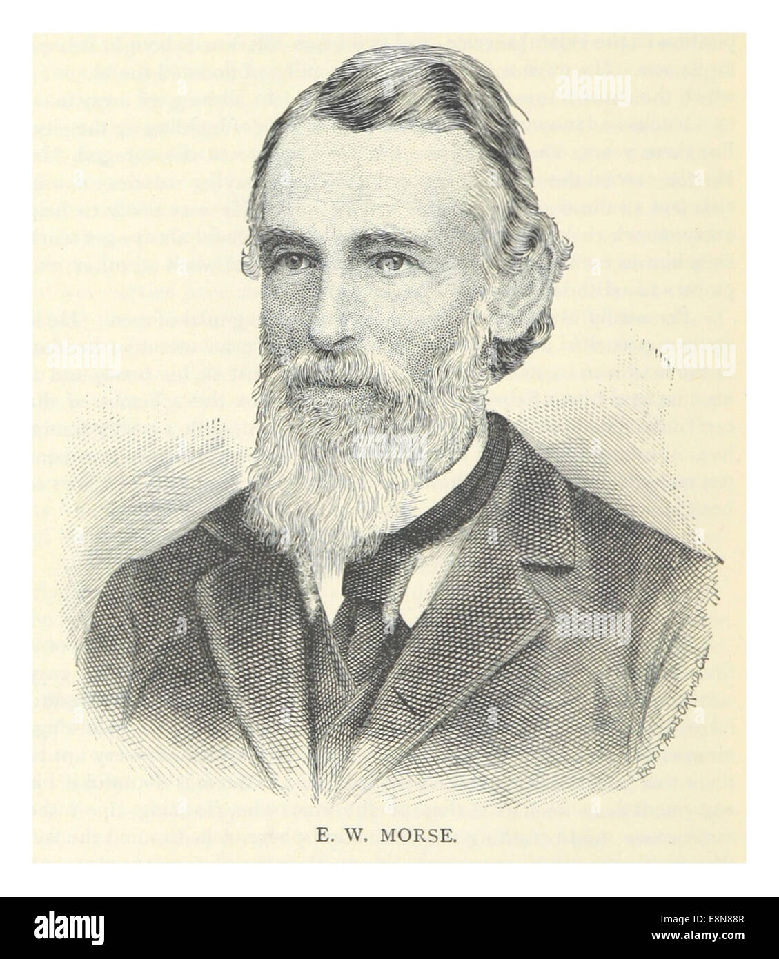 MORSE, Ephraim W. (1823-1906) Stock Photohttps://www.alamy.com/image-license-details/?v=1https://www.alamy.com/stock-photo-morse-ephraim-w-1823-1906-74226231.html
RME8N88R–MORSE, Ephraim W. (1823-1906)
 Sanborn Fire Insurance Map from Ephraim, Sanpete County, Utah. Stock Photohttps://www.alamy.com/image-license-details/?v=1https://www.alamy.com/sanborn-fire-insurance-map-from-ephraim-sanpete-county-utah-image456388396.html
RM2HEE81G–Sanborn Fire Insurance Map from Ephraim, Sanpete County, Utah.
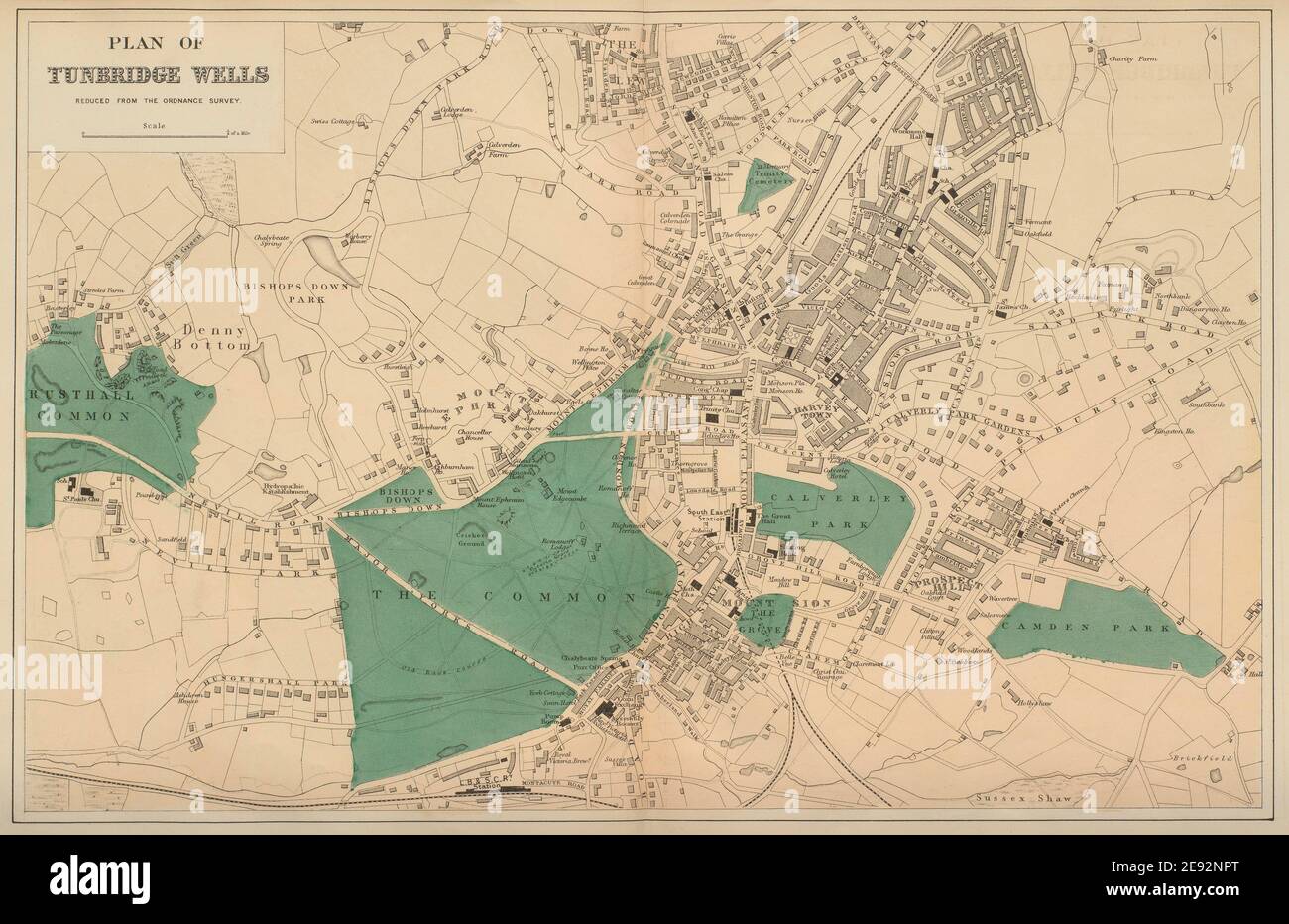 TUNBRIDGE WELLS Ferndale Ephraim Sion Camden town city plan GW BACON 1883 map Stock Photohttps://www.alamy.com/image-license-details/?v=1https://www.alamy.com/tunbridge-wells-ferndale-ephraim-sion-camden-town-city-plan-gw-bacon-1883-map-image401431376.html
RF2E92NPT–TUNBRIDGE WELLS Ferndale Ephraim Sion Camden town city plan GW BACON 1883 map
 WI Ephraim 20130618 TM Restoration Stock Photohttps://www.alamy.com/image-license-details/?v=1https://www.alamy.com/wi-ephraim-20130618-tm-restoration-image335883840.html
RM2AECR7C–WI Ephraim 20130618 TM Restoration
 Ephraim, Sanpete County, US, United States, Utah, N 39 21' 34'', S 111 35' 10'', map, Cartascapes Map published in 2024. Explore Cartascapes, a map revealing Earth's diverse landscapes, cultures, and ecosystems. Journey through time and space, discovering the interconnectedness of our planet's past, present, and future. Stock Photohttps://www.alamy.com/image-license-details/?v=1https://www.alamy.com/ephraim-sanpete-county-us-united-states-utah-n-39-21-34-s-111-35-10-map-cartascapes-map-published-in-2024-explore-cartascapes-a-map-revealing-earths-diverse-landscapes-cultures-and-ecosystems-journey-through-time-and-space-discovering-the-interconnectedness-of-our-planets-past-present-and-future-image621169820.html
RM2Y2GMCC–Ephraim, Sanpete County, US, United States, Utah, N 39 21' 34'', S 111 35' 10'', map, Cartascapes Map published in 2024. Explore Cartascapes, a map revealing Earth's diverse landscapes, cultures, and ecosystems. Journey through time and space, discovering the interconnectedness of our planet's past, present, and future.
 Gotthold Ephraim Lessing grave Dom und Magnifriedhof Braunschweig, Germany DSC04242 Stock Photohttps://www.alamy.com/image-license-details/?v=1https://www.alamy.com/stock-photo-gotthold-ephraim-lessing-grave-dom-und-magnifriedhof-braunschweig-142928098.html
RMJ8EX6X–Gotthold Ephraim Lessing grave Dom und Magnifriedhof Braunschweig, Germany DSC04242
 MORSE, Ephraim W. (1823-1906) Stock Photohttps://www.alamy.com/image-license-details/?v=1https://www.alamy.com/stock-photo-morse-ephraim-w-1823-1906-76859769.html
RMED17BN–MORSE, Ephraim W. (1823-1906)
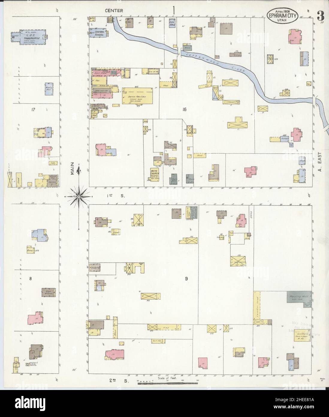 Sanborn Fire Insurance Map from Ephraim, Sanpete County, Utah. Stock Photohttps://www.alamy.com/image-license-details/?v=1https://www.alamy.com/sanborn-fire-insurance-map-from-ephraim-sanpete-county-utah-image456388390.html
RM2HEE81A–Sanborn Fire Insurance Map from Ephraim, Sanpete County, Utah.
 WI Ephraim 20100723 TM Restoration Stock Photohttps://www.alamy.com/image-license-details/?v=1https://www.alamy.com/wi-ephraim-20100723-tm-restoration-image335883837.html
RM2AECR79–WI Ephraim 20100723 TM Restoration
 West Ephraim, Sanpete County, US, United States, Utah, N 39 22' 31'', S 111 35' 20'', map, Cartascapes Map published in 2024. Explore Cartascapes, a map revealing Earth's diverse landscapes, cultures, and ecosystems. Journey through time and space, discovering the interconnectedness of our planet's past, present, and future. Stock Photohttps://www.alamy.com/image-license-details/?v=1https://www.alamy.com/west-ephraim-sanpete-county-us-united-states-utah-n-39-22-31-s-111-35-20-map-cartascapes-map-published-in-2024-explore-cartascapes-a-map-revealing-earths-diverse-landscapes-cultures-and-ecosystems-journey-through-time-and-space-discovering-the-interconnectedness-of-our-planets-past-present-and-future-image621261567.html
RM2Y2MWD3–West Ephraim, Sanpete County, US, United States, Utah, N 39 22' 31'', S 111 35' 20'', map, Cartascapes Map published in 2024. Explore Cartascapes, a map revealing Earth's diverse landscapes, cultures, and ecosystems. Journey through time and space, discovering the interconnectedness of our planet's past, present, and future.
 Gotthold Ephraim Lessing grave Dom und Magnifriedhof Braunschweig, Germany DSC04243 Stock Photohttps://www.alamy.com/image-license-details/?v=1https://www.alamy.com/stock-photo-gotthold-ephraim-lessing-grave-dom-und-magnifriedhof-braunschweig-142928116.html
RMJ8EX7G–Gotthold Ephraim Lessing grave Dom und Magnifriedhof Braunschweig, Germany DSC04243
 Ephraim Moses Lilien Historical images of the Western Wall 1920 C SR 019 Stock Photohttps://www.alamy.com/image-license-details/?v=1https://www.alamy.com/stock-photo-ephraim-moses-lilien-historical-images-of-the-western-wall-1920-c-139814641.html
RMJ3D301–Ephraim Moses Lilien Historical images of the Western Wall 1920 C SR 019
 Sanborn Fire Insurance Map from Ephraim, Sanpete County, Utah. Stock Photohttps://www.alamy.com/image-license-details/?v=1https://www.alamy.com/sanborn-fire-insurance-map-from-ephraim-sanpete-county-utah-image456388406.html
RM2HEE81X–Sanborn Fire Insurance Map from Ephraim, Sanpete County, Utah.
 2015 Potschappel Gotthold-Ephraim-Lessing-Schule Stock Photohttps://www.alamy.com/image-license-details/?v=1https://www.alamy.com/stock-photo-2015-potschappel-gotthold-ephraim-lessing-schule-148478533.html
RMJHFNTN–2015 Potschappel Gotthold-Ephraim-Lessing-Schule
 (King1893NYC) pg410 CONGREGATION SICHRON EPHRAIM, HEBREW, EAST 67TH STREET, NEAR THIRD AVENUE Stock Photohttps://www.alamy.com/image-license-details/?v=1https://www.alamy.com/stock-photo-king1893nyc-pg410-congregation-sichron-ephraim-hebrew-east-67th-street-74160368.html
RME8J88G–(King1893NYC) pg410 CONGREGATION SICHRON EPHRAIM, HEBREW, EAST 67TH STREET, NEAR THIRD AVENUE
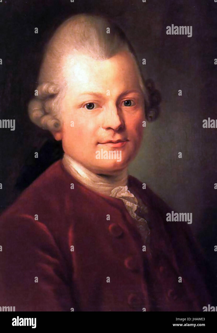 Gotthold Ephraim Lessing Kunstsammlung Uni Leipzig Stock Photohttps://www.alamy.com/image-license-details/?v=1https://www.alamy.com/stock-photo-gotthold-ephraim-lessing-kunstsammlung-uni-leipzig-148371611.html
RMJHAWE3–Gotthold Ephraim Lessing Kunstsammlung Uni Leipzig
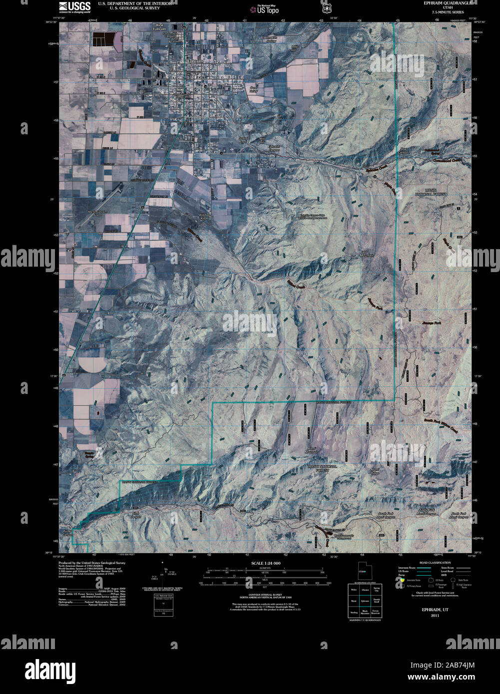 UT Ephraim 20110310 TM Inverted Restoration Stock Photohttps://www.alamy.com/image-license-details/?v=1https://www.alamy.com/ut-ephraim-20110310-tm-inverted-restoration-image333915532.html
RM2AB74JM–UT Ephraim 20110310 TM Inverted Restoration
 The Levite of Ephraim by A.F.Caminafe 281837 Lyon29 Stock Photohttps://www.alamy.com/image-license-details/?v=1https://www.alamy.com/stock-photo-the-levite-of-ephraim-by-afcaminafe-281837-lyon29-147686722.html
RMJG7KWP–The Levite of Ephraim by A.F.Caminafe 281837 Lyon29
 Portret van een man, vermoedelijk Dr. Ephraïm Bueno Rijksmuseum SK-A-3982 Stock Photohttps://www.alamy.com/image-license-details/?v=1https://www.alamy.com/stock-photo-portret-van-een-man-vermoedelijk-dr-ephram-bueno-rijksmuseum-sk-a-147627451.html
RMJG508Y–Portret van een man, vermoedelijk Dr. Ephraïm Bueno Rijksmuseum SK-A-3982
 Sunburst by Mrs Ephraim Scott, born 1802, Philadelphia, Pennsylvania, 1856 Museum of Fine Arts, Boston DSC02683 Stock Photohttps://www.alamy.com/image-license-details/?v=1https://www.alamy.com/sunburst-by-mrs-ephraim-scott-born-1802-philadelphia-pennsylvania-image153140279.html
RMJW43YK–Sunburst by Mrs Ephraim Scott, born 1802, Philadelphia, Pennsylvania, 1856 Museum of Fine Arts, Boston DSC02683
 Mount Ephraim, Camden County, US, United States, New Jersey, N 39 52' 42'', S 75 5' 33'', map, Cartascapes Map published in 2024. Explore Cartascapes, a map revealing Earth's diverse landscapes, cultures, and ecosystems. Journey through time and space, discovering the interconnectedness of our planet's past, present, and future. Stock Photohttps://www.alamy.com/image-license-details/?v=1https://www.alamy.com/mount-ephraim-camden-county-us-united-states-new-jersey-n-39-52-42-s-75-5-33-map-cartascapes-map-published-in-2024-explore-cartascapes-a-map-revealing-earths-diverse-landscapes-cultures-and-ecosystems-journey-through-time-and-space-discovering-the-interconnectedness-of-our-planets-past-present-and-future-image621412458.html
RM2Y2YNX2–Mount Ephraim, Camden County, US, United States, New Jersey, N 39 52' 42'', S 75 5' 33'', map, Cartascapes Map published in 2024. Explore Cartascapes, a map revealing Earth's diverse landscapes, cultures, and ecosystems. Journey through time and space, discovering the interconnectedness of our planet's past, present, and future.
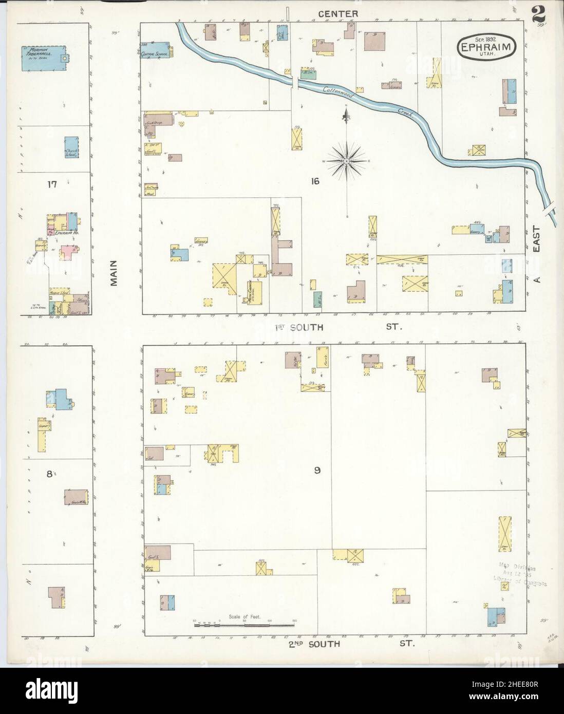 Sanborn Fire Insurance Map from Ephraim, Sanpete County, Utah. Stock Photohttps://www.alamy.com/image-license-details/?v=1https://www.alamy.com/sanborn-fire-insurance-map-from-ephraim-sanpete-county-utah-image456388375.html
RM2HEE80R–Sanborn Fire Insurance Map from Ephraim, Sanpete County, Utah.
 (King1893NYC) pg410 CONGREGATION SICHRON EPHRAIM, HEBREW, EAST 67TH STREET, NEAR THIRD AVENUE Stock Photohttps://www.alamy.com/image-license-details/?v=1https://www.alamy.com/stock-photo-king1893nyc-pg410-congregation-sichron-ephraim-hebrew-east-67th-street-76713198.html
RMECPGD2–(King1893NYC) pg410 CONGREGATION SICHRON EPHRAIM, HEBREW, EAST 67TH STREET, NEAR THIRD AVENUE
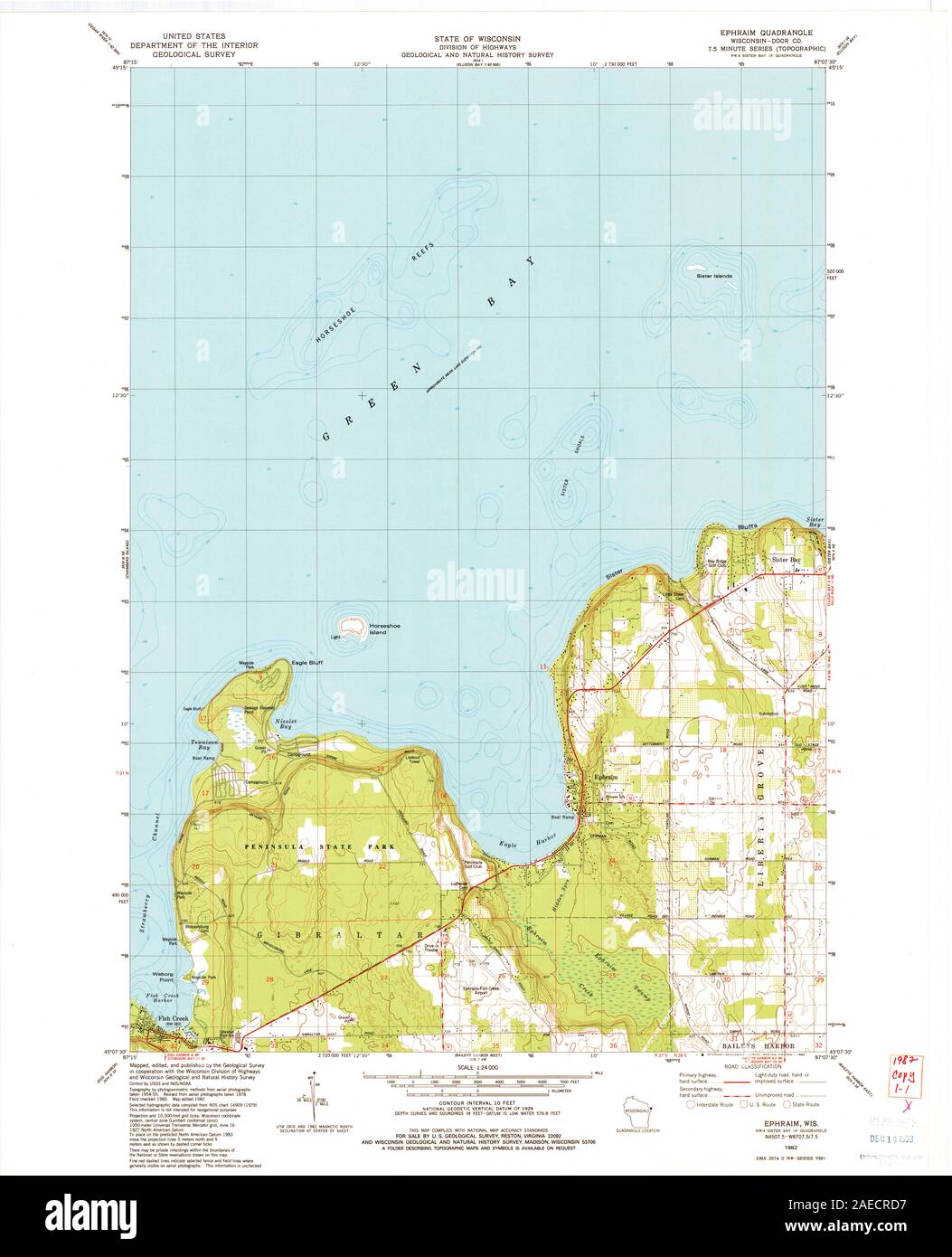 WI Ephraim 500406 1982 24000 Restoration Stock Photohttps://www.alamy.com/image-license-details/?v=1https://www.alamy.com/wi-ephraim-500406-1982-24000-restoration-image335884003.html
RM2AECRD7–WI Ephraim 500406 1982 24000 Restoration
 Sunburst by Mrs Ephraim Scott, born 1802, Philadelphia, Pennsylvania, 1856 Museum of Fine Arts, Boston DSC02683 Stock Photohttps://www.alamy.com/image-license-details/?v=1https://www.alamy.com/sunburst-by-mrs-ephraim-scott-born-1802-philadelphia-pennsylvania-image153728381.html
RMJX2X39–Sunburst by Mrs Ephraim Scott, born 1802, Philadelphia, Pennsylvania, 1856 Museum of Fine Arts, Boston DSC02683
 Ephraim. Willem Janszoon Blaeu and Joan Blaeu. Terra Sancta quae in Sacris Terra Promissionis olim Palestina. 1648-1664 Stock Photohttps://www.alamy.com/image-license-details/?v=1https://www.alamy.com/stock-photo-ephraim-willem-janszoon-blaeu-and-joan-blaeu-terra-sancta-quae-in-148391493.html
RMJHBPT5–Ephraim. Willem Janszoon Blaeu and Joan Blaeu. Terra Sancta quae in Sacris Terra Promissionis olim Palestina. 1648-1664
 Mount Ephraim, Camden County, US, United States, New Jersey, N 39 52' 42'', S 75 5' 33'', map, Cartascapes Map published in 2024. Explore Cartascapes, a map revealing Earth's diverse landscapes, cultures, and ecosystems. Journey through time and space, discovering the interconnectedness of our planet's past, present, and future. Stock Photohttps://www.alamy.com/image-license-details/?v=1https://www.alamy.com/mount-ephraim-camden-county-us-united-states-new-jersey-n-39-52-42-s-75-5-33-map-cartascapes-map-published-in-2024-explore-cartascapes-a-map-revealing-earths-diverse-landscapes-cultures-and-ecosystems-journey-through-time-and-space-discovering-the-interconnectedness-of-our-planets-past-present-and-future-image621377428.html
RM2Y2X570–Mount Ephraim, Camden County, US, United States, New Jersey, N 39 52' 42'', S 75 5' 33'', map, Cartascapes Map published in 2024. Explore Cartascapes, a map revealing Earth's diverse landscapes, cultures, and ecosystems. Journey through time and space, discovering the interconnectedness of our planet's past, present, and future.
 Ephraim. 1852 Philip Map of Palestine - Israel - Holy Land - Geographicus - Palestine-philip-1852 Stock Photohttps://www.alamy.com/image-license-details/?v=1https://www.alamy.com/stock-photo-ephraim-1852-philip-map-of-palestine-israel-holy-land-geographicus-148513447.html
RMJHHABK–Ephraim. 1852 Philip Map of Palestine - Israel - Holy Land - Geographicus - Palestine-philip-1852
 Sanborn Fire Insurance Map from Ephraim, Sanpete County, Utah. Stock Photohttps://www.alamy.com/image-license-details/?v=1https://www.alamy.com/sanborn-fire-insurance-map-from-ephraim-sanpete-county-utah-image456388380.html
RM2HEE810–Sanborn Fire Insurance Map from Ephraim, Sanpete County, Utah.
 Image taken from page 92 of 'The Dictionary of Dublin, being a comprehensive guide to the city and its neighbourhood ... Illustrated by numerous photographs taken by the authors' Image taken from page 92 of 'The Dictionary of Dublin, Stock Photohttps://www.alamy.com/image-license-details/?v=1https://www.alamy.com/stock-photo-image-taken-from-page-92-of-the-dictionary-of-dublin-being-a-comprehensive-127844170.html
RMHBYPF6–Image taken from page 92 of 'The Dictionary of Dublin, being a comprehensive guide to the city and its neighbourhood ... Illustrated by numerous photographs taken by the authors' Image taken from page 92 of 'The Dictionary of Dublin,
 UT Ephraim 249169 2001 24000 Restoration Stock Photohttps://www.alamy.com/image-license-details/?v=1https://www.alamy.com/ut-ephraim-249169-2001-24000-restoration-image333915549.html
RM2AB74K9–UT Ephraim 249169 2001 24000 Restoration
 Ephraim Place, Mitchell County, US, United States, North Carolina, N 36 5' 16'', S 82 24' 12'', map, Cartascapes Map published in 2024. Explore Cartascapes, a map revealing Earth's diverse landscapes, cultures, and ecosystems. Journey through time and space, discovering the interconnectedness of our planet's past, present, and future. Stock Photohttps://www.alamy.com/image-license-details/?v=1https://www.alamy.com/ephraim-place-mitchell-county-us-united-states-north-carolina-n-36-5-16-s-82-24-12-map-cartascapes-map-published-in-2024-explore-cartascapes-a-map-revealing-earths-diverse-landscapes-cultures-and-ecosystems-journey-through-time-and-space-discovering-the-interconnectedness-of-our-planets-past-present-and-future-image621415206.html
RM2Y2YWC6–Ephraim Place, Mitchell County, US, United States, North Carolina, N 36 5' 16'', S 82 24' 12'', map, Cartascapes Map published in 2024. Explore Cartascapes, a map revealing Earth's diverse landscapes, cultures, and ecosystems. Journey through time and space, discovering the interconnectedness of our planet's past, present, and future.
 Ephraim Deinard Stock Photohttps://www.alamy.com/image-license-details/?v=1https://www.alamy.com/stock-photo-ephraim-deinard-139783297.html
RMJ3BK0H–Ephraim Deinard
 Sanborn Fire Insurance Map from Ephraim, Sanpete County, Utah. Stock Photohttps://www.alamy.com/image-license-details/?v=1https://www.alamy.com/sanborn-fire-insurance-map-from-ephraim-sanpete-county-utah-image456388398.html
RM2HEE81J–Sanborn Fire Insurance Map from Ephraim, Sanpete County, Utah.
 Image taken from page 195 of 'The Dictionary of Dublin, being a comprehensive guide to the city and its neighbourhood ... Illustrated by numerous photographs taken by the authors' Image taken from page 195 of 'The Dictionary of Dublin, Stock Photohttps://www.alamy.com/image-license-details/?v=1https://www.alamy.com/stock-photo-image-taken-from-page-195-of-the-dictionary-of-dublin-being-a-comprehensive-127841112.html
RMHBYJJ0–Image taken from page 195 of 'The Dictionary of Dublin, being a comprehensive guide to the city and its neighbourhood ... Illustrated by numerous photographs taken by the authors' Image taken from page 195 of 'The Dictionary of Dublin,
 UT Ephraim 249168 1966 24000 Restoration Stock Photohttps://www.alamy.com/image-license-details/?v=1https://www.alamy.com/ut-ephraim-249168-1966-24000-restoration-image333915534.html
RM2AB74JP–UT Ephraim 249168 1966 24000 Restoration
 Ephraim, Door County, US, United States, Wisconsin, N 45 9' 22'', S 87 10' 5'', map, Cartascapes Map published in 2024. Explore Cartascapes, a map revealing Earth's diverse landscapes, cultures, and ecosystems. Journey through time and space, discovering the interconnectedness of our planet's past, present, and future. Stock Photohttps://www.alamy.com/image-license-details/?v=1https://www.alamy.com/ephraim-door-county-us-united-states-wisconsin-n-45-9-22-s-87-10-5-map-cartascapes-map-published-in-2024-explore-cartascapes-a-map-revealing-earths-diverse-landscapes-cultures-and-ecosystems-journey-through-time-and-space-discovering-the-interconnectedness-of-our-planets-past-present-and-future-image620670130.html
RM2Y1NY2A–Ephraim, Door County, US, United States, Wisconsin, N 45 9' 22'', S 87 10' 5'', map, Cartascapes Map published in 2024. Explore Cartascapes, a map revealing Earth's diverse landscapes, cultures, and ecosystems. Journey through time and space, discovering the interconnectedness of our planet's past, present, and future.
 Ephraim McDowell Stock Photohttps://www.alamy.com/image-license-details/?v=1https://www.alamy.com/stock-photo-ephraim-mcdowell-139787913.html
RMJ3BTWD–Ephraim McDowell
 Christian van Adrichem 1590 map Tribus Ephraim, Beniamin, et, Dan iste videlicet Terræ Sanctæ tractus, qui in regionis partitione istis tribus tribubus datus est. Stock Photohttps://www.alamy.com/image-license-details/?v=1https://www.alamy.com/christian-van-adrichem-1590-map-tribus-ephraim-beniamin-et-dan-iste-videlicet-terr-sanct-tractus-qui-in-regionis-partitione-istis-tribus-tribubus-datus-est-image634265195.html
RM2YRW7MB–Christian van Adrichem 1590 map Tribus Ephraim, Beniamin, et, Dan iste videlicet Terræ Sanctæ tractus, qui in regionis partitione istis tribus tribubus datus est.
 Image taken from page 288 of 'The Dictionary of Dublin, being a comprehensive guide to the city and its neighbourhood ... Illustrated by numerous photographs taken by the authors' Image taken from page 288 of 'The Dictionary of Dublin, Stock Photohttps://www.alamy.com/image-license-details/?v=1https://www.alamy.com/stock-photo-image-taken-from-page-288-of-the-dictionary-of-dublin-being-a-comprehensive-127842437.html
RMHBYM99–Image taken from page 288 of 'The Dictionary of Dublin, being a comprehensive guide to the city and its neighbourhood ... Illustrated by numerous photographs taken by the authors' Image taken from page 288 of 'The Dictionary of Dublin,
 WI Ephraim 20100723 TM Inverted Restoration Stock Photohttps://www.alamy.com/image-license-details/?v=1https://www.alamy.com/wi-ephraim-20100723-tm-inverted-restoration-image335883838.html
RM2AECR7A–WI Ephraim 20100723 TM Inverted Restoration
 Ephraim, Door County, US, United States, Wisconsin, N 45 9' 22'', S 87 10' 5'', map, Cartascapes Map published in 2024. Explore Cartascapes, a map revealing Earth's diverse landscapes, cultures, and ecosystems. Journey through time and space, discovering the interconnectedness of our planet's past, present, and future. Stock Photohttps://www.alamy.com/image-license-details/?v=1https://www.alamy.com/ephraim-door-county-us-united-states-wisconsin-n-45-9-22-s-87-10-5-map-cartascapes-map-published-in-2024-explore-cartascapes-a-map-revealing-earths-diverse-landscapes-cultures-and-ecosystems-journey-through-time-and-space-discovering-the-interconnectedness-of-our-planets-past-present-and-future-image620851168.html
RM2Y22600–Ephraim, Door County, US, United States, Wisconsin, N 45 9' 22'', S 87 10' 5'', map, Cartascapes Map published in 2024. Explore Cartascapes, a map revealing Earth's diverse landscapes, cultures, and ecosystems. Journey through time and space, discovering the interconnectedness of our planet's past, present, and future.
 Webster ephraim Stock Photohttps://www.alamy.com/image-license-details/?v=1https://www.alamy.com/stock-photo-webster-ephraim-140699728.html
RMJ4WBX8–Webster ephraim
 Image taken from page 90 of 'The Dictionary of Dublin, being a comprehensive guide to the city and its neighbourhood ... Illustrated by numerous photographs taken by the authors' Image taken from page 90 of 'The Dictionary of Dublin, Stock Photohttps://www.alamy.com/image-license-details/?v=1https://www.alamy.com/stock-photo-image-taken-from-page-90-of-the-dictionary-of-dublin-being-a-comprehensive-127869052.html
RMHC0X7T–Image taken from page 90 of 'The Dictionary of Dublin, being a comprehensive guide to the city and its neighbourhood ... Illustrated by numerous photographs taken by the authors' Image taken from page 90 of 'The Dictionary of Dublin,
 UT Ephraim 249167 1966 24000 Restoration Stock Photohttps://www.alamy.com/image-license-details/?v=1https://www.alamy.com/ut-ephraim-249167-1966-24000-restoration-image333915531.html
RM2AB74JK–UT Ephraim 249167 1966 24000 Restoration
 Mount Ephraim, Montgomery County, US, United States, Maryland, N 39 14' 45'', S 77 23' 54'', map, Cartascapes Map published in 2024. Explore Cartascapes, a map revealing Earth's diverse landscapes, cultures, and ecosystems. Journey through time and space, discovering the interconnectedness of our planet's past, present, and future. Stock Photohttps://www.alamy.com/image-license-details/?v=1https://www.alamy.com/mount-ephraim-montgomery-county-us-united-states-maryland-n-39-14-45-s-77-23-54-map-cartascapes-map-published-in-2024-explore-cartascapes-a-map-revealing-earths-diverse-landscapes-cultures-and-ecosystems-journey-through-time-and-space-discovering-the-interconnectedness-of-our-planets-past-present-and-future-image620722611.html
RM2Y1TA0K–Mount Ephraim, Montgomery County, US, United States, Maryland, N 39 14' 45'', S 77 23' 54'', map, Cartascapes Map published in 2024. Explore Cartascapes, a map revealing Earth's diverse landscapes, cultures, and ecosystems. Journey through time and space, discovering the interconnectedness of our planet's past, present, and future.
 Ephraim Shmaragd Stock Photohttps://www.alamy.com/image-license-details/?v=1https://www.alamy.com/stock-photo-ephraim-shmaragd-139783043.html
RMJ3BJKF–Ephraim Shmaragd
 Image taken from page 50 of 'The Dictionary of Dublin, being a comprehensive guide to the city and its neighbourhood ... Illustrated by numerous photographs taken by the authors' Image taken from page 50 of 'The Dictionary of Dublin, Stock Photohttps://www.alamy.com/image-license-details/?v=1https://www.alamy.com/stock-photo-image-taken-from-page-50-of-the-dictionary-of-dublin-being-a-comprehensive-127845650.html
RMHBYTC2–Image taken from page 50 of 'The Dictionary of Dublin, being a comprehensive guide to the city and its neighbourhood ... Illustrated by numerous photographs taken by the authors' Image taken from page 50 of 'The Dictionary of Dublin,
 WI Ephraim 20130618 TM Inverted Restoration Stock Photohttps://www.alamy.com/image-license-details/?v=1https://www.alamy.com/wi-ephraim-20130618-tm-inverted-restoration-image335883841.html
RM2AECR7D–WI Ephraim 20130618 TM Inverted Restoration
 Mount Ephraim, Noble County, US, United States, Ohio, N 39 50' 50'', S 81 25' 4'', map, Cartascapes Map published in 2024. Explore Cartascapes, a map revealing Earth's diverse landscapes, cultures, and ecosystems. Journey through time and space, discovering the interconnectedness of our planet's past, present, and future. Stock Photohttps://www.alamy.com/image-license-details/?v=1https://www.alamy.com/mount-ephraim-noble-county-us-united-states-ohio-n-39-50-50-s-81-25-4-map-cartascapes-map-published-in-2024-explore-cartascapes-a-map-revealing-earths-diverse-landscapes-cultures-and-ecosystems-journey-through-time-and-space-discovering-the-interconnectedness-of-our-planets-past-present-and-future-image620784242.html
RM2Y1Y4HP–Mount Ephraim, Noble County, US, United States, Ohio, N 39 50' 50'', S 81 25' 4'', map, Cartascapes Map published in 2024. Explore Cartascapes, a map revealing Earth's diverse landscapes, cultures, and ecosystems. Journey through time and space, discovering the interconnectedness of our planet's past, present, and future.
 Ephraim Willard Burr Stock Photohttps://www.alamy.com/image-license-details/?v=1https://www.alamy.com/stock-photo-ephraim-willard-burr-139782637.html
RMJ3BJ51–Ephraim Willard Burr
 Image taken from page 286 of 'The Dictionary of Dublin, being a comprehensive guide to the city and its neighbourhood ... Illustrated by numerous photographs taken by the authors' Image taken from page 286 of 'The Dictionary of Dublin, Stock Photohttps://www.alamy.com/image-license-details/?v=1https://www.alamy.com/stock-photo-image-taken-from-page-286-of-the-dictionary-of-dublin-being-a-comprehensive-127867917.html
RMHC0TR9–Image taken from page 286 of 'The Dictionary of Dublin, being a comprehensive guide to the city and its neighbourhood ... Illustrated by numerous photographs taken by the authors' Image taken from page 286 of 'The Dictionary of Dublin,
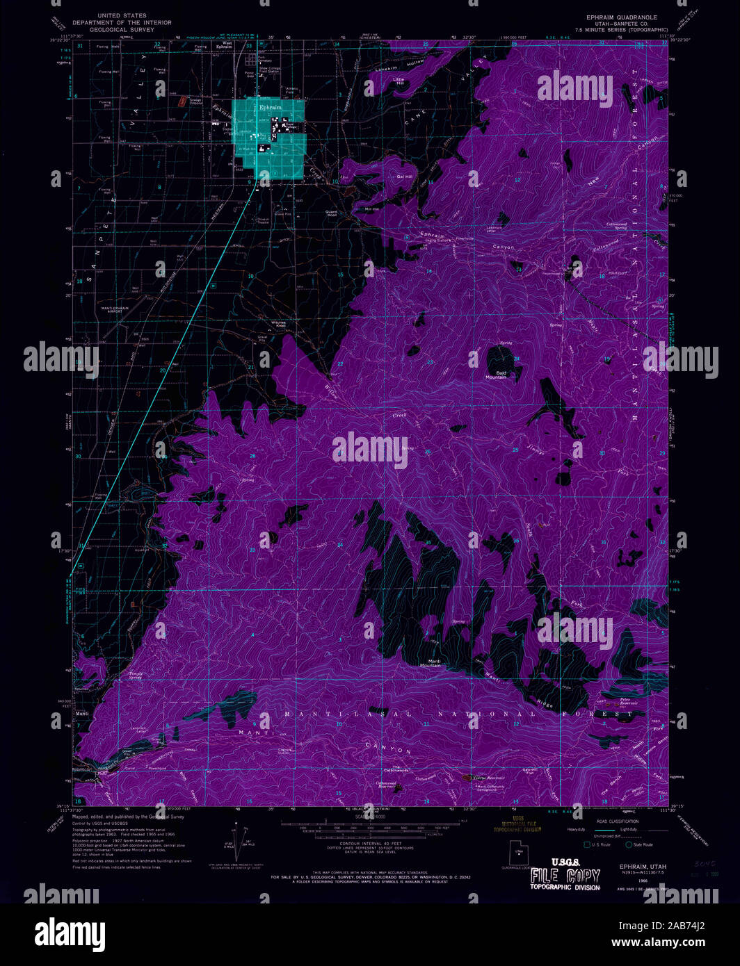 UT Ephraim 249167 1966 24000 Inverted Restoration Stock Photohttps://www.alamy.com/image-license-details/?v=1https://www.alamy.com/ut-ephraim-249167-1966-24000-inverted-restoration-image333915514.html
RM2AB74J2–UT Ephraim 249167 1966 24000 Inverted Restoration
 City of Ephraim, Sanpete County, US, United States, Utah, N 39 21' 27'', S 111 34' 55'', map, Cartascapes Map published in 2024. Explore Cartascapes, a map revealing Earth's diverse landscapes, cultures, and ecosystems. Journey through time and space, discovering the interconnectedness of our planet's past, present, and future. Stock Photohttps://www.alamy.com/image-license-details/?v=1https://www.alamy.com/city-of-ephraim-sanpete-county-us-united-states-utah-n-39-21-27-s-111-34-55-map-cartascapes-map-published-in-2024-explore-cartascapes-a-map-revealing-earths-diverse-landscapes-cultures-and-ecosystems-journey-through-time-and-space-discovering-the-interconnectedness-of-our-planets-past-present-and-future-image633862720.html
RM2YR6XA8–City of Ephraim, Sanpete County, US, United States, Utah, N 39 21' 27'', S 111 34' 55'', map, Cartascapes Map published in 2024. Explore Cartascapes, a map revealing Earth's diverse landscapes, cultures, and ecosystems. Journey through time and space, discovering the interconnectedness of our planet's past, present, and future.
 Ephraim Salomon Unger Stock Photohttps://www.alamy.com/image-license-details/?v=1https://www.alamy.com/stock-photo-ephraim-salomon-unger-139792164.html
RMJ3C298–Ephraim Salomon Unger
 Image taken from page 282 of 'The Dictionary of Dublin, being a comprehensive guide to the city and its neighbourhood ... Illustrated by numerous photographs taken by the authors' Image taken from page 282 of 'The Dictionary of Dublin, Stock Photohttps://www.alamy.com/image-license-details/?v=1https://www.alamy.com/stock-photo-image-taken-from-page-282-of-the-dictionary-of-dublin-being-a-comprehensive-127870293.html
RMHC0YT5–Image taken from page 282 of 'The Dictionary of Dublin, being a comprehensive guide to the city and its neighbourhood ... Illustrated by numerous photographs taken by the authors' Image taken from page 282 of 'The Dictionary of Dublin,
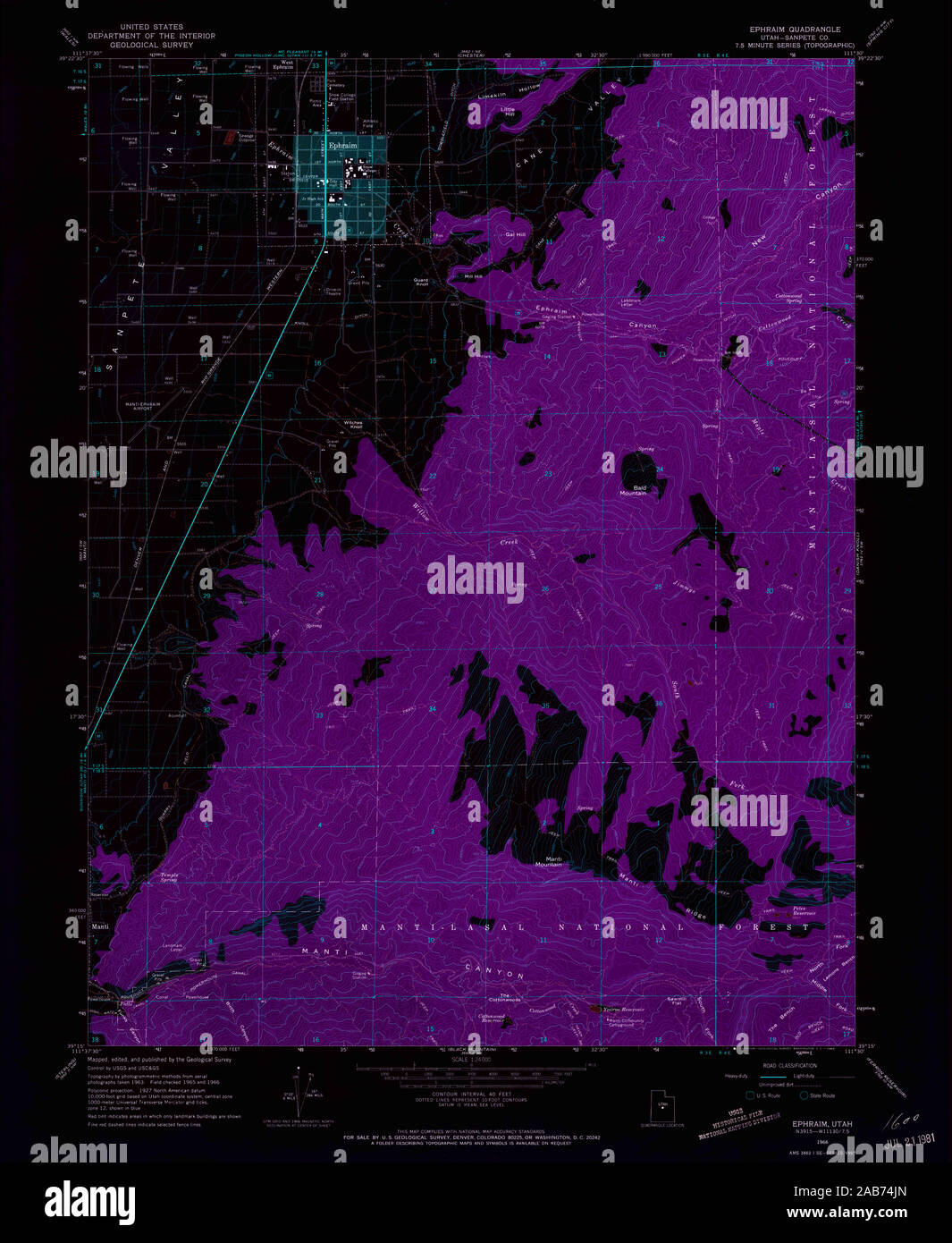 UT Ephraim 249168 1966 24000 Inverted Restoration Stock Photohttps://www.alamy.com/image-license-details/?v=1https://www.alamy.com/ut-ephraim-249168-1966-24000-inverted-restoration-image333915533.html
RM2AB74JN–UT Ephraim 249168 1966 24000 Inverted Restoration
 Village of Ephraim, Door County, US, United States, Wisconsin, N 45 9' 58'', S 87 10' 20'', map, Cartascapes Map published in 2024. Explore Cartascapes, a map revealing Earth's diverse landscapes, cultures, and ecosystems. Journey through time and space, discovering the interconnectedness of our planet's past, present, and future. Stock Photohttps://www.alamy.com/image-license-details/?v=1https://www.alamy.com/village-of-ephraim-door-county-us-united-states-wisconsin-n-45-9-58-s-87-10-20-map-cartascapes-map-published-in-2024-explore-cartascapes-a-map-revealing-earths-diverse-landscapes-cultures-and-ecosystems-journey-through-time-and-space-discovering-the-interconnectedness-of-our-planets-past-present-and-future-image633886918.html
RM2YR816E–Village of Ephraim, Door County, US, United States, Wisconsin, N 45 9' 58'', S 87 10' 20'', map, Cartascapes Map published in 2024. Explore Cartascapes, a map revealing Earth's diverse landscapes, cultures, and ecosystems. Journey through time and space, discovering the interconnectedness of our planet's past, present, and future.
 Ephraim Luzzatto song Stock Photohttps://www.alamy.com/image-license-details/?v=1https://www.alamy.com/stock-photo-ephraim-luzzatto-song-139780633.html
RMJ3BFHD–Ephraim Luzzatto song
 Image taken from page 482 of 'Peru: incidents of ravel and exploration in the Land of the Incas. ... With illustrations' Image taken from page 482 of 'Peru incidents of ravel Stock Photohttps://www.alamy.com/image-license-details/?v=1https://www.alamy.com/stock-photo-image-taken-from-page-482-of-peru-incidents-of-ravel-and-exploration-127742334.html
RMHBR4J6–Image taken from page 482 of 'Peru: incidents of ravel and exploration in the Land of the Incas. ... With illustrations' Image taken from page 482 of 'Peru incidents of ravel
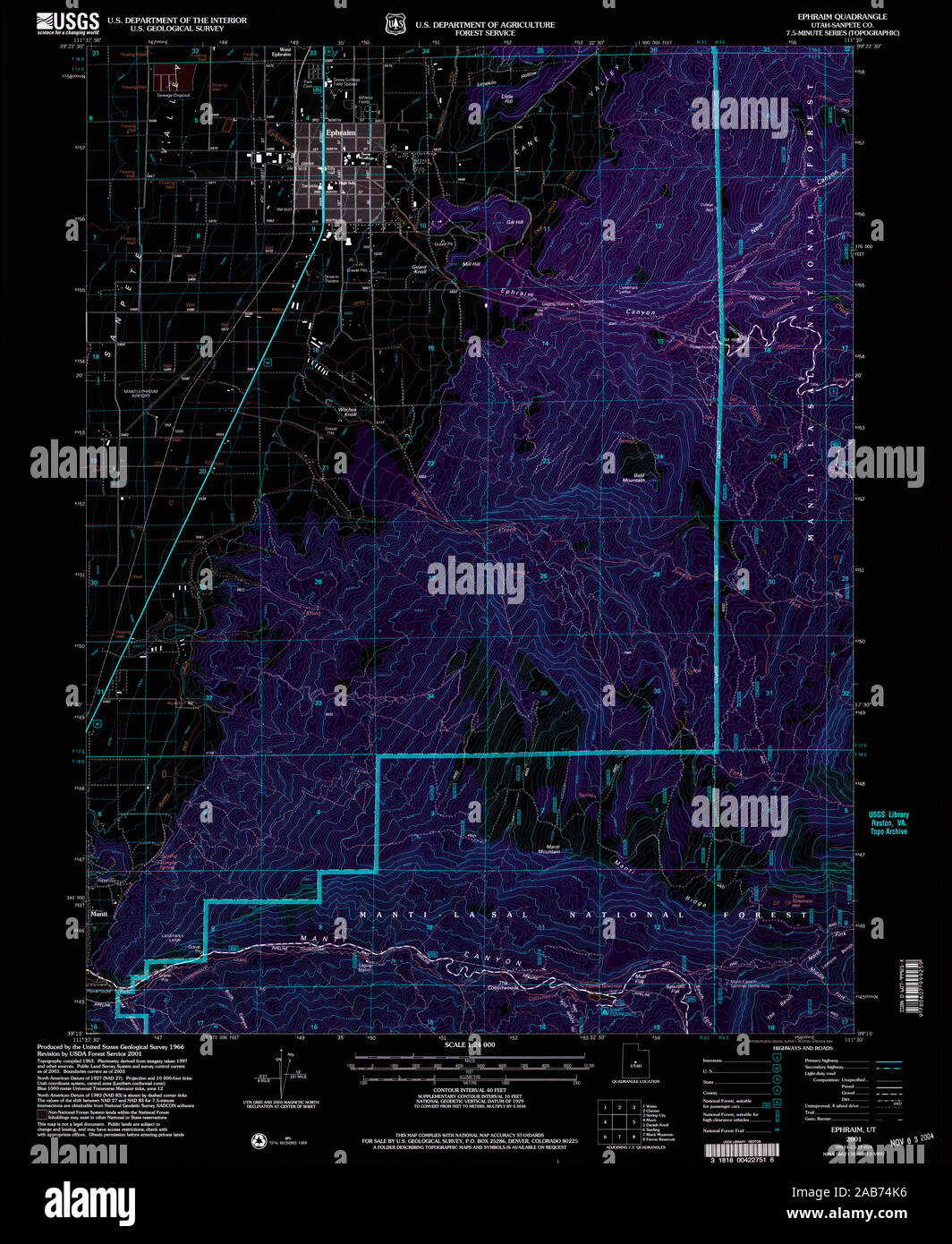 UT Ephraim 249169 2001 24000 Inverted Restoration Stock Photohttps://www.alamy.com/image-license-details/?v=1https://www.alamy.com/ut-ephraim-249169-2001-24000-inverted-restoration-image333915546.html
RM2AB74K6–UT Ephraim 249169 2001 24000 Inverted Restoration
 Borough of Mount Ephraim, Camden County, US, United States, New Jersey, N 39 52' 50'', S 75 5' 29'', map, Cartascapes Map published in 2024. Explore Cartascapes, a map revealing Earth's diverse landscapes, cultures, and ecosystems. Journey through time and space, discovering the interconnectedness of our planet's past, present, and future. Stock Photohttps://www.alamy.com/image-license-details/?v=1https://www.alamy.com/borough-of-mount-ephraim-camden-county-us-united-states-new-jersey-n-39-52-50-s-75-5-29-map-cartascapes-map-published-in-2024-explore-cartascapes-a-map-revealing-earths-diverse-landscapes-cultures-and-ecosystems-journey-through-time-and-space-discovering-the-interconnectedness-of-our-planets-past-present-and-future-image633812574.html
RM2YR4JBA–Borough of Mount Ephraim, Camden County, US, United States, New Jersey, N 39 52' 50'', S 75 5' 29'', map, Cartascapes Map published in 2024. Explore Cartascapes, a map revealing Earth's diverse landscapes, cultures, and ecosystems. Journey through time and space, discovering the interconnectedness of our planet's past, present, and future.
 Johannes Ephraim Larsen Stock Photohttps://www.alamy.com/image-license-details/?v=1https://www.alamy.com/stock-photo-johannes-ephraim-larsen-140055229.html
RMJ3T1TD–Johannes Ephraim Larsen
 Image taken from page 291 of 'The Dictionary of Dublin, being a comprehensive guide to the city and its neighbourhood ... Illustrated by numerous photographs taken by the authors' Image taken from page 291 of 'The Dictionary of Dublin, Stock Photohttps://www.alamy.com/image-license-details/?v=1https://www.alamy.com/stock-photo-image-taken-from-page-291-of-the-dictionary-of-dublin-being-a-comprehensive-127839901.html
RMHBYH2N–Image taken from page 291 of 'The Dictionary of Dublin, being a comprehensive guide to the city and its neighbourhood ... Illustrated by numerous photographs taken by the authors' Image taken from page 291 of 'The Dictionary of Dublin,
 WI Ephraim 500406 1982 24000 Inverted Restoration Stock Photohttps://www.alamy.com/image-license-details/?v=1https://www.alamy.com/wi-ephraim-500406-1982-24000-inverted-restoration-image335883963.html
RM2AECRBR–WI Ephraim 500406 1982 24000 Inverted Restoration
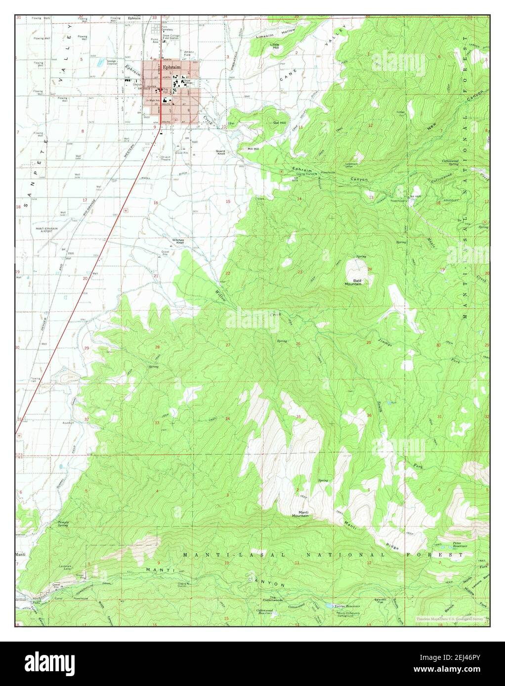 Ephraim, Utah, map 1966, 1:24000, United States of America by Timeless Maps, data U.S. Geological Survey Stock Photohttps://www.alamy.com/image-license-details/?v=1https://www.alamy.com/ephraim-utah-map-1966-124000-united-states-of-america-by-timeless-maps-data-us-geological-survey-image406995427.html
RM2EJ46PY–Ephraim, Utah, map 1966, 1:24000, United States of America by Timeless Maps, data U.S. Geological Survey
 Downs ephraim clockmaker Stock Photohttps://www.alamy.com/image-license-details/?v=1https://www.alamy.com/stock-photo-downs-ephraim-clockmaker-139789188.html
RMJ3BXF0–Downs ephraim clockmaker
 Image taken from page 135 of 'The Dictionary of Dublin, being a comprehensive guide to the city and its neighbourhood ... Illustrated by numerous photographs taken by the authors' Image taken from page 135 of 'The Dictionary of Dublin, Stock Photohttps://www.alamy.com/image-license-details/?v=1https://www.alamy.com/stock-photo-image-taken-from-page-135-of-the-dictionary-of-dublin-being-a-comprehensive-127842742.html
RMHBYMM6–Image taken from page 135 of 'The Dictionary of Dublin, being a comprehensive guide to the city and its neighbourhood ... Illustrated by numerous photographs taken by the authors' Image taken from page 135 of 'The Dictionary of Dublin,
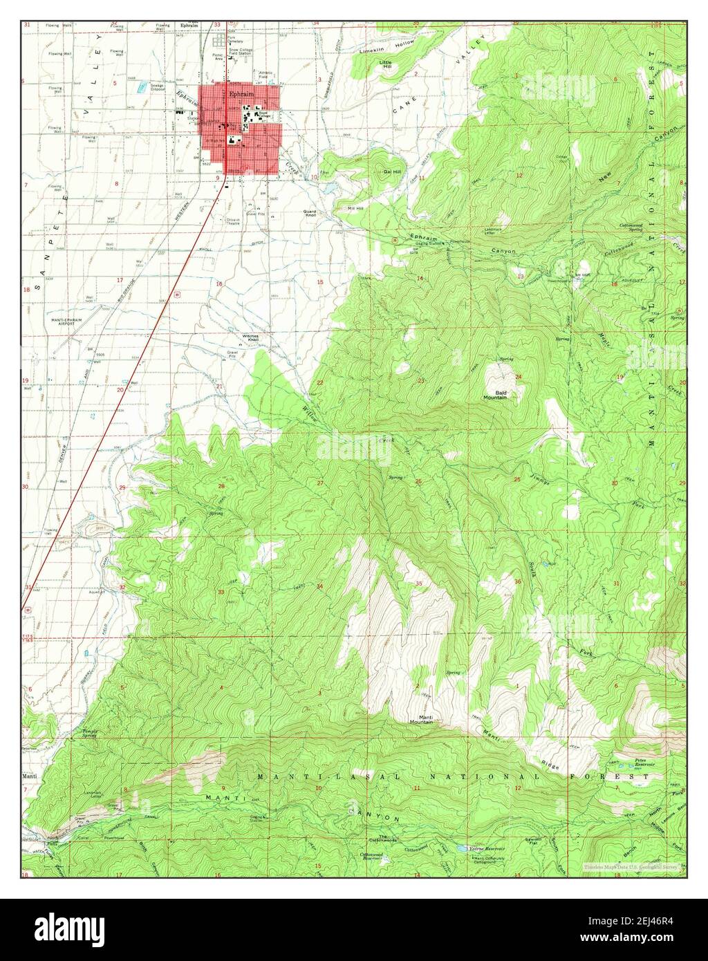 Ephraim, Utah, map 1966, 1:24000, United States of America by Timeless Maps, data U.S. Geological Survey Stock Photohttps://www.alamy.com/image-license-details/?v=1https://www.alamy.com/ephraim-utah-map-1966-124000-united-states-of-america-by-timeless-maps-data-us-geological-survey-image406995432.html
RM2EJ46R4–Ephraim, Utah, map 1966, 1:24000, United States of America by Timeless Maps, data U.S. Geological Survey
 Ephraim Ish Kishor Stock Photohttps://www.alamy.com/image-license-details/?v=1https://www.alamy.com/stock-photo-ephraim-ish-kishor-139788654.html
RMJ3BWRX–Ephraim Ish Kishor
 Image taken from page 19 of 'The Dictionary of Dublin, being a comprehensive guide to the city and its neighbourhood ... Illustrated by numerous photographs taken by the authors' Image taken from page 19 of 'The Dictionary of Dublin, Stock Photohttps://www.alamy.com/image-license-details/?v=1https://www.alamy.com/stock-photo-image-taken-from-page-19-of-the-dictionary-of-dublin-being-a-comprehensive-127837093.html
RMHBYDED–Image taken from page 19 of 'The Dictionary of Dublin, being a comprehensive guide to the city and its neighbourhood ... Illustrated by numerous photographs taken by the authors' Image taken from page 19 of 'The Dictionary of Dublin,
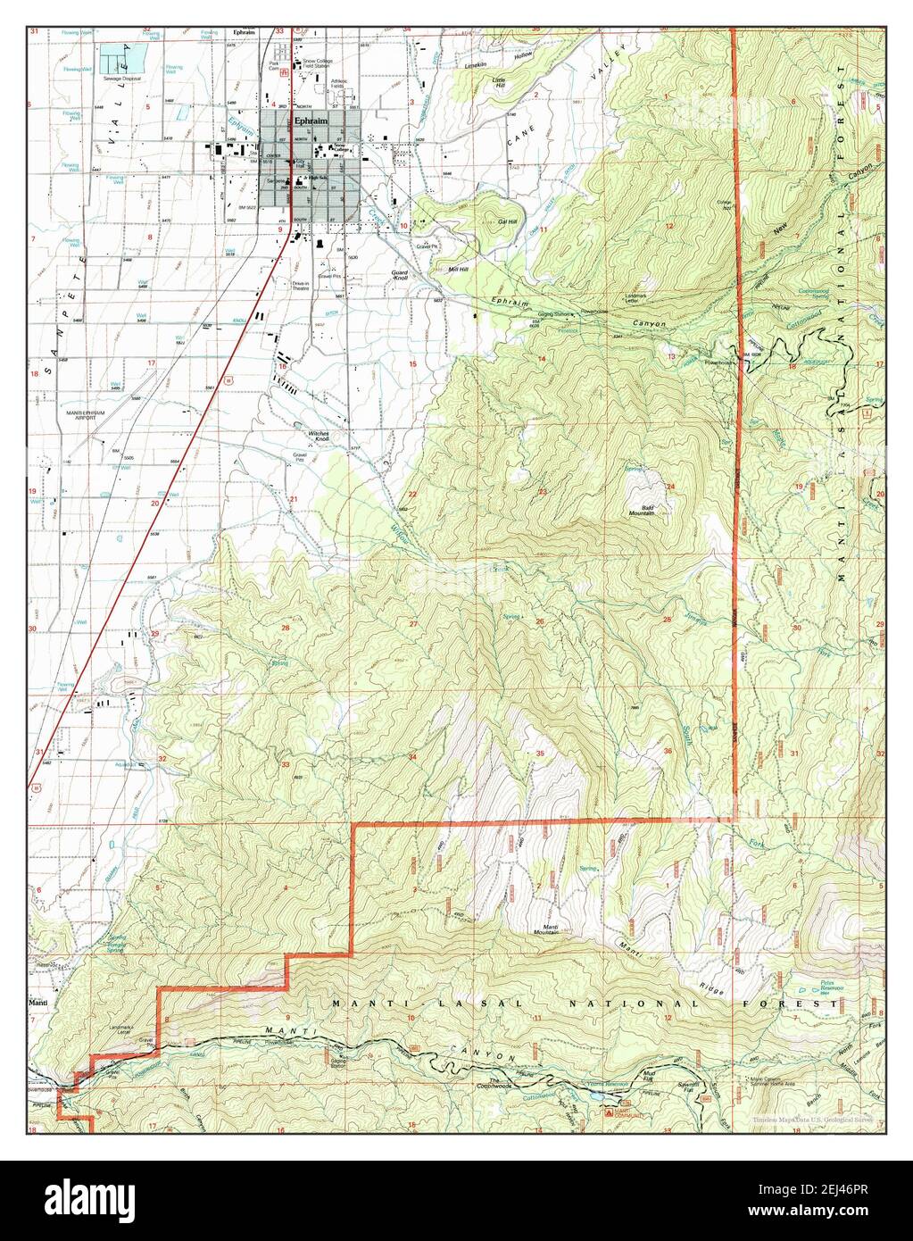 Ephraim, Utah, map 2001, 1:24000, United States of America by Timeless Maps, data U.S. Geological Survey Stock Photohttps://www.alamy.com/image-license-details/?v=1https://www.alamy.com/ephraim-utah-map-2001-124000-united-states-of-america-by-timeless-maps-data-us-geological-survey-image406995423.html
RM2EJ46PR–Ephraim, Utah, map 2001, 1:24000, United States of America by Timeless Maps, data U.S. Geological Survey
 Ephraim Weston Clark Stock Photohttps://www.alamy.com/image-license-details/?v=1https://www.alamy.com/stock-photo-ephraim-weston-clark-142442687.html
RMJ7MR2R–Ephraim Weston Clark
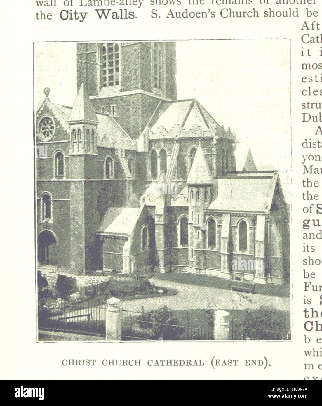 Image taken from page 64 of 'The Dictionary of Dublin, being a comprehensive guide to the city and its neighbourhood ... Illustrated by numerous photographs taken by the authors' Image taken from page 64 of 'The Dictionary of Dublin, Stock Photohttps://www.alamy.com/image-license-details/?v=1https://www.alamy.com/stock-photo-image-taken-from-page-64-of-the-dictionary-of-dublin-being-a-comprehensive-127866686.html
RMHC0R7A–Image taken from page 64 of 'The Dictionary of Dublin, being a comprehensive guide to the city and its neighbourhood ... Illustrated by numerous photographs taken by the authors' Image taken from page 64 of 'The Dictionary of Dublin,