Folly creek carolina Stock Photos and Images
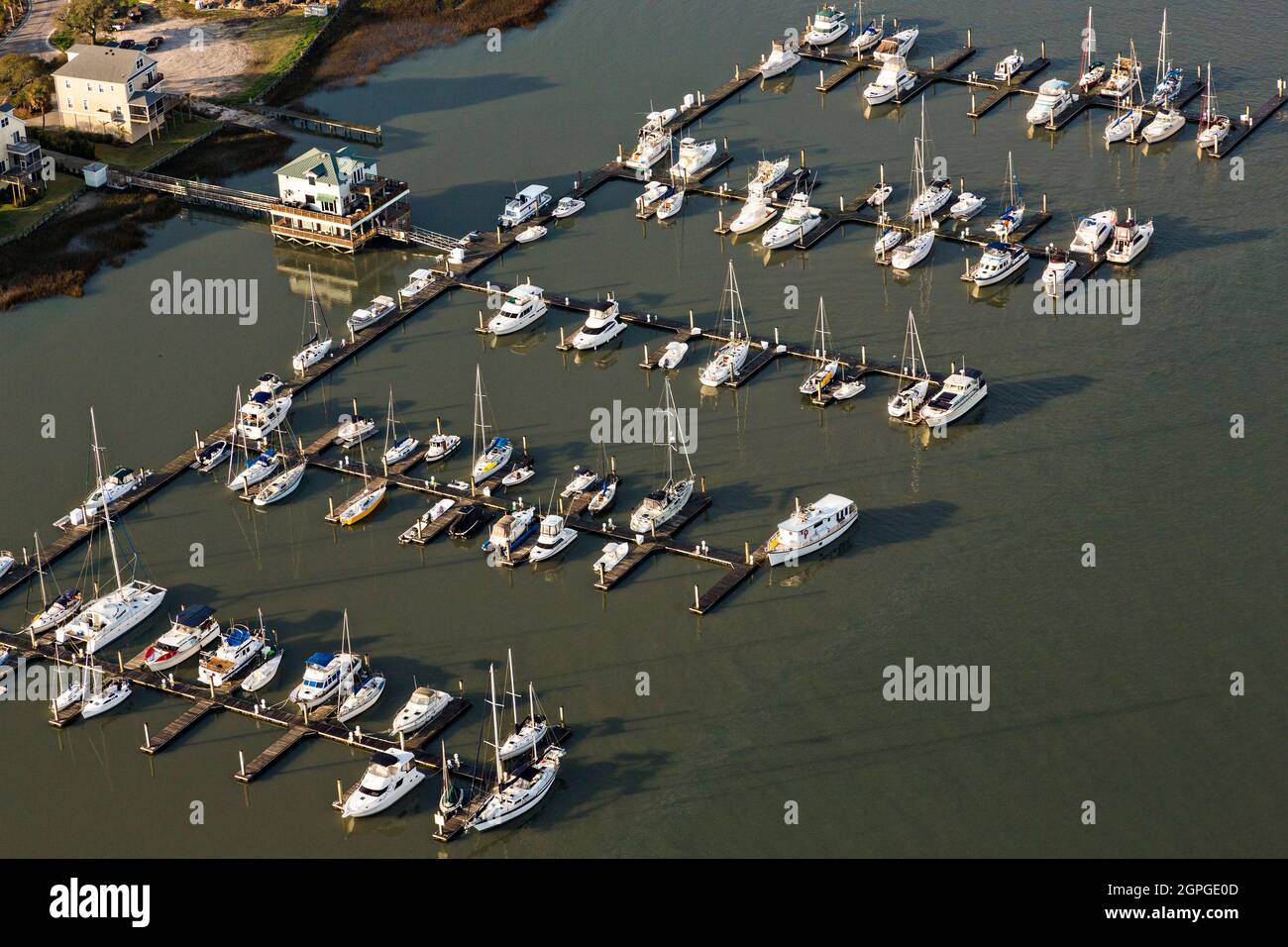
 Aerial view of the Sunset Cay Marina on Folly Beach, South Carolina known locally as the Edge of America. Stock Photohttps://www.alamy.com/image-license-details/?v=1https://www.alamy.com/aerial-view-of-the-sunset-cay-marina-on-folly-beach-south-carolina-known-locally-as-the-edge-of-america-image444143853.html
RM2GPGE0D–Aerial view of the Sunset Cay Marina on Folly Beach, South Carolina known locally as the Edge of America.
 An Old half sunken Tugboat grounded in Shem Creek, Charleston, South Carolina, USA Stock Photohttps://www.alamy.com/image-license-details/?v=1https://www.alamy.com/stock-photo-an-old-half-sunken-tugboat-grounded-in-shem-creek-charleston-south-11739821.html
RFA76EHJ–An Old half sunken Tugboat grounded in Shem Creek, Charleston, South Carolina, USA
 A late 19th century map of Charleston and Charleston Harbour, South Carolina, USA showing place names, rivers and railway tracks as they were at that time; with distances in English miles. Stock Photohttps://www.alamy.com/image-license-details/?v=1https://www.alamy.com/a-late-19th-century-map-of-charleston-and-charleston-harbour-south-carolina-usa-showing-place-names-rivers-and-railway-tracks-as-they-were-at-that-time-with-distances-in-english-miles-image472708387.html
RM2JD1MAB–A late 19th century map of Charleston and Charleston Harbour, South Carolina, USA showing place names, rivers and railway tracks as they were at that time; with distances in English miles.
 . Coast watch. Marine resources; Oceanography; Coastal zone management; Coastal ecology. Jim and Bonnie Swartzenberg gather oysters in Stump Sound. "These oysters are from Mississippi," says David Knox, the festival organizer. "We have been getting oysters out of state for eight years. We get about 200 bushels for the festival. It is hard to get anyone around here to guarantee that many oysters." The vanishing oysters on the Newport River is a familiar scenario in other North Carolina rivers and creeks — from Harlowe Creek in Carteret County to Lockwood Folly River in Bruns Stock Photohttps://www.alamy.com/image-license-details/?v=1https://www.alamy.com/coast-watch-marine-resources-oceanography-coastal-zone-management-coastal-ecology-jim-and-bonnie-swartzenberg-gather-oysters-in-stump-sound-quotthese-oysters-are-from-mississippiquot-says-david-knox-the-festival-organizer-quotwe-have-been-getting-oysters-out-of-state-for-eight-years-we-get-about-200-bushels-for-the-festival-it-is-hard-to-get-anyone-around-here-to-guarantee-that-many-oystersquot-the-vanishing-oysters-on-the-newport-river-is-a-familiar-scenario-in-other-north-carolina-rivers-and-creeks-from-harlowe-creek-in-carteret-county-to-lockwood-folly-river-in-bruns-image232757151.html
RMREK03B–. Coast watch. Marine resources; Oceanography; Coastal zone management; Coastal ecology. Jim and Bonnie Swartzenberg gather oysters in Stump Sound. "These oysters are from Mississippi," says David Knox, the festival organizer. "We have been getting oysters out of state for eight years. We get about 200 bushels for the festival. It is hard to get anyone around here to guarantee that many oysters." The vanishing oysters on the Newport River is a familiar scenario in other North Carolina rivers and creeks — from Harlowe Creek in Carteret County to Lockwood Folly River in Bruns
 Usa, Charleston, Rainbow Row travel landmark vector illustration Stock Vectorhttps://www.alamy.com/image-license-details/?v=1https://www.alamy.com/usa-charleston-rainbow-row-travel-landmark-vector-illustration-image544529629.html
RF2PHWD2N–Usa, Charleston, Rainbow Row travel landmark vector illustration
 Aerial view of the Sunset Cay Marina on Folly Beach, South Carolina known locally as the Edge of America. Stock Photohttps://www.alamy.com/image-license-details/?v=1https://www.alamy.com/aerial-view-of-the-sunset-cay-marina-on-folly-beach-south-carolina-known-locally-as-the-edge-of-america-image444143851.html
RM2GPGE0B–Aerial view of the Sunset Cay Marina on Folly Beach, South Carolina known locally as the Edge of America.
 United States, Charleston, South Carolina travel landmark vector illustration Stock Vectorhttps://www.alamy.com/image-license-details/?v=1https://www.alamy.com/united-states-charleston-south-carolina-travel-landmark-vector-illustration-image544432357.html
RF2PHN10N–United States, Charleston, South Carolina travel landmark vector illustration
 Aerial view of homes surrounded by salt marsh on Oak Island off Folly Road in Charleston, South Carolina. Stock Photohttps://www.alamy.com/image-license-details/?v=1https://www.alamy.com/aerial-view-of-homes-surrounded-by-salt-marsh-on-oak-island-off-folly-road-in-charleston-south-carolina-image444143840.html
RM2GPGE00–Aerial view of homes surrounded by salt marsh on Oak Island off Folly Road in Charleston, South Carolina.
 Aerial view of a thin strip of homes surrounded by salt marsh and the Atlantic Ocean on Folly Beach, South Carolina known locally as the Edge of America. Stock Photohttps://www.alamy.com/image-license-details/?v=1https://www.alamy.com/aerial-view-of-a-thin-strip-of-homes-surrounded-by-salt-marsh-and-the-atlantic-ocean-on-folly-beach-south-carolina-known-locally-as-the-edge-of-america-image444143752.html
RM2GPGDTT–Aerial view of a thin strip of homes surrounded by salt marsh and the Atlantic Ocean on Folly Beach, South Carolina known locally as the Edge of America.
 Aerial view of the Kiawah Island Beach Club on Kiawah Island, South Carolina. Stock Photohttps://www.alamy.com/image-license-details/?v=1https://www.alamy.com/aerial-view-of-the-kiawah-island-beach-club-on-kiawah-island-south-carolina-image444144084.html
RM2GPGE8M–Aerial view of the Kiawah Island Beach Club on Kiawah Island, South Carolina.
 Aerial view of the Ocean Course golf resort on the eastern end of Kiawah Island, South Carolina. Stock Photohttps://www.alamy.com/image-license-details/?v=1https://www.alamy.com/aerial-view-of-the-ocean-course-golf-resort-on-the-eastern-end-of-kiawah-island-south-carolina-image444143918.html
RM2GPGE2P–Aerial view of the Ocean Course golf resort on the eastern end of Kiawah Island, South Carolina.
 Aerial view of the Ocean Course golf resort on the eastern end of Kiawah Island, South Carolina. Stock Photohttps://www.alamy.com/image-license-details/?v=1https://www.alamy.com/aerial-view-of-the-ocean-course-golf-resort-on-the-eastern-end-of-kiawah-island-south-carolina-image444143919.html
RM2GPGE2R–Aerial view of the Ocean Course golf resort on the eastern end of Kiawah Island, South Carolina.
 Aerial view of the undeveloped north end of Kiawah Island resort community on the Atlantic Ocean at Stono Inlet in Kiawah Island, South Carolina. Stock Photohttps://www.alamy.com/image-license-details/?v=1https://www.alamy.com/aerial-view-of-the-undeveloped-north-end-of-kiawah-island-resort-community-on-the-atlantic-ocean-at-stono-inlet-in-kiawah-island-south-carolina-image444143910.html
RM2GPGE2E–Aerial view of the undeveloped north end of Kiawah Island resort community on the Atlantic Ocean at Stono Inlet in Kiawah Island, South Carolina.
 Aerial view of the undeveloped north end of Kiawah Island resort community on the Atlantic Ocean at Stono Inlet in Kiawah Island, South Carolina. Stock Photohttps://www.alamy.com/image-license-details/?v=1https://www.alamy.com/aerial-view-of-the-undeveloped-north-end-of-kiawah-island-resort-community-on-the-atlantic-ocean-at-stono-inlet-in-kiawah-island-south-carolina-image444143921.html
RM2GPGE2W–Aerial view of the undeveloped north end of Kiawah Island resort community on the Atlantic Ocean at Stono Inlet in Kiawah Island, South Carolina.