France map Cut Out Stock Images
 France map radial dot pattern. Blue dots going from the capital Paris outwards and form the hexagon silhouette of France. Stock Photohttps://www.alamy.com/image-license-details/?v=1https://www.alamy.com/stock-photo-france-map-radial-dot-pattern-blue-dots-going-from-the-capital-paris-116875389.html
RFGP43N1–France map radial dot pattern. Blue dots going from the capital Paris outwards and form the hexagon silhouette of France.
 France map on white background. Vector illustration. Stock Vectorhttps://www.alamy.com/image-license-details/?v=1https://www.alamy.com/france-map-on-white-background-vector-illustration-image334580197.html
RF2AC9CCN–France map on white background. Vector illustration.
 3D France map with flag illustration on white background Stock Photohttps://www.alamy.com/image-license-details/?v=1https://www.alamy.com/stock-photo-3d-france-map-with-flag-illustration-on-white-background-57669511.html
RFD9R21B–3D France map with flag illustration on white background
 France map in old green paper isolated on white background. Stock Photohttps://www.alamy.com/image-license-details/?v=1https://www.alamy.com/stock-photo-france-map-in-old-green-paper-isolated-on-white-background-49087623.html
RMCRT3NB–France map in old green paper isolated on white background.
 France map multicultural group of people integration immigration diversity isolated Stock Photohttps://www.alamy.com/image-license-details/?v=1https://www.alamy.com/france-map-multicultural-group-of-people-integration-immigration-diversity-image155496048.html
RFK0YCP8–France map multicultural group of people integration immigration diversity isolated
 France map Stock Photohttps://www.alamy.com/image-license-details/?v=1https://www.alamy.com/stock-photo-france-map-15776124.html
RFAPFFBW–France map
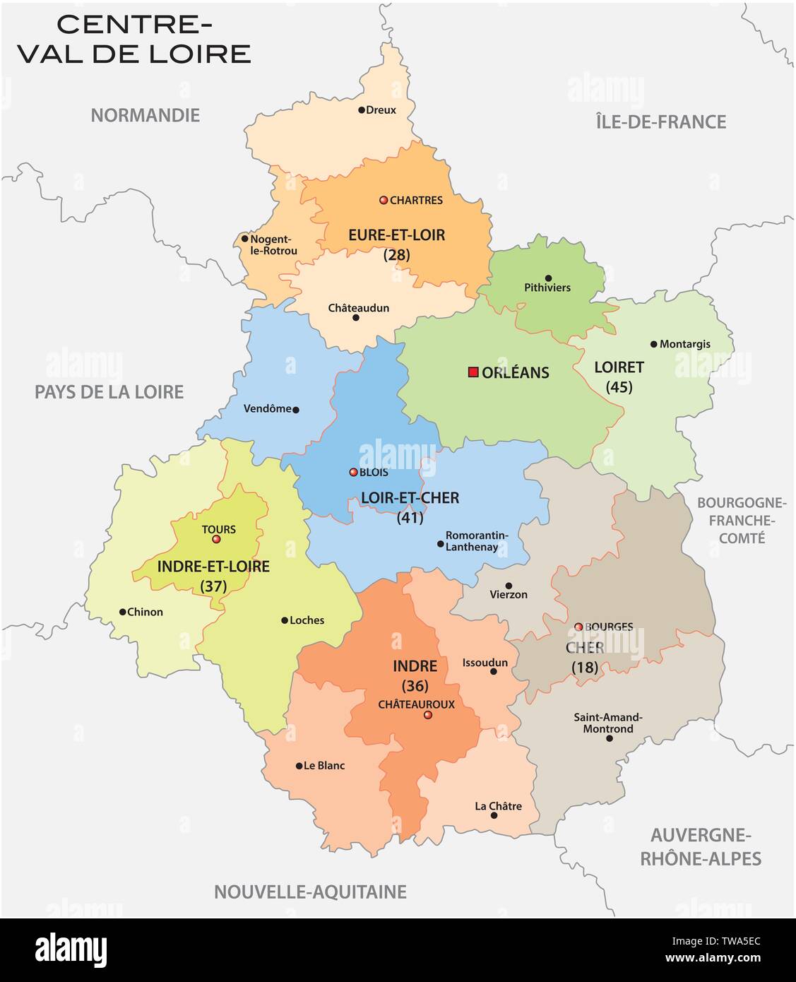 administrative and political map of the region Centre Val de Loire france Stock Vectorhttps://www.alamy.com/image-license-details/?v=1https://www.alamy.com/administrative-and-political-map-of-the-region-centre-val-de-loire-france-image256535396.html
RFTWA5EC–administrative and political map of the region Centre Val de Loire france
 Bretagne France Map grey Stock Vectorhttps://www.alamy.com/image-license-details/?v=1https://www.alamy.com/stock-photo-bretagne-france-map-grey-123174381.html
RFH4B251–Bretagne France Map grey
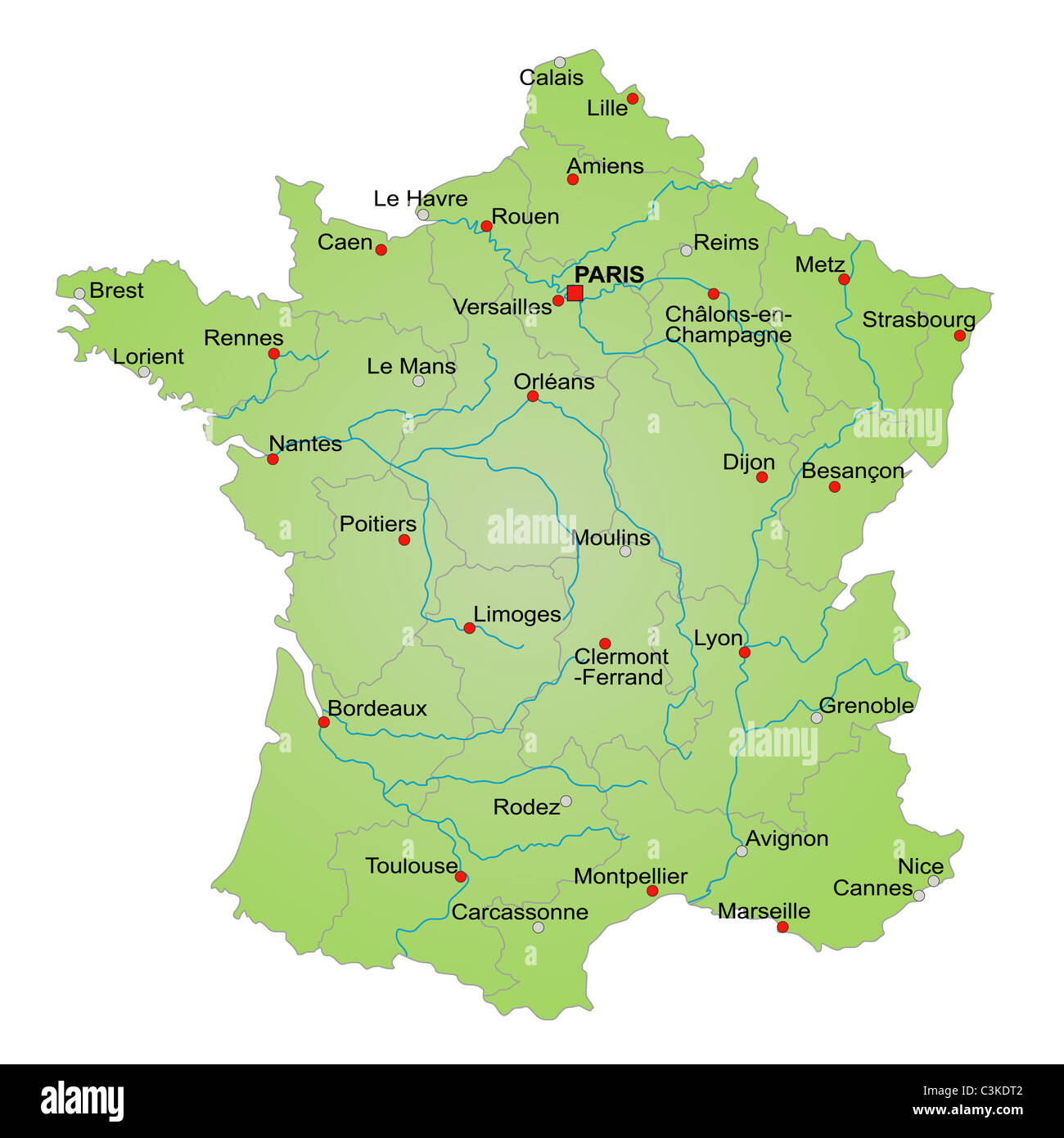 Stylized map of France showing provinces, rivers and cities. All on white background. French caption Stock Photohttps://www.alamy.com/image-license-details/?v=1https://www.alamy.com/stock-photo-stylized-map-of-france-showing-provinces-rivers-and-cities-all-on-36692658.html
RFC3KDT2–Stylized map of France showing provinces, rivers and cities. All on white background. French caption
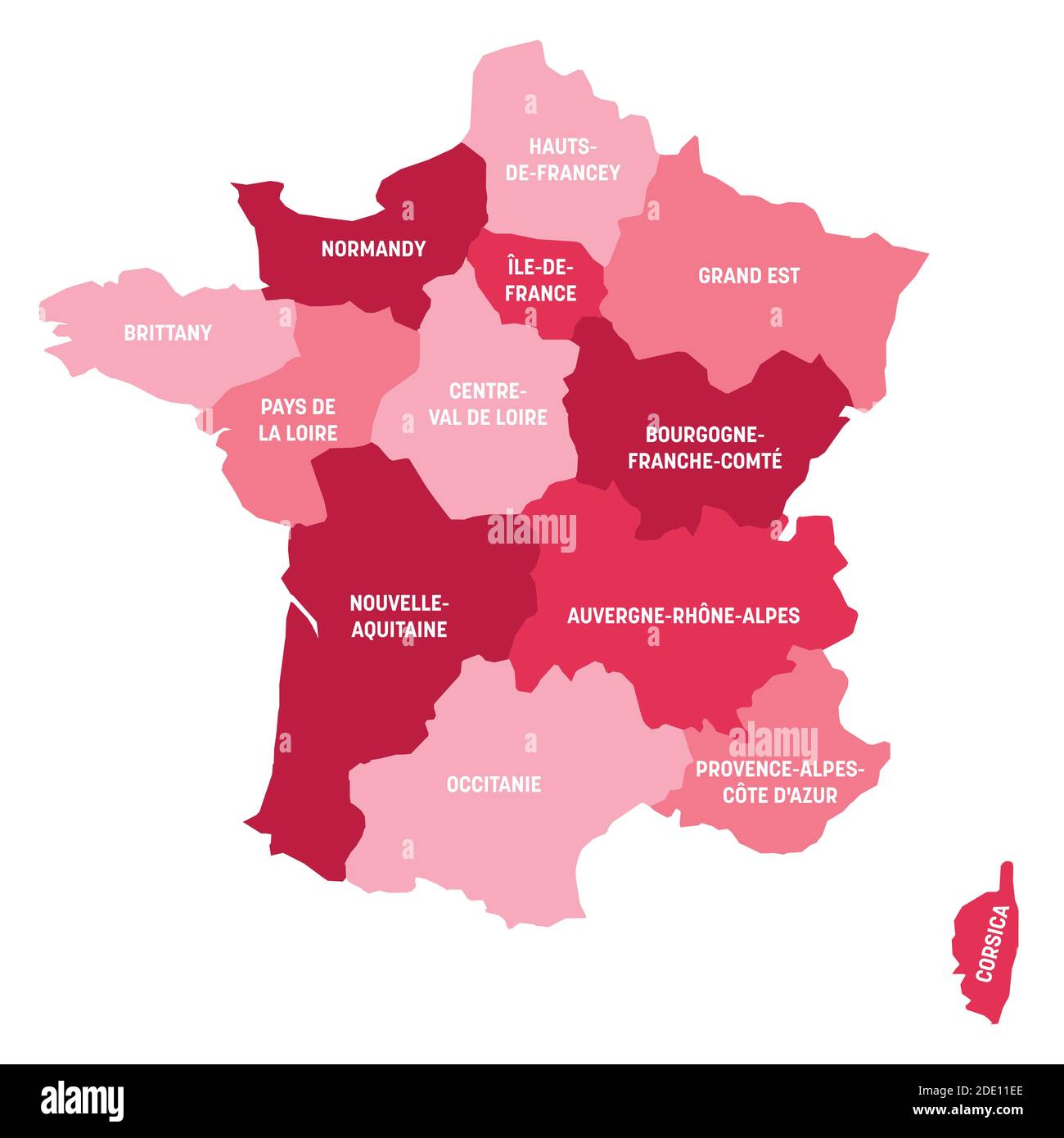 Pink political map of France. Administrative divisions - metropolitan regions. Simple flat vector map with labels. Stock Vectorhttps://www.alamy.com/image-license-details/?v=1https://www.alamy.com/pink-political-map-of-france-administrative-divisions-metropolitan-regions-simple-flat-vector-map-with-labels-image387256422.html
RF2DE11EE–Pink political map of France. Administrative divisions - metropolitan regions. Simple flat vector map with labels.
 National flag of France as a map Stock Photohttps://www.alamy.com/image-license-details/?v=1https://www.alamy.com/stock-photo-national-flag-of-france-as-a-map-15257806.html
RFAMGCPR–National flag of France as a map
 French France Country Map Outline With National Flag Inside Stock Photohttps://www.alamy.com/image-license-details/?v=1https://www.alamy.com/stock-photo-french-france-country-map-outline-with-national-flag-inside-21847074.html
RMB7F64J–French France Country Map Outline With National Flag Inside
 Outline map of France Stock Photohttps://www.alamy.com/image-license-details/?v=1https://www.alamy.com/stock-photo-outline-map-of-france-16065150.html
RFARJ7HK–Outline map of France
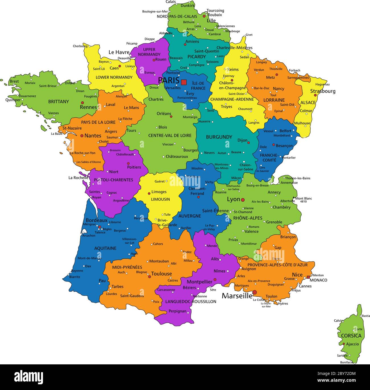 Colorful France political map with clearly labeled, separated layers. Vector illustration. Stock Vectorhttps://www.alamy.com/image-license-details/?v=1https://www.alamy.com/colorful-france-political-map-with-clearly-labeled-separated-layers-vector-illustration-image360958688.html
RF2BY72DM–Colorful France political map with clearly labeled, separated layers. Vector illustration.
 Outline, map of France Stock Photohttps://www.alamy.com/image-license-details/?v=1https://www.alamy.com/stock-photo-outline-map-of-france-34054628.html
RFBYB90M–Outline, map of France
 map and flag of france Stock Photohttps://www.alamy.com/image-license-details/?v=1https://www.alamy.com/stock-photo-map-and-flag-of-france-18879813.html
RFB2M1B1–map and flag of france
 France map cracked Stock Photohttps://www.alamy.com/image-license-details/?v=1https://www.alamy.com/stock-photo-france-map-cracked-55453479.html
RFD663DB–France map cracked
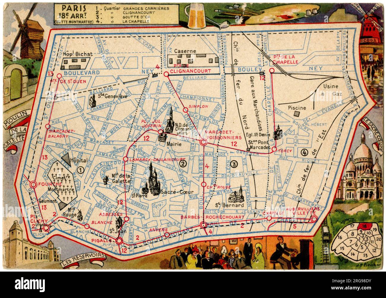 Map of the Butte Montmartre, 18th arrondissement, Paris, France. Stock Photohttps://www.alamy.com/image-license-details/?v=1https://www.alamy.com/map-of-the-butte-montmartre-18th-arrondissement-paris-france-image560770503.html
RM2RG98DY–Map of the Butte Montmartre, 18th arrondissement, Paris, France.
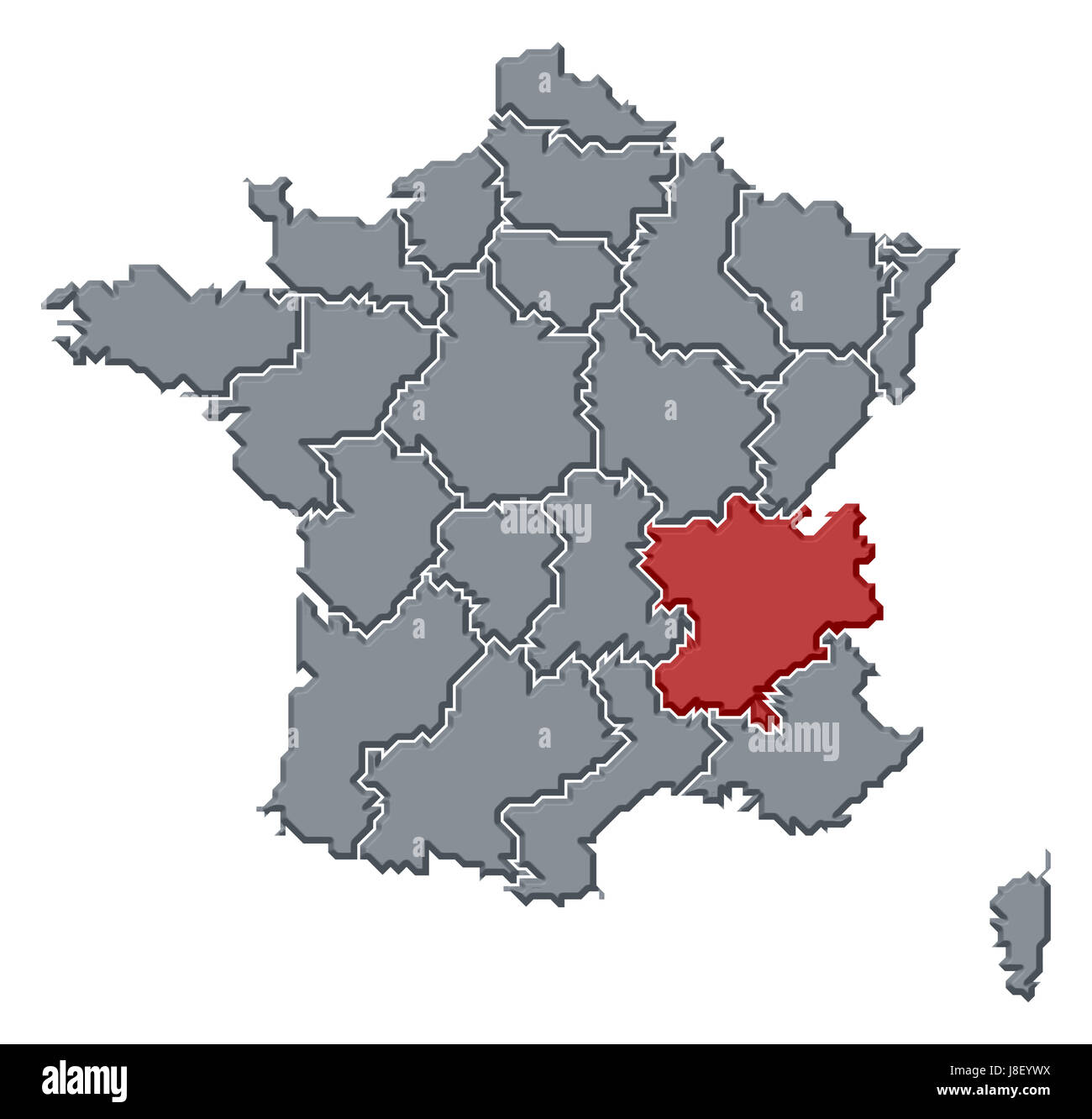 france, map, atlas, map of the world, profile, symbolic, political, colour, Stock Photohttps://www.alamy.com/image-license-details/?v=1https://www.alamy.com/stock-photo-france-map-atlas-map-of-the-world-profile-symbolic-political-colour-142929414.html
RFJ8EYWX–france, map, atlas, map of the world, profile, symbolic, political, colour,
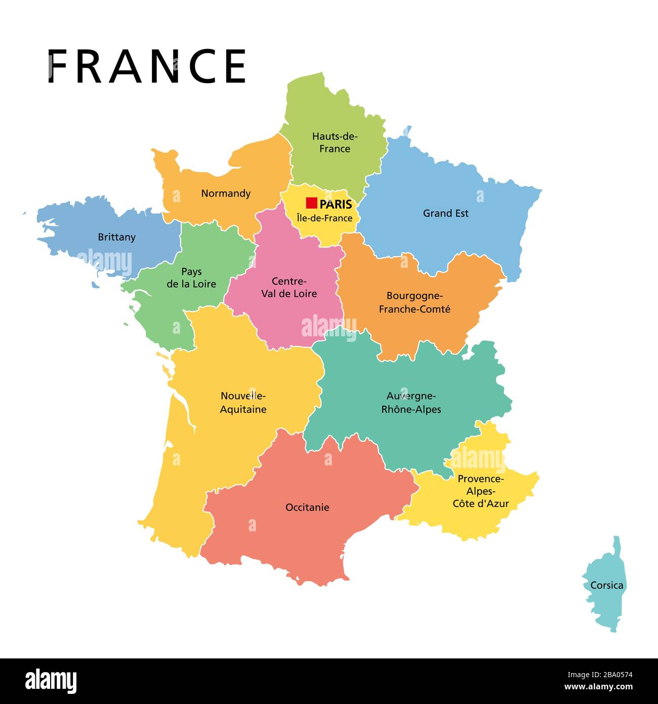 France, political map with multicolored regions of Metropolitan France. French Republic, capital Paris, administrative regions and prefectures. Stock Photohttps://www.alamy.com/image-license-details/?v=1https://www.alamy.com/france-political-map-with-multicolored-regions-of-metropolitan-france-french-republic-capital-paris-administrative-regions-and-prefectures-image350358040.html
RF2BA0574–France, political map with multicolored regions of Metropolitan France. French Republic, capital Paris, administrative regions and prefectures.
 France map sign background. Vector eps10 illustration Stock Vectorhttps://www.alamy.com/image-license-details/?v=1https://www.alamy.com/france-map-sign-background-vector-eps10-illustration-image259866050.html
RFW2NWPA–France map sign background. Vector eps10 illustration
 A France map on white background with clipping path Stock Photohttps://www.alamy.com/image-license-details/?v=1https://www.alamy.com/a-france-map-on-white-background-with-clipping-path-image355512033.html
RF2BJAY69–A France map on white background with clipping path
 Outline map of country of France in blue isolated on white background Stock Photohttps://www.alamy.com/image-license-details/?v=1https://www.alamy.com/stock-photo-outline-map-of-country-of-france-in-blue-isolated-on-white-background-21610795.html
RMB74CP3–Outline map of country of France in blue isolated on white background
 Dotted france map vector, isolated background. Flat Earth, gray map template for web site pattern, annual report, infographic. Map of France dots Stock Vectorhttps://www.alamy.com/image-license-details/?v=1https://www.alamy.com/dotted-france-map-vector-isolated-background-flat-earth-gray-map-template-for-web-site-pattern-annual-report-infographic-map-of-france-dots-image336466257.html
RF2AFBA41–Dotted france map vector, isolated background. Flat Earth, gray map template for web site pattern, annual report, infographic. Map of France dots
 Blue france map with 3 gold fleur de lys - Old French flag - 3D Rendering Stock Photohttps://www.alamy.com/image-license-details/?v=1https://www.alamy.com/blue-france-map-with-3-gold-fleur-de-lys-old-french-flag-3d-rendering-image465579588.html
RF2J1CYEC–Blue france map with 3 gold fleur de lys - Old French flag - 3D Rendering
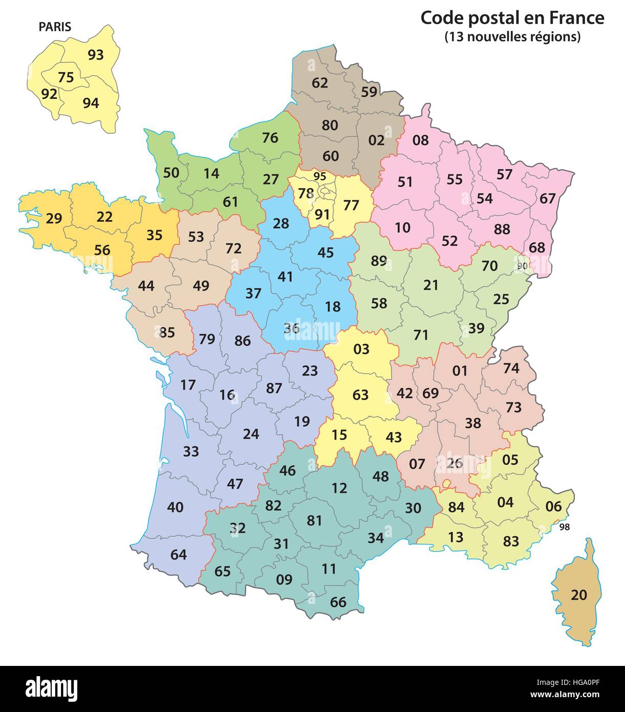 france 2-digit postcodes map 2017 (13 Regions) Stock Vectorhttps://www.alamy.com/image-license-details/?v=1https://www.alamy.com/stock-photo-france-2-digit-postcodes-map-2017-13-regions-130527223.html
RFHGA0PF–france 2-digit postcodes map 2017 (13 Regions)
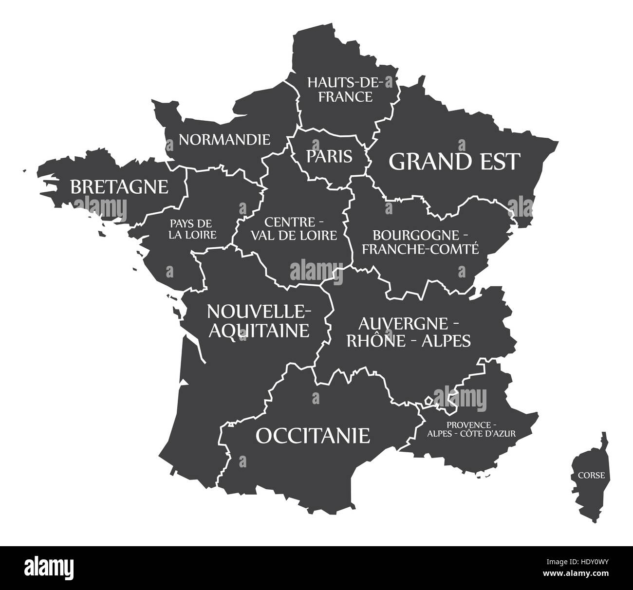 France Map labelled black Stock Vectorhttps://www.alamy.com/image-license-details/?v=1https://www.alamy.com/stock-photo-france-map-labelled-black-129056535.html
RFHDY0WY–France Map labelled black
 graph made of euros on France map flag illustration Stock Photohttps://www.alamy.com/image-license-details/?v=1https://www.alamy.com/stock-photo-graph-made-of-euros-on-france-map-flag-illustration-32331487.html
RFBTGR3Y–graph made of euros on France map flag illustration
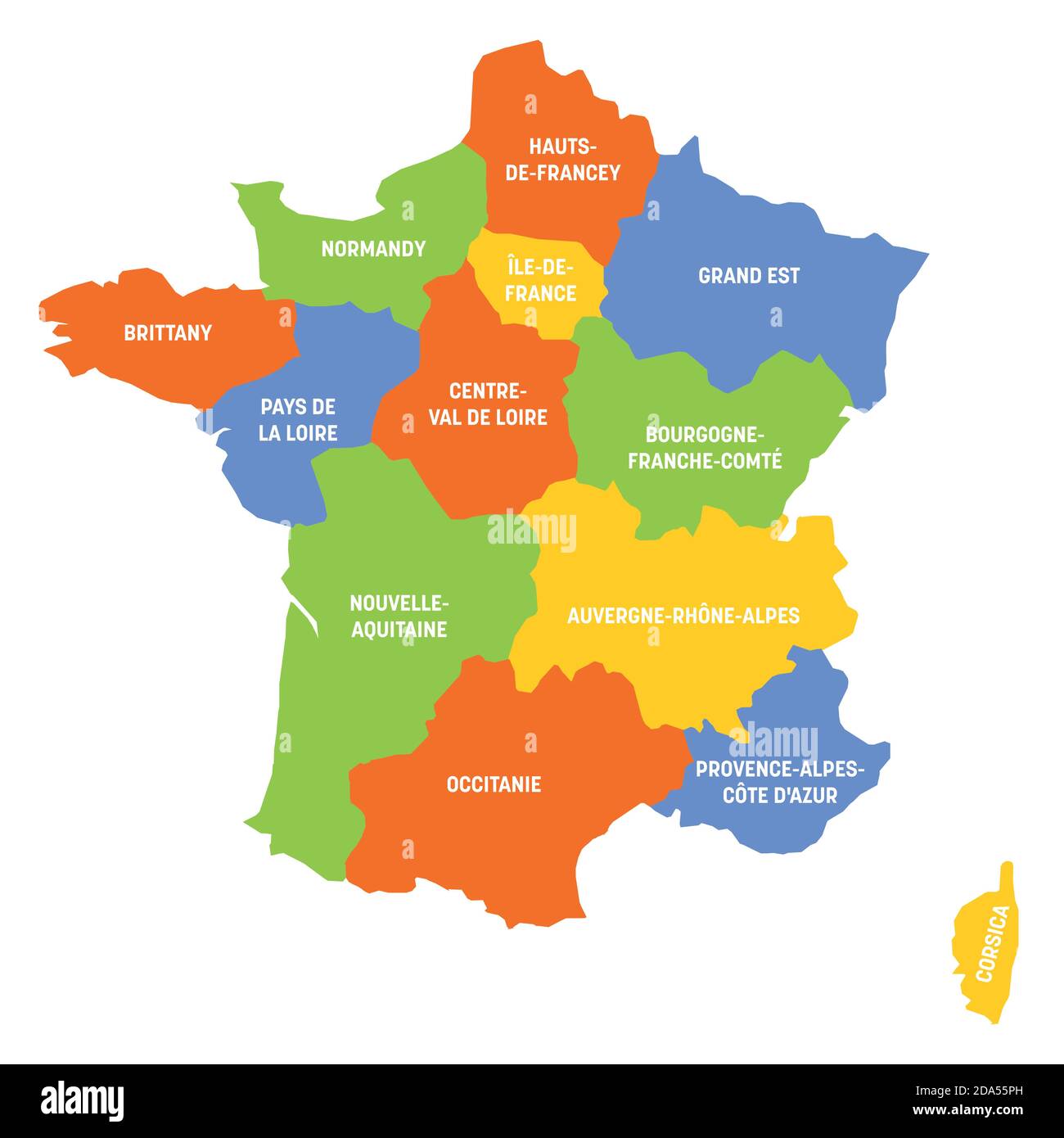 France political map of France. Administrative divisions - metropolitan regions. Simple flat vector map with labels. Stock Vectorhttps://www.alamy.com/image-license-details/?v=1https://www.alamy.com/france-political-map-of-france-administrative-divisions-metropolitan-regions-simple-flat-vector-map-with-labels-image384888969.html
RF2DA55PH–France political map of France. Administrative divisions - metropolitan regions. Simple flat vector map with labels.
 Map of France. France map, Europe Outline map of France, High detailed France map, illustration vector, tourism, government, Stock Vectorhttps://www.alamy.com/image-license-details/?v=1https://www.alamy.com/map-of-france-france-map-europe-outline-map-of-france-high-detailed-france-map-illustration-vector-tourism-government-image612060878.html
RF2XFNNW2–Map of France. France map, Europe Outline map of France, High detailed France map, illustration vector, tourism, government,
 Outline silhouette map of France isolated on a white background Stock Photohttps://www.alamy.com/image-license-details/?v=1https://www.alamy.com/outline-silhouette-map-of-france-isolated-on-a-white-background-image461242604.html
RF2HPBBJ4–Outline silhouette map of France isolated on a white background
 France map on white background. Vector illustration. Stock Vectorhttps://www.alamy.com/image-license-details/?v=1https://www.alamy.com/france-map-on-white-background-vector-illustration-image334509560.html
RF2AC66A0–France map on white background. Vector illustration.
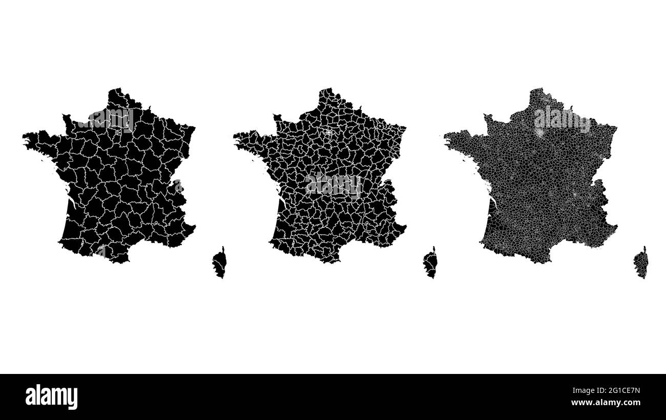 France map municipal, region, state division. Administrative borders, outline black on white background vector illustration. Stock Vectorhttps://www.alamy.com/image-license-details/?v=1https://www.alamy.com/france-map-municipal-region-state-division-administrative-borders-outline-black-on-white-background-vector-illustration-image431148473.html
RF2G1CE7N–France map municipal, region, state division. Administrative borders, outline black on white background vector illustration.
 Map of France Stock Photohttps://www.alamy.com/image-license-details/?v=1https://www.alamy.com/stock-photo-map-of-france-91193068.html
RFF8A5K8–Map of France
 France Map Stock Photohttps://www.alamy.com/image-license-details/?v=1https://www.alamy.com/stock-photo-france-map-103265777.html
RMG004FD–France Map
 france map logo illustration design Stock Vectorhttps://www.alamy.com/image-license-details/?v=1https://www.alamy.com/france-map-logo-illustration-design-image542486633.html
RF2PEGB6H–france map logo illustration design
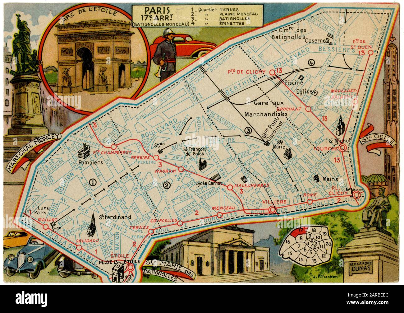 Map of Batignolles-Monceau, 17th arrondissement, Paris, France. Stock Photohttps://www.alamy.com/image-license-details/?v=1https://www.alamy.com/map-of-batignolles-monceau-17th-arrondissement-paris-france-image341386936.html
RM2ARBEEG–Map of Batignolles-Monceau, 17th arrondissement, Paris, France.
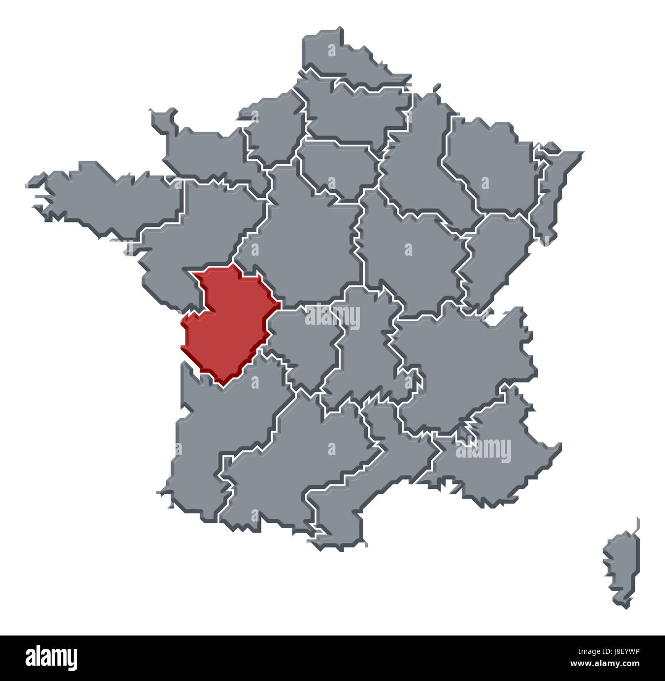 france, map, atlas, map of the world, profile, symbolic, political, colour, Stock Photohttps://www.alamy.com/image-license-details/?v=1https://www.alamy.com/stock-photo-france-map-atlas-map-of-the-world-profile-symbolic-political-colour-142929410.html
RFJ8EYWP–france, map, atlas, map of the world, profile, symbolic, political, colour,
 France Map With Wooden Flag Stock Vectorhttps://www.alamy.com/image-license-details/?v=1https://www.alamy.com/stock-photo-france-map-with-wooden-flag-147084069.html
RFJF876D–France Map With Wooden Flag
 France map sign background. Vector eps10 illustration Stock Vectorhttps://www.alamy.com/image-license-details/?v=1https://www.alamy.com/france-map-sign-background-vector-eps10-illustration-image259866013.html
RFW2NWN1–France map sign background. Vector eps10 illustration
 Illustration for Euro 2016 France football championship.Host cities with balls on a France map covered by a football field. Stock Photohttps://www.alamy.com/image-license-details/?v=1https://www.alamy.com/stock-photo-illustration-for-euro-2016-france-football-championshiphost-cities-104867853.html
RMG2H40D–Illustration for Euro 2016 France football championship.Host cities with balls on a France map covered by a football field.
 France map on a European Union flag button isolated on a white background. Stock Photohttps://www.alamy.com/image-license-details/?v=1https://www.alamy.com/stock-photo-france-map-on-a-european-union-flag-button-isolated-on-a-white-background-114243504.html
RMGHT6N4–France map on a European Union flag button isolated on a white background.
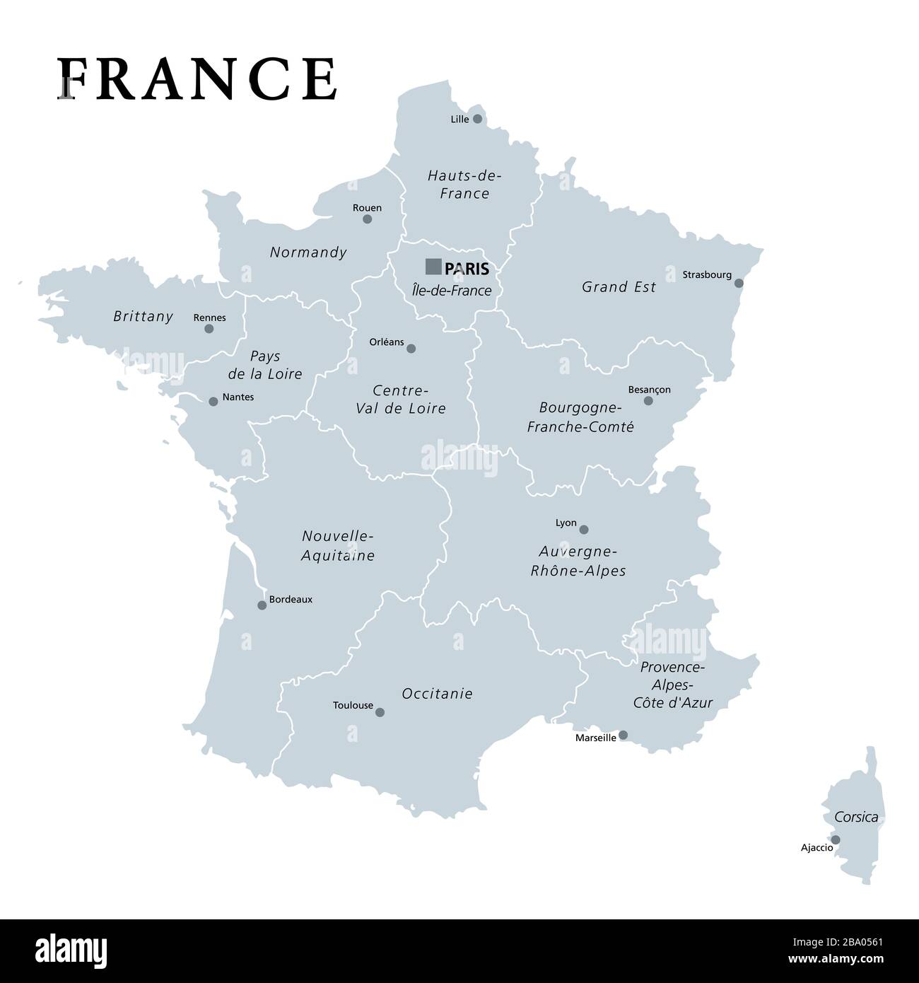 France, gray political map. Regions of Metropolitan France. French Republic, capital Paris, administrative regions and prefectures. Stock Photohttps://www.alamy.com/image-license-details/?v=1https://www.alamy.com/france-gray-political-map-regions-of-metropolitan-france-french-republic-capital-paris-administrative-regions-and-prefectures-image350358009.html
RF2BA0561–France, gray political map. Regions of Metropolitan France. French Republic, capital Paris, administrative regions and prefectures.
 Illustration of France map button; isolated on white background. Stock Photohttps://www.alamy.com/image-license-details/?v=1https://www.alamy.com/stock-photo-illustration-of-france-map-button-isolated-on-white-background-34334685.html
RMBYT26N–Illustration of France map button; isolated on white background.
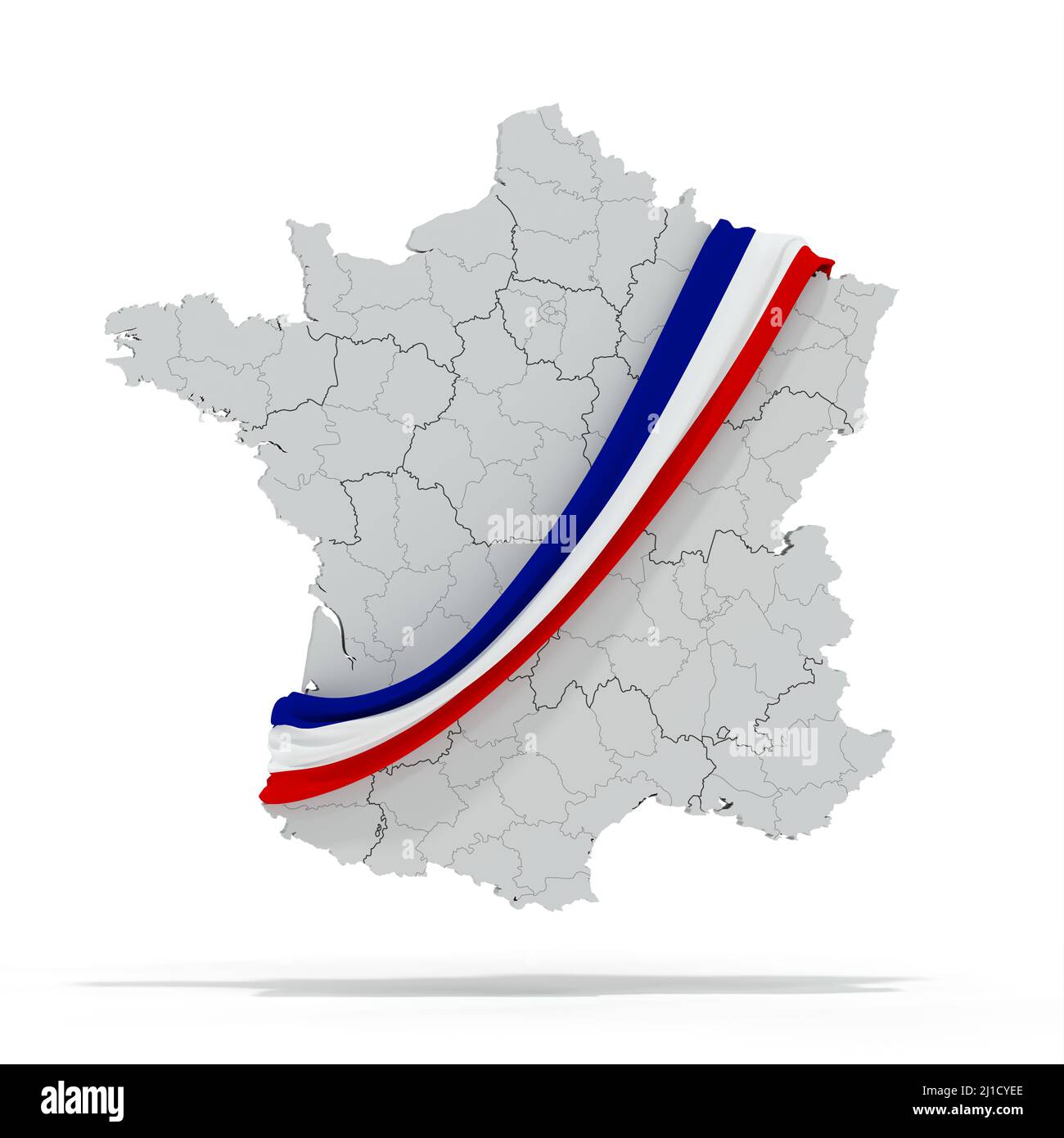 France map with tricolor scarf - political election - 3D rendering Stock Photohttps://www.alamy.com/image-license-details/?v=1https://www.alamy.com/france-map-with-tricolor-scarf-political-election-3d-rendering-image465579590.html
RF2J1CYEE–France map with tricolor scarf - political election - 3D rendering
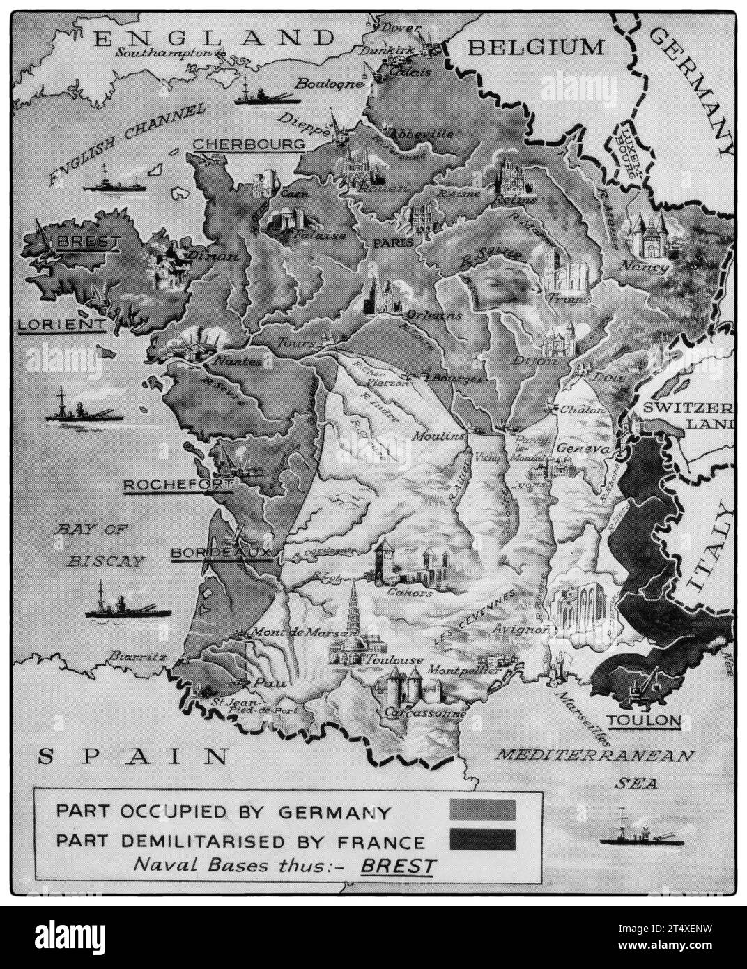 A map illustrating the demarcation of France following the Armistice of 21st June 1940; they included Northern France, Paris and the entire Atlantic Coast. Stock Photohttps://www.alamy.com/image-license-details/?v=1https://www.alamy.com/a-map-illustrating-the-demarcation-of-france-following-the-armistice-of-21st-june-1940-they-included-northern-france-paris-and-the-entire-atlantic-coast-image570983109.html
RM2T4XENW–A map illustrating the demarcation of France following the Armistice of 21st June 1940; they included Northern France, Paris and the entire Atlantic Coast.
 France map silhouette vector illustration Stock Vectorhttps://www.alamy.com/image-license-details/?v=1https://www.alamy.com/france-map-silhouette-vector-illustration-image610362612.html
RF2XD0BMM–France map silhouette vector illustration
 France map vector illustration. Global economy. Famous country. Western Europe. Europe. Stock Vectorhttps://www.alamy.com/image-license-details/?v=1https://www.alamy.com/france-map-vector-illustration-global-economy-famous-country-western-europe-europe-image499616530.html
RF2M0RDYE–France map vector illustration. Global economy. Famous country. Western Europe. Europe.
 Map of France. France map, Europe Outline map of France, High detailed France map, illustration vector, tourism, government, Stock Vectorhttps://www.alamy.com/image-license-details/?v=1https://www.alamy.com/map-of-france-france-map-europe-outline-map-of-france-high-detailed-france-map-illustration-vector-tourism-government-image612063247.html
RF2XFNTWK–Map of France. France map, Europe Outline map of France, High detailed France map, illustration vector, tourism, government,
 France Map and Flag Stock Vectorhttps://www.alamy.com/image-license-details/?v=1https://www.alamy.com/france-map-and-flag-image553660767.html
RF2R4NBXR–France Map and Flag
 Molecular Structure France Map Virus map Prvention campaign map Stock Vectorhttps://www.alamy.com/image-license-details/?v=1https://www.alamy.com/molecular-structure-france-map-virus-map-prvention-campaign-map-image345720401.html
RF2B2CWW5–Molecular Structure France Map Virus map Prvention campaign map
 France map municipal, region, state division. Administrative borders, outline black on white background vector illustration. Stock Vectorhttps://www.alamy.com/image-license-details/?v=1https://www.alamy.com/france-map-municipal-region-state-division-administrative-borders-outline-black-on-white-background-vector-illustration-image431148468.html
RF2G1CE7G–France map municipal, region, state division. Administrative borders, outline black on white background vector illustration.
RF2DGAB1G–france map icon, black vector sign with editable strokes, concept illustration
RF2JGN39X–France map vector icon isolated on white background. Outline map of France vector icon
 france map logo illustration design Stock Vectorhttps://www.alamy.com/image-license-details/?v=1https://www.alamy.com/france-map-logo-illustration-design-image542486675.html
RF2PEGB83–france map logo illustration design
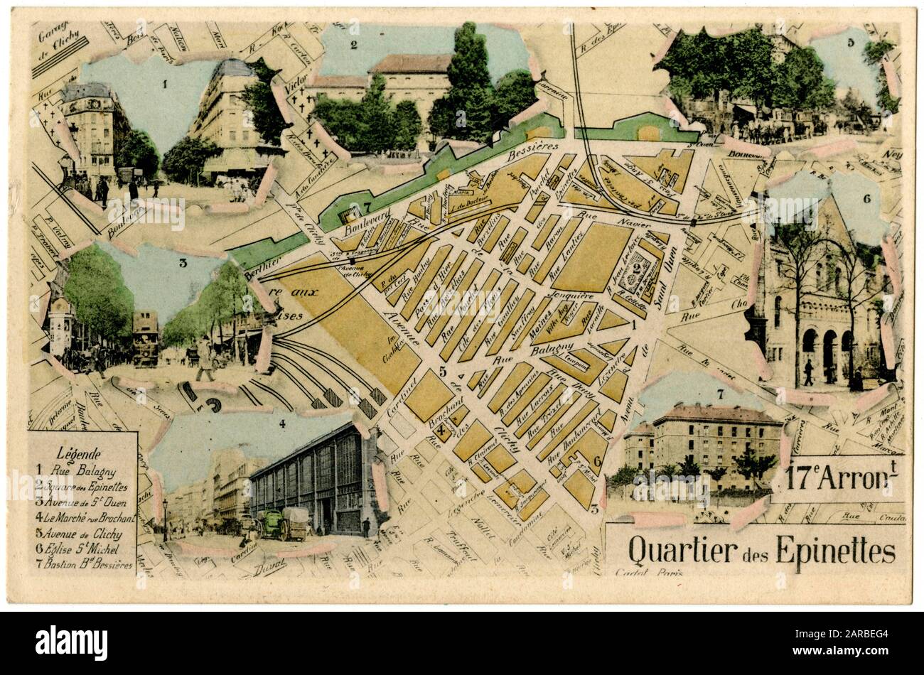 Map of the 17th Arrondissement, Quartier des Epinettes, Paris, France. Stock Photohttps://www.alamy.com/image-license-details/?v=1https://www.alamy.com/map-of-the-17th-arrondissement-quartier-des-epinettes-paris-france-image341386980.html
RM2ARBEG4–Map of the 17th Arrondissement, Quartier des Epinettes, Paris, France.
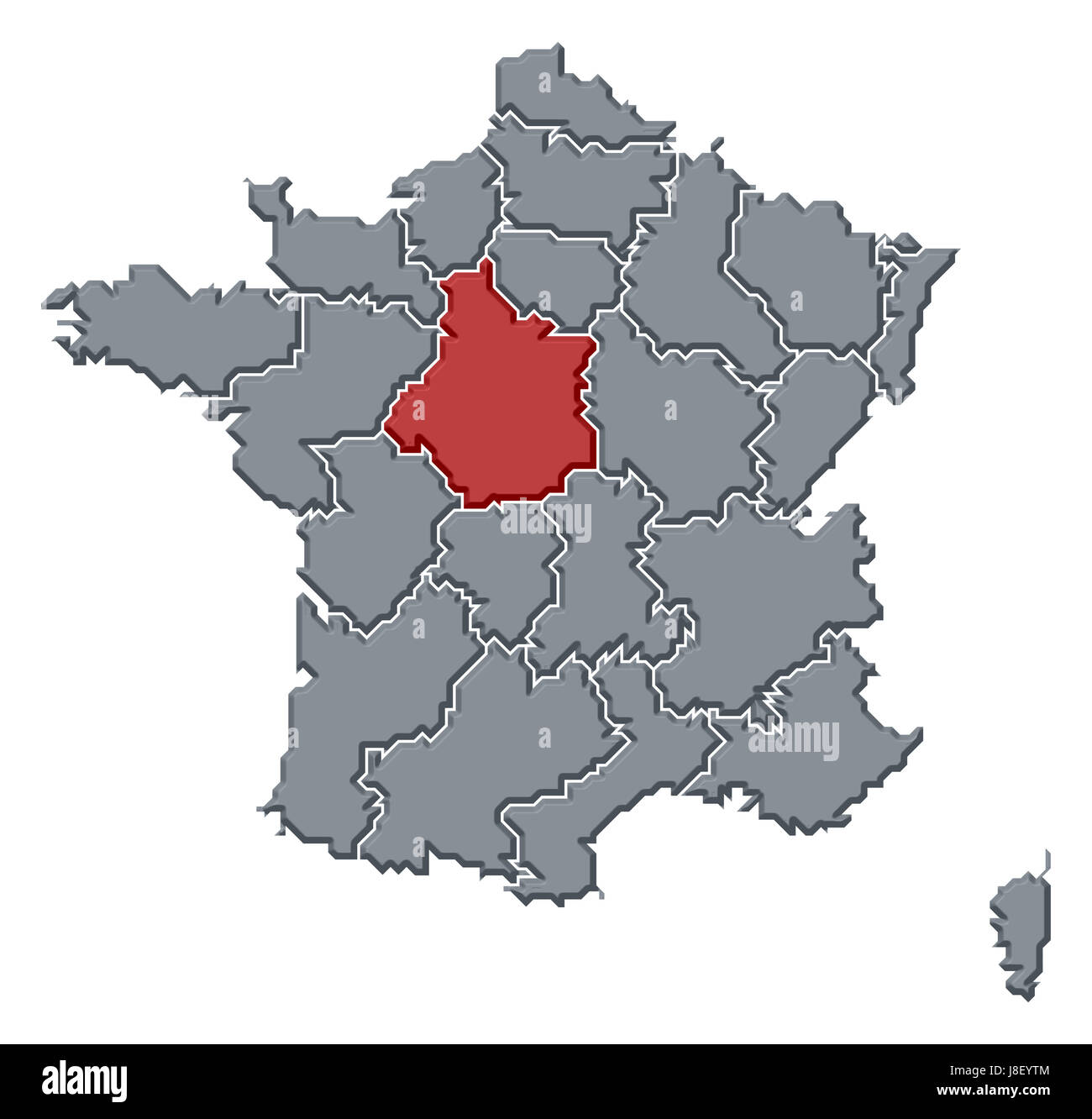 france, map, atlas, map of the world, profile, symbolic, political, colour, Stock Photohttps://www.alamy.com/image-license-details/?v=1https://www.alamy.com/stock-photo-france-map-atlas-map-of-the-world-profile-symbolic-political-colour-142929380.html
RFJ8EYTM–france, map, atlas, map of the world, profile, symbolic, political, colour,
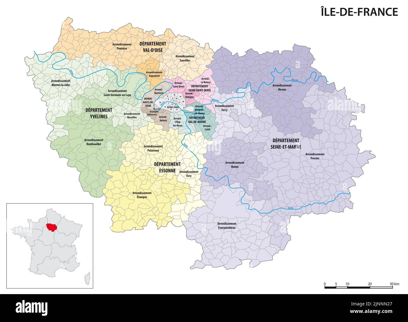 Detailed administrative map of the Ile-de-France region, France Stock Photohttps://www.alamy.com/image-license-details/?v=1https://www.alamy.com/detailed-administrative-map-of-the-ile-de-france-region-france-image478065231.html
RF2JNNN27–Detailed administrative map of the Ile-de-France region, France
RFEGGNWW–France icon
RF2CBJ54W–France map on vintage background. Black and white hand drawn illustration. Icon sign for print and labelling.
 Auvergne France Map grey Stock Vectorhttps://www.alamy.com/image-license-details/?v=1https://www.alamy.com/stock-photo-auvergne-france-map-grey-123174376.html
RFH4B24T–Auvergne France Map grey
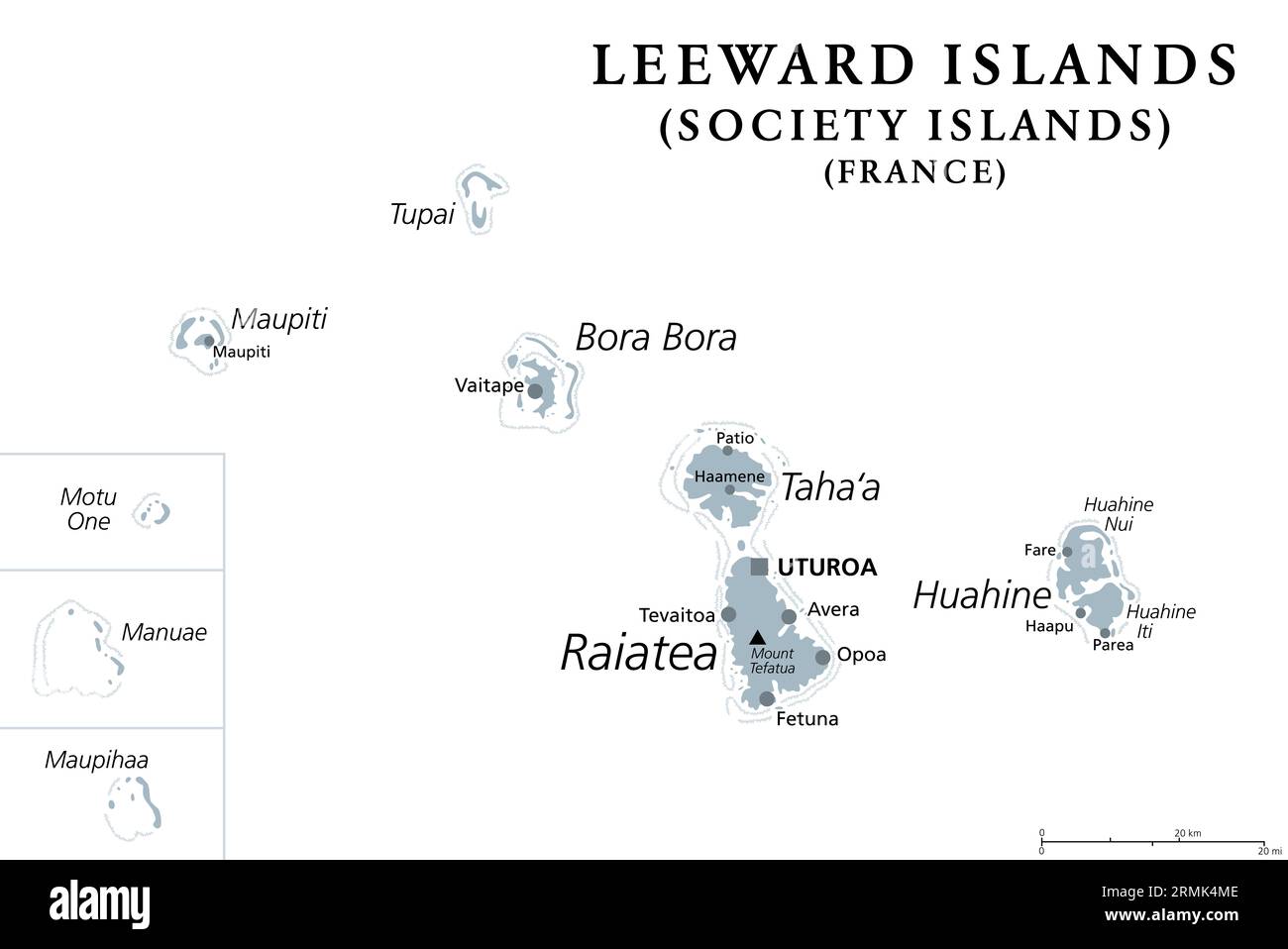 Leeward Islands, gray political map. Western part of the Society Islands in French Polynesia. Overseas collectivity of France in the South Pacific. Stock Photohttps://www.alamy.com/image-license-details/?v=1https://www.alamy.com/leeward-islands-gray-political-map-western-part-of-the-society-islands-in-french-polynesia-overseas-collectivity-of-france-in-the-south-pacific-image563445694.html
RF2RMK4ME–Leeward Islands, gray political map. Western part of the Society Islands in French Polynesia. Overseas collectivity of France in the South Pacific.
 France map blue circular button isolated on white background. Stock Photohttps://www.alamy.com/image-license-details/?v=1https://www.alamy.com/stock-photo-france-map-blue-circular-button-isolated-on-white-background-33978774.html
RMBY7T7J–France map blue circular button isolated on white background.
 France map with tricolor scarf - political election - 3D rendering Stock Photohttps://www.alamy.com/image-license-details/?v=1https://www.alamy.com/france-map-with-tricolor-scarf-political-election-3d-rendering-image465579593.html
RF2J1CYEH–France map with tricolor scarf - political election - 3D rendering
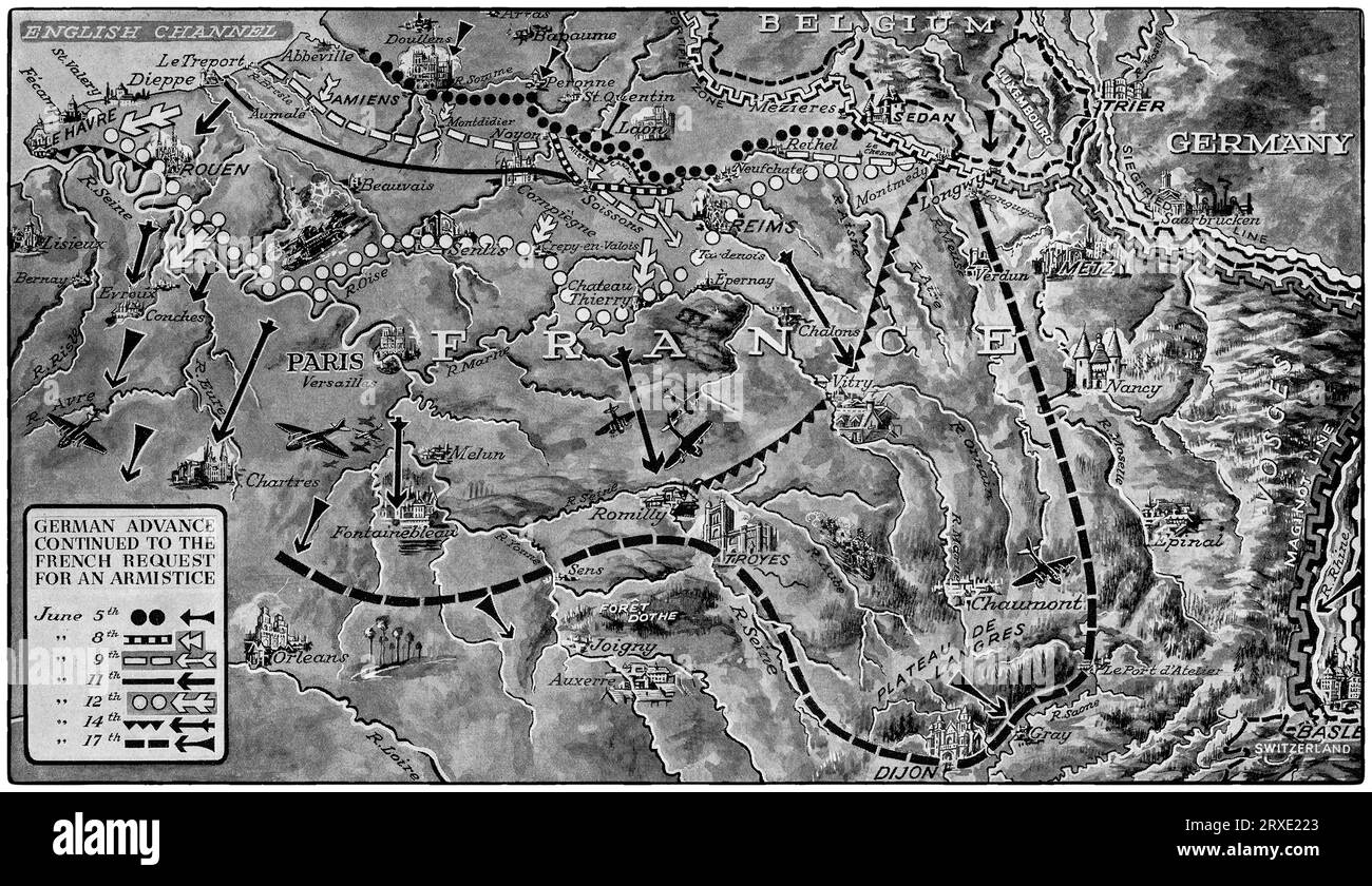 A map illustrating the German Wermacht advance through France during the early stages of the Second World War until an armistice was signed on the 22nd June, 1940. Stock Photohttps://www.alamy.com/image-license-details/?v=1https://www.alamy.com/a-map-illustrating-the-german-wermacht-advance-through-france-during-the-early-stages-of-the-second-world-war-until-an-armistice-was-signed-on-the-22nd-june-1940-image567021787.html
RM2RXE223–A map illustrating the German Wermacht advance through France during the early stages of the Second World War until an armistice was signed on the 22nd June, 1940.
 France map with lined pattern vector illustration Stock Vectorhttps://www.alamy.com/image-license-details/?v=1https://www.alamy.com/france-map-with-lined-pattern-vector-illustration-image610420268.html
RF2XD317T–France map with lined pattern vector illustration
 France map with red reopening sign after quarantine. 3D Rendering Stock Photohttps://www.alamy.com/image-license-details/?v=1https://www.alamy.com/france-map-with-red-reopening-sign-after-quarantine-3d-rendering-image358348993.html
RF2BR05P9–France map with red reopening sign after quarantine. 3D Rendering
 Map of France. France map, Europe Outline map of France, High detailed France map, illustration vector, tourism, government, Stock Vectorhttps://www.alamy.com/image-license-details/?v=1https://www.alamy.com/map-of-france-france-map-europe-outline-map-of-france-high-detailed-france-map-illustration-vector-tourism-government-image612063386.html
RF2XFNW2J–Map of France. France map, Europe Outline map of France, High detailed France map, illustration vector, tourism, government,
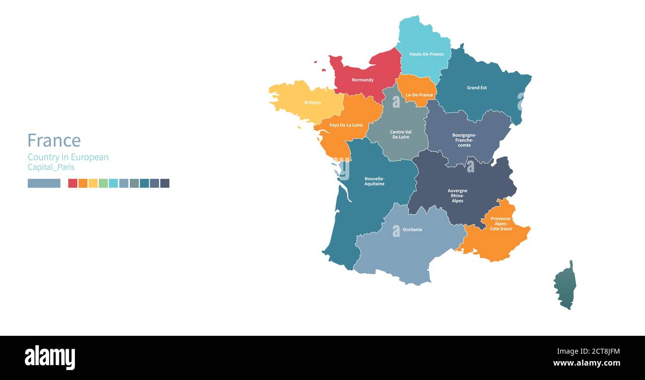 France map. Colorful detailed vector map of the European country. Stock Vectorhttps://www.alamy.com/image-license-details/?v=1https://www.alamy.com/france-map-colorful-detailed-vector-map-of-the-european-country-image376359640.html
RF2CT8JFM–France map. Colorful detailed vector map of the European country.
 France map with flag - outline of a state with a national flag, white background, vector Stock Vectorhttps://www.alamy.com/image-license-details/?v=1https://www.alamy.com/france-map-with-flag-outline-of-a-state-with-a-national-flag-white-background-vector-image402353365.html
RF2EAGNR1–France map with flag - outline of a state with a national flag, white background, vector
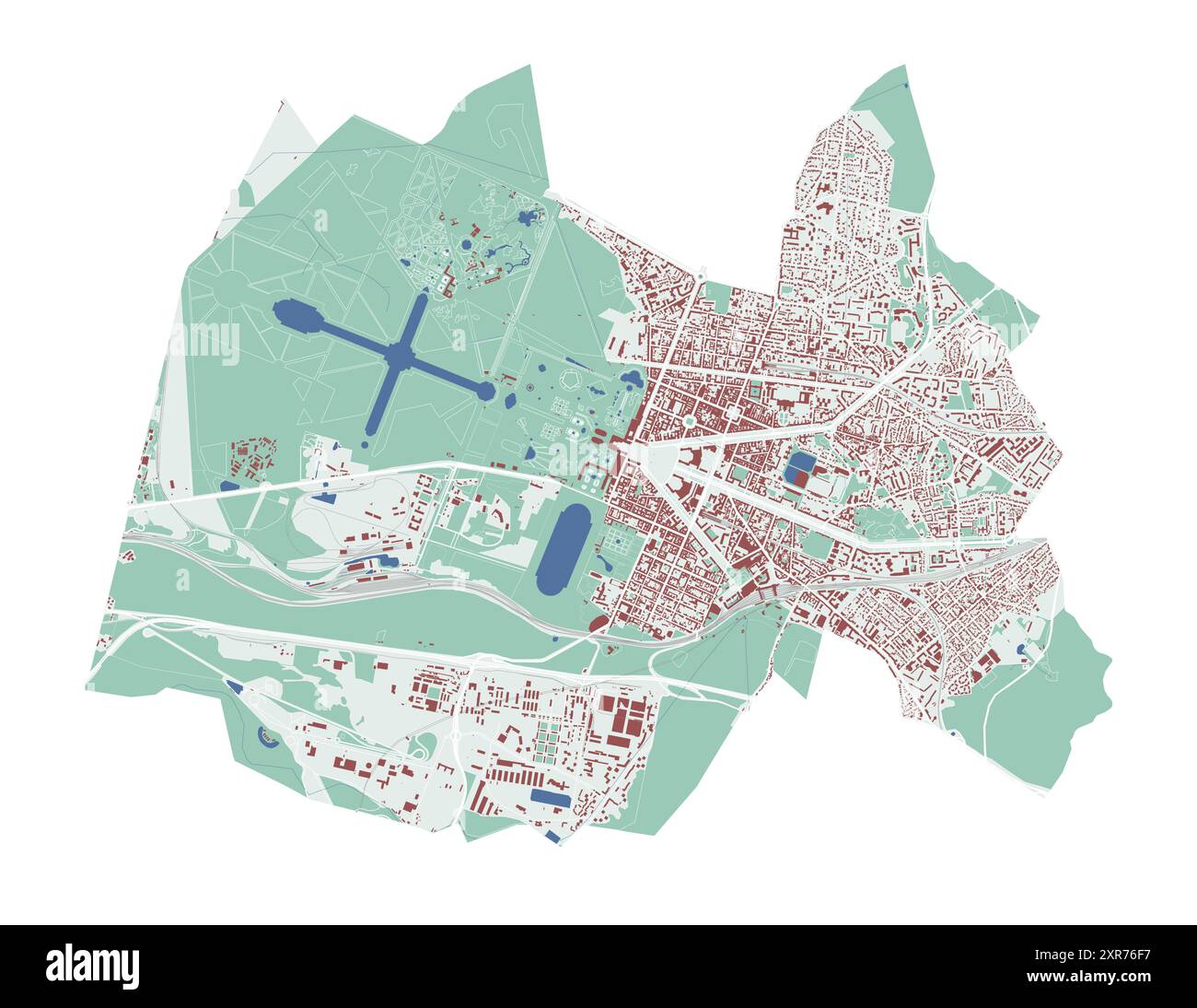 Versailles map, France. City map, vector streetmap with buildings and roads, parks and rivers. Stock Vectorhttps://www.alamy.com/image-license-details/?v=1https://www.alamy.com/versailles-map-france-city-map-vector-streetmap-with-buildings-and-roads-parks-and-rivers-image616658763.html
RF2XR76F7–Versailles map, France. City map, vector streetmap with buildings and roads, parks and rivers.
RF2B7M562–Dotted vector map of France. Round gray spots. France map with national flag and map icons. Black silhouette
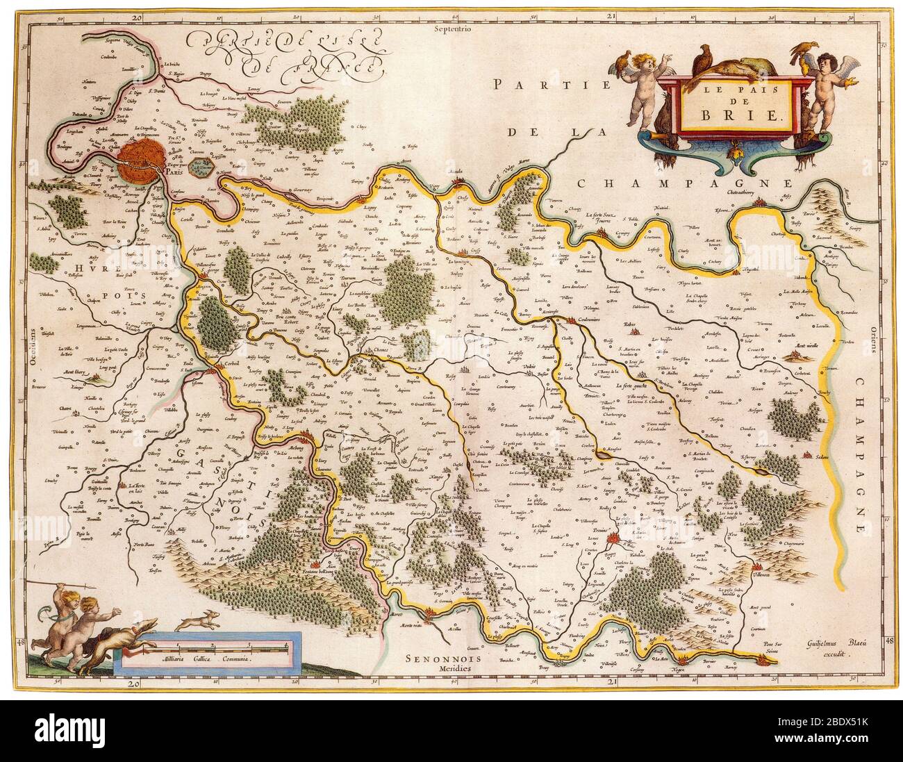 Joan Blaeu, Brie Region Map, France, 17th Century Stock Photohttps://www.alamy.com/image-license-details/?v=1https://www.alamy.com/joan-blaeu-brie-region-map-france-17th-century-image352772607.html
RM2BDX51K–Joan Blaeu, Brie Region Map, France, 17th Century
 france map logo illustration design Stock Vectorhttps://www.alamy.com/image-license-details/?v=1https://www.alamy.com/france-map-logo-illustration-design-image544883578.html
RF2PJDGFP–france map logo illustration design
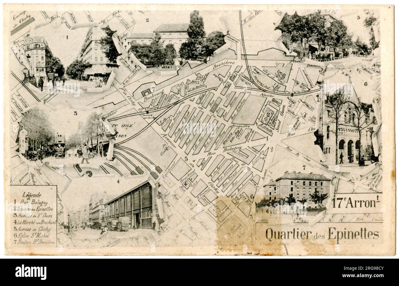 Map of the 17th Arrondissement, Quartier des Epinettes, Paris, France. Stock Photohttps://www.alamy.com/image-license-details/?v=1https://www.alamy.com/map-of-the-17th-arrondissement-quartier-des-epinettes-paris-france-image560770475.html
RM2RG98CY–Map of the 17th Arrondissement, Quartier des Epinettes, Paris, France.
 france, map, atlas, map of the world, profile, symbolic, political, colour, Stock Photohttps://www.alamy.com/image-license-details/?v=1https://www.alamy.com/stock-photo-france-map-atlas-map-of-the-world-profile-symbolic-political-colour-142929404.html
RFJ8EYWG–france, map, atlas, map of the world, profile, symbolic, political, colour,
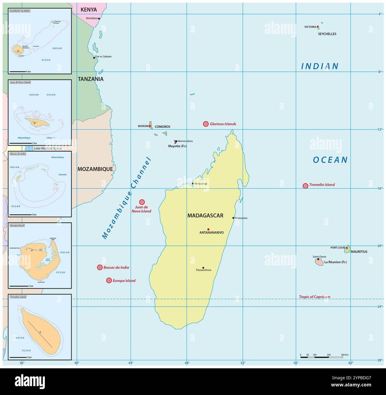 Map of the Scattered Islands of the Indian Ocean, France Stock Photohttps://www.alamy.com/image-license-details/?v=1https://www.alamy.com/map-of-the-scattered-islands-of-the-indian-ocean-france-image633347799.html
RF2YPBDG7–Map of the Scattered Islands of the Indian Ocean, France
 Black silhouette of France. Map illustration of European country. Stock Photohttps://www.alamy.com/image-license-details/?v=1https://www.alamy.com/black-silhouette-of-france-map-illustration-of-european-country-image605956708.html
RF2X5RKY0–Black silhouette of France. Map illustration of European country.
 map France Stock Photohttps://www.alamy.com/image-license-details/?v=1https://www.alamy.com/stock-photo-map-france-80097107.html
RFEJ8MJY–map France
 Limousin France Map grey Stock Vectorhttps://www.alamy.com/image-license-details/?v=1https://www.alamy.com/stock-photo-limousin-france-map-grey-123174360.html
RFH4B248–Limousin France Map grey
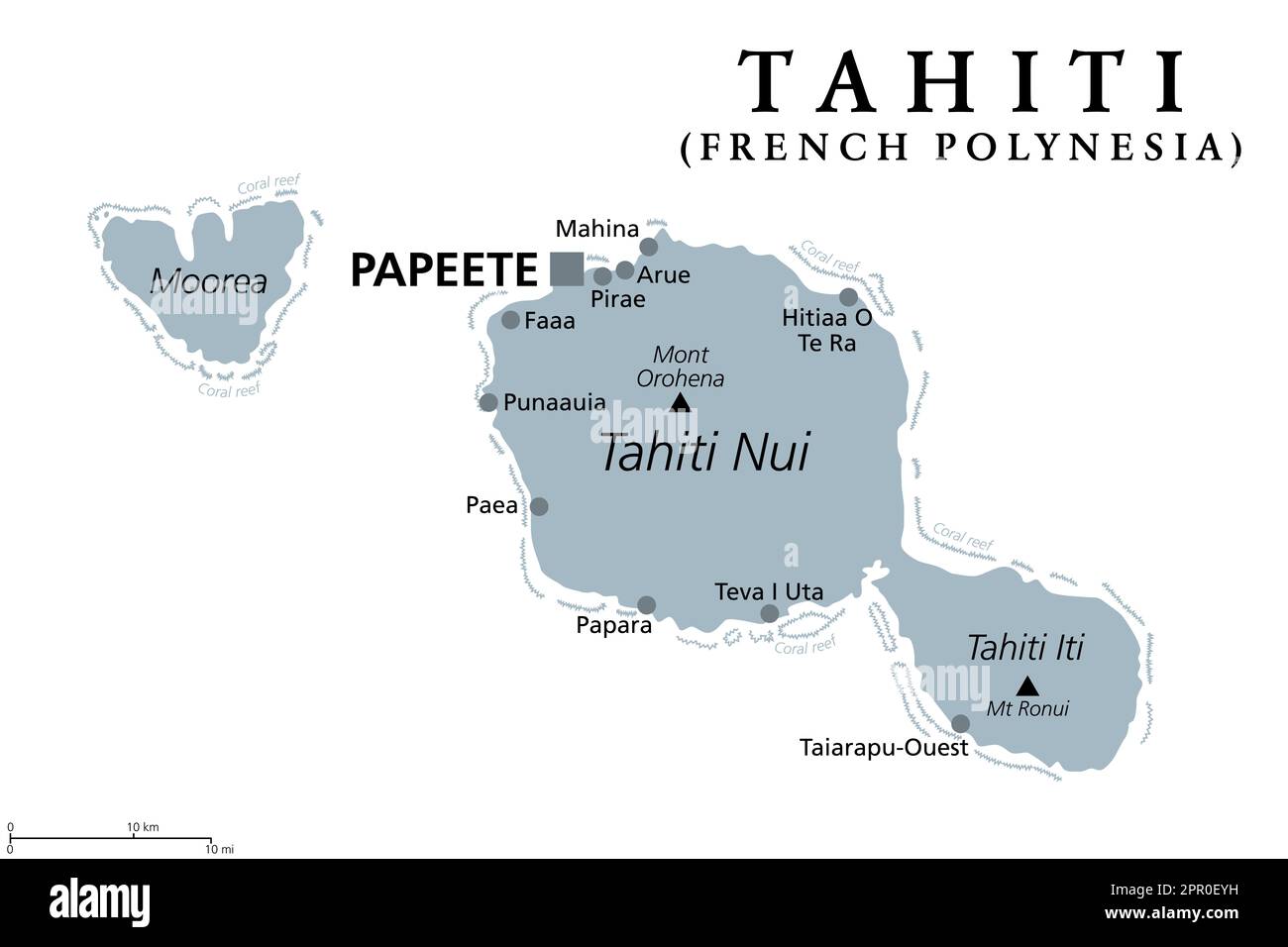 Tahiti, French Polynesia, gray political map. Largest island of the Windward group of the Society Islands, with capital Papeete. Stock Photohttps://www.alamy.com/image-license-details/?v=1https://www.alamy.com/tahiti-french-polynesia-gray-political-map-largest-island-of-the-windward-group-of-the-society-islands-with-capital-papeete-image547670245.html
RF2PR0EYH–Tahiti, French Polynesia, gray political map. Largest island of the Windward group of the Society Islands, with capital Papeete.
 France map button in the color of the European flag. Stock Photohttps://www.alamy.com/image-license-details/?v=1https://www.alamy.com/stock-photo-france-map-button-in-the-color-of-the-european-flag-110677474.html
RMGC1P6X–France map button in the color of the European flag.
 map of france covered with virus - 3D rendering Stock Photohttps://www.alamy.com/image-license-details/?v=1https://www.alamy.com/map-of-france-covered-with-virus-3d-rendering-image396478586.html
RF2E114DE–map of france covered with virus - 3D rendering
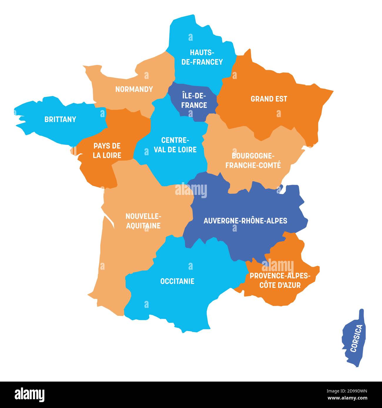 Colorful political map of France. Administrative divisions - metropolitan regions. Simple flat vector map with labels. Stock Vectorhttps://www.alamy.com/image-license-details/?v=1https://www.alamy.com/colorful-political-map-of-france-administrative-divisions-metropolitan-regions-simple-flat-vector-map-with-labels-image384368481.html
RF2D99DWN–Colorful political map of France. Administrative divisions - metropolitan regions. Simple flat vector map with labels.
 France map with dotted pattern vector illustration Stock Vectorhttps://www.alamy.com/image-license-details/?v=1https://www.alamy.com/france-map-with-dotted-pattern-vector-illustration-image610362752.html
RF2XD0BWM–France map with dotted pattern vector illustration
 France map with a virus microbe. Illness and disease outbreak Stock Vectorhttps://www.alamy.com/image-license-details/?v=1https://www.alamy.com/france-map-with-a-virus-microbe-illness-and-disease-outbreak-image341643891.html
RF2ARR67F–France map with a virus microbe. Illness and disease outbreak
 Map of France. France map, Europe Outline map of France, High detailed France map, illustration vector, tourism, government, Stock Vectorhttps://www.alamy.com/image-license-details/?v=1https://www.alamy.com/map-of-france-france-map-europe-outline-map-of-france-high-detailed-france-map-illustration-vector-tourism-government-image612061118.html
RF2XFNP5J–Map of France. France map, Europe Outline map of France, High detailed France map, illustration vector, tourism, government,
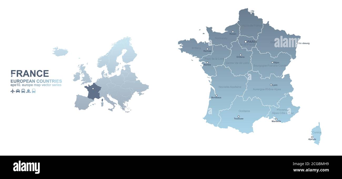 France map. blue gradient vector map of European countries. Stock Vectorhttps://www.alamy.com/image-license-details/?v=1https://www.alamy.com/france-map-blue-gradient-vector-map-of-european-countries-image371509861.html
RF2CGBMH9–France map. blue gradient vector map of European countries.
 France map, 3D rendering isolated on white background Stock Photohttps://www.alamy.com/image-license-details/?v=1https://www.alamy.com/stock-photo-france-map-3d-rendering-isolated-on-white-background-103851134.html
RFG0XR52–France map, 3D rendering isolated on white background
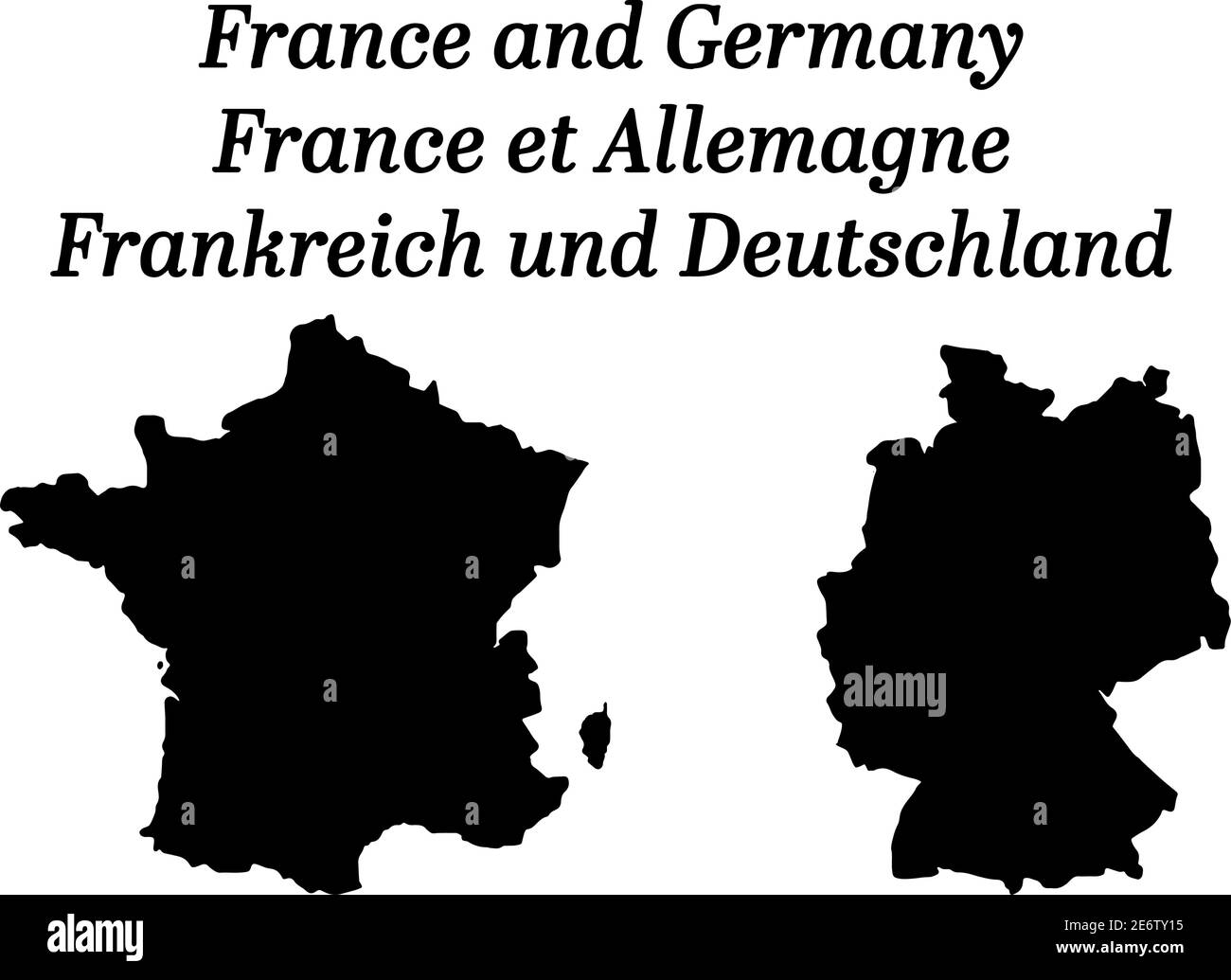 Maps of France and Germany silhouettes on white background Stock Vectorhttps://www.alamy.com/image-license-details/?v=1https://www.alamy.com/maps-of-france-and-germany-silhouettes-on-white-background-image400074449.html
RF2E6TY15–Maps of France and Germany silhouettes on white background
 France map with cut out Eiffel Tower Stock Vectorhttps://www.alamy.com/image-license-details/?v=1https://www.alamy.com/france-map-with-cut-out-eiffel-tower-image627320868.html
RF2YCGX4M–France map with cut out Eiffel Tower
 Satellite map of Marseille and buildings, France. Map roads, ring roads and highways, rivers. Transportation map Stock Vectorhttps://www.alamy.com/image-license-details/?v=1https://www.alamy.com/satellite-map-of-marseille-and-buildings-france-map-roads-ring-roads-and-highways-rivers-transportation-map-image332417561.html
RF2A8PWYN–Satellite map of Marseille and buildings, France. Map roads, ring roads and highways, rivers. Transportation map
 france map logo illustration design Stock Vectorhttps://www.alamy.com/image-license-details/?v=1https://www.alamy.com/france-map-logo-illustration-design-image542484317.html
RF2PEG87W–france map logo illustration design
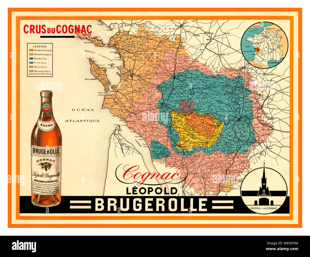 Vintage 1920's French Crus du Cognac poster-map, produced in part by the French Government to aid and promote sales of French Cognac. Cognac brandy comes from a specific region of France, the Charente and Charente-Maritime Deux-Sevres, and the Dordogne. These areas are colour coded on the map. Leopold Brugerolle Cognac is the promoter of this particular map and legend Stock Photohttps://www.alamy.com/image-license-details/?v=1https://www.alamy.com/vintage-1920s-french-crus-du-cognac-poster-map-produced-in-part-by-the-french-government-to-aid-and-promote-sales-of-french-cognac-cognac-brandy-comes-from-a-specific-region-of-france-the-charente-and-charente-maritime-deux-sevres-and-the-dordogne-these-areas-are-colour-coded-on-the-map-leopold-brugerolle-cognac-is-the-promoter-of-this-particular-map-and-legend-image185680368.html
RMMP2D5M–Vintage 1920's French Crus du Cognac poster-map, produced in part by the French Government to aid and promote sales of French Cognac. Cognac brandy comes from a specific region of France, the Charente and Charente-Maritime Deux-Sevres, and the Dordogne. These areas are colour coded on the map. Leopold Brugerolle Cognac is the promoter of this particular map and legend
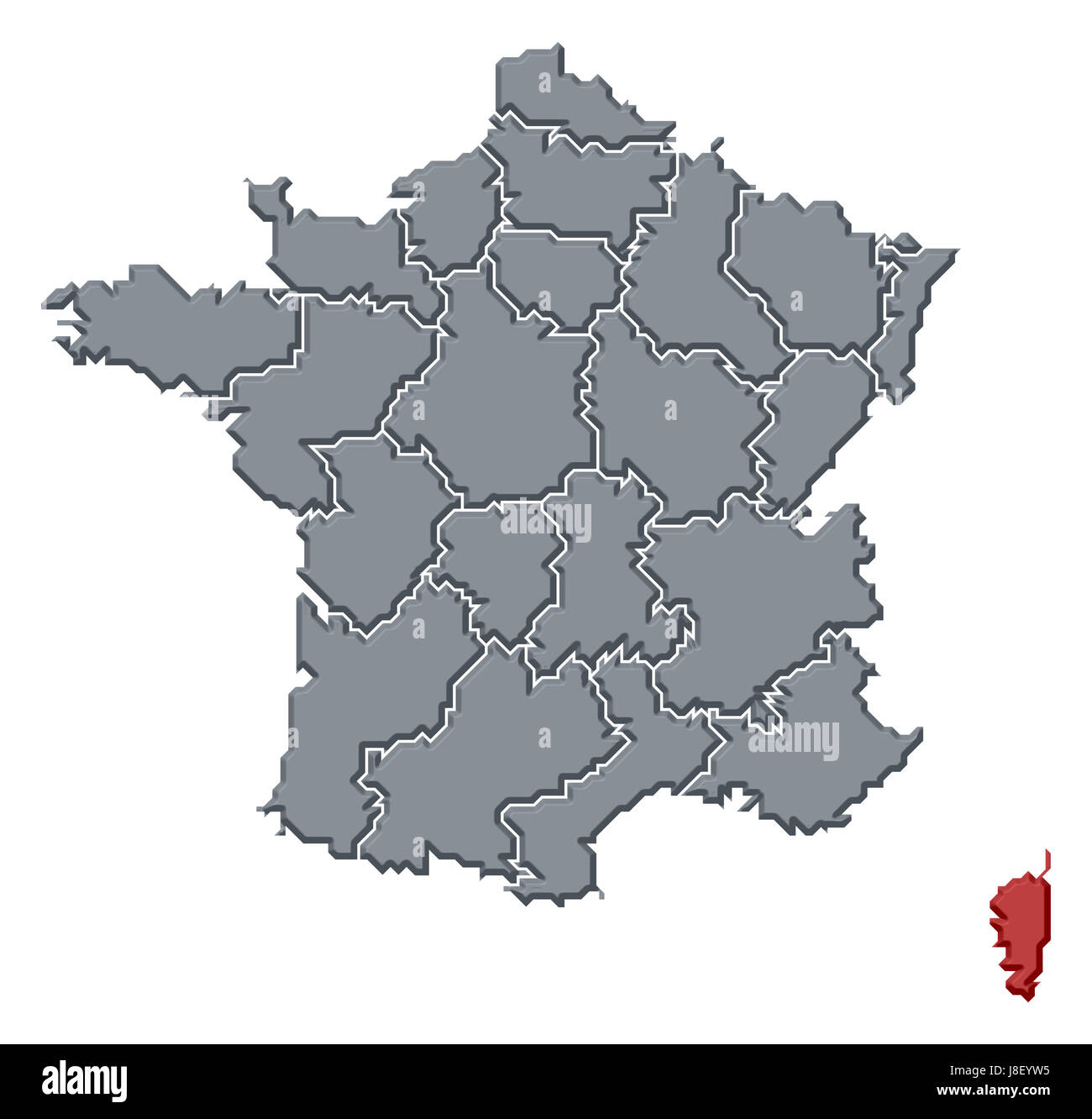 france, map, atlas, map of the world, profile, symbolic, political, colour, Stock Photohttps://www.alamy.com/image-license-details/?v=1https://www.alamy.com/stock-photo-france-map-atlas-map-of-the-world-profile-symbolic-political-colour-142929393.html
RFJ8EYW5–france, map, atlas, map of the world, profile, symbolic, political, colour,
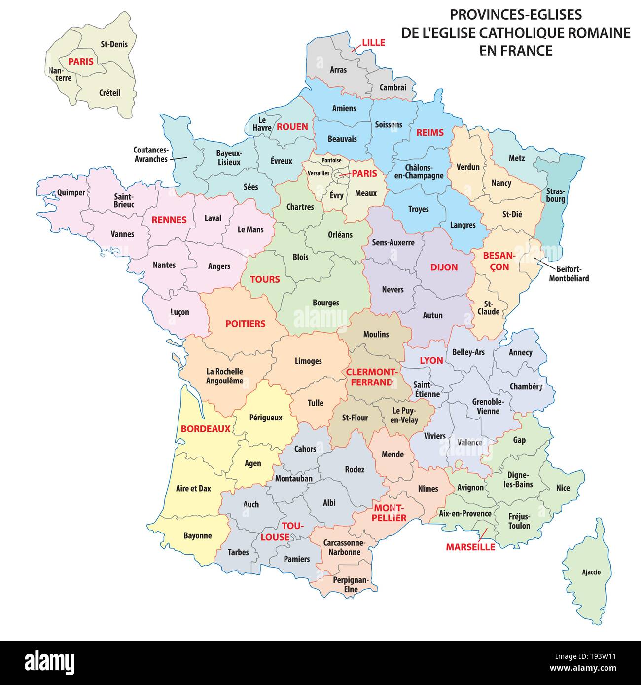 Map of the Roman Catholic Church Provinces in France Stock Vectorhttps://www.alamy.com/image-license-details/?v=1https://www.alamy.com/map-of-the-roman-catholic-church-provinces-in-france-image246562541.html
RFT93W11–Map of the Roman Catholic Church Provinces in France
 Black silhouette of Italy and France. Map illustration of European countries. Stock Photohttps://www.alamy.com/image-license-details/?v=1https://www.alamy.com/black-silhouette-of-italy-and-france-map-illustration-of-european-countries-image605956717.html
RF2X5RKY9–Black silhouette of Italy and France. Map illustration of European countries.
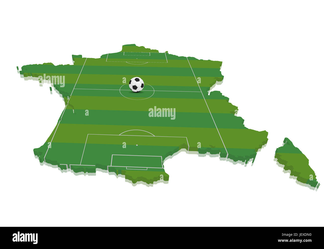 Map France Soccerfield Stock Photohttps://www.alamy.com/image-license-details/?v=1https://www.alamy.com/stock-photo-map-france-soccerfield-146869660.html
RMJEXDN0–Map France Soccerfield
