Georgia perry Cut Out Stock Images
 The Global Dragon coin was designed by Tech. Sgt. Lyndsey Barclay III, and it was distributed to participants during the Global Dragon deployment for training awards ceremony at the Guardian Centers, Perry, Ga., March 20, 2015. Global Dragon emergency managers represented all 10 Federal Emergency Management Agency regions from 20 states and 25 units. Barclay is a Global Dragon cadre assigned to the 147th Reconnaissance Wing, Texas. (U.S. Air National Guard graphic by Tech. Sgt. Lyndsey Barclay/released) Air National Guard Emergency Management recognizes Global Dragon 2015 award winners 150319- Stock Photohttps://www.alamy.com/image-license-details/?v=1https://www.alamy.com/stock-photo-the-global-dragon-coin-was-designed-by-tech-sgt-lyndsey-barclay-iii-129761611.html
RMHF3477–The Global Dragon coin was designed by Tech. Sgt. Lyndsey Barclay III, and it was distributed to participants during the Global Dragon deployment for training awards ceremony at the Guardian Centers, Perry, Ga., March 20, 2015. Global Dragon emergency managers represented all 10 Federal Emergency Management Agency regions from 20 states and 25 units. Barclay is a Global Dragon cadre assigned to the 147th Reconnaissance Wing, Texas. (U.S. Air National Guard graphic by Tech. Sgt. Lyndsey Barclay/released) Air National Guard Emergency Management recognizes Global Dragon 2015 award winners 150319-
 Rendering of a green 3d highway sign for Taylor County Stock Photohttps://www.alamy.com/image-license-details/?v=1https://www.alamy.com/rendering-of-a-green-3d-highway-sign-for-taylor-county-image338600708.html
RF2AJTGJC–Rendering of a green 3d highway sign for Taylor County
 USGS TOPO Map Georgia GA Perry East 246636 1973 24000 Restoration Stock Photohttps://www.alamy.com/image-license-details/?v=1https://www.alamy.com/usgs-topo-map-georgia-ga-perry-east-246636-1973-24000-restoration-image244703379.html
RMT635JB–USGS TOPO Map Georgia GA Perry East 246636 1973 24000 Restoration
 Perry, Houston County, US, United States, Georgia, N 32 27' 29'', S 83 43' 53'', map, Cartascapes Map published in 2024. Explore Cartascapes, a map revealing Earth's diverse landscapes, cultures, and ecosystems. Journey through time and space, discovering the interconnectedness of our planet's past, present, and future. Stock Photohttps://www.alamy.com/image-license-details/?v=1https://www.alamy.com/perry-houston-county-us-united-states-georgia-n-32-27-29-s-83-43-53-map-cartascapes-map-published-in-2024-explore-cartascapes-a-map-revealing-earths-diverse-landscapes-cultures-and-ecosystems-journey-through-time-and-space-discovering-the-interconnectedness-of-our-planets-past-present-and-future-image620856692.html
RM2Y22D18–Perry, Houston County, US, United States, Georgia, N 32 27' 29'', S 83 43' 53'', map, Cartascapes Map published in 2024. Explore Cartascapes, a map revealing Earth's diverse landscapes, cultures, and ecosystems. Journey through time and space, discovering the interconnectedness of our planet's past, present, and future.
![. Nests and eggs of North American birds [microform]. Ornithology; Birds; Ornithologie; Oiseaux. 404 NB8T8 AND E0G8 OF. 697, Blue Grosbeak. Texas, it commences to build about the first part of May. Mr. T. D. Perry has found eggs as early as May 10, slightly incubated, near Savannah, Georgia, and fresh eggs as late as July 7, indicating that at least two broods are reared in a season. The nest resembles that of the Painted Bunting, being invariably lined with fine brown rootlets, and occasion- ally it contains some horse hair. A characteristic of the Blue Grosbeak's nest is that it almost invar Stock Photo . Nests and eggs of North American birds [microform]. Ornithology; Birds; Ornithologie; Oiseaux. 404 NB8T8 AND E0G8 OF. 697, Blue Grosbeak. Texas, it commences to build about the first part of May. Mr. T. D. Perry has found eggs as early as May 10, slightly incubated, near Savannah, Georgia, and fresh eggs as late as July 7, indicating that at least two broods are reared in a season. The nest resembles that of the Painted Bunting, being invariably lined with fine brown rootlets, and occasion- ally it contains some horse hair. A characteristic of the Blue Grosbeak's nest is that it almost invar Stock Photo](https://c8.alamy.com/comp/RJ2YXK/nests-and-eggs-of-north-american-birds-microform-ornithology-birds-ornithologie-oiseaux-404-nb8t8-and-e0g8-of-697-blue-grosbeak-texas-it-commences-to-build-about-the-first-part-of-may-mr-t-d-perry-has-found-eggs-as-early-as-may-10-slightly-incubated-near-savannah-georgia-and-fresh-eggs-as-late-as-july-7-indicating-that-at-least-two-broods-are-reared-in-a-season-the-nest-resembles-that-of-the-painted-bunting-being-invariably-lined-with-fine-brown-rootlets-and-occasion-ally-it-contains-some-horse-hair-a-characteristic-of-the-blue-grosbeaks-nest-is-that-it-almost-invar-RJ2YXK.jpg) . Nests and eggs of North American birds [microform]. Ornithology; Birds; Ornithologie; Oiseaux. 404 NB8T8 AND E0G8 OF. 697, Blue Grosbeak. Texas, it commences to build about the first part of May. Mr. T. D. Perry has found eggs as early as May 10, slightly incubated, near Savannah, Georgia, and fresh eggs as late as July 7, indicating that at least two broods are reared in a season. The nest resembles that of the Painted Bunting, being invariably lined with fine brown rootlets, and occasion- ally it contains some horse hair. A characteristic of the Blue Grosbeak's nest is that it almost invar Stock Photohttps://www.alamy.com/image-license-details/?v=1https://www.alamy.com/nests-and-eggs-of-north-american-birds-microform-ornithology-birds-ornithologie-oiseaux-404-nb8t8-and-e0g8-of-697-blue-grosbeak-texas-it-commences-to-build-about-the-first-part-of-may-mr-t-d-perry-has-found-eggs-as-early-as-may-10-slightly-incubated-near-savannah-georgia-and-fresh-eggs-as-late-as-july-7-indicating-that-at-least-two-broods-are-reared-in-a-season-the-nest-resembles-that-of-the-painted-bunting-being-invariably-lined-with-fine-brown-rootlets-and-occasion-ally-it-contains-some-horse-hair-a-characteristic-of-the-blue-grosbeaks-nest-is-that-it-almost-invar-image234864411.html
. Nests and eggs of North American birds [microform]. Ornithology; Birds; Ornithologie; Oiseaux. 404 NB8T8 AND E0G8 OF. 697, Blue Grosbeak. Texas, it commences to build about the first part of May. Mr. T. D. Perry has found eggs as early as May 10, slightly incubated, near Savannah, Georgia, and fresh eggs as late as July 7, indicating that at least two broods are reared in a season. The nest resembles that of the Painted Bunting, being invariably lined with fine brown rootlets, and occasion- ally it contains some horse hair. A characteristic of the Blue Grosbeak's nest is that it almost invar Stock Photohttps://www.alamy.com/image-license-details/?v=1https://www.alamy.com/nests-and-eggs-of-north-american-birds-microform-ornithology-birds-ornithologie-oiseaux-404-nb8t8-and-e0g8-of-697-blue-grosbeak-texas-it-commences-to-build-about-the-first-part-of-may-mr-t-d-perry-has-found-eggs-as-early-as-may-10-slightly-incubated-near-savannah-georgia-and-fresh-eggs-as-late-as-july-7-indicating-that-at-least-two-broods-are-reared-in-a-season-the-nest-resembles-that-of-the-painted-bunting-being-invariably-lined-with-fine-brown-rootlets-and-occasion-ally-it-contains-some-horse-hair-a-characteristic-of-the-blue-grosbeaks-nest-is-that-it-almost-invar-image234864411.htmlRMRJ2YXK–. Nests and eggs of North American birds [microform]. Ornithology; Birds; Ornithologie; Oiseaux. 404 NB8T8 AND E0G8 OF. 697, Blue Grosbeak. Texas, it commences to build about the first part of May. Mr. T. D. Perry has found eggs as early as May 10, slightly incubated, near Savannah, Georgia, and fresh eggs as late as July 7, indicating that at least two broods are reared in a season. The nest resembles that of the Painted Bunting, being invariably lined with fine brown rootlets, and occasion- ally it contains some horse hair. A characteristic of the Blue Grosbeak's nest is that it almost invar
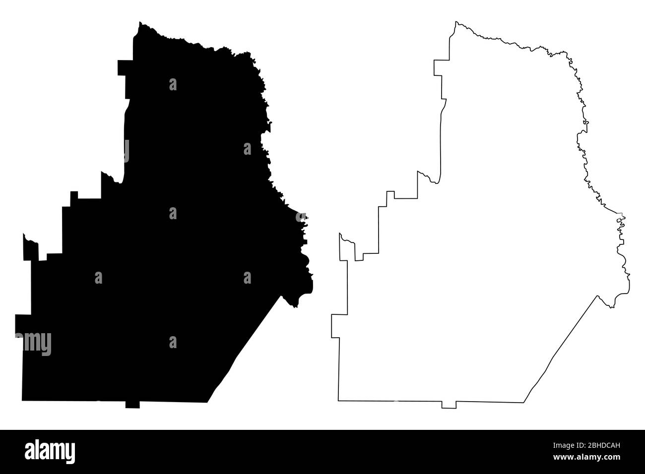
 Houston County, Georgia (U.S. county, United States of America,USA, U.S., US) map vector illustration, scribble sketch Houston map Stock Vectorhttps://www.alamy.com/image-license-details/?v=1https://www.alamy.com/houston-county-georgia-us-county-united-states-of-americausa-us-us-map-vector-illustration-scribble-sketch-houston-map-image354951593.html
RF2BHDCAH–Houston County, Georgia (U.S. county, United States of America,USA, U.S., US) map vector illustration, scribble sketch Houston map
 USGS TOPO Map Georgia GA Perry East 246635 1973 24000 Restoration Stock Photohttps://www.alamy.com/image-license-details/?v=1https://www.alamy.com/usgs-topo-map-georgia-ga-perry-east-246635-1973-24000-restoration-image244703377.html
RMT635J9–USGS TOPO Map Georgia GA Perry East 246635 1973 24000 Restoration
 Perry, Houston County, US, United States, Georgia, N 32 27' 29'', S 83 43' 53'', map, Cartascapes Map published in 2024. Explore Cartascapes, a map revealing Earth's diverse landscapes, cultures, and ecosystems. Journey through time and space, discovering the interconnectedness of our planet's past, present, and future. Stock Photohttps://www.alamy.com/image-license-details/?v=1https://www.alamy.com/perry-houston-county-us-united-states-georgia-n-32-27-29-s-83-43-53-map-cartascapes-map-published-in-2024-explore-cartascapes-a-map-revealing-earths-diverse-landscapes-cultures-and-ecosystems-journey-through-time-and-space-discovering-the-interconnectedness-of-our-planets-past-present-and-future-image620826230.html
RM2Y2125A–Perry, Houston County, US, United States, Georgia, N 32 27' 29'', S 83 43' 53'', map, Cartascapes Map published in 2024. Explore Cartascapes, a map revealing Earth's diverse landscapes, cultures, and ecosystems. Journey through time and space, discovering the interconnectedness of our planet's past, present, and future.
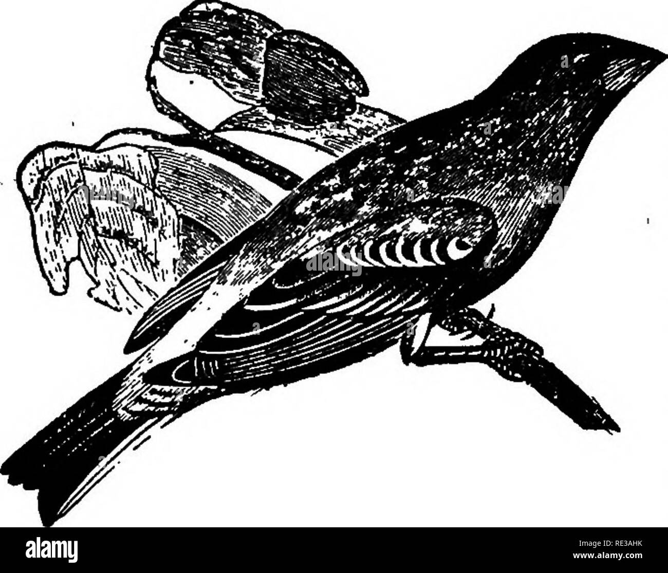
 . Nests and eggs of North American birds. Birds; Birds. 404 NESTS AND EGGS OF. 69V. Blue Grosbeak. Texas, it commences to build about the first part of May. Mr. T. D. Perry has found eggs as early as May 10, slightly incubated, near Savannah, Georgia, and fresh eggs as late as July 7, indicating that at least two broods are reared in a season. The nest resembles that of the Painted Bunting, being invariably lined with fine brown rootlets, and occasion- ally it contains some horse hair. A characteristic of the Blue Grosbeak's nest is that it almost invariably con- tains pieces of snakeskin in t Stock Photohttps://www.alamy.com/image-license-details/?v=1https://www.alamy.com/nests-and-eggs-of-north-american-birds-birds-birds-404-nests-and-eggs-of-69v-blue-grosbeak-texas-it-commences-to-build-about-the-first-part-of-may-mr-t-d-perry-has-found-eggs-as-early-as-may-10-slightly-incubated-near-savannah-georgia-and-fresh-eggs-as-late-as-july-7-indicating-that-at-least-two-broods-are-reared-in-a-season-the-nest-resembles-that-of-the-painted-bunting-being-invariably-lined-with-fine-brown-rootlets-and-occasion-ally-it-contains-some-horse-hair-a-characteristic-of-the-blue-grosbeaks-nest-is-that-it-almost-invariably-con-tains-pieces-of-snakeskin-in-t-image232414159.html
RMRE3AHK–. Nests and eggs of North American birds. Birds; Birds. 404 NESTS AND EGGS OF. 69V. Blue Grosbeak. Texas, it commences to build about the first part of May. Mr. T. D. Perry has found eggs as early as May 10, slightly incubated, near Savannah, Georgia, and fresh eggs as late as July 7, indicating that at least two broods are reared in a season. The nest resembles that of the Painted Bunting, being invariably lined with fine brown rootlets, and occasion- ally it contains some horse hair. A characteristic of the Blue Grosbeak's nest is that it almost invariably con- tains pieces of snakeskin in t
 Houston County, Georgia (U.S. county, United States of America,USA, U.S., US) map vector illustration, scribble sketch Houston map Stock Vectorhttps://www.alamy.com/image-license-details/?v=1https://www.alamy.com/houston-county-georgia-us-county-united-states-of-americausa-us-us-map-vector-illustration-scribble-sketch-houston-map-image365508122.html
RF2C6J99E–Houston County, Georgia (U.S. county, United States of America,USA, U.S., US) map vector illustration, scribble sketch Houston map
 USGS TOPO Map Georgia GA Perry West 246638 1972 24000 Restoration Stock Photohttps://www.alamy.com/image-license-details/?v=1https://www.alamy.com/usgs-topo-map-georgia-ga-perry-west-246638-1972-24000-restoration-image244703405.html
RMT635K9–USGS TOPO Map Georgia GA Perry West 246638 1972 24000 Restoration
 Perry, Georgia, map 1956, 1:62500, United States of America by Timeless Maps, data U.S. Geological Survey Stock Photohttps://www.alamy.com/image-license-details/?v=1https://www.alamy.com/perry-georgia-map-1956-162500-united-states-of-america-by-timeless-maps-data-us-geological-survey-image414035240.html
RM2F1GX4T–Perry, Georgia, map 1956, 1:62500, United States of America by Timeless Maps, data U.S. Geological Survey
 Houston County, Georgia (U.S. county, United States of America,USA, U.S., US) map vector illustration, scribble sketch Houston map Stock Vectorhttps://www.alamy.com/image-license-details/?v=1https://www.alamy.com/houston-county-georgia-us-county-united-states-of-americausa-us-us-map-vector-illustration-scribble-sketch-houston-map-image357957102.html
RF2BPA9X6–Houston County, Georgia (U.S. county, United States of America,USA, U.S., US) map vector illustration, scribble sketch Houston map
 USGS TOPO Map Georgia GA Perry West 246637 1972 24000 Restoration Stock Photohttps://www.alamy.com/image-license-details/?v=1https://www.alamy.com/usgs-topo-map-georgia-ga-perry-west-246637-1972-24000-restoration-image244703393.html
RMT635JW–USGS TOPO Map Georgia GA Perry West 246637 1972 24000 Restoration
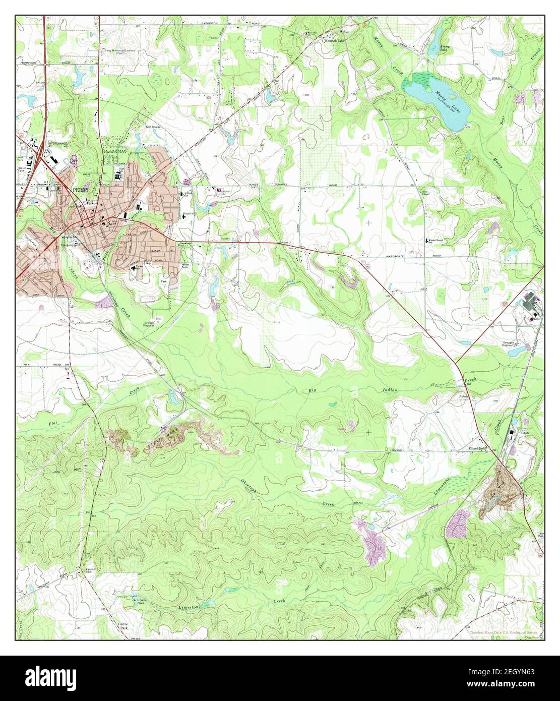
 Perry East, Georgia, map 1973, 1:24000, United States of America by Timeless Maps, data U.S. Geological Survey Stock Photohttps://www.alamy.com/image-license-details/?v=1https://www.alamy.com/perry-east-georgia-map-1973-124000-united-states-of-america-by-timeless-maps-data-us-geological-survey-image406282299.html
RM2EGYN63–Perry East, Georgia, map 1973, 1:24000, United States of America by Timeless Maps, data U.S. Geological Survey
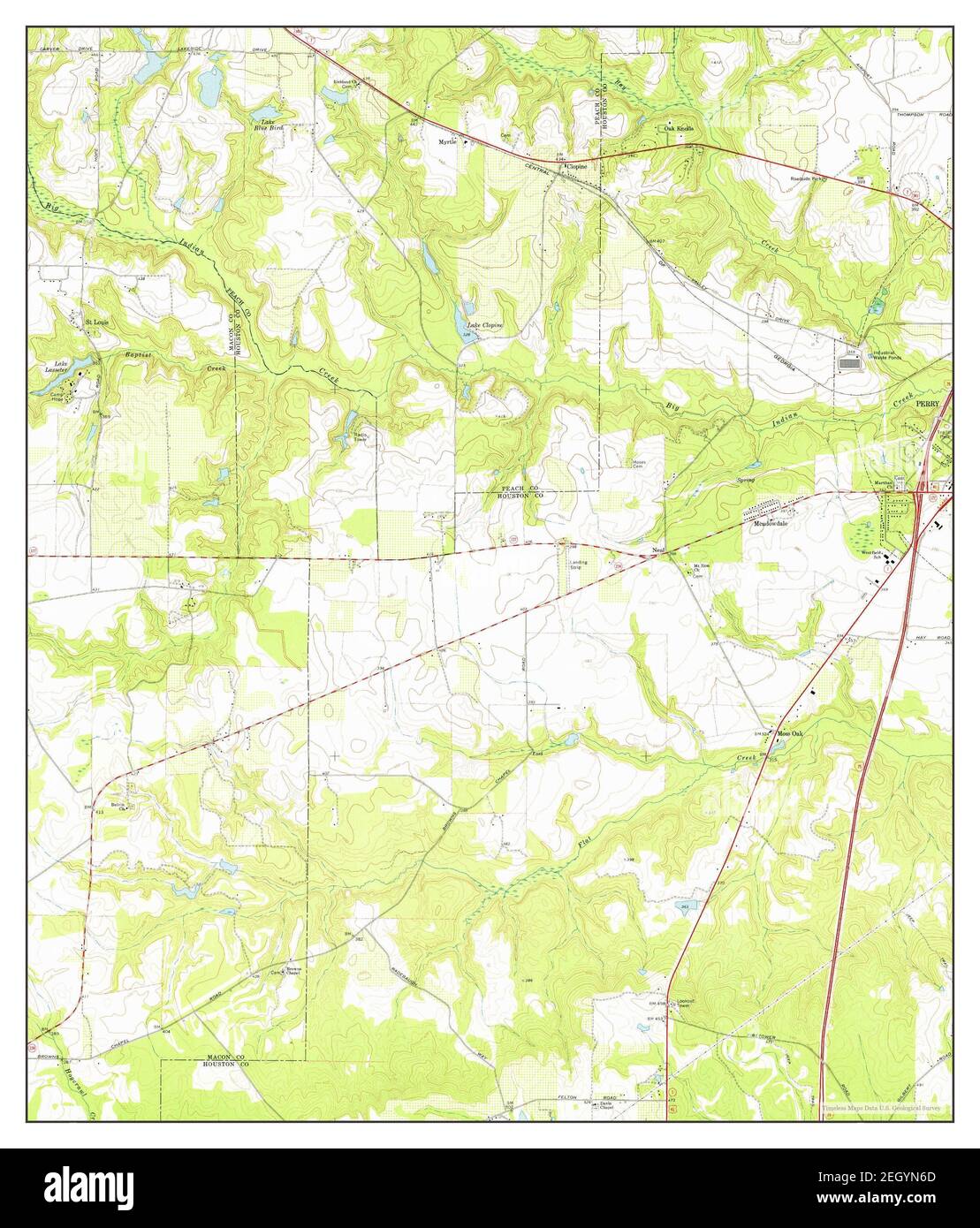
 Perry West, Georgia, map 1972, 1:24000, United States of America by Timeless Maps, data U.S. Geological Survey Stock Photohttps://www.alamy.com/image-license-details/?v=1https://www.alamy.com/perry-west-georgia-map-1972-124000-united-states-of-america-by-timeless-maps-data-us-geological-survey-image406282309.html
RM2EGYN6D–Perry West, Georgia, map 1972, 1:24000, United States of America by Timeless Maps, data U.S. Geological Survey
 Perry West, Georgia, map 1972, 1:24000, United States of America by Timeless Maps, data U.S. Geological Survey Stock Photohttps://www.alamy.com/image-license-details/?v=1https://www.alamy.com/perry-west-georgia-map-1972-124000-united-states-of-america-by-timeless-maps-data-us-geological-survey-image406282307.html
RM2EGYN6B–Perry West, Georgia, map 1972, 1:24000, United States of America by Timeless Maps, data U.S. Geological Survey