Quick filters:
Harlem 138th street Stock Photos and Images
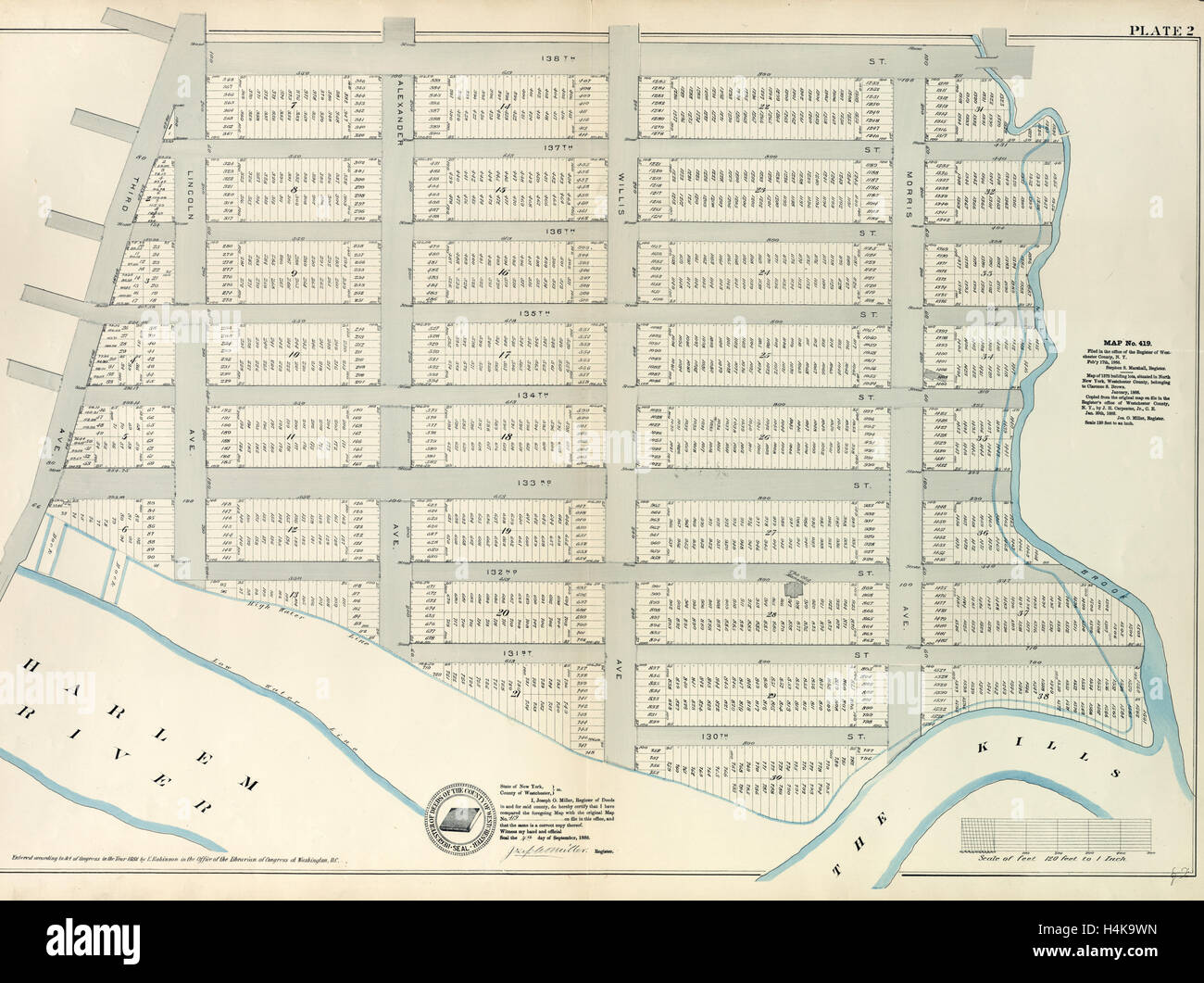 Plate 2: Map No. 419 Bounded by 138th Street, Mill Brook, 131st Street, Morris Avenue, 130th Street, Harlem River Stock Photohttps://www.alamy.com/image-license-details/?v=1https://www.alamy.com/stock-photo-plate-2-map-no-419-bounded-by-138th-street-mill-brook-131st-street-123356065.html
RMH4K9WN–Plate 2: Map No. 419 Bounded by 138th Street, Mill Brook, 131st Street, Morris Avenue, 130th Street, Harlem River
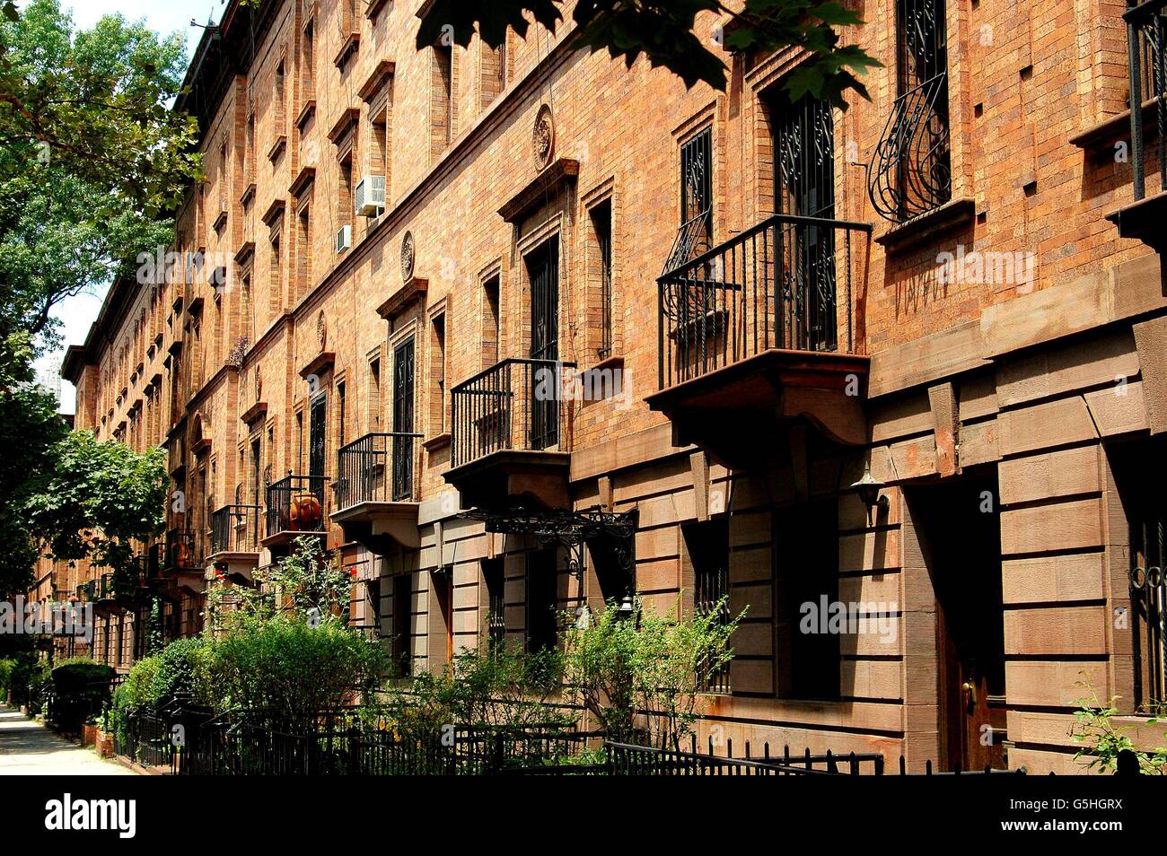 New York City: Handsome restored brick townhouses on Striver's Row (West 138th Street) in Harlem Stock Photohttps://www.alamy.com/image-license-details/?v=1https://www.alamy.com/stock-photo-new-york-city-handsome-restored-brick-townhouses-on-strivers-row-west-106721886.html
RMG5HGRX–New York City: Handsome restored brick townhouses on Striver's Row (West 138th Street) in Harlem
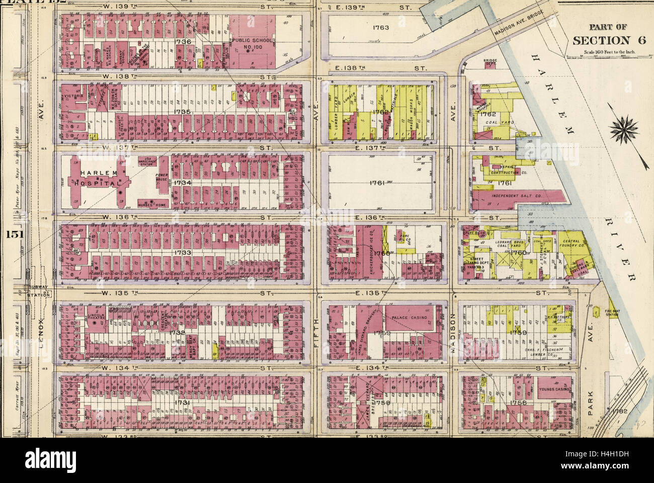 Plate 152: Bounded by W. 139th Street, Fifth Avenue, E. 138th Street, Harlem River Madison Avenue, E. 135th Street, Park Avenue Stock Photohttps://www.alamy.com/image-license-details/?v=1https://www.alamy.com/stock-photo-plate-152-bounded-by-w-139th-street-fifth-avenue-e-138th-street-harlem-123305549.html
RMH4H1DH–Plate 152: Bounded by W. 139th Street, Fifth Avenue, E. 138th Street, Harlem River Madison Avenue, E. 135th Street, Park Avenue
 138th Street, Harlem, New York City, Stock Photohttps://www.alamy.com/image-license-details/?v=1https://www.alamy.com/138th-street-harlem-new-york-city-image68536360.html
RMDYE2R4–138th Street, Harlem, New York City,
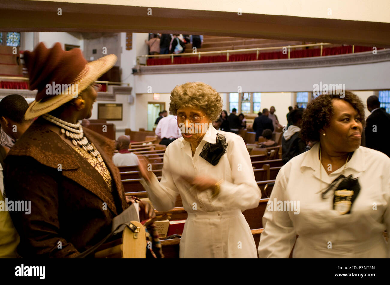 Parishioners at mass. Abyssinian Baptist Church. 132 Odell Clark Place (commonly 138th Street) near the 7th Avenue. Phone 212-86 Stock Photohttps://www.alamy.com/image-license-details/?v=1https://www.alamy.com/stock-photo-parishioners-at-mass-abyssinian-baptist-church-132-odell-clark-place-88375777.html
RMF3NT5N–Parishioners at mass. Abyssinian Baptist Church. 132 Odell Clark Place (commonly 138th Street) near the 7th Avenue. Phone 212-86
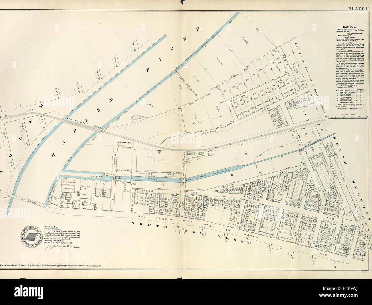 Plate 1: Map No. 441 Bounded by Fourth Avenue, 138th Street, ... Harlem River Line of Water Grant, Bulkhead & Pier Line Stock Photohttps://www.alamy.com/image-license-details/?v=1https://www.alamy.com/stock-photo-plate-1-map-no-441-bounded-by-fourth-avenue-138th-street-harlem-river-123356062.html
RMH4K9WJ–Plate 1: Map No. 441 Bounded by Fourth Avenue, 138th Street, ... Harlem River Line of Water Grant, Bulkhead & Pier Line
 138th Street Station, The Bronx Stock Photohttps://www.alamy.com/image-license-details/?v=1https://www.alamy.com/stock-photo-138th-street-station-the-bronx-54929882.html
RMD5A7HE–138th Street Station, The Bronx
![Plate 2: Map No. 419 [Bounded by 138th Street, Mill Brook, 131st Street, Morris Avenue, 130th Street, Harlem River High Water Line and Third Avenue.] 1888 - 1897 Stock Photo Plate 2: Map No. 419 [Bounded by 138th Street, Mill Brook, 131st Street, Morris Avenue, 130th Street, Harlem River High Water Line and Third Avenue.] 1888 - 1897 Stock Photo](https://c8.alamy.com/comp/2YP9GE6/plate-2-map-no-419-bounded-by-138th-street-mill-brook-131st-street-morris-avenue-130th-street-harlem-river-high-water-line-and-third-avenue-1888-1897-2YP9GE6.jpg) Plate 2: Map No. 419 [Bounded by 138th Street, Mill Brook, 131st Street, Morris Avenue, 130th Street, Harlem River High Water Line and Third Avenue.] 1888 - 1897 Stock Photohttps://www.alamy.com/image-license-details/?v=1https://www.alamy.com/plate-2-map-no-419-bounded-by-138th-street-mill-brook-131st-street-morris-avenue-130th-street-harlem-river-high-water-line-and-third-avenue-1888-1897-image633306190.html
Plate 2: Map No. 419 [Bounded by 138th Street, Mill Brook, 131st Street, Morris Avenue, 130th Street, Harlem River High Water Line and Third Avenue.] 1888 - 1897 Stock Photohttps://www.alamy.com/image-license-details/?v=1https://www.alamy.com/plate-2-map-no-419-bounded-by-138th-street-mill-brook-131st-street-morris-avenue-130th-street-harlem-river-high-water-line-and-third-avenue-1888-1897-image633306190.htmlRM2YP9GE6–Plate 2: Map No. 419 [Bounded by 138th Street, Mill Brook, 131st Street, Morris Avenue, 130th Street, Harlem River High Water Line and Third Avenue.] 1888 - 1897
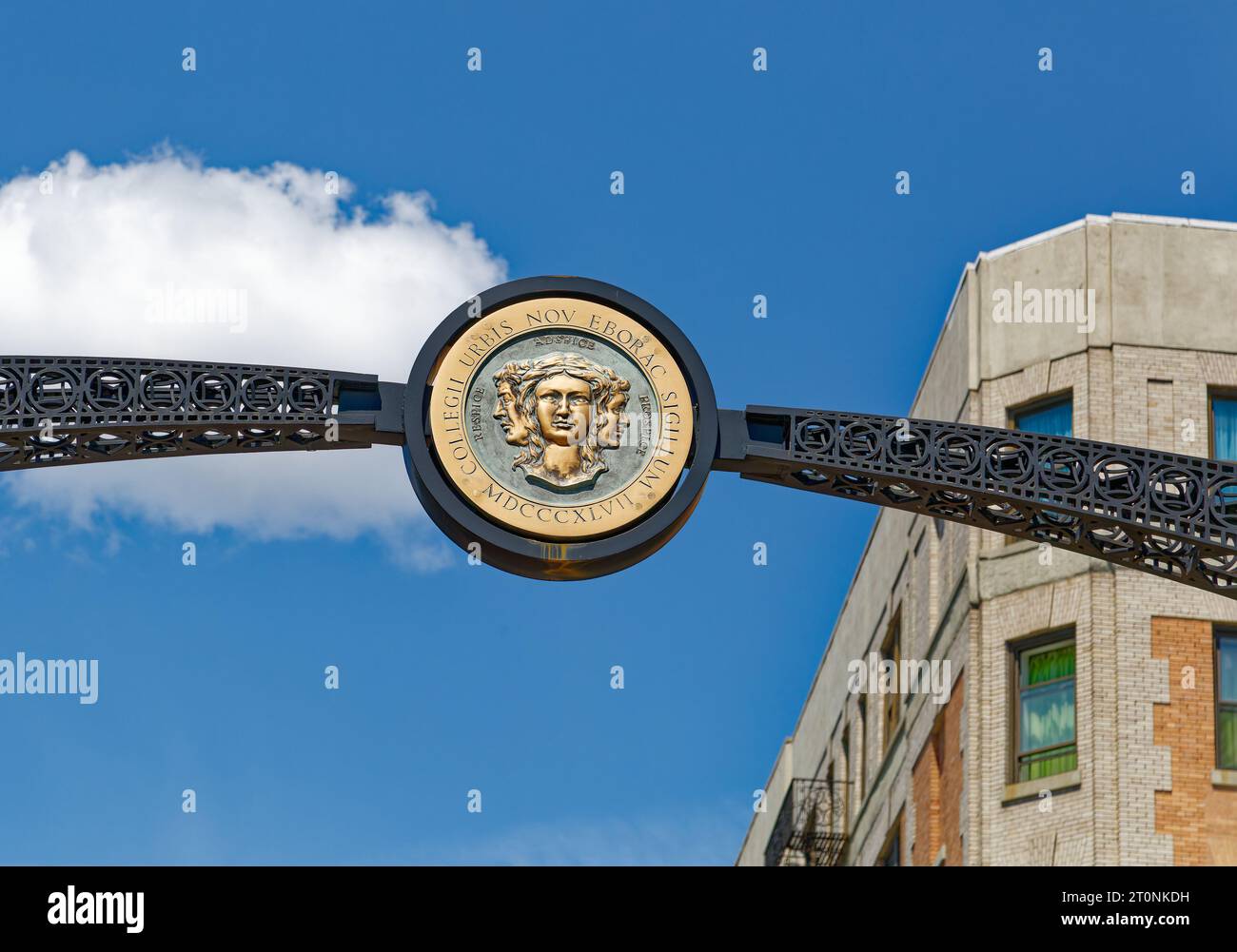 Arch over the City College campus entrance on Amsterdam Avenue and West 138th Street. Stock Photohttps://www.alamy.com/image-license-details/?v=1https://www.alamy.com/arch-over-the-city-college-campus-entrance-on-amsterdam-avenue-and-west-138th-street-image568418413.html
RF2T0NKDH–Arch over the City College campus entrance on Amsterdam Avenue and West 138th Street.
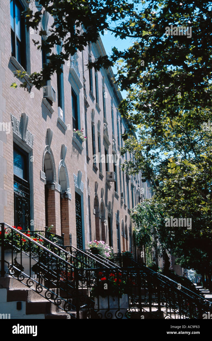 Historic Strivers Row 138th Street Harlem upper Manhattan New York City Stock Photohttps://www.alamy.com/image-license-details/?v=1https://www.alamy.com/historic-strivers-row-138th-street-harlem-upper-manhattan-new-york-image827235.html
RMAC9F63–Historic Strivers Row 138th Street Harlem upper Manhattan New York City
 A parishioner at mass. The Evangelist Catholic Churc. 65 138th Street in harlem, New York, USA. Abyssinian Baptist Church, just across Malcolm X Boule Stock Photohttps://www.alamy.com/image-license-details/?v=1https://www.alamy.com/a-parishioner-at-mass-the-evangelist-catholic-churc-65-138th-street-in-harlem-new-york-usa-abyssinian-baptist-church-just-across-malcolm-x-boule-image387327306.html
RM2DE47X2–A parishioner at mass. The Evangelist Catholic Churc. 65 138th Street in harlem, New York, USA. Abyssinian Baptist Church, just across Malcolm X Boule
 Abyssinian Baptist Church, located at 132 West 138th Street between Adam Clayton Powell Jr. Boulevard and Lenox Avenue in the Harlem neighborhood of M Stock Photohttps://www.alamy.com/image-license-details/?v=1https://www.alamy.com/stock-photo-abyssinian-baptist-church-located-at-132-west-138th-street-between-140314732.html
RFJ47TTC–Abyssinian Baptist Church, located at 132 West 138th Street between Adam Clayton Powell Jr. Boulevard and Lenox Avenue in the Harlem neighborhood of M
 Cartographic, Maps. 1888 - 1897. Lionel Pincus and Princess Firyal Map Division. Bronx (New York, N.Y.) Plate 2: Map No. 419 Bounded by 138th Street, Mill Brook, 131st Street, Morris Avenue, 130th Street, Harlem River High Water Line and Third Avenue. Stock Photohttps://www.alamy.com/image-license-details/?v=1https://www.alamy.com/cartographic-maps-1888-1897-lionel-pincus-and-princess-firyal-map-division-bronx-new-york-ny-plate-2-map-no-419-bounded-by-138th-street-mill-brook-131st-street-morris-avenue-130th-street-harlem-river-high-water-line-and-third-avenue-image483724287.html
RM2K2YF7B–Cartographic, Maps. 1888 - 1897. Lionel Pincus and Princess Firyal Map Division. Bronx (New York, N.Y.) Plate 2: Map No. 419 Bounded by 138th Street, Mill Brook, 131st Street, Morris Avenue, 130th Street, Harlem River High Water Line and Third Avenue.
 February 16, 2021, New York, NY, USA: February 16, 2021 : A funeral service was held for the late actress Cicely Tyson at The Abyssinian Baptist Church at 132 West 138th Street in Harlem. (Credit Image: © Dan Herrick/ZUMA Wire) Stock Photohttps://www.alamy.com/image-license-details/?v=1https://www.alamy.com/february-16-2021-new-york-ny-usa-february-16-2021-a-funeral-service-was-held-for-the-late-actress-cicely-tyson-at-the-abyssinian-baptist-church-at-132-west-138th-street-in-harlem-credit-image-dan-herrickzuma-wire-image405647625.html
RM2EFXRK5–February 16, 2021, New York, NY, USA: February 16, 2021 : A funeral service was held for the late actress Cicely Tyson at The Abyssinian Baptist Church at 132 West 138th Street in Harlem. (Credit Image: © Dan Herrick/ZUMA Wire)
 Plate 2: Map No. 419 Bounded by 138th Street, Mill Brook, 131st Street, Morris Avenue, 130th Street, Harlem River reimagined Stock Photohttps://www.alamy.com/image-license-details/?v=1https://www.alamy.com/plate-2-map-no-419-bounded-by-138th-street-mill-brook-131st-street-morris-avenue-130th-street-harlem-river-reimagined-image230375302.html
RFRAPE1A–Plate 2: Map No. 419 Bounded by 138th Street, Mill Brook, 131st Street, Morris Avenue, 130th Street, Harlem River reimagined
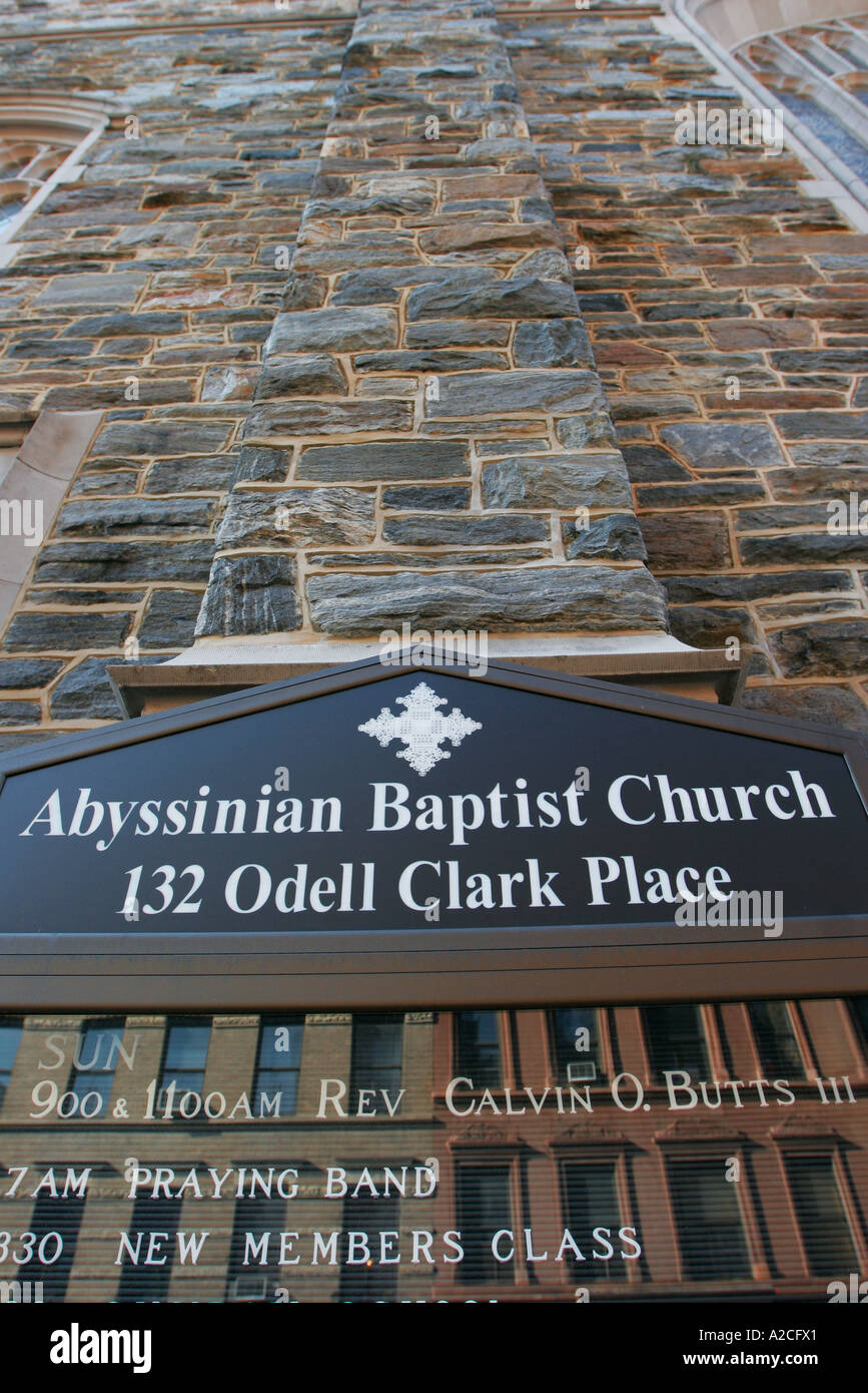 Abyssinian Baptist Church Odell Clark Place Harlem Manhattan New York Stock Photohttps://www.alamy.com/image-license-details/?v=1https://www.alamy.com/abyssinian-baptist-church-odell-clark-place-harlem-manhattan-new-york-image5988320.html
RMA2CFX1–Abyssinian Baptist Church Odell Clark Place Harlem Manhattan New York
 What to see in America . versity since 1897. The University libraryis a particularly impressive building. All the section from 138th to 145th Street near AmsterdamA, ^o^was once owned by Alexander Hamilton, and therehe lived in what was a grand homestead then. The houseoccupied by Audubon, the naturalist, in his last years is atthe foot of 155th Street beside the river. When a com-mission laid out streets and avenues up to 155th Street in1807 it apologized for doing so much laying out, and acknowledged that prob-ably not for centurieswould most of thesestreets be occupied. On Harlem Heights at Stock Photohttps://www.alamy.com/image-license-details/?v=1https://www.alamy.com/what-to-see-in-america-versity-since-1897-the-university-libraryis-a-particularly-impressive-building-all-the-section-from-138th-to-145th-street-near-amsterdama-owas-once-owned-by-alexander-hamilton-and-therehe-lived-in-what-was-a-grand-homestead-then-the-houseoccupied-by-audubon-the-naturalist-in-his-last-years-is-atthe-foot-of-155th-street-beside-the-river-when-a-com-mission-laid-out-streets-and-avenues-up-to-155th-street-in1807-it-apologized-for-doing-so-much-laying-out-and-acknowledged-that-prob-ably-not-for-centurieswould-most-of-thesestreets-be-occupied-on-harlem-heights-at-image338356248.html
RM2AJDCRM–What to see in America . versity since 1897. The University libraryis a particularly impressive building. All the section from 138th to 145th Street near AmsterdamA, ^o^was once owned by Alexander Hamilton, and therehe lived in what was a grand homestead then. The houseoccupied by Audubon, the naturalist, in his last years is atthe foot of 155th Street beside the river. When a com-mission laid out streets and avenues up to 155th Street in1807 it apologized for doing so much laying out, and acknowledged that prob-ably not for centurieswould most of thesestreets be occupied. On Harlem Heights at
 New York City: Handsome restored yellow brick townhouses on Striver's Row (West 138th Street) in Harlem Stock Photohttps://www.alamy.com/image-license-details/?v=1https://www.alamy.com/stock-photo-new-york-city-handsome-restored-yellow-brick-townhouses-on-strivers-106721838.html
RMG5HGP6–New York City: Handsome restored yellow brick townhouses on Striver's Row (West 138th Street) in Harlem
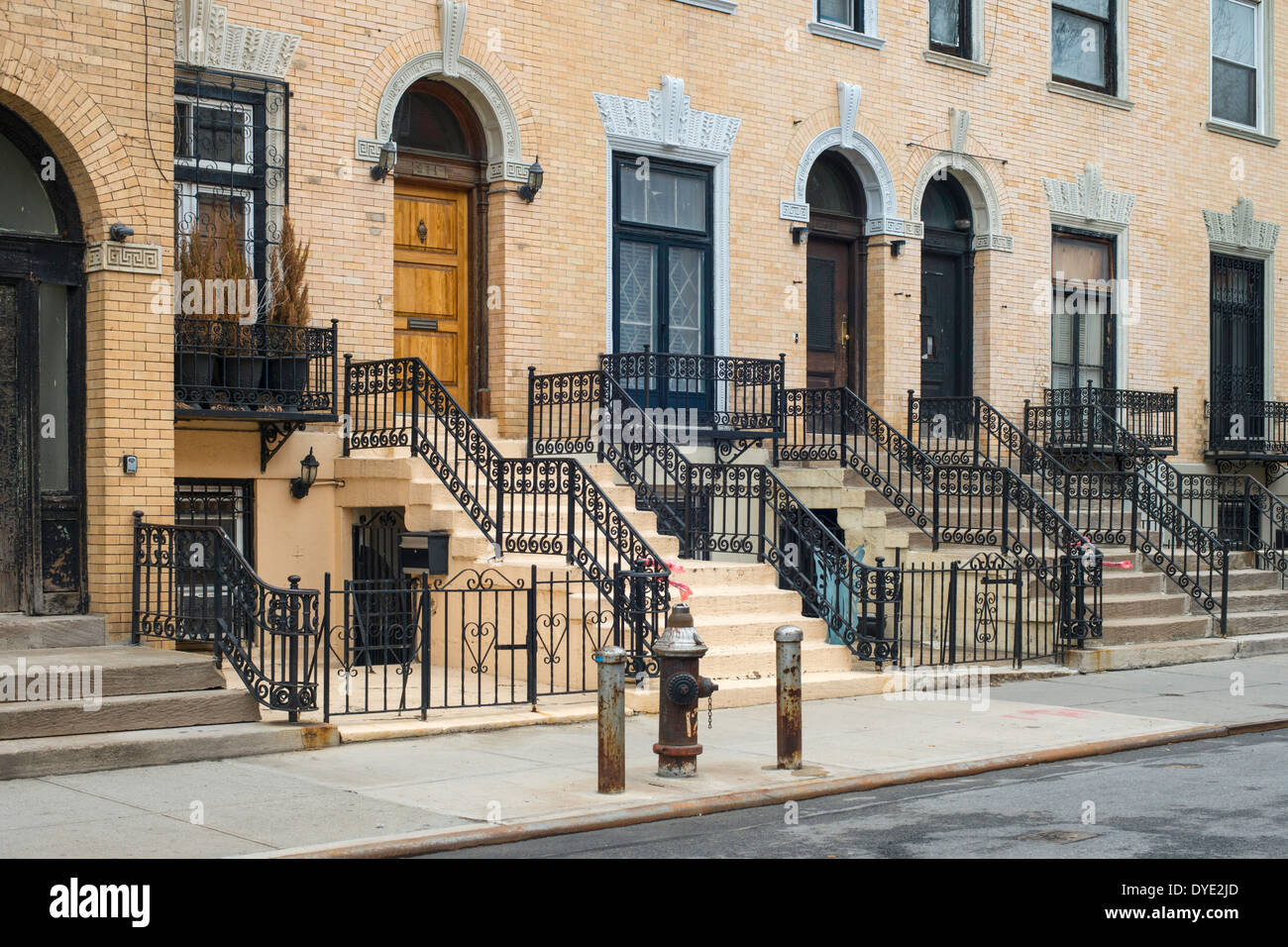 Houses on 138th Street, Harlem, New York City, known as 'Strivers' Row' in the St. Nicholas Historic District. Stock Photohttps://www.alamy.com/image-license-details/?v=1https://www.alamy.com/houses-on-138th-street-harlem-new-york-city-known-as-strivers-row-image68536229.html
RMDYE2JD–Houses on 138th Street, Harlem, New York City, known as 'Strivers' Row' in the St. Nicholas Historic District.
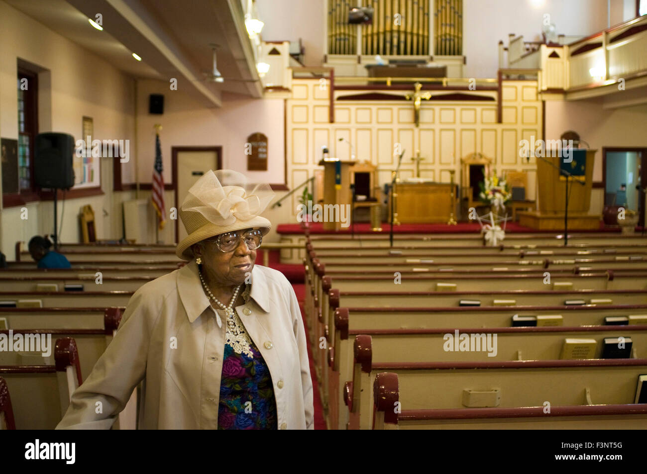 A parishioner leaves mass. Union Congregational Church. 60 138th Street. Phone 212-926-2549. St. Mark The Evangelist Catholic Ch Stock Photohttps://www.alamy.com/image-license-details/?v=1https://www.alamy.com/stock-photo-a-parishioner-leaves-mass-union-congregational-church-60-138th-street-88375772.html
RMF3NT5G–A parishioner leaves mass. Union Congregational Church. 60 138th Street. Phone 212-926-2549. St. Mark The Evangelist Catholic Ch
 138th Street Station, The Bronx Stock Photohttps://www.alamy.com/image-license-details/?v=1https://www.alamy.com/stock-photo-138th-street-station-the-bronx-54929624.html
RMD5A788–138th Street Station, The Bronx
 Bounded by W. 139th Street, Fifth Avenue, E. 138th Street, (Harlem River) Madison Avenue, E. 135th Street, Park Avenue, E. 133rd Street, W. 133rd Street and Lenox Avenue, Plate 152 1916 Stock Photohttps://www.alamy.com/image-license-details/?v=1https://www.alamy.com/bounded-by-w-139th-street-fifth-avenue-e-138th-street-harlem-river-madison-avenue-e-135th-street-park-avenue-e-133rd-street-w-133rd-street-and-lenox-avenue-plate-152-1916-image633900377.html
RM2YR8JB5–Bounded by W. 139th Street, Fifth Avenue, E. 138th Street, (Harlem River) Madison Avenue, E. 135th Street, Park Avenue, E. 133rd Street, W. 133rd Street and Lenox Avenue, Plate 152 1916
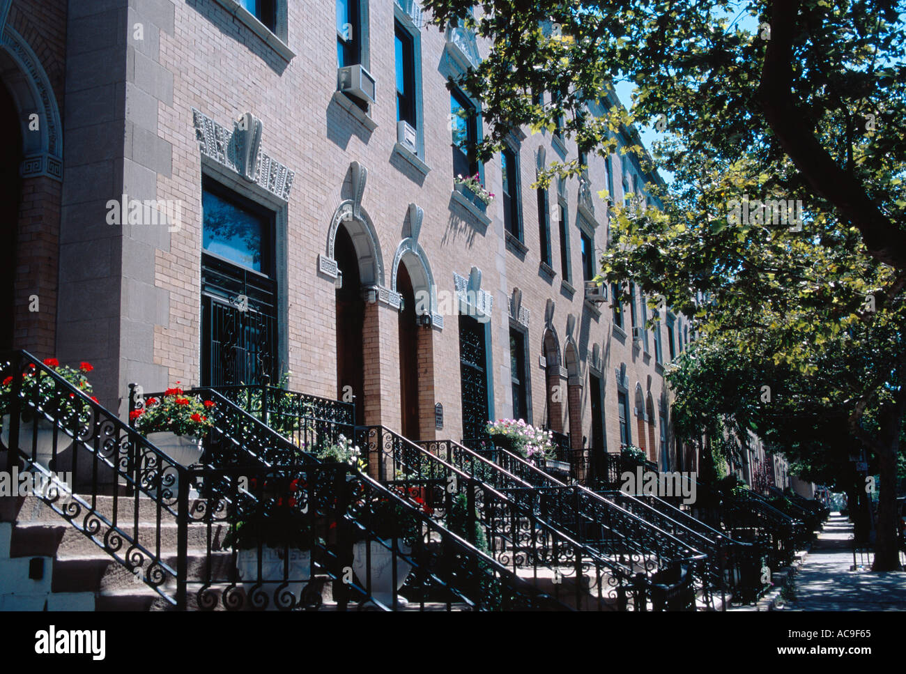 Historic Strivers Row 138th Street Harlem Upper Manhattan New York City Stock Photohttps://www.alamy.com/image-license-details/?v=1https://www.alamy.com/historic-strivers-row-138th-street-harlem-upper-manhattan-new-york-image827237.html
RMAC9F65–Historic Strivers Row 138th Street Harlem Upper Manhattan New York City
 A parishioner at mass. The Evangelist Catholic Churc. 65 138th Street in harlem, New York, USA. Abyssinian Baptist Church, just across Malcolm X Boule Stock Photohttps://www.alamy.com/image-license-details/?v=1https://www.alamy.com/a-parishioner-at-mass-the-evangelist-catholic-churc-65-138th-street-in-harlem-new-york-usa-abyssinian-baptist-church-just-across-malcolm-x-boule-image387327303.html
RM2DE47WY–A parishioner at mass. The Evangelist Catholic Churc. 65 138th Street in harlem, New York, USA. Abyssinian Baptist Church, just across Malcolm X Boule
 Cartographic, Maps. 1888 - 1897. Lionel Pincus and Princess Firyal Map Division. Bronx (New York, N.Y.) Plate 1: Map No. 441 Bounded by Fourth Avenue, 138th Street, ... (Harlem River) Line of Water Grant, Bulkhead & Pier Line, Grove Street, Cottage Street, Old Boston Post Road or Morris Avenue. Stock Photohttps://www.alamy.com/image-license-details/?v=1https://www.alamy.com/cartographic-maps-1888-1897-lionel-pincus-and-princess-firyal-map-division-bronx-new-york-ny-plate-1-map-no-441-bounded-by-fourth-avenue-138th-street-harlem-river-line-of-water-grant-bulkhead-pier-line-grove-street-cottage-street-old-boston-post-road-or-morris-avenue-image483726153.html
RM2K2YHJ1–Cartographic, Maps. 1888 - 1897. Lionel Pincus and Princess Firyal Map Division. Bronx (New York, N.Y.) Plate 1: Map No. 441 Bounded by Fourth Avenue, 138th Street, ... (Harlem River) Line of Water Grant, Bulkhead & Pier Line, Grove Street, Cottage Street, Old Boston Post Road or Morris Avenue.
 February 16, 2021, New York, NY, USA: February 16, 2021 : A funeral service was held for the late actress Cicely Tyson at The Abyssinian Baptist Church at 132 West 138th Street in Harlem. (Credit Image: © Dan Herrick/ZUMA Wire) Stock Photohttps://www.alamy.com/image-license-details/?v=1https://www.alamy.com/february-16-2021-new-york-ny-usa-february-16-2021-a-funeral-service-was-held-for-the-late-actress-cicely-tyson-at-the-abyssinian-baptist-church-at-132-west-138th-street-in-harlem-credit-image-dan-herrickzuma-wire-image405650670.html
RM2EFXYFX–February 16, 2021, New York, NY, USA: February 16, 2021 : A funeral service was held for the late actress Cicely Tyson at The Abyssinian Baptist Church at 132 West 138th Street in Harlem. (Credit Image: © Dan Herrick/ZUMA Wire)
 Cartographic, Maps. 1885. Lionel Pincus and Princess Firyal Map Division. Real property , New York (State) , New York, New York (N.Y.) Plate 33: E. 144th Street, Rider Avenue, E. 142nd Street, Third Avenue, E. 144th Street, East River, Harlem Kills, Harlem River, E. 138th Street and Mott Avenue. Part of Ward 23, New York City. Stock Photohttps://www.alamy.com/image-license-details/?v=1https://www.alamy.com/cartographic-maps-1885-lionel-pincus-and-princess-firyal-map-division-real-property-new-york-state-new-york-new-york-ny-plate-33-e-144th-street-rider-avenue-e-142nd-street-third-avenue-e-144th-street-east-river-harlem-kills-harlem-river-e-138th-street-and-mott-avenue-part-of-ward-23-new-york-city-image483738419.html
RM2K30583–Cartographic, Maps. 1885. Lionel Pincus and Princess Firyal Map Division. Real property , New York (State) , New York, New York (N.Y.) Plate 33: E. 144th Street, Rider Avenue, E. 142nd Street, Third Avenue, E. 144th Street, East River, Harlem Kills, Harlem River, E. 138th Street and Mott Avenue. Part of Ward 23, New York City.
 Plate 2: Map No. 419 Bounded by 138th Street, Mill Brook, 131st Street, Morris Avenue, 130th Street, Harlem River reimagined Stock Photohttps://www.alamy.com/image-license-details/?v=1https://www.alamy.com/plate-2-map-no-419-bounded-by-138th-street-mill-brook-131st-street-morris-avenue-130th-street-harlem-river-reimagined-image230182425.html
RFRADM0W–Plate 2: Map No. 419 Bounded by 138th Street, Mill Brook, 131st Street, Morris Avenue, 130th Street, Harlem River reimagined
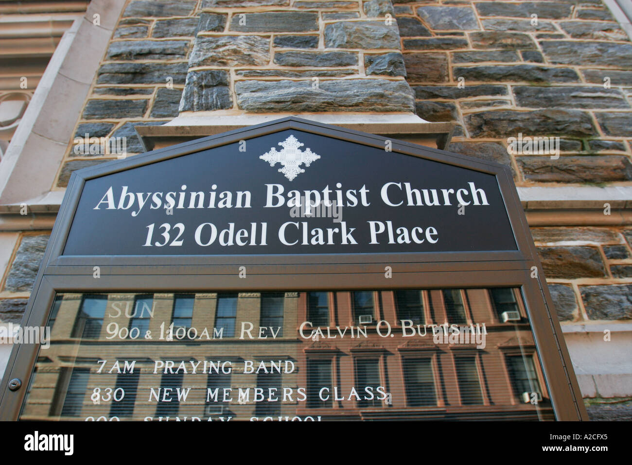 Abyssinian Baptist Church Odell Clark Place Harlem Manhattan New York Stock Photohttps://www.alamy.com/image-license-details/?v=1https://www.alamy.com/abyssinian-baptist-church-odell-clark-place-harlem-manhattan-new-york-image5988324.html
RMA2CFX5–Abyssinian Baptist Church Odell Clark Place Harlem Manhattan New York
 . Health and pleasure resorts and summer homes accessible by the picturesque Harlem Railroad : containing descriptive masster and an extensive list of s . ne so animated, so varied in beauty, extending on onehand to the islands in the East River, with their great institu-tions of charity and reform, and on the other hand, to Wash-ington Heights on the Hudson, and High Bridge, with itsgraceful outlines and lofty tower. In a few moments aftercrossing the Harlem River, we are at 138th Street Station, a point deserving of somethingmore than a passing notice. The centre of population of themetropol Stock Photohttps://www.alamy.com/image-license-details/?v=1https://www.alamy.com/health-and-pleasure-resorts-and-summer-homes-accessible-by-the-picturesque-harlem-railroad-containing-descriptive-masster-and-an-extensive-list-of-s-ne-so-animated-so-varied-in-beauty-extending-on-onehand-to-the-islands-in-the-east-river-with-their-great-institu-tions-of-charity-and-reform-and-on-the-other-hand-to-wash-ington-heights-on-the-hudson-and-high-bridge-with-itsgraceful-outlines-and-lofty-tower-in-a-few-moments-aftercrossing-the-harlem-river-we-are-at-138th-street-station-a-point-deserving-of-somethingmore-than-a-passing-notice-the-centre-of-population-of-themetropol-image375661963.html
RM2CR4TJK–. Health and pleasure resorts and summer homes accessible by the picturesque Harlem Railroad : containing descriptive masster and an extensive list of s . ne so animated, so varied in beauty, extending on onehand to the islands in the East River, with their great institu-tions of charity and reform, and on the other hand, to Wash-ington Heights on the Hudson, and High Bridge, with itsgraceful outlines and lofty tower. In a few moments aftercrossing the Harlem River, we are at 138th Street Station, a point deserving of somethingmore than a passing notice. The centre of population of themetropol
 138th Street, Harlem, New York City, Stock Photohttps://www.alamy.com/image-license-details/?v=1https://www.alamy.com/138th-street-harlem-new-york-city-image68536372.html
RMDYE2RG–138th Street, Harlem, New York City,
 138th Street Station, The Bronx Stock Photohttps://www.alamy.com/image-license-details/?v=1https://www.alamy.com/stock-photo-138th-street-station-the-bronx-54930735.html
RMD5A8KY–138th Street Station, The Bronx
 Plate 33: E. 144th Street, Rider Avenue, E. 142nd Street, Third Avenue, E. 144th Street, East River, Harlem Kills, Harlem River, E. 138th Street and Mott Avenue 1885 by Robinson, E. (Elisha) Stock Photohttps://www.alamy.com/image-license-details/?v=1https://www.alamy.com/plate-33-e-144th-street-rider-avenue-e-142nd-street-third-avenue-e-144th-street-east-river-harlem-kills-harlem-river-e-138th-street-and-mott-avenue-1885-by-robinson-e-elisha-image633126509.html
RM2YP1B91–Plate 33: E. 144th Street, Rider Avenue, E. 142nd Street, Third Avenue, E. 144th Street, East River, Harlem Kills, Harlem River, E. 138th Street and Mott Avenue 1885 by Robinson, E. (Elisha)
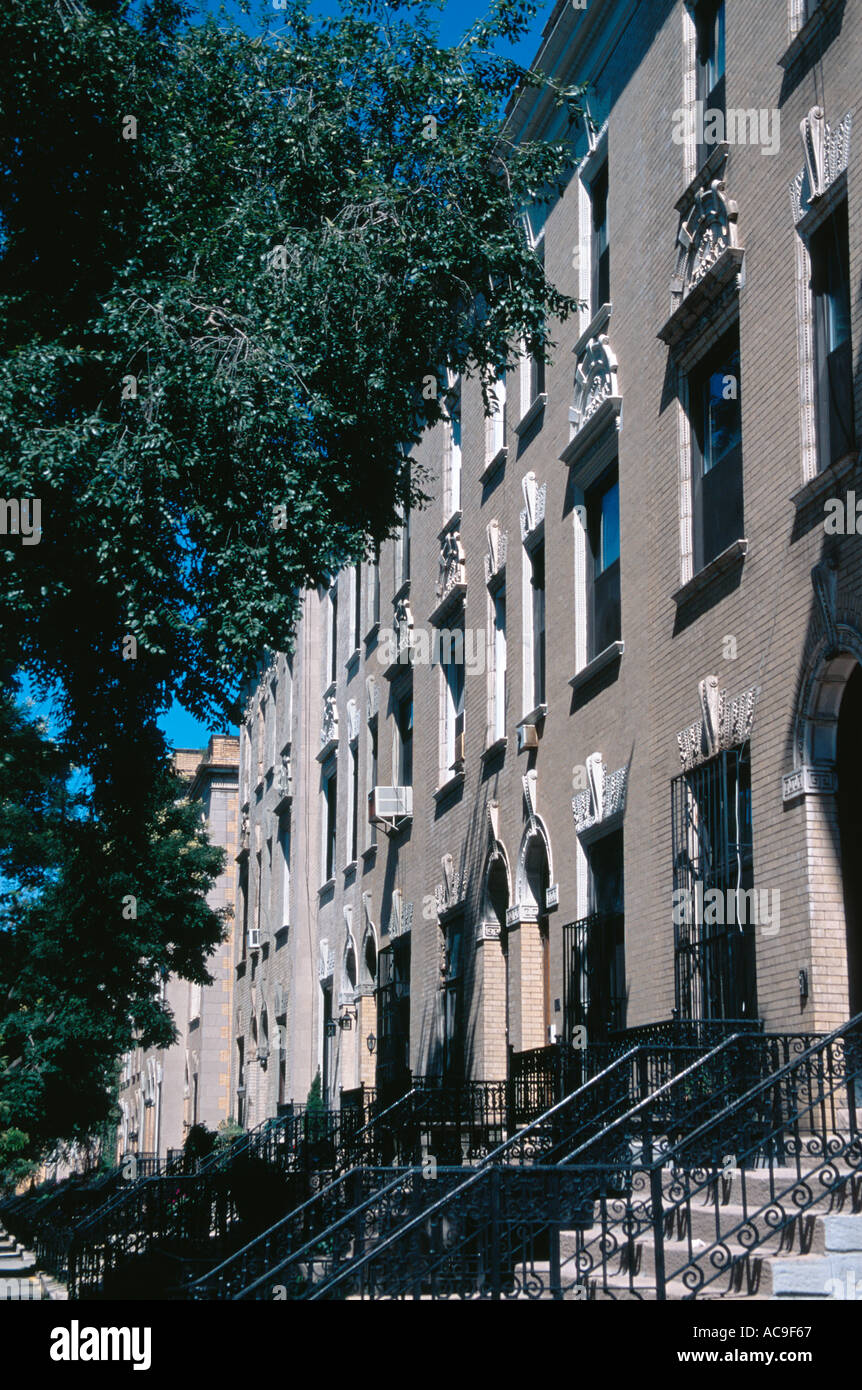 Historic Strivers Row 138th Street Harlem Upper Manhattan New York City Stock Photohttps://www.alamy.com/image-license-details/?v=1https://www.alamy.com/historic-strivers-row-138th-street-harlem-upper-manhattan-new-york-image827239.html
RMAC9F67–Historic Strivers Row 138th Street Harlem Upper Manhattan New York City
 A parishioner at mass. The Evangelist Catholic Churc. 65 138th Street in harlem, New York, USA. Abyssinian Baptist Church, just across Malcolm X Boule Stock Photohttps://www.alamy.com/image-license-details/?v=1https://www.alamy.com/a-parishioner-at-mass-the-evangelist-catholic-churc-65-138th-street-in-harlem-new-york-usa-abyssinian-baptist-church-just-across-malcolm-x-boule-image387327302.html
RM2DE47WX–A parishioner at mass. The Evangelist Catholic Churc. 65 138th Street in harlem, New York, USA. Abyssinian Baptist Church, just across Malcolm X Boule
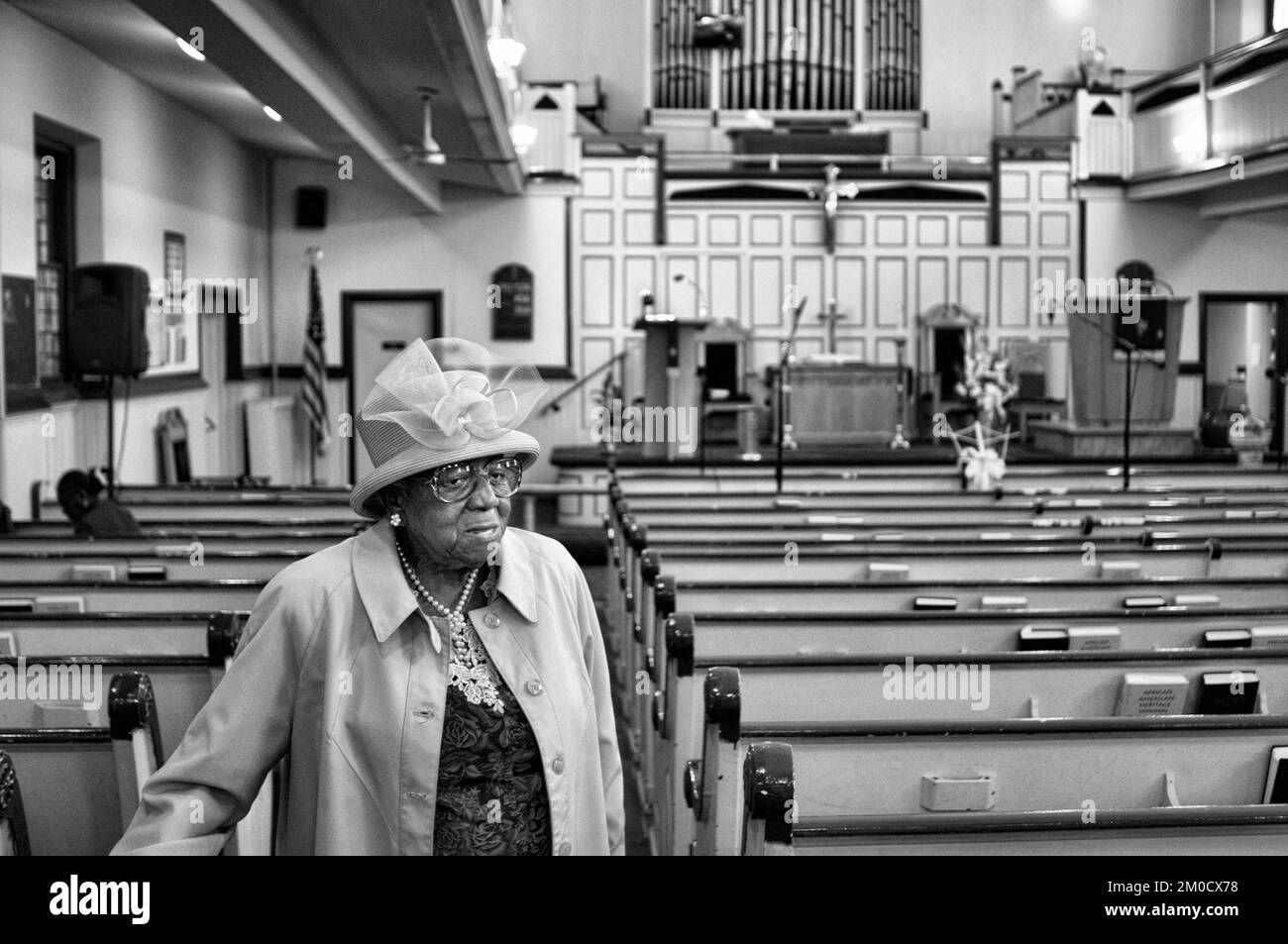 A parishioner leaves mass. Union Congregational Church. Evangelist Catholic Church. 65 138th Street. Harlem New York, USA Stock Photohttps://www.alamy.com/image-license-details/?v=1https://www.alamy.com/a-parishioner-leaves-mass-union-congregational-church-evangelist-catholic-church-65-138th-street-harlem-new-york-usa-image499384684.html
RM2M0CX78–A parishioner leaves mass. Union Congregational Church. Evangelist Catholic Church. 65 138th Street. Harlem New York, USA
 February 16, 2021, New York, NY, USA: February 16, 2021 : A funeral service was held for the late actress Cicely Tyson at The Abyssinian Baptist Church at 132 West 138th Street in Harlem. (Credit Image: © Dan Herrick/ZUMA Wire) Stock Photohttps://www.alamy.com/image-license-details/?v=1https://www.alamy.com/february-16-2021-new-york-ny-usa-february-16-2021-a-funeral-service-was-held-for-the-late-actress-cicely-tyson-at-the-abyssinian-baptist-church-at-132-west-138th-street-in-harlem-credit-image-dan-herrickzuma-wire-image405645471.html
RM2EFXMX7–February 16, 2021, New York, NY, USA: February 16, 2021 : A funeral service was held for the late actress Cicely Tyson at The Abyssinian Baptist Church at 132 West 138th Street in Harlem. (Credit Image: © Dan Herrick/ZUMA Wire)
 A parishioner at mass. Union Congregational Church. 60 138th Street. Tel 212-926-2549. St. Mark The Evangelist Catholic Church. Stock Photohttps://www.alamy.com/image-license-details/?v=1https://www.alamy.com/a-parishioner-at-mass-union-congregational-church-60-138th-street-image67655913.html
RMDX1YPH–A parishioner at mass. Union Congregational Church. 60 138th Street. Tel 212-926-2549. St. Mark The Evangelist Catholic Church.
 Cartographic, Maps. 1916. Lionel Pincus and Princess Firyal Map Division. Atlases, Manhattan (New York, N.Y.), Real property , New York (State) , New York Plate 152: Bounded by W. 139th Street, Fifth Avenue, E. 138th Street, (Harlem River) Madison Avenue, E. 135th Street, Park Avenue, E. 133rd Street, W. 133rd Street and Lenox Avenue Part of Section 6 Stock Photohttps://www.alamy.com/image-license-details/?v=1https://www.alamy.com/cartographic-maps-1916-lionel-pincus-and-princess-firyal-map-division-atlases-manhattan-new-york-ny-real-property-new-york-state-new-york-plate-152-bounded-by-w-139th-street-fifth-avenue-e-138th-street-harlem-river-madison-avenue-e-135th-street-park-avenue-e-133rd-street-w-133rd-street-and-lenox-avenue-part-of-section-6-image483737198.html
RM2K303ME–Cartographic, Maps. 1916. Lionel Pincus and Princess Firyal Map Division. Atlases, Manhattan (New York, N.Y.), Real property , New York (State) , New York Plate 152: Bounded by W. 139th Street, Fifth Avenue, E. 138th Street, (Harlem River) Madison Avenue, E. 135th Street, Park Avenue, E. 133rd Street, W. 133rd Street and Lenox Avenue Part of Section 6
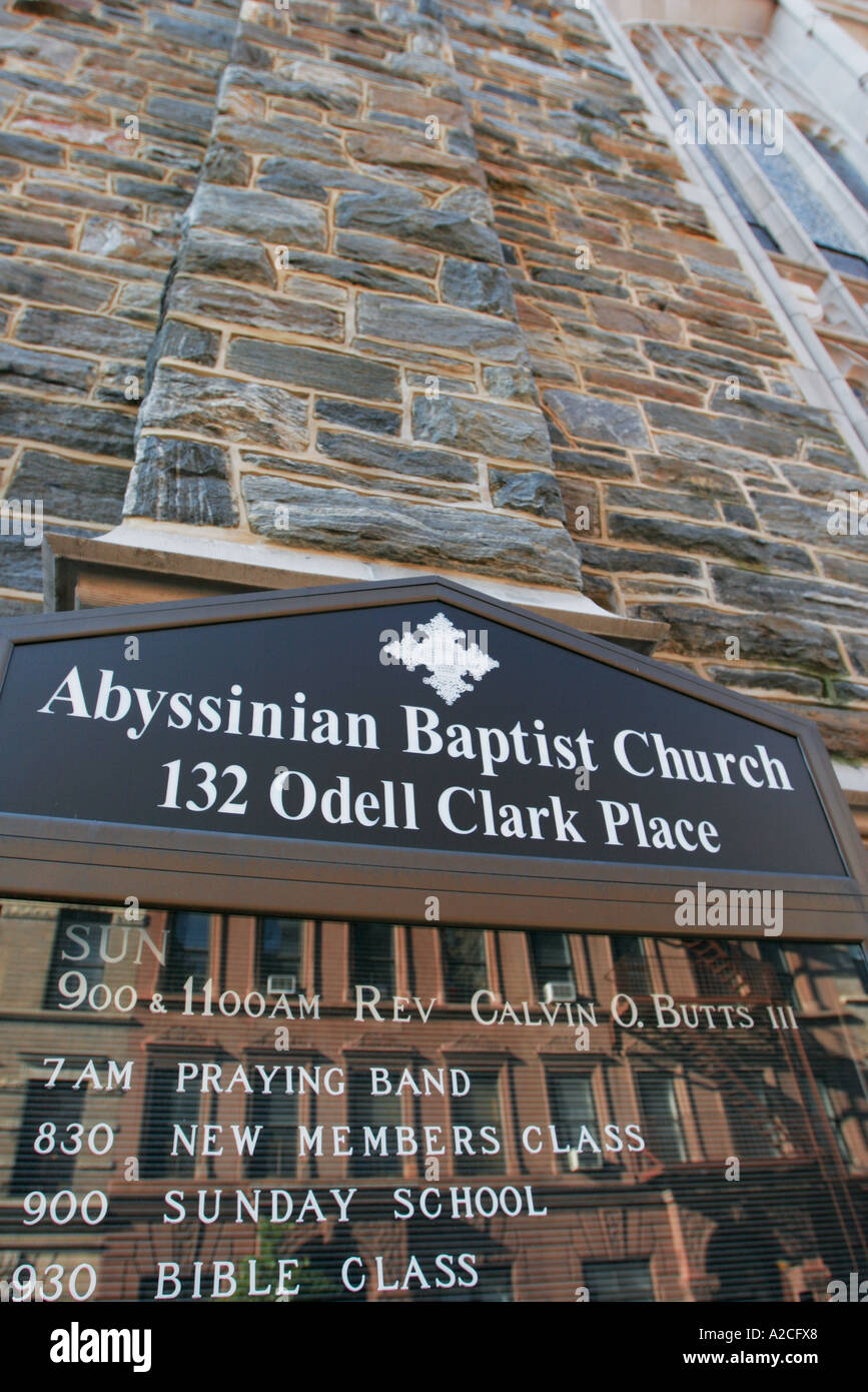 Abyssinian Baptist Church Odell Clark Place Harlem Manhattan New York Stock Photohttps://www.alamy.com/image-license-details/?v=1https://www.alamy.com/abyssinian-baptist-church-odell-clark-place-harlem-manhattan-new-york-image5988327.html
RMA2CFX8–Abyssinian Baptist Church Odell Clark Place Harlem Manhattan New York
 Cartographic, Maps. 1914. Lionel Pincus and Princess Firyal Map Division. Manhattan (New York, N.Y.), Real property , New York (State) , New York Plate 24, Part of Section 6: Bounded by W. 139th Street, E. 139th Street, Fifth Avenue, E. 138th Street, Madison Avenue (Harlem River), E. 135th Street, Park Avenue, E. 133rd Street, W. 133rd Street and Lenox Avenue Stock Photohttps://www.alamy.com/image-license-details/?v=1https://www.alamy.com/cartographic-maps-1914-lionel-pincus-and-princess-firyal-map-division-manhattan-new-york-ny-real-property-new-york-state-new-york-plate-24-part-of-section-6-bounded-by-w-139th-street-e-139th-street-fifth-avenue-e-138th-street-madison-avenue-harlem-river-e-135th-street-park-avenue-e-133rd-street-w-133rd-street-and-lenox-avenue-image483723785.html
RM2K2YEHD–Cartographic, Maps. 1914. Lionel Pincus and Princess Firyal Map Division. Manhattan (New York, N.Y.), Real property , New York (State) , New York Plate 24, Part of Section 6: Bounded by W. 139th Street, E. 139th Street, Fifth Avenue, E. 138th Street, Madison Avenue (Harlem River), E. 135th Street, Park Avenue, E. 133rd Street, W. 133rd Street and Lenox Avenue
 Plate 152: Bounded by W. 139th Street, Fifth Avenue, E. 138th Street, Harlem River Madison Avenue, E. 135th Street reimagined Stock Photohttps://www.alamy.com/image-license-details/?v=1https://www.alamy.com/plate-152-bounded-by-w-139th-street-fifth-avenue-e-138th-street-harlem-river-madison-avenue-e-135th-street-reimagined-image230181809.html
RFRADK6W–Plate 152: Bounded by W. 139th Street, Fifth Avenue, E. 138th Street, Harlem River Madison Avenue, E. 135th Street reimagined
 Cartographic, Maps. 1942. Lionel Pincus and Princess Firyal Map Division. Real property , New York (State) , New York (N.Y.), Bronx (New York, N.Y.) , Maps Double Page Plate No. 4, Part of Section 9, Borough of the Bronx: Bounded by E. 140th Street, Grand Concourse, E. 138th Street, Park Avenue, E. 141st Street, Third Avenue, E. 142nd Street, Alexander Avenue, E. 135th Street, (Harlem River) Exterior Street and Major Deegan Boulevard Stock Photohttps://www.alamy.com/image-license-details/?v=1https://www.alamy.com/cartographic-maps-1942-lionel-pincus-and-princess-firyal-map-division-real-property-new-york-state-new-york-ny-bronx-new-york-ny-maps-double-page-plate-no-4-part-of-section-9-borough-of-the-bronx-bounded-by-e-140th-street-grand-concourse-e-138th-street-park-avenue-e-141st-street-third-avenue-e-142nd-street-alexander-avenue-e-135th-street-harlem-river-exterior-street-and-major-deegan-boulevard-image483596168.html
RM2K2NKRM–Cartographic, Maps. 1942. Lionel Pincus and Princess Firyal Map Division. Real property , New York (State) , New York (N.Y.), Bronx (New York, N.Y.) , Maps Double Page Plate No. 4, Part of Section 9, Borough of the Bronx: Bounded by E. 140th Street, Grand Concourse, E. 138th Street, Park Avenue, E. 141st Street, Third Avenue, E. 142nd Street, Alexander Avenue, E. 135th Street, (Harlem River) Exterior Street and Major Deegan Boulevard
 Cartographic, Maps. 1942 - 1957. Lionel Pincus and Princess Firyal Map Division. Real property , New York (State) , New York (N.Y.), Bronx (New York, N.Y.) , Maps Double Page Plate No. 4, Part of Section 9, Borough of the Bronx: Bounded by E. 140th Street, Grand Concourse, E. 138th Street, Park Avenue, E. 141st Street, Morris Avenue, Third Avenue, E. 142nd Street, Alexander Avenue, E. 135th Street, (Harlem River) Exterior Street and Major Deegan Boulevard Stock Photohttps://www.alamy.com/image-license-details/?v=1https://www.alamy.com/cartographic-maps-1942-1957-lionel-pincus-and-princess-firyal-map-division-real-property-new-york-state-new-york-ny-bronx-new-york-ny-maps-double-page-plate-no-4-part-of-section-9-borough-of-the-bronx-bounded-by-e-140th-street-grand-concourse-e-138th-street-park-avenue-e-141st-street-morris-avenue-third-avenue-e-142nd-street-alexander-avenue-e-135th-street-harlem-river-exterior-street-and-major-deegan-boulevard-image483589257.html
RM2K2NB0W–Cartographic, Maps. 1942 - 1957. Lionel Pincus and Princess Firyal Map Division. Real property , New York (State) , New York (N.Y.), Bronx (New York, N.Y.) , Maps Double Page Plate No. 4, Part of Section 9, Borough of the Bronx: Bounded by E. 140th Street, Grand Concourse, E. 138th Street, Park Avenue, E. 141st Street, Morris Avenue, Third Avenue, E. 142nd Street, Alexander Avenue, E. 135th Street, (Harlem River) Exterior Street and Major Deegan Boulevard
 Architectural detail on 'Strivers' Row', 138th Street, Harlem, New York City, Stock Photohttps://www.alamy.com/image-license-details/?v=1https://www.alamy.com/architectural-detail-on-strivers-row-138th-street-harlem-new-york-image68536385.html
RMDYE2T1–Architectural detail on 'Strivers' Row', 138th Street, Harlem, New York City,
 138th Street Station, The Bronx Stock Photohttps://www.alamy.com/image-license-details/?v=1https://www.alamy.com/stock-photo-138th-street-station-the-bronx-54929562.html
RMD5A762–138th Street Station, The Bronx
![Plate 1: Map No. 441 [Bounded by Fourth Avenue, 138th Street, ... (Harlem River) Line of Water Grant, Bulkhead & Pier Line, Grove Street, Cottage Street, Old Boston Post Road or Morris Avenue.] 1888 - 1897 Stock Photo Plate 1: Map No. 441 [Bounded by Fourth Avenue, 138th Street, ... (Harlem River) Line of Water Grant, Bulkhead & Pier Line, Grove Street, Cottage Street, Old Boston Post Road or Morris Avenue.] 1888 - 1897 Stock Photo](https://c8.alamy.com/comp/2YP9GE3/plate-1-map-no-441-bounded-by-fourth-avenue-138th-street-harlem-river-line-of-water-grant-bulkhead-pier-line-grove-street-cottage-street-old-boston-post-road-or-morris-avenue-1888-1897-2YP9GE3.jpg) Plate 1: Map No. 441 [Bounded by Fourth Avenue, 138th Street, ... (Harlem River) Line of Water Grant, Bulkhead & Pier Line, Grove Street, Cottage Street, Old Boston Post Road or Morris Avenue.] 1888 - 1897 Stock Photohttps://www.alamy.com/image-license-details/?v=1https://www.alamy.com/plate-1-map-no-441-bounded-by-fourth-avenue-138th-street-harlem-river-line-of-water-grant-bulkhead-pier-line-grove-street-cottage-street-old-boston-post-road-or-morris-avenue-1888-1897-image633306187.html
Plate 1: Map No. 441 [Bounded by Fourth Avenue, 138th Street, ... (Harlem River) Line of Water Grant, Bulkhead & Pier Line, Grove Street, Cottage Street, Old Boston Post Road or Morris Avenue.] 1888 - 1897 Stock Photohttps://www.alamy.com/image-license-details/?v=1https://www.alamy.com/plate-1-map-no-441-bounded-by-fourth-avenue-138th-street-harlem-river-line-of-water-grant-bulkhead-pier-line-grove-street-cottage-street-old-boston-post-road-or-morris-avenue-1888-1897-image633306187.htmlRM2YP9GE3–Plate 1: Map No. 441 [Bounded by Fourth Avenue, 138th Street, ... (Harlem River) Line of Water Grant, Bulkhead & Pier Line, Grove Street, Cottage Street, Old Boston Post Road or Morris Avenue.] 1888 - 1897
 February 16, 2021, New York, NY, USA: February 16, 2021 : A funeral service was held for the late actress Cicely Tyson at The Abyssinian Baptist Church at 132 West 138th Street in Harlem. (Credit Image: © Dan Herrick/ZUMA Wire) Stock Photohttps://www.alamy.com/image-license-details/?v=1https://www.alamy.com/february-16-2021-new-york-ny-usa-february-16-2021-a-funeral-service-was-held-for-the-late-actress-cicely-tyson-at-the-abyssinian-baptist-church-at-132-west-138th-street-in-harlem-credit-image-dan-herrickzuma-wire-image405651479.html
RM2EFY0GR–February 16, 2021, New York, NY, USA: February 16, 2021 : A funeral service was held for the late actress Cicely Tyson at The Abyssinian Baptist Church at 132 West 138th Street in Harlem. (Credit Image: © Dan Herrick/ZUMA Wire)
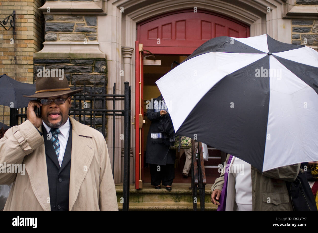 Mass outside. Abyssinian Baptist Church. 132 Odell Clark Place (commonly 138th Street) near the 7th Avenue. Tel 212-862-7474. Stock Photohttps://www.alamy.com/image-license-details/?v=1https://www.alamy.com/mass-outside-abyssinian-baptist-church-132-odell-clark-place-commonly-image67655915.html
RMDX1YPK–Mass outside. Abyssinian Baptist Church. 132 Odell Clark Place (commonly 138th Street) near the 7th Avenue. Tel 212-862-7474.
 Plate 152: Bounded by W. 139th Street, Fifth Avenue, E. 138th Street, Harlem River Madison Avenue, E. 135th Street reimagined Stock Photohttps://www.alamy.com/image-license-details/?v=1https://www.alamy.com/plate-152-bounded-by-w-139th-street-fifth-avenue-e-138th-street-harlem-river-madison-avenue-e-135th-street-reimagined-image230373634.html
RFRAPBWP–Plate 152: Bounded by W. 139th Street, Fifth Avenue, E. 138th Street, Harlem River Madison Avenue, E. 135th Street reimagined
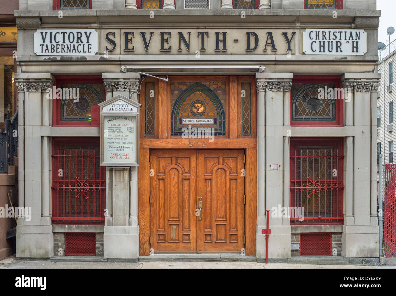 Victory Tabernacle Seventh Day Christian Church in 'Striver's Row', 38th Street, Harlem, New York City, Stock Photohttps://www.alamy.com/image-license-details/?v=1https://www.alamy.com/victory-tabernacle-seventh-day-christian-church-in-strivers-row-38th-image68536253.html
RMDYE2K9–Victory Tabernacle Seventh Day Christian Church in 'Striver's Row', 38th Street, Harlem, New York City,
 Bounded by W. 139th Street, E. 139th Street, Fifth Avenue, E. 138th Street, Madison Avenue (Harlem River), E. 135th Street, Park Avenue, E. 133rd Street, W. 133rd Street and Lenox Avenue, Plate 24, Part of Section 6 1914 by Bromley, George Washington Stock Photohttps://www.alamy.com/image-license-details/?v=1https://www.alamy.com/bounded-by-w-139th-street-e-139th-street-fifth-avenue-e-138th-street-madison-avenue-harlem-river-e-135th-street-park-avenue-e-133rd-street-w-133rd-street-and-lenox-avenue-plate-24-part-of-section-6-1914-by-bromley-george-washington-image633900486.html
RM2YR8JF2–Bounded by W. 139th Street, E. 139th Street, Fifth Avenue, E. 138th Street, Madison Avenue (Harlem River), E. 135th Street, Park Avenue, E. 133rd Street, W. 133rd Street and Lenox Avenue, Plate 24, Part of Section 6 1914 by Bromley, George Washington
 February 16, 2021, New York, NY, USA: February 16, 2021 : A funeral service was held for the late actress Cicely Tyson at The Abyssinian Baptist Church at 132 West 138th Street in Harlem. (Credit Image: © Dan Herrick/ZUMA Wire) Stock Photohttps://www.alamy.com/image-license-details/?v=1https://www.alamy.com/february-16-2021-new-york-ny-usa-february-16-2021-a-funeral-service-was-held-for-the-late-actress-cicely-tyson-at-the-abyssinian-baptist-church-at-132-west-138th-street-in-harlem-credit-image-dan-herrickzuma-wire-image405649499.html
RM2EFXX23–February 16, 2021, New York, NY, USA: February 16, 2021 : A funeral service was held for the late actress Cicely Tyson at The Abyssinian Baptist Church at 132 West 138th Street in Harlem. (Credit Image: © Dan Herrick/ZUMA Wire)
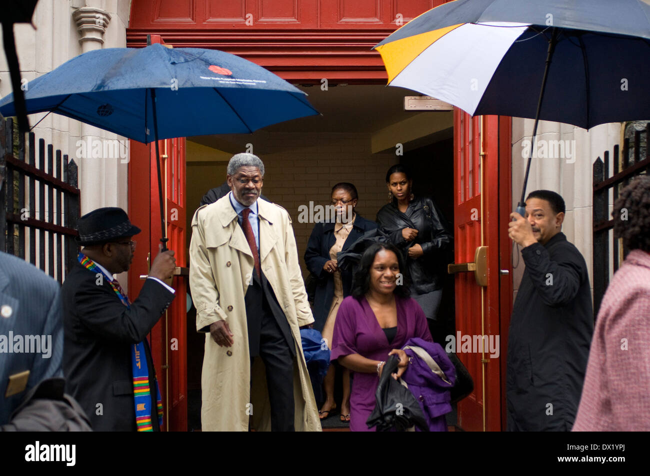 Mass outside. Abyssinian Baptist Church. 132 Odell Clark Place (commonly 138th Street ) near the 7th Avenue . Tel 212-862-7474 . Stock Photohttps://www.alamy.com/image-license-details/?v=1https://www.alamy.com/mass-outside-abyssinian-baptist-church-132-odell-clark-place-commonly-image67655914.html
RMDX1YPJ–Mass outside. Abyssinian Baptist Church. 132 Odell Clark Place (commonly 138th Street ) near the 7th Avenue . Tel 212-862-7474 .
 A parishioner at mass. Union Congregational Church. 60 138th Street. Tel 212-926-2549. St. Mark The Evangelist Catholic Churc. 6 Stock Photohttps://www.alamy.com/image-license-details/?v=1https://www.alamy.com/stock-photo-a-parishioner-at-mass-union-congregational-church-60-138th-street-84598187.html
RMEWHNRR–A parishioner at mass. Union Congregational Church. 60 138th Street. Tel 212-926-2549. St. Mark The Evangelist Catholic Churc. 6
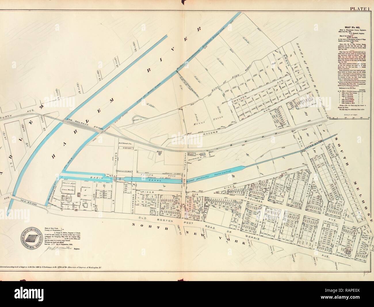 Plate 1: Map No. 441 Bounded by Fourth Avenue, 138th Street, ... Harlem River Line of Water Grant, Bulkhead & Pier reimagined Stock Photohttps://www.alamy.com/image-license-details/?v=1https://www.alamy.com/plate-1-map-no-441-bounded-by-fourth-avenue-138th-street-harlem-river-line-of-water-grant-bulkhead-pier-reimagined-image230375290.html
RFRAPE0X–Plate 1: Map No. 441 Bounded by Fourth Avenue, 138th Street, ... Harlem River Line of Water Grant, Bulkhead & Pier reimagined
![Double Page Plate No. 4, Part of Section 9, Borough of the Bronx: [Bounded by E. 140th Street, Grand Concourse, E. 138th Street, Park Avenue, E. 141st Street, Third Avenue, E. 142nd Street, Alexander Avenue, E. 135th Street, (Harlem River) Exterior Street and Major Deegan Boulevard] 1942 Stock Photo Double Page Plate No. 4, Part of Section 9, Borough of the Bronx: [Bounded by E. 140th Street, Grand Concourse, E. 138th Street, Park Avenue, E. 141st Street, Third Avenue, E. 142nd Street, Alexander Avenue, E. 135th Street, (Harlem River) Exterior Street and Major Deegan Boulevard] 1942 Stock Photo](https://c8.alamy.com/comp/2YPEPEH/double-page-plate-no-4-part-of-section-9-borough-of-the-bronx-bounded-by-e-140th-street-grand-concourse-e-138th-street-park-avenue-e-141st-street-third-avenue-e-142nd-street-alexander-avenue-e-135th-street-harlem-river-exterior-street-and-major-deegan-boulevard-1942-2YPEPEH.jpg) Double Page Plate No. 4, Part of Section 9, Borough of the Bronx: [Bounded by E. 140th Street, Grand Concourse, E. 138th Street, Park Avenue, E. 141st Street, Third Avenue, E. 142nd Street, Alexander Avenue, E. 135th Street, (Harlem River) Exterior Street and Major Deegan Boulevard] 1942 Stock Photohttps://www.alamy.com/image-license-details/?v=1https://www.alamy.com/double-page-plate-no-4-part-of-section-9-borough-of-the-bronx-bounded-by-e-140th-street-grand-concourse-e-138th-street-park-avenue-e-141st-street-third-avenue-e-142nd-street-alexander-avenue-e-135th-street-harlem-river-exterior-street-and-major-deegan-boulevard-1942-image633420665.html
Double Page Plate No. 4, Part of Section 9, Borough of the Bronx: [Bounded by E. 140th Street, Grand Concourse, E. 138th Street, Park Avenue, E. 141st Street, Third Avenue, E. 142nd Street, Alexander Avenue, E. 135th Street, (Harlem River) Exterior Street and Major Deegan Boulevard] 1942 Stock Photohttps://www.alamy.com/image-license-details/?v=1https://www.alamy.com/double-page-plate-no-4-part-of-section-9-borough-of-the-bronx-bounded-by-e-140th-street-grand-concourse-e-138th-street-park-avenue-e-141st-street-third-avenue-e-142nd-street-alexander-avenue-e-135th-street-harlem-river-exterior-street-and-major-deegan-boulevard-1942-image633420665.htmlRM2YPEPEH–Double Page Plate No. 4, Part of Section 9, Borough of the Bronx: [Bounded by E. 140th Street, Grand Concourse, E. 138th Street, Park Avenue, E. 141st Street, Third Avenue, E. 142nd Street, Alexander Avenue, E. 135th Street, (Harlem River) Exterior Street and Major Deegan Boulevard] 1942
 February 16, 2021, New York, NY, USA: February 16, 2021 : A funeral service was held for the late actress Cicely Tyson at The Abyssinian Baptist Church at 132 West 138th Street in Harlem. (Credit Image: © Dan Herrick/ZUMA Wire) Stock Photohttps://www.alamy.com/image-license-details/?v=1https://www.alamy.com/february-16-2021-new-york-ny-usa-february-16-2021-a-funeral-service-was-held-for-the-late-actress-cicely-tyson-at-the-abyssinian-baptist-church-at-132-west-138th-street-in-harlem-credit-image-dan-herrickzuma-wire-image405652262.html
RM2EFY1GP–February 16, 2021, New York, NY, USA: February 16, 2021 : A funeral service was held for the late actress Cicely Tyson at The Abyssinian Baptist Church at 132 West 138th Street in Harlem. (Credit Image: © Dan Herrick/ZUMA Wire)
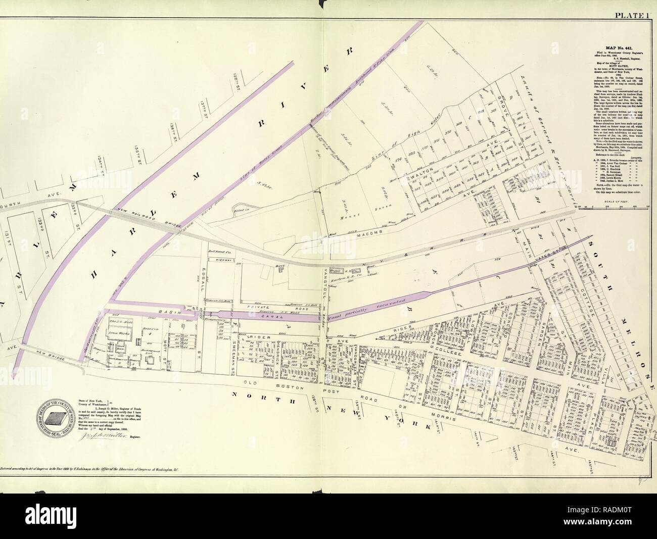 Plate 1: Map No. 441 Bounded by Fourth Avenue, 138th Street, ... Harlem River Line of Water Grant, Bulkhead & Pier reimagined Stock Photohttps://www.alamy.com/image-license-details/?v=1https://www.alamy.com/plate-1-map-no-441-bounded-by-fourth-avenue-138th-street-harlem-river-line-of-water-grant-bulkhead-pier-reimagined-image230182424.html
RFRADM0T–Plate 1: Map No. 441 Bounded by Fourth Avenue, 138th Street, ... Harlem River Line of Water Grant, Bulkhead & Pier reimagined
![Double Page Plate No. 4, Part of Section 9, Borough of the Bronx: [Bounded by E. 140th Street, Grand Concourse, E. 138th Street, Park Avenue, E. 141st Street, Morris Avenue, Third Avenue, E. 142nd Street, Alexander Avenue, E. 135th Street, (Harlem River) Exterior Street and Major Deegan Boulevard] 1942 - 1957 Stock Photo Double Page Plate No. 4, Part of Section 9, Borough of the Bronx: [Bounded by E. 140th Street, Grand Concourse, E. 138th Street, Park Avenue, E. 141st Street, Morris Avenue, Third Avenue, E. 142nd Street, Alexander Avenue, E. 135th Street, (Harlem River) Exterior Street and Major Deegan Boulevard] 1942 - 1957 Stock Photo](https://c8.alamy.com/comp/2YPER50/double-page-plate-no-4-part-of-section-9-borough-of-the-bronx-bounded-by-e-140th-street-grand-concourse-e-138th-street-park-avenue-e-141st-street-morris-avenue-third-avenue-e-142nd-street-alexander-avenue-e-135th-street-harlem-river-exterior-street-and-major-deegan-boulevard-1942-1957-2YPER50.jpg) Double Page Plate No. 4, Part of Section 9, Borough of the Bronx: [Bounded by E. 140th Street, Grand Concourse, E. 138th Street, Park Avenue, E. 141st Street, Morris Avenue, Third Avenue, E. 142nd Street, Alexander Avenue, E. 135th Street, (Harlem River) Exterior Street and Major Deegan Boulevard] 1942 - 1957 Stock Photohttps://www.alamy.com/image-license-details/?v=1https://www.alamy.com/double-page-plate-no-4-part-of-section-9-borough-of-the-bronx-bounded-by-e-140th-street-grand-concourse-e-138th-street-park-avenue-e-141st-street-morris-avenue-third-avenue-e-142nd-street-alexander-avenue-e-135th-street-harlem-river-exterior-street-and-major-deegan-boulevard-1942-1957-image633421180.html
Double Page Plate No. 4, Part of Section 9, Borough of the Bronx: [Bounded by E. 140th Street, Grand Concourse, E. 138th Street, Park Avenue, E. 141st Street, Morris Avenue, Third Avenue, E. 142nd Street, Alexander Avenue, E. 135th Street, (Harlem River) Exterior Street and Major Deegan Boulevard] 1942 - 1957 Stock Photohttps://www.alamy.com/image-license-details/?v=1https://www.alamy.com/double-page-plate-no-4-part-of-section-9-borough-of-the-bronx-bounded-by-e-140th-street-grand-concourse-e-138th-street-park-avenue-e-141st-street-morris-avenue-third-avenue-e-142nd-street-alexander-avenue-e-135th-street-harlem-river-exterior-street-and-major-deegan-boulevard-1942-1957-image633421180.htmlRM2YPER50–Double Page Plate No. 4, Part of Section 9, Borough of the Bronx: [Bounded by E. 140th Street, Grand Concourse, E. 138th Street, Park Avenue, E. 141st Street, Morris Avenue, Third Avenue, E. 142nd Street, Alexander Avenue, E. 135th Street, (Harlem River) Exterior Street and Major Deegan Boulevard] 1942 - 1957
 February 16, 2021, New York, NY, USA: February 16, 2021 : A funeral service was held for the late actress Cicely Tyson at The Abyssinian Baptist Church at 132 West 138th Street in Harlem. (Credit Image: © Dan Herrick/ZUMA Wire) Stock Photohttps://www.alamy.com/image-license-details/?v=1https://www.alamy.com/february-16-2021-new-york-ny-usa-february-16-2021-a-funeral-service-was-held-for-the-late-actress-cicely-tyson-at-the-abyssinian-baptist-church-at-132-west-138th-street-in-harlem-credit-image-dan-herrickzuma-wire-image405649042.html
RM2EFXWDP–February 16, 2021, New York, NY, USA: February 16, 2021 : A funeral service was held for the late actress Cicely Tyson at The Abyssinian Baptist Church at 132 West 138th Street in Harlem. (Credit Image: © Dan Herrick/ZUMA Wire)
 February 16, 2021, New York, NY, USA: February 16, 2021 : A funeral service was held for the late actress Cicely Tyson at The Abyssinian Baptist Church at 132 West 138th Street in Harlem. (Credit Image: © Dan Herrick/ZUMA Wire) Stock Photohttps://www.alamy.com/image-license-details/?v=1https://www.alamy.com/february-16-2021-new-york-ny-usa-february-16-2021-a-funeral-service-was-held-for-the-late-actress-cicely-tyson-at-the-abyssinian-baptist-church-at-132-west-138th-street-in-harlem-credit-image-dan-herrickzuma-wire-image405646201.html
RM2EFXNT9–February 16, 2021, New York, NY, USA: February 16, 2021 : A funeral service was held for the late actress Cicely Tyson at The Abyssinian Baptist Church at 132 West 138th Street in Harlem. (Credit Image: © Dan Herrick/ZUMA Wire)
 February 16, 2021, New York, NY, USA: February 16, 2021 : A funeral service was held for the late actress Cicely Tyson at The Abyssinian Baptist Church at 132 West 138th Street in Harlem. (Credit Image: © Dan Herrick/ZUMA Wire) Stock Photohttps://www.alamy.com/image-license-details/?v=1https://www.alamy.com/february-16-2021-new-york-ny-usa-february-16-2021-a-funeral-service-was-held-for-the-late-actress-cicely-tyson-at-the-abyssinian-baptist-church-at-132-west-138th-street-in-harlem-credit-image-dan-herrickzuma-wire-image405646929.html
RM2EFXPP9–February 16, 2021, New York, NY, USA: February 16, 2021 : A funeral service was held for the late actress Cicely Tyson at The Abyssinian Baptist Church at 132 West 138th Street in Harlem. (Credit Image: © Dan Herrick/ZUMA Wire)
 February 16, 2021, New York, NY, USA: February 16, 2021 : A funeral service was held for the late actress Cicely Tyson at The Abyssinian Baptist Church at 132 West 138th Street in Harlem. (Credit Image: © Dan Herrick/ZUMA Wire) Stock Photohttps://www.alamy.com/image-license-details/?v=1https://www.alamy.com/february-16-2021-new-york-ny-usa-february-16-2021-a-funeral-service-was-held-for-the-late-actress-cicely-tyson-at-the-abyssinian-baptist-church-at-132-west-138th-street-in-harlem-credit-image-dan-herrickzuma-wire-image405645448.html
RM2EFXMWC–February 16, 2021, New York, NY, USA: February 16, 2021 : A funeral service was held for the late actress Cicely Tyson at The Abyssinian Baptist Church at 132 West 138th Street in Harlem. (Credit Image: © Dan Herrick/ZUMA Wire)
 February 16, 2021, New York, NY, USA: February 16, 2021 : A funeral service was held for the late actress Cicely Tyson at The Abyssinian Baptist Church at 132 West 138th Street in Harlem. (Credit Image: © Dan Herrick/ZUMA Wire) Stock Photohttps://www.alamy.com/image-license-details/?v=1https://www.alamy.com/february-16-2021-new-york-ny-usa-february-16-2021-a-funeral-service-was-held-for-the-late-actress-cicely-tyson-at-the-abyssinian-baptist-church-at-132-west-138th-street-in-harlem-credit-image-dan-herrickzuma-wire-image405651080.html
RM2EFY02G–February 16, 2021, New York, NY, USA: February 16, 2021 : A funeral service was held for the late actress Cicely Tyson at The Abyssinian Baptist Church at 132 West 138th Street in Harlem. (Credit Image: © Dan Herrick/ZUMA Wire)
 February 16, 2021, New York, NY, USA: February 16, 2021 : A funeral service was held for the late actress Cicely Tyson at The Abyssinian Baptist Church at 132 West 138th Street in Harlem. (Credit Image: © Dan Herrick/ZUMA Wire) Stock Photohttps://www.alamy.com/image-license-details/?v=1https://www.alamy.com/february-16-2021-new-york-ny-usa-february-16-2021-a-funeral-service-was-held-for-the-late-actress-cicely-tyson-at-the-abyssinian-baptist-church-at-132-west-138th-street-in-harlem-credit-image-dan-herrickzuma-wire-image405649839.html
RM2EFXXE7–February 16, 2021, New York, NY, USA: February 16, 2021 : A funeral service was held for the late actress Cicely Tyson at The Abyssinian Baptist Church at 132 West 138th Street in Harlem. (Credit Image: © Dan Herrick/ZUMA Wire)
 February 16, 2021, New York, NY, USA: February 16, 2021 : A funeral service was held for the late actress Cicely Tyson at The Abyssinian Baptist Church at 132 West 138th Street in Harlem. (Credit Image: © Dan Herrick/ZUMA Wire) Stock Photohttps://www.alamy.com/image-license-details/?v=1https://www.alamy.com/february-16-2021-new-york-ny-usa-february-16-2021-a-funeral-service-was-held-for-the-late-actress-cicely-tyson-at-the-abyssinian-baptist-church-at-132-west-138th-street-in-harlem-credit-image-dan-herrickzuma-wire-image405652653.html
RM2EFY22N–February 16, 2021, New York, NY, USA: February 16, 2021 : A funeral service was held for the late actress Cicely Tyson at The Abyssinian Baptist Church at 132 West 138th Street in Harlem. (Credit Image: © Dan Herrick/ZUMA Wire)
 February 16, 2021, New York, NY, USA: February 16, 2021 : A funeral service was held for the late actress Cicely Tyson at The Abyssinian Baptist Church at 132 West 138th Street in Harlem. (Credit Image: © Dan Herrick/ZUMA Wire) Stock Photohttps://www.alamy.com/image-license-details/?v=1https://www.alamy.com/february-16-2021-new-york-ny-usa-february-16-2021-a-funeral-service-was-held-for-the-late-actress-cicely-tyson-at-the-abyssinian-baptist-church-at-132-west-138th-street-in-harlem-credit-image-dan-herrickzuma-wire-image405649492.html
RM2EFXX1T–February 16, 2021, New York, NY, USA: February 16, 2021 : A funeral service was held for the late actress Cicely Tyson at The Abyssinian Baptist Church at 132 West 138th Street in Harlem. (Credit Image: © Dan Herrick/ZUMA Wire)
 February 16, 2021, New York, NY, USA: February 16, 2021 : A funeral service was held for the late actress Cicely Tyson at The Abyssinian Baptist Church at 132 West 138th Street in Harlem. (Credit Image: © Dan Herrick/ZUMA Wire) Stock Photohttps://www.alamy.com/image-license-details/?v=1https://www.alamy.com/february-16-2021-new-york-ny-usa-february-16-2021-a-funeral-service-was-held-for-the-late-actress-cicely-tyson-at-the-abyssinian-baptist-church-at-132-west-138th-street-in-harlem-credit-image-dan-herrickzuma-wire-image405646184.html
RM2EFXNRM–February 16, 2021, New York, NY, USA: February 16, 2021 : A funeral service was held for the late actress Cicely Tyson at The Abyssinian Baptist Church at 132 West 138th Street in Harlem. (Credit Image: © Dan Herrick/ZUMA Wire)
 February 16, 2021, New York, NY, USA: February 16, 2021 : A funeral service was held for the late actress Cicely Tyson at The Abyssinian Baptist Church at 132 West 138th Street in Harlem. (Credit Image: © Dan Herrick/ZUMA Wire) Stock Photohttps://www.alamy.com/image-license-details/?v=1https://www.alamy.com/february-16-2021-new-york-ny-usa-february-16-2021-a-funeral-service-was-held-for-the-late-actress-cicely-tyson-at-the-abyssinian-baptist-church-at-132-west-138th-street-in-harlem-credit-image-dan-herrickzuma-wire-image405646183.html
RM2EFXNRK–February 16, 2021, New York, NY, USA: February 16, 2021 : A funeral service was held for the late actress Cicely Tyson at The Abyssinian Baptist Church at 132 West 138th Street in Harlem. (Credit Image: © Dan Herrick/ZUMA Wire)
 February 16, 2021, New York, NY, USA: February 16, 2021 : A funeral service was held for the late actress Cicely Tyson at The Abyssinian Baptist Church at 132 West 138th Street in Harlem. (Credit Image: © Dan Herrick/ZUMA Wire) Stock Photohttps://www.alamy.com/image-license-details/?v=1https://www.alamy.com/february-16-2021-new-york-ny-usa-february-16-2021-a-funeral-service-was-held-for-the-late-actress-cicely-tyson-at-the-abyssinian-baptist-church-at-132-west-138th-street-in-harlem-credit-image-dan-herrickzuma-wire-image405648309.html
RM2EFXTFH–February 16, 2021, New York, NY, USA: February 16, 2021 : A funeral service was held for the late actress Cicely Tyson at The Abyssinian Baptist Church at 132 West 138th Street in Harlem. (Credit Image: © Dan Herrick/ZUMA Wire)
 February 16, 2021, New York, NY, USA: February 16, 2021 : A funeral service was held for the late actress Cicely Tyson at The Abyssinian Baptist Church at 132 West 138th Street in Harlem. (Credit Image: © Dan Herrick/ZUMA Wire) Stock Photohttps://www.alamy.com/image-license-details/?v=1https://www.alamy.com/february-16-2021-new-york-ny-usa-february-16-2021-a-funeral-service-was-held-for-the-late-actress-cicely-tyson-at-the-abyssinian-baptist-church-at-132-west-138th-street-in-harlem-credit-image-dan-herrickzuma-wire-image405649043.html
RM2EFXWDR–February 16, 2021, New York, NY, USA: February 16, 2021 : A funeral service was held for the late actress Cicely Tyson at The Abyssinian Baptist Church at 132 West 138th Street in Harlem. (Credit Image: © Dan Herrick/ZUMA Wire)
 February 16, 2021, New York, NY, USA: February 16, 2021 : A funeral service was held for the late actress Cicely Tyson at The Abyssinian Baptist Church at 132 West 138th Street in Harlem. (Credit Image: © Dan Herrick/ZUMA Wire) Stock Photohttps://www.alamy.com/image-license-details/?v=1https://www.alamy.com/february-16-2021-new-york-ny-usa-february-16-2021-a-funeral-service-was-held-for-the-late-actress-cicely-tyson-at-the-abyssinian-baptist-church-at-132-west-138th-street-in-harlem-credit-image-dan-herrickzuma-wire-image405652654.html
RM2EFY22P–February 16, 2021, New York, NY, USA: February 16, 2021 : A funeral service was held for the late actress Cicely Tyson at The Abyssinian Baptist Church at 132 West 138th Street in Harlem. (Credit Image: © Dan Herrick/ZUMA Wire)
 February 16, 2021, New York, NY, USA: February 16, 2021 : A funeral service was held for the late actress Cicely Tyson at The Abyssinian Baptist Church at 132 West 138th Street in Harlem. (Credit Image: © Dan Herrick/ZUMA Wire) Stock Photohttps://www.alamy.com/image-license-details/?v=1https://www.alamy.com/february-16-2021-new-york-ny-usa-february-16-2021-a-funeral-service-was-held-for-the-late-actress-cicely-tyson-at-the-abyssinian-baptist-church-at-132-west-138th-street-in-harlem-credit-image-dan-herrickzuma-wire-image405649059.html
RM2EFXWEB–February 16, 2021, New York, NY, USA: February 16, 2021 : A funeral service was held for the late actress Cicely Tyson at The Abyssinian Baptist Church at 132 West 138th Street in Harlem. (Credit Image: © Dan Herrick/ZUMA Wire)
 February 16, 2021, New York, NY, USA: February 16, 2021 : A funeral service was held for the late actress Cicely Tyson at The Abyssinian Baptist Church at 132 West 138th Street in Harlem. (Credit Image: © Dan Herrick/ZUMA Wire) Stock Photohttps://www.alamy.com/image-license-details/?v=1https://www.alamy.com/february-16-2021-new-york-ny-usa-february-16-2021-a-funeral-service-was-held-for-the-late-actress-cicely-tyson-at-the-abyssinian-baptist-church-at-132-west-138th-street-in-harlem-credit-image-dan-herrickzuma-wire-image405649067.html
RM2EFXWEK–February 16, 2021, New York, NY, USA: February 16, 2021 : A funeral service was held for the late actress Cicely Tyson at The Abyssinian Baptist Church at 132 West 138th Street in Harlem. (Credit Image: © Dan Herrick/ZUMA Wire)
 February 16, 2021, New York, NY, USA: February 16, 2021 : A funeral service was held for the late actress Cicely Tyson at The Abyssinian Baptist Church at 132 West 138th Street in Harlem. (Credit Image: © Dan Herrick/ZUMA Wire) Stock Photohttps://www.alamy.com/image-license-details/?v=1https://www.alamy.com/february-16-2021-new-york-ny-usa-february-16-2021-a-funeral-service-was-held-for-the-late-actress-cicely-tyson-at-the-abyssinian-baptist-church-at-132-west-138th-street-in-harlem-credit-image-dan-herrickzuma-wire-image405651841.html
RM2EFY11N–February 16, 2021, New York, NY, USA: February 16, 2021 : A funeral service was held for the late actress Cicely Tyson at The Abyssinian Baptist Church at 132 West 138th Street in Harlem. (Credit Image: © Dan Herrick/ZUMA Wire)
 February 16, 2021, New York, NY, USA: February 16, 2021 : A funeral service was held for the late actress Cicely Tyson at The Abyssinian Baptist Church at 132 West 138th Street in Harlem. (Credit Image: © Dan Herrick/ZUMA Wire) Stock Photohttps://www.alamy.com/image-license-details/?v=1https://www.alamy.com/february-16-2021-new-york-ny-usa-february-16-2021-a-funeral-service-was-held-for-the-late-actress-cicely-tyson-at-the-abyssinian-baptist-church-at-132-west-138th-street-in-harlem-credit-image-dan-herrickzuma-wire-image405651863.html
RM2EFY12F–February 16, 2021, New York, NY, USA: February 16, 2021 : A funeral service was held for the late actress Cicely Tyson at The Abyssinian Baptist Church at 132 West 138th Street in Harlem. (Credit Image: © Dan Herrick/ZUMA Wire)
 February 16, 2021, New York, NY, USA: February 16, 2021 : A funeral service was held for the late actress Cicely Tyson at The Abyssinian Baptist Church at 132 West 138th Street in Harlem. (Credit Image: © Dan Herrick/ZUMA Wire) Stock Photohttps://www.alamy.com/image-license-details/?v=1https://www.alamy.com/february-16-2021-new-york-ny-usa-february-16-2021-a-funeral-service-was-held-for-the-late-actress-cicely-tyson-at-the-abyssinian-baptist-church-at-132-west-138th-street-in-harlem-credit-image-dan-herrickzuma-wire-image405647942.html
RM2EFXT2E–February 16, 2021, New York, NY, USA: February 16, 2021 : A funeral service was held for the late actress Cicely Tyson at The Abyssinian Baptist Church at 132 West 138th Street in Harlem. (Credit Image: © Dan Herrick/ZUMA Wire)
 February 16, 2021, New York, NY, USA: February 16, 2021 : A funeral service was held for the late actress Cicely Tyson at The Abyssinian Baptist Church at 132 West 138th Street in Harlem. (Credit Image: © Dan Herrick/ZUMA Wire) Stock Photohttps://www.alamy.com/image-license-details/?v=1https://www.alamy.com/february-16-2021-new-york-ny-usa-february-16-2021-a-funeral-service-was-held-for-the-late-actress-cicely-tyson-at-the-abyssinian-baptist-church-at-132-west-138th-street-in-harlem-credit-image-dan-herrickzuma-wire-image405650224.html
RM2EFXY00–February 16, 2021, New York, NY, USA: February 16, 2021 : A funeral service was held for the late actress Cicely Tyson at The Abyssinian Baptist Church at 132 West 138th Street in Harlem. (Credit Image: © Dan Herrick/ZUMA Wire)
 February 16, 2021, New York, NY, USA: February 16, 2021 : A funeral service was held for the late actress Cicely Tyson at The Abyssinian Baptist Church at 132 West 138th Street in Harlem. (Credit Image: © Dan Herrick/ZUMA Wire) Stock Photohttps://www.alamy.com/image-license-details/?v=1https://www.alamy.com/february-16-2021-new-york-ny-usa-february-16-2021-a-funeral-service-was-held-for-the-late-actress-cicely-tyson-at-the-abyssinian-baptist-church-at-132-west-138th-street-in-harlem-credit-image-dan-herrickzuma-wire-image405645868.html
RM2EFXNCC–February 16, 2021, New York, NY, USA: February 16, 2021 : A funeral service was held for the late actress Cicely Tyson at The Abyssinian Baptist Church at 132 West 138th Street in Harlem. (Credit Image: © Dan Herrick/ZUMA Wire)
 February 16, 2021, New York, NY, USA: February 16, 2021 : A funeral service was held for the late actress Cicely Tyson at The Abyssinian Baptist Church at 132 West 138th Street in Harlem. (Credit Image: © Dan Herrick/ZUMA Wire) Stock Photohttps://www.alamy.com/image-license-details/?v=1https://www.alamy.com/february-16-2021-new-york-ny-usa-february-16-2021-a-funeral-service-was-held-for-the-late-actress-cicely-tyson-at-the-abyssinian-baptist-church-at-132-west-138th-street-in-harlem-credit-image-dan-herrickzuma-wire-image405649824.html
RM2EFXXDM–February 16, 2021, New York, NY, USA: February 16, 2021 : A funeral service was held for the late actress Cicely Tyson at The Abyssinian Baptist Church at 132 West 138th Street in Harlem. (Credit Image: © Dan Herrick/ZUMA Wire)
 February 16, 2021, New York, NY, USA: February 16, 2021 : A funeral service was held for the late actress Cicely Tyson at The Abyssinian Baptist Church at 132 West 138th Street in Harlem. (Credit Image: © Dan Herrick/ZUMA Wire) Stock Photohttps://www.alamy.com/image-license-details/?v=1https://www.alamy.com/february-16-2021-new-york-ny-usa-february-16-2021-a-funeral-service-was-held-for-the-late-actress-cicely-tyson-at-the-abyssinian-baptist-church-at-132-west-138th-street-in-harlem-credit-image-dan-herrickzuma-wire-image405647633.html
RM2EFXRKD–February 16, 2021, New York, NY, USA: February 16, 2021 : A funeral service was held for the late actress Cicely Tyson at The Abyssinian Baptist Church at 132 West 138th Street in Harlem. (Credit Image: © Dan Herrick/ZUMA Wire)
 February 16, 2021, New York, NY, USA: February 16, 2021 : A funeral service was held for the late actress Cicely Tyson at The Abyssinian Baptist Church at 132 West 138th Street in Harlem. (Credit Image: © Dan Herrick/ZUMA Wire) Stock Photohttps://www.alamy.com/image-license-details/?v=1https://www.alamy.com/february-16-2021-new-york-ny-usa-february-16-2021-a-funeral-service-was-held-for-the-late-actress-cicely-tyson-at-the-abyssinian-baptist-church-at-132-west-138th-street-in-harlem-credit-image-dan-herrickzuma-wire-image405648616.html
RM2EFXTXG–February 16, 2021, New York, NY, USA: February 16, 2021 : A funeral service was held for the late actress Cicely Tyson at The Abyssinian Baptist Church at 132 West 138th Street in Harlem. (Credit Image: © Dan Herrick/ZUMA Wire)
 February 16, 2021, New York, NY, USA: February 16, 2021 : A funeral service was held for the late actress Cicely Tyson at The Abyssinian Baptist Church at 132 West 138th Street in Harlem. (Credit Image: © Dan Herrick/ZUMA Wire) Stock Photohttps://www.alamy.com/image-license-details/?v=1https://www.alamy.com/february-16-2021-new-york-ny-usa-february-16-2021-a-funeral-service-was-held-for-the-late-actress-cicely-tyson-at-the-abyssinian-baptist-church-at-132-west-138th-street-in-harlem-credit-image-dan-herrickzuma-wire-image405645863.html
RM2EFXNC7–February 16, 2021, New York, NY, USA: February 16, 2021 : A funeral service was held for the late actress Cicely Tyson at The Abyssinian Baptist Church at 132 West 138th Street in Harlem. (Credit Image: © Dan Herrick/ZUMA Wire)
 February 16, 2021, New York, NY, USA: February 16, 2021 : A funeral service was held for the late actress Cicely Tyson at The Abyssinian Baptist Church at 132 West 138th Street in Harlem. (Credit Image: © Dan Herrick/ZUMA Wire) Stock Photohttps://www.alamy.com/image-license-details/?v=1https://www.alamy.com/february-16-2021-new-york-ny-usa-february-16-2021-a-funeral-service-was-held-for-the-late-actress-cicely-tyson-at-the-abyssinian-baptist-church-at-132-west-138th-street-in-harlem-credit-image-dan-herrickzuma-wire-image405650209.html
RM2EFXXYD–February 16, 2021, New York, NY, USA: February 16, 2021 : A funeral service was held for the late actress Cicely Tyson at The Abyssinian Baptist Church at 132 West 138th Street in Harlem. (Credit Image: © Dan Herrick/ZUMA Wire)
 February 15, 2021, New York, NY, USA: February 16, 2021 : A funeral service was held for the late actress Cicely Tyson at The Abyssinian Baptist Church at 132 West 138th Street in Harlem. (Credit Image: © Dan Herrick/ZUMA Wire) Stock Photohttps://www.alamy.com/image-license-details/?v=1https://www.alamy.com/february-15-2021-new-york-ny-usa-february-16-2021-a-funeral-service-was-held-for-the-late-actress-cicely-tyson-at-the-abyssinian-baptist-church-at-132-west-138th-street-in-harlem-credit-image-dan-herrickzuma-wire-image405648394.html
RM2EFXTJJ–February 15, 2021, New York, NY, USA: February 16, 2021 : A funeral service was held for the late actress Cicely Tyson at The Abyssinian Baptist Church at 132 West 138th Street in Harlem. (Credit Image: © Dan Herrick/ZUMA Wire)
 February 15, 2021, New York, NY, USA: February 16, 2021 : A funeral service was held for the late actress Cicely Tyson at The Abyssinian Baptist Church at 132 West 138th Street in Harlem. (Credit Image: © Dan Herrick/ZUMA Wire) Stock Photohttps://www.alamy.com/image-license-details/?v=1https://www.alamy.com/february-15-2021-new-york-ny-usa-february-16-2021-a-funeral-service-was-held-for-the-late-actress-cicely-tyson-at-the-abyssinian-baptist-church-at-132-west-138th-street-in-harlem-credit-image-dan-herrickzuma-wire-image405648618.html
RM2EFXTXJ–February 15, 2021, New York, NY, USA: February 16, 2021 : A funeral service was held for the late actress Cicely Tyson at The Abyssinian Baptist Church at 132 West 138th Street in Harlem. (Credit Image: © Dan Herrick/ZUMA Wire)
 February 15, 2021, New York, NY, USA: February 16, 2021 : A funeral service was held for the late actress Cicely Tyson at The Abyssinian Baptist Church at 132 West 138th Street in Harlem. (Credit Image: © Dan Herrick/ZUMA Wire) Stock Photohttps://www.alamy.com/image-license-details/?v=1https://www.alamy.com/february-15-2021-new-york-ny-usa-february-16-2021-a-funeral-service-was-held-for-the-late-actress-cicely-tyson-at-the-abyssinian-baptist-church-at-132-west-138th-street-in-harlem-credit-image-dan-herrickzuma-wire-image405648706.html
RM2EFXW1P–February 15, 2021, New York, NY, USA: February 16, 2021 : A funeral service was held for the late actress Cicely Tyson at The Abyssinian Baptist Church at 132 West 138th Street in Harlem. (Credit Image: © Dan Herrick/ZUMA Wire)
 February 15, 2021, New York, NY, USA: February 16, 2021 : A funeral service was held for the late actress Cicely Tyson at The Abyssinian Baptist Church at 132 West 138th Street in Harlem. (Credit Image: © Dan Herrick/ZUMA Wire) Stock Photohttps://www.alamy.com/image-license-details/?v=1https://www.alamy.com/february-15-2021-new-york-ny-usa-february-16-2021-a-funeral-service-was-held-for-the-late-actress-cicely-tyson-at-the-abyssinian-baptist-church-at-132-west-138th-street-in-harlem-credit-image-dan-herrickzuma-wire-image405648210.html
RM2EFXTC2–February 15, 2021, New York, NY, USA: February 16, 2021 : A funeral service was held for the late actress Cicely Tyson at The Abyssinian Baptist Church at 132 West 138th Street in Harlem. (Credit Image: © Dan Herrick/ZUMA Wire)
 February 16, 2021, New York, NY, USA: February 16, 2021 : A funeral service was held for the late actress Cicely Tyson at The Abyssinian Baptist Church at 132 West 138th Street in Harlem. Bill Clinton (Credit Image: © Dan Herrick/ZUMA Wire) Stock Photohttps://www.alamy.com/image-license-details/?v=1https://www.alamy.com/february-16-2021-new-york-ny-usa-february-16-2021-a-funeral-service-was-held-for-the-late-actress-cicely-tyson-at-the-abyssinian-baptist-church-at-132-west-138th-street-in-harlem-bill-clinton-credit-image-dan-herrickzuma-wire-image405647316.html
RM2EFXR84–February 16, 2021, New York, NY, USA: February 16, 2021 : A funeral service was held for the late actress Cicely Tyson at The Abyssinian Baptist Church at 132 West 138th Street in Harlem. Bill Clinton (Credit Image: © Dan Herrick/ZUMA Wire)
 February 16, 2021, New York, NY, USA: February 16, 2021 : A funeral service was held for the late actress Cicely Tyson at The Abyssinian Baptist Church at 132 West 138th Street in Harlem. The program for the service (Credit Image: © Dan Herrick/ZUMA Wire) Stock Photohttps://www.alamy.com/image-license-details/?v=1https://www.alamy.com/february-16-2021-new-york-ny-usa-february-16-2021-a-funeral-service-was-held-for-the-late-actress-cicely-tyson-at-the-abyssinian-baptist-church-at-132-west-138th-street-in-harlem-the-program-for-the-service-credit-image-dan-herrickzuma-wire-image405647943.html
RM2EFXT2F–February 16, 2021, New York, NY, USA: February 16, 2021 : A funeral service was held for the late actress Cicely Tyson at The Abyssinian Baptist Church at 132 West 138th Street in Harlem. The program for the service (Credit Image: © Dan Herrick/ZUMA Wire)
 February 16, 2021, New York, NY, USA: February 16, 2021 : A funeral service was held for the late actress Cicely Tyson at The Abyssinian Baptist Church at 132 West 138th Street in Harlem. The program for the service (Credit Image: © Dan Herrick/ZUMA Wire) Stock Photohttps://www.alamy.com/image-license-details/?v=1https://www.alamy.com/february-16-2021-new-york-ny-usa-february-16-2021-a-funeral-service-was-held-for-the-late-actress-cicely-tyson-at-the-abyssinian-baptist-church-at-132-west-138th-street-in-harlem-the-program-for-the-service-credit-image-dan-herrickzuma-wire-image405648228.html
RM2EFXTCM–February 16, 2021, New York, NY, USA: February 16, 2021 : A funeral service was held for the late actress Cicely Tyson at The Abyssinian Baptist Church at 132 West 138th Street in Harlem. The program for the service (Credit Image: © Dan Herrick/ZUMA Wire)
 February 16, 2021, New York, NY, USA: February 16, 2021 : A funeral service was held for the late actress Cicely Tyson at The Abyssinian Baptist Church at 132 West 138th Street in Harlem. The program for the service (Credit Image: © Dan Herrick/ZUMA Wire) Stock Photohttps://www.alamy.com/image-license-details/?v=1https://www.alamy.com/february-16-2021-new-york-ny-usa-february-16-2021-a-funeral-service-was-held-for-the-late-actress-cicely-tyson-at-the-abyssinian-baptist-church-at-132-west-138th-street-in-harlem-the-program-for-the-service-credit-image-dan-herrickzuma-wire-image405648234.html
RM2EFXTCX–February 16, 2021, New York, NY, USA: February 16, 2021 : A funeral service was held for the late actress Cicely Tyson at The Abyssinian Baptist Church at 132 West 138th Street in Harlem. The program for the service (Credit Image: © Dan Herrick/ZUMA Wire)
 February 16, 2021, New York, NY, USA: February 16, 2021 : A funeral service was held for the late actress Cicely Tyson at The Abyssinian Baptist Church at 132 West 138th Street in Harlem. The program for the service (Credit Image: © Dan Herrick/ZUMA Wire) Stock Photohttps://www.alamy.com/image-license-details/?v=1https://www.alamy.com/february-16-2021-new-york-ny-usa-february-16-2021-a-funeral-service-was-held-for-the-late-actress-cicely-tyson-at-the-abyssinian-baptist-church-at-132-west-138th-street-in-harlem-the-program-for-the-service-credit-image-dan-herrickzuma-wire-image405647930.html
RM2EFXT22–February 16, 2021, New York, NY, USA: February 16, 2021 : A funeral service was held for the late actress Cicely Tyson at The Abyssinian Baptist Church at 132 West 138th Street in Harlem. The program for the service (Credit Image: © Dan Herrick/ZUMA Wire)
 February 16, 2021, New York, NY, USA: February 16, 2021 : A funeral service was held for the late actress Cicely Tyson at The Abyssinian Baptist Church at 132 West 138th Street in Harlem. The program for the service (Credit Image: © Dan Herrick/ZUMA Wire) Stock Photohttps://www.alamy.com/image-license-details/?v=1https://www.alamy.com/february-16-2021-new-york-ny-usa-february-16-2021-a-funeral-service-was-held-for-the-late-actress-cicely-tyson-at-the-abyssinian-baptist-church-at-132-west-138th-street-in-harlem-the-program-for-the-service-credit-image-dan-herrickzuma-wire-image405648209.html
RM2EFXTC1–February 16, 2021, New York, NY, USA: February 16, 2021 : A funeral service was held for the late actress Cicely Tyson at The Abyssinian Baptist Church at 132 West 138th Street in Harlem. The program for the service (Credit Image: © Dan Herrick/ZUMA Wire)
 February 16, 2021, New York, NY, USA: February 16, 2021 : A funeral service was held for the late actress Cicely Tyson at The Abyssinian Baptist Church at 132 West 138th Street in Harlem. Bill Clinton (Credit Image: © Dan Herrick/ZUMA Wire) Stock Photohttps://www.alamy.com/image-license-details/?v=1https://www.alamy.com/february-16-2021-new-york-ny-usa-february-16-2021-a-funeral-service-was-held-for-the-late-actress-cicely-tyson-at-the-abyssinian-baptist-church-at-132-west-138th-street-in-harlem-bill-clinton-credit-image-dan-herrickzuma-wire-image405647326.html
RM2EFXR8E–February 16, 2021, New York, NY, USA: February 16, 2021 : A funeral service was held for the late actress Cicely Tyson at The Abyssinian Baptist Church at 132 West 138th Street in Harlem. Bill Clinton (Credit Image: © Dan Herrick/ZUMA Wire)
 February 16, 2021, New York, NY, USA: February 16, 2021 : A funeral service was held for the late actress Cicely Tyson at The Abyssinian Baptist Church at 132 West 138th Street in Harlem. Bill Clinton (Credit Image: © Dan Herrick/ZUMA Wire) Stock Photohttps://www.alamy.com/image-license-details/?v=1https://www.alamy.com/february-16-2021-new-york-ny-usa-february-16-2021-a-funeral-service-was-held-for-the-late-actress-cicely-tyson-at-the-abyssinian-baptist-church-at-132-west-138th-street-in-harlem-bill-clinton-credit-image-dan-herrickzuma-wire-image405647324.html
RM2EFXR8C–February 16, 2021, New York, NY, USA: February 16, 2021 : A funeral service was held for the late actress Cicely Tyson at The Abyssinian Baptist Church at 132 West 138th Street in Harlem. Bill Clinton (Credit Image: © Dan Herrick/ZUMA Wire)
 February 16, 2021, New York, NY, USA: February 16, 2021 : A funeral service was held for the late actress Cicely Tyson at The Abyssinian Baptist Church at 132 West 138th Street in Harlem. Bill Clinton (Credit Image: © Dan Herrick/ZUMA Wire) Stock Photohttps://www.alamy.com/image-license-details/?v=1https://www.alamy.com/february-16-2021-new-york-ny-usa-february-16-2021-a-funeral-service-was-held-for-the-late-actress-cicely-tyson-at-the-abyssinian-baptist-church-at-132-west-138th-street-in-harlem-bill-clinton-credit-image-dan-herrickzuma-wire-image405646209.html
RM2EFXNTH–February 16, 2021, New York, NY, USA: February 16, 2021 : A funeral service was held for the late actress Cicely Tyson at The Abyssinian Baptist Church at 132 West 138th Street in Harlem. Bill Clinton (Credit Image: © Dan Herrick/ZUMA Wire)
 February 16, 2021, New York, NY, USA: February 16, 2021 : A funeral service was held for the late actress Cicely Tyson at The Abyssinian Baptist Church at 132 West 138th Street in Harlem. Bill Clinton (Credit Image: © Dan Herrick/ZUMA Wire) Stock Photohttps://www.alamy.com/image-license-details/?v=1https://www.alamy.com/february-16-2021-new-york-ny-usa-february-16-2021-a-funeral-service-was-held-for-the-late-actress-cicely-tyson-at-the-abyssinian-baptist-church-at-132-west-138th-street-in-harlem-bill-clinton-credit-image-dan-herrickzuma-wire-image405646917.html
RM2EFXPNW–February 16, 2021, New York, NY, USA: February 16, 2021 : A funeral service was held for the late actress Cicely Tyson at The Abyssinian Baptist Church at 132 West 138th Street in Harlem. Bill Clinton (Credit Image: © Dan Herrick/ZUMA Wire)
 February 16, 2021, New York, NY, USA: February 16, 2021 : A funeral service was held for the late actress Cicely Tyson at The Abyssinian Baptist Church at 132 West 138th Street in Harlem. Bill Clinton (Credit Image: © Dan Herrick/ZUMA Wire) Stock Photohttps://www.alamy.com/image-license-details/?v=1https://www.alamy.com/february-16-2021-new-york-ny-usa-february-16-2021-a-funeral-service-was-held-for-the-late-actress-cicely-tyson-at-the-abyssinian-baptist-church-at-132-west-138th-street-in-harlem-bill-clinton-credit-image-dan-herrickzuma-wire-image405647327.html
RM2EFXR8F–February 16, 2021, New York, NY, USA: February 16, 2021 : A funeral service was held for the late actress Cicely Tyson at The Abyssinian Baptist Church at 132 West 138th Street in Harlem. Bill Clinton (Credit Image: © Dan Herrick/ZUMA Wire)