Historical uzbekistan map Stock Photos and Images
(30)See historical uzbekistan map stock video clipsHistorical uzbekistan map Stock Photos and Images
 Flag on the map of Uzbekistan. Vintage Map and Flag of Asian Countries Series 3D Rendering Stock Photohttps://www.alamy.com/image-license-details/?v=1https://www.alamy.com/flag-on-the-map-of-uzbekistan-vintage-map-and-flag-of-asian-countries-series-3d-rendering-image370761137.html
RF2CF5HH5–Flag on the map of Uzbekistan. Vintage Map and Flag of Asian Countries Series 3D Rendering
 Central Asia old map. By Erhard and Bonaparte, publ. on le Tour du Monde, Paris, 1863 Stock Photohttps://www.alamy.com/image-license-details/?v=1https://www.alamy.com/stock-image-central-asia-old-map-by-erhard-and-bonaparte-publ-on-le-tour-du-monde-165409293.html
RFKH316N–Central Asia old map. By Erhard and Bonaparte, publ. on le Tour du Monde, Paris, 1863
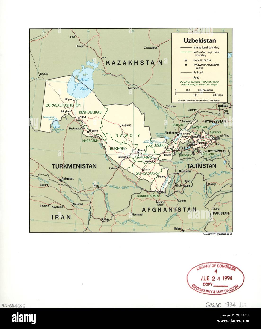 Map of Uzbekistan ca. 1994 Stock Photohttps://www.alamy.com/image-license-details/?v=1https://www.alamy.com/map-of-uzbekistan-ca-1994-image454767559.html
RM2HBTCJF–Map of Uzbekistan ca. 1994
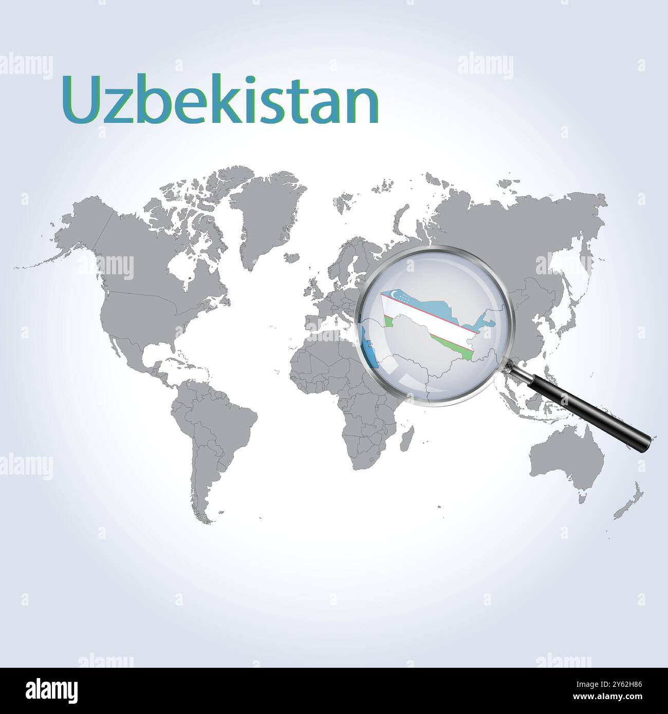 Uzbekistan Magnified Map and Flag, Uzbekistan Enlargement Maps, Vector Art Stock Vectorhttps://www.alamy.com/image-license-details/?v=1https://www.alamy.com/uzbekistan-magnified-map-and-flag-uzbekistan-enlargement-maps-vector-art-image623318646.html
RF2Y62H86–Uzbekistan Magnified Map and Flag, Uzbekistan Enlargement Maps, Vector Art
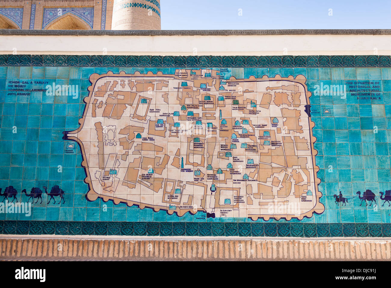 Tiled map of Khiva, Ichan Kala, Khiva, Uzbekistan Stock Photohttps://www.alamy.com/image-license-details/?v=1https://www.alamy.com/tiled-map-of-khiva-ichan-kala-khiva-uzbekistan-image62965438.html
RMDJC91J–Tiled map of Khiva, Ichan Kala, Khiva, Uzbekistan
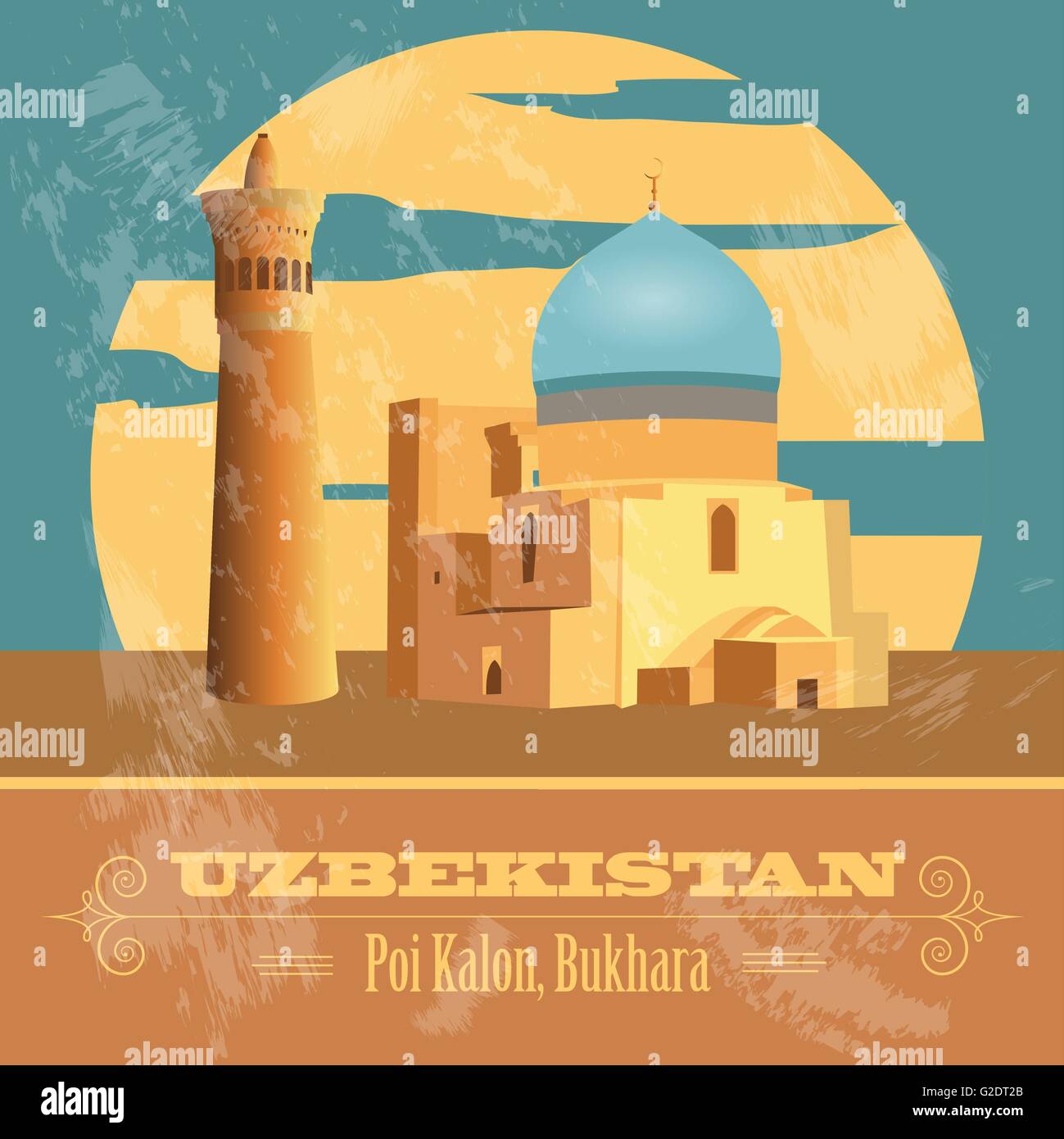 Uzbekistan landmarks. Retro styled image. Vector illustration Stock Vectorhttps://www.alamy.com/image-license-details/?v=1https://www.alamy.com/stock-photo-uzbekistan-landmarks-retro-styled-image-vector-illustration-104795779.html
RFG2DT2B–Uzbekistan landmarks. Retro styled image. Vector illustration
 Map of Uzbekistan ca. 1995 Stock Photohttps://www.alamy.com/image-license-details/?v=1https://www.alamy.com/map-of-uzbekistan-ca-1995-image454760141.html
RM2HBT35H–Map of Uzbekistan ca. 1995
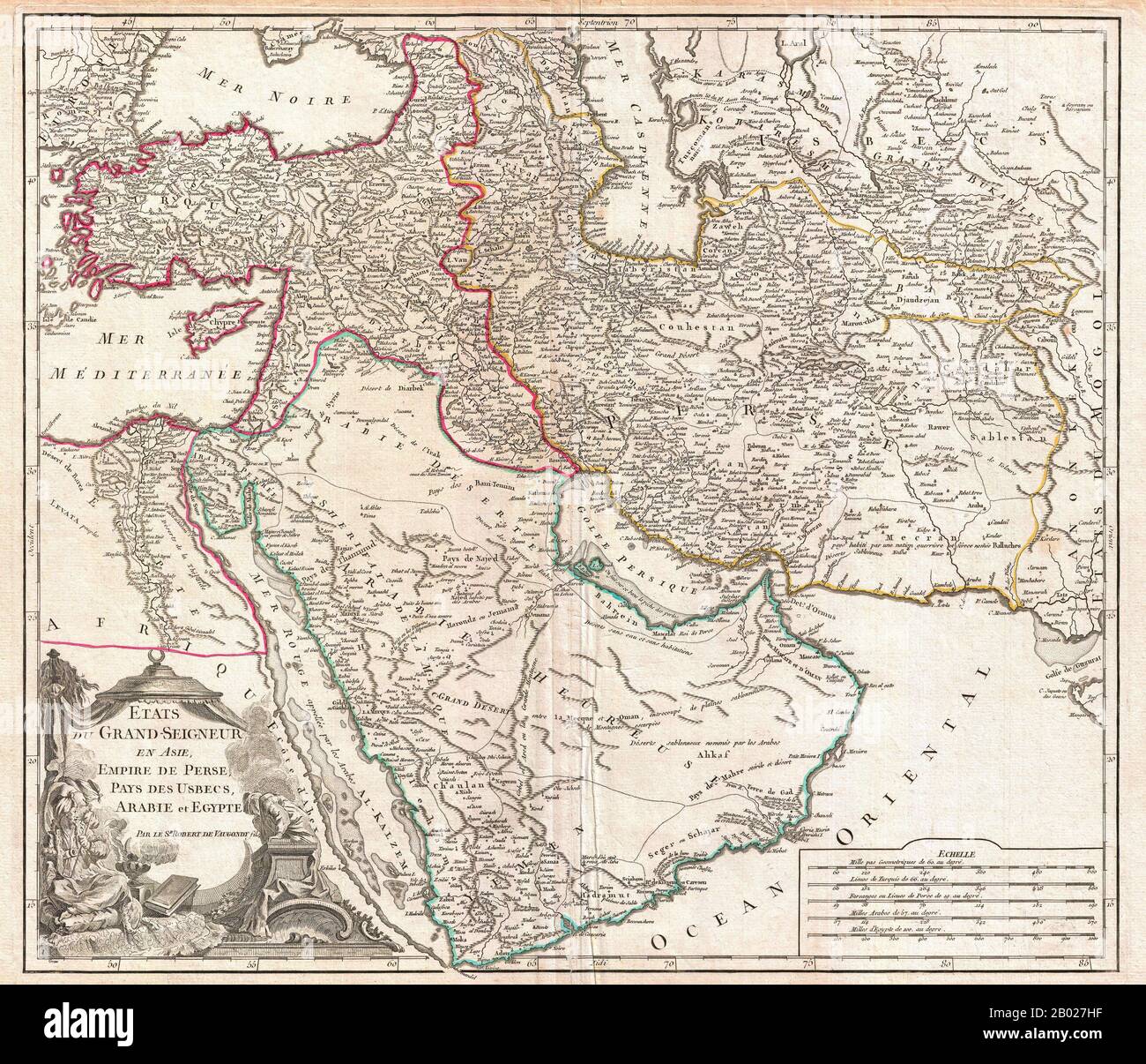 In this 1753 map of the Ottoman Empire. Vaugondy maps the empire at its height, with territory spanning from the Black Sea to the southernmost extension of Arabia and west, inclusive of Persia, as far as the Mongol Empire of India. This includes the modern day nations of Turkey, Egypt, Saudi Arabia, Oman, Yemen, the United Arab Emirates, Iran, Iraq, Kuwait, Israel, Palestine, Jordan, Syria, Lebanon, Armenia, Azerbaijan, Georgia, and parts of Afghanistan, Pakistan, India, Uzbekistan, and Greece. Vaugondy employs all of the latest geographical information of the time incorporating both French a Stock Photohttps://www.alamy.com/image-license-details/?v=1https://www.alamy.com/in-this-1753-map-of-the-ottoman-empire-vaugondy-maps-the-empire-at-its-height-with-territory-spanning-from-the-black-sea-to-the-southernmost-extension-of-arabia-and-west-inclusive-of-persia-as-far-as-the-mongol-empire-of-india-this-includes-the-modern-day-nations-of-turkey-egypt-saudi-arabia-oman-yemen-the-united-arab-emirates-iran-iraq-kuwait-israel-palestine-jordan-syria-lebanon-armenia-azerbaijan-georgia-and-parts-of-afghanistan-pakistan-india-uzbekistan-and-greece-vaugondy-employs-all-of-the-latest-geographical-information-of-the-time-incorporating-both-french-a-image344257243.html
RM2B027HF–In this 1753 map of the Ottoman Empire. Vaugondy maps the empire at its height, with territory spanning from the Black Sea to the southernmost extension of Arabia and west, inclusive of Persia, as far as the Mongol Empire of India. This includes the modern day nations of Turkey, Egypt, Saudi Arabia, Oman, Yemen, the United Arab Emirates, Iran, Iraq, Kuwait, Israel, Palestine, Jordan, Syria, Lebanon, Armenia, Azerbaijan, Georgia, and parts of Afghanistan, Pakistan, India, Uzbekistan, and Greece. Vaugondy employs all of the latest geographical information of the time incorporating both French a
 Map of Uzbekistan ca. 1991 Stock Photohttps://www.alamy.com/image-license-details/?v=1https://www.alamy.com/map-of-uzbekistan-ca-1991-image454768940.html
RM2HBTEBT–Map of Uzbekistan ca. 1991
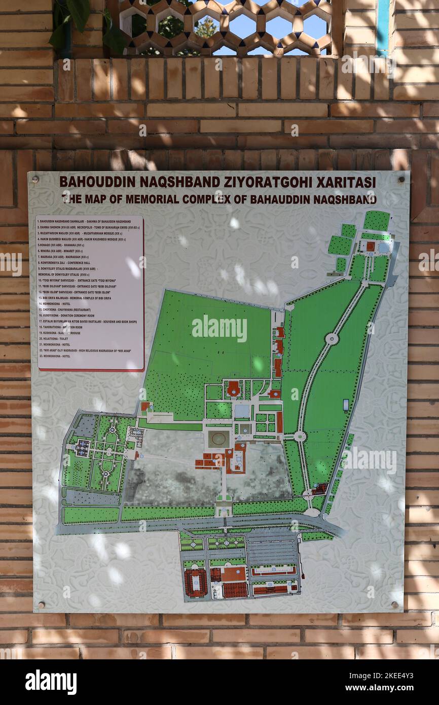 Map of the Bahauddin Naqshband Necropolis, Kasri, Bukhara, Bukhara Province, Uzbekistan, Central Asia Stock Photohttps://www.alamy.com/image-license-details/?v=1https://www.alamy.com/map-of-the-bahauddin-naqshband-necropolis-kasri-bukhara-bukhara-province-uzbekistan-central-asia-image490806711.html
RM2KEE4Y3–Map of the Bahauddin Naqshband Necropolis, Kasri, Bukhara, Bukhara Province, Uzbekistan, Central Asia
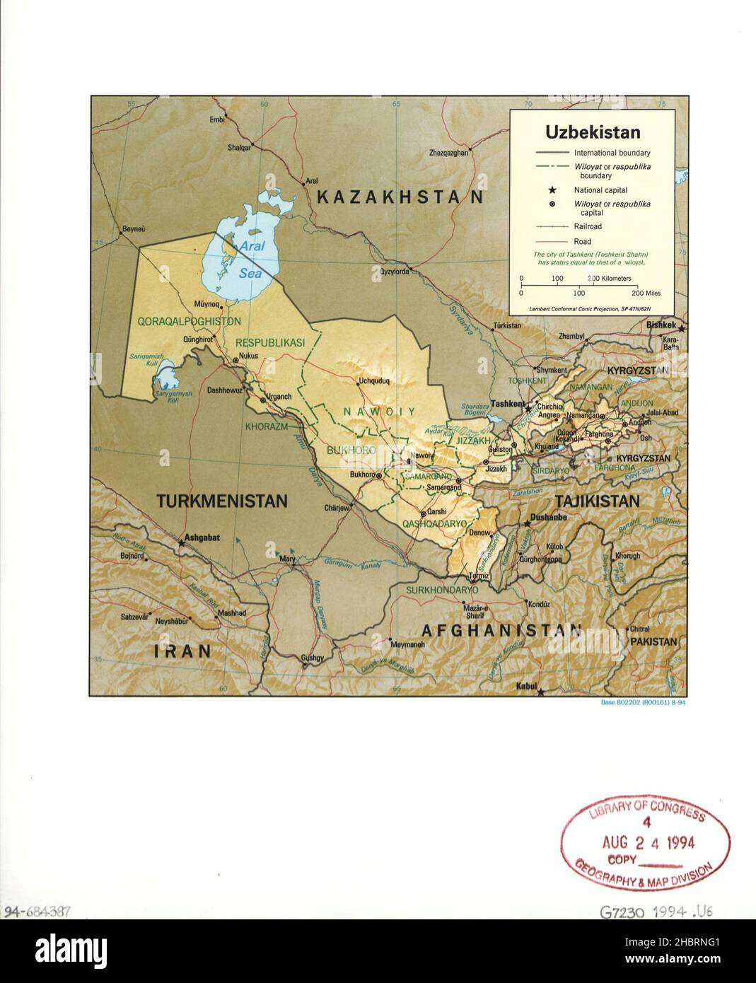 Map of Uzbekistan ca. 1994 Stock Photohttps://www.alamy.com/image-license-details/?v=1https://www.alamy.com/map-of-uzbekistan-ca-1994-image454752593.html
RM2HBRNG1–Map of Uzbekistan ca. 1994
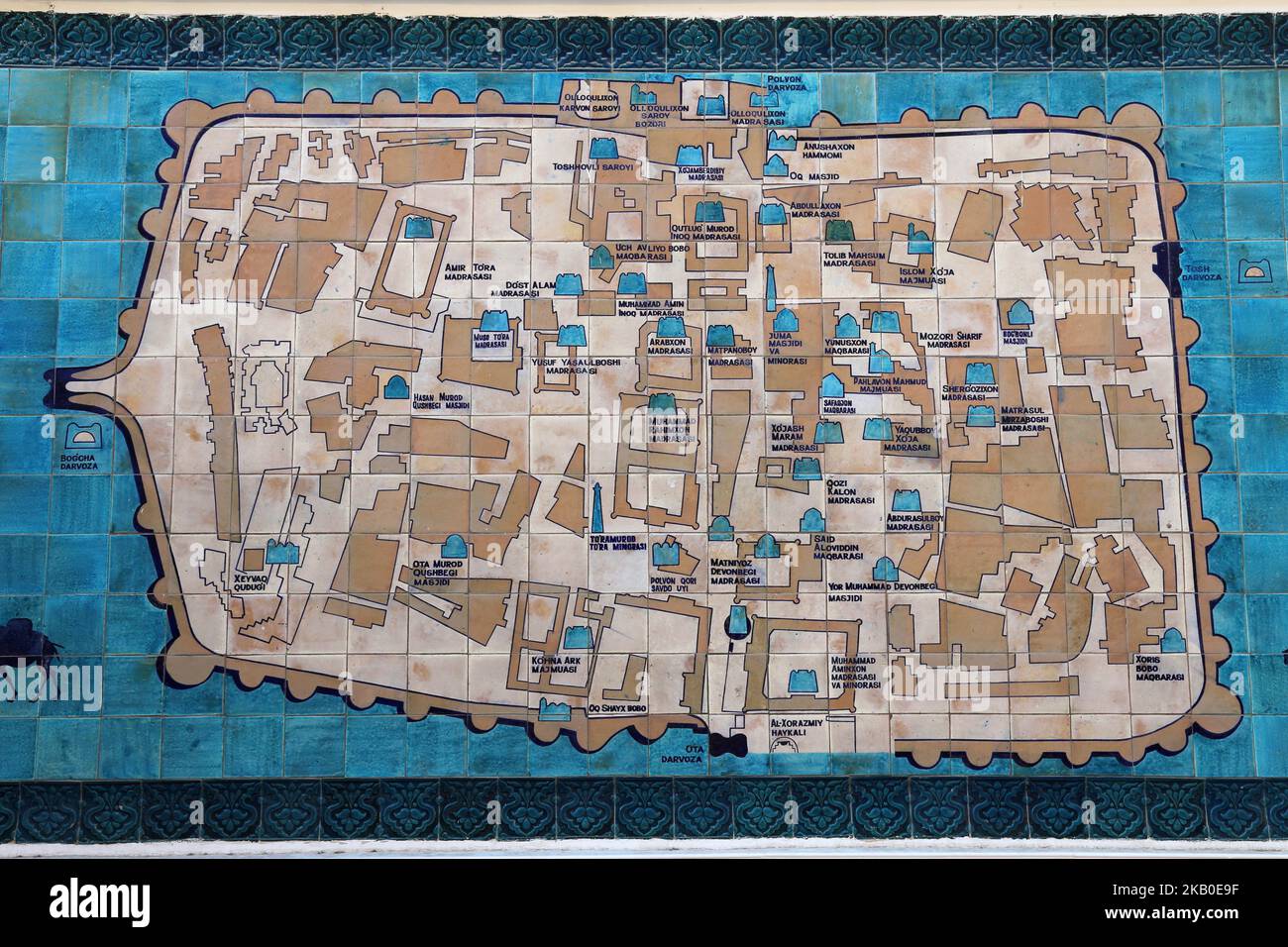 Tile map of Ichan Kala (Inner Fortress), Polvon Kori Street, Khiva, Khorezm Province, Uzbekistan, Central Asia Stock Photohttps://www.alamy.com/image-license-details/?v=1https://www.alamy.com/tile-map-of-ichan-kala-inner-fortress-polvon-kori-street-khiva-khorezm-province-uzbekistan-central-asia-image488662763.html
RM2KB0E9F–Tile map of Ichan Kala (Inner Fortress), Polvon Kori Street, Khiva, Khorezm Province, Uzbekistan, Central Asia
 Map of selected industrial activity in Uzbekistan ca. 1995 Stock Photohttps://www.alamy.com/image-license-details/?v=1https://www.alamy.com/map-of-selected-industrial-activity-in-uzbekistan-ca-1995-image454759906.html
RM2HBT2W6–Map of selected industrial activity in Uzbekistan ca. 1995
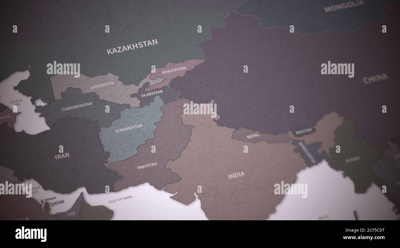 Central Asia Countries Map. Continental Vintage Map 3d Rendering. Stock Photohttps://www.alamy.com/image-license-details/?v=1https://www.alamy.com/central-asia-countries-map-continental-vintage-map-3d-rendering-image370756760.html
RF2CF5C0T–Central Asia Countries Map. Continental Vintage Map 3d Rendering.
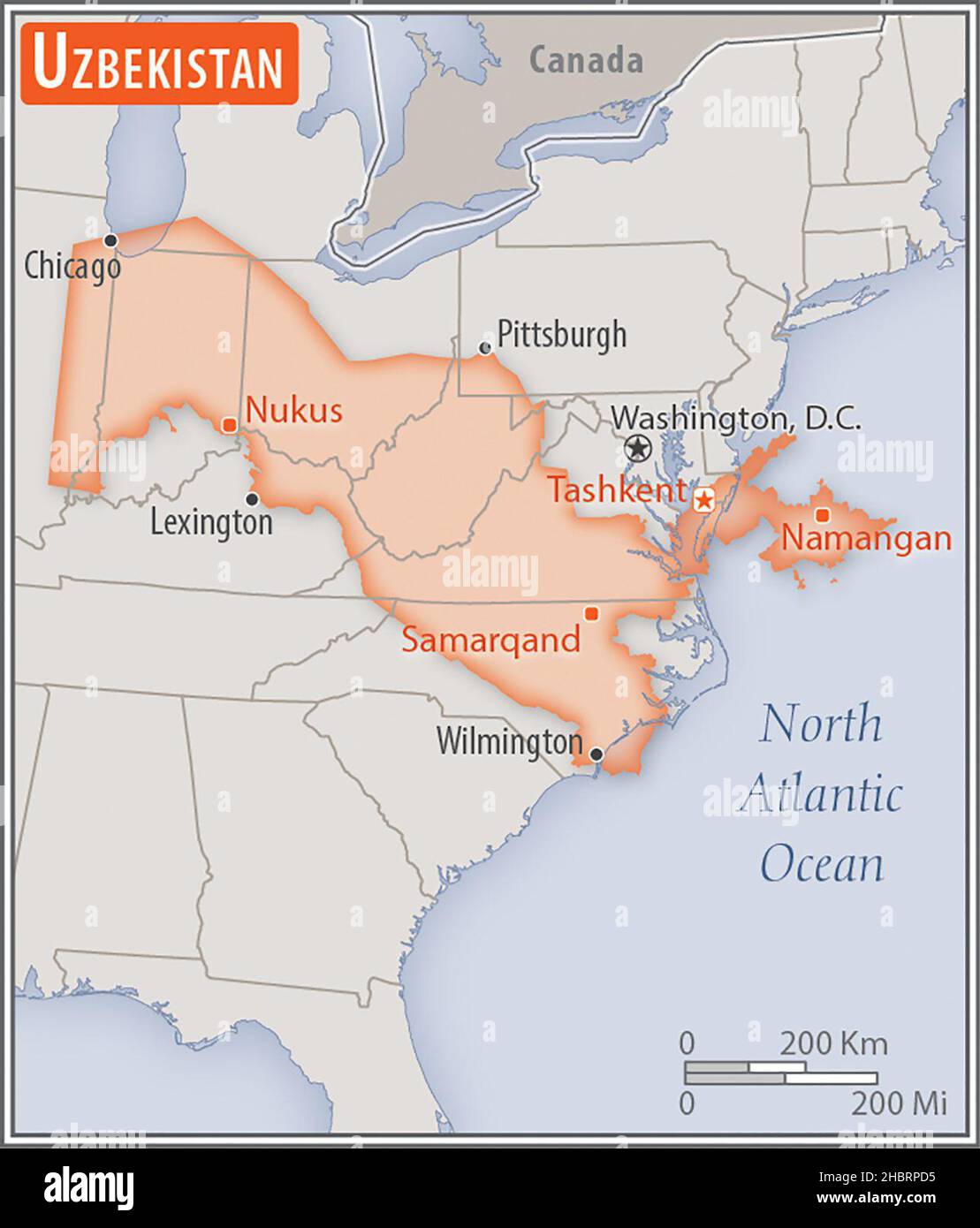 Map of Uzbekistan. Comparison of the areas of two countries. The area of Uzbekistan with biggest cities (red) overlay the area of the United States of America (gray background) ca. 17 February 2014 Stock Photohttps://www.alamy.com/image-license-details/?v=1https://www.alamy.com/map-of-uzbekistan-comparison-of-the-areas-of-two-countries-the-area-of-uzbekistan-with-biggest-cities-red-overlay-the-area-of-the-united-states-of-america-gray-background-ca-17-february-2014-image454753297.html
RM2HBRPD5–Map of Uzbekistan. Comparison of the areas of two countries. The area of Uzbekistan with biggest cities (red) overlay the area of the United States of America (gray background) ca. 17 February 2014
 Sarmatia et Scythia. Rufsia et Tartaria. Europaea by Philippus Cluverius, German, issued in London, 1711. This Cluverius (1580-1662) map gives to you Stock Photohttps://www.alamy.com/image-license-details/?v=1https://www.alamy.com/sarmatia-et-scythia-rufsia-et-tartaria-europaea-by-philippus-cluverius-german-issued-in-london-1711-this-cluverius-1580-1662-map-gives-to-you-image516459485.html
RM2N06N9H–Sarmatia et Scythia. Rufsia et Tartaria. Europaea by Philippus Cluverius, German, issued in London, 1711. This Cluverius (1580-1662) map gives to you
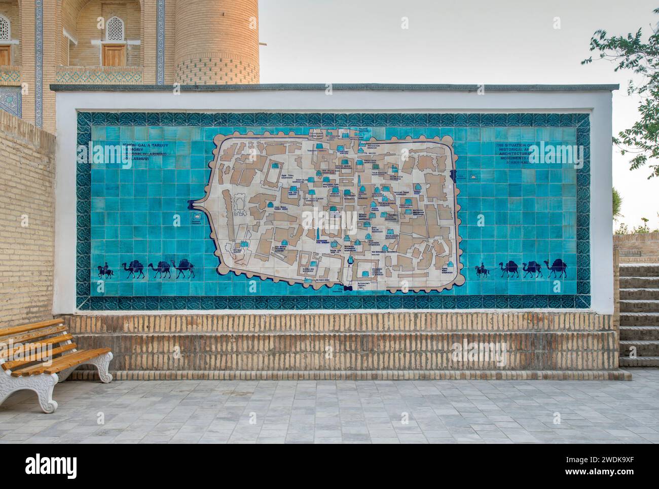 Map in Itchan Kala (inner town) in Khiva. Uzbekistan Stock Photohttps://www.alamy.com/image-license-details/?v=1https://www.alamy.com/map-in-itchan-kala-inner-town-in-khiva-uzbekistan-image593567927.html
RF2WDK9XF–Map in Itchan Kala (inner town) in Khiva. Uzbekistan
 Bukhara, Uzbekistan - August 27, 2016: Two unknown travellers at the site of Abdullazizkhan Madrasa, sitting on the ground and looking at the map. Stock Photohttps://www.alamy.com/image-license-details/?v=1https://www.alamy.com/bukhara-uzbekistan-august-27-2016-two-unknown-travellers-at-the-site-of-abdullazizkhan-madrasa-sitting-on-the-ground-and-looking-at-the-map-image220020256.html
RMPNXP28–Bukhara, Uzbekistan - August 27, 2016: Two unknown travellers at the site of Abdullazizkhan Madrasa, sitting on the ground and looking at the map.
 BUKHARA, UZBEKISTAN - AUGUST 26, 2016: historical map of the Aral Sea, from 1960 to today, in Bukhara, Uzbekistan Stock Photohttps://www.alamy.com/image-license-details/?v=1https://www.alamy.com/bukhara-uzbekistan-august-26-2016-historical-map-of-the-aral-sea-from-1960-to-today-in-bukhara-uzbekistan-image357692748.html
RF2BNX8N0–BUKHARA, UZBEKISTAN - AUGUST 26, 2016: historical map of the Aral Sea, from 1960 to today, in Bukhara, Uzbekistan
 Khiva, Uzbekistan - September 15, 2024: Group of tourists listen to a tour guide near the map of historical center of Khiva on the ceramic tiles Stock Photohttps://www.alamy.com/image-license-details/?v=1https://www.alamy.com/khiva-uzbekistan-september-15-2024-group-of-tourists-listen-to-a-tour-guide-near-the-map-of-historical-center-of-khiva-on-the-ceramic-tiles-image626836531.html
RF2YBPTAY–Khiva, Uzbekistan - September 15, 2024: Group of tourists listen to a tour guide near the map of historical center of Khiva on the ceramic tiles
 Ca. 1698 map by Gerard Mercator - (Kazakhstan, Uzbekistan, Turkmenistan, Afghanistan, Iran) Tab. VII. exhibens Scythiam Intra Imaum Sogdianam, Bactrianam, Hircaniam, alisq. Asiae Regiones. Stock Photohttps://www.alamy.com/image-license-details/?v=1https://www.alamy.com/ca-1698-map-by-gerard-mercator-kazakhstan-uzbekistan-turkmenistan-afghanistan-iran-tab-vii-exhibens-scythiam-intra-imaum-sogdianam-bactrianam-hircaniam-alisq-asiae-regiones-image632817614.html
RM2YNF992–Ca. 1698 map by Gerard Mercator - (Kazakhstan, Uzbekistan, Turkmenistan, Afghanistan, Iran) Tab. VII. exhibens Scythiam Intra Imaum Sogdianam, Bactrianam, Hircaniam, alisq. Asiae Regiones.
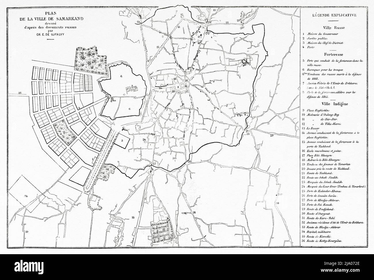 Old plan of the city of Samarkand, Uzbekistan, Central Asia. From Orenburg to Samarkand 1876-1878 by Madame Marie Ujfalvy-Bourdon, Le Tour du Monde 1879 Stock Photohttps://www.alamy.com/image-license-details/?v=1https://www.alamy.com/old-plan-of-the-city-of-samarkand-uzbekistan-central-asia-from-orenburg-to-samarkand-1876-1878-by-madame-marie-ujfalvy-bourdon-le-tour-du-monde-1879-image470832054.html
RM2JA072E–Old plan of the city of Samarkand, Uzbekistan, Central Asia. From Orenburg to Samarkand 1876-1878 by Madame Marie Ujfalvy-Bourdon, Le Tour du Monde 1879
 Map of the barren steppe of the Khodzhentsk distric, Samarkand region, with its environs, 1914. From the atlas "Atlas of Asian Russia." Stock Photohttps://www.alamy.com/image-license-details/?v=1https://www.alamy.com/map-of-the-barren-steppe-of-the-khodzhentsk-distric-samarkand-region-with-its-environs-1914-from-the-atlas-quotatlas-of-asian-russiaquot-image595003196.html
RM2WG0MJ4–Map of the barren steppe of the Khodzhentsk distric, Samarkand region, with its environs, 1914. From the atlas "Atlas of Asian Russia."
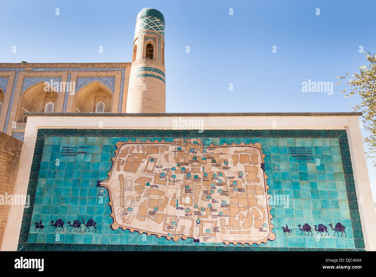 Tiled map of Khiva, Orient Star Hotel, formerly Mohammed Amin Khan Madrasah, behind, Ichan Kala, Khiva, Uzbekistan Stock Photohttps://www.alamy.com/image-license-details/?v=1https://www.alamy.com/tiled-map-of-khiva-orient-star-hotel-formerly-mohammed-amin-khan-madrasah-image62966746.html
RMDJCAMA–Tiled map of Khiva, Orient Star Hotel, formerly Mohammed Amin Khan Madrasah, behind, Ichan Kala, Khiva, Uzbekistan
 Uzbekistan infographics, statistical data, sights. Vector illustration Stock Vectorhttps://www.alamy.com/image-license-details/?v=1https://www.alamy.com/stock-photo-uzbekistan-infographics-statistical-data-sights-vector-illustration-104795783.html
RFG2DT2F–Uzbekistan infographics, statistical data, sights. Vector illustration
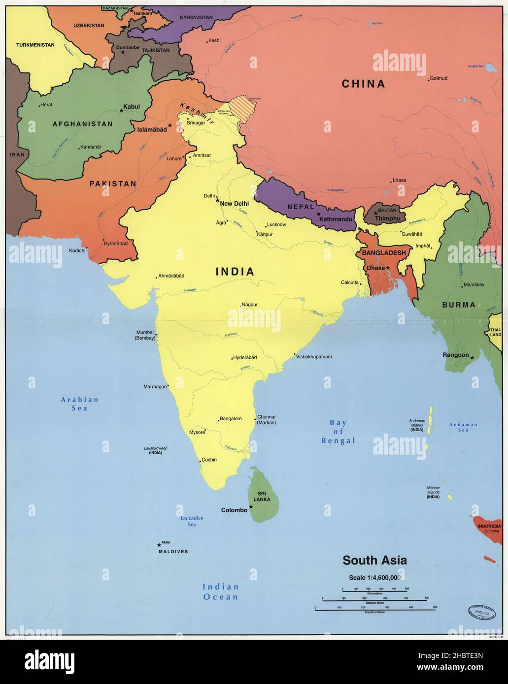 Map of South Asia. Covers the area north to Uzbekistan and western China, south to Sri Lanka, west to Afghanistan, and east to Burma ca. 1998 Stock Photohttps://www.alamy.com/image-license-details/?v=1https://www.alamy.com/map-of-south-asia-covers-the-area-north-to-uzbekistan-and-western-china-south-to-sri-lanka-west-to-afghanistan-and-east-to-burma-ca-1998-image454768713.html
RM2HBTE3N–Map of South Asia. Covers the area north to Uzbekistan and western China, south to Sri Lanka, west to Afghanistan, and east to Burma ca. 1998
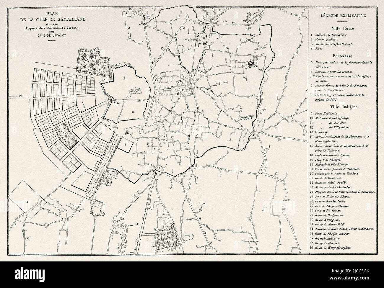 Old plan of the city of Samarkand, Uzbekistan, Central Asia. From Orenburg to Samarkand 1876-1878 by Madame Marie Ujfalvy-Bourdon, Le Tour du Monde 1879 Stock Photohttps://www.alamy.com/image-license-details/?v=1https://www.alamy.com/old-plan-of-the-city-of-samarkand-uzbekistan-central-asia-from-orenburg-to-samarkand-1876-1878-by-madame-marie-ujfalvy-bourdon-le-tour-du-monde-1879-image472322051.html
RM2JCC3GK–Old plan of the city of Samarkand, Uzbekistan, Central Asia. From Orenburg to Samarkand 1876-1878 by Madame Marie Ujfalvy-Bourdon, Le Tour du Monde 1879
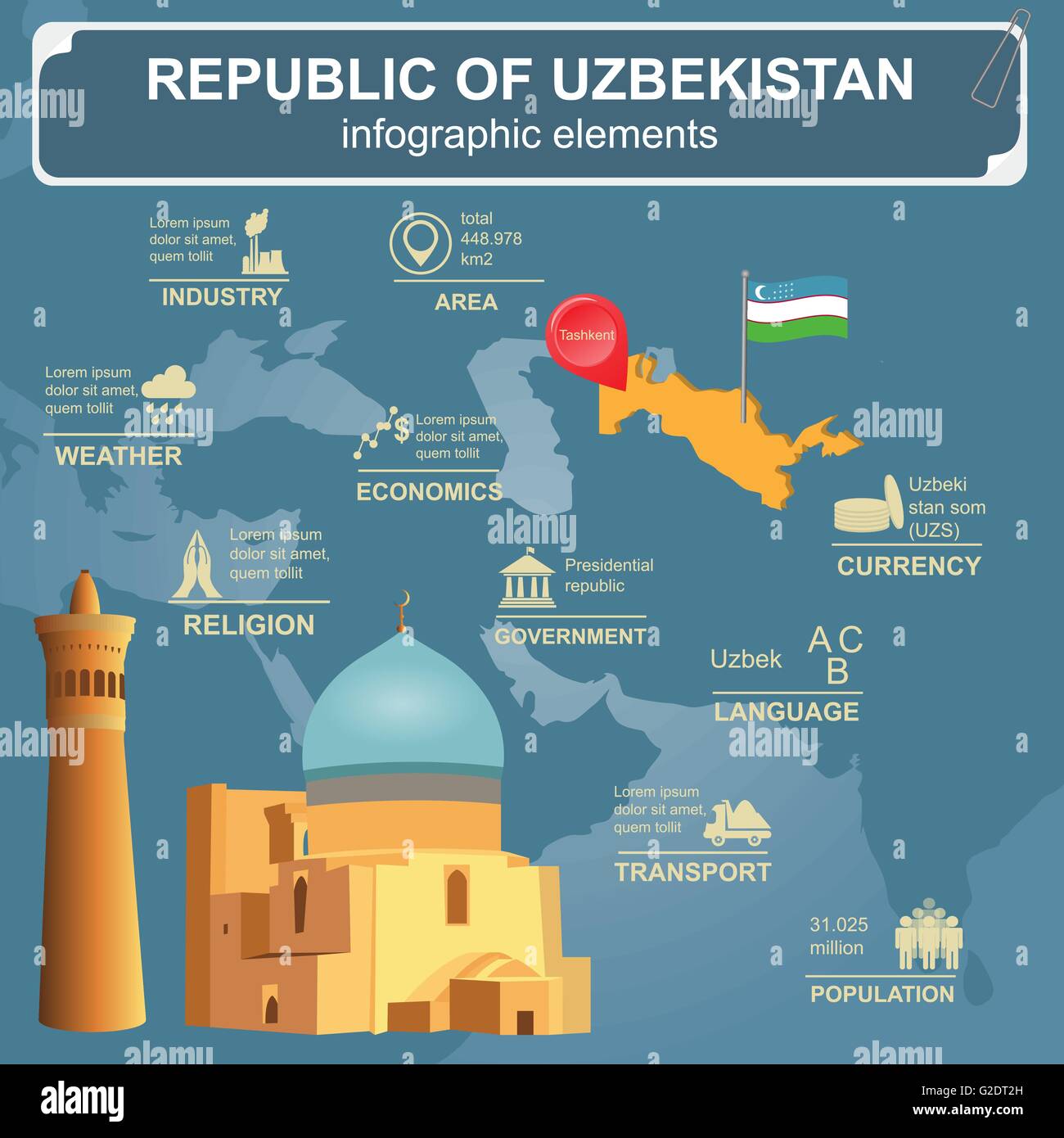 Uzbekistan infographics, statistical data, sights. Vector illustration Stock Vectorhttps://www.alamy.com/image-license-details/?v=1https://www.alamy.com/stock-photo-uzbekistan-infographics-statistical-data-sights-vector-illustration-104795785.html
RFG2DT2H–Uzbekistan infographics, statistical data, sights. Vector illustration
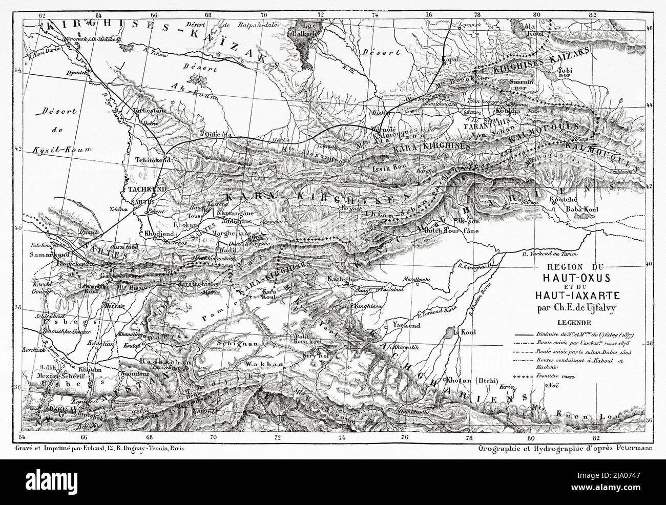 Upper Oxus and Upper Iaxarte region. Uzbekistan, Central Asia. From Orenburg to Samarkand 1876-1878 by Madame Marie Ujfalvy-Bourdon, Le Tour du Monde 1879 Stock Photohttps://www.alamy.com/image-license-details/?v=1https://www.alamy.com/upper-oxus-and-upper-iaxarte-region-uzbekistan-central-asia-from-orenburg-to-samarkand-1876-1878-by-madame-marie-ujfalvy-bourdon-le-tour-du-monde-1879-image470832103.html
RM2JA0747–Upper Oxus and Upper Iaxarte region. Uzbekistan, Central Asia. From Orenburg to Samarkand 1876-1878 by Madame Marie Ujfalvy-Bourdon, Le Tour du Monde 1879
 Upper Oxus and Upper Iaxarte region. Uzbekistan, Central Asia. From Orenburg to Samarkand 1876-1878 by Madame Marie Ujfalvy-Bourdon, Le Tour du Monde 1879 Stock Photohttps://www.alamy.com/image-license-details/?v=1https://www.alamy.com/upper-oxus-and-upper-iaxarte-region-uzbekistan-central-asia-from-orenburg-to-samarkand-1876-1878-by-madame-marie-ujfalvy-bourdon-le-tour-du-monde-1879-image472322064.html
RM2JCC3H4–Upper Oxus and Upper Iaxarte region. Uzbekistan, Central Asia. From Orenburg to Samarkand 1876-1878 by Madame Marie Ujfalvy-Bourdon, Le Tour du Monde 1879