Quick filters:
History chart Stock Photos and Images
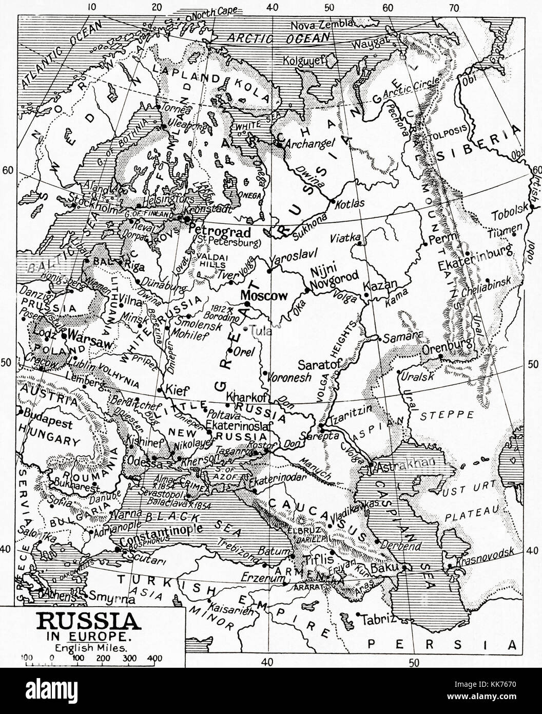 Map of Russia in 1915. From Hutchinson's History of the Nations, published 1915. Stock Photohttps://www.alamy.com/image-license-details/?v=1https://www.alamy.com/stock-image-map-of-russia-in-1915-from-hutchinsons-history-of-the-nations-published-166730340.html
RMKK7670–Map of Russia in 1915. From Hutchinson's History of the Nations, published 1915.
 Symbolical centenary chart of American history 1876 Stock Photohttps://www.alamy.com/image-license-details/?v=1https://www.alamy.com/stock-photo-symbolical-centenary-chart-of-american-history-1876-83146940.html
RMER7JNG–Symbolical centenary chart of American history 1876
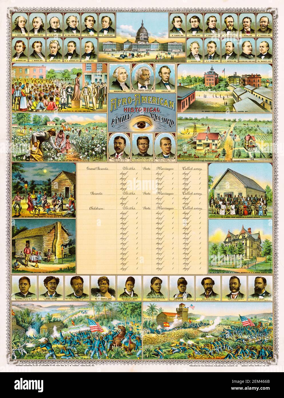 Afro-American, Historical Family Record, a personal genealogical chart and pictorial history of African American advancement in the USA, print by James M Vickroy, circa 1899 Stock Photohttps://www.alamy.com/image-license-details/?v=1https://www.alamy.com/afro-american-historical-family-record-a-personal-genealogical-chart-and-pictorial-history-of-african-american-advancement-in-the-usa-print-by-james-m-vickroy-circa-1899-image408224275.html
RM2EM466B–Afro-American, Historical Family Record, a personal genealogical chart and pictorial history of African American advancement in the USA, print by James M Vickroy, circa 1899
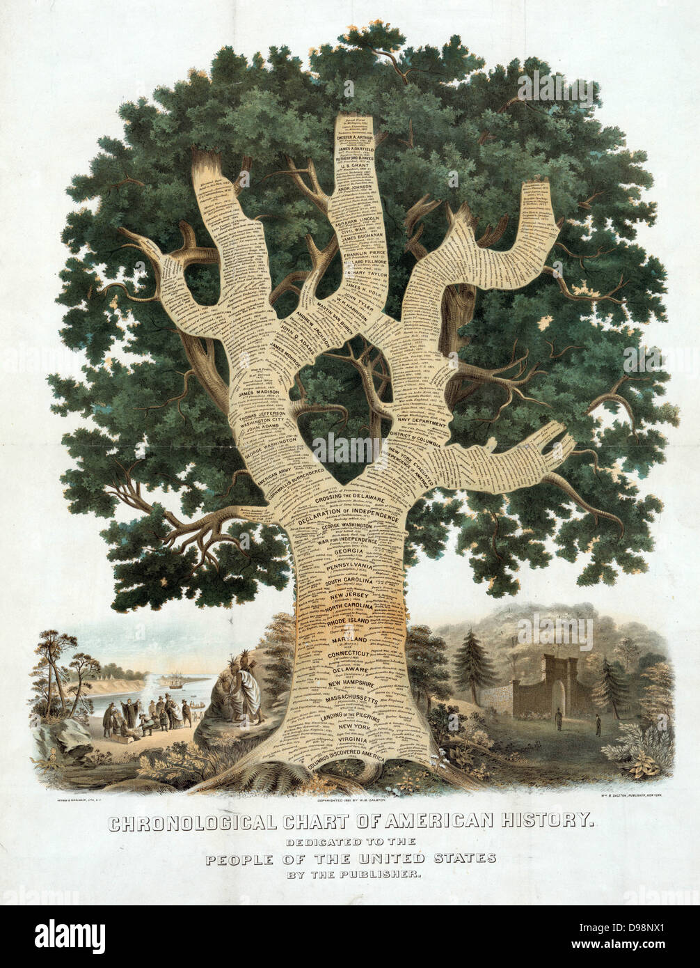 Chronological Chart of American History, New York, 1881. At foot of tree is Columbus, then Virginia, New York, Landing of Pilgrim Fathers, through Declaration of Independence to date of publication. Pilgrims and Native Americans, left. Stock Photohttps://www.alamy.com/image-license-details/?v=1https://www.alamy.com/stock-photo-chronological-chart-of-american-history-new-york-1881-at-foot-of-tree-57355817.html
RMD98NX1–Chronological Chart of American History, New York, 1881. At foot of tree is Columbus, then Virginia, New York, Landing of Pilgrim Fathers, through Declaration of Independence to date of publication. Pilgrims and Native Americans, left.
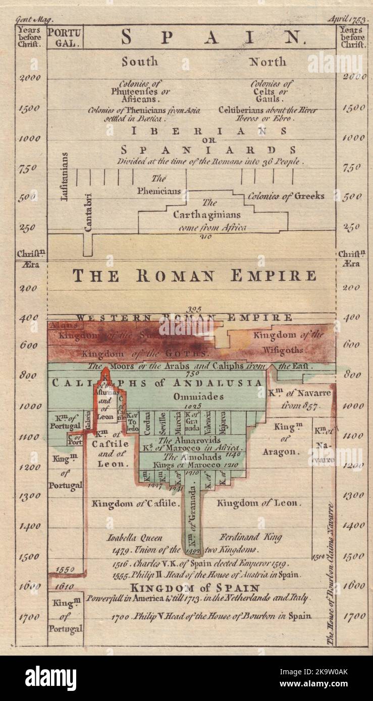 Chart of the History of Spain. Timeline. Decorative. GENTS MAG 1753 old print Stock Photohttps://www.alamy.com/image-license-details/?v=1https://www.alamy.com/chart-of-the-history-of-spain-timeline-decorative-gents-mag-1753-old-print-image487971307.html
RF2K9W0AK–Chart of the History of Spain. Timeline. Decorative. GENTS MAG 1753 old print
 Young woman entering her medical history chart. Stock Photohttps://www.alamy.com/image-license-details/?v=1https://www.alamy.com/stock-photo-young-woman-entering-her-medical-history-chart-13395540.html
RFADEE9W–Young woman entering her medical history chart.
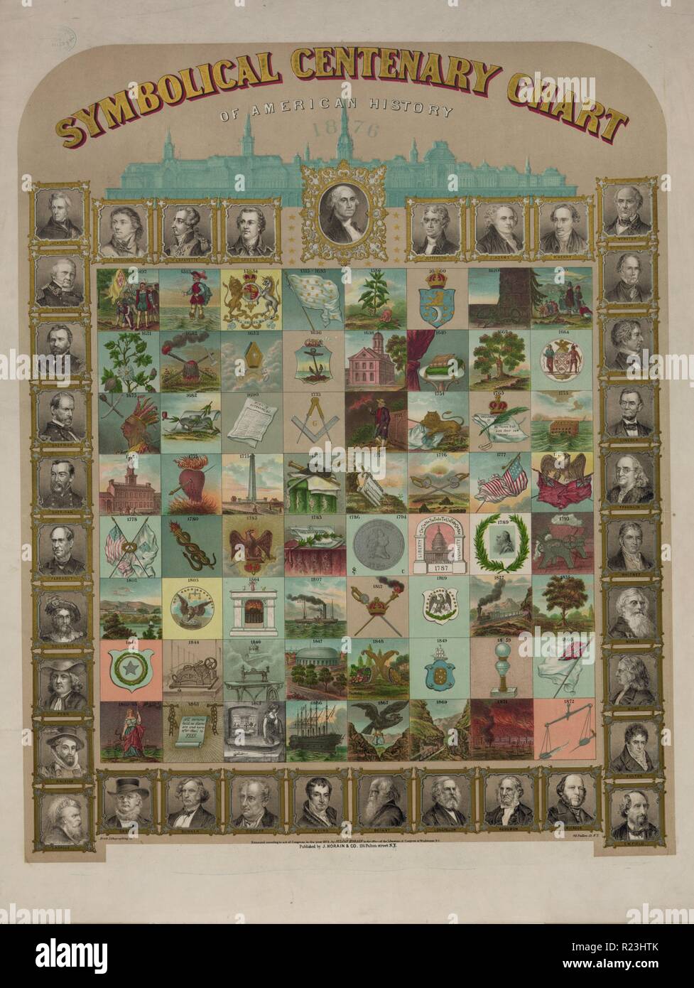 Symbolical centenary chart of American history. Print shows a large chart representing events in American history, presented chronologically from 1492 to 1872, and portraits of explorers, presidents, legislators, poets, journalists, generals, and other notable figures. 1874 Stock Photohttps://www.alamy.com/image-license-details/?v=1https://www.alamy.com/symbolical-centenary-chart-of-american-history-print-shows-a-large-chart-representing-events-in-american-history-presented-chronologically-from-1492-to-1872-and-portraits-of-explorers-presidents-legislators-poets-journalists-generals-and-other-notable-figures-1874-image225043971.html
RMR23HTK–Symbolical centenary chart of American history. Print shows a large chart representing events in American history, presented chronologically from 1492 to 1872, and portraits of explorers, presidents, legislators, poets, journalists, generals, and other notable figures. 1874
 Family tree mobile app, genealogy template vector illustration. Cartoon apple green tree with branches and portraits of four generations of relatives in infographic history chart on phone screen Stock Vectorhttps://www.alamy.com/image-license-details/?v=1https://www.alamy.com/family-tree-mobile-app-genealogy-template-vector-illustration-cartoon-apple-green-tree-with-branches-and-portraits-of-four-generations-of-relatives-in-infographic-history-chart-on-phone-screen-image522437408.html
RF2N9Y26T–Family tree mobile app, genealogy template vector illustration. Cartoon apple green tree with branches and portraits of four generations of relatives in infographic history chart on phone screen
 Workflow arrows infographic Stock Vectorhttps://www.alamy.com/image-license-details/?v=1https://www.alamy.com/stock-photo-workflow-arrows-infographic-115474090.html
RFGKT8AJ–Workflow arrows infographic
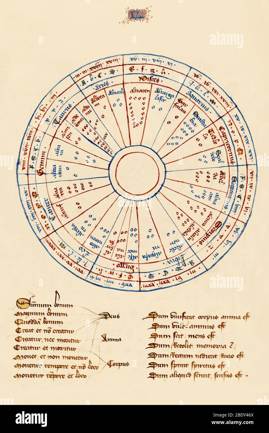 Astrological Chart, 1405 Stock Photohttps://www.alamy.com/image-license-details/?v=1https://www.alamy.com/astrological-chart-1405-image352793922.html
RM2BDY46X–Astrological Chart, 1405
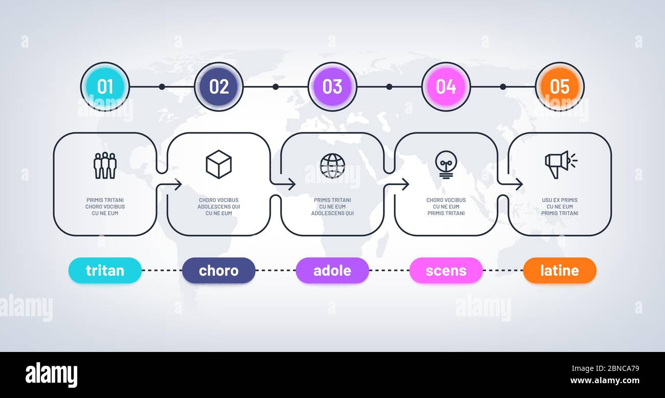 Business flowchart. Timeline with milestone steps pesentation history chart. Infographic optional vector diagram on world map. Illustration of infographic process step, timeline diagram Stock Vectorhttps://www.alamy.com/image-license-details/?v=1https://www.alamy.com/business-flowchart-timeline-with-milestone-steps-pesentation-history-chart-infographic-optional-vector-diagram-on-world-map-illustration-of-infographic-process-step-timeline-diagram-image357386605.html
RF2BNCA79–Business flowchart. Timeline with milestone steps pesentation history chart. Infographic optional vector diagram on world map. Illustration of infographic process step, timeline diagram
 History of the Civil War in the United States, 1860-1865 Stock Photohttps://www.alamy.com/image-license-details/?v=1https://www.alamy.com/stock-photo-history-of-the-civil-war-in-the-united-states-1860-1865-171094859.html
RMKXA16K–History of the Civil War in the United States, 1860-1865
 Nurses discussing patient chart Stock Photohttps://www.alamy.com/image-license-details/?v=1https://www.alamy.com/stock-photo-nurses-discussing-patient-chart-31017862.html
RMBPCYGP–Nurses discussing patient chart
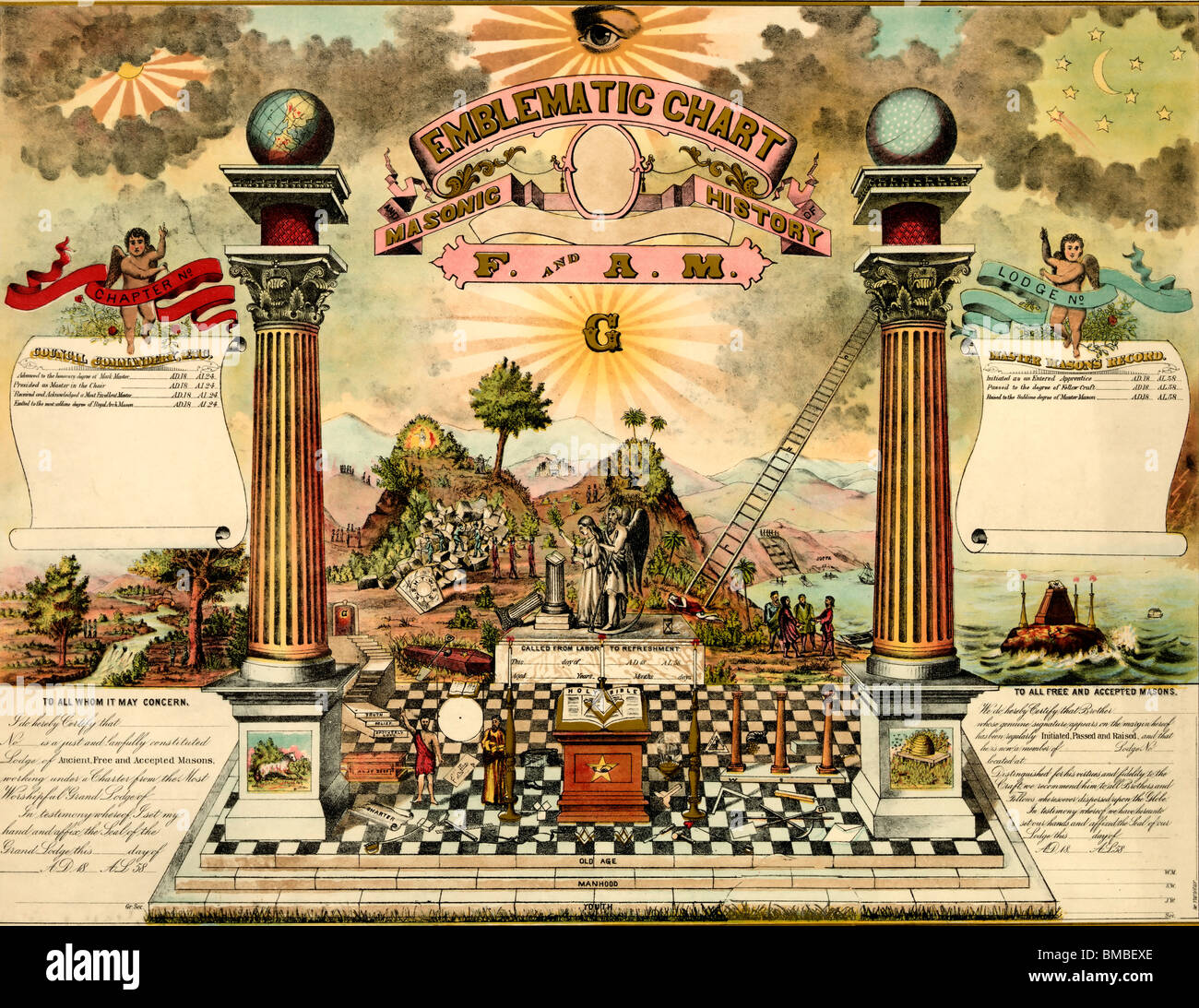 Emblematic chart and Masonic history of Free and Accepted Masons Stock Photohttps://www.alamy.com/image-license-details/?v=1https://www.alamy.com/stock-photo-emblematic-chart-and-masonic-history-of-free-and-accepted-masons-29756678.html
RMBMBEXE–Emblematic chart and Masonic history of Free and Accepted Masons
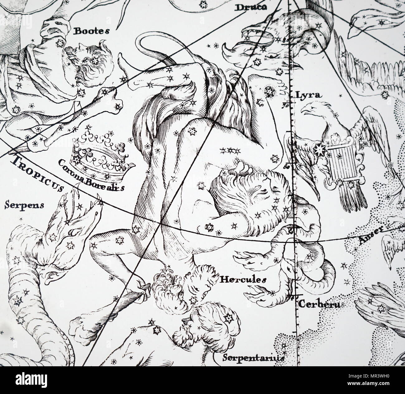
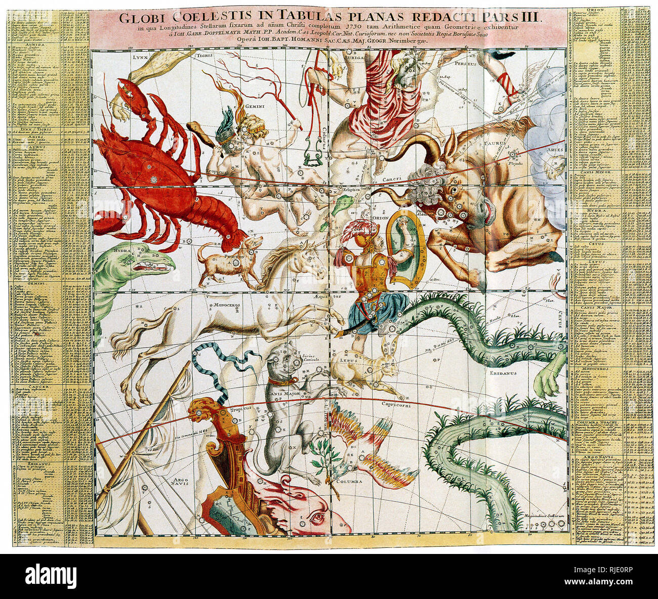 Ottens' Regional Sky Chart. Stock Photohttps://www.alamy.com/image-license-details/?v=1https://www.alamy.com/ottens-regional-sky-chart-image235106586.html
RMRJE0RP–Ottens' Regional Sky Chart.
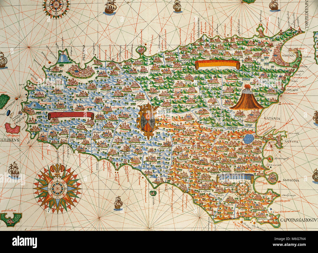 Island of Sicily. Portolan chart by Joan Martines, Spanish cartographer of the Majorcan cartographic school (16th century). Manuscript of 19 double-folio maps. Messina, Sicily, 1587. National Library, Madrid, Spain. Stock Photohttps://www.alamy.com/image-license-details/?v=1https://www.alamy.com/stock-photo-island-of-sicily-portolan-chart-by-joan-martines-spanish-cartographer-176148928.html
RMM6G7N4–Island of Sicily. Portolan chart by Joan Martines, Spanish cartographer of the Majorcan cartographic school (16th century). Manuscript of 19 double-folio maps. Messina, Sicily, 1587. National Library, Madrid, Spain.
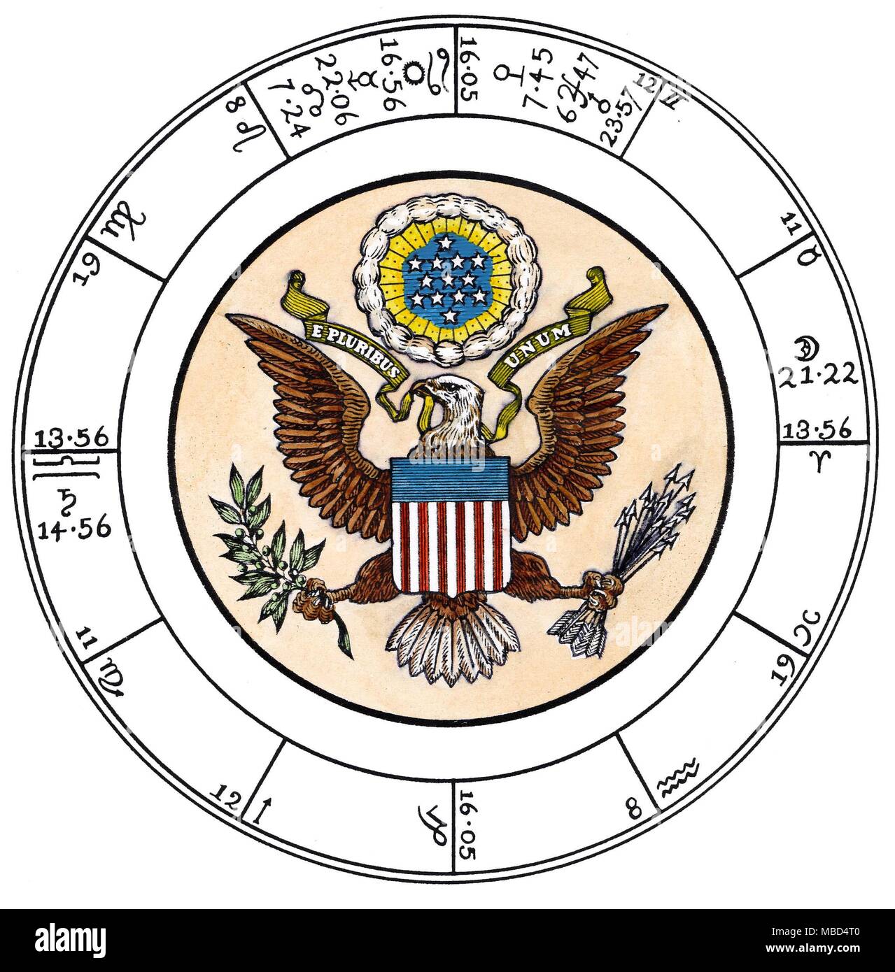 HOROSCOPES - UNITED STATES OF AMERICA The chart is cast for the moment of the public proclamation of the Declaration of Independence, in Philadelphia, at noon, on 8 July 1776. The date, time and place were enshrined in early American history by the Pennsylvania Evening Post, for Tuesday 7-9 July 1776. See also Edward Channing, A History of the United States, Vol. III The American Revolution 1761-1789, 1912, p.205. The suggestion, that this chart could be a valid horoscope of the United States, is proposed in Nicholas Campion, The Book of World Horoscopes, 1996 revised edn., pp.417-8. Stock Photohttps://www.alamy.com/image-license-details/?v=1https://www.alamy.com/horoscopes-united-states-of-america-the-chart-is-cast-for-the-moment-of-the-public-proclamation-of-the-declaration-of-independence-in-philadelphia-at-noon-on-8-july-1776-the-date-time-and-place-were-enshrined-in-early-american-history-by-the-pennsylvania-evening-post-for-tuesday-7-9-july-1776-see-also-edward-channing-a-history-of-the-united-states-vol-iii-the-american-revolution-1761-1789-1912-p205-the-suggestion-that-this-chart-could-be-a-valid-horoscope-of-the-united-states-is-proposed-in-nicholas-campion-the-book-of-world-horoscopes-1996-revised-edn-pp417-8-image179154080.html
RMMBD4T0–HOROSCOPES - UNITED STATES OF AMERICA The chart is cast for the moment of the public proclamation of the Declaration of Independence, in Philadelphia, at noon, on 8 July 1776. The date, time and place were enshrined in early American history by the Pennsylvania Evening Post, for Tuesday 7-9 July 1776. See also Edward Channing, A History of the United States, Vol. III The American Revolution 1761-1789, 1912, p.205. The suggestion, that this chart could be a valid horoscope of the United States, is proposed in Nicholas Campion, The Book of World Horoscopes, 1996 revised edn., pp.417-8.
 chart antique asia vintage siberia china history japan korea russia globe Stock Photohttps://www.alamy.com/image-license-details/?v=1https://www.alamy.com/stock-photo-chart-antique-asia-vintage-siberia-china-history-japan-korea-russia-142372806.html
RFJ7HHY2–chart antique asia vintage siberia china history japan korea russia globe
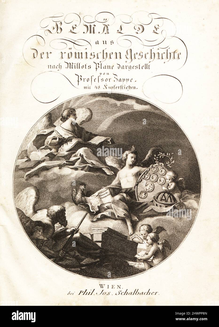 Allegorical scene with History seated on a cloud above Study with a history book, medallion with portraits, a globe and chart. Two winged genie write the History of Remus and Romulus. Copperplate title page with round vignette by Jean Baptiste Piauger from Professor Joseph Rudolf Zappe’s Gemalde aus der romischen Geschichte, Pictures of Roman History, Joseph Schalbacher, Vienna, 1800. German edition of Abbe Claude Francois Xavier Millot’s Abrege de l’Histoire Romaine. Stock Photohttps://www.alamy.com/image-license-details/?v=1https://www.alamy.com/allegorical-scene-with-history-seated-on-a-cloud-above-study-with-a-history-book-medallion-with-portraits-a-globe-and-chart-two-winged-genie-write-the-history-of-remus-and-romulus-copperplate-title-page-with-round-vignette-by-jean-baptiste-piauger-from-professor-joseph-rudolf-zappes-gemalde-aus-der-romischen-geschichte-pictures-of-roman-history-joseph-schalbacher-vienna-1800-german-edition-of-abbe-claude-francois-xavier-millots-abrege-de-lhistoire-romaine-image463336405.html
RM2HWPP8N–Allegorical scene with History seated on a cloud above Study with a history book, medallion with portraits, a globe and chart. Two winged genie write the History of Remus and Romulus. Copperplate title page with round vignette by Jean Baptiste Piauger from Professor Joseph Rudolf Zappe’s Gemalde aus der romischen Geschichte, Pictures of Roman History, Joseph Schalbacher, Vienna, 1800. German edition of Abbe Claude Francois Xavier Millot’s Abrege de l’Histoire Romaine.
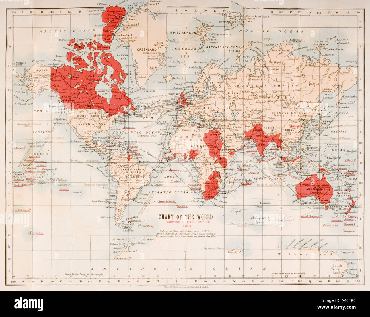 Map of the world showing in red the extent of the British Empire in 1901 Stock Photohttps://www.alamy.com/image-license-details/?v=1https://www.alamy.com/map-of-the-world-showing-in-red-the-extent-of-the-british-empire-in-image6226549.html
RMA40TR6–Map of the world showing in red the extent of the British Empire in 1901
 Symbolical centenary chart of American history 1876 Stock Photohttps://www.alamy.com/image-license-details/?v=1https://www.alamy.com/stock-photo-symbolical-centenary-chart-of-american-history-1876-83146941.html
RMER7JNH–Symbolical centenary chart of American history 1876
RF2W8WN4E–Pedigree icon family tree, family life history diagram, pedigree chart
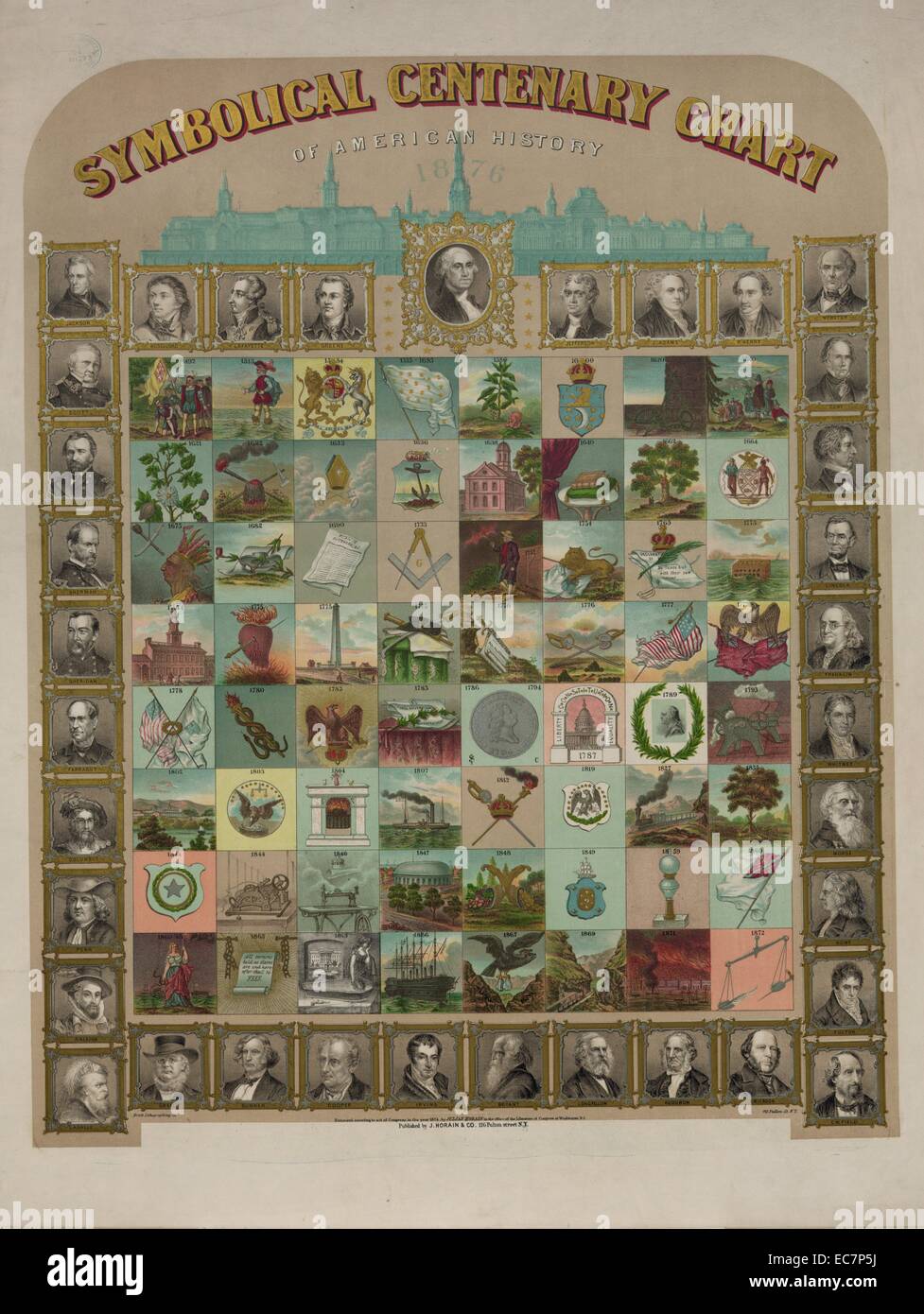 Symbolical centenary chart of American history. Print shows a large chart representing events in American history, presented chronologically from 1492 to 1872, and portraits of explorers, presidents, legislators, poets, journalists, generals, and other notable figures. Stock Photohttps://www.alamy.com/image-license-details/?v=1https://www.alamy.com/stock-photo-symbolical-centenary-chart-of-american-history-print-shows-a-large-76388414.html
RMEC7P5J–Symbolical centenary chart of American history. Print shows a large chart representing events in American history, presented chronologically from 1492 to 1872, and portraits of explorers, presidents, legislators, poets, journalists, generals, and other notable figures.
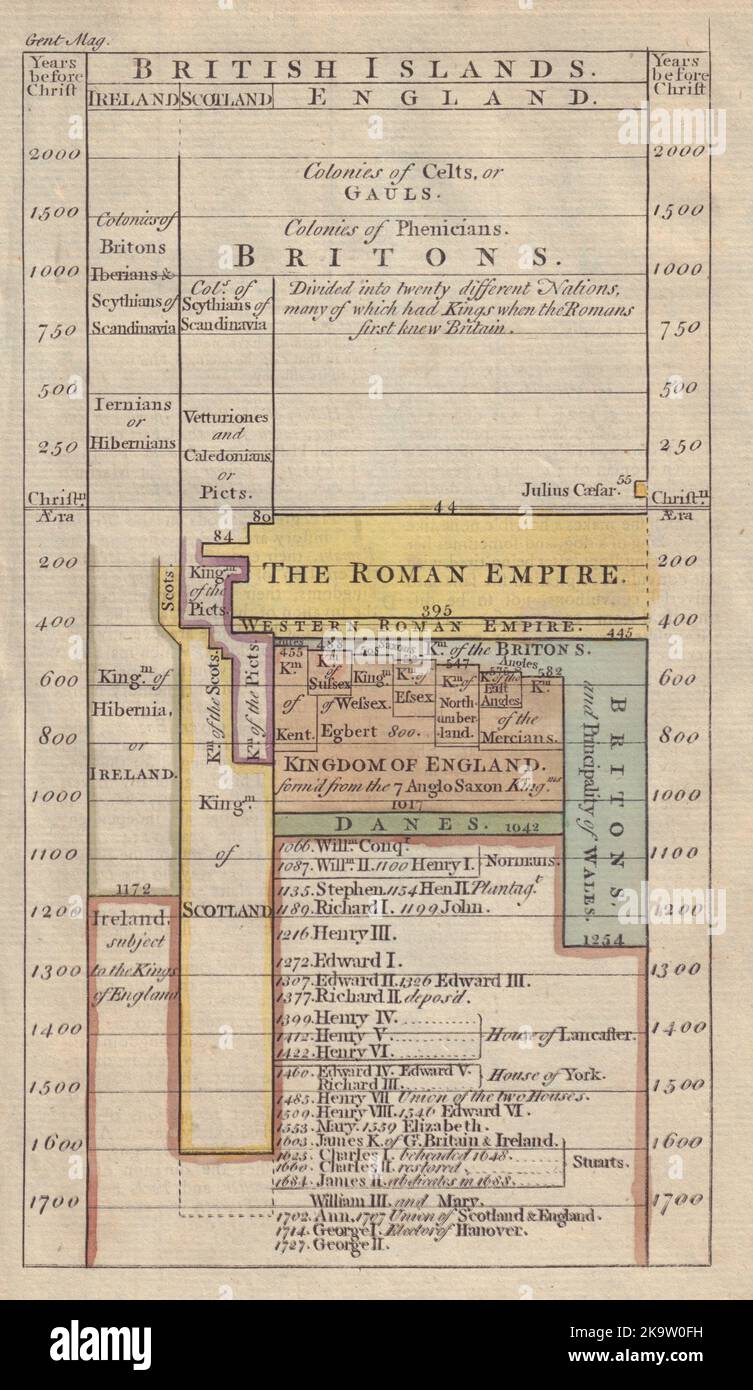 Chart of British History. Timeline. Decorative. GENTS MAG 1753 old print Stock Photohttps://www.alamy.com/image-license-details/?v=1https://www.alamy.com/chart-of-british-history-timeline-decorative-gents-mag-1753-old-print-image487971445.html
RF2K9W0FH–Chart of British History. Timeline. Decorative. GENTS MAG 1753 old print
 Doctor reviews patient's medical history chart. Stock Photohttps://www.alamy.com/image-license-details/?v=1https://www.alamy.com/stock-photo-doctor-reviews-patients-medical-history-chart-11359016.html
RFA5P17N–Doctor reviews patient's medical history chart.
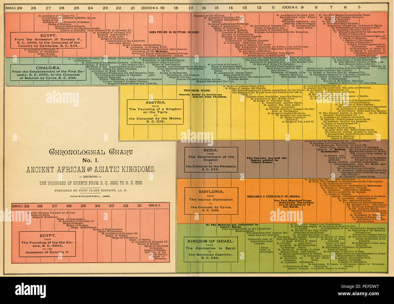 Chronological Chart of Ancient African and Asiatic Kingdoms, Illustration, Cyclopaedia of Universal History, Volume 1, The Ancient World, by John Clark Ridpath, the Jones Brothers Publishing Company, 1885 Stock Photohttps://www.alamy.com/image-license-details/?v=1https://www.alamy.com/chronological-chart-of-ancient-african-and-asiatic-kingdoms-illustration-cyclopaedia-of-universal-history-volume-1-the-ancient-world-by-john-clark-ridpath-the-jones-brothers-publishing-company-1885-image215469779.html
RMPEFDW7–Chronological Chart of Ancient African and Asiatic Kingdoms, Illustration, Cyclopaedia of Universal History, Volume 1, The Ancient World, by John Clark Ridpath, the Jones Brothers Publishing Company, 1885
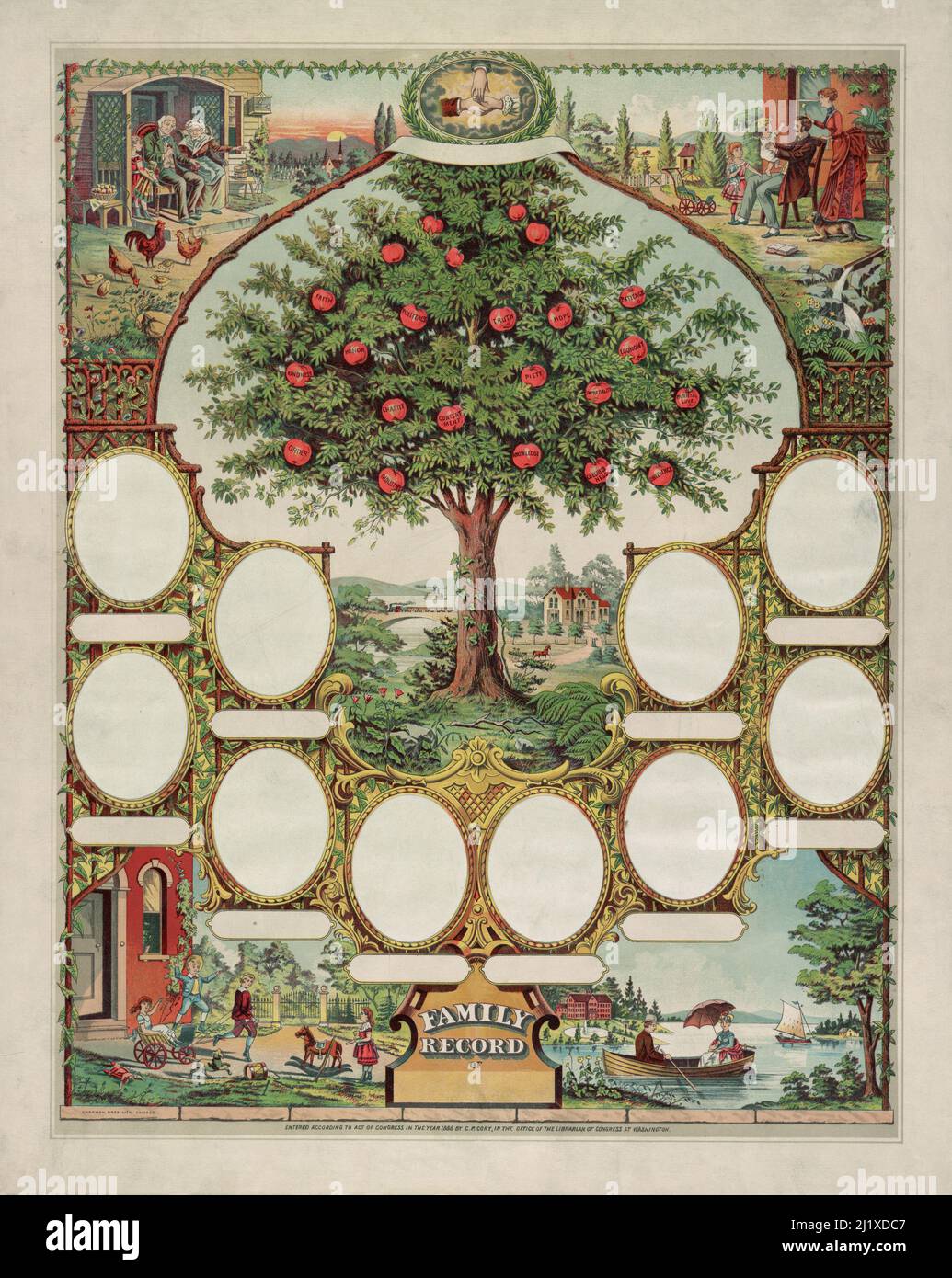 A vintage lithograph print circa 1888 showing a family tree chart with spaces for photos or portraits and illustrated with various family scenes and a large apple tree in the centre produced by Chapman Brothers of Chicago Stock Photohttps://www.alamy.com/image-license-details/?v=1https://www.alamy.com/a-vintage-lithograph-print-circa-1888-showing-a-family-tree-chart-with-spaces-for-photos-or-portraits-and-illustrated-with-various-family-scenes-and-a-large-apple-tree-in-the-centre-produced-by-chapman-brothers-of-chicago-image465875879.html
RF2J1XDC7–A vintage lithograph print circa 1888 showing a family tree chart with spaces for photos or portraits and illustrated with various family scenes and a large apple tree in the centre produced by Chapman Brothers of Chicago
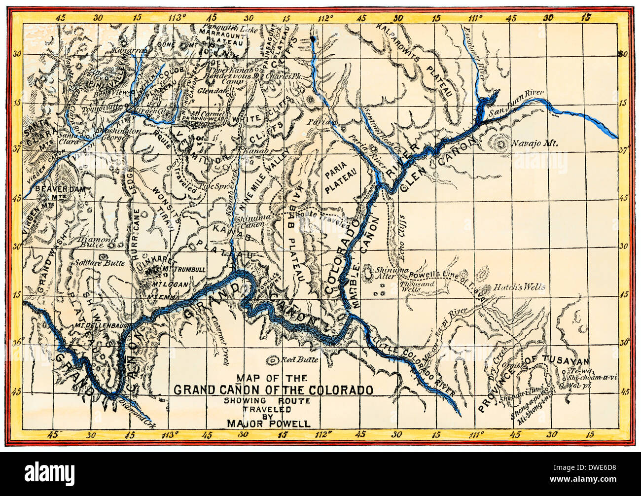 Map of the Grand Canyon drawn by the Powell expedition, 1870s. Digitally colored woodcut Stock Photohttps://www.alamy.com/image-license-details/?v=1https://www.alamy.com/map-of-the-grand-canyon-drawn-by-the-powell-expedition-1870s-digitally-image67309908.html
RMDWE6D8–Map of the Grand Canyon drawn by the Powell expedition, 1870s. Digitally colored woodcut
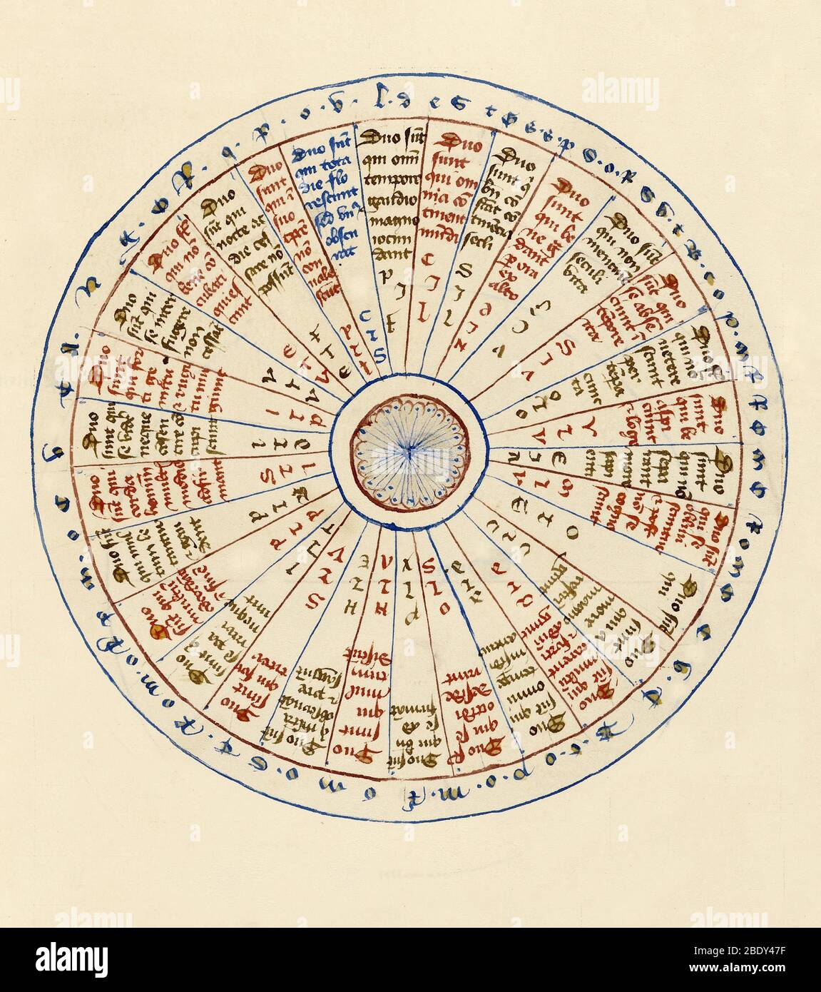 Astrological Chart, 1405 Stock Photohttps://www.alamy.com/image-license-details/?v=1https://www.alamy.com/astrological-chart-1405-image352793939.html
RM2BDY47F–Astrological Chart, 1405
 Chronological Chart of American History, New York At foot of tree is Columbus, then Virginia, New York, Landing of Pilgrim Fathers, through Declaration of Independence to date of publication Lithograph Stock Photohttps://www.alamy.com/image-license-details/?v=1https://www.alamy.com/chronological-chart-of-american-history-new-york-at-foot-of-tree-is-columbus-then-virginia-new-york-landing-of-pilgrim-fathers-through-declaration-of-independence-to-date-of-publication-lithograph-image257283188.html
RMTXG798–Chronological Chart of American History, New York At foot of tree is Columbus, then Virginia, New York, Landing of Pilgrim Fathers, through Declaration of Independence to date of publication Lithograph
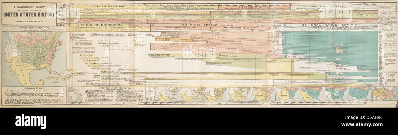 A Synchronic Chart and Statistical Tables of United States History Stock Photohttps://www.alamy.com/image-license-details/?v=1https://www.alamy.com/stock-photo-a-synchronic-chart-and-statistical-tables-of-united-states-history-54937490.html
RMD5AH96–A Synchronic Chart and Statistical Tables of United States History
 Nurses discussing patient chart Stock Photohttps://www.alamy.com/image-license-details/?v=1https://www.alamy.com/stock-photo-nurses-discussing-patient-chart-31018399.html
RMBPD07Y–Nurses discussing patient chart
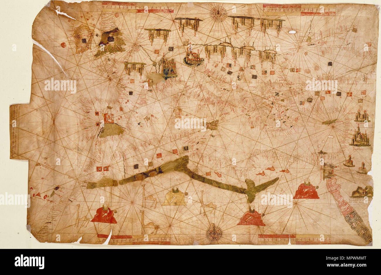 Nautical chart of the Mediterranean Sea, 1508. Stock Photohttps://www.alamy.com/image-license-details/?v=1https://www.alamy.com/nautical-chart-of-the-mediterranean-sea-1508-image186191176.html
RMMPWMMT–Nautical chart of the Mediterranean Sea, 1508.
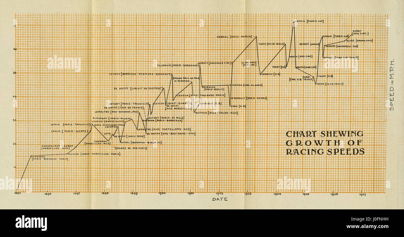 Chart showing growth of racing speeds, 1895-1906, speed in mph Stock Photohttps://www.alamy.com/image-license-details/?v=1https://www.alamy.com/stock-photo-chart-showing-growth-of-racing-speeds-1895-1906-speed-in-mph-138029181.html
RMJ0FNHH–Chart showing growth of racing speeds, 1895-1906, speed in mph
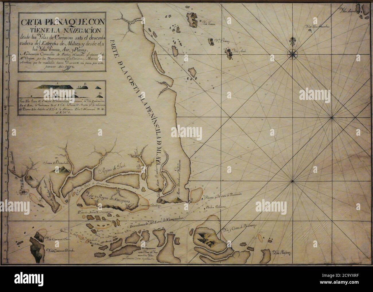 Chart of the Singapore Strait, 1778. It is a representation of Singapore with the name of 'Island and Kingdom of Sincapura', as an independent realm prior to British colonisation. It includes an elevation plan of Viola Island, identified as 'Island of Vandurria', the earliest known depiction of this land in a Spanish document. Naval Museum. Madrid. Spain. Stock Photohttps://www.alamy.com/image-license-details/?v=1https://www.alamy.com/chart-of-the-singapore-strait-1778-it-is-a-representation-of-singapore-with-the-name-of-island-and-kingdom-of-sincapura-as-an-independent-realm-prior-to-british-colonisation-it-includes-an-elevation-plan-of-viola-island-identified-as-island-of-vandurria-the-earliest-known-depiction-of-this-land-in-a-spanish-document-naval-museum-madrid-spain-image367563379.html
RM2C9YXRF–Chart of the Singapore Strait, 1778. It is a representation of Singapore with the name of 'Island and Kingdom of Sincapura', as an independent realm prior to British colonisation. It includes an elevation plan of Viola Island, identified as 'Island of Vandurria', the earliest known depiction of this land in a Spanish document. Naval Museum. Madrid. Spain.
 MASONS - MASONIC LODGES Engraving showing Freemasons standing before a chart of English Lodges in the early 18th century. Engraving of 1731 by Folkema, for Picart's History of Customs and Religions. Stock Photohttps://www.alamy.com/image-license-details/?v=1https://www.alamy.com/masons-masonic-lodges-engraving-showing-freemasons-standing-before-a-chart-of-english-lodges-in-the-early-18th-century-engraving-of-1731-by-folkema-for-picarts-history-of-customs-and-religions-image179624924.html
RMMC6HBT–MASONS - MASONIC LODGES Engraving showing Freemasons standing before a chart of English Lodges in the early 18th century. Engraving of 1731 by Folkema, for Picart's History of Customs and Religions.
 Nährverlust der Gerste. Loss of alimentation of barley. comparison, chart, Austria-Hungary, alcohol, drug, history, historical, 1910s, 1920s, 20th century, archive, Carl Simon, glass slide Stock Photohttps://www.alamy.com/image-license-details/?v=1https://www.alamy.com/stock-photo-nhrverlust-der-gerste-loss-of-alimentation-of-barley-comparison-chart-106692255.html
RMG5G71K–Nährverlust der Gerste. Loss of alimentation of barley. comparison, chart, Austria-Hungary, alcohol, drug, history, historical, 1910s, 1920s, 20th century, archive, Carl Simon, glass slide
 A mountain of euro cents with history chart and bar graph. For backgrounds. Germany Stock Photohttps://www.alamy.com/image-license-details/?v=1https://www.alamy.com/a-mountain-of-euro-cents-with-history-chart-and-bar-graph-for-backgrounds-germany-image443968100.html
RF2GP8DRG–A mountain of euro cents with history chart and bar graph. For backgrounds. Germany
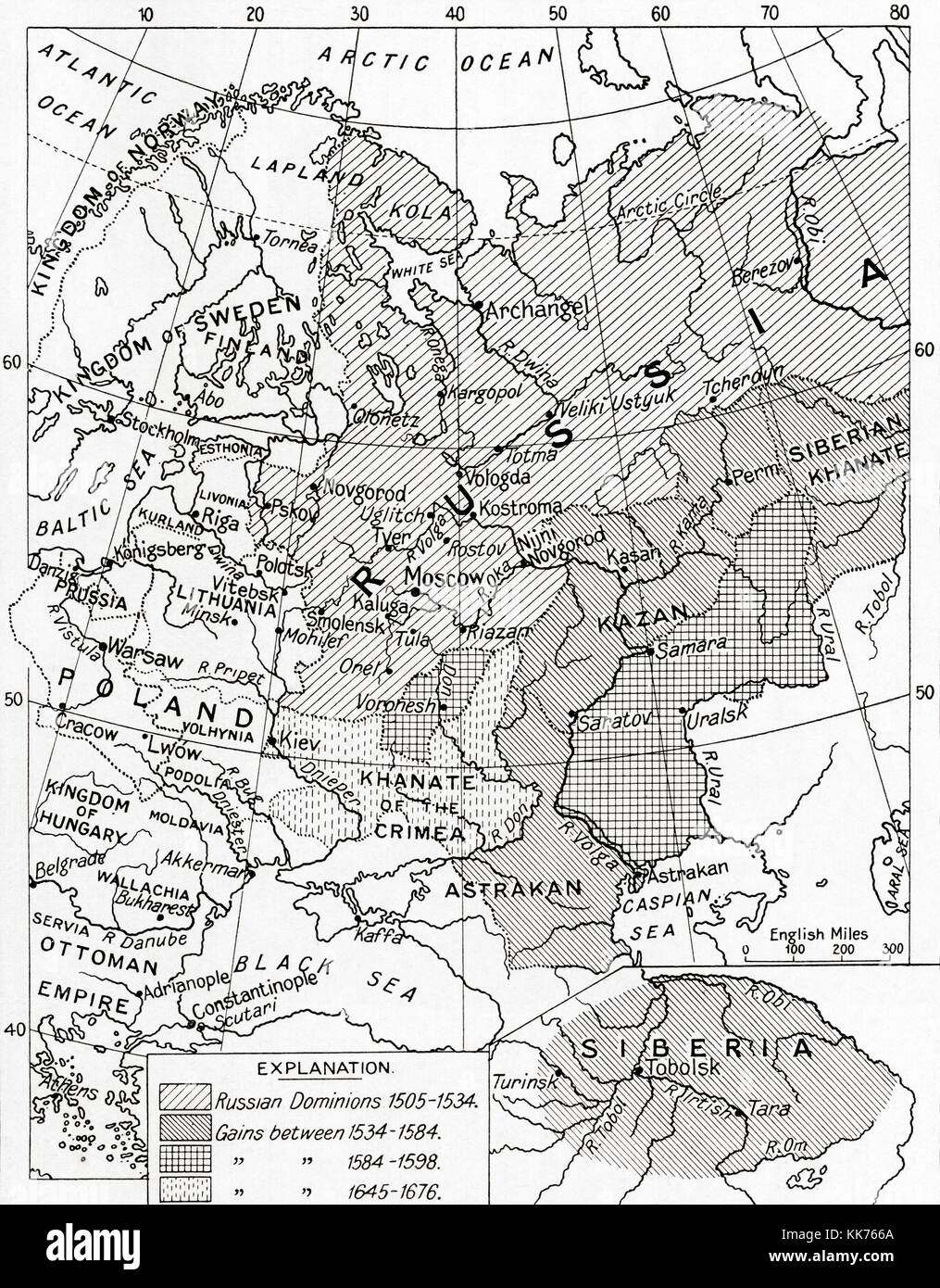 Map of Russia in the 16th and 17th centuries. From Hutchinson's History of the Nations, published 1915. Stock Photohttps://www.alamy.com/image-license-details/?v=1https://www.alamy.com/stock-image-map-of-russia-in-the-16th-and-17th-centuries-from-hutchinsons-history-166730322.html
RMKK766A–Map of Russia in the 16th and 17th centuries. From Hutchinson's History of the Nations, published 1915.
 Emblematic chart and Masonic history of Free and Accepted Ma Stock Photohttps://www.alamy.com/image-license-details/?v=1https://www.alamy.com/stock-photo-emblematic-chart-and-masonic-history-of-free-and-accepted-ma-83183306.html
RMER994A–Emblematic chart and Masonic history of Free and Accepted Ma
 Tennessee Valley Authority's comprehensive planning chart from the New Deal era of the Franklin Roosevelt Administration. It Stock Photohttps://www.alamy.com/image-license-details/?v=1https://www.alamy.com/stock-photo-tennessee-valley-authoritys-comprehensive-planning-chart-from-the-50026450.html
RMCWAW6X–Tennessee Valley Authority's comprehensive planning chart from the New Deal era of the Franklin Roosevelt Administration. It
 Newspaper article on The World of Pathe Pic. Supervising film editor Charlie Chart. British Pathe, the world's leading multimedia resource with a history stretching back over a century. Stock Photohttps://www.alamy.com/image-license-details/?v=1https://www.alamy.com/newspaper-article-on-the-world-of-pathe-pic-supervising-film-editor-charlie-chart-british-pathe-the-worlds-leading-multimedia-resource-with-a-history-stretching-back-over-a-century-image482091626.html
RM2K094P2–Newspaper article on The World of Pathe Pic. Supervising film editor Charlie Chart. British Pathe, the world's leading multimedia resource with a history stretching back over a century.
 Health management and medical history pie chart concept with a group of three dimensional segments made of human blood cells and virus bacteria and cancer cell icons for patient diagnosis or symptoms data for disease and illness treatment. Stock Photohttps://www.alamy.com/image-license-details/?v=1https://www.alamy.com/health-management-and-medical-history-pie-chart-concept-with-a-group-image64044840.html
RFDM5DRM–Health management and medical history pie chart concept with a group of three dimensional segments made of human blood cells and virus bacteria and cancer cell icons for patient diagnosis or symptoms data for disease and illness treatment.
 Doctor looks over patient's chart to read his medical history. Stock Photohttps://www.alamy.com/image-license-details/?v=1https://www.alamy.com/stock-photo-doctor-looks-over-patients-chart-to-read-his-medical-history-11358984.html
RFA5P14W–Doctor looks over patient's chart to read his medical history.
 Plan of Jerusalem from The Exploration of the World, Celebrated Travels and Travellers, Celebrated Voyages by Jules Verne nonfiction. Published in three volumes from 1878 to 1880, Celebrated Travels and Travelers is a history of the explorers and adventurers who voyaged to the far reaches of the globe, discovered the wonders of exotic lands, and filled in the blank spaces on the world map. With illustrations by L. Benett and P. Philippoteaux, Stock Photohttps://www.alamy.com/image-license-details/?v=1https://www.alamy.com/plan-of-jerusalem-from-the-exploration-of-the-world-celebrated-travels-and-travellers-celebrated-voyages-by-jules-verne-nonfiction-published-in-three-volumes-from-1878-to-1880-celebrated-travels-and-travelers-is-a-history-of-the-explorers-and-adventurers-who-voyaged-to-the-far-reaches-of-the-globe-discovered-the-wonders-of-exotic-lands-and-filled-in-the-blank-spaces-on-the-world-map-with-illustrations-by-l-benett-and-p-philippoteaux-image460499738.html
RF2HN5G36–Plan of Jerusalem from The Exploration of the World, Celebrated Travels and Travellers, Celebrated Voyages by Jules Verne nonfiction. Published in three volumes from 1878 to 1880, Celebrated Travels and Travelers is a history of the explorers and adventurers who voyaged to the far reaches of the globe, discovered the wonders of exotic lands, and filled in the blank spaces on the world map. With illustrations by L. Benett and P. Philippoteaux,
 couple of doctors looking at a history chart isolated on white Stock Photohttps://www.alamy.com/image-license-details/?v=1https://www.alamy.com/stock-photo-couple-of-doctors-looking-at-a-history-chart-isolated-on-white-135127730.html
RFHRRGPA–couple of doctors looking at a history chart isolated on white
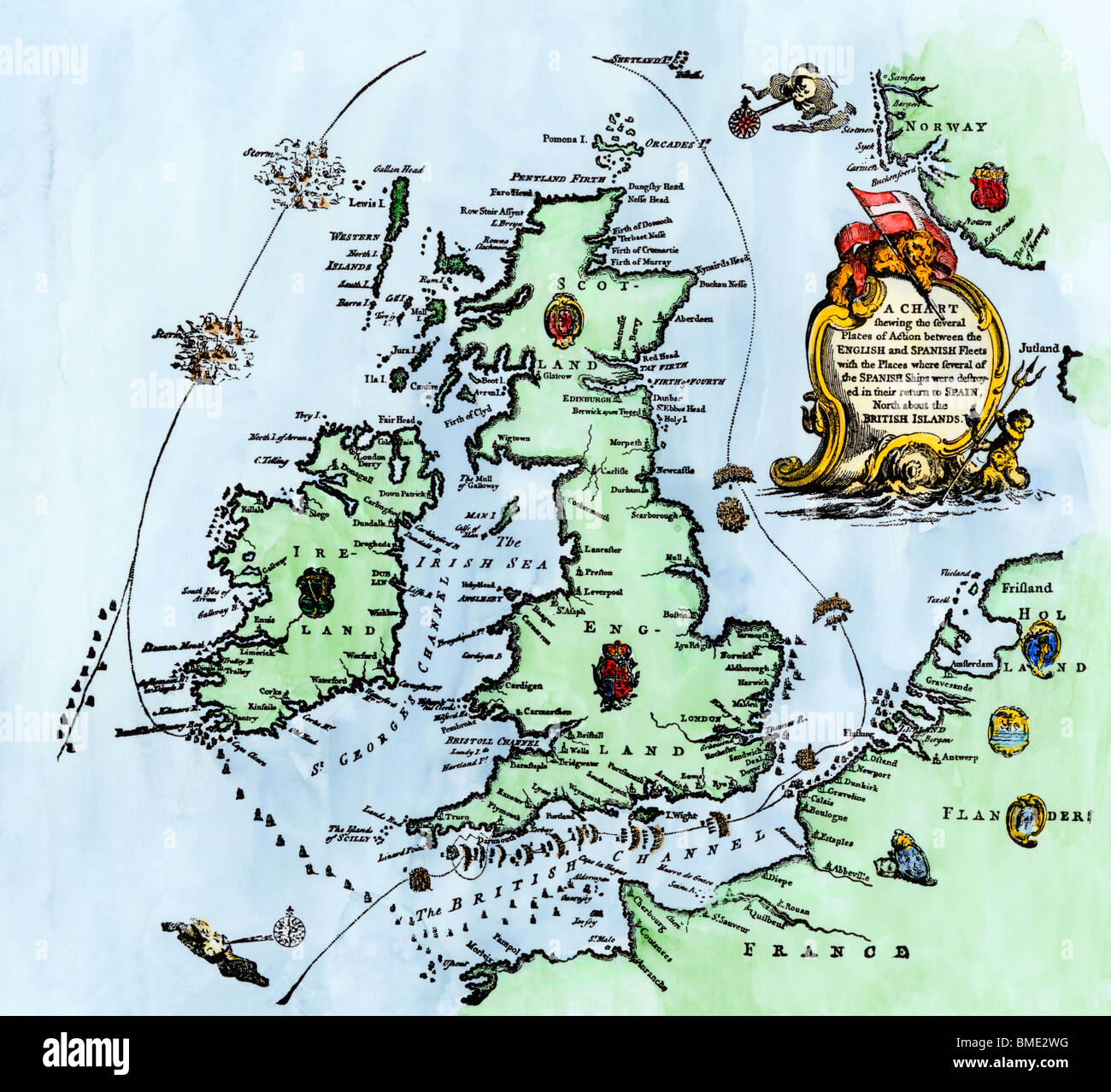 Chart of the Spanish Armada's course, 1588. Hand-colored woodcut Stock Photohttps://www.alamy.com/image-license-details/?v=1https://www.alamy.com/stock-photo-chart-of-the-spanish-armadas-course-1588-hand-colored-woodcut-29813100.html
RMBME2WG–Chart of the Spanish Armada's course, 1588. Hand-colored woodcut
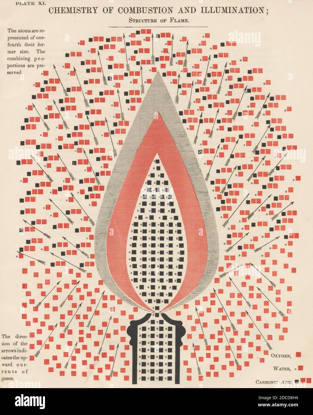 Chemistry of Combustion and Illumination, 1856 Stock Photohttps://www.alamy.com/image-license-details/?v=1https://www.alamy.com/chemistry-of-combustion-and-illumination-1856-image386296096.html
RF2DCD8H4–Chemistry of Combustion and Illumination, 1856
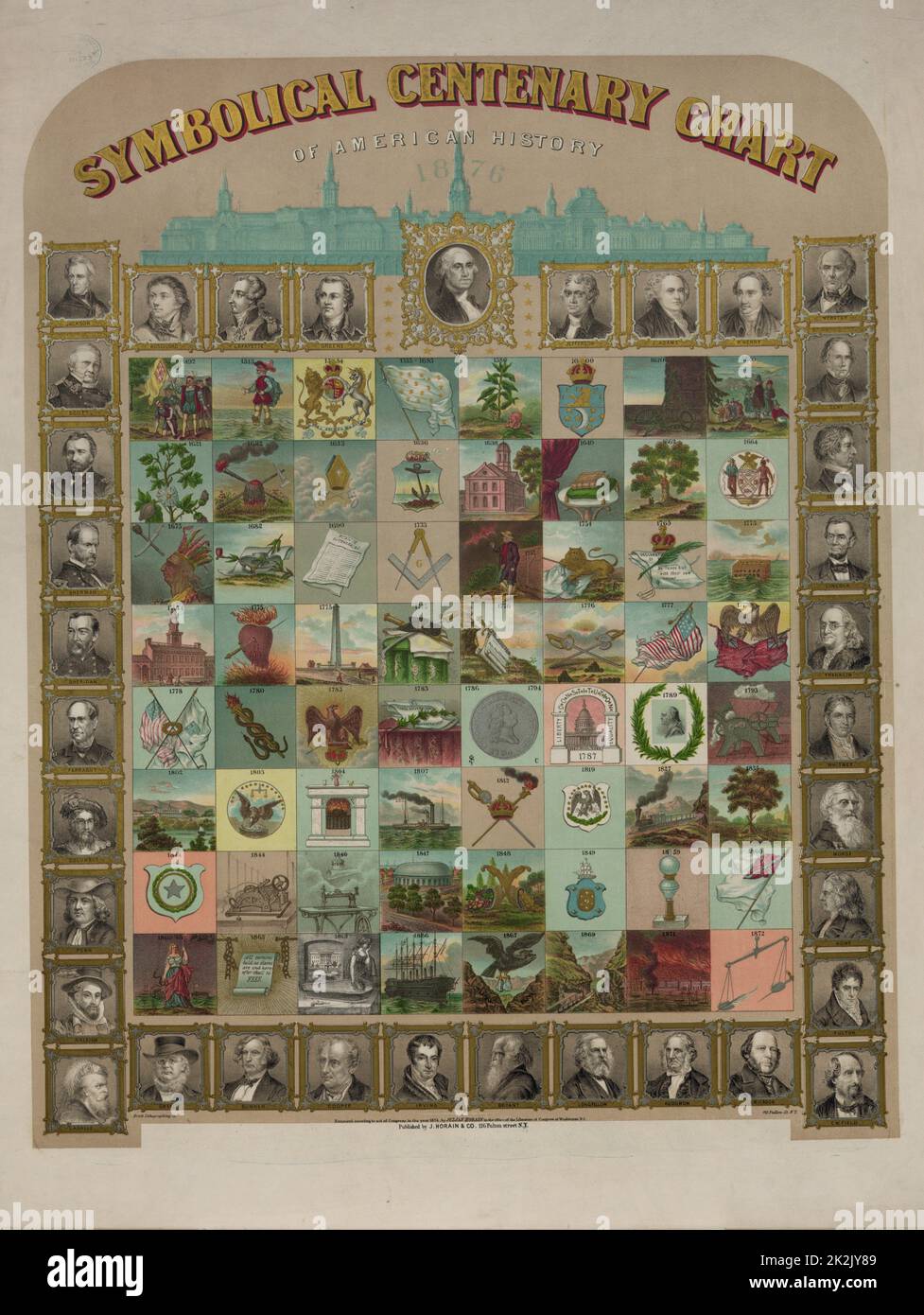 Symbolical centenary chart of American history by the Brett Lithographing Company. 1874. Print shows a large chart comprised of 64 symbols representing events in American history, presented chronologically from 1492 to 1872, and 35 portraits of explorers, presidents, legislators, poets, journalists, generals, and other notable figures; includes a key (attached to bottom of chart) which explains each symbol and identifies the people in the portraits and provides notable facts about their lives. Stock Photohttps://www.alamy.com/image-license-details/?v=1https://www.alamy.com/symbolical-centenary-chart-of-american-history-by-the-brett-lithographing-company-1874-print-shows-a-large-chart-comprised-of-64-symbols-representing-events-in-american-history-presented-chronologically-from-1492-to-1872-and-35-portraits-of-explorers-presidents-legislators-poets-journalists-generals-and-other-notable-figures-includes-a-key-attached-to-bottom-of-chart-which-explains-each-symbol-and-identifies-the-people-in-the-portraits-and-provides-notable-facts-about-their-lives-image483536153.html
RM2K2JY89–Symbolical centenary chart of American history by the Brett Lithographing Company. 1874. Print shows a large chart comprised of 64 symbols representing events in American history, presented chronologically from 1492 to 1872, and 35 portraits of explorers, presidents, legislators, poets, journalists, generals, and other notable figures; includes a key (attached to bottom of chart) which explains each symbol and identifies the people in the portraits and provides notable facts about their lives.
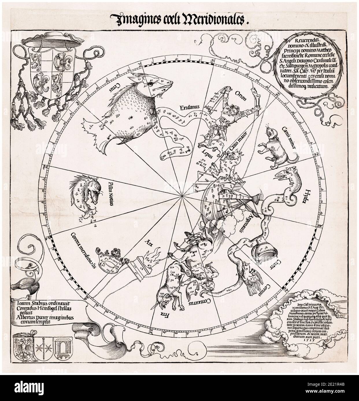 Sky map of the Southern Hemisphere, Star Chart, Zodiac, print, 1515 by Albrecht Dürer after Conrad Heinfogel Stock Photohttps://www.alamy.com/image-license-details/?v=1https://www.alamy.com/sky-map-of-the-southern-hemisphere-star-chart-zodiac-print-1515-by-albrecht-drer-after-conrad-heinfogel-image397107883.html
RM2E21R4B–Sky map of the Southern Hemisphere, Star Chart, Zodiac, print, 1515 by Albrecht Dürer after Conrad Heinfogel
 Nurse adding patient history to chart Stock Photohttps://www.alamy.com/image-license-details/?v=1https://www.alamy.com/stock-photo-nurse-adding-patient-history-to-chart-31018158.html
RMBPCYYA–Nurse adding patient history to chart
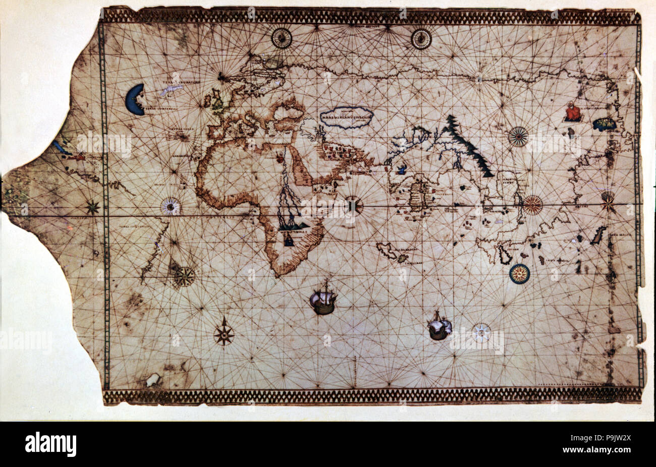 Nautical chart called 'King-Hamy', 1502, attributed to Amerigo Vespucci. Stock Photohttps://www.alamy.com/image-license-details/?v=1https://www.alamy.com/nautical-chart-called-king-hamy-1502-attributed-to-amerigo-vespucci-image212471138.html
RMP9JW2X–Nautical chart called 'King-Hamy', 1502, attributed to Amerigo Vespucci.
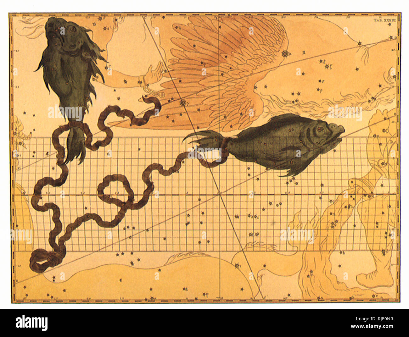 Pisces. Stock Photohttps://www.alamy.com/image-license-details/?v=1https://www.alamy.com/pisces-image235106531.html
RMRJE0NR–Pisces.
 Hispaniola: Nautical chart of Haiti, the Dominican Republic and Puerto Rico by Johannes Vingboons (1616-1670), 1639. A 1639 nautical map of Hispaniola (center-left), the most populous island in the Americas, and Puerto Rico (right). The name originally given by Christopher Columbus, who founded the first European colonies in the New World here during his first two voyages, was La Isla Espanola ('the Spanish island'), which was shortened to Espanola and then Latinised to Hispaniola. Stock Photohttps://www.alamy.com/image-license-details/?v=1https://www.alamy.com/hispaniola-nautical-chart-of-haiti-the-dominican-republic-and-puerto-rico-by-johannes-vingboons-1616-1670-1639-a-1639-nautical-map-of-hispaniola-center-left-the-most-populous-island-in-the-americas-and-puerto-rico-right-the-name-originally-given-by-christopher-columbus-who-founded-the-first-european-colonies-in-the-new-world-here-during-his-first-two-voyages-was-la-isla-espanola-the-spanish-island-which-was-shortened-to-espanola-and-then-latinised-to-hispaniola-image344227343.html
RM2B00WDK–Hispaniola: Nautical chart of Haiti, the Dominican Republic and Puerto Rico by Johannes Vingboons (1616-1670), 1639. A 1639 nautical map of Hispaniola (center-left), the most populous island in the Americas, and Puerto Rico (right). The name originally given by Christopher Columbus, who founded the first European colonies in the New World here during his first two voyages, was La Isla Espanola ('the Spanish island'), which was shortened to Espanola and then Latinised to Hispaniola.
 Medical Blood Letting Chart Crude blood letting chart from the Rostock Shepherd's Calendar of 1523 Stock Photohttps://www.alamy.com/image-license-details/?v=1https://www.alamy.com/medical-blood-letting-chart-crude-blood-letting-chart-from-the-rostock-shepherds-calendar-of-1523-image179627945.html
RMMC6N7N–Medical Blood Letting Chart Crude blood letting chart from the Rostock Shepherd's Calendar of 1523
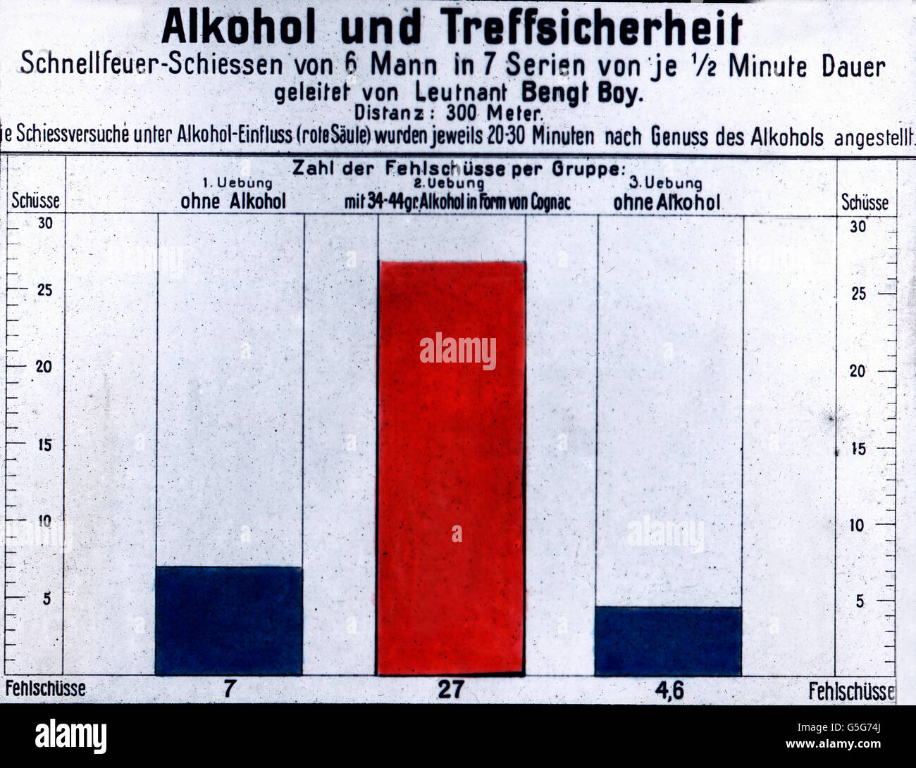 Alkohol und Treffsicherheit. Alcohol and accuracy. shooting, alcoholized, drunk, sober, target, chart, statistics, alcohol, drug, history, historical, 1910s, 1920s, 20th century, archive, Carl Simon, glass slide Stock Photohttps://www.alamy.com/image-license-details/?v=1https://www.alamy.com/stock-photo-alkohol-und-treffsicherheit-alcohol-and-accuracy-shooting-alcoholized-106692338.html
RMG5G74J–Alkohol und Treffsicherheit. Alcohol and accuracy. shooting, alcoholized, drunk, sober, target, chart, statistics, alcohol, drug, history, historical, 1910s, 1920s, 20th century, archive, Carl Simon, glass slide
 Euro coins in stacks with history chart and bar graph. Presentation for investments with yield. For background. Germany Stock Photohttps://www.alamy.com/image-license-details/?v=1https://www.alamy.com/euro-coins-in-stacks-with-history-chart-and-bar-graph-presentation-for-investments-with-yield-for-background-germany-image443861340.html
RF2GP3HJM–Euro coins in stacks with history chart and bar graph. Presentation for investments with yield. For background. Germany
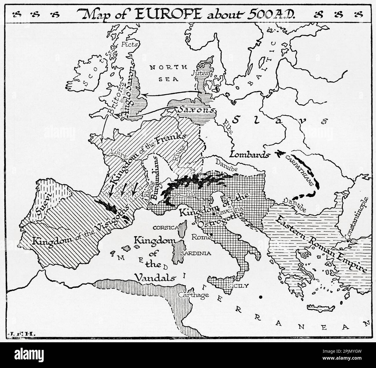 Map of Europe circa 500 A.D. From the book Outline of History by H.G. Wells, published 1920. Stock Photohttps://www.alamy.com/image-license-details/?v=1https://www.alamy.com/map-of-europe-circa-500-ad-from-the-book-outline-of-history-by-hg-wells-published-1920-image545045897.html
RM2PJMYGW–Map of Europe circa 500 A.D. From the book Outline of History by H.G. Wells, published 1920.
 Chronological chart of American history--Dedicated to the pe Stock Photohttps://www.alamy.com/image-license-details/?v=1https://www.alamy.com/stock-photo-chronological-chart-of-american-history-dedicated-to-the-pe-83186284.html
RMER9CXM–Chronological chart of American history--Dedicated to the pe
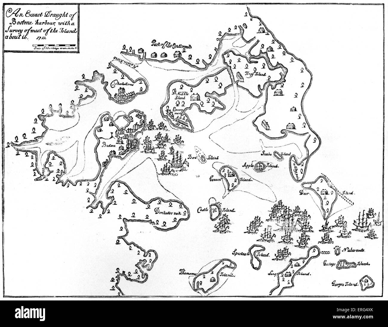 Chart of Boston Harbour, 1733 Stock Photohttps://www.alamy.com/image-license-details/?v=1https://www.alamy.com/stock-photo-chart-of-boston-harbour-1733-83333675.html
RMERG4XK–Chart of Boston Harbour, 1733
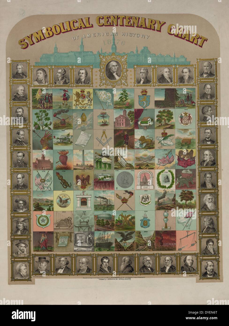 Symbolical centenary chart of American history by the Brett Lithographing Company. 1874. Print shows a large chart comprised of 64 symbols representing events in American history, presented chronologically from 1492 to 1872, and 35 portraits of explorers, presidents, legislators, poets, journalists, generals, and other notable figures; includes a key (attached to bottom of chart) which explains each symbol and identifies the people in the portraits and provides notable facts about their lives. Stock Photohttps://www.alamy.com/image-license-details/?v=1https://www.alamy.com/symbolical-centenary-chart-of-american-history-by-the-brett-lithographing-image68550800.html
RMDYEN6T–Symbolical centenary chart of American history by the Brett Lithographing Company. 1874. Print shows a large chart comprised of 64 symbols representing events in American history, presented chronologically from 1492 to 1872, and 35 portraits of explorers, presidents, legislators, poets, journalists, generals, and other notable figures; includes a key (attached to bottom of chart) which explains each symbol and identifies the people in the portraits and provides notable facts about their lives.
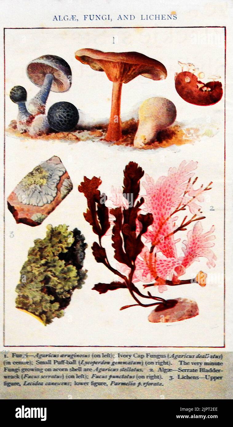 An early British coloured education identity chart for Algae, fungi & lichens Stock Photohttps://www.alamy.com/image-license-details/?v=1https://www.alamy.com/an-early-british-coloured-education-identity-chart-for-algae-fungi-lichens-image478731190.html
RM2JPT2EE–An early British coloured education identity chart for Algae, fungi & lichens
 Nurse writes info into patient's history chart Stock Photohttps://www.alamy.com/image-license-details/?v=1https://www.alamy.com/stock-photo-nurse-writes-info-into-patients-history-chart-14188493.html
RFAGEP9J–Nurse writes info into patient's history chart
 Consistent Storytelling Illustration. A narrative chart showcasing a brand's history and evolution, reflecting consistent storytelling in branding. Flat vector illustration. Stock Vectorhttps://www.alamy.com/image-license-details/?v=1https://www.alamy.com/consistent-storytelling-illustration-a-narrative-chart-showcasing-a-brands-history-and-evolution-reflecting-consistent-storytelling-in-branding-flat-vector-illustration-image601182504.html
RF2WX26BM–Consistent Storytelling Illustration. A narrative chart showcasing a brand's history and evolution, reflecting consistent storytelling in branding. Flat vector illustration.
 A pictorial history chart of the Naxi minority, near Lijiang, China. Stock Photohttps://www.alamy.com/image-license-details/?v=1https://www.alamy.com/stock-photo-a-pictorial-history-chart-of-the-naxi-minority-near-lijiang-china-16002722.html
RMARBHPY–A pictorial history chart of the Naxi minority, near Lijiang, China.
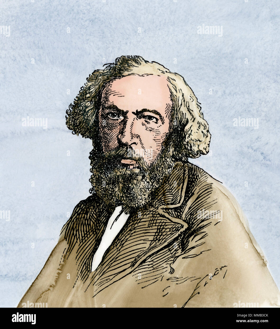 Dmitry Mendeleev, who developed the periodic table. Hand-colored woodcut Stock Photohttps://www.alamy.com/image-license-details/?v=1https://www.alamy.com/dmitry-mendeleev-who-developed-the-periodic-table-hand-colored-woodcut-image184640979.html
RMMMB3CK–Dmitry Mendeleev, who developed the periodic table. Hand-colored woodcut
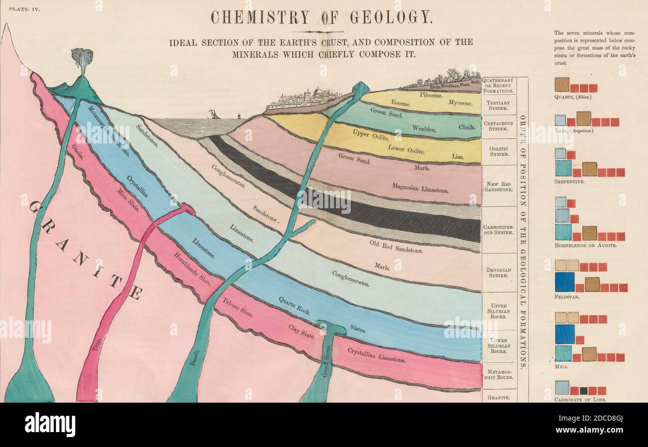 Chemistry of Geology, 1856 Stock Photohttps://www.alamy.com/image-license-details/?v=1https://www.alamy.com/chemistry-of-geology-1856-image386296082.html
RF2DCD8GJ–Chemistry of Geology, 1856
 Plan of Vauxhall Pleasure Gardens, Lambeth 1827 old antique map chart Stock Photohttps://www.alamy.com/image-license-details/?v=1https://www.alamy.com/plan-of-vauxhall-pleasure-gardens-lambeth-1827-old-antique-map-chart-image599868725.html
RF2WRXAK1–Plan of Vauxhall Pleasure Gardens, Lambeth 1827 old antique map chart
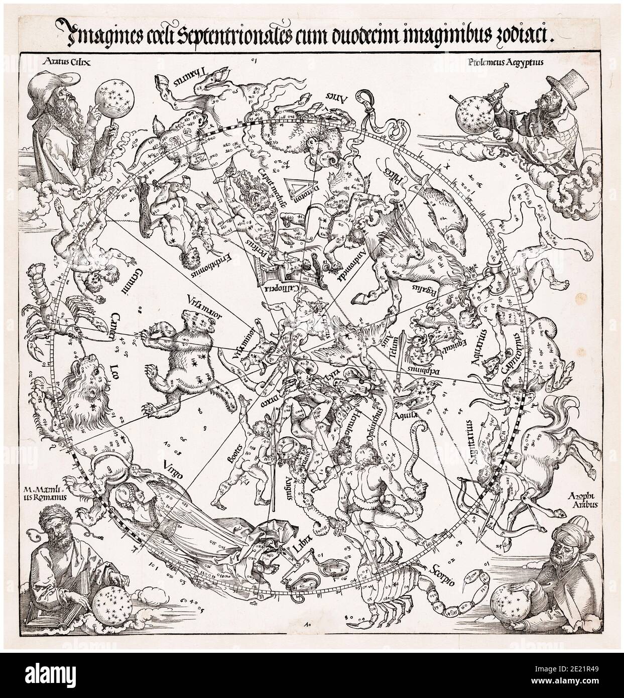 Sky map of the Northern Hemisphere, Star Chart, Zodiac, print, 1515 by Albrecht Dürer after Conrad Heinfogel Stock Photohttps://www.alamy.com/image-license-details/?v=1https://www.alamy.com/sky-map-of-the-northern-hemisphere-star-chart-zodiac-print-1515-by-albrecht-drer-after-conrad-heinfogel-image397107881.html
RM2E21R49–Sky map of the Northern Hemisphere, Star Chart, Zodiac, print, 1515 by Albrecht Dürer after Conrad Heinfogel
 Nurse adding patient history to chart Stock Photohttps://www.alamy.com/image-license-details/?v=1https://www.alamy.com/stock-photo-nurse-adding-patient-history-to-chart-31018178.html
RMBPD002–Nurse adding patient history to chart
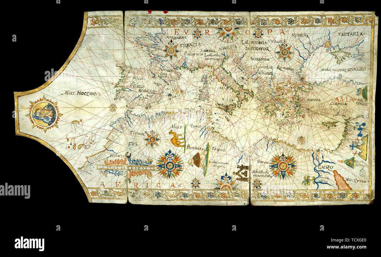 Portolan chart of the Mediterranean Sea, the Black Sea, Sea of Azov…, 16th century. Creator: Anonymous master. Stock Photohttps://www.alamy.com/image-license-details/?v=1https://www.alamy.com/portolan-chart-of-the-mediterranean-sea-the-black-sea-sea-of-azov-16th-century-creator-anonymous-master-image248904712.html
RMTCXGE0–Portolan chart of the Mediterranean Sea, the Black Sea, Sea of Azov…, 16th century. Creator: Anonymous master.
 Mapmaking. Stock Photohttps://www.alamy.com/image-license-details/?v=1https://www.alamy.com/stock-photo-mapmaking-91707151.html
RMF95HBB–Mapmaking.
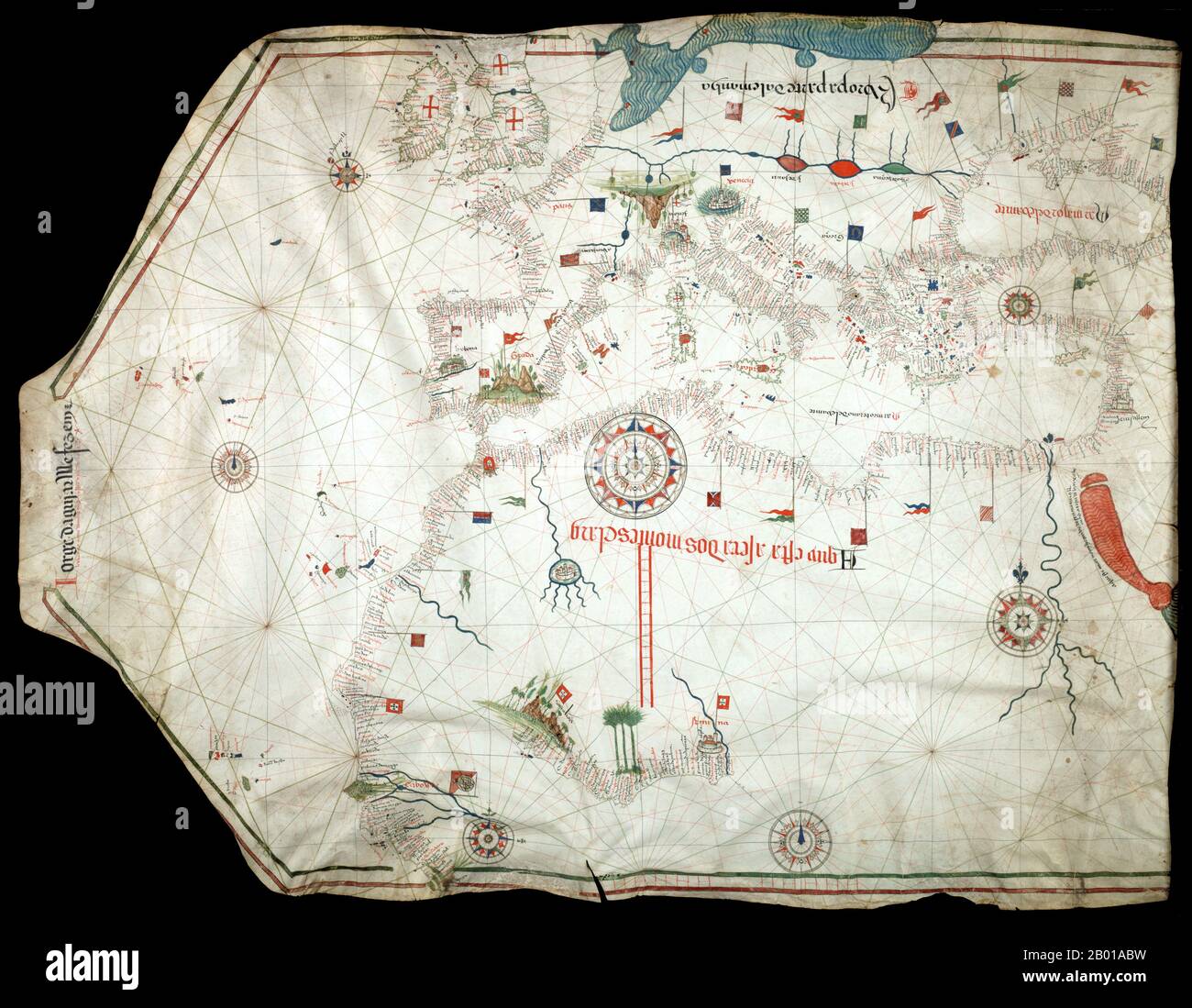 Portugal: Jorge de Aguiar's chart of the Mediterranean, Western Europe and African Coast, 1492. A portolan chart from 1492, the oldest known signed and dated chart of Portuguese origin. Cartography technologies greatly advanced during the Age of Discovery. Iberian mapmakers in particular focused on practical charts to use as navigational aids. Unlike Spanish maps which were considered a state secret, Portuguese maps were used by other countries, and Portuguese cartographers drew upon the skill and knowledge of other cultures, notably Islamic, as well. Stock Photohttps://www.alamy.com/image-license-details/?v=1https://www.alamy.com/portugal-jorge-de-aguiars-chart-of-the-mediterranean-western-europe-and-african-coast-1492-a-portolan-chart-from-1492-the-oldest-known-signed-and-dated-chart-of-portuguese-origin-cartography-technologies-greatly-advanced-during-the-age-of-discovery-iberian-mapmakers-in-particular-focused-on-practical-charts-to-use-as-navigational-aids-unlike-spanish-maps-which-were-considered-a-state-secret-portuguese-maps-were-used-by-other-countries-and-portuguese-cartographers-drew-upon-the-skill-and-knowledge-of-other-cultures-notably-islamic-as-well-image344237485.html
RM2B01ABW–Portugal: Jorge de Aguiar's chart of the Mediterranean, Western Europe and African Coast, 1492. A portolan chart from 1492, the oldest known signed and dated chart of Portuguese origin. Cartography technologies greatly advanced during the Age of Discovery. Iberian mapmakers in particular focused on practical charts to use as navigational aids. Unlike Spanish maps which were considered a state secret, Portuguese maps were used by other countries, and Portuguese cartographers drew upon the skill and knowledge of other cultures, notably Islamic, as well.
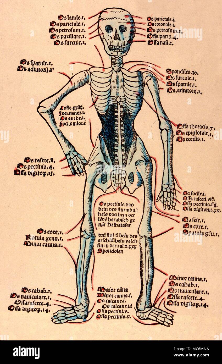 Herbal skeletal chart, a hand coloured woodcut from the Venetian 1511 edition of Hortus Santitatis- the first Italian edition Stock Photohttps://www.alamy.com/image-license-details/?v=1https://www.alamy.com/herbal-skeletal-chart-a-hand-coloured-woodcut-from-the-venetian-1511-edition-of-hortus-santitatis-the-first-italian-edition-image179627542.html
RMMC6MNA–Herbal skeletal chart, a hand coloured woodcut from the Venetian 1511 edition of Hortus Santitatis- the first Italian edition
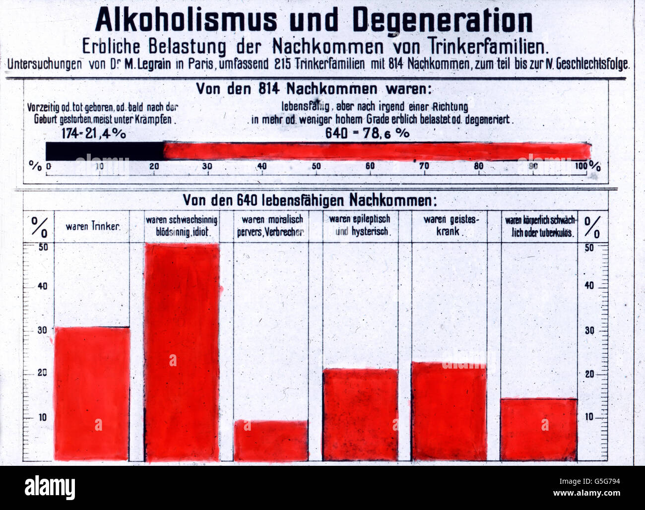 Alkoholismus und Vererbung. Alcoholism and heredity. chart, fact sheet, numbers, diagram, columns, statistics, alcohol, drug, history, historical, 1910s, 1920s, 20th century, archive, Carl Simon, glass slide Stock Photohttps://www.alamy.com/image-license-details/?v=1https://www.alamy.com/stock-photo-alkoholismus-und-vererbung-alcoholism-and-heredity-chart-fact-sheet-106692464.html
RMG5G794–Alkoholismus und Vererbung. Alcoholism and heredity. chart, fact sheet, numbers, diagram, columns, statistics, alcohol, drug, history, historical, 1910s, 1920s, 20th century, archive, Carl Simon, glass slide
 Euro coins in stacks with history chart and bar graph. Presentation for investments with yield. For background. Germany Stock Photohttps://www.alamy.com/image-license-details/?v=1https://www.alamy.com/euro-coins-in-stacks-with-history-chart-and-bar-graph-presentation-for-investments-with-yield-for-background-germany-image443909711.html
RF2GP5RA7–Euro coins in stacks with history chart and bar graph. Presentation for investments with yield. For background. Germany
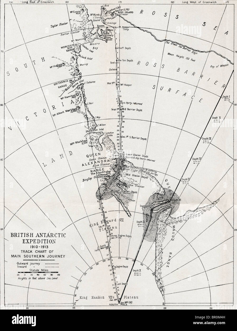 Track chart of the main southern journey of Robert Falcon Scott´s British Antarctic Expedition, 1910 - 1913. Stock Photohttps://www.alamy.com/image-license-details/?v=1https://www.alamy.com/stock-photo-track-chart-of-the-main-southern-journey-of-robert-falcon-scotts-british-31363265.html
RMBR0M4H–Track chart of the main southern journey of Robert Falcon Scott´s British Antarctic Expedition, 1910 - 1913.
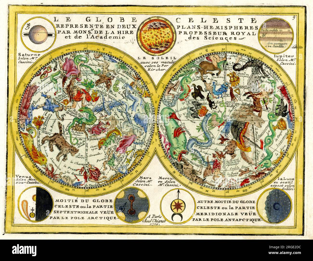 Celestial Chart Stock Photohttps://www.alamy.com/image-license-details/?v=1https://www.alamy.com/celestial-chart-image560875544.html
RM2RGE2DC–Celestial Chart
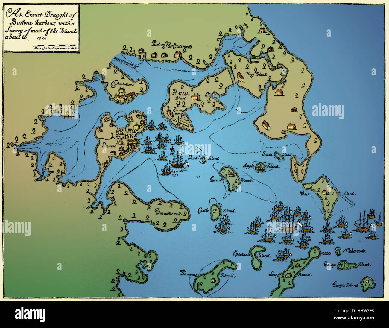 Chart of Boston Harbour, 1733 Stock Photohttps://www.alamy.com/image-license-details/?v=1https://www.alamy.com/stock-photo-chart-of-boston-harbour-1733-131473303.html
RMHHW3F3–Chart of Boston Harbour, 1733
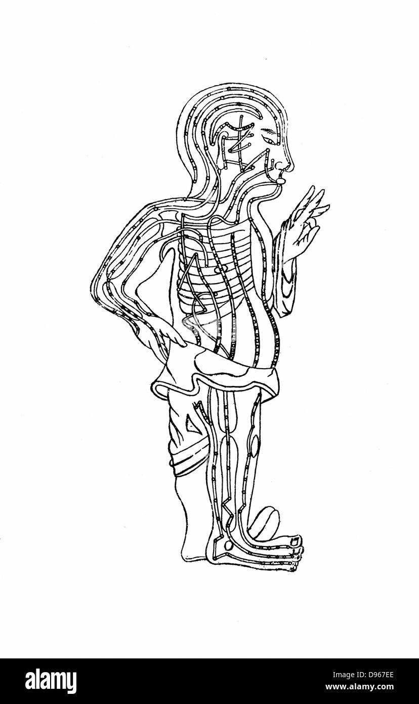 Acupuncture chart, 19th century woodcut Stock Photohttps://www.alamy.com/image-license-details/?v=1https://www.alamy.com/stock-photo-acupuncture-chart-19th-century-woodcut-57300614.html
RMD967EE–Acupuncture chart, 19th century woodcut
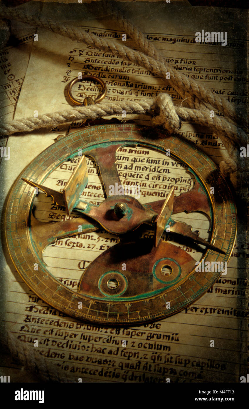 Historical navigation , sailing discovery - Antique sextant , sun dial on a chart log with rope Stock Photohttps://www.alamy.com/image-license-details/?v=1https://www.alamy.com/stock-photo-historical-navigation-sailing-discovery-antique-sextant-sun-dial-on-174903375.html
RMM4FF13–Historical navigation , sailing discovery - Antique sextant , sun dial on a chart log with rope
 Nurse collects patient info to create a patient history chart. Stock Photohttps://www.alamy.com/image-license-details/?v=1https://www.alamy.com/stock-photo-nurse-collects-patient-info-to-create-a-patient-history-chart-14165538.html
RFAGCA0K–Nurse collects patient info to create a patient history chart.
 Consistent Storytelling Illustration. A narrative chart showcasing a brand's history and evolution, reflecting consistent storytelling in branding. Flat vector illustration. Stock Vectorhttps://www.alamy.com/image-license-details/?v=1https://www.alamy.com/consistent-storytelling-illustration-a-narrative-chart-showcasing-a-brands-history-and-evolution-reflecting-consistent-storytelling-in-branding-flat-vector-illustration-image601183127.html
RF2WX275Y–Consistent Storytelling Illustration. A narrative chart showcasing a brand's history and evolution, reflecting consistent storytelling in branding. Flat vector illustration.
 Genogram in cartoon style. Family tree chart. Genealogy tree structure. Can be used for ancestry heritage research, systematic constellation. Vector Stock Vectorhttps://www.alamy.com/image-license-details/?v=1https://www.alamy.com/genogram-in-cartoon-style-family-tree-chart-genealogy-tree-structure-can-be-used-for-ancestry-heritage-research-systematic-constellation-vector-image551310697.html
RF2R0XABN–Genogram in cartoon style. Family tree chart. Genealogy tree structure. Can be used for ancestry heritage research, systematic constellation. Vector
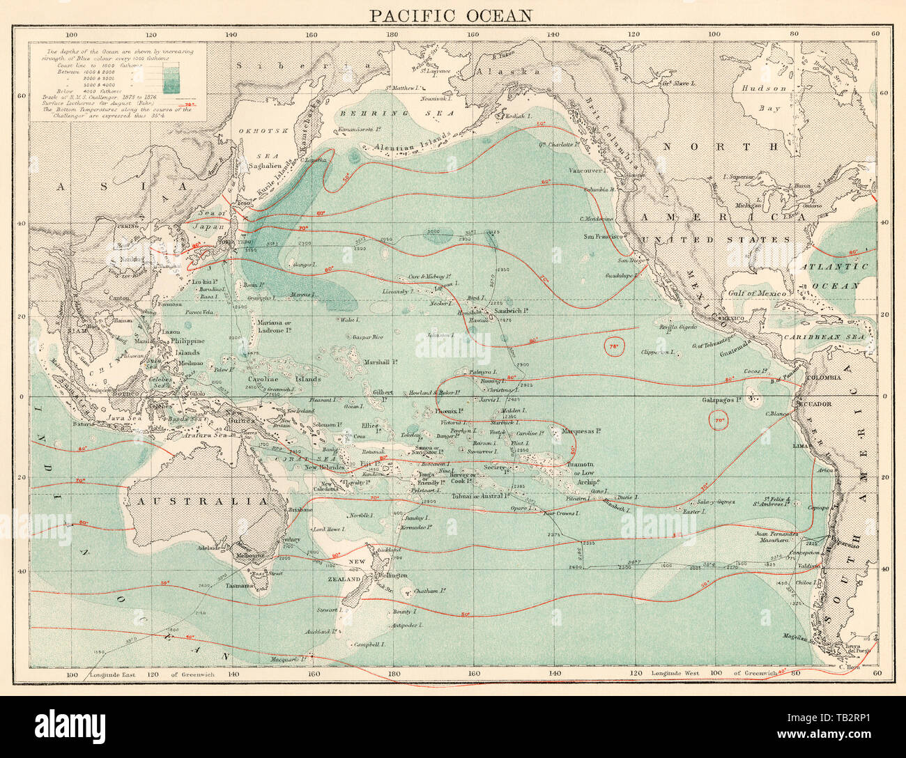 Map of the Pacific Ocean, 1870s. Color lithograph Stock Photohttps://www.alamy.com/image-license-details/?v=1https://www.alamy.com/map-of-the-pacific-ocean-1870s-color-lithograph-image247768921.html
RMTB2RP1–Map of the Pacific Ocean, 1870s. Color lithograph
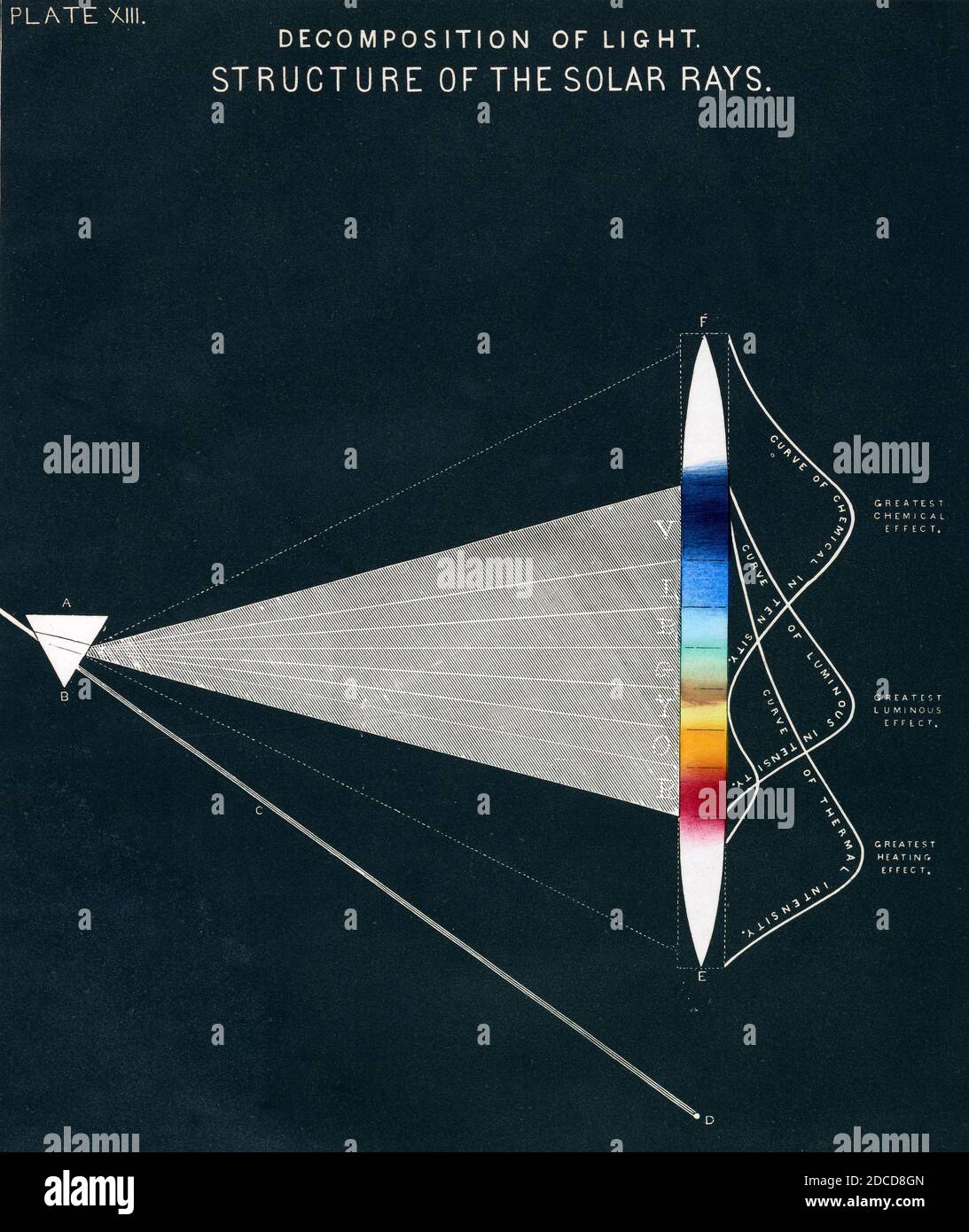 Decomposition of Light, Structure of the Solar Rays, 1856 Stock Photohttps://www.alamy.com/image-license-details/?v=1https://www.alamy.com/decomposition-of-light-structure-of-the-solar-rays-1856-image386296085.html
RF2DCD8GN–Decomposition of Light, Structure of the Solar Rays, 1856
 Geological Map of the country surrounding Tottenham 1840 old antique chart Stock Photohttps://www.alamy.com/image-license-details/?v=1https://www.alamy.com/geological-map-of-the-country-surrounding-tottenham-1840-old-antique-chart-image599859637.html
RF2WRWY2D–Geological Map of the country surrounding Tottenham 1840 old antique chart
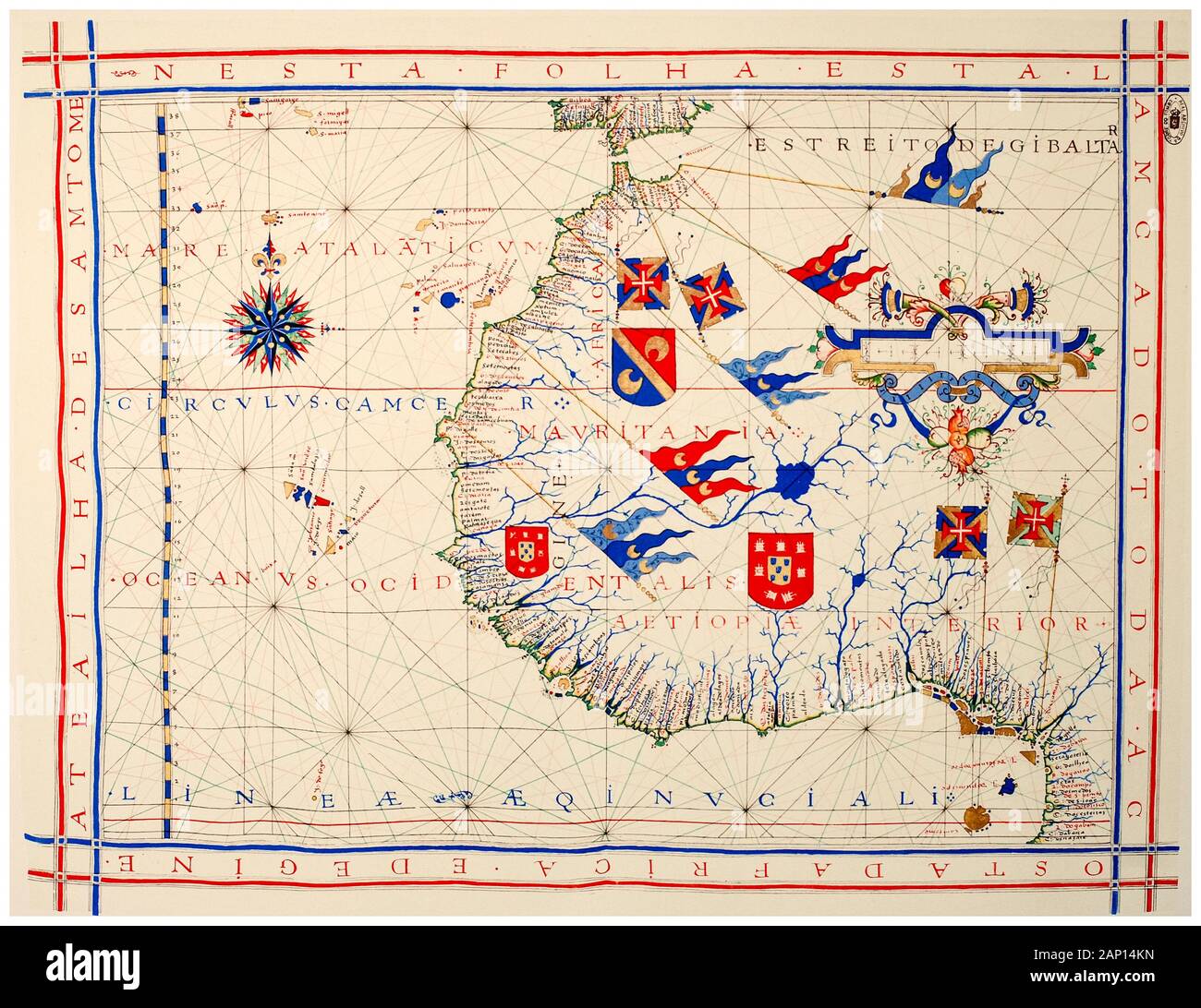 Old 16th Century Vintage Map of West Africa in a nautical chart of Portuguese cartographer Fernão Vaz Dourado, illustration, 1571 Stock Photohttps://www.alamy.com/image-license-details/?v=1https://www.alamy.com/old-16th-century-vintage-map-of-west-africain-a-nautical-chart-of-portuguese-cartographerferno-vaz-dourado-illustration-1571-image340545065.html
RM2AP14KN–Old 16th Century Vintage Map of West Africa in a nautical chart of Portuguese cartographer Fernão Vaz Dourado, illustration, 1571
 Nurse adding patient history to chart Stock Photohttps://www.alamy.com/image-license-details/?v=1https://www.alamy.com/stock-photo-nurse-adding-patient-history-to-chart-31018703.html
RMBPD0JR–Nurse adding patient history to chart
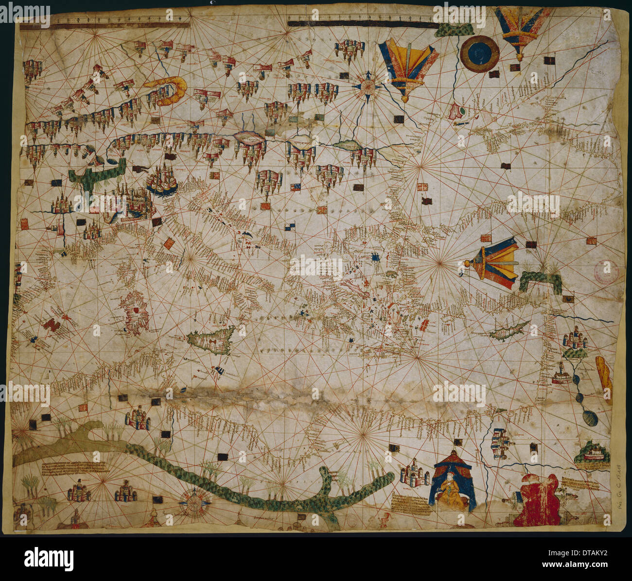 Nautical chart of the Mediterranean Sea and the Black Sea, 1440s. Artist: Rossell (Rosselli), Pere (Petrus) (active 1446-1489) Stock Photohttps://www.alamy.com/image-license-details/?v=1https://www.alamy.com/nautical-chart-of-the-mediterranean-sea-and-the-black-sea-1440s-artist-image66618022.html
RMDTAKY2–Nautical chart of the Mediterranean Sea and the Black Sea, 1440s. Artist: Rossell (Rosselli), Pere (Petrus) (active 1446-1489)
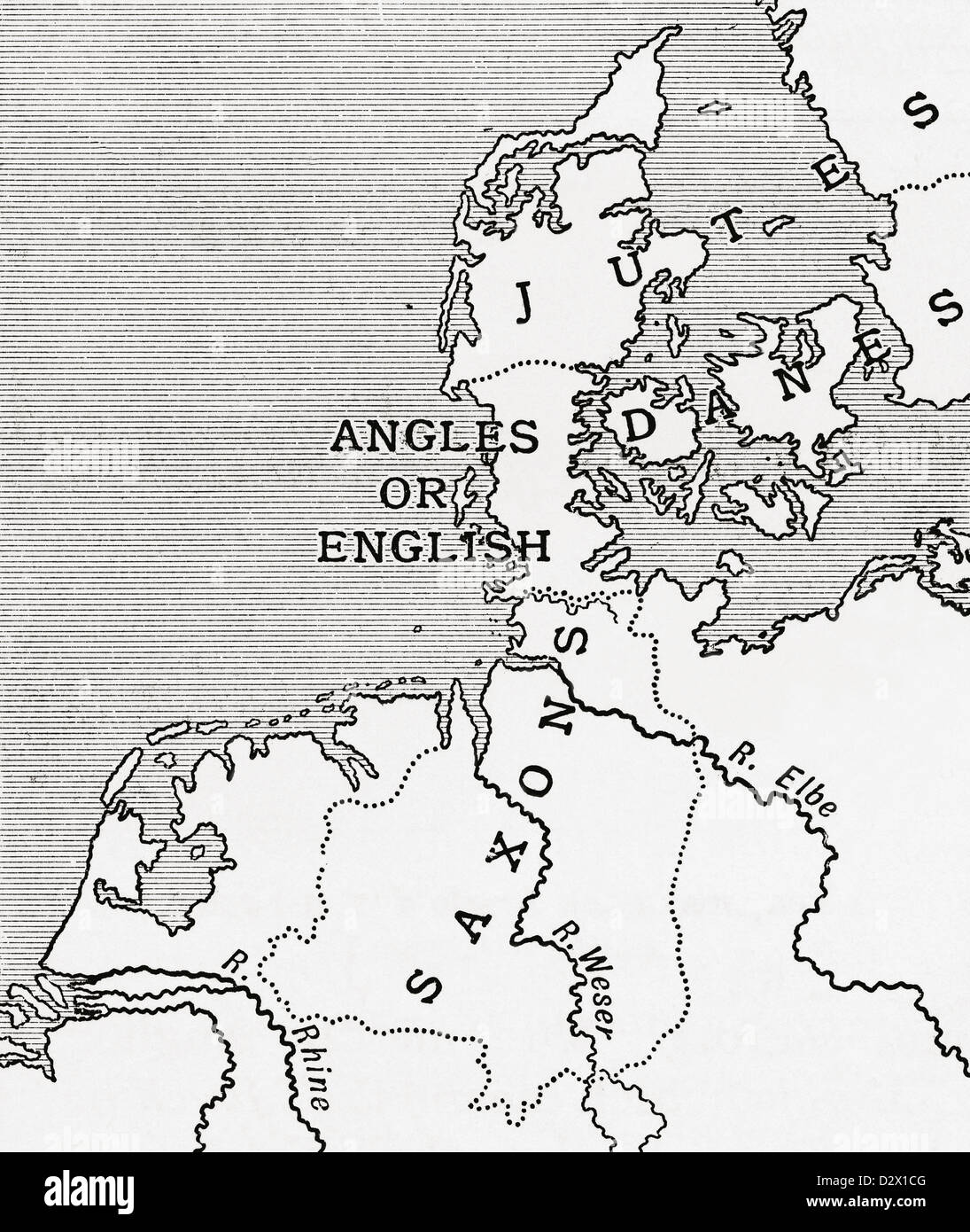 Map showing the old homes of the English in the 5th century. From A First Book of British History published 1925. Stock Photohttps://www.alamy.com/image-license-details/?v=1https://www.alamy.com/stock-photo-map-showing-the-old-homes-of-the-english-in-the-5th-century-from-a-53432304.html
RMD2X1CG–Map showing the old homes of the English in the 5th century. From A First Book of British History published 1925.
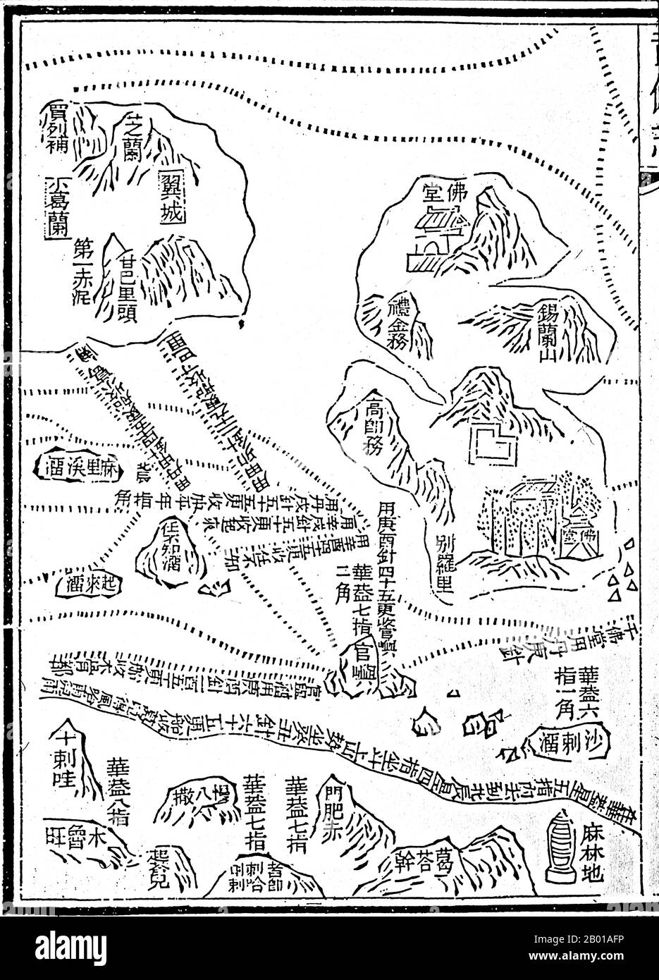 China: One of a set of maps ('Star Chart') from the Mao Kun map in the Ming Dynasty military treatise 'Wubei Zhi', depicting Zheng He's maritime expeditions to the Indian Ocean (1405-1433), 1628 Between 1405 and 1433, the Ming government sponsored a series of seven naval expeditions. The Yongle emperor designed them to establish a Chinese presence, impose imperial control over trade, impress foreign peoples in the Indian Ocean basin and extend the empire's tributary system. Zheng He was placed as the admiral in control of the huge fleet and armed forces that undertook these expeditions. Stock Photohttps://www.alamy.com/image-license-details/?v=1https://www.alamy.com/china-one-of-a-set-of-maps-star-chart-from-the-mao-kun-map-in-the-ming-dynasty-military-treatise-wubei-zhi-depicting-zheng-hes-maritime-expeditions-to-the-indian-ocean-1405-1433-1628-between-1405-and-1433-the-ming-government-sponsored-a-series-of-seven-naval-expeditions-the-yongle-emperor-designed-them-to-establish-a-chinese-presence-impose-imperial-control-over-trade-impress-foreign-peoples-in-the-indian-ocean-basin-and-extend-the-empires-tributary-system-zheng-he-was-placed-as-the-admiral-in-control-of-the-huge-fleet-and-armed-forces-that-undertook-these-expeditions-image344237594.html
RM2B01AFP–China: One of a set of maps ('Star Chart') from the Mao Kun map in the Ming Dynasty military treatise 'Wubei Zhi', depicting Zheng He's maritime expeditions to the Indian Ocean (1405-1433), 1628 Between 1405 and 1433, the Ming government sponsored a series of seven naval expeditions. The Yongle emperor designed them to establish a Chinese presence, impose imperial control over trade, impress foreign peoples in the Indian Ocean basin and extend the empire's tributary system. Zheng He was placed as the admiral in control of the huge fleet and armed forces that undertook these expeditions.
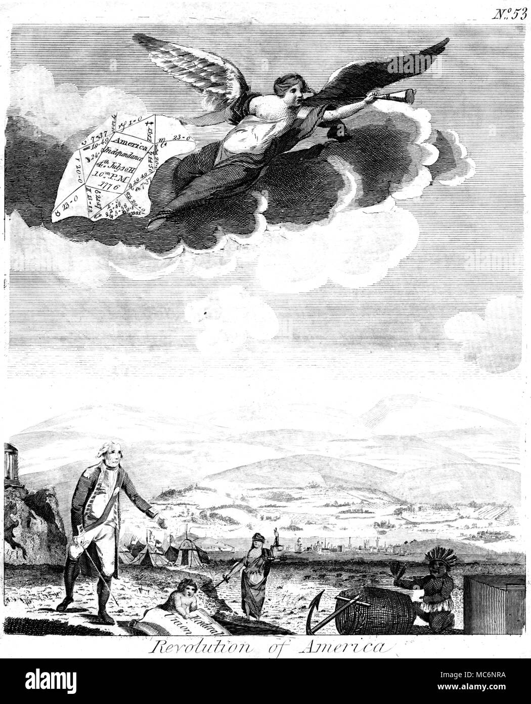 A hand-coloured version of this chart is available. This chart was not cast for the moment of Delaration, but was probably a horary chart, posed by Ebenezer Sibly himself. From E. Sibly, 'A New and Complete Illustration' 1812 edition. Stock Photohttps://www.alamy.com/image-license-details/?v=1https://www.alamy.com/a-hand-coloured-version-of-this-chart-is-available-this-chart-was-not-cast-for-the-moment-of-delaration-but-was-probably-a-horary-chart-posed-by-ebenezer-sibly-himself-from-e-sibly-a-new-and-complete-illustration-1812-edition-image179628382.html
RMMC6NRA–A hand-coloured version of this chart is available. This chart was not cast for the moment of Delaration, but was probably a horary chart, posed by Ebenezer Sibly himself. From E. Sibly, 'A New and Complete Illustration' 1812 edition.
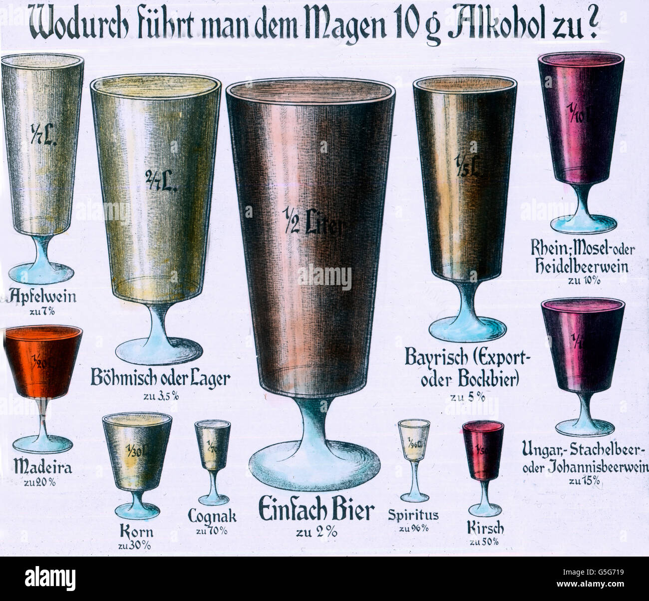 Wodurch führt man dem Magen 10 Gramm Alkohol zu ? Which drinks bring 10 grams of alcohol to your stomach ? chart, scheme, illustration, spirits, beer, brandy, wine, alcohol, drug, history, historical, 1910s, 1920s, 20th century, archive, Carl Simon, hand coloured glass slide Stock Photohttps://www.alamy.com/image-license-details/?v=1https://www.alamy.com/stock-photo-wodurch-fhrt-man-dem-magen-10-gramm-alkohol-zu-which-drinks-bring-106692245.html
RMG5G719–Wodurch führt man dem Magen 10 Gramm Alkohol zu ? Which drinks bring 10 grams of alcohol to your stomach ? chart, scheme, illustration, spirits, beer, brandy, wine, alcohol, drug, history, historical, 1910s, 1920s, 20th century, archive, Carl Simon, hand coloured glass slide
![Plan of Pekin [Peking] from The Exploration of the World, Celebrated Travels and Travellers, Celebrated Voyages by Jules Verne nonfiction. Published in three volumes from 1878 to 1880, Celebrated Travels and Travelers is a history of the explorers and adventurers who voyaged to the far reaches of the globe, discovered the wonders of exotic lands, and filled in the blank spaces on the world map. With illustrations by L. Benett and P. Philippoteaux, Stock Photo Plan of Pekin [Peking] from The Exploration of the World, Celebrated Travels and Travellers, Celebrated Voyages by Jules Verne nonfiction. Published in three volumes from 1878 to 1880, Celebrated Travels and Travelers is a history of the explorers and adventurers who voyaged to the far reaches of the globe, discovered the wonders of exotic lands, and filled in the blank spaces on the world map. With illustrations by L. Benett and P. Philippoteaux, Stock Photo](https://c8.alamy.com/comp/2HHP51H/plan-of-pekin-peking-from-the-exploration-of-the-world-celebrated-travels-and-travellers-celebrated-voyages-by-jules-verne-nonfiction-published-in-three-volumes-from-1878-to-1880-celebrated-travels-and-travelers-is-a-history-of-the-explorers-and-adventurers-who-voyaged-to-the-far-reaches-of-the-globe-discovered-the-wonders-of-exotic-lands-and-filled-in-the-blank-spaces-on-the-world-map-with-illustrations-by-l-benett-and-p-philippoteaux-2HHP51H.jpg) Plan of Pekin [Peking] from The Exploration of the World, Celebrated Travels and Travellers, Celebrated Voyages by Jules Verne nonfiction. Published in three volumes from 1878 to 1880, Celebrated Travels and Travelers is a history of the explorers and adventurers who voyaged to the far reaches of the globe, discovered the wonders of exotic lands, and filled in the blank spaces on the world map. With illustrations by L. Benett and P. Philippoteaux, Stock Photohttps://www.alamy.com/image-license-details/?v=1https://www.alamy.com/plan-of-pekin-peking-from-the-exploration-of-the-world-celebrated-travels-and-travellers-celebrated-voyages-by-jules-verne-nonfiction-published-in-three-volumes-from-1878-to-1880-celebrated-travels-and-travelers-is-a-history-of-the-explorers-and-adventurers-who-voyaged-to-the-far-reaches-of-the-globe-discovered-the-wonders-of-exotic-lands-and-filled-in-the-blank-spaces-on-the-world-map-with-illustrations-by-l-benett-and-p-philippoteaux-image458405629.html
Plan of Pekin [Peking] from The Exploration of the World, Celebrated Travels and Travellers, Celebrated Voyages by Jules Verne nonfiction. Published in three volumes from 1878 to 1880, Celebrated Travels and Travelers is a history of the explorers and adventurers who voyaged to the far reaches of the globe, discovered the wonders of exotic lands, and filled in the blank spaces on the world map. With illustrations by L. Benett and P. Philippoteaux, Stock Photohttps://www.alamy.com/image-license-details/?v=1https://www.alamy.com/plan-of-pekin-peking-from-the-exploration-of-the-world-celebrated-travels-and-travellers-celebrated-voyages-by-jules-verne-nonfiction-published-in-three-volumes-from-1878-to-1880-celebrated-travels-and-travelers-is-a-history-of-the-explorers-and-adventurers-who-voyaged-to-the-far-reaches-of-the-globe-discovered-the-wonders-of-exotic-lands-and-filled-in-the-blank-spaces-on-the-world-map-with-illustrations-by-l-benett-and-p-philippoteaux-image458405629.htmlRF2HHP51H–Plan of Pekin [Peking] from The Exploration of the World, Celebrated Travels and Travellers, Celebrated Voyages by Jules Verne nonfiction. Published in three volumes from 1878 to 1880, Celebrated Travels and Travelers is a history of the explorers and adventurers who voyaged to the far reaches of the globe, discovered the wonders of exotic lands, and filled in the blank spaces on the world map. With illustrations by L. Benett and P. Philippoteaux,
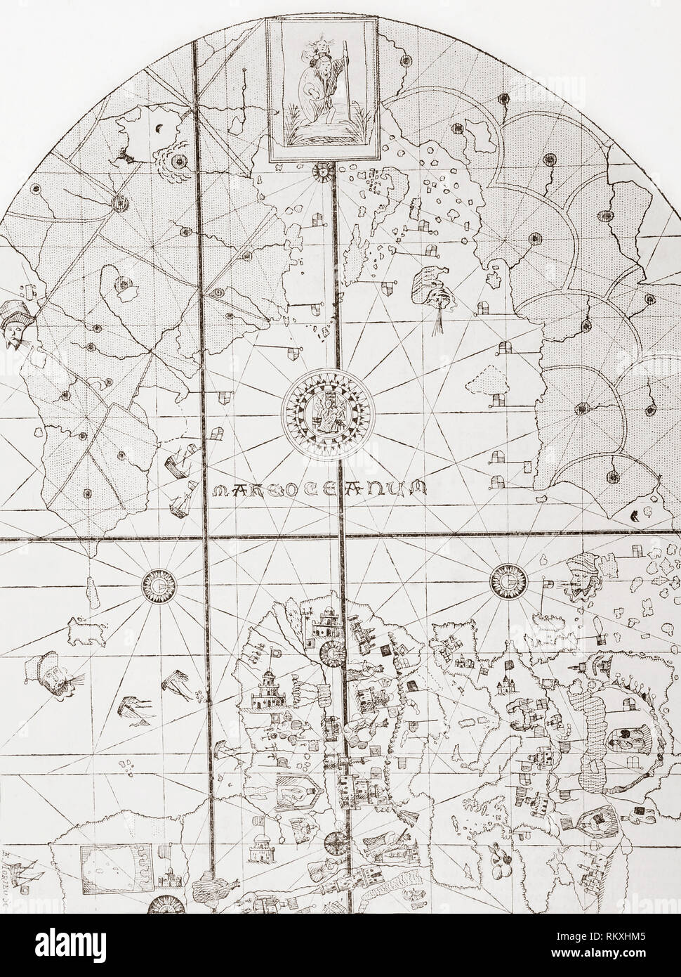 The sea chart of Juan de la Cosa. Juan de la Cosa, c. 1450 – 1510. Spanish navigator and cartographer. Owner and captain of the Santa María, ship used by Christopher Columbus during his first and second voyages to the West Indies. From La Ilustracion Espanola y Americana, published 1892. Stock Photohttps://www.alamy.com/image-license-details/?v=1https://www.alamy.com/the-sea-chart-of-juan-de-la-cosa-juan-de-la-cosa-c-1450-1510-spanish-navigator-and-cartographer-owner-and-captain-of-the-santa-mara-ship-used-by-christopher-columbus-during-his-first-and-second-voyages-to-the-west-indies-from-la-ilustracion-espanola-y-americana-published-1892-image235997893.html
RMRKXHM5–The sea chart of Juan de la Cosa. Juan de la Cosa, c. 1450 – 1510. Spanish navigator and cartographer. Owner and captain of the Santa María, ship used by Christopher Columbus during his first and second voyages to the West Indies. From La Ilustracion Espanola y Americana, published 1892.
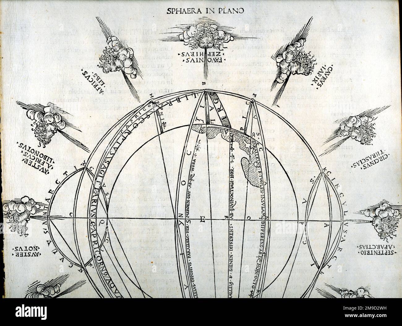 Ptolemaic Wind Chart Stock Photohttps://www.alamy.com/image-license-details/?v=1https://www.alamy.com/ptolemaic-wind-chart-image504920237.html
RM2M9D2WH–Ptolemaic Wind Chart
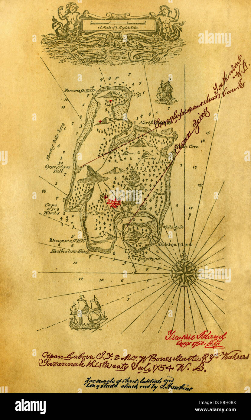 Chart of Treasure Island from the book Treasure Island by Robert Louis Stevenson. Scottish novelist, poet, and travel writer, Stock Photohttps://www.alamy.com/image-license-details/?v=1https://www.alamy.com/stock-photo-chart-of-treasure-island-from-the-book-treasure-island-by-robert-louis-83352060.html
RMERH0B8–Chart of Treasure Island from the book Treasure Island by Robert Louis Stevenson. Scottish novelist, poet, and travel writer,
