Quick filters:
History of india map Stock Photos and Images
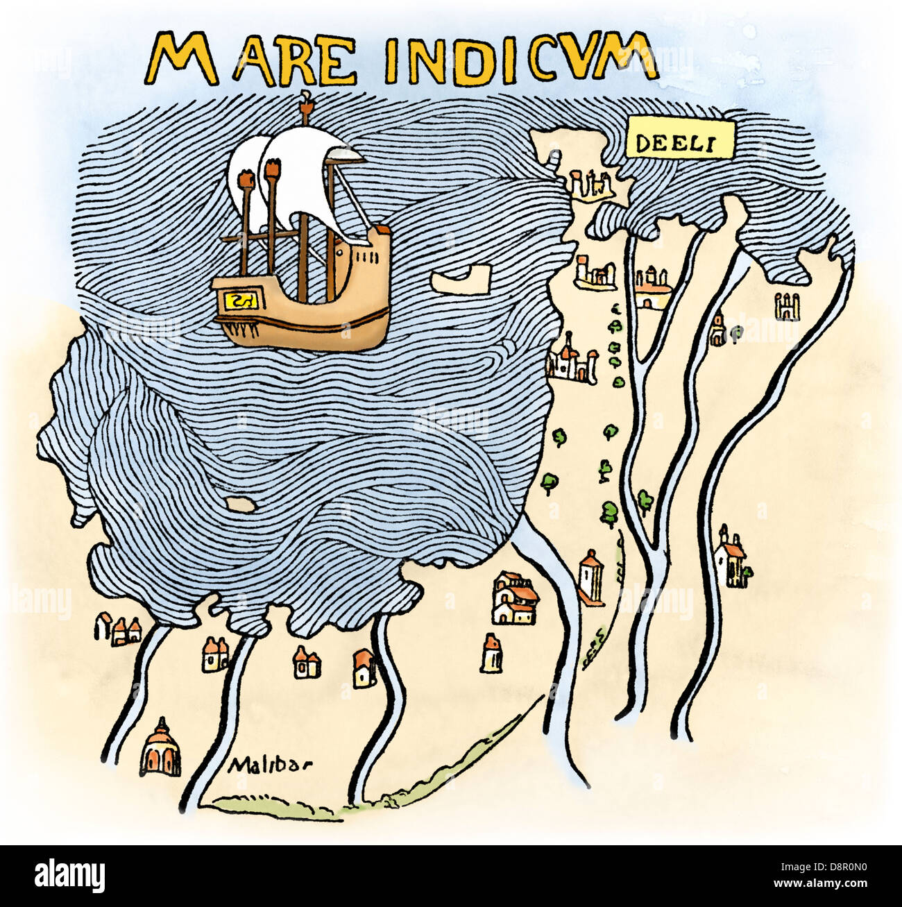 The Malabar Coast of India, from Fra Mauro's map, 1459 (south is at the top). Digitally colored woodcut Stock Photohttps://www.alamy.com/image-license-details/?v=1https://www.alamy.com/stock-photo-the-malabar-coast-of-india-from-fra-mauros-map-1459-south-is-at-the-57053836.html
RMD8R0N0–The Malabar Coast of India, from Fra Mauro's map, 1459 (south is at the top). Digitally colored woodcut
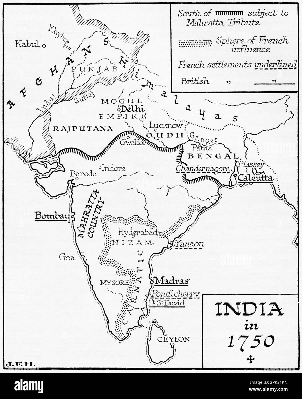 Map of India in 1750. From the book Outline of History by H.G. Wells, published 1920. Stock Photohttps://www.alamy.com/image-license-details/?v=1https://www.alamy.com/map-of-india-in-1750-from-the-book-outline-of-history-by-hg-wells-published-1920-image545245113.html
RM2PK21KN–Map of India in 1750. From the book Outline of History by H.G. Wells, published 1920.
 Manusyaloka. Map of the Human World. Stock Photohttps://www.alamy.com/image-license-details/?v=1https://www.alamy.com/manusyaloka-map-of-the-human-world-image262731039.html
RMW7CC3B–Manusyaloka. Map of the Human World.
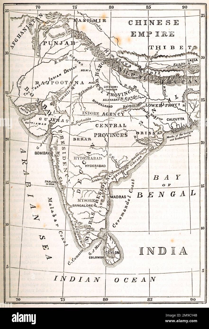 Map Of India Stock Photohttps://www.alamy.com/image-license-details/?v=1https://www.alamy.com/map-of-india-image504917291.html
RM2M9CY4B–Map Of India
 Map of India Stock Photohttps://www.alamy.com/image-license-details/?v=1https://www.alamy.com/map-of-india-image240554356.html
RMRYA5F0–Map of India
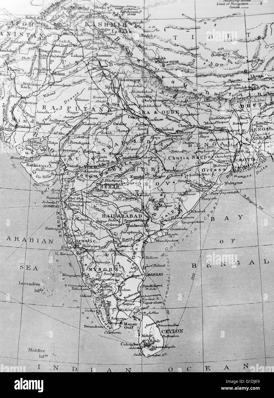 Map of India Stock Photohttps://www.alamy.com/image-license-details/?v=1https://www.alamy.com/stock-photo-map-of-india-104176753.html
RMG1DJE9–Map of India
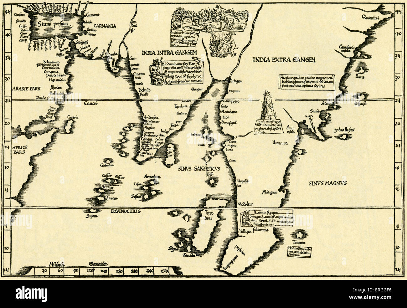 India - map in Ptolemy 's 'Geographicae Enarrationis'. 1535. Stock Photohttps://www.alamy.com/image-license-details/?v=1https://www.alamy.com/stock-photo-india-map-in-ptolemy-s-geographicae-enarrationis-1535-83342762.html
RMERGGF6–India - map in Ptolemy 's 'Geographicae Enarrationis'. 1535.
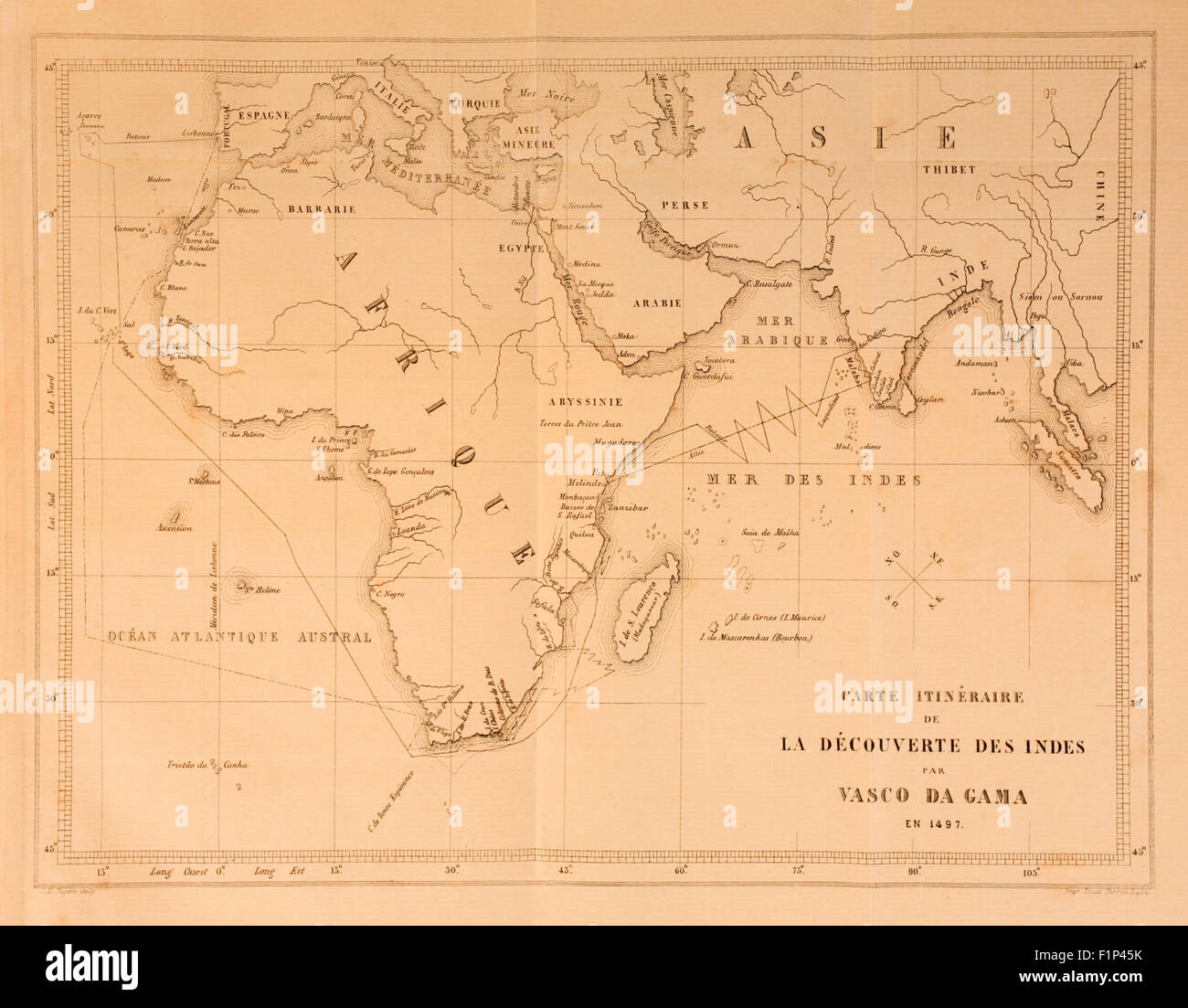 Map showing route from Europe to India taken by Vasco da Gama (1460-1524), Portuguese explorer and the first European to successfully navigate the route from Europe round the Cape of Good Hope to India, landing on 20 May 1498. See description for more information. Stock Photohttps://www.alamy.com/image-license-details/?v=1https://www.alamy.com/stock-photo-map-showing-route-from-europe-to-india-taken-by-vasco-da-gama-1460-87152735.html
RMF1P45K–Map showing route from Europe to India taken by Vasco da Gama (1460-1524), Portuguese explorer and the first European to successfully navigate the route from Europe round the Cape of Good Hope to India, landing on 20 May 1498. See description for more information.
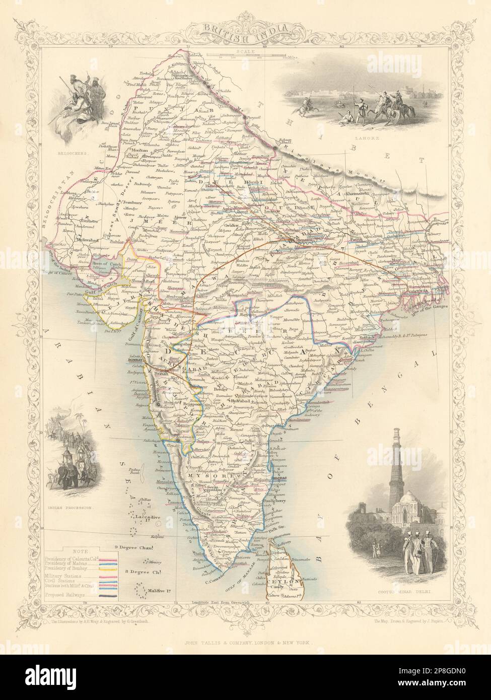 BRITISH INDIA. shows 'Proposed Railways'. Military bases.TALLIS/RAPKIN 1851 map Stock Photohttps://www.alamy.com/image-license-details/?v=1https://www.alamy.com/british-india-shows-proposed-railways-military-basestallisrapkin-1851-map-image538800668.html
RF2P8GDN0–BRITISH INDIA. shows 'Proposed Railways'. Military bases.TALLIS/RAPKIN 1851 map
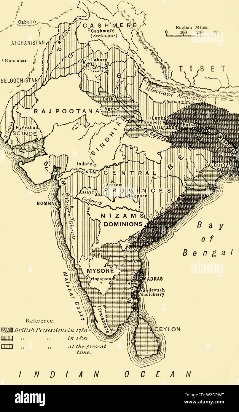 'Map of India, Showing the British Possessions in 1780,1800, and at the Present Time', 1890. Creator: Unknown. Stock Photohttps://www.alamy.com/image-license-details/?v=1https://www.alamy.com/map-of-india-showing-the-british-possessions-in-17801800-and-at-the-present-time-1890-creator-unknown-image259688964.html
RMW2DRWT–'Map of India, Showing the British Possessions in 1780,1800, and at the Present Time', 1890. Creator: Unknown.
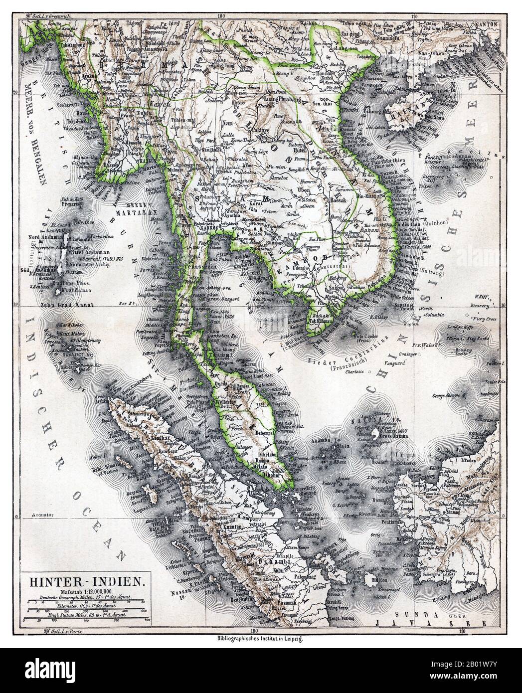 Southeast Asia: 'Hinter-Indien' ('Further India'), a map of Greater Indochina and the western part of the Malay-Indonesian Archipelago, Bibliographisches Institut in Leipzig, Germany, 1876. Physical map showing approximate political frontiers in Green. The Shan and Lao states are shown independent of (or tributary to) Siam. Chiang Mai ('Tshien-Mai'and Luang Prabang are both shown lying within the frontiers of a greater Siam,, but the territoryy of Chiang Mai extends further to the northwest, into Burma's Shan State, beyond the Salween River, than it does today. Stock Photohttps://www.alamy.com/image-license-details/?v=1https://www.alamy.com/southeast-asia-hinter-indien-further-india-a-map-of-greater-indochina-and-the-western-part-of-the-malay-indonesian-archipelago-bibliographisches-institut-in-leipzig-germany-1876-physical-map-showing-approximate-political-frontiers-in-green-the-shan-and-lao-states-are-shown-independent-of-or-tributary-to-siam-chiang-mai-tshien-maiand-luang-prabang-are-both-shown-lying-within-the-frontiers-of-a-greater-siam-but-the-territoryy-of-chiang-mai-extends-further-to-the-northwest-into-burmas-shan-state-beyond-the-salween-river-than-it-does-today-image344249135.html
RM2B01W7Y–Southeast Asia: 'Hinter-Indien' ('Further India'), a map of Greater Indochina and the western part of the Malay-Indonesian Archipelago, Bibliographisches Institut in Leipzig, Germany, 1876. Physical map showing approximate political frontiers in Green. The Shan and Lao states are shown independent of (or tributary to) Siam. Chiang Mai ('Tshien-Mai'and Luang Prabang are both shown lying within the frontiers of a greater Siam,, but the territoryy of Chiang Mai extends further to the northwest, into Burma's Shan State, beyond the Salween River, than it does today.
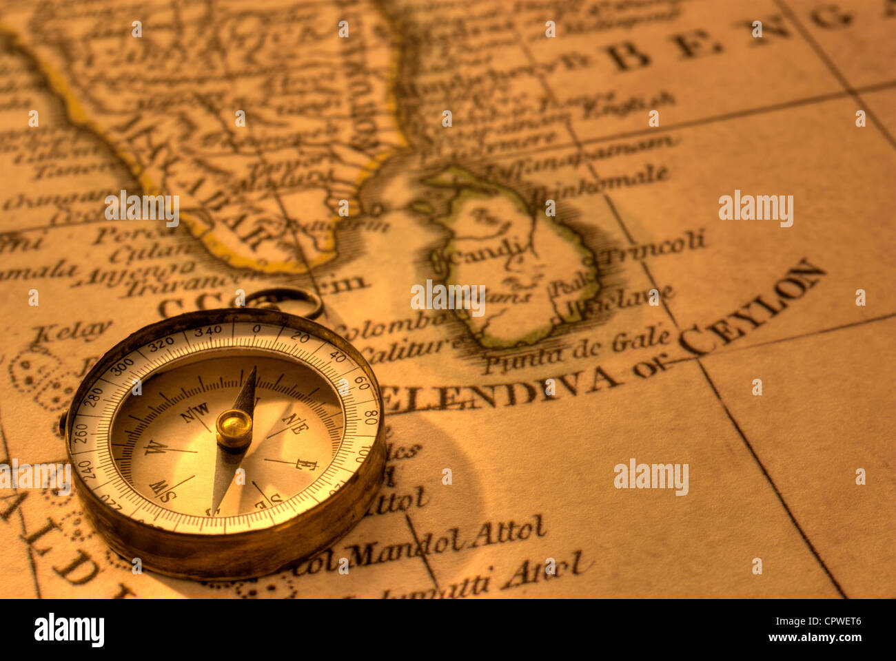 Ancient compass and map of Southern India and Sri Lanka. Map is from 1799 and is out of copyright. Stock Photohttps://www.alamy.com/image-license-details/?v=1https://www.alamy.com/stock-photo-ancient-compass-and-map-of-southern-india-and-sri-lanka-map-is-from-48503622.html
RFCPWET6–Ancient compass and map of Southern India and Sri Lanka. Map is from 1799 and is out of copyright.
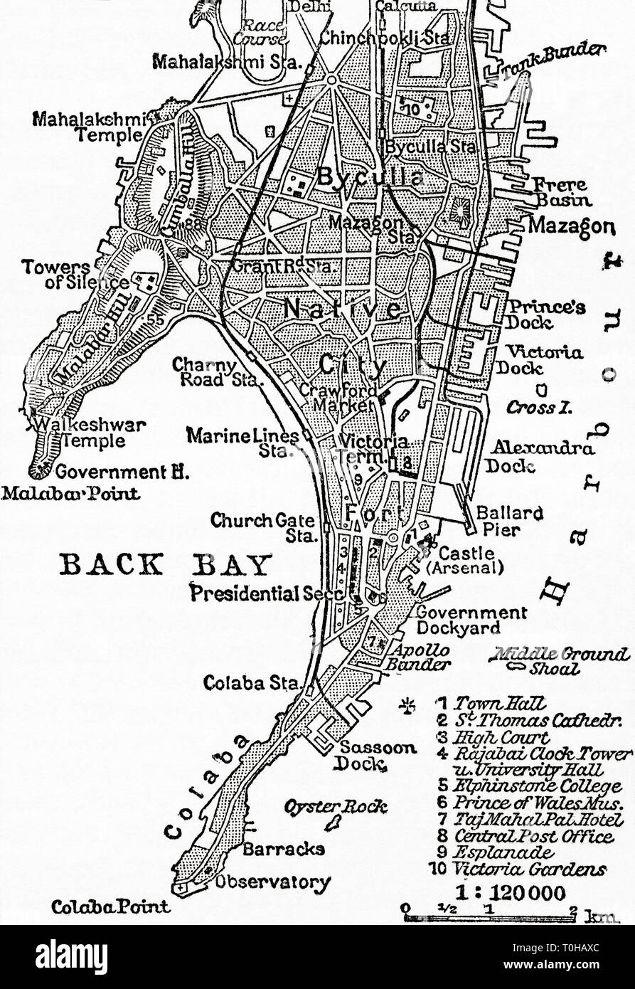 Map of Bombay, India, c 1920 Stock Photohttps://www.alamy.com/image-license-details/?v=1https://www.alamy.com/map-of-bombay-india-c-1920-image241326916.html
RMT0HAXC–Map of Bombay, India, c 1920
 Map of Goa India 17th-century Portugal, Portuguese, Stock Photohttps://www.alamy.com/image-license-details/?v=1https://www.alamy.com/stock-photo-map-of-goa-india-17th-century-portugal-portuguese-173440102.html
RMM24THA–Map of Goa India 17th-century Portugal, Portuguese,
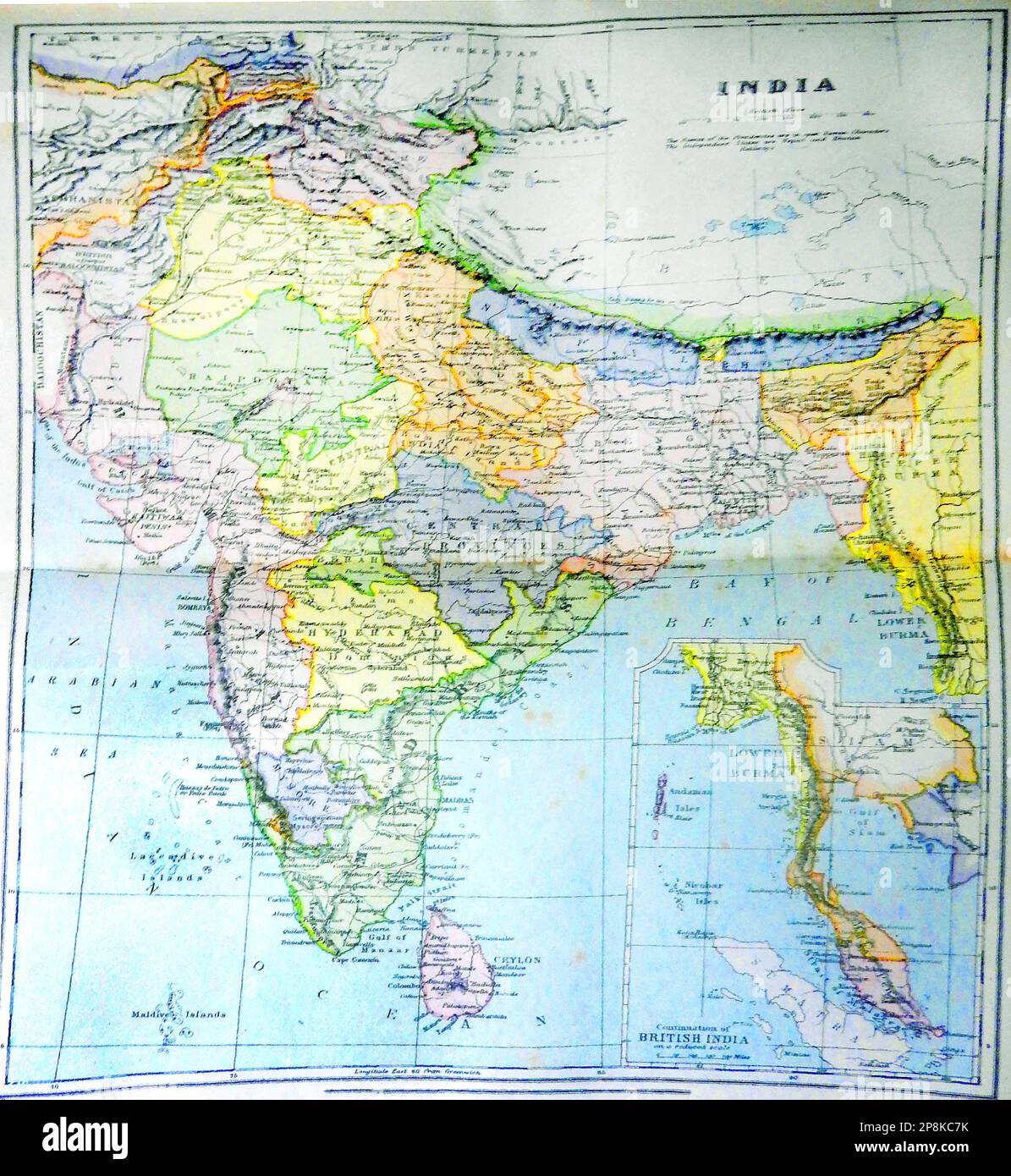 An old 19th century coloured map of India and what is now Pakistan -19 वीं शताब्दी का एक पुराना रंगीन नक्शा भारत और अब पाकिस्तान क्या है - 19 ویں صدی کا ایک پرانا رنگین نقشہ جو ہندوستان اور اب پاکستان ہے Stock Photohttps://www.alamy.com/image-license-details/?v=1https://www.alamy.com/an-old-19th-century-coloured-map-of-india-and-what-is-now-pakistan-19-19-image538865367.html
RM2P8KC7K–An old 19th century coloured map of India and what is now Pakistan -19 वीं शताब्दी का एक पुराना रंगीन नक्शा भारत और अब पाकिस्तान क्या है - 19 ویں صدی کا ایک پرانا رنگین نقشہ جو ہندوستان اور اب پاکستان ہے
 Early 20th century British map shows red coated soldiers looking into the Indus Valley and Afghanistan from Indian territory. Stock Photohttps://www.alamy.com/image-license-details/?v=1https://www.alamy.com/stock-photo-early-20th-century-british-map-shows-red-coated-soldiers-looking-into-50010976.html
RMCWA5E8–Early 20th century British map shows red coated soldiers looking into the Indus Valley and Afghanistan from Indian territory.
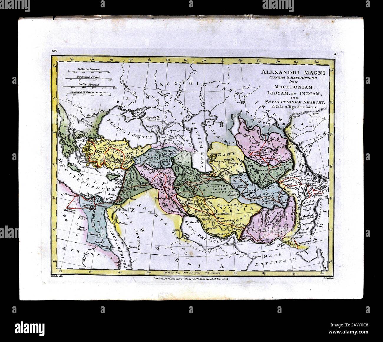 1808 Wilkinson History Map Route of Alexander the Great Turkey Stock Photohttps://www.alamy.com/image-license-details/?v=1https://www.alamy.com/1808-wilkinson-history-map-route-of-alexander-the-great-turkey-image344185752.html
RM2AYY0C8–1808 Wilkinson History Map Route of Alexander the Great Turkey
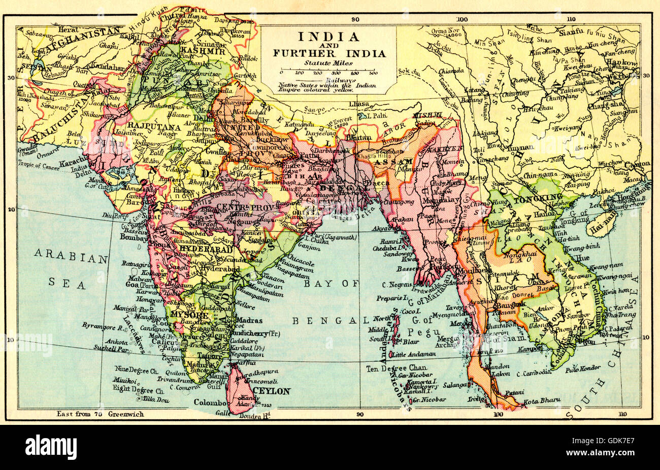 A 1930's map of India and Further India. Stock Photohttps://www.alamy.com/image-license-details/?v=1https://www.alamy.com/stock-photo-a-1930s-map-of-india-and-further-india-111675711.html
RMGDK7E7–A 1930's map of India and Further India.
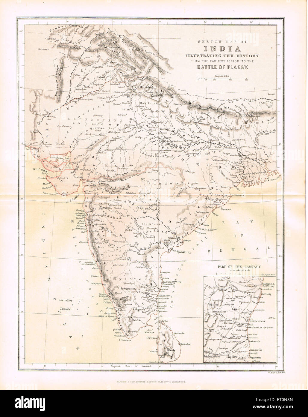 Sketch map of India to battle of Plassey Stock Photohttps://www.alamy.com/image-license-details/?v=1https://www.alamy.com/stock-photo-sketch-map-of-india-to-battle-of-plassey-83609925.html
RMET0N8N–Sketch map of India to battle of Plassey
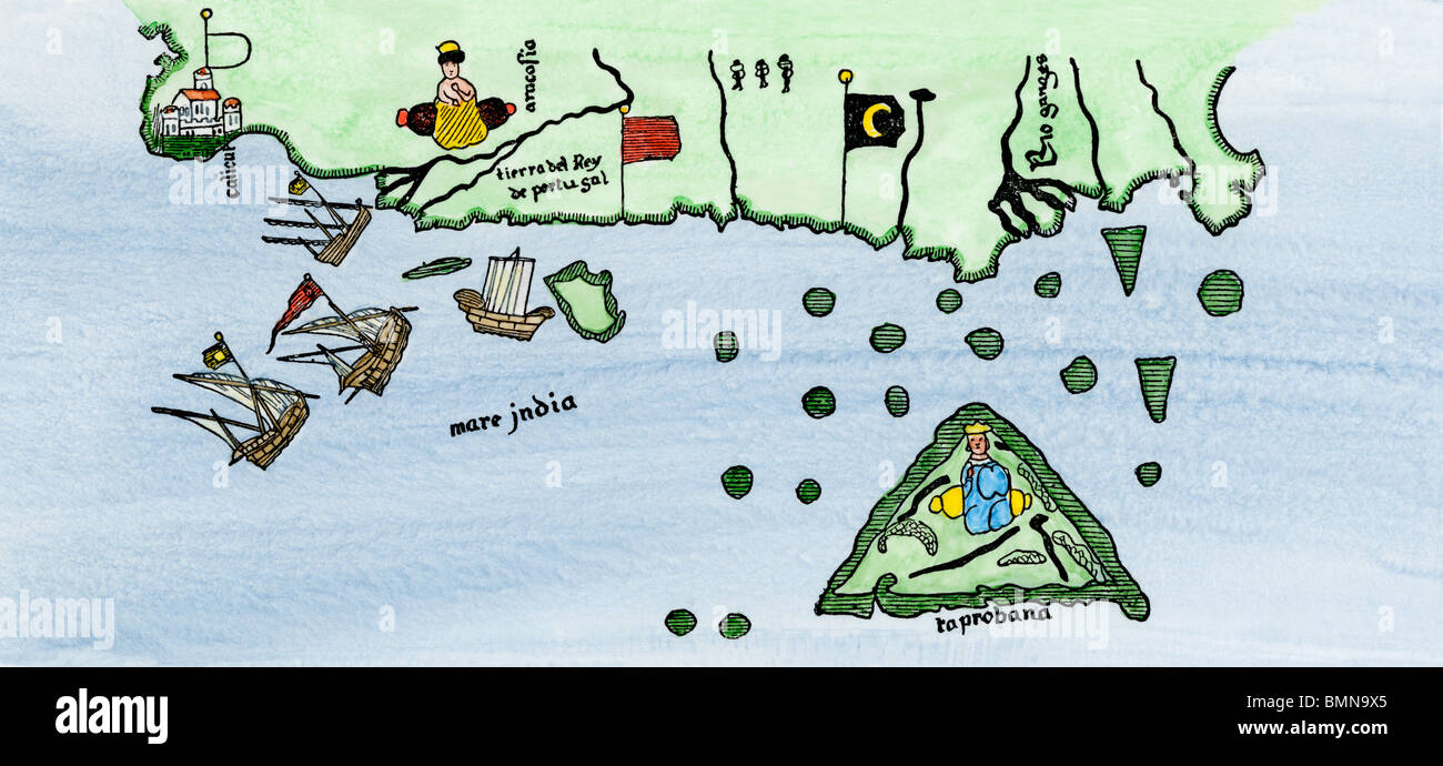 Calcutta and the southern coast of India, from Juan de la Cosa's map, 1500. Hand-colored woodcut Stock Photohttps://www.alamy.com/image-license-details/?v=1https://www.alamy.com/stock-photo-calcutta-and-the-southern-coast-of-india-from-juan-de-la-cosas-map-29972269.html
RMBMN9X5–Calcutta and the southern coast of India, from Juan de la Cosa's map, 1500. Hand-colored woodcut
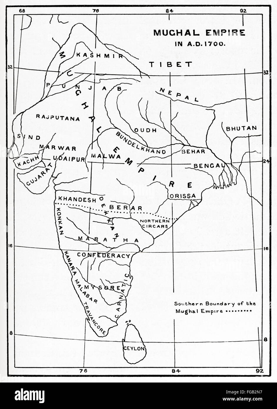 Map of the Mughal Empire in India, 1700. Stock Photohttps://www.alamy.com/image-license-details/?v=1https://www.alamy.com/stock-photo-map-of-the-mughal-empire-in-india-1700-96129971.html
RMFGB2N7–Map of the Mughal Empire in India, 1700.
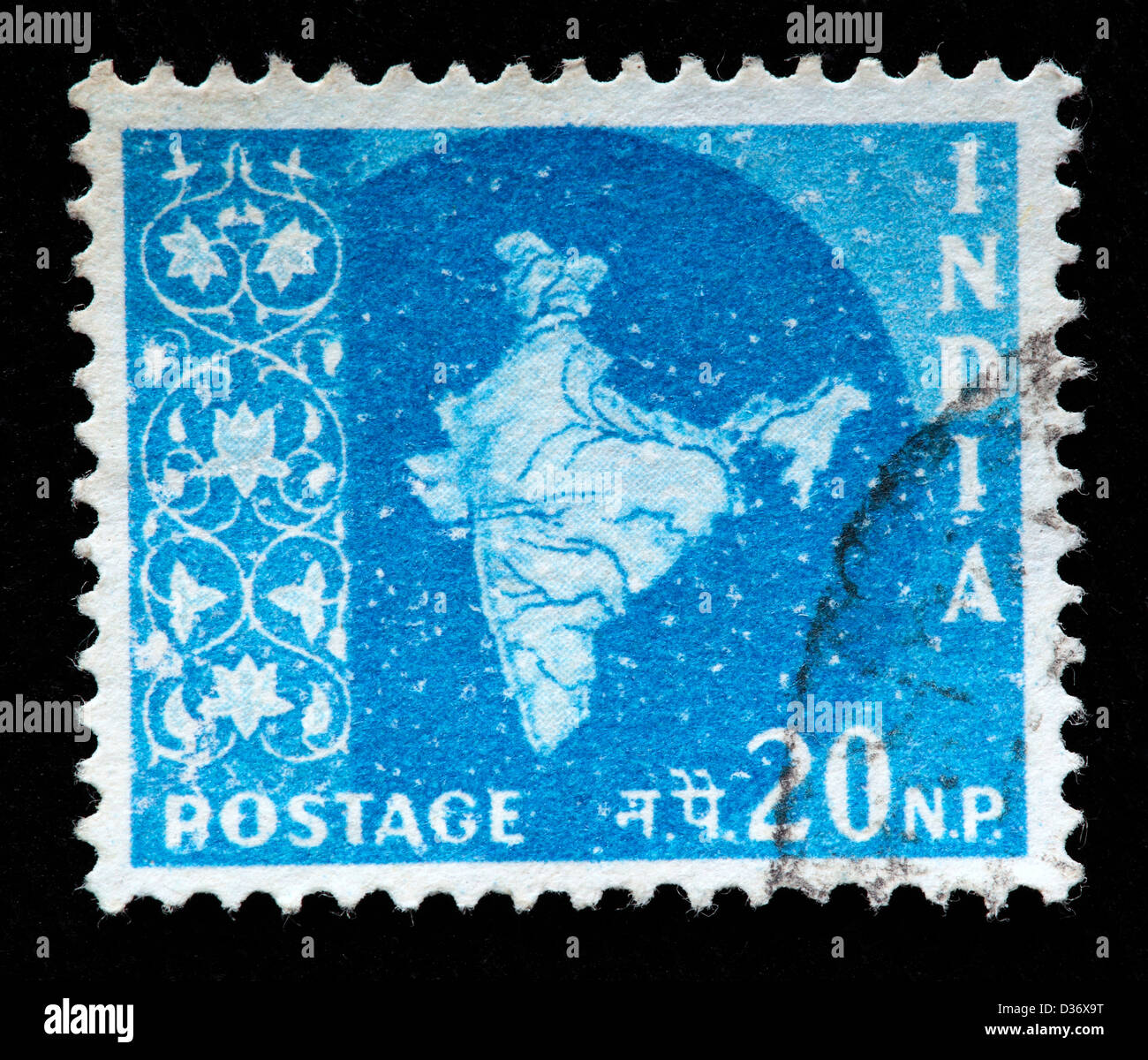 Map of India, postage stamp, India, 1957 Stock Photohttps://www.alamy.com/image-license-details/?v=1https://www.alamy.com/stock-photo-map-of-india-postage-stamp-india-1957-53627444.html
RMD36X9T–Map of India, postage stamp, India, 1957
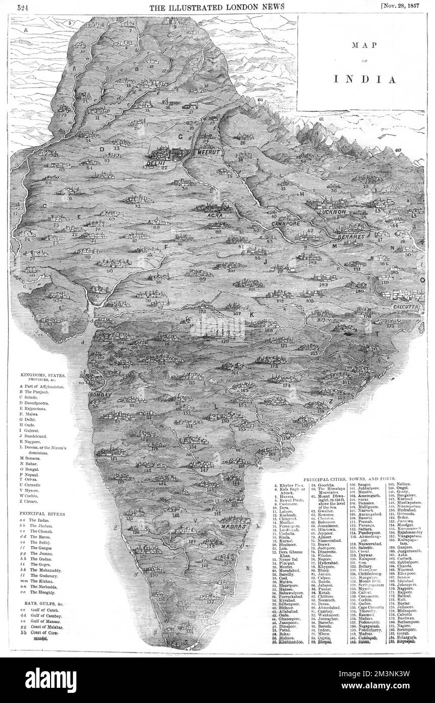 Map of India Stock Photohttps://www.alamy.com/image-license-details/?v=1https://www.alamy.com/map-of-india-image501420637.html
RM2M3NK3W–Map of India
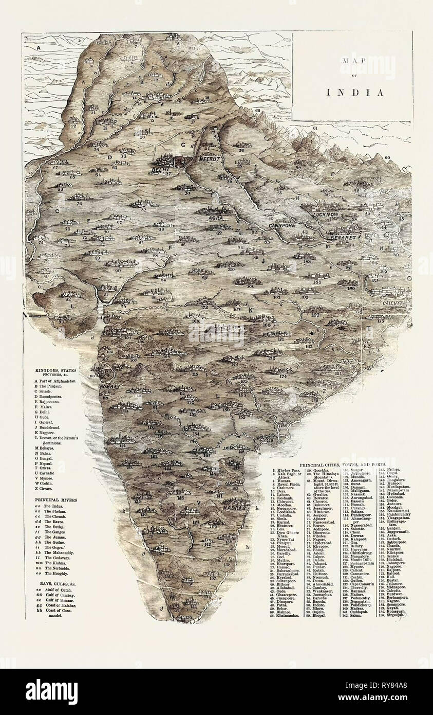 Map of India Stock Photohttps://www.alamy.com/image-license-details/?v=1https://www.alamy.com/map-of-india-image240509536.html
RMRY84A8–Map of India
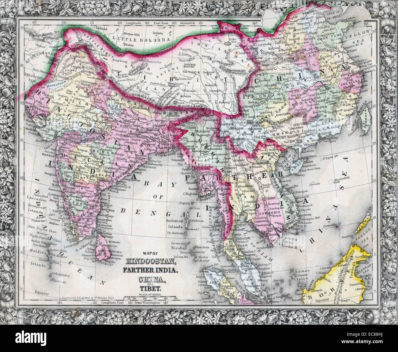 Mitchell Map of India, Tibet, China and Southeast Asia. Dated 1864 Stock Photohttps://www.alamy.com/image-license-details/?v=1https://www.alamy.com/stock-photo-mitchell-map-of-india-tibet-china-and-southeast-asia-dated-1864-76399726.html
RMEC88HJ–Mitchell Map of India, Tibet, China and Southeast Asia. Dated 1864
 Map of East India and Adjacent Islands in 'Theatrum Orbis Tearrarum' by Abraham Ortelius, 1570. Stock Photohttps://www.alamy.com/image-license-details/?v=1https://www.alamy.com/stock-photo-map-of-east-india-and-adjacent-islands-in-theatrum-orbis-tearrarum-83342769.html
RMERGGFD–Map of East India and Adjacent Islands in 'Theatrum Orbis Tearrarum' by Abraham Ortelius, 1570.
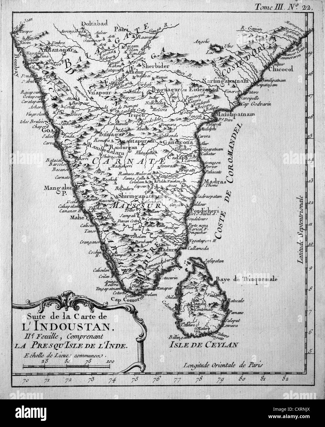 Historical engraving, map of Ceylon and South India, Jacques Nicolas Bellin, Suite de la Carte de l'Industan, circa 1763 Stock Photohttps://www.alamy.com/image-license-details/?v=1https://www.alamy.com/stock-photo-historical-engraving-map-of-ceylon-and-south-india-jacques-nicolas-50923682.html
RMCXRNJX–Historical engraving, map of Ceylon and South India, Jacques Nicolas Bellin, Suite de la Carte de l'Industan, circa 1763
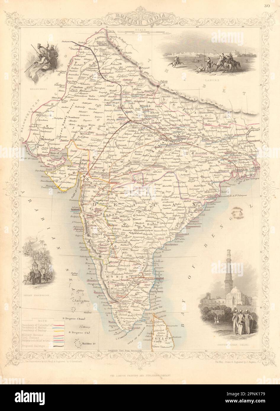 BRITISH INDIA showing military bases & proposed railways. RAPKIN/TALLIS 1851 map Stock Photohttps://www.alamy.com/image-license-details/?v=1https://www.alamy.com/british-india-showing-military-bases-proposed-railways-rapkintallis-1851-map-image546847261.html
RF2PNK179–BRITISH INDIA showing military bases & proposed railways. RAPKIN/TALLIS 1851 map
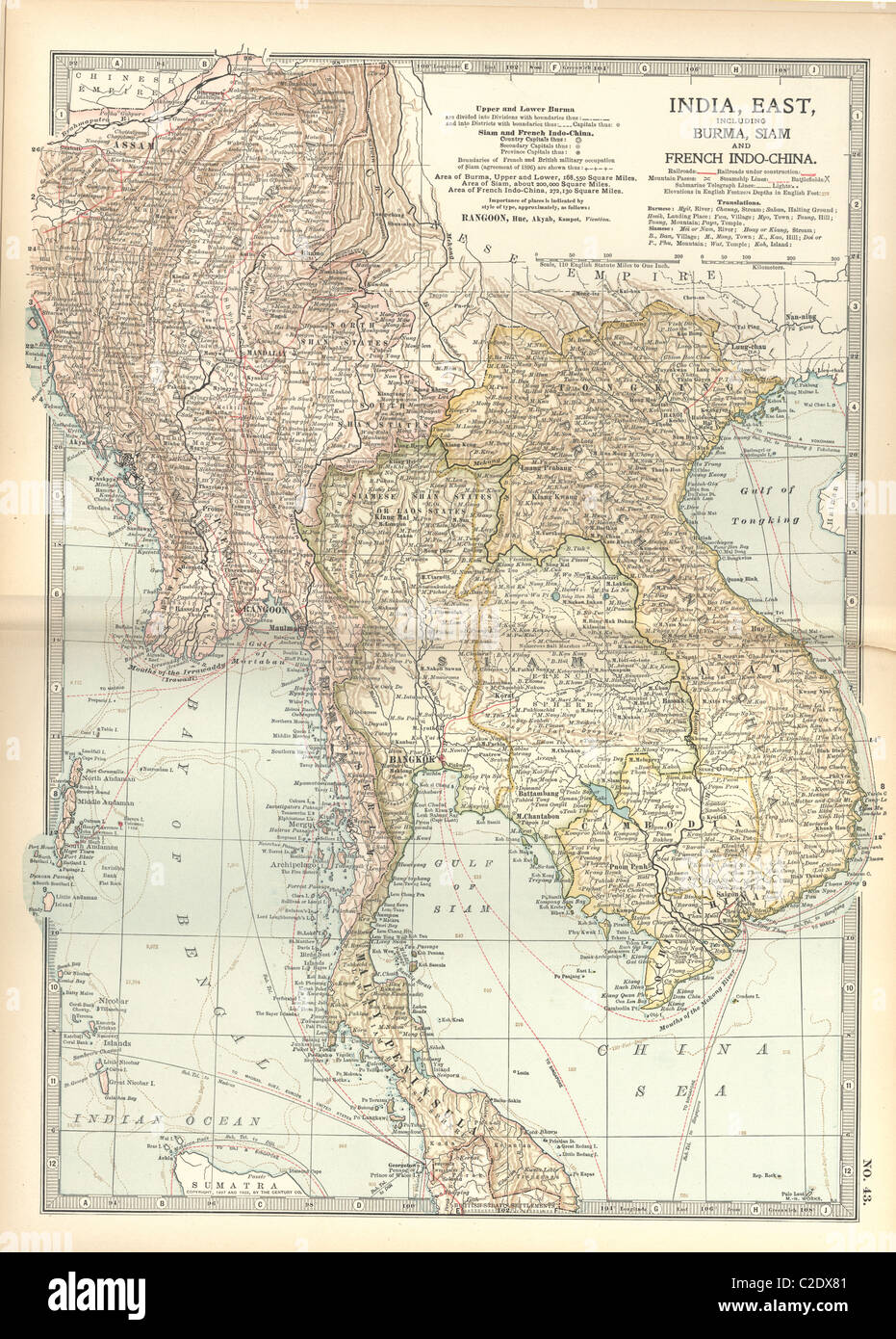 Map of Eastern India Stock Photohttps://www.alamy.com/image-license-details/?v=1https://www.alamy.com/stock-photo-map-of-eastern-india-35956033.html
RMC2DX81–Map of Eastern India
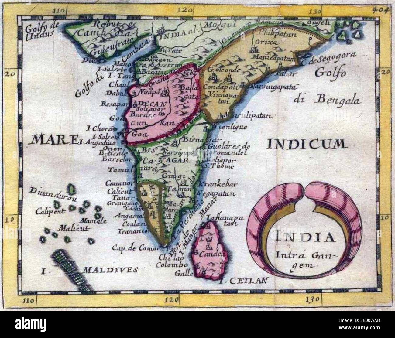 India: 'India Intra-Gangem', a miniature map of the Malabar and Coromandel coasts, from Pierre Duval's 'Geographiae Universalis', 1679. In classical usage, 'India Intra Gangem' refers to South Asia west of the Ganges, while 'India Extra Gangem' refers to peninsular Southeast Asia. Stock Photohttps://www.alamy.com/image-license-details/?v=1https://www.alamy.com/india-india-intra-gangem-a-miniature-map-of-the-malabar-and-coromandel-coasts-from-pierre-duvals-geographiae-universalis-1679-in-classical-usage-india-intra-gangem-refers-to-south-asia-west-of-the-ganges-while-india-extra-gangem-refers-to-peninsular-southeast-asia-image344227251.html
RM2B00WAB–India: 'India Intra-Gangem', a miniature map of the Malabar and Coromandel coasts, from Pierre Duval's 'Geographiae Universalis', 1679. In classical usage, 'India Intra Gangem' refers to South Asia west of the Ganges, while 'India Extra Gangem' refers to peninsular Southeast Asia.
 india, map, atlas, map of the world, city, town, colour, mountains, industry, Stock Photohttps://www.alamy.com/image-license-details/?v=1https://www.alamy.com/stock-photo-india-map-atlas-map-of-the-world-city-town-colour-mountains-industry-143216649.html
RFJ90289–india, map, atlas, map of the world, city, town, colour, mountains, industry,
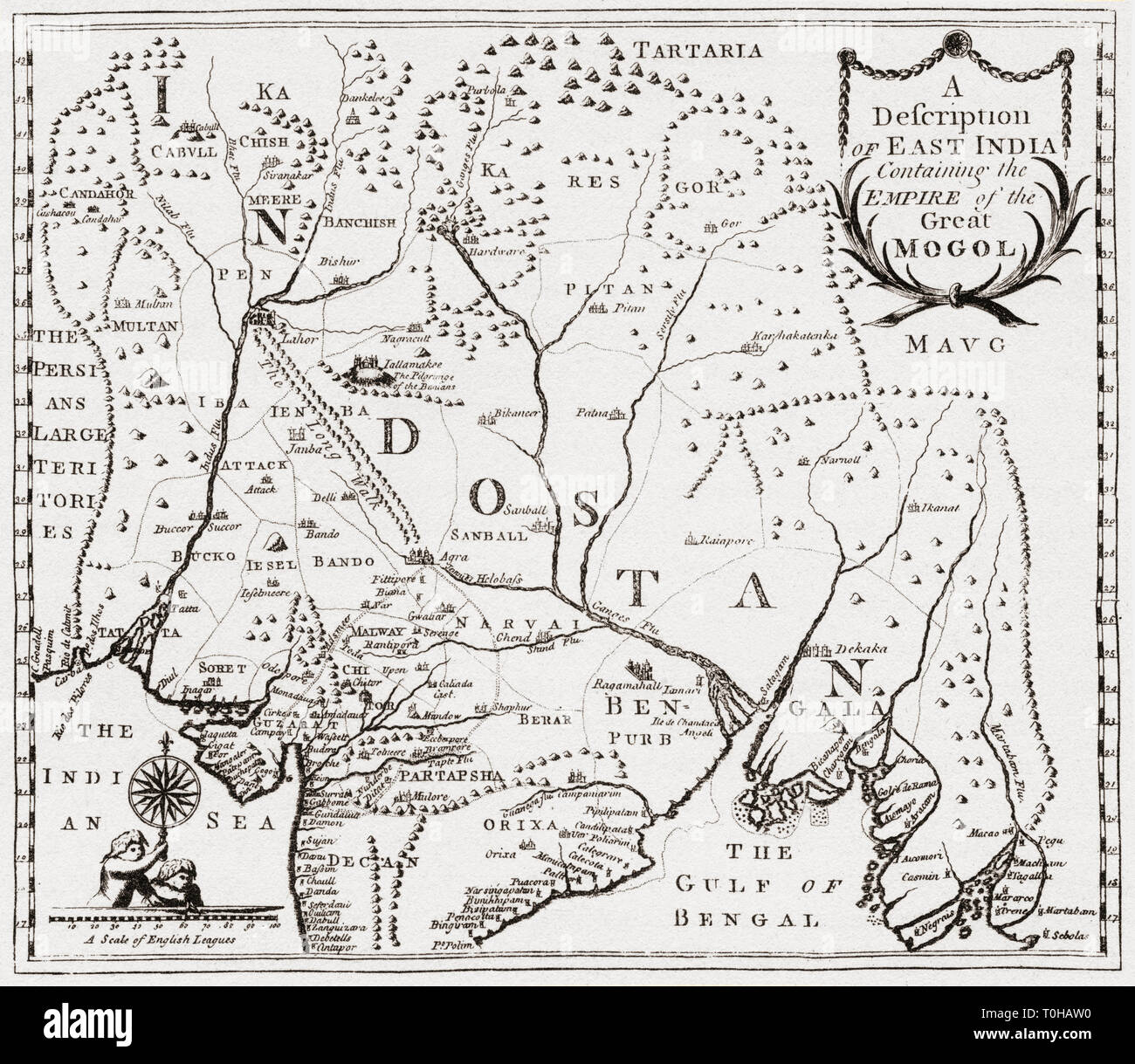 map of territories in east India, Asia Stock Photohttps://www.alamy.com/image-license-details/?v=1https://www.alamy.com/map-of-territories-in-east-india-asia-image241326876.html
RMT0HAW0–map of territories in east India, Asia
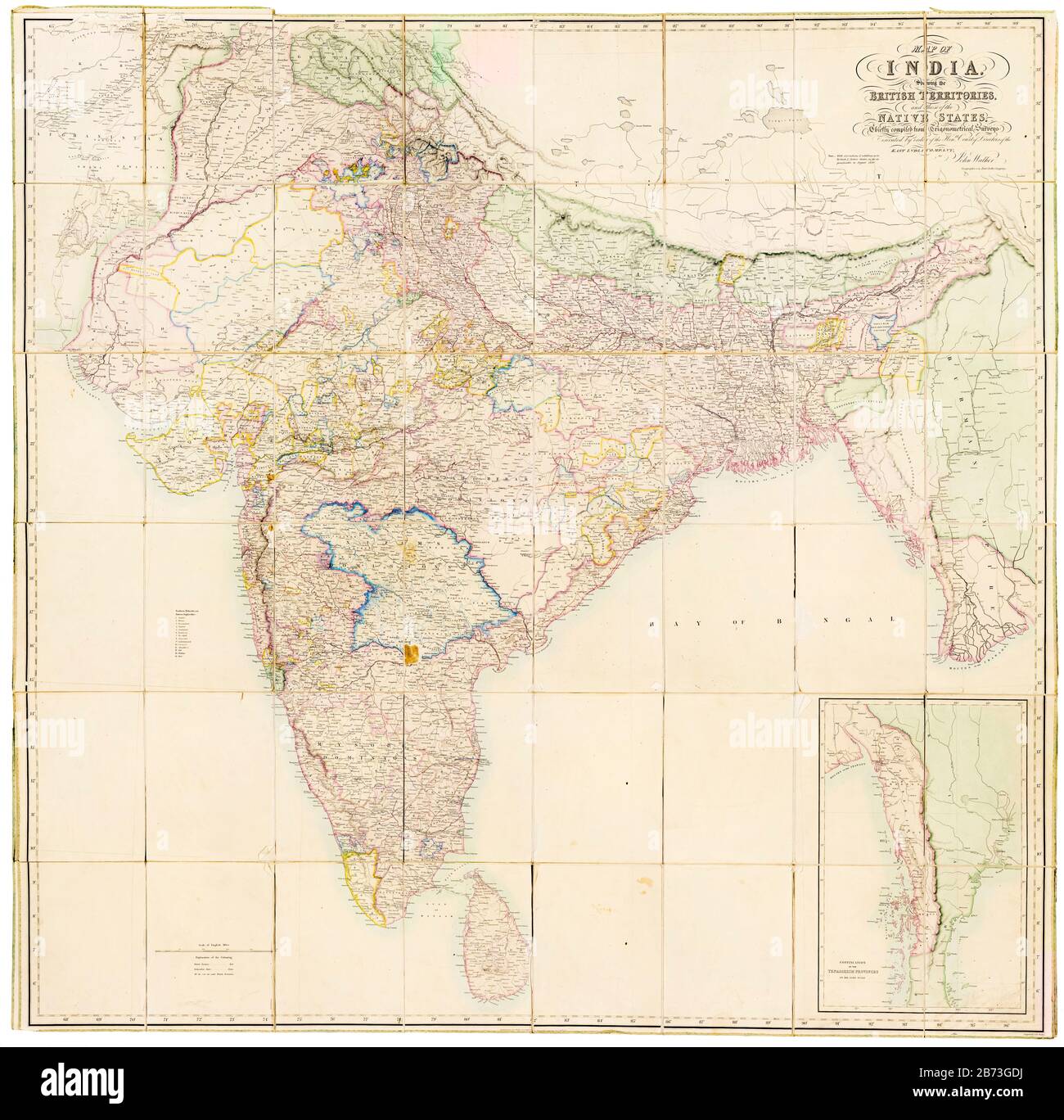 Map of India showing the British Territories and those of the Native States, 19th Century map by John Walker, East India Company, 1856 Stock Photohttps://www.alamy.com/image-license-details/?v=1https://www.alamy.com/map-of-india-showing-the-british-territories-and-those-of-the-native-states-19th-century-map-by-john-walker-east-india-company-1856-image348588734.html
RM2B73GDJ–Map of India showing the British Territories and those of the Native States, 19th Century map by John Walker, East India Company, 1856
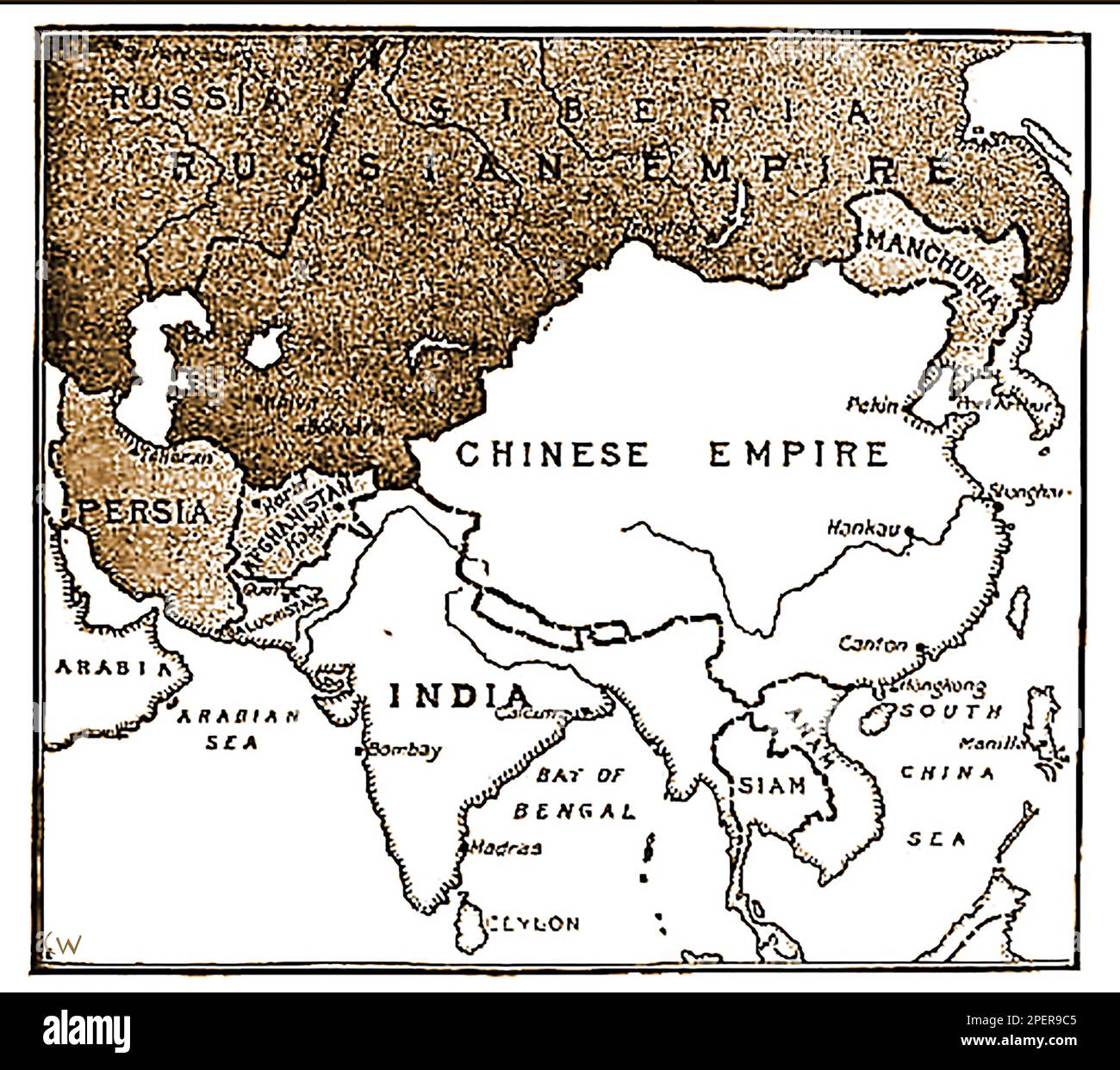 An 1892 map showing the advance of Russian forces on India. (In the 19th century Russia wanted to take India from British control?, a pan only defeated following the assassination of Russian Emperor Paul I -- Карта 1892 года, показывающая продвижение русских войск на Индию. (В 19-м веке Россия хотела отвести Индию из-под британского контроля?, пан побежден только по1892 ----का एक नक्शा जो भारत पर रूसी सेना की प्रगति को दर्शाता है। उल आई -сле убийства российского -- императора Павла I..-----1892 کا ایک نقشہ جس میں ہندوستان پر روسی افواج کی پیش قدمی کو دکھایا گیا ہے۔ میں -- Stock Photohttps://www.alamy.com/image-license-details/?v=1https://www.alamy.com/an-1892-map-showing-the-advance-of-russian-forces-on-india-in-the-19th-century-russia-wanted-to-take-india-from-british-control-a-pan-only-defeated-following-the-assassination-of-russian-emperor-paul-i-1892-19-1892-i-1892-image542638885.html
RM2PER9C5–An 1892 map showing the advance of Russian forces on India. (In the 19th century Russia wanted to take India from British control?, a pan only defeated following the assassination of Russian Emperor Paul I -- Карта 1892 года, показывающая продвижение русских войск на Индию. (В 19-м веке Россия хотела отвести Индию из-под британского контроля?, пан побежден только по1892 ----का एक नक्शा जो भारत पर रूसी सेना की प्रगति को दर्शाता है। उल आई -сле убийства российского -- императора Павла I..-----1892 کا ایک نقشہ جس میں ہندوستان پر روسی افواج کی پیش قدمی کو دکھایا گیا ہے۔ میں --
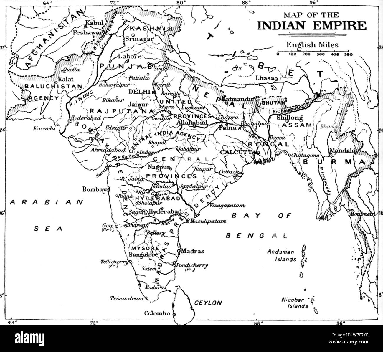 'Map of the Indian Empire', c1912. Artist: Unknown. Stock Photohttps://www.alamy.com/image-license-details/?v=1https://www.alamy.com/map-of-the-indian-empire-c1912-artist-unknown-image262793622.html
RMW7F7XE–'Map of the Indian Empire', c1912. Artist: Unknown.
 1808 Wilkinson History Map Route of Alexander the Great Turkey Stock Photohttps://www.alamy.com/image-license-details/?v=1https://www.alamy.com/1808-wilkinson-history-map-route-of-alexander-the-great-turkey-image344185708.html
RM2AYY0AM–1808 Wilkinson History Map Route of Alexander the Great Turkey
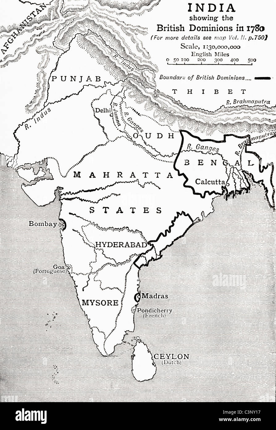 Map of India showing the British Dominions in 1780. From The Story of England, published 1930. Stock Photohttps://www.alamy.com/image-license-details/?v=1https://www.alamy.com/stock-photo-map-of-india-showing-the-british-dominions-in-1780-from-the-story-36746899.html
RMC3NY17–Map of India showing the British Dominions in 1780. From The Story of England, published 1930.
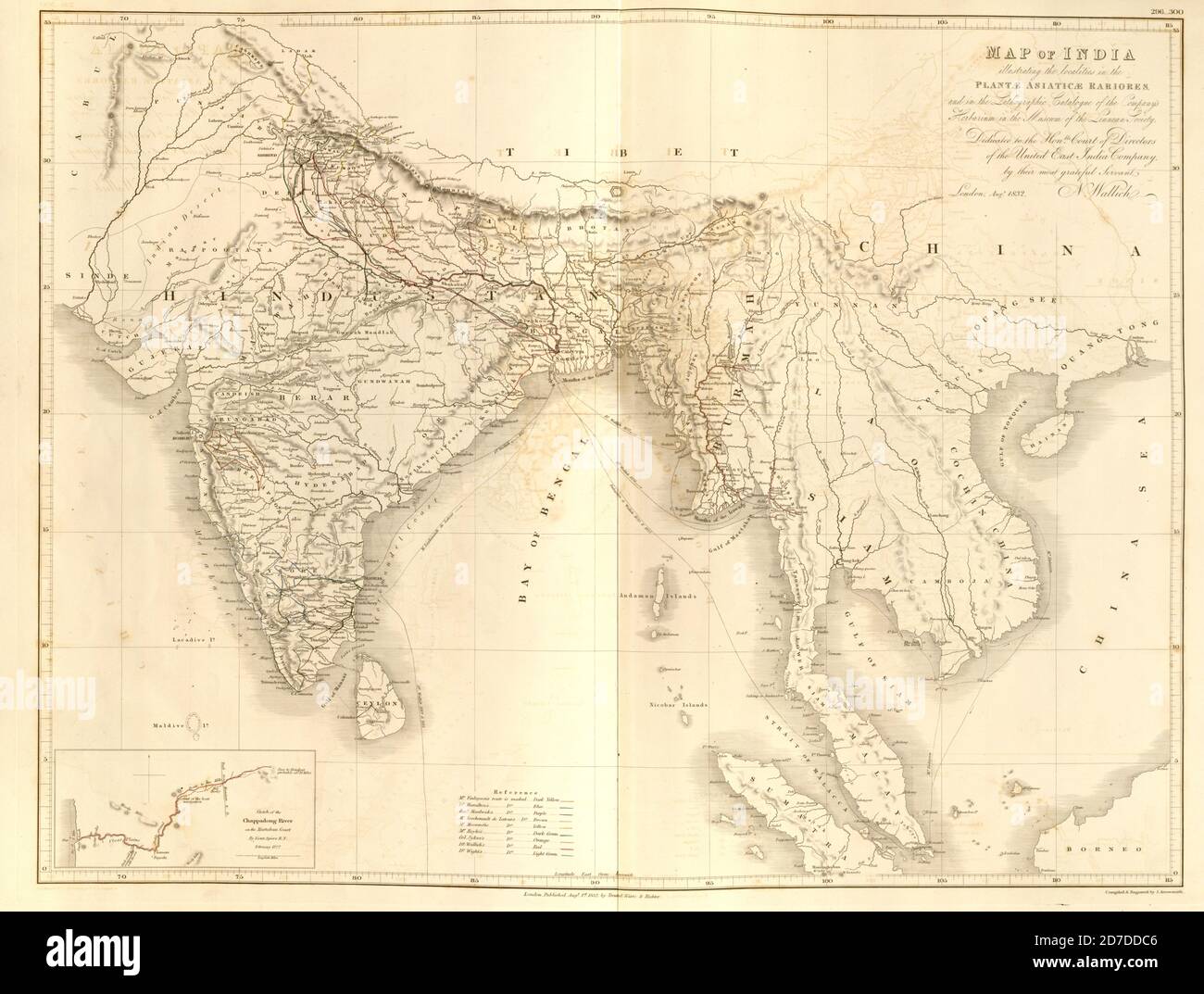 19th century map of India and Indochina From Plantae Asiaticae rariores, or, Descriptions and figures of a select number of unpublished East Indian plants Volume III by Nathaniel Wolff Wallich. Published in London in 1832 Stock Photohttps://www.alamy.com/image-license-details/?v=1https://www.alamy.com/19th-century-map-of-india-and-indochina-from-plantae-asiaticae-rariores-or-descriptions-and-figures-of-a-select-number-of-unpublished-east-indian-plants-volume-iii-by-nathaniel-wolff-wallich-published-in-london-in-1832-image383226598.html
RF2D7DDC6–19th century map of India and Indochina From Plantae Asiaticae rariores, or, Descriptions and figures of a select number of unpublished East Indian plants Volume III by Nathaniel Wolff Wallich. Published in London in 1832
 Map of northern India in the early 1900s. Color lithograph Stock Photohttps://www.alamy.com/image-license-details/?v=1https://www.alamy.com/map-of-northern-india-in-the-early-1900s-color-lithograph-image417868489.html
RM2F7RFEH–Map of northern India in the early 1900s. Color lithograph
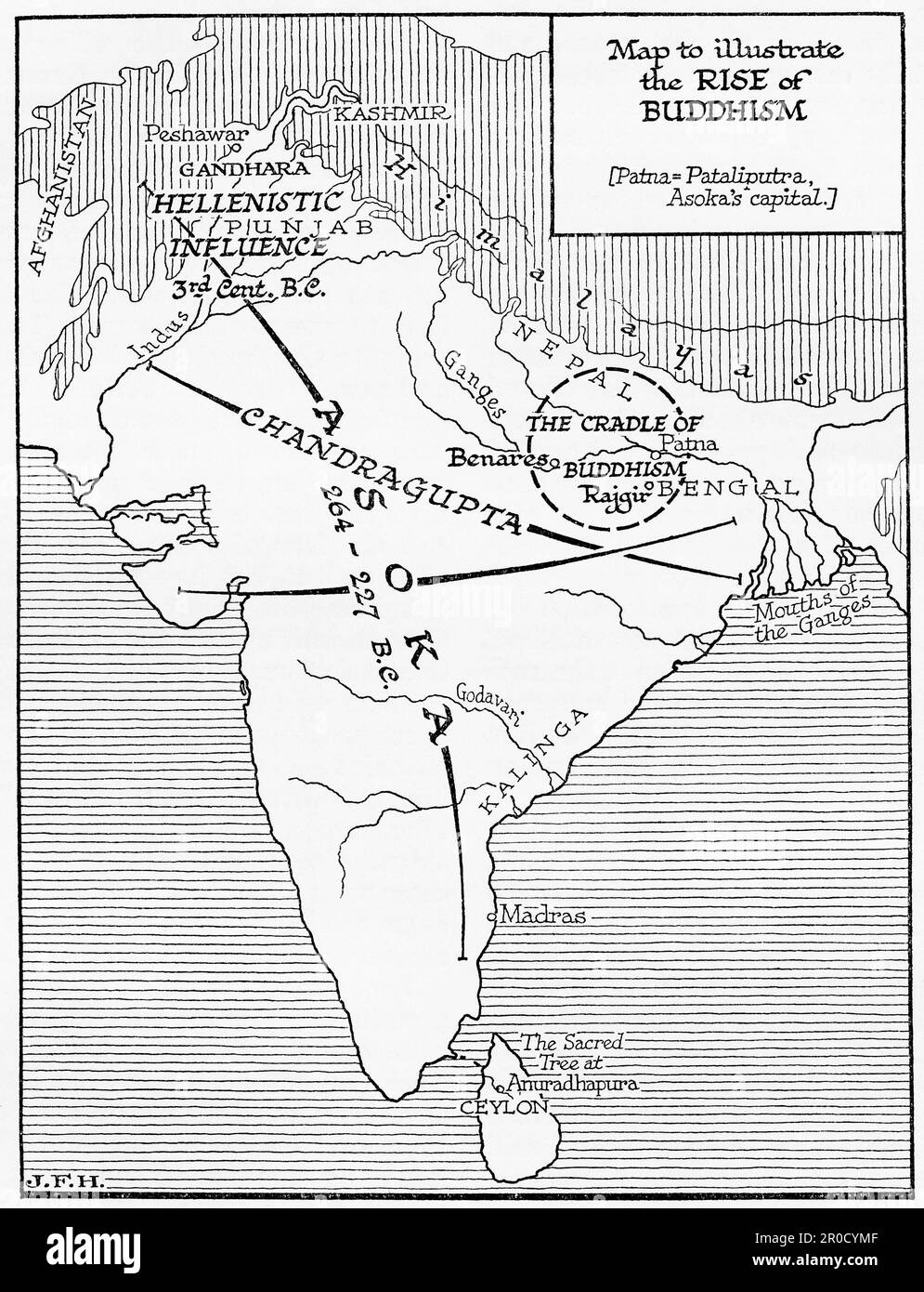 Map to illustrate the rise of Buddhism in India. From the book Outline of History by H.G. Wells, published 1920. Stock Photohttps://www.alamy.com/image-license-details/?v=1https://www.alamy.com/map-to-illustrate-the-rise-of-buddhism-in-india-from-the-book-outline-of-history-by-hg-wells-published-1920-image551016943.html
RM2R0CYMF–Map to illustrate the rise of Buddhism in India. From the book Outline of History by H.G. Wells, published 1920.
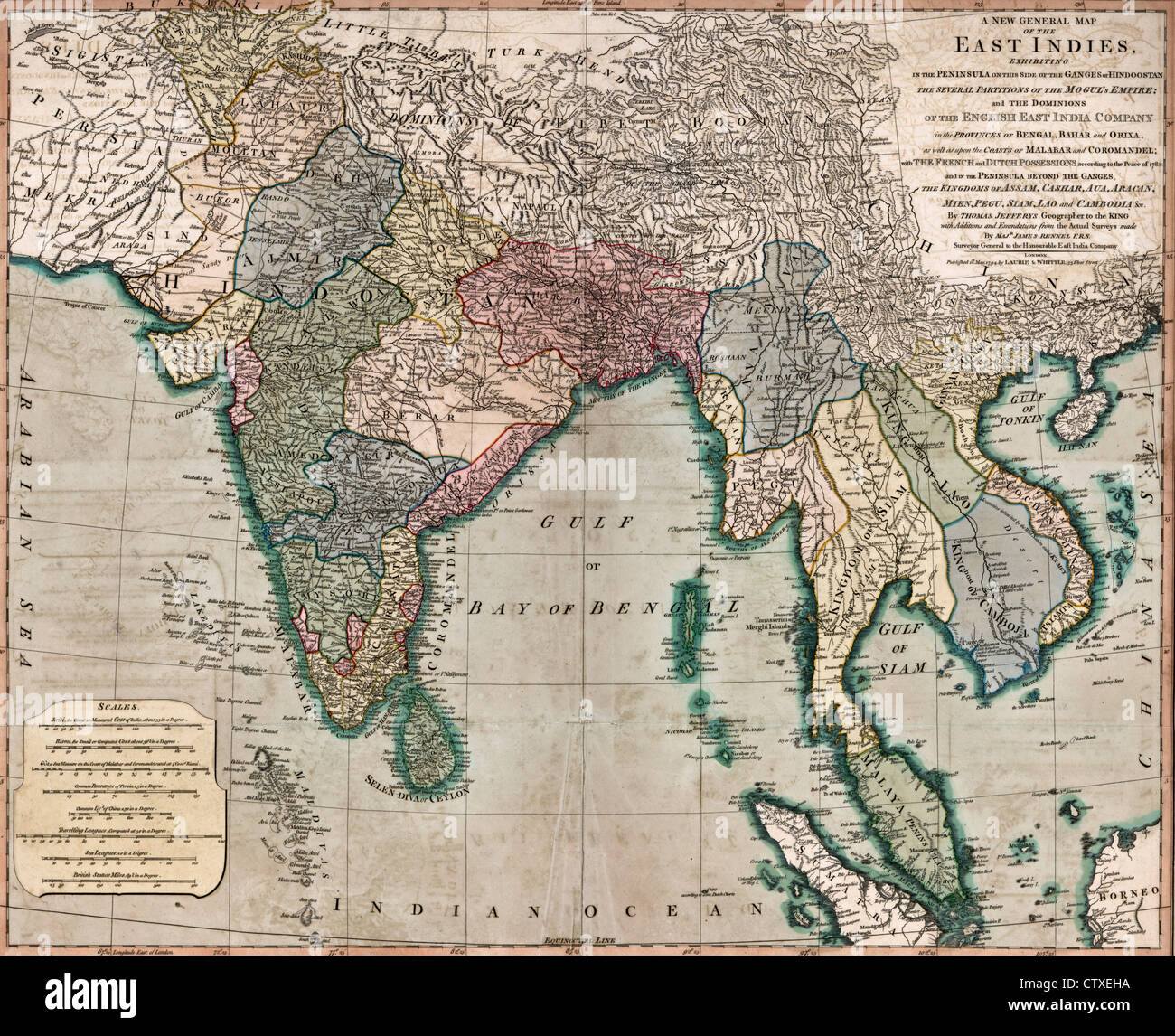 A general map of the East Indies, circa 1794 Stock Photohttps://www.alamy.com/image-license-details/?v=1https://www.alamy.com/stock-photo-a-general-map-of-the-east-indies-circa-1794-49754694.html
RMCTXEHA–A general map of the East Indies, circa 1794
 Hindoostan Map - India Stock Photohttps://www.alamy.com/image-license-details/?v=1https://www.alamy.com/hindoostan-map-india-image504920096.html
RM2M9D2MG–Hindoostan Map - India
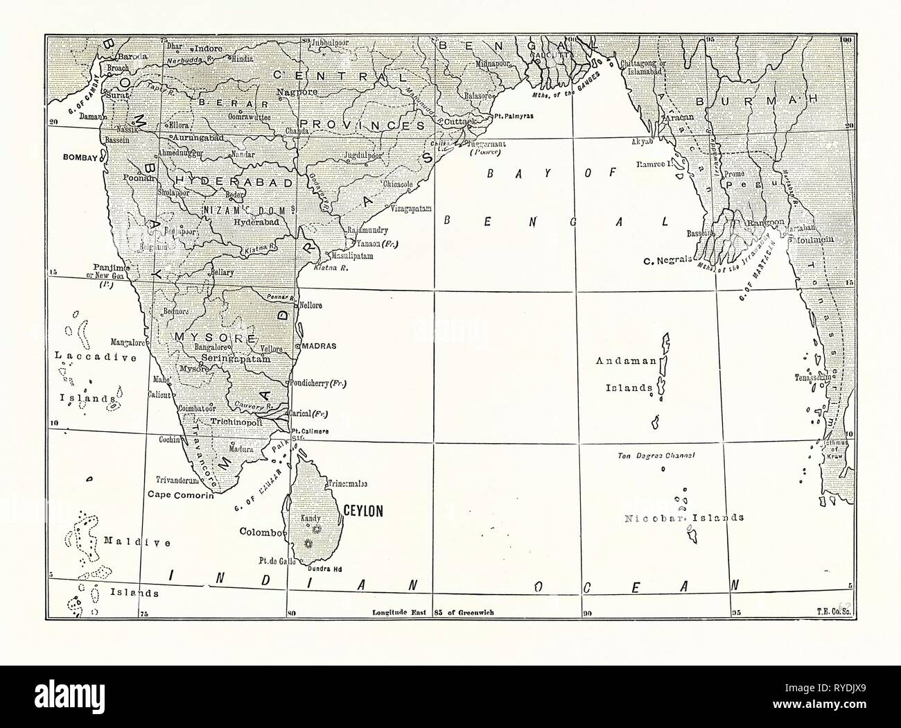 Map of Lower India and Ceylon, Sri Lanka Stock Photohttps://www.alamy.com/image-license-details/?v=1https://www.alamy.com/map-of-lower-india-and-ceylon-sri-lanka-image240630721.html
RMRYDJX9–Map of Lower India and Ceylon, Sri Lanka
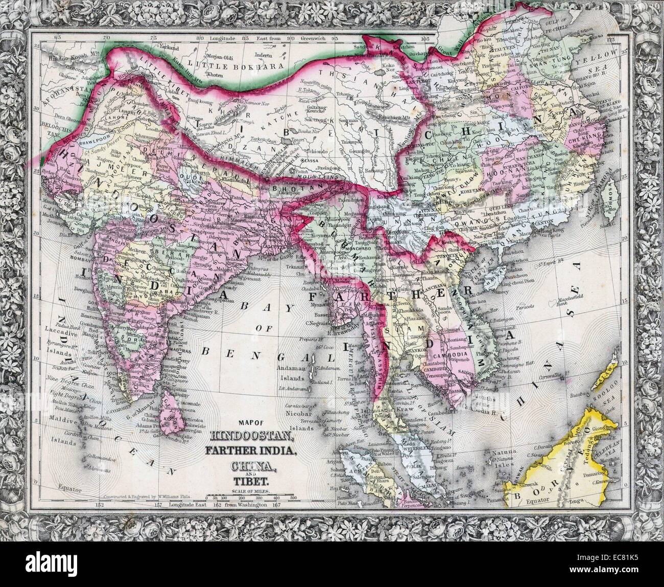 19th Century Map of India, Tibet, China and Southeast Asia. Dated 1864 Stock Photohttps://www.alamy.com/image-license-details/?v=1https://www.alamy.com/stock-photo-19th-century-map-of-india-tibet-china-and-southeast-asia-dated-1864-76394281.html
RMEC81K5–19th Century Map of India, Tibet, China and Southeast Asia. Dated 1864
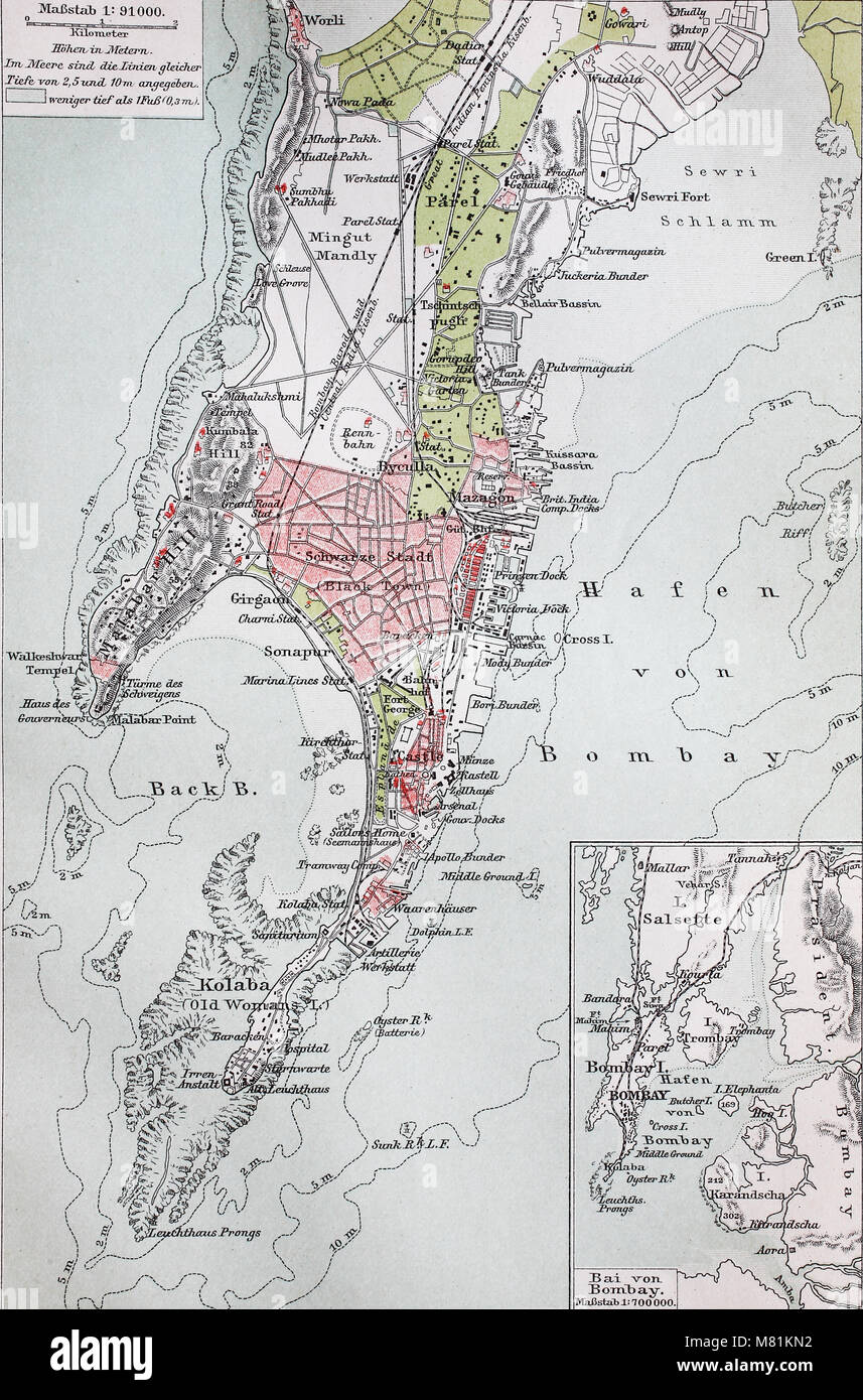 city map from the year 1892: Bombay, now Mumbai, India, digital improved reproduction of an original print from the year 1895 Stock Photohttps://www.alamy.com/image-license-details/?v=1https://www.alamy.com/stock-photo-city-map-from-the-year-1892-bombay-now-mumbai-india-digital-improved-177058366.html
RFM81KN2–city map from the year 1892: Bombay, now Mumbai, India, digital improved reproduction of an original print from the year 1895
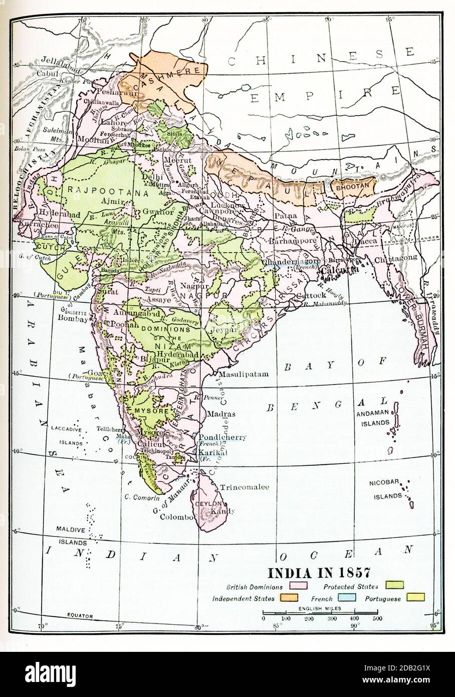 India in 1857. British dominions are in pink. Protected states in yellow. Independent states in orange. French in blue, Portuguese in yellow. Stock Photohttps://www.alamy.com/image-license-details/?v=1https://www.alamy.com/india-in-1857-british-dominions-are-in-pink-protected-states-in-yellow-independent-states-in-orange-french-in-blue-portuguese-in-yellow-image385445814.html
RF2DB2G1X–India in 1857. British dominions are in pink. Protected states in yellow. Independent states in orange. French in blue, Portuguese in yellow.
 INDIA: Sketch map of India, c1880 Stock Photohttps://www.alamy.com/image-license-details/?v=1https://www.alamy.com/stock-photo-india-sketch-map-of-india-c1880-103843736.html
RFG0XDMT–INDIA: Sketch map of India, c1880
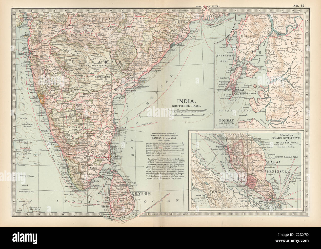 Map of southern India with Bombay Stock Photohttps://www.alamy.com/image-license-details/?v=1https://www.alamy.com/stock-photo-map-of-southern-india-with-bombay-35956017.html
RMC2DX7D–Map of southern India with Bombay
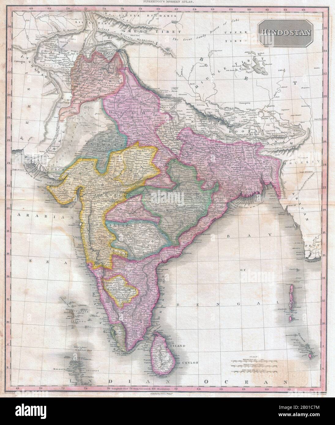 India/South Asia: Map of Hindostan showing British Raj by John Pinkerton (17 Februar 1758 - 10 March 1826), c. 1818. Map of Hindostan from Pinkerton's Modern Atlas, early 19th century. It covers the subcontinent from Tibet to Ceylon (Sri Lanka) and from the mouth of the Indus to the Kingdom of Pegu (Burma/Myanmar). The map also colour codes various political divisions and princely states. Stock Photohttps://www.alamy.com/image-license-details/?v=1https://www.alamy.com/indiasouth-asia-map-of-hindostan-showing-british-raj-by-john-pinkerton-17-februar-1758-10-march-1826-c-1818-map-of-hindostan-from-pinkertons-modern-atlas-early-19th-century-it-covers-the-subcontinent-from-tibet-to-ceylon-sri-lanka-and-from-the-mouth-of-the-indus-to-the-kingdom-of-pegu-burmamyanmar-the-map-also-colour-codes-various-political-divisions-and-princely-states-image344238936.html
RM2B01C7M–India/South Asia: Map of Hindostan showing British Raj by John Pinkerton (17 Februar 1758 - 10 March 1826), c. 1818. Map of Hindostan from Pinkerton's Modern Atlas, early 19th century. It covers the subcontinent from Tibet to Ceylon (Sri Lanka) and from the mouth of the Indus to the Kingdom of Pegu (Burma/Myanmar). The map also colour codes various political divisions and princely states.
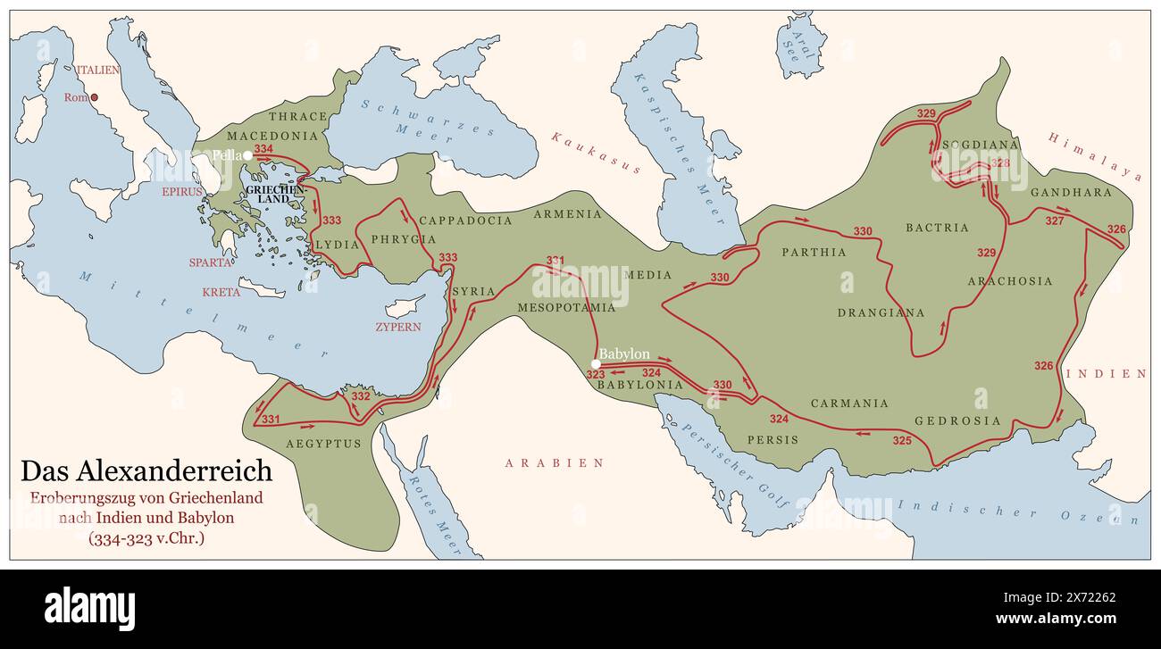 The Empire of Alexander the Great on his conquest course from Greece to India to Babylon 334 to 323 BC. German labeled history map. Stock Photohttps://www.alamy.com/image-license-details/?v=1https://www.alamy.com/the-empire-of-alexander-the-great-on-his-conquest-course-from-greece-to-india-to-babylon-334-to-323-bc-german-labeled-history-map-image606711114.html
RF2X72262–The Empire of Alexander the Great on his conquest course from Greece to India to Babylon 334 to 323 BC. German labeled history map.
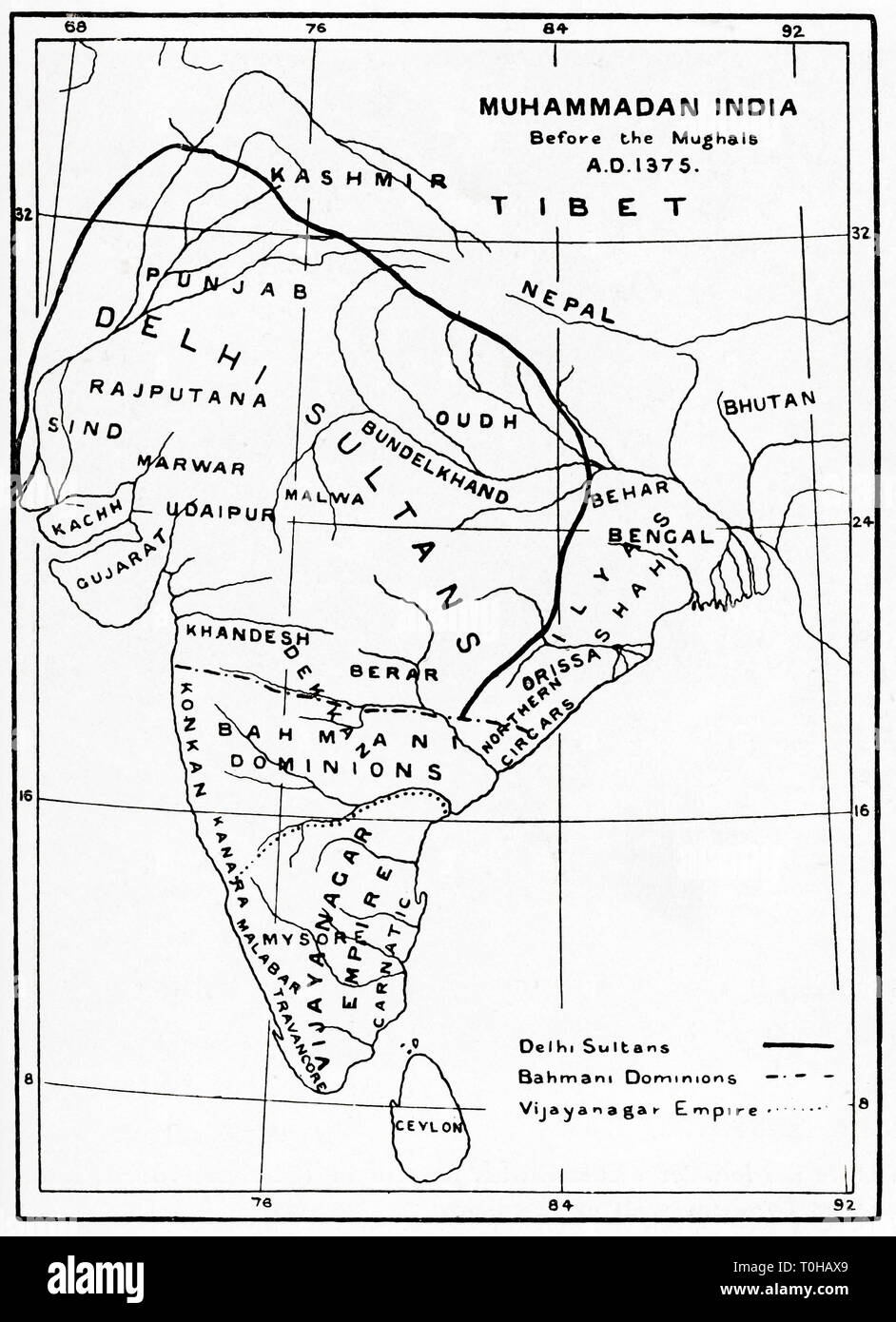 Map of Muhammadan India before Mughal circa, 1375 Stock Photohttps://www.alamy.com/image-license-details/?v=1https://www.alamy.com/map-of-muhammadan-india-before-mughal-circa-1375-image241326913.html
RMT0HAX9–Map of Muhammadan India before Mughal circa, 1375
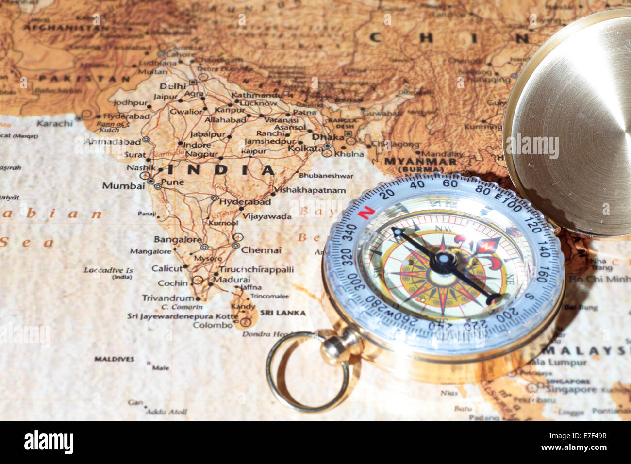 Compass on a map pointing at India, planning a travel destination Stock Photohttps://www.alamy.com/image-license-details/?v=1https://www.alamy.com/stock-photo-compass-on-a-map-pointing-at-india-planning-a-travel-destination-73476755.html
RFE7F49R–Compass on a map pointing at India, planning a travel destination
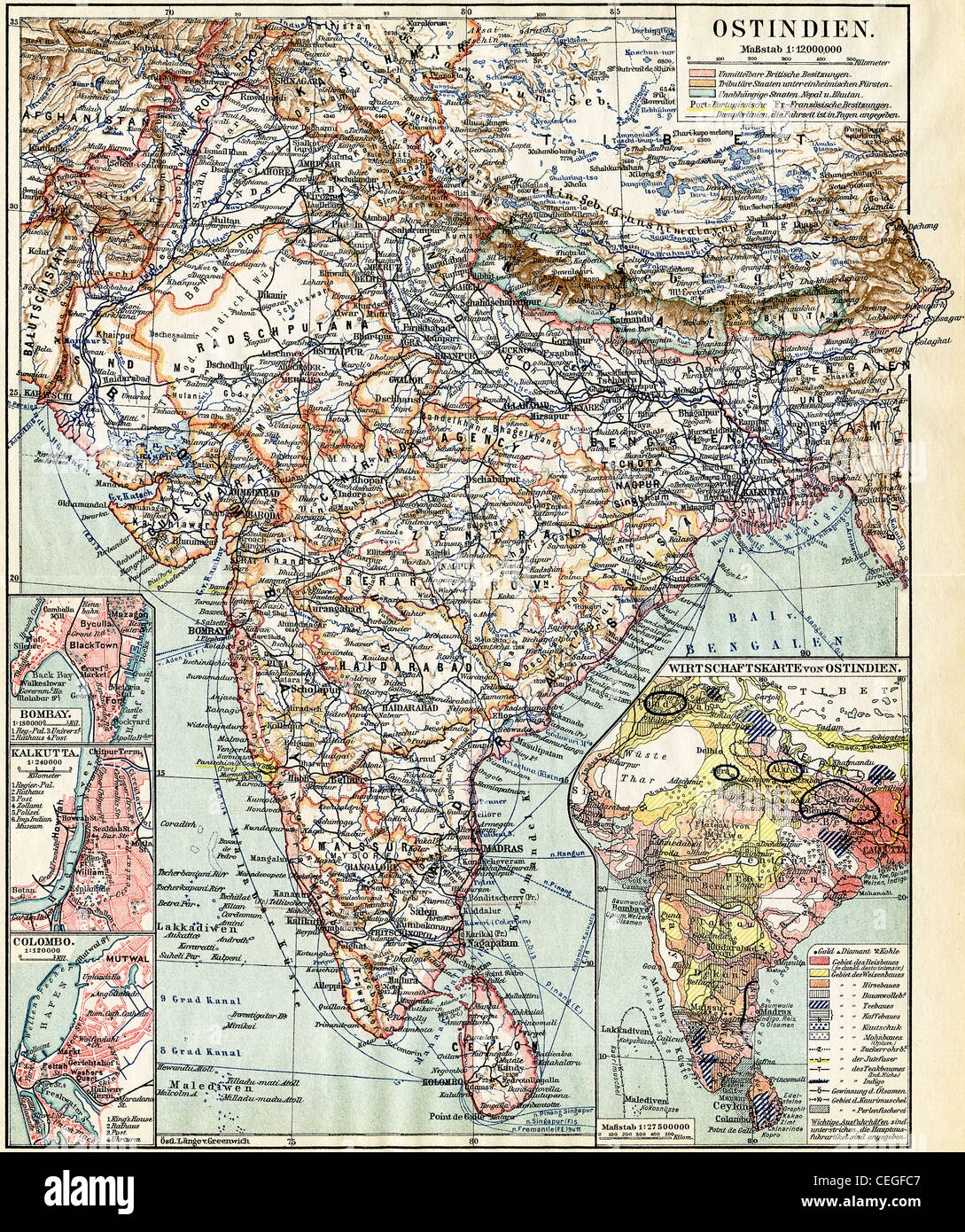 Map of India. Publication of the book 'Meyers Konversations-Lexikon', Volume 7, Leipzig, Germany, 1910 Stock Photohttps://www.alamy.com/image-license-details/?v=1https://www.alamy.com/stock-photo-map-of-india-publication-of-the-book-meyers-konversations-lexikon-43389255.html
RFCEGFC7–Map of India. Publication of the book 'Meyers Konversations-Lexikon', Volume 7, Leipzig, Germany, 1910
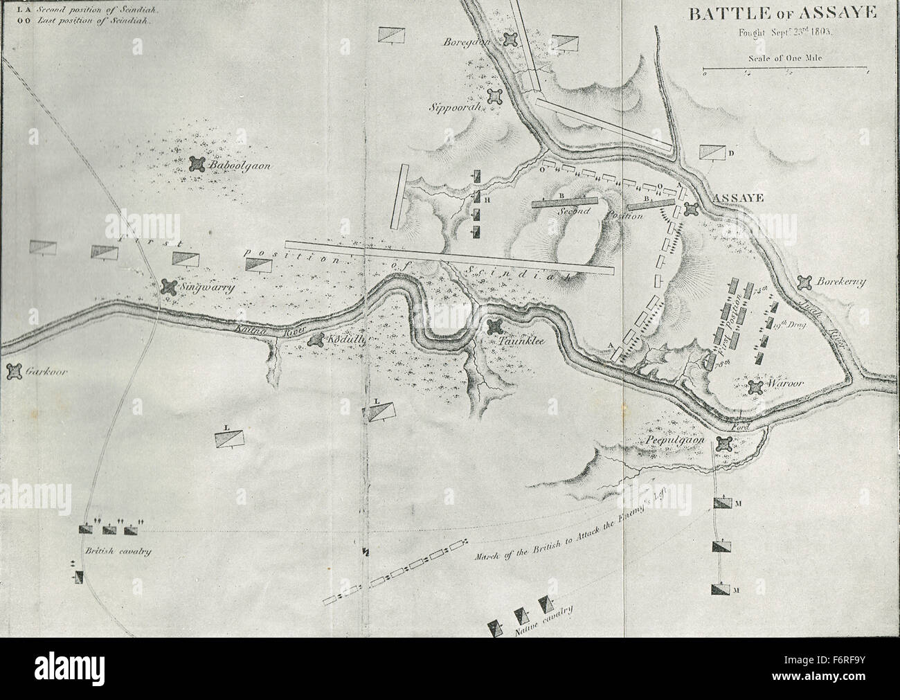 Sketch map Battle of Assaye India 1803 Stock Photohttps://www.alamy.com/image-license-details/?v=1https://www.alamy.com/stock-photo-sketch-map-battle-of-assaye-india-1803-90256711.html
RMF6RF9Y–Sketch map Battle of Assaye India 1803
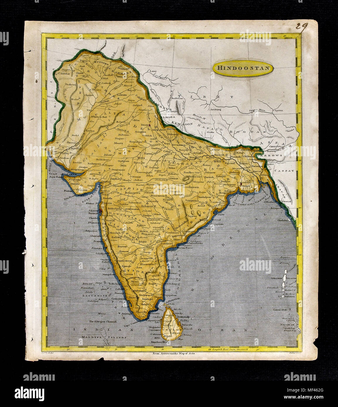 1804 Arrowsmith Map India Bombay Calcutta Bengal Pakistan Kashmir Nepal Tibet Stock Photohttps://www.alamy.com/image-license-details/?v=1https://www.alamy.com/1804-arrowsmith-map-india-bombay-calcutta-bengal-pakistan-kashmir-nepal-tibet-image181416104.html
RFMF462G–1804 Arrowsmith Map India Bombay Calcutta Bengal Pakistan Kashmir Nepal Tibet
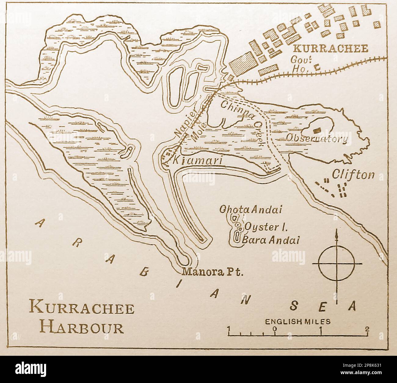 An old 19th century map An old 19th century map of the harbour at Kurrache (Karachi). India. (Now in Pakistan) ------ 19 ویں صدی کا ایک پرانا نقشہ 19 ویں صدی کا ایک پرانا نقشہ کراچی (کراچی) میں بندرگاہ کا ہے۔ ہندوستان. . اب پاکستان میں -- कुर्राचे (कराची) में बंदरगाह का एक पुराना 19 वीं शताब्दी का नक्शा। भारत।. अब पाकिस्तान में Stock Photohttps://www.alamy.com/image-license-details/?v=1https://www.alamy.com/an-old-19th-century-map-an-old-19th-century-map-of-the-harbour-at-kurrache-karachi-india-now-in-pakistan-19-19-19-image538860533.html
RM2P8K631–An old 19th century map An old 19th century map of the harbour at Kurrache (Karachi). India. (Now in Pakistan) ------ 19 ویں صدی کا ایک پرانا نقشہ 19 ویں صدی کا ایک پرانا نقشہ کراچی (کراچی) میں بندرگاہ کا ہے۔ ہندوستان. . اب پاکستان میں -- कुर्राचे (कराची) में बंदरगाह का एक पुराना 19 वीं शताब्दी का नक्शा। भारत।. अब पाकिस्तान में
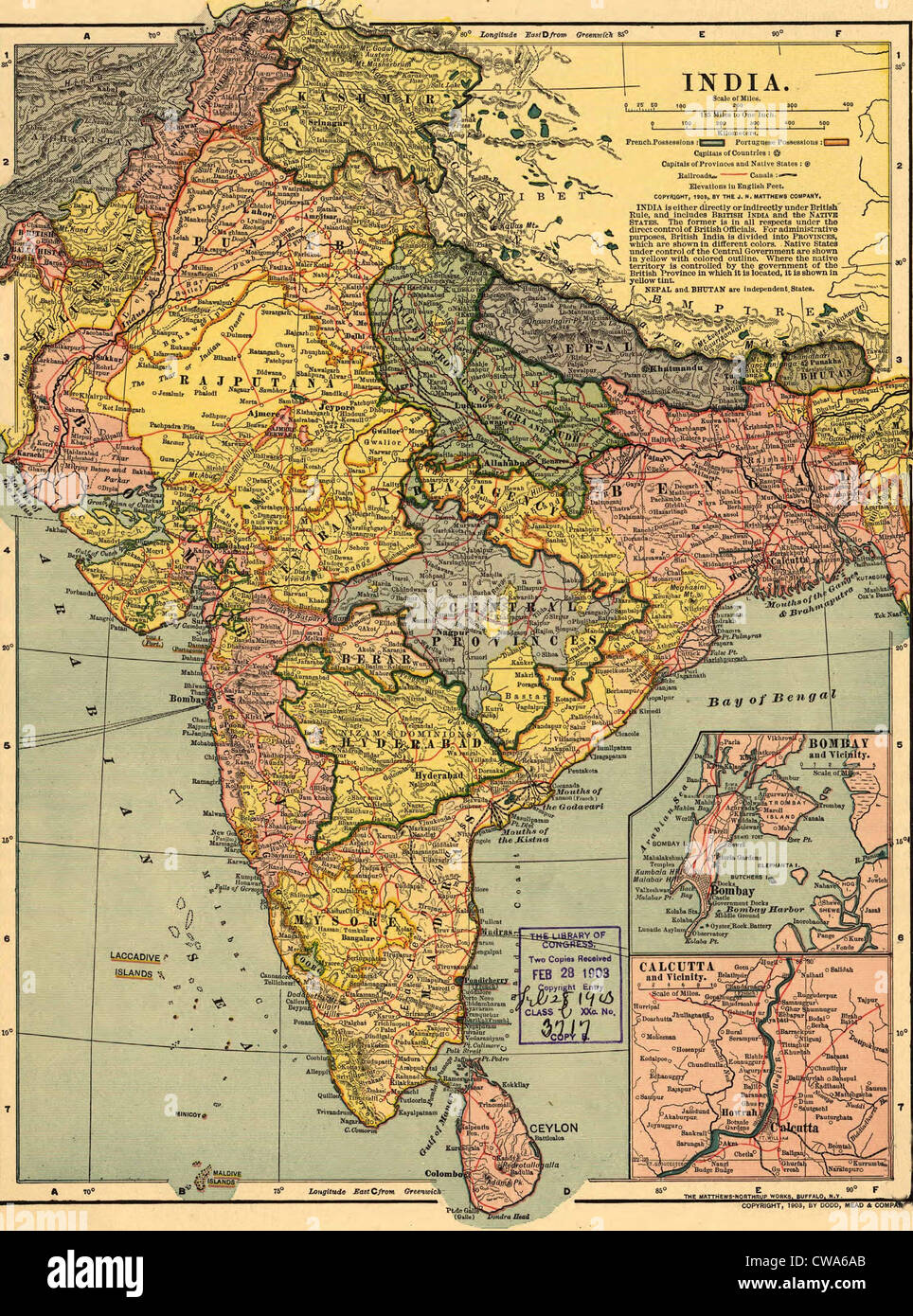 1902 map of India, then a colony within the British Empire, showing internal boundaries. Stock Photohttps://www.alamy.com/image-license-details/?v=1https://www.alamy.com/stock-photo-1902-map-of-india-then-a-colony-within-the-british-empire-showing-50011651.html
RMCWA6AB–1902 map of India, then a colony within the British Empire, showing internal boundaries.
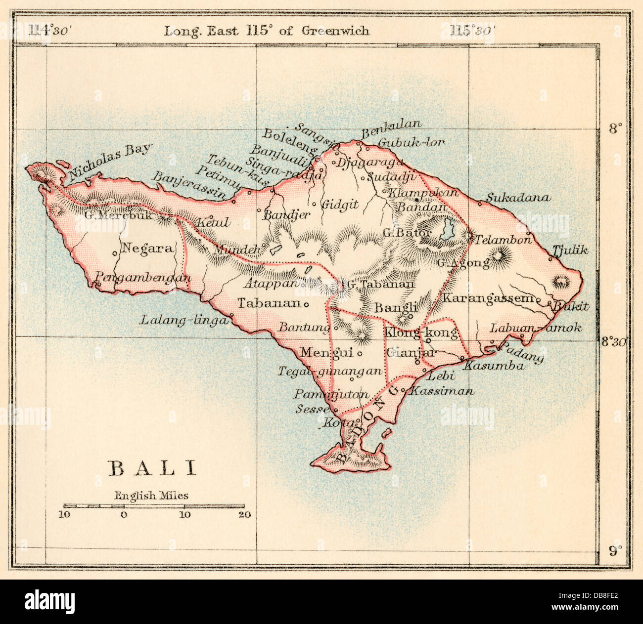 Map of Bali, 1870s. Color lithograph Stock Photohttps://www.alamy.com/image-license-details/?v=1https://www.alamy.com/stock-photo-map-of-bali-1870s-color-lithograph-58580090.html
RMDB8FE2–Map of Bali, 1870s. Color lithograph
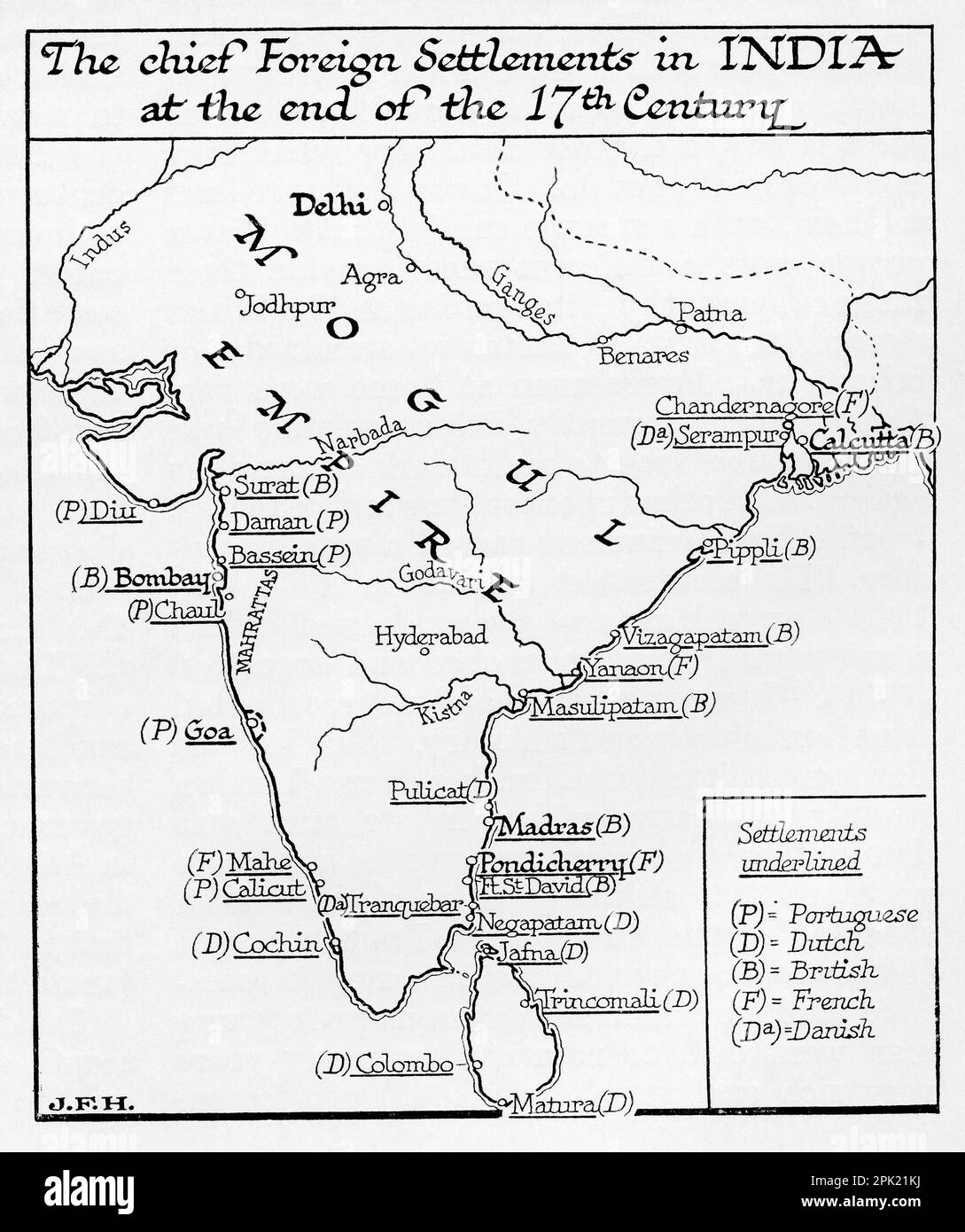 Map of the chief foreign settlements in India at the end of the 17th century. From the book Outline of History by H.G. Wells, published 1920. Stock Photohttps://www.alamy.com/image-license-details/?v=1https://www.alamy.com/map-of-the-chief-foreign-settlements-in-india-at-the-end-of-the-17th-century-from-the-book-outline-of-history-by-hg-wells-published-1920-image545245110.html
RM2PK21KJ–Map of the chief foreign settlements in India at the end of the 17th century. From the book Outline of History by H.G. Wells, published 1920.
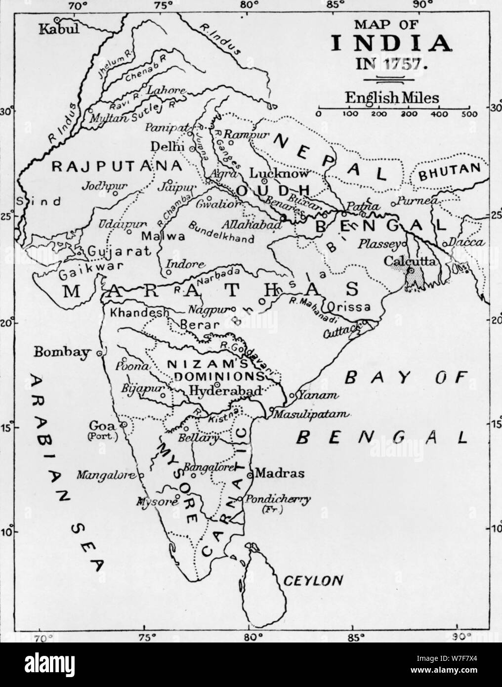 'Map of India in 1757', (c1912). Artist: Unknown. Stock Photohttps://www.alamy.com/image-license-details/?v=1https://www.alamy.com/map-of-india-in-1757-c1912-artist-unknown-image262793612.html
RMW7F7X4–'Map of India in 1757', (c1912). Artist: Unknown.
 Hindoostan Map - India Stock Photohttps://www.alamy.com/image-license-details/?v=1https://www.alamy.com/hindoostan-map-india-image504920097.html
RM2M9D2MH–Hindoostan Map - India
 1821, Carey Map of India Stock Photohttps://www.alamy.com/image-license-details/?v=1https://www.alamy.com/stock-image-1821-carey-map-of-india-162575550.html
RMKCDXNJ–1821, Carey Map of India
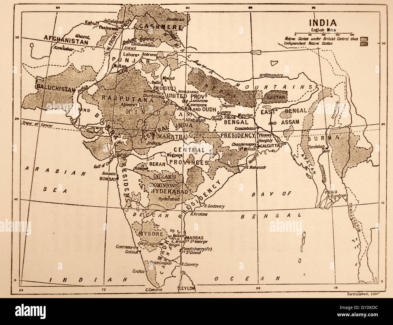 Map showing the British Control over India. Dated 19th Century Stock Photohttps://www.alamy.com/image-license-details/?v=1https://www.alamy.com/stock-photo-map-showing-the-british-control-over-india-dated-19th-century-104177512.html
RMG1DKDC–Map showing the British Control over India. Dated 19th Century
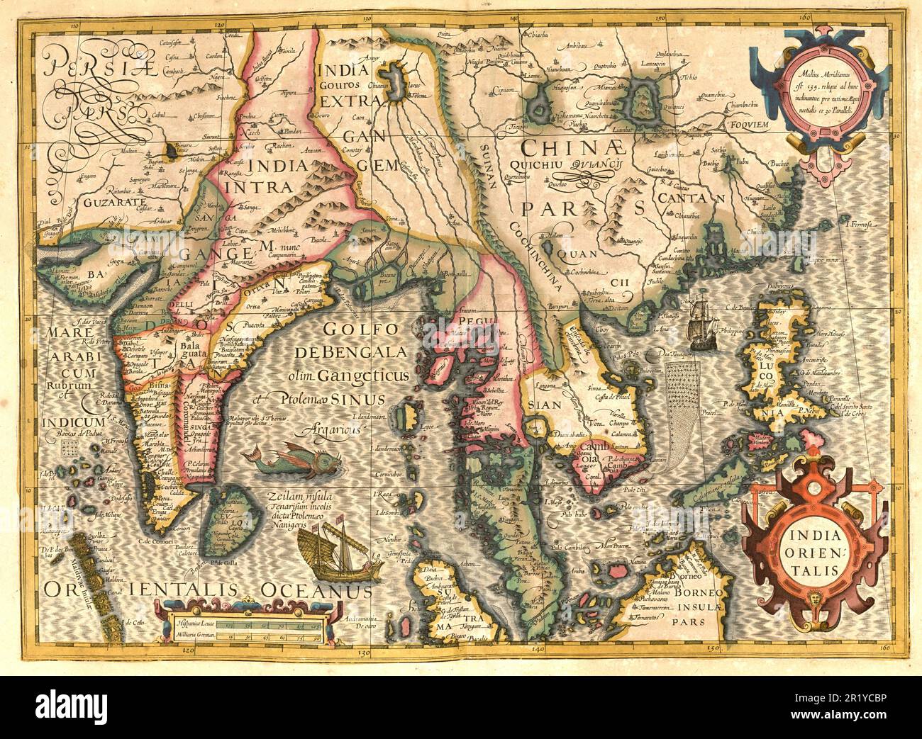 Atlas, map from 1623, Bay of Bengal, India, Siam, Thailand, Sumatra, Asia, digitally restored reproduction from an engraving by Gerhard Mercator, born as Gheert Cremer, March 5, 1512 - December 2, 1594, geographer and cartographer / Landkarte aus dem Jahre 1623, Golf von Bengalen, Indien, Siam, Thailand, Sumatra, Asien, digital restaurierte Reproduktion von einem Kupferstich von Gerhard Mercator, geboren als Gheert Cremer, 5. März 1512 - 2. Dezember 1594, Geograph und Kartograf Stock Photohttps://www.alamy.com/image-license-details/?v=1https://www.alamy.com/atlas-map-from-1623-bay-of-bengal-india-siam-thailand-sumatra-asia-digitally-restored-reproduction-from-an-engraving-by-gerhard-mercator-born-as-gheert-cremer-march-5-1512-december-2-1594-geographer-and-cartographer-landkarte-aus-dem-jahre-1623-golf-von-bengalen-indien-siam-thailand-sumatra-asien-digital-restaurierte-reproduktion-von-einem-kupferstich-von-gerhard-mercator-geboren-als-gheert-cremer-5-mrz-1512-2-dezember-1594-geograph-und-kartograf-image551948874.html
RF2R1YCBP–Atlas, map from 1623, Bay of Bengal, India, Siam, Thailand, Sumatra, Asia, digitally restored reproduction from an engraving by Gerhard Mercator, born as Gheert Cremer, March 5, 1512 - December 2, 1594, geographer and cartographer / Landkarte aus dem Jahre 1623, Golf von Bengalen, Indien, Siam, Thailand, Sumatra, Asien, digital restaurierte Reproduktion von einem Kupferstich von Gerhard Mercator, geboren als Gheert Cremer, 5. März 1512 - 2. Dezember 1594, Geograph und Kartograf
 Ancient globe replica with map of Asian countries, Indian Ocean and African east coast during the Age of Discovery (on black background with copy spac Stock Photohttps://www.alamy.com/image-license-details/?v=1https://www.alamy.com/ancient-globe-replica-with-map-of-asian-countries-indian-ocean-and-african-east-coast-during-the-age-of-discovery-on-black-background-with-copy-spac-image383853434.html
RF2D8E0Y6–Ancient globe replica with map of Asian countries, Indian Ocean and African east coast during the Age of Discovery (on black background with copy spac
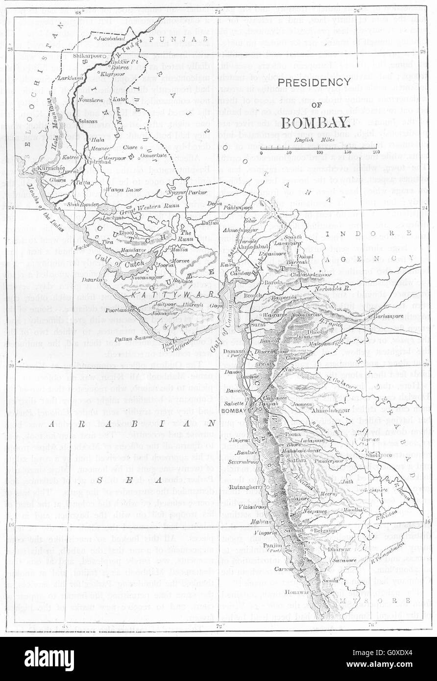 INDIA: Map of The Presidency of Mumbai, c1880 Stock Photohttps://www.alamy.com/image-license-details/?v=1https://www.alamy.com/stock-photo-india-map-of-the-presidency-of-mumbai-c1880-103843884.html
RFG0XDX4–INDIA: Map of The Presidency of Mumbai, c1880
 Map of northern India with Calcutta Stock Photohttps://www.alamy.com/image-license-details/?v=1https://www.alamy.com/stock-photo-map-of-northern-india-with-calcutta-35956009.html
RMC2DX75–Map of northern India with Calcutta
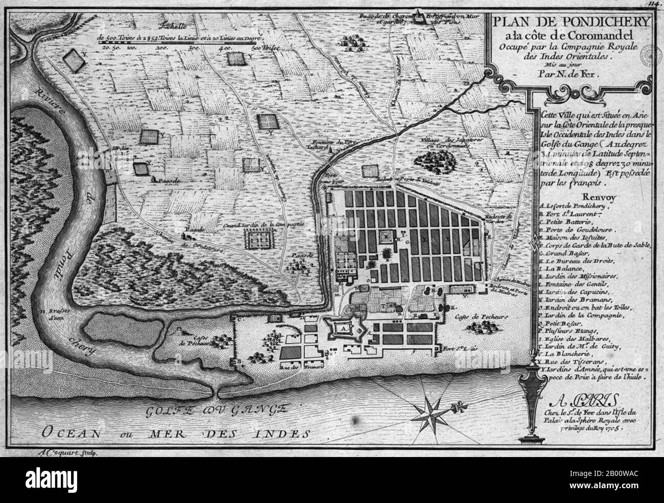 India: A map of the French colony of Pondicherry, by Nicolas de Fer (1646-1720), 1705. Pondicherry, or Puducherry, is a former French colony in India, also called The French Riviera of the East (La Côte d'Azur de l'Est) for its rich French culture and architecture. The use of French language can be still seen in Pondicherry to this day. The city still has a large number of Tamil and a small number of non-Tamil residents with French passports who are descendants of those who chose to remain French when the then ruling French Establishment presented the people of Pondicherry with an option to e Stock Photohttps://www.alamy.com/image-license-details/?v=1https://www.alamy.com/india-a-map-of-the-french-colony-of-pondicherry-by-nicolas-de-fer-1646-1720-1705-pondicherry-or-puducherry-is-a-former-french-colony-in-india-also-called-the-french-riviera-of-the-east-la-cte-dazur-de-lest-for-its-rich-french-culture-and-architecture-the-use-of-french-language-can-be-still-seen-in-pondicherry-to-this-day-the-city-still-has-a-large-number-of-tamil-and-a-small-number-of-non-tamil-residents-with-french-passports-who-are-descendants-of-those-who-chose-to-remain-french-when-the-then-ruling-french-establishment-presented-the-people-of-pondicherry-with-an-option-to-e-image344227252.html
RM2B00WAC–India: A map of the French colony of Pondicherry, by Nicolas de Fer (1646-1720), 1705. Pondicherry, or Puducherry, is a former French colony in India, also called The French Riviera of the East (La Côte d'Azur de l'Est) for its rich French culture and architecture. The use of French language can be still seen in Pondicherry to this day. The city still has a large number of Tamil and a small number of non-Tamil residents with French passports who are descendants of those who chose to remain French when the then ruling French Establishment presented the people of Pondicherry with an option to e
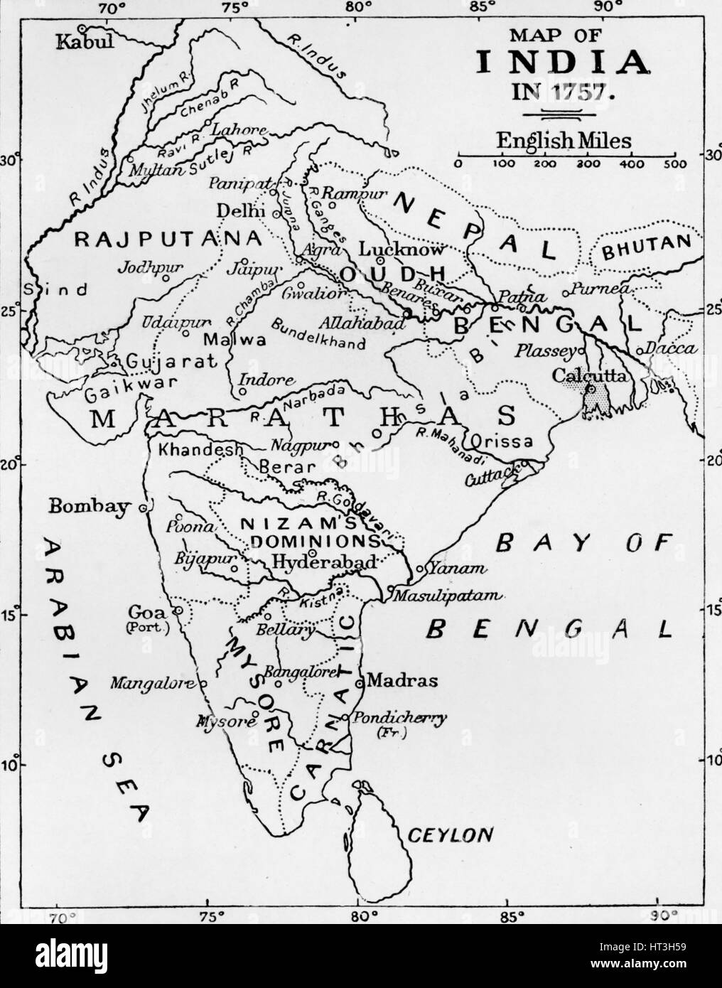 'Map of India in 1757', (c1912). Artist: Unknown. Stock Photohttps://www.alamy.com/image-license-details/?v=1https://www.alamy.com/stock-photo-map-of-india-in-1757-c1912-artist-unknown-135303653.html
RMHT3H59–'Map of India in 1757', (c1912). Artist: Unknown.
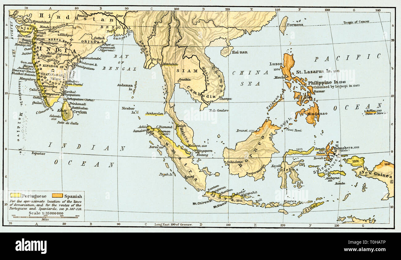 Portuguese Colonial Dominions Map, India, 1498, 1580 Stock Photohttps://www.alamy.com/image-license-details/?v=1https://www.alamy.com/portuguese-colonial-dominions-map-india-1498-1580-image241326870.html
RMT0HATP–Portuguese Colonial Dominions Map, India, 1498, 1580
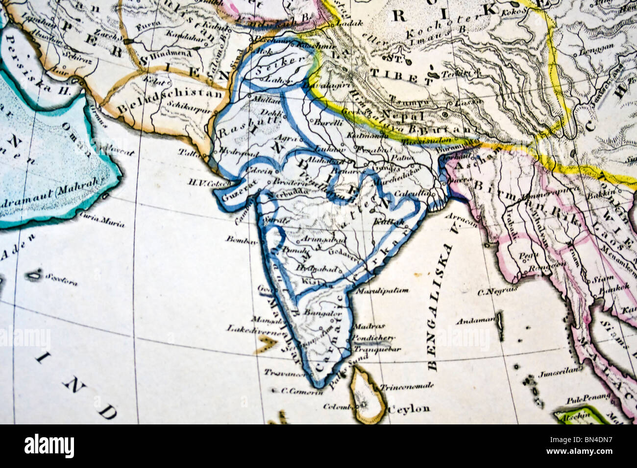 Ancient map of India. Handmade in 1881 Stock Photohttps://www.alamy.com/image-license-details/?v=1https://www.alamy.com/stock-photo-ancient-map-of-india-handmade-in-1881-30216739.html
RFBN4DN7–Ancient map of India. Handmade in 1881
 Historical buildings of India coming out from the zipper of a soccer ball Stock Photohttps://www.alamy.com/image-license-details/?v=1https://www.alamy.com/stock-photo-historical-buildings-of-india-coming-out-from-the-zipper-of-a-soccer-53668623.html
RFD38PTF–Historical buildings of India coming out from the zipper of a soccer ball
 MacRITCHIE(1886) Map Arabia and India Stock Photohttps://www.alamy.com/image-license-details/?v=1https://www.alamy.com/stock-photo-macritchie1886-map-arabia-and-india-76858309.html
RMED15FH–MacRITCHIE(1886) Map Arabia and India
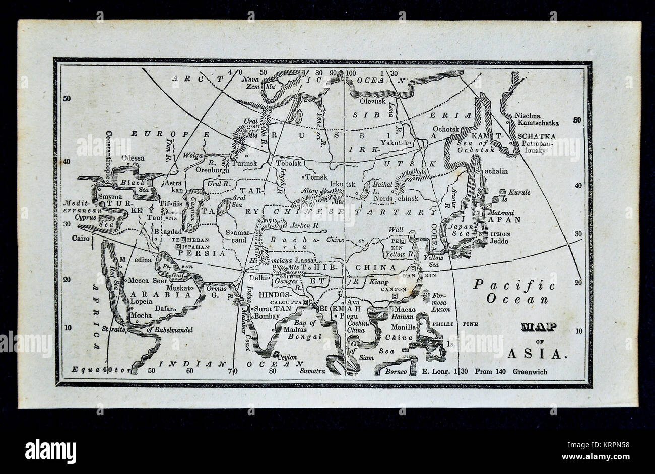 1830 Nathan Hale Map - Asia - Japan China Korea Arabia India Siberia Stock Photohttps://www.alamy.com/image-license-details/?v=1https://www.alamy.com/stock-image-1830-nathan-hale-map-asia-japan-china-korea-arabia-india-siberia-169529956.html
RFKRPN58–1830 Nathan Hale Map - Asia - Japan China Korea Arabia India Siberia
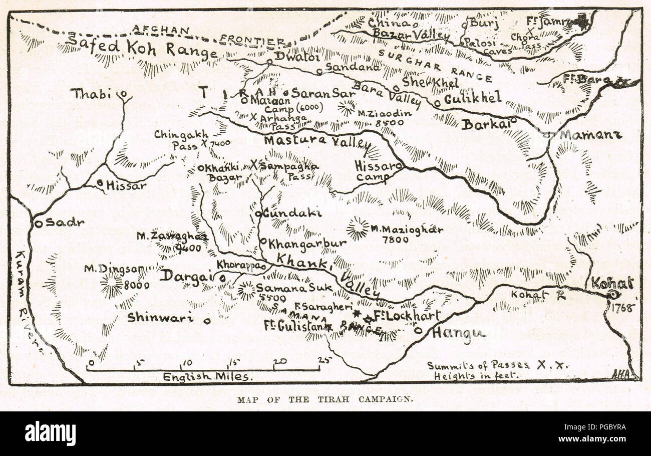 Map of the Tirah Campaign, also known as the Tirah Expedition, an Indian frontier war in 1897–1898 Stock Photohttps://www.alamy.com/image-license-details/?v=1https://www.alamy.com/map-of-the-tirah-campaign-also-known-as-the-tirah-expedition-an-indian-frontier-war-in-18971898-image216622206.html
RMPGBYRA–Map of the Tirah Campaign, also known as the Tirah Expedition, an Indian frontier war in 1897–1898
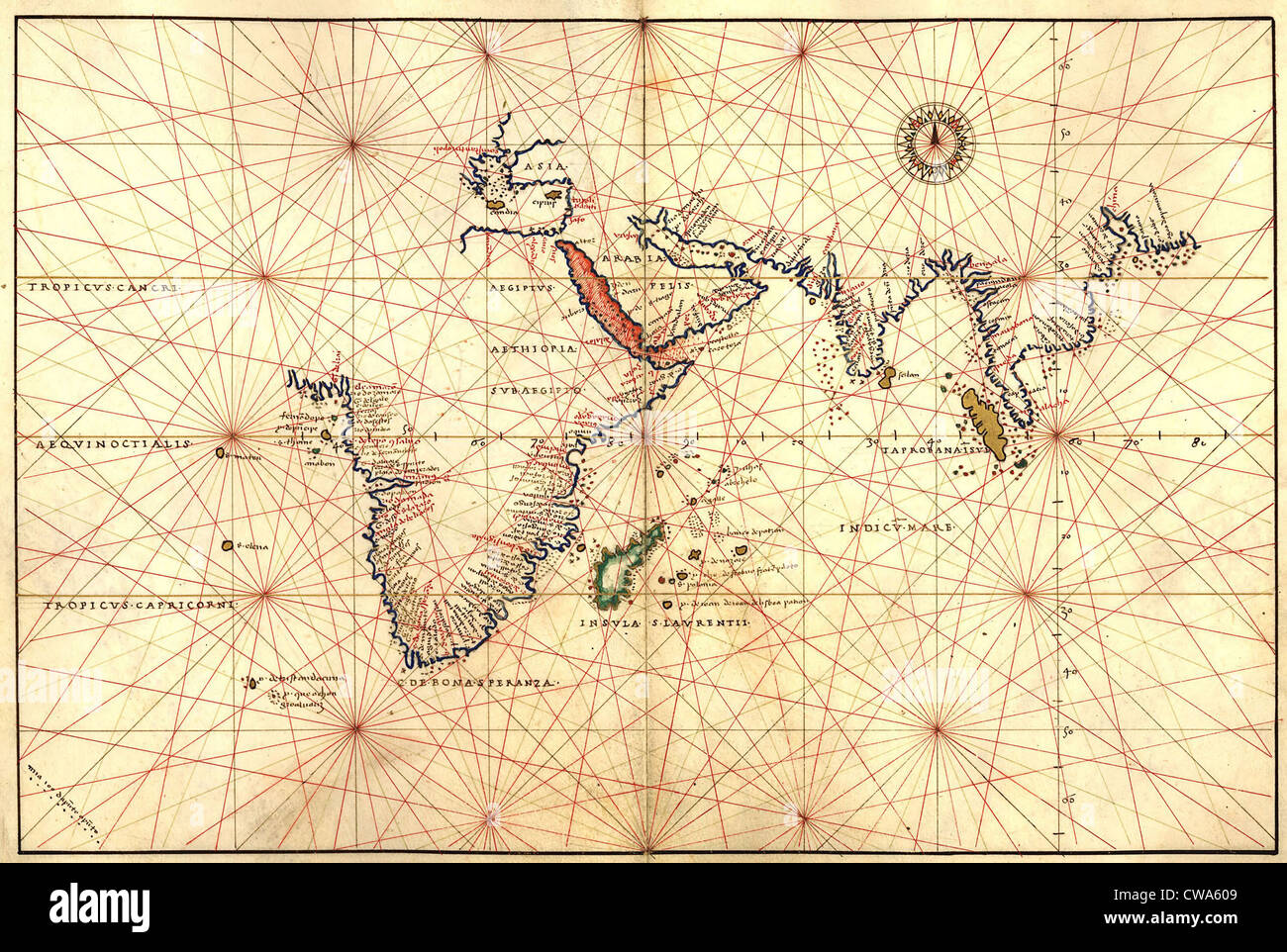 1544 nautical map of the Indian Ocean showing Africa, South Asia, the East Indies, India and Australia. Australia is Stock Photohttps://www.alamy.com/image-license-details/?v=1https://www.alamy.com/stock-photo-1544-nautical-map-of-the-indian-ocean-showing-africa-south-asia-the-50011369.html
RMCWA609–1544 nautical map of the Indian Ocean showing Africa, South Asia, the East Indies, India and Australia. Australia is
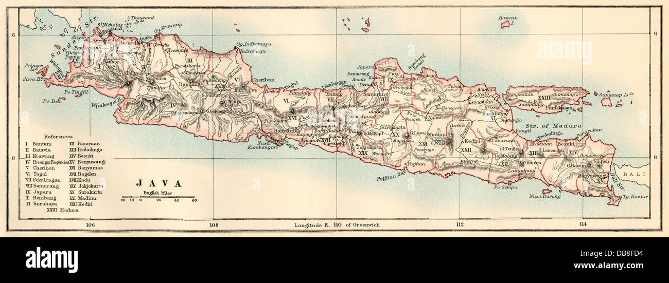 Map of Java, 1870s. Color lithograph Stock Photohttps://www.alamy.com/image-license-details/?v=1https://www.alamy.com/stock-photo-map-of-java-1870s-color-lithograph-58580064.html
RMDB8FD4–Map of Java, 1870s. Color lithograph
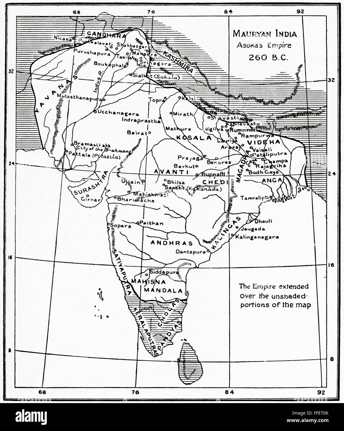 Map of Mauryan India, Asoka's Empire, 260 BC. A geographically extensive Iron Age historical power in ancient India, ruled by the Maurya dynasty. From Hutchinson's History of the Nations, published 1915. Stock Photohttps://www.alamy.com/image-license-details/?v=1https://www.alamy.com/stock-photo-map-of-mauryan-india-asokas-empire-260-bc-a-geographically-extensive-95597843.html
RMFFET0K–Map of Mauryan India, Asoka's Empire, 260 BC. A geographically extensive Iron Age historical power in ancient India, ruled by the Maurya dynasty. From Hutchinson's History of the Nations, published 1915.
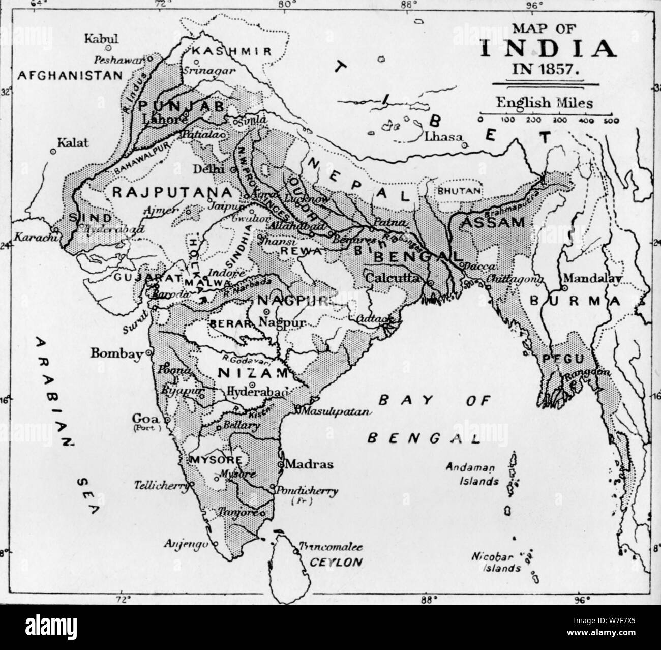 'Map of India in 1857', c1912. Artist: Unknown. Stock Photohttps://www.alamy.com/image-license-details/?v=1https://www.alamy.com/map-of-india-in-1857-c1912-artist-unknown-image262793613.html
RMW7F7X5–'Map of India in 1857', c1912. Artist: Unknown.
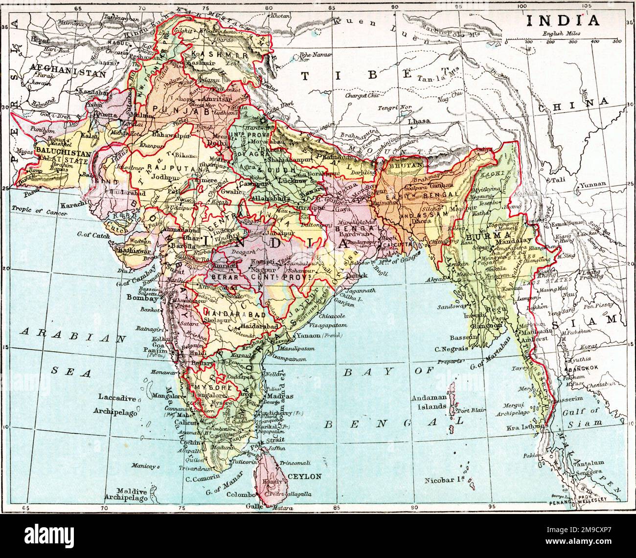 19th century Map of India Stock Photohttps://www.alamy.com/image-license-details/?v=1https://www.alamy.com/19th-century-map-of-india-image504917007.html
RM2M9CXP7–19th century Map of India
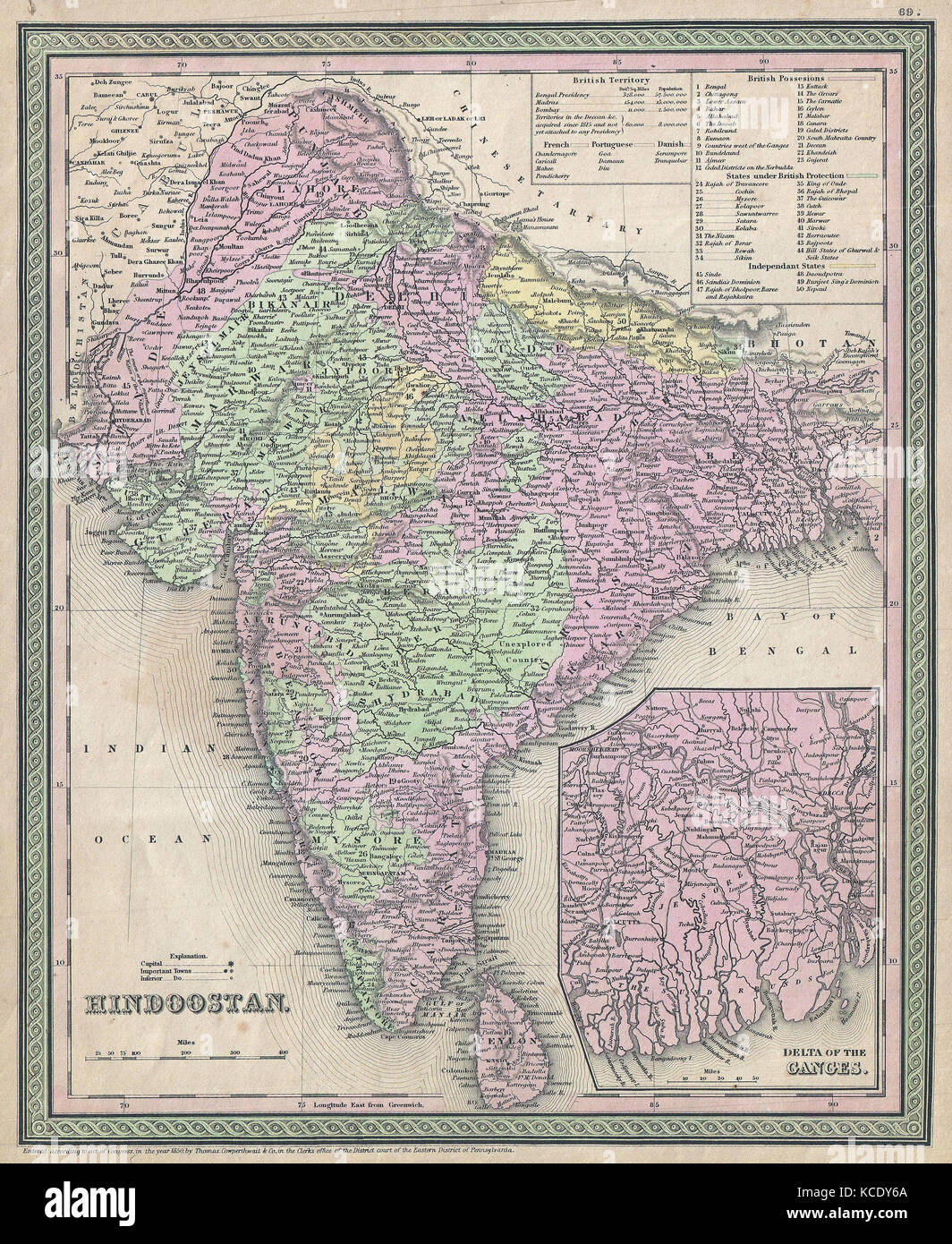 1853, Mitchell Map of India Stock Photohttps://www.alamy.com/image-license-details/?v=1https://www.alamy.com/stock-image-1853-mitchell-map-of-india-162575906.html
RMKCDY6A–1853, Mitchell Map of India
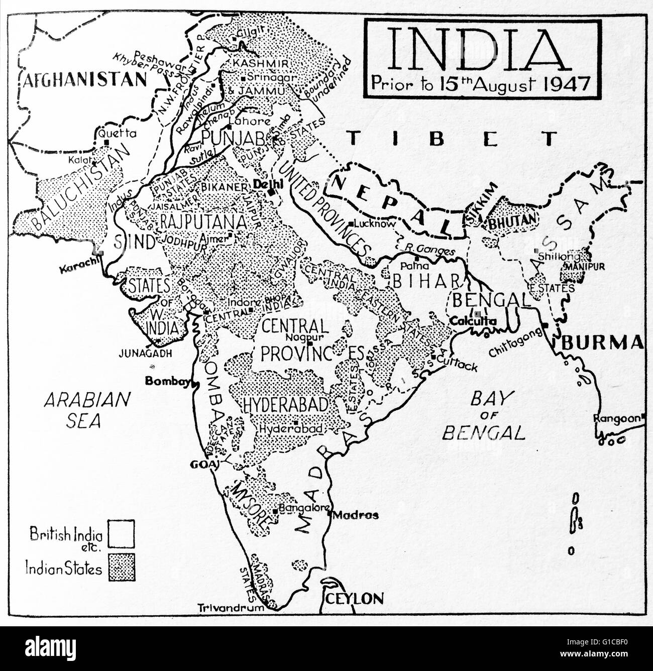 Map depicting India prior to August 15th 1947 highlighting which areas were British India and Indian States Stock Photohttps://www.alamy.com/image-license-details/?v=1https://www.alamy.com/stock-photo-map-depicting-india-prior-to-august-15th-1947-highlighting-which-areas-104149332.html
RMG1CBF0–Map depicting India prior to August 15th 1947 highlighting which areas were British India and Indian States
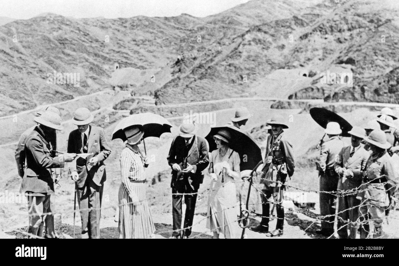 The viceroy of India, Lord Wellington, studying a map in front of the Khyber Pass. The hinterland of the border crossing in the northwest of India could never really be pacified by the English. Here applied the authority of the respective tribal leaders. Today the pass separates Pakistan from Afghanistan. Stock Photohttps://www.alamy.com/image-license-details/?v=1https://www.alamy.com/the-viceroy-of-india-lord-wellington-studying-a-map-in-front-of-the-khyber-pass-the-hinterland-of-the-border-crossing-in-the-northwest-of-india-could-never-really-be-pacified-by-the-english-here-applied-the-authority-of-the-respective-tribal-leaders-today-the-pass-separates-pakistan-from-afghanistan-image345684751.html
RM2B2B8BY–The viceroy of India, Lord Wellington, studying a map in front of the Khyber Pass. The hinterland of the border crossing in the northwest of India could never really be pacified by the English. Here applied the authority of the respective tribal leaders. Today the pass separates Pakistan from Afghanistan.
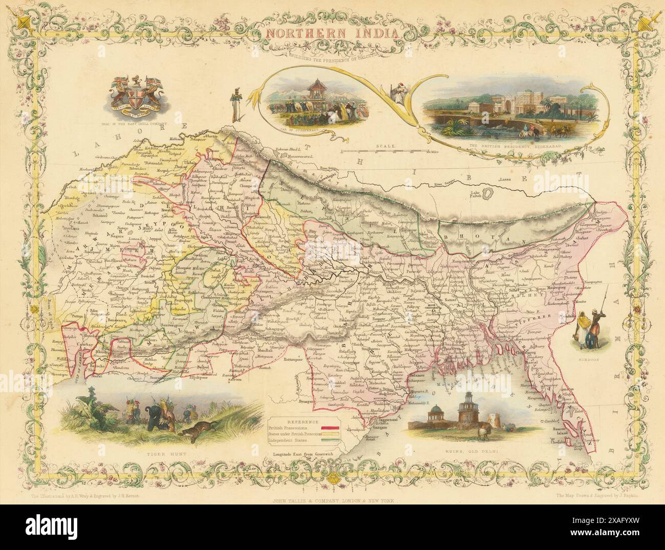 Vintage Illustrated John Tallis Map: Northern India, showing colonial British Possessions. 1860s Stock Photohttps://www.alamy.com/image-license-details/?v=1https://www.alamy.com/vintage-illustrated-john-tallis-map-northern-india-showing-colonial-british-possessions-1860s-image608860641.html
RM2XAFYXW–Vintage Illustrated John Tallis Map: Northern India, showing colonial British Possessions. 1860s
 INDIA: Map of the Presidency of Chennai, c1880 Stock Photohttps://www.alamy.com/image-license-details/?v=1https://www.alamy.com/stock-photo-india-map-of-the-presidency-of-chennai-c1880-103843797.html
RFG0XDR1–INDIA: Map of the Presidency of Chennai, c1880
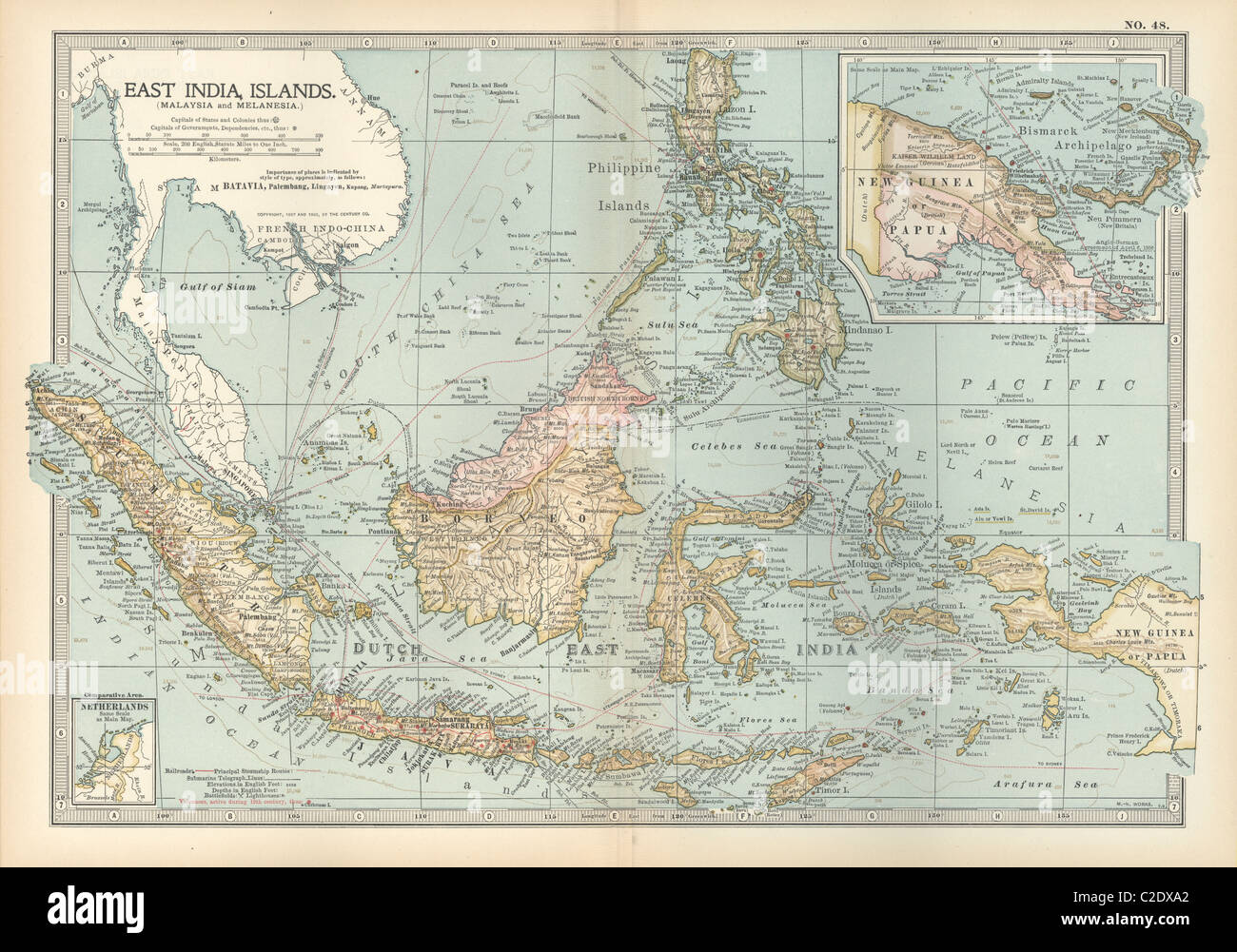 Map of East India Islands with New Guinea Stock Photohttps://www.alamy.com/image-license-details/?v=1https://www.alamy.com/stock-photo-map-of-east-india-islands-with-new-guinea-35956090.html
RMC2DXA2–Map of East India Islands with New Guinea
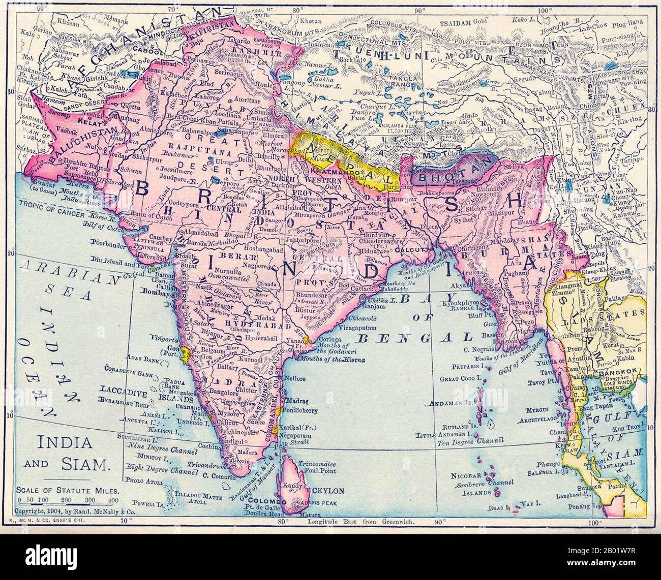 India: Map of the British Raj, including present-day India, Pakistan, Bangladesh, Burma and Sri Lanka, 1904. This map was produced at the height of British Imperial power and shows direct British rule extending all the way from Iran (Persia) to Thailand (Siam). Most of the contiguous Indian Ocean littoral, from South Africa to Singapore and Australia, was also under British administration or de facto control. It is relevant to note that the map shows Sikkim extending north into the present-day territory of China's Tibetan Autonomous Region. Similarly Darjeeling is shown in eastern Nepal. Stock Photohttps://www.alamy.com/image-license-details/?v=1https://www.alamy.com/india-map-of-the-british-raj-including-present-day-india-pakistan-bangladesh-burma-and-sri-lanka-1904-this-map-was-produced-at-the-height-of-british-imperial-power-and-shows-direct-british-rule-extending-all-the-way-from-iran-persia-to-thailand-siam-most-of-the-contiguous-indian-ocean-littoral-from-south-africa-to-singapore-and-australia-was-also-under-british-administration-or-de-facto-control-it-is-relevant-to-note-that-the-map-shows-sikkim-extending-north-into-the-present-day-territory-of-chinas-tibetan-autonomous-region-similarly-darjeeling-is-shown-in-eastern-nepal-image344249131.html
RM2B01W7R–India: Map of the British Raj, including present-day India, Pakistan, Bangladesh, Burma and Sri Lanka, 1904. This map was produced at the height of British Imperial power and shows direct British rule extending all the way from Iran (Persia) to Thailand (Siam). Most of the contiguous Indian Ocean littoral, from South Africa to Singapore and Australia, was also under British administration or de facto control. It is relevant to note that the map shows Sikkim extending north into the present-day territory of China's Tibetan Autonomous Region. Similarly Darjeeling is shown in eastern Nepal.
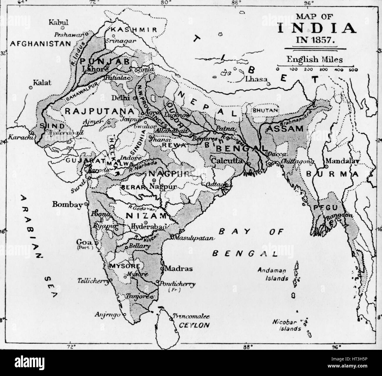 'Map of India in 1857', c1912. Artist: Unknown. Stock Photohttps://www.alamy.com/image-license-details/?v=1https://www.alamy.com/stock-photo-map-of-india-in-1857-c1912-artist-unknown-135303666.html
RMHT3H5P–'Map of India in 1857', c1912. Artist: Unknown.
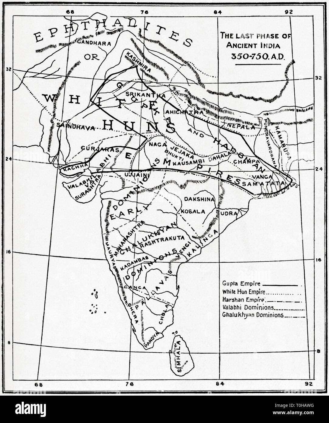 Map of the last phase of Ancient India, 350, 750 AD Stock Photohttps://www.alamy.com/image-license-details/?v=1https://www.alamy.com/map-of-the-last-phase-of-ancient-india-350-750-ad-image241326892.html
RMT0HAWG–Map of the last phase of Ancient India, 350, 750 AD
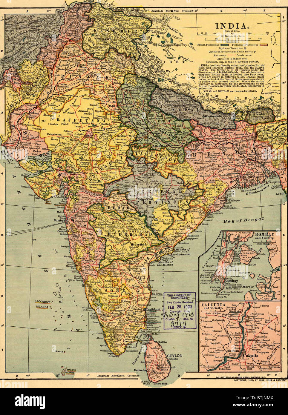 1902 map of India, then a colony within the British Empire, showing internal boundaries. Stock Photohttps://www.alamy.com/image-license-details/?v=1https://www.alamy.com/stock-photo-1902-map-of-india-then-a-colony-within-the-british-empire-showing-32374298.html
RMBTJNMX–1902 map of India, then a colony within the British Empire, showing internal boundaries.
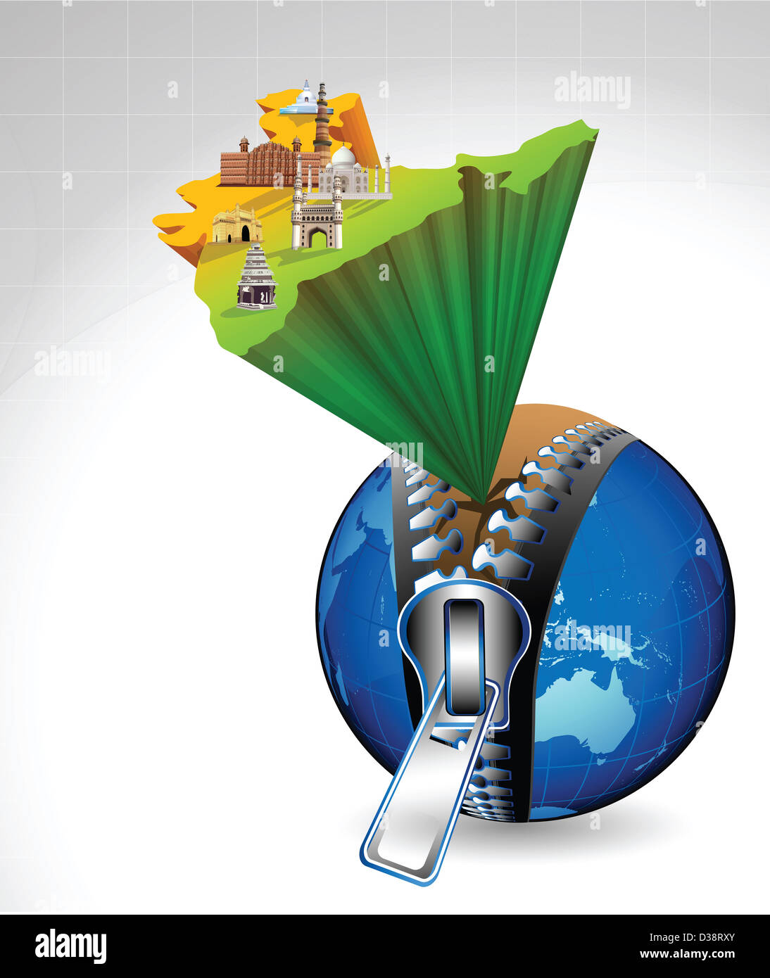 Indian map with montage of landmarks emerging from globe Stock Photohttps://www.alamy.com/image-license-details/?v=1https://www.alamy.com/stock-photo-indian-map-with-montage-of-landmarks-emerging-from-globe-53669475.html
RFD38RXY–Indian map with montage of landmarks emerging from globe
 BEVAN(1839) 1.028 Map of India Stock Photohttps://www.alamy.com/image-license-details/?v=1https://www.alamy.com/stock-photo-bevan1839-1028-map-of-india-75589331.html
RMEAYAXY–BEVAN(1839) 1.028 Map of India
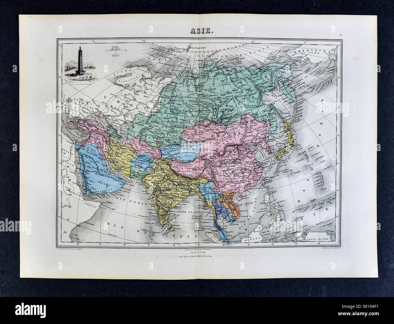 1877 Migeon Map - Asia - China Japan India Arabia Mongolia Siberia Tibet Nepal Stock Photohttps://www.alamy.com/image-license-details/?v=1https://www.alamy.com/stock-photo-1877-migeon-map-asia-china-japan-india-arabia-mongolia-siberia-tibet-172919461.html
RFM194F1–1877 Migeon Map - Asia - China Japan India Arabia Mongolia Siberia Tibet Nepal
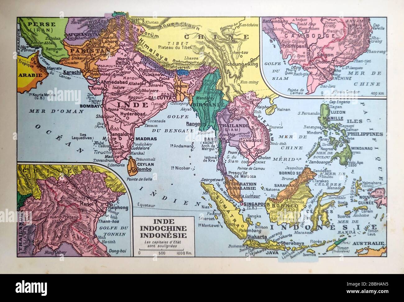 Old map of India, Indochina and Indonesia printed in the late 19th century. Stock Photohttps://www.alamy.com/image-license-details/?v=1https://www.alamy.com/old-map-of-india-indochina-and-indonesia-printed-in-the-late-19th-century-image351350193.html
RF2BBHAN5–Old map of India, Indochina and Indonesia printed in the late 19th century.
 Flag on the map of India. Vintage Map and Flag of Asian Countries Series 3D Rendering Stock Photohttps://www.alamy.com/image-license-details/?v=1https://www.alamy.com/flag-on-the-map-of-india-vintage-map-and-flag-of-asian-countries-series-3d-rendering-image370761424.html
RF2CF5HYC–Flag on the map of India. Vintage Map and Flag of Asian Countries Series 3D Rendering
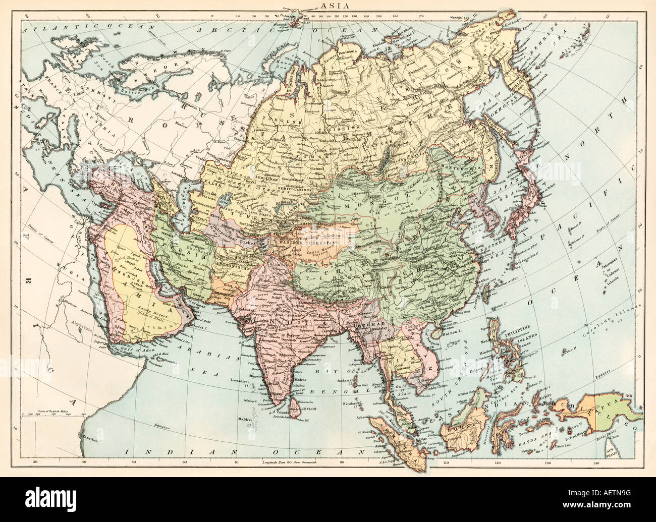 Map of Asia circa 1870. Color lithograph Stock Photohttps://www.alamy.com/image-license-details/?v=1https://www.alamy.com/stock-photo-map-of-asia-circa-1870-color-lithograph-13755387.html
RMAETN9G–Map of Asia circa 1870. Color lithograph
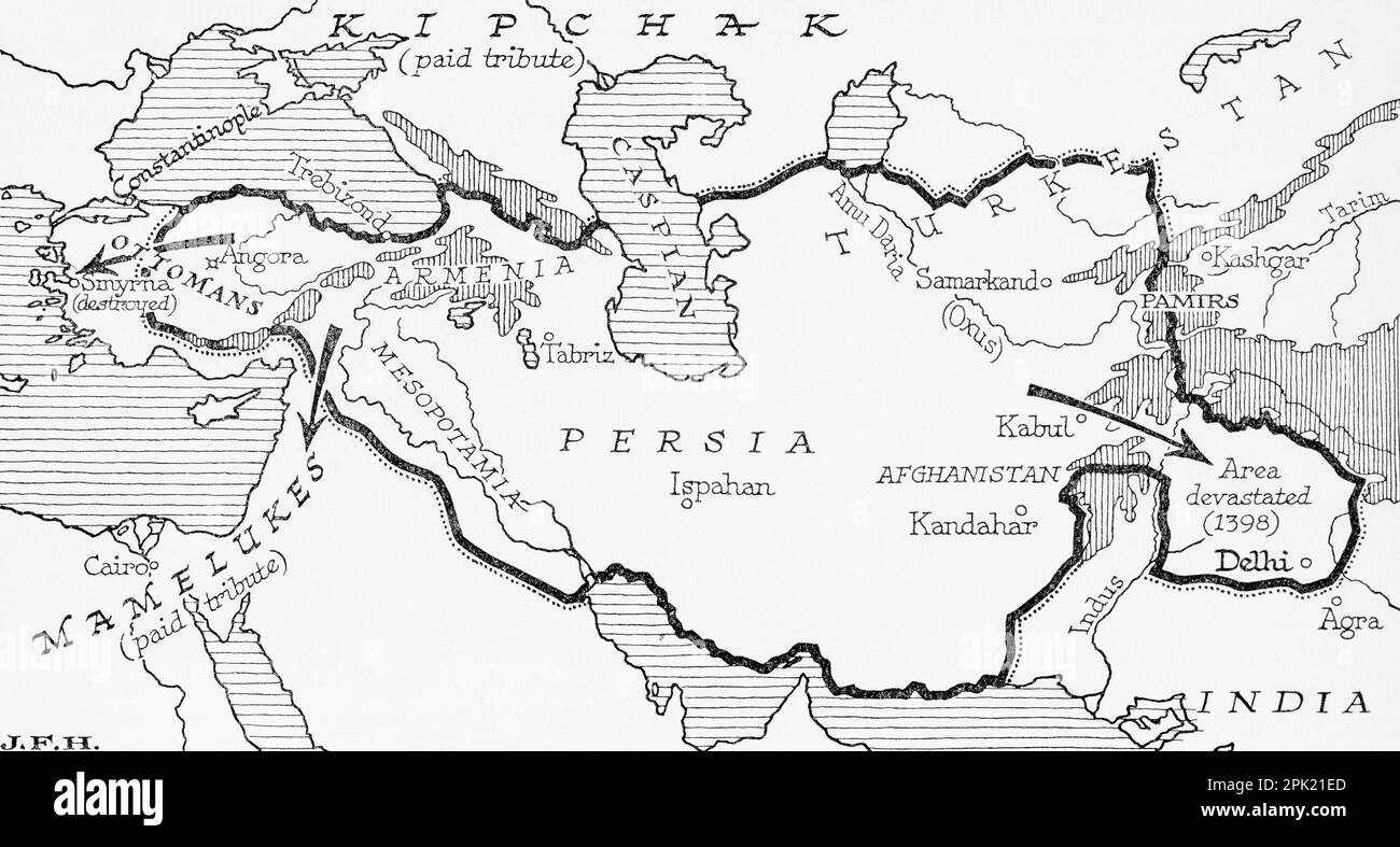 Map showing the Timurid Empire, (modern-day Afghanistan, Iran, Iraq and Central Asia, also parts of Pakistan, North India and Turkey) founded by Timur, aka Tamerlane, 1336 – 1405. From the book Outline of History by H.G. Wells, published 1920. Stock Photohttps://www.alamy.com/image-license-details/?v=1https://www.alamy.com/map-showing-the-timurid-empire-modern-day-afghanistan-iran-iraq-and-central-asia-also-parts-of-pakistan-north-india-and-turkey-founded-by-timur-aka-tamerlane-1336-1405-from-the-book-outline-of-history-by-hg-wells-published-1920-image545244965.html
RM2PK21ED–Map showing the Timurid Empire, (modern-day Afghanistan, Iran, Iraq and Central Asia, also parts of Pakistan, North India and Turkey) founded by Timur, aka Tamerlane, 1336 – 1405. From the book Outline of History by H.G. Wells, published 1920.
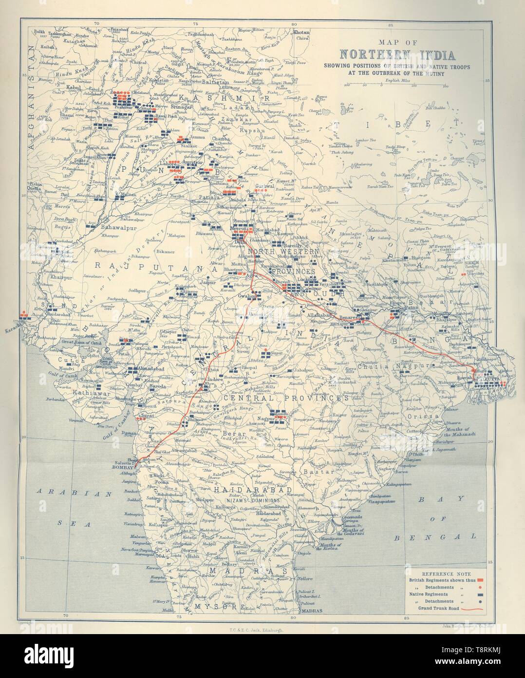 'Map of Northern India', 1901. Creator: John Bartholomew. Stock Photohttps://www.alamy.com/image-license-details/?v=1https://www.alamy.com/map-of-northern-india-1901-creator-john-bartholomew-image246382770.html
RMT8RKMJ–'Map of Northern India', 1901. Creator: John Bartholomew.
