Quick filters:
Hurricane sandy aerial Stock Photos and Images
 Aerial views of the damage caused by Hurricane Sandy to the New Jersey October 30, 2012. Stock Photohttps://www.alamy.com/image-license-details/?v=1https://www.alamy.com/stock-photo-aerial-views-of-the-damage-caused-by-hurricane-sandy-to-the-new-jersey-46916901.html
RMCM96YH–Aerial views of the damage caused by Hurricane Sandy to the New Jersey October 30, 2012.
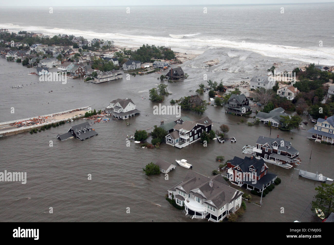 Aerial views of the damage caused by Hurricane Sandy to the New Jersey coast taken during a search and rescue mission by 1-150 Assault Helicopter Battalion, New Jersey Army National Guard, Oct. 30, 2012. (U.S. Air Force photo by Master Sgt. Mark C. Olsen/Released) Stock Photohttps://www.alamy.com/image-license-details/?v=1https://www.alamy.com/stock-photo-aerial-views-of-the-damage-caused-by-hurricane-sandy-to-the-new-jersey-51469616.html
RMCYMJ0G–Aerial views of the damage caused by Hurricane Sandy to the New Jersey coast taken during a search and rescue mission by 1-150 Assault Helicopter Battalion, New Jersey Army National Guard, Oct. 30, 2012. (U.S. Air Force photo by Master Sgt. Mark C. Olsen/Released)
 Aerial views of the damage caused by Hurricane Sandy to the New Jersey coast taken during a search and rescue mission by 1-150 Assault Helicopter Battalion, New Jersey Army National Guard, Oct. 30, 2012.Aerial views of the damage caused by Hurricane Sandy to the New Jersey coast taken during a search and rescue mission by 1-150 Assault Helicopter Battalion, New Jersey Army National Guard, Oct. 30, 2012. (U.S. Air Force photo by Master Sgt. Mark C. Olsen/) Stock Photohttps://www.alamy.com/image-license-details/?v=1https://www.alamy.com/stock-photo-aerial-views-of-the-damage-caused-by-hurricane-sandy-to-the-new-jersey-46911321.html
RMCM8YT9–Aerial views of the damage caused by Hurricane Sandy to the New Jersey coast taken during a search and rescue mission by 1-150 Assault Helicopter Battalion, New Jersey Army National Guard, Oct. 30, 2012.Aerial views of the damage caused by Hurricane Sandy to the New Jersey coast taken during a search and rescue mission by 1-150 Assault Helicopter Battalion, New Jersey Army National Guard, Oct. 30, 2012. (U.S. Air Force photo by Master Sgt. Mark C. Olsen/)
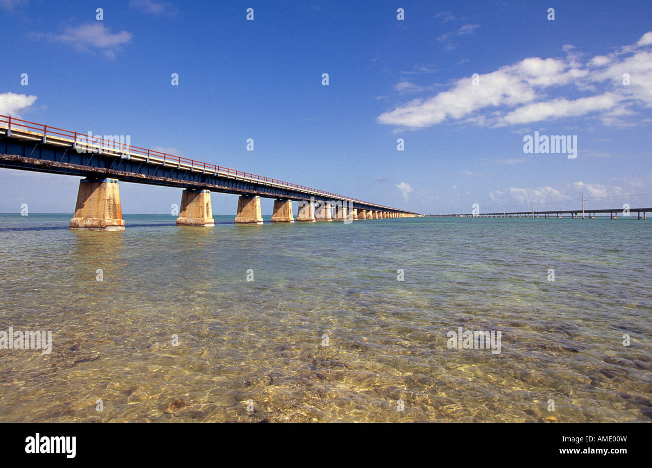 USA FLORIDA FLORIDA KEYS The old railroad bridge destroyed in a hurricane that runs through the Florida Keys to Key West Stock Photohttps://www.alamy.com/image-license-details/?v=1https://www.alamy.com/stock-photo-usa-florida-florida-keys-the-old-railroad-bridge-destroyed-in-a-hurricane-15234696.html
RMAME00W–USA FLORIDA FLORIDA KEYS The old railroad bridge destroyed in a hurricane that runs through the Florida Keys to Key West
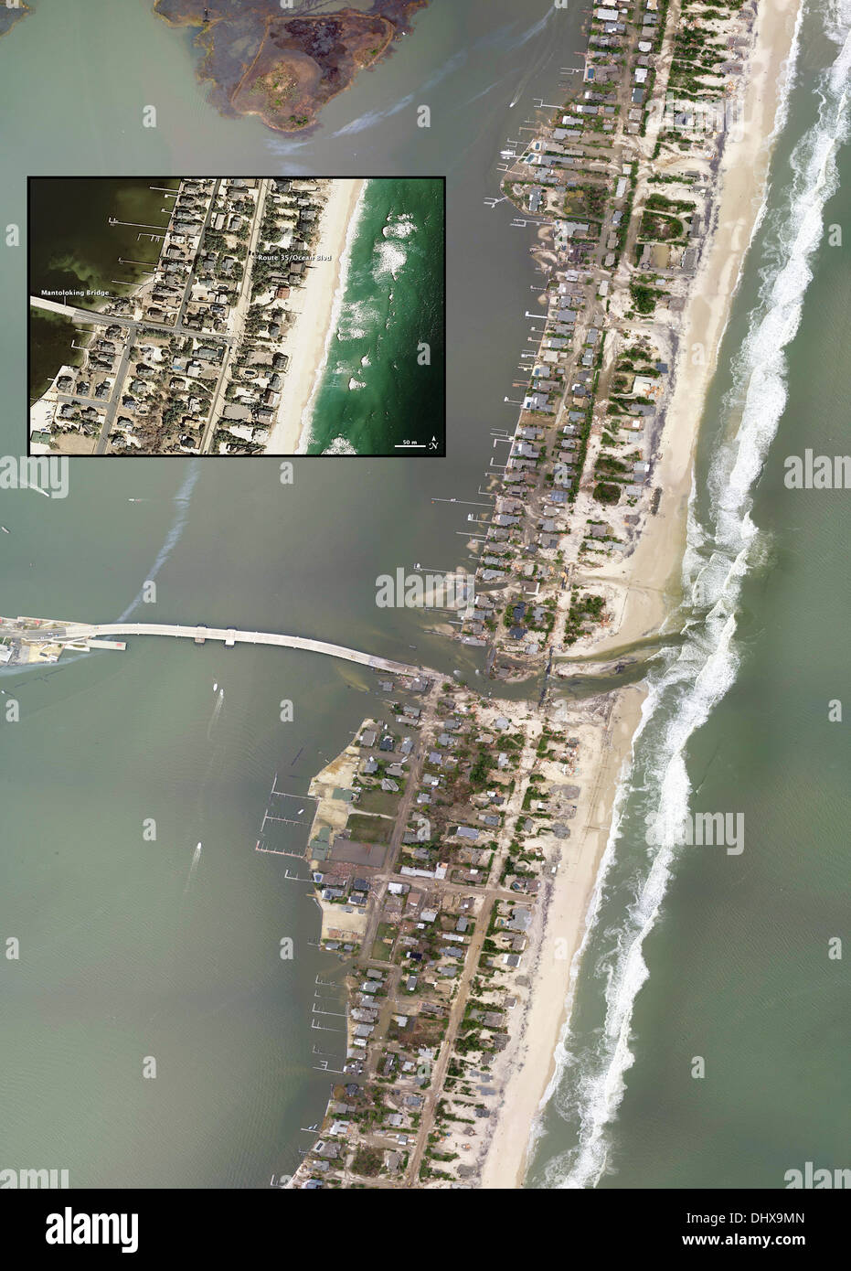 A new inlet breached through a barrier island off New Jersey Stock Photohttps://www.alamy.com/image-license-details/?v=1https://www.alamy.com/a-new-inlet-breached-through-a-barrier-island-off-new-jersey-image62658645.html
RMDHX9MN–A new inlet breached through a barrier island off New Jersey
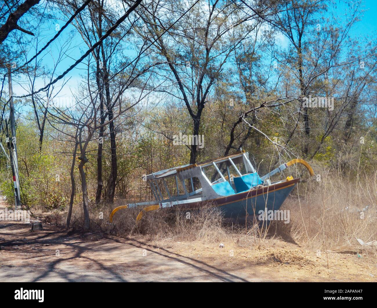 Gili Air aerial Stock Photohttps://www.alamy.com/image-license-details/?v=1https://www.alamy.com/gili-air-aerial-image340755527.html
RF2APAN47–Gili Air aerial
 Aerial view showing a portion of Mantoloking, New Jersey, damaged by Hurricane Sandy. Stock Photohttps://www.alamy.com/image-license-details/?v=1https://www.alamy.com/stock-photo-aerial-view-showing-a-portion-of-mantoloking-new-jersey-damaged-by-57549402.html
RFD9HGRP–Aerial view showing a portion of Mantoloking, New Jersey, damaged by Hurricane Sandy.
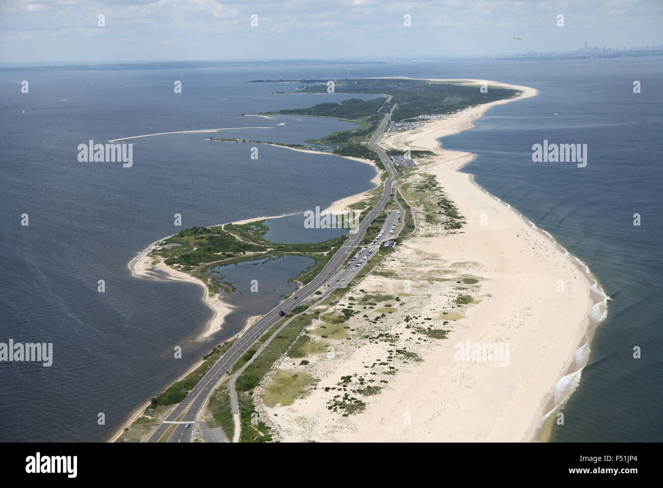 Aerial view of Gateway National Recreation Area / Sandy Hook, New Jersey (post Hurricane Sandy) Stock Photohttps://www.alamy.com/image-license-details/?v=1https://www.alamy.com/stock-photo-aerial-view-of-gateway-national-recreation-area-sandy-hook-new-jersey-89161804.html
RMF51JP4–Aerial view of Gateway National Recreation Area / Sandy Hook, New Jersey (post Hurricane Sandy)
 Hurricane sandy NASA earth observatory Stock Photohttps://www.alamy.com/image-license-details/?v=1https://www.alamy.com/stock-photo-hurricane-sandy-nasa-earth-observatory-88275427.html
RFF3H85R–Hurricane sandy NASA earth observatory
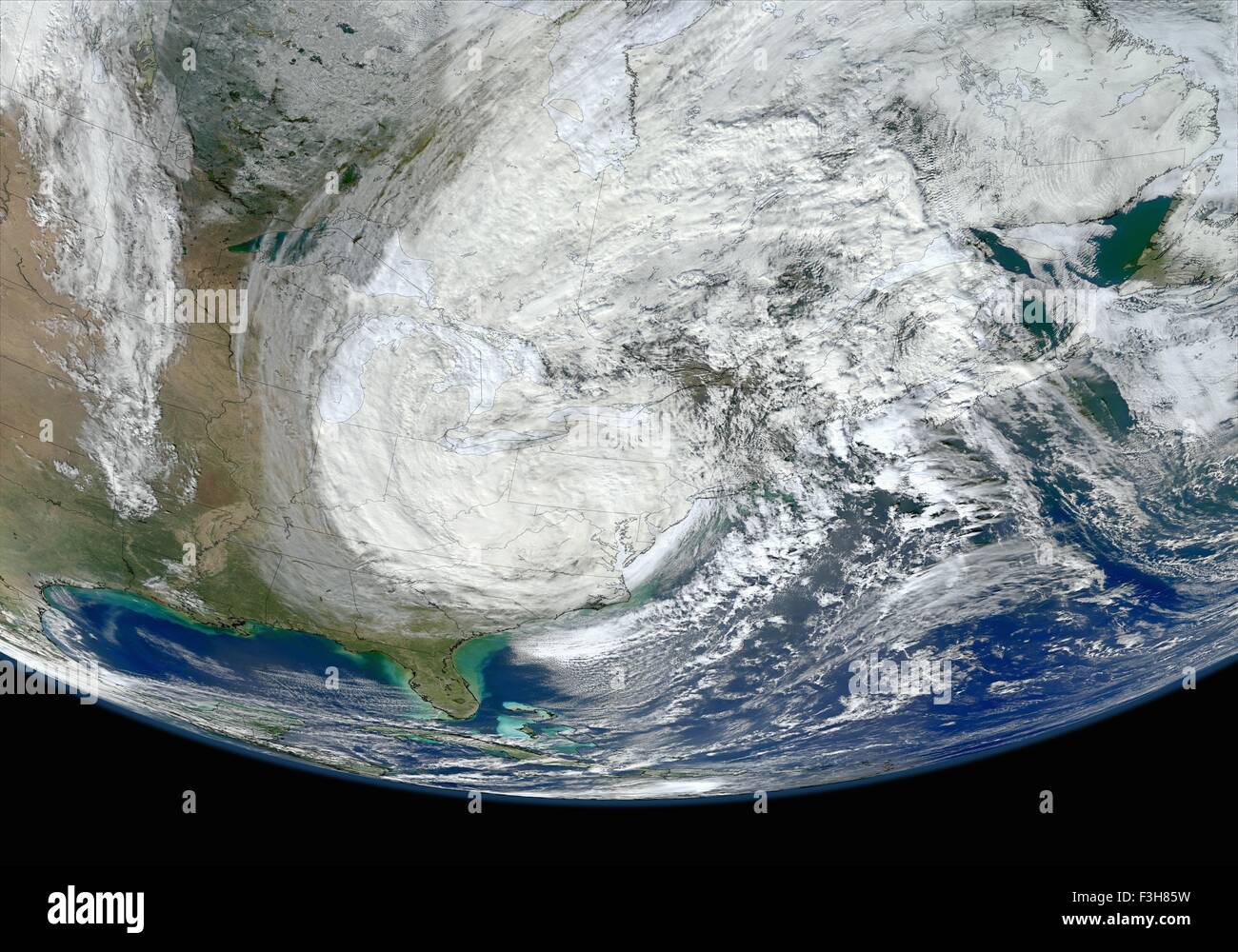 Hurricane sandy NASA earth observatory Stock Photohttps://www.alamy.com/image-license-details/?v=1https://www.alamy.com/stock-photo-hurricane-sandy-nasa-earth-observatory-88275429.html
RFF3H85W–Hurricane sandy NASA earth observatory
 Aerial view of a house submerged in flood water after a hurricane hit South Carolina. Stock Photohttps://www.alamy.com/image-license-details/?v=1https://www.alamy.com/stock-photo-aerial-view-of-a-house-submerged-in-flood-water-after-a-hurricane-130022369.html
RFHFF0T1–Aerial view of a house submerged in flood water after a hurricane hit South Carolina.
 Road. Aerial of hurricane storm damage to New York City. Overflowing East River and flooding on the FDR Drive. Two police cars blocking off traffic. Stock Photohttps://www.alamy.com/image-license-details/?v=1https://www.alamy.com/stock-photo-road-aerial-of-hurricane-storm-damage-to-new-york-city-overflowing-52641695.html
RMD1J10F–Road. Aerial of hurricane storm damage to New York City. Overflowing East River and flooding on the FDR Drive. Two police cars blocking off traffic.
 This aerial shows flood damage from tropical storm Irene where a road has been completely washed away in Vermont. Stock Photohttps://www.alamy.com/image-license-details/?v=1https://www.alamy.com/stock-photo-this-aerial-shows-flood-damage-from-tropical-storm-irene-where-a-road-41902616.html
RMCC4R60–This aerial shows flood damage from tropical storm Irene where a road has been completely washed away in Vermont.
 Aerial of Gooseberry Mesa Desert Path in Utah Stock Photohttps://www.alamy.com/image-license-details/?v=1https://www.alamy.com/aerial-of-gooseberry-mesa-desert-path-in-utah-image640556279.html
RF2S63T1Y–Aerial of Gooseberry Mesa Desert Path in Utah
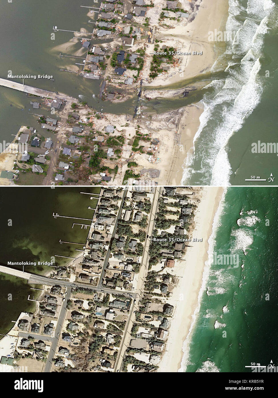 On October 29, 2012, lives were changed forever along the shores of New Jersey, New York, Connecticut, and in the two dozen United States affected by what meteorologists are calling Superstorm Sandy. The landscape of the East Coast was also changed, though no geologist would ever use the word “forever” when referring to the shape of a barrier island. The two aerial photographs above show a portion of the New Jersey coastal town of Mantoloking, just north of where Hurricane Sandy made landfall. The top photograph was taken by the Remote Sensing Division of the National Oceanic and Atmospheric A Stock Photohttps://www.alamy.com/image-license-details/?v=1https://www.alamy.com/stock-image-on-october-29-2012-lives-were-changed-forever-along-the-shores-of-169276571.html
RMKRB5YR–On October 29, 2012, lives were changed forever along the shores of New Jersey, New York, Connecticut, and in the two dozen United States affected by what meteorologists are calling Superstorm Sandy. The landscape of the East Coast was also changed, though no geologist would ever use the word “forever” when referring to the shape of a barrier island. The two aerial photographs above show a portion of the New Jersey coastal town of Mantoloking, just north of where Hurricane Sandy made landfall. The top photograph was taken by the Remote Sensing Division of the National Oceanic and Atmospheric A
 Hurricane Ike, Galveston, Texas, September 17, 2008 Mayor of Galveston Lyda Ann Thomas (lf) and Federal Coordinating Officer Sandy Coachman (rt) prepare to take an aerial tour of Galveston Island to observe damages created by Hurricane Ike. Robert Kaufmann/FEMA.. Photographs Relating to Disasters and Emergency Management Programs, Activities, and Officials Stock Photohttps://www.alamy.com/image-license-details/?v=1https://www.alamy.com/hurricane-ike-galveston-texas-september-17-2008-mayor-of-galveston-lyda-ann-thomas-lf-and-federal-coordinating-officer-sandy-coachman-rt-prepare-to-take-an-aerial-tour-of-galveston-island-to-observe-damages-created-by-hurricane-ike-robert-kaufmannfema-photographs-relating-to-disasters-and-emergency-management-programs-activities-and-officials-image497949913.html
RM2KX3G5D–Hurricane Ike, Galveston, Texas, September 17, 2008 Mayor of Galveston Lyda Ann Thomas (lf) and Federal Coordinating Officer Sandy Coachman (rt) prepare to take an aerial tour of Galveston Island to observe damages created by Hurricane Ike. Robert Kaufmann/FEMA.. Photographs Relating to Disasters and Emergency Management Programs, Activities, and Officials
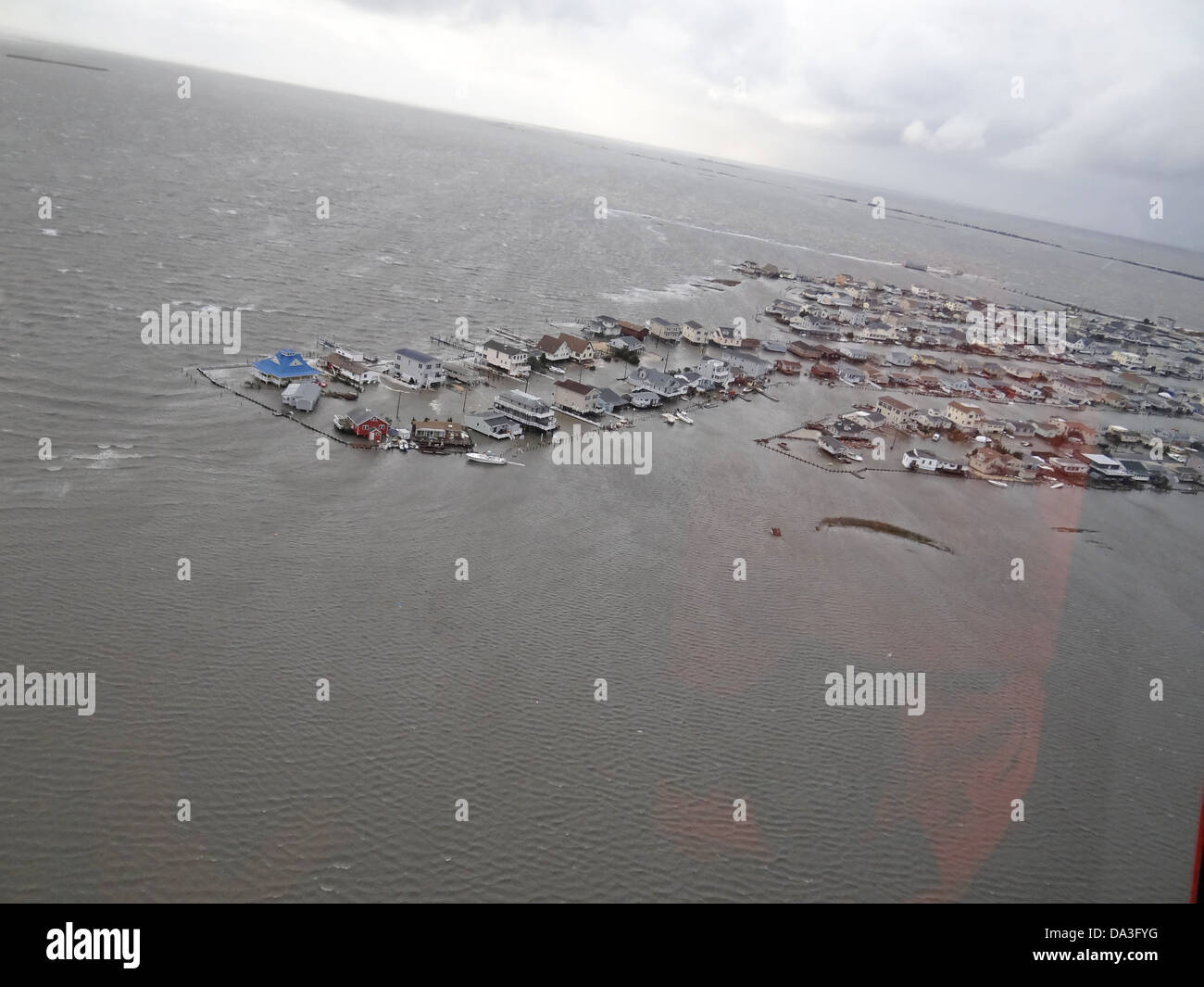 USA New Jersey Tuckerton Hurricane Sandy aftermath homes flooded Stock Photohttps://www.alamy.com/image-license-details/?v=1https://www.alamy.com/stock-photo-usa-new-jersey-tuckerton-hurricane-sandy-aftermath-homes-flooded-57856052.html
RMDA3FYG–USA New Jersey Tuckerton Hurricane Sandy aftermath homes flooded
 San Antonio, TX, July 20, 2007 Aerial of roughly 300 ambulances staged at Kelly USA, in San Antonio, TX in preparation for Hurricane Dean. The EMS resources are activated to assist the State in evacuation of hospitals, nursing homes, and patients living at home with significant medical problems when the storm appeared to be threatening South Texas. Sandy Bogucki/HHS.. Photographs Relating to Disasters and Emergency Management Programs, Activities, and Officials Stock Photohttps://www.alamy.com/image-license-details/?v=1https://www.alamy.com/san-antonio-tx-july-20-2007-aerial-of-roughly-300-ambulances-staged-at-kelly-usa-in-san-antonio-tx-in-preparation-for-hurricane-dean-the-ems-resources-are-activated-to-assist-the-state-in-evacuation-of-hospitals-nursing-homes-and-patients-living-at-home-with-significant-medical-problems-when-the-storm-appeared-to-be-threatening-south-texas-sandy-boguckihhs-photographs-relating-to-disasters-and-emergency-management-programs-activities-and-officials-image497856770.html
RM2KWY9AX–San Antonio, TX, July 20, 2007 Aerial of roughly 300 ambulances staged at Kelly USA, in San Antonio, TX in preparation for Hurricane Dean. The EMS resources are activated to assist the State in evacuation of hospitals, nursing homes, and patients living at home with significant medical problems when the storm appeared to be threatening South Texas. Sandy Bogucki/HHS.. Photographs Relating to Disasters and Emergency Management Programs, Activities, and Officials
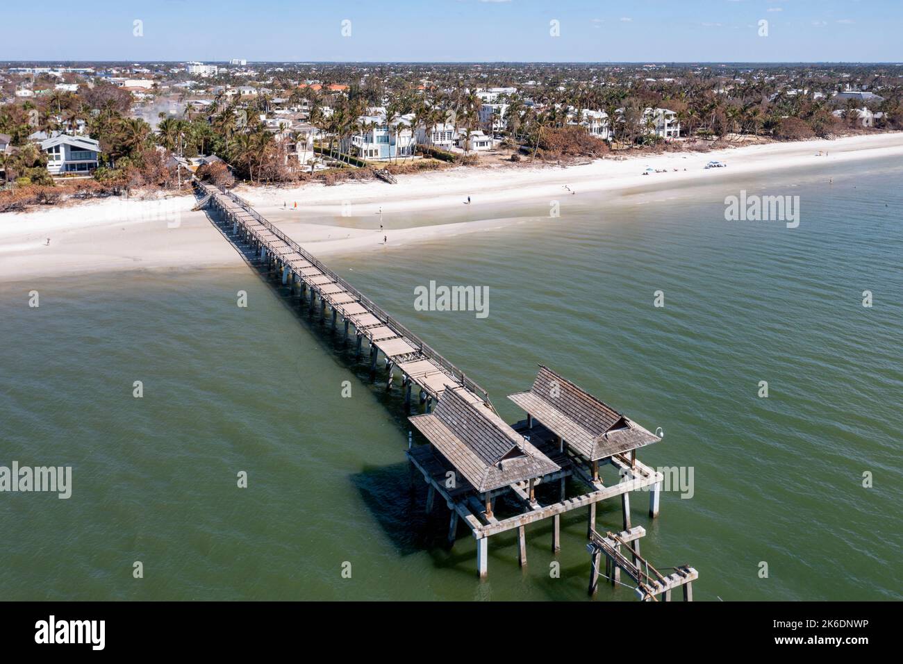 Naples Pier after Hurricane Ian 2022. Heavy damage and destruction Stock Photohttps://www.alamy.com/image-license-details/?v=1https://www.alamy.com/naples-pier-after-hurricane-ian-2022-heavy-damage-and-destruction-image485880802.html
RM2K6DNWP–Naples Pier after Hurricane Ian 2022. Heavy damage and destruction
 Aerial views of the damage caused by Hurricane Sandy to the New Jersey October 30, 2012. Stock Photohttps://www.alamy.com/image-license-details/?v=1https://www.alamy.com/stock-photo-aerial-views-of-the-damage-caused-by-hurricane-sandy-to-the-new-jersey-46916897.html
RMCM96YD–Aerial views of the damage caused by Hurricane Sandy to the New Jersey October 30, 2012.
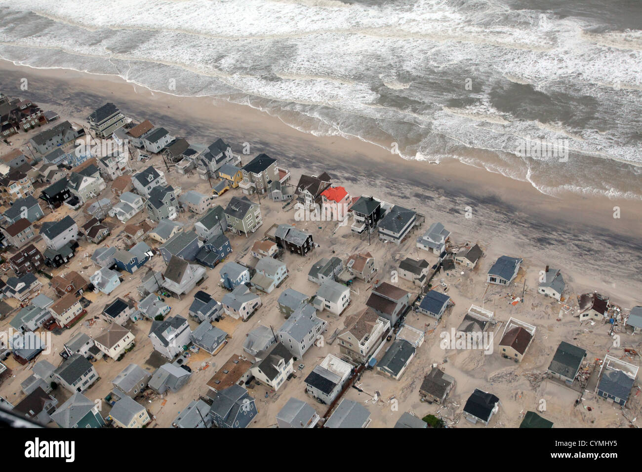 Aerial views of the damage caused by Hurricane Sandy to the New Jersey coast taken during a search and rescue mission by 1-150 Assault Helicopter Battalion, New Jersey Army National Guard, Oct. 30, 2012. (U.S. Air Force photo by Master Sgt. Mark C. Olsen/Released) Stock Photohttps://www.alamy.com/image-license-details/?v=1https://www.alamy.com/stock-photo-aerial-views-of-the-damage-caused-by-hurricane-sandy-to-the-new-jersey-51469577.html
RMCYMHY5–Aerial views of the damage caused by Hurricane Sandy to the New Jersey coast taken during a search and rescue mission by 1-150 Assault Helicopter Battalion, New Jersey Army National Guard, Oct. 30, 2012. (U.S. Air Force photo by Master Sgt. Mark C. Olsen/Released)
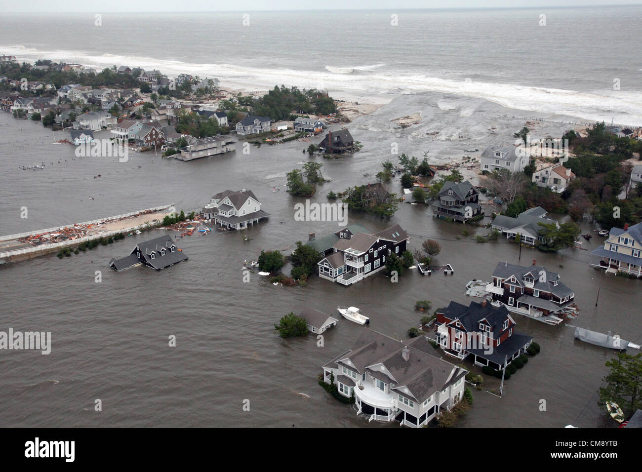 Aerial views of the damage caused by Hurricane Sandy to the New Jersey coast taken during a search and rescue mission by 1-150 Assault Helicopter Battalion, New Jersey Army National Guard, Oct. 30, 2012.Aerial views of the damage caused by Hurricane Sandy to the New Jersey coast taken during a search and rescue mission by 1-150 Assault Helicopter Battalion, New Jersey Army National Guard, Oct. 30, 2012. (U.S. Air Force photo by Master Sgt. Mark C. Olsen/) Stock Photohttps://www.alamy.com/image-license-details/?v=1https://www.alamy.com/stock-photo-aerial-views-of-the-damage-caused-by-hurricane-sandy-to-the-new-jersey-46911323.html
RMCM8YTB–Aerial views of the damage caused by Hurricane Sandy to the New Jersey coast taken during a search and rescue mission by 1-150 Assault Helicopter Battalion, New Jersey Army National Guard, Oct. 30, 2012.Aerial views of the damage caused by Hurricane Sandy to the New Jersey coast taken during a search and rescue mission by 1-150 Assault Helicopter Battalion, New Jersey Army National Guard, Oct. 30, 2012. (U.S. Air Force photo by Master Sgt. Mark C. Olsen/)
 Aerial of Mantoloking New Jersey coastline damaged homes. New Jersey Hurricane Sandy. Photographs Relating to Disasters and Emergency Management Programs, Activities, and Officials Stock Photohttps://www.alamy.com/image-license-details/?v=1https://www.alamy.com/aerial-of-mantoloking-new-jersey-coastline-damaged-homes-new-jersey-hurricane-sandy-photographs-relating-to-disasters-and-emergency-management-programs-activities-and-officials-image498609750.html
RM2KY5HR2–Aerial of Mantoloking New Jersey coastline damaged homes. New Jersey Hurricane Sandy. Photographs Relating to Disasters and Emergency Management Programs, Activities, and Officials
 New York Mayor Michael Bloomberg points out areas on a map of the region for President Barack Obama aboard Marine One during an aerial tour of Hurricane Sandy storm damage in New York N.Y. Nov. 15 2012. Joining the President from left are: Secretary of Housing and Urban Development Shaun Donovan; Secretary of Homeland Security Janet Napolitano; and New York Governor Andrew Cuomo. Stock Photohttps://www.alamy.com/image-license-details/?v=1https://www.alamy.com/new-york-mayor-michael-bloomberg-points-out-areas-on-a-map-of-the-region-for-president-barack-obama-aboard-marine-one-during-an-aerial-tour-of-hurricane-sandy-storm-damage-in-new-york-ny-nov-15-2012-joining-the-president-from-left-are-secretary-of-housing-and-urban-development-shaun-donovan-secretary-of-homeland-security-janet-napolitano-and-new-york-governor-andrew-cuomo-image413641464.html
RM2F0XYWC–New York Mayor Michael Bloomberg points out areas on a map of the region for President Barack Obama aboard Marine One during an aerial tour of Hurricane Sandy storm damage in New York N.Y. Nov. 15 2012. Joining the President from left are: Secretary of Housing and Urban Development Shaun Donovan; Secretary of Homeland Security Janet Napolitano; and New York Governor Andrew Cuomo.
 Nov. 15, 2012 'New York City Mayor Michael Bloomberg views a map with the President during an aerial tour to view damage from Hurricane Sandy in Breezy Point, the Rockaways and Staten Island in NYC. Also onboard were New York Gov. Andrew Cuomo, Shaun Donovan, Secretary of Housing and Urban Development, Janet Napolitano, Homeland Security Secretary.' (Official White House Photo by Pete Souza) This official White House photograph is being made available only for publication by news organizations and/or for personal use printing by the subject(s) of the photograph. The photograph may not be ma Stock Photohttps://www.alamy.com/image-license-details/?v=1https://www.alamy.com/stock-image-nov-15-2012-new-york-city-mayor-michael-bloomberg-views-a-map-with-166852674.html
RFKKCP82–Nov. 15, 2012 'New York City Mayor Michael Bloomberg views a map with the President during an aerial tour to view damage from Hurricane Sandy in Breezy Point, the Rockaways and Staten Island in NYC. Also onboard were New York Gov. Andrew Cuomo, Shaun Donovan, Secretary of Housing and Urban Development, Janet Napolitano, Homeland Security Secretary.' (Official White House Photo by Pete Souza) This official White House photograph is being made available only for publication by news organizations and/or for personal use printing by the subject(s) of the photograph. The photograph may not be ma
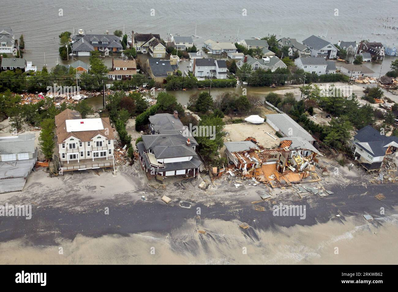 Bildnummer: 58655792 Datum: 30.10.2012 Copyright: imago/Xinhua WASHINGTON D.C. -- In this photo released by U.S. Department of Defense (DOD), aerial views during an Army search and rescue mission show damage from Hurricane Sandy to the New Jersey coast, Oct. 30, 2012. (Xinhua/DOD Release) US-NEW JERSEY-COAST-SANDY PUBLICATIONxNOTxINxCHN Gesellschaft USA Sandy Sturm Wirbelsturm Hurrikan Wetter Unwetter Naturkatastrophe Schaden Luftbild x0x xac 2012 quer 58655792 Date 30 10 2012 Copyright Imago XINHUA Washington D C in This Photo released by U S Department of Defense Dod Aerial Views durin Stock Photohttps://www.alamy.com/image-license-details/?v=1https://www.alamy.com/bildnummer-58655792-datum-30102012-copyright-imagoxinhua-washington-dc-in-this-photo-released-by-us-department-of-defense-dod-aerial-views-during-an-army-search-and-rescue-mission-show-damage-from-hurricane-sandy-to-the-new-jersey-coast-oct-30-2012-xinhuadod-release-us-new-jersey-coast-sandy-publicationxnotxinxchn-gesellschaft-usa-sandy-sturm-wirbelsturm-hurrikan-wetter-unwetter-naturkatastrophe-schaden-luftbild-x0x-xac-2012-quer-58655792-date-30-10-2012-copyright-imago-xinhua-washington-d-c-in-this-photo-released-by-u-s-department-of-defense-dod-aerial-views-durin-image562967834.html
RM2RKWB62–Bildnummer: 58655792 Datum: 30.10.2012 Copyright: imago/Xinhua WASHINGTON D.C. -- In this photo released by U.S. Department of Defense (DOD), aerial views during an Army search and rescue mission show damage from Hurricane Sandy to the New Jersey coast, Oct. 30, 2012. (Xinhua/DOD Release) US-NEW JERSEY-COAST-SANDY PUBLICATIONxNOTxINxCHN Gesellschaft USA Sandy Sturm Wirbelsturm Hurrikan Wetter Unwetter Naturkatastrophe Schaden Luftbild x0x xac 2012 quer 58655792 Date 30 10 2012 Copyright Imago XINHUA Washington D C in This Photo released by U S Department of Defense Dod Aerial Views durin
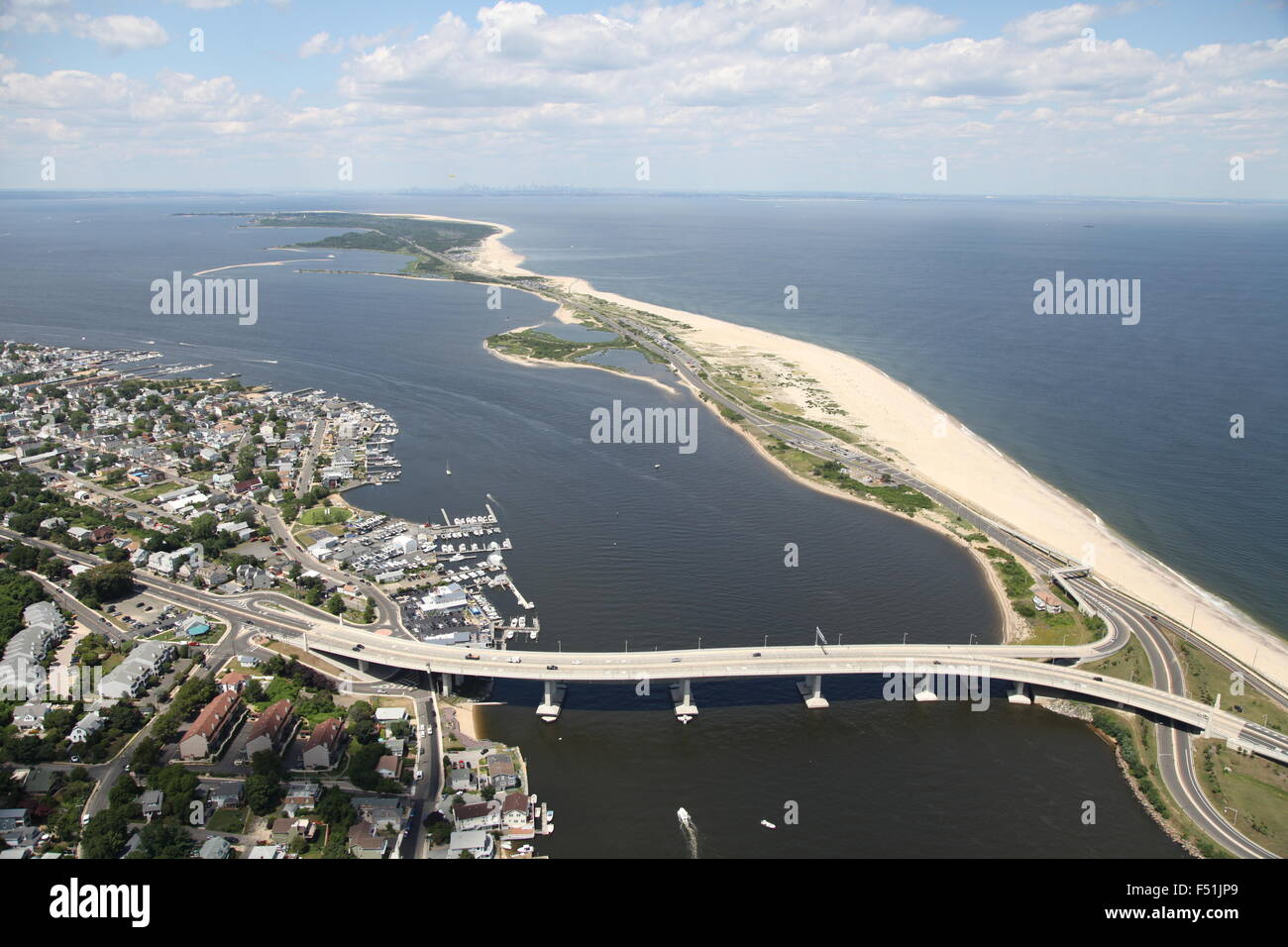 Aerial view of Highlands, New Jersey, and Gateway National Recreation Area / Sandy Hook (post Hurricane Sandy) Stock Photohttps://www.alamy.com/image-license-details/?v=1https://www.alamy.com/stock-photo-aerial-view-of-highlands-new-jersey-and-gateway-national-recreation-89161809.html
RMF51JP9–Aerial view of Highlands, New Jersey, and Gateway National Recreation Area / Sandy Hook (post Hurricane Sandy)
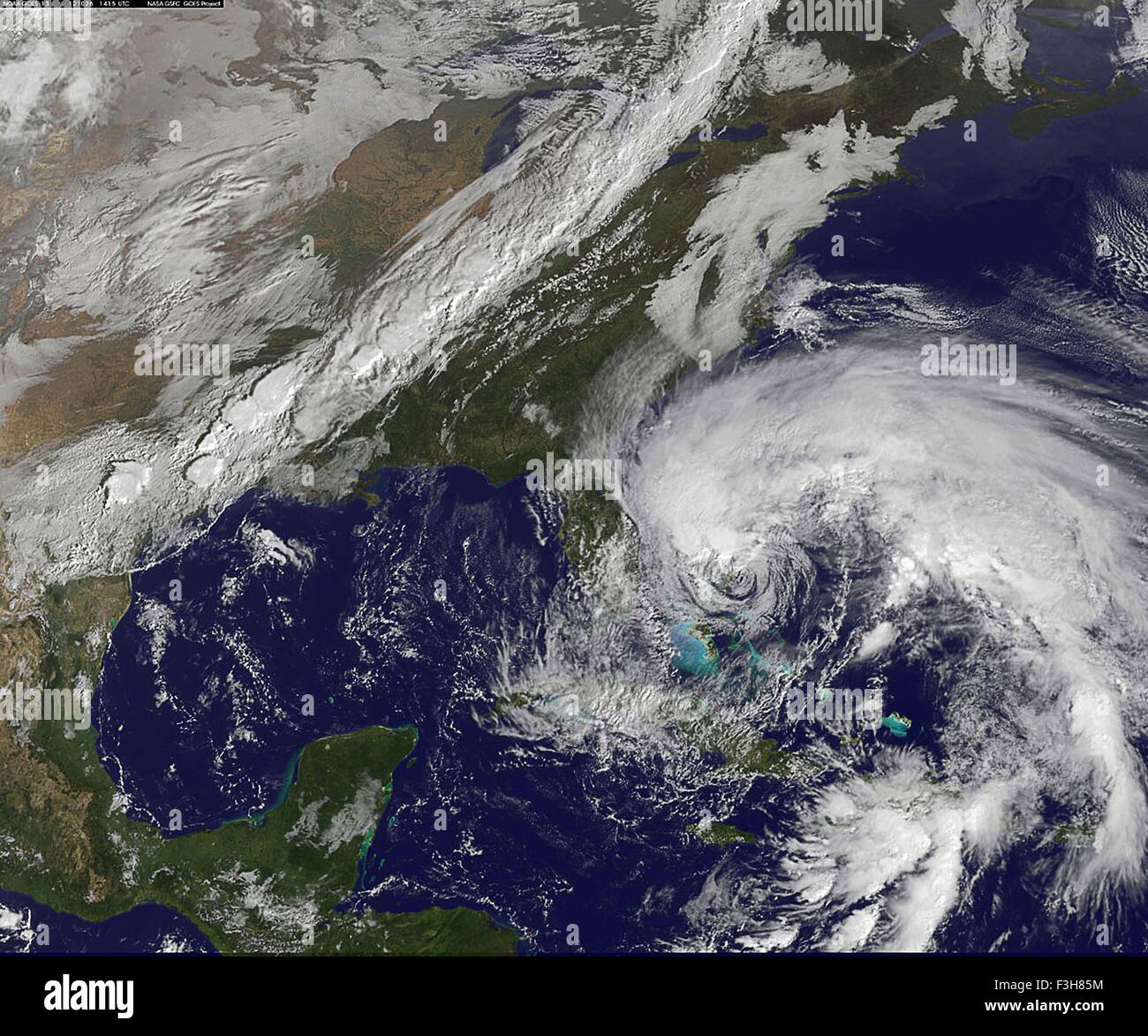 Hurricane sandy NASA earth observatory Stock Photohttps://www.alamy.com/image-license-details/?v=1https://www.alamy.com/stock-photo-hurricane-sandy-nasa-earth-observatory-88275424.html
RFF3H85M–Hurricane sandy NASA earth observatory
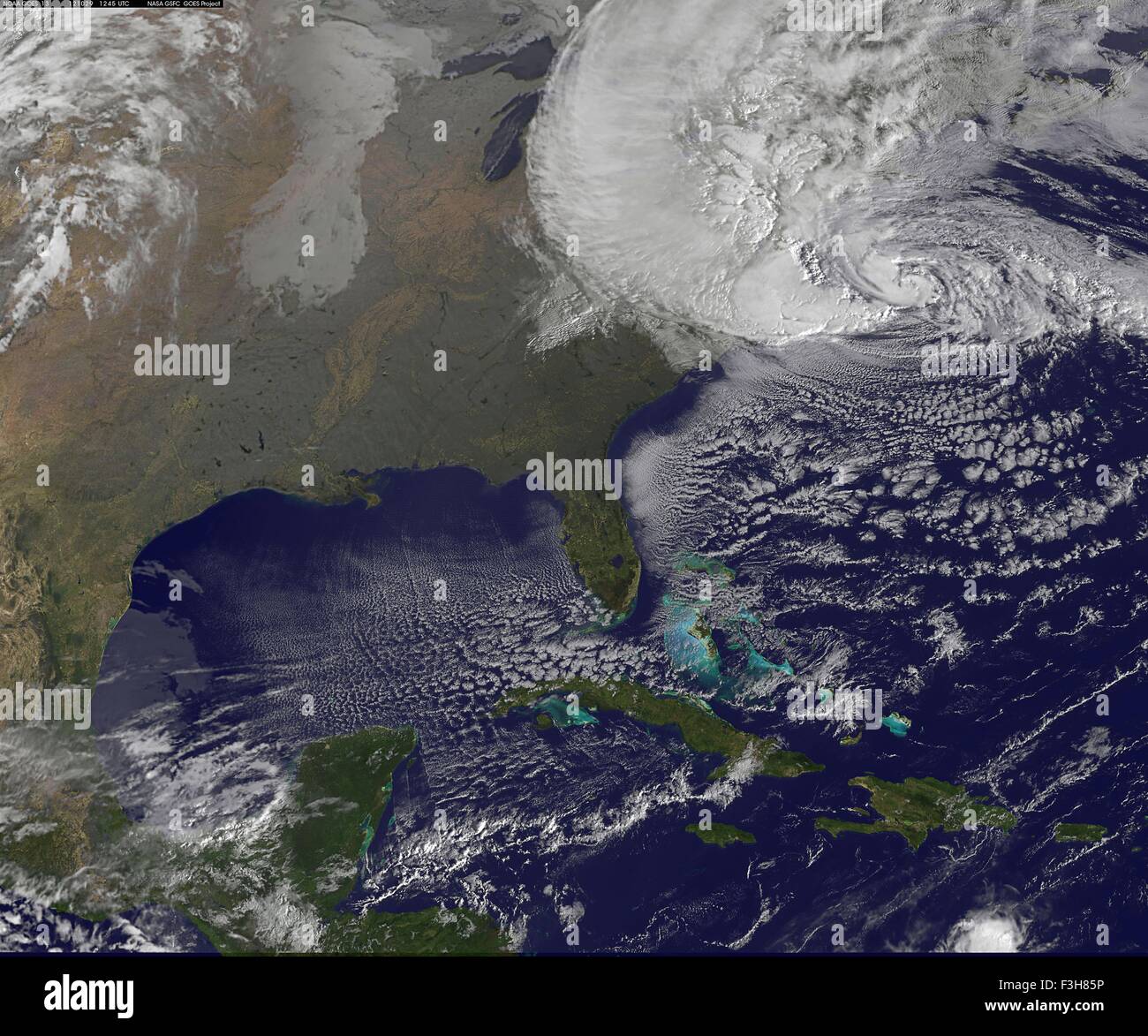 Hurricane sandy NASA earth observatory Stock Photohttps://www.alamy.com/image-license-details/?v=1https://www.alamy.com/stock-photo-hurricane-sandy-nasa-earth-observatory-88275426.html
RFF3H85P–Hurricane sandy NASA earth observatory
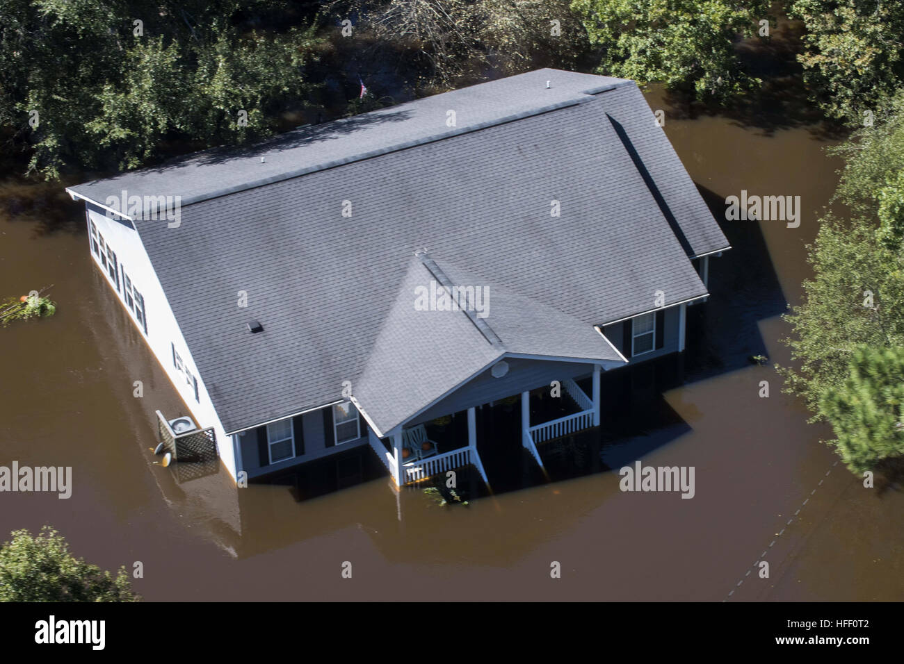 Aerial view of a house submerged in flood water after a hurricane hit South Carolina. Stock Photohttps://www.alamy.com/image-license-details/?v=1https://www.alamy.com/stock-photo-aerial-view-of-a-house-submerged-in-flood-water-after-a-hurricane-130022370.html
RFHFF0T2–Aerial view of a house submerged in flood water after a hurricane hit South Carolina.
 USA FLORIDA FLORIDA KEYS A wind surfer finds a good breeze in the Florida Keys near Key West Stock Photohttps://www.alamy.com/image-license-details/?v=1https://www.alamy.com/stock-photo-usa-florida-florida-keys-a-wind-surfer-finds-a-good-breeze-in-the-15234663.html
RMAMDYXG–USA FLORIDA FLORIDA KEYS A wind surfer finds a good breeze in the Florida Keys near Key West
 A road is shown damaged by flood water caused by tropical storm Irene in Vermont shown in this aerial photo. Stock Photohttps://www.alamy.com/image-license-details/?v=1https://www.alamy.com/stock-photo-a-road-is-shown-damaged-by-flood-water-caused-by-tropical-storm-irene-41902497.html
RMCC4R1N–A road is shown damaged by flood water caused by tropical storm Irene in Vermont shown in this aerial photo.
 Aerial of Gooseberry Mesa Desert and Mountains Stock Photohttps://www.alamy.com/image-license-details/?v=1https://www.alamy.com/aerial-of-gooseberry-mesa-desert-and-mountains-image640557218.html
RF2S63W7E–Aerial of Gooseberry Mesa Desert and Mountains
 Lavalette, Ortly, and Normandy used to be full of these little cottages, now there are very few remaining; they were all destroyed by Hurricane Sandy. Stock Photohttps://www.alamy.com/image-license-details/?v=1https://www.alamy.com/lavalette-ortly-and-normandy-used-to-be-full-of-these-little-cottages-now-there-are-very-few-remaining-they-were-all-destroyed-by-hurricane-sandy-image559388989.html
RF2RE2AA5–Lavalette, Ortly, and Normandy used to be full of these little cottages, now there are very few remaining; they were all destroyed by Hurricane Sandy.
 New York Mayor Michael Bloomberg points out areas on a map of the region for United States President Barack Obama aboard Marine One during an aerial tour of Hurricane Sandy storm damage in New York, New York, November 15, 2012. Joining the President, from left, are: Secretary of Housing and Urban Development Shaun Donovan; Secretary of Homeland Security Janet Napolitano; and New York Governor Andrew Cuomo. .Mandatory Credit: Pete Souza - White House via CNP | usage worldwide Stock Photohttps://www.alamy.com/image-license-details/?v=1https://www.alamy.com/new-york-mayor-michael-bloomberg-points-out-areas-on-a-map-of-the-region-for-united-states-president-barack-obama-aboard-marine-one-during-an-aerial-tour-of-hurricane-sandy-storm-damage-in-new-york-new-york-november-15-2012-joining-the-president-from-left-are-secretary-of-housing-and-urban-development-shaun-donovan-secretary-of-homeland-security-janet-napolitano-and-new-york-governor-andrew-cuomo-mandatory-credit-pete-souza-white-house-via-cnp-usage-worldwide-image344866984.html
RM2B121A0–New York Mayor Michael Bloomberg points out areas on a map of the region for United States President Barack Obama aboard Marine One during an aerial tour of Hurricane Sandy storm damage in New York, New York, November 15, 2012. Joining the President, from left, are: Secretary of Housing and Urban Development Shaun Donovan; Secretary of Homeland Security Janet Napolitano; and New York Governor Andrew Cuomo. .Mandatory Credit: Pete Souza - White House via CNP | usage worldwide
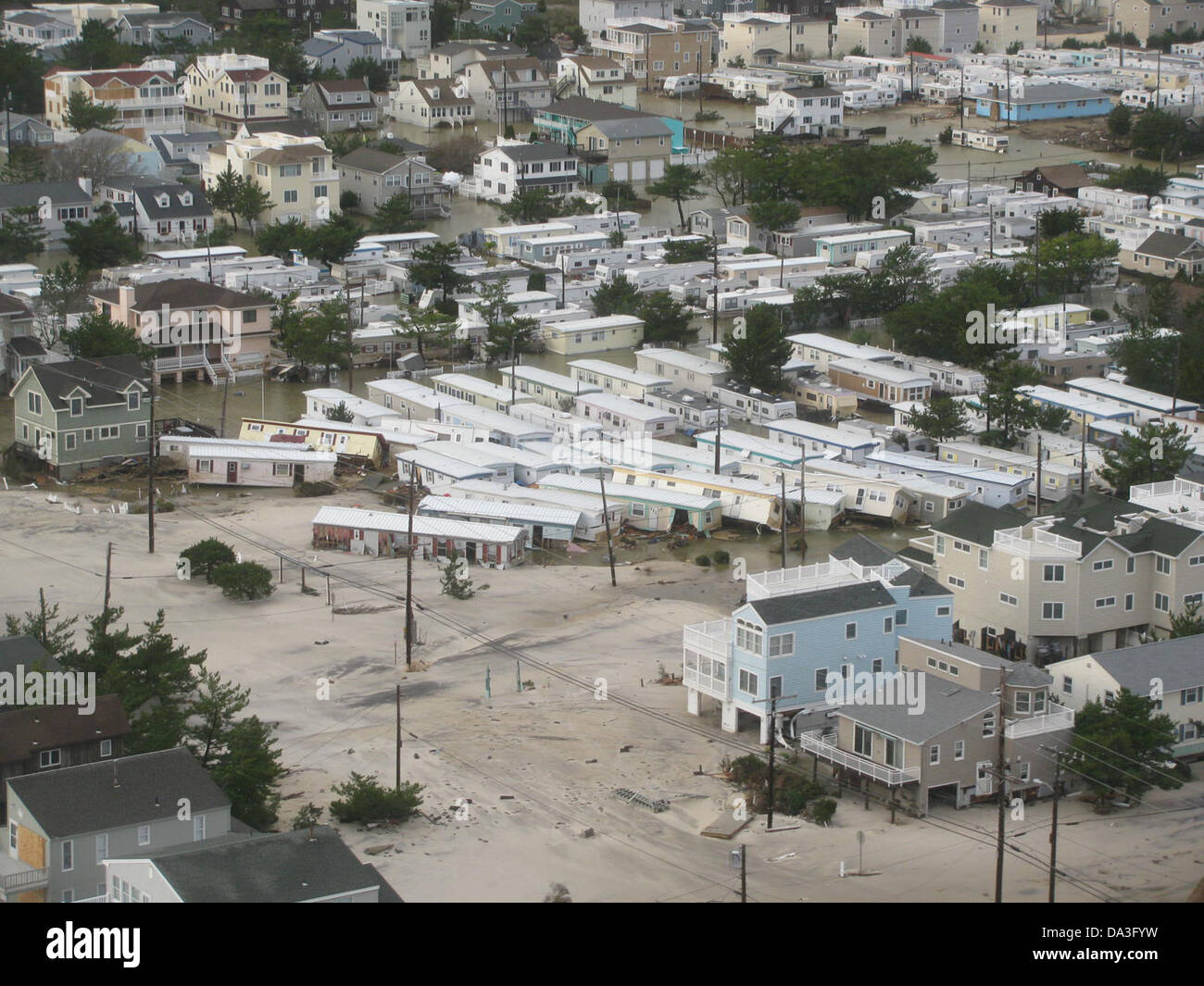 USA New Jersey Brigantine Hurricane Sandy Aftermath Homes displaced October 30, 2012 Stock Photohttps://www.alamy.com/image-license-details/?v=1https://www.alamy.com/stock-photo-usa-new-jersey-brigantine-hurricane-sandy-aftermath-homes-displaced-57856061.html
RMDA3FYW–USA New Jersey Brigantine Hurricane Sandy Aftermath Homes displaced October 30, 2012
 An aerial panorama of Cetti Bay between the villages of Agat and Umatac, on the west coast of Guam, Micronesia, Mariana Islands, Pacific Ocean. Stock Photohttps://www.alamy.com/image-license-details/?v=1https://www.alamy.com/an-aerial-panorama-of-cetti-bay-between-the-villages-of-agat-and-umatac-on-the-west-coast-of-guam-micronesia-mariana-islands-pacific-ocean-image608983236.html
RM2XANG98–An aerial panorama of Cetti Bay between the villages of Agat and Umatac, on the west coast of Guam, Micronesia, Mariana Islands, Pacific Ocean.
 The sea is a strong storm a seagull over the waves. A neutral seascape with waves and a flying bird. Sandy beach, seaweed, waves roll on the shore. Th Stock Photohttps://www.alamy.com/image-license-details/?v=1https://www.alamy.com/the-sea-is-a-strong-storm-a-seagull-over-the-waves-a-neutral-seascape-with-waves-and-a-flying-bird-sandy-beach-seaweed-waves-roll-on-the-shore-th-image436473023.html
RF2GA31P7–The sea is a strong storm a seagull over the waves. A neutral seascape with waves and a flying bird. Sandy beach, seaweed, waves roll on the shore. Th
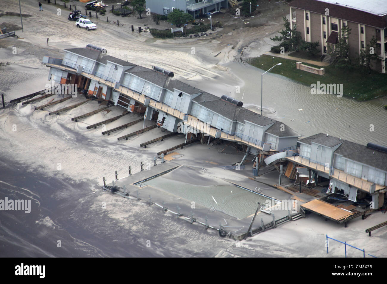 New Jersey, Usa. 30th October 2012. Aerial view of property damage along the New Jersey coast caused by Hurricane Sandy October 30, 2012. Sandy swept through the region resulting in 26 deaths in seven states in the past 48 hours and shutting power to more than 6 million people Stock Photohttps://www.alamy.com/image-license-details/?v=1https://www.alamy.com/stock-photo-new-jersey-usa-30th-october-2012-aerial-view-of-property-damage-along-46909923.html
RMCM8X2B–New Jersey, Usa. 30th October 2012. Aerial view of property damage along the New Jersey coast caused by Hurricane Sandy October 30, 2012. Sandy swept through the region resulting in 26 deaths in seven states in the past 48 hours and shutting power to more than 6 million people
 Aerial views of the damage caused by Hurricane Sandy to the New Jersey coast taken during a search and rescue mission by 1-150 Assault Helicopter Battalion, New Jersey Army National Guard, Oct. 30, 2012. (U.S. Air Force photo by Master Sgt. Mark C. Olsen/Released) Stock Photohttps://www.alamy.com/image-license-details/?v=1https://www.alamy.com/stock-photo-aerial-views-of-the-damage-caused-by-hurricane-sandy-to-the-new-jersey-51469586.html
RMCYMHYE–Aerial views of the damage caused by Hurricane Sandy to the New Jersey coast taken during a search and rescue mission by 1-150 Assault Helicopter Battalion, New Jersey Army National Guard, Oct. 30, 2012. (U.S. Air Force photo by Master Sgt. Mark C. Olsen/Released)
 Aerial views of the damage caused by Hurricane Sandy to the New Jersey coast taken during a search and rescue mission by 1-150 Assault Helicopter Battalion, New Jersey Army National Guard, Oct. 30, 2012.Aerial views of the damage caused by Hurricane Sandy to the New Jersey coast taken during a search and rescue mission by 1-150 Assault Helicopter Battalion, New Jersey Army National Guard, Oct. 30, 2012. (U.S. Air Force photo by Master Sgt. Mark C. Olsen/) Stock Photohttps://www.alamy.com/image-license-details/?v=1https://www.alamy.com/stock-photo-aerial-views-of-the-damage-caused-by-hurricane-sandy-to-the-new-jersey-46911425.html
RMCM9001–Aerial views of the damage caused by Hurricane Sandy to the New Jersey coast taken during a search and rescue mission by 1-150 Assault Helicopter Battalion, New Jersey Army National Guard, Oct. 30, 2012.Aerial views of the damage caused by Hurricane Sandy to the New Jersey coast taken during a search and rescue mission by 1-150 Assault Helicopter Battalion, New Jersey Army National Guard, Oct. 30, 2012. (U.S. Air Force photo by Master Sgt. Mark C. Olsen/)
 Aerial of Mantoloking New Jersey coastline damaged homes. New Jersey Hurricane Sandy. Photographs Relating to Disasters and Emergency Management Programs, Activities, and Officials Stock Photohttps://www.alamy.com/image-license-details/?v=1https://www.alamy.com/aerial-of-mantoloking-new-jersey-coastline-damaged-homes-new-jersey-hurricane-sandy-photographs-relating-to-disasters-and-emergency-management-programs-activities-and-officials-image498610290.html
RM2KY5JEA–Aerial of Mantoloking New Jersey coastline damaged homes. New Jersey Hurricane Sandy. Photographs Relating to Disasters and Emergency Management Programs, Activities, and Officials
 usfwsnortheast 16045371773 Day 4 - Hurricane Sandy Aerial Tour Stock Photohttps://www.alamy.com/image-license-details/?v=1https://www.alamy.com/stock-photo-usfwsnortheast-16045371773-day-4-hurricane-sandy-aerial-tour-126824277.html
RMHA99JD–usfwsnortheast 16045371773 Day 4 - Hurricane Sandy Aerial Tour
 Aerial views of the damage caused by Hurricane Sandy to the New Jersey coast taken during a search and rescue mission by 1-150 Assault Helicopter Battalion, New Jersey Army National Guard, Oct. 30, 2012. Master Sgt. Mark C. Olsen Stock Photohttps://www.alamy.com/image-license-details/?v=1https://www.alamy.com/stock-photo-aerial-views-of-the-damage-caused-by-hurricane-sandy-to-the-new-jersey-129328198.html
RMHEBBC6–Aerial views of the damage caused by Hurricane Sandy to the New Jersey coast taken during a search and rescue mission by 1-150 Assault Helicopter Battalion, New Jersey Army National Guard, Oct. 30, 2012. Master Sgt. Mark C. Olsen
 Bildnummer: 58655793 Datum: 30.10.2012 Copyright: imago/Xinhua WASHINGTON D.C. -- In this photo released by U.S. Department of Defense (DOD), aerial views during an Army search and rescue mission show damage from Hurricane Sandy to the New Jersey coast, Oct. 30, 2012. (Xinhua/DOD Release) US-NEW JERSEY-COAST-SANDY PUBLICATIONxNOTxINxCHN Gesellschaft USA Sandy Sturm Wirbelsturm Hurrikan Wetter Unwetter Naturkatastrophe Schaden Luftbild x0x xac 2012 quer 58655793 Date 30 10 2012 Copyright Imago XINHUA Washington D C in This Photo released by U S Department of Defense Dod Aerial Views durin Stock Photohttps://www.alamy.com/image-license-details/?v=1https://www.alamy.com/bildnummer-58655793-datum-30102012-copyright-imagoxinhua-washington-dc-in-this-photo-released-by-us-department-of-defense-dod-aerial-views-during-an-army-search-and-rescue-mission-show-damage-from-hurricane-sandy-to-the-new-jersey-coast-oct-30-2012-xinhuadod-release-us-new-jersey-coast-sandy-publicationxnotxinxchn-gesellschaft-usa-sandy-sturm-wirbelsturm-hurrikan-wetter-unwetter-naturkatastrophe-schaden-luftbild-x0x-xac-2012-quer-58655793-date-30-10-2012-copyright-imago-xinhua-washington-d-c-in-this-photo-released-by-u-s-department-of-defense-dod-aerial-views-durin-image562967832.html
RM2RKWB60–Bildnummer: 58655793 Datum: 30.10.2012 Copyright: imago/Xinhua WASHINGTON D.C. -- In this photo released by U.S. Department of Defense (DOD), aerial views during an Army search and rescue mission show damage from Hurricane Sandy to the New Jersey coast, Oct. 30, 2012. (Xinhua/DOD Release) US-NEW JERSEY-COAST-SANDY PUBLICATIONxNOTxINxCHN Gesellschaft USA Sandy Sturm Wirbelsturm Hurrikan Wetter Unwetter Naturkatastrophe Schaden Luftbild x0x xac 2012 quer 58655793 Date 30 10 2012 Copyright Imago XINHUA Washington D C in This Photo released by U S Department of Defense Dod Aerial Views durin
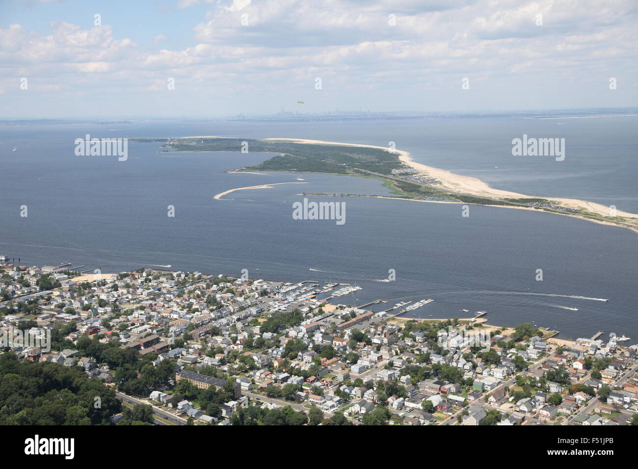 Aerial view of Atlantic Highlands, New Jersey, and Gateway National Recreation Area / Sandy Hook (post Hurricane Sandy) Stock Photohttps://www.alamy.com/image-license-details/?v=1https://www.alamy.com/stock-photo-aerial-view-of-atlantic-highlands-new-jersey-and-gateway-national-89161811.html
RMF51JPB–Aerial view of Atlantic Highlands, New Jersey, and Gateway National Recreation Area / Sandy Hook (post Hurricane Sandy)
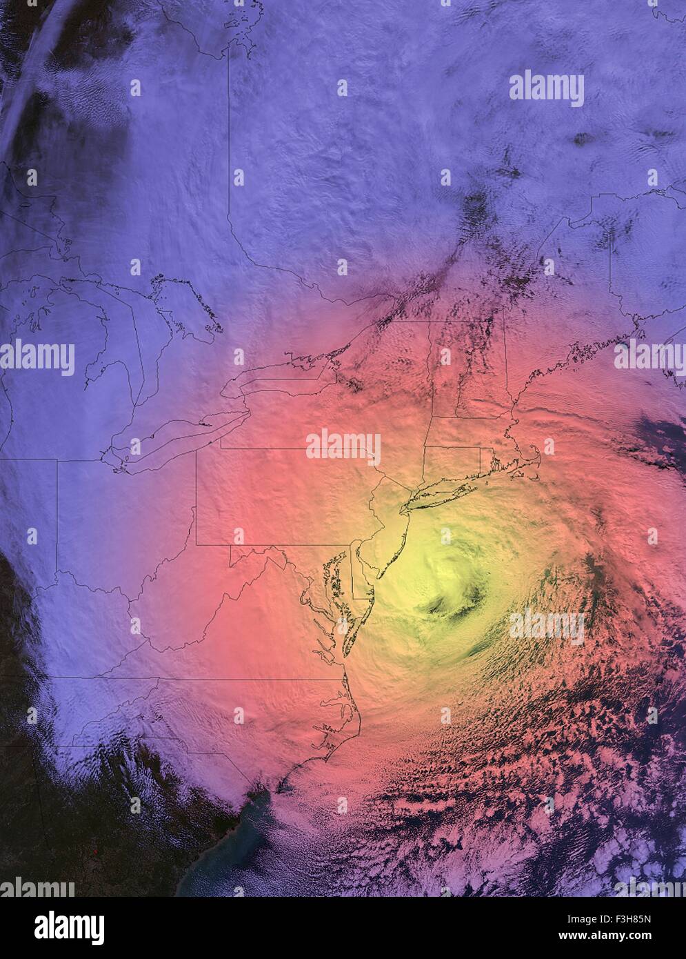 Hurricane sandy NASA earth observatory Stock Photohttps://www.alamy.com/image-license-details/?v=1https://www.alamy.com/stock-photo-hurricane-sandy-nasa-earth-observatory-88275425.html
RFF3H85N–Hurricane sandy NASA earth observatory
 An aerial view of the coast in Palm Beach Florida Stock Photohttps://www.alamy.com/image-license-details/?v=1https://www.alamy.com/stock-photo-an-aerial-view-of-the-coast-in-palm-beach-florida-20270282.html
RFB4YAXJ–An aerial view of the coast in Palm Beach Florida
 Aerial view of a house submerged in flood water after a hurricane hit South Carolina. Stock Photohttps://www.alamy.com/image-license-details/?v=1https://www.alamy.com/stock-photo-aerial-view-of-a-house-submerged-in-flood-water-after-a-hurricane-130022368.html
RFHFF0T0–Aerial view of a house submerged in flood water after a hurricane hit South Carolina.
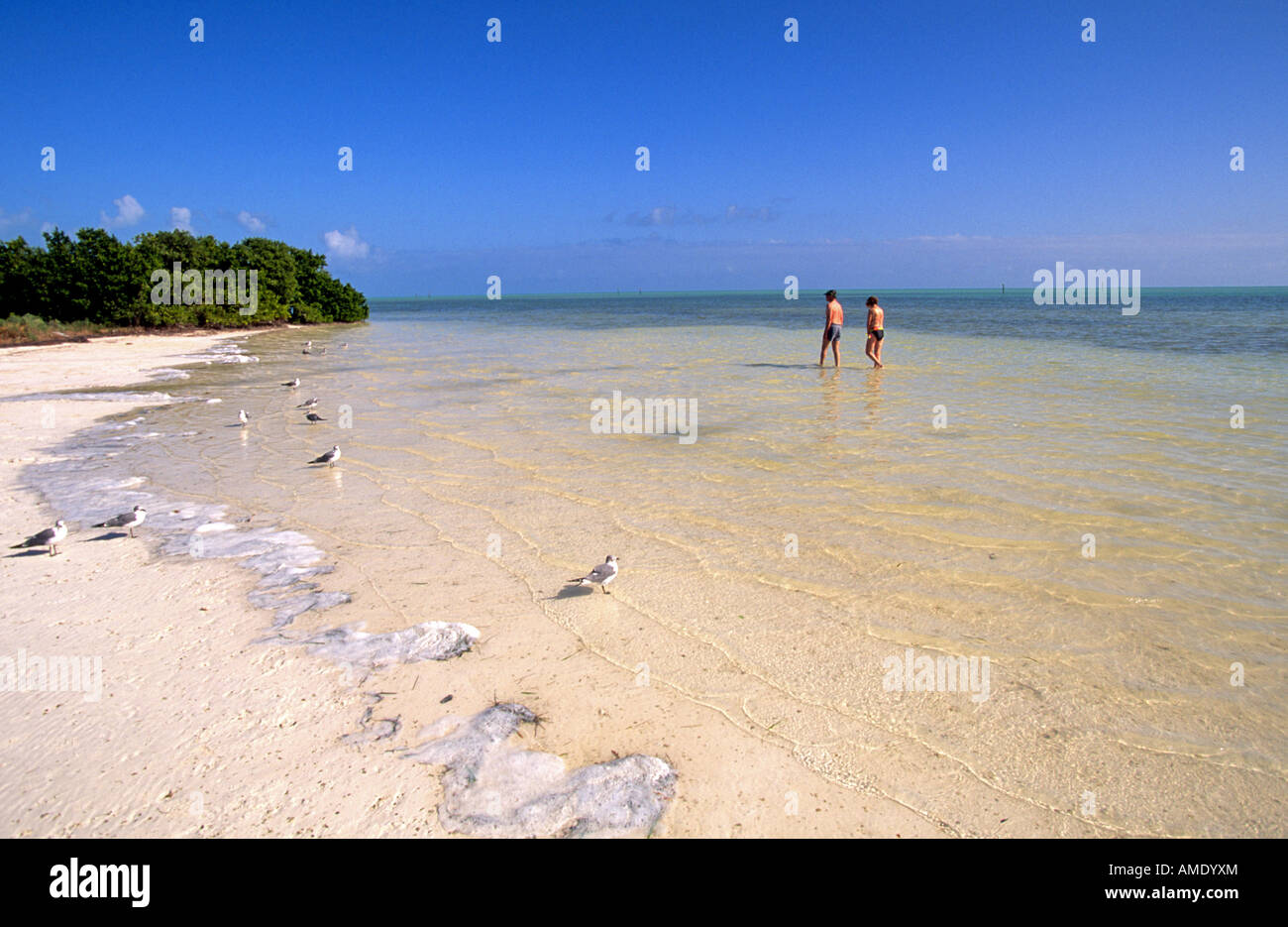 USA FLORIDA FLORIDA KEYS Beachcombers wander along a deserted beach in the Florida Keys Stock Photohttps://www.alamy.com/image-license-details/?v=1https://www.alamy.com/stock-photo-usa-florida-florida-keys-beachcombers-wander-along-a-deserted-beach-15234667.html
RMAMDYXM–USA FLORIDA FLORIDA KEYS Beachcombers wander along a deserted beach in the Florida Keys
 A road is shown damaged by flood water caused by tropical storm Irene in Vermont shown in this aerial photo. Stock Photohttps://www.alamy.com/image-license-details/?v=1https://www.alamy.com/stock-photo-a-road-is-shown-damaged-by-flood-water-caused-by-tropical-storm-irene-41902510.html
RMCC4R26–A road is shown damaged by flood water caused by tropical storm Irene in Vermont shown in this aerial photo.
 Aerial Desert Road and Town Gooseberry Mesa Utah Stock Photohttps://www.alamy.com/image-license-details/?v=1https://www.alamy.com/aerial-desert-road-and-town-gooseberry-mesa-utah-image640555792.html
RF2S63RCG–Aerial Desert Road and Town Gooseberry Mesa Utah
 Lavalette, Ortly, and Normandy used to be full of these little cottages, now there are very few remaining; they were all destroyed by Hurricane Sandy. Stock Photohttps://www.alamy.com/image-license-details/?v=1https://www.alamy.com/lavalette-ortly-and-normandy-used-to-be-full-of-these-little-cottages-now-there-are-very-few-remaining-they-were-all-destroyed-by-hurricane-sandy-image559389529.html
RF2RE2B1D–Lavalette, Ortly, and Normandy used to be full of these little cottages, now there are very few remaining; they were all destroyed by Hurricane Sandy.
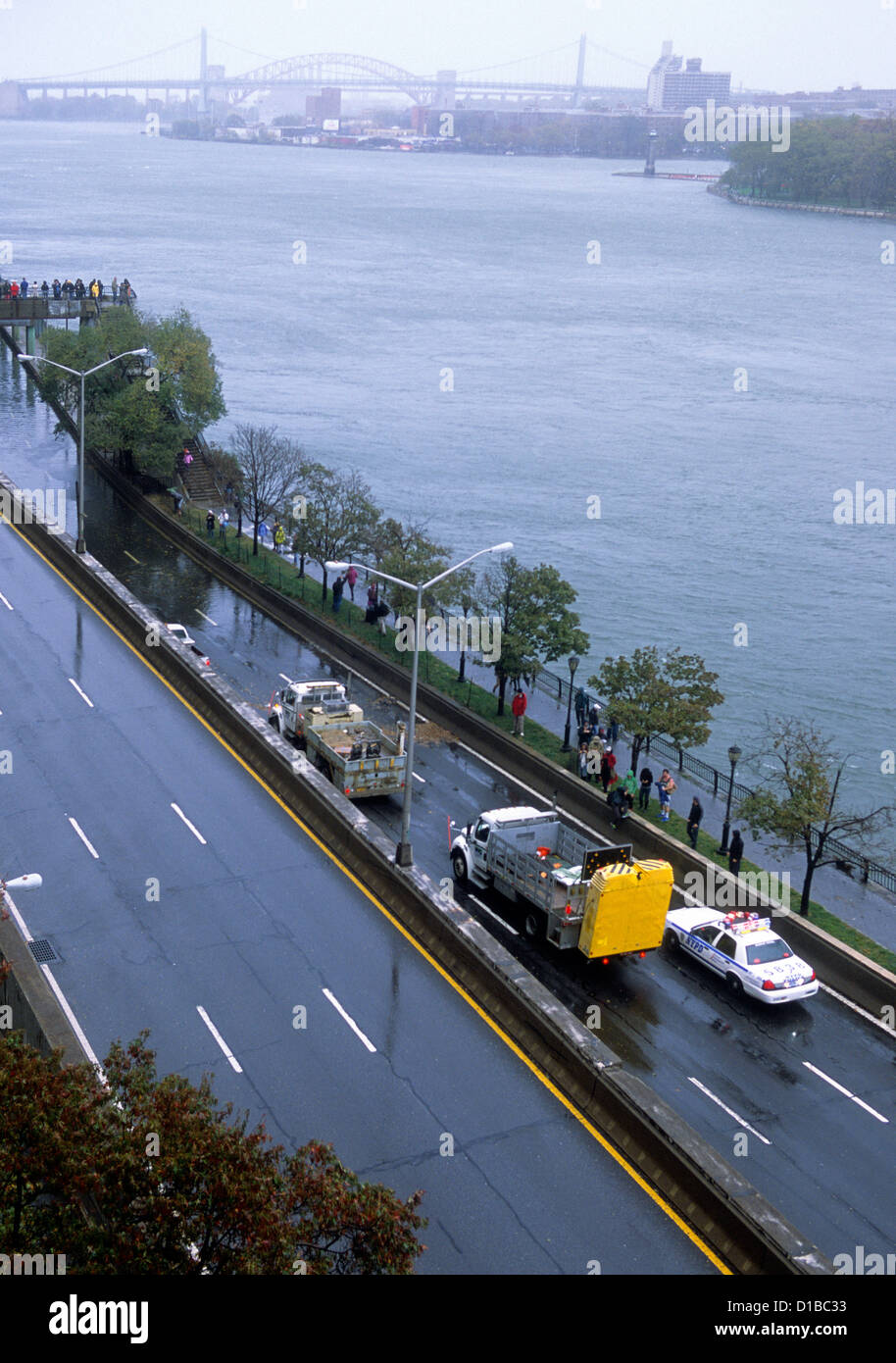 Aerial view of highway flood damage in Manhattan, New York City. Flooded road on FDR Drive. People, police car and tow truck no traffic. USA Stock Photohttps://www.alamy.com/image-license-details/?v=1https://www.alamy.com/stock-photo-aerial-view-of-highway-flood-damage-in-manhattan-new-york-city-flooded-52496727.html
RMD1BC33–Aerial view of highway flood damage in Manhattan, New York City. Flooded road on FDR Drive. People, police car and tow truck no traffic. USA
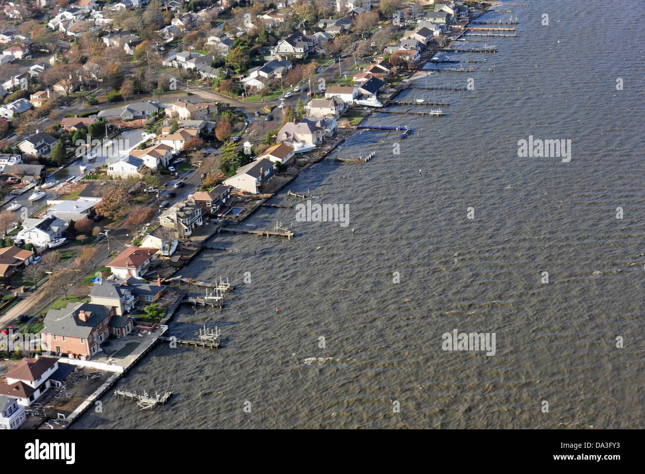 USA New York Long Island shown during an overflight with Coast Guard Air Station Cape Cod following Hurricane Sandy Stock Photohttps://www.alamy.com/image-license-details/?v=1https://www.alamy.com/stock-photo-usa-new-york-long-island-shown-during-an-overflight-with-coast-guard-57856039.html
RMDA3FY3–USA New York Long Island shown during an overflight with Coast Guard Air Station Cape Cod following Hurricane Sandy
 Aerial views of the damage caused by Hurricane Sandy to the New Jersey coast, USA, taken during a search and rescue mission by 1-150 Assault Helicopter Battalion, New Jersey Army National Guard, Oct. 30, 2012. Photo by USAF via ABACAPRESS.COM Stock Photohttps://www.alamy.com/image-license-details/?v=1https://www.alamy.com/aerial-views-of-the-damage-caused-by-hurricane-sandy-to-the-new-jersey-coast-usa-taken-during-a-search-and-rescue-mission-by-1-150-assault-helicopter-battalion-new-jersey-army-national-guard-oct-30-2012-photo-by-usaf-via-abacapresscom-image396388377.html
RM2E0W1BN–Aerial views of the damage caused by Hurricane Sandy to the New Jersey coast, USA, taken during a search and rescue mission by 1-150 Assault Helicopter Battalion, New Jersey Army National Guard, Oct. 30, 2012. Photo by USAF via ABACAPRESS.COM
 The sea is a strong storm a seagull over the waves. A neutral seascape with waves and a flying bird. Sandy beach, seaweed, waves roll on the shore. Th Stock Photohttps://www.alamy.com/image-license-details/?v=1https://www.alamy.com/the-sea-is-a-strong-storm-a-seagull-over-the-waves-a-neutral-seascape-with-waves-and-a-flying-bird-sandy-beach-seaweed-waves-roll-on-the-shore-th-image436473103.html
RF2GA31W3–The sea is a strong storm a seagull over the waves. A neutral seascape with waves and a flying bird. Sandy beach, seaweed, waves roll on the shore. Th
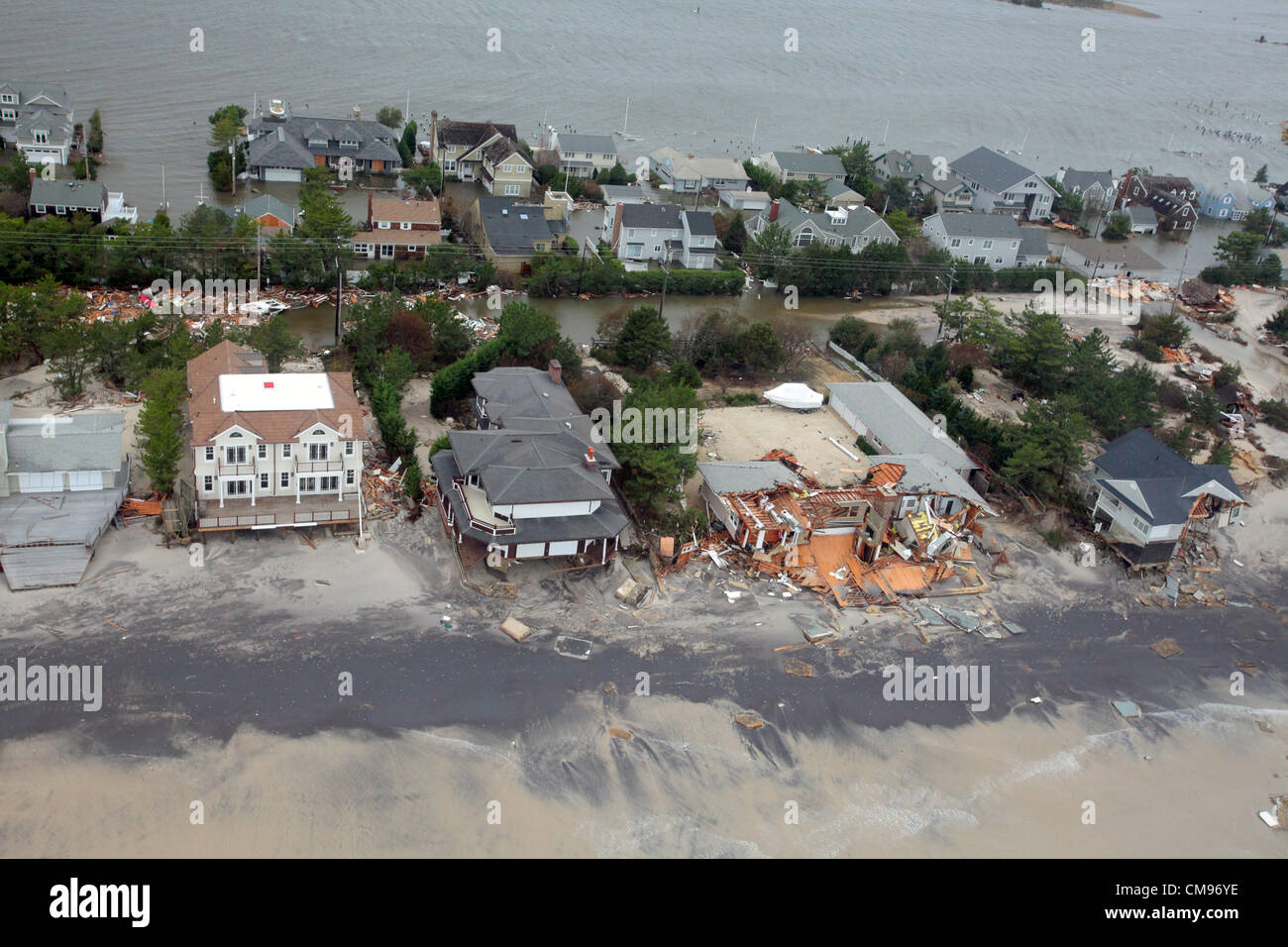 Aerial views of the damage caused by Hurricane Sandy to the New Jersey October 30, 2012. Stock Photohttps://www.alamy.com/image-license-details/?v=1https://www.alamy.com/stock-photo-aerial-views-of-the-damage-caused-by-hurricane-sandy-to-the-new-jersey-46916898.html
RMCM96YE–Aerial views of the damage caused by Hurricane Sandy to the New Jersey October 30, 2012.
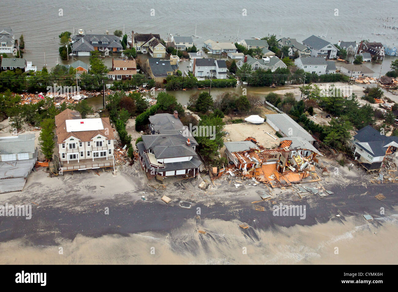 Aerial views of the damage caused by Hurricane Sandy to the New Jersey coast taken during a search and rescue mission by 1-150 Stock Photohttps://www.alamy.com/image-license-details/?v=1https://www.alamy.com/stock-photo-aerial-views-of-the-damage-caused-by-hurricane-sandy-to-the-new-jersey-51470569.html
RMCYMK6H–Aerial views of the damage caused by Hurricane Sandy to the New Jersey coast taken during a search and rescue mission by 1-150
 US President Barack Obama and New Jersey Gov. Chris Christie look at damage from Hurricane Sandy along the coast of New Jersey on Marine One October 31, 2012 in Seaside Heights, NJ. Stock Photohttps://www.alamy.com/image-license-details/?v=1https://www.alamy.com/stock-photo-us-president-barack-obama-and-new-jersey-gov-chris-christie-look-at-46916888.html
RMCM96Y4–US President Barack Obama and New Jersey Gov. Chris Christie look at damage from Hurricane Sandy along the coast of New Jersey on Marine One October 31, 2012 in Seaside Heights, NJ.
 Hurricane Sandy damage Mantaloking. New Jersey Hurricane Sandy. Photographs Relating to Disasters and Emergency Management Programs, Activities, and Officials Stock Photohttps://www.alamy.com/image-license-details/?v=1https://www.alamy.com/hurricane-sandy-damage-mantaloking-new-jersey-hurricane-sandy-photographs-relating-to-disasters-and-emergency-management-programs-activities-and-officials-image498609749.html
RM2KY5HR1–Hurricane Sandy damage Mantaloking. New Jersey Hurricane Sandy. Photographs Relating to Disasters and Emergency Management Programs, Activities, and Officials
 usfwsnortheast 16665301575 Day 4 - Hurricane Sandy Aerial Tour Stock Photohttps://www.alamy.com/image-license-details/?v=1https://www.alamy.com/stock-photo-usfwsnortheast-16665301575-day-4-hurricane-sandy-aerial-tour-126824437.html
RMHA99T5–usfwsnortheast 16665301575 Day 4 - Hurricane Sandy Aerial Tour
 Lincroft, N.J., April 9, 2013 Aerial photograph of the FEMA Joint Field Office whose dedicated staff is working to help Hurricane Sandy survivors in New Jersey. New Jersey Hurricane Sandy. Photographs Relating to Disasters and Emergency Management Programs, Activities, and Officials Stock Photohttps://www.alamy.com/image-license-details/?v=1https://www.alamy.com/lincroft-nj-april-9-2013-aerial-photograph-of-the-fema-joint-field-office-whose-dedicated-staff-is-working-to-help-hurricane-sandy-survivors-in-new-jersey-new-jersey-hurricane-sandy-photographs-relating-to-disasters-and-emergency-management-programs-activities-and-officials-image498611956.html
RM2KY5MHT–Lincroft, N.J., April 9, 2013 Aerial photograph of the FEMA Joint Field Office whose dedicated staff is working to help Hurricane Sandy survivors in New Jersey. New Jersey Hurricane Sandy. Photographs Relating to Disasters and Emergency Management Programs, Activities, and Officials
 Aerial views of the damage caused by Hurricane Sandy to the New Jersey coast taken during a search and rescue mission by 1-150 Assault Helicopter Battalion, New Jersey Army National Guard, Oct. 30, 2012. Master Sgt. Mark C. Olsen Stock Photohttps://www.alamy.com/image-license-details/?v=1https://www.alamy.com/stock-photo-aerial-views-of-the-damage-caused-by-hurricane-sandy-to-the-new-jersey-129233770.html
RMHE72YP–Aerial views of the damage caused by Hurricane Sandy to the New Jersey coast taken during a search and rescue mission by 1-150 Assault Helicopter Battalion, New Jersey Army National Guard, Oct. 30, 2012. Master Sgt. Mark C. Olsen
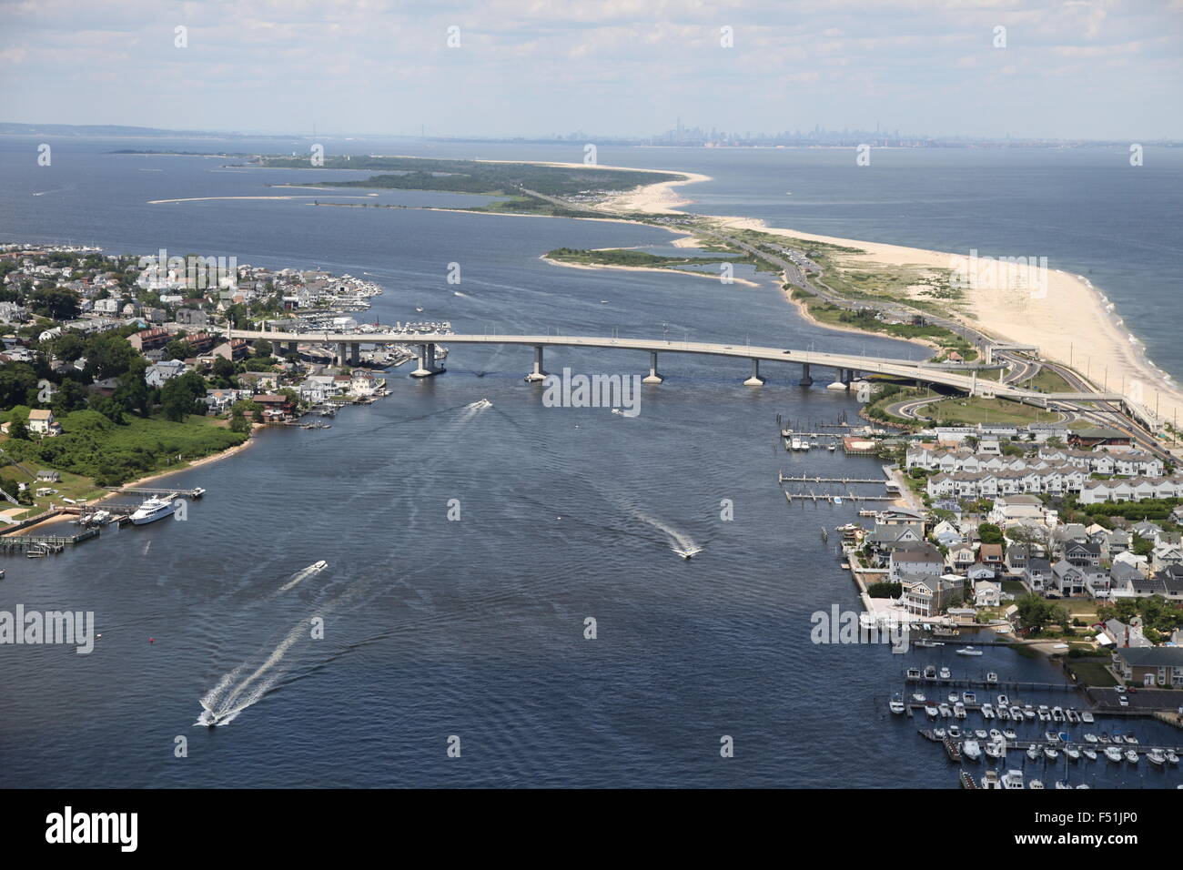 Aerial view of Sea Bright and Bridge over the Navesink River and Sandy Hook in New Jersey (post Hurricane Sandy) Stock Photohttps://www.alamy.com/image-license-details/?v=1https://www.alamy.com/stock-photo-aerial-view-of-sea-bright-and-bridge-over-the-navesink-river-and-sandy-89161800.html
RMF51JP0–Aerial view of Sea Bright and Bridge over the Navesink River and Sandy Hook in New Jersey (post Hurricane Sandy)
 Hurricane sandy NASA earth observatory Stock Photohttps://www.alamy.com/image-license-details/?v=1https://www.alamy.com/stock-photo-hurricane-sandy-nasa-earth-observatory-88275428.html
RFF3H85T–Hurricane sandy NASA earth observatory
 Nautical Mile, N.Y., Nov. 12, 2012 Aerial views of damage to boats and marina at Nautical Mile in Suffolk County, New York. Hurricane Sandy tossed boats on the shores and on the marina. Andrea Booher/FEMA. New York Hurricane Sandy. Photographs Relating to Disasters and Emergency Management Programs, Activities, and Officials Stock Photohttps://www.alamy.com/image-license-details/?v=1https://www.alamy.com/nautical-mile-ny-nov-12-2012-aerial-views-of-damage-to-boats-and-marina-at-nautical-mile-in-suffolk-county-new-york-hurricane-sandy-tossed-boats-on-the-shores-and-on-the-marina-andrea-booherfema-new-york-hurricane-sandy-photographs-relating-to-disasters-and-emergency-management-programs-activities-and-officials-image498486277.html
RM2KY0099–Nautical Mile, N.Y., Nov. 12, 2012 Aerial views of damage to boats and marina at Nautical Mile in Suffolk County, New York. Hurricane Sandy tossed boats on the shores and on the marina. Andrea Booher/FEMA. New York Hurricane Sandy. Photographs Relating to Disasters and Emergency Management Programs, Activities, and Officials
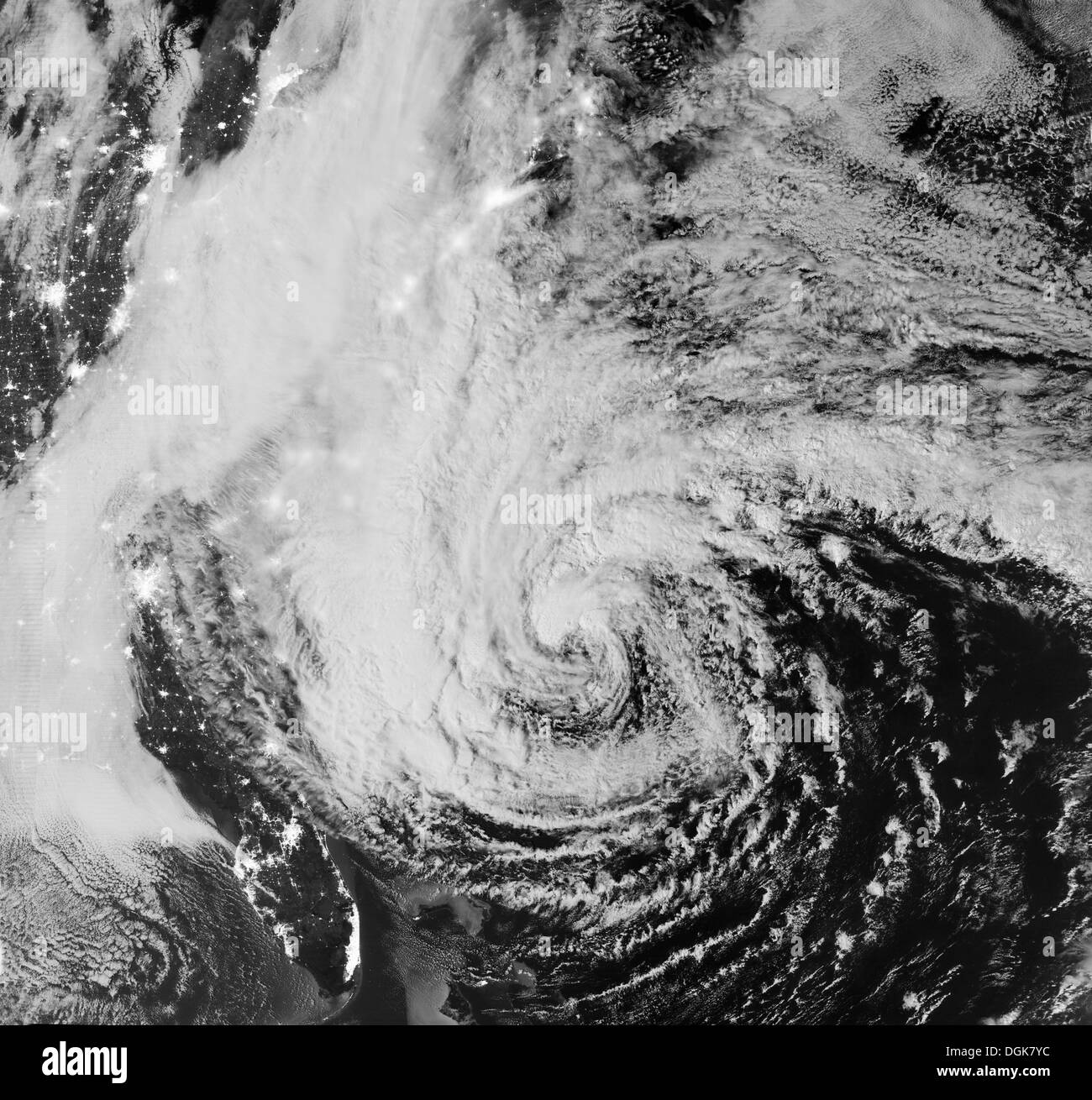 Satellite view, Hurricane Sandy, October 28, 2012 Stock Photohttps://www.alamy.com/image-license-details/?v=1https://www.alamy.com/satellite-view-hurricane-sandy-october-28-2012-image61888944.html
RFDGK7YC–Satellite view, Hurricane Sandy, October 28, 2012
 Surfing Folly Beach At Sunset as Hurricane Sandy Comes In Stock Photohttps://www.alamy.com/image-license-details/?v=1https://www.alamy.com/stock-photo-surfing-folly-beach-at-sunset-as-hurricane-sandy-comes-in-51435886.html
RMCYK2YX–Surfing Folly Beach At Sunset as Hurricane Sandy Comes In
 Dark weather front clouds forming on stormy sky during heavy rainfall season over sandy beach sea water in summer evening Stock Photohttps://www.alamy.com/image-license-details/?v=1https://www.alamy.com/dark-weather-front-clouds-forming-on-stormy-sky-during-heavy-rainfall-season-over-sandy-beach-sea-water-in-summer-evening-image556626651.html
RF2R9GEY7–Dark weather front clouds forming on stormy sky during heavy rainfall season over sandy beach sea water in summer evening
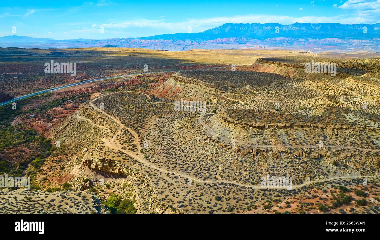 Aerial of Gooseberry Mesa Desert Landscape Adventure Utah Stock Photohttps://www.alamy.com/image-license-details/?v=1https://www.alamy.com/aerial-of-gooseberry-mesa-desert-landscape-adventure-utah-image640557309.html
RF2S63WAN–Aerial of Gooseberry Mesa Desert Landscape Adventure Utah
 White seagull flies over sandy beach Stock Photohttps://www.alamy.com/image-license-details/?v=1https://www.alamy.com/white-seagull-flies-over-sandy-beach-image383025575.html
RF2D7490R–White seagull flies over sandy beach
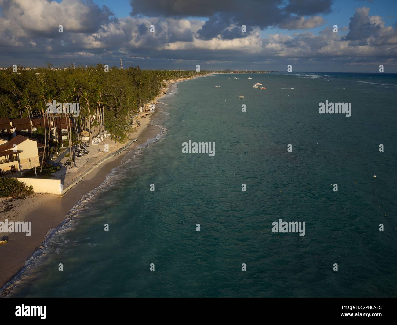 Town on the seashore under a gloomy sky. Tropical plants, palm trees on the sandy seashore. There are storm clouds in the sky. Resort, vacation, weath Stock Photohttps://www.alamy.com/image-license-details/?v=1https://www.alamy.com/town-on-the-seashore-under-a-gloomy-sky-tropical-plants-palm-trees-on-the-sandy-seashore-there-are-storm-clouds-in-the-sky-resort-vacation-weath-image544110520.html
RF2PH6AEG–Town on the seashore under a gloomy sky. Tropical plants, palm trees on the sandy seashore. There are storm clouds in the sky. Resort, vacation, weath
 Lighthouse at Darsser Ort in stormy weather, Baltic Sea, Mecklenburg-Western Pomerania, Germany Stock Photohttps://www.alamy.com/image-license-details/?v=1https://www.alamy.com/lighthouse-at-darsser-ort-in-stormy-weather-baltic-sea-mecklenburg-western-pomerania-germany-image223592178.html
RMPYNE2X–Lighthouse at Darsser Ort in stormy weather, Baltic Sea, Mecklenburg-Western Pomerania, Germany
 Aerial views of the damage caused by Hurricane Sandy to the New Jersey coast, USA, taken during a search and rescue mission by 1-150 Assault Helicopter Battalion, New Jersey Army National Guard, Oct. 30, 2012. Photo by USAF via ABACAPRESS.COM Stock Photohttps://www.alamy.com/image-license-details/?v=1https://www.alamy.com/aerial-views-of-the-damage-caused-by-hurricane-sandy-to-the-new-jersey-coast-usa-taken-during-a-search-and-rescue-mission-by-1-150-assault-helicopter-battalion-new-jersey-army-national-guard-oct-30-2012-photo-by-usaf-via-abacapresscom-image396388375.html
RM2E0W1BK–Aerial views of the damage caused by Hurricane Sandy to the New Jersey coast, USA, taken during a search and rescue mission by 1-150 Assault Helicopter Battalion, New Jersey Army National Guard, Oct. 30, 2012. Photo by USAF via ABACAPRESS.COM
 The sea is a strong storm a seagull over the waves. A neutral seascape with waves and a flying bird. Sandy beach, seaweed, waves roll on the shore. Th Stock Photohttps://www.alamy.com/image-license-details/?v=1https://www.alamy.com/the-sea-is-a-strong-storm-a-seagull-over-the-waves-a-neutral-seascape-with-waves-and-a-flying-bird-sandy-beach-seaweed-waves-roll-on-the-shore-th-image436473183.html
RF2GA31YY–The sea is a strong storm a seagull over the waves. A neutral seascape with waves and a flying bird. Sandy beach, seaweed, waves roll on the shore. Th
 still some lights before the night... Stock Photohttps://www.alamy.com/image-license-details/?v=1https://www.alamy.com/still-some-lights-before-the-night-image460502267.html
RF2HN5K9F–still some lights before the night...
 Aerial views of the damage caused by Hurricane Sandy to the New Jersey coast taken during a search and rescue mission by 1-150 Assault Helicopter Battalion, New Jersey Army National Guard, Oct. 30, 2012. (U.S. Air Force photo by Master Sgt. Mark C. Olsen/Released) Stock Photohttps://www.alamy.com/image-license-details/?v=1https://www.alamy.com/stock-photo-aerial-views-of-the-damage-caused-by-hurricane-sandy-to-the-new-jersey-51469751.html
RMCYMJ5B–Aerial views of the damage caused by Hurricane Sandy to the New Jersey coast taken during a search and rescue mission by 1-150 Assault Helicopter Battalion, New Jersey Army National Guard, Oct. 30, 2012. (U.S. Air Force photo by Master Sgt. Mark C. Olsen/Released)
 Marine One, carrying President Barack Obama and New Jersey Gov. Chris Christie, and a second helicopter, Nighthawk Two, fly over damage caused by Hurricane Sandy October 31, 2012 near Atlantic City, NJ. Stock Photohttps://www.alamy.com/image-license-details/?v=1https://www.alamy.com/stock-photo-marine-one-carrying-president-barack-obama-and-new-jersey-gov-chris-46916890.html
RMCM96Y6–Marine One, carrying President Barack Obama and New Jersey Gov. Chris Christie, and a second helicopter, Nighthawk Two, fly over damage caused by Hurricane Sandy October 31, 2012 near Atlantic City, NJ.
 75 members of the 107th Airlift Wing have deployed downstate to aid in Hurricane Sandy recovery efforts. Senior Airman Kimberly Starr, 107th Aerial Port and Master Sgt. Timothy Griffin, 107th Loadmaster moves the cargo onto the C-130 aircraft for the deployment to New York City. Oct. 30, 2012 (U.S. Air Force Photo/Senior Master Sgt. Ray Lloyd) Stock Photohttps://www.alamy.com/image-license-details/?v=1https://www.alamy.com/stock-photo-75-members-of-the-107th-airlift-wing-have-deployed-downstate-to-aid-170114111.html
RMKTNA7Y–75 members of the 107th Airlift Wing have deployed downstate to aid in Hurricane Sandy recovery efforts. Senior Airman Kimberly Starr, 107th Aerial Port and Master Sgt. Timothy Griffin, 107th Loadmaster moves the cargo onto the C-130 aircraft for the deployment to New York City. Oct. 30, 2012 (U.S. Air Force Photo/Senior Master Sgt. Ray Lloyd)
 Aerial view of floods caused by a winter storm March 7, 2013 in Ocean City, NJ., Thursday, March 7, 2013, after a winter storm passed through the area. The area is still recovering from storm damage caused by Hurricane Sandy. Stock Photohttps://www.alamy.com/image-license-details/?v=1https://www.alamy.com/stock-photo-aerial-view-of-floods-caused-by-a-winter-storm-march-7-2013-in-ocean-54280337.html
RMD48K3D–Aerial view of floods caused by a winter storm March 7, 2013 in Ocean City, NJ., Thursday, March 7, 2013, after a winter storm passed through the area. The area is still recovering from storm damage caused by Hurricane Sandy.
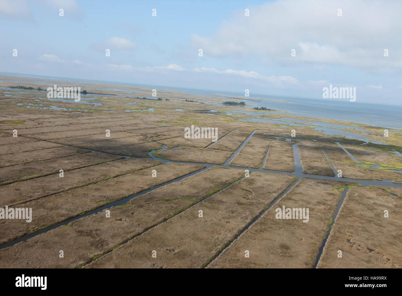 usfwsnortheast 16664291262 Day 4 - Hurricane Sandy Aerial Tour Stock Photohttps://www.alamy.com/image-license-details/?v=1https://www.alamy.com/stock-photo-usfwsnortheast-16664291262-day-4-hurricane-sandy-aerial-tour-126824430.html
RMHA99RX–usfwsnortheast 16664291262 Day 4 - Hurricane Sandy Aerial Tour
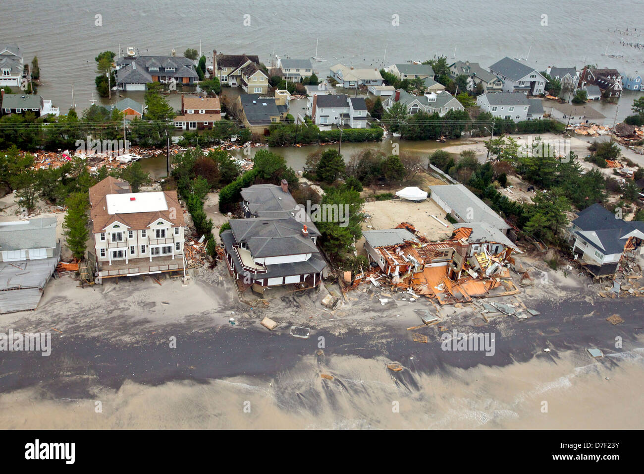 Aerial views of the damage caused by Hurricane Sandy to the New Jersey coast October 30, 2012. Stock Photohttps://www.alamy.com/image-license-details/?v=1https://www.alamy.com/stock-photo-aerial-views-of-the-damage-caused-by-hurricane-sandy-to-the-new-jersey-56264655.html
RMD7F23Y–Aerial views of the damage caused by Hurricane Sandy to the New Jersey coast October 30, 2012.
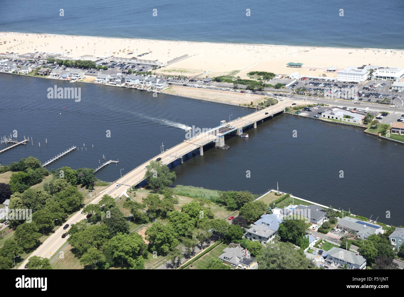 Aerial view of Sea Bright and Bridge over the Navesink River and Sandy Hook in New Jersey (post Hurricane Sandy) Stock Photohttps://www.alamy.com/image-license-details/?v=1https://www.alamy.com/stock-photo-aerial-view-of-sea-bright-and-bridge-over-the-navesink-river-and-sandy-89161796.html
RMF51JNT–Aerial view of Sea Bright and Bridge over the Navesink River and Sandy Hook in New Jersey (post Hurricane Sandy)
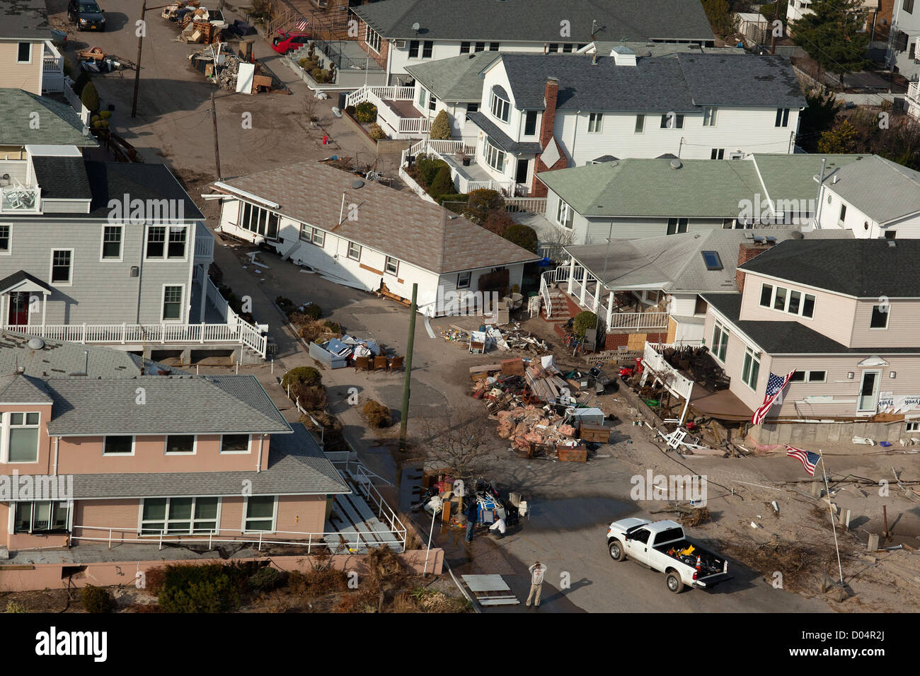 Aerial views of Hurricane Sandy damage along the New York coastline November 12, 2012 in Nassau County, NY. Stock Photohttps://www.alamy.com/image-license-details/?v=1https://www.alamy.com/stock-photo-aerial-views-of-hurricane-sandy-damage-along-the-new-york-coastline-51737018.html
RMD04R2J–Aerial views of Hurricane Sandy damage along the New York coastline November 12, 2012 in Nassau County, NY.
 Long Beach, N.Y., Nov. 12, 2012 Aerial views of piles of debris near the water treatment plant in Long Island. Hurricane Sandy caused widespread flooding and destruction in Long Beach, New York. Andrea Booher/FEMA. New York Hurricane Sandy. Photographs Relating to Disasters and Emergency Management Programs, Activities, and Officials Stock Photohttps://www.alamy.com/image-license-details/?v=1https://www.alamy.com/long-beach-ny-nov-12-2012-aerial-views-of-piles-of-debris-near-the-water-treatment-plant-in-long-island-hurricane-sandy-caused-widespread-flooding-and-destruction-in-long-beach-new-york-andrea-booherfema-new-york-hurricane-sandy-photographs-relating-to-disasters-and-emergency-management-programs-activities-and-officials-image498486220.html
RM2KY0078–Long Beach, N.Y., Nov. 12, 2012 Aerial views of piles of debris near the water treatment plant in Long Island. Hurricane Sandy caused widespread flooding and destruction in Long Beach, New York. Andrea Booher/FEMA. New York Hurricane Sandy. Photographs Relating to Disasters and Emergency Management Programs, Activities, and Officials
 Destroyed boats are scattered by Hurricane Sandy along the shore November 3, 2012 in Great Kills Harbor, NY. Stock Photohttps://www.alamy.com/image-license-details/?v=1https://www.alamy.com/stock-photo-destroyed-boats-are-scattered-by-hurricane-sandy-along-the-shore-november-51534696.html
RMCYRH0T–Destroyed boats are scattered by Hurricane Sandy along the shore November 3, 2012 in Great Kills Harbor, NY.
 New York, N.Y., Nov. 10, 2012 An army specialist watches for air traffic while working on a Blackhawk that is providing support to partner agencies in support of Hurricane Sandy. New York, NY, Nov. 10, 2012--Aerial damage of the coastline of New York, NY. Jcoelyn Augustino/FEMA. Photographs Relating to Disasters and Emergency Management Programs, Activities, and Officials Stock Photohttps://www.alamy.com/image-license-details/?v=1https://www.alamy.com/new-york-ny-nov-10-2012-an-army-specialist-watches-for-air-traffic-while-working-on-a-blackhawk-that-is-providing-support-to-partner-agencies-in-support-of-hurricane-sandy-new-york-ny-nov-10-2012-aerial-damage-of-the-coastline-of-new-york-ny-jcoelyn-augustinofema-photographs-relating-to-disasters-and-emergency-management-programs-activities-and-officials-image498471503.html
RM2KXY9DK–New York, N.Y., Nov. 10, 2012 An army specialist watches for air traffic while working on a Blackhawk that is providing support to partner agencies in support of Hurricane Sandy. New York, NY, Nov. 10, 2012--Aerial damage of the coastline of New York, NY. Jcoelyn Augustino/FEMA. Photographs Relating to Disasters and Emergency Management Programs, Activities, and Officials
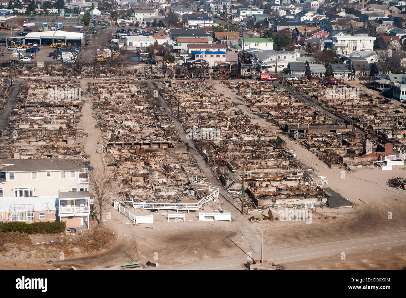 Aerial view of the of widespread devastation after Hurricane Sandy November 12, 2012 in Breezy Point, NY. Stock Photohttps://www.alamy.com/image-license-details/?v=1https://www.alamy.com/stock-photo-aerial-view-of-the-of-widespread-devastation-after-hurricane-sandy-51651508.html
RMD00X0M–Aerial view of the of widespread devastation after Hurricane Sandy November 12, 2012 in Breezy Point, NY.
 Aerial of Eroded Cliffs and Sedimentary Layers Gooseberry Mesa Utah Stock Photohttps://www.alamy.com/image-license-details/?v=1https://www.alamy.com/aerial-of-eroded-cliffs-and-sedimentary-layers-gooseberry-mesa-utah-image640554765.html
RF2S63P3W–Aerial of Eroded Cliffs and Sedimentary Layers Gooseberry Mesa Utah
 New York Mayor Michael Bloomberg points out areas on a map for President Barack Obama aboard Marine One during an aerial tour of Hurricane Sandy storm damage November 15, 2012 in New York City. Joining the President, from left, are: Secretary of Housing and Urban Development Shaun Donovan; Secretary of Homeland Security Janet Napolitano; and New York Governor Andrew Cuomo. Stock Photohttps://www.alamy.com/image-license-details/?v=1https://www.alamy.com/stock-photo-new-york-mayor-michael-bloomberg-points-out-areas-on-a-map-for-president-52356448.html
RMD15154–New York Mayor Michael Bloomberg points out areas on a map for President Barack Obama aboard Marine One during an aerial tour of Hurricane Sandy storm damage November 15, 2012 in New York City. Joining the President, from left, are: Secretary of Housing and Urban Development Shaun Donovan; Secretary of Homeland Security Janet Napolitano; and New York Governor Andrew Cuomo.
 Breezy Point, N.Y., Nov. 8, 2012 Aerial views of flood and fire damage in the Breezy Point neighborhood as a result of Hurricane Sandy. Following the hurricane, a nor'easter struck the area causing more power outages and additional flooding. Andrea Booher/FEMA. New York Hurricane Sandy. Photographs Relating to Disasters and Emergency Management Programs, Activities, and Officials Stock Photohttps://www.alamy.com/image-license-details/?v=1https://www.alamy.com/breezy-point-ny-nov-8-2012-aerial-views-of-flood-and-fire-damage-in-the-breezy-point-neighborhood-as-a-result-of-hurricane-sandy-following-the-hurricane-a-noreaster-struck-the-area-causing-more-power-outages-and-additional-flooding-andrea-booherfema-new-york-hurricane-sandy-photographs-relating-to-disasters-and-emergency-management-programs-activities-and-officials-image498464681.html
RM2KXY0P1–Breezy Point, N.Y., Nov. 8, 2012 Aerial views of flood and fire damage in the Breezy Point neighborhood as a result of Hurricane Sandy. Following the hurricane, a nor'easter struck the area causing more power outages and additional flooding. Andrea Booher/FEMA. New York Hurricane Sandy. Photographs Relating to Disasters and Emergency Management Programs, Activities, and Officials
 US President Barack Obama and New Jersey Gov. Chris Christie look at damage from Hurricane Sandy along the coast of New Jersey on Marine One October 31, 2012 in Atlantic City, NJ. Stock Photohttps://www.alamy.com/image-license-details/?v=1https://www.alamy.com/stock-photo-us-president-barack-obama-and-new-jersey-gov-chris-christie-look-at-46916889.html
RMCM96Y5–US President Barack Obama and New Jersey Gov. Chris Christie look at damage from Hurricane Sandy along the coast of New Jersey on Marine One October 31, 2012 in Atlantic City, NJ.
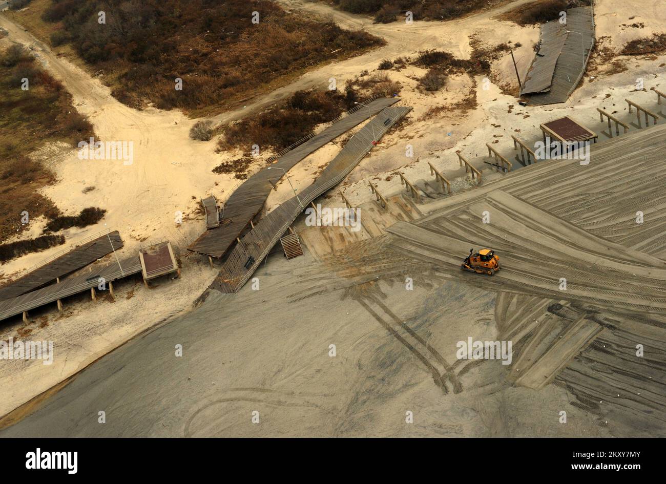 New York, N.Y., Nov. 10, 2012 Aerial damage of the coastline of New York. Cleanup activities continue with lots of sand that blanketed areas due to the storm surge in Hurricane Sandy. New York, NY, Nov. 10, 2012--Aerial damage of the coastline of New York, NY. Jcoelyn Augustino/FEMA. Photographs Relating to Disasters and Emergency Management Programs, Activities, and Officials Stock Photohttps://www.alamy.com/image-license-details/?v=1https://www.alamy.com/new-york-ny-nov-10-2012-aerial-damage-of-the-coastline-of-new-york-cleanup-activities-continue-with-lots-of-sand-that-blanketed-areas-due-to-the-storm-surge-in-hurricane-sandy-new-york-ny-nov-10-2012-aerial-damage-of-the-coastline-of-new-york-ny-jcoelyn-augustinofema-photographs-relating-to-disasters-and-emergency-management-programs-activities-and-officials-image498470139.html
RM2KXY7MY–New York, N.Y., Nov. 10, 2012 Aerial damage of the coastline of New York. Cleanup activities continue with lots of sand that blanketed areas due to the storm surge in Hurricane Sandy. New York, NY, Nov. 10, 2012--Aerial damage of the coastline of New York, NY. Jcoelyn Augustino/FEMA. Photographs Relating to Disasters and Emergency Management Programs, Activities, and Officials
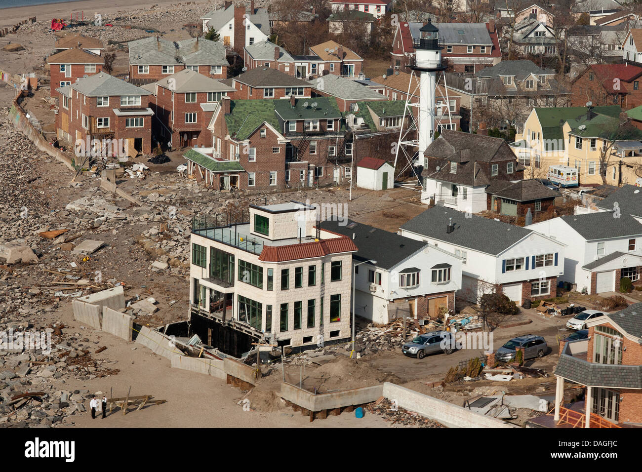 Aerial view of Hurricane Sandy damage along the New York coastline November 12, 2012 in Nassau County, New York. Stock Photohttps://www.alamy.com/image-license-details/?v=1https://www.alamy.com/stock-photo-aerial-view-of-hurricane-sandy-damage-along-the-new-york-coastline-58141172.html
RMDAGFJC–Aerial view of Hurricane Sandy damage along the New York coastline November 12, 2012 in Nassau County, New York.
 The sea is a strong storm a seagull over the waves. A neutral seascape with waves and a flying bird. Sandy beach, seaweed, waves roll on the shore. Th Stock Photohttps://www.alamy.com/image-license-details/?v=1https://www.alamy.com/the-sea-is-a-strong-storm-a-seagull-over-the-waves-a-neutral-seascape-with-waves-and-a-flying-bird-sandy-beach-seaweed-waves-roll-on-the-shore-th-image436473191.html
RF2GA3207–The sea is a strong storm a seagull over the waves. A neutral seascape with waves and a flying bird. Sandy beach, seaweed, waves roll on the shore. Th
 Aerial views of the damage caused by Hurricane Sandy to the New Jersey coast taken during a search and rescue mission by 1-150 Assault Helicopter Battalion, New Jersey Army National Guard, Oct. 30, 2012. (U.S. Air Force photo by Master Sgt. Mark C. Olsen/Released) Stock Photohttps://www.alamy.com/image-license-details/?v=1https://www.alamy.com/stock-photo-aerial-views-of-the-damage-caused-by-hurricane-sandy-to-the-new-jersey-51469601.html
RMCYMJ01–Aerial views of the damage caused by Hurricane Sandy to the New Jersey coast taken during a search and rescue mission by 1-150 Assault Helicopter Battalion, New Jersey Army National Guard, Oct. 30, 2012. (U.S. Air Force photo by Master Sgt. Mark C. Olsen/Released)
 Nassau County, N.Y., Nov. 12, 2012 Aerial views of Hurricane Sandy damage along the New York coastline. Following the hurricane, a nor'easter struck the area causing more power outages and additional flooding. FEMA is working with state and local officials to assist residents affected by Hurricane Sandy. Andrea Booher/FEMA. New York Hurricane Sandy. Photographs Relating to Disasters and Emergency Management Programs, Activities, and Officials Stock Photohttps://www.alamy.com/image-license-details/?v=1https://www.alamy.com/nassau-county-ny-nov-12-2012-aerial-views-of-hurricane-sandy-damage-along-the-new-york-coastline-following-the-hurricane-a-noreaster-struck-the-area-causing-more-power-outages-and-additional-flooding-fema-is-working-with-state-and-local-officials-to-assist-residents-affected-by-hurricane-sandy-andrea-booherfema-new-york-hurricane-sandy-photographs-relating-to-disasters-and-emergency-management-programs-activities-and-officials-image498486211.html
RM2KY006Y–Nassau County, N.Y., Nov. 12, 2012 Aerial views of Hurricane Sandy damage along the New York coastline. Following the hurricane, a nor'easter struck the area causing more power outages and additional flooding. FEMA is working with state and local officials to assist residents affected by Hurricane Sandy. Andrea Booher/FEMA. New York Hurricane Sandy. Photographs Relating to Disasters and Emergency Management Programs, Activities, and Officials
 Aerial views of the damage caused by Hurricane Sandy to the New Jersey coast taken during a search and rescue mission by 1-150 Assault Helicopter Battalion, New Jersey Army National Guard, Oct. 30, 2012. Master Sgt. Mark C. Olsen Stock Photohttps://www.alamy.com/image-license-details/?v=1https://www.alamy.com/stock-photo-aerial-views-of-the-damage-caused-by-hurricane-sandy-to-the-new-jersey-129233782.html
RMHE7306–Aerial views of the damage caused by Hurricane Sandy to the New Jersey coast taken during a search and rescue mission by 1-150 Assault Helicopter Battalion, New Jersey Army National Guard, Oct. 30, 2012. Master Sgt. Mark C. Olsen
 New York, N.Y., Nov. 10, 2012 Federal Coordinating Officer Mike Byrne, gets an aerial tour of damage caused by Hurricane Sandy on the coastline of New York. Cleanup efforts are continuing after storm surge battered the area. New York, NY, Nov. 10, 2012--Aerial damage of the coastline of New York, NY. Jcoelyn Augustino/FEMA. Photographs Relating to Disasters and Emergency Management Programs, Activities, and Officials Stock Photohttps://www.alamy.com/image-license-details/?v=1https://www.alamy.com/new-york-ny-nov-10-2012-federal-coordinating-officer-mike-byrne-gets-an-aerial-tour-of-damage-caused-by-hurricane-sandy-on-the-coastline-of-new-york-cleanup-efforts-are-continuing-after-storm-surge-battered-the-area-new-york-ny-nov-10-2012-aerial-damage-of-the-coastline-of-new-york-ny-jcoelyn-augustinofema-photographs-relating-to-disasters-and-emergency-management-programs-activities-and-officials-image498470128.html
RM2KXY7MG–New York, N.Y., Nov. 10, 2012 Federal Coordinating Officer Mike Byrne, gets an aerial tour of damage caused by Hurricane Sandy on the coastline of New York. Cleanup efforts are continuing after storm surge battered the area. New York, NY, Nov. 10, 2012--Aerial damage of the coastline of New York, NY. Jcoelyn Augustino/FEMA. Photographs Relating to Disasters and Emergency Management Programs, Activities, and Officials