India map 18th century Cut Out Stock Images
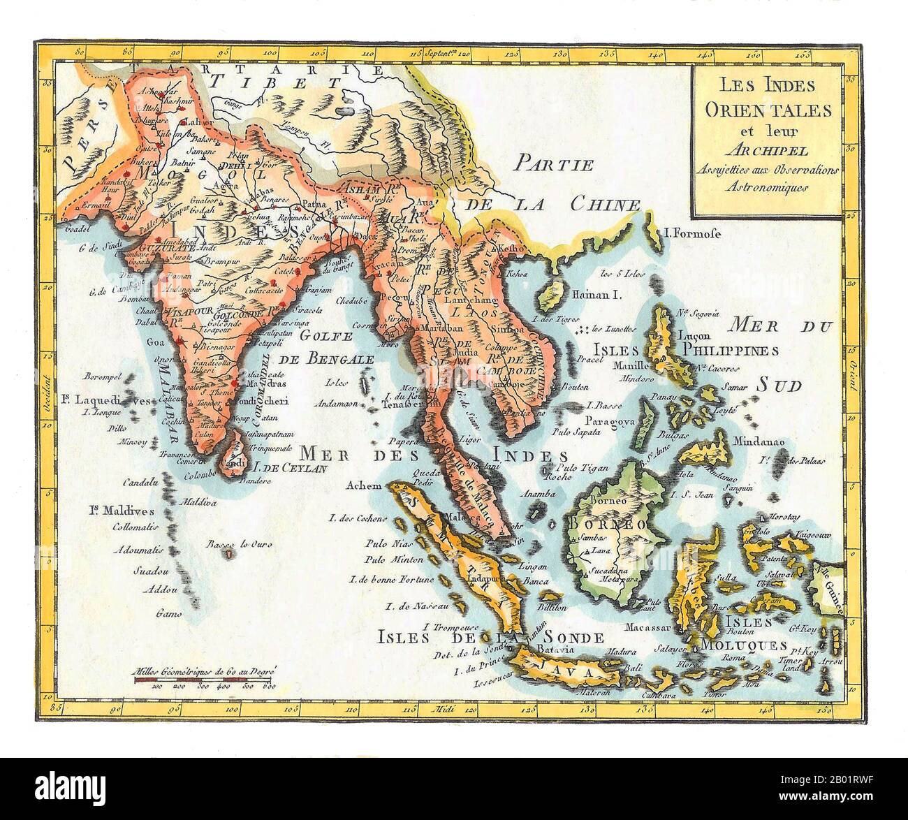
 Asia/Indian Ocean: 'East Indies'. Hand-coloured map by Joseph de La Porte (19 January 1714 - 19 December 1779) from his 'Atlas Moderne Portatif', 1799. East Indies is a term used by Europeans from the 16th century onwards to identify what is now known as the Indian subcontinent or South Asia, Southeastern Asia, and the islands of Oceania, including the Malay Archipelago and the Philippines. The term has traditionally excluded China, Japan, and other countries to the north of India and the Himalayas. The names 'India' and 'the Indies', derived from the Indus River in modern-day Pakistan. Stock Photohttps://www.alamy.com/image-license-details/?v=1https://www.alamy.com/asiaindian-ocean-east-indies-hand-coloured-map-by-joseph-de-la-porte-19-january-1714-19-december-1779-from-his-atlas-moderne-portatif-1799-east-indies-is-a-term-used-by-europeans-from-the-16th-century-onwards-to-identify-what-is-now-known-as-the-indian-subcontinent-or-south-asia-southeastern-asia-and-the-islands-of-oceania-including-the-malay-archipelago-and-the-philippines-the-term-has-traditionally-excluded-china-japan-and-other-countries-to-the-north-of-india-and-the-himalayas-the-names-india-and-the-indies-derived-from-the-indus-river-in-modern-day-pakistan-image344248059.html
RM2B01RWF–Asia/Indian Ocean: 'East Indies'. Hand-coloured map by Joseph de La Porte (19 January 1714 - 19 December 1779) from his 'Atlas Moderne Portatif', 1799. East Indies is a term used by Europeans from the 16th century onwards to identify what is now known as the Indian subcontinent or South Asia, Southeastern Asia, and the islands of Oceania, including the Malay Archipelago and the Philippines. The term has traditionally excluded China, Japan, and other countries to the north of India and the Himalayas. The names 'India' and 'the Indies', derived from the Indus River in modern-day Pakistan.
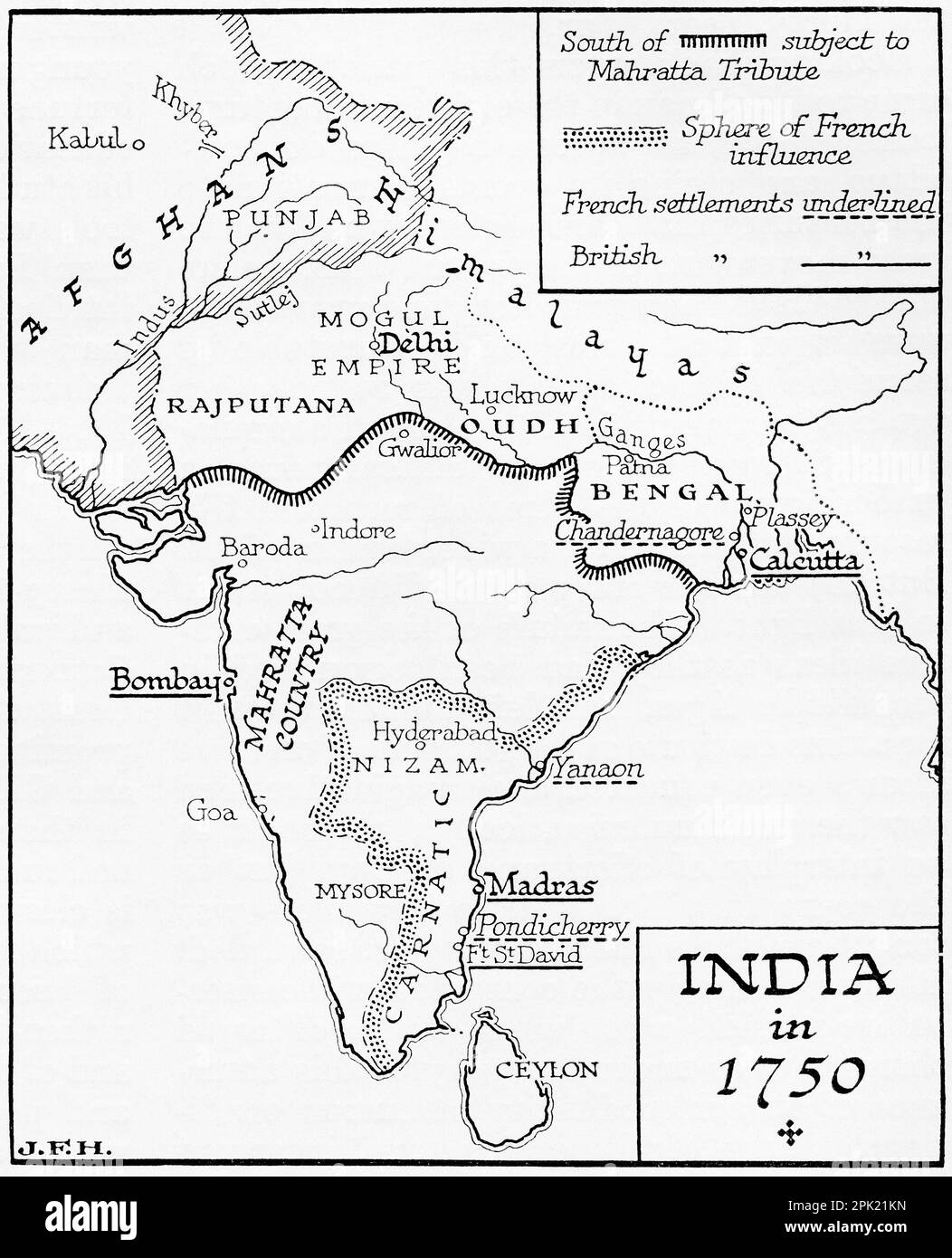
 Map of India in 1750. From the book Outline of History by H.G. Wells, published 1920. Stock Photohttps://www.alamy.com/image-license-details/?v=1https://www.alamy.com/map-of-india-in-1750-from-the-book-outline-of-history-by-hg-wells-published-1920-image545245113.html
RM2PK21KN–Map of India in 1750. From the book Outline of History by H.G. Wells, published 1920.
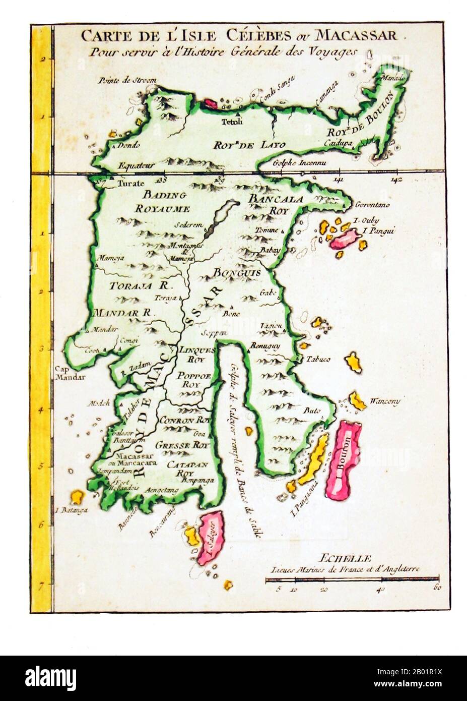
 Indonesia/Netherlands: Early map of Sulawesi (the Celebes). Engraving on paper by Jakob van der Schley (26 July 1715 - 12 February 1779) and Pieter de Hondt (May 1696 - 27 March 1764), c. 1757. Sulawesi (formerly known as Celebes) is one of the four larger Sunda Islands of Indonesia and is situated between Borneo and the Maluku Islands. In Indonesia, only Sumatra, Borneo, and Papua are larger in territory, and only Java and Sumatra have larger Indonesian populations. Stock Photohttps://www.alamy.com/image-license-details/?v=1https://www.alamy.com/indonesianetherlands-early-map-of-sulawesi-the-celebes-engraving-on-paper-by-jakob-van-der-schley-26-july-1715-12-february-1779-and-pieter-de-hondt-may-1696-27-march-1764-c-1757-sulawesi-formerly-known-as-celebes-is-one-of-the-four-larger-sunda-islands-of-indonesia-and-is-situated-between-borneo-and-the-maluku-islands-in-indonesia-only-sumatra-borneo-and-papua-are-larger-in-territory-and-only-java-and-sumatra-have-larger-indonesian-populations-image344247398.html
RM2B01R1X–Indonesia/Netherlands: Early map of Sulawesi (the Celebes). Engraving on paper by Jakob van der Schley (26 July 1715 - 12 February 1779) and Pieter de Hondt (May 1696 - 27 March 1764), c. 1757. Sulawesi (formerly known as Celebes) is one of the four larger Sunda Islands of Indonesia and is situated between Borneo and the Maluku Islands. In Indonesia, only Sumatra, Borneo, and Papua are larger in territory, and only Java and Sumatra have larger Indonesian populations.
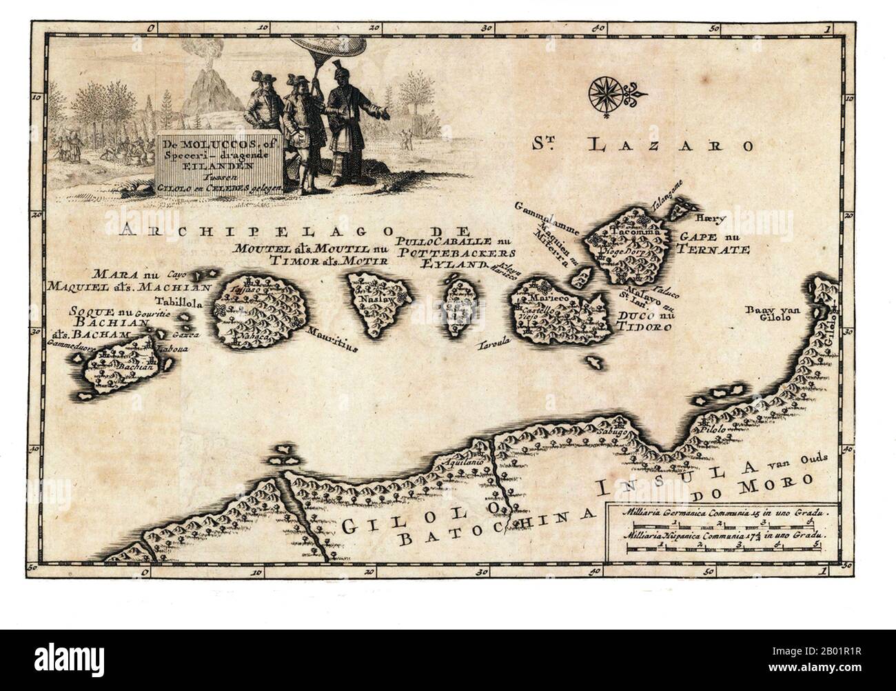
 Indonesia/Netherlands: Early map of the Maluku Islands. Copperplate engraving by Pieter Van der Aa (1659-1733), c. 1707. The Maluku Islands (also known as the Moluccas, Moluccan Islands and the Spice Islands) are an archipelago that is part of Indonesia, and part of the larger Maritime Southeast Asia region. Tectonically they are located on the Halmahera Plate within the Molucca Sea Collision Zone. Geographically they are located east of Sulawesi (Celebes), west of New Guinea and north and east of Timor. Most of the islands are mountainous, some with active volcanoes, and enjoy a wet climate Stock Photohttps://www.alamy.com/image-license-details/?v=1https://www.alamy.com/indonesianetherlands-early-map-of-the-maluku-islands-copperplate-engraving-by-pieter-van-der-aa-1659-1733-c-1707-the-maluku-islands-also-known-as-the-moluccas-moluccan-islands-and-the-spice-islands-are-an-archipelago-that-is-part-of-indonesia-and-part-of-the-larger-maritime-southeast-asia-region-tectonically-they-are-located-on-the-halmahera-plate-within-the-molucca-sea-collision-zone-geographically-they-are-located-east-of-sulawesi-celebes-west-of-new-guinea-and-north-and-east-of-timor-most-of-the-islands-are-mountainous-some-with-active-volcanoes-and-enjoy-a-wet-climate-image344247395.html
RM2B01R1R–Indonesia/Netherlands: Early map of the Maluku Islands. Copperplate engraving by Pieter Van der Aa (1659-1733), c. 1707. The Maluku Islands (also known as the Moluccas, Moluccan Islands and the Spice Islands) are an archipelago that is part of Indonesia, and part of the larger Maritime Southeast Asia region. Tectonically they are located on the Halmahera Plate within the Molucca Sea Collision Zone. Geographically they are located east of Sulawesi (Celebes), west of New Guinea and north and east of Timor. Most of the islands are mountainous, some with active volcanoes, and enjoy a wet climate
 Tharangambadi, formerly Tranquebar, is a town in the Nagapattinam district of the Indian state of Tamil Nadu. It lies 15 kilometres (9.3 mi) north of Karaikal, near the mouth of a distributary of the Kaveri River. It was a Danish colony from 1620 to 1845, and in Danish it is still known as Trankebar. Stock Photohttps://www.alamy.com/image-license-details/?v=1https://www.alamy.com/tharangambadi-formerly-tranquebar-is-a-town-in-the-nagapattinam-district-of-the-indian-state-of-tamil-nadu-it-lies-15-kilometres-93-mi-north-of-karaikal-near-the-mouth-of-a-distributary-of-the-kaveri-river-it-was-a-danish-colony-from-1620-to-1845-and-in-danish-it-is-still-known-as-trankebar-image344277428.html
RM2B035AC–Tharangambadi, formerly Tranquebar, is a town in the Nagapattinam district of the Indian state of Tamil Nadu. It lies 15 kilometres (9.3 mi) north of Karaikal, near the mouth of a distributary of the Kaveri River. It was a Danish colony from 1620 to 1845, and in Danish it is still known as Trankebar.