Kehl germany Cut Out Stock Images
 close up detail of modern steel cable-stayed suspension bridge under an overcast sky Stock Photohttps://www.alamy.com/image-license-details/?v=1https://www.alamy.com/close-up-detail-of-modern-steel-cable-stayed-suspension-bridge-under-an-overcast-sky-image337284884.html
RF2AGMJ8M–close up detail of modern steel cable-stayed suspension bridge under an overcast sky
 Kehl, DE, Germany, Lower Saxony, N 52 9' 42'', N 9 5' 56'', map, Cartascapes Map published in 2024. Explore Cartascapes, a map revealing Earth's diverse landscapes, cultures, and ecosystems. Journey through time and space, discovering the interconnectedness of our planet's past, present, and future. Stock Photohttps://www.alamy.com/image-license-details/?v=1https://www.alamy.com/kehl-de-germany-lower-saxony-n-52-9-42-n-9-5-56-map-cartascapes-map-published-in-2024-explore-cartascapes-a-map-revealing-earths-diverse-landscapes-cultures-and-ecosystems-journey-through-time-and-space-discovering-the-interconnectedness-of-our-planets-past-present-and-future-image629561540.html
RM2YG704M–Kehl, DE, Germany, Lower Saxony, N 52 9' 42'', N 9 5' 56'', map, Cartascapes Map published in 2024. Explore Cartascapes, a map revealing Earth's diverse landscapes, cultures, and ecosystems. Journey through time and space, discovering the interconnectedness of our planet's past, present, and future.
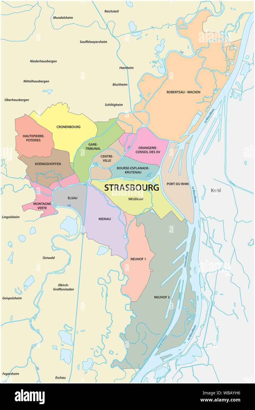
 administrative and political map of the Alsatian capital Strasbourg Stock Vectorhttps://www.alamy.com/image-license-details/?v=1https://www.alamy.com/administrative-and-political-map-of-the-alsatian-capital-strasbourg-image265157906.html
RFWBAYH6–administrative and political map of the Alsatian capital Strasbourg
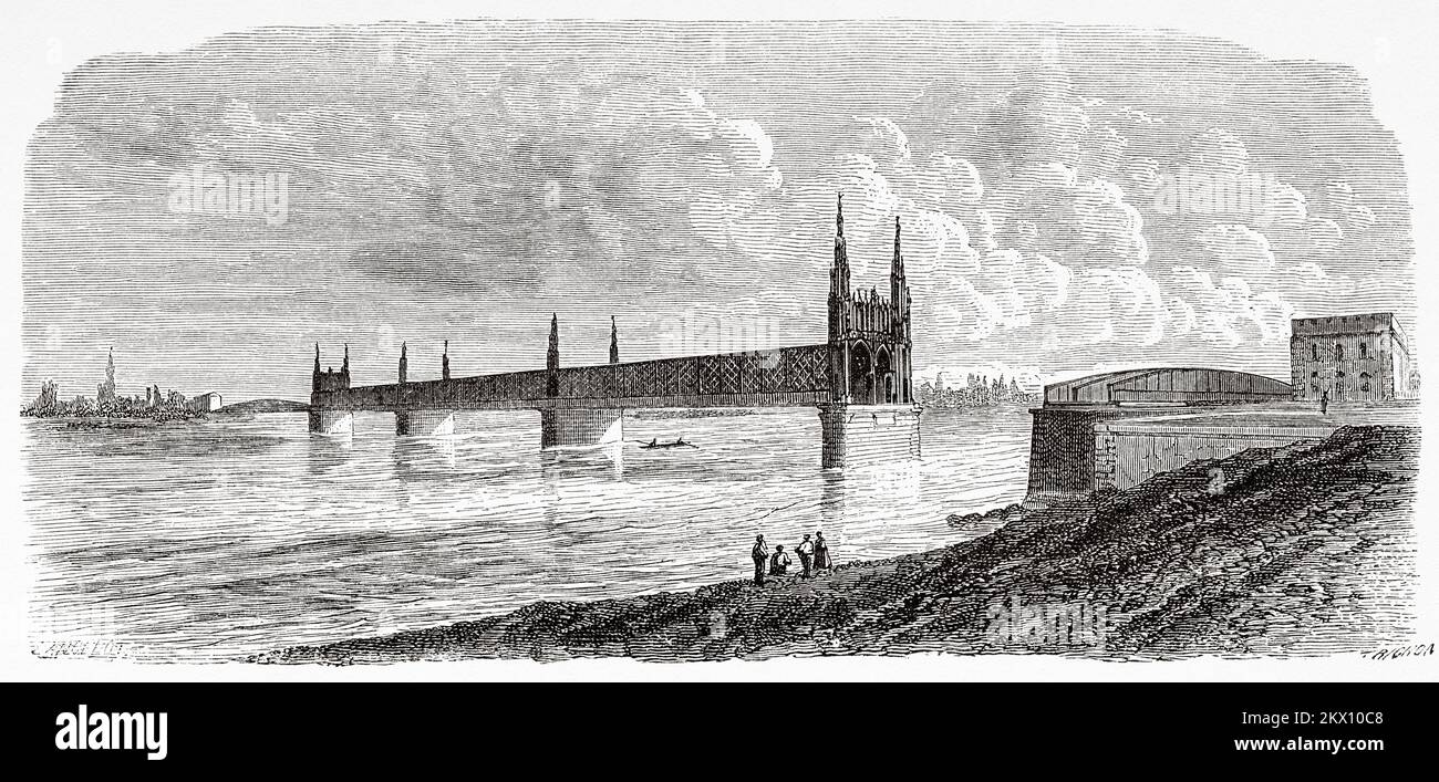
 Kehl bridge over Rhine river completed in Kehl, Baden-Wurttemberg. Germany. From Paris to Bucharest by Victor Duruy 1860 Stock Photohttps://www.alamy.com/image-license-details/?v=1https://www.alamy.com/kehl-bridge-over-rhine-river-completed-in-kehl-baden-wurttemberg-germany-from-paris-to-bucharest-by-victor-duruy-1860-image497893656.html
RM2KX10C8–Kehl bridge over Rhine river completed in Kehl, Baden-Wurttemberg. Germany. From Paris to Bucharest by Victor Duruy 1860
 Kehl, Regierungsbezirk Mittelfranken, DE, Germany, Bavaria, N 49 1' 48'', N 11 0' 47'', map, Cartascapes Map published in 2024. Explore Cartascapes, a map revealing Earth's diverse landscapes, cultures, and ecosystems. Journey through time and space, discovering the interconnectedness of our planet's past, present, and future. Stock Photohttps://www.alamy.com/image-license-details/?v=1https://www.alamy.com/kehl-regierungsbezirk-mittelfranken-de-germany-bavaria-n-49-1-48-n-11-0-47-map-cartascapes-map-published-in-2024-explore-cartascapes-a-map-revealing-earths-diverse-landscapes-cultures-and-ecosystems-journey-through-time-and-space-discovering-the-interconnectedness-of-our-planets-past-present-and-future-image629785540.html
RM2YGH5TM–Kehl, Regierungsbezirk Mittelfranken, DE, Germany, Bavaria, N 49 1' 48'', N 11 0' 47'', map, Cartascapes Map published in 2024. Explore Cartascapes, a map revealing Earth's diverse landscapes, cultures, and ecosystems. Journey through time and space, discovering the interconnectedness of our planet's past, present, and future.
 Kehl, Freiburg Region, DE, Germany, Baden-Wurttemberg, N 48 35' 2'', N 7 49' 25'', map, Cartascapes Map published in 2024. Explore Cartascapes, a map revealing Earth's diverse landscapes, cultures, and ecosystems. Journey through time and space, discovering the interconnectedness of our planet's past, present, and future. Stock Photohttps://www.alamy.com/image-license-details/?v=1https://www.alamy.com/kehl-freiburg-region-de-germany-baden-wurttemberg-n-48-35-2-n-7-49-25-map-cartascapes-map-published-in-2024-explore-cartascapes-a-map-revealing-earths-diverse-landscapes-cultures-and-ecosystems-journey-through-time-and-space-discovering-the-interconnectedness-of-our-planets-past-present-and-future-image629393367.html
RM2YFY9JF–Kehl, Freiburg Region, DE, Germany, Baden-Wurttemberg, N 48 35' 2'', N 7 49' 25'', map, Cartascapes Map published in 2024. Explore Cartascapes, a map revealing Earth's diverse landscapes, cultures, and ecosystems. Journey through time and space, discovering the interconnectedness of our planet's past, present, and future.
 Kehl, Freiburg Region, DE, Germany, Baden-Wurttemberg, N 48 34' 35'', N 7 48' 22'', map, Cartascapes Map published in 2024. Explore Cartascapes, a map revealing Earth's diverse landscapes, cultures, and ecosystems. Journey through time and space, discovering the interconnectedness of our planet's past, present, and future. Stock Photohttps://www.alamy.com/image-license-details/?v=1https://www.alamy.com/kehl-freiburg-region-de-germany-baden-wurttemberg-n-48-34-35-n-7-48-22-map-cartascapes-map-published-in-2024-explore-cartascapes-a-map-revealing-earths-diverse-landscapes-cultures-and-ecosystems-journey-through-time-and-space-discovering-the-interconnectedness-of-our-planets-past-present-and-future-image629796760.html
RM2YGHM5C–Kehl, Freiburg Region, DE, Germany, Baden-Wurttemberg, N 48 34' 35'', N 7 48' 22'', map, Cartascapes Map published in 2024. Explore Cartascapes, a map revealing Earth's diverse landscapes, cultures, and ecosystems. Journey through time and space, discovering the interconnectedness of our planet's past, present, and future.
 Kehl, Freiburg Region, DE, Germany, Baden-Wurttemberg, N 48 34' 22'', N 7 48' 54'', map, Cartascapes Map published in 2024. Explore Cartascapes, a map revealing Earth's diverse landscapes, cultures, and ecosystems. Journey through time and space, discovering the interconnectedness of our planet's past, present, and future. Stock Photohttps://www.alamy.com/image-license-details/?v=1https://www.alamy.com/kehl-freiburg-region-de-germany-baden-wurttemberg-n-48-34-22-n-7-48-54-map-cartascapes-map-published-in-2024-explore-cartascapes-a-map-revealing-earths-diverse-landscapes-cultures-and-ecosystems-journey-through-time-and-space-discovering-the-interconnectedness-of-our-planets-past-present-and-future-image629794267.html
RM2YGHH0B–Kehl, Freiburg Region, DE, Germany, Baden-Wurttemberg, N 48 34' 22'', N 7 48' 54'', map, Cartascapes Map published in 2024. Explore Cartascapes, a map revealing Earth's diverse landscapes, cultures, and ecosystems. Journey through time and space, discovering the interconnectedness of our planet's past, present, and future.
 Kehl-Sundheim, Freiburg Region, DE, Germany, Baden-Wurttemberg, N 48 33' 39'', N 7 50' 35'', map, Cartascapes Map published in 2024. Explore Cartascapes, a map revealing Earth's diverse landscapes, cultures, and ecosystems. Journey through time and space, discovering the interconnectedness of our planet's past, present, and future. Stock Photohttps://www.alamy.com/image-license-details/?v=1https://www.alamy.com/kehl-sundheim-freiburg-region-de-germany-baden-wurttemberg-n-48-33-39-n-7-50-35-map-cartascapes-map-published-in-2024-explore-cartascapes-a-map-revealing-earths-diverse-landscapes-cultures-and-ecosystems-journey-through-time-and-space-discovering-the-interconnectedness-of-our-planets-past-present-and-future-image629402068.html
RM2YFYMN8–Kehl-Sundheim, Freiburg Region, DE, Germany, Baden-Wurttemberg, N 48 33' 39'', N 7 50' 35'', map, Cartascapes Map published in 2024. Explore Cartascapes, a map revealing Earth's diverse landscapes, cultures, and ecosystems. Journey through time and space, discovering the interconnectedness of our planet's past, present, and future.
 Kehl-Berg, Regierungsbezirk Arnsberg, DE, Germany, North Rhine-Westphalia, N 51 19' 40'', N 8 5' 48'', map, Cartascapes Map published in 2024. Explore Cartascapes, a map revealing Earth's diverse landscapes, cultures, and ecosystems. Journey through time and space, discovering the interconnectedness of our planet's past, present, and future. Stock Photohttps://www.alamy.com/image-license-details/?v=1https://www.alamy.com/kehl-berg-regierungsbezirk-arnsberg-de-germany-north-rhine-westphalia-n-51-19-40-n-8-5-48-map-cartascapes-map-published-in-2024-explore-cartascapes-a-map-revealing-earths-diverse-landscapes-cultures-and-ecosystems-journey-through-time-and-space-discovering-the-interconnectedness-of-our-planets-past-present-and-future-image629752551.html
RM2YGFKPF–Kehl-Berg, Regierungsbezirk Arnsberg, DE, Germany, North Rhine-Westphalia, N 51 19' 40'', N 8 5' 48'', map, Cartascapes Map published in 2024. Explore Cartascapes, a map revealing Earth's diverse landscapes, cultures, and ecosystems. Journey through time and space, discovering the interconnectedness of our planet's past, present, and future.
 Kehl, Middle Franconia, Germany, Bavaria, N 49 1' 48'', E 11 0' 47'', map, Timeless Map published in 2021. Travelers, explorers and adventurers like Florence Nightingale, David Livingstone, Ernest Shackleton, Lewis and Clark and Sherlock Holmes relied on maps to plan travels to the world's most remote corners, Timeless Maps is mapping most locations on the globe, showing the achievement of great dreams Stock Photohttps://www.alamy.com/image-license-details/?v=1https://www.alamy.com/kehl-middle-franconia-germany-bavaria-n-49-1-48-e-11-0-47-map-timeless-map-published-in-2021-travelers-explorers-and-adventurers-like-florence-nightingale-david-livingstone-ernest-shackleton-lewis-and-clark-and-sherlock-holmes-relied-on-maps-to-plan-travels-to-the-worlds-most-remote-corners-timeless-maps-is-mapping-most-locations-on-the-globe-showing-the-achievement-of-great-dreams-image439334355.html
RM2GENBCK–Kehl, Middle Franconia, Germany, Bavaria, N 49 1' 48'', E 11 0' 47'', map, Timeless Map published in 2021. Travelers, explorers and adventurers like Florence Nightingale, David Livingstone, Ernest Shackleton, Lewis and Clark and Sherlock Holmes relied on maps to plan travels to the world's most remote corners, Timeless Maps is mapping most locations on the globe, showing the achievement of great dreams
 Kehl, Freiburg Region, Germany, Baden-Württemberg, N 48 34' 22'', E 7 48' 54'', map, Timeless Map published in 2021. Travelers, explorers and adventurers like Florence Nightingale, David Livingstone, Ernest Shackleton, Lewis and Clark and Sherlock Holmes relied on maps to plan travels to the world's most remote corners, Timeless Maps is mapping most locations on the globe, showing the achievement of great dreams Stock Photohttps://www.alamy.com/image-license-details/?v=1https://www.alamy.com/kehl-freiburg-region-germany-baden-wrttemberg-n-48-34-22-e-7-48-54-map-timeless-map-published-in-2021-travelers-explorers-and-adventurers-like-florence-nightingale-david-livingstone-ernest-shackleton-lewis-and-clark-and-sherlock-holmes-relied-on-maps-to-plan-travels-to-the-worlds-most-remote-corners-timeless-maps-is-mapping-most-locations-on-the-globe-showing-the-achievement-of-great-dreams-image439334406.html
RM2GENBEE–Kehl, Freiburg Region, Germany, Baden-Württemberg, N 48 34' 22'', E 7 48' 54'', map, Timeless Map published in 2021. Travelers, explorers and adventurers like Florence Nightingale, David Livingstone, Ernest Shackleton, Lewis and Clark and Sherlock Holmes relied on maps to plan travels to the world's most remote corners, Timeless Maps is mapping most locations on the globe, showing the achievement of great dreams