Lima peru callao Stock Vectors & Vector Art
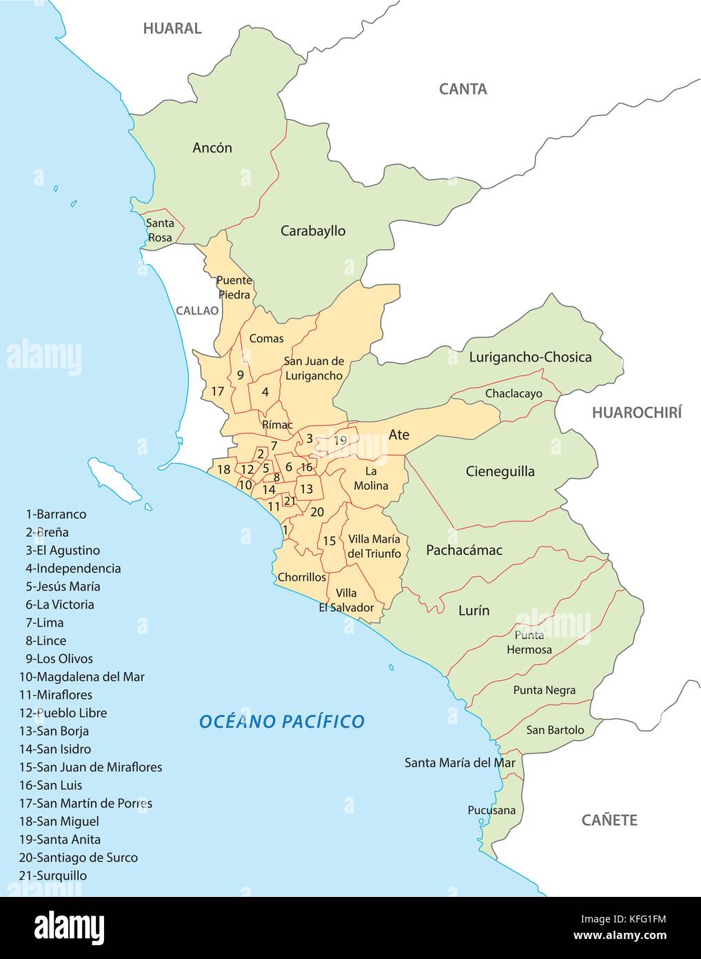 lima administrative and political vector map Stock Vectorhttps://www.alamy.com/image-license-details/?v=1https://www.alamy.com/stock-image-lima-administrative-and-political-vector-map-164465608.html
RFKFG1FM–lima administrative and political vector map
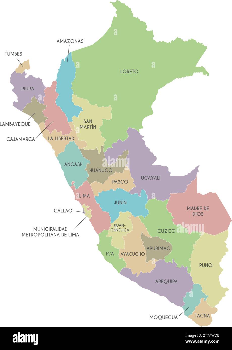 Vector map of Peru with departments, provinces and administrative divisions. Editable and clearly labeled layers. Stock Vectorhttps://www.alamy.com/image-license-details/?v=1https://www.alamy.com/vector-map-of-peru-with-departments-provinces-and-administrative-divisions-editable-and-clearly-labeled-layers-image572484231.html
RF2T7AWDB–Vector map of Peru with departments, provinces and administrative divisions. Editable and clearly labeled layers.
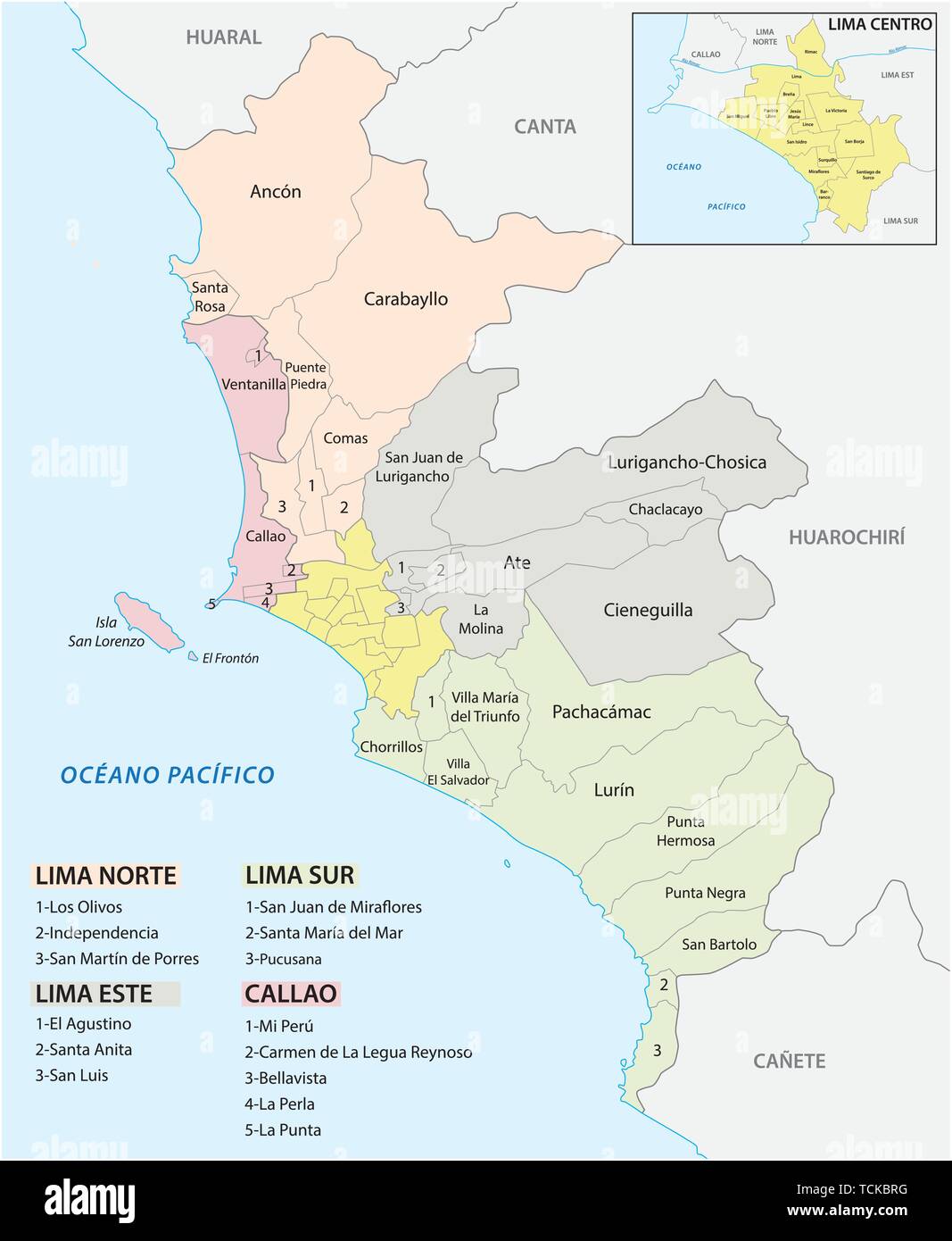 Lima metropolitan area administrative and political map in spanish language Stock Vectorhttps://www.alamy.com/image-license-details/?v=1https://www.alamy.com/lima-metropolitan-area-administrative-and-political-map-in-spanish-language-image248747396.html
RFTCKBRG–Lima metropolitan area administrative and political map in spanish language
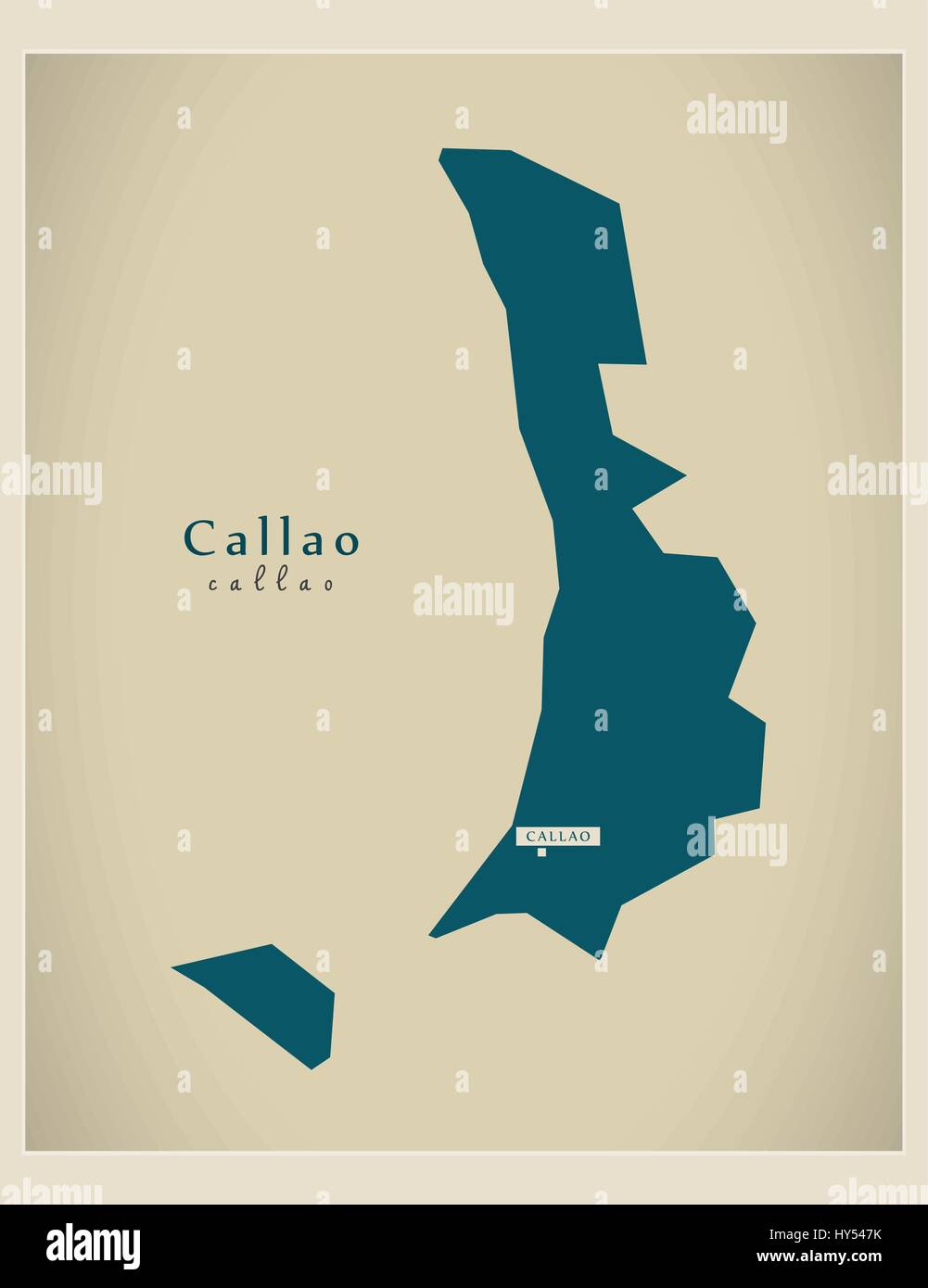 Modern Map - Callao PE Stock Vectorhttps://www.alamy.com/image-license-details/?v=1https://www.alamy.com/stock-photo-modern-map-callao-pe-137181399.html
RFHY547K–Modern Map - Callao PE
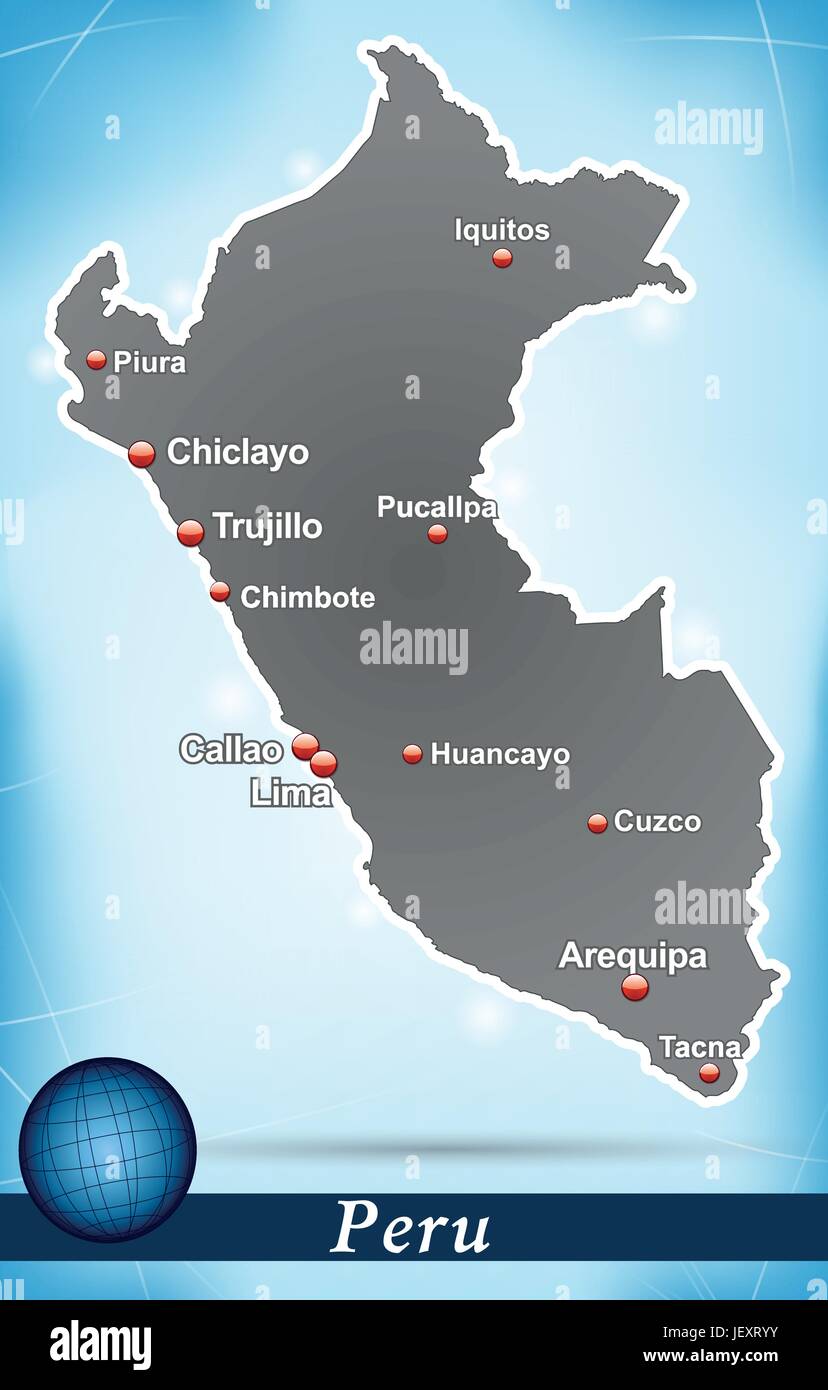 island map of peru abstract background in blue Stock Vectorhttps://www.alamy.com/image-license-details/?v=1https://www.alamy.com/stock-photo-island-map-of-peru-abstract-background-in-blue-146877695.html
RFJEXRYY–island map of peru abstract background in blue
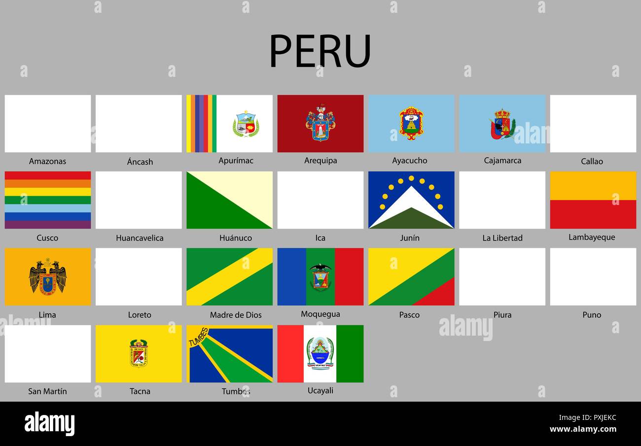 all Flags of departments of Peru. Vector illustraion. flag set Stock Vectorhttps://www.alamy.com/image-license-details/?v=1https://www.alamy.com/all-flags-of-departments-of-peru-vector-illustraion-flag-set-image222912128.html
RFPXJEKC–all Flags of departments of Peru. Vector illustraion. flag set
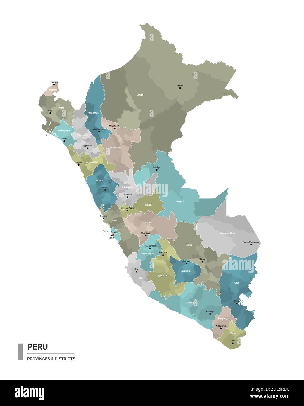 Peru higt detailed map with subdivisions. Administrative map of Peru with districts and cities name, colored by states and administrative districts. Stock Vectorhttps://www.alamy.com/image-license-details/?v=1https://www.alamy.com/peru-higt-detailed-map-with-subdivisions-administrative-map-of-peru-with-districts-and-cities-name-colored-by-states-and-administrative-districts-image386132136.html
RF2DC5RDC–Peru higt detailed map with subdivisions. Administrative map of Peru with districts and cities name, colored by states and administrative districts.
 Peru, Lima, Torre Banco De La Nacion travel landmark vector illustration Stock Vectorhttps://www.alamy.com/image-license-details/?v=1https://www.alamy.com/peru-lima-torre-banco-de-la-nacion-travel-landmark-vector-illustration-image544877766.html
RF2PJD946–Peru, Lima, Torre Banco De La Nacion travel landmark vector illustration
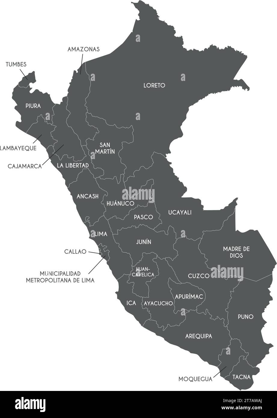 Vector map of Peru with departments, provinces and administrative divisions. Editable and clearly labeled layers. Stock Vectorhttps://www.alamy.com/image-license-details/?v=1https://www.alamy.com/vector-map-of-peru-with-departments-provinces-and-administrative-divisions-editable-and-clearly-labeled-layers-image572484154.html
RF2T7AWAJ–Vector map of Peru with departments, provinces and administrative divisions. Editable and clearly labeled layers.
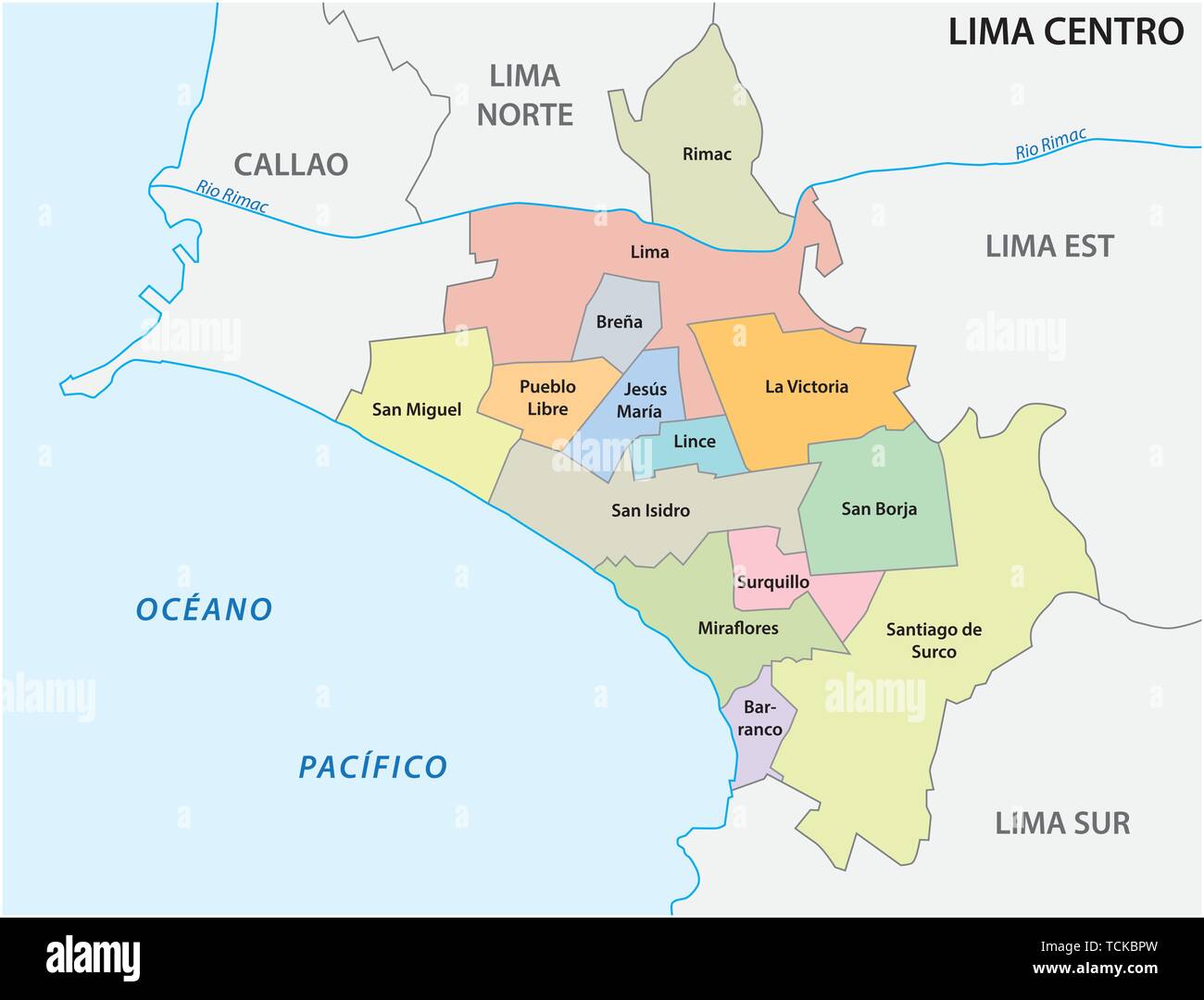 Lima center area administrative and political map in spanish language Stock Vectorhttps://www.alamy.com/image-license-details/?v=1https://www.alamy.com/lima-center-area-administrative-and-political-map-in-spanish-language-image248747377.html
RFTCKBPW–Lima center area administrative and political map in spanish language
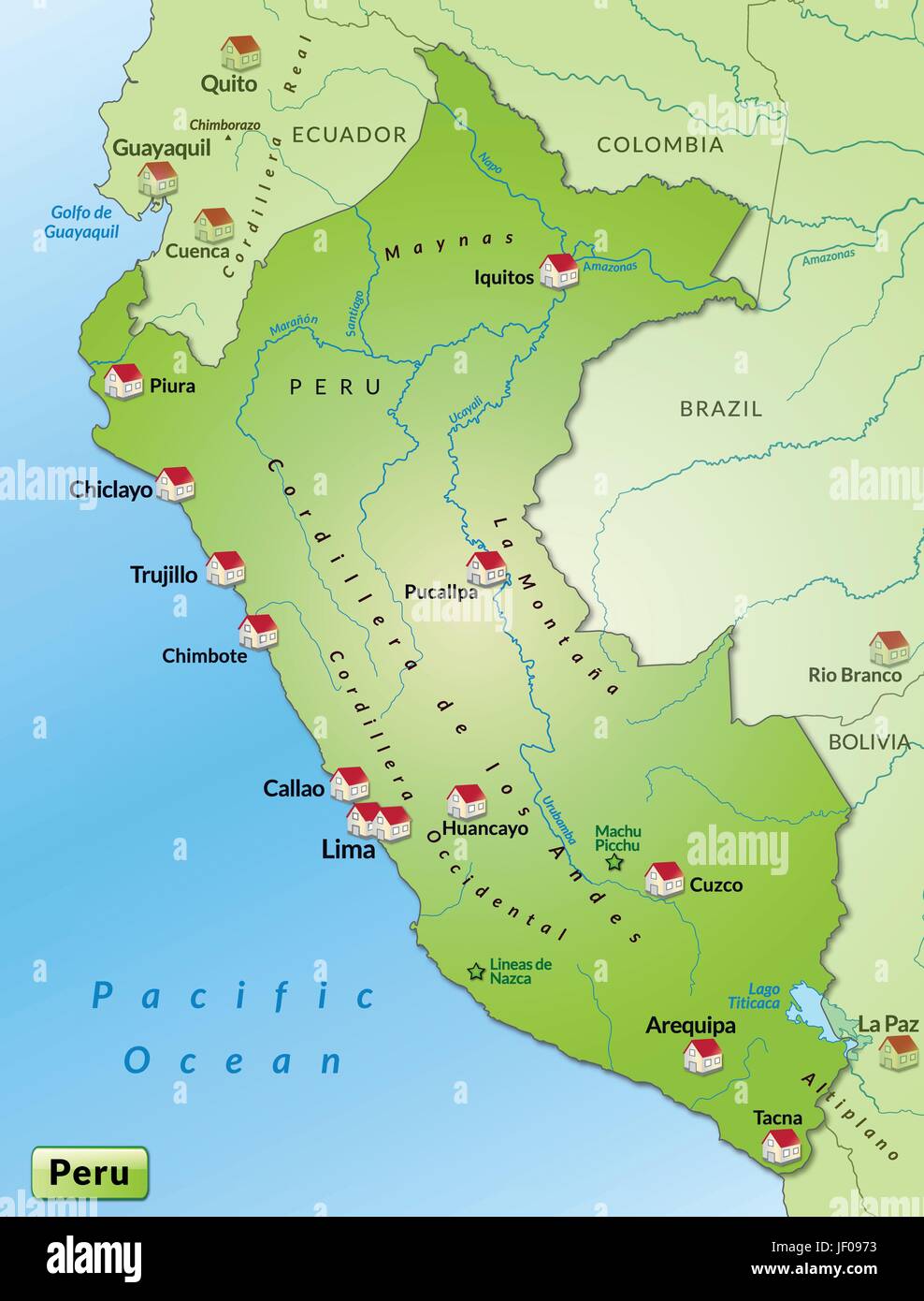 map of peru as infographic in green Stock Vectorhttps://www.alamy.com/image-license-details/?v=1https://www.alamy.com/stock-photo-map-of-peru-as-infographic-in-green-146910039.html
RFJF0973–map of peru as infographic in green
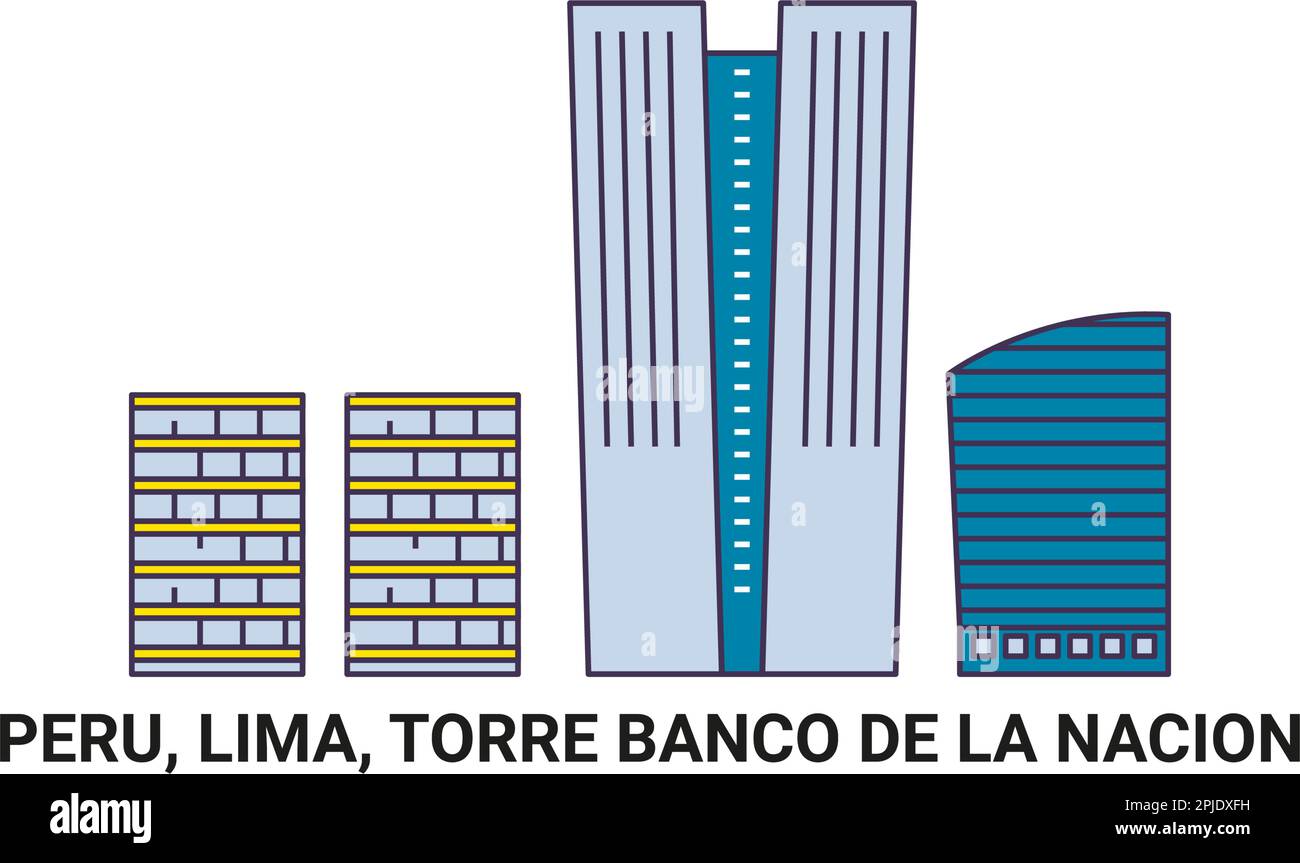 Peru, Lima, Torre Banco De La Nacion travel landmark vector illustration Stock Vectorhttps://www.alamy.com/image-license-details/?v=1https://www.alamy.com/peru-lima-torre-banco-de-la-nacion-travel-landmark-vector-illustration-image544891413.html
RF2PJDXFH–Peru, Lima, Torre Banco De La Nacion travel landmark vector illustration
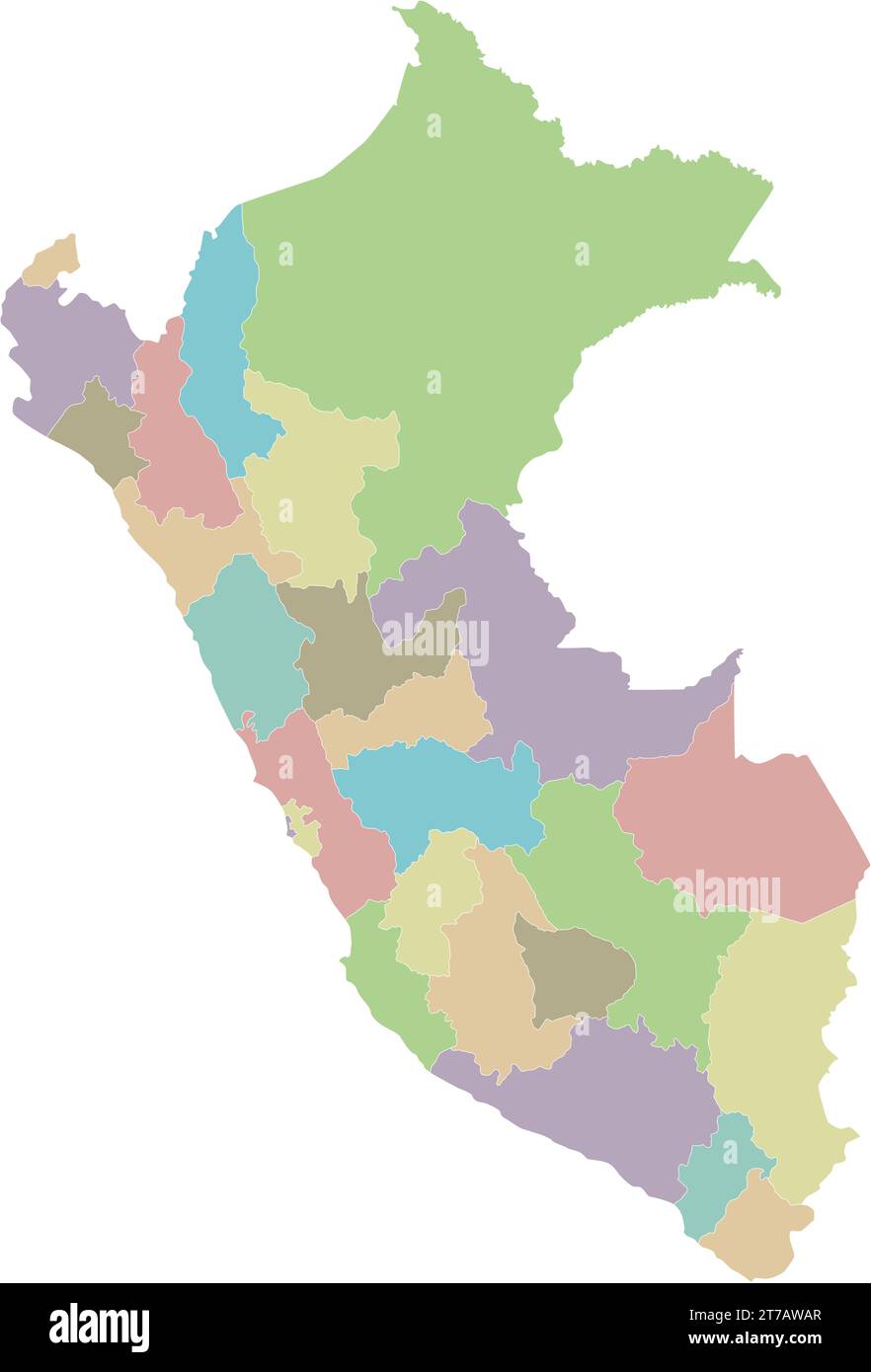 Vector blank map of Peru with departments, provinces and administrative divisions. Editable and clearly labeled layers. Stock Vectorhttps://www.alamy.com/image-license-details/?v=1https://www.alamy.com/vector-blank-map-of-peru-with-departments-provinces-and-administrative-divisions-editable-and-clearly-labeled-layers-image572484159.html
RF2T7AWAR–Vector blank map of Peru with departments, provinces and administrative divisions. Editable and clearly labeled layers.
 map of peru as an overview map in pastelorange Stock Vectorhttps://www.alamy.com/image-license-details/?v=1https://www.alamy.com/stock-photo-map-of-peru-as-an-overview-map-in-pastelorange-146903122.html
RFJF00C2–map of peru as an overview map in pastelorange
 Peru, Lima, Torre Banco De La Nacion travel landmark vector illustration Stock Vectorhttps://www.alamy.com/image-license-details/?v=1https://www.alamy.com/peru-lima-torre-banco-de-la-nacion-travel-landmark-vector-illustration-image544480545.html
RF2PHR6DN–Peru, Lima, Torre Banco De La Nacion travel landmark vector illustration
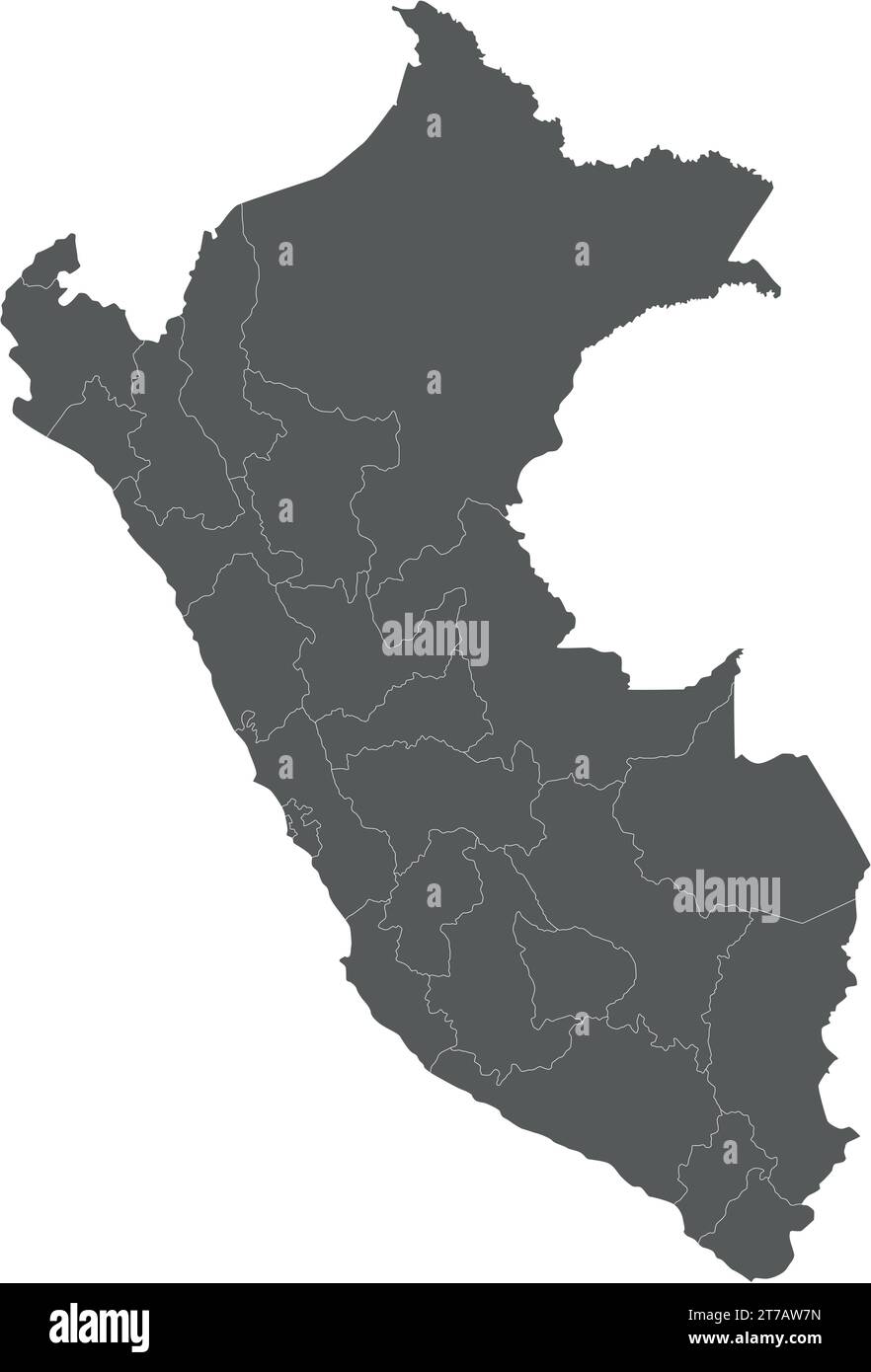 Vector blank map of Peru with departments, provinces and administrative divisions. Editable and clearly labeled layers. Stock Vectorhttps://www.alamy.com/image-license-details/?v=1https://www.alamy.com/vector-blank-map-of-peru-with-departments-provinces-and-administrative-divisions-editable-and-clearly-labeled-layers-image572484073.html
RF2T7AW7N–Vector blank map of Peru with departments, provinces and administrative divisions. Editable and clearly labeled layers.
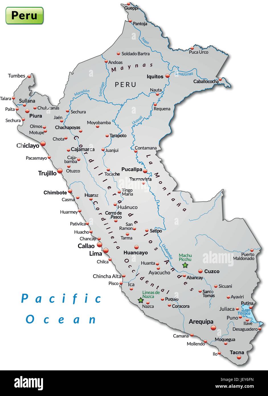 island map of peru as an overview map in gray Stock Vectorhttps://www.alamy.com/image-license-details/?v=1https://www.alamy.com/stock-photo-island-map-of-peru-as-an-overview-map-in-gray-146885977.html
RFJEY6FN–island map of peru as an overview map in gray
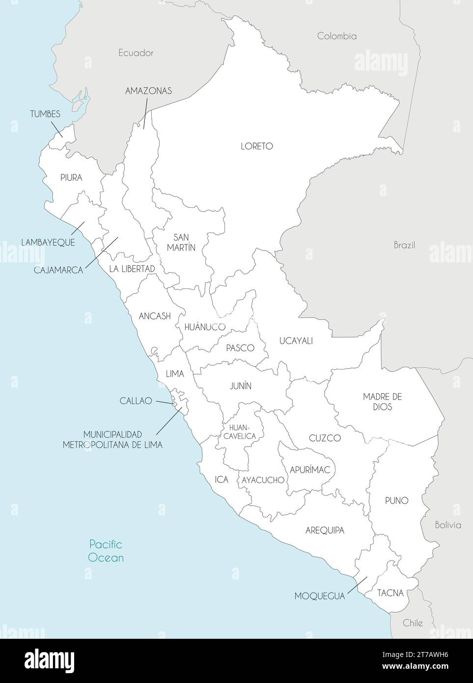 Vector map of Peru with departments, provinces and administrative divisions, and neighbouring countries. Editable and clearly labeled layers. Stock Vectorhttps://www.alamy.com/image-license-details/?v=1https://www.alamy.com/vector-map-of-peru-with-departments-provinces-and-administrative-divisions-and-neighbouring-countries-editable-and-clearly-labeled-layers-image572484338.html
RF2T7AWH6–Vector map of Peru with departments, provinces and administrative divisions, and neighbouring countries. Editable and clearly labeled layers.
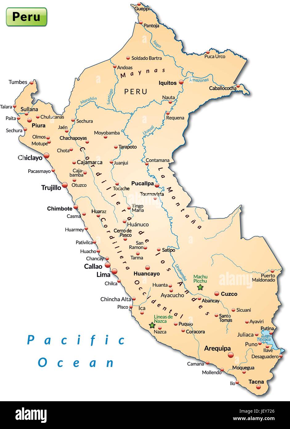 island map of peru as an overview map in pastelorange Stock Vectorhttps://www.alamy.com/image-license-details/?v=1https://www.alamy.com/stock-photo-island-map-of-peru-as-an-overview-map-in-pastelorange-146886382.html
RFJEY726–island map of peru as an overview map in pastelorange
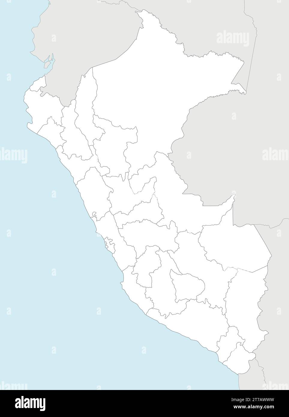 Vector blank map of Peru with departments, provinces and administrative divisions, and neighbouring countries. Editable and clearly labeled layers. Stock Vectorhttps://www.alamy.com/image-license-details/?v=1https://www.alamy.com/vector-blank-map-of-peru-with-departments-provinces-and-administrative-divisions-and-neighbouring-countries-editable-and-clearly-labeled-layers-image572484581.html
RF2T7AWWW–Vector blank map of Peru with departments, provinces and administrative divisions, and neighbouring countries. Editable and clearly labeled layers.
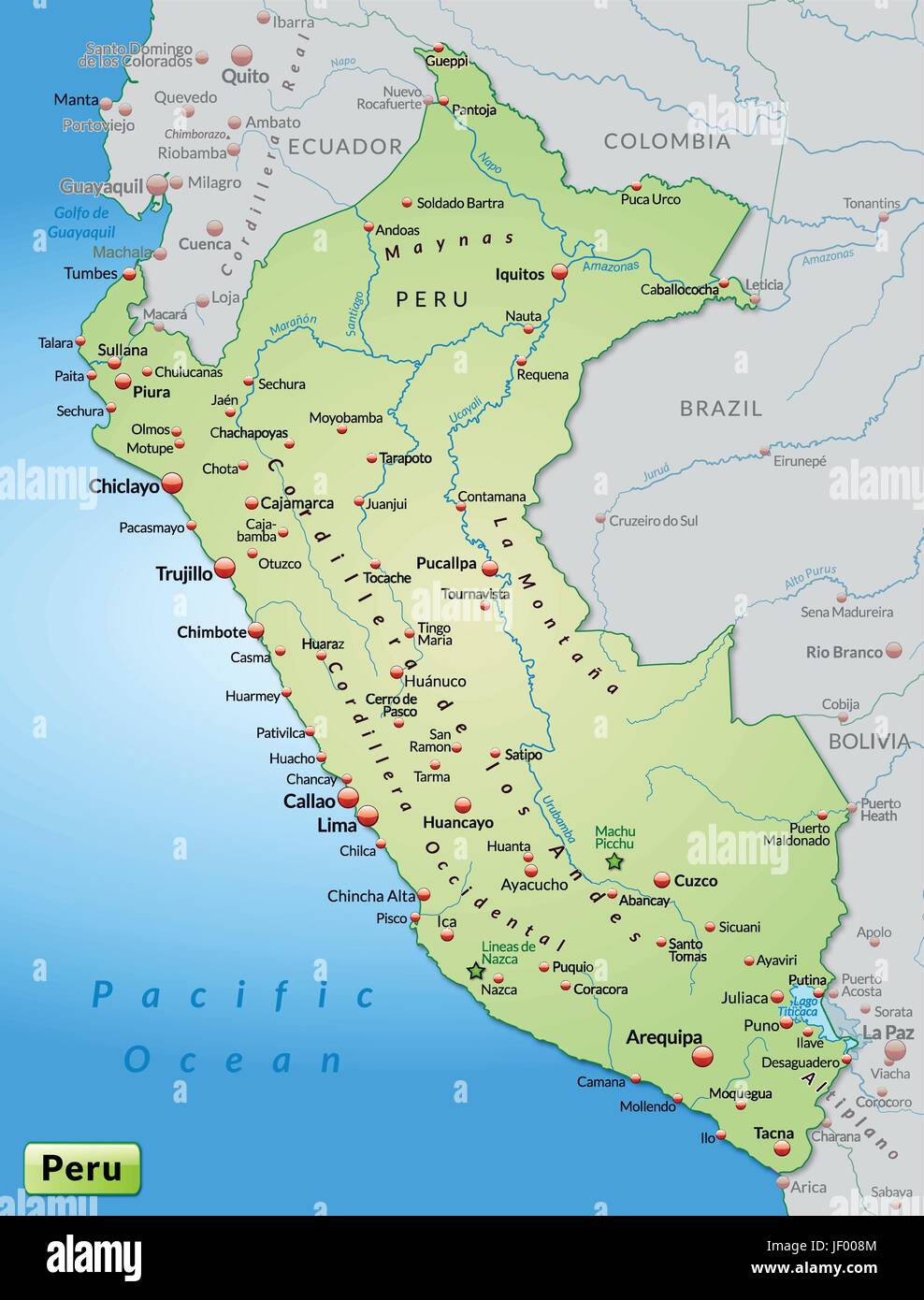 map of peru as an overview map in pastel green Stock Vectorhttps://www.alamy.com/image-license-details/?v=1https://www.alamy.com/stock-photo-map-of-peru-as-an-overview-map-in-pastel-green-146903028.html
RFJF008M–map of peru as an overview map in pastel green
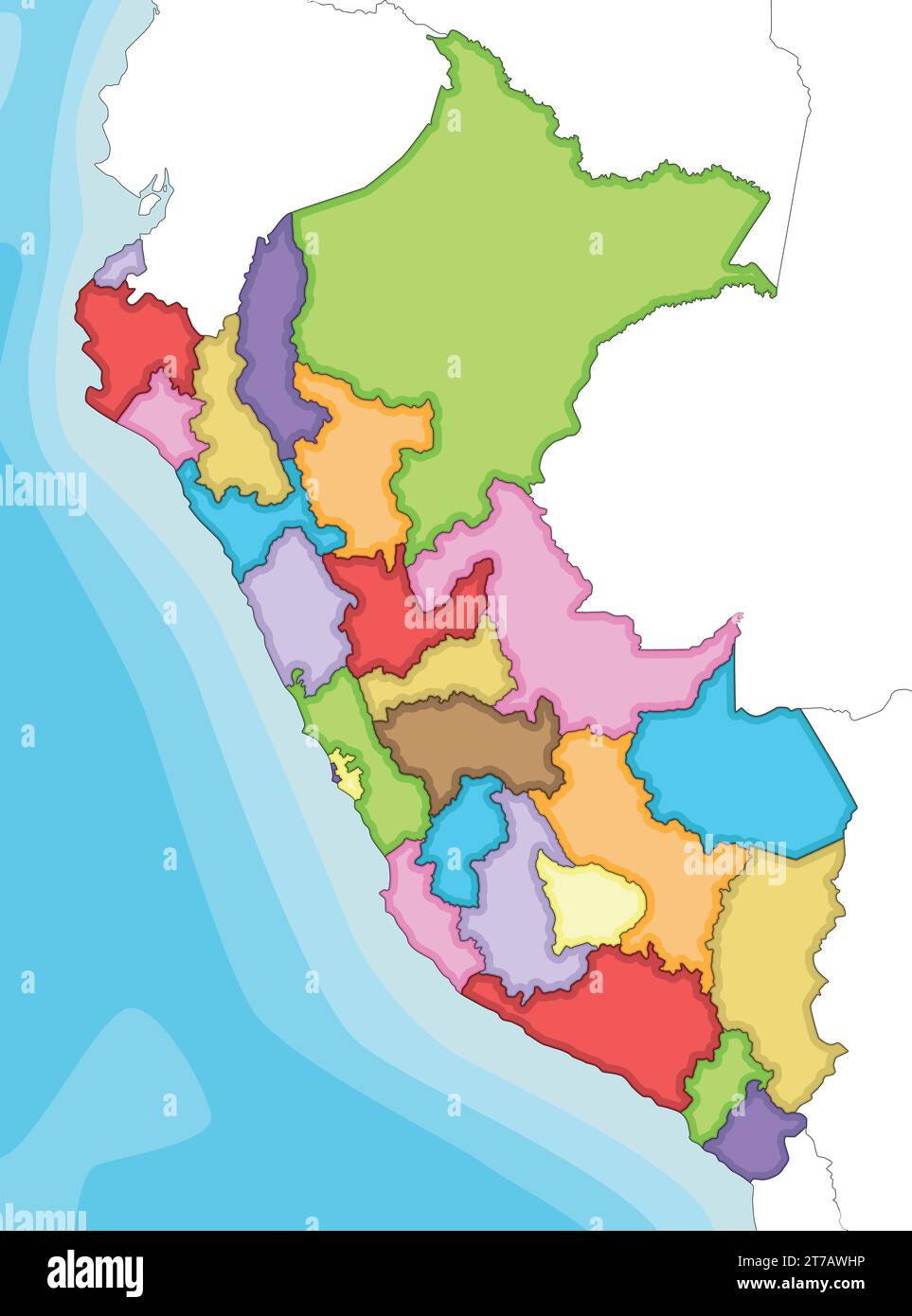 Vector illustrated blank map of Peru with departments, provinces and administrative divisions, and neighbouring countries. Editable and clearly labele Stock Vectorhttps://www.alamy.com/image-license-details/?v=1https://www.alamy.com/vector-illustrated-blank-map-of-peru-with-departments-provinces-and-administrative-divisions-and-neighbouring-countries-editable-and-clearly-labele-image572484354.html
RF2T7AWHP–Vector illustrated blank map of Peru with departments, provinces and administrative divisions, and neighbouring countries. Editable and clearly labele
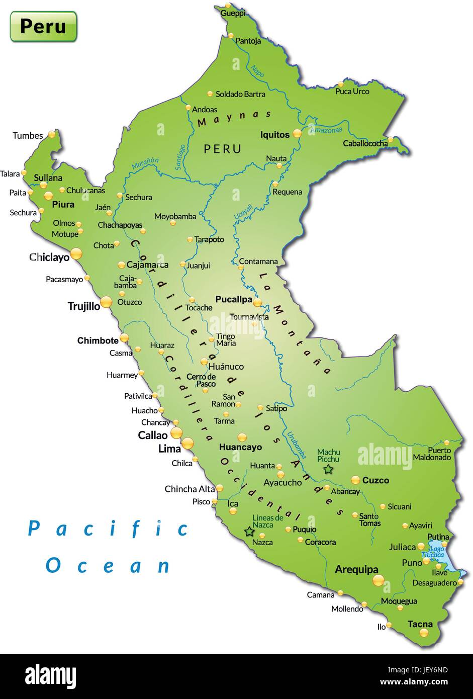 island map of peru as an overview map in green Stock Vectorhttps://www.alamy.com/image-license-details/?v=1https://www.alamy.com/stock-photo-island-map-of-peru-as-an-overview-map-in-green-146886137.html
RFJEY6ND–island map of peru as an overview map in green
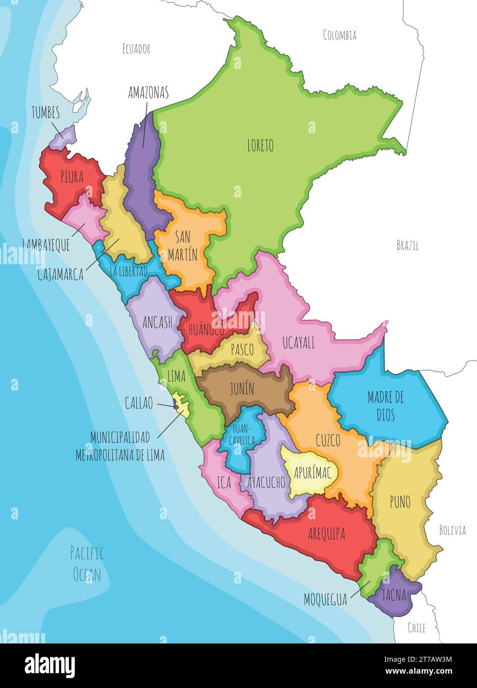 Vector illustrated map of Peru with departments, provinces and administrative divisions, and neighbouring countries. Editable and clearly labeled laye Stock Vectorhttps://www.alamy.com/image-license-details/?v=1https://www.alamy.com/vector-illustrated-map-of-peru-with-departments-provinces-and-administrative-divisions-and-neighbouring-countries-editable-and-clearly-labeled-laye-image572483960.html
RF2T7AW3M–Vector illustrated map of Peru with departments, provinces and administrative divisions, and neighbouring countries. Editable and clearly labeled laye
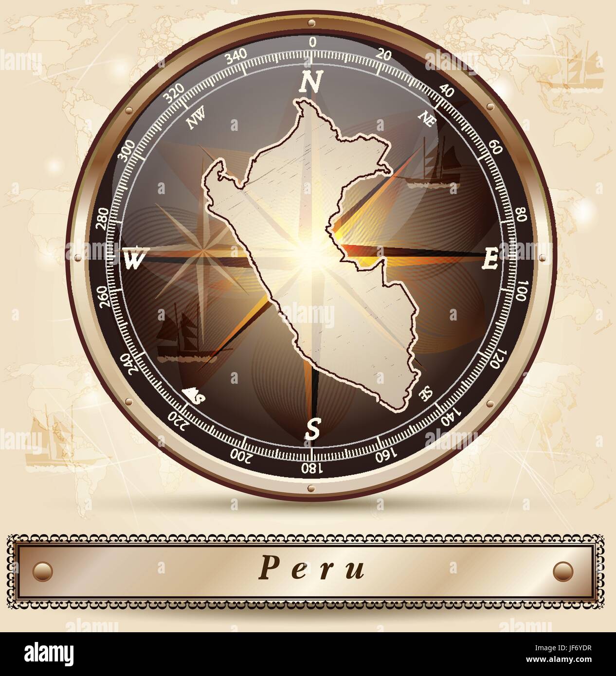 map of peru Stock Vectorhttps://www.alamy.com/image-license-details/?v=1https://www.alamy.com/stock-photo-map-of-peru-147056051.html
RFJF6YDR–map of peru
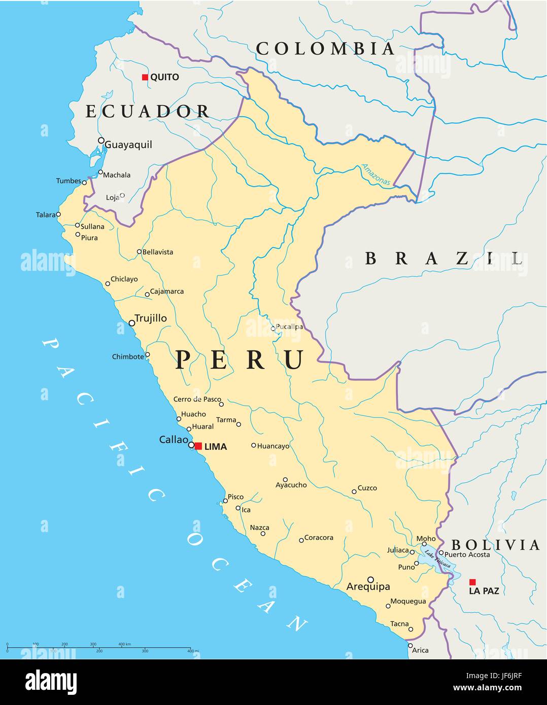 south america, peru, map, atlas, map of the world, travel, political, pacific, Stock Vectorhttps://www.alamy.com/image-license-details/?v=1https://www.alamy.com/stock-photo-south-america-peru-map-atlas-map-of-the-world-travel-political-pacific-147049267.html
RFJF6JRF–south america, peru, map, atlas, map of the world, travel, political, pacific,
 blue, note, memo, slip, illustration, card, message, peru, notepads, land, Stock Vectorhttps://www.alamy.com/image-license-details/?v=1https://www.alamy.com/stock-photo-blue-note-memo-slip-illustration-card-message-peru-notepads-land-147002233.html
RFJF4ERN–blue, note, memo, slip, illustration, card, message, peru, notepads, land,
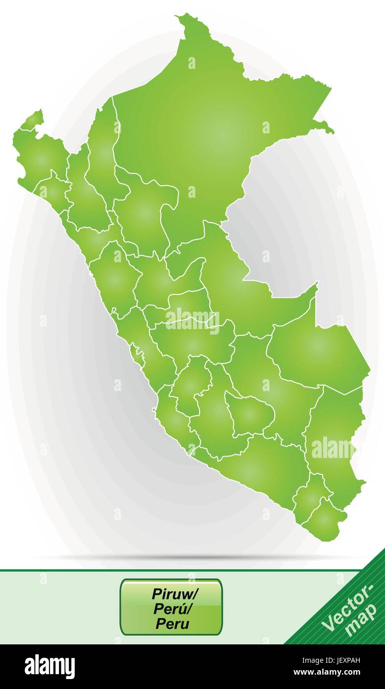 card, atlas, map of the world, map, model, design, project, concept, plan, Stock Vectorhttps://www.alamy.com/image-license-details/?v=1https://www.alamy.com/stock-photo-card-atlas-map-of-the-world-map-model-design-project-concept-plan-146876425.html
RFJEXPAH–card, atlas, map of the world, map, model, design, project, concept, plan,
 model, design, project, concept, plan, draft, illustration, purple, violet, Stock Vectorhttps://www.alamy.com/image-license-details/?v=1https://www.alamy.com/stock-photo-model-design-project-concept-plan-draft-illustration-purple-violet-146876978.html
RFJEXR2A–model, design, project, concept, plan, draft, illustration, purple, violet,
 model, design, project, concept, plan, draft, illustration, purple, violet, Stock Vectorhttps://www.alamy.com/image-license-details/?v=1https://www.alamy.com/stock-photo-model-design-project-concept-plan-draft-illustration-purple-violet-146877391.html
RFJEXRH3–model, design, project, concept, plan, draft, illustration, purple, violet,
 card, atlas, map of the world, map, model, design, project, concept, plan, Stock Vectorhttps://www.alamy.com/image-license-details/?v=1https://www.alamy.com/stock-photo-card-atlas-map-of-the-world-map-model-design-project-concept-plan-146900763.html
RFJEYWBR–card, atlas, map of the world, map, model, design, project, concept, plan,
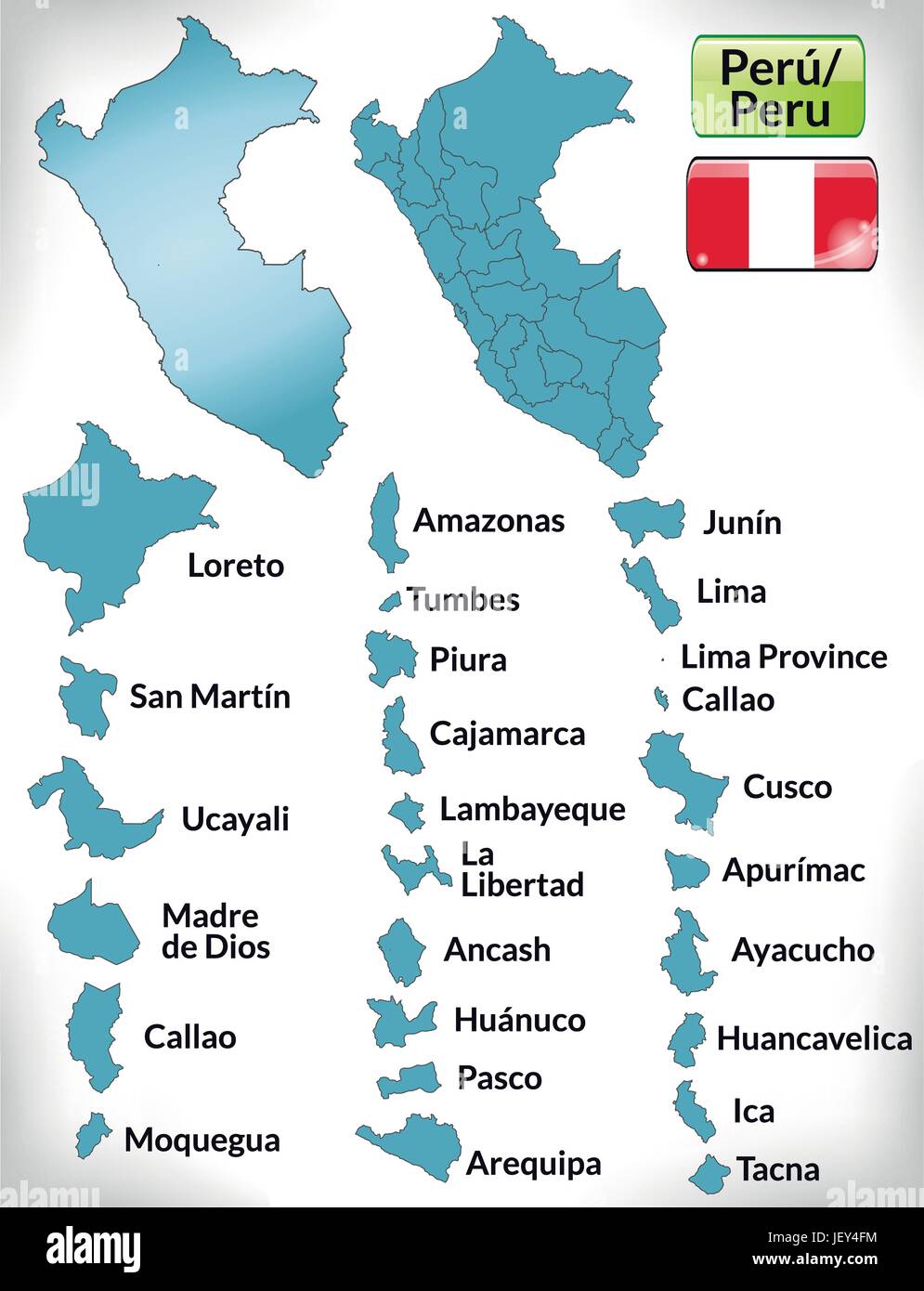 card, atlas, map of the world, map, blue, model, design, project, concept, Stock Vectorhttps://www.alamy.com/image-license-details/?v=1https://www.alamy.com/stock-photo-card-atlas-map-of-the-world-map-blue-model-design-project-concept-146884408.html
RFJEY4FM–card, atlas, map of the world, map, blue, model, design, project, concept,
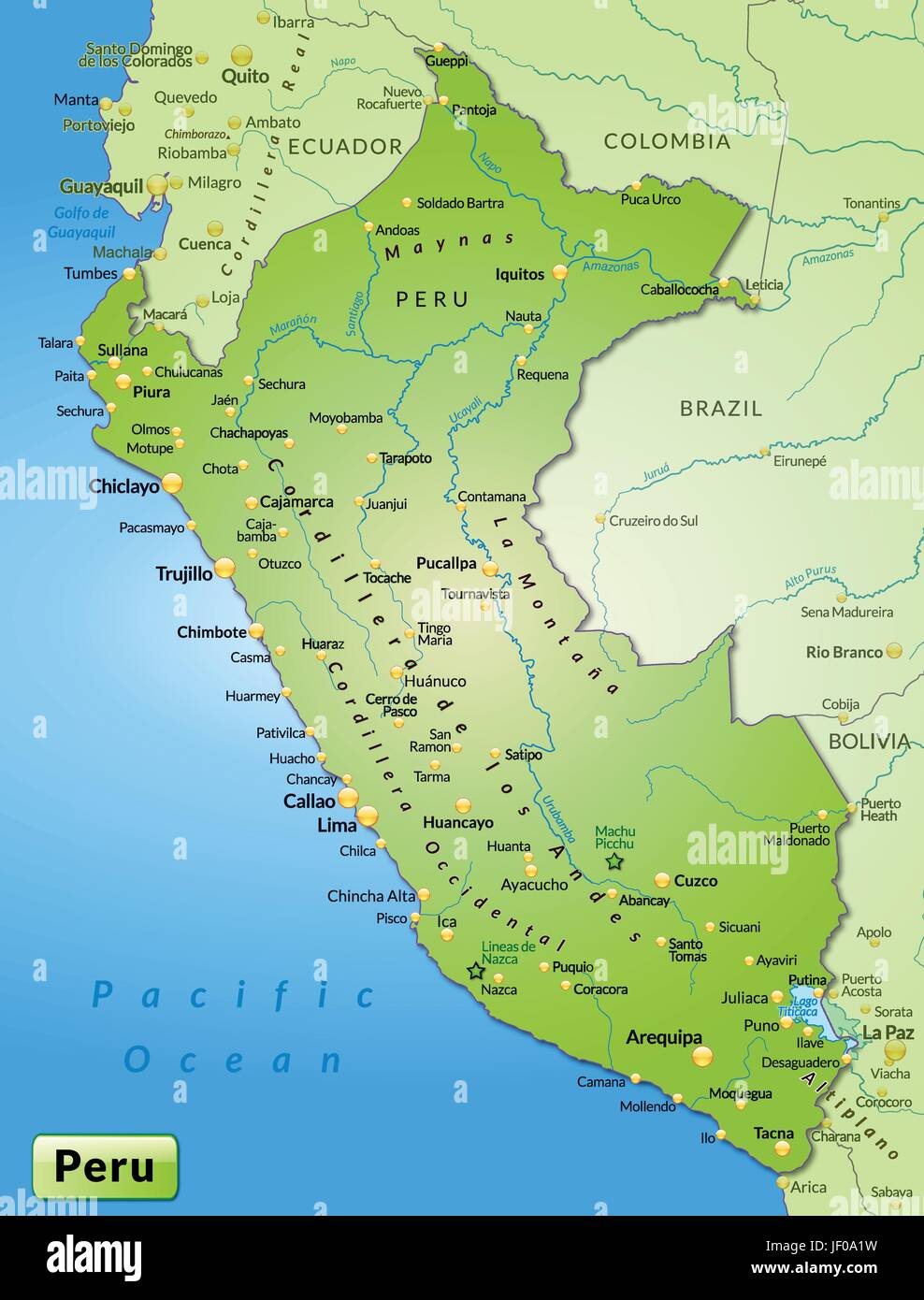 card, atlas, map of the world, map, model, design, project, concept, plan, Stock Vectorhttps://www.alamy.com/image-license-details/?v=1https://www.alamy.com/stock-photo-card-atlas-map-of-the-world-map-model-design-project-concept-plan-146910677.html
RFJF0A1W–card, atlas, map of the world, map, model, design, project, concept, plan,
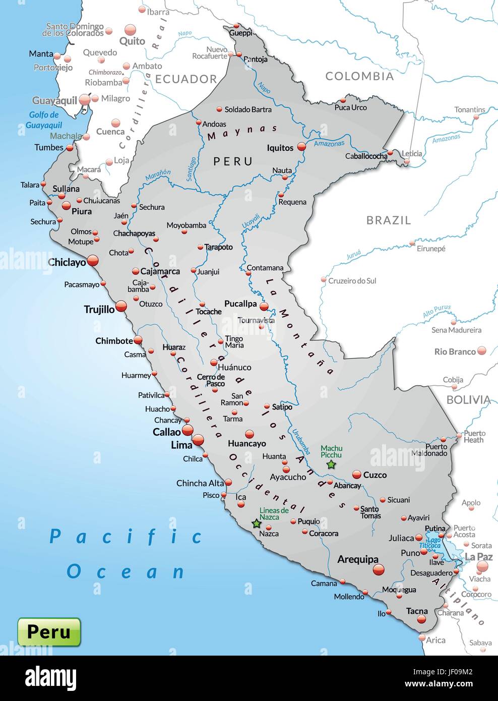 card, atlas, map of the world, map, model, design, project, concept, plan, Stock Vectorhttps://www.alamy.com/image-license-details/?v=1https://www.alamy.com/stock-photo-card-atlas-map-of-the-world-map-model-design-project-concept-plan-146910402.html
RFJF09M2–card, atlas, map of the world, map, model, design, project, concept, plan,
 card, atlas, map of the world, map, model, design, project, concept, plan, Stock Vectorhttps://www.alamy.com/image-license-details/?v=1https://www.alamy.com/stock-photo-card-atlas-map-of-the-world-map-model-design-project-concept-plan-146886260.html
RFJEY6WT–card, atlas, map of the world, map, model, design, project, concept, plan,