Quick filters:
Manchac Stock Photos and Images
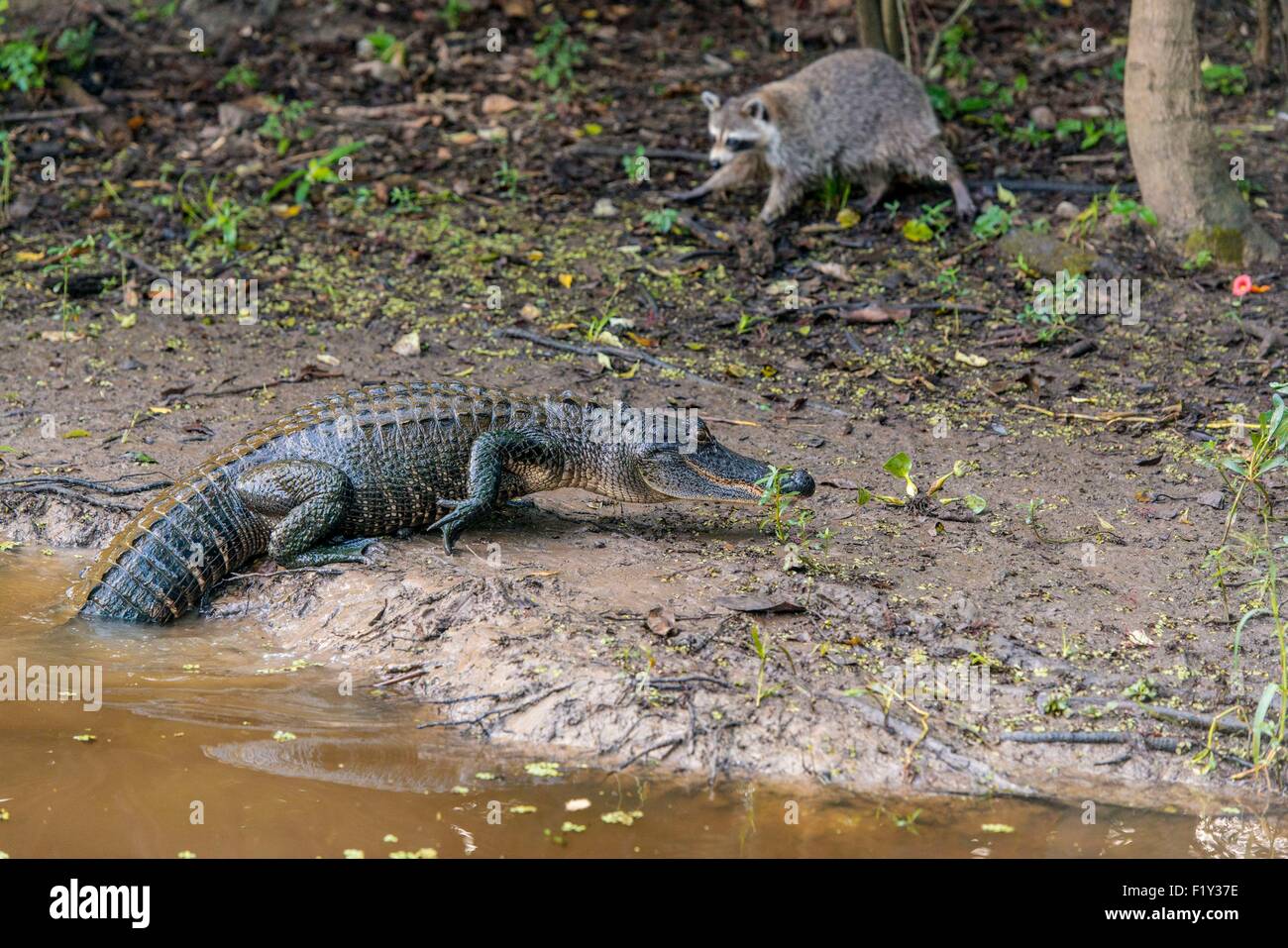 United States, Louisiana, La Place, alligator and raccoon in the bayous of Manchac Swamp Stock Photohttps://www.alamy.com/image-license-details/?v=1https://www.alamy.com/stock-photo-united-states-louisiana-la-place-alligator-and-raccoon-in-the-bayous-87261762.html
RMF1Y37E–United States, Louisiana, La Place, alligator and raccoon in the bayous of Manchac Swamp
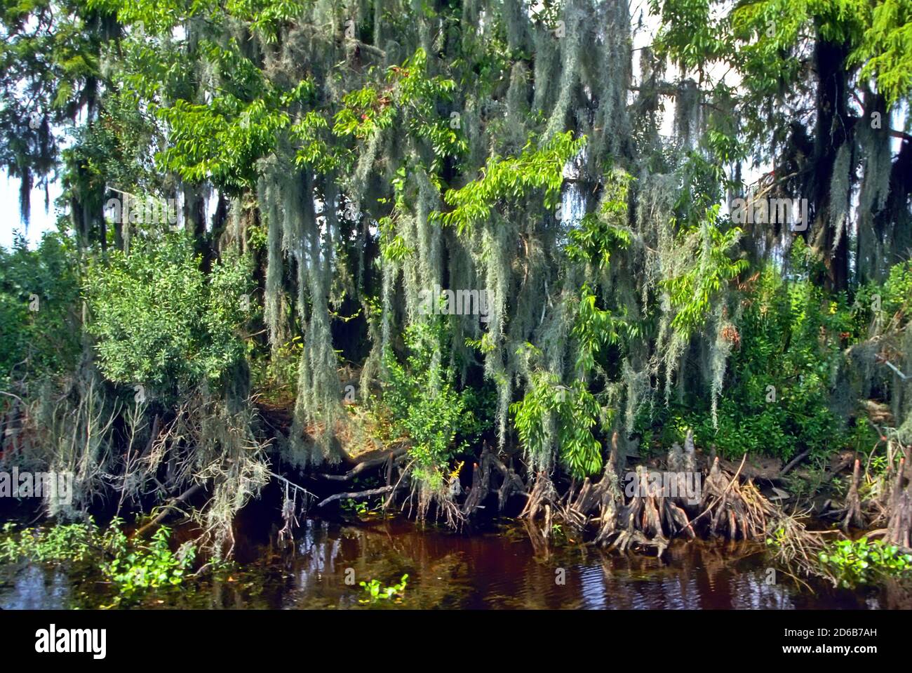 Manchac Swamp Ponchatoula, Louisiana- Trees with swamp moss - southern Louisiana Stock Photohttps://www.alamy.com/image-license-details/?v=1https://www.alamy.com/manchac-swamp-ponchatoula-louisiana-trees-with-swamp-moss-southern-louisiana-image382563289.html
RM2D6B7AH–Manchac Swamp Ponchatoula, Louisiana- Trees with swamp moss - southern Louisiana
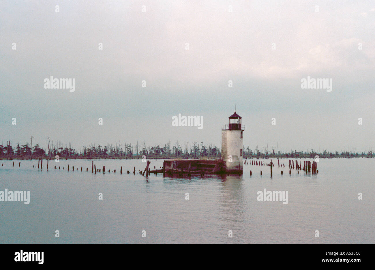 Manchac Lighthouse in Lake Ponchartrain, Louisiana, has been sinking through the years. Stock Photohttps://www.alamy.com/image-license-details/?v=1https://www.alamy.com/manchac-lighthouse-in-lake-ponchartrain-louisiana-has-been-sinking-image406982.html
RMA635C6–Manchac Lighthouse in Lake Ponchartrain, Louisiana, has been sinking through the years.
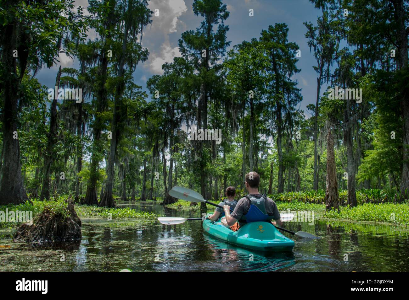 Two males kayaking, Manchac Cypress Swamp Kayak Tour, near New Orleans, Louisiana, USA. Stock Photohttps://www.alamy.com/image-license-details/?v=1https://www.alamy.com/two-males-kayaking-manchac-cypress-swamp-kayak-tour-near-new-orleans-louisiana-usa-image441629544.html
RM2GJDXYM–Two males kayaking, Manchac Cypress Swamp Kayak Tour, near New Orleans, Louisiana, USA.
 Wide angle view of Manchac Swamp near New Orleans, Louisiana, United States of America, North America Stock Photohttps://www.alamy.com/image-license-details/?v=1https://www.alamy.com/wide-angle-view-of-manchac-swamp-near-new-orleans-louisiana-united-states-of-america-north-america-image357519834.html
RF2BNJC5E–Wide angle view of Manchac Swamp near New Orleans, Louisiana, United States of America, North America
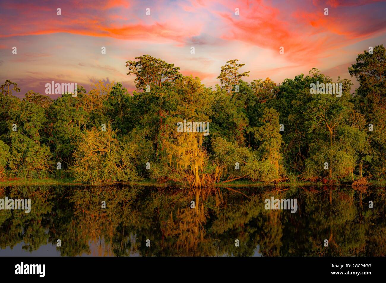 Picture taken on I55 south around Ruddock, Louisiana. Reflection of cypress trees in the Manchac swamp. Stock Photohttps://www.alamy.com/image-license-details/?v=1https://www.alamy.com/picture-taken-on-i55-south-around-ruddock-louisiana-reflection-of-cypress-trees-in-the-manchac-swamp-image438121616.html
RF2GCP4GG–Picture taken on I55 south around Ruddock, Louisiana. Reflection of cypress trees in the Manchac swamp.
 Interstate 10 exit sign for Manchac, Louisiana Stock Photohttps://www.alamy.com/image-license-details/?v=1https://www.alamy.com/stock-photo-interstate-10-exit-sign-for-manchac-louisiana-133784715.html
RFHNJBNF–Interstate 10 exit sign for Manchac, Louisiana
 Mackay, Queensland, Australia - February 2020: The ship Manchac Sun moored at the port wharf ready to lead produce from Australia to overseas markets Stock Photohttps://www.alamy.com/image-license-details/?v=1https://www.alamy.com/mackay-queensland-australia-february-2020-the-ship-manchac-sun-moored-at-the-port-wharf-ready-to-lead-produce-from-australia-to-overseas-markets-image382570721.html
RF2D6BGT1–Mackay, Queensland, Australia - February 2020: The ship Manchac Sun moored at the port wharf ready to lead produce from Australia to overseas markets
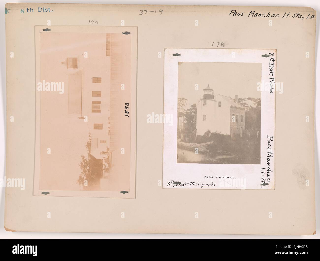 LA - Pass Manchac. Pass Manchac Light Station, Louisiana. Stock Photohttps://www.alamy.com/image-license-details/?v=1https://www.alamy.com/la-pass-manchac-pass-manchac-light-station-louisiana-image475502927.html
RM2JHH0RB–LA - Pass Manchac. Pass Manchac Light Station, Louisiana.
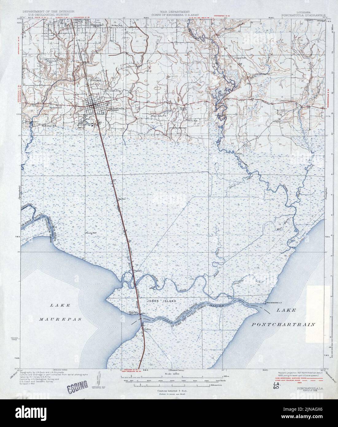 Tangipahoa Parish Louisiana Map 1935 Ponchatoula Pass Manchac Stock Photohttps://www.alamy.com/image-license-details/?v=1https://www.alamy.com/tangipahoa-parish-louisiana-map-1935-ponchatoula-pass-manchac-image477820510.html
RM2JNAGX6–Tangipahoa Parish Louisiana Map 1935 Ponchatoula Pass Manchac
 A map-plan of Ohio Falls as sketched by Thomas Hutchins, American military engineer, cartographer, geographer and surveyor, in 1766 (The only person to hold the post of Geographer of the United States' Stock Photohttps://www.alamy.com/image-license-details/?v=1https://www.alamy.com/stock-photo-a-map-plan-of-ohio-falls-as-sketched-by-thomas-hutchins-american-military-177383594.html
RMM8GEGA–A map-plan of Ohio Falls as sketched by Thomas Hutchins, American military engineer, cartographer, geographer and surveyor, in 1766 (The only person to hold the post of Geographer of the United States'
 Home at Pass Manchac has yard and porch under water as a result of heavy rains and back-up water from the recently reopened Bonnet Carre Spillway; Louisiana ca. April 1973 Stock Photohttps://www.alamy.com/image-license-details/?v=1https://www.alamy.com/home-at-pass-manchac-has-yard-and-porch-under-water-as-a-result-of-heavy-rains-and-back-up-water-from-the-recently-reopened-bonnet-carre-spillway-louisiana-ca-april-1973-image451188289.html
RM2H61B7D–Home at Pass Manchac has yard and porch under water as a result of heavy rains and back-up water from the recently reopened Bonnet Carre Spillway; Louisiana ca. April 1973
 FISHERMAN AND FAMILY AT OWL BAYOU ON HIGHWAY 51 BETWEEN LAPLACE AND MANCHAC 548303 Stock Photohttps://www.alamy.com/image-license-details/?v=1https://www.alamy.com/fisherman-and-family-at-owl-bayou-on-highway-51-between-laplace-and-image61674572.html
RMDG9EF8–FISHERMAN AND FAMILY AT OWL BAYOU ON HIGHWAY 51 BETWEEN LAPLACE AND MANCHAC 548303
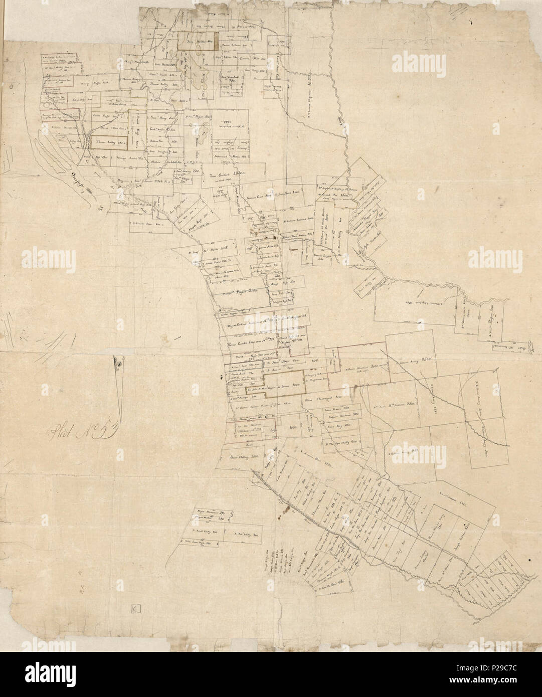 (Map of Manchac and Baton Rouge District, Spanish West Florida). LOC 2012593391. Stock Photohttps://www.alamy.com/image-license-details/?v=1https://www.alamy.com/map-of-manchac-and-baton-rouge-district-spanish-west-florida-loc-2012593391-image207960912.html
RMP29C7C–(Map of Manchac and Baton Rouge District, Spanish West Florida). LOC 2012593391.
 FISHERMAN AND FAMILY AT OWL BAYOU ON HIGHWAY 51 BETWEEN LAPLACE AND MANCHAC Stock Photohttps://www.alamy.com/image-license-details/?v=1https://www.alamy.com/fisherman-and-family-at-owl-bayou-on-highway-51-between-laplace-and-manchac-image262208896.html
RMW6GJ3C–FISHERMAN AND FAMILY AT OWL BAYOU ON HIGHWAY 51 BETWEEN LAPLACE AND MANCHAC
 Manchac (Akers PO), Tangipahoa Parish, US, United States, Louisiana, N 30 17' 29'', S 90 24' 7'', map, Cartascapes Map published in 2024. Explore Cartascapes, a map revealing Earth's diverse landscapes, cultures, and ecosystems. Journey through time and space, discovering the interconnectedness of our planet's past, present, and future. Stock Photohttps://www.alamy.com/image-license-details/?v=1https://www.alamy.com/manchac-akers-po-tangipahoa-parish-us-united-states-louisiana-n-30-17-29-s-90-24-7-map-cartascapes-map-published-in-2024-explore-cartascapes-a-map-revealing-earths-diverse-landscapes-cultures-and-ecosystems-journey-through-time-and-space-discovering-the-interconnectedness-of-our-planets-past-present-and-future-image620811172.html
RM2Y20AYG–Manchac (Akers PO), Tangipahoa Parish, US, United States, Louisiana, N 30 17' 29'', S 90 24' 7'', map, Cartascapes Map published in 2024. Explore Cartascapes, a map revealing Earth's diverse landscapes, cultures, and ecosystems. Journey through time and space, discovering the interconnectedness of our planet's past, present, and future.
 Juliette Manchac and Stephanie Chatellier of New Orleans costume as blue-roofed homes on Bourbon Street in New Orleans on Mardi Gras, February 28, 2006. Blue tarps are a common sight in the city, where Hurricane Katrina ripped the shingles off many homes. Six months after Katrina wrecked the region, somewhat smaller but enthusiastic crowds turned out to celebrate Fat Tuesday. (UPI Photo/A.J. Sisco) Stock Photohttps://www.alamy.com/image-license-details/?v=1https://www.alamy.com/juliette-manchac-and-stephanie-chatellier-of-new-orleans-costume-as-blue-roofed-homes-on-bourbon-street-in-new-orleans-on-mardi-gras-february-28-2006-blue-tarps-are-a-common-sight-in-the-city-where-hurricane-katrina-ripped-the-shingles-off-many-homes-six-months-after-katrina-wrecked-the-region-somewhat-smaller-but-enthusiastic-crowds-turned-out-to-celebrate-fat-tuesday-upi-photoaj-sisco-image257891125.html
RMTYFXN9–Juliette Manchac and Stephanie Chatellier of New Orleans costume as blue-roofed homes on Bourbon Street in New Orleans on Mardi Gras, February 28, 2006. Blue tarps are a common sight in the city, where Hurricane Katrina ripped the shingles off many homes. Six months after Katrina wrecked the region, somewhat smaller but enthusiastic crowds turned out to celebrate Fat Tuesday. (UPI Photo/A.J. Sisco)
 The journal of Julia Le Grand, New Orleans, 1862-1863; . o many people here to-day that my head is in a whirl with the rumors Ihave heard. We have the Hartford, the Alha-tross; Farragut, a prisoner, is on his way toRichmond, where he will be held as hostage forButler; Banks men have mutinied—they have,before battle, declared their intention to run, and,after being blindly trusted by Banks after suchsincere demonstrations, they have been straight-way as good as their word. The Confederates^re building a bridge at Manchac, over whichthey are to walk straightway to this city, havingBanks army and Stock Photohttps://www.alamy.com/image-license-details/?v=1https://www.alamy.com/the-journal-of-julia-le-grand-new-orleans-1862-1863-o-many-people-here-to-day-that-my-head-is-in-a-whirl-with-the-rumors-ihave-heard-we-have-the-hartford-the-alha-tross-farragut-a-prisoner-is-on-his-way-torichmond-where-he-will-be-held-as-hostage-forbutler-banks-men-have-mutiniedthey-havebefore-battle-declared-their-intention-to-run-andafter-being-blindly-trusted-by-banks-after-suchsincere-demonstrations-they-have-been-straight-way-as-good-as-their-word-the-confederatesre-building-a-bridge-at-manchac-over-whichthey-are-to-walk-straightway-to-this-city-havingbanks-army-and-image339261676.html
RM2AKXKMC–The journal of Julia Le Grand, New Orleans, 1862-1863; . o many people here to-day that my head is in a whirl with the rumors Ihave heard. We have the Hartford, the Alha-tross; Farragut, a prisoner, is on his way toRichmond, where he will be held as hostage forButler; Banks men have mutinied—they have,before battle, declared their intention to run, and,after being blindly trusted by Banks after suchsincere demonstrations, they have been straight-way as good as their word. The Confederates^re building a bridge at Manchac, over whichthey are to walk straightway to this city, havingBanks army and
 USGS TOPO Map Louisiana LA Manchac 20120315 TM Stock Photohttps://www.alamy.com/image-license-details/?v=1https://www.alamy.com/usgs-topo-map-louisiana-la-manchac-20120315-tm-image260677802.html
RMW42W5E–USGS TOPO Map Louisiana LA Manchac 20120315 TM
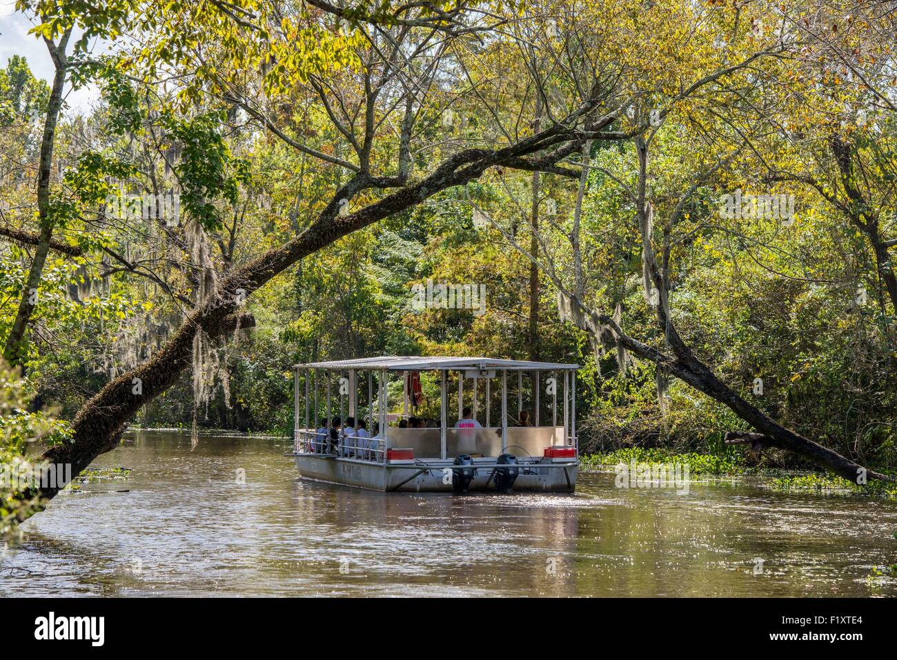 United States, Louisiana, La Place, flat-bottomed boat to visit the bayous of Manchac Swamp Stock Photohttps://www.alamy.com/image-license-details/?v=1https://www.alamy.com/stock-photo-united-states-louisiana-la-place-flat-bottomed-boat-to-visit-the-bayous-87256460.html
RMF1XTE4–United States, Louisiana, La Place, flat-bottomed boat to visit the bayous of Manchac Swamp
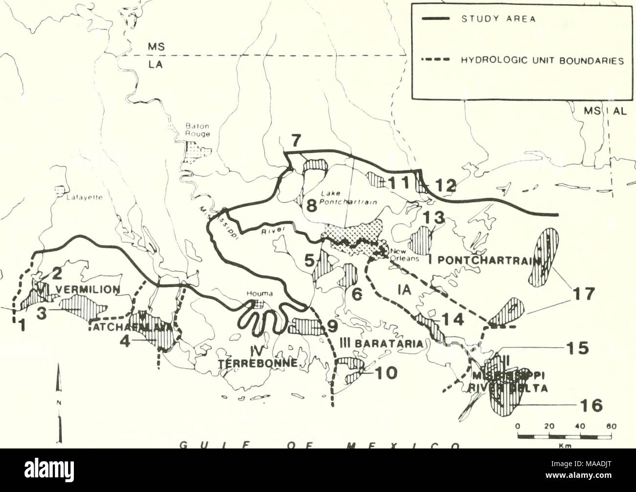 . The ecology of delta marshes of coastal Louisiana : a community profile . GULF OF MEXICO 1 PAUL J. RAINEY WILDLIFE REFUGE 2 LOUISIANA STATE WILDLIFE REFUGE 3 RUSSELL SAGE FOUNDATION WILDLIFE REFUGE 4 ATCHAFALAYA WMA 5 SALVADOR STATE WMA 6 JEAN LAFITTE NATIONAL HISTORICAL PARK 7 JOYCE WMA 8 MANCHAC STATE WMA 9 POINTE-AU-CHIEN STATE WMA Figure 71. Wildlife mdnagement areas in the Mississippi Delta. 94 10WISNER STATE WMA 11 ST. TAMMANY STATE WMA 12 PEARL RIVER WMA 13 BILOXI WMA 14 BOHEMIA STATE WMA 15 DELTA NATIONAL WILDLIFE REFUGE 16 PASS A LOUTRE STATE WMA 17 BRETON NATIONAL WILDLIFE REFUGE Stock Photohttps://www.alamy.com/image-license-details/?v=1https://www.alamy.com/the-ecology-of-delta-marshes-of-coastal-louisiana-a-community-profile-gulf-of-mexico-1-paul-j-rainey-wildlife-refuge-2-louisiana-state-wildlife-refuge-3-russell-sage-foundation-wildlife-refuge-4-atchafalaya-wma-5-salvador-state-wma-6-jean-lafitte-national-historical-park-7-joyce-wma-8-manchac-state-wma-9-pointe-au-chien-state-wma-figure-71-wildlife-mdnagement-areas-in-the-mississippi-delta-94-10wisner-state-wma-11-st-tammany-state-wma-12-pearl-river-wma-13-biloxi-wma-14-bohemia-state-wma-15-delta-national-wildlife-refuge-16-pass-a-loutre-state-wma-17-breton-national-wildlife-refuge-image178480480.html
RMMAADJT–. The ecology of delta marshes of coastal Louisiana : a community profile . GULF OF MEXICO 1 PAUL J. RAINEY WILDLIFE REFUGE 2 LOUISIANA STATE WILDLIFE REFUGE 3 RUSSELL SAGE FOUNDATION WILDLIFE REFUGE 4 ATCHAFALAYA WMA 5 SALVADOR STATE WMA 6 JEAN LAFITTE NATIONAL HISTORICAL PARK 7 JOYCE WMA 8 MANCHAC STATE WMA 9 POINTE-AU-CHIEN STATE WMA Figure 71. Wildlife mdnagement areas in the Mississippi Delta. 94 10WISNER STATE WMA 11 ST. TAMMANY STATE WMA 12 PEARL RIVER WMA 13 BILOXI WMA 14 BOHEMIA STATE WMA 15 DELTA NATIONAL WILDLIFE REFUGE 16 PASS A LOUTRE STATE WMA 17 BRETON NATIONAL WILDLIFE REFUGE
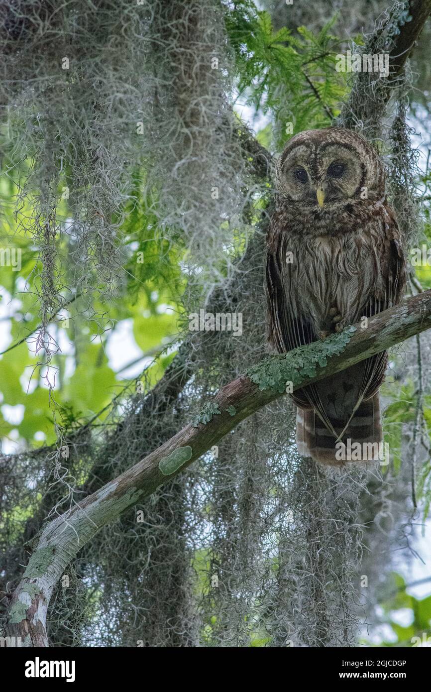 Barred owl perched in cypress forest, Manchac Swamp kayak tour near New Orleans, Louisiana, USA. Stock Photohttps://www.alamy.com/image-license-details/?v=1https://www.alamy.com/barred-owl-perched-in-cypress-forest-manchac-swamp-kayak-tour-near-new-orleans-louisiana-usa-image441597094.html
RM2GJCDGP–Barred owl perched in cypress forest, Manchac Swamp kayak tour near New Orleans, Louisiana, USA.
 Wide angle shot of Manchac Swamp near New Orleans, Louisiana, United States of America, North America Stock Photohttps://www.alamy.com/image-license-details/?v=1https://www.alamy.com/wide-angle-shot-of-manchac-swamp-near-new-orleans-louisiana-united-states-of-america-north-america-image357519839.html
RF2BNJC5K–Wide angle shot of Manchac Swamp near New Orleans, Louisiana, United States of America, North America
 Interstate 10 exit sign for Manchac, Louisiana Stock Photohttps://www.alamy.com/image-license-details/?v=1https://www.alamy.com/stock-photo-interstate-10-exit-sign-for-manchac-louisiana-133784710.html
RFHNJBNA–Interstate 10 exit sign for Manchac, Louisiana
 Mackay, Queensland, Australia - February 2020: The ship Manchac Sun moored at the port wharf ready to lead produce from Australia to overseas markets Stock Photohttps://www.alamy.com/image-license-details/?v=1https://www.alamy.com/mackay-queensland-australia-february-2020-the-ship-manchac-sun-moored-at-the-port-wharf-ready-to-lead-produce-from-australia-to-overseas-markets-image382570701.html
RF2D6BGR9–Mackay, Queensland, Australia - February 2020: The ship Manchac Sun moored at the port wharf ready to lead produce from Australia to overseas markets
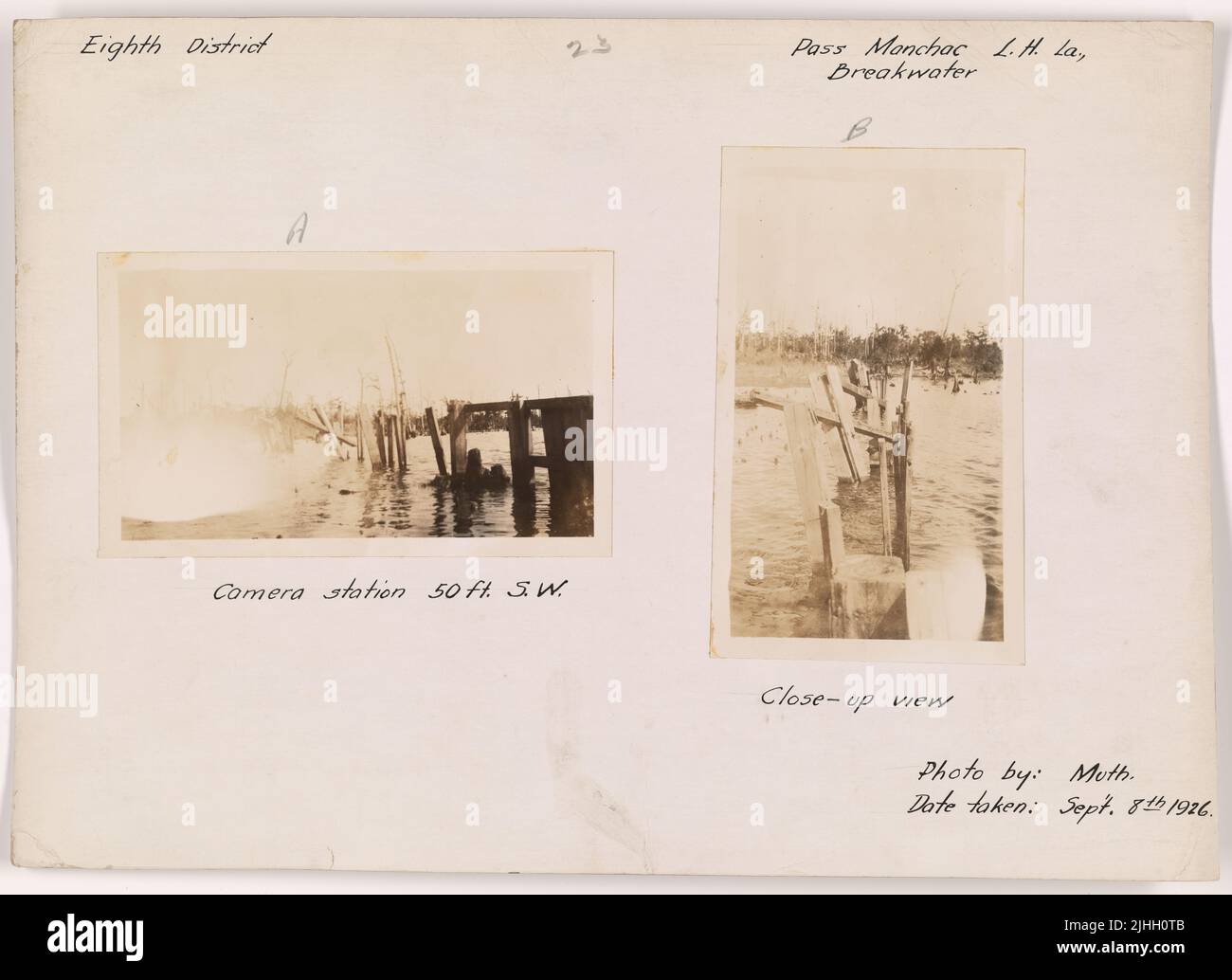 LA - Pass Manchac. Pass Manchac Breakwater Lighthouse, Louisiana. Camera station 50 ft. SW. Stock Photohttps://www.alamy.com/image-license-details/?v=1https://www.alamy.com/la-pass-manchac-pass-manchac-breakwater-lighthouse-louisiana-camera-station-50-ft-sw-image475502955.html
RM2JHH0TB–LA - Pass Manchac. Pass Manchac Breakwater Lighthouse, Louisiana. Camera station 50 ft. SW.
 Fishermen at Pass Manchac. Since the recent opening of the Bonnet Carre Spillway, muddy and polluted Mississippi River water has entered the brackish lakes Pontchartrain and MaurEPAs Manchac is directly between the two lakes, and fishing has suffered with the decline in water quality; Louisiana ca. April 1973 Stock Photohttps://www.alamy.com/image-license-details/?v=1https://www.alamy.com/fishermen-at-pass-manchac-since-the-recent-opening-of-the-bonnet-carre-spillway-muddy-and-polluted-mississippi-river-water-has-entered-the-brackish-lakes-pontchartrain-and-maurepas-manchac-is-directly-between-the-two-lakes-and-fishing-has-suffered-with-the-decline-in-water-quality-louisiana-ca-april-1973-image451190147.html
RM2H61DHR–Fishermen at Pass Manchac. Since the recent opening of the Bonnet Carre Spillway, muddy and polluted Mississippi River water has entered the brackish lakes Pontchartrain and MaurEPAs Manchac is directly between the two lakes, and fishing has suffered with the decline in water quality; Louisiana ca. April 1973
 FISHERMAN AND WIFE AT OWL BAYOU ON HIGHWAY 51 BETWEEN LAPLACE AND MANCHAC 548302 Stock Photohttps://www.alamy.com/image-license-details/?v=1https://www.alamy.com/fisherman-and-wife-at-owl-bayou-on-highway-51-between-laplace-and-image61674576.html
RMDG9EFC–FISHERMAN AND WIFE AT OWL BAYOU ON HIGHWAY 51 BETWEEN LAPLACE AND MANCHAC 548302
 (Map of a portion of Manchac District, Spanish West Florida). LOC 2013585039. Stock Photohttps://www.alamy.com/image-license-details/?v=1https://www.alamy.com/map-of-a-portion-of-manchac-district-spanish-west-florida-loc-2013585039-image207960869.html
RMP29C5W–(Map of a portion of Manchac District, Spanish West Florida). LOC 2013585039.
 FISHERMAN AND WIFE AT OWL BAYOU ON HIGHWAY 51 BETWEEN LAPLACE AND MANCHAC Stock Photohttps://www.alamy.com/image-license-details/?v=1https://www.alamy.com/fisherman-and-wife-at-owl-bayou-on-highway-51-between-laplace-and-manchac-image262208899.html
RMW6GJ3F–FISHERMAN AND WIFE AT OWL BAYOU ON HIGHWAY 51 BETWEEN LAPLACE AND MANCHAC
 Ensign, Bridgman & Fanning's lake and river guide; . s its extreme height;it is then navigable for large boats for a few miles. Bayou Ibberville, 5 miles above, 25 miles in length;navigable only during high water. Manchac, East Baton Rouge parish. La., just aboveBayou Ibberville; a landing-place contairiing a few houses. Bruly Landing, West Baton Rouge parish, La., 12 milesabove. BATON ROUGE CITY, Capital of E. Baton Rouge parish, and capital of the state,6 miles above; mostly situated on a bluff or plain elevated 40feet above high water; the business portion is mostly on onestreet along the r Stock Photohttps://www.alamy.com/image-license-details/?v=1https://www.alamy.com/ensign-bridgman-fannings-lake-and-river-guide-s-its-extreme-heightit-is-then-navigable-for-large-boats-for-a-few-miles-bayou-ibberville-5-miles-above-25-miles-in-lengthnavigable-only-during-high-water-manchac-east-baton-rouge-parish-la-just-abovebayou-ibberville-a-landing-place-contairiing-a-few-houses-bruly-landing-west-baton-rouge-parish-la-12-milesabove-baton-rouge-city-capital-of-e-baton-rouge-parish-and-capital-of-the-state6-miles-above-mostly-situated-on-a-bluff-or-plain-elevated-40feet-above-high-water-the-business-portion-is-mostly-on-onestreet-along-the-r-image343362791.html
RM2AXHEMR–Ensign, Bridgman & Fanning's lake and river guide; . s its extreme height;it is then navigable for large boats for a few miles. Bayou Ibberville, 5 miles above, 25 miles in length;navigable only during high water. Manchac, East Baton Rouge parish. La., just aboveBayou Ibberville; a landing-place contairiing a few houses. Bruly Landing, West Baton Rouge parish, La., 12 milesabove. BATON ROUGE CITY, Capital of E. Baton Rouge parish, and capital of the state,6 miles above; mostly situated on a bluff or plain elevated 40feet above high water; the business portion is mostly on onestreet along the r
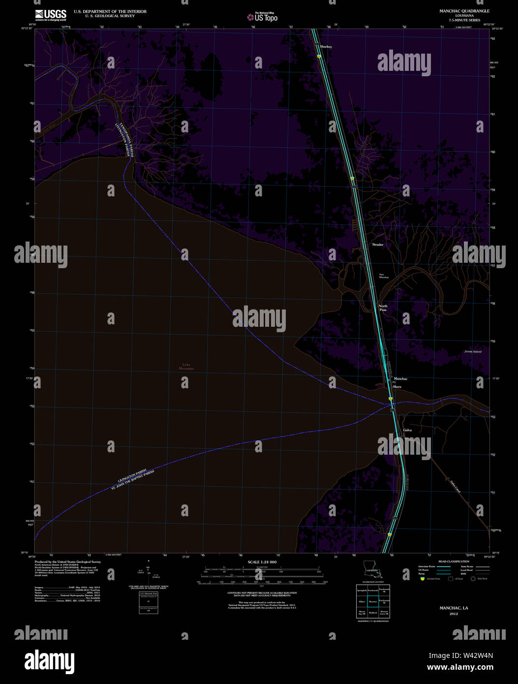 USGS TOPO Map Louisiana LA Manchac 20120315 TM Inverted Stock Photohttps://www.alamy.com/image-license-details/?v=1https://www.alamy.com/usgs-topo-map-louisiana-la-manchac-20120315-tm-inverted-image260677781.html
RMW42W4N–USGS TOPO Map Louisiana LA Manchac 20120315 TM Inverted
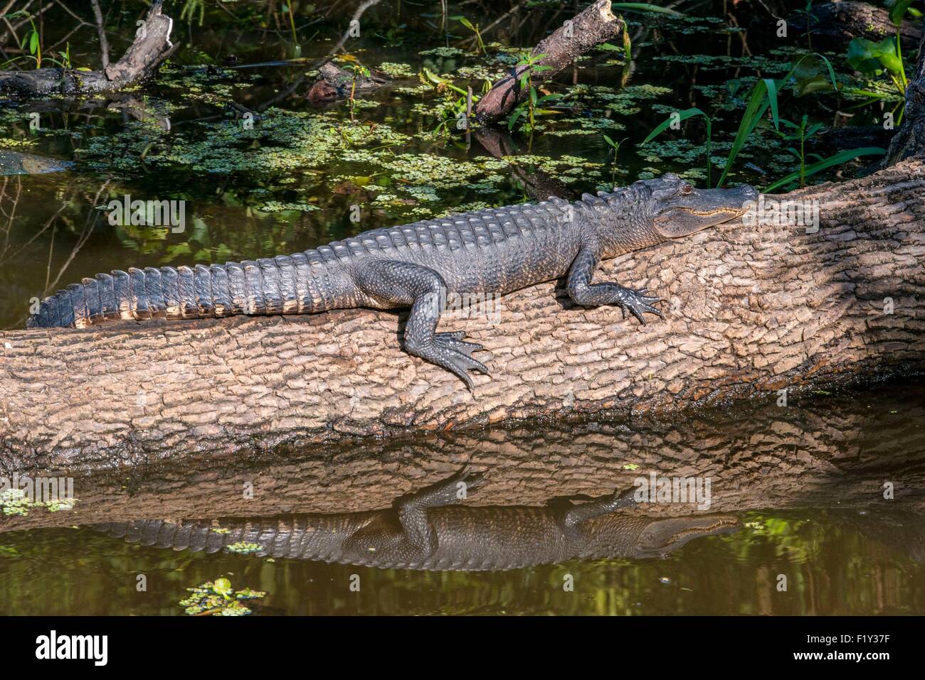 United States, Louisiana, La Place, alligator in the bayous of Manchac Swamp Stock Photohttps://www.alamy.com/image-license-details/?v=1https://www.alamy.com/stock-photo-united-states-louisiana-la-place-alligator-in-the-bayous-of-manchac-87261763.html
RMF1Y37F–United States, Louisiana, La Place, alligator in the bayous of Manchac Swamp
 Barred owl perched in cypress forest, Manchac Swamp kayak tour near New Orleans, Louisiana, USA. Stock Photohttps://www.alamy.com/image-license-details/?v=1https://www.alamy.com/barred-owl-perched-in-cypress-forest-manchac-swamp-kayak-tour-near-new-orleans-louisiana-usa-image441629535.html
RM2GJDXYB–Barred owl perched in cypress forest, Manchac Swamp kayak tour near New Orleans, Louisiana, USA.
 Base of a Cypress tree in Manchac Swamp near New Orleans, Louisiana, United States of America, North America Stock Photohttps://www.alamy.com/image-license-details/?v=1https://www.alamy.com/base-of-a-cypress-tree-in-manchac-swamp-near-new-orleans-louisiana-united-states-of-america-north-america-image357519835.html
RF2BNJC5F–Base of a Cypress tree in Manchac Swamp near New Orleans, Louisiana, United States of America, North America
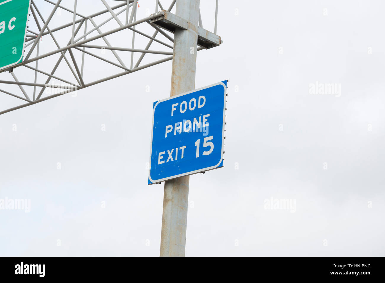 Exit sign marking food and phone access off a highway Stock Photohttps://www.alamy.com/image-license-details/?v=1https://www.alamy.com/stock-photo-exit-sign-marking-food-and-phone-access-off-a-highway-133784712.html
RFHNJBNC–Exit sign marking food and phone access off a highway
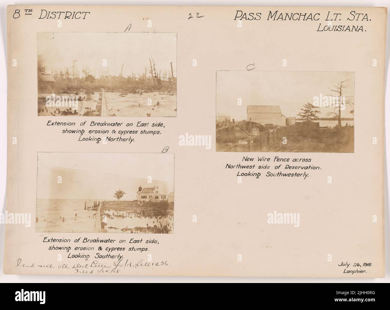 LA - Pass Manchac. Pass Manchac Light Station, Louisiana. Extension of breakwater on East side, showing erosion & cypress stumps. Looking Southerly. Stock Photohttps://www.alamy.com/image-license-details/?v=1https://www.alamy.com/la-pass-manchac-pass-manchac-light-station-louisiana-extension-of-breakwater-on-east-side-showing-erosion-cypress-stumps-looking-southerly-image475502932.html
RM2JHH0RG–LA - Pass Manchac. Pass Manchac Light Station, Louisiana. Extension of breakwater on East side, showing erosion & cypress stumps. Looking Southerly.
 Young fisherman at Pass Manchac. Since the recent opening of the Bonnet Carre Spillway, muddy and polluted Mississippi River water has entered the brackish lakes Pontchartrain and MaurEPAs. Manchac is directly between the two lakes, and fishing has suffered with the decline in water quality ca. April 1973 Stock Photohttps://www.alamy.com/image-license-details/?v=1https://www.alamy.com/young-fisherman-at-pass-manchac-since-the-recent-opening-of-the-bonnet-carre-spillway-muddy-and-polluted-mississippi-river-water-has-entered-the-brackish-lakes-pontchartrain-and-maurepas-manchac-is-directly-between-the-two-lakes-and-fishing-has-suffered-with-the-decline-in-water-quality-ca-april-1973-image451191560.html
RM2H61FC8–Young fisherman at Pass Manchac. Since the recent opening of the Bonnet Carre Spillway, muddy and polluted Mississippi River water has entered the brackish lakes Pontchartrain and MaurEPAs. Manchac is directly between the two lakes, and fishing has suffered with the decline in water quality ca. April 1973
 YOUNG FISHERMAN AT PASS MANCHAC. SINCE THE RECENT OPENING OF THE BONNET CARRE SPILLWAY, MUDDY AND POLLUTED... 548304 Stock Photohttps://www.alamy.com/image-license-details/?v=1https://www.alamy.com/young-fisherman-at-pass-manchac-since-the-recent-opening-of-the-bonnet-image61914718.html
RMDGMCRX–YOUNG FISHERMAN AT PASS MANCHAC. SINCE THE RECENT OPENING OF THE BONNET CARRE SPILLWAY, MUDDY AND POLLUTED... 548304
 Map of a portion of Manchac District, Spanish West Florida. Stock Photohttps://www.alamy.com/image-license-details/?v=1https://www.alamy.com/map-of-a-portion-of-manchac-district-spanish-west-florida-image398199600.html
RM2E3RFJ8–Map of a portion of Manchac District, Spanish West Florida.
 OWL BAYOU ON HIGHWAY 51 BETWEEN LAPLACE AND MANCHAC HUSBAND AND WIFE WAIT WHILE SONS FISH IN THE NEARBY BAYOU Stock Photohttps://www.alamy.com/image-license-details/?v=1https://www.alamy.com/owl-bayou-on-highway-51-between-laplace-and-manchac-husband-and-wife-wait-while-sons-fish-in-the-nearby-bayou-image262257095.html
RMW6JRGR–OWL BAYOU ON HIGHWAY 51 BETWEEN LAPLACE AND MANCHAC HUSBAND AND WIFE WAIT WHILE SONS FISH IN THE NEARBY BAYOU
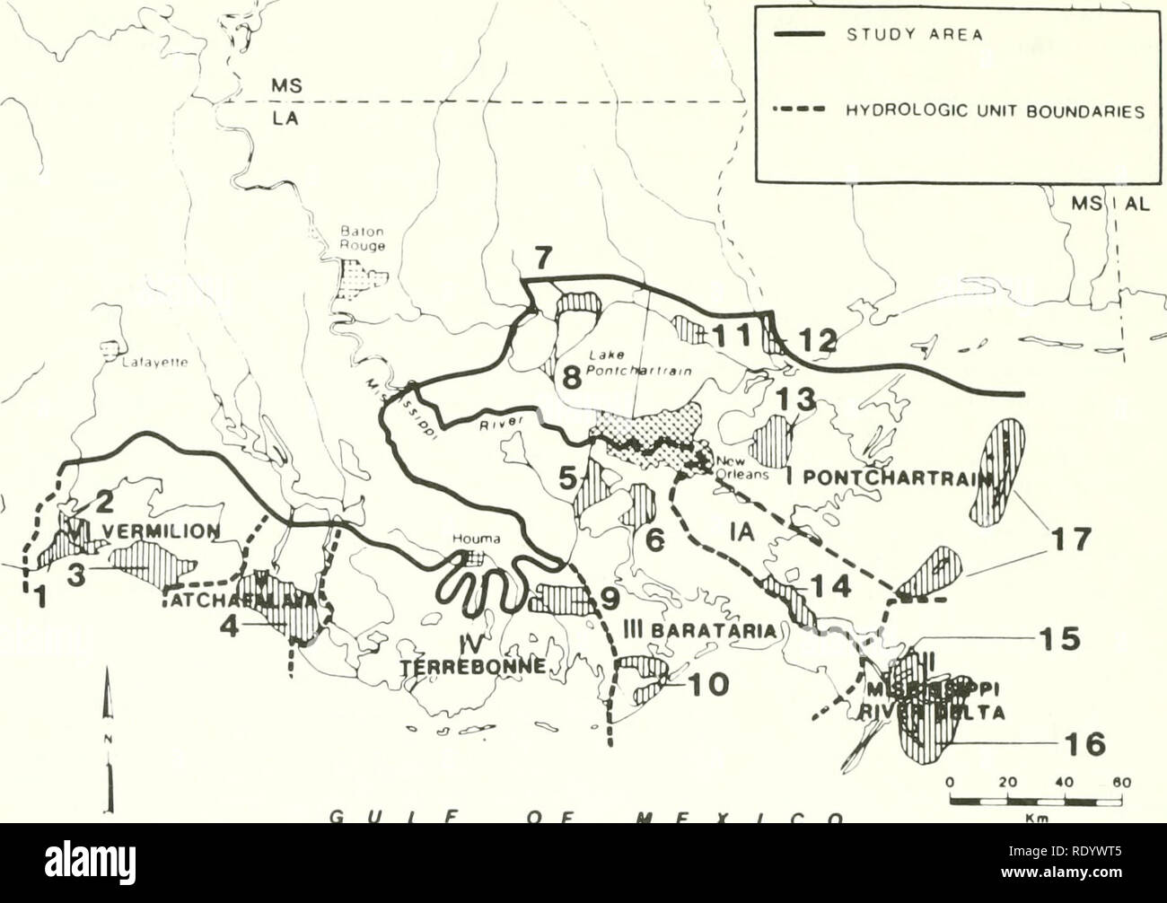 . The ecology of delta marshes of coastal Louisiana : a community profile. Marsh ecology -- Louisiana; Wetlands -- Louisiana. STUDY AREA —-- HYDROLOGIC UNIT BOUNDARIES. GULF OF MEXICO 1 PAUL J. RAINEY WILDLIFE REFUGE 2 LOUISIANA STATE WILDLIFE REFUGE 3 RUSSELL SAGE FOUNDATION WILDLIFE REFUGE 4 ATCHAFALAYA WMA 5 SALVADOR STATE WMA 6 JEAN LAFITTE NATIONAL HISTORICAL PARK 7 JOYCE WMA 8 MANCHAC STATE WMA 9 POINTE-AU-CHIEN STATE WMA Figure 71. Wildlife mdnagement areas in the Mississippi Delta. 94 10WISNER STATE WMA 11 ST. TAMMANY STATE WMA 12 PEARL RIVER WMA 13 BILOXI WMA 14 BOHEMIA STATE WMA 15 D Stock Photohttps://www.alamy.com/image-license-details/?v=1https://www.alamy.com/the-ecology-of-delta-marshes-of-coastal-louisiana-a-community-profile-marsh-ecology-louisiana-wetlands-louisiana-study-area-hydrologic-unit-boundaries-gulf-of-mexico-1-paul-j-rainey-wildlife-refuge-2-louisiana-state-wildlife-refuge-3-russell-sage-foundation-wildlife-refuge-4-atchafalaya-wma-5-salvador-state-wma-6-jean-lafitte-national-historical-park-7-joyce-wma-8-manchac-state-wma-9-pointe-au-chien-state-wma-figure-71-wildlife-mdnagement-areas-in-the-mississippi-delta-94-10wisner-state-wma-11-st-tammany-state-wma-12-pearl-river-wma-13-biloxi-wma-14-bohemia-state-wma-15-d-image232338293.html
RMRDYWT5–. The ecology of delta marshes of coastal Louisiana : a community profile. Marsh ecology -- Louisiana; Wetlands -- Louisiana. STUDY AREA —-- HYDROLOGIC UNIT BOUNDARIES. GULF OF MEXICO 1 PAUL J. RAINEY WILDLIFE REFUGE 2 LOUISIANA STATE WILDLIFE REFUGE 3 RUSSELL SAGE FOUNDATION WILDLIFE REFUGE 4 ATCHAFALAYA WMA 5 SALVADOR STATE WMA 6 JEAN LAFITTE NATIONAL HISTORICAL PARK 7 JOYCE WMA 8 MANCHAC STATE WMA 9 POINTE-AU-CHIEN STATE WMA Figure 71. Wildlife mdnagement areas in the Mississippi Delta. 94 10WISNER STATE WMA 11 ST. TAMMANY STATE WMA 12 PEARL RIVER WMA 13 BILOXI WMA 14 BOHEMIA STATE WMA 15 D
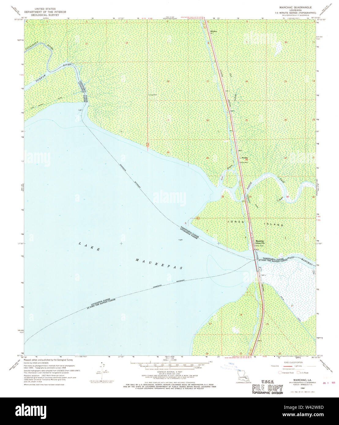 USGS TOPO Map Louisiana LA Manchac 332688 1968 24000 Stock Photohttps://www.alamy.com/image-license-details/?v=1https://www.alamy.com/usgs-topo-map-louisiana-la-manchac-332688-1968-24000-image260677885.html
RMW42W8D–USGS TOPO Map Louisiana LA Manchac 332688 1968 24000
 United States, Louisiana, La Place, alligator in the bayous of Manchac Swamp Stock Photohttps://www.alamy.com/image-license-details/?v=1https://www.alamy.com/stock-photo-united-states-louisiana-la-place-alligator-in-the-bayous-of-manchac-87261764.html
RMF1Y37G–United States, Louisiana, La Place, alligator in the bayous of Manchac Swamp
 Great egret in the Manchac Swamp near New Orleans, Louisiana, United States of America, North America Stock Photohttps://www.alamy.com/image-license-details/?v=1https://www.alamy.com/great-egret-in-the-manchac-swamp-near-new-orleans-louisiana-united-states-of-america-north-america-image357519853.html
RF2BNJC65–Great egret in the Manchac Swamp near New Orleans, Louisiana, United States of America, North America
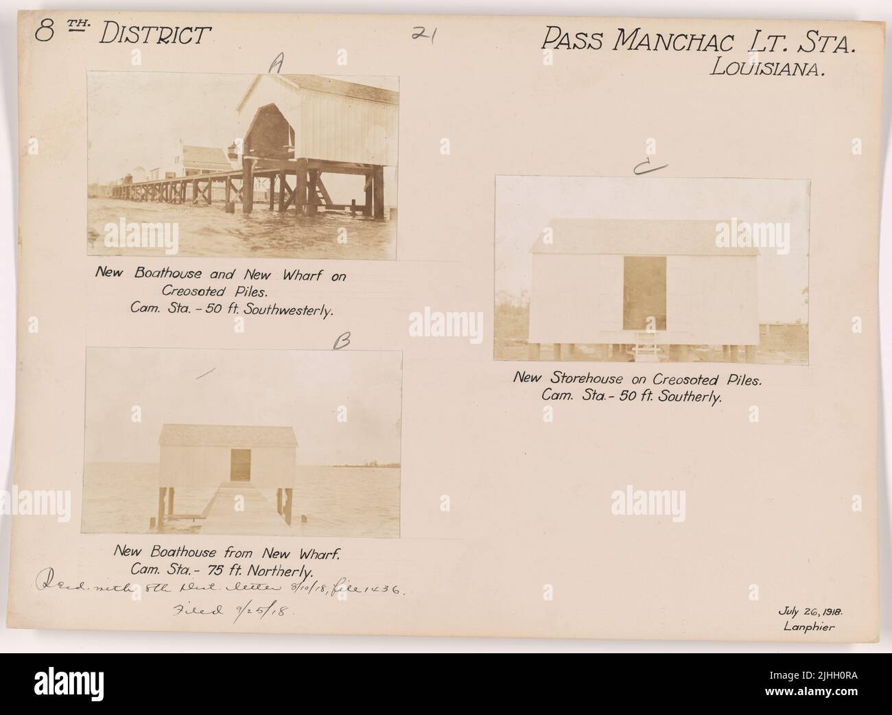 LA - Pass Manchac. Pass Manchac Light Station, Louisiana. New boathouse and new wharf on creosoted piles. Camera station 50 ft. Southwesterly. Stock Photohttps://www.alamy.com/image-license-details/?v=1https://www.alamy.com/la-pass-manchac-pass-manchac-light-station-louisiana-new-boathouse-and-new-wharf-on-creosoted-piles-camera-station-50-ft-southwesterly-image475502926.html
RM2JHH0RA–LA - Pass Manchac. Pass Manchac Light Station, Louisiana. New boathouse and new wharf on creosoted piles. Camera station 50 ft. Southwesterly.
 Fisherman and family at Owl Bayou on Highway 51 between Laplace and Manchac ca. April 1973 Stock Photohttps://www.alamy.com/image-license-details/?v=1https://www.alamy.com/fisherman-and-family-at-owl-bayou-on-highway-51-between-laplace-and-manchac-ca-april-1973-image451187806.html
RM2H61AJ6–Fisherman and family at Owl Bayou on Highway 51 between Laplace and Manchac ca. April 1973
 FISHERMEN AT PASS MANCHAC. SINCE THE RECENT OPENING OF THE BONNET CARRE SPILLWAY, MUDDY AND POLLUTED MISSISSIPPI... 548301 Stock Photohttps://www.alamy.com/image-license-details/?v=1https://www.alamy.com/fishermen-at-pass-manchac-since-the-recent-opening-of-the-bonnet-carre-image61674626.html
RMDG9EH6–FISHERMEN AT PASS MANCHAC. SINCE THE RECENT OPENING OF THE BONNET CARRE SPILLWAY, MUDDY AND POLLUTED MISSISSIPPI... 548301
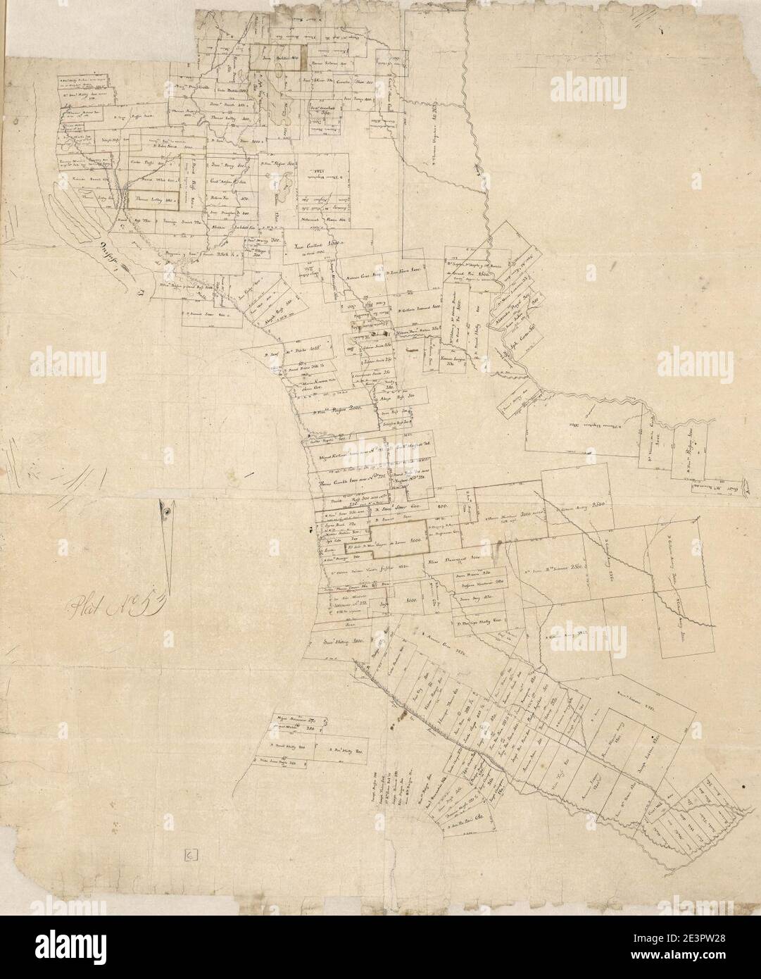 Map of Manchac and Baton Rouge District, Spanish West Florida. Stock Photohttps://www.alamy.com/image-license-details/?v=1https://www.alamy.com/map-of-manchac-and-baton-rouge-district-spanish-west-florida-image398185040.html
RM2E3PW28–Map of Manchac and Baton Rouge District, Spanish West Florida.
 HOME AT PASS MANCHAC HAS YARD AND PORCH UNDER WATER AS A RESULT OF HEAVY RAINS AND BACK-UP WATER FROM THE RECENTLY REOPENED BONNET CARRE SPILLWAY Stock Photohttps://www.alamy.com/image-license-details/?v=1https://www.alamy.com/home-at-pass-manchac-has-yard-and-porch-under-water-as-a-result-of-heavy-rains-and-back-up-water-from-the-recently-reopened-bonnet-carre-spillway-image262226920.html
RMW6HD34–HOME AT PASS MANCHAC HAS YARD AND PORCH UNDER WATER AS A RESULT OF HEAVY RAINS AND BACK-UP WATER FROM THE RECENTLY REOPENED BONNET CARRE SPILLWAY
 USGS TOPO Map Louisiana LA Manchac 332689 1968 24000 Stock Photohttps://www.alamy.com/image-license-details/?v=1https://www.alamy.com/usgs-topo-map-louisiana-la-manchac-332689-1968-24000-image260678067.html
RMW42WEY–USGS TOPO Map Louisiana LA Manchac 332689 1968 24000
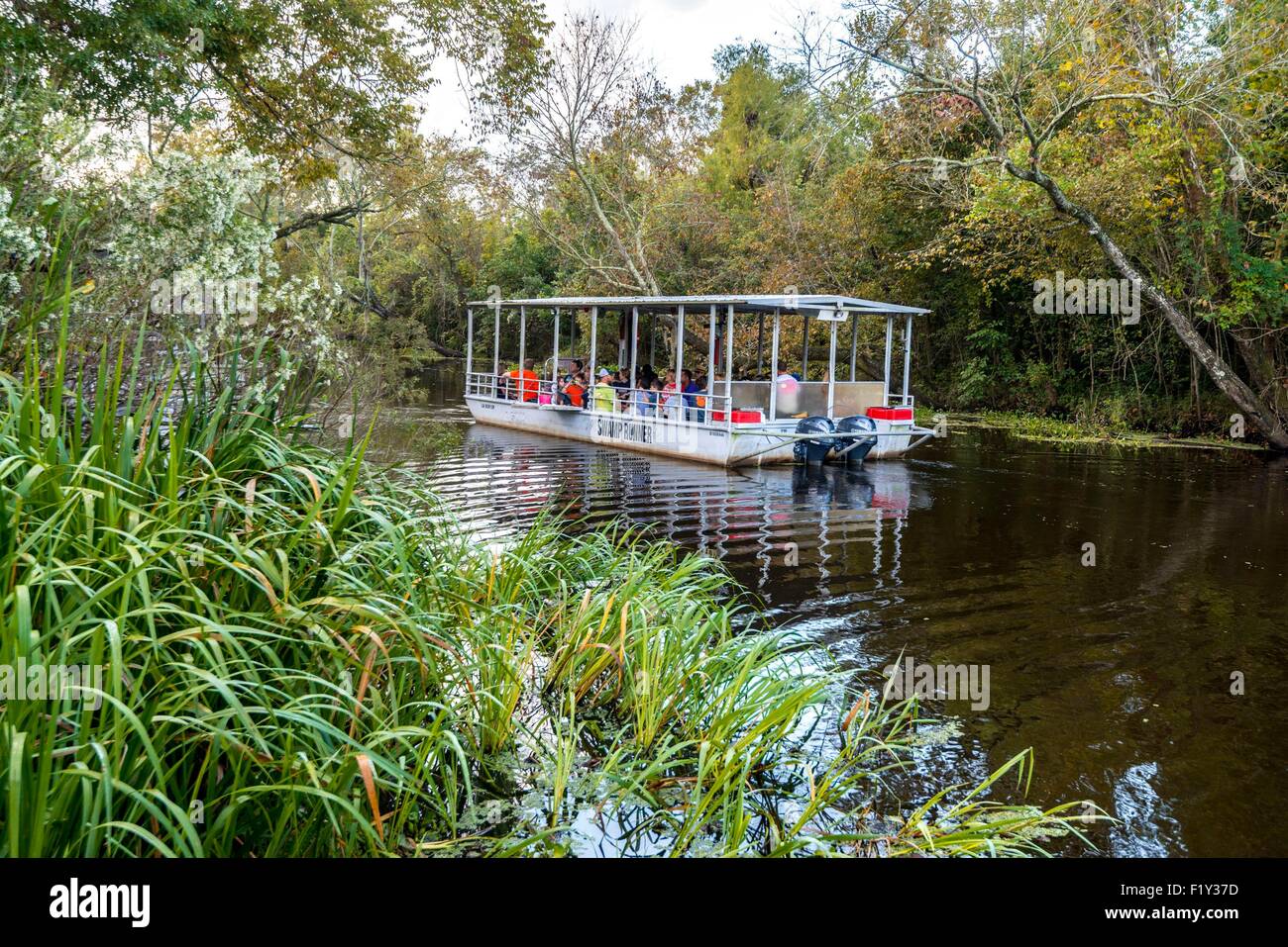 United States, Louisiana, La Place, flat-bottomed boat to visit the bayous of Manchac Swamp Stock Photohttps://www.alamy.com/image-license-details/?v=1https://www.alamy.com/stock-photo-united-states-louisiana-la-place-flat-bottomed-boat-to-visit-the-bayous-87261761.html
RMF1Y37D–United States, Louisiana, La Place, flat-bottomed boat to visit the bayous of Manchac Swamp
 Great egret in the Manchac Swamp near New Orleans, Louisiana, United States of America, North America Stock Photohttps://www.alamy.com/image-license-details/?v=1https://www.alamy.com/great-egret-in-the-manchac-swamp-near-new-orleans-louisiana-united-states-of-america-north-america-image357519849.html
RF2BNJC61–Great egret in the Manchac Swamp near New Orleans, Louisiana, United States of America, North America
 LA - Pass Manchac. Pass Manchac Light Station, Louisiana. Damage by hurricane of September 20th & 30th, 1915. Foundation of outhouse. Camera station 30 feet southeastward. Stock Photohttps://www.alamy.com/image-license-details/?v=1https://www.alamy.com/la-pass-manchac-pass-manchac-light-station-louisiana-damage-by-hurricane-of-september-20th-30th-1915-foundation-of-outhouse-camera-station-30-feet-southeastward-image475502928.html
RM2JHH0RC–LA - Pass Manchac. Pass Manchac Light Station, Louisiana. Damage by hurricane of September 20th & 30th, 1915. Foundation of outhouse. Camera station 30 feet southeastward.
 Sandbags still line the side of a closed section of Manchac Road adjacent to Bayou Manchac in response to the 2016 severe flooding in Ascension Parish, La.. Louisiana Severe Storms and Flooding. Photographs Relating to Disasters and Emergency Management Programs, Activities, and Officials Stock Photohttps://www.alamy.com/image-license-details/?v=1https://www.alamy.com/sandbags-still-line-the-side-of-a-closed-section-of-manchac-road-adjacent-to-bayou-manchac-in-response-to-the-2016-severe-flooding-in-ascension-parish-la-louisiana-severe-storms-and-flooding-photographs-relating-to-disasters-and-emergency-management-programs-activities-and-officials-image498782630.html
RM2KYDE9A–Sandbags still line the side of a closed section of Manchac Road adjacent to Bayou Manchac in response to the 2016 severe flooding in Ascension Parish, La.. Louisiana Severe Storms and Flooding. Photographs Relating to Disasters and Emergency Management Programs, Activities, and Officials
 Fisherman and wife at Owl Bayou on Highway 51 between Laplace and Manchac; Louisiana ca. April 1973 Stock Photohttps://www.alamy.com/image-license-details/?v=1https://www.alamy.com/fisherman-and-wife-at-owl-bayou-on-highway-51-between-laplace-and-manchac-louisiana-ca-april-1973-image451184779.html
RM2H616P3–Fisherman and wife at Owl Bayou on Highway 51 between Laplace and Manchac; Louisiana ca. April 1973
 Confused nutria, presumably displaced by the 2016 severe flooding in Louisiana, crosses the Old U.S. 51 near Manchac, La on Sunday, August 21, 2016.. Louisiana Severe Storms and Flooding. Photographs Relating to Disasters and Emergency Management Programs, Activities, and Officials Stock Photohttps://www.alamy.com/image-license-details/?v=1https://www.alamy.com/confused-nutria-presumably-displaced-by-the-2016-severe-flooding-in-louisiana-crosses-the-old-us-51-near-manchac-la-on-sunday-august-21-2016-louisiana-severe-storms-and-flooding-photographs-relating-to-disasters-and-emergency-management-programs-activities-and-officials-image498767622.html
RM2KYCR5A–Confused nutria, presumably displaced by the 2016 severe flooding in Louisiana, crosses the Old U.S. 51 near Manchac, La on Sunday, August 21, 2016.. Louisiana Severe Storms and Flooding. Photographs Relating to Disasters and Emergency Management Programs, Activities, and Officials
 OWL BAYOU ON HIGHWAY 51 BETWEEN LAPLACE AND MANCHAC HUSBAND AND WIFE WAIT WHILE SONS FISH IN THE NEARBY BAYOU 548306 Stock Photohttps://www.alamy.com/image-license-details/?v=1https://www.alamy.com/owl-bayou-on-highway-51-between-laplace-and-manchac-husband-and-wife-image61919162.html
RMDGMJEJ–OWL BAYOU ON HIGHWAY 51 BETWEEN LAPLACE AND MANCHAC HUSBAND AND WIFE WAIT WHILE SONS FISH IN THE NEARBY BAYOU 548306
 Water flows between Spanish Lake and Bayou Manchac through a trench cut on Alligator Bayou Road in Ascension Parish, in response to the 2016 historic flooding in Louisiana. The cut was made by the Department of Public Works in an effort to help relieve floodwaters and provide Spanish Lake a natural path to drain water that before was blocked by the road.. Louisiana Severe Storms and Flooding. Photographs Relating to Disasters and Emergency Management Programs, Activities, and Officials Stock Photohttps://www.alamy.com/image-license-details/?v=1https://www.alamy.com/water-flows-between-spanish-lake-and-bayou-manchac-through-a-trench-cut-on-alligator-bayou-road-in-ascension-parish-in-response-to-the-2016-historic-flooding-in-louisiana-the-cut-was-made-by-the-department-of-public-works-in-an-effort-to-help-relieve-floodwaters-and-provide-spanish-lake-a-natural-path-to-drain-water-that-before-was-blocked-by-the-road-louisiana-severe-storms-and-flooding-photographs-relating-to-disasters-and-emergency-management-programs-activities-and-officials-image498783137.html
RM2KYDEYD–Water flows between Spanish Lake and Bayou Manchac through a trench cut on Alligator Bayou Road in Ascension Parish, in response to the 2016 historic flooding in Louisiana. The cut was made by the Department of Public Works in an effort to help relieve floodwaters and provide Spanish Lake a natural path to drain water that before was blocked by the road.. Louisiana Severe Storms and Flooding. Photographs Relating to Disasters and Emergency Management Programs, Activities, and Officials
 Map of area from Rio Iberville to Thompson's Creek along the Mississippi River, Spanish West Florida, Districts of Manchac, Baton Rouge, and Feliciana. Stock Photohttps://www.alamy.com/image-license-details/?v=1https://www.alamy.com/map-of-area-from-rio-iberville-to-thompsons-creek-along-the-mississippi-river-spanish-west-florida-districts-of-manchac-baton-rouge-and-feliciana-image398200669.html
RM2E3RH0D–Map of area from Rio Iberville to Thompson's Creek along the Mississippi River, Spanish West Florida, Districts of Manchac, Baton Rouge, and Feliciana.
 HIGHWAY 51 BETWEEN LAPLACE AND MANCHAC. DEAD DOG AT ILLEGAL DUMPING GROUND. WATER COMES FROM BACK-UP OF NEARBY LAKE PONTCHARTRAIN. HEAVY RAINS AND THE OPENING OF THE BONNET CARRE SPILLWAY CAUSED THE OVERFLOW Stock Photohttps://www.alamy.com/image-license-details/?v=1https://www.alamy.com/highway-51-between-laplace-and-manchac-dead-dog-at-illegal-dumping-ground-water-comes-from-back-up-of-nearby-lake-pontchartrain-heavy-rains-and-the-opening-of-the-bonnet-carre-spillway-caused-the-overflow-image262226804.html
RMW6HCY0–HIGHWAY 51 BETWEEN LAPLACE AND MANCHAC. DEAD DOG AT ILLEGAL DUMPING GROUND. WATER COMES FROM BACK-UP OF NEARBY LAKE PONTCHARTRAIN. HEAVY RAINS AND THE OPENING OF THE BONNET CARRE SPILLWAY CAUSED THE OVERFLOW
 USGS TOPO Map Louisiana LA Manchac 332689 1968 24000 Inverted Stock Photohttps://www.alamy.com/image-license-details/?v=1https://www.alamy.com/usgs-topo-map-louisiana-la-manchac-332689-1968-24000-inverted-image260678035.html
RMW42WDR–USGS TOPO Map Louisiana LA Manchac 332689 1968 24000 Inverted
 Great egret in the Manchac Swamp near New Orleans, Louisiana, United States of America, North America Stock Photohttps://www.alamy.com/image-license-details/?v=1https://www.alamy.com/great-egret-in-the-manchac-swamp-near-new-orleans-louisiana-united-states-of-america-north-america-image357519861.html
RF2BNJC6D–Great egret in the Manchac Swamp near New Orleans, Louisiana, United States of America, North America
 Owl Bayou on Highway 51 between Laplace and Manchac, husband and wife wait while sons fish in the nearby bayou; Louisiana ca. April 1973 Stock Photohttps://www.alamy.com/image-license-details/?v=1https://www.alamy.com/owl-bayou-on-highway-51-between-laplace-and-manchac-husband-and-wife-wait-while-sons-fish-in-the-nearby-bayou-louisiana-ca-april-1973-image451188230.html
RM2H61B5A–Owl Bayou on Highway 51 between Laplace and Manchac, husband and wife wait while sons fish in the nearby bayou; Louisiana ca. April 1973
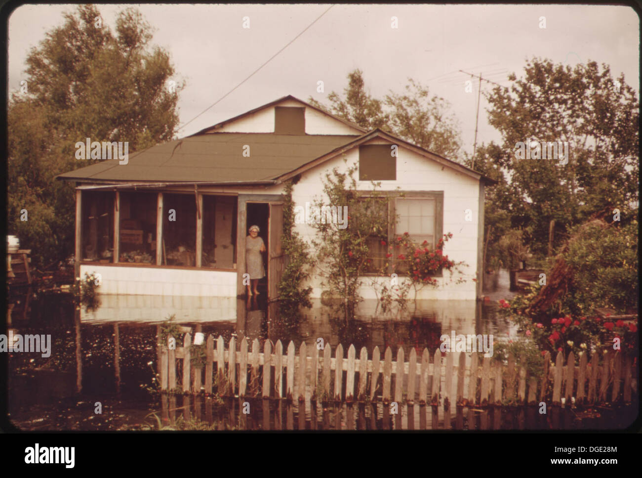 HOME AT PASS MANCHAC HAS YARD AND PORCH UNDER WATER AS A RESULT OF HEAVY RAINS AND BACK-UP WATER FROM THE RECENTLY... 548300 Stock Photohttps://www.alamy.com/image-license-details/?v=1https://www.alamy.com/home-at-pass-manchac-has-yard-and-porch-under-water-as-a-result-of-image61774740.html
RMDGE28M–HOME AT PASS MANCHAC HAS YARD AND PORCH UNDER WATER AS A RESULT OF HEAVY RAINS AND BACK-UP WATER FROM THE RECENTLY... 548300
 Water flows between Spanish Lake and Bayou Manchac through a trench cut on Alligator Bayou Road in Ascension Parish, in response to the 2016 historic flooding in Louisiana. The cut was made by the Department of Public Works in an effort to help relieve floodwaters and provide Spanish Lake a natural path to drain water that before was blocked by the road.. Louisiana Severe Storms and Flooding. Photographs Relating to Disasters and Emergency Management Programs, Activities, and Officials Stock Photohttps://www.alamy.com/image-license-details/?v=1https://www.alamy.com/water-flows-between-spanish-lake-and-bayou-manchac-through-a-trench-cut-on-alligator-bayou-road-in-ascension-parish-in-response-to-the-2016-historic-flooding-in-louisiana-the-cut-was-made-by-the-department-of-public-works-in-an-effort-to-help-relieve-floodwaters-and-provide-spanish-lake-a-natural-path-to-drain-water-that-before-was-blocked-by-the-road-louisiana-severe-storms-and-flooding-photographs-relating-to-disasters-and-emergency-management-programs-activities-and-officials-image498783123.html
RM2KYDEXY–Water flows between Spanish Lake and Bayou Manchac through a trench cut on Alligator Bayou Road in Ascension Parish, in response to the 2016 historic flooding in Louisiana. The cut was made by the Department of Public Works in an effort to help relieve floodwaters and provide Spanish Lake a natural path to drain water that before was blocked by the road.. Louisiana Severe Storms and Flooding. Photographs Relating to Disasters and Emergency Management Programs, Activities, and Officials
 Louisiana Recovery Six Months After Isaac. Louisiana Hurricane Isaac. Photographs Relating to Disasters and Emergency Management Programs, Activities, and Officials Stock Photohttps://www.alamy.com/image-license-details/?v=1https://www.alamy.com/louisiana-recovery-six-months-after-isaac-louisiana-hurricane-isaac-photographs-relating-to-disasters-and-emergency-management-programs-activities-and-officials-image498598989.html
RM2KY542N–Louisiana Recovery Six Months After Isaac. Louisiana Hurricane Isaac. Photographs Relating to Disasters and Emergency Management Programs, Activities, and Officials
 HIGHWAY 51 BETWEEN LAPLACE AND MANCHAC. DEAD DOG AT ILLEGAL DUMPING GROUND. WATER COMES FROM BACK-UP OF NEARBY LAKE PONCHARTRAIN. HEAVY RAINS AND THE OPENING OF THE BONNET CARRE SPILLWAY CAUSED THE OVERFLOW Stock Photohttps://www.alamy.com/image-license-details/?v=1https://www.alamy.com/highway-51-between-laplace-and-manchac-dead-dog-at-illegal-dumping-ground-water-comes-from-back-up-of-nearby-lake-ponchartrain-heavy-rains-and-the-opening-of-the-bonnet-carre-spillway-caused-the-overflow-image262226801.html
RMW6HCXW–HIGHWAY 51 BETWEEN LAPLACE AND MANCHAC. DEAD DOG AT ILLEGAL DUMPING GROUND. WATER COMES FROM BACK-UP OF NEARBY LAKE PONCHARTRAIN. HEAVY RAINS AND THE OPENING OF THE BONNET CARRE SPILLWAY CAUSED THE OVERFLOW
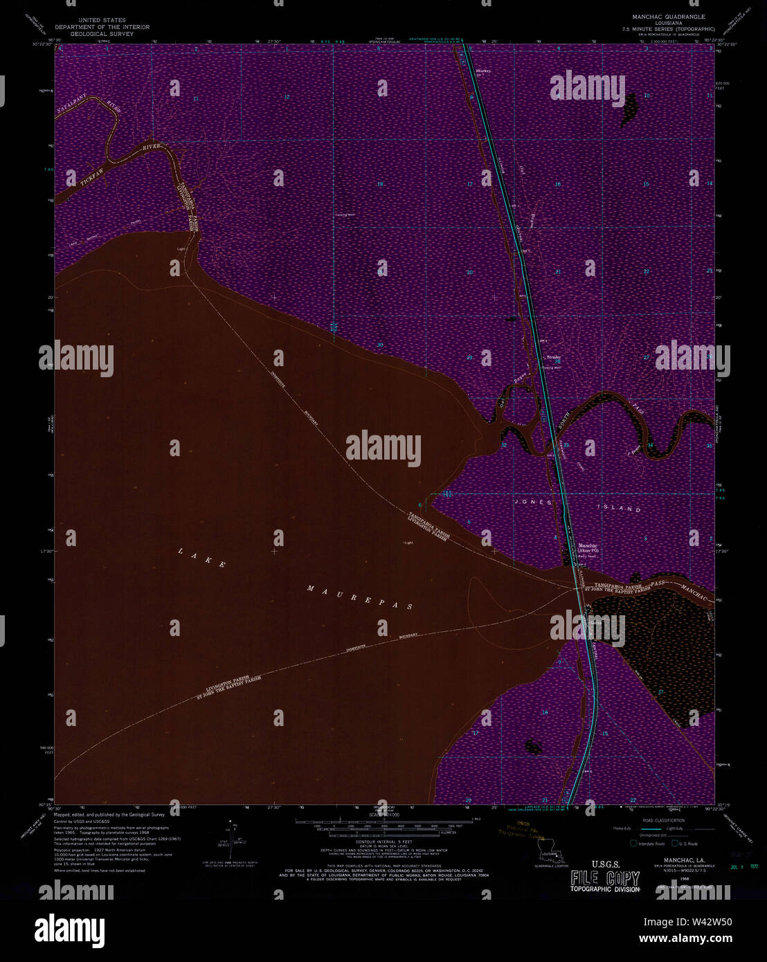 USGS TOPO Map Louisiana LA Manchac 332688 1968 24000 Inverted Stock Photohttps://www.alamy.com/image-license-details/?v=1https://www.alamy.com/usgs-topo-map-louisiana-la-manchac-332688-1968-24000-inverted-image260677788.html
RMW42W50–USGS TOPO Map Louisiana LA Manchac 332688 1968 24000 Inverted
 Highway 51 between Laplace and Manchac. Dead dog at illegal dumping ground. Water comes from back-up of nearby lake ponchartrain. Heavy rains and the opening of the Bonnet Carre Spillway caused the overflow; New Orleans ca. April 1973 Stock Photohttps://www.alamy.com/image-license-details/?v=1https://www.alamy.com/highway-51-between-laplace-and-manchac-dead-dog-at-illegal-dumping-ground-water-comes-from-back-up-of-nearby-lake-ponchartrain-heavy-rains-and-the-opening-of-the-bonnet-carre-spillway-caused-the-overflow-new-orleans-ca-april-1973-image451184694.html
RM2H616K2–Highway 51 between Laplace and Manchac. Dead dog at illegal dumping ground. Water comes from back-up of nearby lake ponchartrain. Heavy rains and the opening of the Bonnet Carre Spillway caused the overflow; New Orleans ca. April 1973
 HIGHWAY 51 BETWEEN LAPLACE AND MANCHAC. DEAD DOG AT ILLEGAL DUMPING GROUND. WATER COMES FROM BACK-UP OF NEARBY LAKE... 548307 Stock Photohttps://www.alamy.com/image-license-details/?v=1https://www.alamy.com/highway-51-between-laplace-and-manchac-dead-dog-at-illegal-dumping-image61774667.html
RMDGE263–HIGHWAY 51 BETWEEN LAPLACE AND MANCHAC. DEAD DOG AT ILLEGAL DUMPING GROUND. WATER COMES FROM BACK-UP OF NEARBY LAKE... 548307
 FISHERMEN AT PASS MANCHAC. SINCE THE RECENT OPENING OF THE BONNET CARRE SPILLWAY, MUDDY AND POLLUTED MISSISSIPPI RIVER WATER HAS ENTERED THE BRACKISH LAKES PONTCHARTRAIN AND MAUREPAS MANCHAC IS DIRECTLY BETWEEN THE TWO LAKES, AND FISHING HAS SUFFERED WITH THE DECLINE IN WATER QUALITY Stock Photohttps://www.alamy.com/image-license-details/?v=1https://www.alamy.com/fishermen-at-pass-manchac-since-the-recent-opening-of-the-bonnet-carre-spillway-muddy-and-polluted-mississippi-river-water-has-entered-the-brackish-lakes-pontchartrain-and-maurepas-manchac-is-directly-between-the-two-lakes-and-fishing-has-suffered-with-the-decline-in-water-quality-image262209071.html
RMW6GJ9K–FISHERMEN AT PASS MANCHAC. SINCE THE RECENT OPENING OF THE BONNET CARRE SPILLWAY, MUDDY AND POLLUTED MISSISSIPPI RIVER WATER HAS ENTERED THE BRACKISH LAKES PONTCHARTRAIN AND MAUREPAS MANCHAC IS DIRECTLY BETWEEN THE TWO LAKES, AND FISHING HAS SUFFERED WITH THE DECLINE IN WATER QUALITY
 Highway 51 between Laplace and Manchac. Dead dog at illegal dumping ground. Water comes from back-up of nearby Lake Pontchartrain. Heavy rains and the opening of the Bonnet Carre Spillway caused the overflow; New Orleans ca. April 1973 Stock Photohttps://www.alamy.com/image-license-details/?v=1https://www.alamy.com/highway-51-between-laplace-and-manchac-dead-dog-at-illegal-dumping-ground-water-comes-from-back-up-of-nearby-lake-pontchartrain-heavy-rains-and-the-opening-of-the-bonnet-carre-spillway-caused-the-overflow-new-orleans-ca-april-1973-image451189932.html
RM2H61DA4–Highway 51 between Laplace and Manchac. Dead dog at illegal dumping ground. Water comes from back-up of nearby Lake Pontchartrain. Heavy rains and the opening of the Bonnet Carre Spillway caused the overflow; New Orleans ca. April 1973
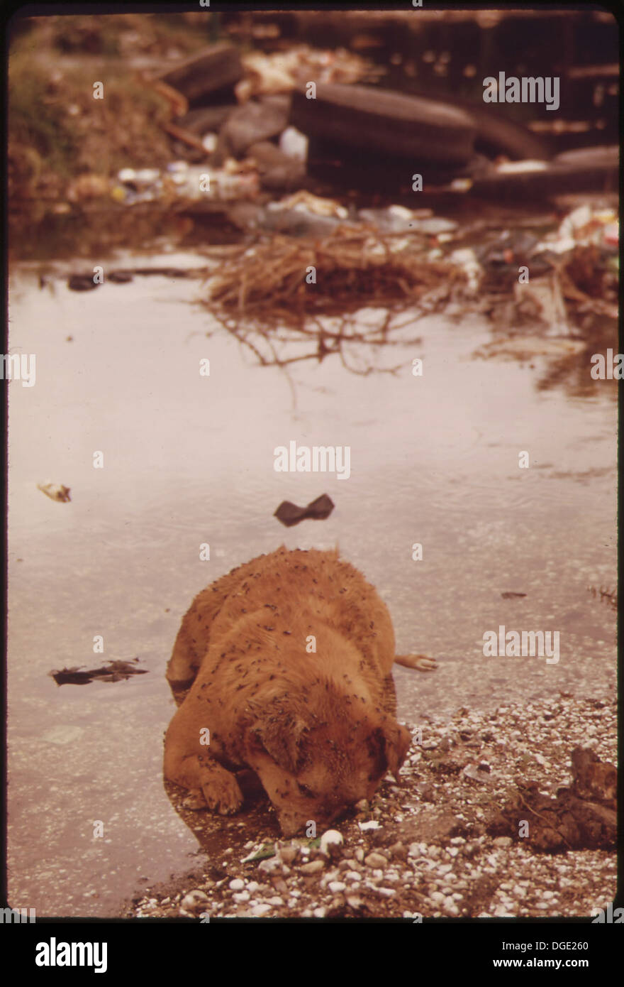 HIGHWAY 51 BETWEEN LAPLACE AND MANCHAC. DEAD DOG AT ILLEGAL DUMPING GROUND. WATER COMES FROM BACK-UP OF NEARBY LAKE... 548305 Stock Photohttps://www.alamy.com/image-license-details/?v=1https://www.alamy.com/highway-51-between-laplace-and-manchac-dead-dog-at-illegal-dumping-image61774664.html
RMDGE260–HIGHWAY 51 BETWEEN LAPLACE AND MANCHAC. DEAD DOG AT ILLEGAL DUMPING GROUND. WATER COMES FROM BACK-UP OF NEARBY LAKE... 548305
 YOUNG FISHERMAN AT PASS MANCHAC. SINCE THE RECENT OPENING OF THE BONNET CARRE SPILLWAY, MUDDY AND POLLUTED MISSISSIPPI RIVER WATER HAS ENTERED THE BRACKISH LAKES PONTCHARTRAIN AND MAUREPAS MANCHAC IS DIRECTLY BETWEEN THE TWO LAKES, AND FISHING HAS SUFFERED WITH THE DECLINE IN WATER QUALITY Stock Photohttps://www.alamy.com/image-license-details/?v=1https://www.alamy.com/young-fisherman-at-pass-manchac-since-the-recent-opening-of-the-bonnet-carre-spillway-muddy-and-polluted-mississippi-river-water-has-entered-the-brackish-lakes-pontchartrain-and-maurepas-manchac-is-directly-between-the-two-lakes-and-fishing-has-suffered-with-the-decline-in-water-quality-image262311209.html
RMW6N8HD–YOUNG FISHERMAN AT PASS MANCHAC. SINCE THE RECENT OPENING OF THE BONNET CARRE SPILLWAY, MUDDY AND POLLUTED MISSISSIPPI RIVER WATER HAS ENTERED THE BRACKISH LAKES PONTCHARTRAIN AND MAUREPAS MANCHAC IS DIRECTLY BETWEEN THE TWO LAKES, AND FISHING HAS SUFFERED WITH THE DECLINE IN WATER QUALITY
 OWL BAYOU ON HIGHWAY 51 BETWEEN LAPLACE AND MANCHAC HUSBAND AND WIFE WAIT WHILE SONS FISH IN THE NEARBY BAYOU Stock Photohttps://www.alamy.com/image-license-details/?v=1https://www.alamy.com/owl-bayou-on-highway-51-between-laplace-and-manchac-husband-and-wife-wait-while-sons-fish-in-the-nearby-bayou-image259153196.html
RMW1HCF8–OWL BAYOU ON HIGHWAY 51 BETWEEN LAPLACE AND MANCHAC HUSBAND AND WIFE WAIT WHILE SONS FISH IN THE NEARBY BAYOU
 HOME AT PASS MANCHAC HAS YARD AND PORCH UNDER WATER AS A RESULT OF HEAVY RAINS AND BACK-UP WATER FROM THE RECENTLY REOPENED BONNET CARRE SPILLWAY Stock Photohttps://www.alamy.com/image-license-details/?v=1https://www.alamy.com/home-at-pass-manchac-has-yard-and-porch-under-water-as-a-result-of-heavy-rains-and-back-up-water-from-the-recently-reopened-bonnet-carre-spillway-image259089570.html
RMW1EFAX–HOME AT PASS MANCHAC HAS YARD AND PORCH UNDER WATER AS A RESULT OF HEAVY RAINS AND BACK-UP WATER FROM THE RECENTLY REOPENED BONNET CARRE SPILLWAY
 HIGHWAY 51 BETWEEN LAPLACE AND MANCHAC. DEAD DOG AT ILLEGAL DUMPING GROUND. WATER COMES FROM BACK-UP OF NEARBY LAKE PONCHARTRAIN. HEAVY RAINS AND THE OPENING OF THE BONNET CARRE SPILLWAY CAUSED THE OVERFLOW Stock Photohttps://www.alamy.com/image-license-details/?v=1https://www.alamy.com/highway-51-between-laplace-and-manchac-dead-dog-at-illegal-dumping-ground-water-comes-from-back-up-of-nearby-lake-ponchartrain-heavy-rains-and-the-opening-of-the-bonnet-carre-spillway-caused-the-overflow-image259089173.html
RMW1EETN–HIGHWAY 51 BETWEEN LAPLACE AND MANCHAC. DEAD DOG AT ILLEGAL DUMPING GROUND. WATER COMES FROM BACK-UP OF NEARBY LAKE PONCHARTRAIN. HEAVY RAINS AND THE OPENING OF THE BONNET CARRE SPILLWAY CAUSED THE OVERFLOW
 HIGHWAY 51 BETWEEN LAPLACE AND MANCHAC. DEAD DOG AT ILLEGAL DUMPING GROUND. WATER COMES FROM BACK-UP OF NEARBY LAKE PONTCHARTRAIN. HEAVY RAINS AND THE OPENING OF THE BONNET CARRE SPILLWAY CAUSED THE OVERFLOW Stock Photohttps://www.alamy.com/image-license-details/?v=1https://www.alamy.com/highway-51-between-laplace-and-manchac-dead-dog-at-illegal-dumping-ground-water-comes-from-back-up-of-nearby-lake-pontchartrain-heavy-rains-and-the-opening-of-the-bonnet-carre-spillway-caused-the-overflow-image259089158.html
RMW1EET6–HIGHWAY 51 BETWEEN LAPLACE AND MANCHAC. DEAD DOG AT ILLEGAL DUMPING GROUND. WATER COMES FROM BACK-UP OF NEARBY LAKE PONTCHARTRAIN. HEAVY RAINS AND THE OPENING OF THE BONNET CARRE SPILLWAY CAUSED THE OVERFLOW
 YOUNG FISHERMAN AT PASS MANCHAC. SINCE THE RECENT OPENING OF THE BONNET CARRE SPILLWAY, MUDDY AND POLLUTED MISSISSIPPI RIVER WATER HAS ENTERED THE BRACKISH LAKES PONTCHARTRAIN AND MAUREPAS MANCHAC IS DIRECTLY BETWEEN THE TWO LAKES, AND FISHING HAS SUFFERED WITH THE DECLINE IN WATER QUALITY Stock Photohttps://www.alamy.com/image-license-details/?v=1https://www.alamy.com/young-fisherman-at-pass-manchac-since-the-recent-opening-of-the-bonnet-carre-spillway-muddy-and-polluted-mississippi-river-water-has-entered-the-brackish-lakes-pontchartrain-and-maurepas-manchac-is-directly-between-the-two-lakes-and-fishing-has-suffered-with-the-decline-in-water-quality-image259210899.html
RMW1M243–YOUNG FISHERMAN AT PASS MANCHAC. SINCE THE RECENT OPENING OF THE BONNET CARRE SPILLWAY, MUDDY AND POLLUTED MISSISSIPPI RIVER WATER HAS ENTERED THE BRACKISH LAKES PONTCHARTRAIN AND MAUREPAS MANCHAC IS DIRECTLY BETWEEN THE TWO LAKES, AND FISHING HAS SUFFERED WITH THE DECLINE IN WATER QUALITY