Quick filters:
Map england france Stock Photos and Images
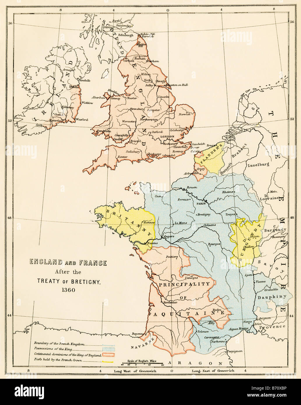 England and France after the Hundred Years War 1360. Color lithograph Stock Photohttps://www.alamy.com/image-license-details/?v=1https://www.alamy.com/stock-photo-england-and-france-after-the-hundred-years-war-1360-color-lithograph-21533674.html
RMB70XBP–England and France after the Hundred Years War 1360. Color lithograph
![Europe the third part of the earth, on the occasion of our times, European map with Spain, France, and England from the 16th century, Fig. 3, according to p. Iii, 1544, Sebastian Münster: Cosmographia. Beschreibung aller Lender durch Sebastianum Münsterum: in welcher begriffen aller Voelker, Herrschaften, Stetten, und namhafftiger Flecken, herkommen: Sitten, Gebreüch, Ordnung, Glauben, Secten und Hantierung durch die gantze Welt und fürnemlich Teütscher Nation [...]. Basel: durch Henrichum Petri, 1544 Stock Photo Europe the third part of the earth, on the occasion of our times, European map with Spain, France, and England from the 16th century, Fig. 3, according to p. Iii, 1544, Sebastian Münster: Cosmographia. Beschreibung aller Lender durch Sebastianum Münsterum: in welcher begriffen aller Voelker, Herrschaften, Stetten, und namhafftiger Flecken, herkommen: Sitten, Gebreüch, Ordnung, Glauben, Secten und Hantierung durch die gantze Welt und fürnemlich Teütscher Nation [...]. Basel: durch Henrichum Petri, 1544 Stock Photo](https://c8.alamy.com/comp/2A2RW9X/europe-the-third-part-of-the-earth-on-the-occasion-of-our-times-european-map-with-spain-france-and-england-from-the-16th-century-fig-3-according-to-p-iii-1544-sebastian-mnster-cosmographia-beschreibung-aller-lender-durch-sebastianum-mnsterum-in-welcher-begriffen-aller-voelker-herrschaften-stetten-und-namhafftiger-flecken-herkommen-sitten-gebrech-ordnung-glauben-secten-und-hantierung-durch-die-gantze-welt-und-frnemlich-tetscher-nation-basel-durch-henrichum-petri-1544-2A2RW9X.jpg) Europe the third part of the earth, on the occasion of our times, European map with Spain, France, and England from the 16th century, Fig. 3, according to p. Iii, 1544, Sebastian Münster: Cosmographia. Beschreibung aller Lender durch Sebastianum Münsterum: in welcher begriffen aller Voelker, Herrschaften, Stetten, und namhafftiger Flecken, herkommen: Sitten, Gebreüch, Ordnung, Glauben, Secten und Hantierung durch die gantze Welt und fürnemlich Teütscher Nation [...]. Basel: durch Henrichum Petri, 1544 Stock Photohttps://www.alamy.com/image-license-details/?v=1https://www.alamy.com/europe-the-third-part-of-the-earth-on-the-occasion-of-our-times-european-map-with-spain-france-and-england-from-the-16th-century-fig-3-according-to-p-iii-1544-sebastian-mnster-cosmographia-beschreibung-aller-lender-durch-sebastianum-mnsterum-in-welcher-begriffen-aller-voelker-herrschaften-stetten-und-namhafftiger-flecken-herkommen-sitten-gebrech-ordnung-glauben-secten-und-hantierung-durch-die-gantze-welt-und-frnemlich-tetscher-nation-basel-durch-henrichum-petri-1544-image328751078.html
Europe the third part of the earth, on the occasion of our times, European map with Spain, France, and England from the 16th century, Fig. 3, according to p. Iii, 1544, Sebastian Münster: Cosmographia. Beschreibung aller Lender durch Sebastianum Münsterum: in welcher begriffen aller Voelker, Herrschaften, Stetten, und namhafftiger Flecken, herkommen: Sitten, Gebreüch, Ordnung, Glauben, Secten und Hantierung durch die gantze Welt und fürnemlich Teütscher Nation [...]. Basel: durch Henrichum Petri, 1544 Stock Photohttps://www.alamy.com/image-license-details/?v=1https://www.alamy.com/europe-the-third-part-of-the-earth-on-the-occasion-of-our-times-european-map-with-spain-france-and-england-from-the-16th-century-fig-3-according-to-p-iii-1544-sebastian-mnster-cosmographia-beschreibung-aller-lender-durch-sebastianum-mnsterum-in-welcher-begriffen-aller-voelker-herrschaften-stetten-und-namhafftiger-flecken-herkommen-sitten-gebrech-ordnung-glauben-secten-und-hantierung-durch-die-gantze-welt-und-frnemlich-tetscher-nation-basel-durch-henrichum-petri-1544-image328751078.htmlRM2A2RW9X–Europe the third part of the earth, on the occasion of our times, European map with Spain, France, and England from the 16th century, Fig. 3, according to p. Iii, 1544, Sebastian Münster: Cosmographia. Beschreibung aller Lender durch Sebastianum Münsterum: in welcher begriffen aller Voelker, Herrschaften, Stetten, und namhafftiger Flecken, herkommen: Sitten, Gebreüch, Ordnung, Glauben, Secten und Hantierung durch die gantze Welt und fürnemlich Teütscher Nation [...]. Basel: durch Henrichum Petri, 1544
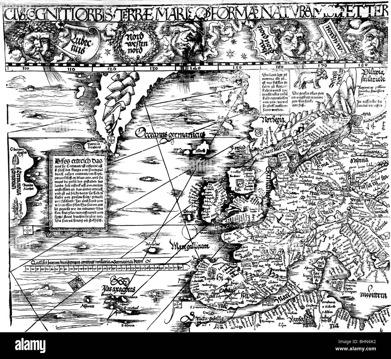 cartography, maps, Western Europe and Atlantic Ocean, 16th century, Spain, France, England, Scotland, Ireland, Iceland, Greenland, Germany, Italy, Norway, Newfoundland, Oceanus Germanicus, Mare Gallicum, scale, map, historic, historical, Stock Photohttps://www.alamy.com/image-license-details/?v=1https://www.alamy.com/stock-photo-cartography-maps-western-europe-and-atlantic-ocean-16th-century-spain-28125750.html
RMBHN6K2–cartography, maps, Western Europe and Atlantic Ocean, 16th century, Spain, France, England, Scotland, Ireland, Iceland, Greenland, Germany, Italy, Norway, Newfoundland, Oceanus Germanicus, Mare Gallicum, scale, map, historic, historical,
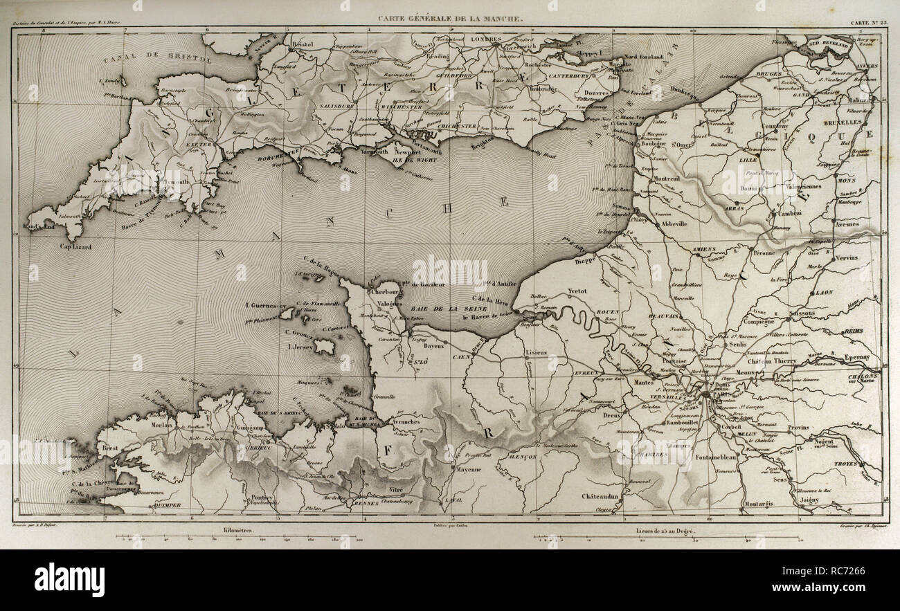 Napoleonic map. English Channel. Atlas de l'Histoire du Consulat et de l'Empire. History of the Consulate and the Empire of France under Napoleon by Marie Joseph Louis Adolphe Thiers (1797-1877). Drawings by Dufour, engravings by Dyonnet. Edited in Paris, 1864. Stock Photohttps://www.alamy.com/image-license-details/?v=1https://www.alamy.com/napoleonic-map-english-channel-atlas-de-lhistoire-du-consulat-et-de-lempire-history-of-the-consulate-and-the-empire-of-france-under-napoleon-by-marie-joseph-louis-adolphe-thiers-1797-1877-drawings-by-dufour-engravings-by-dyonnet-edited-in-paris-1864-image231266062.html
RMRC7266–Napoleonic map. English Channel. Atlas de l'Histoire du Consulat et de l'Empire. History of the Consulate and the Empire of France under Napoleon by Marie Joseph Louis Adolphe Thiers (1797-1877). Drawings by Dufour, engravings by Dyonnet. Edited in Paris, 1864.
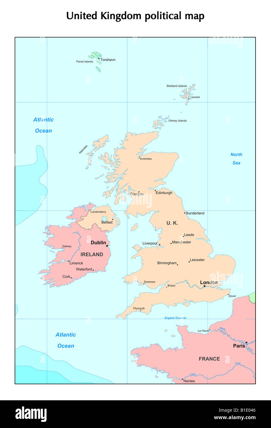 United Kingdom political map Stock Photohttps://www.alamy.com/image-license-details/?v=1https://www.alamy.com/stock-photo-united-kingdom-political-map-18132470.html
RFB1E046–United Kingdom political map
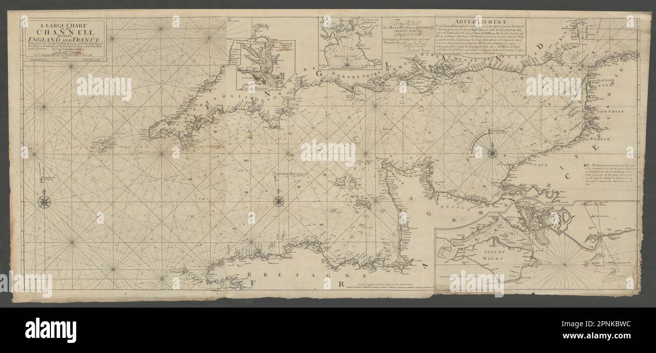 A Large Chart of the Channell between England and France. Tides. HALLEY 1702 map Stock Photohttps://www.alamy.com/image-license-details/?v=1https://www.alamy.com/a-large-chart-of-the-channell-between-england-and-france-tides-halley-1702-map-image546855608.html
RF2PNKBWC–A Large Chart of the Channell between England and France. Tides. HALLEY 1702 map
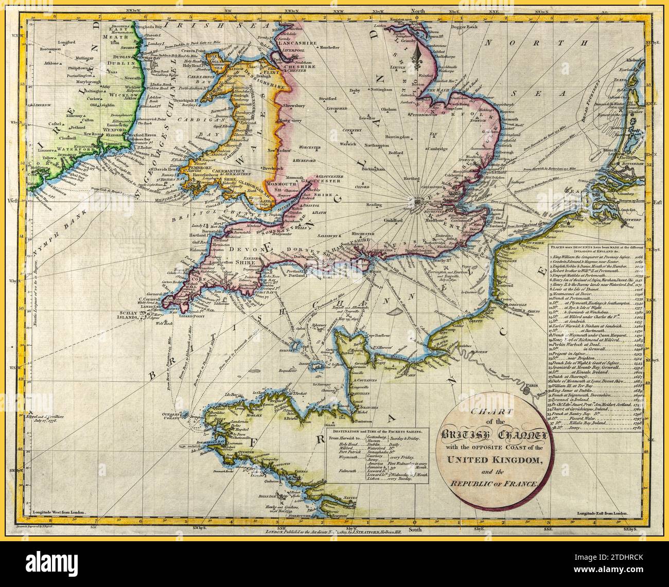 Vintage 1800s historic old colour map of the British Channel with the coast of United Kingdom and Republic of France by John Russell. Showing a table of the different invasions of England from 1066 to 1781 Stock Photohttps://www.alamy.com/image-license-details/?v=1https://www.alamy.com/vintage-1800s-historic-old-colour-map-of-the-british-channel-with-the-coast-of-united-kingdom-and-republic-of-france-by-john-russell-showing-a-table-of-the-different-invasions-of-england-from-1066-to-1781-image576324243.html
RM2TDHRCK–Vintage 1800s historic old colour map of the British Channel with the coast of United Kingdom and Republic of France by John Russell. Showing a table of the different invasions of England from 1066 to 1781
 blue European map of Europe with the eu stars in yellow. Stock Vectorhttps://www.alamy.com/image-license-details/?v=1https://www.alamy.com/blue-european-map-of-europe-with-the-eu-stars-in-yellow-image332642487.html
RF2A954TR–blue European map of Europe with the eu stars in yellow.
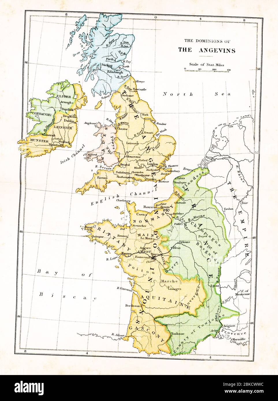 This map shows the dominions of the Angevins in Britain. The Angevins were a royal house of French origin that ruled England in the 12th and early 13th centuries; its monarchs were Henry II, Richard I, and John. Stock Photohttps://www.alamy.com/image-license-details/?v=1https://www.alamy.com/this-map-shows-the-dominions-of-the-angevins-in-britain-the-angevins-were-a-royal-house-of-french-origin-that-ruled-england-in-the-12th-and-early-13th-centuries-its-monarchs-were-henry-ii-richard-i-and-john-image356169560.html
RF2BKCWWC–This map shows the dominions of the Angevins in Britain. The Angevins were a royal house of French origin that ruled England in the 12th and early 13th centuries; its monarchs were Henry II, Richard I, and John.
 Map of France at the Treaty of Brétigny, 9 May 1360. Treaty between King Edward III of England and King John II (the Good) of Stock Photohttps://www.alamy.com/image-license-details/?v=1https://www.alamy.com/stock-photo-map-of-france-at-the-treaty-of-brtigny-9-may-1360-treaty-between-king-83344721.html
RMERGK15–Map of France at the Treaty of Brétigny, 9 May 1360. Treaty between King Edward III of England and King John II (the Good) of
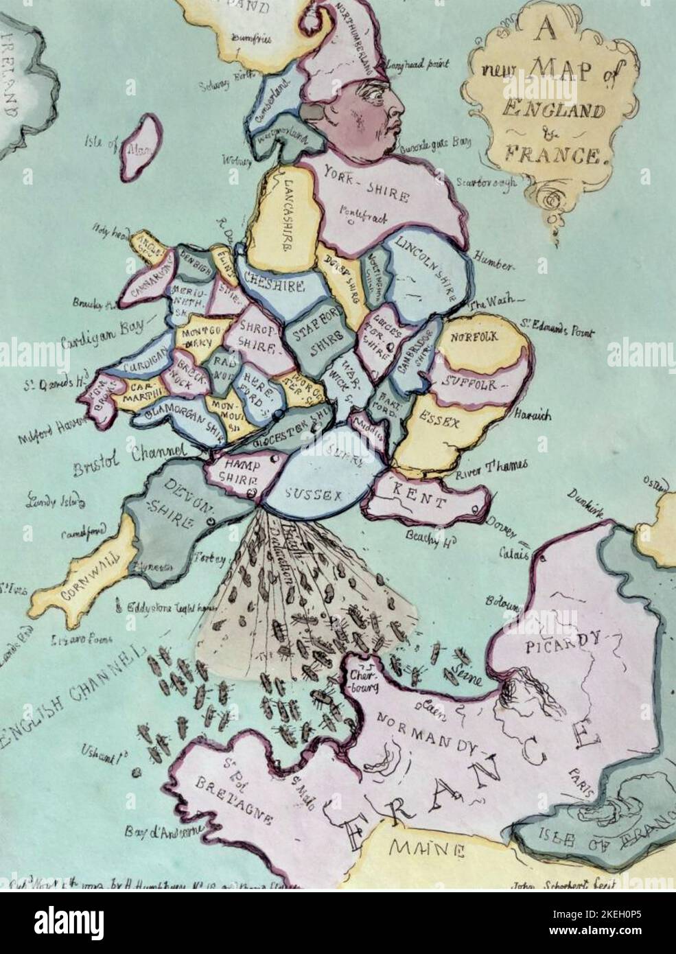 JAMES GILLRAY (7565-1818) English cartoonist. 'A New Map of England & France - The French Invasion or John Bull bombarding the Bum-Boats' Stock Photohttps://www.alamy.com/image-license-details/?v=1https://www.alamy.com/james-gillray-7565-1818-english-cartoonist-a-new-map-of-england-france-the-french-invasion-or-john-bull-bombarding-the-bum-boats-image490869293.html
RM2KEH0P5–JAMES GILLRAY (7565-1818) English cartoonist. 'A New Map of England & France - The French Invasion or John Bull bombarding the Bum-Boats'
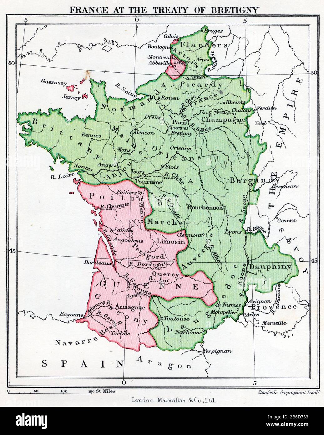 A map showing France at the time of the Treaty of Bretigny. The Treaty of Brétigny was a treaty, drafted on 8th May 1360 and ratified on 24th October 1360, between King Edward III of England and King John II of France. In retrospect it is seen as having marked the end of the first phase of the Hundred Years' War. It was signed at Brétigny and later ratified as the Treaty of Calais on 24th October 1360. Stock Photohttps://www.alamy.com/image-license-details/?v=1https://www.alamy.com/a-map-showing-france-at-the-time-of-the-treaty-of-bretigny-the-treaty-of-brtigny-was-a-treaty-drafted-on-8th-may-1360-and-ratified-on-24th-october-1360-between-king-edward-iii-of-england-and-king-john-ii-of-france-in-retrospect-it-is-seen-as-having-marked-the-end-of-the-first-phase-of-the-hundred-years-war-it-was-signed-at-brtigny-and-later-ratified-as-the-treaty-of-calais-on-24th-october-1360-image348186247.html
RM2B6D733–A map showing France at the time of the Treaty of Bretigny. The Treaty of Brétigny was a treaty, drafted on 8th May 1360 and ratified on 24th October 1360, between King Edward III of England and King John II of France. In retrospect it is seen as having marked the end of the first phase of the Hundred Years' War. It was signed at Brétigny and later ratified as the Treaty of Calais on 24th October 1360.
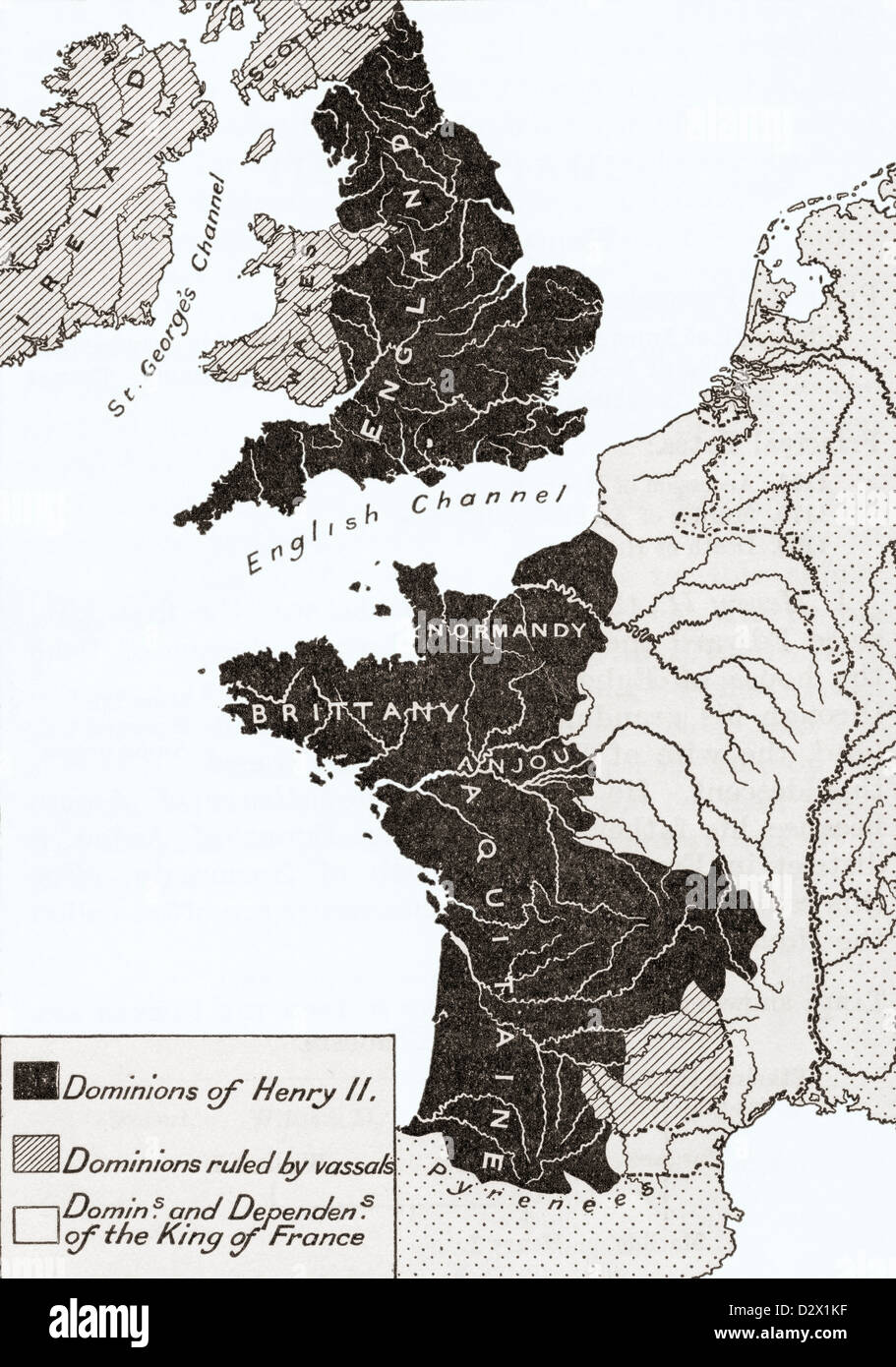 A map showing the Empire of king Henry II of England in the twelfth century Stock Photohttps://www.alamy.com/image-license-details/?v=1https://www.alamy.com/stock-photo-a-map-showing-the-empire-of-king-henry-ii-of-england-in-the-twelfth-53432499.html
RMD2X1KF–A map showing the Empire of king Henry II of England in the twelfth century
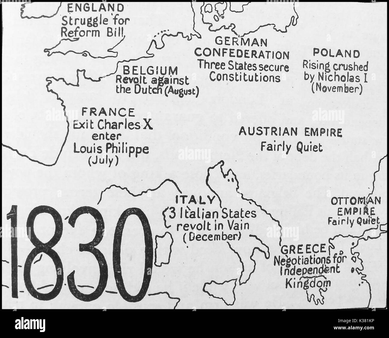 A political map showing the state of Europe in 1830 - England - Belgium - France - German Confederation - Poland - Austrian Empire - Italy - Greece - Ottoman Empire Stock Photohttps://www.alamy.com/image-license-details/?v=1https://www.alamy.com/a-political-map-showing-the-state-of-europe-in-1830-england-belgium-image156914234.html
RMK381KP–A political map showing the state of Europe in 1830 - England - Belgium - France - German Confederation - Poland - Austrian Empire - Italy - Greece - Ottoman Empire
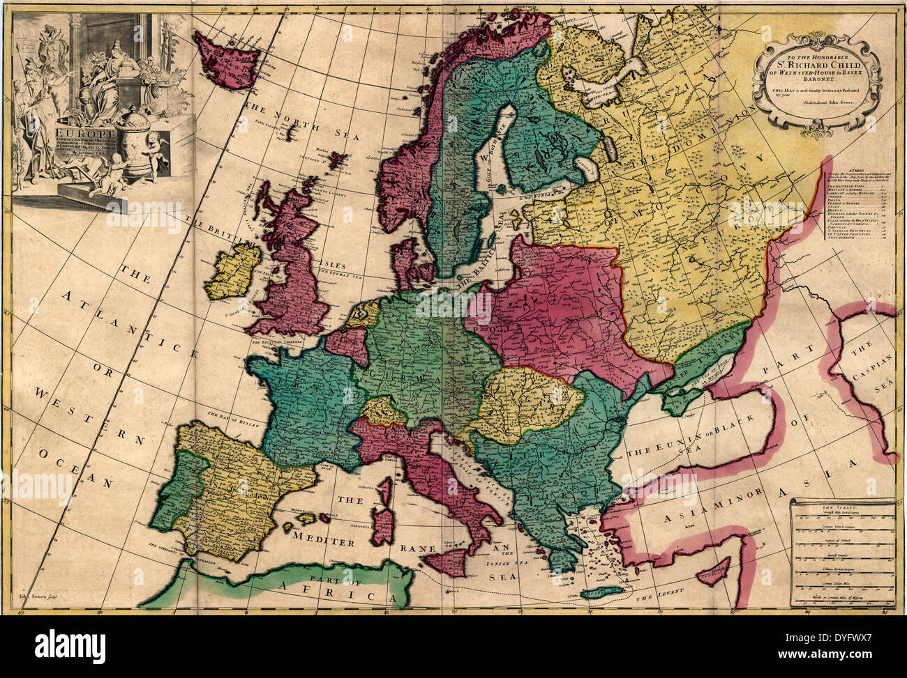 Map of Europe 1740 Stock Photohttps://www.alamy.com/image-license-details/?v=1https://www.alamy.com/map-of-europe-1740-image68576431.html
RMDYFWX7–Map of Europe 1740
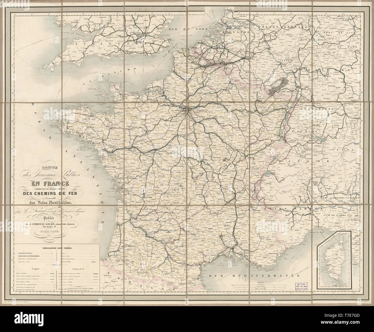 Map of public works in France including the complete network of railways in all the waterways, Published by J. Andriveau-Goujon, 1856 Stock Photohttps://www.alamy.com/image-license-details/?v=1https://www.alamy.com/map-of-public-works-in-france-including-the-complete-network-of-railways-in-all-the-waterways-published-by-j-andriveau-goujon-1856-image245561021.html
RMT7E7GD–Map of public works in France including the complete network of railways in all the waterways, Published by J. Andriveau-Goujon, 1856
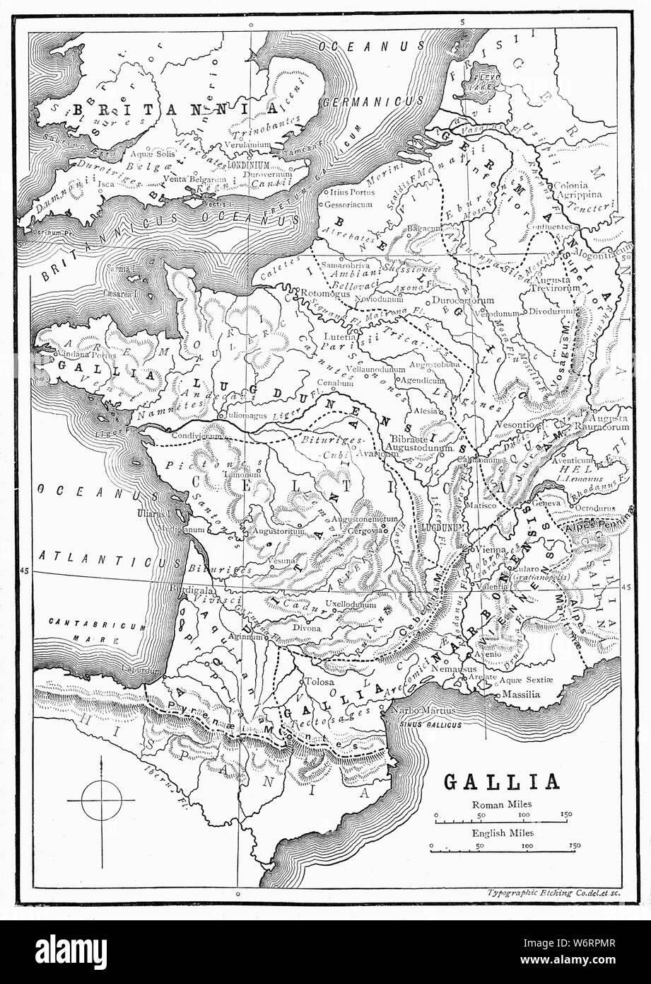 A 19th Century map illustrating the Roman province of Gallia, home of the Gauls, and Britannia. Today bit covers France, |Belgium and Southern England. Stock Photohttps://www.alamy.com/image-license-details/?v=1https://www.alamy.com/a-19th-century-map-illustrating-the-roman-province-of-gallia-home-of-the-gauls-and-britannia-today-bit-covers-france-belgium-and-southern-england-image262366183.html
RMW6RPMR–A 19th Century map illustrating the Roman province of Gallia, home of the Gauls, and Britannia. Today bit covers France, |Belgium and Southern England.
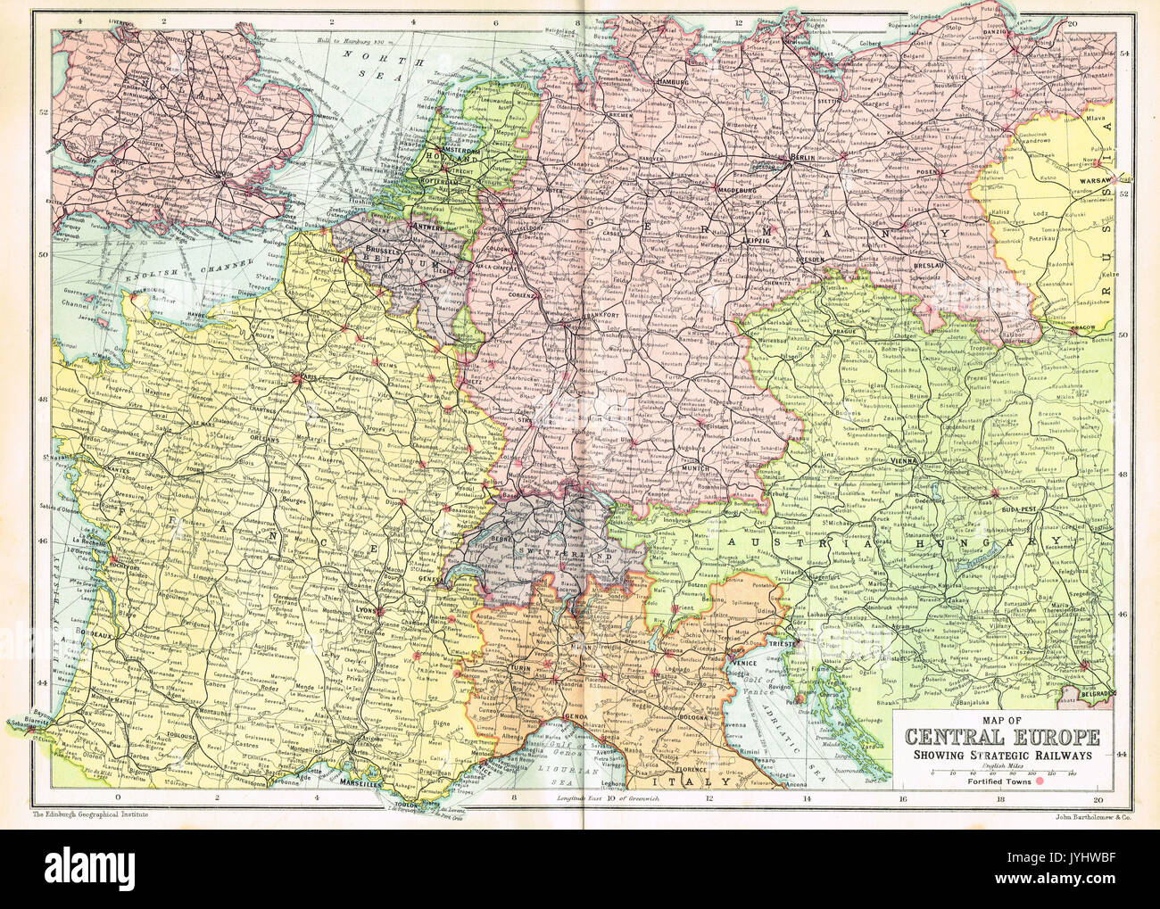 Map of Central Europe at start of WW1 Stock Photohttps://www.alamy.com/image-license-details/?v=1https://www.alamy.com/map-of-central-europe-at-start-of-ww1-image154671763.html
RMJYHWBF–Map of Central Europe at start of WW1
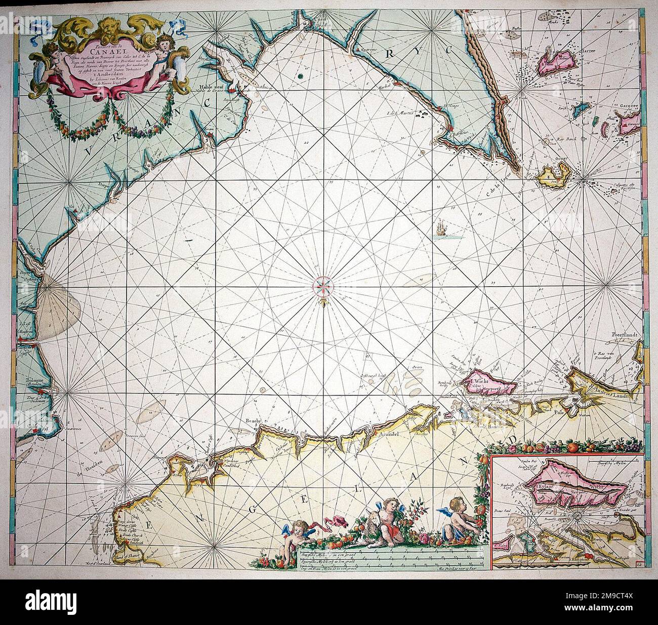 17th century Map of the English Channel between England and France Stock Photohttps://www.alamy.com/image-license-details/?v=1https://www.alamy.com/17th-century-map-of-the-english-channel-between-england-and-france-image504914954.html
RM2M9CT4X–17th century Map of the English Channel between England and France
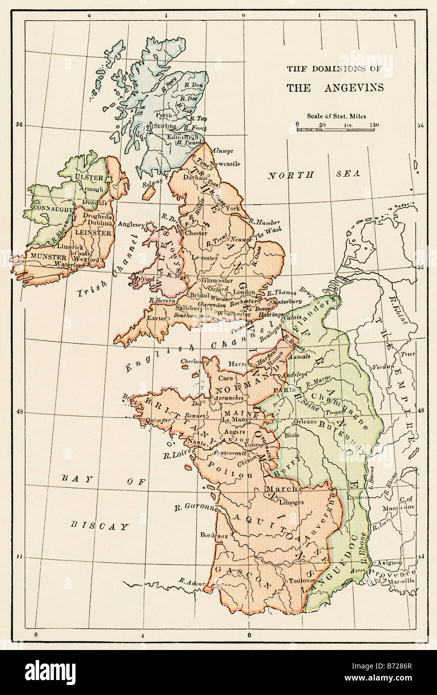 British Isles and France under the Angevins 1100s to 1400s. Color lithograph Stock Photohttps://www.alamy.com/image-license-details/?v=1https://www.alamy.com/stock-photo-british-isles-and-france-under-the-angevins-1100s-to-1400s-color-lithograph-21563327.html
RMB7286R–British Isles and France under the Angevins 1100s to 1400s. Color lithograph
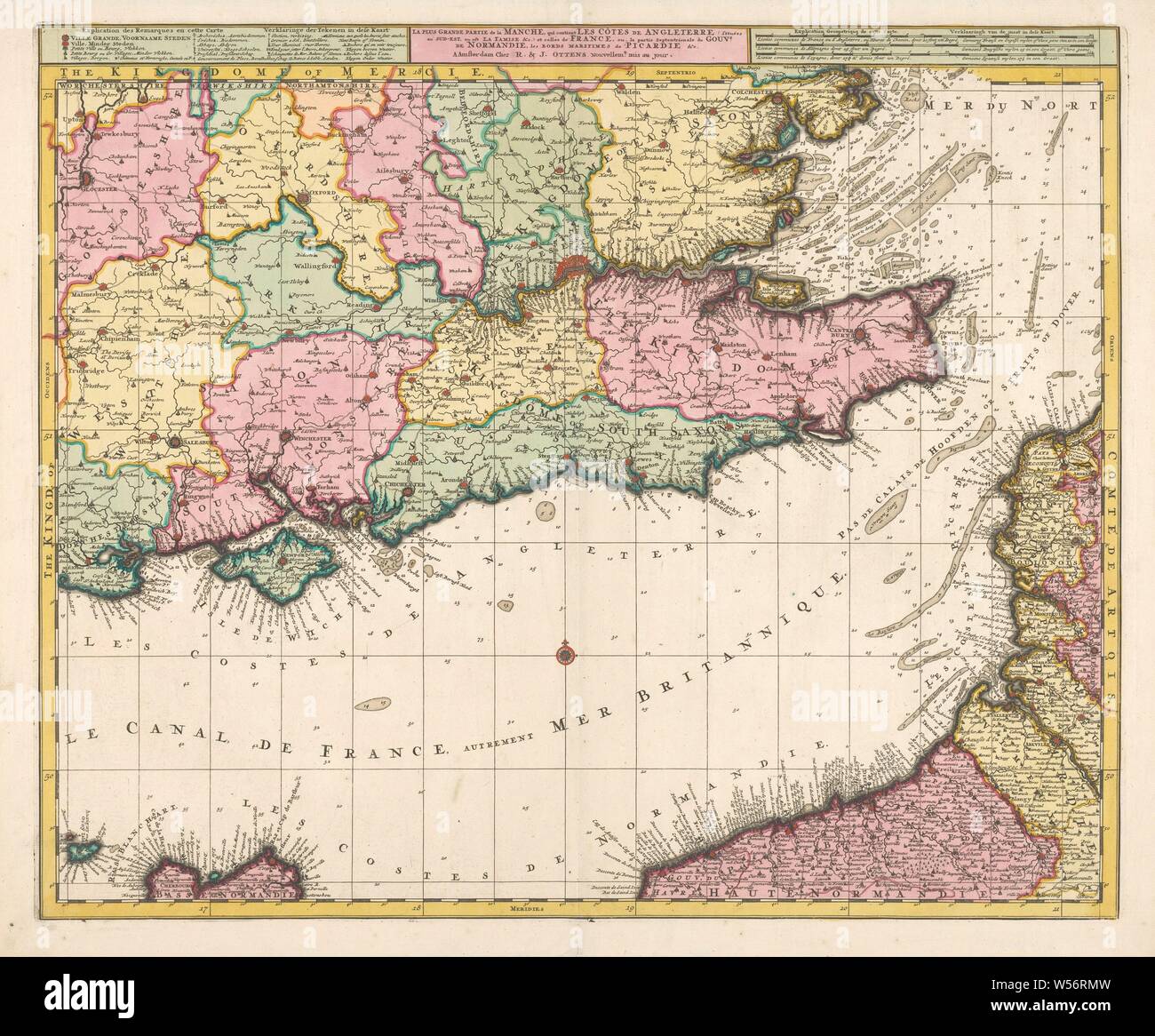 Cartography in the Netherlands, map of the Channel and the coasts of southern England and N. W. France, L.b. next to title legend, r.b. scale in French, German and Spanish miles. Map itself yellow bordered, compass rose m.o, areas of different colors. Inscription, in the upper center: LA PLUS GRANDE PARTIE de la MANCHE, qui contient LES COTES DE ANGLETERRE, Reinier Ottens (I), Amsterdam, 1700 - 1750, paper, engraving, h 49.4 cm × w 59.5 cm Stock Photohttps://www.alamy.com/image-license-details/?v=1https://www.alamy.com/cartography-in-the-netherlands-map-of-the-channel-and-the-coasts-of-southern-england-and-n-w-france-lb-next-to-title-legend-rb-scale-in-french-german-and-spanish-miles-map-itself-yellow-bordered-compass-rose-mo-areas-of-different-colors-inscription-in-the-upper-center-la-plus-grande-partie-de-la-manche-qui-contient-les-cotes-de-angleterre-reinier-ottens-i-amsterdam-1700-1750-paper-engraving-h-494-cm-w-595-cm-image261379129.html
RMW56RMW–Cartography in the Netherlands, map of the Channel and the coasts of southern England and N. W. France, L.b. next to title legend, r.b. scale in French, German and Spanish miles. Map itself yellow bordered, compass rose m.o, areas of different colors. Inscription, in the upper center: LA PLUS GRANDE PARTIE de la MANCHE, qui contient LES COTES DE ANGLETERRE, Reinier Ottens (I), Amsterdam, 1700 - 1750, paper, engraving, h 49.4 cm × w 59.5 cm
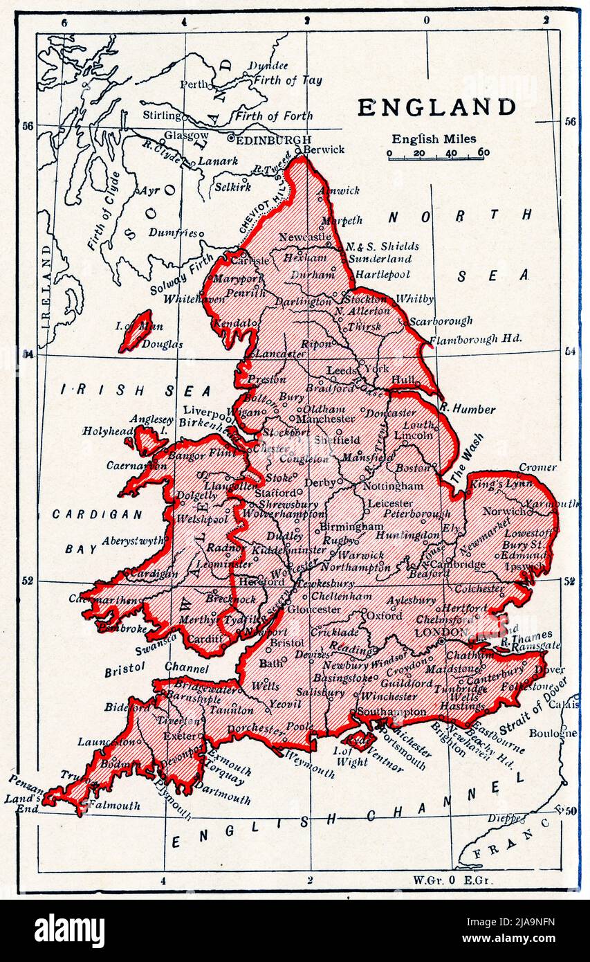 Map of England 600 - 1000 AD Stock Photohttps://www.alamy.com/image-license-details/?v=1https://www.alamy.com/map-of-england-600-1000-ad-image471040969.html
RM2JA9NFN–Map of England 600 - 1000 AD
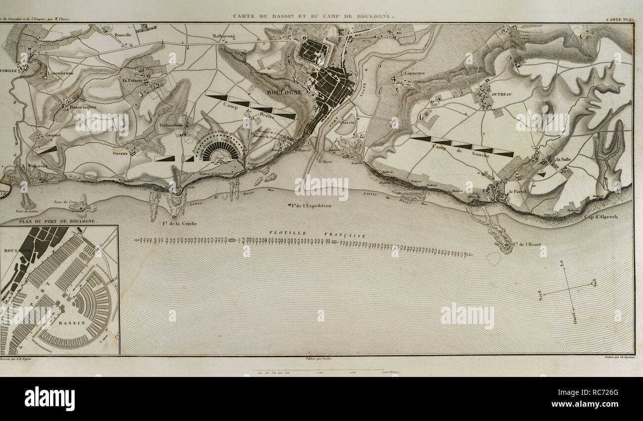 Map of Boulogne-sur-Mer. In French coast on the English Channel. it was a staging area for Napoleon's troops for several months in 1805, during his planned invasion of the United Kingdom. Atlas de l'Histoire du Consulat et de l'Empire. History of the Consulate and the Empire of France under Napoleon by Marie Joseph Louis Adolphe Thiers (1797-1877). Drawings by Dufour, engravings by Dyonnet. Edited in Paris, 1864. Stock Photohttps://www.alamy.com/image-license-details/?v=1https://www.alamy.com/map-of-boulogne-sur-mer-in-french-coast-on-the-english-channel-it-was-a-staging-area-for-napoleons-troops-for-several-months-in-1805-during-his-planned-invasion-of-the-united-kingdom-atlas-de-lhistoire-du-consulat-et-de-lempire-history-of-the-consulate-and-the-empire-of-france-under-napoleon-by-marie-joseph-louis-adolphe-thiers-1797-1877-drawings-by-dufour-engravings-by-dyonnet-edited-in-paris-1864-image231266072.html
RMRC726G–Map of Boulogne-sur-Mer. In French coast on the English Channel. it was a staging area for Napoleon's troops for several months in 1805, during his planned invasion of the United Kingdom. Atlas de l'Histoire du Consulat et de l'Empire. History of the Consulate and the Empire of France under Napoleon by Marie Joseph Louis Adolphe Thiers (1797-1877). Drawings by Dufour, engravings by Dyonnet. Edited in Paris, 1864.
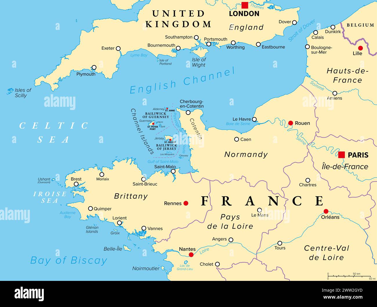 Northern France, political map. Coastline of France and United Kingdom along the English Channel, and along Bay of Biscay, with the Channel Islands. Stock Photohttps://www.alamy.com/image-license-details/?v=1https://www.alamy.com/northern-france-political-map-coastline-of-france-and-united-kingdom-along-the-english-channel-and-along-bay-of-biscay-with-the-channel-islands-image600576129.html
RF2WW2GYD–Northern France, political map. Coastline of France and United Kingdom along the English Channel, and along Bay of Biscay, with the Channel Islands.
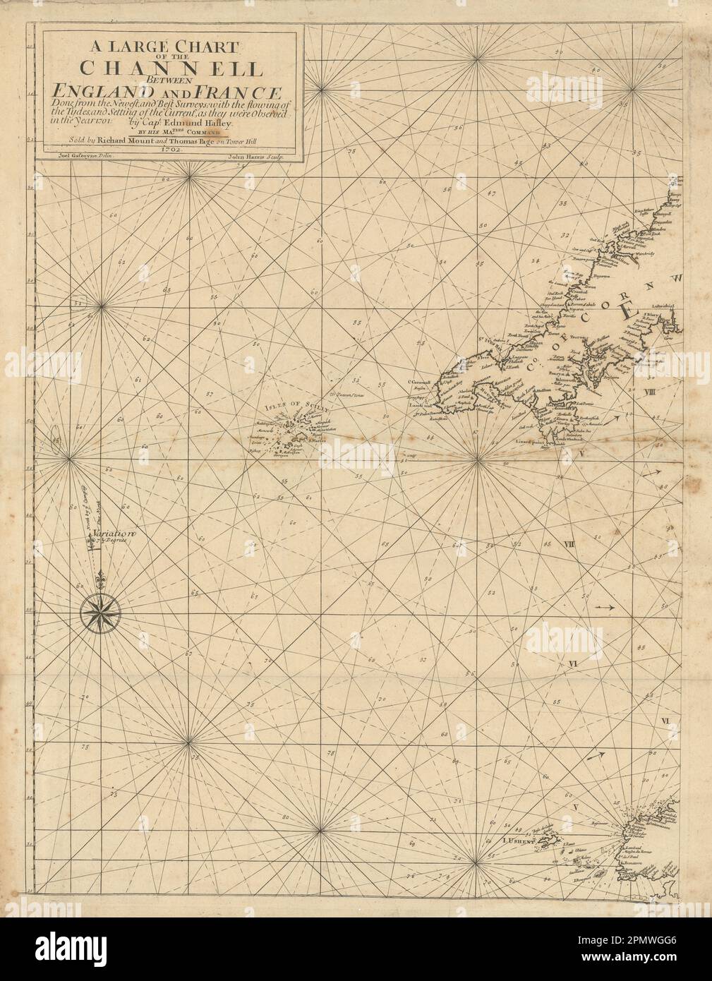 Channell between England & France. West sheet. Cornwall Scillies. MOUNT 1702 map Stock Photohttps://www.alamy.com/image-license-details/?v=1https://www.alamy.com/channell-between-england-france-west-sheet-cornwall-scillies-mount-1702-map-image546376326.html
RF2PMWGG6–Channell between England & France. West sheet. Cornwall Scillies. MOUNT 1702 map
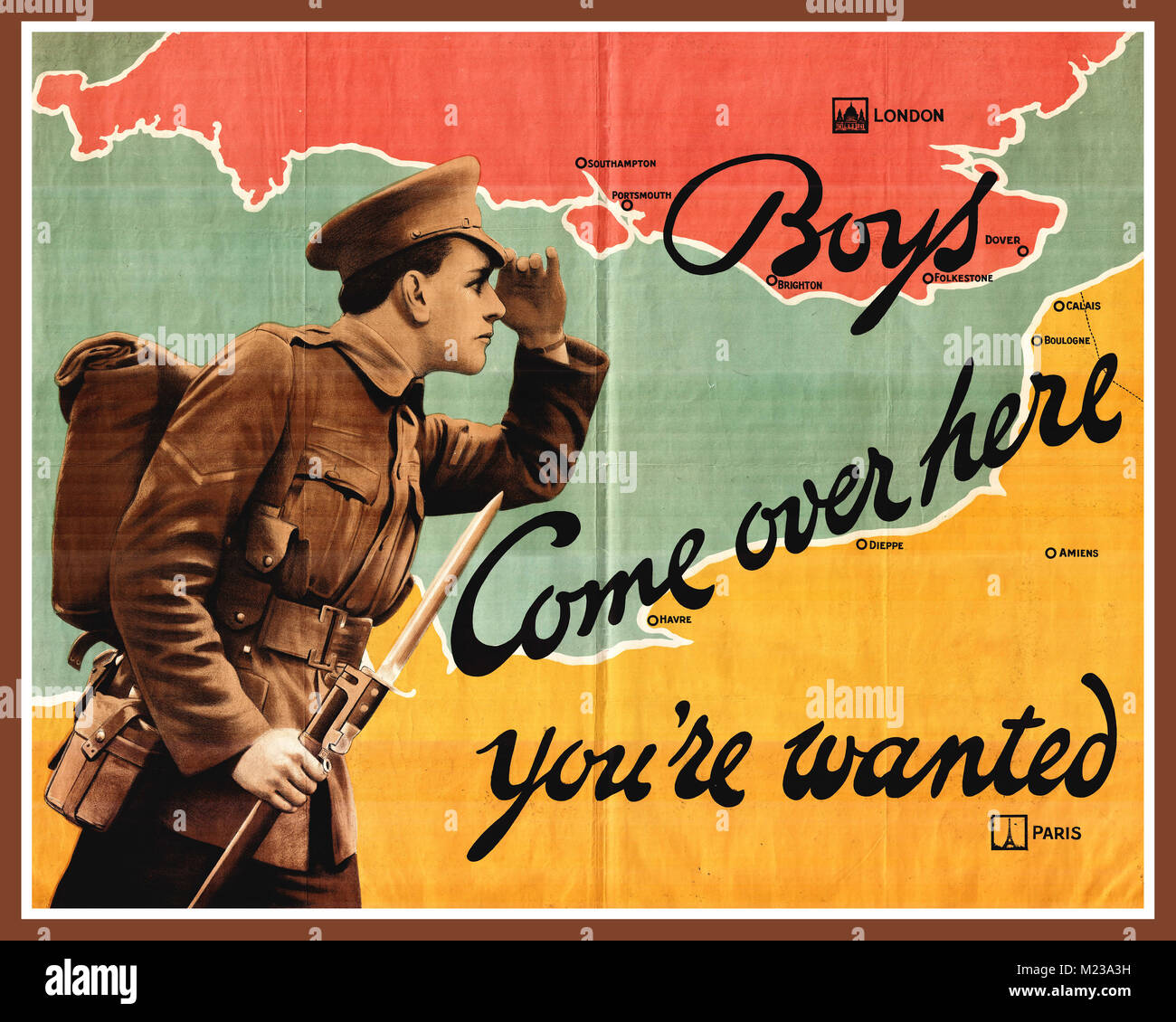 WW1 1900's Recruitment Propaganda Poster featuring a British soldier in full uniform in France come over you are wanted Stock Photohttps://www.alamy.com/image-license-details/?v=1https://www.alamy.com/stock-photo-ww1-1900s-recruitment-propaganda-poster-featuring-a-british-soldier-173406789.html
RMM23A3H–WW1 1900's Recruitment Propaganda Poster featuring a British soldier in full uniform in France come over you are wanted
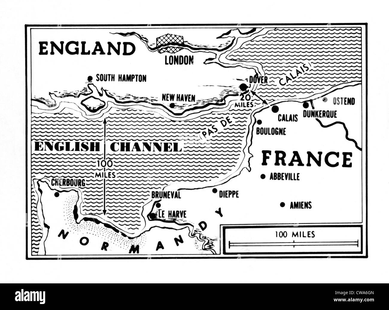 D-Day, map detailing Allies invasion, 1944. Courtesy: CSU Archives / Everett Collection Stock Photohttps://www.alamy.com/image-license-details/?v=1https://www.alamy.com/stock-photo-d-day-map-detailing-allies-invasion-1944-courtesy-csu-archives-everett-50011829.html
RMCWA6GN–D-Day, map detailing Allies invasion, 1944. Courtesy: CSU Archives / Everett Collection
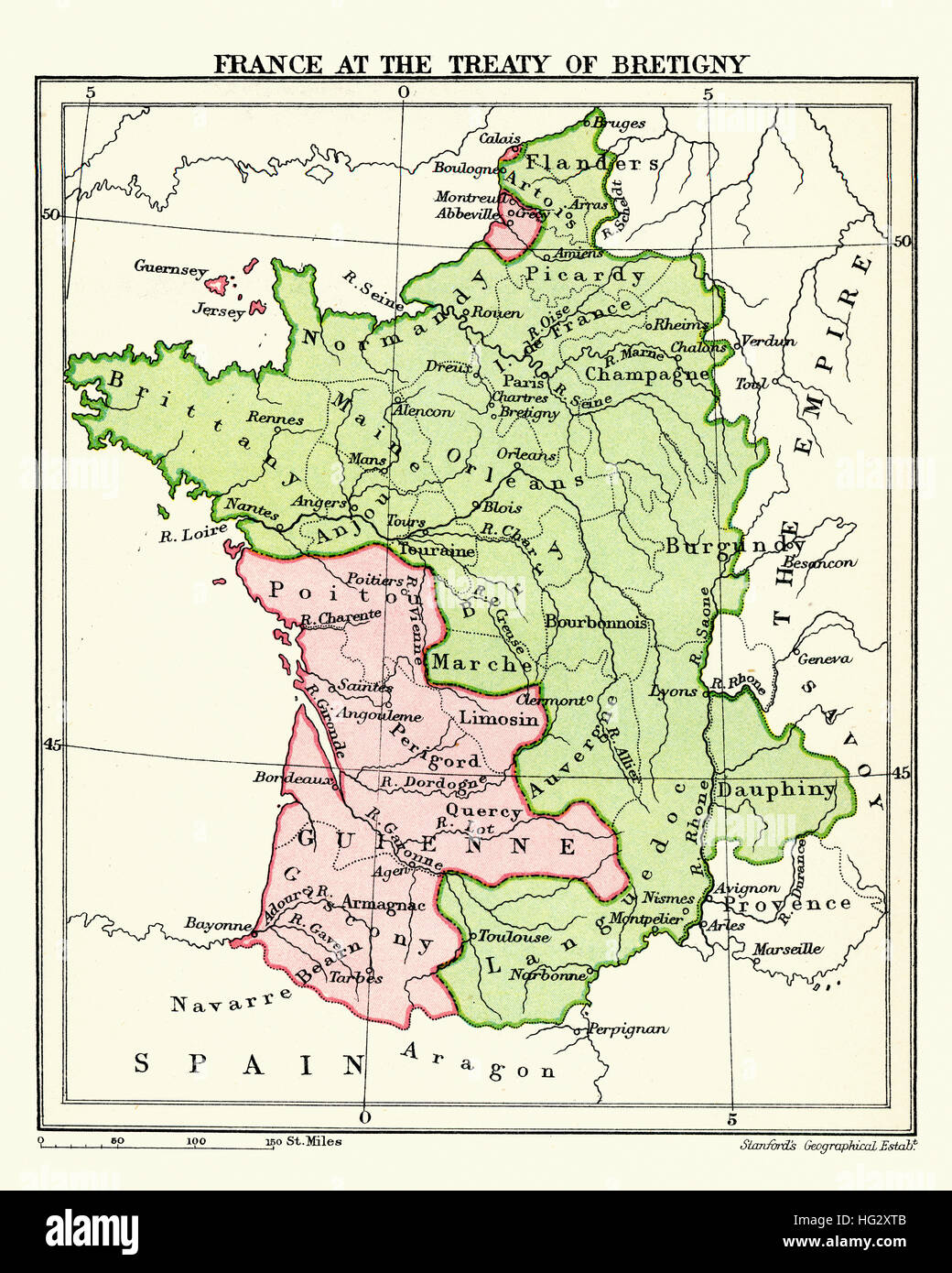 Map of France at the Treaty of Bretigny. Ratified on 24 October 1360, between King Edward III of England and King John II of France. It is seen as hav Stock Photohttps://www.alamy.com/image-license-details/?v=1https://www.alamy.com/stock-photo-map-of-france-at-the-treaty-of-bretigny-ratified-on-24-october-1360-130372043.html
RMHG2XTB–Map of France at the Treaty of Bretigny. Ratified on 24 October 1360, between King Edward III of England and King John II of France. It is seen as hav
 Putting His Foot Down Uncle Sam stands on a large map of China which is being cut up by Germany, Italy, England, Russia, and France (Austria is in background, sharpening shears); Uncle Sam clutches 'Trade Treaty with China' and says: 'Gentlemen, you may cut up this map as much as you like; but remember that I'm here to stay, and that you can't divide me up into spheres of influence!'Date 1899 Stock Photohttps://www.alamy.com/image-license-details/?v=1https://www.alamy.com/putting-his-foot-down-uncle-sam-stands-on-a-large-map-of-china-which-is-being-cut-up-by-germany-italy-england-russia-and-france-austria-is-in-background-sharpening-shears-uncle-sam-clutches-trade-treaty-with-china-and-says-gentlemen-you-may-cut-up-this-map-as-much-as-you-like-but-remember-that-im-here-to-stay-and-that-you-cant-divide-me-up-into-spheres-of-influence!date-1899-image481970006.html
RM2K03HJE–Putting His Foot Down Uncle Sam stands on a large map of China which is being cut up by Germany, Italy, England, Russia, and France (Austria is in background, sharpening shears); Uncle Sam clutches 'Trade Treaty with China' and says: 'Gentlemen, you may cut up this map as much as you like; but remember that I'm here to stay, and that you can't divide me up into spheres of influence!'Date 1899
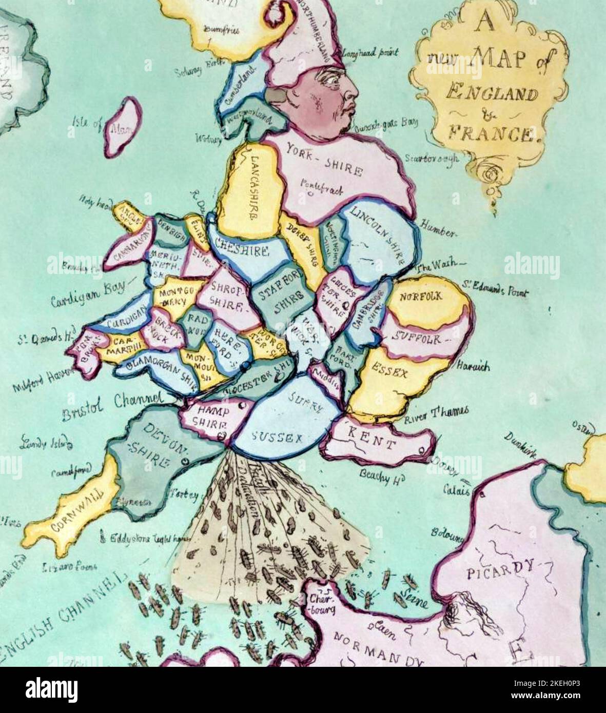 JAMES GILLRAY (7565-1818) English cartoonist. 'A New Map of England & France - The French Invasion or John Bull bombarding the Bum-Boats' - detail. Stock Photohttps://www.alamy.com/image-license-details/?v=1https://www.alamy.com/james-gillray-7565-1818-english-cartoonist-a-new-map-of-england-france-the-french-invasion-or-john-bull-bombarding-the-bum-boats-detail-image490869291.html
RM2KEH0P3–JAMES GILLRAY (7565-1818) English cartoonist. 'A New Map of England & France - The French Invasion or John Bull bombarding the Bum-Boats' - detail.
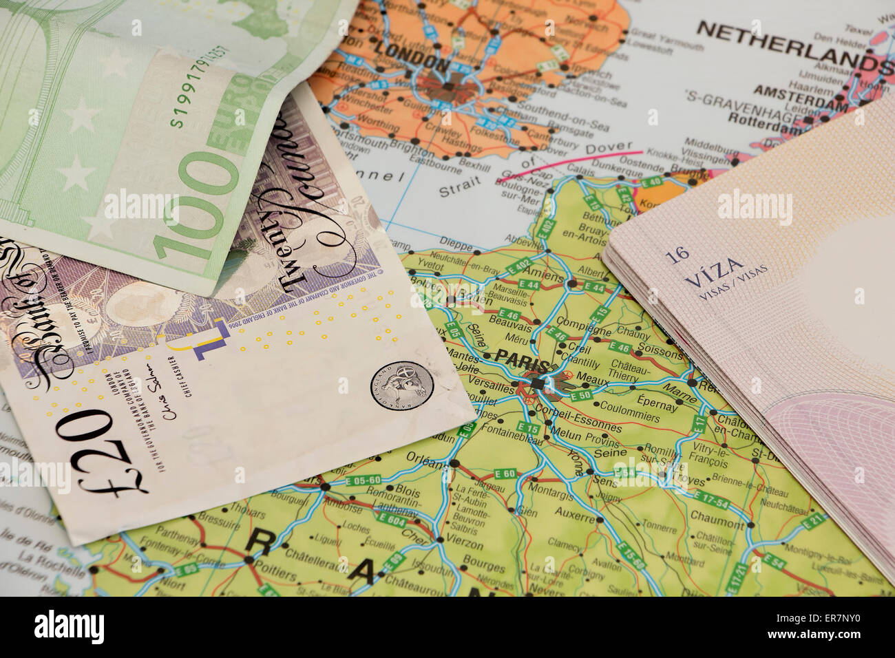 Map, euro and pounds money and a passport. Concept of Europe travel. Stock Photohttps://www.alamy.com/image-license-details/?v=1https://www.alamy.com/stock-photo-map-euro-and-pounds-money-and-a-passport-concept-of-europe-travel-83149444.html
RFER7NY0–Map, euro and pounds money and a passport. Concept of Europe travel.
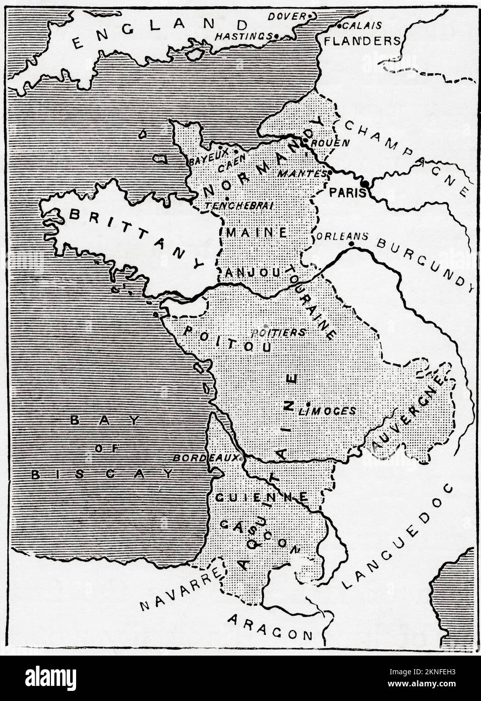 Map showing the possessions in France in the time of Henry II, shown in the tinted portion. From History of England, published 1907 Stock Photohttps://www.alamy.com/image-license-details/?v=1https://www.alamy.com/map-showing-the-possessions-in-france-in-the-time-of-henry-ii-shown-in-the-tinted-portion-from-history-of-england-published-1907-image495138815.html
RM2KNFEH3–Map showing the possessions in France in the time of Henry II, shown in the tinted portion. From History of England, published 1907
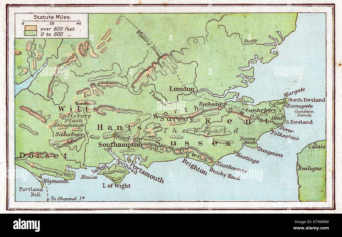 1914 map of South East England Stock Photohttps://www.alamy.com/image-license-details/?v=1https://www.alamy.com/1914-map-of-south-east-england-image159409816.html
RMK79MRM–1914 map of South East England
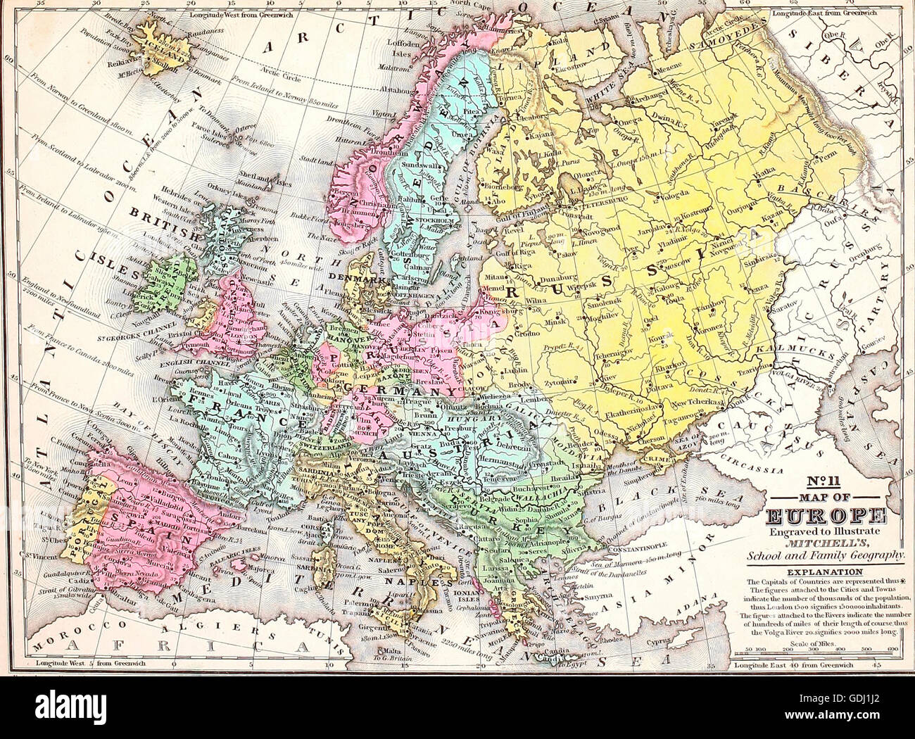 Map of Europe, circa 1860 Stock Photohttps://www.alamy.com/image-license-details/?v=1https://www.alamy.com/stock-photo-map-of-europe-circa-1860-111649162.html
RMGDJ1J2–Map of Europe, circa 1860
 cartography, maps, map of Central Europe at the beginning of the War of the Sixth Coalition in 1813 , war of liberation, Napoleonic Wars, 19th century, historic, historical, Europe, map, maps, France, Germany, Prussia, Austria, Poland, Russia, Italy, England, Spain, Confederation of the Rhine, Additional-Rights-Clearences-Not Available Stock Photohttps://www.alamy.com/image-license-details/?v=1https://www.alamy.com/stock-photo-cartography-maps-map-of-central-europe-at-the-beginning-of-the-war-36909306.html
RMC41A5E–cartography, maps, map of Central Europe at the beginning of the War of the Sixth Coalition in 1813 , war of liberation, Napoleonic Wars, 19th century, historic, historical, Europe, map, maps, France, Germany, Prussia, Austria, Poland, Russia, Italy, England, Spain, Confederation of the Rhine, Additional-Rights-Clearences-Not Available
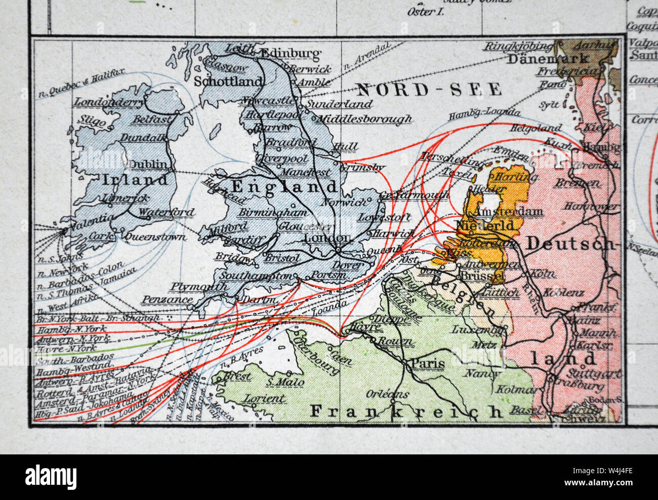 1900 Meyer World Map English Channel Navigation Routes Steamers Stock Photohttps://www.alamy.com/image-license-details/?v=1https://www.alamy.com/1900-meyer-world-map-english-channel-navigation-routes-steamers-image261012850.html
RFW4J4FE–1900 Meyer World Map English Channel Navigation Routes Steamers
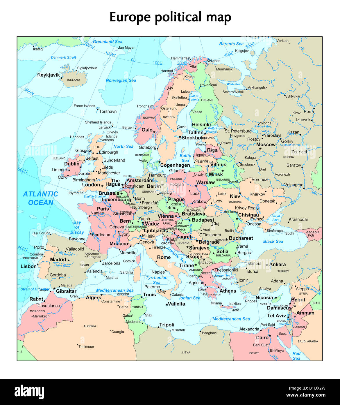 Europe political map Stock Photohttps://www.alamy.com/image-license-details/?v=1https://www.alamy.com/stock-photo-europe-political-map-18130865.html
RFB1DX2W–Europe political map
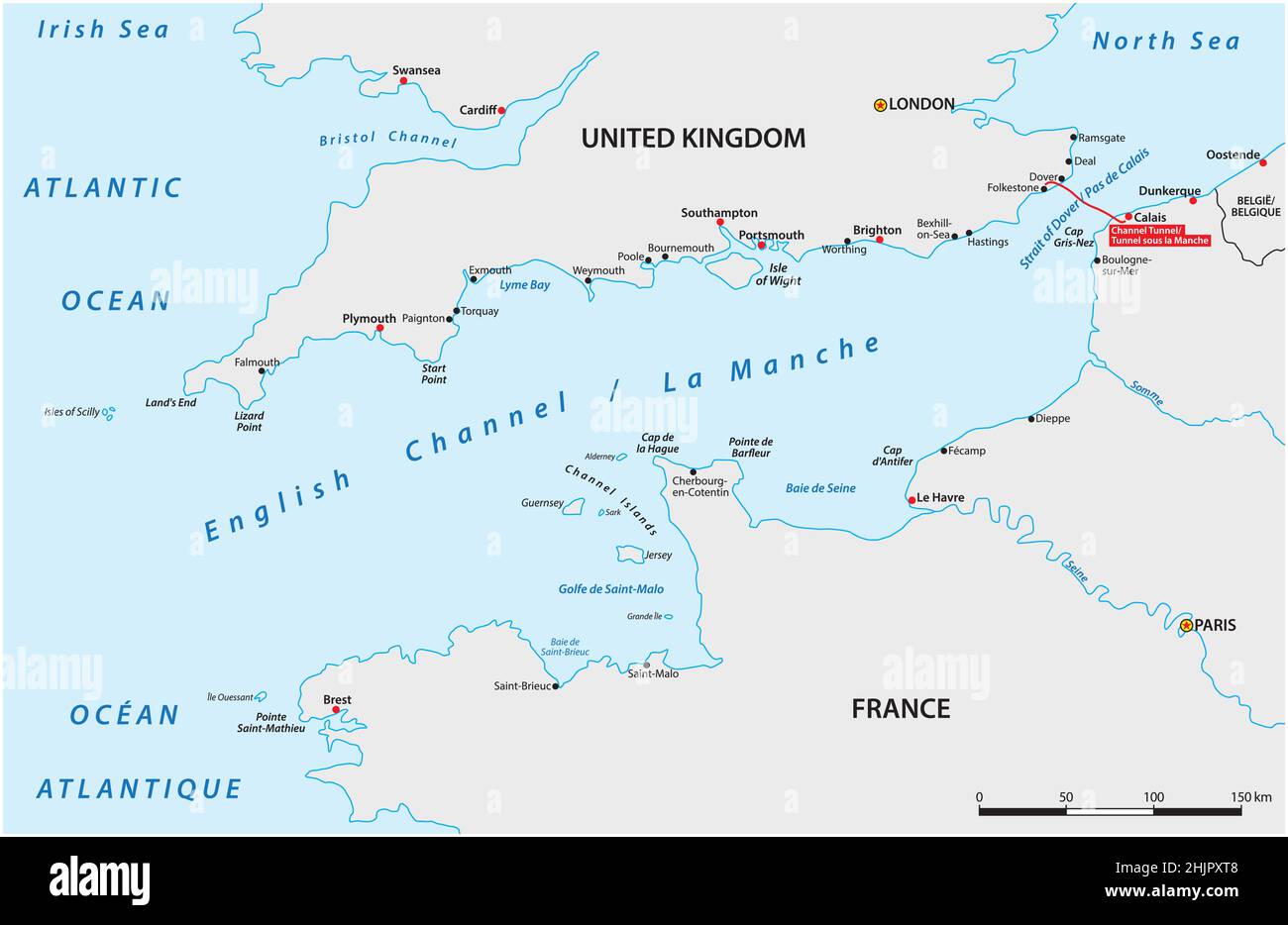 Vector map of the English Channel between United Kingdom and France Stock Vectorhttps://www.alamy.com/image-license-details/?v=1https://www.alamy.com/vector-map-of-the-english-channel-between-united-kingdom-and-france-image459037384.html
RF2HJPXT8–Vector map of the English Channel between United Kingdom and France
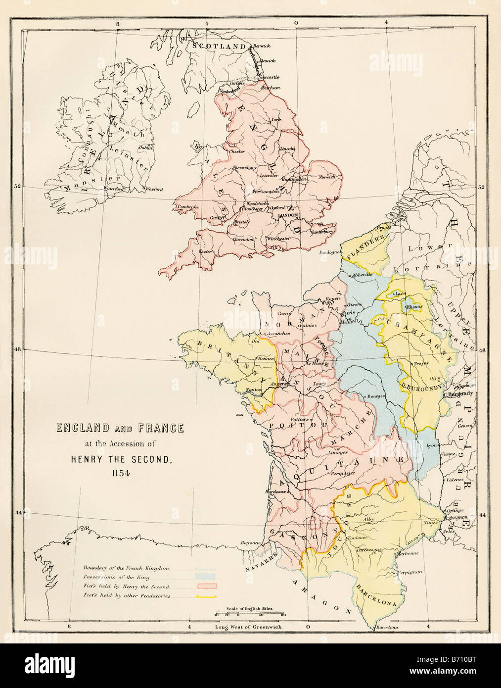 England and France at the accession of Henry II 1154. Color lithograph Stock Photohttps://www.alamy.com/image-license-details/?v=1https://www.alamy.com/stock-photo-england-and-france-at-the-accession-of-henry-ii-1154-color-lithograph-21535244.html
RMB710BT–England and France at the accession of Henry II 1154. Color lithograph
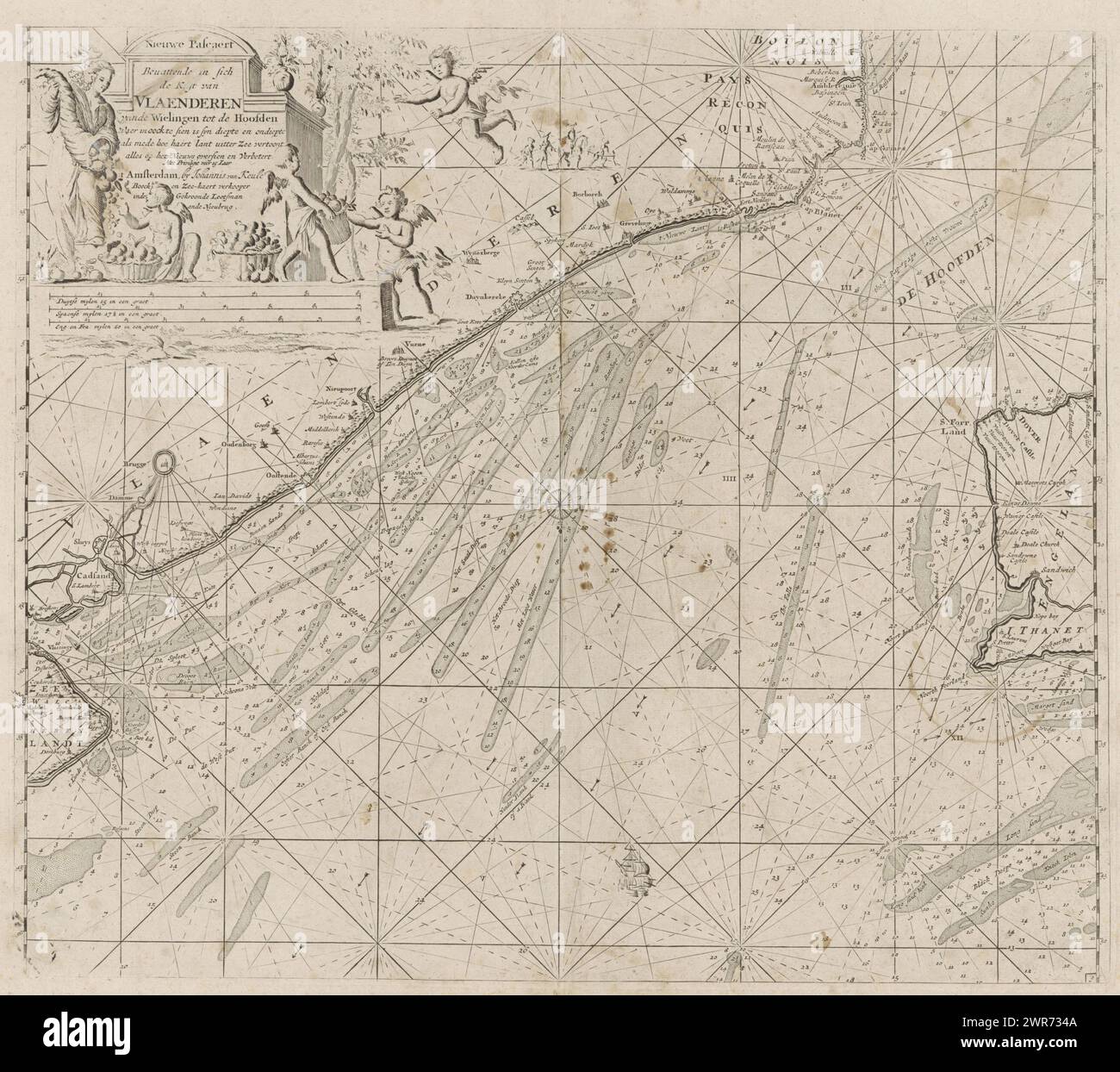 Pass map of the northern access to the Channel with the coasts of Flanders, France and England, Nieuwe Pascaert Containing in itself the Coast of Flanders from the Wielingen to the Hoofden, where it can also be seen its depth and shallowness as well as how it extends from the sea (title on object), Pass map of the northern entrance to the Channel with the coasts of Flanders, France and England, with a compass rose, the North is at the bottom. Top left a cartouche with the title, the address of the publisher and the scale, shown in German, Spanish and English or French miles (scale: c. 1:270 Stock Photohttps://www.alamy.com/image-license-details/?v=1https://www.alamy.com/pass-map-of-the-northern-access-to-the-channel-with-the-coasts-of-flanders-france-and-england-nieuwe-pascaert-containing-in-itself-the-coast-of-flanders-from-the-wielingen-to-the-hoofden-where-it-can-also-be-seen-its-depth-and-shallowness-as-well-as-how-it-extends-from-the-sea-title-on-object-pass-map-of-the-northern-entrance-to-the-channel-with-the-coasts-of-flanders-france-and-england-with-a-compass-rose-the-north-is-at-the-bottom-top-left-a-cartouche-with-the-title-the-address-of-the-publisher-and-the-scale-shown-in-german-spanish-and-english-or-french-miles-scale-c-1270-image599445738.html
RM2WR734A–Pass map of the northern access to the Channel with the coasts of Flanders, France and England, Nieuwe Pascaert Containing in itself the Coast of Flanders from the Wielingen to the Hoofden, where it can also be seen its depth and shallowness as well as how it extends from the sea (title on object), Pass map of the northern entrance to the Channel with the coasts of Flanders, France and England, with a compass rose, the North is at the bottom. Top left a cartouche with the title, the address of the publisher and the scale, shown in German, Spanish and English or French miles (scale: c. 1:270
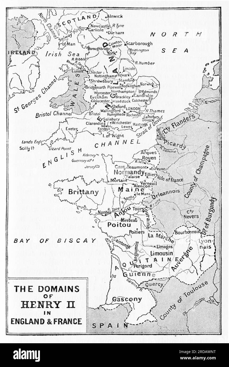 Map of the domains of Henry II in England and France, published late 1800s Stock Photohttps://www.alamy.com/image-license-details/?v=1https://www.alamy.com/map-of-the-domains-of-henry-ii-in-england-and-france-published-late-1800s-image558962036.html
RM2RDAWNT–Map of the domains of Henry II in England and France, published late 1800s
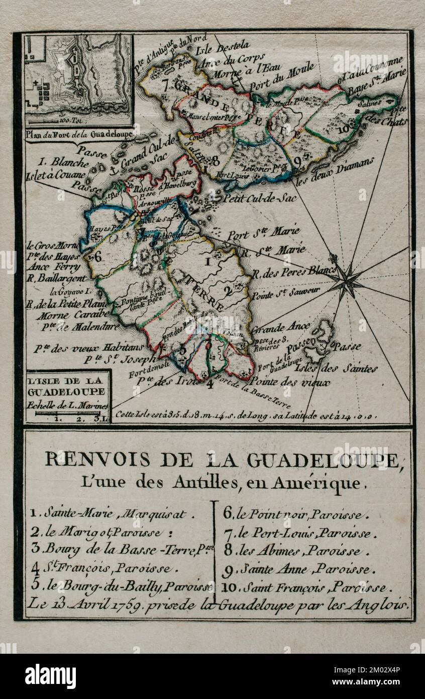 Map of Guadeloupe, 1759. Antilles Archipelago, Caribbean Sea. France took possession of the island on 28 June 1635, after landing at Pointe Allegre. During the Seven Years War, was conquered by England, founding the Port of Pointe-a-Pitre. Taking of the island of Guadeloupe by the British troops on April 13, 1759. Engraving published in 1765 by the cartographer Jean de Beaurain (1696-1771) as an illustration of his Great Map of Germany, with the events that took place during the Seven Years War. French edition, 1765. Military Historical Library of Barcelona (Biblioteca Histórico Militar de Bar Stock Photohttps://www.alamy.com/image-license-details/?v=1https://www.alamy.com/map-of-guadeloupe-1759-antilles-archipelago-caribbean-sea-france-took-possession-of-the-island-on-28-june-1635-after-landing-at-pointe-allegre-during-the-seven-years-war-was-conquered-by-england-founding-the-port-of-pointe-a-pitre-taking-of-the-island-of-guadeloupe-by-the-british-troops-on-april-13-1759-engraving-published-in-1765-by-the-cartographer-jean-de-beaurain-1696-1771-as-an-illustration-of-his-great-map-of-germany-with-the-events-that-took-place-during-the-seven-years-war-french-edition-1765-military-historical-library-of-barcelona-biblioteca-histrico-militar-de-bar-image499165094.html
RM2M02X4P–Map of Guadeloupe, 1759. Antilles Archipelago, Caribbean Sea. France took possession of the island on 28 June 1635, after landing at Pointe Allegre. During the Seven Years War, was conquered by England, founding the Port of Pointe-a-Pitre. Taking of the island of Guadeloupe by the British troops on April 13, 1759. Engraving published in 1765 by the cartographer Jean de Beaurain (1696-1771) as an illustration of his Great Map of Germany, with the events that took place during the Seven Years War. French edition, 1765. Military Historical Library of Barcelona (Biblioteca Histórico Militar de Bar
 Northern France, touristic names of beaches and coastlines, political map. Coastline of France and United Kingdom along the English Channel. Stock Photohttps://www.alamy.com/image-license-details/?v=1https://www.alamy.com/northern-france-touristic-names-of-beaches-and-coastlines-political-map-coastline-of-france-and-united-kingdom-along-the-english-channel-image613103718.html
RF2XHD81A–Northern France, touristic names of beaches and coastlines, political map. Coastline of France and United Kingdom along the English Channel.
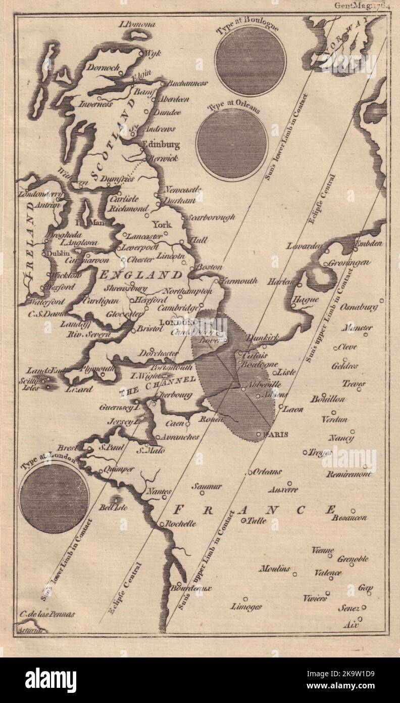 The Solar eclipse of 1 April 1764 across England & France. GENTS MAG 1764 map Stock Photohttps://www.alamy.com/image-license-details/?v=1https://www.alamy.com/the-solar-eclipse-of-1-april-1764-across-england-france-gents-mag-1764-map-image487972165.html
RF2K9W1D9–The Solar eclipse of 1 April 1764 across England & France. GENTS MAG 1764 map
 Map showing the French dominions of Henry II. Stock Photohttps://www.alamy.com/image-license-details/?v=1https://www.alamy.com/map-showing-the-french-dominions-of-henry-ii-image66190447.html
RMDRK6GF–Map showing the French dominions of Henry II.
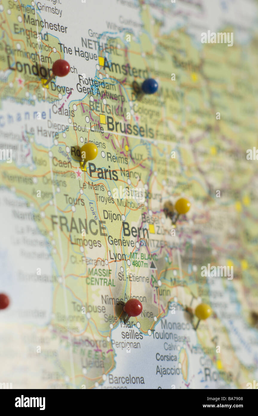 Map Europe cities pins card Central Europe France Switzerland Italy Netherlands Great Britain England needles pins markings Stock Photohttps://www.alamy.com/image-license-details/?v=1https://www.alamy.com/stock-photo-map-europe-cities-pins-card-central-europe-france-switzerland-italy-23517656.html
RMBA7908–Map Europe cities pins card Central Europe France Switzerland Italy Netherlands Great Britain England needles pins markings
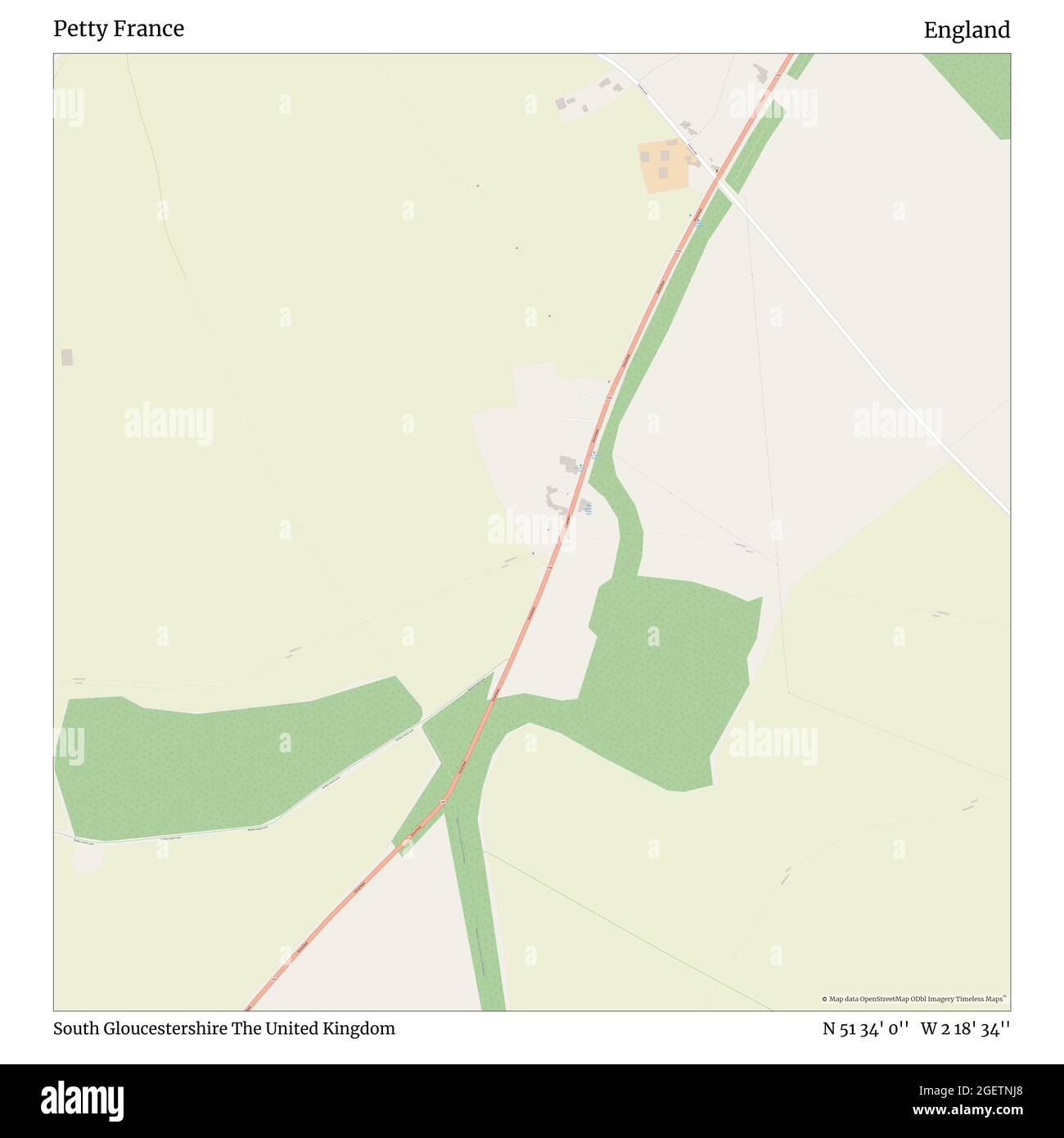 Petty France, South Gloucestershire, United Kingdom, England, N 51 34' 0'', W 2 18' 34'', map, Timeless Map published in 2021. Travelers, explorers and adventurers like Florence Nightingale, David Livingstone, Ernest Shackleton, Lewis and Clark and Sherlock Holmes relied on maps to plan travels to the world's most remote corners, Timeless Maps is mapping most locations on the globe, showing the achievement of great dreams Stock Photohttps://www.alamy.com/image-license-details/?v=1https://www.alamy.com/petty-france-south-gloucestershire-united-kingdom-england-n-51-34-0-w-2-18-34-map-timeless-map-published-in-2021-travelers-explorers-and-adventurers-like-florence-nightingale-david-livingstone-ernest-shackleton-lewis-and-clark-and-sherlock-holmes-relied-on-maps-to-plan-travels-to-the-worlds-most-remote-corners-timeless-maps-is-mapping-most-locations-on-the-globe-showing-the-achievement-of-great-dreams-image439408208.html
RM2GETNJ8–Petty France, South Gloucestershire, United Kingdom, England, N 51 34' 0'', W 2 18' 34'', map, Timeless Map published in 2021. Travelers, explorers and adventurers like Florence Nightingale, David Livingstone, Ernest Shackleton, Lewis and Clark and Sherlock Holmes relied on maps to plan travels to the world's most remote corners, Timeless Maps is mapping most locations on the globe, showing the achievement of great dreams
 Tourist with map Stock Vectorhttps://www.alamy.com/image-license-details/?v=1https://www.alamy.com/tourist-with-map-image363308835.html
RF2C3243F–Tourist with map
 Map Of France With Push Pin Plane Over Paris Stock Photohttps://www.alamy.com/image-license-details/?v=1https://www.alamy.com/map-of-france-with-push-pin-plane-over-paris-image61366775.html
RFDFRDXF–Map Of France With Push Pin Plane Over Paris
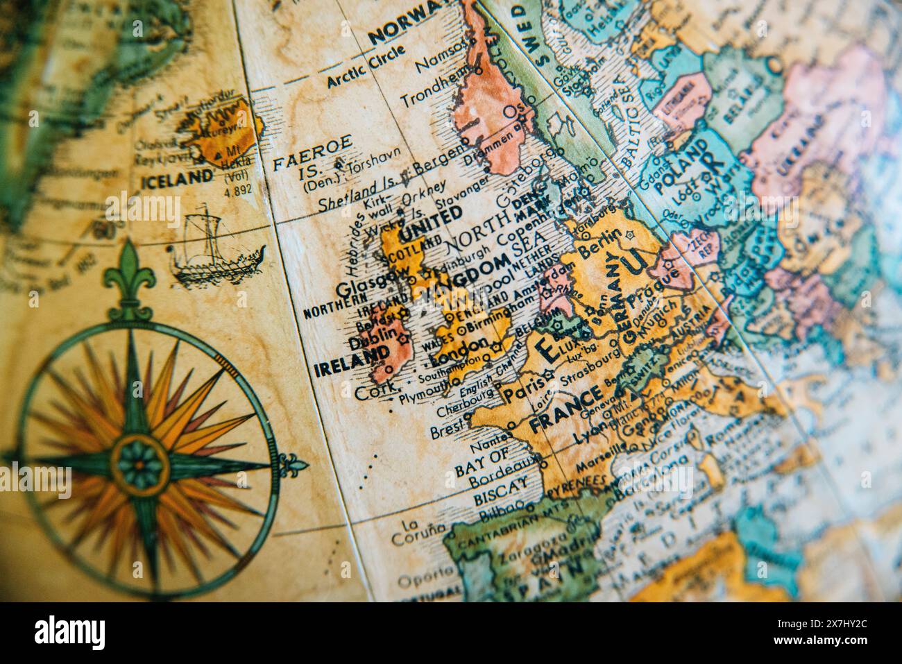 A detailed vintage globe map highlighting the geography of Europe, including the United Kingdom, France and Germany. Stock Photohttps://www.alamy.com/image-license-details/?v=1https://www.alamy.com/a-detailed-vintage-globe-map-highlighting-the-geography-of-europe-including-the-united-kingdom-france-and-germany-image607059892.html
RM2X7HY2C–A detailed vintage globe map highlighting the geography of Europe, including the United Kingdom, France and Germany.
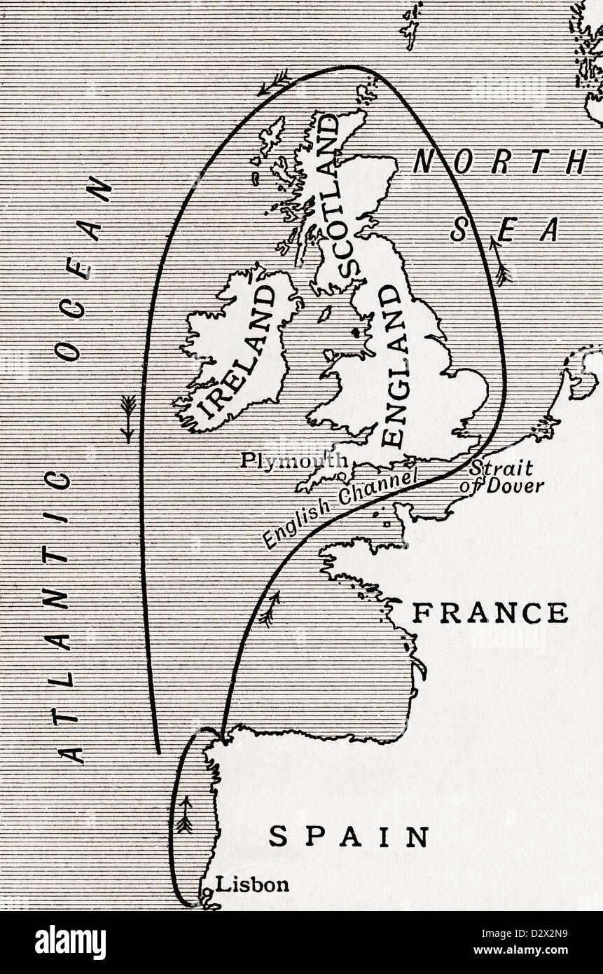 Map showing the route of the Spanish Armada in 1588. From A First Book of British History published 1925. Stock Photohttps://www.alamy.com/image-license-details/?v=1https://www.alamy.com/stock-photo-map-showing-the-route-of-the-spanish-armada-in-1588-from-a-first-book-53433333.html
RMD2X2N9–Map showing the route of the Spanish Armada in 1588. From A First Book of British History published 1925.
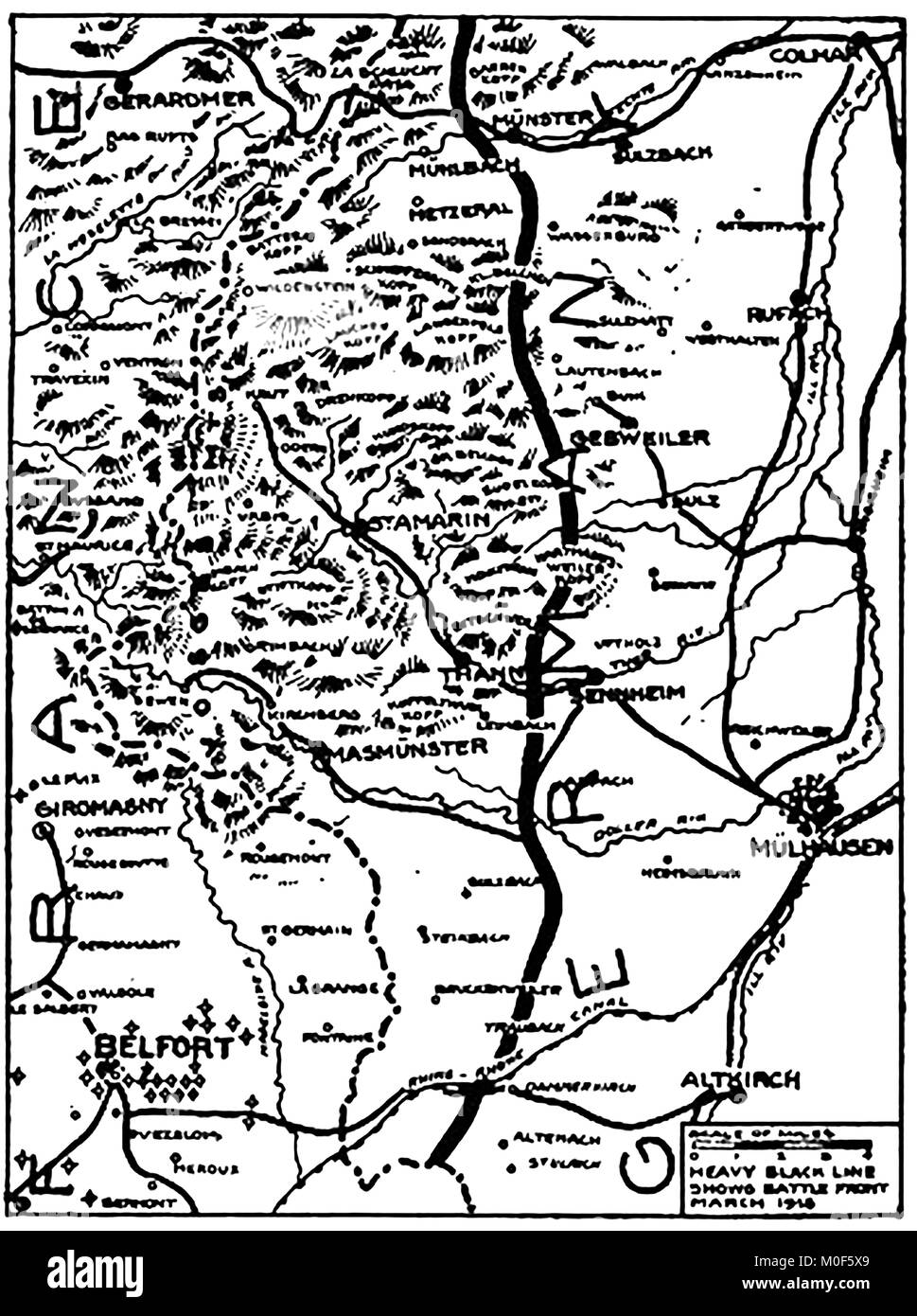 WWI - A 1917 map showing military activity in the 1914-1918 First World War showing the area where fighting took place in Alsace Stock Photohttps://www.alamy.com/image-license-details/?v=1https://www.alamy.com/stock-photo-wwi-a-1917-map-showing-military-activity-in-the-1914-1918-first-world-172437617.html
RMM0F5X9–WWI - A 1917 map showing military activity in the 1914-1918 First World War showing the area where fighting took place in Alsace
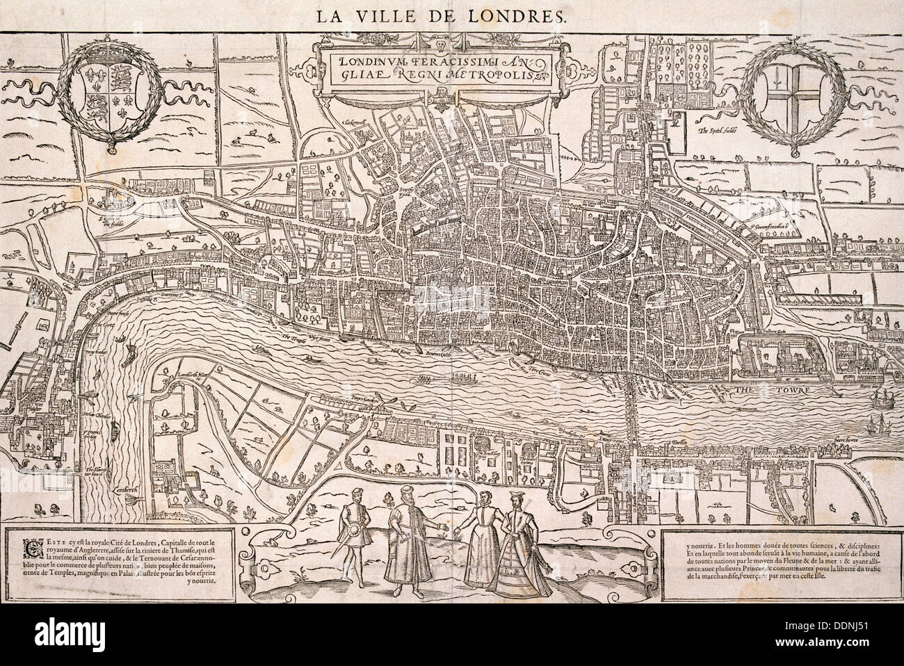 Map of the City of London and City of Westminster with four figures in the foreground, (c1572?). Artist: Anon Stock Photohttps://www.alamy.com/image-license-details/?v=1https://www.alamy.com/map-of-the-city-of-london-and-city-of-westminster-with-four-figures-image60096877.html
RMDDNJ51–Map of the City of London and City of Westminster with four figures in the foreground, (c1572?). Artist: Anon
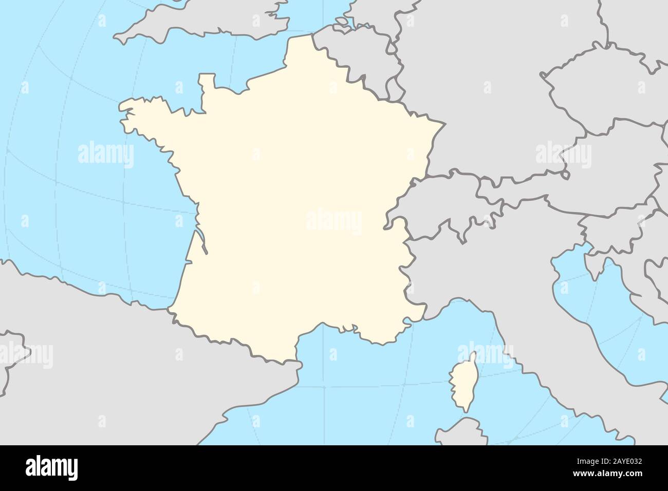 Part of European world map with France map showing country highlighted in yellow surrounded by other european countries in gray color Stock Photohttps://www.alamy.com/image-license-details/?v=1https://www.alamy.com/part-of-european-world-map-with-france-map-showing-country-highlighted-in-yellow-surrounded-by-other-european-countries-in-gray-color-image343900118.html
RF2AYE032–Part of European world map with France map showing country highlighted in yellow surrounded by other european countries in gray color
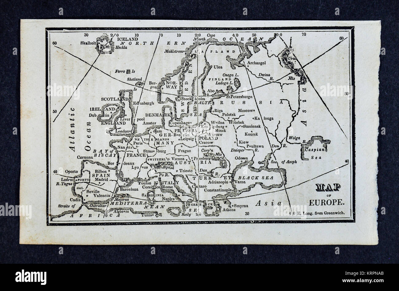 1830 Nathan Hale Map - Europe Continent - Spain France England Germany Italy Austria Norway Sweden Finland Russia Portugal Greece Stock Photohttps://www.alamy.com/image-license-details/?v=1https://www.alamy.com/stock-image-1830-nathan-hale-map-europe-continent-spain-france-england-germany-169530099.html
RFKRPNAB–1830 Nathan Hale Map - Europe Continent - Spain France England Germany Italy Austria Norway Sweden Finland Russia Portugal Greece
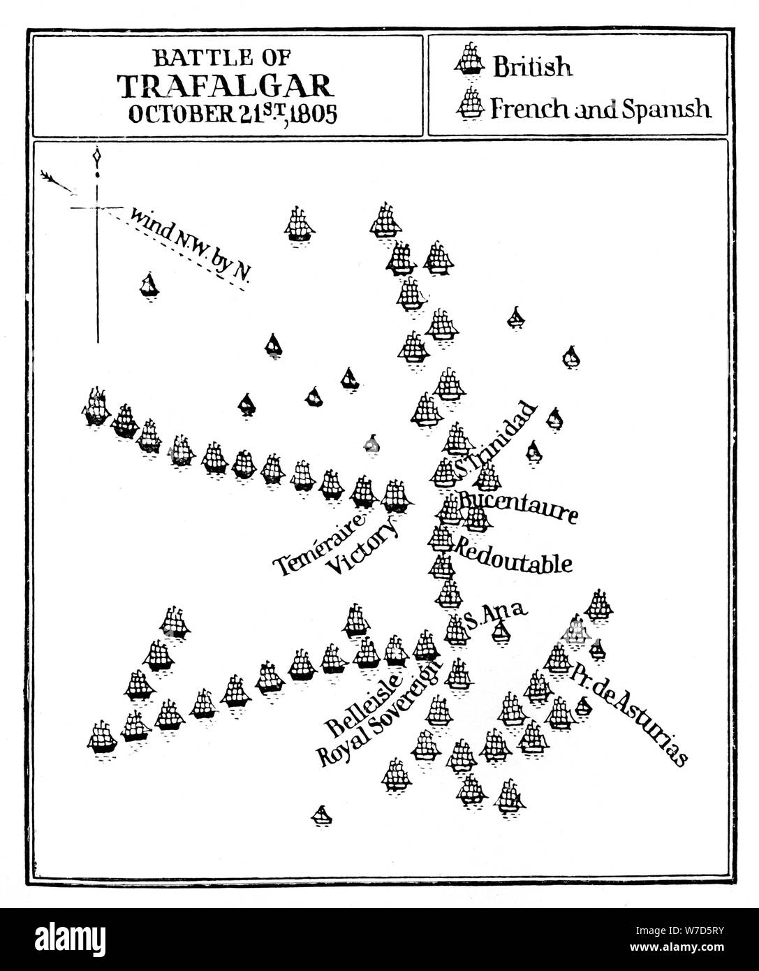 Battle of Trafalgar, 1805. Artist: Unknown Stock Photohttps://www.alamy.com/image-license-details/?v=1https://www.alamy.com/battle-of-trafalgar-1805-artist-unknown-image262748079.html
RMW7D5RY–Battle of Trafalgar, 1805. Artist: Unknown
 Realistic wood toothpick with little country flags for food decoration. Usa, france, japan, sweden and england miniature 3d flags vector set Stock Vectorhttps://www.alamy.com/image-license-details/?v=1https://www.alamy.com/realistic-wood-toothpick-with-little-country-flags-for-food-decoration-usa-france-japan-sweden-and-england-miniature-3d-flags-vector-set-image457608444.html
RF2HGDT6M–Realistic wood toothpick with little country flags for food decoration. Usa, france, japan, sweden and england miniature 3d flags vector set
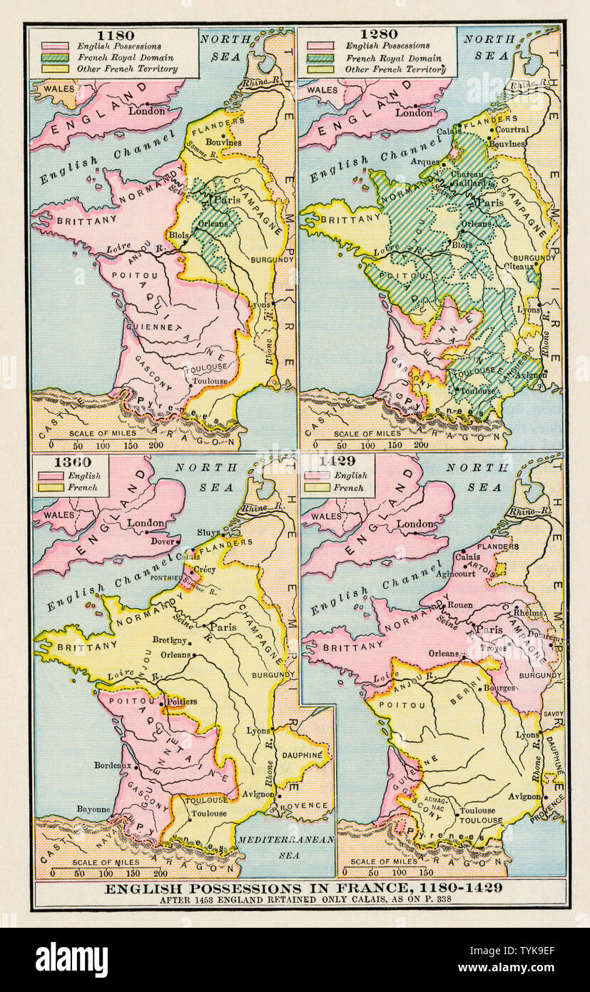 Maps of English possessions in France, 1180-1420. Color lithograph Stock Photohttps://www.alamy.com/image-license-details/?v=1https://www.alamy.com/maps-of-english-possessions-in-france-1180-1420-color-lithograph-image257965415.html
RMTYK9EF–Maps of English possessions in France, 1180-1420. Color lithograph
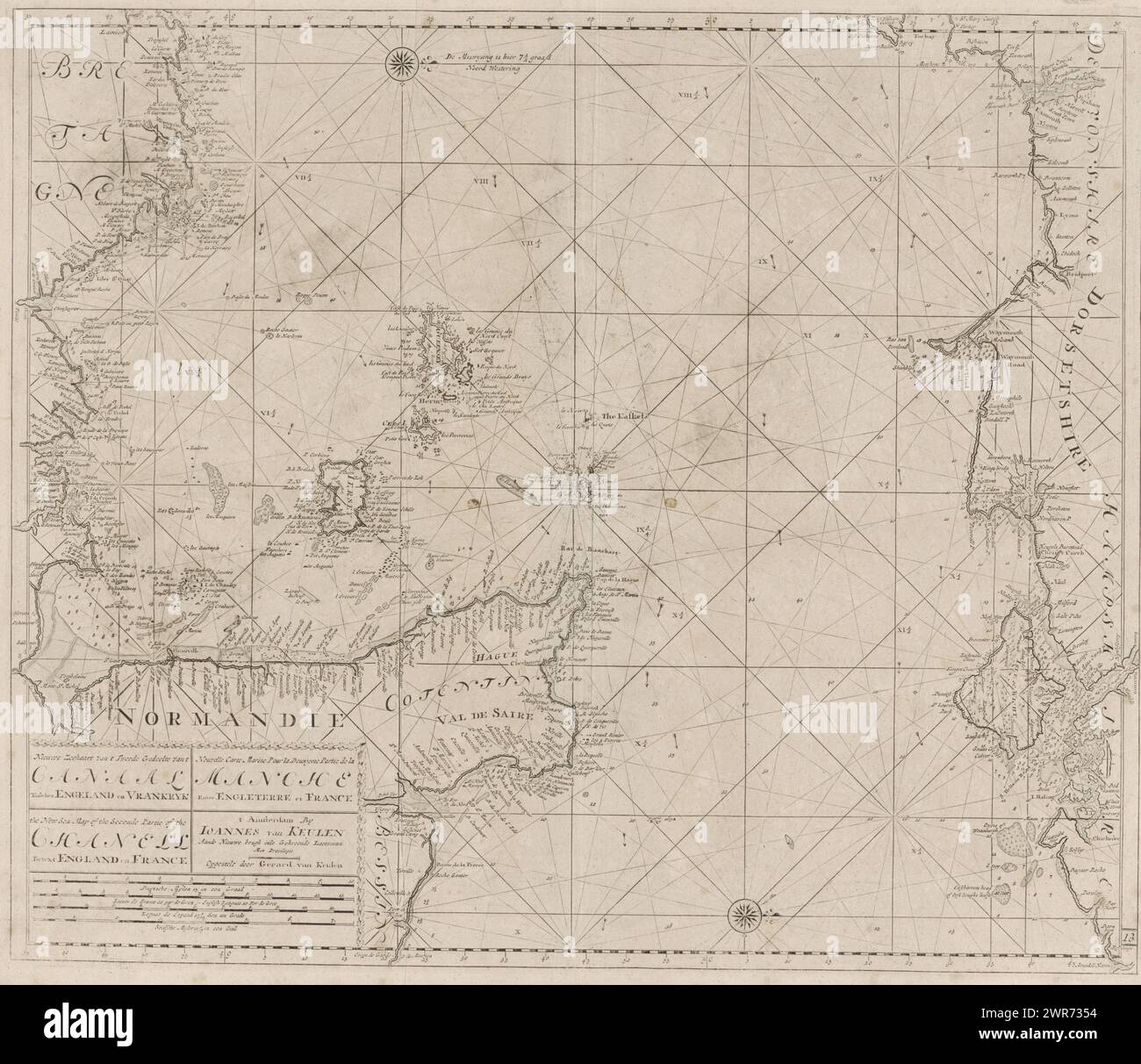 Pass map of the Channel between England and France, part 2, New Nautical Chart of the Second Part of the Canal Between England and France (title on object), Pass map of a part of the Channel, the strait between Great Britain and France, with two compass roses. Bottom left a cartouche with the title, the address of the publisher and the scale., print maker: anonymous, after design by: Gerard van Keulen, publisher: Johannes van Keulen (I), Amsterdam, 1688 - 1803, paper, engraving, etching, height 523 mm × width 620 mm, print Stock Photohttps://www.alamy.com/image-license-details/?v=1https://www.alamy.com/pass-map-of-the-channel-between-england-and-france-part-2-new-nautical-chart-of-the-second-part-of-the-canal-between-england-and-france-title-on-object-pass-map-of-a-part-of-the-channel-the-strait-between-great-britain-and-france-with-two-compass-roses-bottom-left-a-cartouche-with-the-title-the-address-of-the-publisher-and-the-scale-print-maker-anonymous-after-design-by-gerard-van-keulen-publisher-johannes-van-keulen-i-amsterdam-1688-1803-paper-engraving-etching-height-523-mm-width-620-mm-print-image599445760.html
RM2WR7354–Pass map of the Channel between England and France, part 2, New Nautical Chart of the Second Part of the Canal Between England and France (title on object), Pass map of a part of the Channel, the strait between Great Britain and France, with two compass roses. Bottom left a cartouche with the title, the address of the publisher and the scale., print maker: anonymous, after design by: Gerard van Keulen, publisher: Johannes van Keulen (I), Amsterdam, 1688 - 1803, paper, engraving, etching, height 523 mm × width 620 mm, print
![Putting His Foot Down - Uncle Sam (to the powers) - Gentlemen, you may cut up this map as much as you like; but remember that I am here to stay, and you can't divide me up into spheres of influence! Uncle Sam holding a 'Trade Treaty with China', standing on a 'Map of China' in the midst of foreign rulers labeled 'Germany, Italy, England, Austria, Russia [and] France'; depicted are William II, Umberto I, John Bull, Franz Joseph I sharpening scissors at a grinding stone in the background, Uncle Sam, Nicholas II, and Emile Loubet, each with large scissors, intent on cutting up the map. Stock Photo Putting His Foot Down - Uncle Sam (to the powers) - Gentlemen, you may cut up this map as much as you like; but remember that I am here to stay, and you can't divide me up into spheres of influence! Uncle Sam holding a 'Trade Treaty with China', standing on a 'Map of China' in the midst of foreign rulers labeled 'Germany, Italy, England, Austria, Russia [and] France'; depicted are William II, Umberto I, John Bull, Franz Joseph I sharpening scissors at a grinding stone in the background, Uncle Sam, Nicholas II, and Emile Loubet, each with large scissors, intent on cutting up the map. Stock Photo](https://c8.alamy.com/comp/E7T955/putting-his-foot-down-uncle-sam-to-the-powers-gentlemen-you-may-cut-E7T955.jpg) Putting His Foot Down - Uncle Sam (to the powers) - Gentlemen, you may cut up this map as much as you like; but remember that I am here to stay, and you can't divide me up into spheres of influence! Uncle Sam holding a 'Trade Treaty with China', standing on a 'Map of China' in the midst of foreign rulers labeled 'Germany, Italy, England, Austria, Russia [and] France'; depicted are William II, Umberto I, John Bull, Franz Joseph I sharpening scissors at a grinding stone in the background, Uncle Sam, Nicholas II, and Emile Loubet, each with large scissors, intent on cutting up the map. Stock Photohttps://www.alamy.com/image-license-details/?v=1https://www.alamy.com/stock-photo-putting-his-foot-down-uncle-sam-to-the-powers-gentlemen-you-may-cut-73678113.html
Putting His Foot Down - Uncle Sam (to the powers) - Gentlemen, you may cut up this map as much as you like; but remember that I am here to stay, and you can't divide me up into spheres of influence! Uncle Sam holding a 'Trade Treaty with China', standing on a 'Map of China' in the midst of foreign rulers labeled 'Germany, Italy, England, Austria, Russia [and] France'; depicted are William II, Umberto I, John Bull, Franz Joseph I sharpening scissors at a grinding stone in the background, Uncle Sam, Nicholas II, and Emile Loubet, each with large scissors, intent on cutting up the map. Stock Photohttps://www.alamy.com/image-license-details/?v=1https://www.alamy.com/stock-photo-putting-his-foot-down-uncle-sam-to-the-powers-gentlemen-you-may-cut-73678113.htmlRME7T955–Putting His Foot Down - Uncle Sam (to the powers) - Gentlemen, you may cut up this map as much as you like; but remember that I am here to stay, and you can't divide me up into spheres of influence! Uncle Sam holding a 'Trade Treaty with China', standing on a 'Map of China' in the midst of foreign rulers labeled 'Germany, Italy, England, Austria, Russia [and] France'; depicted are William II, Umberto I, John Bull, Franz Joseph I sharpening scissors at a grinding stone in the background, Uncle Sam, Nicholas II, and Emile Loubet, each with large scissors, intent on cutting up the map.
 General map of Europe. Atlas de l'Histoire du Consulat et de l'Empire. History of the Consulate and the Empire of France under Napoleon by Marie Joseph Louis Adolphe Thiers (1797-1877). Drawings by Dufour, engravings by Dyonnet. Edited in Paris, 1864. Stock Photohttps://www.alamy.com/image-license-details/?v=1https://www.alamy.com/general-map-of-europe-atlas-de-lhistoire-du-consulat-et-de-lempire-history-of-the-consulate-and-the-empire-of-france-under-napoleon-by-marie-joseph-louis-adolphe-thiers-1797-1877-drawings-by-dufour-engravings-by-dyonnet-edited-in-paris-1864-image231266104.html
RMRC727M–General map of Europe. Atlas de l'Histoire du Consulat et de l'Empire. History of the Consulate and the Empire of France under Napoleon by Marie Joseph Louis Adolphe Thiers (1797-1877). Drawings by Dufour, engravings by Dyonnet. Edited in Paris, 1864.
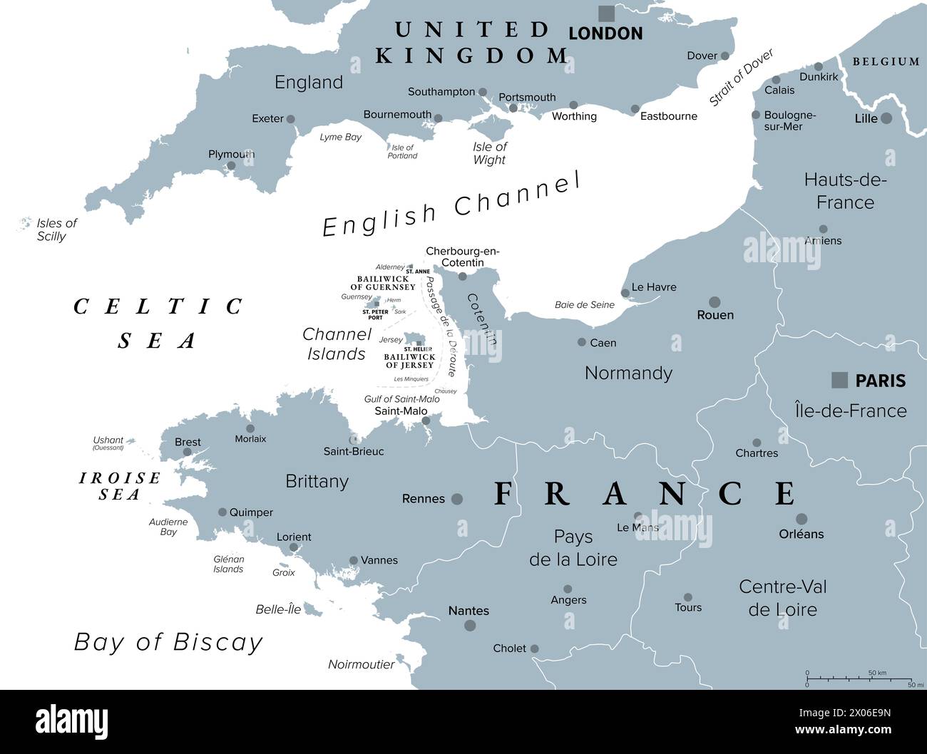 Northern France, gray political map. Coastline of France and United Kingdom along the English Channel, and along Bay of Biscay, with Channel Islands. Stock Photohttps://www.alamy.com/image-license-details/?v=1https://www.alamy.com/northern-france-gray-political-map-coastline-of-france-and-united-kingdom-along-the-english-channel-and-along-bay-of-biscay-with-channel-islands-image602505841.html
RF2X06E9N–Northern France, gray political map. Coastline of France and United Kingdom along the English Channel, and along Bay of Biscay, with Channel Islands.
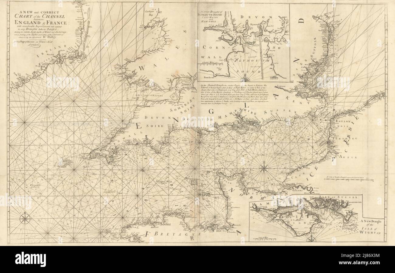 A new & correct chart of the Channel between England & France. COLLINS 1723 map Stock Photohttps://www.alamy.com/image-license-details/?v=1https://www.alamy.com/a-new-correct-chart-of-the-channel-between-england-france-collins-1723-map-image469749384.html
RF2J86X3M–A new & correct chart of the Channel between England & France. COLLINS 1723 map
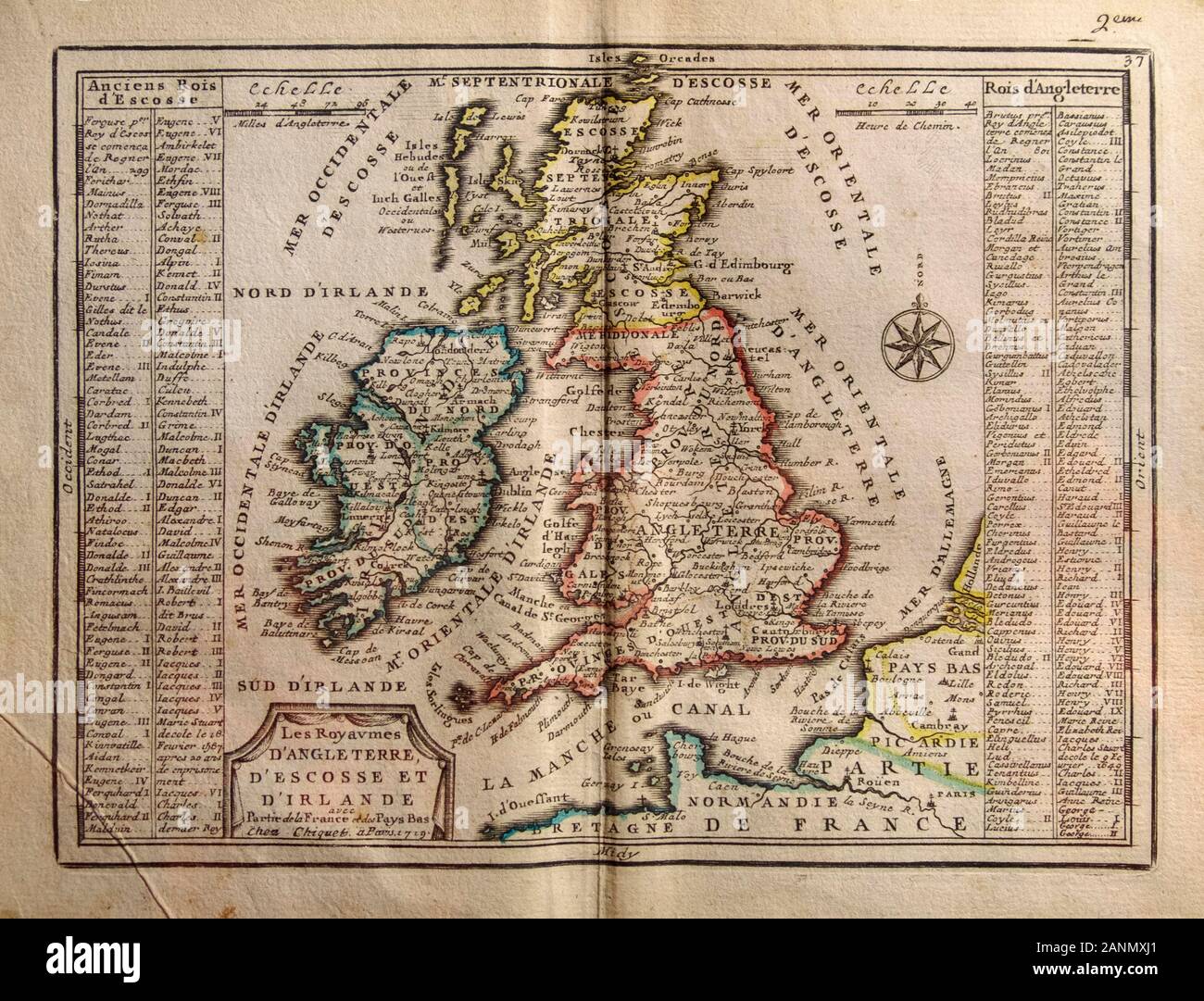 Map of 1719 with the kingdoms of England, Scotland and Ireland and the name of their kings. From Part of France and the Netherlands 1719. Stock Photohttps://www.alamy.com/image-license-details/?v=1https://www.alamy.com/map-of-1719-with-the-kingdoms-of-england-scotland-and-ireland-and-the-name-of-their-kings-from-part-of-france-and-the-netherlands-1719-image340364697.html
RM2ANMXJ1–Map of 1719 with the kingdoms of England, Scotland and Ireland and the name of their kings. From Part of France and the Netherlands 1719.
 Europe financial bomb as an earth map of European union with lit burning fuse with fire sparks fealing the heat as a dangerous economic Euro debt warning and urgent banking crisis with countries as France Italy Greece Spain Portugal. Stock Photohttps://www.alamy.com/image-license-details/?v=1https://www.alamy.com/stock-photo-europe-financial-bomb-as-an-earth-map-of-european-union-with-lit-burning-50366330.html
RFCWXANE–Europe financial bomb as an earth map of European union with lit burning fuse with fire sparks fealing the heat as a dangerous economic Euro debt warning and urgent banking crisis with countries as France Italy Greece Spain Portugal.
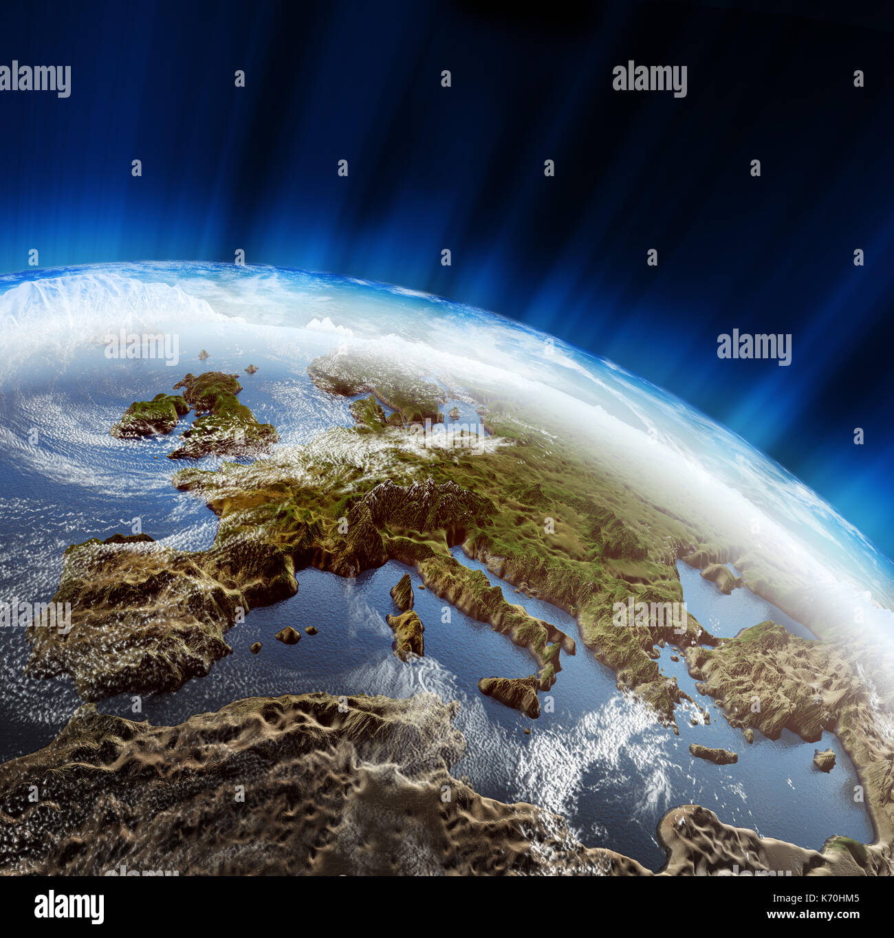 Europe 3d rendering landscape Stock Photohttps://www.alamy.com/image-license-details/?v=1https://www.alamy.com/europe-3d-rendering-landscape-image159209797.html
RFK70HM5–Europe 3d rendering landscape
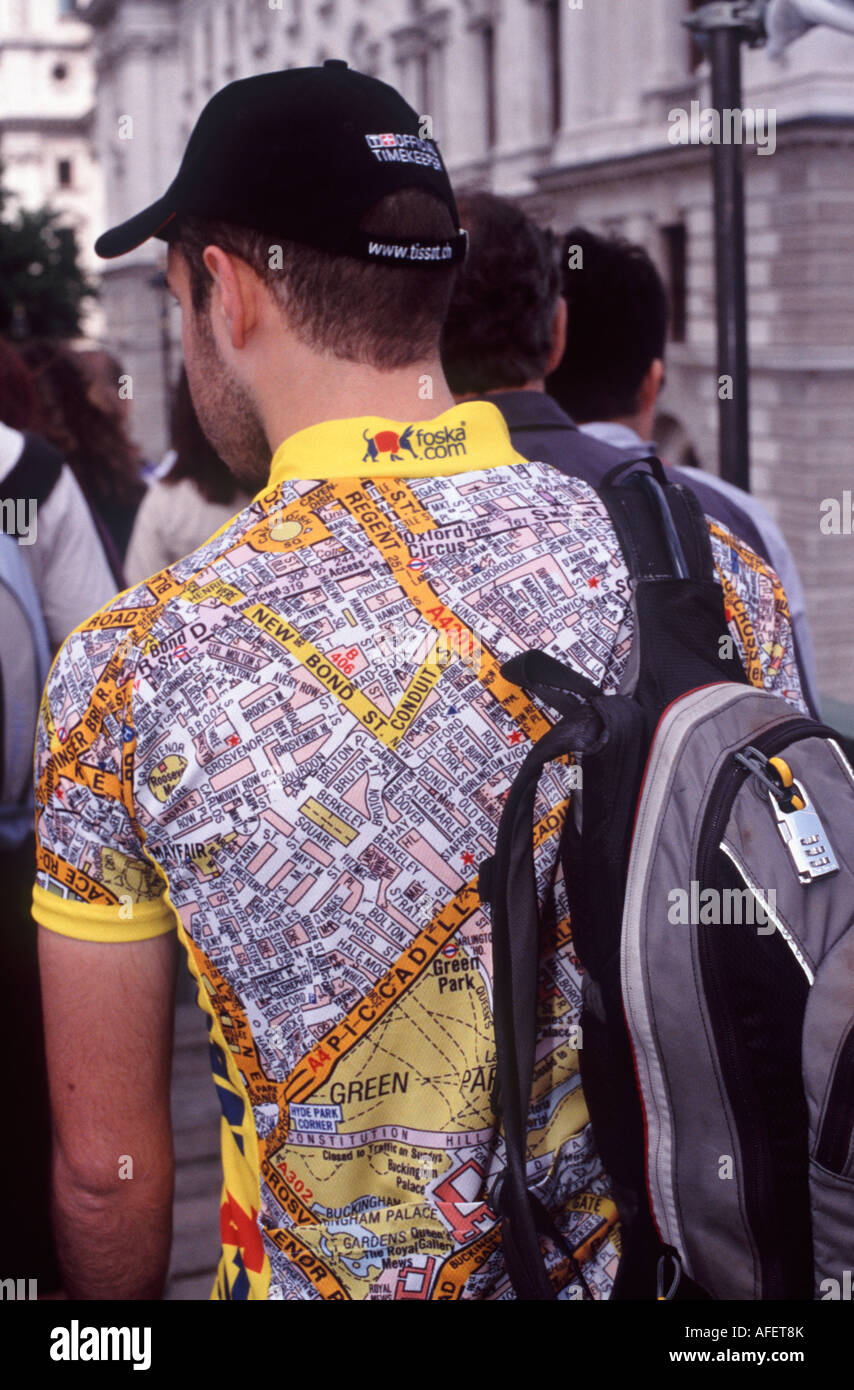 Young man at the Tour de France in London wearing a cycling jersey printed with an accurate street map of London Stock Photohttps://www.alamy.com/image-license-details/?v=1https://www.alamy.com/stock-photo-young-man-at-the-tour-de-france-in-london-wearing-a-cycling-jersey-13925730.html
RMAFET8K–Young man at the Tour de France in London wearing a cycling jersey printed with an accurate street map of London
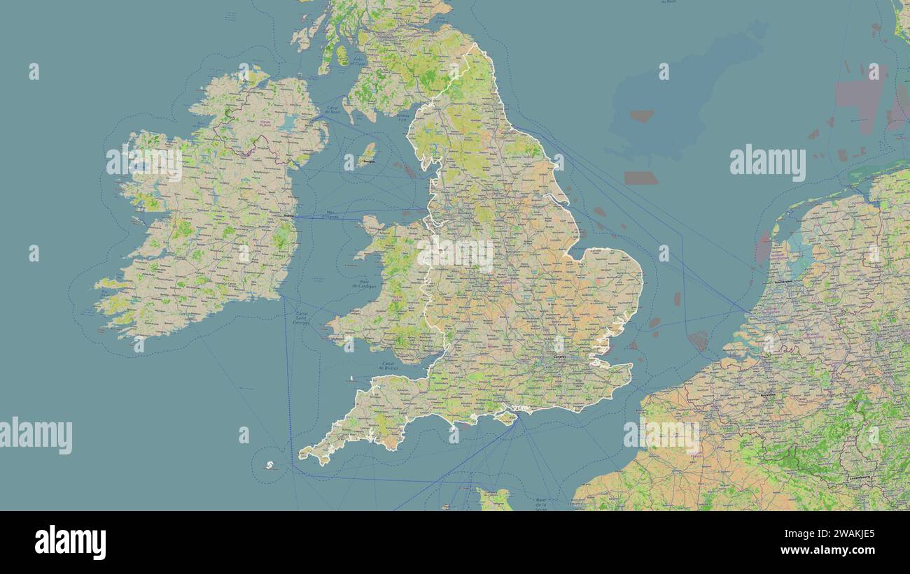 England - Great Britain outlined on a topographic, OSM France style map Stock Photohttps://www.alamy.com/image-license-details/?v=1https://www.alamy.com/england-great-britain-outlined-on-a-topographic-osm-france-style-map-image591730669.html
RF2WAKJE5–England - Great Britain outlined on a topographic, OSM France style map
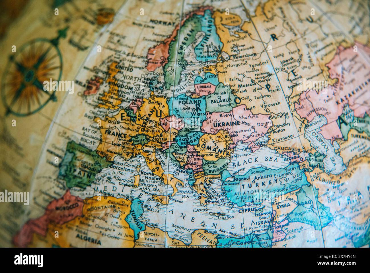 A detailed vintage globe map highlighting the geography of Europe, including Ukraine, Russia, France and Germany, Poland, and Germany. Stock Photohttps://www.alamy.com/image-license-details/?v=1https://www.alamy.com/a-detailed-vintage-globe-map-highlighting-the-geography-of-europe-including-ukraine-russia-france-and-germany-poland-and-germany-image607060013.html
RM2X7HY6N–A detailed vintage globe map highlighting the geography of Europe, including Ukraine, Russia, France and Germany, Poland, and Germany.
 france england digital Stock Photohttps://www.alamy.com/image-license-details/?v=1https://www.alamy.com/stock-photo-france-england-digital-114737923.html
RFGJJNAY–france england digital
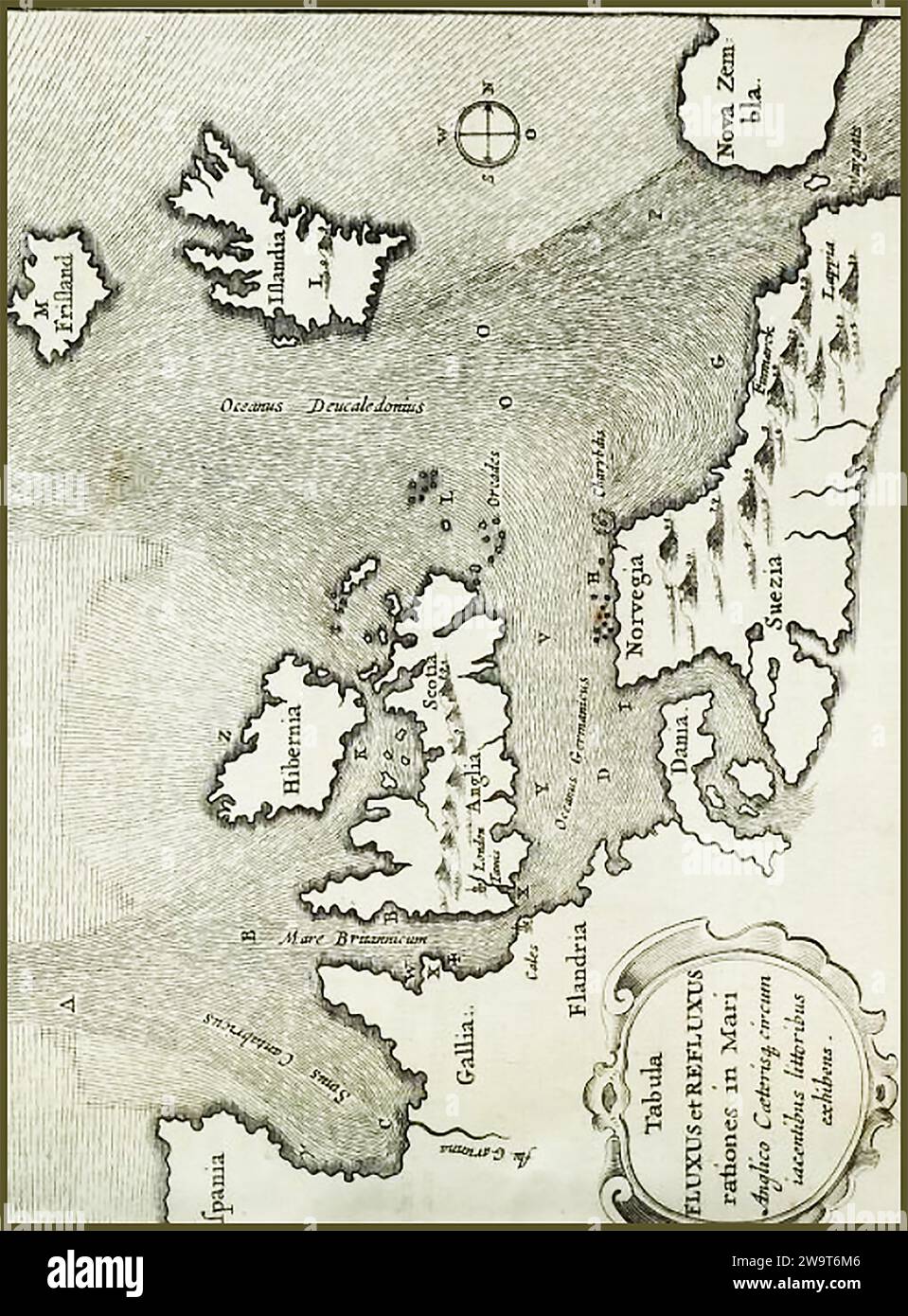 An ancient map of Britain and surrounding lands - Un mapa antiguo de Gran Bretaña y las tierras circundantes. - Et eldgammelt kart over Storbritannia og landene rundt - En gammal karta över Storbritannien och omgivande länder -Fornt kort af Bretlandi og nærliggjandi löndum - Eine alte Karte von Großbritannien und den umliegenden Ländern Stock Photohttps://www.alamy.com/image-license-details/?v=1https://www.alamy.com/an-ancient-map-of-britain-and-surrounding-lands-un-mapa-antiguo-de-gran-bretaa-y-las-tierras-circundantes-et-eldgammelt-kart-over-storbritannia-og-landene-rundt-en-gammal-karta-ver-storbritannien-och-omgivande-lnder-fornt-kort-af-bretlandi-og-nrliggjandi-lndum-eine-alte-karte-von-grobritannien-und-den-umliegenden-lndern-image591216534.html
RM2W9T6M6–An ancient map of Britain and surrounding lands - Un mapa antiguo de Gran Bretaña y las tierras circundantes. - Et eldgammelt kart over Storbritannia og landene rundt - En gammal karta över Storbritannien och omgivande länder -Fornt kort af Bretlandi og nærliggjandi löndum - Eine alte Karte von Großbritannien und den umliegenden Ländern
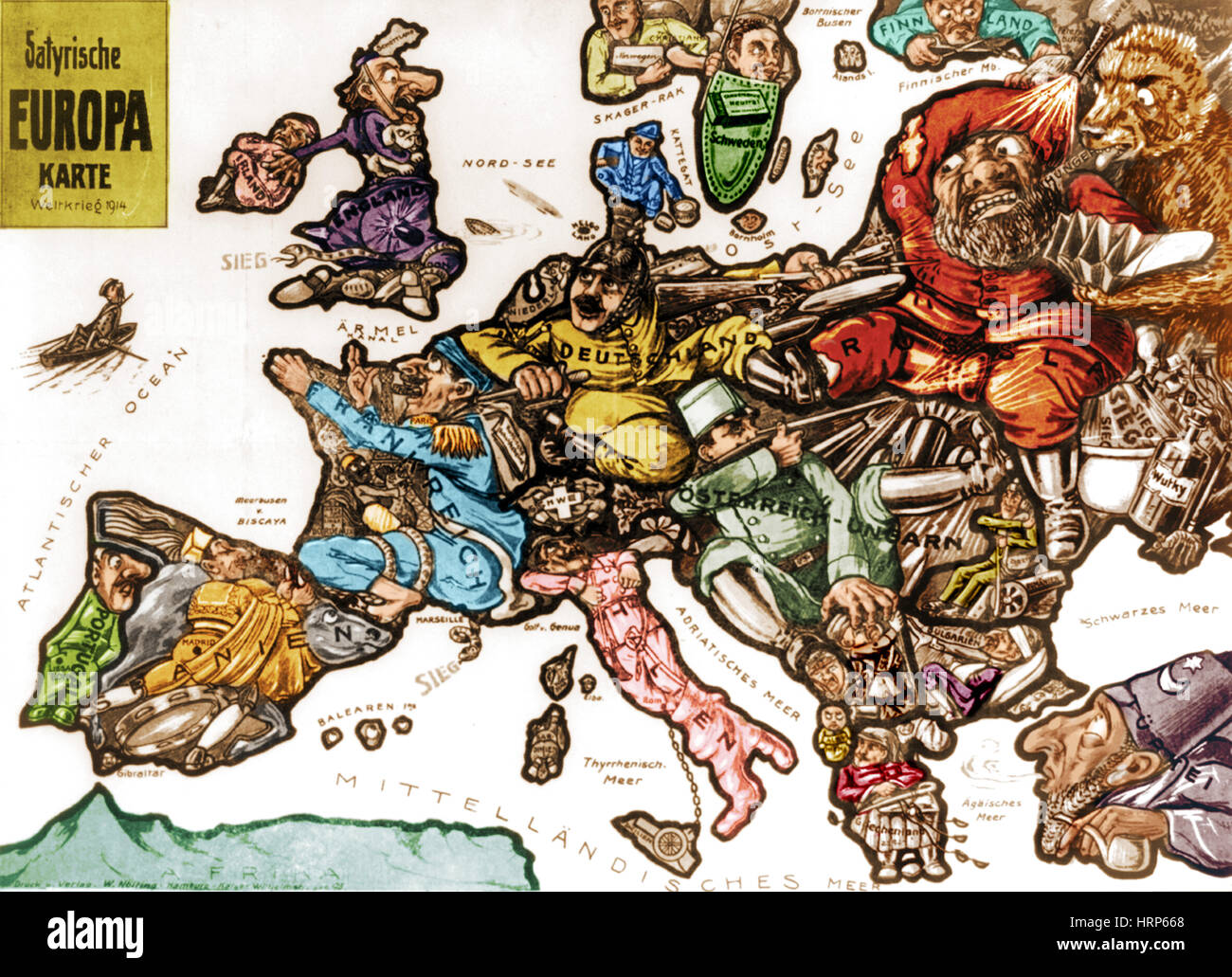 WWI, Satirical War Map of Europe, 1914 Stock Photohttps://www.alamy.com/image-license-details/?v=1https://www.alamy.com/stock-photo-wwi-satirical-war-map-of-europe-1914-135097488.html
RMHRP668–WWI, Satirical War Map of Europe, 1914
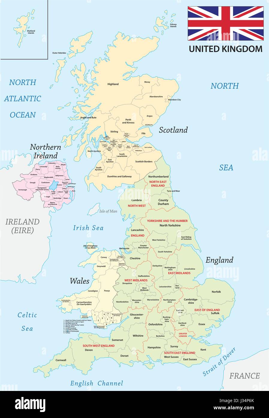 united kingdom administrative and political map with flag Stock Vectorhttps://www.alamy.com/image-license-details/?v=1https://www.alamy.com/stock-photo-united-kingdom-administrative-and-political-map-with-flag-139632155.html
RFJ34P6K–united kingdom administrative and political map with flag
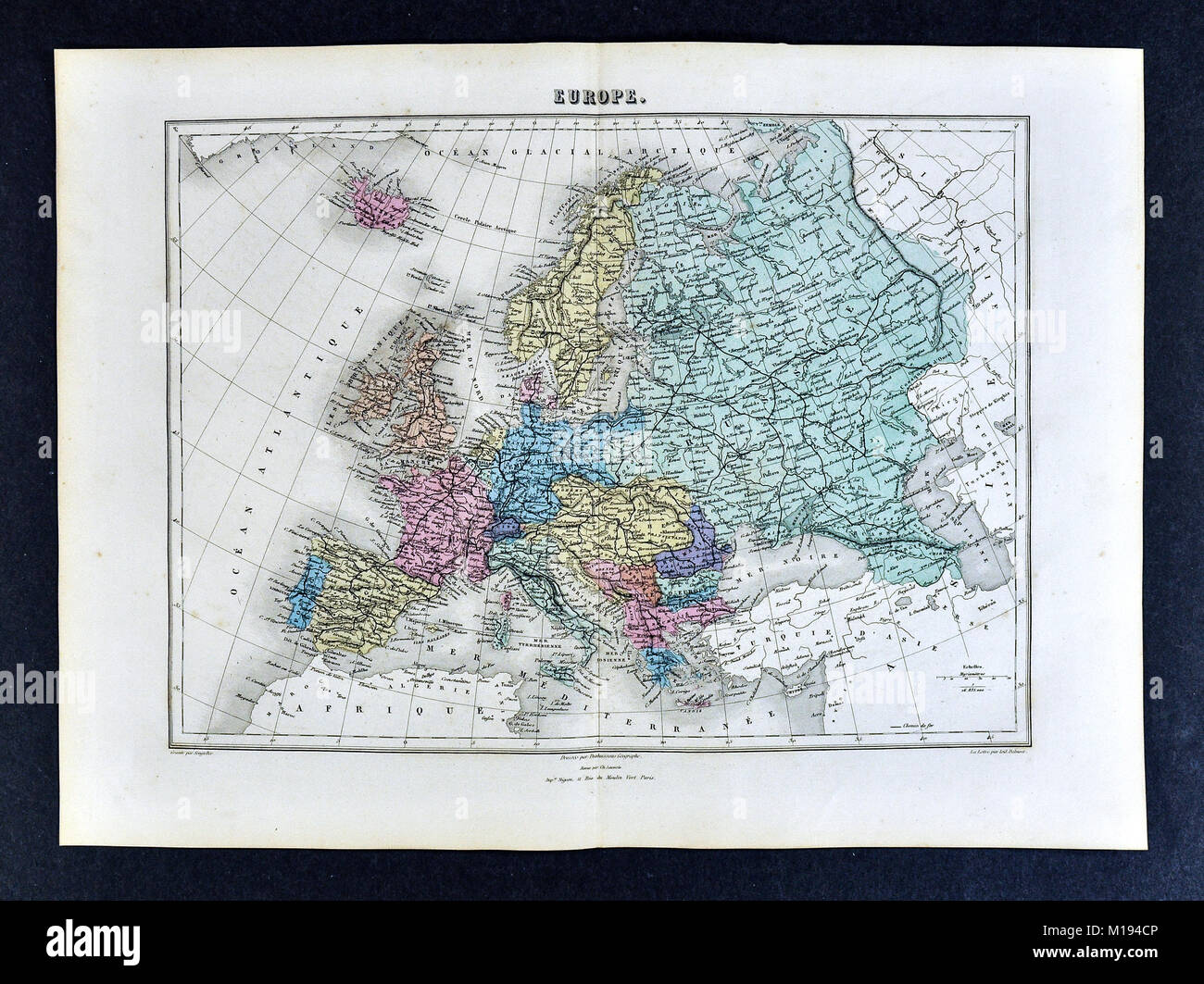 1877 Migeon Map - Europe - France Germany Italy Spain Russia Austria Portugal Britain Holland Belgium Switzerland Stock Photohttps://www.alamy.com/image-license-details/?v=1https://www.alamy.com/stock-photo-1877-migeon-map-europe-france-germany-italy-spain-russia-austria-portugal-172919398.html
RFM194CP–1877 Migeon Map - Europe - France Germany Italy Spain Russia Austria Portugal Britain Holland Belgium Switzerland
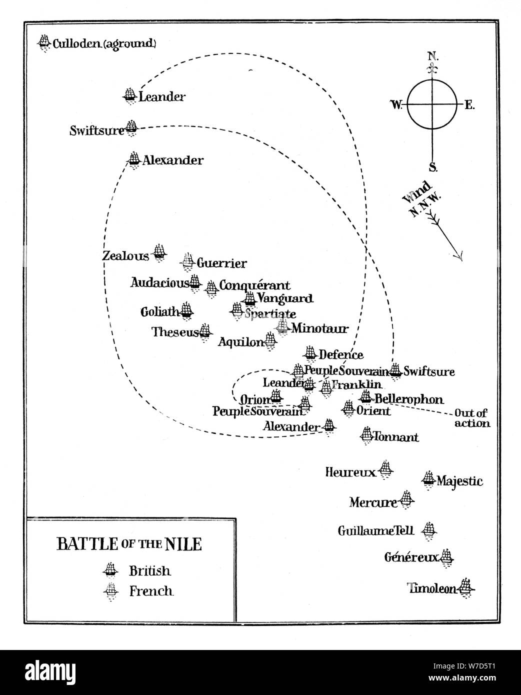 Battle of the Nile, 1798. Artist: Unknown Stock Photohttps://www.alamy.com/image-license-details/?v=1https://www.alamy.com/battle-of-the-nile-1798-artist-unknown-image262748081.html
RMW7D5T1–Battle of the Nile, 1798. Artist: Unknown
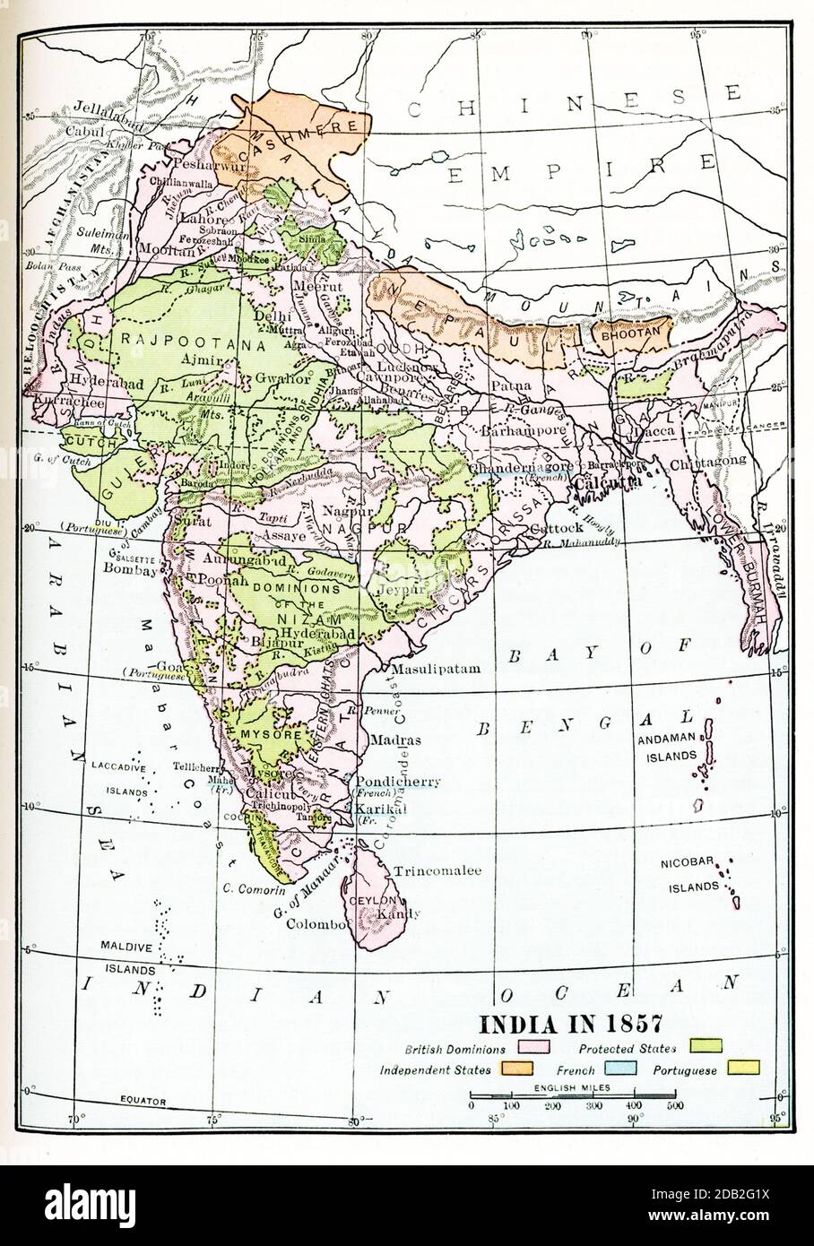 India in 1857. British dominions are in pink. Protected states in yellow. Independent states in orange. French in blue, Portuguese in yellow. Stock Photohttps://www.alamy.com/image-license-details/?v=1https://www.alamy.com/india-in-1857-british-dominions-are-in-pink-protected-states-in-yellow-independent-states-in-orange-french-in-blue-portuguese-in-yellow-image385445814.html
RF2DB2G1X–India in 1857. British dominions are in pink. Protected states in yellow. Independent states in orange. French in blue, Portuguese in yellow.
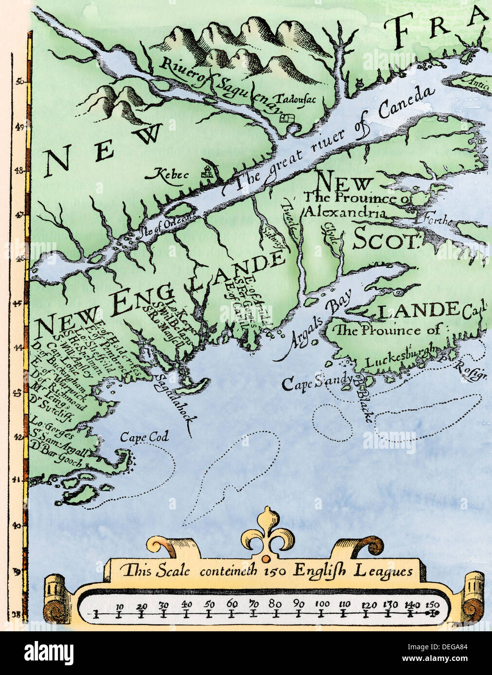 Alexander's map of the north Atlantic coast of New England and Nova Scotia, 1624. Hand-colored woodcut Stock Photohttps://www.alamy.com/image-license-details/?v=1https://www.alamy.com/alexanders-map-of-the-north-atlantic-coast-of-new-england-and-nova-image60595588.html
RMDEGA84–Alexander's map of the north Atlantic coast of New England and Nova Scotia, 1624. Hand-colored woodcut
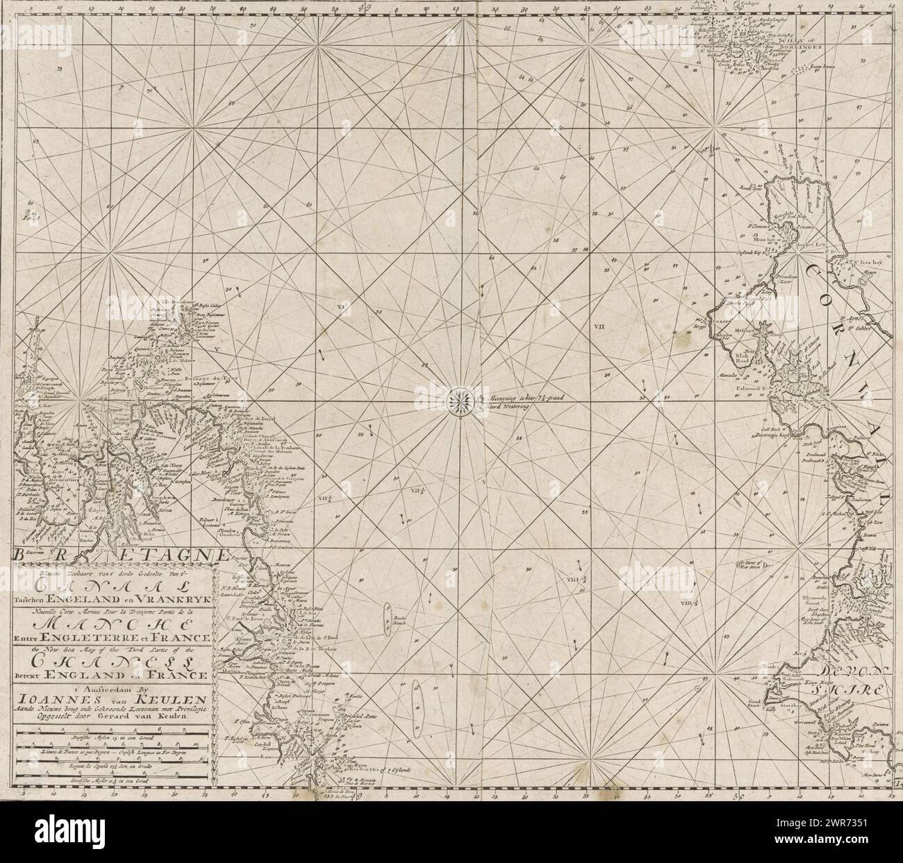 Pass map of the Channel between England and France, part 3, New Nautical Chart of the third Part of the Canal Between England and France (title on object), Pass map of a part of the Channel, the strait between Great Britain and France, with a compass rose. Bottom left a cartouche with the title, the address of the publisher and the scale., print maker: anonymous, after design by: Gerard van Keulen, publisher: Johannes van Keulen (I), Amsterdam, 1688 - 1803, paper, engraving, etching, height 523 mm × width 615 mm, print Stock Photohttps://www.alamy.com/image-license-details/?v=1https://www.alamy.com/pass-map-of-the-channel-between-england-and-france-part-3-new-nautical-chart-of-the-third-part-of-the-canal-between-england-and-france-title-on-object-pass-map-of-a-part-of-the-channel-the-strait-between-great-britain-and-france-with-a-compass-rose-bottom-left-a-cartouche-with-the-title-the-address-of-the-publisher-and-the-scale-print-maker-anonymous-after-design-by-gerard-van-keulen-publisher-johannes-van-keulen-i-amsterdam-1688-1803-paper-engraving-etching-height-523-mm-width-615-mm-print-image599445757.html
RM2WR7351–Pass map of the Channel between England and France, part 3, New Nautical Chart of the third Part of the Canal Between England and France (title on object), Pass map of a part of the Channel, the strait between Great Britain and France, with a compass rose. Bottom left a cartouche with the title, the address of the publisher and the scale., print maker: anonymous, after design by: Gerard van Keulen, publisher: Johannes van Keulen (I), Amsterdam, 1688 - 1803, paper, engraving, etching, height 523 mm × width 615 mm, print
 events, Second World War / WWII, aerial warfare, England, General Robert Ritter von Greim (centre) during a staff meeting of the V Flying Corps (V. Fliegerkorps), 3rd Air Fleet (Luftflotte 3), Villacoublay, France, 1940, Stock Photohttps://www.alamy.com/image-license-details/?v=1https://www.alamy.com/stock-photo-events-second-world-war-wwii-aerial-warfare-england-general-robert-19851122.html
RMB4888J–events, Second World War / WWII, aerial warfare, England, General Robert Ritter von Greim (centre) during a staff meeting of the V Flying Corps (V. Fliegerkorps), 3rd Air Fleet (Luftflotte 3), Villacoublay, France, 1940,
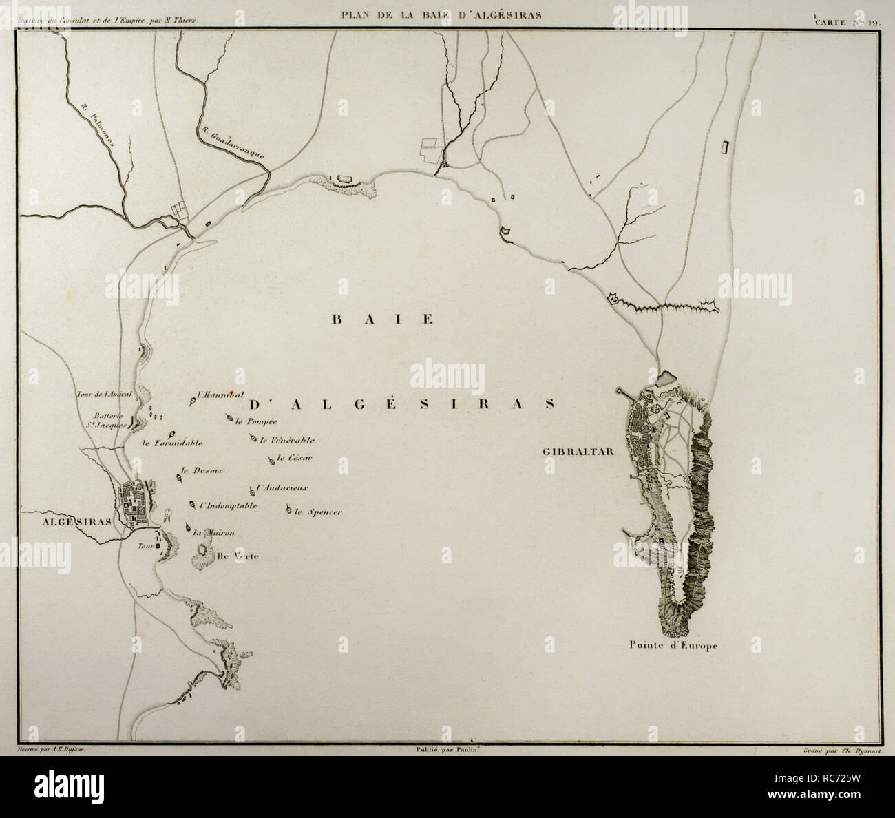 Napoleonic map. Algeciras Bay, Spain. The First Battle of Algeciras was a naval battle which took place on July 6, 1801, fighting a squadron of British Royal Navy ships against a smaller French Navy squadron. Historical context of the French Revolutionary Wars. History of the Consulate and the Empire of France under Napoleon by Marie Joseph Louis Adolphe Thiers (1797-1877). Drawings by Dufour, engravings by Dyonnet. Edited in Paris, 1864. Stock Photohttps://www.alamy.com/image-license-details/?v=1https://www.alamy.com/napoleonic-map-algeciras-bay-spain-the-first-battle-of-algeciras-was-a-naval-battle-which-took-place-on-july-6-1801-fighting-a-squadron-of-british-royal-navy-ships-against-a-smaller-french-navy-squadron-historical-context-of-the-french-revolutionary-wars-history-of-the-consulate-and-the-empire-of-france-under-napoleon-by-marie-joseph-louis-adolphe-thiers-1797-1877-drawings-by-dufour-engravings-by-dyonnet-edited-in-paris-1864-image231266053.html
RMRC725W–Napoleonic map. Algeciras Bay, Spain. The First Battle of Algeciras was a naval battle which took place on July 6, 1801, fighting a squadron of British Royal Navy ships against a smaller French Navy squadron. Historical context of the French Revolutionary Wars. History of the Consulate and the Empire of France under Napoleon by Marie Joseph Louis Adolphe Thiers (1797-1877). Drawings by Dufour, engravings by Dyonnet. Edited in Paris, 1864.
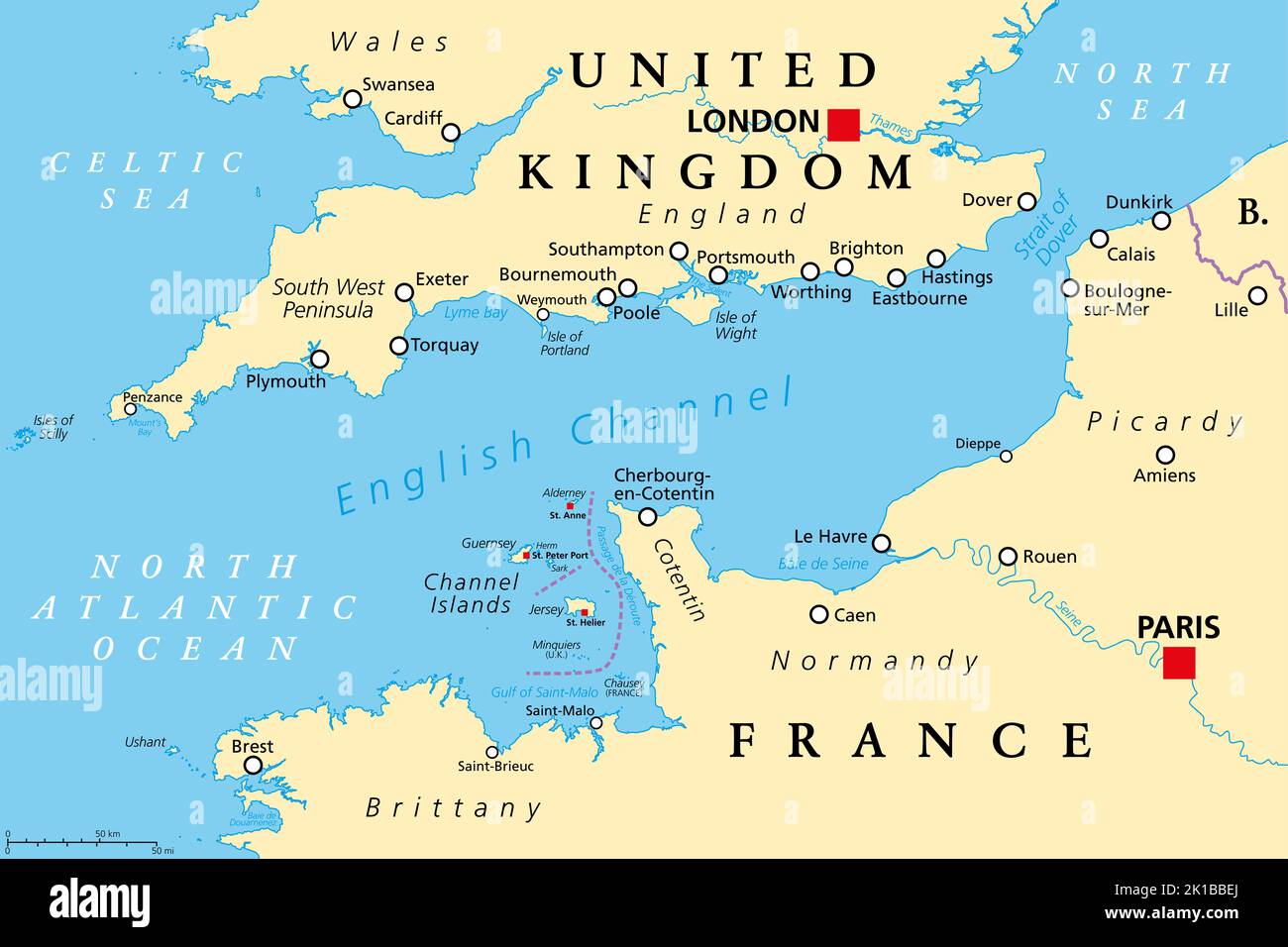 English Channel political map. Also British Channel. Arm of Atlantic Ocean separates Southern England from northern France. Stock Photohttps://www.alamy.com/image-license-details/?v=1https://www.alamy.com/english-channel-political-map-also-british-channel-arm-of-atlantic-ocean-separates-southern-england-from-northern-france-image482755466.html
RF2K1BBEJ–English Channel political map. Also British Channel. Arm of Atlantic Ocean separates Southern England from northern France.
 FRANCE & ENGLAND Geological sections. Original hand colour.MALTE-BRUN, c1846 map Stock Photohttps://www.alamy.com/image-license-details/?v=1https://www.alamy.com/stock-photo-france-england-geological-sections-original-hand-colourmalte-brun-94085683.html
RFFD1Y6Y–FRANCE & ENGLAND Geological sections. Original hand colour.MALTE-BRUN, c1846 map
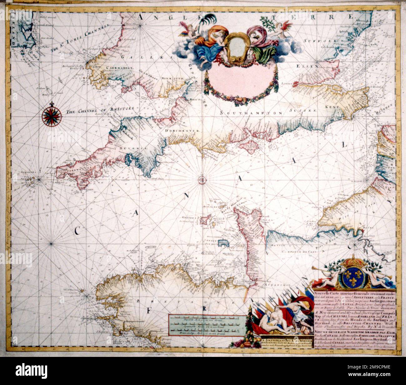 18th century Map of the English Channel Stock Photohttps://www.alamy.com/image-license-details/?v=1https://www.alamy.com/18th-century-map-of-the-english-channel-image504913822.html
RM2M9CPME–18th century Map of the English Channel
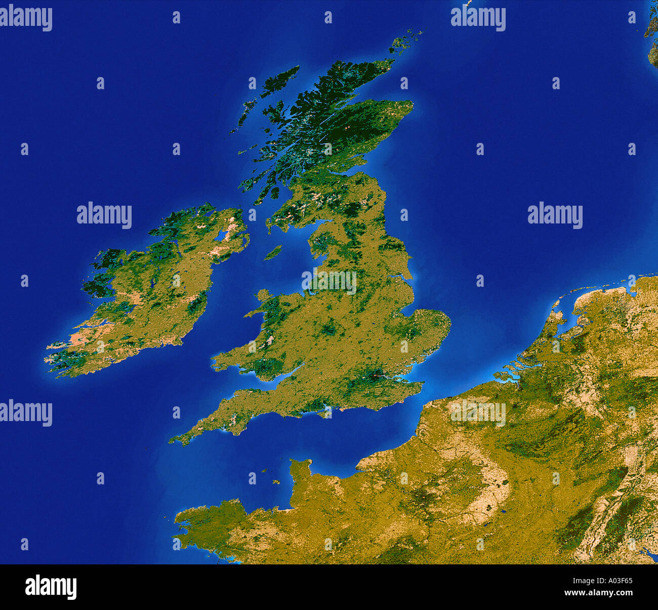 europe and UK photographed from space by satellite Stock Photohttps://www.alamy.com/image-license-details/?v=1https://www.alamy.com/europe-and-uk-photographed-from-space-by-satellite-image16229.html
RMA03F65–europe and UK photographed from space by satellite
 3d render of an flag of France and Great Britain, in front of an blurry background, with a steel flagpole Stock Photohttps://www.alamy.com/image-license-details/?v=1https://www.alamy.com/3d-render-of-an-flag-of-france-and-great-britain-in-front-of-an-blurry-background-with-a-steel-flagpole-image397719257.html
RF2E31JY5–3d render of an flag of France and Great Britain, in front of an blurry background, with a steel flagpole
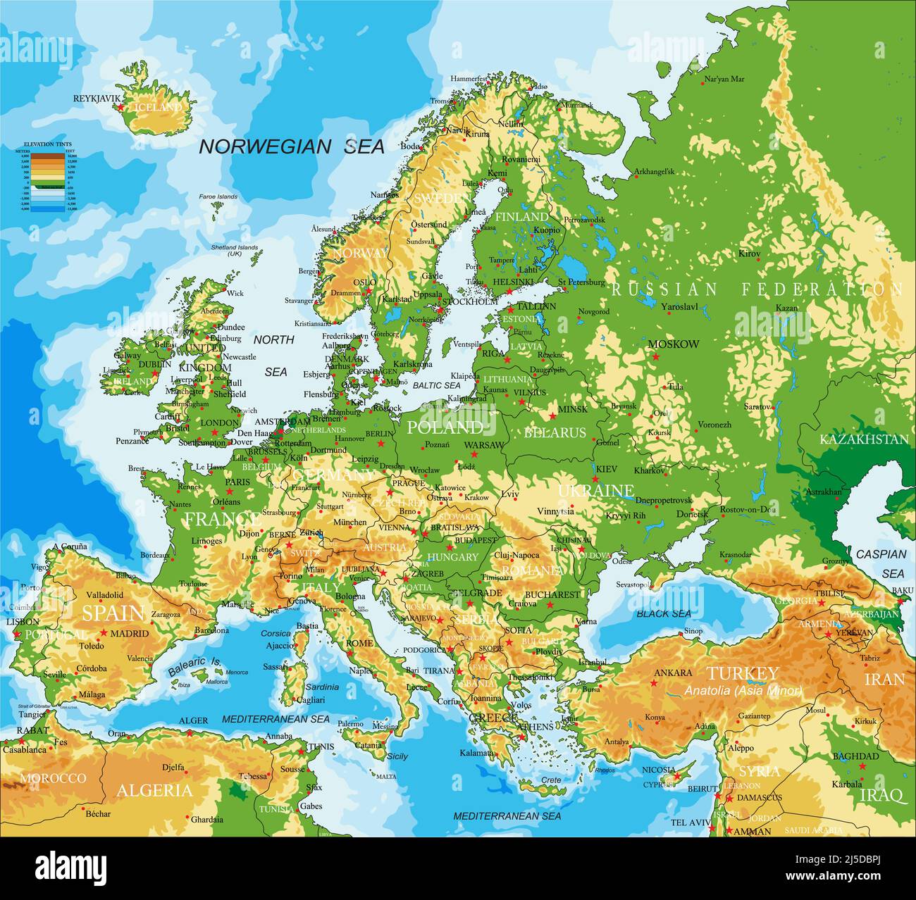 Highly detailed physical map of Europe,in vector format,with all the relief forms,countries and big cities. Stock Vectorhttps://www.alamy.com/image-license-details/?v=1https://www.alamy.com/highly-detailed-physical-map-of-europein-vector-formatwith-all-the-relief-formscountries-and-big-cities-image468047850.html
RF2J5DBPJ–Highly detailed physical map of Europe,in vector format,with all the relief forms,countries and big cities.
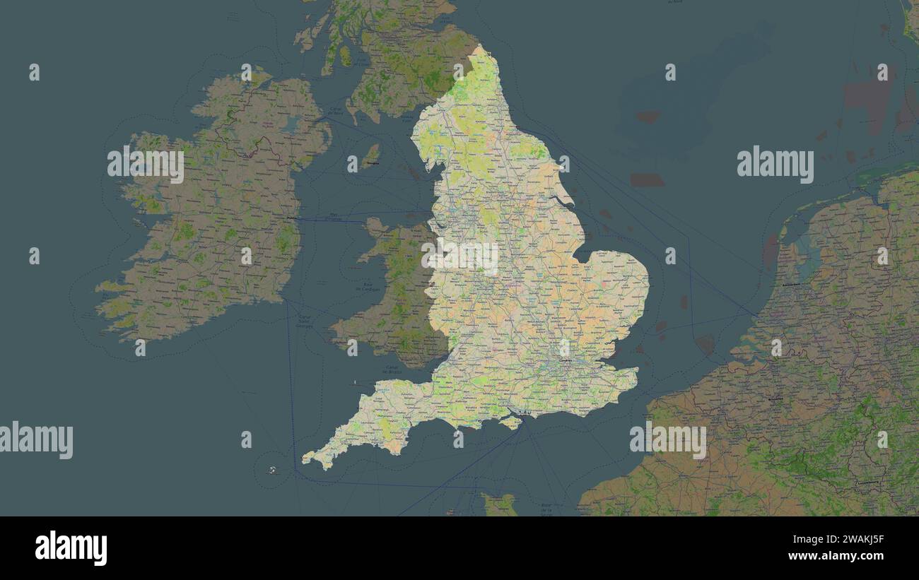 England - Great Britain highlighted on a topographic, OSM France style map Stock Photohttps://www.alamy.com/image-license-details/?v=1https://www.alamy.com/england-great-britain-highlighted-on-a-topographic-osm-france-style-map-image591730427.html
RF2WAKJ5F–England - Great Britain highlighted on a topographic, OSM France style map
 Map of Europe, Vector illustration Stock Vectorhttps://www.alamy.com/image-license-details/?v=1https://www.alamy.com/stock-photo-map-of-europe-vector-illustration-135724934.html
RFHTPPF2–Map of Europe, Vector illustration
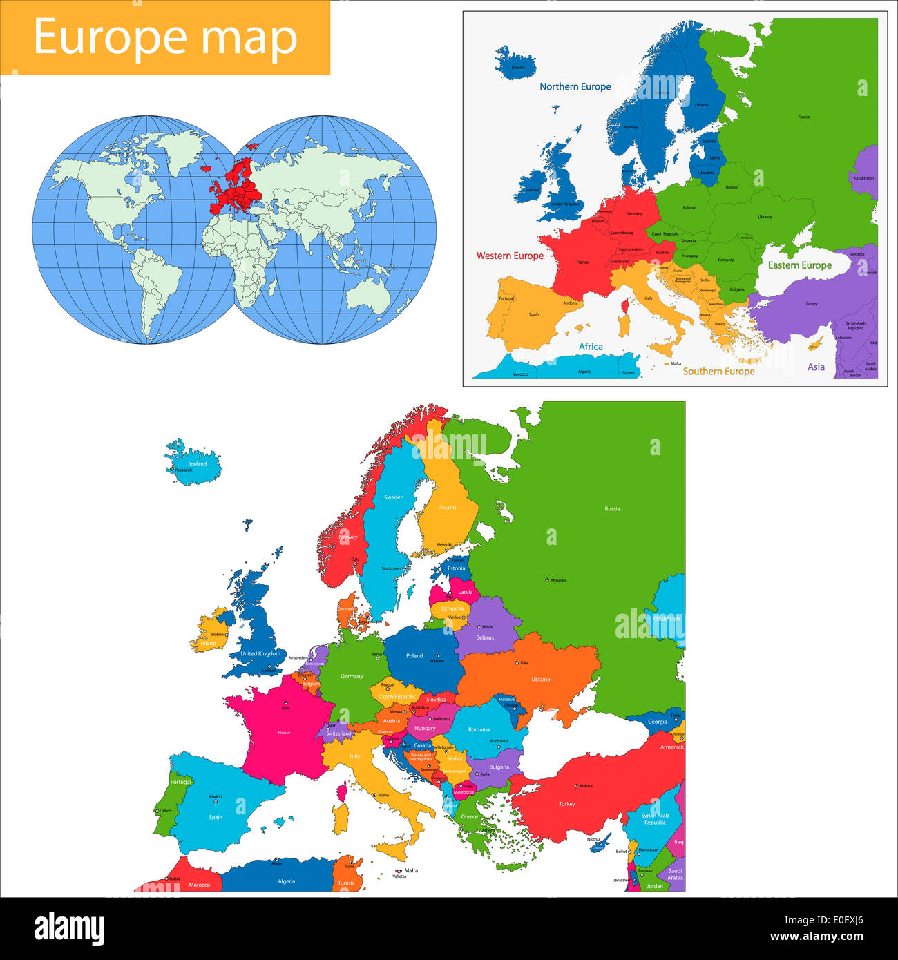 Europe map Stock Photohttps://www.alamy.com/image-license-details/?v=1https://www.alamy.com/europe-map-image69169694.html
RFE0EXJ6–Europe map
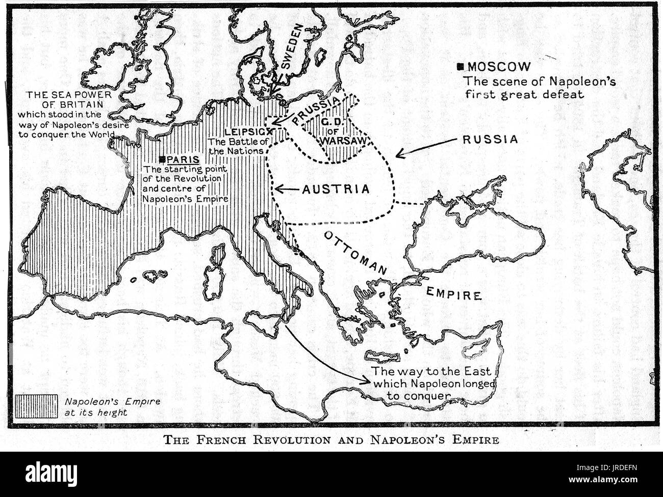 A 1926 children's school map showing Napoleons Empire and the French Revolution regions Stock Photohttps://www.alamy.com/image-license-details/?v=1https://www.alamy.com/a-1926-childrens-school-map-showing-napoleons-empire-and-the-french-image152116825.html
RMJRDEFN–A 1926 children's school map showing Napoleons Empire and the French Revolution regions
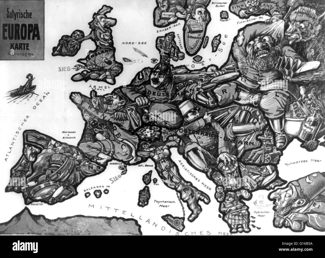 Entitled: Satyrische Europa Karte Weltkrieg 1914. Sketch depicting a map of Europe at the outbreak of the first World War with each country depicted as a human figure representative of the particular state of affairs or attitudes of the country, for insta Stock Photohttps://www.alamy.com/image-license-details/?v=1https://www.alamy.com/stock-photo-entitled-satyrische-europa-karte-weltkrieg-1914-sketch-depicting-a-104017350.html
RMG16B5A–Entitled: Satyrische Europa Karte Weltkrieg 1914. Sketch depicting a map of Europe at the outbreak of the first World War with each country depicted as a human figure representative of the particular state of affairs or attitudes of the country, for insta
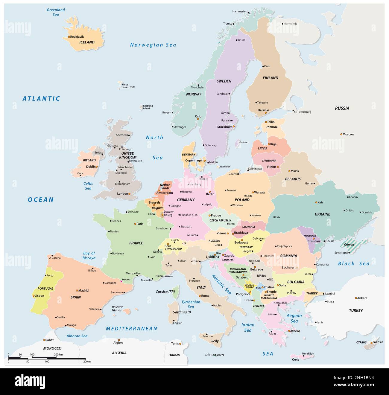 Colored political vector map of European states Stock Photohttps://www.alamy.com/image-license-details/?v=1https://www.alamy.com/colored-political-vector-map-of-european-states-image526791360.html
RF2NH1BN4–Colored political vector map of European states
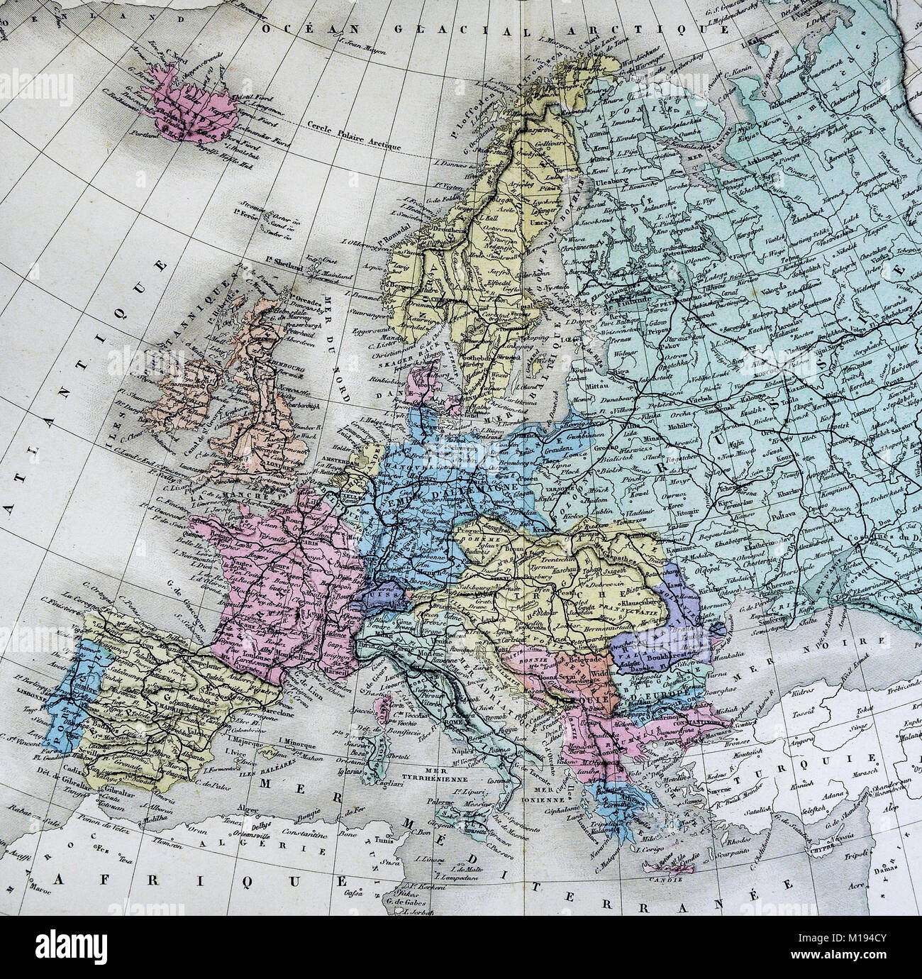 1877 Migeon Map - Europe - France Germany Italy Spain Russia Austria Portugal Britain Holland Belgium Switzerland Stock Photohttps://www.alamy.com/image-license-details/?v=1https://www.alamy.com/stock-photo-1877-migeon-map-europe-france-germany-italy-spain-russia-austria-portugal-172919403.html
RFM194CY–1877 Migeon Map - Europe - France Germany Italy Spain Russia Austria Portugal Britain Holland Belgium Switzerland
 England silhouette map Stock Vectorhttps://www.alamy.com/image-license-details/?v=1https://www.alamy.com/england-silhouette-map-image336215940.html
RF2AEYXT4–England silhouette map
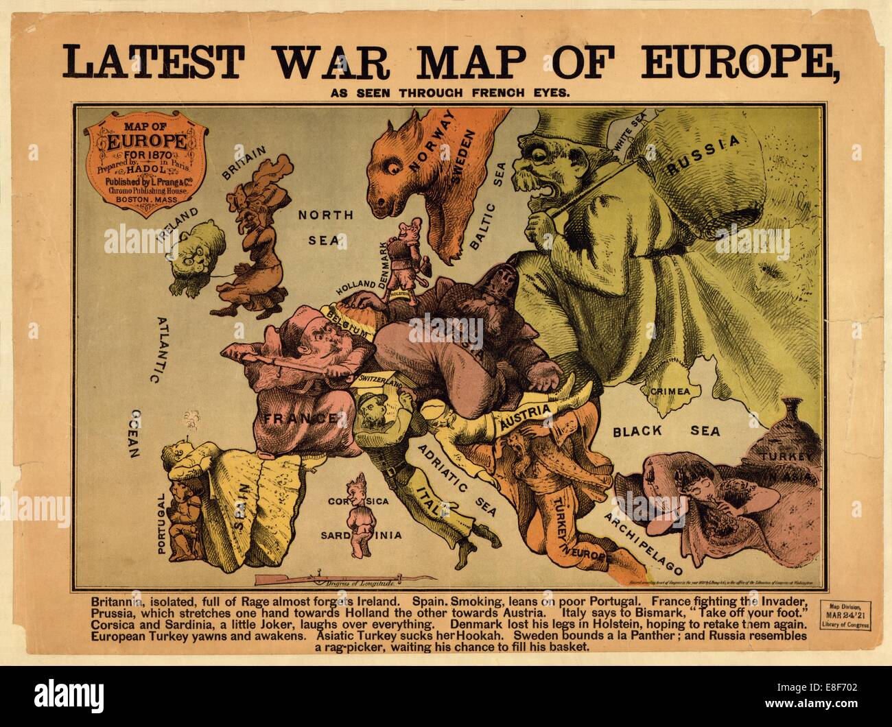 Latest war map of Europe: as seen through French eyes. Artist: Hadol, Paul (1835-1875) Stock Photohttps://www.alamy.com/image-license-details/?v=1https://www.alamy.com/stock-photo-latest-war-map-of-europe-as-seen-through-french-eyes-artist-hadol-74093490.html
RME8F702–Latest war map of Europe: as seen through French eyes. Artist: Hadol, Paul (1835-1875)
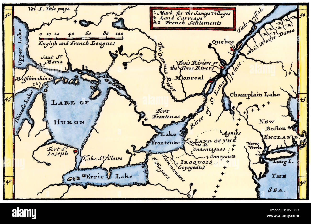 La Hontan's map of the Great Lakes and Saint Lawrence valley 1703. Hand-colored woodcut Stock Photohttps://www.alamy.com/image-license-details/?v=1https://www.alamy.com/stock-photo-la-hontans-map-of-the-great-lakes-and-saint-lawrence-valley-1703-hand-20813001.html
RMB5T35D–La Hontan's map of the Great Lakes and Saint Lawrence valley 1703. Hand-colored woodcut
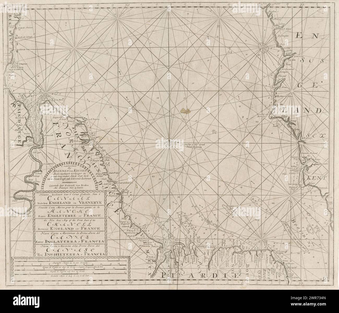 Passage map of the Channel between England and France, part 1, New Nautical Chart of the First Part of the Canal Between England and France (title on object), Passage map of a part of the Channel, the strait between Great Britain and France, with a compass rose. Bottom left a cartouche with the title, the address of the publisher and the scale., print maker: anonymous, after design by: Gerard van Keulen, publisher: Johannes van Keulen (I), Amsterdam, 1688 - 1803, paper, engraving, etching, height 528 mm × width 615 mm, print Stock Photohttps://www.alamy.com/image-license-details/?v=1https://www.alamy.com/passage-map-of-the-channel-between-england-and-france-part-1-new-nautical-chart-of-the-first-part-of-the-canal-between-england-and-france-title-on-object-passage-map-of-a-part-of-the-channel-the-strait-between-great-britain-and-france-with-a-compass-rose-bottom-left-a-cartouche-with-the-title-the-address-of-the-publisher-and-the-scale-print-maker-anonymous-after-design-by-gerard-van-keulen-publisher-johannes-van-keulen-i-amsterdam-1688-1803-paper-engraving-etching-height-528-mm-width-615-mm-print-image599445749.html
RM2WR734N–Passage map of the Channel between England and France, part 1, New Nautical Chart of the First Part of the Canal Between England and France (title on object), Passage map of a part of the Channel, the strait between Great Britain and France, with a compass rose. Bottom left a cartouche with the title, the address of the publisher and the scale., print maker: anonymous, after design by: Gerard van Keulen, publisher: Johannes van Keulen (I), Amsterdam, 1688 - 1803, paper, engraving, etching, height 528 mm × width 615 mm, print
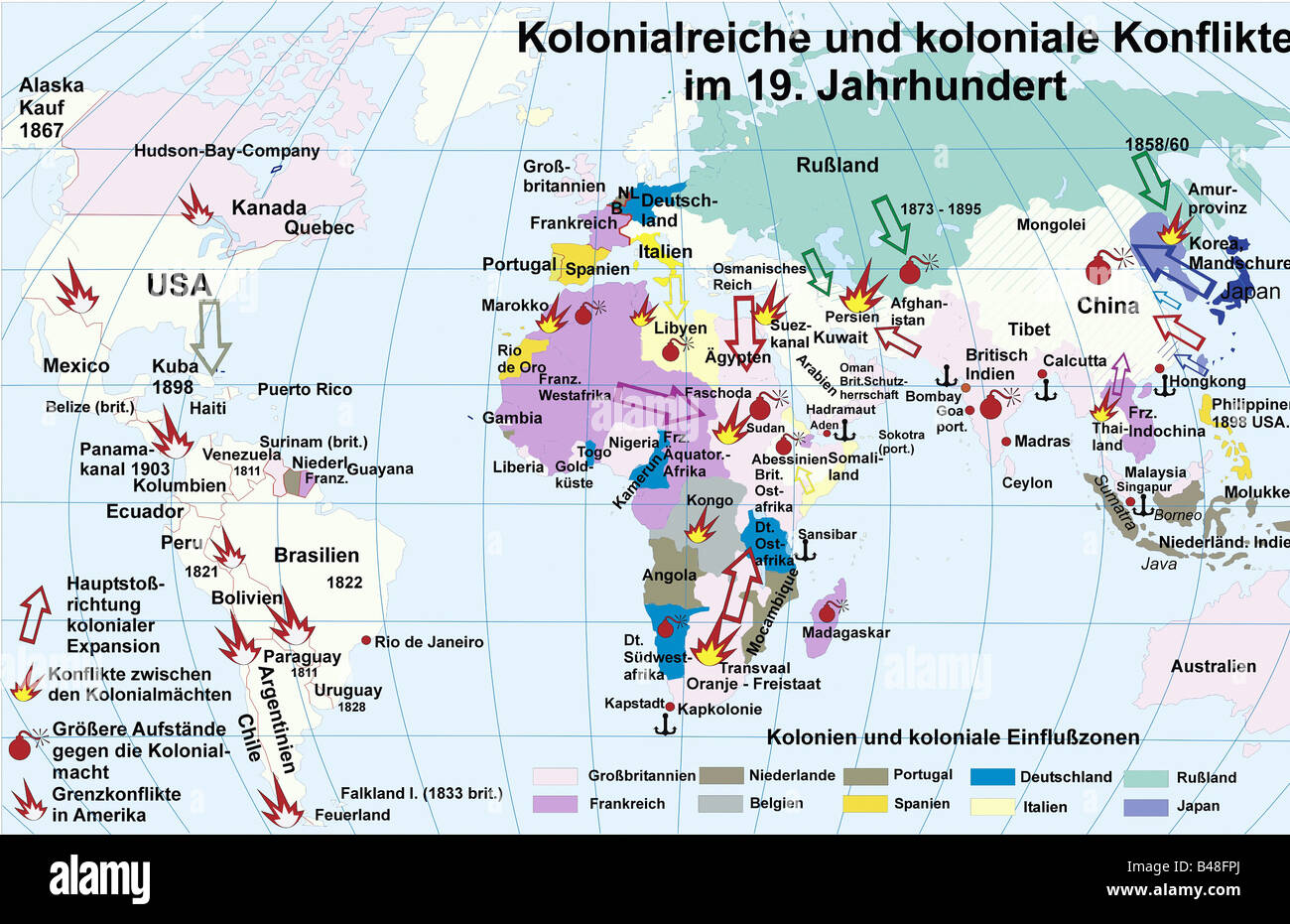 cartography, historical maps, modern times, colonial empires and colonial conflicts in 19th century, historic, historical, colonialism, England, Great Britain, France, Netherlands, Spain, Portugal, Belgium, Russia, Italy, Germany, Japan, Europe, America, Africa, Asia, Australia, Hudson Bay Company, Mexico, USA, Cuba, Carribean, Peru, South America, Brazil, Argentinia, Paraguay, border conflict, French West Africa, Fadoscha, Egypt, South Africa, Congo, India, Indonesia, China, Phillipines, world map, CEAM, Stock Photohttps://www.alamy.com/image-license-details/?v=1https://www.alamy.com/stock-photo-cartography-historical-maps-modern-times-colonial-empires-and-colonial-19857002.html
RMB48FPJ–cartography, historical maps, modern times, colonial empires and colonial conflicts in 19th century, historic, historical, colonialism, England, Great Britain, France, Netherlands, Spain, Portugal, Belgium, Russia, Italy, Germany, Japan, Europe, America, Africa, Asia, Australia, Hudson Bay Company, Mexico, USA, Cuba, Carribean, Peru, South America, Brazil, Argentinia, Paraguay, border conflict, French West Africa, Fadoscha, Egypt, South Africa, Congo, India, Indonesia, China, Phillipines, world map, CEAM,
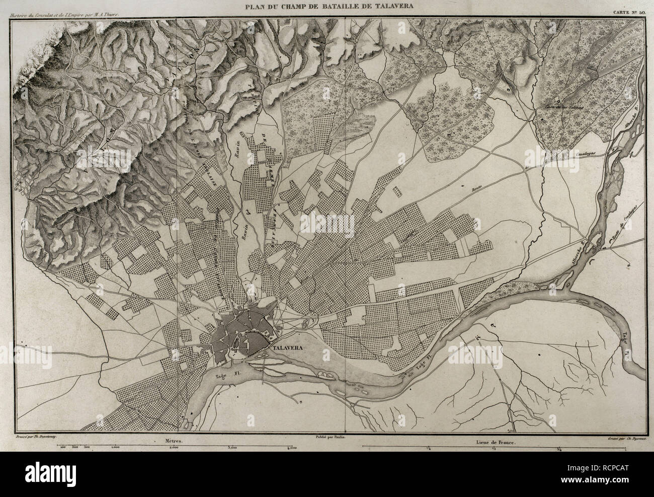 Napoleonic map. Battlefield of Talavera (Talavera de la Reina, province of Toledo, Castile-La Mancha, Spain). The Peninsular War. The Battle of Talavera, 27th-28th July 1809. It tooks place outside the town between the French army against allied forces (United Kingdom and Spain). Atlas de l'Histoire du Consulat et de l'Empire. History of the Consulate and the Empire of France under Napoleon by Marie Joseph Louis Adolphe Thiers (1797-1877). Drawings by Dufour, engravings by Dyonnet. Edited in Paris, 1864. Stock Photohttps://www.alamy.com/image-license-details/?v=1https://www.alamy.com/napoleonic-map-battlefield-of-talavera-talavera-de-la-reina-province-of-toledo-castile-la-mancha-spain-the-peninsular-war-the-battle-of-talavera-27th-28th-july-1809-it-tooks-place-outside-the-town-between-the-french-army-against-allied-forces-united-kingdom-and-spain-atlas-de-lhistoire-du-consulat-et-de-lempire-history-of-the-consulate-and-the-empire-of-france-under-napoleon-by-marie-joseph-louis-adolphe-thiers-1797-1877-drawings-by-dufour-engravings-by-dyonnet-edited-in-paris-1864-image231603312.html
RMRCPCAT–Napoleonic map. Battlefield of Talavera (Talavera de la Reina, province of Toledo, Castile-La Mancha, Spain). The Peninsular War. The Battle of Talavera, 27th-28th July 1809. It tooks place outside the town between the French army against allied forces (United Kingdom and Spain). Atlas de l'Histoire du Consulat et de l'Empire. History of the Consulate and the Empire of France under Napoleon by Marie Joseph Louis Adolphe Thiers (1797-1877). Drawings by Dufour, engravings by Dyonnet. Edited in Paris, 1864.
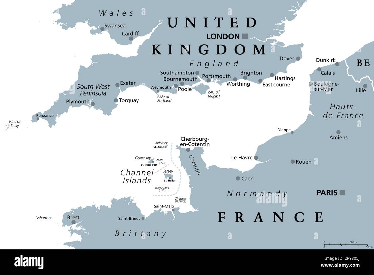 English Channel, gray political map. British Channel, arm of Atlantic Ocean, separates England from France. Busiest shipping area in the world. Stock Photohttps://www.alamy.com/image-license-details/?v=1https://www.alamy.com/english-channel-gray-political-map-british-channel-arm-of-atlantic-ocean-separates-england-from-france-busiest-shipping-area-in-the-world-image550292894.html
RF2PY805J–English Channel, gray political map. British Channel, arm of Atlantic Ocean, separates England from France. Busiest shipping area in the world.