Quick filters:
Map ireland coast Stock Photos and Images
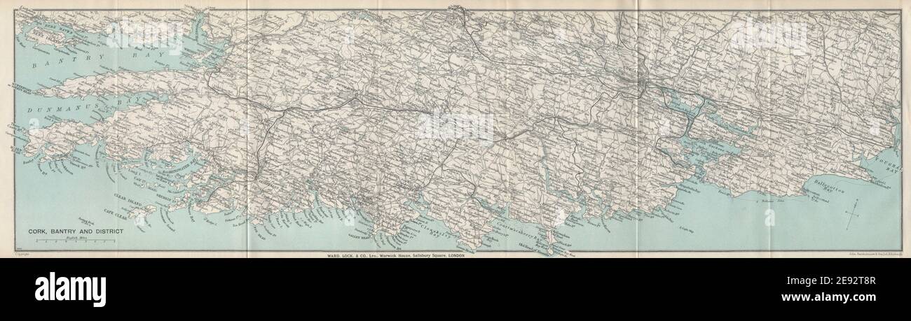 COUNTY CORK COAST & Bantry Bay vintage tourist map. Ireland. WARD LOCK 1936 Stock Photohttps://www.alamy.com/image-license-details/?v=1https://www.alamy.com/county-cork-coast-bantry-bay-vintage-tourist-map-ireland-ward-lock-1936-image401433335.html
RF2E92T8R–COUNTY CORK COAST & Bantry Bay vintage tourist map. Ireland. WARD LOCK 1936
 Map of a part of the south coast of Ireland New Passage of the suyt syde of Yrlandt (title on object), Map of a part of the south coast of Ireland with two compass roses, the North is above. At the top center near the cartouche with the title, a churning woman and men carrying and packing butter. Bottom right two angels with a basket full of flowers at the address of the publisher and the scale, shown in German, Spanish and English or French miles (scale: c. 1: 550 000), cupids: 'amores' ' amoretti ' ' putti 'sailing-ship, sailing-boat, churning, butter, cow, Jan Luyken, Amsterdam, 1681 - 1803 Stock Photohttps://www.alamy.com/image-license-details/?v=1https://www.alamy.com/map-of-a-part-of-the-south-coast-of-ireland-new-passage-of-the-suyt-syde-of-yrlandt-title-on-object-map-of-a-part-of-the-south-coast-of-ireland-with-two-compass-roses-the-north-is-above-at-the-top-center-near-the-cartouche-with-the-title-a-churning-woman-and-men-carrying-and-packing-butter-bottom-right-two-angels-with-a-basket-full-of-flowers-at-the-address-of-the-publisher-and-the-scale-shown-in-german-spanish-and-english-or-french-miles-scale-c-1-550-000-cupids-amores-amoretti-putti-sailing-ship-sailing-boat-churning-butter-cow-jan-luyken-amsterdam-1681-1803-image261399386.html
RMW57NGA–Map of a part of the south coast of Ireland New Passage of the suyt syde of Yrlandt (title on object), Map of a part of the south coast of Ireland with two compass roses, the North is above. At the top center near the cartouche with the title, a churning woman and men carrying and packing butter. Bottom right two angels with a basket full of flowers at the address of the publisher and the scale, shown in German, Spanish and English or French miles (scale: c. 1: 550 000), cupids: 'amores' ' amoretti ' ' putti 'sailing-ship, sailing-boat, churning, butter, cow, Jan Luyken, Amsterdam, 1681 - 1803
 'Irlandiae regnum' or Kingdom of Ireland. The map is in Latin and is lying with its northern coast to the west. The map, was created in the late 16th century by Gerardus Mercator (1512-1594), a 16th-century geographer, cosmographer and cartographer from the County of Flanders, renowned for creating the 1569 world map based on a new projection which represented sailing courses of constant bearing as straight lines—an innovation that is still employed in nautical charts. Stock Photohttps://www.alamy.com/image-license-details/?v=1https://www.alamy.com/irlandiae-regnum-or-kingdom-of-ireland-the-map-is-in-latin-and-is-lying-with-its-northern-coast-to-the-west-the-map-was-created-in-the-late-16th-century-by-gerardus-mercator-1512-1594-a-16th-century-geographer-cosmographer-and-cartographer-from-the-county-of-flanders-renowned-for-creating-the-1569-world-map-based-on-a-new-projection-which-represented-sailing-courses-of-constant-bearing-as-straight-linesan-innovation-that-is-still-employed-in-nautical-charts-image445908407.html
RM2GWCTM7–'Irlandiae regnum' or Kingdom of Ireland. The map is in Latin and is lying with its northern coast to the west. The map, was created in the late 16th century by Gerardus Mercator (1512-1594), a 16th-century geographer, cosmographer and cartographer from the County of Flanders, renowned for creating the 1569 world map based on a new projection which represented sailing courses of constant bearing as straight lines—an innovation that is still employed in nautical charts.
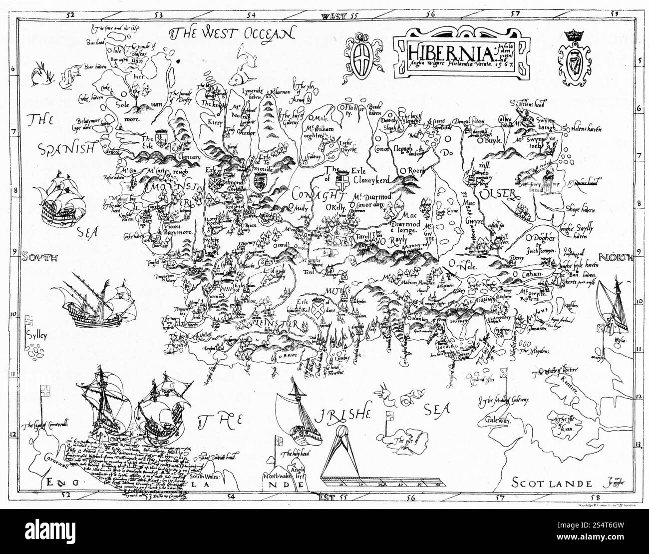 Map of Ireland, 1567. By John Goghe, 16th century. A 16th century map of Ireland. Stock Photohttps://www.alamy.com/image-license-details/?v=1https://www.alamy.com/map-of-ireland-1567-by-john-goghe-16th-century-a-16th-century-map-of-ireland-image639774265.html
RM2S4T6GW–Map of Ireland, 1567. By John Goghe, 16th century. A 16th century map of Ireland.
 Stranocum, Causeway Coast and Glens, United Kingdom, Northern Ireland, N 55 6' 0'', W 6 25' 0'', map, Timeless Map published in 2021. Travelers, explorers and adventurers like Florence Nightingale, David Livingstone, Ernest Shackleton, Lewis and Clark and Sherlock Holmes relied on maps to plan travels to the world's most remote corners, Timeless Maps is mapping most locations on the globe, showing the achievement of great dreams Stock Photohttps://www.alamy.com/image-license-details/?v=1https://www.alamy.com/stranocum-causeway-coast-and-glens-united-kingdom-northern-ireland-n-55-6-0-w-6-25-0-map-timeless-map-published-in-2021-travelers-explorers-and-adventurers-like-florence-nightingale-david-livingstone-ernest-shackleton-lewis-and-clark-and-sherlock-holmes-relied-on-maps-to-plan-travels-to-the-worlds-most-remote-corners-timeless-maps-is-mapping-most-locations-on-the-globe-showing-the-achievement-of-great-dreams-image439385529.html
RM2GERMM9–Stranocum, Causeway Coast and Glens, United Kingdom, Northern Ireland, N 55 6' 0'', W 6 25' 0'', map, Timeless Map published in 2021. Travelers, explorers and adventurers like Florence Nightingale, David Livingstone, Ernest Shackleton, Lewis and Clark and Sherlock Holmes relied on maps to plan travels to the world's most remote corners, Timeless Maps is mapping most locations on the globe, showing the achievement of great dreams
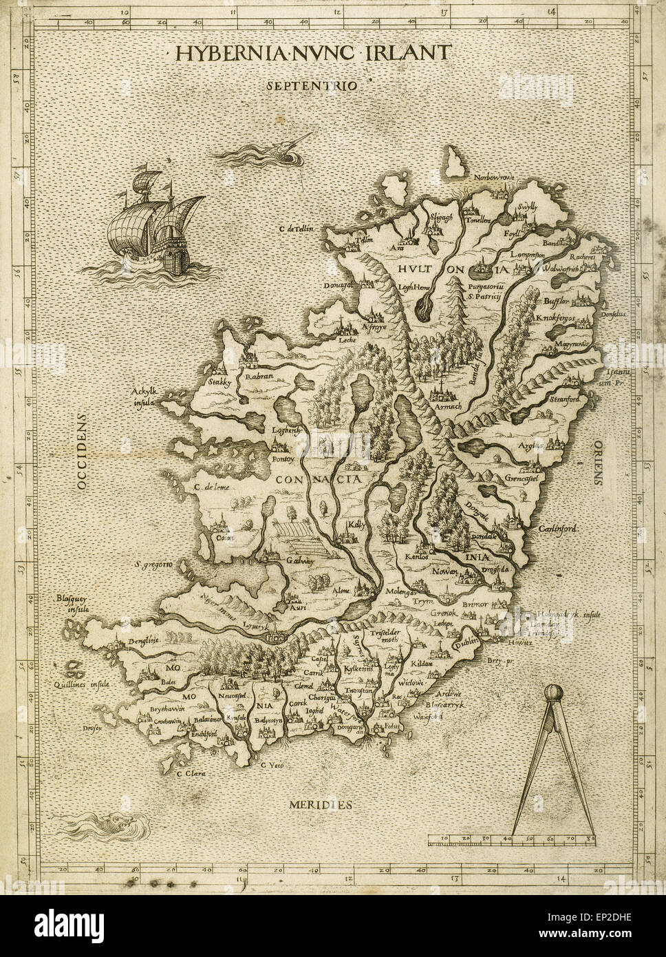 Hybernia Nunc Irlant. Ireland. Map was clearly made by a member of the Lafreri School of cartographers, Antonio Lafreri (1512-77). Rome, 1570. Renaissance. Engraving by Paolo Forlani, 16th C. Stock Photohttps://www.alamy.com/image-license-details/?v=1https://www.alamy.com/stock-photo-hybernia-nunc-irlant-ireland-map-was-clearly-made-by-a-member-of-the-82418490.html
RMEP2DHE–Hybernia Nunc Irlant. Ireland. Map was clearly made by a member of the Lafreri School of cartographers, Antonio Lafreri (1512-77). Rome, 1570. Renaissance. Engraving by Paolo Forlani, 16th C.
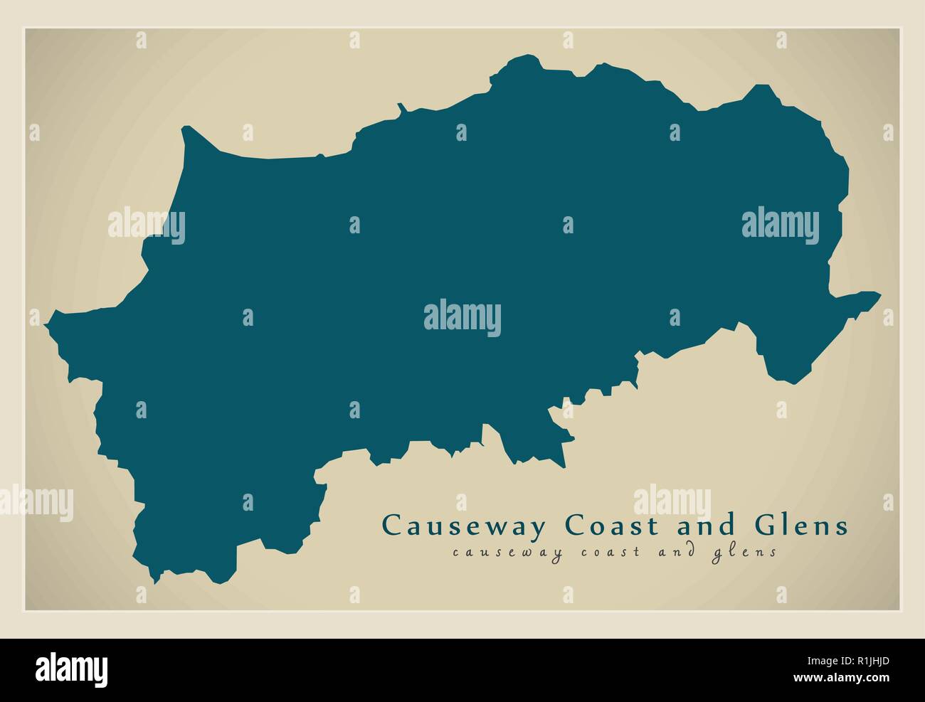 Causeway Coast and Glens district map of Northern Ireland Stock Vectorhttps://www.alamy.com/image-license-details/?v=1https://www.alamy.com/causeway-coast-and-glens-district-map-of-northern-ireland-image224758421.html
RFR1JHJD–Causeway Coast and Glens district map of Northern Ireland
 Hamilton's Seat near Benbane Head, on the Causeway Coast footpath, County Antrim, Northern Ireland, UK Stock Photohttps://www.alamy.com/image-license-details/?v=1https://www.alamy.com/stock-photo-hamiltons-seat-near-benbane-head-on-the-causeway-coast-footpath-county-137812252.html
RMJ05TX4–Hamilton's Seat near Benbane Head, on the Causeway Coast footpath, County Antrim, Northern Ireland, UK
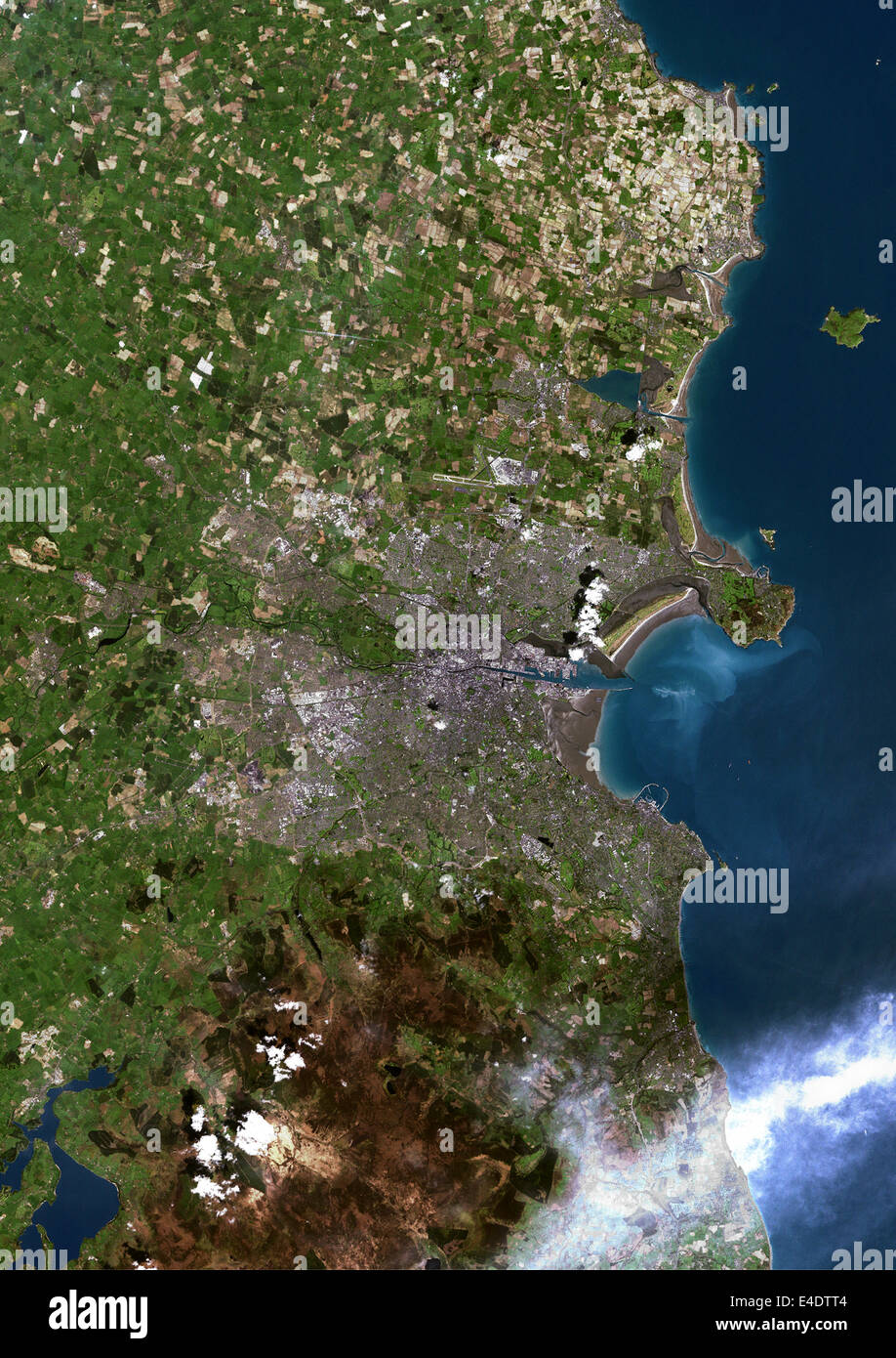 Dublin, Ireland, True Colour Satellite Image. Dublin, Republic of Ireland. True colour satellite image of Dublin, capital city o Stock Photohttps://www.alamy.com/image-license-details/?v=1https://www.alamy.com/stock-photo-dublin-ireland-true-colour-satellite-image-dublin-republic-of-ireland-71604964.html
RME4DTT4–Dublin, Ireland, True Colour Satellite Image. Dublin, Republic of Ireland. True colour satellite image of Dublin, capital city o
 young woman studying a map in front of a beautiful cliff scenery on Dingle Peninsula in the West of Ireland Stock Photohttps://www.alamy.com/image-license-details/?v=1https://www.alamy.com/stock-photo-young-woman-studying-a-map-in-front-of-a-beautiful-cliff-scenery-on-12287423.html
RMA98MAT–young woman studying a map in front of a beautiful cliff scenery on Dingle Peninsula in the West of Ireland
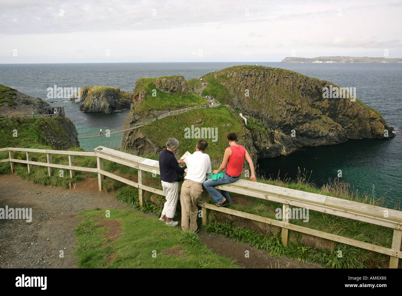 Hiking tourists study a guidebook map on the coastal path near Carrick a Rede Rope bridge Ballycastle Co Antrim Northern Ireland Stock Photohttps://www.alamy.com/image-license-details/?v=1https://www.alamy.com/hiking-tourists-study-a-guidebook-map-on-the-coastal-path-near-carrick-image4952709.html
RMAM6X86–Hiking tourists study a guidebook map on the coastal path near Carrick a Rede Rope bridge Ballycastle Co Antrim Northern Ireland
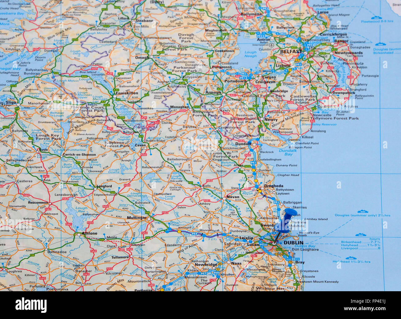 Map of the east coast of Eire (Southern Ireland) showing the road and ferry crossing routes and with a map pin indicating Dublin Stock Photohttps://www.alamy.com/image-license-details/?v=1https://www.alamy.com/stock-photo-map-of-the-east-coast-of-eire-southern-ireland-showing-the-road-and-99673102.html
RMFP4E1J–Map of the east coast of Eire (Southern Ireland) showing the road and ferry crossing routes and with a map pin indicating Dublin
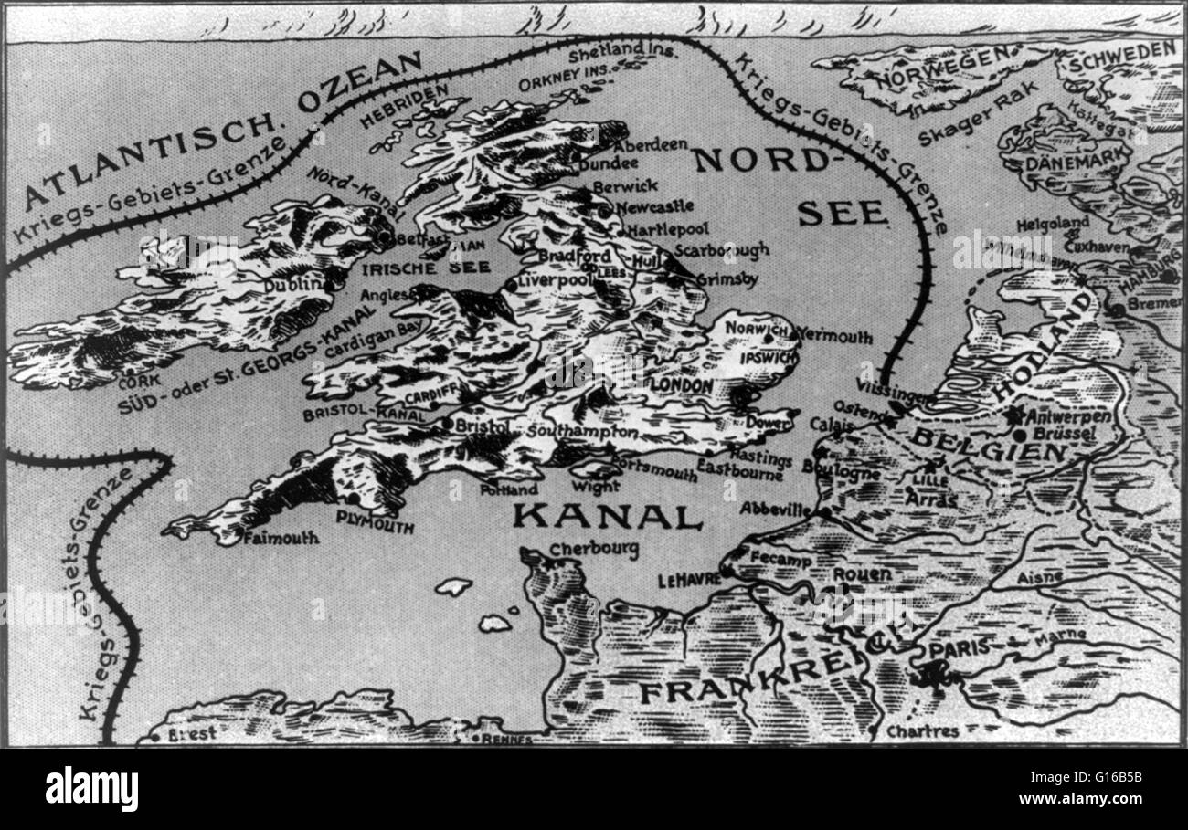 Map with a line, labeled 'Kriegs - Gebiets - Grenze', drawn around of Great Britain, Scotland, and Ireland connecting them to the European coast along the English Channel, outlining the theater of war during the First World War. Entitled: Westl. Kriegssch Stock Photohttps://www.alamy.com/image-license-details/?v=1https://www.alamy.com/stock-photo-map-with-a-line-labeled-kriegs-gebiets-grenze-drawn-around-of-great-104017351.html
RMG16B5B–Map with a line, labeled 'Kriegs - Gebiets - Grenze', drawn around of Great Britain, Scotland, and Ireland connecting them to the European coast along the English Channel, outlining the theater of war during the First World War. Entitled: Westl. Kriegssch
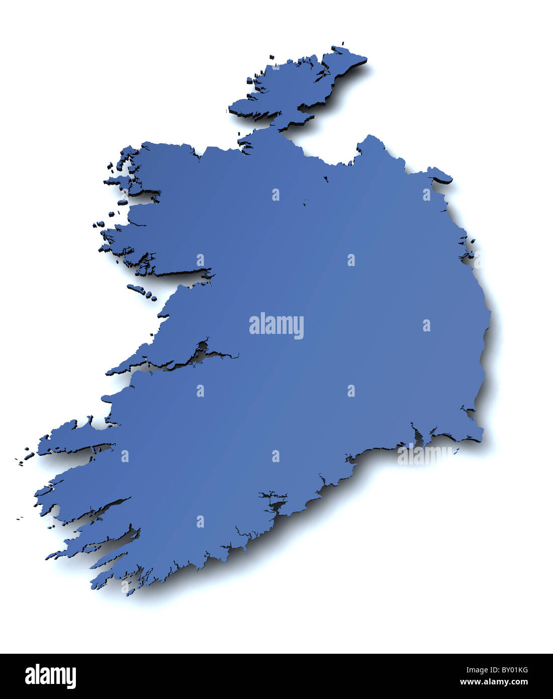 3d rendered blank map of Ireland Stock Photohttps://www.alamy.com/image-license-details/?v=1https://www.alamy.com/stock-photo-3d-rendered-blank-map-of-ireland-33807412.html
RFBY01KG–3d rendered blank map of Ireland
 A Couple Standing On A Road Reading A Map Near Ardgroom; County Cork, Ireland Stock Photohttps://www.alamy.com/image-license-details/?v=1https://www.alamy.com/stock-photo-a-couple-standing-on-a-road-reading-a-map-near-ardgroom-county-cork-49615417.html
RFCTM4Y5–A Couple Standing On A Road Reading A Map Near Ardgroom; County Cork, Ireland
 An antique political sepia coloured map of Scotland showing the west coast and Northern Ireland. Stock Photohttps://www.alamy.com/image-license-details/?v=1https://www.alamy.com/an-antique-political-sepia-coloured-map-of-scotland-showing-the-west-coast-and-northern-ireland-image573086514.html
RF2T8A9KE–An antique political sepia coloured map of Scotland showing the west coast and Northern Ireland.
 Map of Courtmacsherry, County Cork, Ireland Stock Photohttps://www.alamy.com/image-license-details/?v=1https://www.alamy.com/map-of-courtmacsherry-county-cork-ireland-image452975862.html
RM2H8XR9A–Map of Courtmacsherry, County Cork, Ireland
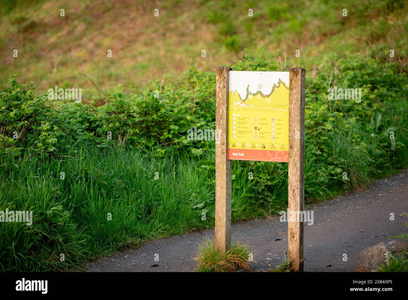 The Map sign at the Giant's Causeway in Northern Ireland Stock Photohttps://www.alamy.com/image-license-details/?v=1https://www.alamy.com/the-map-sign-at-the-giants-causeway-in-northern-ireland-image607388941.html
RF2X84XP5–The Map sign at the Giant's Causeway in Northern Ireland
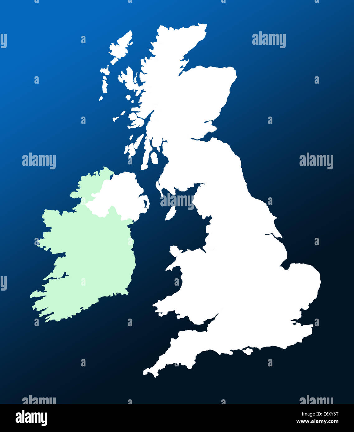 Outline map of UK and Ireland over graduated blue background Stock Photohttps://www.alamy.com/image-license-details/?v=1https://www.alamy.com/stock-photo-outline-map-of-uk-and-ireland-over-graduated-blue-background-73121520.html
RFE6XY6T–Outline map of UK and Ireland over graduated blue background
 85a. Ireland coast. County Waterford Wexford. KRIEGSMARINE Nazi map 1940 Stock Photohttps://www.alamy.com/image-license-details/?v=1https://www.alamy.com/85a-ireland-coast-county-waterford-wexford-kriegsmarine-nazi-map-1940-image454159955.html
RF2HATNJB–85a. Ireland coast. County Waterford Wexford. KRIEGSMARINE Nazi map 1940
 Pass map of part of the coast of Ireland, England, France and Spain, Pass map of the Bight of Vrankryck, Biscaien and Galissen, the entrance to the Canal as Meden, the Canal of Bristol and the South Coast of Yrland (title on object), Pass map of part of the coast of Ireland, England, France and Spain, showing the Bay of Biscay. On the left a compass rose, North is on the left. On the right a cartouche flanked by two putti with the title, including the scale in German, Spanish and English or French miles., print maker: Jan Luyken, (possibly ), print maker: Caspar Luyken, (possibly) Stock Photohttps://www.alamy.com/image-license-details/?v=1https://www.alamy.com/pass-map-of-part-of-the-coast-of-ireland-england-france-and-spain-pass-map-of-the-bight-of-vrankryck-biscaien-and-galissen-the-entrance-to-the-canal-as-meden-the-canal-of-bristol-and-the-south-coast-of-yrland-title-on-object-pass-map-of-part-of-the-coast-of-ireland-england-france-and-spain-showing-the-bay-of-biscay-on-the-left-a-compass-rose-north-is-on-the-left-on-the-right-a-cartouche-flanked-by-two-putti-with-the-title-including-the-scale-in-german-spanish-and-english-or-french-miles-print-maker-jan-luyken-possibly-print-maker-caspar-luyken-possibly-image599445659.html
RM2WR731F–Pass map of part of the coast of Ireland, England, France and Spain, Pass map of the Bight of Vrankryck, Biscaien and Galissen, the entrance to the Canal as Meden, the Canal of Bristol and the South Coast of Yrland (title on object), Pass map of part of the coast of Ireland, England, France and Spain, showing the Bay of Biscay. On the left a compass rose, North is on the left. On the right a cartouche flanked by two putti with the title, including the scale in German, Spanish and English or French miles., print maker: Jan Luyken, (possibly ), print maker: Caspar Luyken, (possibly)
 'Baptista Boazio's Irlandiæ' The description of Ireland. The map is in Latin and is lying with its northern coast to the west. The map, was created in 1606 by Giovanni Battista Boazio or Battista Boazio (1588-1606), an Italian draftsman and cartographer. who spent a long period working in England, and made a map of Ireland that was then used in the Theatrum Orbis Terrarum. Stock Photohttps://www.alamy.com/image-license-details/?v=1https://www.alamy.com/baptista-boazios-irlandi-the-description-of-ireland-the-map-is-in-latin-and-is-lying-with-its-northern-coast-to-the-west-the-map-was-created-in-1606-by-giovanni-battista-boazio-or-battista-boazio-1588-1606-an-italian-draftsman-and-cartographer-who-spent-a-long-period-working-in-england-and-made-a-map-of-ireland-that-was-then-used-in-the-theatrum-orbis-terrarum-image445910899.html
RM2GWCYW7–'Baptista Boazio's Irlandiæ' The description of Ireland. The map is in Latin and is lying with its northern coast to the west. The map, was created in 1606 by Giovanni Battista Boazio or Battista Boazio (1588-1606), an Italian draftsman and cartographer. who spent a long period working in England, and made a map of Ireland that was then used in the Theatrum Orbis Terrarum.
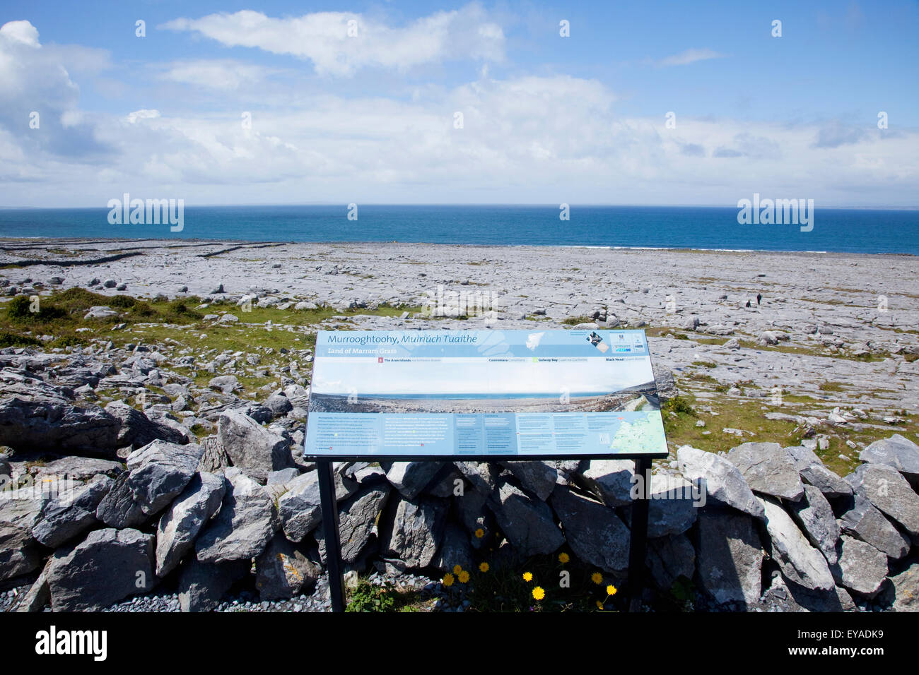 Sign With Maps And Description At A Landmark On The Burren; County Clare, Ireland Stock Photohttps://www.alamy.com/image-license-details/?v=1https://www.alamy.com/stock-photo-sign-with-maps-and-description-at-a-landmark-on-the-burren-county-85667437.html
RMEYADK9–Sign With Maps And Description At A Landmark On The Burren; County Clare, Ireland
 Billy, Causeway Coast and Glens, United Kingdom, Northern Ireland, N 55 10' 0'', W 6 28' 59'', map, Timeless Map published in 2021. Travelers, explorers and adventurers like Florence Nightingale, David Livingstone, Ernest Shackleton, Lewis and Clark and Sherlock Holmes relied on maps to plan travels to the world's most remote corners, Timeless Maps is mapping most locations on the globe, showing the achievement of great dreams Stock Photohttps://www.alamy.com/image-license-details/?v=1https://www.alamy.com/billy-causeway-coast-and-glens-united-kingdom-northern-ireland-n-55-10-0-w-6-28-59-map-timeless-map-published-in-2021-travelers-explorers-and-adventurers-like-florence-nightingale-david-livingstone-ernest-shackleton-lewis-and-clark-and-sherlock-holmes-relied-on-maps-to-plan-travels-to-the-worlds-most-remote-corners-timeless-maps-is-mapping-most-locations-on-the-globe-showing-the-achievement-of-great-dreams-image439402297.html
RM2GETE35–Billy, Causeway Coast and Glens, United Kingdom, Northern Ireland, N 55 10' 0'', W 6 28' 59'', map, Timeless Map published in 2021. Travelers, explorers and adventurers like Florence Nightingale, David Livingstone, Ernest Shackleton, Lewis and Clark and Sherlock Holmes relied on maps to plan travels to the world's most remote corners, Timeless Maps is mapping most locations on the globe, showing the achievement of great dreams
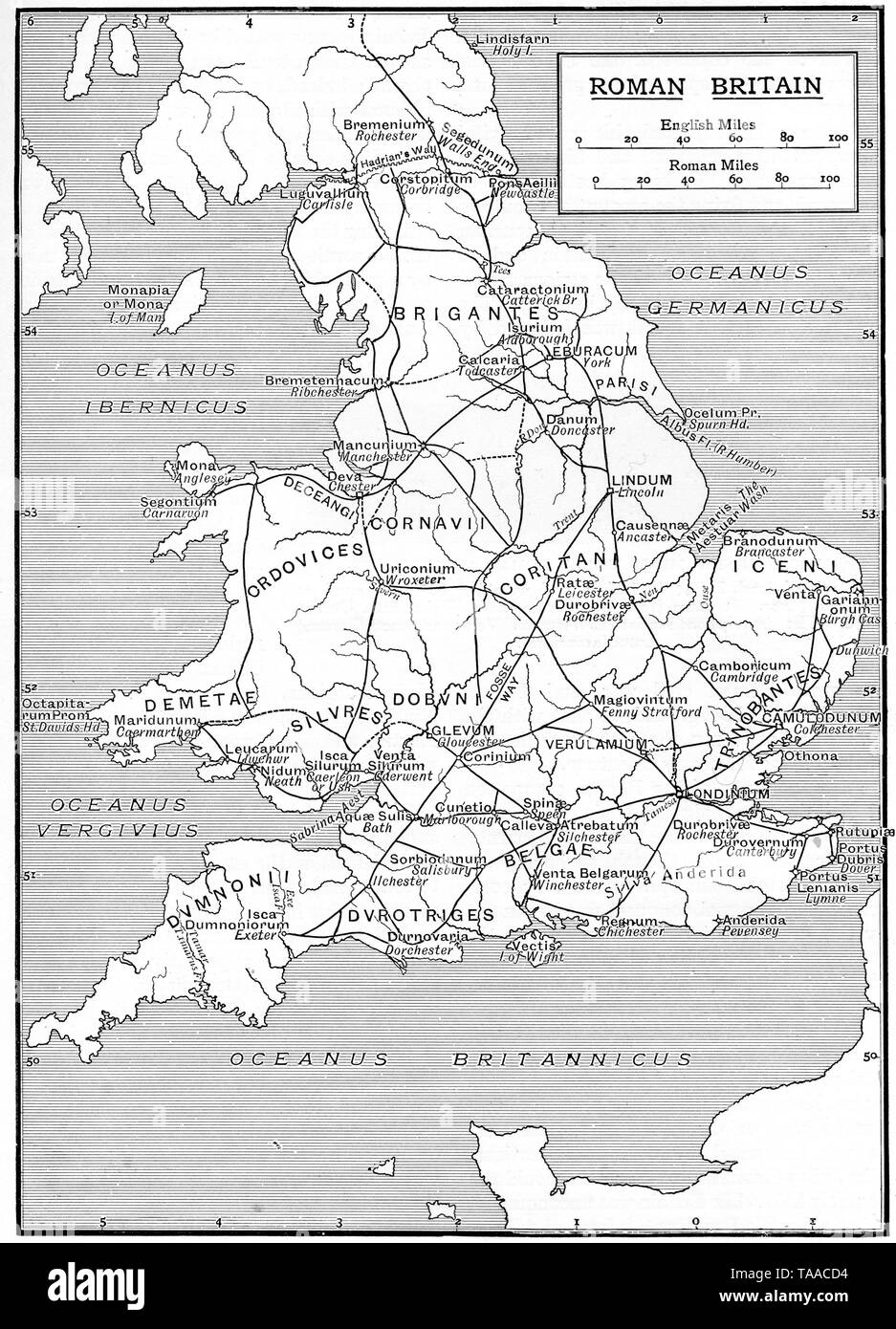 A map showing the infrastructure of Roman Britain, 1925. Stock Photohttps://www.alamy.com/image-license-details/?v=1https://www.alamy.com/a-map-showing-the-infrastructure-of-roman-britain-1925-image247321008.html
RMTAACD4–A map showing the infrastructure of Roman Britain, 1925.
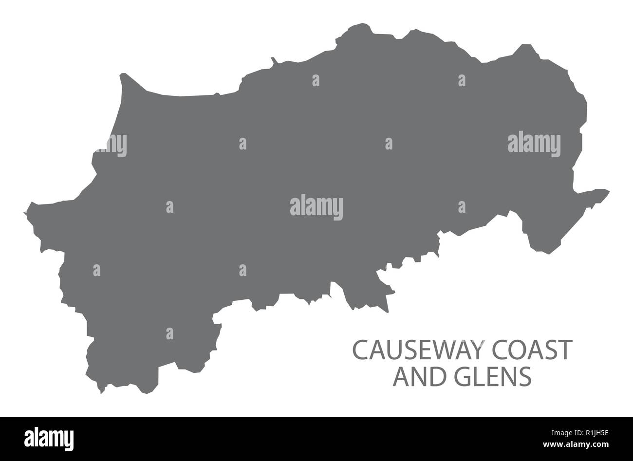 Causeway Coast and Glens map grey Stock Vectorhttps://www.alamy.com/image-license-details/?v=1https://www.alamy.com/causeway-coast-and-glens-map-grey-image224758058.html
RFR1JH5E–Causeway Coast and Glens map grey
 Ireland, Munster, county Kerry, Dingle peninsula, cyclist, map, Stock Photohttps://www.alamy.com/image-license-details/?v=1https://www.alamy.com/stock-photo-ireland-munster-county-kerry-dingle-peninsula-cyclist-map-140606302.html
RMJ4N4NJ–Ireland, Munster, county Kerry, Dingle peninsula, cyclist, map,
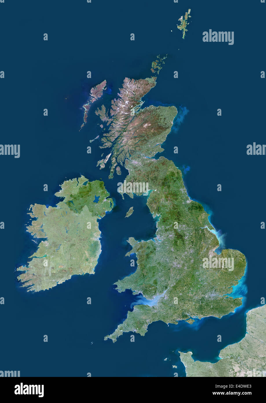 United Kingdom, Europe, True Colour Satellite Image With Mask. Satellite view of the United Kingdom (with mask). This image was Stock Photohttps://www.alamy.com/image-license-details/?v=1https://www.alamy.com/stock-photo-united-kingdom-europe-true-colour-satellite-image-with-mask-satellite-71605467.html
RME4DWE3–United Kingdom, Europe, True Colour Satellite Image With Mask. Satellite view of the United Kingdom (with mask). This image was
 Shape of Inisheer, polygonal sunburst. Map of the island with colorful star rays. Stock Vectorhttps://www.alamy.com/image-license-details/?v=1https://www.alamy.com/shape-of-inisheer-polygonal-sunburst-map-of-the-island-with-colorful-star-rays-image557030794.html
RF2RA6XCX–Shape of Inisheer, polygonal sunburst. Map of the island with colorful star rays.
 Map of England, the south of Ireland and part of the French coast. Stock Photohttps://www.alamy.com/image-license-details/?v=1https://www.alamy.com/map-of-england-the-south-of-ireland-and-part-of-the-french-coast-image214631994.html
RMPD598A–Map of England, the south of Ireland and part of the French coast.
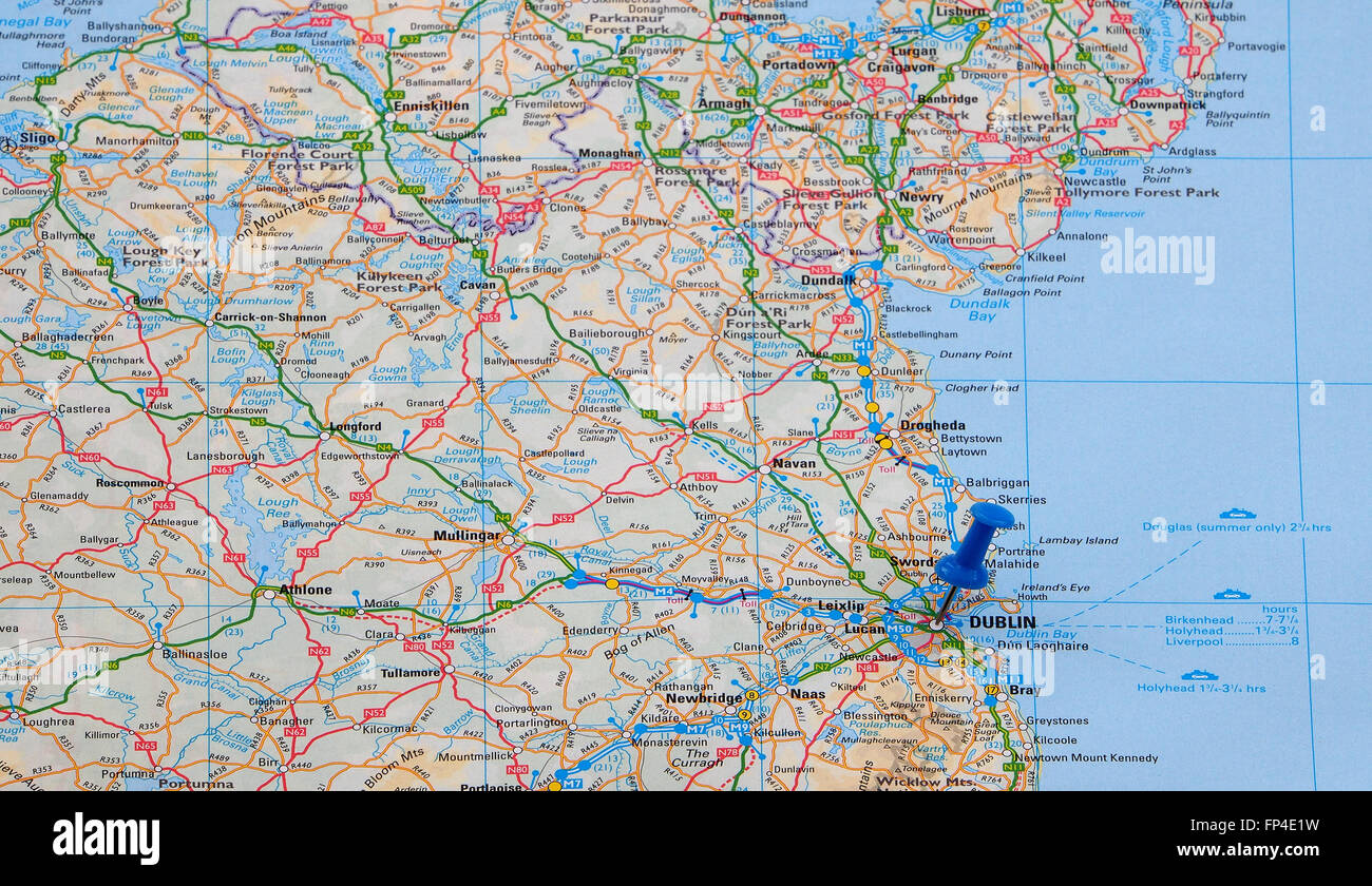 Map of the east coast of Eire (Southern Ireland) showing the road and ferry crossing routes and with a map pin indicating Dublin Stock Photohttps://www.alamy.com/image-license-details/?v=1https://www.alamy.com/stock-photo-map-of-the-east-coast-of-eire-southern-ireland-showing-the-road-and-99673109.html
RMFP4E1W–Map of the east coast of Eire (Southern Ireland) showing the road and ferry crossing routes and with a map pin indicating Dublin
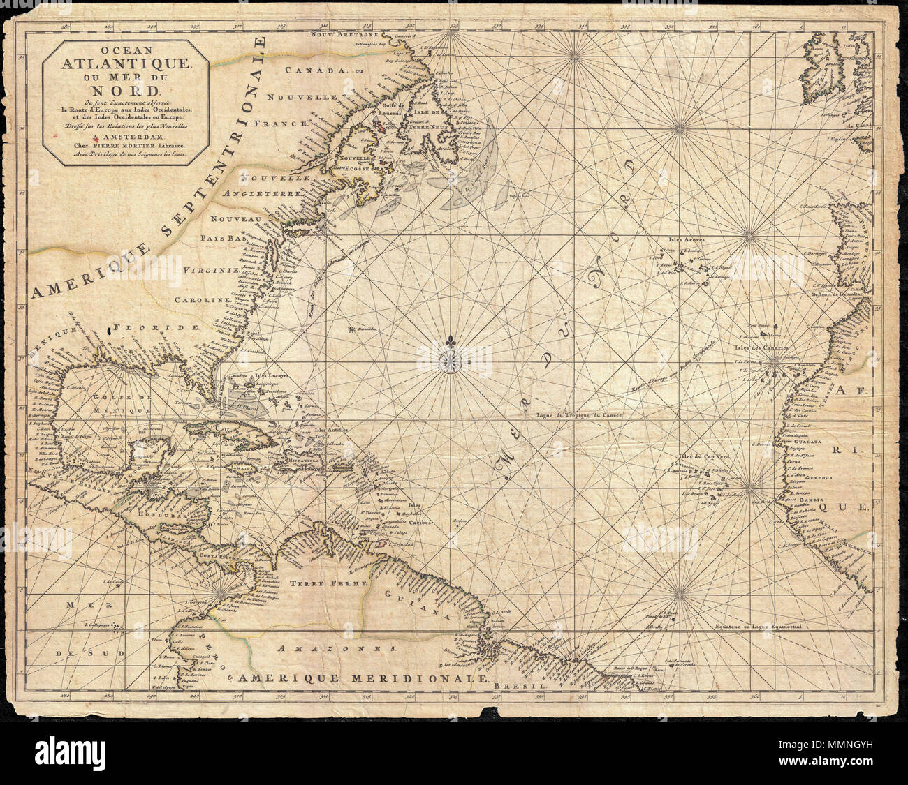 . English: This is a rare and remarkable 1693 nautical chart of the Atlantic Ocean by Pierre Mortier. Covers the North Atlantic from rough 5 degree south latitude to roughly 56 degrees north latitude. Includes much of North America, all of the West Indies and Caribbean, Central America, the northern parts of South America, Western Africa, Ireland, and parts of Western Spain. As a whole Mortier's map presents a moderately accurate picture of the Americas. The coast lines, particularly in North America are a unnaturally craggy. Florida takes on an inverted cone aspect. The barrier islands and c Stock Photohttps://www.alamy.com/image-license-details/?v=1https://www.alamy.com/english-this-is-a-rare-and-remarkable-1693-nautical-chart-of-the-atlantic-ocean-by-pierre-mortier-covers-the-north-atlantic-from-rough-5-degree-south-latitude-to-roughly-56-degrees-north-latitude-includes-much-of-north-america-all-of-the-west-indies-and-caribbean-central-america-the-northern-parts-of-south-america-western-africa-ireland-and-parts-of-western-spain-as-a-whole-mortiers-map-presents-a-moderately-accurate-picture-of-the-americas-the-coast-lines-particularly-in-north-america-are-a-unnaturally-craggy-florida-takes-on-an-inverted-cone-aspect-the-barrier-islands-and-c-image184871109.html
RMMMNGYH–. English: This is a rare and remarkable 1693 nautical chart of the Atlantic Ocean by Pierre Mortier. Covers the North Atlantic from rough 5 degree south latitude to roughly 56 degrees north latitude. Includes much of North America, all of the West Indies and Caribbean, Central America, the northern parts of South America, Western Africa, Ireland, and parts of Western Spain. As a whole Mortier's map presents a moderately accurate picture of the Americas. The coast lines, particularly in North America are a unnaturally craggy. Florida takes on an inverted cone aspect. The barrier islands and c
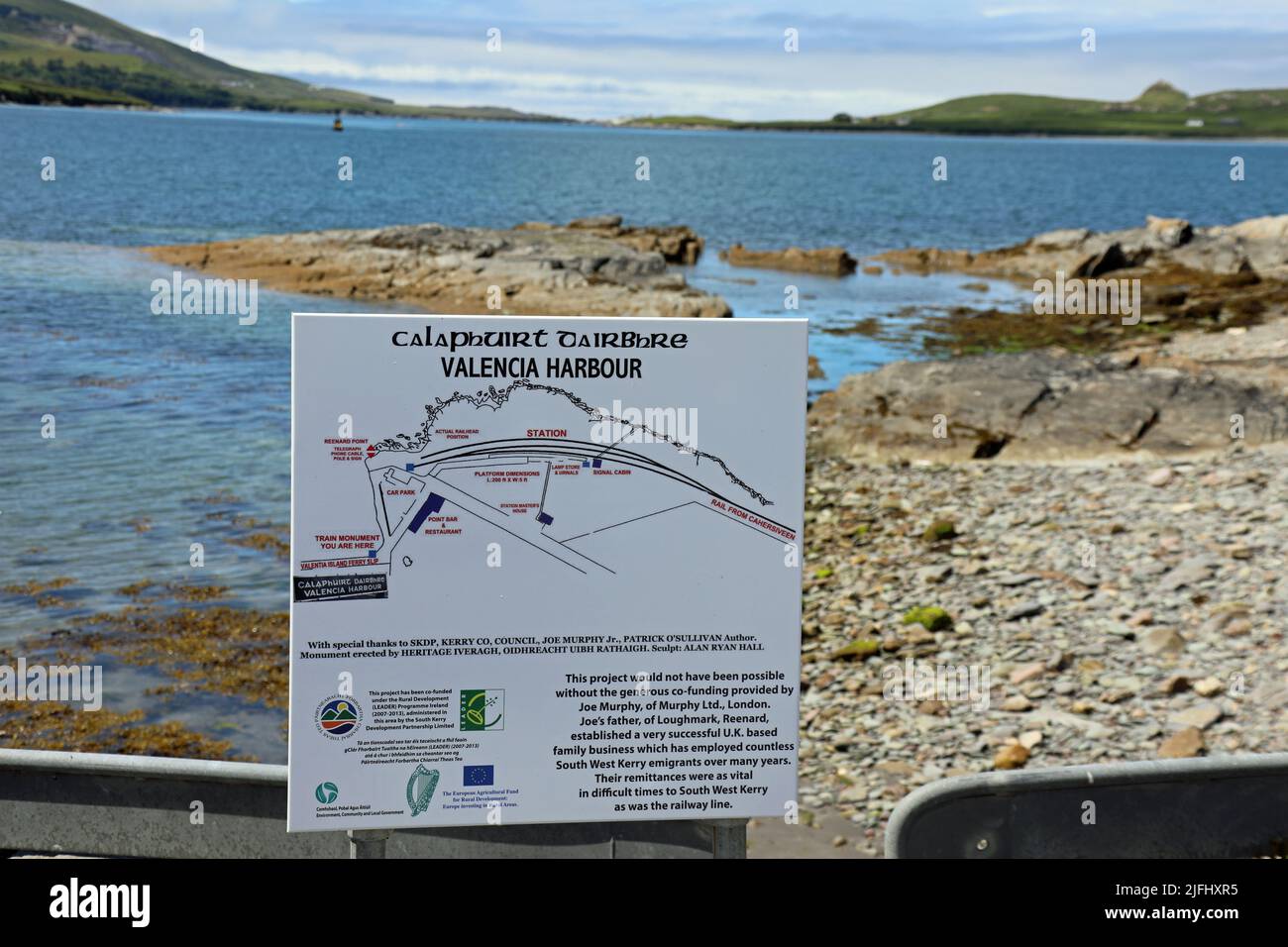 Map of Valentia Harbour in County Kerry Stock Photohttps://www.alamy.com/image-license-details/?v=1https://www.alamy.com/map-of-valentia-harbour-in-county-kerry-image474293993.html
RM2JFHXR5–Map of Valentia Harbour in County Kerry
 A Man And Woman Look At A Map While Standing On A Road Near Ardgroom; County Cork, Ireland Stock Photohttps://www.alamy.com/image-license-details/?v=1https://www.alamy.com/stock-photo-a-man-and-woman-look-at-a-map-while-standing-on-a-road-near-ardgroom-49615406.html
RFCTM4XP–A Man And Woman Look At A Map While Standing On A Road Near Ardgroom; County Cork, Ireland
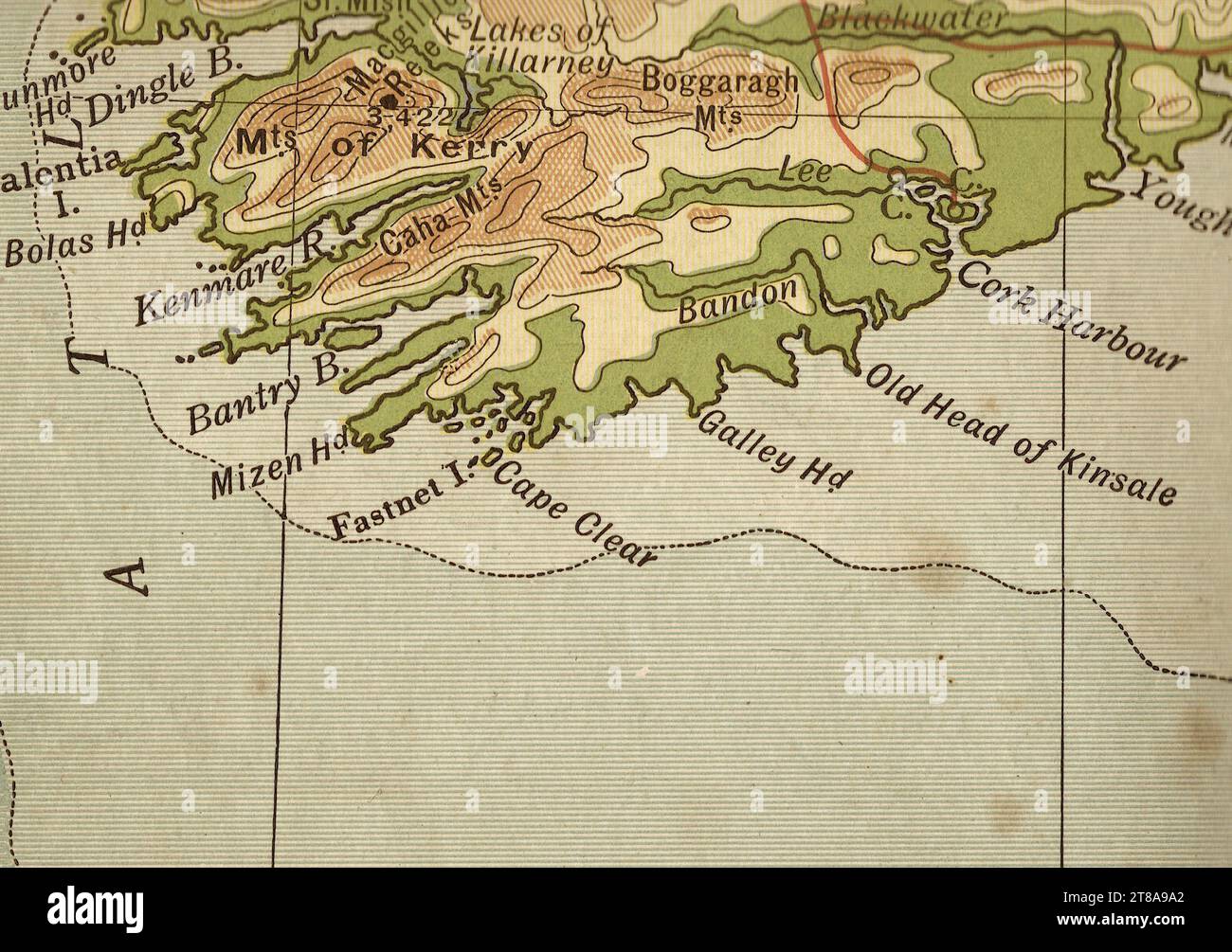 An antique geographical sepia coloured map of Ireland and the south coast. Stock Photohttps://www.alamy.com/image-license-details/?v=1https://www.alamy.com/an-antique-geographical-sepia-coloured-map-of-ireland-and-the-south-coast-image573086250.html
RF2T8A9A2–An antique geographical sepia coloured map of Ireland and the south coast.
 Map of Courtmacsherry, County Cork, Ireland Stock Photohttps://www.alamy.com/image-license-details/?v=1https://www.alamy.com/map-of-courtmacsherry-county-cork-ireland-image452975925.html
RM2H8XRBH–Map of Courtmacsherry, County Cork, Ireland
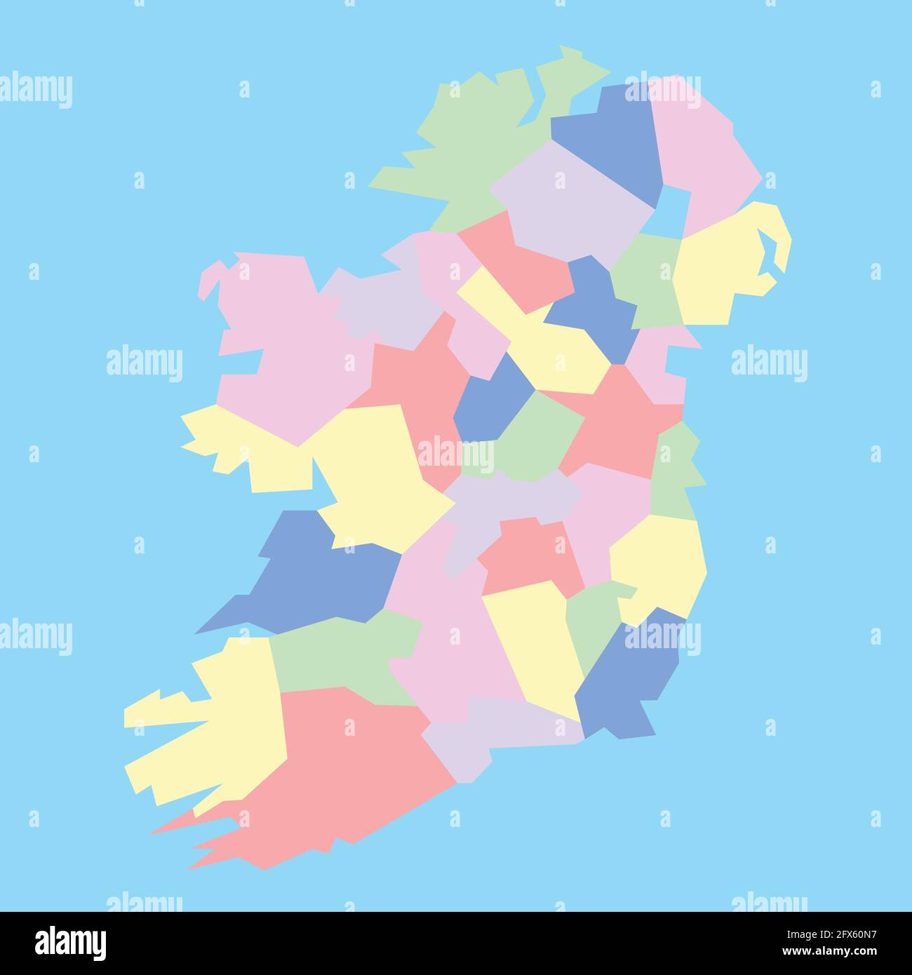 Vector map of Ireland's conties to study Stock Vectorhttps://www.alamy.com/image-license-details/?v=1https://www.alamy.com/vector-map-of-irelands-conties-to-study-image429162195.html
RF2FX60N7–Vector map of Ireland's conties to study
 AMH-6813-NA Map of England, the south of Ireland and part of the French coast Stock Photohttps://www.alamy.com/image-license-details/?v=1https://www.alamy.com/stock-photo-amh-6813-na-map-of-england-the-south-of-ireland-and-part-of-the-french-132612213.html
RMHKN06D–AMH-6813-NA Map of England, the south of Ireland and part of the French coast
 Geological map South west Ireland - Kerry coast. BEYSCHLAG 1898 old Stock Photohttps://www.alamy.com/image-license-details/?v=1https://www.alamy.com/geological-map-south-west-ireland-kerry-coast-beyschlag-1898-old-image623239861.html
RF2Y5Y0PD–Geological map South west Ireland - Kerry coast. BEYSCHLAG 1898 old
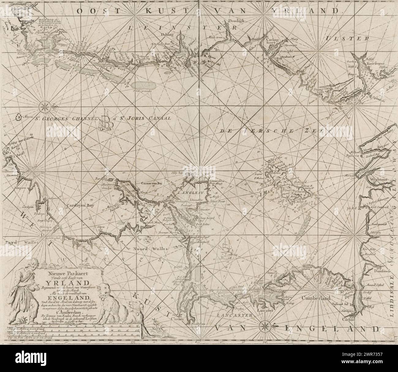 Pass map of part of the Irish Sea and the St. George's Canal, Nieuwe Pas-kaert From the east coast of Ireland Starting from the corner of Waterfoort to the Mards As well as the west coast of England From S. David to Moul of Galoway with all syn depth and dreary, therefore drawn up with great precision and never brought into the light for these animals (title on object), Pass map of a part of the Irish Sea, between Ireland and Great Britain, and the St. George's Canal, with two compass roses, the North is on the right. Bottom left a cartouche with the title Stock Photohttps://www.alamy.com/image-license-details/?v=1https://www.alamy.com/pass-map-of-part-of-the-irish-sea-and-the-st-georges-canal-nieuwe-pas-kaert-from-the-east-coast-of-ireland-starting-from-the-corner-of-waterfoort-to-the-mards-as-well-as-the-west-coast-of-england-from-s-david-to-moul-of-galoway-with-all-syn-depth-and-dreary-therefore-drawn-up-with-great-precision-and-never-brought-into-the-light-for-these-animals-title-on-object-pass-map-of-a-part-of-the-irish-sea-between-ireland-and-great-britain-and-the-st-georges-canal-with-two-compass-roses-the-north-is-on-the-right-bottom-left-a-cartouche-with-the-title-image599445763.html
RM2WR7357–Pass map of part of the Irish Sea and the St. George's Canal, Nieuwe Pas-kaert From the east coast of Ireland Starting from the corner of Waterfoort to the Mards As well as the west coast of England From S. David to Moul of Galoway with all syn depth and dreary, therefore drawn up with great precision and never brought into the light for these animals (title on object), Pass map of a part of the Irish Sea, between Ireland and Great Britain, and the St. George's Canal, with two compass roses, the North is on the right. Bottom left a cartouche with the title
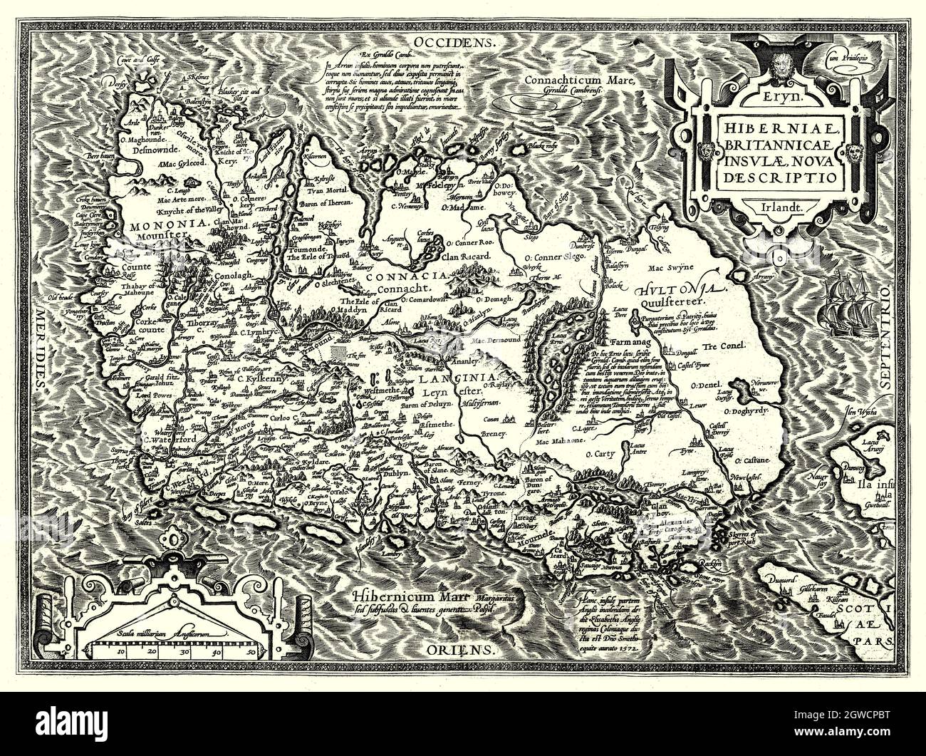 'Hiberniae, Britannicae Insvlae nova descripto.' Translation: a new description of Ireland and the British Island, is in Latin and is lying with its northern coast to the west. The map, was created in 1598 by Abraham Ortelius (1527-1598), a Dutch cartographer, geographer, and cosmographer, conventionally recognized as the creator of the first modern atlas, the Theatrum Orbis Terrarum (Theatre of the World). Stock Photohttps://www.alamy.com/image-license-details/?v=1https://www.alamy.com/hiberniae-britannicae-insvlae-nova-descripto-translation-a-new-description-of-ireland-and-the-british-island-is-in-latin-and-is-lying-with-its-northern-coast-to-the-west-the-map-was-created-in-1598-by-abraham-ortelius-1527-1598-a-dutch-cartographer-geographer-and-cosmographer-conventionally-recognized-as-the-creator-of-the-first-modern-atlas-the-theatrum-orbis-terrarum-theatre-of-the-world-image445906604.html
RM2GWCPBT–'Hiberniae, Britannicae Insvlae nova descripto.' Translation: a new description of Ireland and the British Island, is in Latin and is lying with its northern coast to the west. The map, was created in 1598 by Abraham Ortelius (1527-1598), a Dutch cartographer, geographer, and cosmographer, conventionally recognized as the creator of the first modern atlas, the Theatrum Orbis Terrarum (Theatre of the World).
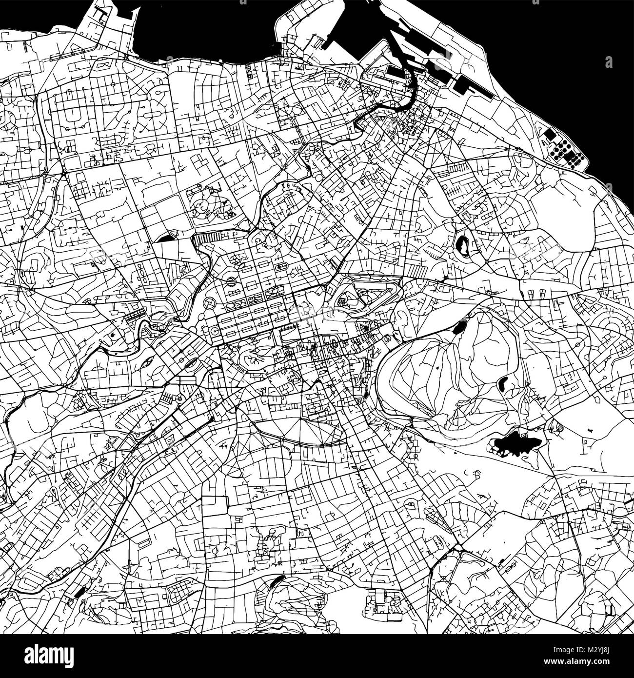 Edinburgh Downtown Vector Map Monochrome Artprint, Outline Version for Infographic Background, Black Streets and Waterways Stock Vectorhttps://www.alamy.com/image-license-details/?v=1https://www.alamy.com/stock-photo-edinburgh-downtown-vector-map-monochrome-artprint-outline-version-173940050.html
RFM2YJ8J–Edinburgh Downtown Vector Map Monochrome Artprint, Outline Version for Infographic Background, Black Streets and Waterways
 Baranailt, Causeway Coast and Glens, United Kingdom, Northern Ireland, N 54 58' 59'', W 7 1' 59'', map, Timeless Map published in 2021. Travelers, explorers and adventurers like Florence Nightingale, David Livingstone, Ernest Shackleton, Lewis and Clark and Sherlock Holmes relied on maps to plan travels to the world's most remote corners, Timeless Maps is mapping most locations on the globe, showing the achievement of great dreams Stock Photohttps://www.alamy.com/image-license-details/?v=1https://www.alamy.com/baranailt-causeway-coast-and-glens-united-kingdom-northern-ireland-n-54-58-59-w-7-1-59-map-timeless-map-published-in-2021-travelers-explorers-and-adventurers-like-florence-nightingale-david-livingstone-ernest-shackleton-lewis-and-clark-and-sherlock-holmes-relied-on-maps-to-plan-travels-to-the-worlds-most-remote-corners-timeless-maps-is-mapping-most-locations-on-the-globe-showing-the-achievement-of-great-dreams-image439403157.html
RM2GETF5W–Baranailt, Causeway Coast and Glens, United Kingdom, Northern Ireland, N 54 58' 59'', W 7 1' 59'', map, Timeless Map published in 2021. Travelers, explorers and adventurers like Florence Nightingale, David Livingstone, Ernest Shackleton, Lewis and Clark and Sherlock Holmes relied on maps to plan travels to the world's most remote corners, Timeless Maps is mapping most locations on the globe, showing the achievement of great dreams
 Hybernia Nunc Irlant. Ireland. Map was clearly made by a member of the Lafreri School of cartographers, Antonio Lafreri (1512-77). Rome, 1570. Renaissance. Engraving by Paolo Forlani, 16th C. Stock Photohttps://www.alamy.com/image-license-details/?v=1https://www.alamy.com/hybernia-nunc-irlant-ireland-map-was-clearly-made-by-a-member-of-the-lafreri-school-of-cartographers-antonio-lafreri-1512-77-rome-1570-renaissance-engraving-by-paolo-forlani-16th-c-image220201526.html
RMPP7186–Hybernia Nunc Irlant. Ireland. Map was clearly made by a member of the Lafreri School of cartographers, Antonio Lafreri (1512-77). Rome, 1570. Renaissance. Engraving by Paolo Forlani, 16th C.
![Map of the British Isles, 1946. Map of England, Wales, Ireland and Scotland, 'Showing the Chief Places Mentioned in the Text', ie islands off the coast including Holy Island, the Farne Islands, Mersea, Canvey and Sheppey, Isle of Wight, Isles of Scilly, Lundy, Skomer, Anglesey, the Skerries, Isle of Man, Great Blasket, the Outer Hebrides, the Orkneys and the Shetlands. From "Islands Round Britain", by R. M. Lockley. [Collins, London, 1946] Stock Photo Map of the British Isles, 1946. Map of England, Wales, Ireland and Scotland, 'Showing the Chief Places Mentioned in the Text', ie islands off the coast including Holy Island, the Farne Islands, Mersea, Canvey and Sheppey, Isle of Wight, Isles of Scilly, Lundy, Skomer, Anglesey, the Skerries, Isle of Man, Great Blasket, the Outer Hebrides, the Orkneys and the Shetlands. From "Islands Round Britain", by R. M. Lockley. [Collins, London, 1946] Stock Photo](https://c8.alamy.com/comp/2AG0H6N/map-of-the-british-isles-1946-map-of-england-wales-ireland-and-scotland-showing-the-chief-places-mentioned-in-the-text-ie-islands-off-the-coast-including-holy-island-the-farne-islands-mersea-canvey-and-sheppey-isle-of-wight-isles-of-scilly-lundy-skomer-anglesey-the-skerries-isle-of-man-great-blasket-the-outer-hebrides-the-orkneys-and-the-shetlands-from-quotislands-round-britainquot-by-r-m-lockley-collins-london-1946-2AG0H6N.jpg) Map of the British Isles, 1946. Map of England, Wales, Ireland and Scotland, 'Showing the Chief Places Mentioned in the Text', ie islands off the coast including Holy Island, the Farne Islands, Mersea, Canvey and Sheppey, Isle of Wight, Isles of Scilly, Lundy, Skomer, Anglesey, the Skerries, Isle of Man, Great Blasket, the Outer Hebrides, the Orkneys and the Shetlands. From "Islands Round Britain", by R. M. Lockley. [Collins, London, 1946] Stock Photohttps://www.alamy.com/image-license-details/?v=1https://www.alamy.com/map-of-the-british-isles-1946-map-of-england-wales-ireland-and-scotland-showing-the-chief-places-mentioned-in-the-text-ie-islands-off-the-coast-including-holy-island-the-farne-islands-mersea-canvey-and-sheppey-isle-of-wight-isles-of-scilly-lundy-skomer-anglesey-the-skerries-isle-of-man-great-blasket-the-outer-hebrides-the-orkneys-and-the-shetlands-from-quotislands-round-britainquot-by-r-m-lockley-collins-london-1946-image336845005.html
Map of the British Isles, 1946. Map of England, Wales, Ireland and Scotland, 'Showing the Chief Places Mentioned in the Text', ie islands off the coast including Holy Island, the Farne Islands, Mersea, Canvey and Sheppey, Isle of Wight, Isles of Scilly, Lundy, Skomer, Anglesey, the Skerries, Isle of Man, Great Blasket, the Outer Hebrides, the Orkneys and the Shetlands. From "Islands Round Britain", by R. M. Lockley. [Collins, London, 1946] Stock Photohttps://www.alamy.com/image-license-details/?v=1https://www.alamy.com/map-of-the-british-isles-1946-map-of-england-wales-ireland-and-scotland-showing-the-chief-places-mentioned-in-the-text-ie-islands-off-the-coast-including-holy-island-the-farne-islands-mersea-canvey-and-sheppey-isle-of-wight-isles-of-scilly-lundy-skomer-anglesey-the-skerries-isle-of-man-great-blasket-the-outer-hebrides-the-orkneys-and-the-shetlands-from-quotislands-round-britainquot-by-r-m-lockley-collins-london-1946-image336845005.htmlRM2AG0H6N–Map of the British Isles, 1946. Map of England, Wales, Ireland and Scotland, 'Showing the Chief Places Mentioned in the Text', ie islands off the coast including Holy Island, the Farne Islands, Mersea, Canvey and Sheppey, Isle of Wight, Isles of Scilly, Lundy, Skomer, Anglesey, the Skerries, Isle of Man, Great Blasket, the Outer Hebrides, the Orkneys and the Shetlands. From "Islands Round Britain", by R. M. Lockley. [Collins, London, 1946]
 Coast guard office in Carrigaholt, County Clare Ireland Stock Photohttps://www.alamy.com/image-license-details/?v=1https://www.alamy.com/stock-photo-coast-guard-office-in-carrigaholt-county-clare-ireland-18805666.html
RMB2GJPX–Coast guard office in Carrigaholt, County Clare Ireland
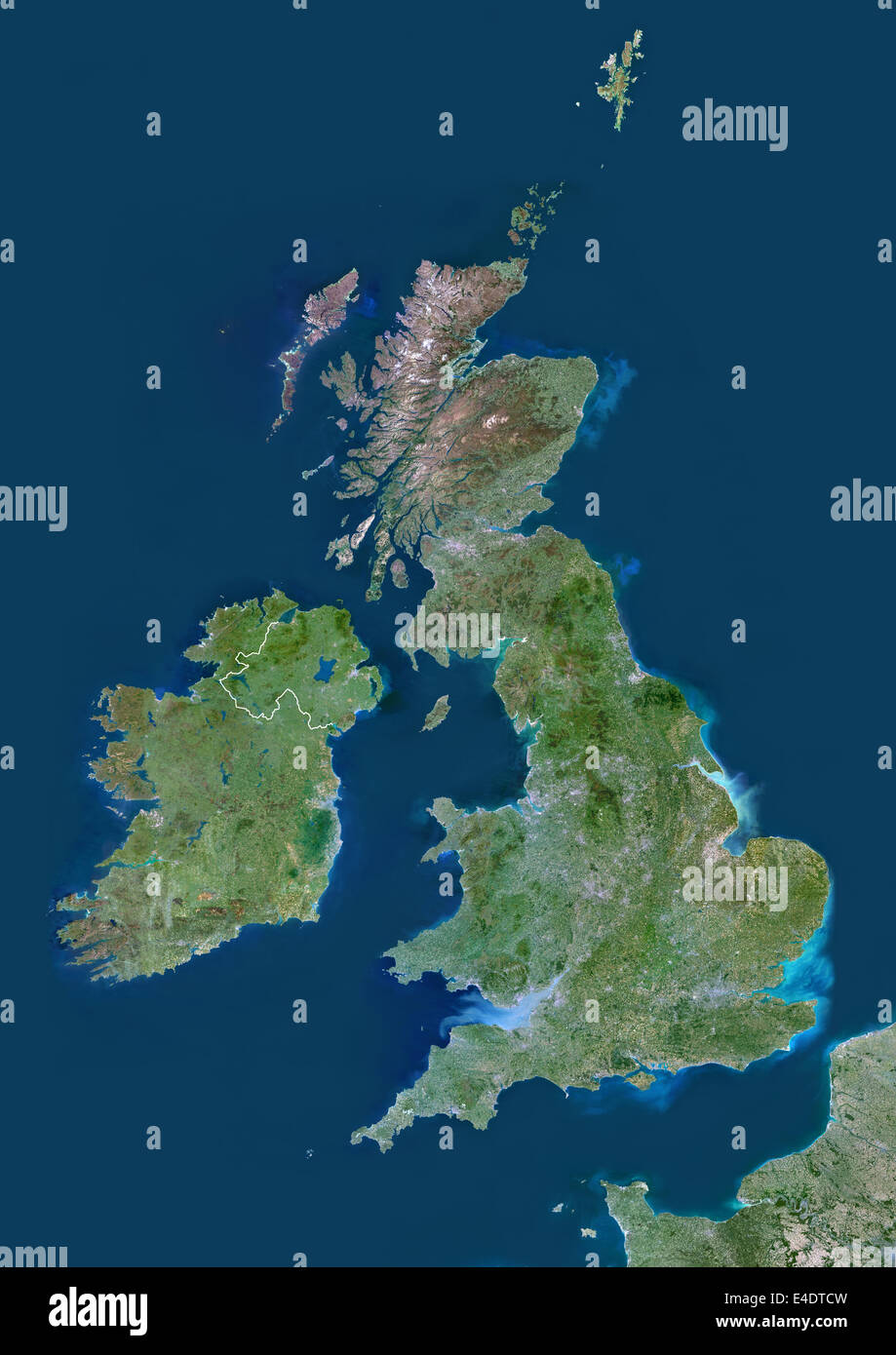 United Kingdom, Europe, True Colour Satellite Image With Border. Satellite view of Bulgaria (with border). This image was compil Stock Photohttps://www.alamy.com/image-license-details/?v=1https://www.alamy.com/stock-photo-united-kingdom-europe-true-colour-satellite-image-with-border-satellite-71604649.html
RME4DTCW–United Kingdom, Europe, True Colour Satellite Image With Border. Satellite view of Bulgaria (with border). This image was compil
 Stencil map of Inisheer. Simple and minimal transparent map of Inisheer. Black rectangle with cut shape of the island. Powerful vector illustration. Stock Vectorhttps://www.alamy.com/image-license-details/?v=1https://www.alamy.com/stencil-map-of-inisheer-simple-and-minimal-transparent-map-of-inisheer-black-rectangle-with-cut-shape-of-the-island-powerful-vector-illustration-image562022684.html
RF2RJA9JM–Stencil map of Inisheer. Simple and minimal transparent map of Inisheer. Black rectangle with cut shape of the island. Powerful vector illustration.
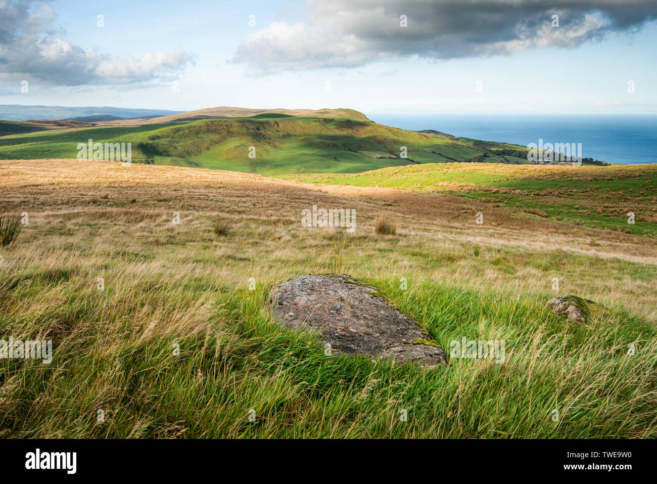 Light and shadows map the rolling hills of Antrim close to Ballygally on the North Antrim Coast, Northern Ireland. Stock Photohttps://www.alamy.com/image-license-details/?v=1https://www.alamy.com/light-and-shadows-map-the-rolling-hills-of-antrim-close-to-ballygally-on-the-north-antrim-coast-northern-ireland-image256626636.html
RMTWE9W0–Light and shadows map the rolling hills of Antrim close to Ballygally on the North Antrim Coast, Northern Ireland.
 Causeway Coast and Glens watercolor district map of Northern Ireland Stock Photohttps://www.alamy.com/image-license-details/?v=1https://www.alamy.com/causeway-coast-and-glens-watercolor-district-map-of-northern-ireland-image242611232.html
RFT2KW2T–Causeway Coast and Glens watercolor district map of Northern Ireland
 3d isometric map of Ireland is an island in Europe, isolated vector illustration Stock Vectorhttps://www.alamy.com/image-license-details/?v=1https://www.alamy.com/3d-isometric-map-of-ireland-is-an-island-in-europe-isolated-vector-illustration-image425032402.html
RF2FKDW4J–3d isometric map of Ireland is an island in Europe, isolated vector illustration
 Map of Valentia Harbour in County Kerry Stock Photohttps://www.alamy.com/image-license-details/?v=1https://www.alamy.com/map-of-valentia-harbour-in-county-kerry-image474294069.html
RM2JFHXWW–Map of Valentia Harbour in County Kerry
![A map of the west coast of England, Wales and part of Ireland. The Mercator atlas of Europe. [S.l.] : [S.n.], 1570-1572. Source: Maps C.29.c.13, page 12. Language: Latin. Author: MERCATOR, GERHARD. Stock Photo A map of the west coast of England, Wales and part of Ireland. The Mercator atlas of Europe. [S.l.] : [S.n.], 1570-1572. Source: Maps C.29.c.13, page 12. Language: Latin. Author: MERCATOR, GERHARD. Stock Photo](https://c8.alamy.com/comp/R5B1T3/a-map-of-the-west-coast-of-england-wales-and-part-of-ireland-the-mercator-atlas-of-europe-sl-sn-1570-1572-source-maps-c29c13-page-12-language-latin-author-mercator-gerhard-R5B1T3.jpg) A map of the west coast of England, Wales and part of Ireland. The Mercator atlas of Europe. [S.l.] : [S.n.], 1570-1572. Source: Maps C.29.c.13, page 12. Language: Latin. Author: MERCATOR, GERHARD. Stock Photohttps://www.alamy.com/image-license-details/?v=1https://www.alamy.com/a-map-of-the-west-coast-of-england-wales-and-part-of-ireland-the-mercator-atlas-of-europe-sl-sn-1570-1572-source-maps-c29c13-page-12-language-latin-author-mercator-gerhard-image227050995.html
A map of the west coast of England, Wales and part of Ireland. The Mercator atlas of Europe. [S.l.] : [S.n.], 1570-1572. Source: Maps C.29.c.13, page 12. Language: Latin. Author: MERCATOR, GERHARD. Stock Photohttps://www.alamy.com/image-license-details/?v=1https://www.alamy.com/a-map-of-the-west-coast-of-england-wales-and-part-of-ireland-the-mercator-atlas-of-europe-sl-sn-1570-1572-source-maps-c29c13-page-12-language-latin-author-mercator-gerhard-image227050995.htmlRMR5B1T3–A map of the west coast of England, Wales and part of Ireland. The Mercator atlas of Europe. [S.l.] : [S.n.], 1570-1572. Source: Maps C.29.c.13, page 12. Language: Latin. Author: MERCATOR, GERHARD.
 An antique geographical sepia coloured map of Ireland showing the south coast. Stock Photohttps://www.alamy.com/image-license-details/?v=1https://www.alamy.com/an-antique-geographical-sepia-coloured-map-of-ireland-showing-the-south-coast-image573086253.html
RF2T8A9A5–An antique geographical sepia coloured map of Ireland showing the south coast.
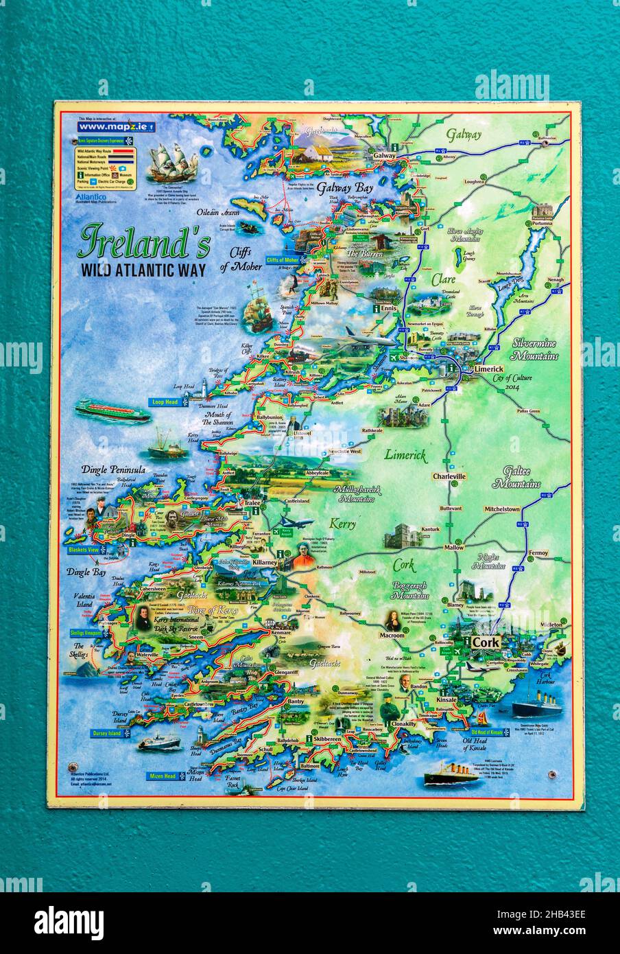 Map of Ireland, Sneem Village, County Kerry, Ireland Stock Photohttps://www.alamy.com/image-license-details/?v=1https://www.alamy.com/map-of-ireland-sneem-village-county-kerry-ireland-image454321350.html
RM2HB43EE–Map of Ireland, Sneem Village, County Kerry, Ireland
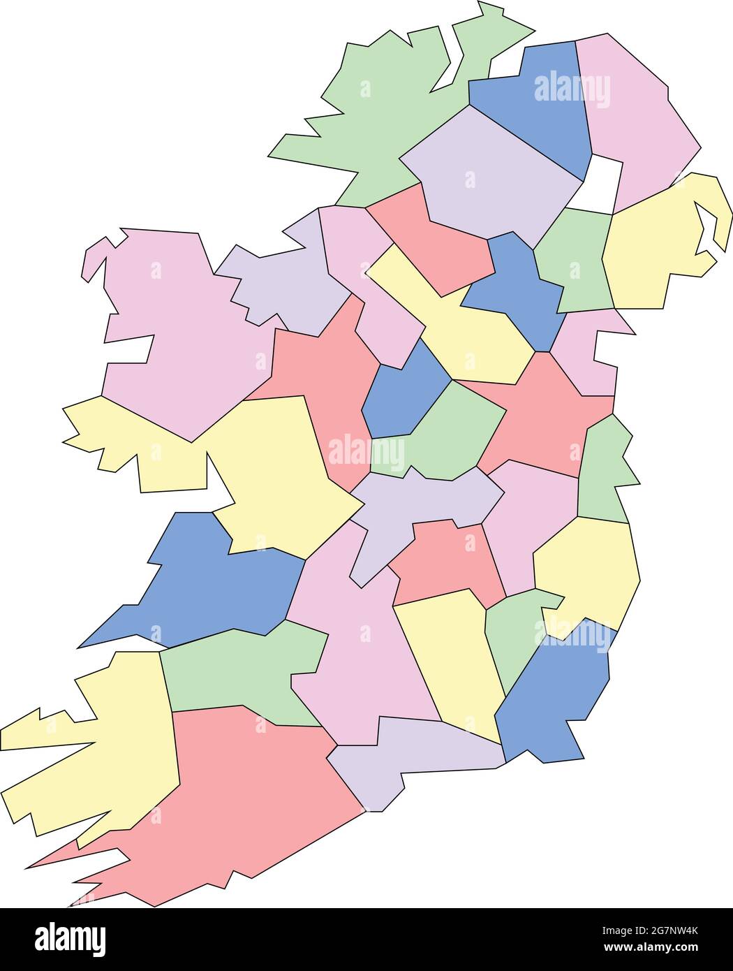 Vector map of Ireland to study with outline Stock Vectorhttps://www.alamy.com/image-license-details/?v=1https://www.alamy.com/vector-map-of-ireland-to-study-with-outline-image435042515.html
RF2G7NW4K–Vector map of Ireland to study with outline
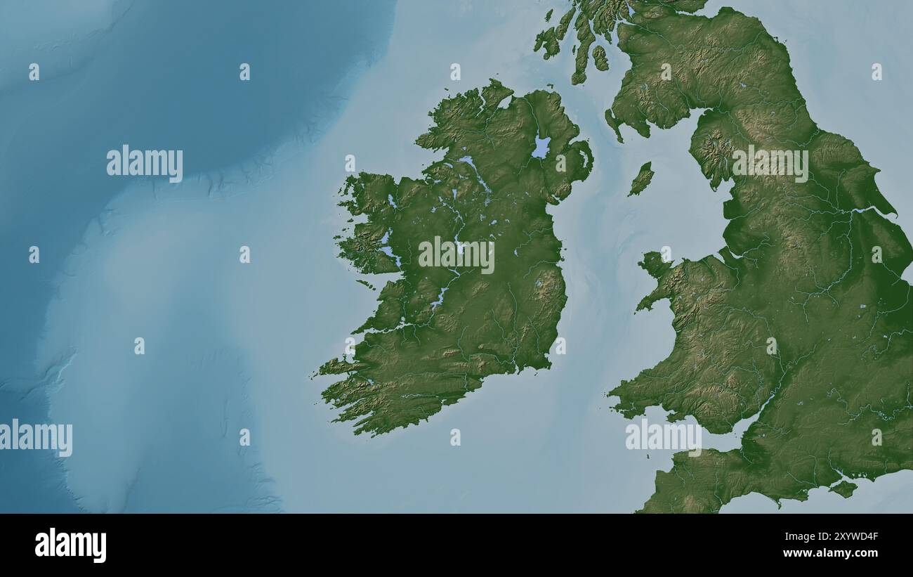 Ireland Island in the Celtic Sea on a colored elevation map Stock Photohttps://www.alamy.com/image-license-details/?v=1https://www.alamy.com/ireland-island-in-the-celtic-sea-on-a-colored-elevation-map-image619517711.html
RF2XYWD4F–Ireland Island in the Celtic Sea on a colored elevation map
 85b. Ireland coast. County Waterford Wexford. KRIEGSMARINE Nazi map 1940 Stock Photohttps://www.alamy.com/image-license-details/?v=1https://www.alamy.com/85b-ireland-coast-county-waterford-wexford-kriegsmarine-nazi-map-1940-image454159941.html
RF2HATNHW–85b. Ireland coast. County Waterford Wexford. KRIEGSMARINE Nazi map 1940
 Pass map of a part of the west coast of Ireland, Pass map of the West Cust of Yrlandt Starting from Klady To a and De Blasques, With all its depth and dryness So far. Accurately drawn up and corrected from many errors. (title on object), Pass map of a part of the west coast of Ireland, with two compass roses, North is on the left. Top center a shepherd with his sheep near the cartouche with the title. Bottom left two angels with flowers at the address of the publisher and the scale, shown in German, Spanish and English or French miles (scale: c . 1:550,000)., print maker: anonymous Stock Photohttps://www.alamy.com/image-license-details/?v=1https://www.alamy.com/pass-map-of-a-part-of-the-west-coast-of-ireland-pass-map-of-the-west-cust-of-yrlandt-starting-from-klady-to-a-and-de-blasques-with-all-its-depth-and-dryness-so-far-accurately-drawn-up-and-corrected-from-many-errors-title-on-object-pass-map-of-a-part-of-the-west-coast-of-ireland-with-two-compass-roses-north-is-on-the-left-top-center-a-shepherd-with-his-sheep-near-the-cartouche-with-the-title-bottom-left-two-angels-with-flowers-at-the-address-of-the-publisher-and-the-scale-shown-in-german-spanish-and-english-or-french-miles-scale-c-1550000-print-maker-anonymous-image599445755.html
RM2WR734Y–Pass map of a part of the west coast of Ireland, Pass map of the West Cust of Yrlandt Starting from Klady To a and De Blasques, With all its depth and dryness So far. Accurately drawn up and corrected from many errors. (title on object), Pass map of a part of the west coast of Ireland, with two compass roses, North is on the left. Top center a shepherd with his sheep near the cartouche with the title. Bottom left two angels with flowers at the address of the publisher and the scale, shown in German, Spanish and English or French miles (scale: c . 1:550,000)., print maker: anonymous
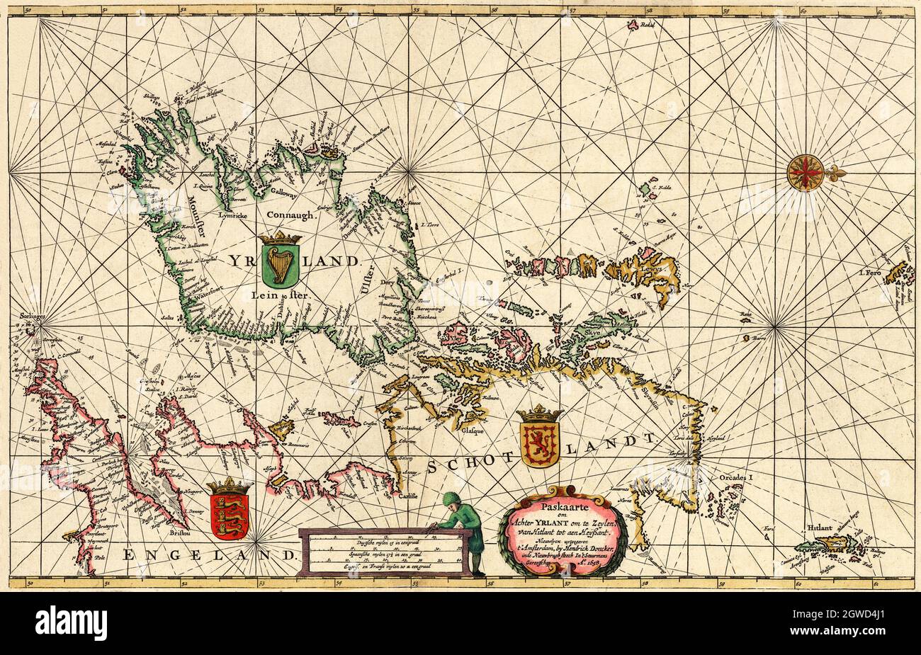 'Paskaarte om achter Yrlant om te zeylen, van Hitlant tot aen Heÿssant.' Tranlation: Map from beyond Ireland to Zeylen, from Shetland to Ouessant. The map created in 1658 was by Hendrick Doncker (1626-1699), a bookseller and publisher in Amsterdam during the 17th Century. His sea atlases are based on his own work and have been known for their accuracy. NB This version has been modified and reduced in size. Stock Photohttps://www.alamy.com/image-license-details/?v=1https://www.alamy.com/paskaarte-om-achter-yrlant-om-te-zeylen-van-hitlant-tot-aen-hessant-tranlation-map-from-beyond-ireland-to-zeylen-from-shetland-to-ouessant-the-map-created-in-1658-was-by-hendrick-doncker-1626-1699-a-bookseller-and-publisher-in-amsterdam-during-the-17th-century-his-sea-atlases-are-based-on-his-own-work-and-have-been-known-for-their-accuracy-nb-this-version-has-been-modified-and-reduced-in-size-image445914617.html
RM2GWD4J1–'Paskaarte om achter Yrlant om te zeylen, van Hitlant tot aen Heÿssant.' Tranlation: Map from beyond Ireland to Zeylen, from Shetland to Ouessant. The map created in 1658 was by Hendrick Doncker (1626-1699), a bookseller and publisher in Amsterdam during the 17th Century. His sea atlases are based on his own work and have been known for their accuracy. NB This version has been modified and reduced in size.
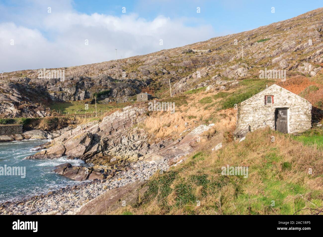 Achilles countryside of West Cork in Ireland Stock Photohttps://www.alamy.com/image-license-details/?v=1https://www.alamy.com/achilles-countryside-of-west-cork-in-ireland-image334413469.html
RM2AC1RP5–Achilles countryside of West Cork in Ireland
 Articlave, Causeway Coast and Glens, United Kingdom, Northern Ireland, N 55 8' 44'', W 6 46' 23'', map, Timeless Map published in 2021. Travelers, explorers and adventurers like Florence Nightingale, David Livingstone, Ernest Shackleton, Lewis and Clark and Sherlock Holmes relied on maps to plan travels to the world's most remote corners, Timeless Maps is mapping most locations on the globe, showing the achievement of great dreams Stock Photohttps://www.alamy.com/image-license-details/?v=1https://www.alamy.com/articlave-causeway-coast-and-glens-united-kingdom-northern-ireland-n-55-8-44-w-6-46-23-map-timeless-map-published-in-2021-travelers-explorers-and-adventurers-like-florence-nightingale-david-livingstone-ernest-shackleton-lewis-and-clark-and-sherlock-holmes-relied-on-maps-to-plan-travels-to-the-worlds-most-remote-corners-timeless-maps-is-mapping-most-locations-on-the-globe-showing-the-achievement-of-great-dreams-image439403807.html
RM2GETG13–Articlave, Causeway Coast and Glens, United Kingdom, Northern Ireland, N 55 8' 44'', W 6 46' 23'', map, Timeless Map published in 2021. Travelers, explorers and adventurers like Florence Nightingale, David Livingstone, Ernest Shackleton, Lewis and Clark and Sherlock Holmes relied on maps to plan travels to the world's most remote corners, Timeless Maps is mapping most locations on the globe, showing the achievement of great dreams
 Ireland, Munster, county Kerry, ring of Kerry, Skellig ring, Stock Photohttps://www.alamy.com/image-license-details/?v=1https://www.alamy.com/stock-photo-ireland-munster-county-kerry-ring-of-kerry-skellig-ring-140638868.html
RMJ4PJ8M–Ireland, Munster, county Kerry, ring of Kerry, Skellig ring,
!['Germany and the Casement Plot', First World War, c1916, (c1920). '...map showing approximately the course taken by the gun-runner and the submarine with Roger Casement on board, from Germany to the coast of Kerry' [on the west coast of Ireland]. A German submarine put Irish nationalist Roger Casement ashore at Banna Strand in Tralee Bay, County Kerry, on 21 April 1916. He had attempted to ship weapons from Germany to fight against Britain in the cause of Irish independence. The Royal Navy intercepted the ship transporting the guns and they never reached Ireland. Casement was tried and execute Stock Photo 'Germany and the Casement Plot', First World War, c1916, (c1920). '...map showing approximately the course taken by the gun-runner and the submarine with Roger Casement on board, from Germany to the coast of Kerry' [on the west coast of Ireland]. A German submarine put Irish nationalist Roger Casement ashore at Banna Strand in Tralee Bay, County Kerry, on 21 April 1916. He had attempted to ship weapons from Germany to fight against Britain in the cause of Irish independence. The Royal Navy intercepted the ship transporting the guns and they never reached Ireland. Casement was tried and execute Stock Photo](https://c8.alamy.com/comp/2A8E7K6/germany-and-the-casement-plot-first-world-war-c1916-c1920-map-showing-approximately-the-course-taken-by-the-gun-runner-and-the-submarine-with-roger-casement-on-board-from-germany-to-the-coast-of-kerry-on-the-west-coast-of-ireland-a-german-submarine-put-irish-nationalist-roger-casement-ashore-at-banna-strand-in-tralee-bay-county-kerry-on-21-april-1916-he-had-attempted-to-ship-weapons-from-germany-to-fight-against-britain-in-the-cause-of-irish-independence-the-royal-navy-intercepted-the-ship-transporting-the-guns-and-they-never-reached-ireland-casement-was-tried-and-execute-2A8E7K6.jpg) 'Germany and the Casement Plot', First World War, c1916, (c1920). '...map showing approximately the course taken by the gun-runner and the submarine with Roger Casement on board, from Germany to the coast of Kerry' [on the west coast of Ireland]. A German submarine put Irish nationalist Roger Casement ashore at Banna Strand in Tralee Bay, County Kerry, on 21 April 1916. He had attempted to ship weapons from Germany to fight against Britain in the cause of Irish independence. The Royal Navy intercepted the ship transporting the guns and they never reached Ireland. Casement was tried and execute Stock Photohttps://www.alamy.com/image-license-details/?v=1https://www.alamy.com/germany-and-the-casement-plot-first-world-war-c1916-c1920-map-showing-approximately-the-course-taken-by-the-gun-runner-and-the-submarine-with-roger-casement-on-board-from-germany-to-the-coast-of-kerry-on-the-west-coast-of-ireland-a-german-submarine-put-irish-nationalist-roger-casement-ashore-at-banna-strand-in-tralee-bay-county-kerry-on-21-april-1916-he-had-attempted-to-ship-weapons-from-germany-to-fight-against-britain-in-the-cause-of-irish-independence-the-royal-navy-intercepted-the-ship-transporting-the-guns-and-they-never-reached-ireland-casement-was-tried-and-execute-image332227594.html
'Germany and the Casement Plot', First World War, c1916, (c1920). '...map showing approximately the course taken by the gun-runner and the submarine with Roger Casement on board, from Germany to the coast of Kerry' [on the west coast of Ireland]. A German submarine put Irish nationalist Roger Casement ashore at Banna Strand in Tralee Bay, County Kerry, on 21 April 1916. He had attempted to ship weapons from Germany to fight against Britain in the cause of Irish independence. The Royal Navy intercepted the ship transporting the guns and they never reached Ireland. Casement was tried and execute Stock Photohttps://www.alamy.com/image-license-details/?v=1https://www.alamy.com/germany-and-the-casement-plot-first-world-war-c1916-c1920-map-showing-approximately-the-course-taken-by-the-gun-runner-and-the-submarine-with-roger-casement-on-board-from-germany-to-the-coast-of-kerry-on-the-west-coast-of-ireland-a-german-submarine-put-irish-nationalist-roger-casement-ashore-at-banna-strand-in-tralee-bay-county-kerry-on-21-april-1916-he-had-attempted-to-ship-weapons-from-germany-to-fight-against-britain-in-the-cause-of-irish-independence-the-royal-navy-intercepted-the-ship-transporting-the-guns-and-they-never-reached-ireland-casement-was-tried-and-execute-image332227594.htmlRM2A8E7K6–'Germany and the Casement Plot', First World War, c1916, (c1920). '...map showing approximately the course taken by the gun-runner and the submarine with Roger Casement on board, from Germany to the coast of Kerry' [on the west coast of Ireland]. A German submarine put Irish nationalist Roger Casement ashore at Banna Strand in Tralee Bay, County Kerry, on 21 April 1916. He had attempted to ship weapons from Germany to fight against Britain in the cause of Irish independence. The Royal Navy intercepted the ship transporting the guns and they never reached Ireland. Casement was tried and execute
 Coast guard office and dolphin watch sign Carrigaholt, County Clare Ireland Stock Photohttps://www.alamy.com/image-license-details/?v=1https://www.alamy.com/stock-photo-coast-guard-office-and-dolphin-watch-sign-carrigaholt-county-clare-18805647.html
RMB2GJP7–Coast guard office and dolphin watch sign Carrigaholt, County Clare Ireland
 United Kingdom, Europe, True Colour Satellite Image With Border And Mask. Satellite view of the United Kingdom (with border and Stock Photohttps://www.alamy.com/image-license-details/?v=1https://www.alamy.com/stock-photo-united-kingdom-europe-true-colour-satellite-image-with-border-and-71604650.html
RME4DTCX–United Kingdom, Europe, True Colour Satellite Image With Border And Mask. Satellite view of the United Kingdom (with border and
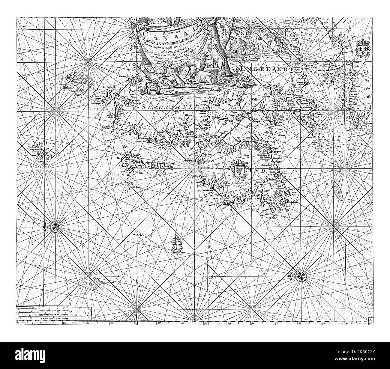 Passport map of the coast of Ireland and part of the coasts of Scotland, England and France, with two compass roses, North is on the left. Stock Photohttps://www.alamy.com/image-license-details/?v=1https://www.alamy.com/passport-map-of-the-coast-of-ireland-and-part-of-the-coasts-of-scotland-england-and-france-with-two-compass-roses-north-is-on-the-left-image488046439.html
RF2KA0C5Y–Passport map of the coast of Ireland and part of the coasts of Scotland, England and France, with two compass roses, North is on the left.
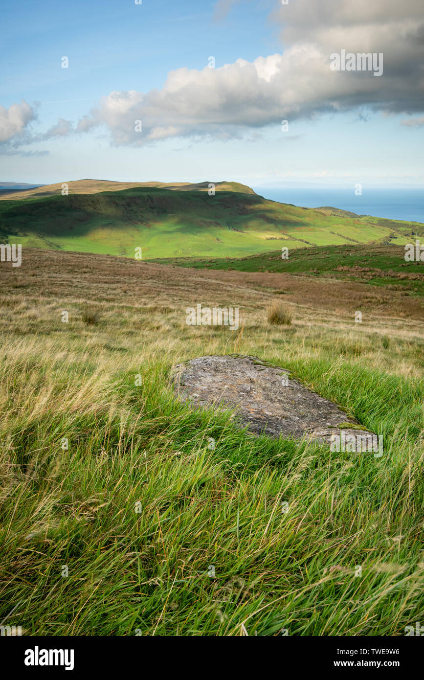 Light and shadows map the rolling hills of Antrim close to Ballygally on the North Antrim Coast, Northern Ireland. Stock Photohttps://www.alamy.com/image-license-details/?v=1https://www.alamy.com/light-and-shadows-map-the-rolling-hills-of-antrim-close-to-ballygally-on-the-north-antrim-coast-northern-ireland-image256626642.html
RMTWE9W6–Light and shadows map the rolling hills of Antrim close to Ballygally on the North Antrim Coast, Northern Ireland.
 Causeway Coast and Glens NORTHERN IRELAND district map with Coronavirus warning Stock Vectorhttps://www.alamy.com/image-license-details/?v=1https://www.alamy.com/causeway-coast-and-glens-northern-ireland-district-map-with-coronavirus-warning-image349250574.html
RF2B85MJP–Causeway Coast and Glens NORTHERN IRELAND district map with Coronavirus warning
 Chart of the western half of the Mediterranean, and the western coast of Europe with Britain and Ireland. Cornaro Atlas (Egerton MS 73, f.6r) Stock Photohttps://www.alamy.com/image-license-details/?v=1https://www.alamy.com/stock-photo-chart-of-the-western-half-of-the-mediterranean-and-the-western-coast-139719778.html
RMJ38P02–Chart of the western half of the Mediterranean, and the western coast of Europe with Britain and Ireland. Cornaro Atlas (Egerton MS 73, f.6r)
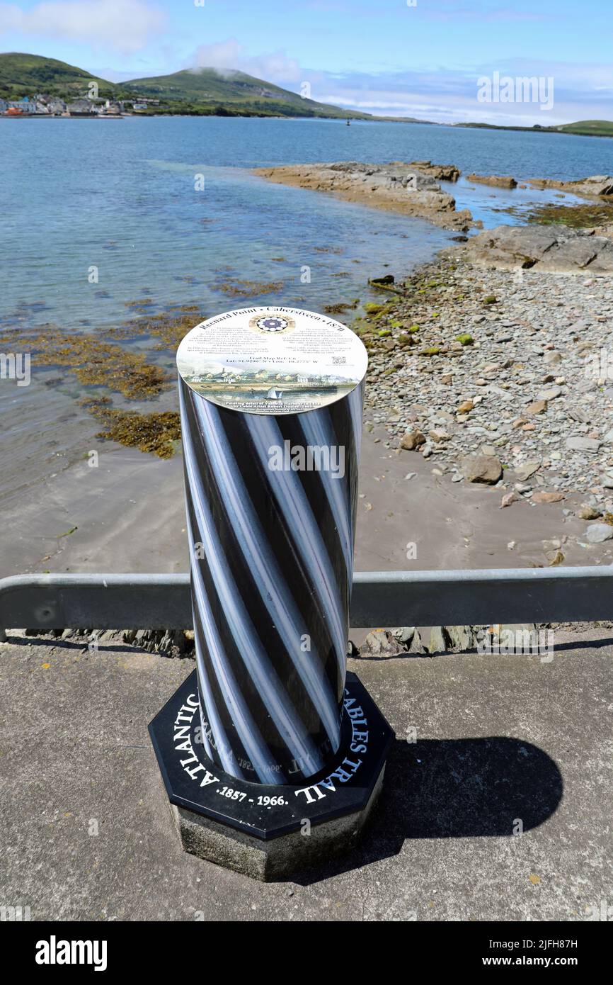 Atlantic Telegraph Cables Trail in Ireland Stock Photohttps://www.alamy.com/image-license-details/?v=1https://www.alamy.com/atlantic-telegraph-cables-trail-in-ireland-image474279445.html
RM2JFH87H–Atlantic Telegraph Cables Trail in Ireland
 Shanvalla, West Cork, Ireland. 14th Feb, 2021.High winds as the yellow weather warning is still in place around the County Cork. Credit: ND News/Alamy Live News Stock Photohttps://www.alamy.com/image-license-details/?v=1https://www.alamy.com/shanvalla-west-cork-ireland-14th-feb-2021high-winds-as-the-yellow-weather-warning-is-still-in-place-around-the-county-cork-credit-nd-newsalamy-live-news-image403932842.html
RM2ED4MCX–Shanvalla, West Cork, Ireland. 14th Feb, 2021.High winds as the yellow weather warning is still in place around the County Cork. Credit: ND News/Alamy Live News
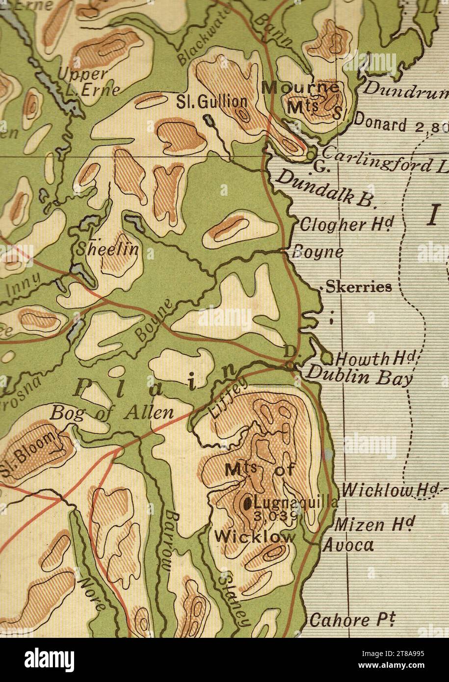 An antique geographical sepia coloured map of Ireland showing Dublin and the east coast. Stock Photohttps://www.alamy.com/image-license-details/?v=1https://www.alamy.com/an-antique-geographical-sepia-coloured-map-of-ireland-showing-dublin-and-the-east-coast-image573086225.html
RF2T8A995–An antique geographical sepia coloured map of Ireland showing Dublin and the east coast.
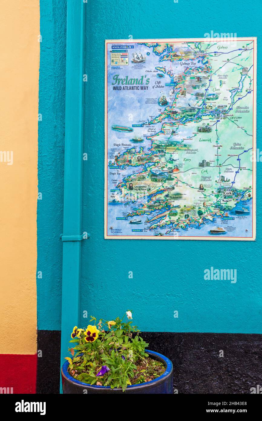 Map of Ireland, Sneem Village, County Kerry, Ireland Stock Photohttps://www.alamy.com/image-license-details/?v=1https://www.alamy.com/map-of-ireland-sneem-village-county-kerry-ireland-image454321344.html
RM2HB43E8–Map of Ireland, Sneem Village, County Kerry, Ireland
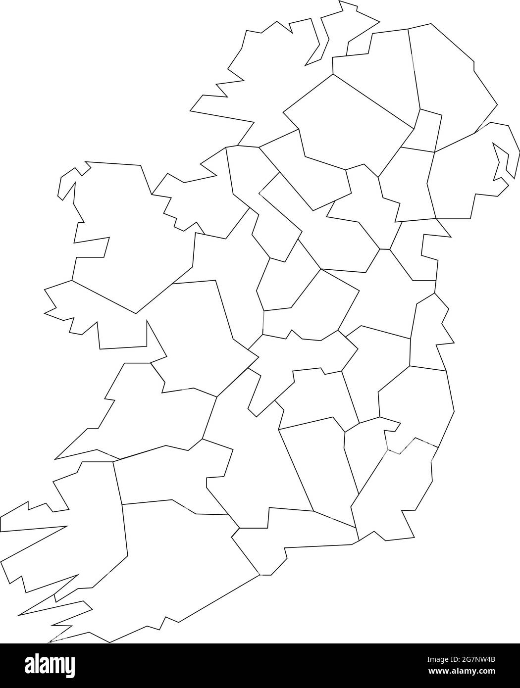 Vector map of Ireland to study colorless with outline Stock Vectorhttps://www.alamy.com/image-license-details/?v=1https://www.alamy.com/vector-map-of-ireland-to-study-colorless-with-outline-image435042507.html
RF2G7NW4B–Vector map of Ireland to study colorless with outline
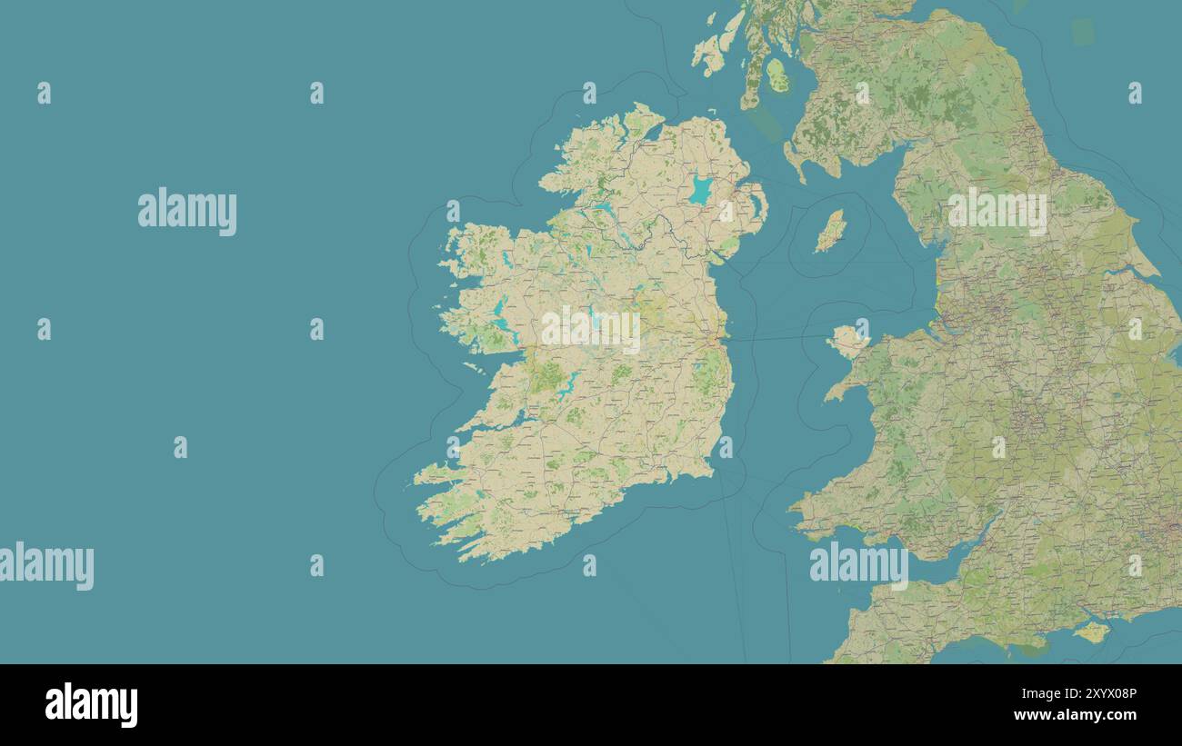 Ireland Island in the Celtic Sea on a topographic, OSM Humanitarian style map Stock Photohttps://www.alamy.com/image-license-details/?v=1https://www.alamy.com/ireland-island-in-the-celtic-sea-on-a-topographic-osm-humanitarian-style-map-image619529590.html
RF2XYX08P–Ireland Island in the Celtic Sea on a topographic, OSM Humanitarian style map
 88b. Ireland coast County Cork Clonakilty Kinsale. KRIEGSMARINE Nazi map 1940 Stock Photohttps://www.alamy.com/image-license-details/?v=1https://www.alamy.com/88b-ireland-coast-county-cork-clonakilty-kinsale-kriegsmarine-nazi-map-1940-image454160010.html
RF2HATNMA–88b. Ireland coast County Cork Clonakilty Kinsale. KRIEGSMARINE Nazi map 1940
 Map of a part of the south coast of Ireland, Nieuwe Pascaert vande suyt syde van Yrlandt (title on object), Map of a part of the south coast of Ireland with two compass roses, North is at the top. Top center near the cartouche with the title, a churning woman and men delivering and packaging butter. Bottom right two angels with a basket full of flowers at the address of the publisher and the scale, shown in German, Spanish and English or French miles (scale: c. 1:550,000)., print maker: anonymous, after print by: Jan Luyken, publisher: Johannes van Keulen (I), Amsterdam, 1681 - 1803 Stock Photohttps://www.alamy.com/image-license-details/?v=1https://www.alamy.com/map-of-a-part-of-the-south-coast-of-ireland-nieuwe-pascaert-vande-suyt-syde-van-yrlandt-title-on-object-map-of-a-part-of-the-south-coast-of-ireland-with-two-compass-roses-north-is-at-the-top-top-center-near-the-cartouche-with-the-title-a-churning-woman-and-men-delivering-and-packaging-butter-bottom-right-two-angels-with-a-basket-full-of-flowers-at-the-address-of-the-publisher-and-the-scale-shown-in-german-spanish-and-english-or-french-miles-scale-c-1550000-print-maker-anonymous-after-print-by-jan-luyken-publisher-johannes-van-keulen-i-amsterdam-1681-1803-image599445764.html
RM2WR7358–Map of a part of the south coast of Ireland, Nieuwe Pascaert vande suyt syde van Yrlandt (title on object), Map of a part of the south coast of Ireland with two compass roses, North is at the top. Top center near the cartouche with the title, a churning woman and men delivering and packaging butter. Bottom right two angels with a basket full of flowers at the address of the publisher and the scale, shown in German, Spanish and English or French miles (scale: c. 1:550,000)., print maker: anonymous, after print by: Jan Luyken, publisher: Johannes van Keulen (I), Amsterdam, 1681 - 1803
 A 19th Century sketch of The Old Weir Bridge, one of Killarney’s oldest structures it is believed to date from the 16th century wityh a unique location at the Meeting of The Waters of Killarney’s three lakes has ensured that it has remained a popular destination for hundreds of years. The visit of Queen Victoria in 1861 put Killarney on the map as a tourist destination and it has never looked back since. Central to the Queen’s visit was an extensive tour of the lakes by boat, County Kerry, Ireland. Stock Photohttps://www.alamy.com/image-license-details/?v=1https://www.alamy.com/a-19th-century-sketch-of-the-old-weir-bridge-one-of-killarneys-oldest-structures-it-is-believed-to-date-from-the-16th-century-wityh-a-unique-location-at-the-meeting-of-the-waters-of-killarneys-three-lakes-has-ensured-that-it-has-remained-a-popular-destination-for-hundreds-of-years-the-visit-of-queen-victoria-in-1861-put-killarney-on-the-map-as-a-tourist-destination-and-it-has-never-looked-back-since-central-to-the-queens-visit-was-an-extensive-tour-of-the-lakes-by-boat-county-kerry-ireland-image415601487.html
RM2F447X7–A 19th Century sketch of The Old Weir Bridge, one of Killarney’s oldest structures it is believed to date from the 16th century wityh a unique location at the Meeting of The Waters of Killarney’s three lakes has ensured that it has remained a popular destination for hundreds of years. The visit of Queen Victoria in 1861 put Killarney on the map as a tourist destination and it has never looked back since. Central to the Queen’s visit was an extensive tour of the lakes by boat, County Kerry, Ireland.
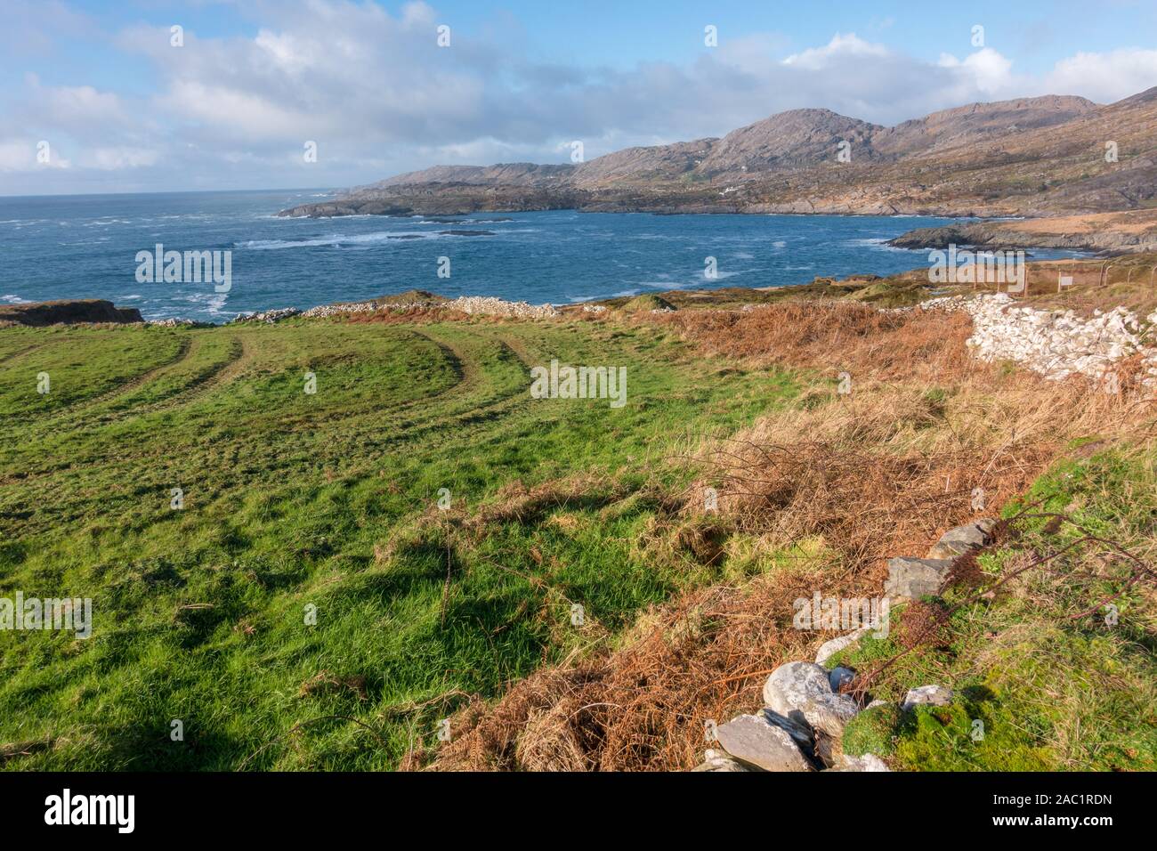 Achilles countryside of West Cork in Ireland Stock Photohttps://www.alamy.com/image-license-details/?v=1https://www.alamy.com/achilles-countryside-of-west-cork-in-ireland-image334413233.html
RM2AC1RDN–Achilles countryside of West Cork in Ireland
 Killeague, Causeway Coast and Glens, United Kingdom, Northern Ireland, N 55 2' 59'', W 6 42' 0'', map, Timeless Map published in 2021. Travelers, explorers and adventurers like Florence Nightingale, David Livingstone, Ernest Shackleton, Lewis and Clark and Sherlock Holmes relied on maps to plan travels to the world's most remote corners, Timeless Maps is mapping most locations on the globe, showing the achievement of great dreams Stock Photohttps://www.alamy.com/image-license-details/?v=1https://www.alamy.com/killeague-causeway-coast-and-glens-united-kingdom-northern-ireland-n-55-2-59-w-6-42-0-map-timeless-map-published-in-2021-travelers-explorers-and-adventurers-like-florence-nightingale-david-livingstone-ernest-shackleton-lewis-and-clark-and-sherlock-holmes-relied-on-maps-to-plan-travels-to-the-worlds-most-remote-corners-timeless-maps-is-mapping-most-locations-on-the-globe-showing-the-achievement-of-great-dreams-image439394205.html
RM2GET3P5–Killeague, Causeway Coast and Glens, United Kingdom, Northern Ireland, N 55 2' 59'', W 6 42' 0'', map, Timeless Map published in 2021. Travelers, explorers and adventurers like Florence Nightingale, David Livingstone, Ernest Shackleton, Lewis and Clark and Sherlock Holmes relied on maps to plan travels to the world's most remote corners, Timeless Maps is mapping most locations on the globe, showing the achievement of great dreams
 Ireland, Munster, county Kerry, ring of Kerry, Skellig ring, Stock Photohttps://www.alamy.com/image-license-details/?v=1https://www.alamy.com/stock-photo-ireland-munster-county-kerry-ring-of-kerry-skellig-ring-140636399.html
RMJ4PF4F–Ireland, Munster, county Kerry, ring of Kerry, Skellig ring,
 Wales and Ireland. The Mercator atlas of Europe. 1570-1572. Map of Wales and the east coast of Ireland. Image taken from The Mercator atlas of Europe. Originally published/produced in 1570-1572. . Source: Maps.C.29.c.13, 9a. Stock Photohttps://www.alamy.com/image-license-details/?v=1https://www.alamy.com/wales-and-ireland-the-mercator-atlas-of-europe-1570-1572-map-of-wales-and-the-east-coast-of-ireland-image-taken-from-the-mercator-atlas-of-europe-originally-publishedproduced-in-1570-1572-source-mapsc29c13-9a-image227214986.html
RMR5JF0X–Wales and Ireland. The Mercator atlas of Europe. 1570-1572. Map of Wales and the east coast of Ireland. Image taken from The Mercator atlas of Europe. Originally published/produced in 1570-1572. . Source: Maps.C.29.c.13, 9a.
 3d isometric map of Aran Island is an island in Ireland, isolated vector illustration Stock Vectorhttps://www.alamy.com/image-license-details/?v=1https://www.alamy.com/3d-isometric-map-of-aran-island-is-an-island-in-ireland-isolated-vector-illustration-image425031043.html
RF2FKDRC3–3d isometric map of Aran Island is an island in Ireland, isolated vector illustration
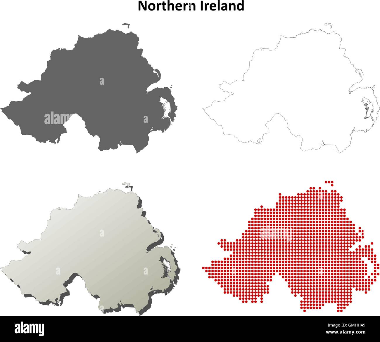 Northern Ireland outline map set Stock Vectorhttps://www.alamy.com/image-license-details/?v=1https://www.alamy.com/stock-photo-northern-ireland-outline-map-set-115941961.html
RFGMHH49–Northern Ireland outline map set
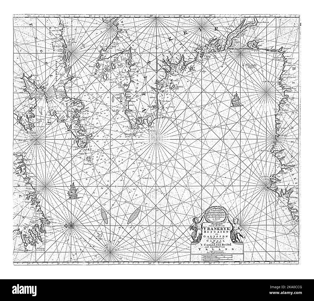 Passport map of part of the coast of Ireland, England, France and Spain, with the Bay of Biscay. A compass rose on the left, North is on the left. Stock Photohttps://www.alamy.com/image-license-details/?v=1https://www.alamy.com/passport-map-of-part-of-the-coast-of-ireland-england-france-and-spain-with-the-bay-of-biscay-a-compass-rose-on-the-left-north-is-on-the-left-image488046624.html
RF2KA0CCG–Passport map of part of the coast of Ireland, England, France and Spain, with the Bay of Biscay. A compass rose on the left, North is on the left.
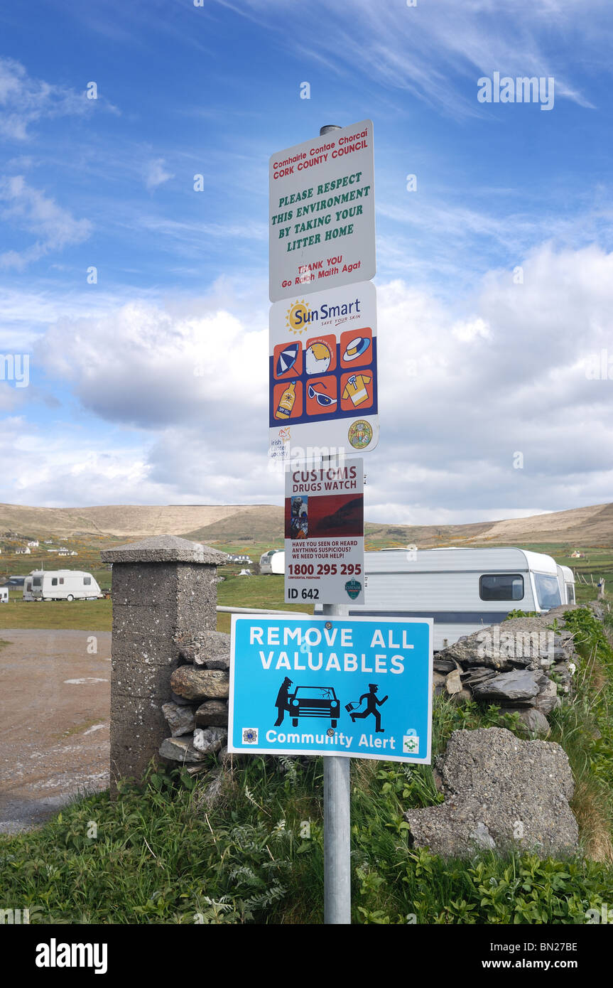 Irish Signs - John Gollop Stock Photohttps://www.alamy.com/image-license-details/?v=1https://www.alamy.com/stock-photo-irish-signs-john-gollop-30167858.html
RMBN27BE–Irish Signs - John Gollop
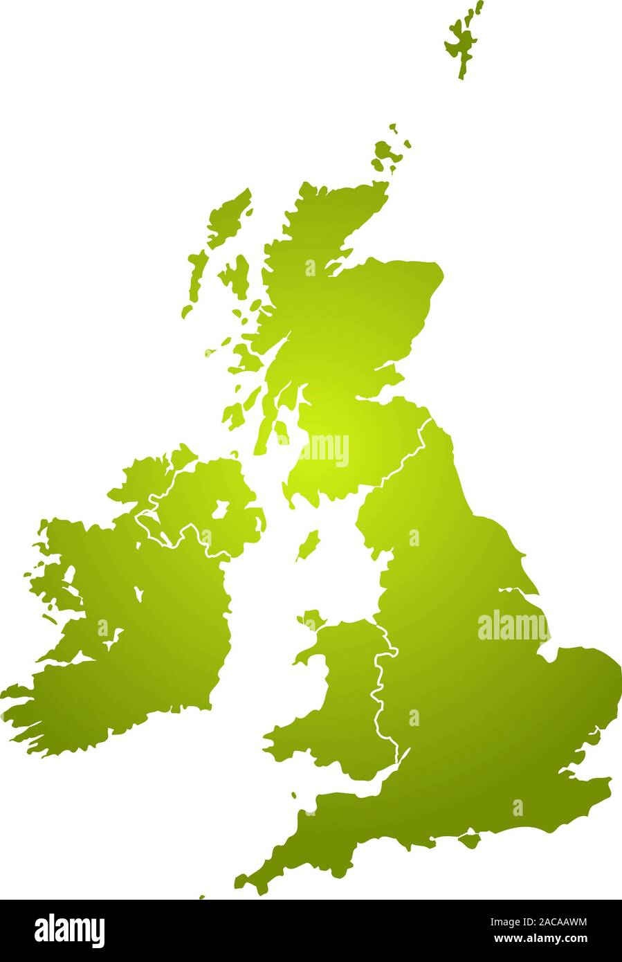 uk map green Stock Photohttps://www.alamy.com/image-license-details/?v=1https://www.alamy.com/uk-map-green-image334600944.html
RM2ACAAWM–uk map green
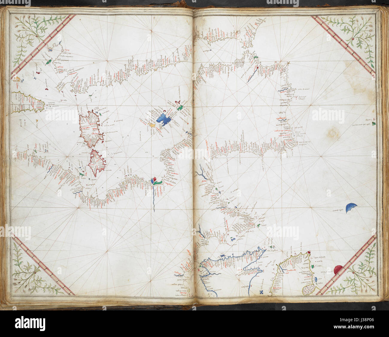 Chart of the western half of the Mediterranean, and the western coast of Europe with part of Britain and Ireland. Cornaro Atlas (Egerton MS 73, f.11r) Stock Photohttps://www.alamy.com/image-license-details/?v=1https://www.alamy.com/stock-photo-chart-of-the-western-half-of-the-mediterranean-and-the-western-coast-139719782.html
RMJ38P06–Chart of the western half of the Mediterranean, and the western coast of Europe with part of Britain and Ireland. Cornaro Atlas (Egerton MS 73, f.11r)
 View of the Cliffs of Moher in Ireland Stock Photohttps://www.alamy.com/image-license-details/?v=1https://www.alamy.com/view-of-the-cliffs-of-moher-in-ireland-image359673659.html
RF2BW4FBR–View of the Cliffs of Moher in Ireland
 Shanvalla, West Cork, Ireland. 14th Feb, 2021.High winds as the yellow weather warning is still in place around the County Cork. Credit: ND News/Alamy Live News Stock Photohttps://www.alamy.com/image-license-details/?v=1https://www.alamy.com/shanvalla-west-cork-ireland-14th-feb-2021high-winds-as-the-yellow-weather-warning-is-still-in-place-around-the-county-cork-credit-nd-newsalamy-live-news-image403932915.html
RM2ED4MFF–Shanvalla, West Cork, Ireland. 14th Feb, 2021.High winds as the yellow weather warning is still in place around the County Cork. Credit: ND News/Alamy Live News
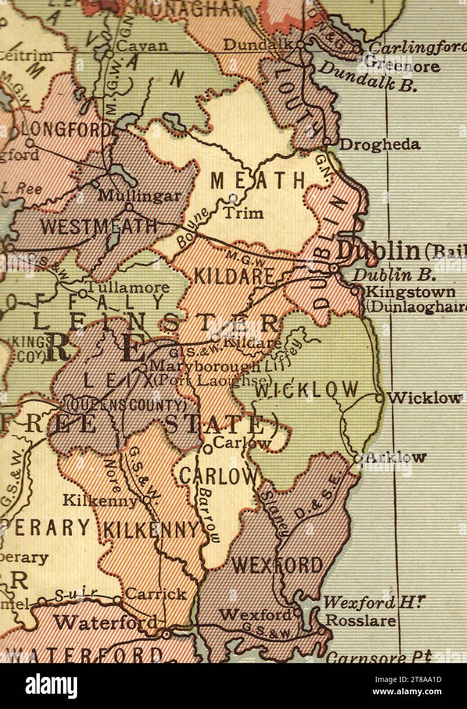 An antique political sepia coloured map showing Dublin and the east coast of Ireland. Stock Photohttps://www.alamy.com/image-license-details/?v=1https://www.alamy.com/an-antique-political-sepia-coloured-map-showing-dublin-and-the-east-coast-of-ireland-image573086793.html
RF2T8AA1D–An antique political sepia coloured map showing Dublin and the east coast of Ireland.
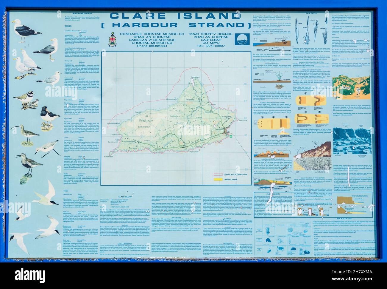 Map of Clare Island, Clare Island, County Mayo, Ireland Stock Photohttps://www.alamy.com/image-license-details/?v=1https://www.alamy.com/map-of-clare-island-clare-island-county-mayo-ireland-image452363866.html
RM2H7XXMA–Map of Clare Island, Clare Island, County Mayo, Ireland
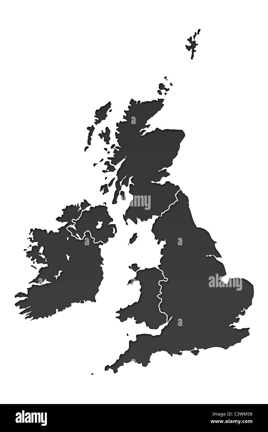 United Kingdom map over white Stock Photohttps://www.alamy.com/image-license-details/?v=1https://www.alamy.com/stock-photo-united-kingdom-map-over-white-36829332.html
RFC3WM58–United Kingdom map over white
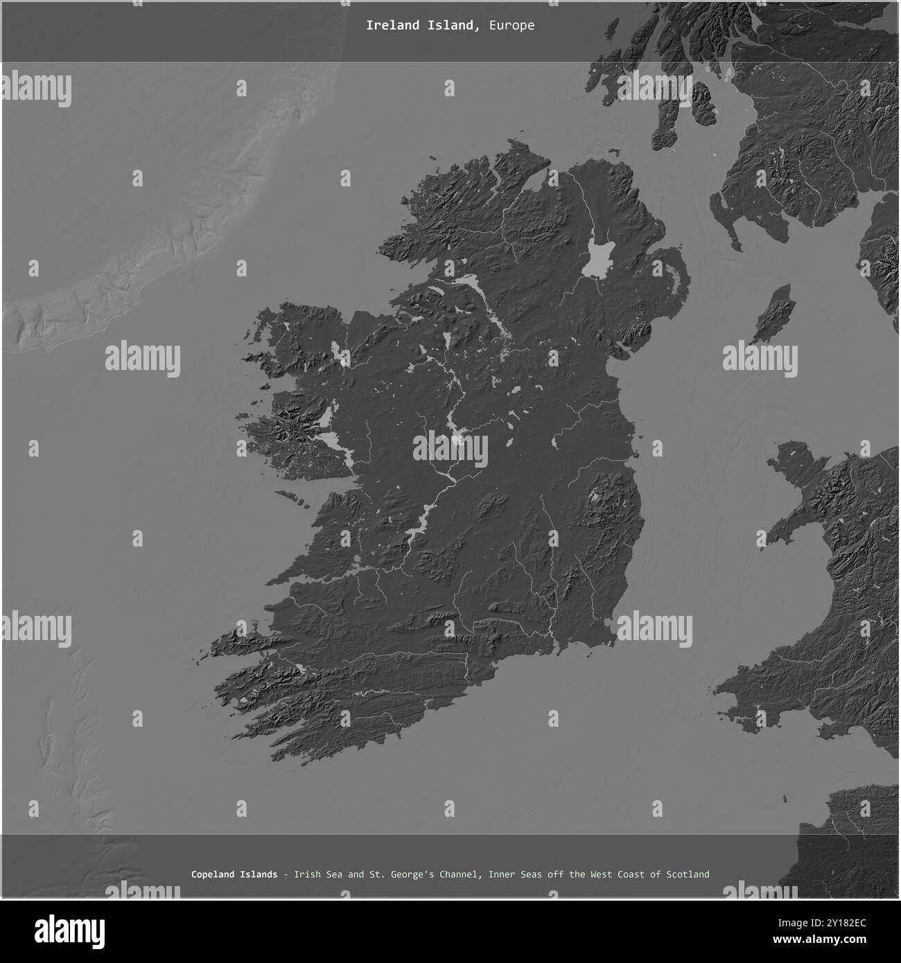 Ireland Island in the Celtic Sea, shared between: Ireland, United Kingdom, cropped to square on a bilevel elevation map Stock Photohttps://www.alamy.com/image-license-details/?v=1https://www.alamy.com/ireland-island-in-the-celtic-sea-shared-between-ireland-united-kingdom-cropped-to-square-on-a-bilevel-elevation-map-image620365492.html
RF2Y182EC–Ireland Island in the Celtic Sea, shared between: Ireland, United Kingdom, cropped to square on a bilevel elevation map
 86a. Ireland coast. County Waterford Cork. Youghal. KRIEGSMARINE Nazi map 1940 Stock Photohttps://www.alamy.com/image-license-details/?v=1https://www.alamy.com/86a-ireland-coast-county-waterford-cork-youghal-kriegsmarine-nazi-map-1940-image454159962.html
RF2HATNJJ–86a. Ireland coast. County Waterford Cork. Youghal. KRIEGSMARINE Nazi map 1940
 Map of part of the south coast of Ireland, Jan Luyken, print maker: Anonymous, Johannes van Keulen I, 1681 - 1803 Stock Photohttps://www.alamy.com/image-license-details/?v=1https://www.alamy.com/map-of-part-of-the-south-coast-of-ireland-jan-luyken-print-maker-anonymous-johannes-van-keulen-i-1681-1803-image240626279.html
RMRYDD7K–Map of part of the south coast of Ireland, Jan Luyken, print maker: Anonymous, Johannes van Keulen I, 1681 - 1803
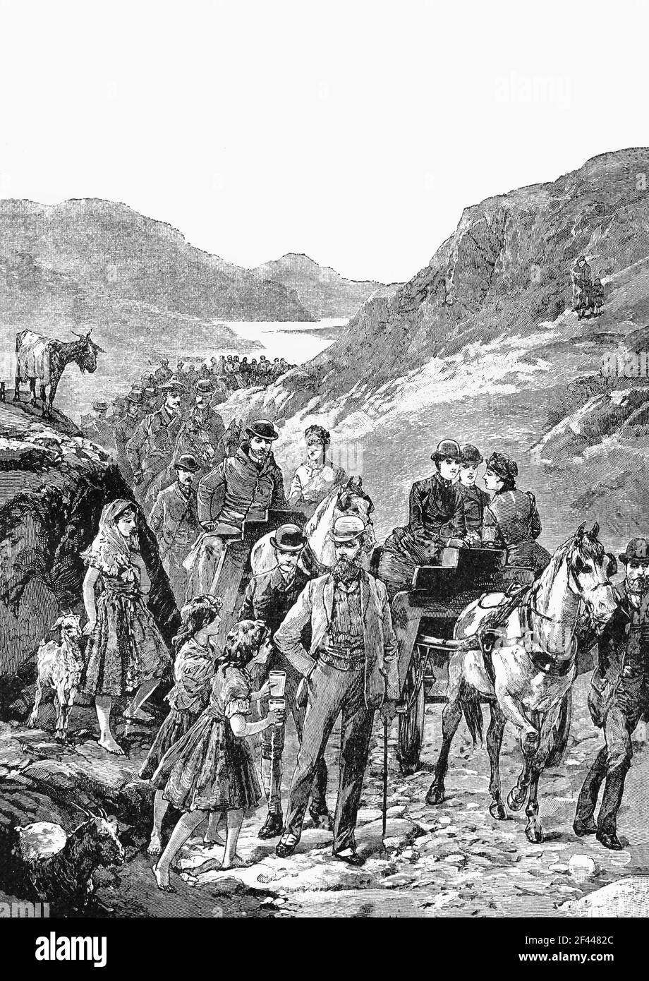 A 19th Century illustration of the 1861 visit by the British Royal Family to the Gap of Dunloe, Killarney, County Kerry, Ireland that put Killarney on the map as a tourist destination and it has never looked back since. Stock Photohttps://www.alamy.com/image-license-details/?v=1https://www.alamy.com/a-19th-century-illustration-of-the-1861-visit-by-the-british-royal-family-to-the-gap-of-dunloe-killarney-county-kerry-ireland-that-put-killarney-on-the-map-as-a-tourist-destination-and-it-has-never-looked-back-since-image415601604.html
RM2F4482C–A 19th Century illustration of the 1861 visit by the British Royal Family to the Gap of Dunloe, Killarney, County Kerry, Ireland that put Killarney on the map as a tourist destination and it has never looked back since.
 Achilles countryside of West Cork in Ireland Stock Photohttps://www.alamy.com/image-license-details/?v=1https://www.alamy.com/achilles-countryside-of-west-cork-in-ireland-image334413052.html
RM2AC1R78–Achilles countryside of West Cork in Ireland
 Kilrea, Causeway Coast and Glens, United Kingdom, Northern Ireland, N 54 57' 3'', W 6 33' 25'', map, Timeless Map published in 2021. Travelers, explorers and adventurers like Florence Nightingale, David Livingstone, Ernest Shackleton, Lewis and Clark and Sherlock Holmes relied on maps to plan travels to the world's most remote corners, Timeless Maps is mapping most locations on the globe, showing the achievement of great dreams Stock Photohttps://www.alamy.com/image-license-details/?v=1https://www.alamy.com/kilrea-causeway-coast-and-glens-united-kingdom-northern-ireland-n-54-57-3-w-6-33-25-map-timeless-map-published-in-2021-travelers-explorers-and-adventurers-like-florence-nightingale-david-livingstone-ernest-shackleton-lewis-and-clark-and-sherlock-holmes-relied-on-maps-to-plan-travels-to-the-worlds-most-remote-corners-timeless-maps-is-mapping-most-locations-on-the-globe-showing-the-achievement-of-great-dreams-image439394157.html
RM2GET3MD–Kilrea, Causeway Coast and Glens, United Kingdom, Northern Ireland, N 54 57' 3'', W 6 33' 25'', map, Timeless Map published in 2021. Travelers, explorers and adventurers like Florence Nightingale, David Livingstone, Ernest Shackleton, Lewis and Clark and Sherlock Holmes relied on maps to plan travels to the world's most remote corners, Timeless Maps is mapping most locations on the globe, showing the achievement of great dreams