Map of ancient greece and its colonies Stock Photos and Images
(12)See map of ancient greece and its colonies stock video clipsQuick filters:
Map of ancient greece and its colonies Stock Photos and Images
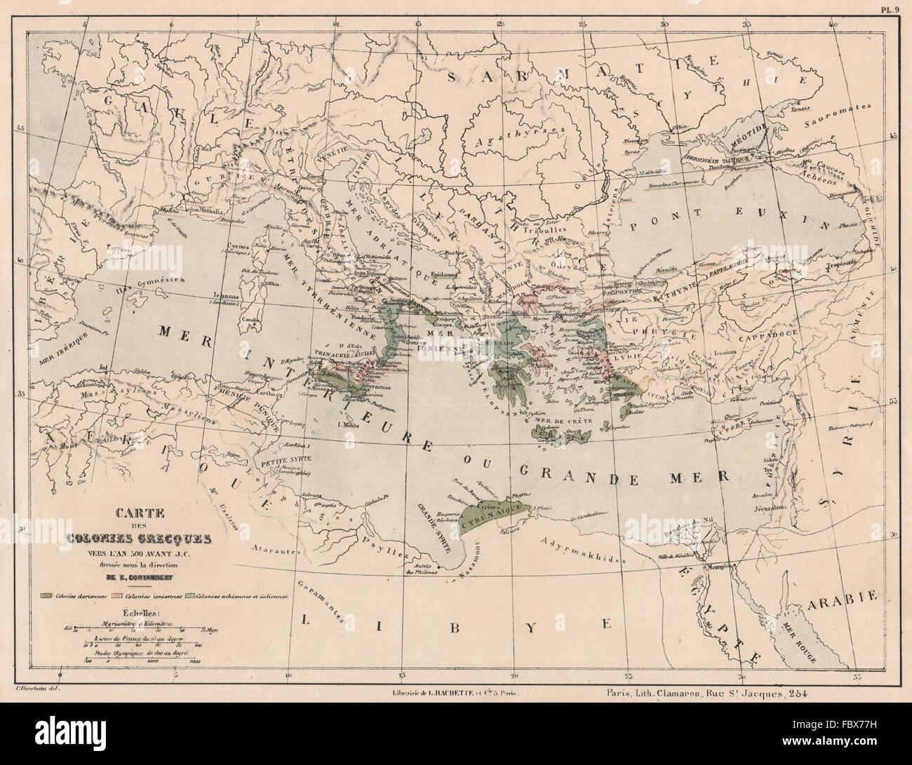 ANCIENT GREECE GREEK COLONIES in 500BC Dorian Aeolian Achaean Ionian, 1880 map Stock Photohttps://www.alamy.com/image-license-details/?v=1https://www.alamy.com/stock-photo-ancient-greece-greek-colonies-in-500bc-dorian-aeolian-achaean-ionian-93389509.html
RFFBX77H–ANCIENT GREECE GREEK COLONIES in 500BC Dorian Aeolian Achaean Ionian, 1880 map
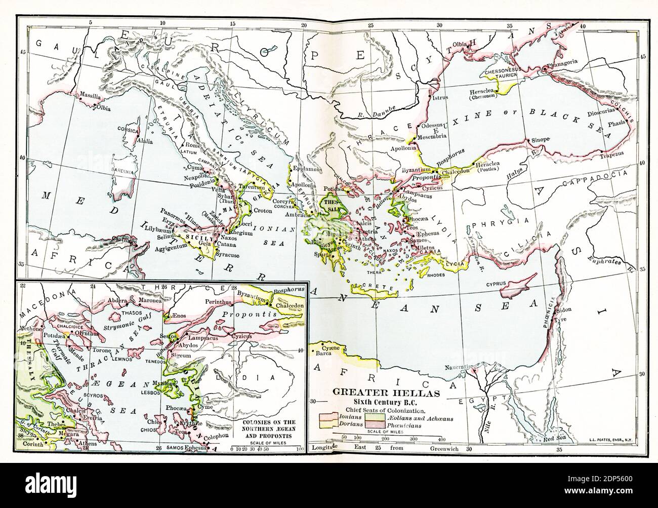 Greater Hellas Sixth Century B.C. The legend on this early 1900s map reads: Chief Seats of Colonization. Pink: Ionians; Green-Aeolians and Achaeans; Yellow-Dorians; Purple-Phoenicians. Inset map: Colonies of the Northern Aegean and Propontis Stock Photohttps://www.alamy.com/image-license-details/?v=1https://www.alamy.com/greater-hellas-sixth-century-bc-the-legend-on-this-early-1900s-map-reads-chief-seats-of-colonization-pink-ionians-green-aeolians-and-achaeans-yellow-dorians-purple-phoenicians-inset-map-colonies-of-the-northern-aegean-and-propontis-image392264992.html
RF2DP5600–Greater Hellas Sixth Century B.C. The legend on this early 1900s map reads: Chief Seats of Colonization. Pink: Ionians; Green-Aeolians and Achaeans; Yellow-Dorians; Purple-Phoenicians. Inset map: Colonies of the Northern Aegean and Propontis
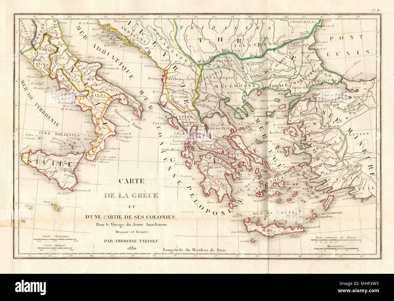 ANCIENT GREECE. 'Carte de la Grèce et… ses colonies'. TARDIEU 1830 old map Stock Photohttps://www.alamy.com/image-license-details/?v=1https://www.alamy.com/ancient-greece-carte-de-la-grce-et-ses-colonies-tardieu-1830-old-map-image183038831.html
RFMHP3W3–ANCIENT GREECE. 'Carte de la Grèce et… ses colonies'. TARDIEU 1830 old map
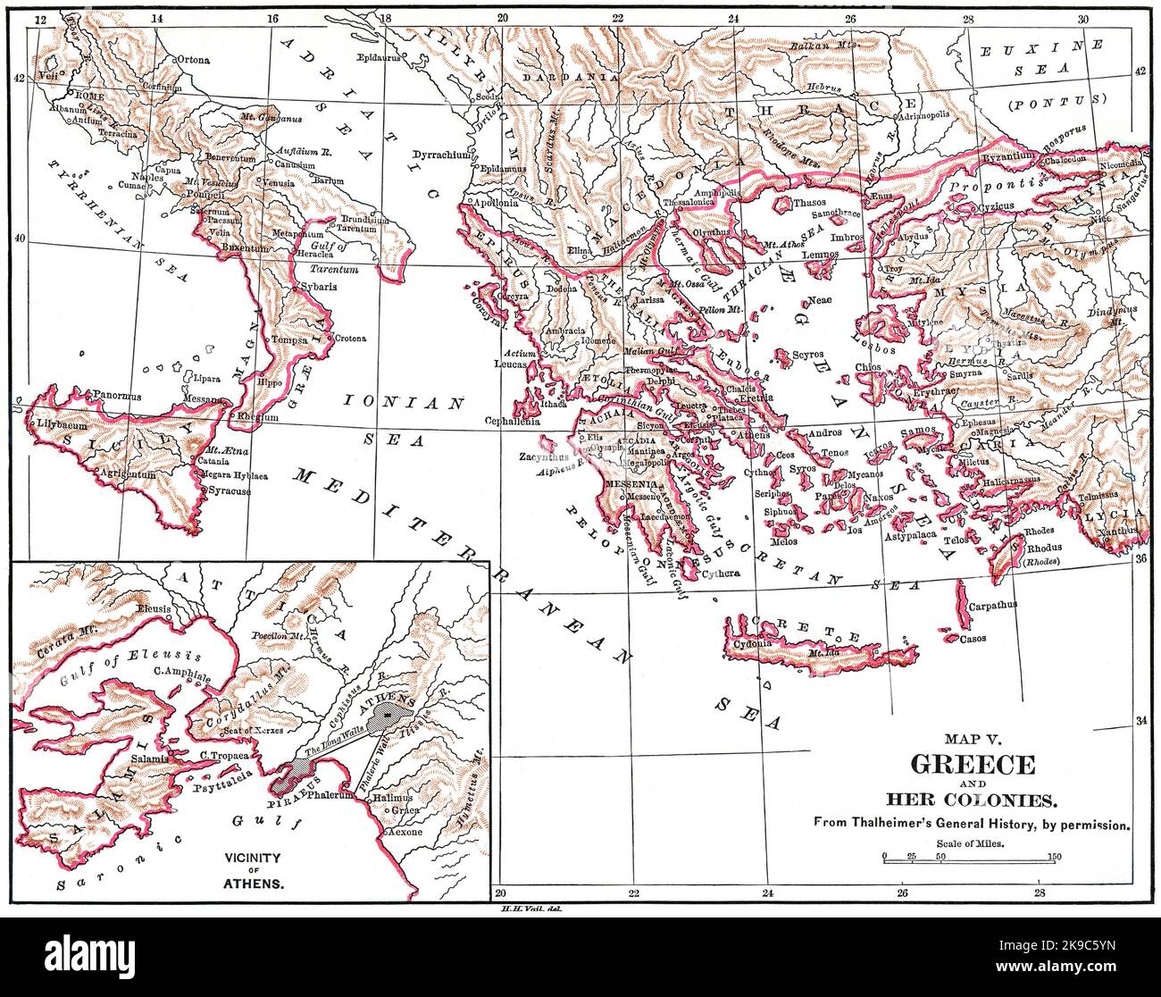 Map V, Greece and her Colonies, Illustration, Ridpath's History of the World, Volume I, by John Clark Ridpath, LL. D., Merrill & Baker Publishers, New York, 1894 Stock Photohttps://www.alamy.com/image-license-details/?v=1https://www.alamy.com/map-v-greece-and-her-colonies-illustration-ridpaths-history-of-the-world-volume-i-by-john-clark-ridpath-ll-d-merrill-baker-publishers-new-york-1894-image487690329.html
RM2K9C5YN–Map V, Greece and her Colonies, Illustration, Ridpath's History of the World, Volume I, by John Clark Ridpath, LL. D., Merrill & Baker Publishers, New York, 1894
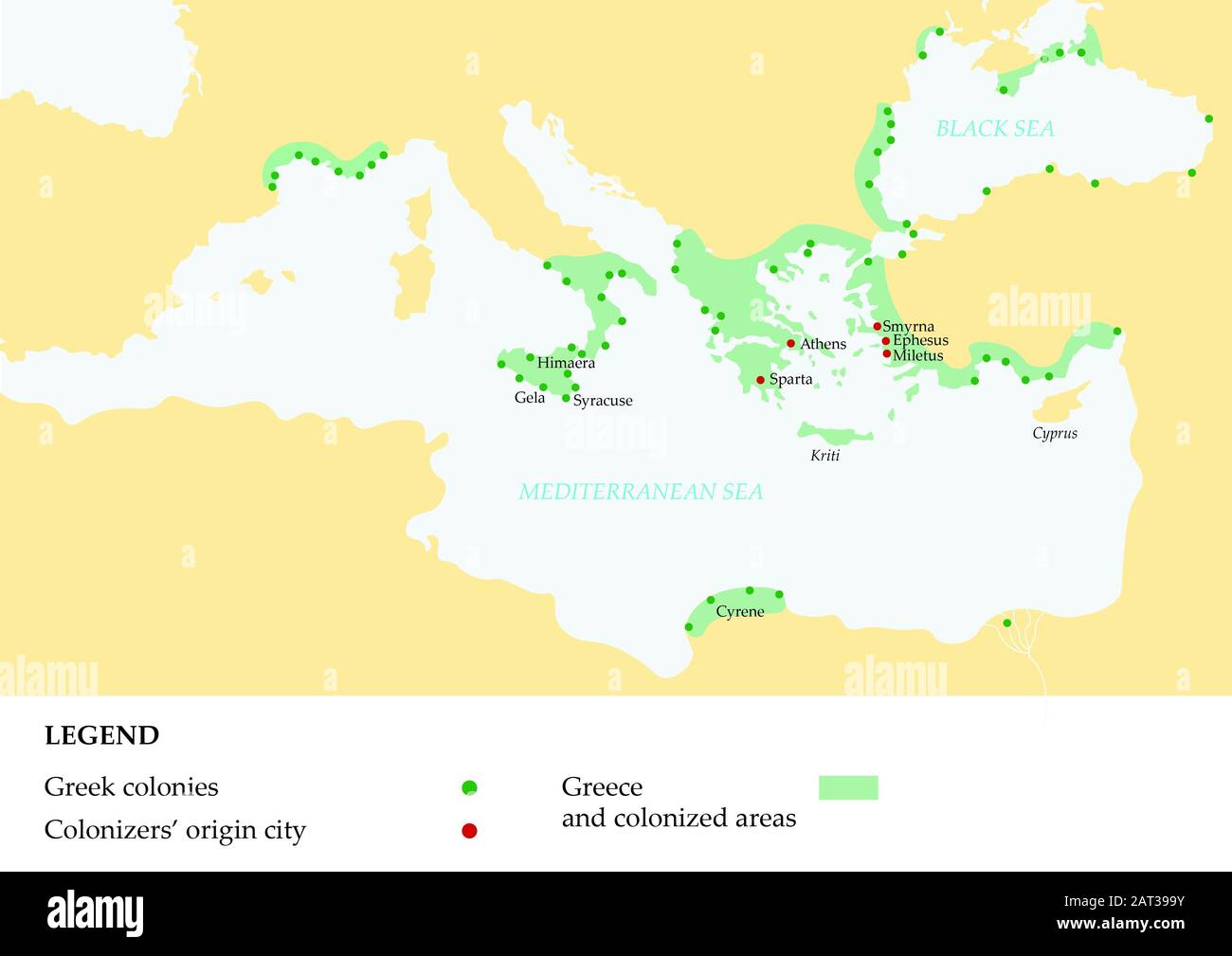 Ancient greece map showing the Greek empire and its colonies. Stock Photohttps://www.alamy.com/image-license-details/?v=1https://www.alamy.com/ancient-greece-map-showing-the-greek-empire-and-its-colonies-image341821927.html
RF2AT399Y–Ancient greece map showing the Greek empire and its colonies.
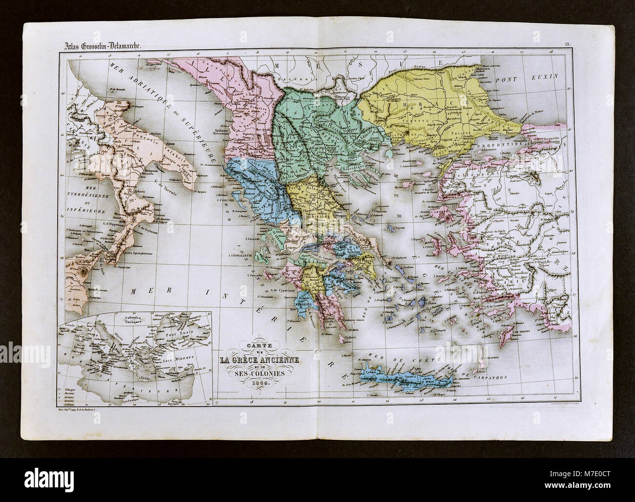 1858 Delamarche Map of Ancient Greece and its Colonies in Italy and Turkey Stock Photohttps://www.alamy.com/image-license-details/?v=1https://www.alamy.com/stock-photo-1858-delamarche-map-of-ancient-greece-and-its-colonies-in-italy-and-176713960.html
RFM7E0CT–1858 Delamarche Map of Ancient Greece and its Colonies in Italy and Turkey
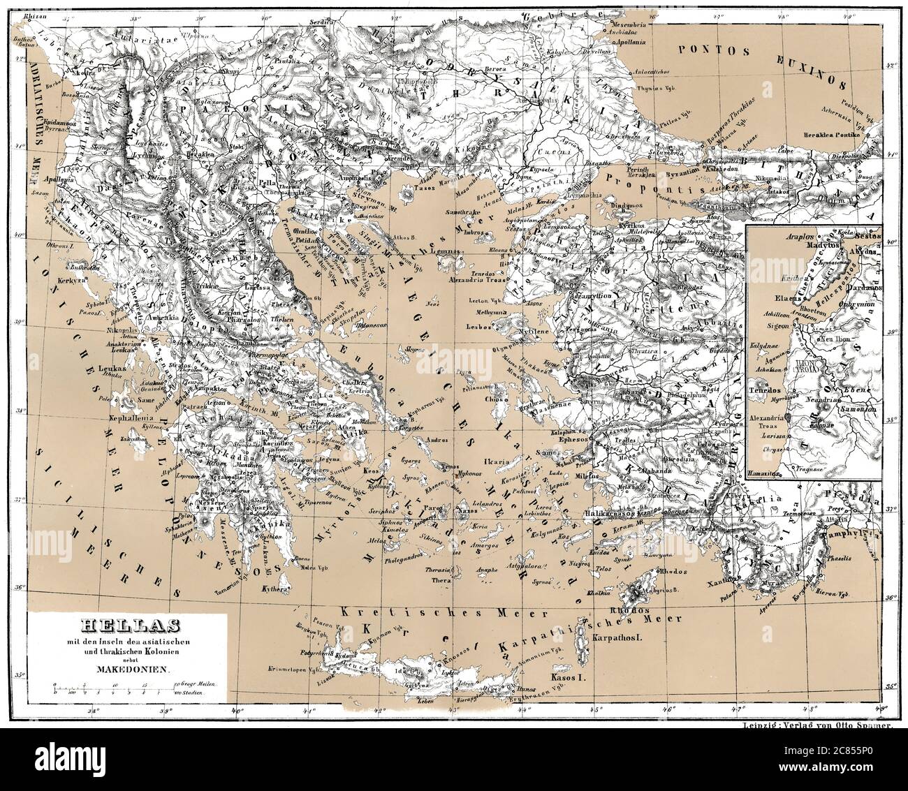 Historical map of ancient Greece with Asian and Thracian Colonies Stock Photohttps://www.alamy.com/image-license-details/?v=1https://www.alamy.com/historical-map-of-ancient-greece-with-asian-and-thracian-colonies-image366449272.html
RM2C855P0–Historical map of ancient Greece with Asian and Thracian Colonies
 . English: This is one of the Homann Heirs finest and most appealing maps of the ancient Greek World. Map centers on Greece but includes the entirety of the eastern Mediterranean and North Africa. Also includes the Black Sea as far as the Crimea and the sea of Azov. Extends north as far as Sarmatia and Pannonia. Includes Italy, Sicily, Corsica and Sardinia. Upper left quadrant features a decorative title cartouche adorned with the rectos and versos of 12 ancient Greek coins with explanatory numbered references outside the top border of the map. Show the important Greek provinces and colonies Stock Photohttps://www.alamy.com/image-license-details/?v=1https://www.alamy.com/english-this-is-one-of-the-homann-heirs-finest-and-most-appealing-maps-of-the-ancient-greek-world-map-centers-on-greece-but-includes-the-entirety-of-the-eastern-mediterranean-and-north-africa-also-includes-the-black-sea-as-far-as-the-crimea-and-the-sea-of-azov-extends-north-as-far-as-sarmatia-and-pannonia-includes-italy-sicily-corsica-and-sardinia-upper-left-quadrant-features-a-decorative-title-cartouche-adorned-with-the-rectos-and-versos-of-12-ancient-greek-coins-with-explanatory-numbered-references-outside-the-top-border-of-the-map-show-the-important-greek-provinces-and-colonies-image184873063.html
RMMMNKDB–. English: This is one of the Homann Heirs finest and most appealing maps of the ancient Greek World. Map centers on Greece but includes the entirety of the eastern Mediterranean and North Africa. Also includes the Black Sea as far as the Crimea and the sea of Azov. Extends north as far as Sarmatia and Pannonia. Includes Italy, Sicily, Corsica and Sardinia. Upper left quadrant features a decorative title cartouche adorned with the rectos and versos of 12 ancient Greek coins with explanatory numbered references outside the top border of the map. Show the important Greek provinces and colonies
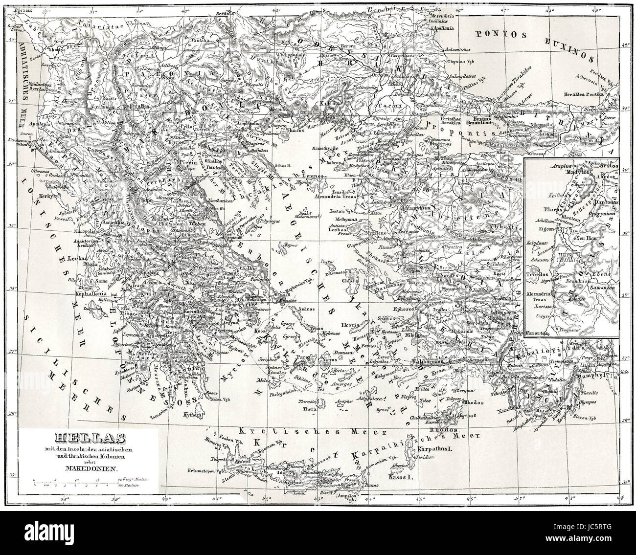 Historical map of ancient Greece with Asian and Thracian Colonies Stock Photohttps://www.alamy.com/image-license-details/?v=1https://www.alamy.com/stock-photo-historical-map-of-ancient-greece-with-asian-and-thracian-colonies-145187296.html
RMJC5RTG–Historical map of ancient Greece with Asian and Thracian Colonies
 A student's study-guide in ancient history; a combination of outlines, map work and questions to aid in visualizing, understanding and remembering the important facts of ancient history and in grasping a sense of the modern world's debt to the peoples of ancient times . FOREIGN WARS OF THE GREEKS 560 B. C—479 B. C. The Funic In vasion MAP WORK Locate and name the Greek colonies that formed the chief centers of WesternGreece. Locate and name Carthage. QUESTIONS 1. Tell about the founding of the coloniesof Western Greece. 2. At the time Persia was trying to con-quer Greece what other jiower, all Stock Photohttps://www.alamy.com/image-license-details/?v=1https://www.alamy.com/a-students-study-guide-in-ancient-history-a-combination-of-outlines-map-work-and-questions-to-aid-in-visualizing-understanding-and-remembering-the-important-facts-of-ancient-history-and-in-grasping-a-sense-of-the-modern-worlds-debt-to-the-peoples-of-ancient-times-foreign-wars-of-the-greeks-560-b-c479-b-c-the-funic-in-vasion-map-work-locate-and-name-the-greek-colonies-that-formed-the-chief-centers-of-westerngreece-locate-and-name-carthage-questions-1-tell-about-the-founding-of-the-coloniesof-western-greece-2-at-the-time-persia-was-trying-to-con-quer-greece-what-other-jiower-all-image339888080.html
RM2AMY6M0–A student's study-guide in ancient history; a combination of outlines, map work and questions to aid in visualizing, understanding and remembering the important facts of ancient history and in grasping a sense of the modern world's debt to the peoples of ancient times . FOREIGN WARS OF THE GREEKS 560 B. C—479 B. C. The Funic In vasion MAP WORK Locate and name the Greek colonies that formed the chief centers of WesternGreece. Locate and name Carthage. QUESTIONS 1. Tell about the founding of the coloniesof Western Greece. 2. At the time Persia was trying to con-quer Greece what other jiower, all
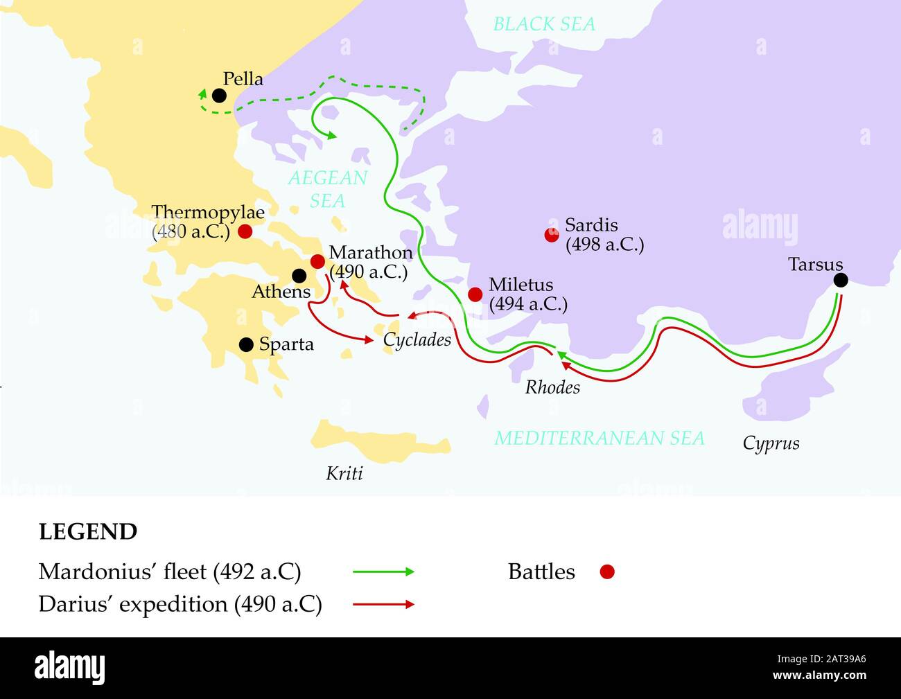 Ancient greece map showing persian invasion of greece. Stock Photohttps://www.alamy.com/image-license-details/?v=1https://www.alamy.com/ancient-greece-map-showing-persian-invasion-of-greece-image341821934.html
RF2AT39A6–Ancient greece map showing persian invasion of greece.
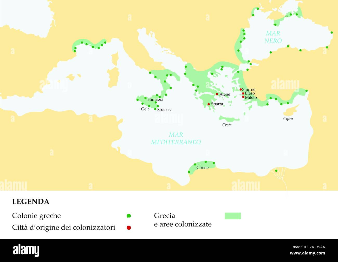 Mappa impero dell'antica Grecia raffigurante colonie e città conquistate. Stock Photohttps://www.alamy.com/image-license-details/?v=1https://www.alamy.com/mappa-impero-dellantica-grecia-raffigurante-colonie-e-citt-conquistate-image341821938.html
RF2AT39AA–Mappa impero dell'antica Grecia raffigurante colonie e città conquistate.