Quick filters:
Map of canada 1850 Stock Photos and Images
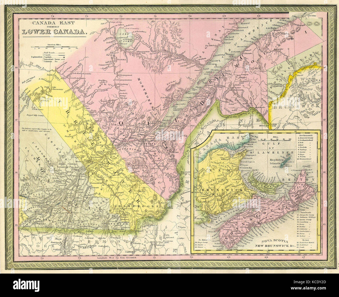 1850, Mitchell Map of Eastern Canada including Quebec Stock Photohttps://www.alamy.com/image-license-details/?v=1https://www.alamy.com/stock-image-1850-mitchell-map-of-eastern-canada-including-quebec-162575797.html
RMKCDY2D–1850, Mitchell Map of Eastern Canada including Quebec
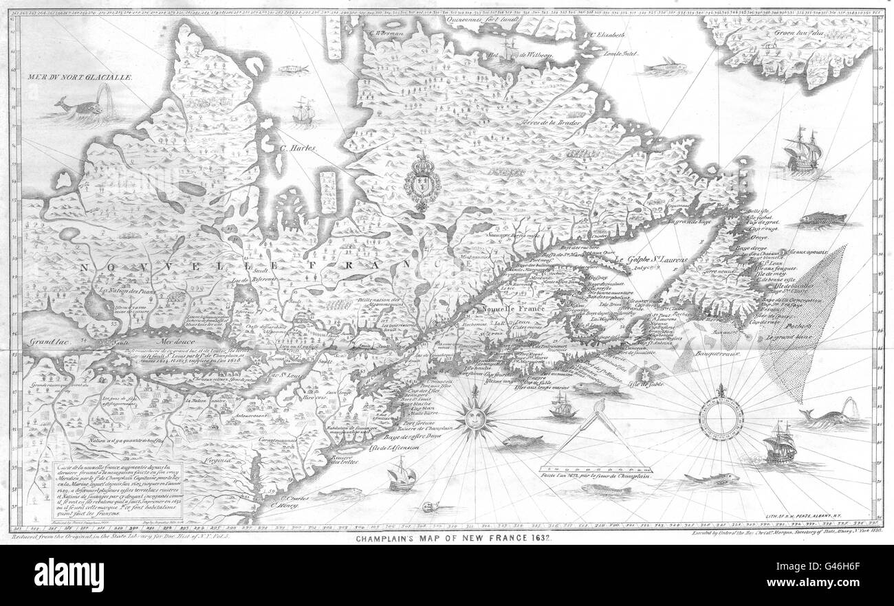 CANADA: Champlain's map of New France Nouvelle France 1632., 1850 Stock Photohttps://www.alamy.com/image-license-details/?v=1https://www.alamy.com/stock-photo-canada-champlains-map-of-new-france-nouvelle-france-1632-1850-105866055.html
RFG46H6F–CANADA: Champlain's map of New France Nouvelle France 1632., 1850
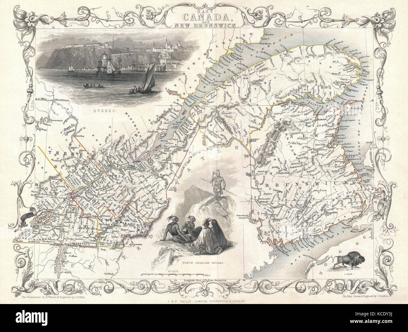 1850, Tallis Map of East Canada or Quebec and New Brunswick Stock Photohttps://www.alamy.com/image-license-details/?v=1https://www.alamy.com/stock-image-1850-tallis-map-of-east-canada-or-quebec-and-new-brunswick-162575830.html
RMKCDY3J–1850, Tallis Map of East Canada or Quebec and New Brunswick
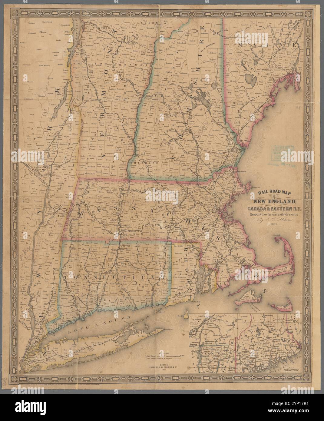 Rail road map of New England, Canada, & eastern N.Y.: compiled from the most authentic sources 1850 by Goldthwait, J. H. Stock Photohttps://www.alamy.com/image-license-details/?v=1https://www.alamy.com/rail-road-map-of-new-england-canada-eastern-ny-compiled-from-the-most-authentic-sources-1850-by-goldthwait-j-h-image633123765.html
RM2YP17R1–Rail road map of New England, Canada, & eastern N.Y.: compiled from the most authentic sources 1850 by Goldthwait, J. H.
 1850, Tallis Map of West Canada or Ontario, includes Great Lakes Stock Photohttps://www.alamy.com/image-license-details/?v=1https://www.alamy.com/stock-image-1850-tallis-map-of-west-canada-or-ontario-includes-great-lakes-162568357.html
RMKCDHGN–1850, Tallis Map of West Canada or Ontario, includes Great Lakes
 1850 Tallis Map of East Canada or Quebec and New Brunswick - Geographicus - EastCanada-tallis-1850 Stock Photohttps://www.alamy.com/image-license-details/?v=1https://www.alamy.com/stock-photo-1850-tallis-map-of-east-canada-or-quebec-and-new-brunswick-geographicus-139467262.html
RMJ2W7WJ–1850 Tallis Map of East Canada or Quebec and New Brunswick - Geographicus - EastCanada-tallis-1850
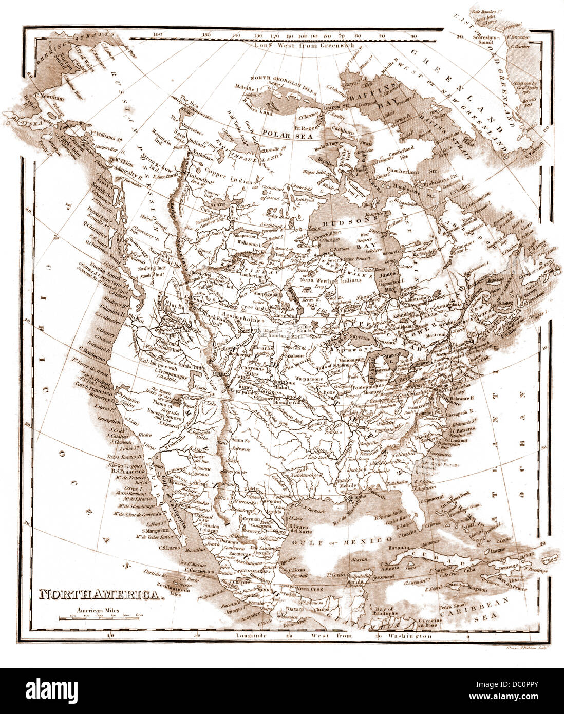 1800s 1850 MAP OF NORTH AMERICA BY SAMUEL WALKER Stock Photohttps://www.alamy.com/image-license-details/?v=1https://www.alamy.com/stock-photo-1800s-1850-map-of-north-america-by-samuel-walker-59024867.html
RMDC0PPY–1800s 1850 MAP OF NORTH AMERICA BY SAMUEL WALKER
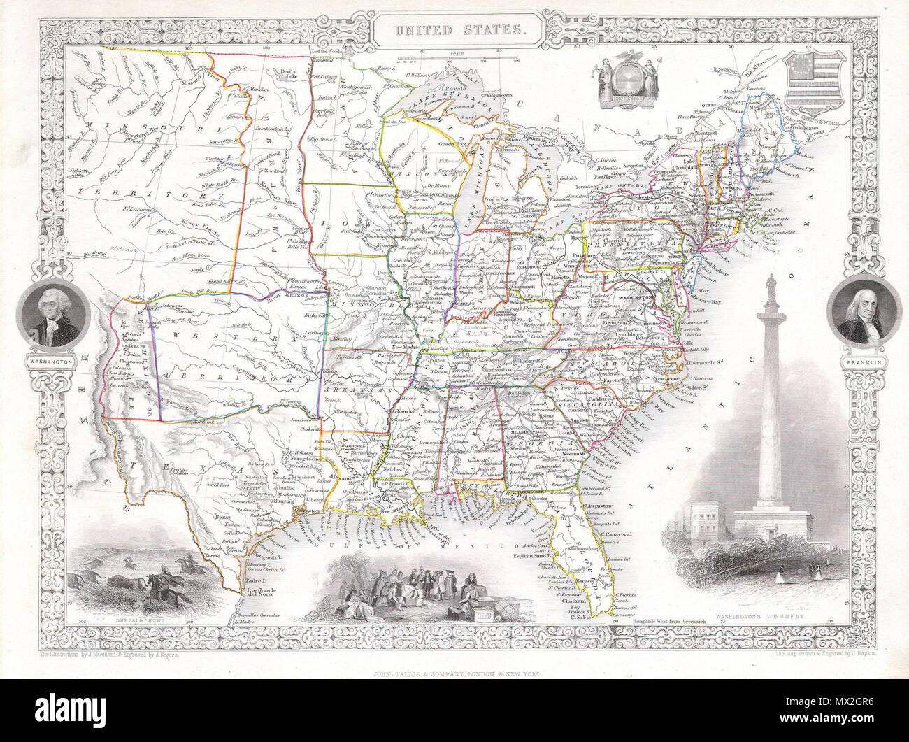 . United States. English: This is a fascinating 1850 map of the United States. Covers the United States from Texas (shown at fullest extant) and Santa Fe north through the Missouri Territory to Canada and east to the Atlantic. The Trans-Mississippi region is exceptionally interesting with a fascinating (if somewhat inaccurate even ate the time) depiction of the political geography. A long Narrow Nebraska territory extends to Canada. There is a large “Western Territory roughly where Oklahoma is today. New Mexico Territory is alternatively called Santa Fe territory. Missouri Territory occupies Stock Photohttps://www.alamy.com/image-license-details/?v=1https://www.alamy.com/united-states-english-this-is-a-fascinating-1850-map-of-the-united-states-covers-the-united-states-from-texas-shown-at-fullest-extant-and-santa-fe-north-through-the-missouri-territory-to-canada-and-east-to-the-atlantic-the-trans-mississippi-region-is-exceptionally-interesting-with-a-fascinating-if-somewhat-inaccurate-even-ate-the-time-depiction-of-the-political-geography-a-long-narrow-nebraska-territory-extends-to-canada-there-is-a-large-western-territory-roughly-where-oklahoma-is-today-new-mexico-territory-is-alternatively-called-santa-fe-territory-missouri-territory-occupies-image188141834.html
RMMX2GR6–. United States. English: This is a fascinating 1850 map of the United States. Covers the United States from Texas (shown at fullest extant) and Santa Fe north through the Missouri Territory to Canada and east to the Atlantic. The Trans-Mississippi region is exceptionally interesting with a fascinating (if somewhat inaccurate even ate the time) depiction of the political geography. A long Narrow Nebraska territory extends to Canada. There is a large “Western Territory roughly where Oklahoma is today. New Mexico Territory is alternatively called Santa Fe territory. Missouri Territory occupies
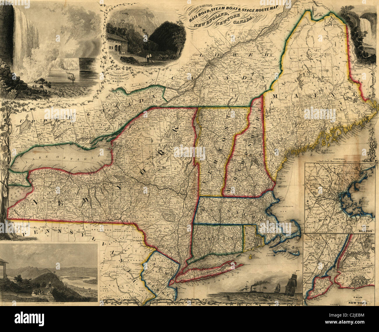 Railroad, steam boat & stage route map of New England, New-York and Canada - 1850 Stock Photohttps://www.alamy.com/image-license-details/?v=1https://www.alamy.com/stock-photo-railroad-steam-boat-stage-route-map-of-new-england-new-york-and-canada-36056488.html
RMC2JEBM–Railroad, steam boat & stage route map of New England, New-York and Canada - 1850
 1850 Mitchell Map of Eastern Canada including Quebec - Geographicus - CanadaQuebec-c-50 Stock Photohttps://www.alamy.com/image-license-details/?v=1https://www.alamy.com/stock-photo-1850-mitchell-map-of-eastern-canada-including-quebec-geographicus-132589325.html
RMHKKY11–1850 Mitchell Map of Eastern Canada including Quebec - Geographicus - CanadaQuebec-c-50
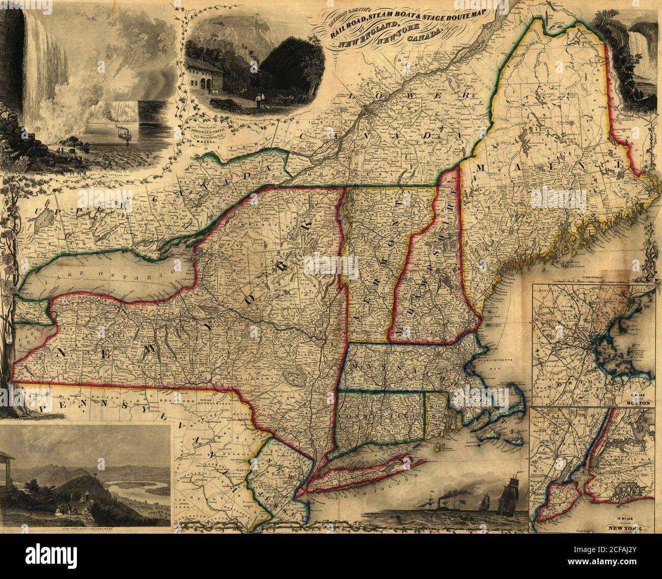 Railroad, steam boat & stage route map of New England, New-York and Canada - 1850 Stock Photohttps://www.alamy.com/image-license-details/?v=1https://www.alamy.com/railroad-steam-boat-stage-route-map-of-new-england-new-york-and-canada-1850-image370871283.html
RM2CFAJ2Y–Railroad, steam boat & stage route map of New England, New-York and Canada - 1850
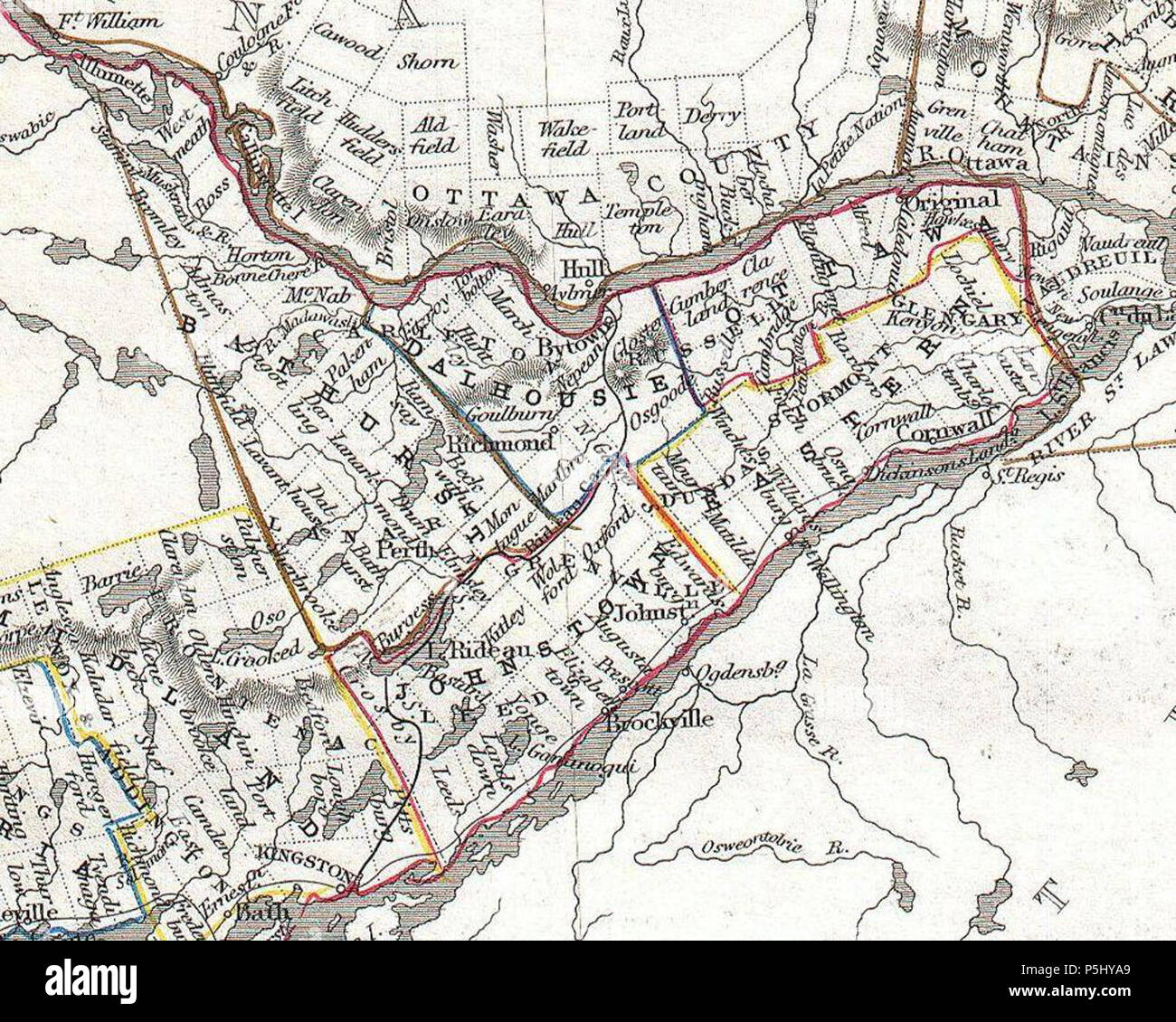 1850 Tallis Map of West Canada or Ontario (cropped - Eastern Ontario). Stock Photohttps://www.alamy.com/image-license-details/?v=1https://www.alamy.com/1850-tallis-map-of-west-canada-or-ontario-cropped-eastern-ontario-image209992337.html
RMP5HYA9–1850 Tallis Map of West Canada or Ontario (cropped - Eastern Ontario).
 Dominion of Canada, Cape Breton Island, Scatari Island and Menadou Passage : from a British survey in 1850 , Nautical charts, Nova Scotia, Scatarie Island, Scatarie Island N.S., Maps Norman B. Leventhal Map Center Collection Stock Photohttps://www.alamy.com/image-license-details/?v=1https://www.alamy.com/dominion-of-canada-cape-breton-island-scatari-island-and-menadou-passage-from-a-british-survey-in-1850-nautical-charts-nova-scotia-scatarie-island-scatarie-island-ns-maps-norman-b-leventhal-map-center-collection-image500769174.html
RM2M2M05A–Dominion of Canada, Cape Breton Island, Scatari Island and Menadou Passage : from a British survey in 1850 , Nautical charts, Nova Scotia, Scatarie Island, Scatarie Island N.S., Maps Norman B. Leventhal Map Center Collection
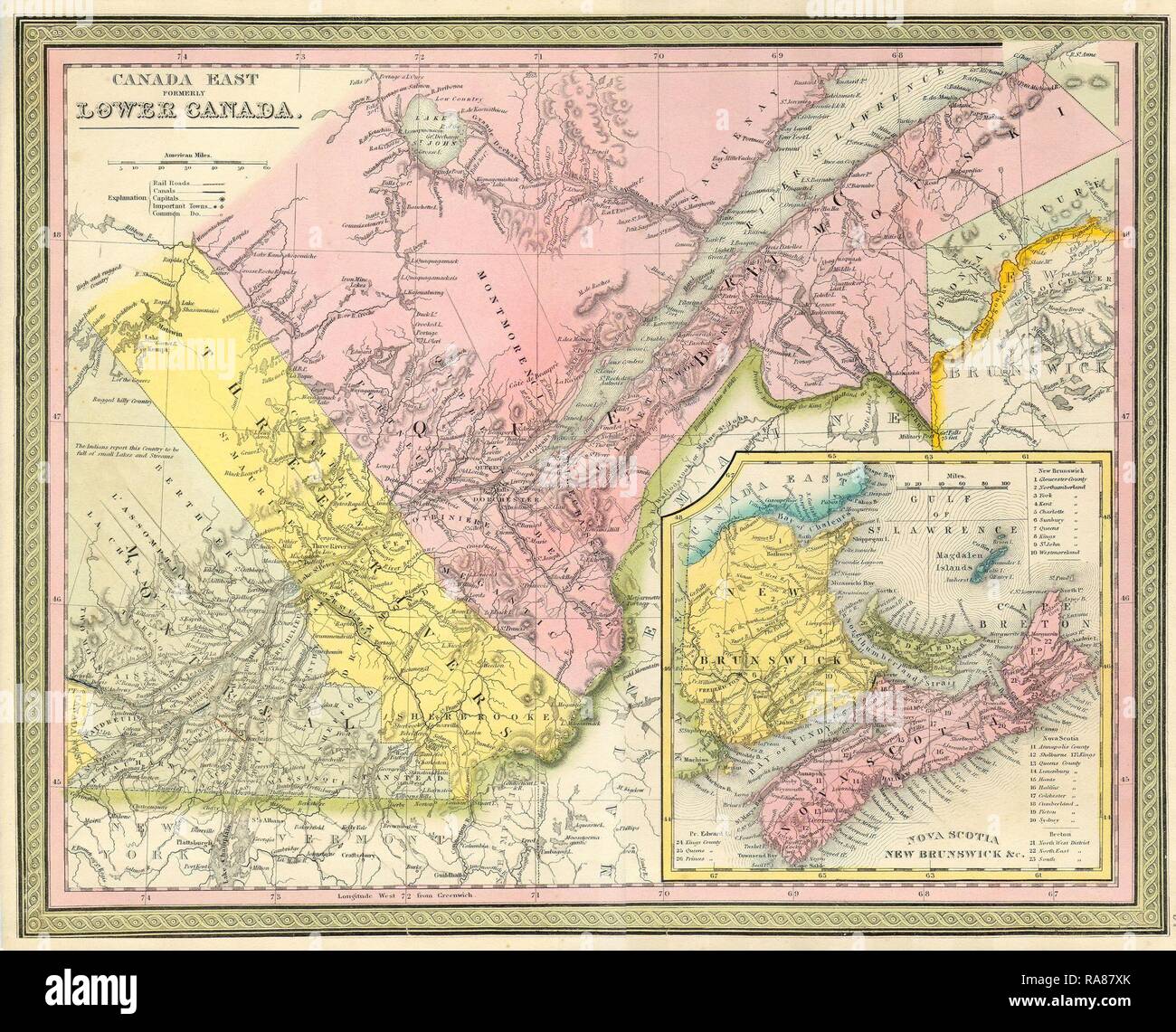 1850, Mitchell Map of Eastern Canada including Quebec. Reimagined by Gibon. Classic art with a modern twist reimagined Stock Photohttps://www.alamy.com/image-license-details/?v=1https://www.alamy.com/1850-mitchell-map-of-eastern-canada-including-quebec-reimagined-by-gibon-classic-art-with-a-modern-twist-reimagined-image230063195.html
RFRA87XK–1850, Mitchell Map of Eastern Canada including Quebec. Reimagined by Gibon. Classic art with a modern twist reimagined
 Relief shown by hachures. Inset map: Map of the world on Mercator's projection. Shows North America from U.S. - Canada border to northern tip of South America, includes the Greater Antilles. Contains table of distances by land and by water, statistical table from the U.S. Census of 1850, a list of the authorities used in compiling the map, and statistics for Central America. Contains vignettes of the United States Capitol, American Eagle surrounded by stars containing the coats of arms of the states, and ships sailing on the open waters; enclosed by ornamental border of acanthus leaves. Scal Stock Photohttps://www.alamy.com/image-license-details/?v=1https://www.alamy.com/relief-shown-by-hachures-inset-map-map-of-the-world-on-mercators-projection-shows-north-america-from-us-canada-border-to-northern-tip-of-south-america-includes-the-greater-antilles-contains-table-of-distances-by-land-and-by-water-statistical-table-from-the-us-census-of-1850-a-list-of-the-authorities-used-in-compiling-the-map-and-statistics-for-central-america-contains-vignettes-of-the-united-states-capitol-american-eagle-surrounded-by-stars-containing-the-coats-of-arms-of-the-states-and-ships-sailing-on-the-open-waters-enclosed-by-ornamental-border-of-acanthus-leaves-scal-image337185496.html
RM2AGG3F4–Relief shown by hachures. Inset map: Map of the world on Mercator's projection. Shows North America from U.S. - Canada border to northern tip of South America, includes the Greater Antilles. Contains table of distances by land and by water, statistical table from the U.S. Census of 1850, a list of the authorities used in compiling the map, and statistics for Central America. Contains vignettes of the United States Capitol, American Eagle surrounded by stars containing the coats of arms of the states, and ships sailing on the open waters; enclosed by ornamental border of acanthus leaves. Scal
 1850 Tallis Map of West Canada or Ontario ( includes Great Lakes ) - Geographicus - WestCanada-tallis-1850 Stock Photohttps://www.alamy.com/image-license-details/?v=1https://www.alamy.com/stock-photo-1850-tallis-map-of-west-canada-or-ontario-includes-great-lakes-geographicus-139472483.html
RMJ2WEG3–1850 Tallis Map of West Canada or Ontario ( includes Great Lakes ) - Geographicus - WestCanada-tallis-1850
 . United States. English: This is a fascinating 1850 map of the United States. Covers the United States from Texas (shown at fullest extant) and Santa Fe north through the Missouri Territory to Canada and east to the Atlantic. The Trans-Mississippi region is exceptionally interesting with a fascinating (if somewhat inaccurate even ate the time) depiction of the political geography. A long Narrow Nebraska territory extends to Canada. There is a large “Western Territory roughly where Oklahoma is today. New Mexico Territory is alternatively called Santa Fe territory. Missouri Territory occupies Stock Photohttps://www.alamy.com/image-license-details/?v=1https://www.alamy.com/united-states-english-this-is-a-fascinating-1850-map-of-the-united-states-covers-the-united-states-from-texas-shown-at-fullest-extant-and-santa-fe-north-through-the-missouri-territory-to-canada-and-east-to-the-atlantic-the-trans-mississippi-region-is-exceptionally-interesting-with-a-fascinating-if-somewhat-inaccurate-even-ate-the-time-depiction-of-the-political-geography-a-long-narrow-nebraska-territory-extends-to-canada-there-is-a-large-western-territory-roughly-where-oklahoma-is-today-new-mexico-territory-is-alternatively-called-santa-fe-territory-missouri-territory-occupies-image187621646.html
RMMW6W92–. United States. English: This is a fascinating 1850 map of the United States. Covers the United States from Texas (shown at fullest extant) and Santa Fe north through the Missouri Territory to Canada and east to the Atlantic. The Trans-Mississippi region is exceptionally interesting with a fascinating (if somewhat inaccurate even ate the time) depiction of the political geography. A long Narrow Nebraska territory extends to Canada. There is a large “Western Territory roughly where Oklahoma is today. New Mexico Territory is alternatively called Santa Fe territory. Missouri Territory occupies
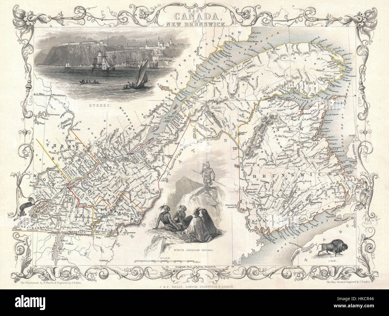 1850 Tallis Map of East Canada or Quebec and New Brunswick Geographicus EastCanada tallis 1850 Stock Photohttps://www.alamy.com/image-license-details/?v=1https://www.alamy.com/stock-photo-1850-tallis-map-of-east-canada-or-quebec-and-new-brunswick-geographicus-132432614.html
RMHKCR46–1850 Tallis Map of East Canada or Quebec and New Brunswick Geographicus EastCanada tallis 1850
 1850 Mitchell Map of Eastern Canada including Quebec - Geographicus - CanadaQuebec-c-50. Stock Photohttps://www.alamy.com/image-license-details/?v=1https://www.alamy.com/1850-mitchell-map-of-eastern-canada-including-quebec-geographicus-canadaquebec-c-50-image209992025.html
RMP5HXY5–1850 Mitchell Map of Eastern Canada including Quebec - Geographicus - CanadaQuebec-c-50.
 Map of the European and North American Railway, showing its connection with the railways of the United States & Canada; made by direction of His Excellency John Hubbard, Governor of Maine under the resolve of Aug. 20th 1850 , Railroads, New England, Maps, Railroads, Maritime Provinces, Maps Norman B. Leventhal Map Center Collection Stock Photohttps://www.alamy.com/image-license-details/?v=1https://www.alamy.com/map-of-the-european-and-north-american-railway-showing-its-connection-with-the-railways-of-the-united-states-canada-made-by-direction-of-his-excellency-john-hubbard-governor-of-maine-under-the-resolve-of-aug-20th-1850-railroads-new-england-maps-railroads-maritime-provinces-maps-norman-b-leventhal-map-center-collection-image501280638.html
RM2M3F8FX–Map of the European and North American Railway, showing its connection with the railways of the United States & Canada; made by direction of His Excellency John Hubbard, Governor of Maine under the resolve of Aug. 20th 1850 , Railroads, New England, Maps, Railroads, Maritime Provinces, Maps Norman B. Leventhal Map Center Collection
 1850, Tallis Map of East Canada or Quebec and New Brunswick. Reimagined by Gibon. Classic art with a modern twist reimagined Stock Photohttps://www.alamy.com/image-license-details/?v=1https://www.alamy.com/1850-tallis-map-of-east-canada-or-quebec-and-new-brunswick-reimagined-by-gibon-classic-art-with-a-modern-twist-reimagined-image230072093.html
RFRA8K8D–1850, Tallis Map of East Canada or Quebec and New Brunswick. Reimagined by Gibon. Classic art with a modern twist reimagined
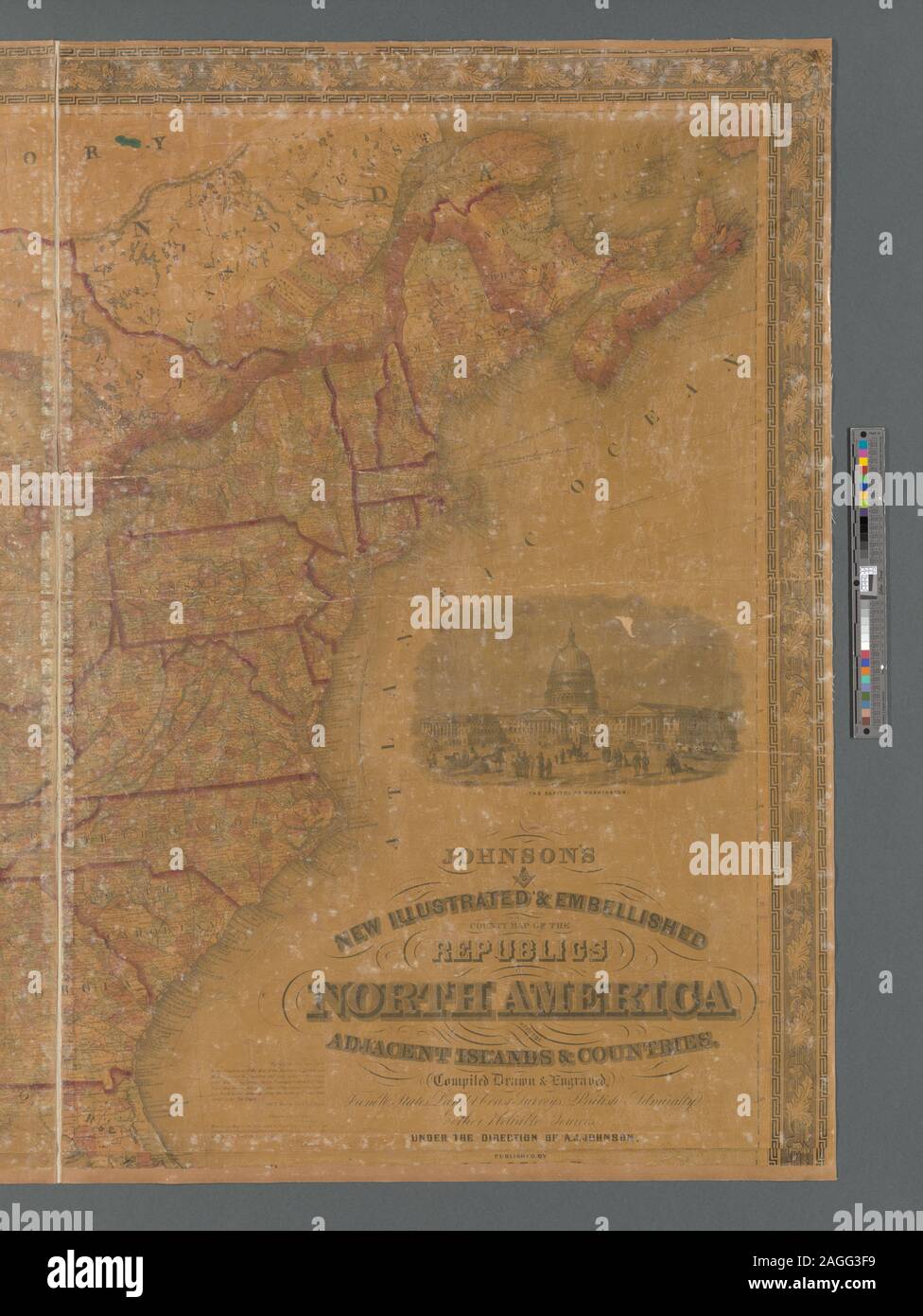 Relief shown by hachures. Inset map: Map of the world on Mercator's projection. Shows North America from U.S. - Canada border to northern tip of South America, includes the Greater Antilles. Contains table of distances by land and by water, statistical table from the U.S. Census of 1850, a list of the authorities used in compiling the map, and statistics for Central America. Contains vignettes of the United States Capitol, American Eagle surrounded by stars containing the coats of arms of the states, and ships sailing on the open waters; enclosed by ornamental border of acanthus leaves. Scal Stock Photohttps://www.alamy.com/image-license-details/?v=1https://www.alamy.com/relief-shown-by-hachures-inset-map-map-of-the-world-on-mercators-projection-shows-north-america-from-us-canada-border-to-northern-tip-of-south-america-includes-the-greater-antilles-contains-table-of-distances-by-land-and-by-water-statistical-table-from-the-us-census-of-1850-a-list-of-the-authorities-used-in-compiling-the-map-and-statistics-for-central-america-contains-vignettes-of-the-united-states-capitol-american-eagle-surrounded-by-stars-containing-the-coats-of-arms-of-the-states-and-ships-sailing-on-the-open-waters-enclosed-by-ornamental-border-of-acanthus-leaves-scal-image337185501.html
RM2AGG3F9–Relief shown by hachures. Inset map: Map of the world on Mercator's projection. Shows North America from U.S. - Canada border to northern tip of South America, includes the Greater Antilles. Contains table of distances by land and by water, statistical table from the U.S. Census of 1850, a list of the authorities used in compiling the map, and statistics for Central America. Contains vignettes of the United States Capitol, American Eagle surrounded by stars containing the coats of arms of the states, and ships sailing on the open waters; enclosed by ornamental border of acanthus leaves. Scal
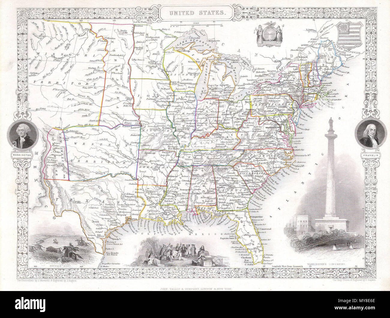 . United States. English: This is a fascinating 1850 map of the United States. Covers the United States from Texas (shown at fullest extant) and Santa Fe north through the Missouri Territory to Canada and east to the Atlantic. The Trans-Mississippi region is exceptionally interesting with a fascinating (if somewhat inaccurate even ate the time) depiction of the political geography. A long Narrow Nebraska territory extends to Canada. There is a large “Western Territory roughly where Oklahoma is today. New Mexico Territory is alternatively called Santa Fe territory. Missouri Territory occupies Stock Photohttps://www.alamy.com/image-license-details/?v=1https://www.alamy.com/united-states-english-this-is-a-fascinating-1850-map-of-the-united-states-covers-the-united-states-from-texas-shown-at-fullest-extant-and-santa-fe-north-through-the-missouri-territory-to-canada-and-east-to-the-atlantic-the-trans-mississippi-region-is-exceptionally-interesting-with-a-fascinating-if-somewhat-inaccurate-even-ate-the-time-depiction-of-the-political-geography-a-long-narrow-nebraska-territory-extends-to-canada-there-is-a-large-western-territory-roughly-where-oklahoma-is-today-new-mexico-territory-is-alternatively-called-santa-fe-territory-missouri-territory-occupies-image188886166.html
RMMY8E6E–. United States. English: This is a fascinating 1850 map of the United States. Covers the United States from Texas (shown at fullest extant) and Santa Fe north through the Missouri Territory to Canada and east to the Atlantic. The Trans-Mississippi region is exceptionally interesting with a fascinating (if somewhat inaccurate even ate the time) depiction of the political geography. A long Narrow Nebraska territory extends to Canada. There is a large “Western Territory roughly where Oklahoma is today. New Mexico Territory is alternatively called Santa Fe territory. Missouri Territory occupies
 1850 Tallis Map of West Canada or Ontario ( includes Great Lakes ) Geographicus WestCanada tallis 1850 Stock Photohttps://www.alamy.com/image-license-details/?v=1https://www.alamy.com/stock-photo-1850-tallis-map-of-west-canada-or-ontario-includes-great-lakes-geographicus-132432581.html
RMHKCR31–1850 Tallis Map of West Canada or Ontario ( includes Great Lakes ) Geographicus WestCanada tallis 1850
 1850 Tallis Map of East Canada or Quebec and New Brunswick - Geographicus - EastCanada-tallis-1850. Stock Photohttps://www.alamy.com/image-license-details/?v=1https://www.alamy.com/1850-tallis-map-of-east-canada-or-quebec-and-new-brunswick-geographicus-eastcanada-tallis-1850-image209992291.html
RMP5HY8K–1850 Tallis Map of East Canada or Quebec and New Brunswick - Geographicus - EastCanada-tallis-1850.
 Dominion of Canada, Nova Scotia, Guysborough Harbor (Chedabucto Bay) : from a British survey in 1850 , Nautical charts, Nova Scotia, Chedabucto Bay, Nautical charts, Nova Scotia, Guysborough Harbour, Chedabucto Bay N.S., Maps, Guysborough Harbour N.S., Maps Norman B. Leventhal Map Center Collection Stock Photohttps://www.alamy.com/image-license-details/?v=1https://www.alamy.com/dominion-of-canada-nova-scotia-guysborough-harbor-chedabucto-bay-from-a-british-survey-in-1850-nautical-charts-nova-scotia-chedabucto-bay-nautical-charts-nova-scotia-guysborough-harbour-chedabucto-bay-ns-maps-guysborough-harbour-ns-maps-norman-b-leventhal-map-center-collection-image500770173.html
RM2M2M1D1–Dominion of Canada, Nova Scotia, Guysborough Harbor (Chedabucto Bay) : from a British survey in 1850 , Nautical charts, Nova Scotia, Chedabucto Bay, Nautical charts, Nova Scotia, Guysborough Harbour, Chedabucto Bay N.S., Maps, Guysborough Harbour N.S., Maps Norman B. Leventhal Map Center Collection
 1850, Tallis Map of West Canada or Ontario, includes Great Lakes . Reimagined by Gibon. Classic art with a modern reimagined Stock Photohttps://www.alamy.com/image-license-details/?v=1https://www.alamy.com/1850-tallis-map-of-west-canada-or-ontario-includes-great-lakes-reimagined-by-gibon-classic-art-with-a-modern-reimagined-image230087946.html
RFRA9BEJ–1850, Tallis Map of West Canada or Ontario, includes Great Lakes . Reimagined by Gibon. Classic art with a modern reimagined
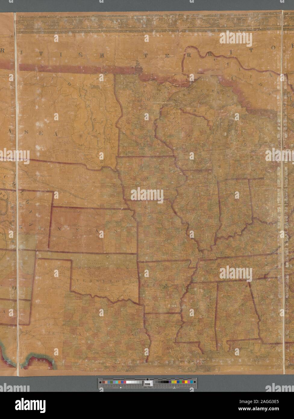 Relief shown by hachures. Inset map: Map of the world on Mercator's projection. Shows North America from U.S. - Canada border to northern tip of South America, includes the Greater Antilles. Contains table of distances by land and by water, statistical table from the U.S. Census of 1850, a list of the authorities used in compiling the map, and statistics for Central America. Contains vignettes of the United States Capitol, American Eagle surrounded by stars containing the coats of arms of the states, and ships sailing on the open waters; enclosed by ornamental border of acanthus leaves. Scal Stock Photohttps://www.alamy.com/image-license-details/?v=1https://www.alamy.com/relief-shown-by-hachures-inset-map-map-of-the-world-on-mercators-projection-shows-north-america-from-us-canada-border-to-northern-tip-of-south-america-includes-the-greater-antilles-contains-table-of-distances-by-land-and-by-water-statistical-table-from-the-us-census-of-1850-a-list-of-the-authorities-used-in-compiling-the-map-and-statistics-for-central-america-contains-vignettes-of-the-united-states-capitol-american-eagle-surrounded-by-stars-containing-the-coats-of-arms-of-the-states-and-ships-sailing-on-the-open-waters-enclosed-by-ornamental-border-of-acanthus-leaves-scal-image337185469.html
RM2AGG3E5–Relief shown by hachures. Inset map: Map of the world on Mercator's projection. Shows North America from U.S. - Canada border to northern tip of South America, includes the Greater Antilles. Contains table of distances by land and by water, statistical table from the U.S. Census of 1850, a list of the authorities used in compiling the map, and statistics for Central America. Contains vignettes of the United States Capitol, American Eagle surrounded by stars containing the coats of arms of the states, and ships sailing on the open waters; enclosed by ornamental border of acanthus leaves. Scal
 . East Canada, and New Brunswick. English: This is John Tallis’ extremely attractive c. 1850 map of East Canada or what is now Quebec and New Brunswick. Includes Montreal, Quebec City, and the St. Lawrence River valley. Features five stunning vignettes which include American Indian warriors and a spectacular view of Quebec City. The whole is surrounded by a decorative vine motif border. The vignettes for this map were drawn by H. Warren and engraved by J. B. Allen. The map itself is the work of John Rapkin. . circa 1850(undated) 8 1850 Tallis Map of East Canada or Quebec and New Brunswick - Stock Photohttps://www.alamy.com/image-license-details/?v=1https://www.alamy.com/east-canada-and-new-brunswick-english-this-is-john-tallis-extremely-attractive-c-1850-map-of-east-canada-or-what-is-now-quebec-and-new-brunswick-includes-montreal-quebec-city-and-the-st-lawrence-river-valley-features-five-stunning-vignettes-which-include-american-indian-warriors-and-a-spectacular-view-of-quebec-city-the-whole-is-surrounded-by-a-decorative-vine-motif-border-the-vignettes-for-this-map-were-drawn-by-h-warren-and-engraved-by-j-b-allen-the-map-itself-is-the-work-of-john-rapkin-circa-1850undated-8-1850-tallis-map-of-east-canada-or-quebec-and-new-brunswick-image187621647.html
RMMW6W93–. East Canada, and New Brunswick. English: This is John Tallis’ extremely attractive c. 1850 map of East Canada or what is now Quebec and New Brunswick. Includes Montreal, Quebec City, and the St. Lawrence River valley. Features five stunning vignettes which include American Indian warriors and a spectacular view of Quebec City. The whole is surrounded by a decorative vine motif border. The vignettes for this map were drawn by H. Warren and engraved by J. B. Allen. The map itself is the work of John Rapkin. . circa 1850(undated) 8 1850 Tallis Map of East Canada or Quebec and New Brunswick -
 1850 Tallis Map of East Canada or Quebec and New Brunswick Geographicus EastCanada tallis 1850 Stock Photohttps://www.alamy.com/image-license-details/?v=1https://www.alamy.com/stock-photo-1850-tallis-map-of-east-canada-or-quebec-and-new-brunswick-geographicus-136444357.html
RMHWYG4N–1850 Tallis Map of East Canada or Quebec and New Brunswick Geographicus EastCanada tallis 1850
 1850 Tallis Map of West Canada or Ontario ( includes Great Lakes ) - Geographicus - WestCanada-tallis-1850. Stock Photohttps://www.alamy.com/image-license-details/?v=1https://www.alamy.com/1850-tallis-map-of-west-canada-or-ontario-includes-great-lakes-geographicus-westcanada-tallis-1850-image209992331.html
RMP5HYA3–1850 Tallis Map of West Canada or Ontario ( includes Great Lakes ) - Geographicus - WestCanada-tallis-1850.
 Map of the European and North American Railway, showing its connection with the railways of the United States & Canada; made by direction of His Excellency John Hubbard, Governor of Maine under the resolve of Aug. 20th 1850. Inset: Map showing the plan for shortening the transit between New York & London. 12 x 42 cm.. Shows New England, eastern New York, and the Maritime Provinces. Gives completed, in progress, and proposed railroads. Indicates drainage, state boundaries, and larger cities. Slightly different edition, engraved by B.W. Thayer & Co., Boston, accompanies Morton's Report on the Su Stock Photohttps://www.alamy.com/image-license-details/?v=1https://www.alamy.com/map-of-the-european-and-north-american-railway-showing-its-connection-with-the-railways-of-the-united-states-canada-made-by-direction-of-his-excellency-john-hubbard-governor-of-maine-under-the-resolve-of-aug-20th-1850-inset-map-showing-the-plan-for-shortening-the-transit-between-new-york-london-12-x-42-cm-shows-new-england-eastern-new-york-and-the-maritime-provinces-gives-completed-in-progress-and-proposed-railroads-indicates-drainage-state-boundaries-and-larger-cities-slightly-different-edition-engraved-by-bw-thayer-co-boston-accompanies-mortons-report-on-the-su-image502724592.html
RM2M5W29M–Map of the European and North American Railway, showing its connection with the railways of the United States & Canada; made by direction of His Excellency John Hubbard, Governor of Maine under the resolve of Aug. 20th 1850. Inset: Map showing the plan for shortening the transit between New York & London. 12 x 42 cm.. Shows New England, eastern New York, and the Maritime Provinces. Gives completed, in progress, and proposed railroads. Indicates drainage, state boundaries, and larger cities. Slightly different edition, engraved by B.W. Thayer & Co., Boston, accompanies Morton's Report on the Su
 Relief shown by hachures. Inset map: Map of the world on Mercator's projection. Shows North America from U.S. - Canada border to northern tip of South America, includes the Greater Antilles. Contains table of distances by land and by water, statistical table from the U.S. Census of 1850, a list of the authorities used in compiling the map, and statistics for Central America. Contains vignettes of the United States Capitol, American Eagle surrounded by stars containing the coats of arms of the states, and ships sailing on the open waters; enclosed by ornamental border of acanthus leaves. Scal Stock Photohttps://www.alamy.com/image-license-details/?v=1https://www.alamy.com/relief-shown-by-hachures-inset-map-map-of-the-world-on-mercators-projection-shows-north-america-from-us-canada-border-to-northern-tip-of-south-america-includes-the-greater-antilles-contains-table-of-distances-by-land-and-by-water-statistical-table-from-the-us-census-of-1850-a-list-of-the-authorities-used-in-compiling-the-map-and-statistics-for-central-america-contains-vignettes-of-the-united-states-capitol-american-eagle-surrounded-by-stars-containing-the-coats-of-arms-of-the-states-and-ships-sailing-on-the-open-waters-enclosed-by-ornamental-border-of-acanthus-leaves-scal-image337185470.html
RM2AGG3E6–Relief shown by hachures. Inset map: Map of the world on Mercator's projection. Shows North America from U.S. - Canada border to northern tip of South America, includes the Greater Antilles. Contains table of distances by land and by water, statistical table from the U.S. Census of 1850, a list of the authorities used in compiling the map, and statistics for Central America. Contains vignettes of the United States Capitol, American Eagle surrounded by stars containing the coats of arms of the states, and ships sailing on the open waters; enclosed by ornamental border of acanthus leaves. Scal
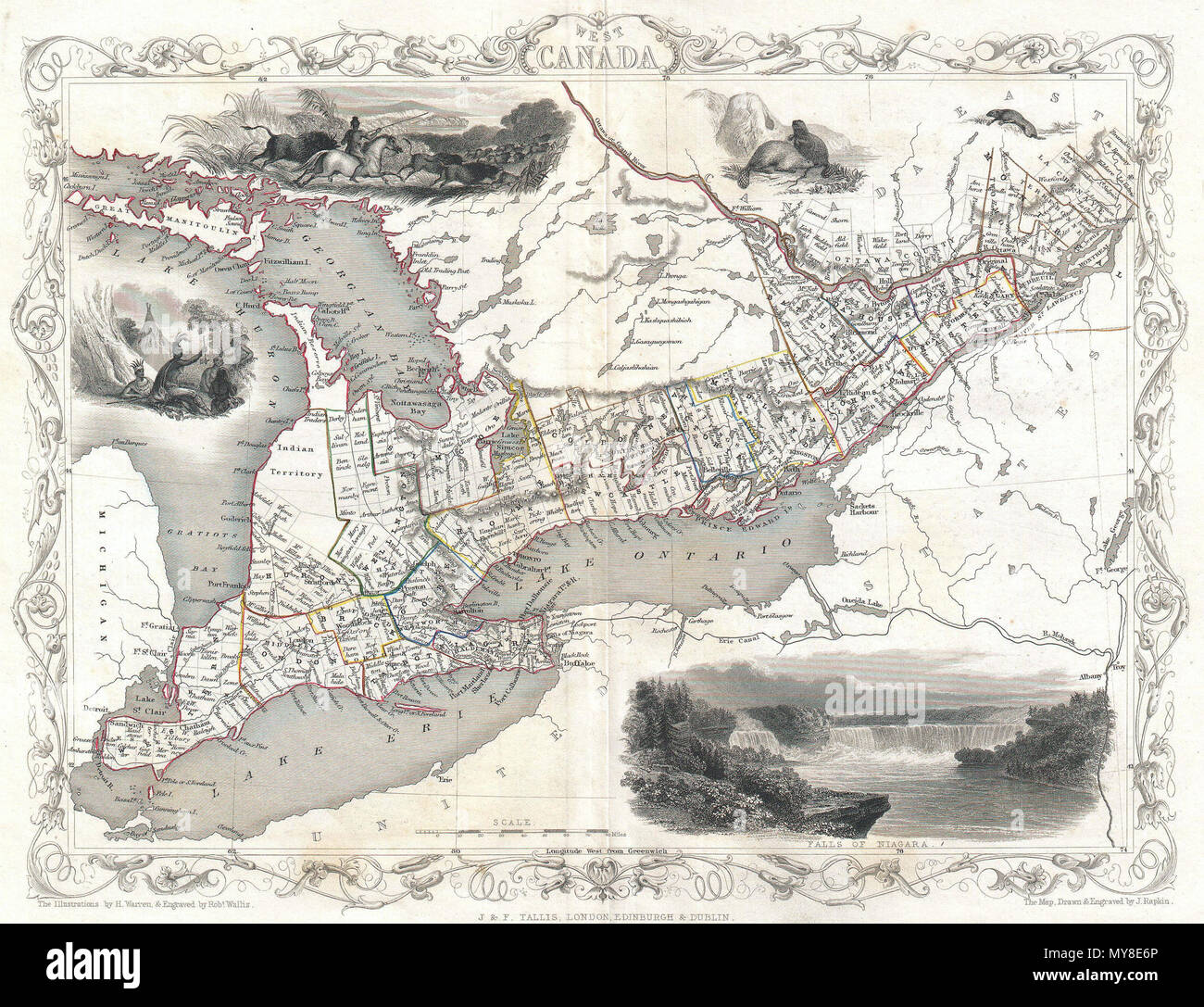 . West Canada. English: This is John Tallis’ extremely attractive c. 1850 map of West Canada or what is now Ontario. Includes Lake Erie, Lake Ontario, and part of Lake Huron with Georgian Bay. Features five stunning vignettes which include American Indians on horseback chasing buffalo across the great plains, Several American Indians sitting around a tree with a teepee in the background, two seals, an otter, and in the lower right quadrant, Niagara Falls. The whole is surrounded by a decorative vine motif border. The vignettes for this map were drawn by H. Warren and engraved by Robert Wallis Stock Photohttps://www.alamy.com/image-license-details/?v=1https://www.alamy.com/west-canada-english-this-is-john-tallis-extremely-attractive-c-1850-map-of-west-canada-or-what-is-now-ontario-includes-lake-erie-lake-ontario-and-part-of-lake-huron-with-georgian-bay-features-five-stunning-vignettes-which-include-american-indians-on-horseback-chasing-buffalo-across-the-great-plains-several-american-indians-sitting-around-a-tree-with-a-teepee-in-the-background-two-seals-an-otter-and-in-the-lower-right-quadrant-niagara-falls-the-whole-is-surrounded-by-a-decorative-vine-motif-border-the-vignettes-for-this-map-were-drawn-by-h-warren-and-engraved-by-robert-wallis-image188886174.html
RMMY8E6P–. West Canada. English: This is John Tallis’ extremely attractive c. 1850 map of West Canada or what is now Ontario. Includes Lake Erie, Lake Ontario, and part of Lake Huron with Georgian Bay. Features five stunning vignettes which include American Indians on horseback chasing buffalo across the great plains, Several American Indians sitting around a tree with a teepee in the background, two seals, an otter, and in the lower right quadrant, Niagara Falls. The whole is surrounded by a decorative vine motif border. The vignettes for this map were drawn by H. Warren and engraved by Robert Wallis
 1850 Tallis Map of West Canada or Ontario ( includes Great Lakes ) Geographicus WestCanada tallis 1850 Stock Photohttps://www.alamy.com/image-license-details/?v=1https://www.alamy.com/stock-photo-1850-tallis-map-of-west-canada-or-ontario-includes-great-lakes-geographicus-136444328.html
RMHWYG3M–1850 Tallis Map of West Canada or Ontario ( includes Great Lakes ) Geographicus WestCanada tallis 1850
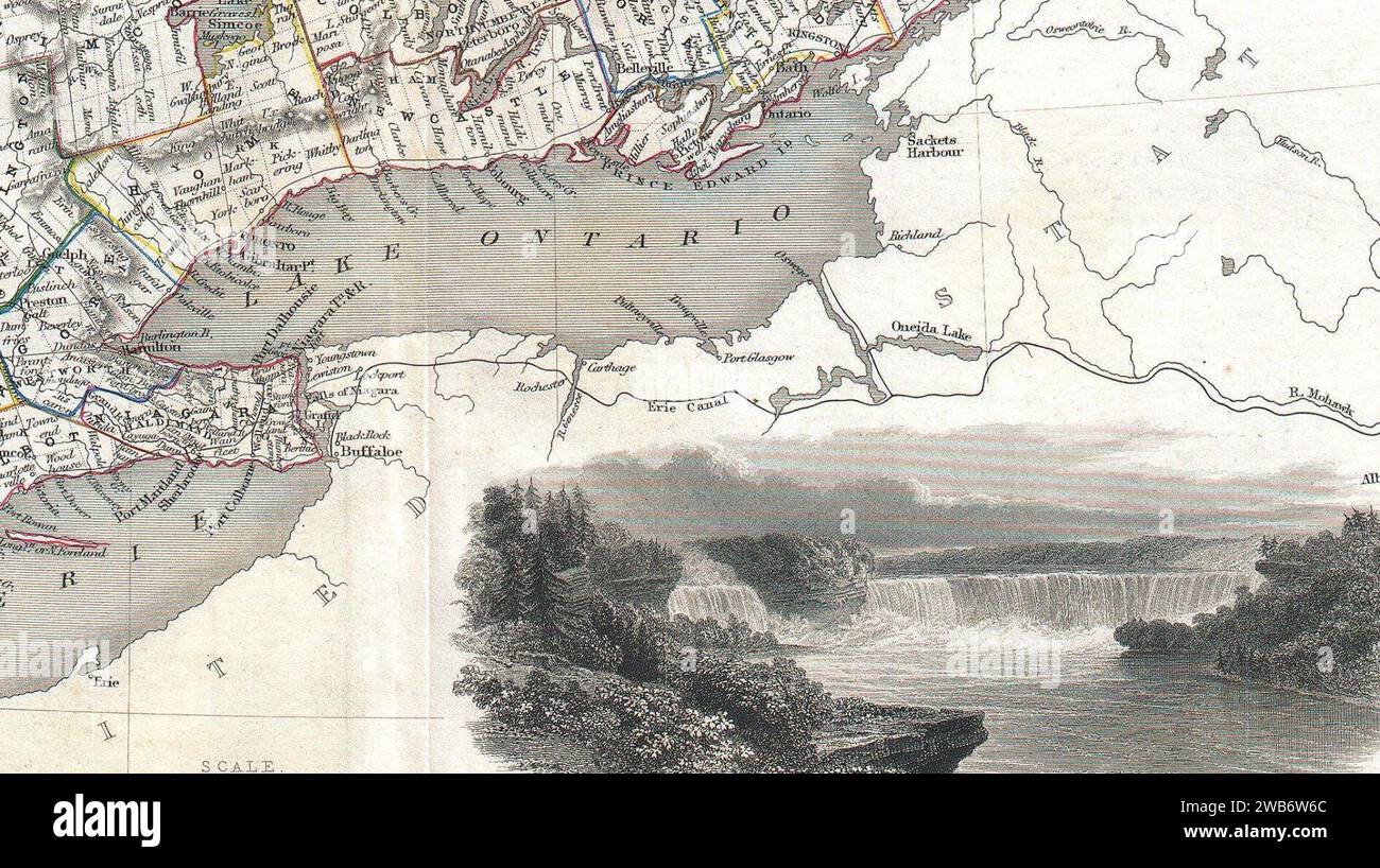 1850 Tallis Map of West Canada or Ontario ( includes Great Lakes ) - Geographicus - WestCanada-tallis-1850 (cropped). Stock Photohttps://www.alamy.com/image-license-details/?v=1https://www.alamy.com/1850-tallis-map-of-west-canada-or-ontario-includes-great-lakes-geographicus-westcanada-tallis-1850-cropped-image592065220.html
RM2WB6W6C–1850 Tallis Map of West Canada or Ontario ( includes Great Lakes ) - Geographicus - WestCanada-tallis-1850 (cropped).
 Sherman & Smith's rail road, steam boat & stage route map of New England, New-York, and Canada. Relief shown by hachures. 'Entered according to act of Congress in the Year 1850 by Sherman & Smith in the Clerks Office of the District Court for the Southern District of New York.' Insets: 15 miles around Boston -- 15 miles around New York. Includes illustrations... Sherman and Smith's railroad, steam boat & stage route map of New England, New-York, and Canada Rail road, steam boat & stage route map of New England, New-York, and Canada Sherman & Smith's illustrated railroad, steamboat & stage-rout Stock Photohttps://www.alamy.com/image-license-details/?v=1https://www.alamy.com/sherman-smiths-rail-road-steam-boat-stage-route-map-of-new-england-new-york-and-canada-relief-shown-by-hachures-entered-according-to-act-of-congress-in-the-year-1850-by-sherman-smith-in-the-clerks-office-of-the-district-court-for-the-southern-district-of-new-york-insets-15-miles-around-boston-15-miles-around-new-york-includes-illustrations-sherman-and-smiths-railroad-steam-boat-stage-route-map-of-new-england-new-york-and-canada-rail-road-steam-boat-stage-route-map-of-new-england-new-york-and-canada-sherman-smiths-illustrated-railroad-steamboat-stage-rout-image502707709.html
RM2M5T8PN–Sherman & Smith's rail road, steam boat & stage route map of New England, New-York, and Canada. Relief shown by hachures. 'Entered according to act of Congress in the Year 1850 by Sherman & Smith in the Clerks Office of the District Court for the Southern District of New York.' Insets: 15 miles around Boston -- 15 miles around New York. Includes illustrations... Sherman and Smith's railroad, steam boat & stage route map of New England, New-York, and Canada Rail road, steam boat & stage route map of New England, New-York, and Canada Sherman & Smith's illustrated railroad, steamboat & stage-rout
 Relief shown by hachures. Inset map: Map of the world on Mercator's projection. Shows North America from U.S. - Canada border to northern tip of South America, includes the Greater Antilles. Contains table of distances by land and by water, statistical table from the U.S. Census of 1850, a list of the authorities used in compiling the map, and statistics for Central America. Contains vignettes of the United States Capitol, American Eagle surrounded by stars containing the coats of arms of the states, and ships sailing on the open waters; enclosed by ornamental border of acanthus leaves. Scal Stock Photohttps://www.alamy.com/image-license-details/?v=1https://www.alamy.com/relief-shown-by-hachures-inset-map-map-of-the-world-on-mercators-projection-shows-north-america-from-us-canada-border-to-northern-tip-of-south-america-includes-the-greater-antilles-contains-table-of-distances-by-land-and-by-water-statistical-table-from-the-us-census-of-1850-a-list-of-the-authorities-used-in-compiling-the-map-and-statistics-for-central-america-contains-vignettes-of-the-united-states-capitol-american-eagle-surrounded-by-stars-containing-the-coats-of-arms-of-the-states-and-ships-sailing-on-the-open-waters-enclosed-by-ornamental-border-of-acanthus-leaves-scal-image337185498.html
RM2AGG3F6–Relief shown by hachures. Inset map: Map of the world on Mercator's projection. Shows North America from U.S. - Canada border to northern tip of South America, includes the Greater Antilles. Contains table of distances by land and by water, statistical table from the U.S. Census of 1850, a list of the authorities used in compiling the map, and statistics for Central America. Contains vignettes of the United States Capitol, American Eagle surrounded by stars containing the coats of arms of the states, and ships sailing on the open waters; enclosed by ornamental border of acanthus leaves. Scal
 . East Canada, and New Brunswick. English: This is John Tallis’ extremely attractive c. 1850 map of East Canada or what is now Quebec and New Brunswick. Includes Montreal, Quebec City, and the St. Lawrence River valley. Features five stunning vignettes which include American Indian warriors and a spectacular view of Quebec City. The whole is surrounded by a decorative vine motif border. The vignettes for this map were drawn by H. Warren and engraved by J. B. Allen. The map itself is the work of John Rapkin. . circa 1850(undated) 8 1850 Tallis Map of East Canada or Quebec and New Brunswick - G Stock Photohttps://www.alamy.com/image-license-details/?v=1https://www.alamy.com/east-canada-and-new-brunswick-english-this-is-john-tallis-extremely-attractive-c-1850-map-of-east-canada-or-what-is-now-quebec-and-new-brunswick-includes-montreal-quebec-city-and-the-st-lawrence-river-valley-features-five-stunning-vignettes-which-include-american-indian-warriors-and-a-spectacular-view-of-quebec-city-the-whole-is-surrounded-by-a-decorative-vine-motif-border-the-vignettes-for-this-map-were-drawn-by-h-warren-and-engraved-by-j-b-allen-the-map-itself-is-the-work-of-john-rapkin-circa-1850undated-8-1850-tallis-map-of-east-canada-or-quebec-and-new-brunswick-g-image188141836.html
RMMX2GR8–. East Canada, and New Brunswick. English: This is John Tallis’ extremely attractive c. 1850 map of East Canada or what is now Quebec and New Brunswick. Includes Montreal, Quebec City, and the St. Lawrence River valley. Features five stunning vignettes which include American Indian warriors and a spectacular view of Quebec City. The whole is surrounded by a decorative vine motif border. The vignettes for this map were drawn by H. Warren and engraved by J. B. Allen. The map itself is the work of John Rapkin. . circa 1850(undated) 8 1850 Tallis Map of East Canada or Quebec and New Brunswick - G
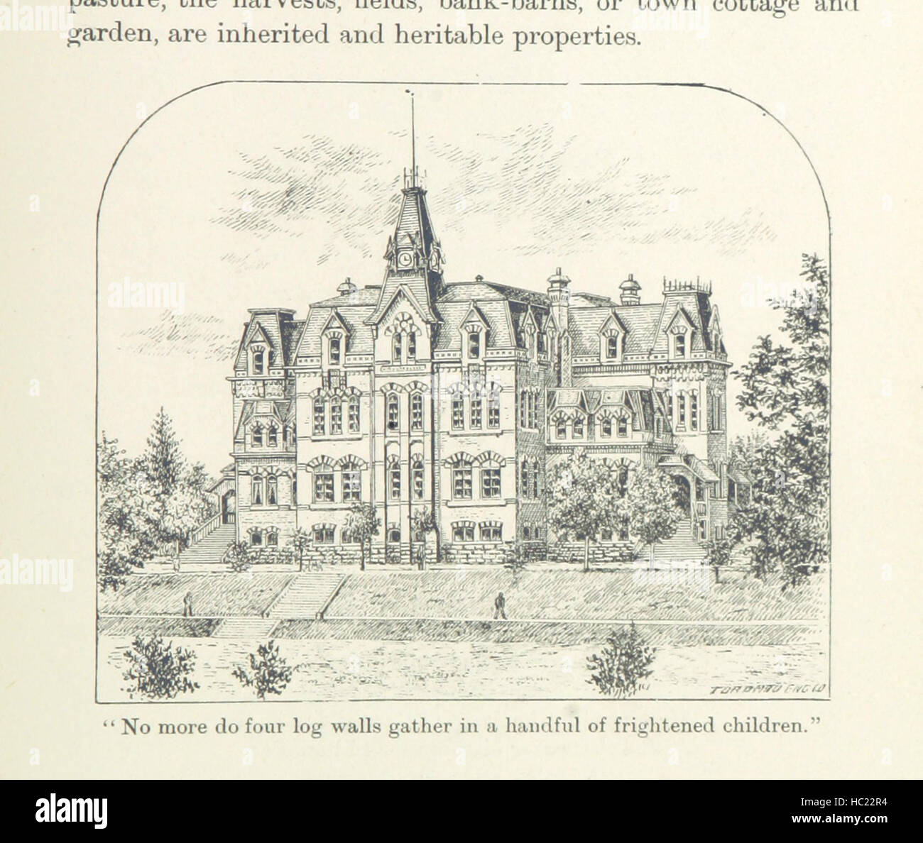 In the Days of the Canada Company: the story of the settlement of the Huron tract and a view of the social life of the period, 1825-1850 ... With an introduction by G. M. Grant Image taken from page 499 of 'In the Days of Stock Photohttps://www.alamy.com/image-license-details/?v=1https://www.alamy.com/stock-photo-in-the-days-of-the-canada-company-the-story-of-the-settlement-of-the-127894568.html
RMHC22R4–In the Days of the Canada Company: the story of the settlement of the Huron tract and a view of the social life of the period, 1825-1850 ... With an introduction by G. M. Grant Image taken from page 499 of 'In the Days of
 Relief shown by hachures. Inset map: Map of the world on Mercator's projection. Shows North America from U.S. - Canada border to northern tip of South America, includes the Greater Antilles. Contains table of distances by land and by water, statistical table from the U.S. Census of 1850, a list of the authorities used in compiling the map, and statistics for Central America. Contains vignettes of the United States Capitol, American Eagle surrounded by stars containing the coats of arms of the states, and ships sailing on the open waters; enclosed by ornamental border of acanthus leaves. Scal Stock Photohttps://www.alamy.com/image-license-details/?v=1https://www.alamy.com/relief-shown-by-hachures-inset-map-map-of-the-world-on-mercators-projection-shows-north-america-from-us-canada-border-to-northern-tip-of-south-america-includes-the-greater-antilles-contains-table-of-distances-by-land-and-by-water-statistical-table-from-the-us-census-of-1850-a-list-of-the-authorities-used-in-compiling-the-map-and-statistics-for-central-america-contains-vignettes-of-the-united-states-capitol-american-eagle-surrounded-by-stars-containing-the-coats-of-arms-of-the-states-and-ships-sailing-on-the-open-waters-enclosed-by-ornamental-border-of-acanthus-leaves-scal-image337185467.html
RM2AGG3E3–Relief shown by hachures. Inset map: Map of the world on Mercator's projection. Shows North America from U.S. - Canada border to northern tip of South America, includes the Greater Antilles. Contains table of distances by land and by water, statistical table from the U.S. Census of 1850, a list of the authorities used in compiling the map, and statistics for Central America. Contains vignettes of the United States Capitol, American Eagle surrounded by stars containing the coats of arms of the states, and ships sailing on the open waters; enclosed by ornamental border of acanthus leaves. Scal
 . West Canada. English: This is John Tallis’ extremely attractive c. 1850 map of West Canada or what is now Ontario. Includes Lake Erie, Lake Ontario, and part of Lake Huron with Georgian Bay. Features five stunning vignettes which include American Indians on horseback chasing buffalo across the great plains, Several American Indians sitting around a tree with a teepee in the background, two seals, an otter, and in the lower right quadrant, Niagara Falls. The whole is surrounded by a decorative vine motif border. The vignettes for this map were drawn by H. Warren and engraved by Robert Wallis Stock Photohttps://www.alamy.com/image-license-details/?v=1https://www.alamy.com/west-canada-english-this-is-john-tallis-extremely-attractive-c-1850-map-of-west-canada-or-what-is-now-ontario-includes-lake-erie-lake-ontario-and-part-of-lake-huron-with-georgian-bay-features-five-stunning-vignettes-which-include-american-indians-on-horseback-chasing-buffalo-across-the-great-plains-several-american-indians-sitting-around-a-tree-with-a-teepee-in-the-background-two-seals-an-otter-and-in-the-lower-right-quadrant-niagara-falls-the-whole-is-surrounded-by-a-decorative-vine-motif-border-the-vignettes-for-this-map-were-drawn-by-h-warren-and-engraved-by-robert-wallis-image187621652.html
RMMW6W98–. West Canada. English: This is John Tallis’ extremely attractive c. 1850 map of West Canada or what is now Ontario. Includes Lake Erie, Lake Ontario, and part of Lake Huron with Georgian Bay. Features five stunning vignettes which include American Indians on horseback chasing buffalo across the great plains, Several American Indians sitting around a tree with a teepee in the background, two seals, an otter, and in the lower right quadrant, Niagara Falls. The whole is surrounded by a decorative vine motif border. The vignettes for this map were drawn by H. Warren and engraved by Robert Wallis
 In the Days of the Canada Company: the story of the settlement of the Huron tract and a view of the social life of the period, 1825-1850 ... With an introduction by G. M. Grant Image taken from page 522 of 'In the Days of Stock Photohttps://www.alamy.com/image-license-details/?v=1https://www.alamy.com/stock-photo-in-the-days-of-the-canada-company-the-story-of-the-settlement-of-the-127887372.html
RMHC1NJ4–In the Days of the Canada Company: the story of the settlement of the Huron tract and a view of the social life of the period, 1825-1850 ... With an introduction by G. M. Grant Image taken from page 522 of 'In the Days of
 Relief shown by hachures. Inset map: Map of the world on Mercator's projection. Shows North America from U.S. - Canada border to northern tip of South America, includes the Greater Antilles. Contains table of distances by land and by water, statistical table from the U.S. Census of 1850, a list of the authorities used in compiling the map, and statistics for Central America. Contains vignettes of the United States Capitol, American Eagle surrounded by stars containing the coats of arms of the states, and ships sailing on the open waters; enclosed by ornamental border of acanthus leaves. Scal Stock Photohttps://www.alamy.com/image-license-details/?v=1https://www.alamy.com/relief-shown-by-hachures-inset-map-map-of-the-world-on-mercators-projection-shows-north-america-from-us-canada-border-to-northern-tip-of-south-america-includes-the-greater-antilles-contains-table-of-distances-by-land-and-by-water-statistical-table-from-the-us-census-of-1850-a-list-of-the-authorities-used-in-compiling-the-map-and-statistics-for-central-america-contains-vignettes-of-the-united-states-capitol-american-eagle-surrounded-by-stars-containing-the-coats-of-arms-of-the-states-and-ships-sailing-on-the-open-waters-enclosed-by-ornamental-border-of-acanthus-leaves-scal-image337185502.html
RM2AGG3FA–Relief shown by hachures. Inset map: Map of the world on Mercator's projection. Shows North America from U.S. - Canada border to northern tip of South America, includes the Greater Antilles. Contains table of distances by land and by water, statistical table from the U.S. Census of 1850, a list of the authorities used in compiling the map, and statistics for Central America. Contains vignettes of the United States Capitol, American Eagle surrounded by stars containing the coats of arms of the states, and ships sailing on the open waters; enclosed by ornamental border of acanthus leaves. Scal
 . East Canada, and New Brunswick. English: This is John Tallis’ extremely attractive c. 1850 map of East Canada or what is now Quebec and New Brunswick. Includes Montreal, Quebec City, and the St. Lawrence River valley. Features five stunning vignettes which include American Indian warriors and a spectacular view of Quebec City. The whole is surrounded by a decorative vine motif border. The vignettes for this map were drawn by H. Warren and engraved by J. B. Allen. The map itself is the work of John Rapkin. . circa 1850(undated) 6 1850 Tallis Map of East Canada or Quebec and New Brunswick - G Stock Photohttps://www.alamy.com/image-license-details/?v=1https://www.alamy.com/east-canada-and-new-brunswick-english-this-is-john-tallis-extremely-attractive-c-1850-map-of-east-canada-or-what-is-now-quebec-and-new-brunswick-includes-montreal-quebec-city-and-the-st-lawrence-river-valley-features-five-stunning-vignettes-which-include-american-indian-warriors-and-a-spectacular-view-of-quebec-city-the-whole-is-surrounded-by-a-decorative-vine-motif-border-the-vignettes-for-this-map-were-drawn-by-h-warren-and-engraved-by-j-b-allen-the-map-itself-is-the-work-of-john-rapkin-circa-1850undated-6-1850-tallis-map-of-east-canada-or-quebec-and-new-brunswick-g-image188886168.html
RMMY8E6G–. East Canada, and New Brunswick. English: This is John Tallis’ extremely attractive c. 1850 map of East Canada or what is now Quebec and New Brunswick. Includes Montreal, Quebec City, and the St. Lawrence River valley. Features five stunning vignettes which include American Indian warriors and a spectacular view of Quebec City. The whole is surrounded by a decorative vine motif border. The vignettes for this map were drawn by H. Warren and engraved by J. B. Allen. The map itself is the work of John Rapkin. . circa 1850(undated) 6 1850 Tallis Map of East Canada or Quebec and New Brunswick - G
 In the Days of the Canada Company: the story of the settlement of the Huron tract and a view of the social life of the period, 1825-1850 ... With an introduction by G. M. Grant Image taken from page 425 of 'In the Days of Stock Photohttps://www.alamy.com/image-license-details/?v=1https://www.alamy.com/stock-photo-in-the-days-of-the-canada-company-the-story-of-the-settlement-of-the-127889861.html
RMHC1TR1–In the Days of the Canada Company: the story of the settlement of the Huron tract and a view of the social life of the period, 1825-1850 ... With an introduction by G. M. Grant Image taken from page 425 of 'In the Days of
 Relief shown by hachures. Inset map: Map of the world on Mercator's projection. Shows North America from U.S. - Canada border to northern tip of South America, includes the Greater Antilles. Contains table of distances by land and by water, statistical table from the U.S. Census of 1850, a list of the authorities used in compiling the map, and statistics for Central America. Contains vignettes of the United States Capitol, American Eagle surrounded by stars containing the coats of arms of the states, and ships sailing on the open waters; enclosed by ornamental border of acanthus leaves. Scal Stock Photohttps://www.alamy.com/image-license-details/?v=1https://www.alamy.com/relief-shown-by-hachures-inset-map-map-of-the-world-on-mercators-projection-shows-north-america-from-us-canada-border-to-northern-tip-of-south-america-includes-the-greater-antilles-contains-table-of-distances-by-land-and-by-water-statistical-table-from-the-us-census-of-1850-a-list-of-the-authorities-used-in-compiling-the-map-and-statistics-for-central-america-contains-vignettes-of-the-united-states-capitol-american-eagle-surrounded-by-stars-containing-the-coats-of-arms-of-the-states-and-ships-sailing-on-the-open-waters-enclosed-by-ornamental-border-of-acanthus-leaves-scal-image337185500.html
RM2AGG3F8–Relief shown by hachures. Inset map: Map of the world on Mercator's projection. Shows North America from U.S. - Canada border to northern tip of South America, includes the Greater Antilles. Contains table of distances by land and by water, statistical table from the U.S. Census of 1850, a list of the authorities used in compiling the map, and statistics for Central America. Contains vignettes of the United States Capitol, American Eagle surrounded by stars containing the coats of arms of the states, and ships sailing on the open waters; enclosed by ornamental border of acanthus leaves. Scal
 . West Canada. English: This is John Tallis’ extremely attractive c. 1850 map of West Canada or what is now Ontario. Includes Lake Erie, Lake Ontario, and part of Lake Huron with Georgian Bay. Features five stunning vignettes which include American Indians on horseback chasing buffalo across the great plains, Several American Indians sitting around a tree with a teepee in the background, two seals, an otter, and in the lower right quadrant, Niagara Falls. The whole is surrounded by a decorative vine motif border. The vignettes for this map were drawn by H. Warren and engraved by Robert Wallis Stock Photohttps://www.alamy.com/image-license-details/?v=1https://www.alamy.com/west-canada-english-this-is-john-tallis-extremely-attractive-c-1850-map-of-west-canada-or-what-is-now-ontario-includes-lake-erie-lake-ontario-and-part-of-lake-huron-with-georgian-bay-features-five-stunning-vignettes-which-include-american-indians-on-horseback-chasing-buffalo-across-the-great-plains-several-american-indians-sitting-around-a-tree-with-a-teepee-in-the-background-two-seals-an-otter-and-in-the-lower-right-quadrant-niagara-falls-the-whole-is-surrounded-by-a-decorative-vine-motif-border-the-vignettes-for-this-map-were-drawn-by-h-warren-and-engraved-by-robert-wallis-image188141843.html
RMMX2GRF–. West Canada. English: This is John Tallis’ extremely attractive c. 1850 map of West Canada or what is now Ontario. Includes Lake Erie, Lake Ontario, and part of Lake Huron with Georgian Bay. Features five stunning vignettes which include American Indians on horseback chasing buffalo across the great plains, Several American Indians sitting around a tree with a teepee in the background, two seals, an otter, and in the lower right quadrant, Niagara Falls. The whole is surrounded by a decorative vine motif border. The vignettes for this map were drawn by H. Warren and engraved by Robert Wallis
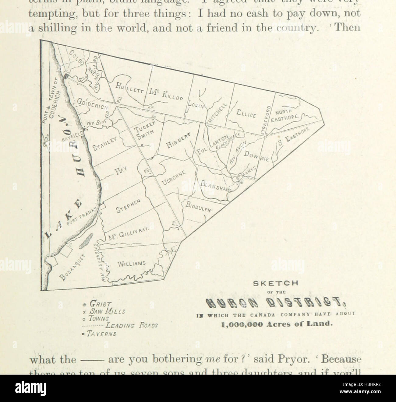 In the Days of the Canada Company: the story of the settlement of the Huron tract and a view of the social life of the period, 1825-1850 ... With an introduction by G. M. Grant Image taken from page 413 of 'In the Days of Stock Photohttps://www.alamy.com/image-license-details/?v=1https://www.alamy.com/stock-photo-in-the-days-of-the-canada-company-the-story-of-the-settlement-of-the-127622490.html
RMHBHKP2–In the Days of the Canada Company: the story of the settlement of the Huron tract and a view of the social life of the period, 1825-1850 ... With an introduction by G. M. Grant Image taken from page 413 of 'In the Days of
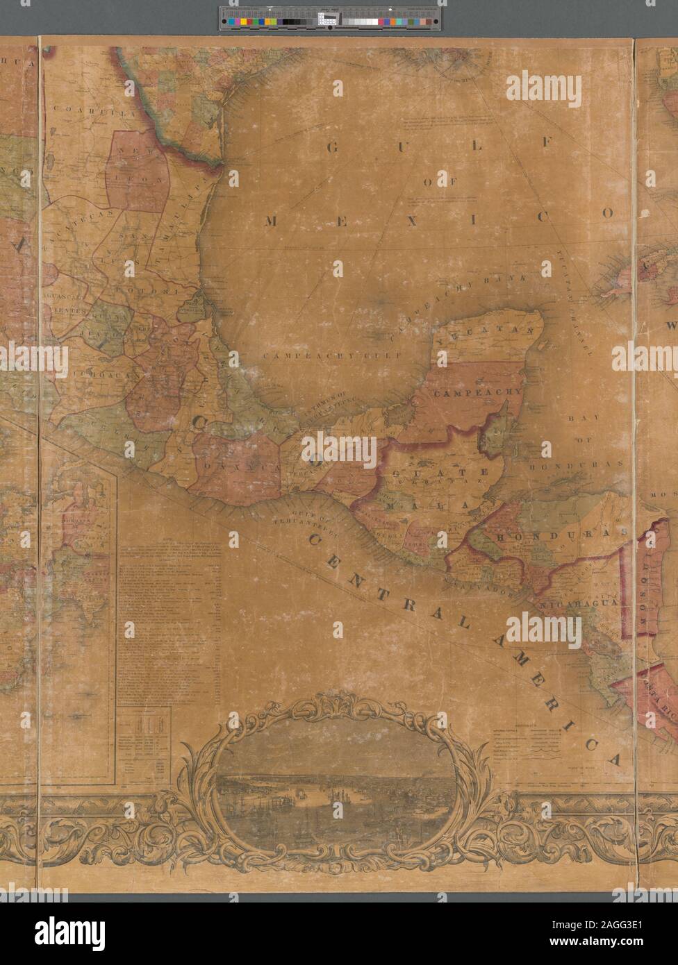 Relief shown by hachures. Prime meridians: Washington and Greenwich. Shows North America from U.S. - Canada border to northern tip of South America, includes the Greater Antilles. Includes notes, table of distances, Statistical table from the Census of 1850, list of authorities used in compiling the map, and engraved views of 9 cities in the United States. Inset map: Johnson's map of the world on Mercator's projection. Scale approximately 1:3,072,000 (W 127°35ʹ00ʺ--W 59°46ʹ00ʺ/N 49°57ʹ00ʺ--N 6°36ʹ00ʺ) Mapping the Nation (NEH grant, 2015-2018); Johnson's new illustrated & embellished county map Stock Photohttps://www.alamy.com/image-license-details/?v=1https://www.alamy.com/relief-shown-by-hachures-prime-meridians-washington-and-greenwich-shows-north-america-from-us-canada-border-to-northern-tip-of-south-america-includes-the-greater-antilles-includes-notes-table-of-distances-statistical-table-from-the-census-of-1850-list-of-authorities-used-in-compiling-the-map-and-engraved-views-of-9-cities-in-the-united-states-inset-map-johnsons-map-of-the-world-on-mercators-projection-scale-approximately-13072000-w-1273500-w-594600n-495700-n-63600-mapping-the-nation-neh-grant-2015-2018-johnsons-new-illustrated-embellished-county-map-image337185465.html
RM2AGG3E1–Relief shown by hachures. Prime meridians: Washington and Greenwich. Shows North America from U.S. - Canada border to northern tip of South America, includes the Greater Antilles. Includes notes, table of distances, Statistical table from the Census of 1850, list of authorities used in compiling the map, and engraved views of 9 cities in the United States. Inset map: Johnson's map of the world on Mercator's projection. Scale approximately 1:3,072,000 (W 127°35ʹ00ʺ--W 59°46ʹ00ʺ/N 49°57ʹ00ʺ--N 6°36ʹ00ʺ) Mapping the Nation (NEH grant, 2015-2018); Johnson's new illustrated & embellished county map
 8 1850 Tallis Map of East Canada or Quebec and New Brunswick - Geographicus - EastCanada-tallis-1850 Stock Photohttps://www.alamy.com/image-license-details/?v=1https://www.alamy.com/8-1850-tallis-map-of-east-canada-or-quebec-and-new-brunswick-geographicus-eastcanada-tallis-1850-image214210236.html
RMPCE39G–8 1850 Tallis Map of East Canada or Quebec and New Brunswick - Geographicus - EastCanada-tallis-1850
 In the Days of the Canada Company: the story of the settlement of the Huron tract and a view of the social life of the period, 1825-1850 ... With an introduction by G. M. Grant Image taken from page 495 of 'In the Days of Stock Photohttps://www.alamy.com/image-license-details/?v=1https://www.alamy.com/stock-photo-in-the-days-of-the-canada-company-the-story-of-the-settlement-of-the-127886959.html
RMHC1N3B–In the Days of the Canada Company: the story of the settlement of the Huron tract and a view of the social life of the period, 1825-1850 ... With an introduction by G. M. Grant Image taken from page 495 of 'In the Days of
 Relief shown by hachures. Prime meridians: Washington and Greenwich. Shows North America from U.S. - Canada border to northern tip of South America, includes the Greater Antilles. Includes notes, table of distances, Statistical table from the Census of 1850, list of authorities used in compiling the map, and engraved views of 9 cities in the United States. Inset map: Johnson's map of the world on Mercator's projection. Scale approximately 1:3,072,000 (W 127°35ʹ00ʺ--W 59°46ʹ00ʺ/N 49°57ʹ00ʺ--N 6°36ʹ00ʺ) Mapping the Nation (NEH grant, 2015-2018); Johnson's new illustrated & embellished county map Stock Photohttps://www.alamy.com/image-license-details/?v=1https://www.alamy.com/relief-shown-by-hachures-prime-meridians-washington-and-greenwich-shows-north-america-from-us-canada-border-to-northern-tip-of-south-america-includes-the-greater-antilles-includes-notes-table-of-distances-statistical-table-from-the-census-of-1850-list-of-authorities-used-in-compiling-the-map-and-engraved-views-of-9-cities-in-the-united-states-inset-map-johnsons-map-of-the-world-on-mercators-projection-scale-approximately-13072000-w-1273500-w-594600n-495700-n-63600-mapping-the-nation-neh-grant-2015-2018-johnsons-new-illustrated-embellished-county-map-image337185463.html
RM2AGG3DY–Relief shown by hachures. Prime meridians: Washington and Greenwich. Shows North America from U.S. - Canada border to northern tip of South America, includes the Greater Antilles. Includes notes, table of distances, Statistical table from the Census of 1850, list of authorities used in compiling the map, and engraved views of 9 cities in the United States. Inset map: Johnson's map of the world on Mercator's projection. Scale approximately 1:3,072,000 (W 127°35ʹ00ʺ--W 59°46ʹ00ʺ/N 49°57ʹ00ʺ--N 6°36ʹ00ʺ) Mapping the Nation (NEH grant, 2015-2018); Johnson's new illustrated & embellished county map
 8 1850 Tallis Map of West Canada or Ontario ( includes Great Lakes ) - Geographicus - WestCanada-tallis-1850 Stock Photohttps://www.alamy.com/image-license-details/?v=1https://www.alamy.com/8-1850-tallis-map-of-west-canada-or-ontario-includes-great-lakes-geographicus-westcanada-tallis-1850-image214210242.html
RMPCE39P–8 1850 Tallis Map of West Canada or Ontario ( includes Great Lakes ) - Geographicus - WestCanada-tallis-1850
 Image taken from page 134 of 'In the Days of the Canada Company: the story of the settlement of the Huron tract and a view of the social life of the period, 1825-1850 ... With an introduction by G. M. Grant' Image taken from page 134 of 'In the Days of Stock Photohttps://www.alamy.com/image-license-details/?v=1https://www.alamy.com/stock-photo-image-taken-from-page-134-of-in-the-days-of-the-canada-company-the-127788410.html
RMHBW7BP–Image taken from page 134 of 'In the Days of the Canada Company: the story of the settlement of the Huron tract and a view of the social life of the period, 1825-1850 ... With an introduction by G. M. Grant' Image taken from page 134 of 'In the Days of
 Relief shown by hachures. Prime meridians: Washington and Greenwich. Shows North America from U.S. - Canada border to northern tip of South America, includes the Greater Antilles. Includes notes, table of distances, Statistical table from the Census of 1850, list of authorities used in compiling the map, and engraved views of 9 cities in the United States. Inset map: Johnson's map of the world on Mercator's projection. Scale approximately 1:3,072,000 (W 127°35ʹ00ʺ--W 59°46ʹ00ʺ/N 49°57ʹ00ʺ--N 6°36ʹ00ʺ) Mapping the Nation (NEH grant, 2015-2018); Johnson's new illustrated & embellished county map Stock Photohttps://www.alamy.com/image-license-details/?v=1https://www.alamy.com/relief-shown-by-hachures-prime-meridians-washington-and-greenwich-shows-north-america-from-us-canada-border-to-northern-tip-of-south-america-includes-the-greater-antilles-includes-notes-table-of-distances-statistical-table-from-the-census-of-1850-list-of-authorities-used-in-compiling-the-map-and-engraved-views-of-9-cities-in-the-united-states-inset-map-johnsons-map-of-the-world-on-mercators-projection-scale-approximately-13072000-w-1273500-w-594600n-495700-n-63600-mapping-the-nation-neh-grant-2015-2018-johnsons-new-illustrated-embellished-county-map-image337185411.html
RM2AGG3C3–Relief shown by hachures. Prime meridians: Washington and Greenwich. Shows North America from U.S. - Canada border to northern tip of South America, includes the Greater Antilles. Includes notes, table of distances, Statistical table from the Census of 1850, list of authorities used in compiling the map, and engraved views of 9 cities in the United States. Inset map: Johnson's map of the world on Mercator's projection. Scale approximately 1:3,072,000 (W 127°35ʹ00ʺ--W 59°46ʹ00ʺ/N 49°57ʹ00ʺ--N 6°36ʹ00ʺ) Mapping the Nation (NEH grant, 2015-2018); Johnson's new illustrated & embellished county map
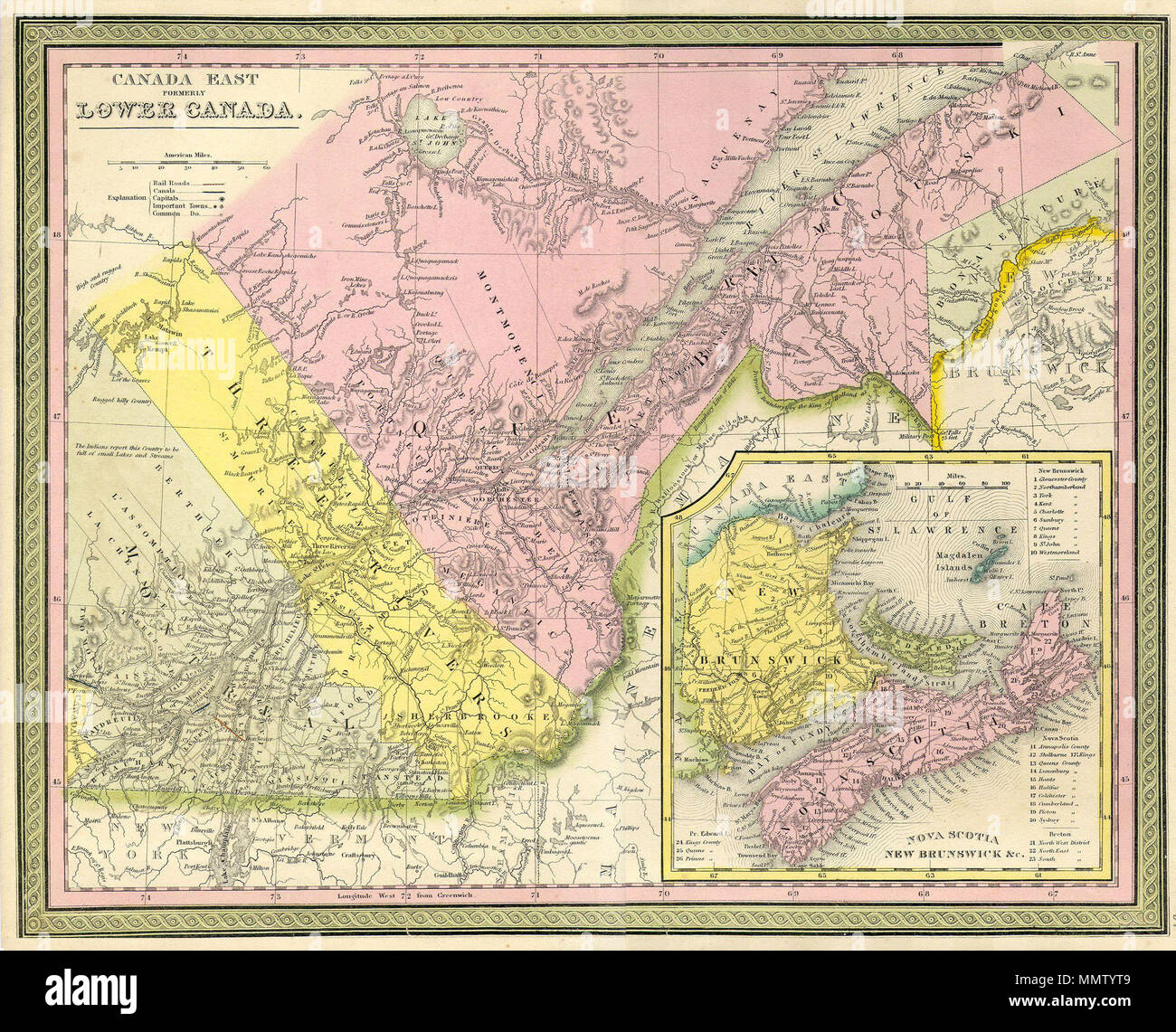 . English: This stunning map is a copperplate engraving depicting Quebec or Eastern Canada. Includes the provinces of Quebec, New Brunswick, Prince Edward Island, and Nova Scotia. Canada East formerly Lower Canada. 1850. 1850 Mitchell Map of Eastern Canada including Quebec - Geographicus - CanadaQuebec-c-50 Stock Photohttps://www.alamy.com/image-license-details/?v=1https://www.alamy.com/english-this-stunning-map-is-a-copperplate-engraving-depicting-quebec-or-eastern-canada-includes-the-provinces-of-quebec-new-brunswick-prince-edward-island-and-nova-scotia-canada-east-formerly-lower-canada-1850-1850-mitchell-map-of-eastern-canada-including-quebec-geographicus-canadaquebec-c-50-image184945497.html
RMMMTYT9–. English: This stunning map is a copperplate engraving depicting Quebec or Eastern Canada. Includes the provinces of Quebec, New Brunswick, Prince Edward Island, and Nova Scotia. Canada East formerly Lower Canada. 1850. 1850 Mitchell Map of Eastern Canada including Quebec - Geographicus - CanadaQuebec-c-50
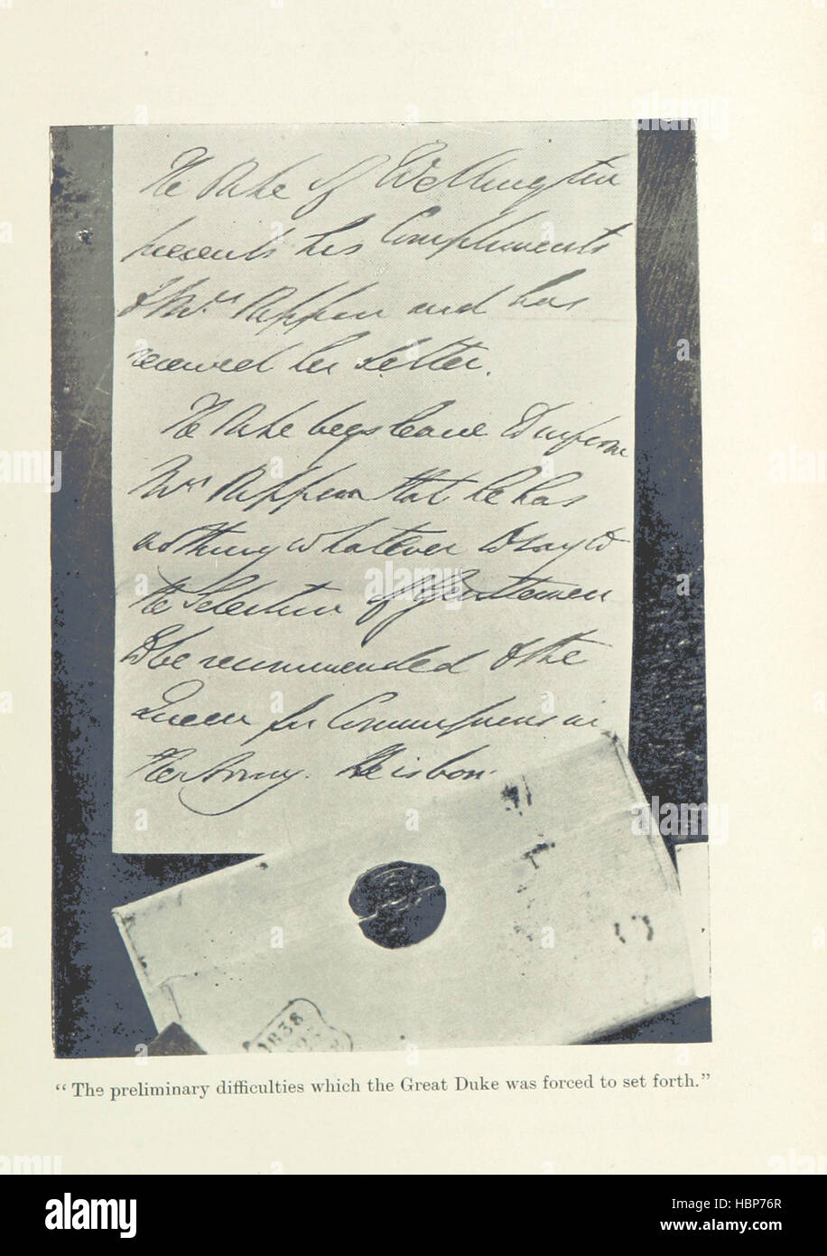 Image taken from page 387 of 'In the Days of the Canada Company: the story of the settlement of the Huron tract and a view of the social life of the period, 1825-1850 ... With an introduction by G. M. Grant' Image taken from page 387 of 'In the Days of Stock Photohttps://www.alamy.com/image-license-details/?v=1https://www.alamy.com/stock-photo-image-taken-from-page-387-of-in-the-days-of-the-canada-company-the-127722415.html
RMHBP76R–Image taken from page 387 of 'In the Days of the Canada Company: the story of the settlement of the Huron tract and a view of the social life of the period, 1825-1850 ... With an introduction by G. M. Grant' Image taken from page 387 of 'In the Days of
 Relief shown by hachures. Prime meridians: Washington and Greenwich. Shows North America from U.S. - Canada border to northern tip of South America, includes the Greater Antilles. Includes notes, table of distances, Statistical table from the Census of 1850, list of authorities used in compiling the map, and engraved views of 9 cities in the United States. Inset map: Johnson's map of the world on Mercator's projection. Scale approximately 1:3,072,000 (W 127°35ʹ00ʺ--W 59°46ʹ00ʺ/N 49°57ʹ00ʺ--N 6°36ʹ00ʺ) Mapping the Nation (NEH grant, 2015-2018); Johnson's new illustrated & embellished county map Stock Photohttps://www.alamy.com/image-license-details/?v=1https://www.alamy.com/relief-shown-by-hachures-prime-meridians-washington-and-greenwich-shows-north-america-from-us-canada-border-to-northern-tip-of-south-america-includes-the-greater-antilles-includes-notes-table-of-distances-statistical-table-from-the-census-of-1850-list-of-authorities-used-in-compiling-the-map-and-engraved-views-of-9-cities-in-the-united-states-inset-map-johnsons-map-of-the-world-on-mercators-projection-scale-approximately-13072000-w-1273500-w-594600n-495700-n-63600-mapping-the-nation-neh-grant-2015-2018-johnsons-new-illustrated-embellished-county-map-image337185414.html
RM2AGG3C6–Relief shown by hachures. Prime meridians: Washington and Greenwich. Shows North America from U.S. - Canada border to northern tip of South America, includes the Greater Antilles. Includes notes, table of distances, Statistical table from the Census of 1850, list of authorities used in compiling the map, and engraved views of 9 cities in the United States. Inset map: Johnson's map of the world on Mercator's projection. Scale approximately 1:3,072,000 (W 127°35ʹ00ʺ--W 59°46ʹ00ʺ/N 49°57ʹ00ʺ--N 6°36ʹ00ʺ) Mapping the Nation (NEH grant, 2015-2018); Johnson's new illustrated & embellished county map
 . English: This is a fascinating 1850 map of the United States. Covers the United States from Texas (shown at fullest extant) and Santa Fe north through the Missouri Territory to Canada and east to the Atlantic. The Trans-Mississippi region is exceptionally interesting with a fascinating (if somewhat inaccurate even ate the time) depiction of the political geography. A long Narrow Nebraska territory extends to Canada. There is a large “Western Territory roughly where Oklahoma is today. New Mexico Territory is alternatively called Santa Fe territory. Missouri Territory occupies the full region Stock Photohttps://www.alamy.com/image-license-details/?v=1https://www.alamy.com/english-this-is-a-fascinating-1850-map-of-the-united-states-covers-the-united-states-from-texas-shown-at-fullest-extant-and-santa-fe-north-through-the-missouri-territory-to-canada-and-east-to-the-atlantic-the-trans-mississippi-region-is-exceptionally-interesting-with-a-fascinating-if-somewhat-inaccurate-even-ate-the-time-depiction-of-the-political-geography-a-long-narrow-nebraska-territory-extends-to-canada-there-is-a-large-western-territory-roughly-where-oklahoma-is-today-new-mexico-territory-is-alternatively-called-santa-fe-territory-missouri-territory-occupies-the-full-region-image184877298.html
RMMMNTTJ–. English: This is a fascinating 1850 map of the United States. Covers the United States from Texas (shown at fullest extant) and Santa Fe north through the Missouri Territory to Canada and east to the Atlantic. The Trans-Mississippi region is exceptionally interesting with a fascinating (if somewhat inaccurate even ate the time) depiction of the political geography. A long Narrow Nebraska territory extends to Canada. There is a large “Western Territory roughly where Oklahoma is today. New Mexico Territory is alternatively called Santa Fe territory. Missouri Territory occupies the full region
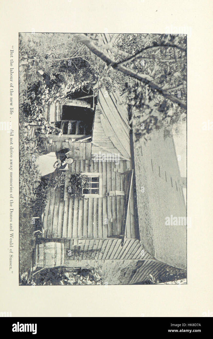 In the Days of the Canada Company: the story of the settlement of the Huron tract and a view of the social life of the period, 1825-1850 ... With an introduction by G. M. Grant Image taken from page 453 of 'In Stock Photohttps://www.alamy.com/image-license-details/?v=1https://www.alamy.com/stock-photo-in-the-days-of-the-canada-company-the-story-of-the-settlement-of-the-132337054.html
RMHK8D7A–In the Days of the Canada Company: the story of the settlement of the Huron tract and a view of the social life of the period, 1825-1850 ... With an introduction by G. M. Grant Image taken from page 453 of 'In
 Relief shown by hachures. Prime meridians: Washington and Greenwich. Shows North America from U.S. - Canada border to northern tip of South America, includes the Greater Antilles. Includes notes, table of distances, Statistical table from the Census of 1850, list of authorities used in compiling the map, and engraved views of 9 cities in the United States. Inset map: Johnson's map of the world on Mercator's projection. Scale approximately 1:3,072,000 (W 127°35ʹ00ʺ--W 59°46ʹ00ʺ/N 49°57ʹ00ʺ--N 6°36ʹ00ʺ) Mapping the Nation (NEH grant, 2015-2018); Johnson's new illustrated & embellished county map Stock Photohttps://www.alamy.com/image-license-details/?v=1https://www.alamy.com/relief-shown-by-hachures-prime-meridians-washington-and-greenwich-shows-north-america-from-us-canada-border-to-northern-tip-of-south-america-includes-the-greater-antilles-includes-notes-table-of-distances-statistical-table-from-the-census-of-1850-list-of-authorities-used-in-compiling-the-map-and-engraved-views-of-9-cities-in-the-united-states-inset-map-johnsons-map-of-the-world-on-mercators-projection-scale-approximately-13072000-w-1273500-w-594600n-495700-n-63600-mapping-the-nation-neh-grant-2015-2018-johnsons-new-illustrated-embellished-county-map-image337185461.html
RM2AGG3DW–Relief shown by hachures. Prime meridians: Washington and Greenwich. Shows North America from U.S. - Canada border to northern tip of South America, includes the Greater Antilles. Includes notes, table of distances, Statistical table from the Census of 1850, list of authorities used in compiling the map, and engraved views of 9 cities in the United States. Inset map: Johnson's map of the world on Mercator's projection. Scale approximately 1:3,072,000 (W 127°35ʹ00ʺ--W 59°46ʹ00ʺ/N 49°57ʹ00ʺ--N 6°36ʹ00ʺ) Mapping the Nation (NEH grant, 2015-2018); Johnson's new illustrated & embellished county map
 . English: This is John Tallis’ extremely attractive c. 1850 map of West Canada or what is now Ontario. Includes Lake Erie, Lake Ontario, and part of Lake Huron with Georgian Bay. Features five stunning vignettes which include American Indians on horseback chasing buffalo across the great plains, Several American Indians sitting around a tree with a teepee in the background, two seals, an otter, and in the lower right quadrant, Niagara Falls. The whole is surrounded by a decorative vine motif border. The vignettes for this map were drawn by H. Warren and engraved by Robert Wallis. The map its Stock Photohttps://www.alamy.com/image-license-details/?v=1https://www.alamy.com/english-this-is-john-tallis-extremely-attractive-c-1850-map-of-west-canada-or-what-is-now-ontario-includes-lake-erie-lake-ontario-and-part-of-lake-huron-with-georgian-bay-features-five-stunning-vignettes-which-include-american-indians-on-horseback-chasing-buffalo-across-the-great-plains-several-american-indians-sitting-around-a-tree-with-a-teepee-in-the-background-two-seals-an-otter-and-in-the-lower-right-quadrant-niagara-falls-the-whole-is-surrounded-by-a-decorative-vine-motif-border-the-vignettes-for-this-map-were-drawn-by-h-warren-and-engraved-by-robert-wallis-the-map-its-image184877329.html
RMMMNTWN–. English: This is John Tallis’ extremely attractive c. 1850 map of West Canada or what is now Ontario. Includes Lake Erie, Lake Ontario, and part of Lake Huron with Georgian Bay. Features five stunning vignettes which include American Indians on horseback chasing buffalo across the great plains, Several American Indians sitting around a tree with a teepee in the background, two seals, an otter, and in the lower right quadrant, Niagara Falls. The whole is surrounded by a decorative vine motif border. The vignettes for this map were drawn by H. Warren and engraved by Robert Wallis. The map its
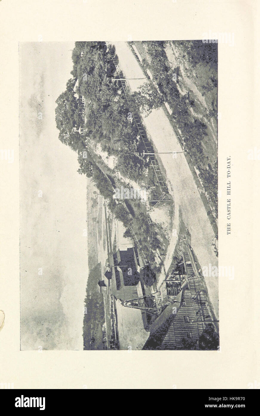 In the Days of the Canada Company: the story of the settlement of the Huron tract and a view of the social life of the period, 1825-1850 ... With an introduction by G. M. Grant Image taken from page 8 of 'In Stock Photohttps://www.alamy.com/image-license-details/?v=1https://www.alamy.com/stock-photo-in-the-days-of-the-canada-company-the-story-of-the-settlement-of-the-132366836.html
RMHK9R70–In the Days of the Canada Company: the story of the settlement of the Huron tract and a view of the social life of the period, 1825-1850 ... With an introduction by G. M. Grant Image taken from page 8 of 'In
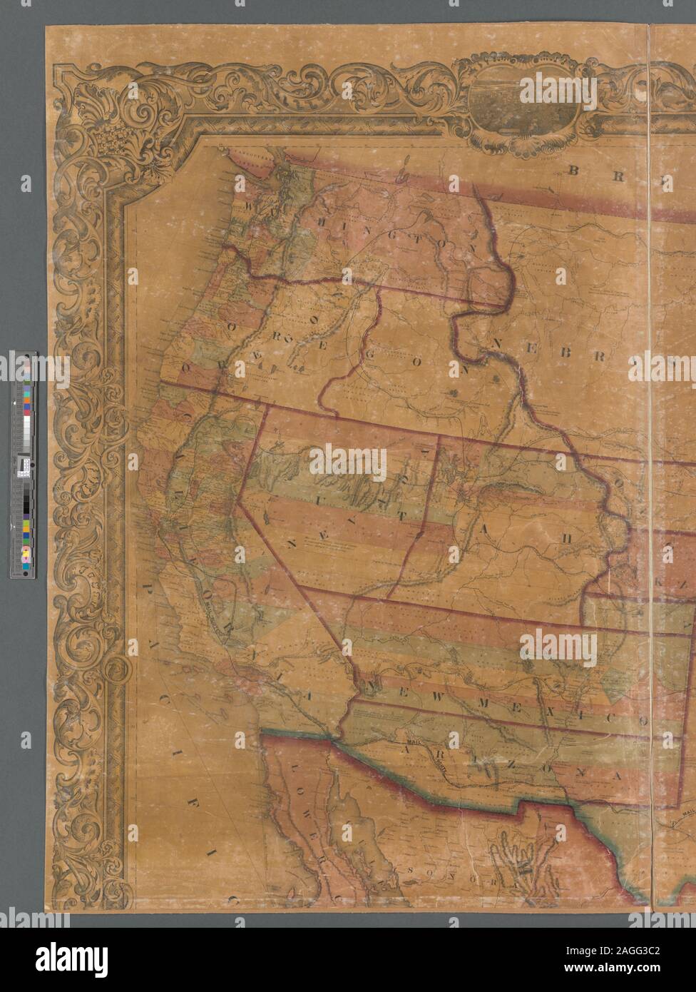 Relief shown by hachures. Prime meridians: Washington and Greenwich. Shows North America from U.S. - Canada border to northern tip of South America, includes the Greater Antilles. Includes notes, table of distances, Statistical table from the Census of 1850, list of authorities used in compiling the map, and engraved views of 9 cities in the United States. Inset map: Johnson's map of the world on Mercator's projection. Scale approximately 1:3,072,000 (W 127°35ʹ00ʺ--W 59°46ʹ00ʺ/N 49°57ʹ00ʺ--N 6°36ʹ00ʺ) Mapping the Nation (NEH grant, 2015-2018); Johnson's new illustrated & embellished county map Stock Photohttps://www.alamy.com/image-license-details/?v=1https://www.alamy.com/relief-shown-by-hachures-prime-meridians-washington-and-greenwich-shows-north-america-from-us-canada-border-to-northern-tip-of-south-america-includes-the-greater-antilles-includes-notes-table-of-distances-statistical-table-from-the-census-of-1850-list-of-authorities-used-in-compiling-the-map-and-engraved-views-of-9-cities-in-the-united-states-inset-map-johnsons-map-of-the-world-on-mercators-projection-scale-approximately-13072000-w-1273500-w-594600n-495700-n-63600-mapping-the-nation-neh-grant-2015-2018-johnsons-new-illustrated-embellished-county-map-image337185410.html
RM2AGG3C2–Relief shown by hachures. Prime meridians: Washington and Greenwich. Shows North America from U.S. - Canada border to northern tip of South America, includes the Greater Antilles. Includes notes, table of distances, Statistical table from the Census of 1850, list of authorities used in compiling the map, and engraved views of 9 cities in the United States. Inset map: Johnson's map of the world on Mercator's projection. Scale approximately 1:3,072,000 (W 127°35ʹ00ʺ--W 59°46ʹ00ʺ/N 49°57ʹ00ʺ--N 6°36ʹ00ʺ) Mapping the Nation (NEH grant, 2015-2018); Johnson's new illustrated & embellished county map
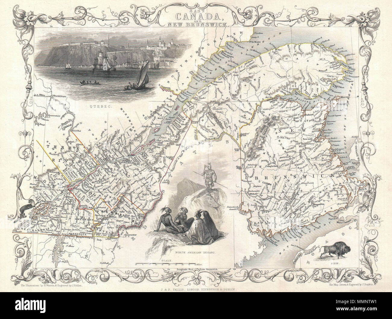 . English: This is John Tallis’ extremely attractive c. 1850 map of East Canada or what is now Quebec and New Brunswick. Includes Montreal, Quebec City, and the St. Lawrence River valley. Features five stunning vignettes which include American Indian warriors and a spectacular view of Quebec City. The whole is surrounded by a decorative vine motif border. The vignettes for this map were drawn by H. Warren and engraved by J. B. Allen. The map itself is the work of John Rapkin. East Canada, and New Brunswick.. circa 1850(undated). 8 1850 Tallis Map of East Canada or Quebec and New Brunswick - Stock Photohttps://www.alamy.com/image-license-details/?v=1https://www.alamy.com/english-this-is-john-tallis-extremely-attractive-c-1850-map-of-east-canada-or-what-is-now-quebec-and-new-brunswick-includes-montreal-quebec-city-and-the-st-lawrence-river-valley-features-five-stunning-vignettes-which-include-american-indian-warriors-and-a-spectacular-view-of-quebec-city-the-whole-is-surrounded-by-a-decorative-vine-motif-border-the-vignettes-for-this-map-were-drawn-by-h-warren-and-engraved-by-j-b-allen-the-map-itself-is-the-work-of-john-rapkin-east-canada-and-new-brunswick-circa-1850undated-8-1850-tallis-map-of-east-canada-or-quebec-and-new-brunswick-image184877309.html
RMMMNTW1–. English: This is John Tallis’ extremely attractive c. 1850 map of East Canada or what is now Quebec and New Brunswick. Includes Montreal, Quebec City, and the St. Lawrence River valley. Features five stunning vignettes which include American Indian warriors and a spectacular view of Quebec City. The whole is surrounded by a decorative vine motif border. The vignettes for this map were drawn by H. Warren and engraved by J. B. Allen. The map itself is the work of John Rapkin. East Canada, and New Brunswick.. circa 1850(undated). 8 1850 Tallis Map of East Canada or Quebec and New Brunswick -
 In the Days of the Canada Company: the story of the settlement of the Huron tract and a view of the social life of the period, 1825-1850 ... With an introduction by G. M. Grant Image taken from page 167 of 'In Stock Photohttps://www.alamy.com/image-license-details/?v=1https://www.alamy.com/stock-photo-in-the-days-of-the-canada-company-the-story-of-the-settlement-of-the-132235173.html
RMHK3R8N–In the Days of the Canada Company: the story of the settlement of the Huron tract and a view of the social life of the period, 1825-1850 ... With an introduction by G. M. Grant Image taken from page 167 of 'In
 Relief shown by hachures. Prime meridians: Washington and Greenwich. Shows North America from U.S. - Canada border to northern tip of South America, includes the Greater Antilles. Includes notes, table of distances, Statistical table from the Census of 1850, list of authorities used in compiling the map, and engraved views of 9 cities in the United States. Inset map: Johnson's map of the world on Mercator's projection. Scale approximately 1:3,072,000 (W 127°35ʹ00ʺ--W 59°46ʹ00ʺ/N 49°57ʹ00ʺ--N 6°36ʹ00ʺ) Mapping the Nation (NEH grant, 2015-2018); Johnson's new illustrated & embellished county map Stock Photohttps://www.alamy.com/image-license-details/?v=1https://www.alamy.com/relief-shown-by-hachures-prime-meridians-washington-and-greenwich-shows-north-america-from-us-canada-border-to-northern-tip-of-south-america-includes-the-greater-antilles-includes-notes-table-of-distances-statistical-table-from-the-census-of-1850-list-of-authorities-used-in-compiling-the-map-and-engraved-views-of-9-cities-in-the-united-states-inset-map-johnsons-map-of-the-world-on-mercators-projection-scale-approximately-13072000-w-1273500-w-594600n-495700-n-63600-mapping-the-nation-neh-grant-2015-2018-johnsons-new-illustrated-embellished-county-map-image337185462.html
RM2AGG3DX–Relief shown by hachures. Prime meridians: Washington and Greenwich. Shows North America from U.S. - Canada border to northern tip of South America, includes the Greater Antilles. Includes notes, table of distances, Statistical table from the Census of 1850, list of authorities used in compiling the map, and engraved views of 9 cities in the United States. Inset map: Johnson's map of the world on Mercator's projection. Scale approximately 1:3,072,000 (W 127°35ʹ00ʺ--W 59°46ʹ00ʺ/N 49°57ʹ00ʺ--N 6°36ʹ00ʺ) Mapping the Nation (NEH grant, 2015-2018); Johnson's new illustrated & embellished county map
 In the Days of the Canada Company: the story of the settlement of the Huron tract and a view of the social life of the period, 1825-1850 ... With an introduction by G. M. Grant Image taken from page 185 of 'In Stock Photohttps://www.alamy.com/image-license-details/?v=1https://www.alamy.com/stock-photo-in-the-days-of-the-canada-company-the-story-of-the-settlement-of-the-132270649.html
RMHK5CFN–In the Days of the Canada Company: the story of the settlement of the Huron tract and a view of the social life of the period, 1825-1850 ... With an introduction by G. M. Grant Image taken from page 185 of 'In
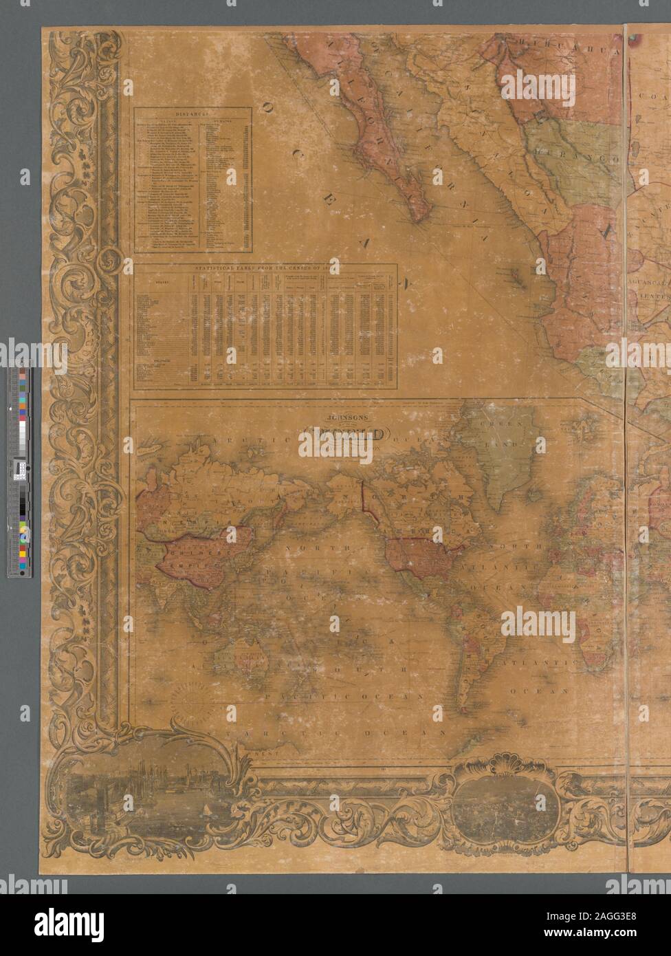 Relief shown by hachures. Prime meridians: Washington and Greenwich. Shows North America from U.S. - Canada border to northern tip of South America, includes the Greater Antilles. Includes notes, table of distances, Statistical table from the Census of 1850, list of authorities used in compiling the map, and engraved views of 9 cities in the United States. Inset map: Johnson's map of the world on Mercator's projection. Scale approximately 1:3,072,000 (W 127°35ʹ00ʺ--W 59°46ʹ00ʺ/N 49°57ʹ00ʺ--N 6°36ʹ00ʺ) Mapping the Nation (NEH grant, 2015-2018); Johnson's new illustrated & embellished county map Stock Photohttps://www.alamy.com/image-license-details/?v=1https://www.alamy.com/relief-shown-by-hachures-prime-meridians-washington-and-greenwich-shows-north-america-from-us-canada-border-to-northern-tip-of-south-america-includes-the-greater-antilles-includes-notes-table-of-distances-statistical-table-from-the-census-of-1850-list-of-authorities-used-in-compiling-the-map-and-engraved-views-of-9-cities-in-the-united-states-inset-map-johnsons-map-of-the-world-on-mercators-projection-scale-approximately-13072000-w-1273500-w-594600n-495700-n-63600-mapping-the-nation-neh-grant-2015-2018-johnsons-new-illustrated-embellished-county-map-image337185472.html
RM2AGG3E8–Relief shown by hachures. Prime meridians: Washington and Greenwich. Shows North America from U.S. - Canada border to northern tip of South America, includes the Greater Antilles. Includes notes, table of distances, Statistical table from the Census of 1850, list of authorities used in compiling the map, and engraved views of 9 cities in the United States. Inset map: Johnson's map of the world on Mercator's projection. Scale approximately 1:3,072,000 (W 127°35ʹ00ʺ--W 59°46ʹ00ʺ/N 49°57ʹ00ʺ--N 6°36ʹ00ʺ) Mapping the Nation (NEH grant, 2015-2018); Johnson's new illustrated & embellished county map
 In the Days of the Canada Company: the story of the settlement of the Huron tract and a view of the social life of the period, 1825-1850 ... With an introduction by G. M. Grant Image taken from page 300 of 'In the Days of Stock Photohttps://www.alamy.com/image-license-details/?v=1https://www.alamy.com/stock-photo-in-the-days-of-the-canada-company-the-story-of-the-settlement-of-the-130134714.html
RMHFM44A–In the Days of the Canada Company: the story of the settlement of the Huron tract and a view of the social life of the period, 1825-1850 ... With an introduction by G. M. Grant Image taken from page 300 of 'In the Days of
 In the Days of the Canada Company: the story of the settlement of the Huron tract and a view of the social life of the period, 1825-1850 ... With an introduction by G. M. Grant Image taken from page 214 of 'In the Days of Stock Photohttps://www.alamy.com/image-license-details/?v=1https://www.alamy.com/stock-photo-in-the-days-of-the-canada-company-the-story-of-the-settlement-of-the-130093843.html
RMHFJ80K–In the Days of the Canada Company: the story of the settlement of the Huron tract and a view of the social life of the period, 1825-1850 ... With an introduction by G. M. Grant Image taken from page 214 of 'In the Days of
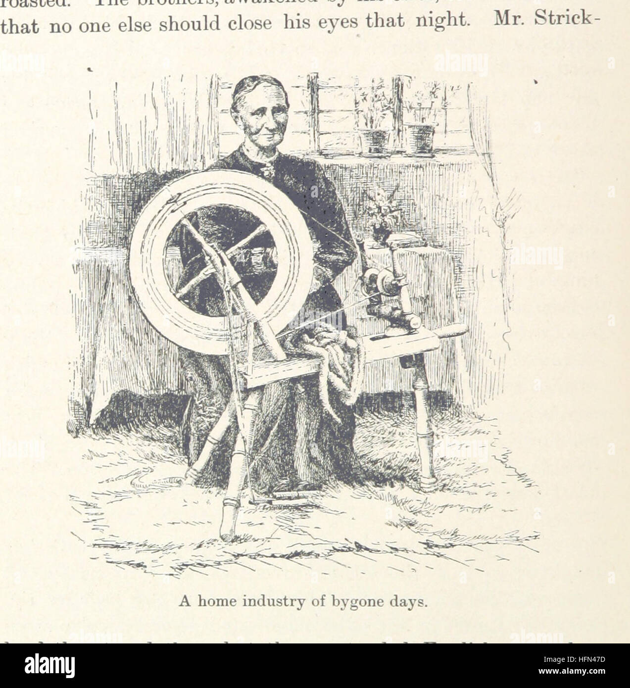 Image taken from page 440 of 'In the Days of the Canada Company: the story of the settlement of the Huron tract and a view of the social life of the period, 1825-1850 ... With an introduction by G. M. Grant' Image taken from page 440 of 'In the Days of Stock Photohttps://www.alamy.com/image-license-details/?v=1https://www.alamy.com/stock-photo-image-taken-from-page-440-of-in-the-days-of-the-canada-company-the-130156753.html
RMHFN47D–Image taken from page 440 of 'In the Days of the Canada Company: the story of the settlement of the Huron tract and a view of the social life of the period, 1825-1850 ... With an introduction by G. M. Grant' Image taken from page 440 of 'In the Days of