Quick filters:
Map of civil war forts Stock Photos and Images
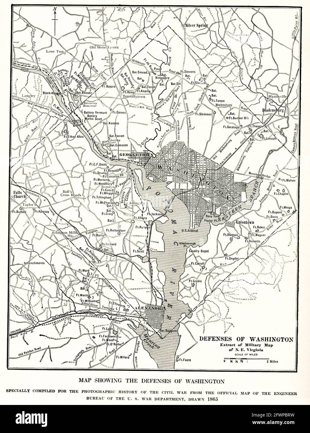 Map Showing defenses of Washington. specially compiled for photographic history of Civil War from the official map of the Engineer Bureau of the U.S. War Department drawn in 1865 Stock Photohttps://www.alamy.com/image-license-details/?v=1https://www.alamy.com/map-showing-defenses-of-washington-specially-compiled-for-photographic-history-of-civil-war-from-the-official-map-of-the-engineer-bureau-of-the-us-war-department-drawn-in-1865-image428907469.html
RF2FWPBRW–Map Showing defenses of Washington. specially compiled for photographic history of Civil War from the official map of the Engineer Bureau of the U.S. War Department drawn in 1865
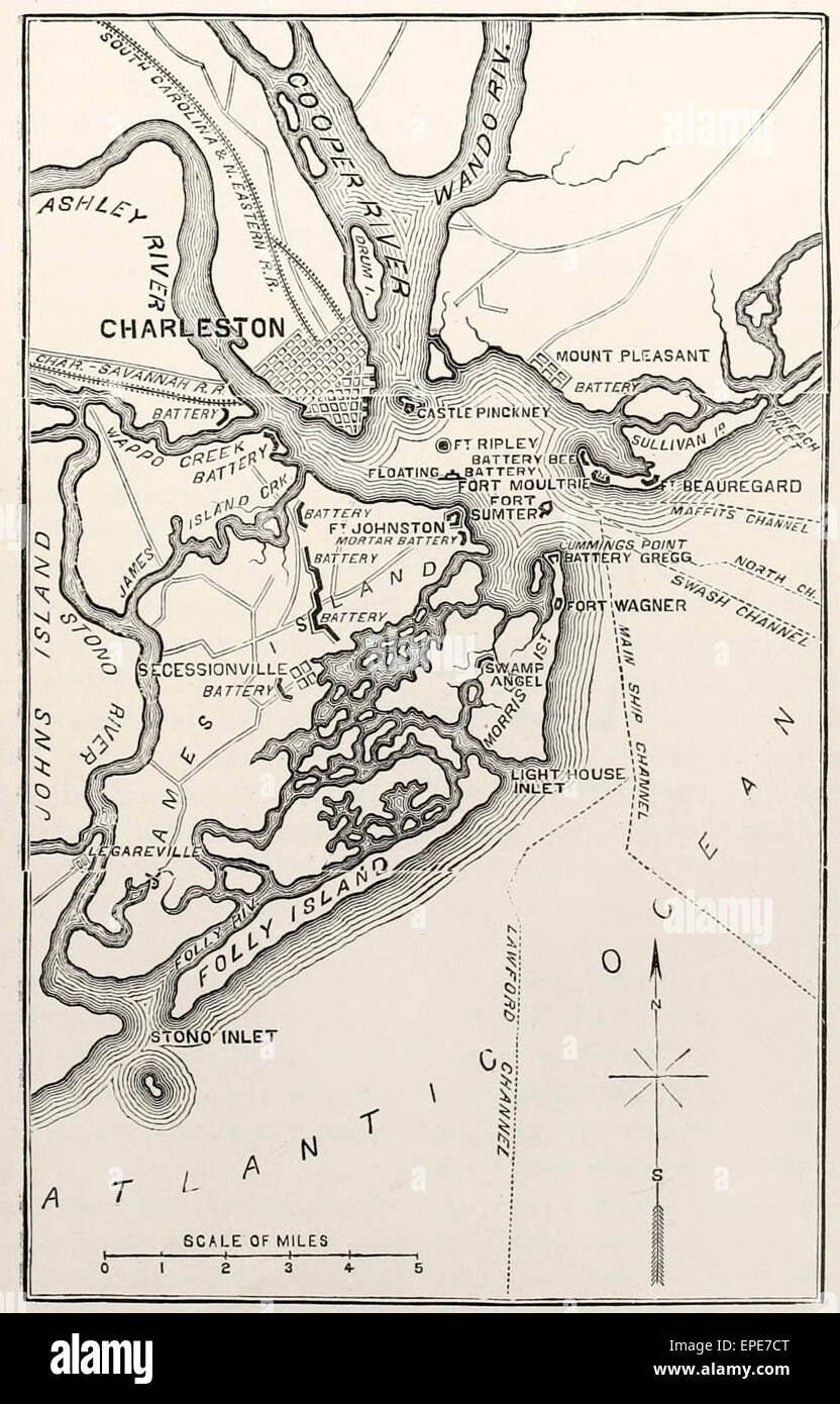 Charleston Harbor and its approaches, showing Forts Sumter and Wagner, James Island, South Carolina during the USA Civil War Stock Photohttps://www.alamy.com/image-license-details/?v=1https://www.alamy.com/stock-photo-charleston-harbor-and-its-approaches-showing-forts-sumter-and-wagner-82677080.html
RMEPE7CT–Charleston Harbor and its approaches, showing Forts Sumter and Wagner, James Island, South Carolina during the USA Civil War
 Two forts stand at the entrance of Charleston Harbor. Patriots inside a palmetto log fort, later named Fort Moultrie, defeated the Royal Navy in 1776. As Charleston blazed a path toward secession to preserve slavery, construction on a new fort, Fort Sumter, proceeded. The Confederacy fired on the US garrison of Fort Sumter on April 12, 1861 opening the Civil War, which redefined American freedom. Stock Photohttps://www.alamy.com/image-license-details/?v=1https://www.alamy.com/two-forts-stand-at-the-entrance-of-charleston-harbor-patriots-inside-a-palmetto-log-fort-later-named-fort-moultrie-defeated-the-royal-navy-in-1776-as-charleston-blazed-a-path-toward-secession-to-preserve-slavery-construction-on-a-new-fort-fort-sumter-proceeded-the-confederacy-fired-on-the-us-garrison-of-fort-sumter-on-april-12-1861-opening-the-civil-war-which-redefined-american-freedom-image614101718.html
RF2XK2N06–Two forts stand at the entrance of Charleston Harbor. Patriots inside a palmetto log fort, later named Fort Moultrie, defeated the Royal Navy in 1776. As Charleston blazed a path toward secession to preserve slavery, construction on a new fort, Fort Sumter, proceeded. The Confederacy fired on the US garrison of Fort Sumter on April 12, 1861 opening the Civil War, which redefined American freedom.
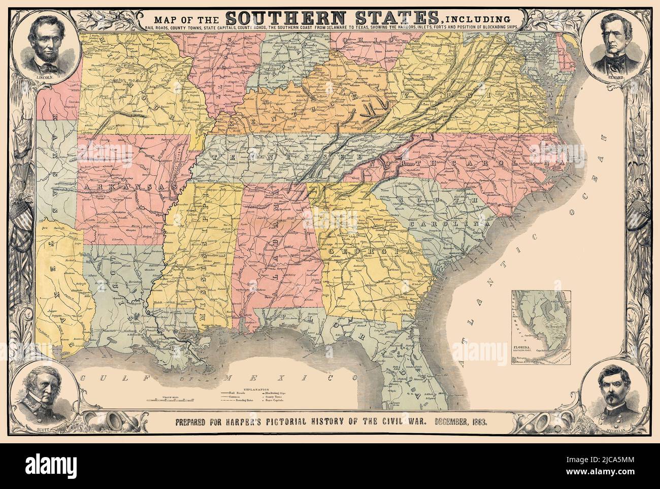 Southern States Map 1863. Original Title: 'Map of the Southern States, including Rail Roads, County Towns, State Capitals, Country Roads, the Southern Coast from Delaware to Texas, showing the Harbors, Inlets, Forts and Positions of Blockading Ships.' Published in 1863, the map shows the Confederate states without naming the Confederacy. It gives important historical detail including railroads and the naval blockade. Medallions in each corner offer portraits of key players on the Union side. Stock Photohttps://www.alamy.com/image-license-details/?v=1https://www.alamy.com/southern-states-map-1863-original-title-map-of-the-southern-states-including-rail-roads-county-towns-state-capitals-country-roads-the-southern-coast-from-delaware-to-texas-showing-the-harbors-inlets-forts-and-positions-of-blockading-ships-published-in-1863-the-map-shows-the-confederate-states-without-naming-the-confederacy-it-gives-important-historical-detail-including-railroads-and-the-naval-blockade-medallions-in-each-corner-offer-portraits-of-key-players-on-the-union-side-image472279828.html
RM2JCA5MM–Southern States Map 1863. Original Title: 'Map of the Southern States, including Rail Roads, County Towns, State Capitals, Country Roads, the Southern Coast from Delaware to Texas, showing the Harbors, Inlets, Forts and Positions of Blockading Ships.' Published in 1863, the map shows the Confederate states without naming the Confederacy. It gives important historical detail including railroads and the naval blockade. Medallions in each corner offer portraits of key players on the Union side.
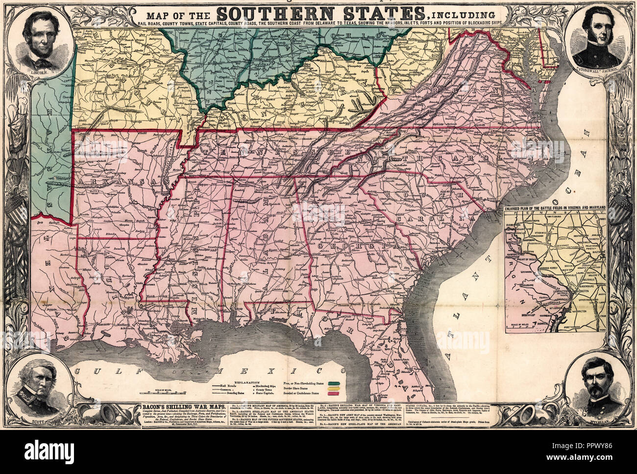 Map of the southern states, including rail roads, county towns, state capitals, county roads, the southern coast from Delaware to Texas, showing the harbors, inlets, forts and position of blockading ships. Circa 1863 Stock Photohttps://www.alamy.com/image-license-details/?v=1https://www.alamy.com/map-of-the-southern-states-including-rail-roads-county-towns-state-capitals-county-roads-the-southern-coast-from-delaware-to-texas-showing-the-harbors-inlets-forts-and-position-of-blockading-ships-circa-1863-image220617046.html
RMPPWY86–Map of the southern states, including rail roads, county towns, state capitals, county roads, the southern coast from Delaware to Texas, showing the harbors, inlets, forts and position of blockading ships. Circa 1863
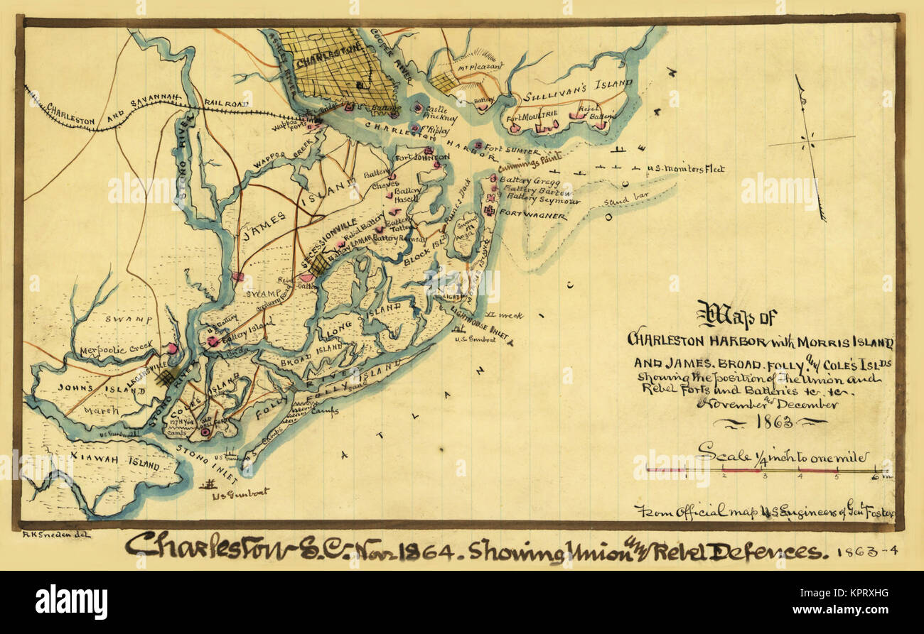 Charleston Harbor with Islands Stock Photohttps://www.alamy.com/image-license-details/?v=1https://www.alamy.com/stock-image-charleston-harbor-with-islands-168941516.html
RMKPRXHG–Charleston Harbor with Islands
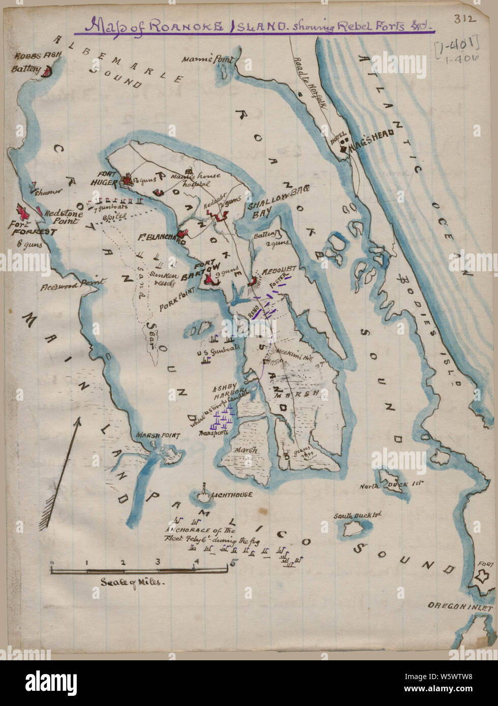 Civil War Maps 0793 Map of Roanoke Island showing Rebel forts Rebuild and Repair Stock Photohttps://www.alamy.com/image-license-details/?v=1https://www.alamy.com/civil-war-maps-0793-map-of-roanoke-island-showing-rebel-forts-rebuild-and-repair-image261797124.html
RMW5WTW8–Civil War Maps 0793 Map of Roanoke Island showing Rebel forts Rebuild and Repair
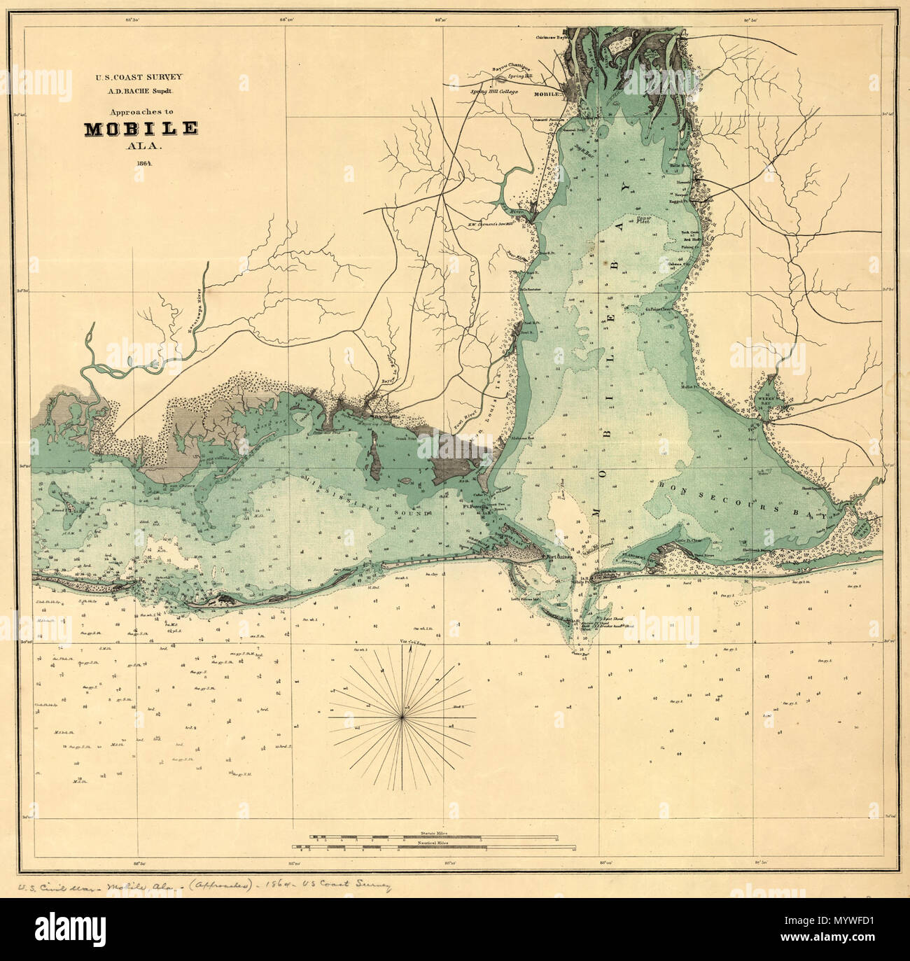 . English: Scale ca. 1:205,000. LC Civil War Maps (2nd ed.), 109 Map of Mobile Bay showing forts, towns, soundings, and a few roads. Description derived from published bibliography. Available also through the Library of Congress web site as raster image. . Approaches to Mobile, Ala. 1864.. 1864. United States Coast Survey 373 Approaches to Mobile, Ala. 1864. LOC 99447256 Stock Photohttps://www.alamy.com/image-license-details/?v=1https://www.alamy.com/english-scale-ca-1205000-lc-civil-war-maps-2nd-ed-109-map-of-mobile-bay-showing-forts-towns-soundings-and-a-few-roads-description-derived-from-published-bibliography-available-also-through-the-library-of-congress-web-site-as-raster-image-approaches-to-mobile-ala-1864-1864-united-states-coast-survey-373-approaches-to-mobile-ala-1864-loc-99447256-image189260317.html
RMMYWFD1–. English: Scale ca. 1:205,000. LC Civil War Maps (2nd ed.), 109 Map of Mobile Bay showing forts, towns, soundings, and a few roads. Description derived from published bibliography. Available also through the Library of Congress web site as raster image. . Approaches to Mobile, Ala. 1864.. 1864. United States Coast Survey 373 Approaches to Mobile, Ala. 1864. LOC 99447256
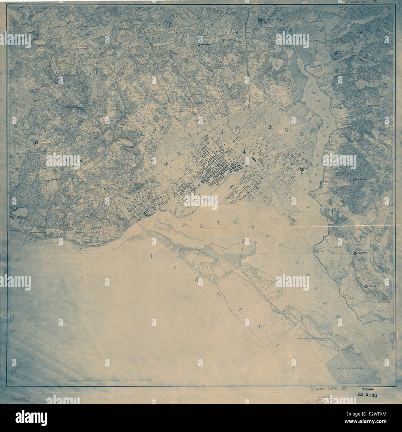 (Topographical map of the District of Columbia showing Civil War forts). LOC 88693392. Stock Photohttps://www.alamy.com/image-license-details/?v=1https://www.alamy.com/topographical-map-of-the-district-of-columbia-showing-civil-war-forts-loc-88693392-image208315036.html
RMP2WFXM–(Topographical map of the District of Columbia showing Civil War forts). LOC 88693392.
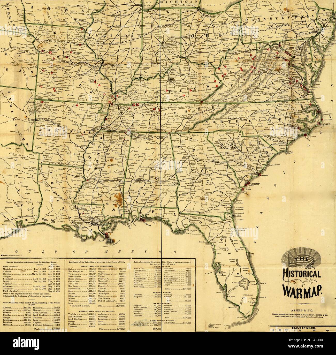 Historical War Map - 1862 Stock Photohttps://www.alamy.com/image-license-details/?v=1https://www.alamy.com/historical-war-map-1862-image370870246.html
RM2CFAGNX–Historical War Map - 1862
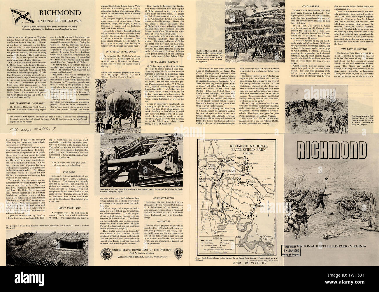 English: Scale ca. 1:250,000. LC Civil War Maps (2nd ed.), 646.7 Map illustrates a descriptive leaflet entitled Richmond National Battlefield Park, Virginia and shows location of Union and Confederate forces, trenches, forts, park boundary, and tour route. Description derived from published bibliography. Available also through the Library of Congress web site as raster image.; Richmond National Battlefield Park, Virginia. Oct. 1958. Stock Photohttps://www.alamy.com/image-license-details/?v=1https://www.alamy.com/english-scale-ca-1250000-lc-civil-war-maps-2nd-ed-6467-map-illustrates-a-descriptive-leaflet-entitled-richmond-national-battlefield-park-virginia-and-shows-location-of-union-and-confederate-forces-trenches-forts-park-boundary-and-tour-route-description-derived-from-published-bibliography-available-also-through-the-library-of-congress-web-site-as-raster-image-richmond-national-battlefield-park-virginia-oct-1958-image256688764.html
RMTWH53T–English: Scale ca. 1:250,000. LC Civil War Maps (2nd ed.), 646.7 Map illustrates a descriptive leaflet entitled Richmond National Battlefield Park, Virginia and shows location of Union and Confederate forces, trenches, forts, park boundary, and tour route. Description derived from published bibliography. Available also through the Library of Congress web site as raster image.; Richmond National Battlefield Park, Virginia. Oct. 1958.
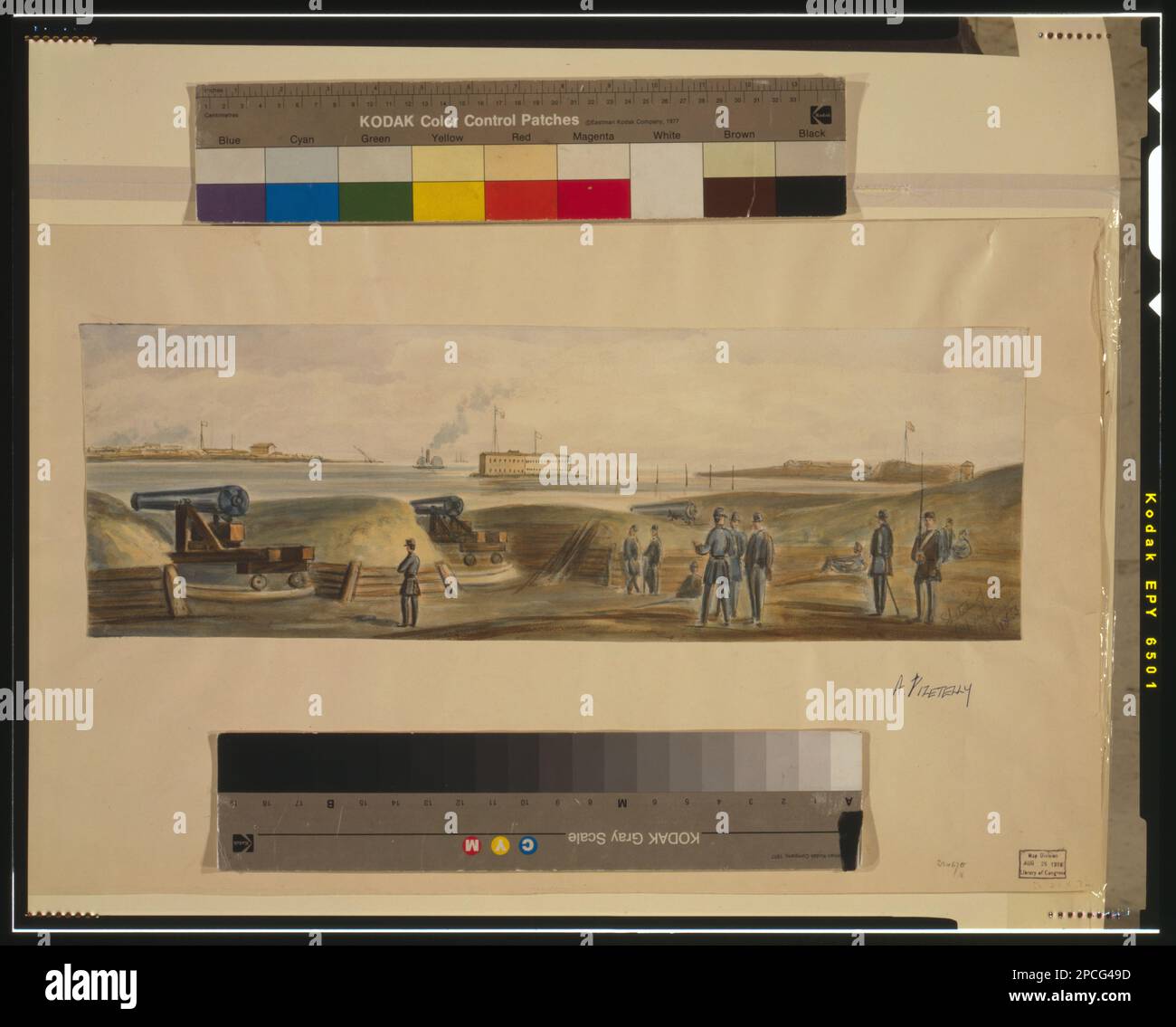 Sketch of Charleston's Defense. Title inscribed, in pencil lower right of image, Transfer, Map Division. Forts & fortifications, 1860-1870, Artillery (Weaponry), 1860-1870, Soldiers, 1860-1870, Ships, 1860-1870, Military uniforms, 1860-1870, United States, History, Civil War, 1861-1865, Military facilities, United States, South Carolina, Charleston , United States, South Carolina, Charleston Harbor Stock Photohttps://www.alamy.com/image-license-details/?v=1https://www.alamy.com/sketch-of-charlestons-defense-title-inscribed-in-pencil-lower-right-of-image-transfer-map-division-forts-fortifications-1860-1870-artillery-weaponry-1860-1870-soldiers-1860-1870-ships-1860-1870-military-uniforms-1860-1870-united-states-history-civil-war-1861-1865-military-facilities-united-states-south-carolina-charleston-united-states-south-carolina-charleston-harbor-image541251913.html
RM2PCG49D–Sketch of Charleston's Defense. Title inscribed, in pencil lower right of image, Transfer, Map Division. Forts & fortifications, 1860-1870, Artillery (Weaponry), 1860-1870, Soldiers, 1860-1870, Ships, 1860-1870, Military uniforms, 1860-1870, United States, History, Civil War, 1861-1865, Military facilities, United States, South Carolina, Charleston , United States, South Carolina, Charleston Harbor
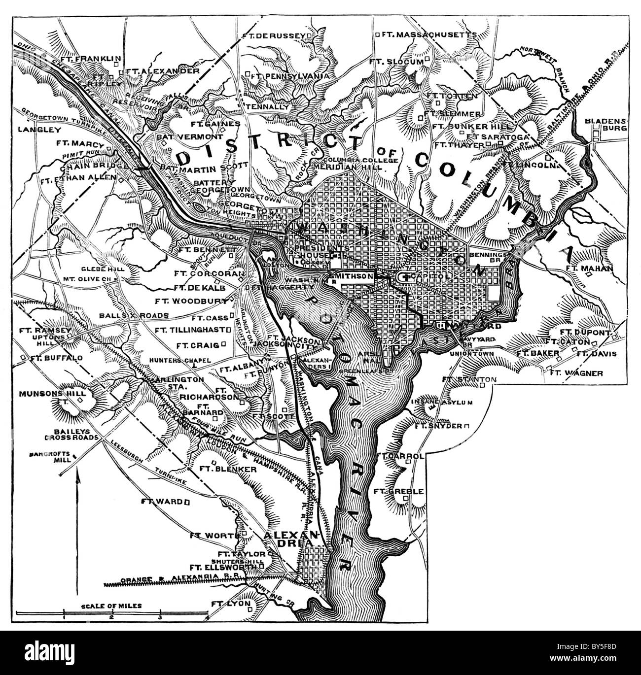 By early 1862, fifty-two forts and redoubts were ready in the vicinity of the National Capital, Washington, D.C.—as shown and la Stock Photohttps://www.alamy.com/image-license-details/?v=1https://www.alamy.com/stock-photo-by-early-1862-fifty-two-forts-and-redoubts-were-ready-in-the-vicinity-33927837.html
RFBY5F8D–By early 1862, fifty-two forts and redoubts were ready in the vicinity of the National Capital, Washington, D.C.—as shown and la
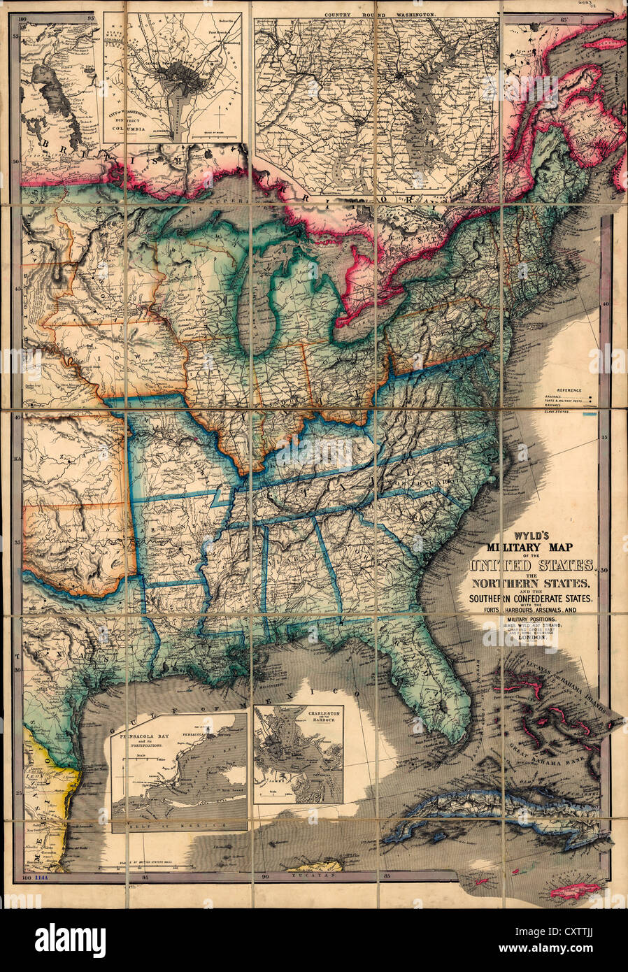 Wyld's military map of the United States, with the forts, harbors, arsenals, and military positions. 1861 USA Civil War Stock Photohttps://www.alamy.com/image-license-details/?v=1https://www.alamy.com/stock-photo-wylds-military-map-of-the-united-states-with-the-forts-harbors-arsenals-50947978.html
RMCXTTJJ–Wyld's military map of the United States, with the forts, harbors, arsenals, and military positions. 1861 USA Civil War
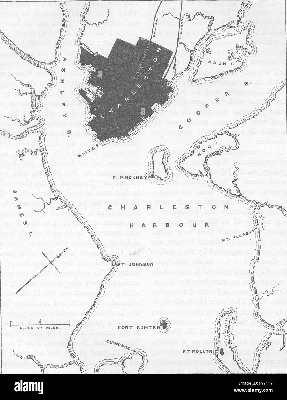 CHARLESTON: Civil War: Forts & harbour plan, c1880 antique map Stock Photohttps://www.alamy.com/image-license-details/?v=1https://www.alamy.com/stock-photo-charleston-civil-war-forts-harbour-plan-c1880-antique-map-103241077.html
RFFYY119–CHARLESTON: Civil War: Forts & harbour plan, c1880 antique map
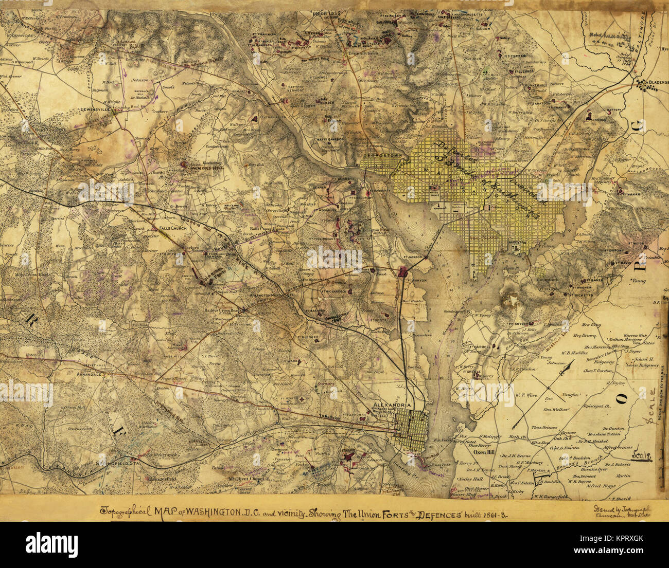 Washington, D.C., Showing the Union forts and defenses Stock Photohttps://www.alamy.com/image-license-details/?v=1https://www.alamy.com/stock-image-washington-dc-showing-the-union-forts-and-defenses-168941491.html
RMKPRXGK–Washington, D.C., Showing the Union forts and defenses
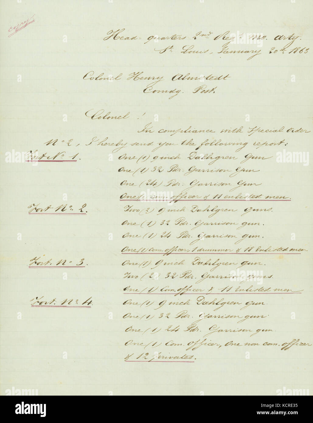 Contemporary copy of letter signed D. Urban, Head quarters 2nd Reg't Mo. Arty. (2nd Regiment Missouri Artillery), St. Louis, to Colonel Henry Almstedt, Comdg. Post, January 20, 1863 Stock Photohttps://www.alamy.com/image-license-details/?v=1https://www.alamy.com/stock-image-contemporary-copy-of-letter-signed-d-urban-head-quarters-2nd-regt-162785145.html
RMKCRE35–Contemporary copy of letter signed D. Urban, Head quarters 2nd Reg't Mo. Arty. (2nd Regiment Missouri Artillery), St. Louis, to Colonel Henry Almstedt, Comdg. Post, January 20, 1863
 . Abraham Lincoln and the battles of the Civil War . 0 SM r CONFEDERATE MONUMENT AT SHEPHERDSTOWN. FIGHTING FARRAGUT BELOW NEW ORLEANS* BY THE COMMANDER OF THE GOVERNOR MOORE.. THIS nar-rative willbe occupiedwith the oper-ations of the RIVER-SIDE INTERIOR OF FORT ST. PHILIP, o. , ^j jvj er Defense gun-boats, and especially with themovements of my vessel, the Governor Moore,and without particular reference to the forts.Xo men ever endured greater hardships,privations, and sufferings than the garrison The top of the map is -west. Stock Photohttps://www.alamy.com/image-license-details/?v=1https://www.alamy.com/abraham-lincoln-and-the-battles-of-the-civil-war-0-sm-r-confederate-monument-at-shepherdstown-fighting-farragut-below-new-orleans-by-the-commander-of-the-governor-moore-this-nar-rative-willbe-occupiedwith-the-oper-ations-of-the-river-side-interior-of-fort-st-philip-o-j-jvj-er-defense-gun-boats-and-especially-with-themovements-of-my-vessel-the-governor-mooreand-without-particular-reference-to-the-fortsxo-men-ever-endured-greater-hardshipsprivations-and-sufferings-than-the-garrison-the-top-of-the-map-is-west-image371658026.html
RM2CGJDGX–. Abraham Lincoln and the battles of the Civil War . 0 SM r CONFEDERATE MONUMENT AT SHEPHERDSTOWN. FIGHTING FARRAGUT BELOW NEW ORLEANS* BY THE COMMANDER OF THE GOVERNOR MOORE.. THIS nar-rative willbe occupiedwith the oper-ations of the RIVER-SIDE INTERIOR OF FORT ST. PHILIP, o. , ^j jvj er Defense gun-boats, and especially with themovements of my vessel, the Governor Moore,and without particular reference to the forts.Xo men ever endured greater hardships,privations, and sufferings than the garrison The top of the map is -west.
![Image taken from page 74 of 'Battles and Leaders of the Civil War, being for the most part contributions by Union and Confederate officers, based upon “the Century War Series.” Edited by R. U. J. and C. C. B., etc. [Illustrated.]' Image taken from page 74 of 'Battles and Leaders of Stock Photo Image taken from page 74 of 'Battles and Leaders of the Civil War, being for the most part contributions by Union and Confederate officers, based upon “the Century War Series.” Edited by R. U. J. and C. C. B., etc. [Illustrated.]' Image taken from page 74 of 'Battles and Leaders of Stock Photo](https://c8.alamy.com/comp/HFP8J1/image-taken-from-page-74-of-battles-and-leaders-of-the-civil-war-being-HFP8J1.jpg) Image taken from page 74 of 'Battles and Leaders of the Civil War, being for the most part contributions by Union and Confederate officers, based upon “the Century War Series.” Edited by R. U. J. and C. C. B., etc. [Illustrated.]' Image taken from page 74 of 'Battles and Leaders of Stock Photohttps://www.alamy.com/image-license-details/?v=1https://www.alamy.com/stock-photo-image-taken-from-page-74-of-battles-and-leaders-of-the-civil-war-being-130182137.html
Image taken from page 74 of 'Battles and Leaders of the Civil War, being for the most part contributions by Union and Confederate officers, based upon “the Century War Series.” Edited by R. U. J. and C. C. B., etc. [Illustrated.]' Image taken from page 74 of 'Battles and Leaders of Stock Photohttps://www.alamy.com/image-license-details/?v=1https://www.alamy.com/stock-photo-image-taken-from-page-74-of-battles-and-leaders-of-the-civil-war-being-130182137.htmlRMHFP8J1–Image taken from page 74 of 'Battles and Leaders of the Civil War, being for the most part contributions by Union and Confederate officers, based upon “the Century War Series.” Edited by R. U. J. and C. C. B., etc. [Illustrated.]' Image taken from page 74 of 'Battles and Leaders of
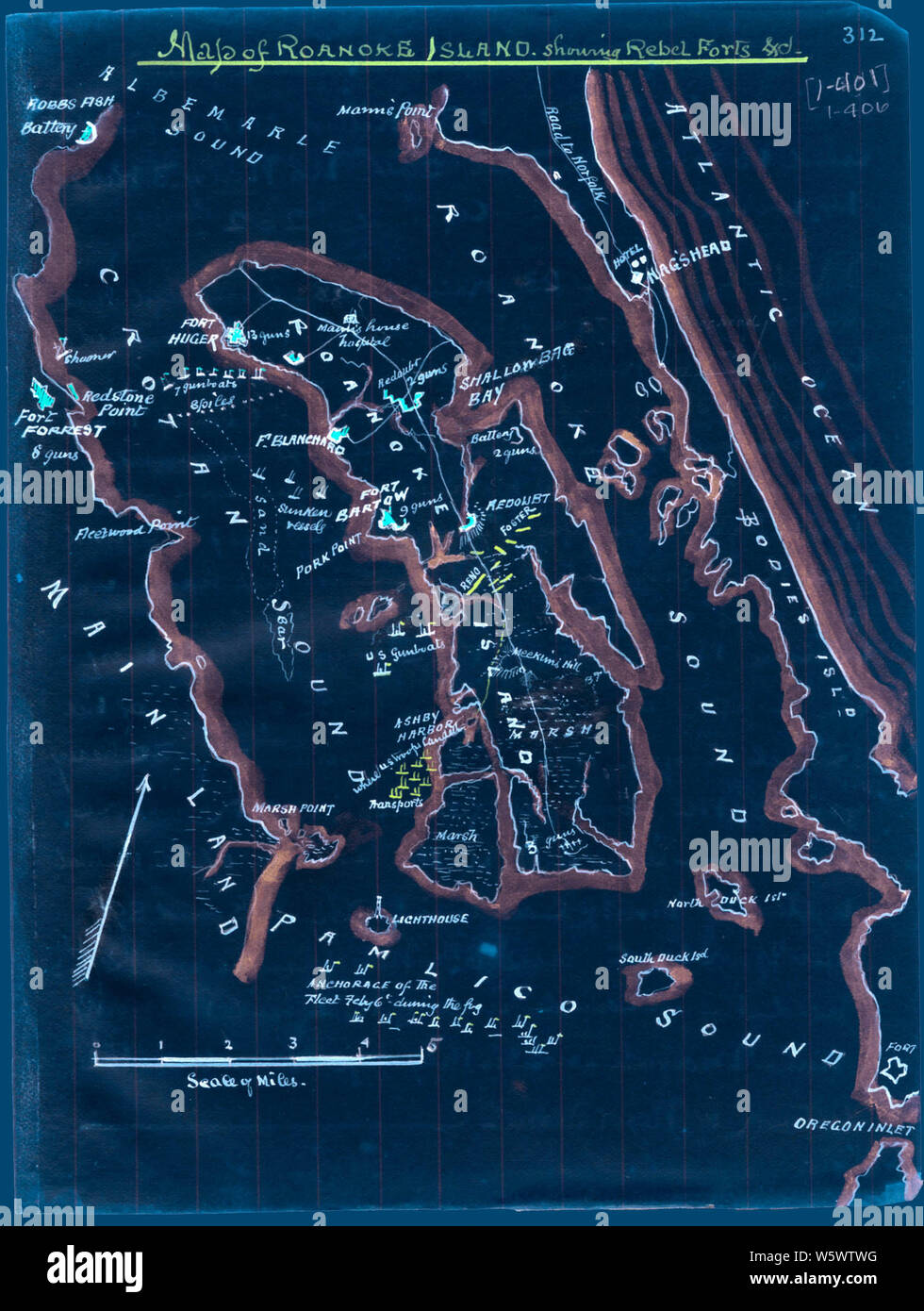 Civil War Maps 0793 Map of Roanoke Island showing Rebel forts Inverted Rebuild and Repair Stock Photohttps://www.alamy.com/image-license-details/?v=1https://www.alamy.com/civil-war-maps-0793-map-of-roanoke-island-showing-rebel-forts-inverted-rebuild-and-repair-image261797132.html
RMW5WTWG–Civil War Maps 0793 Map of Roanoke Island showing Rebel forts Inverted Rebuild and Repair
 . English: An exceptional example of A. J. Johnson’s highly desirable Military Map of the United States. Created at the height of the American Civil War, this map was issued by Johnson in order to capitalize on the general interest in the War. This is the more desirable of the two extant variants of this map. This variant, showing a layout of the states rather than military zones, offers a wonderful insight into the political situation shortly following the outbreak of the American Civil War. Shows the various states and territories along with several hundred forts and other military installa Stock Photohttps://www.alamy.com/image-license-details/?v=1https://www.alamy.com/english-an-exceptional-example-of-a-j-johnsons-highly-desirable-military-map-of-the-united-states-created-at-the-height-of-the-american-civil-war-this-map-was-issued-by-johnson-in-order-to-capitalize-on-the-general-interest-in-the-war-this-is-the-more-desirable-of-the-two-extant-variants-of-this-map-this-variant-showing-a-layout-of-the-states-rather-than-military-zones-offers-a-wonderful-insight-into-the-political-situation-shortly-following-the-outbreak-of-the-american-civil-war-shows-the-various-states-and-territories-along-with-several-hundred-forts-and-other-military-installa-image184964610.html
RMMMWT6X–. English: An exceptional example of A. J. Johnson’s highly desirable Military Map of the United States. Created at the height of the American Civil War, this map was issued by Johnson in order to capitalize on the general interest in the War. This is the more desirable of the two extant variants of this map. This variant, showing a layout of the states rather than military zones, offers a wonderful insight into the political situation shortly following the outbreak of the American Civil War. Shows the various states and territories along with several hundred forts and other military installa
 Civil War Maps 0365 Extract of military map of NE Virginia showing forts and roads Rebuild and Repair Stock Photohttps://www.alamy.com/image-license-details/?v=1https://www.alamy.com/civil-war-maps-0365-extract-of-military-map-of-ne-virginia-showing-forts-and-roads-rebuild-and-repair-image261710630.html
RMW5NXG6–Civil War Maps 0365 Extract of military map of NE Virginia showing forts and roads Rebuild and Repair
 Army Map - Theatre of War - 1862 Stock Photohttps://www.alamy.com/image-license-details/?v=1https://www.alamy.com/army-map-theatre-of-war-1862-image370870459.html
RM2CFAH1F–Army Map - Theatre of War - 1862
 Civil War Maps 0086 Bacon's military map of the United States shewing the forts fortifications Rebuild and Repair Stock Photohttps://www.alamy.com/image-license-details/?v=1https://www.alamy.com/civil-war-maps-0086-bacons-military-map-of-the-united-states-shewing-the-forts-fortifications-rebuild-and-repair-image261684051.html
RMW5MMJY–Civil War Maps 0086 Bacon's military map of the United States shewing the forts fortifications Rebuild and Repair
 Pocket Map of the Probable Theatre of War - 1861 Stock Photohttps://www.alamy.com/image-license-details/?v=1https://www.alamy.com/pocket-map-of-the-probable-theatre-of-war-1861-image370870342.html
RM2CFAGWA–Pocket Map of the Probable Theatre of War - 1861
 Civil War Maps 0365 Extract of military map of NE Virginia showing forts and roads Inverted Rebuild and Repair Stock Photohttps://www.alamy.com/image-license-details/?v=1https://www.alamy.com/civil-war-maps-0365-extract-of-military-map-of-ne-virginia-showing-forts-and-roads-inverted-rebuild-and-repair-image261710670.html
RMW5NXHJ–Civil War Maps 0365 Extract of military map of NE Virginia showing forts and roads Inverted Rebuild and Repair
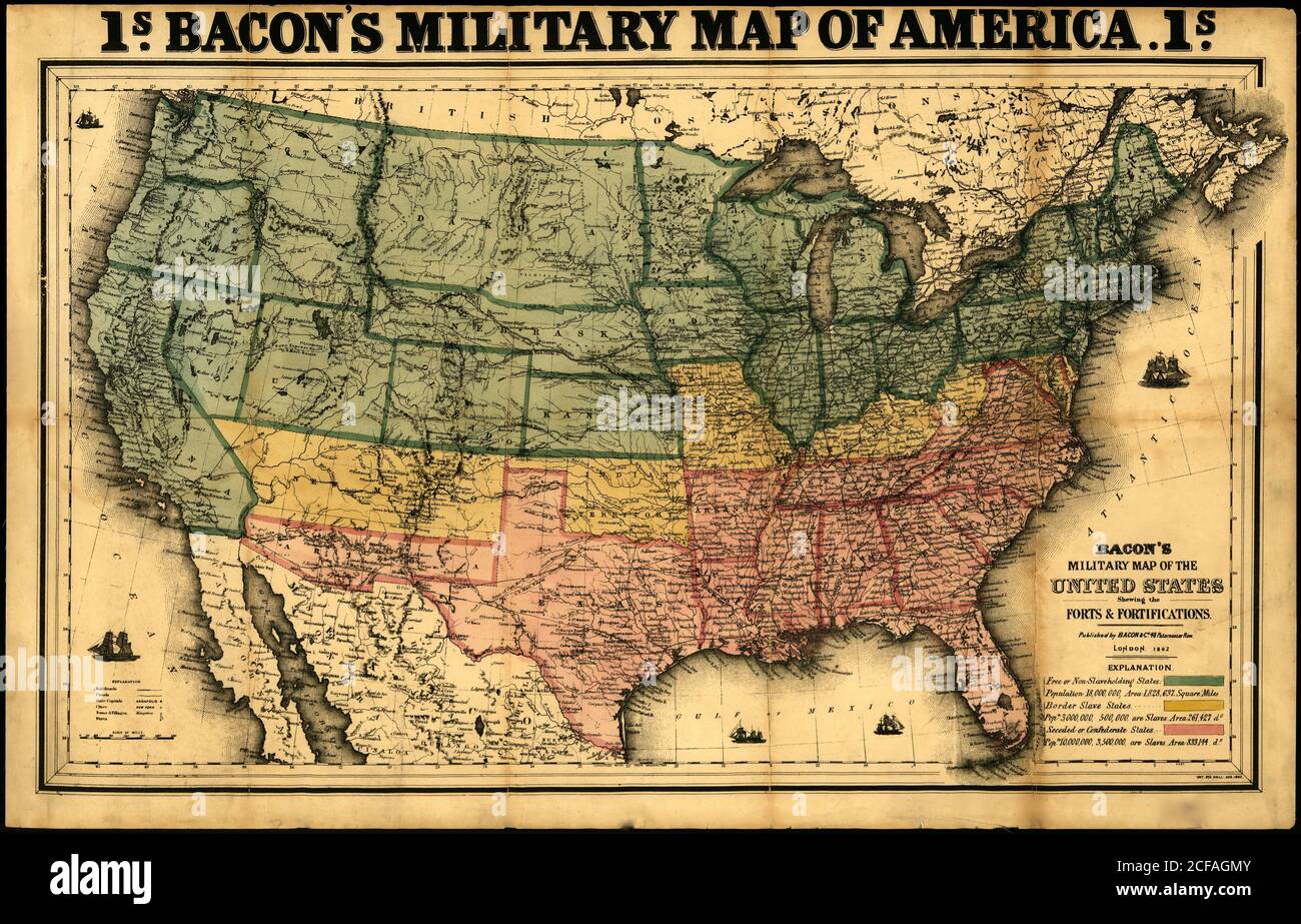 Bacon's military map of the United States showing the forts & fortifications - 1862 Stock Photohttps://www.alamy.com/image-license-details/?v=1https://www.alamy.com/bacons-military-map-of-the-united-states-showing-the-forts-fortifications-1862-image370870219.html
RM2CFAGMY–Bacon's military map of the United States showing the forts & fortifications - 1862
 Civil War Maps 0086 Bacon's military map of the United States shewing the forts fortifications Inverted Rebuild and Repair Stock Photohttps://www.alamy.com/image-license-details/?v=1https://www.alamy.com/civil-war-maps-0086-bacons-military-map-of-the-united-states-shewing-the-forts-fortifications-inverted-rebuild-and-repair-image261683903.html
RMW5MMDK–Civil War Maps 0086 Bacon's military map of the United States shewing the forts fortifications Inverted Rebuild and Repair
![View of Charleston Harbor and its Defences. Title inscribed below image, Inscribed below image to indicacte what is in image, from left to right : Rebell[sic] Bat[ter]y Woodbull; James Island; Bat[ter]y Simpkins-, Charleston; Castle Pinkey; Left Batteries; Ft. Sumter Bat Cregg; Bty Bee; Bat. Chatfield; Sullivan's Island; Ft. Moultrie; Ft. Wagner; Union Siege Works; Iron Clads; Moultrie house, Transfer, Map Division. Ships, 1860-1870, Dwellings, 1860-1870, Forts & fortifications, 1860-1870, Harbors, 1860-1870, United States, History, Civil War, 1861-1865, Military facilities, United States, His Stock Photo View of Charleston Harbor and its Defences. Title inscribed below image, Inscribed below image to indicacte what is in image, from left to right : Rebell[sic] Bat[ter]y Woodbull; James Island; Bat[ter]y Simpkins-, Charleston; Castle Pinkey; Left Batteries; Ft. Sumter Bat Cregg; Bty Bee; Bat. Chatfield; Sullivan's Island; Ft. Moultrie; Ft. Wagner; Union Siege Works; Iron Clads; Moultrie house, Transfer, Map Division. Ships, 1860-1870, Dwellings, 1860-1870, Forts & fortifications, 1860-1870, Harbors, 1860-1870, United States, History, Civil War, 1861-1865, Military facilities, United States, His Stock Photo](https://c8.alamy.com/comp/2PCMJEF/view-of-charleston-harbor-and-its-defences-title-inscribed-below-image-inscribed-below-image-to-indicacte-what-is-in-image-from-left-to-right-rebell-sic-bat-ter-y-woodbull-james-island-bat-ter-y-simpkins-charleston-castle-pinkey-left-batteries-ft-sumter-bat-cregg-bty-bee-bat-chatfield-sullivans-island-ft-moultrie-ft-wagner-union-siege-works-iron-clads-moultrie-house-transfer-map-division-ships-1860-1870-dwellings-1860-1870-forts-fortifications-1860-1870-harbors-1860-1870-united-states-history-civil-war-1861-1865-military-facilities-united-states-his-2PCMJEF.jpg) View of Charleston Harbor and its Defences. Title inscribed below image, Inscribed below image to indicacte what is in image, from left to right : Rebell[sic] Bat[ter]y Woodbull; James Island; Bat[ter]y Simpkins-, Charleston; Castle Pinkey; Left Batteries; Ft. Sumter Bat Cregg; Bty Bee; Bat. Chatfield; Sullivan's Island; Ft. Moultrie; Ft. Wagner; Union Siege Works; Iron Clads; Moultrie house, Transfer, Map Division. Ships, 1860-1870, Dwellings, 1860-1870, Forts & fortifications, 1860-1870, Harbors, 1860-1870, United States, History, Civil War, 1861-1865, Military facilities, United States, His Stock Photohttps://www.alamy.com/image-license-details/?v=1https://www.alamy.com/view-of-charleston-harbor-and-its-defences-title-inscribed-below-image-inscribed-below-image-to-indicacte-what-is-in-image-from-left-to-right-rebell-sic-bat-ter-y-woodbull-james-island-bat-ter-y-simpkins-charleston-castle-pinkey-left-batteries-ft-sumter-bat-cregg-bty-bee-bat-chatfield-sullivans-island-ft-moultrie-ft-wagner-union-siege-works-iron-clads-moultrie-house-transfer-map-division-ships-1860-1870-dwellings-1860-1870-forts-fortifications-1860-1870-harbors-1860-1870-united-states-history-civil-war-1861-1865-military-facilities-united-states-his-image541350839.html
View of Charleston Harbor and its Defences. Title inscribed below image, Inscribed below image to indicacte what is in image, from left to right : Rebell[sic] Bat[ter]y Woodbull; James Island; Bat[ter]y Simpkins-, Charleston; Castle Pinkey; Left Batteries; Ft. Sumter Bat Cregg; Bty Bee; Bat. Chatfield; Sullivan's Island; Ft. Moultrie; Ft. Wagner; Union Siege Works; Iron Clads; Moultrie house, Transfer, Map Division. Ships, 1860-1870, Dwellings, 1860-1870, Forts & fortifications, 1860-1870, Harbors, 1860-1870, United States, History, Civil War, 1861-1865, Military facilities, United States, His Stock Photohttps://www.alamy.com/image-license-details/?v=1https://www.alamy.com/view-of-charleston-harbor-and-its-defences-title-inscribed-below-image-inscribed-below-image-to-indicacte-what-is-in-image-from-left-to-right-rebell-sic-bat-ter-y-woodbull-james-island-bat-ter-y-simpkins-charleston-castle-pinkey-left-batteries-ft-sumter-bat-cregg-bty-bee-bat-chatfield-sullivans-island-ft-moultrie-ft-wagner-union-siege-works-iron-clads-moultrie-house-transfer-map-division-ships-1860-1870-dwellings-1860-1870-forts-fortifications-1860-1870-harbors-1860-1870-united-states-history-civil-war-1861-1865-military-facilities-united-states-his-image541350839.htmlRM2PCMJEF–View of Charleston Harbor and its Defences. Title inscribed below image, Inscribed below image to indicacte what is in image, from left to right : Rebell[sic] Bat[ter]y Woodbull; James Island; Bat[ter]y Simpkins-, Charleston; Castle Pinkey; Left Batteries; Ft. Sumter Bat Cregg; Bty Bee; Bat. Chatfield; Sullivan's Island; Ft. Moultrie; Ft. Wagner; Union Siege Works; Iron Clads; Moultrie house, Transfer, Map Division. Ships, 1860-1870, Dwellings, 1860-1870, Forts & fortifications, 1860-1870, Harbors, 1860-1870, United States, History, Civil War, 1861-1865, Military facilities, United States, His
 Civil War Maps 1184 New map of Charleston Harbor showing the scene of the great naval contest between the iron clad monitors and the Rebel batteries also the lines of fire forts obstructions inlets princl plan Inverted Stock Photohttps://www.alamy.com/image-license-details/?v=1https://www.alamy.com/civil-war-maps-1184-new-map-of-charleston-harbor-showing-the-scene-of-the-great-naval-contest-between-the-iron-clad-monitors-and-the-rebel-batteries-also-the-lines-of-fire-forts-obstructions-inlets-princl-plan-inverted-image261824912.html
RMW5Y49M–Civil War Maps 1184 New map of Charleston Harbor showing the scene of the great naval contest between the iron clad monitors and the Rebel batteries also the lines of fire forts obstructions inlets princl plan Inverted
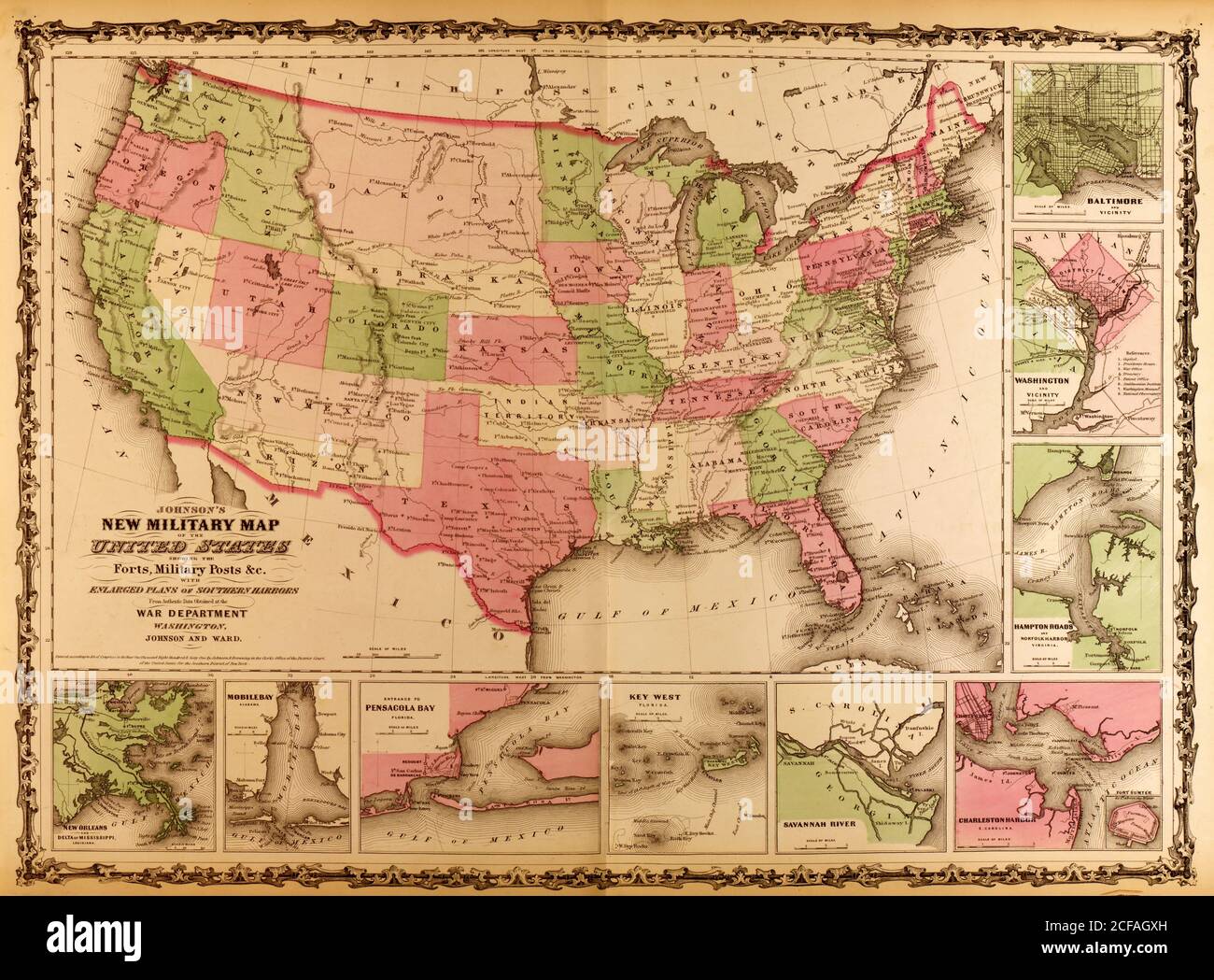 Military Map of the United states - 1863 Stock Photohttps://www.alamy.com/image-license-details/?v=1https://www.alamy.com/military-map-of-the-united-states-1863-image370870377.html
RM2CFAGXH–Military Map of the United states - 1863
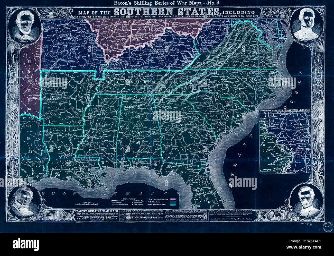 Civil War Maps 0977 Map of the southern states including rail roads county towns state capitals count roads the southern coast from Delaware to Texas showing the harbors inlets forts and position of blockadin Inverted Stock Photohttps://www.alamy.com/image-license-details/?v=1https://www.alamy.com/civil-war-maps-0977-map-of-the-southern-states-including-rail-roads-county-towns-state-capitals-count-roads-the-southern-coast-from-delaware-to-texas-showing-the-harbors-inlets-forts-and-position-of-blockadin-inverted-image261807785.html
RMW5XAE1–Civil War Maps 0977 Map of the southern states including rail roads county towns state capitals count roads the southern coast from Delaware to Texas showing the harbors inlets forts and position of blockadin Inverted
 Railway & County Map of the Southern States Stock Photohttps://www.alamy.com/image-license-details/?v=1https://www.alamy.com/railway-county-map-of-the-southern-states-image370870373.html
RM2CFAGXD–Railway & County Map of the Southern States
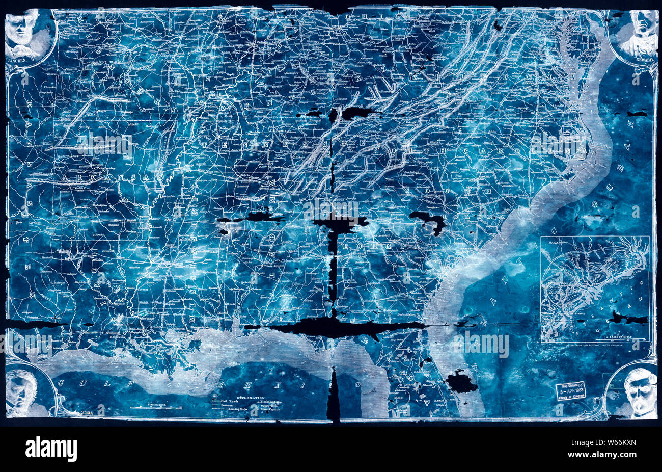 Civil War Maps 2129 Map of the southern states including rail roads county towns state capitals county roads the southern coast Delaware to Texas showing the harbors inlets forts and position of blockading s Inverted Stock Photohttps://www.alamy.com/image-license-details/?v=1https://www.alamy.com/civil-war-maps-2129-map-of-the-southern-states-including-rail-roads-county-towns-state-capitals-county-roads-the-southern-coast-delaware-to-texas-showing-the-harbors-inlets-forts-and-position-of-blockading-s-inverted-image261990813.html
RMW66KXN–Civil War Maps 2129 Map of the southern states including rail roads county towns state capitals county roads the southern coast Delaware to Texas showing the harbors inlets forts and position of blockading s Inverted
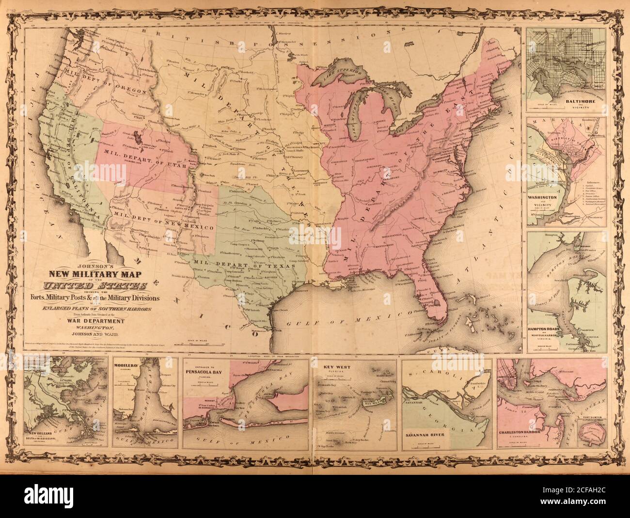 Military Map of the United States - 1862 Stock Photohttps://www.alamy.com/image-license-details/?v=1https://www.alamy.com/military-map-of-the-united-states-1862-image370870484.html
RM2CFAH2C–Military Map of the United States - 1862
 Civil War Maps 1059 Map showing siege operations against forts Sumter and Wagner between July 13th Sept 7th 1863 Maj T B Brooks ADC Assist Engrs Published by permission of Genl Gillmore at the US Rebuild and Repair Stock Photohttps://www.alamy.com/image-license-details/?v=1https://www.alamy.com/civil-war-maps-1059-map-showing-siege-operations-against-forts-sumter-and-wagner-between-july-13th-sept-7th-1863-maj-t-b-brooks-adc-assist-engrs-published-by-permission-of-genl-gillmore-at-the-us-rebuild-and-repair-image261812227.html
RMW5XG4K–Civil War Maps 1059 Map showing siege operations against forts Sumter and Wagner between July 13th Sept 7th 1863 Maj T B Brooks ADC Assist Engrs Published by permission of Genl Gillmore at the US Rebuild and Repair
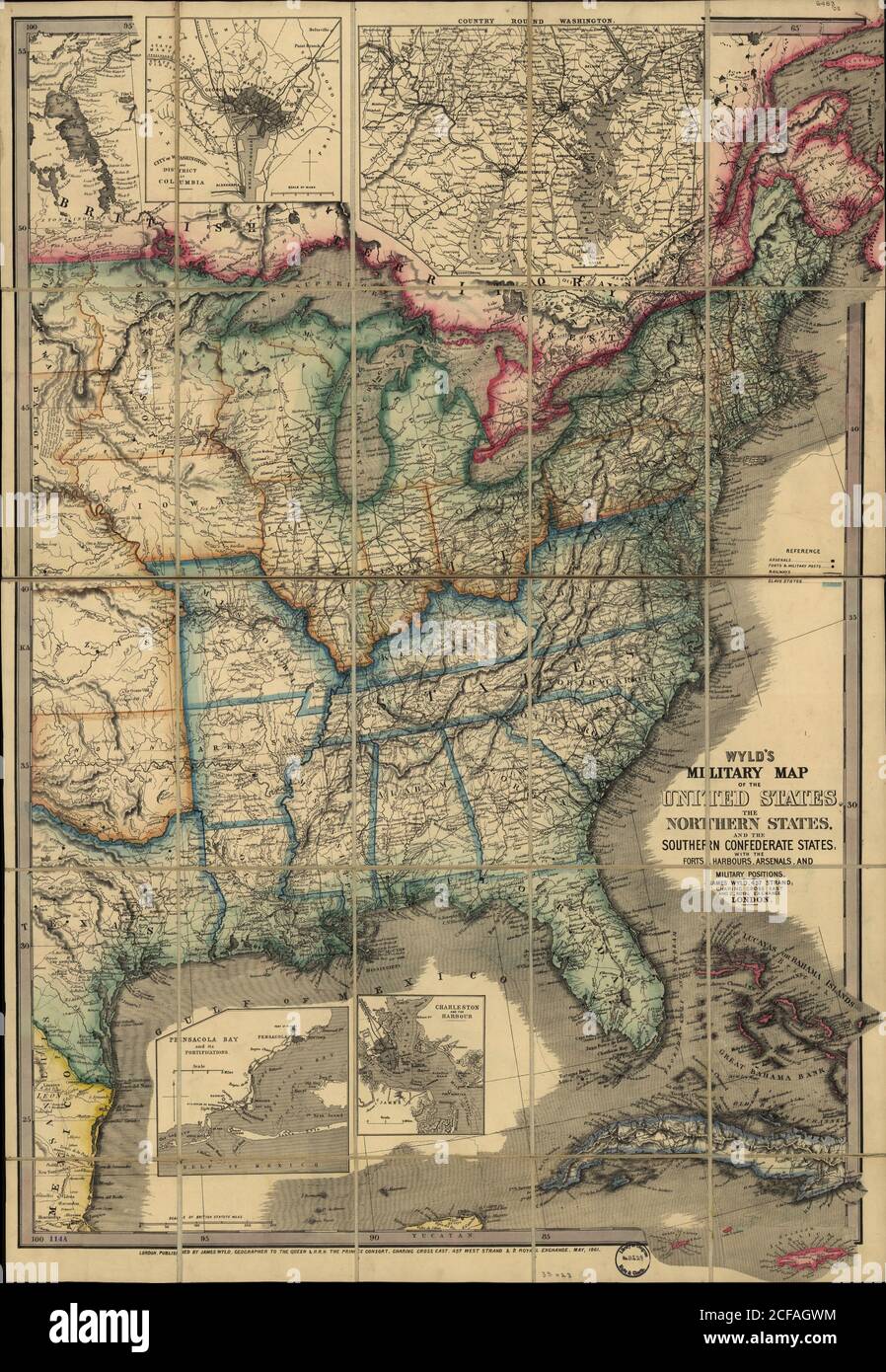 Military Map of the United states - 1861 Stock Photohttps://www.alamy.com/image-license-details/?v=1https://www.alamy.com/military-map-of-the-united-states-1861-image370870352.html
RM2CFAGWM–Military Map of the United states - 1861
 Civil War Maps 1229 Original maps of Forts Henry Donelson and vicinity Rebuild and Repair Stock Photohttps://www.alamy.com/image-license-details/?v=1https://www.alamy.com/civil-war-maps-1229-original-maps-of-forts-henry-donelson-and-vicinity-rebuild-and-repair-image261827605.html
RMW5Y7NW–Civil War Maps 1229 Original maps of Forts Henry Donelson and vicinity Rebuild and Repair
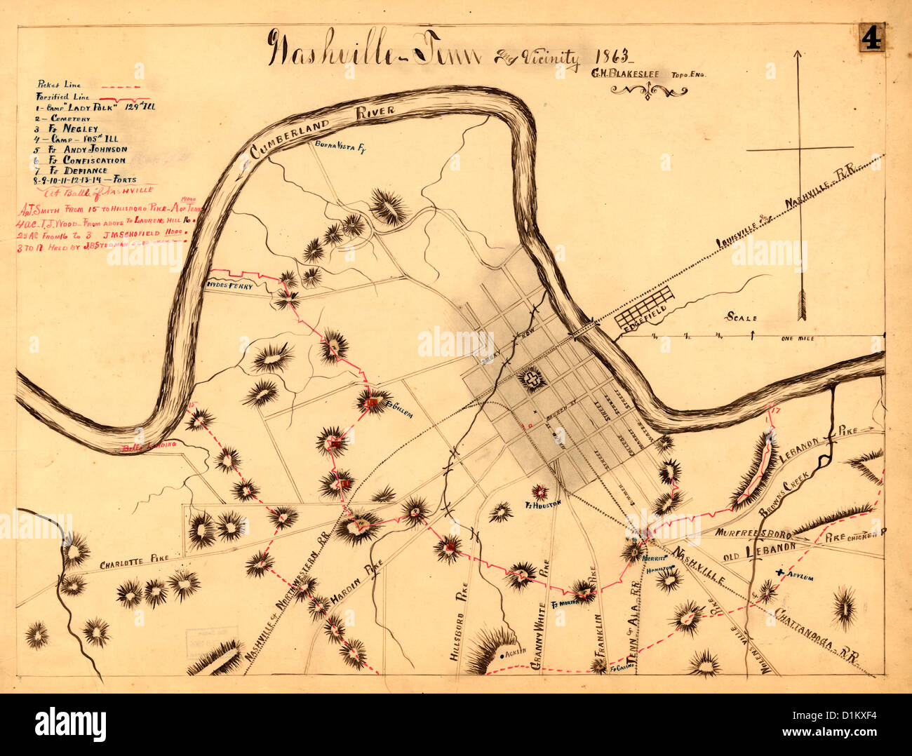 Nashville, Tennessee and vicinity 1863 during USA Civil War Stock Photohttps://www.alamy.com/image-license-details/?v=1https://www.alamy.com/stock-photo-nashville-tennessee-and-vicinity-1863-during-usa-civil-war-52683656.html
RMD1KXF4–Nashville, Tennessee and vicinity 1863 during USA Civil War
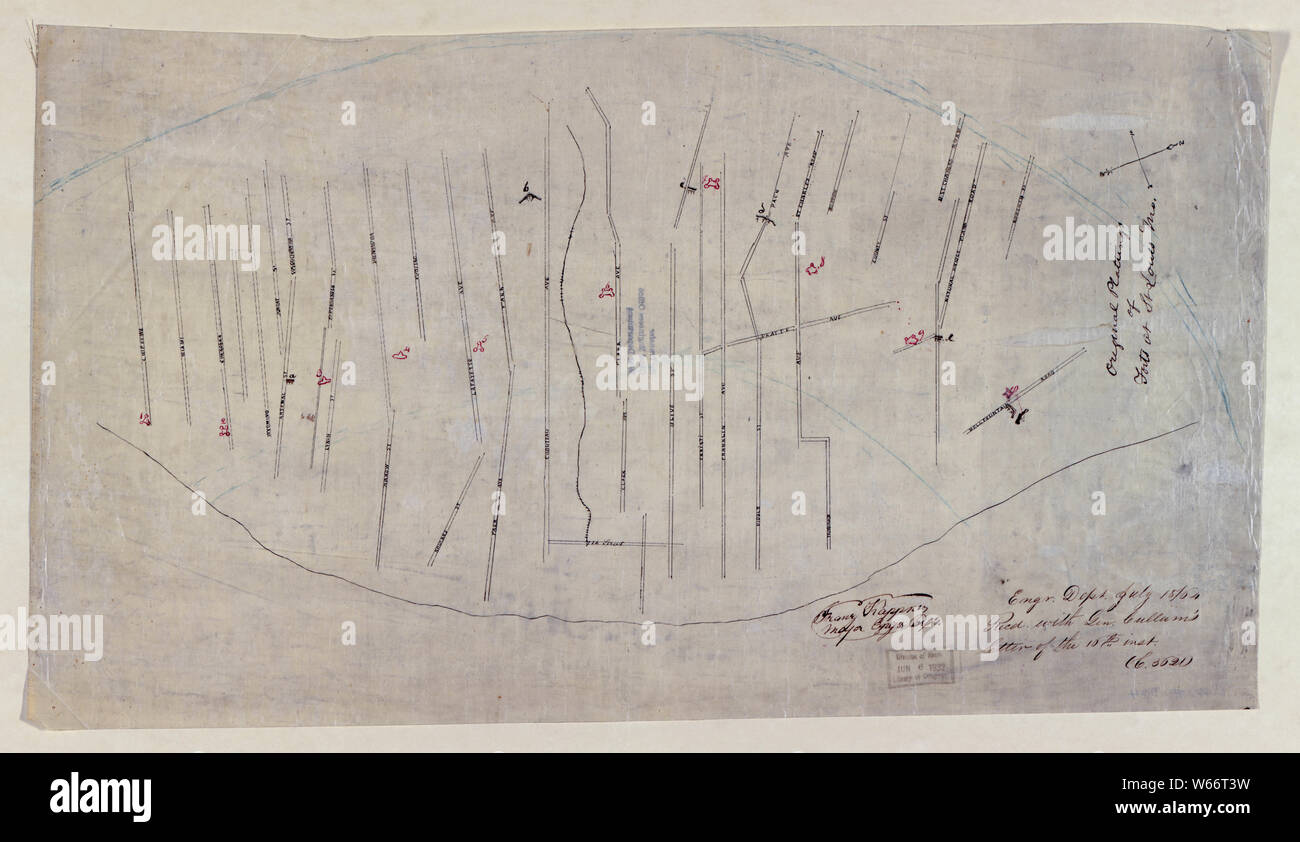 Civil War Maps 2162 Original plattings of forts at St Louis Mo 186- Rebuild and Repair Stock Photohttps://www.alamy.com/image-license-details/?v=1https://www.alamy.com/civil-war-maps-2162-original-plattings-of-forts-at-st-louis-mo-186-rebuild-and-repair-image261994093.html
RMW66T3W–Civil War Maps 2162 Original plattings of forts at St Louis Mo 186- Rebuild and Repair
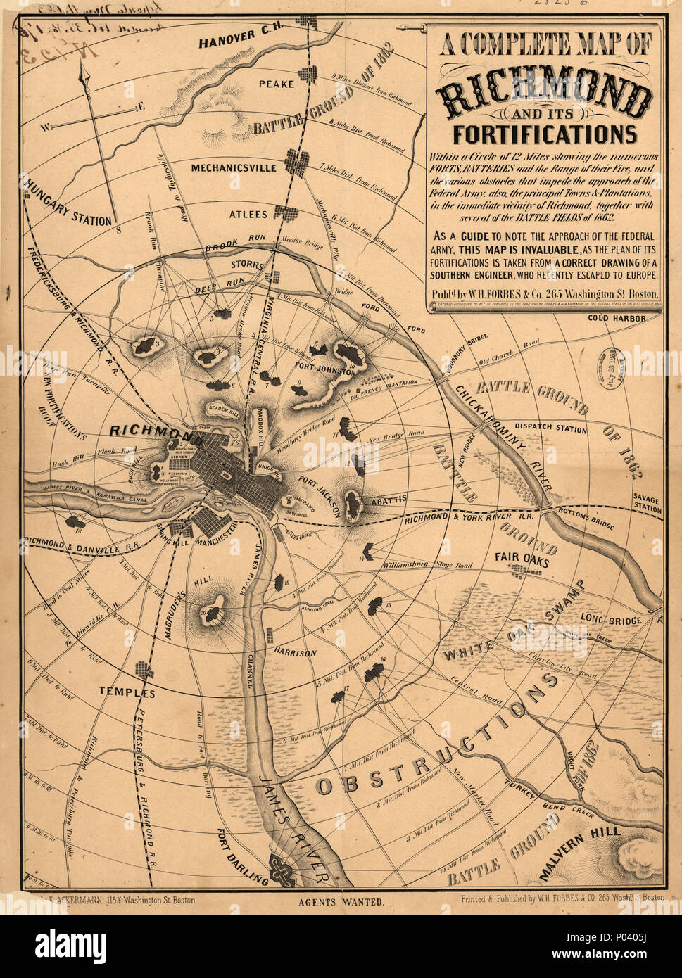 . English: Scale ca. 1:54,000. LC Civil War Maps (2nd ed.), 628 'As a guide to note the approach of the Federal army, this map is invaluable, as the plan of its fortifications is taken from a correct drawing of a Southern engineer, who recently escaped to Europe.' Description derived from published bibliography. Available also through the Library of Congress web site as raster image. . A complete map of Richmond and its fortifications within a circle of 12 miles showing the numerous forts, batteries and the range of their fire, and the various obstacles that impede the approach of the Federal Stock Photohttps://www.alamy.com/image-license-details/?v=1https://www.alamy.com/english-scale-ca-154000-lc-civil-war-maps-2nd-ed-628-as-a-guide-to-note-the-approach-of-the-federal-army-this-map-is-invaluable-as-the-plan-of-its-fortifications-is-taken-from-a-correct-drawing-of-a-southern-engineer-who-recently-escaped-to-europe-description-derived-from-published-bibliography-available-also-through-the-library-of-congress-web-site-as-raster-image-a-complete-map-of-richmond-and-its-fortifications-within-a-circle-of-12-miles-showing-the-numerous-forts-batteries-and-the-range-of-their-fire-and-the-various-obstacles-that-impede-the-approach-of-the-federal-image206612382.html
RMP0405J–. English: Scale ca. 1:54,000. LC Civil War Maps (2nd ed.), 628 'As a guide to note the approach of the Federal army, this map is invaluable, as the plan of its fortifications is taken from a correct drawing of a Southern engineer, who recently escaped to Europe.' Description derived from published bibliography. Available also through the Library of Congress web site as raster image. . A complete map of Richmond and its fortifications within a circle of 12 miles showing the numerous forts, batteries and the range of their fire, and the various obstacles that impede the approach of the Federal
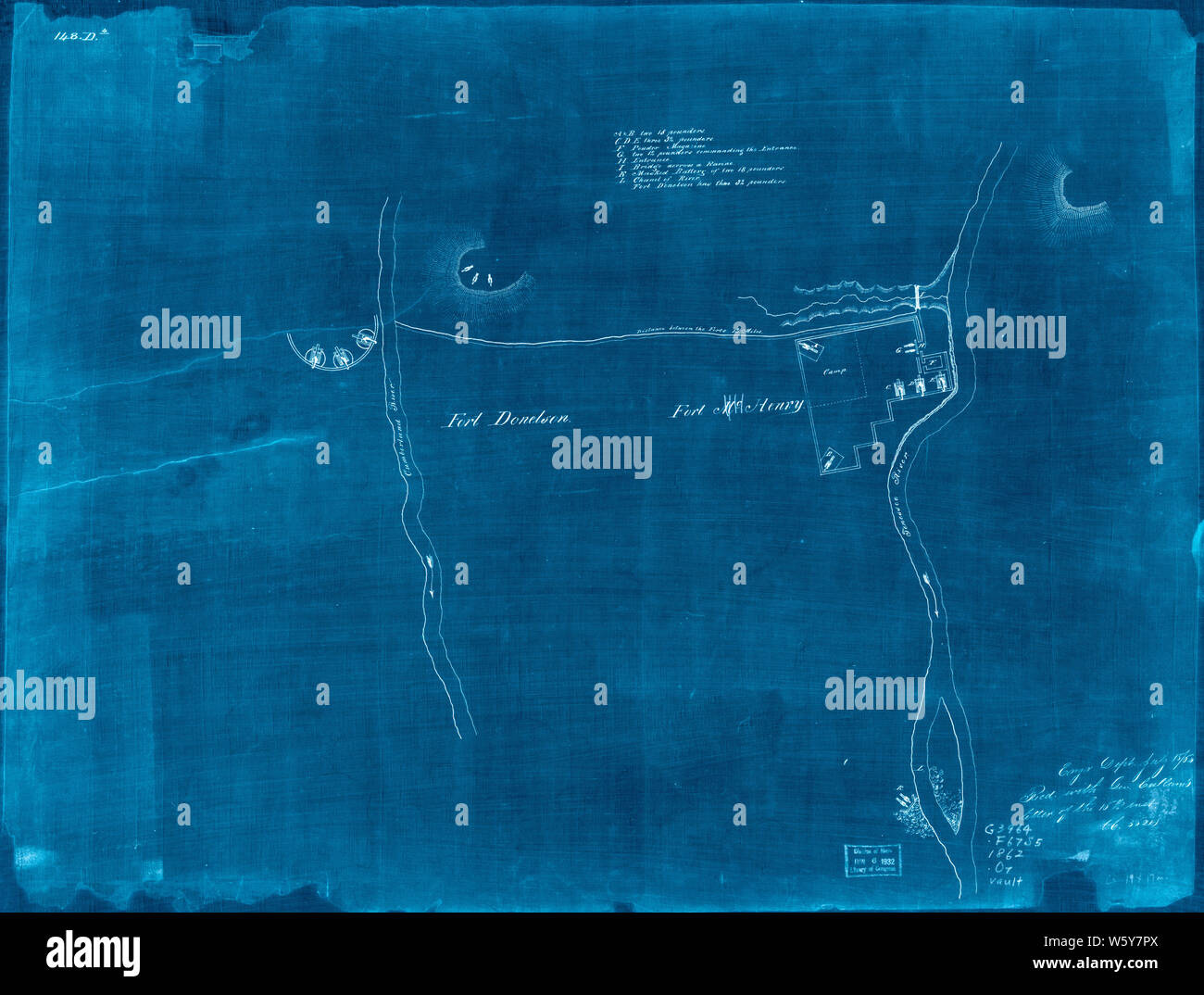 Civil War Maps 1229 Original maps of Forts Henry Donelson and vicinity Inverted Rebuild and Repair Stock Photohttps://www.alamy.com/image-license-details/?v=1https://www.alamy.com/civil-war-maps-1229-original-maps-of-forts-henry-donelson-and-vicinity-inverted-rebuild-and-repair-image261827634.html
RMW5Y7PX–Civil War Maps 1229 Original maps of Forts Henry Donelson and vicinity Inverted Rebuild and Repair
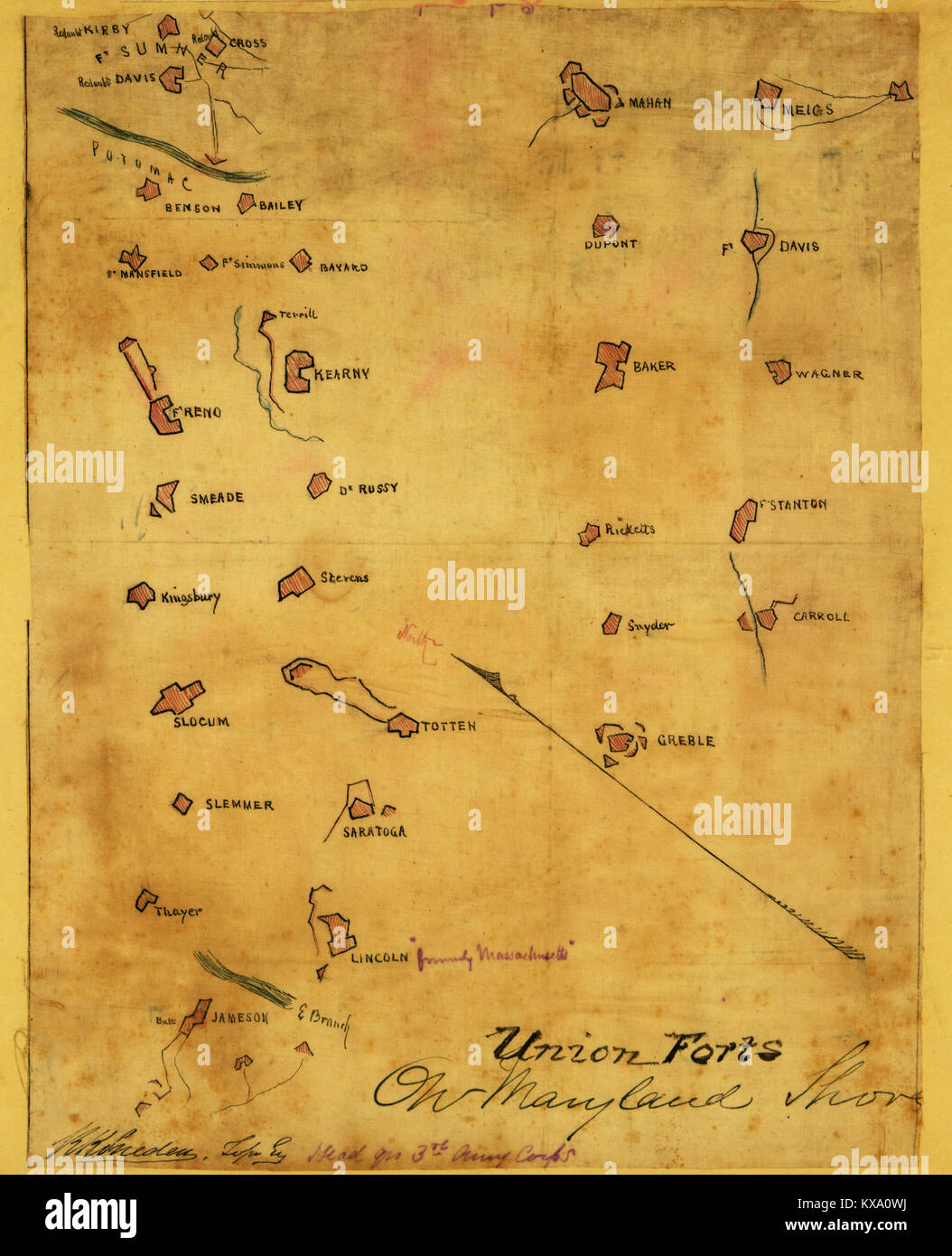 Union forts on Maryland shore. Stock Photohttps://www.alamy.com/image-license-details/?v=1https://www.alamy.com/stock-photo-union-forts-on-maryland-shore-171094606.html
RMKXA0WJ–Union forts on Maryland shore.
 Civil War Maps 2162 Original plattings of forts at St Louis Mo 186- Inverted Rebuild and Repair Stock Photohttps://www.alamy.com/image-license-details/?v=1https://www.alamy.com/civil-war-maps-2162-original-plattings-of-forts-at-st-louis-mo-186-inverted-rebuild-and-repair-image261993896.html
RMW66RTT–Civil War Maps 2162 Original plattings of forts at St Louis Mo 186- Inverted Rebuild and Repair
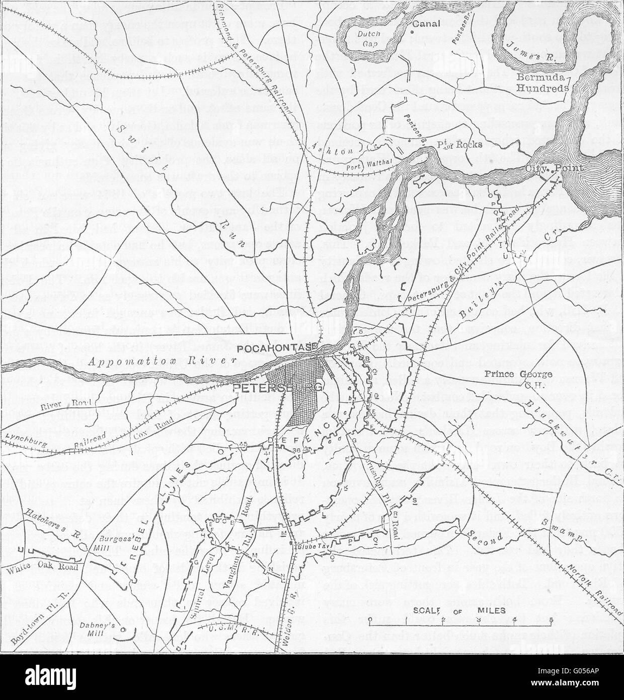 VIRGINIA: Petersburg; Confederate, Federal Forts, c1880 antique map Stock Photohttps://www.alamy.com/image-license-details/?v=1https://www.alamy.com/stock-photo-virginia-petersburg-confederate-federal-forts-c1880-antique-map-103376974.html
RFG056AP–VIRGINIA: Petersburg; Confederate, Federal Forts, c1880 antique map
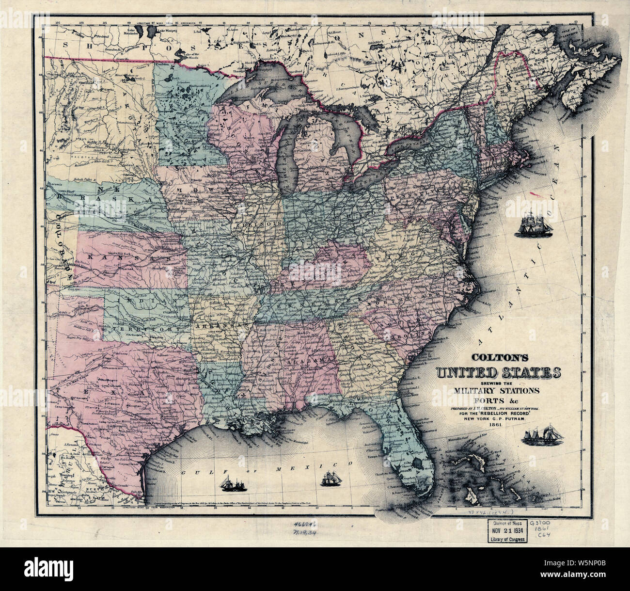 Civil War Maps 0316 Colton's United States shewing the military stations forts c Rebuild and Repair Stock Photohttps://www.alamy.com/image-license-details/?v=1https://www.alamy.com/civil-war-maps-0316-coltons-united-states-shewing-the-military-stations-forts-c-rebuild-and-repair-image261707051.html
RMW5NP0B–Civil War Maps 0316 Colton's United States shewing the military stations forts c Rebuild and Repair
 . The Southern planter. ica, where may be seen thefont at which Pocahontas was baptiz-ed. In the town are many houseswhich antedate the Revolution. The old forts and earthworks aroundWilliamsburg are numerous remind- ers of the Civil War, as the town wason the line of General McClellanspeninsular campaign. The most conspicuous natural fea-ture of the map is York River, whichcrosses it diagonally from the north-west to the southeast. On the north bank of the river, are still standingsome of the original houses in whichfamilies that bore the well-knownnames of TaliafeiTO, Sewall, Page,Stubbs, Ta Stock Photohttps://www.alamy.com/image-license-details/?v=1https://www.alamy.com/the-southern-planter-ica-where-may-be-seen-thefont-at-which-pocahontas-was-baptiz-ed-in-the-town-are-many-houseswhich-antedate-the-revolution-the-old-forts-and-earthworks-aroundwilliamsburg-are-numerous-remind-ers-of-the-civil-war-as-the-town-wason-the-line-of-general-mcclellanspeninsular-campaign-the-most-conspicuous-natural-fea-ture-of-the-map-is-york-river-whichcrosses-it-diagonally-from-the-north-west-to-the-southeast-on-the-north-bank-of-the-river-are-still-standingsome-of-the-original-houses-in-whichfamilies-that-bore-the-well-knownnames-of-taliafeito-sewall-pagestubbs-ta-image370730707.html
RM2CF46PB–. The Southern planter. ica, where may be seen thefont at which Pocahontas was baptiz-ed. In the town are many houseswhich antedate the Revolution. The old forts and earthworks aroundWilliamsburg are numerous remind- ers of the Civil War, as the town wason the line of General McClellanspeninsular campaign. The most conspicuous natural fea-ture of the map is York River, whichcrosses it diagonally from the north-west to the southeast. On the north bank of the river, are still standingsome of the original houses in whichfamilies that bore the well-knownnames of TaliafeiTO, Sewall, Page,Stubbs, Ta
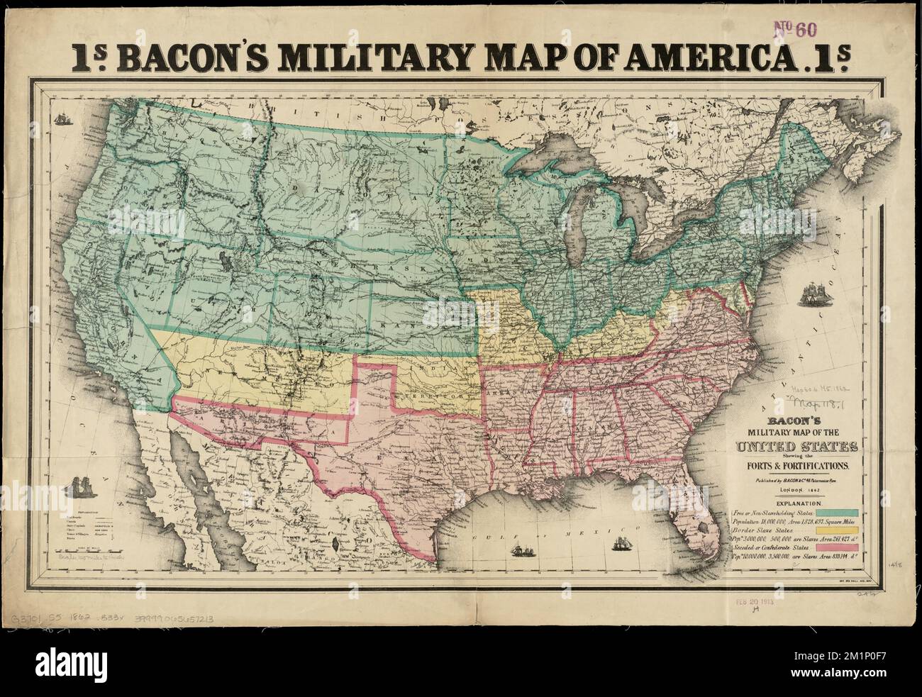 Bacon's military map of the United States shewing the forts & fortifications , Fortification, United States, Maps, United States, History, Civil War, 1861-1865, Maps Norman B. Leventhal Map Center Collection Stock Photohttps://www.alamy.com/image-license-details/?v=1https://www.alamy.com/bacons-military-map-of-the-united-states-shewing-the-forts-fortifications-fortification-united-states-maps-united-states-history-civil-war-1861-1865-maps-norman-b-leventhal-map-center-collection-image500198699.html
RM2M1P0F7–Bacon's military map of the United States shewing the forts & fortifications , Fortification, United States, Maps, United States, History, Civil War, 1861-1865, Maps Norman B. Leventhal Map Center Collection
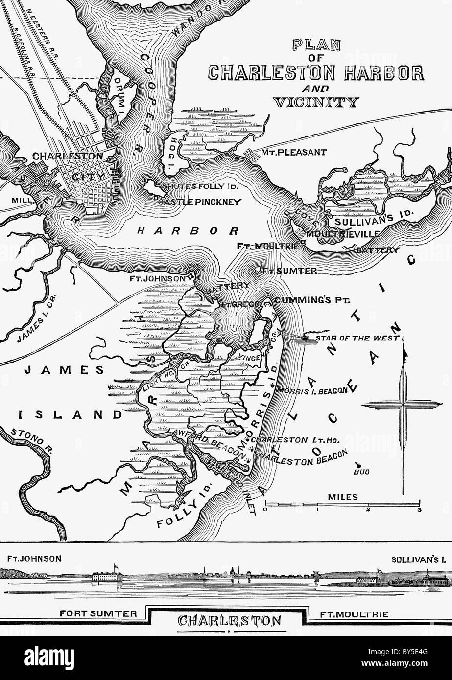 The map shows the layout of Charles Harbor in South Carolina in January of 1861. Stock Photohttps://www.alamy.com/image-license-details/?v=1https://www.alamy.com/stock-photo-the-map-shows-the-layout-of-charles-harbor-in-south-carolina-in-january-33926944.html
RFBY5E4G–The map shows the layout of Charles Harbor in South Carolina in January of 1861.
 Pictorially enhanced map with hotel - 1861 Stock Photohttps://www.alamy.com/image-license-details/?v=1https://www.alamy.com/pictorially-enhanced-map-with-hotel-1861-image370880862.html
RM2CFB292–Pictorially enhanced map with hotel - 1861
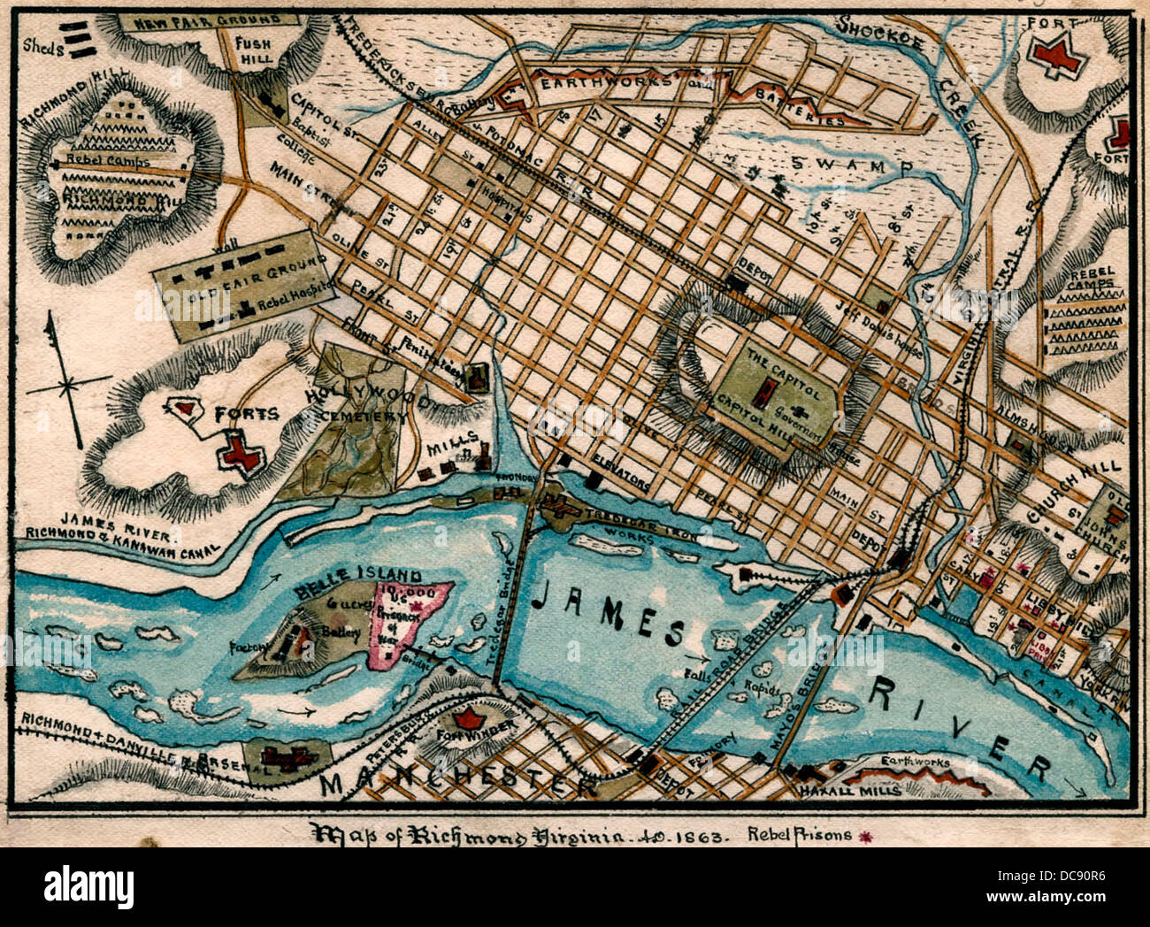 Map of Richmond, Virginia during USA Civil War, 1863. Stock Photohttps://www.alamy.com/image-license-details/?v=1https://www.alamy.com/stock-photo-map-of-richmond-virginia-during-usa-civil-war-1863-59205194.html
RMDC90R6–Map of Richmond, Virginia during USA Civil War, 1863.
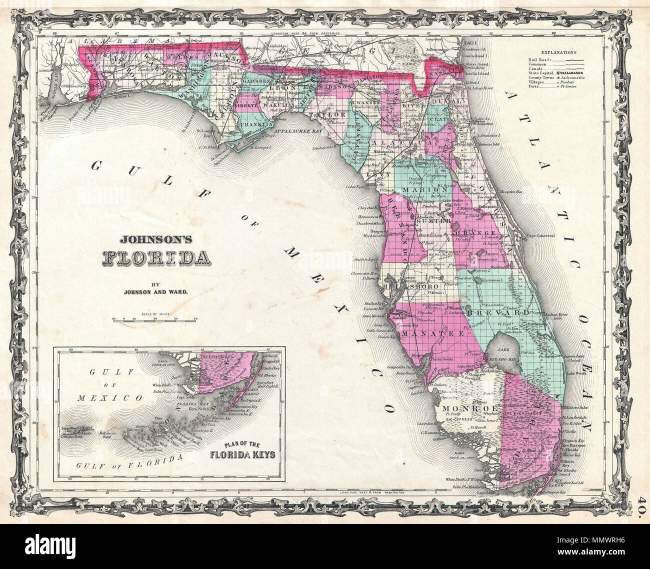 . English: A beautiful example of A. J. Johnson’s 1862 map of Florida. This rare map offers a fascinating snapshot of this secessionist state shortly following the outbreak of the American Civil War. Map shows the state in full with color coding according to county. Cartographically this map is probably based on U.S. Land Survey charts commissioned in the mid 1850s. Makes numerous references to American Indian tribes and to forts and battles sites related to the Seminole Wars. Notes Lake Okeechobee, the Everglades, the Indian Hunting Grounds, Biscayne Bay, Tampa Bay and the Okefenokee Swamp. Stock Photohttps://www.alamy.com/image-license-details/?v=1https://www.alamy.com/english-a-beautiful-example-of-a-j-johnsons-1862-map-of-florida-this-rare-map-offers-a-fascinating-snapshot-of-this-secessionist-state-shortly-following-the-outbreak-of-the-american-civil-war-map-shows-the-state-in-full-with-color-coding-according-to-county-cartographically-this-map-is-probably-based-on-us-land-survey-charts-commissioned-in-the-mid-1850s-makes-numerous-references-to-american-indian-tribes-and-to-forts-and-battles-sites-related-to-the-seminole-wars-notes-lake-okeechobee-the-everglades-the-indian-hunting-grounds-biscayne-bay-tampa-bay-and-the-okefenokee-swamp-image184964114.html
RMMMWRH6–. English: A beautiful example of A. J. Johnson’s 1862 map of Florida. This rare map offers a fascinating snapshot of this secessionist state shortly following the outbreak of the American Civil War. Map shows the state in full with color coding according to county. Cartographically this map is probably based on U.S. Land Survey charts commissioned in the mid 1850s. Makes numerous references to American Indian tribes and to forts and battles sites related to the Seminole Wars. Notes Lake Okeechobee, the Everglades, the Indian Hunting Grounds, Biscayne Bay, Tampa Bay and the Okefenokee Swamp.
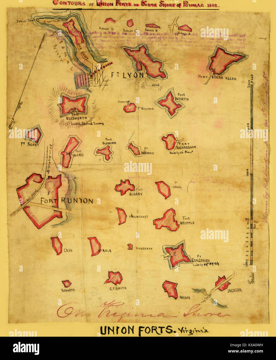 Contours of Union forts on south side of Potomac, 1862 Stock Photohttps://www.alamy.com/image-license-details/?v=1https://www.alamy.com/stock-photo-contours-of-union-forts-on-south-side-of-potomac-1862-171094605.html
RMKXA0WH–Contours of Union forts on south side of Potomac, 1862
 Charleston Harbor with Islands Stock Photohttps://www.alamy.com/image-license-details/?v=1https://www.alamy.com/stock-photo-charleston-harbor-with-islands-171094714.html
RMKXA11E–Charleston Harbor with Islands
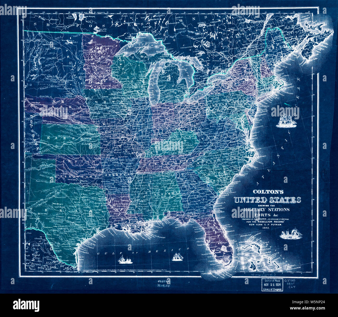 Civil War Maps 0316 Colton's United States shewing the military stations forts c Inverted Rebuild and Repair Stock Photohttps://www.alamy.com/image-license-details/?v=1https://www.alamy.com/civil-war-maps-0316-coltons-united-states-shewing-the-military-stations-forts-c-inverted-rebuild-and-repair-image261707100.html
RMW5NP24–Civil War Maps 0316 Colton's United States shewing the military stations forts c Inverted Rebuild and Repair
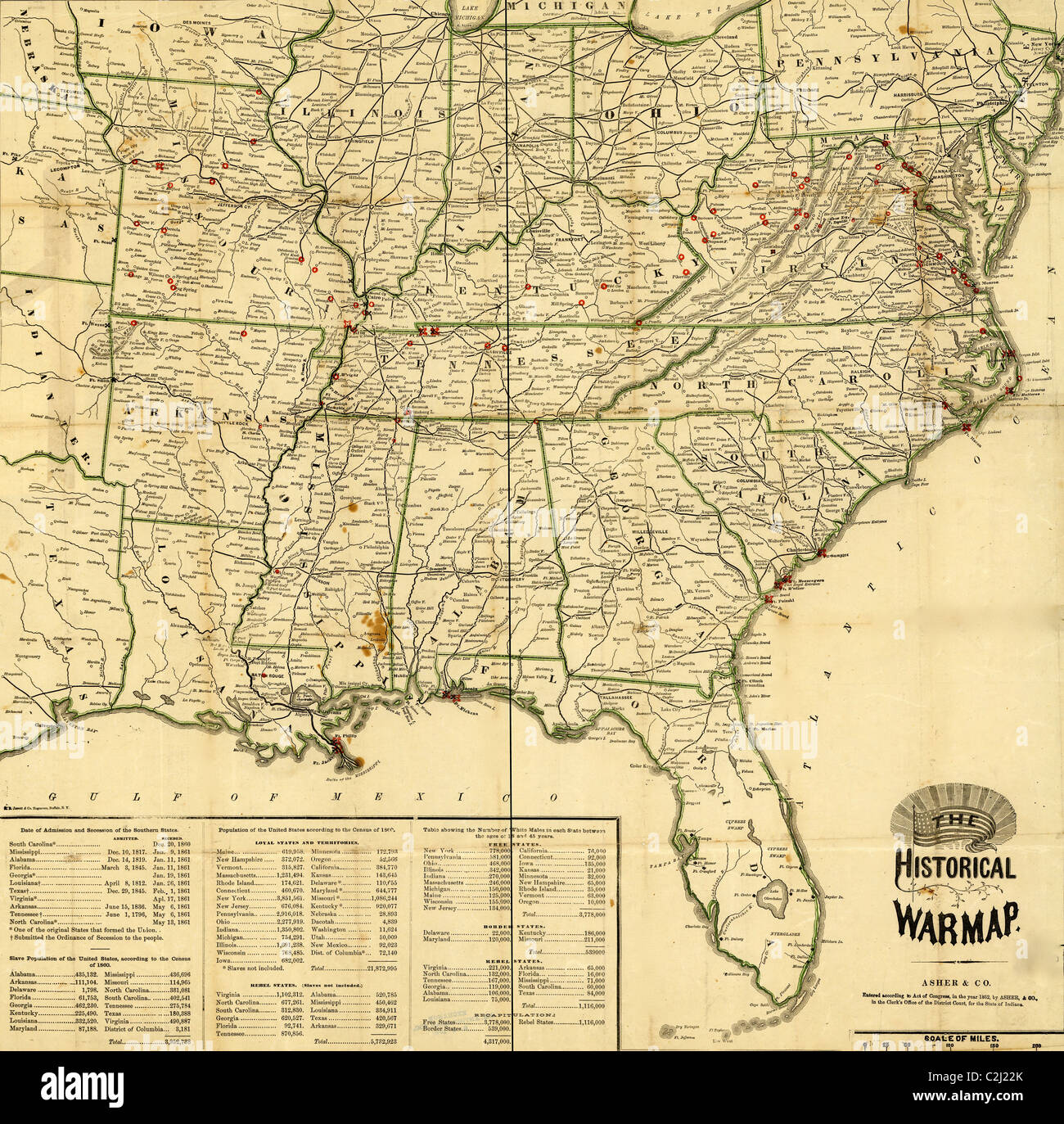 Historical War Map - 1862 Stock Photohttps://www.alamy.com/image-license-details/?v=1https://www.alamy.com/stock-photo-historical-war-map-1862-36046827.html
RMC2J22K–Historical War Map - 1862
 Civil War Maps 2144 Maps of the environs of forts Franklin Alexander and Ripley in Montgomery County Maryland Rebuild and Repair Stock Photohttps://www.alamy.com/image-license-details/?v=1https://www.alamy.com/civil-war-maps-2144-maps-of-the-environs-of-forts-franklin-alexander-and-ripley-in-montgomery-county-maryland-rebuild-and-repair-image261991668.html
RMW66N18–Civil War Maps 2144 Maps of the environs of forts Franklin Alexander and Ripley in Montgomery County Maryland Rebuild and Repair
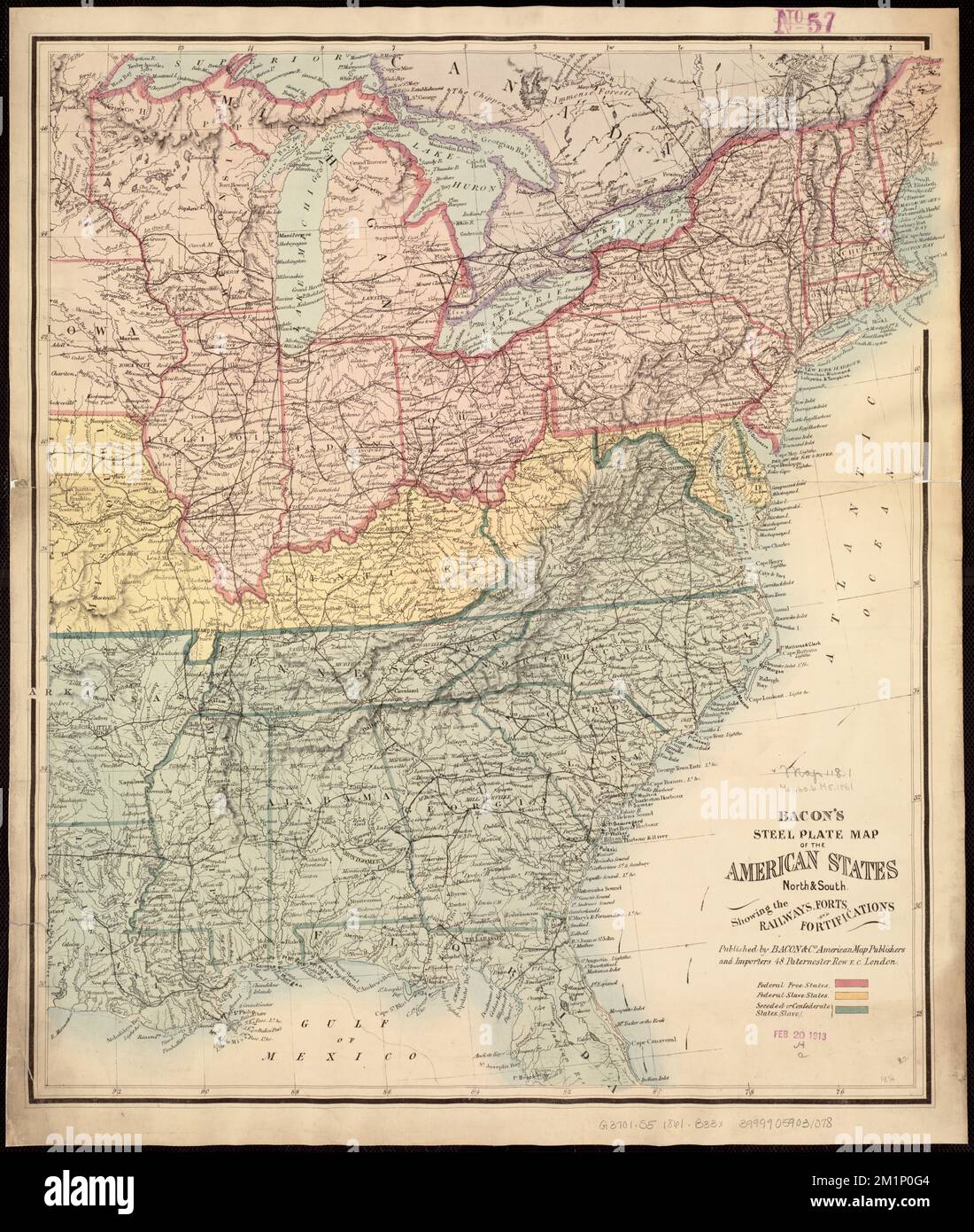 Bacon's steel plate map of the American states north & south : showing the railways , forts, and fortifications , United States, History, Civil War, 1861-1865, Maps Norman B. Leventhal Map Center Collection Stock Photohttps://www.alamy.com/image-license-details/?v=1https://www.alamy.com/bacons-steel-plate-map-of-the-american-states-north-south-showing-the-railways-forts-and-fortifications-united-states-history-civil-war-1861-1865-maps-norman-b-leventhal-map-center-collection-image500198724.html
RM2M1P0G4–Bacon's steel plate map of the American states north & south : showing the railways , forts, and fortifications , United States, History, Civil War, 1861-1865, Maps Norman B. Leventhal Map Center Collection
 . Young folk's history of the war for the union . him-self with a gun, saying in anote which he left, I can-not survive the liberties ofmy country. His shot wasfollowed by shot and shellfrom Moultrie and the otherbatteries, until the firing be-The Civil War had begun.The situation of Charleston harbor and the forts and batter-ies by which it was then defended Avill be best understood fromthe map. It will be seen that Fort Sumter lies in the mouthof the harbor, about three and a half miles from Charleston,and nearly in the middle of a line drawn east and west betweenForts Moultrie and Johnson, Stock Photohttps://www.alamy.com/image-license-details/?v=1https://www.alamy.com/young-folks-history-of-the-war-for-the-union-him-self-with-a-gun-saying-in-anote-which-he-left-i-can-not-survive-the-liberties-ofmy-country-his-shot-wasfollowed-by-shot-and-shellfrom-moultrie-and-the-otherbatteries-until-the-firing-be-the-civil-war-had-begunthe-situation-of-charleston-harbor-and-the-forts-and-batter-ies-by-which-it-was-then-defended-avill-be-best-understood-fromthe-map-it-will-be-seen-that-fort-sumter-lies-in-the-mouthof-the-harbor-about-three-and-a-half-miles-from-charlestonand-nearly-in-the-middle-of-a-line-drawn-east-and-west-betweenforts-moultrie-and-johnson-image371692150.html
RM2CGM13J–. Young folk's history of the war for the union . him-self with a gun, saying in anote which he left, I can-not survive the liberties ofmy country. His shot wasfollowed by shot and shellfrom Moultrie and the otherbatteries, until the firing be-The Civil War had begun.The situation of Charleston harbor and the forts and batter-ies by which it was then defended Avill be best understood fromthe map. It will be seen that Fort Sumter lies in the mouthof the harbor, about three and a half miles from Charleston,and nearly in the middle of a line drawn east and west betweenForts Moultrie and Johnson,
 Statistical and military map of the middle and southern states. - 1861 Stock Photohttps://www.alamy.com/image-license-details/?v=1https://www.alamy.com/statistical-and-military-map-of-the-middle-and-southern-states-1861-image370870365.html
RM2CFAGX5–Statistical and military map of the middle and southern states. - 1861
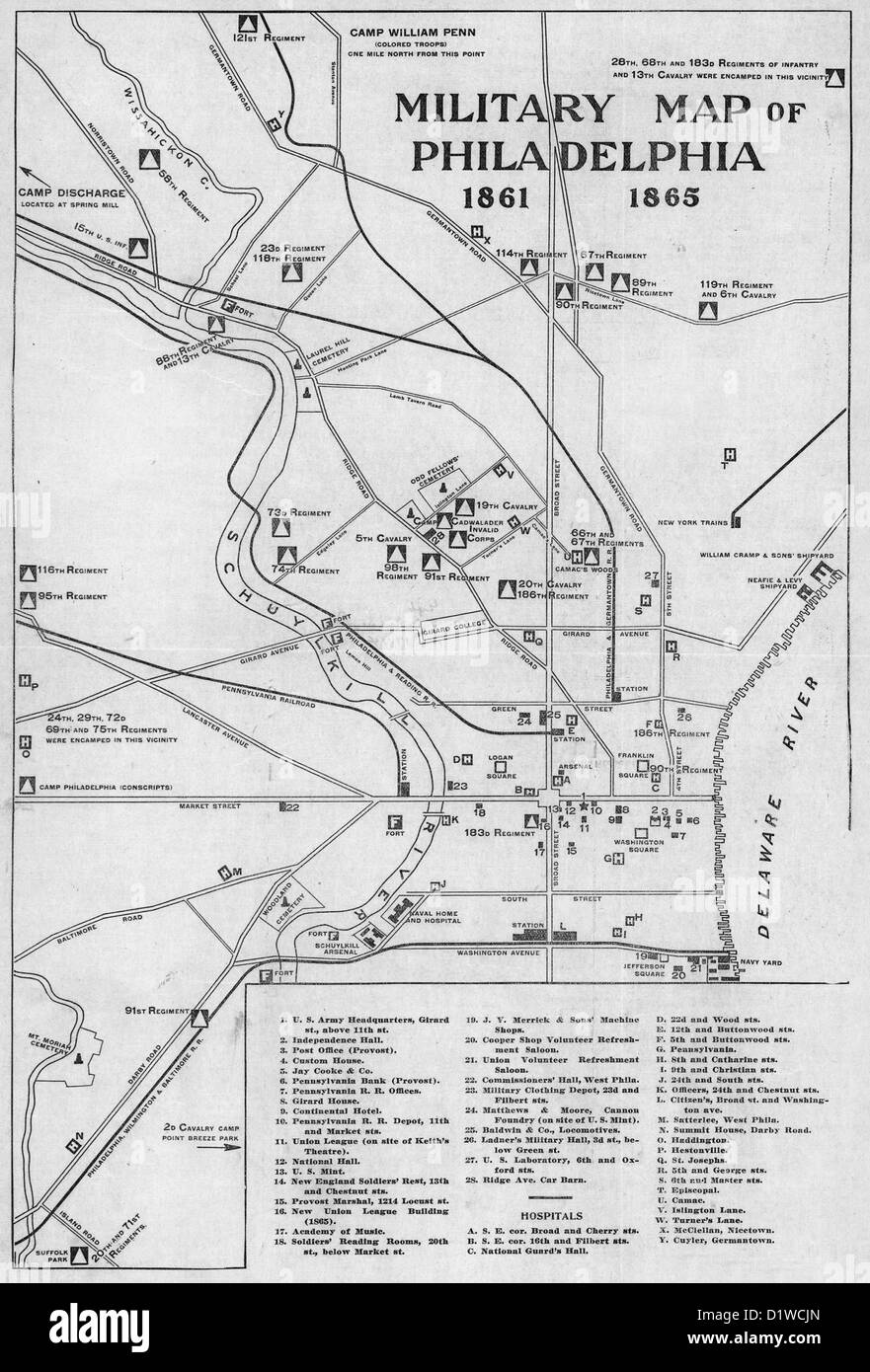 Military Map of Philadelphia, Pennsylvania, 1861-1865, USA Civil War Stock Photohttps://www.alamy.com/image-license-details/?v=1https://www.alamy.com/stock-photo-military-map-of-philadelphia-pennsylvania-1861-1865-usa-civil-war-52804493.html
RMD1WCJN–Military Map of Philadelphia, Pennsylvania, 1861-1865, USA Civil War
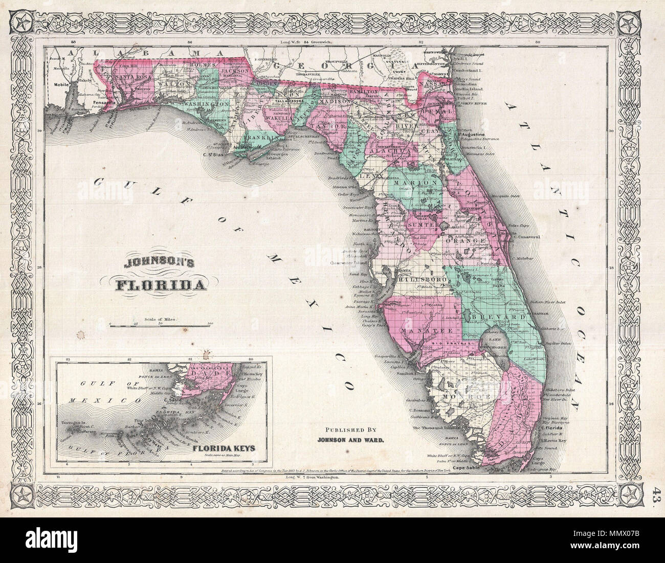 . English: A beautiful example of A. J. Johnson’s 1866 map of Florida. This rare map offers a fascinating snapshot of this secessionist state shortly following the close of the American Civil War. Map shows the state in full with color coding according to county. Cartographically this map is probably based on U.S. Land Survey charts commissioned in the mid-1850s. Makes numerous references to American Indian tribes and to forts and battles sites related to the Seminole Wars. Notes Lake Okeechobee, the Everglades, the Indian Hunting Grounds, Biscayne Bay, Tampa Bay and the Okefenokee Swamp. Als Stock Photohttps://www.alamy.com/image-license-details/?v=1https://www.alamy.com/english-a-beautiful-example-of-a-j-johnsons-1866-map-of-florida-this-rare-map-offers-a-fascinating-snapshot-of-this-secessionist-state-shortly-following-the-close-of-the-american-civil-war-map-shows-the-state-in-full-with-color-coding-according-to-county-cartographically-this-map-is-probably-based-on-us-land-survey-charts-commissioned-in-the-mid-1850s-makes-numerous-references-to-american-indian-tribes-and-to-forts-and-battles-sites-related-to-the-seminole-wars-notes-lake-okeechobee-the-everglades-the-indian-hunting-grounds-biscayne-bay-tampa-bay-and-the-okefenokee-swamp-als-image184967759.html
RMMMX07B–. English: A beautiful example of A. J. Johnson’s 1866 map of Florida. This rare map offers a fascinating snapshot of this secessionist state shortly following the close of the American Civil War. Map shows the state in full with color coding according to county. Cartographically this map is probably based on U.S. Land Survey charts commissioned in the mid-1850s. Makes numerous references to American Indian tribes and to forts and battles sites related to the Seminole Wars. Notes Lake Okeechobee, the Everglades, the Indian Hunting Grounds, Biscayne Bay, Tampa Bay and the Okefenokee Swamp. Als
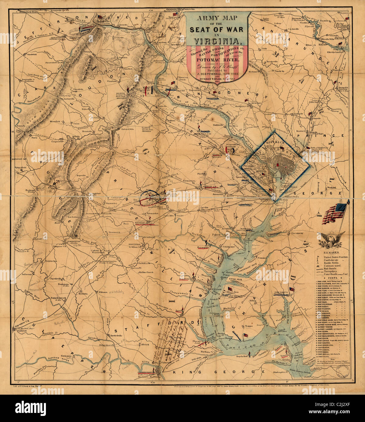 Army Map - Theatre of War - 1862 Stock Photohttps://www.alamy.com/image-license-details/?v=1https://www.alamy.com/stock-photo-army-map-theatre-of-war-1862-36047495.html
RMC2J2XF–Army Map - Theatre of War - 1862
 Civil War Maps 2144 Maps of the environs of forts Franklin Alexander and Ripley in Montgomery County Maryland Inverted Rebuild and Repair Stock Photohttps://www.alamy.com/image-license-details/?v=1https://www.alamy.com/civil-war-maps-2144-maps-of-the-environs-of-forts-franklin-alexander-and-ripley-in-montgomery-county-maryland-inverted-rebuild-and-repair-image261991614.html
RMW66MYA–Civil War Maps 2144 Maps of the environs of forts Franklin Alexander and Ripley in Montgomery County Maryland Inverted Rebuild and Repair
 Reconnoissance of the Mississippi River below Forts Jackson and St. Philip : made previous to the reduction by the U.S. Fleet, under the command of flag officer D.G. Farragut, U.S.N , Fort Jackson Region La., History, Civil War, 1861-1865, Maps, Mississippi River, History, 19th century, Maps, 1862 Norman B. Leventhal Map Center Collection Stock Photohttps://www.alamy.com/image-license-details/?v=1https://www.alamy.com/reconnoissance-of-the-mississippi-river-below-forts-jackson-and-st-philip-made-previous-to-the-reduction-by-the-us-fleet-under-the-command-of-flag-officer-dg-farragut-usn-fort-jackson-region-la-history-civil-war-1861-1865-maps-mississippi-river-history-19th-century-maps-1862-norman-b-leventhal-map-center-collection-image501432158.html
RM2M3P5RA–Reconnoissance of the Mississippi River below Forts Jackson and St. Philip : made previous to the reduction by the U.S. Fleet, under the command of flag officer D.G. Farragut, U.S.N , Fort Jackson Region La., History, Civil War, 1861-1865, Maps, Mississippi River, History, 19th century, Maps, 1862 Norman B. Leventhal Map Center Collection
 Civil War Maps 1345 Plan of the attack by gun-boats on Forts Strong and Lee Cape Fear River NC February 20th and 21st 1865 Rebuild and Repair Stock Photohttps://www.alamy.com/image-license-details/?v=1https://www.alamy.com/civil-war-maps-1345-plan-of-the-attack-by-gun-boats-on-forts-strong-and-lee-cape-fear-river-nc-february-20th-and-21st-1865-rebuild-and-repair-image261832927.html
RMW5YEFY–Civil War Maps 1345 Plan of the attack by gun-boats on Forts Strong and Lee Cape Fear River NC February 20th and 21st 1865 Rebuild and Repair
 Pocket Map of the Probable Theatre of War - 1861 Stock Photohttps://www.alamy.com/image-license-details/?v=1https://www.alamy.com/stock-photo-pocket-map-of-the-probable-theatre-of-war-1861-36047381.html
RMC2J2PD–Pocket Map of the Probable Theatre of War - 1861
 Civil War Maps 0317 Colton's United States shewing the military stations forts c Entered according to Act of Congress in the year 1855 by JH Colton Rebuild and Repair Stock Photohttps://www.alamy.com/image-license-details/?v=1https://www.alamy.com/civil-war-maps-0317-coltons-united-states-shewing-the-military-stations-forts-c-entered-according-to-act-of-congress-in-the-year-1855-by-jh-colton-rebuild-and-repair-image261707352.html
RMW5NPB4–Civil War Maps 0317 Colton's United States shewing the military stations forts c Entered according to Act of Congress in the year 1855 by JH Colton Rebuild and Repair
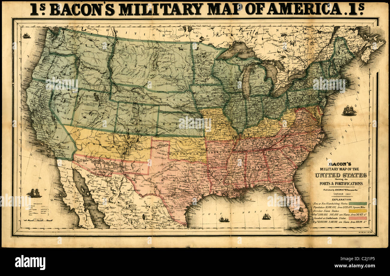 Bacon's military map of the United States showing the forts & fortifications - 1862 Stock Photohttps://www.alamy.com/image-license-details/?v=1https://www.alamy.com/stock-photo-bacons-military-map-of-the-united-states-showing-the-forts-fortifications-36046589.html
RMC2J1P5–Bacon's military map of the United States showing the forts & fortifications - 1862
 Civil War Maps 1345 Plan of the attack by gun-boats on Forts Strong and Lee Cape Fear River NC February 20th and 21st 1865 Inverted Rebuild and Repair Stock Photohttps://www.alamy.com/image-license-details/?v=1https://www.alamy.com/civil-war-maps-1345-plan-of-the-attack-by-gun-boats-on-forts-strong-and-lee-cape-fear-river-nc-february-20th-and-21st-1865-inverted-rebuild-and-repair-image261832899.html
RMW5YEEY–Civil War Maps 1345 Plan of the attack by gun-boats on Forts Strong and Lee Cape Fear River NC February 20th and 21st 1865 Inverted Rebuild and Repair
 . Abraham Lincoln and the battles of the Civil War . THIS nar-rative willbe occupiedwith the oper-ations of the RIVER-SIDE INTERIOR OF FORT ST. PHILIP, o. , ^j jvj er Defense gun-boats, and especially with themovements of my vessel, the Governor Moore,and without particular reference to the forts.Xo men ever endured greater hardships,privations, and sufferings than the garrison The top of the map is -west.. POSITIONS OF Till • ;v. FLEET AND of TIIF. HOBTAK-BOATS BEFORE THE RUNNING 01 THEFLEET.— EDITOR. of Fort Jackson during the eight days andnights of the bombardment, when more thanfourteen h Stock Photohttps://www.alamy.com/image-license-details/?v=1https://www.alamy.com/abraham-lincoln-and-the-battles-of-the-civil-war-this-nar-rative-willbe-occupiedwith-the-oper-ations-of-the-river-side-interior-of-fort-st-philip-o-j-jvj-er-defense-gun-boats-and-especially-with-themovements-of-my-vessel-the-governor-mooreand-without-particular-reference-to-the-fortsxo-men-ever-endured-greater-hardshipsprivations-and-sufferings-than-the-garrison-the-top-of-the-map-is-west-positions-of-till-v-fleet-and-of-tiif-hobtak-boats-before-the-running-01-thefleet-editor-of-fort-jackson-during-the-eight-days-andnights-of-the-bombardment-when-more-thanfourteen-h-image371657856.html
RM2CGJDAT–. Abraham Lincoln and the battles of the Civil War . THIS nar-rative willbe occupiedwith the oper-ations of the RIVER-SIDE INTERIOR OF FORT ST. PHILIP, o. , ^j jvj er Defense gun-boats, and especially with themovements of my vessel, the Governor Moore,and without particular reference to the forts.Xo men ever endured greater hardships,privations, and sufferings than the garrison The top of the map is -west.. POSITIONS OF Till • ;v. FLEET AND of TIIF. HOBTAK-BOATS BEFORE THE RUNNING 01 THEFLEET.— EDITOR. of Fort Jackson during the eight days andnights of the bombardment, when more thanfourteen h
 Civil War Maps 0317 Colton's United States shewing the military stations forts c Entered according to Act of Congress in the year 1855 by JH Colton Inverted Rebuild and Repair Stock Photohttps://www.alamy.com/image-license-details/?v=1https://www.alamy.com/civil-war-maps-0317-coltons-united-states-shewing-the-military-stations-forts-c-entered-according-to-act-of-congress-in-the-year-1855-by-jh-colton-inverted-rebuild-and-repair-image261707325.html
RMW5NPA5–Civil War Maps 0317 Colton's United States shewing the military stations forts c Entered according to Act of Congress in the year 1855 by JH Colton Inverted Rebuild and Repair
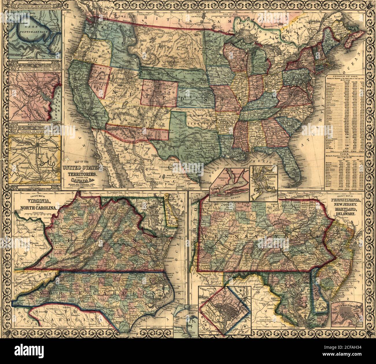 Map of the United States & Its Territories - 1861 Stock Photohttps://www.alamy.com/image-license-details/?v=1https://www.alamy.com/map-of-the-united-states-its-territories-1861-image370870504.html
RM2CFAH34–Map of the United States & Its Territories - 1861
 Civil War Maps 1243 Part of Charleston Harbor embracing forts Moultrie Sumter Johnson and Castle Pinckney also Sullivan James Morris islands and showing the position of the Star of the West when fired into Inverted Stock Photohttps://www.alamy.com/image-license-details/?v=1https://www.alamy.com/civil-war-maps-1243-part-of-charleston-harbor-embracing-forts-moultrie-sumter-johnson-and-castle-pinckney-also-sullivan-james-morris-islands-and-showing-the-position-of-the-star-of-the-west-when-fired-into-inverted-image261829273.html
RMW5Y9WD–Civil War Maps 1243 Part of Charleston Harbor embracing forts Moultrie Sumter Johnson and Castle Pinckney also Sullivan James Morris islands and showing the position of the Star of the West when fired into Inverted
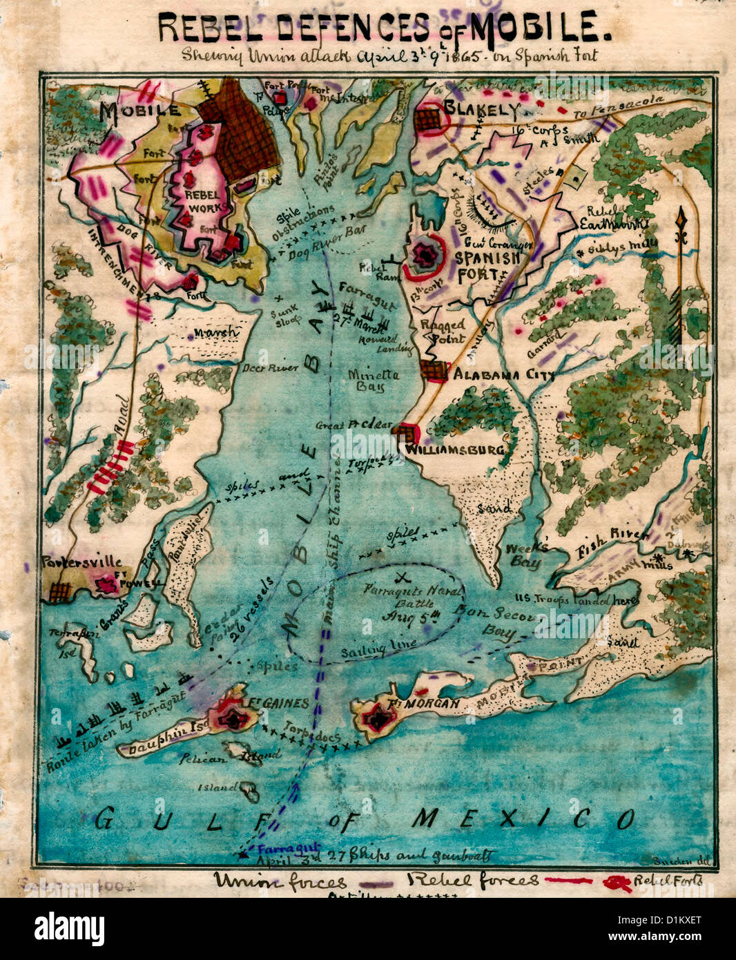 MAP Rebel defenses of Mobile Bay, Alabama, showing Union attack April 3rd-9th 1865 on Spanish Fort. USA Civil War Stock Photohttps://www.alamy.com/image-license-details/?v=1https://www.alamy.com/stock-photo-map-rebel-defenses-of-mobile-bay-alabama-showing-union-attack-april-52683648.html
RMD1KXET–MAP Rebel defenses of Mobile Bay, Alabama, showing Union attack April 3rd-9th 1865 on Spanish Fort. USA Civil War
 Civil War Maps 1230 Our naval and military operations at a glance The coast and land line of the rebellious states-the Union blockade of the Atlantic and Gulf coast-the rebel batteries on the Mississippi-the forts o Stock Photohttps://www.alamy.com/image-license-details/?v=1https://www.alamy.com/civil-war-maps-1230-our-naval-and-military-operations-at-a-glance-the-coast-and-land-line-of-the-rebellious-states-the-union-blockade-of-the-atlantic-and-gulf-coast-the-rebel-batteries-on-the-mississippi-the-forts-o-image261827785.html
RMW5Y809–Civil War Maps 1230 Our naval and military operations at a glance The coast and land line of the rebellious states-the Union blockade of the Atlantic and Gulf coast-the rebel batteries on the Mississippi-the forts o
 . English: A scarce and extremely attractive pocket map of the United States by J. H. Colton. This map was issued in 1862, in the midst of the Civil War, for inclusion in Victor’s History of the Southern Rebellion . Depicts the United States as far west as Texas and Colorado. Features a distended Nebraska, no Wyoming, and a large Dakota Territory. Virginia is undivided. Extends south as far as the Bahamas and the Florida Keys. Shows the Pony Express Route, the U.S. Mail Route, and the tracks of various Civil War military campaigns. Forts are indicated with little flags. Four sailing/steam shi Stock Photohttps://www.alamy.com/image-license-details/?v=1https://www.alamy.com/english-a-scarce-and-extremely-attractive-pocket-map-of-the-united-states-by-j-h-colton-this-map-was-issued-in-1862-in-the-midst-of-the-civil-war-for-inclusion-in-victors-history-of-the-southern-rebellion-depicts-the-united-states-as-far-west-as-texas-and-colorado-features-a-distended-nebraska-no-wyoming-and-a-large-dakota-territory-virginia-is-undivided-extends-south-as-far-as-the-bahamas-and-the-florida-keys-shows-the-pony-express-route-the-us-mail-route-and-the-tracks-of-various-civil-war-military-campaigns-forts-are-indicated-with-little-flags-four-sailingsteam-shi-image184963924.html
RMMMWRAC–. English: A scarce and extremely attractive pocket map of the United States by J. H. Colton. This map was issued in 1862, in the midst of the Civil War, for inclusion in Victor’s History of the Southern Rebellion . Depicts the United States as far west as Texas and Colorado. Features a distended Nebraska, no Wyoming, and a large Dakota Territory. Virginia is undivided. Extends south as far as the Bahamas and the Florida Keys. Shows the Pony Express Route, the U.S. Mail Route, and the tracks of various Civil War military campaigns. Forts are indicated with little flags. Four sailing/steam shi
 Civil War Maps 1508 Reconnoissance of the Mississippi River below Forts Jackson and St Philip made previous to the reduction by the US Fleet under the command of flag officer DG Farragut USN Library o Rebuild and Repair Stock Photohttps://www.alamy.com/image-license-details/?v=1https://www.alamy.com/civil-war-maps-1508-reconnoissance-of-the-mississippi-river-below-forts-jackson-and-st-philip-made-previous-to-the-reduction-by-the-us-fleet-under-the-command-of-flag-officer-dg-farragut-usn-library-o-rebuild-and-repair-image261835248.html
RMW5YHET–Civil War Maps 1508 Reconnoissance of the Mississippi River below Forts Jackson and St Philip made previous to the reduction by the US Fleet under the command of flag officer DG Farragut USN Library o Rebuild and Repair
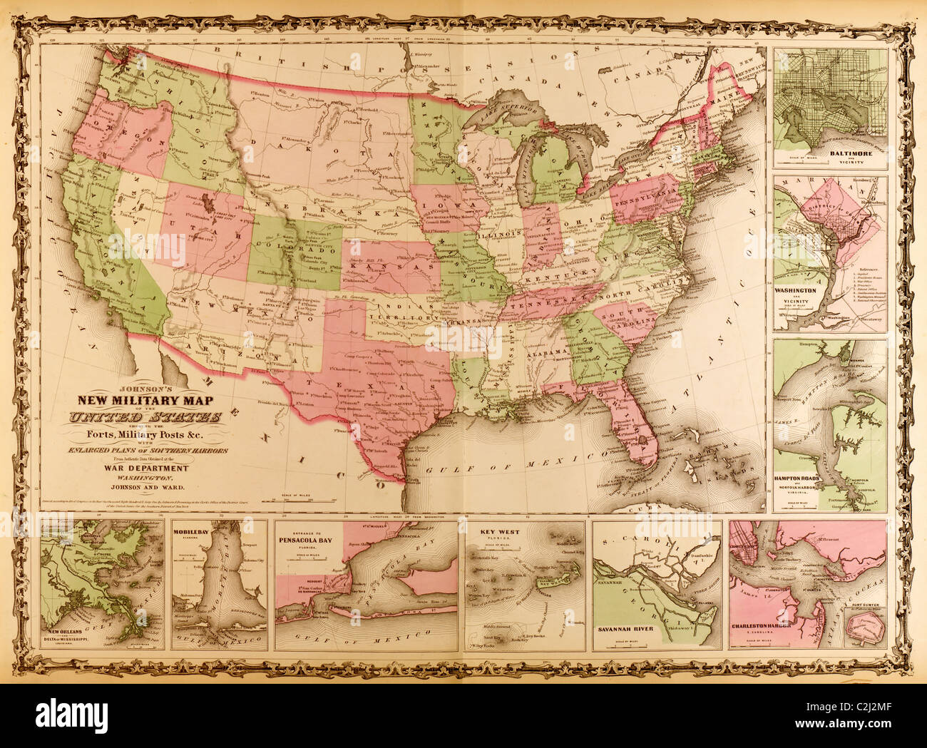 Military Map of the United states - 1863 Stock Photohttps://www.alamy.com/image-license-details/?v=1https://www.alamy.com/stock-photo-military-map-of-the-united-states-1863-36047327.html
RMC2J2MF–Military Map of the United states - 1863
 Civil War Maps 0364 Extract of military map of NE Virginia showing forts and roads Rebuild and Repair Stock Photohttps://www.alamy.com/image-license-details/?v=1https://www.alamy.com/civil-war-maps-0364-extract-of-military-map-of-ne-virginia-showing-forts-and-roads-rebuild-and-repair-image261710489.html
RMW5NXB5–Civil War Maps 0364 Extract of military map of NE Virginia showing forts and roads Rebuild and Repair
 Railway & County Map of the Southern States Stock Photohttps://www.alamy.com/image-license-details/?v=1https://www.alamy.com/stock-photo-railway-county-map-of-the-southern-states-36047214.html
RMC2J2GE–Railway & County Map of the Southern States
 Military Map of the United States - 1862 Stock Photohttps://www.alamy.com/image-license-details/?v=1https://www.alamy.com/stock-photo-military-map-of-the-united-states-1862-36047480.html
RMC2J2X0–Military Map of the United States - 1862
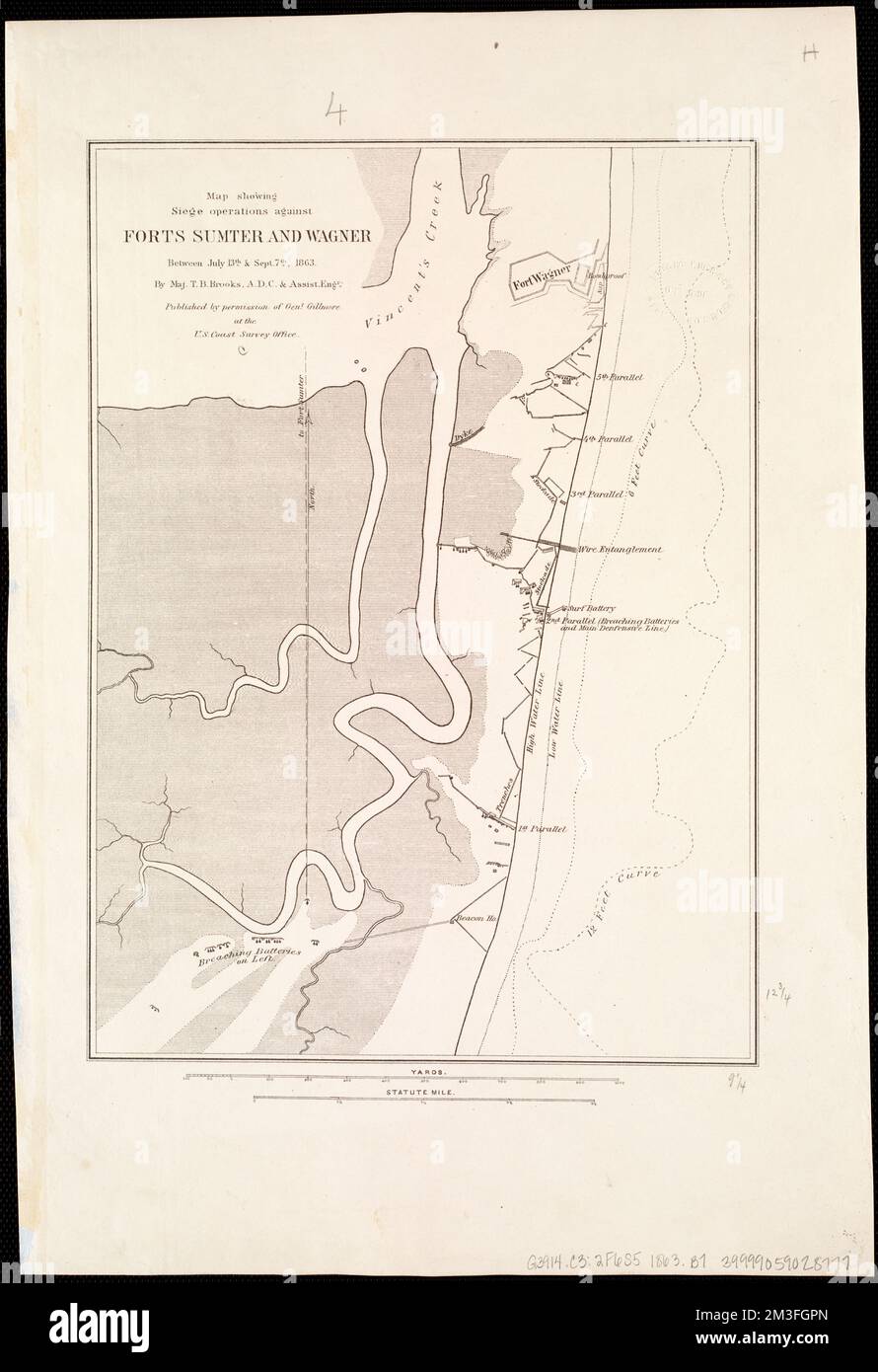 Map showing siege operations against Forts Sumter and Wagner between July 13th & Sept. 7th, 1863 , Fortification, South Carolina, Civil War, 1861-1865, Maps, Fort Sumter Charleston, S.C., History, 19th century, Maps, Fort Wagner S.C., History, 19th century, Maps Norman B. Leventhal Map Center Collection Stock Photohttps://www.alamy.com/image-license-details/?v=1https://www.alamy.com/map-showing-siege-operations-against-forts-sumter-and-wagner-between-july-13th-sept-7th-1863-fortification-south-carolina-civil-war-1861-1865-maps-fort-sumter-charleston-sc-history-19th-century-maps-fort-wagner-sc-history-19th-century-maps-norman-b-leventhal-map-center-collection-image501287101.html
RM2M3FGPN–Map showing siege operations against Forts Sumter and Wagner between July 13th & Sept. 7th, 1863 , Fortification, South Carolina, Civil War, 1861-1865, Maps, Fort Sumter Charleston, S.C., History, 19th century, Maps, Fort Wagner S.C., History, 19th century, Maps Norman B. Leventhal Map Center Collection
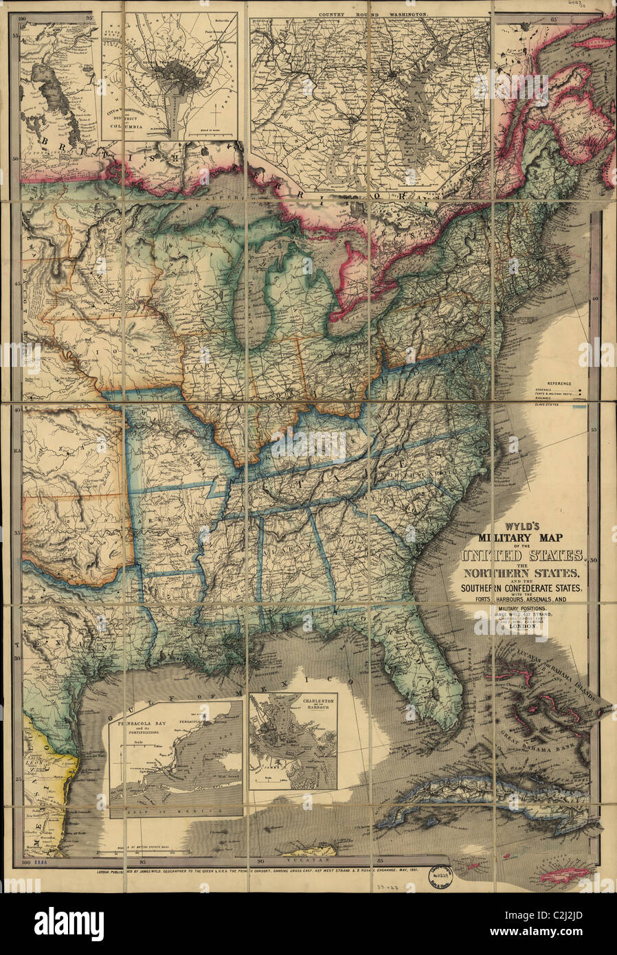 Military Map of the United states - 1861 Stock Photohttps://www.alamy.com/image-license-details/?v=1https://www.alamy.com/stock-photo-military-map-of-the-united-states-1861-36047269.html
RMC2J2JD–Military Map of the United states - 1861
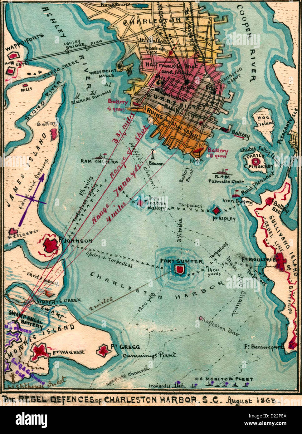 The Rebel defences of Charleston Harbor, South Carolina, August 1863, USA civil war Stock Photohttps://www.alamy.com/image-license-details/?v=1https://www.alamy.com/stock-photo-the-rebel-defences-of-charleston-harbor-south-carolina-august-1863-52921970.html
RMD22PEA–The Rebel defences of Charleston Harbor, South Carolina, August 1863, USA civil war
 Civil War Maps 0363 Extract of military map of NE Virginia showing forts and roads Rebuild and Repair Stock Photohttps://www.alamy.com/image-license-details/?v=1https://www.alamy.com/civil-war-maps-0363-extract-of-military-map-of-ne-virginia-showing-forts-and-roads-rebuild-and-repair-image261710306.html
RMW5NX4J–Civil War Maps 0363 Extract of military map of NE Virginia showing forts and roads Rebuild and Repair
 A complete map of Richmond and its fortifications within a circle of 12 miles showing the numerous forts, batteries and the range of their fire : and the various obstacles that impede the approach of the Federal army, also, the principal towns & plantations, in the immediate vicinity of Richmond, together with several of the battle fields of 1862 , Fortification, Virginia, Richmond, Maps, Richmond Va., History, Civil War, 1861-1865, Maps Norman B. Leventhal Map Center Collection Stock Photohttps://www.alamy.com/image-license-details/?v=1https://www.alamy.com/a-complete-map-of-richmond-and-its-fortifications-within-a-circle-of-12-miles-showing-the-numerous-forts-batteries-and-the-range-of-their-fire-and-the-various-obstacles-that-impede-the-approach-of-the-federal-army-also-the-principal-towns-plantations-in-the-immediate-vicinity-of-richmond-together-with-several-of-the-battle-fields-of-1862-fortification-virginia-richmond-maps-richmond-va-history-civil-war-1861-1865-maps-norman-b-leventhal-map-center-collection-image500588280.html
RM2M2BNCT–A complete map of Richmond and its fortifications within a circle of 12 miles showing the numerous forts, batteries and the range of their fire : and the various obstacles that impede the approach of the Federal army, also, the principal towns & plantations, in the immediate vicinity of Richmond, together with several of the battle fields of 1862 , Fortification, Virginia, Richmond, Maps, Richmond Va., History, Civil War, 1861-1865, Maps Norman B. Leventhal Map Center Collection
 Pictorially enhanced map with hotel - 1861 Stock Photohttps://www.alamy.com/image-license-details/?v=1https://www.alamy.com/stock-photo-pictorially-enhanced-map-with-hotel-1861-36047560.html
RMC2J30T–Pictorially enhanced map with hotel - 1861
 Civil War Maps 0364 Extract of military map of NE Virginia showing forts and roads Inverted Rebuild and Repair Stock Photohttps://www.alamy.com/image-license-details/?v=1https://www.alamy.com/civil-war-maps-0364-extract-of-military-map-of-ne-virginia-showing-forts-and-roads-inverted-rebuild-and-repair-image261710546.html
RMW5NXD6–Civil War Maps 0364 Extract of military map of NE Virginia showing forts and roads Inverted Rebuild and Repair
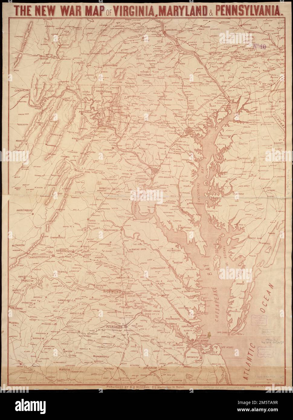 The new war map of Virginia, Maryland & Pennsylvania. General map of the Middle Atlantic and Chesapeake Bay regions showing railroads, highways, and selected forts in eastern Virginia. Does not show Civil War battle locations or troop positions. Relief shown by hachures. Printed in brown... New war map of Virginia, Maryland and Pennsylvania. New war map of Virginia, Maryland and Pennsylvania, Pennsylvania Chesapeake Bay Virginia Maryland Stock Photohttps://www.alamy.com/image-license-details/?v=1https://www.alamy.com/the-new-war-map-of-virginia-maryland-pennsylvania-general-map-of-the-middle-atlantic-and-chesapeake-bay-regions-showing-railroads-highways-and-selected-forts-in-eastern-virginia-does-not-show-civil-war-battle-locations-or-troop-positions-relief-shown-by-hachures-printed-in-brown-new-war-map-of-virginia-maryland-and-pennsylvania-new-war-map-of-virginia-maryland-and-pennsylvania-pennsylvania-chesapeake-bay-virginia-maryland-image502708915.html
RM2M5TA9R–The new war map of Virginia, Maryland & Pennsylvania. General map of the Middle Atlantic and Chesapeake Bay regions showing railroads, highways, and selected forts in eastern Virginia. Does not show Civil War battle locations or troop positions. Relief shown by hachures. Printed in brown... New war map of Virginia, Maryland and Pennsylvania. New war map of Virginia, Maryland and Pennsylvania, Pennsylvania Chesapeake Bay Virginia Maryland
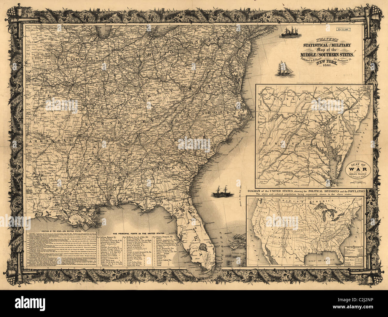 Statistical and military map of the middle and southern states. - 1861 Stock Photohttps://www.alamy.com/image-license-details/?v=1https://www.alamy.com/stock-photo-statistical-and-military-map-of-the-middle-and-southern-states-1861-36047362.html
RMC2J2NP–Statistical and military map of the middle and southern states. - 1861
 Civil War Maps 0363 Extract of military map of NE Virginia showing forts and roads Inverted Rebuild and Repair Stock Photohttps://www.alamy.com/image-license-details/?v=1https://www.alamy.com/civil-war-maps-0363-extract-of-military-map-of-ne-virginia-showing-forts-and-roads-inverted-rebuild-and-repair-image261710296.html
RMW5NX48–Civil War Maps 0363 Extract of military map of NE Virginia showing forts and roads Inverted Rebuild and Repair
 Map of the United States & Its Territories - 1861 Stock Photohttps://www.alamy.com/image-license-details/?v=1https://www.alamy.com/stock-photo-map-of-the-united-states-its-territories-1861-36047540.html
RMC2J304–Map of the United States & Its Territories - 1861
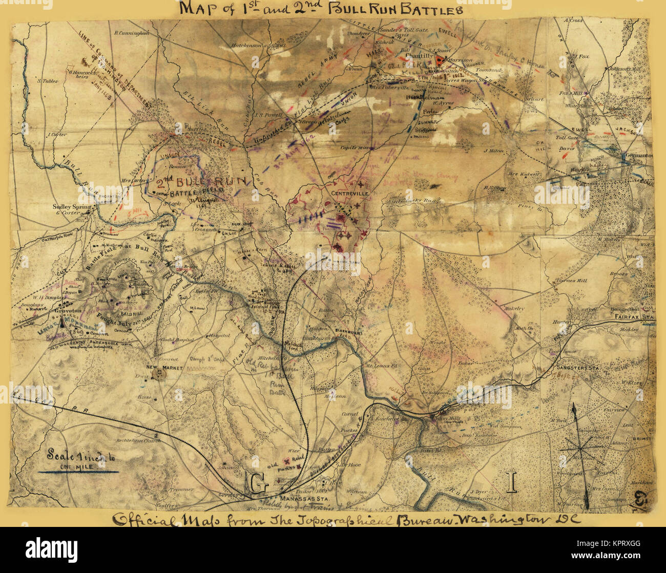 Washington, D.C., Showing the Union forts and defenses Stock Photohttps://www.alamy.com/image-license-details/?v=1https://www.alamy.com/stock-image-washington-dc-showing-the-union-forts-and-defenses-168941488.html
RMKPRXGG–Washington, D.C., Showing the Union forts and defenses
 Union forts on Maryland shore. Stock Photohttps://www.alamy.com/image-license-details/?v=1https://www.alamy.com/stock-photo-union-forts-on-maryland-shore-171094604.html
RMKXA0WG–Union forts on Maryland shore.
 Contours of Union forts on south side of Potomac, 1862 Stock Photohttps://www.alamy.com/image-license-details/?v=1https://www.alamy.com/stock-image-contours-of-union-forts-on-south-side-of-potomac-1862-168941492.html
RMKPRXGM–Contours of Union forts on south side of Potomac, 1862
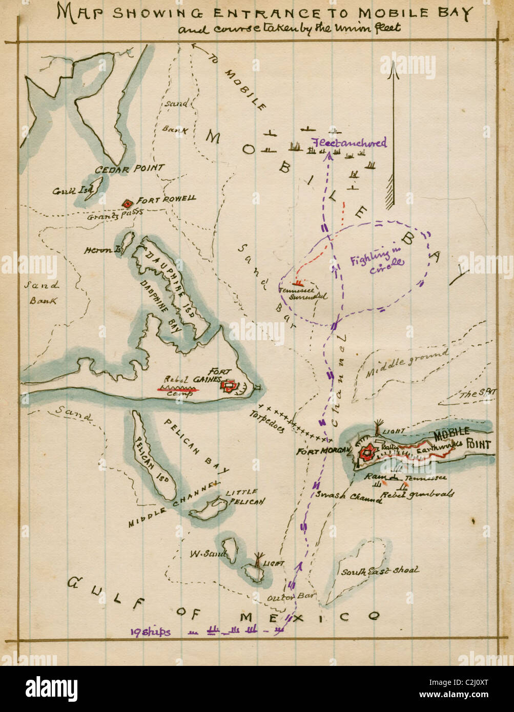 Map showing entrance to Mobile Bay and course taken by Union fleet. Stock Photohttps://www.alamy.com/image-license-details/?v=1https://www.alamy.com/stock-photo-map-showing-entrance-to-mobile-bay-and-course-taken-by-union-fleet-36045936.html
RMC2J0XT–Map showing entrance to Mobile Bay and course taken by Union fleet.