Quick filters:
Map of europe 1930s Stock Photos and Images
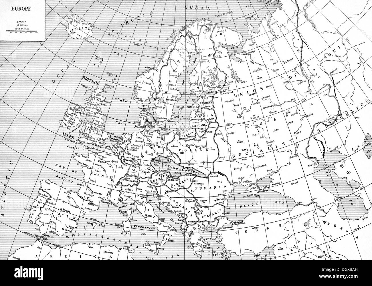 Old map of Europe, 1930's Stock Photohttps://www.alamy.com/image-license-details/?v=1https://www.alamy.com/old-map-of-europe-1930s-image62045273.html
RMDGXBAH–Old map of Europe, 1930's
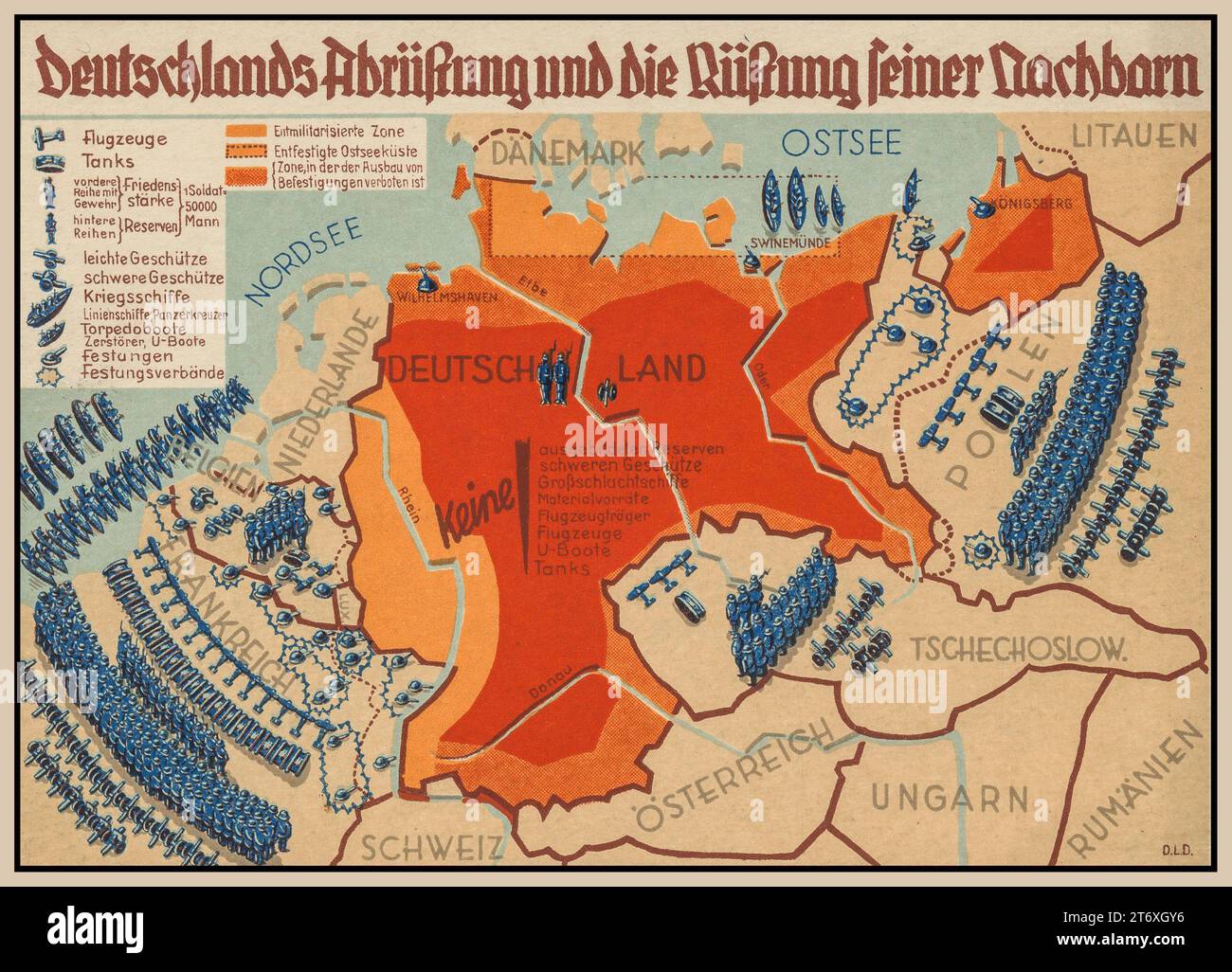 NAZI 'GERMANY DISARMAMENT AND THE ARMAMENT OF ITS NEIGHBOURS' Propaganda Nazi Germany illustration of Germany's perceived decline and the armament of its neighbours 1930s pre WW2 Stock Photohttps://www.alamy.com/image-license-details/?v=1https://www.alamy.com/nazi-germany-disarmament-and-the-armament-of-its-neighbours-propaganda-nazi-germany-illustration-of-germanys-perceived-decline-and-the-armament-of-its-neighbours-1930s-pre-ww2-image572214138.html
RM2T6XGY6–NAZI 'GERMANY DISARMAMENT AND THE ARMAMENT OF ITS NEIGHBOURS' Propaganda Nazi Germany illustration of Germany's perceived decline and the armament of its neighbours 1930s pre WW2
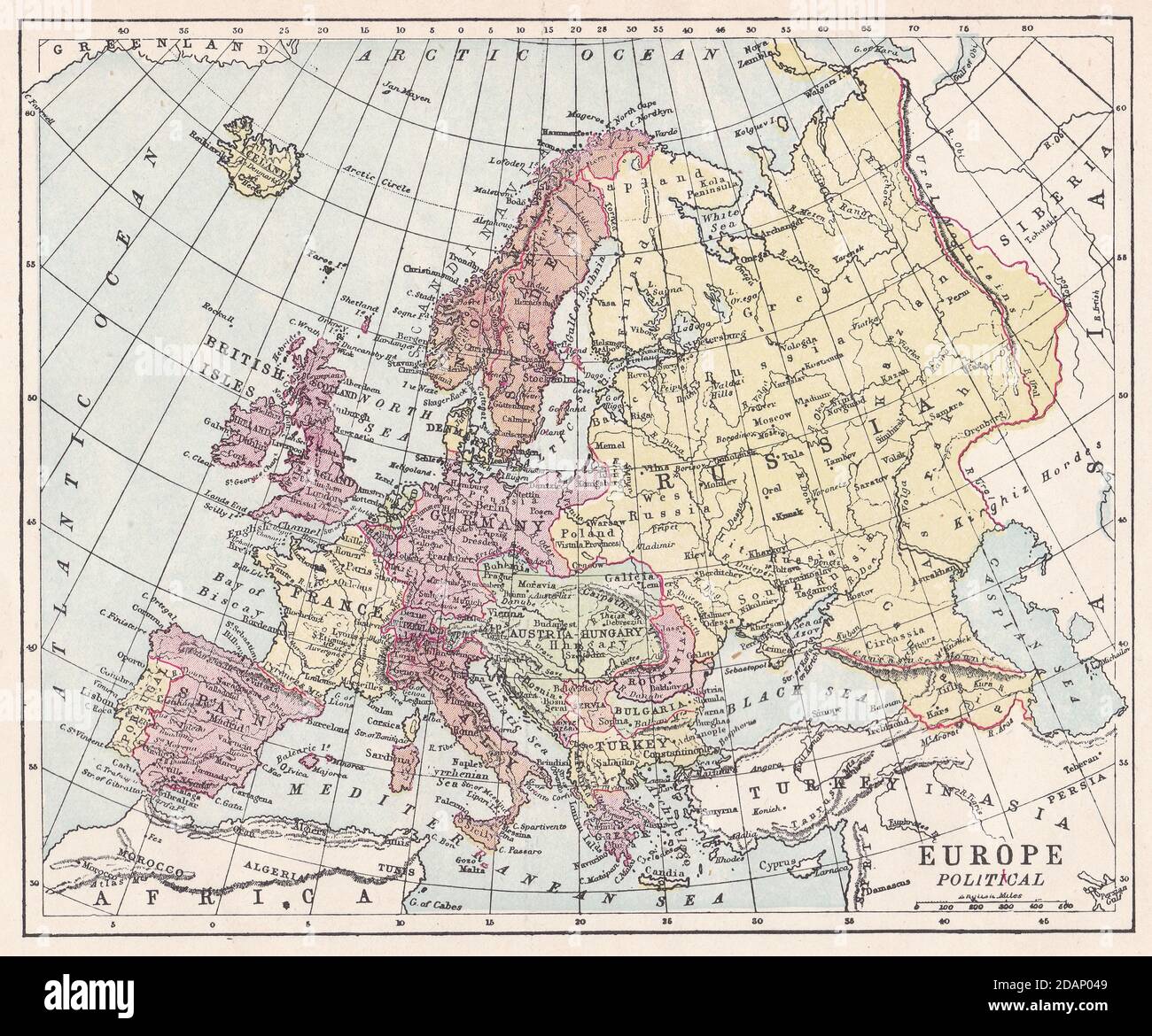 Vintage map of Europe Political 1900s. Stock Photohttps://www.alamy.com/image-license-details/?v=1https://www.alamy.com/vintage-map-of-europe-political-1900s-image385257721.html
RF2DAP049–Vintage map of Europe Political 1900s.
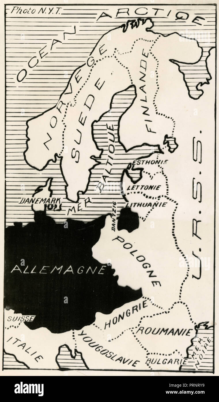 Map of North East Europe, 1930s Stock Photohttps://www.alamy.com/image-license-details/?v=1https://www.alamy.com/map-of-north-east-europe-1930s-image221141293.html
RMPRNRY9–Map of North East Europe, 1930s
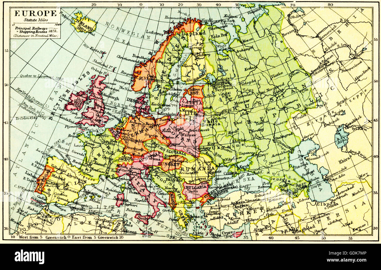 A 1930's map of Europe. Stock Photohttps://www.alamy.com/image-license-details/?v=1https://www.alamy.com/stock-photo-a-1930s-map-of-europe-111675894.html
RMGDK7MP–A 1930's map of Europe.
 ‘Germany's Disarmament and the Armament of its Neighbors ‘ 1930s Deutschlands Abrüstung und die Rüstung seiner Nachbarn. The imbalance of armed forces in Europe is the subject of this poster card. Germany's disarmament, as required by the Treaty of Versailles, left it exposed to the superior forces of its neighbors, east and west. In 1934, the year this card was produced, Adolf Hitler began unilaterally to rearm Germany and increase its military forces. Stock Photohttps://www.alamy.com/image-license-details/?v=1https://www.alamy.com/germanys-disarmament-and-the-armament-of-its-neighbors-1930s-deutschlands-abrstung-und-die-rstung-seiner-nachbarn-the-imbalance-of-armed-forces-in-europe-is-the-subject-of-this-poster-card-germanys-disarmament-as-required-by-the-treaty-of-versailles-left-it-exposed-to-the-superior-forces-of-its-neighbors-east-and-west-in-1934-the-year-this-card-was-produced-adolf-hitler-began-unilaterally-to-rearm-germany-and-increase-its-military-forces-image620815132.html
RM2Y20G10–‘Germany's Disarmament and the Armament of its Neighbors ‘ 1930s Deutschlands Abrüstung und die Rüstung seiner Nachbarn. The imbalance of armed forces in Europe is the subject of this poster card. Germany's disarmament, as required by the Treaty of Versailles, left it exposed to the superior forces of its neighbors, east and west. In 1934, the year this card was produced, Adolf Hitler began unilaterally to rearm Germany and increase its military forces.
 Vintage map of Europe 1930s. Stock Photohttps://www.alamy.com/image-license-details/?v=1https://www.alamy.com/vintage-map-of-europe-1930s-image628920480.html
RF2YF5PDM–Vintage map of Europe 1930s.
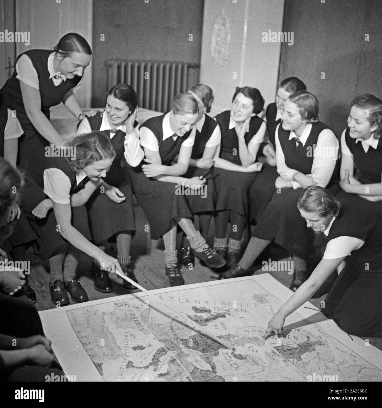 Im weltanschaulichen Unterricht diskutieren die Frauen eine Europakarte beim weiblichen Arbeitsdienst in Molkenberg bei Fürstenwalde, Deutschland 1930er Jahre. Women discussing a map of Europe in their ideological lesson at the female workforce group of Molkenberg, Germany 1930s. Stock Photohttps://www.alamy.com/image-license-details/?v=1https://www.alamy.com/im-weltanschaulichen-unterricht-diskutieren-die-frauen-eine-europakarte-beim-weiblichen-arbeitsdienst-in-molkenberg-bei-frstenwalde-deutschland-1930er-jahre-women-discussing-a-map-of-europe-in-their-ideological-lesson-at-the-female-workforce-group-of-molkenberg-germany-1930s-image328538656.html
RM2A2E6BC–Im weltanschaulichen Unterricht diskutieren die Frauen eine Europakarte beim weiblichen Arbeitsdienst in Molkenberg bei Fürstenwalde, Deutschland 1930er Jahre. Women discussing a map of Europe in their ideological lesson at the female workforce group of Molkenberg, Germany 1930s.
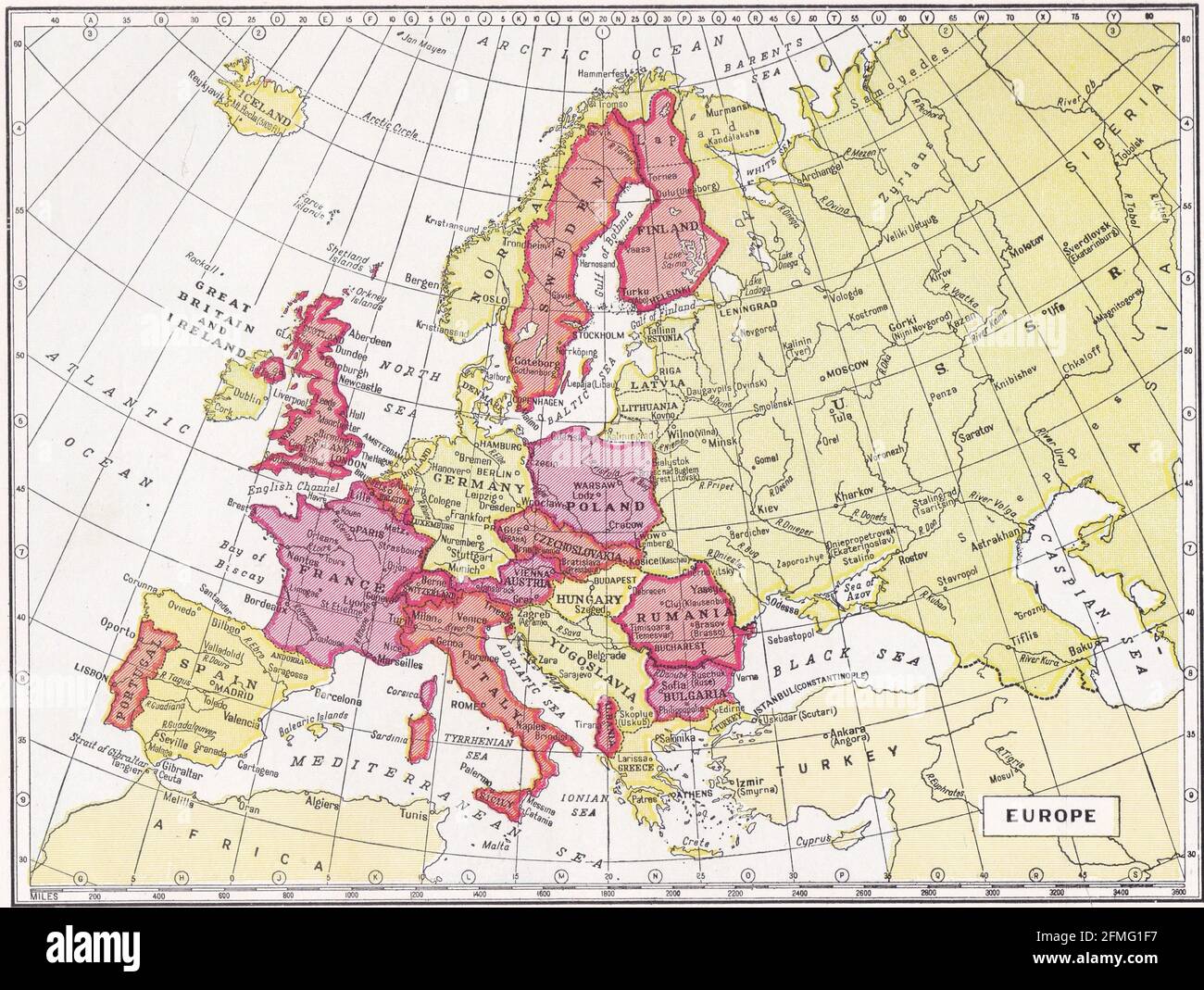 Vintage map of Europe 1930s. Stock Photohttps://www.alamy.com/image-license-details/?v=1https://www.alamy.com/vintage-map-of-europe-1930s-image425694395.html
RF2FMG1F7–Vintage map of Europe 1930s.
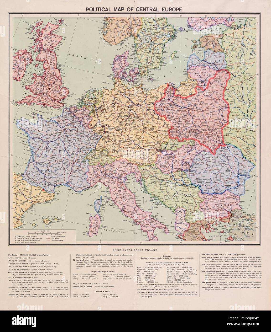 Vintage Political map of central Europe. mid 1930s . with borders of countries as they stood then Stock Photohttps://www.alamy.com/image-license-details/?v=1https://www.alamy.com/vintage-political-map-of-central-europe-mid-1930s-with-borders-of-countries-as-they-stood-then-image596402267.html
RM2WJ8D4Y–Vintage Political map of central Europe. mid 1930s . with borders of countries as they stood then
 Adolf Hitler Portrait on Map of Germany and Unification with Austria, 'Ein Volk Ein Reich Ein Fuhrer', Postcard, 1938 Stock Photohttps://www.alamy.com/image-license-details/?v=1https://www.alamy.com/stock-photo-adolf-hitler-portrait-on-map-of-germany-and-unification-with-austria-72835543.html
RME6DXDB–Adolf Hitler Portrait on Map of Germany and Unification with Austria, 'Ein Volk Ein Reich Ein Fuhrer', Postcard, 1938
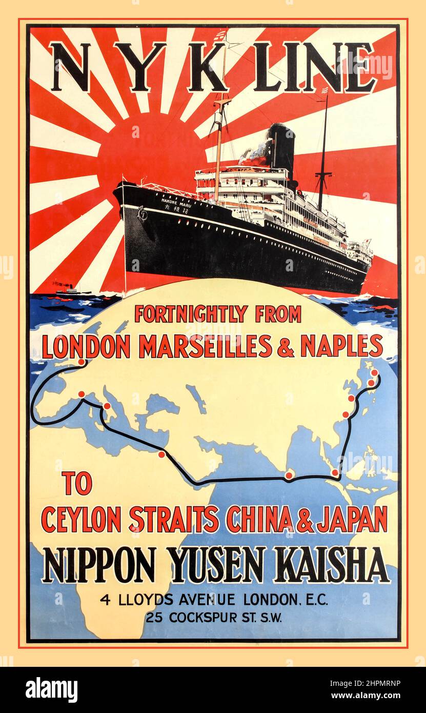 Vintage 1930s Japanese travel advertising poster for N Y K Line - Fortnightly from London Marseilles & Naples to Ceylon Straits China & Japan - Nippon Yusen Kaisha, 4 Lloyds Avenue London EC. poster featuring the Hakone Maru (1921) N.Y.K. cruise liner sailing at sea and the Rising Sun flag - the Naval Ensign of the Japanese Navy - filling the sky in the background with a world map marking the cruise route between London and Europe to India, China and Japan via the Suez Canal below The Nippon Yusen Kaisha Company London Stock Photohttps://www.alamy.com/image-license-details/?v=1https://www.alamy.com/vintage-1930s-japanese-travel-advertising-poster-for-n-y-k-line-fortnightly-from-london-marseilles-naples-to-ceylon-straits-china-japan-nippon-yusen-kaisha-4-lloyds-avenue-london-ec-poster-featuring-the-hakone-maru-1921-nyk-cruise-liner-sailing-at-sea-and-the-rising-sun-flag-the-naval-ensign-of-the-japanese-navy-filling-the-sky-in-the-background-with-a-world-map-marking-the-cruise-route-between-london-and-europe-to-india-china-and-japan-via-the-suez-canal-below-the-nippon-yusen-kaisha-company-london-image461449682.html
RM2HPMRNP–Vintage 1930s Japanese travel advertising poster for N Y K Line - Fortnightly from London Marseilles & Naples to Ceylon Straits China & Japan - Nippon Yusen Kaisha, 4 Lloyds Avenue London EC. poster featuring the Hakone Maru (1921) N.Y.K. cruise liner sailing at sea and the Rising Sun flag - the Naval Ensign of the Japanese Navy - filling the sky in the background with a world map marking the cruise route between London and Europe to India, China and Japan via the Suez Canal below The Nippon Yusen Kaisha Company London
 Map of central Europe headline and article in the Daily Mail (replica) 18th September 1939, at the start of World War Two. Stock Photohttps://www.alamy.com/image-license-details/?v=1https://www.alamy.com/map-of-central-europe-headline-and-article-in-the-daily-mail-replica-18th-september-1939-at-the-start-of-world-war-two-image608959075.html
RM2XAMDEB–Map of central Europe headline and article in the Daily Mail (replica) 18th September 1939, at the start of World War Two.
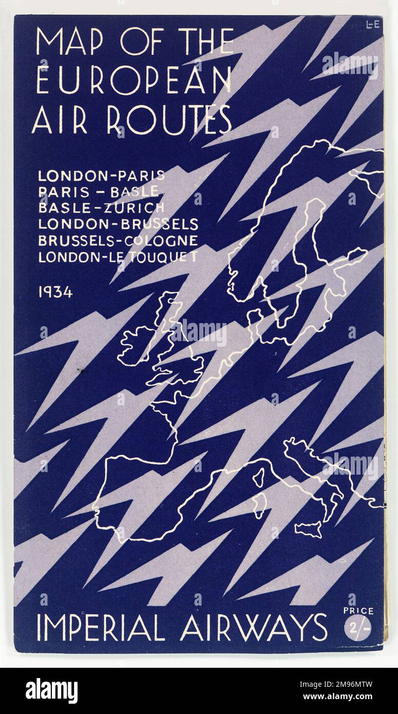 Cover design, Imperial Airways map of the European Air Routes for 1934: London-Paris, Paris-Basle, Basle-Zurich, London-Brussels, Brussels-Cologne, London-Le Touquet. With stylised birds (or planes) over a map of Europe. Stock Photohttps://www.alamy.com/image-license-details/?v=1https://www.alamy.com/cover-design-imperial-airways-map-of-the-european-air-routes-for-1934-london-paris-paris-basle-basle-zurich-london-brussels-brussels-cologne-london-le-touquet-with-stylised-birds-or-planes-over-a-map-of-europe-image504780665.html
RM2M96MTW–Cover design, Imperial Airways map of the European Air Routes for 1934: London-Paris, Paris-Basle, Basle-Zurich, London-Brussels, Brussels-Cologne, London-Le Touquet. With stylised birds (or planes) over a map of Europe.
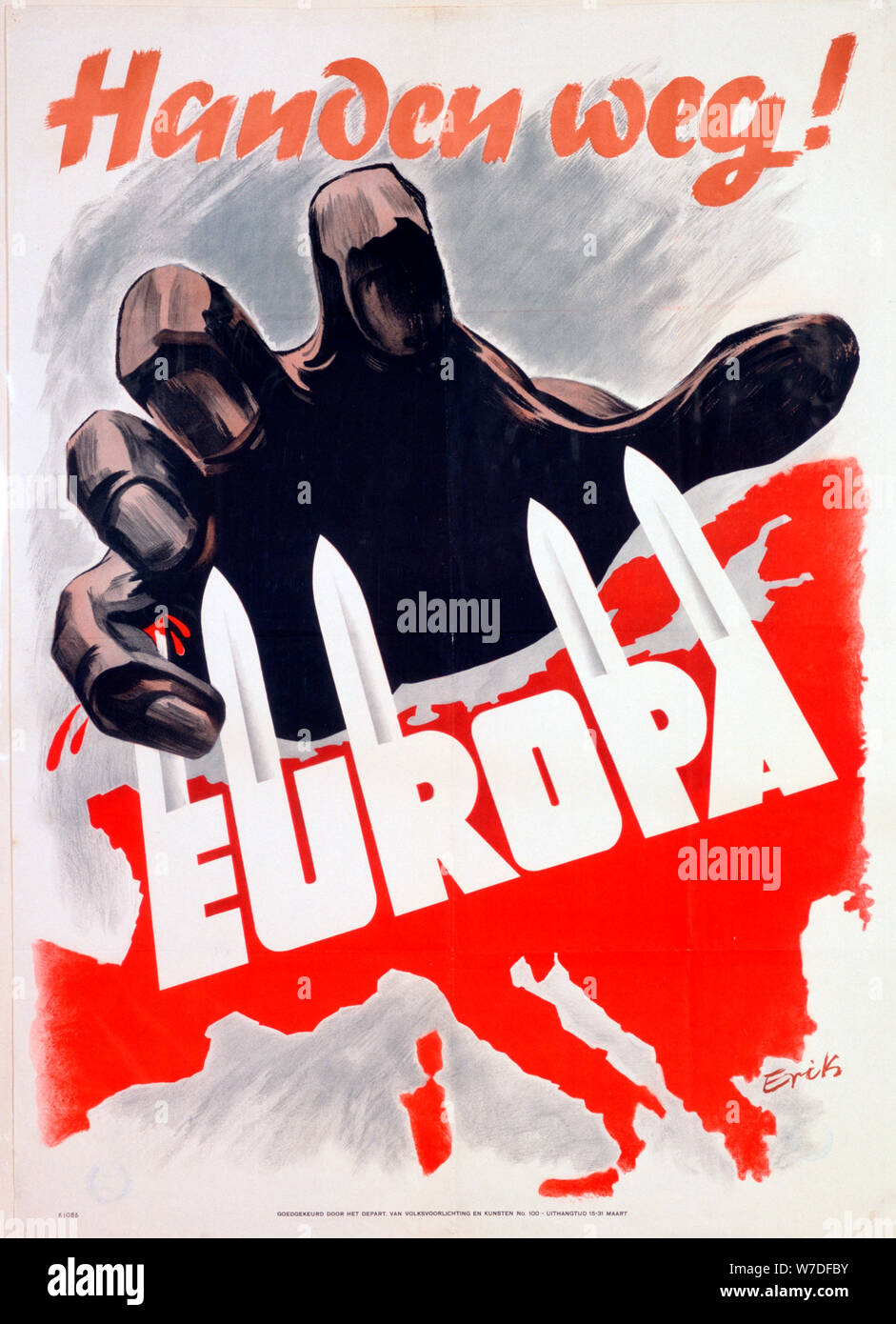 German anti-communist propaganda poster, c1939-c1945. Artist: Erik Stock Photohttps://www.alamy.com/image-license-details/?v=1https://www.alamy.com/german-anti-communist-propaganda-poster-c1939-c1945-artist-erik-image262755583.html
RMW7DFBY–German anti-communist propaganda poster, c1939-c1945. Artist: Erik
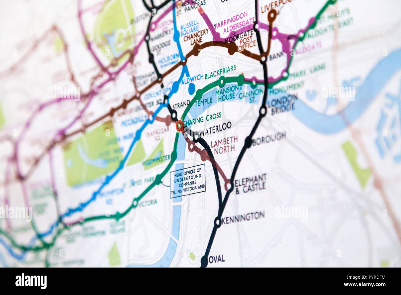 Historic old London Underground map c. 1931, at 55 Broadway Building, London, UK Stock Photohttps://www.alamy.com/image-license-details/?v=1https://www.alamy.com/historic-old-london-underground-map-c-1931-at-55-broadway-building-london-uk-image223635656.html
RMPYRDFM–Historic old London Underground map c. 1931, at 55 Broadway Building, London, UK
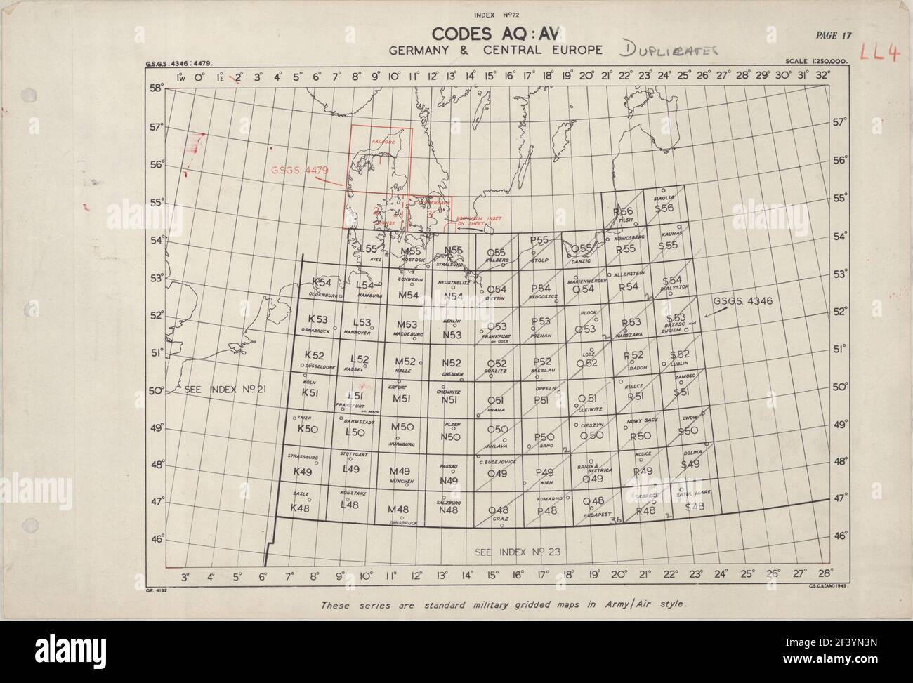 GERMANY AND CENTRAL EUROPE SHEET INDEX MAP 1945 Stock Photohttps://www.alamy.com/image-license-details/?v=1https://www.alamy.com/germany-and-central-europe-sheet-index-map-1945-image415502073.html
RF2F3YN3N–GERMANY AND CENTRAL EUROPE SHEET INDEX MAP 1945
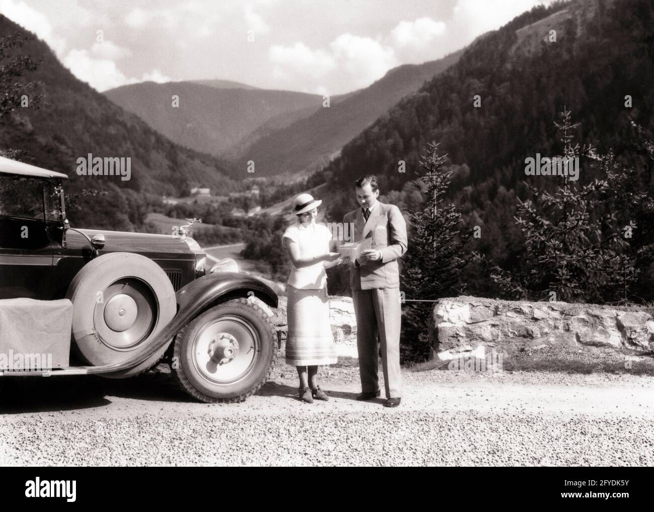 1920s 1930s MAN AND WOMAN PERHAPS LOST READING ROAD MAP STANDING BESIDE AUTOMOBILE NEAR FELDBERG IN BLACK FOREST OF GERMANY - r3848 HAR001 HARS COMMUNICATION VEHICLE LOST INFORMATION VACATION GERMAN HISTORY FEMALES FOREST MARRIED RURAL SPOUSE HUSBANDS COPY SPACE FRIENDSHIP FULL-LENGTH LADIES GERMANY PERSONS AUTOMOBILE MALES TRANSPORTATION EUROPE B&W PARTNER TIME OFF HIGH ANGLE ADVENTURE EUROPEAN TRIP AND AUTOS GETAWAY TOURIST HOLIDAYS NEAR CONCEPTUAL AUTOMOBILES BESIDE STYLISH VEHICLES COOPERATION MID-ADULT MID-ADULT MAN MID-ADULT WOMAN PACKARD PERHAPS SOLUTIONS TOGETHERNESS VACATIONS WIVES Stock Photohttps://www.alamy.com/image-license-details/?v=1https://www.alamy.com/1920s-1930s-man-and-woman-perhaps-lost-reading-road-map-standing-beside-automobile-near-feldberg-in-black-forest-of-germany-r3848-har001-hars-communication-vehicle-lost-information-vacation-german-history-females-forest-married-rural-spouse-husbands-copy-space-friendship-full-length-ladies-germany-persons-automobile-males-transportation-europe-bw-partner-time-off-high-angle-adventure-european-trip-and-autos-getaway-tourist-holidays-near-conceptual-automobiles-beside-stylish-vehicles-cooperation-mid-adult-mid-adult-man-mid-adult-woman-packard-perhaps-solutions-togetherness-vacations-wives-image429944983.html
RM2FYDK5Y–1920s 1930s MAN AND WOMAN PERHAPS LOST READING ROAD MAP STANDING BESIDE AUTOMOBILE NEAR FELDBERG IN BLACK FOREST OF GERMANY - r3848 HAR001 HARS COMMUNICATION VEHICLE LOST INFORMATION VACATION GERMAN HISTORY FEMALES FOREST MARRIED RURAL SPOUSE HUSBANDS COPY SPACE FRIENDSHIP FULL-LENGTH LADIES GERMANY PERSONS AUTOMOBILE MALES TRANSPORTATION EUROPE B&W PARTNER TIME OFF HIGH ANGLE ADVENTURE EUROPEAN TRIP AND AUTOS GETAWAY TOURIST HOLIDAYS NEAR CONCEPTUAL AUTOMOBILES BESIDE STYLISH VEHICLES COOPERATION MID-ADULT MID-ADULT MAN MID-ADULT WOMAN PACKARD PERHAPS SOLUTIONS TOGETHERNESS VACATIONS WIVES
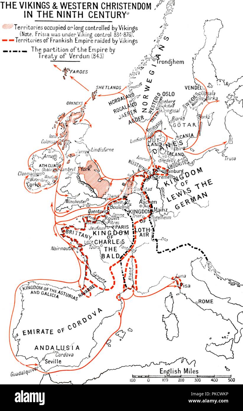 'Map of the Vikings & Western Christendom in the Ninth Century', (1935). Artist: Unknown. Stock Photohttps://www.alamy.com/image-license-details/?v=1https://www.alamy.com/map-of-the-vikings-western-christendom-in-the-ninth-century-1935-artist-unknown-image218486458.html
RMPKCWKP–'Map of the Vikings & Western Christendom in the Ninth Century', (1935). Artist: Unknown.
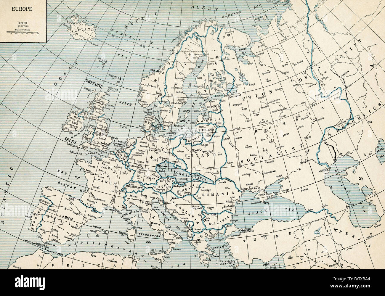 Old map of Europe, 1930's Stock Photohttps://www.alamy.com/image-license-details/?v=1https://www.alamy.com/old-map-of-europe-1930s-image62045260.html
RMDGXBA4–Old map of Europe, 1930's
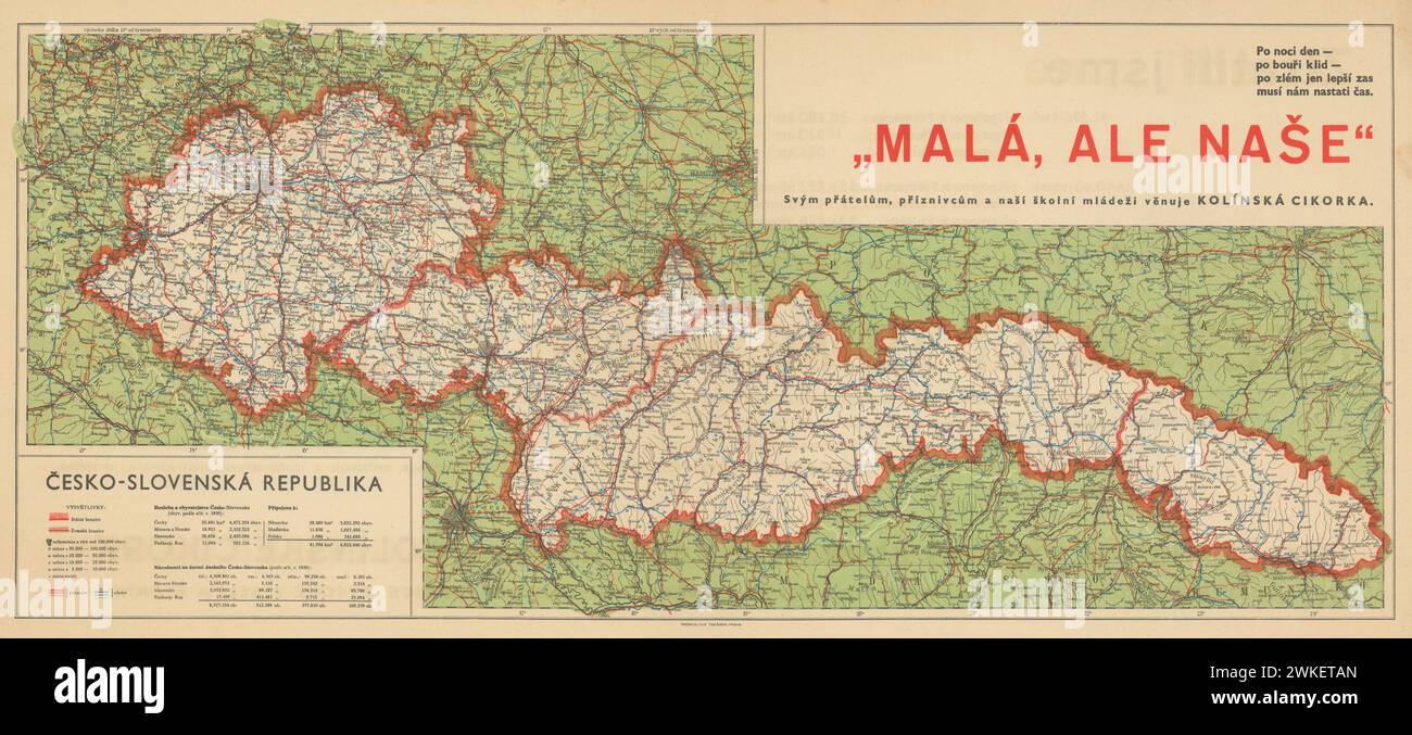 Vintage 1938 map of the Second Czechoslovak Republic after the Munich Agreement. The Territorial Results of the Munich Agreement. Stock Photohttps://www.alamy.com/image-license-details/?v=1https://www.alamy.com/vintage-1938-map-of-the-second-czechoslovak-republic-after-the-munich-agreement-the-territorial-results-of-the-munich-agreement-image597157421.html
RM2WKETAN–Vintage 1938 map of the Second Czechoslovak Republic after the Munich Agreement. The Territorial Results of the Munich Agreement.
 1930s TOURIST COUPLE BY CAR LOOKING AT MAP IN FRONT OF EISENACH LUTHERHAUS 1563 WHERE LUTHER LIVED WHILE ATTENDING SCHOOL Stock Photohttps://www.alamy.com/image-license-details/?v=1https://www.alamy.com/stock-photo-1930s-tourist-couple-by-car-looking-at-map-in-front-of-eisenach-lutherhaus-12666546.html
RMAAN0MK–1930s TOURIST COUPLE BY CAR LOOKING AT MAP IN FRONT OF EISENACH LUTHERHAUS 1563 WHERE LUTHER LIVED WHILE ATTENDING SCHOOL
 Vintage German Travel Poster: Deutsche Luft Hansa Airlines, by Jupp Wiertz 1933. Showing a plane flying over map of Europe. Stock Photohttps://www.alamy.com/image-license-details/?v=1https://www.alamy.com/vintage-german-travel-poster-deutsche-luft-hansa-airlines-by-jupp-wiertz-1933-showing-a-plane-flying-over-map-of-europe-image608418447.html
RM2X9RRX7–Vintage German Travel Poster: Deutsche Luft Hansa Airlines, by Jupp Wiertz 1933. Showing a plane flying over map of Europe.
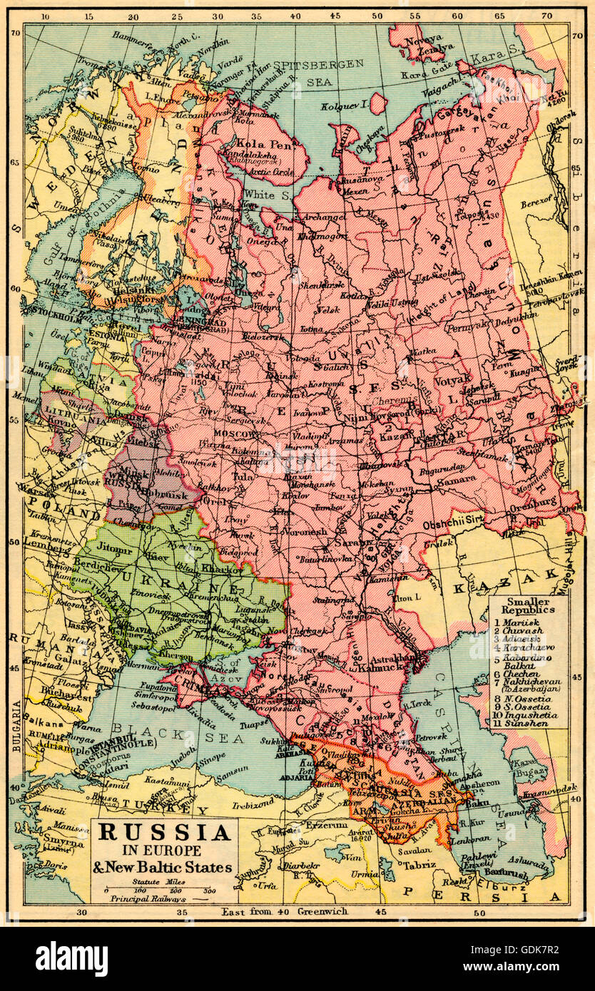 A 1930's map of Russia in Europe and the New Baltic States. Stock Photohttps://www.alamy.com/image-license-details/?v=1https://www.alamy.com/stock-photo-a-1930s-map-of-russia-in-europe-and-the-new-baltic-states-111675958.html
RMGDK7R2–A 1930's map of Russia in Europe and the New Baltic States.
 Im weltanschaulichen Unterricht diskutieren die Frauen eine Europakarte beim weiblichen Arbeitsdienst in Molkenberg bei Fürstenwalde, Deutschland 1930er Jahre. Women discussing a map of Europe in their ideological lesson at the female workforce group of Molkenberg, Germany 1930s. Stock Photohttps://www.alamy.com/image-license-details/?v=1https://www.alamy.com/im-weltanschaulichen-unterricht-diskutieren-die-frauen-eine-europakarte-beim-weiblichen-arbeitsdienst-in-molkenberg-bei-frstenwalde-deutschland-1930er-jahre-women-discussing-a-map-of-europe-in-their-ideological-lesson-at-the-female-workforce-group-of-molkenberg-germany-1930s-image446893391.html
RM2GY1N27–Im weltanschaulichen Unterricht diskutieren die Frauen eine Europakarte beim weiblichen Arbeitsdienst in Molkenberg bei Fürstenwalde, Deutschland 1930er Jahre. Women discussing a map of Europe in their ideological lesson at the female workforce group of Molkenberg, Germany 1930s.
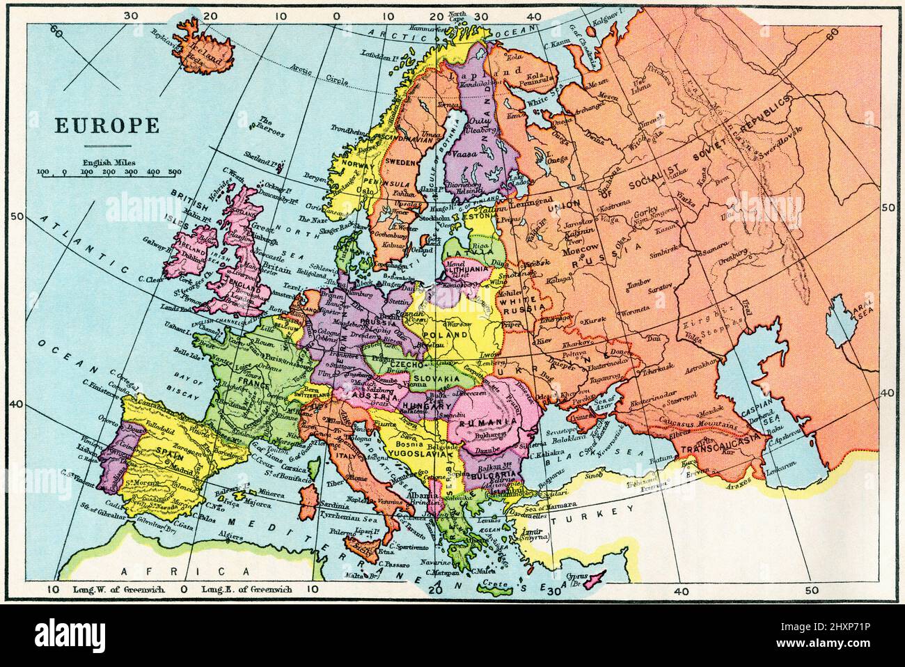 Map of Europe in the 1930's. From The Wonderland of Knowledge, published c.1930 Stock Photohttps://www.alamy.com/image-license-details/?v=1https://www.alamy.com/map-of-europe-in-the-1930s-from-the-wonderland-of-knowledge-published-c1930-image463939106.html
RM2HXP71P–Map of Europe in the 1930's. From The Wonderland of Knowledge, published c.1930
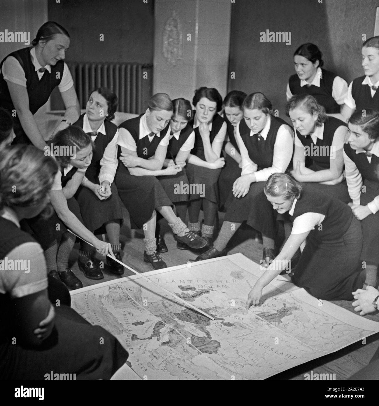 Im weltanschaulichen Unterricht diskutieren die Frauen eine Europakarte beim weiblichen Arbeitsdienst in Molkenberg bei Fürstenwalde, Deutschland 1930er Jahre. Women discussing a map of Europe in their ideological lesson at the female workforce group of Molkenberg, Germany 1930s. Stock Photohttps://www.alamy.com/image-license-details/?v=1https://www.alamy.com/im-weltanschaulichen-unterricht-diskutieren-die-frauen-eine-europakarte-beim-weiblichen-arbeitsdienst-in-molkenberg-bei-frstenwalde-deutschland-1930er-jahre-women-discussing-a-map-of-europe-in-their-ideological-lesson-at-the-female-workforce-group-of-molkenberg-germany-1930s-image328539235.html
RM2A2E743–Im weltanschaulichen Unterricht diskutieren die Frauen eine Europakarte beim weiblichen Arbeitsdienst in Molkenberg bei Fürstenwalde, Deutschland 1930er Jahre. Women discussing a map of Europe in their ideological lesson at the female workforce group of Molkenberg, Germany 1930s.
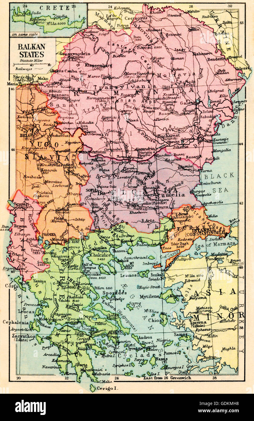 A 1930's map of the Balkan States. Stock Photohttps://www.alamy.com/image-license-details/?v=1https://www.alamy.com/stock-photo-a-1930s-map-of-the-balkan-states-111685988.html
RMGDKMH8–A 1930's map of the Balkan States.
 Vintage map of Central Europe 1930s. Stock Photohttps://www.alamy.com/image-license-details/?v=1https://www.alamy.com/vintage-map-of-central-europe-1930s-image425694470.html
RF2FMG1HX–Vintage map of Central Europe 1930s.
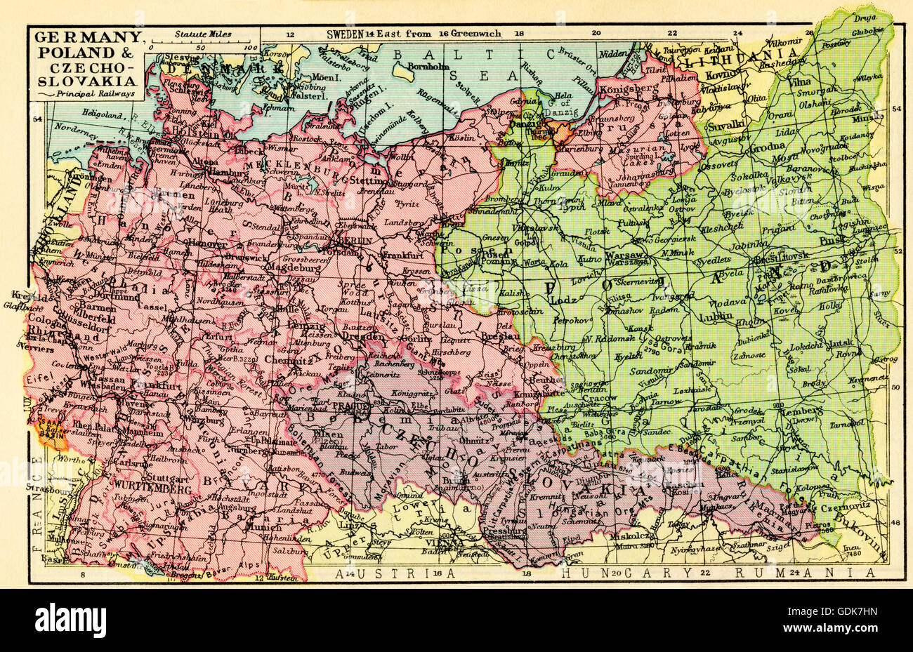 A 1930's map of Germany, Poland and Czechoslovakia. Stock Photohttps://www.alamy.com/image-license-details/?v=1https://www.alamy.com/stock-photo-a-1930s-map-of-germany-poland-and-czechoslovakia-111675809.html
RMGDK7HN–A 1930's map of Germany, Poland and Czechoslovakia.
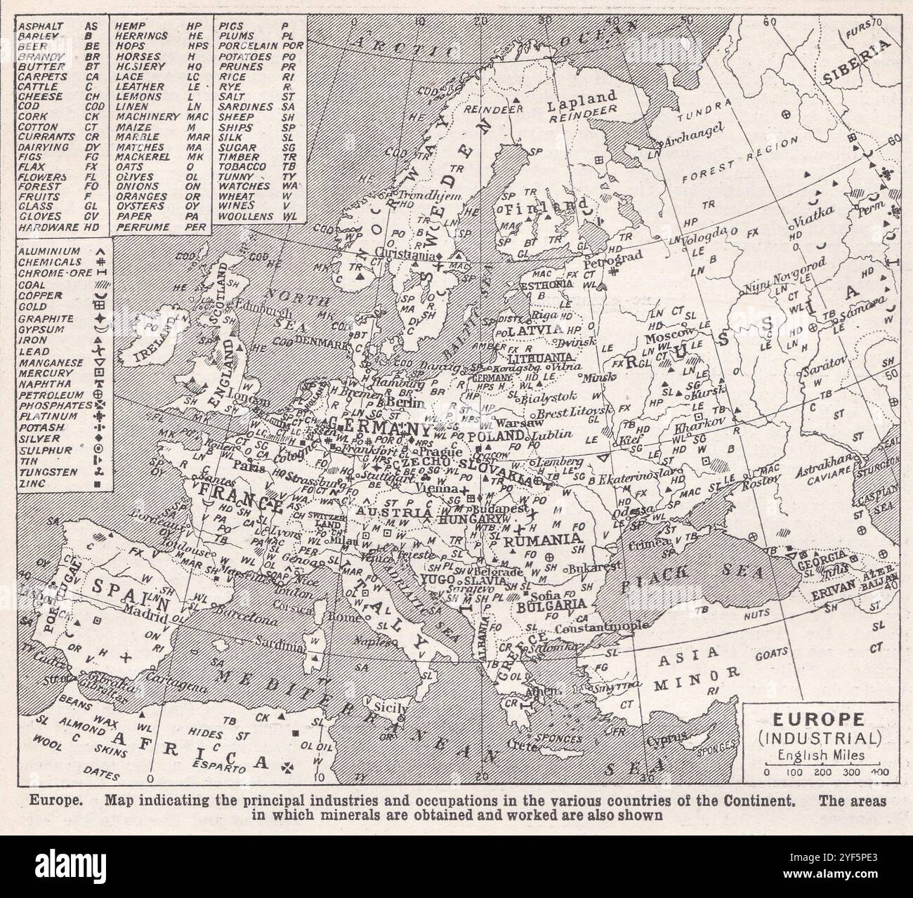 Vintage map of Europe showing principal industries and occupations to include minerals, 1930s. Stock Photohttps://www.alamy.com/image-license-details/?v=1https://www.alamy.com/vintage-map-of-europe-showing-principal-industries-and-occupations-to-include-minerals-1930s-image628920491.html
RF2YF5PE3–Vintage map of Europe showing principal industries and occupations to include minerals, 1930s.
 Eine Europakarte im Museum für Buchdruckerkunst im Haus 'Zum Römischen Kaiser' in Mainz zeigt die zeitliche Ausdehnung des Buchdruckens in Europa, Deutschland 1930er Jahre. A map of Europe at the printing museum at Mainz shows the chronological dimensions of printing, Germany 1930s. Stock Photohttps://www.alamy.com/image-license-details/?v=1https://www.alamy.com/eine-europakarte-im-museum-fr-buchdruckerkunst-im-haus-zum-rmischen-kaiser-in-mainz-zeigt-die-zeitliche-ausdehnung-des-buchdruckens-in-europa-deutschland-1930er-jahre-a-map-of-europe-at-the-printing-museum-at-mainz-shows-the-chronological-dimensions-of-printing-germany-1930s-image447736365.html
RM2H0C48D–Eine Europakarte im Museum für Buchdruckerkunst im Haus 'Zum Römischen Kaiser' in Mainz zeigt die zeitliche Ausdehnung des Buchdruckens in Europa, Deutschland 1930er Jahre. A map of Europe at the printing museum at Mainz shows the chronological dimensions of printing, Germany 1930s.
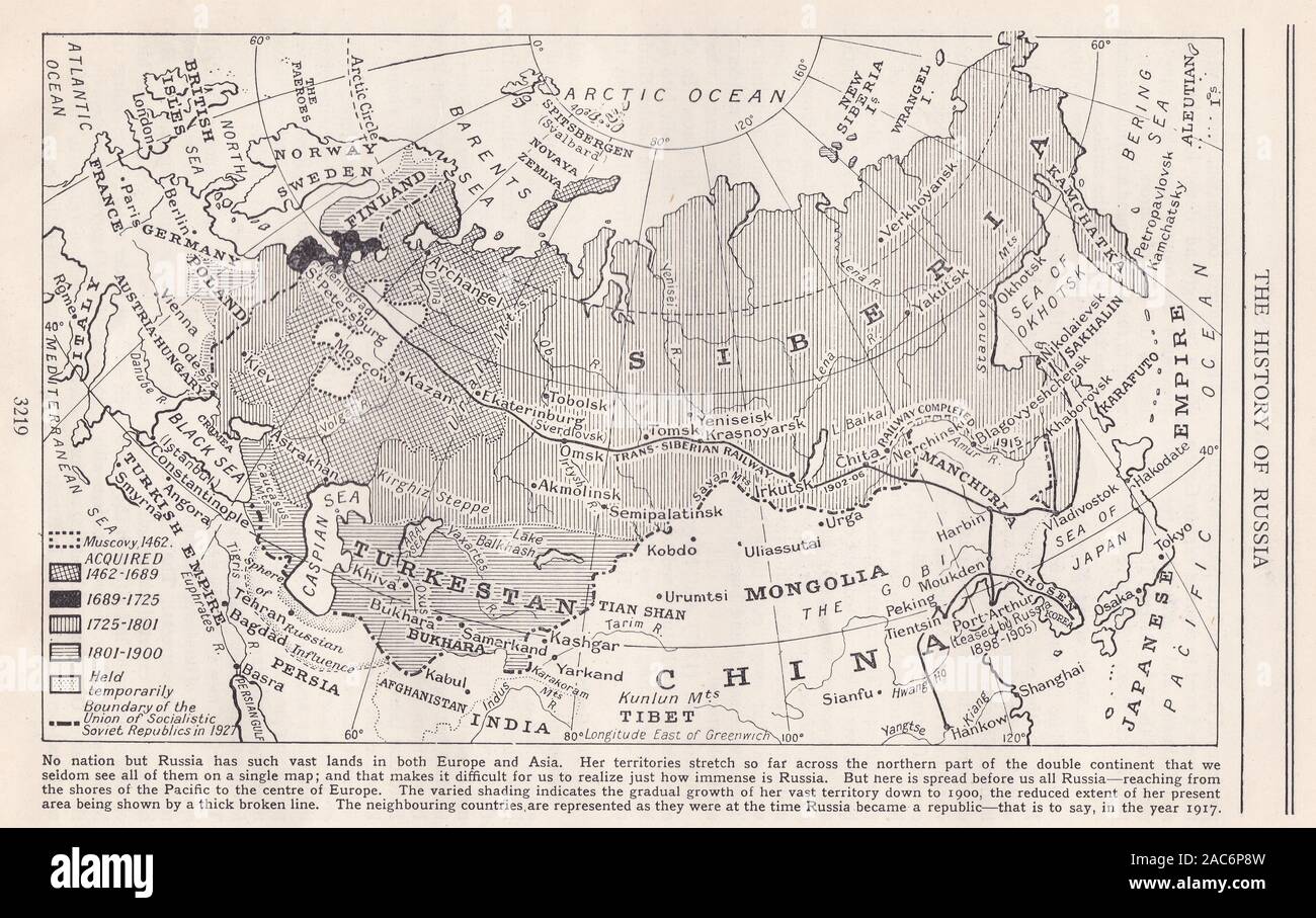 1930s 'The History of Russia' map showing vast lands in Europe and Asia. Stock Photohttps://www.alamy.com/image-license-details/?v=1https://www.alamy.com/1930s-the-history-of-russia-map-showing-vast-lands-in-europe-and-asia-image334522073.html
RF2AC6P8W–1930s 'The History of Russia' map showing vast lands in Europe and Asia.
 1930's World Map jigsaw produced on behalf of Manufacturer's Life Insurance Company, now Munulife (Actual size: 480mm x 312mm) Stock Photohttps://www.alamy.com/image-license-details/?v=1https://www.alamy.com/stock-photo-1930s-world-map-jigsaw-produced-on-behalf-of-manufacturers-life-insurance-78085302.html
RMEF12GP–1930's World Map jigsaw produced on behalf of Manufacturer's Life Insurance Company, now Munulife (Actual size: 480mm x 312mm)
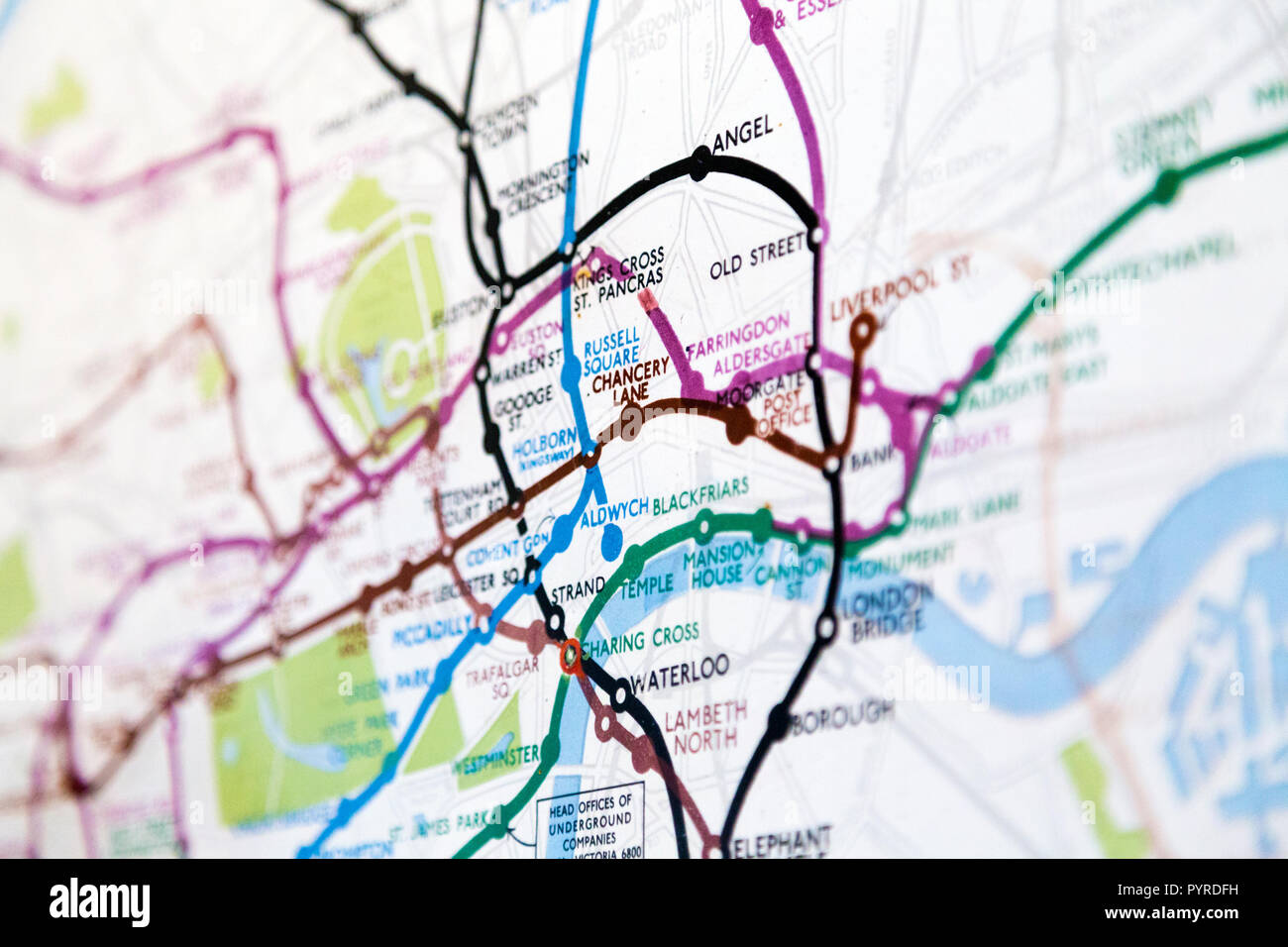 Historic old London Underground map c. 1931, at 55 Broadway Building, London, UK Stock Photohttps://www.alamy.com/image-license-details/?v=1https://www.alamy.com/historic-old-london-underground-map-c-1931-at-55-broadway-building-london-uk-image223635653.html
RMPYRDFH–Historic old London Underground map c. 1931, at 55 Broadway Building, London, UK
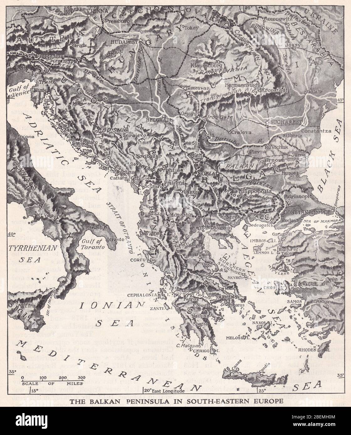 Vintage 1930s map of The Balkan Peninsula in South-Eastern Europe. Stock Photohttps://www.alamy.com/image-license-details/?v=1https://www.alamy.com/vintage-1930s-map-of-the-balkan-peninsula-in-south-eastern-europe-image353264932.html
RF2BEMH0M–Vintage 1930s map of The Balkan Peninsula in South-Eastern Europe.
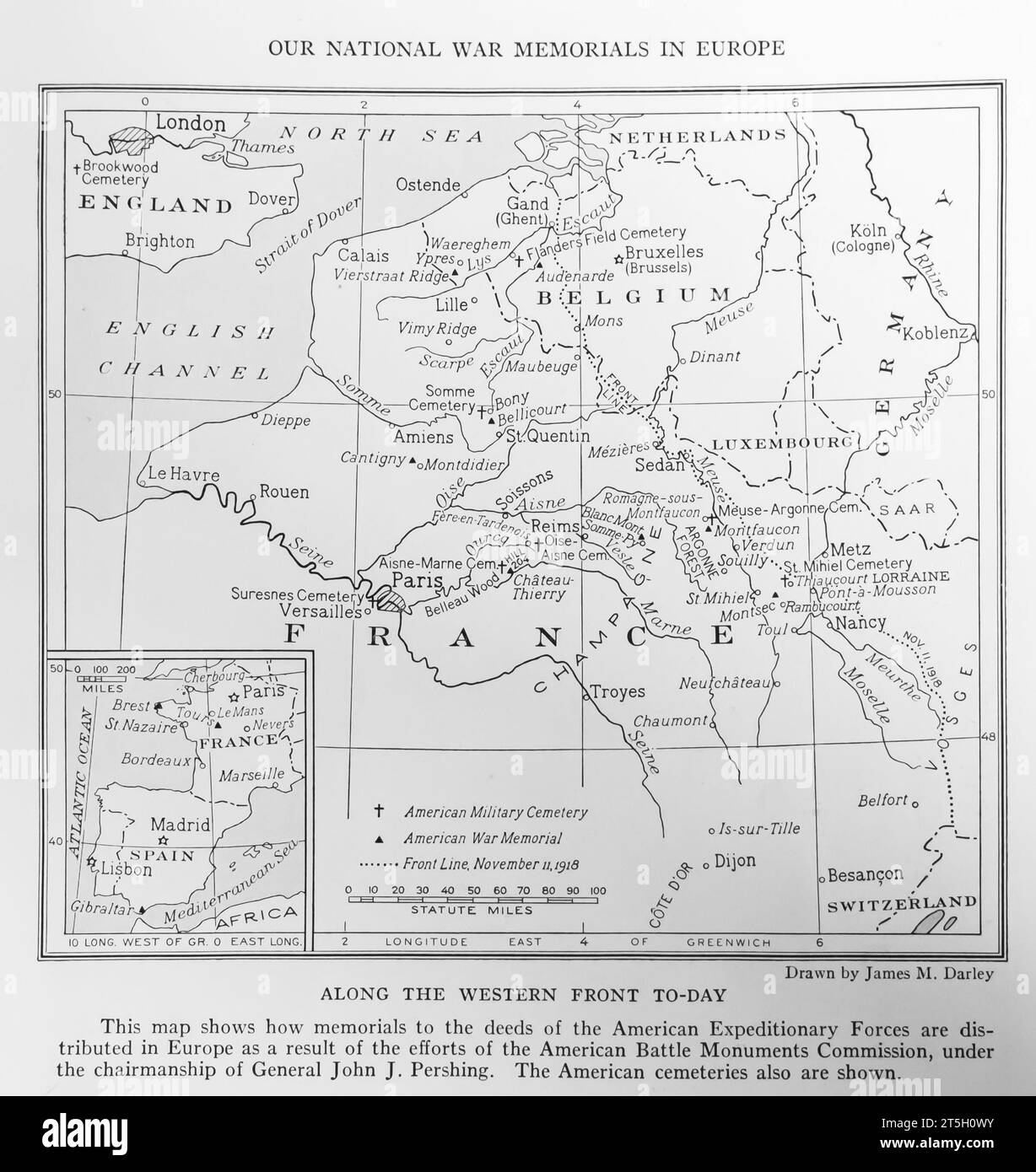 1934 Map of the memorials to American Expeditionary Forces in Europe, made by american Battle Monuments Commission Stock Photohttps://www.alamy.com/image-license-details/?v=1https://www.alamy.com/1934-map-of-the-memorials-to-american-expeditionary-forces-in-europe-made-by-american-battle-monuments-commission-image571389335.html
RM2T5H0WY–1934 Map of the memorials to American Expeditionary Forces in Europe, made by american Battle Monuments Commission
 'The British Isles and Northern Europe at 6pm on midsummers day', 1935. Artist: Unknown. Stock Photohttps://www.alamy.com/image-license-details/?v=1https://www.alamy.com/the-british-isles-and-northern-europe-at-6pm-on-midsummers-day-1935-artist-unknown-image217096633.html
RMPH5GY5–'The British Isles and Northern Europe at 6pm on midsummers day', 1935. Artist: Unknown.
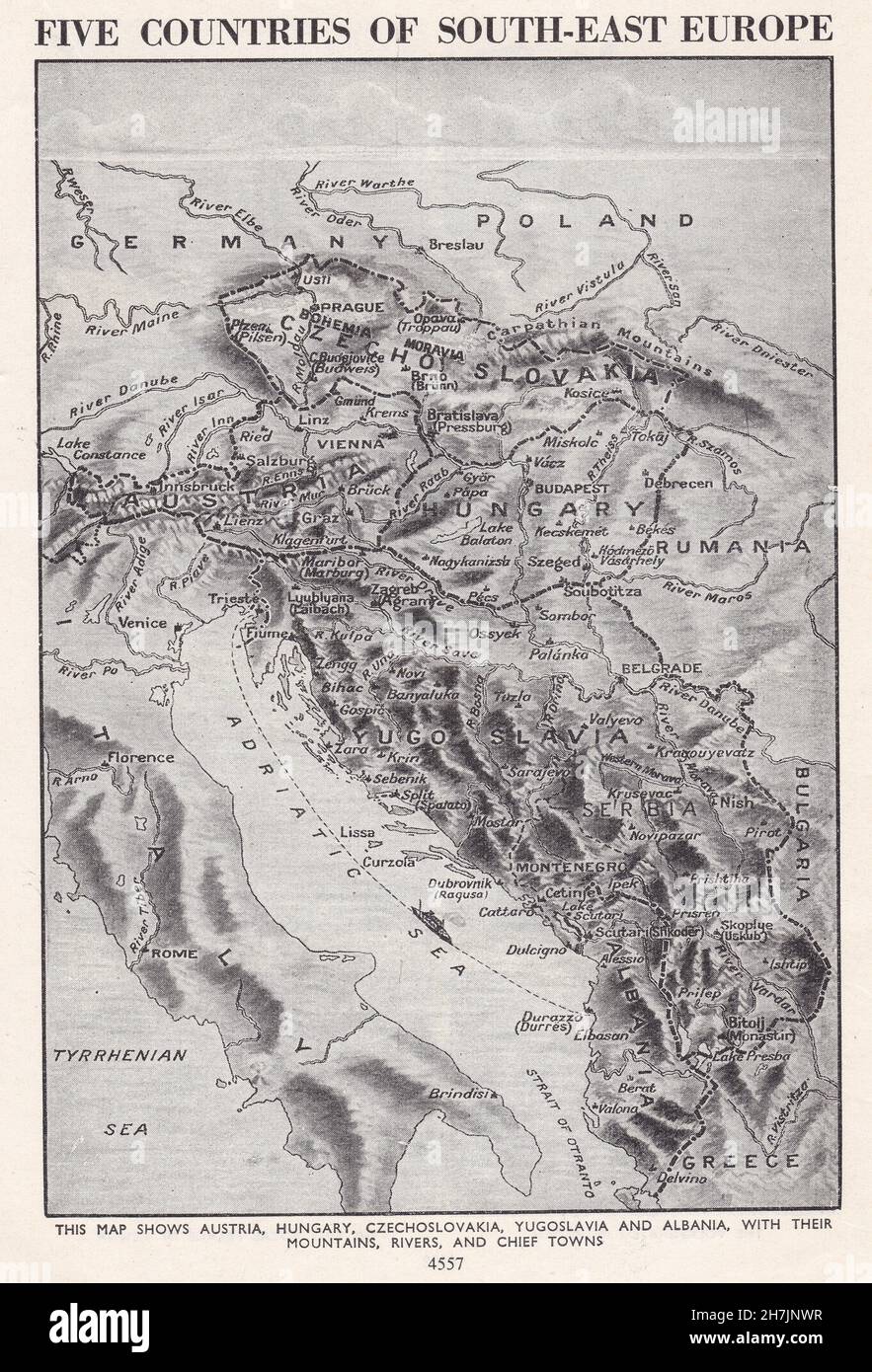 Vintage map of the five countries of south-east Europe 1930s. Stock Photohttps://www.alamy.com/image-license-details/?v=1https://www.alamy.com/vintage-map-of-the-five-countries-of-south-east-europe-1930s-image452184483.html
RF2H7JNWR–Vintage map of the five countries of south-east Europe 1930s.
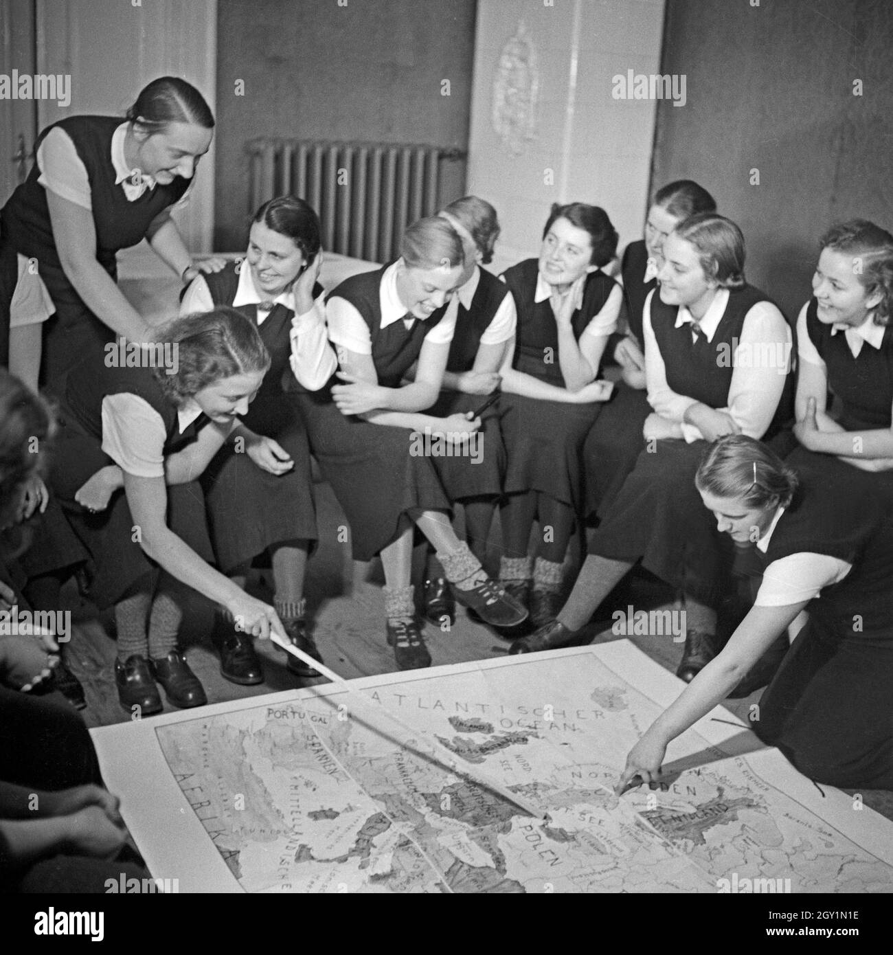 Im weltanschaulichen Unterricht diskutieren die Frauen eine Europakarte beim weiblichen Arbeitsdienst in Molkenberg bei Fürstenwalde, Deutschland 1930er Jahre. Women discussing a map of Europe in their ideological lesson at the female workforce group of Molkenberg, Germany 1930s. Stock Photohttps://www.alamy.com/image-license-details/?v=1https://www.alamy.com/im-weltanschaulichen-unterricht-diskutieren-die-frauen-eine-europakarte-beim-weiblichen-arbeitsdienst-in-molkenberg-bei-frstenwalde-deutschland-1930er-jahre-women-discussing-a-map-of-europe-in-their-ideological-lesson-at-the-female-workforce-group-of-molkenberg-germany-1930s-image446893370.html
RM2GY1N1E–Im weltanschaulichen Unterricht diskutieren die Frauen eine Europakarte beim weiblichen Arbeitsdienst in Molkenberg bei Fürstenwalde, Deutschland 1930er Jahre. Women discussing a map of Europe in their ideological lesson at the female workforce group of Molkenberg, Germany 1930s.
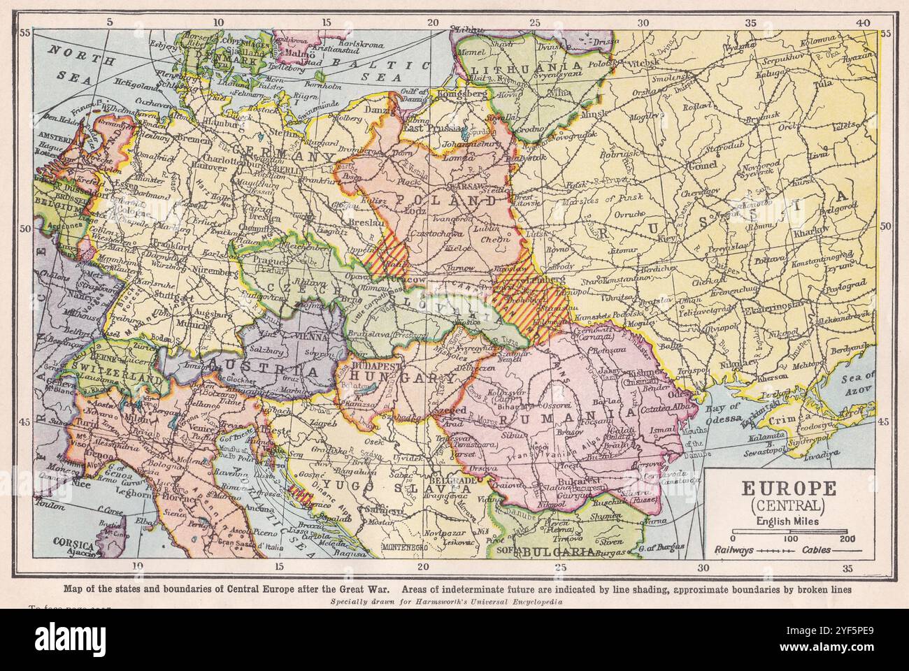 Vintage map of Europe showing states and boundaries of Central Europe after the Great War, 1930s. Stock Photohttps://www.alamy.com/image-license-details/?v=1https://www.alamy.com/vintage-map-of-europe-showing-states-and-boundaries-of-central-europe-after-the-great-war-1930s-image628920497.html
RF2YF5PE9–Vintage map of Europe showing states and boundaries of Central Europe after the Great War, 1930s.
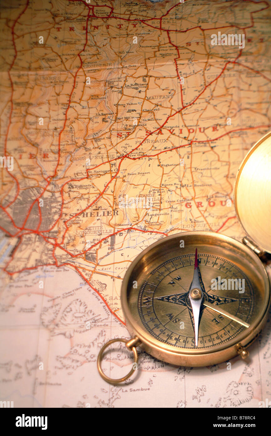 Ordinary magnetic compass on a 1930s map of Jersey,in the Channel Islands Stock Photohttps://www.alamy.com/image-license-details/?v=1https://www.alamy.com/stock-photo-ordinary-magnetic-compass-on-a-1930s-map-of-jerseyin-the-channel-islands-21706948.html
RFB78RC4–Ordinary magnetic compass on a 1930s map of Jersey,in the Channel Islands
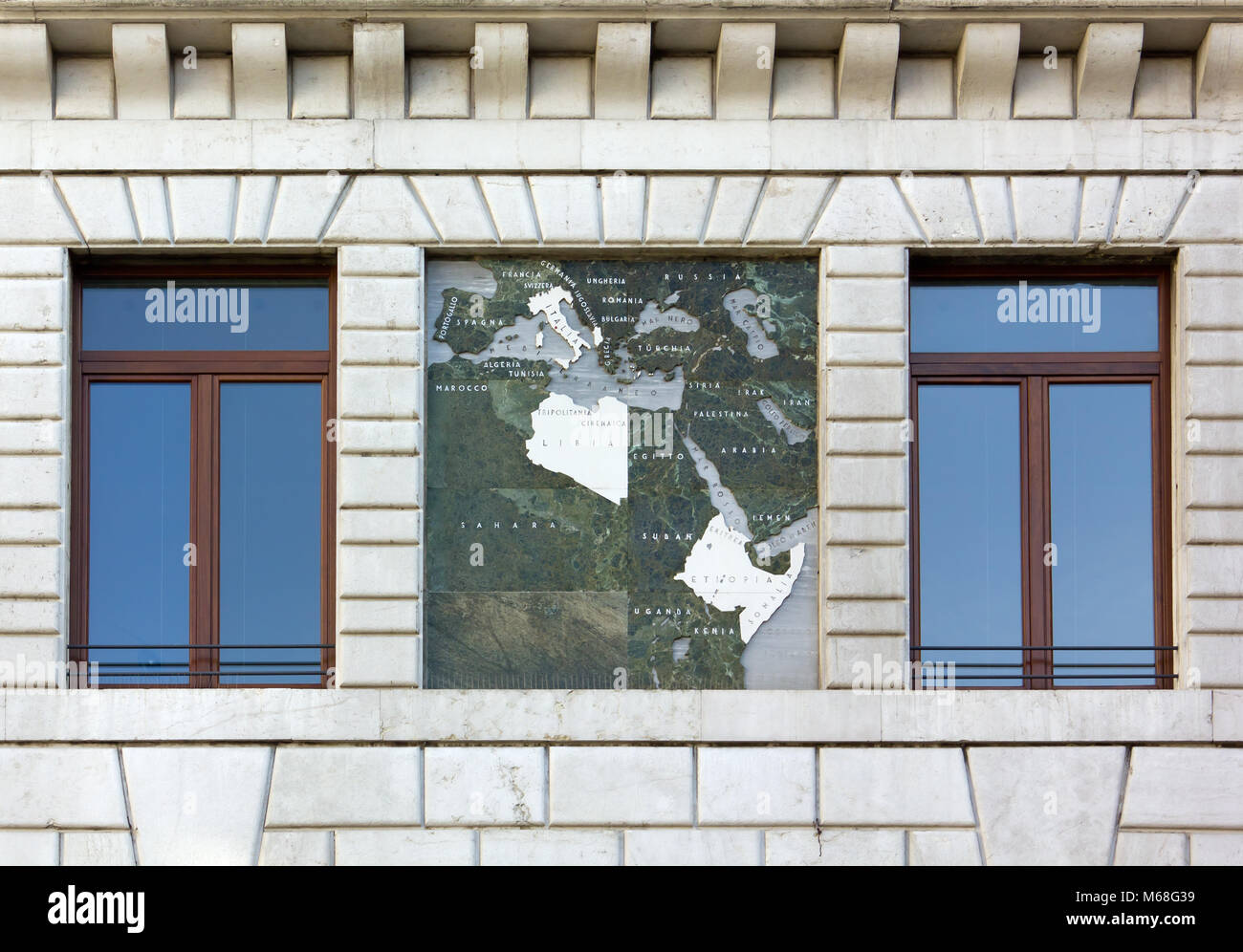 Close-up of the exterior of the Palazzo del Podesta in Padua, Italy, showing a map of the 1930s Italian Empire Stock Photohttps://www.alamy.com/image-license-details/?v=1https://www.alamy.com/stock-photo-close-up-of-the-exterior-of-the-palazzo-del-podesta-in-padua-italy-175979869.html
RFM68G39–Close-up of the exterior of the Palazzo del Podesta in Padua, Italy, showing a map of the 1930s Italian Empire
 Vintage Travel Poster for 'Imperial Airways', showing their air routes maps in Empire and Europe. by László Moholy-Nagy 1936 Stock Photohttps://www.alamy.com/image-license-details/?v=1https://www.alamy.com/vintage-travel-poster-for-imperial-airways-showing-their-air-routes-maps-in-empire-and-europe-by-lszl-moholy-nagy-1936-image597189422.html
RM2WKG95J–Vintage Travel Poster for 'Imperial Airways', showing their air routes maps in Empire and Europe. by László Moholy-Nagy 1936
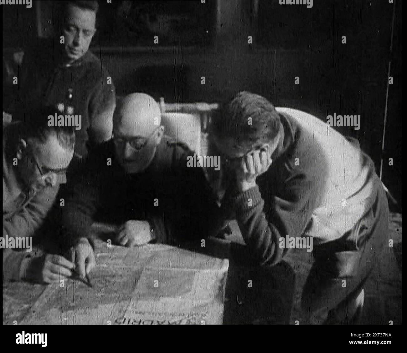 Four Men Consulting a Map in an Office, 1937. Spanish Civil War. '...there was - alas - plenty of trouble...at large in Europe, particularly in places like Madrid. For the cities of Spain were the first to feel the breath of war in a truly modern manner. It has been said that war is but an extension of politics. True enough, particularly if it happens to be a civil war...For this was a war in which all people were soldiers, for the soldiers were the people. You just did what you were told, and fought'. From "Time To Remember - Sense Of Values", 1937 (Reel 2); documentary film about Stock Photohttps://www.alamy.com/image-license-details/?v=1https://www.alamy.com/four-men-consulting-a-map-in-an-office-1937-spanish-civil-war-there-was-alas-plenty-of-troubleat-large-in-europe-particularly-in-places-like-madrid-for-the-cities-of-spain-were-the-first-to-feel-the-breath-of-war-in-a-truly-modern-manner-it-has-been-said-that-war-is-but-an-extension-of-politics-true-enough-particularly-if-it-happens-to-be-a-civil-warfor-this-was-a-war-in-which-all-people-were-soldiers-for-the-soldiers-were-the-people-you-just-did-what-you-were-told-and-fought-from-quottime-to-remember-sense-of-valuesquot-1937-reel-2-documentary-film-about-image617186566.html
RM2XT37NA–Four Men Consulting a Map in an Office, 1937. Spanish Civil War. '...there was - alas - plenty of trouble...at large in Europe, particularly in places like Madrid. For the cities of Spain were the first to feel the breath of war in a truly modern manner. It has been said that war is but an extension of politics. True enough, particularly if it happens to be a civil war...For this was a war in which all people were soldiers, for the soldiers were the people. You just did what you were told, and fought'. From "Time To Remember - Sense Of Values", 1937 (Reel 2); documentary film about
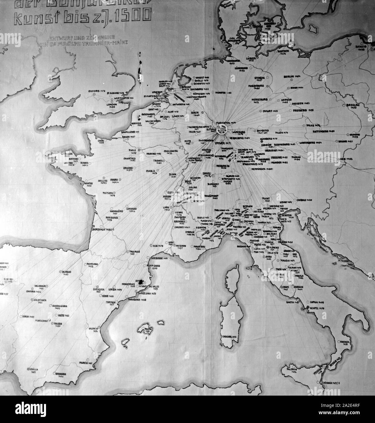 Eine Europakarte im Museum für Buchdruckerkunst im Haus 'Zum Römischen Kaiser' in Mainz zeigt die zeitliche Ausdehnung des Buchdruckens in Europa, Deutschland 1930er Jahre. A map of Europe at the printing museum at Mainz shows the chronological dimensions of printing, Germany 1930s. Stock Photohttps://www.alamy.com/image-license-details/?v=1https://www.alamy.com/eine-europakarte-im-museum-fr-buchdruckerkunst-im-haus-zum-rmischen-kaiser-in-mainz-zeigt-die-zeitliche-ausdehnung-des-buchdruckens-in-europa-deutschland-1930er-jahre-a-map-of-europe-at-the-printing-museum-at-mainz-shows-the-chronological-dimensions-of-printing-germany-1930s-image328537427.html
RM2A2E4RF–Eine Europakarte im Museum für Buchdruckerkunst im Haus 'Zum Römischen Kaiser' in Mainz zeigt die zeitliche Ausdehnung des Buchdruckens in Europa, Deutschland 1930er Jahre. A map of Europe at the printing museum at Mainz shows the chronological dimensions of printing, Germany 1930s.
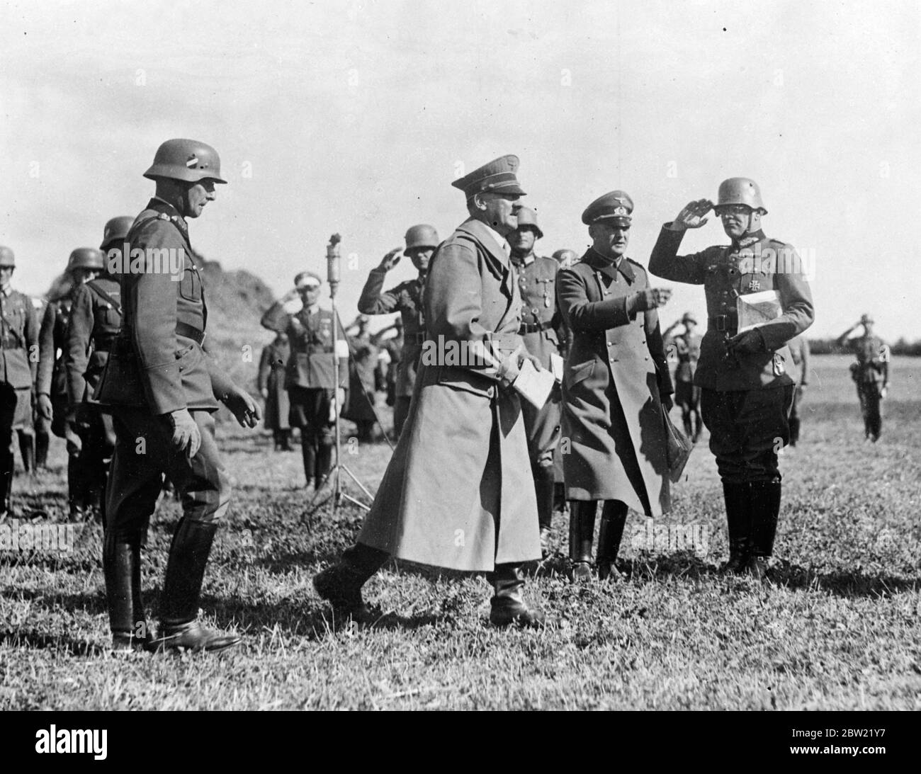 Chancellor Hitler, who is soon to be joined by Signor Mussolini, is already a close observer of the combined land, sea and air manoeuvres of the German forces in Mecklenburg and Pomerania and off the Baltic coast of North Germany. The exercises are being supervised by Field Marshal von Bloomberg, the German war Minister. Chancellor Hitler map in hand, saluted by officers at the manoeuvres. 23 September 1937 Stock Photohttps://www.alamy.com/image-license-details/?v=1https://www.alamy.com/chancellor-hitler-who-is-soon-to-be-joined-by-signor-mussolini-is-already-a-close-observer-of-the-combined-land-sea-and-air-manoeuvres-of-the-german-forces-in-mecklenburg-and-pomerania-and-off-the-baltic-coast-of-north-germany-the-exercises-are-being-supervised-by-field-marshal-von-bloomberg-the-german-war-minister-chancellor-hitler-map-in-hand-saluted-by-officers-at-the-manoeuvres-23-september-1937-image359619211.html
RM2BW21Y7–Chancellor Hitler, who is soon to be joined by Signor Mussolini, is already a close observer of the combined land, sea and air manoeuvres of the German forces in Mecklenburg and Pomerania and off the Baltic coast of North Germany. The exercises are being supervised by Field Marshal von Bloomberg, the German war Minister. Chancellor Hitler map in hand, saluted by officers at the manoeuvres. 23 September 1937
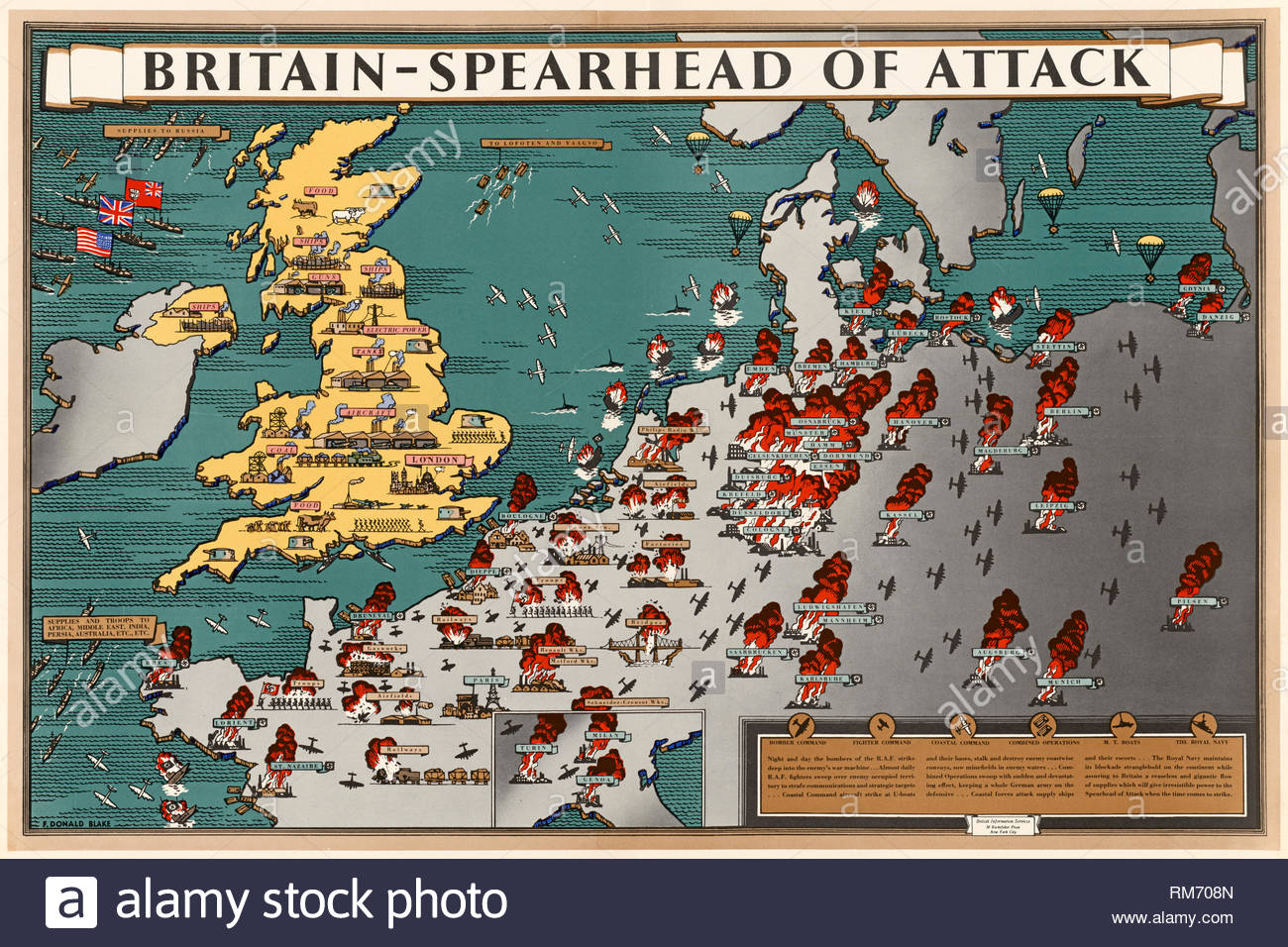 British World War 2 Public Information Propaganda poster Stock Photohttps://www.alamy.com/image-license-details/?v=1https://www.alamy.com/british-world-war-2-public-information-propaganda-poster-image236181813.html
RMRM708N–British World War 2 Public Information Propaganda poster
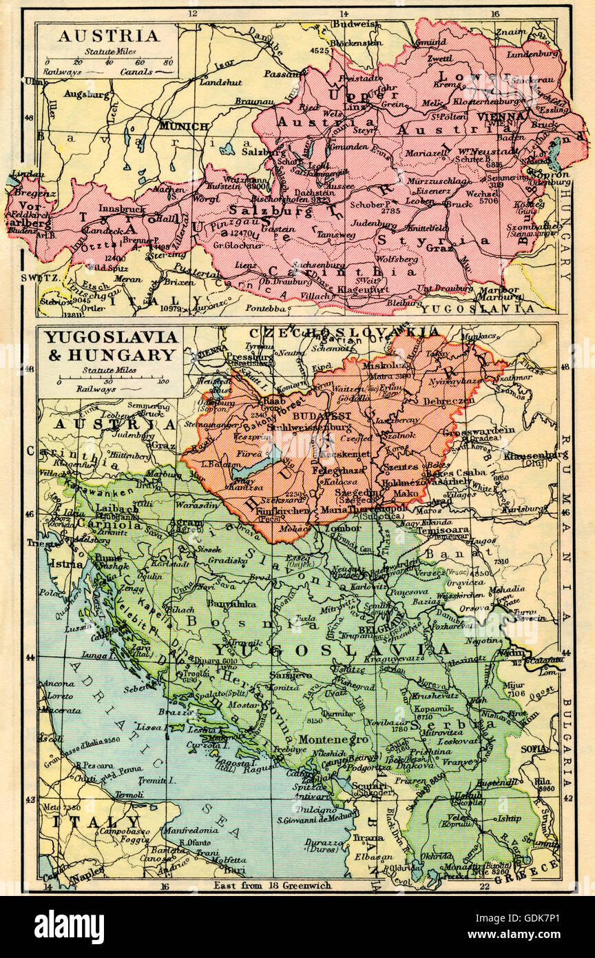 A 1930's map of Austria, top and Yugosalvia and Hungary, bottom. Stock Photohttps://www.alamy.com/image-license-details/?v=1https://www.alamy.com/stock-photo-a-1930s-map-of-austria-top-and-yugosalvia-and-hungary-bottom-111675929.html
RMGDK7P1–A 1930's map of Austria, top and Yugosalvia and Hungary, bottom.
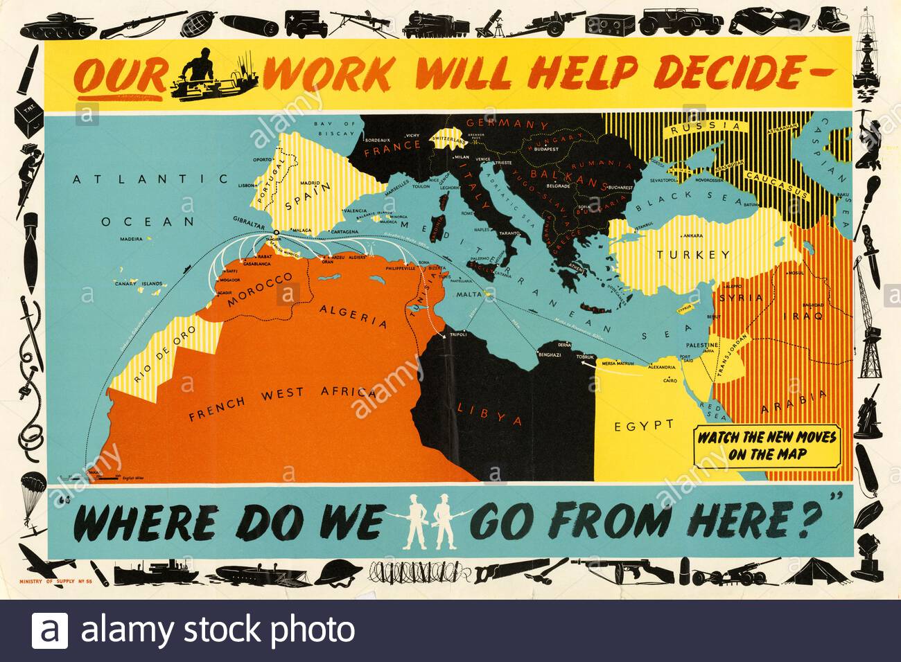 British World War 2 Public Information Propaganda poster Stock Photohttps://www.alamy.com/image-license-details/?v=1https://www.alamy.com/british-world-war-2-public-information-propaganda-poster-image386473550.html
RM2DCNAXP–British World War 2 Public Information Propaganda poster
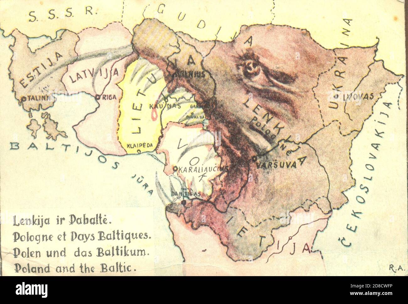 Satirical postcard map of Poland and the Baltic postmarked Lithuania 28 May 1934 Stock Photohttps://www.alamy.com/image-license-details/?v=1https://www.alamy.com/satirical-postcard-map-of-poland-and-the-baltic-postmarked-lithuania-28-may-1934-image383828810.html
RM2D8CWFP–Satirical postcard map of Poland and the Baltic postmarked Lithuania 28 May 1934
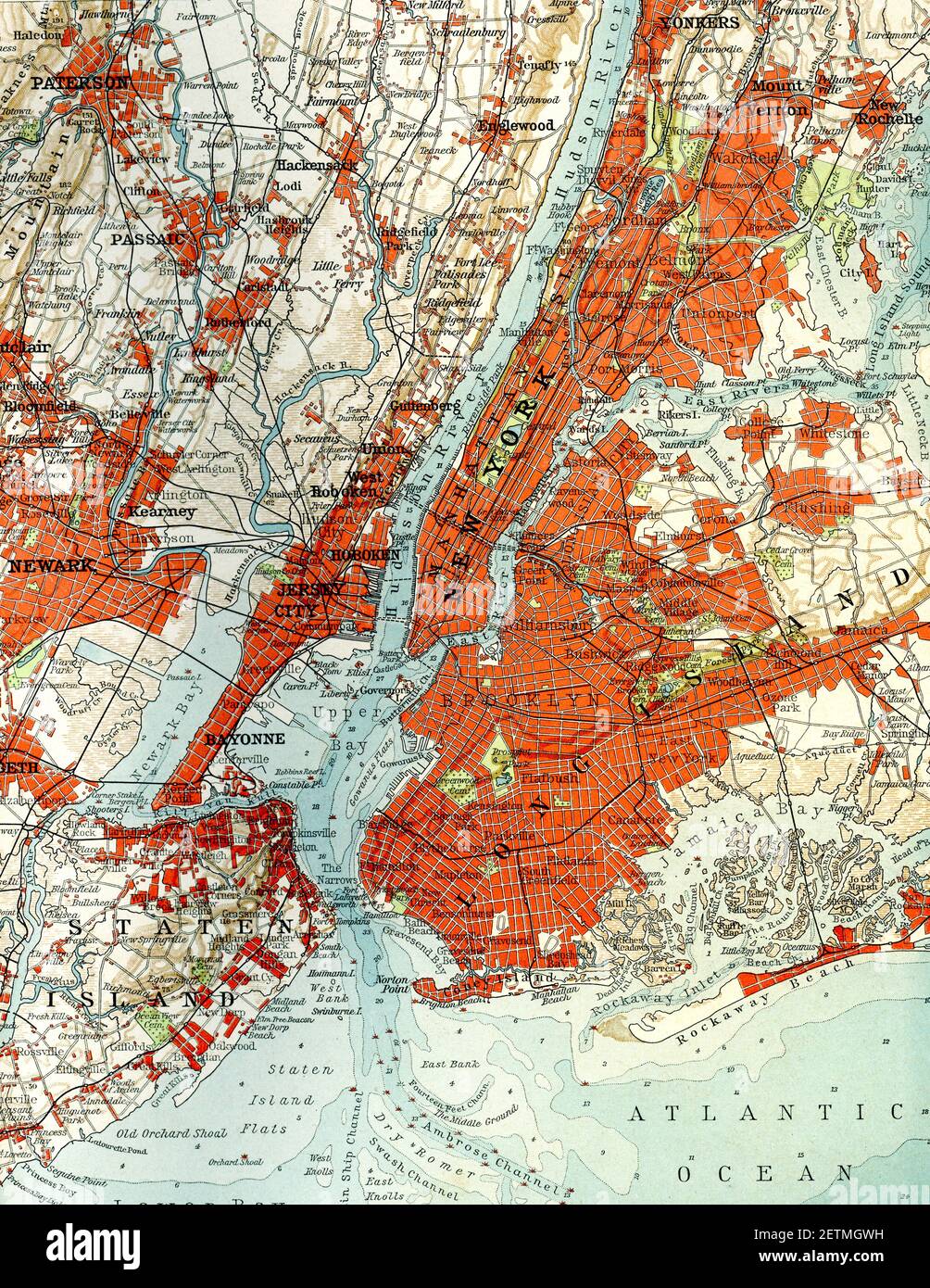 New York City old map Stock Photohttps://www.alamy.com/image-license-details/?v=1https://www.alamy.com/new-york-city-old-map-image411042509.html
RM2ETMGWH–New York City old map
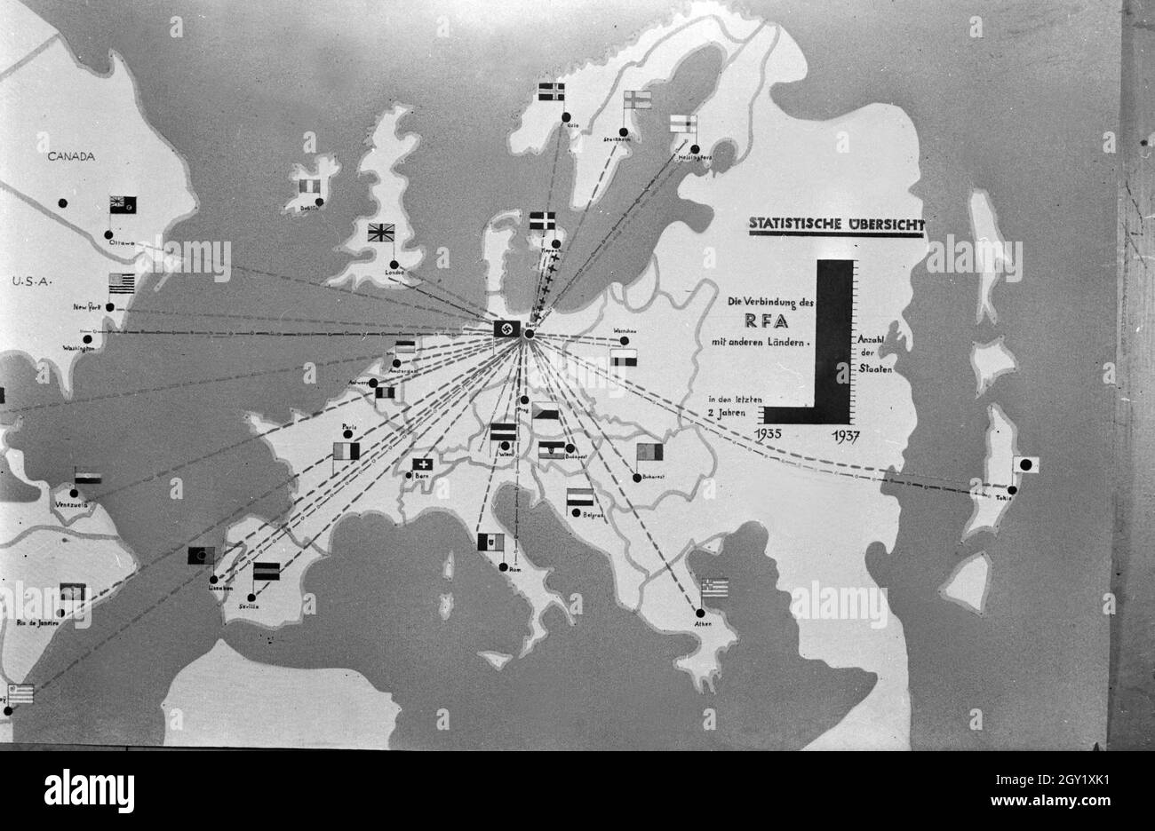 Reproduktion einer Übersicht 'Die Verbindung des RFA mit anderen Ländern', Deutschland 1930er Jahre. Reproduction of a survey of the RFA with other countries, Germany 1930s. Stock Photohttps://www.alamy.com/image-license-details/?v=1https://www.alamy.com/reproduktion-einer-bersicht-die-verbindung-des-rfa-mit-anderen-lndern-deutschland-1930er-jahre-reproduction-of-a-survey-of-the-rfa-with-other-countries-germany-1930s-image446897781.html
RM2GY1XK1–Reproduktion einer Übersicht 'Die Verbindung des RFA mit anderen Ländern', Deutschland 1930er Jahre. Reproduction of a survey of the RFA with other countries, Germany 1930s.
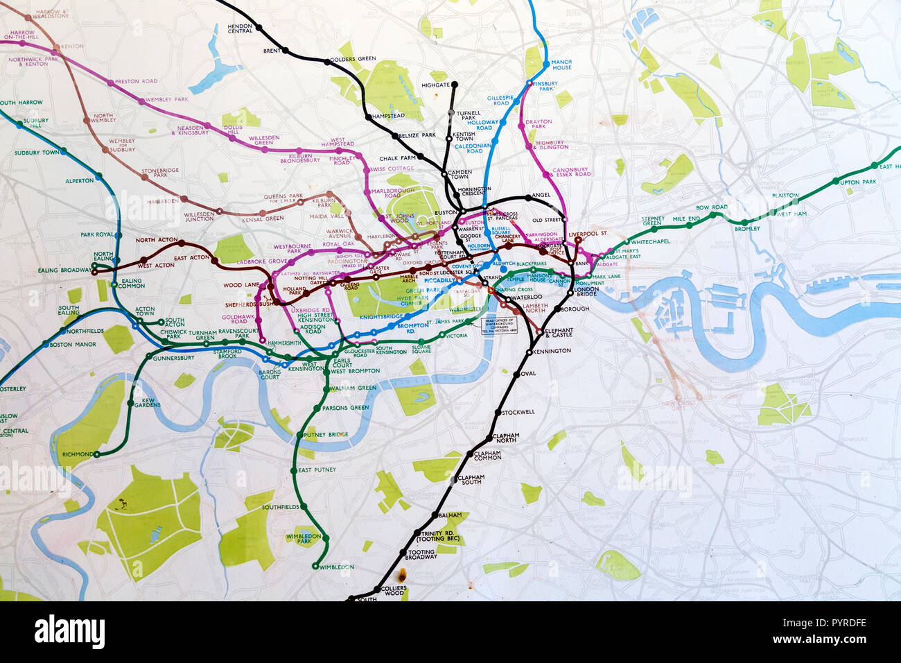 Historic old London Underground map c. 1931, at 55 Broadway building, London, UK Stock Photohttps://www.alamy.com/image-license-details/?v=1https://www.alamy.com/historic-old-london-underground-map-c-1931-at-55-broadway-building-london-uk-image223635650.html
RMPYRDFE–Historic old London Underground map c. 1931, at 55 Broadway building, London, UK
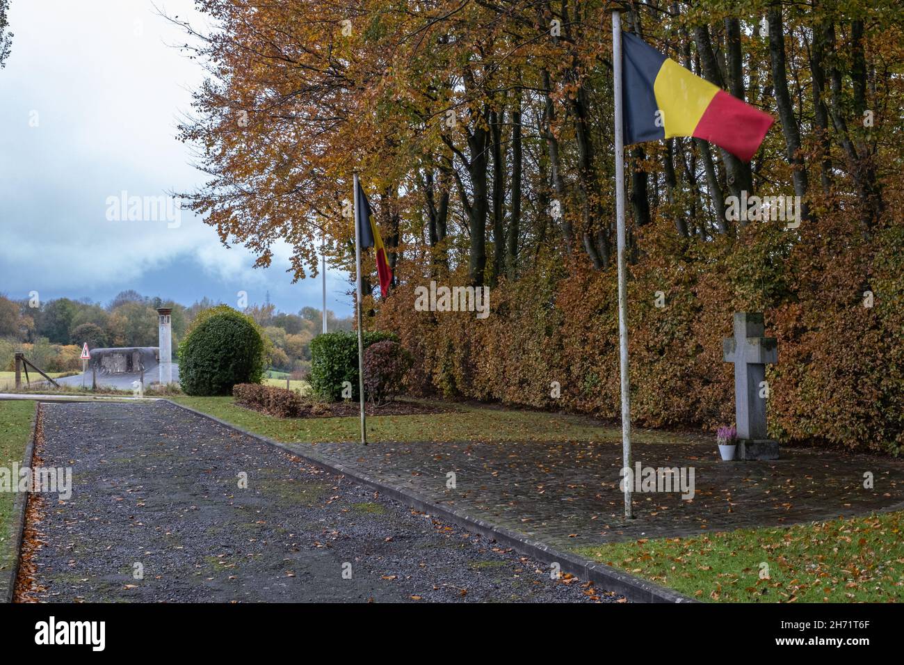 Herve, Belgium - November 2, 2021: Fort of Battice was built in the 1930s as part of the fortified position of Liege. Liege Province. Autumn rainy day Stock Photohttps://www.alamy.com/image-license-details/?v=1https://www.alamy.com/herve-belgium-november-2-2021-fort-of-battice-was-built-in-the-1930s-as-part-of-the-fortified-position-of-liege-liege-province-autumn-rainy-day-image451813111.html
RF2H71T6F–Herve, Belgium - November 2, 2021: Fort of Battice was built in the 1930s as part of the fortified position of Liege. Liege Province. Autumn rainy day
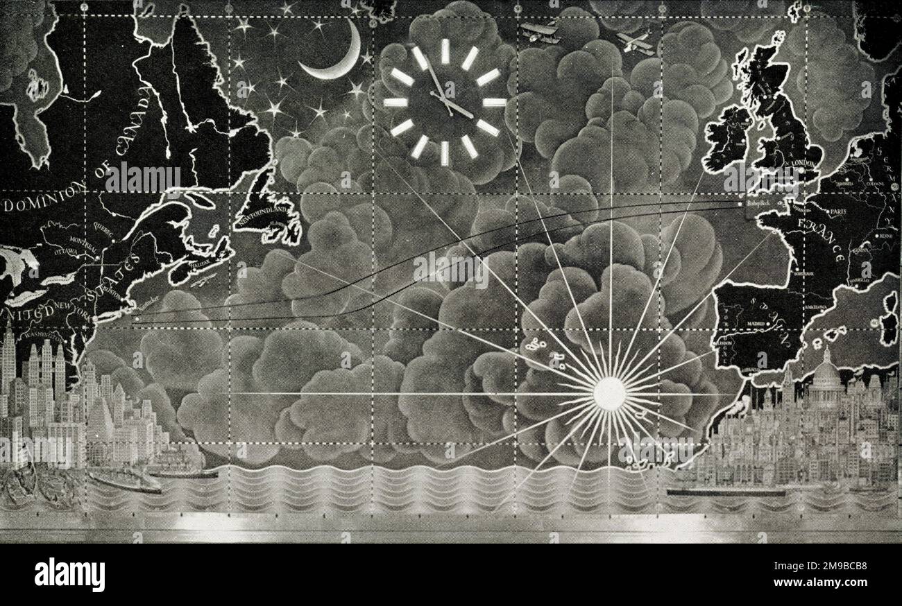 RMS Queen Mary, decorative chart of the Atlantic Stock Photohttps://www.alamy.com/image-license-details/?v=1https://www.alamy.com/rms-queen-mary-decorative-chart-of-the-atlantic-image504883772.html
RM2M9BCB8–RMS Queen Mary, decorative chart of the Atlantic
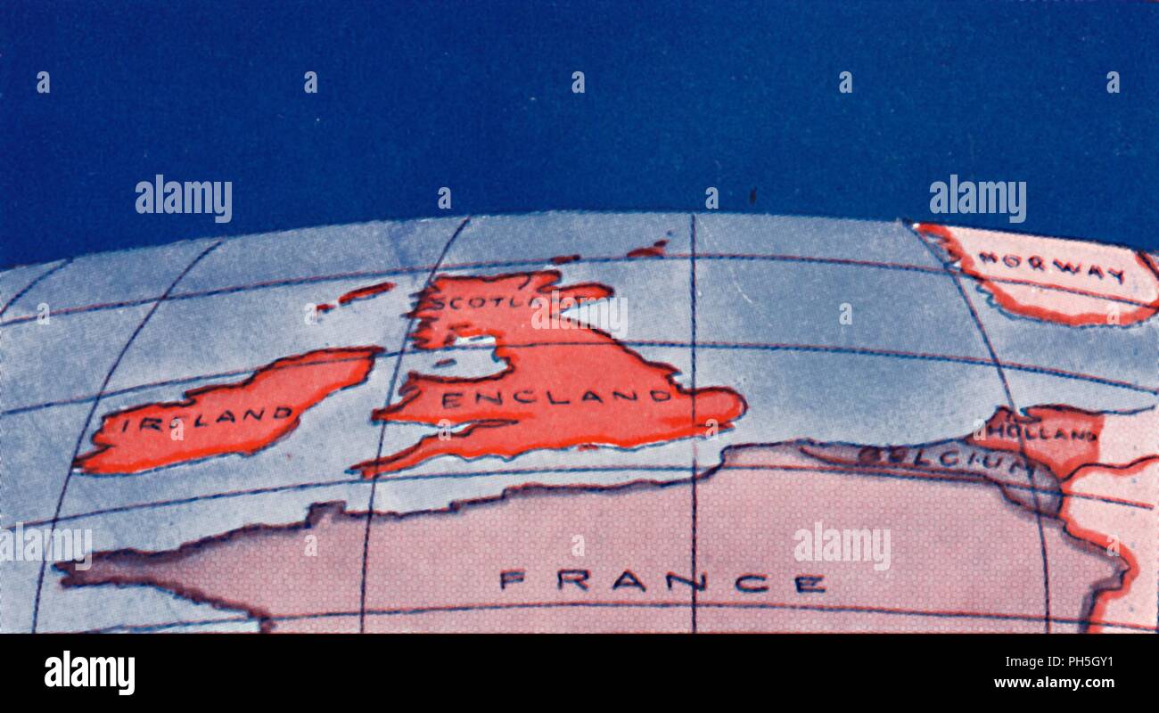 'The British Isles and Northern Europe at Noon in mid-winter', 1935. Artist: Unknown. Stock Photohttps://www.alamy.com/image-license-details/?v=1https://www.alamy.com/the-british-isles-and-northern-europe-at-noon-in-mid-winter-1935-artist-unknown-image217096629.html
RMPH5GY1–'The British Isles and Northern Europe at Noon in mid-winter', 1935. Artist: Unknown.
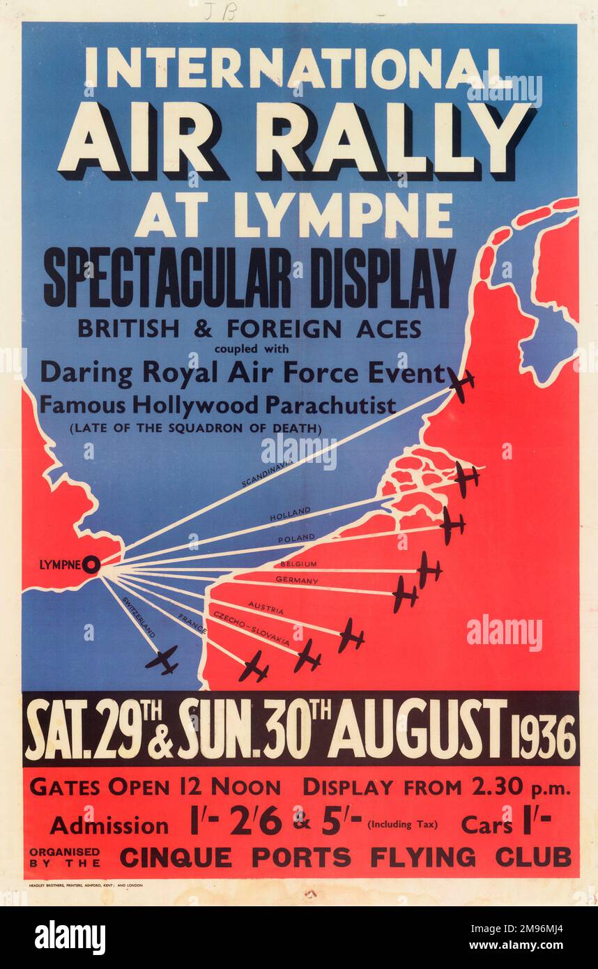 Poster, International Air Rally at Lympne, Cinque Ports Flying Club. Offering a spectacular display of British and foreign aces, a daring RAF event and a famous Hollywood parachutist. Stock Photohttps://www.alamy.com/image-license-details/?v=1https://www.alamy.com/poster-international-air-rally-at-lympne-cinque-ports-flying-club-offering-a-spectacular-display-of-british-and-foreign-aces-a-daring-raf-event-and-a-famous-hollywood-parachutist-image504780476.html
RM2M96MJ4–Poster, International Air Rally at Lympne, Cinque Ports Flying Club. Offering a spectacular display of British and foreign aces, a daring RAF event and a famous Hollywood parachutist.
 vintage medieval art Stock Photohttps://www.alamy.com/image-license-details/?v=1https://www.alamy.com/vintage-medieval-art-image264931814.html
RFWB0K6E–vintage medieval art
 Vintage map of Ghent, 1930s. Stock Photohttps://www.alamy.com/image-license-details/?v=1https://www.alamy.com/vintage-map-of-ghent-1930s-image628920840.html
RF2YF5PXG–Vintage map of Ghent, 1930s.
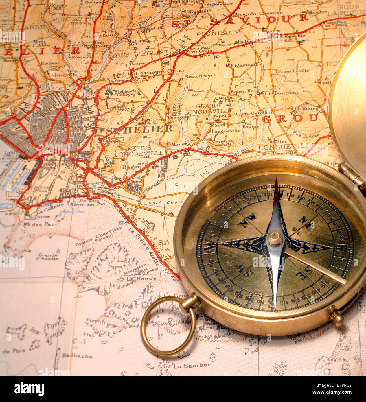 Ordinary magnetic compass on a 1930s map of Jersey,in the Channel Islands Stock Photohttps://www.alamy.com/image-license-details/?v=1https://www.alamy.com/stock-photo-ordinary-magnetic-compass-on-a-1930s-map-of-jerseyin-the-channel-islands-21706952.html
RFB78RC8–Ordinary magnetic compass on a 1930s map of Jersey,in the Channel Islands
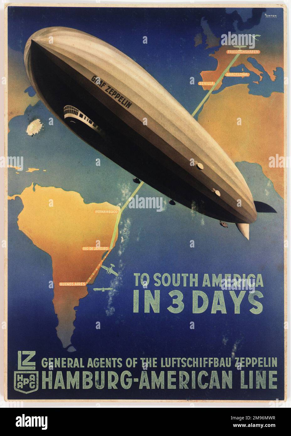 Poster advertising the German Zeppelin Hamburg-American Line, LZ 127 Graf Zeppelin airship service from Friedrichshafen, Germany, to Buenos Aires, Argentina. Stock Photohttps://www.alamy.com/image-license-details/?v=1https://www.alamy.com/poster-advertising-the-german-zeppelin-hamburg-american-line-lz-127-graf-zeppelin-airship-service-from-friedrichshafen-germany-to-buenos-aires-argentina-image504780691.html
RM2M96MWR–Poster advertising the German Zeppelin Hamburg-American Line, LZ 127 Graf Zeppelin airship service from Friedrichshafen, Germany, to Buenos Aires, Argentina.
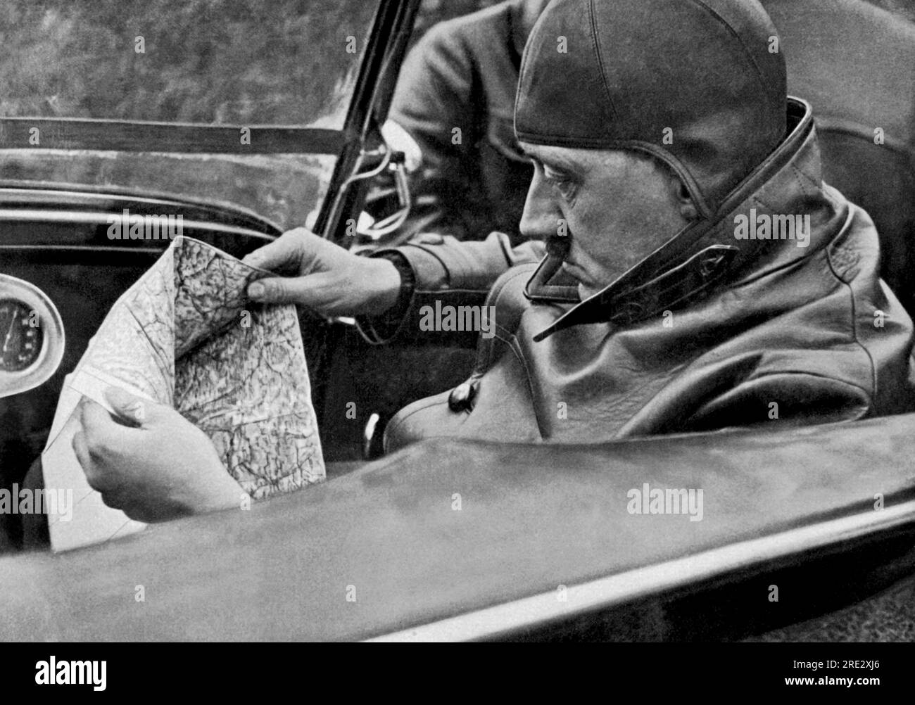 Germany: c. 1934 Adolph Hitler determines the travel route. Stock Photohttps://www.alamy.com/image-license-details/?v=1https://www.alamy.com/germany-c-1934-adolph-hitler-determines-the-travel-route-image559401758.html
RM2RE2XJ6–Germany: c. 1934 Adolph Hitler determines the travel route.
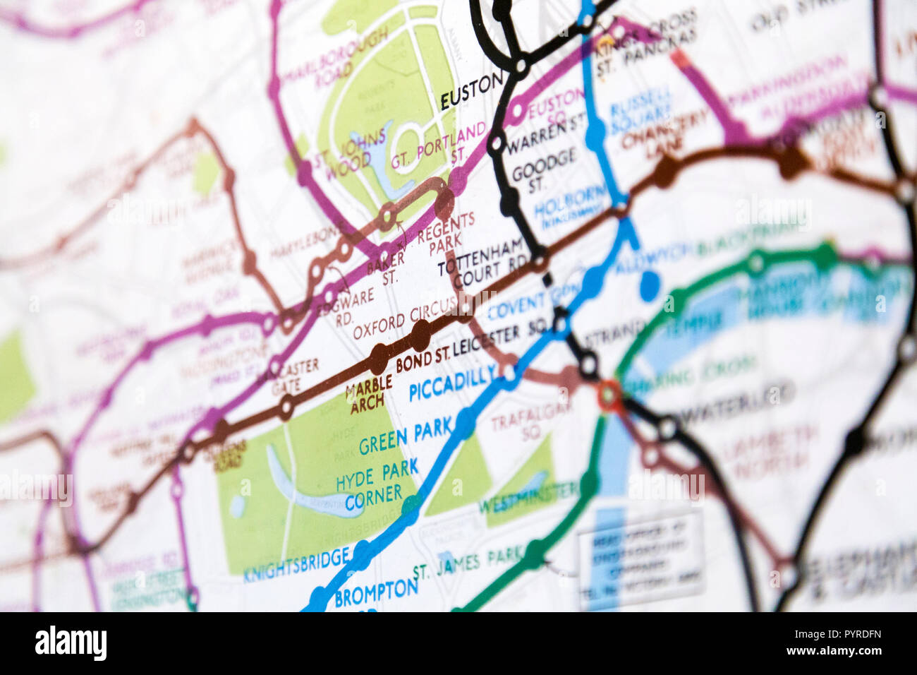 Historic old London Underground map c. 1931, at 55 Broadway Building, London, UK Stock Photohttps://www.alamy.com/image-license-details/?v=1https://www.alamy.com/historic-old-london-underground-map-c-1931-at-55-broadway-building-london-uk-image223635657.html
RMPYRDFN–Historic old London Underground map c. 1931, at 55 Broadway Building, London, UK
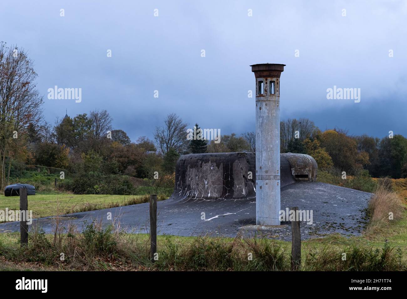 Herve, Belgium - November 2, 2021: Fort of Battice was built in the 1930s as part of the fortified position of Liege. Liege Province. Autumn rainy day Stock Photohttps://www.alamy.com/image-license-details/?v=1https://www.alamy.com/herve-belgium-november-2-2021-fort-of-battice-was-built-in-the-1930s-as-part-of-the-fortified-position-of-liege-liege-province-autumn-rainy-day-image451813128.html
RF2H71T74–Herve, Belgium - November 2, 2021: Fort of Battice was built in the 1930s as part of the fortified position of Liege. Liege Province. Autumn rainy day
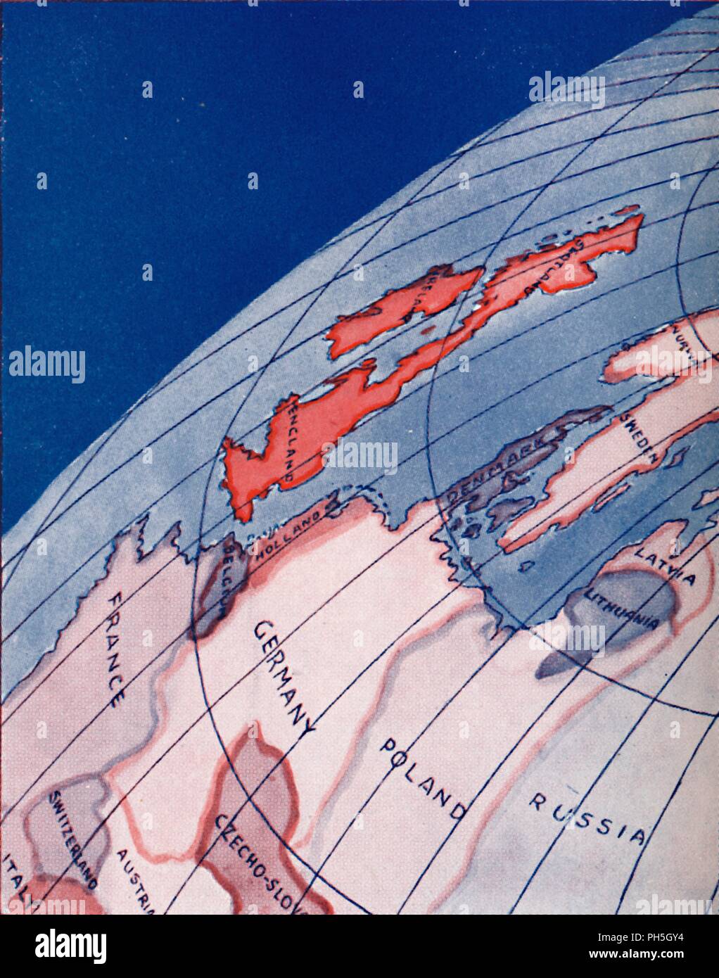 'The British Isles and Northern Europe at 6am on mid-summer day', 1935. Artist: Unknown. Stock Photohttps://www.alamy.com/image-license-details/?v=1https://www.alamy.com/the-british-isles-and-northern-europe-at-6am-on-mid-summer-day-1935-artist-unknown-image217096632.html
RMPH5GY4–'The British Isles and Northern Europe at 6am on mid-summer day', 1935. Artist: Unknown.
 vintage medieval art Stock Photohttps://www.alamy.com/image-license-details/?v=1https://www.alamy.com/vintage-medieval-art-image264931746.html
RFWB0K42–vintage medieval art
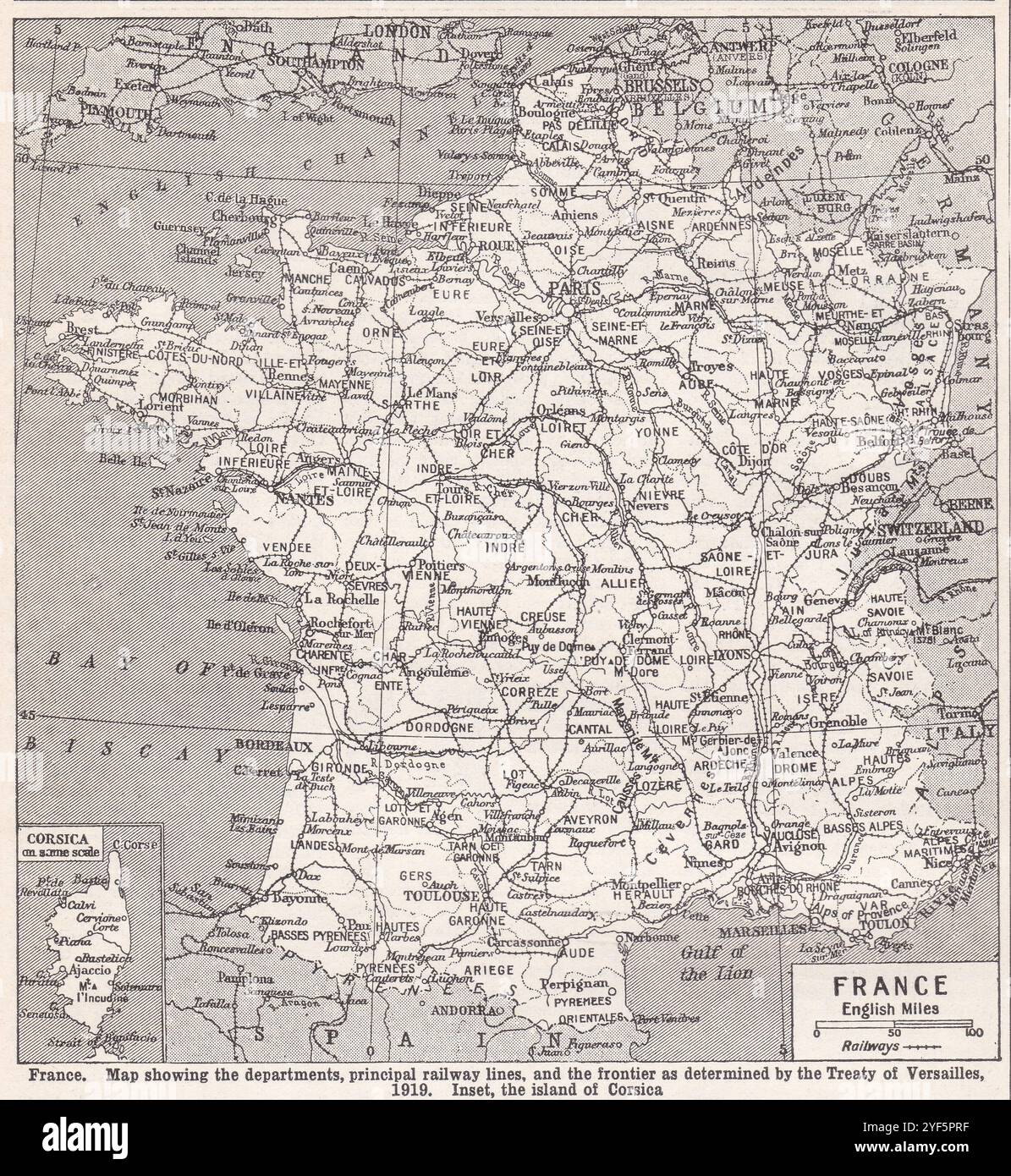 Vintage map of France, 1930s. Stock Photohttps://www.alamy.com/image-license-details/?v=1https://www.alamy.com/vintage-map-of-france-1930s-image628920755.html
RF2YF5PRF–Vintage map of France, 1930s.
 Herve, Belgium - November 2, 2021: Fort of Battice was built in the 1930s as part of the fortified position of Liege. Liege Province. Autumn rainy day Stock Photohttps://www.alamy.com/image-license-details/?v=1https://www.alamy.com/herve-belgium-november-2-2021-fort-of-battice-was-built-in-the-1930s-as-part-of-the-fortified-position-of-liege-liege-province-autumn-rainy-day-image451813125.html
RF2H71T71–Herve, Belgium - November 2, 2021: Fort of Battice was built in the 1930s as part of the fortified position of Liege. Liege Province. Autumn rainy day
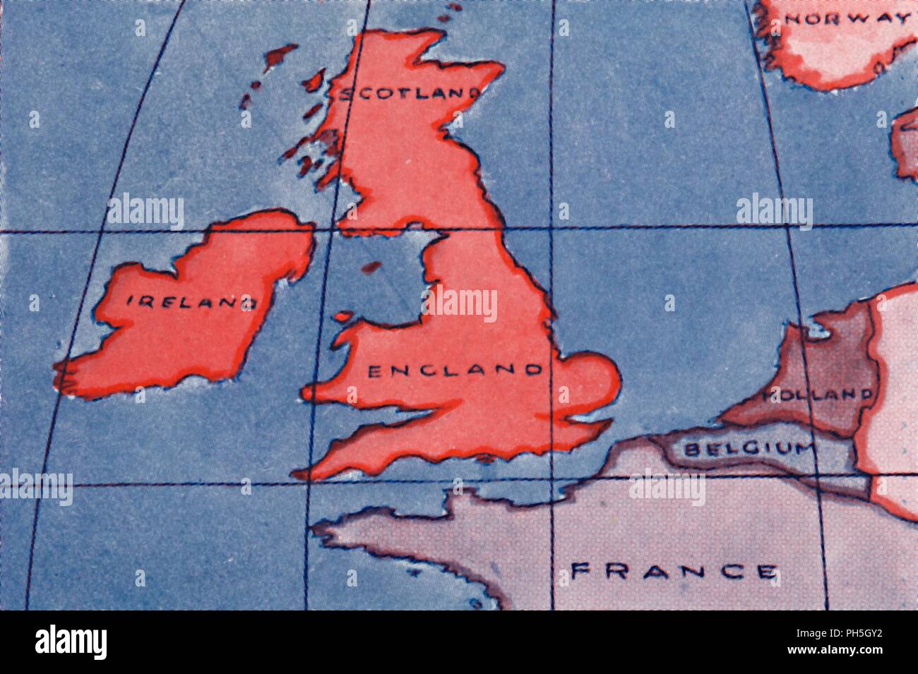 'The British Isles and Northern Europe at Noon in spring or Autumn', 1935. Artist: Unknown. Stock Photohttps://www.alamy.com/image-license-details/?v=1https://www.alamy.com/the-british-isles-and-northern-europe-at-noon-in-spring-or-autumn-1935-artist-unknown-image217096630.html
RMPH5GY2–'The British Isles and Northern Europe at Noon in spring or Autumn', 1935. Artist: Unknown.
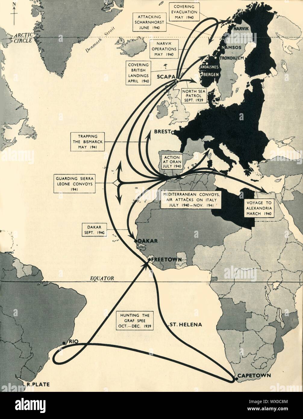 Map showing the movements of 'HMS Ark Royal', 1939-1941, (1942). Map of the Atlantic Ocean, western Europe and Africa, indicating journeys and principal engagements of the British Royal Navy aircraft carrier 'Ark Royal' during the Second World War: Hunting of the 'Graf Spee', October-December 1939; Guarding Sierra Leone Convoys, 1941; Trapping the 'Bismarck', May 1941; Covering British Landings, April 1940; Attacking 'Scharnhorst', June 1940; Covering Evacuation, May 1940; Narvik Operations, May 1940; North Sea Patrol, September 1939; Action at Oran, July 1940; Mediterranean Convoys, Air Attac Stock Photohttps://www.alamy.com/image-license-details/?v=1https://www.alamy.com/map-showing-the-movements-of-hms-ark-royal-1939-1941-1942-map-of-the-atlantic-ocean-western-europe-and-africa-indicating-journeys-and-principal-engagements-of-the-british-royal-navy-aircraft-carrier-ark-royal-during-the-second-world-war-hunting-of-the-graf-spee-october-december-1939-guarding-sierra-leone-convoys-1941-trapping-the-bismarck-may-1941-covering-british-landings-april-1940-attacking-scharnhorst-june-1940-covering-evacuation-may-1940-narvik-operations-may-1940-north-sea-patrol-september-1939-action-at-oran-july-1940-mediterranean-convoys-air-attac-image274146228.html
RMWX0C8M–Map showing the movements of 'HMS Ark Royal', 1939-1941, (1942). Map of the Atlantic Ocean, western Europe and Africa, indicating journeys and principal engagements of the British Royal Navy aircraft carrier 'Ark Royal' during the Second World War: Hunting of the 'Graf Spee', October-December 1939; Guarding Sierra Leone Convoys, 1941; Trapping the 'Bismarck', May 1941; Covering British Landings, April 1940; Attacking 'Scharnhorst', June 1940; Covering Evacuation, May 1940; Narvik Operations, May 1940; North Sea Patrol, September 1939; Action at Oran, July 1940; Mediterranean Convoys, Air Attac
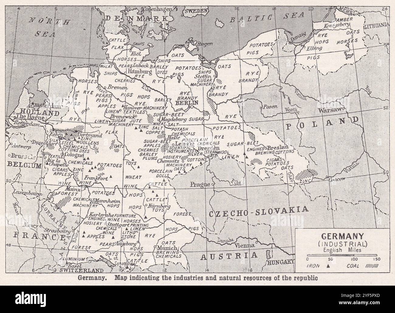 Vintage map of Germany Industrial, 1930s. Stock Photohttps://www.alamy.com/image-license-details/?v=1https://www.alamy.com/vintage-map-of-germany-industrial-1930s-image628920837.html
RF2YF5PXD–Vintage map of Germany Industrial, 1930s.
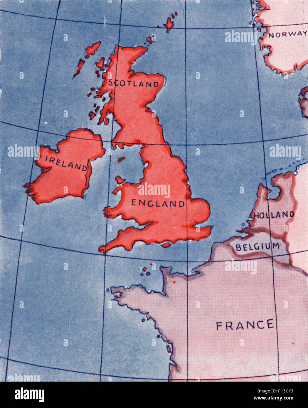 'The British Isles and France, Belgium and Holland at Noon in mid-summer', 1935. Artist: Unknown. Stock Photohttps://www.alamy.com/image-license-details/?v=1https://www.alamy.com/the-british-isles-and-france-belgium-and-holland-at-noon-in-mid-summer-1935-artist-unknown-image217096631.html
RMPH5GY3–'The British Isles and France, Belgium and Holland at Noon in mid-summer', 1935. Artist: Unknown.
 Vintage map of France 1930s. Stock Photohttps://www.alamy.com/image-license-details/?v=1https://www.alamy.com/vintage-map-of-france-1930s-image425694450.html
RF2FMG1H6–Vintage map of France 1930s.
 'The Roman Empire Under Augustus', c1930. Creator: Unknown. Stock Photohttps://www.alamy.com/image-license-details/?v=1https://www.alamy.com/the-roman-empire-under-augustus-c1930-creator-unknown-image243217299.html
RMT3KE43–'The Roman Empire Under Augustus', c1930. Creator: Unknown.
 Herve, Belgium - November 2, 2021: Fort of Battice was built in the 1930s as part of the fortified position of Liege. Liege Province. Autumn rainy day Stock Photohttps://www.alamy.com/image-license-details/?v=1https://www.alamy.com/herve-belgium-november-2-2021-fort-of-battice-was-built-in-the-1930s-as-part-of-the-fortified-position-of-liege-liege-province-autumn-rainy-day-image451813098.html
RF2H71T62–Herve, Belgium - November 2, 2021: Fort of Battice was built in the 1930s as part of the fortified position of Liege. Liege Province. Autumn rainy day
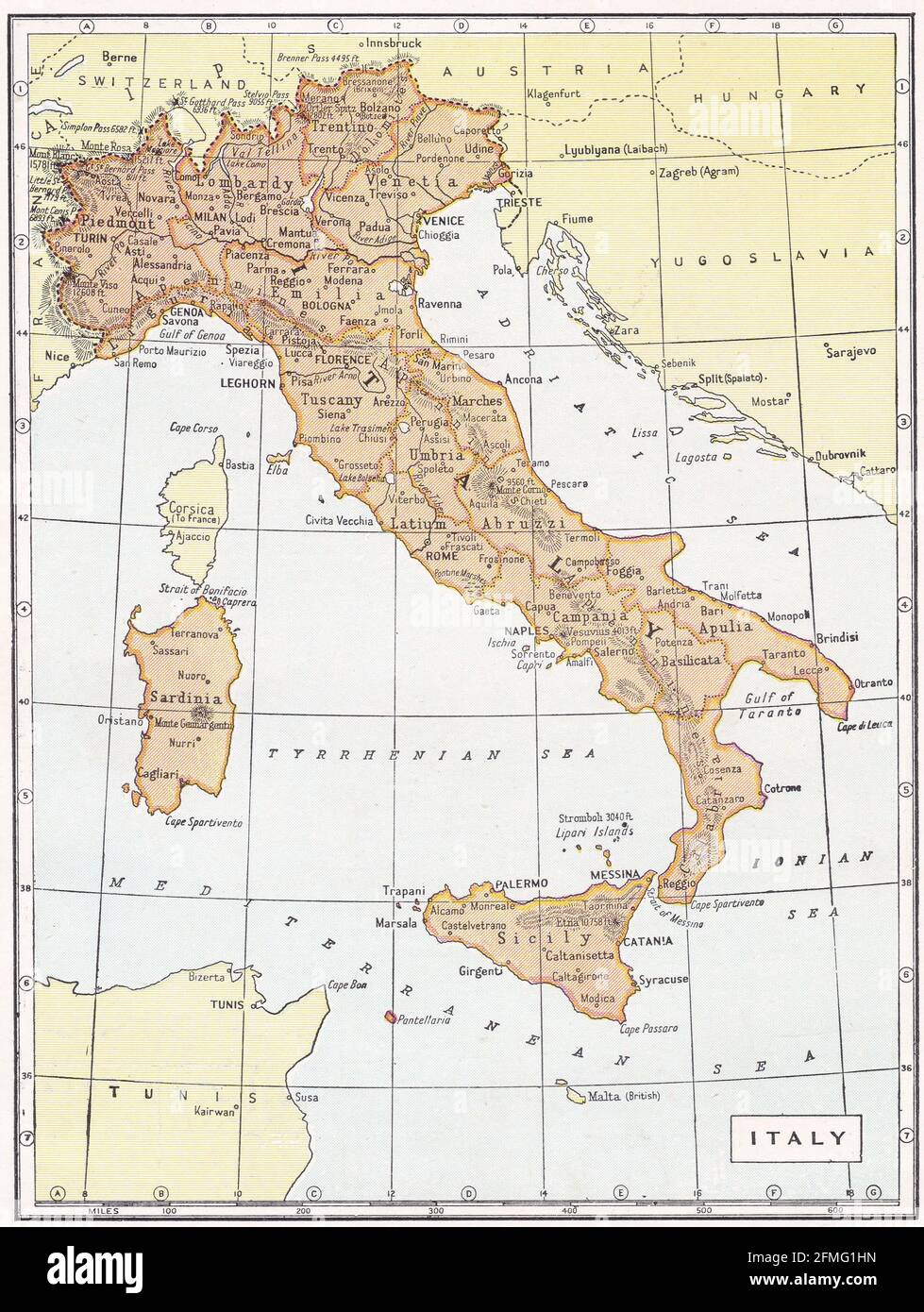 Vintage map of Italy 1930s Stock Photohttps://www.alamy.com/image-license-details/?v=1https://www.alamy.com/vintage-map-of-italy-1930s-image425694465.html
RF2FMG1HN–Vintage map of Italy 1930s
 Herve, Belgium - November 2, 2021: Fort of Battice was built in the 1930s as part of the fortified position of Liege. Liege Province. Autumn rainy day Stock Photohttps://www.alamy.com/image-license-details/?v=1https://www.alamy.com/herve-belgium-november-2-2021-fort-of-battice-was-built-in-the-1930s-as-part-of-the-fortified-position-of-liege-liege-province-autumn-rainy-day-image451813109.html
RF2H71T6D–Herve, Belgium - November 2, 2021: Fort of Battice was built in the 1930s as part of the fortified position of Liege. Liege Province. Autumn rainy day
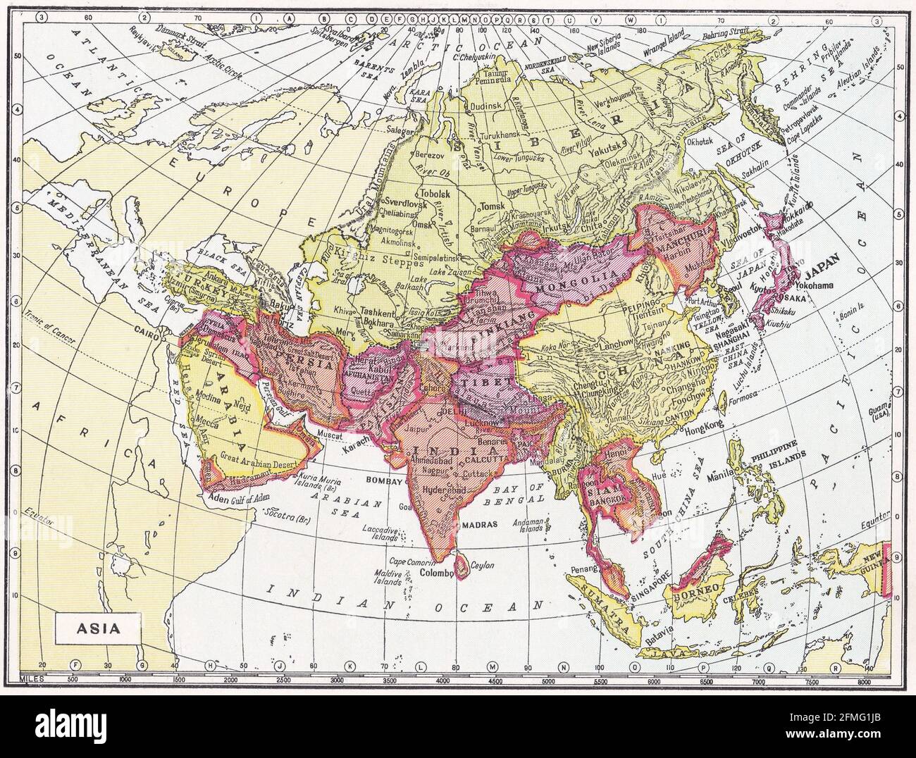 Vintage map of Asia 1930s. Stock Photohttps://www.alamy.com/image-license-details/?v=1https://www.alamy.com/vintage-map-of-asia-1930s-image425694483.html
RF2FMG1JB–Vintage map of Asia 1930s.
 Herve, Belgium - November 2, 2021: Fort of Battice was built in the 1930s as part of the fortified position of Liege. Liege Province. Autumn rainy day Stock Photohttps://www.alamy.com/image-license-details/?v=1https://www.alamy.com/herve-belgium-november-2-2021-fort-of-battice-was-built-in-the-1930s-as-part-of-the-fortified-position-of-liege-liege-province-autumn-rainy-day-image451813086.html
RF2H71T5J–Herve, Belgium - November 2, 2021: Fort of Battice was built in the 1930s as part of the fortified position of Liege. Liege Province. Autumn rainy day
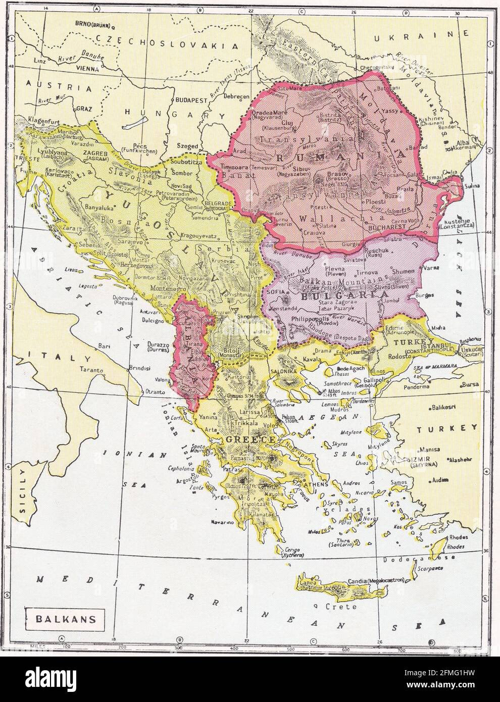 Vintage map of the Balkans 1930s. Stock Photohttps://www.alamy.com/image-license-details/?v=1https://www.alamy.com/vintage-map-of-the-balkans-1930s-image425694469.html
RF2FMG1HW–Vintage map of the Balkans 1930s.
 Herve, Belgium - November 2, 2021: Fort of Battice was built in the 1930s as part of the fortified position of Liege. Liege Province. Autumn rainy day Stock Photohttps://www.alamy.com/image-license-details/?v=1https://www.alamy.com/herve-belgium-november-2-2021-fort-of-battice-was-built-in-the-1930s-as-part-of-the-fortified-position-of-liege-liege-province-autumn-rainy-day-image451813023.html
RF2H71T3B–Herve, Belgium - November 2, 2021: Fort of Battice was built in the 1930s as part of the fortified position of Liege. Liege Province. Autumn rainy day
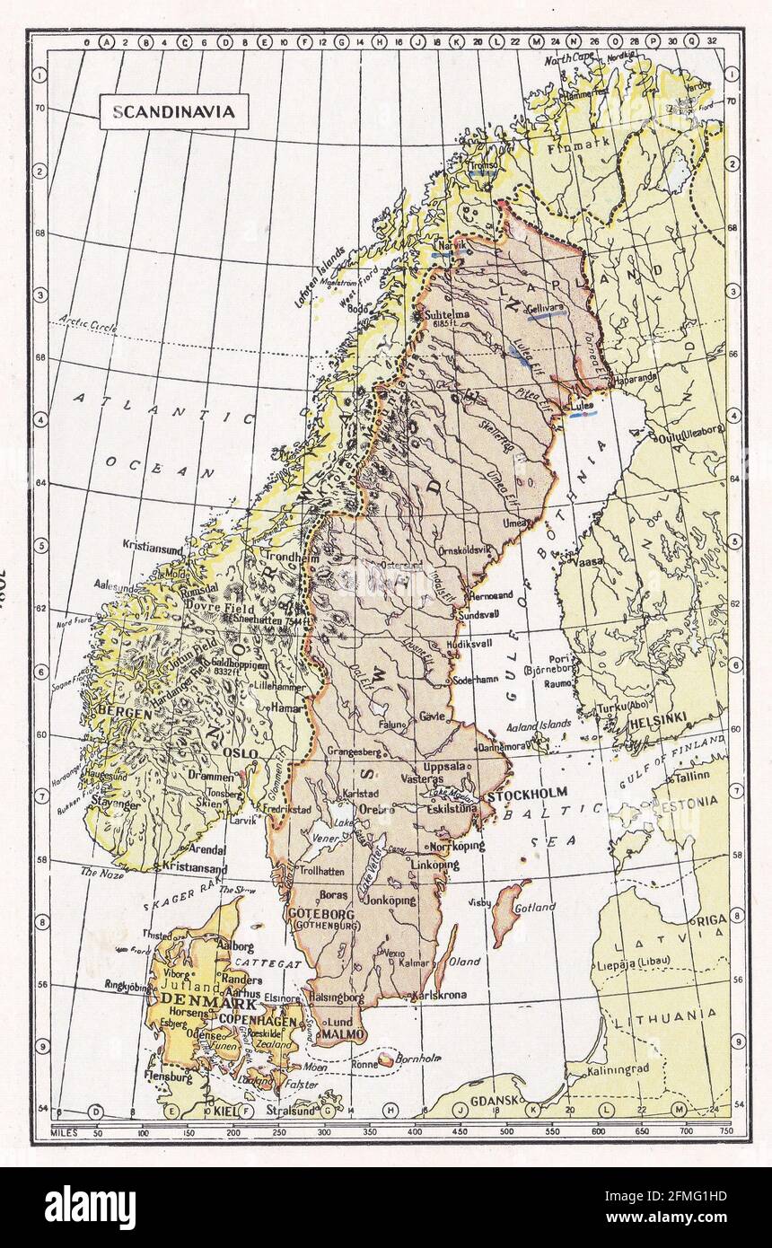 Vintage map of Scandinavia 1930s Stock Photohttps://www.alamy.com/image-license-details/?v=1https://www.alamy.com/vintage-map-of-scandinavia-1930s-image425694457.html
RF2FMG1HD–Vintage map of Scandinavia 1930s
 Vintage map of Norway and environs of Christiania 1930s. Stock Photohttps://www.alamy.com/image-license-details/?v=1https://www.alamy.com/vintage-map-of-norway-and-environs-of-christiania-1930s-image454898244.html
RF2HC2B9T–Vintage map of Norway and environs of Christiania 1930s.
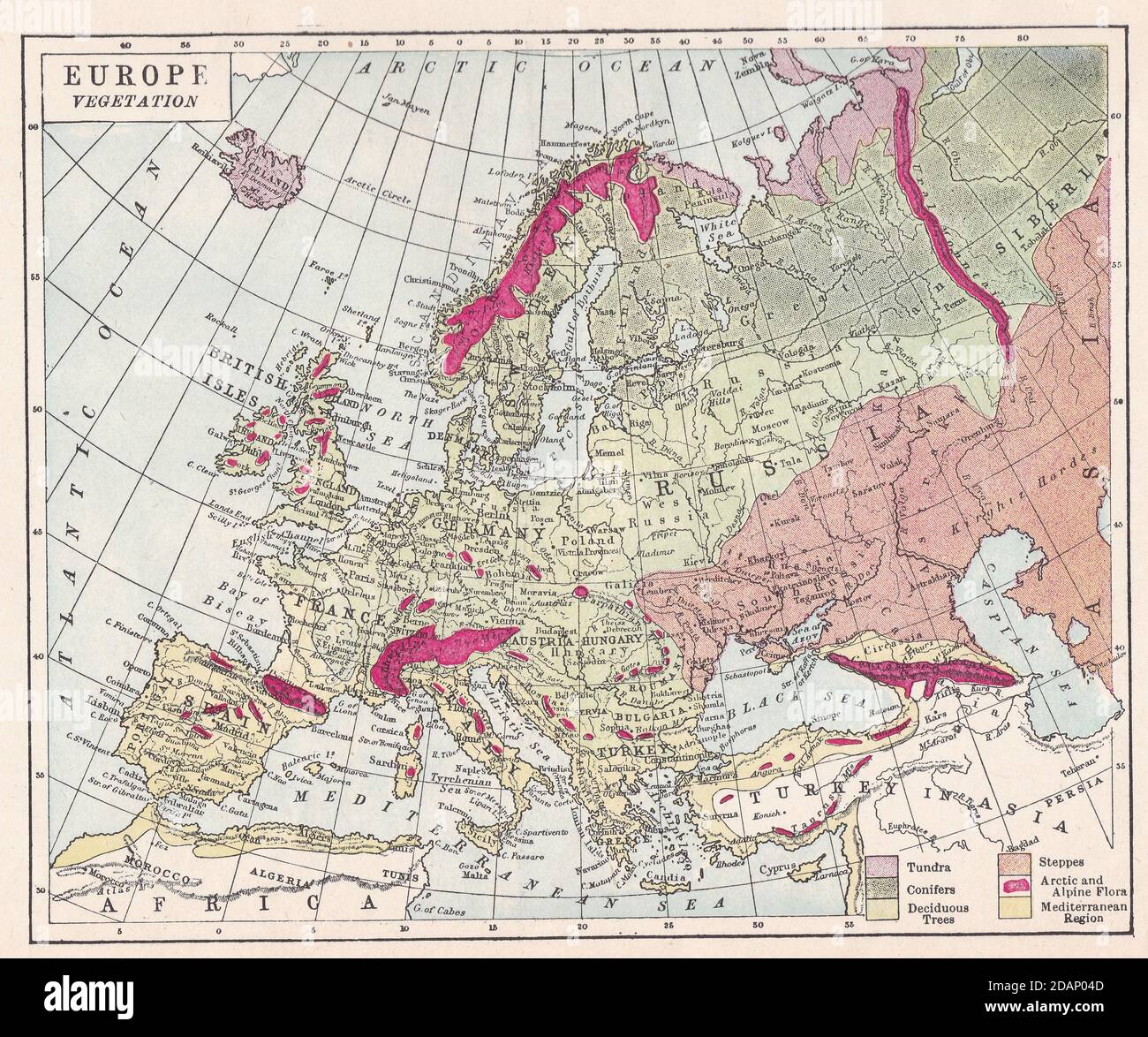 Vintage map of Europe Vegetation 1900s. Stock Photohttps://www.alamy.com/image-license-details/?v=1https://www.alamy.com/vintage-map-of-europe-vegetation-1900s-image385257725.html
RF2DAP04D–Vintage map of Europe Vegetation 1900s.
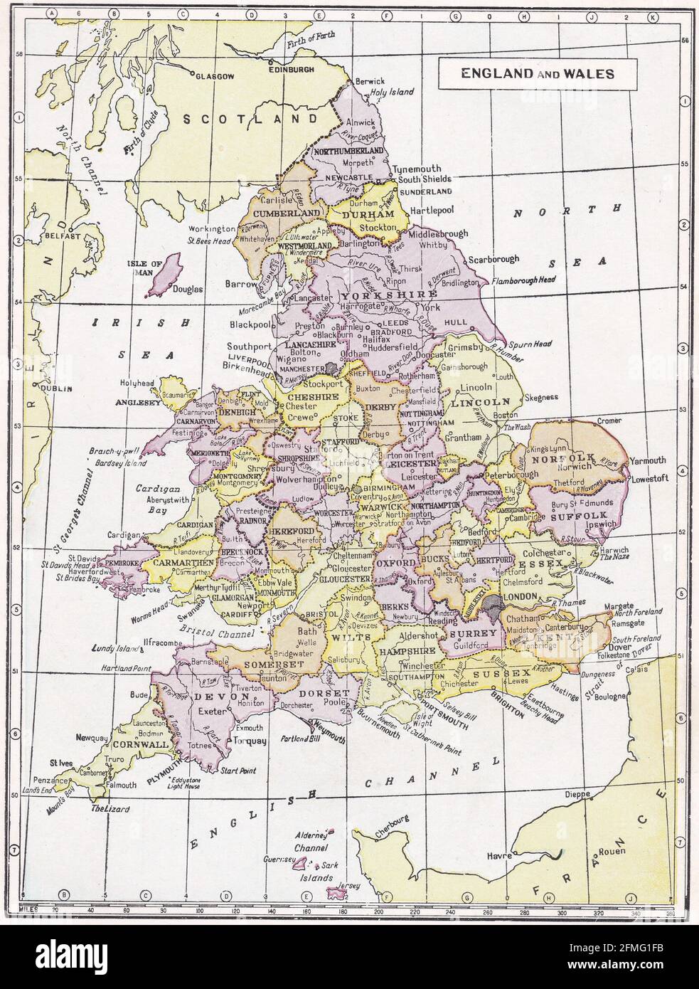 Vintage map of England and Wales 1930s. Stock Photohttps://www.alamy.com/image-license-details/?v=1https://www.alamy.com/vintage-map-of-england-and-wales-1930s-image425694399.html
RF2FMG1FB–Vintage map of England and Wales 1930s.
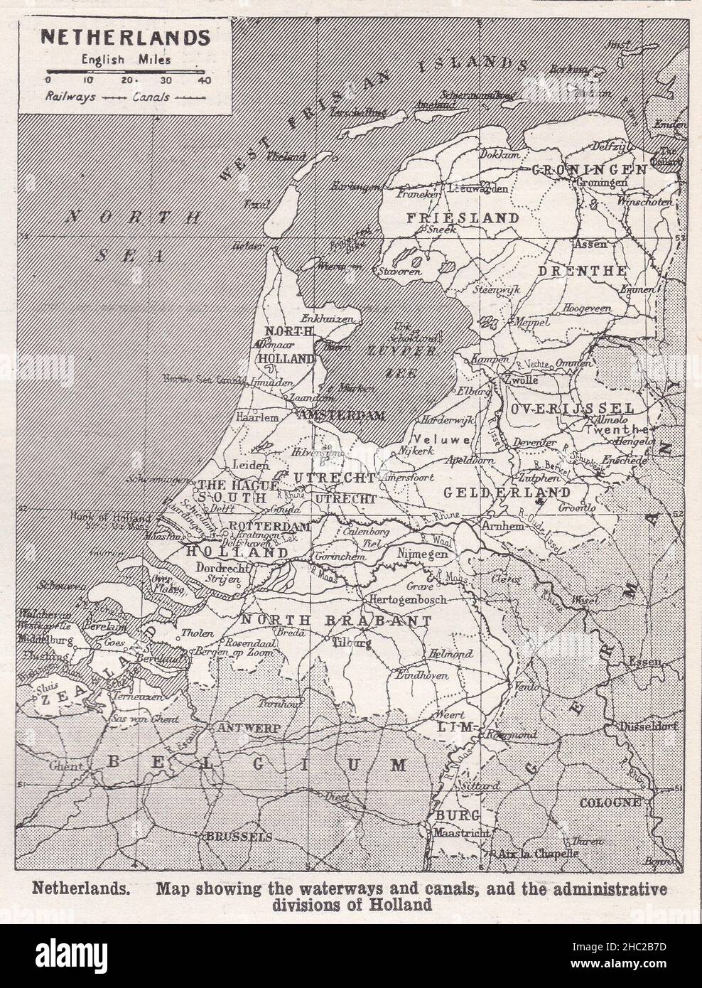 Vintage map of Netherlands showing waterways and canals 1930s. Stock Photohttps://www.alamy.com/image-license-details/?v=1https://www.alamy.com/vintage-map-of-netherlands-showing-waterways-and-canals-1930s-image454898177.html
RF2HC2B7D–Vintage map of Netherlands showing waterways and canals 1930s.
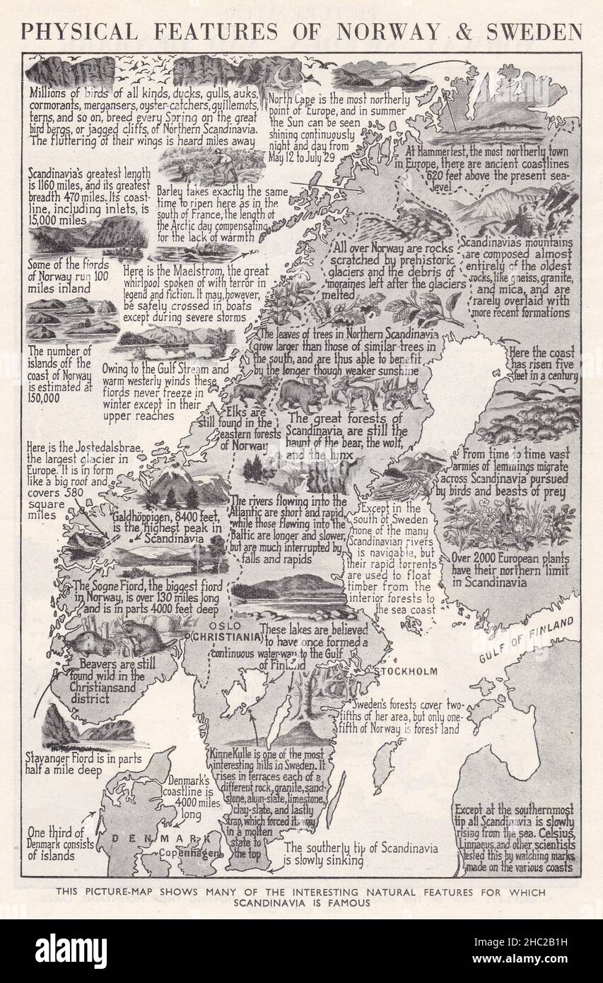 Vintage picture map of physical features of Norway and Sweden 1930s. Stock Photohttps://www.alamy.com/image-license-details/?v=1https://www.alamy.com/vintage-picture-map-of-physical-features-of-norway-and-sweden-1930s-image454898013.html
RF2HC2B1H–Vintage picture map of physical features of Norway and Sweden 1930s.
 Vintage picture map of the stirring history of Norway and Sweden 1930s. Stock Photohttps://www.alamy.com/image-license-details/?v=1https://www.alamy.com/vintage-picture-map-of-the-stirring-history-of-norway-and-sweden-1930s-image454898007.html
RF2HC2B1B–Vintage picture map of the stirring history of Norway and Sweden 1930s.
 Vintage picture map of the animals of Greenland and Iceland 1930s. Stock Photohttps://www.alamy.com/image-license-details/?v=1https://www.alamy.com/vintage-picture-map-of-the-animals-of-greenland-and-iceland-1930s-image454897995.html
RF2HC2B0Y–Vintage picture map of the animals of Greenland and Iceland 1930s.
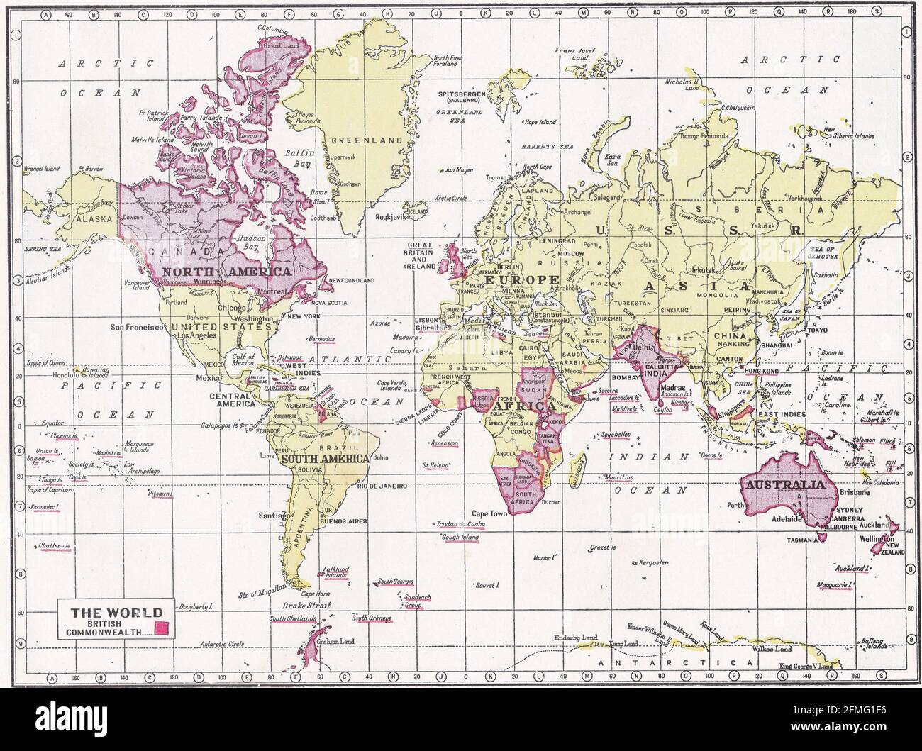 Vintage map of The World / British Commonwealth 1930s. Stock Photohttps://www.alamy.com/image-license-details/?v=1https://www.alamy.com/vintage-map-of-the-world-british-commonwealth-1930s-image425694394.html
RF2FMG1F6–Vintage map of The World / British Commonwealth 1930s.
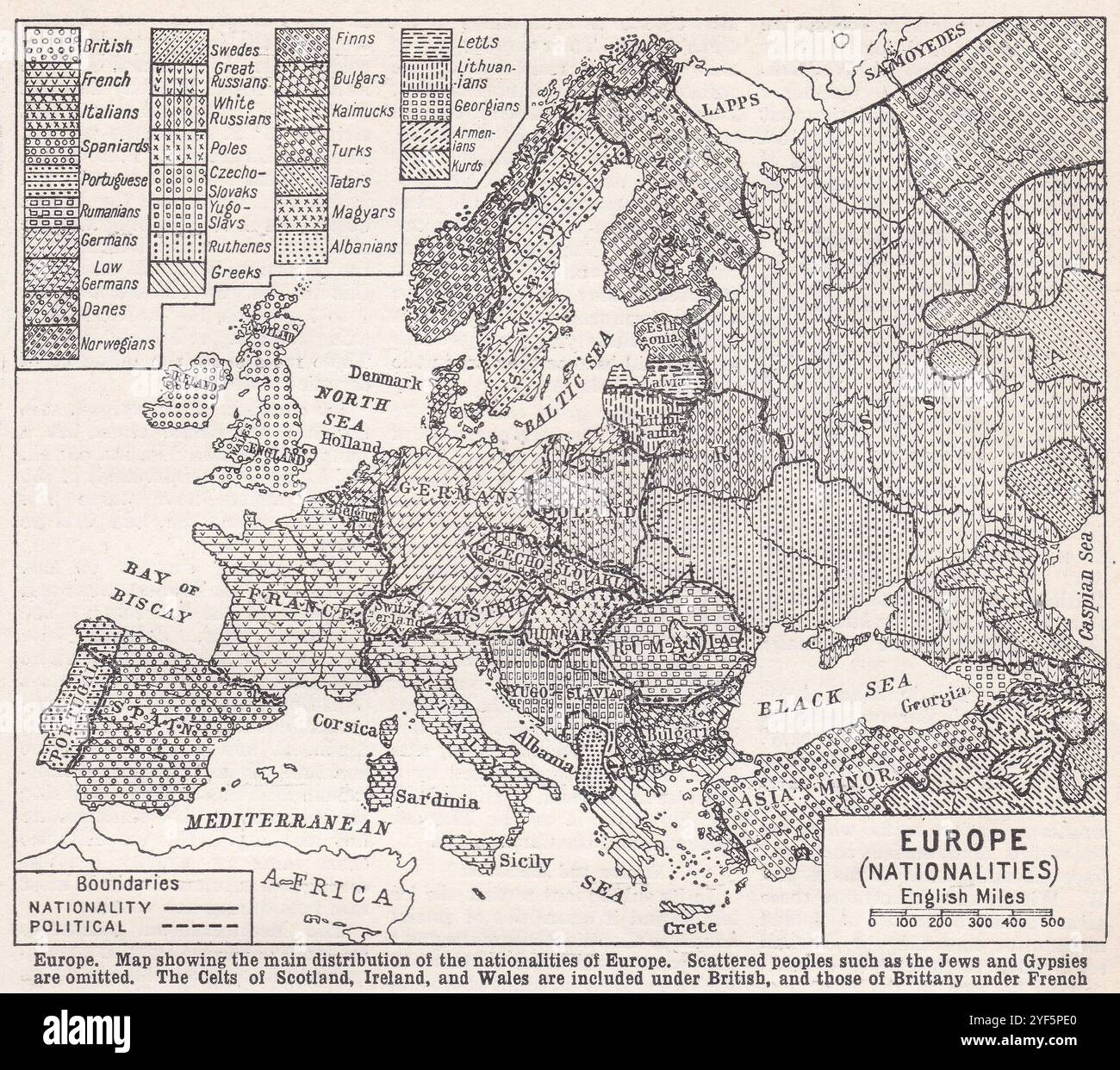 Vintage map of Europe Nationalities. Stock Photohttps://www.alamy.com/image-license-details/?v=1https://www.alamy.com/vintage-map-of-europe-nationalities-image628920488.html
RF2YF5PE0–Vintage map of Europe Nationalities.
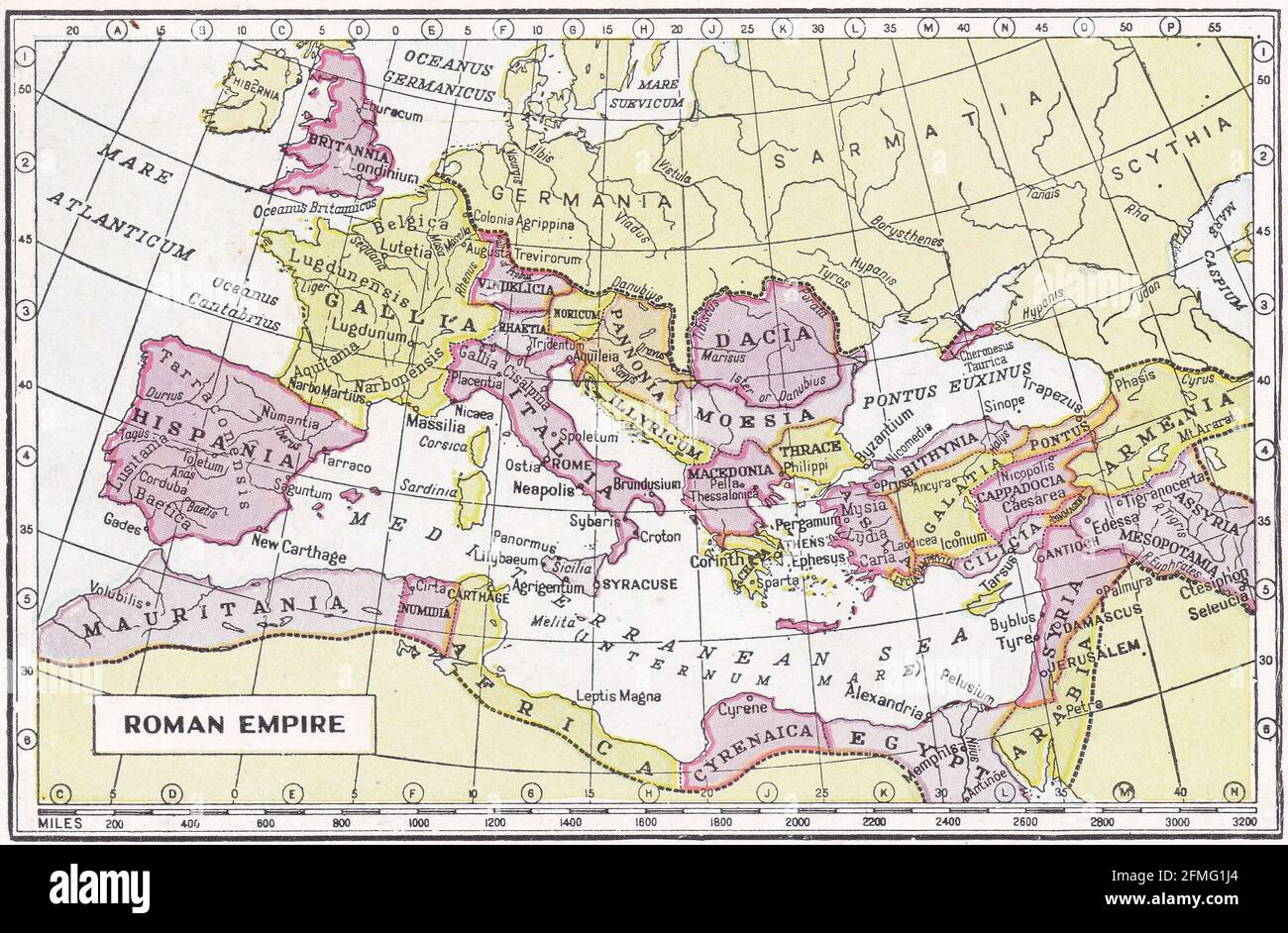 Vintage map of Roman Empire 1930s Stock Photohttps://www.alamy.com/image-license-details/?v=1https://www.alamy.com/vintage-map-of-roman-empire-1930s-image425694476.html
RF2FMG1J4–Vintage map of Roman Empire 1930s
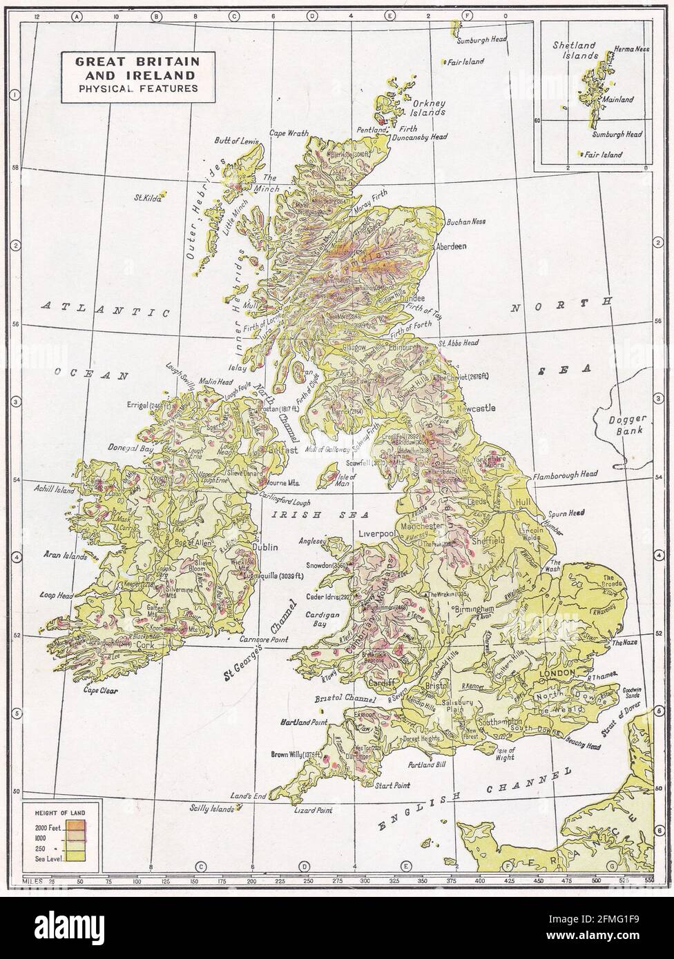 Vintage map of Great Britain and Ireland - Physical Features 1930s. Stock Photohttps://www.alamy.com/image-license-details/?v=1https://www.alamy.com/vintage-map-of-great-britain-and-ireland-physical-features-1930s-image425694397.html
RF2FMG1F9–Vintage map of Great Britain and Ireland - Physical Features 1930s.
 Vintage bird's eye view map of Norway, Sweden, and Denmark 1930s. Stock Photohttps://www.alamy.com/image-license-details/?v=1https://www.alamy.com/vintage-birds-eye-view-map-of-norway-sweden-and-denmark-1930s-image454898016.html
RF2HC2B1M–Vintage bird's eye view map of Norway, Sweden, and Denmark 1930s.
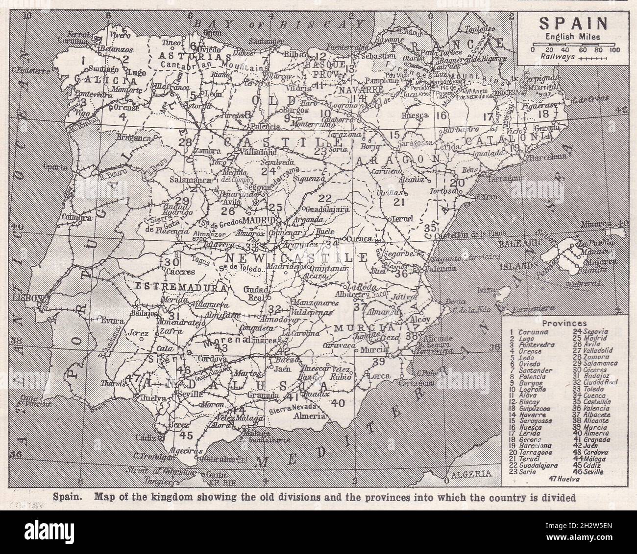 Vintage map of Spain showing the kingdom of the old divisions and the provinces into which the country is divided 1930s. Stock Photohttps://www.alamy.com/image-license-details/?v=1https://www.alamy.com/vintage-map-of-spain-showing-the-kingdom-of-the-old-divisions-and-the-provinces-into-which-the-country-is-divided-1930s-image449252013.html
RF2H2W5EN–Vintage map of Spain showing the kingdom of the old divisions and the provinces into which the country is divided 1930s.
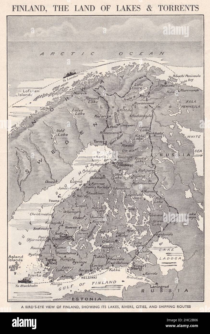 Vintage bird's eye view map of Finland, showing its lakes, rivers, cities, and shipping routes 1930s. Stock Photohttps://www.alamy.com/image-license-details/?v=1https://www.alamy.com/vintage-birds-eye-view-map-of-finland-showing-its-lakes-rivers-cities-and-shipping-routes-1930s-image454897974.html
RF2HC2B06–Vintage bird's eye view map of Finland, showing its lakes, rivers, cities, and shipping routes 1930s.
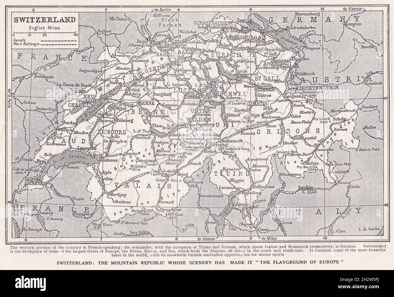 Vintage map of Switzerland 1930s. Stock Photohttps://www.alamy.com/image-license-details/?v=1https://www.alamy.com/vintage-map-of-switzerland-1930s-image449252038.html
RF2H2W5FJ–Vintage map of Switzerland 1930s.
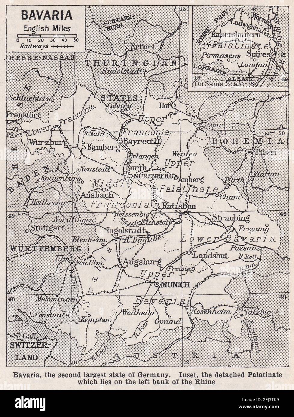 Vintage map of Bavaria 1930s Stock Photohttps://www.alamy.com/image-license-details/?v=1https://www.alamy.com/vintage-map-of-bavaria-1930s-image406987485.html
RF2EJ3TK9–Vintage map of Bavaria 1930s
 Vintage map of Paris showing the city and it environs, the network of railways which connect the business centre with the suburbs 1930s. Stock Photohttps://www.alamy.com/image-license-details/?v=1https://www.alamy.com/vintage-map-of-paris-showing-the-city-and-it-environs-the-network-of-railways-which-connect-the-business-centre-with-the-suburbs-1930s-image454898302.html
RF2HC2BBX–Vintage map of Paris showing the city and it environs, the network of railways which connect the business centre with the suburbs 1930s.