Quick filters:
Map of garibaldi Stock Photos and Images
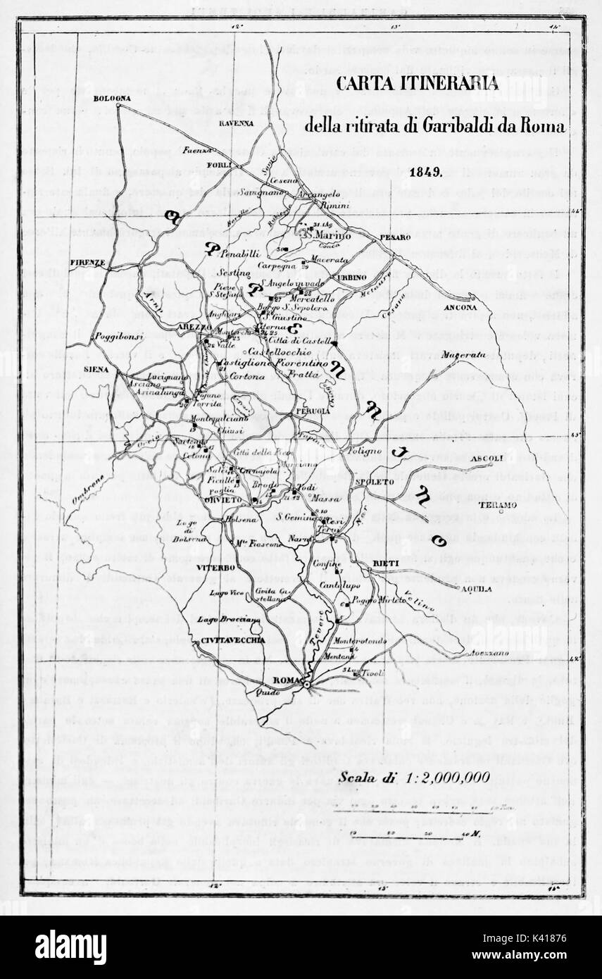 Old itinerary map of Garibaldi retreat from Rome. By E. Matania published on Garibaldi e i Suoi Tempi Milan Italy 1884 Stock Photohttps://www.alamy.com/image-license-details/?v=1https://www.alamy.com/old-itinerary-map-of-garibaldi-retreat-from-rome-by-e-matania-published-image157380362.html
RFK41876–Old itinerary map of Garibaldi retreat from Rome. By E. Matania published on Garibaldi e i Suoi Tempi Milan Italy 1884
 Garibaldi Oregon USA shown on a Geography map or road map Stock Photohttps://www.alamy.com/image-license-details/?v=1https://www.alamy.com/garibaldi-oregon-usa-shown-on-a-geography-map-or-road-map-image433745472.html
RM2G5JPNM–Garibaldi Oregon USA shown on a Geography map or road map
 A cartoon map of Italy from the second half of the 19th-century featuring Giuseppe Garibaldi, an Italian general, patriot, revolutionary and republican who contributed to Italian unification and the creation of the Kingdom of Italy. Designed and painted by Elizabeth Lilian Lancaster, (1852-1939), an amateur artist who created a series of humorous maps of European countries. Stock Photohttps://www.alamy.com/image-license-details/?v=1https://www.alamy.com/a-cartoon-map-of-italy-from-the-second-half-of-the-19th-century-featuring-giuseppe-garibaldi-an-italian-general-patriot-revolutionary-and-republican-who-contributed-to-italian-unification-and-the-creation-of-the-kingdom-of-italy-designed-and-painted-by-elizabeth-lilian-lancaster-1852-1939-an-amateur-artist-who-created-a-series-of-humorous-maps-of-european-countries-image612374540.html
RM2XG81Y8–A cartoon map of Italy from the second half of the 19th-century featuring Giuseppe Garibaldi, an Italian general, patriot, revolutionary and republican who contributed to Italian unification and the creation of the Kingdom of Italy. Designed and painted by Elizabeth Lilian Lancaster, (1852-1939), an amateur artist who created a series of humorous maps of European countries.
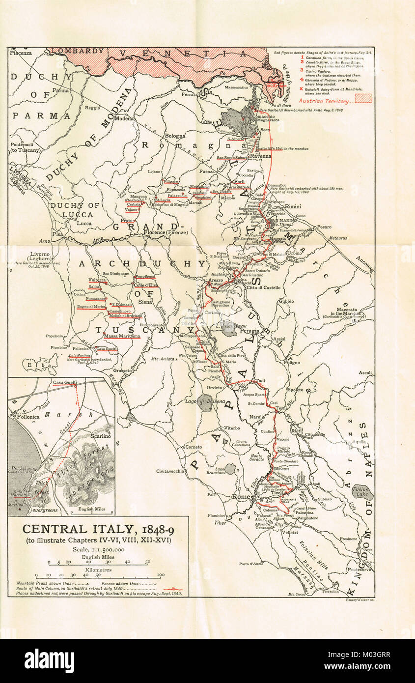 Pre unification map of Italy 1848-49, showing Garibaldi's retreat from Rome Stock Photohttps://www.alamy.com/image-license-details/?v=1https://www.alamy.com/stock-photo-pre-unification-map-of-italy-1848-49-showing-garibaldis-retreat-from-172182747.html
RMM03GRR–Pre unification map of Italy 1848-49, showing Garibaldi's retreat from Rome
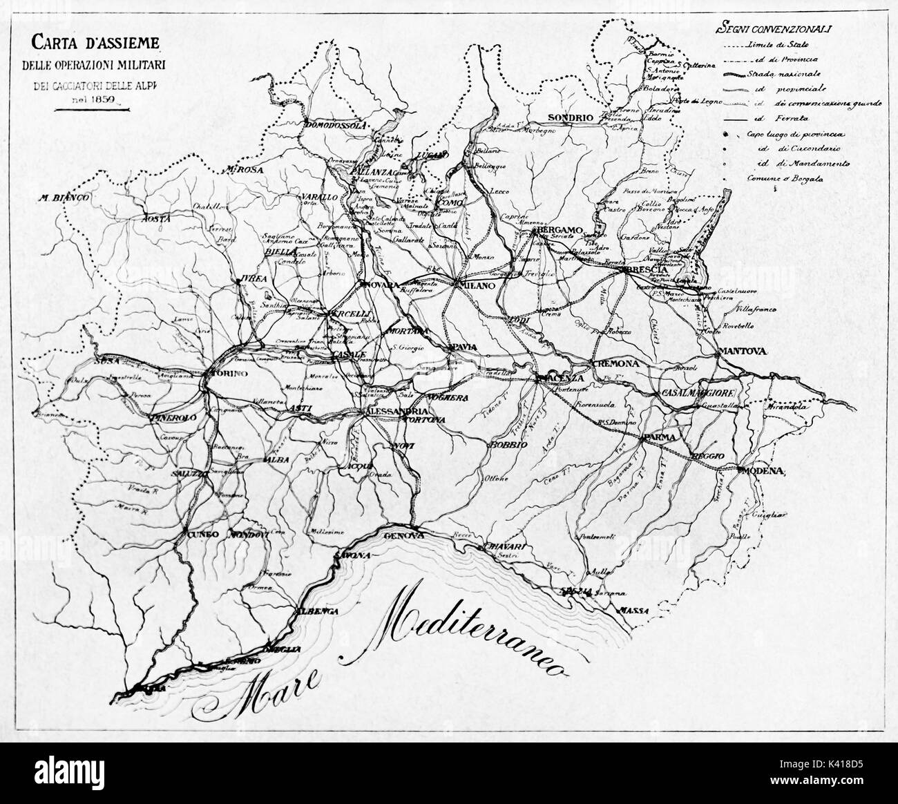 Old black and white map of Hunters of the Alps military actions in 1859. By E. Matania published on Garibaldi e i Suoi Tempi Milan Italy 1884 Stock Photohttps://www.alamy.com/image-license-details/?v=1https://www.alamy.com/old-black-and-white-map-of-hunters-of-the-alps-military-actions-in-image157380529.html
RFK418D5–Old black and white map of Hunters of the Alps military actions in 1859. By E. Matania published on Garibaldi e i Suoi Tempi Milan Italy 1884
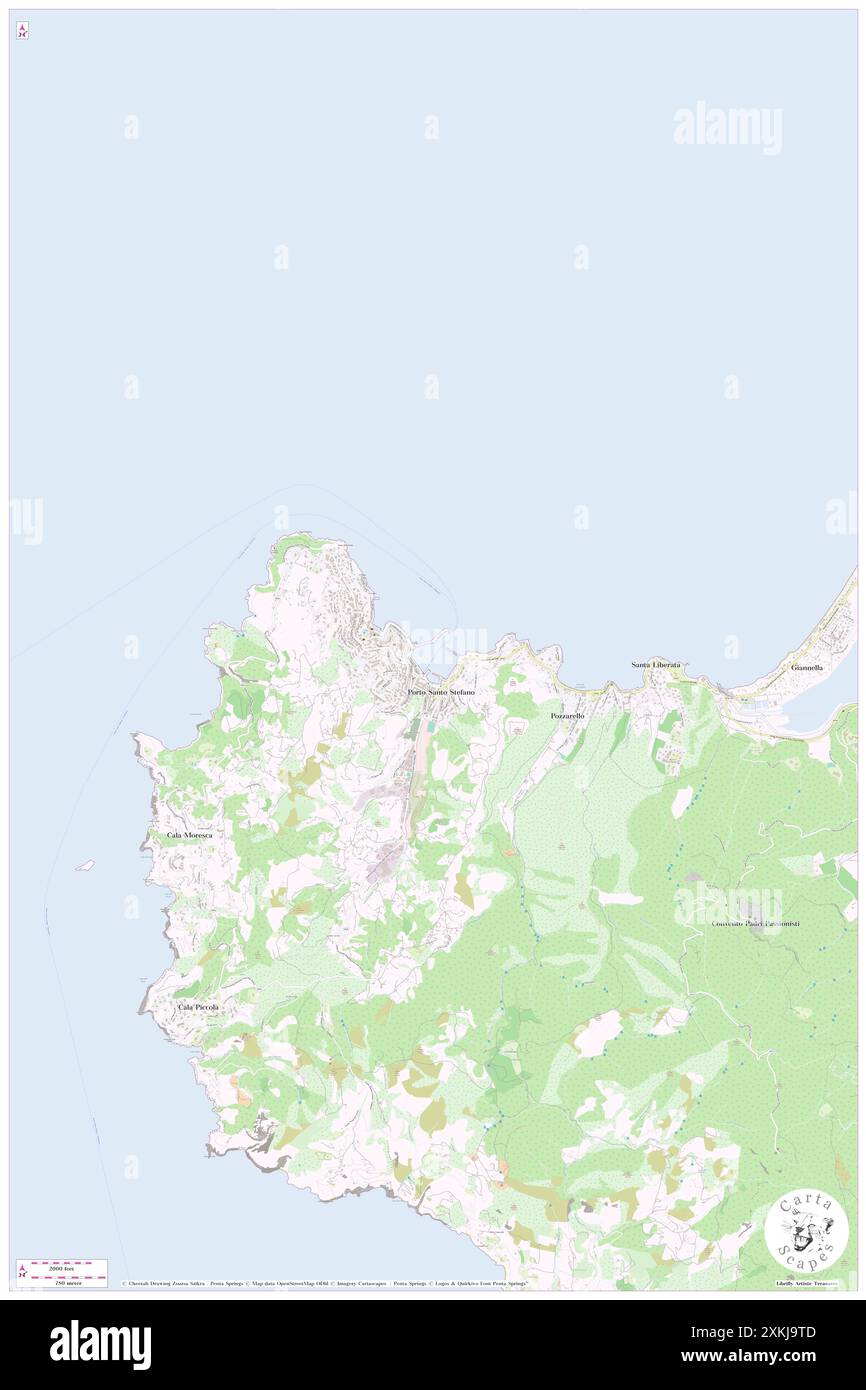 Molo Garibaldi, IT, Italy, Tuscany, N 42 26' 15'', N 11 7' 22'', map, Cartascapes Map published in 2024. Explore Cartascapes, a map revealing Earth's diverse landscapes, cultures, and ecosystems. Journey through time and space, discovering the interconnectedness of our planet's past, present, and future. Stock Photohttps://www.alamy.com/image-license-details/?v=1https://www.alamy.com/molo-garibaldi-it-italy-tuscany-n-42-26-15-n-11-7-22-map-cartascapes-map-published-in-2024-explore-cartascapes-a-map-revealing-earths-diverse-landscapes-cultures-and-ecosystems-journey-through-time-and-space-discovering-the-interconnectedness-of-our-planets-past-present-and-future-image614444221.html
RM2XKJ9TD–Molo Garibaldi, IT, Italy, Tuscany, N 42 26' 15'', N 11 7' 22'', map, Cartascapes Map published in 2024. Explore Cartascapes, a map revealing Earth's diverse landscapes, cultures, and ecosystems. Journey through time and space, discovering the interconnectedness of our planet's past, present, and future.
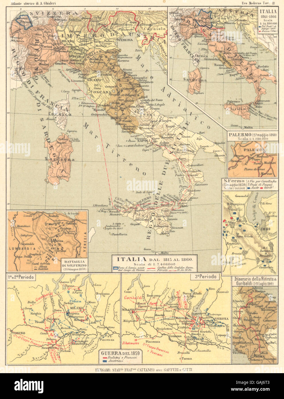 ITALIA: 1815-60; Solferino; S Fermo; Ritirata Garibaldi; Guerra 1859, 1889 map Stock Photohttps://www.alamy.com/image-license-details/?v=1https://www.alamy.com/stock-photo-italia-1815-60-solferino-s-fermo-ritirata-garibaldi-guerra-1859-1889-109809283.html
RFGAJ6T3–ITALIA: 1815-60; Solferino; S Fermo; Ritirata Garibaldi; Guerra 1859, 1889 map
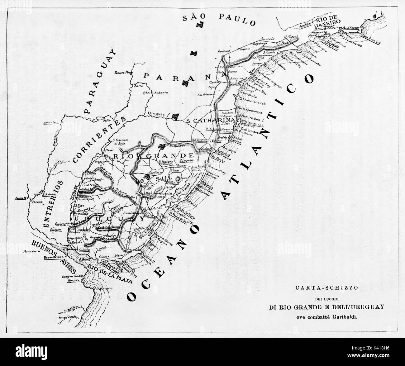 Old map of Rio Grande do Sul and Uruguay. By unidentified author published on Garibaldi e i Suoi Tempi Milan Italy1884 Stock Photohttps://www.alamy.com/image-license-details/?v=1https://www.alamy.com/old-map-of-rio-grande-do-sul-and-uruguay-by-unidentified-author-published-image157380642.html
RFK418H6–Old map of Rio Grande do Sul and Uruguay. By unidentified author published on Garibaldi e i Suoi Tempi Milan Italy1884
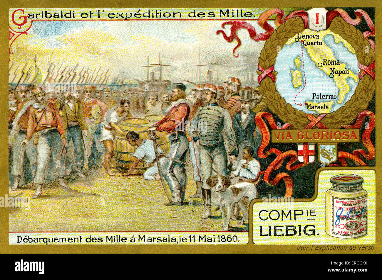 Garibaldi and the Expedition of the Thousand. Illustration of 1910. Disembarkment at Marsala, Sicily, 11 May 1860. Spedizione Stock Photohttps://www.alamy.com/image-license-details/?v=1https://www.alamy.com/stock-photo-garibaldi-and-the-expedition-of-the-thousand-illustration-of-1910-83342868.html
RMERGGK0–Garibaldi and the Expedition of the Thousand. Illustration of 1910. Disembarkment at Marsala, Sicily, 11 May 1860. Spedizione
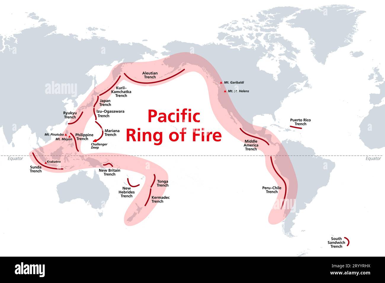 Pacific Ring of Fire, world map with oceanic trenches. The Rim of Fire, or also Circum-Pacific Belt. Region around the rim of the Pacific Ocean. Stock Photohttps://www.alamy.com/image-license-details/?v=1https://www.alamy.com/pacific-ring-of-fire-world-map-with-oceanic-trenches-the-rim-of-fire-or-also-circum-pacific-belt-region-around-the-rim-of-the-pacific-ocean-image567938726.html
RF2RYYRHX–Pacific Ring of Fire, world map with oceanic trenches. The Rim of Fire, or also Circum-Pacific Belt. Region around the rim of the Pacific Ocean.
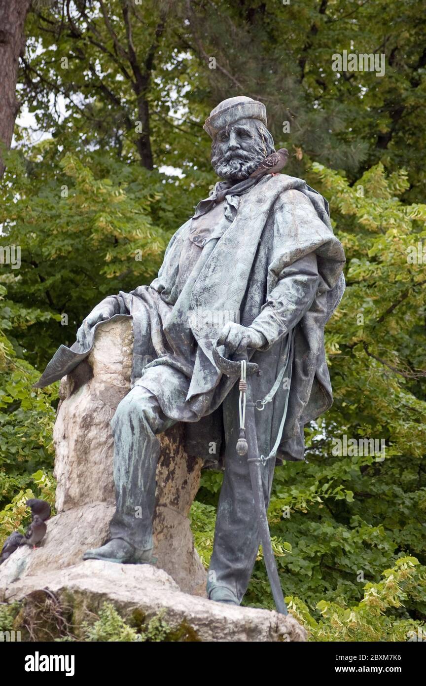 Monument to the Italian revolutionary and military hero Giuseppe Garibaldi (1807 - 1882). Giardini, Venice, Italy. Stock Photohttps://www.alamy.com/image-license-details/?v=1https://www.alamy.com/monument-to-the-italian-revolutionary-and-military-hero-giuseppe-garibaldi-1807-1882-giardini-venice-italy-image360633482.html
RF2BXM7K6–Monument to the Italian revolutionary and military hero Giuseppe Garibaldi (1807 - 1882). Giardini, Venice, Italy.
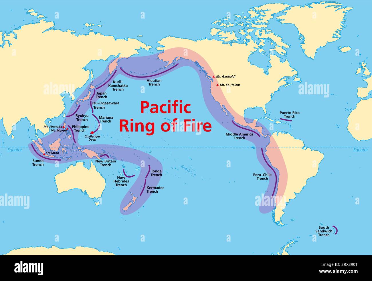 Pacific Ring of Fire, map with oceanic trenches. Also known as Rim of Fire, and as Circum-Pacific Belt. Region around the rim of the Pacific Ocean. Stock Photohttps://www.alamy.com/image-license-details/?v=1https://www.alamy.com/pacific-ring-of-fire-map-with-oceanic-trenches-also-known-as-rim-of-fire-and-as-circum-pacific-belt-region-around-the-rim-of-the-pacific-ocean-image566785768.html
RF2RX390T–Pacific Ring of Fire, map with oceanic trenches. Also known as Rim of Fire, and as Circum-Pacific Belt. Region around the rim of the Pacific Ocean.
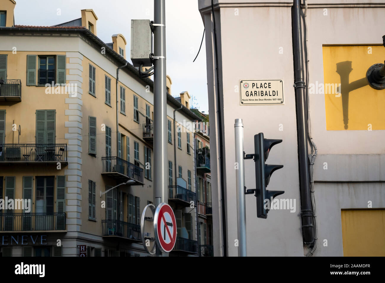 A street marker sign for the popular Place Garibaldi in the Old Town area of Nice, France. Stock Photohttps://www.alamy.com/image-license-details/?v=1https://www.alamy.com/a-street-marker-sign-for-the-popular-place-garibaldi-in-the-old-town-area-of-nice-france-image333593227.html
RF2AAMDFR–A street marker sign for the popular Place Garibaldi in the Old Town area of Nice, France.
 . English: A marvelous 1864 map of Italy by the American cartographic publisher A. J. Johnson. Depicts the Italian peninsula in the midst of its struggle for national solidarity. Shortly before this map was published Garibaldi and his Red Shirts were fighting to unify the disparate city states: Venetia, Kingdom of Italy, Piedmont, Lombardy, Aemilia, Tuscany, the Marches, Umbria, Sicily and the Papal States. This is reflected in above map by the national barriers segregating both the States of the Church and the Duchy of Venice from the rest of Italy. Includes the Kingdom of Sardinia, Corsica, Stock Photohttps://www.alamy.com/image-license-details/?v=1https://www.alamy.com/english-a-marvelous-1864-map-of-italy-by-the-american-cartographic-publisher-a-j-johnson-depicts-the-italian-peninsula-in-the-midst-of-its-struggle-for-national-solidarity-shortly-before-this-map-was-published-garibaldi-and-his-red-shirts-were-fighting-to-unify-the-disparate-city-states-venetia-kingdom-of-italy-piedmont-lombardy-aemilia-tuscany-the-marches-umbria-sicily-and-the-papal-states-this-is-reflected-in-above-map-by-the-national-barriers-segregating-both-the-states-of-the-church-and-the-duchy-of-venice-from-the-rest-of-italy-includes-the-kingdom-of-sardinia-corsica-image184965901.html
RMMMWWW1–. English: A marvelous 1864 map of Italy by the American cartographic publisher A. J. Johnson. Depicts the Italian peninsula in the midst of its struggle for national solidarity. Shortly before this map was published Garibaldi and his Red Shirts were fighting to unify the disparate city states: Venetia, Kingdom of Italy, Piedmont, Lombardy, Aemilia, Tuscany, the Marches, Umbria, Sicily and the Papal States. This is reflected in above map by the national barriers segregating both the States of the Church and the Duchy of Venice from the rest of Italy. Includes the Kingdom of Sardinia, Corsica,
 City map with the Garibaldi Theater in the background packed in Bisceglie, Italy on June 17 2020. The Garibaldi Crew directed by Carlo Bruni 'packed' the Bisceglie municipal theater under renovation, to make it appear so on the day the Italian theaters reopen. And he did it in the manner of Christo, thus wanting to remember the recently deceased artist. (Photo by Davide Pischettola/NurPhoto) Stock Photohttps://www.alamy.com/image-license-details/?v=1https://www.alamy.com/city-map-with-the-garibaldi-theater-in-the-background-packed-in-bisceglie-italy-on-june-17-2020-the-garibaldi-crew-directed-by-carlo-bruni-packed-the-bisceglie-municipal-theater-under-renovation-to-make-it-appear-so-on-the-day-the-italian-theaters-reopen-and-he-did-it-in-the-manner-of-christo-thus-wanting-to-remember-the-recently-deceased-artist-photo-by-davide-pischettolanurphoto-image489163949.html
RM2KBR9H1–City map with the Garibaldi Theater in the background packed in Bisceglie, Italy on June 17 2020. The Garibaldi Crew directed by Carlo Bruni 'packed' the Bisceglie municipal theater under renovation, to make it appear so on the day the Italian theaters reopen. And he did it in the manner of Christo, thus wanting to remember the recently deceased artist. (Photo by Davide Pischettola/NurPhoto)
![Queens, Vol. 1, Double Page Plate No. 28; Part of Ward 4; Jamaica; [Map bounded by Broadway Turnpike, Vermont Way, tennessee Way, Dakota Way, Oregon Way, Idaho Ave., Wyoming Ave., Virginia Way, Alabama Way, Nebraska Way, Florida Way; Including Locust Ave., Merrick Road, Bertha PL., Baist Ave., South Side Branch Long Island R.R., Homestead Ave., Hunton Ave., Bay LisAve., Von Spiecel Ave., Garibaldi Ave., Chrystena Ave.]; Sub Plan From Plate No. 19; Idlewild; [Map bounded by Mill Creek, Brook Road; Including Garfield Ave., 11th St.]; Sub Plan From Plate No. 18; [Map bounded by Springfield Road; Stock Photo Queens, Vol. 1, Double Page Plate No. 28; Part of Ward 4; Jamaica; [Map bounded by Broadway Turnpike, Vermont Way, tennessee Way, Dakota Way, Oregon Way, Idaho Ave., Wyoming Ave., Virginia Way, Alabama Way, Nebraska Way, Florida Way; Including Locust Ave., Merrick Road, Bertha PL., Baist Ave., South Side Branch Long Island R.R., Homestead Ave., Hunton Ave., Bay LisAve., Von Spiecel Ave., Garibaldi Ave., Chrystena Ave.]; Sub Plan From Plate No. 19; Idlewild; [Map bounded by Mill Creek, Brook Road; Including Garfield Ave., 11th St.]; Sub Plan From Plate No. 18; [Map bounded by Springfield Road; Stock Photo](https://c8.alamy.com/comp/2YRC944/queens-vol-1-double-page-plate-no-28-part-of-ward-4-jamaica-map-bounded-by-broadway-turnpike-vermont-way-tennessee-way-dakota-way-oregon-way-idaho-ave-wyoming-ave-virginia-way-alabama-way-nebraska-way-florida-way-including-locust-ave-merrick-road-bertha-pl-baist-ave-south-side-branch-long-island-rr-homestead-ave-hunton-ave-bay-lisave-von-spiecel-ave-garibaldi-ave-chrystena-ave-sub-plan-from-plate-no-19-idlewild-map-bounded-by-mill-creek-brook-road-including-garfield-ave-11th-st-sub-plan-from-plate-no-18-map-bounded-by-springfield-road-2YRC944.jpg) Queens, Vol. 1, Double Page Plate No. 28; Part of Ward 4; Jamaica; [Map bounded by Broadway Turnpike, Vermont Way, tennessee Way, Dakota Way, Oregon Way, Idaho Ave., Wyoming Ave., Virginia Way, Alabama Way, Nebraska Way, Florida Way; Including Locust Ave., Merrick Road, Bertha PL., Baist Ave., South Side Branch Long Island R.R., Homestead Ave., Hunton Ave., Bay LisAve., Von Spiecel Ave., Garibaldi Ave., Chrystena Ave.]; Sub Plan From Plate No. 19; Idlewild; [Map bounded by Mill Creek, Brook Road; Including Garfield Ave., 11th St.]; Sub Plan From Plate No. 18; [Map bounded by Springfield Road; Stock Photohttps://www.alamy.com/image-license-details/?v=1https://www.alamy.com/queens-vol-1-double-page-plate-no-28-part-of-ward-4-jamaica-map-bounded-by-broadway-turnpike-vermont-way-tennessee-way-dakota-way-oregon-way-idaho-ave-wyoming-ave-virginia-way-alabama-way-nebraska-way-florida-way-including-locust-ave-merrick-road-bertha-pl-baist-ave-south-side-branch-long-island-rr-homestead-ave-hunton-ave-bay-lisave-von-spiecel-ave-garibaldi-ave-chrystena-ave-sub-plan-from-plate-no-19-idlewild-map-bounded-by-mill-creek-brook-road-including-garfield-ave-11th-st-sub-plan-from-plate-no-18-map-bounded-by-springfield-road-image633980932.html
Queens, Vol. 1, Double Page Plate No. 28; Part of Ward 4; Jamaica; [Map bounded by Broadway Turnpike, Vermont Way, tennessee Way, Dakota Way, Oregon Way, Idaho Ave., Wyoming Ave., Virginia Way, Alabama Way, Nebraska Way, Florida Way; Including Locust Ave., Merrick Road, Bertha PL., Baist Ave., South Side Branch Long Island R.R., Homestead Ave., Hunton Ave., Bay LisAve., Von Spiecel Ave., Garibaldi Ave., Chrystena Ave.]; Sub Plan From Plate No. 19; Idlewild; [Map bounded by Mill Creek, Brook Road; Including Garfield Ave., 11th St.]; Sub Plan From Plate No. 18; [Map bounded by Springfield Road; Stock Photohttps://www.alamy.com/image-license-details/?v=1https://www.alamy.com/queens-vol-1-double-page-plate-no-28-part-of-ward-4-jamaica-map-bounded-by-broadway-turnpike-vermont-way-tennessee-way-dakota-way-oregon-way-idaho-ave-wyoming-ave-virginia-way-alabama-way-nebraska-way-florida-way-including-locust-ave-merrick-road-bertha-pl-baist-ave-south-side-branch-long-island-rr-homestead-ave-hunton-ave-bay-lisave-von-spiecel-ave-garibaldi-ave-chrystena-ave-sub-plan-from-plate-no-19-idlewild-map-bounded-by-mill-creek-brook-road-including-garfield-ave-11th-st-sub-plan-from-plate-no-18-map-bounded-by-springfield-road-image633980932.htmlRM2YRC944–Queens, Vol. 1, Double Page Plate No. 28; Part of Ward 4; Jamaica; [Map bounded by Broadway Turnpike, Vermont Way, tennessee Way, Dakota Way, Oregon Way, Idaho Ave., Wyoming Ave., Virginia Way, Alabama Way, Nebraska Way, Florida Way; Including Locust Ave., Merrick Road, Bertha PL., Baist Ave., South Side Branch Long Island R.R., Homestead Ave., Hunton Ave., Bay LisAve., Von Spiecel Ave., Garibaldi Ave., Chrystena Ave.]; Sub Plan From Plate No. 19; Idlewild; [Map bounded by Mill Creek, Brook Road; Including Garfield Ave., 11th St.]; Sub Plan From Plate No. 18; [Map bounded by Springfield Road;
 Giuseppe Garibaldi occupying Varese... Stock Photohttps://www.alamy.com/image-license-details/?v=1https://www.alamy.com/stock-photo-giuseppe-garibaldi-occupying-varese-139934807.html
RMJ3JG7K–Giuseppe Garibaldi occupying Varese...
 ROUQUETTE(1871) p269 Garibaldi Stock Photohttps://www.alamy.com/image-license-details/?v=1https://www.alamy.com/stock-photo-rouquette1871-p269-garibaldi-76566473.html
RMECFW8W–ROUQUETTE(1871) p269 Garibaldi
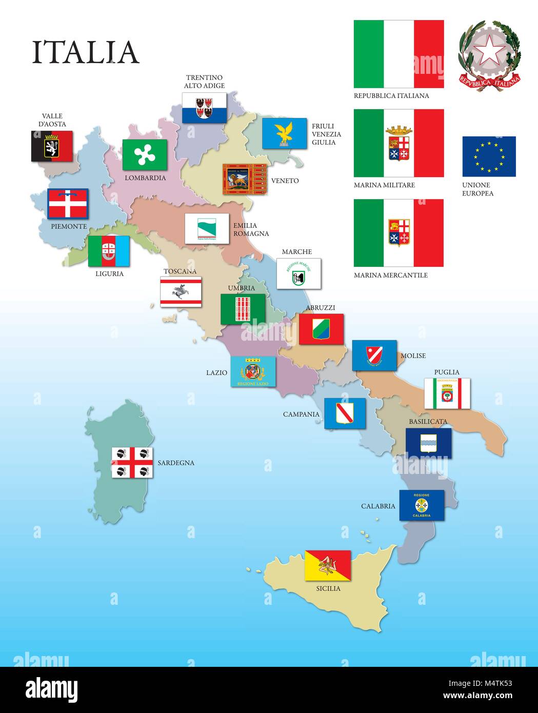 Italy, map and regions with flags Stock Vectorhttps://www.alamy.com/image-license-details/?v=1https://www.alamy.com/stock-photo-italy-map-and-regions-with-flags-175104191.html
RFM4TK53–Italy, map and regions with flags
 Cartographic, Maps. 1907. Lionel Pincus and Princess Firyal Map Division Queens, Vol. 1, Double Page Plate No. 28; Part of Ward 4; Jamaica; Map bounded by Broadway Turnpike, Vermont Way, tennessee Way, Dakota Way, Oregon Way, Idaho Ave., Wyoming Ave., Virginia Way, Alabama Way, Nebraska Way, Florida Way; Including Locust Ave., Merrick Road, Bertha PL., Baist Ave., South Side Branch Long Island R.R., Homestead Ave., Hunton Ave., Bay LisAve., Von Spiecel Ave., Garibaldi Ave., Chrystena Ave.; Sub Plan From Plate No. 19; Idlewild; Map bounded by Mill Creek, Brook Road; Including Garfield Ave., 11t Stock Photohttps://www.alamy.com/image-license-details/?v=1https://www.alamy.com/cartographic-maps-1907-lionel-pincus-and-princess-firyal-map-division-queens-vol-1-double-page-plate-no-28-part-of-ward-4-jamaica-map-bounded-by-broadway-turnpike-vermont-way-tennessee-way-dakota-way-oregon-way-idaho-ave-wyoming-ave-virginia-way-alabama-way-nebraska-way-florida-way-including-locust-ave-merrick-road-bertha-pl-baist-ave-south-side-branch-long-island-rr-homestead-ave-hunton-ave-bay-lisave-von-spiecel-ave-garibaldi-ave-chrystena-ave-sub-plan-from-plate-no-19-idlewild-map-bounded-by-mill-creek-brook-road-including-garfield-ave-11t-image483725791.html
RM2K2YH53–Cartographic, Maps. 1907. Lionel Pincus and Princess Firyal Map Division Queens, Vol. 1, Double Page Plate No. 28; Part of Ward 4; Jamaica; Map bounded by Broadway Turnpike, Vermont Way, tennessee Way, Dakota Way, Oregon Way, Idaho Ave., Wyoming Ave., Virginia Way, Alabama Way, Nebraska Way, Florida Way; Including Locust Ave., Merrick Road, Bertha PL., Baist Ave., South Side Branch Long Island R.R., Homestead Ave., Hunton Ave., Bay LisAve., Von Spiecel Ave., Garibaldi Ave., Chrystena Ave.; Sub Plan From Plate No. 19; Idlewild; Map bounded by Mill Creek, Brook Road; Including Garfield Ave., 11t
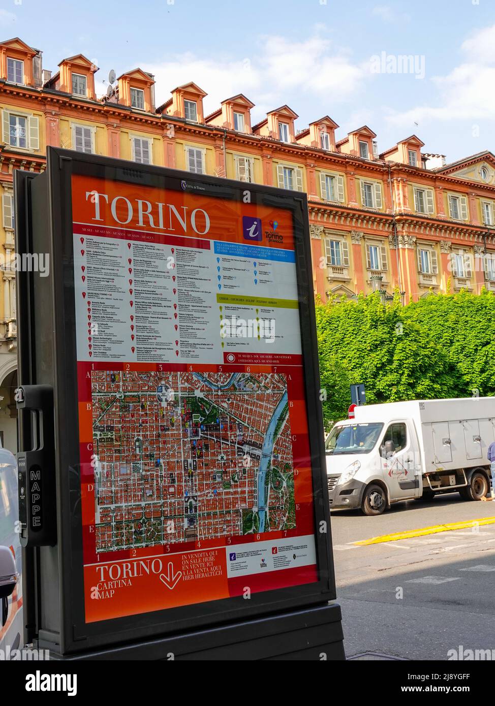 City of Torino map of the historic city center, Turin, Piedmont, Italy. Stock Photohttps://www.alamy.com/image-license-details/?v=1https://www.alamy.com/city-of-torino-map-of-the-historic-city-center-turin-piedmont-italy-image470202867.html
RM2J8YGFF–City of Torino map of the historic city center, Turin, Piedmont, Italy.
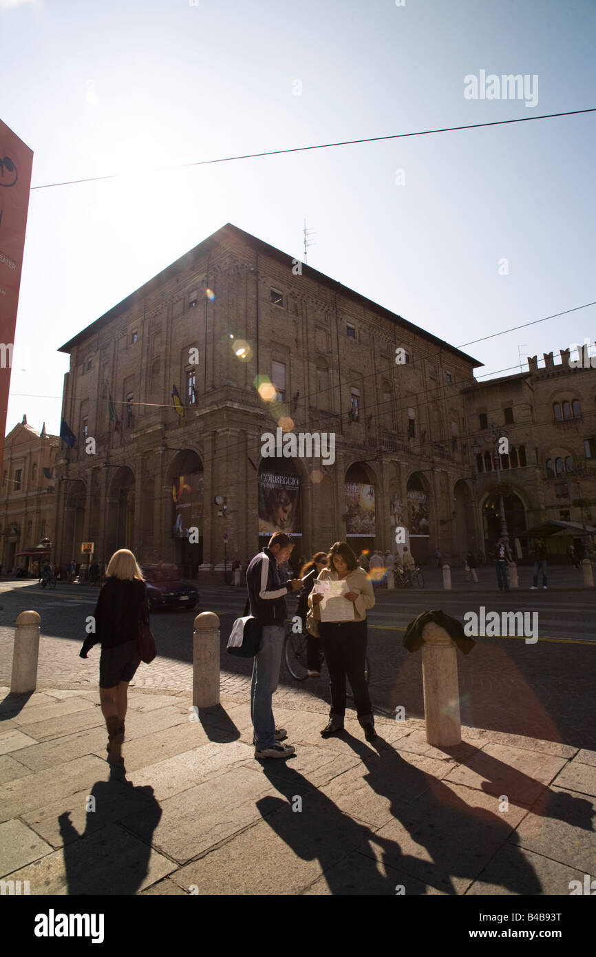 Tourists reading a map in Piazza Garibaldi, Parma, Emilia Romagna, Italy Stock Photohttps://www.alamy.com/image-license-details/?v=1https://www.alamy.com/stock-photo-tourists-reading-a-map-in-piazza-garibaldi-parma-emilia-romagna-italy-19917628.html
RMB4B93T–Tourists reading a map in Piazza Garibaldi, Parma, Emilia Romagna, Italy
 USGS Topo Map Oregon Garibaldi 20110906 TM Restoration Stock Photohttps://www.alamy.com/image-license-details/?v=1https://www.alamy.com/usgs-topo-map-oregon-garibaldi-20110906-tm-restoration-image264105065.html
RMW9K0KN–USGS Topo Map Oregon Garibaldi 20110906 TM Restoration
 Italy, flag, heart symbol and map, I Love Italy Stock Vectorhttps://www.alamy.com/image-license-details/?v=1https://www.alamy.com/stock-photo-italy-flag-heart-symbol-and-map-i-love-italy-172376247.html
RFM0CBJF–Italy, flag, heart symbol and map, I Love Italy
 Garibaldi (h), Napoli, IT, Italy, Campania, N 40 51' 6'', N 14 16' 1'', map, Cartascapes Map published in 2024. Explore Cartascapes, a map revealing Earth's diverse landscapes, cultures, and ecosystems. Journey through time and space, discovering the interconnectedness of our planet's past, present, and future. Stock Photohttps://www.alamy.com/image-license-details/?v=1https://www.alamy.com/garibaldi-h-napoli-it-italy-campania-n-40-51-6-n-14-16-1-map-cartascapes-map-published-in-2024-explore-cartascapes-a-map-revealing-earths-diverse-landscapes-cultures-and-ecosystems-journey-through-time-and-space-discovering-the-interconnectedness-of-our-planets-past-present-and-future-image614468143.html
RM2XKKCAR–Garibaldi (h), Napoli, IT, Italy, Campania, N 40 51' 6'', N 14 16' 1'', map, Cartascapes Map published in 2024. Explore Cartascapes, a map revealing Earth's diverse landscapes, cultures, and ecosystems. Journey through time and space, discovering the interconnectedness of our planet's past, present, and future.
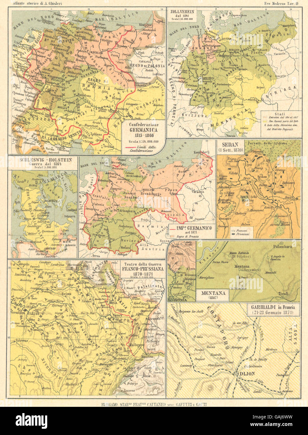 CONFEDERAZIONE GERMANICA: Schleswig Guerra Prussiana Zollverein Sedan, 1889 map Stock Photohttps://www.alamy.com/image-license-details/?v=1https://www.alamy.com/stock-photo-confederazione-germanica-schleswig-guerra-prussiana-zollverein-sedan-109809333.html
RFGAJ6WW–CONFEDERAZIONE GERMANICA: Schleswig Guerra Prussiana Zollverein Sedan, 1889 map
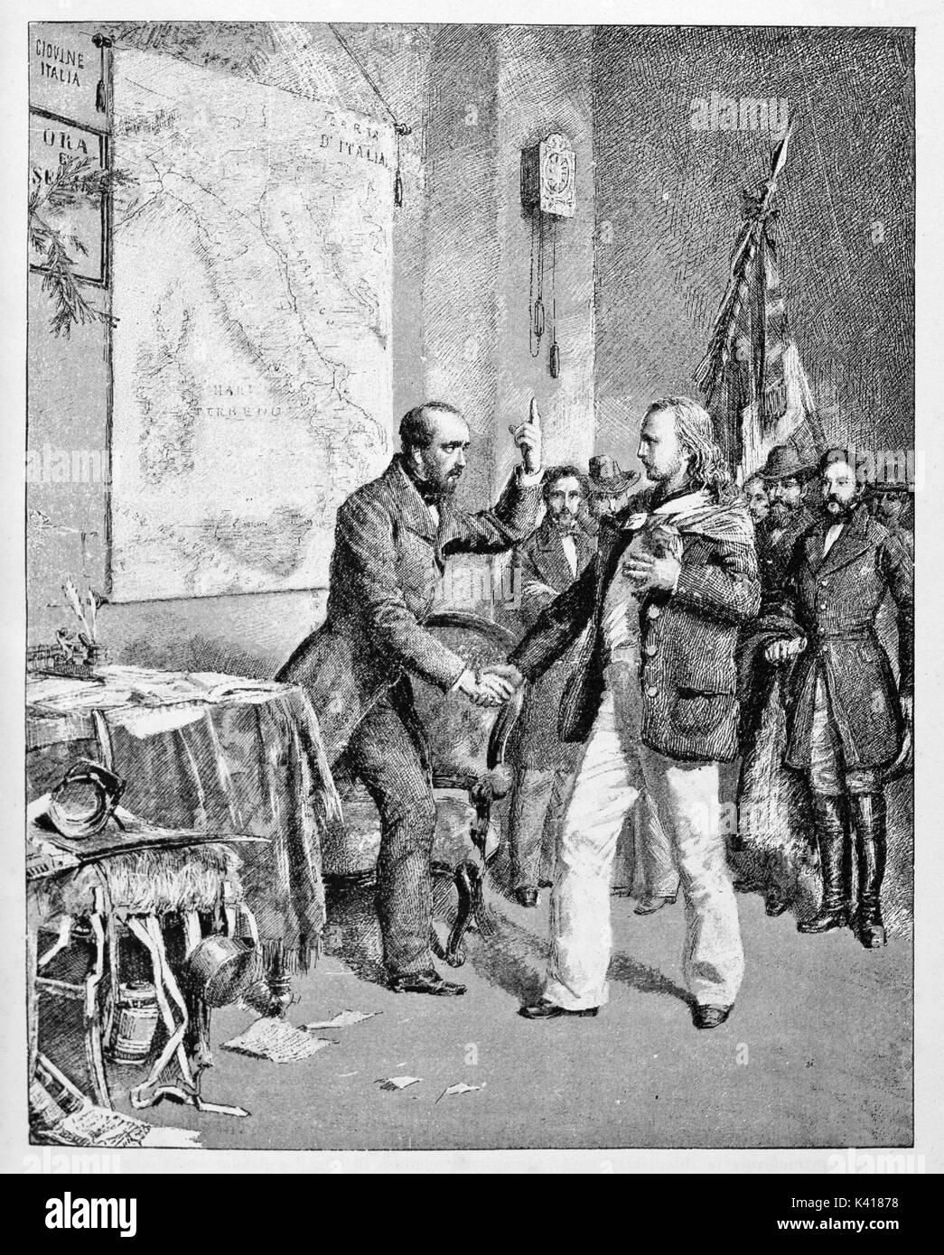 Young Garibaldi meets Mazzini in a room with the italian map on a wall. They talk together and they shake their hands. By E. Matania published on Garibaldi e i Suoi Tempi Milan Italy 1884 Stock Photohttps://www.alamy.com/image-license-details/?v=1https://www.alamy.com/young-garibaldi-meets-mazzini-in-a-room-with-the-italian-map-on-a-image157380364.html
RFK41878–Young Garibaldi meets Mazzini in a room with the italian map on a wall. They talk together and they shake their hands. By E. Matania published on Garibaldi e i Suoi Tempi Milan Italy 1884
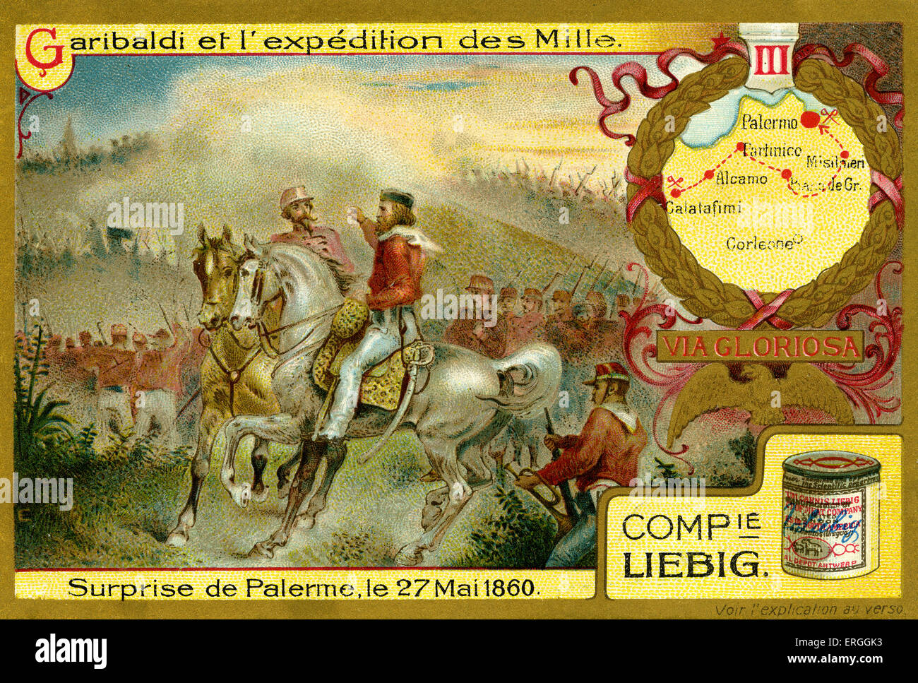 Garibaldi and the Expedition of the Thousand. Illustration of 1910. Surprise attack at Palermo, 27 May 1860. Sicily. Stock Photohttps://www.alamy.com/image-license-details/?v=1https://www.alamy.com/stock-photo-garibaldi-and-the-expedition-of-the-thousand-illustration-of-1910-83342871.html
RMERGGK3–Garibaldi and the Expedition of the Thousand. Illustration of 1910. Surprise attack at Palermo, 27 May 1860. Sicily.
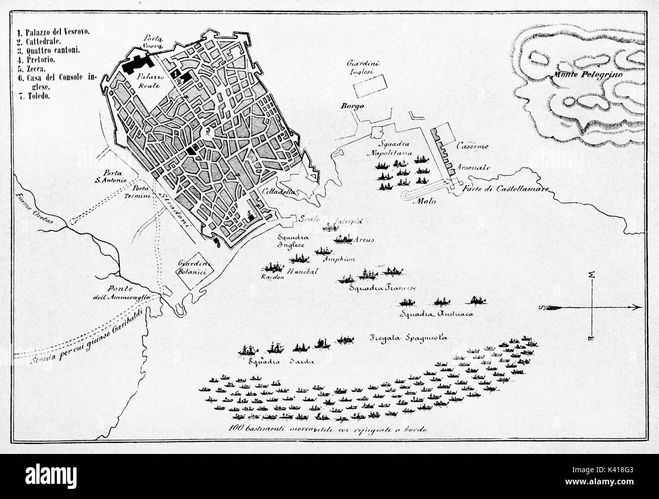 Old map of Palermo and surroundings in may 1860 with positions of the fleets in the gulf during insurrection. By E. Matania published on Garibaldi e i Suoi Tempi Milan Italy 1884 Palermo insurrection map Stock Photohttps://www.alamy.com/image-license-details/?v=1https://www.alamy.com/old-map-of-palermo-and-surroundings-in-may-1860-with-positions-of-image157380611.html
RFK418G3–Old map of Palermo and surroundings in may 1860 with positions of the fleets in the gulf during insurrection. By E. Matania published on Garibaldi e i Suoi Tempi Milan Italy 1884 Palermo insurrection map
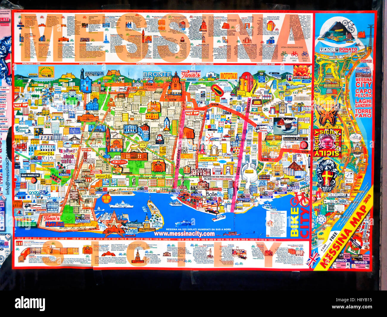 Colourful Messina Sicily tourist street map Stock Photohttps://www.alamy.com/image-license-details/?v=1https://www.alamy.com/stock-photo-colourful-messina-sicily-tourist-street-map-125991185.html
RMH8YB15–Colourful Messina Sicily tourist street map
 Lake Garibaldi (Canada, North America) map vector illustration, scribble sketch map Stock Vectorhttps://www.alamy.com/image-license-details/?v=1https://www.alamy.com/lake-garibaldi-canada-north-america-map-vector-illustration-scribble-sketch-map-image553751095.html
RF2R4WF4R–Lake Garibaldi (Canada, North America) map vector illustration, scribble sketch map
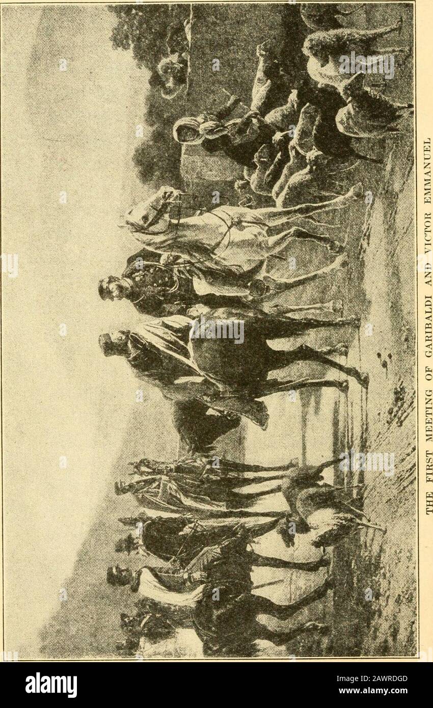 The story of the map of Europe, its making and its changing . ious to be rich only in order that he might free Italy from the Austrians. He sold out his business in New York, and taking all his money, sailed for Italy. When the war of 1859 broke out, he volunteered, and fought throughout the campaign. But the compromising terms of peace galled him, and he was not satisfied with a country only half free. In the region around Genoa, ^ ^ A hazard- he enrolled a thousand men to go on what ous venture looked like a desperate enterprise. Garibaldi had talked with Cavour, and between them, they had s Stock Photohttps://www.alamy.com/image-license-details/?v=1https://www.alamy.com/the-story-of-the-map-of-europe-its-making-and-its-changing-ious-to-be-rich-only-in-order-that-he-might-free-italy-from-the-austrians-he-sold-out-his-business-in-new-york-and-taking-all-his-money-sailed-for-italy-when-the-war-of-1859-broke-out-he-volunteered-and-fought-throughout-the-campaign-but-the-compromising-terms-of-peace-galled-him-and-he-was-not-satisfied-with-a-country-only-half-free-in-the-region-around-genoa-a-hazard-he-enrolled-a-thousand-men-to-go-on-what-ous-venture-looked-like-a-desperate-enterprise-garibaldi-had-talked-with-cavour-and-between-them-they-had-s-image342878941.html
RM2AWRDGD–The story of the map of Europe, its making and its changing . ious to be rich only in order that he might free Italy from the Austrians. He sold out his business in New York, and taking all his money, sailed for Italy. When the war of 1859 broke out, he volunteered, and fought throughout the campaign. But the compromising terms of peace galled him, and he was not satisfied with a country only half free. In the region around Genoa, ^ ^ A hazard- he enrolled a thousand men to go on what ous venture looked like a desperate enterprise. Garibaldi had talked with Cavour, and between them, they had s
 . English: A very attractive example of Johnson's 1862 map of Italy. Details the entire peninsula as well as Corsica, Sardinia, Malta and Sicily. Color coded according to region. When this map was made Italy was in the midst of its struggle for National solidarity under Giuseppe Garibaldi and his Red Shirts. Naples and Sicily were independent, as were the Papal States, and the Venetian States. Most of northern Italy was consolidated with its capital in Florence. Features the strapwork style border common to Johnson’s atlas work from 1860 to 1863. Published by A. J. Johnson and Ward as plate n Stock Photohttps://www.alamy.com/image-license-details/?v=1https://www.alamy.com/english-a-very-attractive-example-of-johnsons-1862-map-of-italy-details-the-entire-peninsula-as-well-as-corsica-sardinia-malta-and-sicily-color-coded-according-to-region-when-this-map-was-made-italy-was-in-the-midst-of-its-struggle-for-national-solidarity-under-giuseppe-garibaldi-and-his-red-shirts-naples-and-sicily-were-independent-as-were-the-papal-states-and-the-venetian-states-most-of-northern-italy-was-consolidated-with-its-capital-in-florence-features-the-strapwork-style-border-common-to-johnsons-atlas-work-from-1860-to-1863-published-by-a-j-johnson-and-ward-as-plate-n-image184964302.html
RMMMWRRX–. English: A very attractive example of Johnson's 1862 map of Italy. Details the entire peninsula as well as Corsica, Sardinia, Malta and Sicily. Color coded according to region. When this map was made Italy was in the midst of its struggle for National solidarity under Giuseppe Garibaldi and his Red Shirts. Naples and Sicily were independent, as were the Papal States, and the Venetian States. Most of northern Italy was consolidated with its capital in Florence. Features the strapwork style border common to Johnson’s atlas work from 1860 to 1863. Published by A. J. Johnson and Ward as plate n
 Italian soldiers of the Garibaldi Brigade plot areas of responsibility on a map while maintaining a simulated tactical operations center during exercise Allied Spirit IV at the U.S. Army’s Joint Multinational Readiness Center in Hohenfels Training Area, Germany, Jan. 20, 2016. Exercise Allied Spirit IV is a U.S. Army Europe-directed, 7th Army Joint Multinational Training Command-conducted multinational exercise that is designed to prepare forces in Europe to operate together by exercising tactical interoperability and testing secure communications within NATO alliance members and partner natio Stock Photohttps://www.alamy.com/image-license-details/?v=1https://www.alamy.com/italian-soldiers-of-the-garibaldi-brigade-plot-areas-of-responsibility-on-a-map-while-maintaining-a-simulated-tactical-operations-center-during-exercise-allied-spirit-iv-at-the-us-armys-joint-multinational-readiness-center-in-hohenfels-training-area-germany-jan-20-2016-exercise-allied-spirit-iv-is-a-us-army-europe-directed-7th-army-joint-multinational-training-command-conducted-multinational-exercise-that-is-designed-to-prepare-forces-in-europe-to-operate-together-by-exercising-tactical-interoperability-and-testing-secure-communications-within-nato-alliance-members-and-partner-natio-image215614321.html
RMPEP27D–Italian soldiers of the Garibaldi Brigade plot areas of responsibility on a map while maintaining a simulated tactical operations center during exercise Allied Spirit IV at the U.S. Army’s Joint Multinational Readiness Center in Hohenfels Training Area, Germany, Jan. 20, 2016. Exercise Allied Spirit IV is a U.S. Army Europe-directed, 7th Army Joint Multinational Training Command-conducted multinational exercise that is designed to prepare forces in Europe to operate together by exercising tactical interoperability and testing secure communications within NATO alliance members and partner natio
 Colico (LC) Italy 08/08/2019, The Fort Montecchio Nord :Barracks room with map on the wall of the Colico Zone, Valtellina and Switzerland in the war zone. Stock Photohttps://www.alamy.com/image-license-details/?v=1https://www.alamy.com/colico-lc-italy-08082019-the-fort-montecchio-nord-barracks-room-with-map-on-the-wall-of-the-colico-zone-valtellina-and-switzerland-in-the-war-zone-image340556017.html
RM2AP1JJW–Colico (LC) Italy 08/08/2019, The Fort Montecchio Nord :Barracks room with map on the wall of the Colico Zone, Valtellina and Switzerland in the war zone.
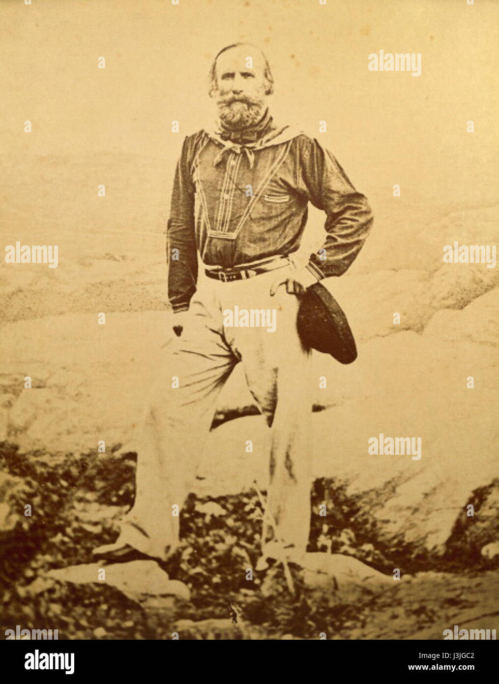 Giuseppe Garibaldi on Caprera... Stock Photohttps://www.alamy.com/image-license-details/?v=1https://www.alamy.com/stock-photo-giuseppe-garibaldi-on-caprera-139934930.html
RMJ3JGC2–Giuseppe Garibaldi on Caprera...
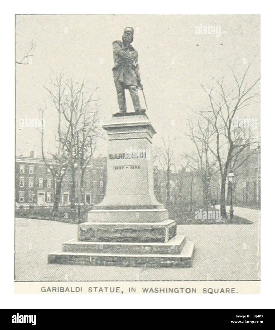 (King1893NYC) pg176 GARIBALDI STATUE, IN WASHINGTON SQUARE Stock Photohttps://www.alamy.com/image-license-details/?v=1https://www.alamy.com/stock-photo-king1893nyc-pg176-garibaldi-statue-in-washington-square-74157550.html
RME8J4KX–(King1893NYC) pg176 GARIBALDI STATUE, IN WASHINGTON SQUARE
 Giuseppe Garibaldi print 19th Century Stock Photohttps://www.alamy.com/image-license-details/?v=1https://www.alamy.com/stock-photo-giuseppe-garibaldi-print-19th-century-140471089.html
RMJ4F08H–Giuseppe Garibaldi print 19th Century
 Venice, Italy - sep, 2021: Giuseppe Garibaldi Monument. High quality photo Stock Photohttps://www.alamy.com/image-license-details/?v=1https://www.alamy.com/venice-italy-sep-2021-giuseppe-garibaldi-monument-high-quality-photo-image467588503.html
RF2J4MDWB–Venice, Italy - sep, 2021: Giuseppe Garibaldi Monument. High quality photo
 GENOA, ITALY - AUG 6, 2016: Exposition in Museum Strada Nouva - Palazzo Doria Tursi. This palace, one of three that together make up the Musei di Stra Stock Photohttps://www.alamy.com/image-license-details/?v=1https://www.alamy.com/genoa-italy-aug-6-2016-exposition-in-museum-strada-nouva-palazzo-doria-tursi-this-palace-one-of-three-that-together-make-up-the-musei-di-stra-image604311133.html
RF2X34N0D–GENOA, ITALY - AUG 6, 2016: Exposition in Museum Strada Nouva - Palazzo Doria Tursi. This palace, one of three that together make up the Musei di Stra
 River in the mountains Stock Photohttps://www.alamy.com/image-license-details/?v=1https://www.alamy.com/stock-photo-river-in-the-mountains-72896087.html
RME6GKKK–River in the mountains
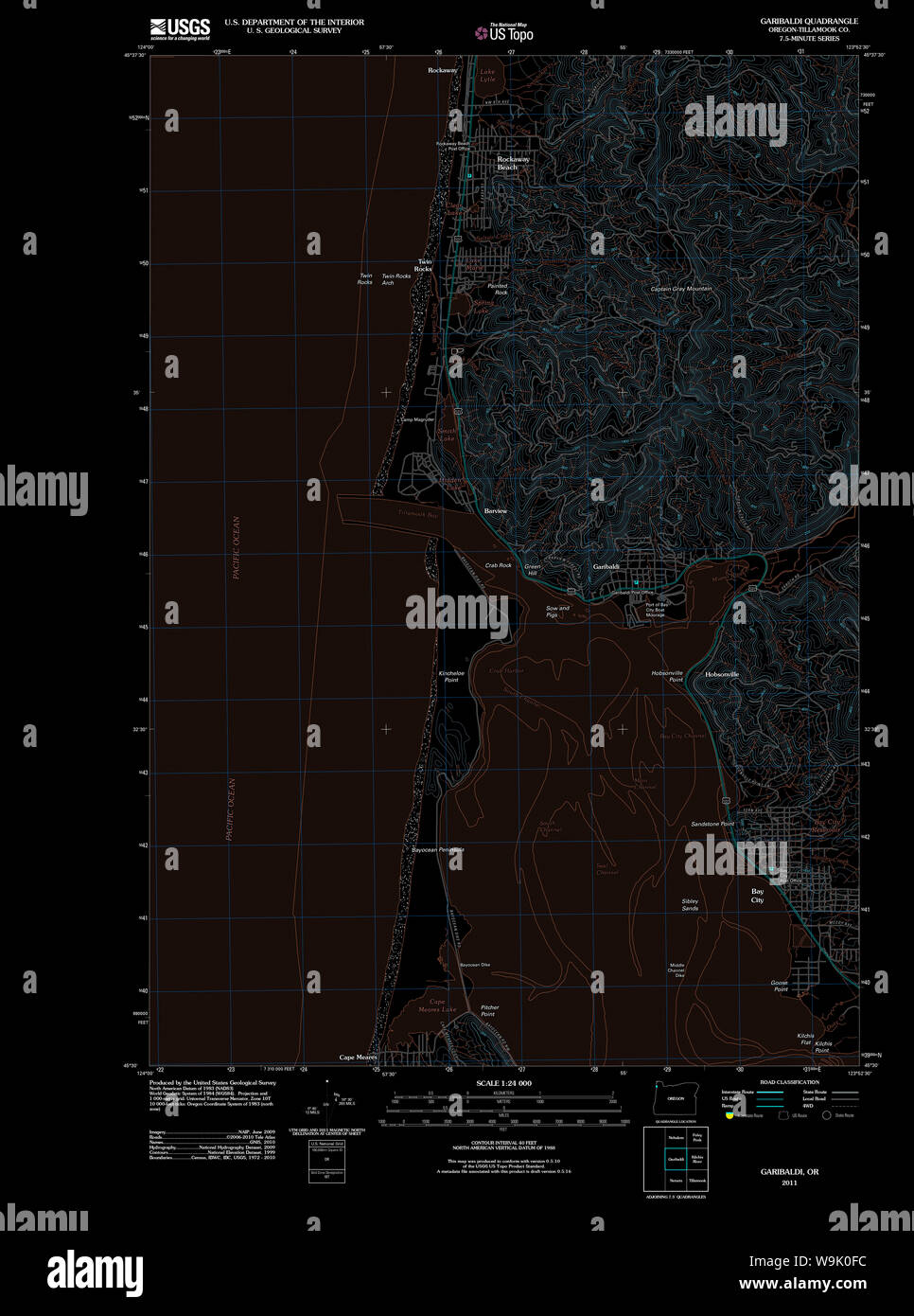 USGS Topo Map Oregon Garibaldi 20110906 TM Inverted Restoration Stock Photohttps://www.alamy.com/image-license-details/?v=1https://www.alamy.com/usgs-topo-map-oregon-garibaldi-20110906-tm-inverted-restoration-image264104944.html
RMW9K0FC–USGS Topo Map Oregon Garibaldi 20110906 TM Inverted Restoration
 Archive image from page 382 of Discovery Discovery discovery0304londuoft Year: DISCOVERY 33 alone ; an hour later the Cacciatori arrived .md Varest- was won for Victor Emmanuel. The North Italian campaign did not always fare so miraculously, and on June i, after the failure of the attempt to surprise the Austrian fort of Laveno b a night attack, Garibaldi, returning disappointed to hi-- headquarters at Varese, flung himself wearily down on the grass at Robarello to snatch a brief rest—a saddle for his pillow, his covering a poncho, sabre and map by his side. After an hour's sleep he rose Stock Photohttps://www.alamy.com/image-license-details/?v=1https://www.alamy.com/archive-image-from-page-382-of-discovery-discovery-discovery0304londuoft-year-discovery-33-alone-an-hour-later-the-cacciatori-arrived-md-varest-was-won-for-victor-emmanuel-the-north-italian-campaign-did-not-always-fare-so-miraculously-and-on-june-i-after-the-failure-of-the-attempt-to-surprise-the-austrian-fort-of-laveno-b-a-night-attack-garibaldi-returning-disappointed-to-hi-headquarters-at-varese-flung-himself-wearily-down-on-the-grass-at-robarello-to-snatch-a-brief-resta-saddle-for-his-pillow-his-covering-a-poncho-sabre-and-map-by-his-side-after-an-hours-sleep-he-rose-image242261977.html
RMT23YHD–Archive image from page 382 of Discovery Discovery discovery0304londuoft Year: DISCOVERY 33 alone ; an hour later the Cacciatori arrived .md Varest- was won for Victor Emmanuel. The North Italian campaign did not always fare so miraculously, and on June i, after the failure of the attempt to surprise the Austrian fort of Laveno b a night attack, Garibaldi, returning disappointed to hi-- headquarters at Varese, flung himself wearily down on the grass at Robarello to snatch a brief rest—a saddle for his pillow, his covering a poncho, sabre and map by his side. After an hour's sleep he rose
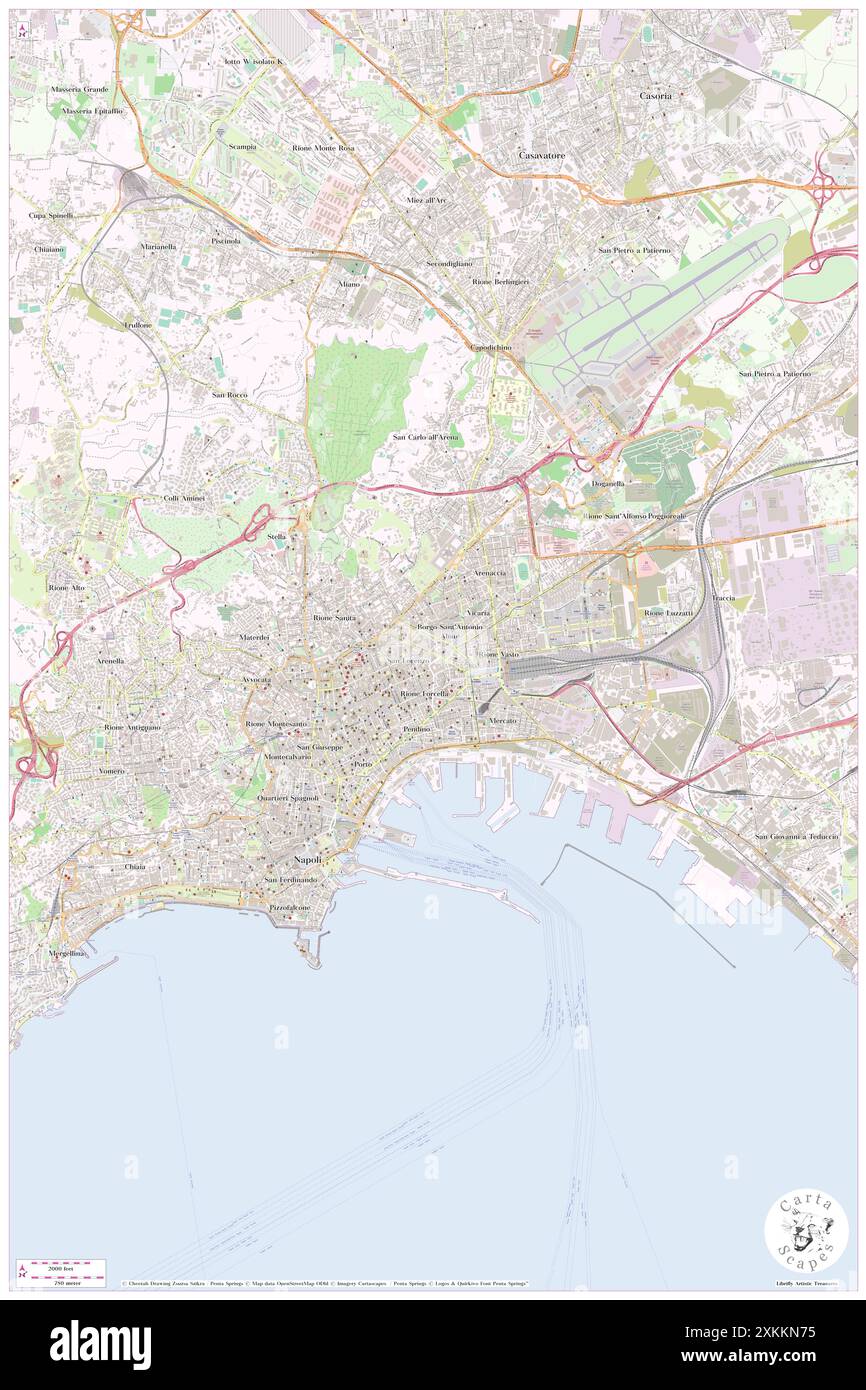 Hotel Garibaldi, Napoli, IT, Italy, Campania, N 40 51' 16'', N 14 15' 49'', map, Cartascapes Map published in 2024. Explore Cartascapes, a map revealing Earth's diverse landscapes, cultures, and ecosystems. Journey through time and space, discovering the interconnectedness of our planet's past, present, and future. Stock Photohttps://www.alamy.com/image-license-details/?v=1https://www.alamy.com/hotel-garibaldi-napoli-it-italy-campania-n-40-51-16-n-14-15-49-map-cartascapes-map-published-in-2024-explore-cartascapes-a-map-revealing-earths-diverse-landscapes-cultures-and-ecosystems-journey-through-time-and-space-discovering-the-interconnectedness-of-our-planets-past-present-and-future-image614475097.html
RM2XKKN75–Hotel Garibaldi, Napoli, IT, Italy, Campania, N 40 51' 16'', N 14 15' 49'', map, Cartascapes Map published in 2024. Explore Cartascapes, a map revealing Earth's diverse landscapes, cultures, and ecosystems. Journey through time and space, discovering the interconnectedness of our planet's past, present, and future.
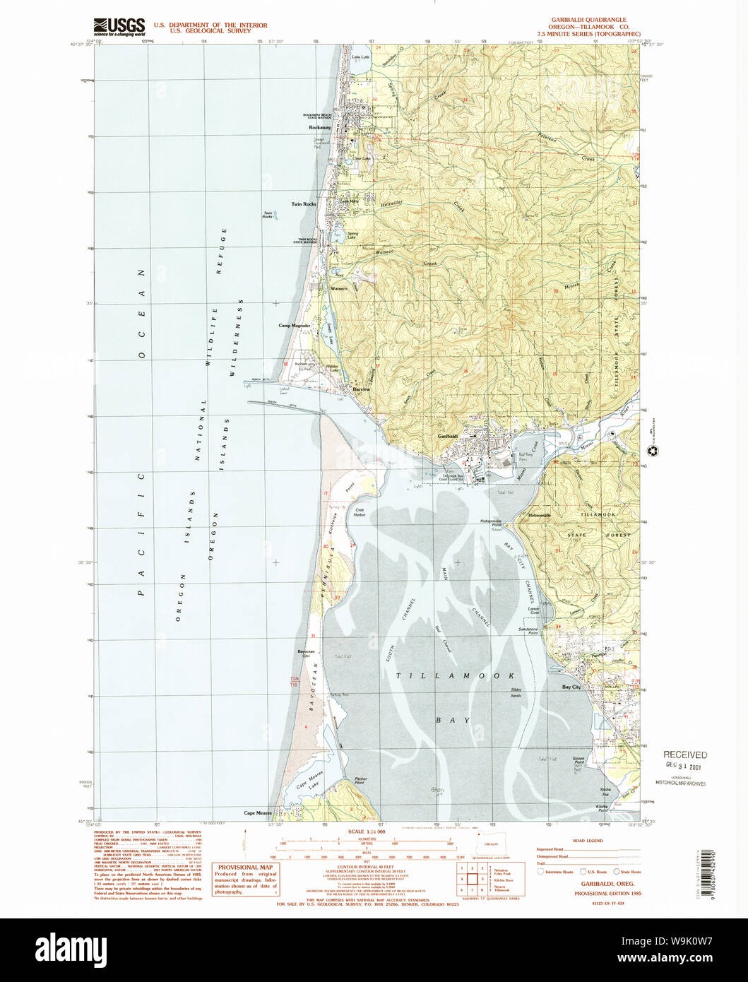 USGS Topo Map Oregon Garibaldi 279985 1985 24000 Restoration Stock Photohttps://www.alamy.com/image-license-details/?v=1https://www.alamy.com/usgs-topo-map-oregon-garibaldi-279985-1985-24000-restoration-image264105219.html
RMW9K0W7–USGS Topo Map Oregon Garibaldi 279985 1985 24000 Restoration
 at dusk Stock Photohttps://www.alamy.com/image-license-details/?v=1https://www.alamy.com/stock-photo-at-dusk-10242116.html
RMA1F94N–at dusk
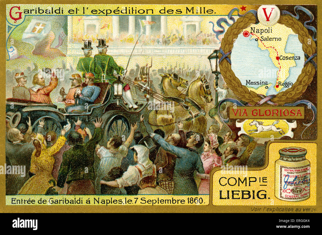 Garibaldi and the Expedition of the Thousand. Illustration of 1910. Garibaldi entering Naples, 7 September 1860. Italy. Stock Photohttps://www.alamy.com/image-license-details/?v=1https://www.alamy.com/stock-photo-garibaldi-and-the-expedition-of-the-thousand-illustration-of-1910-83342872.html
RMERGGK4–Garibaldi and the Expedition of the Thousand. Illustration of 1910. Garibaldi entering Naples, 7 September 1860. Italy.
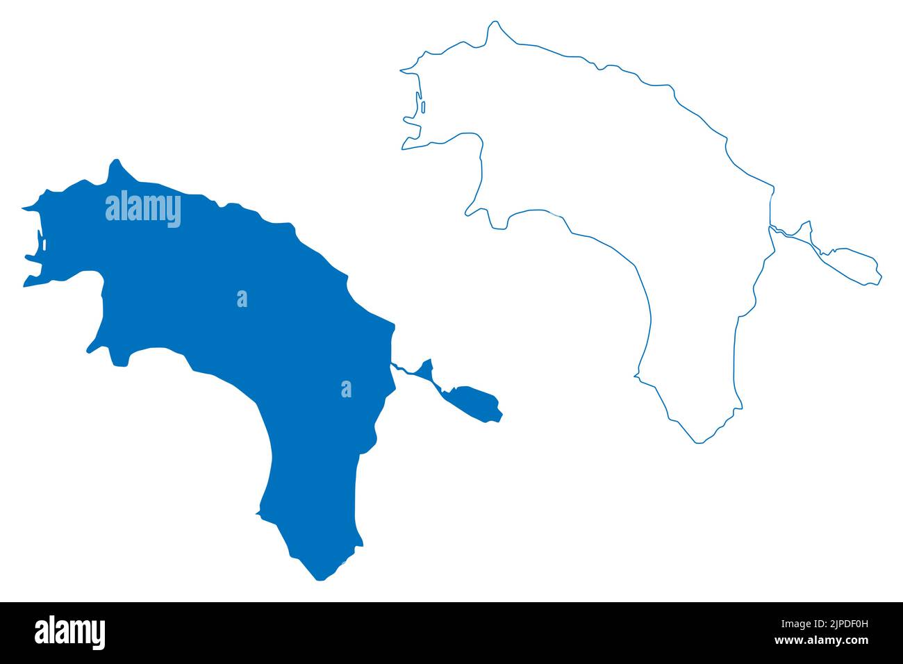 Lake Garibaldi (Canada, North America) map vector illustration, scribble sketch map Stock Vectorhttps://www.alamy.com/image-license-details/?v=1https://www.alamy.com/lake-garibaldi-canada-north-america-map-vector-illustration-scribble-sketch-map-image478499521.html
RF2JPDF0H–Lake Garibaldi (Canada, North America) map vector illustration, scribble sketch map
 . Discovery. Science. DISCOVERY 33 alone ; an hour later the Cacciatori ^ arrived .md Varest- was won for Victor Emmanuel. The North Italian campaign did not always fare so miraculously, and on June i, after the failure of the attempt to surprise the Austrian fort of Laveno b a night attack, Garibaldi, returning disappointed to hi-- headquarters at Varese, flung himself wearily down on the grass at Robarello to snatch a brief rest—a saddle for his pillow, his covering a poncho, sabre and map by his side. After an hour's sleep he rose and, with an officer of his staff, rode along the way to S. Stock Photohttps://www.alamy.com/image-license-details/?v=1https://www.alamy.com/discovery-science-discovery-33-alone-an-hour-later-the-cacciatori-arrived-md-varest-was-won-for-victor-emmanuel-the-north-italian-campaign-did-not-always-fare-so-miraculously-and-on-june-i-after-the-failure-of-the-attempt-to-surprise-the-austrian-fort-of-laveno-b-a-night-attack-garibaldi-returning-disappointed-to-hi-headquarters-at-varese-flung-himself-wearily-down-on-the-grass-at-robarello-to-snatch-a-brief-resta-saddle-for-his-pillow-his-covering-a-poncho-sabre-and-map-by-his-side-after-an-hours-sleep-he-rose-and-with-an-officer-of-his-staff-rode-along-the-way-to-s-image231423135.html
RMRCE6FY–. Discovery. Science. DISCOVERY 33 alone ; an hour later the Cacciatori ^ arrived .md Varest- was won for Victor Emmanuel. The North Italian campaign did not always fare so miraculously, and on June i, after the failure of the attempt to surprise the Austrian fort of Laveno b a night attack, Garibaldi, returning disappointed to hi-- headquarters at Varese, flung himself wearily down on the grass at Robarello to snatch a brief rest—a saddle for his pillow, his covering a poncho, sabre and map by his side. After an hour's sleep he rose and, with an officer of his staff, rode along the way to S.
 . English: This is a beautifully hand colored 1862 lithograph map of Italy. Divides the region into Northern and Southern parts according to the current (in 1862) geographical and political distinctions. This historically important map depicts Italy during a monumental period when, under Garibaldi and his Red Shirts, the region strove for national solidarity. An inset in the lower left quadrant details Malta and its Dependencies. Surrounded by the strapwork style border common in Johnson's atlas work from 1860 to 1863. Prepared by A. J. Johnson and issued as plate nos. 83-84 in the 1862 Johns Stock Photohttps://www.alamy.com/image-license-details/?v=1https://www.alamy.com/english-this-is-a-beautifully-hand-colored-1862-lithograph-map-of-italy-divides-the-region-into-northern-and-southern-parts-according-to-the-current-in-1862-geographical-and-political-distinctions-this-historically-important-map-depicts-italy-during-a-monumental-period-when-under-garibaldi-and-his-red-shirts-the-region-strove-for-national-solidarity-an-inset-in-the-lower-left-quadrant-details-malta-and-its-dependencies-surrounded-by-the-strapwork-style-border-common-in-johnsons-atlas-work-from-1860-to-1863-prepared-by-a-j-johnson-and-issued-as-plate-nos-83-84-in-the-1862-johns-image184964212.html
RMMMWRMM–. English: This is a beautifully hand colored 1862 lithograph map of Italy. Divides the region into Northern and Southern parts according to the current (in 1862) geographical and political distinctions. This historically important map depicts Italy during a monumental period when, under Garibaldi and his Red Shirts, the region strove for national solidarity. An inset in the lower left quadrant details Malta and its Dependencies. Surrounded by the strapwork style border common in Johnson's atlas work from 1860 to 1863. Prepared by A. J. Johnson and issued as plate nos. 83-84 in the 1862 Johns
 An Italian soldier of the Garibaldi Brigade plots an area of responsibility on a map while maintaining a simulated tactical operations center during exercise Allied Spirit IV at the U.S. Army’s Joint Multinational Readiness Center in Hohenfels Training Area, Germany, Jan. 20, 2016. Exercise Allied Spirit IV is a U.S. Army Europe-directed, 7th Army Joint Multinational Training Command-conducted multinational exercise that is designed to prepare forces in Europe to operate together by exercising tactical interoperability and testing secure communications within NATO alliance members and partner Stock Photohttps://www.alamy.com/image-license-details/?v=1https://www.alamy.com/an-italian-soldier-of-the-garibaldi-brigade-plots-an-area-of-responsibility-on-a-map-while-maintaining-a-simulated-tactical-operations-center-during-exercise-allied-spirit-iv-at-the-us-armys-joint-multinational-readiness-center-in-hohenfels-training-area-germany-jan-20-2016-exercise-allied-spirit-iv-is-a-us-army-europe-directed-7th-army-joint-multinational-training-command-conducted-multinational-exercise-that-is-designed-to-prepare-forces-in-europe-to-operate-together-by-exercising-tactical-interoperability-and-testing-secure-communications-within-nato-alliance-members-and-partner-image215614316.html
RMPEP278–An Italian soldier of the Garibaldi Brigade plots an area of responsibility on a map while maintaining a simulated tactical operations center during exercise Allied Spirit IV at the U.S. Army’s Joint Multinational Readiness Center in Hohenfels Training Area, Germany, Jan. 20, 2016. Exercise Allied Spirit IV is a U.S. Army Europe-directed, 7th Army Joint Multinational Training Command-conducted multinational exercise that is designed to prepare forces in Europe to operate together by exercising tactical interoperability and testing secure communications within NATO alliance members and partner
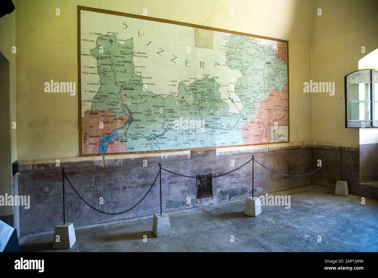 Colico (LC) Italy 08/08/2019, The Fort Montecchio Nord :Barracks room with map on the wall of the Colico Zone, Valtellina and Switzerland in the war zone. Stock Photohttps://www.alamy.com/image-license-details/?v=1https://www.alamy.com/colico-lc-italy-08082019-the-fort-montecchio-nord-barracks-room-with-map-on-the-wall-of-the-colico-zone-valtellina-and-switzerland-in-the-war-zone-image340556213.html
RM2AP1JWW–Colico (LC) Italy 08/08/2019, The Fort Montecchio Nord :Barracks room with map on the wall of the Colico Zone, Valtellina and Switzerland in the war zone.
 An Italian soldier of the Garibaldi Brigade reviews a map prior to conducting a mission orders brief during exercise Allied Spirit IV at the U.S. Army’s Joint Multinational Readiness Center in Hohenfels Training Area, Germany, Jan. 21, 2016. Exercise Allied Spirit IV is a U.S. Army Europe-directed, 7th Army Joint Multinational Training Command-conducted multinational exercise that is designed to prepare forces in Europe to operate together by exercising tactical interoperability and testing secure communications within NATO Alliance members and partner nations. (U.S. Army photo by Spc. Shardes Stock Photohttps://www.alamy.com/image-license-details/?v=1https://www.alamy.com/an-italian-soldier-of-the-garibaldi-brigade-reviews-a-map-prior-to-conducting-a-mission-orders-brief-during-exercise-allied-spirit-iv-at-the-us-armys-joint-multinational-readiness-center-in-hohenfels-training-area-germany-jan-21-2016-exercise-allied-spirit-iv-is-a-us-army-europe-directed-7th-army-joint-multinational-training-command-conducted-multinational-exercise-that-is-designed-to-prepare-forces-in-europe-to-operate-together-by-exercising-tactical-interoperability-and-testing-secure-communications-within-nato-alliance-members-and-partner-nations-us-army-photo-by-spc-shardes-image215627857.html
RMPEPKEW–An Italian soldier of the Garibaldi Brigade reviews a map prior to conducting a mission orders brief during exercise Allied Spirit IV at the U.S. Army’s Joint Multinational Readiness Center in Hohenfels Training Area, Germany, Jan. 21, 2016. Exercise Allied Spirit IV is a U.S. Army Europe-directed, 7th Army Joint Multinational Training Command-conducted multinational exercise that is designed to prepare forces in Europe to operate together by exercising tactical interoperability and testing secure communications within NATO Alliance members and partner nations. (U.S. Army photo by Spc. Shardes
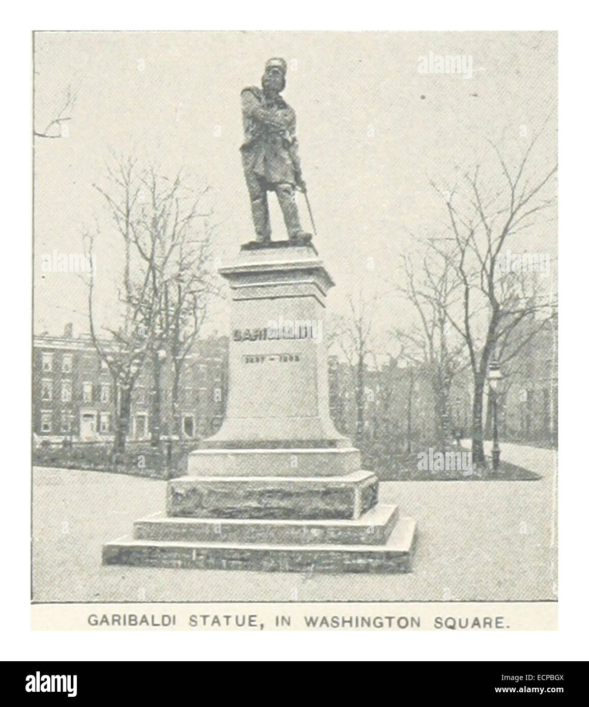 (King1893NYC) pg176 GARIBALDI STATUE, IN WASHINGTON SQUARE Stock Photohttps://www.alamy.com/image-license-details/?v=1https://www.alamy.com/stock-photo-king1893nyc-pg176-garibaldi-statue-in-washington-square-76709386.html
RMECPBGX–(King1893NYC) pg176 GARIBALDI STATUE, IN WASHINGTON SQUARE
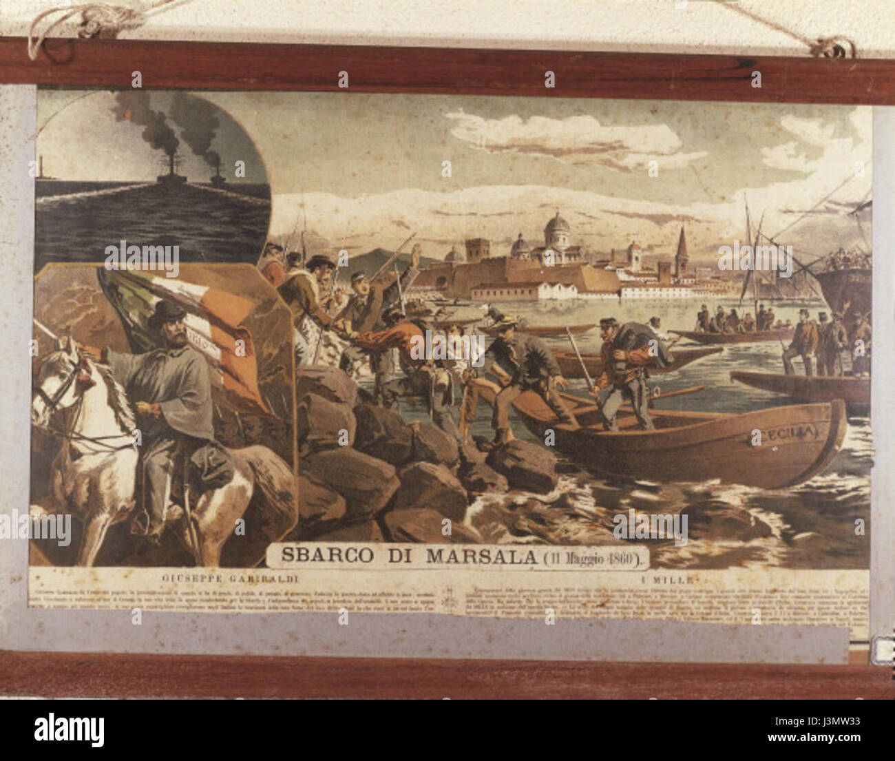 Giuseppe Garibaldi landing at Marsala Stock Photohttps://www.alamy.com/image-license-details/?v=1https://www.alamy.com/stock-photo-giuseppe-garibaldi-landing-at-marsala-139985639.html
RMJ3MW33–Giuseppe Garibaldi landing at Marsala
 Giuseppe Garibaldi boating on the Tiber.. Stock Photohttps://www.alamy.com/image-license-details/?v=1https://www.alamy.com/stock-photo-giuseppe-garibaldi-boating-on-the-tiber-139934684.html
RMJ3JG38–Giuseppe Garibaldi boating on the Tiber..
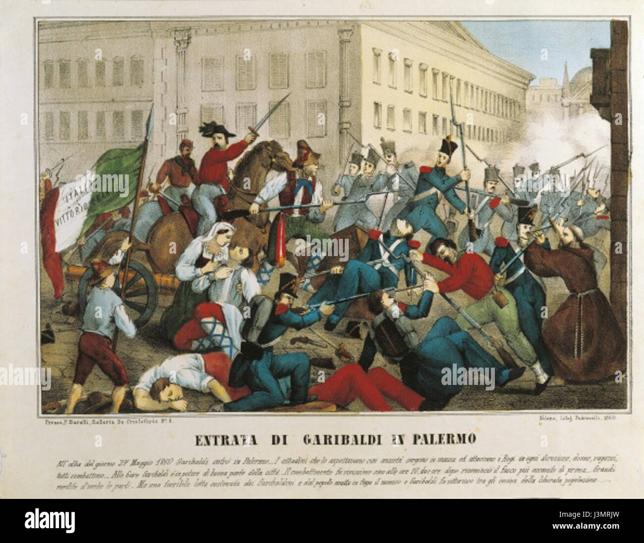 Giuseppe Garibaldi entering Palermo Stock Photohttps://www.alamy.com/image-license-details/?v=1https://www.alamy.com/stock-photo-giuseppe-garibaldi-entering-palermo-139984513.html
RMJ3MRJW–Giuseppe Garibaldi entering Palermo
 Grand Garibaldi, Palermo, IT, Italy, Sicily, N 38 7' 29'', N 13 21' 26'', map, Cartascapes Map published in 2024. Explore Cartascapes, a map revealing Earth's diverse landscapes, cultures, and ecosystems. Journey through time and space, discovering the interconnectedness of our planet's past, present, and future. Stock Photohttps://www.alamy.com/image-license-details/?v=1https://www.alamy.com/grand-garibaldi-palermo-it-italy-sicily-n-38-7-29-n-13-21-26-map-cartascapes-map-published-in-2024-explore-cartascapes-a-map-revealing-earths-diverse-landscapes-cultures-and-ecosystems-journey-through-time-and-space-discovering-the-interconnectedness-of-our-planets-past-present-and-future-image614460971.html
RM2XKK36K–Grand Garibaldi, Palermo, IT, Italy, Sicily, N 38 7' 29'', N 13 21' 26'', map, Cartascapes Map published in 2024. Explore Cartascapes, a map revealing Earth's diverse landscapes, cultures, and ecosystems. Journey through time and space, discovering the interconnectedness of our planet's past, present, and future.
 Garibaldi after being wounded on the Aspromonte Massif Stock Photohttps://www.alamy.com/image-license-details/?v=1https://www.alamy.com/stock-photo-garibaldi-after-being-wounded-on-the-aspromonte-massif-139899121.html
RMJ3GXN5–Garibaldi after being wounded on the Aspromonte Massif
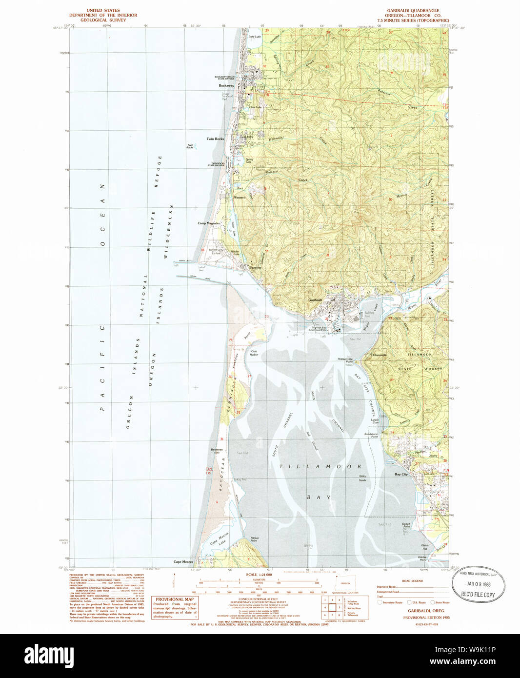 USGS Topo Map Oregon Garibaldi 279986 1985 24000 Restoration Stock Photohttps://www.alamy.com/image-license-details/?v=1https://www.alamy.com/usgs-topo-map-oregon-garibaldi-279986-1985-24000-restoration-image264105346.html
RMW9K11P–USGS Topo Map Oregon Garibaldi 279986 1985 24000 Restoration
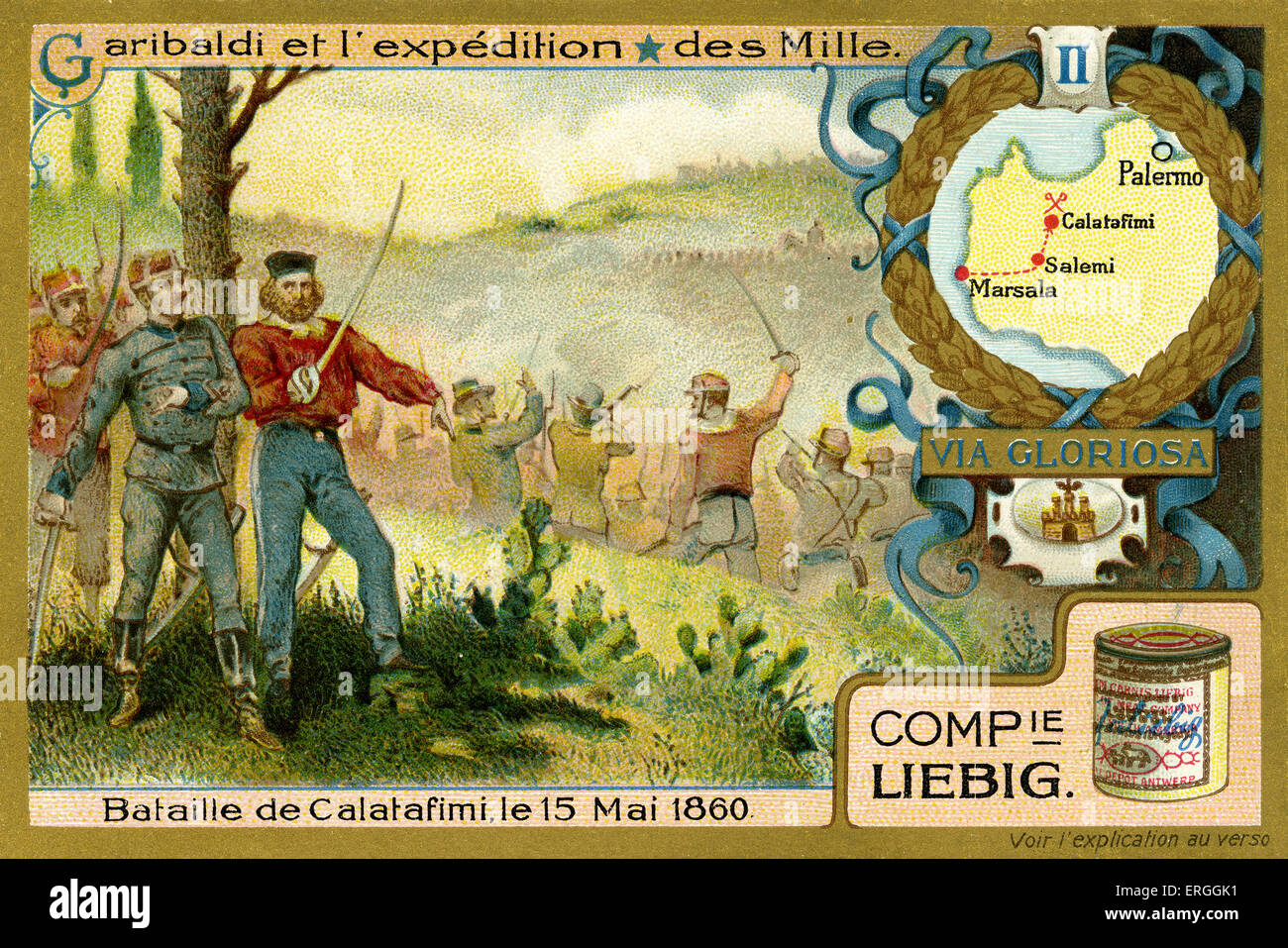 Garibaldi and the Expedition of the Thousand. Illustration of 1910. Battle of Calatafimi, 15 May 1860. Sicily. Spedizione dei Stock Photohttps://www.alamy.com/image-license-details/?v=1https://www.alamy.com/stock-photo-garibaldi-and-the-expedition-of-the-thousand-illustration-of-1910-83342869.html
RMERGGK1–Garibaldi and the Expedition of the Thousand. Illustration of 1910. Battle of Calatafimi, 15 May 1860. Sicily. Spedizione dei
 at dusk Stock Photohttps://www.alamy.com/image-license-details/?v=1https://www.alamy.com/stock-photo-at-dusk-10242121.html
RMA1F94X–at dusk
 Lake Garibaldi (Canada, North America) map vector illustration, scribble sketch map Stock Vectorhttps://www.alamy.com/image-license-details/?v=1https://www.alamy.com/lake-garibaldi-canada-north-america-map-vector-illustration-scribble-sketch-map-image569501111.html
RF2T2F0DB–Lake Garibaldi (Canada, North America) map vector illustration, scribble sketch map
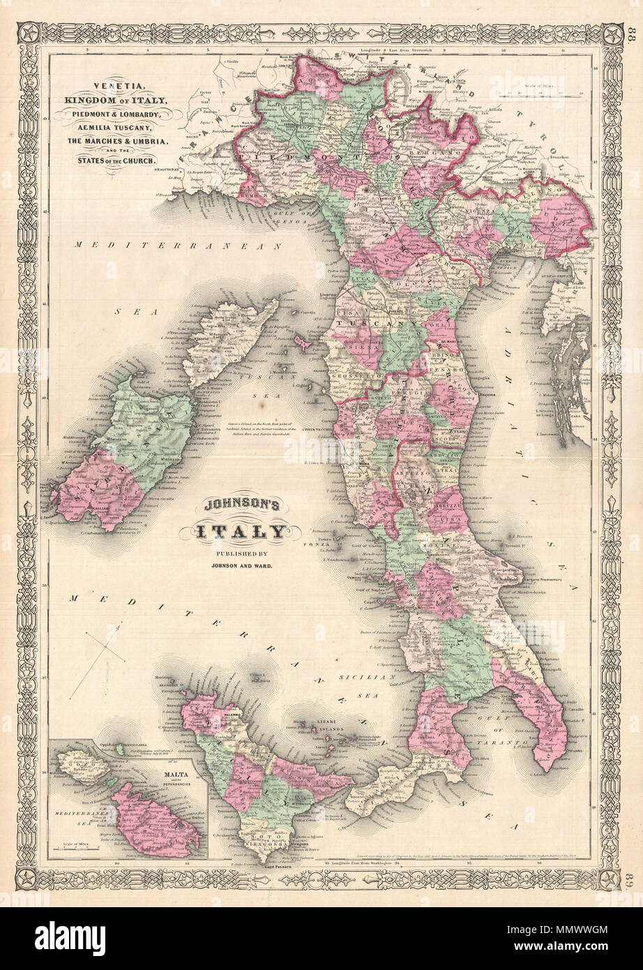 . English: A. J. Johnson’s beautifully hand colored 1864 map of Italy. This map shows cities, topographical features, railways, ferries and roads with color coding at the regional level. Johnson introduced this map in 1863, replacing an earlier map of Italy that divided the peninsula into northern Italy, consisting of Tuscany, Venice, and Piedmont, and southern Italy, including the Kingdom of Naples and the Two Sicilys. This bold move was no doubt a response to the Italian solidarity movement which, in the early 1860s under Garibaldi and his ‘Red Shirts’, unified the Italy under a single admi Stock Photohttps://www.alamy.com/image-license-details/?v=1https://www.alamy.com/english-a-j-johnsons-beautifully-hand-colored-1864-map-of-italy-this-map-shows-cities-topographical-features-railways-ferries-and-roads-with-color-coding-at-the-regional-level-johnson-introduced-this-map-in-1863-replacing-an-earlier-map-of-italy-that-divided-the-peninsula-into-northern-italy-consisting-of-tuscany-venice-and-piedmont-and-southern-italy-including-the-kingdom-of-naples-and-the-two-sicilys-this-bold-move-was-no-doubt-a-response-to-the-italian-solidarity-movement-which-in-the-early-1860s-under-garibaldi-and-his-red-shirts-unified-the-italy-under-a-single-admi-image184965668.html
RMMMWWGM–. English: A. J. Johnson’s beautifully hand colored 1864 map of Italy. This map shows cities, topographical features, railways, ferries and roads with color coding at the regional level. Johnson introduced this map in 1863, replacing an earlier map of Italy that divided the peninsula into northern Italy, consisting of Tuscany, Venice, and Piedmont, and southern Italy, including the Kingdom of Naples and the Two Sicilys. This bold move was no doubt a response to the Italian solidarity movement which, in the early 1860s under Garibaldi and his ‘Red Shirts’, unified the Italy under a single admi
 Garibaldi at Caprera Stock Photohttps://www.alamy.com/image-license-details/?v=1https://www.alamy.com/stock-photo-garibaldi-at-caprera-146473434.html
RMJE8CA2–Garibaldi at Caprera
 Piazza Garibaldi, Bari, IT, Italy, Apulia, N 41 12' 10'', N 16 36' 8'', map, Cartascapes Map published in 2024. Explore Cartascapes, a map revealing Earth's diverse landscapes, cultures, and ecosystems. Journey through time and space, discovering the interconnectedness of our planet's past, present, and future. Stock Photohttps://www.alamy.com/image-license-details/?v=1https://www.alamy.com/piazza-garibaldi-bari-it-italy-apulia-n-41-12-10-n-16-36-8-map-cartascapes-map-published-in-2024-explore-cartascapes-a-map-revealing-earths-diverse-landscapes-cultures-and-ecosystems-journey-through-time-and-space-discovering-the-interconnectedness-of-our-planets-past-present-and-future-image614452446.html
RM2XKJMA6–Piazza Garibaldi, Bari, IT, Italy, Apulia, N 41 12' 10'', N 16 36' 8'', map, Cartascapes Map published in 2024. Explore Cartascapes, a map revealing Earth's diverse landscapes, cultures, and ecosystems. Journey through time and space, discovering the interconnectedness of our planet's past, present, and future.
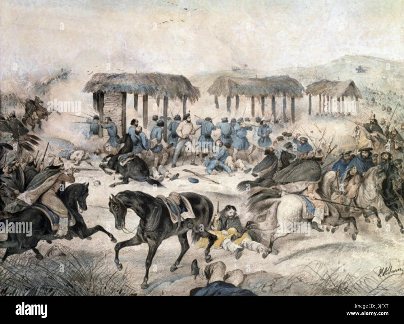 Giuseppe Garibaldi at the battle of San Antonio... Stock Photohttps://www.alamy.com/image-license-details/?v=1https://www.alamy.com/stock-photo-giuseppe-garibaldi-at-the-battle-of-san-antonio-139934560.html
RMJ3JFXT–Giuseppe Garibaldi at the battle of San Antonio...
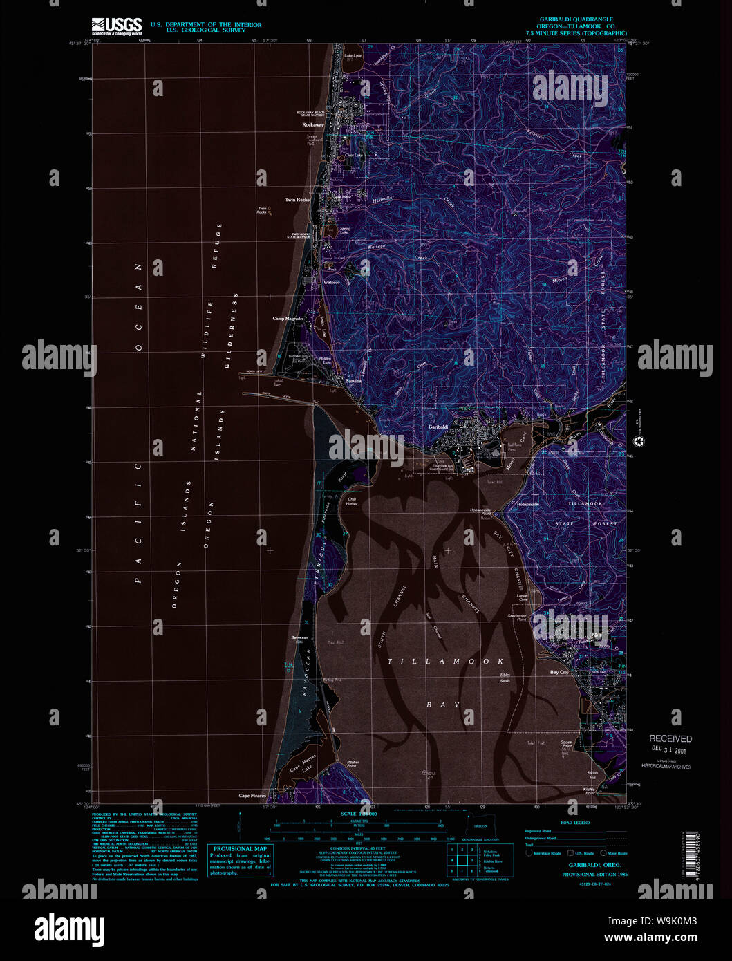 USGS Topo Map Oregon Garibaldi 279985 1985 24000 Inverted Restoration Stock Photohttps://www.alamy.com/image-license-details/?v=1https://www.alamy.com/usgs-topo-map-oregon-garibaldi-279985-1985-24000-inverted-restoration-image264105075.html
RMW9K0M3–USGS Topo Map Oregon Garibaldi 279985 1985 24000 Inverted Restoration
 Garibaldi and the Expedition of the Thousand. Illustration of 1910. Night passage from Messina, 19 - 20 August 1860. Sicily. Stock Photohttps://www.alamy.com/image-license-details/?v=1https://www.alamy.com/stock-photo-garibaldi-and-the-expedition-of-the-thousand-illustration-of-1910-83342870.html
RMERGGK2–Garibaldi and the Expedition of the Thousand. Illustration of 1910. Night passage from Messina, 19 - 20 August 1860. Sicily.
 at dusk Stock Photohttps://www.alamy.com/image-license-details/?v=1https://www.alamy.com/stock-photo-at-dusk-10242120.html
RMA1F94W–at dusk
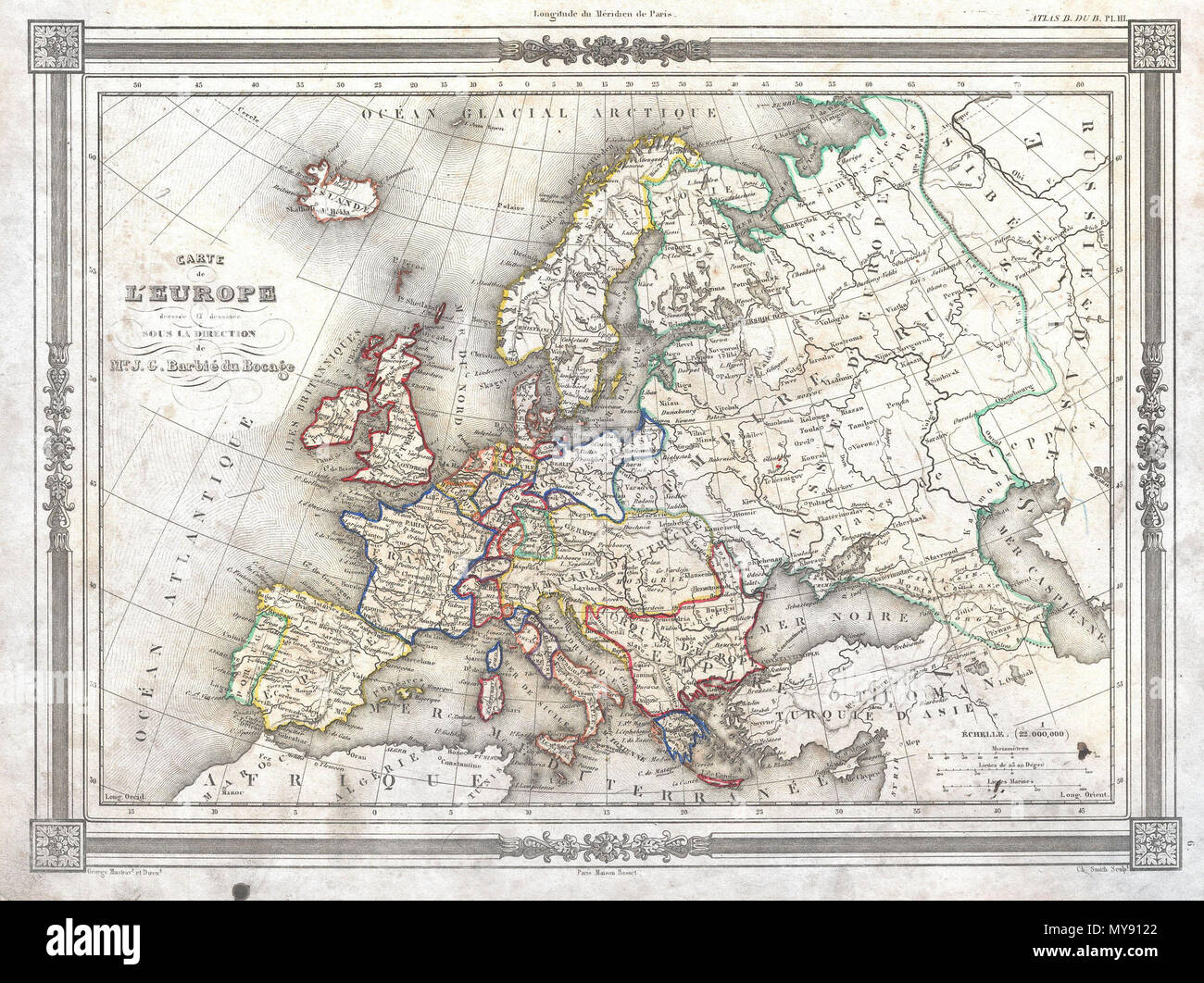 . Carte de L'Europe . English: An uncommon and attractive 1852 map of Europe by J. G. Barbie du Bocage. Details all of Europe including Iceland as well as parts of Asia and Africa. Shows the Austrian Empire at its height, the many states of the German Confederacy, and a pre Garibaldi Italy split into numerous small Duchies and states. Features a beautiful frame style border. Prepared by J. G. Barbie du Bocage for publication as plate no. 3 in Maison Basset’s 1852 edition of the Atlas Illustre . . 1852 (undated) 6 1852 Barbie du Bocage Map of Europe - Geographicus - Europe-bocage-1852 Stock Photohttps://www.alamy.com/image-license-details/?v=1https://www.alamy.com/carte-de-leurope-english-an-uncommon-and-attractive-1852-map-of-europe-by-j-g-barbie-du-bocage-details-all-of-europe-including-iceland-as-well-as-parts-of-asia-and-africa-shows-the-austrian-empire-at-its-height-the-many-states-of-the-german-confederacy-and-a-pre-garibaldi-italy-split-into-numerous-small-duchies-and-states-features-a-beautiful-frame-style-border-prepared-by-j-g-barbie-du-bocage-for-publication-as-plate-no-3-in-maison-bassets-1852-edition-of-the-atlas-illustre-1852-undated-6-1852-barbie-du-bocage-map-of-europe-geographicus-europe-bocage-1852-image188897802.html
RMMY9122–. Carte de L'Europe . English: An uncommon and attractive 1852 map of Europe by J. G. Barbie du Bocage. Details all of Europe including Iceland as well as parts of Asia and Africa. Shows the Austrian Empire at its height, the many states of the German Confederacy, and a pre Garibaldi Italy split into numerous small Duchies and states. Features a beautiful frame style border. Prepared by J. G. Barbie du Bocage for publication as plate no. 3 in Maison Basset’s 1852 edition of the Atlas Illustre . . 1852 (undated) 6 1852 Barbie du Bocage Map of Europe - Geographicus - Europe-bocage-1852
 52054 Garibaldi (scarlet in color), Hypsypops rubicunda (Girard) La Jolla, San Diego, Cal Stock Photohttps://www.alamy.com/image-license-details/?v=1https://www.alamy.com/stock-photo-52054-garibaldi-scarlet-in-color-hypsypops-rubicunda-girard-la-jolla-115079811.html
RMGK69D7–52054 Garibaldi (scarlet in color), Hypsypops rubicunda (Girard) La Jolla, San Diego, Cal
 St John Ambulance volunteers dressed as 'moon men' 35279942592 o Stock Photohttps://www.alamy.com/image-license-details/?v=1https://www.alamy.com/stock-photo-st-john-ambulance-volunteers-dressed-as-moon-men-35279942592-o-147117539.html
RMJF9NWR–St John Ambulance volunteers dressed as 'moon men' 35279942592 o
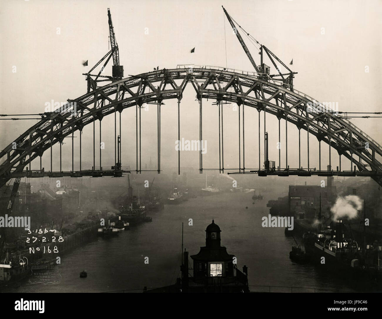 Flags fly above the Tyne Bridge in celebration 34755027013 o Stock Photohttps://www.alamy.com/image-license-details/?v=1https://www.alamy.com/stock-photo-flags-fly-above-the-tyne-bridge-in-celebration-34755027013-o-147109878.html
RMJF9C46–Flags fly above the Tyne Bridge in celebration 34755027013 o
 Coal staithes in the South Docks, Sunderland 35157544300 o Stock Photohttps://www.alamy.com/image-license-details/?v=1https://www.alamy.com/stock-photo-coal-staithes-in-the-south-docks-sunderland-35157544300-o-147117546.html
RMJF9NX2–Coal staithes in the South Docks, Sunderland 35157544300 o
 Garibaldi Hill, Moorabool, AU, Australia, Victoria, S 37 32' 8'', N 144 15' 52'', map, Cartascapes Map published in 2024. Explore Cartascapes, a map revealing Earth's diverse landscapes, cultures, and ecosystems. Journey through time and space, discovering the interconnectedness of our planet's past, present, and future. Stock Photohttps://www.alamy.com/image-license-details/?v=1https://www.alamy.com/garibaldi-hill-moorabool-au-australia-victoria-s-37-32-8-n-144-15-52-map-cartascapes-map-published-in-2024-explore-cartascapes-a-map-revealing-earths-diverse-landscapes-cultures-and-ecosystems-journey-through-time-and-space-discovering-the-interconnectedness-of-our-planets-past-present-and-future-image625419907.html
RM2Y9E9D7–Garibaldi Hill, Moorabool, AU, Australia, Victoria, S 37 32' 8'', N 144 15' 52'', map, Cartascapes Map published in 2024. Explore Cartascapes, a map revealing Earth's diverse landscapes, cultures, and ecosystems. Journey through time and space, discovering the interconnectedness of our planet's past, present, and future.
 Garibaldi being received by King Umberto I Stock Photohttps://www.alamy.com/image-license-details/?v=1https://www.alamy.com/stock-photo-garibaldi-being-received-by-king-umberto-i-139899347.html
RMJ3GY17–Garibaldi being received by King Umberto I
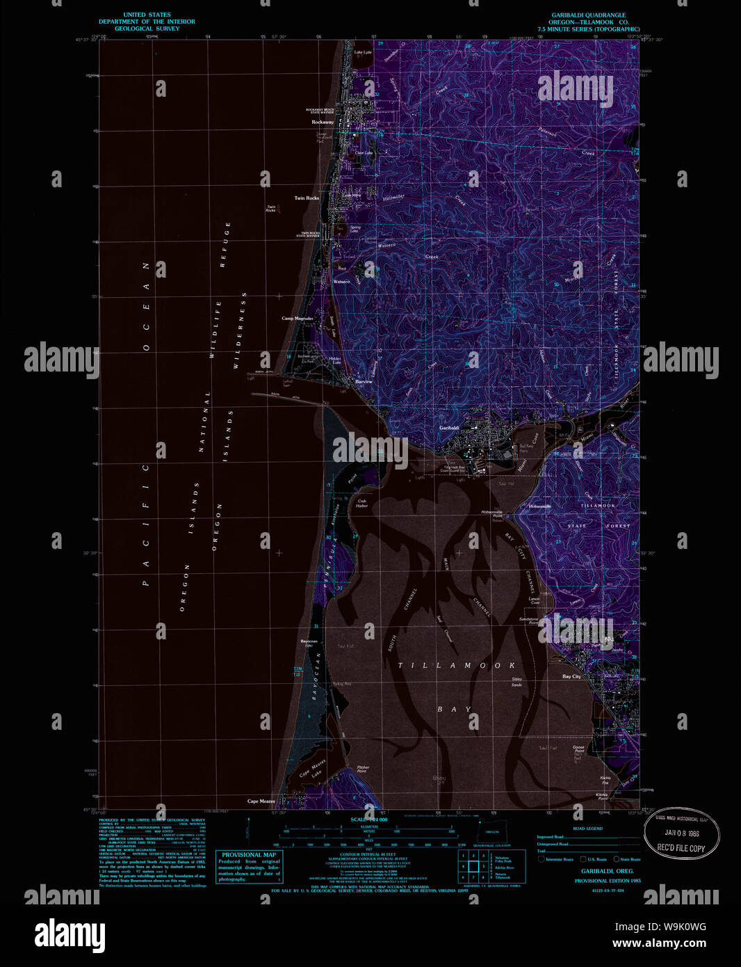 USGS Topo Map Oregon Garibaldi 279986 1985 24000 Inverted Restoration Stock Photohttps://www.alamy.com/image-license-details/?v=1https://www.alamy.com/usgs-topo-map-oregon-garibaldi-279986-1985-24000-inverted-restoration-image264105228.html
RMW9K0WG–USGS Topo Map Oregon Garibaldi 279986 1985 24000 Inverted Restoration
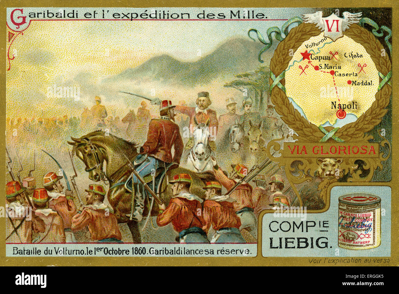 Garibaldi and the Expedition of the Thousand. Illustration of 1910. Battle of Volturno, 1 October 1860. Italy. Spedizione dei Mille, event of the Italian Risorgimento (Italian unification) with aim of regaining Sicily from Bourbon rule. Liebig Collectible Card. Giuseppe Garibaldi, Italian general, politician and patriot, 4 July 1807 – 2 June 1882. Stock Photohttps://www.alamy.com/image-license-details/?v=1https://www.alamy.com/stock-photo-garibaldi-and-the-expedition-of-the-thousand-illustration-of-1910-83342873.html
RMERGGK5–Garibaldi and the Expedition of the Thousand. Illustration of 1910. Battle of Volturno, 1 October 1860. Italy. Spedizione dei Mille, event of the Italian Risorgimento (Italian unification) with aim of regaining Sicily from Bourbon rule. Liebig Collectible Card. Giuseppe Garibaldi, Italian general, politician and patriot, 4 July 1807 – 2 June 1882.
 Retreat of Giuseppe Garibaldi and his troops on Mount Luna Stock Photohttps://www.alamy.com/image-license-details/?v=1https://www.alamy.com/stock-photo-retreat-of-giuseppe-garibaldi-and-his-troops-on-mount-luna-140423108.html
RMJ4CR30–Retreat of Giuseppe Garibaldi and his troops on Mount Luna
 Lord Mayor's Holiday Camp at Amble 35126913061 o Stock Photohttps://www.alamy.com/image-license-details/?v=1https://www.alamy.com/stock-photo-lord-mayors-holiday-camp-at-amble-35126913061-o-147096163.html
RMJF8PJB–Lord Mayor's Holiday Camp at Amble 35126913061 o
 Expedition of the Thousand Giuseppe Garibaldi in Pretoria Square in Palermo 1860 Stock Photohttps://www.alamy.com/image-license-details/?v=1https://www.alamy.com/stock-photo-expedition-of-the-thousand-giuseppe-garibaldi-in-pretoria-square-in-140469967.html
RMJ4EXTF–Expedition of the Thousand Giuseppe Garibaldi in Pretoria Square in Palermo 1860
 Image taken from page 8 of 'Illustrated History of the Manchester Ship Canal, etc' Image taken from page 8 of 'Illustrated History of the Stock Photohttps://www.alamy.com/image-license-details/?v=1https://www.alamy.com/stock-photo-image-taken-from-page-8-of-illustrated-history-of-the-manchester-ship-127813101.html
RMHBXAWH–Image taken from page 8 of 'Illustrated History of the Manchester Ship Canal, etc' Image taken from page 8 of 'Illustrated History of the
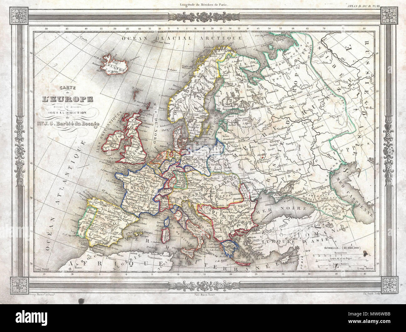 . Carte de L'Europe . English: An uncommon and attractive 1852 map of Europe by J. G. Barbie du Bocage. Details all of Europe including Iceland as well as parts of Asia and Africa. Shows the Austrian Empire at its height, the many states of the German Confederacy, and a pre Garibaldi Italy split into numerous small Duchies and states. Features a beautiful frame style border. Prepared by J. G. Barbie du Bocage for publication as plate no. 3 in Maison Basset’s 1852 edition of the Atlas Illustre . . 1852 (undated) 8 1852 Barbie du Bocage Map of Europe - Geographicus - Europe-bocage-1852 Stock Photohttps://www.alamy.com/image-license-details/?v=1https://www.alamy.com/carte-de-leurope-english-an-uncommon-and-attractive-1852-map-of-europe-by-j-g-barbie-du-bocage-details-all-of-europe-including-iceland-as-well-as-parts-of-asia-and-africa-shows-the-austrian-empire-at-its-height-the-many-states-of-the-german-confederacy-and-a-pre-garibaldi-italy-split-into-numerous-small-duchies-and-states-features-a-beautiful-frame-style-border-prepared-by-j-g-barbie-du-bocage-for-publication-as-plate-no-3-in-maison-bassets-1852-edition-of-the-atlas-illustre-1852-undated-8-1852-barbie-du-bocage-map-of-europe-geographicus-europe-bocage-1852-image187621711.html
RMMW6WBB–. Carte de L'Europe . English: An uncommon and attractive 1852 map of Europe by J. G. Barbie du Bocage. Details all of Europe including Iceland as well as parts of Asia and Africa. Shows the Austrian Empire at its height, the many states of the German Confederacy, and a pre Garibaldi Italy split into numerous small Duchies and states. Features a beautiful frame style border. Prepared by J. G. Barbie du Bocage for publication as plate no. 3 in Maison Basset’s 1852 edition of the Atlas Illustre . . 1852 (undated) 8 1852 Barbie du Bocage Map of Europe - Geographicus - Europe-bocage-1852
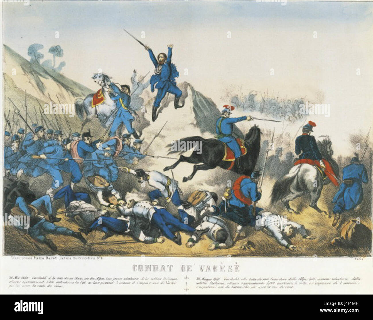 Giuseppe Garibaldi leads troops in Battle of Varese 26 May 1859 Stock Photohttps://www.alamy.com/image-license-details/?v=1https://www.alamy.com/stock-photo-giuseppe-garibaldi-leads-troops-in-battle-of-varese-26-may-1859-140472209.html
RMJ4F1MH–Giuseppe Garibaldi leads troops in Battle of Varese 26 May 1859
 Garibaldi and his men carrying boats from Los Patos lagoon to Tramandahy lake during the Rio Grande do Sul War. Stock Photohttps://www.alamy.com/image-license-details/?v=1https://www.alamy.com/stock-photo-garibaldi-and-his-men-carrying-boats-from-los-patos-lagoon-to-tramandahy-139899234.html
RMJ3GXW6–Garibaldi and his men carrying boats from Los Patos lagoon to Tramandahy lake during the Rio Grande do Sul War.
 Garibaldi--Entrée à Naples Stock Photohttps://www.alamy.com/image-license-details/?v=1https://www.alamy.com/stock-photo-garibaldi-entre-naples-147551150.html
RMJG1EYX–Garibaldi--Entrée à Naples
 Piazza Giuseppe Garibaldi, Napoli, IT, Italy, Campania, N 40 56' 46'', N 14 17' 41'', map, Cartascapes Map published in 2024. Explore Cartascapes, a map revealing Earth's diverse landscapes, cultures, and ecosystems. Journey through time and space, discovering the interconnectedness of our planet's past, present, and future. Stock Photohttps://www.alamy.com/image-license-details/?v=1https://www.alamy.com/piazza-giuseppe-garibaldi-napoli-it-italy-campania-n-40-56-46-n-14-17-41-map-cartascapes-map-published-in-2024-explore-cartascapes-a-map-revealing-earths-diverse-landscapes-cultures-and-ecosystems-journey-through-time-and-space-discovering-the-interconnectedness-of-our-planets-past-present-and-future-image614459500.html
RM2XKK1A4–Piazza Giuseppe Garibaldi, Napoli, IT, Italy, Campania, N 40 56' 46'', N 14 17' 41'', map, Cartascapes Map published in 2024. Explore Cartascapes, a map revealing Earth's diverse landscapes, cultures, and ecosystems. Journey through time and space, discovering the interconnectedness of our planet's past, present, and future.
![Image taken from page 630 of 'Illustrated Battles of the Nineteenth Century. [By Archibald Forbes, Major Arthur Griffiths, and others.]' Image taken from page 630 of 'Illustrated Battles of the Stock Photo Image taken from page 630 of 'Illustrated Battles of the Nineteenth Century. [By Archibald Forbes, Major Arthur Griffiths, and others.]' Image taken from page 630 of 'Illustrated Battles of the Stock Photo](https://c8.alamy.com/comp/HC11GC/image-taken-from-page-630-of-illustrated-battles-of-the-nineteenth-HC11GC.jpg) Image taken from page 630 of 'Illustrated Battles of the Nineteenth Century. [By Archibald Forbes, Major Arthur Griffiths, and others.]' Image taken from page 630 of 'Illustrated Battles of the Stock Photohttps://www.alamy.com/image-license-details/?v=1https://www.alamy.com/stock-photo-image-taken-from-page-630-of-illustrated-battles-of-the-nineteenth-127871644.html
Image taken from page 630 of 'Illustrated Battles of the Nineteenth Century. [By Archibald Forbes, Major Arthur Griffiths, and others.]' Image taken from page 630 of 'Illustrated Battles of the Stock Photohttps://www.alamy.com/image-license-details/?v=1https://www.alamy.com/stock-photo-image-taken-from-page-630-of-illustrated-battles-of-the-nineteenth-127871644.htmlRMHC11GC–Image taken from page 630 of 'Illustrated Battles of the Nineteenth Century. [By Archibald Forbes, Major Arthur Griffiths, and others.]' Image taken from page 630 of 'Illustrated Battles of the
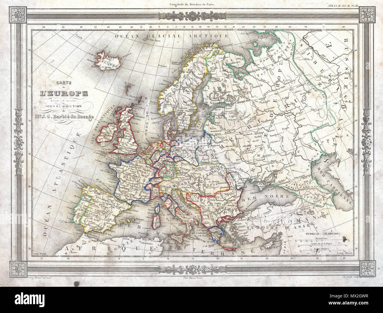 . Carte de L'Europe . English: An uncommon and attractive 1852 map of Europe by J. G. Barbie du Bocage. Details all of Europe including Iceland as well as parts of Asia and Africa. Shows the Austrian Empire at its height, the many states of the German Confederacy, and a pre Garibaldi Italy split into numerous small Duchies and states. Features a beautiful frame style border. Prepared by J. G. Barbie du Bocage for publication as plate no. 3 in Maison Basset’s 1852 edition of the Atlas Illustre . . 1852 (undated) 8 1852 Barbie du Bocage Map of Europe - Geographicus - Europe-bocage-1852 Stock Photohttps://www.alamy.com/image-license-details/?v=1https://www.alamy.com/carte-de-leurope-english-an-uncommon-and-attractive-1852-map-of-europe-by-j-g-barbie-du-bocage-details-all-of-europe-including-iceland-as-well-as-parts-of-asia-and-africa-shows-the-austrian-empire-at-its-height-the-many-states-of-the-german-confederacy-and-a-pre-garibaldi-italy-split-into-numerous-small-duchies-and-states-features-a-beautiful-frame-style-border-prepared-by-j-g-barbie-du-bocage-for-publication-as-plate-no-3-in-maison-bassets-1852-edition-of-the-atlas-illustre-1852-undated-8-1852-barbie-du-bocage-map-of-europe-geographicus-europe-bocage-1852-image188141907.html
RMMX2GWR–. Carte de L'Europe . English: An uncommon and attractive 1852 map of Europe by J. G. Barbie du Bocage. Details all of Europe including Iceland as well as parts of Asia and Africa. Shows the Austrian Empire at its height, the many states of the German Confederacy, and a pre Garibaldi Italy split into numerous small Duchies and states. Features a beautiful frame style border. Prepared by J. G. Barbie du Bocage for publication as plate no. 3 in Maison Basset’s 1852 edition of the Atlas Illustre . . 1852 (undated) 8 1852 Barbie du Bocage Map of Europe - Geographicus - Europe-bocage-1852
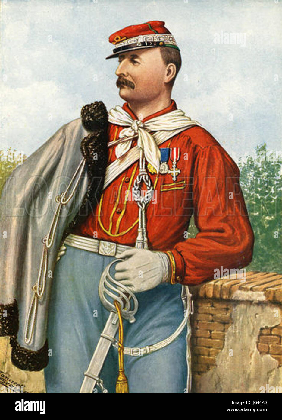 Nino Bixio one of the bravest of Garibaldi s companions Stock Photohttps://www.alamy.com/image-license-details/?v=1https://www.alamy.com/stock-photo-nino-bixio-one-of-the-bravest-of-garibaldi-s-companions-147608664.html
RMJG44A0–Nino Bixio one of the bravest of Garibaldi s companions
 Garibaldi s troops during the Battle of Varese Stock Photohttps://www.alamy.com/image-license-details/?v=1https://www.alamy.com/stock-photo-garibaldi-s-troops-during-the-battle-of-varese-147551143.html
RMJG1EYK–Garibaldi s troops during the Battle of Varese
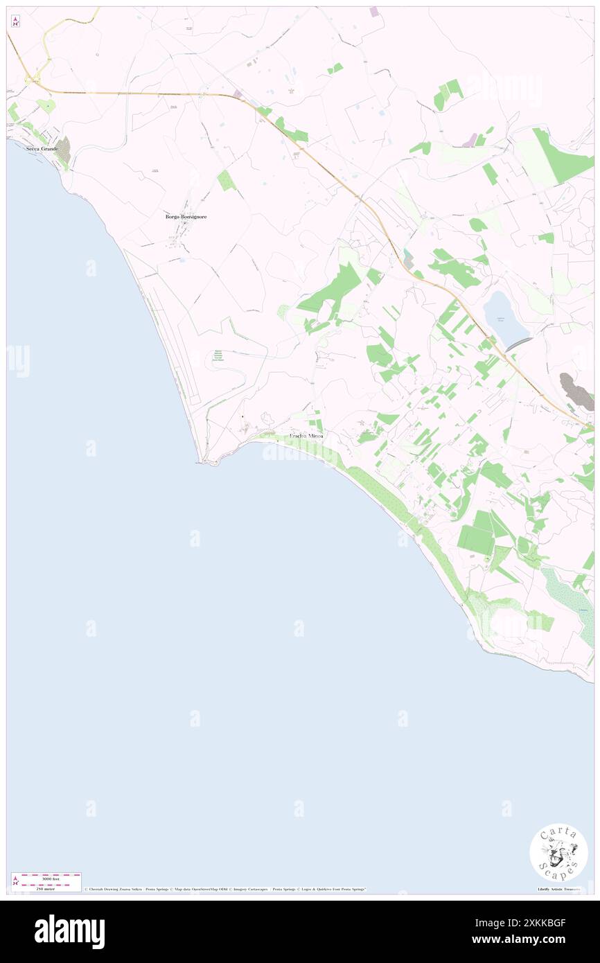 Playa Lido Garibaldi, Agrigento, IT, Italy, Sicily, N 37 23' 27'', N 13 17' 23'', map, Cartascapes Map published in 2024. Explore Cartascapes, a map revealing Earth's diverse landscapes, cultures, and ecosystems. Journey through time and space, discovering the interconnectedness of our planet's past, present, and future. Stock Photohttps://www.alamy.com/image-license-details/?v=1https://www.alamy.com/playa-lido-garibaldi-agrigento-it-italy-sicily-n-37-23-27-n-13-17-23-map-cartascapes-map-published-in-2024-explore-cartascapes-a-map-revealing-earths-diverse-landscapes-cultures-and-ecosystems-journey-through-time-and-space-discovering-the-interconnectedness-of-our-planets-past-present-and-future-image614467519.html
RM2XKKBGF–Playa Lido Garibaldi, Agrigento, IT, Italy, Sicily, N 37 23' 27'', N 13 17' 23'', map, Cartascapes Map published in 2024. Explore Cartascapes, a map revealing Earth's diverse landscapes, cultures, and ecosystems. Journey through time and space, discovering the interconnectedness of our planet's past, present, and future.
 Image taken from page 107 of 'The Boy Soldier; or, Garibaldi's young captain. A novel. Illustrated, etc' Image taken from page 107 of 'The Boy Soldier; or, Stock Photohttps://www.alamy.com/image-license-details/?v=1https://www.alamy.com/stock-photo-image-taken-from-page-107-of-the-boy-soldier-or-garibaldis-young-captain-127717709.html
RMHBP16N–Image taken from page 107 of 'The Boy Soldier; or, Garibaldi's young captain. A novel. Illustrated, etc' Image taken from page 107 of 'The Boy Soldier; or,
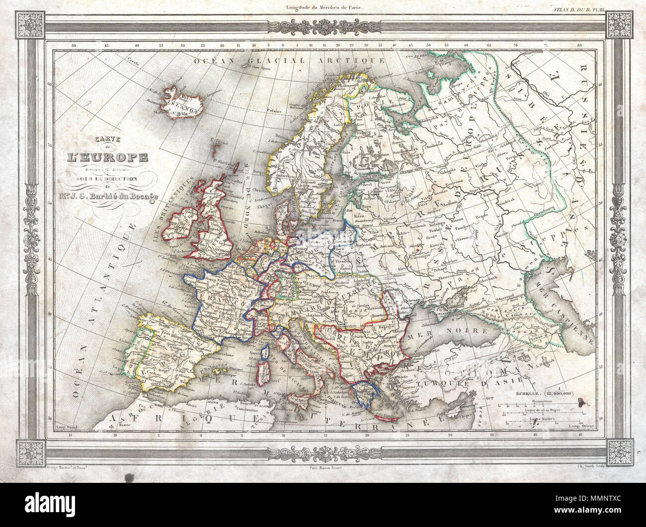 . English: An uncommon and attractive 1852 map of Europe by J. G. Barbie du Bocage. Details all of Europe including Iceland as well as parts of Asia and Africa. Shows the Austrian Empire at its height, the many states of the German Confederacy, and a pre Garibaldi Italy split into numerous small Duchies and states. Features a beautiful frame style border. Prepared by J. G. Barbie du Bocage for publication as plate no. 3 in Maison Basset’s 1852 edition of the Atlas Illustre . Carte de L'Europe. 1852 (undated). 8 1852 Barbie du Bocage Map of Europe - Geographicus - Europe-bocage-1852 Stock Photohttps://www.alamy.com/image-license-details/?v=1https://www.alamy.com/english-an-uncommon-and-attractive-1852-map-of-europe-by-j-g-barbie-du-bocage-details-all-of-europe-including-iceland-as-well-as-parts-of-asia-and-africa-shows-the-austrian-empire-at-its-height-the-many-states-of-the-german-confederacy-and-a-pre-garibaldi-italy-split-into-numerous-small-duchies-and-states-features-a-beautiful-frame-style-border-prepared-by-j-g-barbie-du-bocage-for-publication-as-plate-no-3-in-maison-bassets-1852-edition-of-the-atlas-illustre-carte-de-leurope-1852-undated-8-1852-barbie-du-bocage-map-of-europe-geographicus-europe-bocage-1852-image184877348.html
RMMMNTXC–. English: An uncommon and attractive 1852 map of Europe by J. G. Barbie du Bocage. Details all of Europe including Iceland as well as parts of Asia and Africa. Shows the Austrian Empire at its height, the many states of the German Confederacy, and a pre Garibaldi Italy split into numerous small Duchies and states. Features a beautiful frame style border. Prepared by J. G. Barbie du Bocage for publication as plate no. 3 in Maison Basset’s 1852 edition of the Atlas Illustre . Carte de L'Europe. 1852 (undated). 8 1852 Barbie du Bocage Map of Europe - Geographicus - Europe-bocage-1852
 Giuseppe Garibaldi s assault on Laveno Fort... Stock Photohttps://www.alamy.com/image-license-details/?v=1https://www.alamy.com/stock-photo-giuseppe-garibaldi-s-assault-on-laveno-fort-147590645.html
RMJG39AD–Giuseppe Garibaldi s assault on Laveno Fort...
 Garibaldi s Supporters in Termini Imerese June 1860 Stock Photohttps://www.alamy.com/image-license-details/?v=1https://www.alamy.com/stock-photo-garibaldi-s-supporters-in-termini-imerese-june-1860-147551140.html
RMJG1EYG–Garibaldi s Supporters in Termini Imerese June 1860
 Mercure Napoli Garibaldi, Napoli, IT, Italy, Campania, N 40 51' 2'', N 14 16' 12'', map, Cartascapes Map published in 2024. Explore Cartascapes, a map revealing Earth's diverse landscapes, cultures, and ecosystems. Journey through time and space, discovering the interconnectedness of our planet's past, present, and future. Stock Photohttps://www.alamy.com/image-license-details/?v=1https://www.alamy.com/mercure-napoli-garibaldi-napoli-it-italy-campania-n-40-51-2-n-14-16-12-map-cartascapes-map-published-in-2024-explore-cartascapes-a-map-revealing-earths-diverse-landscapes-cultures-and-ecosystems-journey-through-time-and-space-discovering-the-interconnectedness-of-our-planets-past-present-and-future-image614487587.html
RM2XKM957–Mercure Napoli Garibaldi, Napoli, IT, Italy, Campania, N 40 51' 2'', N 14 16' 12'', map, Cartascapes Map published in 2024. Explore Cartascapes, a map revealing Earth's diverse landscapes, cultures, and ecosystems. Journey through time and space, discovering the interconnectedness of our planet's past, present, and future.
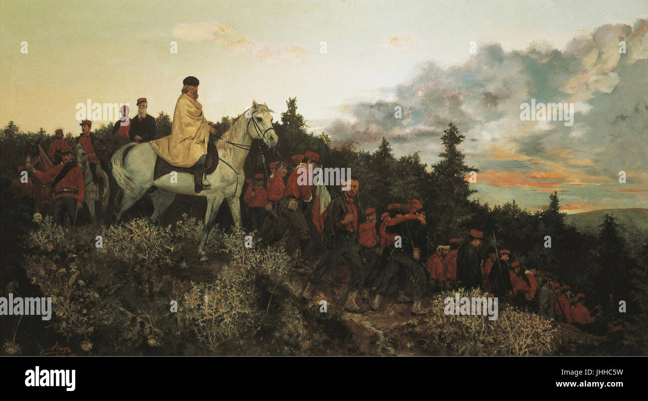 Garibaldi at Mentana, 3rd November 1867 Stock Photohttps://www.alamy.com/image-license-details/?v=1https://www.alamy.com/stock-photo-garibaldi-at-mentana-3rd-november-1867-148514853.html
RMJHHC5W–Garibaldi at Mentana, 3rd November 1867
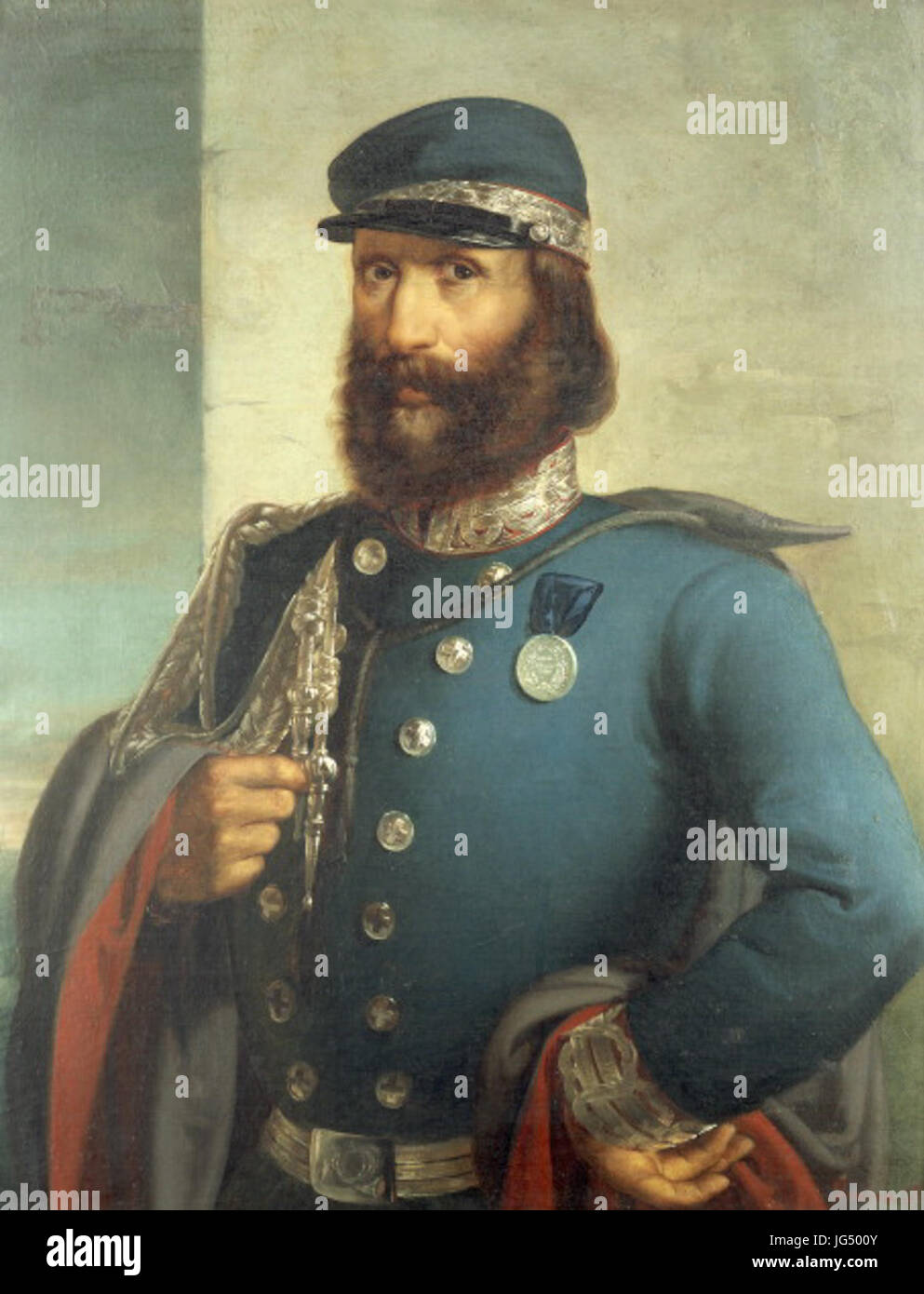 Portrait of Giuseppe Garibaldi 281807-188 9 by Gerolamo Induno 2818 -189029 Stock Photohttps://www.alamy.com/image-license-details/?v=1https://www.alamy.com/stock-photo-portrait-of-giuseppe-garibaldi-281807-188-9-by-gerolamo-induno-2818-147627227.html
RMJG500Y–Portrait of Giuseppe Garibaldi 281807-188 9 by Gerolamo Induno 2818 -189029