Quick filters:
Map of gravenhage Stock Photos and Images
 Hague, 'S Gravenhage, La Haye. Town city plan. Netherlands. BRADSHAW c1853 map Stock Photohttps://www.alamy.com/image-license-details/?v=1https://www.alamy.com/hague-s-gravenhage-la-haye-town-city-plan-netherlands-bradshaw-c1853-map-image622794012.html
RF2Y56M38–Hague, 'S Gravenhage, La Haye. Town city plan. Netherlands. BRADSHAW c1853 map
 Gravenhage and surrounding areas Shown on a Geography map or road map Stock Photohttps://www.alamy.com/image-license-details/?v=1https://www.alamy.com/gravenhage-and-surrounding-areas-shown-on-a-geography-map-or-road-map-image416417051.html
RM2F5DC5F–Gravenhage and surrounding areas Shown on a Geography map or road map
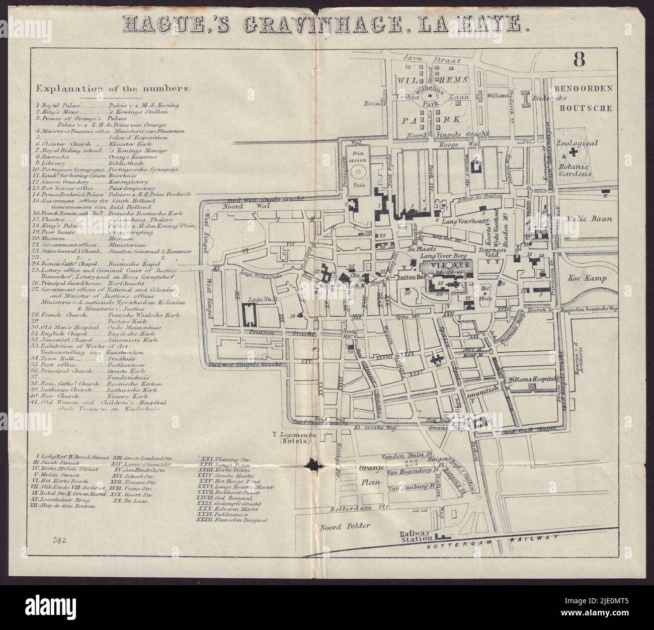 THE HAGUE. Den Haag. 's Gravenhage. town plan 1882 old antique map chart Stock Photohttps://www.alamy.com/image-license-details/?v=1https://www.alamy.com/the-hague-den-haag-s-gravenhage-town-plan-1882-old-antique-map-chart-image473301477.html
RF2JE0MT5–THE HAGUE. Den Haag. 's Gravenhage. town plan 1882 old antique map chart
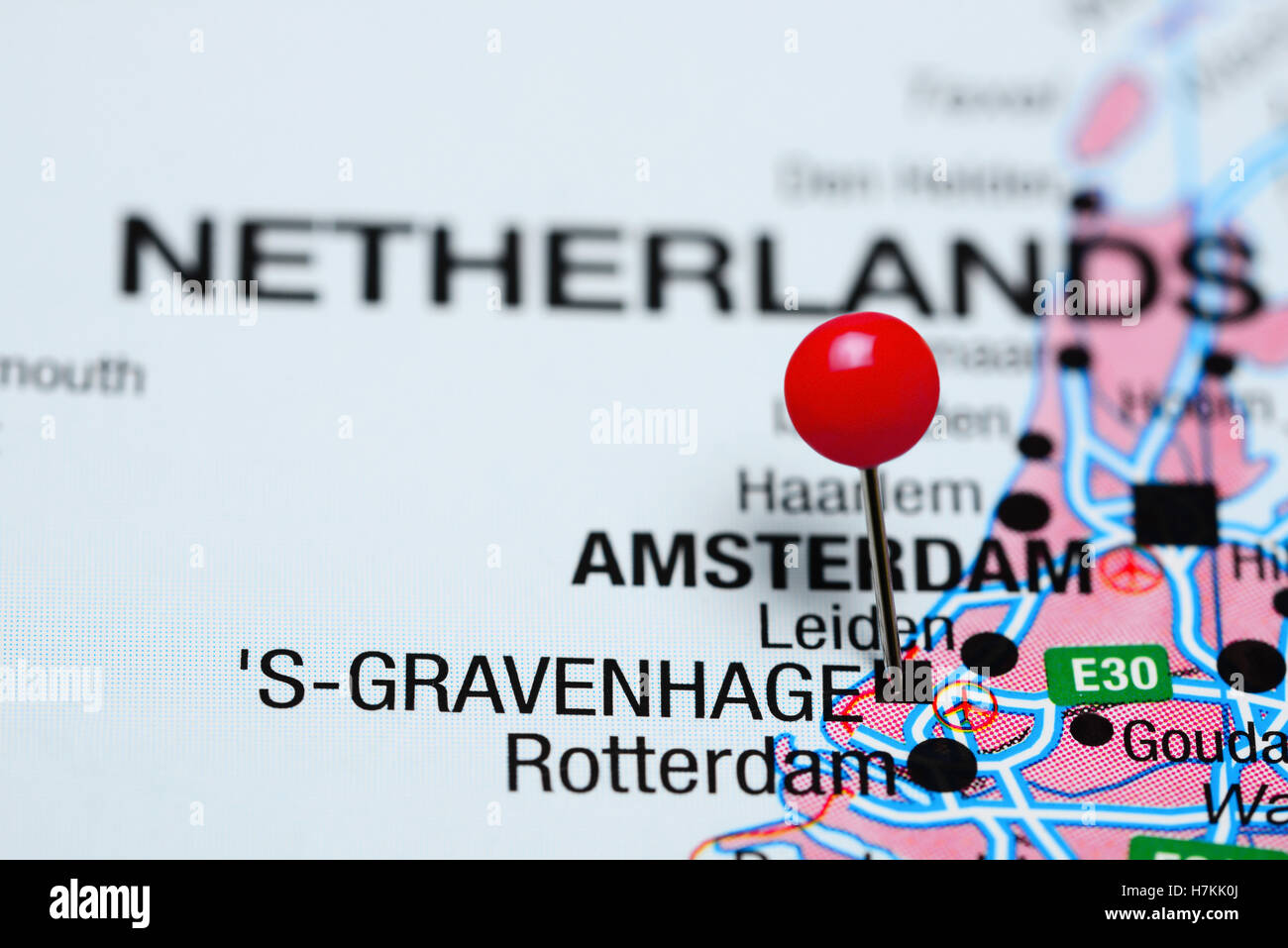 s-Gravenhage pinned on a map of Netherlands Stock Photohttps://www.alamy.com/image-license-details/?v=1https://www.alamy.com/stock-photo-s-gravenhage-pinned-on-a-map-of-netherlands-125207170.html
RFH7KK0J–s-Gravenhage pinned on a map of Netherlands
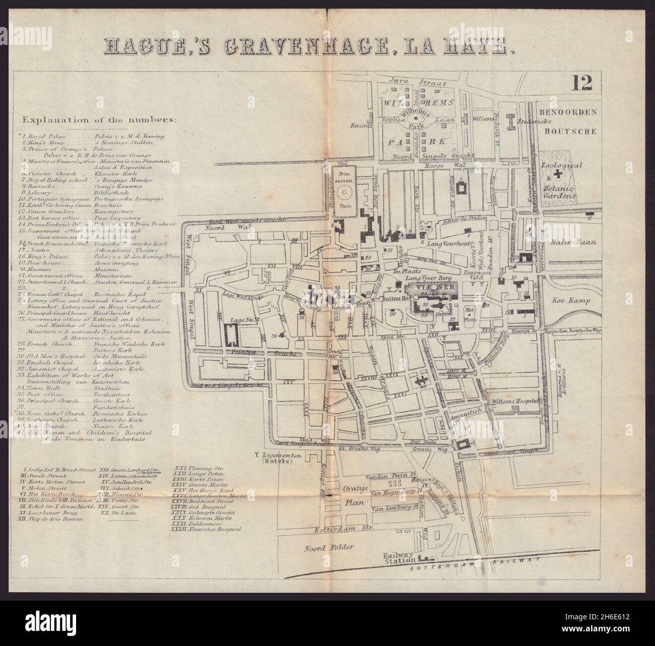 THE HAGUE DEN HAAG 'S-GRAVENHAGE LA HAYE. Town plan city map. BRADSHAW 1893 Stock Photohttps://www.alamy.com/image-license-details/?v=1https://www.alamy.com/the-hague-den-haag-s-gravenhage-la-haye-town-plan-city-map-bradshaw-1893-image451469566.html
RF2H6E612–THE HAGUE DEN HAAG 'S-GRAVENHAGE LA HAYE. Town plan city map. BRADSHAW 1893
 Map of Zorgvliet, with legend from 1-60 inside the park and A-G outside the park. Bottom left a the coat of arms of the Order of the Garter. To the right of the center a scale bar: Schaale van 30 Rhynlandse roeden van 12 voeten (Scale of 30 Rhynland rods of 12 feet), Plan van het schoone Perk van Sorgvliet, by 's Gravenhage Landgoed Zorgvliet, The Hague (series title), print maker: Johannes Jacobsz van den Aveele, (mentioned on object), Johannes Jacobsz van den Aveele, (mentioned on object), publisher: Covens & Mortier, (mentioned on object), print maker: Northern Netherlands, Northern Stock Photohttps://www.alamy.com/image-license-details/?v=1https://www.alamy.com/map-of-zorgvliet-with-legend-from-1-60-inside-the-park-and-a-g-outside-the-park-bottom-left-a-the-coat-of-arms-of-the-order-of-the-garter-to-the-right-of-the-center-a-scale-bar-schaale-van-30-rhynlandse-roeden-van-12-voeten-scale-of-30-rhynland-rods-of-12-feet-plan-van-het-schoone-perk-van-sorgvliet-by-s-gravenhage-landgoed-zorgvliet-the-hague-series-title-print-maker-johannes-jacobsz-van-den-aveele-mentioned-on-object-johannes-jacobsz-van-den-aveele-mentioned-on-object-publisher-covens-mortier-mentioned-on-object-print-maker-northern-netherlands-northern-image472033315.html
RM2JBXY8K–Map of Zorgvliet, with legend from 1-60 inside the park and A-G outside the park. Bottom left a the coat of arms of the Order of the Garter. To the right of the center a scale bar: Schaale van 30 Rhynlandse roeden van 12 voeten (Scale of 30 Rhynland rods of 12 feet), Plan van het schoone Perk van Sorgvliet, by 's Gravenhage Landgoed Zorgvliet, The Hague (series title), print maker: Johannes Jacobsz van den Aveele, (mentioned on object), Johannes Jacobsz van den Aveele, (mentioned on object), publisher: Covens & Mortier, (mentioned on object), print maker: Northern Netherlands, Northern
 THE HAGUE DEN HAAG 'S-GRAVENHAGE LA HAYE. Town plan city map. BRADSHAW 1892 Stock Photohttps://www.alamy.com/image-license-details/?v=1https://www.alamy.com/the-hague-den-haag-s-gravenhage-la-haye-town-plan-city-map-bradshaw-1892-image451469453.html
RF2H6E5W1–THE HAGUE DEN HAAG 'S-GRAVENHAGE LA HAYE. Town plan city map. BRADSHAW 1892
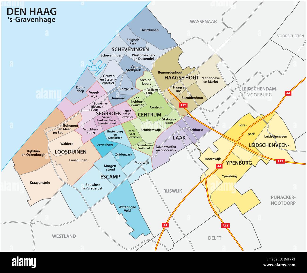 Administrative and political map of the Dutch city The Hague Stock Vectorhttps://www.alamy.com/image-license-details/?v=1https://www.alamy.com/administrative-and-political-map-of-the-dutch-city-the-hague-image150311031.html
RFJMF773–Administrative and political map of the Dutch city The Hague
 THE HAGUE DEN HAAG 'S-GRAVENHAGE LA HAYE. Town plan. City map. BRADSHAW 1895 Stock Photohttps://www.alamy.com/image-license-details/?v=1https://www.alamy.com/stock-photo-the-hague-den-haag-s-gravenhage-la-haye-town-plan-city-map-bradshaw-114549448.html
RFGJA4YM–THE HAGUE DEN HAAG 'S-GRAVENHAGE LA HAYE. Town plan. City map. BRADSHAW 1895
![ROOSENBURG Author Swieten, Willem van 106.51.2 tab. Place of publication: In 's Gravenhage Publisher: byÃà Iacobus de Iongh, kaartverkooper, Date of publication: [1727] Item type: 1 map Medium: copperplate engraving Dimensions: 97.7 x 224.5 cm Former owner: George III, King of Great Britain, 1738-1820 Stock Photo ROOSENBURG Author Swieten, Willem van 106.51.2 tab. Place of publication: In 's Gravenhage Publisher: byÃà Iacobus de Iongh, kaartverkooper, Date of publication: [1727] Item type: 1 map Medium: copperplate engraving Dimensions: 97.7 x 224.5 cm Former owner: George III, King of Great Britain, 1738-1820 Stock Photo](https://c8.alamy.com/comp/2E9F8WC/roosenburg-author-swieten-willem-van-106512-tab-place-of-publication-in-s-gravenhage-publisher-by-iacobus-de-iongh-kaartverkooper-date-of-publication-1727-item-type-1-map-medium-copperplate-engraving-dimensions-977-x-2245-cm-former-owner-george-iii-king-of-great-britain-1738-1820-2E9F8WC.jpg) ROOSENBURG Author Swieten, Willem van 106.51.2 tab. Place of publication: In 's Gravenhage Publisher: byÃà Iacobus de Iongh, kaartverkooper, Date of publication: [1727] Item type: 1 map Medium: copperplate engraving Dimensions: 97.7 x 224.5 cm Former owner: George III, King of Great Britain, 1738-1820 Stock Photohttps://www.alamy.com/image-license-details/?v=1https://www.alamy.com/roosenburg-author-swieten-willem-van-106512-tab-place-of-publication-in-s-gravenhage-publisher-by-iacobus-de-iongh-kaartverkooper-date-of-publication-1727-item-type-1-map-medium-copperplate-engraving-dimensions-977-x-2245-cm-former-owner-george-iii-king-of-great-britain-1738-1820-image401706632.html
ROOSENBURG Author Swieten, Willem van 106.51.2 tab. Place of publication: In 's Gravenhage Publisher: byÃà Iacobus de Iongh, kaartverkooper, Date of publication: [1727] Item type: 1 map Medium: copperplate engraving Dimensions: 97.7 x 224.5 cm Former owner: George III, King of Great Britain, 1738-1820 Stock Photohttps://www.alamy.com/image-license-details/?v=1https://www.alamy.com/roosenburg-author-swieten-willem-van-106512-tab-place-of-publication-in-s-gravenhage-publisher-by-iacobus-de-iongh-kaartverkooper-date-of-publication-1727-item-type-1-map-medium-copperplate-engraving-dimensions-977-x-2245-cm-former-owner-george-iii-king-of-great-britain-1738-1820-image401706632.htmlRM2E9F8WC–ROOSENBURG Author Swieten, Willem van 106.51.2 tab. Place of publication: In 's Gravenhage Publisher: byÃà Iacobus de Iongh, kaartverkooper, Date of publication: [1727] Item type: 1 map Medium: copperplate engraving Dimensions: 97.7 x 224.5 cm Former owner: George III, King of Great Britain, 1738-1820
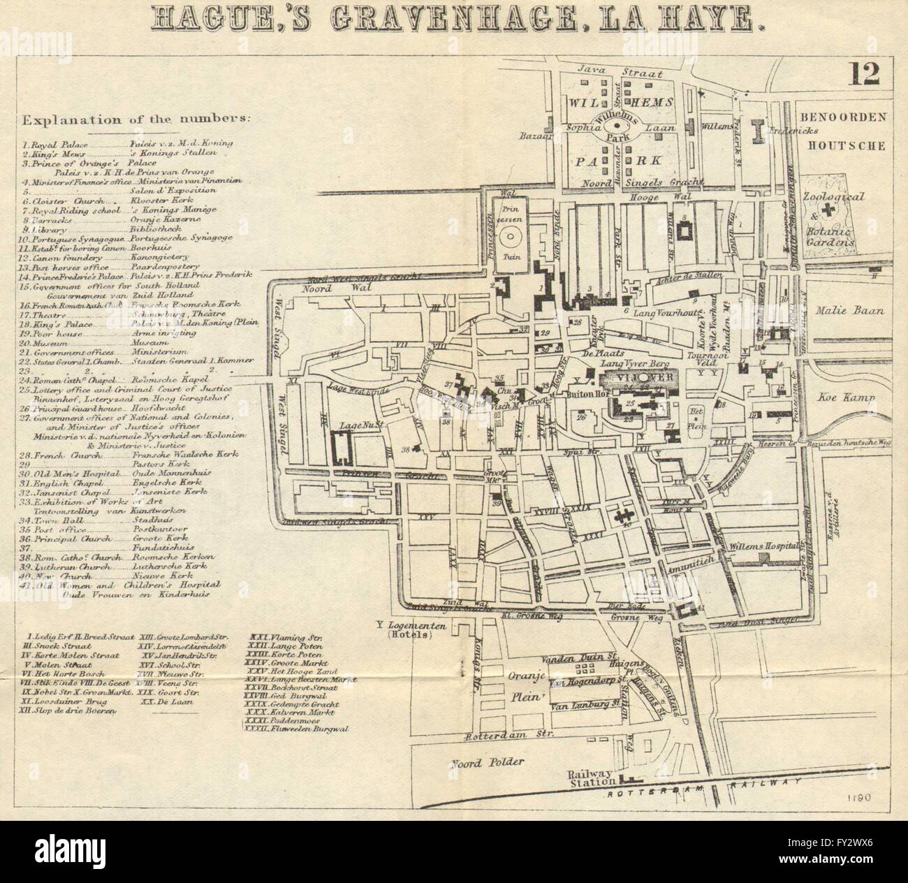 THE HAGUE DEN HAAG 'S-GRAVENHAGE LA HAYE: Town plan. City map. BRADSHAW 1890 Stock Photohttps://www.alamy.com/image-license-details/?v=1https://www.alamy.com/stock-photo-the-hague-den-haag-s-gravenhage-la-haye-town-plan-city-map-bradshaw-102711790.html
RFFY2WX6–THE HAGUE DEN HAAG 'S-GRAVENHAGE LA HAYE: Town plan. City map. BRADSHAW 1890
 English: Map of The Hague and surrounding area - engraving - 1839 1839. 933 Noordaa - 's-Gravenhage en omstreken - gravure - 1839 Stock Photohttps://www.alamy.com/image-license-details/?v=1https://www.alamy.com/english-map-of-the-hague-and-surrounding-area-engraving-1839-1839-933-noordaa-s-gravenhage-en-omstreken-gravure-1839-image185881435.html
RMMPBHJK–English: Map of The Hague and surrounding area - engraving - 1839 1839. 933 Noordaa - 's-Gravenhage en omstreken - gravure - 1839
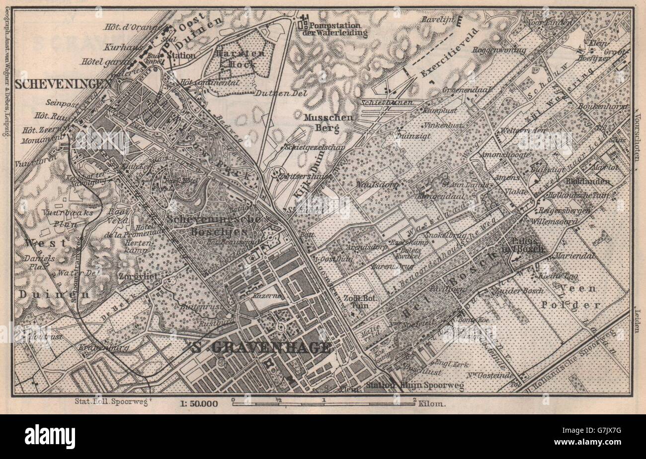 SCHEVENINGEN & THE HAGUE DEN HAAG 'S-GRAVENHAGE environs. Netherlands, 1897 map Stock Photohttps://www.alamy.com/image-license-details/?v=1https://www.alamy.com/stock-photo-scheveningen-the-hague-den-haag-s-gravenhage-environs-netherlands-107980532.html
RFG7JX7G–SCHEVENINGEN & THE HAGUE DEN HAAG 'S-GRAVENHAGE environs. Netherlands, 1897 map
 AA(1855) p027 GRAVENHAGE Stock Photohttps://www.alamy.com/image-license-details/?v=1https://www.alamy.com/stock-photo-aa1855-p027-gravenhage-73998984.html
RME8AXCT–AA(1855) p027 GRAVENHAGE
 SCHEVENINGEN & THE HAGUE DEN HAAG 'S-GRAVENHAGE environs. Netherlands, 1910 map Stock Photohttps://www.alamy.com/image-license-details/?v=1https://www.alamy.com/stock-photo-scheveningen-the-hague-den-haag-s-gravenhage-environs-netherlands-107983836.html
RFG7K2DG–SCHEVENINGEN & THE HAGUE DEN HAAG 'S-GRAVENHAGE environs. Netherlands, 1910 map
![Historical map of Greece and Italy Property Type: picture postcard Item number: RP-P-1936-265 Inscriptions / Brands (Verso not viewed.) Manufacture Creator: printmaker: Harmanus Condet (listed building) Dated: 1757 - 1765 Physical characteristics: engra material: paper Technique: engra (printing process) Measurements: sheet: h 235 mm × W 275 mmToelichtingKaart for: P. Virgil Maro (edited by H. Justice). Opera. [ 'S-Gravenhage, 1757-1765]. Dl 2, p. 69. Subject: maps of separate countries or regions where Greece and Italy Stock Photo Historical map of Greece and Italy Property Type: picture postcard Item number: RP-P-1936-265 Inscriptions / Brands (Verso not viewed.) Manufacture Creator: printmaker: Harmanus Condet (listed building) Dated: 1757 - 1765 Physical characteristics: engra material: paper Technique: engra (printing process) Measurements: sheet: h 235 mm × W 275 mmToelichtingKaart for: P. Virgil Maro (edited by H. Justice). Opera. [ 'S-Gravenhage, 1757-1765]. Dl 2, p. 69. Subject: maps of separate countries or regions where Greece and Italy Stock Photo](https://c8.alamy.com/comp/2B6TTAX/historical-map-of-greece-and-italy-property-type-picture-postcard-item-number-rp-p-1936-265-inscriptions-brands-verso-not-viewed-manufacture-creator-printmaker-harmanus-condet-listed-building-dated-1757-1765-physical-characteristics-engra-material-paper-technique-engra-printing-process-measurements-sheet-h-235-mm-w-275-mmtoelichtingkaart-for-p-virgil-maro-edited-by-h-justice-opera-s-gravenhage-1757-1765-dl-2-p-69-subject-maps-of-separate-countries-or-regions-where-greece-and-italy-2B6TTAX.jpg) Historical map of Greece and Italy Property Type: picture postcard Item number: RP-P-1936-265 Inscriptions / Brands (Verso not viewed.) Manufacture Creator: printmaker: Harmanus Condet (listed building) Dated: 1757 - 1765 Physical characteristics: engra material: paper Technique: engra (printing process) Measurements: sheet: h 235 mm × W 275 mmToelichtingKaart for: P. Virgil Maro (edited by H. Justice). Opera. [ 'S-Gravenhage, 1757-1765]. Dl 2, p. 69. Subject: maps of separate countries or regions where Greece and Italy Stock Photohttps://www.alamy.com/image-license-details/?v=1https://www.alamy.com/historical-map-of-greece-and-italy-property-type-picture-postcard-item-number-rp-p-1936-265-inscriptions-brands-verso-not-viewed-manufacture-creator-printmaker-harmanus-condet-listed-building-dated-1757-1765-physical-characteristics-engra-material-paper-technique-engra-printing-process-measurements-sheet-h-235-mm-w-275-mmtoelichtingkaart-for-p-virgil-maro-edited-by-h-justice-opera-s-gravenhage-1757-1765-dl-2-p-69-subject-maps-of-separate-countries-or-regions-where-greece-and-italy-image348441266.html
Historical map of Greece and Italy Property Type: picture postcard Item number: RP-P-1936-265 Inscriptions / Brands (Verso not viewed.) Manufacture Creator: printmaker: Harmanus Condet (listed building) Dated: 1757 - 1765 Physical characteristics: engra material: paper Technique: engra (printing process) Measurements: sheet: h 235 mm × W 275 mmToelichtingKaart for: P. Virgil Maro (edited by H. Justice). Opera. [ 'S-Gravenhage, 1757-1765]. Dl 2, p. 69. Subject: maps of separate countries or regions where Greece and Italy Stock Photohttps://www.alamy.com/image-license-details/?v=1https://www.alamy.com/historical-map-of-greece-and-italy-property-type-picture-postcard-item-number-rp-p-1936-265-inscriptions-brands-verso-not-viewed-manufacture-creator-printmaker-harmanus-condet-listed-building-dated-1757-1765-physical-characteristics-engra-material-paper-technique-engra-printing-process-measurements-sheet-h-235-mm-w-275-mmtoelichtingkaart-for-p-virgil-maro-edited-by-h-justice-opera-s-gravenhage-1757-1765-dl-2-p-69-subject-maps-of-separate-countries-or-regions-where-greece-and-italy-image348441266.htmlRM2B6TTAX–Historical map of Greece and Italy Property Type: picture postcard Item number: RP-P-1936-265 Inscriptions / Brands (Verso not viewed.) Manufacture Creator: printmaker: Harmanus Condet (listed building) Dated: 1757 - 1765 Physical characteristics: engra material: paper Technique: engra (printing process) Measurements: sheet: h 235 mm × W 275 mmToelichtingKaart for: P. Virgil Maro (edited by H. Justice). Opera. [ 'S-Gravenhage, 1757-1765]. Dl 2, p. 69. Subject: maps of separate countries or regions where Greece and Italy
 Jan Weissenbruch, s Gravenhage Stock Photohttps://www.alamy.com/image-license-details/?v=1https://www.alamy.com/stock-photo-jan-weissenbruch-s-gravenhage-142951541.html
RMJ8G045–Jan Weissenbruch, s Gravenhage
 S Gravenhage, Netherlands pin on map Stock Photohttps://www.alamy.com/image-license-details/?v=1https://www.alamy.com/s-gravenhage-netherlands-pin-on-map-image614441661.html
RF2XKJ6H1–S Gravenhage, Netherlands pin on map
![NIEUWE PLATTE GROND VAN 'S GRAVENHAGE Author Beeck, Anna 107.43. Place of publication: [The Hague] Publisher: [Anna Beek] Date of publication: [about 1710?] Item type: 1 map Medium: copperplate engraving Dimensions: 47 x 57.5 cm, on sheet 50 x 62.2 cm Former owner: George III, King of Great Britain, 1738-1820 Stock Photo NIEUWE PLATTE GROND VAN 'S GRAVENHAGE Author Beeck, Anna 107.43. Place of publication: [The Hague] Publisher: [Anna Beek] Date of publication: [about 1710?] Item type: 1 map Medium: copperplate engraving Dimensions: 47 x 57.5 cm, on sheet 50 x 62.2 cm Former owner: George III, King of Great Britain, 1738-1820 Stock Photo](https://c8.alamy.com/comp/2E9FD8M/nieuwe-platte-grond-van-s-gravenhage-author-beeck-anna-10743-place-of-publication-the-hague-publisher-anna-beek-date-of-publication-about-1710-item-type-1-map-medium-copperplate-engraving-dimensions-47-x-575-cm-on-sheet-50-x-622-cm-former-owner-george-iii-king-of-great-britain-1738-1820-2E9FD8M.jpg) NIEUWE PLATTE GROND VAN 'S GRAVENHAGE Author Beeck, Anna 107.43. Place of publication: [The Hague] Publisher: [Anna Beek] Date of publication: [about 1710?] Item type: 1 map Medium: copperplate engraving Dimensions: 47 x 57.5 cm, on sheet 50 x 62.2 cm Former owner: George III, King of Great Britain, 1738-1820 Stock Photohttps://www.alamy.com/image-license-details/?v=1https://www.alamy.com/nieuwe-platte-grond-van-s-gravenhage-author-beeck-anna-10743-place-of-publication-the-hague-publisher-anna-beek-date-of-publication-about-1710-item-type-1-map-medium-copperplate-engraving-dimensions-47-x-575-cm-on-sheet-50-x-622-cm-former-owner-george-iii-king-of-great-britain-1738-1820-image401710084.html
NIEUWE PLATTE GROND VAN 'S GRAVENHAGE Author Beeck, Anna 107.43. Place of publication: [The Hague] Publisher: [Anna Beek] Date of publication: [about 1710?] Item type: 1 map Medium: copperplate engraving Dimensions: 47 x 57.5 cm, on sheet 50 x 62.2 cm Former owner: George III, King of Great Britain, 1738-1820 Stock Photohttps://www.alamy.com/image-license-details/?v=1https://www.alamy.com/nieuwe-platte-grond-van-s-gravenhage-author-beeck-anna-10743-place-of-publication-the-hague-publisher-anna-beek-date-of-publication-about-1710-item-type-1-map-medium-copperplate-engraving-dimensions-47-x-575-cm-on-sheet-50-x-622-cm-former-owner-george-iii-king-of-great-britain-1738-1820-image401710084.htmlRM2E9FD8M–NIEUWE PLATTE GROND VAN 'S GRAVENHAGE Author Beeck, Anna 107.43. Place of publication: [The Hague] Publisher: [Anna Beek] Date of publication: [about 1710?] Item type: 1 map Medium: copperplate engraving Dimensions: 47 x 57.5 cm, on sheet 50 x 62.2 cm Former owner: George III, King of Great Britain, 1738-1820
 English: New map of The Hague and surrounding villages and country-seats - engraving - 1839 1839. 933 Noordaa - Nieuwe Kaart van 's-Gravenhage met de omliggende dorpen en buitenplaatsen - gravure - 1839 Stock Photohttps://www.alamy.com/image-license-details/?v=1https://www.alamy.com/english-new-map-of-the-hague-and-surrounding-villages-and-country-seats-engraving-1839-1839-933-noordaa-nieuwe-kaart-van-s-gravenhage-met-de-omliggende-dorpen-en-buitenplaatsen-gravure-1839-image185881438.html
RMMPBHJP–English: New map of The Hague and surrounding villages and country-seats - engraving - 1839 1839. 933 Noordaa - Nieuwe Kaart van 's-Gravenhage met de omliggende dorpen en buitenplaatsen - gravure - 1839
 AA(1855) p027 GRAVENHAGE Stock Photohttps://www.alamy.com/image-license-details/?v=1https://www.alamy.com/stock-photo-aa1855-p027-gravenhage-76717974.html
RMECPPFJ–AA(1855) p027 GRAVENHAGE
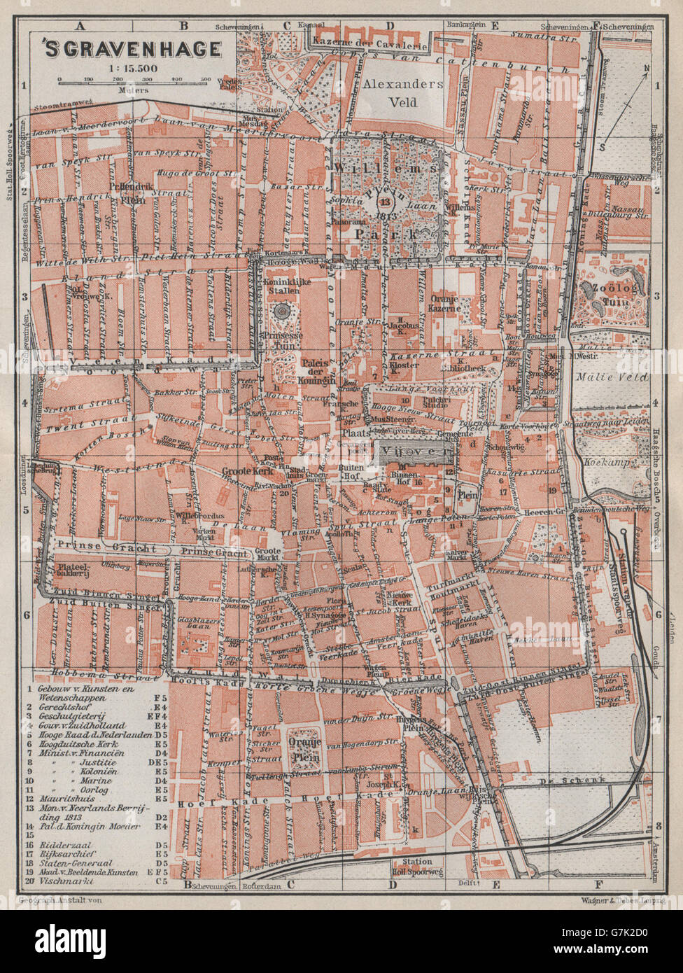 THE HAGUE DEN HAAG 'S-GRAVENHAGE town city stadsplan. Netherlands, 1910 map Stock Photohttps://www.alamy.com/image-license-details/?v=1https://www.alamy.com/stock-photo-the-hague-den-haag-s-gravenhage-town-city-stadsplan-netherlands-1910-107983820.html
RFG7K2D0–THE HAGUE DEN HAAG 'S-GRAVENHAGE town city stadsplan. Netherlands, 1910 map
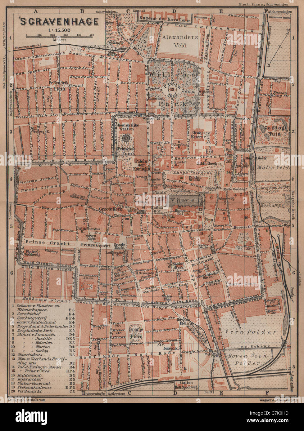 THE HAGUE DEN HAAG 'S-GRAVENHAGE town city stadsplan. Netherlands, 1905 map Stock Photohttps://www.alamy.com/image-license-details/?v=1https://www.alamy.com/stock-photo-the-hague-den-haag-s-gravenhage-town-city-stadsplan-netherlands-1905-107982377.html
RFG7K0HD–THE HAGUE DEN HAAG 'S-GRAVENHAGE town city stadsplan. Netherlands, 1905 map
 Blaeu 1652 - 's Gravenhage Stock Photohttps://www.alamy.com/image-license-details/?v=1https://www.alamy.com/stock-photo-blaeu-1652-s-gravenhage-139504376.html
RMJ2XY74–Blaeu 1652 - 's Gravenhage
![GRAVENHAGE T' HOF VAN HOLLAT. Map information: Title: GRAVENHAGE T' HOF VAN HOLLAT. 107.39. Place of publication: [Amsterdam?] Publisher: [publisher not identified] Date of publication: [between 1600 and 1650] Item type: 1 map Medium: copperplate engraving Dimensions: 22.8 x 31.5 cm, on sheet 23.5 x 32.2 cm Former owner: George III, King of Great Britain, 1738-1820 Stock Photo GRAVENHAGE T' HOF VAN HOLLAT. Map information: Title: GRAVENHAGE T' HOF VAN HOLLAT. 107.39. Place of publication: [Amsterdam?] Publisher: [publisher not identified] Date of publication: [between 1600 and 1650] Item type: 1 map Medium: copperplate engraving Dimensions: 22.8 x 31.5 cm, on sheet 23.5 x 32.2 cm Former owner: George III, King of Great Britain, 1738-1820 Stock Photo](https://c8.alamy.com/comp/2E9FD61/gravenhage-t-hof-van-hollat-map-information-title-gravenhage-t-hof-van-hollat-10739-place-of-publication-amsterdam-publisher-publisher-not-identified-date-of-publication-between-1600-and-1650-item-type-1-map-medium-copperplate-engraving-dimensions-228-x-315-cm-on-sheet-235-x-322-cm-former-owner-george-iii-king-of-great-britain-1738-1820-2E9FD61.jpg) GRAVENHAGE T' HOF VAN HOLLAT. Map information: Title: GRAVENHAGE T' HOF VAN HOLLAT. 107.39. Place of publication: [Amsterdam?] Publisher: [publisher not identified] Date of publication: [between 1600 and 1650] Item type: 1 map Medium: copperplate engraving Dimensions: 22.8 x 31.5 cm, on sheet 23.5 x 32.2 cm Former owner: George III, King of Great Britain, 1738-1820 Stock Photohttps://www.alamy.com/image-license-details/?v=1https://www.alamy.com/gravenhage-t-hof-van-hollat-map-information-title-gravenhage-t-hof-van-hollat-10739-place-of-publication-amsterdam-publisher-publisher-not-identified-date-of-publication-between-1600-and-1650-item-type-1-map-medium-copperplate-engraving-dimensions-228-x-315-cm-on-sheet-235-x-322-cm-former-owner-george-iii-king-of-great-britain-1738-1820-image401710009.html
GRAVENHAGE T' HOF VAN HOLLAT. Map information: Title: GRAVENHAGE T' HOF VAN HOLLAT. 107.39. Place of publication: [Amsterdam?] Publisher: [publisher not identified] Date of publication: [between 1600 and 1650] Item type: 1 map Medium: copperplate engraving Dimensions: 22.8 x 31.5 cm, on sheet 23.5 x 32.2 cm Former owner: George III, King of Great Britain, 1738-1820 Stock Photohttps://www.alamy.com/image-license-details/?v=1https://www.alamy.com/gravenhage-t-hof-van-hollat-map-information-title-gravenhage-t-hof-van-hollat-10739-place-of-publication-amsterdam-publisher-publisher-not-identified-date-of-publication-between-1600-and-1650-item-type-1-map-medium-copperplate-engraving-dimensions-228-x-315-cm-on-sheet-235-x-322-cm-former-owner-george-iii-king-of-great-britain-1738-1820-image401710009.htmlRM2E9FD61–GRAVENHAGE T' HOF VAN HOLLAT. Map information: Title: GRAVENHAGE T' HOF VAN HOLLAT. 107.39. Place of publication: [Amsterdam?] Publisher: [publisher not identified] Date of publication: [between 1600 and 1650] Item type: 1 map Medium: copperplate engraving Dimensions: 22.8 x 31.5 cm, on sheet 23.5 x 32.2 cm Former owner: George III, King of Great Britain, 1738-1820
 English: New map of The Hague and surrounding villages and country-seats - coloured engraving - 1839 1839. 933 Noordaa - Nieuwe kaart van 's-Gravenhage met de omliggende dorpen en buitenplaatsen - pen in zwart; penseel in kleur - 1839 Stock Photohttps://www.alamy.com/image-license-details/?v=1https://www.alamy.com/english-new-map-of-the-hague-and-surrounding-villages-and-country-seats-coloured-engraving-1839-1839-933-noordaa-nieuwe-kaart-van-s-gravenhage-met-de-omliggende-dorpen-en-buitenplaatsen-pen-in-zwart-penseel-in-kleur-1839-image185881436.html
RMMPBHJM–English: New map of The Hague and surrounding villages and country-seats - coloured engraving - 1839 1839. 933 Noordaa - Nieuwe kaart van 's-Gravenhage met de omliggende dorpen en buitenplaatsen - pen in zwart; penseel in kleur - 1839
 AA(1855) p031 GRAVENHAGE, De Loterijzaal Stock Photohttps://www.alamy.com/image-license-details/?v=1https://www.alamy.com/stock-photo-aa1855-p031-gravenhage-de-loterijzaal-73998985.html
RME8AXCW–AA(1855) p031 GRAVENHAGE, De Loterijzaal
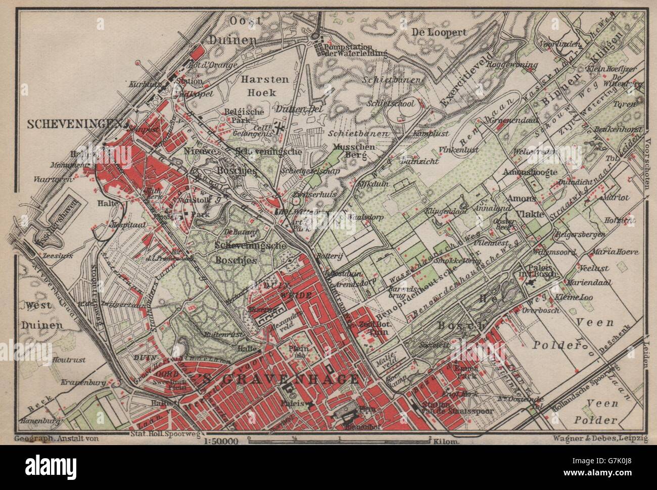 SCHEVENINGEN & THE HAGUE DEN HAAG 'S-GRAVENHAGE environs. Netherlands, 1905 map Stock Photohttps://www.alamy.com/image-license-details/?v=1https://www.alamy.com/stock-photo-scheveningen-the-hague-den-haag-s-gravenhage-environs-netherlands-107982400.html
RFG7K0J8–SCHEVENINGEN & THE HAGUE DEN HAAG 'S-GRAVENHAGE environs. Netherlands, 1905 map
 Mauritshuis 's Gravenhage cover Stock Photohttps://www.alamy.com/image-license-details/?v=1https://www.alamy.com/stock-photo-mauritshuis-s-gravenhage-cover-140197829.html
RMJ42FN9–Mauritshuis 's Gravenhage cover
 THE HAGUE DEN HAAG 'S-GRAVENHAGE town city stadsplan. Netherlands, 1901 map Stock Photohttps://www.alamy.com/image-license-details/?v=1https://www.alamy.com/stock-photo-the-hague-den-haag-s-gravenhage-town-city-stadsplan-netherlands-1901-107981535.html
RFG7JYFB–THE HAGUE DEN HAAG 'S-GRAVENHAGE town city stadsplan. Netherlands, 1901 map
 Het hof gravenhage Trap kasteelen Stock Photohttps://www.alamy.com/image-license-details/?v=1https://www.alamy.com/stock-photo-het-hof-gravenhage-trap-kasteelen-139985413.html
RMJ3MTR1–Het hof gravenhage Trap kasteelen
 Stam, De stad s Gravenhage vanaf de Delftse vaart Stock Photohttps://www.alamy.com/image-license-details/?v=1https://www.alamy.com/stock-photo-stam-de-stad-s-gravenhage-vanaf-de-delftse-vaart-140513708.html
RMJ4GXJM–Stam, De stad s Gravenhage vanaf de Delftse vaart
 Atlas de Wit 1698 pl035 's Gravenhage KB PPN 145205088 Stock Photohttps://www.alamy.com/image-license-details/?v=1https://www.alamy.com/stock-photo-atlas-de-wit-1698-pl035-s-gravenhage-kb-ppn-145205088-142575944.html
RMJ7XW20–Atlas de Wit 1698 pl035 's Gravenhage KB PPN 145205088
 Iven Besoet, Gezicht op het Voorhout te 's Gravenhage (1756) Stock Photohttps://www.alamy.com/image-license-details/?v=1https://www.alamy.com/stock-photo-iven-besoet-gezicht-op-het-voorhout-te-s-gravenhage-1756-142920408.html
RMJ8EGC8–Iven Besoet, Gezicht op het Voorhout te 's Gravenhage (1756)
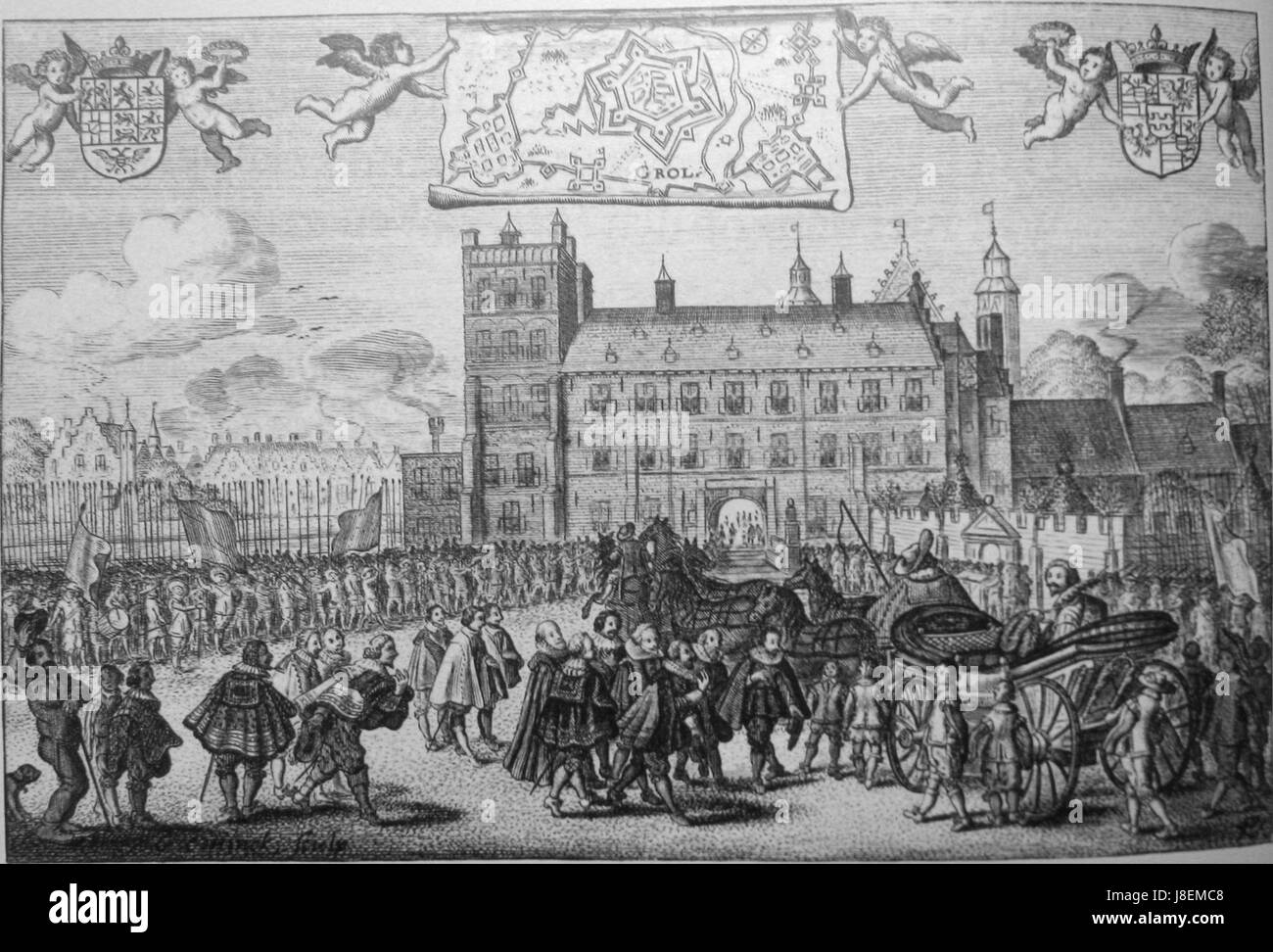 Feestelijke ontvangst van Frederik Hendrik op het buitenhof te 's Gravenhage Stock Photohttps://www.alamy.com/image-license-details/?v=1https://www.alamy.com/stock-photo-feestelijke-ontvangst-van-frederik-hendrik-op-het-buitenhof-te-s-gravenhage-142923544.html
RMJ8EMC8–Feestelijke ontvangst van Frederik Hendrik op het buitenhof te 's Gravenhage
![NIEUWE AFBEELDING VAN S GRAVENHAGE = NOUVEAU PLAN DE LA HAYE Author Langeweg, Daniel 107.44. Place of publication: [in S HAGE] Publisher: by D. LANGEWEG, Boek en Kaartverkoper in de Vlaming Straat = Chez DANIEL LANGEWEG Marchand des Cartes Geograph. dans le Vlamingstraat, Date of publication: 1747. Item type: 1 map Medium: copperplate engraving Dimensions: cm Former owner: George III, King of Great Britain, 1738-1820 Stock Photo NIEUWE AFBEELDING VAN S GRAVENHAGE = NOUVEAU PLAN DE LA HAYE Author Langeweg, Daniel 107.44. Place of publication: [in S HAGE] Publisher: by D. LANGEWEG, Boek en Kaartverkoper in de Vlaming Straat = Chez DANIEL LANGEWEG Marchand des Cartes Geograph. dans le Vlamingstraat, Date of publication: 1747. Item type: 1 map Medium: copperplate engraving Dimensions: cm Former owner: George III, King of Great Britain, 1738-1820 Stock Photo](https://c8.alamy.com/comp/2E9FD9H/nieuwe-afbeelding-van-s-gravenhage-=-nouveau-plan-de-la-haye-author-langeweg-daniel-10744-place-of-publication-in-s-hage-publisher-by-d-langeweg-boek-en-kaartverkoper-in-de-vlaming-straat-=-chez-daniel-langeweg-marchand-des-cartes-geograph-dans-le-vlamingstraat-date-of-publication-1747-item-type-1-map-medium-copperplate-engraving-dimensions-cm-former-owner-george-iii-king-of-great-britain-1738-1820-2E9FD9H.jpg) NIEUWE AFBEELDING VAN S GRAVENHAGE = NOUVEAU PLAN DE LA HAYE Author Langeweg, Daniel 107.44. Place of publication: [in S HAGE] Publisher: by D. LANGEWEG, Boek en Kaartverkoper in de Vlaming Straat = Chez DANIEL LANGEWEG Marchand des Cartes Geograph. dans le Vlamingstraat, Date of publication: 1747. Item type: 1 map Medium: copperplate engraving Dimensions: cm Former owner: George III, King of Great Britain, 1738-1820 Stock Photohttps://www.alamy.com/image-license-details/?v=1https://www.alamy.com/nieuwe-afbeelding-van-s-gravenhage-=-nouveau-plan-de-la-haye-author-langeweg-daniel-10744-place-of-publication-in-s-hage-publisher-by-d-langeweg-boek-en-kaartverkoper-in-de-vlaming-straat-=-chez-daniel-langeweg-marchand-des-cartes-geograph-dans-le-vlamingstraat-date-of-publication-1747-item-type-1-map-medium-copperplate-engraving-dimensions-cm-former-owner-george-iii-king-of-great-britain-1738-1820-image401710109.html
NIEUWE AFBEELDING VAN S GRAVENHAGE = NOUVEAU PLAN DE LA HAYE Author Langeweg, Daniel 107.44. Place of publication: [in S HAGE] Publisher: by D. LANGEWEG, Boek en Kaartverkoper in de Vlaming Straat = Chez DANIEL LANGEWEG Marchand des Cartes Geograph. dans le Vlamingstraat, Date of publication: 1747. Item type: 1 map Medium: copperplate engraving Dimensions: cm Former owner: George III, King of Great Britain, 1738-1820 Stock Photohttps://www.alamy.com/image-license-details/?v=1https://www.alamy.com/nieuwe-afbeelding-van-s-gravenhage-=-nouveau-plan-de-la-haye-author-langeweg-daniel-10744-place-of-publication-in-s-hage-publisher-by-d-langeweg-boek-en-kaartverkoper-in-de-vlaming-straat-=-chez-daniel-langeweg-marchand-des-cartes-geograph-dans-le-vlamingstraat-date-of-publication-1747-item-type-1-map-medium-copperplate-engraving-dimensions-cm-former-owner-george-iii-king-of-great-britain-1738-1820-image401710109.htmlRM2E9FD9H–NIEUWE AFBEELDING VAN S GRAVENHAGE = NOUVEAU PLAN DE LA HAYE Author Langeweg, Daniel 107.44. Place of publication: [in S HAGE] Publisher: by D. LANGEWEG, Boek en Kaartverkoper in de Vlaming Straat = Chez DANIEL LANGEWEG Marchand des Cartes Geograph. dans le Vlamingstraat, Date of publication: 1747. Item type: 1 map Medium: copperplate engraving Dimensions: cm Former owner: George III, King of Great Britain, 1738-1820
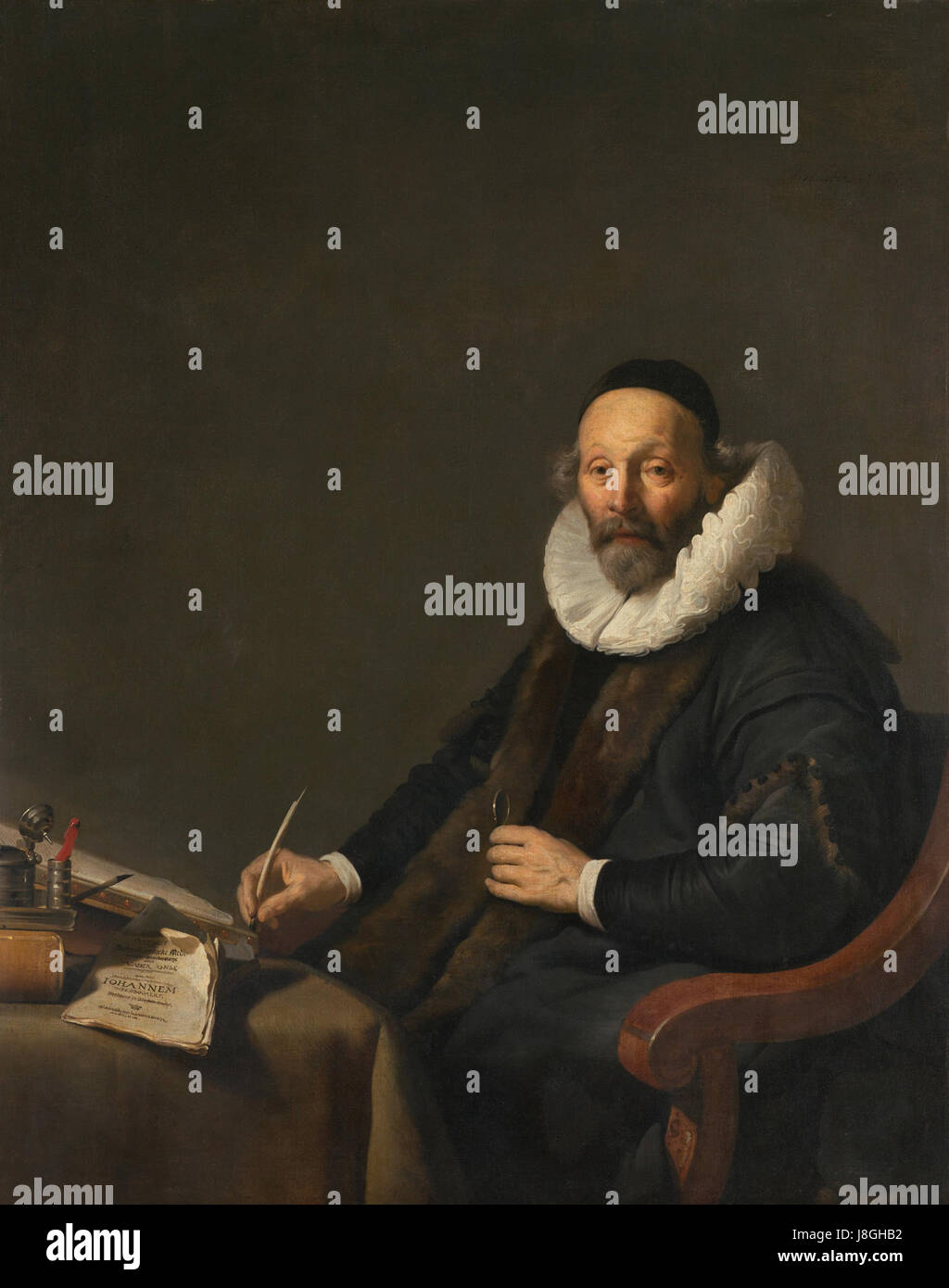 Johannes Wtenbogaert (1557 1644). Remonstrants predikant te 's Gravenhage Rijksmuseum SK C 1474 Stock Photohttps://www.alamy.com/image-license-details/?v=1https://www.alamy.com/stock-photo-johannes-wtenbogaert-1557-1644-remonstrants-predikant-te-s-gravenhage-142965062.html
RMJ8GHB2–Johannes Wtenbogaert (1557 1644). Remonstrants predikant te 's Gravenhage Rijksmuseum SK C 1474
 . Nederlands: Afbeeldinge van 's Gravenhage in haar Platte Grond Gemeeten. Cornelis Elandts, 1666 English: Map of The Hague, the Netherlands, in 1666. Made by Cornelis Elandts . 1666. Cornelis Elandts (1641-1687) 17 1666, Afbeeldinge van 's Gravenhage in haar Platte Grond Gemeeten Stock Photohttps://www.alamy.com/image-license-details/?v=1https://www.alamy.com/nederlands-afbeeldinge-van-s-gravenhage-in-haar-platte-grond-gemeeten-cornelis-elandts-1666-english-map-of-the-hague-the-netherlands-in-1666-made-by-cornelis-elandts-1666-cornelis-elandts-1641-1687-17-1666-afbeeldinge-van-s-gravenhage-in-haar-platte-grond-gemeeten-image206578065.html
RMP02CC1–. Nederlands: Afbeeldinge van 's Gravenhage in haar Platte Grond Gemeeten. Cornelis Elandts, 1666 English: Map of The Hague, the Netherlands, in 1666. Made by Cornelis Elandts . 1666. Cornelis Elandts (1641-1687) 17 1666, Afbeeldinge van 's Gravenhage in haar Platte Grond Gemeeten
 Diploma van de Tentoonstelling Ambachts Onderricht te 's Gravenhage 1901 uitgereikt aan Pierre Cuypers Cuypershuis 0504 Stock Photohttps://www.alamy.com/image-license-details/?v=1https://www.alamy.com/stock-photo-diploma-van-de-tentoonstelling-ambachts-onderricht-te-s-gravenhage-139763918.html
RMJ3AP8E–Diploma van de Tentoonstelling Ambachts Onderricht te 's Gravenhage 1901 uitgereikt aan Pierre Cuypers Cuypershuis 0504
 AA(1855) p031 GRAVENHAGE, De Loterijzaal Stock Photohttps://www.alamy.com/image-license-details/?v=1https://www.alamy.com/stock-photo-aa1855-p031-gravenhage-de-loterijzaal-76717975.html
RMECPPFK–AA(1855) p031 GRAVENHAGE, De Loterijzaal
 Postkantoor te 's Gravenhage Stock Photohttps://www.alamy.com/image-license-details/?v=1https://www.alamy.com/stock-image-postkantoor-te-s-gravenhage-160933979.html
RMK9R4X3–Postkantoor te 's Gravenhage
 SCHEVENINGEN & THE HAGUE DEN HAAG 'S-GRAVENHAGE environs. Netherlands, 1901 map Stock Photohttps://www.alamy.com/image-license-details/?v=1https://www.alamy.com/stock-photo-scheveningen-the-hague-den-haag-s-gravenhage-environs-netherlands-107981556.html
RFG7JYG4–SCHEVENINGEN & THE HAGUE DEN HAAG 'S-GRAVENHAGE environs. Netherlands, 1901 map
 THE HAGUE DEN HAAG 'S-GRAVENHAGE town city stadsplan. Netherlands, 1897 map Stock Photohttps://www.alamy.com/image-license-details/?v=1https://www.alamy.com/stock-photo-the-hague-den-haag-s-gravenhage-town-city-stadsplan-netherlands-1897-107980526.html
RFG7JX7A–THE HAGUE DEN HAAG 'S-GRAVENHAGE town city stadsplan. Netherlands, 1897 map
![NIEUWE PLATTE GROND VAN 'GRAVENHAGE Author Block, Joan 107.42. Place of publication: ['s Gravenhage] Publisher: in het Koper Gebragt en UyÃàtgegeven door Joan Block in 's Gravenhage, Date of publication: [between 1730 and 1740] Item type: 1 map Medium: copperplate engraving Dimensions: 47.2 x 57.3 cm, on sheet 50.8 x 63 cm Former owner: George III, King of Great Britain, 1738-1820 Stock Photo NIEUWE PLATTE GROND VAN 'GRAVENHAGE Author Block, Joan 107.42. Place of publication: ['s Gravenhage] Publisher: in het Koper Gebragt en UyÃàtgegeven door Joan Block in 's Gravenhage, Date of publication: [between 1730 and 1740] Item type: 1 map Medium: copperplate engraving Dimensions: 47.2 x 57.3 cm, on sheet 50.8 x 63 cm Former owner: George III, King of Great Britain, 1738-1820 Stock Photo](https://c8.alamy.com/comp/2E9FD6T/nieuwe-platte-grond-van-gravenhage-author-block-joan-10742-place-of-publication-s-gravenhage-publisher-in-het-koper-gebragt-en-uytgegeven-door-joan-block-in-s-gravenhage-date-of-publication-between-1730-and-1740-item-type-1-map-medium-copperplate-engraving-dimensions-472-x-573-cm-on-sheet-508-x-63-cm-former-owner-george-iii-king-of-great-britain-1738-1820-2E9FD6T.jpg) NIEUWE PLATTE GROND VAN 'GRAVENHAGE Author Block, Joan 107.42. Place of publication: ['s Gravenhage] Publisher: in het Koper Gebragt en UyÃàtgegeven door Joan Block in 's Gravenhage, Date of publication: [between 1730 and 1740] Item type: 1 map Medium: copperplate engraving Dimensions: 47.2 x 57.3 cm, on sheet 50.8 x 63 cm Former owner: George III, King of Great Britain, 1738-1820 Stock Photohttps://www.alamy.com/image-license-details/?v=1https://www.alamy.com/nieuwe-platte-grond-van-gravenhage-author-block-joan-10742-place-of-publication-s-gravenhage-publisher-in-het-koper-gebragt-en-uytgegeven-door-joan-block-in-s-gravenhage-date-of-publication-between-1730-and-1740-item-type-1-map-medium-copperplate-engraving-dimensions-472-x-573-cm-on-sheet-508-x-63-cm-former-owner-george-iii-king-of-great-britain-1738-1820-image401710032.html
NIEUWE PLATTE GROND VAN 'GRAVENHAGE Author Block, Joan 107.42. Place of publication: ['s Gravenhage] Publisher: in het Koper Gebragt en UyÃàtgegeven door Joan Block in 's Gravenhage, Date of publication: [between 1730 and 1740] Item type: 1 map Medium: copperplate engraving Dimensions: 47.2 x 57.3 cm, on sheet 50.8 x 63 cm Former owner: George III, King of Great Britain, 1738-1820 Stock Photohttps://www.alamy.com/image-license-details/?v=1https://www.alamy.com/nieuwe-platte-grond-van-gravenhage-author-block-joan-10742-place-of-publication-s-gravenhage-publisher-in-het-koper-gebragt-en-uytgegeven-door-joan-block-in-s-gravenhage-date-of-publication-between-1730-and-1740-item-type-1-map-medium-copperplate-engraving-dimensions-472-x-573-cm-on-sheet-508-x-63-cm-former-owner-george-iii-king-of-great-britain-1738-1820-image401710032.htmlRM2E9FD6T–NIEUWE PLATTE GROND VAN 'GRAVENHAGE Author Block, Joan 107.42. Place of publication: ['s Gravenhage] Publisher: in het Koper Gebragt en UyÃàtgegeven door Joan Block in 's Gravenhage, Date of publication: [between 1730 and 1740] Item type: 1 map Medium: copperplate engraving Dimensions: 47.2 x 57.3 cm, on sheet 50.8 x 63 cm Former owner: George III, King of Great Britain, 1738-1820
![. Nederlands: Titel in catalogus Leupe (NA): Kaart van Straat Bouton, van het Zuyder Eyland tot het eyland Wawony. Notities verso: Ryks-Archief 's Gravenhage [stempeltje]. Cf. Bodel Nijenhuis/Universiteitsbibliotheek Leiden, inv.nr. COLLBN 006-15-032. English: Title in the Leupe catalogue (National Archives): Kaart van Straat Bouton, van het Zuyder Eyland tot het eyland Wawony. Notes on reverse: Ryks-Archief 's Gravenhage [stamped]. Cf. Bodel Nijenhuis/Universiteitsbibliotheek Leiden, inv.nr. COLLBN 006-15-032. Nederlands: Kaart van Straat Bouton English: Map of the Bouton Straits . between Stock Photo . Nederlands: Titel in catalogus Leupe (NA): Kaart van Straat Bouton, van het Zuyder Eyland tot het eyland Wawony. Notities verso: Ryks-Archief 's Gravenhage [stempeltje]. Cf. Bodel Nijenhuis/Universiteitsbibliotheek Leiden, inv.nr. COLLBN 006-15-032. English: Title in the Leupe catalogue (National Archives): Kaart van Straat Bouton, van het Zuyder Eyland tot het eyland Wawony. Notes on reverse: Ryks-Archief 's Gravenhage [stamped]. Cf. Bodel Nijenhuis/Universiteitsbibliotheek Leiden, inv.nr. COLLBN 006-15-032. Nederlands: Kaart van Straat Bouton English: Map of the Bouton Straits . between Stock Photo](https://c8.alamy.com/comp/MMPB83/nederlands-titel-in-catalogus-leupe-na-kaart-van-straat-bouton-van-het-zuyder-eyland-tot-het-eyland-wawony-notities-verso-ryks-archief-s-gravenhage-stempeltje-cf-bodel-nijenhuisuniversiteitsbibliotheek-leiden-invnr-collbn-006-15-032-english-title-in-the-leupe-catalogue-national-archives-kaart-van-straat-bouton-van-het-zuyder-eyland-tot-het-eyland-wawony-notes-on-reverse-ryks-archief-s-gravenhage-stamped-cf-bodel-nijenhuisuniversiteitsbibliotheek-leiden-invnr-collbn-006-15-032-nederlands-kaart-van-straat-bouton-english-map-of-the-bouton-straits-between-MMPB83.jpg) . Nederlands: Titel in catalogus Leupe (NA): Kaart van Straat Bouton, van het Zuyder Eyland tot het eyland Wawony. Notities verso: Ryks-Archief 's Gravenhage [stempeltje]. Cf. Bodel Nijenhuis/Universiteitsbibliotheek Leiden, inv.nr. COLLBN 006-15-032. English: Title in the Leupe catalogue (National Archives): Kaart van Straat Bouton, van het Zuyder Eyland tot het eyland Wawony. Notes on reverse: Ryks-Archief 's Gravenhage [stamped]. Cf. Bodel Nijenhuis/Universiteitsbibliotheek Leiden, inv.nr. COLLBN 006-15-032. Nederlands: Kaart van Straat Bouton English: Map of the Bouton Straits . between Stock Photohttps://www.alamy.com/image-license-details/?v=1https://www.alamy.com/nederlands-titel-in-catalogus-leupe-na-kaart-van-straat-bouton-van-het-zuyder-eyland-tot-het-eyland-wawony-notities-verso-ryks-archief-s-gravenhage-stempeltje-cf-bodel-nijenhuisuniversiteitsbibliotheek-leiden-invnr-collbn-006-15-032-english-title-in-the-leupe-catalogue-national-archives-kaart-van-straat-bouton-van-het-zuyder-eyland-tot-het-eyland-wawony-notes-on-reverse-ryks-archief-s-gravenhage-stamped-cf-bodel-nijenhuisuniversiteitsbibliotheek-leiden-invnr-collbn-006-15-032-nederlands-kaart-van-straat-bouton-english-map-of-the-bouton-straits-between-image184888595.html
. Nederlands: Titel in catalogus Leupe (NA): Kaart van Straat Bouton, van het Zuyder Eyland tot het eyland Wawony. Notities verso: Ryks-Archief 's Gravenhage [stempeltje]. Cf. Bodel Nijenhuis/Universiteitsbibliotheek Leiden, inv.nr. COLLBN 006-15-032. English: Title in the Leupe catalogue (National Archives): Kaart van Straat Bouton, van het Zuyder Eyland tot het eyland Wawony. Notes on reverse: Ryks-Archief 's Gravenhage [stamped]. Cf. Bodel Nijenhuis/Universiteitsbibliotheek Leiden, inv.nr. COLLBN 006-15-032. Nederlands: Kaart van Straat Bouton English: Map of the Bouton Straits . between Stock Photohttps://www.alamy.com/image-license-details/?v=1https://www.alamy.com/nederlands-titel-in-catalogus-leupe-na-kaart-van-straat-bouton-van-het-zuyder-eyland-tot-het-eyland-wawony-notities-verso-ryks-archief-s-gravenhage-stempeltje-cf-bodel-nijenhuisuniversiteitsbibliotheek-leiden-invnr-collbn-006-15-032-english-title-in-the-leupe-catalogue-national-archives-kaart-van-straat-bouton-van-het-zuyder-eyland-tot-het-eyland-wawony-notes-on-reverse-ryks-archief-s-gravenhage-stamped-cf-bodel-nijenhuisuniversiteitsbibliotheek-leiden-invnr-collbn-006-15-032-nederlands-kaart-van-straat-bouton-english-map-of-the-bouton-straits-between-image184888595.htmlRMMMPB83–. Nederlands: Titel in catalogus Leupe (NA): Kaart van Straat Bouton, van het Zuyder Eyland tot het eyland Wawony. Notities verso: Ryks-Archief 's Gravenhage [stempeltje]. Cf. Bodel Nijenhuis/Universiteitsbibliotheek Leiden, inv.nr. COLLBN 006-15-032. English: Title in the Leupe catalogue (National Archives): Kaart van Straat Bouton, van het Zuyder Eyland tot het eyland Wawony. Notes on reverse: Ryks-Archief 's Gravenhage [stamped]. Cf. Bodel Nijenhuis/Universiteitsbibliotheek Leiden, inv.nr. COLLBN 006-15-032. Nederlands: Kaart van Straat Bouton English: Map of the Bouton Straits . between
 AA(1855) p034 GRAVENHAGE, Het Ministerie van Financien, Klosterkerke Stock Photohttps://www.alamy.com/image-license-details/?v=1https://www.alamy.com/stock-photo-aa1855-p034-gravenhage-het-ministerie-van-financien-klosterkerke-73998986.html
RME8AXCX–AA(1855) p034 GRAVENHAGE, Het Ministerie van Financien, Klosterkerke
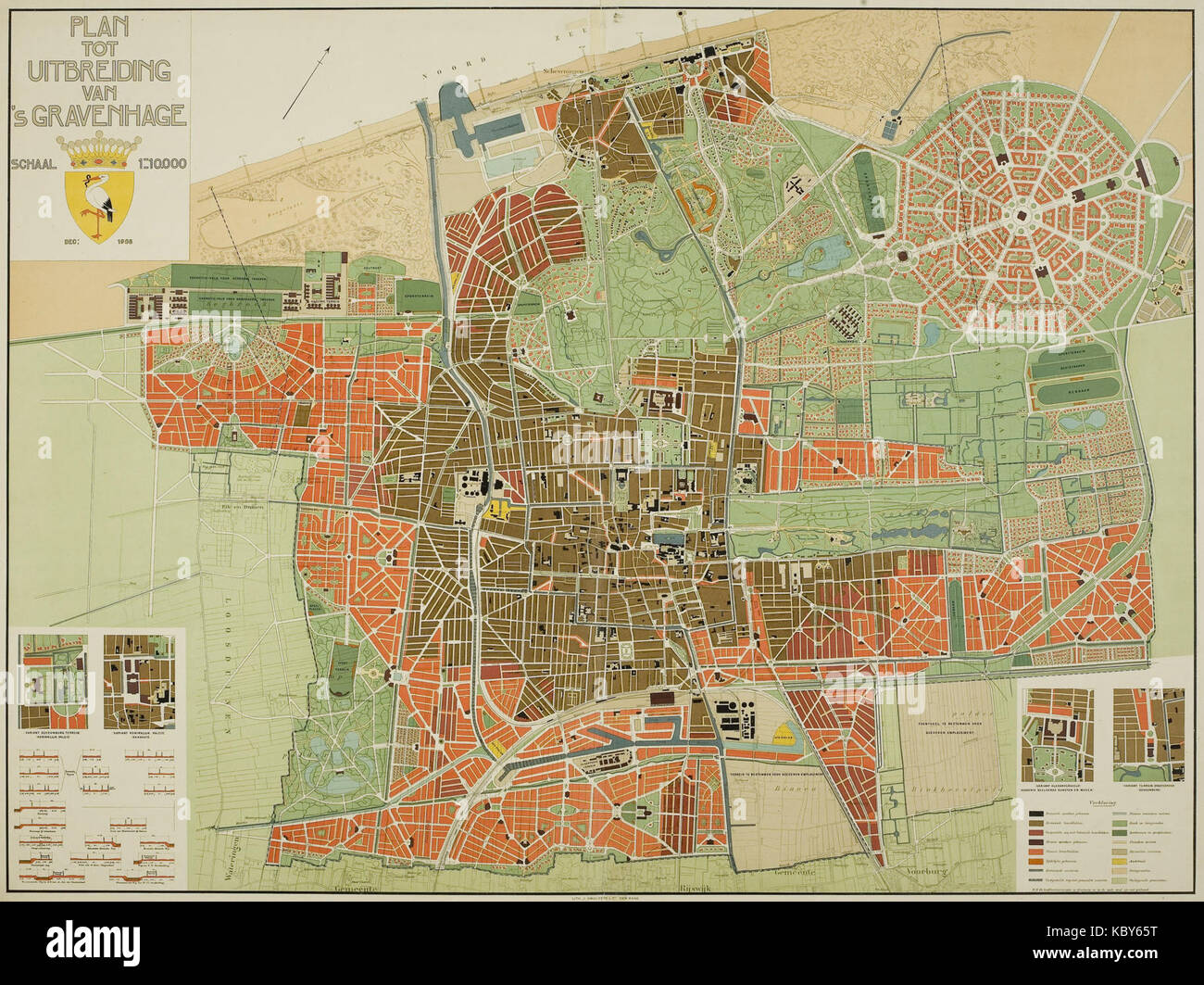 1908, Plan tot uitbreiding van 's Gravenhage, Plan Berlage Stock Photohttps://www.alamy.com/image-license-details/?v=1https://www.alamy.com/stock-image-1908-plan-tot-uitbreiding-van-s-gravenhage-plan-berlage-162252100.html
RMKBY65T–1908, Plan tot uitbreiding van 's Gravenhage, Plan Berlage
 Tentoonstelling van kunstwerken van levende meesters te 's Gravenhage, 1890, front cover Stock Photohttps://www.alamy.com/image-license-details/?v=1https://www.alamy.com/stock-image-tentoonstelling-van-kunstwerken-van-levende-meesters-te-s-gravenhage-161283684.html
RMKAB2YG–Tentoonstelling van kunstwerken van levende meesters te 's Gravenhage, 1890, front cover
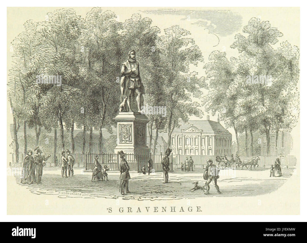 AA(1855) p027 GRAVENHAGE Stock Photohttps://www.alamy.com/image-license-details/?v=1https://www.alamy.com/aa1855-p027-gravenhage-image154601465.html
RMJYEKMW–AA(1855) p027 GRAVENHAGE
 Topographic map of the surroundings of 's -Gravenhage, Jacobus Engelbertus Schoevers AZ, 1830 - 1846 print The Hague paper maps, atlases The Hague. Zuid-Holland Stock Photohttps://www.alamy.com/image-license-details/?v=1https://www.alamy.com/topographic-map-of-the-surroundings-of-s-gravenhage-jacobus-engelbertus-schoevers-az-1830-1846-print-the-hague-paper-maps-atlases-the-hague-zuid-holland-image593176371.html
RM2WD1EEB–Topographic map of the surroundings of 's -Gravenhage, Jacobus Engelbertus Schoevers AZ, 1830 - 1846 print The Hague paper maps, atlases The Hague. Zuid-Holland
 Nederlands: Plattegrond van Den Haag uit 1908 waarop aangegeven het stedenbouwkundig plan dat architect Hendrik Berlage had ontwikkeld om de bebouwing van Den Haag uit te breiden. English: Map of The Hague of 1908 on which shown the urban development plan designed by architect Hendrik Berlage. Deutsch: Karte von Den Haag von 1908, auf dem gezeigt das Stadtentwicklungsplan von Architekt Hendrik Berlage entworfen. Français : Carte de La Haye de 1908, sur lequel s'affiche le plan de développement urbain conçu par l'architecte Hendrik Berlage. 1908 3 1908, Plan tot uitbreiding van 's-Gravenhage, P Stock Photohttps://www.alamy.com/image-license-details/?v=1https://www.alamy.com/nederlands-plattegrond-van-den-haag-uit-1908-waarop-aangegeven-het-stedenbouwkundig-plan-dat-architect-hendrik-berlage-had-ontwikkeld-om-de-bebouwing-van-den-haag-uit-te-breiden-english-map-of-the-hague-of-1908-on-which-shown-the-urban-development-plan-designed-by-architect-hendrik-berlage-deutsch-karte-von-den-haag-von-1908-auf-dem-gezeigt-das-stadtentwicklungsplan-von-architekt-hendrik-berlage-entworfen-franais-carte-de-la-haye-de-1908-sur-lequel-saffiche-le-plan-de-dveloppement-urbain-conu-par-larchitecte-hendrik-berlage-1908-3-1908-plan-tot-uitbreiding-van-s-gravenhage-p-image210924001.html
RMP74BM1–Nederlands: Plattegrond van Den Haag uit 1908 waarop aangegeven het stedenbouwkundig plan dat architect Hendrik Berlage had ontwikkeld om de bebouwing van Den Haag uit te breiden. English: Map of The Hague of 1908 on which shown the urban development plan designed by architect Hendrik Berlage. Deutsch: Karte von Den Haag von 1908, auf dem gezeigt das Stadtentwicklungsplan von Architekt Hendrik Berlage entworfen. Français : Carte de La Haye de 1908, sur lequel s'affiche le plan de développement urbain conçu par l'architecte Hendrik Berlage. 1908 3 1908, Plan tot uitbreiding van 's-Gravenhage, P
 AA(1855) p034 GRAVENHAGE, Het Ministerie van Financien, Klosterkerke Stock Photohttps://www.alamy.com/image-license-details/?v=1https://www.alamy.com/stock-photo-aa1855-p034-gravenhage-het-ministerie-van-financien-klosterkerke-76717976.html
RMECPPFM–AA(1855) p034 GRAVENHAGE, Het Ministerie van Financien, Klosterkerke
 Programmaboekje van Concertgebouw s Gravenhage Stock Photohttps://www.alamy.com/image-license-details/?v=1https://www.alamy.com/stock-photo-programmaboekje-van-concertgebouw-s-gravenhage-147659343.html
RMJG6CYY–Programmaboekje van Concertgebouw s Gravenhage
![GEZICHT van het INKOME in 'S GRAVENHAGE = VUEÃà & PERSPECTIVE en ENTRANT LA HAYE Author Besoet, I. V. 107.45.k. Place of publication: [The Hague] Publisher: [Hendrik Scheurleer Fz.] Date of publication: 1757. Item type: 1 print Medium: etching and engraving Dimensions: sheet 29.7 x 42 cm (trimmed) Former owner: George III, King of Great Britain, 1738-1820 Stock Photo GEZICHT van het INKOME in 'S GRAVENHAGE = VUEÃà & PERSPECTIVE en ENTRANT LA HAYE Author Besoet, I. V. 107.45.k. Place of publication: [The Hague] Publisher: [Hendrik Scheurleer Fz.] Date of publication: 1757. Item type: 1 print Medium: etching and engraving Dimensions: sheet 29.7 x 42 cm (trimmed) Former owner: George III, King of Great Britain, 1738-1820 Stock Photo](https://c8.alamy.com/comp/2E9FDYW/gezicht-van-het-inkome-in-s-gravenhage-=-vue-perspective-en-entrant-la-haye-author-besoet-i-v-10745k-place-of-publication-the-hague-publisher-hendrik-scheurleer-fz-date-of-publication-1757-item-type-1-print-medium-etching-and-engraving-dimensions-sheet-297-x-42-cm-trimmed-former-owner-george-iii-king-of-great-britain-1738-1820-2E9FDYW.jpg) GEZICHT van het INKOME in 'S GRAVENHAGE = VUEÃà & PERSPECTIVE en ENTRANT LA HAYE Author Besoet, I. V. 107.45.k. Place of publication: [The Hague] Publisher: [Hendrik Scheurleer Fz.] Date of publication: 1757. Item type: 1 print Medium: etching and engraving Dimensions: sheet 29.7 x 42 cm (trimmed) Former owner: George III, King of Great Britain, 1738-1820 Stock Photohttps://www.alamy.com/image-license-details/?v=1https://www.alamy.com/gezicht-van-het-inkome-in-s-gravenhage-=-vue-perspective-en-entrant-la-haye-author-besoet-i-v-10745k-place-of-publication-the-hague-publisher-hendrik-scheurleer-fz-date-of-publication-1757-item-type-1-print-medium-etching-and-engraving-dimensions-sheet-297-x-42-cm-trimmed-former-owner-george-iii-king-of-great-britain-1738-1820-image401710621.html
GEZICHT van het INKOME in 'S GRAVENHAGE = VUEÃà & PERSPECTIVE en ENTRANT LA HAYE Author Besoet, I. V. 107.45.k. Place of publication: [The Hague] Publisher: [Hendrik Scheurleer Fz.] Date of publication: 1757. Item type: 1 print Medium: etching and engraving Dimensions: sheet 29.7 x 42 cm (trimmed) Former owner: George III, King of Great Britain, 1738-1820 Stock Photohttps://www.alamy.com/image-license-details/?v=1https://www.alamy.com/gezicht-van-het-inkome-in-s-gravenhage-=-vue-perspective-en-entrant-la-haye-author-besoet-i-v-10745k-place-of-publication-the-hague-publisher-hendrik-scheurleer-fz-date-of-publication-1757-item-type-1-print-medium-etching-and-engraving-dimensions-sheet-297-x-42-cm-trimmed-former-owner-george-iii-king-of-great-britain-1738-1820-image401710621.htmlRM2E9FDYW–GEZICHT van het INKOME in 'S GRAVENHAGE = VUEÃà & PERSPECTIVE en ENTRANT LA HAYE Author Besoet, I. V. 107.45.k. Place of publication: [The Hague] Publisher: [Hendrik Scheurleer Fz.] Date of publication: 1757. Item type: 1 print Medium: etching and engraving Dimensions: sheet 29.7 x 42 cm (trimmed) Former owner: George III, King of Great Britain, 1738-1820
![. Nederlands: Titel in catalogus Leupe (Nationaal Archief): Kaart van Gouzaratte, Cucan of Visiapoer, van R. Pilatus tot Dabul. Rechtsboven genummerd: 15. Notities verso: 226 [in rood potlood] / Ryks-Archief 's Gravenhage [stempeltje]. English: Title in Leupe catalogue (National Archives): Kaart van Gouzaratte, Cucan of Visiapoer, van R. Pilatus tot Dabul. Numbered top right: 15. Notes on reverse: 226 [in red pencil] / Ryks-Archief 's Gravenhage [stamp]. Nederlands: Kaart van de westkust van India English: Map of the west coast of India . between 1680 and 1730. Isaak de Graaf (1668–1743) Stock Photo . Nederlands: Titel in catalogus Leupe (Nationaal Archief): Kaart van Gouzaratte, Cucan of Visiapoer, van R. Pilatus tot Dabul. Rechtsboven genummerd: 15. Notities verso: 226 [in rood potlood] / Ryks-Archief 's Gravenhage [stempeltje]. English: Title in Leupe catalogue (National Archives): Kaart van Gouzaratte, Cucan of Visiapoer, van R. Pilatus tot Dabul. Numbered top right: 15. Notes on reverse: 226 [in red pencil] / Ryks-Archief 's Gravenhage [stamp]. Nederlands: Kaart van de westkust van India English: Map of the west coast of India . between 1680 and 1730. Isaak de Graaf (1668–1743) Stock Photo](https://c8.alamy.com/comp/MMPB12/nederlands-titel-in-catalogus-leupe-nationaal-archief-kaart-van-gouzaratte-cucan-of-visiapoer-van-r-pilatus-tot-dabul-rechtsboven-genummerd-15-notities-verso-226-in-rood-potlood-ryks-archief-s-gravenhage-stempeltje-english-title-in-leupe-catalogue-national-archives-kaart-van-gouzaratte-cucan-of-visiapoer-van-r-pilatus-tot-dabul-numbered-top-right-15-notes-on-reverse-226-in-red-pencil-ryks-archief-s-gravenhage-stamp-nederlands-kaart-van-de-westkust-van-india-english-map-of-the-west-coast-of-india-between-1680-and-1730-isaak-de-graaf-16681743-MMPB12.jpg) . Nederlands: Titel in catalogus Leupe (Nationaal Archief): Kaart van Gouzaratte, Cucan of Visiapoer, van R. Pilatus tot Dabul. Rechtsboven genummerd: 15. Notities verso: 226 [in rood potlood] / Ryks-Archief 's Gravenhage [stempeltje]. English: Title in Leupe catalogue (National Archives): Kaart van Gouzaratte, Cucan of Visiapoer, van R. Pilatus tot Dabul. Numbered top right: 15. Notes on reverse: 226 [in red pencil] / Ryks-Archief 's Gravenhage [stamp]. Nederlands: Kaart van de westkust van India English: Map of the west coast of India . between 1680 and 1730. Isaak de Graaf (1668–1743) Stock Photohttps://www.alamy.com/image-license-details/?v=1https://www.alamy.com/nederlands-titel-in-catalogus-leupe-nationaal-archief-kaart-van-gouzaratte-cucan-of-visiapoer-van-r-pilatus-tot-dabul-rechtsboven-genummerd-15-notities-verso-226-in-rood-potlood-ryks-archief-s-gravenhage-stempeltje-english-title-in-leupe-catalogue-national-archives-kaart-van-gouzaratte-cucan-of-visiapoer-van-r-pilatus-tot-dabul-numbered-top-right-15-notes-on-reverse-226-in-red-pencil-ryks-archief-s-gravenhage-stamp-nederlands-kaart-van-de-westkust-van-india-english-map-of-the-west-coast-of-india-between-1680-and-1730-isaak-de-graaf-16681743-image184888398.html
. Nederlands: Titel in catalogus Leupe (Nationaal Archief): Kaart van Gouzaratte, Cucan of Visiapoer, van R. Pilatus tot Dabul. Rechtsboven genummerd: 15. Notities verso: 226 [in rood potlood] / Ryks-Archief 's Gravenhage [stempeltje]. English: Title in Leupe catalogue (National Archives): Kaart van Gouzaratte, Cucan of Visiapoer, van R. Pilatus tot Dabul. Numbered top right: 15. Notes on reverse: 226 [in red pencil] / Ryks-Archief 's Gravenhage [stamp]. Nederlands: Kaart van de westkust van India English: Map of the west coast of India . between 1680 and 1730. Isaak de Graaf (1668–1743) Stock Photohttps://www.alamy.com/image-license-details/?v=1https://www.alamy.com/nederlands-titel-in-catalogus-leupe-nationaal-archief-kaart-van-gouzaratte-cucan-of-visiapoer-van-r-pilatus-tot-dabul-rechtsboven-genummerd-15-notities-verso-226-in-rood-potlood-ryks-archief-s-gravenhage-stempeltje-english-title-in-leupe-catalogue-national-archives-kaart-van-gouzaratte-cucan-of-visiapoer-van-r-pilatus-tot-dabul-numbered-top-right-15-notes-on-reverse-226-in-red-pencil-ryks-archief-s-gravenhage-stamp-nederlands-kaart-van-de-westkust-van-india-english-map-of-the-west-coast-of-india-between-1680-and-1730-isaak-de-graaf-16681743-image184888398.htmlRMMMPB12–. Nederlands: Titel in catalogus Leupe (Nationaal Archief): Kaart van Gouzaratte, Cucan of Visiapoer, van R. Pilatus tot Dabul. Rechtsboven genummerd: 15. Notities verso: 226 [in rood potlood] / Ryks-Archief 's Gravenhage [stempeltje]. English: Title in Leupe catalogue (National Archives): Kaart van Gouzaratte, Cucan of Visiapoer, van R. Pilatus tot Dabul. Numbered top right: 15. Notes on reverse: 226 [in red pencil] / Ryks-Archief 's Gravenhage [stamp]. Nederlands: Kaart van de westkust van India English: Map of the west coast of India . between 1680 and 1730. Isaak de Graaf (1668–1743)
 02 of ''S Gravenhage in onzen tijd ... Met 80 illustratiën, etc' Stock Photohttps://www.alamy.com/image-license-details/?v=1https://www.alamy.com/stock-photo-02-of-s-gravenhage-in-onzen-tijd-met-80-illustratien-etc-95789929.html
RFFFRH0W–02 of ''S Gravenhage in onzen tijd ... Met 80 illustratiën, etc'
 AA(1855) p031 GRAVENHAGE, De Loterijzaal Stock Photohttps://www.alamy.com/image-license-details/?v=1https://www.alamy.com/aa1855-p031-gravenhage-de-loterijzaal-image154601464.html
RMJYEKMT–AA(1855) p031 GRAVENHAGE, De Loterijzaal
![GEZICHT van het BUYTENHOF in 'S GRAVENHAGE = VUE de la COUR EXTERIEURE aÃÄ la HAYE. Author Spilman, Hendricus 107.45.w. Place of publication: te Amsterdam Publisher: by P. Fouquet Jun., Date of publication: [between 1745 and 1760] Item type: 1 print Medium: etching and engraving Dimensions: sheet 32 x 47.2 cm (trimmed) Former owner: George III, King of Great Britain, 1738-1820 Stock Photo GEZICHT van het BUYTENHOF in 'S GRAVENHAGE = VUE de la COUR EXTERIEURE aÃÄ la HAYE. Author Spilman, Hendricus 107.45.w. Place of publication: te Amsterdam Publisher: by P. Fouquet Jun., Date of publication: [between 1745 and 1760] Item type: 1 print Medium: etching and engraving Dimensions: sheet 32 x 47.2 cm (trimmed) Former owner: George III, King of Great Britain, 1738-1820 Stock Photo](https://c8.alamy.com/comp/2E9FEKF/gezicht-van-het-buytenhof-in-s-gravenhage-=-vue-de-la-cour-exterieure-a-la-haye-author-spilman-hendricus-10745w-place-of-publication-te-amsterdam-publisher-by-p-fouquet-jun-date-of-publication-between-1745-and-1760-item-type-1-print-medium-etching-and-engraving-dimensions-sheet-32-x-472-cm-trimmed-former-owner-george-iii-king-of-great-britain-1738-1820-2E9FEKF.jpg) GEZICHT van het BUYTENHOF in 'S GRAVENHAGE = VUE de la COUR EXTERIEURE aÃÄ la HAYE. Author Spilman, Hendricus 107.45.w. Place of publication: te Amsterdam Publisher: by P. Fouquet Jun., Date of publication: [between 1745 and 1760] Item type: 1 print Medium: etching and engraving Dimensions: sheet 32 x 47.2 cm (trimmed) Former owner: George III, King of Great Britain, 1738-1820 Stock Photohttps://www.alamy.com/image-license-details/?v=1https://www.alamy.com/gezicht-van-het-buytenhof-in-s-gravenhage-=-vue-de-la-cour-exterieure-a-la-haye-author-spilman-hendricus-10745w-place-of-publication-te-amsterdam-publisher-by-p-fouquet-jun-date-of-publication-between-1745-and-1760-item-type-1-print-medium-etching-and-engraving-dimensions-sheet-32-x-472-cm-trimmed-former-owner-george-iii-king-of-great-britain-1738-1820-image401711171.html
GEZICHT van het BUYTENHOF in 'S GRAVENHAGE = VUE de la COUR EXTERIEURE aÃÄ la HAYE. Author Spilman, Hendricus 107.45.w. Place of publication: te Amsterdam Publisher: by P. Fouquet Jun., Date of publication: [between 1745 and 1760] Item type: 1 print Medium: etching and engraving Dimensions: sheet 32 x 47.2 cm (trimmed) Former owner: George III, King of Great Britain, 1738-1820 Stock Photohttps://www.alamy.com/image-license-details/?v=1https://www.alamy.com/gezicht-van-het-buytenhof-in-s-gravenhage-=-vue-de-la-cour-exterieure-a-la-haye-author-spilman-hendricus-10745w-place-of-publication-te-amsterdam-publisher-by-p-fouquet-jun-date-of-publication-between-1745-and-1760-item-type-1-print-medium-etching-and-engraving-dimensions-sheet-32-x-472-cm-trimmed-former-owner-george-iii-king-of-great-britain-1738-1820-image401711171.htmlRM2E9FEKF–GEZICHT van het BUYTENHOF in 'S GRAVENHAGE = VUE de la COUR EXTERIEURE aÃÄ la HAYE. Author Spilman, Hendricus 107.45.w. Place of publication: te Amsterdam Publisher: by P. Fouquet Jun., Date of publication: [between 1745 and 1760] Item type: 1 print Medium: etching and engraving Dimensions: sheet 32 x 47.2 cm (trimmed) Former owner: George III, King of Great Britain, 1738-1820
![. Nederlands: Titel in catalogus Leupe (NA): Kaart van de Bocht van Tomine (Oostkust van Celebes), beseylt met de Hoeker de Brandgans anno 1682. Datering van de situatie op de kaart: 1682 Rechtsboven genummerd: 17.d. Bezeild met de hoeker Brandgans. Notities verso: De bogt van Tomine / 's ryks archief. [stempeltje] / Ryks-Archief 's Gravenhage [stempeltje]. English: Title in the Leupe catalogue (National Archives): Kaart van de Bocht van Tomine (Oostkust van Celebes), beseylt met de Hoeker de Brandgans anno 1682. Dating of the situation depicted on the map: 1682 Numbered top right: 17.d. Navi Stock Photo . Nederlands: Titel in catalogus Leupe (NA): Kaart van de Bocht van Tomine (Oostkust van Celebes), beseylt met de Hoeker de Brandgans anno 1682. Datering van de situatie op de kaart: 1682 Rechtsboven genummerd: 17.d. Bezeild met de hoeker Brandgans. Notities verso: De bogt van Tomine / 's ryks archief. [stempeltje] / Ryks-Archief 's Gravenhage [stempeltje]. English: Title in the Leupe catalogue (National Archives): Kaart van de Bocht van Tomine (Oostkust van Celebes), beseylt met de Hoeker de Brandgans anno 1682. Dating of the situation depicted on the map: 1682 Numbered top right: 17.d. Navi Stock Photo](https://c8.alamy.com/comp/MMPB7W/nederlands-titel-in-catalogus-leupe-na-kaart-van-de-bocht-van-tomine-oostkust-van-celebes-beseylt-met-de-hoeker-de-brandgans-anno-1682-datering-van-de-situatie-op-de-kaart-1682-rechtsboven-genummerd-17d-bezeild-met-de-hoeker-brandgans-notities-verso-de-bogt-van-tomine-s-ryks-archief-stempeltje-ryks-archief-s-gravenhage-stempeltje-english-title-in-the-leupe-catalogue-national-archives-kaart-van-de-bocht-van-tomine-oostkust-van-celebes-beseylt-met-de-hoeker-de-brandgans-anno-1682-dating-of-the-situation-depicted-on-the-map-1682-numbered-top-right-17d-navi-MMPB7W.jpg) . Nederlands: Titel in catalogus Leupe (NA): Kaart van de Bocht van Tomine (Oostkust van Celebes), beseylt met de Hoeker de Brandgans anno 1682. Datering van de situatie op de kaart: 1682 Rechtsboven genummerd: 17.d. Bezeild met de hoeker Brandgans. Notities verso: De bogt van Tomine / 's ryks archief. [stempeltje] / Ryks-Archief 's Gravenhage [stempeltje]. English: Title in the Leupe catalogue (National Archives): Kaart van de Bocht van Tomine (Oostkust van Celebes), beseylt met de Hoeker de Brandgans anno 1682. Dating of the situation depicted on the map: 1682 Numbered top right: 17.d. Navi Stock Photohttps://www.alamy.com/image-license-details/?v=1https://www.alamy.com/nederlands-titel-in-catalogus-leupe-na-kaart-van-de-bocht-van-tomine-oostkust-van-celebes-beseylt-met-de-hoeker-de-brandgans-anno-1682-datering-van-de-situatie-op-de-kaart-1682-rechtsboven-genummerd-17d-bezeild-met-de-hoeker-brandgans-notities-verso-de-bogt-van-tomine-s-ryks-archief-stempeltje-ryks-archief-s-gravenhage-stempeltje-english-title-in-the-leupe-catalogue-national-archives-kaart-van-de-bocht-van-tomine-oostkust-van-celebes-beseylt-met-de-hoeker-de-brandgans-anno-1682-dating-of-the-situation-depicted-on-the-map-1682-numbered-top-right-17d-navi-image184888589.html
. Nederlands: Titel in catalogus Leupe (NA): Kaart van de Bocht van Tomine (Oostkust van Celebes), beseylt met de Hoeker de Brandgans anno 1682. Datering van de situatie op de kaart: 1682 Rechtsboven genummerd: 17.d. Bezeild met de hoeker Brandgans. Notities verso: De bogt van Tomine / 's ryks archief. [stempeltje] / Ryks-Archief 's Gravenhage [stempeltje]. English: Title in the Leupe catalogue (National Archives): Kaart van de Bocht van Tomine (Oostkust van Celebes), beseylt met de Hoeker de Brandgans anno 1682. Dating of the situation depicted on the map: 1682 Numbered top right: 17.d. Navi Stock Photohttps://www.alamy.com/image-license-details/?v=1https://www.alamy.com/nederlands-titel-in-catalogus-leupe-na-kaart-van-de-bocht-van-tomine-oostkust-van-celebes-beseylt-met-de-hoeker-de-brandgans-anno-1682-datering-van-de-situatie-op-de-kaart-1682-rechtsboven-genummerd-17d-bezeild-met-de-hoeker-brandgans-notities-verso-de-bogt-van-tomine-s-ryks-archief-stempeltje-ryks-archief-s-gravenhage-stempeltje-english-title-in-the-leupe-catalogue-national-archives-kaart-van-de-bocht-van-tomine-oostkust-van-celebes-beseylt-met-de-hoeker-de-brandgans-anno-1682-dating-of-the-situation-depicted-on-the-map-1682-numbered-top-right-17d-navi-image184888589.htmlRMMMPB7W–. Nederlands: Titel in catalogus Leupe (NA): Kaart van de Bocht van Tomine (Oostkust van Celebes), beseylt met de Hoeker de Brandgans anno 1682. Datering van de situatie op de kaart: 1682 Rechtsboven genummerd: 17.d. Bezeild met de hoeker Brandgans. Notities verso: De bogt van Tomine / 's ryks archief. [stempeltje] / Ryks-Archief 's Gravenhage [stempeltje]. English: Title in the Leupe catalogue (National Archives): Kaart van de Bocht van Tomine (Oostkust van Celebes), beseylt met de Hoeker de Brandgans anno 1682. Dating of the situation depicted on the map: 1682 Numbered top right: 17.d. Navi
 94 of ''S Gravenhage in onzen tijd ... Met 80 illustratiën, etc' Stock Photohttps://www.alamy.com/image-license-details/?v=1https://www.alamy.com/stock-photo-94-of-s-gravenhage-in-onzen-tijd-met-80-illustratien-etc-95785378.html
RFFFRB6A–94 of ''S Gravenhage in onzen tijd ... Met 80 illustratiën, etc'
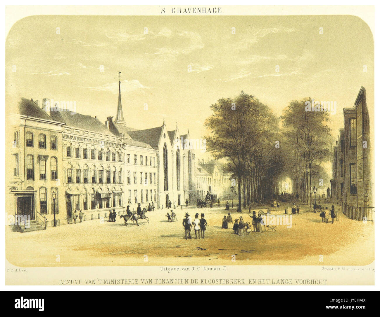 AA(1855) p034 GRAVENHAGE, Het Ministerie van Financien, Klosterkerke Stock Photohttps://www.alamy.com/image-license-details/?v=1https://www.alamy.com/aa1855-p034-gravenhage-het-ministerie-van-financien-klosterkerke-image154601466.html
RMJYEKMX–AA(1855) p034 GRAVENHAGE, Het Ministerie van Financien, Klosterkerke
![GESIGT van het inkomen in 's GRAVENHAGE aan de delftse trekvaard = VUE & Perspective en Antran la HAYE par le Canal de Delft. Author Le Charpentier, ReneÃÅ Jacques 107.45.ee. Place of publication: te Amsterdam Publisher: by P. Fouquet Junior, Date of publication: [between 1750 and 1770] Item type: 1 print Medium: etching and engraving Dimensions: sheet 27.5 x 37.5 cm (trimmed) Former owner: George III, King of Great Britain, 1738-1820 Stock Photo GESIGT van het inkomen in 's GRAVENHAGE aan de delftse trekvaard = VUE & Perspective en Antran la HAYE par le Canal de Delft. Author Le Charpentier, ReneÃÅ Jacques 107.45.ee. Place of publication: te Amsterdam Publisher: by P. Fouquet Junior, Date of publication: [between 1750 and 1770] Item type: 1 print Medium: etching and engraving Dimensions: sheet 27.5 x 37.5 cm (trimmed) Former owner: George III, King of Great Britain, 1738-1820 Stock Photo](https://c8.alamy.com/comp/2E9FDHB/gesigt-van-het-inkomen-in-s-gravenhage-aan-de-delftse-trekvaard-=-vue-perspective-en-antran-la-haye-par-le-canal-de-delft-author-le-charpentier-rene-jacques-10745ee-place-of-publication-te-amsterdam-publisher-by-p-fouquet-junior-date-of-publication-between-1750-and-1770-item-type-1-print-medium-etching-and-engraving-dimensions-sheet-275-x-375-cm-trimmed-former-owner-george-iii-king-of-great-britain-1738-1820-2E9FDHB.jpg) GESIGT van het inkomen in 's GRAVENHAGE aan de delftse trekvaard = VUE & Perspective en Antran la HAYE par le Canal de Delft. Author Le Charpentier, ReneÃÅ Jacques 107.45.ee. Place of publication: te Amsterdam Publisher: by P. Fouquet Junior, Date of publication: [between 1750 and 1770] Item type: 1 print Medium: etching and engraving Dimensions: sheet 27.5 x 37.5 cm (trimmed) Former owner: George III, King of Great Britain, 1738-1820 Stock Photohttps://www.alamy.com/image-license-details/?v=1https://www.alamy.com/gesigt-van-het-inkomen-in-s-gravenhage-aan-de-delftse-trekvaard-=-vue-perspective-en-antran-la-haye-par-le-canal-de-delft-author-le-charpentier-rene-jacques-10745ee-place-of-publication-te-amsterdam-publisher-by-p-fouquet-junior-date-of-publication-between-1750-and-1770-item-type-1-print-medium-etching-and-engraving-dimensions-sheet-275-x-375-cm-trimmed-former-owner-george-iii-king-of-great-britain-1738-1820-image401710327.html
GESIGT van het inkomen in 's GRAVENHAGE aan de delftse trekvaard = VUE & Perspective en Antran la HAYE par le Canal de Delft. Author Le Charpentier, ReneÃÅ Jacques 107.45.ee. Place of publication: te Amsterdam Publisher: by P. Fouquet Junior, Date of publication: [between 1750 and 1770] Item type: 1 print Medium: etching and engraving Dimensions: sheet 27.5 x 37.5 cm (trimmed) Former owner: George III, King of Great Britain, 1738-1820 Stock Photohttps://www.alamy.com/image-license-details/?v=1https://www.alamy.com/gesigt-van-het-inkomen-in-s-gravenhage-aan-de-delftse-trekvaard-=-vue-perspective-en-antran-la-haye-par-le-canal-de-delft-author-le-charpentier-rene-jacques-10745ee-place-of-publication-te-amsterdam-publisher-by-p-fouquet-junior-date-of-publication-between-1750-and-1770-item-type-1-print-medium-etching-and-engraving-dimensions-sheet-275-x-375-cm-trimmed-former-owner-george-iii-king-of-great-britain-1738-1820-image401710327.htmlRM2E9FDHB–GESIGT van het inkomen in 's GRAVENHAGE aan de delftse trekvaard = VUE & Perspective en Antran la HAYE par le Canal de Delft. Author Le Charpentier, ReneÃÅ Jacques 107.45.ee. Place of publication: te Amsterdam Publisher: by P. Fouquet Junior, Date of publication: [between 1750 and 1770] Item type: 1 print Medium: etching and engraving Dimensions: sheet 27.5 x 37.5 cm (trimmed) Former owner: George III, King of Great Britain, 1738-1820
![. English: Marine chart of the North Atlantic inserted in a report entitled Voyage van experiment van den generalen regul des gesichts van de groote zeevaert (1620) about the failed attempt made by Jan Hendricks Jarichs van der Ley (1566-1639) to calculate geographic longitudes using a new type of map. Copper engraving, ['s Gravenhage, s.n., 1620]. Español: Carta marina del Atlántico Norte inserta en un informe titulado Voyage van experiment van den generalen regul des gesichts van de groote zeevaert (1620) acerca del intento fallido realizado por Jan Hendricks Jarichs van der Ley (1566-1639) Stock Photo . English: Marine chart of the North Atlantic inserted in a report entitled Voyage van experiment van den generalen regul des gesichts van de groote zeevaert (1620) about the failed attempt made by Jan Hendricks Jarichs van der Ley (1566-1639) to calculate geographic longitudes using a new type of map. Copper engraving, ['s Gravenhage, s.n., 1620]. Español: Carta marina del Atlántico Norte inserta en un informe titulado Voyage van experiment van den generalen regul des gesichts van de groote zeevaert (1620) acerca del intento fallido realizado por Jan Hendricks Jarichs van der Ley (1566-1639) Stock Photo](https://c8.alamy.com/comp/MW77W9/english-marine-chart-of-the-north-atlantic-inserted-in-a-report-entitled-voyage-van-experiment-van-den-generalen-regul-des-gesichts-van-de-groote-zeevaert-1620-about-the-failed-attempt-made-by-jan-hendricks-jarichs-van-der-ley-1566-1639-to-calculate-geographic-longitudes-using-a-new-type-of-map-copper-engraving-s-gravenhage-sn-1620-espaol-carta-marina-del-atlntico-norte-inserta-en-un-informe-titulado-voyage-van-experiment-van-den-generalen-regul-des-gesichts-van-de-groote-zeevaert-1620-acerca-del-intento-fallido-realizado-por-jan-hendricks-jarichs-van-der-ley-1566-1639-MW77W9.jpg) . English: Marine chart of the North Atlantic inserted in a report entitled Voyage van experiment van den generalen regul des gesichts van de groote zeevaert (1620) about the failed attempt made by Jan Hendricks Jarichs van der Ley (1566-1639) to calculate geographic longitudes using a new type of map. Copper engraving, ['s Gravenhage, s.n., 1620]. Español: Carta marina del Atlántico Norte inserta en un informe titulado Voyage van experiment van den generalen regul des gesichts van de groote zeevaert (1620) acerca del intento fallido realizado por Jan Hendricks Jarichs van der Ley (1566-1639) Stock Photohttps://www.alamy.com/image-license-details/?v=1https://www.alamy.com/english-marine-chart-of-the-north-atlantic-inserted-in-a-report-entitled-voyage-van-experiment-van-den-generalen-regul-des-gesichts-van-de-groote-zeevaert-1620-about-the-failed-attempt-made-by-jan-hendricks-jarichs-van-der-ley-1566-1639-to-calculate-geographic-longitudes-using-a-new-type-of-map-copper-engraving-s-gravenhage-sn-1620-espaol-carta-marina-del-atlntico-norte-inserta-en-un-informe-titulado-voyage-van-experiment-van-den-generalen-regul-des-gesichts-van-de-groote-zeevaert-1620-acerca-del-intento-fallido-realizado-por-jan-hendricks-jarichs-van-der-ley-1566-1639-image187629941.html
. English: Marine chart of the North Atlantic inserted in a report entitled Voyage van experiment van den generalen regul des gesichts van de groote zeevaert (1620) about the failed attempt made by Jan Hendricks Jarichs van der Ley (1566-1639) to calculate geographic longitudes using a new type of map. Copper engraving, ['s Gravenhage, s.n., 1620]. Español: Carta marina del Atlántico Norte inserta en un informe titulado Voyage van experiment van den generalen regul des gesichts van de groote zeevaert (1620) acerca del intento fallido realizado por Jan Hendricks Jarichs van der Ley (1566-1639) Stock Photohttps://www.alamy.com/image-license-details/?v=1https://www.alamy.com/english-marine-chart-of-the-north-atlantic-inserted-in-a-report-entitled-voyage-van-experiment-van-den-generalen-regul-des-gesichts-van-de-groote-zeevaert-1620-about-the-failed-attempt-made-by-jan-hendricks-jarichs-van-der-ley-1566-1639-to-calculate-geographic-longitudes-using-a-new-type-of-map-copper-engraving-s-gravenhage-sn-1620-espaol-carta-marina-del-atlntico-norte-inserta-en-un-informe-titulado-voyage-van-experiment-van-den-generalen-regul-des-gesichts-van-de-groote-zeevaert-1620-acerca-del-intento-fallido-realizado-por-jan-hendricks-jarichs-van-der-ley-1566-1639-image187629941.htmlRMMW77W9–. English: Marine chart of the North Atlantic inserted in a report entitled Voyage van experiment van den generalen regul des gesichts van de groote zeevaert (1620) about the failed attempt made by Jan Hendricks Jarichs van der Ley (1566-1639) to calculate geographic longitudes using a new type of map. Copper engraving, ['s Gravenhage, s.n., 1620]. Español: Carta marina del Atlántico Norte inserta en un informe titulado Voyage van experiment van den generalen regul des gesichts van de groote zeevaert (1620) acerca del intento fallido realizado por Jan Hendricks Jarichs van der Ley (1566-1639)
 86 of ''S Gravenhage in onzen tijd ... Met 80 illustratiën, etc' Stock Photohttps://www.alamy.com/image-license-details/?v=1https://www.alamy.com/stock-photo-86-of-s-gravenhage-in-onzen-tijd-met-80-illustratien-etc-95775794.html
RFFFPY02–86 of ''S Gravenhage in onzen tijd ... Met 80 illustratiën, etc'
 1903, Plan van Uitbreiding van de Gemeente 's Gravenhage (Plan Lindo) Stock Photohttps://www.alamy.com/image-license-details/?v=1https://www.alamy.com/1903-plan-van-uitbreiding-van-de-gemeente-s-gravenhage-plan-lindo-image154662333.html
RMJYHDAN–1903, Plan van Uitbreiding van de Gemeente 's Gravenhage (Plan Lindo)
 Den Haag, gezicht van de praalbogen op de Vijverberg en op het Buitenhof (7985076657) Stock Photohttps://www.alamy.com/image-license-details/?v=1https://www.alamy.com/stock-image-den-haag-gezicht-van-de-praalbogen-op-de-vijverberg-en-op-het-buitenhof-162802207.html
RMKCT7TF–Den Haag, gezicht van de praalbogen op de Vijverberg en op het Buitenhof (7985076657)
![De Kermis Kramen op 't Buitehof in 's Gravenhage, in brand, op den 9 May 1758 naer 't leven afgeschetst. Author Fokke, Simon 107.45.cc. Place of publication: [Amsterdam] Publisher: F. Houttuyn excudit, Date of publication: [between 1758 and 1760] Item type: 1 print Medium: etching Dimensions: platemark 18.5 x 24 cm, on sheet 18.7 x 24.8 cm Former owner: George III, King of Great Britain, 1738-1820 Stock Photo De Kermis Kramen op 't Buitehof in 's Gravenhage, in brand, op den 9 May 1758 naer 't leven afgeschetst. Author Fokke, Simon 107.45.cc. Place of publication: [Amsterdam] Publisher: F. Houttuyn excudit, Date of publication: [between 1758 and 1760] Item type: 1 print Medium: etching Dimensions: platemark 18.5 x 24 cm, on sheet 18.7 x 24.8 cm Former owner: George III, King of Great Britain, 1738-1820 Stock Photo](https://c8.alamy.com/comp/2E9FDDT/de-kermis-kramen-op-t-buitehof-in-s-gravenhage-in-brand-op-den-9-may-1758-naer-t-leven-afgeschetst-author-fokke-simon-10745cc-place-of-publication-amsterdam-publisher-f-houttuyn-excudit-date-of-publication-between-1758-and-1760-item-type-1-print-medium-etching-dimensions-platemark-185-x-24-cm-on-sheet-187-x-248-cm-former-owner-george-iii-king-of-great-britain-1738-1820-2E9FDDT.jpg) De Kermis Kramen op 't Buitehof in 's Gravenhage, in brand, op den 9 May 1758 naer 't leven afgeschetst. Author Fokke, Simon 107.45.cc. Place of publication: [Amsterdam] Publisher: F. Houttuyn excudit, Date of publication: [between 1758 and 1760] Item type: 1 print Medium: etching Dimensions: platemark 18.5 x 24 cm, on sheet 18.7 x 24.8 cm Former owner: George III, King of Great Britain, 1738-1820 Stock Photohttps://www.alamy.com/image-license-details/?v=1https://www.alamy.com/de-kermis-kramen-op-t-buitehof-in-s-gravenhage-in-brand-op-den-9-may-1758-naer-t-leven-afgeschetst-author-fokke-simon-10745cc-place-of-publication-amsterdam-publisher-f-houttuyn-excudit-date-of-publication-between-1758-and-1760-item-type-1-print-medium-etching-dimensions-platemark-185-x-24-cm-on-sheet-187-x-248-cm-former-owner-george-iii-king-of-great-britain-1738-1820-image401710228.html
De Kermis Kramen op 't Buitehof in 's Gravenhage, in brand, op den 9 May 1758 naer 't leven afgeschetst. Author Fokke, Simon 107.45.cc. Place of publication: [Amsterdam] Publisher: F. Houttuyn excudit, Date of publication: [between 1758 and 1760] Item type: 1 print Medium: etching Dimensions: platemark 18.5 x 24 cm, on sheet 18.7 x 24.8 cm Former owner: George III, King of Great Britain, 1738-1820 Stock Photohttps://www.alamy.com/image-license-details/?v=1https://www.alamy.com/de-kermis-kramen-op-t-buitehof-in-s-gravenhage-in-brand-op-den-9-may-1758-naer-t-leven-afgeschetst-author-fokke-simon-10745cc-place-of-publication-amsterdam-publisher-f-houttuyn-excudit-date-of-publication-between-1758-and-1760-item-type-1-print-medium-etching-dimensions-platemark-185-x-24-cm-on-sheet-187-x-248-cm-former-owner-george-iii-king-of-great-britain-1738-1820-image401710228.htmlRM2E9FDDT–De Kermis Kramen op 't Buitehof in 's Gravenhage, in brand, op den 9 May 1758 naer 't leven afgeschetst. Author Fokke, Simon 107.45.cc. Place of publication: [Amsterdam] Publisher: F. Houttuyn excudit, Date of publication: [between 1758 and 1760] Item type: 1 print Medium: etching Dimensions: platemark 18.5 x 24 cm, on sheet 18.7 x 24.8 cm Former owner: George III, King of Great Britain, 1738-1820
![. Nederlands: Titel in catalogus Leupe (Nationaal Archief): Kaart van de Rivier van Toncquin, van de Mond tot aan de Hollandsche Logie. Rechtsboven genummerd: 33.b. Notities verso: De rivier van Toncquin. / Ryks-Archief 's Gravenhage [stempeltje]. English: Title in the Leupe catalogue (National Archives): Kaart van de Rivier van Toncquin, van de Mond tot aan de Hollandsche Logie. Numbered top right: 33.b. Notes on reverse: De rivier van Toncquin. / Ryks-Archief 's Gravenhage [stamped]. Nederlands: Kaart van de rivier van Tonquin, tot aan de Hollandse loge English: Map of the river of Tonquin Stock Photo . Nederlands: Titel in catalogus Leupe (Nationaal Archief): Kaart van de Rivier van Toncquin, van de Mond tot aan de Hollandsche Logie. Rechtsboven genummerd: 33.b. Notities verso: De rivier van Toncquin. / Ryks-Archief 's Gravenhage [stempeltje]. English: Title in the Leupe catalogue (National Archives): Kaart van de Rivier van Toncquin, van de Mond tot aan de Hollandsche Logie. Numbered top right: 33.b. Notes on reverse: De rivier van Toncquin. / Ryks-Archief 's Gravenhage [stamped]. Nederlands: Kaart van de rivier van Tonquin, tot aan de Hollandse loge English: Map of the river of Tonquin Stock Photo](https://c8.alamy.com/comp/MMPB3G/nederlands-titel-in-catalogus-leupe-nationaal-archief-kaart-van-de-rivier-van-toncquin-van-de-mond-tot-aan-de-hollandsche-logie-rechtsboven-genummerd-33b-notities-verso-de-rivier-van-toncquin-ryks-archief-s-gravenhage-stempeltje-english-title-in-the-leupe-catalogue-national-archives-kaart-van-de-rivier-van-toncquin-van-de-mond-tot-aan-de-hollandsche-logie-numbered-top-right-33b-notes-on-reverse-de-rivier-van-toncquin-ryks-archief-s-gravenhage-stamped-nederlands-kaart-van-de-rivier-van-tonquin-tot-aan-de-hollandse-loge-english-map-of-the-river-of-tonquin-MMPB3G.jpg) . Nederlands: Titel in catalogus Leupe (Nationaal Archief): Kaart van de Rivier van Toncquin, van de Mond tot aan de Hollandsche Logie. Rechtsboven genummerd: 33.b. Notities verso: De rivier van Toncquin. / Ryks-Archief 's Gravenhage [stempeltje]. English: Title in the Leupe catalogue (National Archives): Kaart van de Rivier van Toncquin, van de Mond tot aan de Hollandsche Logie. Numbered top right: 33.b. Notes on reverse: De rivier van Toncquin. / Ryks-Archief 's Gravenhage [stamped]. Nederlands: Kaart van de rivier van Tonquin, tot aan de Hollandse loge English: Map of the river of Tonquin Stock Photohttps://www.alamy.com/image-license-details/?v=1https://www.alamy.com/nederlands-titel-in-catalogus-leupe-nationaal-archief-kaart-van-de-rivier-van-toncquin-van-de-mond-tot-aan-de-hollandsche-logie-rechtsboven-genummerd-33b-notities-verso-de-rivier-van-toncquin-ryks-archief-s-gravenhage-stempeltje-english-title-in-the-leupe-catalogue-national-archives-kaart-van-de-rivier-van-toncquin-van-de-mond-tot-aan-de-hollandsche-logie-numbered-top-right-33b-notes-on-reverse-de-rivier-van-toncquin-ryks-archief-s-gravenhage-stamped-nederlands-kaart-van-de-rivier-van-tonquin-tot-aan-de-hollandse-loge-english-map-of-the-river-of-tonquin-image184888468.html
. Nederlands: Titel in catalogus Leupe (Nationaal Archief): Kaart van de Rivier van Toncquin, van de Mond tot aan de Hollandsche Logie. Rechtsboven genummerd: 33.b. Notities verso: De rivier van Toncquin. / Ryks-Archief 's Gravenhage [stempeltje]. English: Title in the Leupe catalogue (National Archives): Kaart van de Rivier van Toncquin, van de Mond tot aan de Hollandsche Logie. Numbered top right: 33.b. Notes on reverse: De rivier van Toncquin. / Ryks-Archief 's Gravenhage [stamped]. Nederlands: Kaart van de rivier van Tonquin, tot aan de Hollandse loge English: Map of the river of Tonquin Stock Photohttps://www.alamy.com/image-license-details/?v=1https://www.alamy.com/nederlands-titel-in-catalogus-leupe-nationaal-archief-kaart-van-de-rivier-van-toncquin-van-de-mond-tot-aan-de-hollandsche-logie-rechtsboven-genummerd-33b-notities-verso-de-rivier-van-toncquin-ryks-archief-s-gravenhage-stempeltje-english-title-in-the-leupe-catalogue-national-archives-kaart-van-de-rivier-van-toncquin-van-de-mond-tot-aan-de-hollandsche-logie-numbered-top-right-33b-notes-on-reverse-de-rivier-van-toncquin-ryks-archief-s-gravenhage-stamped-nederlands-kaart-van-de-rivier-van-tonquin-tot-aan-de-hollandse-loge-english-map-of-the-river-of-tonquin-image184888468.htmlRMMMPB3G–. Nederlands: Titel in catalogus Leupe (Nationaal Archief): Kaart van de Rivier van Toncquin, van de Mond tot aan de Hollandsche Logie. Rechtsboven genummerd: 33.b. Notities verso: De rivier van Toncquin. / Ryks-Archief 's Gravenhage [stempeltje]. English: Title in the Leupe catalogue (National Archives): Kaart van de Rivier van Toncquin, van de Mond tot aan de Hollandsche Logie. Numbered top right: 33.b. Notes on reverse: De rivier van Toncquin. / Ryks-Archief 's Gravenhage [stamped]. Nederlands: Kaart van de rivier van Tonquin, tot aan de Hollandse loge English: Map of the river of Tonquin
 87 of ''S Gravenhage in onzen tijd ... Met 80 illustratiën, etc' Stock Photohttps://www.alamy.com/image-license-details/?v=1https://www.alamy.com/stock-photo-87-of-s-gravenhage-in-onzen-tijd-met-80-illustratien-etc-95789939.html
RFFFRH17–87 of ''S Gravenhage in onzen tijd ... Met 80 illustratiën, etc'
 Den Haag, het Voorhout van de Kneuterdijk voorbij de Kloosterkerk (7985076733) (2) Stock Photohttps://www.alamy.com/image-license-details/?v=1https://www.alamy.com/stock-image-den-haag-het-voorhout-van-de-kneuterdijk-voorbij-de-kloosterkerk-7985076733-162802208.html
RMKCT7TG–Den Haag, het Voorhout van de Kneuterdijk voorbij de Kloosterkerk (7985076733) (2)
![Het THEATER opde getrossen VREEDE van den jaare 1748, in de Hoff Vyver van s' Gravenhage Opgereeht, en Geillumineerl den 11 juny 1749 dus verthoont Author Besoet, I. V. 107.45.mm.1-2. Place of publication: [The Hague] Publisher: D. Langeweg excud., Date of publication: [1749] Item type: 1 print Medium: engraving Dimensions: platemark 50.3 x 71.2 cm, on sheet 53.7 x 76 cm Former owner: George III, King of Great Britain, 1738-1820 Stock Photo Het THEATER opde getrossen VREEDE van den jaare 1748, in de Hoff Vyver van s' Gravenhage Opgereeht, en Geillumineerl den 11 juny 1749 dus verthoont Author Besoet, I. V. 107.45.mm.1-2. Place of publication: [The Hague] Publisher: D. Langeweg excud., Date of publication: [1749] Item type: 1 print Medium: engraving Dimensions: platemark 50.3 x 71.2 cm, on sheet 53.7 x 76 cm Former owner: George III, King of Great Britain, 1738-1820 Stock Photo](https://c8.alamy.com/comp/2E9FE75/het-theater-opde-getrossen-vreede-van-den-jaare-1748-in-de-hoff-vyver-van-s-gravenhage-opgereeht-en-geillumineerl-den-11-juny-1749-dus-verthoont-author-besoet-i-v-10745mm1-2-place-of-publication-the-hague-publisher-d-langeweg-excud-date-of-publication-1749-item-type-1-print-medium-engraving-dimensions-platemark-503-x-712-cm-on-sheet-537-x-76-cm-former-owner-george-iii-king-of-great-britain-1738-1820-2E9FE75.jpg) Het THEATER opde getrossen VREEDE van den jaare 1748, in de Hoff Vyver van s' Gravenhage Opgereeht, en Geillumineerl den 11 juny 1749 dus verthoont Author Besoet, I. V. 107.45.mm.1-2. Place of publication: [The Hague] Publisher: D. Langeweg excud., Date of publication: [1749] Item type: 1 print Medium: engraving Dimensions: platemark 50.3 x 71.2 cm, on sheet 53.7 x 76 cm Former owner: George III, King of Great Britain, 1738-1820 Stock Photohttps://www.alamy.com/image-license-details/?v=1https://www.alamy.com/het-theater-opde-getrossen-vreede-van-den-jaare-1748-in-de-hoff-vyver-van-s-gravenhage-opgereeht-en-geillumineerl-den-11-juny-1749-dus-verthoont-author-besoet-i-v-10745mm1-2-place-of-publication-the-hague-publisher-d-langeweg-excud-date-of-publication-1749-item-type-1-print-medium-engraving-dimensions-platemark-503-x-712-cm-on-sheet-537-x-76-cm-former-owner-george-iii-king-of-great-britain-1738-1820-image401710825.html
Het THEATER opde getrossen VREEDE van den jaare 1748, in de Hoff Vyver van s' Gravenhage Opgereeht, en Geillumineerl den 11 juny 1749 dus verthoont Author Besoet, I. V. 107.45.mm.1-2. Place of publication: [The Hague] Publisher: D. Langeweg excud., Date of publication: [1749] Item type: 1 print Medium: engraving Dimensions: platemark 50.3 x 71.2 cm, on sheet 53.7 x 76 cm Former owner: George III, King of Great Britain, 1738-1820 Stock Photohttps://www.alamy.com/image-license-details/?v=1https://www.alamy.com/het-theater-opde-getrossen-vreede-van-den-jaare-1748-in-de-hoff-vyver-van-s-gravenhage-opgereeht-en-geillumineerl-den-11-juny-1749-dus-verthoont-author-besoet-i-v-10745mm1-2-place-of-publication-the-hague-publisher-d-langeweg-excud-date-of-publication-1749-item-type-1-print-medium-engraving-dimensions-platemark-503-x-712-cm-on-sheet-537-x-76-cm-former-owner-george-iii-king-of-great-britain-1738-1820-image401710825.htmlRM2E9FE75–Het THEATER opde getrossen VREEDE van den jaare 1748, in de Hoff Vyver van s' Gravenhage Opgereeht, en Geillumineerl den 11 juny 1749 dus verthoont Author Besoet, I. V. 107.45.mm.1-2. Place of publication: [The Hague] Publisher: D. Langeweg excud., Date of publication: [1749] Item type: 1 print Medium: engraving Dimensions: platemark 50.3 x 71.2 cm, on sheet 53.7 x 76 cm Former owner: George III, King of Great Britain, 1738-1820
![. English: Marine chart of the North Atlantic inserted in a report entitled Voyage van experiment van den generalen regul des gesichts van de groote zeevaert (1620) about the failed attempt made by Jan Hendricks Jarichs van der Ley (1566-1639) to calculate geographic longitudes using a new type of map. Copper engraving, ['s Gravenhage, s.n., 1620]. Español: Carta marina del Atlántico Norte inserta en un informe titulado Voyage van experiment van den generalen regul des gesichts van de groote zeevaert (1620) acerca del intento fallido realizado por Jan Hendricks Jarichs van der Ley (1566-1639) Stock Photo . English: Marine chart of the North Atlantic inserted in a report entitled Voyage van experiment van den generalen regul des gesichts van de groote zeevaert (1620) about the failed attempt made by Jan Hendricks Jarichs van der Ley (1566-1639) to calculate geographic longitudes using a new type of map. Copper engraving, ['s Gravenhage, s.n., 1620]. Español: Carta marina del Atlántico Norte inserta en un informe titulado Voyage van experiment van den generalen regul des gesichts van de groote zeevaert (1620) acerca del intento fallido realizado por Jan Hendricks Jarichs van der Ley (1566-1639) Stock Photo](https://c8.alamy.com/comp/MX315R/english-marine-chart-of-the-north-atlantic-inserted-in-a-report-entitled-voyage-van-experiment-van-den-generalen-regul-des-gesichts-van-de-groote-zeevaert-1620-about-the-failed-attempt-made-by-jan-hendricks-jarichs-van-der-ley-1566-1639-to-calculate-geographic-longitudes-using-a-new-type-of-map-copper-engraving-s-gravenhage-sn-1620-espaol-carta-marina-del-atlntico-norte-inserta-en-un-informe-titulado-voyage-van-experiment-van-den-generalen-regul-des-gesichts-van-de-groote-zeevaert-1620-acerca-del-intento-fallido-realizado-por-jan-hendricks-jarichs-van-der-ley-1566-1639-MX315R.jpg) . English: Marine chart of the North Atlantic inserted in a report entitled Voyage van experiment van den generalen regul des gesichts van de groote zeevaert (1620) about the failed attempt made by Jan Hendricks Jarichs van der Ley (1566-1639) to calculate geographic longitudes using a new type of map. Copper engraving, ['s Gravenhage, s.n., 1620]. Español: Carta marina del Atlántico Norte inserta en un informe titulado Voyage van experiment van den generalen regul des gesichts van de groote zeevaert (1620) acerca del intento fallido realizado por Jan Hendricks Jarichs van der Ley (1566-1639) Stock Photohttps://www.alamy.com/image-license-details/?v=1https://www.alamy.com/english-marine-chart-of-the-north-atlantic-inserted-in-a-report-entitled-voyage-van-experiment-van-den-generalen-regul-des-gesichts-van-de-groote-zeevaert-1620-about-the-failed-attempt-made-by-jan-hendricks-jarichs-van-der-ley-1566-1639-to-calculate-geographic-longitudes-using-a-new-type-of-map-copper-engraving-s-gravenhage-sn-1620-espaol-carta-marina-del-atlntico-norte-inserta-en-un-informe-titulado-voyage-van-experiment-van-den-generalen-regul-des-gesichts-van-de-groote-zeevaert-1620-acerca-del-intento-fallido-realizado-por-jan-hendricks-jarichs-van-der-ley-1566-1639-image188151539.html
. English: Marine chart of the North Atlantic inserted in a report entitled Voyage van experiment van den generalen regul des gesichts van de groote zeevaert (1620) about the failed attempt made by Jan Hendricks Jarichs van der Ley (1566-1639) to calculate geographic longitudes using a new type of map. Copper engraving, ['s Gravenhage, s.n., 1620]. Español: Carta marina del Atlántico Norte inserta en un informe titulado Voyage van experiment van den generalen regul des gesichts van de groote zeevaert (1620) acerca del intento fallido realizado por Jan Hendricks Jarichs van der Ley (1566-1639) Stock Photohttps://www.alamy.com/image-license-details/?v=1https://www.alamy.com/english-marine-chart-of-the-north-atlantic-inserted-in-a-report-entitled-voyage-van-experiment-van-den-generalen-regul-des-gesichts-van-de-groote-zeevaert-1620-about-the-failed-attempt-made-by-jan-hendricks-jarichs-van-der-ley-1566-1639-to-calculate-geographic-longitudes-using-a-new-type-of-map-copper-engraving-s-gravenhage-sn-1620-espaol-carta-marina-del-atlntico-norte-inserta-en-un-informe-titulado-voyage-van-experiment-van-den-generalen-regul-des-gesichts-van-de-groote-zeevaert-1620-acerca-del-intento-fallido-realizado-por-jan-hendricks-jarichs-van-der-ley-1566-1639-image188151539.htmlRMMX315R–. English: Marine chart of the North Atlantic inserted in a report entitled Voyage van experiment van den generalen regul des gesichts van de groote zeevaert (1620) about the failed attempt made by Jan Hendricks Jarichs van der Ley (1566-1639) to calculate geographic longitudes using a new type of map. Copper engraving, ['s Gravenhage, s.n., 1620]. Español: Carta marina del Atlántico Norte inserta en un informe titulado Voyage van experiment van den generalen regul des gesichts van de groote zeevaert (1620) acerca del intento fallido realizado por Jan Hendricks Jarichs van der Ley (1566-1639)
 87 of ''S Gravenhage in onzen tijd ... Met 80 illustratiën, etc' Stock Photohttps://www.alamy.com/image-license-details/?v=1https://www.alamy.com/stock-photo-87-of-s-gravenhage-in-onzen-tijd-met-80-illustratien-etc-95772401.html
RFFFPPJW–87 of ''S Gravenhage in onzen tijd ... Met 80 illustratiën, etc'
 Den Haag, het Binnenhof en galerij naar de Franse kerk (7985076411) (2) Stock Photohttps://www.alamy.com/image-license-details/?v=1https://www.alamy.com/stock-image-den-haag-het-binnenhof-en-galerij-naar-de-franse-kerk-7985076411-2-162802204.html
RMKCT7TC–Den Haag, het Binnenhof en galerij naar de Franse kerk (7985076411) (2)
![Het THEATER opde getrossen VREEDE van den Jaare 1748, in de Hoff Vyver van s' Gravenhage Opgerecht, en Afgestoken den 13 juny 1749 dus verthoont Author Besoet, I. V. 107.45.nn.1-2. Place of publication: [The Hague] Publisher: D. Langeweg Excud., Date of publication: [1749] Item type: 1 print Medium: engraving Dimensions: platemark 50.3 x 71.2 cm, on sheet 53.9 x 76.2 cm Former owner: George III, King of Great Britain, 1738-1820 Stock Photo Het THEATER opde getrossen VREEDE van den Jaare 1748, in de Hoff Vyver van s' Gravenhage Opgerecht, en Afgestoken den 13 juny 1749 dus verthoont Author Besoet, I. V. 107.45.nn.1-2. Place of publication: [The Hague] Publisher: D. Langeweg Excud., Date of publication: [1749] Item type: 1 print Medium: engraving Dimensions: platemark 50.3 x 71.2 cm, on sheet 53.9 x 76.2 cm Former owner: George III, King of Great Britain, 1738-1820 Stock Photo](https://c8.alamy.com/comp/2E9FE7R/het-theater-opde-getrossen-vreede-van-den-jaare-1748-in-de-hoff-vyver-van-s-gravenhage-opgerecht-en-afgestoken-den-13-juny-1749-dus-verthoont-author-besoet-i-v-10745nn1-2-place-of-publication-the-hague-publisher-d-langeweg-excud-date-of-publication-1749-item-type-1-print-medium-engraving-dimensions-platemark-503-x-712-cm-on-sheet-539-x-762-cm-former-owner-george-iii-king-of-great-britain-1738-1820-2E9FE7R.jpg) Het THEATER opde getrossen VREEDE van den Jaare 1748, in de Hoff Vyver van s' Gravenhage Opgerecht, en Afgestoken den 13 juny 1749 dus verthoont Author Besoet, I. V. 107.45.nn.1-2. Place of publication: [The Hague] Publisher: D. Langeweg Excud., Date of publication: [1749] Item type: 1 print Medium: engraving Dimensions: platemark 50.3 x 71.2 cm, on sheet 53.9 x 76.2 cm Former owner: George III, King of Great Britain, 1738-1820 Stock Photohttps://www.alamy.com/image-license-details/?v=1https://www.alamy.com/het-theater-opde-getrossen-vreede-van-den-jaare-1748-in-de-hoff-vyver-van-s-gravenhage-opgerecht-en-afgestoken-den-13-juny-1749-dus-verthoont-author-besoet-i-v-10745nn1-2-place-of-publication-the-hague-publisher-d-langeweg-excud-date-of-publication-1749-item-type-1-print-medium-engraving-dimensions-platemark-503-x-712-cm-on-sheet-539-x-762-cm-former-owner-george-iii-king-of-great-britain-1738-1820-image401710843.html
Het THEATER opde getrossen VREEDE van den Jaare 1748, in de Hoff Vyver van s' Gravenhage Opgerecht, en Afgestoken den 13 juny 1749 dus verthoont Author Besoet, I. V. 107.45.nn.1-2. Place of publication: [The Hague] Publisher: D. Langeweg Excud., Date of publication: [1749] Item type: 1 print Medium: engraving Dimensions: platemark 50.3 x 71.2 cm, on sheet 53.9 x 76.2 cm Former owner: George III, King of Great Britain, 1738-1820 Stock Photohttps://www.alamy.com/image-license-details/?v=1https://www.alamy.com/het-theater-opde-getrossen-vreede-van-den-jaare-1748-in-de-hoff-vyver-van-s-gravenhage-opgerecht-en-afgestoken-den-13-juny-1749-dus-verthoont-author-besoet-i-v-10745nn1-2-place-of-publication-the-hague-publisher-d-langeweg-excud-date-of-publication-1749-item-type-1-print-medium-engraving-dimensions-platemark-503-x-712-cm-on-sheet-539-x-762-cm-former-owner-george-iii-king-of-great-britain-1738-1820-image401710843.htmlRM2E9FE7R–Het THEATER opde getrossen VREEDE van den Jaare 1748, in de Hoff Vyver van s' Gravenhage Opgerecht, en Afgestoken den 13 juny 1749 dus verthoont Author Besoet, I. V. 107.45.nn.1-2. Place of publication: [The Hague] Publisher: D. Langeweg Excud., Date of publication: [1749] Item type: 1 print Medium: engraving Dimensions: platemark 50.3 x 71.2 cm, on sheet 53.9 x 76.2 cm Former owner: George III, King of Great Britain, 1738-1820
![. English: Marine chart of the North Atlantic inserted in a report entitled Voyage van experiment van den generalen regul des gesichts van de groote zeevaert (1620) about the failed attempt made by Jan Hendricks Jarichs van der Ley (1566-1639) to calculate geographic longitudes using a new type of map. Copper engraving, ['s Gravenhage, s.n., 1620]. Español: Carta marina del Atlántico Norte inserta en un informe titulado Voyage van experiment van den generalen regul des gesichts van de groote zeevaert (1620) acerca del intento fallido realizado por Jan Hendricks Jarichs van der Ley (1566-1639) Stock Photo . English: Marine chart of the North Atlantic inserted in a report entitled Voyage van experiment van den generalen regul des gesichts van de groote zeevaert (1620) about the failed attempt made by Jan Hendricks Jarichs van der Ley (1566-1639) to calculate geographic longitudes using a new type of map. Copper engraving, ['s Gravenhage, s.n., 1620]. Español: Carta marina del Atlántico Norte inserta en un informe titulado Voyage van experiment van den generalen regul des gesichts van de groote zeevaert (1620) acerca del intento fallido realizado por Jan Hendricks Jarichs van der Ley (1566-1639) Stock Photo](https://c8.alamy.com/comp/MY8D4H/english-marine-chart-of-the-north-atlantic-inserted-in-a-report-entitled-voyage-van-experiment-van-den-generalen-regul-des-gesichts-van-de-groote-zeevaert-1620-about-the-failed-attempt-made-by-jan-hendricks-jarichs-van-der-ley-1566-1639-to-calculate-geographic-longitudes-using-a-new-type-of-map-copper-engraving-s-gravenhage-sn-1620-espaol-carta-marina-del-atlntico-norte-inserta-en-un-informe-titulado-voyage-van-experiment-van-den-generalen-regul-des-gesichts-van-de-groote-zeevaert-1620-acerca-del-intento-fallido-realizado-por-jan-hendricks-jarichs-van-der-ley-1566-1639-MY8D4H.jpg) . English: Marine chart of the North Atlantic inserted in a report entitled Voyage van experiment van den generalen regul des gesichts van de groote zeevaert (1620) about the failed attempt made by Jan Hendricks Jarichs van der Ley (1566-1639) to calculate geographic longitudes using a new type of map. Copper engraving, ['s Gravenhage, s.n., 1620]. Español: Carta marina del Atlántico Norte inserta en un informe titulado Voyage van experiment van den generalen regul des gesichts van de groote zeevaert (1620) acerca del intento fallido realizado por Jan Hendricks Jarichs van der Ley (1566-1639) Stock Photohttps://www.alamy.com/image-license-details/?v=1https://www.alamy.com/english-marine-chart-of-the-north-atlantic-inserted-in-a-report-entitled-voyage-van-experiment-van-den-generalen-regul-des-gesichts-van-de-groote-zeevaert-1620-about-the-failed-attempt-made-by-jan-hendricks-jarichs-van-der-ley-1566-1639-to-calculate-geographic-longitudes-using-a-new-type-of-map-copper-engraving-s-gravenhage-sn-1620-espaol-carta-marina-del-atlntico-norte-inserta-en-un-informe-titulado-voyage-van-experiment-van-den-generalen-regul-des-gesichts-van-de-groote-zeevaert-1620-acerca-del-intento-fallido-realizado-por-jan-hendricks-jarichs-van-der-ley-1566-1639-image188885329.html
. English: Marine chart of the North Atlantic inserted in a report entitled Voyage van experiment van den generalen regul des gesichts van de groote zeevaert (1620) about the failed attempt made by Jan Hendricks Jarichs van der Ley (1566-1639) to calculate geographic longitudes using a new type of map. Copper engraving, ['s Gravenhage, s.n., 1620]. Español: Carta marina del Atlántico Norte inserta en un informe titulado Voyage van experiment van den generalen regul des gesichts van de groote zeevaert (1620) acerca del intento fallido realizado por Jan Hendricks Jarichs van der Ley (1566-1639) Stock Photohttps://www.alamy.com/image-license-details/?v=1https://www.alamy.com/english-marine-chart-of-the-north-atlantic-inserted-in-a-report-entitled-voyage-van-experiment-van-den-generalen-regul-des-gesichts-van-de-groote-zeevaert-1620-about-the-failed-attempt-made-by-jan-hendricks-jarichs-van-der-ley-1566-1639-to-calculate-geographic-longitudes-using-a-new-type-of-map-copper-engraving-s-gravenhage-sn-1620-espaol-carta-marina-del-atlntico-norte-inserta-en-un-informe-titulado-voyage-van-experiment-van-den-generalen-regul-des-gesichts-van-de-groote-zeevaert-1620-acerca-del-intento-fallido-realizado-por-jan-hendricks-jarichs-van-der-ley-1566-1639-image188885329.htmlRMMY8D4H–. English: Marine chart of the North Atlantic inserted in a report entitled Voyage van experiment van den generalen regul des gesichts van de groote zeevaert (1620) about the failed attempt made by Jan Hendricks Jarichs van der Ley (1566-1639) to calculate geographic longitudes using a new type of map. Copper engraving, ['s Gravenhage, s.n., 1620]. Español: Carta marina del Atlántico Norte inserta en un informe titulado Voyage van experiment van den generalen regul des gesichts van de groote zeevaert (1620) acerca del intento fallido realizado por Jan Hendricks Jarichs van der Ley (1566-1639)
 81 of ''S Gravenhage in onzen tijd ... Met 80 illustratiën, etc' Stock Photohttps://www.alamy.com/image-license-details/?v=1https://www.alamy.com/stock-photo-81-of-s-gravenhage-in-onzen-tijd-met-80-illustratien-etc-95780641.html
RFFFR555–81 of ''S Gravenhage in onzen tijd ... Met 80 illustratiën, etc'
 Den Haag, gezicht bij de Koekamp tot aan de Leidse brug (7985084736) (2) Stock Photohttps://www.alamy.com/image-license-details/?v=1https://www.alamy.com/stock-image-den-haag-gezicht-bij-de-koekamp-tot-aan-de-leidse-brug-7985084736-162802201.html
RMKCT7T9–Den Haag, gezicht bij de Koekamp tot aan de Leidse brug (7985084736) (2)
![Het THEATER opde getrossen VREEDE van den Jaare 1748, in de Hoff Vyver van s' Gravenhage Opgerecht, en Afgestoken den 13 juny 1749 dus verthoont Author Besoet, I. V. 107.45.nn.1-2. Place of publication: [The Hague] Publisher: D. Langeweg Excud., Date of publication: [1749] Item type: 1 print Medium: engraving Dimensions: platemark 50.3 x 71.2 cm, on sheet 53.9 x 76.2 cm Former owner: George III, King of Great Britain, 1738-1820 Stock Photo Het THEATER opde getrossen VREEDE van den Jaare 1748, in de Hoff Vyver van s' Gravenhage Opgerecht, en Afgestoken den 13 juny 1749 dus verthoont Author Besoet, I. V. 107.45.nn.1-2. Place of publication: [The Hague] Publisher: D. Langeweg Excud., Date of publication: [1749] Item type: 1 print Medium: engraving Dimensions: platemark 50.3 x 71.2 cm, on sheet 53.9 x 76.2 cm Former owner: George III, King of Great Britain, 1738-1820 Stock Photo](https://c8.alamy.com/comp/2E9FEA1/het-theater-opde-getrossen-vreede-van-den-jaare-1748-in-de-hoff-vyver-van-s-gravenhage-opgerecht-en-afgestoken-den-13-juny-1749-dus-verthoont-author-besoet-i-v-10745nn1-2-place-of-publication-the-hague-publisher-d-langeweg-excud-date-of-publication-1749-item-type-1-print-medium-engraving-dimensions-platemark-503-x-712-cm-on-sheet-539-x-762-cm-former-owner-george-iii-king-of-great-britain-1738-1820-2E9FEA1.jpg) Het THEATER opde getrossen VREEDE van den Jaare 1748, in de Hoff Vyver van s' Gravenhage Opgerecht, en Afgestoken den 13 juny 1749 dus verthoont Author Besoet, I. V. 107.45.nn.1-2. Place of publication: [The Hague] Publisher: D. Langeweg Excud., Date of publication: [1749] Item type: 1 print Medium: engraving Dimensions: platemark 50.3 x 71.2 cm, on sheet 53.9 x 76.2 cm Former owner: George III, King of Great Britain, 1738-1820 Stock Photohttps://www.alamy.com/image-license-details/?v=1https://www.alamy.com/het-theater-opde-getrossen-vreede-van-den-jaare-1748-in-de-hoff-vyver-van-s-gravenhage-opgerecht-en-afgestoken-den-13-juny-1749-dus-verthoont-author-besoet-i-v-10745nn1-2-place-of-publication-the-hague-publisher-d-langeweg-excud-date-of-publication-1749-item-type-1-print-medium-engraving-dimensions-platemark-503-x-712-cm-on-sheet-539-x-762-cm-former-owner-george-iii-king-of-great-britain-1738-1820-image401710905.html
Het THEATER opde getrossen VREEDE van den Jaare 1748, in de Hoff Vyver van s' Gravenhage Opgerecht, en Afgestoken den 13 juny 1749 dus verthoont Author Besoet, I. V. 107.45.nn.1-2. Place of publication: [The Hague] Publisher: D. Langeweg Excud., Date of publication: [1749] Item type: 1 print Medium: engraving Dimensions: platemark 50.3 x 71.2 cm, on sheet 53.9 x 76.2 cm Former owner: George III, King of Great Britain, 1738-1820 Stock Photohttps://www.alamy.com/image-license-details/?v=1https://www.alamy.com/het-theater-opde-getrossen-vreede-van-den-jaare-1748-in-de-hoff-vyver-van-s-gravenhage-opgerecht-en-afgestoken-den-13-juny-1749-dus-verthoont-author-besoet-i-v-10745nn1-2-place-of-publication-the-hague-publisher-d-langeweg-excud-date-of-publication-1749-item-type-1-print-medium-engraving-dimensions-platemark-503-x-712-cm-on-sheet-539-x-762-cm-former-owner-george-iii-king-of-great-britain-1738-1820-image401710905.htmlRM2E9FEA1–Het THEATER opde getrossen VREEDE van den Jaare 1748, in de Hoff Vyver van s' Gravenhage Opgerecht, en Afgestoken den 13 juny 1749 dus verthoont Author Besoet, I. V. 107.45.nn.1-2. Place of publication: [The Hague] Publisher: D. Langeweg Excud., Date of publication: [1749] Item type: 1 print Medium: engraving Dimensions: platemark 50.3 x 71.2 cm, on sheet 53.9 x 76.2 cm Former owner: George III, King of Great Britain, 1738-1820
![. English: Marine chart of the North Atlantic inserted in a report entitled Voyage van experiment van den generalen regul des gesichts van de groote zeevaert (1620) about the failed attempt made by Jan Hendricks Jarichs van der Ley (1566-1639) to calculate geographic longitudes using a new type of map. Copper engraving, ['s Gravenhage, s.n., 1620]. Español: Carta marina del Atlántico Norte inserta en un informe titulado Voyage van experiment van den generalen regul des gesichts van de groote zeevaert (1620) acerca del intento fallido realizado por Jan Hendricks Jarichs van der Ley (1566-1639) Stock Photo . English: Marine chart of the North Atlantic inserted in a report entitled Voyage van experiment van den generalen regul des gesichts van de groote zeevaert (1620) about the failed attempt made by Jan Hendricks Jarichs van der Ley (1566-1639) to calculate geographic longitudes using a new type of map. Copper engraving, ['s Gravenhage, s.n., 1620]. Español: Carta marina del Atlántico Norte inserta en un informe titulado Voyage van experiment van den generalen regul des gesichts van de groote zeevaert (1620) acerca del intento fallido realizado por Jan Hendricks Jarichs van der Ley (1566-1639) Stock Photo](https://c8.alamy.com/comp/MMNT9B/english-marine-chart-of-the-north-atlantic-inserted-in-a-report-entitled-voyage-van-experiment-van-den-generalen-regul-des-gesichts-van-de-groote-zeevaert-1620-about-the-failed-attempt-made-by-jan-hendricks-jarichs-van-der-ley-1566-1639-to-calculate-geographic-longitudes-using-a-new-type-of-map-copper-engraving-s-gravenhage-sn-1620-espaol-carta-marina-del-atlntico-norte-inserta-en-un-informe-titulado-voyage-van-experiment-van-den-generalen-regul-des-gesichts-van-de-groote-zeevaert-1620-acerca-del-intento-fallido-realizado-por-jan-hendricks-jarichs-van-der-ley-1566-1639-MMNT9B.jpg) . English: Marine chart of the North Atlantic inserted in a report entitled Voyage van experiment van den generalen regul des gesichts van de groote zeevaert (1620) about the failed attempt made by Jan Hendricks Jarichs van der Ley (1566-1639) to calculate geographic longitudes using a new type of map. Copper engraving, ['s Gravenhage, s.n., 1620]. Español: Carta marina del Atlántico Norte inserta en un informe titulado Voyage van experiment van den generalen regul des gesichts van de groote zeevaert (1620) acerca del intento fallido realizado por Jan Hendricks Jarichs van der Ley (1566-1639) Stock Photohttps://www.alamy.com/image-license-details/?v=1https://www.alamy.com/english-marine-chart-of-the-north-atlantic-inserted-in-a-report-entitled-voyage-van-experiment-van-den-generalen-regul-des-gesichts-van-de-groote-zeevaert-1620-about-the-failed-attempt-made-by-jan-hendricks-jarichs-van-der-ley-1566-1639-to-calculate-geographic-longitudes-using-a-new-type-of-map-copper-engraving-s-gravenhage-sn-1620-espaol-carta-marina-del-atlntico-norte-inserta-en-un-informe-titulado-voyage-van-experiment-van-den-generalen-regul-des-gesichts-van-de-groote-zeevaert-1620-acerca-del-intento-fallido-realizado-por-jan-hendricks-jarichs-van-der-ley-1566-1639-image184876871.html
. English: Marine chart of the North Atlantic inserted in a report entitled Voyage van experiment van den generalen regul des gesichts van de groote zeevaert (1620) about the failed attempt made by Jan Hendricks Jarichs van der Ley (1566-1639) to calculate geographic longitudes using a new type of map. Copper engraving, ['s Gravenhage, s.n., 1620]. Español: Carta marina del Atlántico Norte inserta en un informe titulado Voyage van experiment van den generalen regul des gesichts van de groote zeevaert (1620) acerca del intento fallido realizado por Jan Hendricks Jarichs van der Ley (1566-1639) Stock Photohttps://www.alamy.com/image-license-details/?v=1https://www.alamy.com/english-marine-chart-of-the-north-atlantic-inserted-in-a-report-entitled-voyage-van-experiment-van-den-generalen-regul-des-gesichts-van-de-groote-zeevaert-1620-about-the-failed-attempt-made-by-jan-hendricks-jarichs-van-der-ley-1566-1639-to-calculate-geographic-longitudes-using-a-new-type-of-map-copper-engraving-s-gravenhage-sn-1620-espaol-carta-marina-del-atlntico-norte-inserta-en-un-informe-titulado-voyage-van-experiment-van-den-generalen-regul-des-gesichts-van-de-groote-zeevaert-1620-acerca-del-intento-fallido-realizado-por-jan-hendricks-jarichs-van-der-ley-1566-1639-image184876871.htmlRMMMNT9B–. English: Marine chart of the North Atlantic inserted in a report entitled Voyage van experiment van den generalen regul des gesichts van de groote zeevaert (1620) about the failed attempt made by Jan Hendricks Jarichs van der Ley (1566-1639) to calculate geographic longitudes using a new type of map. Copper engraving, ['s Gravenhage, s.n., 1620]. Español: Carta marina del Atlántico Norte inserta en un informe titulado Voyage van experiment van den generalen regul des gesichts van de groote zeevaert (1620) acerca del intento fallido realizado por Jan Hendricks Jarichs van der Ley (1566-1639)
 29 of ''S Gravenhage in onzen tijd ... Met 80 illustratiën, etc' Stock Photohttps://www.alamy.com/image-license-details/?v=1https://www.alamy.com/stock-photo-29-of-s-gravenhage-in-onzen-tijd-met-80-illustratien-etc-95782527.html
RFFFR7GF–29 of ''S Gravenhage in onzen tijd ... Met 80 illustratiën, etc'
 Den Haag, gezicht bij de Poten in het Plein naar de Korte Vijverberg (7985084902) (3) Stock Photohttps://www.alamy.com/image-license-details/?v=1https://www.alamy.com/stock-image-den-haag-gezicht-bij-de-poten-in-het-plein-naar-de-korte-vijverberg-162802203.html
RMKCT7TB–Den Haag, gezicht bij de Poten in het Plein naar de Korte Vijverberg (7985084902) (3)
![Het THEATER opde getrossen VREEDE van den jaare 1748, in de Hoff Vyver van s' Gravenhage Opgereeht, en Geillumineerl den 11 juny 1749 dus verthoont Author Besoet, I. V. 107.45.mm.1-2. Place of publication: [The Hague] Publisher: D. Langeweg excud., Date of publication: [1749] Item type: 1 print Medium: engraving Dimensions: platemark 50.3 x 71.2 cm, on sheet 53.7 x 76 cm Former owner: George III, King of Great Britain, 1738-1820 Stock Photo Het THEATER opde getrossen VREEDE van den jaare 1748, in de Hoff Vyver van s' Gravenhage Opgereeht, en Geillumineerl den 11 juny 1749 dus verthoont Author Besoet, I. V. 107.45.mm.1-2. Place of publication: [The Hague] Publisher: D. Langeweg excud., Date of publication: [1749] Item type: 1 print Medium: engraving Dimensions: platemark 50.3 x 71.2 cm, on sheet 53.7 x 76 cm Former owner: George III, King of Great Britain, 1738-1820 Stock Photo](https://c8.alamy.com/comp/2E9FE6N/het-theater-opde-getrossen-vreede-van-den-jaare-1748-in-de-hoff-vyver-van-s-gravenhage-opgereeht-en-geillumineerl-den-11-juny-1749-dus-verthoont-author-besoet-i-v-10745mm1-2-place-of-publication-the-hague-publisher-d-langeweg-excud-date-of-publication-1749-item-type-1-print-medium-engraving-dimensions-platemark-503-x-712-cm-on-sheet-537-x-76-cm-former-owner-george-iii-king-of-great-britain-1738-1820-2E9FE6N.jpg) Het THEATER opde getrossen VREEDE van den jaare 1748, in de Hoff Vyver van s' Gravenhage Opgereeht, en Geillumineerl den 11 juny 1749 dus verthoont Author Besoet, I. V. 107.45.mm.1-2. Place of publication: [The Hague] Publisher: D. Langeweg excud., Date of publication: [1749] Item type: 1 print Medium: engraving Dimensions: platemark 50.3 x 71.2 cm, on sheet 53.7 x 76 cm Former owner: George III, King of Great Britain, 1738-1820 Stock Photohttps://www.alamy.com/image-license-details/?v=1https://www.alamy.com/het-theater-opde-getrossen-vreede-van-den-jaare-1748-in-de-hoff-vyver-van-s-gravenhage-opgereeht-en-geillumineerl-den-11-juny-1749-dus-verthoont-author-besoet-i-v-10745mm1-2-place-of-publication-the-hague-publisher-d-langeweg-excud-date-of-publication-1749-item-type-1-print-medium-engraving-dimensions-platemark-503-x-712-cm-on-sheet-537-x-76-cm-former-owner-george-iii-king-of-great-britain-1738-1820-image401710813.html
Het THEATER opde getrossen VREEDE van den jaare 1748, in de Hoff Vyver van s' Gravenhage Opgereeht, en Geillumineerl den 11 juny 1749 dus verthoont Author Besoet, I. V. 107.45.mm.1-2. Place of publication: [The Hague] Publisher: D. Langeweg excud., Date of publication: [1749] Item type: 1 print Medium: engraving Dimensions: platemark 50.3 x 71.2 cm, on sheet 53.7 x 76 cm Former owner: George III, King of Great Britain, 1738-1820 Stock Photohttps://www.alamy.com/image-license-details/?v=1https://www.alamy.com/het-theater-opde-getrossen-vreede-van-den-jaare-1748-in-de-hoff-vyver-van-s-gravenhage-opgereeht-en-geillumineerl-den-11-juny-1749-dus-verthoont-author-besoet-i-v-10745mm1-2-place-of-publication-the-hague-publisher-d-langeweg-excud-date-of-publication-1749-item-type-1-print-medium-engraving-dimensions-platemark-503-x-712-cm-on-sheet-537-x-76-cm-former-owner-george-iii-king-of-great-britain-1738-1820-image401710813.htmlRM2E9FE6N–Het THEATER opde getrossen VREEDE van den jaare 1748, in de Hoff Vyver van s' Gravenhage Opgereeht, en Geillumineerl den 11 juny 1749 dus verthoont Author Besoet, I. V. 107.45.mm.1-2. Place of publication: [The Hague] Publisher: D. Langeweg excud., Date of publication: [1749] Item type: 1 print Medium: engraving Dimensions: platemark 50.3 x 71.2 cm, on sheet 53.7 x 76 cm Former owner: George III, King of Great Britain, 1738-1820
 7 of ''S Gravenhage in onzen tijd ... Met 80 illustratiën, etc' Stock Photohttps://www.alamy.com/image-license-details/?v=1https://www.alamy.com/stock-photo-7-of-s-gravenhage-in-onzen-tijd-met-80-illustratien-etc-95788363.html
RFFFRF0Y–7 of ''S Gravenhage in onzen tijd ... Met 80 illustratiën, etc'
 Den Haag, gezicht bij het weeshuis, op het Spui (7985084820) (2) Stock Photohttps://www.alamy.com/image-license-details/?v=1https://www.alamy.com/stock-image-den-haag-gezicht-bij-het-weeshuis-op-het-spui-7985084820-2-162802202.html
RMKCT7TA–Den Haag, gezicht bij het weeshuis, op het Spui (7985084820) (2)
 Afbeeldingh van de Illuminatien met zyn Ornamenten opgericht door order vande Edele Achtbare Heere Regeerders van s'Gravenhage = Representation des Illuminations avec leurs Ornements faits par ordre noble et du ven Visual Material information: Title: Afbeeldingh van de Illuminatien met zyn Ornamenten opgericht door order vande Edele Achtbare Heere Regeerders van s'Gravenhage = Representation des Illuminations avec leurs Ornements faits par ordre noble et du venerable Magistrat de la Haye 107.45.hh. Place of publication: in 's Gravenhage Publisher: by Ann Stock Photohttps://www.alamy.com/image-license-details/?v=1https://www.alamy.com/afbeeldingh-van-de-illuminatien-met-zyn-ornamenten-opgericht-door-order-vande-edele-achtbare-heere-regeerders-van-sgravenhage-=-representation-des-illuminations-avec-leurs-ornements-faits-par-ordre-noble-et-du-ven-visual-material-information-title-afbeeldingh-van-de-illuminatien-met-zyn-ornamenten-opgericht-door-order-vande-edele-achtbare-heere-regeerders-van-sgravenhage-=-representation-des-illuminations-avec-leurs-ornements-faits-par-ordre-noble-et-du-venerable-magistrat-de-la-haye-10745hh-place-of-publication-in-s-gravenhage-publisher-by-ann-image401710537.html
RM2E9FDTW–Afbeeldingh van de Illuminatien met zyn Ornamenten opgericht door order vande Edele Achtbare Heere Regeerders van s'Gravenhage = Representation des Illuminations avec leurs Ornements faits par ordre noble et du ven Visual Material information: Title: Afbeeldingh van de Illuminatien met zyn Ornamenten opgericht door order vande Edele Achtbare Heere Regeerders van s'Gravenhage = Representation des Illuminations avec leurs Ornements faits par ordre noble et du venerable Magistrat de la Haye 107.45.hh. Place of publication: in 's Gravenhage Publisher: by Ann
 46 of ''S Gravenhage in onzen tijd ... Met 80 illustratiën, etc' Stock Photohttps://www.alamy.com/image-license-details/?v=1https://www.alamy.com/stock-photo-46-of-s-gravenhage-in-onzen-tijd-met-80-illustratien-etc-95781292.html
RFFFR60C–46 of ''S Gravenhage in onzen tijd ... Met 80 illustratiën, etc'
 Den Haag, gezicht bij de Doelen over de Korte Vijverberg, tot aan het Plein (7985085070) Stock Photohttps://www.alamy.com/image-license-details/?v=1https://www.alamy.com/stock-image-den-haag-gezicht-bij-de-doelen-over-de-korte-vijverberg-tot-aan-het-162802205.html
RMKCT7TD–Den Haag, gezicht bij de Doelen over de Korte Vijverberg, tot aan het Plein (7985085070)
![AAN ZYN HOOGHEID WILLEM DE Ve. PRINCE VAN ORANJE EN NASSAU enz enz enz Author Philips, Jan Caspar 107.45.z. Place of publication: ['S GRAVENHAGE] Publisher: Getekent op Ordre van HAARE KONINGLYKE HOOGHEID en met Derzelver volkomen Goedkeuring uitgegeven in 'S GRAVENHAGE by DANIEL LANGEWEG, Boek-Konst-en Kaartverkoper. Met Privilegie van HAAR EDELE GROOT MOGendE, Date of publication: 1757. Item type: 1 print Medium: etching and engraving Dimensions: sheet 44.2 x 52.5 cm (trimmed) Former owner: George III, King of Great Britain, 1738-1820 Stock Photo AAN ZYN HOOGHEID WILLEM DE Ve. PRINCE VAN ORANJE EN NASSAU enz enz enz Author Philips, Jan Caspar 107.45.z. Place of publication: ['S GRAVENHAGE] Publisher: Getekent op Ordre van HAARE KONINGLYKE HOOGHEID en met Derzelver volkomen Goedkeuring uitgegeven in 'S GRAVENHAGE by DANIEL LANGEWEG, Boek-Konst-en Kaartverkoper. Met Privilegie van HAAR EDELE GROOT MOGendE, Date of publication: 1757. Item type: 1 print Medium: etching and engraving Dimensions: sheet 44.2 x 52.5 cm (trimmed) Former owner: George III, King of Great Britain, 1738-1820 Stock Photo](https://c8.alamy.com/comp/2E9FEPK/aan-zyn-hoogheid-willem-de-ve-prince-van-oranje-en-nassau-enz-enz-enz-author-philips-jan-caspar-10745z-place-of-publication-s-gravenhage-publisher-getekent-op-ordre-van-haare-koninglyke-hoogheid-en-met-derzelver-volkomen-goedkeuring-uitgegeven-in-s-gravenhage-by-daniel-langeweg-boek-konst-en-kaartverkoper-met-privilegie-van-haar-edele-groot-mogende-date-of-publication-1757-item-type-1-print-medium-etching-and-engraving-dimensions-sheet-442-x-525-cm-trimmed-former-owner-george-iii-king-of-great-britain-1738-1820-2E9FEPK.jpg) AAN ZYN HOOGHEID WILLEM DE Ve. PRINCE VAN ORANJE EN NASSAU enz enz enz Author Philips, Jan Caspar 107.45.z. Place of publication: ['S GRAVENHAGE] Publisher: Getekent op Ordre van HAARE KONINGLYKE HOOGHEID en met Derzelver volkomen Goedkeuring uitgegeven in 'S GRAVENHAGE by DANIEL LANGEWEG, Boek-Konst-en Kaartverkoper. Met Privilegie van HAAR EDELE GROOT MOGendE, Date of publication: 1757. Item type: 1 print Medium: etching and engraving Dimensions: sheet 44.2 x 52.5 cm (trimmed) Former owner: George III, King of Great Britain, 1738-1820 Stock Photohttps://www.alamy.com/image-license-details/?v=1https://www.alamy.com/aan-zyn-hoogheid-willem-de-ve-prince-van-oranje-en-nassau-enz-enz-enz-author-philips-jan-caspar-10745z-place-of-publication-s-gravenhage-publisher-getekent-op-ordre-van-haare-koninglyke-hoogheid-en-met-derzelver-volkomen-goedkeuring-uitgegeven-in-s-gravenhage-by-daniel-langeweg-boek-konst-en-kaartverkoper-met-privilegie-van-haar-edele-groot-mogende-date-of-publication-1757-item-type-1-print-medium-etching-and-engraving-dimensions-sheet-442-x-525-cm-trimmed-former-owner-george-iii-king-of-great-britain-1738-1820-image401711259.html
AAN ZYN HOOGHEID WILLEM DE Ve. PRINCE VAN ORANJE EN NASSAU enz enz enz Author Philips, Jan Caspar 107.45.z. Place of publication: ['S GRAVENHAGE] Publisher: Getekent op Ordre van HAARE KONINGLYKE HOOGHEID en met Derzelver volkomen Goedkeuring uitgegeven in 'S GRAVENHAGE by DANIEL LANGEWEG, Boek-Konst-en Kaartverkoper. Met Privilegie van HAAR EDELE GROOT MOGendE, Date of publication: 1757. Item type: 1 print Medium: etching and engraving Dimensions: sheet 44.2 x 52.5 cm (trimmed) Former owner: George III, King of Great Britain, 1738-1820 Stock Photohttps://www.alamy.com/image-license-details/?v=1https://www.alamy.com/aan-zyn-hoogheid-willem-de-ve-prince-van-oranje-en-nassau-enz-enz-enz-author-philips-jan-caspar-10745z-place-of-publication-s-gravenhage-publisher-getekent-op-ordre-van-haare-koninglyke-hoogheid-en-met-derzelver-volkomen-goedkeuring-uitgegeven-in-s-gravenhage-by-daniel-langeweg-boek-konst-en-kaartverkoper-met-privilegie-van-haar-edele-groot-mogende-date-of-publication-1757-item-type-1-print-medium-etching-and-engraving-dimensions-sheet-442-x-525-cm-trimmed-former-owner-george-iii-king-of-great-britain-1738-1820-image401711259.htmlRM2E9FEPK–AAN ZYN HOOGHEID WILLEM DE Ve. PRINCE VAN ORANJE EN NASSAU enz enz enz Author Philips, Jan Caspar 107.45.z. Place of publication: ['S GRAVENHAGE] Publisher: Getekent op Ordre van HAARE KONINGLYKE HOOGHEID en met Derzelver volkomen Goedkeuring uitgegeven in 'S GRAVENHAGE by DANIEL LANGEWEG, Boek-Konst-en Kaartverkoper. Met Privilegie van HAAR EDELE GROOT MOGendE, Date of publication: 1757. Item type: 1 print Medium: etching and engraving Dimensions: sheet 44.2 x 52.5 cm (trimmed) Former owner: George III, King of Great Britain, 1738-1820
 10 of ''S Gravenhage in onzen tijd ... Met 80 illustratiën, etc' Stock Photohttps://www.alamy.com/image-license-details/?v=1https://www.alamy.com/stock-photo-10-of-s-gravenhage-in-onzen-tijd-met-80-illustratien-etc-95781553.html
RFFFR69N–10 of ''S Gravenhage in onzen tijd ... Met 80 illustratiën, etc'
 Den Haag, gezicht uit het bos naar het Voorhout (7985076815) Stock Photohttps://www.alamy.com/image-license-details/?v=1https://www.alamy.com/stock-image-den-haag-gezicht-uit-het-bos-naar-het-voorhout-7985076815-162802211.html
RMKCT7TK–Den Haag, gezicht uit het bos naar het Voorhout (7985076815)
![Afbeeldingh van het Theater met syn ornamenten en Constigh Vuurwerck, opgericht door ordere van haar Ed. Groot Mog: de Heeren Staten van Holland en West Vriesland = Figure du Theatre avec ses ornemens, et un Curieu Author Stopendael, Daniel 107.45.ii. Place of publication: in 's Gravenhage Publisher: by Anna Beek met Previlegie van haar Ed. Groot. Mog., Date of publication: [1713] Item type: 1 print Medium: etching and engraving Dimensions: platemark 47.3 x 54.2 cm, on sheet 49 x 55 cm Former owner: George III, King of Great Britain, 1738-1820 Stock Photo Afbeeldingh van het Theater met syn ornamenten en Constigh Vuurwerck, opgericht door ordere van haar Ed. Groot Mog: de Heeren Staten van Holland en West Vriesland = Figure du Theatre avec ses ornemens, et un Curieu Author Stopendael, Daniel 107.45.ii. Place of publication: in 's Gravenhage Publisher: by Anna Beek met Previlegie van haar Ed. Groot. Mog., Date of publication: [1713] Item type: 1 print Medium: etching and engraving Dimensions: platemark 47.3 x 54.2 cm, on sheet 49 x 55 cm Former owner: George III, King of Great Britain, 1738-1820 Stock Photo](https://c8.alamy.com/comp/2E9FDYY/afbeeldingh-van-het-theater-met-syn-ornamenten-en-constigh-vuurwerck-opgericht-door-ordere-van-haar-ed-groot-mog-de-heeren-staten-van-holland-en-west-vriesland-=-figure-du-theatre-avec-ses-ornemens-et-un-curieu-author-stopendael-daniel-10745ii-place-of-publication-in-s-gravenhage-publisher-by-anna-beek-met-previlegie-van-haar-ed-groot-mog-date-of-publication-1713-item-type-1-print-medium-etching-and-engraving-dimensions-platemark-473-x-542-cm-on-sheet-49-x-55-cm-former-owner-george-iii-king-of-great-britain-1738-1820-2E9FDYY.jpg) Afbeeldingh van het Theater met syn ornamenten en Constigh Vuurwerck, opgericht door ordere van haar Ed. Groot Mog: de Heeren Staten van Holland en West Vriesland = Figure du Theatre avec ses ornemens, et un Curieu Author Stopendael, Daniel 107.45.ii. Place of publication: in 's Gravenhage Publisher: by Anna Beek met Previlegie van haar Ed. Groot. Mog., Date of publication: [1713] Item type: 1 print Medium: etching and engraving Dimensions: platemark 47.3 x 54.2 cm, on sheet 49 x 55 cm Former owner: George III, King of Great Britain, 1738-1820 Stock Photohttps://www.alamy.com/image-license-details/?v=1https://www.alamy.com/afbeeldingh-van-het-theater-met-syn-ornamenten-en-constigh-vuurwerck-opgericht-door-ordere-van-haar-ed-groot-mog-de-heeren-staten-van-holland-en-west-vriesland-=-figure-du-theatre-avec-ses-ornemens-et-un-curieu-author-stopendael-daniel-10745ii-place-of-publication-in-s-gravenhage-publisher-by-anna-beek-met-previlegie-van-haar-ed-groot-mog-date-of-publication-1713-item-type-1-print-medium-etching-and-engraving-dimensions-platemark-473-x-542-cm-on-sheet-49-x-55-cm-former-owner-george-iii-king-of-great-britain-1738-1820-image401710623.html
Afbeeldingh van het Theater met syn ornamenten en Constigh Vuurwerck, opgericht door ordere van haar Ed. Groot Mog: de Heeren Staten van Holland en West Vriesland = Figure du Theatre avec ses ornemens, et un Curieu Author Stopendael, Daniel 107.45.ii. Place of publication: in 's Gravenhage Publisher: by Anna Beek met Previlegie van haar Ed. Groot. Mog., Date of publication: [1713] Item type: 1 print Medium: etching and engraving Dimensions: platemark 47.3 x 54.2 cm, on sheet 49 x 55 cm Former owner: George III, King of Great Britain, 1738-1820 Stock Photohttps://www.alamy.com/image-license-details/?v=1https://www.alamy.com/afbeeldingh-van-het-theater-met-syn-ornamenten-en-constigh-vuurwerck-opgericht-door-ordere-van-haar-ed-groot-mog-de-heeren-staten-van-holland-en-west-vriesland-=-figure-du-theatre-avec-ses-ornemens-et-un-curieu-author-stopendael-daniel-10745ii-place-of-publication-in-s-gravenhage-publisher-by-anna-beek-met-previlegie-van-haar-ed-groot-mog-date-of-publication-1713-item-type-1-print-medium-etching-and-engraving-dimensions-platemark-473-x-542-cm-on-sheet-49-x-55-cm-former-owner-george-iii-king-of-great-britain-1738-1820-image401710623.htmlRM2E9FDYY–Afbeeldingh van het Theater met syn ornamenten en Constigh Vuurwerck, opgericht door ordere van haar Ed. Groot Mog: de Heeren Staten van Holland en West Vriesland = Figure du Theatre avec ses ornemens, et un Curieu Author Stopendael, Daniel 107.45.ii. Place of publication: in 's Gravenhage Publisher: by Anna Beek met Previlegie van haar Ed. Groot. Mog., Date of publication: [1713] Item type: 1 print Medium: etching and engraving Dimensions: platemark 47.3 x 54.2 cm, on sheet 49 x 55 cm Former owner: George III, King of Great Britain, 1738-1820
 Map of Landgoed Clingendael; General plan or flat ground from Mr. Van St. Annalands Hofstede is called Clingendaal, located about s' Gravenhage. Map of Landgoed Clingendael near The Hague. At the bottom of a legend 1-28 in Dutch. Stock Photohttps://www.alamy.com/image-license-details/?v=1https://www.alamy.com/map-of-landgoed-clingendael-general-plan-or-flat-ground-from-mr-van-st-annalands-hofstede-is-called-clingendaal-located-about-s-gravenhage-map-of-landgoed-clingendael-near-the-hague-at-the-bottom-of-a-legend-1-28-in-dutch-image432388234.html
RM2G3CYGX–Map of Landgoed Clingendael; General plan or flat ground from Mr. Van St. Annalands Hofstede is called Clingendaal, located about s' Gravenhage. Map of Landgoed Clingendael near The Hague. At the bottom of a legend 1-28 in Dutch.
 2 of ''S Gravenhage in onzen tijd ... Met 80 illustratiën, etc' Stock Photohttps://www.alamy.com/image-license-details/?v=1https://www.alamy.com/stock-photo-2-of-s-gravenhage-in-onzen-tijd-met-80-illustratien-etc-95863917.html
RFFFXYB9–2 of ''S Gravenhage in onzen tijd ... Met 80 illustratiën, etc'
 Den Haag, het Binnenhof van achteren, aan de vijver, en de Vijverberg (7985076597) (2) Stock Photohttps://www.alamy.com/image-license-details/?v=1https://www.alamy.com/stock-image-den-haag-het-binnenhof-van-achteren-aan-de-vijver-en-de-vijverberg-162802206.html
RMKCT7TE–Den Haag, het Binnenhof van achteren, aan de vijver, en de Vijverberg (7985076597) (2)
 Flower beds map at the rear of Huis Clingendael; Second floorres or flower parks agter the large house; Gifted Schoone and entertainment pleasants in the Hofstede van Clingendaal located by 's Gravenhage. Flower beds at the rear of Huis Clingendael at The Hague. Stock Photohttps://www.alamy.com/image-license-details/?v=1https://www.alamy.com/flower-beds-map-at-the-rear-of-huis-clingendael-second-floorres-or-flower-parks-agter-the-large-house-gifted-schoone-and-entertainment-pleasants-in-the-hofstede-van-clingendaal-located-by-s-gravenhage-flower-beds-at-the-rear-of-huis-clingendael-at-the-hague-image432409368.html
RM2G3DXFM–Flower beds map at the rear of Huis Clingendael; Second floorres or flower parks agter the large house; Gifted Schoone and entertainment pleasants in the Hofstede van Clingendaal located by 's Gravenhage. Flower beds at the rear of Huis Clingendael at The Hague.
 92 of ''S Gravenhage in onzen tijd ... Met 80 illustratiën, etc' Stock Photohttps://www.alamy.com/image-license-details/?v=1https://www.alamy.com/stock-photo-92-of-s-gravenhage-in-onzen-tijd-met-80-illustratien-etc-95775514.html
RFFFPXJ2–92 of ''S Gravenhage in onzen tijd ... Met 80 illustratiën, etc'
 Floor plan of the second floor of the Clingendael house; Second and Principal Gront of the house; Gifted Schoone and entertainment pleasants in the Hofstede van Clingendaal located by 's Gravenhage. Map of the second and most important floor of Huis Clingendael, The Hague. At the bottom of a scale. Stock Photohttps://www.alamy.com/image-license-details/?v=1https://www.alamy.com/floor-plan-of-the-second-floor-of-the-clingendael-house-second-and-principal-gront-of-the-house-gifted-schoone-and-entertainment-pleasants-in-the-hofstede-van-clingendaal-located-by-s-gravenhage-map-of-the-second-and-most-important-floor-of-huis-clingendael-the-hague-at-the-bottom-of-a-scale-image432429313.html
RM2G3ET01–Floor plan of the second floor of the Clingendael house; Second and Principal Gront of the house; Gifted Schoone and entertainment pleasants in the Hofstede van Clingendaal located by 's Gravenhage. Map of the second and most important floor of Huis Clingendael, The Hague. At the bottom of a scale.
 3 of ''S Gravenhage in onzen tijd ... Met 80 illustratiën, etc' Stock Photohttps://www.alamy.com/image-license-details/?v=1https://www.alamy.com/stock-photo-3-of-s-gravenhage-in-onzen-tijd-met-80-illustratien-etc-96024069.html
RFFG67K1–3 of ''S Gravenhage in onzen tijd ... Met 80 illustratiën, etc'
 Map of The Hague; Ground drawing of the Gravenhage. Map with buildings in a bird's eye perspective. At the top left the title cartouche with the coat of arms of The Hague. Legend 1-25 at the bottom left. At the bottom right of a legend A-D and B-Aa. Stock Photohttps://www.alamy.com/image-license-details/?v=1https://www.alamy.com/map-of-the-hague-ground-drawing-of-the-gravenhage-map-with-buildings-in-a-birds-eye-perspective-at-the-top-left-the-title-cartouche-with-the-coat-of-arms-of-the-hague-legend-1-25-at-the-bottom-left-at-the-bottom-right-of-a-legend-a-d-and-b-aa-image432894465.html
RM2G4818H–Map of The Hague; Ground drawing of the Gravenhage. Map with buildings in a bird's eye perspective. At the top left the title cartouche with the coat of arms of The Hague. Legend 1-25 at the bottom left. At the bottom right of a legend A-D and B-Aa.