Quick filters:
Map of gregory Stock Photos and Images
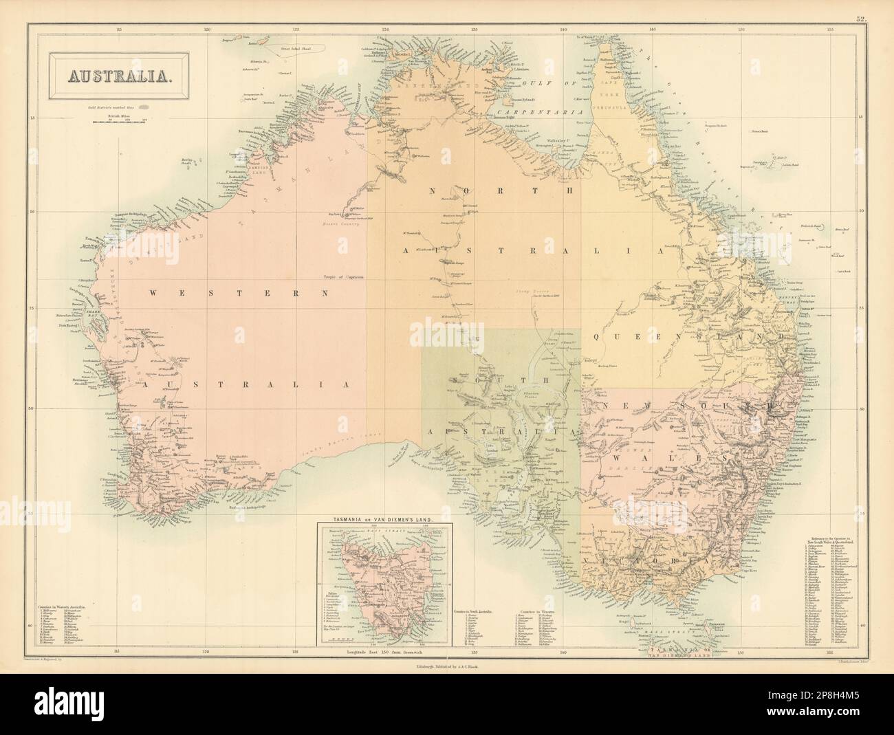 Australia. Sturt Stuart Austin Gregory explorers' routes. BARTHOLOMEW 1862 map Stock Photohttps://www.alamy.com/image-license-details/?v=1https://www.alamy.com/australia-sturt-stuart-austin-gregory-explorers-routes-bartholomew-1862-map-image538815541.html
RF2P8H4M5–Australia. Sturt Stuart Austin Gregory explorers' routes. BARTHOLOMEW 1862 map
 Map of Gregory in South Dakota Stock Photohttps://www.alamy.com/image-license-details/?v=1https://www.alamy.com/map-of-gregory-in-south-dakota-image402446959.html
RF2EAN15K–Map of Gregory in South Dakota
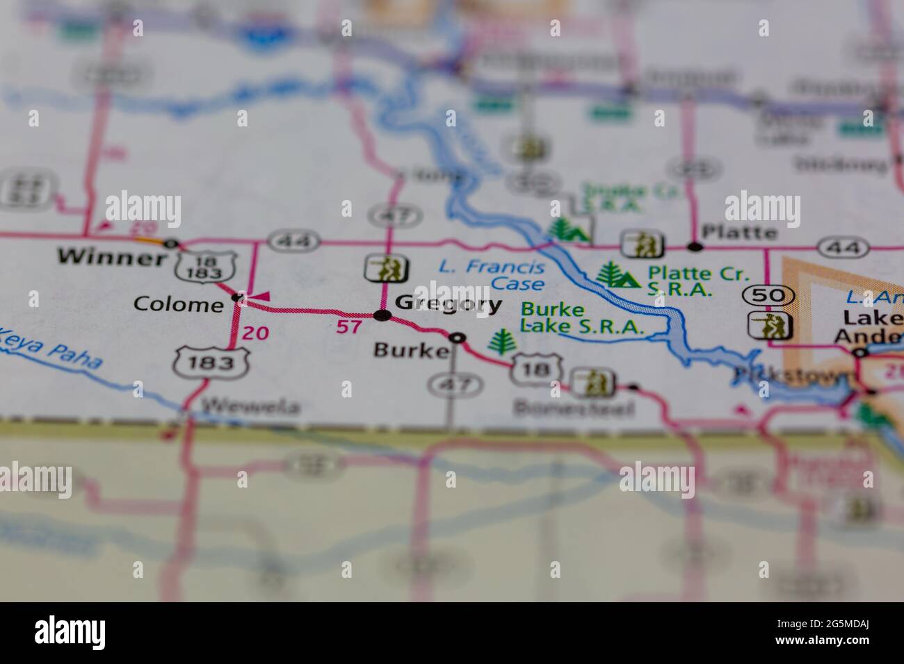 Gregory South Dakota USA shown on a Geography map or Road map Stock Photohttps://www.alamy.com/image-license-details/?v=1https://www.alamy.com/gregory-south-dakota-usa-shown-on-a-geography-map-or-road-map-image433782010.html
RM2G5MDAJ–Gregory South Dakota USA shown on a Geography map or Road map
![Sketch map by Gregory from his expedition to East Africa in 1892-3. This shows 'THe South-Western Quadrant of the Central Part of [Mount] Kenya' . 1892 175 Gregory004 Stock Photo Sketch map by Gregory from his expedition to East Africa in 1892-3. This shows 'THe South-Western Quadrant of the Central Part of [Mount] Kenya' . 1892 175 Gregory004 Stock Photo](https://c8.alamy.com/comp/P7X9GK/sketch-map-by-gregory-from-his-expedition-to-east-africa-in-1892-3-this-shows-the-south-western-quadrant-of-the-central-part-of-mount-kenya-1892-175-gregory004-P7X9GK.jpg) Sketch map by Gregory from his expedition to East Africa in 1892-3. This shows 'THe South-Western Quadrant of the Central Part of [Mount] Kenya' . 1892 175 Gregory004 Stock Photohttps://www.alamy.com/image-license-details/?v=1https://www.alamy.com/sketch-map-by-gregory-from-his-expedition-to-east-africa-in-1892-3-this-shows-the-south-western-quadrant-of-the-central-part-of-mount-kenya-1892-175-gregory004-image211405283.html
Sketch map by Gregory from his expedition to East Africa in 1892-3. This shows 'THe South-Western Quadrant of the Central Part of [Mount] Kenya' . 1892 175 Gregory004 Stock Photohttps://www.alamy.com/image-license-details/?v=1https://www.alamy.com/sketch-map-by-gregory-from-his-expedition-to-east-africa-in-1892-3-this-shows-the-south-western-quadrant-of-the-central-part-of-mount-kenya-1892-175-gregory004-image211405283.htmlRMP7X9GK–Sketch map by Gregory from his expedition to East Africa in 1892-3. This shows 'THe South-Western Quadrant of the Central Part of [Mount] Kenya' . 1892 175 Gregory004
 WESTERN AUSTRALIA,SWAN RIVER:Helpman Gregory Gray routes.TALLIS/RAPKIN, 1851 map Stock Photohttps://www.alamy.com/image-license-details/?v=1https://www.alamy.com/stock-photo-western-australiaswan-riverhelpman-gregory-gray-routestallisrapkin-93001097.html
RFFB8FRN–WESTERN AUSTRALIA,SWAN RIVER:Helpman Gregory Gray routes.TALLIS/RAPKIN, 1851 map
 Gregory River, , AU, Australia, Queensland, S 20 10' 0'', N 148 25' 0'', map, Cartascapes Map published in 2024. Explore Cartascapes, a map revealing Earth's diverse landscapes, cultures, and ecosystems. Journey through time and space, discovering the interconnectedness of our planet's past, present, and future. Stock Photohttps://www.alamy.com/image-license-details/?v=1https://www.alamy.com/gregory-river-au-australia-queensland-s-20-10-0-n-148-25-0-map-cartascapes-map-published-in-2024-explore-cartascapes-a-map-revealing-earths-diverse-landscapes-cultures-and-ecosystems-journey-through-time-and-space-discovering-the-interconnectedness-of-our-planets-past-present-and-future-image625485636.html
RM2Y9H98M–Gregory River, , AU, Australia, Queensland, S 20 10' 0'', N 148 25' 0'', map, Cartascapes Map published in 2024. Explore Cartascapes, a map revealing Earth's diverse landscapes, cultures, and ecosystems. Journey through time and space, discovering the interconnectedness of our planet's past, present, and future.
 YORKSHIRE Mirfield Whitley Briestfield Ravensthorpe Northorpe Dewsbury 1935 map Stock Photohttps://www.alamy.com/image-license-details/?v=1https://www.alamy.com/yorkshire-mirfield-whitley-briestfield-ravensthorpe-northorpe-dewsbury-1935-map-image568753463.html
RF2T18XRK–YORKSHIRE Mirfield Whitley Briestfield Ravensthorpe Northorpe Dewsbury 1935 map
 Map of Asia showing distribution of Races from the book ' The living races of mankind ' Vol 1 by Henry Neville Hutchinson,, editors John Walter Gregory, and Richard Lydekker, Publisher: London, Hutchinson & co 1901 Stock Photohttps://www.alamy.com/image-license-details/?v=1https://www.alamy.com/map-of-asia-showing-distribution-of-races-from-the-book-the-living-races-of-mankind-vol-1-by-henry-neville-hutchinson-editors-john-walter-gregory-and-richard-lydekker-publisher-london-hutchinson-co-1901-image459042178.html
RF2HJR4YE–Map of Asia showing distribution of Races from the book ' The living races of mankind ' Vol 1 by Henry Neville Hutchinson,, editors John Walter Gregory, and Richard Lydekker, Publisher: London, Hutchinson & co 1901
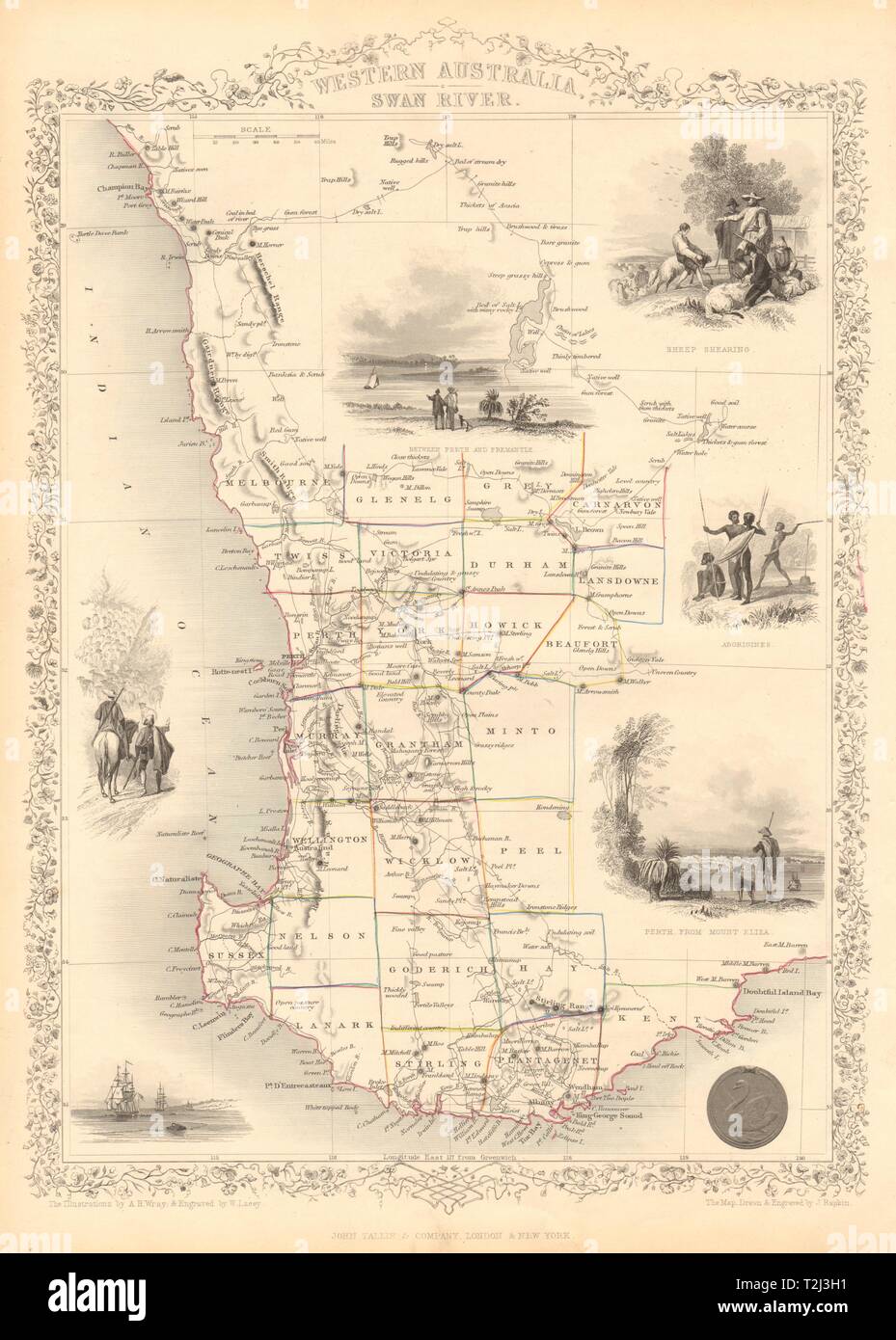 WESTERN AUSTRALIA,SWAN RIVER.Helpman Gregory Gray routes. RAPKIN/TALLIS 1851 map Stock Photohttps://www.alamy.com/image-license-details/?v=1https://www.alamy.com/western-australiaswan-riverhelpman-gregory-gray-routes-rapkintallis-1851-map-image242572429.html
RFT2J3H1–WESTERN AUSTRALIA,SWAN RIVER.Helpman Gregory Gray routes. RAPKIN/TALLIS 1851 map
 Map of Gregory in South Dakota Stock Photohttps://www.alamy.com/image-license-details/?v=1https://www.alamy.com/map-of-gregory-in-south-dakota-image365207891.html
RF2C64JAY–Map of Gregory in South Dakota
 Original Film Title: TWELVE O'CLOCK HIGH. English Title: TWELVE O'CLOCK HIGH. Film Director: HENRY KING. Year: 1949. Stars: GREGORY PECK. Credit: 20TH CENTURY FOX / Album Stock Photohttps://www.alamy.com/image-license-details/?v=1https://www.alamy.com/original-film-title-twelve-oclock-high-english-title-twelve-oclock-high-film-director-henry-king-year-1949-stars-gregory-peck-credit-20th-century-fox-album-image207486452.html
RMP1FR2C–Original Film Title: TWELVE O'CLOCK HIGH. English Title: TWELVE O'CLOCK HIGH. Film Director: HENRY KING. Year: 1949. Stars: GREGORY PECK. Credit: 20TH CENTURY FOX / Album
 Plate 73: Residence of A.S. Doane, Doanesburg, Putnam Co. N.Y - N.L. Thompson's Lake Mahopac - The Gregory House, Lake Mahopac, Putnam Co. N.Y. 1868 by Beers, F. W. (Frederick W.) Stock Photohttps://www.alamy.com/image-license-details/?v=1https://www.alamy.com/plate-73-residence-of-as-doane-doanesburg-putnam-co-ny-nl-thompsons-lake-mahopac-the-gregory-house-lake-mahopac-putnam-co-ny-1868-by-beers-f-w-frederick-w-image633127713.html
RM2YP1CT1–Plate 73: Residence of A.S. Doane, Doanesburg, Putnam Co. N.Y - N.L. Thompson's Lake Mahopac - The Gregory House, Lake Mahopac, Putnam Co. N.Y. 1868 by Beers, F. W. (Frederick W.)
 Gregory County (South Dakota) outline map set Stock Vectorhttps://www.alamy.com/image-license-details/?v=1https://www.alamy.com/gregory-county-south-dakota-outline-map-set-image620962894.html
RF2Y278E6–Gregory County (South Dakota) outline map set
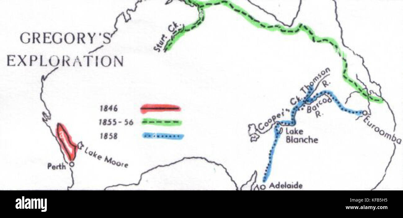 Gregory map Stock Photohttps://www.alamy.com/image-license-details/?v=1https://www.alamy.com/stock-image-gregory-map-164359025.html
RMKFB5H5–Gregory map
 U.S. Army Lt. Col. Gregory Jacobsen, with 2nd Battalion, 4th Brigade Combat Team, reads a map with family members of Sheik Saee Stock Photohttps://www.alamy.com/image-license-details/?v=1https://www.alamy.com/us-army-lt-col-gregory-jacobsen-with-2nd-battalion-4th-brigade-combat-image69729126.html
RME1CC5X–U.S. Army Lt. Col. Gregory Jacobsen, with 2nd Battalion, 4th Brigade Combat Team, reads a map with family members of Sheik Saee
 Western Australia - Route of The Dettlers Expedition Under Mr Ac Gregory From Perth To Gascoyne River 1848 and Govenor Fitz Gerald's Route From Champion Bay To Murchison River 1848 and 1849 Stock Photohttps://www.alamy.com/image-license-details/?v=1https://www.alamy.com/western-australia-route-of-the-dettlers-expedition-under-mr-ac-gregory-from-perth-to-gascoyne-river-1848-and-govenor-fitz-geralds-route-from-champion-bay-to-murchison-river-1848-and-1849-image560875404.html
RM2RGE28C–Western Australia - Route of The Dettlers Expedition Under Mr Ac Gregory From Perth To Gascoyne River 1848 and Govenor Fitz Gerald's Route From Champion Bay To Murchison River 1848 and 1849
 SAN JUAN, Puerto Rico – Gregory Aponte, Juliana McMillan-Wilhoit and Jessie Petit of Task Force Power Restoration Geographical Information Systems Team display a map and graphic illustrating 72% of electric meters on the island are now energized. PREPA reports approximately 72% percent or approximately 1,054,001 of the 1.47M customers who are able to receive electric power have their service restored. The U.S. Army Corps of Engineers deploys some of its best to the Geospatial researchers to the GIS team. ( Stock Photohttps://www.alamy.com/image-license-details/?v=1https://www.alamy.com/stock-photo-san-juan-puerto-rico-gregory-aponte-juliana-mcmillan-wilhoit-and-jessie-174335269.html
RMM3HJBH–SAN JUAN, Puerto Rico – Gregory Aponte, Juliana McMillan-Wilhoit and Jessie Petit of Task Force Power Restoration Geographical Information Systems Team display a map and graphic illustrating 72% of electric meters on the island are now energized. PREPA reports approximately 72% percent or approximately 1,054,001 of the 1.47M customers who are able to receive electric power have their service restored. The U.S. Army Corps of Engineers deploys some of its best to the Geospatial researchers to the GIS team. (
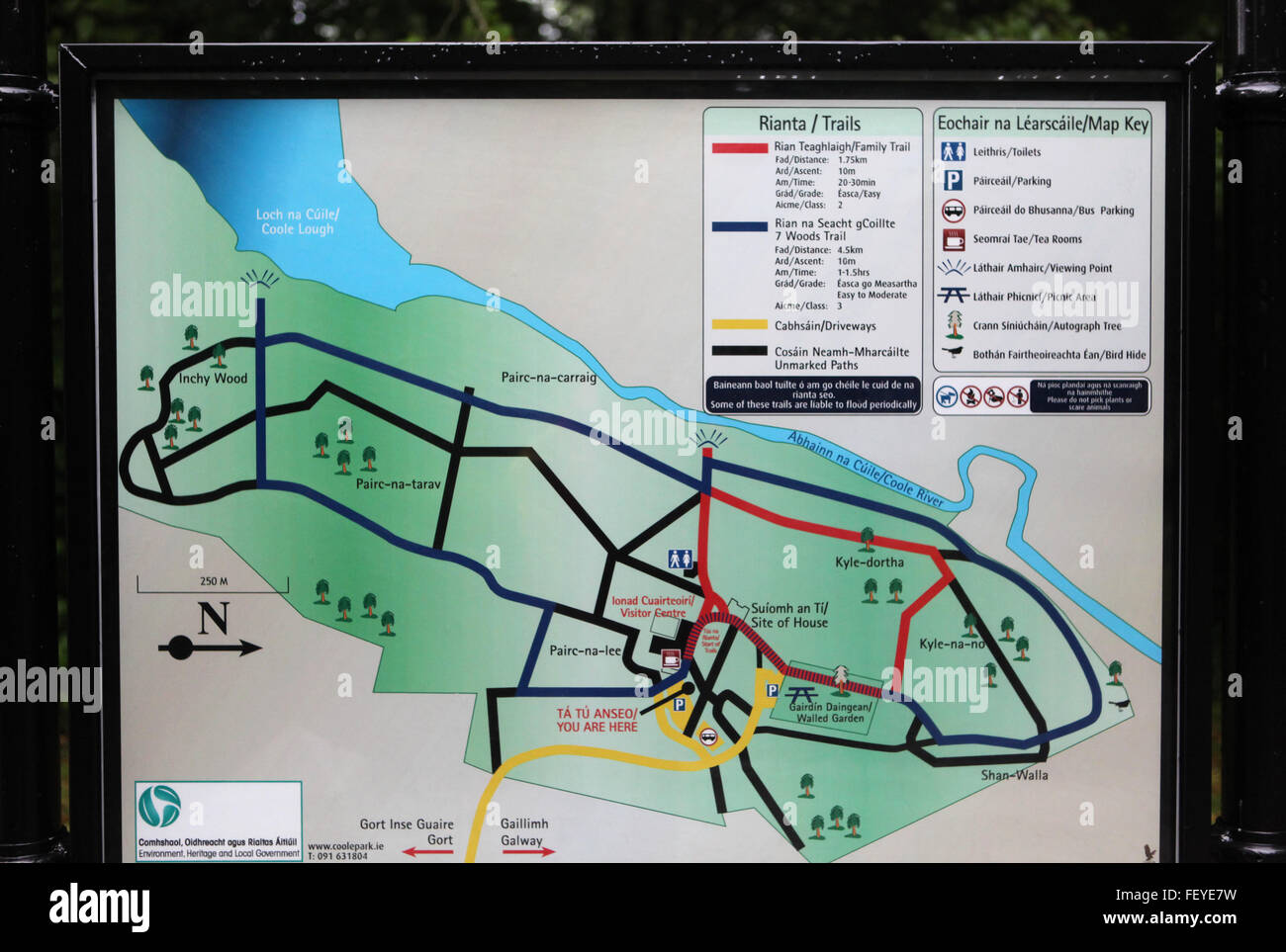 Inside Coole Park, Gort, Co. Galway Stock Photohttps://www.alamy.com/image-license-details/?v=1https://www.alamy.com/stock-photo-inside-coole-park-gort-co-galway-95260925.html
RMFEYE7W–Inside Coole Park, Gort, Co. Galway
 An amorous encounter - Smithfield Decretals (Decretals of Gregory IX) (c.1340), f.139 - BL Royal MS 10 E IV Stock Photohttps://www.alamy.com/image-license-details/?v=1https://www.alamy.com/stock-photo-an-amorous-encounter-smithfield-decretals-decretals-of-gregory-ix-73512512.html
RME7GNXT–An amorous encounter - Smithfield Decretals (Decretals of Gregory IX) (c.1340), f.139 - BL Royal MS 10 E IV
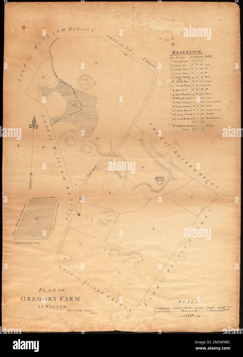 Plan of Gregory Farm in Weston. Manuscript map showing layout of a farm in Weston. Includes reference key for 16 sections. Also shows neighboring landowners. Relief shown by hachures.... , Massachusetts , Middlesex ,county , Weston Stock Photohttps://www.alamy.com/image-license-details/?v=1https://www.alamy.com/plan-of-gregory-farm-in-weston-manuscript-map-showing-layout-of-a-farm-in-weston-includes-reference-key-for-16-sections-also-shows-neighboring-landowners-relief-shown-by-hachures-massachusetts-middlesex-county-weston-image502730128.html
RM2M5W9BC–Plan of Gregory Farm in Weston. Manuscript map showing layout of a farm in Weston. Includes reference key for 16 sections. Also shows neighboring landowners. Relief shown by hachures.... , Massachusetts , Middlesex ,county , Weston
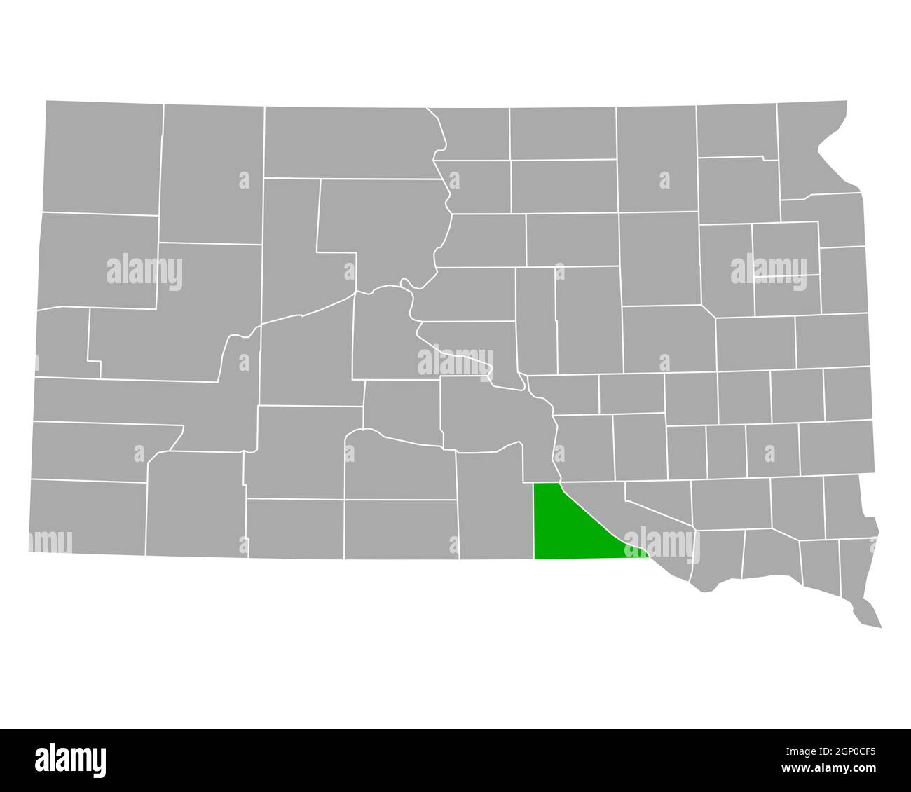 Map of Gregory in South Dakota Stock Photohttps://www.alamy.com/image-license-details/?v=1https://www.alamy.com/map-of-gregory-in-south-dakota-image443791465.html
RF2GP0CF5–Map of Gregory in South Dakota
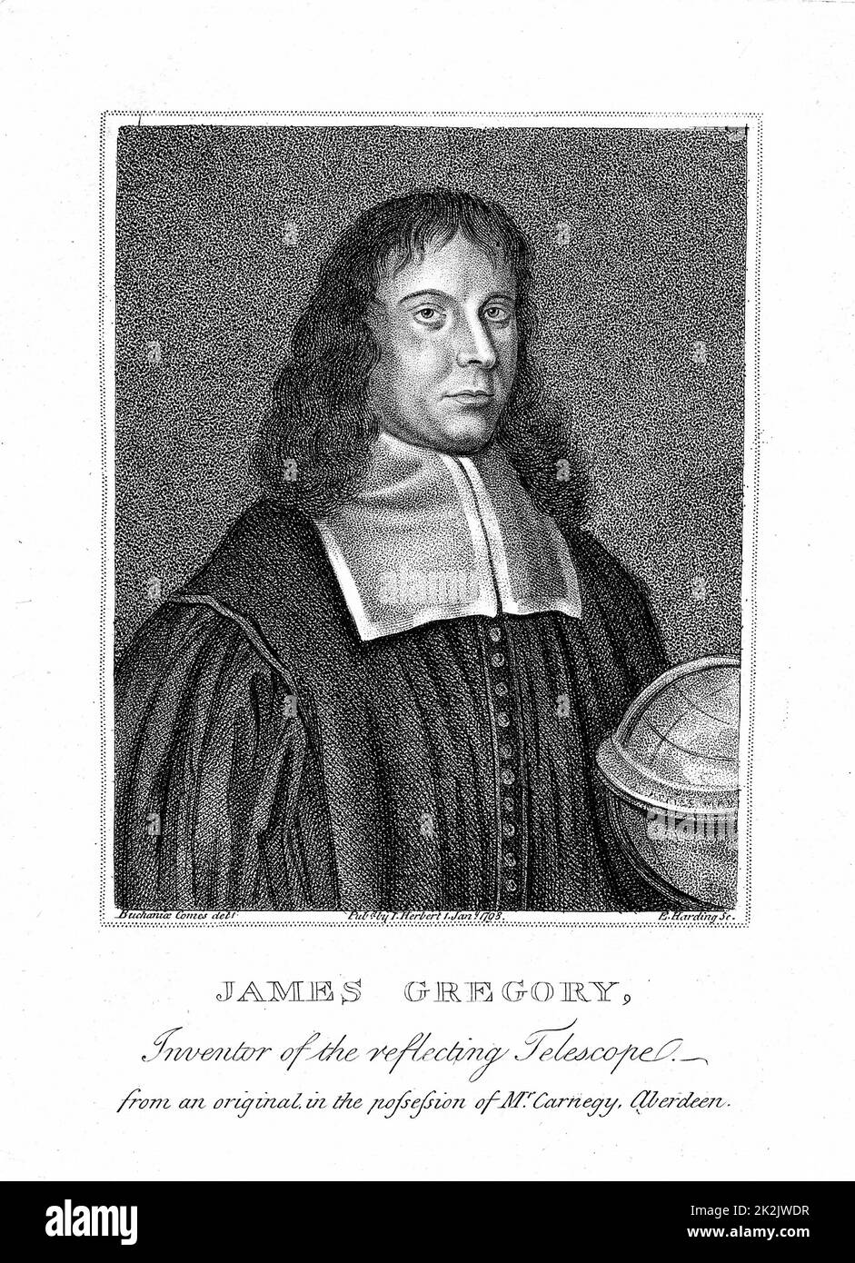 James Gregory (1638-75) Scottish mathematician. In 1663 published 'Optica Promota' describing his reflecting telescope. Corresponded with Newton. Stipple engraving Stock Photohttps://www.alamy.com/image-license-details/?v=1https://www.alamy.com/james-gregory-1638-75-scottish-mathematician-in-1663-published-optica-promota-describing-his-reflecting-telescope-corresponded-with-newton-stipple-engraving-image483534739.html
RM2K2JWDR–James Gregory (1638-75) Scottish mathematician. In 1663 published 'Optica Promota' describing his reflecting telescope. Corresponded with Newton. Stipple engraving
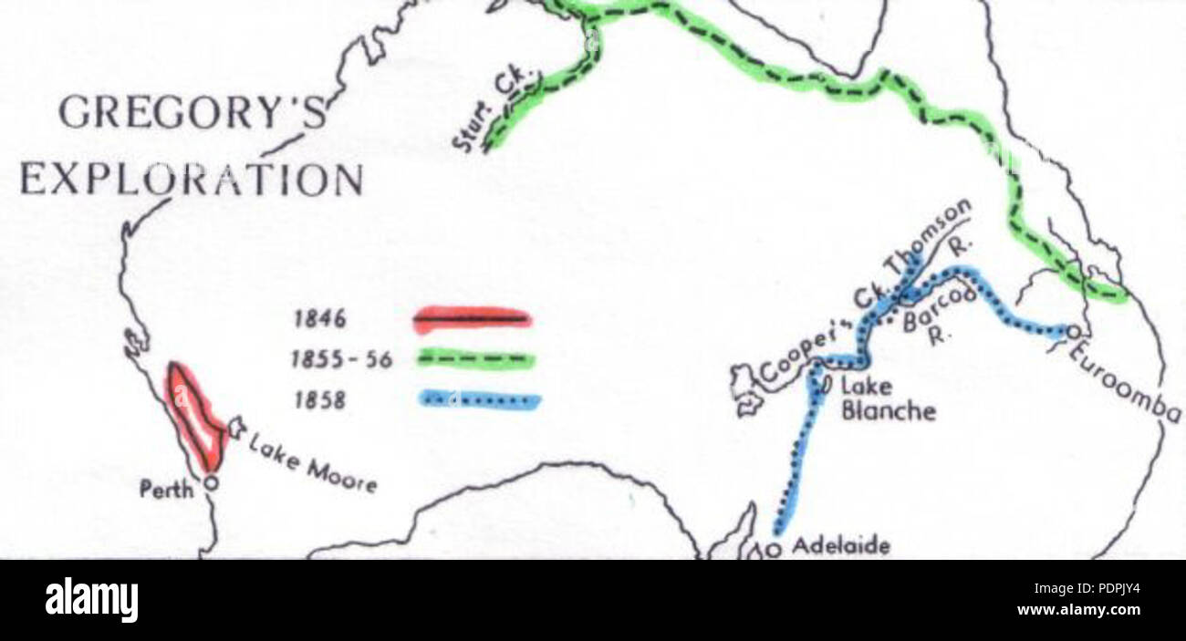 53 Gregory-map Stock Photohttps://www.alamy.com/image-license-details/?v=1https://www.alamy.com/53-gregory-map-image215012760.html
RMPDPJY4–53 Gregory-map
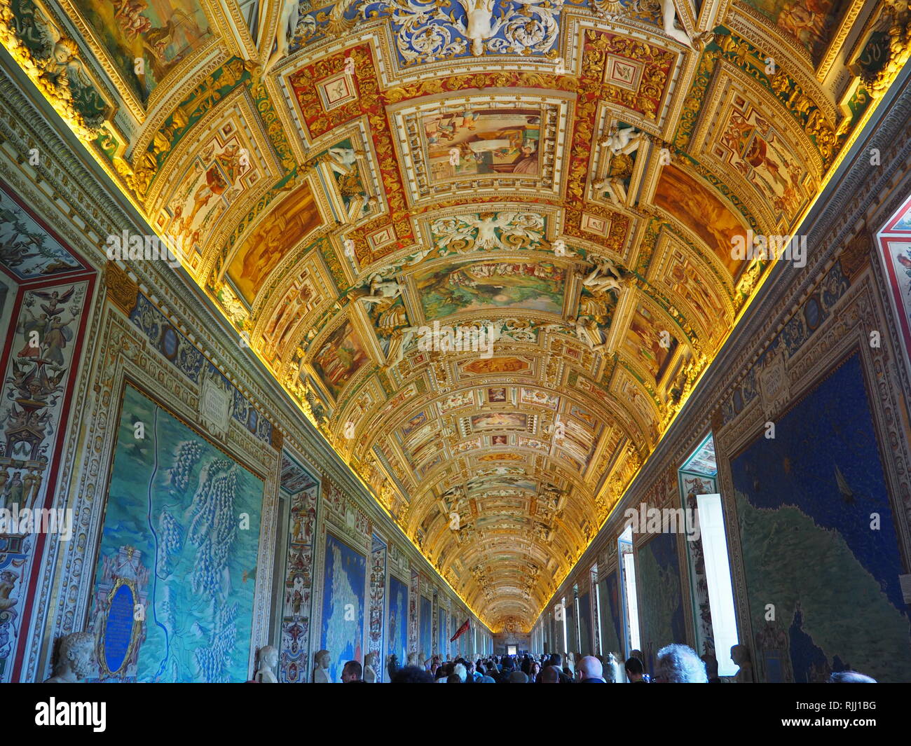 Ceiling of Gallery of Maps in the Vatican Museum - Vatican City - Rome - Italy Stock Photohttps://www.alamy.com/image-license-details/?v=1https://www.alamy.com/ceiling-of-gallery-of-maps-in-the-vatican-museum-vatican-city-rome-italy-image235194836.html
RFRJJ1BG–Ceiling of Gallery of Maps in the Vatican Museum - Vatican City - Rome - Italy
 Gregory River, , AU, Australia, Queensland, S 25 10' 59'', N 152 33' 0'', map, Cartascapes Map published in 2024. Explore Cartascapes, a map revealing Earth's diverse landscapes, cultures, and ecosystems. Journey through time and space, discovering the interconnectedness of our planet's past, present, and future. Stock Photohttps://www.alamy.com/image-license-details/?v=1https://www.alamy.com/gregory-river-au-australia-queensland-s-25-10-59-n-152-33-0-map-cartascapes-map-published-in-2024-explore-cartascapes-a-map-revealing-earths-diverse-landscapes-cultures-and-ecosystems-journey-through-time-and-space-discovering-the-interconnectedness-of-our-planets-past-present-and-future-image625414861.html
RM2Y9E311–Gregory River, , AU, Australia, Queensland, S 25 10' 59'', N 152 33' 0'', map, Cartascapes Map published in 2024. Explore Cartascapes, a map revealing Earth's diverse landscapes, cultures, and ecosystems. Journey through time and space, discovering the interconnectedness of our planet's past, present, and future.
 DENIS O'DEA and GREGORY PECK in CAPTAIN HORATIO HORNBLOWER R.N. 1951 director RAOUL WALSH novel / adaptation C.S. Forester music Robert Farnon UK-USA-France co-production Warner Bros. Stock Photohttps://www.alamy.com/image-license-details/?v=1https://www.alamy.com/denis-odea-and-gregory-peck-in-captain-horatio-hornblower-rn-1951-director-raoul-walsh-novel-adaptation-cs-forester-music-robert-farnon-uk-usa-france-co-production-warner-bros-image484711457.html
RM2K4GEBD–DENIS O'DEA and GREGORY PECK in CAPTAIN HORATIO HORNBLOWER R.N. 1951 director RAOUL WALSH novel / adaptation C.S. Forester music Robert Farnon UK-USA-France co-production Warner Bros.
 Map Showing the Distribution of African Races from the book ' The living races of mankind ' Vol 1 by Henry Neville Hutchinson,, editors John Walter Gregory, and Richard Lydekker, Publisher: London, Hutchinson & co 1901 Stock Photohttps://www.alamy.com/image-license-details/?v=1https://www.alamy.com/map-showing-the-distribution-of-african-races-from-the-book-the-living-races-of-mankind-vol-1-by-henry-neville-hutchinson-editors-john-walter-gregory-and-richard-lydekker-publisher-london-hutchinson-co-1901-image459841122.html
RF2HM3G16–Map Showing the Distribution of African Races from the book ' The living races of mankind ' Vol 1 by Henry Neville Hutchinson,, editors John Walter Gregory, and Richard Lydekker, Publisher: London, Hutchinson & co 1901
 WESTERN AUSTRALIA,SWAN RIVER.Helpman Gregory Gray routes.TALLIS/RAPKIN c1851 map Stock Photohttps://www.alamy.com/image-license-details/?v=1https://www.alamy.com/stock-photo-western-australiaswan-riverhelpman-gregory-gray-routestallisrapkin-139122514.html
RFJ29G56–WESTERN AUSTRALIA,SWAN RIVER.Helpman Gregory Gray routes.TALLIS/RAPKIN c1851 map
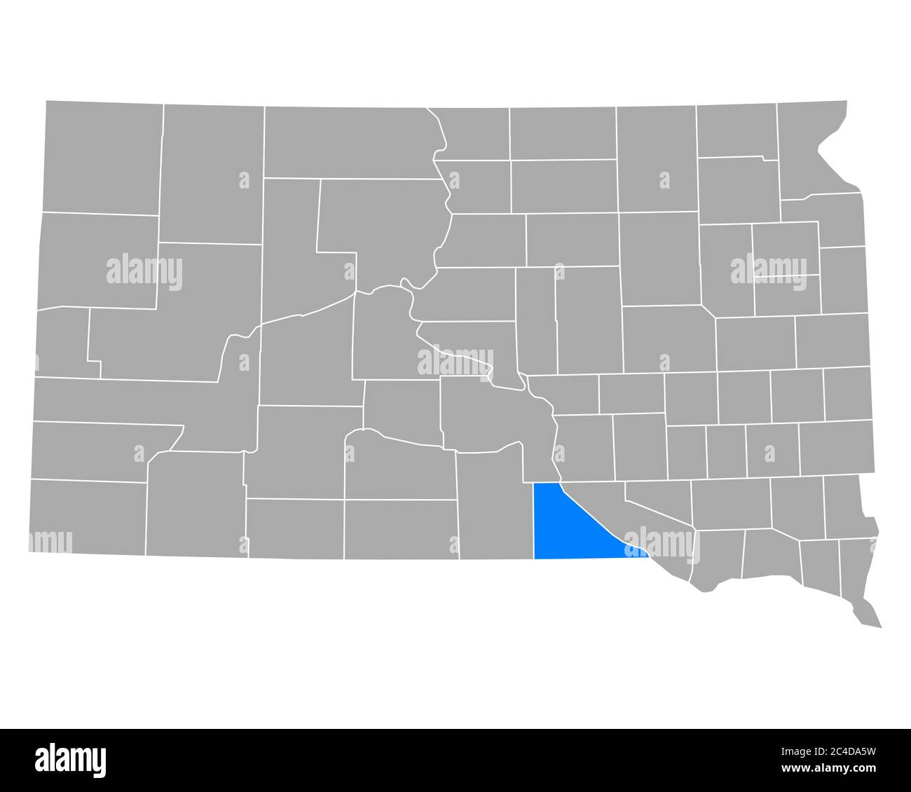 Map of Gregory in South Dakota Stock Photohttps://www.alamy.com/image-license-details/?v=1https://www.alamy.com/map-of-gregory-in-south-dakota-image364169733.html
RF2C4DA5W–Map of Gregory in South Dakota
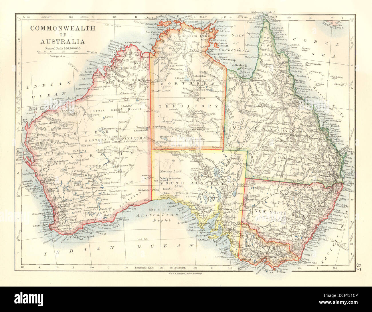 AUSTRALIA explorers' routes Giles Elder Carnegie Forrest Gregory Stuart 1920 map Stock Photohttps://www.alamy.com/image-license-details/?v=1https://www.alamy.com/stock-photo-australia-explorers-routes-giles-elder-carnegie-forrest-gregory-stuart-102758454.html
RFFY51CP–AUSTRALIA explorers' routes Giles Elder Carnegie Forrest Gregory Stuart 1920 map
![Part of the town of West Orange. Double Page Plate No. 18 [Map bounded by West End Ave., Upper Mountain Ave., Mountain Ave., Gregory Ave., Mt. Pleasant Ave.] 1904 Stock Photo Part of the town of West Orange. Double Page Plate No. 18 [Map bounded by West End Ave., Upper Mountain Ave., Mountain Ave., Gregory Ave., Mt. Pleasant Ave.] 1904 Stock Photo](https://c8.alamy.com/comp/2YP54EM/part-of-the-town-of-west-orange-double-page-plate-no-18-map-bounded-by-west-end-ave-upper-mountain-ave-mountain-ave-gregory-ave-mt-pleasant-ave-1904-2YP54EM.jpg) Part of the town of West Orange. Double Page Plate No. 18 [Map bounded by West End Ave., Upper Mountain Ave., Mountain Ave., Gregory Ave., Mt. Pleasant Ave.] 1904 Stock Photohttps://www.alamy.com/image-license-details/?v=1https://www.alamy.com/part-of-the-town-of-west-orange-double-page-plate-no-18-map-bounded-by-west-end-ave-upper-mountain-ave-mountain-ave-gregory-ave-mt-pleasant-ave-1904-image633208988.html
Part of the town of West Orange. Double Page Plate No. 18 [Map bounded by West End Ave., Upper Mountain Ave., Mountain Ave., Gregory Ave., Mt. Pleasant Ave.] 1904 Stock Photohttps://www.alamy.com/image-license-details/?v=1https://www.alamy.com/part-of-the-town-of-west-orange-double-page-plate-no-18-map-bounded-by-west-end-ave-upper-mountain-ave-mountain-ave-gregory-ave-mt-pleasant-ave-1904-image633208988.htmlRM2YP54EM–Part of the town of West Orange. Double Page Plate No. 18 [Map bounded by West End Ave., Upper Mountain Ave., Mountain Ave., Gregory Ave., Mt. Pleasant Ave.] 1904
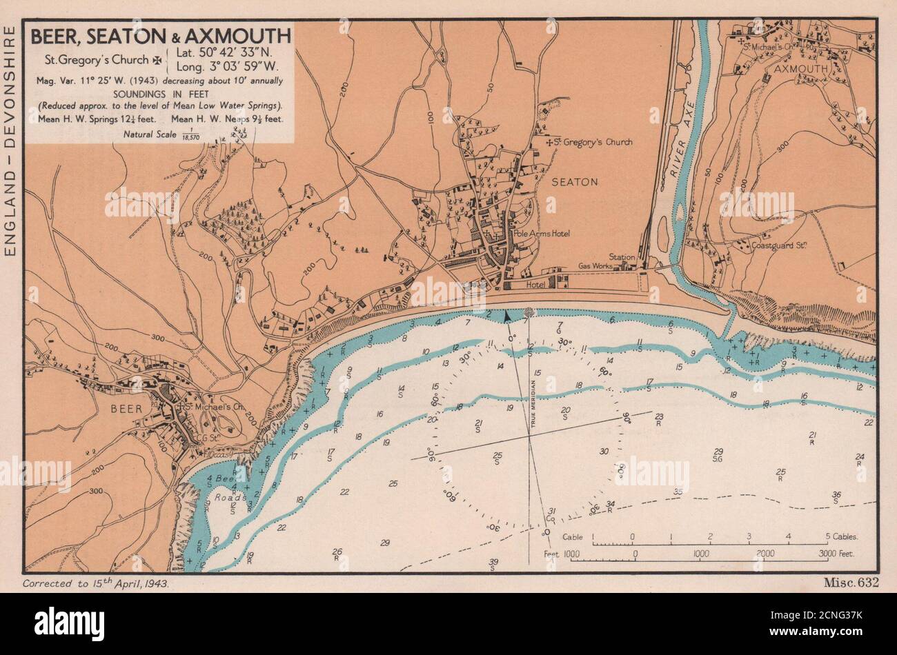 Beer, Seaton & Axmouth town plan & sea coast chart. Devon. ADMIRALTY 1943 map Stock Photohttps://www.alamy.com/image-license-details/?v=1https://www.alamy.com/beer-seaton-axmouth-town-plan-sea-coast-chart-devon-admiralty-1943-map-image374679303.html
RF2CNG37K–Beer, Seaton & Axmouth town plan & sea coast chart. Devon. ADMIRALTY 1943 map
 Pope Gregory I Stock Photohttps://www.alamy.com/image-license-details/?v=1https://www.alamy.com/stock-photo-pope-gregory-i-140390509.html
RMJ4B9EN–Pope Gregory I
 Western Australia Gascoyne Shark Bay ADMIRALTY sea chart 1879 (1954) old map Stock Photohttps://www.alamy.com/image-license-details/?v=1https://www.alamy.com/western-australia-gascoyne-shark-bay-admiralty-sea-chart-1879-1954-old-map-image442254219.html
RF2GKEBNF–Western Australia Gascoyne Shark Bay ADMIRALTY sea chart 1879 (1954) old map
 Syd Gregory Stock Photohttps://www.alamy.com/image-license-details/?v=1https://www.alamy.com/stock-photo-syd-gregory-140526886.html
RMJ4HFDA–Syd Gregory
 Feb. 25, 2013 - Mineola, New York, U.S. - GREGORY MAY, legislative liason for Nassau County Supervisor Mangano, responds to questions from legislators, during meeting that had major topic of the controversial Redistricting Map proposed by Republicans. The legislature postponed the vote on the map shortly before 1 AM the morning of February 26, nearly 12 hours after the meeting started on 1:30 PM Feb. 25. Stock Photohttps://www.alamy.com/image-license-details/?v=1https://www.alamy.com/stock-photo-feb-25-2013-mineola-new-york-us-gregory-may-legislative-liason-for-54070201.html
RMD3Y32H–Feb. 25, 2013 - Mineola, New York, U.S. - GREGORY MAY, legislative liason for Nassau County Supervisor Mangano, responds to questions from legislators, during meeting that had major topic of the controversial Redistricting Map proposed by Republicans. The legislature postponed the vote on the map shortly before 1 AM the morning of February 26, nearly 12 hours after the meeting started on 1:30 PM Feb. 25.
 Gregory XI Stock Photohttps://www.alamy.com/image-license-details/?v=1https://www.alamy.com/stock-photo-gregory-xi-142968593.html
RMJ8GNW5–Gregory XI
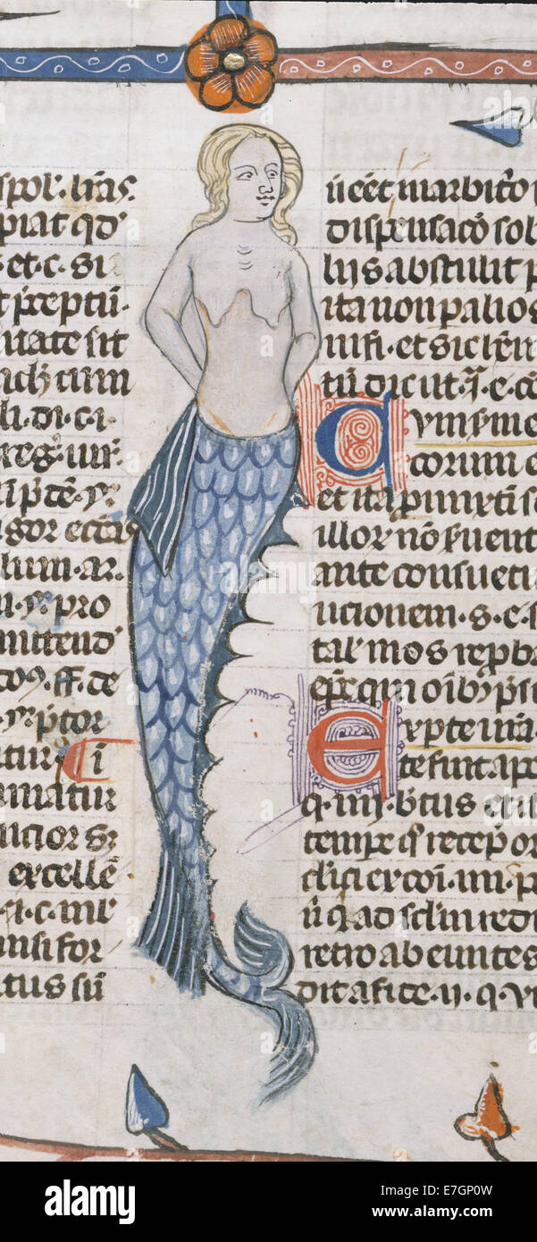 A Mermaid - Smithfield Decretals (Decretals of Gregory IX) (c.1340), f.47 - BL Royal MS 10 E IV Stock Photohttps://www.alamy.com/image-license-details/?v=1https://www.alamy.com/stock-photo-a-mermaid-smithfield-decretals-decretals-of-gregory-ix-c1340-f47-bl-73512569.html
RME7GP0W–A Mermaid - Smithfield Decretals (Decretals of Gregory IX) (c.1340), f.47 - BL Royal MS 10 E IV
 Gregory Thaumaturge Stock Photohttps://www.alamy.com/image-license-details/?v=1https://www.alamy.com/stock-photo-gregory-thaumaturge-139962316.html
RMJ3KRA4–Gregory Thaumaturge
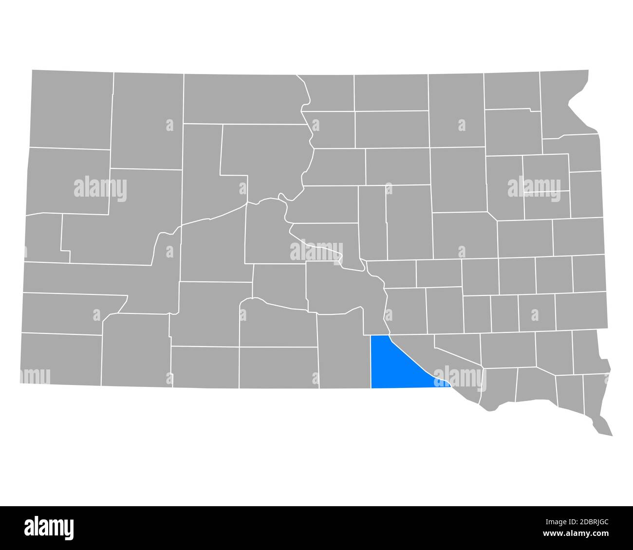 Map of Gregory in South Dakota Stock Photohttps://www.alamy.com/image-license-details/?v=1https://www.alamy.com/map-of-gregory-in-south-dakota-image385908780.html
RF2DBRJGC–Map of Gregory in South Dakota
 Gregory Rus Stock Photohttps://www.alamy.com/image-license-details/?v=1https://www.alamy.com/stock-photo-gregory-rus-139964604.html
RMJ3KX7T–Gregory Rus
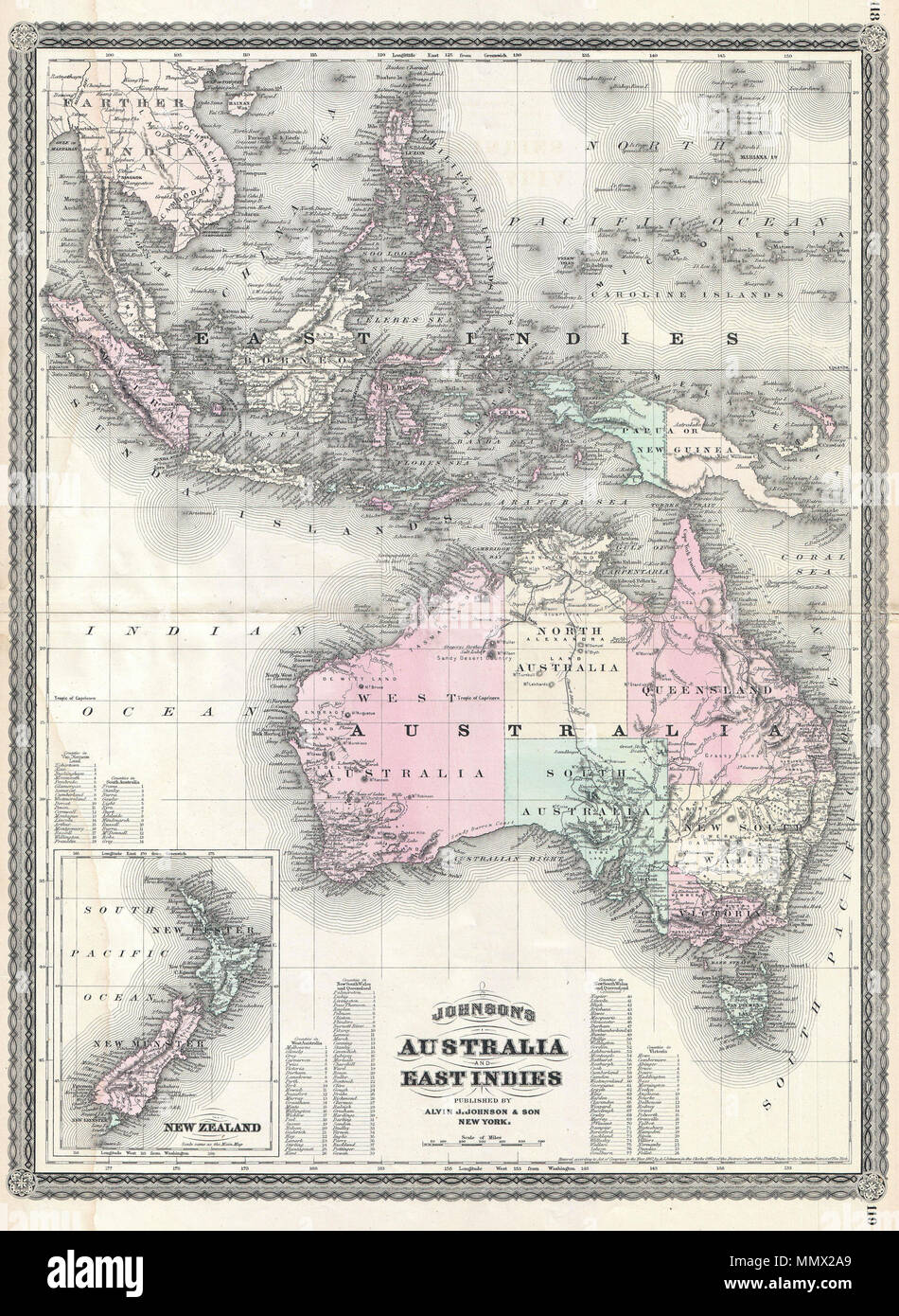 . English: This is A. J. Johnson’s 1870 map of Australia, the East Indies and Southeast Asia. Covers from Modern day Thailand and Vietnam south to include all of the East Indies, the Philippines, New Guinea and the continent of Australia. Offers superb detail with numerous islands, states, cities and geographical areas labeled and color coded. Shows an advanced state of Australian exploration noting the explorations of Burke, Wills, Stuart and Gregory. An inset in the lower left quadrant details New Zealand. Text in the lower quadrants notes counties in each province of Australia. Features th Stock Photohttps://www.alamy.com/image-license-details/?v=1https://www.alamy.com/english-this-is-a-j-johnsons-1870-map-of-australia-the-east-indies-and-southeast-asia-covers-from-modern-day-thailand-and-vietnam-south-to-include-all-of-the-east-indies-the-philippines-new-guinea-and-the-continent-of-australia-offers-superb-detail-with-numerous-islands-states-cities-and-geographical-areas-labeled-and-color-coded-shows-an-advanced-state-of-australian-exploration-noting-the-explorations-of-burke-wills-stuart-and-gregory-an-inset-in-the-lower-left-quadrant-details-new-zealand-text-in-the-lower-quadrants-notes-counties-in-each-province-of-australia-features-th-image184969409.html
RMMMX2A9–. English: This is A. J. Johnson’s 1870 map of Australia, the East Indies and Southeast Asia. Covers from Modern day Thailand and Vietnam south to include all of the East Indies, the Philippines, New Guinea and the continent of Australia. Offers superb detail with numerous islands, states, cities and geographical areas labeled and color coded. Shows an advanced state of Australian exploration noting the explorations of Burke, Wills, Stuart and Gregory. An inset in the lower left quadrant details New Zealand. Text in the lower quadrants notes counties in each province of Australia. Features th
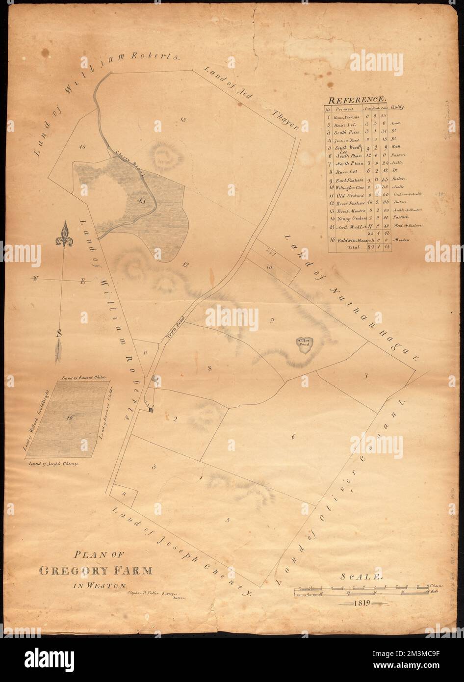 Plan of Gregory Farm in Weston , Real property, Massachusetts, Weston Town, Maps, Landowners, Massachusetts, Weston Town, Maps, Weston Mass. : Town, Maps, Manuscript maps Norman B. Leventhal Map Center Collection Stock Photohttps://www.alamy.com/image-license-details/?v=1https://www.alamy.com/plan-of-gregory-farm-in-weston-real-property-massachusetts-weston-town-maps-landowners-massachusetts-weston-town-maps-weston-mass-town-maps-manuscript-maps-norman-b-leventhal-map-center-collection-image501393355.html
RM2M3MC9F–Plan of Gregory Farm in Weston , Real property, Massachusetts, Weston Town, Maps, Landowners, Massachusetts, Weston Town, Maps, Weston Mass. : Town, Maps, Manuscript maps Norman B. Leventhal Map Center Collection
 Gregory Islands, , AU, Australia, Queensland, S 25 10' 38'', N 152 34' 29'', map, Cartascapes Map published in 2024. Explore Cartascapes, a map revealing Earth's diverse landscapes, cultures, and ecosystems. Journey through time and space, discovering the interconnectedness of our planet's past, present, and future. Stock Photohttps://www.alamy.com/image-license-details/?v=1https://www.alamy.com/gregory-islands-au-australia-queensland-s-25-10-38-n-152-34-29-map-cartascapes-map-published-in-2024-explore-cartascapes-a-map-revealing-earths-diverse-landscapes-cultures-and-ecosystems-journey-through-time-and-space-discovering-the-interconnectedness-of-our-planets-past-present-and-future-image625584742.html
RM2Y9NRM6–Gregory Islands, , AU, Australia, Queensland, S 25 10' 38'', N 152 34' 29'', map, Cartascapes Map published in 2024. Explore Cartascapes, a map revealing Earth's diverse landscapes, cultures, and ecosystems. Journey through time and space, discovering the interconnectedness of our planet's past, present, and future.
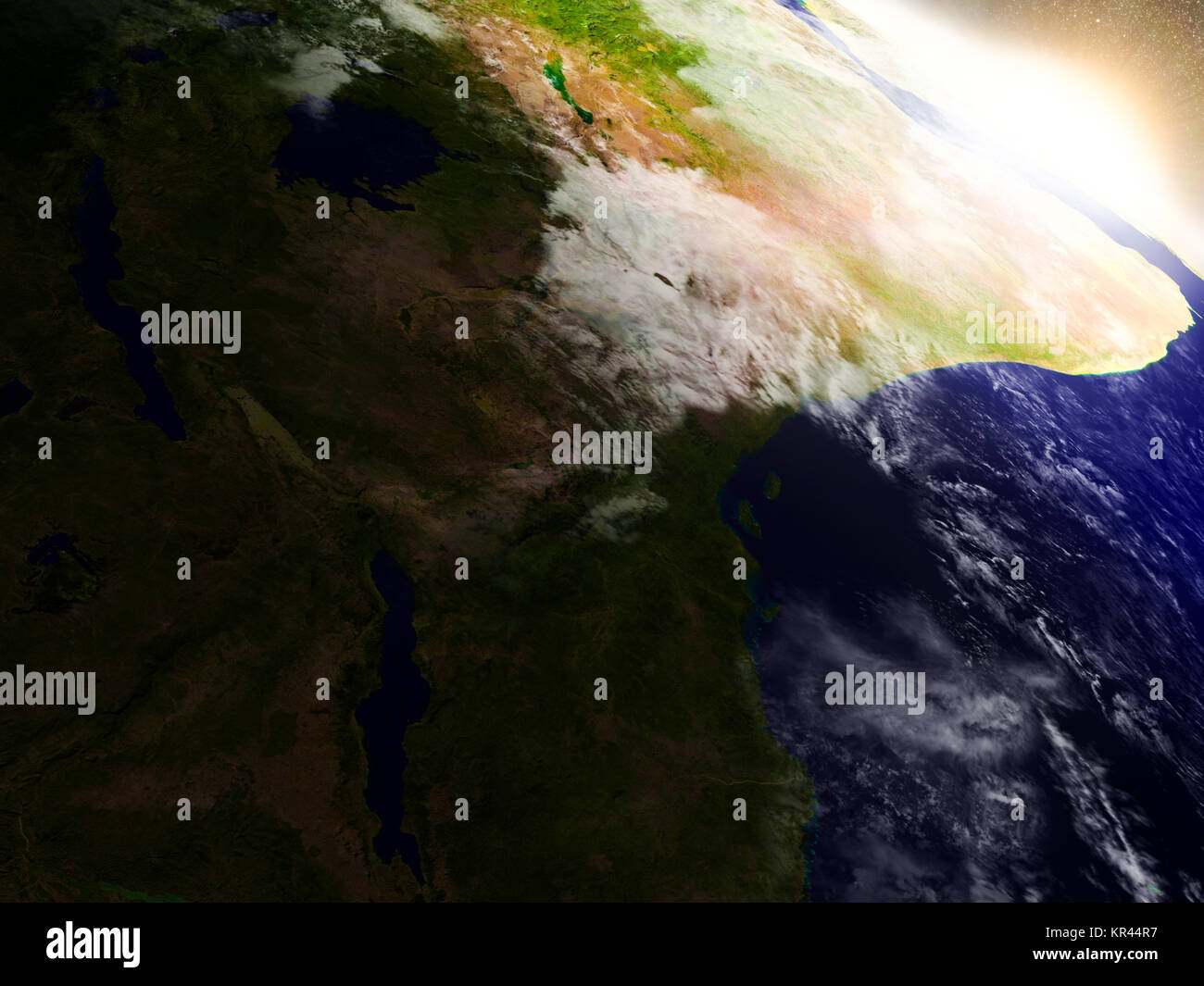 Tanzania from space during sunrise Stock Photohttps://www.alamy.com/image-license-details/?v=1https://www.alamy.com/stock-image-tanzania-from-space-during-sunrise-169121995.html
RFKR44R7–Tanzania from space during sunrise
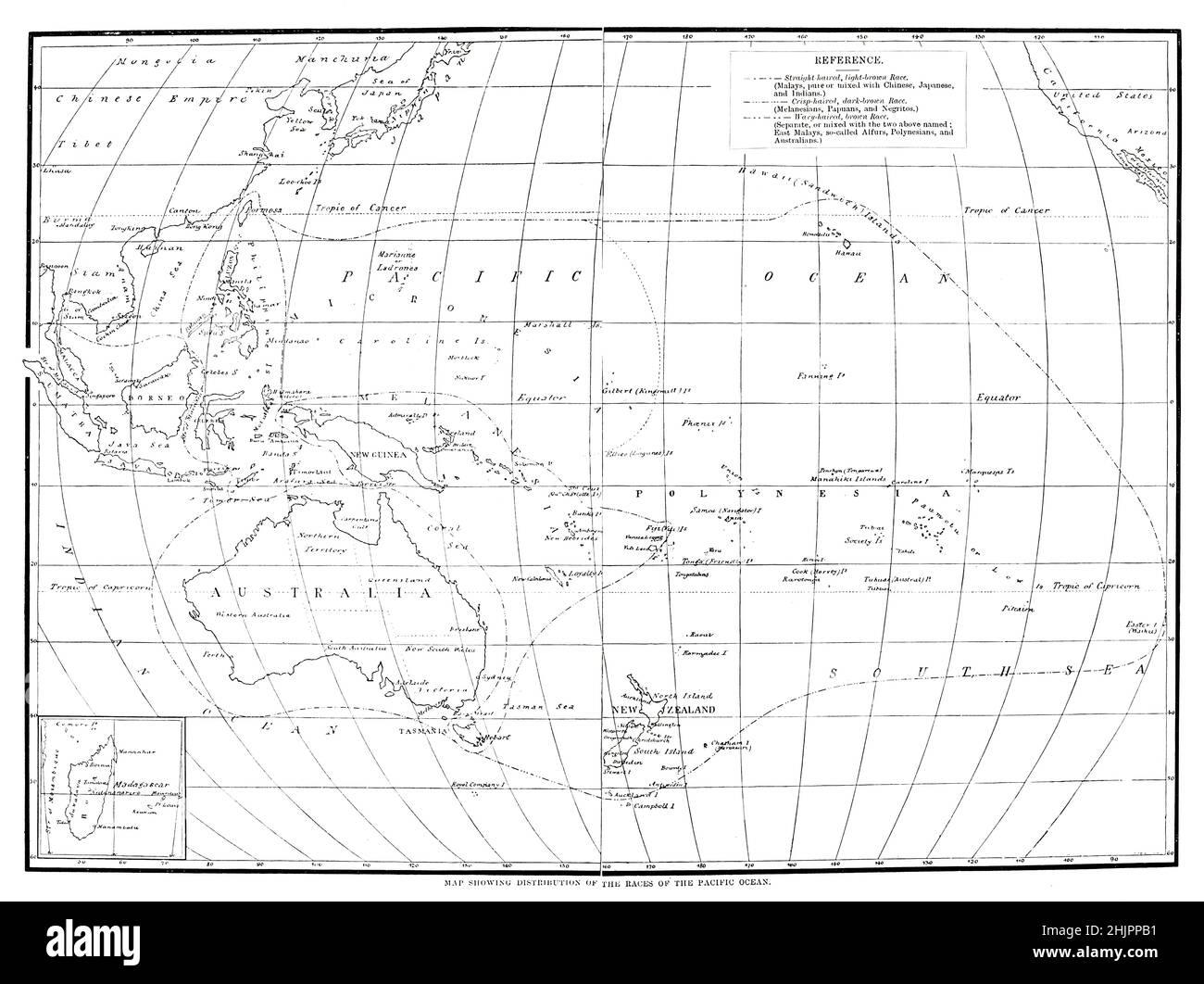 Map showing the distribution of races of the Pacific Ocean from the book ' The living races of mankind ' Vol 1 by Henry Neville Hutchinson,, editors John Walter Gregory, and Richard Lydekker, Publisher: London, Hutchinson & co 1901 Stock Photohttps://www.alamy.com/image-license-details/?v=1https://www.alamy.com/map-showing-the-distribution-of-races-of-the-pacific-ocean-from-the-book-the-living-races-of-mankind-vol-1-by-henry-neville-hutchinson-editors-john-walter-gregory-and-richard-lydekker-publisher-london-hutchinson-co-1901-image459033877.html
RF2HJPPB1–Map showing the distribution of races of the Pacific Ocean from the book ' The living races of mankind ' Vol 1 by Henry Neville Hutchinson,, editors John Walter Gregory, and Richard Lydekker, Publisher: London, Hutchinson & co 1901
 2014-07-05 NADT Ross Gregory Stock Photohttps://www.alamy.com/image-license-details/?v=1https://www.alamy.com/stock-photo-2014-07-05-nadt-ross-gregory-146502506.html
RMJE9NCA–2014-07-05 NADT Ross Gregory
 Map of Gregory in South Dakota Stock Photohttps://www.alamy.com/image-license-details/?v=1https://www.alamy.com/map-of-gregory-in-south-dakota-image365483510.html
RF2C6H5XE–Map of Gregory in South Dakota
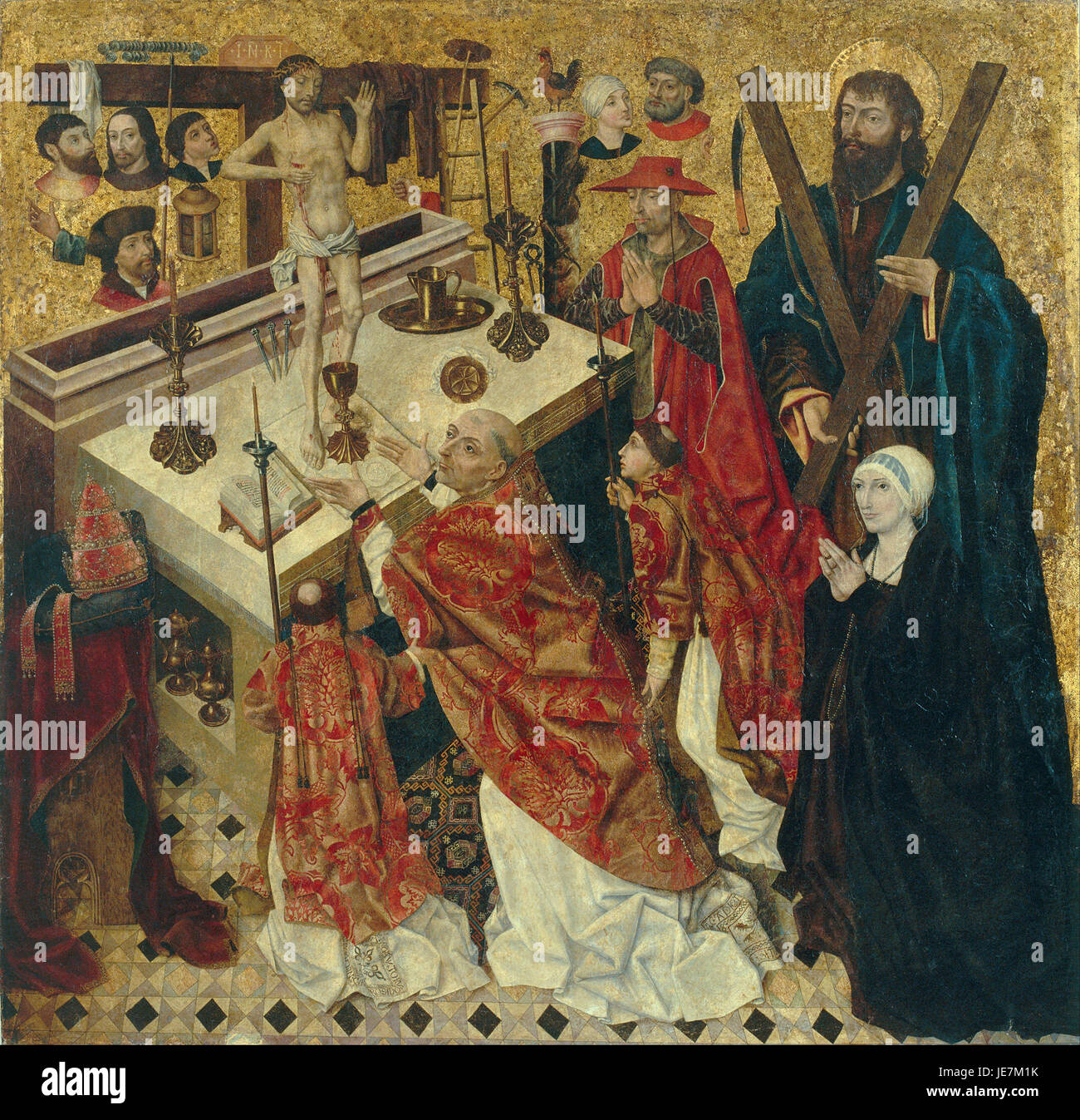 Diego de la Cruz - The Mass of Saint Gregory - Stock Photohttps://www.alamy.com/image-license-details/?v=1https://www.alamy.com/stock-photo-diego-de-la-cruz-the-mass-of-saint-gregory-146457519.html
RMJE7M1K–Diego de la Cruz - The Mass of Saint Gregory -
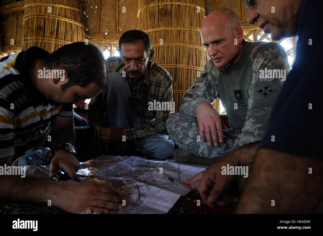 U.S. Army Lt Col. Gregory Jacobsen, assigned to the 2nd Battalion, 4th Brigade Combat Team, looks over a map with family members of Sheik Saeed Hassan Al Batat, during a key leadership engagement, being held in order to build rapport and determine causes of instability in the Qarmat Ali District, Basra, Iraq, July 28. Stock Photohttps://www.alamy.com/image-license-details/?v=1https://www.alamy.com/stock-photo-us-army-lt-col-gregory-jacobsen-assigned-to-the-2nd-battalion-4th-129307883.html
RMHEADEK–U.S. Army Lt Col. Gregory Jacobsen, assigned to the 2nd Battalion, 4th Brigade Combat Team, looks over a map with family members of Sheik Saeed Hassan Al Batat, during a key leadership engagement, being held in order to build rapport and determine causes of instability in the Qarmat Ali District, Basra, Iraq, July 28.
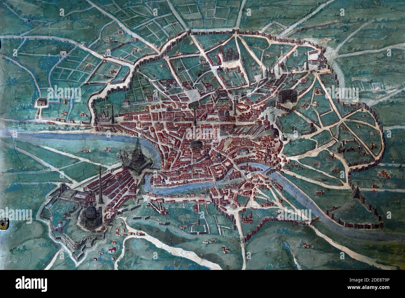 16th century painted map of the city of Rome and the Vatican in the Gallery of Geographical Maps. The Gallery of Geographical Maps is 120 m long and was commissioned in 1581 by Pope Gregory XIII. Thus it was that 40 geographical maps were painted along the walls representing the italian regions and the principal ports and cities.Vatican Museums (Gallery of Geographical Maps) Vatican, 2018. - The Vatican Museums contain masterpieces of painting, sculpture and other works of art collected by the popes through the centuries. Through their diversity and richness, the Vatican museums rank among the Stock Photohttps://www.alamy.com/image-license-details/?v=1https://www.alamy.com/16th-century-painted-map-of-the-city-of-rome-and-the-vatican-in-the-gallery-of-geographical-maps-the-gallery-of-geographical-maps-is-120-m-long-and-was-commissioned-in-1581-by-pope-gregory-xiii-thus-it-was-that-40-geographical-maps-were-painted-along-the-walls-representing-the-italian-regions-and-the-principal-ports-and-citiesvatican-museums-gallery-of-geographical-maps-vatican-2018-the-vatican-museums-contain-masterpieces-of-painting-sculpture-and-other-works-of-art-collected-by-the-popes-through-the-centuries-through-their-diversity-and-richness-the-vatican-museums-rank-among-the-image387427986.html
RM2DE8T9P–16th century painted map of the city of Rome and the Vatican in the Gallery of Geographical Maps. The Gallery of Geographical Maps is 120 m long and was commissioned in 1581 by Pope Gregory XIII. Thus it was that 40 geographical maps were painted along the walls representing the italian regions and the principal ports and cities.Vatican Museums (Gallery of Geographical Maps) Vatican, 2018. - The Vatican Museums contain masterpieces of painting, sculpture and other works of art collected by the popes through the centuries. Through their diversity and richness, the Vatican museums rank among the
 Army Sgt. Gregory J. Maldonado plots points on a map during the land navigation course for the Local Best Warrior Competition at Camp Santiago Joint Maneuver Training Center, Salinas, Puerto Rico, Nov. 9, 2014. Maldonado is an infantryman assigned to Headquarters Company, 296th Infantry Battalion, 101st Troop Command, Puerto Rico Army National Guard. Local Best Warrior Competition 141109-A-KD550-492 Stock Photohttps://www.alamy.com/image-license-details/?v=1https://www.alamy.com/stock-photo-army-sgt-gregory-j-maldonado-plots-points-on-a-map-during-the-land-129560268.html
RMHENYCC–Army Sgt. Gregory J. Maldonado plots points on a map during the land navigation course for the Local Best Warrior Competition at Camp Santiago Joint Maneuver Training Center, Salinas, Puerto Rico, Nov. 9, 2014. Maldonado is an infantryman assigned to Headquarters Company, 296th Infantry Battalion, 101st Troop Command, Puerto Rico Army National Guard. Local Best Warrior Competition 141109-A-KD550-492
 Angela Keane holds Morgan, 1, as Braeden ,3, watches as his mother points to places where they lived on a map were the kids marked where the lived during the celebration for military kids since April is the Month of the Military Child on Wednesday April 28, 2004 in Alameda, Calif. Over 200 hundred Stock Photohttps://www.alamy.com/image-license-details/?v=1https://www.alamy.com/stock-photo-angela-keane-holds-morgan-1-as-braeden-3-watches-as-his-mother-points-40814602.html
RMCAB7CA–Angela Keane holds Morgan, 1, as Braeden ,3, watches as his mother points to places where they lived on a map were the kids marked where the lived during the celebration for military kids since April is the Month of the Military Child on Wednesday April 28, 2004 in Alameda, Calif. Over 200 hundred
 Senior Airman Gregory Cerny, 1st Combat Camera Squadron broadcaster, points out a location on a map for his team to reach during the tactical portion of the Ability to Survive and Operate exercise Jan. 14, 2014, at North Auxiliary Airfield, S.C. The 1st Combat Camera Squadron located at Joint Base Charleston, S.C., hosted the Ability to Survive and Operate Exercise Jan. 6-17. Senior Airman Dennis Sloan) Stock Photohttps://www.alamy.com/image-license-details/?v=1https://www.alamy.com/stock-photo-senior-airman-gregory-cerny-1st-combat-camera-squadron-broadcaster-129296244.html
RMHE9XK0–Senior Airman Gregory Cerny, 1st Combat Camera Squadron broadcaster, points out a location on a map for his team to reach during the tactical portion of the Ability to Survive and Operate exercise Jan. 14, 2014, at North Auxiliary Airfield, S.C. The 1st Combat Camera Squadron located at Joint Base Charleston, S.C., hosted the Ability to Survive and Operate Exercise Jan. 6-17. Senior Airman Dennis Sloan)
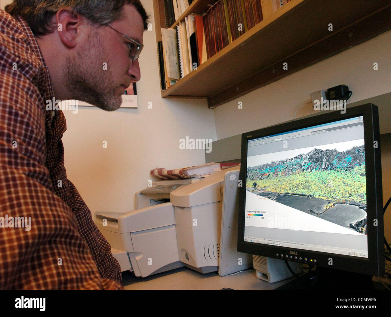 George Hilley calls up the map of the Berkeley Hills' topography that shows the slowly moving local landslides in the on Thursday June 24, 2004 in Berkeley, Calif. The team of Roland Burmann and George Hilley found the new information with a new system to analysis the data given to them from satel Stock Photohttps://www.alamy.com/image-license-details/?v=1https://www.alamy.com/stock-photo-george-hilley-calls-up-the-map-of-the-berkeley-hills-topography-that-42255870.html
RMCCMWP6–George Hilley calls up the map of the Berkeley Hills' topography that shows the slowly moving local landslides in the on Thursday June 24, 2004 in Berkeley, Calif. The team of Roland Burmann and George Hilley found the new information with a new system to analysis the data given to them from satel
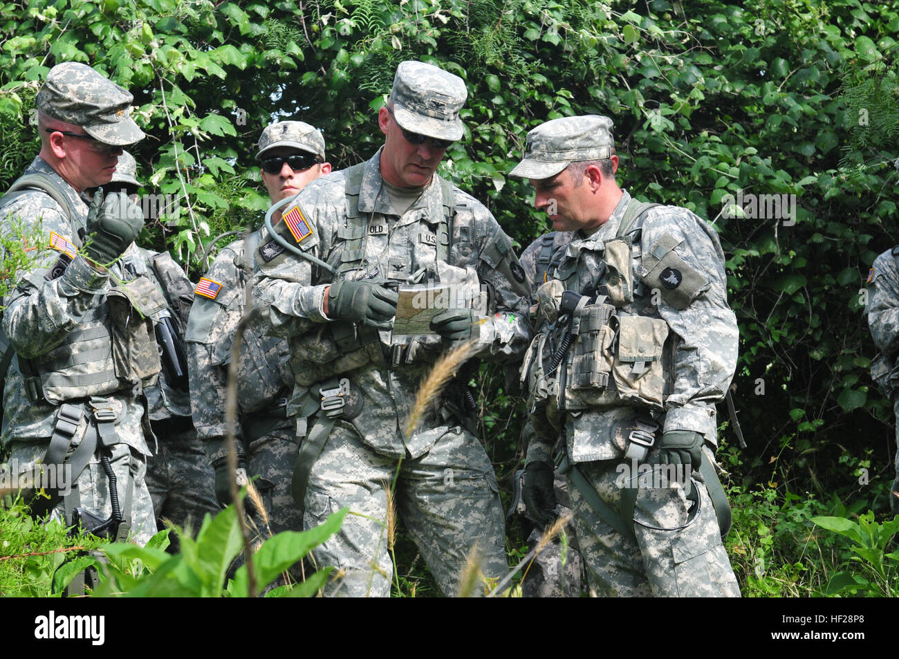 Col. Gregory Thingvold, the commander of the 34th Combat Aviation Brigade, and Capt. Bernard Williamson, an aviator with Headquarters Company 34th CAB, use a map to navigate after their helicopter crashed during a training exercise on June 21, 2014, at Fort Hood, Texas. The soldiers are mobilizing in Fort Hood prior to deploying to Kuwait this summer. (Minnesota Army National Guard photo by Spc. Jess Nemec/Released) Aviators and aircrew train for Kuwait 140621-Z-OX391-719 Stock Photohttps://www.alamy.com/image-license-details/?v=1https://www.alamy.com/stock-photo-col-gregory-thingvold-the-commander-of-the-34th-combat-aviation-brigade-129743216.html
RMHF28P8–Col. Gregory Thingvold, the commander of the 34th Combat Aviation Brigade, and Capt. Bernard Williamson, an aviator with Headquarters Company 34th CAB, use a map to navigate after their helicopter crashed during a training exercise on June 21, 2014, at Fort Hood, Texas. The soldiers are mobilizing in Fort Hood prior to deploying to Kuwait this summer. (Minnesota Army National Guard photo by Spc. Jess Nemec/Released) Aviators and aircrew train for Kuwait 140621-Z-OX391-719
 Saint Gregory the Illuminator Cathedral , Yerevan , Armenia Stock Photohttps://www.alamy.com/image-license-details/?v=1https://www.alamy.com/saint-gregory-the-illuminator-cathedral-yerevan-armenia-image66687169.html
RMDTDT4H–Saint Gregory the Illuminator Cathedral , Yerevan , Armenia
 U.S. Marine Corps 1st Lt. Gregory M. Veteto, left, with Charlie Company, 1st Battalion, 3rd Marine Regiment, and a British solider with Alpha Squadron, Cavalry Regiment look over a map near Marjah, Afghanistan, Feb. 21, 2010. The Marines and British soldiers are working together to provide better security on the roads in Helmand province. (U.S. Marine Corps photo by Cpl. Albert F. Hunt/Released) Marines Clear Near Marjah DVIDS255044 Stock Photohttps://www.alamy.com/image-license-details/?v=1https://www.alamy.com/stock-photo-us-marine-corps-1st-lt-gregory-m-veteto-left-with-charlie-company-129782393.html
RMHF42ND–U.S. Marine Corps 1st Lt. Gregory M. Veteto, left, with Charlie Company, 1st Battalion, 3rd Marine Regiment, and a British solider with Alpha Squadron, Cavalry Regiment look over a map near Marjah, Afghanistan, Feb. 21, 2010. The Marines and British soldiers are working together to provide better security on the roads in Helmand province. (U.S. Marine Corps photo by Cpl. Albert F. Hunt/Released) Marines Clear Near Marjah DVIDS255044
 Ceiling painting with coat of arms of Pope Gregory XIII, Europa/, Pontifex Maximus, Gallery of Maps, Vatican Museums, Vatican City, Vatican, Rome Stock Photohttps://www.alamy.com/image-license-details/?v=1https://www.alamy.com/ceiling-painting-with-coat-of-arms-of-pope-gregory-xiii-europa-pontifex-maximus-gallery-of-maps-vatican-museums-vatican-city-vatican-rome-image551837590.html
RM2R1PADA–Ceiling painting with coat of arms of Pope Gregory XIII, Europa/, Pontifex Maximus, Gallery of Maps, Vatican Museums, Vatican City, Vatican, Rome
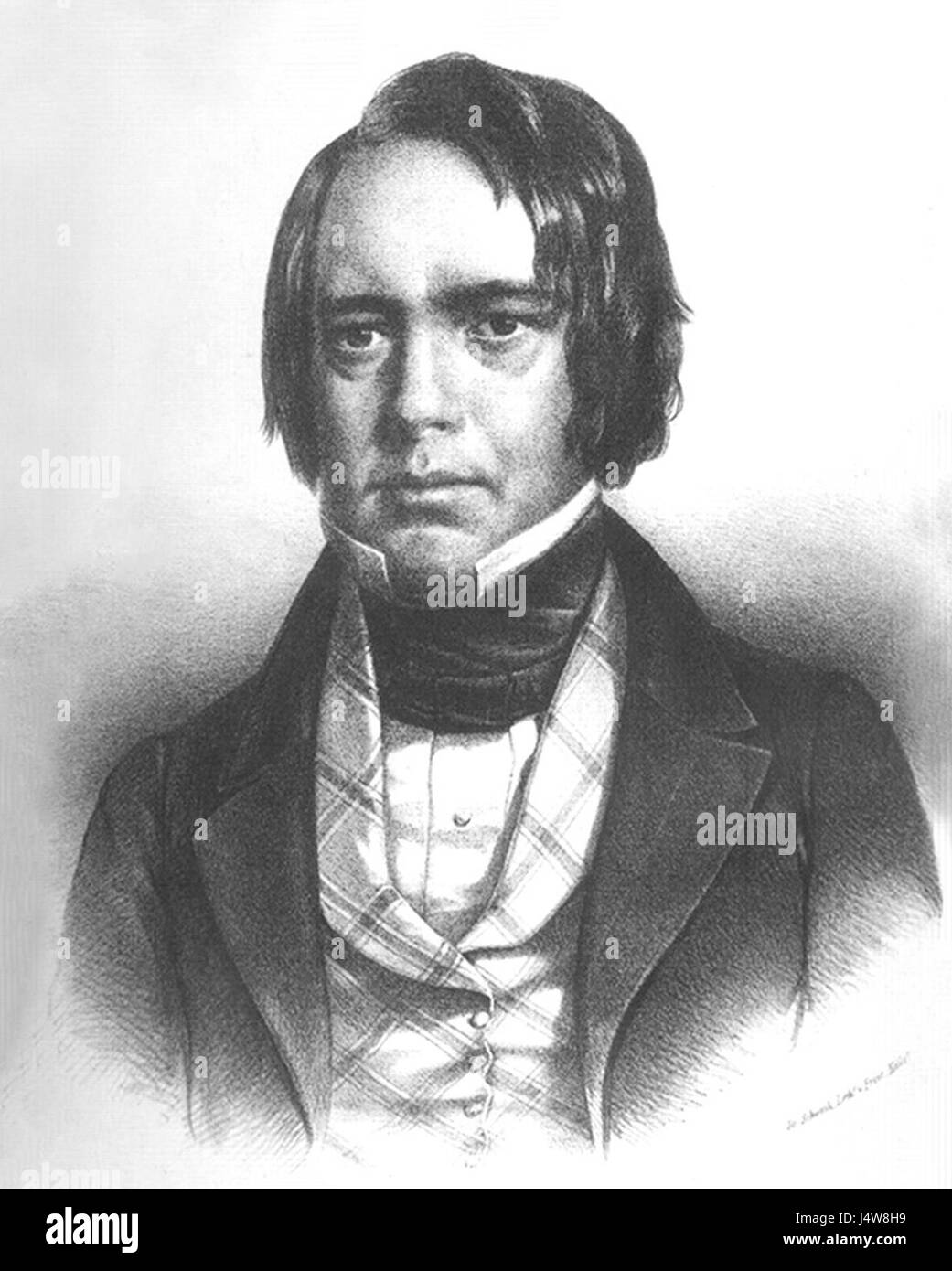 William Gregory Stock Photohttps://www.alamy.com/image-license-details/?v=1https://www.alamy.com/stock-photo-william-gregory-140697125.html
RMJ4W8H9–William Gregory
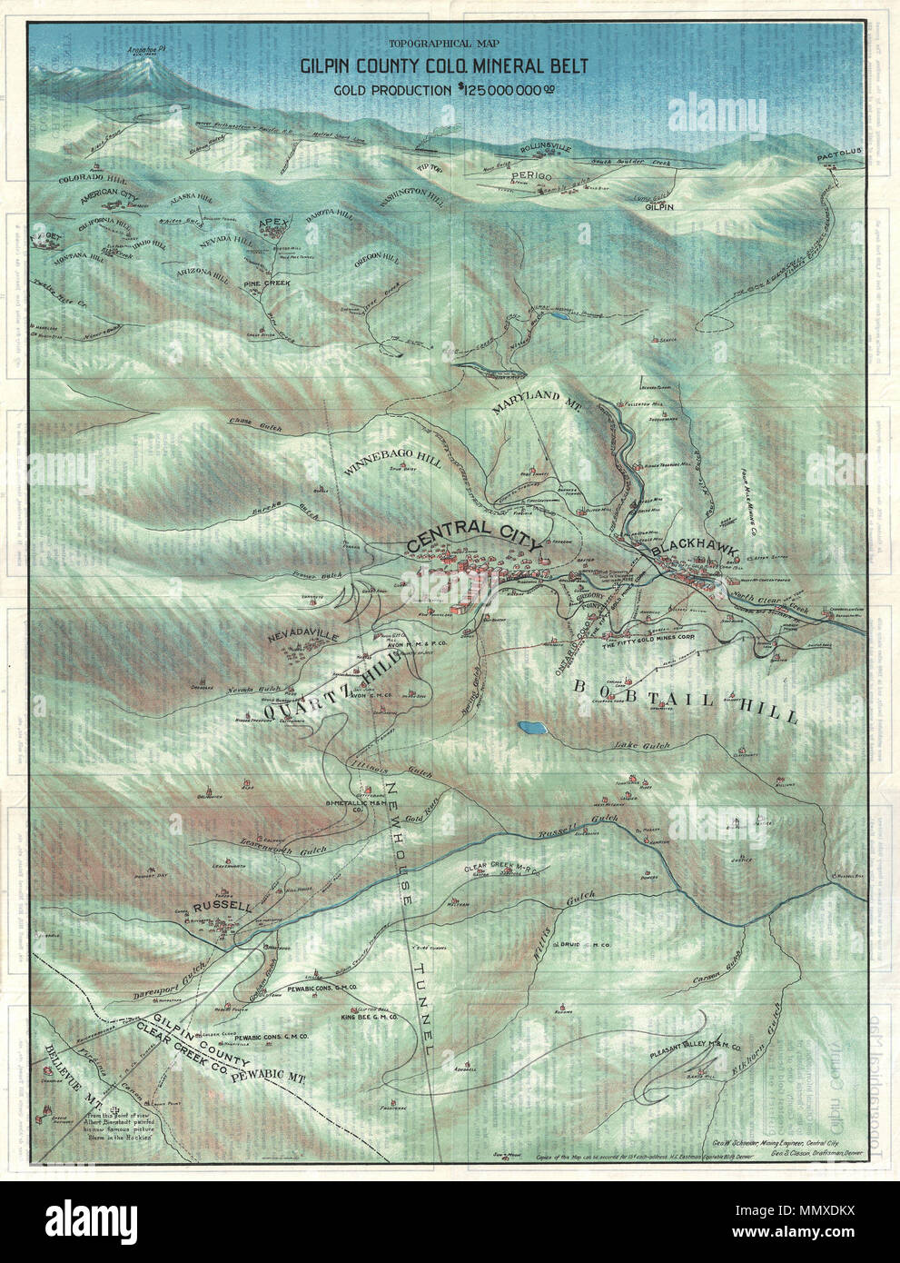 . English: This is a stunning 1904 broadside bird's eye view or map of Gilpin County, Colorado. Centered on Central City, this view extends as far north as Rollinsville and Arapahoe Peak, as far south as Bellevue Mountain, as far east as Randolph Mill, and west as far as Nugget. In 1859 John H. Gregory discovered gold high in the Rocky Mountains near Denver. The subsequent gold rush was one of the richest in U.S. history and contributed significantly to the settling and development of Colorado in the mid to late 19th century. This stunning view, issued by the Gilpin County Chamber of Commerce Stock Photohttps://www.alamy.com/image-license-details/?v=1https://www.alamy.com/english-this-is-a-stunning-1904-broadside-birds-eye-view-or-map-of-gilpin-county-colorado-centered-on-central-city-this-view-extends-as-far-north-as-rollinsville-and-arapahoe-peak-as-far-south-as-bellevue-mountain-as-far-east-as-randolph-mill-and-west-as-far-as-nugget-in-1859-john-h-gregory-discovered-gold-high-in-the-rocky-mountains-near-denver-the-subsequent-gold-rush-was-one-of-the-richest-in-us-history-and-contributed-significantly-to-the-settling-and-development-of-colorado-in-the-mid-to-late-19th-century-this-stunning-view-issued-by-the-gilpin-county-chamber-of-commerce-image184978302.html
RMMMXDKX–. English: This is a stunning 1904 broadside bird's eye view or map of Gilpin County, Colorado. Centered on Central City, this view extends as far north as Rollinsville and Arapahoe Peak, as far south as Bellevue Mountain, as far east as Randolph Mill, and west as far as Nugget. In 1859 John H. Gregory discovered gold high in the Rocky Mountains near Denver. The subsequent gold rush was one of the richest in U.S. history and contributed significantly to the settling and development of Colorado in the mid to late 19th century. This stunning view, issued by the Gilpin County Chamber of Commerce
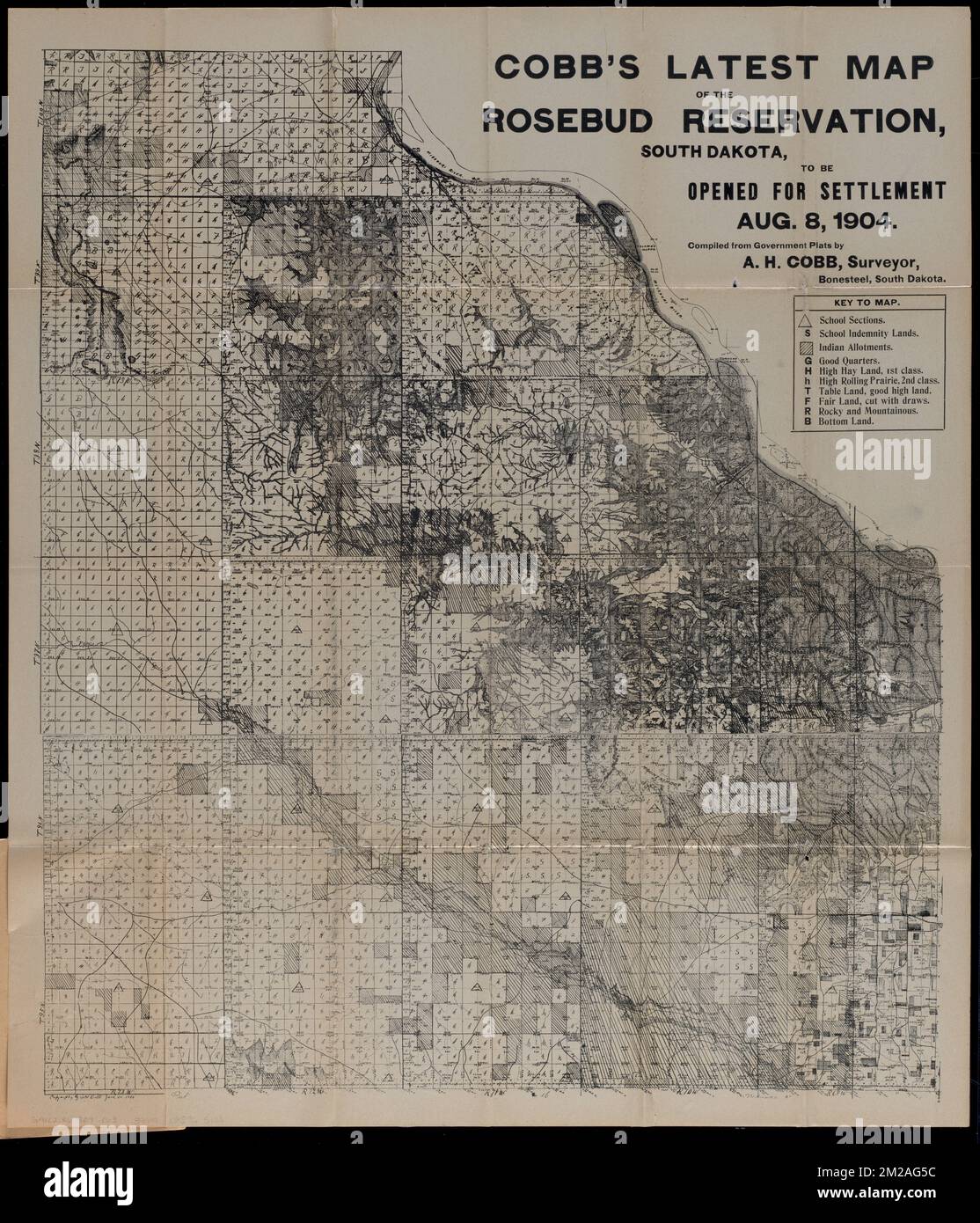 Cobb's latest map of the Rosebud Reservation, South Dakota, to be opened for settlement Aug. 8, 1904 , Rosebud Indian Reservation S.D., Maps, Gregory County S.D., Maps, Land tenure, South Dakota, Gregory County, Indian land transfers, South Dakota, Dakota Indians, Land tenure Norman B. Leventhal Map Center Collection Stock Photohttps://www.alamy.com/image-license-details/?v=1https://www.alamy.com/cobbs-latest-map-of-the-rosebud-reservation-south-dakota-to-be-opened-for-settlement-aug-8-1904-rosebud-indian-reservation-sd-maps-gregory-county-sd-maps-land-tenure-south-dakota-gregory-county-indian-land-transfers-south-dakota-dakota-indians-land-tenure-norman-b-leventhal-map-center-collection-image500562200.html
RM2M2AG5C–Cobb's latest map of the Rosebud Reservation, South Dakota, to be opened for settlement Aug. 8, 1904 , Rosebud Indian Reservation S.D., Maps, Gregory County S.D., Maps, Land tenure, South Dakota, Gregory County, Indian land transfers, South Dakota, Dakota Indians, Land tenure Norman B. Leventhal Map Center Collection
 Gregory Range, , AU, Australia, Queensland, S 19 0' 0'', N 143 4' 59'', map, Cartascapes Map published in 2024. Explore Cartascapes, a map revealing Earth's diverse landscapes, cultures, and ecosystems. Journey through time and space, discovering the interconnectedness of our planet's past, present, and future. Stock Photohttps://www.alamy.com/image-license-details/?v=1https://www.alamy.com/gregory-range-au-australia-queensland-s-19-0-0-n-143-4-59-map-cartascapes-map-published-in-2024-explore-cartascapes-a-map-revealing-earths-diverse-landscapes-cultures-and-ecosystems-journey-through-time-and-space-discovering-the-interconnectedness-of-our-planets-past-present-and-future-image625471491.html
RM2Y9GK7F–Gregory Range, , AU, Australia, Queensland, S 19 0' 0'', N 143 4' 59'', map, Cartascapes Map published in 2024. Explore Cartascapes, a map revealing Earth's diverse landscapes, cultures, and ecosystems. Journey through time and space, discovering the interconnectedness of our planet's past, present, and future.
 A Soldier from the 1st Battalion, 77th Armored Regiment, 3rd Armored Brigade Combat Team, 1st Armored Division, checks his map, making use of available light during the night-time land navigation portion of the U.S. Army Expert Infantryman Badge course in Djibouti, April 20, 2015. The EIB is a special skills badge of the U.S. Army awarded to Soldiers holding infantry or special forces military occupational specialties after the completion of specific prerequisites and a battery of graded tests on basic infantry skills. (U.S. Air Force photo by Staff Sgt. Gregory Brook/ Released) Stock Photohttps://www.alamy.com/image-license-details/?v=1https://www.alamy.com/stock-photo-a-soldier-from-the-1st-battalion-77th-armored-regiment-3rd-armored-129330218.html
RMHEBE0A–A Soldier from the 1st Battalion, 77th Armored Regiment, 3rd Armored Brigade Combat Team, 1st Armored Division, checks his map, making use of available light during the night-time land navigation portion of the U.S. Army Expert Infantryman Badge course in Djibouti, April 20, 2015. The EIB is a special skills badge of the U.S. Army awarded to Soldiers holding infantry or special forces military occupational specialties after the completion of specific prerequisites and a battery of graded tests on basic infantry skills. (U.S. Air Force photo by Staff Sgt. Gregory Brook/ Released)
 Gregory and Edmunds County, State of South Dakota (U.S. county, United States of America, USA, U.S., US) map vector illustration, scribble sketch map Stock Vectorhttps://www.alamy.com/image-license-details/?v=1https://www.alamy.com/gregory-and-edmunds-county-state-of-south-dakota-us-county-united-states-of-america-usa-us-us-map-vector-illustration-scribble-sketch-map-image389926144.html
RF2DJAJNM–Gregory and Edmunds County, State of South Dakota (U.S. county, United States of America, USA, U.S., US) map vector illustration, scribble sketch map
 West Virginia Army National Guardsmen review a map of local of Upshur County, W.Va, roads while enroute to deliver food, water and medical supplies. Guard Liaison Units from Air and Army Units coordinated State National Guard assets with local Emergency Response Teams. Shown left to right Specialist Mark Smith, 119th Sapper Company, 1st Sgt. James Gregory, Joint Forces Headquarters and Staff Sgt Sheila J. Hyde 151th Military Police Battalion, 154th Company. West Virginia National Guard assists Upshur County residents after Hurricane Sandy 121102-Z-FR440-014 Stock Photohttps://www.alamy.com/image-license-details/?v=1https://www.alamy.com/stock-photo-west-virginia-army-national-guardsmen-review-a-map-of-local-of-upshur-129715864.html
RMHF11WC–West Virginia Army National Guardsmen review a map of local of Upshur County, W.Va, roads while enroute to deliver food, water and medical supplies. Guard Liaison Units from Air and Army Units coordinated State National Guard assets with local Emergency Response Teams. Shown left to right Specialist Mark Smith, 119th Sapper Company, 1st Sgt. James Gregory, Joint Forces Headquarters and Staff Sgt Sheila J. Hyde 151th Military Police Battalion, 154th Company. West Virginia National Guard assists Upshur County residents after Hurricane Sandy 121102-Z-FR440-014
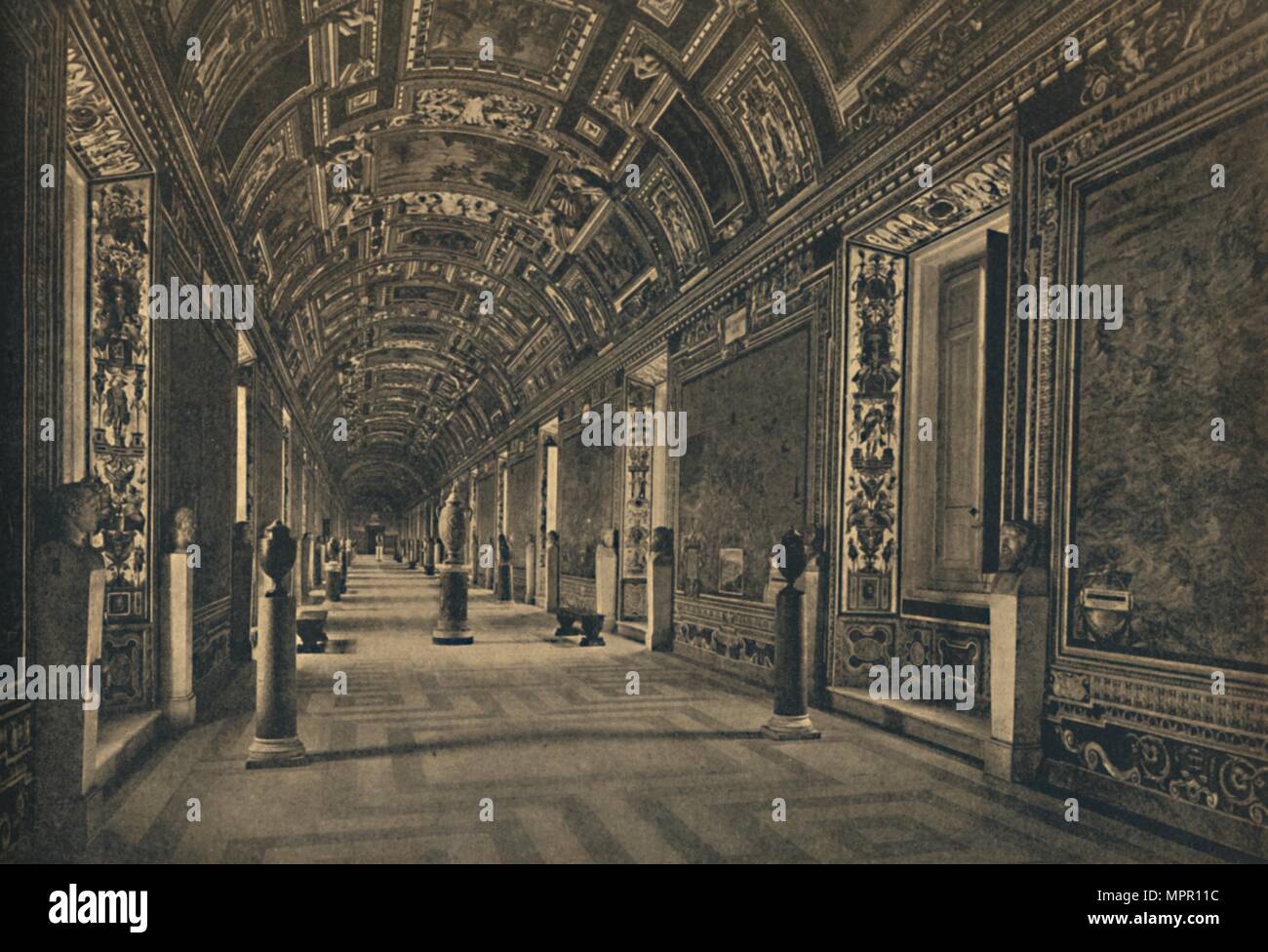 'Roma - Vatican Palace - Gallery of Geographical Maps', 1910. Artist: Unknown. Stock Photohttps://www.alamy.com/image-license-details/?v=1https://www.alamy.com/roma-vatican-palace-gallery-of-geographical-maps-1910-artist-unknown-image186131832.html
RMMPR11C–'Roma - Vatican Palace - Gallery of Geographical Maps', 1910. Artist: Unknown.
 Adriaen Ysenbrandt (Netherlandish, active 1510 - 1551) - The Mass of Saint Gregory the Great - Stock Photohttps://www.alamy.com/image-license-details/?v=1https://www.alamy.com/stock-photo-adriaen-ysenbrandt-netherlandish-active-1510-1551-the-mass-of-saint-146451479.html
RMJE7C9Y–Adriaen Ysenbrandt (Netherlandish, active 1510 - 1551) - The Mass of Saint Gregory the Great -
 U.S. Army Capt. (Dr.) Nikhil Godbole, staff ophthalmologist, and U.S. Army Capt. (Dr.) Gregory Giles, ophthalmology resident, use a femtosecond laser system to map precise incisions prior to performing cataract surgery at Brooke Army Medical Center, Fort Sam Houston, Texas, Jan. 29, 2019. Laser-assisted cataract surgery allows the ophthalmologist to make very precise incisions in less time than traditional cataract surgery, known as phacoemulsification. Stock Photohttps://www.alamy.com/image-license-details/?v=1https://www.alamy.com/us-army-capt-dr-nikhil-godbole-staff-ophthalmologist-and-us-army-capt-dr-gregory-giles-ophthalmology-resident-use-a-femtosecond-laser-system-to-map-precise-incisions-prior-to-performing-cataract-surgery-at-brooke-army-medical-center-fort-sam-houston-texas-jan-29-2019-laser-assisted-cataract-surgery-allows-the-ophthalmologist-to-make-very-precise-incisions-in-less-time-than-traditional-cataract-surgery-known-as-phacoemulsification-image238697198.html
RMRT9GKX–U.S. Army Capt. (Dr.) Nikhil Godbole, staff ophthalmologist, and U.S. Army Capt. (Dr.) Gregory Giles, ophthalmology resident, use a femtosecond laser system to map precise incisions prior to performing cataract surgery at Brooke Army Medical Center, Fort Sam Houston, Texas, Jan. 29, 2019. Laser-assisted cataract surgery allows the ophthalmologist to make very precise incisions in less time than traditional cataract surgery, known as phacoemulsification.
 16th century painted map of the city of Venice (Italy) in the Gallery of Geographical Maps. The Gallery of Geographical Maps is 120 m long and was commissioned in 1581 by Pope Gregory XIII. Thus it was that 40 geographical maps were painted along the walls representing the italian regions and the principal ports and cities.Vatican Museums (Gallery of Geographical Maps) Vatican, 2018. - The Vatican Museums contain masterpieces of painting, sculpture and other works of art collected by the popes through the centuries. Through their diversity and richness, the Vatican museums rank among the first Stock Photohttps://www.alamy.com/image-license-details/?v=1https://www.alamy.com/16th-century-painted-map-of-the-city-of-venice-italy-in-the-gallery-of-geographical-maps-the-gallery-of-geographical-maps-is-120-m-long-and-was-commissioned-in-1581-by-pope-gregory-xiii-thus-it-was-that-40-geographical-maps-were-painted-along-the-walls-representing-the-italian-regions-and-the-principal-ports-and-citiesvatican-museums-gallery-of-geographical-maps-vatican-2018-the-vatican-museums-contain-masterpieces-of-painting-sculpture-and-other-works-of-art-collected-by-the-popes-through-the-centuries-through-their-diversity-and-richness-the-vatican-museums-rank-among-the-first-image387427957.html
RM2DE8T8N–16th century painted map of the city of Venice (Italy) in the Gallery of Geographical Maps. The Gallery of Geographical Maps is 120 m long and was commissioned in 1581 by Pope Gregory XIII. Thus it was that 40 geographical maps were painted along the walls representing the italian regions and the principal ports and cities.Vatican Museums (Gallery of Geographical Maps) Vatican, 2018. - The Vatican Museums contain masterpieces of painting, sculpture and other works of art collected by the popes through the centuries. Through their diversity and richness, the Vatican museums rank among the first
 New Jersey as a colony and as a state : one of the original thirteen . ethe character of the settlement, the alterations be-ing of a purely political character. So far as the limits of the State of New Jerseyare concerned the political influence of New Swe-den was of a negative character. Few if any per-manent settlements were made during this period,the Swedes in West Jersey being descendants ofthose adventurers who settled in Delaware andSoutheastern Pennsylvania. The town of Swedesboro is the most strikingevidence of the occupancy of the Scandinavians.Upon a map made by Gregory B. Keen ther Stock Photohttps://www.alamy.com/image-license-details/?v=1https://www.alamy.com/new-jersey-as-a-colony-and-as-a-state-one-of-the-original-thirteen-ethe-character-of-the-settlement-the-alterations-be-ing-of-a-purely-political-character-so-far-as-the-limits-of-the-state-of-new-jerseyare-concerned-the-political-influence-of-new-swe-den-was-of-a-negative-character-few-if-any-per-manent-settlements-were-made-during-this-periodthe-swedes-in-west-jersey-being-descendants-ofthose-adventurers-who-settled-in-delaware-andsoutheastern-pennsylvania-the-town-of-swedesboro-is-the-most-strikingevidence-of-the-occupancy-of-the-scandinaviansupon-a-map-made-by-gregory-b-keen-ther-image342754014.html
RM2AWHP6P–New Jersey as a colony and as a state : one of the original thirteen . ethe character of the settlement, the alterations be-ing of a purely political character. So far as the limits of the State of New Jerseyare concerned the political influence of New Swe-den was of a negative character. Few if any per-manent settlements were made during this period,the Swedes in West Jersey being descendants ofthose adventurers who settled in Delaware andSoutheastern Pennsylvania. The town of Swedesboro is the most strikingevidence of the occupancy of the Scandinavians.Upon a map made by Gregory B. Keen ther
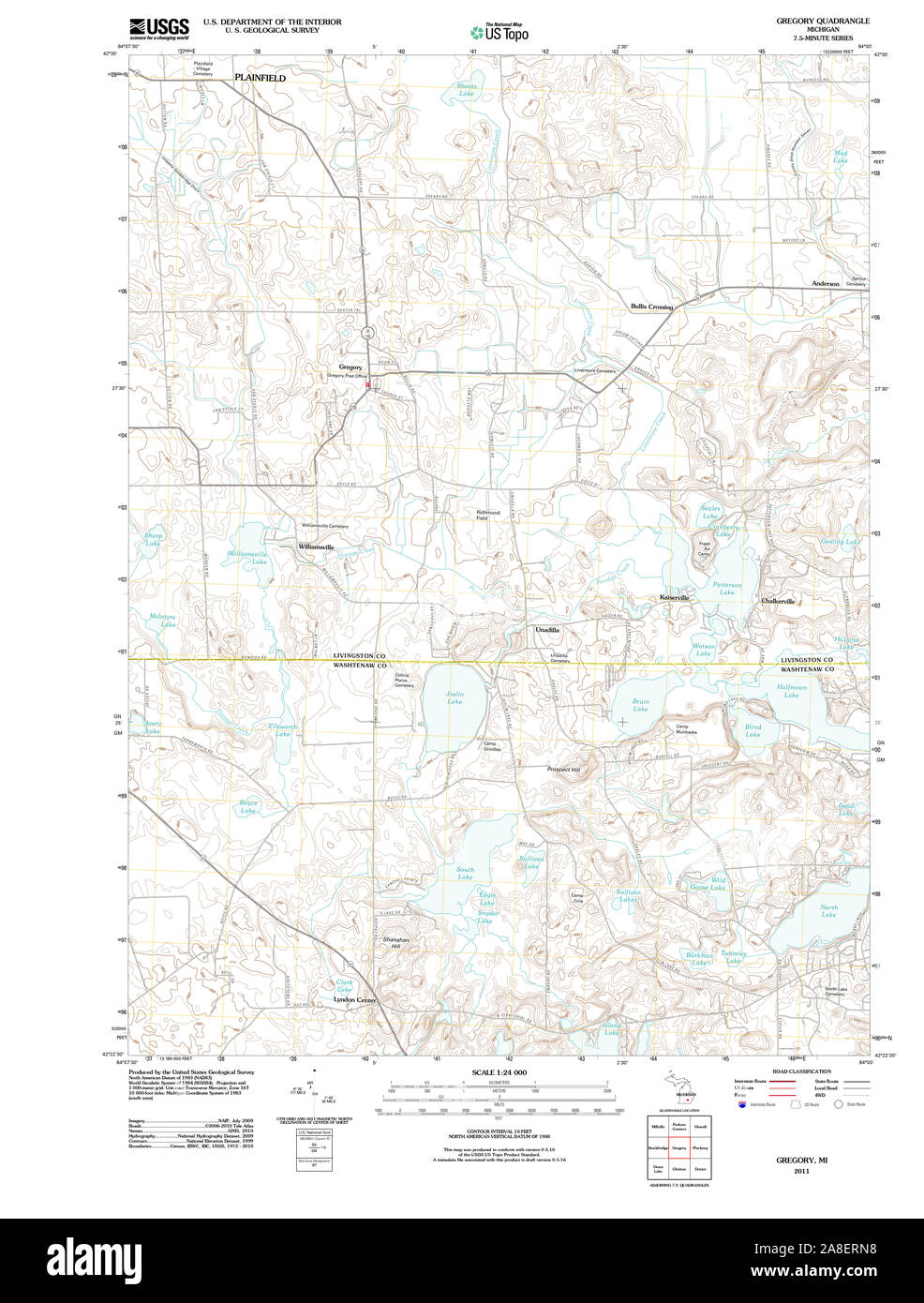 USGS TOPO Map Michigan MI Gregory 20111028 TM Stock Photohttps://www.alamy.com/image-license-details/?v=1https://www.alamy.com/usgs-topo-map-michigan-mi-gregory-20111028-tm-image332240196.html
RM2A8ERN8–USGS TOPO Map Michigan MI Gregory 20111028 TM
 BRAZIL - CIRCA 1992: stamp printed by Brazil, shows Gregory Ivanovitch Langsdorff, circa 1992 Stock Photohttps://www.alamy.com/image-license-details/?v=1https://www.alamy.com/brazil-circa-1992-stamp-printed-by-brazil-shows-gregory-ivanovitch-langsdorff-circa-1992-image559680318.html
RF2REFHXP–BRAZIL - CIRCA 1992: stamp printed by Brazil, shows Gregory Ivanovitch Langsdorff, circa 1992
 USGS TOPO Map Arkansas AR Gregory 20110728 TM Restoration Stock Photohttps://www.alamy.com/image-license-details/?v=1https://www.alamy.com/usgs-topo-map-arkansas-ar-gregory-20110728-tm-restoration-image242876300.html
RMT33Y5G–USGS TOPO Map Arkansas AR Gregory 20110728 TM Restoration
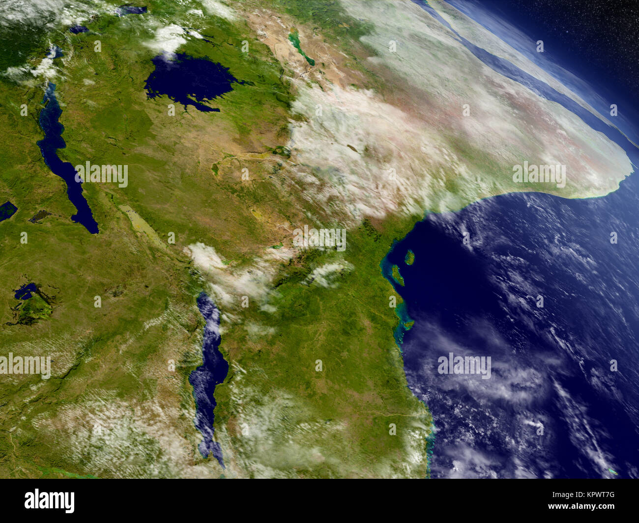 Tanzania from space Stock Photohttps://www.alamy.com/image-license-details/?v=1https://www.alamy.com/stock-image-tanzania-from-space-168983572.html
RFKPWT7G–Tanzania from space
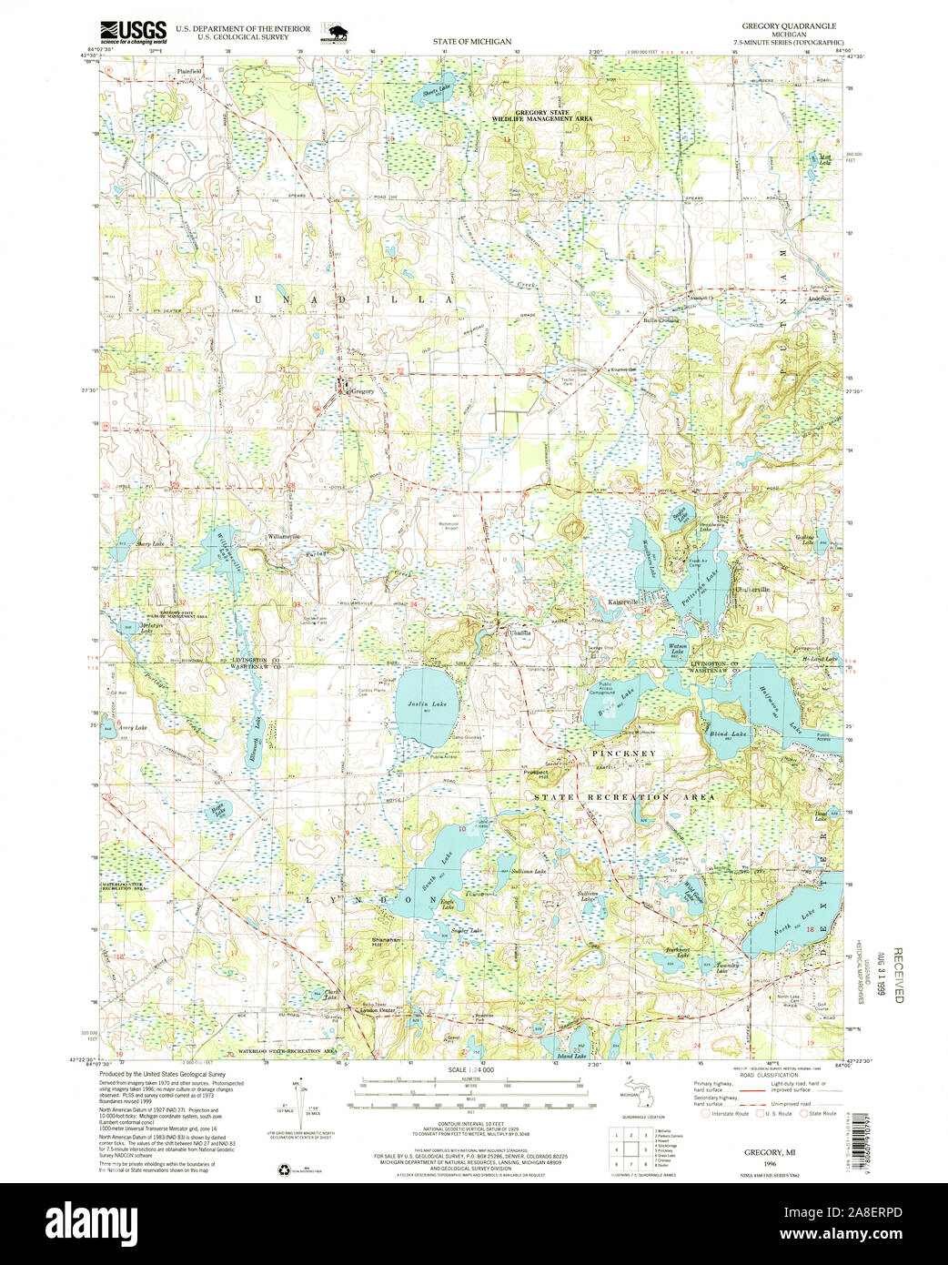 USGS TOPO Map Michigan MI Gregory 276255 1996 24000 Stock Photohttps://www.alamy.com/image-license-details/?v=1https://www.alamy.com/usgs-topo-map-michigan-mi-gregory-276255-1996-24000-image332240229.html
RM2A8ERPD–USGS TOPO Map Michigan MI Gregory 276255 1996 24000
 Tanzania with surrounding region as seen from Earth's orbit in space. 3D illustration with highly detailed planet surface and clouds in the atmosphere Stock Photohttps://www.alamy.com/image-license-details/?v=1https://www.alamy.com/tanzania-with-surrounding-region-as-seen-from-earths-orbit-in-space-3d-illustration-with-highly-detailed-planet-surface-and-clouds-in-the-atmosphere-image358050154.html
RF2BPEGHE–Tanzania with surrounding region as seen from Earth's orbit in space. 3D illustration with highly detailed planet surface and clouds in the atmosphere
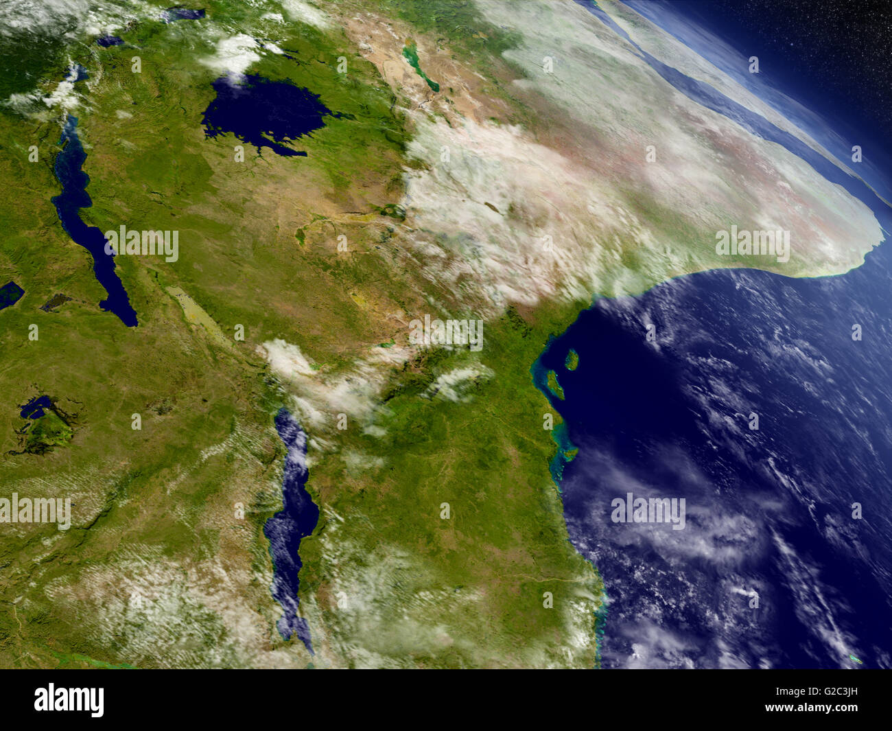 Tanzania with surrounding region as seen from Earth's orbit in space. 3D illustration with highly detailed realistic planet surf Stock Photohttps://www.alamy.com/image-license-details/?v=1https://www.alamy.com/stock-photo-tanzania-with-surrounding-region-as-seen-from-earths-orbit-in-space-104757817.html
RFG2C3JH–Tanzania with surrounding region as seen from Earth's orbit in space. 3D illustration with highly detailed realistic planet surf
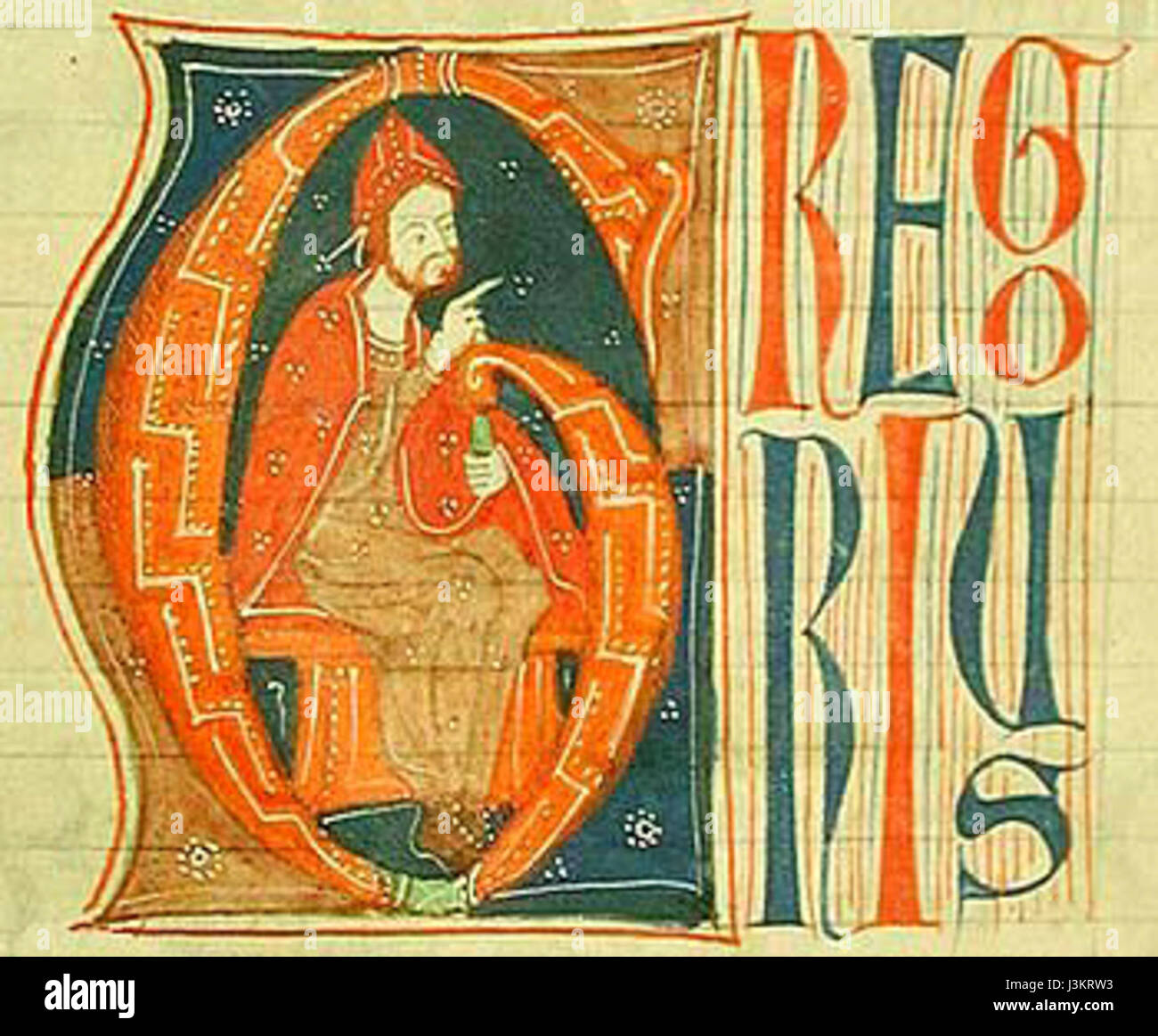 Gregory IX Stock Photohttps://www.alamy.com/image-license-details/?v=1https://www.alamy.com/stock-photo-gregory-ix-139962735.html
RMJ3KRW3–Gregory IX
 Part of the town of West Orange. Double Page Plate No. 18 Map bounded by West End Ave., Upper Mountain Ave., Mountain Ave., Gregory Ave., Mt. Pleasant Ave. Cartographic. Atlases, Maps, Cadastral maps. 1904. Lionel Pincus and Princess Firyal Map Division. Essex County (N.J.), Real property , New Jersey , Essex County (N.J.) Stock Photohttps://www.alamy.com/image-license-details/?v=1https://www.alamy.com/part-of-the-town-of-west-orange-double-page-plate-no-18-map-bounded-by-west-end-ave-upper-mountain-ave-mountain-ave-gregory-ave-mt-pleasant-ave-cartographic-atlases-maps-cadastral-maps-1904-lionel-pincus-and-princess-firyal-map-division-essex-county-nj-real-property-new-jersey-essex-county-nj-image484326363.html
RM2K3XY63–Part of the town of West Orange. Double Page Plate No. 18 Map bounded by West End Ave., Upper Mountain Ave., Mountain Ave., Gregory Ave., Mt. Pleasant Ave. Cartographic. Atlases, Maps, Cadastral maps. 1904. Lionel Pincus and Princess Firyal Map Division. Essex County (N.J.), Real property , New Jersey , Essex County (N.J.)
 Gregory River, , AU, Australia, Queensland, S 25 10' 59'', N 152 33' 0'', map, Cartascapes Map published in 2024. Explore Cartascapes, a map revealing Earth's diverse landscapes, cultures, and ecosystems. Journey through time and space, discovering the interconnectedness of our planet's past, present, and future. Stock Photohttps://www.alamy.com/image-license-details/?v=1https://www.alamy.com/gregory-river-au-australia-queensland-s-25-10-59-n-152-33-0-map-cartascapes-map-published-in-2024-explore-cartascapes-a-map-revealing-earths-diverse-landscapes-cultures-and-ecosystems-journey-through-time-and-space-discovering-the-interconnectedness-of-our-planets-past-present-and-future-image625752485.html
RM2YA1DK1–Gregory River, , AU, Australia, Queensland, S 25 10' 59'', N 152 33' 0'', map, Cartascapes Map published in 2024. Explore Cartascapes, a map revealing Earth's diverse landscapes, cultures, and ecosystems. Journey through time and space, discovering the interconnectedness of our planet's past, present, and future.
 Cartographic, Maps. 1868. Lionel Pincus and Princess Firyal Map Division. Real property , New York Metropolitan Area, Westchester County (N.Y.), New York Metropolitan Area Plate 73: Residence of A.S. Doane, Doanesburg, Putnam Co. N.Y - N.L. Thompson's Lake Mahopac - The Gregory House, Lake Mahopac, Putnam Co. N.Y. Small folder - S2 Stock Photohttps://www.alamy.com/image-license-details/?v=1https://www.alamy.com/cartographic-maps-1868-lionel-pincus-and-princess-firyal-map-division-real-property-new-york-metropolitan-area-westchester-county-ny-new-york-metropolitan-area-plate-73-residence-of-as-doane-doanesburg-putnam-co-ny-nl-thompsons-lake-mahopac-the-gregory-house-lake-mahopac-putnam-co-ny-small-folder-s2-image483735483.html
RM2K301F7–Cartographic, Maps. 1868. Lionel Pincus and Princess Firyal Map Division. Real property , New York Metropolitan Area, Westchester County (N.Y.), New York Metropolitan Area Plate 73: Residence of A.S. Doane, Doanesburg, Putnam Co. N.Y - N.L. Thompson's Lake Mahopac - The Gregory House, Lake Mahopac, Putnam Co. N.Y. Small folder - S2
 Gregory and Edmunds County, State of South Dakota (U.S. county, United States of America, USA, U.S., US) map vector illustration, scribble sketch map Stock Vectorhttps://www.alamy.com/image-license-details/?v=1https://www.alamy.com/gregory-and-edmunds-county-state-of-south-dakota-us-county-united-states-of-america-usa-us-us-map-vector-illustration-scribble-sketch-map-image426586401.html
RF2FP0K8H–Gregory and Edmunds County, State of South Dakota (U.S. county, United States of America, USA, U.S., US) map vector illustration, scribble sketch map
![Cobb's latest map of the Rosebud Reservation, South Dakota, to be opened for settlement Aug. 8, 1904. Relief shown by hachures. Accompanying text (8 pages ; 19 cm) includes preface, presidential proclamation opening the reservation, circular listing qualifications to homestead entry, and text about section corners. 'Copy [illegible] by A.H. Cobb June 20, 1904.'.. Newest and latest quarter-sectional map of the Rosebud Reservation, Gregory County, South Dakota : with President's proclamation, how to read corner stones, and other information. Newest and latest quarter-sectional map of the Rosebud Stock Photo Cobb's latest map of the Rosebud Reservation, South Dakota, to be opened for settlement Aug. 8, 1904. Relief shown by hachures. Accompanying text (8 pages ; 19 cm) includes preface, presidential proclamation opening the reservation, circular listing qualifications to homestead entry, and text about section corners. 'Copy [illegible] by A.H. Cobb June 20, 1904.'.. Newest and latest quarter-sectional map of the Rosebud Reservation, Gregory County, South Dakota : with President's proclamation, how to read corner stones, and other information. Newest and latest quarter-sectional map of the Rosebud Stock Photo](https://c8.alamy.com/comp/2M5W4K7/cobbs-latest-map-of-the-rosebud-reservation-south-dakota-to-be-opened-for-settlement-aug-8-1904-relief-shown-by-hachures-accompanying-text-8-pages-19-cm-includes-preface-presidential-proclamation-opening-the-reservation-circular-listing-qualifications-to-homestead-entry-and-text-about-section-corners-copy-illegible-by-ah-cobb-june-20-1904-newest-and-latest-quarter-sectional-map-of-the-rosebud-reservation-gregory-county-south-dakota-with-presidents-proclamation-how-to-read-corner-stones-and-other-information-newest-and-latest-quarter-sectional-map-of-the-rosebud-2M5W4K7.jpg) Cobb's latest map of the Rosebud Reservation, South Dakota, to be opened for settlement Aug. 8, 1904. Relief shown by hachures. Accompanying text (8 pages ; 19 cm) includes preface, presidential proclamation opening the reservation, circular listing qualifications to homestead entry, and text about section corners. 'Copy [illegible] by A.H. Cobb June 20, 1904.'.. Newest and latest quarter-sectional map of the Rosebud Reservation, Gregory County, South Dakota : with President's proclamation, how to read corner stones, and other information. Newest and latest quarter-sectional map of the Rosebud Stock Photohttps://www.alamy.com/image-license-details/?v=1https://www.alamy.com/cobbs-latest-map-of-the-rosebud-reservation-south-dakota-to-be-opened-for-settlement-aug-8-1904-relief-shown-by-hachures-accompanying-text-8-pages-19-cm-includes-preface-presidential-proclamation-opening-the-reservation-circular-listing-qualifications-to-homestead-entry-and-text-about-section-corners-copy-illegible-by-ah-cobb-june-20-1904-newest-and-latest-quarter-sectional-map-of-the-rosebud-reservation-gregory-county-south-dakota-with-presidents-proclamation-how-to-read-corner-stones-and-other-information-newest-and-latest-quarter-sectional-map-of-the-rosebud-image502726427.html
Cobb's latest map of the Rosebud Reservation, South Dakota, to be opened for settlement Aug. 8, 1904. Relief shown by hachures. Accompanying text (8 pages ; 19 cm) includes preface, presidential proclamation opening the reservation, circular listing qualifications to homestead entry, and text about section corners. 'Copy [illegible] by A.H. Cobb June 20, 1904.'.. Newest and latest quarter-sectional map of the Rosebud Reservation, Gregory County, South Dakota : with President's proclamation, how to read corner stones, and other information. Newest and latest quarter-sectional map of the Rosebud Stock Photohttps://www.alamy.com/image-license-details/?v=1https://www.alamy.com/cobbs-latest-map-of-the-rosebud-reservation-south-dakota-to-be-opened-for-settlement-aug-8-1904-relief-shown-by-hachures-accompanying-text-8-pages-19-cm-includes-preface-presidential-proclamation-opening-the-reservation-circular-listing-qualifications-to-homestead-entry-and-text-about-section-corners-copy-illegible-by-ah-cobb-june-20-1904-newest-and-latest-quarter-sectional-map-of-the-rosebud-reservation-gregory-county-south-dakota-with-presidents-proclamation-how-to-read-corner-stones-and-other-information-newest-and-latest-quarter-sectional-map-of-the-rosebud-image502726427.htmlRM2M5W4K7–Cobb's latest map of the Rosebud Reservation, South Dakota, to be opened for settlement Aug. 8, 1904. Relief shown by hachures. Accompanying text (8 pages ; 19 cm) includes preface, presidential proclamation opening the reservation, circular listing qualifications to homestead entry, and text about section corners. 'Copy [illegible] by A.H. Cobb June 20, 1904.'.. Newest and latest quarter-sectional map of the Rosebud Reservation, Gregory County, South Dakota : with President's proclamation, how to read corner stones, and other information. Newest and latest quarter-sectional map of the Rosebud
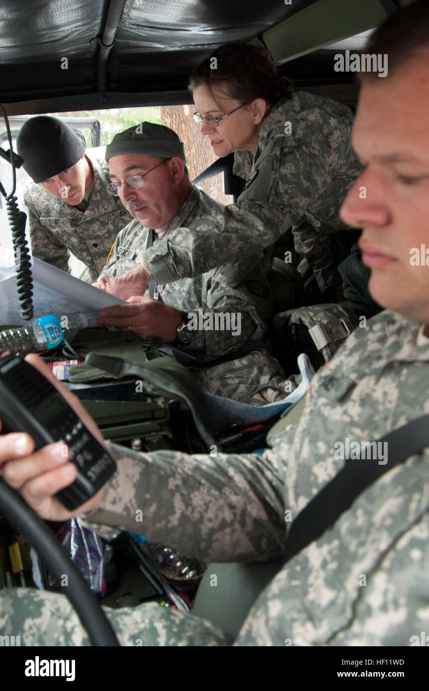 West Virginia Army National Guardsmen review a map of local of Upshur County, W.Va, roads while enroute to deliver food, water and medical supplies. Guard Liaison Units from Air and Army Units coordinated State National Guard assets with local Emergency Response Teams. Shown left to right Spc. Mark Smith, 119th Sapper Company, 1st Sgt. James Gregory, Joint Forces Headquarters and Staff Sgt Sheila J. Hyde 151th Military Police Battalion, 154th Company and Specialist Zak Davis also of the 151st. West Virginia National Guard assists Upshur County residents after Hurricane Sandy 110918-Z-FR440-0 Stock Photohttps://www.alamy.com/image-license-details/?v=1https://www.alamy.com/stock-photo-west-virginia-army-national-guardsmen-review-a-map-of-local-of-upshur-129715865.html
RMHF11WD–West Virginia Army National Guardsmen review a map of local of Upshur County, W.Va, roads while enroute to deliver food, water and medical supplies. Guard Liaison Units from Air and Army Units coordinated State National Guard assets with local Emergency Response Teams. Shown left to right Spc. Mark Smith, 119th Sapper Company, 1st Sgt. James Gregory, Joint Forces Headquarters and Staff Sgt Sheila J. Hyde 151th Military Police Battalion, 154th Company and Specialist Zak Davis also of the 151st. West Virginia National Guard assists Upshur County residents after Hurricane Sandy 110918-Z-FR440-0
 Portrait of Lionel J Nomchong with son Gregory James, Goulburn, 33709167875 o Stock Photohttps://www.alamy.com/image-license-details/?v=1https://www.alamy.com/stock-photo-portrait-of-lionel-j-nomchong-with-son-gregory-james-goulburn-33709167875-147111497.html
RMJF9E61–Portrait of Lionel J Nomchong with son Gregory James, Goulburn, 33709167875 o
 Spc. Gregory P. Doty is a resident of Lake Peekskill, New York, and an allied trade specialist with the 854th Engineer Battalion competing in the 2014 Army Reserve Best Warrior Competition at Joint Base McGuire-Dix-Lakehurst June 23. Doty is competing in the Soldier category, representing the 412th Theater Engineer Command. (U.S. Army photo by Sgt. 1st Class Michel Sauret) 2014 Army Reserve Best Warrior Competition 140623-A-TI382-255 Stock Photohttps://www.alamy.com/image-license-details/?v=1https://www.alamy.com/stock-photo-spc-gregory-p-doty-is-a-resident-of-lake-peekskill-new-york-and-an-129553940.html
RMHENKAC–Spc. Gregory P. Doty is a resident of Lake Peekskill, New York, and an allied trade specialist with the 854th Engineer Battalion competing in the 2014 Army Reserve Best Warrior Competition at Joint Base McGuire-Dix-Lakehurst June 23. Doty is competing in the Soldier category, representing the 412th Theater Engineer Command. (U.S. Army photo by Sgt. 1st Class Michel Sauret) 2014 Army Reserve Best Warrior Competition 140623-A-TI382-255
 16th century painted map of Corsica (upside down, seen from north) in the Gallery of Geographical Maps. The Gallery of Geographical Maps is 120 m long and was commissioned in 1581 by Pope Gregory XIII. Thus it was that 40 geographical maps were painted along the walls representing the italian regions and the principal ports and cities.Vatican Museums (Gallery of Geographical Maps) Vatican, 2018. - The Vatican Museums contain masterpieces of painting, sculpture and other works of art collected by the popes through the centuries. Through their diversity and richness, the Vatican museums rank amo Stock Photohttps://www.alamy.com/image-license-details/?v=1https://www.alamy.com/16th-century-painted-map-of-corsica-upside-down-seen-from-north-in-the-gallery-of-geographical-maps-the-gallery-of-geographical-maps-is-120-m-long-and-was-commissioned-in-1581-by-pope-gregory-xiii-thus-it-was-that-40-geographical-maps-were-painted-along-the-walls-representing-the-italian-regions-and-the-principal-ports-and-citiesvatican-museums-gallery-of-geographical-maps-vatican-2018-the-vatican-museums-contain-masterpieces-of-painting-sculpture-and-other-works-of-art-collected-by-the-popes-through-the-centuries-through-their-diversity-and-richness-the-vatican-museums-rank-amo-image387427980.html
RM2DE8T9G–16th century painted map of Corsica (upside down, seen from north) in the Gallery of Geographical Maps. The Gallery of Geographical Maps is 120 m long and was commissioned in 1581 by Pope Gregory XIII. Thus it was that 40 geographical maps were painted along the walls representing the italian regions and the principal ports and cities.Vatican Museums (Gallery of Geographical Maps) Vatican, 2018. - The Vatican Museums contain masterpieces of painting, sculpture and other works of art collected by the popes through the centuries. Through their diversity and richness, the Vatican museums rank amo
 History of the parish of Buxhall in the county of Suffolk; with twenty-four full-plate illustrations and a large parish map (containing all the field names) specially drawn for the work . ale, however, Oct. 18, 1698, the erroris corrected, for Gravell Pyttes is omitted and Millfield 8 acres included. This salewas made to Robert Burland for life with remainder to his son Robert Burland,who sold the estate to Gregory Copinger, of Cockerells Hall, who was admittedSept. 3, 1711. Gregory by will, Dec. 22, 1739, devised to his daughter Sarahall his copyhold messuages, lands, and tenements in Buxhall Stock Photohttps://www.alamy.com/image-license-details/?v=1https://www.alamy.com/history-of-the-parish-of-buxhall-in-the-county-of-suffolk-with-twenty-four-full-plate-illustrations-and-a-large-parish-map-containing-all-the-field-names-specially-drawn-for-the-work-ale-however-oct-18-1698-the-erroris-corrected-for-gravell-pyttes-is-omitted-and-millfield-8-acres-included-this-salewas-made-to-robert-burland-for-life-with-remainder-to-his-son-robert-burlandwho-sold-the-estate-to-gregory-copinger-of-cockerells-hall-who-was-admittedsept-3-1711-gregory-by-will-dec-22-1739-devised-to-his-daughter-sarahall-his-copyhold-messuages-lands-and-tenements-in-buxhall-image339406234.html
RM2AM5836–History of the parish of Buxhall in the county of Suffolk; with twenty-four full-plate illustrations and a large parish map (containing all the field names) specially drawn for the work . ale, however, Oct. 18, 1698, the erroris corrected, for Gravell Pyttes is omitted and Millfield 8 acres included. This salewas made to Robert Burland for life with remainder to his son Robert Burland,who sold the estate to Gregory Copinger, of Cockerells Hall, who was admittedSept. 3, 1711. Gregory by will, Dec. 22, 1739, devised to his daughter Sarahall his copyhold messuages, lands, and tenements in Buxhall
 SAN JUAN, Puerto Rico – Gregory Aponte, Juliana McMillan-Wilhoit and Jessie Petit of Task Force Power Restoration Geographical Information Systems Team display a map and graphic illustrating 72% of electric meters on the island were energized. Stock Photohttps://www.alamy.com/image-license-details/?v=1https://www.alamy.com/san-juan-puerto-rico-gregory-aponte-juliana-mcmillan-wilhoit-and-jessie-petit-of-task-force-power-restoration-geographical-information-systems-team-display-a-map-and-graphic-illustrating-72-of-electric-meters-on-the-island-were-energized-image224746637.html
RMR1J2HH–SAN JUAN, Puerto Rico – Gregory Aponte, Juliana McMillan-Wilhoit and Jessie Petit of Task Force Power Restoration Geographical Information Systems Team display a map and graphic illustrating 72% of electric meters on the island were energized.
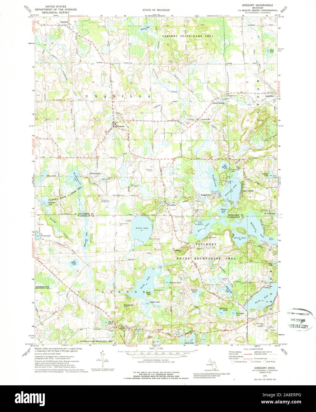 USGS TOPO Map Michigan MI Gregory 276254 1973 24000 Stock Photohttps://www.alamy.com/image-license-details/?v=1https://www.alamy.com/usgs-topo-map-michigan-mi-gregory-276254-1973-24000-image332240232.html
RM2A8ERPG–USGS TOPO Map Michigan MI Gregory 276254 1973 24000
 Tanzania region from Earth's orbit in space during sunrise. 3D illustration with highly detailed realistic planet surface. Eleme Stock Photohttps://www.alamy.com/image-license-details/?v=1https://www.alamy.com/stock-photo-tanzania-region-from-earths-orbit-in-space-during-sunrise-3d-illustration-110944551.html
RFGCDXWB–Tanzania region from Earth's orbit in space during sunrise. 3D illustration with highly detailed realistic planet surface. Eleme
 Gregory Thaumaturgus Stock Photohttps://www.alamy.com/image-license-details/?v=1https://www.alamy.com/stock-photo-gregory-thaumaturgus-139981197.html
RMJ3MKCD–Gregory Thaumaturgus
 Gregory River, , AU, Australia, Queensland, S 19 36' 0'', N 144 40' 0'', map, Cartascapes Map published in 2024. Explore Cartascapes, a map revealing Earth's diverse landscapes, cultures, and ecosystems. Journey through time and space, discovering the interconnectedness of our planet's past, present, and future. Stock Photohttps://www.alamy.com/image-license-details/?v=1https://www.alamy.com/gregory-river-au-australia-queensland-s-19-36-0-n-144-40-0-map-cartascapes-map-published-in-2024-explore-cartascapes-a-map-revealing-earths-diverse-landscapes-cultures-and-ecosystems-journey-through-time-and-space-discovering-the-interconnectedness-of-our-planets-past-present-and-future-image625422017.html
RM2Y9EC4H–Gregory River, , AU, Australia, Queensland, S 19 36' 0'', N 144 40' 0'', map, Cartascapes Map published in 2024. Explore Cartascapes, a map revealing Earth's diverse landscapes, cultures, and ecosystems. Journey through time and space, discovering the interconnectedness of our planet's past, present, and future.
 Gregory and Edmunds County, State of South Dakota (U.S. county, United States of America, USA, U.S., US) map vector illustration, scribble sketch map Stock Vectorhttps://www.alamy.com/image-license-details/?v=1https://www.alamy.com/gregory-and-edmunds-county-state-of-south-dakota-us-county-united-states-of-america-usa-us-us-map-vector-illustration-scribble-sketch-map-image415847467.html
RF2F4FDK7–Gregory and Edmunds County, State of South Dakota (U.S. county, United States of America, USA, U.S., US) map vector illustration, scribble sketch map
![ELEVATION OF BRIDGWATER BRIDGE. Author Deeble, Thomas 38.1.b. Place of publication: [England] Publisher: Publish'd as the Act directs by THOS GREGORY, Date of publication: July 8th 1797. Item type: 1 print Medium: etching and engraving Dimensions: sheet 22.5 x 43.7 cm Former owner: George III, King of Great Britain, 1738-1820 Stock Photo ELEVATION OF BRIDGWATER BRIDGE. Author Deeble, Thomas 38.1.b. Place of publication: [England] Publisher: Publish'd as the Act directs by THOS GREGORY, Date of publication: July 8th 1797. Item type: 1 print Medium: etching and engraving Dimensions: sheet 22.5 x 43.7 cm Former owner: George III, King of Great Britain, 1738-1820 Stock Photo](https://c8.alamy.com/comp/2E9HP46/elevation-of-bridgwater-bridge-author-deeble-thomas-381b-place-of-publication-england-publisher-publishd-as-the-act-directs-by-thos-gregory-date-of-publication-july-8th-1797-item-type-1-print-medium-etching-and-engraving-dimensions-sheet-225-x-437-cm-former-owner-george-iii-king-of-great-britain-1738-1820-2E9HP46.jpg) ELEVATION OF BRIDGWATER BRIDGE. Author Deeble, Thomas 38.1.b. Place of publication: [England] Publisher: Publish'd as the Act directs by THOS GREGORY, Date of publication: July 8th 1797. Item type: 1 print Medium: etching and engraving Dimensions: sheet 22.5 x 43.7 cm Former owner: George III, King of Great Britain, 1738-1820 Stock Photohttps://www.alamy.com/image-license-details/?v=1https://www.alamy.com/elevation-of-bridgwater-bridge-author-deeble-thomas-381b-place-of-publication-england-publisher-publishd-as-the-act-directs-by-thos-gregory-date-of-publication-july-8th-1797-item-type-1-print-medium-etching-and-engraving-dimensions-sheet-225-x-437-cm-former-owner-george-iii-king-of-great-britain-1738-1820-image401760918.html
ELEVATION OF BRIDGWATER BRIDGE. Author Deeble, Thomas 38.1.b. Place of publication: [England] Publisher: Publish'd as the Act directs by THOS GREGORY, Date of publication: July 8th 1797. Item type: 1 print Medium: etching and engraving Dimensions: sheet 22.5 x 43.7 cm Former owner: George III, King of Great Britain, 1738-1820 Stock Photohttps://www.alamy.com/image-license-details/?v=1https://www.alamy.com/elevation-of-bridgwater-bridge-author-deeble-thomas-381b-place-of-publication-england-publisher-publishd-as-the-act-directs-by-thos-gregory-date-of-publication-july-8th-1797-item-type-1-print-medium-etching-and-engraving-dimensions-sheet-225-x-437-cm-former-owner-george-iii-king-of-great-britain-1738-1820-image401760918.htmlRM2E9HP46–ELEVATION OF BRIDGWATER BRIDGE. Author Deeble, Thomas 38.1.b. Place of publication: [England] Publisher: Publish'd as the Act directs by THOS GREGORY, Date of publication: July 8th 1797. Item type: 1 print Medium: etching and engraving Dimensions: sheet 22.5 x 43.7 cm Former owner: George III, King of Great Britain, 1738-1820
![Smithfield Decretals [Decretals of Gregory IX] - caption: 'An amorous encounter' Smithfield Decretals [Decretals of Gregory IX] - caption 'An amorous Stock Photo Smithfield Decretals [Decretals of Gregory IX] - caption: 'An amorous encounter' Smithfield Decretals [Decretals of Gregory IX] - caption 'An amorous Stock Photo](https://c8.alamy.com/comp/EYRMM2/smithfield-decretals-decretals-of-gregory-ix-caption-an-amorous-encounter-EYRMM2.jpg) Smithfield Decretals [Decretals of Gregory IX] - caption: 'An amorous encounter' Smithfield Decretals [Decretals of Gregory IX] - caption 'An amorous Stock Photohttps://www.alamy.com/image-license-details/?v=1https://www.alamy.com/stock-photo-smithfield-decretals-decretals-of-gregory-ix-caption-an-amorous-encounter-85958322.html
Smithfield Decretals [Decretals of Gregory IX] - caption: 'An amorous encounter' Smithfield Decretals [Decretals of Gregory IX] - caption 'An amorous Stock Photohttps://www.alamy.com/image-license-details/?v=1https://www.alamy.com/stock-photo-smithfield-decretals-decretals-of-gregory-ix-caption-an-amorous-encounter-85958322.htmlRMEYRMM2–Smithfield Decretals [Decretals of Gregory IX] - caption: 'An amorous encounter' Smithfield Decretals [Decretals of Gregory IX] - caption 'An amorous
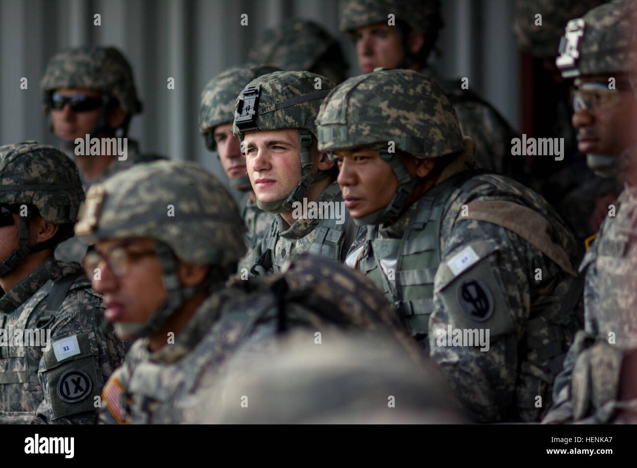 Spc. Gregory P. Doty, resident of Lake Peekskill, New York, an allied trade specialist with the 854th Engineer Battalion, receives a safety briefing prior to a 9mm pistol marksmanship range at Joint Base McGuire-Dix-Lakehurst, New Jersey, during the 2014 Army Reserve Best Warrior Competition June 23. Doty is competing in the Soldier category, representing the 412th Theater Engineer Command. (U.S. Army photo by Sgt. 1st Class Michel Sauret) 2014 Army Reserve Best Warrior Competition 140623-A-TI382-205 Stock Photohttps://www.alamy.com/image-license-details/?v=1https://www.alamy.com/stock-photo-spc-gregory-p-doty-resident-of-lake-peekskill-new-york-an-allied-trade-129553935.html
RMHENKA7–Spc. Gregory P. Doty, resident of Lake Peekskill, New York, an allied trade specialist with the 854th Engineer Battalion, receives a safety briefing prior to a 9mm pistol marksmanship range at Joint Base McGuire-Dix-Lakehurst, New Jersey, during the 2014 Army Reserve Best Warrior Competition June 23. Doty is competing in the Soldier category, representing the 412th Theater Engineer Command. (U.S. Army photo by Sgt. 1st Class Michel Sauret) 2014 Army Reserve Best Warrior Competition 140623-A-TI382-205
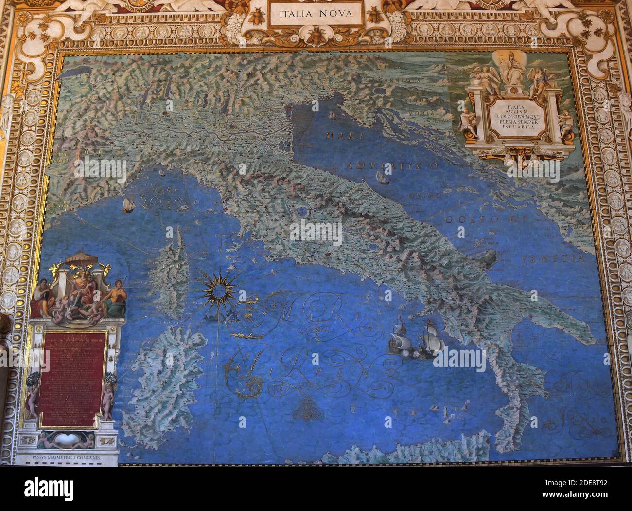 16th century painted map of Italy in the Gallery of Geographical Maps. The Gallery of Geographical Maps is 120 m long and was commissioned in 1581 by Pope Gregory XIII. Thus it was that 40 geographical maps were painted along the walls representing the italian regions and the principal ports and cities.Vatican Museums (Gallery of Geographical Maps) Vatican, 2018. - The Vatican Museums contain masterpieces of painting, sculpture and other works of art collected by the popes through the centuries. Through their diversity and richness, the Vatican museums rank among the first great museums in the Stock Photohttps://www.alamy.com/image-license-details/?v=1https://www.alamy.com/16th-century-painted-map-of-italy-in-the-gallery-of-geographical-maps-the-gallery-of-geographical-maps-is-120-m-long-and-was-commissioned-in-1581-by-pope-gregory-xiii-thus-it-was-that-40-geographical-maps-were-painted-along-the-walls-representing-the-italian-regions-and-the-principal-ports-and-citiesvatican-museums-gallery-of-geographical-maps-vatican-2018-the-vatican-museums-contain-masterpieces-of-painting-sculpture-and-other-works-of-art-collected-by-the-popes-through-the-centuries-through-their-diversity-and-richness-the-vatican-museums-rank-among-the-first-great-museums-in-the-image387427966.html
RM2DE8T92–16th century painted map of Italy in the Gallery of Geographical Maps. The Gallery of Geographical Maps is 120 m long and was commissioned in 1581 by Pope Gregory XIII. Thus it was that 40 geographical maps were painted along the walls representing the italian regions and the principal ports and cities.Vatican Museums (Gallery of Geographical Maps) Vatican, 2018. - The Vatican Museums contain masterpieces of painting, sculpture and other works of art collected by the popes through the centuries. Through their diversity and richness, the Vatican museums rank among the first great museums in the
 History of the parish of Buxhall in the county of Suffolk; with twenty-four full-plate illustrations and a large parish map (containing all the field names) specially drawn for the work . de and Charles Cracherode, and Gregory Copinger, and theproceeds to be divided amongst her children. Under a certain deed of March 2,1711, Gregory Copinger seems to have become absolute owner, for on Sept. 3,1711, he was admitted, and by will, Dec. 22 1739, devised to his daughterSarah Copinger, who was admitted Jan. 14, 1744. Sarah married ThomasMoyle, Esq., and their son Thomas Copinger Moyle, was admitted Stock Photohttps://www.alamy.com/image-license-details/?v=1https://www.alamy.com/history-of-the-parish-of-buxhall-in-the-county-of-suffolk-with-twenty-four-full-plate-illustrations-and-a-large-parish-map-containing-all-the-field-names-specially-drawn-for-the-work-de-and-charles-cracherode-and-gregory-copinger-and-theproceeds-to-be-divided-amongst-her-children-under-a-certain-deed-of-march-21711-gregory-copinger-seems-to-have-become-absolute-owner-for-on-sept-31711-he-was-admitted-and-by-will-dec-22-1739-devised-to-his-daughtersarah-copinger-who-was-admitted-jan-14-1744-sarah-married-thomasmoyle-esq-and-their-son-thomas-copinger-moyle-was-admitted-image339404350.html
RM2AM55KX–History of the parish of Buxhall in the county of Suffolk; with twenty-four full-plate illustrations and a large parish map (containing all the field names) specially drawn for the work . de and Charles Cracherode, and Gregory Copinger, and theproceeds to be divided amongst her children. Under a certain deed of March 2,1711, Gregory Copinger seems to have become absolute owner, for on Sept. 3,1711, he was admitted, and by will, Dec. 22 1739, devised to his daughterSarah Copinger, who was admitted Jan. 14, 1744. Sarah married ThomasMoyle, Esq., and their son Thomas Copinger Moyle, was admitted