Map of hinsdale Cut Out Stock Images
 Hinsdale, DuPage County, US, United States, Illinois, N 41 48' 3'', S 87 56' 13'', map, Cartascapes Map published in 2024. Explore Cartascapes, a map revealing Earth's diverse landscapes, cultures, and ecosystems. Journey through time and space, discovering the interconnectedness of our planet's past, present, and future. Stock Photohttps://www.alamy.com/image-license-details/?v=1https://www.alamy.com/hinsdale-dupage-county-us-united-states-illinois-n-41-48-3-s-87-56-13-map-cartascapes-map-published-in-2024-explore-cartascapes-a-map-revealing-earths-diverse-landscapes-cultures-and-ecosystems-journey-through-time-and-space-discovering-the-interconnectedness-of-our-planets-past-present-and-future-image621237096.html
RM2Y2KP74–Hinsdale, DuPage County, US, United States, Illinois, N 41 48' 3'', S 87 56' 13'', map, Cartascapes Map published in 2024. Explore Cartascapes, a map revealing Earth's diverse landscapes, cultures, and ecosystems. Journey through time and space, discovering the interconnectedness of our planet's past, present, and future.
 Map of Hinsdale in Colorado Stock Photohttps://www.alamy.com/image-license-details/?v=1https://www.alamy.com/map-of-hinsdale-in-colorado-image363187644.html
RF2C2THF8–Map of Hinsdale in Colorado
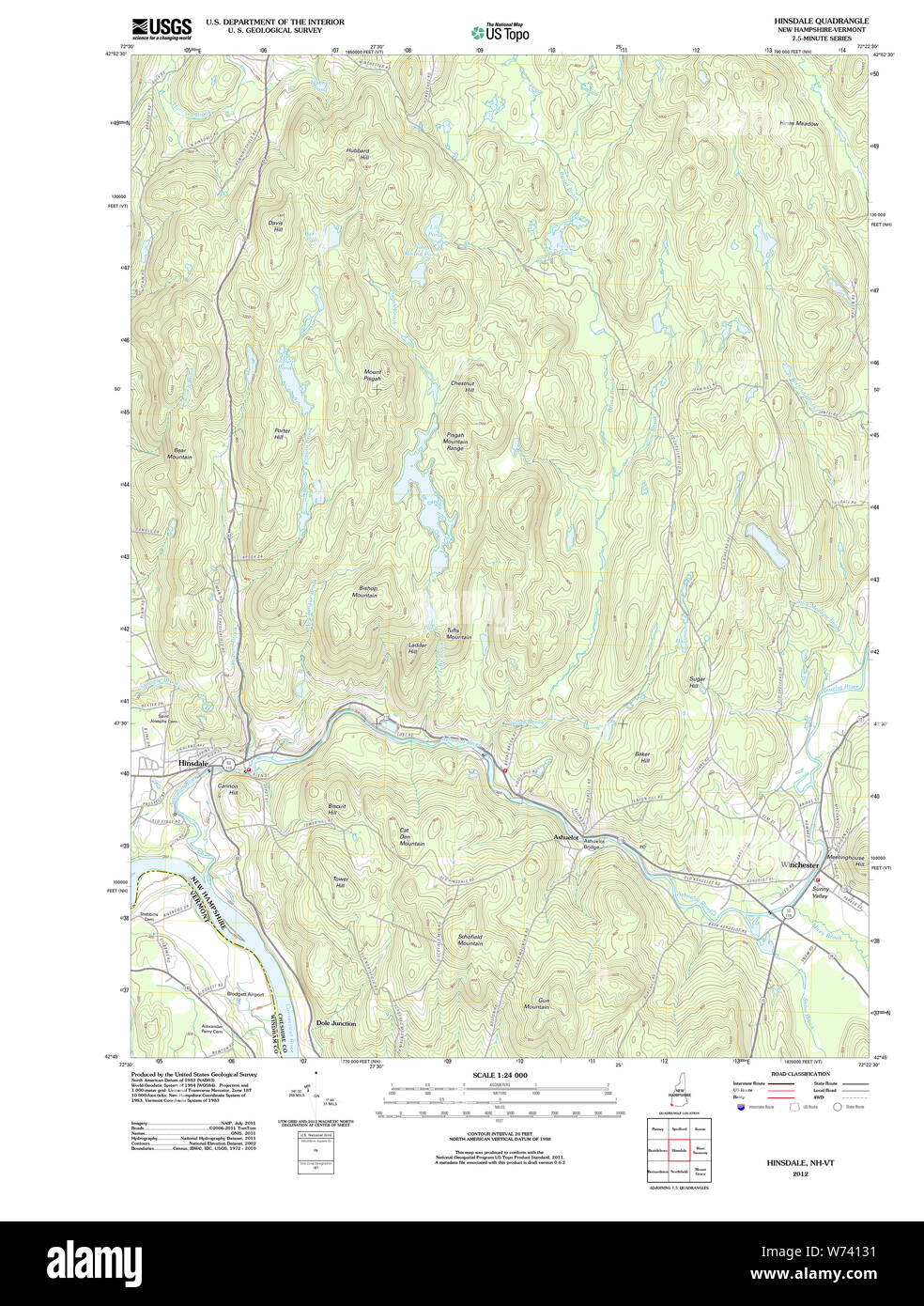 USGS TOPO Map New Hampshire NH Hinsdale 20120430 TM Restoration Stock Photohttps://www.alamy.com/image-license-details/?v=1https://www.alamy.com/usgs-topo-map-new-hampshire-nh-hinsdale-20120430-tm-restoration-image262546789.html
RMW74131–USGS TOPO Map New Hampshire NH Hinsdale 20120430 TM Restoration
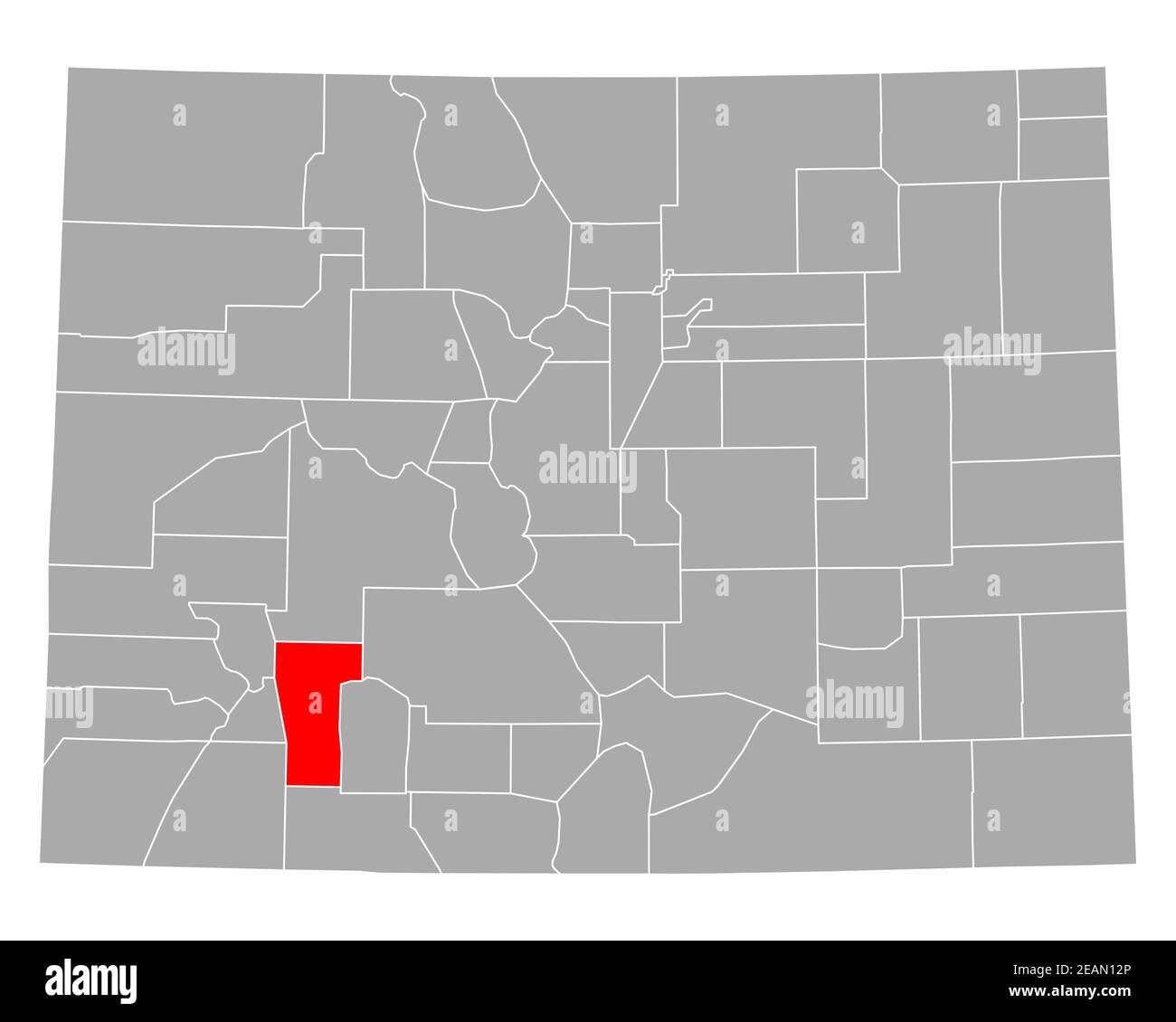 Map of Hinsdale in Colorado Stock Photohttps://www.alamy.com/image-license-details/?v=1https://www.alamy.com/map-of-hinsdale-in-colorado-image402446878.html
RF2EAN12P–Map of Hinsdale in Colorado
 USGS TOPO Map New Hampshire NH Hinsdale 329606 1998 24000 Restoration Stock Photohttps://www.alamy.com/image-license-details/?v=1https://www.alamy.com/usgs-topo-map-new-hampshire-nh-hinsdale-329606-1998-24000-restoration-image262546885.html
RMW7416D–USGS TOPO Map New Hampshire NH Hinsdale 329606 1998 24000 Restoration
 Hinsdale County, Colorado (U.S. county, United States of America,USA, U.S., US) map vector illustration, scribble sketch Hinsdale map Stock Vectorhttps://www.alamy.com/image-license-details/?v=1https://www.alamy.com/hinsdale-county-colorado-us-county-united-states-of-americausa-us-us-map-vector-illustration-scribble-sketch-hinsdale-map-image345043729.html
RF2B1A2P9–Hinsdale County, Colorado (U.S. county, United States of America,USA, U.S., US) map vector illustration, scribble sketch Hinsdale map
 New York NY Hinsdale 20100222 TM Restoration Stock Photohttps://www.alamy.com/image-license-details/?v=1https://www.alamy.com/new-york-ny-hinsdale-20100222-tm-restoration-image271172461.html
RMWN4Y6N–New York NY Hinsdale 20100222 TM Restoration
 New York NY Hinsdale 129864 1971 24000 Restoration Stock Photohttps://www.alamy.com/image-license-details/?v=1https://www.alamy.com/new-york-ny-hinsdale-129864-1971-24000-restoration-image271171753.html
RMWN4X9D–New York NY Hinsdale 129864 1971 24000 Restoration
 USGS TOPO Map Illinois IL Hinsdale 20120809 TM Restoration Stock Photohttps://www.alamy.com/image-license-details/?v=1https://www.alamy.com/usgs-topo-map-illinois-il-hinsdale-20120809-tm-restoration-image258733715.html
RMW0X9DR–USGS TOPO Map Illinois IL Hinsdale 20120809 TM Restoration
 Henson, Hinsdale County, US, United States, Colorado, N 38 1' 14'', S 107 22' 37'', map, Cartascapes Map published in 2024. Explore Cartascapes, a map revealing Earth's diverse landscapes, cultures, and ecosystems. Journey through time and space, discovering the interconnectedness of our planet's past, present, and future. Stock Photohttps://www.alamy.com/image-license-details/?v=1https://www.alamy.com/henson-hinsdale-county-us-united-states-colorado-n-38-1-14-s-107-22-37-map-cartascapes-map-published-in-2024-explore-cartascapes-a-map-revealing-earths-diverse-landscapes-cultures-and-ecosystems-journey-through-time-and-space-discovering-the-interconnectedness-of-our-planets-past-present-and-future-image621302773.html
RM2Y2PP0N–Henson, Hinsdale County, US, United States, Colorado, N 38 1' 14'', S 107 22' 37'', map, Cartascapes Map published in 2024. Explore Cartascapes, a map revealing Earth's diverse landscapes, cultures, and ecosystems. Journey through time and space, discovering the interconnectedness of our planet's past, present, and future.
 Map of Hinsdale in Colorado Stock Photohttps://www.alamy.com/image-license-details/?v=1https://www.alamy.com/map-of-hinsdale-in-colorado-image363873379.html
RF2C3YT5R–Map of Hinsdale in Colorado
 Map of Hinsdale in Colorado Stock Photohttps://www.alamy.com/image-license-details/?v=1https://www.alamy.com/map-of-hinsdale-in-colorado-image443861728.html
RF2GP3J4G–Map of Hinsdale in Colorado
 Hinsdale County, Colorado (U.S. county, United States of America,USA, U.S., US) map vector illustration, scribble sketch Hinsdale map Stock Vectorhttps://www.alamy.com/image-license-details/?v=1https://www.alamy.com/hinsdale-county-colorado-us-county-united-states-of-americausa-us-us-map-vector-illustration-scribble-sketch-hinsdale-map-image340908394.html
RF2APHM3P–Hinsdale County, Colorado (U.S. county, United States of America,USA, U.S., US) map vector illustration, scribble sketch Hinsdale map
 USGS TOPO Map Montana MT Hinsdale 20110707 TM Restoration Stock Photohttps://www.alamy.com/image-license-details/?v=1https://www.alamy.com/usgs-topo-map-montana-mt-hinsdale-20110707-tm-restoration-image333429880.html
RM2AAD160–USGS TOPO Map Montana MT Hinsdale 20110707 TM Restoration
 Cathedral, Hinsdale County, US, United States, Colorado, N 38 5' 44'', S 107 2' 2'', map, Cartascapes Map published in 2024. Explore Cartascapes, a map revealing Earth's diverse landscapes, cultures, and ecosystems. Journey through time and space, discovering the interconnectedness of our planet's past, present, and future. Stock Photohttps://www.alamy.com/image-license-details/?v=1https://www.alamy.com/cathedral-hinsdale-county-us-united-states-colorado-n-38-5-44-s-107-2-2-map-cartascapes-map-published-in-2024-explore-cartascapes-a-map-revealing-earths-diverse-landscapes-cultures-and-ecosystems-journey-through-time-and-space-discovering-the-interconnectedness-of-our-planets-past-present-and-future-image621224661.html
RM2Y2K6B1–Cathedral, Hinsdale County, US, United States, Colorado, N 38 5' 44'', S 107 2' 2'', map, Cartascapes Map published in 2024. Explore Cartascapes, a map revealing Earth's diverse landscapes, cultures, and ecosystems. Journey through time and space, discovering the interconnectedness of our planet's past, present, and future.
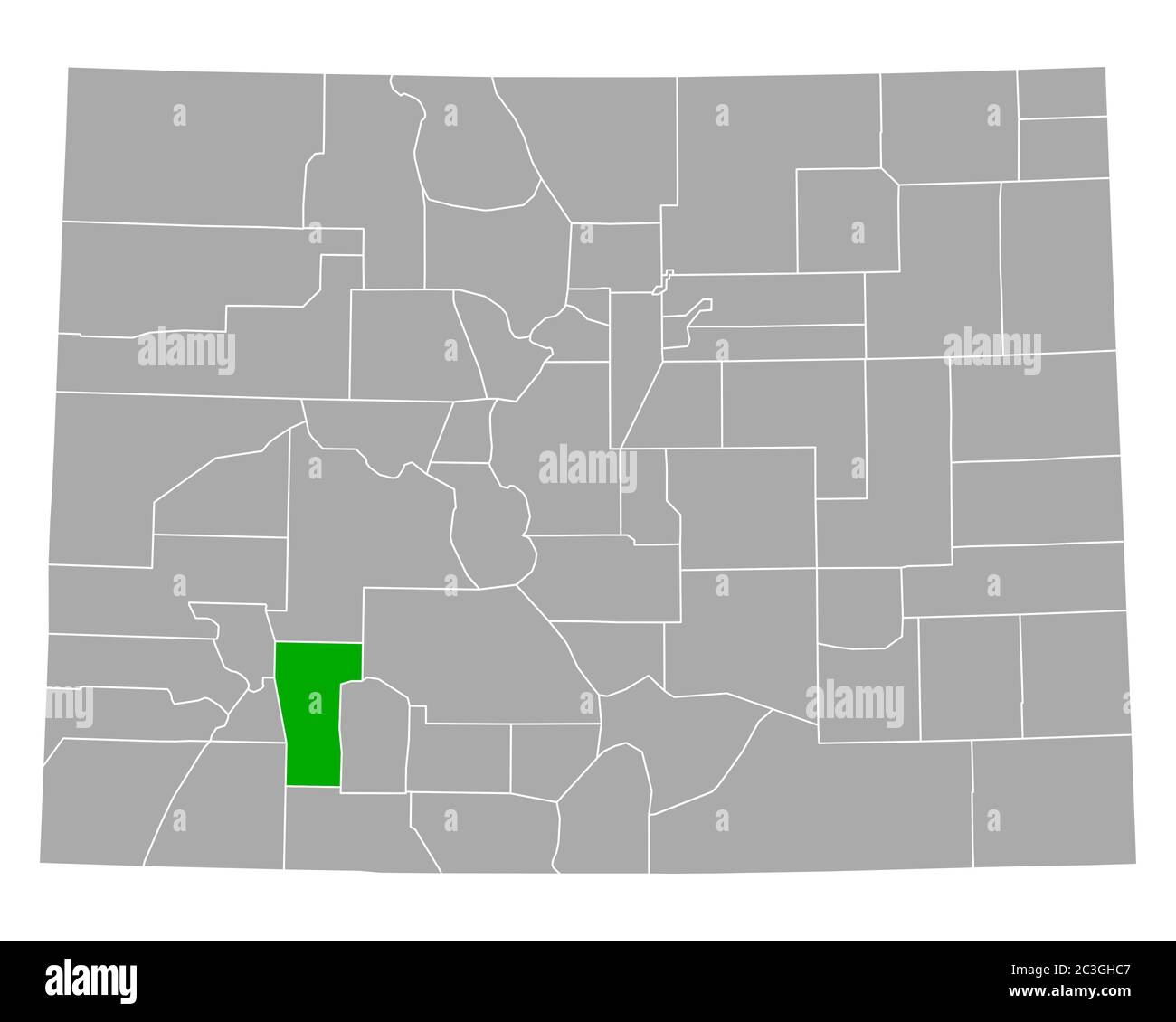 Map of Hinsdale in Colorado Stock Photohttps://www.alamy.com/image-license-details/?v=1https://www.alamy.com/map-of-hinsdale-in-colorado-image363626599.html
RF2C3GHC7–Map of Hinsdale in Colorado
 Map of Hinsdale in Colorado Stock Photohttps://www.alamy.com/image-license-details/?v=1https://www.alamy.com/map-of-hinsdale-in-colorado-image443787993.html
RF2GP0835–Map of Hinsdale in Colorado
 Hinsdale County, Colorado (U.S. county, United States of America,USA, U.S., US) map vector illustration, scribble sketch Hinsdale map Stock Vectorhttps://www.alamy.com/image-license-details/?v=1https://www.alamy.com/hinsdale-county-colorado-us-county-united-states-of-americausa-us-us-map-vector-illustration-scribble-sketch-hinsdale-map-image343432464.html
RF2AXMKH4–Hinsdale County, Colorado (U.S. county, United States of America,USA, U.S., US) map vector illustration, scribble sketch Hinsdale map
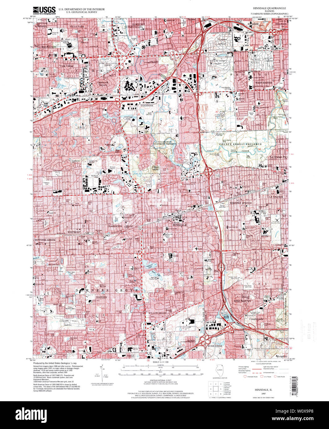 USGS TOPO Map Illinois IL Hinsdale 307828 1997 24000 Restoration Stock Photohttps://www.alamy.com/image-license-details/?v=1https://www.alamy.com/usgs-topo-map-illinois-il-hinsdale-307828-1997-24000-restoration-image258733952.html
RMW0X9P8–USGS TOPO Map Illinois IL Hinsdale 307828 1997 24000 Restoration
 Hinsdale, Berkshire County, US, United States, Massachusetts, N 42 26' 19'', S 73 7' 31'', map, Cartascapes Map published in 2024. Explore Cartascapes, a map revealing Earth's diverse landscapes, cultures, and ecosystems. Journey through time and space, discovering the interconnectedness of our planet's past, present, and future. Stock Photohttps://www.alamy.com/image-license-details/?v=1https://www.alamy.com/hinsdale-berkshire-county-us-united-states-massachusetts-n-42-26-19-s-73-7-31-map-cartascapes-map-published-in-2024-explore-cartascapes-a-map-revealing-earths-diverse-landscapes-cultures-and-ecosystems-journey-through-time-and-space-discovering-the-interconnectedness-of-our-planets-past-present-and-future-image621268681.html
RM2Y2N6F5–Hinsdale, Berkshire County, US, United States, Massachusetts, N 42 26' 19'', S 73 7' 31'', map, Cartascapes Map published in 2024. Explore Cartascapes, a map revealing Earth's diverse landscapes, cultures, and ecosystems. Journey through time and space, discovering the interconnectedness of our planet's past, present, and future.
 USGS TOPO Map Illinois IL Hinsdale 307833 1963 24000 Restoration Stock Photohttps://www.alamy.com/image-license-details/?v=1https://www.alamy.com/usgs-topo-map-illinois-il-hinsdale-307833-1963-24000-restoration-image258734368.html
RMW0XA94–USGS TOPO Map Illinois IL Hinsdale 307833 1963 24000 Restoration
 Hinsdale, Cheshire County, US, United States, New Hampshire, N 42 47' 10'', S 72 29' 11'', map, Cartascapes Map published in 2024. Explore Cartascapes, a map revealing Earth's diverse landscapes, cultures, and ecosystems. Journey through time and space, discovering the interconnectedness of our planet's past, present, and future. Stock Photohttps://www.alamy.com/image-license-details/?v=1https://www.alamy.com/hinsdale-cheshire-county-us-united-states-new-hampshire-n-42-47-10-s-72-29-11-map-cartascapes-map-published-in-2024-explore-cartascapes-a-map-revealing-earths-diverse-landscapes-cultures-and-ecosystems-journey-through-time-and-space-discovering-the-interconnectedness-of-our-planets-past-present-and-future-image621283975.html
RM2Y2NX1B–Hinsdale, Cheshire County, US, United States, New Hampshire, N 42 47' 10'', S 72 29' 11'', map, Cartascapes Map published in 2024. Explore Cartascapes, a map revealing Earth's diverse landscapes, cultures, and ecosystems. Journey through time and space, discovering the interconnectedness of our planet's past, present, and future.
 USGS TOPO Map Illinois IL Hinsdale 307827 1993 24000 Restoration Stock Photohttps://www.alamy.com/image-license-details/?v=1https://www.alamy.com/usgs-topo-map-illinois-il-hinsdale-307827-1993-24000-restoration-image258733800.html
RMW0X9GT–USGS TOPO Map Illinois IL Hinsdale 307827 1993 24000 Restoration
 Hinsdale, Onondaga County, US, United States, New York, N 43 6' 16'', S 76 8' 15'', map, Cartascapes Map published in 2024. Explore Cartascapes, a map revealing Earth's diverse landscapes, cultures, and ecosystems. Journey through time and space, discovering the interconnectedness of our planet's past, present, and future. Stock Photohttps://www.alamy.com/image-license-details/?v=1https://www.alamy.com/hinsdale-onondaga-county-us-united-states-new-york-n-43-6-16-s-76-8-15-map-cartascapes-map-published-in-2024-explore-cartascapes-a-map-revealing-earths-diverse-landscapes-cultures-and-ecosystems-journey-through-time-and-space-discovering-the-interconnectedness-of-our-planets-past-present-and-future-image621310464.html
RM2Y2R3RC–Hinsdale, Onondaga County, US, United States, New York, N 43 6' 16'', S 76 8' 15'', map, Cartascapes Map published in 2024. Explore Cartascapes, a map revealing Earth's diverse landscapes, cultures, and ecosystems. Journey through time and space, discovering the interconnectedness of our planet's past, present, and future.
 USGS TOPO Map Montana MT Hinsdale SE 20110707 TM Restoration Stock Photohttps://www.alamy.com/image-license-details/?v=1https://www.alamy.com/usgs-topo-map-montana-mt-hinsdale-se-20110707-tm-restoration-image333430029.html
RM2AAD1B9–USGS TOPO Map Montana MT Hinsdale SE 20110707 TM Restoration
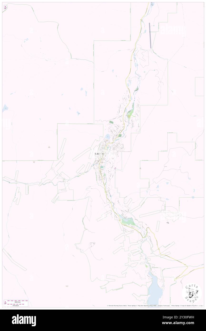 Lake City, Hinsdale County, US, United States, Colorado, N 38 1' 48'', S 107 18' 55'', map, Cartascapes Map published in 2024. Explore Cartascapes, a map revealing Earth's diverse landscapes, cultures, and ecosystems. Journey through time and space, discovering the interconnectedness of our planet's past, present, and future. Stock Photohttps://www.alamy.com/image-license-details/?v=1https://www.alamy.com/lake-city-hinsdale-county-us-united-states-colorado-n-38-1-48-s-107-18-55-map-cartascapes-map-published-in-2024-explore-cartascapes-a-map-revealing-earths-diverse-landscapes-cultures-and-ecosystems-journey-through-time-and-space-discovering-the-interconnectedness-of-our-planets-past-present-and-future-image621429693.html
RM2Y30FWH–Lake City, Hinsdale County, US, United States, Colorado, N 38 1' 48'', S 107 18' 55'', map, Cartascapes Map published in 2024. Explore Cartascapes, a map revealing Earth's diverse landscapes, cultures, and ecosystems. Journey through time and space, discovering the interconnectedness of our planet's past, present, and future.
 USGS TOPO Map Montana MT Hinsdale NW 20110707 TM Restoration Stock Photohttps://www.alamy.com/image-license-details/?v=1https://www.alamy.com/usgs-topo-map-montana-mt-hinsdale-nw-20110707-tm-restoration-image333430024.html
RM2AAD1B4–USGS TOPO Map Montana MT Hinsdale NW 20110707 TM Restoration
 Lake City, Hinsdale County, US, United States, Colorado, N 38 1' 48'', S 107 18' 55'', map, Cartascapes Map published in 2024. Explore Cartascapes, a map revealing Earth's diverse landscapes, cultures, and ecosystems. Journey through time and space, discovering the interconnectedness of our planet's past, present, and future. Stock Photohttps://www.alamy.com/image-license-details/?v=1https://www.alamy.com/lake-city-hinsdale-county-us-united-states-colorado-n-38-1-48-s-107-18-55-map-cartascapes-map-published-in-2024-explore-cartascapes-a-map-revealing-earths-diverse-landscapes-cultures-and-ecosystems-journey-through-time-and-space-discovering-the-interconnectedness-of-our-planets-past-present-and-future-image621163539.html
RM2Y2GCC3–Lake City, Hinsdale County, US, United States, Colorado, N 38 1' 48'', S 107 18' 55'', map, Cartascapes Map published in 2024. Explore Cartascapes, a map revealing Earth's diverse landscapes, cultures, and ecosystems. Journey through time and space, discovering the interconnectedness of our planet's past, present, and future.
 USGS TOPO Map Montana MT Hinsdale 264418 1984 24000 Restoration Stock Photohttps://www.alamy.com/image-license-details/?v=1https://www.alamy.com/usgs-topo-map-montana-mt-hinsdale-264418-1984-24000-restoration-image333429877.html
RM2AAD15W–USGS TOPO Map Montana MT Hinsdale 264418 1984 24000 Restoration
 Hinsdale, Saint Louis County, US, United States, Minnesota, N 47 36' 3'', S 92 8' 52'', map, Cartascapes Map published in 2024. Explore Cartascapes, a map revealing Earth's diverse landscapes, cultures, and ecosystems. Journey through time and space, discovering the interconnectedness of our planet's past, present, and future. Stock Photohttps://www.alamy.com/image-license-details/?v=1https://www.alamy.com/hinsdale-saint-louis-county-us-united-states-minnesota-n-47-36-3-s-92-8-52-map-cartascapes-map-published-in-2024-explore-cartascapes-a-map-revealing-earths-diverse-landscapes-cultures-and-ecosystems-journey-through-time-and-space-discovering-the-interconnectedness-of-our-planets-past-present-and-future-image621368391.html
RM2Y2WNM7–Hinsdale, Saint Louis County, US, United States, Minnesota, N 47 36' 3'', S 92 8' 52'', map, Cartascapes Map published in 2024. Explore Cartascapes, a map revealing Earth's diverse landscapes, cultures, and ecosystems. Journey through time and space, discovering the interconnectedness of our planet's past, present, and future.
 USGS TOPO Map Montana MT Hinsdale NW 264419 1984 24000 Restoration Stock Photohttps://www.alamy.com/image-license-details/?v=1https://www.alamy.com/usgs-topo-map-montana-mt-hinsdale-nw-264419-1984-24000-restoration-image333430012.html
RM2AAD1AM–USGS TOPO Map Montana MT Hinsdale NW 264419 1984 24000 Restoration
 North Hinsdale, Cheshire County, US, United States, New Hampshire, N 42 49' 30'', S 72 31' 7'', map, Cartascapes Map published in 2024. Explore Cartascapes, a map revealing Earth's diverse landscapes, cultures, and ecosystems. Journey through time and space, discovering the interconnectedness of our planet's past, present, and future. Stock Photohttps://www.alamy.com/image-license-details/?v=1https://www.alamy.com/north-hinsdale-cheshire-county-us-united-states-new-hampshire-n-42-49-30-s-72-31-7-map-cartascapes-map-published-in-2024-explore-cartascapes-a-map-revealing-earths-diverse-landscapes-cultures-and-ecosystems-journey-through-time-and-space-discovering-the-interconnectedness-of-our-planets-past-present-and-future-image621432089.html
RM2Y30JY5–North Hinsdale, Cheshire County, US, United States, New Hampshire, N 42 49' 30'', S 72 31' 7'', map, Cartascapes Map published in 2024. Explore Cartascapes, a map revealing Earth's diverse landscapes, cultures, and ecosystems. Journey through time and space, discovering the interconnectedness of our planet's past, present, and future.
 USGS TOPO Map Montana MT Hinsdale SE 264420 1984 24000 Restoration Stock Photohttps://www.alamy.com/image-license-details/?v=1https://www.alamy.com/usgs-topo-map-montana-mt-hinsdale-se-264420-1984-24000-restoration-image333430116.html
RM2AAD1EC–USGS TOPO Map Montana MT Hinsdale SE 264420 1984 24000 Restoration
 Capitol City (historical), Hinsdale County, US, United States, Colorado, N 38 0' 25'', S 107 28' 0'', map, Cartascapes Map published in 2024. Explore Cartascapes, a map revealing Earth's diverse landscapes, cultures, and ecosystems. Journey through time and space, discovering the interconnectedness of our planet's past, present, and future. Stock Photohttps://www.alamy.com/image-license-details/?v=1https://www.alamy.com/capitol-city-historical-hinsdale-county-us-united-states-colorado-n-38-0-25-s-107-28-0-map-cartascapes-map-published-in-2024-explore-cartascapes-a-map-revealing-earths-diverse-landscapes-cultures-and-ecosystems-journey-through-time-and-space-discovering-the-interconnectedness-of-our-planets-past-present-and-future-image621404709.html
RM2Y2YC19–Capitol City (historical), Hinsdale County, US, United States, Colorado, N 38 0' 25'', S 107 28' 0'', map, Cartascapes Map published in 2024. Explore Cartascapes, a map revealing Earth's diverse landscapes, cultures, and ecosystems. Journey through time and space, discovering the interconnectedness of our planet's past, present, and future.
 Hinsdale, Sutter County, US, United States, California, N 39 0' 54'', S 121 46' 43'', map, Cartascapes Map published in 2024. Explore Cartascapes, a map revealing Earth's diverse landscapes, cultures, and ecosystems. Journey through time and space, discovering the interconnectedness of our planet's past, present, and future. Stock Photohttps://www.alamy.com/image-license-details/?v=1https://www.alamy.com/hinsdale-sutter-county-us-united-states-california-n-39-0-54-s-121-46-43-map-cartascapes-map-published-in-2024-explore-cartascapes-a-map-revealing-earths-diverse-landscapes-cultures-and-ecosystems-journey-through-time-and-space-discovering-the-interconnectedness-of-our-planets-past-present-and-future-image620861970.html
RM2Y22KNP–Hinsdale, Sutter County, US, United States, California, N 39 0' 54'', S 121 46' 43'', map, Cartascapes Map published in 2024. Explore Cartascapes, a map revealing Earth's diverse landscapes, cultures, and ecosystems. Journey through time and space, discovering the interconnectedness of our planet's past, present, and future.
 Hinsdale, Berkshire County, US, United States, Massachusetts, N 42 26' 19'', S 73 7' 31'', map, Cartascapes Map published in 2024. Explore Cartascapes, a map revealing Earth's diverse landscapes, cultures, and ecosystems. Journey through time and space, discovering the interconnectedness of our planet's past, present, and future. Stock Photohttps://www.alamy.com/image-license-details/?v=1https://www.alamy.com/hinsdale-berkshire-county-us-united-states-massachusetts-n-42-26-19-s-73-7-31-map-cartascapes-map-published-in-2024-explore-cartascapes-a-map-revealing-earths-diverse-landscapes-cultures-and-ecosystems-journey-through-time-and-space-discovering-the-interconnectedness-of-our-planets-past-present-and-future-image620876789.html
RM2Y23AK1–Hinsdale, Berkshire County, US, United States, Massachusetts, N 42 26' 19'', S 73 7' 31'', map, Cartascapes Map published in 2024. Explore Cartascapes, a map revealing Earth's diverse landscapes, cultures, and ecosystems. Journey through time and space, discovering the interconnectedness of our planet's past, present, and future.
 Hinsdale, Valley County, US, United States, Montana, N 48 23' 39'', S 107 5' 5'', map, Cartascapes Map published in 2024. Explore Cartascapes, a map revealing Earth's diverse landscapes, cultures, and ecosystems. Journey through time and space, discovering the interconnectedness of our planet's past, present, and future. Stock Photohttps://www.alamy.com/image-license-details/?v=1https://www.alamy.com/hinsdale-valley-county-us-united-states-montana-n-48-23-39-s-107-5-5-map-cartascapes-map-published-in-2024-explore-cartascapes-a-map-revealing-earths-diverse-landscapes-cultures-and-ecosystems-journey-through-time-and-space-discovering-the-interconnectedness-of-our-planets-past-present-and-future-image620855046.html
RM2Y22AXE–Hinsdale, Valley County, US, United States, Montana, N 48 23' 39'', S 107 5' 5'', map, Cartascapes Map published in 2024. Explore Cartascapes, a map revealing Earth's diverse landscapes, cultures, and ecosystems. Journey through time and space, discovering the interconnectedness of our planet's past, present, and future.
 Hinsdale, DuPage County, US, United States, Illinois, N 41 48' 3'', S 87 56' 13'', map, Cartascapes Map published in 2024. Explore Cartascapes, a map revealing Earth's diverse landscapes, cultures, and ecosystems. Journey through time and space, discovering the interconnectedness of our planet's past, present, and future. Stock Photohttps://www.alamy.com/image-license-details/?v=1https://www.alamy.com/hinsdale-dupage-county-us-united-states-illinois-n-41-48-3-s-87-56-13-map-cartascapes-map-published-in-2024-explore-cartascapes-a-map-revealing-earths-diverse-landscapes-cultures-and-ecosystems-journey-through-time-and-space-discovering-the-interconnectedness-of-our-planets-past-present-and-future-image620849714.html
RM2Y22442–Hinsdale, DuPage County, US, United States, Illinois, N 41 48' 3'', S 87 56' 13'', map, Cartascapes Map published in 2024. Explore Cartascapes, a map revealing Earth's diverse landscapes, cultures, and ecosystems. Journey through time and space, discovering the interconnectedness of our planet's past, present, and future.
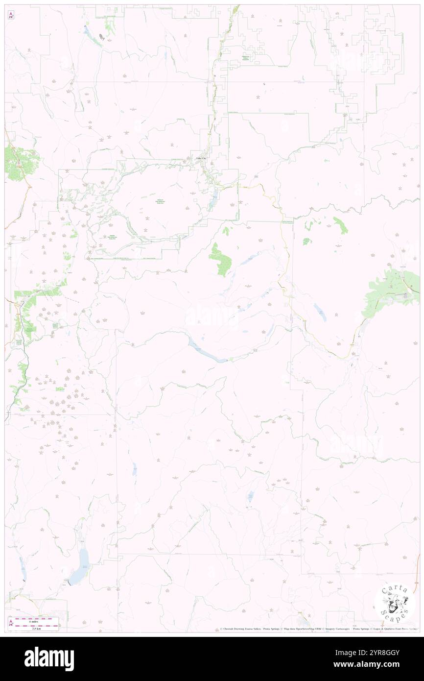 Hinsdale County, Hinsdale County, US, United States, Colorado, N 37 49' 16'', S 107 18' 1'', map, Cartascapes Map published in 2024. Explore Cartascapes, a map revealing Earth's diverse landscapes, cultures, and ecosystems. Journey through time and space, discovering the interconnectedness of our planet's past, present, and future. Stock Photohttps://www.alamy.com/image-license-details/?v=1https://www.alamy.com/hinsdale-county-hinsdale-county-us-united-states-colorado-n-37-49-16-s-107-18-1-map-cartascapes-map-published-in-2024-explore-cartascapes-a-map-revealing-earths-diverse-landscapes-cultures-and-ecosystems-journey-through-time-and-space-discovering-the-interconnectedness-of-our-planets-past-present-and-future-image633898971.html
RM2YR8GGY–Hinsdale County, Hinsdale County, US, United States, Colorado, N 37 49' 16'', S 107 18' 1'', map, Cartascapes Map published in 2024. Explore Cartascapes, a map revealing Earth's diverse landscapes, cultures, and ecosystems. Journey through time and space, discovering the interconnectedness of our planet's past, present, and future.
 Hinsdale County, Hinsdale County, US, United States, Colorado, N 37 49' 16'', S 107 18' 1'', map, Cartascapes Map published in 2024. Explore Cartascapes, a map revealing Earth's diverse landscapes, cultures, and ecosystems. Journey through time and space, discovering the interconnectedness of our planet's past, present, and future. Stock Photohttps://www.alamy.com/image-license-details/?v=1https://www.alamy.com/hinsdale-county-hinsdale-county-us-united-states-colorado-n-37-49-16-s-107-18-1-map-cartascapes-map-published-in-2024-explore-cartascapes-a-map-revealing-earths-diverse-landscapes-cultures-and-ecosystems-journey-through-time-and-space-discovering-the-interconnectedness-of-our-planets-past-present-and-future-image633901892.html
RM2YR8M98–Hinsdale County, Hinsdale County, US, United States, Colorado, N 37 49' 16'', S 107 18' 1'', map, Cartascapes Map published in 2024. Explore Cartascapes, a map revealing Earth's diverse landscapes, cultures, and ecosystems. Journey through time and space, discovering the interconnectedness of our planet's past, present, and future.
 Hinsdale, Cheshire County, US, United States, New Hampshire, N 42 47' 10'', S 72 29' 11'', map, Cartascapes Map published in 2024. Explore Cartascapes, a map revealing Earth's diverse landscapes, cultures, and ecosystems. Journey through time and space, discovering the interconnectedness of our planet's past, present, and future. Stock Photohttps://www.alamy.com/image-license-details/?v=1https://www.alamy.com/hinsdale-cheshire-county-us-united-states-new-hampshire-n-42-47-10-s-72-29-11-map-cartascapes-map-published-in-2024-explore-cartascapes-a-map-revealing-earths-diverse-landscapes-cultures-and-ecosystems-journey-through-time-and-space-discovering-the-interconnectedness-of-our-planets-past-present-and-future-image620798827.html
RM2Y1YR6K–Hinsdale, Cheshire County, US, United States, New Hampshire, N 42 47' 10'', S 72 29' 11'', map, Cartascapes Map published in 2024. Explore Cartascapes, a map revealing Earth's diverse landscapes, cultures, and ecosystems. Journey through time and space, discovering the interconnectedness of our planet's past, present, and future.
 Town of Lake City, Hinsdale County, US, United States, Colorado, N 38 1' 48'', S 107 18' 37'', map, Cartascapes Map published in 2024. Explore Cartascapes, a map revealing Earth's diverse landscapes, cultures, and ecosystems. Journey through time and space, discovering the interconnectedness of our planet's past, present, and future. Stock Photohttps://www.alamy.com/image-license-details/?v=1https://www.alamy.com/town-of-lake-city-hinsdale-county-us-united-states-colorado-n-38-1-48-s-107-18-37-map-cartascapes-map-published-in-2024-explore-cartascapes-a-map-revealing-earths-diverse-landscapes-cultures-and-ecosystems-journey-through-time-and-space-discovering-the-interconnectedness-of-our-planets-past-present-and-future-image633829407.html
RM2YR5BTF–Town of Lake City, Hinsdale County, US, United States, Colorado, N 38 1' 48'', S 107 18' 37'', map, Cartascapes Map published in 2024. Explore Cartascapes, a map revealing Earth's diverse landscapes, cultures, and ecosystems. Journey through time and space, discovering the interconnectedness of our planet's past, present, and future.
 Town of Hinsdale, Cattaraugus County, US, United States, New York, N 42 10' 0'', S 78 22' 51'', map, Cartascapes Map published in 2024. Explore Cartascapes, a map revealing Earth's diverse landscapes, cultures, and ecosystems. Journey through time and space, discovering the interconnectedness of our planet's past, present, and future. Stock Photohttps://www.alamy.com/image-license-details/?v=1https://www.alamy.com/town-of-hinsdale-cattaraugus-county-us-united-states-new-york-n-42-10-0-s-78-22-51-map-cartascapes-map-published-in-2024-explore-cartascapes-a-map-revealing-earths-diverse-landscapes-cultures-and-ecosystems-journey-through-time-and-space-discovering-the-interconnectedness-of-our-planets-past-present-and-future-image633862700.html
RM2YR6X9G–Town of Hinsdale, Cattaraugus County, US, United States, New York, N 42 10' 0'', S 78 22' 51'', map, Cartascapes Map published in 2024. Explore Cartascapes, a map revealing Earth's diverse landscapes, cultures, and ecosystems. Journey through time and space, discovering the interconnectedness of our planet's past, present, and future.
 Village of Hinsdale, DuPage County, US, United States, Illinois, N 41 48' 2'', S 87 55' 38'', map, Cartascapes Map published in 2024. Explore Cartascapes, a map revealing Earth's diverse landscapes, cultures, and ecosystems. Journey through time and space, discovering the interconnectedness of our planet's past, present, and future. Stock Photohttps://www.alamy.com/image-license-details/?v=1https://www.alamy.com/village-of-hinsdale-dupage-county-us-united-states-illinois-n-41-48-2-s-87-55-38-map-cartascapes-map-published-in-2024-explore-cartascapes-a-map-revealing-earths-diverse-landscapes-cultures-and-ecosystems-journey-through-time-and-space-discovering-the-interconnectedness-of-our-planets-past-present-and-future-image633912871.html
RM2YR969B–Village of Hinsdale, DuPage County, US, United States, Illinois, N 41 48' 2'', S 87 55' 38'', map, Cartascapes Map published in 2024. Explore Cartascapes, a map revealing Earth's diverse landscapes, cultures, and ecosystems. Journey through time and space, discovering the interconnectedness of our planet's past, present, and future.
 Town of Hinsdale, Cattaraugus County, US, United States, New York, N 42 10' 0'', S 78 22' 51'', map, Cartascapes Map published in 2024. Explore Cartascapes, a map revealing Earth's diverse landscapes, cultures, and ecosystems. Journey through time and space, discovering the interconnectedness of our planet's past, present, and future. Stock Photohttps://www.alamy.com/image-license-details/?v=1https://www.alamy.com/town-of-hinsdale-cattaraugus-county-us-united-states-new-york-n-42-10-0-s-78-22-51-map-cartascapes-map-published-in-2024-explore-cartascapes-a-map-revealing-earths-diverse-landscapes-cultures-and-ecosystems-journey-through-time-and-space-discovering-the-interconnectedness-of-our-planets-past-present-and-future-image633860315.html
RM2YR6R8B–Town of Hinsdale, Cattaraugus County, US, United States, New York, N 42 10' 0'', S 78 22' 51'', map, Cartascapes Map published in 2024. Explore Cartascapes, a map revealing Earth's diverse landscapes, cultures, and ecosystems. Journey through time and space, discovering the interconnectedness of our planet's past, present, and future.
 Hinsdale, Cattaraugus County, US, United States, New York, N 42 10' 4'', S 78 23' 14'', map, Cartascapes Map published in 2024. Explore Cartascapes, a map revealing Earth's diverse landscapes, cultures, and ecosystems. Journey through time and space, discovering the interconnectedness of our planet's past, present, and future. Stock Photohttps://www.alamy.com/image-license-details/?v=1https://www.alamy.com/hinsdale-cattaraugus-county-us-united-states-new-york-n-42-10-4-s-78-23-14-map-cartascapes-map-published-in-2024-explore-cartascapes-a-map-revealing-earths-diverse-landscapes-cultures-and-ecosystems-journey-through-time-and-space-discovering-the-interconnectedness-of-our-planets-past-present-and-future-image620699077.html
RM2Y1R805–Hinsdale, Cattaraugus County, US, United States, New York, N 42 10' 4'', S 78 23' 14'', map, Cartascapes Map published in 2024. Explore Cartascapes, a map revealing Earth's diverse landscapes, cultures, and ecosystems. Journey through time and space, discovering the interconnectedness of our planet's past, present, and future.
 Town of Hinsdale, Berkshire County, US, United States, Massachusetts, N 42 26' 5'', S 73 6' 48'', map, Cartascapes Map published in 2024. Explore Cartascapes, a map revealing Earth's diverse landscapes, cultures, and ecosystems. Journey through time and space, discovering the interconnectedness of our planet's past, present, and future. Stock Photohttps://www.alamy.com/image-license-details/?v=1https://www.alamy.com/town-of-hinsdale-berkshire-county-us-united-states-massachusetts-n-42-26-5-s-73-6-48-map-cartascapes-map-published-in-2024-explore-cartascapes-a-map-revealing-earths-diverse-landscapes-cultures-and-ecosystems-journey-through-time-and-space-discovering-the-interconnectedness-of-our-planets-past-present-and-future-image633884951.html
RM2YR7XM7–Town of Hinsdale, Berkshire County, US, United States, Massachusetts, N 42 26' 5'', S 73 6' 48'', map, Cartascapes Map published in 2024. Explore Cartascapes, a map revealing Earth's diverse landscapes, cultures, and ecosystems. Journey through time and space, discovering the interconnectedness of our planet's past, present, and future.
 Town of Hinsdale, Cheshire County, US, United States, New Hampshire, N 42 48' 32'', S 72 30' 0'', map, Cartascapes Map published in 2024. Explore Cartascapes, a map revealing Earth's diverse landscapes, cultures, and ecosystems. Journey through time and space, discovering the interconnectedness of our planet's past, present, and future. Stock Photohttps://www.alamy.com/image-license-details/?v=1https://www.alamy.com/town-of-hinsdale-cheshire-county-us-united-states-new-hampshire-n-42-48-32-s-72-30-0-map-cartascapes-map-published-in-2024-explore-cartascapes-a-map-revealing-earths-diverse-landscapes-cultures-and-ecosystems-journey-through-time-and-space-discovering-the-interconnectedness-of-our-planets-past-present-and-future-image633860412.html
RM2YR6RBT–Town of Hinsdale, Cheshire County, US, United States, New Hampshire, N 42 48' 32'', S 72 30' 0'', map, Cartascapes Map published in 2024. Explore Cartascapes, a map revealing Earth's diverse landscapes, cultures, and ecosystems. Journey through time and space, discovering the interconnectedness of our planet's past, present, and future.
 Hinsdale, Illinois, map 1927, 1:24000, United States of America by Timeless Maps, data U.S. Geological Survey Stock Photohttps://www.alamy.com/image-license-details/?v=1https://www.alamy.com/hinsdale-illinois-map-1927-124000-united-states-of-america-by-timeless-maps-data-us-geological-survey-image414040824.html
RM2F1H588–Hinsdale, Illinois, map 1927, 1:24000, United States of America by Timeless Maps, data U.S. Geological Survey
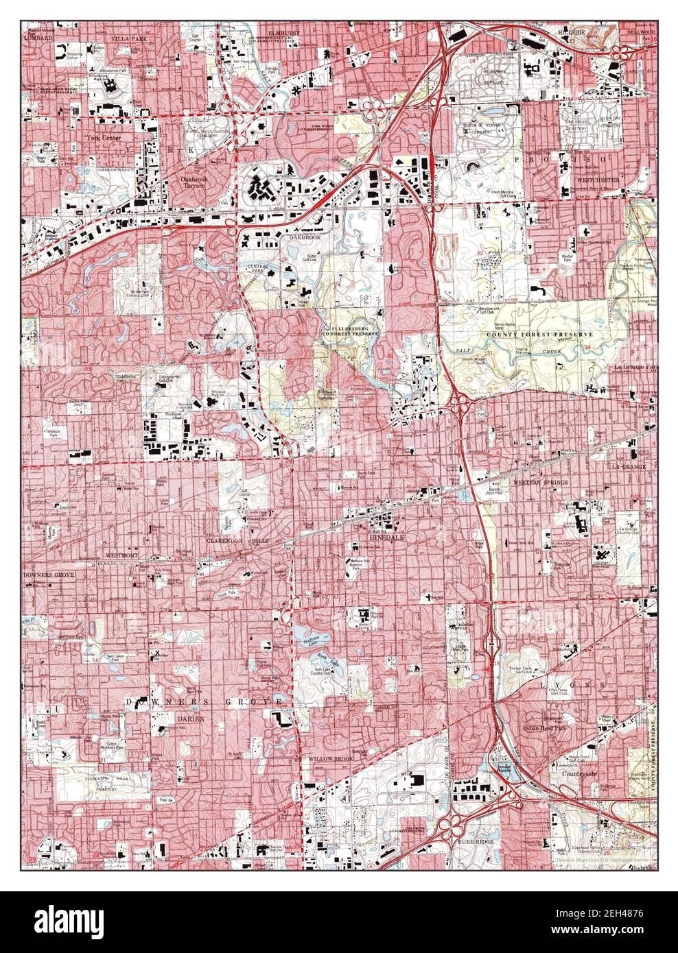 Hinsdale, Illinois, map 1997, 1:24000, United States of America by Timeless Maps, data U.S. Geological Survey Stock Photohttps://www.alamy.com/image-license-details/?v=1https://www.alamy.com/hinsdale-illinois-map-1997-124000-united-states-of-america-by-timeless-maps-data-us-geological-survey-image406381898.html
RM2EH4876–Hinsdale, Illinois, map 1997, 1:24000, United States of America by Timeless Maps, data U.S. Geological Survey
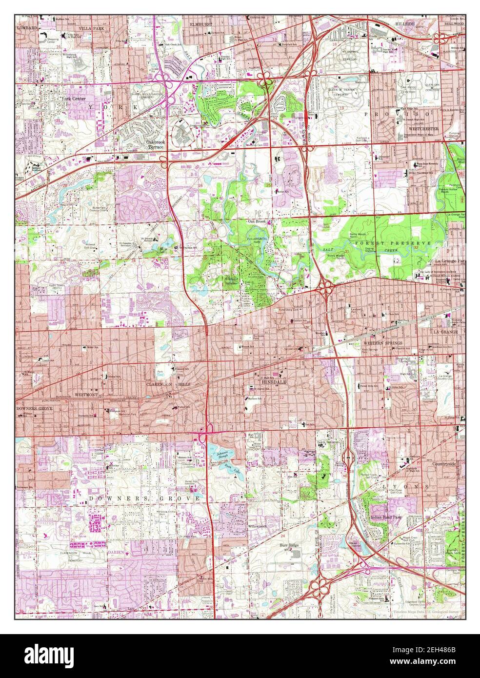 Hinsdale, Illinois, map 1963, 1:24000, United States of America by Timeless Maps, data U.S. Geological Survey Stock Photohttps://www.alamy.com/image-license-details/?v=1https://www.alamy.com/hinsdale-illinois-map-1963-124000-united-states-of-america-by-timeless-maps-data-us-geological-survey-image406381875.html
RM2EH486B–Hinsdale, Illinois, map 1963, 1:24000, United States of America by Timeless Maps, data U.S. Geological Survey
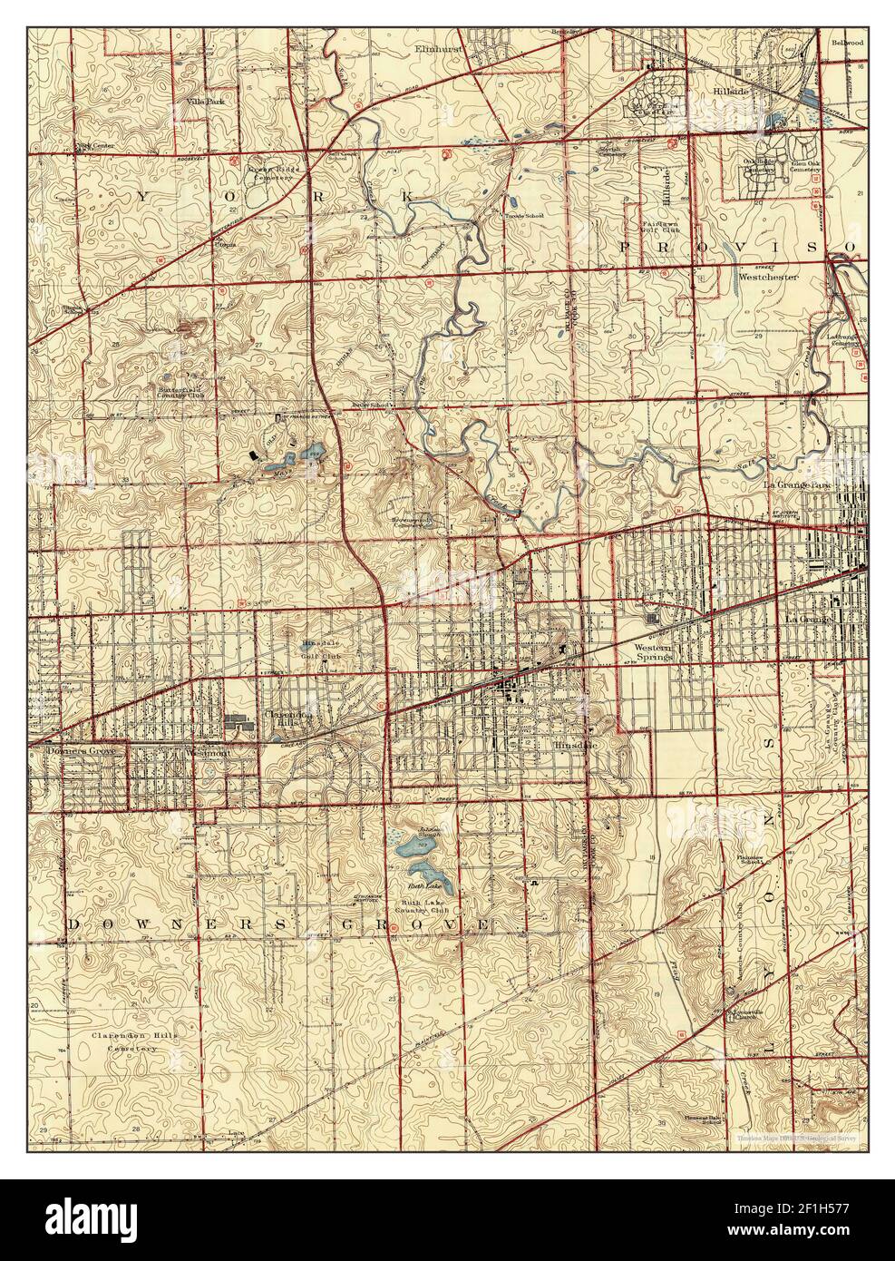 Hinsdale, Illinois, map 1927, 1:24000, United States of America by Timeless Maps, data U.S. Geological Survey Stock Photohttps://www.alamy.com/image-license-details/?v=1https://www.alamy.com/hinsdale-illinois-map-1927-124000-united-states-of-america-by-timeless-maps-data-us-geological-survey-image414040795.html
RM2F1H577–Hinsdale, Illinois, map 1927, 1:24000, United States of America by Timeless Maps, data U.S. Geological Survey
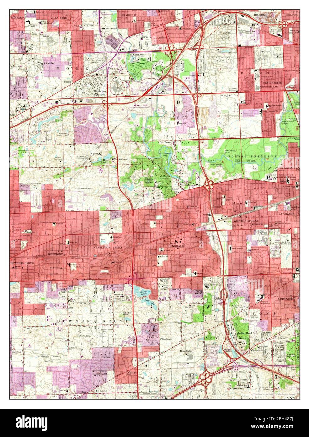 Hinsdale, Illinois, map 1963, 1:24000, United States of America by Timeless Maps, data U.S. Geological Survey Stock Photohttps://www.alamy.com/image-license-details/?v=1https://www.alamy.com/hinsdale-illinois-map-1963-124000-united-states-of-america-by-timeless-maps-data-us-geological-survey-image406381910.html
RM2EH487J–Hinsdale, Illinois, map 1963, 1:24000, United States of America by Timeless Maps, data U.S. Geological Survey
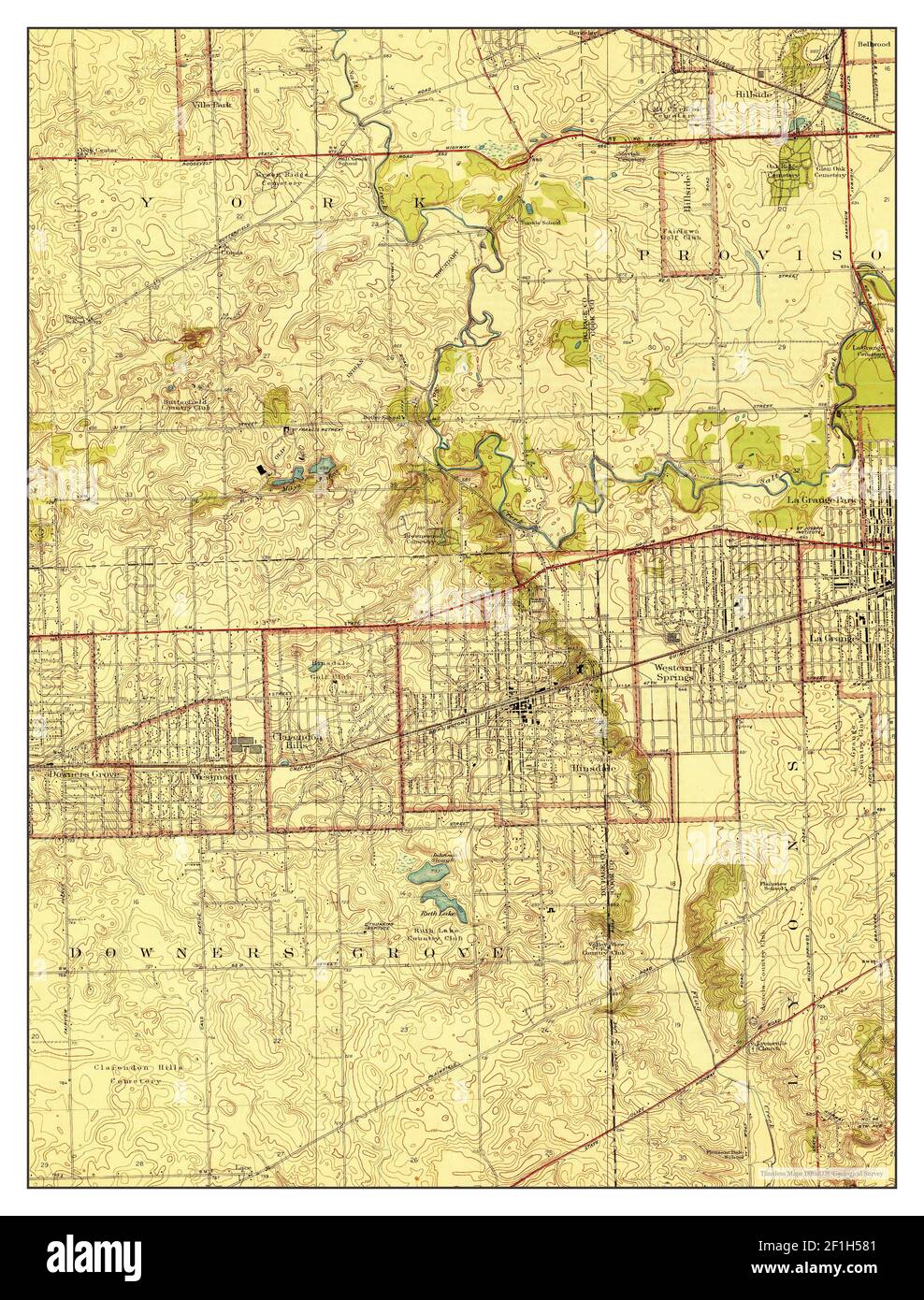 Hinsdale, Illinois, map 1927, 1:24000, United States of America by Timeless Maps, data U.S. Geological Survey Stock Photohttps://www.alamy.com/image-license-details/?v=1https://www.alamy.com/hinsdale-illinois-map-1927-124000-united-states-of-america-by-timeless-maps-data-us-geological-survey-image414040817.html
RM2F1H581–Hinsdale, Illinois, map 1927, 1:24000, United States of America by Timeless Maps, data U.S. Geological Survey
 Hinsdale, Montana, map 1984, 1:24000, United States of America by Timeless Maps, data U.S. Geological Survey Stock Photohttps://www.alamy.com/image-license-details/?v=1https://www.alamy.com/hinsdale-montana-map-1984-124000-united-states-of-america-by-timeless-maps-data-us-geological-survey-image406856536.html
RM2EHWWJG–Hinsdale, Montana, map 1984, 1:24000, United States of America by Timeless Maps, data U.S. Geological Survey
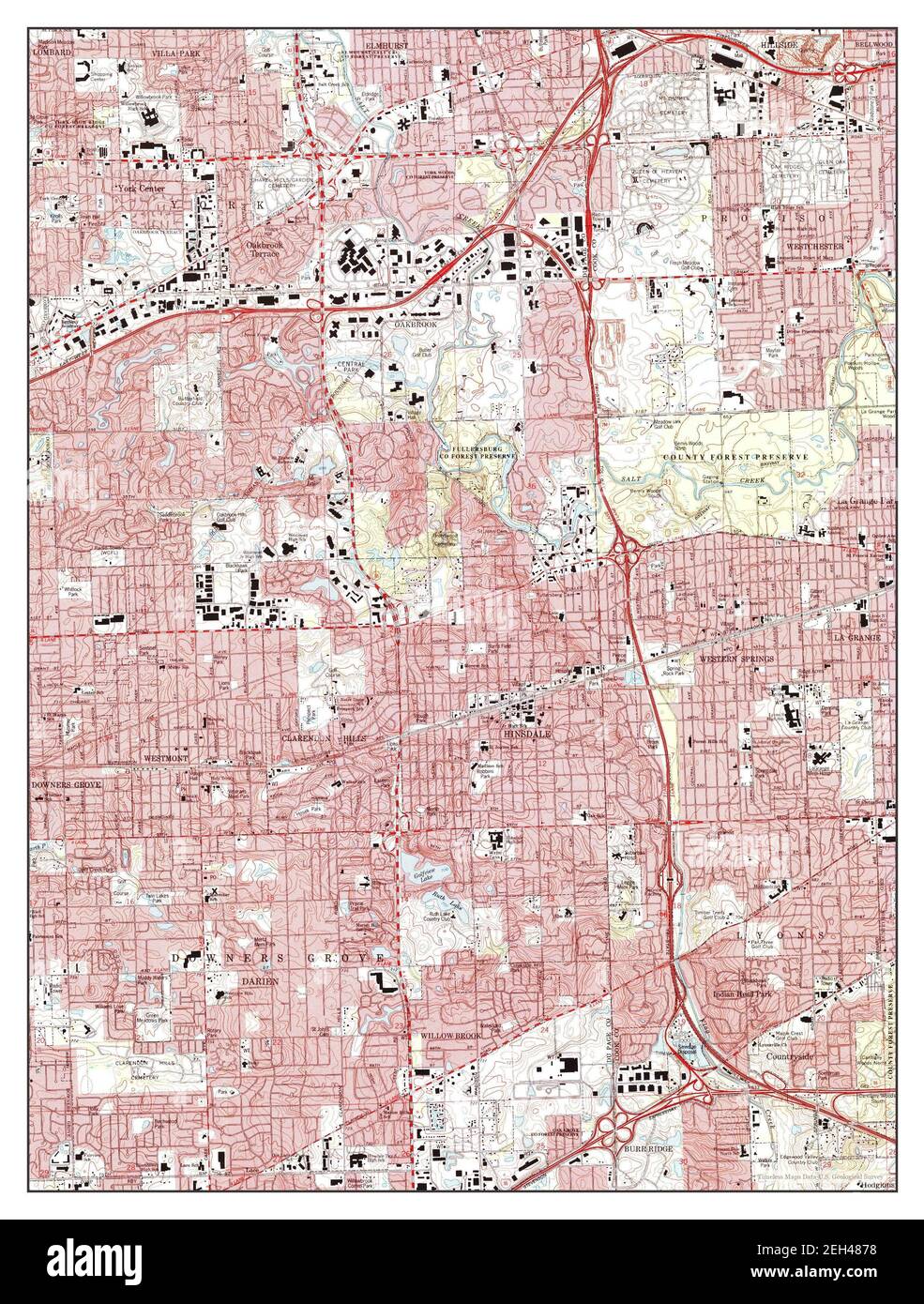 Hinsdale, Illinois, map 1993, 1:24000, United States of America by Timeless Maps, data U.S. Geological Survey Stock Photohttps://www.alamy.com/image-license-details/?v=1https://www.alamy.com/hinsdale-illinois-map-1993-124000-united-states-of-america-by-timeless-maps-data-us-geological-survey-image406381900.html
RM2EH4878–Hinsdale, Illinois, map 1993, 1:24000, United States of America by Timeless Maps, data U.S. Geological Survey
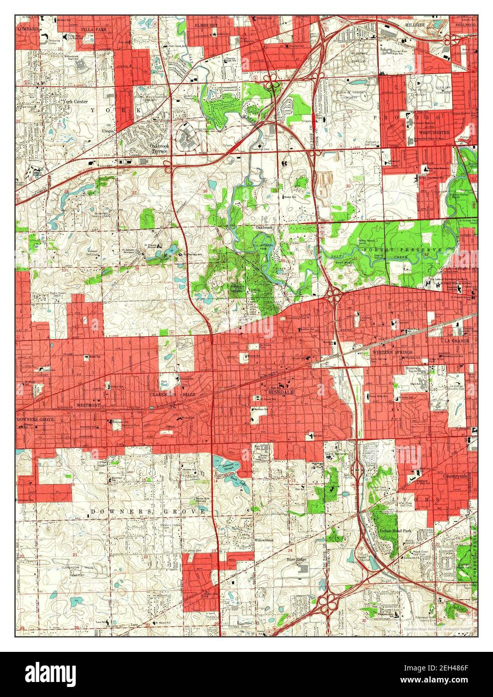 Hinsdale, Illinois, map 1963, 1:24000, United States of America by Timeless Maps, data U.S. Geological Survey Stock Photohttps://www.alamy.com/image-license-details/?v=1https://www.alamy.com/hinsdale-illinois-map-1963-124000-united-states-of-america-by-timeless-maps-data-us-geological-survey-image406381879.html
RM2EH486F–Hinsdale, Illinois, map 1963, 1:24000, United States of America by Timeless Maps, data U.S. Geological Survey
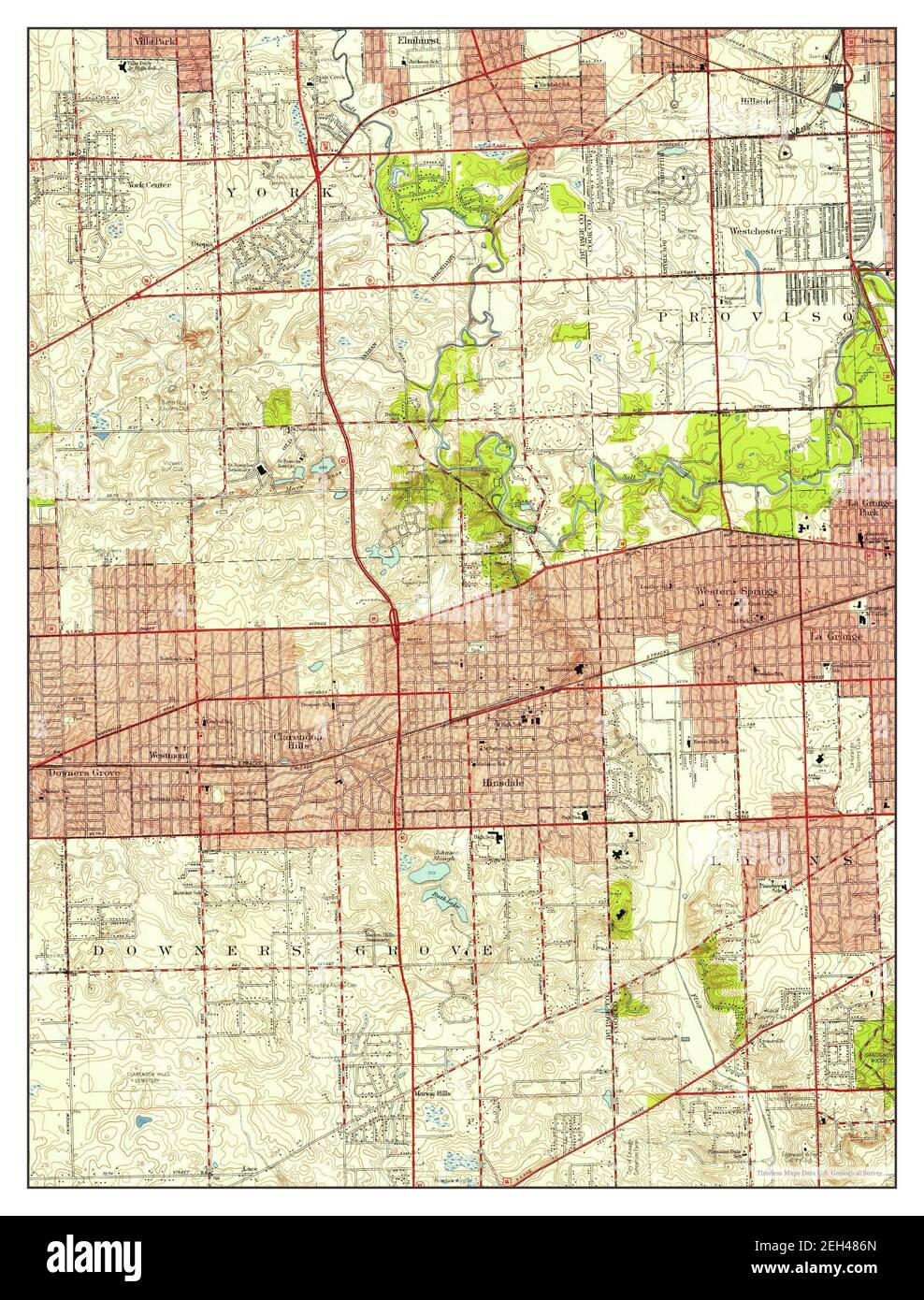 Hinsdale, Illinois, map 1953, 1:24000, United States of America by Timeless Maps, data U.S. Geological Survey Stock Photohttps://www.alamy.com/image-license-details/?v=1https://www.alamy.com/hinsdale-illinois-map-1953-124000-united-states-of-america-by-timeless-maps-data-us-geological-survey-image406381885.html
RM2EH486N–Hinsdale, Illinois, map 1953, 1:24000, United States of America by Timeless Maps, data U.S. Geological Survey
 Hinsdale, New York, map 1979, 1:24000, United States of America by Timeless Maps, data U.S. Geological Survey Stock Photohttps://www.alamy.com/image-license-details/?v=1https://www.alamy.com/hinsdale-new-york-map-1979-124000-united-states-of-america-by-timeless-maps-data-us-geological-survey-image406923099.html
RM2EJ0XFR–Hinsdale, New York, map 1979, 1:24000, United States of America by Timeless Maps, data U.S. Geological Survey
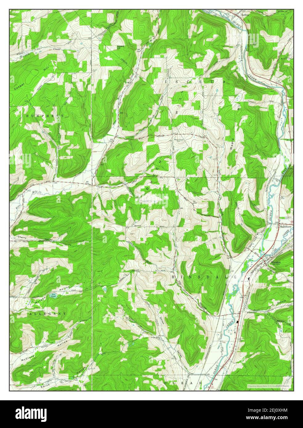 Hinsdale, New York, map 1961, 1:24000, United States of America by Timeless Maps, data U.S. Geological Survey Stock Photohttps://www.alamy.com/image-license-details/?v=1https://www.alamy.com/hinsdale-new-york-map-1961-124000-united-states-of-america-by-timeless-maps-data-us-geological-survey-image406923152.html
RM2EJ0XHM–Hinsdale, New York, map 1961, 1:24000, United States of America by Timeless Maps, data U.S. Geological Survey
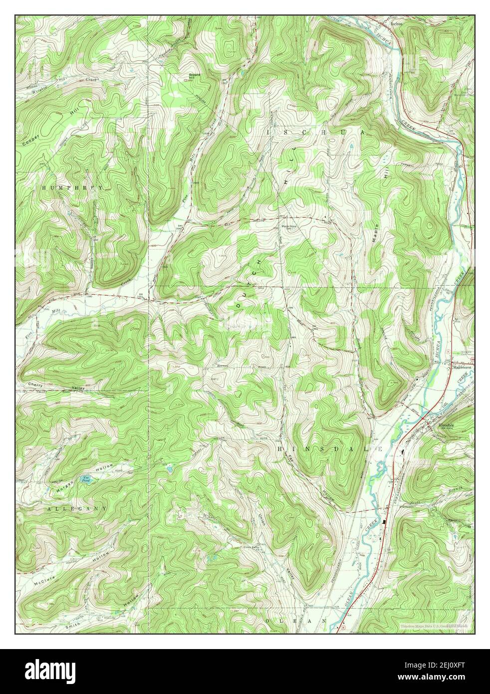 Hinsdale, New York, map 1971, 1:24000, United States of America by Timeless Maps, data U.S. Geological Survey Stock Photohttps://www.alamy.com/image-license-details/?v=1https://www.alamy.com/hinsdale-new-york-map-1971-124000-united-states-of-america-by-timeless-maps-data-us-geological-survey-image406923100.html
RM2EJ0XFT–Hinsdale, New York, map 1971, 1:24000, United States of America by Timeless Maps, data U.S. Geological Survey
 Hinsdale, New Hampshire, map 1998, 1:24000, United States of America by Timeless Maps, data U.S. Geological Survey Stock Photohttps://www.alamy.com/image-license-details/?v=1https://www.alamy.com/hinsdale-new-hampshire-map-1998-124000-united-states-of-america-by-timeless-maps-data-us-geological-survey-image406896028.html
RM2EHYM10–Hinsdale, New Hampshire, map 1998, 1:24000, United States of America by Timeless Maps, data U.S. Geological Survey