Quick filters:
Map of kirby Stock Photos and Images
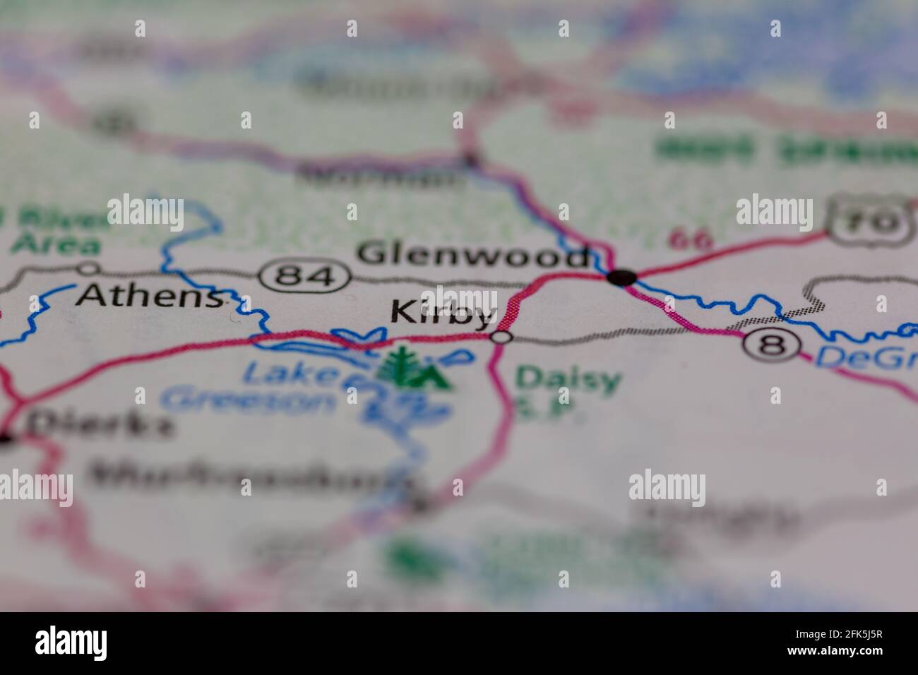 Kirby Arkansas USA shown on a geography map or road map Stock Photohttps://www.alamy.com/image-license-details/?v=1https://www.alamy.com/kirby-arkansas-usa-shown-on-a-geography-map-or-road-map-image424851331.html
RM2FK5J5R–Kirby Arkansas USA shown on a geography map or road map
 CLASSROON IN PROPOSED BRYAN UNIVERSITY IN TENNESSEE, July 18, 1925, by Rollin Kirby, NEW YORK WORLD. The gagged teacher points to a map of a flat earth (BSLOC 2016 10 67) Stock Photohttps://www.alamy.com/image-license-details/?v=1https://www.alamy.com/stock-photo-classroon-in-proposed-bryan-university-in-tennessee-july-18-1925-by-170552813.html
RMKWD9RW–CLASSROON IN PROPOSED BRYAN UNIVERSITY IN TENNESSEE, July 18, 1925, by Rollin Kirby, NEW YORK WORLD. The gagged teacher points to a map of a flat earth (BSLOC 2016 10 67)
 Kirby 2, , AU, Australia, South Australia, S 27 38' 42'', N 140 51' 14'', map, Cartascapes Map published in 2024. Explore Cartascapes, a map revealing Earth's diverse landscapes, cultures, and ecosystems. Journey through time and space, discovering the interconnectedness of our planet's past, present, and future. Stock Photohttps://www.alamy.com/image-license-details/?v=1https://www.alamy.com/kirby-2-au-australia-south-australia-s-27-38-42-n-140-51-14-map-cartascapes-map-published-in-2024-explore-cartascapes-a-map-revealing-earths-diverse-landscapes-cultures-and-ecosystems-journey-through-time-and-space-discovering-the-interconnectedness-of-our-planets-past-present-and-future-image625832004.html
RM2YA5330–Kirby 2, , AU, Australia, South Australia, S 27 38' 42'', N 140 51' 14'', map, Cartascapes Map published in 2024. Explore Cartascapes, a map revealing Earth's diverse landscapes, cultures, and ecosystems. Journey through time and space, discovering the interconnectedness of our planet's past, present, and future.
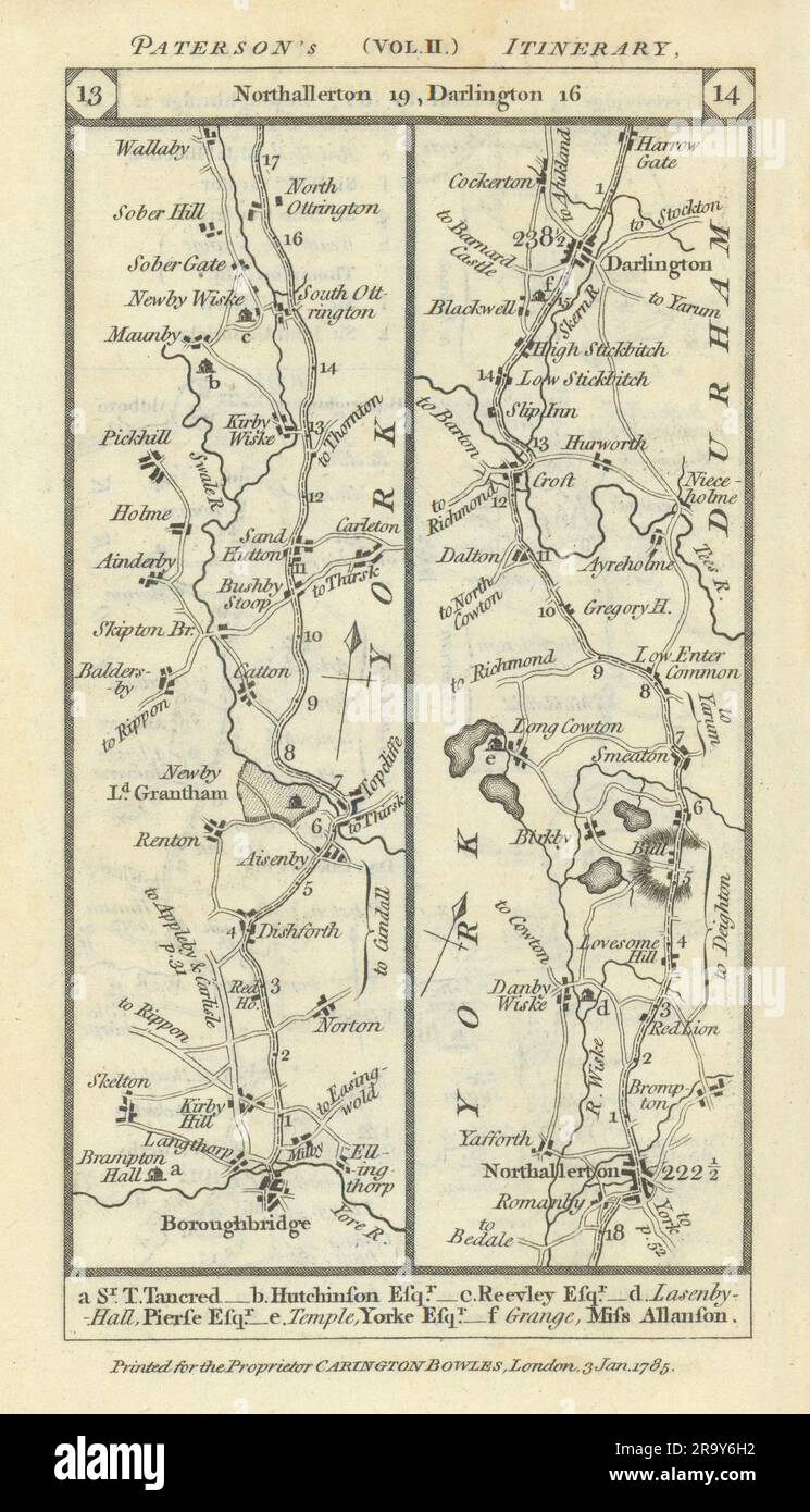 Boroughbridge-Northallerton-Darlington road strip map PATERSON 1785 old Stock Photohttps://www.alamy.com/image-license-details/?v=1https://www.alamy.com/boroughbridge-northallerton-darlington-road-strip-map-paterson-1785-old-image556861566.html
RF2R9Y6H2–Boroughbridge-Northallerton-Darlington road strip map PATERSON 1785 old
 Map of the highlands of the Hudson, Orange Co: from actual surveys 1880 by Kirby, James P. Stock Photohttps://www.alamy.com/image-license-details/?v=1https://www.alamy.com/map-of-the-highlands-of-the-hudson-orange-co-from-actual-surveys-1880-by-kirby-james-p-image633233181.html
RM2YP67AN–Map of the highlands of the Hudson, Orange Co: from actual surveys 1880 by Kirby, James P.
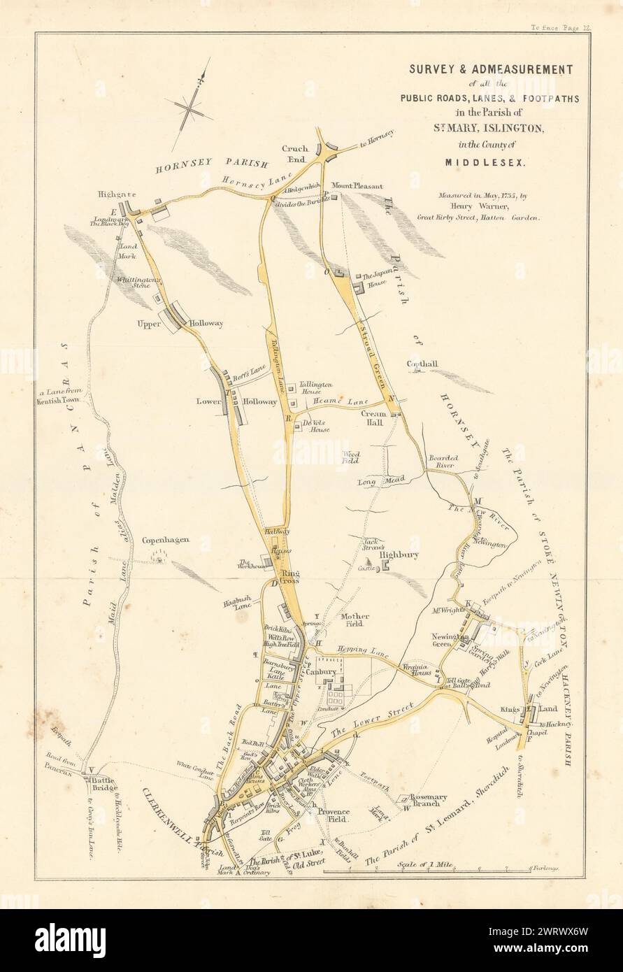 Survey & Admeasurement of… the Parish of St. Mary, Islington 1735 (1858) map Stock Photohttps://www.alamy.com/image-license-details/?v=1https://www.alamy.com/survey-admeasurement-of-the-parish-of-st-mary-islington-1735-1858-map-image599858977.html
RF2WRWX6W–Survey & Admeasurement of… the Parish of St. Mary, Islington 1735 (1858) map
 CLASSROON IN PROPOSED BRYAN UNIVERSITY IN TENNESSEE, July 18, 1925, by Rollin Kirby, NEW YORK WORLD. The gagged teacher points to a map of a flat earth (BSLOC 2016 10 67) Stock Photohttps://www.alamy.com/image-license-details/?v=1https://www.alamy.com/stock-photo-classroon-in-proposed-bryan-university-in-tennessee-july-18-1925-by-170553624.html
RMKWDATT–CLASSROON IN PROPOSED BRYAN UNIVERSITY IN TENNESSEE, July 18, 1925, by Rollin Kirby, NEW YORK WORLD. The gagged teacher points to a map of a flat earth (BSLOC 2016 10 67)
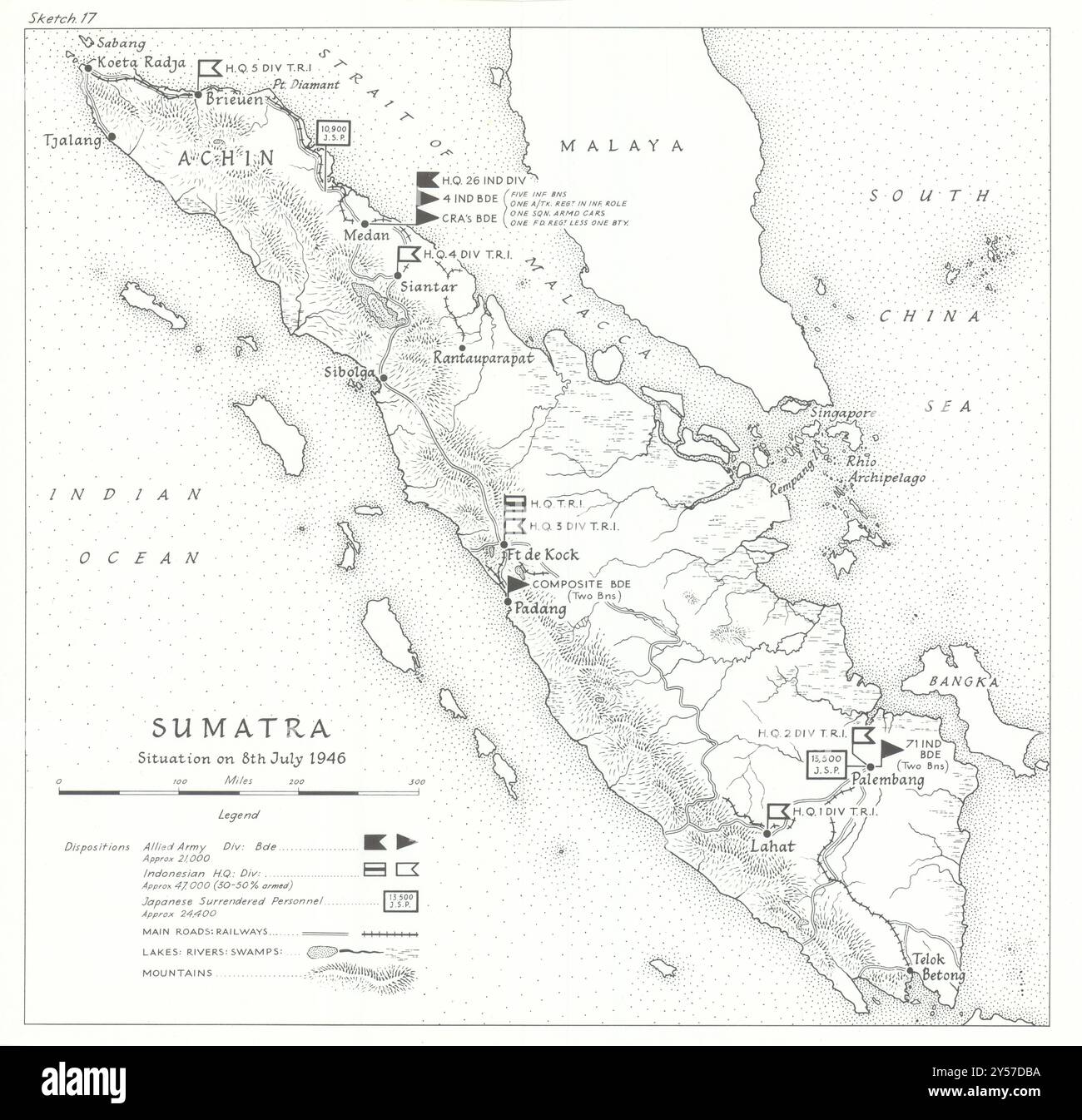 Sumatra July 1946. Indonesian National Revolution. Surrendered Japanese 1969 map Stock Photohttps://www.alamy.com/image-license-details/?v=1https://www.alamy.com/sumatra-july-1946-indonesian-national-revolution-surrendered-japanese-1969-map-image622810702.html
RF2Y57DBA–Sumatra July 1946. Indonesian National Revolution. Surrendered Japanese 1969 map
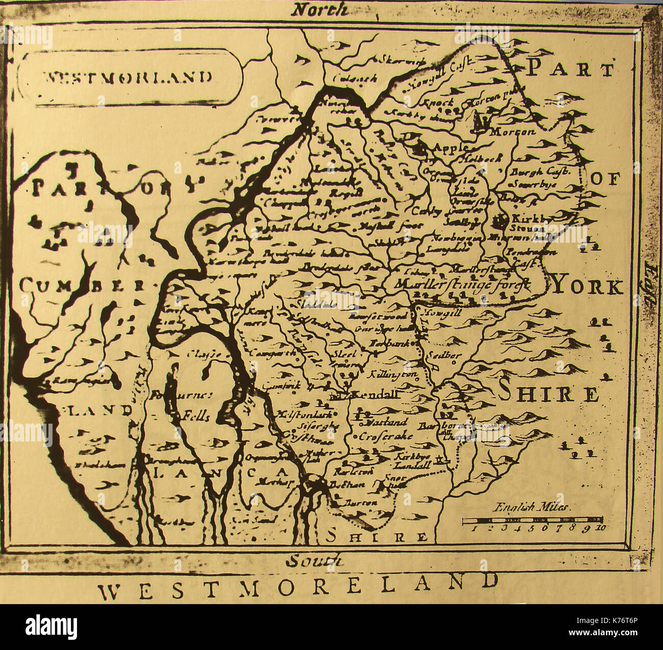 An 18th century map of the county of Westmoreland, Northern England. Stock Photohttps://www.alamy.com/image-license-details/?v=1https://www.alamy.com/an-18th-century-map-of-the-county-of-westmoreland-northern-england-image159346622.html
RMK76T6P–An 18th century map of the county of Westmoreland, Northern England.
![A New Map of the County of Suffolk Author Kirby, John 39.5.1-5. Place of publication: [London] Publisher: [Joshua , W.m Kirby] Date of publication: [1766] Item type: 1 map on 4 sheets Medium: copperplate engraving Dimensions: 111.0 x 144.6 cm Former owner: George III, King of Great Britain, 1738-1820 Stock Photo A New Map of the County of Suffolk Author Kirby, John 39.5.1-5. Place of publication: [London] Publisher: [Joshua , W.m Kirby] Date of publication: [1766] Item type: 1 map on 4 sheets Medium: copperplate engraving Dimensions: 111.0 x 144.6 cm Former owner: George III, King of Great Britain, 1738-1820 Stock Photo](https://c8.alamy.com/comp/2E9HPMG/a-new-map-of-the-county-of-suffolk-author-kirby-john-3951-5-place-of-publication-london-publisher-joshua-wm-kirby-date-of-publication-1766-item-type-1-map-on-4-sheets-medium-copperplate-engraving-dimensions-1110-x-1446-cm-former-owner-george-iii-king-of-great-britain-1738-1820-2E9HPMG.jpg) A New Map of the County of Suffolk Author Kirby, John 39.5.1-5. Place of publication: [London] Publisher: [Joshua , W.m Kirby] Date of publication: [1766] Item type: 1 map on 4 sheets Medium: copperplate engraving Dimensions: 111.0 x 144.6 cm Former owner: George III, King of Great Britain, 1738-1820 Stock Photohttps://www.alamy.com/image-license-details/?v=1https://www.alamy.com/a-new-map-of-the-county-of-suffolk-author-kirby-john-3951-5-place-of-publication-london-publisher-joshua-wm-kirby-date-of-publication-1766-item-type-1-map-on-4-sheets-medium-copperplate-engraving-dimensions-1110-x-1446-cm-former-owner-george-iii-king-of-great-britain-1738-1820-image401761376.html
A New Map of the County of Suffolk Author Kirby, John 39.5.1-5. Place of publication: [London] Publisher: [Joshua , W.m Kirby] Date of publication: [1766] Item type: 1 map on 4 sheets Medium: copperplate engraving Dimensions: 111.0 x 144.6 cm Former owner: George III, King of Great Britain, 1738-1820 Stock Photohttps://www.alamy.com/image-license-details/?v=1https://www.alamy.com/a-new-map-of-the-county-of-suffolk-author-kirby-john-3951-5-place-of-publication-london-publisher-joshua-wm-kirby-date-of-publication-1766-item-type-1-map-on-4-sheets-medium-copperplate-engraving-dimensions-1110-x-1446-cm-former-owner-george-iii-king-of-great-britain-1738-1820-image401761376.htmlRM2E9HPMG–A New Map of the County of Suffolk Author Kirby, John 39.5.1-5. Place of publication: [London] Publisher: [Joshua , W.m Kirby] Date of publication: [1766] Item type: 1 map on 4 sheets Medium: copperplate engraving Dimensions: 111.0 x 144.6 cm Former owner: George III, King of Great Britain, 1738-1820
 Man holding a compass and a map of the Lake District at Gummers How. Stock Photohttps://www.alamy.com/image-license-details/?v=1https://www.alamy.com/man-holding-a-compass-and-a-map-of-the-lake-district-at-gummers-how-image68524046.html
RMDYDF3A–Man holding a compass and a map of the Lake District at Gummers How.
 Joe Kirby 001 Stock Photohttps://www.alamy.com/image-license-details/?v=1https://www.alamy.com/stock-photo-joe-kirby-001-140058083.html
RMJ3T5EB–Joe Kirby 001
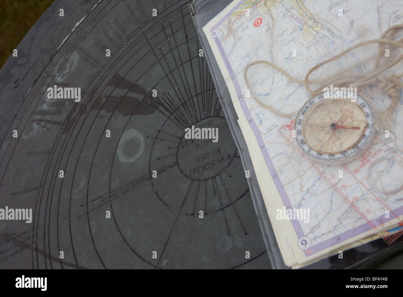 Triangulation Point at Nine Standards Rigg (nr Kirby Stephen North Yorkshire UK) Stock Photohttps://www.alamy.com/image-license-details/?v=1https://www.alamy.com/stock-photo-triangulation-point-at-nine-standards-rigg-nr-kirby-stephen-north-26539307.html
RMBF4Y4B–Triangulation Point at Nine Standards Rigg (nr Kirby Stephen North Yorkshire UK)
 THE GIRL FROM U.N.C.L.E. (TV) THE GIRL FROM UNCLE (ALT) LEO G CARROLL RANDY KIRBY STEFANIE POWERS NOEL HARRISON GFU 003 Stock Photohttps://www.alamy.com/image-license-details/?v=1https://www.alamy.com/stock-photo-the-girl-from-uncle-tv-the-girl-from-uncle-alt-leo-g-carroll-randy-50602219.html
RMCX93J3–THE GIRL FROM U.N.C.L.E. (TV) THE GIRL FROM UNCLE (ALT) LEO G CARROLL RANDY KIRBY STEFANIE POWERS NOEL HARRISON GFU 003
![Kent estate map. England; 1810. [Whole map] Survey and map of an estate in the parishes of Horton Kirby, Sutton at Hone, and Darenth, co. Kent; the property of Edward Cresy and William Muggeridge Originally published/produced in England; 1810. . Source: Egerton 3021 P,. Language: English. Stock Photo Kent estate map. England; 1810. [Whole map] Survey and map of an estate in the parishes of Horton Kirby, Sutton at Hone, and Darenth, co. Kent; the property of Edward Cresy and William Muggeridge Originally published/produced in England; 1810. . Source: Egerton 3021 P,. Language: English. Stock Photo](https://c8.alamy.com/comp/R5CTX6/kent-estate-map-england-1810-whole-map-survey-and-map-of-an-estate-in-the-parishes-of-horton-kirby-sutton-at-hone-and-darenth-co-kent-the-property-of-edward-cresy-and-william-muggeridge-originally-publishedproduced-in-england-1810-source-egerton-3021-p-language-english-R5CTX6.jpg) Kent estate map. England; 1810. [Whole map] Survey and map of an estate in the parishes of Horton Kirby, Sutton at Hone, and Darenth, co. Kent; the property of Edward Cresy and William Muggeridge Originally published/produced in England; 1810. . Source: Egerton 3021 P,. Language: English. Stock Photohttps://www.alamy.com/image-license-details/?v=1https://www.alamy.com/kent-estate-map-england-1810-whole-map-survey-and-map-of-an-estate-in-the-parishes-of-horton-kirby-sutton-at-hone-and-darenth-co-kent-the-property-of-edward-cresy-and-william-muggeridge-originally-publishedproduced-in-england-1810-source-egerton-3021-p-language-english-image227091038.html
Kent estate map. England; 1810. [Whole map] Survey and map of an estate in the parishes of Horton Kirby, Sutton at Hone, and Darenth, co. Kent; the property of Edward Cresy and William Muggeridge Originally published/produced in England; 1810. . Source: Egerton 3021 P,. Language: English. Stock Photohttps://www.alamy.com/image-license-details/?v=1https://www.alamy.com/kent-estate-map-england-1810-whole-map-survey-and-map-of-an-estate-in-the-parishes-of-horton-kirby-sutton-at-hone-and-darenth-co-kent-the-property-of-edward-cresy-and-william-muggeridge-originally-publishedproduced-in-england-1810-source-egerton-3021-p-language-english-image227091038.htmlRMR5CTX6–Kent estate map. England; 1810. [Whole map] Survey and map of an estate in the parishes of Horton Kirby, Sutton at Hone, and Darenth, co. Kent; the property of Edward Cresy and William Muggeridge Originally published/produced in England; 1810. . Source: Egerton 3021 P,. Language: English.
 Edmund Kirby Smith Stock Photohttps://www.alamy.com/image-license-details/?v=1https://www.alamy.com/stock-photo-edmund-kirby-smith-139812099.html
RMJ3CYN7–Edmund Kirby Smith
 Street sign, Kirkby Lonsdale, Cumbria, UK Stock Photohttps://www.alamy.com/image-license-details/?v=1https://www.alamy.com/street-sign-kirkby-lonsdale-cumbria-uk-image155920652.html
RMK1JPAM–Street sign, Kirkby Lonsdale, Cumbria, UK
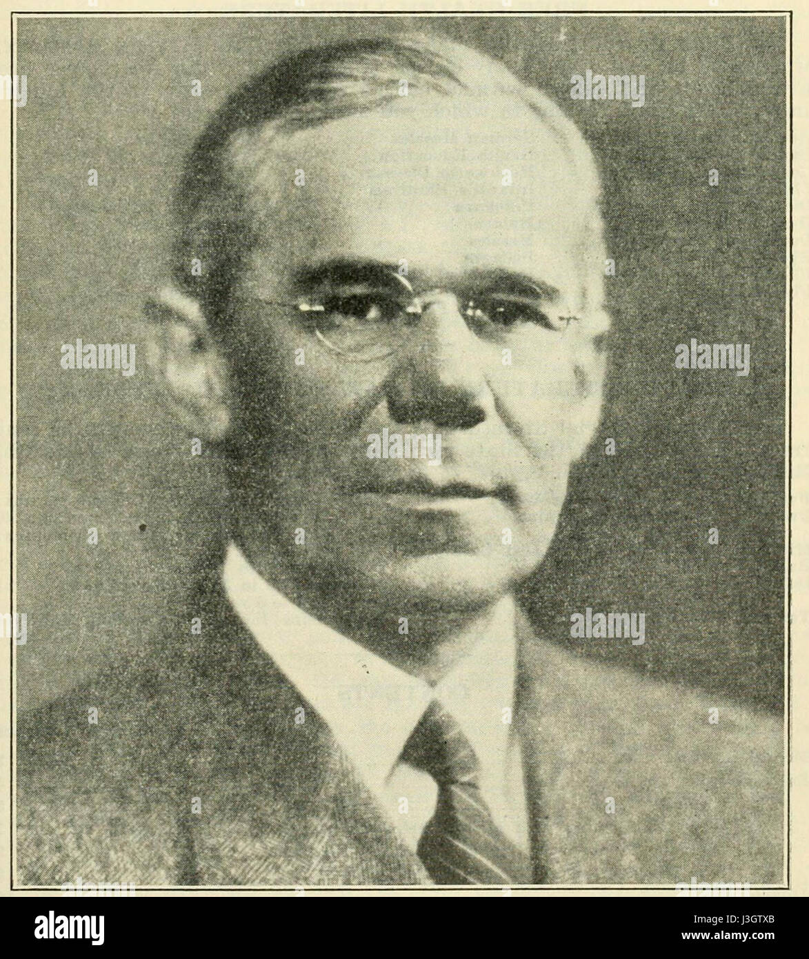 George Hughes Kirby Stock Photohttps://www.alamy.com/image-license-details/?v=1https://www.alamy.com/stock-photo-george-hughes-kirby-139897699.html
RMJ3GTXB–George Hughes Kirby
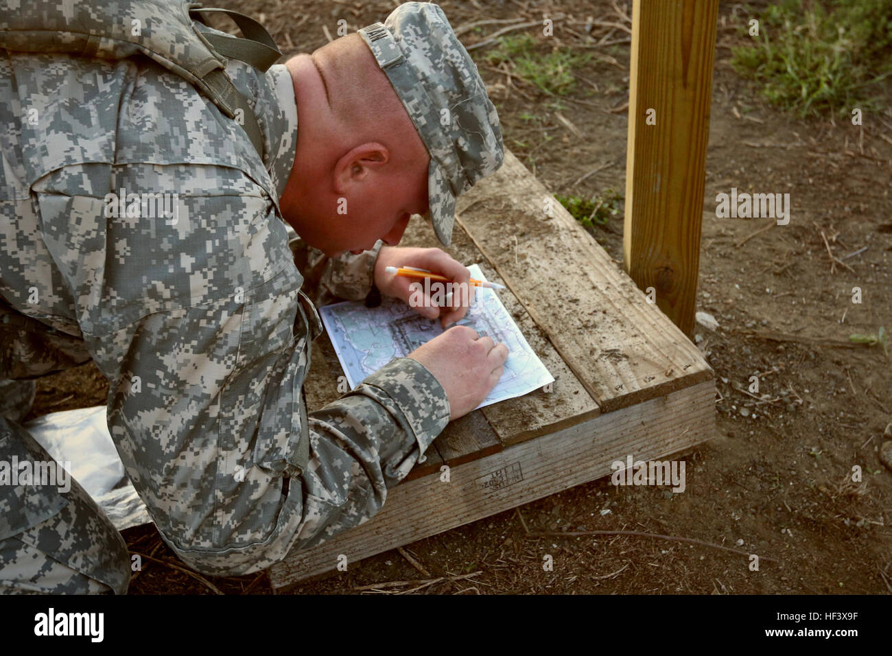 A student from GTMO’s first Army Basic Leadership Course plots his grid coordinates on his map ahead of beginning the land navigation course at U.S. Naval Station, Guantanamo Bay, Cuba on April 11. (Photo by U.S. Army Sgt. Sarah Kirby // released) New Army Career Advancement Offered at GTMO 160411-Z-SV252-018 Stock Photohttps://www.alamy.com/image-license-details/?v=1https://www.alamy.com/stock-photo-a-student-from-gtmos-first-army-basic-leadership-course-plots-his-129778923.html
RMHF3X9F–A student from GTMO’s first Army Basic Leadership Course plots his grid coordinates on his map ahead of beginning the land navigation course at U.S. Naval Station, Guantanamo Bay, Cuba on April 11. (Photo by U.S. Army Sgt. Sarah Kirby // released) New Army Career Advancement Offered at GTMO 160411-Z-SV252-018
 46653 Scale of eyed Kirby hooks Stock Photohttps://www.alamy.com/image-license-details/?v=1https://www.alamy.com/stock-photo-46653-scale-of-eyed-kirby-hooks-115033293.html
RMGK463W–46653 Scale of eyed Kirby hooks
![Historic archive Image taken from page 11 of 'A topographical and historical description of the County of S. ... embellished with prints and a map of the county. [By J. Kirby.]' Stock Photo Historic archive Image taken from page 11 of 'A topographical and historical description of the County of S. ... embellished with prints and a map of the county. [By J. Kirby.]' Stock Photo](https://c8.alamy.com/comp/PETEF2/historic-archive-image-taken-from-page-11-of-a-topographical-and-historical-description-of-the-county-of-s-embellished-with-prints-and-a-map-of-the-county-by-j-kirby-PETEF2.jpg) Historic archive Image taken from page 11 of 'A topographical and historical description of the County of S. ... embellished with prints and a map of the county. [By J. Kirby.]' Stock Photohttps://www.alamy.com/image-license-details/?v=1https://www.alamy.com/historic-archive-image-taken-from-page-11-of-a-topographical-and-historical-description-of-the-county-of-s-embellished-with-prints-and-a-map-of-the-county-by-j-kirby-image215667846.html
Historic archive Image taken from page 11 of 'A topographical and historical description of the County of S. ... embellished with prints and a map of the county. [By J. Kirby.]' Stock Photohttps://www.alamy.com/image-license-details/?v=1https://www.alamy.com/historic-archive-image-taken-from-page-11-of-a-topographical-and-historical-description-of-the-county-of-s-embellished-with-prints-and-a-map-of-the-county-by-j-kirby-image215667846.htmlRMPETEF2–Historic archive Image taken from page 11 of 'A topographical and historical description of the County of S. ... embellished with prints and a map of the county. [By J. Kirby.]'
 Kirby, , AU, Australia, New South Wales, S 28 49' 33'', N 152 38' 48'', map, Cartascapes Map published in 2024. Explore Cartascapes, a map revealing Earth's diverse landscapes, cultures, and ecosystems. Journey through time and space, discovering the interconnectedness of our planet's past, present, and future. Stock Photohttps://www.alamy.com/image-license-details/?v=1https://www.alamy.com/kirby-au-australia-new-south-wales-s-28-49-33-n-152-38-48-map-cartascapes-map-published-in-2024-explore-cartascapes-a-map-revealing-earths-diverse-landscapes-cultures-and-ecosystems-journey-through-time-and-space-discovering-the-interconnectedness-of-our-planets-past-present-and-future-image625379334.html
RM2Y9CDM6–Kirby, , AU, Australia, New South Wales, S 28 49' 33'', N 152 38' 48'', map, Cartascapes Map published in 2024. Explore Cartascapes, a map revealing Earth's diverse landscapes, cultures, and ecosystems. Journey through time and space, discovering the interconnectedness of our planet's past, present, and future.
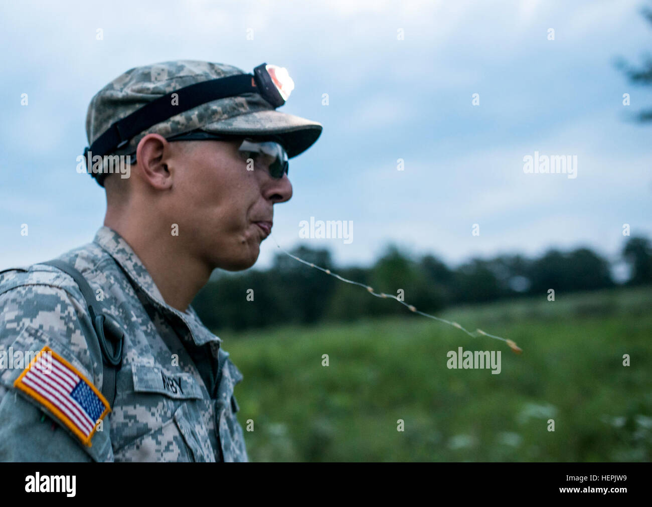 Pfc. Jorge Kirby, U.S. Army Reserve combat engineer with the 374th Engineer Company (Sapper), of Concord, Calif., spits while walking on a trail on a team-based land navigation course during the 2015 Sapper Stakes competition at Fort Chaffee, Ark., Aug. 30. The competition is designed to build teamwork, enhance combat engineering skills and promote leadership among the units. (U.S. Army photo by Master Sgt. Michel Sauret) Sapper teams take land by foot 150830-A-TI382-276 Stock Photohttps://www.alamy.com/image-license-details/?v=1https://www.alamy.com/stock-photo-pfc-jorge-kirby-us-army-reserve-combat-engineer-with-the-374th-engineer-129575525.html
RMHEPJW9–Pfc. Jorge Kirby, U.S. Army Reserve combat engineer with the 374th Engineer Company (Sapper), of Concord, Calif., spits while walking on a trail on a team-based land navigation course during the 2015 Sapper Stakes competition at Fort Chaffee, Ark., Aug. 30. The competition is designed to build teamwork, enhance combat engineering skills and promote leadership among the units. (U.S. Army photo by Master Sgt. Michel Sauret) Sapper teams take land by foot 150830-A-TI382-276
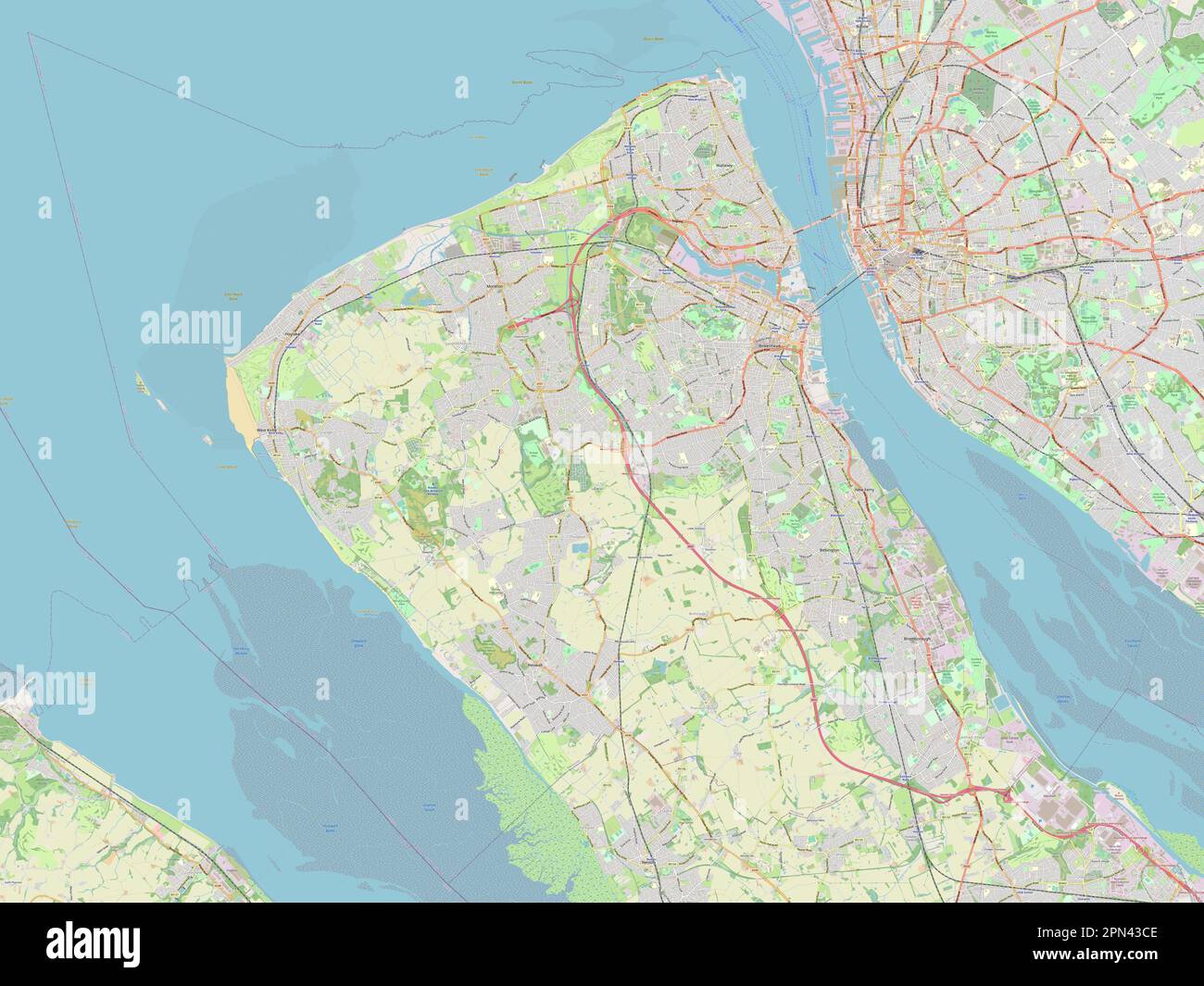 Wirral, metropolitan district of England - Great Britain. Open Street Map Stock Photohttps://www.alamy.com/image-license-details/?v=1https://www.alamy.com/wirral-metropolitan-district-of-england-great-britain-open-street-map-image546519694.html
RF2PN43CE–Wirral, metropolitan district of England - Great Britain. Open Street Map
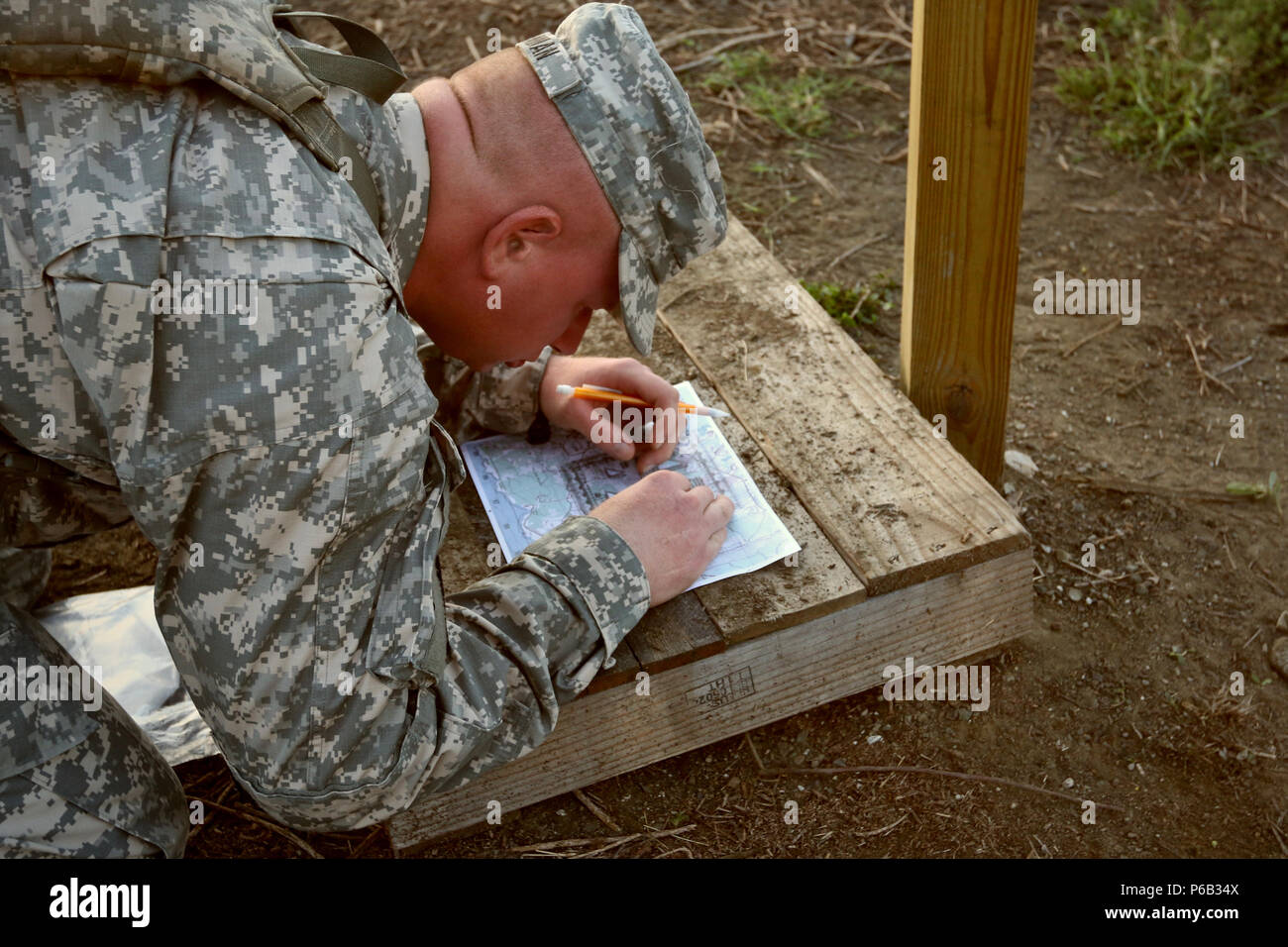 A student from GTMO’s first Army Basic Leadership Course plots his grid coordinates on his map ahead of beginning the land navigation course at U.S. Naval Station, Guantanamo Bay, Cuba on April 11. (Photo by U.S. Army Sgt. Sarah Kirby // released) Stock Photohttps://www.alamy.com/image-license-details/?v=1https://www.alamy.com/a-student-from-gtmos-first-army-basic-leadership-course-plots-his-grid-coordinates-on-his-map-ahead-of-beginning-the-land-navigation-course-at-us-naval-station-guantanamo-bay-cuba-on-april-11-photo-by-us-army-sgt-sarah-kirby-released-image210456314.html
RMP6B34X–A student from GTMO’s first Army Basic Leadership Course plots his grid coordinates on his map ahead of beginning the land navigation course at U.S. Naval Station, Guantanamo Bay, Cuba on April 11. (Photo by U.S. Army Sgt. Sarah Kirby // released)
 The literary digest . ^^tmyp^ui^ WALKING THE PLANK. —Kirby in the New York World.OPPOSING VIEW« OF T^TTE PROHIBITION VICTORY AND THEN HE TURNED AROUND. —Henderson in The American Is^ue. The Literary Digest for January 25, 1919 11. Frdiii tiif Vii-tory Map of the Aiiti-Saluou League. HOW PROHIBITION CAME. The States in white adopted State-wide prohibition, and tlie white area in the two-rolored Siates became dry under loral-option laws. InAugust, 1917, the United States Senate adopted a proliibition amendment to the Federal Constitution, and the House of Representatives fol-lowed in Decemb Stock Photohttps://www.alamy.com/image-license-details/?v=1https://www.alamy.com/the-literary-digest-tmypui-walking-the-plank-kirby-in-the-new-york-worldopposing-view-of-ttte-prohibition-victory-and-then-he-turned-around-henderson-in-the-american-isue-the-literary-digest-for-january-25-1919-11-frdiii-tiif-vii-tory-map-of-the-aiiti-saluou-league-how-prohibition-came-the-states-in-white-adopted-state-wide-prohibition-and-tlie-white-area-in-the-two-rolored-siates-became-dry-under-loral-option-laws-inaugust-1917-the-united-states-senate-adopted-a-proliibition-amendment-to-the-federal-constitution-and-the-house-of-representatives-fol-lowed-in-decemb-image339075918.html
RM2AKJ6P6–The literary digest . ^^tmyp^ui^ WALKING THE PLANK. —Kirby in the New York World.OPPOSING VIEW« OF T^TTE PROHIBITION VICTORY AND THEN HE TURNED AROUND. —Henderson in The American Is^ue. The Literary Digest for January 25, 1919 11. Frdiii tiif Vii-tory Map of the Aiiti-Saluou League. HOW PROHIBITION CAME. The States in white adopted State-wide prohibition, and tlie white area in the two-rolored Siates became dry under loral-option laws. InAugust, 1917, the United States Senate adopted a proliibition amendment to the Federal Constitution, and the House of Representatives fol-lowed in Decemb
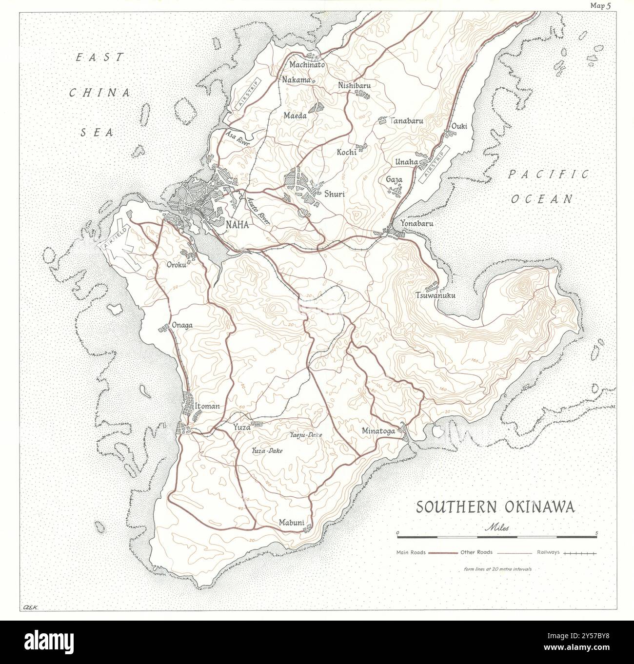 Southern Okinawa 1945. World War Two 1969 old vintage map plan chart Stock Photohttps://www.alamy.com/image-license-details/?v=1https://www.alamy.com/southern-okinawa-1945-world-war-two-1969-old-vintage-map-plan-chart-image622809580.html
RF2Y57BY8–Southern Okinawa 1945. World War Two 1969 old vintage map plan chart
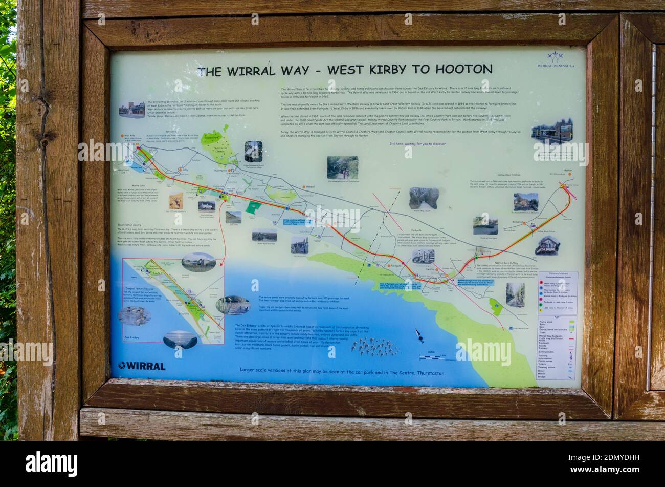 Caldy, The Wirral, UK: Jun 217, 2020: A sign displays information and map for visitors and tourists to The Wirral Way which is a popular walking route Stock Photohttps://www.alamy.com/image-license-details/?v=1https://www.alamy.com/caldy-the-wirral-uk-jun-217-2020-a-sign-displays-information-and-map-for-visitors-and-tourists-to-the-wirral-way-which-is-a-popular-walking-route-image391524605.html
RF2DMYDHH–Caldy, The Wirral, UK: Jun 217, 2020: A sign displays information and map for visitors and tourists to The Wirral Way which is a popular walking route
 Strategic map of the Pacific 1941 1957 old vintage plan chart Stock Photohttps://www.alamy.com/image-license-details/?v=1https://www.alamy.com/strategic-map-of-the-pacific-1941-1957-old-vintage-plan-chart-image242553349.html
RFT2H77H–Strategic map of the Pacific 1941 1957 old vintage plan chart
![A New Map of the County of Suffolk Author Kirby, John 39.5.1-5. Place of publication: [London] Publisher: [Joshua , W.m Kirby] Date of publication: [1766] Item type: 1 map on 4 sheets Medium: copperplate engraving Dimensions: 111.0 x 144.6 cm Former owner: George III, King of Great Britain, 1738-1820 Stock Photo A New Map of the County of Suffolk Author Kirby, John 39.5.1-5. Place of publication: [London] Publisher: [Joshua , W.m Kirby] Date of publication: [1766] Item type: 1 map on 4 sheets Medium: copperplate engraving Dimensions: 111.0 x 144.6 cm Former owner: George III, King of Great Britain, 1738-1820 Stock Photo](https://c8.alamy.com/comp/2E9HPMJ/a-new-map-of-the-county-of-suffolk-author-kirby-john-3951-5-place-of-publication-london-publisher-joshua-wm-kirby-date-of-publication-1766-item-type-1-map-on-4-sheets-medium-copperplate-engraving-dimensions-1110-x-1446-cm-former-owner-george-iii-king-of-great-britain-1738-1820-2E9HPMJ.jpg) A New Map of the County of Suffolk Author Kirby, John 39.5.1-5. Place of publication: [London] Publisher: [Joshua , W.m Kirby] Date of publication: [1766] Item type: 1 map on 4 sheets Medium: copperplate engraving Dimensions: 111.0 x 144.6 cm Former owner: George III, King of Great Britain, 1738-1820 Stock Photohttps://www.alamy.com/image-license-details/?v=1https://www.alamy.com/a-new-map-of-the-county-of-suffolk-author-kirby-john-3951-5-place-of-publication-london-publisher-joshua-wm-kirby-date-of-publication-1766-item-type-1-map-on-4-sheets-medium-copperplate-engraving-dimensions-1110-x-1446-cm-former-owner-george-iii-king-of-great-britain-1738-1820-image401761378.html
A New Map of the County of Suffolk Author Kirby, John 39.5.1-5. Place of publication: [London] Publisher: [Joshua , W.m Kirby] Date of publication: [1766] Item type: 1 map on 4 sheets Medium: copperplate engraving Dimensions: 111.0 x 144.6 cm Former owner: George III, King of Great Britain, 1738-1820 Stock Photohttps://www.alamy.com/image-license-details/?v=1https://www.alamy.com/a-new-map-of-the-county-of-suffolk-author-kirby-john-3951-5-place-of-publication-london-publisher-joshua-wm-kirby-date-of-publication-1766-item-type-1-map-on-4-sheets-medium-copperplate-engraving-dimensions-1110-x-1446-cm-former-owner-george-iii-king-of-great-britain-1738-1820-image401761378.htmlRM2E9HPMJ–A New Map of the County of Suffolk Author Kirby, John 39.5.1-5. Place of publication: [London] Publisher: [Joshua , W.m Kirby] Date of publication: [1766] Item type: 1 map on 4 sheets Medium: copperplate engraving Dimensions: 111.0 x 144.6 cm Former owner: George III, King of Great Britain, 1738-1820
 Man holding a compass and a map of the Lake District. Stock Photohttps://www.alamy.com/image-license-details/?v=1https://www.alamy.com/man-holding-a-compass-and-a-map-of-the-lake-district-image68524045.html
RMDYDF39–Man holding a compass and a map of the Lake District.
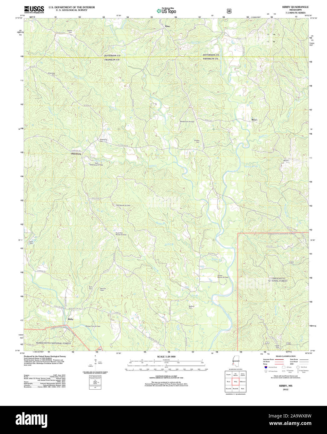 USGS TOPO Map Mississippi MS Kirby 20120405 TM Restoration Stock Photohttps://www.alamy.com/image-license-details/?v=1https://www.alamy.com/usgs-topo-map-mississippi-ms-kirby-20120405-tm-restoration-image333098329.html
RM2A9WX8W–USGS TOPO Map Mississippi MS Kirby 20120405 TM Restoration
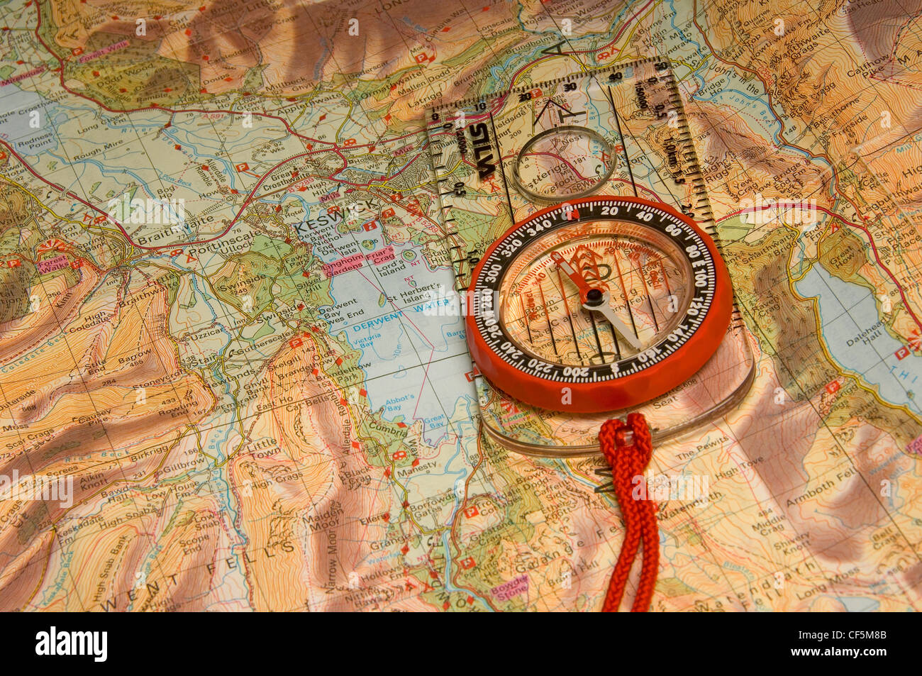 Walking map and compass. Stock Photohttps://www.alamy.com/image-license-details/?v=1https://www.alamy.com/stock-photo-walking-map-and-compass-43766251.html
RMCF5M8B–Walking map and compass.
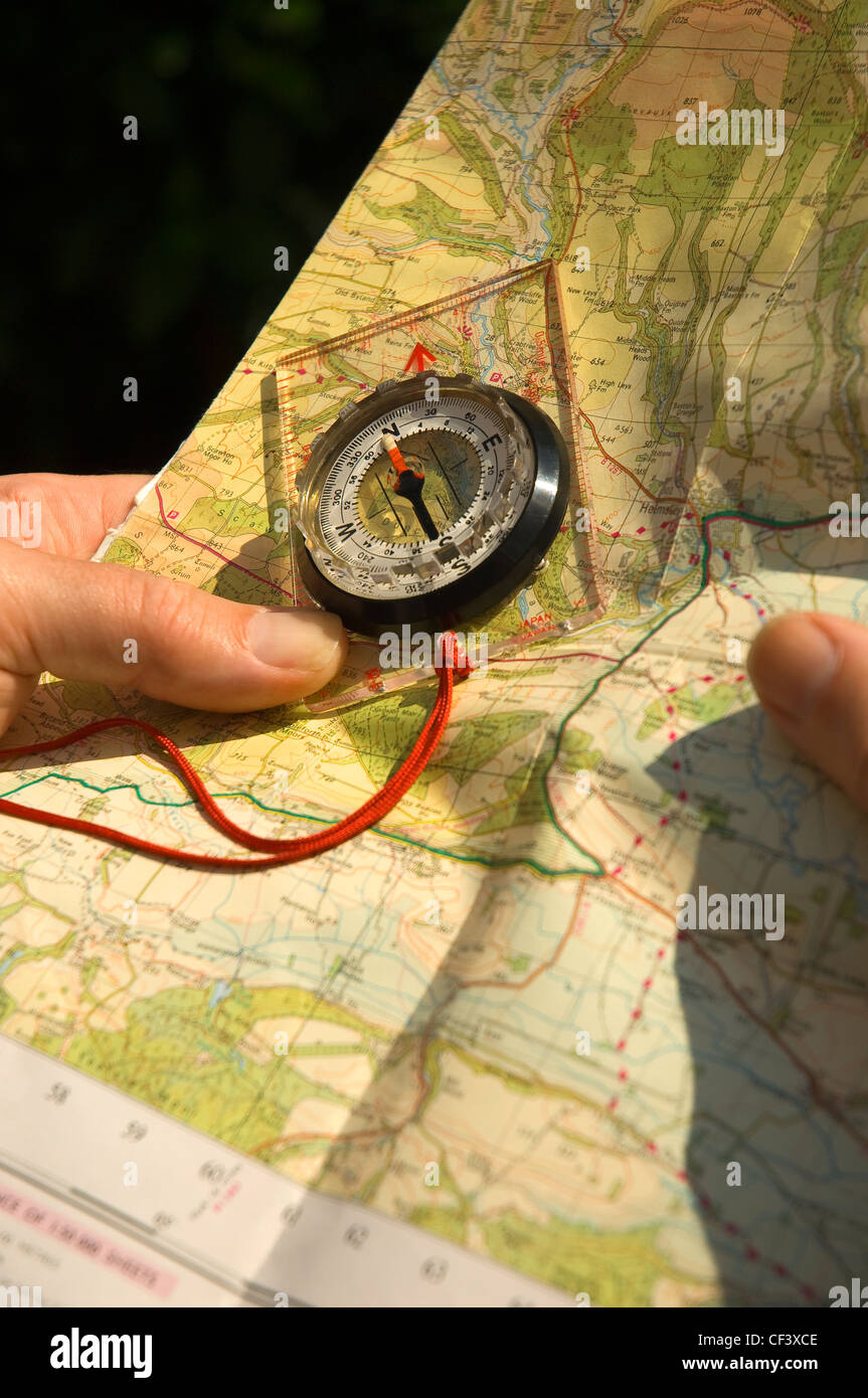 A man holding a walking map and compass. Stock Photohttps://www.alamy.com/image-license-details/?v=1https://www.alamy.com/stock-photo-a-man-holding-a-walking-map-and-compass-43727166.html
RMCF3XCE–A man holding a walking map and compass.
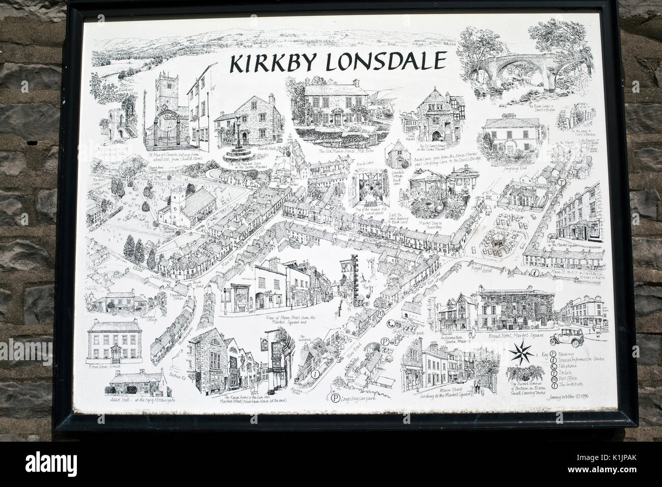 Street sign, Kirkby Lonsdale, Cumbria, UK Stock Photohttps://www.alamy.com/image-license-details/?v=1https://www.alamy.com/street-sign-kirkby-lonsdale-cumbria-uk-image155920651.html
RMK1JPAK–Street sign, Kirkby Lonsdale, Cumbria, UK
 William Kirby b1759 Stock Photohttps://www.alamy.com/image-license-details/?v=1https://www.alamy.com/stock-photo-william-kirby-b1759-140705092.html
RMJ4WJNT–William Kirby b1759
 Note on Carboniferous Entomostraca from Nova Scotia, in the Peter Redpath Museum, determined and described by Prof. T. Rupert Jones, F.R. S., and Mr. Kirby BHL266 Stock Photohttps://www.alamy.com/image-license-details/?v=1https://www.alamy.com/stock-photo-note-on-carboniferous-entomostraca-from-nova-scotia-in-the-peter-redpath-122491977.html
RMH37YND–Note on Carboniferous Entomostraca from Nova Scotia, in the Peter Redpath Museum, determined and described by Prof. T. Rupert Jones, F.R. S., and Mr. Kirby BHL266
 Kirby Dam, McKinlay, AU, Australia, Queensland, S 21 43' 42'', N 141 22' 1'', map, Cartascapes Map published in 2024. Explore Cartascapes, a map revealing Earth's diverse landscapes, cultures, and ecosystems. Journey through time and space, discovering the interconnectedness of our planet's past, present, and future. Stock Photohttps://www.alamy.com/image-license-details/?v=1https://www.alamy.com/kirby-dam-mckinlay-au-australia-queensland-s-21-43-42-n-141-22-1-map-cartascapes-map-published-in-2024-explore-cartascapes-a-map-revealing-earths-diverse-landscapes-cultures-and-ecosystems-journey-through-time-and-space-discovering-the-interconnectedness-of-our-planets-past-present-and-future-image625662196.html
RM2Y9WAEC–Kirby Dam, McKinlay, AU, Australia, Queensland, S 21 43' 42'', N 141 22' 1'', map, Cartascapes Map published in 2024. Explore Cartascapes, a map revealing Earth's diverse landscapes, cultures, and ecosystems. Journey through time and space, discovering the interconnectedness of our planet's past, present, and future.
 Wirral, metropolitan district of England - Great Britain. Low resolution satellite map Stock Photohttps://www.alamy.com/image-license-details/?v=1https://www.alamy.com/wirral-metropolitan-district-of-england-great-britain-low-resolution-satellite-map-image546519690.html
RF2PN43CA–Wirral, metropolitan district of England - Great Britain. Low resolution satellite map
 A Soldier from GTMO’s first Army Basic Leadership Course plots grid coordinates on his map before beginning a land navigation exercise at U.S. Naval Station, Guantanamo Bay, Cuba on April 11. Land navigation is one of the mandatory requirements a student must pass in order to graduate from BLC. (Photo by U.S. Army Sgt. Sarah Kirby // released) Stock Photohttps://www.alamy.com/image-license-details/?v=1https://www.alamy.com/a-soldier-from-gtmos-first-army-basic-leadership-course-plots-grid-coordinates-on-his-map-before-beginning-a-land-navigation-exercise-at-us-naval-station-guantanamo-bay-cuba-on-april-11-land-navigation-is-one-of-the-mandatory-requirements-a-student-must-pass-in-order-to-graduate-from-blc-photo-by-us-army-sgt-sarah-kirby-released-image210456319.html
RMP6B353–A Soldier from GTMO’s first Army Basic Leadership Course plots grid coordinates on his map before beginning a land navigation exercise at U.S. Naval Station, Guantanamo Bay, Cuba on April 11. Land navigation is one of the mandatory requirements a student must pass in order to graduate from BLC. (Photo by U.S. Army Sgt. Sarah Kirby // released)
 . American homes and gardens. I JJT JL fCXXXXBOOOOf IS 155 CONTENTS FOR MAY, 1913. The Problem of Choosing a Site for a Small House 7T:*?.?* -.-.: Frontispiece Houses of Moderate Size By Gardner Teall 147 Small Gardens for Small Places By F. F. Rockwell 153 The Home of Mr. M. H. Clark 157 The Small House Site By Harold Donaldson Eberlein 158 Wrought Metal Work By Emory Leadyard 162 The Small House of Stucco By Kirby Hendricks 163 Well Placed Window-Boxes 168-169 Window Curtains By Ida J. Burgess Wendelloaks By Margaret H. Pratt A Small House in Tuckahoe, New York Map Samplers By Robert H. Va Stock Photohttps://www.alamy.com/image-license-details/?v=1https://www.alamy.com/american-homes-and-gardens-i-jjt-jl-fcxxxxboooof-is-155-contents-for-may-1913-the-problem-of-choosing-a-site-for-a-small-house-7t-frontispiece-houses-of-moderate-size-by-gardner-teall-147-small-gardens-for-small-places-by-f-f-rockwell-153-the-home-of-mr-m-h-clark-157-the-small-house-site-by-harold-donaldson-eberlein-158-wrought-metal-work-by-emory-leadyard-162-the-small-house-of-stucco-by-kirby-hendricks-163-well-placed-window-boxes-168-169-window-curtains-by-ida-j-burgess-wendelloaks-by-margaret-h-pratt-a-small-house-in-tuckahoe-new-york-map-samplers-by-robert-h-va-image336781304.html
RM2AFWKYM–. American homes and gardens. I JJT JL fCXXXXBOOOOf IS 155 CONTENTS FOR MAY, 1913. The Problem of Choosing a Site for a Small House 7T:*?.?* -.-.: Frontispiece Houses of Moderate Size By Gardner Teall 147 Small Gardens for Small Places By F. F. Rockwell 153 The Home of Mr. M. H. Clark 157 The Small House Site By Harold Donaldson Eberlein 158 Wrought Metal Work By Emory Leadyard 162 The Small House of Stucco By Kirby Hendricks 163 Well Placed Window-Boxes 168-169 Window Curtains By Ida J. Burgess Wendelloaks By Margaret H. Pratt A Small House in Tuckahoe, New York Map Samplers By Robert H. Va
 Pfc. Jorge Kirby, U.S. Army Reserve combat engineer with the 374th Engineer Company (Sapper), of Concord, Calif., spits while walking on a trail on a team-based land navigation course during the 2015 Sapper Stakes competition at Fort Chaffee, Ark., Aug. 30. The competition is designed to build teamwork, enhance combat engineering skills and promote leadership among the units. (U.S. Army photo by Master Sgt. Michel Sauret) Stock Photohttps://www.alamy.com/image-license-details/?v=1https://www.alamy.com/pfc-jorge-kirby-us-army-reserve-combat-engineer-with-the-374th-engineer-company-sapper-of-concord-calif-spits-while-walking-on-a-trail-on-a-team-based-land-navigation-course-during-the-2015-sapper-stakes-competition-at-fort-chaffee-ark-aug-30-the-competition-is-designed-to-build-teamwork-enhance-combat-engineering-skills-and-promote-leadership-among-the-units-us-army-photo-by-master-sgt-michel-sauret-image215535939.html
RMPEJE83–Pfc. Jorge Kirby, U.S. Army Reserve combat engineer with the 374th Engineer Company (Sapper), of Concord, Calif., spits while walking on a trail on a team-based land navigation course during the 2015 Sapper Stakes competition at Fort Chaffee, Ark., Aug. 30. The competition is designed to build teamwork, enhance combat engineering skills and promote leadership among the units. (U.S. Army photo by Master Sgt. Michel Sauret)
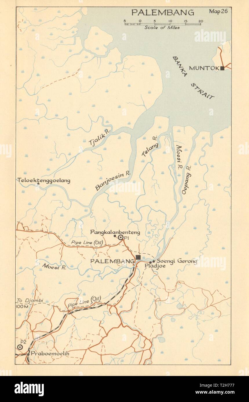 Palembang, Sumatra 1942 1957 old vintage map plan chart Stock Photohttps://www.alamy.com/image-license-details/?v=1https://www.alamy.com/palembang-sumatra-1942-1957-old-vintage-map-plan-chart-image242553339.html
RFT2H777–Palembang, Sumatra 1942 1957 old vintage map plan chart
![A New Map of the County of Suffolk Author Kirby, John 39.5.1-5. Place of publication: [London] Publisher: [Joshua , W.m Kirby] Date of publication: [1766] Item type: 1 map on 4 sheets Medium: copperplate engraving Dimensions: 111.0 x 144.6 cm Former owner: George III, King of Great Britain, 1738-1820 Stock Photo A New Map of the County of Suffolk Author Kirby, John 39.5.1-5. Place of publication: [London] Publisher: [Joshua , W.m Kirby] Date of publication: [1766] Item type: 1 map on 4 sheets Medium: copperplate engraving Dimensions: 111.0 x 144.6 cm Former owner: George III, King of Great Britain, 1738-1820 Stock Photo](https://c8.alamy.com/comp/2E9HPMY/a-new-map-of-the-county-of-suffolk-author-kirby-john-3951-5-place-of-publication-london-publisher-joshua-wm-kirby-date-of-publication-1766-item-type-1-map-on-4-sheets-medium-copperplate-engraving-dimensions-1110-x-1446-cm-former-owner-george-iii-king-of-great-britain-1738-1820-2E9HPMY.jpg) A New Map of the County of Suffolk Author Kirby, John 39.5.1-5. Place of publication: [London] Publisher: [Joshua , W.m Kirby] Date of publication: [1766] Item type: 1 map on 4 sheets Medium: copperplate engraving Dimensions: 111.0 x 144.6 cm Former owner: George III, King of Great Britain, 1738-1820 Stock Photohttps://www.alamy.com/image-license-details/?v=1https://www.alamy.com/a-new-map-of-the-county-of-suffolk-author-kirby-john-3951-5-place-of-publication-london-publisher-joshua-wm-kirby-date-of-publication-1766-item-type-1-map-on-4-sheets-medium-copperplate-engraving-dimensions-1110-x-1446-cm-former-owner-george-iii-king-of-great-britain-1738-1820-image401761387.html
A New Map of the County of Suffolk Author Kirby, John 39.5.1-5. Place of publication: [London] Publisher: [Joshua , W.m Kirby] Date of publication: [1766] Item type: 1 map on 4 sheets Medium: copperplate engraving Dimensions: 111.0 x 144.6 cm Former owner: George III, King of Great Britain, 1738-1820 Stock Photohttps://www.alamy.com/image-license-details/?v=1https://www.alamy.com/a-new-map-of-the-county-of-suffolk-author-kirby-john-3951-5-place-of-publication-london-publisher-joshua-wm-kirby-date-of-publication-1766-item-type-1-map-on-4-sheets-medium-copperplate-engraving-dimensions-1110-x-1446-cm-former-owner-george-iii-king-of-great-britain-1738-1820-image401761387.htmlRM2E9HPMY–A New Map of the County of Suffolk Author Kirby, John 39.5.1-5. Place of publication: [London] Publisher: [Joshua , W.m Kirby] Date of publication: [1766] Item type: 1 map on 4 sheets Medium: copperplate engraving Dimensions: 111.0 x 144.6 cm Former owner: George III, King of Great Britain, 1738-1820
 USGS TOPO Map Montana MT Kirby 20110523 TM Restoration Stock Photohttps://www.alamy.com/image-license-details/?v=1https://www.alamy.com/usgs-topo-map-montana-mt-kirby-20110523-tm-restoration-image333458578.html
RM2AAE9PX–USGS TOPO Map Montana MT Kirby 20110523 TM Restoration
 USGS Topo Map Washington State WA Kirby 20110406 TM Restoration Stock Photohttps://www.alamy.com/image-license-details/?v=1https://www.alamy.com/usgs-topo-map-washington-state-wa-kirby-20110406-tm-restoration-image266311007.html
RMWD7EBB–USGS Topo Map Washington State WA Kirby 20110406 TM Restoration
 A man holding a walking map and compass. Stock Photohttps://www.alamy.com/image-license-details/?v=1https://www.alamy.com/stock-photo-a-man-holding-a-walking-map-and-compass-43727165.html
RMCF3XCD–A man holding a walking map and compass.
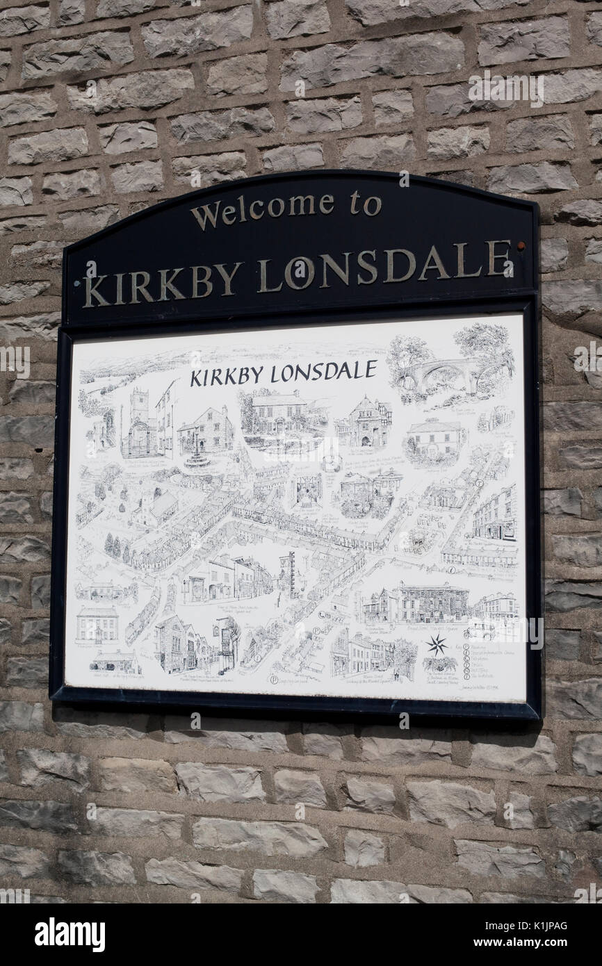 Street sign, Kirkby Lonsdale, Cumbria, UK Stock Photohttps://www.alamy.com/image-license-details/?v=1https://www.alamy.com/street-sign-kirkby-lonsdale-cumbria-uk-image155920648.html
RMK1JPAG–Street sign, Kirkby Lonsdale, Cumbria, UK
 Smith Edmund Kirby Stock Photohttps://www.alamy.com/image-license-details/?v=1https://www.alamy.com/stock-photo-smith-edmund-kirby-140497903.html
RMJ4G6E7–Smith Edmund Kirby
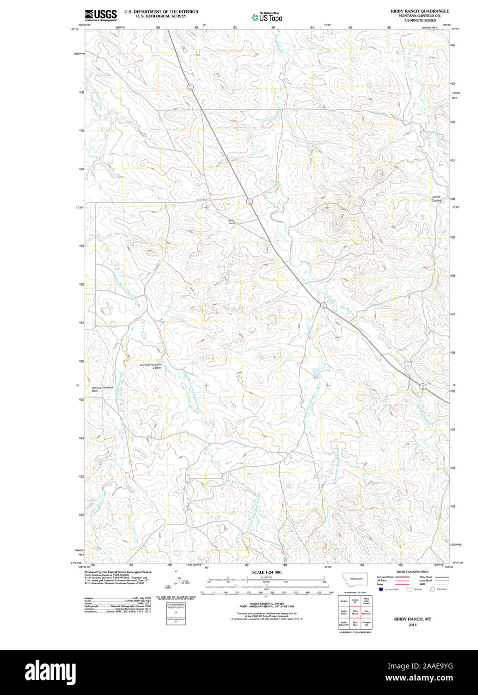 USGS TOPO Map Montana MT Kirby Ranch 20110620 TM Restoration Stock Photohttps://www.alamy.com/image-license-details/?v=1https://www.alamy.com/usgs-topo-map-montana-mt-kirby-ranch-20110620-tm-restoration-image333458708.html
RM2AAE9YG–USGS TOPO Map Montana MT Kirby Ranch 20110620 TM Restoration
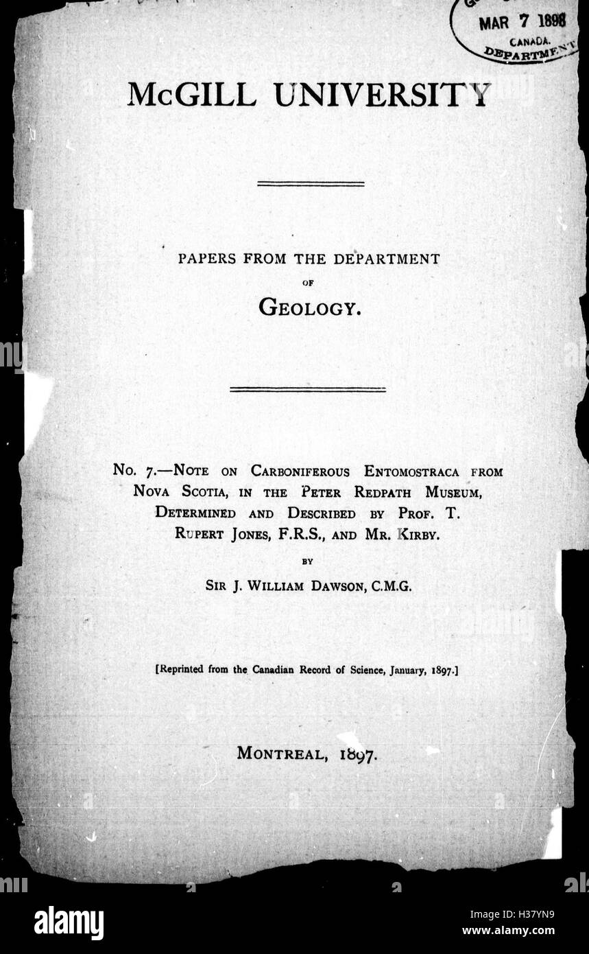 Note on Carboniferous Entomostraca from Nova Scotia, in the Peter Redpath Museum, determined and described by Prof. T. Rupert Jones, F.R. S., and Mr. Kirby BHL266 Stock Photohttps://www.alamy.com/image-license-details/?v=1https://www.alamy.com/stock-photo-note-on-carboniferous-entomostraca-from-nova-scotia-in-the-peter-redpath-122491973.html
RMH37YN9–Note on Carboniferous Entomostraca from Nova Scotia, in the Peter Redpath Museum, determined and described by Prof. T. Rupert Jones, F.R. S., and Mr. Kirby BHL266
 Kirby Knob, , AU, Australia, South Australia, S 27 32' 36'', N 140 52' 6'', map, Cartascapes Map published in 2024. Explore Cartascapes, a map revealing Earth's diverse landscapes, cultures, and ecosystems. Journey through time and space, discovering the interconnectedness of our planet's past, present, and future. Stock Photohttps://www.alamy.com/image-license-details/?v=1https://www.alamy.com/kirby-knob-au-australia-south-australia-s-27-32-36-n-140-52-6-map-cartascapes-map-published-in-2024-explore-cartascapes-a-map-revealing-earths-diverse-landscapes-cultures-and-ecosystems-journey-through-time-and-space-discovering-the-interconnectedness-of-our-planets-past-present-and-future-image625485106.html
RM2Y9H8HP–Kirby Knob, , AU, Australia, South Australia, S 27 32' 36'', N 140 52' 6'', map, Cartascapes Map published in 2024. Explore Cartascapes, a map revealing Earth's diverse landscapes, cultures, and ecosystems. Journey through time and space, discovering the interconnectedness of our planet's past, present, and future.
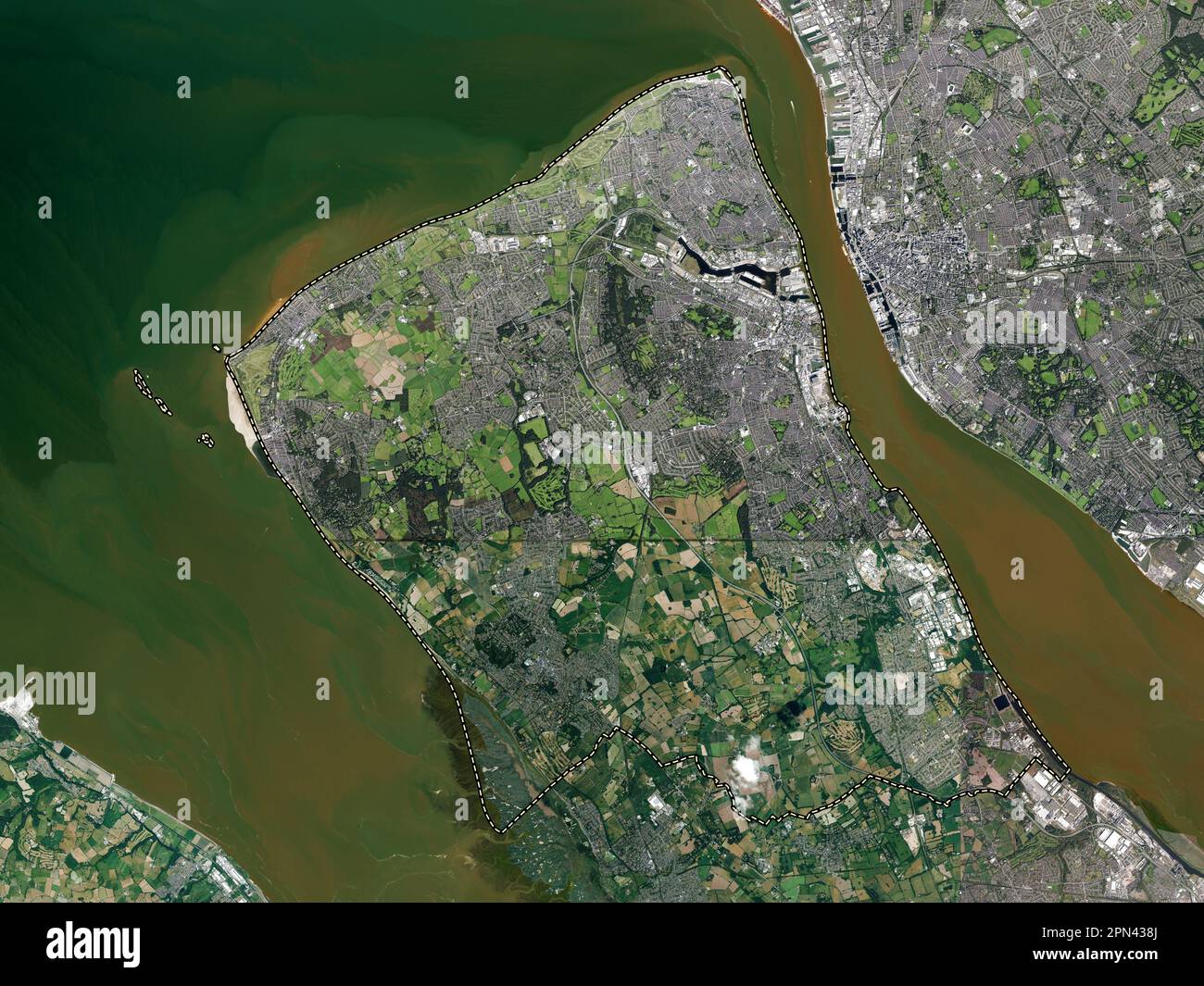 Wirral, metropolitan district of England - Great Britain. High resolution satellite map Stock Photohttps://www.alamy.com/image-license-details/?v=1https://www.alamy.com/wirral-metropolitan-district-of-england-great-britain-high-resolution-satellite-map-image546519586.html
RF2PN438J–Wirral, metropolitan district of England - Great Britain. High resolution satellite map
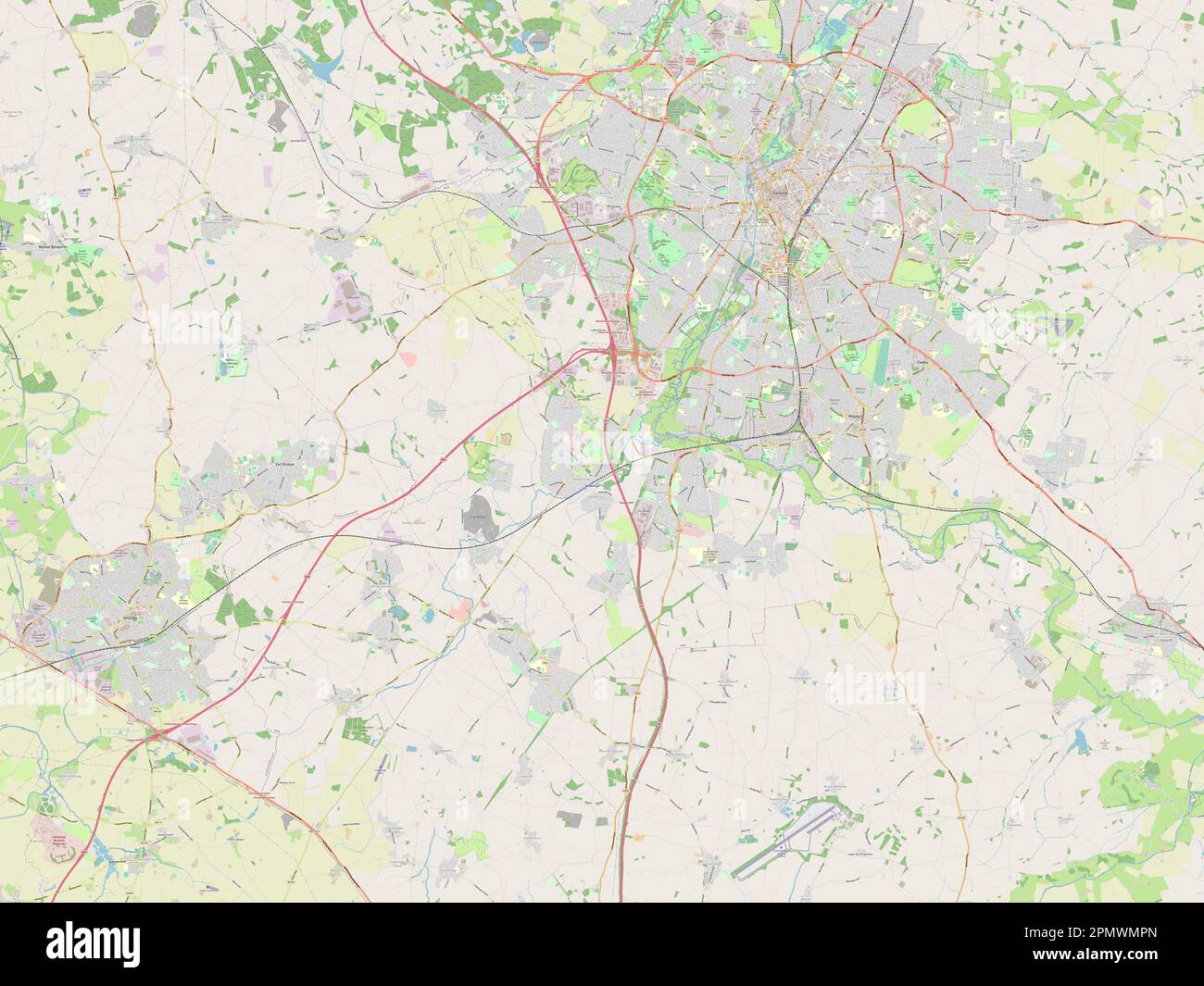 Blaby, non metropolitan district of England - Great Britain. Open Street Map Stock Photohttps://www.alamy.com/image-license-details/?v=1https://www.alamy.com/blaby-non-metropolitan-district-of-england-great-britain-open-street-map-image546379645.html
RF2PMWMPN–Blaby, non metropolitan district of England - Great Britain. Open Street Map
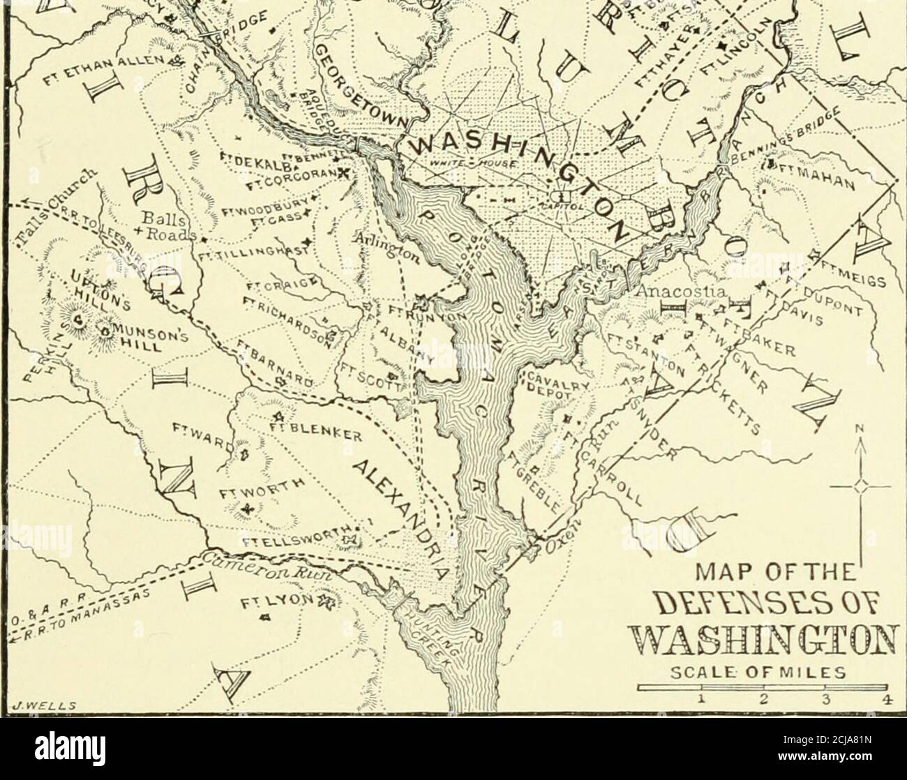 . Abraham Lincoln; a history . MAP OFTHE SCALE OFMILES THE DEFENSES OF WASHINGTON DLEINO THE ANTIETAil < A3IPAIGN,SEPTEMBER 1-20, 1862. Extensive additions to the defeu^^es of the west bank of the Potomac were madesubseqiieutly. Forts Alexander, Franklin, and Eipley were afterward united andcalled redoubts Davis, Kirby, and Cross, receiving later the nanii- of Fort Sumner.Forts De Kalh, Massachusetts, Pennsylvania, and Blenker were afterward changedrespectively to Strong, Stevens, Reno, and Reynolds. See also page 108, Vol. IX. THE NEVJ YORK PUBLIC u::rary MANASSAS EVACUATED 177 of which th Stock Photohttps://www.alamy.com/image-license-details/?v=1https://www.alamy.com/abraham-lincoln-a-history-map-ofthe-scale-ofmiles-the-defenses-of-washington-dleino-the-antietail-lt-a3ipaignseptember-1-20-1862-extensive-additions-to-the-defeues-of-the-west-bank-of-the-potomac-were-madesubseqiieutly-forts-alexander-franklin-and-eipley-were-afterward-united-andcalled-redoubts-davis-kirby-and-cross-receiving-later-the-nanii-of-fort-sumnerforts-de-kalh-massachusetts-pennsylvania-and-blenker-were-afterward-changedrespectively-to-strong-stevens-reno-and-reynolds-see-also-page-108-vol-ix-the-nevj-york-public-urary-manassas-evacuated-177-of-which-th-image372707377.html
RM2CJA81N–. Abraham Lincoln; a history . MAP OFTHE SCALE OFMILES THE DEFENSES OF WASHINGTON DLEINO THE ANTIETAil < A3IPAIGN,SEPTEMBER 1-20, 1862. Extensive additions to the defeu^^es of the west bank of the Potomac were madesubseqiieutly. Forts Alexander, Franklin, and Eipley were afterward united andcalled redoubts Davis, Kirby, and Cross, receiving later the nanii- of Fort Sumner.Forts De Kalh, Massachusetts, Pennsylvania, and Blenker were afterward changedrespectively to Strong, Stevens, Reno, and Reynolds. See also page 108, Vol. IX. THE NEVJ YORK PUBLIC u::rary MANASSAS EVACUATED 177 of which th
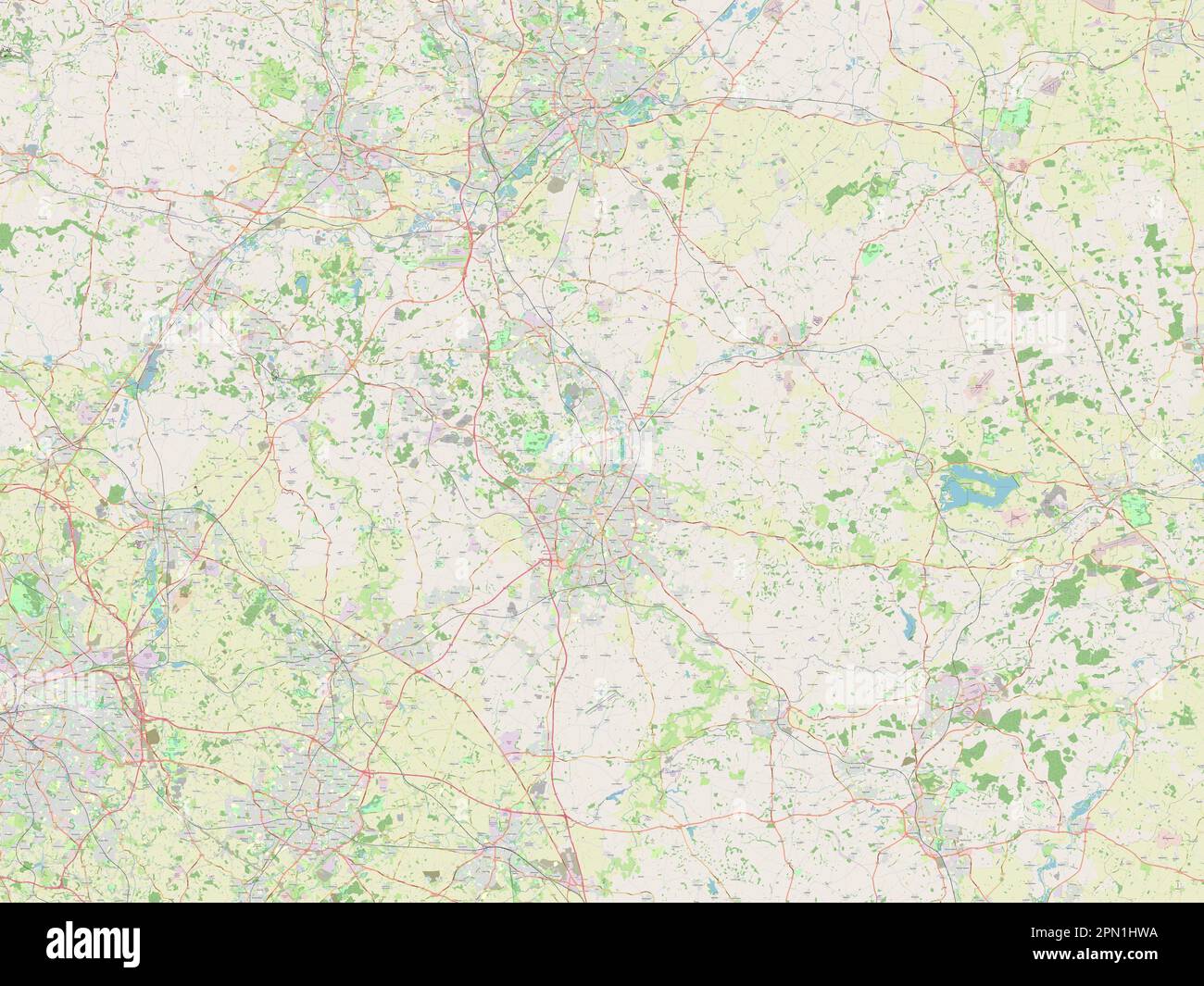 Leicestershire, administrative county of England - Great Britain. Open Street Map Stock Photohttps://www.alamy.com/image-license-details/?v=1https://www.alamy.com/leicestershire-administrative-county-of-england-great-britain-open-street-map-image546465174.html
RF2PN1HWA–Leicestershire, administrative county of England - Great Britain. Open Street Map
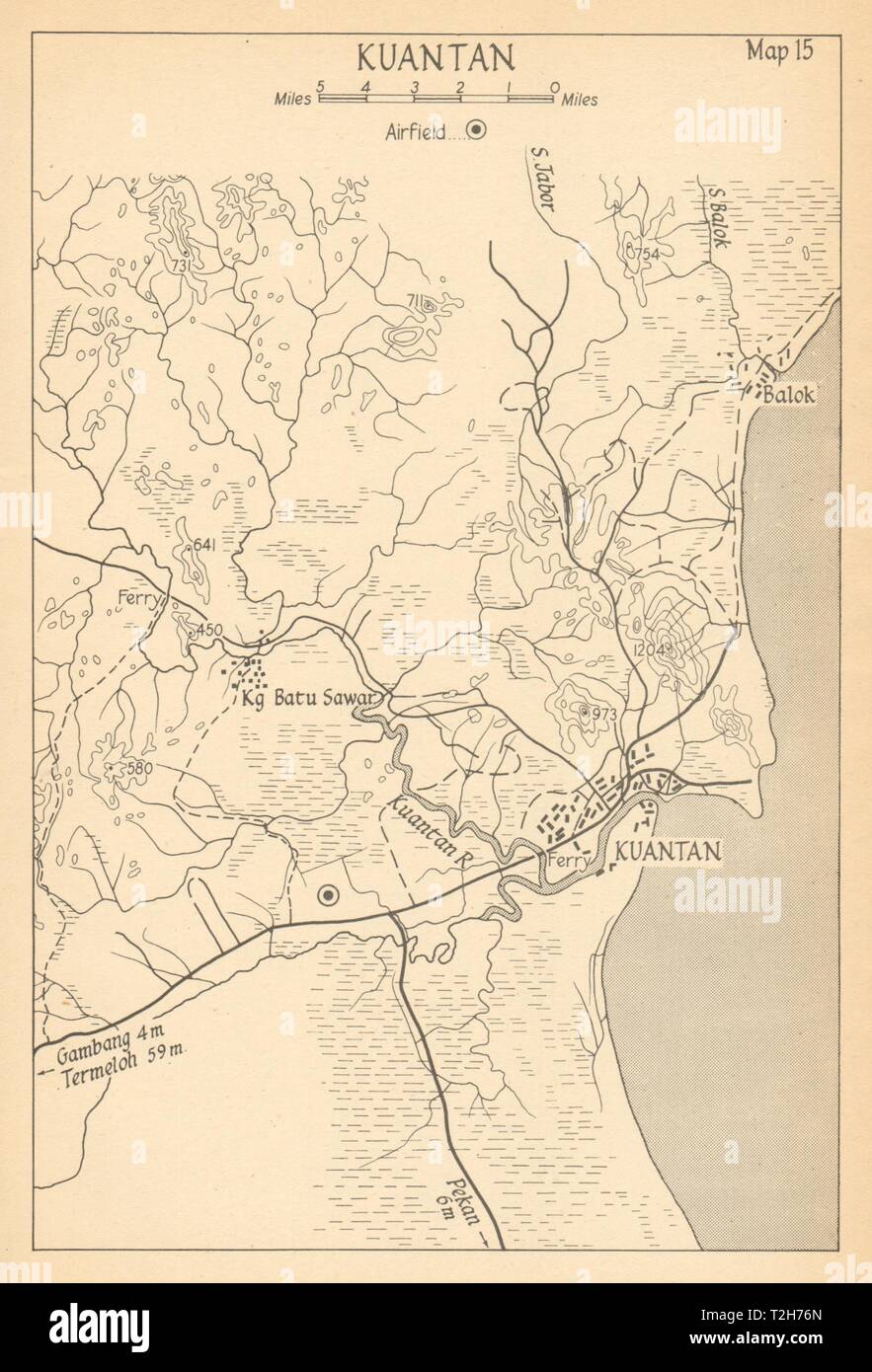 Kuantan 1942. Malaya. Malaysia 1957 old vintage map plan chart Stock Photohttps://www.alamy.com/image-license-details/?v=1https://www.alamy.com/kuantan-1942-malaya-malaysia-1957-old-vintage-map-plan-chart-image242553325.html
RFT2H76N–Kuantan 1942. Malaya. Malaysia 1957 old vintage map plan chart
![A New Map of the County of Suffolk Author Kirby, John 39.5.1-5. Place of publication: [London] Publisher: [Joshua , W.m Kirby] Date of publication: [1766] Item type: 1 map on 4 sheets Medium: copperplate engraving Dimensions: 111.0 x 144.6 cm Former owner: George III, King of Great Britain, 1738-1820 Stock Photo A New Map of the County of Suffolk Author Kirby, John 39.5.1-5. Place of publication: [London] Publisher: [Joshua , W.m Kirby] Date of publication: [1766] Item type: 1 map on 4 sheets Medium: copperplate engraving Dimensions: 111.0 x 144.6 cm Former owner: George III, King of Great Britain, 1738-1820 Stock Photo](https://c8.alamy.com/comp/2E9HPM3/a-new-map-of-the-county-of-suffolk-author-kirby-john-3951-5-place-of-publication-london-publisher-joshua-wm-kirby-date-of-publication-1766-item-type-1-map-on-4-sheets-medium-copperplate-engraving-dimensions-1110-x-1446-cm-former-owner-george-iii-king-of-great-britain-1738-1820-2E9HPM3.jpg) A New Map of the County of Suffolk Author Kirby, John 39.5.1-5. Place of publication: [London] Publisher: [Joshua , W.m Kirby] Date of publication: [1766] Item type: 1 map on 4 sheets Medium: copperplate engraving Dimensions: 111.0 x 144.6 cm Former owner: George III, King of Great Britain, 1738-1820 Stock Photohttps://www.alamy.com/image-license-details/?v=1https://www.alamy.com/a-new-map-of-the-county-of-suffolk-author-kirby-john-3951-5-place-of-publication-london-publisher-joshua-wm-kirby-date-of-publication-1766-item-type-1-map-on-4-sheets-medium-copperplate-engraving-dimensions-1110-x-1446-cm-former-owner-george-iii-king-of-great-britain-1738-1820-image401761363.html
A New Map of the County of Suffolk Author Kirby, John 39.5.1-5. Place of publication: [London] Publisher: [Joshua , W.m Kirby] Date of publication: [1766] Item type: 1 map on 4 sheets Medium: copperplate engraving Dimensions: 111.0 x 144.6 cm Former owner: George III, King of Great Britain, 1738-1820 Stock Photohttps://www.alamy.com/image-license-details/?v=1https://www.alamy.com/a-new-map-of-the-county-of-suffolk-author-kirby-john-3951-5-place-of-publication-london-publisher-joshua-wm-kirby-date-of-publication-1766-item-type-1-map-on-4-sheets-medium-copperplate-engraving-dimensions-1110-x-1446-cm-former-owner-george-iii-king-of-great-britain-1738-1820-image401761363.htmlRM2E9HPM3–A New Map of the County of Suffolk Author Kirby, John 39.5.1-5. Place of publication: [London] Publisher: [Joshua , W.m Kirby] Date of publication: [1766] Item type: 1 map on 4 sheets Medium: copperplate engraving Dimensions: 111.0 x 144.6 cm Former owner: George III, King of Great Britain, 1738-1820
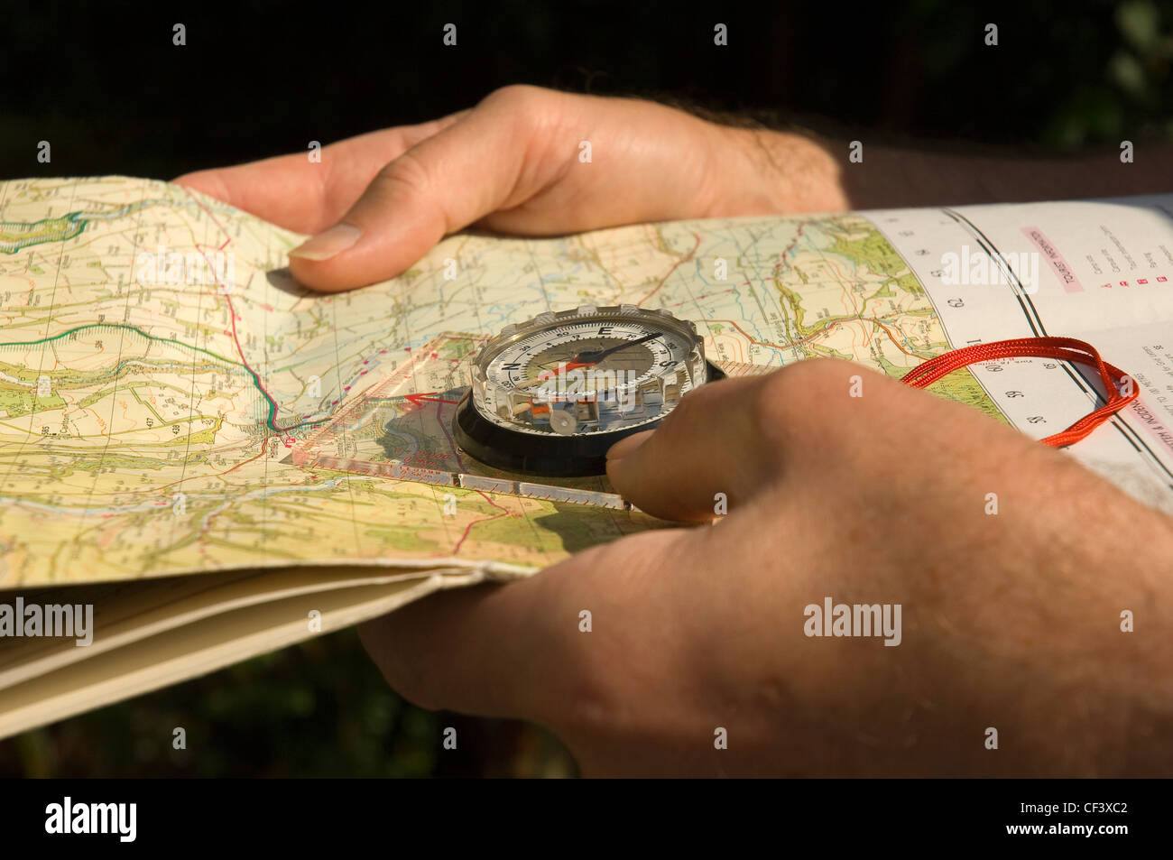 A man holding a walking map and compass. Stock Photohttps://www.alamy.com/image-license-details/?v=1https://www.alamy.com/stock-photo-a-man-holding-a-walking-map-and-compass-43727154.html
RMCF3XC2–A man holding a walking map and compass.
 Horton Kirby Westminster Stock Photohttps://www.alamy.com/image-license-details/?v=1https://www.alamy.com/stock-photo-horton-kirby-westminster-139963206.html
RMJ3KTDX–Horton Kirby Westminster
 USGS TOPO Map Mississippi MS Kirby 20120405 TM Inverted Restoration Stock Photohttps://www.alamy.com/image-license-details/?v=1https://www.alamy.com/usgs-topo-map-mississippi-ms-kirby-20120405-tm-inverted-restoration-image333098324.html
RM2A9WX8M–USGS TOPO Map Mississippi MS Kirby 20120405 TM Inverted Restoration
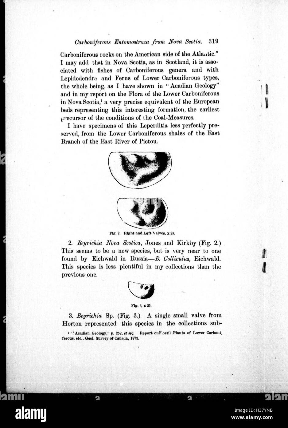 Note on Carboniferous Entomostraca from Nova Scotia, in the Peter Redpath Museum, determined and described by Prof. T. Rupert Jones, F.R. S., and Mr. Kirby BHL266 Stock Photohttps://www.alamy.com/image-license-details/?v=1https://www.alamy.com/stock-photo-note-on-carboniferous-entomostraca-from-nova-scotia-in-the-peter-redpath-122491975.html
RMH37YNB–Note on Carboniferous Entomostraca from Nova Scotia, in the Peter Redpath Museum, determined and described by Prof. T. Rupert Jones, F.R. S., and Mr. Kirby BHL266
 Kirby, Emanuel County, US, United States, Georgia, N 32 30' 40'', S 82 20' 4'', map, Cartascapes Map published in 2024. Explore Cartascapes, a map revealing Earth's diverse landscapes, cultures, and ecosystems. Journey through time and space, discovering the interconnectedness of our planet's past, present, and future. Stock Photohttps://www.alamy.com/image-license-details/?v=1https://www.alamy.com/kirby-emanuel-county-us-united-states-georgia-n-32-30-40-s-82-20-4-map-cartascapes-map-published-in-2024-explore-cartascapes-a-map-revealing-earths-diverse-landscapes-cultures-and-ecosystems-journey-through-time-and-space-discovering-the-interconnectedness-of-our-planets-past-present-and-future-image621172174.html
RM2Y2GRCE–Kirby, Emanuel County, US, United States, Georgia, N 32 30' 40'', S 82 20' 4'', map, Cartascapes Map published in 2024. Explore Cartascapes, a map revealing Earth's diverse landscapes, cultures, and ecosystems. Journey through time and space, discovering the interconnectedness of our planet's past, present, and future.
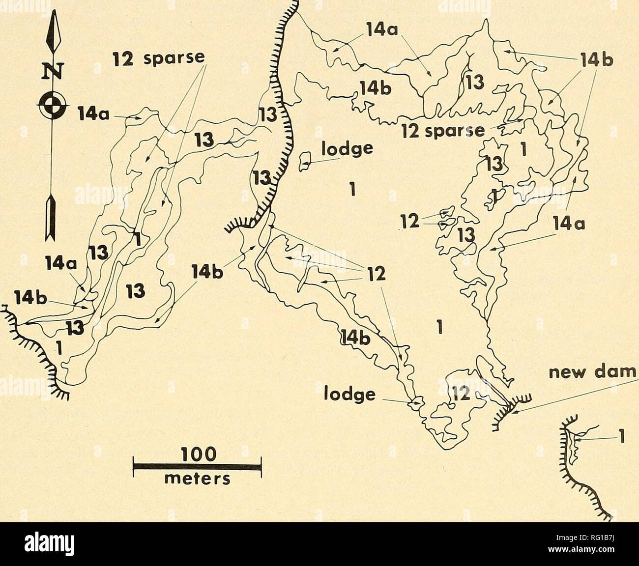 . The Canadian field-naturalist. 1976 KiRBY: Mapping Wetlands With 35-mm Photography 429. meters Figure 3. Vegetation map of flowage 300 made from the photograph in Figure IB, 17 July 1971. The numbers refer to the cover-type associations listed in Table 2. Flowage surface area was now only 5.1 hectares. The lowest and highest pools in the drainage, as well as the pool formed behind a new dam constructed in late May 1971, were dry. Emergent vegetation was extensive and more dense (Types 12 and 13), but the area of flooded trees and shrubs was much reduced by the lowered water levels. and expen Stock Photohttps://www.alamy.com/image-license-details/?v=1https://www.alamy.com/the-canadian-field-naturalist-1976-kirby-mapping-wetlands-with-35-mm-photography-429-meters-figure-3-vegetation-map-of-flowage-300-made-from-the-photograph-in-figure-ib-17-july-1971-the-numbers-refer-to-the-cover-type-associations-listed-in-table-2-flowage-surface-area-was-now-only-51-hectares-the-lowest-and-highest-pools-in-the-drainage-as-well-as-the-pool-formed-behind-a-new-dam-constructed-in-late-may-1971-were-dry-emergent-vegetation-was-extensive-and-more-dense-types-12-and-13-but-the-area-of-flooded-trees-and-shrubs-was-much-reduced-by-the-lowered-water-levels-and-expen-image233600070.html
RMRG1B7J–. The Canadian field-naturalist. 1976 KiRBY: Mapping Wetlands With 35-mm Photography 429. meters Figure 3. Vegetation map of flowage 300 made from the photograph in Figure IB, 17 July 1971. The numbers refer to the cover-type associations listed in Table 2. Flowage surface area was now only 5.1 hectares. The lowest and highest pools in the drainage, as well as the pool formed behind a new dam constructed in late May 1971, were dry. Emergent vegetation was extensive and more dense (Types 12 and 13), but the area of flooded trees and shrubs was much reduced by the lowered water levels. and expen
 Sevenoaks, non metropolitan district of England - Great Britain. Open Street Map Stock Photohttps://www.alamy.com/image-license-details/?v=1https://www.alamy.com/sevenoaks-non-metropolitan-district-of-england-great-britain-open-street-map-image546500689.html
RF2PN375N–Sevenoaks, non metropolitan district of England - Great Britain. Open Street Map
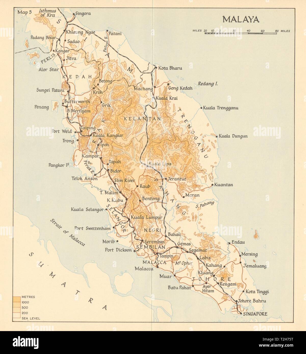 Malaya in 1941. Malaysia 1957 old vintage map plan chart Stock Photohttps://www.alamy.com/image-license-details/?v=1https://www.alamy.com/malaya-in-1941-malaysia-1957-old-vintage-map-plan-chart-image242553300.html
RFT2H75T–Malaya in 1941. Malaysia 1957 old vintage map plan chart
![THE TOMB OF LORD BARDOLF. Author Wood, Joseph 39.51. Place of publication: [London] Publisher: [J. Kirby] Date of publication: [1748.] Item type: 1 print Medium: etching Dimensions: platemark 24.5 x 31.2 cm. Former owner: George III, King of Great Britain, 1738-1820 Stock Photo THE TOMB OF LORD BARDOLF. Author Wood, Joseph 39.51. Place of publication: [London] Publisher: [J. Kirby] Date of publication: [1748.] Item type: 1 print Medium: etching Dimensions: platemark 24.5 x 31.2 cm. Former owner: George III, King of Great Britain, 1738-1820 Stock Photo](https://c8.alamy.com/comp/2E9HPMH/the-tomb-of-lord-bardolf-author-wood-joseph-3951-place-of-publication-london-publisher-j-kirby-date-of-publication-1748-item-type-1-print-medium-etching-dimensions-platemark-245-x-312-cm-former-owner-george-iii-king-of-great-britain-1738-1820-2E9HPMH.jpg) THE TOMB OF LORD BARDOLF. Author Wood, Joseph 39.51. Place of publication: [London] Publisher: [J. Kirby] Date of publication: [1748.] Item type: 1 print Medium: etching Dimensions: platemark 24.5 x 31.2 cm. Former owner: George III, King of Great Britain, 1738-1820 Stock Photohttps://www.alamy.com/image-license-details/?v=1https://www.alamy.com/the-tomb-of-lord-bardolf-author-wood-joseph-3951-place-of-publication-london-publisher-j-kirby-date-of-publication-1748-item-type-1-print-medium-etching-dimensions-platemark-245-x-312-cm-former-owner-george-iii-king-of-great-britain-1738-1820-image401761377.html
THE TOMB OF LORD BARDOLF. Author Wood, Joseph 39.51. Place of publication: [London] Publisher: [J. Kirby] Date of publication: [1748.] Item type: 1 print Medium: etching Dimensions: platemark 24.5 x 31.2 cm. Former owner: George III, King of Great Britain, 1738-1820 Stock Photohttps://www.alamy.com/image-license-details/?v=1https://www.alamy.com/the-tomb-of-lord-bardolf-author-wood-joseph-3951-place-of-publication-london-publisher-j-kirby-date-of-publication-1748-item-type-1-print-medium-etching-dimensions-platemark-245-x-312-cm-former-owner-george-iii-king-of-great-britain-1738-1820-image401761377.htmlRM2E9HPMH–THE TOMB OF LORD BARDOLF. Author Wood, Joseph 39.51. Place of publication: [London] Publisher: [J. Kirby] Date of publication: [1748.] Item type: 1 print Medium: etching Dimensions: platemark 24.5 x 31.2 cm. Former owner: George III, King of Great Britain, 1738-1820
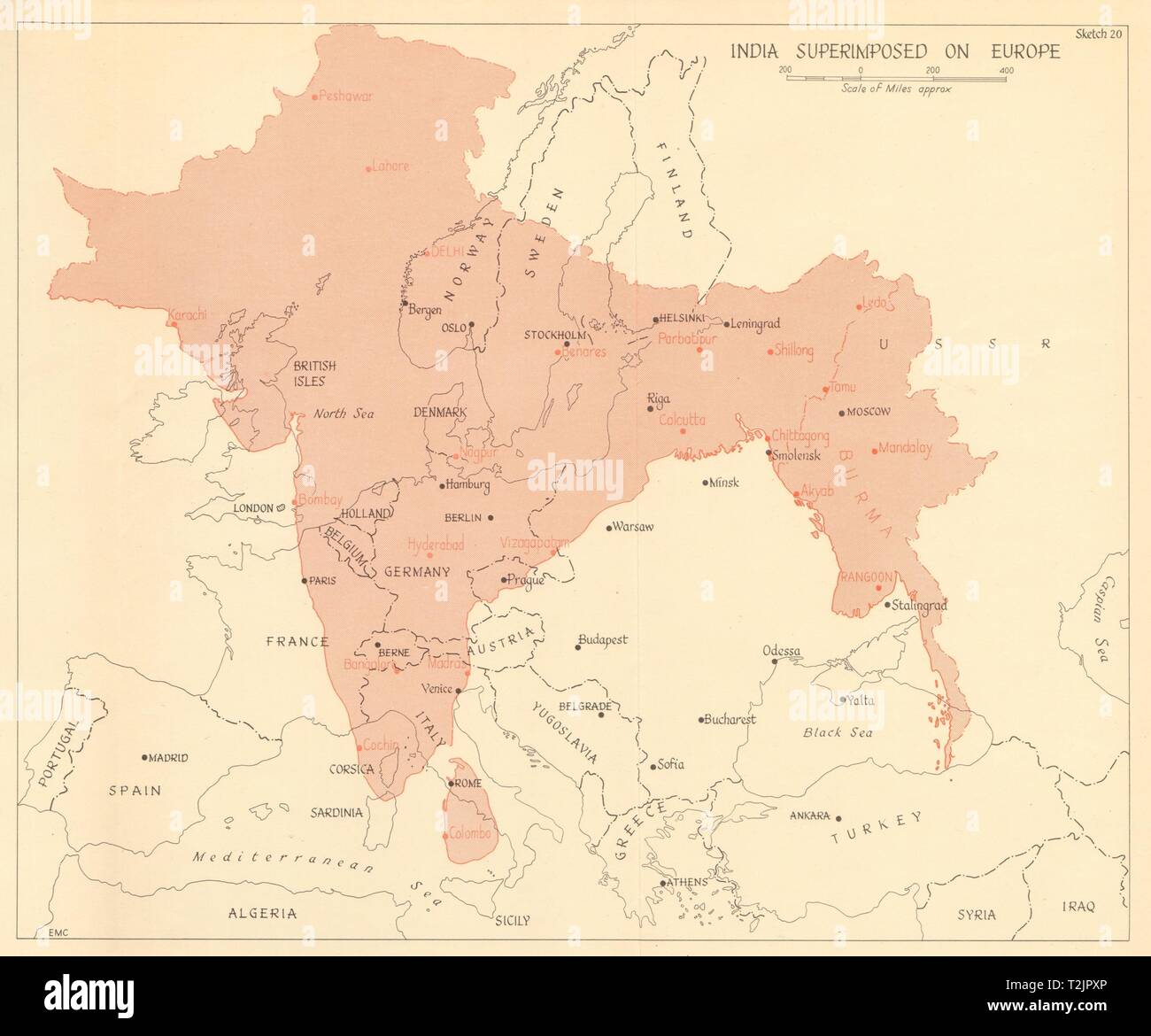 India superimposed on Europe 1961 old vintage map plan chart Stock Photohttps://www.alamy.com/image-license-details/?v=1https://www.alamy.com/india-superimposed-on-europe-1961-old-vintage-map-plan-chart-image242587598.html
RFT2JPXP–India superimposed on Europe 1961 old vintage map plan chart
 Blaby, non metropolitan district of England - Great Britain. Low resolution satellite map Stock Photohttps://www.alamy.com/image-license-details/?v=1https://www.alamy.com/blaby-non-metropolitan-district-of-england-great-britain-low-resolution-satellite-map-image546379591.html
RF2PMWMMR–Blaby, non metropolitan district of England - Great Britain. Low resolution satellite map
 A man holding a walking map and compass. Stock Photohttps://www.alamy.com/image-license-details/?v=1https://www.alamy.com/stock-photo-a-man-holding-a-walking-map-and-compass-43727158.html
RMCF3XC6–A man holding a walking map and compass.
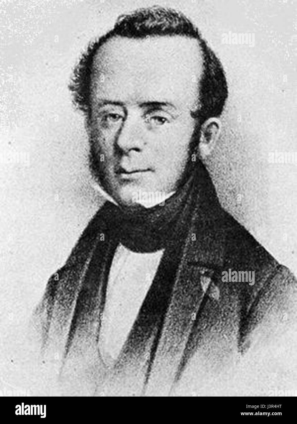 John Kirby Allen Stock Photohttps://www.alamy.com/image-license-details/?v=1https://www.alamy.com/stock-photo-john-kirby-allen-140035444.html
RMJ3R4HT–John Kirby Allen
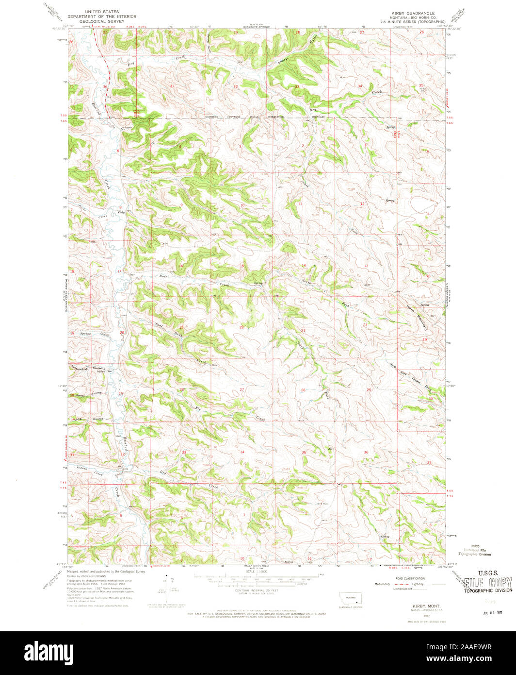 USGS TOPO Map Montana MT Kirby 264799 1967 24000 Restoration Stock Photohttps://www.alamy.com/image-license-details/?v=1https://www.alamy.com/usgs-topo-map-montana-mt-kirby-264799-1967-24000-restoration-image333458659.html
RM2AAE9WR–USGS TOPO Map Montana MT Kirby 264799 1967 24000 Restoration
 Charles Turner John Kirby Stock Photohttps://www.alamy.com/image-license-details/?v=1https://www.alamy.com/stock-photo-charles-turner-john-kirby-139729898.html
RMJ396WE–Charles Turner John Kirby
 Note on Carboniferous Entomostraca from Nova Scotia, in the Peter Redpath Museum, determined and described by Prof. T. Rupert Jones, F.R. S., and Mr. Kirby BHL266 Stock Photohttps://www.alamy.com/image-license-details/?v=1https://www.alamy.com/stock-photo-note-on-carboniferous-entomostraca-from-nova-scotia-in-the-peter-redpath-122491974.html
RMH37YNA–Note on Carboniferous Entomostraca from Nova Scotia, in the Peter Redpath Museum, determined and described by Prof. T. Rupert Jones, F.R. S., and Mr. Kirby BHL266
 Kirby, Pike County, US, United States, Arkansas, N 34 15' 1'', S 93 38' 28'', map, Cartascapes Map published in 2024. Explore Cartascapes, a map revealing Earth's diverse landscapes, cultures, and ecosystems. Journey through time and space, discovering the interconnectedness of our planet's past, present, and future. Stock Photohttps://www.alamy.com/image-license-details/?v=1https://www.alamy.com/kirby-pike-county-us-united-states-arkansas-n-34-15-1-s-93-38-28-map-cartascapes-map-published-in-2024-explore-cartascapes-a-map-revealing-earths-diverse-landscapes-cultures-and-ecosystems-journey-through-time-and-space-discovering-the-interconnectedness-of-our-planets-past-present-and-future-image621392099.html
RM2Y2XRXY–Kirby, Pike County, US, United States, Arkansas, N 34 15' 1'', S 93 38' 28'', map, Cartascapes Map published in 2024. Explore Cartascapes, a map revealing Earth's diverse landscapes, cultures, and ecosystems. Journey through time and space, discovering the interconnectedness of our planet's past, present, and future.
 AKC Champion Kirby of Indiana Stock Photohttps://www.alamy.com/image-license-details/?v=1https://www.alamy.com/stock-photo-akc-champion-kirby-of-indiana-139487055.html
RMJ2X54F–AKC Champion Kirby of Indiana
 Kirby William 1759 1850 Stock Photohttps://www.alamy.com/image-license-details/?v=1https://www.alamy.com/stock-photo-kirby-william-1759-1850-140029967.html
RMJ3PWJ7–Kirby William 1759 1850
 William Kirby 1817 1906 Stock Photohttps://www.alamy.com/image-license-details/?v=1https://www.alamy.com/stock-photo-william-kirby-1817-1906-140691596.html
RMJ4W1FT–William Kirby 1817 1906
 . Bulletin of the British Museum (Natural History) Entomology. REVISIONAL NOTES ON AFRICAN CHARAXES 69 With the above in mind, one may attempt to solve the Palla problem. The species involved are: Palla decius (Cramer, 1777), P. ussheri (Butler, 1870) P. violinitens (Crowley, 1890) and P. publius Staudinger, 1892. Palla decius (Cramer) (PI. 1, figs 1-4; Map 2) Papilio decius Cramer, 1777 : 26, pi. 114, figs a, b. Palla decius (Cramer) Kirby, 1871 : 273. Palla decius f. Sagittarius Rousseau-Decelle, 1934 : 235. Male. Fore wing length 38 mm. Shape falcate, but apex rounded; the outer margin conc Stock Photohttps://www.alamy.com/image-license-details/?v=1https://www.alamy.com/bulletin-of-the-british-museum-natural-history-entomology-revisional-notes-on-african-charaxes-69-with-the-above-in-mind-one-may-attempt-to-solve-the-palla-problem-the-species-involved-are-palla-decius-cramer-1777-p-ussheri-butler-1870-p-violinitens-crowley-1890-and-p-publius-staudinger-1892-palla-decius-cramer-pi-1-figs-1-4-map-2-papilio-decius-cramer-1777-26-pi-114-figs-a-b-palla-decius-cramer-kirby-1871-273-palla-decius-f-sagittarius-rousseau-decelle-1934-235-male-fore-wing-length-38-mm-shape-falcate-but-apex-rounded-the-outer-margin-conc-image233972092.html
RMRGJ9P4–. Bulletin of the British Museum (Natural History) Entomology. REVISIONAL NOTES ON AFRICAN CHARAXES 69 With the above in mind, one may attempt to solve the Palla problem. The species involved are: Palla decius (Cramer, 1777), P. ussheri (Butler, 1870) P. violinitens (Crowley, 1890) and P. publius Staudinger, 1892. Palla decius (Cramer) (PI. 1, figs 1-4; Map 2) Papilio decius Cramer, 1777 : 26, pi. 114, figs a, b. Palla decius (Cramer) Kirby, 1871 : 273. Palla decius f. Sagittarius Rousseau-Decelle, 1934 : 235. Male. Fore wing length 38 mm. Shape falcate, but apex rounded; the outer margin conc
 AKC CHAMPION KIRBY OF INDIANA 1940 Stock Photohttps://www.alamy.com/image-license-details/?v=1https://www.alamy.com/stock-photo-akc-champion-kirby-of-indiana-1940-139487056.html
RMJ2X54G–AKC CHAMPION KIRBY OF INDIANA 1940
![THE TOMB OF THOMAS HOWARD DUKE OF NORFOLK. Author Wood, Joseph 39.17.c. Place of publication: [London] Publisher: [J. Kirby] Date of publication: [1748.] Item type: 1 print Medium: etching Dimensions: platemark 23.8 x 32.0 cm. Former owner: George III, King of Great Britain, 1738-1820 Stock Photo THE TOMB OF THOMAS HOWARD DUKE OF NORFOLK. Author Wood, Joseph 39.17.c. Place of publication: [London] Publisher: [J. Kirby] Date of publication: [1748.] Item type: 1 print Medium: etching Dimensions: platemark 23.8 x 32.0 cm. Former owner: George III, King of Great Britain, 1738-1820 Stock Photo](https://c8.alamy.com/comp/2E9HPFG/the-tomb-of-thomas-howard-duke-of-norfolk-author-wood-joseph-3917c-place-of-publication-london-publisher-j-kirby-date-of-publication-1748-item-type-1-print-medium-etching-dimensions-platemark-238-x-320-cm-former-owner-george-iii-king-of-great-britain-1738-1820-2E9HPFG.jpg) THE TOMB OF THOMAS HOWARD DUKE OF NORFOLK. Author Wood, Joseph 39.17.c. Place of publication: [London] Publisher: [J. Kirby] Date of publication: [1748.] Item type: 1 print Medium: etching Dimensions: platemark 23.8 x 32.0 cm. Former owner: George III, King of Great Britain, 1738-1820 Stock Photohttps://www.alamy.com/image-license-details/?v=1https://www.alamy.com/the-tomb-of-thomas-howard-duke-of-norfolk-author-wood-joseph-3917c-place-of-publication-london-publisher-j-kirby-date-of-publication-1748-item-type-1-print-medium-etching-dimensions-platemark-238-x-320-cm-former-owner-george-iii-king-of-great-britain-1738-1820-image401761236.html
THE TOMB OF THOMAS HOWARD DUKE OF NORFOLK. Author Wood, Joseph 39.17.c. Place of publication: [London] Publisher: [J. Kirby] Date of publication: [1748.] Item type: 1 print Medium: etching Dimensions: platemark 23.8 x 32.0 cm. Former owner: George III, King of Great Britain, 1738-1820 Stock Photohttps://www.alamy.com/image-license-details/?v=1https://www.alamy.com/the-tomb-of-thomas-howard-duke-of-norfolk-author-wood-joseph-3917c-place-of-publication-london-publisher-j-kirby-date-of-publication-1748-item-type-1-print-medium-etching-dimensions-platemark-238-x-320-cm-former-owner-george-iii-king-of-great-britain-1738-1820-image401761236.htmlRM2E9HPFG–THE TOMB OF THOMAS HOWARD DUKE OF NORFOLK. Author Wood, Joseph 39.17.c. Place of publication: [London] Publisher: [J. Kirby] Date of publication: [1748.] Item type: 1 print Medium: etching Dimensions: platemark 23.8 x 32.0 cm. Former owner: George III, King of Great Britain, 1738-1820
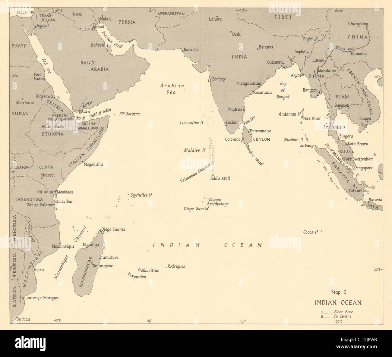 Indian Ocean 1942. World War 2 1961 old vintage map plan chart Stock Photohttps://www.alamy.com/image-license-details/?v=1https://www.alamy.com/indian-ocean-1942-world-war-2-1961-old-vintage-map-plan-chart-image242587559.html
RFT2JPWB–Indian Ocean 1942. World War 2 1961 old vintage map plan chart
 Hummingbirds by Mary and Elizabeth Kirby book cover Stock Photohttps://www.alamy.com/image-license-details/?v=1https://www.alamy.com/stock-photo-hummingbirds-by-mary-and-elizabeth-kirby-book-cover-142926584.html
RMJ8ET8T–Hummingbirds by Mary and Elizabeth Kirby book cover
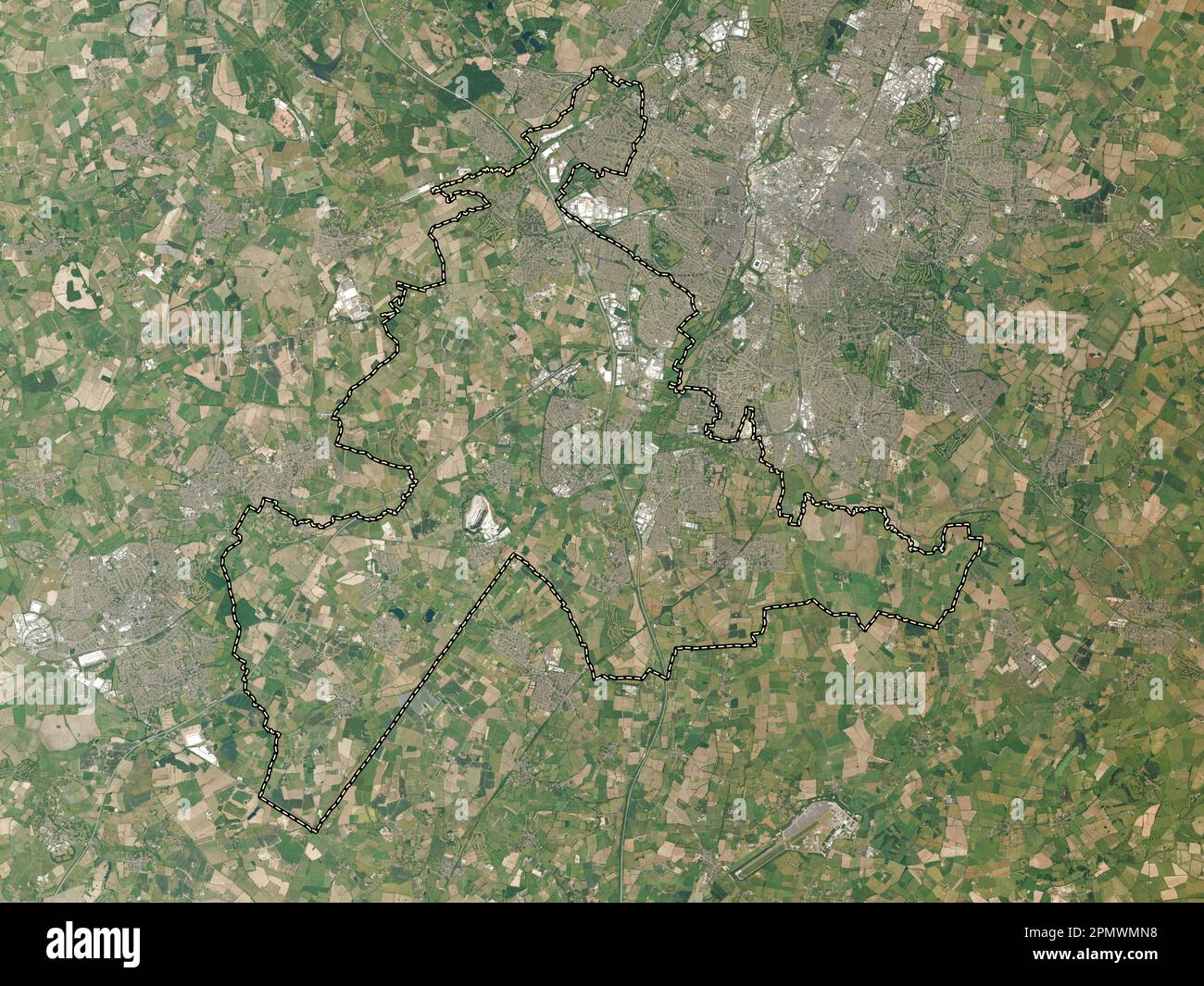 Blaby, non metropolitan district of England - Great Britain. High resolution satellite map Stock Photohttps://www.alamy.com/image-license-details/?v=1https://www.alamy.com/blaby-non-metropolitan-district-of-england-great-britain-high-resolution-satellite-map-image546379604.html
RF2PMWMN8–Blaby, non metropolitan district of England - Great Britain. High resolution satellite map
 Leicestershire, administrative county of England - Great Britain. Low resolution satellite map Stock Photohttps://www.alamy.com/image-license-details/?v=1https://www.alamy.com/leicestershire-administrative-county-of-england-great-britain-low-resolution-satellite-map-image546465057.html
RF2PN1HN5–Leicestershire, administrative county of England - Great Britain. Low resolution satellite map
 USGS TOPO Map Montana MT Kirby 264800 1967 24000 Restoration Stock Photohttps://www.alamy.com/image-license-details/?v=1https://www.alamy.com/usgs-topo-map-montana-mt-kirby-264800-1967-24000-restoration-image333458740.html
RM2AAEA0M–USGS TOPO Map Montana MT Kirby 264800 1967 24000 Restoration
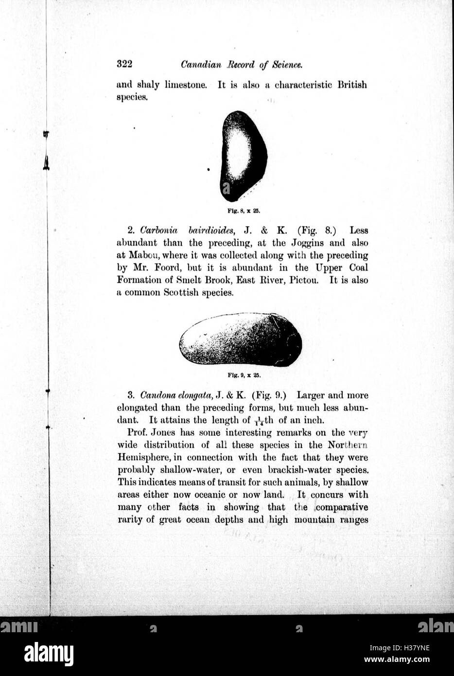 Note on Carboniferous Entomostraca from Nova Scotia, in the Peter Redpath Museum, determined and described by Prof. T. Rupert Jones, F.R. S., and Mr. Kirby BHL266 Stock Photohttps://www.alamy.com/image-license-details/?v=1https://www.alamy.com/stock-photo-note-on-carboniferous-entomostraca-from-nova-scotia-in-the-peter-redpath-122491978.html
RMH37YNE–Note on Carboniferous Entomostraca from Nova Scotia, in the Peter Redpath Museum, determined and described by Prof. T. Rupert Jones, F.R. S., and Mr. Kirby BHL266
 Kirby Well, Menzies, AU, Australia, Western Australia, S 29 33' 22'', N 121 24' 12'', map, Cartascapes Map published in 2024. Explore Cartascapes, a map revealing Earth's diverse landscapes, cultures, and ecosystems. Journey through time and space, discovering the interconnectedness of our planet's past, present, and future. Stock Photohttps://www.alamy.com/image-license-details/?v=1https://www.alamy.com/kirby-well-menzies-au-australia-western-australia-s-29-33-22-n-121-24-12-map-cartascapes-map-published-in-2024-explore-cartascapes-a-map-revealing-earths-diverse-landscapes-cultures-and-ecosystems-journey-through-time-and-space-discovering-the-interconnectedness-of-our-planets-past-present-and-future-image625597112.html
RM2Y9PBE0–Kirby Well, Menzies, AU, Australia, Western Australia, S 29 33' 22'', N 121 24' 12'', map, Cartascapes Map published in 2024. Explore Cartascapes, a map revealing Earth's diverse landscapes, cultures, and ecosystems. Journey through time and space, discovering the interconnectedness of our planet's past, present, and future.
![Kirby Hall Author Basire, James 45.24.1. Place of publication: [London] Publisher: [C. Campbell ?] Date of publication: [1767 c.] Item type: 1 print Medium: etching Dimensions: platemark 43.9 x 55.8 cm. Former owner: George III, King of Great Britain, 1738-1820 Stock Photo Kirby Hall Author Basire, James 45.24.1. Place of publication: [London] Publisher: [C. Campbell ?] Date of publication: [1767 c.] Item type: 1 print Medium: etching Dimensions: platemark 43.9 x 55.8 cm. Former owner: George III, King of Great Britain, 1738-1820 Stock Photo](https://c8.alamy.com/comp/2E9ETNK/kirby-hall-author-basire-james-45241-place-of-publication-london-publisher-c-campbell-date-of-publication-1767-c-item-type-1-print-medium-etching-dimensions-platemark-439-x-558-cm-former-owner-george-iii-king-of-great-britain-1738-1820-2E9ETNK.jpg) Kirby Hall Author Basire, James 45.24.1. Place of publication: [London] Publisher: [C. Campbell ?] Date of publication: [1767 c.] Item type: 1 print Medium: etching Dimensions: platemark 43.9 x 55.8 cm. Former owner: George III, King of Great Britain, 1738-1820 Stock Photohttps://www.alamy.com/image-license-details/?v=1https://www.alamy.com/kirby-hall-author-basire-james-45241-place-of-publication-london-publisher-c-campbell-date-of-publication-1767-c-item-type-1-print-medium-etching-dimensions-platemark-439-x-558-cm-former-owner-george-iii-king-of-great-britain-1738-1820-image401697119.html
Kirby Hall Author Basire, James 45.24.1. Place of publication: [London] Publisher: [C. Campbell ?] Date of publication: [1767 c.] Item type: 1 print Medium: etching Dimensions: platemark 43.9 x 55.8 cm. Former owner: George III, King of Great Britain, 1738-1820 Stock Photohttps://www.alamy.com/image-license-details/?v=1https://www.alamy.com/kirby-hall-author-basire-james-45241-place-of-publication-london-publisher-c-campbell-date-of-publication-1767-c-item-type-1-print-medium-etching-dimensions-platemark-439-x-558-cm-former-owner-george-iii-king-of-great-britain-1738-1820-image401697119.htmlRM2E9ETNK–Kirby Hall Author Basire, James 45.24.1. Place of publication: [London] Publisher: [C. Campbell ?] Date of publication: [1767 c.] Item type: 1 print Medium: etching Dimensions: platemark 43.9 x 55.8 cm. Former owner: George III, King of Great Britain, 1738-1820
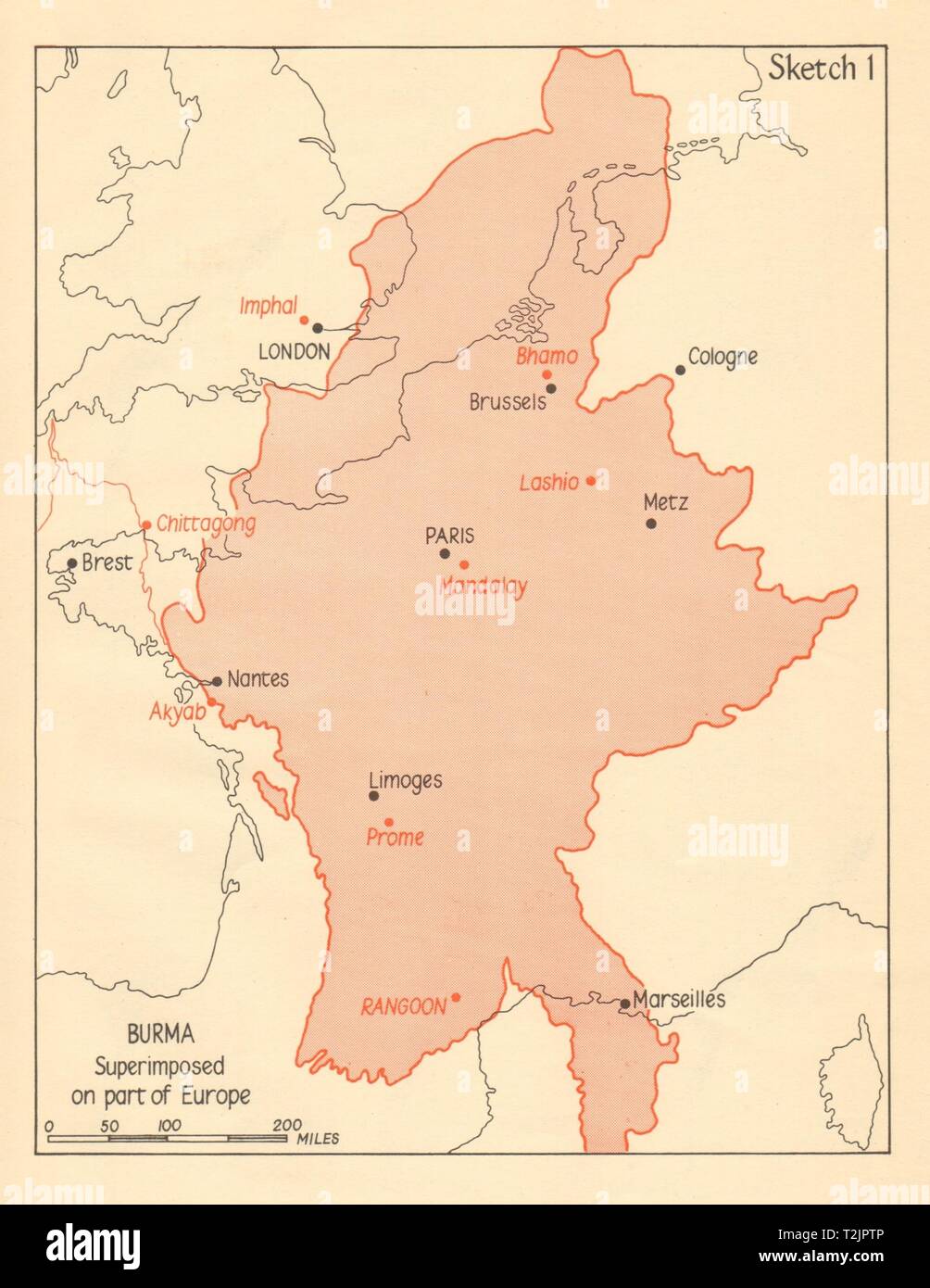 Burma superimposed on part of Europe. Myanmar 1961 old vintage map plan chart Stock Photohttps://www.alamy.com/image-license-details/?v=1https://www.alamy.com/burma-superimposed-on-part-of-europe-myanmar-1961-old-vintage-map-plan-chart-image242587542.html
RFT2JPTP–Burma superimposed on part of Europe. Myanmar 1961 old vintage map plan chart
 Eurovision Song Contest 1965 - Kathy Kirby Stock Photohttps://www.alamy.com/image-license-details/?v=1https://www.alamy.com/stock-photo-eurovision-song-contest-1965-kathy-kirby-139497289.html
RMJ2XJ61–Eurovision Song Contest 1965 - Kathy Kirby
 Leicestershire, administrative county of England - Great Britain. High resolution satellite map Stock Photohttps://www.alamy.com/image-license-details/?v=1https://www.alamy.com/leicestershire-administrative-county-of-england-great-britain-high-resolution-satellite-map-image546465006.html
RF2PN1HKA–Leicestershire, administrative county of England - Great Britain. High resolution satellite map
 USGS TOPO Map Mississippi MS Kirby 335916 1988 24000 Restoration Stock Photohttps://www.alamy.com/image-license-details/?v=1https://www.alamy.com/usgs-topo-map-mississippi-ms-kirby-335916-1988-24000-restoration-image333098395.html
RM2A9WXB7–USGS TOPO Map Mississippi MS Kirby 335916 1988 24000 Restoration
 Note on Carboniferous Entomostraca from Nova Scotia, in the Peter Redpath Museum, determined and described by Prof. T. Rupert Jones, F.R. S., and Mr. Kirby BHL266 Stock Photohttps://www.alamy.com/image-license-details/?v=1https://www.alamy.com/stock-photo-note-on-carboniferous-entomostraca-from-nova-scotia-in-the-peter-redpath-122491972.html
RMH37YN8–Note on Carboniferous Entomostraca from Nova Scotia, in the Peter Redpath Museum, determined and described by Prof. T. Rupert Jones, F.R. S., and Mr. Kirby BHL266
 Kirby, Wyandot County, US, United States, Ohio, N 40 48' 47'', S 83 25' 6'', map, Cartascapes Map published in 2024. Explore Cartascapes, a map revealing Earth's diverse landscapes, cultures, and ecosystems. Journey through time and space, discovering the interconnectedness of our planet's past, present, and future. Stock Photohttps://www.alamy.com/image-license-details/?v=1https://www.alamy.com/kirby-wyandot-county-us-united-states-ohio-n-40-48-47-s-83-25-6-map-cartascapes-map-published-in-2024-explore-cartascapes-a-map-revealing-earths-diverse-landscapes-cultures-and-ecosystems-journey-through-time-and-space-discovering-the-interconnectedness-of-our-planets-past-present-and-future-image621227336.html
RM2Y2K9PG–Kirby, Wyandot County, US, United States, Ohio, N 40 48' 47'', S 83 25' 6'', map, Cartascapes Map published in 2024. Explore Cartascapes, a map revealing Earth's diverse landscapes, cultures, and ecosystems. Journey through time and space, discovering the interconnectedness of our planet's past, present, and future.
![THE TOMB OF HENRY HOLLAND EARL OF SURRY. Author Wood, Joseph 39.17.d. Place of publication: [London] Publisher: [J. Kirby] Date of publication: [1748.] Item type: 1 print Medium: etching Dimensions: platemark 23.6 x 31.5 cm. Former owner: George III, King of Great Britain, 1738-1820 Stock Photo THE TOMB OF HENRY HOLLAND EARL OF SURRY. Author Wood, Joseph 39.17.d. Place of publication: [London] Publisher: [J. Kirby] Date of publication: [1748.] Item type: 1 print Medium: etching Dimensions: platemark 23.6 x 31.5 cm. Former owner: George III, King of Great Britain, 1738-1820 Stock Photo](https://c8.alamy.com/comp/2E9HPEH/the-tomb-of-henry-holland-earl-of-surry-author-wood-joseph-3917d-place-of-publication-london-publisher-j-kirby-date-of-publication-1748-item-type-1-print-medium-etching-dimensions-platemark-236-x-315-cm-former-owner-george-iii-king-of-great-britain-1738-1820-2E9HPEH.jpg) THE TOMB OF HENRY HOLLAND EARL OF SURRY. Author Wood, Joseph 39.17.d. Place of publication: [London] Publisher: [J. Kirby] Date of publication: [1748.] Item type: 1 print Medium: etching Dimensions: platemark 23.6 x 31.5 cm. Former owner: George III, King of Great Britain, 1738-1820 Stock Photohttps://www.alamy.com/image-license-details/?v=1https://www.alamy.com/the-tomb-of-henry-holland-earl-of-surry-author-wood-joseph-3917d-place-of-publication-london-publisher-j-kirby-date-of-publication-1748-item-type-1-print-medium-etching-dimensions-platemark-236-x-315-cm-former-owner-george-iii-king-of-great-britain-1738-1820-image401761209.html
THE TOMB OF HENRY HOLLAND EARL OF SURRY. Author Wood, Joseph 39.17.d. Place of publication: [London] Publisher: [J. Kirby] Date of publication: [1748.] Item type: 1 print Medium: etching Dimensions: platemark 23.6 x 31.5 cm. Former owner: George III, King of Great Britain, 1738-1820 Stock Photohttps://www.alamy.com/image-license-details/?v=1https://www.alamy.com/the-tomb-of-henry-holland-earl-of-surry-author-wood-joseph-3917d-place-of-publication-london-publisher-j-kirby-date-of-publication-1748-item-type-1-print-medium-etching-dimensions-platemark-236-x-315-cm-former-owner-george-iii-king-of-great-britain-1738-1820-image401761209.htmlRM2E9HPEH–THE TOMB OF HENRY HOLLAND EARL OF SURRY. Author Wood, Joseph 39.17.d. Place of publication: [London] Publisher: [J. Kirby] Date of publication: [1748.] Item type: 1 print Medium: etching Dimensions: platemark 23.6 x 31.5 cm. Former owner: George III, King of Great Britain, 1738-1820
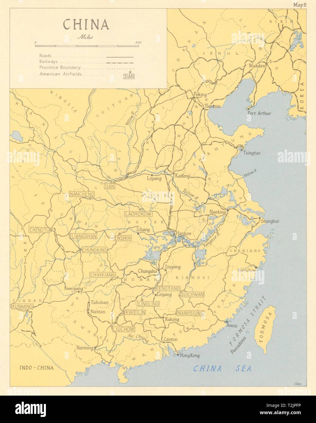 China in 1944 showing American airfields. USAF 1961 old vintage map plan chart Stock Photohttps://www.alamy.com/image-license-details/?v=1https://www.alamy.com/china-in-1944-showing-american-airfields-usaf-1961-old-vintage-map-plan-chart-image242587290.html
RFT2JPFP–China in 1944 showing American airfields. USAF 1961 old vintage map plan chart
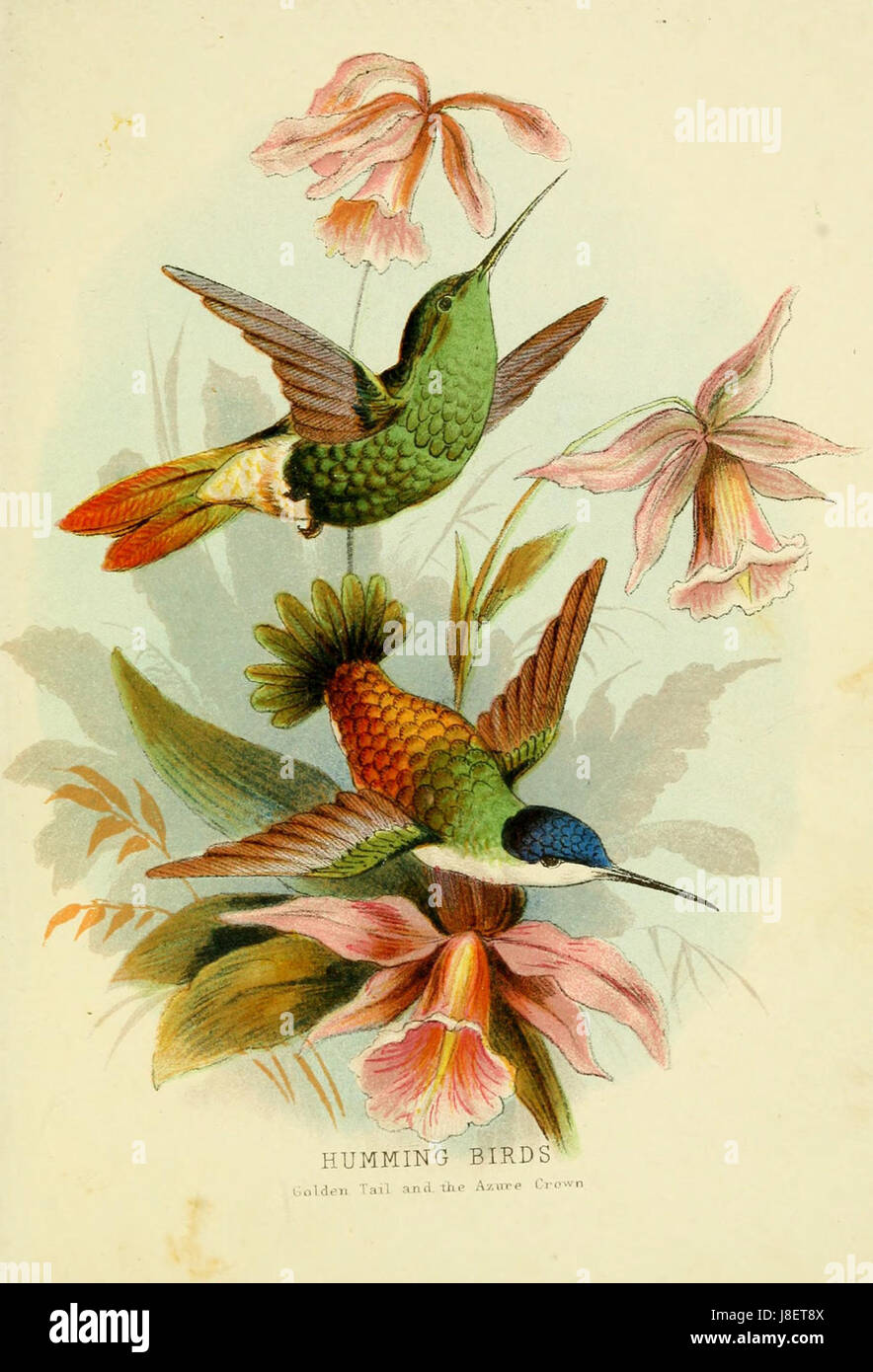 Golden Tail and Azure Crown Hummingbird by Elizabeth and Mary Kirby Stock Photohttps://www.alamy.com/image-license-details/?v=1https://www.alamy.com/stock-photo-golden-tail-and-azure-crown-hummingbird-by-elizabeth-and-mary-kirby-142926586.html
RMJ8ET8X–Golden Tail and Azure Crown Hummingbird by Elizabeth and Mary Kirby
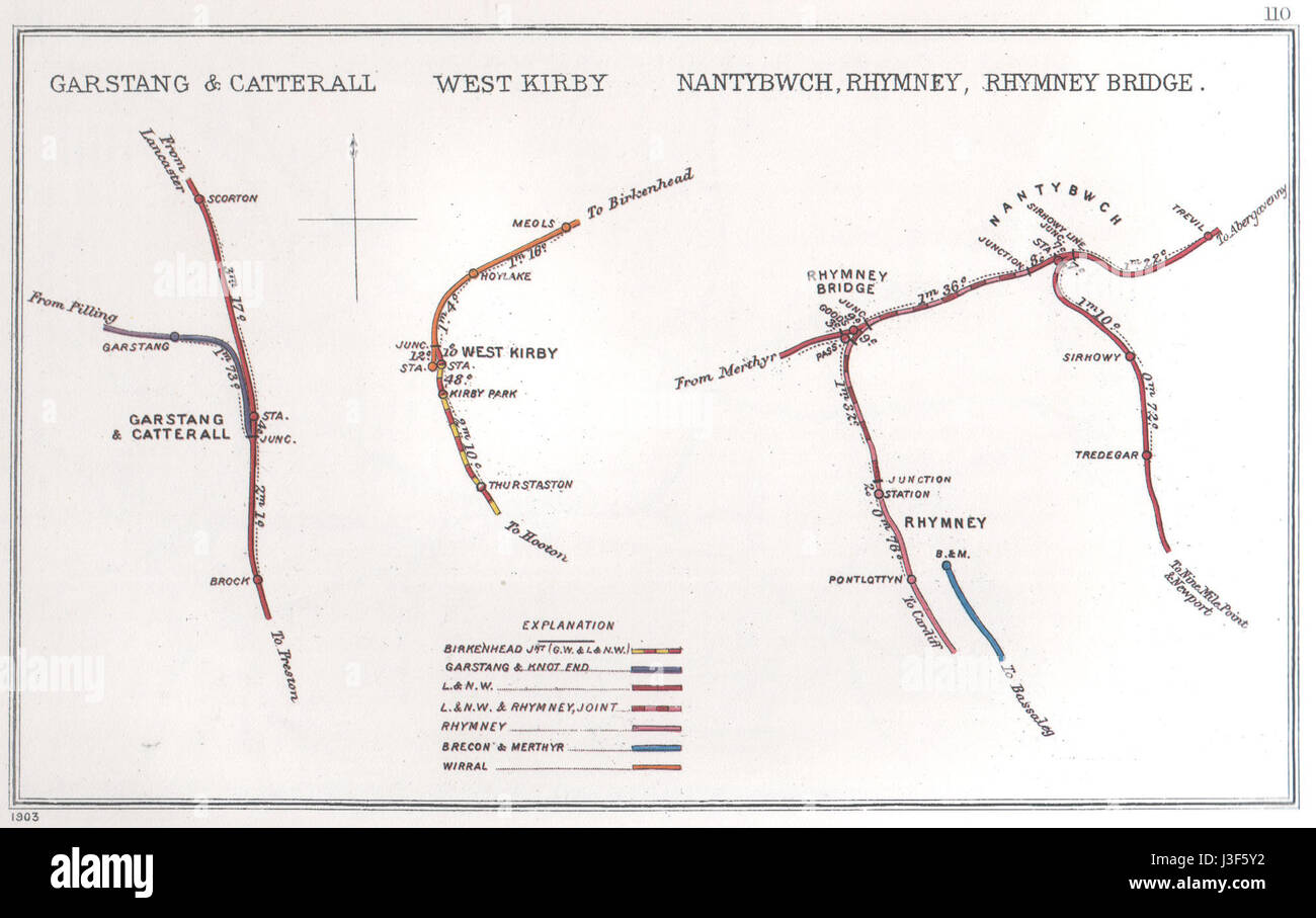 Garstang & Catterall, West Kirby Nantybwch, Rhymney, Rhymney Bridge RJD 110 Stock Photohttps://www.alamy.com/image-license-details/?v=1https://www.alamy.com/stock-photo-garstang-catterall-west-kirby-nantybwch-rhymney-rhymney-bridge-rjd-139860870.html
RMJ3F5Y2–Garstang & Catterall, West Kirby Nantybwch, Rhymney, Rhymney Bridge RJD 110
 Sevenoaks, non metropolitan district of England - Great Britain. Low resolution satellite map Stock Photohttps://www.alamy.com/image-license-details/?v=1https://www.alamy.com/sevenoaks-non-metropolitan-district-of-england-great-britain-low-resolution-satellite-map-image546500589.html
RF2PN3725–Sevenoaks, non metropolitan district of England - Great Britain. Low resolution satellite map