Quick filters:
Map of kirby Stock Photos and Images
 E. Kirby Smith Stock Photohttps://www.alamy.com/image-license-details/?v=1https://www.alamy.com/stock-image-e-kirby-smith-162780908.html
RMKCR8KT–E. Kirby Smith
 USGS TOPO Map Montana MT Kirby 20110523 TM Inverted Restoration Stock Photohttps://www.alamy.com/image-license-details/?v=1https://www.alamy.com/usgs-topo-map-montana-mt-kirby-20110523-tm-inverted-restoration-image333458393.html
RM2AAE9G9–USGS TOPO Map Montana MT Kirby 20110523 TM Inverted Restoration
 Note on Carboniferous Entomostraca from Nova Scotia, in the Peter Redpath Museum, determined and described by Prof. T. Rupert Jones, F.R. S., and Mr. Kirby (Page 1) BHL266 Stock Photohttps://www.alamy.com/image-license-details/?v=1https://www.alamy.com/stock-photo-note-on-carboniferous-entomostraca-from-nova-scotia-in-the-peter-redpath-122491925.html
RMH37YKH–Note on Carboniferous Entomostraca from Nova Scotia, in the Peter Redpath Museum, determined and described by Prof. T. Rupert Jones, F.R. S., and Mr. Kirby (Page 1) BHL266
 Kirby, Franklin County, US, United States, Mississippi, N 31 30' 41'', S 90 58' 51'', map, Cartascapes Map published in 2024. Explore Cartascapes, a map revealing Earth's diverse landscapes, cultures, and ecosystems. Journey through time and space, discovering the interconnectedness of our planet's past, present, and future. Stock Photohttps://www.alamy.com/image-license-details/?v=1https://www.alamy.com/kirby-franklin-county-us-united-states-mississippi-n-31-30-41-s-90-58-51-map-cartascapes-map-published-in-2024-explore-cartascapes-a-map-revealing-earths-diverse-landscapes-cultures-and-ecosystems-journey-through-time-and-space-discovering-the-interconnectedness-of-our-planets-past-present-and-future-image621318135.html
RM2Y2RDHB–Kirby, Franklin County, US, United States, Mississippi, N 31 30' 41'', S 90 58' 51'', map, Cartascapes Map published in 2024. Explore Cartascapes, a map revealing Earth's diverse landscapes, cultures, and ecosystems. Journey through time and space, discovering the interconnectedness of our planet's past, present, and future.
 USGS Topo Map Washington State WA Kirby 241777 1964 24000 Restoration Stock Photohttps://www.alamy.com/image-license-details/?v=1https://www.alamy.com/usgs-topo-map-washington-state-wa-kirby-241777-1964-24000-restoration-image266311358.html
RMWD7ERX–USGS Topo Map Washington State WA Kirby 241777 1964 24000 Restoration
![THE WEST VIEW OF BUNGAY CASTLE, IN THE COUNTY OF SUFFOLK. Author Wood, Joseph 39.10.b. Place of publication: [London] Publisher: [J. Kirby] Date of publication: [1748.] Item type: 1 print Medium: etching Dimensions: platemark 20.2 X 35.9 cm. Former owner: George III, King of Great Britain, 1738-1820 Stock Photo THE WEST VIEW OF BUNGAY CASTLE, IN THE COUNTY OF SUFFOLK. Author Wood, Joseph 39.10.b. Place of publication: [London] Publisher: [J. Kirby] Date of publication: [1748.] Item type: 1 print Medium: etching Dimensions: platemark 20.2 X 35.9 cm. Former owner: George III, King of Great Britain, 1738-1820 Stock Photo](https://c8.alamy.com/comp/2E9HPDR/the-west-view-of-bungay-castle-in-the-county-of-suffolk-author-wood-joseph-3910b-place-of-publication-london-publisher-j-kirby-date-of-publication-1748-item-type-1-print-medium-etching-dimensions-platemark-202-x-359-cm-former-owner-george-iii-king-of-great-britain-1738-1820-2E9HPDR.jpg) THE WEST VIEW OF BUNGAY CASTLE, IN THE COUNTY OF SUFFOLK. Author Wood, Joseph 39.10.b. Place of publication: [London] Publisher: [J. Kirby] Date of publication: [1748.] Item type: 1 print Medium: etching Dimensions: platemark 20.2 X 35.9 cm. Former owner: George III, King of Great Britain, 1738-1820 Stock Photohttps://www.alamy.com/image-license-details/?v=1https://www.alamy.com/the-west-view-of-bungay-castle-in-the-county-of-suffolk-author-wood-joseph-3910b-place-of-publication-london-publisher-j-kirby-date-of-publication-1748-item-type-1-print-medium-etching-dimensions-platemark-202-x-359-cm-former-owner-george-iii-king-of-great-britain-1738-1820-image401761187.html
THE WEST VIEW OF BUNGAY CASTLE, IN THE COUNTY OF SUFFOLK. Author Wood, Joseph 39.10.b. Place of publication: [London] Publisher: [J. Kirby] Date of publication: [1748.] Item type: 1 print Medium: etching Dimensions: platemark 20.2 X 35.9 cm. Former owner: George III, King of Great Britain, 1738-1820 Stock Photohttps://www.alamy.com/image-license-details/?v=1https://www.alamy.com/the-west-view-of-bungay-castle-in-the-county-of-suffolk-author-wood-joseph-3910b-place-of-publication-london-publisher-j-kirby-date-of-publication-1748-item-type-1-print-medium-etching-dimensions-platemark-202-x-359-cm-former-owner-george-iii-king-of-great-britain-1738-1820-image401761187.htmlRM2E9HPDR–THE WEST VIEW OF BUNGAY CASTLE, IN THE COUNTY OF SUFFOLK. Author Wood, Joseph 39.10.b. Place of publication: [London] Publisher: [J. Kirby] Date of publication: [1748.] Item type: 1 print Medium: etching Dimensions: platemark 20.2 X 35.9 cm. Former owner: George III, King of Great Britain, 1738-1820
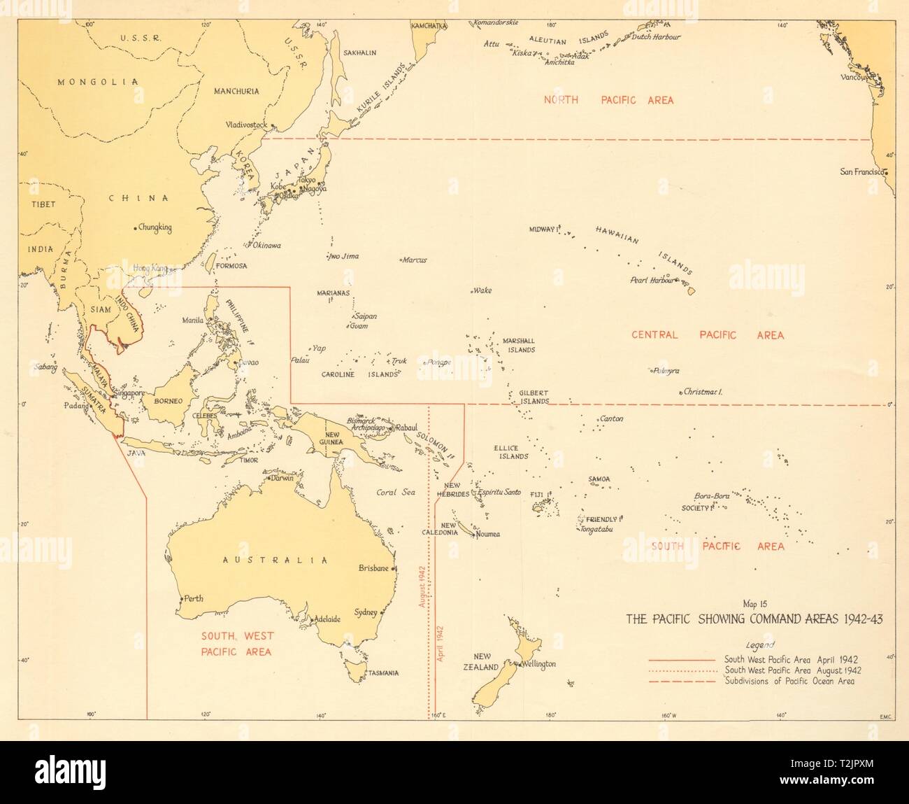 The Pacific showing Command Areas 1942-43. World War 2 1961 old vintage map Stock Photohttps://www.alamy.com/image-license-details/?v=1https://www.alamy.com/the-pacific-showing-command-areas-1942-43-world-war-2-1961-old-vintage-map-image242587596.html
RFT2JPXM–The Pacific showing Command Areas 1942-43. World War 2 1961 old vintage map
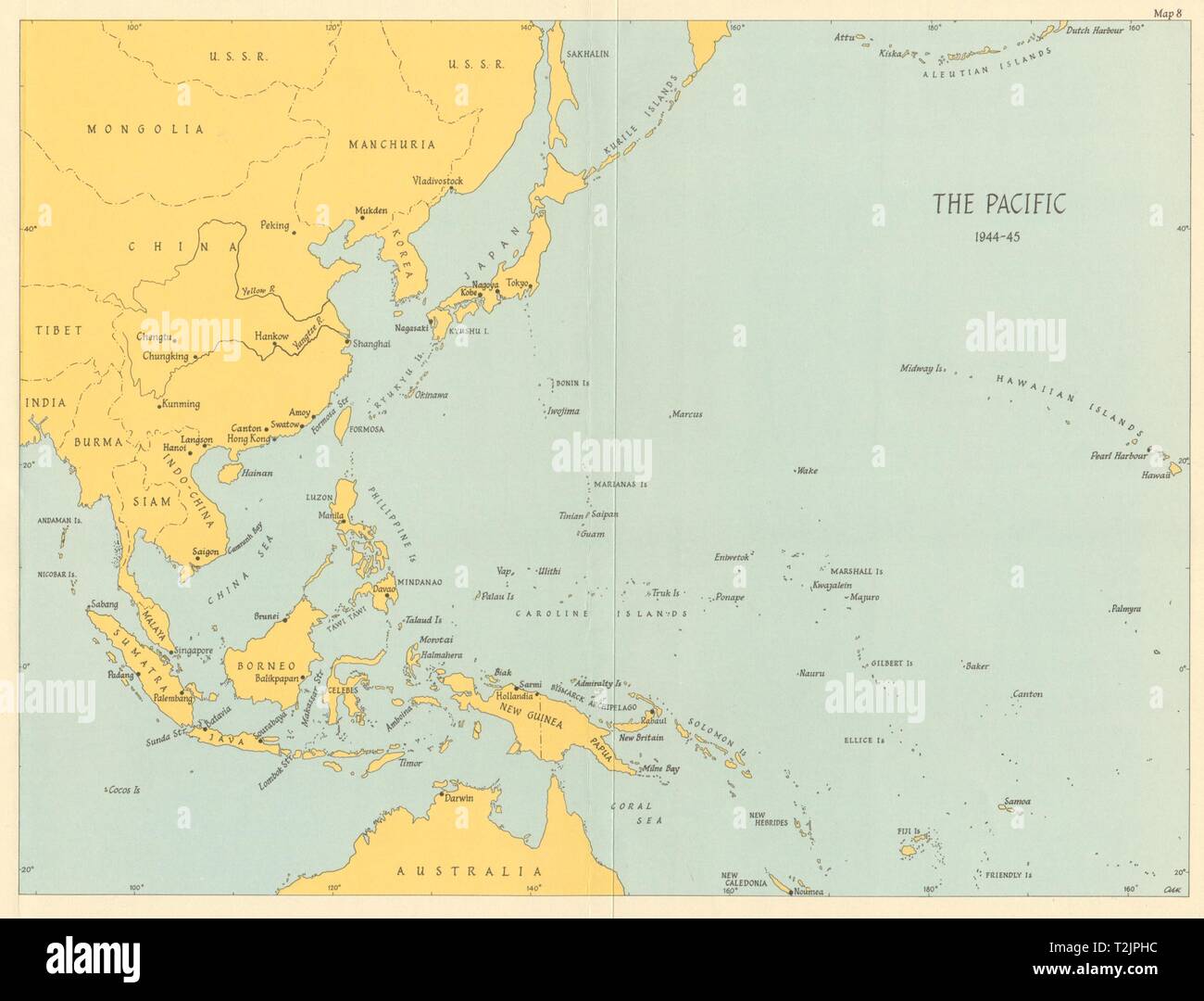 Pacific Ocean theatre 1944/45. World War 2 1965 old vintage map plan chart Stock Photohttps://www.alamy.com/image-license-details/?v=1https://www.alamy.com/pacific-ocean-theatre-194445-world-war-2-1965-old-vintage-map-plan-chart-image242587336.html
RFT2JPHC–Pacific Ocean theatre 1944/45. World War 2 1965 old vintage map plan chart
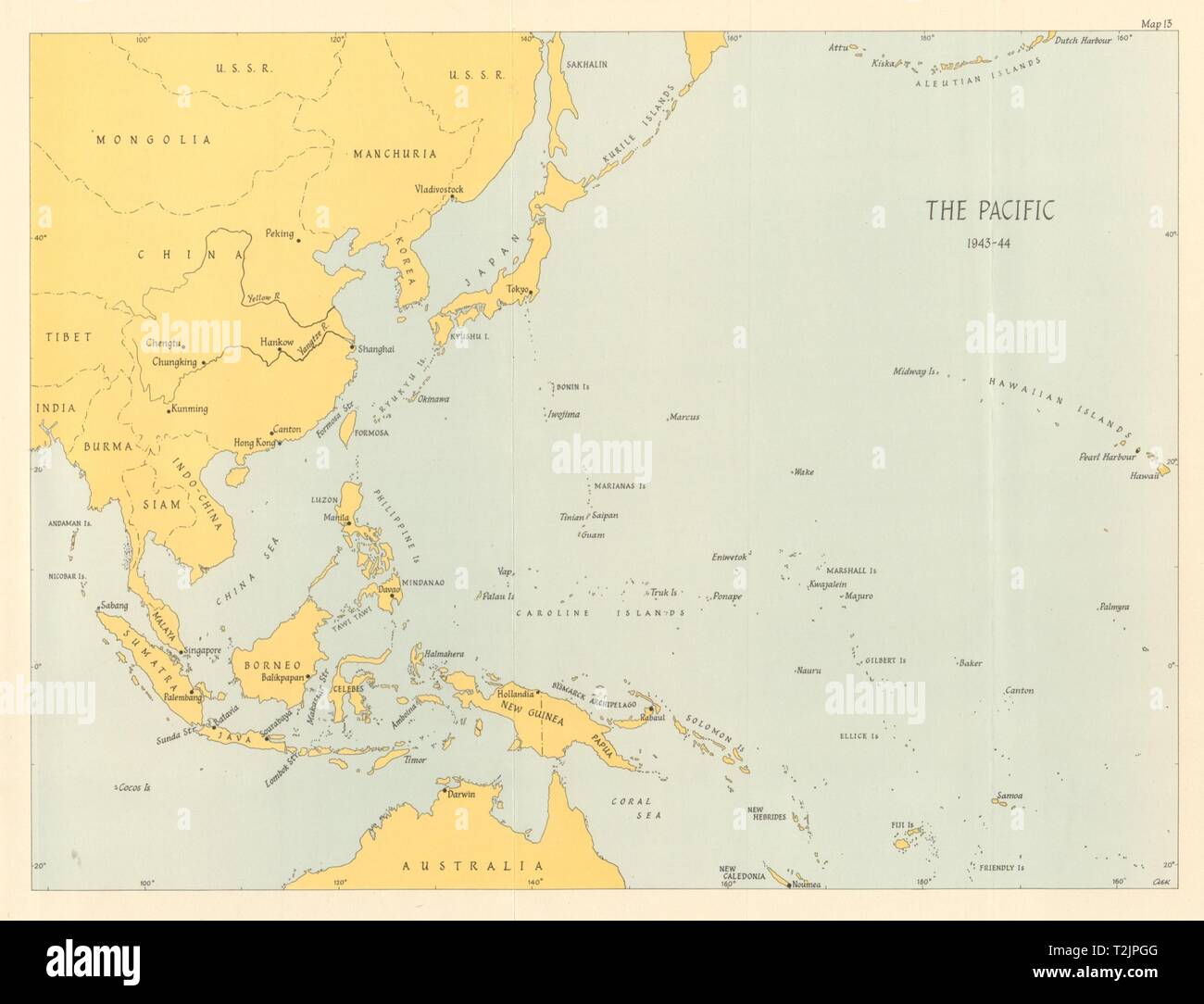 Pacific Ocean theatre 1943/44. World War 2 1961 old vintage map plan chart Stock Photohttps://www.alamy.com/image-license-details/?v=1https://www.alamy.com/pacific-ocean-theatre-194344-world-war-2-1961-old-vintage-map-plan-chart-image242587312.html
RFT2JPGG–Pacific Ocean theatre 1943/44. World War 2 1961 old vintage map plan chart
 Phyllogomphoides appendiculatus description Kirby 1899 Stock Photohttps://www.alamy.com/image-license-details/?v=1https://www.alamy.com/stock-image-phyllogomphoides-appendiculatus-description-kirby-1899-160929729.html
RMK9PYE9–Phyllogomphoides appendiculatus description Kirby 1899
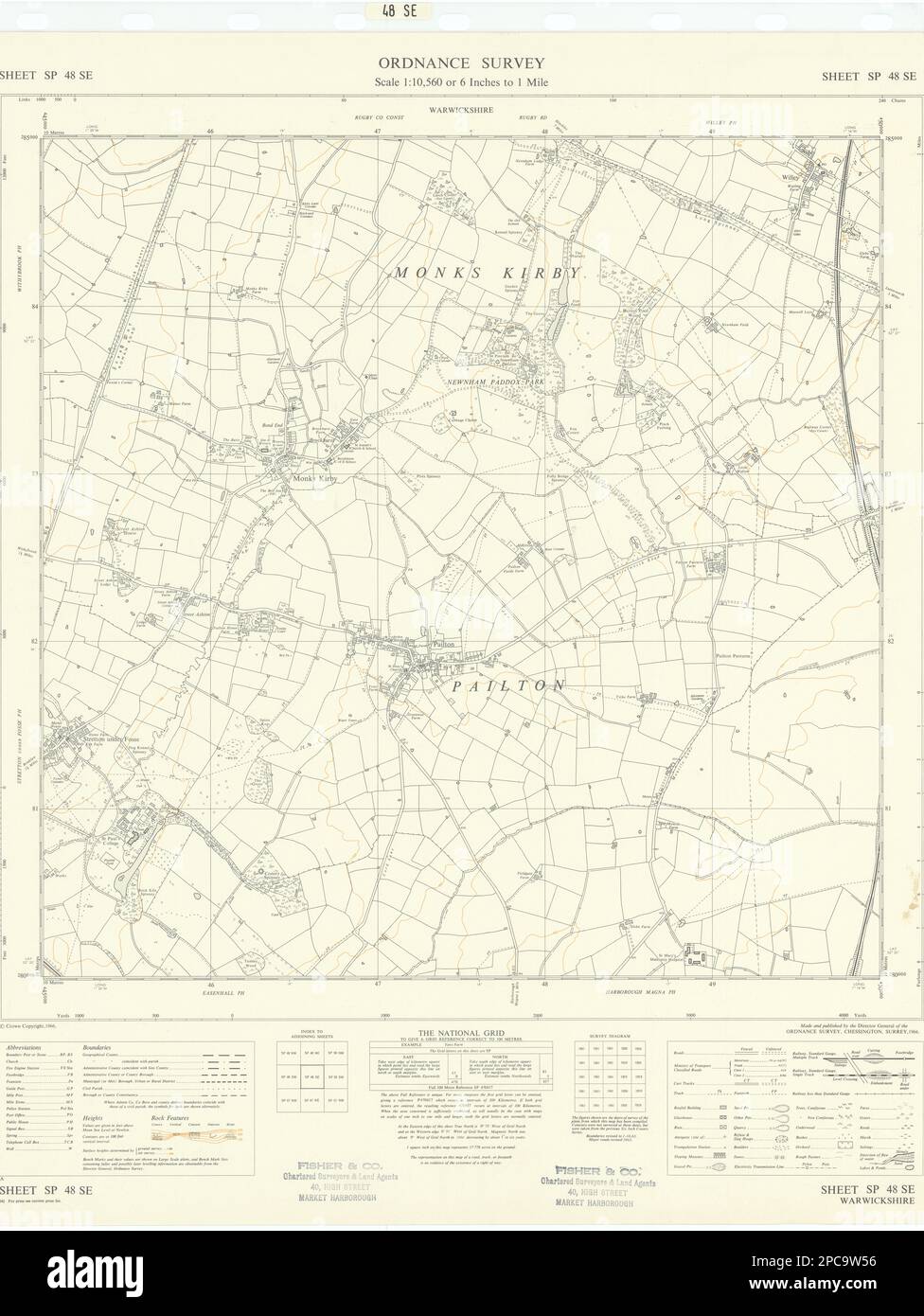 Ordnance Survey SP48SE Warks Pailton Monks Kirby Stretton under Fosse 1966 map Stock Photohttps://www.alamy.com/image-license-details/?v=1https://www.alamy.com/ordnance-survey-sp48se-warks-pailton-monks-kirby-stretton-under-fosse-1966-map-image541114594.html
RF2PC9W56–Ordnance Survey SP48SE Warks Pailton Monks Kirby Stretton under Fosse 1966 map
 Sevenoaks, non metropolitan district of England - Great Britain. High resolution satellite map Stock Photohttps://www.alamy.com/image-license-details/?v=1https://www.alamy.com/sevenoaks-non-metropolitan-district-of-england-great-britain-high-resolution-satellite-map-image546500520.html
RF2PN36YM–Sevenoaks, non metropolitan district of England - Great Britain. High resolution satellite map
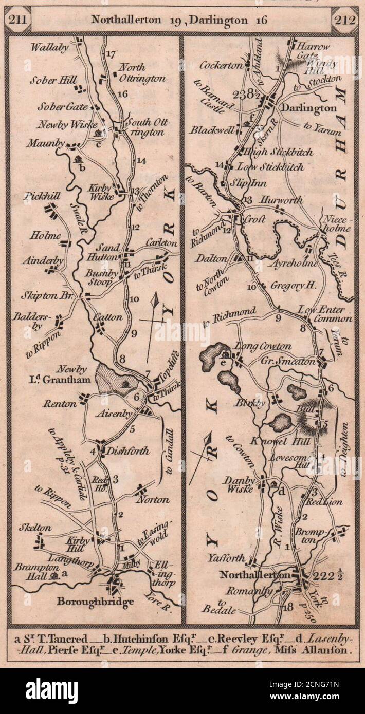 Boroughbridge-Northallerton-Darlington road strip map PATERSON 1803 old Stock Photohttps://www.alamy.com/image-license-details/?v=1https://www.alamy.com/boroughbridge-northallerton-darlington-road-strip-map-paterson-1803-old-image374682273.html
RF2CNG71N–Boroughbridge-Northallerton-Darlington road strip map PATERSON 1803 old
 Note on Carboniferous Entomostraca from Nova Scotia, in the Peter Redpath Museum, determined and described by Prof. T. Rupert Jones, F.R. S., and Mr. Kirby (Page 16) BHL266 Stock Photohttps://www.alamy.com/image-license-details/?v=1https://www.alamy.com/stock-photo-note-on-carboniferous-entomostraca-from-nova-scotia-in-the-peter-redpath-122491926.html
RMH37YKJ–Note on Carboniferous Entomostraca from Nova Scotia, in the Peter Redpath Museum, determined and described by Prof. T. Rupert Jones, F.R. S., and Mr. Kirby (Page 16) BHL266
 Kirby, Bexar County, US, United States, Texas, N 29 27' 47'', S 98 23' 8'', map, Cartascapes Map published in 2024. Explore Cartascapes, a map revealing Earth's diverse landscapes, cultures, and ecosystems. Journey through time and space, discovering the interconnectedness of our planet's past, present, and future. Stock Photohttps://www.alamy.com/image-license-details/?v=1https://www.alamy.com/kirby-bexar-county-us-united-states-texas-n-29-27-47-s-98-23-8-map-cartascapes-map-published-in-2024-explore-cartascapes-a-map-revealing-earths-diverse-landscapes-cultures-and-ecosystems-journey-through-time-and-space-discovering-the-interconnectedness-of-our-planets-past-present-and-future-image621493535.html
RM2Y33D9K–Kirby, Bexar County, US, United States, Texas, N 29 27' 47'', S 98 23' 8'', map, Cartascapes Map published in 2024. Explore Cartascapes, a map revealing Earth's diverse landscapes, cultures, and ecosystems. Journey through time and space, discovering the interconnectedness of our planet's past, present, and future.
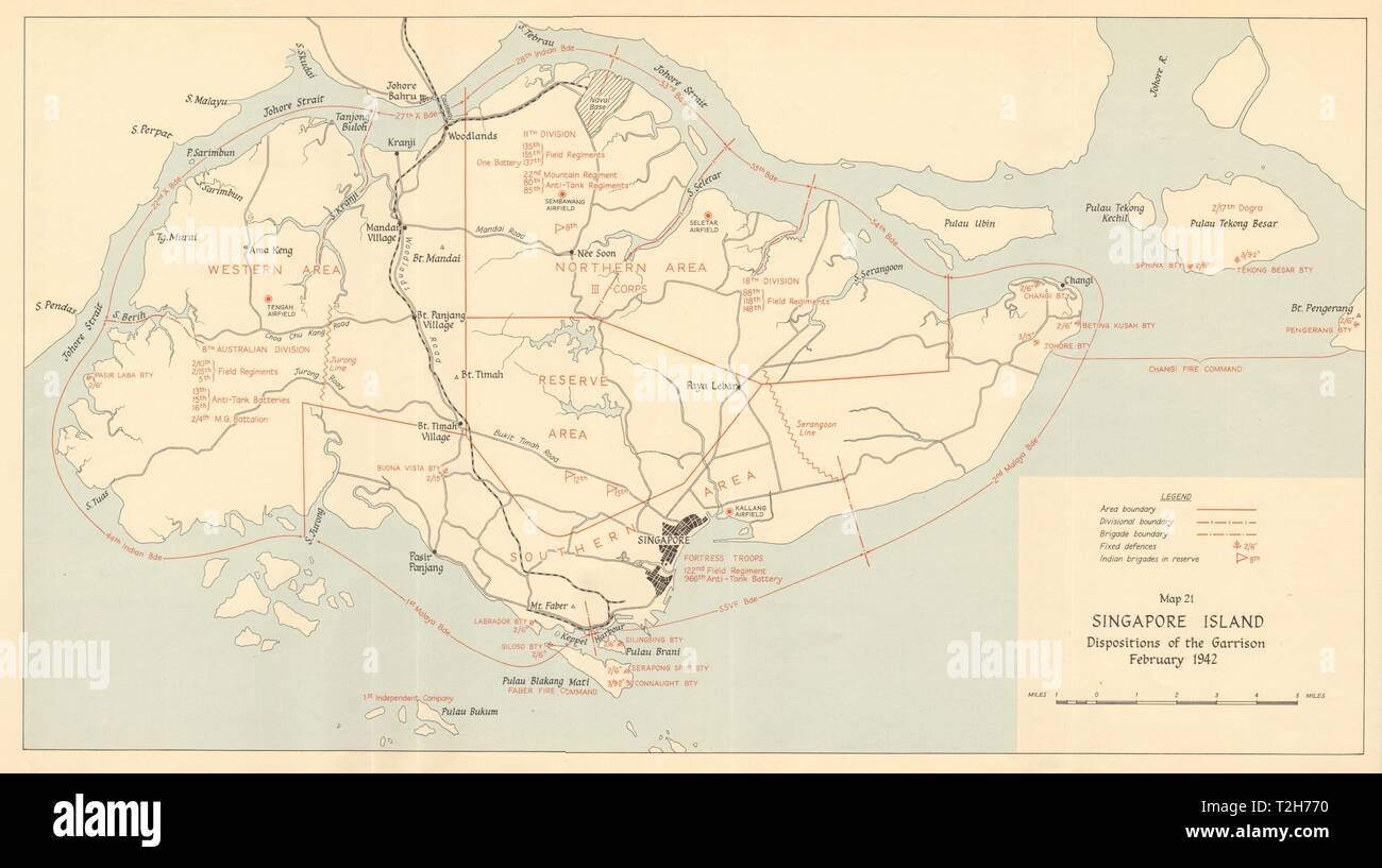 Singapore Island, dispositions of the garrison February 1942 1957 old map Stock Photohttps://www.alamy.com/image-license-details/?v=1https://www.alamy.com/singapore-island-dispositions-of-the-garrison-february-1942-1957-old-map-image242553332.html
RFT2H770–Singapore Island, dispositions of the garrison February 1942 1957 old map
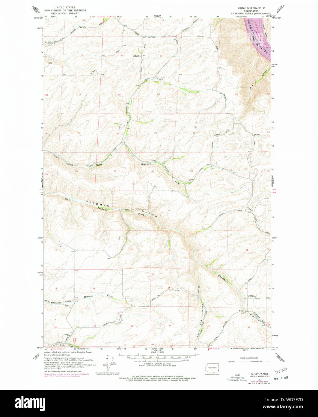 USGS Topo Map Washington State WA Kirby 241778 1964 24000 Restoration Stock Photohttps://www.alamy.com/image-license-details/?v=1https://www.alamy.com/usgs-topo-map-washington-state-wa-kirby-241778-1964-24000-restoration-image266311681.html
RMWD7F7D–USGS Topo Map Washington State WA Kirby 241778 1964 24000 Restoration
 USGS Topo Map Washington State WA Kirby 20110406 TM Inverted Restoration Stock Photohttps://www.alamy.com/image-license-details/?v=1https://www.alamy.com/usgs-topo-map-washington-state-wa-kirby-20110406-tm-inverted-restoration-image266311008.html
RMWD7EBC–USGS Topo Map Washington State WA Kirby 20110406 TM Inverted Restoration
 USGS TOPO Map Montana MT Kirby Ranch 264802 1965 24000 Restoration Stock Photohttps://www.alamy.com/image-license-details/?v=1https://www.alamy.com/usgs-topo-map-montana-mt-kirby-ranch-264802-1965-24000-restoration-image333458718.html
RM2AAE9YX–USGS TOPO Map Montana MT Kirby Ranch 264802 1965 24000 Restoration
![THE WEST VIEW OF CHRIST'S HOSPITAL IN IPSWICH. Author Wood, Joseph 39.22.b. Place of publication: [London] Publisher: [J. Kirby] Date of publication: [1748.] Item type: 1 print Medium: etching Dimensions: platemark 19.9 x 35.1 cm. Former owner: George III, King of Great Britain, 1738-1820 Stock Photo THE WEST VIEW OF CHRIST'S HOSPITAL IN IPSWICH. Author Wood, Joseph 39.22.b. Place of publication: [London] Publisher: [J. Kirby] Date of publication: [1748.] Item type: 1 print Medium: etching Dimensions: platemark 19.9 x 35.1 cm. Former owner: George III, King of Great Britain, 1738-1820 Stock Photo](https://c8.alamy.com/comp/2E9HPEY/the-west-view-of-christs-hospital-in-ipswich-author-wood-joseph-3922b-place-of-publication-london-publisher-j-kirby-date-of-publication-1748-item-type-1-print-medium-etching-dimensions-platemark-199-x-351-cm-former-owner-george-iii-king-of-great-britain-1738-1820-2E9HPEY.jpg) THE WEST VIEW OF CHRIST'S HOSPITAL IN IPSWICH. Author Wood, Joseph 39.22.b. Place of publication: [London] Publisher: [J. Kirby] Date of publication: [1748.] Item type: 1 print Medium: etching Dimensions: platemark 19.9 x 35.1 cm. Former owner: George III, King of Great Britain, 1738-1820 Stock Photohttps://www.alamy.com/image-license-details/?v=1https://www.alamy.com/the-west-view-of-christs-hospital-in-ipswich-author-wood-joseph-3922b-place-of-publication-london-publisher-j-kirby-date-of-publication-1748-item-type-1-print-medium-etching-dimensions-platemark-199-x-351-cm-former-owner-george-iii-king-of-great-britain-1738-1820-image401761219.html
THE WEST VIEW OF CHRIST'S HOSPITAL IN IPSWICH. Author Wood, Joseph 39.22.b. Place of publication: [London] Publisher: [J. Kirby] Date of publication: [1748.] Item type: 1 print Medium: etching Dimensions: platemark 19.9 x 35.1 cm. Former owner: George III, King of Great Britain, 1738-1820 Stock Photohttps://www.alamy.com/image-license-details/?v=1https://www.alamy.com/the-west-view-of-christs-hospital-in-ipswich-author-wood-joseph-3922b-place-of-publication-london-publisher-j-kirby-date-of-publication-1748-item-type-1-print-medium-etching-dimensions-platemark-199-x-351-cm-former-owner-george-iii-king-of-great-britain-1738-1820-image401761219.htmlRM2E9HPEY–THE WEST VIEW OF CHRIST'S HOSPITAL IN IPSWICH. Author Wood, Joseph 39.22.b. Place of publication: [London] Publisher: [J. Kirby] Date of publication: [1748.] Item type: 1 print Medium: etching Dimensions: platemark 19.9 x 35.1 cm. Former owner: George III, King of Great Britain, 1738-1820
 P462 Kirby warning Charles II. of the Assassination Plot Stock Photohttps://www.alamy.com/image-license-details/?v=1https://www.alamy.com/stock-image-p462-kirby-warning-charles-ii-of-the-assassination-plot-160916419.html
RMK9PAEY–P462 Kirby warning Charles II. of the Assassination Plot
 Edmund Waller (died 1898) of Farmington and Kirby Fleetham Stock Photohttps://www.alamy.com/image-license-details/?v=1https://www.alamy.com/stock-image-edmund-waller-died-1898-of-farmington-and-kirby-fleetham-162788259.html
RMKCRJ2B–Edmund Waller (died 1898) of Farmington and Kirby Fleetham
 Leicestershire, administrative county of England - Great Britain. Bilevel elevation map with lakes and rivers Stock Photohttps://www.alamy.com/image-license-details/?v=1https://www.alamy.com/leicestershire-administrative-county-of-england-great-britain-bilevel-elevation-map-with-lakes-and-rivers-image546464918.html
RF2PN1HG6–Leicestershire, administrative county of England - Great Britain. Bilevel elevation map with lakes and rivers
 Kirby 1899 Harpagomantis Stock Photohttps://www.alamy.com/image-license-details/?v=1https://www.alamy.com/stock-image-kirby-1899-harpagomantis-160532745.html
RMK94W49–Kirby 1899 Harpagomantis
 Kirby, Monroe County, US, United States, Wisconsin, N 44 5' 25'', S 90 32' 21'', map, Cartascapes Map published in 2024. Explore Cartascapes, a map revealing Earth's diverse landscapes, cultures, and ecosystems. Journey through time and space, discovering the interconnectedness of our planet's past, present, and future. Stock Photohttps://www.alamy.com/image-license-details/?v=1https://www.alamy.com/kirby-monroe-county-us-united-states-wisconsin-n-44-5-25-s-90-32-21-map-cartascapes-map-published-in-2024-explore-cartascapes-a-map-revealing-earths-diverse-landscapes-cultures-and-ecosystems-journey-through-time-and-space-discovering-the-interconnectedness-of-our-planets-past-present-and-future-image621173333.html
RM2Y2GTWW–Kirby, Monroe County, US, United States, Wisconsin, N 44 5' 25'', S 90 32' 21'', map, Cartascapes Map published in 2024. Explore Cartascapes, a map revealing Earth's diverse landscapes, cultures, and ecosystems. Journey through time and space, discovering the interconnectedness of our planet's past, present, and future.
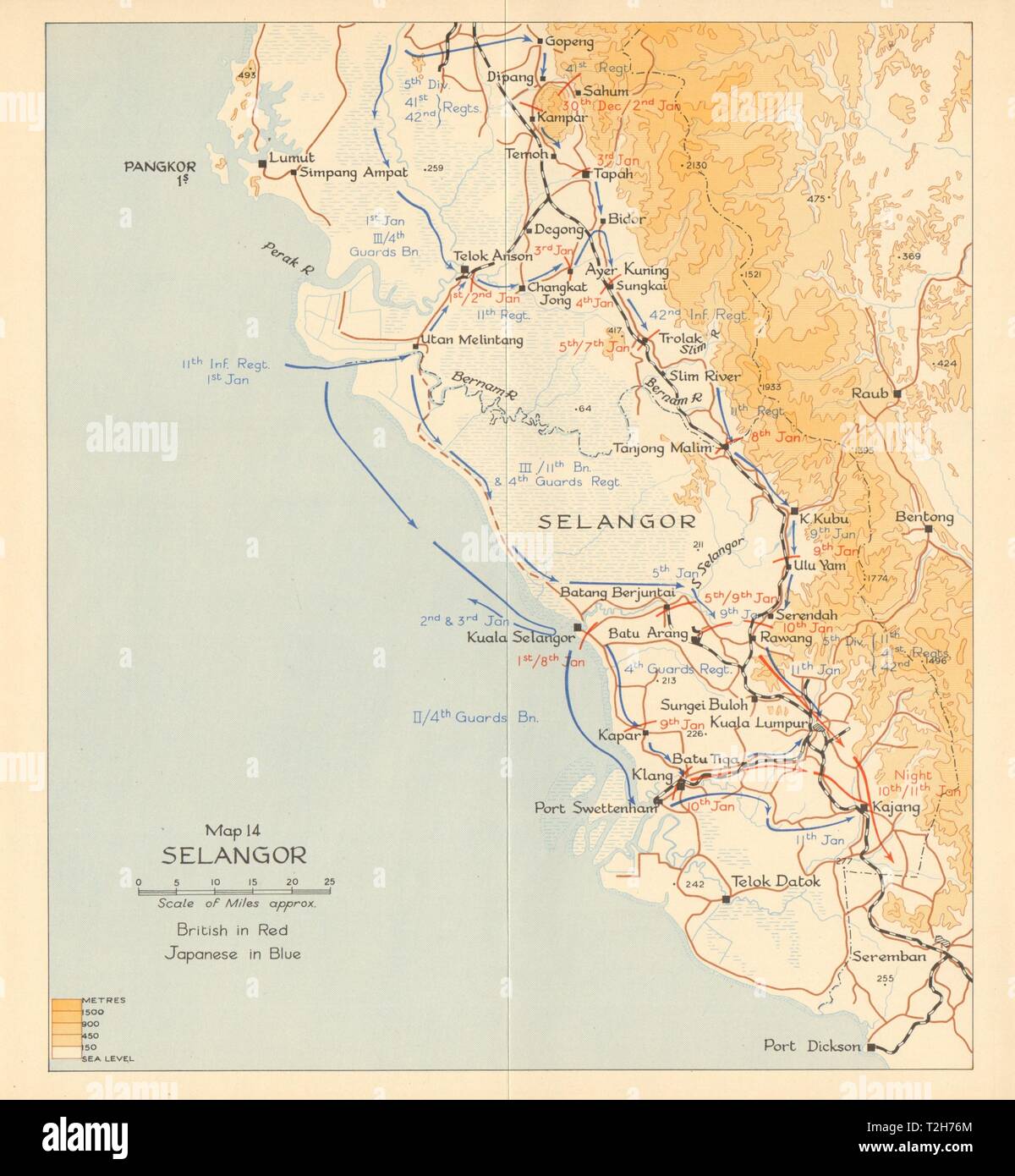 Selangor. Japanese invasion of Malaya 1942. Malaysia 1957 old vintage map Stock Photohttps://www.alamy.com/image-license-details/?v=1https://www.alamy.com/selangor-japanese-invasion-of-malaya-1942-malaysia-1957-old-vintage-map-image242553324.html
RFT2H76M–Selangor. Japanese invasion of Malaya 1942. Malaysia 1957 old vintage map
![Margaret's Choice. [A tale.] By the author of “Lost Cities brought to Light,” etc. [Elizabeth Kirby.] Image taken from page 155 of 'Margaret's Cho Stock Photo Margaret's Choice. [A tale.] By the author of “Lost Cities brought to Light,” etc. [Elizabeth Kirby.] Image taken from page 155 of 'Margaret's Cho Stock Photo](https://c8.alamy.com/comp/HK3M3X/margarets-choice-a-tale-by-the-author-of-lost-cities-brought-to-light-HK3M3X.jpg) Margaret's Choice. [A tale.] By the author of “Lost Cities brought to Light,” etc. [Elizabeth Kirby.] Image taken from page 155 of 'Margaret's Cho Stock Photohttps://www.alamy.com/image-license-details/?v=1https://www.alamy.com/stock-photo-margarets-choice-a-tale-by-the-author-of-lost-cities-brought-to-light-132232686.html
Margaret's Choice. [A tale.] By the author of “Lost Cities brought to Light,” etc. [Elizabeth Kirby.] Image taken from page 155 of 'Margaret's Cho Stock Photohttps://www.alamy.com/image-license-details/?v=1https://www.alamy.com/stock-photo-margarets-choice-a-tale-by-the-author-of-lost-cities-brought-to-light-132232686.htmlRMHK3M3X–Margaret's Choice. [A tale.] By the author of “Lost Cities brought to Light,” etc. [Elizabeth Kirby.] Image taken from page 155 of 'Margaret's Cho
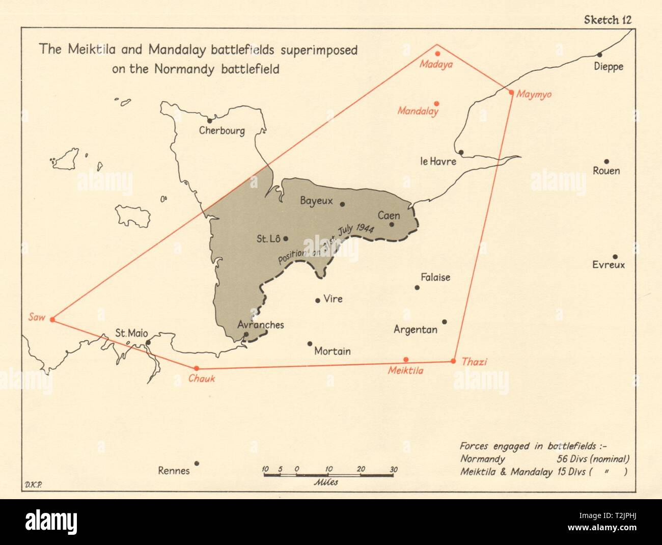 Meiktila & Mandalay Battlefields superimposed on Normandy Battlefield 1965 map Stock Photohttps://www.alamy.com/image-license-details/?v=1https://www.alamy.com/meiktila-mandalay-battlefields-superimposed-on-normandy-battlefield-1965-map-image242587342.html
RFT2JPHJ–Meiktila & Mandalay Battlefields superimposed on Normandy Battlefield 1965 map
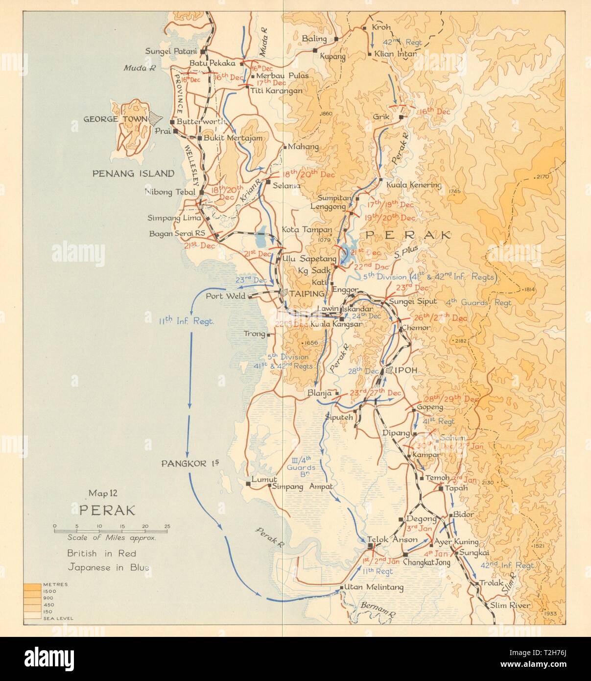 Perak. Japanese invasion of Malaya 1941. Malaysia 1957 old vintage map chart Stock Photohttps://www.alamy.com/image-license-details/?v=1https://www.alamy.com/perak-japanese-invasion-of-malaya-1941-malaysia-1957-old-vintage-map-chart-image242553322.html
RFT2H76J–Perak. Japanese invasion of Malaya 1941. Malaysia 1957 old vintage map chart
 USGS TOPO Map Montana MT Kirby Ranch 20110620 TM Inverted Restoration Stock Photohttps://www.alamy.com/image-license-details/?v=1https://www.alamy.com/usgs-topo-map-montana-mt-kirby-ranch-20110620-tm-inverted-restoration-image333458713.html
RM2AAE9YN–USGS TOPO Map Montana MT Kirby Ranch 20110620 TM Inverted Restoration
![THE TOMB OF HENRY FITZROY DUKE OF RICHMOND AND SOMERSET. Author Wood, Joseph 39.17.b.3. Place of publication: [London] Publisher: [J. Kirby] Date of publication: [1748.] Item type: 1 print Medium: etching Dimensions: platemark 23.3 x 31.4 cm. Former owner: George III, King of Great Britain, 1738-1820 Stock Photo THE TOMB OF HENRY FITZROY DUKE OF RICHMOND AND SOMERSET. Author Wood, Joseph 39.17.b.3. Place of publication: [London] Publisher: [J. Kirby] Date of publication: [1748.] Item type: 1 print Medium: etching Dimensions: platemark 23.3 x 31.4 cm. Former owner: George III, King of Great Britain, 1738-1820 Stock Photo](https://c8.alamy.com/comp/2E9HPEW/the-tomb-of-henry-fitzroy-duke-of-richmond-and-somerset-author-wood-joseph-3917b3-place-of-publication-london-publisher-j-kirby-date-of-publication-1748-item-type-1-print-medium-etching-dimensions-platemark-233-x-314-cm-former-owner-george-iii-king-of-great-britain-1738-1820-2E9HPEW.jpg) THE TOMB OF HENRY FITZROY DUKE OF RICHMOND AND SOMERSET. Author Wood, Joseph 39.17.b.3. Place of publication: [London] Publisher: [J. Kirby] Date of publication: [1748.] Item type: 1 print Medium: etching Dimensions: platemark 23.3 x 31.4 cm. Former owner: George III, King of Great Britain, 1738-1820 Stock Photohttps://www.alamy.com/image-license-details/?v=1https://www.alamy.com/the-tomb-of-henry-fitzroy-duke-of-richmond-and-somerset-author-wood-joseph-3917b3-place-of-publication-london-publisher-j-kirby-date-of-publication-1748-item-type-1-print-medium-etching-dimensions-platemark-233-x-314-cm-former-owner-george-iii-king-of-great-britain-1738-1820-image401761217.html
THE TOMB OF HENRY FITZROY DUKE OF RICHMOND AND SOMERSET. Author Wood, Joseph 39.17.b.3. Place of publication: [London] Publisher: [J. Kirby] Date of publication: [1748.] Item type: 1 print Medium: etching Dimensions: platemark 23.3 x 31.4 cm. Former owner: George III, King of Great Britain, 1738-1820 Stock Photohttps://www.alamy.com/image-license-details/?v=1https://www.alamy.com/the-tomb-of-henry-fitzroy-duke-of-richmond-and-somerset-author-wood-joseph-3917b3-place-of-publication-london-publisher-j-kirby-date-of-publication-1748-item-type-1-print-medium-etching-dimensions-platemark-233-x-314-cm-former-owner-george-iii-king-of-great-britain-1738-1820-image401761217.htmlRM2E9HPEW–THE TOMB OF HENRY FITZROY DUKE OF RICHMOND AND SOMERSET. Author Wood, Joseph 39.17.b.3. Place of publication: [London] Publisher: [J. Kirby] Date of publication: [1748.] Item type: 1 print Medium: etching Dimensions: platemark 23.3 x 31.4 cm. Former owner: George III, King of Great Britain, 1738-1820
 Leicestershire, administrative county of England - Great Britain. Grayscale elevation map with lakes and rivers Stock Photohttps://www.alamy.com/image-license-details/?v=1https://www.alamy.com/leicestershire-administrative-county-of-england-great-britain-grayscale-elevation-map-with-lakes-and-rivers-image546464946.html
RF2PN1HH6–Leicestershire, administrative county of England - Great Britain. Grayscale elevation map with lakes and rivers
 Moses H. Kirby 28Mason29 Stock Photohttps://www.alamy.com/image-license-details/?v=1https://www.alamy.com/stock-photo-moses-h-kirby-28mason29-147603929.html
RMJG3X8W–Moses H. Kirby 28Mason29
 Kirby, Shelby County, US, United States, Missouri, N 39 50' 44'', S 92 6' 52'', map, Cartascapes Map published in 2024. Explore Cartascapes, a map revealing Earth's diverse landscapes, cultures, and ecosystems. Journey through time and space, discovering the interconnectedness of our planet's past, present, and future. Stock Photohttps://www.alamy.com/image-license-details/?v=1https://www.alamy.com/kirby-shelby-county-us-united-states-missouri-n-39-50-44-s-92-6-52-map-cartascapes-map-published-in-2024-explore-cartascapes-a-map-revealing-earths-diverse-landscapes-cultures-and-ecosystems-journey-through-time-and-space-discovering-the-interconnectedness-of-our-planets-past-present-and-future-image621443063.html
RM2Y314Y3–Kirby, Shelby County, US, United States, Missouri, N 39 50' 44'', S 92 6' 52'', map, Cartascapes Map published in 2024. Explore Cartascapes, a map revealing Earth's diverse landscapes, cultures, and ecosystems. Journey through time and space, discovering the interconnectedness of our planet's past, present, and future.
![Image taken from page 695 of 'Nouvelle Histoire de Lyon et des provinces de Lyonnais, Forez, Beaujolais, etc. [Illustrated by the author.]' Image taken from page 695 of 'Nouvelle Histoire de Lyon Stock Photo Image taken from page 695 of 'Nouvelle Histoire de Lyon et des provinces de Lyonnais, Forez, Beaujolais, etc. [Illustrated by the author.]' Image taken from page 695 of 'Nouvelle Histoire de Lyon Stock Photo](https://c8.alamy.com/comp/HBYG12/image-taken-from-page-695-of-nouvelle-histoire-de-lyon-et-des-provinces-HBYG12.jpg) Image taken from page 695 of 'Nouvelle Histoire de Lyon et des provinces de Lyonnais, Forez, Beaujolais, etc. [Illustrated by the author.]' Image taken from page 695 of 'Nouvelle Histoire de Lyon Stock Photohttps://www.alamy.com/image-license-details/?v=1https://www.alamy.com/stock-photo-image-taken-from-page-695-of-nouvelle-histoire-de-lyon-et-des-provinces-127839070.html
Image taken from page 695 of 'Nouvelle Histoire de Lyon et des provinces de Lyonnais, Forez, Beaujolais, etc. [Illustrated by the author.]' Image taken from page 695 of 'Nouvelle Histoire de Lyon Stock Photohttps://www.alamy.com/image-license-details/?v=1https://www.alamy.com/stock-photo-image-taken-from-page-695-of-nouvelle-histoire-de-lyon-et-des-provinces-127839070.htmlRMHBYG12–Image taken from page 695 of 'Nouvelle Histoire de Lyon et des provinces de Lyonnais, Forez, Beaujolais, etc. [Illustrated by the author.]' Image taken from page 695 of 'Nouvelle Histoire de Lyon
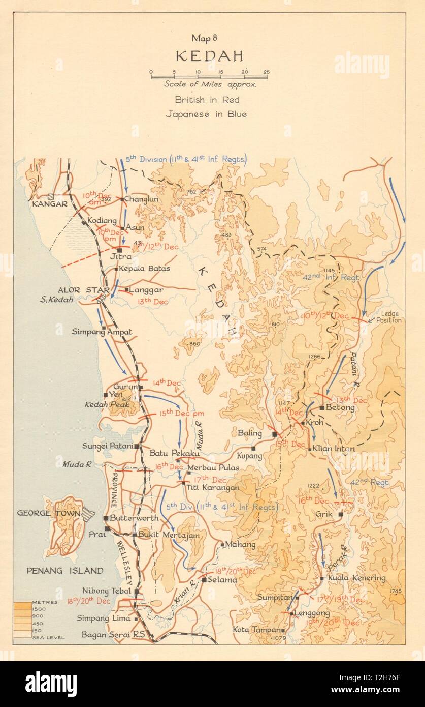 Kedah. Japanese invasion of Malaya. December 1941 1957 old vintage map chart Stock Photohttps://www.alamy.com/image-license-details/?v=1https://www.alamy.com/kedah-japanese-invasion-of-malaya-december-1941-1957-old-vintage-map-chart-image242553319.html
RFT2H76F–Kedah. Japanese invasion of Malaya. December 1941 1957 old vintage map chart
 USGS TOPO Map Mississippi MS Kirby 335916 1988 24000 Inverted Restoration Stock Photohttps://www.alamy.com/image-license-details/?v=1https://www.alamy.com/usgs-topo-map-mississippi-ms-kirby-335916-1988-24000-inverted-restoration-image333098327.html
RM2A9WX8R–USGS TOPO Map Mississippi MS Kirby 335916 1988 24000 Inverted Restoration
 Battle of Yenangyaung April 1942. Japanese conquest of Burma. Oilfields 1961 map Stock Photohttps://www.alamy.com/image-license-details/?v=1https://www.alamy.com/battle-of-yenangyaung-april-1942-japanese-conquest-of-burma-oilfields-1961-map-image242587563.html
RFT2JPWF–Battle of Yenangyaung April 1942. Japanese conquest of Burma. Oilfields 1961 map
![THE SOUTH VIEW OF LAVENHAM CHURCH, IN THE COUNTY OF SUFFOLK. Author Wood, Joseph 39.23.1. Place of publication: [London] Publisher: [J. Kirby] Date of publication: [1748.] Item type: 1 print Medium: etching Dimensions: platemark 24.6 x 34.0 cm. Former owner: George III, King of Great Britain, 1738-1820 Stock Photo THE SOUTH VIEW OF LAVENHAM CHURCH, IN THE COUNTY OF SUFFOLK. Author Wood, Joseph 39.23.1. Place of publication: [London] Publisher: [J. Kirby] Date of publication: [1748.] Item type: 1 print Medium: etching Dimensions: platemark 24.6 x 34.0 cm. Former owner: George III, King of Great Britain, 1738-1820 Stock Photo](https://c8.alamy.com/comp/2E9HPEP/the-south-view-of-lavenham-church-in-the-county-of-suffolk-author-wood-joseph-39231-place-of-publication-london-publisher-j-kirby-date-of-publication-1748-item-type-1-print-medium-etching-dimensions-platemark-246-x-340-cm-former-owner-george-iii-king-of-great-britain-1738-1820-2E9HPEP.jpg) THE SOUTH VIEW OF LAVENHAM CHURCH, IN THE COUNTY OF SUFFOLK. Author Wood, Joseph 39.23.1. Place of publication: [London] Publisher: [J. Kirby] Date of publication: [1748.] Item type: 1 print Medium: etching Dimensions: platemark 24.6 x 34.0 cm. Former owner: George III, King of Great Britain, 1738-1820 Stock Photohttps://www.alamy.com/image-license-details/?v=1https://www.alamy.com/the-south-view-of-lavenham-church-in-the-county-of-suffolk-author-wood-joseph-39231-place-of-publication-london-publisher-j-kirby-date-of-publication-1748-item-type-1-print-medium-etching-dimensions-platemark-246-x-340-cm-former-owner-george-iii-king-of-great-britain-1738-1820-image401761214.html
THE SOUTH VIEW OF LAVENHAM CHURCH, IN THE COUNTY OF SUFFOLK. Author Wood, Joseph 39.23.1. Place of publication: [London] Publisher: [J. Kirby] Date of publication: [1748.] Item type: 1 print Medium: etching Dimensions: platemark 24.6 x 34.0 cm. Former owner: George III, King of Great Britain, 1738-1820 Stock Photohttps://www.alamy.com/image-license-details/?v=1https://www.alamy.com/the-south-view-of-lavenham-church-in-the-county-of-suffolk-author-wood-joseph-39231-place-of-publication-london-publisher-j-kirby-date-of-publication-1748-item-type-1-print-medium-etching-dimensions-platemark-246-x-340-cm-former-owner-george-iii-king-of-great-britain-1738-1820-image401761214.htmlRM2E9HPEP–THE SOUTH VIEW OF LAVENHAM CHURCH, IN THE COUNTY OF SUFFOLK. Author Wood, Joseph 39.23.1. Place of publication: [London] Publisher: [J. Kirby] Date of publication: [1748.] Item type: 1 print Medium: etching Dimensions: platemark 24.6 x 34.0 cm. Former owner: George III, King of Great Britain, 1738-1820
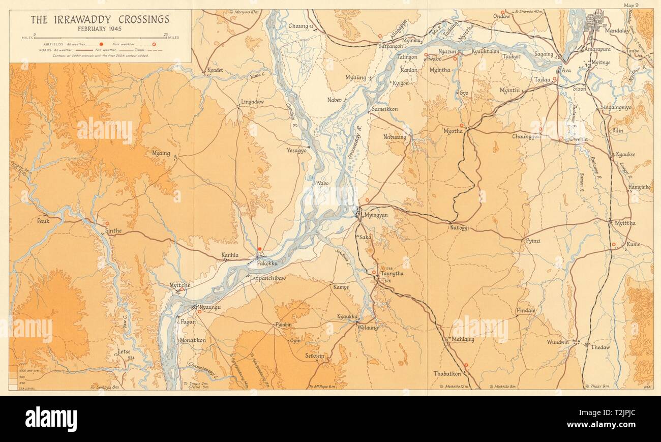 Irrawaddy Crossings February 1945 Battle of Mandalay Burma Campaign WW2 1965 map Stock Photohttps://www.alamy.com/image-license-details/?v=1https://www.alamy.com/irrawaddy-crossings-february-1945-battle-of-mandalay-burma-campaign-ww2-1965-map-image242587364.html
RFT2JPJC–Irrawaddy Crossings February 1945 Battle of Mandalay Burma Campaign WW2 1965 map
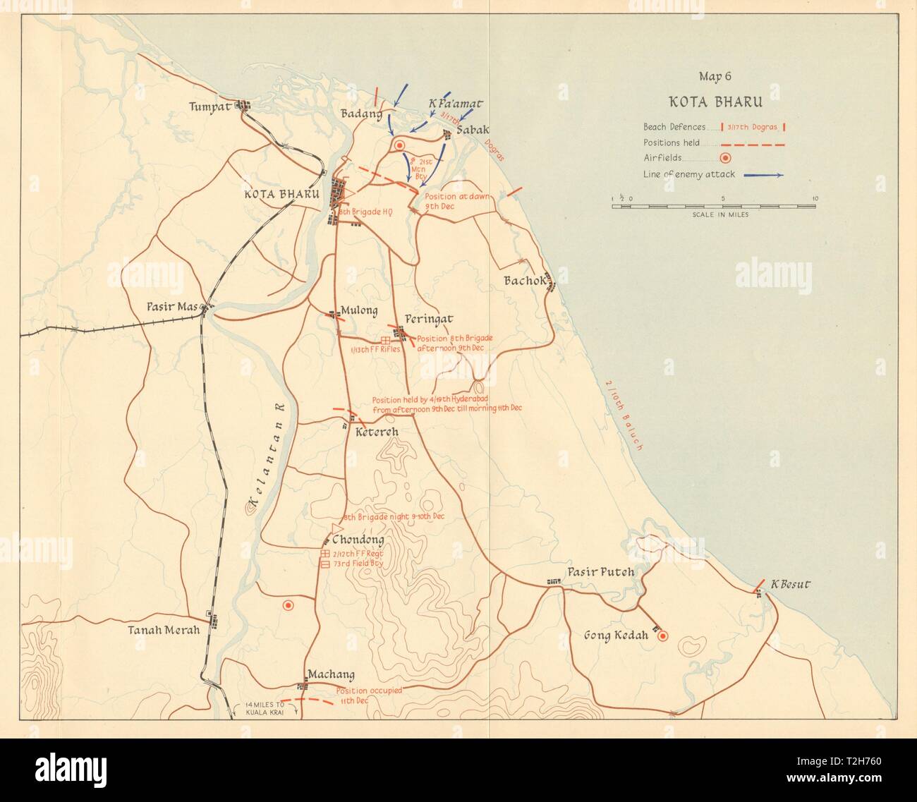 Japanese invasion of Malaya. Kota Bharu. 8 December 1941. Malaysia 1957 map Stock Photohttps://www.alamy.com/image-license-details/?v=1https://www.alamy.com/japanese-invasion-of-malaya-kota-bharu-8-december-1941-malaysia-1957-map-image242553304.html
RFT2H760–Japanese invasion of Malaya. Kota Bharu. 8 December 1941. Malaysia 1957 map
 Leicestershire, administrative county of England - Great Britain. Colored elevation map with lakes and rivers Stock Photohttps://www.alamy.com/image-license-details/?v=1https://www.alamy.com/leicestershire-administrative-county-of-england-great-britain-colored-elevation-map-with-lakes-and-rivers-image546465278.html
RF2PN1J12–Leicestershire, administrative county of England - Great Britain. Colored elevation map with lakes and rivers
 Kirby Golden Dog 1877 Frontpage1 Stock Photohttps://www.alamy.com/image-license-details/?v=1https://www.alamy.com/stock-image-kirby-golden-dog-1877-frontpage1-160534462.html
RMK94Y9J–Kirby Golden Dog 1877 Frontpage1
 Kirby Park, Mount Barker, AU, Australia, South Australia, S 35 2' 12'', N 138 47' 9'', map, Cartascapes Map published in 2024. Explore Cartascapes, a map revealing Earth's diverse landscapes, cultures, and ecosystems. Journey through time and space, discovering the interconnectedness of our planet's past, present, and future. Stock Photohttps://www.alamy.com/image-license-details/?v=1https://www.alamy.com/kirby-park-mount-barker-au-australia-south-australia-s-35-2-12-n-138-47-9-map-cartascapes-map-published-in-2024-explore-cartascapes-a-map-revealing-earths-diverse-landscapes-cultures-and-ecosystems-journey-through-time-and-space-discovering-the-interconnectedness-of-our-planets-past-present-and-future-image625476580.html
RM2Y9GWN8–Kirby Park, Mount Barker, AU, Australia, South Australia, S 35 2' 12'', N 138 47' 9'', map, Cartascapes Map published in 2024. Explore Cartascapes, a map revealing Earth's diverse landscapes, cultures, and ecosystems. Journey through time and space, discovering the interconnectedness of our planet's past, present, and future.
 Image taken from page 257 of 'The World at Home, etc' Image taken from page 257 of 'The World at Home, Stock Photohttps://www.alamy.com/image-license-details/?v=1https://www.alamy.com/stock-photo-image-taken-from-page-257-of-the-world-at-home-etc-image-taken-from-127745040.html
RMHBR82T–Image taken from page 257 of 'The World at Home, etc' Image taken from page 257 of 'The World at Home,
 USGS TOPO Map Montana MT Kirby 264800 1967 24000 Inverted Restoration Stock Photohttps://www.alamy.com/image-license-details/?v=1https://www.alamy.com/usgs-topo-map-montana-mt-kirby-264800-1967-24000-inverted-restoration-image333458711.html
RM2AAE9YK–USGS TOPO Map Montana MT Kirby 264800 1967 24000 Inverted Restoration
![THE SOUTH EAST VIEW OF CLARE PRIORY AND CASTLE, IN THE COUNTY OF SUFFOLK. Author Wood, Joseph 39.14.a. Place of publication: [London] Publisher: [J. Kirby] Date of publication: [1748.] Item type: 1 print Medium: etching Dimensions: platemark 19.9 X 35.3 cm. Former owner: George III, King of Great Britain, 1738-1820 Stock Photo THE SOUTH EAST VIEW OF CLARE PRIORY AND CASTLE, IN THE COUNTY OF SUFFOLK. Author Wood, Joseph 39.14.a. Place of publication: [London] Publisher: [J. Kirby] Date of publication: [1748.] Item type: 1 print Medium: etching Dimensions: platemark 19.9 X 35.3 cm. Former owner: George III, King of Great Britain, 1738-1820 Stock Photo](https://c8.alamy.com/comp/2E9HPEC/the-south-east-view-of-clare-priory-and-castle-in-the-county-of-suffolk-author-wood-joseph-3914a-place-of-publication-london-publisher-j-kirby-date-of-publication-1748-item-type-1-print-medium-etching-dimensions-platemark-199-x-353-cm-former-owner-george-iii-king-of-great-britain-1738-1820-2E9HPEC.jpg) THE SOUTH EAST VIEW OF CLARE PRIORY AND CASTLE, IN THE COUNTY OF SUFFOLK. Author Wood, Joseph 39.14.a. Place of publication: [London] Publisher: [J. Kirby] Date of publication: [1748.] Item type: 1 print Medium: etching Dimensions: platemark 19.9 X 35.3 cm. Former owner: George III, King of Great Britain, 1738-1820 Stock Photohttps://www.alamy.com/image-license-details/?v=1https://www.alamy.com/the-south-east-view-of-clare-priory-and-castle-in-the-county-of-suffolk-author-wood-joseph-3914a-place-of-publication-london-publisher-j-kirby-date-of-publication-1748-item-type-1-print-medium-etching-dimensions-platemark-199-x-353-cm-former-owner-george-iii-king-of-great-britain-1738-1820-image401761204.html
THE SOUTH EAST VIEW OF CLARE PRIORY AND CASTLE, IN THE COUNTY OF SUFFOLK. Author Wood, Joseph 39.14.a. Place of publication: [London] Publisher: [J. Kirby] Date of publication: [1748.] Item type: 1 print Medium: etching Dimensions: platemark 19.9 X 35.3 cm. Former owner: George III, King of Great Britain, 1738-1820 Stock Photohttps://www.alamy.com/image-license-details/?v=1https://www.alamy.com/the-south-east-view-of-clare-priory-and-castle-in-the-county-of-suffolk-author-wood-joseph-3914a-place-of-publication-london-publisher-j-kirby-date-of-publication-1748-item-type-1-print-medium-etching-dimensions-platemark-199-x-353-cm-former-owner-george-iii-king-of-great-britain-1738-1820-image401761204.htmlRM2E9HPEC–THE SOUTH EAST VIEW OF CLARE PRIORY AND CASTLE, IN THE COUNTY OF SUFFOLK. Author Wood, Joseph 39.14.a. Place of publication: [London] Publisher: [J. Kirby] Date of publication: [1748.] Item type: 1 print Medium: etching Dimensions: platemark 19.9 X 35.3 cm. Former owner: George III, King of Great Britain, 1738-1820
 Battle of Singapore. Town city. 12th to 15th February 1942 1957 old map Stock Photohttps://www.alamy.com/image-license-details/?v=1https://www.alamy.com/battle-of-singapore-town-city-12th-to-15th-february-1942-1957-old-map-image242553337.html
RFT2H775–Battle of Singapore. Town city. 12th to 15th February 1942 1957 old map
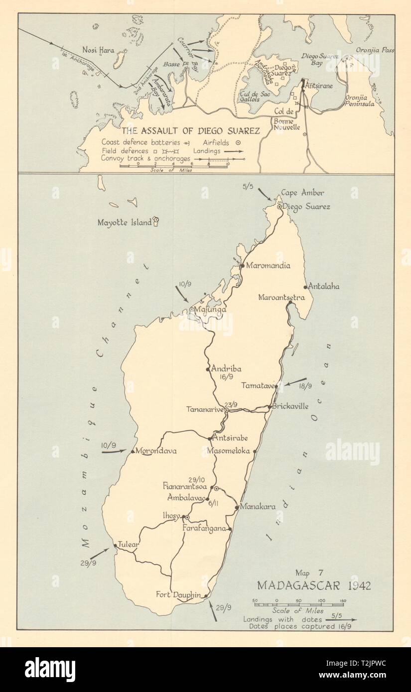 Battle of Madagascar 1942. Assault of Diego Suarez Antsiranana Ironclad 1961 map Stock Photohttps://www.alamy.com/image-license-details/?v=1https://www.alamy.com/battle-of-madagascar-1942-assault-of-diego-suarez-antsiranana-ironclad-1961-map-image242587560.html
RFT2JPWC–Battle of Madagascar 1942. Assault of Diego Suarez Antsiranana Ironclad 1961 map
 Sevenoaks, non metropolitan district of England - Great Britain. Colored elevation map with lakes and rivers Stock Photohttps://www.alamy.com/image-license-details/?v=1https://www.alamy.com/sevenoaks-non-metropolitan-district-of-england-great-britain-colored-elevation-map-with-lakes-and-rivers-image546500700.html
RF2PN3764–Sevenoaks, non metropolitan district of England - Great Britain. Colored elevation map with lakes and rivers
 Kirby Golden Dog 1877 Frontpage2 Stock Photohttps://www.alamy.com/image-license-details/?v=1https://www.alamy.com/stock-image-kirby-golden-dog-1877-frontpage2-160534474.html
RMK94YA2–Kirby Golden Dog 1877 Frontpage2
 Kirby, Big Horn County, US, United States, Montana, N 45 19' 56'', S 106 58' 54'', map, Cartascapes Map published in 2024. Explore Cartascapes, a map revealing Earth's diverse landscapes, cultures, and ecosystems. Journey through time and space, discovering the interconnectedness of our planet's past, present, and future. Stock Photohttps://www.alamy.com/image-license-details/?v=1https://www.alamy.com/kirby-big-horn-county-us-united-states-montana-n-45-19-56-s-106-58-54-map-cartascapes-map-published-in-2024-explore-cartascapes-a-map-revealing-earths-diverse-landscapes-cultures-and-ecosystems-journey-through-time-and-space-discovering-the-interconnectedness-of-our-planets-past-present-and-future-image621157427.html
RM2Y2G4HR–Kirby, Big Horn County, US, United States, Montana, N 45 19' 56'', S 106 58' 54'', map, Cartascapes Map published in 2024. Explore Cartascapes, a map revealing Earth's diverse landscapes, cultures, and ecosystems. Journey through time and space, discovering the interconnectedness of our planet's past, present, and future.
 Image taken from page 222 of 'The World at Home; or, pictures and scenes from far off lands' Image taken from page 222 of 'The World at Home; Stock Photohttps://www.alamy.com/image-license-details/?v=1https://www.alamy.com/stock-photo-image-taken-from-page-222-of-the-world-at-home-or-pictures-and-scenes-127705361.html
RMHBNDDN–Image taken from page 222 of 'The World at Home; or, pictures and scenes from far off lands' Image taken from page 222 of 'The World at Home;
 USGS TOPO Map Montana MT Kirby 264799 1967 24000 Inverted Restoration Stock Photohttps://www.alamy.com/image-license-details/?v=1https://www.alamy.com/usgs-topo-map-montana-mt-kirby-264799-1967-24000-inverted-restoration-image333458603.html
RM2AAE9RR–USGS TOPO Map Montana MT Kirby 264799 1967 24000 Inverted Restoration
![THE NORTH WEST VIEW OF BUNGAY CHURCH AND PRIORY, IN SUFFOLK. Author Wood, Joseph 39.10.a. Place of publication: [London] Publisher: [J. Kirby] Date of publication: [1748.] Item type: 1 print Medium: etching Dimensions: platemark 24.4 x 34.0 cm. Former owner: George III, King of Great Britain, 1738-1820 Stock Photo THE NORTH WEST VIEW OF BUNGAY CHURCH AND PRIORY, IN SUFFOLK. Author Wood, Joseph 39.10.a. Place of publication: [London] Publisher: [J. Kirby] Date of publication: [1748.] Item type: 1 print Medium: etching Dimensions: platemark 24.4 x 34.0 cm. Former owner: George III, King of Great Britain, 1738-1820 Stock Photo](https://c8.alamy.com/comp/2E9HPDM/the-north-west-view-of-bungay-church-and-priory-in-suffolk-author-wood-joseph-3910a-place-of-publication-london-publisher-j-kirby-date-of-publication-1748-item-type-1-print-medium-etching-dimensions-platemark-244-x-340-cm-former-owner-george-iii-king-of-great-britain-1738-1820-2E9HPDM.jpg) THE NORTH WEST VIEW OF BUNGAY CHURCH AND PRIORY, IN SUFFOLK. Author Wood, Joseph 39.10.a. Place of publication: [London] Publisher: [J. Kirby] Date of publication: [1748.] Item type: 1 print Medium: etching Dimensions: platemark 24.4 x 34.0 cm. Former owner: George III, King of Great Britain, 1738-1820 Stock Photohttps://www.alamy.com/image-license-details/?v=1https://www.alamy.com/the-north-west-view-of-bungay-church-and-priory-in-suffolk-author-wood-joseph-3910a-place-of-publication-london-publisher-j-kirby-date-of-publication-1748-item-type-1-print-medium-etching-dimensions-platemark-244-x-340-cm-former-owner-george-iii-king-of-great-britain-1738-1820-image401761184.html
THE NORTH WEST VIEW OF BUNGAY CHURCH AND PRIORY, IN SUFFOLK. Author Wood, Joseph 39.10.a. Place of publication: [London] Publisher: [J. Kirby] Date of publication: [1748.] Item type: 1 print Medium: etching Dimensions: platemark 24.4 x 34.0 cm. Former owner: George III, King of Great Britain, 1738-1820 Stock Photohttps://www.alamy.com/image-license-details/?v=1https://www.alamy.com/the-north-west-view-of-bungay-church-and-priory-in-suffolk-author-wood-joseph-3910a-place-of-publication-london-publisher-j-kirby-date-of-publication-1748-item-type-1-print-medium-etching-dimensions-platemark-244-x-340-cm-former-owner-george-iii-king-of-great-britain-1738-1820-image401761184.htmlRM2E9HPDM–THE NORTH WEST VIEW OF BUNGAY CHURCH AND PRIORY, IN SUFFOLK. Author Wood, Joseph 39.10.a. Place of publication: [London] Publisher: [J. Kirby] Date of publication: [1748.] Item type: 1 print Medium: etching Dimensions: platemark 24.4 x 34.0 cm. Former owner: George III, King of Great Britain, 1738-1820
 USGS Topo Map Washington State WA Kirby 241777 1964 24000 Inverted Restoration Stock Photohttps://www.alamy.com/image-license-details/?v=1https://www.alamy.com/usgs-topo-map-washington-state-wa-kirby-241777-1964-24000-inverted-restoration-image266311355.html
RMWD7ERR–USGS Topo Map Washington State WA Kirby 241777 1964 24000 Inverted Restoration
 Maungdaw-Buthidaung-Rathedaung 1943. Japanese conquest of Burma. WW2 1961 map Stock Photohttps://www.alamy.com/image-license-details/?v=1https://www.alamy.com/maungdaw-buthidaung-rathedaung-1943-japanese-conquest-of-burma-ww2-1961-map-image242587578.html
RFT2JPX2–Maungdaw-Buthidaung-Rathedaung 1943. Japanese conquest of Burma. WW2 1961 map
 Japanese occupation of Hong Kong. Mainland, 8th -13th December 1941 1957 map Stock Photohttps://www.alamy.com/image-license-details/?v=1https://www.alamy.com/japanese-occupation-of-hong-kong-mainland-8th-13th-december-1941-1957-map-image242553298.html
RFT2H75P–Japanese occupation of Hong Kong. Mainland, 8th -13th December 1941 1957 map
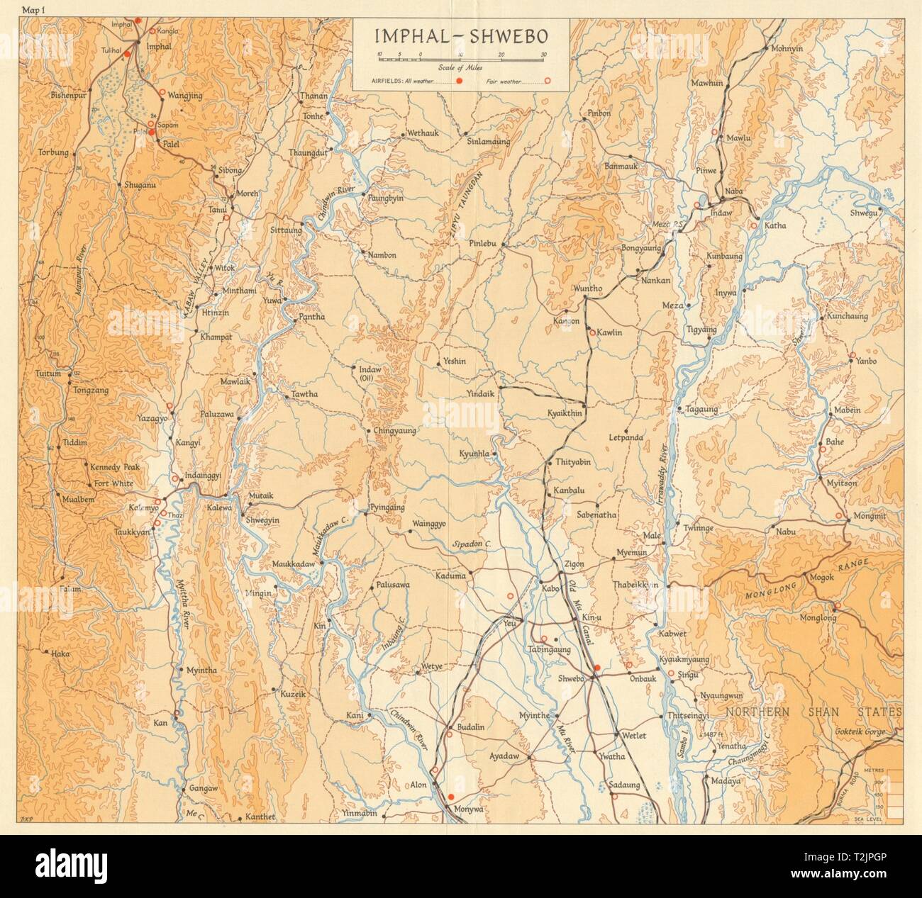 Burma Campaign 1944. Imphal - Shwebo. Airfields. World War 2 1965 old map Stock Photohttps://www.alamy.com/image-license-details/?v=1https://www.alamy.com/burma-campaign-1944-imphal-shwebo-airfields-world-war-2-1965-old-map-image242587318.html
RFT2JPGP–Burma Campaign 1944. Imphal - Shwebo. Airfields. World War 2 1965 old map
 Neale(1826) p3 094 Kirby Hall, Northamptonshire Stock Photohttps://www.alamy.com/image-license-details/?v=1https://www.alamy.com/neale1826-p3-094-kirby-hall-northamptonshire-image153727752.html
RMJX2W8T–Neale(1826) p3 094 Kirby Hall, Northamptonshire
 Kirby Creek, Hillsborough County, US, United States, Florida, N 28 1' 8'', S 82 30' 32'', map, Cartascapes Map published in 2024. Explore Cartascapes, a map revealing Earth's diverse landscapes, cultures, and ecosystems. Journey through time and space, discovering the interconnectedness of our planet's past, present, and future. Stock Photohttps://www.alamy.com/image-license-details/?v=1https://www.alamy.com/kirby-creek-hillsborough-county-us-united-states-florida-n-28-1-8-s-82-30-32-map-cartascapes-map-published-in-2024-explore-cartascapes-a-map-revealing-earths-diverse-landscapes-cultures-and-ecosystems-journey-through-time-and-space-discovering-the-interconnectedness-of-our-planets-past-present-and-future-image621202735.html
RM2Y2J6BY–Kirby Creek, Hillsborough County, US, United States, Florida, N 28 1' 8'', S 82 30' 32'', map, Cartascapes Map published in 2024. Explore Cartascapes, a map revealing Earth's diverse landscapes, cultures, and ecosystems. Journey through time and space, discovering the interconnectedness of our planet's past, present, and future.
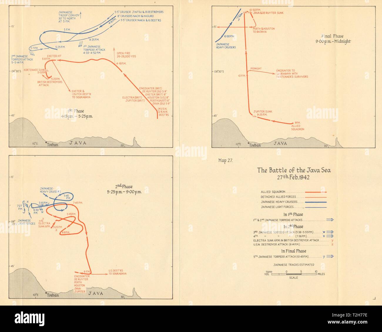 Battle of the Java Sea, 27th February 1942. Allied Japanese movements 1957 map Stock Photohttps://www.alamy.com/image-license-details/?v=1https://www.alamy.com/battle-of-the-java-sea-27th-february-1942-allied-japanese-movements-1957-map-image242553346.html
RFT2H77E–Battle of the Java Sea, 27th February 1942. Allied Japanese movements 1957 map
 Sevenoaks, non metropolitan district of England - Great Britain. Bilevel elevation map with lakes and rivers Stock Photohttps://www.alamy.com/image-license-details/?v=1https://www.alamy.com/sevenoaks-non-metropolitan-district-of-england-great-britain-bilevel-elevation-map-with-lakes-and-rivers-image546500544.html
RF2PN370G–Sevenoaks, non metropolitan district of England - Great Britain. Bilevel elevation map with lakes and rivers
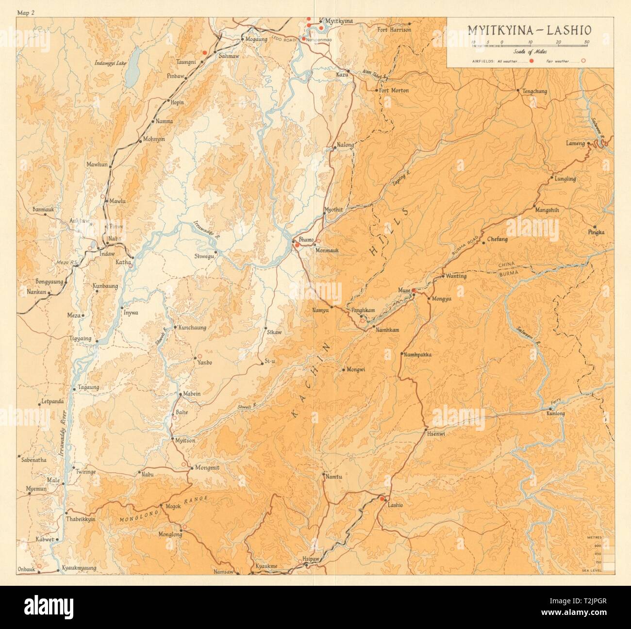 Burma Campaign 1944. Myitkyina - Lashio. Airfields. World War 2 1965 old map Stock Photohttps://www.alamy.com/image-license-details/?v=1https://www.alamy.com/burma-campaign-1944-myitkyina-lashio-airfields-world-war-2-1965-old-map-image242587319.html
RFT2JPGR–Burma Campaign 1944. Myitkyina - Lashio. Airfields. World War 2 1965 old map
 Image taken from page 149 of 'The World at Home, etc' Image taken from page 149 of 'The World at Home, Stock Photohttps://www.alamy.com/image-license-details/?v=1https://www.alamy.com/stock-photo-image-taken-from-page-149-of-the-world-at-home-etc-image-taken-from-127741912.html
RMHBR434–Image taken from page 149 of 'The World at Home, etc' Image taken from page 149 of 'The World at Home,
![THE NORTH WEST VIEW OF SUDBURY PRIORY, IN THE COUNTY OF SUFFOLK. Author Wood, Joseph 39.25.a. Place of publication: [London] Publisher: [J. Kirby] Date of publication: [1748.] Item type: 1 print Medium: etching Dimensions: platemark 20.3 x 38.0 cm. Former owner: George III, King of Great Britain, 1738-1820 Stock Photo THE NORTH WEST VIEW OF SUDBURY PRIORY, IN THE COUNTY OF SUFFOLK. Author Wood, Joseph 39.25.a. Place of publication: [London] Publisher: [J. Kirby] Date of publication: [1748.] Item type: 1 print Medium: etching Dimensions: platemark 20.3 x 38.0 cm. Former owner: George III, King of Great Britain, 1738-1820 Stock Photo](https://c8.alamy.com/comp/2E9HPGJ/the-north-west-view-of-sudbury-priory-in-the-county-of-suffolk-author-wood-joseph-3925a-place-of-publication-london-publisher-j-kirby-date-of-publication-1748-item-type-1-print-medium-etching-dimensions-platemark-203-x-380-cm-former-owner-george-iii-king-of-great-britain-1738-1820-2E9HPGJ.jpg) THE NORTH WEST VIEW OF SUDBURY PRIORY, IN THE COUNTY OF SUFFOLK. Author Wood, Joseph 39.25.a. Place of publication: [London] Publisher: [J. Kirby] Date of publication: [1748.] Item type: 1 print Medium: etching Dimensions: platemark 20.3 x 38.0 cm. Former owner: George III, King of Great Britain, 1738-1820 Stock Photohttps://www.alamy.com/image-license-details/?v=1https://www.alamy.com/the-north-west-view-of-sudbury-priory-in-the-county-of-suffolk-author-wood-joseph-3925a-place-of-publication-london-publisher-j-kirby-date-of-publication-1748-item-type-1-print-medium-etching-dimensions-platemark-203-x-380-cm-former-owner-george-iii-king-of-great-britain-1738-1820-image401761266.html
THE NORTH WEST VIEW OF SUDBURY PRIORY, IN THE COUNTY OF SUFFOLK. Author Wood, Joseph 39.25.a. Place of publication: [London] Publisher: [J. Kirby] Date of publication: [1748.] Item type: 1 print Medium: etching Dimensions: platemark 20.3 x 38.0 cm. Former owner: George III, King of Great Britain, 1738-1820 Stock Photohttps://www.alamy.com/image-license-details/?v=1https://www.alamy.com/the-north-west-view-of-sudbury-priory-in-the-county-of-suffolk-author-wood-joseph-3925a-place-of-publication-london-publisher-j-kirby-date-of-publication-1748-item-type-1-print-medium-etching-dimensions-platemark-203-x-380-cm-former-owner-george-iii-king-of-great-britain-1738-1820-image401761266.htmlRM2E9HPGJ–THE NORTH WEST VIEW OF SUDBURY PRIORY, IN THE COUNTY OF SUFFOLK. Author Wood, Joseph 39.25.a. Place of publication: [London] Publisher: [J. Kirby] Date of publication: [1748.] Item type: 1 print Medium: etching Dimensions: platemark 20.3 x 38.0 cm. Former owner: George III, King of Great Britain, 1738-1820
 USGS Topo Map Washington State WA Kirby 241778 1964 24000 Inverted Restoration Stock Photohttps://www.alamy.com/image-license-details/?v=1https://www.alamy.com/usgs-topo-map-washington-state-wa-kirby-241778-1964-24000-inverted-restoration-image266311356.html
RMWD7ERT–USGS Topo Map Washington State WA Kirby 241778 1964 24000 Inverted Restoration
 USGS TOPO Map Montana MT Kirby Ranch 264802 1965 24000 Inverted Restoration Stock Photohttps://www.alamy.com/image-license-details/?v=1https://www.alamy.com/usgs-topo-map-montana-mt-kirby-ranch-264802-1965-24000-inverted-restoration-image333458757.html
RM2AAEA19–USGS TOPO Map Montana MT Kirby Ranch 264802 1965 24000 Inverted Restoration
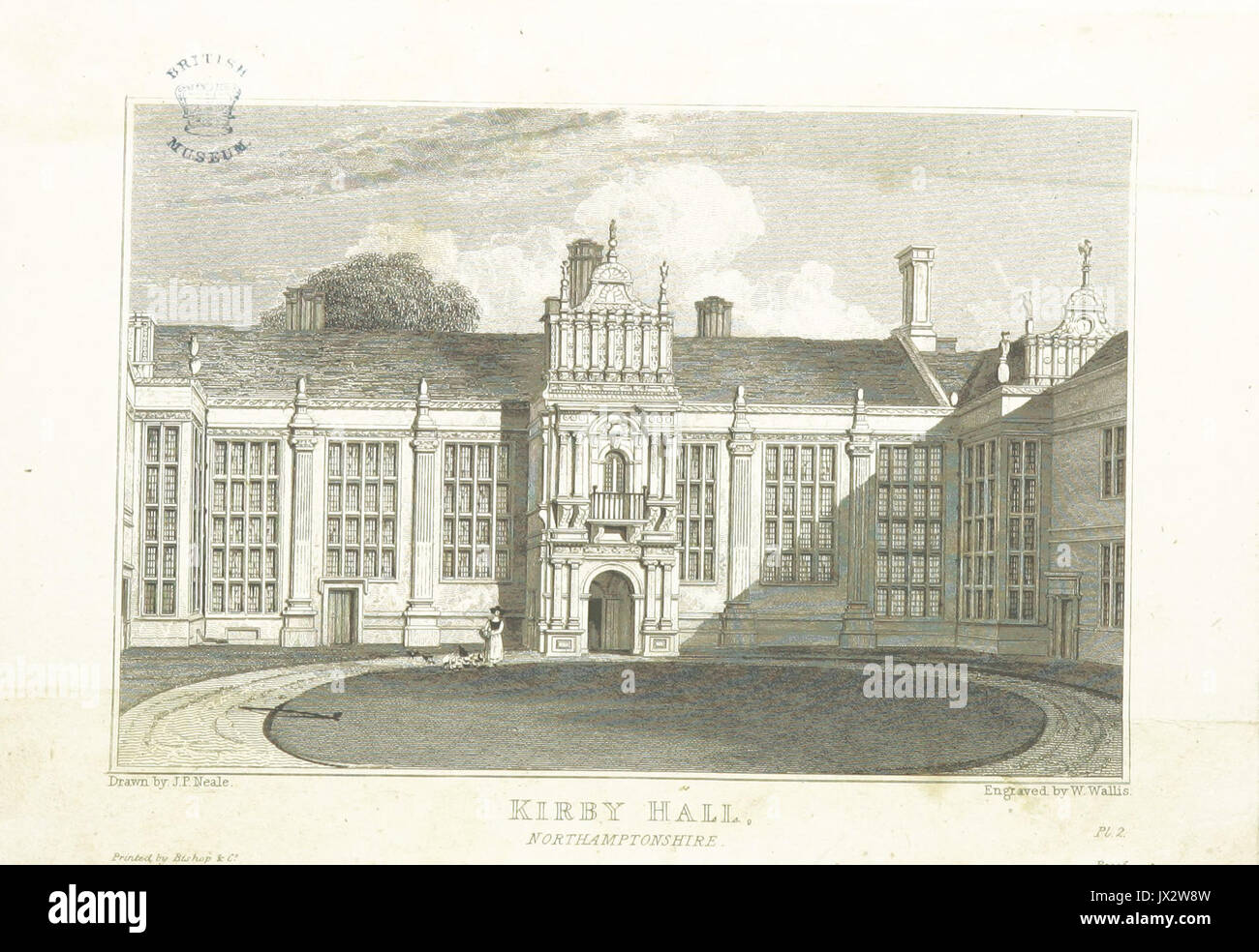 Neale(1826) p3 096 Kirby Hall, Northamptonshire Stock Photohttps://www.alamy.com/image-license-details/?v=1https://www.alamy.com/neale1826-p3-096-kirby-hall-northamptonshire-image153727753.html
RMJX2W8W–Neale(1826) p3 096 Kirby Hall, Northamptonshire
 Kirby Corner, Chittenden County, US, United States, Vermont, N 44 27' 18'', S 73 7' 23'', map, Cartascapes Map published in 2024. Explore Cartascapes, a map revealing Earth's diverse landscapes, cultures, and ecosystems. Journey through time and space, discovering the interconnectedness of our planet's past, present, and future. Stock Photohttps://www.alamy.com/image-license-details/?v=1https://www.alamy.com/kirby-corner-chittenden-county-us-united-states-vermont-n-44-27-18-s-73-7-23-map-cartascapes-map-published-in-2024-explore-cartascapes-a-map-revealing-earths-diverse-landscapes-cultures-and-ecosystems-journey-through-time-and-space-discovering-the-interconnectedness-of-our-planets-past-present-and-future-image621174970.html
RM2Y2GY0A–Kirby Corner, Chittenden County, US, United States, Vermont, N 44 27' 18'', S 73 7' 23'', map, Cartascapes Map published in 2024. Explore Cartascapes, a map revealing Earth's diverse landscapes, cultures, and ecosystems. Journey through time and space, discovering the interconnectedness of our planet's past, present, and future.
 Sevenoaks, non metropolitan district of England - Great Britain. Grayscale elevation map with lakes and rivers Stock Photohttps://www.alamy.com/image-license-details/?v=1https://www.alamy.com/sevenoaks-non-metropolitan-district-of-england-great-britain-grayscale-elevation-map-with-lakes-and-rivers-image546500549.html
RF2PN370N–Sevenoaks, non metropolitan district of England - Great Britain. Grayscale elevation map with lakes and rivers
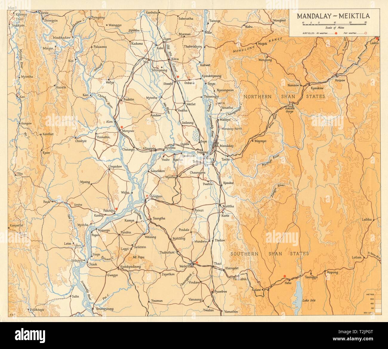 Burma Campaign 1944. Mandalay - Meiktila. Airfields. World War 2 1965 old map Stock Photohttps://www.alamy.com/image-license-details/?v=1https://www.alamy.com/burma-campaign-1944-mandalay-meiktila-airfields-world-war-2-1965-old-map-image242587320.html
RFT2JPGT–Burma Campaign 1944. Mandalay - Meiktila. Airfields. World War 2 1965 old map
 Image taken from page 229 of 'The World at Home; or, pictures and scenes from far off lands' Image taken from page 229 of 'The Wo Stock Photohttps://www.alamy.com/image-license-details/?v=1https://www.alamy.com/stock-photo-image-taken-from-page-229-of-the-world-at-home-or-pictures-and-scenes-132288297.html
RMHK6721–Image taken from page 229 of 'The World at Home; or, pictures and scenes from far off lands' Image taken from page 229 of 'The Wo
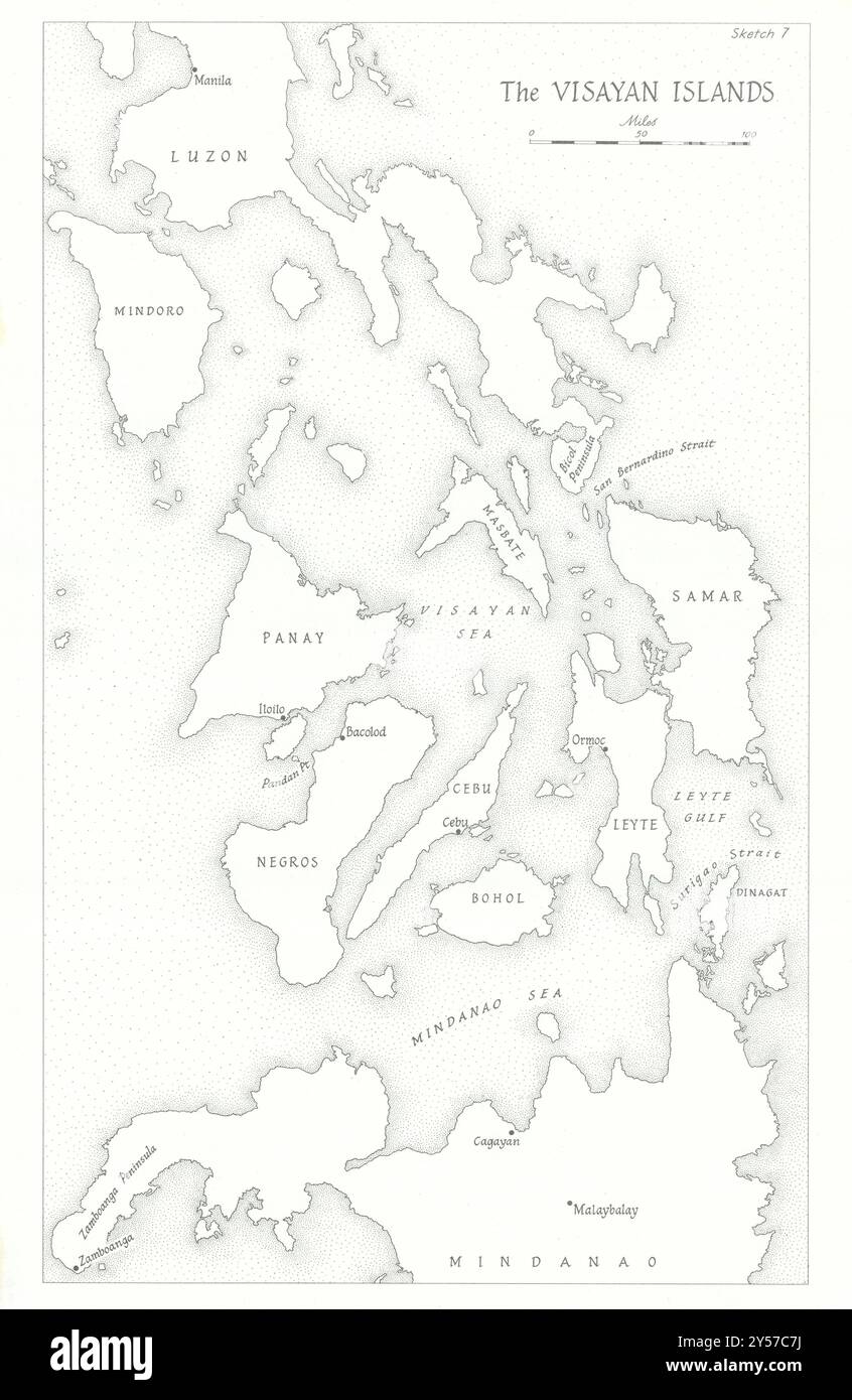 The Visayan Islands, Philippines 1945. World War Two 1969 old vintage map Stock Photohttps://www.alamy.com/image-license-details/?v=1https://www.alamy.com/the-visayan-islands-philippines-1945-world-war-two-1969-old-vintage-map-image622809814.html
RF2Y57C7J–The Visayan Islands, Philippines 1945. World War Two 1969 old vintage map
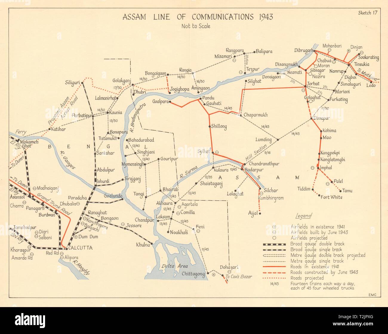 Assam Line of Communications 1943. Burma Campaign WW2 India 1961 old map Stock Photohttps://www.alamy.com/image-license-details/?v=1https://www.alamy.com/assam-line-of-communications-1943-burma-campaign-ww2-india-1961-old-map-image242587592.html
RFT2JPXG–Assam Line of Communications 1943. Burma Campaign WW2 India 1961 old map
![THE SOUTH VIEW OF BLITHBURGH CHURCH AND PRIORY, IN SUFFOLK. Author Wood, Joseph 39.45.2.a. Place of publication: [London] Publisher: [J. Kirby] Date of publication: [1748.] Item type: 1 print Medium: etching Dimensions: platemark 25.0 x 34.3 cm. Former owner: George III, King of Great Britain, 1738-1820 Stock Photo THE SOUTH VIEW OF BLITHBURGH CHURCH AND PRIORY, IN SUFFOLK. Author Wood, Joseph 39.45.2.a. Place of publication: [London] Publisher: [J. Kirby] Date of publication: [1748.] Item type: 1 print Medium: etching Dimensions: platemark 25.0 x 34.3 cm. Former owner: George III, King of Great Britain, 1738-1820 Stock Photo](https://c8.alamy.com/comp/2E9HPK2/the-south-view-of-blithburgh-church-and-priory-in-suffolk-author-wood-joseph-39452a-place-of-publication-london-publisher-j-kirby-date-of-publication-1748-item-type-1-print-medium-etching-dimensions-platemark-250-x-343-cm-former-owner-george-iii-king-of-great-britain-1738-1820-2E9HPK2.jpg) THE SOUTH VIEW OF BLITHBURGH CHURCH AND PRIORY, IN SUFFOLK. Author Wood, Joseph 39.45.2.a. Place of publication: [London] Publisher: [J. Kirby] Date of publication: [1748.] Item type: 1 print Medium: etching Dimensions: platemark 25.0 x 34.3 cm. Former owner: George III, King of Great Britain, 1738-1820 Stock Photohttps://www.alamy.com/image-license-details/?v=1https://www.alamy.com/the-south-view-of-blithburgh-church-and-priory-in-suffolk-author-wood-joseph-39452a-place-of-publication-london-publisher-j-kirby-date-of-publication-1748-item-type-1-print-medium-etching-dimensions-platemark-250-x-343-cm-former-owner-george-iii-king-of-great-britain-1738-1820-image401761334.html
THE SOUTH VIEW OF BLITHBURGH CHURCH AND PRIORY, IN SUFFOLK. Author Wood, Joseph 39.45.2.a. Place of publication: [London] Publisher: [J. Kirby] Date of publication: [1748.] Item type: 1 print Medium: etching Dimensions: platemark 25.0 x 34.3 cm. Former owner: George III, King of Great Britain, 1738-1820 Stock Photohttps://www.alamy.com/image-license-details/?v=1https://www.alamy.com/the-south-view-of-blithburgh-church-and-priory-in-suffolk-author-wood-joseph-39452a-place-of-publication-london-publisher-j-kirby-date-of-publication-1748-item-type-1-print-medium-etching-dimensions-platemark-250-x-343-cm-former-owner-george-iii-king-of-great-britain-1738-1820-image401761334.htmlRM2E9HPK2–THE SOUTH VIEW OF BLITHBURGH CHURCH AND PRIORY, IN SUFFOLK. Author Wood, Joseph 39.45.2.a. Place of publication: [London] Publisher: [J. Kirby] Date of publication: [1748.] Item type: 1 print Medium: etching Dimensions: platemark 25.0 x 34.3 cm. Former owner: George III, King of Great Britain, 1738-1820
 USGS TOPO Map Texas TX Kirby Lake 110037 1957 62500 Restoration Stock Photohttps://www.alamy.com/image-license-details/?v=1https://www.alamy.com/usgs-topo-map-texas-tx-kirby-lake-110037-1957-62500-restoration-image332480230.html
RM2A8WNWX–USGS TOPO Map Texas TX Kirby Lake 110037 1957 62500 Restoration
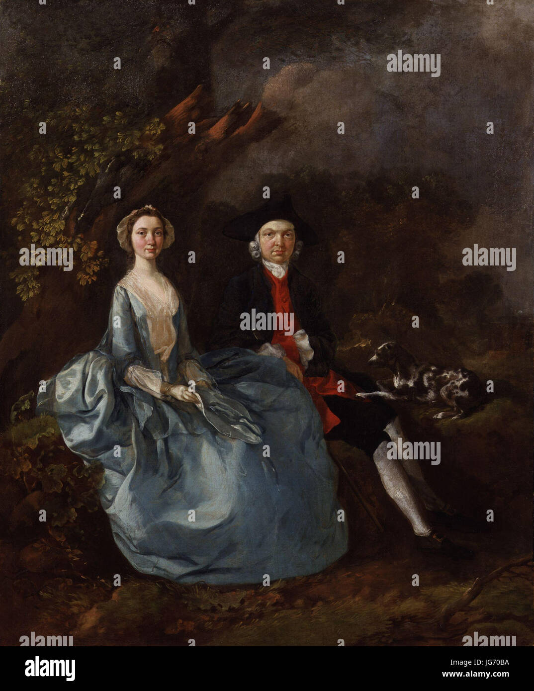 Sarah Kirby (née Bull); John Joshua Kirby by Thomas Gainsborough Stock Photohttps://www.alamy.com/image-license-details/?v=1https://www.alamy.com/stock-photo-sarah-kirby-ne-bull-john-joshua-kirby-by-thomas-gainsborough-147671422.html
RMJG70BA–Sarah Kirby (née Bull); John Joshua Kirby by Thomas Gainsborough
 North Kirby, Caledonia County, US, United States, Vermont, N 44 30' 57'', S 71 56' 20'', map, Cartascapes Map published in 2024. Explore Cartascapes, a map revealing Earth's diverse landscapes, cultures, and ecosystems. Journey through time and space, discovering the interconnectedness of our planet's past, present, and future. Stock Photohttps://www.alamy.com/image-license-details/?v=1https://www.alamy.com/north-kirby-caledonia-county-us-united-states-vermont-n-44-30-57-s-71-56-20-map-cartascapes-map-published-in-2024-explore-cartascapes-a-map-revealing-earths-diverse-landscapes-cultures-and-ecosystems-journey-through-time-and-space-discovering-the-interconnectedness-of-our-planets-past-present-and-future-image621316815.html
RM2Y2RBX7–North Kirby, Caledonia County, US, United States, Vermont, N 44 30' 57'', S 71 56' 20'', map, Cartascapes Map published in 2024. Explore Cartascapes, a map revealing Earth's diverse landscapes, cultures, and ecosystems. Journey through time and space, discovering the interconnectedness of our planet's past, present, and future.
 Leicestershire, administrative county of England - Great Britain. Elevation map colored in sepia tones with lakes and rivers Stock Photohttps://www.alamy.com/image-license-details/?v=1https://www.alamy.com/leicestershire-administrative-county-of-england-great-britain-elevation-map-colored-in-sepia-tones-with-lakes-and-rivers-image546465397.html
RF2PN1J59–Leicestershire, administrative county of England - Great Britain. Elevation map colored in sepia tones with lakes and rivers
 Image taken from page 59 of 'The World at Home; or, pictures and scenes from far off lands' Image taken from page 59 of 'The Wo Stock Photohttps://www.alamy.com/image-license-details/?v=1https://www.alamy.com/stock-photo-image-taken-from-page-59-of-the-world-at-home-or-pictures-and-scenes-132347351.html
RMHK8XB3–Image taken from page 59 of 'The World at Home; or, pictures and scenes from far off lands' Image taken from page 59 of 'The Wo
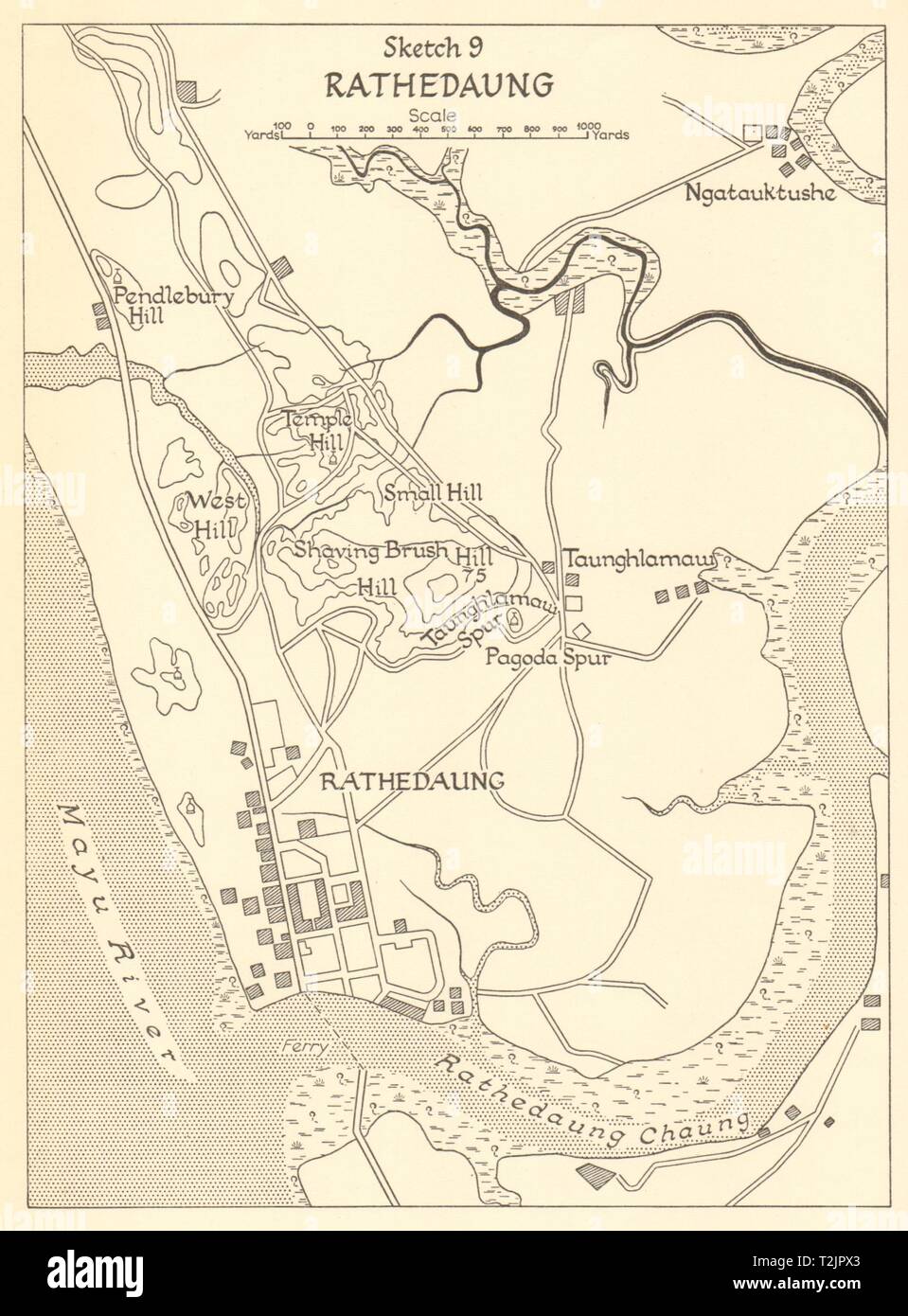 Battle of Rathedaung 1943. Japanese conquest of Burma. World War 2 1961 map Stock Photohttps://www.alamy.com/image-license-details/?v=1https://www.alamy.com/battle-of-rathedaung-1943-japanese-conquest-of-burma-world-war-2-1961-map-image242587579.html
RFT2JPX3–Battle of Rathedaung 1943. Japanese conquest of Burma. World War 2 1961 map
![THE SOUTH VIEW OF ST. JAMES'S AND THE PRIORY CHURCH AT BURY IN SUFFOLK. Author Wood, Joseph 39.13.k. Place of publication: [London] Publisher: [J. Kirby] Date of publication: [1748.] Item type: 1 print Medium: etching Dimensions: platemark 25.1 x 34.2 cm. Former owner: George III, King of Great Britain, 1738-1820 Stock Photo THE SOUTH VIEW OF ST. JAMES'S AND THE PRIORY CHURCH AT BURY IN SUFFOLK. Author Wood, Joseph 39.13.k. Place of publication: [London] Publisher: [J. Kirby] Date of publication: [1748.] Item type: 1 print Medium: etching Dimensions: platemark 25.1 x 34.2 cm. Former owner: George III, King of Great Britain, 1738-1820 Stock Photo](https://c8.alamy.com/comp/2E9HPDK/the-south-view-of-st-jamess-and-the-priory-church-at-bury-in-suffolk-author-wood-joseph-3913k-place-of-publication-london-publisher-j-kirby-date-of-publication-1748-item-type-1-print-medium-etching-dimensions-platemark-251-x-342-cm-former-owner-george-iii-king-of-great-britain-1738-1820-2E9HPDK.jpg) THE SOUTH VIEW OF ST. JAMES'S AND THE PRIORY CHURCH AT BURY IN SUFFOLK. Author Wood, Joseph 39.13.k. Place of publication: [London] Publisher: [J. Kirby] Date of publication: [1748.] Item type: 1 print Medium: etching Dimensions: platemark 25.1 x 34.2 cm. Former owner: George III, King of Great Britain, 1738-1820 Stock Photohttps://www.alamy.com/image-license-details/?v=1https://www.alamy.com/the-south-view-of-st-jamess-and-the-priory-church-at-bury-in-suffolk-author-wood-joseph-3913k-place-of-publication-london-publisher-j-kirby-date-of-publication-1748-item-type-1-print-medium-etching-dimensions-platemark-251-x-342-cm-former-owner-george-iii-king-of-great-britain-1738-1820-image401761183.html
THE SOUTH VIEW OF ST. JAMES'S AND THE PRIORY CHURCH AT BURY IN SUFFOLK. Author Wood, Joseph 39.13.k. Place of publication: [London] Publisher: [J. Kirby] Date of publication: [1748.] Item type: 1 print Medium: etching Dimensions: platemark 25.1 x 34.2 cm. Former owner: George III, King of Great Britain, 1738-1820 Stock Photohttps://www.alamy.com/image-license-details/?v=1https://www.alamy.com/the-south-view-of-st-jamess-and-the-priory-church-at-bury-in-suffolk-author-wood-joseph-3913k-place-of-publication-london-publisher-j-kirby-date-of-publication-1748-item-type-1-print-medium-etching-dimensions-platemark-251-x-342-cm-former-owner-george-iii-king-of-great-britain-1738-1820-image401761183.htmlRM2E9HPDK–THE SOUTH VIEW OF ST. JAMES'S AND THE PRIORY CHURCH AT BURY IN SUFFOLK. Author Wood, Joseph 39.13.k. Place of publication: [London] Publisher: [J. Kirby] Date of publication: [1748.] Item type: 1 print Medium: etching Dimensions: platemark 25.1 x 34.2 cm. Former owner: George III, King of Great Britain, 1738-1820
 USGS TOPO Map Texas TX Kirby Lake 110036 1957 62500 Restoration Stock Photohttps://www.alamy.com/image-license-details/?v=1https://www.alamy.com/usgs-topo-map-texas-tx-kirby-lake-110036-1957-62500-restoration-image332480231.html
RM2A8WNWY–USGS TOPO Map Texas TX Kirby Lake 110036 1957 62500 Restoration
 Note on Carboniferous Entomostraca from Nova Scotia, in the Peter Redpath Museum, determined and described by Prof. T. Rupert Jones, F.R. S., and Mr. Kirby BHL26603028 Stock Photohttps://www.alamy.com/image-license-details/?v=1https://www.alamy.com/stock-image-note-on-carboniferous-entomostraca-from-nova-scotia-in-the-peter-redpath-160731350.html
RMK9DXDA–Note on Carboniferous Entomostraca from Nova Scotia, in the Peter Redpath Museum, determined and described by Prof. T. Rupert Jones, F.R. S., and Mr. Kirby BHL26603028
 Kirby Woods, Chester County, US, United States, Pennsylvania, N 39 58' 34'', S 75 36' 9'', map, Cartascapes Map published in 2024. Explore Cartascapes, a map revealing Earth's diverse landscapes, cultures, and ecosystems. Journey through time and space, discovering the interconnectedness of our planet's past, present, and future. Stock Photohttps://www.alamy.com/image-license-details/?v=1https://www.alamy.com/kirby-woods-chester-county-us-united-states-pennsylvania-n-39-58-34-s-75-36-9-map-cartascapes-map-published-in-2024-explore-cartascapes-a-map-revealing-earths-diverse-landscapes-cultures-and-ecosystems-journey-through-time-and-space-discovering-the-interconnectedness-of-our-planets-past-present-and-future-image621304606.html
RM2Y2PTA6–Kirby Woods, Chester County, US, United States, Pennsylvania, N 39 58' 34'', S 75 36' 9'', map, Cartascapes Map published in 2024. Explore Cartascapes, a map revealing Earth's diverse landscapes, cultures, and ecosystems. Journey through time and space, discovering the interconnectedness of our planet's past, present, and future.
 Leicestershire, administrative county of England - Great Britain. Elevation map colored in wiki style with lakes and rivers Stock Photohttps://www.alamy.com/image-license-details/?v=1https://www.alamy.com/leicestershire-administrative-county-of-england-great-britain-elevation-map-colored-in-wiki-style-with-lakes-and-rivers-image546465525.html
RF2PN1J9W–Leicestershire, administrative county of England - Great Britain. Elevation map colored in wiki style with lakes and rivers
 Image taken from page 111 of 'The World at Home; or, pictures and scenes from far off lands' Image taken from page 111 of 'The Wo Stock Photohttps://www.alamy.com/image-license-details/?v=1https://www.alamy.com/stock-photo-image-taken-from-page-111-of-the-world-at-home-or-pictures-and-scenes-132249742.html
RMHK4DW2–Image taken from page 111 of 'The World at Home; or, pictures and scenes from far off lands' Image taken from page 111 of 'The Wo
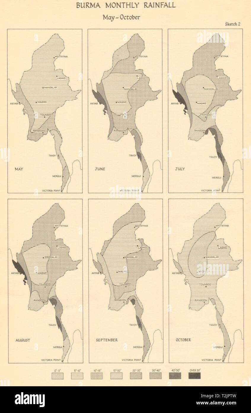 Burma Monthly Rainfall, May-October. Monsoon. Myanmar 1961 old vintage map Stock Photohttps://www.alamy.com/image-license-details/?v=1https://www.alamy.com/burma-monthly-rainfall-may-october-monsoon-myanmar-1961-old-vintage-map-image242587545.html
RFT2JPTW–Burma Monthly Rainfall, May-October. Monsoon. Myanmar 1961 old vintage map
 Plan & Elevation of Kew Chapel with the proposed alterations. Author Kirby, John Joshua 40.46.h. Date of publication: February 1768 Item type: 1 drawing Medium: pen and black ink with monochrome and pink wash over pencil Dimensions: sheet 48.7 x 32.4 cm Former owner: George III, King of Great Britain, 1738-1820 Stock Photohttps://www.alamy.com/image-license-details/?v=1https://www.alamy.com/plan-elevation-of-kew-chapel-with-the-proposed-alterations-author-kirby-john-joshua-4046h-date-of-publication-february-1768-item-type-1-drawing-medium-pen-and-black-ink-with-monochrome-and-pink-wash-over-pencil-dimensions-sheet-487-x-324-cm-former-owner-george-iii-king-of-great-britain-1738-1820-image401761965.html
RM2E9HRDH–Plan & Elevation of Kew Chapel with the proposed alterations. Author Kirby, John Joshua 40.46.h. Date of publication: February 1768 Item type: 1 drawing Medium: pen and black ink with monochrome and pink wash over pencil Dimensions: sheet 48.7 x 32.4 cm Former owner: George III, King of Great Britain, 1738-1820
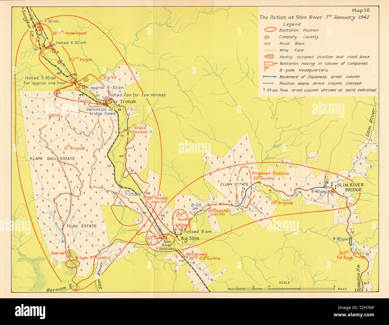 Battle of Slim River, 7th January 1942. Japanese invasion of Malaya 1957 map Stock Photohttps://www.alamy.com/image-license-details/?v=1https://www.alamy.com/battle-of-slim-river-7th-january-1942-japanese-invasion-of-malaya-1957-map-image242553326.html
RFT2H76P–Battle of Slim River, 7th January 1942. Japanese invasion of Malaya 1957 map
 USGS TOPO Map Texas TX Kirby Lake NE 20100318 TM Restoration Stock Photohttps://www.alamy.com/image-license-details/?v=1https://www.alamy.com/usgs-topo-map-texas-tx-kirby-lake-ne-20100318-tm-restoration-image332480287.html
RM2A8WNYY–USGS TOPO Map Texas TX Kirby Lake NE 20100318 TM Restoration
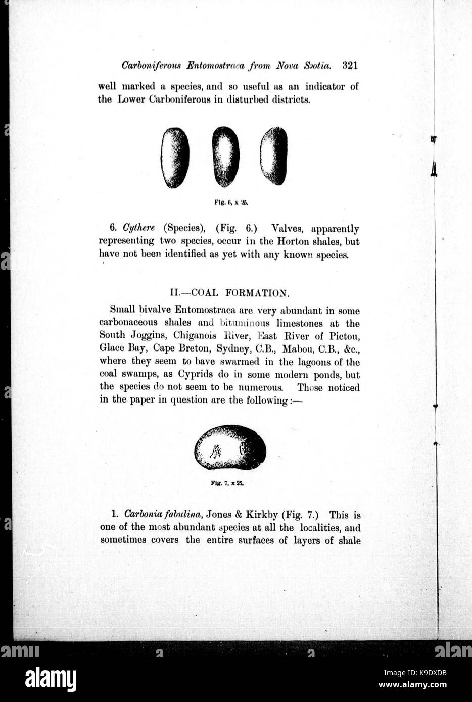 Note on Carboniferous Entomostraca from Nova Scotia, in the Peter Redpath Museum, determined and described by Prof. T. Rupert Jones, F.R. S., and Mr. Kirby BHL26603030 Stock Photohttps://www.alamy.com/image-license-details/?v=1https://www.alamy.com/stock-image-note-on-carboniferous-entomostraca-from-nova-scotia-in-the-peter-redpath-160731351.html
RMK9DXDB–Note on Carboniferous Entomostraca from Nova Scotia, in the Peter Redpath Museum, determined and described by Prof. T. Rupert Jones, F.R. S., and Mr. Kirby BHL26603030
 Kirby Corner, Bristol County, US, United States, Massachusetts, N 41 36' 10'', S 71 5' 8'', map, Cartascapes Map published in 2024. Explore Cartascapes, a map revealing Earth's diverse landscapes, cultures, and ecosystems. Journey through time and space, discovering the interconnectedness of our planet's past, present, and future. Stock Photohttps://www.alamy.com/image-license-details/?v=1https://www.alamy.com/kirby-corner-bristol-county-us-united-states-massachusetts-n-41-36-10-s-71-5-8-map-cartascapes-map-published-in-2024-explore-cartascapes-a-map-revealing-earths-diverse-landscapes-cultures-and-ecosystems-journey-through-time-and-space-discovering-the-interconnectedness-of-our-planets-past-present-and-future-image621274231.html
RM2Y2NDHB–Kirby Corner, Bristol County, US, United States, Massachusetts, N 41 36' 10'', S 71 5' 8'', map, Cartascapes Map published in 2024. Explore Cartascapes, a map revealing Earth's diverse landscapes, cultures, and ecosystems. Journey through time and space, discovering the interconnectedness of our planet's past, present, and future.
 Sevenoaks, non metropolitan district of England - Great Britain. Elevation map colored in sepia tones with lakes and rivers Stock Photohttps://www.alamy.com/image-license-details/?v=1https://www.alamy.com/sevenoaks-non-metropolitan-district-of-england-great-britain-elevation-map-colored-in-sepia-tones-with-lakes-and-rivers-image546500735.html
RF2PN377B–Sevenoaks, non metropolitan district of England - Great Britain. Elevation map colored in sepia tones with lakes and rivers
 Image taken from page 286 of 'The World at Home; or, pictures and scenes from far off lands' Image taken from page 286 of 'The Wo Stock Photohttps://www.alamy.com/image-license-details/?v=1https://www.alamy.com/stock-photo-image-taken-from-page-286-of-the-world-at-home-or-pictures-and-scenes-132297636.html
RMHK6JYG–Image taken from page 286 of 'The World at Home; or, pictures and scenes from far off lands' Image taken from page 286 of 'The Wo
![PROPOSALS FOR PUBLISHING BY SUBSCRIPTION, A PRINT, FROM ONE OF THE SOUTH WINDOWS OF KING'S COLLEGE CHAPEL, CAMBRIDGE Author Baldrey, Joshua Kirby 8.58.p.1. Place of publication: Cambridge Publisher: [published by Joshua Kirby Baldrey] Date of publication: [1809-1810] Item type: 1 volume Medium: one sheet of letterpress text and 8 pages of letterpress text Dimensions: advertisement 22 x 18 cm ; leaflet 21 x 13 cm Former owner: George III, King of Great Britain, 1738-1820 Stock Photo PROPOSALS FOR PUBLISHING BY SUBSCRIPTION, A PRINT, FROM ONE OF THE SOUTH WINDOWS OF KING'S COLLEGE CHAPEL, CAMBRIDGE Author Baldrey, Joshua Kirby 8.58.p.1. Place of publication: Cambridge Publisher: [published by Joshua Kirby Baldrey] Date of publication: [1809-1810] Item type: 1 volume Medium: one sheet of letterpress text and 8 pages of letterpress text Dimensions: advertisement 22 x 18 cm ; leaflet 21 x 13 cm Former owner: George III, King of Great Britain, 1738-1820 Stock Photo](https://c8.alamy.com/comp/2E9FM34/proposals-for-publishing-by-subscription-a-print-from-one-of-the-south-windows-of-kings-college-chapel-cambridge-author-baldrey-joshua-kirby-858p1-place-of-publication-cambridge-publisher-published-by-joshua-kirby-baldrey-date-of-publication-1809-1810-item-type-1-volume-medium-one-sheet-of-letterpress-text-and-8-pages-of-letterpress-text-dimensions-advertisement-22-x-18-cm-leaflet-21-x-13-cm-former-owner-george-iii-king-of-great-britain-1738-1820-2E9FM34.jpg) PROPOSALS FOR PUBLISHING BY SUBSCRIPTION, A PRINT, FROM ONE OF THE SOUTH WINDOWS OF KING'S COLLEGE CHAPEL, CAMBRIDGE Author Baldrey, Joshua Kirby 8.58.p.1. Place of publication: Cambridge Publisher: [published by Joshua Kirby Baldrey] Date of publication: [1809-1810] Item type: 1 volume Medium: one sheet of letterpress text and 8 pages of letterpress text Dimensions: advertisement 22 x 18 cm ; leaflet 21 x 13 cm Former owner: George III, King of Great Britain, 1738-1820 Stock Photohttps://www.alamy.com/image-license-details/?v=1https://www.alamy.com/proposals-for-publishing-by-subscription-a-print-from-one-of-the-south-windows-of-kings-college-chapel-cambridge-author-baldrey-joshua-kirby-858p1-place-of-publication-cambridge-publisher-published-by-joshua-kirby-baldrey-date-of-publication-1809-1810-item-type-1-volume-medium-one-sheet-of-letterpress-text-and-8-pages-of-letterpress-text-dimensions-advertisement-22-x-18-cm-leaflet-21-x-13-cm-former-owner-george-iii-king-of-great-britain-1738-1820-image401715416.html
PROPOSALS FOR PUBLISHING BY SUBSCRIPTION, A PRINT, FROM ONE OF THE SOUTH WINDOWS OF KING'S COLLEGE CHAPEL, CAMBRIDGE Author Baldrey, Joshua Kirby 8.58.p.1. Place of publication: Cambridge Publisher: [published by Joshua Kirby Baldrey] Date of publication: [1809-1810] Item type: 1 volume Medium: one sheet of letterpress text and 8 pages of letterpress text Dimensions: advertisement 22 x 18 cm ; leaflet 21 x 13 cm Former owner: George III, King of Great Britain, 1738-1820 Stock Photohttps://www.alamy.com/image-license-details/?v=1https://www.alamy.com/proposals-for-publishing-by-subscription-a-print-from-one-of-the-south-windows-of-kings-college-chapel-cambridge-author-baldrey-joshua-kirby-858p1-place-of-publication-cambridge-publisher-published-by-joshua-kirby-baldrey-date-of-publication-1809-1810-item-type-1-volume-medium-one-sheet-of-letterpress-text-and-8-pages-of-letterpress-text-dimensions-advertisement-22-x-18-cm-leaflet-21-x-13-cm-former-owner-george-iii-king-of-great-britain-1738-1820-image401715416.htmlRM2E9FM34–PROPOSALS FOR PUBLISHING BY SUBSCRIPTION, A PRINT, FROM ONE OF THE SOUTH WINDOWS OF KING'S COLLEGE CHAPEL, CAMBRIDGE Author Baldrey, Joshua Kirby 8.58.p.1. Place of publication: Cambridge Publisher: [published by Joshua Kirby Baldrey] Date of publication: [1809-1810] Item type: 1 volume Medium: one sheet of letterpress text and 8 pages of letterpress text Dimensions: advertisement 22 x 18 cm ; leaflet 21 x 13 cm Former owner: George III, King of Great Britain, 1738-1820
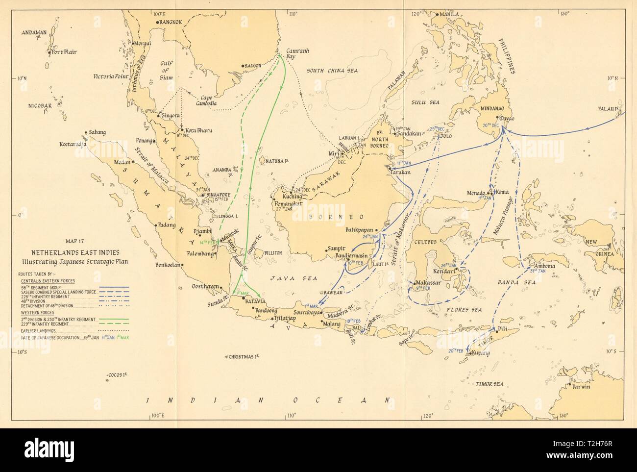 Japanese invasion of Dutch East Indies. Strategic Plan 1942. Indonesia 1957 map Stock Photohttps://www.alamy.com/image-license-details/?v=1https://www.alamy.com/japanese-invasion-of-dutch-east-indies-strategic-plan-1942-indonesia-1957-map-image242553327.html
RFT2H76R–Japanese invasion of Dutch East Indies. Strategic Plan 1942. Indonesia 1957 map
 Burma Campaign. February 1945. Myitson-Mongmit Momeik. World War 2 1965 map Stock Photohttps://www.alamy.com/image-license-details/?v=1https://www.alamy.com/burma-campaign-february-1945-myitson-mongmit-momeik-world-war-2-1965-map-image242587341.html
RFT2JPHH–Burma Campaign. February 1945. Myitson-Mongmit Momeik. World War 2 1965 map
