Quick filters:
Map of la plant Stock Photos and Images
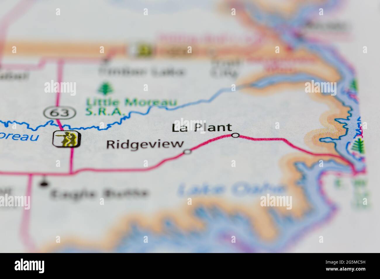 La Plant South Dakota USA shown on a Geography map or Road map Stock Photohttps://www.alamy.com/image-license-details/?v=1https://www.alamy.com/la-plant-south-dakota-usa-shown-on-a-geography-map-or-road-map-image433781085.html
RM2G5MC5H–La Plant South Dakota USA shown on a Geography map or Road map
 La Plant, Dewey County, US, United States, South Dakota, N 45 8' 40'', S 100 39' 5'', map, Cartascapes Map published in 2024. Explore Cartascapes, a map revealing Earth's diverse landscapes, cultures, and ecosystems. Journey through time and space, discovering the interconnectedness of our planet's past, present, and future. Stock Photohttps://www.alamy.com/image-license-details/?v=1https://www.alamy.com/la-plant-dewey-county-us-united-states-south-dakota-n-45-8-40-s-100-39-5-map-cartascapes-map-published-in-2024-explore-cartascapes-a-map-revealing-earths-diverse-landscapes-cultures-and-ecosystems-journey-through-time-and-space-discovering-the-interconnectedness-of-our-planets-past-present-and-future-image621170958.html
RM2Y2GNW2–La Plant, Dewey County, US, United States, South Dakota, N 45 8' 40'', S 100 39' 5'', map, Cartascapes Map published in 2024. Explore Cartascapes, a map revealing Earth's diverse landscapes, cultures, and ecosystems. Journey through time and space, discovering the interconnectedness of our planet's past, present, and future.
 The Holy and Expanded City of Jerusalem, First Known as Salem by Visscher, Claes Jansz in 1756 reprint ( originally 1643 ) Stock Photohttps://www.alamy.com/image-license-details/?v=1https://www.alamy.com/the-holy-and-expanded-city-of-jerusalem-first-known-as-salem-by-visscher-claes-jansz-in-1756-reprint-originally-1643-image603562316.html
RM2X1XHW0–The Holy and Expanded City of Jerusalem, First Known as Salem by Visscher, Claes Jansz in 1756 reprint ( originally 1643 )
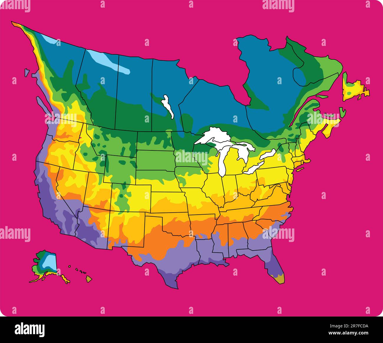 Plant zone mapping Stock Vectorhttps://www.alamy.com/image-license-details/?v=1https://www.alamy.com/plant-zone-mapping-image555373430.html
RF2R7FCDA–Plant zone mapping
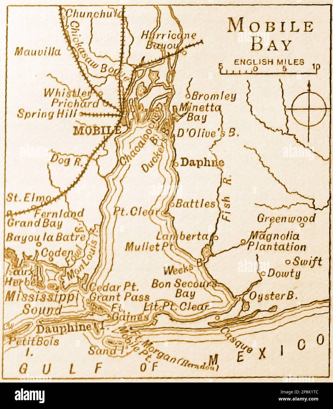 An old 19th century map of Mobile Bay in the Gulf of Mexico Stock Photohttps://www.alamy.com/image-license-details/?v=1https://www.alamy.com/an-old-19th-century-map-of-mobile-bay-in-the-gulf-of-mexico-image538857212.html
RM2P8K1TC–An old 19th century map of Mobile Bay in the Gulf of Mexico
 plan de millepertuis la plante médicinale en pleine nature - map of St. John's wort the medicinal plant in nature Stock Photohttps://www.alamy.com/image-license-details/?v=1https://www.alamy.com/plan-de-millepertuis-la-plante-mdicinale-en-pleine-nature-map-of-st-johns-wort-the-medicinal-plant-in-nature-image573849683.html
RF2T9H33F–plan de millepertuis la plante médicinale en pleine nature - map of St. John's wort the medicinal plant in nature
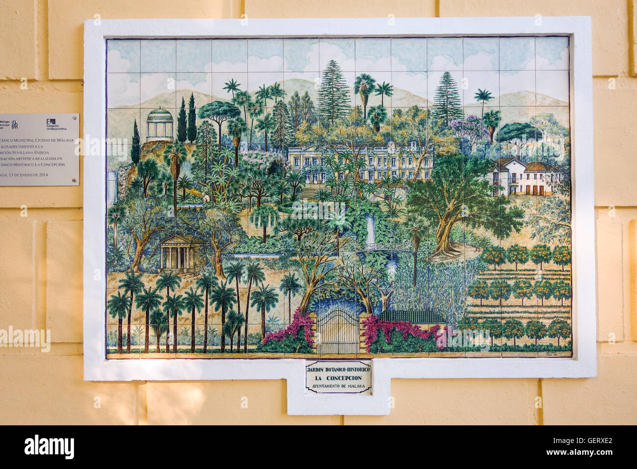 Map of Botanical garden, Malaga, painted on Andalusian tiles, Andalusia, Spain. Stock Photohttps://www.alamy.com/image-license-details/?v=1https://www.alamy.com/stock-photo-map-of-botanical-garden-malaga-painted-on-andalusian-tiles-andalusia-112393066.html
RMGERXE2–Map of Botanical garden, Malaga, painted on Andalusian tiles, Andalusia, Spain.
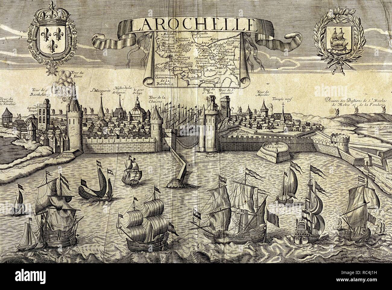 La Rochelle. Map of the city on the Atlantic. Sixteenth-century engraving by Jollain. Stock Photohttps://www.alamy.com/image-license-details/?v=1https://www.alamy.com/la-rochelle-map-of-the-city-on-the-atlantic-sixteenth-century-engraving-by-jollain-image231212621.html
RMRC4J1H–La Rochelle. Map of the city on the Atlantic. Sixteenth-century engraving by Jollain.
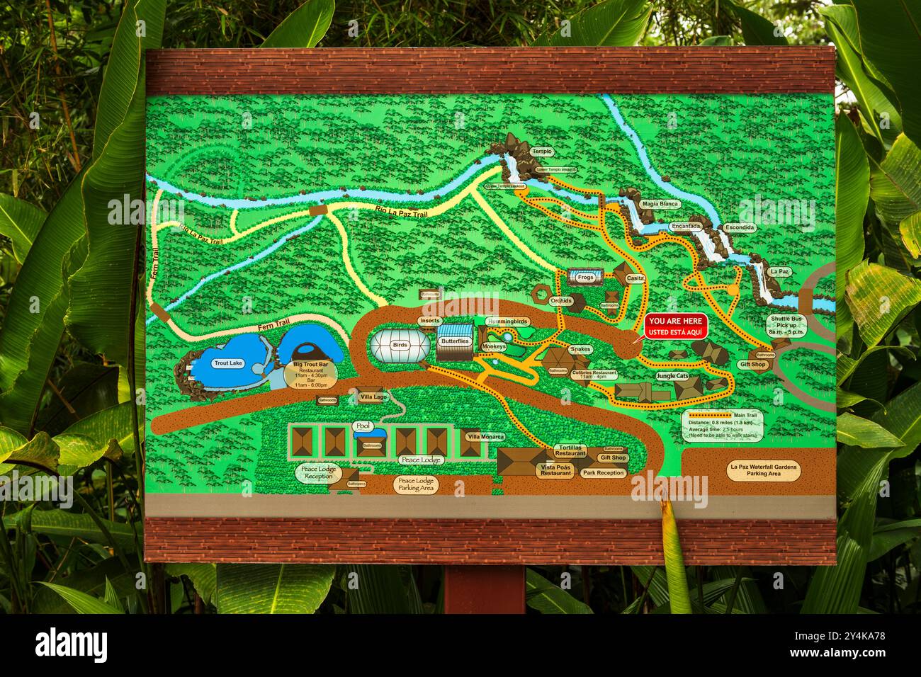 Interpretive sign and trail map, La Paz Waterfall Gardens, Alajuela Province, Costa Rica Stock Photohttps://www.alamy.com/image-license-details/?v=1https://www.alamy.com/interpretive-sign-and-trail-map-la-paz-waterfall-gardens-alajuela-province-costa-rica-image622457004.html
RM2Y4KA78–Interpretive sign and trail map, La Paz Waterfall Gardens, Alajuela Province, Costa Rica
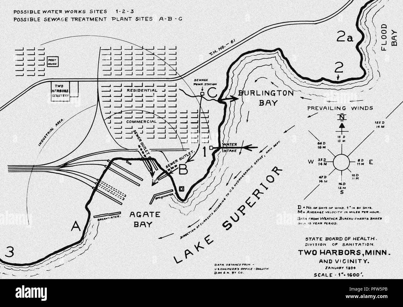 System of water intake, and sewer outlet into Lake Superior at Two Harbors, Minnesota, digitally enhanced an colorized map, 1917. Image courtesy Centers for Disease Control (CDC) / Librarians Melissa Rethlefsen and Marie Jones. () Stock Photohttps://www.alamy.com/image-license-details/?v=1https://www.alamy.com/system-of-water-intake-and-sewer-outlet-into-lake-superior-at-two-harbors-minnesota-digitally-enhanced-an-colorized-map-1917-image-courtesy-centers-for-disease-control-cdc-librarians-melissa-rethlefsen-and-marie-jones-image216297603.html
RMPFW5PB–System of water intake, and sewer outlet into Lake Superior at Two Harbors, Minnesota, digitally enhanced an colorized map, 1917. Image courtesy Centers for Disease Control (CDC) / Librarians Melissa Rethlefsen and Marie Jones. ()
 Hiking backpack, Caldera de Taburiente, La Palma, Canary Islands, Spain Stock Photohttps://www.alamy.com/image-license-details/?v=1https://www.alamy.com/stock-photo-hiking-backpack-caldera-de-taburiente-la-palma-canary-islands-spain-35162214.html
RMC15NNA–Hiking backpack, Caldera de Taburiente, La Palma, Canary Islands, Spain
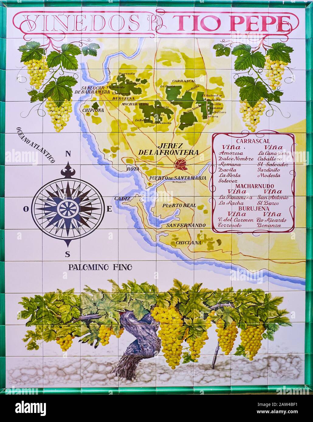 JEREZ, SPAIN - SEPTEMBER 20, 2019: The vintage tile map on the wall of Bodegas Tio Pepe wine museum with location of vineyards in Sherry Triangle, on Stock Photohttps://www.alamy.com/image-license-details/?v=1https://www.alamy.com/jerez-spain-september-20-2019-the-vintage-tile-map-on-the-wall-of-bodegas-tio-pepe-wine-museum-with-location-of-vineyards-in-sherry-triangle-on-image342460245.html
RM2AW4BF1–JEREZ, SPAIN - SEPTEMBER 20, 2019: The vintage tile map on the wall of Bodegas Tio Pepe wine museum with location of vineyards in Sherry Triangle, on
 Kardinaal Richelieu plant het beleg van La Rochelle, 1624 Opgeworpen dam in zee, om Rochelle te benaauwen, op last van den Kardinaal Richelieu (titel op object) Cardinal Richelieu plant the siege of La Rochelle, 1627-1628. The cardinal looks at the map of the city and the verschansingen. Manufacturer : printmaker: Reinier Vinkeles (I) (listed building) supervision: Reinier Vinkeles (I) (listed building) in drawing: Christian Bernhard Rode (listed building) place manufacture: the Netherlands Date: 1798 Physical characteristics: etching and engra material: paper Technique: etching / engra (print Stock Photohttps://www.alamy.com/image-license-details/?v=1https://www.alamy.com/kardinaal-richelieu-plant-het-beleg-van-la-rochelle-1624-opgeworpen-dam-in-zee-om-rochelle-te-benaauwen-op-last-van-den-kardinaal-richelieu-titel-op-object-cardinal-richelieu-plant-the-siege-of-la-rochelle-1627-1628-the-cardinal-looks-at-the-map-of-the-city-and-the-verschansingen-manufacturer-printmaker-reinier-vinkeles-i-listed-building-supervision-reinier-vinkeles-i-listed-building-in-drawing-christian-bernhard-rode-listed-building-place-manufacture-the-netherlands-date-1798-physical-characteristics-etching-and-engra-material-paper-technique-etching-engra-print-image348495122.html
RM2B6Y92A–Kardinaal Richelieu plant het beleg van La Rochelle, 1624 Opgeworpen dam in zee, om Rochelle te benaauwen, op last van den Kardinaal Richelieu (titel op object) Cardinal Richelieu plant the siege of La Rochelle, 1627-1628. The cardinal looks at the map of the city and the verschansingen. Manufacturer : printmaker: Reinier Vinkeles (I) (listed building) supervision: Reinier Vinkeles (I) (listed building) in drawing: Christian Bernhard Rode (listed building) place manufacture: the Netherlands Date: 1798 Physical characteristics: etching and engra material: paper Technique: etching / engra (print
 Haro, Spain - 28 Dec, 2024: The Bodegas Muga winery in Haro, La Rioja, Spain Stock Photohttps://www.alamy.com/image-license-details/?v=1https://www.alamy.com/haro-spain-28-dec-2024-the-bodegas-muga-winery-in-haro-la-rioja-spain-image637381653.html
RF2S0Y6PD–Haro, Spain - 28 Dec, 2024: The Bodegas Muga winery in Haro, La Rioja, Spain
 Weed plant in the flag colors of Bolvia Stock Photohttps://www.alamy.com/image-license-details/?v=1https://www.alamy.com/weed-plant-in-the-flag-colors-of-bolvia-image273396168.html
RFWTP7GT–Weed plant in the flag colors of Bolvia
 Part of the edge of a map of Suriname (right part), J.G. de la Croix, 1737 print Two Surinamese men flank a weapon composed of the weapons of Amsterdam, the WIC and the Sommelsdijck family. Fragment of a richly decorated edge around a map of Suriname. paper etching / engraving sailing-ship, sailing-boat. armorial bearing, heraldry. coat of arms (as symbol of the state, etc.). African Americans. slavery; serfs and the enslaved. ornament derived from plant forms. crustaceans: crab Suriname Stock Photohttps://www.alamy.com/image-license-details/?v=1https://www.alamy.com/part-of-the-edge-of-a-map-of-suriname-right-part-jg-de-la-croix-1737-print-two-surinamese-men-flank-a-weapon-composed-of-the-weapons-of-amsterdam-the-wic-and-the-sommelsdijck-family-fragment-of-a-richly-decorated-edge-around-a-map-of-suriname-paper-etching-engraving-sailing-ship-sailing-boat-armorial-bearing-heraldry-coat-of-arms-as-symbol-of-the-state-etc-african-americans-slavery-serfs-and-the-enslaved-ornament-derived-from-plant-forms-crustaceans-crab-suriname-image594271149.html
RM2WERAWH–Part of the edge of a map of Suriname (right part), J.G. de la Croix, 1737 print Two Surinamese men flank a weapon composed of the weapons of Amsterdam, the WIC and the Sommelsdijck family. Fragment of a richly decorated edge around a map of Suriname. paper etching / engraving sailing-ship, sailing-boat. armorial bearing, heraldry. coat of arms (as symbol of the state, etc.). African Americans. slavery; serfs and the enslaved. ornament derived from plant forms. crustaceans: crab Suriname
 woman reading map on her car in the Verdon canyon Stock Photohttps://www.alamy.com/image-license-details/?v=1https://www.alamy.com/woman-reading-map-on-her-car-in-the-verdon-canyon-image436016117.html
RF2G9A705–woman reading map on her car in the Verdon canyon
 La Paz / El Alto airport terminal building and monument with outline of Bolivia carved into stone block, El Alto, Bolivia Stock Photohttps://www.alamy.com/image-license-details/?v=1https://www.alamy.com/la-paz-el-alto-airport-terminal-building-and-monument-with-outline-of-bolivia-carved-into-stone-block-el-alto-bolivia-image560435083.html
RM2RFP0JK–La Paz / El Alto airport terminal building and monument with outline of Bolivia carved into stone block, El Alto, Bolivia
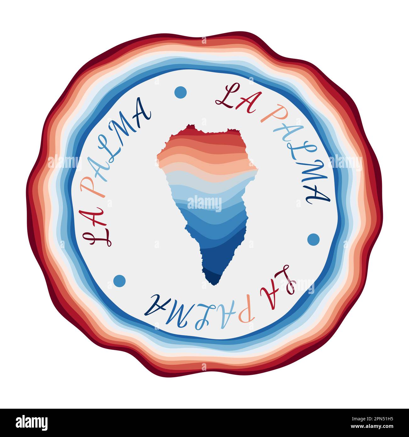 La Palma badge. Map of the island with beautiful geometric waves and vibrant red blue frame. Vivid round La Palma logo. Vector illustration. Stock Vectorhttps://www.alamy.com/image-license-details/?v=1https://www.alamy.com/la-palma-badge-map-of-the-island-with-beautiful-geometric-waves-and-vibrant-red-blue-frame-vivid-round-la-palma-logo-vector-illustration-image546540209.html
RF2PN51H5–La Palma badge. Map of the island with beautiful geometric waves and vibrant red blue frame. Vivid round La Palma logo. Vector illustration.
 Wine Areas of the Loire, France Stock Photohttps://www.alamy.com/image-license-details/?v=1https://www.alamy.com/stock-photo-wine-areas-of-the-loire-france-15099805.html
RMAKYJFX–Wine Areas of the Loire, France
 La Plant, Dewey County, US, United States, South Dakota, N 45 8' 40'', S 100 39' 5'', map, Cartascapes Map published in 2024. Explore Cartascapes, a map revealing Earth's diverse landscapes, cultures, and ecosystems. Journey through time and space, discovering the interconnectedness of our planet's past, present, and future. Stock Photohttps://www.alamy.com/image-license-details/?v=1https://www.alamy.com/la-plant-dewey-county-us-united-states-south-dakota-n-45-8-40-s-100-39-5-map-cartascapes-map-published-in-2024-explore-cartascapes-a-map-revealing-earths-diverse-landscapes-cultures-and-ecosystems-journey-through-time-and-space-discovering-the-interconnectedness-of-our-planets-past-present-and-future-image621209119.html
RM2Y2JEFY–La Plant, Dewey County, US, United States, South Dakota, N 45 8' 40'', S 100 39' 5'', map, Cartascapes Map published in 2024. Explore Cartascapes, a map revealing Earth's diverse landscapes, cultures, and ecosystems. Journey through time and space, discovering the interconnectedness of our planet's past, present, and future.
![''En Argonne; Du haut d'un observatoire que dissimule un abatis de branchages, le commandant en chef suit le combat sur la carte', 1915. From "L'Album de la Guerre 1914-1919: Volume I" [L'Illustration, Paris, 1926]. Stock Photo ''En Argonne; Du haut d'un observatoire que dissimule un abatis de branchages, le commandant en chef suit le combat sur la carte', 1915. From "L'Album de la Guerre 1914-1919: Volume I" [L'Illustration, Paris, 1926]. Stock Photo](https://c8.alamy.com/comp/2R4DN7H/en-argonne-du-haut-dun-observatoire-que-dissimule-un-abatis-de-branchages-le-commandant-en-chef-suit-le-combat-sur-la-carte-1915-from-quotlalbum-de-la-guerre-1914-1919-volume-iquot-lillustration-paris-1926-2R4DN7H.jpg) ''En Argonne; Du haut d'un observatoire que dissimule un abatis de branchages, le commandant en chef suit le combat sur la carte', 1915. From "L'Album de la Guerre 1914-1919: Volume I" [L'Illustration, Paris, 1926]. Stock Photohttps://www.alamy.com/image-license-details/?v=1https://www.alamy.com/en-argonne-du-haut-dun-observatoire-que-dissimule-un-abatis-de-branchages-le-commandant-en-chef-suit-le-combat-sur-la-carte-1915-from-quotlalbum-de-la-guerre-1914-1919-volume-iquot-lillustration-paris-1926-image553492453.html
''En Argonne; Du haut d'un observatoire que dissimule un abatis de branchages, le commandant en chef suit le combat sur la carte', 1915. From "L'Album de la Guerre 1914-1919: Volume I" [L'Illustration, Paris, 1926]. Stock Photohttps://www.alamy.com/image-license-details/?v=1https://www.alamy.com/en-argonne-du-haut-dun-observatoire-que-dissimule-un-abatis-de-branchages-le-commandant-en-chef-suit-le-combat-sur-la-carte-1915-from-quotlalbum-de-la-guerre-1914-1919-volume-iquot-lillustration-paris-1926-image553492453.htmlRM2R4DN7H–''En Argonne; Du haut d'un observatoire que dissimule un abatis de branchages, le commandant en chef suit le combat sur la carte', 1915. From "L'Album de la Guerre 1914-1919: Volume I" [L'Illustration, Paris, 1926].
 World map lichen (Rhizocarpon geographicum) colonizing a rock surface. Lichen colonisant la surface d'un rocher. Stock Photohttps://www.alamy.com/image-license-details/?v=1https://www.alamy.com/world-map-lichen-rhizocarpon-geographicum-colonizing-a-rock-surface-image7791725.html
RMAEC0PE–World map lichen (Rhizocarpon geographicum) colonizing a rock surface. Lichen colonisant la surface d'un rocher.
![Bird's-eye view of Savannah from Hutchinson Island, with cows grazing under the trees, two boats approaching the shore, sailing ships and the Savannah River in the foreground. Dwellings and public buildings laid out in a grid, ships, boats, a fence and a forest in the background. A View of Savanah as it stood the 29th of March 1734 = VÃœE de Savanah dans la Georgie : To the Hon.ble the Trustees for establishing the Colony of Georgia in America This View of the Town of Savanah is humbly dedicated by their Honours Obliged and most Obedient Servant Peter Gordon. [London] : [publisher not identifi Stock Photo Bird's-eye view of Savannah from Hutchinson Island, with cows grazing under the trees, two boats approaching the shore, sailing ships and the Savannah River in the foreground. Dwellings and public buildings laid out in a grid, ships, boats, a fence and a forest in the background. A View of Savanah as it stood the 29th of March 1734 = VÃœE de Savanah dans la Georgie : To the Hon.ble the Trustees for establishing the Colony of Georgia in America This View of the Town of Savanah is humbly dedicated by their Honours Obliged and most Obedient Servant Peter Gordon. [London] : [publisher not identifi Stock Photo](https://c8.alamy.com/comp/R5ANF7/birds-eye-view-of-savannah-from-hutchinson-island-with-cows-grazing-under-the-trees-two-boats-approaching-the-shore-sailing-ships-and-the-savannah-river-in-the-foreground-dwellings-and-public-buildings-laid-out-in-a-grid-ships-boats-a-fence-and-a-forest-in-the-background-a-view-of-savanah-as-it-stood-the-29th-of-march-1734-=-ve-de-savanah-dans-la-georgie-to-the-honble-the-trustees-for-establishing-the-colony-of-georgia-in-america-this-view-of-the-town-of-savanah-is-humbly-dedicated-by-their-honours-obliged-and-most-obedient-servant-peter-gordon-london-publisher-not-identifi-R5ANF7.jpg) Bird's-eye view of Savannah from Hutchinson Island, with cows grazing under the trees, two boats approaching the shore, sailing ships and the Savannah River in the foreground. Dwellings and public buildings laid out in a grid, ships, boats, a fence and a forest in the background. A View of Savanah as it stood the 29th of March 1734 = VÃœE de Savanah dans la Georgie : To the Hon.ble the Trustees for establishing the Colony of Georgia in America This View of the Town of Savanah is humbly dedicated by their Honours Obliged and most Obedient Servant Peter Gordon. [London] : [publisher not identifi Stock Photohttps://www.alamy.com/image-license-details/?v=1https://www.alamy.com/birds-eye-view-of-savannah-from-hutchinson-island-with-cows-grazing-under-the-trees-two-boats-approaching-the-shore-sailing-ships-and-the-savannah-river-in-the-foreground-dwellings-and-public-buildings-laid-out-in-a-grid-ships-boats-a-fence-and-a-forest-in-the-background-a-view-of-savanah-as-it-stood-the-29th-of-march-1734-=-ve-de-savanah-dans-la-georgie-to-the-honble-the-trustees-for-establishing-the-colony-of-georgia-in-america-this-view-of-the-town-of-savanah-is-humbly-dedicated-by-their-honours-obliged-and-most-obedient-servant-peter-gordon-london-publisher-not-identifi-image227044475.html
Bird's-eye view of Savannah from Hutchinson Island, with cows grazing under the trees, two boats approaching the shore, sailing ships and the Savannah River in the foreground. Dwellings and public buildings laid out in a grid, ships, boats, a fence and a forest in the background. A View of Savanah as it stood the 29th of March 1734 = VÃœE de Savanah dans la Georgie : To the Hon.ble the Trustees for establishing the Colony of Georgia in America This View of the Town of Savanah is humbly dedicated by their Honours Obliged and most Obedient Servant Peter Gordon. [London] : [publisher not identifi Stock Photohttps://www.alamy.com/image-license-details/?v=1https://www.alamy.com/birds-eye-view-of-savannah-from-hutchinson-island-with-cows-grazing-under-the-trees-two-boats-approaching-the-shore-sailing-ships-and-the-savannah-river-in-the-foreground-dwellings-and-public-buildings-laid-out-in-a-grid-ships-boats-a-fence-and-a-forest-in-the-background-a-view-of-savanah-as-it-stood-the-29th-of-march-1734-=-ve-de-savanah-dans-la-georgie-to-the-honble-the-trustees-for-establishing-the-colony-of-georgia-in-america-this-view-of-the-town-of-savanah-is-humbly-dedicated-by-their-honours-obliged-and-most-obedient-servant-peter-gordon-london-publisher-not-identifi-image227044475.htmlRMR5ANF7–Bird's-eye view of Savannah from Hutchinson Island, with cows grazing under the trees, two boats approaching the shore, sailing ships and the Savannah River in the foreground. Dwellings and public buildings laid out in a grid, ships, boats, a fence and a forest in the background. A View of Savanah as it stood the 29th of March 1734 = VÃœE de Savanah dans la Georgie : To the Hon.ble the Trustees for establishing the Colony of Georgia in America This View of the Town of Savanah is humbly dedicated by their Honours Obliged and most Obedient Servant Peter Gordon. [London] : [publisher not identifi
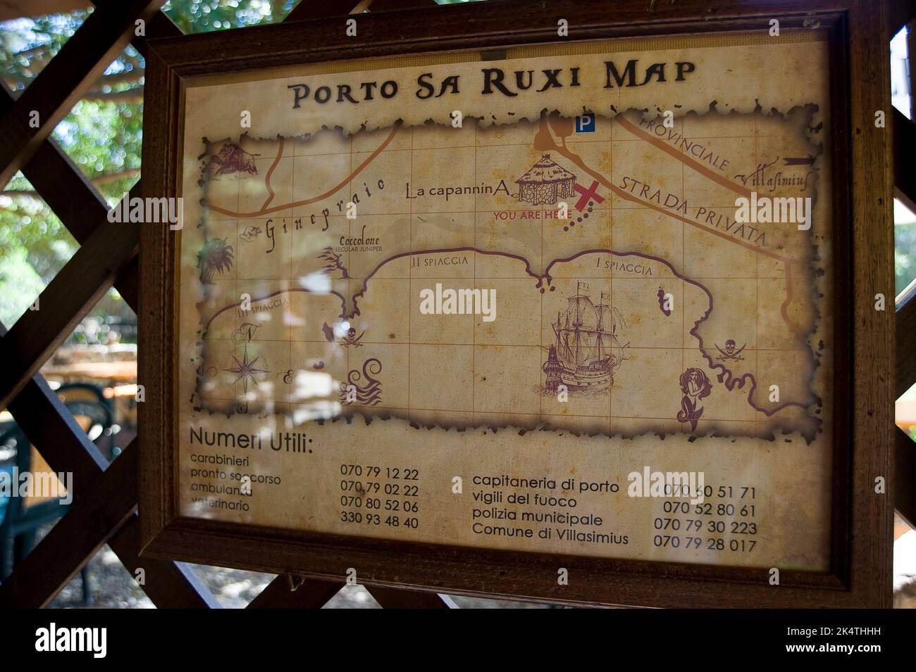 La Capannina, Porto sa Ruxi, Villasimius, Sardinia Stock Photohttps://www.alamy.com/image-license-details/?v=1https://www.alamy.com/la-capannina-porto-sa-ruxi-villasimius-sardinia-image484889597.html
RM2K4THHH–La Capannina, Porto sa Ruxi, Villasimius, Sardinia
 Street objects set with isometric trees, road signs, traffic lights, hotel and restaurant signboards. Vector illustration of park and cafe objects, la Stock Vectorhttps://www.alamy.com/image-license-details/?v=1https://www.alamy.com/street-objects-set-with-isometric-trees-road-signs-traffic-lights-hotel-and-restaurant-signboards-vector-illustration-of-park-and-cafe-objects-la-image476851359.html
RF2JKPCNK–Street objects set with isometric trees, road signs, traffic lights, hotel and restaurant signboards. Vector illustration of park and cafe objects, la
 PLANO PLAZA S SEBASTIAN Y CASTILLO DE STA CRUZ DE LA MOTA AÑO 1726. Location: SERVICIO GEOGRAFICO DEL EJERCITO, MADRID, SPAIN. Stock Photohttps://www.alamy.com/image-license-details/?v=1https://www.alamy.com/plano-plaza-s-sebastian-y-castillo-de-sta-cruz-de-la-mota-ao-1726-location-servicio-geografico-del-ejercito-madrid-spain-image208713980.html
RMP3FMPM–PLANO PLAZA S SEBASTIAN Y CASTILLO DE STA CRUZ DE LA MOTA AÑO 1726. Location: SERVICIO GEOGRAFICO DEL EJERCITO, MADRID, SPAIN.
 Map of La Rioja Province, Argentina, on wooden background, 3D illustration Stock Photohttps://www.alamy.com/image-license-details/?v=1https://www.alamy.com/map-of-la-rioja-province-argentina-on-wooden-background-3d-illustration-image368623930.html
RF2CBM7GA–Map of La Rioja Province, Argentina, on wooden background, 3D illustration
 La Guajira Department (Colombia, Republic of Colombia, Departments of Colombia) map is designed cannabis leaf green and black, La Guajira map made of Stock Vectorhttps://www.alamy.com/image-license-details/?v=1https://www.alamy.com/la-guajira-department-colombia-republic-of-colombia-departments-of-colombia-map-is-designed-cannabis-leaf-green-and-black-la-guajira-map-made-of-image332784828.html
RF2A9BJCC–La Guajira Department (Colombia, Republic of Colombia, Departments of Colombia) map is designed cannabis leaf green and black, La Guajira map made of
 USGS TOPO Map Louisiana LA Cotton Plant 20120328 TM Restoration Stock Photohttps://www.alamy.com/image-license-details/?v=1https://www.alamy.com/usgs-topo-map-louisiana-la-cotton-plant-20120328-tm-restoration-image260526468.html
RMW3T04M–USGS TOPO Map Louisiana LA Cotton Plant 20120328 TM Restoration
 Image taken from page 452 of 'Histoire de la Nation suisse' Image taken from page 452 of 'Histoire de la Nation Stock Photohttps://www.alamy.com/image-license-details/?v=1https://www.alamy.com/stock-photo-image-taken-from-page-452-of-histoire-de-la-nation-suisse-image-taken-127886618.html
RMHC1MK6–Image taken from page 452 of 'Histoire de la Nation suisse' Image taken from page 452 of 'Histoire de la Nation
 . The natural history of Carolina, Florida, and the Bahama Islands : containing the figures of birds, beasts, fishes, serpents, insects, and plants : particularly, those not hitherto described, or incorrectly figured by former authors, with their descriptions in English and French : to which is prefixed, a new and correct map of the countries, with observations on their natural state, inhabitants, and productions . MANCANIL LA Pyri fade. Plumier Plant. Amcric.Juglandi affinis Arbor Julifera, &c. Hift. Jam. Vol. U. p. 3* The Mancaneel Tree. Mancénillier. Stock Photohttps://www.alamy.com/image-license-details/?v=1https://www.alamy.com/the-natural-history-of-carolina-florida-and-the-bahama-islands-containing-the-figures-of-birds-beasts-fishes-serpents-insects-and-plants-particularly-those-not-hitherto-described-or-incorrectly-figured-by-former-authors-with-their-descriptions-in-english-and-french-to-which-is-prefixed-a-new-and-correct-map-of-the-countries-with-observations-on-their-natural-state-inhabitants-and-productions-mancanil-la-pyri-fade-plumier-plant-amcricjuglandi-affinis-arbor-julifera-c-hift-jam-vol-u-p-3-the-mancaneel-tree-mancnillier-image375330364.html
RM2CPHNKT–. The natural history of Carolina, Florida, and the Bahama Islands : containing the figures of birds, beasts, fishes, serpents, insects, and plants : particularly, those not hitherto described, or incorrectly figured by former authors, with their descriptions in English and French : to which is prefixed, a new and correct map of the countries, with observations on their natural state, inhabitants, and productions . MANCANIL LA Pyri fade. Plumier Plant. Amcric.Juglandi affinis Arbor Julifera, &c. Hift. Jam. Vol. U. p. 3* The Mancaneel Tree. Mancénillier.
 Haro, Spain - 28 Dec, 2024: The Bodegas Muga winery in Haro, La Rioja, Spain Stock Photohttps://www.alamy.com/image-license-details/?v=1https://www.alamy.com/haro-spain-28-dec-2024-the-bodegas-muga-winery-in-haro-la-rioja-spain-image637381656.html
RF2S0Y6PG–Haro, Spain - 28 Dec, 2024: The Bodegas Muga winery in Haro, La Rioja, Spain
 Tio Pepe, Gonzalez Byass, Jerez, Spain Stock Photohttps://www.alamy.com/image-license-details/?v=1https://www.alamy.com/tio-pepe-gonzalez-byass-jerez-spain-image478974256.html
RF2JR74FC–Tio Pepe, Gonzalez Byass, Jerez, Spain
 Part of the edge of a map of Suriname (left part), J.G. de la Croix, 1737 print Two Surinamese men flank a weapon composed of the weapons of Amsterdam, the WIC and the Sommelsdijck family. Fragment of a richly decorated edge around a map of Suriname. paper etching / engraving sailing-ship, sailing-boat. armorial bearing, heraldry. coat of arms (as symbol of the state, etc.). Native peoples of South America. slavery; serfs and the enslaved. ornament derived from plant forms. crustaceans: crab Suriname Stock Photohttps://www.alamy.com/image-license-details/?v=1https://www.alamy.com/part-of-the-edge-of-a-map-of-suriname-left-part-jg-de-la-croix-1737-print-two-surinamese-men-flank-a-weapon-composed-of-the-weapons-of-amsterdam-the-wic-and-the-sommelsdijck-family-fragment-of-a-richly-decorated-edge-around-a-map-of-suriname-paper-etching-engraving-sailing-ship-sailing-boat-armorial-bearing-heraldry-coat-of-arms-as-symbol-of-the-state-etc-native-peoples-of-south-america-slavery-serfs-and-the-enslaved-ornament-derived-from-plant-forms-crustaceans-crab-suriname-image594270707.html
RM2WERA9R–Part of the edge of a map of Suriname (left part), J.G. de la Croix, 1737 print Two Surinamese men flank a weapon composed of the weapons of Amsterdam, the WIC and the Sommelsdijck family. Fragment of a richly decorated edge around a map of Suriname. paper etching / engraving sailing-ship, sailing-boat. armorial bearing, heraldry. coat of arms (as symbol of the state, etc.). Native peoples of South America. slavery; serfs and the enslaved. ornament derived from plant forms. crustaceans: crab Suriname
 Early Pennsylvanian paleotopography and depositional environments, Rock Island County, Illinois earlypennsylvani18lear Year: 1985 14 Guidebooklet: Illinois State Museum No. 4 1 St. Louis, Mo. 2 Golden Eagle 3 Brown County 4 Monmouth 5 Wyoming Hill, Iowa 6 Cleveland quarry 7 Midway quarry 8 Port Byron 9 La Salle County 10 Channahon 11 Kankakee 12 Putnam County, Ind. 13 Green County, Ind. ALLIED STONE CO. QUARRY Figure 10. Map of reported localities of Early Pennsylvanian plant fossils on the margins of the Illinois (Eastern Interior) Basin. 12 Margin of Pennsylvanian strata Locality no lon Stock Photohttps://www.alamy.com/image-license-details/?v=1https://www.alamy.com/early-pennsylvanian-paleotopography-and-depositional-environments-rock-island-county-illinois-earlypennsylvani18lear-year-1985-14-guidebooklet-illinois-state-museum-no-4-1-st-louis-mo-2-golden-eagle-3-brown-county-4-monmouth-5-wyoming-hill-iowa-6-cleveland-quarry-7-midway-quarry-8-port-byron-9-la-salle-county-10-channahon-11-kankakee-12-putnam-county-ind-13-green-county-ind-allied-stone-co-quarry-figure-10-map-of-reported-localities-of-early-pennsylvanian-plant-fossils-on-the-margins-of-the-illinois-eastern-interior-basin-12-margin-of-pennsylvanian-strata-locality-no-lon-image240651841.html
RMRYEHTH–Early Pennsylvanian paleotopography and depositional environments, Rock Island County, Illinois earlypennsylvani18lear Year: 1985 14 Guidebooklet: Illinois State Museum No. 4 1 St. Louis, Mo. 2 Golden Eagle 3 Brown County 4 Monmouth 5 Wyoming Hill, Iowa 6 Cleveland quarry 7 Midway quarry 8 Port Byron 9 La Salle County 10 Channahon 11 Kankakee 12 Putnam County, Ind. 13 Green County, Ind. ALLIED STONE CO. QUARRY Figure 10. Map of reported localities of Early Pennsylvanian plant fossils on the margins of the Illinois (Eastern Interior) Basin. 12 Margin of Pennsylvanian strata Locality no lon
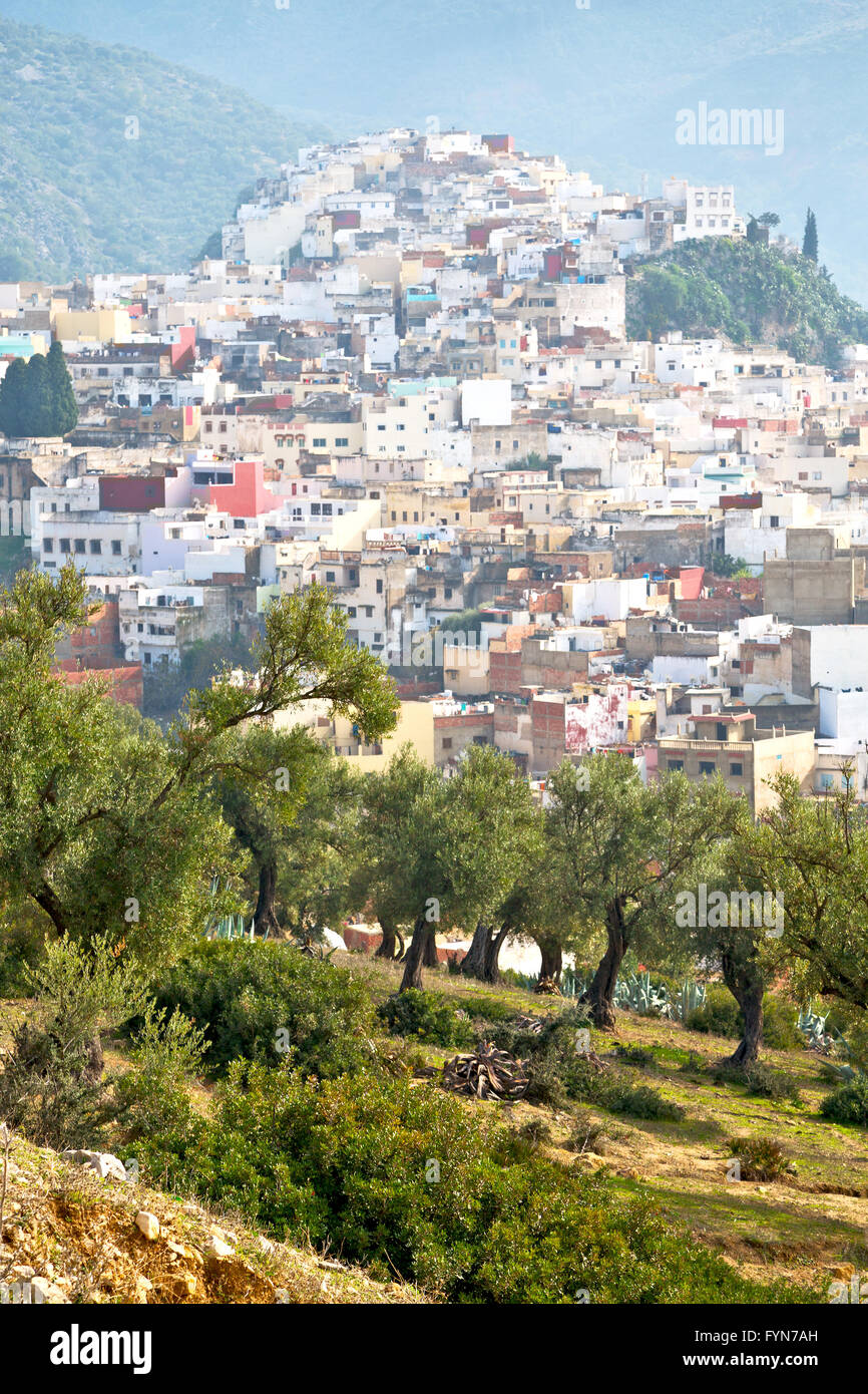 old city in morocco africa la landscape Stock Photohttps://www.alamy.com/image-license-details/?v=1https://www.alamy.com/stock-photo-old-city-in-morocco-africa-la-landscape-103114329.html
RMFYN7AH–old city in morocco africa la landscape
 La Plant, South Dakota, map 1951, 1:24000, United States of America by Timeless Maps, data U.S. Geological Survey Stock Photohttps://www.alamy.com/image-license-details/?v=1https://www.alamy.com/la-plant-south-dakota-map-1951-124000-united-states-of-america-by-timeless-maps-data-us-geological-survey-image406959387.html
RM2EJ2GRR–La Plant, South Dakota, map 1951, 1:24000, United States of America by Timeless Maps, data U.S. Geological Survey
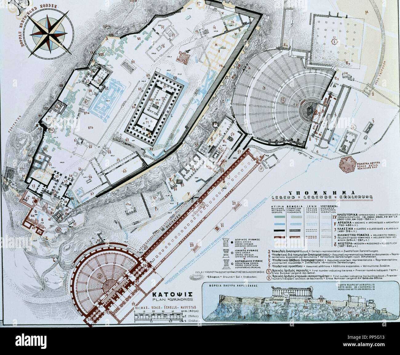 PLANO DE LA RECONSTRUCCION DE LA ACROPOLIS DE ATENAS- PLANTAS DE SUS EDIFICIOS. Stock Photohttps://www.alamy.com/image-license-details/?v=1https://www.alamy.com/plano-de-la-reconstruccion-de-la-acropolis-de-atenas-plantas-de-sus-edificios-image220169183.html
RMPP5G13–PLANO DE LA RECONSTRUCCION DE LA ACROPOLIS DE ATENAS- PLANTAS DE SUS EDIFICIOS.
 Department of La Libertad (Republic of Peru, Regions of Peru) map is designed cannabis leaf green and black, La Libertad map made of marijuana (marihu Stock Vectorhttps://www.alamy.com/image-license-details/?v=1https://www.alamy.com/department-of-la-libertad-republic-of-peru-regions-of-peru-map-is-designed-cannabis-leaf-green-and-black-la-libertad-map-made-of-marijuana-marihu-image333545927.html
RF2AAJ96F–Department of La Libertad (Republic of Peru, Regions of Peru) map is designed cannabis leaf green and black, La Libertad map made of marijuana (marihu
 USGS TOPO Map Louisiana LA Cotton Plant 20120328 TM Inverted Restoration Stock Photohttps://www.alamy.com/image-license-details/?v=1https://www.alamy.com/usgs-topo-map-louisiana-la-cotton-plant-20120328-tm-inverted-restoration-image260526476.html
RMW3T050–USGS TOPO Map Louisiana LA Cotton Plant 20120328 TM Inverted Restoration
![Image taken from page 42 of 'La Côte d'Azur. [An illustrated description of the Riviera.]' Image taken from page 42 of 'La Côte d'Azur [An Stock Photo Image taken from page 42 of 'La Côte d'Azur. [An illustrated description of the Riviera.]' Image taken from page 42 of 'La Côte d'Azur [An Stock Photo](https://c8.alamy.com/comp/HFN0M6/image-taken-from-page-42-of-la-cote-dazur-an-illustrated-description-HFN0M6.jpg) Image taken from page 42 of 'La Côte d'Azur. [An illustrated description of the Riviera.]' Image taken from page 42 of 'La Côte d'Azur [An Stock Photohttps://www.alamy.com/image-license-details/?v=1https://www.alamy.com/stock-photo-image-taken-from-page-42-of-la-cote-dazur-an-illustrated-description-130153974.html
Image taken from page 42 of 'La Côte d'Azur. [An illustrated description of the Riviera.]' Image taken from page 42 of 'La Côte d'Azur [An Stock Photohttps://www.alamy.com/image-license-details/?v=1https://www.alamy.com/stock-photo-image-taken-from-page-42-of-la-cote-dazur-an-illustrated-description-130153974.htmlRMHFN0M6–Image taken from page 42 of 'La Côte d'Azur. [An illustrated description of the Riviera.]' Image taken from page 42 of 'La Côte d'Azur [An
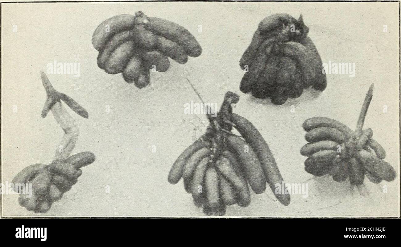 . Five important wild-duck foods . Fig. 14.—Small rootstocks of the banana water lily. (Natural size.) 18 BULLETIN 58, U. S. DEPARTMENT OF AGRICULTURE. is fully justified in doing on the basis of then possession in common ofcharacters unique among water lilies. The new records of the plantfrom Galveston, Tex., and Avery Island, La., go far toward bridging. Fig. 15.—Hibernating bodies of the banana water lily. (Two-thirds natural size.) the previous apparent gap in distribution of the plant and to cor-roborating Dr. Conards views. The accompanying map (fig. 16)shows the probable natural range o Stock Photohttps://www.alamy.com/image-license-details/?v=1https://www.alamy.com/five-important-wild-duck-foods-fig-14small-rootstocks-of-the-banana-water-lily-natural-size-18-bulletin-58-u-s-department-of-agriculture-is-fully-justified-in-doing-on-the-basis-of-then-possession-in-common-ofcharacters-unique-among-water-lilies-the-new-records-of-the-plantfrom-galveston-tex-and-avery-island-la-go-far-toward-bridging-fig-15hibernating-bodies-of-the-banana-water-lily-two-thirds-natural-size-the-previous-apparent-gap-in-distribution-of-the-plant-and-to-cor-roborating-dr-conards-views-the-accompanying-map-fig-16shows-the-probable-natural-range-o-image372329955.html
RM2CHN2JB–. Five important wild-duck foods . Fig. 14.—Small rootstocks of the banana water lily. (Natural size.) 18 BULLETIN 58, U. S. DEPARTMENT OF AGRICULTURE. is fully justified in doing on the basis of then possession in common ofcharacters unique among water lilies. The new records of the plantfrom Galveston, Tex., and Avery Island, La., go far toward bridging. Fig. 15.—Hibernating bodies of the banana water lily. (Two-thirds natural size.) the previous apparent gap in distribution of the plant and to cor-roborating Dr. Conards views. The accompanying map (fig. 16)shows the probable natural range o
 Haro, Spain - 28 Dec, 2024: The Bodegas Muga winery in Haro, La Rioja, Spain Stock Photohttps://www.alamy.com/image-license-details/?v=1https://www.alamy.com/haro-spain-28-dec-2024-the-bodegas-muga-winery-in-haro-la-rioja-spain-image637381657.html
RF2S0Y6PH–Haro, Spain - 28 Dec, 2024: The Bodegas Muga winery in Haro, La Rioja, Spain
 Part of the edge of a map of Suriname, J.G. de la Croix, 1737 print Two Surinamese men flank a weapon composed of the weapons of Amsterdam, the WIC and the Sommelsdijck family. Fragment of a richly decorated edge around a map of Suriname. paper etching / engraving sailing-ship, sailing-boat. armorial bearing, heraldry. coat of arms (as symbol of the state, etc.). African Americans. Native peoples of South America. slavery; serfs and the enslaved. ornament derived from plant forms. crustaceans: crab Suriname Stock Photohttps://www.alamy.com/image-license-details/?v=1https://www.alamy.com/part-of-the-edge-of-a-map-of-suriname-jg-de-la-croix-1737-print-two-surinamese-men-flank-a-weapon-composed-of-the-weapons-of-amsterdam-the-wic-and-the-sommelsdijck-family-fragment-of-a-richly-decorated-edge-around-a-map-of-suriname-paper-etching-engraving-sailing-ship-sailing-boat-armorial-bearing-heraldry-coat-of-arms-as-symbol-of-the-state-etc-african-americans-native-peoples-of-south-america-slavery-serfs-and-the-enslaved-ornament-derived-from-plant-forms-crustaceans-crab-suriname-image594293725.html
RM2WETBKW–Part of the edge of a map of Suriname, J.G. de la Croix, 1737 print Two Surinamese men flank a weapon composed of the weapons of Amsterdam, the WIC and the Sommelsdijck family. Fragment of a richly decorated edge around a map of Suriname. paper etching / engraving sailing-ship, sailing-boat. armorial bearing, heraldry. coat of arms (as symbol of the state, etc.). African Americans. Native peoples of South America. slavery; serfs and the enslaved. ornament derived from plant forms. crustaceans: crab Suriname
 La Plant, South Dakota, map 1985, 1:100000, United States of America by Timeless Maps, data U.S. Geological Survey Stock Photohttps://www.alamy.com/image-license-details/?v=1https://www.alamy.com/la-plant-south-dakota-map-1985-1100000-united-states-of-america-by-timeless-maps-data-us-geological-survey-image406959390.html
RM2EJ2GRX–La Plant, South Dakota, map 1985, 1:100000, United States of America by Timeless Maps, data U.S. Geological Survey
 LA HABANA-MURALLA-1675-STO DOMINGO-M Y P 70- URBANISMO HISPANOAMERICA. Location: ARCHIVO DE INDIAS, SEVILLA, SEVILLE, SPAIN. Stock Photohttps://www.alamy.com/image-license-details/?v=1https://www.alamy.com/la-habana-muralla-1675-sto-domingo-m-y-p-70-urbanismo-hispanoamerica-location-archivo-de-indias-sevilla-seville-spain-image209183631.html
RMP493RY–LA HABANA-MURALLA-1675-STO DOMINGO-M Y P 70- URBANISMO HISPANOAMERICA. Location: ARCHIVO DE INDIAS, SEVILLA, SEVILLE, SPAIN.
 La Rioja (Region of Argentina, Argentine Republic, Provinces of Argentina) map is designed cannabis leaf green and black, La Rioja Province map made o Stock Vectorhttps://www.alamy.com/image-license-details/?v=1https://www.alamy.com/la-rioja-region-of-argentina-argentine-republic-provinces-of-argentina-map-is-designed-cannabis-leaf-green-and-black-la-rioja-province-map-made-o-image262294538.html
RFW6MFA2–La Rioja (Region of Argentina, Argentine Republic, Provinces of Argentina) map is designed cannabis leaf green and black, La Rioja Province map made o
 USGS TOPO Map Louisiana LA Cotton Plant 331749 1989 24000 Restoration Stock Photohttps://www.alamy.com/image-license-details/?v=1https://www.alamy.com/usgs-topo-map-louisiana-la-cotton-plant-331749-1989-24000-restoration-image260526609.html
RMW3T09N–USGS TOPO Map Louisiana LA Cotton Plant 331749 1989 24000 Restoration
 Image taken from page 163 of 'Vers le Nil français avec la mission Marchand. 150 illustrations, etc' Image taken from page 163 of 'Vers le Nil français Stock Photohttps://www.alamy.com/image-license-details/?v=1https://www.alamy.com/stock-photo-image-taken-from-page-163-of-vers-le-nil-francais-avec-la-mission-130078868.html
RMHFHGWT–Image taken from page 163 of 'Vers le Nil français avec la mission Marchand. 150 illustrations, etc' Image taken from page 163 of 'Vers le Nil français
 . Cooperative economic insect report. Beneficial insects; Insect pests. Adult, Larva and Pupa of Epicaerus cognatus and damaged potatoes Major reference and figures (except map): Oficina Federal para la Defensa Agricola de Mexico. 1931. Principales Plagas y Enferroedades de los Cultivos en la Republica Mexiana. 378 pp., Tacubaya, D. F.. Please note that these images are extracted from scanned page images that may have been digitally enhanced for readability - coloration and appearance of these illustrations may not perfectly resemble the original work.. United States. Animal and Plant Health S Stock Photohttps://www.alamy.com/image-license-details/?v=1https://www.alamy.com/cooperative-economic-insect-report-beneficial-insects-insect-pests-adult-larva-and-pupa-of-epicaerus-cognatus-and-damaged-potatoes-major-reference-and-figures-except-map-oficina-federal-para-la-defensa-agricola-de-mexico-1931-principales-plagas-y-enferroedades-de-los-cultivos-en-la-republica-mexiana-378-pp-tacubaya-d-f-please-note-that-these-images-are-extracted-from-scanned-page-images-that-may-have-been-digitally-enhanced-for-readability-coloration-and-appearance-of-these-illustrations-may-not-perfectly-resemble-the-original-work-united-states-animal-and-plant-health-s-image232514416.html
RMRE7XE8–. Cooperative economic insect report. Beneficial insects; Insect pests. Adult, Larva and Pupa of Epicaerus cognatus and damaged potatoes Major reference and figures (except map): Oficina Federal para la Defensa Agricola de Mexico. 1931. Principales Plagas y Enferroedades de los Cultivos en la Republica Mexiana. 378 pp., Tacubaya, D. F.. Please note that these images are extracted from scanned page images that may have been digitally enhanced for readability - coloration and appearance of these illustrations may not perfectly resemble the original work.. United States. Animal and Plant Health S
 Haro, Spain - 28 Dec, 2024: The Bodegas Muga winery in Haro, La Rioja, Spain Stock Photohttps://www.alamy.com/image-license-details/?v=1https://www.alamy.com/haro-spain-28-dec-2024-the-bodegas-muga-winery-in-haro-la-rioja-spain-image637381655.html
RF2S0Y6PF–Haro, Spain - 28 Dec, 2024: The Bodegas Muga winery in Haro, La Rioja, Spain
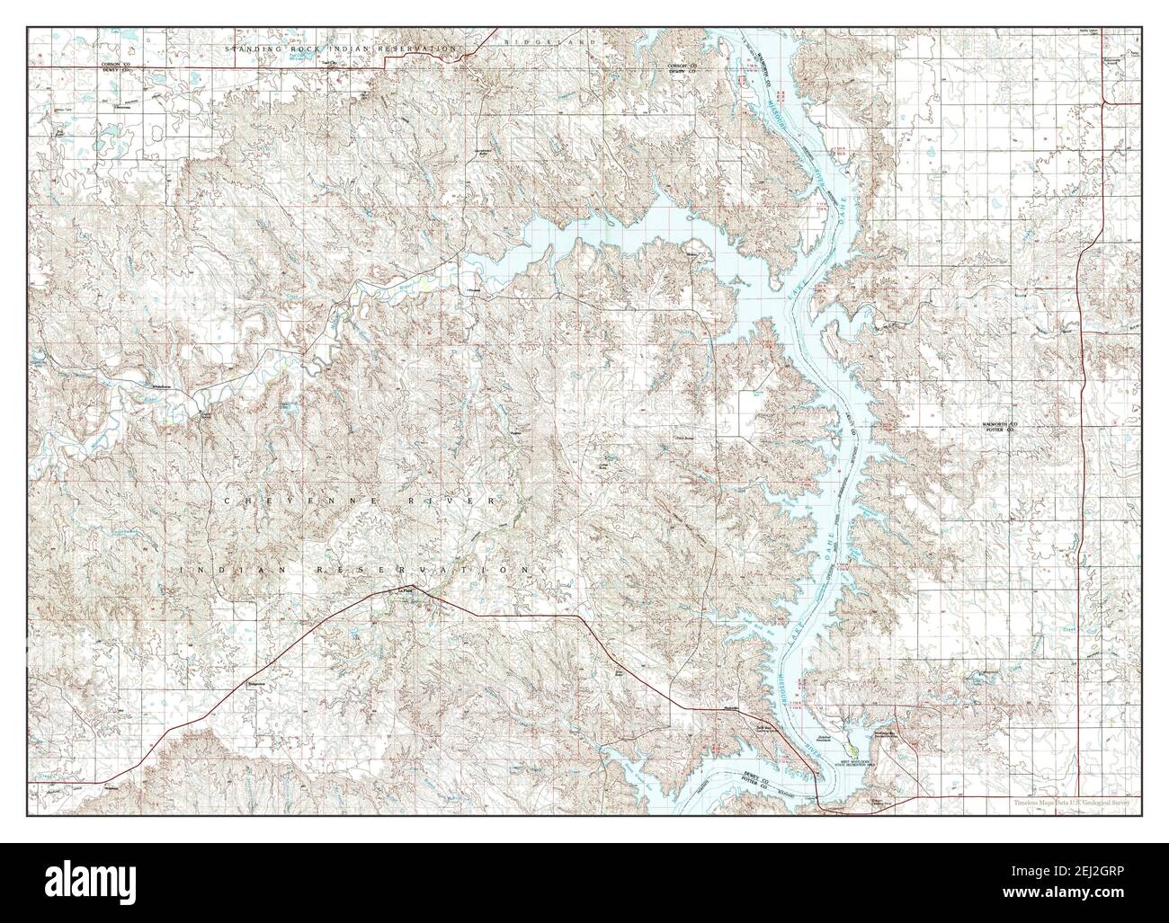 La Plant, South Dakota, map 1985, 1:100000, United States of America by Timeless Maps, data U.S. Geological Survey Stock Photohttps://www.alamy.com/image-license-details/?v=1https://www.alamy.com/la-plant-south-dakota-map-1985-1100000-united-states-of-america-by-timeless-maps-data-us-geological-survey-image406959386.html
RM2EJ2GRP–La Plant, South Dakota, map 1985, 1:100000, United States of America by Timeless Maps, data U.S. Geological Survey
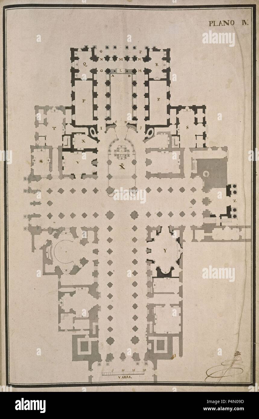 PLANO DE LA CATEDRAL-PRIMERA PAGINA - PLANTA DE CRUZ LATINA- SIGLO XVIII-. Author: Lucas Antonio Ferro Caaveyro (1699-1770). Location: CATEDRAL-BIBLIOTECA, SANTIAGO DE COMPOSTELA, CORUÑA, SPAIN. Stock Photohttps://www.alamy.com/image-license-details/?v=1https://www.alamy.com/plano-de-la-catedral-primera-pagina-planta-de-cruz-latina-siglo-xviii-author-lucas-antonio-ferro-caaveyro-1699-1770-location-catedral-biblioteca-santiago-de-compostela-corua-spain-image209444297.html
RMP4N09D–PLANO DE LA CATEDRAL-PRIMERA PAGINA - PLANTA DE CRUZ LATINA- SIGLO XVIII-. Author: Lucas Antonio Ferro Caaveyro (1699-1770). Location: CATEDRAL-BIBLIOTECA, SANTIAGO DE COMPOSTELA, CORUÑA, SPAIN.
 Son La Province (Socialist Republic of Vietnam, Subdivisions of Vietnam) map is designed cannabis leaf green and black, scribble sketch Tinh Son La ma Stock Vectorhttps://www.alamy.com/image-license-details/?v=1https://www.alamy.com/son-la-province-socialist-republic-of-vietnam-subdivisions-of-vietnam-map-is-designed-cannabis-leaf-green-and-black-scribble-sketch-tinh-son-la-ma-image331638215.html
RF2A7FBWY–Son La Province (Socialist Republic of Vietnam, Subdivisions of Vietnam) map is designed cannabis leaf green and black, scribble sketch Tinh Son La ma
 USGS TOPO Map South Dakota SD La Plant 20120626 TM Restoration Stock Photohttps://www.alamy.com/image-license-details/?v=1https://www.alamy.com/usgs-topo-map-south-dakota-sd-la-plant-20120626-tm-restoration-image335028811.html
RM2AD1TJK–USGS TOPO Map South Dakota SD La Plant 20120626 TM Restoration
 Image taken from page 48 of 'Vers le Nil français avec la mission Marchand. 150 illustrations, etc' Image taken from page 48 of 'Vers le Nil français Stock Photohttps://www.alamy.com/image-license-details/?v=1https://www.alamy.com/stock-photo-image-taken-from-page-48-of-vers-le-nil-francais-avec-la-mission-marchand-130161141.html
RMHFN9T5–Image taken from page 48 of 'Vers le Nil français avec la mission Marchand. 150 illustrations, etc' Image taken from page 48 of 'Vers le Nil français
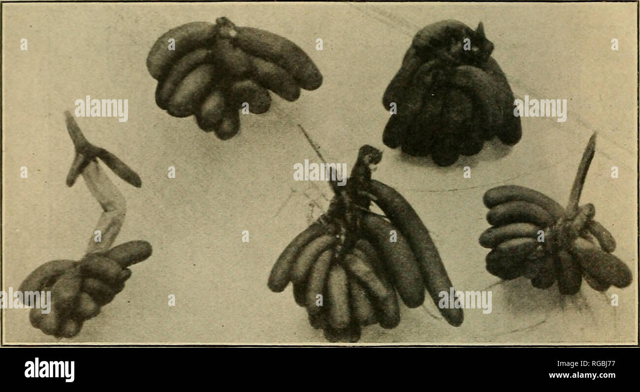 . Bulletin of the U.S. Department of Agriculture. Agriculture; Agriculture. 18 BULLETIN 58, U. S. DEPARTMEXT OF AGRICULTURE. is fully justified in doing on the basis of their possession in common of characters unique among water lilies. The new records of the plant from Galveston, Tex., and Avery Island, La., go far toward bridging. Fig. 15.—Hibernating bodies of the banana water lily. (Two-thirds natural size.) the previous apparent gap in distribution of the plant and to cor- roborating Dr. Conard's views. The accompanying map (fig. 16) shows the probable natural range of the species.. Pleas Stock Photohttps://www.alamy.com/image-license-details/?v=1https://www.alamy.com/bulletin-of-the-us-department-of-agriculture-agriculture-agriculture-18-bulletin-58-u-s-departmext-of-agriculture-is-fully-justified-in-doing-on-the-basis-of-their-possession-in-common-of-characters-unique-among-water-lilies-the-new-records-of-the-plant-from-galveston-tex-and-avery-island-la-go-far-toward-bridging-fig-15hibernating-bodies-of-the-banana-water-lily-two-thirds-natural-size-the-previous-apparent-gap-in-distribution-of-the-plant-and-to-cor-roborating-dr-conards-views-the-accompanying-map-fig-16-shows-the-probable-natural-range-of-the-species-pleas-image233825067.html
RMRGBJ77–. Bulletin of the U.S. Department of Agriculture. Agriculture; Agriculture. 18 BULLETIN 58, U. S. DEPARTMEXT OF AGRICULTURE. is fully justified in doing on the basis of their possession in common of characters unique among water lilies. The new records of the plant from Galveston, Tex., and Avery Island, La., go far toward bridging. Fig. 15.—Hibernating bodies of the banana water lily. (Two-thirds natural size.) the previous apparent gap in distribution of the plant and to cor- roborating Dr. Conard's views. The accompanying map (fig. 16) shows the probable natural range of the species.. Pleas
 Haro, Spain - 28 Dec, 2024: The Bodegas Muga winery in Haro, La Rioja, Spain Stock Photohttps://www.alamy.com/image-license-details/?v=1https://www.alamy.com/haro-spain-28-dec-2024-the-bodegas-muga-winery-in-haro-la-rioja-spain-image637381710.html
RF2S0Y6TE–Haro, Spain - 28 Dec, 2024: The Bodegas Muga winery in Haro, La Rioja, Spain
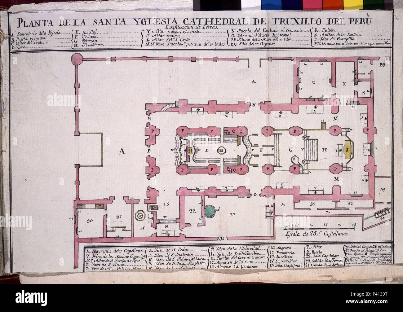 CODICE TRUJILLO DEL PERU - PLANTA DE LA CATEDRAL DE TRUJILLO DEL PERU - ACUARELA - SIGLO XVIII. Author: Baltasar Jaime Martínez Compañón (1737-1797). Location: PALACIO REAL-BIBLIOTECA, MADRID, SPAIN. Stock Photohttps://www.alamy.com/image-license-details/?v=1https://www.alamy.com/codice-trujillo-del-peru-planta-de-la-catedral-de-trujillo-del-peru-acuarela-siglo-xviii-author-baltasar-jaime-martnez-compan-1737-1797-location-palacio-real-biblioteca-madrid-spain-image209007620.html
RMP4139T–CODICE TRUJILLO DEL PERU - PLANTA DE LA CATEDRAL DE TRUJILLO DEL PERU - ACUARELA - SIGLO XVIII. Author: Baltasar Jaime Martínez Compañón (1737-1797). Location: PALACIO REAL-BIBLIOTECA, MADRID, SPAIN.
 La Pampa (Region of Argentina, Argentine Republic, Provinces of Argentina) map is designed cannabis leaf green and black, La Pampa Province map made o Stock Vectorhttps://www.alamy.com/image-license-details/?v=1https://www.alamy.com/la-pampa-region-of-argentina-argentine-republic-provinces-of-argentina-map-is-designed-cannabis-leaf-green-and-black-la-pampa-province-map-made-o-image262214429.html
RFW6GW51–La Pampa (Region of Argentina, Argentine Republic, Provinces of Argentina) map is designed cannabis leaf green and black, La Pampa Province map made o
 USGS TOPO Map Louisiana LA Cotton Plant 331749 1989 24000 Inverted Restoration Stock Photohttps://www.alamy.com/image-license-details/?v=1https://www.alamy.com/usgs-topo-map-louisiana-la-cotton-plant-331749-1989-24000-inverted-restoration-image260526535.html
RMW3T073–USGS TOPO Map Louisiana LA Cotton Plant 331749 1989 24000 Inverted Restoration
![Image taken from page 461 of 'La Terra, trattato popolare di geografia universale per G. Marinelli ed altri scienziati italiani, etc. [With illustrations and maps.]' Image taken from page 461 of 'La Terra, trattato popolare Stock Photo Image taken from page 461 of 'La Terra, trattato popolare di geografia universale per G. Marinelli ed altri scienziati italiani, etc. [With illustrations and maps.]' Image taken from page 461 of 'La Terra, trattato popolare Stock Photo](https://c8.alamy.com/comp/HFN79J/image-taken-from-page-461-of-la-terra-trattato-popolare-di-geografia-HFN79J.jpg) Image taken from page 461 of 'La Terra, trattato popolare di geografia universale per G. Marinelli ed altri scienziati italiani, etc. [With illustrations and maps.]' Image taken from page 461 of 'La Terra, trattato popolare Stock Photohttps://www.alamy.com/image-license-details/?v=1https://www.alamy.com/stock-photo-image-taken-from-page-461-of-la-terra-trattato-popolare-di-geografia-130159166.html
Image taken from page 461 of 'La Terra, trattato popolare di geografia universale per G. Marinelli ed altri scienziati italiani, etc. [With illustrations and maps.]' Image taken from page 461 of 'La Terra, trattato popolare Stock Photohttps://www.alamy.com/image-license-details/?v=1https://www.alamy.com/stock-photo-image-taken-from-page-461-of-la-terra-trattato-popolare-di-geografia-130159166.htmlRMHFN79J–Image taken from page 461 of 'La Terra, trattato popolare di geografia universale per G. Marinelli ed altri scienziati italiani, etc. [With illustrations and maps.]' Image taken from page 461 of 'La Terra, trattato popolare
 . Cooperative economic insect report. Beneficial insects; Insect pests. Adult Genitalia Empoasca lybica Figures (except map): Adult and damage to grape from Ruiz Castro, A. 1950. Bol. de Patol. Vegetal y Ent. Agr. 17:111-162. Genitalia and damage to leaf from Ruiz Castro, A. 1944. Fauna Ent. de la Vid en Espana. II. (Hemiptera). 189 pp. Madrid.. Please note that these images are extracted from scanned page images that may have been digitally enhanced for readability - coloration and appearance of these illustrations may not perfectly resemble the original work.. United States. Animal and Plant Stock Photohttps://www.alamy.com/image-license-details/?v=1https://www.alamy.com/cooperative-economic-insect-report-beneficial-insects-insect-pests-adult-genitalia-empoasca-lybica-figures-except-map-adult-and-damage-to-grape-from-ruiz-castro-a-1950-bol-de-patol-vegetal-y-ent-agr-17111-162-genitalia-and-damage-to-leaf-from-ruiz-castro-a-1944-fauna-ent-de-la-vid-en-espana-ii-hemiptera-189-pp-madrid-please-note-that-these-images-are-extracted-from-scanned-page-images-that-may-have-been-digitally-enhanced-for-readability-coloration-and-appearance-of-these-illustrations-may-not-perfectly-resemble-the-original-work-united-states-animal-and-plant-image232526057.html
RMRE8DA1–. Cooperative economic insect report. Beneficial insects; Insect pests. Adult Genitalia Empoasca lybica Figures (except map): Adult and damage to grape from Ruiz Castro, A. 1950. Bol. de Patol. Vegetal y Ent. Agr. 17:111-162. Genitalia and damage to leaf from Ruiz Castro, A. 1944. Fauna Ent. de la Vid en Espana. II. (Hemiptera). 189 pp. Madrid.. Please note that these images are extracted from scanned page images that may have been digitally enhanced for readability - coloration and appearance of these illustrations may not perfectly resemble the original work.. United States. Animal and Plant
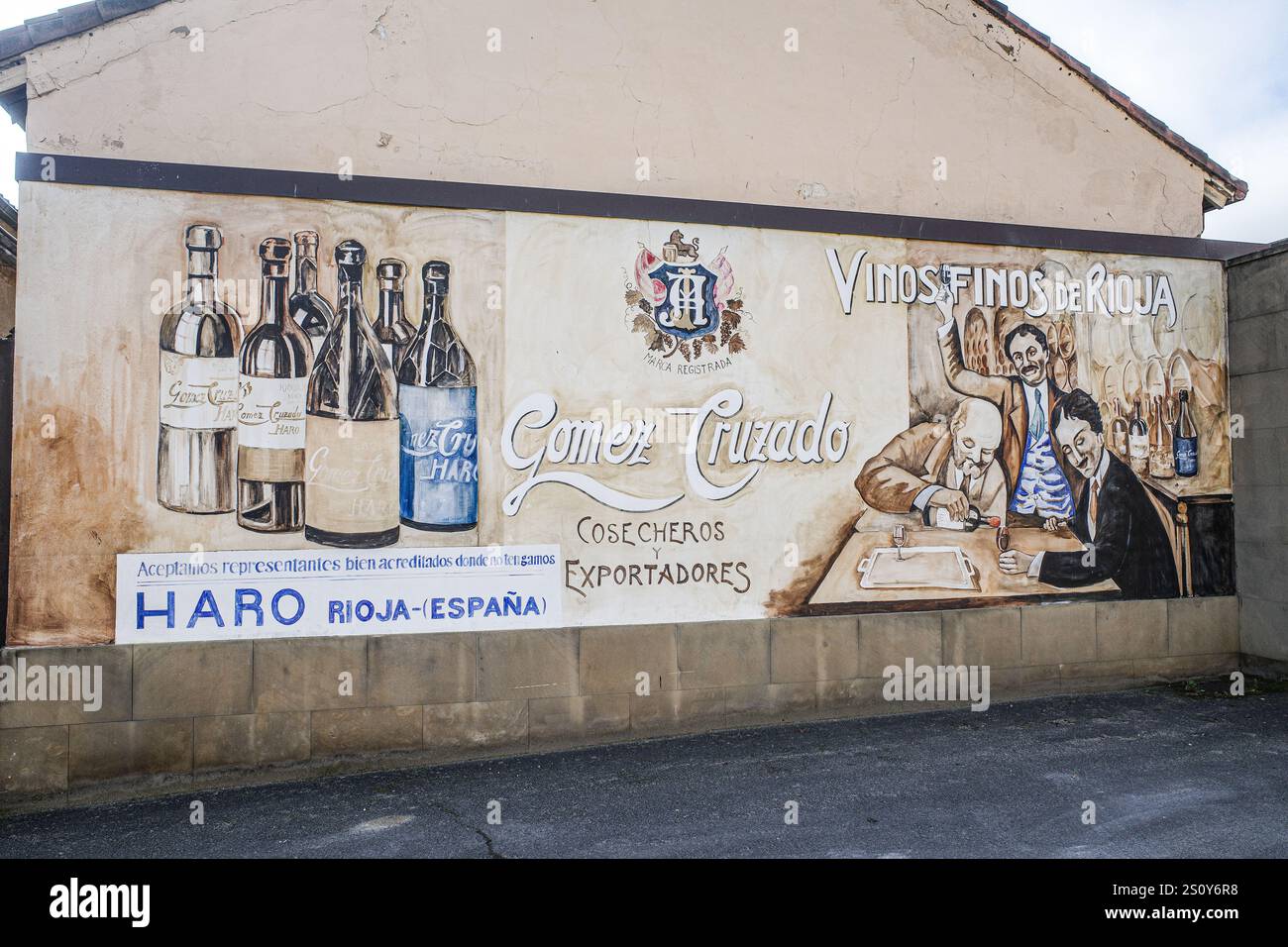 Haro, Spain - 28 Dec, 2024: Murals outside a historic winery in La Rioja, Spain Stock Photohttps://www.alamy.com/image-license-details/?v=1https://www.alamy.com/haro-spain-28-dec-2024-murals-outside-a-historic-winery-in-la-rioja-spain-image637381676.html
RF2S0Y6R8–Haro, Spain - 28 Dec, 2024: Murals outside a historic winery in La Rioja, Spain
 Pays de la Loire (France, administrative region, Loire Country) map is designed cannabis leaf green and black, Pays de la Loire map made of marijuana Stock Vectorhttps://www.alamy.com/image-license-details/?v=1https://www.alamy.com/pays-de-la-loire-france-administrative-region-loire-country-map-is-designed-cannabis-leaf-green-and-black-pays-de-la-loire-map-made-of-marijuana-image248300282.html
RFTBY1F6–Pays de la Loire (France, administrative region, Loire Country) map is designed cannabis leaf green and black, Pays de la Loire map made of marijuana
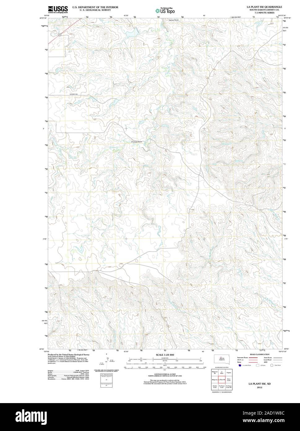 USGS TOPO Map South Dakota SD La Plant SW 20120614 TM Restoration Stock Photohttps://www.alamy.com/image-license-details/?v=1https://www.alamy.com/usgs-topo-map-south-dakota-sd-la-plant-sw-20120614-tm-restoration-image335029308.html
RM2AD1W8C–USGS TOPO Map South Dakota SD La Plant SW 20120614 TM Restoration
![Image taken from page 124 of 'La Terra, trattato popolare di geografia universale per G. Marinelli ed altri scienziati italiani, etc. [With illustrations and maps.]' Image taken from page 124 of 'La Terra, trattato popolare Stock Photo Image taken from page 124 of 'La Terra, trattato popolare di geografia universale per G. Marinelli ed altri scienziati italiani, etc. [With illustrations and maps.]' Image taken from page 124 of 'La Terra, trattato popolare Stock Photo](https://c8.alamy.com/comp/HFKE45/image-taken-from-page-124-of-la-terra-trattato-popolare-di-geografia-HFKE45.jpg) Image taken from page 124 of 'La Terra, trattato popolare di geografia universale per G. Marinelli ed altri scienziati italiani, etc. [With illustrations and maps.]' Image taken from page 124 of 'La Terra, trattato popolare Stock Photohttps://www.alamy.com/image-license-details/?v=1https://www.alamy.com/stock-photo-image-taken-from-page-124-of-la-terra-trattato-popolare-di-geografia-130120597.html
Image taken from page 124 of 'La Terra, trattato popolare di geografia universale per G. Marinelli ed altri scienziati italiani, etc. [With illustrations and maps.]' Image taken from page 124 of 'La Terra, trattato popolare Stock Photohttps://www.alamy.com/image-license-details/?v=1https://www.alamy.com/stock-photo-image-taken-from-page-124-of-la-terra-trattato-popolare-di-geografia-130120597.htmlRMHFKE45–Image taken from page 124 of 'La Terra, trattato popolare di geografia universale per G. Marinelli ed altri scienziati italiani, etc. [With illustrations and maps.]' Image taken from page 124 of 'La Terra, trattato popolare
![. Bulletin de l'Acadmie internationale de gographie botanique. Phytogeography; Plant ecology; Plants; Plants -- Europe. /, èfê: LA.T0URt4G.TTE. y / A/ iA Aqstb, ^.se.RTni-uE. VAL o's eRG Cûù^O'lSeRANj I • Sowie/a.l. 1 SKETCH MAP, 7?^ S Wm^ Norlkrn Itineranj oX- )Cj07. ( H.S.T dctuvi.]. Please note that these images are extracted from scanned page images that may have been digitally enhanced for readability - coloration and appearance of these illustrations may not perfectly resemble the original work.. Acadmie internationale de gographie botanique. Le Mans : Impr. Edmond Monnoyer Stock Photo . Bulletin de l'Acadmie internationale de gographie botanique. Phytogeography; Plant ecology; Plants; Plants -- Europe. /, èfê: LA.T0URt4G.TTE. y / A/ iA Aqstb, ^.se.RTni-uE. VAL o's eRG Cûù^O'lSeRANj I • Sowie/a.l. 1 SKETCH MAP, 7?^ S Wm^ Norlkrn Itineranj oX- )Cj07. ( H.S.T dctuvi.]. Please note that these images are extracted from scanned page images that may have been digitally enhanced for readability - coloration and appearance of these illustrations may not perfectly resemble the original work.. Acadmie internationale de gographie botanique. Le Mans : Impr. Edmond Monnoyer Stock Photo](https://c8.alamy.com/comp/RGTAB7/bulletin-de-lacadmie-internationale-de-gographie-botanique-phytogeography-plant-ecology-plants-plants-europe-f-lat0urt4gtte-y-a-ia-aqstb-sertni-ue-val-os-erg-colseranj-i-sowieal-1-sketch-map-7-s-wm-norlkrn-itineranj-ox-cj07-hst-dctuvi-please-note-that-these-images-are-extracted-from-scanned-page-images-that-may-have-been-digitally-enhanced-for-readability-coloration-and-appearance-of-these-illustrations-may-not-perfectly-resemble-the-original-work-acadmie-internationale-de-gographie-botanique-le-mans-impr-edmond-monnoyer-RGTAB7.jpg) . Bulletin de l'Acadmie internationale de gographie botanique. Phytogeography; Plant ecology; Plants; Plants -- Europe. /, èfê: LA.T0URt4G.TTE. y / A/ iA Aqstb, ^.se.RTni-uE. VAL o's eRG Cûù^O'lSeRANj I • Sowie/a.l. 1 SKETCH MAP, 7?^ S Wm^ Norlkrn Itineranj oX- )Cj07. ( H.S.T dctuvi.]. Please note that these images are extracted from scanned page images that may have been digitally enhanced for readability - coloration and appearance of these illustrations may not perfectly resemble the original work.. Acadmie internationale de gographie botanique. Le Mans : Impr. Edmond Monnoyer Stock Photohttps://www.alamy.com/image-license-details/?v=1https://www.alamy.com/bulletin-de-lacadmie-internationale-de-gographie-botanique-phytogeography-plant-ecology-plants-plants-europe-f-lat0urt4gtte-y-a-ia-aqstb-sertni-ue-val-os-erg-colseranj-i-sowieal-1-sketch-map-7-s-wm-norlkrn-itineranj-ox-cj07-hst-dctuvi-please-note-that-these-images-are-extracted-from-scanned-page-images-that-may-have-been-digitally-enhanced-for-readability-coloration-and-appearance-of-these-illustrations-may-not-perfectly-resemble-the-original-work-acadmie-internationale-de-gographie-botanique-le-mans-impr-edmond-monnoyer-image234104283.html
. Bulletin de l'Acadmie internationale de gographie botanique. Phytogeography; Plant ecology; Plants; Plants -- Europe. /, èfê: LA.T0URt4G.TTE. y / A/ iA Aqstb, ^.se.RTni-uE. VAL o's eRG Cûù^O'lSeRANj I • Sowie/a.l. 1 SKETCH MAP, 7?^ S Wm^ Norlkrn Itineranj oX- )Cj07. ( H.S.T dctuvi.]. Please note that these images are extracted from scanned page images that may have been digitally enhanced for readability - coloration and appearance of these illustrations may not perfectly resemble the original work.. Acadmie internationale de gographie botanique. Le Mans : Impr. Edmond Monnoyer Stock Photohttps://www.alamy.com/image-license-details/?v=1https://www.alamy.com/bulletin-de-lacadmie-internationale-de-gographie-botanique-phytogeography-plant-ecology-plants-plants-europe-f-lat0urt4gtte-y-a-ia-aqstb-sertni-ue-val-os-erg-colseranj-i-sowieal-1-sketch-map-7-s-wm-norlkrn-itineranj-ox-cj07-hst-dctuvi-please-note-that-these-images-are-extracted-from-scanned-page-images-that-may-have-been-digitally-enhanced-for-readability-coloration-and-appearance-of-these-illustrations-may-not-perfectly-resemble-the-original-work-acadmie-internationale-de-gographie-botanique-le-mans-impr-edmond-monnoyer-image234104283.htmlRMRGTAB7–. Bulletin de l'Acadmie internationale de gographie botanique. Phytogeography; Plant ecology; Plants; Plants -- Europe. /, èfê: LA.T0URt4G.TTE. y / A/ iA Aqstb, ^.se.RTni-uE. VAL o's eRG Cûù^O'lSeRANj I • Sowie/a.l. 1 SKETCH MAP, 7?^ S Wm^ Norlkrn Itineranj oX- )Cj07. ( H.S.T dctuvi.]. Please note that these images are extracted from scanned page images that may have been digitally enhanced for readability - coloration and appearance of these illustrations may not perfectly resemble the original work.. Acadmie internationale de gographie botanique. Le Mans : Impr. Edmond Monnoyer
 Haro, Spain - 28 Dec, 2024: Murals outside a historic winery in La Rioja, Spain Stock Photohttps://www.alamy.com/image-license-details/?v=1https://www.alamy.com/haro-spain-28-dec-2024-murals-outside-a-historic-winery-in-la-rioja-spain-image637381673.html
RF2S0Y6R5–Haro, Spain - 28 Dec, 2024: Murals outside a historic winery in La Rioja, Spain
 Reunion - map is designed cannabis leaf green and black, La Reunion map made of marijuana (marihuana,THC) foliage, Stock Vectorhttps://www.alamy.com/image-license-details/?v=1https://www.alamy.com/reunion-map-is-designed-cannabis-leaf-green-and-black-la-reunion-map-made-of-marijuana-marihuanathc-foliage-image244406151.html
RFT5HJF3–Reunion - map is designed cannabis leaf green and black, La Reunion map made of marijuana (marihuana,THC) foliage,
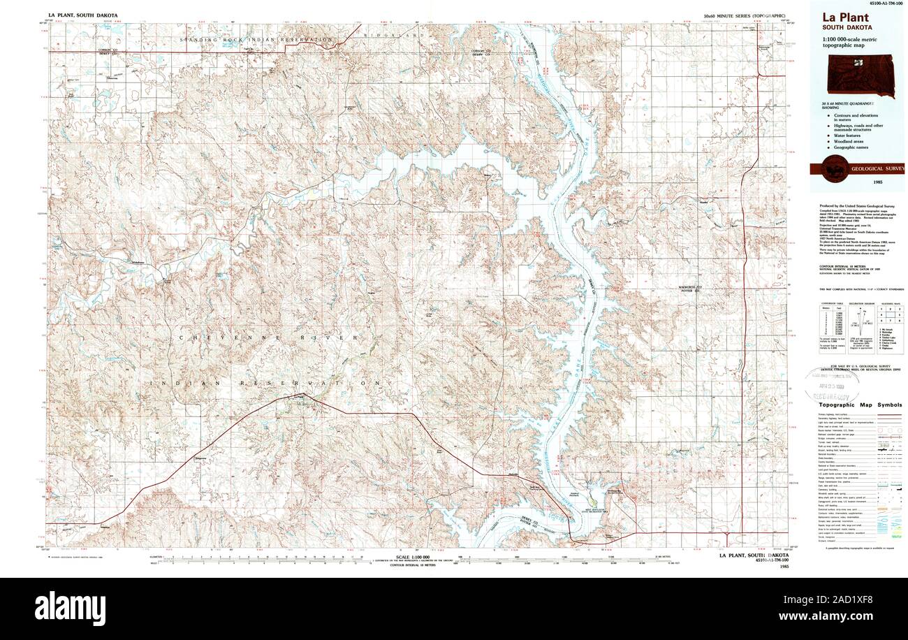 USGS TOPO Map South Dakota SD La Plant 344688 1985 100000 Restoration Stock Photohttps://www.alamy.com/image-license-details/?v=1https://www.alamy.com/usgs-topo-map-south-dakota-sd-la-plant-344688-1985-100000-restoration-image335030284.html
RM2AD1XF8–USGS TOPO Map South Dakota SD La Plant 344688 1985 100000 Restoration
![Image taken from page 139 of 'La Terra, trattato popolare di geografia universale per G. Marinelli ed altri scienziati italiani, etc. [With illustrations and maps.]' Image taken from page 139 of 'La Terra, trattato popolare Stock Photo Image taken from page 139 of 'La Terra, trattato popolare di geografia universale per G. Marinelli ed altri scienziati italiani, etc. [With illustrations and maps.]' Image taken from page 139 of 'La Terra, trattato popolare Stock Photo](https://c8.alamy.com/comp/HFFTPY/image-taken-from-page-139-of-la-terra-trattato-popolare-di-geografia-HFFTPY.jpg) Image taken from page 139 of 'La Terra, trattato popolare di geografia universale per G. Marinelli ed altri scienziati italiani, etc. [With illustrations and maps.]' Image taken from page 139 of 'La Terra, trattato popolare Stock Photohttps://www.alamy.com/image-license-details/?v=1https://www.alamy.com/stock-photo-image-taken-from-page-139-of-la-terra-trattato-popolare-di-geografia-130041155.html
Image taken from page 139 of 'La Terra, trattato popolare di geografia universale per G. Marinelli ed altri scienziati italiani, etc. [With illustrations and maps.]' Image taken from page 139 of 'La Terra, trattato popolare Stock Photohttps://www.alamy.com/image-license-details/?v=1https://www.alamy.com/stock-photo-image-taken-from-page-139-of-la-terra-trattato-popolare-di-geografia-130041155.htmlRMHFFTPY–Image taken from page 139 of 'La Terra, trattato popolare di geografia universale per G. Marinelli ed altri scienziati italiani, etc. [With illustrations and maps.]' Image taken from page 139 of 'La Terra, trattato popolare
![. [Bulletins on forest pathology : from Bulletin U.S.D.A., Washington, D.C., 1913-1925]. Trees; Plant diseases. 22 BULLETIN 658, U. S. DEPARTMENT OF AGRICULTURE. The maps will be found valuable not only as an interpretation of the data taken in intensive disease surveys in connection with timber surveys but in the appraisal, marking, and general administration of the sale area. With regard to appraisal the map will indicate the location of seriously infected areas and also the rot percentages. With respect to marking, the map will show the exact area of the. If 3 lA 1 It f' f mm* â :>£â , Stock Photo . [Bulletins on forest pathology : from Bulletin U.S.D.A., Washington, D.C., 1913-1925]. Trees; Plant diseases. 22 BULLETIN 658, U. S. DEPARTMENT OF AGRICULTURE. The maps will be found valuable not only as an interpretation of the data taken in intensive disease surveys in connection with timber surveys but in the appraisal, marking, and general administration of the sale area. With regard to appraisal the map will indicate the location of seriously infected areas and also the rot percentages. With respect to marking, the map will show the exact area of the. If 3 lA 1 It f' f mm* â :>£â , Stock Photo](https://c8.alamy.com/comp/RG8W7P/bulletins-on-forest-pathology-from-bulletin-usda-washington-dc-1913-1925-trees-plant-diseases-22-bulletin-658-u-s-department-of-agriculture-the-maps-will-be-found-valuable-not-only-as-an-interpretation-of-the-data-taken-in-intensive-disease-surveys-in-connection-with-timber-surveys-but-in-the-appraisal-marking-and-general-administration-of-the-sale-area-with-regard-to-appraisal-the-map-will-indicate-the-location-of-seriously-infected-areas-and-also-the-rot-percentages-with-respect-to-marking-the-map-will-show-the-exact-area-of-the-if-3-la-1-it-f-f-mm-gt-RG8W7P.jpg) . [Bulletins on forest pathology : from Bulletin U.S.D.A., Washington, D.C., 1913-1925]. Trees; Plant diseases. 22 BULLETIN 658, U. S. DEPARTMENT OF AGRICULTURE. The maps will be found valuable not only as an interpretation of the data taken in intensive disease surveys in connection with timber surveys but in the appraisal, marking, and general administration of the sale area. With regard to appraisal the map will indicate the location of seriously infected areas and also the rot percentages. With respect to marking, the map will show the exact area of the. If 3 lA 1 It f' f mm* â :>£â , Stock Photohttps://www.alamy.com/image-license-details/?v=1https://www.alamy.com/bulletins-on-forest-pathology-from-bulletin-usda-washington-dc-1913-1925-trees-plant-diseases-22-bulletin-658-u-s-department-of-agriculture-the-maps-will-be-found-valuable-not-only-as-an-interpretation-of-the-data-taken-in-intensive-disease-surveys-in-connection-with-timber-surveys-but-in-the-appraisal-marking-and-general-administration-of-the-sale-area-with-regard-to-appraisal-the-map-will-indicate-the-location-of-seriously-infected-areas-and-also-the-rot-percentages-with-respect-to-marking-the-map-will-show-the-exact-area-of-the-if-3-la-1-it-f-f-mm-gt-image233764714.html
. [Bulletins on forest pathology : from Bulletin U.S.D.A., Washington, D.C., 1913-1925]. Trees; Plant diseases. 22 BULLETIN 658, U. S. DEPARTMENT OF AGRICULTURE. The maps will be found valuable not only as an interpretation of the data taken in intensive disease surveys in connection with timber surveys but in the appraisal, marking, and general administration of the sale area. With regard to appraisal the map will indicate the location of seriously infected areas and also the rot percentages. With respect to marking, the map will show the exact area of the. If 3 lA 1 It f' f mm* â :>£â , Stock Photohttps://www.alamy.com/image-license-details/?v=1https://www.alamy.com/bulletins-on-forest-pathology-from-bulletin-usda-washington-dc-1913-1925-trees-plant-diseases-22-bulletin-658-u-s-department-of-agriculture-the-maps-will-be-found-valuable-not-only-as-an-interpretation-of-the-data-taken-in-intensive-disease-surveys-in-connection-with-timber-surveys-but-in-the-appraisal-marking-and-general-administration-of-the-sale-area-with-regard-to-appraisal-the-map-will-indicate-the-location-of-seriously-infected-areas-and-also-the-rot-percentages-with-respect-to-marking-the-map-will-show-the-exact-area-of-the-if-3-la-1-it-f-f-mm-gt-image233764714.htmlRMRG8W7P–. [Bulletins on forest pathology : from Bulletin U.S.D.A., Washington, D.C., 1913-1925]. Trees; Plant diseases. 22 BULLETIN 658, U. S. DEPARTMENT OF AGRICULTURE. The maps will be found valuable not only as an interpretation of the data taken in intensive disease surveys in connection with timber surveys but in the appraisal, marking, and general administration of the sale area. With regard to appraisal the map will indicate the location of seriously infected areas and also the rot percentages. With respect to marking, the map will show the exact area of the. If 3 lA 1 It f' f mm* â :>£â ,
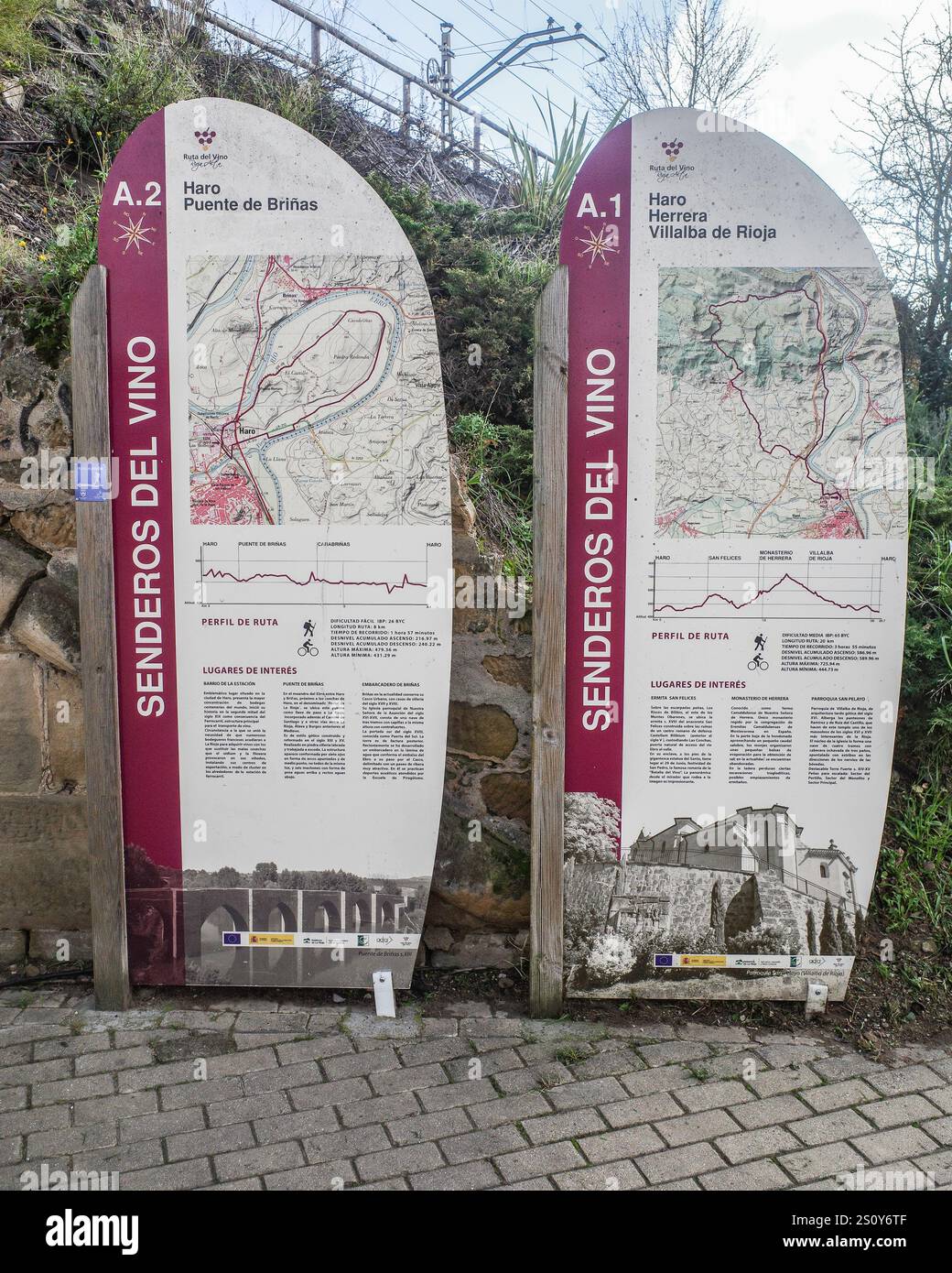 Haro, Spain - 28 Dec, 2024: Maps of walking trails through the La Rioja wine region, Haro, Spain Stock Photohttps://www.alamy.com/image-license-details/?v=1https://www.alamy.com/haro-spain-28-dec-2024-maps-of-walking-trails-through-the-la-rioja-wine-region-haro-spain-image637381711.html
RF2S0Y6TF–Haro, Spain - 28 Dec, 2024: Maps of walking trails through the La Rioja wine region, Haro, Spain
 Tucuman (Region, Argentine Republic, Provinces) map is designed cannabis leaf green and black, Tucumán Province (El Jardin de la Republica) map made o Stock Vectorhttps://www.alamy.com/image-license-details/?v=1https://www.alamy.com/tucuman-region-argentine-republic-provinces-map-is-designed-cannabis-leaf-green-and-black-tucumn-province-el-jardin-de-la-republica-map-made-o-image262222293.html
RFW6H75W–Tucuman (Region, Argentine Republic, Provinces) map is designed cannabis leaf green and black, Tucumán Province (El Jardin de la Republica) map made o
 USGS TOPO Map South Dakota SD La Plant 344687 1985 100000 Restoration Stock Photohttps://www.alamy.com/image-license-details/?v=1https://www.alamy.com/usgs-topo-map-south-dakota-sd-la-plant-344687-1985-100000-restoration-image335029309.html
RM2AD1W8D–USGS TOPO Map South Dakota SD La Plant 344687 1985 100000 Restoration
![Image taken from page 132 of 'La Terra, trattato popolare di geografia universale per G. Marinelli ed altri scienziati italiani, etc. [With illustrations and maps.]' Image taken from page 132 of 'La Terra, trattato popolare Stock Photo Image taken from page 132 of 'La Terra, trattato popolare di geografia universale per G. Marinelli ed altri scienziati italiani, etc. [With illustrations and maps.]' Image taken from page 132 of 'La Terra, trattato popolare Stock Photo](https://c8.alamy.com/comp/HFFP1F/image-taken-from-page-132-of-la-terra-trattato-popolare-di-geografia-HFFP1F.jpg) Image taken from page 132 of 'La Terra, trattato popolare di geografia universale per G. Marinelli ed altri scienziati italiani, etc. [With illustrations and maps.]' Image taken from page 132 of 'La Terra, trattato popolare Stock Photohttps://www.alamy.com/image-license-details/?v=1https://www.alamy.com/stock-photo-image-taken-from-page-132-of-la-terra-trattato-popolare-di-geografia-130038987.html
Image taken from page 132 of 'La Terra, trattato popolare di geografia universale per G. Marinelli ed altri scienziati italiani, etc. [With illustrations and maps.]' Image taken from page 132 of 'La Terra, trattato popolare Stock Photohttps://www.alamy.com/image-license-details/?v=1https://www.alamy.com/stock-photo-image-taken-from-page-132-of-la-terra-trattato-popolare-di-geografia-130038987.htmlRMHFFP1F–Image taken from page 132 of 'La Terra, trattato popolare di geografia universale per G. Marinelli ed altri scienziati italiani, etc. [With illustrations and maps.]' Image taken from page 132 of 'La Terra, trattato popolare
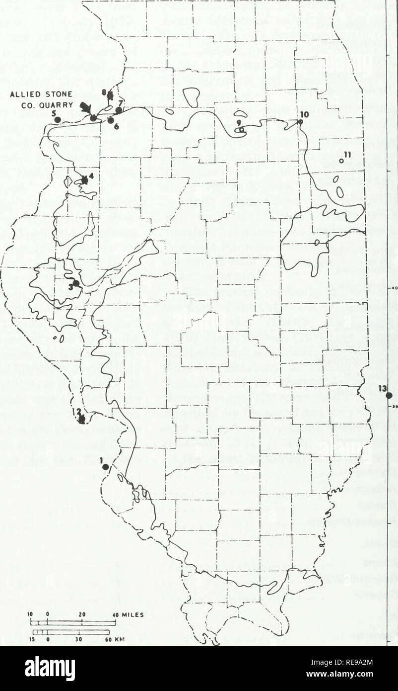 . Early Pennsylvanian paleotopography and depositional environments, Rock Island County, Illinois. Geology, Stratigraphic; Paleobotany; Paleobotany. 14 Guidebooklet: Illinois State Museum No. 4 1 St. Louis, Mo. 2 Golden Eagle 3 Brown County 4 Monmouth 5 Wyoming Hill, Iowa 6 Cleveland quarry 7 Midway quarry 8 Port Byron 9 La Salle County 10 Channahon 11 Kankakee 12 Putnam County, Ind. 13 Green County, Ind. ALLIED STONE CO. QUARRY. Figure 10. Map of reported localities of Early Pennsylvanian plant fossils on the margins of the Illinois (Eastern Interior) Basin. 12 Margin of Pennsylvanian strata Stock Photohttps://www.alamy.com/image-license-details/?v=1https://www.alamy.com/early-pennsylvanian-paleotopography-and-depositional-environments-rock-island-county-illinois-geology-stratigraphic-paleobotany-paleobotany-14-guidebooklet-illinois-state-museum-no-4-1-st-louis-mo-2-golden-eagle-3-brown-county-4-monmouth-5-wyoming-hill-iowa-6-cleveland-quarry-7-midway-quarry-8-port-byron-9-la-salle-county-10-channahon-11-kankakee-12-putnam-county-ind-13-green-county-ind-allied-stone-co-quarry-figure-10-map-of-reported-localities-of-early-pennsylvanian-plant-fossils-on-the-margins-of-the-illinois-eastern-interior-basin-12-margin-of-pennsylvanian-strata-image232545452.html
RMRE9A2M–. Early Pennsylvanian paleotopography and depositional environments, Rock Island County, Illinois. Geology, Stratigraphic; Paleobotany; Paleobotany. 14 Guidebooklet: Illinois State Museum No. 4 1 St. Louis, Mo. 2 Golden Eagle 3 Brown County 4 Monmouth 5 Wyoming Hill, Iowa 6 Cleveland quarry 7 Midway quarry 8 Port Byron 9 La Salle County 10 Channahon 11 Kankakee 12 Putnam County, Ind. 13 Green County, Ind. ALLIED STONE CO. QUARRY. Figure 10. Map of reported localities of Early Pennsylvanian plant fossils on the margins of the Illinois (Eastern Interior) Basin. 12 Margin of Pennsylvanian strata
 Haro, Spain - 28 Dec, 2024: Historic train on display outside the Bodegas Muga winery in La Rioja, Spain Stock Photohttps://www.alamy.com/image-license-details/?v=1https://www.alamy.com/haro-spain-28-dec-2024-historic-train-on-display-outside-the-bodegas-muga-winery-in-la-rioja-spain-image637381672.html
RF2S0Y6R4–Haro, Spain - 28 Dec, 2024: Historic train on display outside the Bodegas Muga winery in La Rioja, Spain
 Veracruz (United Mexican States, Mexico) map is designed cannabis leaf green and black, Free and Sovereign State of Veracruz de Ignacio de la Llave ma Stock Vectorhttps://www.alamy.com/image-license-details/?v=1https://www.alamy.com/veracruz-united-mexican-states-mexico-map-is-designed-cannabis-leaf-green-and-black-free-and-sovereign-state-of-veracruz-de-ignacio-de-la-llave-ma-image257802779.html
RFTYBX23–Veracruz (United Mexican States, Mexico) map is designed cannabis leaf green and black, Free and Sovereign State of Veracruz de Ignacio de la Llave ma
 USGS TOPO Map South Dakota SD La Plant 20120626 TM Inverted Restoration Stock Photohttps://www.alamy.com/image-license-details/?v=1https://www.alamy.com/usgs-topo-map-south-dakota-sd-la-plant-20120626-tm-inverted-restoration-image335028802.html
RM2AD1TJA–USGS TOPO Map South Dakota SD La Plant 20120626 TM Inverted Restoration
![Image taken from page 137 of 'La Terra, trattato popolare di geografia universale per G. Marinelli ed altri scienziati italiani, etc. [With illustrations and maps.]' Image taken from page 137 of 'La Terra, trattato popolare Stock Photo Image taken from page 137 of 'La Terra, trattato popolare di geografia universale per G. Marinelli ed altri scienziati italiani, etc. [With illustrations and maps.]' Image taken from page 137 of 'La Terra, trattato popolare Stock Photo](https://c8.alamy.com/comp/HFFT1F/image-taken-from-page-137-of-la-terra-trattato-popolare-di-geografia-HFFT1F.jpg) Image taken from page 137 of 'La Terra, trattato popolare di geografia universale per G. Marinelli ed altri scienziati italiani, etc. [With illustrations and maps.]' Image taken from page 137 of 'La Terra, trattato popolare Stock Photohttps://www.alamy.com/image-license-details/?v=1https://www.alamy.com/stock-photo-image-taken-from-page-137-of-la-terra-trattato-popolare-di-geografia-130040555.html
Image taken from page 137 of 'La Terra, trattato popolare di geografia universale per G. Marinelli ed altri scienziati italiani, etc. [With illustrations and maps.]' Image taken from page 137 of 'La Terra, trattato popolare Stock Photohttps://www.alamy.com/image-license-details/?v=1https://www.alamy.com/stock-photo-image-taken-from-page-137-of-la-terra-trattato-popolare-di-geografia-130040555.htmlRMHFFT1F–Image taken from page 137 of 'La Terra, trattato popolare di geografia universale per G. Marinelli ed altri scienziati italiani, etc. [With illustrations and maps.]' Image taken from page 137 of 'La Terra, trattato popolare
 Haro, Spain - 28 Dec, 2024: Historic train on display outside the Bodegas Muga winery in La Rioja, Spain Stock Photohttps://www.alamy.com/image-license-details/?v=1https://www.alamy.com/haro-spain-28-dec-2024-historic-train-on-display-outside-the-bodegas-muga-winery-in-la-rioja-spain-image637381658.html
RF2S0Y6PJ–Haro, Spain - 28 Dec, 2024: Historic train on display outside the Bodegas Muga winery in La Rioja, Spain
 Bolivia - map is designed cannabis leaf green and black, Plurinational State of Bolivia map made of marijuana (marihuana,THC) foliage, Stock Vectorhttps://www.alamy.com/image-license-details/?v=1https://www.alamy.com/bolivia-map-is-designed-cannabis-leaf-green-and-black-plurinational-state-of-bolivia-map-made-of-marijuana-marihuanathc-foliage-image243250426.html
RFT3N0B6–Bolivia - map is designed cannabis leaf green and black, Plurinational State of Bolivia map made of marijuana (marihuana,THC) foliage,
 USGS TOPO Map South Dakota SD La Plant 343548 1951 24000 Restoration Stock Photohttps://www.alamy.com/image-license-details/?v=1https://www.alamy.com/usgs-topo-map-south-dakota-sd-la-plant-343548-1951-24000-restoration-image335029305.html
RM2AD1W89–USGS TOPO Map South Dakota SD La Plant 343548 1951 24000 Restoration
![Image taken from page 140 of 'La Terra, trattato popolare di geografia universale per G. Marinelli ed altri scienziati italiani, etc. [With illustrations and maps.]' Image taken from page 140 of 'La Terra, trattato popolare Stock Photo Image taken from page 140 of 'La Terra, trattato popolare di geografia universale per G. Marinelli ed altri scienziati italiani, etc. [With illustrations and maps.]' Image taken from page 140 of 'La Terra, trattato popolare Stock Photo](https://c8.alamy.com/comp/HFFWCC/image-taken-from-page-140-of-la-terra-trattato-popolare-di-geografia-HFFWCC.jpg) Image taken from page 140 of 'La Terra, trattato popolare di geografia universale per G. Marinelli ed altri scienziati italiani, etc. [With illustrations and maps.]' Image taken from page 140 of 'La Terra, trattato popolare Stock Photohttps://www.alamy.com/image-license-details/?v=1https://www.alamy.com/stock-photo-image-taken-from-page-140-of-la-terra-trattato-popolare-di-geografia-130041644.html
Image taken from page 140 of 'La Terra, trattato popolare di geografia universale per G. Marinelli ed altri scienziati italiani, etc. [With illustrations and maps.]' Image taken from page 140 of 'La Terra, trattato popolare Stock Photohttps://www.alamy.com/image-license-details/?v=1https://www.alamy.com/stock-photo-image-taken-from-page-140-of-la-terra-trattato-popolare-di-geografia-130041644.htmlRMHFFWCC–Image taken from page 140 of 'La Terra, trattato popolare di geografia universale per G. Marinelli ed altri scienziati italiani, etc. [With illustrations and maps.]' Image taken from page 140 of 'La Terra, trattato popolare
 Haro, Spain - 28 Dec, 2024: Historic train on display outside the Bodegas Muga winery in La Rioja, Spain Stock Photohttps://www.alamy.com/image-license-details/?v=1https://www.alamy.com/haro-spain-28-dec-2024-historic-train-on-display-outside-the-bodegas-muga-winery-in-la-rioja-spain-image637381654.html
RF2S0Y6PE–Haro, Spain - 28 Dec, 2024: Historic train on display outside the Bodegas Muga winery in La Rioja, Spain
 Andorra - map is designed cannabis leaf green and black, Principality of the Valleys of Andorra map made of marijuana (marihuana,THC) foliage, Stock Vectorhttps://www.alamy.com/image-license-details/?v=1https://www.alamy.com/andorra-map-is-designed-cannabis-leaf-green-and-black-principality-of-the-valleys-of-andorra-map-made-of-marijuana-marihuanathc-foliage-image242652296.html
RFT2NNDC–Andorra - map is designed cannabis leaf green and black, Principality of the Valleys of Andorra map made of marijuana (marihuana,THC) foliage,
 USGS TOPO Map South Dakota SD La Plant 344687 1985 100000 Inverted Restoration Stock Photohttps://www.alamy.com/image-license-details/?v=1https://www.alamy.com/usgs-topo-map-south-dakota-sd-la-plant-344687-1985-100000-inverted-restoration-image335029313.html
RM2AD1W8H–USGS TOPO Map South Dakota SD La Plant 344687 1985 100000 Inverted Restoration
 Image taken from page 590 of 'Nouvelle Géographie universelle. La Terre et les hommes ... Cartes et ... gravures sur bois' Image taken from page 590 of 'Nouvelle Géographie universelle La Stock Photohttps://www.alamy.com/image-license-details/?v=1https://www.alamy.com/stock-photo-image-taken-from-page-590-of-nouvelle-geographie-universelle-la-terre-130172162.html
RMHFNRWP–Image taken from page 590 of 'Nouvelle Géographie universelle. La Terre et les hommes ... Cartes et ... gravures sur bois' Image taken from page 590 of 'Nouvelle Géographie universelle La
 Haro, Spain - 28 Dec, 2024: Historic train on display outside the Bodegas Muga winery in La Rioja, Spain Stock Photohttps://www.alamy.com/image-license-details/?v=1https://www.alamy.com/haro-spain-28-dec-2024-historic-train-on-display-outside-the-bodegas-muga-winery-in-la-rioja-spain-image637381660.html
RF2S0Y6PM–Haro, Spain - 28 Dec, 2024: Historic train on display outside the Bodegas Muga winery in La Rioja, Spain
 Coquimbo Region (Republic of Chile, Administrative divisions of Chile) map is designed cannabis leaf green and black, Coquimbo map made of marijuana ( Stock Vectorhttps://www.alamy.com/image-license-details/?v=1https://www.alamy.com/coquimbo-region-republic-of-chile-administrative-divisions-of-chile-map-is-designed-cannabis-leaf-green-and-black-coquimbo-map-made-of-marijuana-image338812436.html
RF2AK66M4–Coquimbo Region (Republic of Chile, Administrative divisions of Chile) map is designed cannabis leaf green and black, Coquimbo map made of marijuana (
 USGS TOPO Map South Dakota SD La Plant SW 343549 1981 24000 Restoration Stock Photohttps://www.alamy.com/image-license-details/?v=1https://www.alamy.com/usgs-topo-map-south-dakota-sd-la-plant-sw-343549-1981-24000-restoration-image335029822.html
RM2AD1WXP–USGS TOPO Map South Dakota SD La Plant SW 343549 1981 24000 Restoration
 Haro, Spain - 28 Dec, 2024: Historic train on display outside the Bodegas Muga winery in La Rioja, Spain Stock Photohttps://www.alamy.com/image-license-details/?v=1https://www.alamy.com/haro-spain-28-dec-2024-historic-train-on-display-outside-the-bodegas-muga-winery-in-la-rioja-spain-image637381659.html
RF2S0Y6PK–Haro, Spain - 28 Dec, 2024: Historic train on display outside the Bodegas Muga winery in La Rioja, Spain
 Canary Islands - map is designed cannabis leaf green and black, Islas Canarias map made of marijuana (marihuana,THC) foliage, Stock Vectorhttps://www.alamy.com/image-license-details/?v=1https://www.alamy.com/canary-islands-map-is-designed-cannabis-leaf-green-and-black-islas-canarias-map-made-of-marijuana-marihuanathc-foliage-image243860252.html
RFT4MP6M–Canary Islands - map is designed cannabis leaf green and black, Islas Canarias map made of marijuana (marihuana,THC) foliage,
 USGS TOPO Map South Dakota SD La Plant SW 20120614 TM Inverted Restoration Stock Photohttps://www.alamy.com/image-license-details/?v=1https://www.alamy.com/usgs-topo-map-south-dakota-sd-la-plant-sw-20120614-tm-inverted-restoration-image335029323.html
RM2AD1W8Y–USGS TOPO Map South Dakota SD La Plant SW 20120614 TM Inverted Restoration
 Federal Dependencies (Bolivarian Republic of Venezuela) map is designed cannabis leaf green and black, Federal Dependencies of Venezuela map made of m Stock Vectorhttps://www.alamy.com/image-license-details/?v=1https://www.alamy.com/federal-dependencies-bolivarian-republic-of-venezuela-map-is-designed-cannabis-leaf-green-and-black-federal-dependencies-of-venezuela-map-made-of-m-image333545909.html
RF2AAJ95W–Federal Dependencies (Bolivarian Republic of Venezuela) map is designed cannabis leaf green and black, Federal Dependencies of Venezuela map made of m
 USGS TOPO Map South Dakota SD La Plant 343548 1951 24000 Inverted Restoration Stock Photohttps://www.alamy.com/image-license-details/?v=1https://www.alamy.com/usgs-topo-map-south-dakota-sd-la-plant-343548-1951-24000-inverted-restoration-image335029311.html
RM2AD1W8F–USGS TOPO Map South Dakota SD La Plant 343548 1951 24000 Inverted Restoration
 Vargas State (Bolivarian Republic of Venezuela, States, Federal Dependencies and Capital District) map is designed cannabis leaf green and black, Varg Stock Vectorhttps://www.alamy.com/image-license-details/?v=1https://www.alamy.com/vargas-state-bolivarian-republic-of-venezuela-states-federal-dependencies-and-capital-district-map-is-designed-cannabis-leaf-green-and-black-varg-image333545743.html
RF2AAJ8YY–Vargas State (Bolivarian Republic of Venezuela, States, Federal Dependencies and Capital District) map is designed cannabis leaf green and black, Varg