Quick filters:
Map of logan virginia Stock Photos and Images
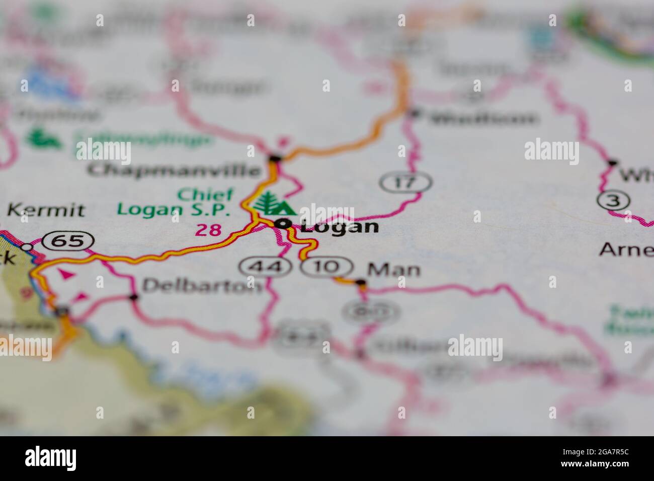 Logan Virginia shown on a road map or Geography map Stock Photohttps://www.alamy.com/image-license-details/?v=1https://www.alamy.com/logan-virginia-shown-on-a-road-map-or-geography-map-image436577608.html
RM2GA7R5C–Logan Virginia shown on a road map or Geography map
 Logan, Spotsylvania County, US, United States, Virginia, N 38 13' 3'', S 77 45' 39'', map, Cartascapes Map published in 2024. Explore Cartascapes, a map revealing Earth's diverse landscapes, cultures, and ecosystems. Journey through time and space, discovering the interconnectedness of our planet's past, present, and future. Stock Photohttps://www.alamy.com/image-license-details/?v=1https://www.alamy.com/logan-spotsylvania-county-us-united-states-virginia-n-38-13-3-s-77-45-39-map-cartascapes-map-published-in-2024-explore-cartascapes-a-map-revealing-earths-diverse-landscapes-cultures-and-ecosystems-journey-through-time-and-space-discovering-the-interconnectedness-of-our-planets-past-present-and-future-image621146957.html
RM2Y2FK7W–Logan, Spotsylvania County, US, United States, Virginia, N 38 13' 3'', S 77 45' 39'', map, Cartascapes Map published in 2024. Explore Cartascapes, a map revealing Earth's diverse landscapes, cultures, and ecosystems. Journey through time and space, discovering the interconnectedness of our planet's past, present, and future.
 Black highlighted location map of the Logan County inside gray administrative map of the Federal State of West Virginia, USA Stock Vectorhttps://www.alamy.com/image-license-details/?v=1https://www.alamy.com/black-highlighted-location-map-of-the-logan-county-inside-gray-administrative-map-of-the-federal-state-of-west-virginia-usa-image455233879.html
RF2HCHKCR–Black highlighted location map of the Logan County inside gray administrative map of the Federal State of West Virginia, USA
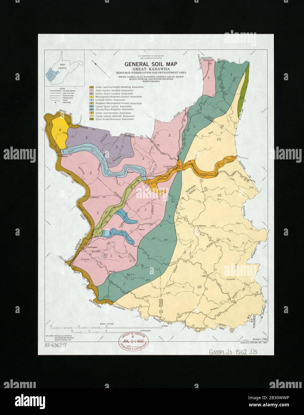 General soil map, Great Kanawha Resource Conservation and Development Area, Boone, Cabell, Clay, Kanawha, Lincoln, Logan, Mason, Mingo, Putnam, and Wayne Counties, West Virginia Stock Photohttps://www.alamy.com/image-license-details/?v=1https://www.alamy.com/general-soil-map-great-kanawha-resource-conservation-and-development-area-boone-cabell-clay-kanawha-lincoln-logan-mason-mingo-putnam-and-wayne-counties-west-virginia-image346071650.html
RM2B30WWP–General soil map, Great Kanawha Resource Conservation and Development Area, Boone, Cabell, Clay, Kanawha, Lincoln, Logan, Mason, Mingo, Putnam, and Wayne Counties, West Virginia
 Plan for hearing on Reed nomination. Washington, D.C., Jan. 17. Senator Henry F. Ashurst, of Arizona, Chairman of the Senate Judiciary Committee, and Senator Matthew M. Neely of West Virginia, Senate Rules Committee Chairman, map out plans for Senate Judiciary Subcommittee hearing on the fitness of Stanley F. Reed to sit on the United States Supreme Court. Senator M.M. Logan of Kentucky, is Chairman of the Subcommittee, 1/17/38 Stock Photohttps://www.alamy.com/image-license-details/?v=1https://www.alamy.com/plan-for-hearing-on-reed-nomination-washington-dc-jan-17-senator-henry-f-ashurst-of-arizona-chairman-of-the-senate-judiciary-committee-and-senator-matthew-m-neely-of-west-virginia-senate-rules-committee-chairman-map-out-plans-for-senate-judiciary-subcommittee-hearing-on-the-fitness-of-stanley-f-reed-to-sit-on-the-united-states-supreme-court-senator-mm-logan-of-kentucky-is-chairman-of-the-subcommittee-11738-image328366901.html
RM2A26B99–Plan for hearing on Reed nomination. Washington, D.C., Jan. 17. Senator Henry F. Ashurst, of Arizona, Chairman of the Senate Judiciary Committee, and Senator Matthew M. Neely of West Virginia, Senate Rules Committee Chairman, map out plans for Senate Judiciary Subcommittee hearing on the fitness of Stanley F. Reed to sit on the United States Supreme Court. Senator M.M. Logan of Kentucky, is Chairman of the Subcommittee, 1/17/38
 224 Plat of the partition of Moore Beckley survey of 170 038 a in the counties of Giles Logan Virginia Rebuild and Repair Stock Photohttps://www.alamy.com/image-license-details/?v=1https://www.alamy.com/224-plat-of-the-partition-of-moore-beckley-survey-of-170-038-a-in-the-counties-of-giles-logan-virginia-rebuild-and-repair-image261653777.html
RMW5KA1N–224 Plat of the partition of Moore Beckley survey of 170 038 a in the counties of Giles Logan Virginia Rebuild and Repair
 Map of Logan in West Virginia Stock Photohttps://www.alamy.com/image-license-details/?v=1https://www.alamy.com/map-of-logan-in-west-virginia-image359720433.html
RF2BW6K29–Map of Logan in West Virginia
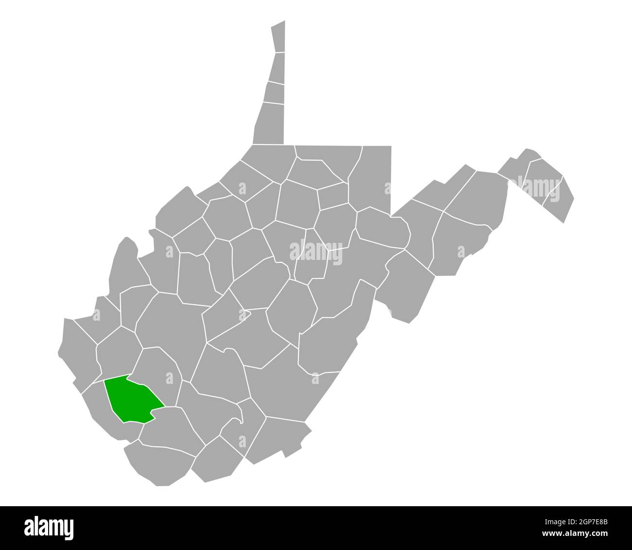 Map of Logan in West Virginia Stock Photohttps://www.alamy.com/image-license-details/?v=1https://www.alamy.com/map-of-logan-in-west-virginia-image443946507.html
RF2GP7E8B–Map of Logan in West Virginia
 Logan County (West Virginia) outline map set Stock Vectorhttps://www.alamy.com/image-license-details/?v=1https://www.alamy.com/logan-county-west-virginia-outline-map-set-image620818475.html
RF2Y20M8B–Logan County (West Virginia) outline map set
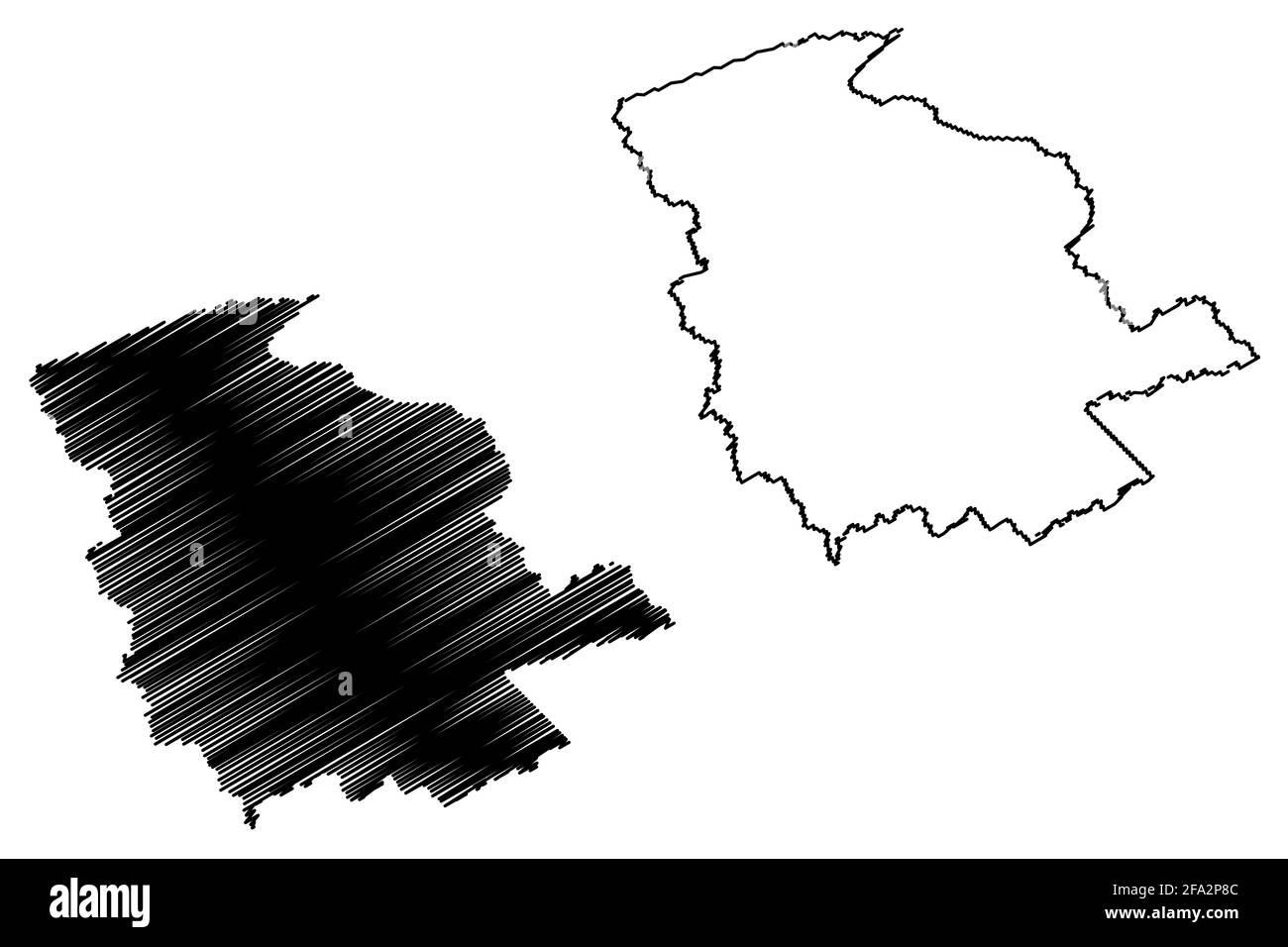 Logan County, State of West Virginia (U.S. county, United States of America, USA, U.S., US) map vector illustration, scribble sketch Logan map Stock Vectorhttps://www.alamy.com/image-license-details/?v=1https://www.alamy.com/logan-county-state-of-west-virginia-us-county-united-states-of-america-usa-us-us-map-vector-illustration-scribble-sketch-logan-map-image419256780.html
RF2FA2P8C–Logan County, State of West Virginia (U.S. county, United States of America, USA, U.S., US) map vector illustration, scribble sketch Logan map
 Logan West Virginia USA shown on a road map or Geography map Stock Photohttps://www.alamy.com/image-license-details/?v=1https://www.alamy.com/logan-west-virginia-usa-shown-on-a-road-map-or-geography-map-image436549907.html
RM2GA6FT3–Logan West Virginia USA shown on a road map or Geography map
 Stowe, Logan County, US, United States, West Virginia, N 37 48' 22'', S 81 45' 31'', map, Cartascapes Map published in 2024. Explore Cartascapes, a map revealing Earth's diverse landscapes, cultures, and ecosystems. Journey through time and space, discovering the interconnectedness of our planet's past, present, and future. Stock Photohttps://www.alamy.com/image-license-details/?v=1https://www.alamy.com/stowe-logan-county-us-united-states-west-virginia-n-37-48-22-s-81-45-31-map-cartascapes-map-published-in-2024-explore-cartascapes-a-map-revealing-earths-diverse-landscapes-cultures-and-ecosystems-journey-through-time-and-space-discovering-the-interconnectedness-of-our-planets-past-present-and-future-image621281486.html
RM2Y2NPTE–Stowe, Logan County, US, United States, West Virginia, N 37 48' 22'', S 81 45' 31'', map, Cartascapes Map published in 2024. Explore Cartascapes, a map revealing Earth's diverse landscapes, cultures, and ecosystems. Journey through time and space, discovering the interconnectedness of our planet's past, present, and future.
 Map of the Logan County coal field in West Virginia Stock Photohttps://www.alamy.com/image-license-details/?v=1https://www.alamy.com/map-of-the-logan-county-coal-field-in-west-virginia-image398171074.html
RM2E3P77E–Map of the Logan County coal field in West Virginia
 224 Plat of the partition of Moore Beckley survey of 170 038 a in the counties of Giles Logan Virginia Inverted Rebuild and Repair Stock Photohttps://www.alamy.com/image-license-details/?v=1https://www.alamy.com/224-plat-of-the-partition-of-moore-beckley-survey-of-170-038-a-in-the-counties-of-giles-logan-virginia-inverted-rebuild-and-repair-image261653731.html
RMW5KA03–224 Plat of the partition of Moore Beckley survey of 170 038 a in the counties of Giles Logan Virginia Inverted Rebuild and Repair
 Map of Logan in West Virginia Stock Photohttps://www.alamy.com/image-license-details/?v=1https://www.alamy.com/map-of-logan-in-west-virginia-image363873542.html
RF2C3YTBJ–Map of Logan in West Virginia
 225 Plats of the Wilson Cary Nicholas surveys from the originals made in Wythe and Russell Counties Virginia now Mercer Raleigh Wyoming McDowell and Logan Rebuild and Repair Stock Photohttps://www.alamy.com/image-license-details/?v=1https://www.alamy.com/225-plats-of-the-wilson-cary-nicholas-surveys-from-the-originals-made-in-wythe-and-russell-counties-virginia-now-mercer-raleigh-wyoming-mcdowell-and-logan-rebuild-and-repair-image261653782.html
RMW5KA1X–225 Plats of the Wilson Cary Nicholas surveys from the originals made in Wythe and Russell Counties Virginia now Mercer Raleigh Wyoming McDowell and Logan Rebuild and Repair
 Map of Logan in West Virginia Stock Photohttps://www.alamy.com/image-license-details/?v=1https://www.alamy.com/map-of-logan-in-west-virginia-image385820031.html
RF2DBKHAR–Map of Logan in West Virginia
 Logan County (Kansas) outline map set Stock Vectorhttps://www.alamy.com/image-license-details/?v=1https://www.alamy.com/logan-county-kansas-outline-map-set-image620911562.html
RF2Y24Y0X–Logan County (Kansas) outline map set
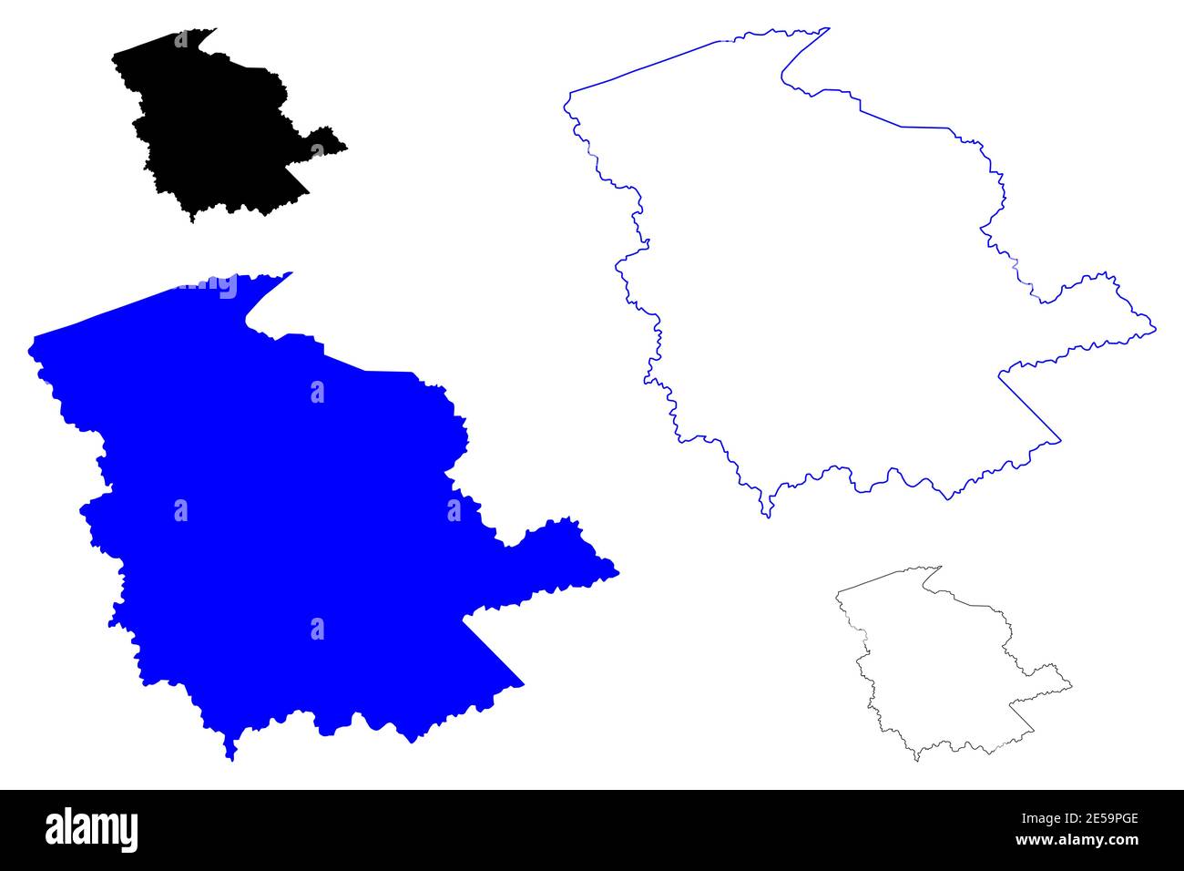 Logan County, State of West Virginia (U.S. county, United States of America, USA, U.S., US) map vector illustration, scribble sketch Logan map Stock Vectorhttps://www.alamy.com/image-license-details/?v=1https://www.alamy.com/logan-county-state-of-west-virginia-us-county-united-states-of-america-usa-us-us-map-vector-illustration-scribble-sketch-logan-map-image399127022.html
RF2E59PGE–Logan County, State of West Virginia (U.S. county, United States of America, USA, U.S., US) map vector illustration, scribble sketch Logan map
 Stirrat, Logan County, US, United States, West Virginia, N 37 43' 35'', S 82 0' 8'', map, Cartascapes Map published in 2024. Explore Cartascapes, a map revealing Earth's diverse landscapes, cultures, and ecosystems. Journey through time and space, discovering the interconnectedness of our planet's past, present, and future. Stock Photohttps://www.alamy.com/image-license-details/?v=1https://www.alamy.com/stirrat-logan-county-us-united-states-west-virginia-n-37-43-35-s-82-0-8-map-cartascapes-map-published-in-2024-explore-cartascapes-a-map-revealing-earths-diverse-landscapes-cultures-and-ecosystems-journey-through-time-and-space-discovering-the-interconnectedness-of-our-planets-past-present-and-future-image621449507.html
RM2Y31D57–Stirrat, Logan County, US, United States, West Virginia, N 37 43' 35'', S 82 0' 8'', map, Cartascapes Map published in 2024. Explore Cartascapes, a map revealing Earth's diverse landscapes, cultures, and ecosystems. Journey through time and space, discovering the interconnectedness of our planet's past, present, and future.
 Notes on Virginia (1802) - Virginia map segment (Logan murders). Stock Photohttps://www.alamy.com/image-license-details/?v=1https://www.alamy.com/notes-on-virginia-1802-virginia-map-segment-logan-murders-image403026958.html
RM2EBKCYX–Notes on Virginia (1802) - Virginia map segment (Logan murders).
 Map of Logan in West Virginia Stock Photohttps://www.alamy.com/image-license-details/?v=1https://www.alamy.com/map-of-logan-in-west-virginia-image360928036.html
RF2BY5KB0–Map of Logan in West Virginia
 225 Plats of the Wilson Cary Nicholas surveys from the originals made in Wythe and Russell Counties Virginia now Mercer Raleigh Wyoming McDowell and Logan Inverted Rebuild and Repair Stock Photohttps://www.alamy.com/image-license-details/?v=1https://www.alamy.com/225-plats-of-the-wilson-cary-nicholas-surveys-from-the-originals-made-in-wythe-and-russell-counties-virginia-now-mercer-raleigh-wyoming-mcdowell-and-logan-inverted-rebuild-and-repair-image261653758.html
RMW5KA12–225 Plats of the Wilson Cary Nicholas surveys from the originals made in Wythe and Russell Counties Virginia now Mercer Raleigh Wyoming McDowell and Logan Inverted Rebuild and Repair
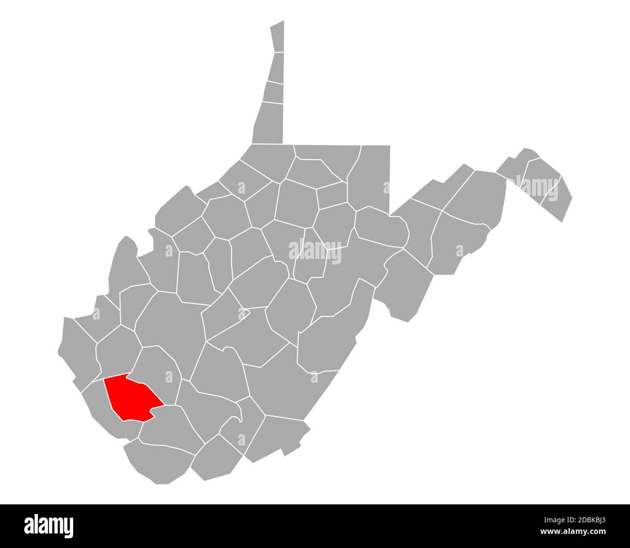 Map of Logan in West Virginia Stock Photohttps://www.alamy.com/image-license-details/?v=1https://www.alamy.com/map-of-logan-in-west-virginia-image385815531.html
RF2DBKBJ3–Map of Logan in West Virginia
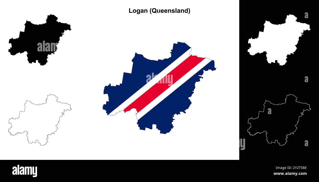 Logan (Queensland) outline map set Stock Vectorhttps://www.alamy.com/image-license-details/?v=1https://www.alamy.com/logan-queensland-outline-map-set-image621333566.html
RF2Y2T58E–Logan (Queensland) outline map set
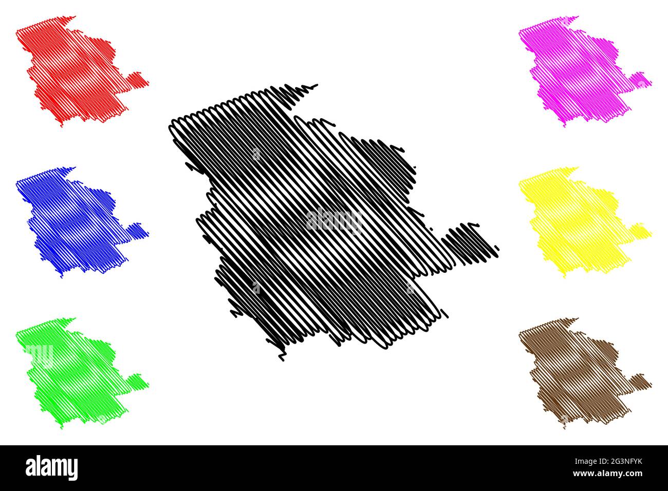 Logan County, State of West Virginia (U.S. county, United States of America, USA, U.S., US) map vector illustration, scribble sketch Logan map Stock Vectorhttps://www.alamy.com/image-license-details/?v=1https://www.alamy.com/logan-county-state-of-west-virginia-us-county-united-states-of-america-usa-us-us-map-vector-illustration-scribble-sketch-logan-map-image432576695.html
RF2G3NFYK–Logan County, State of West Virginia (U.S. county, United States of America, USA, U.S., US) map vector illustration, scribble sketch Logan map
 Shively, Logan County, US, United States, West Virginia, N 37 57' 57'', S 82 7' 5'', map, Cartascapes Map published in 2024. Explore Cartascapes, a map revealing Earth's diverse landscapes, cultures, and ecosystems. Journey through time and space, discovering the interconnectedness of our planet's past, present, and future. Stock Photohttps://www.alamy.com/image-license-details/?v=1https://www.alamy.com/shively-logan-county-us-united-states-west-virginia-n-37-57-57-s-82-7-5-map-cartascapes-map-published-in-2024-explore-cartascapes-a-map-revealing-earths-diverse-landscapes-cultures-and-ecosystems-journey-through-time-and-space-discovering-the-interconnectedness-of-our-planets-past-present-and-future-image621297748.html
RM2Y2PFH8–Shively, Logan County, US, United States, West Virginia, N 37 57' 57'', S 82 7' 5'', map, Cartascapes Map published in 2024. Explore Cartascapes, a map revealing Earth's diverse landscapes, cultures, and ecosystems. Journey through time and space, discovering the interconnectedness of our planet's past, present, and future.
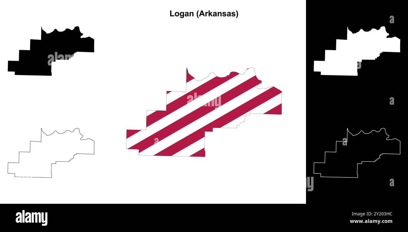 Logan County (Arkansas) outline map set Stock Vectorhttps://www.alamy.com/image-license-details/?v=1https://www.alamy.com/logan-county-arkansas-outline-map-set-image620805400.html
RF2Y203HC–Logan County (Arkansas) outline map set
 Stollings, Logan County, US, United States, West Virginia, N 37 50' 15'', S 81 57' 52'', map, Cartascapes Map published in 2024. Explore Cartascapes, a map revealing Earth's diverse landscapes, cultures, and ecosystems. Journey through time and space, discovering the interconnectedness of our planet's past, present, and future. Stock Photohttps://www.alamy.com/image-license-details/?v=1https://www.alamy.com/stollings-logan-county-us-united-states-west-virginia-n-37-50-15-s-81-57-52-map-cartascapes-map-published-in-2024-explore-cartascapes-a-map-revealing-earths-diverse-landscapes-cultures-and-ecosystems-journey-through-time-and-space-discovering-the-interconnectedness-of-our-planets-past-present-and-future-image621411591.html
RM2Y2YMR3–Stollings, Logan County, US, United States, West Virginia, N 37 50' 15'', S 81 57' 52'', map, Cartascapes Map published in 2024. Explore Cartascapes, a map revealing Earth's diverse landscapes, cultures, and ecosystems. Journey through time and space, discovering the interconnectedness of our planet's past, present, and future.
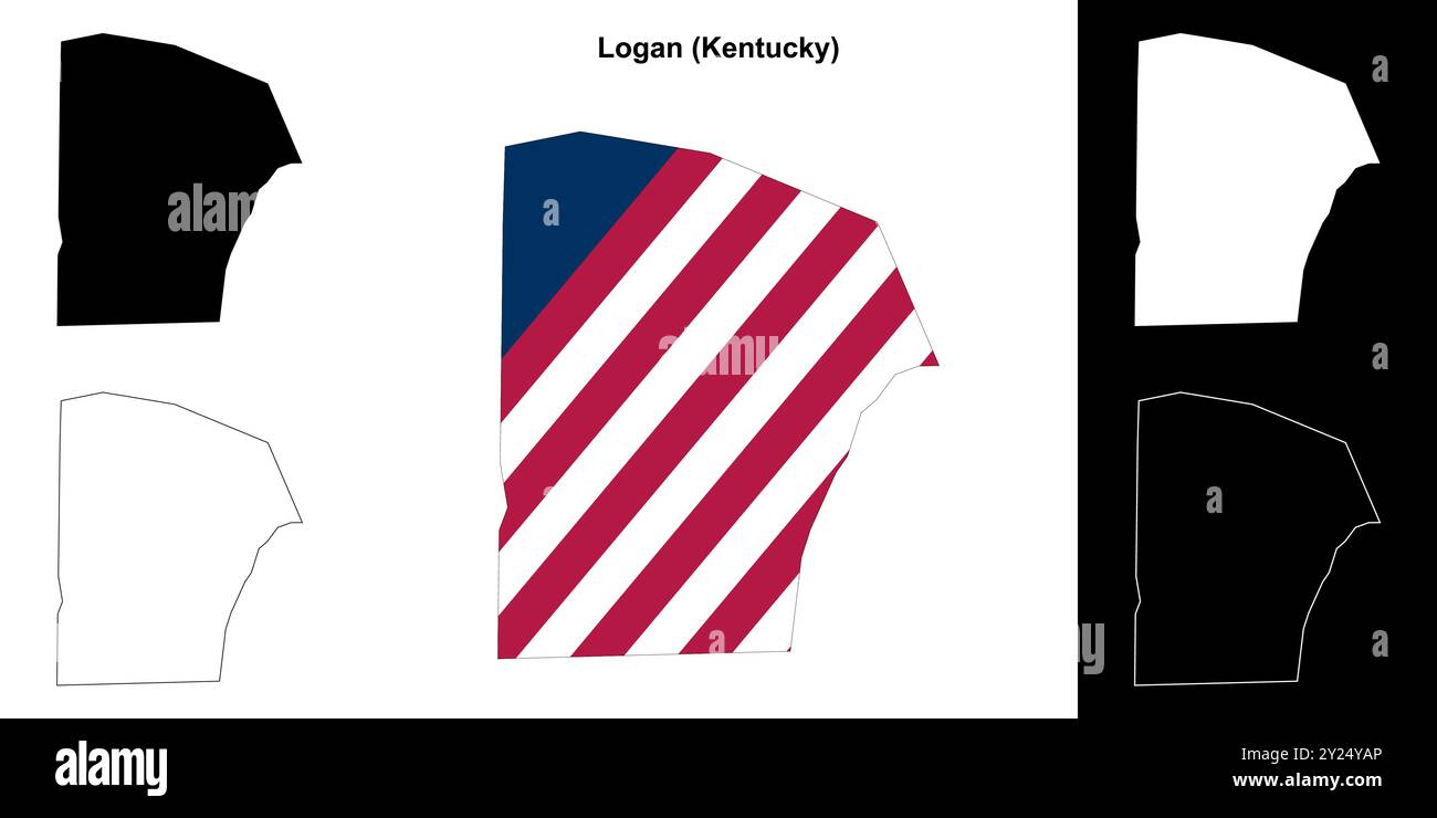 Logan County (Kentucky) outline map set Stock Vectorhttps://www.alamy.com/image-license-details/?v=1https://www.alamy.com/logan-county-kentucky-outline-map-set-image620911838.html
RF2Y24YAP–Logan County (Kentucky) outline map set
 Rita, Logan County, US, United States, West Virginia, N 37 46' 13'', S 81 55' 55'', map, Cartascapes Map published in 2024. Explore Cartascapes, a map revealing Earth's diverse landscapes, cultures, and ecosystems. Journey through time and space, discovering the interconnectedness of our planet's past, present, and future. Stock Photohttps://www.alamy.com/image-license-details/?v=1https://www.alamy.com/rita-logan-county-us-united-states-west-virginia-n-37-46-13-s-81-55-55-map-cartascapes-map-published-in-2024-explore-cartascapes-a-map-revealing-earths-diverse-landscapes-cultures-and-ecosystems-journey-through-time-and-space-discovering-the-interconnectedness-of-our-planets-past-present-and-future-image621187557.html
RM2Y2HF1W–Rita, Logan County, US, United States, West Virginia, N 37 46' 13'', S 81 55' 55'', map, Cartascapes Map published in 2024. Explore Cartascapes, a map revealing Earth's diverse landscapes, cultures, and ecosystems. Journey through time and space, discovering the interconnectedness of our planet's past, present, and future.
 Logan County (Illinois) outline map set Stock Vectorhttps://www.alamy.com/image-license-details/?v=1https://www.alamy.com/logan-county-illinois-outline-map-set-image620885693.html
RF2Y23P11–Logan County (Illinois) outline map set
 Isom, Logan County, US, United States, West Virginia, N 37 56' 37'', S 81 52' 13'', map, Cartascapes Map published in 2024. Explore Cartascapes, a map revealing Earth's diverse landscapes, cultures, and ecosystems. Journey through time and space, discovering the interconnectedness of our planet's past, present, and future. Stock Photohttps://www.alamy.com/image-license-details/?v=1https://www.alamy.com/isom-logan-county-us-united-states-west-virginia-n-37-56-37-s-81-52-13-map-cartascapes-map-published-in-2024-explore-cartascapes-a-map-revealing-earths-diverse-landscapes-cultures-and-ecosystems-journey-through-time-and-space-discovering-the-interconnectedness-of-our-planets-past-present-and-future-image621289291.html
RM2Y2P4R7–Isom, Logan County, US, United States, West Virginia, N 37 56' 37'', S 81 52' 13'', map, Cartascapes Map published in 2024. Explore Cartascapes, a map revealing Earth's diverse landscapes, cultures, and ecosystems. Journey through time and space, discovering the interconnectedness of our planet's past, present, and future.
 Logan County (Colorado) outline map set Stock Vectorhttps://www.alamy.com/image-license-details/?v=1https://www.alamy.com/logan-county-colorado-outline-map-set-image620806164.html
RF2Y204GM–Logan County (Colorado) outline map set
 Sodom, Logan County, US, United States, West Virginia, N 37 54' 59'', S 81 49' 59'', map, Cartascapes Map published in 2024. Explore Cartascapes, a map revealing Earth's diverse landscapes, cultures, and ecosystems. Journey through time and space, discovering the interconnectedness of our planet's past, present, and future. Stock Photohttps://www.alamy.com/image-license-details/?v=1https://www.alamy.com/sodom-logan-county-us-united-states-west-virginia-n-37-54-59-s-81-49-59-map-cartascapes-map-published-in-2024-explore-cartascapes-a-map-revealing-earths-diverse-landscapes-cultures-and-ecosystems-journey-through-time-and-space-discovering-the-interconnectedness-of-our-planets-past-present-and-future-image621194685.html
RM2Y2HT4D–Sodom, Logan County, US, United States, West Virginia, N 37 54' 59'', S 81 49' 59'', map, Cartascapes Map published in 2024. Explore Cartascapes, a map revealing Earth's diverse landscapes, cultures, and ecosystems. Journey through time and space, discovering the interconnectedness of our planet's past, present, and future.
 Logan County (Ohio) outline map set Stock Vectorhttps://www.alamy.com/image-license-details/?v=1https://www.alamy.com/logan-county-ohio-outline-map-set-image621159870.html
RF2Y2G7N2–Logan County (Ohio) outline map set
 Chapmanville, Logan County, US, United States, West Virginia, N 37 58' 25'', S 82 1' 2'', map, Cartascapes Map published in 2024. Explore Cartascapes, a map revealing Earth's diverse landscapes, cultures, and ecosystems. Journey through time and space, discovering the interconnectedness of our planet's past, present, and future. Stock Photohttps://www.alamy.com/image-license-details/?v=1https://www.alamy.com/chapmanville-logan-county-us-united-states-west-virginia-n-37-58-25-s-82-1-2-map-cartascapes-map-published-in-2024-explore-cartascapes-a-map-revealing-earths-diverse-landscapes-cultures-and-ecosystems-journey-through-time-and-space-discovering-the-interconnectedness-of-our-planets-past-present-and-future-image621169673.html
RM2Y2GM75–Chapmanville, Logan County, US, United States, West Virginia, N 37 58' 25'', S 82 1' 2'', map, Cartascapes Map published in 2024. Explore Cartascapes, a map revealing Earth's diverse landscapes, cultures, and ecosystems. Journey through time and space, discovering the interconnectedness of our planet's past, present, and future.
 Logan County (Oklahoma) outline map set Stock Vectorhttps://www.alamy.com/image-license-details/?v=1https://www.alamy.com/logan-county-oklahoma-outline-map-set-image621159703.html
RF2Y2G7F3–Logan County (Oklahoma) outline map set
 Kistler, Logan County, US, United States, West Virginia, N 37 45' 22'', S 81 51' 36'', map, Cartascapes Map published in 2024. Explore Cartascapes, a map revealing Earth's diverse landscapes, cultures, and ecosystems. Journey through time and space, discovering the interconnectedness of our planet's past, present, and future. Stock Photohttps://www.alamy.com/image-license-details/?v=1https://www.alamy.com/kistler-logan-county-us-united-states-west-virginia-n-37-45-22-s-81-51-36-map-cartascapes-map-published-in-2024-explore-cartascapes-a-map-revealing-earths-diverse-landscapes-cultures-and-ecosystems-journey-through-time-and-space-discovering-the-interconnectedness-of-our-planets-past-present-and-future-image621207467.html
RM2Y2JCCY–Kistler, Logan County, US, United States, West Virginia, N 37 45' 22'', S 81 51' 36'', map, Cartascapes Map published in 2024. Explore Cartascapes, a map revealing Earth's diverse landscapes, cultures, and ecosystems. Journey through time and space, discovering the interconnectedness of our planet's past, present, and future.
 Logan County (Nebraska) outline map set Stock Vectorhttps://www.alamy.com/image-license-details/?v=1https://www.alamy.com/logan-county-nebraska-outline-map-set-image621155167.html
RF2Y2G1N3–Logan County (Nebraska) outline map set
 Logan, Logan County, US, United States, West Virginia, N 37 50' 55'', S 81 59' 36'', map, Cartascapes Map published in 2024. Explore Cartascapes, a map revealing Earth's diverse landscapes, cultures, and ecosystems. Journey through time and space, discovering the interconnectedness of our planet's past, present, and future. Stock Photohttps://www.alamy.com/image-license-details/?v=1https://www.alamy.com/logan-logan-county-us-united-states-west-virginia-n-37-50-55-s-81-59-36-map-cartascapes-map-published-in-2024-explore-cartascapes-a-map-revealing-earths-diverse-landscapes-cultures-and-ecosystems-journey-through-time-and-space-discovering-the-interconnectedness-of-our-planets-past-present-and-future-image621284098.html
RM2Y2NX5P–Logan, Logan County, US, United States, West Virginia, N 37 50' 55'', S 81 59' 36'', map, Cartascapes Map published in 2024. Explore Cartascapes, a map revealing Earth's diverse landscapes, cultures, and ecosystems. Journey through time and space, discovering the interconnectedness of our planet's past, present, and future.
 Logan County (North Dakota) outline map set Stock Vectorhttps://www.alamy.com/image-license-details/?v=1https://www.alamy.com/logan-county-north-dakota-outline-map-set-image621154602.html
RF2Y2G10X–Logan County (North Dakota) outline map set
 Mifflin, Logan County, US, United States, West Virginia, N 37 56' 28'', S 81 49' 19'', map, Cartascapes Map published in 2024. Explore Cartascapes, a map revealing Earth's diverse landscapes, cultures, and ecosystems. Journey through time and space, discovering the interconnectedness of our planet's past, present, and future. Stock Photohttps://www.alamy.com/image-license-details/?v=1https://www.alamy.com/mifflin-logan-county-us-united-states-west-virginia-n-37-56-28-s-81-49-19-map-cartascapes-map-published-in-2024-explore-cartascapes-a-map-revealing-earths-diverse-landscapes-cultures-and-ecosystems-journey-through-time-and-space-discovering-the-interconnectedness-of-our-planets-past-present-and-future-image621206802.html
RM2Y2JBH6–Mifflin, Logan County, US, United States, West Virginia, N 37 56' 28'', S 81 49' 19'', map, Cartascapes Map published in 2024. Explore Cartascapes, a map revealing Earth's diverse landscapes, cultures, and ecosystems. Journey through time and space, discovering the interconnectedness of our planet's past, present, and future.
 Monaville, Logan County, US, United States, West Virginia, N 37 48' 43'', S 81 59' 41'', map, Cartascapes Map published in 2024. Explore Cartascapes, a map revealing Earth's diverse landscapes, cultures, and ecosystems. Journey through time and space, discovering the interconnectedness of our planet's past, present, and future. Stock Photohttps://www.alamy.com/image-license-details/?v=1https://www.alamy.com/monaville-logan-county-us-united-states-west-virginia-n-37-48-43-s-81-59-41-map-cartascapes-map-published-in-2024-explore-cartascapes-a-map-revealing-earths-diverse-landscapes-cultures-and-ecosystems-journey-through-time-and-space-discovering-the-interconnectedness-of-our-planets-past-present-and-future-image621358849.html
RM2Y2W9FD–Monaville, Logan County, US, United States, West Virginia, N 37 48' 43'', S 81 59' 41'', map, Cartascapes Map published in 2024. Explore Cartascapes, a map revealing Earth's diverse landscapes, cultures, and ecosystems. Journey through time and space, discovering the interconnectedness of our planet's past, present, and future.
 Saunders, Logan County, US, United States, West Virginia, N 37 47' 59'', S 81 40' 20'', map, Cartascapes Map published in 2024. Explore Cartascapes, a map revealing Earth's diverse landscapes, cultures, and ecosystems. Journey through time and space, discovering the interconnectedness of our planet's past, present, and future. Stock Photohttps://www.alamy.com/image-license-details/?v=1https://www.alamy.com/saunders-logan-county-us-united-states-west-virginia-n-37-47-59-s-81-40-20-map-cartascapes-map-published-in-2024-explore-cartascapes-a-map-revealing-earths-diverse-landscapes-cultures-and-ecosystems-journey-through-time-and-space-discovering-the-interconnectedness-of-our-planets-past-present-and-future-image621219882.html
RM2Y2K08A–Saunders, Logan County, US, United States, West Virginia, N 37 47' 59'', S 81 40' 20'', map, Cartascapes Map published in 2024. Explore Cartascapes, a map revealing Earth's diverse landscapes, cultures, and ecosystems. Journey through time and space, discovering the interconnectedness of our planet's past, present, and future.
 Aracoma, Logan County, US, United States, West Virginia, N 37 51' 32'', S 81 59' 31'', map, Cartascapes Map published in 2024. Explore Cartascapes, a map revealing Earth's diverse landscapes, cultures, and ecosystems. Journey through time and space, discovering the interconnectedness of our planet's past, present, and future. Stock Photohttps://www.alamy.com/image-license-details/?v=1https://www.alamy.com/aracoma-logan-county-us-united-states-west-virginia-n-37-51-32-s-81-59-31-map-cartascapes-map-published-in-2024-explore-cartascapes-a-map-revealing-earths-diverse-landscapes-cultures-and-ecosystems-journey-through-time-and-space-discovering-the-interconnectedness-of-our-planets-past-present-and-future-image621447976.html
RM2Y31B6G–Aracoma, Logan County, US, United States, West Virginia, N 37 51' 32'', S 81 59' 31'', map, Cartascapes Map published in 2024. Explore Cartascapes, a map revealing Earth's diverse landscapes, cultures, and ecosystems. Journey through time and space, discovering the interconnectedness of our planet's past, present, and future.
 Argyle, Logan County, US, United States, West Virginia, N 37 49' 32'', S 81 52' 36'', map, Cartascapes Map published in 2024. Explore Cartascapes, a map revealing Earth's diverse landscapes, cultures, and ecosystems. Journey through time and space, discovering the interconnectedness of our planet's past, present, and future. Stock Photohttps://www.alamy.com/image-license-details/?v=1https://www.alamy.com/argyle-logan-county-us-united-states-west-virginia-n-37-49-32-s-81-52-36-map-cartascapes-map-published-in-2024-explore-cartascapes-a-map-revealing-earths-diverse-landscapes-cultures-and-ecosystems-journey-through-time-and-space-discovering-the-interconnectedness-of-our-planets-past-present-and-future-image621148462.html
RM2Y2FN5J–Argyle, Logan County, US, United States, West Virginia, N 37 49' 32'', S 81 52' 36'', map, Cartascapes Map published in 2024. Explore Cartascapes, a map revealing Earth's diverse landscapes, cultures, and ecosystems. Journey through time and space, discovering the interconnectedness of our planet's past, present, and future.
 Craneco, Logan County, US, United States, West Virginia, N 37 47' 48'', S 81 43' 55'', map, Cartascapes Map published in 2024. Explore Cartascapes, a map revealing Earth's diverse landscapes, cultures, and ecosystems. Journey through time and space, discovering the interconnectedness of our planet's past, present, and future. Stock Photohttps://www.alamy.com/image-license-details/?v=1https://www.alamy.com/craneco-logan-county-us-united-states-west-virginia-n-37-47-48-s-81-43-55-map-cartascapes-map-published-in-2024-explore-cartascapes-a-map-revealing-earths-diverse-landscapes-cultures-and-ecosystems-journey-through-time-and-space-discovering-the-interconnectedness-of-our-planets-past-present-and-future-image621380299.html
RM2Y2X8WF–Craneco, Logan County, US, United States, West Virginia, N 37 47' 48'', S 81 43' 55'', map, Cartascapes Map published in 2024. Explore Cartascapes, a map revealing Earth's diverse landscapes, cultures, and ecosystems. Journey through time and space, discovering the interconnectedness of our planet's past, present, and future.
 Dabney, Logan County, US, United States, West Virginia, N 37 48' 43'', S 81 55' 42'', map, Cartascapes Map published in 2024. Explore Cartascapes, a map revealing Earth's diverse landscapes, cultures, and ecosystems. Journey through time and space, discovering the interconnectedness of our planet's past, present, and future. Stock Photohttps://www.alamy.com/image-license-details/?v=1https://www.alamy.com/dabney-logan-county-us-united-states-west-virginia-n-37-48-43-s-81-55-42-map-cartascapes-map-published-in-2024-explore-cartascapes-a-map-revealing-earths-diverse-landscapes-cultures-and-ecosystems-journey-through-time-and-space-discovering-the-interconnectedness-of-our-planets-past-present-and-future-image621448093.html
RM2Y31BAN–Dabney, Logan County, US, United States, West Virginia, N 37 48' 43'', S 81 55' 42'', map, Cartascapes Map published in 2024. Explore Cartascapes, a map revealing Earth's diverse landscapes, cultures, and ecosystems. Journey through time and space, discovering the interconnectedness of our planet's past, present, and future.
 Latrobe, Logan County, US, United States, West Virginia, N 37 47' 26'', S 81 46' 7'', map, Cartascapes Map published in 2024. Explore Cartascapes, a map revealing Earth's diverse landscapes, cultures, and ecosystems. Journey through time and space, discovering the interconnectedness of our planet's past, present, and future. Stock Photohttps://www.alamy.com/image-license-details/?v=1https://www.alamy.com/latrobe-logan-county-us-united-states-west-virginia-n-37-47-26-s-81-46-7-map-cartascapes-map-published-in-2024-explore-cartascapes-a-map-revealing-earths-diverse-landscapes-cultures-and-ecosystems-journey-through-time-and-space-discovering-the-interconnectedness-of-our-planets-past-present-and-future-image621148155.html
RM2Y2FMPK–Latrobe, Logan County, US, United States, West Virginia, N 37 47' 26'', S 81 46' 7'', map, Cartascapes Map published in 2024. Explore Cartascapes, a map revealing Earth's diverse landscapes, cultures, and ecosystems. Journey through time and space, discovering the interconnectedness of our planet's past, present, and future.
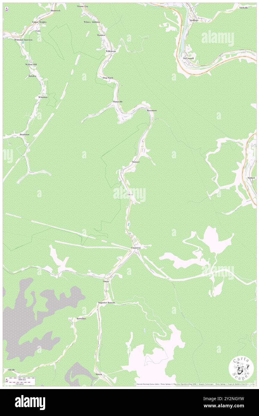 Micco, Logan County, US, United States, West Virginia, N 37 46' 58'', S 81 59' 24'', map, Cartascapes Map published in 2024. Explore Cartascapes, a map revealing Earth's diverse landscapes, cultures, and ecosystems. Journey through time and space, discovering the interconnectedness of our planet's past, present, and future. Stock Photohttps://www.alamy.com/image-license-details/?v=1https://www.alamy.com/micco-logan-county-us-united-states-west-virginia-n-37-46-58-s-81-59-24-map-cartascapes-map-published-in-2024-explore-cartascapes-a-map-revealing-earths-diverse-landscapes-cultures-and-ecosystems-journey-through-time-and-space-discovering-the-interconnectedness-of-our-planets-past-present-and-future-image621276877.html
RM2Y2NGYW–Micco, Logan County, US, United States, West Virginia, N 37 46' 58'', S 81 59' 24'', map, Cartascapes Map published in 2024. Explore Cartascapes, a map revealing Earth's diverse landscapes, cultures, and ecosystems. Journey through time and space, discovering the interconnectedness of our planet's past, present, and future.
 Sovereign, Logan County, US, United States, West Virginia, N 37 51' 42'', S 81 49' 34'', map, Cartascapes Map published in 2024. Explore Cartascapes, a map revealing Earth's diverse landscapes, cultures, and ecosystems. Journey through time and space, discovering the interconnectedness of our planet's past, present, and future. Stock Photohttps://www.alamy.com/image-license-details/?v=1https://www.alamy.com/sovereign-logan-county-us-united-states-west-virginia-n-37-51-42-s-81-49-34-map-cartascapes-map-published-in-2024-explore-cartascapes-a-map-revealing-earths-diverse-landscapes-cultures-and-ecosystems-journey-through-time-and-space-discovering-the-interconnectedness-of-our-planets-past-present-and-future-image621434763.html
RM2Y30PAK–Sovereign, Logan County, US, United States, West Virginia, N 37 51' 42'', S 81 49' 34'', map, Cartascapes Map published in 2024. Explore Cartascapes, a map revealing Earth's diverse landscapes, cultures, and ecosystems. Journey through time and space, discovering the interconnectedness of our planet's past, present, and future.
 Baisden, Logan County, US, United States, West Virginia, N 37 49' 12'', S 82 1' 43'', map, Cartascapes Map published in 2024. Explore Cartascapes, a map revealing Earth's diverse landscapes, cultures, and ecosystems. Journey through time and space, discovering the interconnectedness of our planet's past, present, and future. Stock Photohttps://www.alamy.com/image-license-details/?v=1https://www.alamy.com/baisden-logan-county-us-united-states-west-virginia-n-37-49-12-s-82-1-43-map-cartascapes-map-published-in-2024-explore-cartascapes-a-map-revealing-earths-diverse-landscapes-cultures-and-ecosystems-journey-through-time-and-space-discovering-the-interconnectedness-of-our-planets-past-present-and-future-image621306393.html
RM2Y2PXJ1–Baisden, Logan County, US, United States, West Virginia, N 37 49' 12'', S 82 1' 43'', map, Cartascapes Map published in 2024. Explore Cartascapes, a map revealing Earth's diverse landscapes, cultures, and ecosystems. Journey through time and space, discovering the interconnectedness of our planet's past, present, and future.
 Man, Logan County, US, United States, West Virginia, N 37 44' 23'', S 81 52' 39'', map, Cartascapes Map published in 2024. Explore Cartascapes, a map revealing Earth's diverse landscapes, cultures, and ecosystems. Journey through time and space, discovering the interconnectedness of our planet's past, present, and future. Stock Photohttps://www.alamy.com/image-license-details/?v=1https://www.alamy.com/man-logan-county-us-united-states-west-virginia-n-37-44-23-s-81-52-39-map-cartascapes-map-published-in-2024-explore-cartascapes-a-map-revealing-earths-diverse-landscapes-cultures-and-ecosystems-journey-through-time-and-space-discovering-the-interconnectedness-of-our-planets-past-present-and-future-image621344130.html
RM2Y2TJNP–Man, Logan County, US, United States, West Virginia, N 37 44' 23'', S 81 52' 39'', map, Cartascapes Map published in 2024. Explore Cartascapes, a map revealing Earth's diverse landscapes, cultures, and ecosystems. Journey through time and space, discovering the interconnectedness of our planet's past, present, and future.
 Hetzel, Logan County, US, United States, West Virginia, N 37 51' 39'', S 81 52' 39'', map, Cartascapes Map published in 2024. Explore Cartascapes, a map revealing Earth's diverse landscapes, cultures, and ecosystems. Journey through time and space, discovering the interconnectedness of our planet's past, present, and future. Stock Photohttps://www.alamy.com/image-license-details/?v=1https://www.alamy.com/hetzel-logan-county-us-united-states-west-virginia-n-37-51-39-s-81-52-39-map-cartascapes-map-published-in-2024-explore-cartascapes-a-map-revealing-earths-diverse-landscapes-cultures-and-ecosystems-journey-through-time-and-space-discovering-the-interconnectedness-of-our-planets-past-present-and-future-image621187420.html
RM2Y2HEW0–Hetzel, Logan County, US, United States, West Virginia, N 37 51' 39'', S 81 52' 39'', map, Cartascapes Map published in 2024. Explore Cartascapes, a map revealing Earth's diverse landscapes, cultures, and ecosystems. Journey through time and space, discovering the interconnectedness of our planet's past, present, and future.
 Davis, Logan County, US, United States, West Virginia, N 37 49' 36'', S 82 5' 4'', map, Cartascapes Map published in 2024. Explore Cartascapes, a map revealing Earth's diverse landscapes, cultures, and ecosystems. Journey through time and space, discovering the interconnectedness of our planet's past, present, and future. Stock Photohttps://www.alamy.com/image-license-details/?v=1https://www.alamy.com/davis-logan-county-us-united-states-west-virginia-n-37-49-36-s-82-5-4-map-cartascapes-map-published-in-2024-explore-cartascapes-a-map-revealing-earths-diverse-landscapes-cultures-and-ecosystems-journey-through-time-and-space-discovering-the-interconnectedness-of-our-planets-past-present-and-future-image621371593.html
RM2Y2WWPH–Davis, Logan County, US, United States, West Virginia, N 37 49' 36'', S 82 5' 4'', map, Cartascapes Map published in 2024. Explore Cartascapes, a map revealing Earth's diverse landscapes, cultures, and ecosystems. Journey through time and space, discovering the interconnectedness of our planet's past, present, and future.
 Man, Logan County, US, United States, West Virginia, N 37 44' 23'', S 81 52' 39'', map, Cartascapes Map published in 2024. Explore Cartascapes, a map revealing Earth's diverse landscapes, cultures, and ecosystems. Journey through time and space, discovering the interconnectedness of our planet's past, present, and future. Stock Photohttps://www.alamy.com/image-license-details/?v=1https://www.alamy.com/man-logan-county-us-united-states-west-virginia-n-37-44-23-s-81-52-39-map-cartascapes-map-published-in-2024-explore-cartascapes-a-map-revealing-earths-diverse-landscapes-cultures-and-ecosystems-journey-through-time-and-space-discovering-the-interconnectedness-of-our-planets-past-present-and-future-image621444149.html
RM2Y3169W–Man, Logan County, US, United States, West Virginia, N 37 44' 23'', S 81 52' 39'', map, Cartascapes Map published in 2024. Explore Cartascapes, a map revealing Earth's diverse landscapes, cultures, and ecosystems. Journey through time and space, discovering the interconnectedness of our planet's past, present, and future.
 Holden, Logan County, US, United States, West Virginia, N 37 49' 27'', S 82 3' 34'', map, Cartascapes Map published in 2024. Explore Cartascapes, a map revealing Earth's diverse landscapes, cultures, and ecosystems. Journey through time and space, discovering the interconnectedness of our planet's past, present, and future. Stock Photohttps://www.alamy.com/image-license-details/?v=1https://www.alamy.com/holden-logan-county-us-united-states-west-virginia-n-37-49-27-s-82-3-34-map-cartascapes-map-published-in-2024-explore-cartascapes-a-map-revealing-earths-diverse-landscapes-cultures-and-ecosystems-journey-through-time-and-space-discovering-the-interconnectedness-of-our-planets-past-present-and-future-image621412779.html
RM2Y2YP9F–Holden, Logan County, US, United States, West Virginia, N 37 49' 27'', S 82 3' 34'', map, Cartascapes Map published in 2024. Explore Cartascapes, a map revealing Earth's diverse landscapes, cultures, and ecosystems. Journey through time and space, discovering the interconnectedness of our planet's past, present, and future.
 Whitman, Logan County, US, United States, West Virginia, N 37 48' 48'', S 82 1' 28'', map, Cartascapes Map published in 2024. Explore Cartascapes, a map revealing Earth's diverse landscapes, cultures, and ecosystems. Journey through time and space, discovering the interconnectedness of our planet's past, present, and future. Stock Photohttps://www.alamy.com/image-license-details/?v=1https://www.alamy.com/whitman-logan-county-us-united-states-west-virginia-n-37-48-48-s-82-1-28-map-cartascapes-map-published-in-2024-explore-cartascapes-a-map-revealing-earths-diverse-landscapes-cultures-and-ecosystems-journey-through-time-and-space-discovering-the-interconnectedness-of-our-planets-past-present-and-future-image621289989.html
RM2Y2P5M5–Whitman, Logan County, US, United States, West Virginia, N 37 48' 48'', S 82 1' 28'', map, Cartascapes Map published in 2024. Explore Cartascapes, a map revealing Earth's diverse landscapes, cultures, and ecosystems. Journey through time and space, discovering the interconnectedness of our planet's past, present, and future.
 Lorado, Logan County, US, United States, West Virginia, N 37 47' 44'', S 81 42' 53'', map, Cartascapes Map published in 2024. Explore Cartascapes, a map revealing Earth's diverse landscapes, cultures, and ecosystems. Journey through time and space, discovering the interconnectedness of our planet's past, present, and future. Stock Photohttps://www.alamy.com/image-license-details/?v=1https://www.alamy.com/lorado-logan-county-us-united-states-west-virginia-n-37-47-44-s-81-42-53-map-cartascapes-map-published-in-2024-explore-cartascapes-a-map-revealing-earths-diverse-landscapes-cultures-and-ecosystems-journey-through-time-and-space-discovering-the-interconnectedness-of-our-planets-past-present-and-future-image621474084.html
RM2Y32GF0–Lorado, Logan County, US, United States, West Virginia, N 37 47' 44'', S 81 42' 53'', map, Cartascapes Map published in 2024. Explore Cartascapes, a map revealing Earth's diverse landscapes, cultures, and ecosystems. Journey through time and space, discovering the interconnectedness of our planet's past, present, and future.
 Rossmore, Logan County, US, United States, West Virginia, N 37 48' 33'', S 81 58' 52'', map, Cartascapes Map published in 2024. Explore Cartascapes, a map revealing Earth's diverse landscapes, cultures, and ecosystems. Journey through time and space, discovering the interconnectedness of our planet's past, present, and future. Stock Photohttps://www.alamy.com/image-license-details/?v=1https://www.alamy.com/rossmore-logan-county-us-united-states-west-virginia-n-37-48-33-s-81-58-52-map-cartascapes-map-published-in-2024-explore-cartascapes-a-map-revealing-earths-diverse-landscapes-cultures-and-ecosystems-journey-through-time-and-space-discovering-the-interconnectedness-of-our-planets-past-present-and-future-image621341415.html
RM2Y2TF8R–Rossmore, Logan County, US, United States, West Virginia, N 37 48' 33'', S 81 58' 52'', map, Cartascapes Map published in 2024. Explore Cartascapes, a map revealing Earth's diverse landscapes, cultures, and ecosystems. Journey through time and space, discovering the interconnectedness of our planet's past, present, and future.
 Taplin, Logan County, US, United States, West Virginia, N 37 45' 30'', S 81 53' 44'', map, Cartascapes Map published in 2024. Explore Cartascapes, a map revealing Earth's diverse landscapes, cultures, and ecosystems. Journey through time and space, discovering the interconnectedness of our planet's past, present, and future. Stock Photohttps://www.alamy.com/image-license-details/?v=1https://www.alamy.com/taplin-logan-county-us-united-states-west-virginia-n-37-45-30-s-81-53-44-map-cartascapes-map-published-in-2024-explore-cartascapes-a-map-revealing-earths-diverse-landscapes-cultures-and-ecosystems-journey-through-time-and-space-discovering-the-interconnectedness-of-our-planets-past-present-and-future-image621372845.html
RM2Y2WYB9–Taplin, Logan County, US, United States, West Virginia, N 37 45' 30'', S 81 53' 44'', map, Cartascapes Map published in 2024. Explore Cartascapes, a map revealing Earth's diverse landscapes, cultures, and ecosystems. Journey through time and space, discovering the interconnectedness of our planet's past, present, and future.
 Dehue, Logan County, US, United States, West Virginia, N 37 48' 22'', S 81 54' 21'', map, Cartascapes Map published in 2024. Explore Cartascapes, a map revealing Earth's diverse landscapes, cultures, and ecosystems. Journey through time and space, discovering the interconnectedness of our planet's past, present, and future. Stock Photohttps://www.alamy.com/image-license-details/?v=1https://www.alamy.com/dehue-logan-county-us-united-states-west-virginia-n-37-48-22-s-81-54-21-map-cartascapes-map-published-in-2024-explore-cartascapes-a-map-revealing-earths-diverse-landscapes-cultures-and-ecosystems-journey-through-time-and-space-discovering-the-interconnectedness-of-our-planets-past-present-and-future-image621218567.html
RM2Y2JXHB–Dehue, Logan County, US, United States, West Virginia, N 37 48' 22'', S 81 54' 21'', map, Cartascapes Map published in 2024. Explore Cartascapes, a map revealing Earth's diverse landscapes, cultures, and ecosystems. Journey through time and space, discovering the interconnectedness of our planet's past, present, and future.
 Accoville, Logan County, US, United States, West Virginia, N 37 46' 7'', S 81 50' 13'', map, Cartascapes Map published in 2024. Explore Cartascapes, a map revealing Earth's diverse landscapes, cultures, and ecosystems. Journey through time and space, discovering the interconnectedness of our planet's past, present, and future. Stock Photohttps://www.alamy.com/image-license-details/?v=1https://www.alamy.com/accoville-logan-county-us-united-states-west-virginia-n-37-46-7-s-81-50-13-map-cartascapes-map-published-in-2024-explore-cartascapes-a-map-revealing-earths-diverse-landscapes-cultures-and-ecosystems-journey-through-time-and-space-discovering-the-interconnectedness-of-our-planets-past-present-and-future-image621424633.html
RM2Y309CW–Accoville, Logan County, US, United States, West Virginia, N 37 46' 7'', S 81 50' 13'', map, Cartascapes Map published in 2024. Explore Cartascapes, a map revealing Earth's diverse landscapes, cultures, and ecosystems. Journey through time and space, discovering the interconnectedness of our planet's past, present, and future.
 Cora, Logan County, US, United States, West Virginia, N 37 50' 3'', S 82 1' 35'', map, Cartascapes Map published in 2024. Explore Cartascapes, a map revealing Earth's diverse landscapes, cultures, and ecosystems. Journey through time and space, discovering the interconnectedness of our planet's past, present, and future. Stock Photohttps://www.alamy.com/image-license-details/?v=1https://www.alamy.com/cora-logan-county-us-united-states-west-virginia-n-37-50-3-s-82-1-35-map-cartascapes-map-published-in-2024-explore-cartascapes-a-map-revealing-earths-diverse-landscapes-cultures-and-ecosystems-journey-through-time-and-space-discovering-the-interconnectedness-of-our-planets-past-present-and-future-image621201689.html
RM2Y2J52H–Cora, Logan County, US, United States, West Virginia, N 37 50' 3'', S 82 1' 35'', map, Cartascapes Map published in 2024. Explore Cartascapes, a map revealing Earth's diverse landscapes, cultures, and ecosystems. Journey through time and space, discovering the interconnectedness of our planet's past, present, and future.
 Halcyon, Logan County, US, United States, West Virginia, N 37 58' 47'', S 82 5' 37'', map, Cartascapes Map published in 2024. Explore Cartascapes, a map revealing Earth's diverse landscapes, cultures, and ecosystems. Journey through time and space, discovering the interconnectedness of our planet's past, present, and future. Stock Photohttps://www.alamy.com/image-license-details/?v=1https://www.alamy.com/halcyon-logan-county-us-united-states-west-virginia-n-37-58-47-s-82-5-37-map-cartascapes-map-published-in-2024-explore-cartascapes-a-map-revealing-earths-diverse-landscapes-cultures-and-ecosystems-journey-through-time-and-space-discovering-the-interconnectedness-of-our-planets-past-present-and-future-image621355419.html
RM2Y2W54Y–Halcyon, Logan County, US, United States, West Virginia, N 37 58' 47'', S 82 5' 37'', map, Cartascapes Map published in 2024. Explore Cartascapes, a map revealing Earth's diverse landscapes, cultures, and ecosystems. Journey through time and space, discovering the interconnectedness of our planet's past, present, and future.
 Slagle, Logan County, US, United States, West Virginia, N 37 49' 10'', S 81 50' 26'', map, Cartascapes Map published in 2024. Explore Cartascapes, a map revealing Earth's diverse landscapes, cultures, and ecosystems. Journey through time and space, discovering the interconnectedness of our planet's past, present, and future. Stock Photohttps://www.alamy.com/image-license-details/?v=1https://www.alamy.com/slagle-logan-county-us-united-states-west-virginia-n-37-49-10-s-81-50-26-map-cartascapes-map-published-in-2024-explore-cartascapes-a-map-revealing-earths-diverse-landscapes-cultures-and-ecosystems-journey-through-time-and-space-discovering-the-interconnectedness-of-our-planets-past-present-and-future-image621260441.html
RM2Y2MT0W–Slagle, Logan County, US, United States, West Virginia, N 37 49' 10'', S 81 50' 26'', map, Cartascapes Map published in 2024. Explore Cartascapes, a map revealing Earth's diverse landscapes, cultures, and ecosystems. Journey through time and space, discovering the interconnectedness of our planet's past, present, and future.
 Wylo, Logan County, US, United States, West Virginia, N 37 40' 35'', S 81 50' 49'', map, Cartascapes Map published in 2024. Explore Cartascapes, a map revealing Earth's diverse landscapes, cultures, and ecosystems. Journey through time and space, discovering the interconnectedness of our planet's past, present, and future. Stock Photohttps://www.alamy.com/image-license-details/?v=1https://www.alamy.com/wylo-logan-county-us-united-states-west-virginia-n-37-40-35-s-81-50-49-map-cartascapes-map-published-in-2024-explore-cartascapes-a-map-revealing-earths-diverse-landscapes-cultures-and-ecosystems-journey-through-time-and-space-discovering-the-interconnectedness-of-our-planets-past-present-and-future-image621377390.html
RM2Y2X55J–Wylo, Logan County, US, United States, West Virginia, N 37 40' 35'', S 81 50' 49'', map, Cartascapes Map published in 2024. Explore Cartascapes, a map revealing Earth's diverse landscapes, cultures, and ecosystems. Journey through time and space, discovering the interconnectedness of our planet's past, present, and future.
 Becco, Logan County, US, United States, West Virginia, N 37 47' 0'', S 81 48' 51'', map, Cartascapes Map published in 2024. Explore Cartascapes, a map revealing Earth's diverse landscapes, cultures, and ecosystems. Journey through time and space, discovering the interconnectedness of our planet's past, present, and future. Stock Photohttps://www.alamy.com/image-license-details/?v=1https://www.alamy.com/becco-logan-county-us-united-states-west-virginia-n-37-47-0-s-81-48-51-map-cartascapes-map-published-in-2024-explore-cartascapes-a-map-revealing-earths-diverse-landscapes-cultures-and-ecosystems-journey-through-time-and-space-discovering-the-interconnectedness-of-our-planets-past-present-and-future-image621486550.html
RM2Y334C6–Becco, Logan County, US, United States, West Virginia, N 37 47' 0'', S 81 48' 51'', map, Cartascapes Map published in 2024. Explore Cartascapes, a map revealing Earth's diverse landscapes, cultures, and ecosystems. Journey through time and space, discovering the interconnectedness of our planet's past, present, and future.
 Christian, Logan County, US, United States, West Virginia, N 37 41' 31'', S 81 51' 21'', map, Cartascapes Map published in 2024. Explore Cartascapes, a map revealing Earth's diverse landscapes, cultures, and ecosystems. Journey through time and space, discovering the interconnectedness of our planet's past, present, and future. Stock Photohttps://www.alamy.com/image-license-details/?v=1https://www.alamy.com/christian-logan-county-us-united-states-west-virginia-n-37-41-31-s-81-51-21-map-cartascapes-map-published-in-2024-explore-cartascapes-a-map-revealing-earths-diverse-landscapes-cultures-and-ecosystems-journey-through-time-and-space-discovering-the-interconnectedness-of-our-planets-past-present-and-future-image621142612.html
RM2Y2FDMM–Christian, Logan County, US, United States, West Virginia, N 37 41' 31'', S 81 51' 21'', map, Cartascapes Map published in 2024. Explore Cartascapes, a map revealing Earth's diverse landscapes, cultures, and ecosystems. Journey through time and space, discovering the interconnectedness of our planet's past, present, and future.
 Pardee, Logan County, US, United States, West Virginia, N 37 48' 21'', S 81 42' 5'', map, Cartascapes Map published in 2024. Explore Cartascapes, a map revealing Earth's diverse landscapes, cultures, and ecosystems. Journey through time and space, discovering the interconnectedness of our planet's past, present, and future. Stock Photohttps://www.alamy.com/image-license-details/?v=1https://www.alamy.com/pardee-logan-county-us-united-states-west-virginia-n-37-48-21-s-81-42-5-map-cartascapes-map-published-in-2024-explore-cartascapes-a-map-revealing-earths-diverse-landscapes-cultures-and-ecosystems-journey-through-time-and-space-discovering-the-interconnectedness-of-our-planets-past-present-and-future-image621364474.html
RM2Y2WGMA–Pardee, Logan County, US, United States, West Virginia, N 37 48' 21'', S 81 42' 5'', map, Cartascapes Map published in 2024. Explore Cartascapes, a map revealing Earth's diverse landscapes, cultures, and ecosystems. Journey through time and space, discovering the interconnectedness of our planet's past, present, and future.
 Sunbeam, Logan County, US, United States, West Virginia, N 37 50' 48'', S 81 56' 42'', map, Cartascapes Map published in 2024. Explore Cartascapes, a map revealing Earth's diverse landscapes, cultures, and ecosystems. Journey through time and space, discovering the interconnectedness of our planet's past, present, and future. Stock Photohttps://www.alamy.com/image-license-details/?v=1https://www.alamy.com/sunbeam-logan-county-us-united-states-west-virginia-n-37-50-48-s-81-56-42-map-cartascapes-map-published-in-2024-explore-cartascapes-a-map-revealing-earths-diverse-landscapes-cultures-and-ecosystems-journey-through-time-and-space-discovering-the-interconnectedness-of-our-planets-past-present-and-future-image621469870.html
RM2Y32B4E–Sunbeam, Logan County, US, United States, West Virginia, N 37 50' 48'', S 81 56' 42'', map, Cartascapes Map published in 2024. Explore Cartascapes, a map revealing Earth's diverse landscapes, cultures, and ecosystems. Journey through time and space, discovering the interconnectedness of our planet's past, present, and future.
 Frogtown, Logan County, US, United States, West Virginia, N 37 49' 41'', S 82 4' 3'', map, Cartascapes Map published in 2024. Explore Cartascapes, a map revealing Earth's diverse landscapes, cultures, and ecosystems. Journey through time and space, discovering the interconnectedness of our planet's past, present, and future. Stock Photohttps://www.alamy.com/image-license-details/?v=1https://www.alamy.com/frogtown-logan-county-us-united-states-west-virginia-n-37-49-41-s-82-4-3-map-cartascapes-map-published-in-2024-explore-cartascapes-a-map-revealing-earths-diverse-landscapes-cultures-and-ecosystems-journey-through-time-and-space-discovering-the-interconnectedness-of-our-planets-past-present-and-future-image621456270.html
RM2Y31NPP–Frogtown, Logan County, US, United States, West Virginia, N 37 49' 41'', S 82 4' 3'', map, Cartascapes Map published in 2024. Explore Cartascapes, a map revealing Earth's diverse landscapes, cultures, and ecosystems. Journey through time and space, discovering the interconnectedness of our planet's past, present, and future.
 Crites, Logan County, US, United States, West Virginia, N 37 47' 54'', S 81 45' 43'', map, Cartascapes Map published in 2024. Explore Cartascapes, a map revealing Earth's diverse landscapes, cultures, and ecosystems. Journey through time and space, discovering the interconnectedness of our planet's past, present, and future. Stock Photohttps://www.alamy.com/image-license-details/?v=1https://www.alamy.com/crites-logan-county-us-united-states-west-virginia-n-37-47-54-s-81-45-43-map-cartascapes-map-published-in-2024-explore-cartascapes-a-map-revealing-earths-diverse-landscapes-cultures-and-ecosystems-journey-through-time-and-space-discovering-the-interconnectedness-of-our-planets-past-present-and-future-image621208030.html
RM2Y2JD52–Crites, Logan County, US, United States, West Virginia, N 37 47' 54'', S 81 45' 43'', map, Cartascapes Map published in 2024. Explore Cartascapes, a map revealing Earth's diverse landscapes, cultures, and ecosystems. Journey through time and space, discovering the interconnectedness of our planet's past, present, and future.
 Switzer, Logan County, US, United States, West Virginia, N 37 47' 35'', S 81 59' 15'', map, Cartascapes Map published in 2024. Explore Cartascapes, a map revealing Earth's diverse landscapes, cultures, and ecosystems. Journey through time and space, discovering the interconnectedness of our planet's past, present, and future. Stock Photohttps://www.alamy.com/image-license-details/?v=1https://www.alamy.com/switzer-logan-county-us-united-states-west-virginia-n-37-47-35-s-81-59-15-map-cartascapes-map-published-in-2024-explore-cartascapes-a-map-revealing-earths-diverse-landscapes-cultures-and-ecosystems-journey-through-time-and-space-discovering-the-interconnectedness-of-our-planets-past-present-and-future-image621225087.html
RM2Y2K6X7–Switzer, Logan County, US, United States, West Virginia, N 37 47' 35'', S 81 59' 15'', map, Cartascapes Map published in 2024. Explore Cartascapes, a map revealing Earth's diverse landscapes, cultures, and ecosystems. Journey through time and space, discovering the interconnectedness of our planet's past, present, and future.
 Baber, Logan County, US, United States, West Virginia, N 38 0' 30'', S 82 2' 44'', map, Cartascapes Map published in 2024. Explore Cartascapes, a map revealing Earth's diverse landscapes, cultures, and ecosystems. Journey through time and space, discovering the interconnectedness of our planet's past, present, and future. Stock Photohttps://www.alamy.com/image-license-details/?v=1https://www.alamy.com/baber-logan-county-us-united-states-west-virginia-n-38-0-30-s-82-2-44-map-cartascapes-map-published-in-2024-explore-cartascapes-a-map-revealing-earths-diverse-landscapes-cultures-and-ecosystems-journey-through-time-and-space-discovering-the-interconnectedness-of-our-planets-past-present-and-future-image621377086.html
RM2Y2X4PP–Baber, Logan County, US, United States, West Virginia, N 38 0' 30'', S 82 2' 44'', map, Cartascapes Map published in 2024. Explore Cartascapes, a map revealing Earth's diverse landscapes, cultures, and ecosystems. Journey through time and space, discovering the interconnectedness of our planet's past, present, and future.
 Ralumco, Logan County, US, United States, West Virginia, N 37 54' 39'', S 81 58' 33'', map, Cartascapes Map published in 2024. Explore Cartascapes, a map revealing Earth's diverse landscapes, cultures, and ecosystems. Journey through time and space, discovering the interconnectedness of our planet's past, present, and future. Stock Photohttps://www.alamy.com/image-license-details/?v=1https://www.alamy.com/ralumco-logan-county-us-united-states-west-virginia-n-37-54-39-s-81-58-33-map-cartascapes-map-published-in-2024-explore-cartascapes-a-map-revealing-earths-diverse-landscapes-cultures-and-ecosystems-journey-through-time-and-space-discovering-the-interconnectedness-of-our-planets-past-present-and-future-image621348217.html
RM2Y2TRYN–Ralumco, Logan County, US, United States, West Virginia, N 37 54' 39'', S 81 58' 33'', map, Cartascapes Map published in 2024. Explore Cartascapes, a map revealing Earth's diverse landscapes, cultures, and ecosystems. Journey through time and space, discovering the interconnectedness of our planet's past, present, and future.
 Shamrock, Logan County, US, United States, West Virginia, N 37 50' 26'', S 82 1' 10'', map, Cartascapes Map published in 2024. Explore Cartascapes, a map revealing Earth's diverse landscapes, cultures, and ecosystems. Journey through time and space, discovering the interconnectedness of our planet's past, present, and future. Stock Photohttps://www.alamy.com/image-license-details/?v=1https://www.alamy.com/shamrock-logan-county-us-united-states-west-virginia-n-37-50-26-s-82-1-10-map-cartascapes-map-published-in-2024-explore-cartascapes-a-map-revealing-earths-diverse-landscapes-cultures-and-ecosystems-journey-through-time-and-space-discovering-the-interconnectedness-of-our-planets-past-present-and-future-image621411833.html
RM2Y2YN3N–Shamrock, Logan County, US, United States, West Virginia, N 37 50' 26'', S 82 1' 10'', map, Cartascapes Map published in 2024. Explore Cartascapes, a map revealing Earth's diverse landscapes, cultures, and ecosystems. Journey through time and space, discovering the interconnectedness of our planet's past, present, and future.
 Wilkinson, Logan County, US, United States, West Virginia, N 37 49' 40'', S 81 59' 51'', map, Cartascapes Map published in 2024. Explore Cartascapes, a map revealing Earth's diverse landscapes, cultures, and ecosystems. Journey through time and space, discovering the interconnectedness of our planet's past, present, and future. Stock Photohttps://www.alamy.com/image-license-details/?v=1https://www.alamy.com/wilkinson-logan-county-us-united-states-west-virginia-n-37-49-40-s-81-59-51-map-cartascapes-map-published-in-2024-explore-cartascapes-a-map-revealing-earths-diverse-landscapes-cultures-and-ecosystems-journey-through-time-and-space-discovering-the-interconnectedness-of-our-planets-past-present-and-future-image621279246.html
RM2Y2NM0E–Wilkinson, Logan County, US, United States, West Virginia, N 37 49' 40'', S 81 59' 51'', map, Cartascapes Map published in 2024. Explore Cartascapes, a map revealing Earth's diverse landscapes, cultures, and ecosystems. Journey through time and space, discovering the interconnectedness of our planet's past, present, and future.
 Holden, Logan County, US, United States, West Virginia, N 37 49' 27'', S 82 3' 34'', map, Cartascapes Map published in 2024. Explore Cartascapes, a map revealing Earth's diverse landscapes, cultures, and ecosystems. Journey through time and space, discovering the interconnectedness of our planet's past, present, and future. Stock Photohttps://www.alamy.com/image-license-details/?v=1https://www.alamy.com/holden-logan-county-us-united-states-west-virginia-n-37-49-27-s-82-3-34-map-cartascapes-map-published-in-2024-explore-cartascapes-a-map-revealing-earths-diverse-landscapes-cultures-and-ecosystems-journey-through-time-and-space-discovering-the-interconnectedness-of-our-planets-past-present-and-future-image621475736.html
RM2Y32JJ0–Holden, Logan County, US, United States, West Virginia, N 37 49' 27'', S 82 3' 34'', map, Cartascapes Map published in 2024. Explore Cartascapes, a map revealing Earth's diverse landscapes, cultures, and ecosystems. Journey through time and space, discovering the interconnectedness of our planet's past, present, and future.
 Kelly, Logan County, US, United States, West Virginia, N 37 50' 55'', S 81 48' 21'', map, Cartascapes Map published in 2024. Explore Cartascapes, a map revealing Earth's diverse landscapes, cultures, and ecosystems. Journey through time and space, discovering the interconnectedness of our planet's past, present, and future. Stock Photohttps://www.alamy.com/image-license-details/?v=1https://www.alamy.com/kelly-logan-county-us-united-states-west-virginia-n-37-50-55-s-81-48-21-map-cartascapes-map-published-in-2024-explore-cartascapes-a-map-revealing-earths-diverse-landscapes-cultures-and-ecosystems-journey-through-time-and-space-discovering-the-interconnectedness-of-our-planets-past-present-and-future-image621262771.html
RM2Y2MY03–Kelly, Logan County, US, United States, West Virginia, N 37 50' 55'', S 81 48' 21'', map, Cartascapes Map published in 2024. Explore Cartascapes, a map revealing Earth's diverse landscapes, cultures, and ecosystems. Journey through time and space, discovering the interconnectedness of our planet's past, present, and future.
 Beebe, Logan County, US, United States, West Virginia, N 37 49' 35'', S 82 3' 44'', map, Cartascapes Map published in 2024. Explore Cartascapes, a map revealing Earth's diverse landscapes, cultures, and ecosystems. Journey through time and space, discovering the interconnectedness of our planet's past, present, and future. Stock Photohttps://www.alamy.com/image-license-details/?v=1https://www.alamy.com/beebe-logan-county-us-united-states-west-virginia-n-37-49-35-s-82-3-44-map-cartascapes-map-published-in-2024-explore-cartascapes-a-map-revealing-earths-diverse-landscapes-cultures-and-ecosystems-journey-through-time-and-space-discovering-the-interconnectedness-of-our-planets-past-present-and-future-image621464297.html
RM2Y3241D–Beebe, Logan County, US, United States, West Virginia, N 37 49' 35'', S 82 3' 44'', map, Cartascapes Map published in 2024. Explore Cartascapes, a map revealing Earth's diverse landscapes, cultures, and ecosystems. Journey through time and space, discovering the interconnectedness of our planet's past, present, and future.
 Monitor, Logan County, US, United States, West Virginia, N 37 49' 58'', S 82 0' 5'', map, Cartascapes Map published in 2024. Explore Cartascapes, a map revealing Earth's diverse landscapes, cultures, and ecosystems. Journey through time and space, discovering the interconnectedness of our planet's past, present, and future. Stock Photohttps://www.alamy.com/image-license-details/?v=1https://www.alamy.com/monitor-logan-county-us-united-states-west-virginia-n-37-49-58-s-82-0-5-map-cartascapes-map-published-in-2024-explore-cartascapes-a-map-revealing-earths-diverse-landscapes-cultures-and-ecosystems-journey-through-time-and-space-discovering-the-interconnectedness-of-our-planets-past-present-and-future-image621411119.html
RM2Y2YM67–Monitor, Logan County, US, United States, West Virginia, N 37 49' 58'', S 82 0' 5'', map, Cartascapes Map published in 2024. Explore Cartascapes, a map revealing Earth's diverse landscapes, cultures, and ecosystems. Journey through time and space, discovering the interconnectedness of our planet's past, present, and future.
 Robinette, Logan County, US, United States, West Virginia, N 37 47' 6'', S 81 47' 37'', map, Cartascapes Map published in 2024. Explore Cartascapes, a map revealing Earth's diverse landscapes, cultures, and ecosystems. Journey through time and space, discovering the interconnectedness of our planet's past, present, and future. Stock Photohttps://www.alamy.com/image-license-details/?v=1https://www.alamy.com/robinette-logan-county-us-united-states-west-virginia-n-37-47-6-s-81-47-37-map-cartascapes-map-published-in-2024-explore-cartascapes-a-map-revealing-earths-diverse-landscapes-cultures-and-ecosystems-journey-through-time-and-space-discovering-the-interconnectedness-of-our-planets-past-present-and-future-image621376408.html
RM2Y2X3XG–Robinette, Logan County, US, United States, West Virginia, N 37 47' 6'', S 81 47' 37'', map, Cartascapes Map published in 2024. Explore Cartascapes, a map revealing Earth's diverse landscapes, cultures, and ecosystems. Journey through time and space, discovering the interconnectedness of our planet's past, present, and future.
 Whirlwind, Logan County, US, United States, West Virginia, N 37 55' 38'', S 82 8' 34'', map, Cartascapes Map published in 2024. Explore Cartascapes, a map revealing Earth's diverse landscapes, cultures, and ecosystems. Journey through time and space, discovering the interconnectedness of our planet's past, present, and future. Stock Photohttps://www.alamy.com/image-license-details/?v=1https://www.alamy.com/whirlwind-logan-county-us-united-states-west-virginia-n-37-55-38-s-82-8-34-map-cartascapes-map-published-in-2024-explore-cartascapes-a-map-revealing-earths-diverse-landscapes-cultures-and-ecosystems-journey-through-time-and-space-discovering-the-interconnectedness-of-our-planets-past-present-and-future-image621210161.html
RM2Y2JFW5–Whirlwind, Logan County, US, United States, West Virginia, N 37 55' 38'', S 82 8' 34'', map, Cartascapes Map published in 2024. Explore Cartascapes, a map revealing Earth's diverse landscapes, cultures, and ecosystems. Journey through time and space, discovering the interconnectedness of our planet's past, present, and future.
 Wanda, Logan County, US, United States, West Virginia, N 37 51' 31'', S 81 55' 40'', map, Cartascapes Map published in 2024. Explore Cartascapes, a map revealing Earth's diverse landscapes, cultures, and ecosystems. Journey through time and space, discovering the interconnectedness of our planet's past, present, and future. Stock Photohttps://www.alamy.com/image-license-details/?v=1https://www.alamy.com/wanda-logan-county-us-united-states-west-virginia-n-37-51-31-s-81-55-40-map-cartascapes-map-published-in-2024-explore-cartascapes-a-map-revealing-earths-diverse-landscapes-cultures-and-ecosystems-journey-through-time-and-space-discovering-the-interconnectedness-of-our-planets-past-present-and-future-image621448714.html
RM2Y31C4X–Wanda, Logan County, US, United States, West Virginia, N 37 51' 31'', S 81 55' 40'', map, Cartascapes Map published in 2024. Explore Cartascapes, a map revealing Earth's diverse landscapes, cultures, and ecosystems. Journey through time and space, discovering the interconnectedness of our planet's past, present, and future.
 Don, Logan County, US, United States, West Virginia, N 37 44' 31'', S 81 56' 20'', map, Cartascapes Map published in 2024. Explore Cartascapes, a map revealing Earth's diverse landscapes, cultures, and ecosystems. Journey through time and space, discovering the interconnectedness of our planet's past, present, and future. Stock Photohttps://www.alamy.com/image-license-details/?v=1https://www.alamy.com/don-logan-county-us-united-states-west-virginia-n-37-44-31-s-81-56-20-map-cartascapes-map-published-in-2024-explore-cartascapes-a-map-revealing-earths-diverse-landscapes-cultures-and-ecosystems-journey-through-time-and-space-discovering-the-interconnectedness-of-our-planets-past-present-and-future-image621364487.html
RM2Y2WGMR–Don, Logan County, US, United States, West Virginia, N 37 44' 31'', S 81 56' 20'', map, Cartascapes Map published in 2024. Explore Cartascapes, a map revealing Earth's diverse landscapes, cultures, and ecosystems. Journey through time and space, discovering the interconnectedness of our planet's past, present, and future.
 Oilville, Logan County, US, United States, West Virginia, N 37 43' 40'', S 82 2' 13'', map, Cartascapes Map published in 2024. Explore Cartascapes, a map revealing Earth's diverse landscapes, cultures, and ecosystems. Journey through time and space, discovering the interconnectedness of our planet's past, present, and future. Stock Photohttps://www.alamy.com/image-license-details/?v=1https://www.alamy.com/oilville-logan-county-us-united-states-west-virginia-n-37-43-40-s-82-2-13-map-cartascapes-map-published-in-2024-explore-cartascapes-a-map-revealing-earths-diverse-landscapes-cultures-and-ecosystems-journey-through-time-and-space-discovering-the-interconnectedness-of-our-planets-past-present-and-future-image621259501.html
RM2Y2MPR9–Oilville, Logan County, US, United States, West Virginia, N 37 43' 40'', S 82 2' 13'', map, Cartascapes Map published in 2024. Explore Cartascapes, a map revealing Earth's diverse landscapes, cultures, and ecosystems. Journey through time and space, discovering the interconnectedness of our planet's past, present, and future.
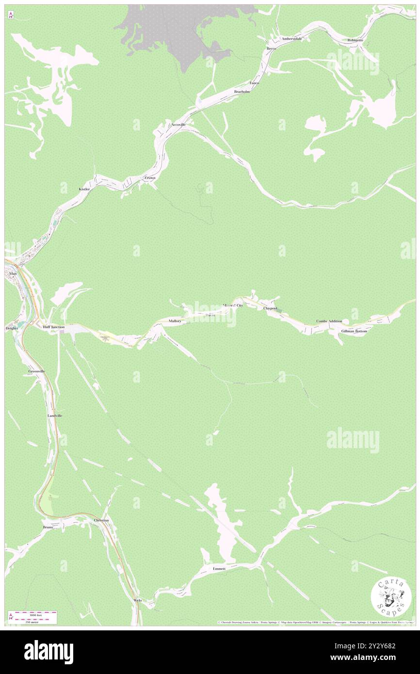 Davin, Logan County, US, United States, West Virginia, N 37 43' 54'', S 81 49' 45'', map, Cartascapes Map published in 2024. Explore Cartascapes, a map revealing Earth's diverse landscapes, cultures, and ecosystems. Journey through time and space, discovering the interconnectedness of our planet's past, present, and future. Stock Photohttps://www.alamy.com/image-license-details/?v=1https://www.alamy.com/davin-logan-county-us-united-states-west-virginia-n-37-43-54-s-81-49-45-map-cartascapes-map-published-in-2024-explore-cartascapes-a-map-revealing-earths-diverse-landscapes-cultures-and-ecosystems-journey-through-time-and-space-discovering-the-interconnectedness-of-our-planets-past-present-and-future-image621400194.html
RM2Y2Y682–Davin, Logan County, US, United States, West Virginia, N 37 43' 54'', S 81 49' 45'', map, Cartascapes Map published in 2024. Explore Cartascapes, a map revealing Earth's diverse landscapes, cultures, and ecosystems. Journey through time and space, discovering the interconnectedness of our planet's past, present, and future.
 Logan, Logan County, US, United States, West Virginia, N 37 50' 55'', S 81 59' 36'', map, Cartascapes Map published in 2024. Explore Cartascapes, a map revealing Earth's diverse landscapes, cultures, and ecosystems. Journey through time and space, discovering the interconnectedness of our planet's past, present, and future. Stock Photohttps://www.alamy.com/image-license-details/?v=1https://www.alamy.com/logan-logan-county-us-united-states-west-virginia-n-37-50-55-s-81-59-36-map-cartascapes-map-published-in-2024-explore-cartascapes-a-map-revealing-earths-diverse-landscapes-cultures-and-ecosystems-journey-through-time-and-space-discovering-the-interconnectedness-of-our-planets-past-present-and-future-image621355747.html
RM2Y2W5GK–Logan, Logan County, US, United States, West Virginia, N 37 50' 55'', S 81 59' 36'', map, Cartascapes Map published in 2024. Explore Cartascapes, a map revealing Earth's diverse landscapes, cultures, and ecosystems. Journey through time and space, discovering the interconnectedness of our planet's past, present, and future.
 Kitchen, Logan County, US, United States, West Virginia, N 37 58' 53'', S 82 2' 3'', map, Cartascapes Map published in 2024. Explore Cartascapes, a map revealing Earth's diverse landscapes, cultures, and ecosystems. Journey through time and space, discovering the interconnectedness of our planet's past, present, and future. Stock Photohttps://www.alamy.com/image-license-details/?v=1https://www.alamy.com/kitchen-logan-county-us-united-states-west-virginia-n-37-58-53-s-82-2-3-map-cartascapes-map-published-in-2024-explore-cartascapes-a-map-revealing-earths-diverse-landscapes-cultures-and-ecosystems-journey-through-time-and-space-discovering-the-interconnectedness-of-our-planets-past-present-and-future-image621388099.html
RM2Y2XJT3–Kitchen, Logan County, US, United States, West Virginia, N 37 58' 53'', S 82 2' 3'', map, Cartascapes Map published in 2024. Explore Cartascapes, a map revealing Earth's diverse landscapes, cultures, and ecosystems. Journey through time and space, discovering the interconnectedness of our planet's past, present, and future.
 Banco, Logan County, US, United States, West Virginia, N 38 0' 9'', S 82 0' 30'', map, Cartascapes Map published in 2024. Explore Cartascapes, a map revealing Earth's diverse landscapes, cultures, and ecosystems. Journey through time and space, discovering the interconnectedness of our planet's past, present, and future. Stock Photohttps://www.alamy.com/image-license-details/?v=1https://www.alamy.com/banco-logan-county-us-united-states-west-virginia-n-38-0-9-s-82-0-30-map-cartascapes-map-published-in-2024-explore-cartascapes-a-map-revealing-earths-diverse-landscapes-cultures-and-ecosystems-journey-through-time-and-space-discovering-the-interconnectedness-of-our-planets-past-present-and-future-image621153347.html
RM2Y2FYC3–Banco, Logan County, US, United States, West Virginia, N 38 0' 9'', S 82 0' 30'', map, Cartascapes Map published in 2024. Explore Cartascapes, a map revealing Earth's diverse landscapes, cultures, and ecosystems. Journey through time and space, discovering the interconnectedness of our planet's past, present, and future.
 Greenville, Logan County, US, United States, West Virginia, N 37 43' 15'', S 81 52' 18'', map, Cartascapes Map published in 2024. Explore Cartascapes, a map revealing Earth's diverse landscapes, cultures, and ecosystems. Journey through time and space, discovering the interconnectedness of our planet's past, present, and future. Stock Photohttps://www.alamy.com/image-license-details/?v=1https://www.alamy.com/greenville-logan-county-us-united-states-west-virginia-n-37-43-15-s-81-52-18-map-cartascapes-map-published-in-2024-explore-cartascapes-a-map-revealing-earths-diverse-landscapes-cultures-and-ecosystems-journey-through-time-and-space-discovering-the-interconnectedness-of-our-planets-past-present-and-future-image621339046.html
RM2Y2TC86–Greenville, Logan County, US, United States, West Virginia, N 37 43' 15'', S 81 52' 18'', map, Cartascapes Map published in 2024. Explore Cartascapes, a map revealing Earth's diverse landscapes, cultures, and ecosystems. Journey through time and space, discovering the interconnectedness of our planet's past, present, and future.
 Bradshaw, Logan County, US, United States, West Virginia, N 37 48' 6'', S 82 1' 54'', map, Cartascapes Map published in 2024. Explore Cartascapes, a map revealing Earth's diverse landscapes, cultures, and ecosystems. Journey through time and space, discovering the interconnectedness of our planet's past, present, and future. Stock Photohttps://www.alamy.com/image-license-details/?v=1https://www.alamy.com/bradshaw-logan-county-us-united-states-west-virginia-n-37-48-6-s-82-1-54-map-cartascapes-map-published-in-2024-explore-cartascapes-a-map-revealing-earths-diverse-landscapes-cultures-and-ecosystems-journey-through-time-and-space-discovering-the-interconnectedness-of-our-planets-past-present-and-future-image621442033.html
RM2Y313J9–Bradshaw, Logan County, US, United States, West Virginia, N 37 48' 6'', S 82 1' 54'', map, Cartascapes Map published in 2024. Explore Cartascapes, a map revealing Earth's diverse landscapes, cultures, and ecosystems. Journey through time and space, discovering the interconnectedness of our planet's past, present, and future.
 Crown, Logan County, US, United States, West Virginia, N 37 45' 30'', S 81 50' 38'', map, Cartascapes Map published in 2024. Explore Cartascapes, a map revealing Earth's diverse landscapes, cultures, and ecosystems. Journey through time and space, discovering the interconnectedness of our planet's past, present, and future. Stock Photohttps://www.alamy.com/image-license-details/?v=1https://www.alamy.com/crown-logan-county-us-united-states-west-virginia-n-37-45-30-s-81-50-38-map-cartascapes-map-published-in-2024-explore-cartascapes-a-map-revealing-earths-diverse-landscapes-cultures-and-ecosystems-journey-through-time-and-space-discovering-the-interconnectedness-of-our-planets-past-present-and-future-image621445862.html
RM2Y318F2–Crown, Logan County, US, United States, West Virginia, N 37 45' 30'', S 81 50' 38'', map, Cartascapes Map published in 2024. Explore Cartascapes, a map revealing Earth's diverse landscapes, cultures, and ecosystems. Journey through time and space, discovering the interconnectedness of our planet's past, present, and future.
 Henlawson, Logan County, US, United States, West Virginia, N 37 54' 8'', S 81 59' 17'', map, Cartascapes Map published in 2024. Explore Cartascapes, a map revealing Earth's diverse landscapes, cultures, and ecosystems. Journey through time and space, discovering the interconnectedness of our planet's past, present, and future. Stock Photohttps://www.alamy.com/image-license-details/?v=1https://www.alamy.com/henlawson-logan-county-us-united-states-west-virginia-n-37-54-8-s-81-59-17-map-cartascapes-map-published-in-2024-explore-cartascapes-a-map-revealing-earths-diverse-landscapes-cultures-and-ecosystems-journey-through-time-and-space-discovering-the-interconnectedness-of-our-planets-past-present-and-future-image621218195.html
RM2Y2JX43–Henlawson, Logan County, US, United States, West Virginia, N 37 54' 8'', S 81 59' 17'', map, Cartascapes Map published in 2024. Explore Cartascapes, a map revealing Earth's diverse landscapes, cultures, and ecosystems. Journey through time and space, discovering the interconnectedness of our planet's past, present, and future.
 Mallory, Logan County, US, United States, West Virginia, N 37 43' 50'', S 81 50' 16'', map, Cartascapes Map published in 2024. Explore Cartascapes, a map revealing Earth's diverse landscapes, cultures, and ecosystems. Journey through time and space, discovering the interconnectedness of our planet's past, present, and future. Stock Photohttps://www.alamy.com/image-license-details/?v=1https://www.alamy.com/mallory-logan-county-us-united-states-west-virginia-n-37-43-50-s-81-50-16-map-cartascapes-map-published-in-2024-explore-cartascapes-a-map-revealing-earths-diverse-landscapes-cultures-and-ecosystems-journey-through-time-and-space-discovering-the-interconnectedness-of-our-planets-past-present-and-future-image621419656.html
RM2Y30334–Mallory, Logan County, US, United States, West Virginia, N 37 43' 50'', S 81 50' 16'', map, Cartascapes Map published in 2024. Explore Cartascapes, a map revealing Earth's diverse landscapes, cultures, and ecosystems. Journey through time and space, discovering the interconnectedness of our planet's past, present, and future.
 Shegon, Logan County, US, United States, West Virginia, N 37 51' 20'', S 82 4' 8'', map, Cartascapes Map published in 2024. Explore Cartascapes, a map revealing Earth's diverse landscapes, cultures, and ecosystems. Journey through time and space, discovering the interconnectedness of our planet's past, present, and future. Stock Photohttps://www.alamy.com/image-license-details/?v=1https://www.alamy.com/shegon-logan-county-us-united-states-west-virginia-n-37-51-20-s-82-4-8-map-cartascapes-map-published-in-2024-explore-cartascapes-a-map-revealing-earths-diverse-landscapes-cultures-and-ecosystems-journey-through-time-and-space-discovering-the-interconnectedness-of-our-planets-past-present-and-future-image621193254.html
RM2Y2HP9A–Shegon, Logan County, US, United States, West Virginia, N 37 51' 20'', S 82 4' 8'', map, Cartascapes Map published in 2024. Explore Cartascapes, a map revealing Earth's diverse landscapes, cultures, and ecosystems. Journey through time and space, discovering the interconnectedness of our planet's past, present, and future.
 Sharples, Logan County, US, United States, West Virginia, N 37 55' 13'', S 81 49' 45'', map, Cartascapes Map published in 2024. Explore Cartascapes, a map revealing Earth's diverse landscapes, cultures, and ecosystems. Journey through time and space, discovering the interconnectedness of our planet's past, present, and future. Stock Photohttps://www.alamy.com/image-license-details/?v=1https://www.alamy.com/sharples-logan-county-us-united-states-west-virginia-n-37-55-13-s-81-49-45-map-cartascapes-map-published-in-2024-explore-cartascapes-a-map-revealing-earths-diverse-landscapes-cultures-and-ecosystems-journey-through-time-and-space-discovering-the-interconnectedness-of-our-planets-past-present-and-future-image621199333.html
RM2Y2J22D–Sharples, Logan County, US, United States, West Virginia, N 37 55' 13'', S 81 49' 45'', map, Cartascapes Map published in 2024. Explore Cartascapes, a map revealing Earth's diverse landscapes, cultures, and ecosystems. Journey through time and space, discovering the interconnectedness of our planet's past, present, and future.
 Bradshaw, Logan County, US, United States, West Virginia, N 37 48' 6'', S 82 1' 54'', map, Cartascapes Map published in 2024. Explore Cartascapes, a map revealing Earth's diverse landscapes, cultures, and ecosystems. Journey through time and space, discovering the interconnectedness of our planet's past, present, and future. Stock Photohttps://www.alamy.com/image-license-details/?v=1https://www.alamy.com/bradshaw-logan-county-us-united-states-west-virginia-n-37-48-6-s-82-1-54-map-cartascapes-map-published-in-2024-explore-cartascapes-a-map-revealing-earths-diverse-landscapes-cultures-and-ecosystems-journey-through-time-and-space-discovering-the-interconnectedness-of-our-planets-past-present-and-future-image621157434.html
RM2Y2G4J2–Bradshaw, Logan County, US, United States, West Virginia, N 37 48' 6'', S 82 1' 54'', map, Cartascapes Map published in 2024. Explore Cartascapes, a map revealing Earth's diverse landscapes, cultures, and ecosystems. Journey through time and space, discovering the interconnectedness of our planet's past, present, and future.