Quick filters:
Map of oneill Stock Photos and Images
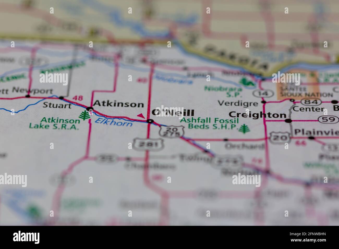 O'Neill Nebraska USA Shown on a Geography map or Road map Stock Photohttps://www.alamy.com/image-license-details/?v=1https://www.alamy.com/oneill-nebraska-usa-shown-on-a-geography-map-or-road-map-image426514529.html
RM2FNWBHN–O'Neill Nebraska USA Shown on a Geography map or Road map
 O'Neill Brook, , AU, Australia, Western Australia, S 32 28' 59'', N 116 10' 0'', map, Cartascapes Map published in 2024. Explore Cartascapes, a map revealing Earth's diverse landscapes, cultures, and ecosystems. Journey through time and space, discovering the interconnectedness of our planet's past, present, and future. Stock Photohttps://www.alamy.com/image-license-details/?v=1https://www.alamy.com/oneill-brook-au-australia-western-australia-s-32-28-59-n-116-10-0-map-cartascapes-map-published-in-2024-explore-cartascapes-a-map-revealing-earths-diverse-landscapes-cultures-and-ecosystems-journey-through-time-and-space-discovering-the-interconnectedness-of-our-planets-past-present-and-future-image625450394.html
RM2Y9FMA2–O'Neill Brook, , AU, Australia, Western Australia, S 32 28' 59'', N 116 10' 0'', map, Cartascapes Map published in 2024. Explore Cartascapes, a map revealing Earth's diverse landscapes, cultures, and ecosystems. Journey through time and space, discovering the interconnectedness of our planet's past, present, and future.
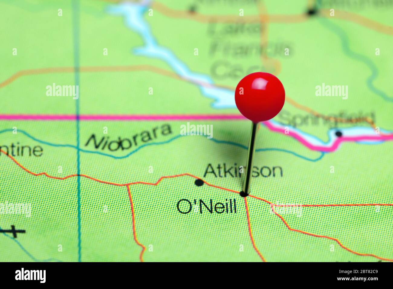 O'Neill pinned on a map of Nebraska, USA Stock Photohttps://www.alamy.com/image-license-details/?v=1https://www.alamy.com/oneill-pinned-on-a-map-of-nebraska-usa-image359136633.html
RF2BT82C9–O'Neill pinned on a map of Nebraska, USA
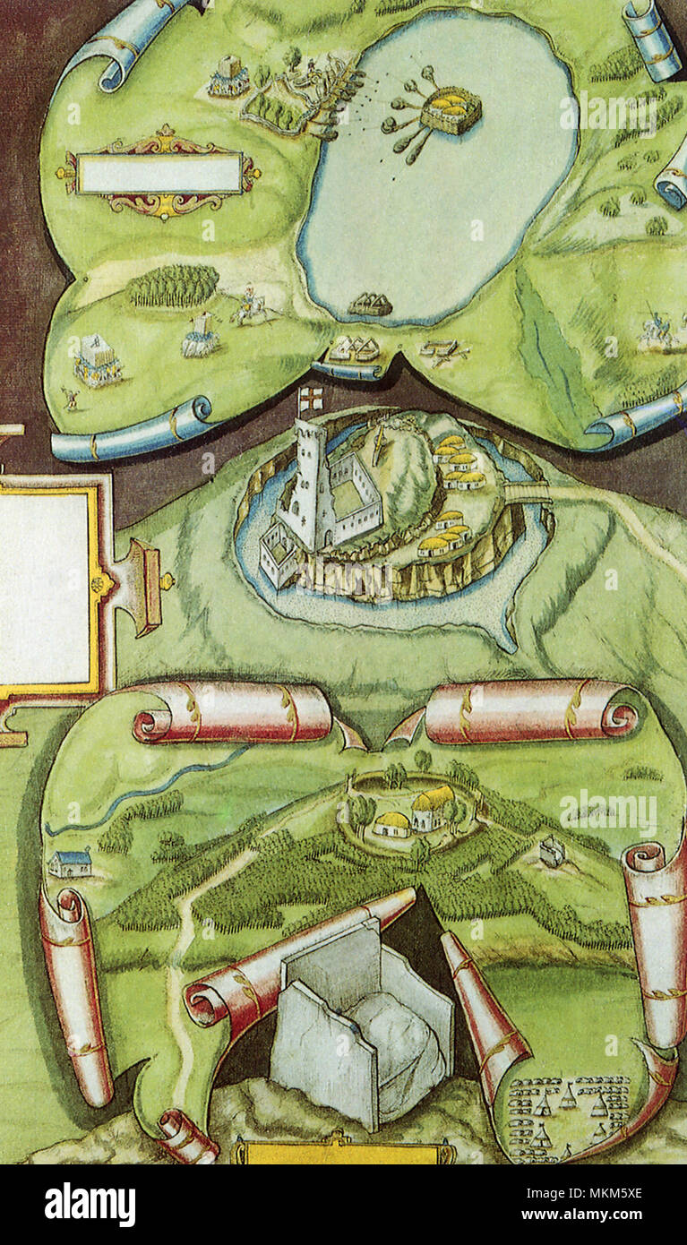 Old World Irish Map 1600 Stock Photohttps://www.alamy.com/image-license-details/?v=1https://www.alamy.com/old-world-irish-map-1600-image184225846.html
RMMKM5XE–Old World Irish Map 1600
 A 16th century plan of The Battle of the Yellow Ford, fought in County Armagh on 14 August 1598, during the Nine Years' War in Ireland. An English army detachment of about 4,000, led by Henry Bagenal, was sent from the Pale. Marching from Armagh to the Blackwater, the column was routed by a Gaelic Irish army under Hugh O'Neill of Tyrone, whose forces divided the English column and stalled its advance. Bagenal was killed, along with scores of his men. Stock Photohttps://www.alamy.com/image-license-details/?v=1https://www.alamy.com/a-16th-century-plan-of-the-battle-of-the-yellow-ford-fought-in-county-armagh-on-14-august-1598-during-the-nine-years-war-in-ireland-an-english-army-detachment-of-about-4000-led-by-henry-bagenal-was-sent-from-the-pale-marching-from-armagh-to-the-blackwater-the-column-was-routed-by-a-gaelic-irish-army-under-hugh-oneill-of-tyrone-whose-forces-divided-the-english-column-and-stalled-its-advance-bagenal-was-killed-along-with-scores-of-his-men-image559828873.html
RM2REPBC9–A 16th century plan of The Battle of the Yellow Ford, fought in County Armagh on 14 August 1598, during the Nine Years' War in Ireland. An English army detachment of about 4,000, led by Henry Bagenal, was sent from the Pale. Marching from Armagh to the Blackwater, the column was routed by a Gaelic Irish army under Hugh O'Neill of Tyrone, whose forces divided the English column and stalled its advance. Bagenal was killed, along with scores of his men.
 . English: Detail from copy of an Ulsster map by Richard Bartlett of O'Neill inauguration at Tulach Og. The king is seated on a mound during an inauguration ceremony that includes the single shoe ritual. Copy from Dartmouth Collection, National Maritime Museum, Greenwich. 1602. Copy from map by Richard Bartlett 937 O'Neill inauguration Richard Bartlett Stock Photohttps://www.alamy.com/image-license-details/?v=1https://www.alamy.com/english-detail-from-copy-of-an-ulsster-map-by-richard-bartlett-of-oneill-inauguration-at-tulach-og-the-king-is-seated-on-a-mound-during-an-inauguration-ceremony-that-includes-the-single-shoe-ritual-copy-from-dartmouth-collection-national-maritime-museum-greenwich-1602-copy-from-map-by-richard-bartlett-937-oneill-inauguration-richard-bartlett-image185882129.html
RMMPBJFD–. English: Detail from copy of an Ulsster map by Richard Bartlett of O'Neill inauguration at Tulach Og. The king is seated on a mound during an inauguration ceremony that includes the single shoe ritual. Copy from Dartmouth Collection, National Maritime Museum, Greenwich. 1602. Copy from map by Richard Bartlett 937 O'Neill inauguration Richard Bartlett
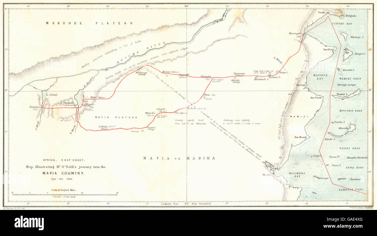 MOZAMBIQUE: coast. Mavia Mabiha country. O'Neill 1882. RGS map, 1883 Stock Photohttps://www.alamy.com/image-license-details/?v=1https://www.alamy.com/stock-photo-mozambique-coast-mavia-mabiha-country-oneill-1882-rgs-map-1883-109719976.html
RFGAE4XG–MOZAMBIQUE: coast. Mavia Mabiha country. O'Neill 1882. RGS map, 1883
 Marine Corps personnel demonstrate map reading and compass skills during Operation Dawson River in Vietnam. The individuals in the photograph are Corporal J. P. O'Neill, Sergeant R. J. Thibault, and First Lieutenant E. D. Connelly. Together, they plot targets for a mortar mission west of Khe Sanh and south of the Demilitarized Zone. Stock Photohttps://www.alamy.com/image-license-details/?v=1https://www.alamy.com/marine-corps-personnel-demonstrate-map-reading-and-compass-skills-during-operation-dawson-river-in-vietnam-the-individuals-in-the-photograph-are-corporal-j-p-oneill-sergeant-r-j-thibault-and-first-lieutenant-e-d-connelly-together-they-plot-targets-for-a-mortar-mission-west-of-khe-sanh-and-south-of-the-demilitarized-zone-image574164804.html
RM2TA3D1T–Marine Corps personnel demonstrate map reading and compass skills during Operation Dawson River in Vietnam. The individuals in the photograph are Corporal J. P. O'Neill, Sergeant R. J. Thibault, and First Lieutenant E. D. Connelly. Together, they plot targets for a mortar mission west of Khe Sanh and south of the Demilitarized Zone.
 MOZAMBIQUE: Makua Country. O'Neill journey. Nampula. RGS, 1882 antique map Stock Photohttps://www.alamy.com/image-license-details/?v=1https://www.alamy.com/stock-photo-mozambique-makua-country-oneill-journey-nampula-rgs-1882-antique-map-110380167.html
RFGBG70R–MOZAMBIQUE: Makua Country. O'Neill journey. Nampula. RGS, 1882 antique map
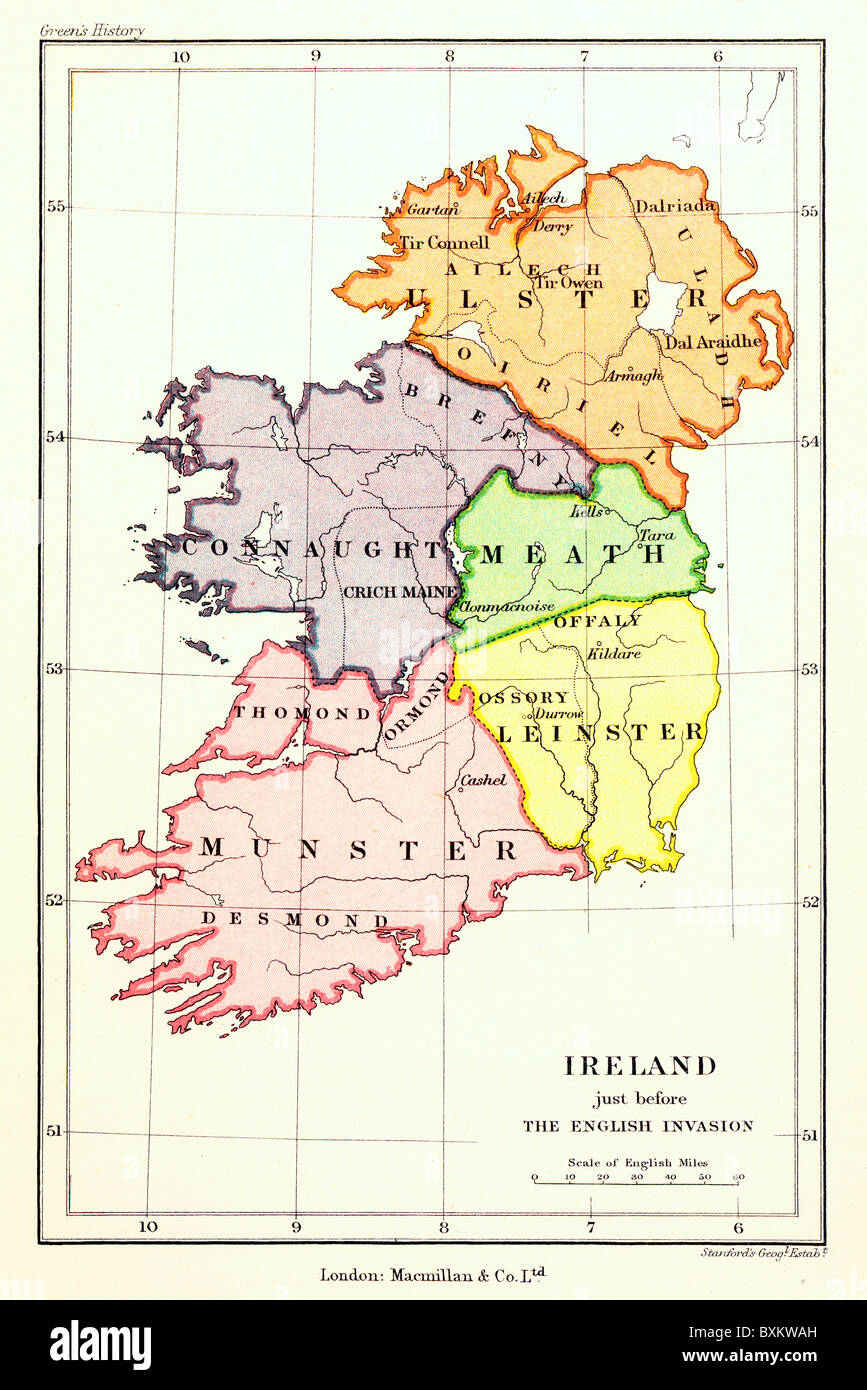 A Map of the five Irish Provinces prior to the Nine Years' war between 1594 and 1603; Colour Illustration; Stock Photohttps://www.alamy.com/image-license-details/?v=1https://www.alamy.com/stock-photo-a-map-of-the-five-irish-provinces-prior-to-the-nine-years-war-between-33628409.html
RMBXKWAH–A Map of the five Irish Provinces prior to the Nine Years' war between 1594 and 1603; Colour Illustration;
 Tip O'Neill Stock Photohttps://www.alamy.com/image-license-details/?v=1https://www.alamy.com/stock-photo-tip-oneill-140669777.html
RMJ4T1MH–Tip O'Neill
 41177 Leaders and the Scientific Staff Before the Departure from Home - Wilkins, Mlloch, Beuchat, O'Neill, Cox, McKinlay, Mamen Stock Photohttps://www.alamy.com/image-license-details/?v=1https://www.alamy.com/stock-photo-41177-leaders-and-the-scientific-staff-before-the-departure-from-home-115089701.html
RMGK6P2D–41177 Leaders and the Scientific Staff Before the Departure from Home - Wilkins, Mlloch, Beuchat, O'Neill, Cox, McKinlay, Mamen
 Norman O'Neill Stock Photohttps://www.alamy.com/image-license-details/?v=1https://www.alamy.com/stock-photo-norman-oneill-140278182.html
RMJ46672–Norman O'Neill
 A video monitor in the Joint Operations Center displays a Google Map image of the area around Trump Tower. With regard to the heightened security in the vicinity of Trump Tower in midtown Manhattan as President-elect Donald J. Trump holds meetings with potential members of his staff, Mayor Bill de Blasio, Police Commissioner James O'Neill and Secret Service Agent David Beach and Department of Transportation Commissioner Polly Trottenberg spoke at a press conference at NYPD Headquarters' Joint Operations Center. (Photo by Albin Lohr-Jones/Pacific Press) Stock Photohttps://www.alamy.com/image-license-details/?v=1https://www.alamy.com/stock-photo-a-video-monitor-in-the-joint-operations-center-displays-a-google-map-126144030.html
RMH969YX–A video monitor in the Joint Operations Center displays a Google Map image of the area around Trump Tower. With regard to the heightened security in the vicinity of Trump Tower in midtown Manhattan as President-elect Donald J. Trump holds meetings with potential members of his staff, Mayor Bill de Blasio, Police Commissioner James O'Neill and Secret Service Agent David Beach and Department of Transportation Commissioner Polly Trottenberg spoke at a press conference at NYPD Headquarters' Joint Operations Center. (Photo by Albin Lohr-Jones/Pacific Press)
 Nero oneill Stock Photohttps://www.alamy.com/image-license-details/?v=1https://www.alamy.com/stock-photo-nero-oneill-139553785.html
RMJ3167N–Nero oneill
 Lake San Luis and O'Neill Forebay Reservoir (United States of America, North America, us, usa, California) map vector illustration, scribble sketch Sa Stock Vectorhttps://www.alamy.com/image-license-details/?v=1https://www.alamy.com/lake-san-luis-and-oneill-forebay-reservoir-united-states-of-america-north-america-us-usa-california-map-vector-illustration-scribble-sketch-sa-image530126158.html
RF2NPD992–Lake San Luis and O'Neill Forebay Reservoir (United States of America, North America, us, usa, California) map vector illustration, scribble sketch Sa
 Daniel O'Neill Memorial Stock Photohttps://www.alamy.com/image-license-details/?v=1https://www.alamy.com/stock-photo-daniel-oneill-memorial-139728086.html
RMJ394GP–Daniel O'Neill Memorial
 'The Roman Empire Under Augustus', c1930. Creator: Unknown. Stock Photohttps://www.alamy.com/image-license-details/?v=1https://www.alamy.com/the-roman-empire-under-augustus-c1930-creator-unknown-image243217299.html
RMT3KE43–'The Roman Empire Under Augustus', c1930. Creator: Unknown.
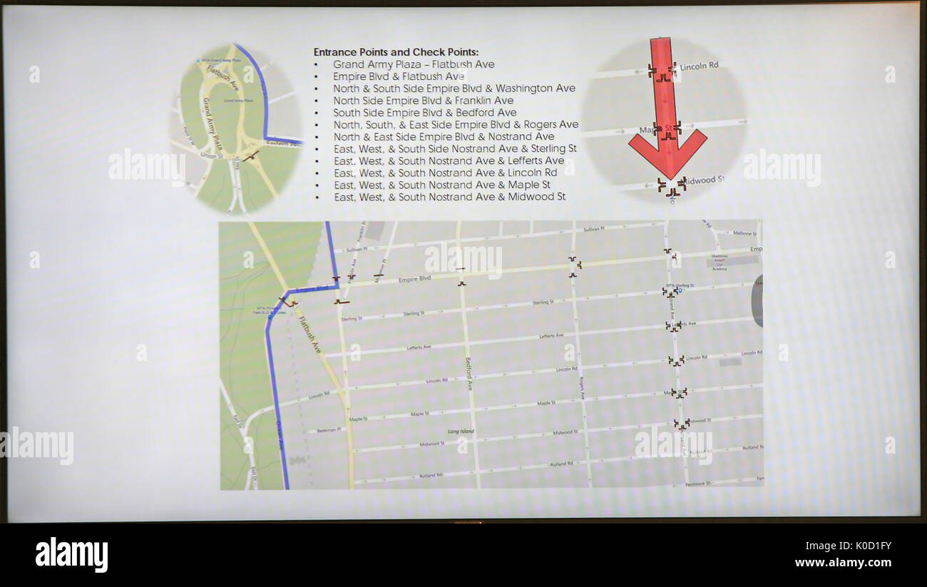 NYPD-generated diagram of access points to Flatbush Avenue. NYC Mayor Bill de Blasio joined NYPD commissioner James O'Neill, Brooklyn Borough President Eric Adams & other officials in Brooklyn to announce that the pre-dawn Labor Day celebration known as J'Ouvert will take on a new form similar to New Year's Eve celebrations in Times Square. These changes, which include a later start time and restricted access to the parade route, are designed to reduce the violence that has plagued recent J'Ouverts and led to some calls for its cancellation. (Photo by Andy Katz/Pacific Press) Stock Photohttps://www.alamy.com/image-license-details/?v=1https://www.alamy.com/nypd-generated-diagram-of-access-points-to-flatbush-avenue-nyc-mayor-image155179919.html
RMK0D1FY–NYPD-generated diagram of access points to Flatbush Avenue. NYC Mayor Bill de Blasio joined NYPD commissioner James O'Neill, Brooklyn Borough President Eric Adams & other officials in Brooklyn to announce that the pre-dawn Labor Day celebration known as J'Ouvert will take on a new form similar to New Year's Eve celebrations in Times Square. These changes, which include a later start time and restricted access to the parade route, are designed to reduce the violence that has plagued recent J'Ouverts and led to some calls for its cancellation. (Photo by Andy Katz/Pacific Press)
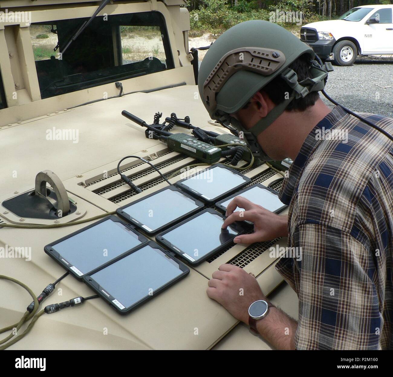 Christopher O'Neill, CERDEC CP&I engineer, configures the Tactical Computing Environment, or TCE, extend mode, which pieces together various points on a digital map to create one, large map-view similar to what is available in larger command post video displays. (Photo credit: U.S. Army CERDEC/Susan Sodon) Stock Photohttps://www.alamy.com/image-license-details/?v=1https://www.alamy.com/christopher-oneill-cerdec-cpi-engineer-configures-the-tactical-computing-environment-or-tce-extend-mode-which-pieces-together-various-points-on-a-digital-map-to-create-one-large-map-view-similar-to-what-is-available-in-larger-command-post-video-displays-photo-credit-us-army-cerdecsusan-sodon-image208193720.html
RMP2M160–Christopher O'Neill, CERDEC CP&I engineer, configures the Tactical Computing Environment, or TCE, extend mode, which pieces together various points on a digital map to create one, large map-view similar to what is available in larger command post video displays. (Photo credit: U.S. Army CERDEC/Susan Sodon)
 O'Neill Park, , AU, Australia, New South Wales, S 32 50' 21'', N 151 20' 4'', map, Cartascapes Map published in 2024. Explore Cartascapes, a map revealing Earth's diverse landscapes, cultures, and ecosystems. Journey through time and space, discovering the interconnectedness of our planet's past, present, and future. Stock Photohttps://www.alamy.com/image-license-details/?v=1https://www.alamy.com/oneill-park-au-australia-new-south-wales-s-32-50-21-n-151-20-4-map-cartascapes-map-published-in-2024-explore-cartascapes-a-map-revealing-earths-diverse-landscapes-cultures-and-ecosystems-journey-through-time-and-space-discovering-the-interconnectedness-of-our-planets-past-present-and-future-image625428787.html
RM2Y9EMPB–O'Neill Park, , AU, Australia, New South Wales, S 32 50' 21'', N 151 20' 4'', map, Cartascapes Map published in 2024. Explore Cartascapes, a map revealing Earth's diverse landscapes, cultures, and ecosystems. Journey through time and space, discovering the interconnectedness of our planet's past, present, and future.
 USGS TOPO Map Nebraska NE O'Neill 20111025 TM Restoration Stock Photohttps://www.alamy.com/image-license-details/?v=1https://www.alamy.com/usgs-topo-map-nebraska-ne-oneill-20111025-tm-restoration-image333631583.html
RM2AAP6DK–USGS TOPO Map Nebraska NE O'Neill 20111025 TM Restoration
 . P.J. Hannifan & Co.'s new commercial railroad and county map of New Yort State and gazetteer .. . BIMaHAMTOM-Continued. W. H. MONROE, Practical Horseshoer. Special Treatment given to Lame andInterfering Horses and Diseases of the Foot. No- 228 Water St., BINGHAMTON, N. Y. E. li. StJlililVflfl, Contractor AND .... Builder . ® ® ® Estimates Furnished,JOBBING given special. attention. No. 129 LeRoy Street, BlNQHAMTON, N. Y. CARRIAGE MFR. ONeill, J., 259 Water. CHAIR SfFFRS. Wilkinson & Eastwood. CIGAR MTRS. Butler, C, 161 Washington. Smith, C. B. Jr., 305 Water. Carpenters, Contractorsand Duild Stock Photohttps://www.alamy.com/image-license-details/?v=1https://www.alamy.com/pj-hannifan-cos-new-commercial-railroad-and-county-map-of-new-yort-state-and-gazetteer-bimahamtom-continued-w-h-monroe-practical-horseshoer-special-treatment-given-to-lame-andinterfering-horses-and-diseases-of-the-foot-no-228-water-st-binghamton-n-y-e-li-stjlililvflfl-contractor-and-builder-estimates-furnishedjobbing-given-special-attention-no-129-leroy-street-blnqhamton-n-y-carriage-mfr-oneill-j-259-water-chair-sfffrs-wilkinson-eastwood-cigar-mtrs-butler-c-161-washington-smith-c-b-jr-305-water-carpenters-contractorsand-duild-image375710715.html
RM2CR72RR–. P.J. Hannifan & Co.'s new commercial railroad and county map of New Yort State and gazetteer .. . BIMaHAMTOM-Continued. W. H. MONROE, Practical Horseshoer. Special Treatment given to Lame andInterfering Horses and Diseases of the Foot. No- 228 Water St., BINGHAMTON, N. Y. E. li. StJlililVflfl, Contractor AND .... Builder . ® ® ® Estimates Furnished,JOBBING given special. attention. No. 129 LeRoy Street, BlNQHAMTON, N. Y. CARRIAGE MFR. ONeill, J., 259 Water. CHAIR SfFFRS. Wilkinson & Eastwood. CIGAR MTRS. Butler, C, 161 Washington. Smith, C. B. Jr., 305 Water. Carpenters, Contractorsand Duild
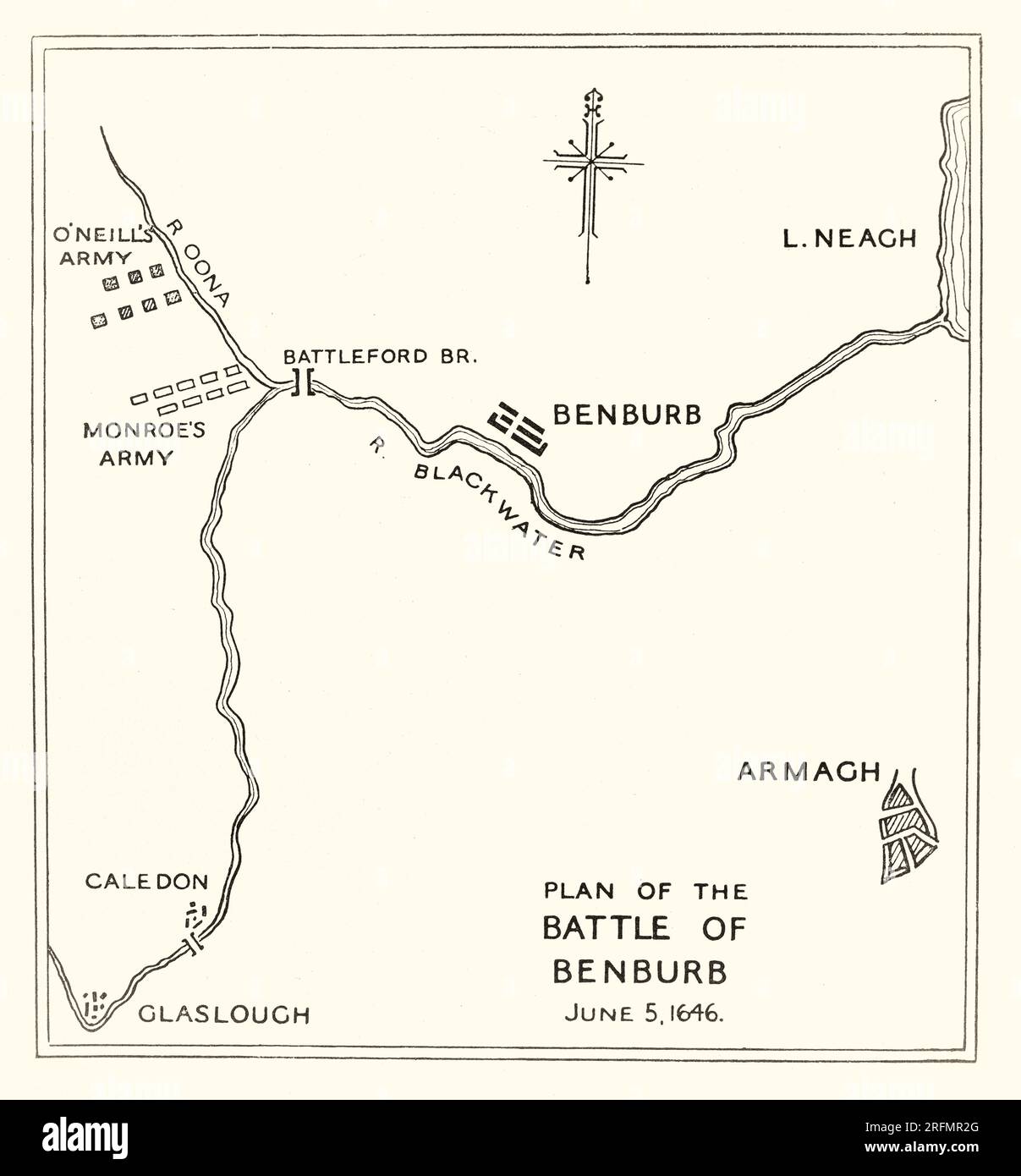 A 17th century plan of the Battle of Benburb, that took place in County Tyrone, Northern Ireland, on 5 June 1646 during the Irish Confederate Wars, the Irish theatre of the Wars of the Three Kingdoms. It was fought between the Irish Confederates under Owen Roe O'Neill, and an army of Scottish Covenanters and Scottish/English settlers under Robert Monro. The battle ended in a decisive victory for the Irish Confederates and ended Scottish hopes of conquering Ireland and imposing their own religious settlement there. Stock Photohttps://www.alamy.com/image-license-details/?v=1https://www.alamy.com/a-17th-century-plan-of-the-battle-of-benburb-that-took-place-in-county-tyrone-northern-ireland-on-5-june-1646-during-the-irish-confederate-wars-the-irish-theatre-of-the-wars-of-the-three-kingdoms-it-was-fought-between-the-irish-confederates-under-owen-roe-oneill-and-an-army-of-scottish-covenanters-and-scottishenglish-settlers-under-robert-monro-the-battle-ended-in-a-decisive-victory-for-the-irish-confederates-and-ended-scottish-hopes-of-conquering-ireland-and-imposing-their-own-religious-settlement-there-image560408760.html
RM2RFMR2G–A 17th century plan of the Battle of Benburb, that took place in County Tyrone, Northern Ireland, on 5 June 1646 during the Irish Confederate Wars, the Irish theatre of the Wars of the Three Kingdoms. It was fought between the Irish Confederates under Owen Roe O'Neill, and an army of Scottish Covenanters and Scottish/English settlers under Robert Monro. The battle ended in a decisive victory for the Irish Confederates and ended Scottish hopes of conquering Ireland and imposing their own religious settlement there.
 . English: Detail from copy of an Ulsster map by Richard Bartlett of O'Neill inauguration at Tulach Og. The king is seated on a mound during an inauguration ceremony that includes the single shoe ritual. Copy from Dartmouth Collection, National Maritime Museum, Greenwich. 1602. Copy from map by Richard Bartlett 937 O'Neill inauguration Richard Bartlett detail cropped Stock Photohttps://www.alamy.com/image-license-details/?v=1https://www.alamy.com/english-detail-from-copy-of-an-ulsster-map-by-richard-bartlett-of-oneill-inauguration-at-tulach-og-the-king-is-seated-on-a-mound-during-an-inauguration-ceremony-that-includes-the-single-shoe-ritual-copy-from-dartmouth-collection-national-maritime-museum-greenwich-1602-copy-from-map-by-richard-bartlett-937-oneill-inauguration-richard-bartlett-detail-cropped-image185882130.html
RMMPBJFE–. English: Detail from copy of an Ulsster map by Richard Bartlett of O'Neill inauguration at Tulach Og. The king is seated on a mound during an inauguration ceremony that includes the single shoe ritual. Copy from Dartmouth Collection, National Maritime Museum, Greenwich. 1602. Copy from map by Richard Bartlett 937 O'Neill inauguration Richard Bartlett detail cropped
 Image taken from page 9 of 'Sketches of African Scenery, from Zanzibar to the Victoria Nyanza, being a series of coloured lithographic pictures, from sketches by ... T. O'Neill. (The larger part of the letterpress is from a journal kept by T. O'Neill.)' Image taken from page 9 of 'Sketches of African Scenery, Stock Photohttps://www.alamy.com/image-license-details/?v=1https://www.alamy.com/stock-photo-image-taken-from-page-9-of-sketches-of-african-scenery-from-zanzibar-127716054.html
RMHBNY3J–Image taken from page 9 of 'Sketches of African Scenery, from Zanzibar to the Victoria Nyanza, being a series of coloured lithographic pictures, from sketches by ... T. O'Neill. (The larger part of the letterpress is from a journal kept by T. O'Neill.)' Image taken from page 9 of 'Sketches of African Scenery,
 The O'Neill's burial place 35197434900 o Stock Photohttps://www.alamy.com/image-license-details/?v=1https://www.alamy.com/stock-photo-the-oneills-burial-place-35197434900-o-147110014.html
RMJF9C92–The O'Neill's burial place 35197434900 o
 Lake San Luis and O'Neill Forebay Reservoir (United States of America, North America, us, usa, California) map vector illustration, scribble sketch Sa Stock Vectorhttps://www.alamy.com/image-license-details/?v=1https://www.alamy.com/lake-san-luis-and-oneill-forebay-reservoir-united-states-of-america-north-america-us-usa-california-map-vector-illustration-scribble-sketch-sa-image573160031.html
RF2T8DKD3–Lake San Luis and O'Neill Forebay Reservoir (United States of America, North America, us, usa, California) map vector illustration, scribble sketch Sa
 Daniel O'Neill Gravesite Stock Photohttps://www.alamy.com/image-license-details/?v=1https://www.alamy.com/stock-photo-daniel-oneill-gravesite-139728071.html
RMJ394G7–Daniel O'Neill Gravesite
 Fall and Winter, 1890-91 Fashion Catalogue - H. O'Neill and Co. (1890) Stock Photohttps://www.alamy.com/image-license-details/?v=1https://www.alamy.com/stock-photo-fall-and-winter-1890-91-fashion-catalogue-h-oneill-and-co-1890-114280927.html
RMGHWXDK–Fall and Winter, 1890-91 Fashion Catalogue - H. O'Neill and Co. (1890)
 Genterispetto mason oneill Stock Photohttps://www.alamy.com/image-license-details/?v=1https://www.alamy.com/stock-photo-genterispetto-mason-oneill-139548747.html
RMJ30YRR–Genterispetto mason oneill
 O'Neill Lagoon, , AU, Australia, New South Wales, S 36 3' 54'', N 148 55' 4'', map, Cartascapes Map published in 2024. Explore Cartascapes, a map revealing Earth's diverse landscapes, cultures, and ecosystems. Journey through time and space, discovering the interconnectedness of our planet's past, present, and future. Stock Photohttps://www.alamy.com/image-license-details/?v=1https://www.alamy.com/oneill-lagoon-au-australia-new-south-wales-s-36-3-54-n-148-55-4-map-cartascapes-map-published-in-2024-explore-cartascapes-a-map-revealing-earths-diverse-landscapes-cultures-and-ecosystems-journey-through-time-and-space-discovering-the-interconnectedness-of-our-planets-past-present-and-future-image625367368.html
RM2Y9BXCT–O'Neill Lagoon, , AU, Australia, New South Wales, S 36 3' 54'', N 148 55' 4'', map, Cartascapes Map published in 2024. Explore Cartascapes, a map revealing Earth's diverse landscapes, cultures, and ecosystems. Journey through time and space, discovering the interconnectedness of our planet's past, present, and future.
 USGS TOPO Map Arizona AZ O'Neill Hills 20111125 TM Restoration Stock Photohttps://www.alamy.com/image-license-details/?v=1https://www.alamy.com/usgs-topo-map-arizona-az-oneill-hills-20111125-tm-restoration-image242418872.html
RMT2B3MT–USGS TOPO Map Arizona AZ O'Neill Hills 20111125 TM Restoration
 . P.J. Hannifan & Co.'s new commercial railroad and county map of New Yort State and gazetteer .. . 129 LeRoy Street, BlNQHAMTON, N. Y. CARRIAGE MFR. ONeill, J., 259 Water. CHAIR SfFFRS. Wilkinson & Eastwood. CIGAR MTRS. Butler, C, 161 Washington. Smith, C. B. Jr., 305 Water. Carpenters, Contractorsand Duilders. WALL, F. P., 24 Baldwin Street. £IOFFIN, A. N., 5£4 Chenango Street. EDWARDS, F. D., Contractor, 75 GrandBoulevard. KEEJLER & CO. CONTRACTORS and BUILDERS Estimates furnished and Jobbingattended to.4 Catharine Street. Leanord, M., 37 Washington. E. S. MEEKER, Contractor and Builder. ES Stock Photohttps://www.alamy.com/image-license-details/?v=1https://www.alamy.com/pj-hannifan-cos-new-commercial-railroad-and-county-map-of-new-yort-state-and-gazetteer-129-leroy-street-blnqhamton-n-y-carriage-mfr-oneill-j-259-water-chair-sfffrs-wilkinson-eastwood-cigar-mtrs-butler-c-161-washington-smith-c-b-jr-305-water-carpenters-contractorsand-duilders-wall-f-p-24-baldwin-street-ioffin-a-n-54-chenango-street-edwards-f-d-contractor-75-grandboulevard-keejler-co-contractors-and-builders-estimates-furnished-and-jobbingattended-to4-catharine-street-leanord-m-37-washington-e-s-meeker-contractor-and-builder-es-image375709949.html
RM2CR71TD–. P.J. Hannifan & Co.'s new commercial railroad and county map of New Yort State and gazetteer .. . 129 LeRoy Street, BlNQHAMTON, N. Y. CARRIAGE MFR. ONeill, J., 259 Water. CHAIR SfFFRS. Wilkinson & Eastwood. CIGAR MTRS. Butler, C, 161 Washington. Smith, C. B. Jr., 305 Water. Carpenters, Contractorsand Duilders. WALL, F. P., 24 Baldwin Street. £IOFFIN, A. N., 5£4 Chenango Street. EDWARDS, F. D., Contractor, 75 GrandBoulevard. KEEJLER & CO. CONTRACTORS and BUILDERS Estimates furnished and Jobbingattended to.4 Catharine Street. Leanord, M., 37 Washington. E. S. MEEKER, Contractor and Builder. ES
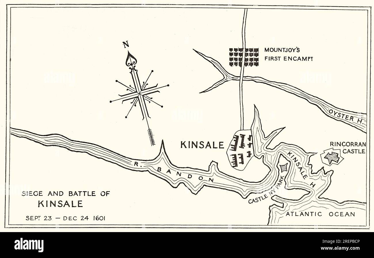 A 17th century plan of the siege of Kinsale, in County Cork, Ireland, also known as the Battle of Kinsale, was the ultimate battle in England's conquest of Gaelic Ireland, commencing in October 1601, near the end of the reign of Queen Elizabeth I, and at the climax of the Nine Years' War—a campaign by Hugh O'Neill, Hugh Roe O'Donnell and other Irish lords against English rule. Owing to Spanish involvement and the strategic advantages to be gained, the battle also formed part of the Anglo-Spanish War, the wider conflict of Protestant England against Catholic Spain. Stock Photohttps://www.alamy.com/image-license-details/?v=1https://www.alamy.com/a-17th-century-plan-of-the-siege-of-kinsale-in-county-cork-ireland-also-known-as-the-battle-of-kinsale-was-the-ultimate-battle-in-englands-conquest-of-gaelic-ireland-commencing-in-october-1601-near-the-end-of-the-reign-of-queen-elizabeth-i-and-at-the-climax-of-the-nine-years-wara-campaign-by-hugh-oneill-hugh-roe-odonnell-and-other-irish-lords-against-english-rule-owing-to-spanish-involvement-and-the-strategic-advantages-to-be-gained-the-battle-also-formed-part-of-the-anglo-spanish-war-the-wider-conflict-of-protestant-england-against-catholic-spain-image559828886.html
RM2REPBCP–A 17th century plan of the siege of Kinsale, in County Cork, Ireland, also known as the Battle of Kinsale, was the ultimate battle in England's conquest of Gaelic Ireland, commencing in October 1601, near the end of the reign of Queen Elizabeth I, and at the climax of the Nine Years' War—a campaign by Hugh O'Neill, Hugh Roe O'Donnell and other Irish lords against English rule. Owing to Spanish involvement and the strategic advantages to be gained, the battle also formed part of the Anglo-Spanish War, the wider conflict of Protestant England against Catholic Spain.
 Lake San Luis and O'Neill Forebay Reservoir (United States of America, North America, us, usa, California) map vector illustration, scribble sketch Sa Stock Vectorhttps://www.alamy.com/image-license-details/?v=1https://www.alamy.com/lake-san-luis-and-oneill-forebay-reservoir-united-states-of-america-north-america-us-usa-california-map-vector-illustration-scribble-sketch-sa-image558279568.html
RF2RC7R80–Lake San Luis and O'Neill Forebay Reservoir (United States of America, North America, us, usa, California) map vector illustration, scribble sketch Sa
 Fall and Winter, 1890-91 Fashion Catalogue - H. O'Neill and Co. (1890) Stock Photohttps://www.alamy.com/image-license-details/?v=1https://www.alamy.com/stock-photo-fall-and-winter-1890-91-fashion-catalogue-h-oneill-and-co-1890-114280929.html
RMGHWXDN–Fall and Winter, 1890-91 Fashion Catalogue - H. O'Neill and Co. (1890)
 Genterispetto gora oneill Stock Photohttps://www.alamy.com/image-license-details/?v=1https://www.alamy.com/stock-photo-genterispetto-gora-oneill-139548801.html
RMJ30YWN–Genterispetto gora oneill
 O'Neill Park, , AU, Australia, New South Wales, S 31 57' 3'', N 141 28' 10'', map, Cartascapes Map published in 2024. Explore Cartascapes, a map revealing Earth's diverse landscapes, cultures, and ecosystems. Journey through time and space, discovering the interconnectedness of our planet's past, present, and future. Stock Photohttps://www.alamy.com/image-license-details/?v=1https://www.alamy.com/oneill-park-au-australia-new-south-wales-s-31-57-3-n-141-28-10-map-cartascapes-map-published-in-2024-explore-cartascapes-a-map-revealing-earths-diverse-landscapes-cultures-and-ecosystems-journey-through-time-and-space-discovering-the-interconnectedness-of-our-planets-past-present-and-future-image625409654.html
RM2Y9DTB2–O'Neill Park, , AU, Australia, New South Wales, S 31 57' 3'', N 141 28' 10'', map, Cartascapes Map published in 2024. Explore Cartascapes, a map revealing Earth's diverse landscapes, cultures, and ecosystems. Journey through time and space, discovering the interconnectedness of our planet's past, present, and future.
 USGS TOPO Map Arizona AZ O'Neill Pass 20111108 TM Restoration Stock Photohttps://www.alamy.com/image-license-details/?v=1https://www.alamy.com/usgs-topo-map-arizona-az-oneill-pass-20111108-tm-restoration-image242418874.html
RMT2B3MX–USGS TOPO Map Arizona AZ O'Neill Pass 20111108 TM Restoration
 . American bastile. A history of the illegal arrests and imprisionment of American citizens in the northern and border states ... during the late civil war. By John A. Marshall ... Illustrated with ... steel engravings by John A. O'Neill . jg y. (stmrgetiny/A— o ^^ASHI.NG^ Cot/a, e&- A ■*M.tfC?9A. , I oc.p/s- .... v$l ■f(r/ ft6 j-^^ajs^:^ -gi*- rLiliy 1runconiai. k X 0/ 5 Gy Mc/cC/iirjJei-Jfartboro CixxjiiteMu. i-ACt/fernon. vVartas3(aj U/o-ngBranc/yf g^JM -FtT yC o -Zanecufte? •Vr/ntcr c- /.111-A. C/tusroaoLs. Map showing the routes of Booth and the Detectives, and the place where Booth Stock Photohttps://www.alamy.com/image-license-details/?v=1https://www.alamy.com/american-bastile-a-history-of-the-illegal-arrests-and-imprisionment-of-american-citizens-in-the-northern-and-border-states-during-the-late-civil-war-by-john-a-marshall-illustrated-with-steel-engravings-by-john-a-oneill-jg-y-stmrgetinya-o-ashing-cota-e-a-mtfc9a-i-ocps-vl-fr-ft6-j-ajs-gi-rliliy-1runconiai-k-x-0-5-gy-mccciirjjei-jfartboro-cixxjiitemu-i-actfernon-vvartas3aj-uo-ngbrancyf-gjm-ftt-yc-o-zanecufte-vrntcr-c-111-a-ctusroaols-map-showing-the-routes-of-booth-and-the-detectives-and-the-place-where-booth-image371689003.html
RM2CGKW37–. American bastile. A history of the illegal arrests and imprisionment of American citizens in the northern and border states ... during the late civil war. By John A. Marshall ... Illustrated with ... steel engravings by John A. O'Neill . jg y. (stmrgetiny/A— o ^^ASHI.NG^ Cot/a, e&- A ■*M.tfC?9A. , I oc.p/s- .... v$l ■f(r/ ft6 j-^^ajs^:^ -gi*- rLiliy 1runconiai. k X 0/ 5 Gy Mc/cC/iirjJei-Jfartboro CixxjiiteMu. i-ACt/fernon. vVartas3(aj U/o-ngBranc/yf g^JM -FtT yC o -Zanecufte? •Vr/ntcr c- /.111-A. C/tusroaoLs. Map showing the routes of Booth and the Detectives, and the place where Booth
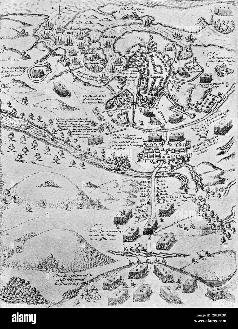 A 17th century illustration of the siege of Kinsale, in County Cork, Ireland, also known as the battle of Kinsale, was the ultimate battle in England's conquest of Gaelic Ireland, commencing in October 1601, near the end of the reign of Queen Elizabeth I, and at the climax of the Nine Years' War—a campaign by Hugh O'Neill, Hugh Roe O'Donnell and other Irish lords against English rule. Owing to Spanish involvement and the strategic advantages to be gained, the battle also formed part of the Anglo-Spanish War, the wider conflict of Protestant England against Catholic Spain. Stock Photohttps://www.alamy.com/image-license-details/?v=1https://www.alamy.com/a-17th-century-illustration-of-the-siege-of-kinsale-in-county-cork-ireland-also-known-as-the-battle-of-kinsale-was-the-ultimate-battle-in-englands-conquest-of-gaelic-ireland-commencing-in-october-1601-near-the-end-of-the-reign-of-queen-elizabeth-i-and-at-the-climax-of-the-nine-years-wara-campaign-by-hugh-oneill-hugh-roe-odonnell-and-other-irish-lords-against-english-rule-owing-to-spanish-involvement-and-the-strategic-advantages-to-be-gained-the-battle-also-formed-part-of-the-anglo-spanish-war-the-wider-conflict-of-protestant-england-against-catholic-spain-image559829415.html
RM2REPC3K–A 17th century illustration of the siege of Kinsale, in County Cork, Ireland, also known as the battle of Kinsale, was the ultimate battle in England's conquest of Gaelic Ireland, commencing in October 1601, near the end of the reign of Queen Elizabeth I, and at the climax of the Nine Years' War—a campaign by Hugh O'Neill, Hugh Roe O'Donnell and other Irish lords against English rule. Owing to Spanish involvement and the strategic advantages to be gained, the battle also formed part of the Anglo-Spanish War, the wider conflict of Protestant England against Catholic Spain.
 Holt County, Nebraska (U.S. county, United States of America, USA, U.S., US) map vector illustration, scribble sketch Holt map Stock Vectorhttps://www.alamy.com/image-license-details/?v=1https://www.alamy.com/holt-county-nebraska-us-county-united-states-of-america-usa-us-us-map-vector-illustration-scribble-sketch-holt-map-image383237797.html
RF2D7DYM5–Holt County, Nebraska (U.S. county, United States of America, USA, U.S., US) map vector illustration, scribble sketch Holt map
 Fall and Winter, 1890-91 Fashion Catalogue - H. O'Neill and Co. (1890) Stock Photohttps://www.alamy.com/image-license-details/?v=1https://www.alamy.com/stock-photo-fall-and-winter-1890-91-fashion-catalogue-h-oneill-and-co-1890-114280925.html
RMGHWXDH–Fall and Winter, 1890-91 Fashion Catalogue - H. O'Neill and Co. (1890)
 Genterispetto nero oneill Stock Photohttps://www.alamy.com/image-license-details/?v=1https://www.alamy.com/stock-photo-genterispetto-nero-oneill-139548896.html
RMJ31014–Genterispetto nero oneill
 O'Neill, Holt County, US, United States, Nebraska, N 42 27' 28'', S 98 38' 51'', map, Cartascapes Map published in 2024. Explore Cartascapes, a map revealing Earth's diverse landscapes, cultures, and ecosystems. Journey through time and space, discovering the interconnectedness of our planet's past, present, and future. Stock Photohttps://www.alamy.com/image-license-details/?v=1https://www.alamy.com/oneill-holt-county-us-united-states-nebraska-n-42-27-28-s-98-38-51-map-cartascapes-map-published-in-2024-explore-cartascapes-a-map-revealing-earths-diverse-landscapes-cultures-and-ecosystems-journey-through-time-and-space-discovering-the-interconnectedness-of-our-planets-past-present-and-future-image621435615.html
RM2Y30RD3–O'Neill, Holt County, US, United States, Nebraska, N 42 27' 28'', S 98 38' 51'', map, Cartascapes Map published in 2024. Explore Cartascapes, a map revealing Earth's diverse landscapes, cultures, and ecosystems. Journey through time and space, discovering the interconnectedness of our planet's past, present, and future.
 Eugene M O'Neill grave Stock Photohttps://www.alamy.com/image-license-details/?v=1https://www.alamy.com/stock-photo-eugene-m-oneill-grave-139809348.html
RMJ3CT70–Eugene M O'Neill grave
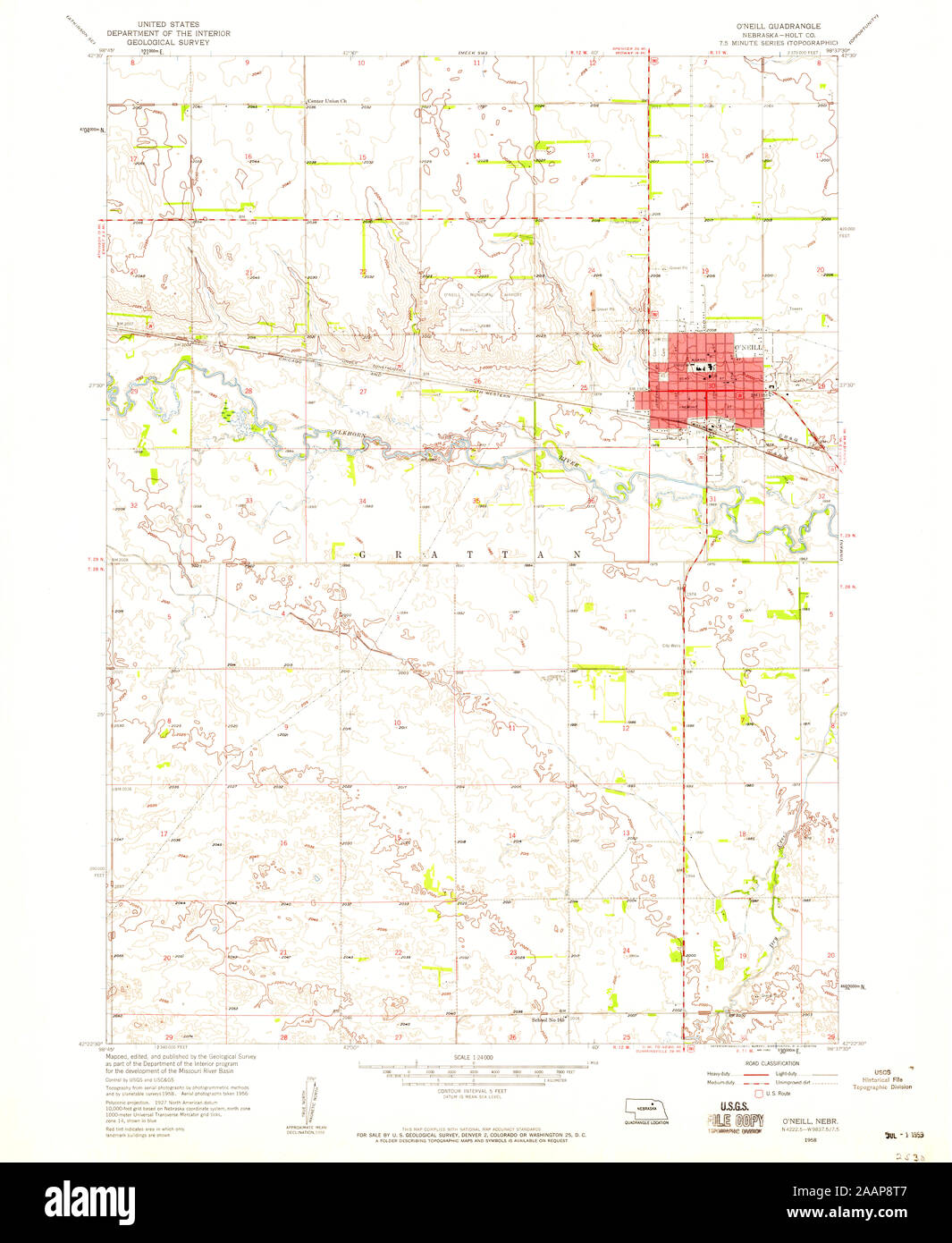 USGS TOPO Map Nebraska NE ONeill 316919 1958 24000 Restoration Stock Photohttps://www.alamy.com/image-license-details/?v=1https://www.alamy.com/usgs-topo-map-nebraska-ne-oneill-316919-1958-24000-restoration-image333633447.html
RM2AAP8T7–USGS TOPO Map Nebraska NE ONeill 316919 1958 24000 Restoration
 Not Forgotten by George Bernard O'Neill Stock Photohttps://www.alamy.com/image-license-details/?v=1https://www.alamy.com/stock-photo-not-forgotten-by-george-bernard-oneill-140275617.html
RMJ462YD–Not Forgotten by George Bernard O'Neill
 Hugh O'Neill Engraving William Holl Stock Photohttps://www.alamy.com/image-license-details/?v=1https://www.alamy.com/stock-photo-hugh-oneill-engraving-william-holl-139969592.html
RMJ3M4J0–Hugh O'Neill Engraving William Holl
 Holt County, Nebraska (U.S. county, United States of America, USA, U.S., US) map vector illustration, scribble sketch Holt map Stock Vectorhttps://www.alamy.com/image-license-details/?v=1https://www.alamy.com/holt-county-nebraska-us-county-united-states-of-america-usa-us-us-map-vector-illustration-scribble-sketch-holt-map-image398059498.html
RF2E3H4XJ–Holt County, Nebraska (U.S. county, United States of America, USA, U.S., US) map vector illustration, scribble sketch Holt map
 Fall and Winter, 1890-91 Fashion Catalogue - H. O'Neill and Co. (1890) Stock Photohttps://www.alamy.com/image-license-details/?v=1https://www.alamy.com/stock-photo-fall-and-winter-1890-91-fashion-catalogue-h-oneill-and-co-1890-114610955.html
RMGJCYCB–Fall and Winter, 1890-91 Fashion Catalogue - H. O'Neill and Co. (1890)
 O'Neill, Weber County, US, United States, Utah, N 41 12' 44'', S 111 56' 8'', map, Cartascapes Map published in 2024. Explore Cartascapes, a map revealing Earth's diverse landscapes, cultures, and ecosystems. Journey through time and space, discovering the interconnectedness of our planet's past, present, and future. Stock Photohttps://www.alamy.com/image-license-details/?v=1https://www.alamy.com/oneill-weber-county-us-united-states-utah-n-41-12-44-s-111-56-8-map-cartascapes-map-published-in-2024-explore-cartascapes-a-map-revealing-earths-diverse-landscapes-cultures-and-ecosystems-journey-through-time-and-space-discovering-the-interconnectedness-of-our-planets-past-present-and-future-image621473954.html
RM2Y32GAA–O'Neill, Weber County, US, United States, Utah, N 41 12' 44'', S 111 56' 8'', map, Cartascapes Map published in 2024. Explore Cartascapes, a map revealing Earth's diverse landscapes, cultures, and ecosystems. Journey through time and space, discovering the interconnectedness of our planet's past, present, and future.
 USGS TOPO Map Nebraska NE ONeill 317950 1989 250000 Restoration Stock Photohttps://www.alamy.com/image-license-details/?v=1https://www.alamy.com/usgs-topo-map-nebraska-ne-oneill-317950-1989-250000-restoration-image333633721.html
RM2AAP961–USGS TOPO Map Nebraska NE ONeill 317950 1989 250000 Restoration
 Miss O'Neill as Mrs. Haller (in The stranger) (NYPL Hades 255336 431247) Stock Photohttps://www.alamy.com/image-license-details/?v=1https://www.alamy.com/stock-photo-miss-oneill-as-mrs-haller-in-the-stranger-nypl-hades-255336-431247-140298812.html
RMJ474FT–Miss O'Neill as Mrs. Haller (in The stranger) (NYPL Hades 255336 431247)
 Holt County, Nebraska (U.S. county, United States of America, USA, U.S., US) map vector illustration, scribble sketch Holt map Stock Vectorhttps://www.alamy.com/image-license-details/?v=1https://www.alamy.com/holt-county-nebraska-us-county-united-states-of-america-usa-us-us-map-vector-illustration-scribble-sketch-holt-map-image387828657.html
RF2DEY3BD–Holt County, Nebraska (U.S. county, United States of America, USA, U.S., US) map vector illustration, scribble sketch Holt map
 Fall and Winter, 1890-91 Fashion Catalogue - H. O'Neill and Co. (1890) Stock Photohttps://www.alamy.com/image-license-details/?v=1https://www.alamy.com/stock-photo-fall-and-winter-1890-91-fashion-catalogue-h-oneill-and-co-1890-114568927.html
RMGJB1RB–Fall and Winter, 1890-91 Fashion Catalogue - H. O'Neill and Co. (1890)
 O'Neill, Holt County, US, United States, Nebraska, N 42 27' 28'', S 98 38' 51'', map, Cartascapes Map published in 2024. Explore Cartascapes, a map revealing Earth's diverse landscapes, cultures, and ecosystems. Journey through time and space, discovering the interconnectedness of our planet's past, present, and future. Stock Photohttps://www.alamy.com/image-license-details/?v=1https://www.alamy.com/oneill-holt-county-us-united-states-nebraska-n-42-27-28-s-98-38-51-map-cartascapes-map-published-in-2024-explore-cartascapes-a-map-revealing-earths-diverse-landscapes-cultures-and-ecosystems-journey-through-time-and-space-discovering-the-interconnectedness-of-our-planets-past-present-and-future-image620884586.html
RM2Y23MHE–O'Neill, Holt County, US, United States, Nebraska, N 42 27' 28'', S 98 38' 51'', map, Cartascapes Map published in 2024. Explore Cartascapes, a map revealing Earth's diverse landscapes, cultures, and ecosystems. Journey through time and space, discovering the interconnectedness of our planet's past, present, and future.
 USGS TOPO Map Nebraska NE O'Neill SE 20111025 TM Restoration Stock Photohttps://www.alamy.com/image-license-details/?v=1https://www.alamy.com/usgs-topo-map-nebraska-ne-oneill-se-20111025-tm-restoration-image333631555.html
RM2AAP6CK–USGS TOPO Map Nebraska NE O'Neill SE 20111025 TM Restoration
 Rose O'Neill Stock Photohttps://www.alamy.com/image-license-details/?v=1https://www.alamy.com/stock-image-rose-oneill-162204597.html
RMKBW1H9–Rose O'Neill
 Fall and Winter, 1890-91 Fashion Catalogue - H. O'Neill and Co. (1890) Stock Photohttps://www.alamy.com/image-license-details/?v=1https://www.alamy.com/stock-photo-fall-and-winter-1890-91-fashion-catalogue-h-oneill-and-co-1890-114280926.html
RMGHWXDJ–Fall and Winter, 1890-91 Fashion Catalogue - H. O'Neill and Co. (1890)
 O'Neill Point, MacDonnell, AU, Australia, Northern Territory, S 24 33' 12'', N 135 45' 3'', map, Cartascapes Map published in 2024. Explore Cartascapes, a map revealing Earth's diverse landscapes, cultures, and ecosystems. Journey through time and space, discovering the interconnectedness of our planet's past, present, and future. Stock Photohttps://www.alamy.com/image-license-details/?v=1https://www.alamy.com/oneill-point-macdonnell-au-australia-northern-territory-s-24-33-12-n-135-45-3-map-cartascapes-map-published-in-2024-explore-cartascapes-a-map-revealing-earths-diverse-landscapes-cultures-and-ecosystems-journey-through-time-and-space-discovering-the-interconnectedness-of-our-planets-past-present-and-future-image625522296.html
RM2Y9K020–O'Neill Point, MacDonnell, AU, Australia, Northern Territory, S 24 33' 12'', N 135 45' 3'', map, Cartascapes Map published in 2024. Explore Cartascapes, a map revealing Earth's diverse landscapes, cultures, and ecosystems. Journey through time and space, discovering the interconnectedness of our planet's past, present, and future.
 USGS TOPO Map Nebraska NE ONeill 317948 1955 250000 Restoration Stock Photohttps://www.alamy.com/image-license-details/?v=1https://www.alamy.com/usgs-topo-map-nebraska-ne-oneill-317948-1955-250000-restoration-image333633578.html
RM2AAP90X–USGS TOPO Map Nebraska NE ONeill 317948 1955 250000 Restoration
 James Hall Nasmyth by George Bernard O'Neill Stock Photohttps://www.alamy.com/image-license-details/?v=1https://www.alamy.com/stock-image-james-hall-nasmyth-by-george-bernard-oneill-162214287.html
RMKBWDYB–James Hall Nasmyth by George Bernard O'Neill
 Fall and Winter, 1890-91 Fashion Catalogue - H. O'Neill and Co. (1890) Stock Photohttps://www.alamy.com/image-license-details/?v=1https://www.alamy.com/stock-photo-fall-and-winter-1890-91-fashion-catalogue-h-oneill-and-co-1890-114610962.html
RMGJCYCJ–Fall and Winter, 1890-91 Fashion Catalogue - H. O'Neill and Co. (1890)
 O'Neill, Dubuque County, US, United States, Iowa, N 42 36' 32'', S 90 53' 12'', map, Cartascapes Map published in 2024. Explore Cartascapes, a map revealing Earth's diverse landscapes, cultures, and ecosystems. Journey through time and space, discovering the interconnectedness of our planet's past, present, and future. Stock Photohttps://www.alamy.com/image-license-details/?v=1https://www.alamy.com/oneill-dubuque-county-us-united-states-iowa-n-42-36-32-s-90-53-12-map-cartascapes-map-published-in-2024-explore-cartascapes-a-map-revealing-earths-diverse-landscapes-cultures-and-ecosystems-journey-through-time-and-space-discovering-the-interconnectedness-of-our-planets-past-present-and-future-image620786974.html
RM2Y1Y83A–O'Neill, Dubuque County, US, United States, Iowa, N 42 36' 32'', S 90 53' 12'', map, Cartascapes Map published in 2024. Explore Cartascapes, a map revealing Earth's diverse landscapes, cultures, and ecosystems. Journey through time and space, discovering the interconnectedness of our planet's past, present, and future.
 USGS TOPO Map Nebraska NE ONeill 317949 1955 250000 Restoration Stock Photohttps://www.alamy.com/image-license-details/?v=1https://www.alamy.com/usgs-topo-map-nebraska-ne-oneill-317949-1955-250000-restoration-image333633660.html
RM2AAP93T–USGS TOPO Map Nebraska NE ONeill 317949 1955 250000 Restoration
 2017 02 George Bernard O'Neill Piggy back Stock Photohttps://www.alamy.com/image-license-details/?v=1https://www.alamy.com/stock-image-2017-02-george-bernard-oneill-piggy-back-162154132.html
RMKBPN70–2017 02 George Bernard O'Neill Piggy back
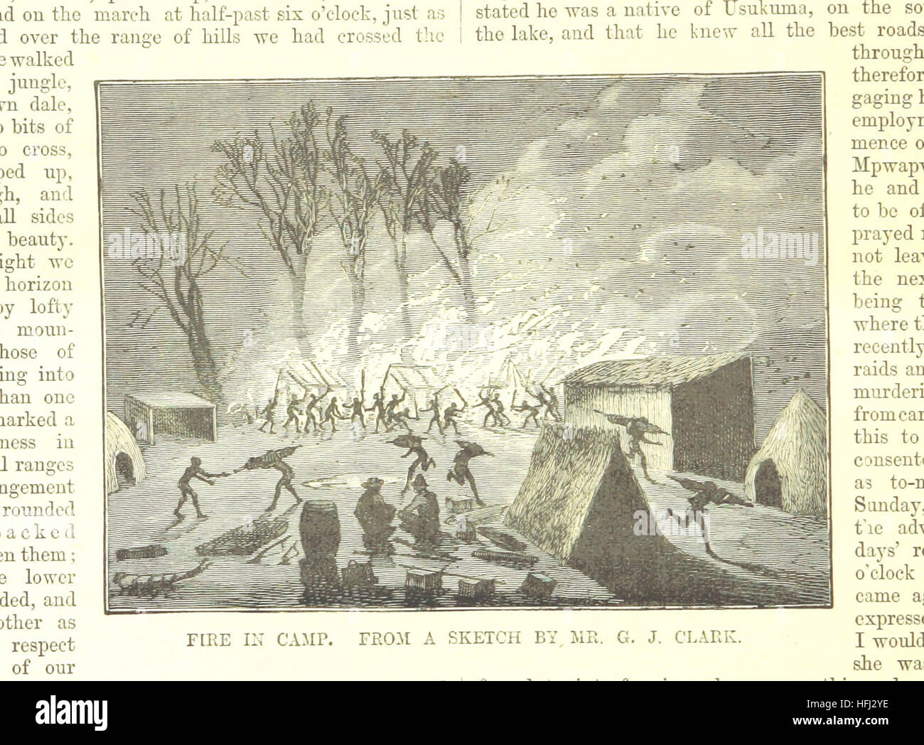 Sketches of African Scenery, from Zanzibar to the Victoria Nyanza, being a series of coloured lithographic pictures, from sketches by ... T. O'Neill. (The larger part of the letterpress is from a journal kept by T. O'Neill.) Image taken from page 20 of 'Sketches of African Scenery, Stock Photohttps://www.alamy.com/image-license-details/?v=1https://www.alamy.com/stock-photo-sketches-of-african-scenery-from-zanzibar-to-the-victoria-nyanza-being-130089890.html
RMHFJ2YE–Sketches of African Scenery, from Zanzibar to the Victoria Nyanza, being a series of coloured lithographic pictures, from sketches by ... T. O'Neill. (The larger part of the letterpress is from a journal kept by T. O'Neill.) Image taken from page 20 of 'Sketches of African Scenery,
 Brian O'Neill Memorial Reserve, , AU, Australia, Western Australia, S 32 10' 18'', N 116 2' 57'', map, Cartascapes Map published in 2024. Explore Cartascapes, a map revealing Earth's diverse landscapes, cultures, and ecosystems. Journey through time and space, discovering the interconnectedness of our planet's past, present, and future. Stock Photohttps://www.alamy.com/image-license-details/?v=1https://www.alamy.com/brian-oneill-memorial-reserve-au-australia-western-australia-s-32-10-18-n-116-2-57-map-cartascapes-map-published-in-2024-explore-cartascapes-a-map-revealing-earths-diverse-landscapes-cultures-and-ecosystems-journey-through-time-and-space-discovering-the-interconnectedness-of-our-planets-past-present-and-future-image625770690.html
RM2YA28W6–Brian O'Neill Memorial Reserve, , AU, Australia, Western Australia, S 32 10' 18'', N 116 2' 57'', map, Cartascapes Map published in 2024. Explore Cartascapes, a map revealing Earth's diverse landscapes, cultures, and ecosystems. Journey through time and space, discovering the interconnectedness of our planet's past, present, and future.
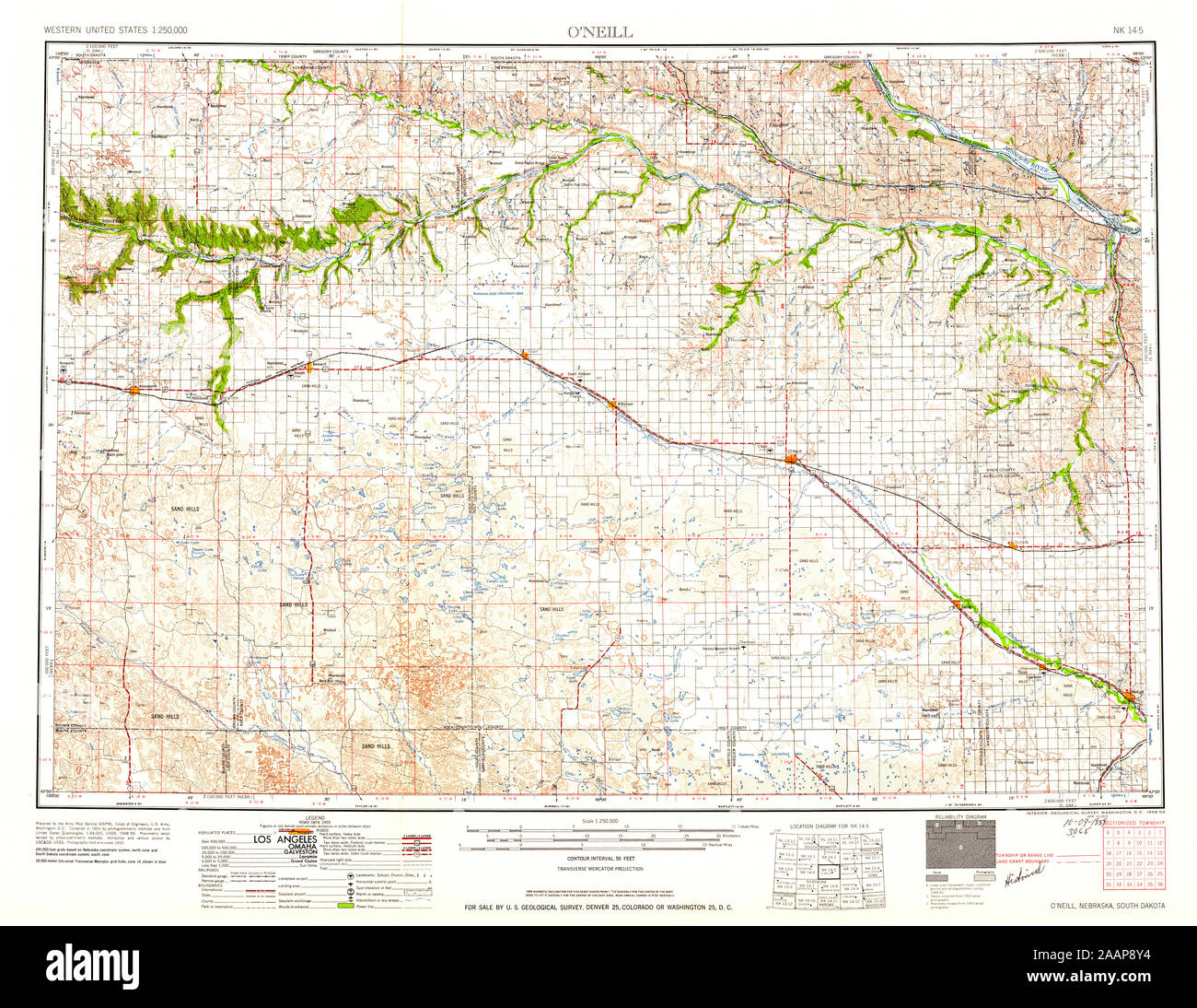 USGS TOPO Map Nebraska NE ONeill 317946 1959 250000 Restoration Stock Photohttps://www.alamy.com/image-license-details/?v=1https://www.alamy.com/usgs-topo-map-nebraska-ne-oneill-317946-1959-250000-restoration-image333633528.html
RM2AAP8Y4–USGS TOPO Map Nebraska NE ONeill 317946 1959 250000 Restoration
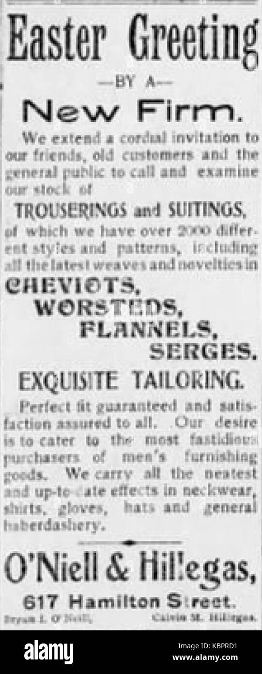 1900 Oneill & Hillegas 9 Apr LDR Allentown PA Stock Photohttps://www.alamy.com/image-license-details/?v=1https://www.alamy.com/stock-image-1900-oneill-hillegas-9-apr-ldr-allentown-pa-162155869.html
RMKBPRD1–1900 Oneill & Hillegas 9 Apr LDR Allentown PA
 General Orders Nos. 1 and 2 of John O'Neill and M. Kerwin, Headquarters, Fenian Brotherhood, New York, February 3 4, 1870 Stock Photohttps://www.alamy.com/image-license-details/?v=1https://www.alamy.com/stock-image-general-orders-nos-1-and-2-of-john-oneill-and-m-kerwin-headquarters-162786801.html
RMKCRG69–General Orders Nos. 1 and 2 of John O'Neill and M. Kerwin, Headquarters, Fenian Brotherhood, New York, February 3 4, 1870
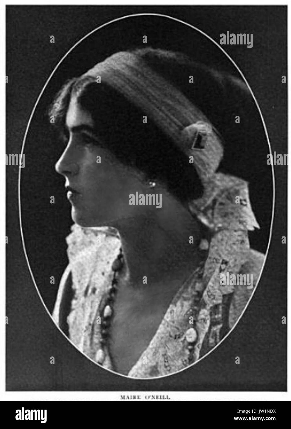 Maire O'Neill 001 Stock Photohttps://www.alamy.com/image-license-details/?v=1https://www.alamy.com/maire-oneill-001-image153088150.html
RMJW1NDX–Maire O'Neill 001
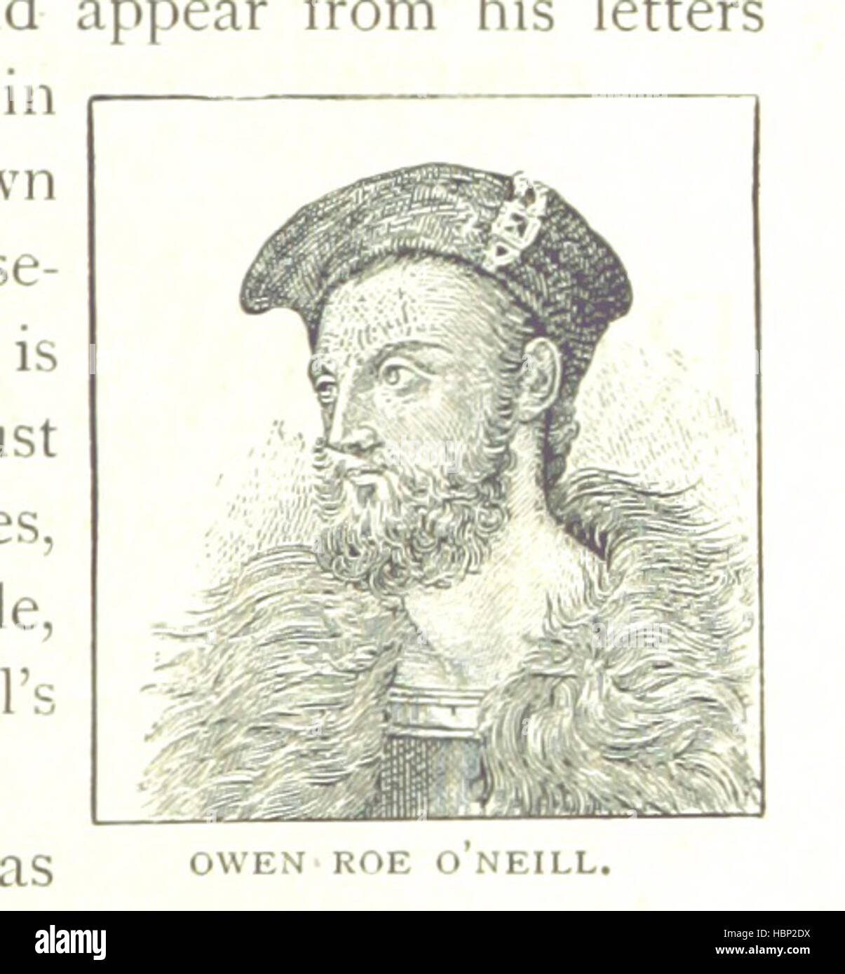 Image taken from page 25 of 'Guide to North of Ireland, Giant's Causeway and Belfast, with history of Belfast' Image taken from page 25 of 'Guide to North of Stock Photohttps://www.alamy.com/image-license-details/?v=1https://www.alamy.com/stock-photo-image-taken-from-page-25-of-guide-to-north-of-ireland-giants-causeway-127718694.html
RMHBP2DX–Image taken from page 25 of 'Guide to North of Ireland, Giant's Causeway and Belfast, with history of Belfast' Image taken from page 25 of 'Guide to North of
 O'Neill, Harrison County, US, United States, West Virginia, N 39 17' 35'', S 80 24' 40'', map, Cartascapes Map published in 2024. Explore Cartascapes, a map revealing Earth's diverse landscapes, cultures, and ecosystems. Journey through time and space, discovering the interconnectedness of our planet's past, present, and future. Stock Photohttps://www.alamy.com/image-license-details/?v=1https://www.alamy.com/oneill-harrison-county-us-united-states-west-virginia-n-39-17-35-s-80-24-40-map-cartascapes-map-published-in-2024-explore-cartascapes-a-map-revealing-earths-diverse-landscapes-cultures-and-ecosystems-journey-through-time-and-space-discovering-the-interconnectedness-of-our-planets-past-present-and-future-image620898730.html
RM2Y24AJJ–O'Neill, Harrison County, US, United States, West Virginia, N 39 17' 35'', S 80 24' 40'', map, Cartascapes Map published in 2024. Explore Cartascapes, a map revealing Earth's diverse landscapes, cultures, and ecosystems. Journey through time and space, discovering the interconnectedness of our planet's past, present, and future.
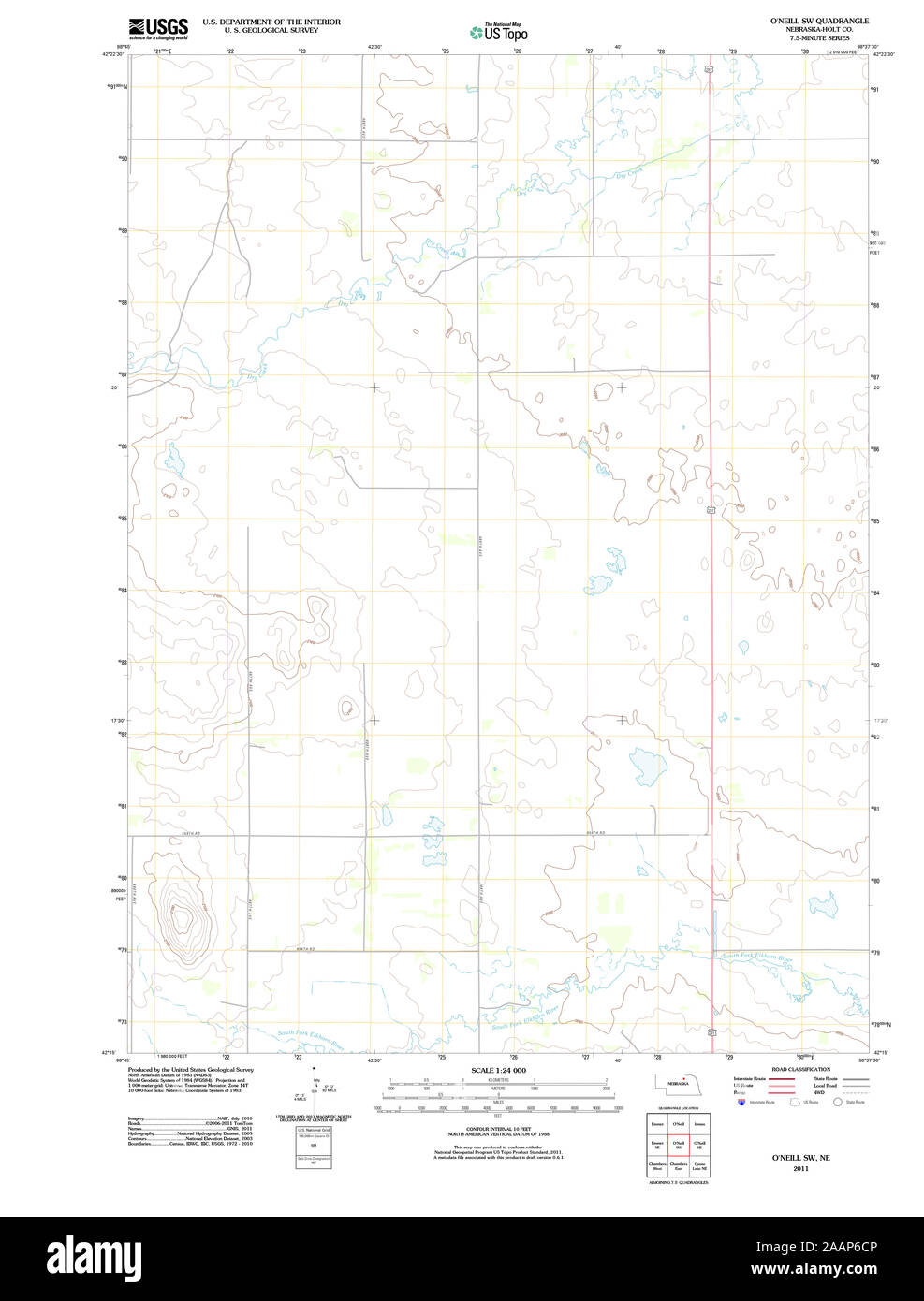 USGS TOPO Map Nebraska NE O'Neill SW 20111025 TM Restoration Stock Photohttps://www.alamy.com/image-license-details/?v=1https://www.alamy.com/usgs-topo-map-nebraska-ne-oneill-sw-20111025-tm-restoration-image333631558.html
RM2AAP6CP–USGS TOPO Map Nebraska NE O'Neill SW 20111025 TM Restoration
 Maire O'Neill 001 Stock Photohttps://www.alamy.com/image-license-details/?v=1https://www.alamy.com/maire-oneill-001-image153836006.html
RMJX7RB2–Maire O'Neill 001
 Image taken from page 123 of 'Beauties and Antiquities of Ireland. Being a tourist's guide to its most beautiful scenery & an archæologist's manual for its most interesting ruins' Image taken from page 123 of 'Beauties and Antiquities of Stock Photohttps://www.alamy.com/image-license-details/?v=1https://www.alamy.com/stock-photo-image-taken-from-page-123-of-beauties-and-antiquities-of-ireland-being-130120170.html
RMHFKDGX–Image taken from page 123 of 'Beauties and Antiquities of Ireland. Being a tourist's guide to its most beautiful scenery & an archæologist's manual for its most interesting ruins' Image taken from page 123 of 'Beauties and Antiquities of
 Oneill (historical), Custer County, US, United States, Montana, N 46 8' 54'', S 105 9' 1'', map, Cartascapes Map published in 2024. Explore Cartascapes, a map revealing Earth's diverse landscapes, cultures, and ecosystems. Journey through time and space, discovering the interconnectedness of our planet's past, present, and future. Stock Photohttps://www.alamy.com/image-license-details/?v=1https://www.alamy.com/oneill-historical-custer-county-us-united-states-montana-n-46-8-54-s-105-9-1-map-cartascapes-map-published-in-2024-explore-cartascapes-a-map-revealing-earths-diverse-landscapes-cultures-and-ecosystems-journey-through-time-and-space-discovering-the-interconnectedness-of-our-planets-past-present-and-future-image620793363.html
RM2Y1YG7F–Oneill (historical), Custer County, US, United States, Montana, N 46 8' 54'', S 105 9' 1'', map, Cartascapes Map published in 2024. Explore Cartascapes, a map revealing Earth's diverse landscapes, cultures, and ecosystems. Journey through time and space, discovering the interconnectedness of our planet's past, present, and future.
 USGS TOPO Map Nebraska NE ONeill 316921 1958 24000 Restoration Stock Photohttps://www.alamy.com/image-license-details/?v=1https://www.alamy.com/usgs-topo-map-nebraska-ne-oneill-316921-1958-24000-restoration-image333633457.html
RM2AAP8TH–USGS TOPO Map Nebraska NE ONeill 316921 1958 24000 Restoration
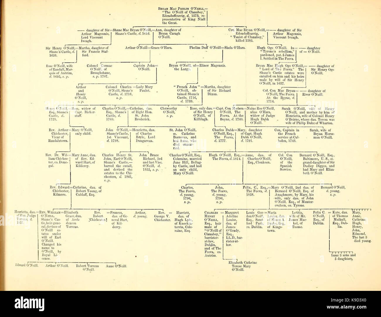 O'Neill Conroy family tree Stock Photohttps://www.alamy.com/image-license-details/?v=1https://www.alamy.com/stock-image-oneill-conroy-family-tree-160713672.html
RMK9D3X0–O'Neill Conroy family tree
 Image taken from page 195 of 'Beauties and Antiquities of Ireland. Being a tourist's guide to its most beautiful scenery & an archæologist's manual for its most interesting ruins' Image taken from page 195 of 'Beauties and Antiquities of Stock Photohttps://www.alamy.com/image-license-details/?v=1https://www.alamy.com/stock-photo-image-taken-from-page-195-of-beauties-and-antiquities-of-ireland-being-130088328.html
RMHFJ0YM–Image taken from page 195 of 'Beauties and Antiquities of Ireland. Being a tourist's guide to its most beautiful scenery & an archæologist's manual for its most interesting ruins' Image taken from page 195 of 'Beauties and Antiquities of
 O'Neill Park, Canterbury-Bankstown, AU, Australia, New South Wales, S 33 54' 4'', N 151 1' 24'', map, Cartascapes Map published in 2024. Explore Cartascapes, a map revealing Earth's diverse landscapes, cultures, and ecosystems. Journey through time and space, discovering the interconnectedness of our planet's past, present, and future. Stock Photohttps://www.alamy.com/image-license-details/?v=1https://www.alamy.com/oneill-park-canterbury-bankstown-au-australia-new-south-wales-s-33-54-4-n-151-1-24-map-cartascapes-map-published-in-2024-explore-cartascapes-a-map-revealing-earths-diverse-landscapes-cultures-and-ecosystems-journey-through-time-and-space-discovering-the-interconnectedness-of-our-planets-past-present-and-future-image625660883.html
RM2Y9W8RF–O'Neill Park, Canterbury-Bankstown, AU, Australia, New South Wales, S 33 54' 4'', N 151 1' 24'', map, Cartascapes Map published in 2024. Explore Cartascapes, a map revealing Earth's diverse landscapes, cultures, and ecosystems. Journey through time and space, discovering the interconnectedness of our planet's past, present, and future.
 USGS TOPO Map Nebraska NE O'Neill 20111025 TM Inverted Restoration Stock Photohttps://www.alamy.com/image-license-details/?v=1https://www.alamy.com/usgs-topo-map-nebraska-ne-oneill-20111025-tm-inverted-restoration-image333631570.html
RM2AAP6D6–USGS TOPO Map Nebraska NE O'Neill 20111025 TM Inverted Restoration
 2017 02 George Bernard O'Neill Piggy back Stock Photohttps://www.alamy.com/image-license-details/?v=1https://www.alamy.com/2017-02-george-bernard-oneill-piggy-back-image154709414.html
RMJYKHC6–2017 02 George Bernard O'Neill Piggy back
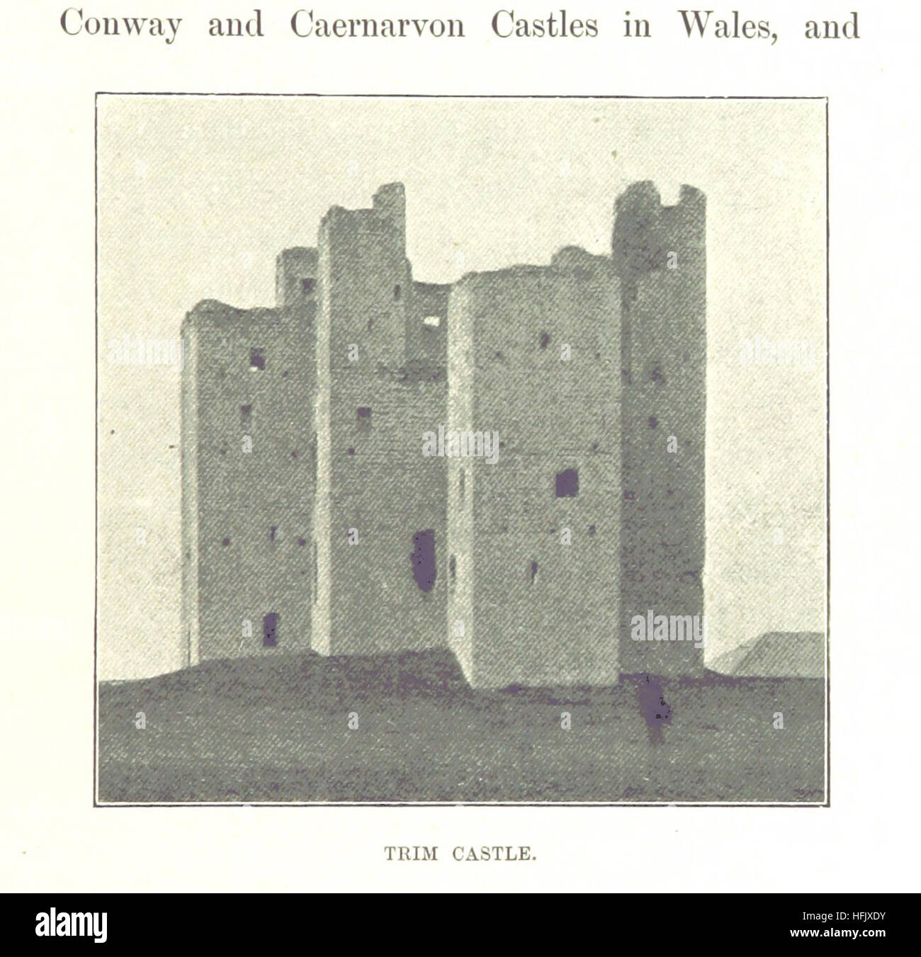 Image taken from page 231 of 'Beauties and Antiquities of Ireland. Being a tourist's guide to its most beautiful scenery & an archæologist's manual for its most interesting ruins' Image taken from page 231 of 'Beauties and Antiquities of Stock Photohttps://www.alamy.com/image-license-details/?v=1https://www.alamy.com/stock-photo-image-taken-from-page-231-of-beauties-and-antiquities-of-ireland-being-130108327.html
RMHFJXDY–Image taken from page 231 of 'Beauties and Antiquities of Ireland. Being a tourist's guide to its most beautiful scenery & an archæologist's manual for its most interesting ruins' Image taken from page 231 of 'Beauties and Antiquities of
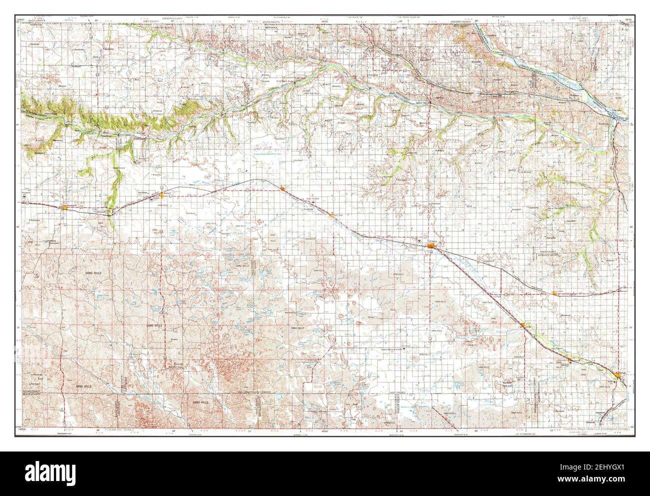 ONeill, Nebraska, map 1969, 1:250000, United States of America by Timeless Maps, data U.S. Geological Survey Stock Photohttps://www.alamy.com/image-license-details/?v=1https://www.alamy.com/oneill-nebraska-map-1969-1250000-united-states-of-america-by-timeless-maps-data-us-geological-survey-image406893593.html
RM2EHYGX1–ONeill, Nebraska, map 1969, 1:250000, United States of America by Timeless Maps, data U.S. Geological Survey
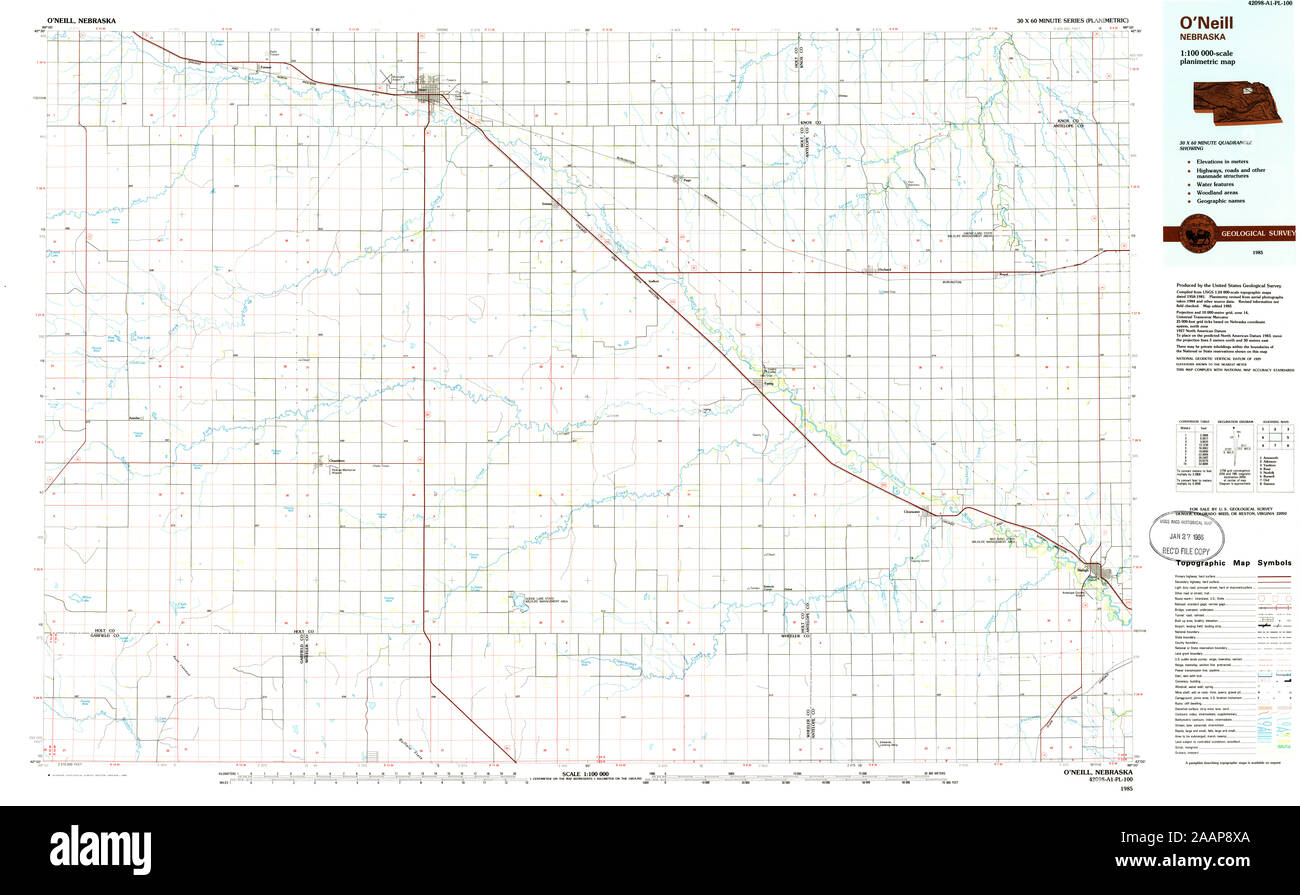 USGS TOPO Map Nebraska NE ONeill 317759 1985 100000 Restoration Stock Photohttps://www.alamy.com/image-license-details/?v=1https://www.alamy.com/usgs-topo-map-nebraska-ne-oneill-317759-1985-100000-restoration-image333633506.html
RM2AAP8XA–USGS TOPO Map Nebraska NE ONeill 317759 1985 100000 Restoration
 Image taken from page 247 of 'Beauties and Antiquities of Ireland. Being a tourist's guide to its most beautiful scenery & an archæologist's manual for its most interesting ruins' Image taken from page 247 of 'Beauties and Antiquities of Stock Photohttps://www.alamy.com/image-license-details/?v=1https://www.alamy.com/stock-photo-image-taken-from-page-247-of-beauties-and-antiquities-of-ireland-being-130112183.html
RMHFK3BK–Image taken from page 247 of 'Beauties and Antiquities of Ireland. Being a tourist's guide to its most beautiful scenery & an archæologist's manual for its most interesting ruins' Image taken from page 247 of 'Beauties and Antiquities of
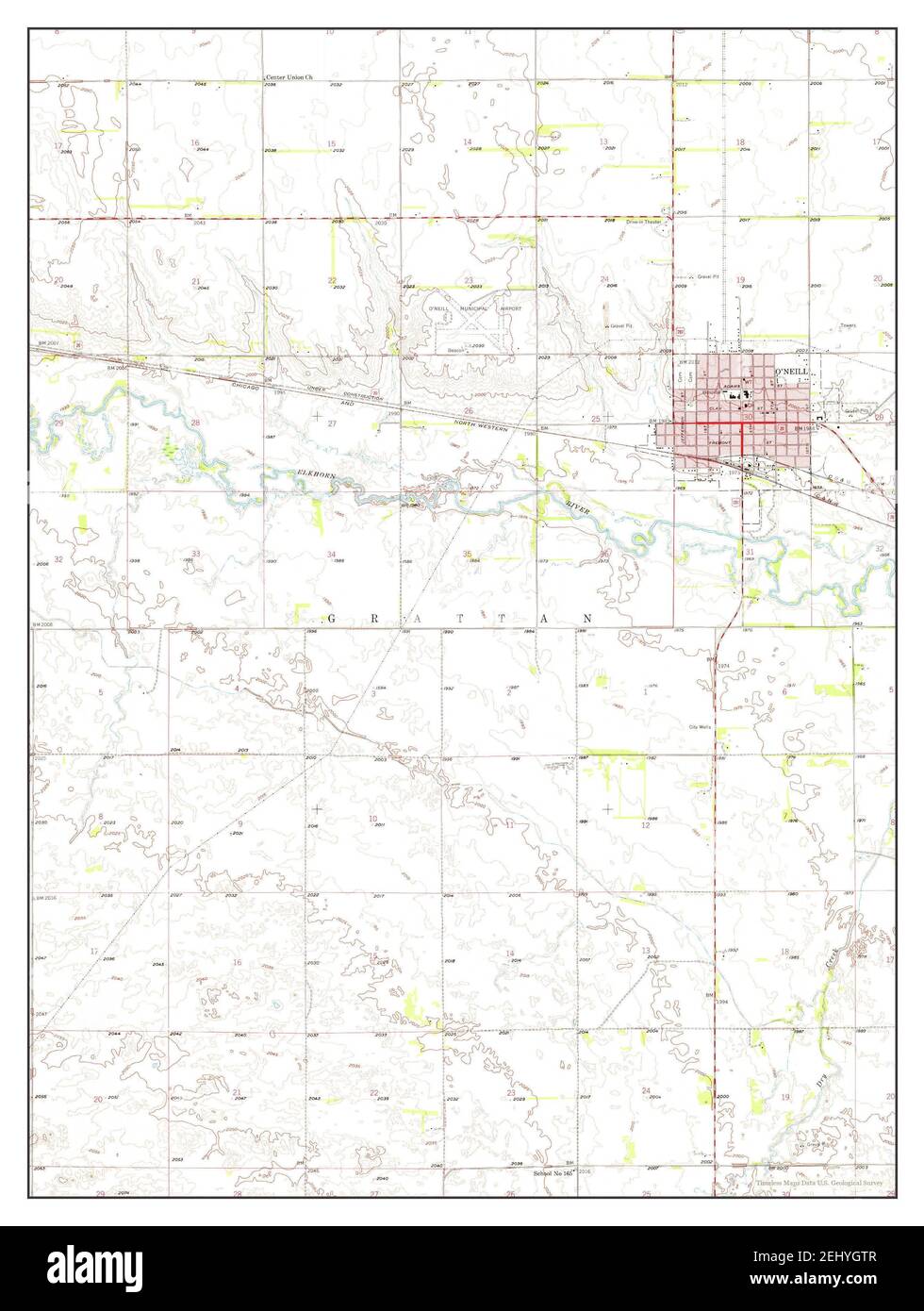 ONeill, Nebraska, map 1958, 1:24000, United States of America by Timeless Maps, data U.S. Geological Survey Stock Photohttps://www.alamy.com/image-license-details/?v=1https://www.alamy.com/oneill-nebraska-map-1958-124000-united-states-of-america-by-timeless-maps-data-us-geological-survey-image406893559.html
RM2EHYGTR–ONeill, Nebraska, map 1958, 1:24000, United States of America by Timeless Maps, data U.S. Geological Survey
 USGS TOPO Map Nebraska NE ONeill 317947 1969 250000 Restoration Stock Photohttps://www.alamy.com/image-license-details/?v=1https://www.alamy.com/usgs-topo-map-nebraska-ne-oneill-317947-1969-250000-restoration-image333633576.html
RM2AAP90T–USGS TOPO Map Nebraska NE ONeill 317947 1969 250000 Restoration
 Image taken from page 209 of 'Beauties and Antiquities of Ireland. Being a tourist's guide to its most beautiful scenery & an archæologist's manual for its most interesting ruins' Image taken from page 209 of 'Beauties and Antiquities of Stock Photohttps://www.alamy.com/image-license-details/?v=1https://www.alamy.com/stock-photo-image-taken-from-page-209-of-beauties-and-antiquities-of-ireland-being-130092218.html
RMHFJ5XJ–Image taken from page 209 of 'Beauties and Antiquities of Ireland. Being a tourist's guide to its most beautiful scenery & an archæologist's manual for its most interesting ruins' Image taken from page 209 of 'Beauties and Antiquities of
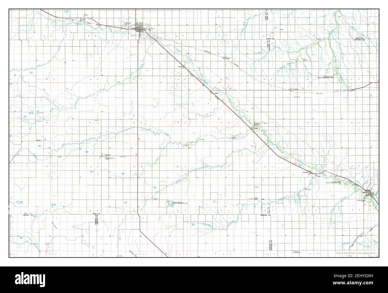 ONeill, Nebraska, map 1985, 1:100000, United States of America by Timeless Maps, data U.S. Geological Survey Stock Photohttps://www.alamy.com/image-license-details/?v=1https://www.alamy.com/oneill-nebraska-map-1985-1100000-united-states-of-america-by-timeless-maps-data-us-geological-survey-image406893609.html
RM2EHYGXH–ONeill, Nebraska, map 1985, 1:100000, United States of America by Timeless Maps, data U.S. Geological Survey
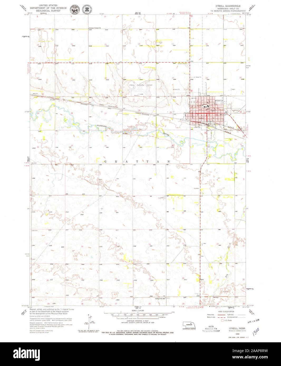 USGS TOPO Map Nebraska NE ONeill 316920 1958 24000 Restoration Stock Photohttps://www.alamy.com/image-license-details/?v=1https://www.alamy.com/usgs-topo-map-nebraska-ne-oneill-316920-1958-24000-restoration-image333633437.html
RM2AAP8RW–USGS TOPO Map Nebraska NE ONeill 316920 1958 24000 Restoration
 ONeill, Nebraska, map 1955, 1:250000, United States of America by Timeless Maps, data U.S. Geological Survey Stock Photohttps://www.alamy.com/image-license-details/?v=1https://www.alamy.com/oneill-nebraska-map-1955-1250000-united-states-of-america-by-timeless-maps-data-us-geological-survey-image406893581.html
RM2EHYGWH–ONeill, Nebraska, map 1955, 1:250000, United States of America by Timeless Maps, data U.S. Geological Survey
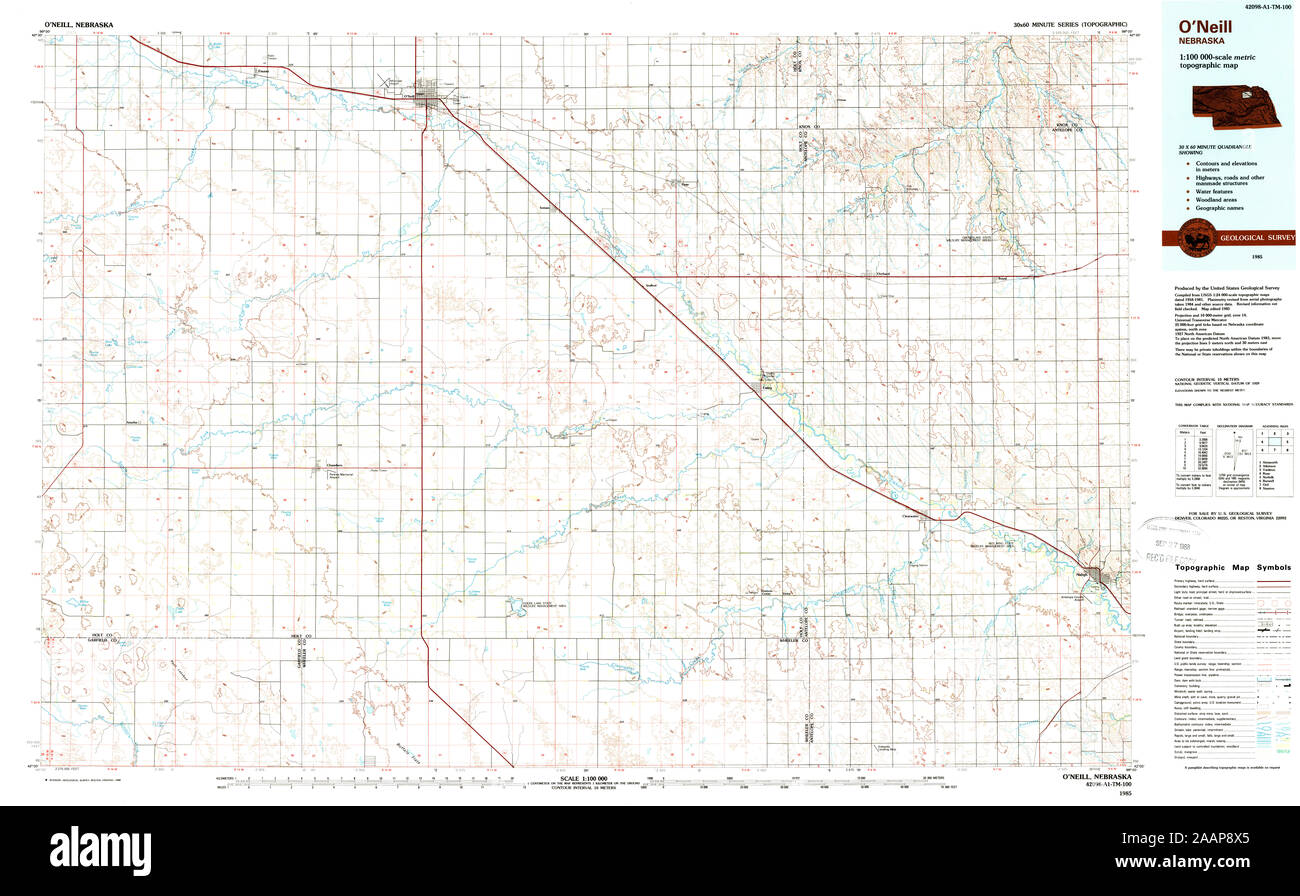 USGS TOPO Map Nebraska NE ONeill 317758 1985 100000 Restoration Stock Photohttps://www.alamy.com/image-license-details/?v=1https://www.alamy.com/usgs-topo-map-nebraska-ne-oneill-317758-1985-100000-restoration-image333633501.html
RM2AAP8X5–USGS TOPO Map Nebraska NE ONeill 317758 1985 100000 Restoration
 ONeill, Nebraska, map 1985, 1:100000, United States of America by Timeless Maps, data U.S. Geological Survey Stock Photohttps://www.alamy.com/image-license-details/?v=1https://www.alamy.com/oneill-nebraska-map-1985-1100000-united-states-of-america-by-timeless-maps-data-us-geological-survey-image406893544.html
RM2EHYGT8–ONeill, Nebraska, map 1985, 1:100000, United States of America by Timeless Maps, data U.S. Geological Survey
 USGS TOPO Map Arizona AZ ONeill Hills 312705 1990 24000 Restoration Stock Photohttps://www.alamy.com/image-license-details/?v=1https://www.alamy.com/usgs-topo-map-arizona-az-oneill-hills-312705-1990-24000-restoration-image242419020.html
RMT2B3X4–USGS TOPO Map Arizona AZ ONeill Hills 312705 1990 24000 Restoration
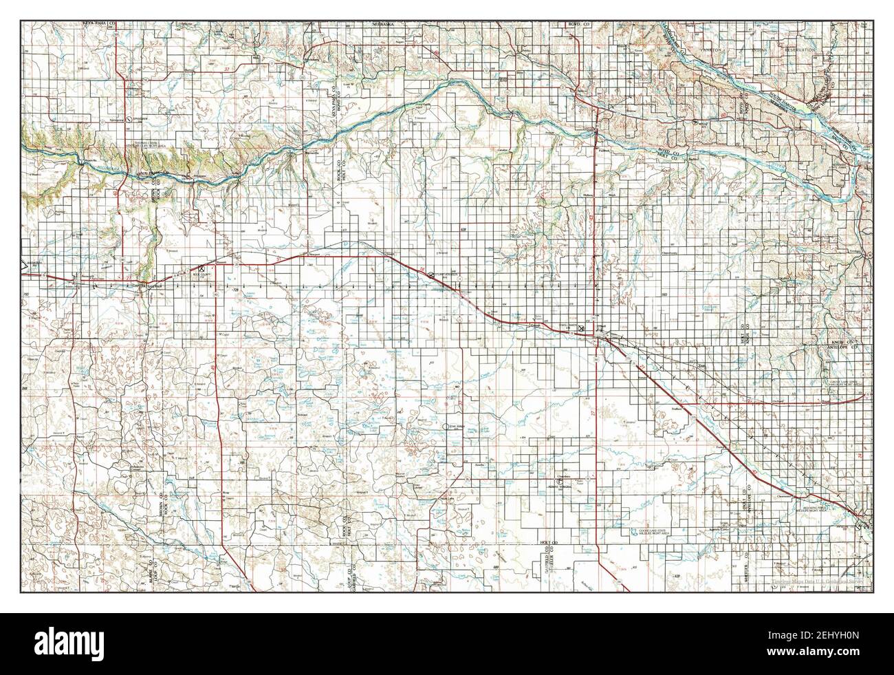 ONeill, Nebraska, map 1989, 1:250000, United States of America by Timeless Maps, data U.S. Geological Survey Stock Photohttps://www.alamy.com/image-license-details/?v=1https://www.alamy.com/oneill-nebraska-map-1989-1250000-united-states-of-america-by-timeless-maps-data-us-geological-survey-image406893669.html
RM2EHYH0N–ONeill, Nebraska, map 1989, 1:250000, United States of America by Timeless Maps, data U.S. Geological Survey