Map of peoria illinois Cut Out Stock Images
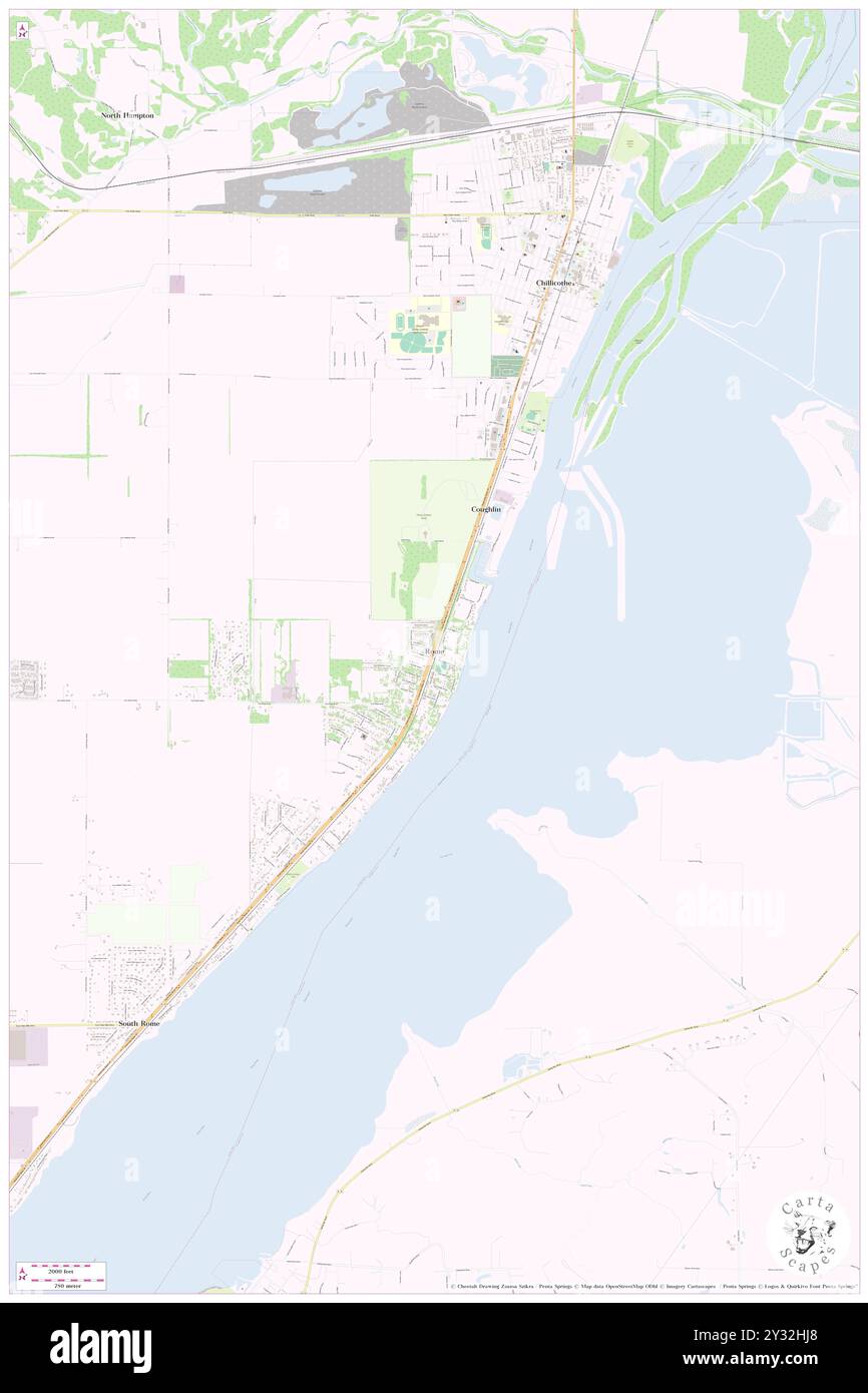 Rome, Peoria County, US, United States, Illinois, N 40 52' 59'', S 89 30' 9'', map, Cartascapes Map published in 2024. Explore Cartascapes, a map revealing Earth's diverse landscapes, cultures, and ecosystems. Journey through time and space, discovering the interconnectedness of our planet's past, present, and future. Stock Photohttps://www.alamy.com/image-license-details/?v=1https://www.alamy.com/rome-peoria-county-us-united-states-illinois-n-40-52-59-s-89-30-9-map-cartascapes-map-published-in-2024-explore-cartascapes-a-map-revealing-earths-diverse-landscapes-cultures-and-ecosystems-journey-through-time-and-space-discovering-the-interconnectedness-of-our-planets-past-present-and-future-image621474960.html
RM2Y32HJ8–Rome, Peoria County, US, United States, Illinois, N 40 52' 59'', S 89 30' 9'', map, Cartascapes Map published in 2024. Explore Cartascapes, a map revealing Earth's diverse landscapes, cultures, and ecosystems. Journey through time and space, discovering the interconnectedness of our planet's past, present, and future.
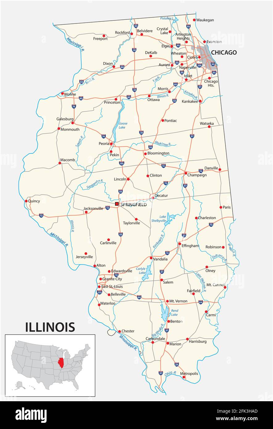 road map of the US American State of illinois Stock Vectorhttps://www.alamy.com/image-license-details/?v=1https://www.alamy.com/road-map-of-the-us-american-state-of-illinois-image424806773.html
RF2FK3HAD–road map of the US American State of illinois
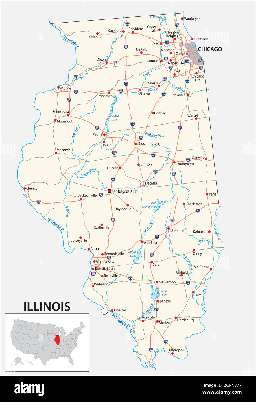 road map of the US American State of illinois Stock Vectorhttps://www.alamy.com/image-license-details/?v=1https://www.alamy.com/road-map-of-the-us-american-state-of-illinois-image444245179.html
RF2GPN377–road map of the US American State of illinois
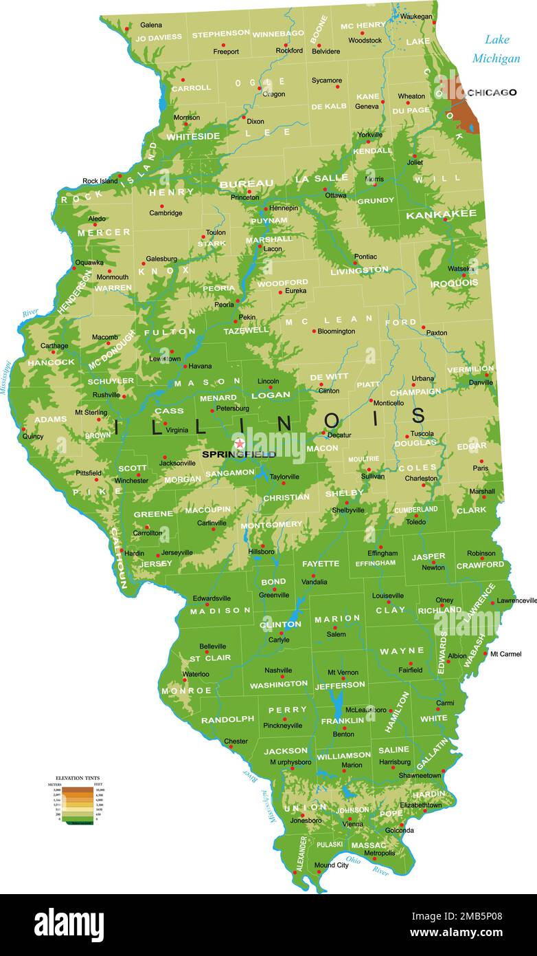 Highly detailed physical map of the Illinois, in vector format,with all the relief forms,regions and big cities. Stock Vectorhttps://www.alamy.com/image-license-details/?v=1https://www.alamy.com/highly-detailed-physical-map-of-the-illinois-in-vector-formatwith-all-the-relief-formsregions-and-big-cities-image505988904.html
RF2MB5P08–Highly detailed physical map of the Illinois, in vector format,with all the relief forms,regions and big cities.
 Map of Peoria in Illinois Stock Photohttps://www.alamy.com/image-license-details/?v=1https://www.alamy.com/map-of-peoria-in-illinois-image359542777.html
RF2BTXGDD–Map of Peoria in Illinois
 Greetings from Peoria vintage rusty metal sign on a white background, vector illustration Stock Vectorhttps://www.alamy.com/image-license-details/?v=1https://www.alamy.com/greetings-from-peoria-vintage-rusty-metal-sign-on-a-white-background-vector-illustration-image539020836.html
RF2P8XEG4–Greetings from Peoria vintage rusty metal sign on a white background, vector illustration
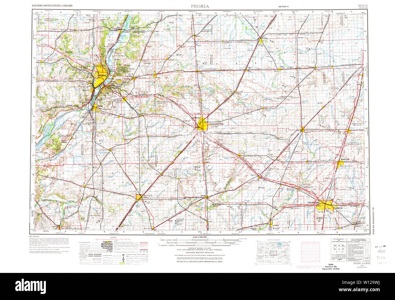 USGS TOPO Map Illinois IL Peoria 310171 1958 250000 Restoration Stock Photohttps://www.alamy.com/image-license-details/?v=1https://www.alamy.com/usgs-topo-map-illinois-il-peoria-310171-1958-250000-restoration-image258821854.html
RMW129WJ–USGS TOPO Map Illinois IL Peoria 310171 1958 250000 Restoration
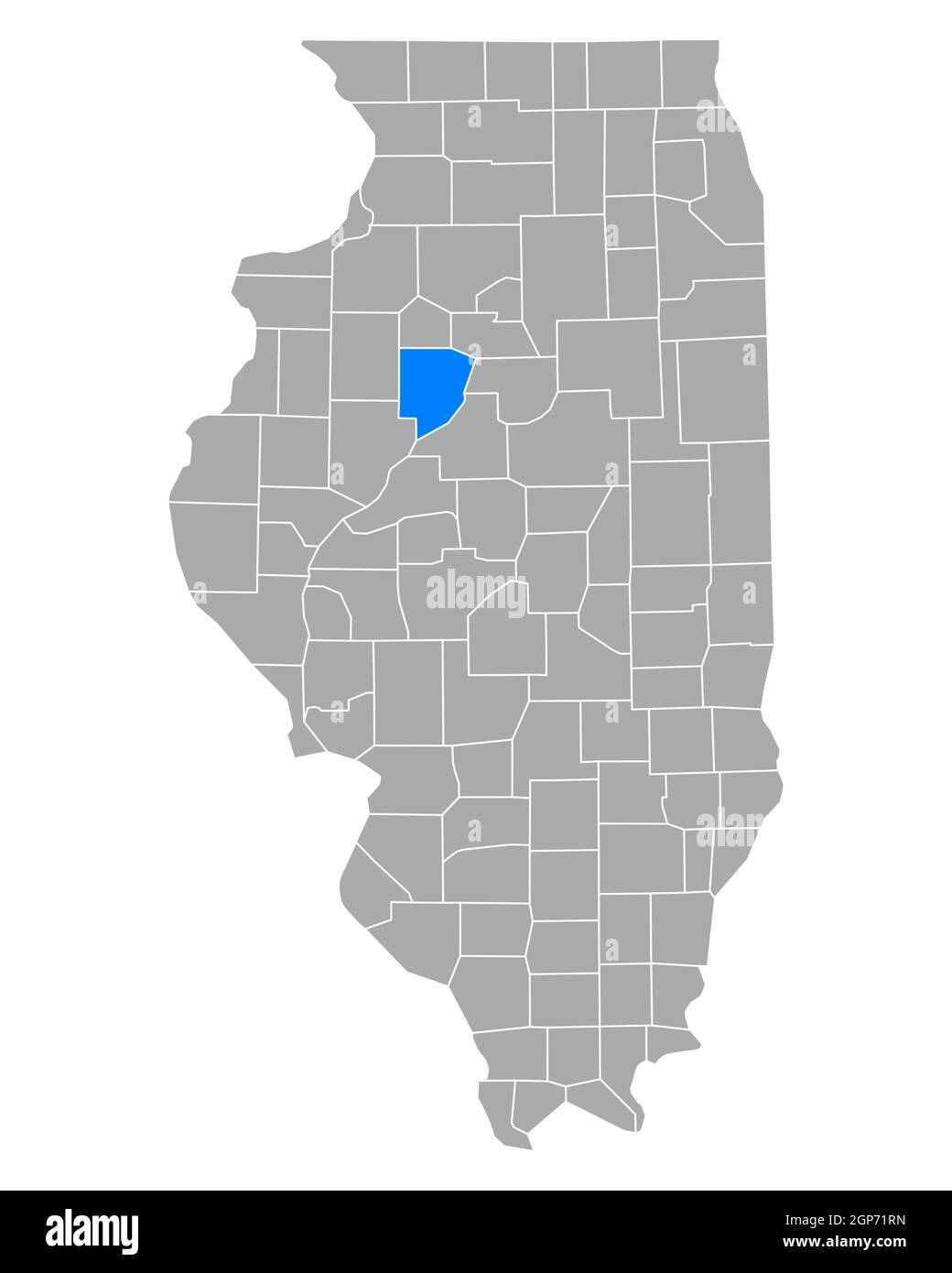 Map of Peoria in Illinois Stock Photohttps://www.alamy.com/image-license-details/?v=1https://www.alamy.com/map-of-peoria-in-illinois-image443936745.html
RF2GP71RN–Map of Peoria in Illinois
 Peoria City, Illinois (United States cities, United States of America, us, usa city) map vector illustration, scribble sketch City of Peoria map Stock Vectorhttps://www.alamy.com/image-license-details/?v=1https://www.alamy.com/peoria-city-illinois-united-states-cities-united-states-of-america-us-usa-city-map-vector-illustration-scribble-sketch-city-of-peoria-map-image609912305.html
RF2XC7WA9–Peoria City, Illinois (United States cities, United States of America, us, usa city) map vector illustration, scribble sketch City of Peoria map
 The History of Peoria County, Illinois ... Illustrated Image taken from page 231 of 'The History of Peoria Stock Photohttps://www.alamy.com/image-license-details/?v=1https://www.alamy.com/stock-photo-the-history-of-peoria-county-illinois-illustrated-image-taken-from-127887029.html
RMHC1N5W–The History of Peoria County, Illinois ... Illustrated Image taken from page 231 of 'The History of Peoria
 Bellevue, Peoria County, US, United States, Illinois, N 40 41' 4'', S 89 40' 48'', map, Cartascapes Map published in 2024. Explore Cartascapes, a map revealing Earth's diverse landscapes, cultures, and ecosystems. Journey through time and space, discovering the interconnectedness of our planet's past, present, and future. Stock Photohttps://www.alamy.com/image-license-details/?v=1https://www.alamy.com/bellevue-peoria-county-us-united-states-illinois-n-40-41-4-s-89-40-48-map-cartascapes-map-published-in-2024-explore-cartascapes-a-map-revealing-earths-diverse-landscapes-cultures-and-ecosystems-journey-through-time-and-space-discovering-the-interconnectedness-of-our-planets-past-present-and-future-image621145641.html
RM2Y2FHGW–Bellevue, Peoria County, US, United States, Illinois, N 40 41' 4'', S 89 40' 48'', map, Cartascapes Map published in 2024. Explore Cartascapes, a map revealing Earth's diverse landscapes, cultures, and ecosystems. Journey through time and space, discovering the interconnectedness of our planet's past, present, and future.
 Map of Peoria in Illinois Stock Photohttps://www.alamy.com/image-license-details/?v=1https://www.alamy.com/map-of-peoria-in-illinois-image358071880.html
RF2BPFG9C–Map of Peoria in Illinois
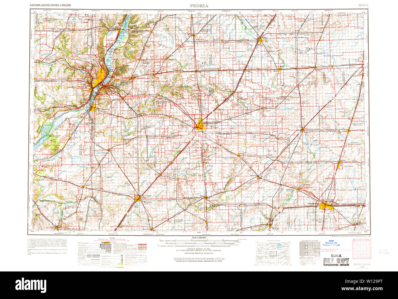 USGS TOPO Map Illinois IL Peoria 310170 1958 250000 Restoration Stock Photohttps://www.alamy.com/image-license-details/?v=1https://www.alamy.com/usgs-topo-map-illinois-il-peoria-310170-1958-250000-restoration-image258821776.html
RMW129PT–USGS TOPO Map Illinois IL Peoria 310170 1958 250000 Restoration
 Map of Peoria in Illinois Stock Photohttps://www.alamy.com/image-license-details/?v=1https://www.alamy.com/map-of-peoria-in-illinois-image385773984.html
RF2DBHEJ8–Map of Peoria in Illinois
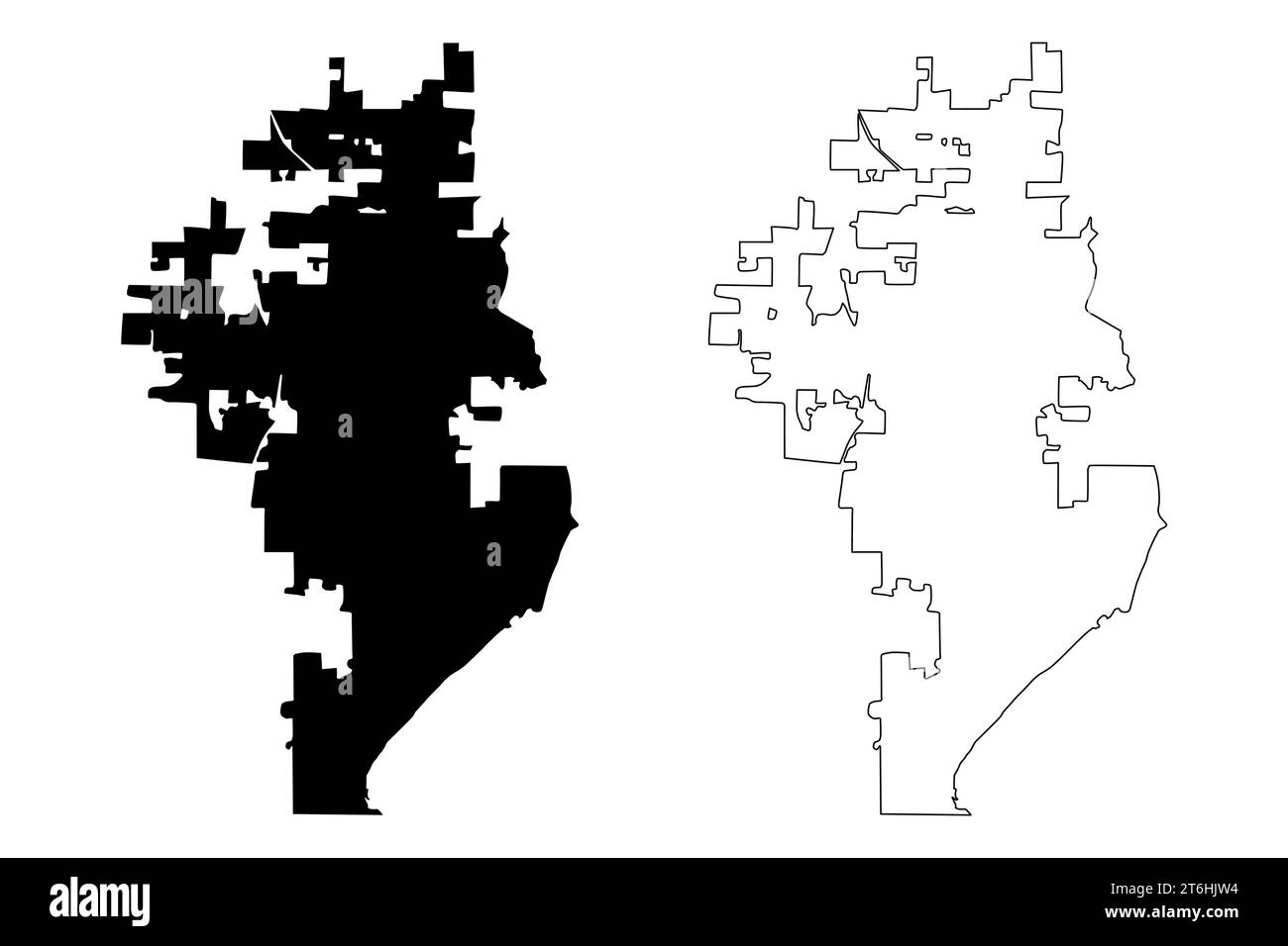 Peoria City, Illinois (United States cities, United States of America, us, usa city) map vector illustration, scribble sketch City of Peoria map Stock Vectorhttps://www.alamy.com/image-license-details/?v=1https://www.alamy.com/peoria-city-illinois-united-states-cities-united-states-of-america-us-usa-city-map-vector-illustration-scribble-sketch-city-of-peoria-map-image572018080.html
RF2T6HJW4–Peoria City, Illinois (United States cities, United States of America, us, usa city) map vector illustration, scribble sketch City of Peoria map
 Image taken from page 725 of 'The History of Peoria County, Illinois ... Illustrated' Image taken from page 725 of 'The History of Peoria Stock Photohttps://www.alamy.com/image-license-details/?v=1https://www.alamy.com/stock-photo-image-taken-from-page-725-of-the-history-of-peoria-county-illinois-127700312.html
RMHBN71C–Image taken from page 725 of 'The History of Peoria County, Illinois ... Illustrated' Image taken from page 725 of 'The History of Peoria
 Kickapoo, Peoria County, US, United States, Illinois, N 40 47' 24'', S 89 45' 4'', map, Cartascapes Map published in 2024. Explore Cartascapes, a map revealing Earth's diverse landscapes, cultures, and ecosystems. Journey through time and space, discovering the interconnectedness of our planet's past, present, and future. Stock Photohttps://www.alamy.com/image-license-details/?v=1https://www.alamy.com/kickapoo-peoria-county-us-united-states-illinois-n-40-47-24-s-89-45-4-map-cartascapes-map-published-in-2024-explore-cartascapes-a-map-revealing-earths-diverse-landscapes-cultures-and-ecosystems-journey-through-time-and-space-discovering-the-interconnectedness-of-our-planets-past-present-and-future-image621235561.html
RM2Y2KM89–Kickapoo, Peoria County, US, United States, Illinois, N 40 47' 24'', S 89 45' 4'', map, Cartascapes Map published in 2024. Explore Cartascapes, a map revealing Earth's diverse landscapes, cultures, and ecosystems. Journey through time and space, discovering the interconnectedness of our planet's past, present, and future.
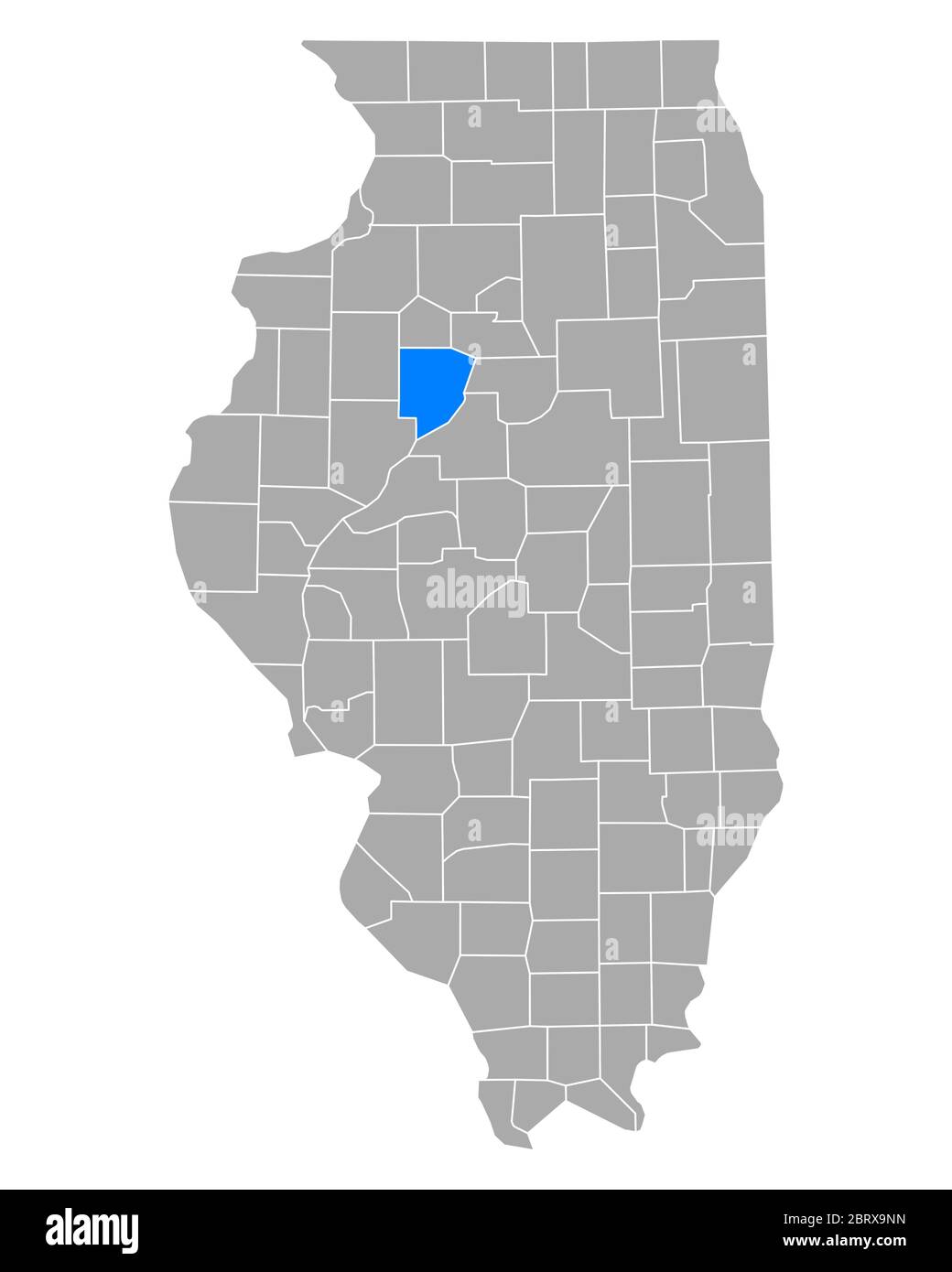 Map of Peoria in Illinois Stock Photohttps://www.alamy.com/image-license-details/?v=1https://www.alamy.com/map-of-peoria-in-illinois-image358922865.html
RF2BRX9NN–Map of Peoria in Illinois
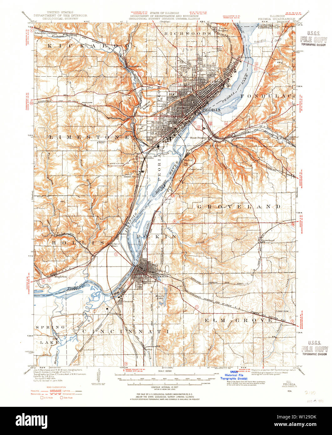 USGS TOPO Map Illinois IL Peoria 309882 1927 62500 Restoration Stock Photohttps://www.alamy.com/image-license-details/?v=1https://www.alamy.com/usgs-topo-map-illinois-il-peoria-309882-1927-62500-restoration-image258821519.html
RMW129DK–USGS TOPO Map Illinois IL Peoria 309882 1927 62500 Restoration
 Map of Peoria in Illinois Stock Photohttps://www.alamy.com/image-license-details/?v=1https://www.alamy.com/map-of-peoria-in-illinois-image443780647.html
RF2GNYXMR–Map of Peoria in Illinois
 Peoria City, Illinois (United States cities, United States of America, us, usa city) map vector illustration, scribble sketch City of Peoria map Stock Vectorhttps://www.alamy.com/image-license-details/?v=1https://www.alamy.com/peoria-city-illinois-united-states-cities-united-states-of-america-us-usa-city-map-vector-illustration-scribble-sketch-city-of-peoria-map-image601673975.html
RF2WXTH87–Peoria City, Illinois (United States cities, United States of America, us, usa city) map vector illustration, scribble sketch City of Peoria map
 The History of Peoria County, Illinois ... Illustrated Image taken from page 745 of 'The History of Peoria Stock Photohttps://www.alamy.com/image-license-details/?v=1https://www.alamy.com/stock-photo-the-history-of-peoria-county-illinois-illustrated-image-taken-from-130182514.html
RMHFP93E–The History of Peoria County, Illinois ... Illustrated Image taken from page 745 of 'The History of Peoria
 Sankoty, Peoria County, US, United States, Illinois, N 40 45' 34'', S 89 33' 54'', map, Cartascapes Map published in 2024. Explore Cartascapes, a map revealing Earth's diverse landscapes, cultures, and ecosystems. Journey through time and space, discovering the interconnectedness of our planet's past, present, and future. Stock Photohttps://www.alamy.com/image-license-details/?v=1https://www.alamy.com/sankoty-peoria-county-us-united-states-illinois-n-40-45-34-s-89-33-54-map-cartascapes-map-published-in-2024-explore-cartascapes-a-map-revealing-earths-diverse-landscapes-cultures-and-ecosystems-journey-through-time-and-space-discovering-the-interconnectedness-of-our-planets-past-present-and-future-image621420107.html
RM2Y303K7–Sankoty, Peoria County, US, United States, Illinois, N 40 45' 34'', S 89 33' 54'', map, Cartascapes Map published in 2024. Explore Cartascapes, a map revealing Earth's diverse landscapes, cultures, and ecosystems. Journey through time and space, discovering the interconnectedness of our planet's past, present, and future.
 USGS TOPO Map Illinois IL Peoria West 20120822 TM Restoration Stock Photohttps://www.alamy.com/image-license-details/?v=1https://www.alamy.com/usgs-topo-map-illinois-il-peoria-west-20120822-tm-restoration-image258822561.html
RMW12APW–USGS TOPO Map Illinois IL Peoria West 20120822 TM Restoration
 Peoria County, Illinois (U.S. county, United States of America, USA, U.S., US) map vector illustration, scribble sketch Peoria map Stock Vectorhttps://www.alamy.com/image-license-details/?v=1https://www.alamy.com/peoria-county-illinois-us-county-united-states-of-america-usa-us-us-map-vector-illustration-scribble-sketch-peoria-map-image362153234.html
RF2C15E42–Peoria County, Illinois (U.S. county, United States of America, USA, U.S., US) map vector illustration, scribble sketch Peoria map
 The History of Peoria County, Illinois ... Illustrated Image taken from page 509 of 'The History of Peoria Stock Photohttps://www.alamy.com/image-license-details/?v=1https://www.alamy.com/stock-photo-the-history-of-peoria-county-illinois-illustrated-image-taken-from-130163943.html
RMHFNDC7–The History of Peoria County, Illinois ... Illustrated Image taken from page 509 of 'The History of Peoria
 Mapleton, Peoria County, US, United States, Illinois, N 40 33' 59'', S 89 43' 54'', map, Cartascapes Map published in 2024. Explore Cartascapes, a map revealing Earth's diverse landscapes, cultures, and ecosystems. Journey through time and space, discovering the interconnectedness of our planet's past, present, and future. Stock Photohttps://www.alamy.com/image-license-details/?v=1https://www.alamy.com/mapleton-peoria-county-us-united-states-illinois-n-40-33-59-s-89-43-54-map-cartascapes-map-published-in-2024-explore-cartascapes-a-map-revealing-earths-diverse-landscapes-cultures-and-ecosystems-journey-through-time-and-space-discovering-the-interconnectedness-of-our-planets-past-present-and-future-image621442332.html
RM2Y31410–Mapleton, Peoria County, US, United States, Illinois, N 40 33' 59'', S 89 43' 54'', map, Cartascapes Map published in 2024. Explore Cartascapes, a map revealing Earth's diverse landscapes, cultures, and ecosystems. Journey through time and space, discovering the interconnectedness of our planet's past, present, and future.
 USGS TOPO Map Illinois IL Peoria 310169 1963 250000 Restoration Stock Photohttps://www.alamy.com/image-license-details/?v=1https://www.alamy.com/usgs-topo-map-illinois-il-peoria-310169-1963-250000-restoration-image258821742.html
RMW129NJ–USGS TOPO Map Illinois IL Peoria 310169 1963 250000 Restoration
 Peoria County, Illinois (U.S. county, United States of America, USA, U.S., US) map vector illustration, scribble sketch Peoria map Stock Vectorhttps://www.alamy.com/image-license-details/?v=1https://www.alamy.com/peoria-county-illinois-us-county-united-states-of-america-usa-us-us-map-vector-illustration-scribble-sketch-peoria-map-image369154232.html
RF2CCGBYM–Peoria County, Illinois (U.S. county, United States of America, USA, U.S., US) map vector illustration, scribble sketch Peoria map
 The History of Peoria County, Illinois ... Illustrated Image taken from page 717 of 'The History of Peoria Stock Photohttps://www.alamy.com/image-license-details/?v=1https://www.alamy.com/stock-photo-the-history-of-peoria-county-illinois-illustrated-image-taken-from-130180902.html
RMHFP71X–The History of Peoria County, Illinois ... Illustrated Image taken from page 717 of 'The History of Peoria
 Pioneer, Peoria County, US, United States, Illinois, N 40 46' 58'', S 89 39' 17'', map, Cartascapes Map published in 2024. Explore Cartascapes, a map revealing Earth's diverse landscapes, cultures, and ecosystems. Journey through time and space, discovering the interconnectedness of our planet's past, present, and future. Stock Photohttps://www.alamy.com/image-license-details/?v=1https://www.alamy.com/pioneer-peoria-county-us-united-states-illinois-n-40-46-58-s-89-39-17-map-cartascapes-map-published-in-2024-explore-cartascapes-a-map-revealing-earths-diverse-landscapes-cultures-and-ecosystems-journey-through-time-and-space-discovering-the-interconnectedness-of-our-planets-past-present-and-future-image621234960.html
RM2Y2KKET–Pioneer, Peoria County, US, United States, Illinois, N 40 46' 58'', S 89 39' 17'', map, Cartascapes Map published in 2024. Explore Cartascapes, a map revealing Earth's diverse landscapes, cultures, and ecosystems. Journey through time and space, discovering the interconnectedness of our planet's past, present, and future.
 USGS TOPO Map Illinois IL Peoria 310168 1990 250000 Restoration Stock Photohttps://www.alamy.com/image-license-details/?v=1https://www.alamy.com/usgs-topo-map-illinois-il-peoria-310168-1990-250000-restoration-image258821711.html
RMW129MF–USGS TOPO Map Illinois IL Peoria 310168 1990 250000 Restoration
 Peoria County, Illinois (U.S. county, United States of America, USA, U.S., US) map vector illustration, scribble sketch Peoria map Stock Vectorhttps://www.alamy.com/image-license-details/?v=1https://www.alamy.com/peoria-county-illinois-us-county-united-states-of-america-usa-us-us-map-vector-illustration-scribble-sketch-peoria-map-image366013575.html
RF2C7DA1B–Peoria County, Illinois (U.S. county, United States of America, USA, U.S., US) map vector illustration, scribble sketch Peoria map
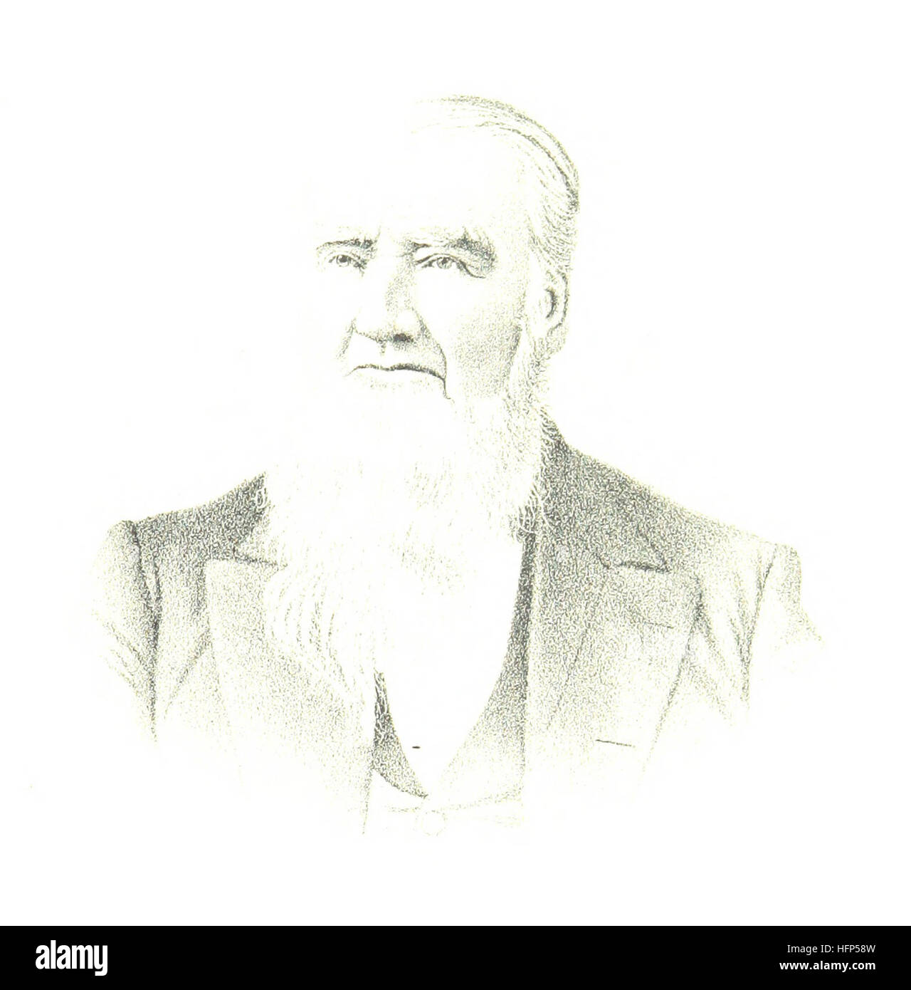 The History of Peoria County, Illinois ... Illustrated Image taken from page 697 of 'The History of Peoria Stock Photohttps://www.alamy.com/image-license-details/?v=1https://www.alamy.com/stock-photo-the-history-of-peoria-county-illinois-illustrated-image-taken-from-130179529.html
RMHFP58W–The History of Peoria County, Illinois ... Illustrated Image taken from page 697 of 'The History of Peoria
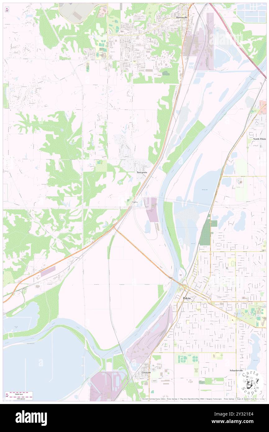 Hollis, Peoria County, US, United States, Illinois, N 40 35' 48'', S 89 40' 12'', map, Cartascapes Map published in 2024. Explore Cartascapes, a map revealing Earth's diverse landscapes, cultures, and ecosystems. Journey through time and space, discovering the interconnectedness of our planet's past, present, and future. Stock Photohttps://www.alamy.com/image-license-details/?v=1https://www.alamy.com/hollis-peoria-county-us-united-states-illinois-n-40-35-48-s-89-40-12-map-cartascapes-map-published-in-2024-explore-cartascapes-a-map-revealing-earths-diverse-landscapes-cultures-and-ecosystems-journey-through-time-and-space-discovering-the-interconnectedness-of-our-planets-past-present-and-future-image621462300.html
RM2Y321E4–Hollis, Peoria County, US, United States, Illinois, N 40 35' 48'', S 89 40' 12'', map, Cartascapes Map published in 2024. Explore Cartascapes, a map revealing Earth's diverse landscapes, cultures, and ecosystems. Journey through time and space, discovering the interconnectedness of our planet's past, present, and future.
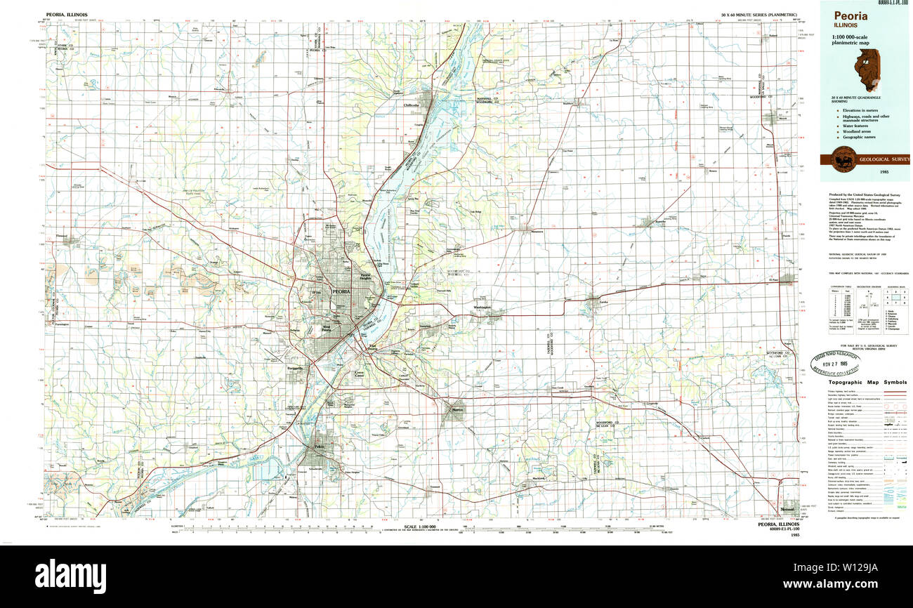 USGS TOPO Map Illinois IL Peoria 310131 1985 100000 Restoration Stock Photohttps://www.alamy.com/image-license-details/?v=1https://www.alamy.com/usgs-topo-map-illinois-il-peoria-310131-1985-100000-restoration-image258821650.html
RMW129JA–USGS TOPO Map Illinois IL Peoria 310131 1985 100000 Restoration
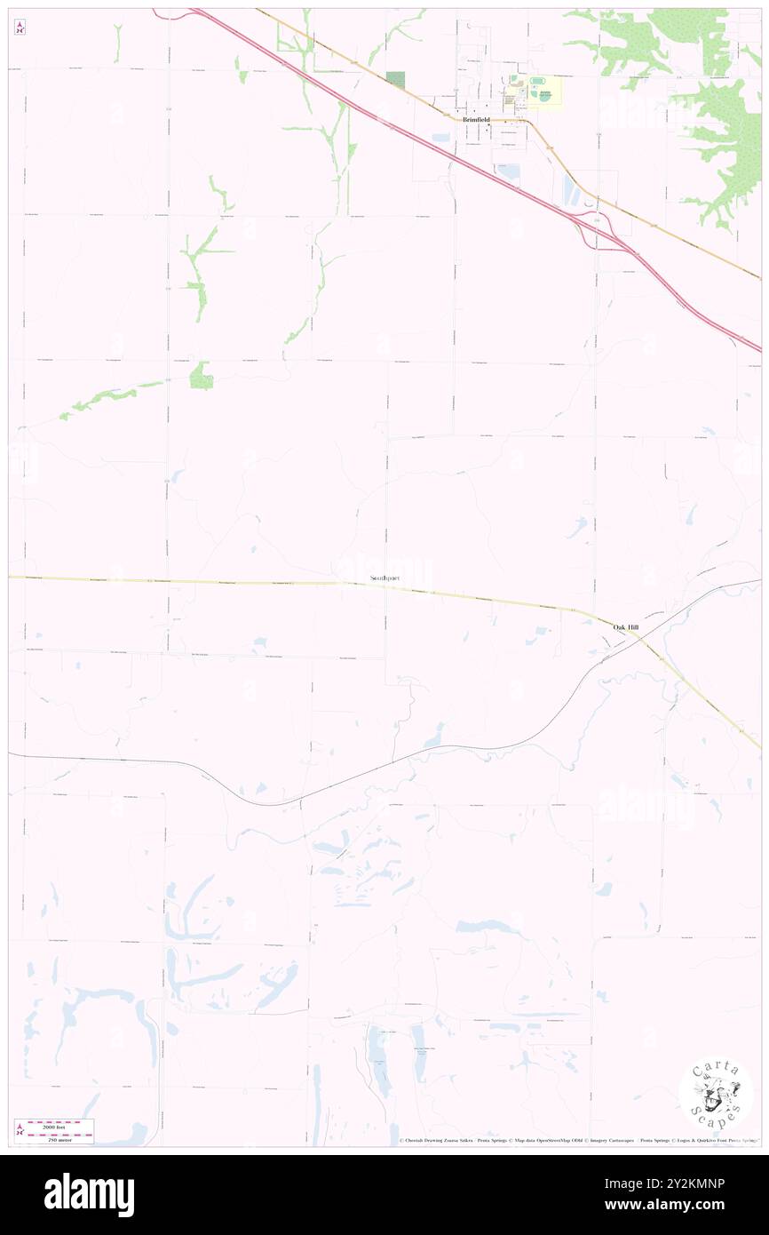 Southport, Peoria County, US, United States, Illinois, N 40 47' 33'', S 89 53' 55'', map, Cartascapes Map published in 2024. Explore Cartascapes, a map revealing Earth's diverse landscapes, cultures, and ecosystems. Journey through time and space, discovering the interconnectedness of our planet's past, present, and future. Stock Photohttps://www.alamy.com/image-license-details/?v=1https://www.alamy.com/southport-peoria-county-us-united-states-illinois-n-40-47-33-s-89-53-55-map-cartascapes-map-published-in-2024-explore-cartascapes-a-map-revealing-earths-diverse-landscapes-cultures-and-ecosystems-journey-through-time-and-space-discovering-the-interconnectedness-of-our-planets-past-present-and-future-image621235938.html
RM2Y2KMNP–Southport, Peoria County, US, United States, Illinois, N 40 47' 33'', S 89 53' 55'', map, Cartascapes Map published in 2024. Explore Cartascapes, a map revealing Earth's diverse landscapes, cultures, and ecosystems. Journey through time and space, discovering the interconnectedness of our planet's past, present, and future.
 USGS TOPO Map Illinois IL Peoria 310132 1989 100000 Restoration Stock Photohttps://www.alamy.com/image-license-details/?v=1https://www.alamy.com/usgs-topo-map-illinois-il-peoria-310132-1989-100000-restoration-image258821688.html
RMW129KM–USGS TOPO Map Illinois IL Peoria 310132 1989 100000 Restoration
 Brimfield, Peoria County, US, United States, Illinois, N 40 50' 20'', S 89 53' 11'', map, Cartascapes Map published in 2024. Explore Cartascapes, a map revealing Earth's diverse landscapes, cultures, and ecosystems. Journey through time and space, discovering the interconnectedness of our planet's past, present, and future. Stock Photohttps://www.alamy.com/image-license-details/?v=1https://www.alamy.com/brimfield-peoria-county-us-united-states-illinois-n-40-50-20-s-89-53-11-map-cartascapes-map-published-in-2024-explore-cartascapes-a-map-revealing-earths-diverse-landscapes-cultures-and-ecosystems-journey-through-time-and-space-discovering-the-interconnectedness-of-our-planets-past-present-and-future-image621446761.html
RM2Y319K5–Brimfield, Peoria County, US, United States, Illinois, N 40 50' 20'', S 89 53' 11'', map, Cartascapes Map published in 2024. Explore Cartascapes, a map revealing Earth's diverse landscapes, cultures, and ecosystems. Journey through time and space, discovering the interconnectedness of our planet's past, present, and future.
 USGS TOPO Map Illinois IL Peoria 310172 1958 250000 Restoration Stock Photohttps://www.alamy.com/image-license-details/?v=1https://www.alamy.com/usgs-topo-map-illinois-il-peoria-310172-1958-250000-restoration-image258821904.html
RMW129YC–USGS TOPO Map Illinois IL Peoria 310172 1958 250000 Restoration
 Glasford, Peoria County, US, United States, Illinois, N 40 34' 21'', S 89 48' 48'', map, Cartascapes Map published in 2024. Explore Cartascapes, a map revealing Earth's diverse landscapes, cultures, and ecosystems. Journey through time and space, discovering the interconnectedness of our planet's past, present, and future. Stock Photohttps://www.alamy.com/image-license-details/?v=1https://www.alamy.com/glasford-peoria-county-us-united-states-illinois-n-40-34-21-s-89-48-48-map-cartascapes-map-published-in-2024-explore-cartascapes-a-map-revealing-earths-diverse-landscapes-cultures-and-ecosystems-journey-through-time-and-space-discovering-the-interconnectedness-of-our-planets-past-present-and-future-image621394435.html
RM2Y2XXXB–Glasford, Peoria County, US, United States, Illinois, N 40 34' 21'', S 89 48' 48'', map, Cartascapes Map published in 2024. Explore Cartascapes, a map revealing Earth's diverse landscapes, cultures, and ecosystems. Journey through time and space, discovering the interconnectedness of our planet's past, present, and future.
 USGS TOPO Map Illinois IL Peoria East 20120822 TM Restoration Stock Photohttps://www.alamy.com/image-license-details/?v=1https://www.alamy.com/usgs-topo-map-illinois-il-peoria-east-20120822-tm-restoration-image258821945.html
RMW12A0W–USGS TOPO Map Illinois IL Peoria East 20120822 TM Restoration
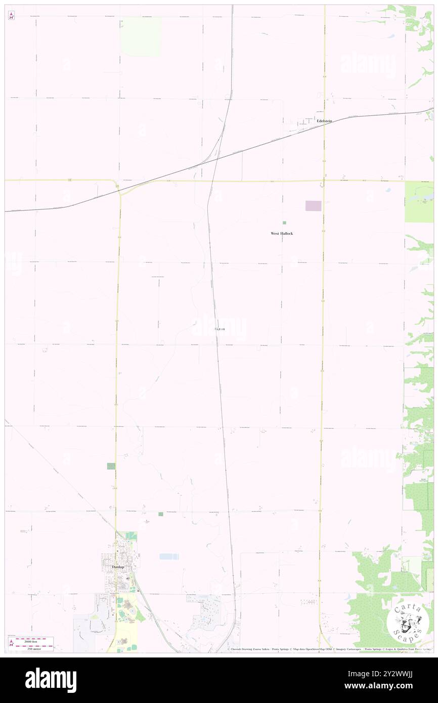 Akron, Peoria County, US, United States, Illinois, N 40 54' 14'', S 89 39' 14'', map, Cartascapes Map published in 2024. Explore Cartascapes, a map revealing Earth's diverse landscapes, cultures, and ecosystems. Journey through time and space, discovering the interconnectedness of our planet's past, present, and future. Stock Photohttps://www.alamy.com/image-license-details/?v=1https://www.alamy.com/akron-peoria-county-us-united-states-illinois-n-40-54-14-s-89-39-14-map-cartascapes-map-published-in-2024-explore-cartascapes-a-map-revealing-earths-diverse-landscapes-cultures-and-ecosystems-journey-through-time-and-space-discovering-the-interconnectedness-of-our-planets-past-present-and-future-image621371482.html
RM2Y2WWJJ–Akron, Peoria County, US, United States, Illinois, N 40 54' 14'', S 89 39' 14'', map, Cartascapes Map published in 2024. Explore Cartascapes, a map revealing Earth's diverse landscapes, cultures, and ecosystems. Journey through time and space, discovering the interconnectedness of our planet's past, present, and future.
 USGS TOPO Map Illinois IL Peoria East 308464 1949 24000 Restoration Stock Photohttps://www.alamy.com/image-license-details/?v=1https://www.alamy.com/usgs-topo-map-illinois-il-peoria-east-308464-1949-24000-restoration-image258822333.html
RMW12AEN–USGS TOPO Map Illinois IL Peoria East 308464 1949 24000 Restoration
 Averyville, Peoria County, US, United States, Illinois, N 40 43' 0'', S 89 33' 44'', map, Cartascapes Map published in 2024. Explore Cartascapes, a map revealing Earth's diverse landscapes, cultures, and ecosystems. Journey through time and space, discovering the interconnectedness of our planet's past, present, and future. Stock Photohttps://www.alamy.com/image-license-details/?v=1https://www.alamy.com/averyville-peoria-county-us-united-states-illinois-n-40-43-0-s-89-33-44-map-cartascapes-map-published-in-2024-explore-cartascapes-a-map-revealing-earths-diverse-landscapes-cultures-and-ecosystems-journey-through-time-and-space-discovering-the-interconnectedness-of-our-planets-past-present-and-future-image621424300.html
RM2Y30910–Averyville, Peoria County, US, United States, Illinois, N 40 43' 0'', S 89 33' 44'', map, Cartascapes Map published in 2024. Explore Cartascapes, a map revealing Earth's diverse landscapes, cultures, and ecosystems. Journey through time and space, discovering the interconnectedness of our planet's past, present, and future.
 USGS TOPO Map Illinois IL Peoria East 308460 1996 24000 Restoration Stock Photohttps://www.alamy.com/image-license-details/?v=1https://www.alamy.com/usgs-topo-map-illinois-il-peoria-east-308460-1996-24000-restoration-image258822080.html
RMW12A5M–USGS TOPO Map Illinois IL Peoria East 308460 1996 24000 Restoration
 Monica, Peoria County, US, United States, Illinois, N 40 55' 25'', S 89 49' 23'', map, Cartascapes Map published in 2024. Explore Cartascapes, a map revealing Earth's diverse landscapes, cultures, and ecosystems. Journey through time and space, discovering the interconnectedness of our planet's past, present, and future. Stock Photohttps://www.alamy.com/image-license-details/?v=1https://www.alamy.com/monica-peoria-county-us-united-states-illinois-n-40-55-25-s-89-49-23-map-cartascapes-map-published-in-2024-explore-cartascapes-a-map-revealing-earths-diverse-landscapes-cultures-and-ecosystems-journey-through-time-and-space-discovering-the-interconnectedness-of-our-planets-past-present-and-future-image621296086.html
RM2Y2PDDX–Monica, Peoria County, US, United States, Illinois, N 40 55' 25'', S 89 49' 23'', map, Cartascapes Map published in 2024. Explore Cartascapes, a map revealing Earth's diverse landscapes, cultures, and ecosystems. Journey through time and space, discovering the interconnectedness of our planet's past, present, and future.
 USGS TOPO Map Illinois IL Peoria West 308466 1996 24000 Restoration Stock Photohttps://www.alamy.com/image-license-details/?v=1https://www.alamy.com/usgs-topo-map-illinois-il-peoria-west-308466-1996-24000-restoration-image258822630.html
RMW12AWA–USGS TOPO Map Illinois IL Peoria West 308466 1996 24000 Restoration
 Elmwood, Peoria County, US, United States, Illinois, N 40 46' 40'', S 89 57' 59'', map, Cartascapes Map published in 2024. Explore Cartascapes, a map revealing Earth's diverse landscapes, cultures, and ecosystems. Journey through time and space, discovering the interconnectedness of our planet's past, present, and future. Stock Photohttps://www.alamy.com/image-license-details/?v=1https://www.alamy.com/elmwood-peoria-county-us-united-states-illinois-n-40-46-40-s-89-57-59-map-cartascapes-map-published-in-2024-explore-cartascapes-a-map-revealing-earths-diverse-landscapes-cultures-and-ecosystems-journey-through-time-and-space-discovering-the-interconnectedness-of-our-planets-past-present-and-future-image621163420.html
RM2Y2GC7T–Elmwood, Peoria County, US, United States, Illinois, N 40 46' 40'', S 89 57' 59'', map, Cartascapes Map published in 2024. Explore Cartascapes, a map revealing Earth's diverse landscapes, cultures, and ecosystems. Journey through time and space, discovering the interconnectedness of our planet's past, present, and future.
 USGS TOPO Map Illinois IL Peoria East 308461 1949 24000 Restoration Stock Photohttps://www.alamy.com/image-license-details/?v=1https://www.alamy.com/usgs-topo-map-illinois-il-peoria-east-308461-1949-24000-restoration-image258822171.html
RMW12A8Y–USGS TOPO Map Illinois IL Peoria East 308461 1949 24000 Restoration
 Bartonville, Peoria County, US, United States, Illinois, N 40 39' 1'', S 89 39' 7'', map, Cartascapes Map published in 2024. Explore Cartascapes, a map revealing Earth's diverse landscapes, cultures, and ecosystems. Journey through time and space, discovering the interconnectedness of our planet's past, present, and future. Stock Photohttps://www.alamy.com/image-license-details/?v=1https://www.alamy.com/bartonville-peoria-county-us-united-states-illinois-n-40-39-1-s-89-39-7-map-cartascapes-map-published-in-2024-explore-cartascapes-a-map-revealing-earths-diverse-landscapes-cultures-and-ecosystems-journey-through-time-and-space-discovering-the-interconnectedness-of-our-planets-past-present-and-future-image621435787.html
RM2Y30RK7–Bartonville, Peoria County, US, United States, Illinois, N 40 39' 1'', S 89 39' 7'', map, Cartascapes Map published in 2024. Explore Cartascapes, a map revealing Earth's diverse landscapes, cultures, and ecosystems. Journey through time and space, discovering the interconnectedness of our planet's past, present, and future.
 USGS TOPO Map Illinois IL Peoria West 308470 1949 24000 Restoration Stock Photohttps://www.alamy.com/image-license-details/?v=1https://www.alamy.com/usgs-topo-map-illinois-il-peoria-west-308470-1949-24000-restoration-image258822815.html
RMW12B3Y–USGS TOPO Map Illinois IL Peoria West 308470 1949 24000 Restoration
 Edelstein, Peoria County, US, United States, Illinois, N 40 56' 27'', S 89 37' 45'', map, Cartascapes Map published in 2024. Explore Cartascapes, a map revealing Earth's diverse landscapes, cultures, and ecosystems. Journey through time and space, discovering the interconnectedness of our planet's past, present, and future. Stock Photohttps://www.alamy.com/image-license-details/?v=1https://www.alamy.com/edelstein-peoria-county-us-united-states-illinois-n-40-56-27-s-89-37-45-map-cartascapes-map-published-in-2024-explore-cartascapes-a-map-revealing-earths-diverse-landscapes-cultures-and-ecosystems-journey-through-time-and-space-discovering-the-interconnectedness-of-our-planets-past-present-and-future-image621419923.html
RM2Y303CK–Edelstein, Peoria County, US, United States, Illinois, N 40 56' 27'', S 89 37' 45'', map, Cartascapes Map published in 2024. Explore Cartascapes, a map revealing Earth's diverse landscapes, cultures, and ecosystems. Journey through time and space, discovering the interconnectedness of our planet's past, present, and future.
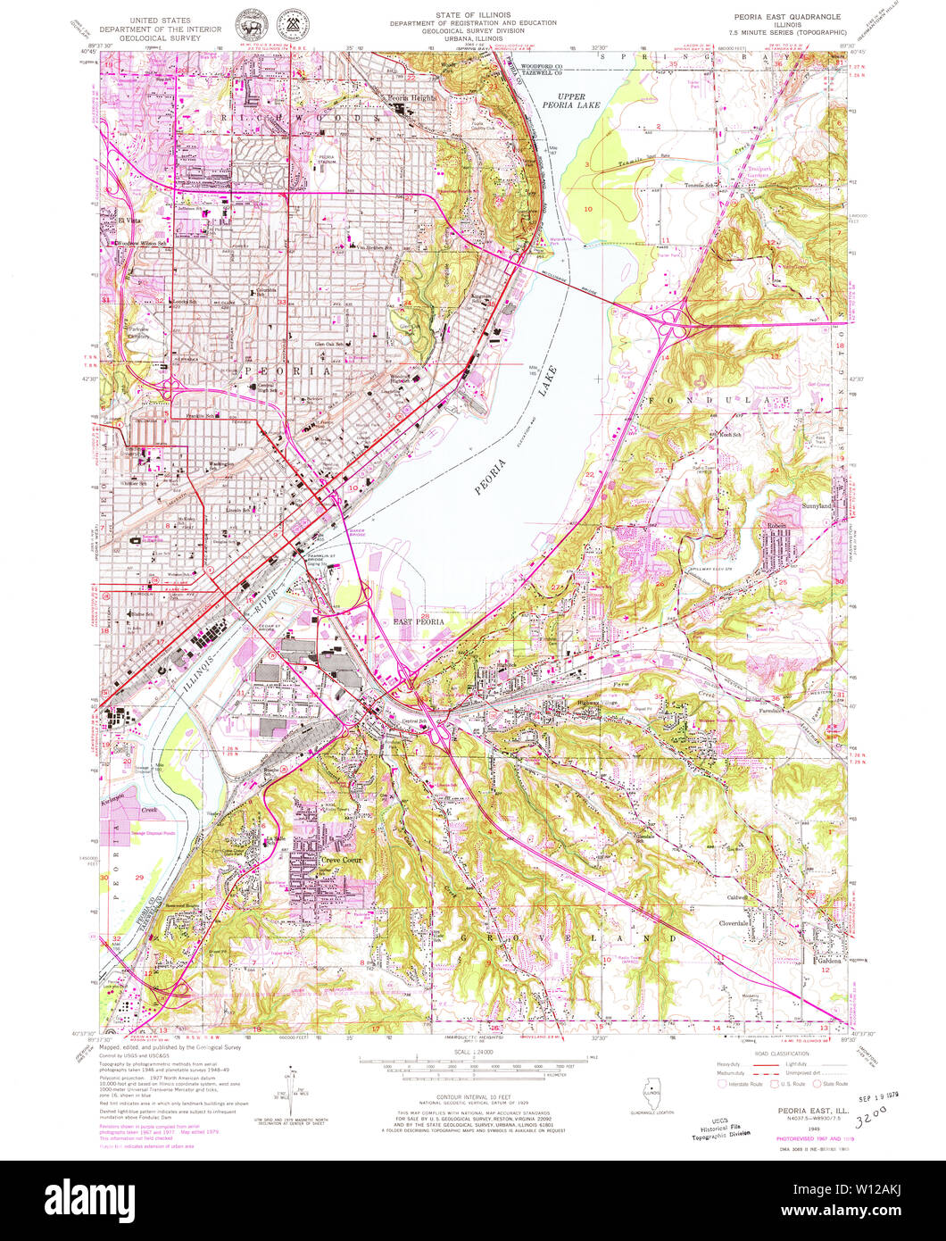 USGS TOPO Map Illinois IL Peoria East 308465 1949 24000 Restoration Stock Photohttps://www.alamy.com/image-license-details/?v=1https://www.alamy.com/usgs-topo-map-illinois-il-peoria-east-308465-1949-24000-restoration-image258822470.html
RMW12AKJ–USGS TOPO Map Illinois IL Peoria East 308465 1949 24000 Restoration
 Princeville, Peoria County, US, United States, Illinois, N 40 55' 47'', S 89 45' 27'', map, Cartascapes Map published in 2024. Explore Cartascapes, a map revealing Earth's diverse landscapes, cultures, and ecosystems. Journey through time and space, discovering the interconnectedness of our planet's past, present, and future. Stock Photohttps://www.alamy.com/image-license-details/?v=1https://www.alamy.com/princeville-peoria-county-us-united-states-illinois-n-40-55-47-s-89-45-27-map-cartascapes-map-published-in-2024-explore-cartascapes-a-map-revealing-earths-diverse-landscapes-cultures-and-ecosystems-journey-through-time-and-space-discovering-the-interconnectedness-of-our-planets-past-present-and-future-image621344530.html
RM2Y2TK82–Princeville, Peoria County, US, United States, Illinois, N 40 55' 47'', S 89 45' 27'', map, Cartascapes Map published in 2024. Explore Cartascapes, a map revealing Earth's diverse landscapes, cultures, and ecosystems. Journey through time and space, discovering the interconnectedness of our planet's past, present, and future.
 USGS TOPO Map Illinois IL Peoria West 308467 1949 24000 Restoration Stock Photohttps://www.alamy.com/image-license-details/?v=1https://www.alamy.com/usgs-topo-map-illinois-il-peoria-west-308467-1949-24000-restoration-image258822698.html
RMW12AYP–USGS TOPO Map Illinois IL Peoria West 308467 1949 24000 Restoration
 Alta, Peoria County, US, United States, Illinois, N 40 48' 39'', S 89 38' 3'', map, Cartascapes Map published in 2024. Explore Cartascapes, a map revealing Earth's diverse landscapes, cultures, and ecosystems. Journey through time and space, discovering the interconnectedness of our planet's past, present, and future. Stock Photohttps://www.alamy.com/image-license-details/?v=1https://www.alamy.com/alta-peoria-county-us-united-states-illinois-n-40-48-39-s-89-38-3-map-cartascapes-map-published-in-2024-explore-cartascapes-a-map-revealing-earths-diverse-landscapes-cultures-and-ecosystems-journey-through-time-and-space-discovering-the-interconnectedness-of-our-planets-past-present-and-future-image621151461.html
RM2Y2FW0N–Alta, Peoria County, US, United States, Illinois, N 40 48' 39'', S 89 38' 3'', map, Cartascapes Map published in 2024. Explore Cartascapes, a map revealing Earth's diverse landscapes, cultures, and ecosystems. Journey through time and space, discovering the interconnectedness of our planet's past, present, and future.
 Norwood, Peoria County, US, United States, Illinois, N 40 42' 20'', S 89 41' 55'', map, Cartascapes Map published in 2024. Explore Cartascapes, a map revealing Earth's diverse landscapes, cultures, and ecosystems. Journey through time and space, discovering the interconnectedness of our planet's past, present, and future. Stock Photohttps://www.alamy.com/image-license-details/?v=1https://www.alamy.com/norwood-peoria-county-us-united-states-illinois-n-40-42-20-s-89-41-55-map-cartascapes-map-published-in-2024-explore-cartascapes-a-map-revealing-earths-diverse-landscapes-cultures-and-ecosystems-journey-through-time-and-space-discovering-the-interconnectedness-of-our-planets-past-present-and-future-image621378016.html
RM2Y2X600–Norwood, Peoria County, US, United States, Illinois, N 40 42' 20'', S 89 41' 55'', map, Cartascapes Map published in 2024. Explore Cartascapes, a map revealing Earth's diverse landscapes, cultures, and ecosystems. Journey through time and space, discovering the interconnectedness of our planet's past, present, and future.
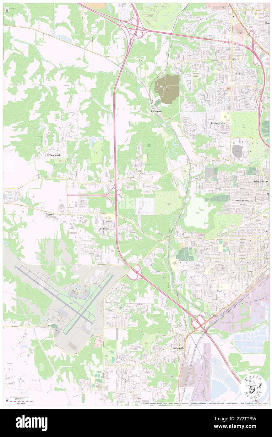 Bellevue, Peoria County, US, United States, Illinois, N 40 41' 4'', S 89 40' 48'', map, Cartascapes Map published in 2024. Explore Cartascapes, a map revealing Earth's diverse landscapes, cultures, and ecosystems. Journey through time and space, discovering the interconnectedness of our planet's past, present, and future. Stock Photohttps://www.alamy.com/image-license-details/?v=1https://www.alamy.com/bellevue-peoria-county-us-united-states-illinois-n-40-41-4-s-89-40-48-map-cartascapes-map-published-in-2024-explore-cartascapes-a-map-revealing-earths-diverse-landscapes-cultures-and-ecosystems-journey-through-time-and-space-discovering-the-interconnectedness-of-our-planets-past-present-and-future-image621348557.html
RM2Y2TTBW–Bellevue, Peoria County, US, United States, Illinois, N 40 41' 4'', S 89 40' 48'', map, Cartascapes Map published in 2024. Explore Cartascapes, a map revealing Earth's diverse landscapes, cultures, and ecosystems. Journey through time and space, discovering the interconnectedness of our planet's past, present, and future.
 Maxwell, Peoria County, US, United States, Illinois, N 40 41' 19'', S 89 42' 1'', map, Cartascapes Map published in 2024. Explore Cartascapes, a map revealing Earth's diverse landscapes, cultures, and ecosystems. Journey through time and space, discovering the interconnectedness of our planet's past, present, and future. Stock Photohttps://www.alamy.com/image-license-details/?v=1https://www.alamy.com/maxwell-peoria-county-us-united-states-illinois-n-40-41-19-s-89-42-1-map-cartascapes-map-published-in-2024-explore-cartascapes-a-map-revealing-earths-diverse-landscapes-cultures-and-ecosystems-journey-through-time-and-space-discovering-the-interconnectedness-of-our-planets-past-present-and-future-image621366395.html
RM2Y2WK4Y–Maxwell, Peoria County, US, United States, Illinois, N 40 41' 19'', S 89 42' 1'', map, Cartascapes Map published in 2024. Explore Cartascapes, a map revealing Earth's diverse landscapes, cultures, and ecosystems. Journey through time and space, discovering the interconnectedness of our planet's past, present, and future.
 Mapleton, Peoria County, US, United States, Illinois, N 40 33' 59'', S 89 43' 54'', map, Cartascapes Map published in 2024. Explore Cartascapes, a map revealing Earth's diverse landscapes, cultures, and ecosystems. Journey through time and space, discovering the interconnectedness of our planet's past, present, and future. Stock Photohttps://www.alamy.com/image-license-details/?v=1https://www.alamy.com/mapleton-peoria-county-us-united-states-illinois-n-40-33-59-s-89-43-54-map-cartascapes-map-published-in-2024-explore-cartascapes-a-map-revealing-earths-diverse-landscapes-cultures-and-ecosystems-journey-through-time-and-space-discovering-the-interconnectedness-of-our-planets-past-present-and-future-image621475022.html
RM2Y32HME–Mapleton, Peoria County, US, United States, Illinois, N 40 33' 59'', S 89 43' 54'', map, Cartascapes Map published in 2024. Explore Cartascapes, a map revealing Earth's diverse landscapes, cultures, and ecosystems. Journey through time and space, discovering the interconnectedness of our planet's past, present, and future.
 Olin, Peoria County, US, United States, Illinois, N 40 45' 10'', S 89 46' 6'', map, Cartascapes Map published in 2024. Explore Cartascapes, a map revealing Earth's diverse landscapes, cultures, and ecosystems. Journey through time and space, discovering the interconnectedness of our planet's past, present, and future. Stock Photohttps://www.alamy.com/image-license-details/?v=1https://www.alamy.com/olin-peoria-county-us-united-states-illinois-n-40-45-10-s-89-46-6-map-cartascapes-map-published-in-2024-explore-cartascapes-a-map-revealing-earths-diverse-landscapes-cultures-and-ecosystems-journey-through-time-and-space-discovering-the-interconnectedness-of-our-planets-past-present-and-future-image621299668.html
RM2Y2PJ1T–Olin, Peoria County, US, United States, Illinois, N 40 45' 10'', S 89 46' 6'', map, Cartascapes Map published in 2024. Explore Cartascapes, a map revealing Earth's diverse landscapes, cultures, and ecosystems. Journey through time and space, discovering the interconnectedness of our planet's past, present, and future.
 Brimfield, Peoria County, US, United States, Illinois, N 40 50' 20'', S 89 53' 11'', map, Cartascapes Map published in 2024. Explore Cartascapes, a map revealing Earth's diverse landscapes, cultures, and ecosystems. Journey through time and space, discovering the interconnectedness of our planet's past, present, and future. Stock Photohttps://www.alamy.com/image-license-details/?v=1https://www.alamy.com/brimfield-peoria-county-us-united-states-illinois-n-40-50-20-s-89-53-11-map-cartascapes-map-published-in-2024-explore-cartascapes-a-map-revealing-earths-diverse-landscapes-cultures-and-ecosystems-journey-through-time-and-space-discovering-the-interconnectedness-of-our-planets-past-present-and-future-image621398437.html
RM2Y2Y419–Brimfield, Peoria County, US, United States, Illinois, N 40 50' 20'', S 89 53' 11'', map, Cartascapes Map published in 2024. Explore Cartascapes, a map revealing Earth's diverse landscapes, cultures, and ecosystems. Journey through time and space, discovering the interconnectedness of our planet's past, present, and future.
 Norwood, Peoria County, US, United States, Illinois, N 40 42' 20'', S 89 41' 55'', map, Cartascapes Map published in 2024. Explore Cartascapes, a map revealing Earth's diverse landscapes, cultures, and ecosystems. Journey through time and space, discovering the interconnectedness of our planet's past, present, and future. Stock Photohttps://www.alamy.com/image-license-details/?v=1https://www.alamy.com/norwood-peoria-county-us-united-states-illinois-n-40-42-20-s-89-41-55-map-cartascapes-map-published-in-2024-explore-cartascapes-a-map-revealing-earths-diverse-landscapes-cultures-and-ecosystems-journey-through-time-and-space-discovering-the-interconnectedness-of-our-planets-past-present-and-future-image621182309.html
RM2Y2H8AD–Norwood, Peoria County, US, United States, Illinois, N 40 42' 20'', S 89 41' 55'', map, Cartascapes Map published in 2024. Explore Cartascapes, a map revealing Earth's diverse landscapes, cultures, and ecosystems. Journey through time and space, discovering the interconnectedness of our planet's past, present, and future.
 Trivoli, Peoria County, US, United States, Illinois, N 40 41' 26'', S 89 53' 31'', map, Cartascapes Map published in 2024. Explore Cartascapes, a map revealing Earth's diverse landscapes, cultures, and ecosystems. Journey through time and space, discovering the interconnectedness of our planet's past, present, and future. Stock Photohttps://www.alamy.com/image-license-details/?v=1https://www.alamy.com/trivoli-peoria-county-us-united-states-illinois-n-40-41-26-s-89-53-31-map-cartascapes-map-published-in-2024-explore-cartascapes-a-map-revealing-earths-diverse-landscapes-cultures-and-ecosystems-journey-through-time-and-space-discovering-the-interconnectedness-of-our-planets-past-present-and-future-image621149498.html
RM2Y2FPEJ–Trivoli, Peoria County, US, United States, Illinois, N 40 41' 26'', S 89 53' 31'', map, Cartascapes Map published in 2024. Explore Cartascapes, a map revealing Earth's diverse landscapes, cultures, and ecosystems. Journey through time and space, discovering the interconnectedness of our planet's past, present, and future.
 Cramer, Peoria County, US, United States, Illinois, N 40 41' 28'', S 89 56' 49'', map, Cartascapes Map published in 2024. Explore Cartascapes, a map revealing Earth's diverse landscapes, cultures, and ecosystems. Journey through time and space, discovering the interconnectedness of our planet's past, present, and future. Stock Photohttps://www.alamy.com/image-license-details/?v=1https://www.alamy.com/cramer-peoria-county-us-united-states-illinois-n-40-41-28-s-89-56-49-map-cartascapes-map-published-in-2024-explore-cartascapes-a-map-revealing-earths-diverse-landscapes-cultures-and-ecosystems-journey-through-time-and-space-discovering-the-interconnectedness-of-our-planets-past-present-and-future-image621308952.html
RM2Y2R1WC–Cramer, Peoria County, US, United States, Illinois, N 40 41' 28'', S 89 56' 49'', map, Cartascapes Map published in 2024. Explore Cartascapes, a map revealing Earth's diverse landscapes, cultures, and ecosystems. Journey through time and space, discovering the interconnectedness of our planet's past, present, and future.
 Pottstown, Peoria County, US, United States, Illinois, N 40 43' 5'', S 89 39' 37'', map, Cartascapes Map published in 2024. Explore Cartascapes, a map revealing Earth's diverse landscapes, cultures, and ecosystems. Journey through time and space, discovering the interconnectedness of our planet's past, present, and future. Stock Photohttps://www.alamy.com/image-license-details/?v=1https://www.alamy.com/pottstown-peoria-county-us-united-states-illinois-n-40-43-5-s-89-39-37-map-cartascapes-map-published-in-2024-explore-cartascapes-a-map-revealing-earths-diverse-landscapes-cultures-and-ecosystems-journey-through-time-and-space-discovering-the-interconnectedness-of-our-planets-past-present-and-future-image621396194.html
RM2Y2Y156–Pottstown, Peoria County, US, United States, Illinois, N 40 43' 5'', S 89 39' 37'', map, Cartascapes Map published in 2024. Explore Cartascapes, a map revealing Earth's diverse landscapes, cultures, and ecosystems. Journey through time and space, discovering the interconnectedness of our planet's past, present, and future.
 Smithville, Peoria County, US, United States, Illinois, N 40 39' 37'', S 89 47' 59'', map, Cartascapes Map published in 2024. Explore Cartascapes, a map revealing Earth's diverse landscapes, cultures, and ecosystems. Journey through time and space, discovering the interconnectedness of our planet's past, present, and future. Stock Photohttps://www.alamy.com/image-license-details/?v=1https://www.alamy.com/smithville-peoria-county-us-united-states-illinois-n-40-39-37-s-89-47-59-map-cartascapes-map-published-in-2024-explore-cartascapes-a-map-revealing-earths-diverse-landscapes-cultures-and-ecosystems-journey-through-time-and-space-discovering-the-interconnectedness-of-our-planets-past-present-and-future-image621265628.html
RM2Y2N2J4–Smithville, Peoria County, US, United States, Illinois, N 40 39' 37'', S 89 47' 59'', map, Cartascapes Map published in 2024. Explore Cartascapes, a map revealing Earth's diverse landscapes, cultures, and ecosystems. Journey through time and space, discovering the interconnectedness of our planet's past, present, and future.
 Mossville, Peoria County, US, United States, Illinois, N 40 48' 56'', S 89 34' 4'', map, Cartascapes Map published in 2024. Explore Cartascapes, a map revealing Earth's diverse landscapes, cultures, and ecosystems. Journey through time and space, discovering the interconnectedness of our planet's past, present, and future. Stock Photohttps://www.alamy.com/image-license-details/?v=1https://www.alamy.com/mossville-peoria-county-us-united-states-illinois-n-40-48-56-s-89-34-4-map-cartascapes-map-published-in-2024-explore-cartascapes-a-map-revealing-earths-diverse-landscapes-cultures-and-ecosystems-journey-through-time-and-space-discovering-the-interconnectedness-of-our-planets-past-present-and-future-image621464544.html
RM2Y324A8–Mossville, Peoria County, US, United States, Illinois, N 40 48' 56'', S 89 34' 4'', map, Cartascapes Map published in 2024. Explore Cartascapes, a map revealing Earth's diverse landscapes, cultures, and ecosystems. Journey through time and space, discovering the interconnectedness of our planet's past, present, and future.
 Dunlap, Peoria County, US, United States, Illinois, N 40 51' 42'', S 89 40' 43'', map, Cartascapes Map published in 2024. Explore Cartascapes, a map revealing Earth's diverse landscapes, cultures, and ecosystems. Journey through time and space, discovering the interconnectedness of our planet's past, present, and future. Stock Photohttps://www.alamy.com/image-license-details/?v=1https://www.alamy.com/dunlap-peoria-county-us-united-states-illinois-n-40-51-42-s-89-40-43-map-cartascapes-map-published-in-2024-explore-cartascapes-a-map-revealing-earths-diverse-landscapes-cultures-and-ecosystems-journey-through-time-and-space-discovering-the-interconnectedness-of-our-planets-past-present-and-future-image621234296.html
RM2Y2KJK4–Dunlap, Peoria County, US, United States, Illinois, N 40 51' 42'', S 89 40' 43'', map, Cartascapes Map published in 2024. Explore Cartascapes, a map revealing Earth's diverse landscapes, cultures, and ecosystems. Journey through time and space, discovering the interconnectedness of our planet's past, present, and future.
 North Peoria, Peoria County, US, United States, Illinois, N 40 43' 3'', S 89 35' 3'', map, Cartascapes Map published in 2024. Explore Cartascapes, a map revealing Earth's diverse landscapes, cultures, and ecosystems. Journey through time and space, discovering the interconnectedness of our planet's past, present, and future. Stock Photohttps://www.alamy.com/image-license-details/?v=1https://www.alamy.com/north-peoria-peoria-county-us-united-states-illinois-n-40-43-3-s-89-35-3-map-cartascapes-map-published-in-2024-explore-cartascapes-a-map-revealing-earths-diverse-landscapes-cultures-and-ecosystems-journey-through-time-and-space-discovering-the-interconnectedness-of-our-planets-past-present-and-future-image621432816.html
RM2Y30KW4–North Peoria, Peoria County, US, United States, Illinois, N 40 43' 3'', S 89 35' 3'', map, Cartascapes Map published in 2024. Explore Cartascapes, a map revealing Earth's diverse landscapes, cultures, and ecosystems. Journey through time and space, discovering the interconnectedness of our planet's past, present, and future.
 East Peoria, Tazewell County, US, United States, Illinois, N 40 39' 58'', S 89 34' 48'', map, Cartascapes Map published in 2024. Explore Cartascapes, a map revealing Earth's diverse landscapes, cultures, and ecosystems. Journey through time and space, discovering the interconnectedness of our planet's past, present, and future. Stock Photohttps://www.alamy.com/image-license-details/?v=1https://www.alamy.com/east-peoria-tazewell-county-us-united-states-illinois-n-40-39-58-s-89-34-48-map-cartascapes-map-published-in-2024-explore-cartascapes-a-map-revealing-earths-diverse-landscapes-cultures-and-ecosystems-journey-through-time-and-space-discovering-the-interconnectedness-of-our-planets-past-present-and-future-image621167021.html
RM2Y2GGTD–East Peoria, Tazewell County, US, United States, Illinois, N 40 39' 58'', S 89 34' 48'', map, Cartascapes Map published in 2024. Explore Cartascapes, a map revealing Earth's diverse landscapes, cultures, and ecosystems. Journey through time and space, discovering the interconnectedness of our planet's past, present, and future.
 North Hampton, Peoria County, US, United States, Illinois, N 40 55' 52'', S 89 32' 20'', map, Cartascapes Map published in 2024. Explore Cartascapes, a map revealing Earth's diverse landscapes, cultures, and ecosystems. Journey through time and space, discovering the interconnectedness of our planet's past, present, and future. Stock Photohttps://www.alamy.com/image-license-details/?v=1https://www.alamy.com/north-hampton-peoria-county-us-united-states-illinois-n-40-55-52-s-89-32-20-map-cartascapes-map-published-in-2024-explore-cartascapes-a-map-revealing-earths-diverse-landscapes-cultures-and-ecosystems-journey-through-time-and-space-discovering-the-interconnectedness-of-our-planets-past-present-and-future-image621171816.html
RM2Y2GPYM–North Hampton, Peoria County, US, United States, Illinois, N 40 55' 52'', S 89 32' 20'', map, Cartascapes Map published in 2024. Explore Cartascapes, a map revealing Earth's diverse landscapes, cultures, and ecosystems. Journey through time and space, discovering the interconnectedness of our planet's past, present, and future.
 East Peoria, Tazewell County, US, United States, Illinois, N 40 39' 58'', S 89 34' 48'', map, Cartascapes Map published in 2024. Explore Cartascapes, a map revealing Earth's diverse landscapes, cultures, and ecosystems. Journey through time and space, discovering the interconnectedness of our planet's past, present, and future. Stock Photohttps://www.alamy.com/image-license-details/?v=1https://www.alamy.com/east-peoria-tazewell-county-us-united-states-illinois-n-40-39-58-s-89-34-48-map-cartascapes-map-published-in-2024-explore-cartascapes-a-map-revealing-earths-diverse-landscapes-cultures-and-ecosystems-journey-through-time-and-space-discovering-the-interconnectedness-of-our-planets-past-present-and-future-image621407242.html
RM2Y2YF7P–East Peoria, Tazewell County, US, United States, Illinois, N 40 39' 58'', S 89 34' 48'', map, Cartascapes Map published in 2024. Explore Cartascapes, a map revealing Earth's diverse landscapes, cultures, and ecosystems. Journey through time and space, discovering the interconnectedness of our planet's past, present, and future.
 Hanna City, Peoria County, US, United States, Illinois, N 40 41' 30'', S 89 47' 42'', map, Cartascapes Map published in 2024. Explore Cartascapes, a map revealing Earth's diverse landscapes, cultures, and ecosystems. Journey through time and space, discovering the interconnectedness of our planet's past, present, and future. Stock Photohttps://www.alamy.com/image-license-details/?v=1https://www.alamy.com/hanna-city-peoria-county-us-united-states-illinois-n-40-41-30-s-89-47-42-map-cartascapes-map-published-in-2024-explore-cartascapes-a-map-revealing-earths-diverse-landscapes-cultures-and-ecosystems-journey-through-time-and-space-discovering-the-interconnectedness-of-our-planets-past-present-and-future-image621260601.html
RM2Y2MT6H–Hanna City, Peoria County, US, United States, Illinois, N 40 41' 30'', S 89 47' 42'', map, Cartascapes Map published in 2024. Explore Cartascapes, a map revealing Earth's diverse landscapes, cultures, and ecosystems. Journey through time and space, discovering the interconnectedness of our planet's past, present, and future.
 Oak Hill, Peoria County, US, United States, Illinois, N 40 47' 15'', S 89 51' 59'', map, Cartascapes Map published in 2024. Explore Cartascapes, a map revealing Earth's diverse landscapes, cultures, and ecosystems. Journey through time and space, discovering the interconnectedness of our planet's past, present, and future. Stock Photohttps://www.alamy.com/image-license-details/?v=1https://www.alamy.com/oak-hill-peoria-county-us-united-states-illinois-n-40-47-15-s-89-51-59-map-cartascapes-map-published-in-2024-explore-cartascapes-a-map-revealing-earths-diverse-landscapes-cultures-and-ecosystems-journey-through-time-and-space-discovering-the-interconnectedness-of-our-planets-past-present-and-future-image621187432.html
RM2Y2HEWC–Oak Hill, Peoria County, US, United States, Illinois, N 40 47' 15'', S 89 51' 59'', map, Cartascapes Map published in 2024. Explore Cartascapes, a map revealing Earth's diverse landscapes, cultures, and ecosystems. Journey through time and space, discovering the interconnectedness of our planet's past, present, and future.
 Kingston Mines, Peoria County, US, United States, Illinois, N 40 33' 29'', S 89 46' 14'', map, Cartascapes Map published in 2024. Explore Cartascapes, a map revealing Earth's diverse landscapes, cultures, and ecosystems. Journey through time and space, discovering the interconnectedness of our planet's past, present, and future. Stock Photohttps://www.alamy.com/image-license-details/?v=1https://www.alamy.com/kingston-mines-peoria-county-us-united-states-illinois-n-40-33-29-s-89-46-14-map-cartascapes-map-published-in-2024-explore-cartascapes-a-map-revealing-earths-diverse-landscapes-cultures-and-ecosystems-journey-through-time-and-space-discovering-the-interconnectedness-of-our-planets-past-present-and-future-image621390824.html
RM2Y2XP9C–Kingston Mines, Peoria County, US, United States, Illinois, N 40 33' 29'', S 89 46' 14'', map, Cartascapes Map published in 2024. Explore Cartascapes, a map revealing Earth's diverse landscapes, cultures, and ecosystems. Journey through time and space, discovering the interconnectedness of our planet's past, present, and future.
 West Hallock, Peoria County, US, United States, Illinois, N 40 55' 15'', S 89 38' 21'', map, Cartascapes Map published in 2024. Explore Cartascapes, a map revealing Earth's diverse landscapes, cultures, and ecosystems. Journey through time and space, discovering the interconnectedness of our planet's past, present, and future. Stock Photohttps://www.alamy.com/image-license-details/?v=1https://www.alamy.com/west-hallock-peoria-county-us-united-states-illinois-n-40-55-15-s-89-38-21-map-cartascapes-map-published-in-2024-explore-cartascapes-a-map-revealing-earths-diverse-landscapes-cultures-and-ecosystems-journey-through-time-and-space-discovering-the-interconnectedness-of-our-planets-past-present-and-future-image621310408.html
RM2Y2R3NC–West Hallock, Peoria County, US, United States, Illinois, N 40 55' 15'', S 89 38' 21'', map, Cartascapes Map published in 2024. Explore Cartascapes, a map revealing Earth's diverse landscapes, cultures, and ecosystems. Journey through time and space, discovering the interconnectedness of our planet's past, present, and future.
 Golden Acres, Peoria County, US, United States, Illinois, N 40 44' 38'', S 89 37' 54'', map, Cartascapes Map published in 2024. Explore Cartascapes, a map revealing Earth's diverse landscapes, cultures, and ecosystems. Journey through time and space, discovering the interconnectedness of our planet's past, present, and future. Stock Photohttps://www.alamy.com/image-license-details/?v=1https://www.alamy.com/golden-acres-peoria-county-us-united-states-illinois-n-40-44-38-s-89-37-54-map-cartascapes-map-published-in-2024-explore-cartascapes-a-map-revealing-earths-diverse-landscapes-cultures-and-ecosystems-journey-through-time-and-space-discovering-the-interconnectedness-of-our-planets-past-present-and-future-image621444441.html
RM2Y316M9–Golden Acres, Peoria County, US, United States, Illinois, N 40 44' 38'', S 89 37' 54'', map, Cartascapes Map published in 2024. Explore Cartascapes, a map revealing Earth's diverse landscapes, cultures, and ecosystems. Journey through time and space, discovering the interconnectedness of our planet's past, present, and future.
 El Vista, Peoria County, US, United States, Illinois, N 40 43' 44'', S 89 37' 45'', map, Cartascapes Map published in 2024. Explore Cartascapes, a map revealing Earth's diverse landscapes, cultures, and ecosystems. Journey through time and space, discovering the interconnectedness of our planet's past, present, and future. Stock Photohttps://www.alamy.com/image-license-details/?v=1https://www.alamy.com/el-vista-peoria-county-us-united-states-illinois-n-40-43-44-s-89-37-45-map-cartascapes-map-published-in-2024-explore-cartascapes-a-map-revealing-earths-diverse-landscapes-cultures-and-ecosystems-journey-through-time-and-space-discovering-the-interconnectedness-of-our-planets-past-present-and-future-image621453721.html
RM2Y31JFN–El Vista, Peoria County, US, United States, Illinois, N 40 43' 44'', S 89 37' 45'', map, Cartascapes Map published in 2024. Explore Cartascapes, a map revealing Earth's diverse landscapes, cultures, and ecosystems. Journey through time and space, discovering the interconnectedness of our planet's past, present, and future.
 Hanna City, Peoria County, US, United States, Illinois, N 40 41' 30'', S 89 47' 42'', map, Cartascapes Map published in 2024. Explore Cartascapes, a map revealing Earth's diverse landscapes, cultures, and ecosystems. Journey through time and space, discovering the interconnectedness of our planet's past, present, and future. Stock Photohttps://www.alamy.com/image-license-details/?v=1https://www.alamy.com/hanna-city-peoria-county-us-united-states-illinois-n-40-41-30-s-89-47-42-map-cartascapes-map-published-in-2024-explore-cartascapes-a-map-revealing-earths-diverse-landscapes-cultures-and-ecosystems-journey-through-time-and-space-discovering-the-interconnectedness-of-our-planets-past-present-and-future-image621145902.html
RM2Y2FHX6–Hanna City, Peoria County, US, United States, Illinois, N 40 41' 30'', S 89 47' 42'', map, Cartascapes Map published in 2024. Explore Cartascapes, a map revealing Earth's diverse landscapes, cultures, and ecosystems. Journey through time and space, discovering the interconnectedness of our planet's past, present, and future.
 Cedar Bluff Estates, Peoria County, US, United States, Illinois, N 40 50' 10'', S 89 36' 50'', map, Cartascapes Map published in 2024. Explore Cartascapes, a map revealing Earth's diverse landscapes, cultures, and ecosystems. Journey through time and space, discovering the interconnectedness of our planet's past, present, and future. Stock Photohttps://www.alamy.com/image-license-details/?v=1https://www.alamy.com/cedar-bluff-estates-peoria-county-us-united-states-illinois-n-40-50-10-s-89-36-50-map-cartascapes-map-published-in-2024-explore-cartascapes-a-map-revealing-earths-diverse-landscapes-cultures-and-ecosystems-journey-through-time-and-space-discovering-the-interconnectedness-of-our-planets-past-present-and-future-image621462094.html
RM2Y3216P–Cedar Bluff Estates, Peoria County, US, United States, Illinois, N 40 50' 10'', S 89 36' 50'', map, Cartascapes Map published in 2024. Explore Cartascapes, a map revealing Earth's diverse landscapes, cultures, and ecosystems. Journey through time and space, discovering the interconnectedness of our planet's past, present, and future.
 West Peoria, Peoria County, US, United States, Illinois, N 40 41' 33'', S 89 37' 40'', map, Cartascapes Map published in 2024. Explore Cartascapes, a map revealing Earth's diverse landscapes, cultures, and ecosystems. Journey through time and space, discovering the interconnectedness of our planet's past, present, and future. Stock Photohttps://www.alamy.com/image-license-details/?v=1https://www.alamy.com/west-peoria-peoria-county-us-united-states-illinois-n-40-41-33-s-89-37-40-map-cartascapes-map-published-in-2024-explore-cartascapes-a-map-revealing-earths-diverse-landscapes-cultures-and-ecosystems-journey-through-time-and-space-discovering-the-interconnectedness-of-our-planets-past-present-and-future-image621419529.html
RM2Y302XH–West Peoria, Peoria County, US, United States, Illinois, N 40 41' 33'', S 89 37' 40'', map, Cartascapes Map published in 2024. Explore Cartascapes, a map revealing Earth's diverse landscapes, cultures, and ecosystems. Journey through time and space, discovering the interconnectedness of our planet's past, present, and future.
 West Peoria, Peoria County, US, United States, Illinois, N 40 41' 33'', S 89 37' 40'', map, Cartascapes Map published in 2024. Explore Cartascapes, a map revealing Earth's diverse landscapes, cultures, and ecosystems. Journey through time and space, discovering the interconnectedness of our planet's past, present, and future. Stock Photohttps://www.alamy.com/image-license-details/?v=1https://www.alamy.com/west-peoria-peoria-county-us-united-states-illinois-n-40-41-33-s-89-37-40-map-cartascapes-map-published-in-2024-explore-cartascapes-a-map-revealing-earths-diverse-landscapes-cultures-and-ecosystems-journey-through-time-and-space-discovering-the-interconnectedness-of-our-planets-past-present-and-future-image621493896.html
RM2Y33DPG–West Peoria, Peoria County, US, United States, Illinois, N 40 41' 33'', S 89 37' 40'', map, Cartascapes Map published in 2024. Explore Cartascapes, a map revealing Earth's diverse landscapes, cultures, and ecosystems. Journey through time and space, discovering the interconnectedness of our planet's past, present, and future.
 Eden, Peoria County, US, United States, Illinois, N 40 41' 20'', S 89 49' 58'', map, Cartascapes Map published in 2024. Explore Cartascapes, a map revealing Earth's diverse landscapes, cultures, and ecosystems. Journey through time and space, discovering the interconnectedness of our planet's past, present, and future. Stock Photohttps://www.alamy.com/image-license-details/?v=1https://www.alamy.com/eden-peoria-county-us-united-states-illinois-n-40-41-20-s-89-49-58-map-cartascapes-map-published-in-2024-explore-cartascapes-a-map-revealing-earths-diverse-landscapes-cultures-and-ecosystems-journey-through-time-and-space-discovering-the-interconnectedness-of-our-planets-past-present-and-future-image620751288.html
RM2Y1WJGT–Eden, Peoria County, US, United States, Illinois, N 40 41' 20'', S 89 49' 58'', map, Cartascapes Map published in 2024. Explore Cartascapes, a map revealing Earth's diverse landscapes, cultures, and ecosystems. Journey through time and space, discovering the interconnectedness of our planet's past, present, and future.
 Rome, Peoria County, US, United States, Illinois, N 40 52' 59'', S 89 30' 9'', map, Cartascapes Map published in 2024. Explore Cartascapes, a map revealing Earth's diverse landscapes, cultures, and ecosystems. Journey through time and space, discovering the interconnectedness of our planet's past, present, and future. Stock Photohttps://www.alamy.com/image-license-details/?v=1https://www.alamy.com/rome-peoria-county-us-united-states-illinois-n-40-52-59-s-89-30-9-map-cartascapes-map-published-in-2024-explore-cartascapes-a-map-revealing-earths-diverse-landscapes-cultures-and-ecosystems-journey-through-time-and-space-discovering-the-interconnectedness-of-our-planets-past-present-and-future-image620740453.html
RM2Y1W4NW–Rome, Peoria County, US, United States, Illinois, N 40 52' 59'', S 89 30' 9'', map, Cartascapes Map published in 2024. Explore Cartascapes, a map revealing Earth's diverse landscapes, cultures, and ecosystems. Journey through time and space, discovering the interconnectedness of our planet's past, present, and future.
 Edwards, Peoria County, US, United States, Illinois, N 40 44' 45'', S 89 44' 39'', map, Cartascapes Map published in 2024. Explore Cartascapes, a map revealing Earth's diverse landscapes, cultures, and ecosystems. Journey through time and space, discovering the interconnectedness of our planet's past, present, and future. Stock Photohttps://www.alamy.com/image-license-details/?v=1https://www.alamy.com/edwards-peoria-county-us-united-states-illinois-n-40-44-45-s-89-44-39-map-cartascapes-map-published-in-2024-explore-cartascapes-a-map-revealing-earths-diverse-landscapes-cultures-and-ecosystems-journey-through-time-and-space-discovering-the-interconnectedness-of-our-planets-past-present-and-future-image620684602.html
RM2Y1PHF6–Edwards, Peoria County, US, United States, Illinois, N 40 44' 45'', S 89 44' 39'', map, Cartascapes Map published in 2024. Explore Cartascapes, a map revealing Earth's diverse landscapes, cultures, and ecosystems. Journey through time and space, discovering the interconnectedness of our planet's past, present, and future.
 Glasford, Peoria County, US, United States, Illinois, N 40 34' 21'', S 89 48' 48'', map, Cartascapes Map published in 2024. Explore Cartascapes, a map revealing Earth's diverse landscapes, cultures, and ecosystems. Journey through time and space, discovering the interconnectedness of our planet's past, present, and future. Stock Photohttps://www.alamy.com/image-license-details/?v=1https://www.alamy.com/glasford-peoria-county-us-united-states-illinois-n-40-34-21-s-89-48-48-map-cartascapes-map-published-in-2024-explore-cartascapes-a-map-revealing-earths-diverse-landscapes-cultures-and-ecosystems-journey-through-time-and-space-discovering-the-interconnectedness-of-our-planets-past-present-and-future-image620879870.html
RM2Y23EH2–Glasford, Peoria County, US, United States, Illinois, N 40 34' 21'', S 89 48' 48'', map, Cartascapes Map published in 2024. Explore Cartascapes, a map revealing Earth's diverse landscapes, cultures, and ecosystems. Journey through time and space, discovering the interconnectedness of our planet's past, present, and future.
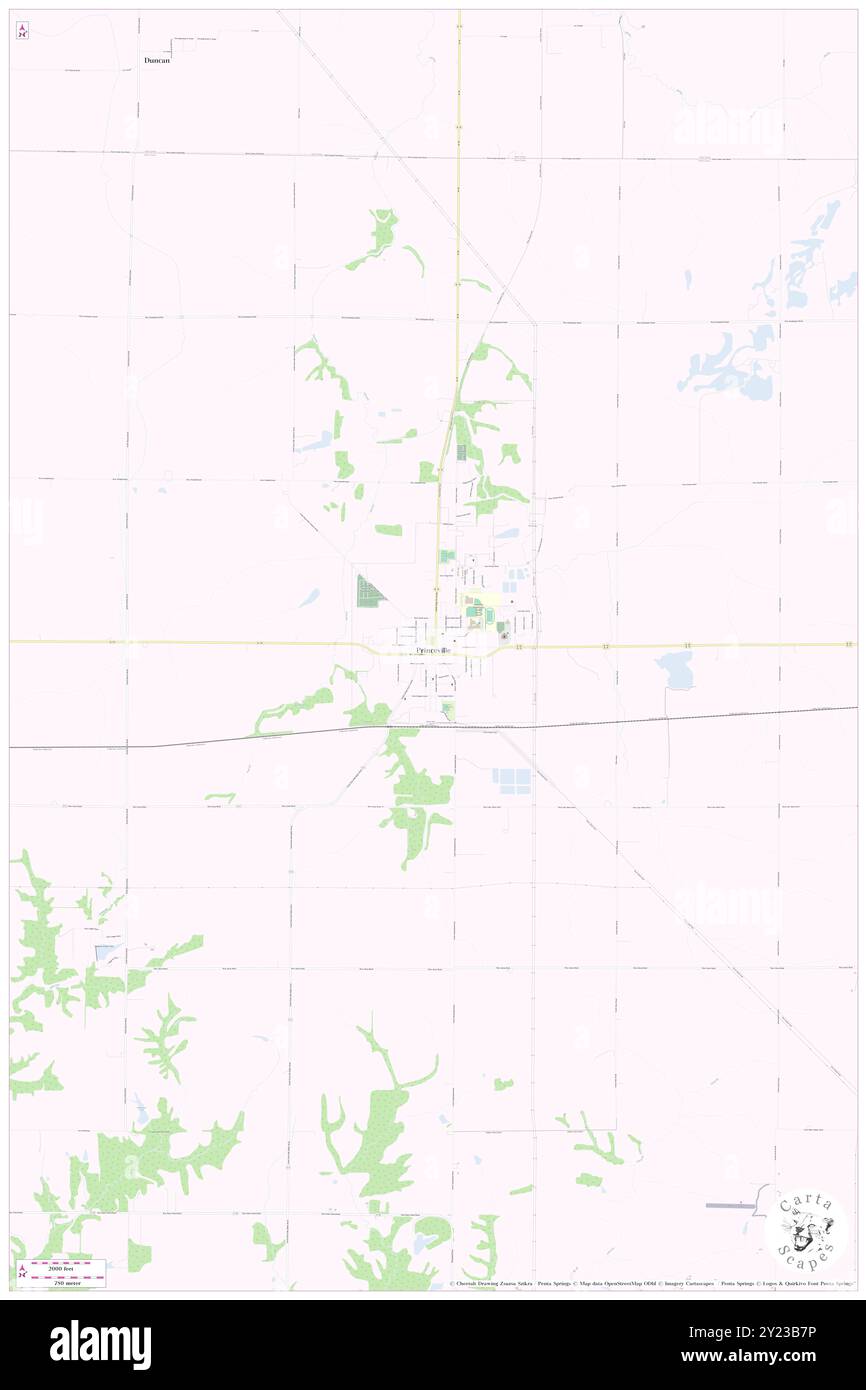 Princeville, Peoria County, US, United States, Illinois, N 40 55' 47'', S 89 45' 27'', map, Cartascapes Map published in 2024. Explore Cartascapes, a map revealing Earth's diverse landscapes, cultures, and ecosystems. Journey through time and space, discovering the interconnectedness of our planet's past, present, and future. Stock Photohttps://www.alamy.com/image-license-details/?v=1https://www.alamy.com/princeville-peoria-county-us-united-states-illinois-n-40-55-47-s-89-45-27-map-cartascapes-map-published-in-2024-explore-cartascapes-a-map-revealing-earths-diverse-landscapes-cultures-and-ecosystems-journey-through-time-and-space-discovering-the-interconnectedness-of-our-planets-past-present-and-future-image620877258.html
RM2Y23B7P–Princeville, Peoria County, US, United States, Illinois, N 40 55' 47'', S 89 45' 27'', map, Cartascapes Map published in 2024. Explore Cartascapes, a map revealing Earth's diverse landscapes, cultures, and ecosystems. Journey through time and space, discovering the interconnectedness of our planet's past, present, and future.
 Lancaster, Peoria County, US, United States, Illinois, N 40 34' 49'', S 89 50' 14'', map, Cartascapes Map published in 2024. Explore Cartascapes, a map revealing Earth's diverse landscapes, cultures, and ecosystems. Journey through time and space, discovering the interconnectedness of our planet's past, present, and future. Stock Photohttps://www.alamy.com/image-license-details/?v=1https://www.alamy.com/lancaster-peoria-county-us-united-states-illinois-n-40-34-49-s-89-50-14-map-cartascapes-map-published-in-2024-explore-cartascapes-a-map-revealing-earths-diverse-landscapes-cultures-and-ecosystems-journey-through-time-and-space-discovering-the-interconnectedness-of-our-planets-past-present-and-future-image620798671.html
RM2Y1YR13–Lancaster, Peoria County, US, United States, Illinois, N 40 34' 49'', S 89 50' 14'', map, Cartascapes Map published in 2024. Explore Cartascapes, a map revealing Earth's diverse landscapes, cultures, and ecosystems. Journey through time and space, discovering the interconnectedness of our planet's past, present, and future.
 Tuscarora, Peoria County, US, United States, Illinois, N 40 36' 19'', S 89 40' 2'', map, Cartascapes Map published in 2024. Explore Cartascapes, a map revealing Earth's diverse landscapes, cultures, and ecosystems. Journey through time and space, discovering the interconnectedness of our planet's past, present, and future. Stock Photohttps://www.alamy.com/image-license-details/?v=1https://www.alamy.com/tuscarora-peoria-county-us-united-states-illinois-n-40-36-19-s-89-40-2-map-cartascapes-map-published-in-2024-explore-cartascapes-a-map-revealing-earths-diverse-landscapes-cultures-and-ecosystems-journey-through-time-and-space-discovering-the-interconnectedness-of-our-planets-past-present-and-future-image620812553.html
RM2Y20CMW–Tuscarora, Peoria County, US, United States, Illinois, N 40 36' 19'', S 89 40' 2'', map, Cartascapes Map published in 2024. Explore Cartascapes, a map revealing Earth's diverse landscapes, cultures, and ecosystems. Journey through time and space, discovering the interconnectedness of our planet's past, present, and future.
 Peoria, Peoria County, US, United States, Illinois, N 40 41' 37'', S 89 35' 20'', map, Cartascapes Map published in 2024. Explore Cartascapes, a map revealing Earth's diverse landscapes, cultures, and ecosystems. Journey through time and space, discovering the interconnectedness of our planet's past, present, and future. Stock Photohttps://www.alamy.com/image-license-details/?v=1https://www.alamy.com/peoria-peoria-county-us-united-states-illinois-n-40-41-37-s-89-35-20-map-cartascapes-map-published-in-2024-explore-cartascapes-a-map-revealing-earths-diverse-landscapes-cultures-and-ecosystems-journey-through-time-and-space-discovering-the-interconnectedness-of-our-planets-past-present-and-future-image620860912.html
RM2Y22JC0–Peoria, Peoria County, US, United States, Illinois, N 40 41' 37'', S 89 35' 20'', map, Cartascapes Map published in 2024. Explore Cartascapes, a map revealing Earth's diverse landscapes, cultures, and ecosystems. Journey through time and space, discovering the interconnectedness of our planet's past, present, and future.
 Peoria, Peoria County, US, United States, Illinois, N 40 41' 37'', S 89 35' 20'', map, Cartascapes Map published in 2024. Explore Cartascapes, a map revealing Earth's diverse landscapes, cultures, and ecosystems. Journey through time and space, discovering the interconnectedness of our planet's past, present, and future. Stock Photohttps://www.alamy.com/image-license-details/?v=1https://www.alamy.com/peoria-peoria-county-us-united-states-illinois-n-40-41-37-s-89-35-20-map-cartascapes-map-published-in-2024-explore-cartascapes-a-map-revealing-earths-diverse-landscapes-cultures-and-ecosystems-journey-through-time-and-space-discovering-the-interconnectedness-of-our-planets-past-present-and-future-image620882495.html
RM2Y23HXR–Peoria, Peoria County, US, United States, Illinois, N 40 41' 37'', S 89 35' 20'', map, Cartascapes Map published in 2024. Explore Cartascapes, a map revealing Earth's diverse landscapes, cultures, and ecosystems. Journey through time and space, discovering the interconnectedness of our planet's past, present, and future.
 Chillicothe, Peoria County, US, United States, Illinois, N 40 55' 20'', S 89 29' 10'', map, Cartascapes Map published in 2024. Explore Cartascapes, a map revealing Earth's diverse landscapes, cultures, and ecosystems. Journey through time and space, discovering the interconnectedness of our planet's past, present, and future. Stock Photohttps://www.alamy.com/image-license-details/?v=1https://www.alamy.com/chillicothe-peoria-county-us-united-states-illinois-n-40-55-20-s-89-29-10-map-cartascapes-map-published-in-2024-explore-cartascapes-a-map-revealing-earths-diverse-landscapes-cultures-and-ecosystems-journey-through-time-and-space-discovering-the-interconnectedness-of-our-planets-past-present-and-future-image620765047.html
RM2Y1X847–Chillicothe, Peoria County, US, United States, Illinois, N 40 55' 20'', S 89 29' 10'', map, Cartascapes Map published in 2024. Explore Cartascapes, a map revealing Earth's diverse landscapes, cultures, and ecosystems. Journey through time and space, discovering the interconnectedness of our planet's past, present, and future.
 Bartonville, Peoria County, US, United States, Illinois, N 40 39' 1'', S 89 39' 7'', map, Cartascapes Map published in 2024. Explore Cartascapes, a map revealing Earth's diverse landscapes, cultures, and ecosystems. Journey through time and space, discovering the interconnectedness of our planet's past, present, and future. Stock Photohttps://www.alamy.com/image-license-details/?v=1https://www.alamy.com/bartonville-peoria-county-us-united-states-illinois-n-40-39-1-s-89-39-7-map-cartascapes-map-published-in-2024-explore-cartascapes-a-map-revealing-earths-diverse-landscapes-cultures-and-ecosystems-journey-through-time-and-space-discovering-the-interconnectedness-of-our-planets-past-present-and-future-image620877929.html
RM2Y23C3N–Bartonville, Peoria County, US, United States, Illinois, N 40 39' 1'', S 89 39' 7'', map, Cartascapes Map published in 2024. Explore Cartascapes, a map revealing Earth's diverse landscapes, cultures, and ecosystems. Journey through time and space, discovering the interconnectedness of our planet's past, present, and future.
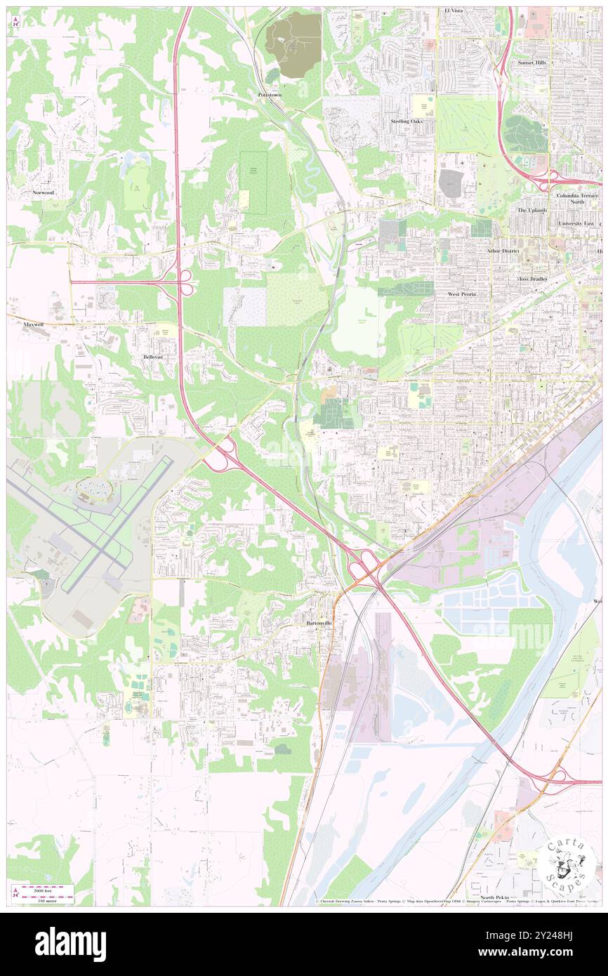 Kickapoo, Peoria County, US, United States, Illinois, N 40 40' 18'', S 89 39' 16'', map, Cartascapes Map published in 2024. Explore Cartascapes, a map revealing Earth's diverse landscapes, cultures, and ecosystems. Journey through time and space, discovering the interconnectedness of our planet's past, present, and future. Stock Photohttps://www.alamy.com/image-license-details/?v=1https://www.alamy.com/kickapoo-peoria-county-us-united-states-illinois-n-40-40-18-s-89-39-16-map-cartascapes-map-published-in-2024-explore-cartascapes-a-map-revealing-earths-diverse-landscapes-cultures-and-ecosystems-journey-through-time-and-space-discovering-the-interconnectedness-of-our-planets-past-present-and-future-image620897134.html
RM2Y248HJ–Kickapoo, Peoria County, US, United States, Illinois, N 40 40' 18'', S 89 39' 16'', map, Cartascapes Map published in 2024. Explore Cartascapes, a map revealing Earth's diverse landscapes, cultures, and ecosystems. Journey through time and space, discovering the interconnectedness of our planet's past, present, and future.
 Keller, Peoria County, US, United States, Illinois, N 40 45' 41'', S 89 35' 50'', map, Cartascapes Map published in 2024. Explore Cartascapes, a map revealing Earth's diverse landscapes, cultures, and ecosystems. Journey through time and space, discovering the interconnectedness of our planet's past, present, and future. Stock Photohttps://www.alamy.com/image-license-details/?v=1https://www.alamy.com/keller-peoria-county-us-united-states-illinois-n-40-45-41-s-89-35-50-map-cartascapes-map-published-in-2024-explore-cartascapes-a-map-revealing-earths-diverse-landscapes-cultures-and-ecosystems-journey-through-time-and-space-discovering-the-interconnectedness-of-our-planets-past-present-and-future-image620877832.html
RM2Y23C08–Keller, Peoria County, US, United States, Illinois, N 40 45' 41'', S 89 35' 50'', map, Cartascapes Map published in 2024. Explore Cartascapes, a map revealing Earth's diverse landscapes, cultures, and ecosystems. Journey through time and space, discovering the interconnectedness of our planet's past, present, and future.
 Laura, Peoria County, US, United States, Illinois, N 40 55' 17'', S 89 55' 35'', map, Cartascapes Map published in 2024. Explore Cartascapes, a map revealing Earth's diverse landscapes, cultures, and ecosystems. Journey through time and space, discovering the interconnectedness of our planet's past, present, and future. Stock Photohttps://www.alamy.com/image-license-details/?v=1https://www.alamy.com/laura-peoria-county-us-united-states-illinois-n-40-55-17-s-89-55-35-map-cartascapes-map-published-in-2024-explore-cartascapes-a-map-revealing-earths-diverse-landscapes-cultures-and-ecosystems-journey-through-time-and-space-discovering-the-interconnectedness-of-our-planets-past-present-and-future-image620879183.html
RM2Y23DMF–Laura, Peoria County, US, United States, Illinois, N 40 55' 17'', S 89 55' 35'', map, Cartascapes Map published in 2024. Explore Cartascapes, a map revealing Earth's diverse landscapes, cultures, and ecosystems. Journey through time and space, discovering the interconnectedness of our planet's past, present, and future.
 Chillicothe, Peoria County, US, United States, Illinois, N 40 55' 20'', S 89 29' 10'', map, Cartascapes Map published in 2024. Explore Cartascapes, a map revealing Earth's diverse landscapes, cultures, and ecosystems. Journey through time and space, discovering the interconnectedness of our planet's past, present, and future. Stock Photohttps://www.alamy.com/image-license-details/?v=1https://www.alamy.com/chillicothe-peoria-county-us-united-states-illinois-n-40-55-20-s-89-29-10-map-cartascapes-map-published-in-2024-explore-cartascapes-a-map-revealing-earths-diverse-landscapes-cultures-and-ecosystems-journey-through-time-and-space-discovering-the-interconnectedness-of-our-planets-past-present-and-future-image620687787.html
RM2Y1PNGY–Chillicothe, Peoria County, US, United States, Illinois, N 40 55' 20'', S 89 29' 10'', map, Cartascapes Map published in 2024. Explore Cartascapes, a map revealing Earth's diverse landscapes, cultures, and ecosystems. Journey through time and space, discovering the interconnectedness of our planet's past, present, and future.
 Coughlin, Peoria County, US, United States, Illinois, N 40 53' 45'', S 89 29' 47'', map, Cartascapes Map published in 2024. Explore Cartascapes, a map revealing Earth's diverse landscapes, cultures, and ecosystems. Journey through time and space, discovering the interconnectedness of our planet's past, present, and future. Stock Photohttps://www.alamy.com/image-license-details/?v=1https://www.alamy.com/coughlin-peoria-county-us-united-states-illinois-n-40-53-45-s-89-29-47-map-cartascapes-map-published-in-2024-explore-cartascapes-a-map-revealing-earths-diverse-landscapes-cultures-and-ecosystems-journey-through-time-and-space-discovering-the-interconnectedness-of-our-planets-past-present-and-future-image620860968.html
RM2Y22JE0–Coughlin, Peoria County, US, United States, Illinois, N 40 53' 45'', S 89 29' 47'', map, Cartascapes Map published in 2024. Explore Cartascapes, a map revealing Earth's diverse landscapes, cultures, and ecosystems. Journey through time and space, discovering the interconnectedness of our planet's past, present, and future.