Quick filters:
Map of saranac lake Stock Photos and Images
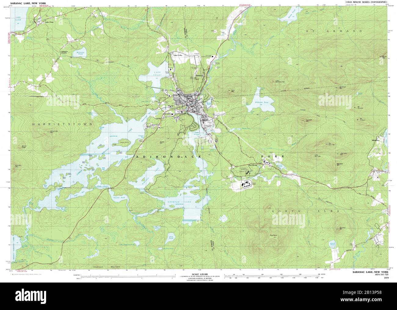 Highly detailed view of the 1979 topographic map for Saranac Lake, NY Stock Photohttps://www.alamy.com/image-license-details/?v=1https://www.alamy.com/highly-detailed-view-of-the-1979-topographic-map-for-saranac-lake-ny-image344905268.html
RF2B13P58–Highly detailed view of the 1979 topographic map for Saranac Lake, NY
 Image 1 of Sanborn Fire Insurance Map from Saranac Lake, Franklin And Essex Counties, New York. Aug 1895. 2 Sheet(s), America, street map with a Nineteenth Century compass Stock Photohttps://www.alamy.com/image-license-details/?v=1https://www.alamy.com/image-1-of-sanborn-fire-insurance-map-from-saranac-lake-franklin-and-essex-counties-new-york-aug-1895-2-sheets-america-street-map-with-a-nineteenth-century-compass-image344698770.html
RM2B0PAPA–Image 1 of Sanborn Fire Insurance Map from Saranac Lake, Franklin And Essex Counties, New York. Aug 1895. 2 Sheet(s), America, street map with a Nineteenth Century compass
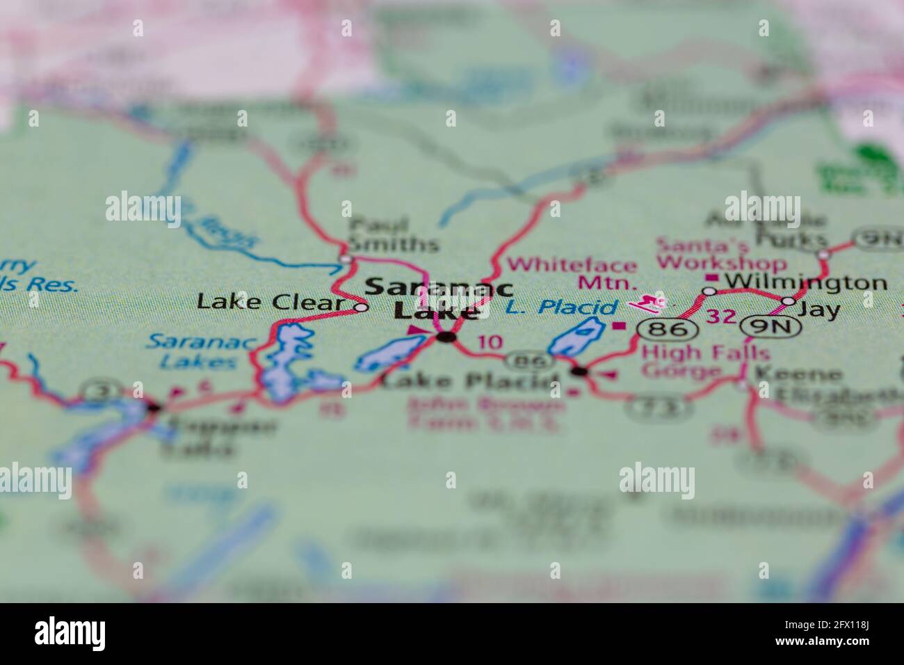 Saranac Lake New York USA Shown on a Geography map or road map Stock Photohttps://www.alamy.com/image-license-details/?v=1https://www.alamy.com/saranac-lake-new-york-usa-shown-on-a-geography-map-or-road-map-image429052866.html
RM2FX118J–Saranac Lake New York USA Shown on a Geography map or road map
 Saranac Lake, Franklin County, US, United States, New York, N 44 19' 46'', S 74 7' 52'', map, Cartascapes Map published in 2024. Explore Cartascapes, a map revealing Earth's diverse landscapes, cultures, and ecosystems. Journey through time and space, discovering the interconnectedness of our planet's past, present, and future. Stock Photohttps://www.alamy.com/image-license-details/?v=1https://www.alamy.com/saranac-lake-franklin-county-us-united-states-new-york-n-44-19-46-s-74-7-52-map-cartascapes-map-published-in-2024-explore-cartascapes-a-map-revealing-earths-diverse-landscapes-cultures-and-ecosystems-journey-through-time-and-space-discovering-the-interconnectedness-of-our-planets-past-present-and-future-image621221826.html
RM2Y2K2NP–Saranac Lake, Franklin County, US, United States, New York, N 44 19' 46'', S 74 7' 52'', map, Cartascapes Map published in 2024. Explore Cartascapes, a map revealing Earth's diverse landscapes, cultures, and ecosystems. Journey through time and space, discovering the interconnectedness of our planet's past, present, and future.
 Sanborn Fire Insurance Map from Saranac Lake, Franklin And Essex Counties, New York. Stock Photohttps://www.alamy.com/image-license-details/?v=1https://www.alamy.com/sanborn-fire-insurance-map-from-saranac-lake-franklin-and-essex-counties-new-york-image456472970.html
RM2HEJ3X2–Sanborn Fire Insurance Map from Saranac Lake, Franklin And Essex Counties, New York.
 . English: A very attractive example of the 1872 U.S. Coast Survey nautical chart or map of Plattsburgh and Cumberland Bay, Lake Champlain, New York. This map covers the urban center of Plattsburgh as well as the surrounding areas as far south as Crab Island and as far north as far east as Cumberland Head. The map includes the course of the Saranac River as it passes south of the city and route of the Whitehall and Plattsburgh Railroad. Offers exceptional inland detail with important building, streets, and property lines shown. In Lake Champlain there are countless depth soundings as well as Stock Photohttps://www.alamy.com/image-license-details/?v=1https://www.alamy.com/english-a-very-attractive-example-of-the-1872-us-coast-survey-nautical-chart-or-map-of-plattsburgh-and-cumberland-bay-lake-champlain-new-york-this-map-covers-the-urban-center-of-plattsburgh-as-well-as-the-surrounding-areas-as-far-south-as-crab-island-and-as-far-north-as-far-east-as-cumberland-head-the-map-includes-the-course-of-the-saranac-river-as-it-passes-south-of-the-city-and-route-of-the-whitehall-and-plattsburgh-railroad-offers-exceptional-inland-detail-with-important-building-streets-and-property-lines-shown-in-lake-champlain-there-are-countless-depth-soundings-as-well-as-image184877789.html
RMMMNWE5–. English: A very attractive example of the 1872 U.S. Coast Survey nautical chart or map of Plattsburgh and Cumberland Bay, Lake Champlain, New York. This map covers the urban center of Plattsburgh as well as the surrounding areas as far south as Crab Island and as far north as far east as Cumberland Head. The map includes the course of the Saranac River as it passes south of the city and route of the Whitehall and Plattsburgh Railroad. Offers exceptional inland detail with important building, streets, and property lines shown. In Lake Champlain there are countless depth soundings as well as
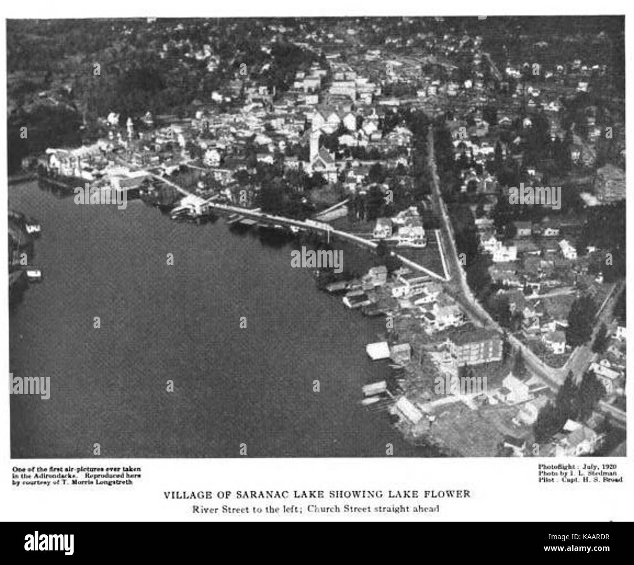 Saranac Lake circa 1920 ALD Stock Photohttps://www.alamy.com/image-license-details/?v=1https://www.alamy.com/stock-image-saranac-lake-circa-1920-ald-161277811.html
RMKAARDR–Saranac Lake circa 1920 ALD
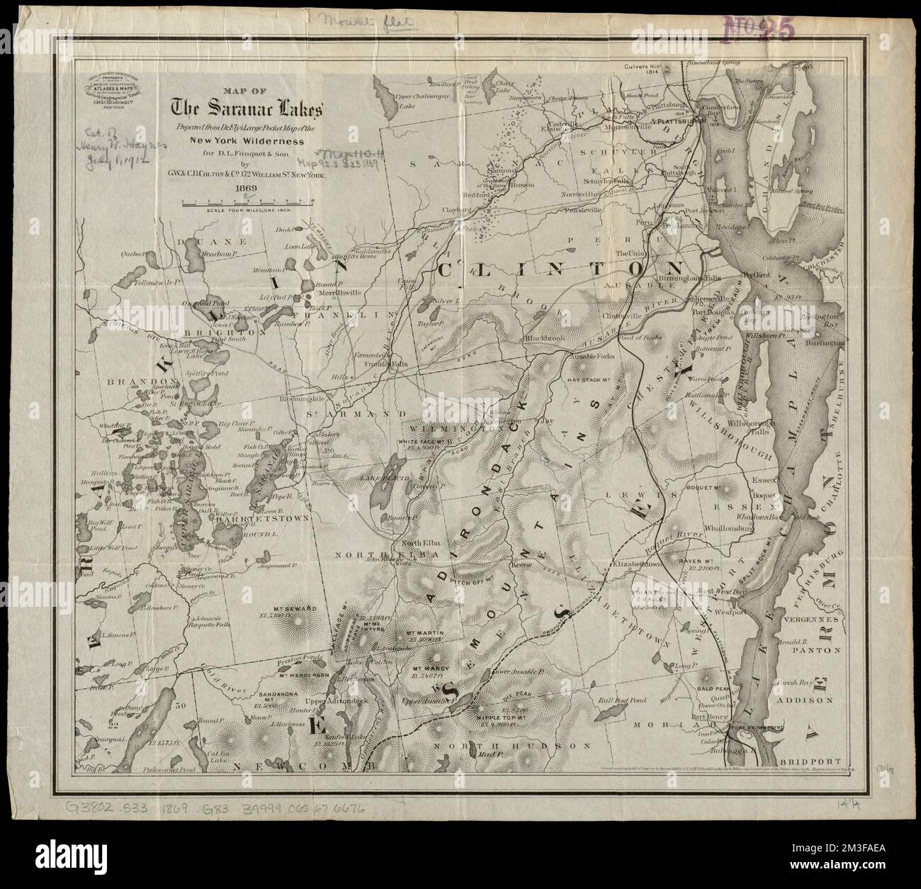 Map of the Saranac Lakes : prepared from Dr. Ely's large pocket map of the New York wilderness for D.L. Fouquet & Son , Saranac Lake Region N.Y., Maps, Saranac River N.Y., Maps, Adirondack Mountains N.Y., Maps Norman B. Leventhal Map Center Collection Stock Photohttps://www.alamy.com/image-license-details/?v=1https://www.alamy.com/map-of-the-saranac-lakes-prepared-from-dr-elys-large-pocket-map-of-the-new-york-wilderness-for-dl-fouquet-son-saranac-lake-region-ny-maps-saranac-river-ny-maps-adirondack-mountains-ny-maps-norman-b-leventhal-map-center-collection-image501282162.html
RM2M3FAEA–Map of the Saranac Lakes : prepared from Dr. Ely's large pocket map of the New York wilderness for D.L. Fouquet & Son , Saranac Lake Region N.Y., Maps, Saranac River N.Y., Maps, Adirondack Mountains N.Y., Maps Norman B. Leventhal Map Center Collection
 Broadway, Saranac Lake, NY 1909 cph.3b18511 Stock Photohttps://www.alamy.com/image-license-details/?v=1https://www.alamy.com/stock-image-broadway-saranac-lake-ny-1909-cph3b18511-162787226.html
RMKCRGNE–Broadway, Saranac Lake, NY 1909 cph.3b18511
 42062 Stocking Halfway Brook, Near Saranac Lake Stock Photohttps://www.alamy.com/image-license-details/?v=1https://www.alamy.com/stock-photo-42062-stocking-halfway-brook-near-saranac-lake-115090764.html
RMGK6RCC–42062 Stocking Halfway Brook, Near Saranac Lake
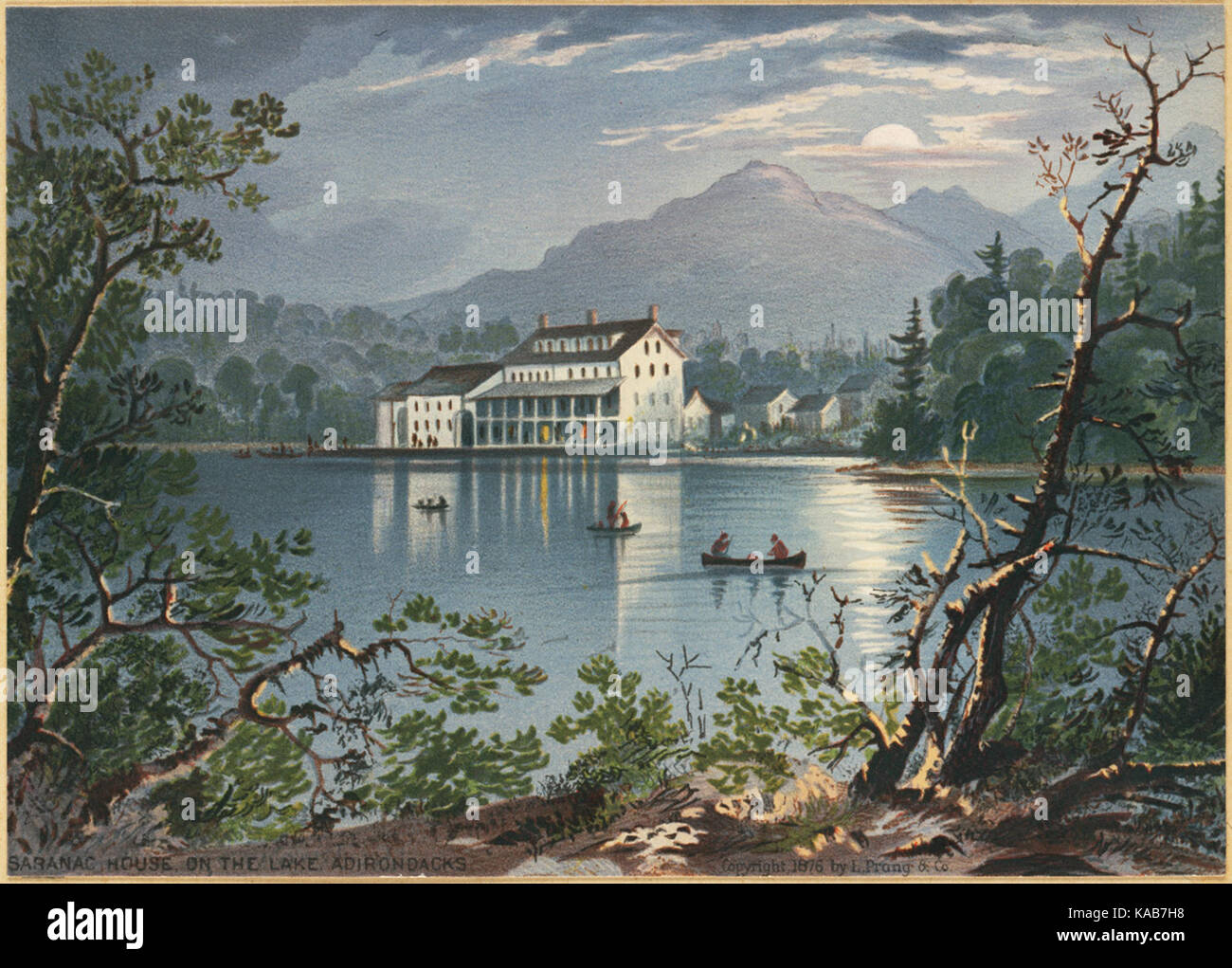 Saranac House on the Lake, Adirondacks (Boston Public Library) Stock Photohttps://www.alamy.com/image-license-details/?v=1https://www.alamy.com/stock-image-saranac-house-on-the-lake-adirondacks-boston-public-library-161287316.html
RMKAB7H8–Saranac House on the Lake, Adirondacks (Boston Public Library)
 . P.J. Hannifan & Co.'s new commercial railroad and county map of New Yort State and gazetteer .. . cross the Saranac was bravely resisted.In the evening, Prevost retreated, leaving bis sick and wounded, and alarge quantity of military stores, behind him. The British loss, from the6th to the 11th of September, in killed, wounded, and deserted, wasabout 2,500 ; that of the Americans, 121. Sept. 11. McDonoughs victory on Lake Champlain. After an engage-ment of two hours and forty minutes, the British fleet, under Com.Downie, surrendered. The Americans lost in killed and wounded 116 ;the British Stock Photohttps://www.alamy.com/image-license-details/?v=1https://www.alamy.com/pj-hannifan-cos-new-commercial-railroad-and-county-map-of-new-yort-state-and-gazetteer-cross-the-saranac-was-bravely-resistedin-the-evening-prevost-retreated-leaving-bis-sick-and-wounded-and-alarge-quantity-of-military-stores-behind-him-the-british-loss-from-the6th-to-the-11th-of-september-in-killed-wounded-and-deserted-wasabout-2500-that-of-the-americans-121-sept-11-mcdonoughs-victory-on-lake-champlain-after-an-engage-ment-of-two-hours-and-forty-minutes-the-british-fleet-under-comdownie-surrendered-the-americans-lost-in-killed-and-wounded-116-the-british-image375833907.html
RM2CRCKYF–. P.J. Hannifan & Co.'s new commercial railroad and county map of New Yort State and gazetteer .. . cross the Saranac was bravely resisted.In the evening, Prevost retreated, leaving bis sick and wounded, and alarge quantity of military stores, behind him. The British loss, from the6th to the 11th of September, in killed, wounded, and deserted, wasabout 2,500 ; that of the Americans, 121. Sept. 11. McDonoughs victory on Lake Champlain. After an engage-ment of two hours and forty minutes, the British fleet, under Com.Downie, surrendered. The Americans lost in killed and wounded 116 ;the British
 New York NY Saranac Lake 20100629 TM Restoration Stock Photohttps://www.alamy.com/image-license-details/?v=1https://www.alamy.com/new-york-ny-saranac-lake-20100629-tm-restoration-image271875128.html
RMWP8YE0–New York NY Saranac Lake 20100629 TM Restoration
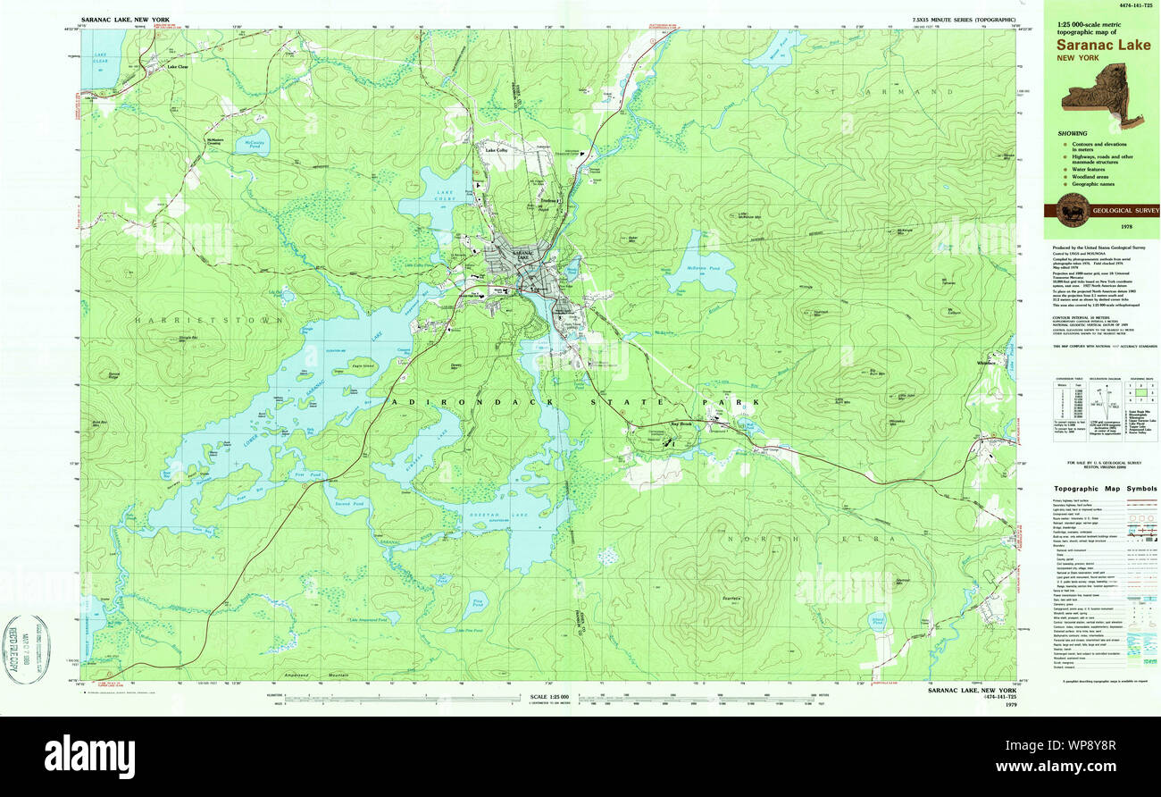 New York NY Saranac Lake 129378 1978 25000 Restoration Stock Photohttps://www.alamy.com/image-license-details/?v=1https://www.alamy.com/new-york-ny-saranac-lake-129378-1978-25000-restoration-image271874983.html
RMWP8Y8R–New York NY Saranac Lake 129378 1978 25000 Restoration
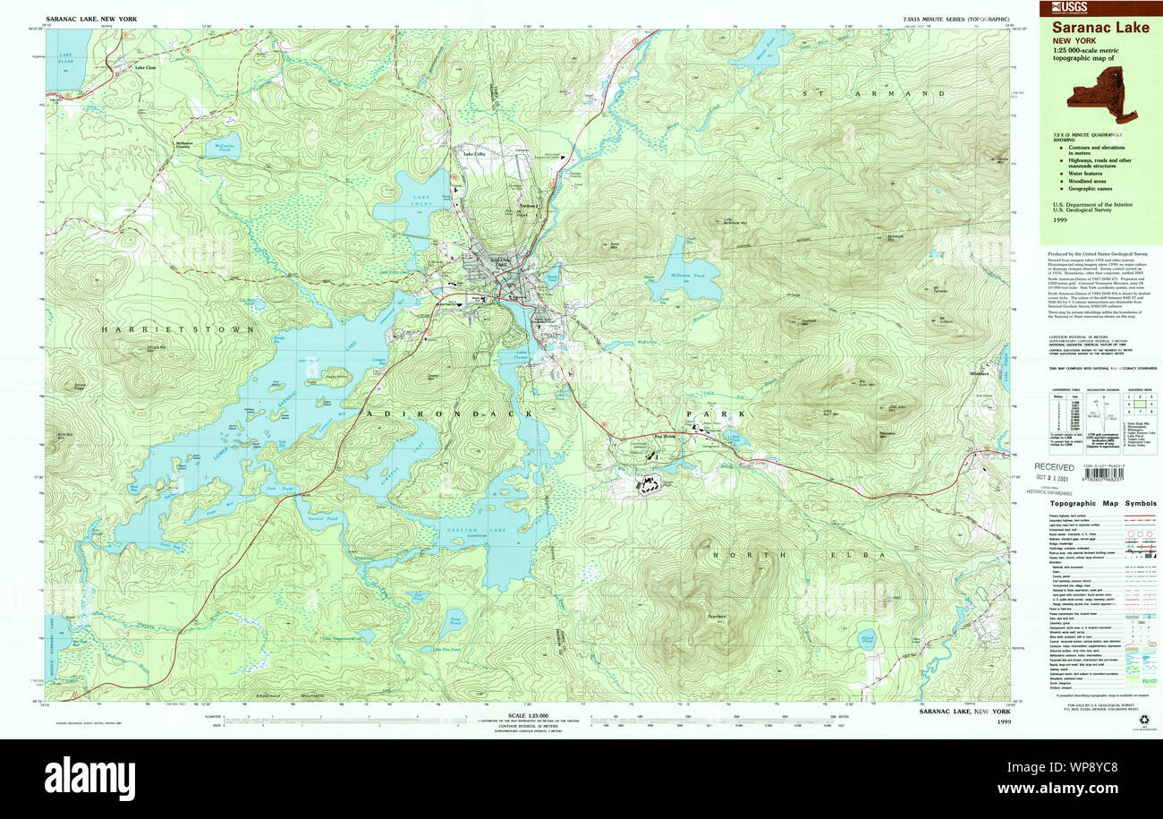 New York NY Saranac Lake 136887 1999 25000 Restoration Stock Photohttps://www.alamy.com/image-license-details/?v=1https://www.alamy.com/new-york-ny-saranac-lake-136887-1999-25000-restoration-image271875080.html
RMWP8YC8–New York NY Saranac Lake 136887 1999 25000 Restoration
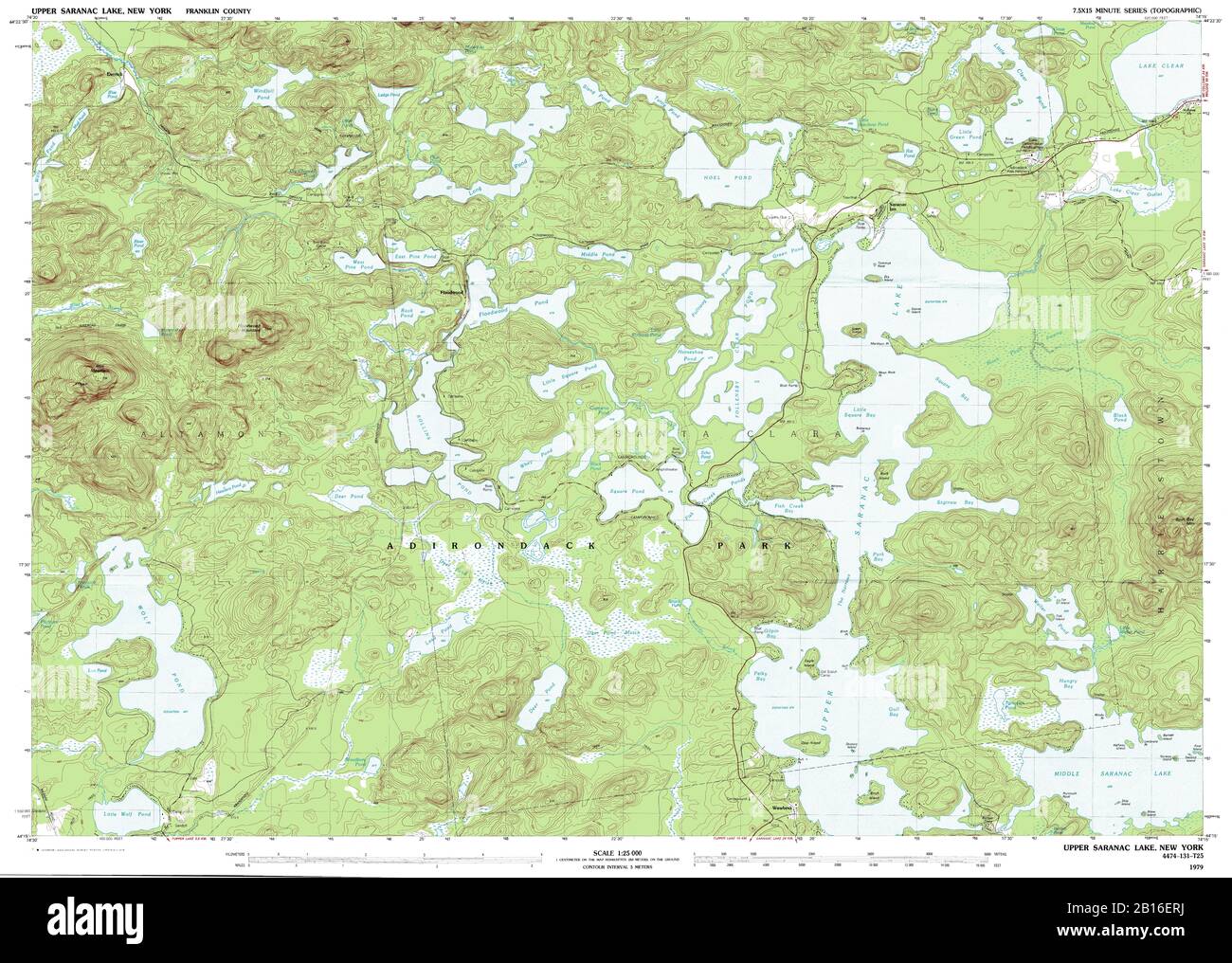 Highly detailed view of the 1979 topographic map for Upper Saranac Lake, NY Stock Photohttps://www.alamy.com/image-license-details/?v=1https://www.alamy.com/highly-detailed-view-of-the-1979-topographic-map-for-upper-saranac-lake-ny-image344965366.html
RF2B16ERJ–Highly detailed view of the 1979 topographic map for Upper Saranac Lake, NY
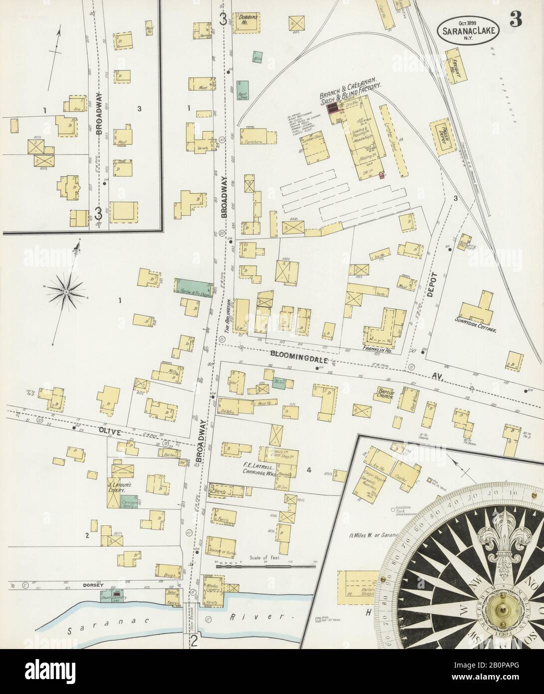 Image 3 of Sanborn Fire Insurance Map from Saranac Lake, Franklin And Essex Counties, New York. Oct 1899. 4 Sheet(s), America, street map with a Nineteenth Century compass Stock Photohttps://www.alamy.com/image-license-details/?v=1https://www.alamy.com/image-3-of-sanborn-fire-insurance-map-from-saranac-lake-franklin-and-essex-counties-new-york-oct-1899-4-sheets-america-street-map-with-a-nineteenth-century-compass-image344698776.html
RM2B0PAPG–Image 3 of Sanborn Fire Insurance Map from Saranac Lake, Franklin And Essex Counties, New York. Oct 1899. 4 Sheet(s), America, street map with a Nineteenth Century compass
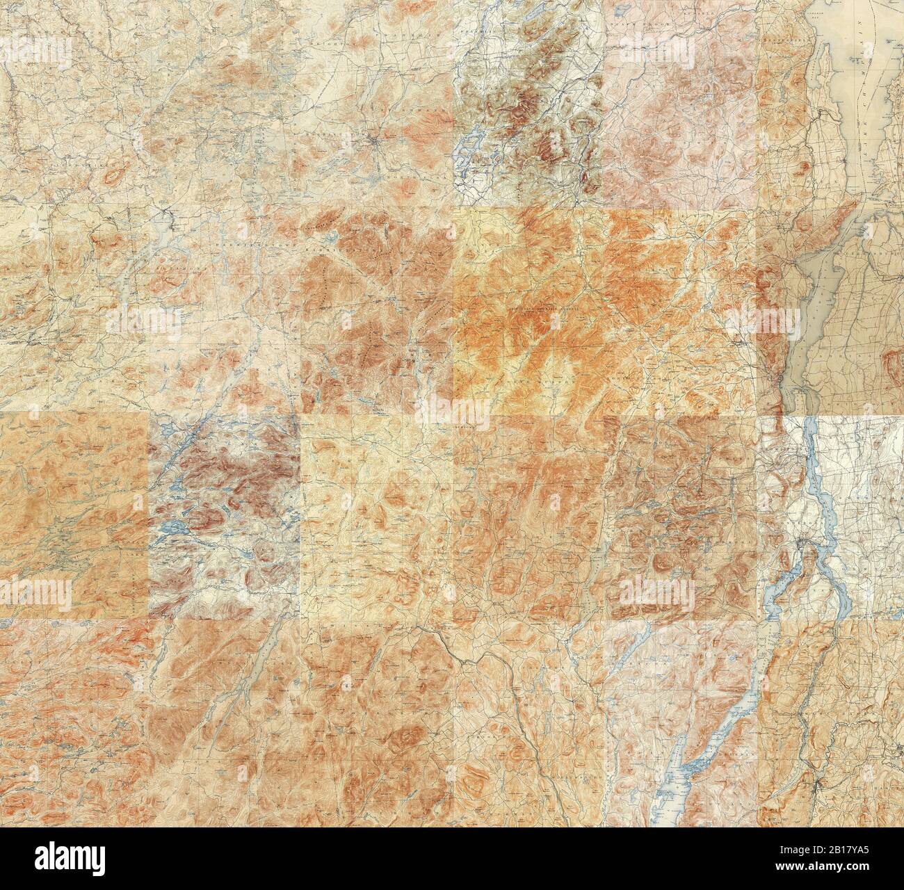 Topographic Map of the Adirondacks - Compilation of 24 individual 15 minute quadrangles in the Adirondack Park Stock Photohttps://www.alamy.com/image-license-details/?v=1https://www.alamy.com/topographic-map-of-the-adirondacks-compilation-of-24-individual-15-minute-quadrangles-in-the-adirondack-park-image344997133.html
RF2B17YA5–Topographic Map of the Adirondacks - Compilation of 24 individual 15 minute quadrangles in the Adirondack Park
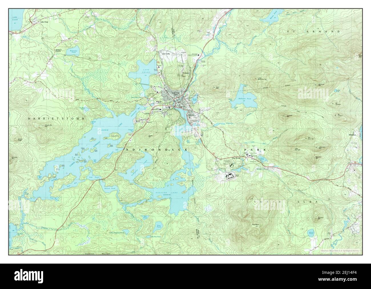 Saranac Lake, New York, map 1999, 1:25000, United States of America by Timeless Maps, data U.S. Geological Survey Stock Photohttps://www.alamy.com/image-license-details/?v=1https://www.alamy.com/saranac-lake-new-york-map-1999-125000-united-states-of-america-by-timeless-maps-data-us-geological-survey-image406927784.html
RM2EJ14F4–Saranac Lake, New York, map 1999, 1:25000, United States of America by Timeless Maps, data U.S. Geological Survey
 Sanborn Fire Insurance Map from Saranac Lake, Franklin And Essex Counties, New York. Stock Photohttps://www.alamy.com/image-license-details/?v=1https://www.alamy.com/sanborn-fire-insurance-map-from-saranac-lake-franklin-and-essex-counties-new-york-image456472980.html
RM2HEJ3XC–Sanborn Fire Insurance Map from Saranac Lake, Franklin And Essex Counties, New York.
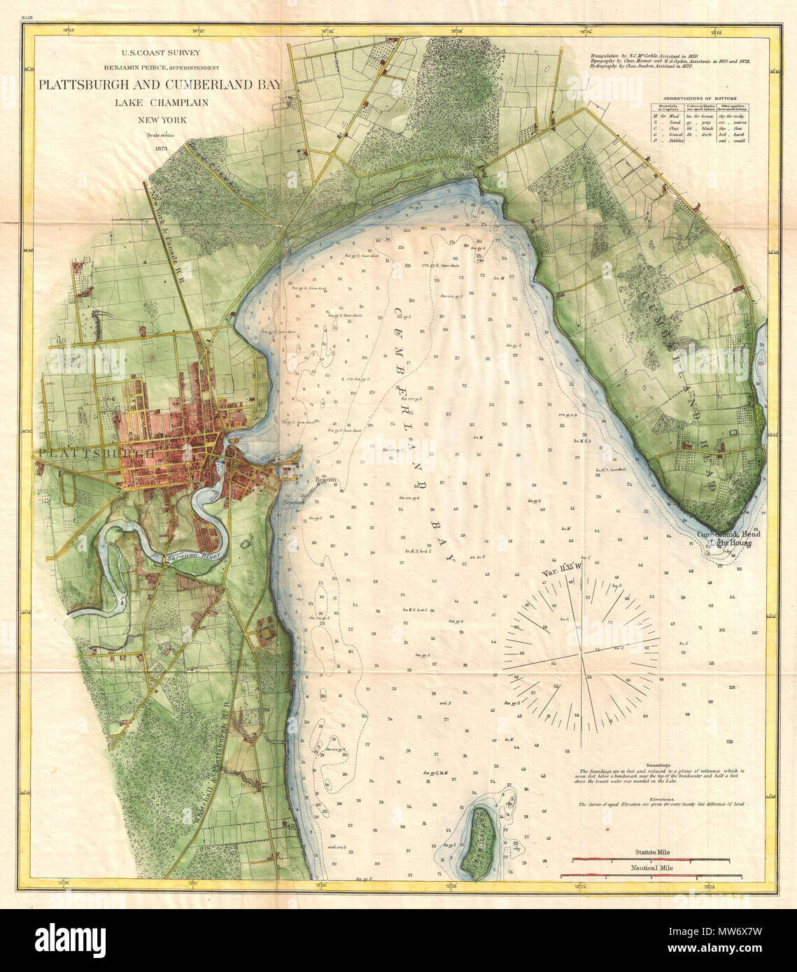 . Plattsburgh and Cumberland Bay Lake Champlain New York. English: A very attractive example of the 1872 U.S. Coast Survey nautical chart or map of Plattsburgh and Cumberland Bay, Lake Champlain, New York. This map covers the urban center of Plattsburgh as well as the surrounding areas as far south as Crab Island and as far north as far east as Cumberland Head. The map includes the course of the Saranac River as it passes south of the city and route of the Whitehall and Plattsburgh Railroad. Offers exceptional inland detail with important building, streets, and property lines shown. In Lake C Stock Photohttps://www.alamy.com/image-license-details/?v=1https://www.alamy.com/plattsburgh-and-cumberland-bay-lake-champlain-new-york-english-a-very-attractive-example-of-the-1872-us-coast-survey-nautical-chart-or-map-of-plattsburgh-and-cumberland-bay-lake-champlain-new-york-this-map-covers-the-urban-center-of-plattsburgh-as-well-as-the-surrounding-areas-as-far-south-as-crab-island-and-as-far-north-as-far-east-as-cumberland-head-the-map-includes-the-course-of-the-saranac-river-as-it-passes-south-of-the-city-and-route-of-the-whitehall-and-plattsburgh-railroad-offers-exceptional-inland-detail-with-important-building-streets-and-property-lines-shown-in-lake-c-image187622397.html
RMMW6X7W–. Plattsburgh and Cumberland Bay Lake Champlain New York. English: A very attractive example of the 1872 U.S. Coast Survey nautical chart or map of Plattsburgh and Cumberland Bay, Lake Champlain, New York. This map covers the urban center of Plattsburgh as well as the surrounding areas as far south as Crab Island and as far north as far east as Cumberland Head. The map includes the course of the Saranac River as it passes south of the city and route of the Whitehall and Plattsburgh Railroad. Offers exceptional inland detail with important building, streets, and property lines shown. In Lake C
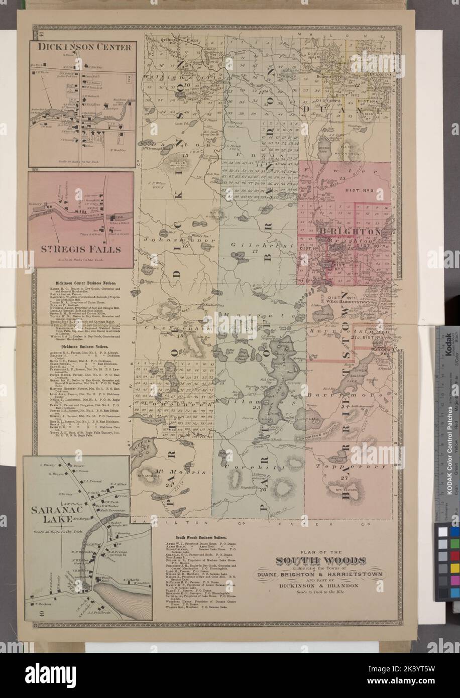 Dickinson Center Village; St. Regis Falls Village; Dickinson Center Business Notices. ; Dickinson Business Notices. ; Saranac Lake Village; South Woods Business Notices. ; Plan of the South Woods Embracing the Towns of Duane, Brighton, & Harrietstown and part of Dickinson & Brandon Cartographic. Atlases, Maps. 1876. Lionel Pincus and Princess Firyal Map Division. Franklin County (N.Y.), Real property , New York (State) Stock Photohttps://www.alamy.com/image-license-details/?v=1https://www.alamy.com/dickinson-center-village-st-regis-falls-village-dickinson-center-business-notices-dickinson-business-notices-saranac-lake-village-south-woods-business-notices-plan-of-the-south-woods-embracing-the-towns-of-duane-brighton-harrietstown-and-part-of-dickinson-brandon-cartographic-atlases-maps-1876-lionel-pincus-and-princess-firyal-map-division-franklin-county-ny-real-property-new-york-state-image484345957.html
RM2K3YT5W–Dickinson Center Village; St. Regis Falls Village; Dickinson Center Business Notices. ; Dickinson Business Notices. ; Saranac Lake Village; South Woods Business Notices. ; Plan of the South Woods Embracing the Towns of Duane, Brighton, & Harrietstown and part of Dickinson & Brandon Cartographic. Atlases, Maps. 1876. Lionel Pincus and Princess Firyal Map Division. Franklin County (N.Y.), Real property , New York (State)
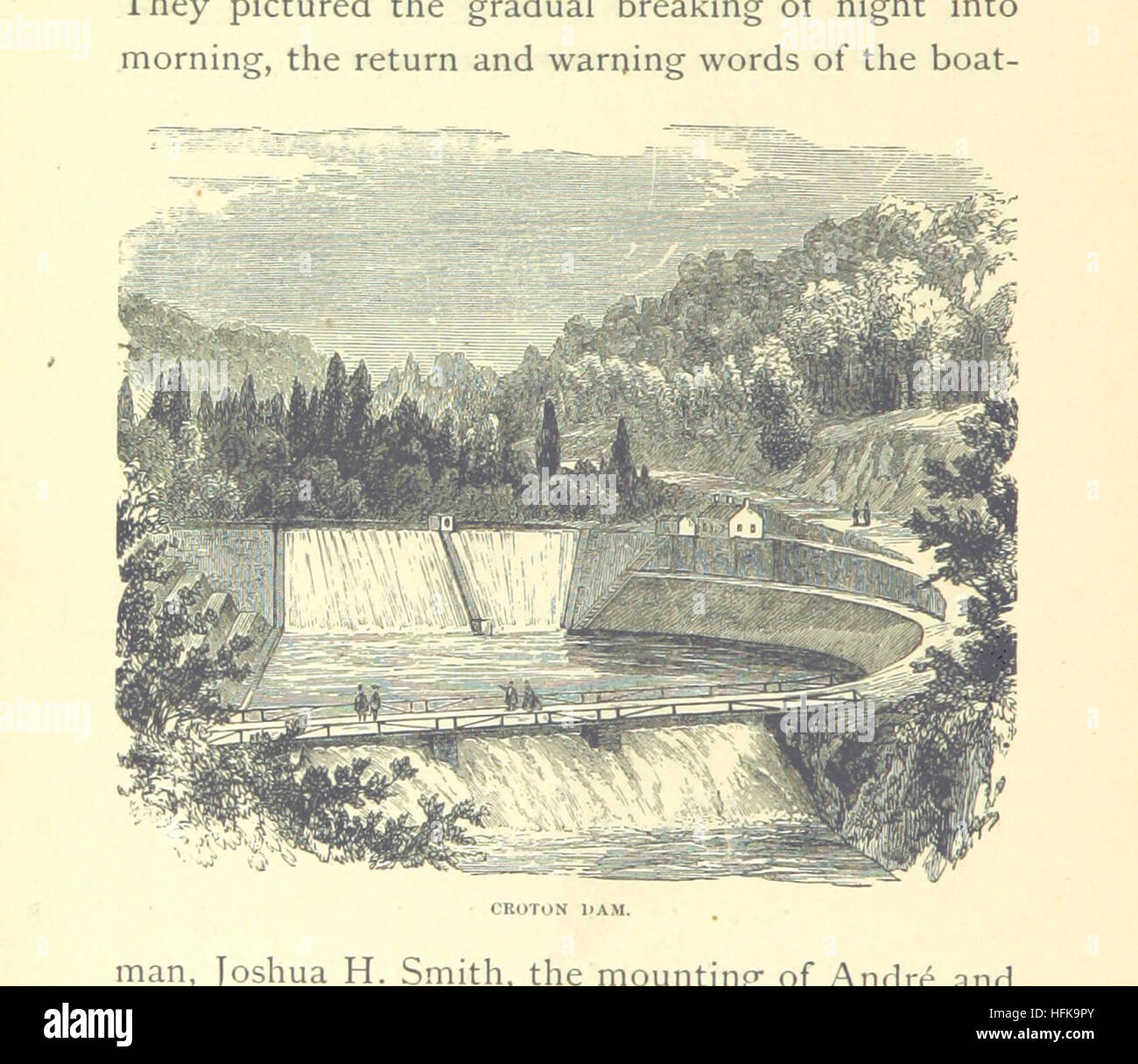 Image taken from page 114 of 'Summer days on the Hudson: the story of a pleasure tour from Sandy Hook to the Saranac Lakes. ... Illustrated, etc' Image taken from page 114 of 'Summer days on the Stock Photohttps://www.alamy.com/image-license-details/?v=1https://www.alamy.com/stock-photo-image-taken-from-page-114-of-summer-days-on-the-hudson-the-story-of-130117203.html
RMHFK9PY–Image taken from page 114 of 'Summer days on the Hudson: the story of a pleasure tour from Sandy Hook to the Saranac Lakes. ... Illustrated, etc' Image taken from page 114 of 'Summer days on the
 Saranac House on the Lake, Adirondacks 2 (Boston Public Library) Stock Photohttps://www.alamy.com/image-license-details/?v=1https://www.alamy.com/stock-image-saranac-house-on-the-lake-adirondacks-2-boston-public-library-161287304.html
RMKAB7GT–Saranac House on the Lake, Adirondacks 2 (Boston Public Library)
 . Routes and rates for summer tours ... 1888 . and Return, - 125 White Mountains, . - . 98 Quebec, P. Q., - - - - - 126 Maps— Quebec, P. Q., and Return, - 126 Adirondack Region, - - facing ^0 Rainbow House, N. Y., - I 6 Rainbow House, N. Y., and Return, - 106 Birds-eve View Map— R.,W.& 0. R.R. System, - facing front. Rouses Point, N. Y., - - 125 Boston & Lowell R.R. System, facing 98 Saranac Inn, N. Y., - 106 Maine Central R.R., 124 Saranac Inn, N. Y., and Return, - I(j6 Niagara Falls, 10 Saranac Lake House, N. Y , - 106 Niagara Falls,White Mts.and Port- Saranac Lake House, N. Y., and land Lin Stock Photohttps://www.alamy.com/image-license-details/?v=1https://www.alamy.com/routes-and-rates-for-summer-tours-1888-and-return-125-white-mountains-98-quebec-p-q-126-maps-quebec-p-q-and-return-126-adirondack-region-facing-0-rainbow-house-n-y-i-6-rainbow-house-n-y-and-return-106-birds-eve-view-map-rw-0-rr-system-facing-front-rouses-point-n-y-125-boston-lowell-rr-system-facing-98-saranac-inn-n-y-106-maine-central-rr-124-saranac-inn-n-y-and-return-ij6-niagara-falls-10-saranac-lake-house-n-y-106-niagara-fallswhite-mtsand-port-saranac-lake-house-n-y-and-land-lin-image371931449.html
RM2CH2XA1–. Routes and rates for summer tours ... 1888 . and Return, - 125 White Mountains, . - . 98 Quebec, P. Q., - - - - - 126 Maps— Quebec, P. Q., and Return, - 126 Adirondack Region, - - facing ^0 Rainbow House, N. Y., - I 6 Rainbow House, N. Y., and Return, - 106 Birds-eve View Map— R.,W.& 0. R.R. System, - facing front. Rouses Point, N. Y., - - 125 Boston & Lowell R.R. System, facing 98 Saranac Inn, N. Y., - 106 Maine Central R.R., 124 Saranac Inn, N. Y., and Return, - I(j6 Niagara Falls, 10 Saranac Lake House, N. Y , - 106 Niagara Falls,White Mts.and Port- Saranac Lake House, N. Y., and land Lin
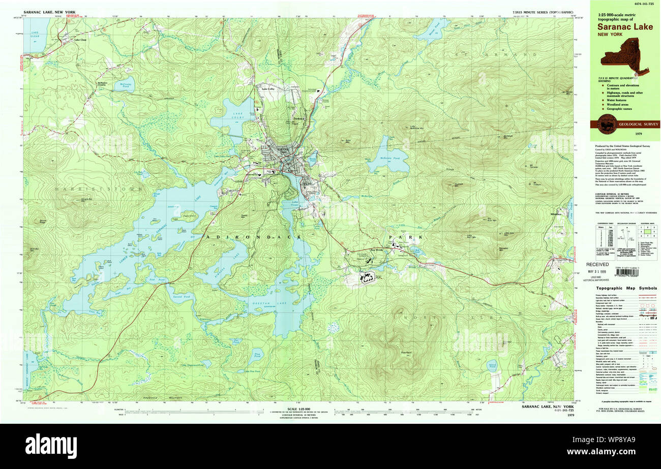 New York NY Saranac Lake 129379 1979 25000 Restoration Stock Photohttps://www.alamy.com/image-license-details/?v=1https://www.alamy.com/new-york-ny-saranac-lake-129379-1979-25000-restoration-image271875025.html
RMWP8YA9–New York NY Saranac Lake 129379 1979 25000 Restoration
 Image 4 of Sanborn Fire Insurance Map from Saranac Lake, Franklin And Essex Counties, New York. Oct 1899. 4 Sheet(s), America, street map with a Nineteenth Century compass Stock Photohttps://www.alamy.com/image-license-details/?v=1https://www.alamy.com/image-4-of-sanborn-fire-insurance-map-from-saranac-lake-franklin-and-essex-counties-new-york-oct-1899-4-sheets-america-street-map-with-a-nineteenth-century-compass-image344698780.html
RM2B0PAPM–Image 4 of Sanborn Fire Insurance Map from Saranac Lake, Franklin And Essex Counties, New York. Oct 1899. 4 Sheet(s), America, street map with a Nineteenth Century compass
 Saranac Lake, New York, map 1979, 1:25000, United States of America by Timeless Maps, data U.S. Geological Survey Stock Photohttps://www.alamy.com/image-license-details/?v=1https://www.alamy.com/saranac-lake-new-york-map-1979-125000-united-states-of-america-by-timeless-maps-data-us-geological-survey-image406927783.html
RM2EJ14F3–Saranac Lake, New York, map 1979, 1:25000, United States of America by Timeless Maps, data U.S. Geological Survey
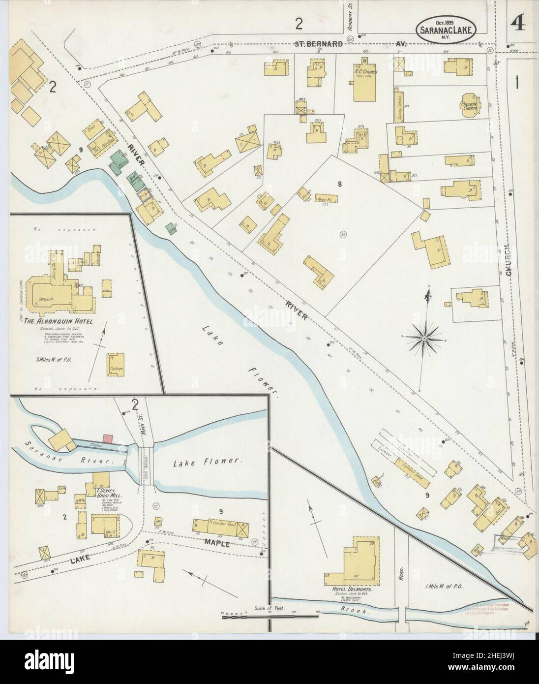 Sanborn Fire Insurance Map from Saranac Lake, Franklin And Essex Counties, New York. Stock Photohttps://www.alamy.com/image-license-details/?v=1https://www.alamy.com/sanborn-fire-insurance-map-from-saranac-lake-franklin-and-essex-counties-new-york-image456472958.html
RM2HEJ3WJ–Sanborn Fire Insurance Map from Saranac Lake, Franklin And Essex Counties, New York.
 . Plattsburgh and Cumberland Bay Lake Champlain New York. English: A very attractive example of the 1872 U.S. Coast Survey nautical chart or map of Plattsburgh and Cumberland Bay, Lake Champlain, New York. This map covers the urban center of Plattsburgh as well as the surrounding areas as far south as Crab Island and as far north as far east as Cumberland Head. The map includes the course of the Saranac River as it passes south of the city and route of the Whitehall and Plattsburgh Railroad. Offers exceptional inland detail with important building, streets, and property lines shown. In Lake C Stock Photohttps://www.alamy.com/image-license-details/?v=1https://www.alamy.com/plattsburgh-and-cumberland-bay-lake-champlain-new-york-english-a-very-attractive-example-of-the-1872-us-coast-survey-nautical-chart-or-map-of-plattsburgh-and-cumberland-bay-lake-champlain-new-york-this-map-covers-the-urban-center-of-plattsburgh-as-well-as-the-surrounding-areas-as-far-south-as-crab-island-and-as-far-north-as-far-east-as-cumberland-head-the-map-includes-the-course-of-the-saranac-river-as-it-passes-south-of-the-city-and-route-of-the-whitehall-and-plattsburgh-railroad-offers-exceptional-inland-detail-with-important-building-streets-and-property-lines-shown-in-lake-c-image188898352.html
RMMY91NM–. Plattsburgh and Cumberland Bay Lake Champlain New York. English: A very attractive example of the 1872 U.S. Coast Survey nautical chart or map of Plattsburgh and Cumberland Bay, Lake Champlain, New York. This map covers the urban center of Plattsburgh as well as the surrounding areas as far south as Crab Island and as far north as far east as Cumberland Head. The map includes the course of the Saranac River as it passes south of the city and route of the Whitehall and Plattsburgh Railroad. Offers exceptional inland detail with important building, streets, and property lines shown. In Lake C
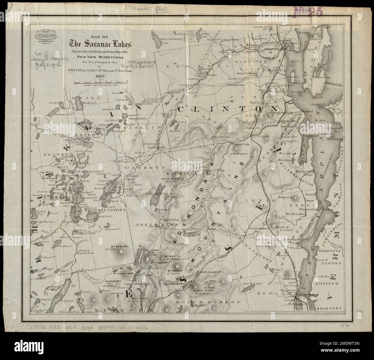 Map of the Saranac Lakes : prepared from Dr. Ely's large pocket map of the New York wilderness for D.L. Fouquet & Son. Covers the Saranac River and part of the Adirondacks. Relief shown by hachures and spot heights... Saranac Lakes. Saranac Lakes, New York , Adirondack Mountains New York , Saranac ,river New York , Franklin ,county , Lower Saranac Lake New York , Franklin ,county , Middle Saranac Lake New York , Franklin ,county , Upper Saranac Lake Stock Photohttps://www.alamy.com/image-license-details/?v=1https://www.alamy.com/map-of-the-saranac-lakes-prepared-from-dr-elys-large-pocket-map-of-the-new-york-wilderness-for-dl-fouquet-son-covers-the-saranac-river-and-part-of-the-adirondacks-relief-shown-by-hachures-and-spot-heights-saranac-lakes-saranac-lakes-new-york-adirondack-mountains-new-york-saranac-river-new-york-franklin-county-lower-saranac-lake-new-york-franklin-county-middle-saranac-lake-new-york-franklin-county-upper-saranac-lake-image502741673.html
RM2M5WT3N–Map of the Saranac Lakes : prepared from Dr. Ely's large pocket map of the New York wilderness for D.L. Fouquet & Son. Covers the Saranac River and part of the Adirondacks. Relief shown by hachures and spot heights... Saranac Lakes. Saranac Lakes, New York , Adirondack Mountains New York , Saranac ,river New York , Franklin ,county , Lower Saranac Lake New York , Franklin ,county , Middle Saranac Lake New York , Franklin ,county , Upper Saranac Lake
 Map showing the Adirondack Lake regions Map of part of the Adirondack Lake Region extending from Forked Lake northward to St. Regis Lake and from Cranberry Lake eastward to lower Saranac Lake Cartographic. Maps. 1880. Lionel Pincus and Princess Firyal Map Division. Adirondack Mountains Region (N.Y.), Real property , New York (State) , Adirondack Mountains (N.Y.), Landowners , New York (State) , Adirondack Mountains (N.Y.), Adirondack Mountains (N.Y.), Saranac Lake (N.Y.), Tupper Lake (N.Y.), Long Lake (N.Y.) Stock Photohttps://www.alamy.com/image-license-details/?v=1https://www.alamy.com/map-showing-the-adirondack-lake-regions-map-of-part-of-the-adirondack-lake-region-extending-from-forked-lake-northward-to-st-regis-lake-and-from-cranberry-lake-eastward-to-lower-saranac-lake-cartographic-maps-1880-lionel-pincus-and-princess-firyal-map-division-adirondack-mountains-region-ny-real-property-new-york-state-adirondack-mountains-ny-landowners-new-york-state-adirondack-mountains-ny-adirondack-mountains-ny-saranac-lake-ny-tupper-lake-ny-long-lake-ny-image484307527.html
RM2K3X35B–Map showing the Adirondack Lake regions Map of part of the Adirondack Lake Region extending from Forked Lake northward to St. Regis Lake and from Cranberry Lake eastward to lower Saranac Lake Cartographic. Maps. 1880. Lionel Pincus and Princess Firyal Map Division. Adirondack Mountains Region (N.Y.), Real property , New York (State) , Adirondack Mountains (N.Y.), Landowners , New York (State) , Adirondack Mountains (N.Y.), Adirondack Mountains (N.Y.), Saranac Lake (N.Y.), Tupper Lake (N.Y.), Long Lake (N.Y.)
 View from Eagle Island, Adirondacks (Lower Saranac Lake) (Boston Public Library) Stock Photohttps://www.alamy.com/image-license-details/?v=1https://www.alamy.com/stock-image-view-from-eagle-island-adirondacks-lower-saranac-lake-boston-public-161656320.html
RMKB0280–View from Eagle Island, Adirondacks (Lower Saranac Lake) (Boston Public Library)
 Map of the great pleasure route to Saratoga, Lake George, Adirondacks and the White Mountains: via the Delaware & Hudson Canal Co.'s Railroads, Lake George, Lake Champlian's steamers Saranac Inn formerly Prospect House, on the Upper Saranac Lake Cartographic. Maps, Tourist maps. 1886. Lionel Pincus and Princess Firyal Map Division. Delaware and Hudson Canal Company, Railroads , New York (State) , Adirondack Mountains (N.Y.), Adirondack Mountains Region (N.Y.), George, Lake, Region (N.Y. : Lake), Champlain, Lake, region, Champlain, Lake, George, Lake (N.Y. : Lake), Adirondack Mountains (N.Y.) Stock Photohttps://www.alamy.com/image-license-details/?v=1https://www.alamy.com/map-of-the-great-pleasure-route-to-saratoga-lake-george-adirondacks-and-the-white-mountains-via-the-delaware-hudson-canal-cos-railroads-lake-george-lake-champlians-steamers-saranac-inn-formerly-prospect-house-on-the-upper-saranac-lake-cartographic-maps-tourist-maps-1886-lionel-pincus-and-princess-firyal-map-division-delaware-and-hudson-canal-company-railroads-new-york-state-adirondack-mountains-ny-adirondack-mountains-region-ny-george-lake-region-ny-lake-champlain-lake-region-champlain-lake-george-lake-ny-lake-adirondack-mountains-ny-image484305438.html
RM2K3X0EP–Map of the great pleasure route to Saratoga, Lake George, Adirondacks and the White Mountains: via the Delaware & Hudson Canal Co.'s Railroads, Lake George, Lake Champlian's steamers Saranac Inn formerly Prospect House, on the Upper Saranac Lake Cartographic. Maps, Tourist maps. 1886. Lionel Pincus and Princess Firyal Map Division. Delaware and Hudson Canal Company, Railroads , New York (State) , Adirondack Mountains (N.Y.), Adirondack Mountains Region (N.Y.), George, Lake, Region (N.Y. : Lake), Champlain, Lake, region, Champlain, Lake, George, Lake (N.Y. : Lake), Adirondack Mountains (N.Y.)
 . Annual report of the Regents. New York State Museum; Science. Map 2 Saranac Inn and immediate vicinity Lakes and ponds: 1 St Regis pond; 2 Grass pond; 3 Lake Clear ; 4 Little Clear pond; 5 Little Green pond : 6 Bone pond; 7 Rat pond ; 8 and 9 Little Bog ponds; 10 Upper Saranac Lake Places: a Saranac Inn railroad station; b Adirondack hatchery ; c the sawmill; d the Inn. Please note that these images are extracted from scanned page images that may have been digitally enhanced for readability - coloration and appearance of these illustrations may not perfectly resemble the original work.. New Stock Photohttps://www.alamy.com/image-license-details/?v=1https://www.alamy.com/annual-report-of-the-regents-new-york-state-museum-science-map-2-saranac-inn-and-immediate-vicinity-lakes-and-ponds-1-st-regis-pond-2-grass-pond-3-lake-clear-4-little-clear-pond-5-little-green-pond-6-bone-pond-7-rat-pond-8-and-9-little-bog-ponds-10-upper-saranac-lake-places-a-saranac-inn-railroad-station-b-adirondack-hatchery-c-the-sawmill-d-the-inn-please-note-that-these-images-are-extracted-from-scanned-page-images-that-may-have-been-digitally-enhanced-for-readability-coloration-and-appearance-of-these-illustrations-may-not-perfectly-resemble-the-original-work-new-image236161906.html
RMRM62WP–. Annual report of the Regents. New York State Museum; Science. Map 2 Saranac Inn and immediate vicinity Lakes and ponds: 1 St Regis pond; 2 Grass pond; 3 Lake Clear ; 4 Little Clear pond; 5 Little Green pond : 6 Bone pond; 7 Rat pond ; 8 and 9 Little Bog ponds; 10 Upper Saranac Lake Places: a Saranac Inn railroad station; b Adirondack hatchery ; c the sawmill; d the Inn. Please note that these images are extracted from scanned page images that may have been digitally enhanced for readability - coloration and appearance of these illustrations may not perfectly resemble the original work.. New
 New York NY Saranac Lake 129377 1979 25000 Restoration Stock Photohttps://www.alamy.com/image-license-details/?v=1https://www.alamy.com/new-york-ny-saranac-lake-129377-1979-25000-restoration-image271874933.html
RMWP8Y71–New York NY Saranac Lake 129377 1979 25000 Restoration
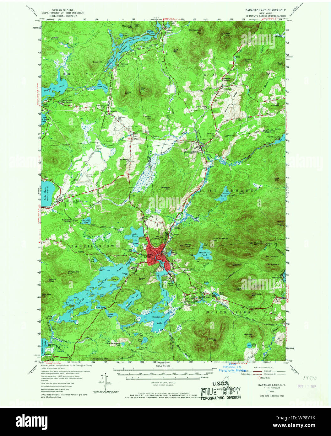 New York NY Saranac Lake 129372 1955 62500 Restoration Stock Photohttps://www.alamy.com/image-license-details/?v=1https://www.alamy.com/new-york-ny-saranac-lake-129372-1955-62500-restoration-image271874783.html
RMWP8Y1K–New York NY Saranac Lake 129372 1955 62500 Restoration
 Image 1 of Sanborn Fire Insurance Map from Saranac Lake, Franklin And Essex Counties, New York. Oct 1899. 4 Sheet(s), America, street map with a Nineteenth Century compass Stock Photohttps://www.alamy.com/image-license-details/?v=1https://www.alamy.com/image-1-of-sanborn-fire-insurance-map-from-saranac-lake-franklin-and-essex-counties-new-york-oct-1899-4-sheets-america-street-map-with-a-nineteenth-century-compass-image344698773.html
RM2B0PAPD–Image 1 of Sanborn Fire Insurance Map from Saranac Lake, Franklin And Essex Counties, New York. Oct 1899. 4 Sheet(s), America, street map with a Nineteenth Century compass
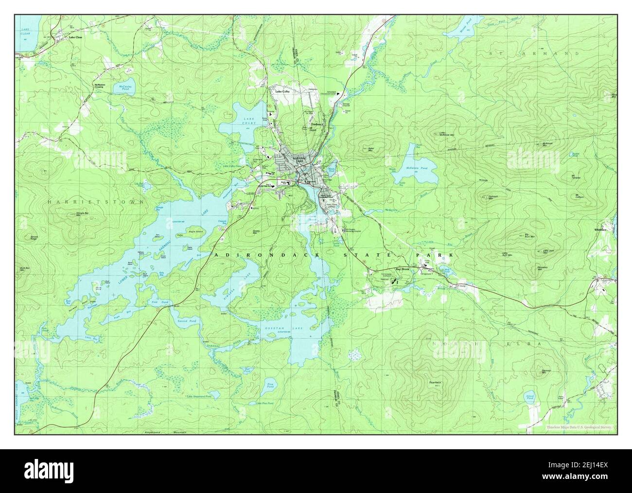 Saranac Lake, New York, map 1978, 1:25000, United States of America by Timeless Maps, data U.S. Geological Survey Stock Photohttps://www.alamy.com/image-license-details/?v=1https://www.alamy.com/saranac-lake-new-york-map-1978-125000-united-states-of-america-by-timeless-maps-data-us-geological-survey-image406927778.html
RM2EJ14EX–Saranac Lake, New York, map 1978, 1:25000, United States of America by Timeless Maps, data U.S. Geological Survey
 Sanborn Fire Insurance Map from Saranac Lake, Franklin And Essex Counties, New York. Stock Photohttps://www.alamy.com/image-license-details/?v=1https://www.alamy.com/sanborn-fire-insurance-map-from-saranac-lake-franklin-and-essex-counties-new-york-image456472945.html
RM2HEJ3W5–Sanborn Fire Insurance Map from Saranac Lake, Franklin And Essex Counties, New York.
 . Plattsburgh and Cumberland Bay Lake Champlain New York. English: A very attractive example of the 1872 U.S. Coast Survey nautical chart or map of Plattsburgh and Cumberland Bay, Lake Champlain, New York. This map covers the urban center of Plattsburgh as well as the surrounding areas as far south as Crab Island and as far north as far east as Cumberland Head. The map includes the course of the Saranac River as it passes south of the city and route of the Whitehall and Plattsburgh Railroad. Offers exceptional inland detail with important building, streets, and property lines shown. In Lake C Stock Photohttps://www.alamy.com/image-license-details/?v=1https://www.alamy.com/plattsburgh-and-cumberland-bay-lake-champlain-new-york-english-a-very-attractive-example-of-the-1872-us-coast-survey-nautical-chart-or-map-of-plattsburgh-and-cumberland-bay-lake-champlain-new-york-this-map-covers-the-urban-center-of-plattsburgh-as-well-as-the-surrounding-areas-as-far-south-as-crab-island-and-as-far-north-as-far-east-as-cumberland-head-the-map-includes-the-course-of-the-saranac-river-as-it-passes-south-of-the-city-and-route-of-the-whitehall-and-plattsburgh-railroad-offers-exceptional-inland-detail-with-important-building-streets-and-property-lines-shown-in-lake-c-image188134923.html
RMMX280B–. Plattsburgh and Cumberland Bay Lake Champlain New York. English: A very attractive example of the 1872 U.S. Coast Survey nautical chart or map of Plattsburgh and Cumberland Bay, Lake Champlain, New York. This map covers the urban center of Plattsburgh as well as the surrounding areas as far south as Crab Island and as far north as far east as Cumberland Head. The map includes the course of the Saranac River as it passes south of the city and route of the Whitehall and Plattsburgh Railroad. Offers exceptional inland detail with important building, streets, and property lines shown. In Lake C
 View from Eagle Island, Adirondacks (Lower Saranac Lake) 2 (Boston Public Library) Stock Photohttps://www.alamy.com/image-license-details/?v=1https://www.alamy.com/stock-image-view-from-eagle-island-adirondacks-lower-saranac-lake-2-boston-public-161656284.html
RMKB026M–View from Eagle Island, Adirondacks (Lower Saranac Lake) 2 (Boston Public Library)
 Winslow Homer - Fly Fishing, Saranac Lake - Stock Photohttps://www.alamy.com/image-license-details/?v=1https://www.alamy.com/stock-photo-winslow-homer-fly-fishing-saranac-lake-148427366.html
RMJHDCHA–Winslow Homer - Fly Fishing, Saranac Lake -
 . Bulletin - New York State Museum. Science. r-<=A. a^ ^r C^ Map 2 Saranac Inn and immediate vicinity Lakes and ponds: 1 St Regis pond; 2 Grass pond; 3 Lake Clear ; 4 Little Clear pond; 5 Little Green pond 6 Bone pond ; 7 Rat pond ; 8 and 9 Little Bog ponds; 10 Upper Saranac Lake Places: a Saranac Inn railroad station; 6 Adirondack hatchery ; c the sawmill; d the Inn. Please note that these images are extracted from scanned page images that may have been digitally enhanced for readability - coloration and appearance of these illustrations may not perfectly resemble the original work.. New Y Stock Photohttps://www.alamy.com/image-license-details/?v=1https://www.alamy.com/bulletin-new-york-state-museum-science-r-lt=a-a-r-c-map-2-saranac-inn-and-immediate-vicinity-lakes-and-ponds-1-st-regis-pond-2-grass-pond-3-lake-clear-4-little-clear-pond-5-little-green-pond-6-bone-pond-7-rat-pond-8-and-9-little-bog-ponds-10-upper-saranac-lake-places-a-saranac-inn-railroad-station-6-adirondack-hatchery-c-the-sawmill-d-the-inn-please-note-that-these-images-are-extracted-from-scanned-page-images-that-may-have-been-digitally-enhanced-for-readability-coloration-and-appearance-of-these-illustrations-may-not-perfectly-resemble-the-original-work-new-y-image233991969.html
RMRGK741–. Bulletin - New York State Museum. Science. r-<=A. a^ ^r C^ Map 2 Saranac Inn and immediate vicinity Lakes and ponds: 1 St Regis pond; 2 Grass pond; 3 Lake Clear ; 4 Little Clear pond; 5 Little Green pond 6 Bone pond ; 7 Rat pond ; 8 and 9 Little Bog ponds; 10 Upper Saranac Lake Places: a Saranac Inn railroad station; 6 Adirondack hatchery ; c the sawmill; d the Inn. Please note that these images are extracted from scanned page images that may have been digitally enhanced for readability - coloration and appearance of these illustrations may not perfectly resemble the original work.. New Y
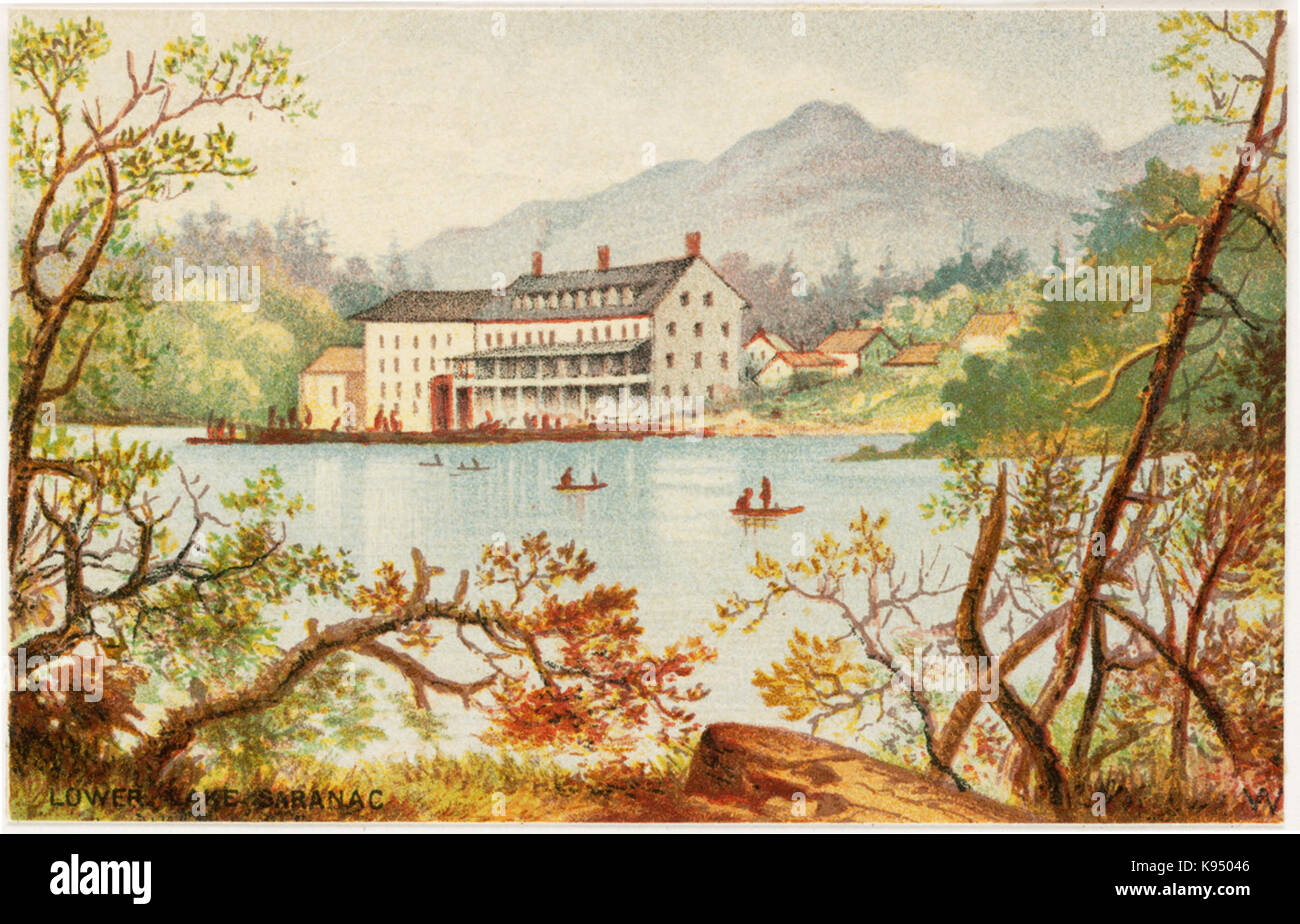 Lower Lake Saranac (Boston Public Library) Stock Photohttps://www.alamy.com/image-license-details/?v=1https://www.alamy.com/stock-image-lower-lake-saranac-boston-public-library-160535094.html
RMK95046–Lower Lake Saranac (Boston Public Library)
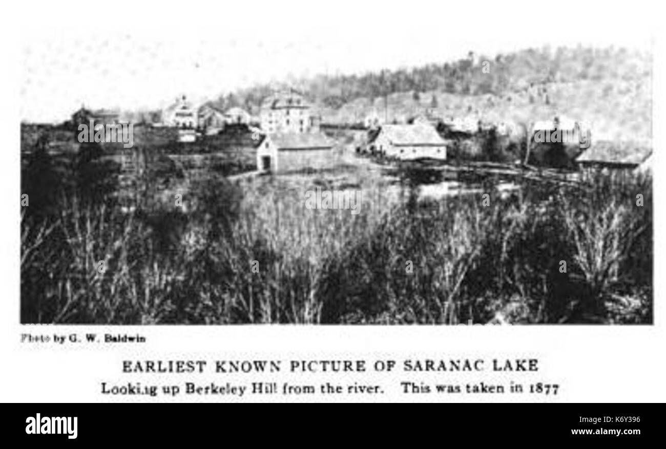 Early Picture of Saranac Lake 1877 ALD Stock Photohttps://www.alamy.com/image-license-details/?v=1https://www.alamy.com/early-picture-of-saranac-lake-1877-ald-image159176562.html
RMK6Y396–Early Picture of Saranac Lake 1877 ALD
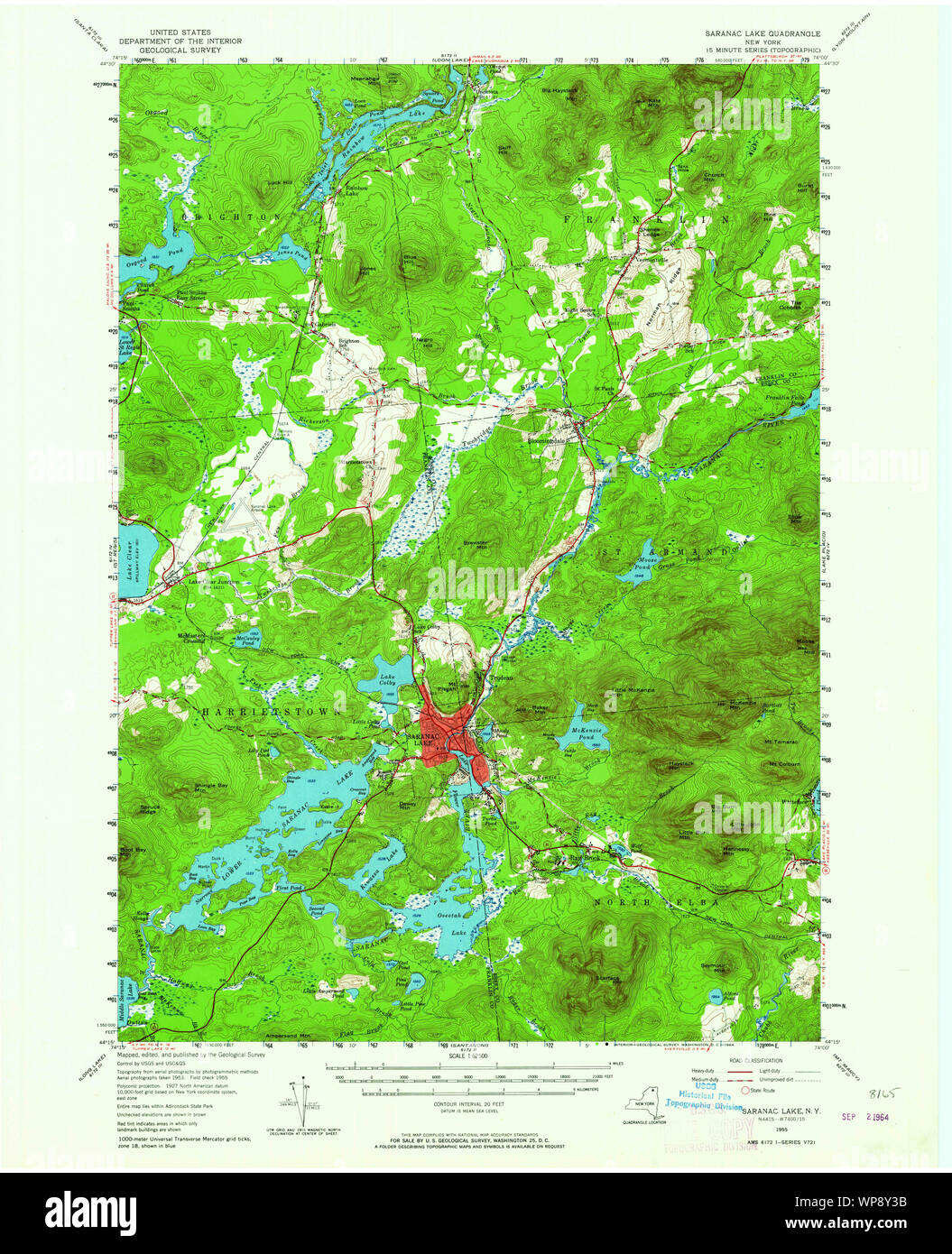 New York NY Saranac Lake 129373 1955 62500 Restoration Stock Photohttps://www.alamy.com/image-license-details/?v=1https://www.alamy.com/new-york-ny-saranac-lake-129373-1955-62500-restoration-image271874831.html
RMWP8Y3B–New York NY Saranac Lake 129373 1955 62500 Restoration
 Image 2 of Sanborn Fire Insurance Map from Saranac Lake, Franklin And Essex Counties, New York. Aug 1895. 2 Sheet(s), America, street map with a Nineteenth Century compass Stock Photohttps://www.alamy.com/image-license-details/?v=1https://www.alamy.com/image-2-of-sanborn-fire-insurance-map-from-saranac-lake-franklin-and-essex-counties-new-york-aug-1895-2-sheets-america-street-map-with-a-nineteenth-century-compass-image344698771.html
RM2B0PAPB–Image 2 of Sanborn Fire Insurance Map from Saranac Lake, Franklin And Essex Counties, New York. Aug 1895. 2 Sheet(s), America, street map with a Nineteenth Century compass
 Saranac Lake, New York, map 1955, 1:62500, United States of America by Timeless Maps, data U.S. Geological Survey Stock Photohttps://www.alamy.com/image-license-details/?v=1https://www.alamy.com/saranac-lake-new-york-map-1955-162500-united-states-of-america-by-timeless-maps-data-us-geological-survey-image414150152.html
RM2F1P4MT–Saranac Lake, New York, map 1955, 1:62500, United States of America by Timeless Maps, data U.S. Geological Survey
 Sanborn Fire Insurance Map from Saranac Lake, Franklin And Essex Counties, New York. Stock Photohttps://www.alamy.com/image-license-details/?v=1https://www.alamy.com/sanborn-fire-insurance-map-from-saranac-lake-franklin-and-essex-counties-new-york-image456472932.html
RM2HEJ3TM–Sanborn Fire Insurance Map from Saranac Lake, Franklin And Essex Counties, New York.
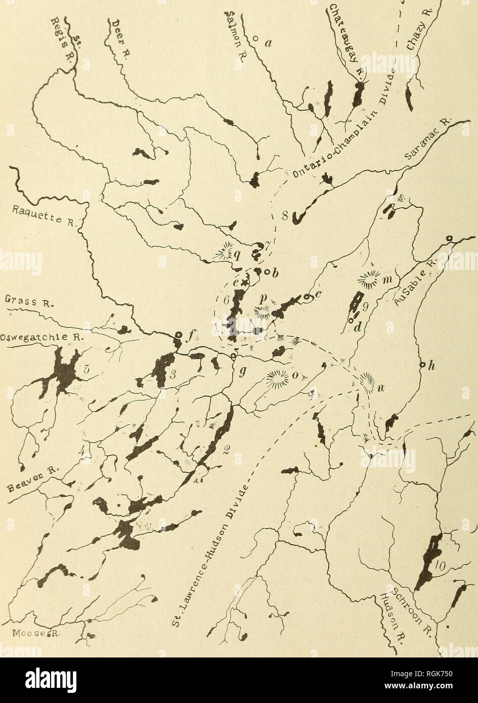 . Bulletin - New York State Museum. Science. 386 NEW YORK STATE MUSEUM. Moose Map 1 Drainage map of tlie Saranac region La,e,: IRaauette; 2 Long; 3 Topper; 4 Ne-ha-sa-ne; 5 Cranberry; 6 0pper Saranac ; 7 S. Regis; 8 Rata 'â 7oi>L'"-''"a'i4!o"nl=f'?Taranae Junction; o Saranac La»e ; d Lake Placid : e Saranac Inn ; /Tnpper Lake ' ^â'Zki?rm^U&ce; n Marcy (Tahawu,) ; o Seward ; P Boot Bay ; a St Regis. Please note that these images are extracted from scanned page images that may have been digitally enhanced for readability - coloration and appearance of these illustrations m Stock Photohttps://www.alamy.com/image-license-details/?v=1https://www.alamy.com/bulletin-new-york-state-museum-science-386-new-york-state-museum-moose-map-1-drainage-map-of-tlie-saranac-region-lae-iraauette-2-long-3-topper-4-ne-ha-sa-ne-5-cranberry-6-0pper-saranac-7-s-regis-8-rata-7oigtlquot-quotai4!oquotnl=ftaranae-junction-o-saranac-lae-d-lake-placid-e-saranac-inn-tnpper-lake-zkirmuampce-n-marcy-tahawu-o-seward-p-boot-bay-a-st-regis-please-note-that-these-images-are-extracted-from-scanned-page-images-that-may-have-been-digitally-enhanced-for-readability-coloration-and-appearance-of-these-illustrations-m-image233991996.html
RMRGK750–. Bulletin - New York State Museum. Science. 386 NEW YORK STATE MUSEUM. Moose Map 1 Drainage map of tlie Saranac region La,e,: IRaauette; 2 Long; 3 Topper; 4 Ne-ha-sa-ne; 5 Cranberry; 6 0pper Saranac ; 7 S. Regis; 8 Rata 'â 7oi>L'"-''"a'i4!o"nl=f'?Taranae Junction; o Saranac La»e ; d Lake Placid : e Saranac Inn ; /Tnpper Lake ' ^â'Zki?rm^U&ce; n Marcy (Tahawu,) ; o Seward ; P Boot Bay ; a St Regis. Please note that these images are extracted from scanned page images that may have been digitally enhanced for readability - coloration and appearance of these illustrations m
 'Fly Fishing, Saranac Lake', etching by Winslow Homer Stock Photohttps://www.alamy.com/image-license-details/?v=1https://www.alamy.com/stock-photo-fly-fishing-saranac-lake-etching-by-winslow-homer-148513337.html
RMJHHA7N–'Fly Fishing, Saranac Lake', etching by Winslow Homer
 Camp Edgar, Lake Saranac (Boston Public Library) Stock Photohttps://www.alamy.com/image-license-details/?v=1https://www.alamy.com/camp-edgar-lake-saranac-boston-public-library-image159049274.html
RMK6N8Y6–Camp Edgar, Lake Saranac (Boston Public Library)
 New York NY Saranac Lake 129376 1955 62500 Restoration Stock Photohttps://www.alamy.com/image-license-details/?v=1https://www.alamy.com/new-york-ny-saranac-lake-129376-1955-62500-restoration-image271874941.html
RMWP8Y79–New York NY Saranac Lake 129376 1955 62500 Restoration
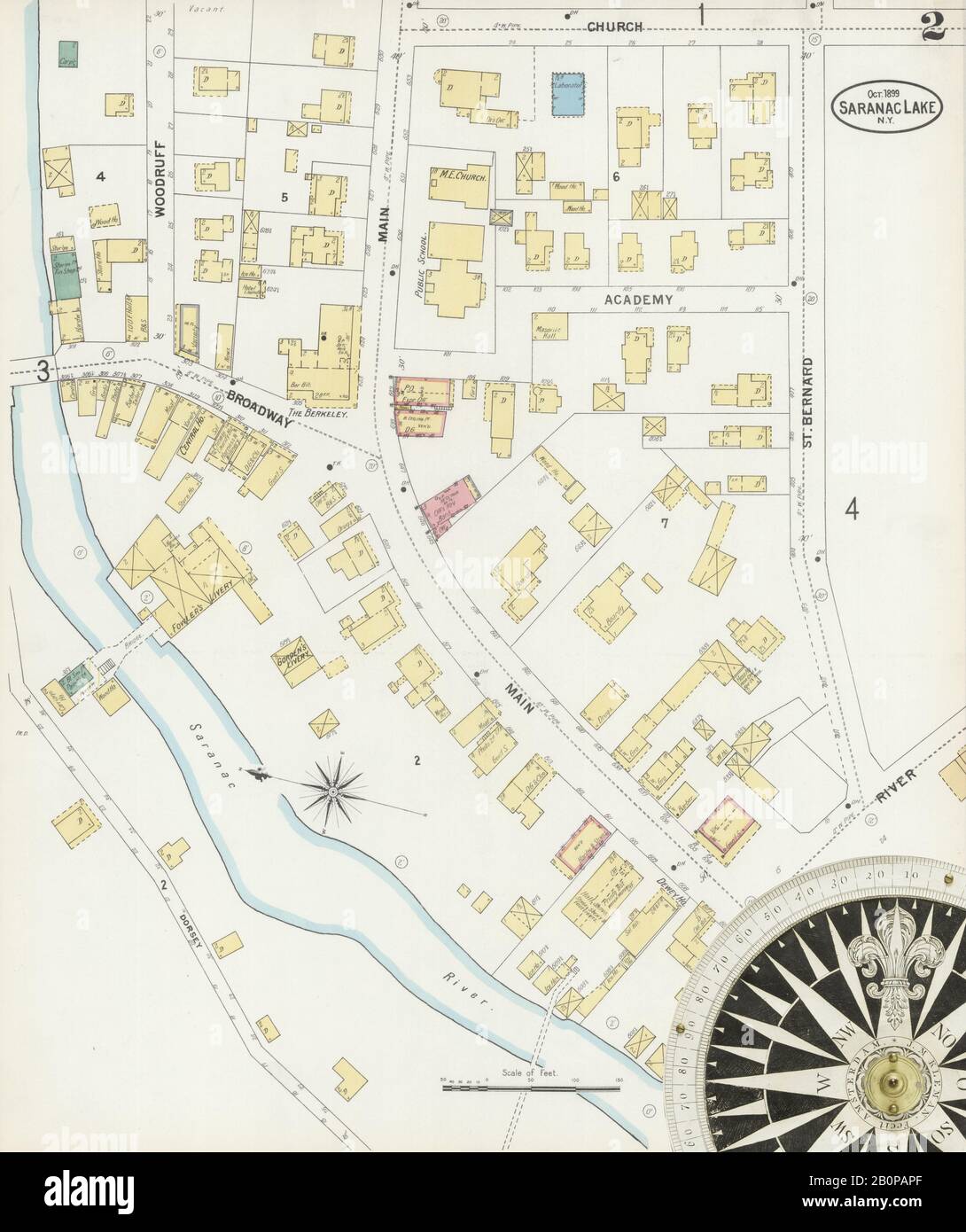 Image 2 of Sanborn Fire Insurance Map from Saranac Lake, Franklin And Essex Counties, New York. Oct 1899. 4 Sheet(s), America, street map with a Nineteenth Century compass Stock Photohttps://www.alamy.com/image-license-details/?v=1https://www.alamy.com/image-2-of-sanborn-fire-insurance-map-from-saranac-lake-franklin-and-essex-counties-new-york-oct-1899-4-sheets-america-street-map-with-a-nineteenth-century-compass-image344698775.html
RM2B0PAPF–Image 2 of Sanborn Fire Insurance Map from Saranac Lake, Franklin And Essex Counties, New York. Oct 1899. 4 Sheet(s), America, street map with a Nineteenth Century compass
 Saranac Lake, New York, map 1979, 1:25000, United States of America by Timeless Maps, data U.S. Geological Survey Stock Photohttps://www.alamy.com/image-license-details/?v=1https://www.alamy.com/saranac-lake-new-york-map-1979-125000-united-states-of-america-by-timeless-maps-data-us-geological-survey-image406927774.html
RM2EJ14EP–Saranac Lake, New York, map 1979, 1:25000, United States of America by Timeless Maps, data U.S. Geological Survey
 Sanborn Fire Insurance Map from Saranac Lake, Franklin And Essex Counties, New York. Stock Photohttps://www.alamy.com/image-license-details/?v=1https://www.alamy.com/sanborn-fire-insurance-map-from-saranac-lake-franklin-and-essex-counties-new-york-image456472929.html
RM2HEJ3TH–Sanborn Fire Insurance Map from Saranac Lake, Franklin And Essex Counties, New York.
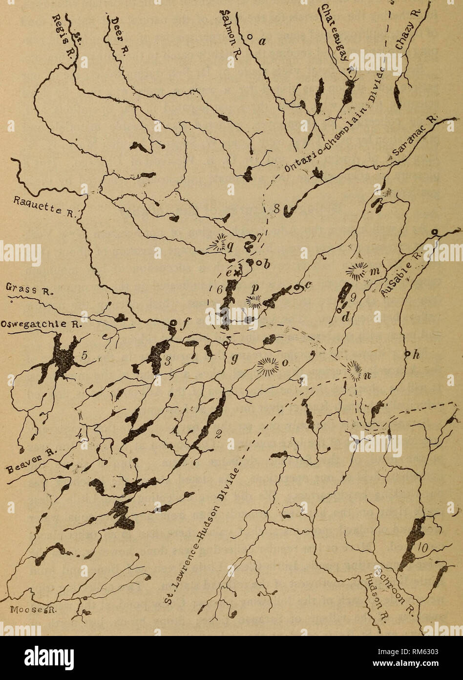 . Annual report of the Regents. New York State Museum; Science. 386 NEW YORK STATE MUSEUM. Map 1 Drainage map of the Saranac region LaTces: IRaquette; 2 Long; 3 Tupper ; 4 Ne-ha-sa-ne; 5 Cranberry; 6 Upper Saranac ; 7 St Regis; 8 Rain, ''To^L^.'ti^aJoneT^Taranac Junction; c Saranac Lake; d Lake Placid : e Saranac Inn ; /Tupper Lake ^ ^untkinfrm^^?It^ce; n Marcy (Tahawus); o Seward; p Boot Bay ; a St Regis. Please note that these images are extracted from scanned page images that may have been digitally enhanced for readability - coloration and appearance of these illustrations may not perfectl Stock Photohttps://www.alamy.com/image-license-details/?v=1https://www.alamy.com/annual-report-of-the-regents-new-york-state-museum-science-386-new-york-state-museum-map-1-drainage-map-of-the-saranac-region-latces-iraquette-2-long-3-tupper-4-ne-ha-sa-ne-5-cranberry-6-upper-saranac-7-st-regis-8-rain-toltiajonettaranac-junction-c-saranac-lake-d-lake-placid-e-saranac-inn-tupper-lake-untkinfrmitce-n-marcy-tahawus-o-seward-p-boot-bay-a-st-regis-please-note-that-these-images-are-extracted-from-scanned-page-images-that-may-have-been-digitally-enhanced-for-readability-coloration-and-appearance-of-these-illustrations-may-not-perfectl-image236161971.html
RMRM6303–. Annual report of the Regents. New York State Museum; Science. 386 NEW YORK STATE MUSEUM. Map 1 Drainage map of the Saranac region LaTces: IRaquette; 2 Long; 3 Tupper ; 4 Ne-ha-sa-ne; 5 Cranberry; 6 Upper Saranac ; 7 St Regis; 8 Rain, ''To^L^.'ti^aJoneT^Taranac Junction; c Saranac Lake; d Lake Placid : e Saranac Inn ; /Tupper Lake ^ ^untkinfrm^^?It^ce; n Marcy (Tahawus); o Seward; p Boot Bay ; a St Regis. Please note that these images are extracted from scanned page images that may have been digitally enhanced for readability - coloration and appearance of these illustrations may not perfectl
 New York NY Saranac Lake 129374 1955 62500 Restoration Stock Photohttps://www.alamy.com/image-license-details/?v=1https://www.alamy.com/new-york-ny-saranac-lake-129374-1955-62500-restoration-image271874823.html
RMWP8Y33–New York NY Saranac Lake 129374 1955 62500 Restoration
 Saranac Lake, New York, map 1955, 1:62500, United States of America by Timeless Maps, data U.S. Geological Survey Stock Photohttps://www.alamy.com/image-license-details/?v=1https://www.alamy.com/saranac-lake-new-york-map-1955-162500-united-states-of-america-by-timeless-maps-data-us-geological-survey-image414150142.html
RM2F1P4ME–Saranac Lake, New York, map 1955, 1:62500, United States of America by Timeless Maps, data U.S. Geological Survey
 New York NY Saranac Lake 129375 1955 62500 Restoration Stock Photohttps://www.alamy.com/image-license-details/?v=1https://www.alamy.com/new-york-ny-saranac-lake-129375-1955-62500-restoration-image271874861.html
RMWP8Y4D–New York NY Saranac Lake 129375 1955 62500 Restoration
 New York NY Saranac Lake 20100629 TM Inverted Restoration Stock Photohttps://www.alamy.com/image-license-details/?v=1https://www.alamy.com/new-york-ny-saranac-lake-20100629-tm-inverted-restoration-image271875083.html
RMWP8YCB–New York NY Saranac Lake 20100629 TM Inverted Restoration
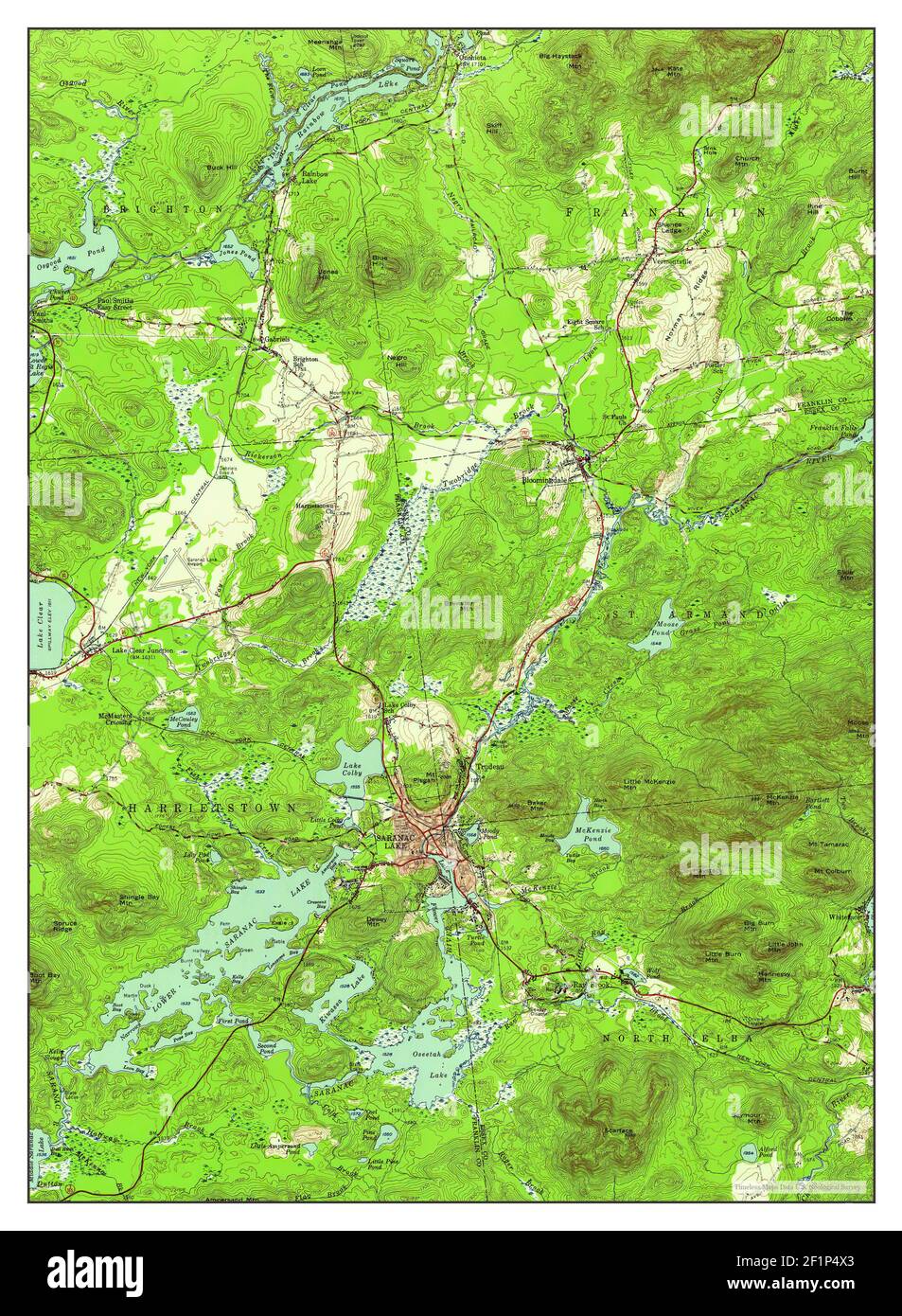 Saranac Lake, New York, map 1955, 1:62500, United States of America by Timeless Maps, data U.S. Geological Survey Stock Photohttps://www.alamy.com/image-license-details/?v=1https://www.alamy.com/saranac-lake-new-york-map-1955-162500-united-states-of-america-by-timeless-maps-data-us-geological-survey-image414150299.html
RM2F1P4X3–Saranac Lake, New York, map 1955, 1:62500, United States of America by Timeless Maps, data U.S. Geological Survey
 New York NY Upper Saranac Lake 20100126 TM Restoration Stock Photohttps://www.alamy.com/image-license-details/?v=1https://www.alamy.com/new-york-ny-upper-saranac-lake-20100126-tm-restoration-image271922323.html
RMWPB3KF–New York NY Upper Saranac Lake 20100126 TM Restoration
 New York NY Saranac Lake 129378 1978 25000 Inverted Restoration Stock Photohttps://www.alamy.com/image-license-details/?v=1https://www.alamy.com/new-york-ny-saranac-lake-129378-1978-25000-inverted-restoration-image271874984.html
RMWP8Y8T–New York NY Saranac Lake 129378 1978 25000 Inverted Restoration
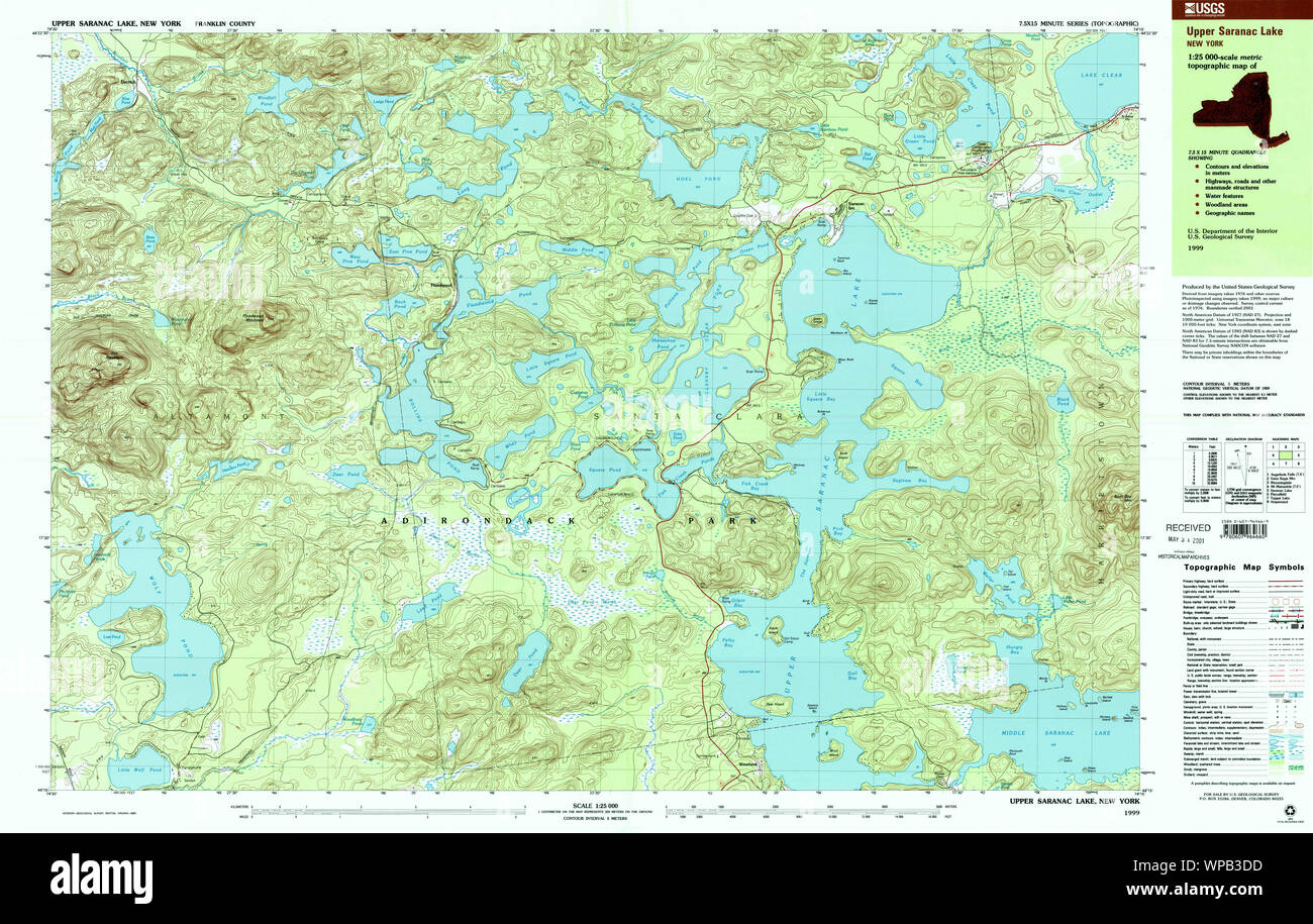 New York NY Upper Saranac Lake 136979 1999 25000 Restoration Stock Photohttps://www.alamy.com/image-license-details/?v=1https://www.alamy.com/new-york-ny-upper-saranac-lake-136979-1999-25000-restoration-image271922153.html
RMWPB3DD–New York NY Upper Saranac Lake 136979 1999 25000 Restoration
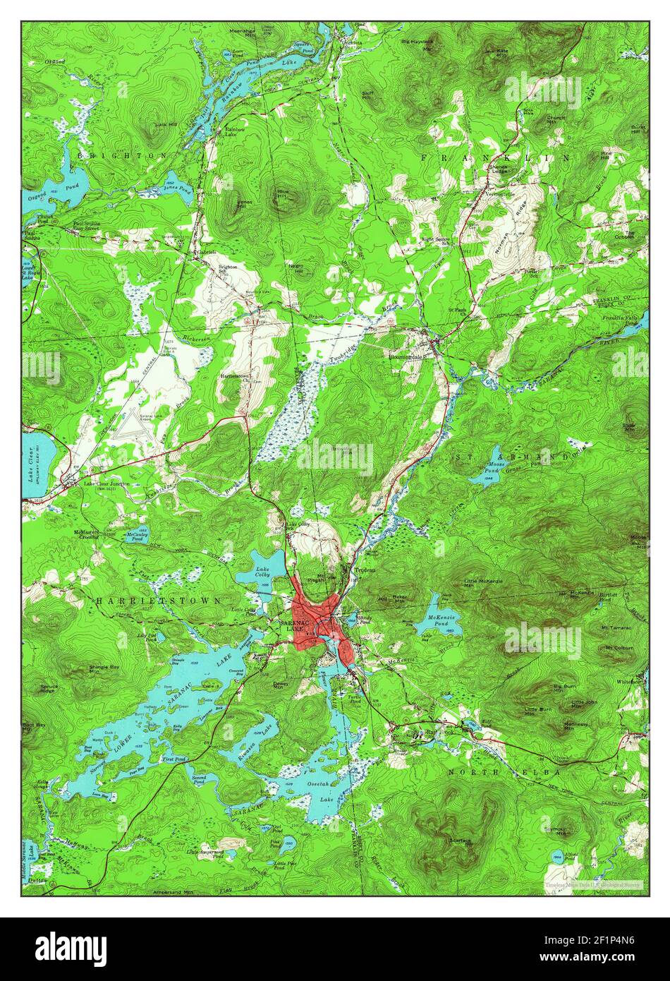 Saranac Lake, New York, map 1955, 1:62500, United States of America by Timeless Maps, data U.S. Geological Survey Stock Photohttps://www.alamy.com/image-license-details/?v=1https://www.alamy.com/saranac-lake-new-york-map-1955-162500-united-states-of-america-by-timeless-maps-data-us-geological-survey-image414150162.html
RM2F1P4N6–Saranac Lake, New York, map 1955, 1:62500, United States of America by Timeless Maps, data U.S. Geological Survey
 New York NY Saranac Lake 129379 1979 25000 Inverted Restoration Stock Photohttps://www.alamy.com/image-license-details/?v=1https://www.alamy.com/new-york-ny-saranac-lake-129379-1979-25000-inverted-restoration-image271874979.html
RMWP8Y8K–New York NY Saranac Lake 129379 1979 25000 Inverted Restoration
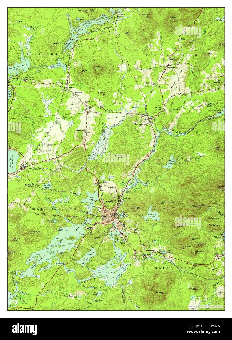 Saranac Lake, New York, map 1955, 1:62500, United States of America by Timeless Maps, data U.S. Geological Survey Stock Photohttps://www.alamy.com/image-license-details/?v=1https://www.alamy.com/saranac-lake-new-york-map-1955-162500-united-states-of-america-by-timeless-maps-data-us-geological-survey-image414150166.html
RM2F1P4NA–Saranac Lake, New York, map 1955, 1:62500, United States of America by Timeless Maps, data U.S. Geological Survey
 New York NY Saranac Lake 136887 1999 25000 Inverted Restoration Stock Photohttps://www.alamy.com/image-license-details/?v=1https://www.alamy.com/new-york-ny-saranac-lake-136887-1999-25000-inverted-restoration-image271875020.html
RMWP8YA4–New York NY Saranac Lake 136887 1999 25000 Inverted Restoration
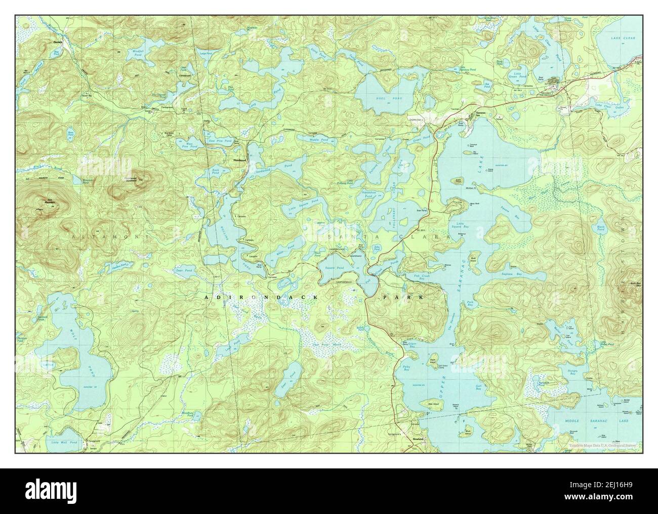 Upper Saranac Lake, New York, map 1979, 1:25000, United States of America by Timeless Maps, data U.S. Geological Survey Stock Photohttps://www.alamy.com/image-license-details/?v=1https://www.alamy.com/upper-saranac-lake-new-york-map-1979-125000-united-states-of-america-by-timeless-maps-data-us-geological-survey-image406929413.html
RM2EJ16H9–Upper Saranac Lake, New York, map 1979, 1:25000, United States of America by Timeless Maps, data U.S. Geological Survey
 New York NY Upper Saranac Lake 139450 1979 25000 Restoration Stock Photohttps://www.alamy.com/image-license-details/?v=1https://www.alamy.com/new-york-ny-upper-saranac-lake-139450-1979-25000-restoration-image271922244.html
RMWPB3GM–New York NY Upper Saranac Lake 139450 1979 25000 Restoration
 Upper Saranac Lake, New York, map 1999, 1:25000, United States of America by Timeless Maps, data U.S. Geological Survey Stock Photohttps://www.alamy.com/image-license-details/?v=1https://www.alamy.com/upper-saranac-lake-new-york-map-1999-125000-united-states-of-america-by-timeless-maps-data-us-geological-survey-image406929428.html
RM2EJ16HT–Upper Saranac Lake, New York, map 1999, 1:25000, United States of America by Timeless Maps, data U.S. Geological Survey
 New York NY Saranac Lake 129377 1979 25000 Inverted Restoration Stock Photohttps://www.alamy.com/image-license-details/?v=1https://www.alamy.com/new-york-ny-saranac-lake-129377-1979-25000-inverted-restoration-image271874928.html
RMWP8Y6T–New York NY Saranac Lake 129377 1979 25000 Inverted Restoration
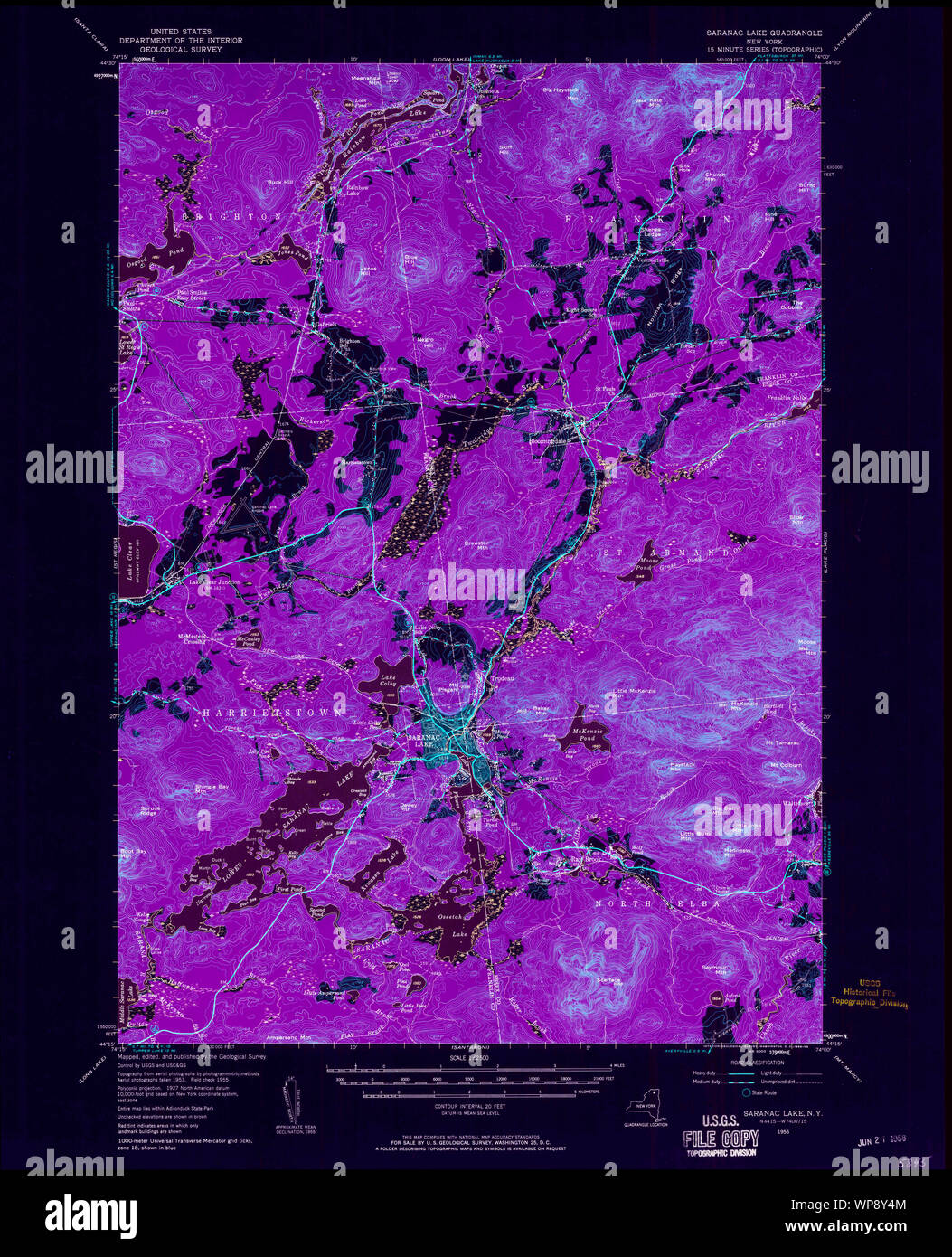 New York NY Saranac Lake 129375 1955 62500 Inverted Restoration Stock Photohttps://www.alamy.com/image-license-details/?v=1https://www.alamy.com/new-york-ny-saranac-lake-129375-1955-62500-inverted-restoration-image271874868.html
RMWP8Y4M–New York NY Saranac Lake 129375 1955 62500 Inverted Restoration
 New York NY Saranac Lake 129373 1955 62500 Inverted Restoration Stock Photohttps://www.alamy.com/image-license-details/?v=1https://www.alamy.com/new-york-ny-saranac-lake-129373-1955-62500-inverted-restoration-image271874781.html
RMWP8Y1H–New York NY Saranac Lake 129373 1955 62500 Inverted Restoration
 New York NY Saranac Lake 129374 1955 62500 Inverted Restoration Stock Photohttps://www.alamy.com/image-license-details/?v=1https://www.alamy.com/new-york-ny-saranac-lake-129374-1955-62500-inverted-restoration-image271874829.html
RMWP8Y39–New York NY Saranac Lake 129374 1955 62500 Inverted Restoration
 New York NY Saranac Lake 129372 1955 62500 Inverted Restoration Stock Photohttps://www.alamy.com/image-license-details/?v=1https://www.alamy.com/new-york-ny-saranac-lake-129372-1955-62500-inverted-restoration-image271874774.html
RMWP8Y1A–New York NY Saranac Lake 129372 1955 62500 Inverted Restoration
 New York NY Saranac Lake 129376 1955 62500 Inverted Restoration Stock Photohttps://www.alamy.com/image-license-details/?v=1https://www.alamy.com/new-york-ny-saranac-lake-129376-1955-62500-inverted-restoration-image271874870.html
RMWP8Y4P–New York NY Saranac Lake 129376 1955 62500 Inverted Restoration
 New York NY Upper Saranac Lake 20100126 TM Inverted Restoration Stock Photohttps://www.alamy.com/image-license-details/?v=1https://www.alamy.com/new-york-ny-upper-saranac-lake-20100126-tm-inverted-restoration-image271922317.html
RMWPB3K9–New York NY Upper Saranac Lake 20100126 TM Inverted Restoration
 New York NY Upper Saranac Lake 136979 1999 25000 Inverted Restoration Stock Photohttps://www.alamy.com/image-license-details/?v=1https://www.alamy.com/new-york-ny-upper-saranac-lake-136979-1999-25000-inverted-restoration-image271922158.html
RMWPB3DJ–New York NY Upper Saranac Lake 136979 1999 25000 Inverted Restoration
 New York NY Upper Saranac Lake 139450 1979 25000 Inverted Restoration Stock Photohttps://www.alamy.com/image-license-details/?v=1https://www.alamy.com/new-york-ny-upper-saranac-lake-139450-1979-25000-inverted-restoration-image271922242.html
RMWPB3GJ–New York NY Upper Saranac Lake 139450 1979 25000 Inverted Restoration