Quick filters:
Map of shanklin Stock Photos and Images
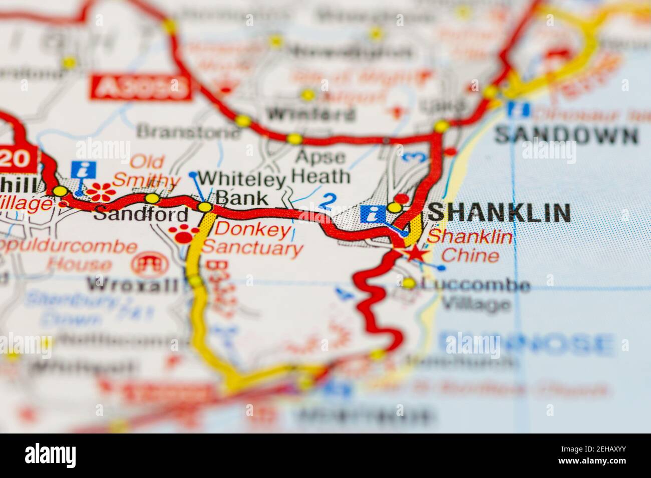 Shanklin isle of wight and surrounding areas shown on a road map or Geography map Stock Photohttps://www.alamy.com/image-license-details/?v=1https://www.alamy.com/shanklin-isle-of-wight-and-surrounding-areas-shown-on-a-road-map-or-geography-map-image406528303.html
RM2EHAXYY–Shanklin isle of wight and surrounding areas shown on a road map or Geography map
 Shanklin, Canada, New Brunswick, N 45 21' 40'', W 65 37' 31'', map, Timeless Map published in 2021. Travelers, explorers and adventurers like Florence Nightingale, David Livingstone, Ernest Shackleton, Lewis and Clark and Sherlock Holmes relied on maps to plan travels to the world's most remote corners, Timeless Maps is mapping most locations on the globe, showing the achievement of great dreams Stock Photohttps://www.alamy.com/image-license-details/?v=1https://www.alamy.com/shanklin-canada-new-brunswick-n-45-21-40-w-65-37-31-map-timeless-map-published-in-2021-travelers-explorers-and-adventurers-like-florence-nightingale-david-livingstone-ernest-shackleton-lewis-and-clark-and-sherlock-holmes-relied-on-maps-to-plan-travels-to-the-worlds-most-remote-corners-timeless-maps-is-mapping-most-locations-on-the-globe-showing-the-achievement-of-great-dreams-image457883754.html
RM2HGXBB6–Shanklin, Canada, New Brunswick, N 45 21' 40'', W 65 37' 31'', map, Timeless Map published in 2021. Travelers, explorers and adventurers like Florence Nightingale, David Livingstone, Ernest Shackleton, Lewis and Clark and Sherlock Holmes relied on maps to plan travels to the world's most remote corners, Timeless Maps is mapping most locations on the globe, showing the achievement of great dreams
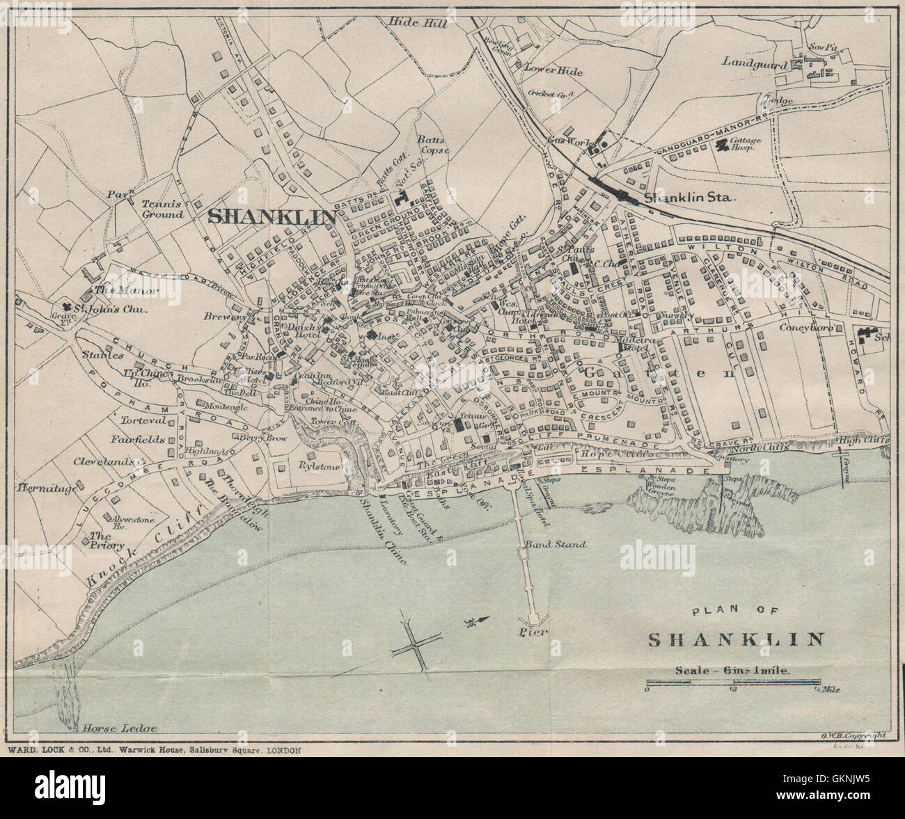 SHANKLIN vintage town/city plan. Isle of Wight. WARD LOCK, 1908 antique map Stock Photohttps://www.alamy.com/image-license-details/?v=1https://www.alamy.com/stock-photo-shanklin-vintage-towncity-plan-isle-of-wight-ward-lock-1908-antique-115416481.html
RFGKNJW5–SHANKLIN vintage town/city plan. Isle of Wight. WARD LOCK, 1908 antique map
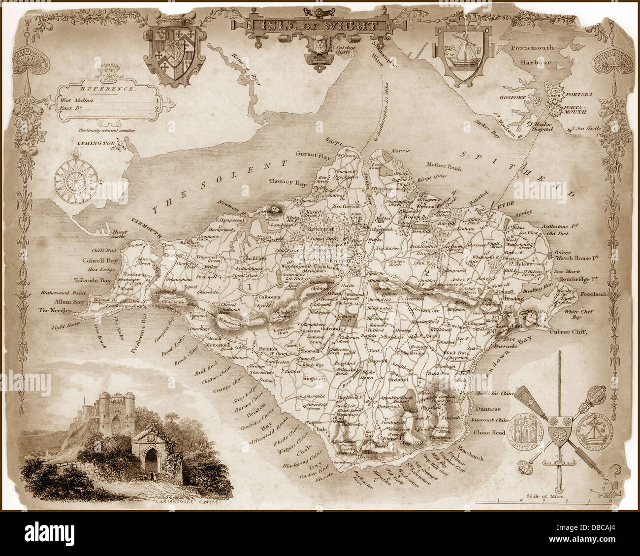 1840s Victorian Map of Isle Of Wight Stock Photohttps://www.alamy.com/image-license-details/?v=1https://www.alamy.com/stock-photo-1840s-victorian-map-of-isle-of-wight-58664092.html
RFDBCAJ4–1840s Victorian Map of Isle Of Wight
 SHANKLIN vintage town/city plan. Isle of Wight. WARD LOCK, 1922 vintage map Stock Photohttps://www.alamy.com/image-license-details/?v=1https://www.alamy.com/stock-photo-shanklin-vintage-towncity-plan-isle-of-wight-ward-lock-1922-vintage-115416554.html
RFGKNJYP–SHANKLIN vintage town/city plan. Isle of Wight. WARD LOCK, 1922 vintage map
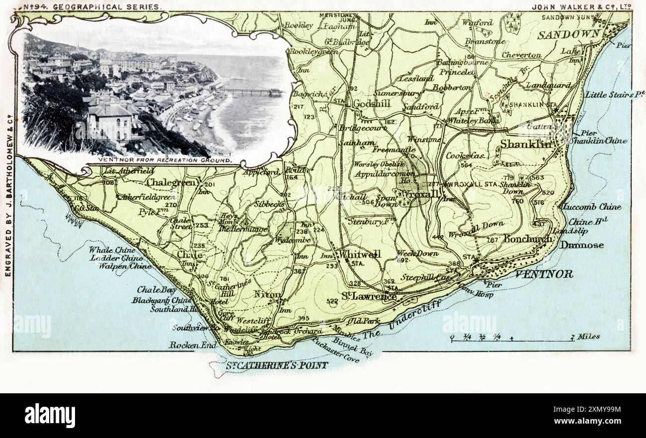 Map of southern section of The Isle of Wight, Hampshire Stock Photohttps://www.alamy.com/image-license-details/?v=1https://www.alamy.com/map-of-southern-section-of-the-isle-of-wight-hampshire-image615256032.html
RM2XMY99M–Map of southern section of The Isle of Wight, Hampshire
 SHANKLIN vintage town/city plan. Isle of Wight. WARD LOCK, 1939 vintage map Stock Photohttps://www.alamy.com/image-license-details/?v=1https://www.alamy.com/stock-photo-shanklin-vintage-towncity-plan-isle-of-wight-ward-lock-1939-vintage-115416962.html
RFGKNKEA–SHANKLIN vintage town/city plan. Isle of Wight. WARD LOCK, 1939 vintage map
 Poster, Portsmouth, Southsea & Isle of Wight Aviation Ltd, showing a passenger airliner flying above a cruise liner. With a list of principal agents, fares and route map. Stock Photohttps://www.alamy.com/image-license-details/?v=1https://www.alamy.com/poster-portsmouth-southsea-isle-of-wight-aviation-ltd-showing-a-passenger-airliner-flying-above-a-cruise-liner-with-a-list-of-principal-agents-fares-and-route-map-image504780483.html
RM2M96MJB–Poster, Portsmouth, Southsea & Isle of Wight Aviation Ltd, showing a passenger airliner flying above a cruise liner. With a list of principal agents, fares and route map.
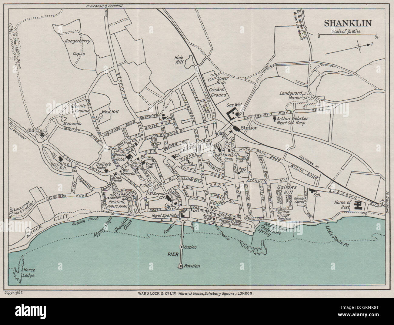 SHANKLIN vintage town/city plan. Isle of Wight. WARD LOCK, 1932 vintage map Stock Photohttps://www.alamy.com/image-license-details/?v=1https://www.alamy.com/stock-photo-shanklin-vintage-towncity-plan-isle-of-wight-ward-lock-1932-vintage-115416808.html
RFGKNK8T–SHANKLIN vintage town/city plan. Isle of Wight. WARD LOCK, 1932 vintage map
 Shanklin Chine Isle of Wight A. Heaton Cooper Stock Photohttps://www.alamy.com/image-license-details/?v=1https://www.alamy.com/stock-image-shanklin-chine-isle-of-wight-a-heaton-cooper-162267480.html
RMKBYWR4–Shanklin Chine Isle of Wight A. Heaton Cooper
 SHANKLIN vintage town/city plan. Isle of Wight. WARD LOCK, 1929 vintage map Stock Photohttps://www.alamy.com/image-license-details/?v=1https://www.alamy.com/stock-photo-shanklin-vintage-towncity-plan-isle-of-wight-ward-lock-1929-vintage-115416640.html
RFGKNK2T–SHANKLIN vintage town/city plan. Isle of Wight. WARD LOCK, 1929 vintage map
![SHANKLIN CHINE, ISLE OF WIGHT. Author Harraden, J. B. 15.39.b. Place of publication: [Cambridge] Publisher: Published R. Harraden and Son, Cambridge, Date of publication: 1814. Item type: 1 print Medium: aquatint and etching with hand-colouring Dimensions: platemark 37.9 x 50.6 cm, on sheet 42.5 x 60.9 cn Former owner: George III, King of Great Britain, 1738-1820 Stock Photo SHANKLIN CHINE, ISLE OF WIGHT. Author Harraden, J. B. 15.39.b. Place of publication: [Cambridge] Publisher: Published R. Harraden and Son, Cambridge, Date of publication: 1814. Item type: 1 print Medium: aquatint and etching with hand-colouring Dimensions: platemark 37.9 x 50.6 cm, on sheet 42.5 x 60.9 cn Former owner: George III, King of Great Britain, 1738-1820 Stock Photo](https://c8.alamy.com/comp/2E9H3HD/shanklin-chine-isle-of-wight-author-harraden-j-b-1539b-place-of-publication-cambridge-publisher-published-r-harraden-and-son-cambridge-date-of-publication-1814-item-type-1-print-medium-aquatint-and-etching-with-hand-colouring-dimensions-platemark-379-x-506-cm-on-sheet-425-x-609-cn-former-owner-george-iii-king-of-great-britain-1738-1820-2E9H3HD.jpg) SHANKLIN CHINE, ISLE OF WIGHT. Author Harraden, J. B. 15.39.b. Place of publication: [Cambridge] Publisher: Published R. Harraden and Son, Cambridge, Date of publication: 1814. Item type: 1 print Medium: aquatint and etching with hand-colouring Dimensions: platemark 37.9 x 50.6 cm, on sheet 42.5 x 60.9 cn Former owner: George III, King of Great Britain, 1738-1820 Stock Photohttps://www.alamy.com/image-license-details/?v=1https://www.alamy.com/shanklin-chine-isle-of-wight-author-harraden-j-b-1539b-place-of-publication-cambridge-publisher-published-r-harraden-and-son-cambridge-date-of-publication-1814-item-type-1-print-medium-aquatint-and-etching-with-hand-colouring-dimensions-platemark-379-x-506-cm-on-sheet-425-x-609-cn-former-owner-george-iii-king-of-great-britain-1738-1820-image401746393.html
SHANKLIN CHINE, ISLE OF WIGHT. Author Harraden, J. B. 15.39.b. Place of publication: [Cambridge] Publisher: Published R. Harraden and Son, Cambridge, Date of publication: 1814. Item type: 1 print Medium: aquatint and etching with hand-colouring Dimensions: platemark 37.9 x 50.6 cm, on sheet 42.5 x 60.9 cn Former owner: George III, King of Great Britain, 1738-1820 Stock Photohttps://www.alamy.com/image-license-details/?v=1https://www.alamy.com/shanklin-chine-isle-of-wight-author-harraden-j-b-1539b-place-of-publication-cambridge-publisher-published-r-harraden-and-son-cambridge-date-of-publication-1814-item-type-1-print-medium-aquatint-and-etching-with-hand-colouring-dimensions-platemark-379-x-506-cm-on-sheet-425-x-609-cn-former-owner-george-iii-king-of-great-britain-1738-1820-image401746393.htmlRM2E9H3HD–SHANKLIN CHINE, ISLE OF WIGHT. Author Harraden, J. B. 15.39.b. Place of publication: [Cambridge] Publisher: Published R. Harraden and Son, Cambridge, Date of publication: 1814. Item type: 1 print Medium: aquatint and etching with hand-colouring Dimensions: platemark 37.9 x 50.6 cm, on sheet 42.5 x 60.9 cn Former owner: George III, King of Great Britain, 1738-1820
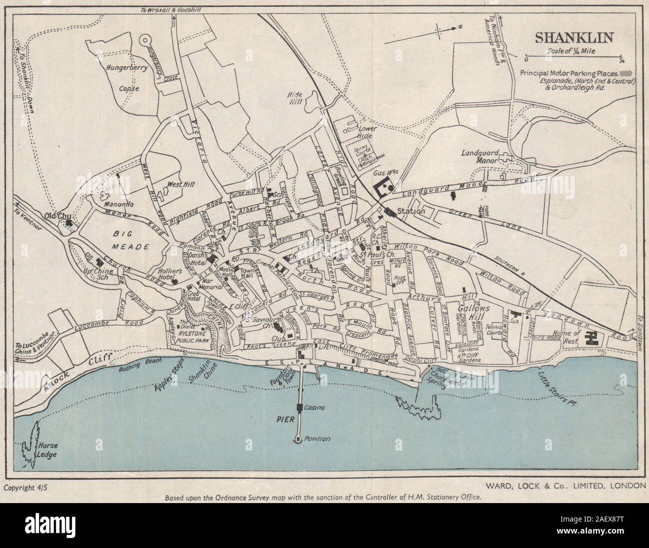 SHANKLIN vintage town/city plan. Isle of Wight. WARD LOCK 1950 old vintage map Stock Photohttps://www.alamy.com/image-license-details/?v=1https://www.alamy.com/shanklin-vintage-towncity-plan-isle-of-wight-ward-lock-1950-old-vintage-map-image336179420.html
RF2AEX87T–SHANKLIN vintage town/city plan. Isle of Wight. WARD LOCK 1950 old vintage map
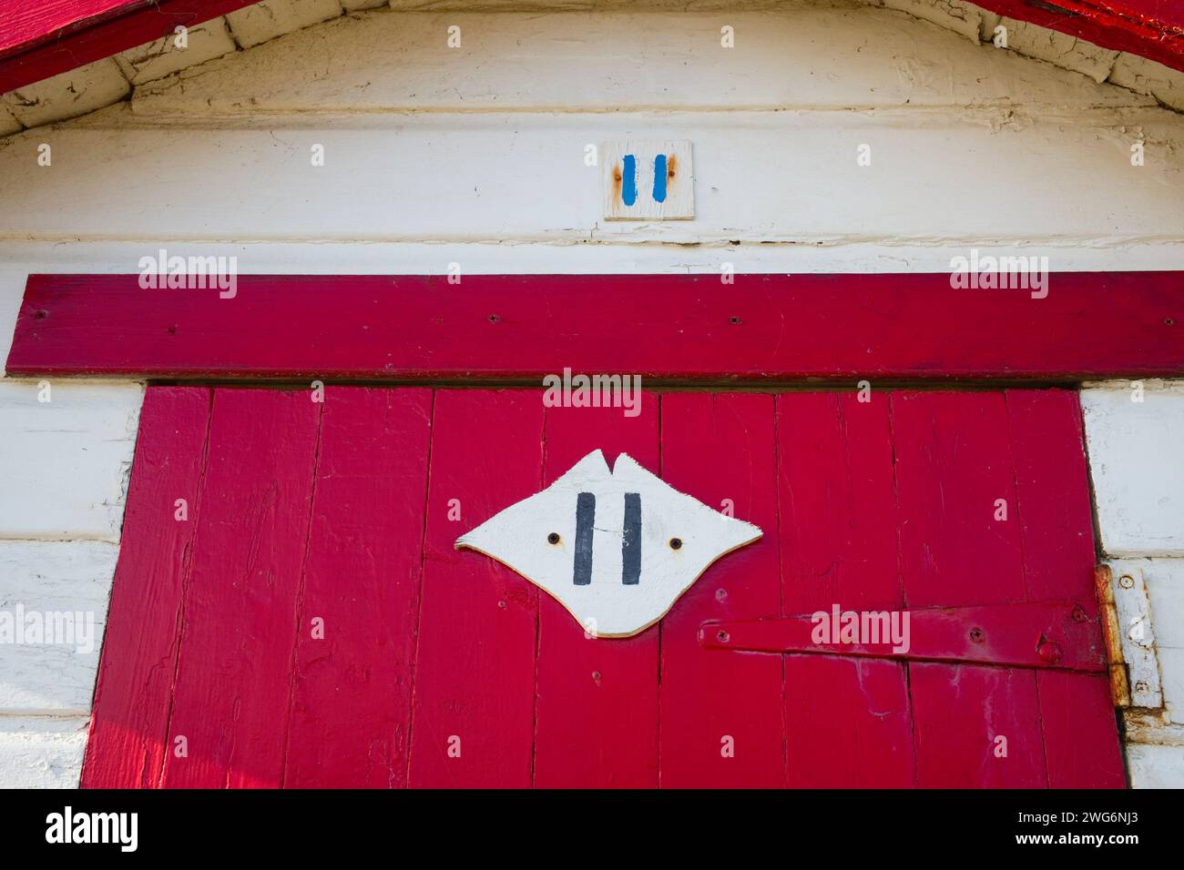 Number 11 beach hut at Shanklin, Isle of Wight Stock Photohttps://www.alamy.com/image-license-details/?v=1https://www.alamy.com/number-11-beach-hut-at-shanklin-isle-of-wight-image595135691.html
RM2WG6NJ3–Number 11 beach hut at Shanklin, Isle of Wight
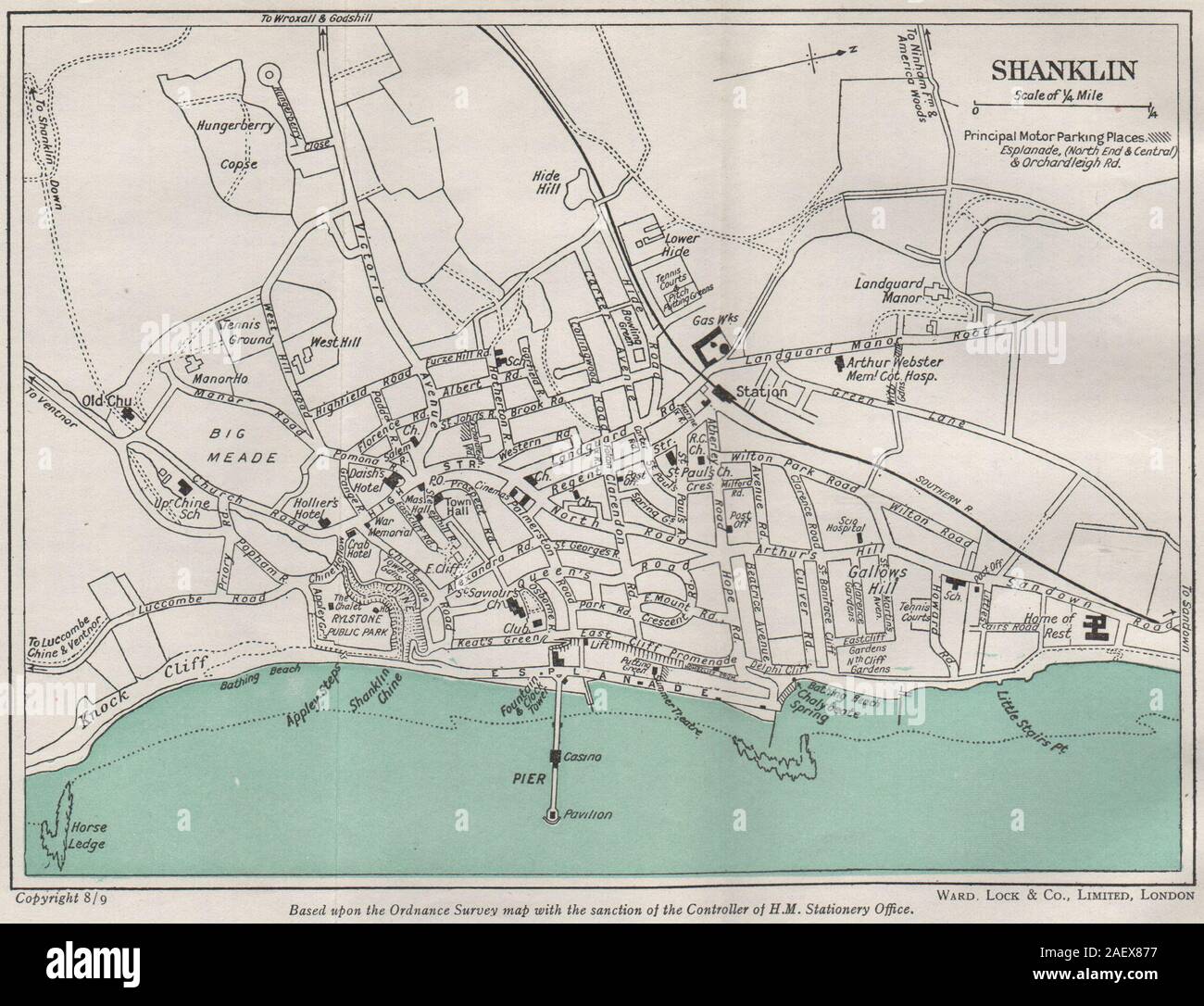 SHANKLIN vintage town/city plan. Isle of Wight. WARD LOCK 1948 old vintage map Stock Photohttps://www.alamy.com/image-license-details/?v=1https://www.alamy.com/shanklin-vintage-towncity-plan-isle-of-wight-ward-lock-1948-old-vintage-map-image336179403.html
RF2AEX877–SHANKLIN vintage town/city plan. Isle of Wight. WARD LOCK 1948 old vintage map
 Map of Isle of Wight painted on a beach hut door, Small Hope Beach, Shanklin, Isle of Wight, Hampshire, UK Stock Photohttps://www.alamy.com/image-license-details/?v=1https://www.alamy.com/map-of-isle-of-wight-painted-on-a-beach-hut-door-small-hope-beach-shanklin-isle-of-wight-hampshire-uk-image564821530.html
RM2RPWRHE–Map of Isle of Wight painted on a beach hut door, Small Hope Beach, Shanklin, Isle of Wight, Hampshire, UK
 man, woman, Couple, reading, map, driving, holiday, Classic Volkswagen Camper Van, Sandown, Shanklin, Holidays, Red, Down, Isle of Wight, England, UK, Stock Photohttps://www.alamy.com/image-license-details/?v=1https://www.alamy.com/stock-photo-man-woman-couple-reading-map-driving-holiday-classic-volkswagen-camper-37595535.html
RMC54HDK–man, woman, Couple, reading, map, driving, holiday, Classic Volkswagen Camper Van, Sandown, Shanklin, Holidays, Red, Down, Isle of Wight, England, UK,
 Cover design, Railway Air Services timetable in conjunction with Spartan Air Lines Ltd, between London and the Isle of Wight. Stock Photohttps://www.alamy.com/image-license-details/?v=1https://www.alamy.com/cover-design-railway-air-services-timetable-in-conjunction-with-spartan-air-lines-ltd-between-london-and-the-isle-of-wight-image504780625.html
RM2M96MRD–Cover design, Railway Air Services timetable in conjunction with Spartan Air Lines Ltd, between London and the Isle of Wight.
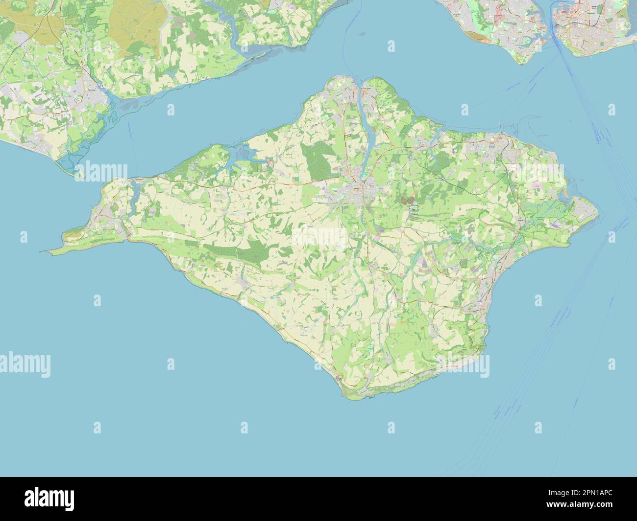 Isle of Wight, unitary authority of England - Great Britain. Open Street Map Stock Photohttps://www.alamy.com/image-license-details/?v=1https://www.alamy.com/isle-of-wight-unitary-authority-of-england-great-britain-open-street-map-image546459604.html
RF2PN1APC–Isle of Wight, unitary authority of England - Great Britain. Open Street Map
 . Central Connecticut in the geologic past. Figure I. GEOLOGIC MAP of CENTRAL CONNECTICUT with STRUCTURE SECTION on Lat. 41° 35 N. j^tat? of (Hottttwtuut PUBLIC DOCUMENT No. 47 State Geological and NaturalHistory Survey Marcus H. Holcomb, Governor of Connecticut {Chairman)Arthur Twining Hadley, President of Yale UniversityWilliam Arnold Shanklin, President of Wesleyan UniversityFlavkl Sweeten Luther, President of Trinity College {Secretary)Charles Lewis Beach, President of Connecticut Agricultural College COMMISSIONERS SUPERINTENDENTWilliam North Rice Bulletin No. 23. HARTFORD Printed for the Stock Photohttps://www.alamy.com/image-license-details/?v=1https://www.alamy.com/central-connecticut-in-the-geologic-past-figure-i-geologic-map-of-central-connecticut-with-structure-section-on-lat-41-35-n-jtat-of-hottttwtuut-public-document-no-47-state-geological-and-naturalhistory-survey-marcus-h-holcomb-governor-of-connecticut-chairmanarthur-twining-hadley-president-of-yale-universitywilliam-arnold-shanklin-president-of-wesleyan-universityflavkl-sweeten-luther-president-of-trinity-college-secretarycharles-lewis-beach-president-of-connecticut-agricultural-college-commissioners-superintendentwilliam-north-rice-bulletin-no-23-hartford-printed-for-the-image370780409.html
RM2CF6E5D–. Central Connecticut in the geologic past. Figure I. GEOLOGIC MAP of CENTRAL CONNECTICUT with STRUCTURE SECTION on Lat. 41° 35 N. j^tat? of (Hottttwtuut PUBLIC DOCUMENT No. 47 State Geological and NaturalHistory Survey Marcus H. Holcomb, Governor of Connecticut {Chairman)Arthur Twining Hadley, President of Yale UniversityWilliam Arnold Shanklin, President of Wesleyan UniversityFlavkl Sweeten Luther, President of Trinity College {Secretary)Charles Lewis Beach, President of Connecticut Agricultural College COMMISSIONERS SUPERINTENDENTWilliam North Rice Bulletin No. 23. HARTFORD Printed for the
 Shanklin, Isle of Wight, United Kingdom, England, N 50 37' 34'', W 1 10' 42'', map, Timeless Map published in 2021. Travelers, explorers and adventurers like Florence Nightingale, David Livingstone, Ernest Shackleton, Lewis and Clark and Sherlock Holmes relied on maps to plan travels to the world's most remote corners, Timeless Maps is mapping most locations on the globe, showing the achievement of great dreams Stock Photohttps://www.alamy.com/image-license-details/?v=1https://www.alamy.com/shanklin-isle-of-wight-united-kingdom-england-n-50-37-34-w-1-10-42-map-timeless-map-published-in-2021-travelers-explorers-and-adventurers-like-florence-nightingale-david-livingstone-ernest-shackleton-lewis-and-clark-and-sherlock-holmes-relied-on-maps-to-plan-travels-to-the-worlds-most-remote-corners-timeless-maps-is-mapping-most-locations-on-the-globe-showing-the-achievement-of-great-dreams-image439386860.html
RM2GERPBT–Shanklin, Isle of Wight, United Kingdom, England, N 50 37' 34'', W 1 10' 42'', map, Timeless Map published in 2021. Travelers, explorers and adventurers like Florence Nightingale, David Livingstone, Ernest Shackleton, Lewis and Clark and Sherlock Holmes relied on maps to plan travels to the world's most remote corners, Timeless Maps is mapping most locations on the globe, showing the achievement of great dreams
 people tourists holiday makers looking at town guide map for information at cowes on the isle of wight Stock Photohttps://www.alamy.com/image-license-details/?v=1https://www.alamy.com/stock-photo-people-tourists-holiday-makers-looking-at-town-guide-map-for-information-13036290.html
RMAC494K–people tourists holiday makers looking at town guide map for information at cowes on the isle of wight
 Shanklin Village Isle of Wight A. Heaton Cooper Stock Photohttps://www.alamy.com/image-license-details/?v=1https://www.alamy.com/stock-image-shanklin-village-isle-of-wight-a-heaton-cooper-162267477.html
RMKBYWR1–Shanklin Village Isle of Wight A. Heaton Cooper
![VIEW LOOKING into SHANKLIN CHINE. Author Jukes, Francis 15.39.a. Place of publication: [London] Publisher: Pubd Novr 14th 1796 by F. Jukes Howland Street., Date of publication: [November 14 1796] Item type: 1 print Medium: aquatint and etching with hand-colouring Dimensions: platemark 13.9 x 20.3 cm, on sheet 19.1 x 25.3 cm Former owner: George III, King of Great Britain, 1738-1820 Stock Photo VIEW LOOKING into SHANKLIN CHINE. Author Jukes, Francis 15.39.a. Place of publication: [London] Publisher: Pubd Novr 14th 1796 by F. Jukes Howland Street., Date of publication: [November 14 1796] Item type: 1 print Medium: aquatint and etching with hand-colouring Dimensions: platemark 13.9 x 20.3 cm, on sheet 19.1 x 25.3 cm Former owner: George III, King of Great Britain, 1738-1820 Stock Photo](https://c8.alamy.com/comp/2E9H3HR/view-looking-into-shanklin-chine-author-jukes-francis-1539a-place-of-publication-london-publisher-pubd-novr-14th-1796-by-f-jukes-howland-street-date-of-publication-november-14-1796-item-type-1-print-medium-aquatint-and-etching-with-hand-colouring-dimensions-platemark-139-x-203-cm-on-sheet-191-x-253-cm-former-owner-george-iii-king-of-great-britain-1738-1820-2E9H3HR.jpg) VIEW LOOKING into SHANKLIN CHINE. Author Jukes, Francis 15.39.a. Place of publication: [London] Publisher: Pubd Novr 14th 1796 by F. Jukes Howland Street., Date of publication: [November 14 1796] Item type: 1 print Medium: aquatint and etching with hand-colouring Dimensions: platemark 13.9 x 20.3 cm, on sheet 19.1 x 25.3 cm Former owner: George III, King of Great Britain, 1738-1820 Stock Photohttps://www.alamy.com/image-license-details/?v=1https://www.alamy.com/view-looking-into-shanklin-chine-author-jukes-francis-1539a-place-of-publication-london-publisher-pubd-novr-14th-1796-by-f-jukes-howland-street-date-of-publication-november-14-1796-item-type-1-print-medium-aquatint-and-etching-with-hand-colouring-dimensions-platemark-139-x-203-cm-on-sheet-191-x-253-cm-former-owner-george-iii-king-of-great-britain-1738-1820-image401746403.html
VIEW LOOKING into SHANKLIN CHINE. Author Jukes, Francis 15.39.a. Place of publication: [London] Publisher: Pubd Novr 14th 1796 by F. Jukes Howland Street., Date of publication: [November 14 1796] Item type: 1 print Medium: aquatint and etching with hand-colouring Dimensions: platemark 13.9 x 20.3 cm, on sheet 19.1 x 25.3 cm Former owner: George III, King of Great Britain, 1738-1820 Stock Photohttps://www.alamy.com/image-license-details/?v=1https://www.alamy.com/view-looking-into-shanklin-chine-author-jukes-francis-1539a-place-of-publication-london-publisher-pubd-novr-14th-1796-by-f-jukes-howland-street-date-of-publication-november-14-1796-item-type-1-print-medium-aquatint-and-etching-with-hand-colouring-dimensions-platemark-139-x-203-cm-on-sheet-191-x-253-cm-former-owner-george-iii-king-of-great-britain-1738-1820-image401746403.htmlRM2E9H3HR–VIEW LOOKING into SHANKLIN CHINE. Author Jukes, Francis 15.39.a. Place of publication: [London] Publisher: Pubd Novr 14th 1796 by F. Jukes Howland Street., Date of publication: [November 14 1796] Item type: 1 print Medium: aquatint and etching with hand-colouring Dimensions: platemark 13.9 x 20.3 cm, on sheet 19.1 x 25.3 cm Former owner: George III, King of Great Britain, 1738-1820
 Isle of Wight, unitary authority of England - Great Britain. Low resolution satellite map Stock Photohttps://www.alamy.com/image-license-details/?v=1https://www.alamy.com/isle-of-wight-unitary-authority-of-england-great-britain-low-resolution-satellite-map-image546459474.html
RF2PN1AHP–Isle of Wight, unitary authority of England - Great Britain. Low resolution satellite map
 . Central Connecticut in the geologic past. CATALOGUE SLIPS. Geology. Barrell, J. Central Connecticut in the geologicpast. Hartford, 1915. 44 pp., 5 pis., 23cra. (Bulletin no. 23, Connecticut geological and natural history survey.) i L. Figure I. GEOLOGIC MAP of CENTRAL CONNECTICUT with STRUCTURE SECTION on Lat. 41° 35 N. j^tat? of (Hottttwtuut PUBLIC DOCUMENT No. 47 State Geological and NaturalHistory Survey Marcus H. Holcomb, Governor of Connecticut {Chairman)Arthur Twining Hadley, President of Yale UniversityWilliam Arnold Shanklin, President of Wesleyan UniversityFlavkl Sweeten Luther, Pre Stock Photohttps://www.alamy.com/image-license-details/?v=1https://www.alamy.com/central-connecticut-in-the-geologic-past-catalogue-slips-geology-barrell-j-central-connecticut-in-the-geologicpast-hartford-1915-44-pp-5-pis-23cra-bulletin-no-23-connecticut-geological-and-natural-history-survey-i-l-figure-i-geologic-map-of-central-connecticut-with-structure-section-on-lat-41-35-n-jtat-of-hottttwtuut-public-document-no-47-state-geological-and-naturalhistory-survey-marcus-h-holcomb-governor-of-connecticut-chairmanarthur-twining-hadley-president-of-yale-universitywilliam-arnold-shanklin-president-of-wesleyan-universityflavkl-sweeten-luther-pre-image370780835.html
RM2CF6EMK–. Central Connecticut in the geologic past. CATALOGUE SLIPS. Geology. Barrell, J. Central Connecticut in the geologicpast. Hartford, 1915. 44 pp., 5 pis., 23cra. (Bulletin no. 23, Connecticut geological and natural history survey.) i L. Figure I. GEOLOGIC MAP of CENTRAL CONNECTICUT with STRUCTURE SECTION on Lat. 41° 35 N. j^tat? of (Hottttwtuut PUBLIC DOCUMENT No. 47 State Geological and NaturalHistory Survey Marcus H. Holcomb, Governor of Connecticut {Chairman)Arthur Twining Hadley, President of Yale UniversityWilliam Arnold Shanklin, President of Wesleyan UniversityFlavkl Sweeten Luther, Pre
 Shanklin, Isle of Wight, GB, United Kingdom, England, N 50 37' 33'', S 1 11' 23'', map, Cartascapes Map published in 2024. Explore Cartascapes, a map revealing Earth's diverse landscapes, cultures, and ecosystems. Journey through time and space, discovering the interconnectedness of our planet's past, present, and future. Stock Photohttps://www.alamy.com/image-license-details/?v=1https://www.alamy.com/shanklin-isle-of-wight-gb-united-kingdom-england-n-50-37-33-s-1-11-23-map-cartascapes-map-published-in-2024-explore-cartascapes-a-map-revealing-earths-diverse-landscapes-cultures-and-ecosystems-journey-through-time-and-space-discovering-the-interconnectedness-of-our-planets-past-present-and-future-image604267420.html
RM2X32N78–Shanklin, Isle of Wight, GB, United Kingdom, England, N 50 37' 33'', S 1 11' 23'', map, Cartascapes Map published in 2024. Explore Cartascapes, a map revealing Earth's diverse landscapes, cultures, and ecosystems. Journey through time and space, discovering the interconnectedness of our planet's past, present, and future.
 John Glover - Sandown Bay, from near Shanklin Chine, Isle of Wight - Stock Photohttps://www.alamy.com/image-license-details/?v=1https://www.alamy.com/stock-photo-john-glover-sandown-bay-from-near-shanklin-chine-isle-of-wight-148369944.html
RMJHARAG–John Glover - Sandown Bay, from near Shanklin Chine, Isle of Wight -
![VIEW of DUNNOSE from the CLIFF near Shanklin in Sandown Bay, Isle of Wight. Author Jukes, Francis 15.27. Place of publication: London Publisher: Published by F. Jukes No10 Howland Street., Date of publication: [about 1790-1800] Item type: 1 print Medium: aquatint and etching with hand-colouring Dimensions: platemark 27.5 x 32.8 cm, on sheet 31.1 x 38.6 cm Former owner: George III, King of Great Britain, 1738-1820 Stock Photo VIEW of DUNNOSE from the CLIFF near Shanklin in Sandown Bay, Isle of Wight. Author Jukes, Francis 15.27. Place of publication: London Publisher: Published by F. Jukes No10 Howland Street., Date of publication: [about 1790-1800] Item type: 1 print Medium: aquatint and etching with hand-colouring Dimensions: platemark 27.5 x 32.8 cm, on sheet 31.1 x 38.6 cm Former owner: George III, King of Great Britain, 1738-1820 Stock Photo](https://c8.alamy.com/comp/2E9H3G5/view-of-dunnose-from-the-cliff-near-shanklin-in-sandown-bay-isle-of-wight-author-jukes-francis-1527-place-of-publication-london-publisher-published-by-f-jukes-no10-howland-street-date-of-publication-about-1790-1800-item-type-1-print-medium-aquatint-and-etching-with-hand-colouring-dimensions-platemark-275-x-328-cm-on-sheet-311-x-386-cm-former-owner-george-iii-king-of-great-britain-1738-1820-2E9H3G5.jpg) VIEW of DUNNOSE from the CLIFF near Shanklin in Sandown Bay, Isle of Wight. Author Jukes, Francis 15.27. Place of publication: London Publisher: Published by F. Jukes No10 Howland Street., Date of publication: [about 1790-1800] Item type: 1 print Medium: aquatint and etching with hand-colouring Dimensions: platemark 27.5 x 32.8 cm, on sheet 31.1 x 38.6 cm Former owner: George III, King of Great Britain, 1738-1820 Stock Photohttps://www.alamy.com/image-license-details/?v=1https://www.alamy.com/view-of-dunnose-from-the-cliff-near-shanklin-in-sandown-bay-isle-of-wight-author-jukes-francis-1527-place-of-publication-london-publisher-published-by-f-jukes-no10-howland-street-date-of-publication-about-1790-1800-item-type-1-print-medium-aquatint-and-etching-with-hand-colouring-dimensions-platemark-275-x-328-cm-on-sheet-311-x-386-cm-former-owner-george-iii-king-of-great-britain-1738-1820-image401746357.html
VIEW of DUNNOSE from the CLIFF near Shanklin in Sandown Bay, Isle of Wight. Author Jukes, Francis 15.27. Place of publication: London Publisher: Published by F. Jukes No10 Howland Street., Date of publication: [about 1790-1800] Item type: 1 print Medium: aquatint and etching with hand-colouring Dimensions: platemark 27.5 x 32.8 cm, on sheet 31.1 x 38.6 cm Former owner: George III, King of Great Britain, 1738-1820 Stock Photohttps://www.alamy.com/image-license-details/?v=1https://www.alamy.com/view-of-dunnose-from-the-cliff-near-shanklin-in-sandown-bay-isle-of-wight-author-jukes-francis-1527-place-of-publication-london-publisher-published-by-f-jukes-no10-howland-street-date-of-publication-about-1790-1800-item-type-1-print-medium-aquatint-and-etching-with-hand-colouring-dimensions-platemark-275-x-328-cm-on-sheet-311-x-386-cm-former-owner-george-iii-king-of-great-britain-1738-1820-image401746357.htmlRM2E9H3G5–VIEW of DUNNOSE from the CLIFF near Shanklin in Sandown Bay, Isle of Wight. Author Jukes, Francis 15.27. Place of publication: London Publisher: Published by F. Jukes No10 Howland Street., Date of publication: [about 1790-1800] Item type: 1 print Medium: aquatint and etching with hand-colouring Dimensions: platemark 27.5 x 32.8 cm, on sheet 31.1 x 38.6 cm Former owner: George III, King of Great Britain, 1738-1820
 Isle of Wight, unitary authority of England - Great Britain. High resolution satellite map Stock Photohttps://www.alamy.com/image-license-details/?v=1https://www.alamy.com/isle-of-wight-unitary-authority-of-england-great-britain-high-resolution-satellite-map-image546459322.html
RF2PN1ACA–Isle of Wight, unitary authority of England - Great Britain. High resolution satellite map
 Shanklin, Isle of Wight, GB, United Kingdom, England, N 50 37' 33'', S 1 11' 23'', map, Cartascapes Map published in 2024. Explore Cartascapes, a map revealing Earth's diverse landscapes, cultures, and ecosystems. Journey through time and space, discovering the interconnectedness of our planet's past, present, and future. Stock Photohttps://www.alamy.com/image-license-details/?v=1https://www.alamy.com/shanklin-isle-of-wight-gb-united-kingdom-england-n-50-37-33-s-1-11-23-map-cartascapes-map-published-in-2024-explore-cartascapes-a-map-revealing-earths-diverse-landscapes-cultures-and-ecosystems-journey-through-time-and-space-discovering-the-interconnectedness-of-our-planets-past-present-and-future-image604267424.html
RM2X32N7C–Shanklin, Isle of Wight, GB, United Kingdom, England, N 50 37' 33'', S 1 11' 23'', map, Cartascapes Map published in 2024. Explore Cartascapes, a map revealing Earth's diverse landscapes, cultures, and ecosystems. Journey through time and space, discovering the interconnectedness of our planet's past, present, and future.
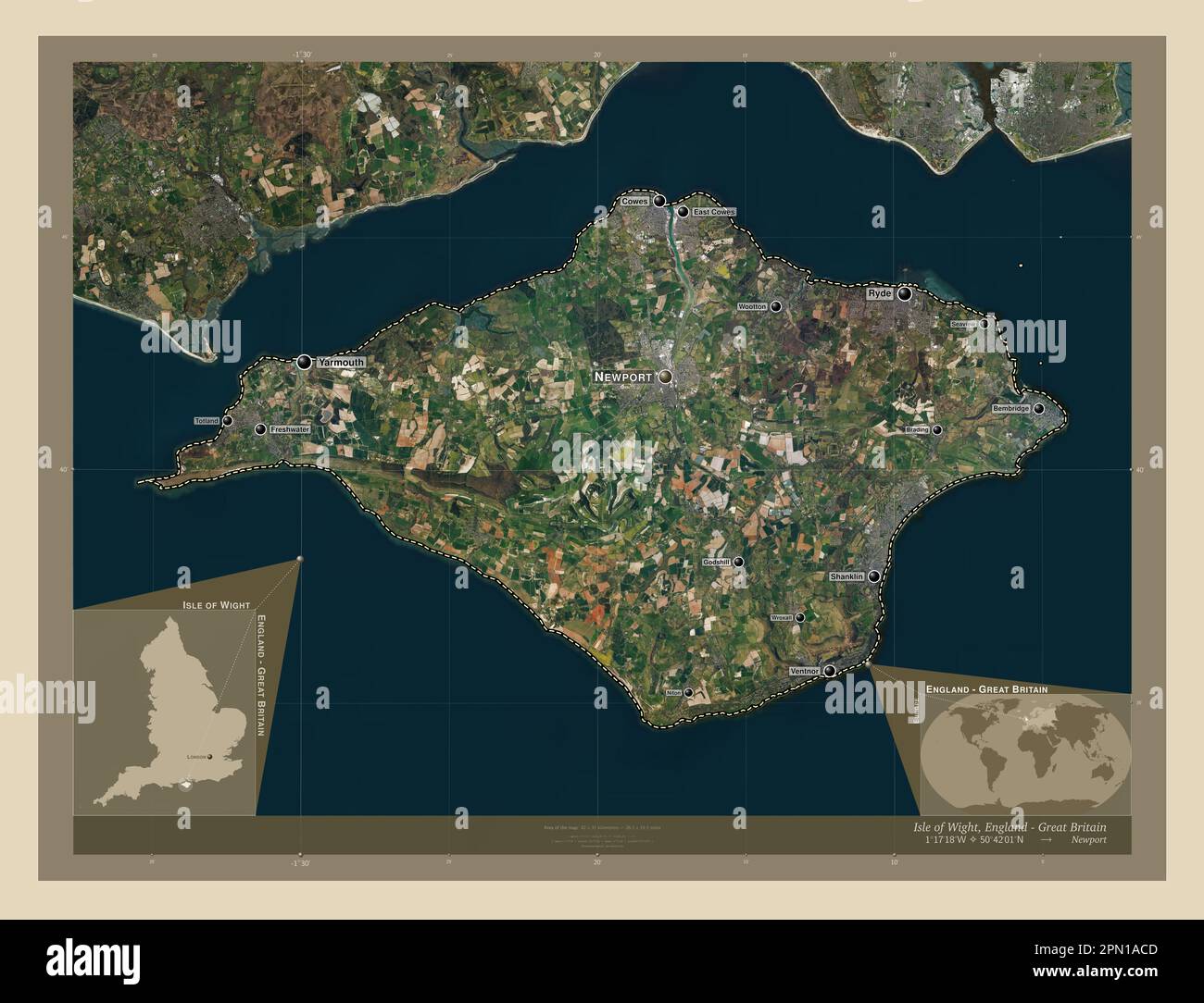 Isle of Wight, unitary authority of England - Great Britain. High resolution satellite map. Locations and names of major cities of the region. Corner Stock Photohttps://www.alamy.com/image-license-details/?v=1https://www.alamy.com/isle-of-wight-unitary-authority-of-england-great-britain-high-resolution-satellite-map-locations-and-names-of-major-cities-of-the-region-corner-image546459325.html
RF2PN1ACD–Isle of Wight, unitary authority of England - Great Britain. High resolution satellite map. Locations and names of major cities of the region. Corner
 Shanklin, Clutha District, NZ, New Zealand, Otago, S 46 16' 6'', N 169 38' 24'', map, Cartascapes Map published in 2024. Explore Cartascapes, a map revealing Earth's diverse landscapes, cultures, and ecosystems. Journey through time and space, discovering the interconnectedness of our planet's past, present, and future. Stock Photohttps://www.alamy.com/image-license-details/?v=1https://www.alamy.com/shanklin-clutha-district-nz-new-zealand-otago-s-46-16-6-n-169-38-24-map-cartascapes-map-published-in-2024-explore-cartascapes-a-map-revealing-earths-diverse-landscapes-cultures-and-ecosystems-journey-through-time-and-space-discovering-the-interconnectedness-of-our-planets-past-present-and-future-image634074531.html
RM2YRGGEY–Shanklin, Clutha District, NZ, New Zealand, Otago, S 46 16' 6'', N 169 38' 24'', map, Cartascapes Map published in 2024. Explore Cartascapes, a map revealing Earth's diverse landscapes, cultures, and ecosystems. Journey through time and space, discovering the interconnectedness of our planet's past, present, and future.
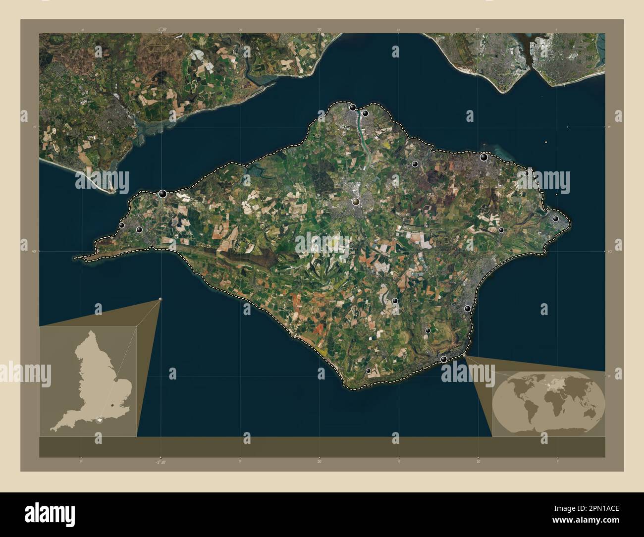 Isle of Wight, unitary authority of England - Great Britain. High resolution satellite map. Locations of major cities of the region. Corner auxiliary Stock Photohttps://www.alamy.com/image-license-details/?v=1https://www.alamy.com/isle-of-wight-unitary-authority-of-england-great-britain-high-resolution-satellite-map-locations-of-major-cities-of-the-region-corner-auxiliary-image546459326.html
RF2PN1ACE–Isle of Wight, unitary authority of England - Great Britain. High resolution satellite map. Locations of major cities of the region. Corner auxiliary
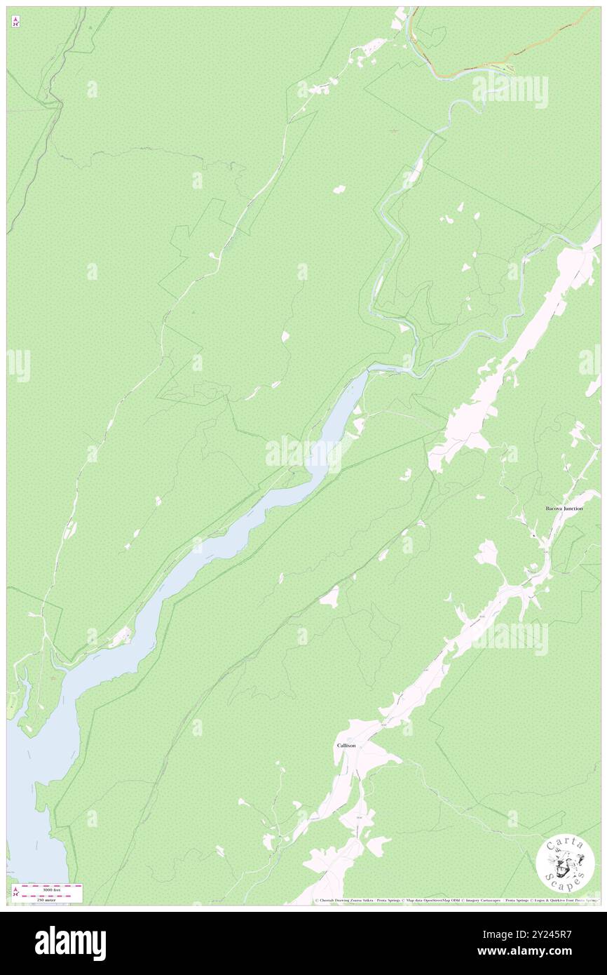 Shanklin (historical), Bath County, US, United States, Virginia, N 38 1' 2'', S 79 55' 7'', map, Cartascapes Map published in 2024. Explore Cartascapes, a map revealing Earth's diverse landscapes, cultures, and ecosystems. Journey through time and space, discovering the interconnectedness of our planet's past, present, and future. Stock Photohttps://www.alamy.com/image-license-details/?v=1https://www.alamy.com/shanklin-historical-bath-county-us-united-states-virginia-n-38-1-2-s-79-55-7-map-cartascapes-map-published-in-2024-explore-cartascapes-a-map-revealing-earths-diverse-landscapes-cultures-and-ecosystems-journey-through-time-and-space-discovering-the-interconnectedness-of-our-planets-past-present-and-future-image620894939.html
RM2Y245R7–Shanklin (historical), Bath County, US, United States, Virginia, N 38 1' 2'', S 79 55' 7'', map, Cartascapes Map published in 2024. Explore Cartascapes, a map revealing Earth's diverse landscapes, cultures, and ecosystems. Journey through time and space, discovering the interconnectedness of our planet's past, present, and future.
 Isle of Wight, unitary authority of England - Great Britain. Low resolution satellite map. Locations and names of major cities of the region. Corner a Stock Photohttps://www.alamy.com/image-license-details/?v=1https://www.alamy.com/isle-of-wight-unitary-authority-of-england-great-britain-low-resolution-satellite-map-locations-and-names-of-major-cities-of-the-region-corner-a-image546459475.html
RF2PN1AHR–Isle of Wight, unitary authority of England - Great Britain. Low resolution satellite map. Locations and names of major cities of the region. Corner a
 Shanklin Railway Station, Isle of Wight, GB, United Kingdom, England, N 50 38' 2'', S 1 10' 46'', map, Cartascapes Map published in 2024. Explore Cartascapes, a map revealing Earth's diverse landscapes, cultures, and ecosystems. Journey through time and space, discovering the interconnectedness of our planet's past, present, and future. Stock Photohttps://www.alamy.com/image-license-details/?v=1https://www.alamy.com/shanklin-railway-station-isle-of-wight-gb-united-kingdom-england-n-50-38-2-s-1-10-46-map-cartascapes-map-published-in-2024-explore-cartascapes-a-map-revealing-earths-diverse-landscapes-cultures-and-ecosystems-journey-through-time-and-space-discovering-the-interconnectedness-of-our-planets-past-present-and-future-image604217073.html
RM2X30D15–Shanklin Railway Station, Isle of Wight, GB, United Kingdom, England, N 50 38' 2'', S 1 10' 46'', map, Cartascapes Map published in 2024. Explore Cartascapes, a map revealing Earth's diverse landscapes, cultures, and ecosystems. Journey through time and space, discovering the interconnectedness of our planet's past, present, and future.
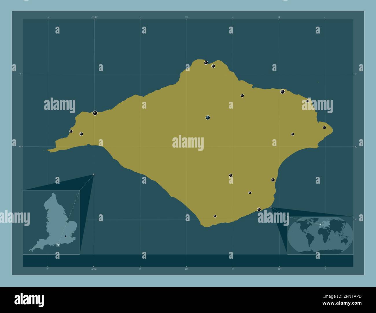 Isle of Wight, unitary authority of England - Great Britain. Solid color shape. Locations of major cities of the region. Corner auxiliary location map Stock Photohttps://www.alamy.com/image-license-details/?v=1https://www.alamy.com/isle-of-wight-unitary-authority-of-england-great-britain-solid-color-shape-locations-of-major-cities-of-the-region-corner-auxiliary-location-map-image546459605.html
RF2PN1APD–Isle of Wight, unitary authority of England - Great Britain. Solid color shape. Locations of major cities of the region. Corner auxiliary location map
 Shanklin, Isle of Wight, GB, United Kingdom, England, N 50 37' 34'', S 1 10' 42'', map, Cartascapes Map published in 2024. Explore Cartascapes, a map revealing Earth's diverse landscapes, cultures, and ecosystems. Journey through time and space, discovering the interconnectedness of our planet's past, present, and future. Stock Photohttps://www.alamy.com/image-license-details/?v=1https://www.alamy.com/shanklin-isle-of-wight-gb-united-kingdom-england-n-50-37-34-s-1-10-42-map-cartascapes-map-published-in-2024-explore-cartascapes-a-map-revealing-earths-diverse-landscapes-cultures-and-ecosystems-journey-through-time-and-space-discovering-the-interconnectedness-of-our-planets-past-present-and-future-image604151120.html
RM2X2WCWM–Shanklin, Isle of Wight, GB, United Kingdom, England, N 50 37' 34'', S 1 10' 42'', map, Cartascapes Map published in 2024. Explore Cartascapes, a map revealing Earth's diverse landscapes, cultures, and ecosystems. Journey through time and space, discovering the interconnectedness of our planet's past, present, and future.
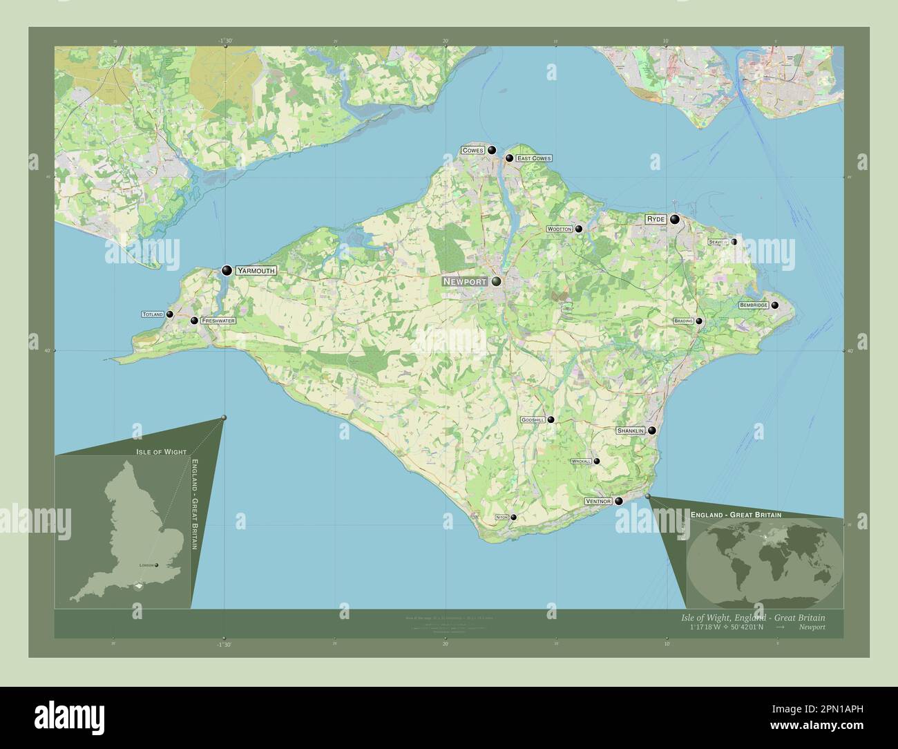 Isle of Wight, unitary authority of England - Great Britain. Open Street Map. Locations and names of major cities of the region. Corner auxiliary loca Stock Photohttps://www.alamy.com/image-license-details/?v=1https://www.alamy.com/isle-of-wight-unitary-authority-of-england-great-britain-open-street-map-locations-and-names-of-major-cities-of-the-region-corner-auxiliary-loca-image546459609.html
RF2PN1APH–Isle of Wight, unitary authority of England - Great Britain. Open Street Map. Locations and names of major cities of the region. Corner auxiliary loca
 Shanklin & Sandown Golf Club, Isle of Wight, GB, United Kingdom, England, N 50 39' 34'', S 1 10' 19'', map, Cartascapes Map published in 2024. Explore Cartascapes, a map revealing Earth's diverse landscapes, cultures, and ecosystems. Journey through time and space, discovering the interconnectedness of our planet's past, present, and future. Stock Photohttps://www.alamy.com/image-license-details/?v=1https://www.alamy.com/shanklin-sandown-golf-club-isle-of-wight-gb-united-kingdom-england-n-50-39-34-s-1-10-19-map-cartascapes-map-published-in-2024-explore-cartascapes-a-map-revealing-earths-diverse-landscapes-cultures-and-ecosystems-journey-through-time-and-space-discovering-the-interconnectedness-of-our-planets-past-present-and-future-image604077470.html
RM2X2P2YA–Shanklin & Sandown Golf Club, Isle of Wight, GB, United Kingdom, England, N 50 39' 34'', S 1 10' 19'', map, Cartascapes Map published in 2024. Explore Cartascapes, a map revealing Earth's diverse landscapes, cultures, and ecosystems. Journey through time and space, discovering the interconnectedness of our planet's past, present, and future.
 Isle of Wight, unitary authority of England - Great Britain. Low resolution satellite map. Locations of major cities of the region. Corner auxiliary l Stock Photohttps://www.alamy.com/image-license-details/?v=1https://www.alamy.com/isle-of-wight-unitary-authority-of-england-great-britain-low-resolution-satellite-map-locations-of-major-cities-of-the-region-corner-auxiliary-l-image546459389.html
RF2PN1AEN–Isle of Wight, unitary authority of England - Great Britain. Low resolution satellite map. Locations of major cities of the region. Corner auxiliary l
 Isle of Wight, unitary authority of England - Great Britain. Open Street Map. Locations of major cities of the region. Corner auxiliary location maps Stock Photohttps://www.alamy.com/image-license-details/?v=1https://www.alamy.com/isle-of-wight-unitary-authority-of-england-great-britain-open-street-map-locations-of-major-cities-of-the-region-corner-auxiliary-location-maps-image546459551.html
RF2PN1AMF–Isle of Wight, unitary authority of England - Great Britain. Open Street Map. Locations of major cities of the region. Corner auxiliary location maps
 Isle of Wight, unitary authority of England - Great Britain. Solid color shape Stock Photohttps://www.alamy.com/image-license-details/?v=1https://www.alamy.com/isle-of-wight-unitary-authority-of-england-great-britain-solid-color-shape-image546459642.html
RF2PN1ARP–Isle of Wight, unitary authority of England - Great Britain. Solid color shape
 Isle of Wight, unitary authority of England - Great Britain. Solid color shape. Locations and names of major cities of the region. Corner auxiliary lo Stock Photohttps://www.alamy.com/image-license-details/?v=1https://www.alamy.com/isle-of-wight-unitary-authority-of-england-great-britain-solid-color-shape-locations-and-names-of-major-cities-of-the-region-corner-auxiliary-lo-image546459637.html
RF2PN1ARH–Isle of Wight, unitary authority of England - Great Britain. Solid color shape. Locations and names of major cities of the region. Corner auxiliary lo