Map of st louis michigan Stock Photos and Images
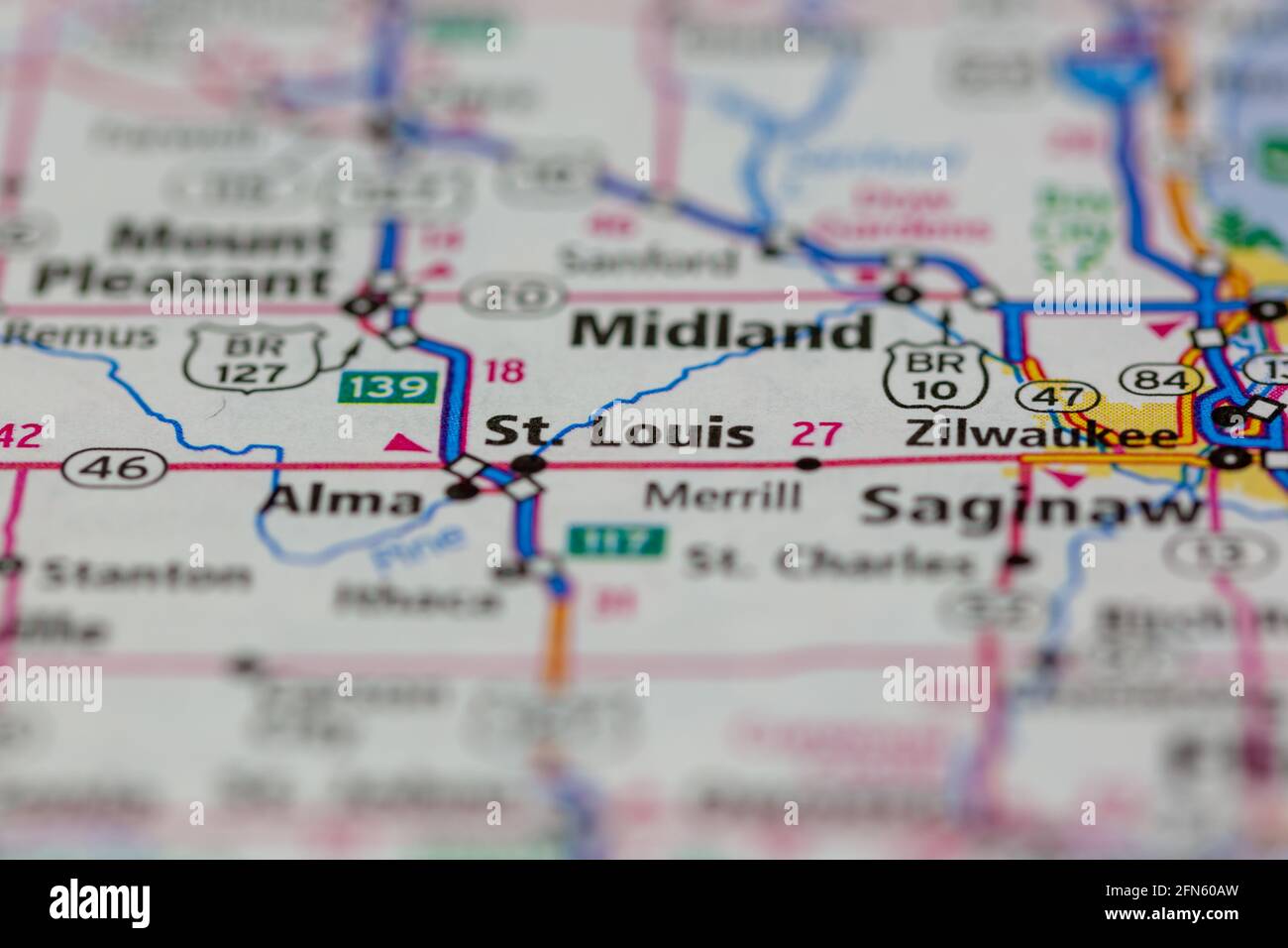 St Louis Michigan USA shown on a Geography map or road map Stock Photohttps://www.alamy.com/image-license-details/?v=1https://www.alamy.com/st-louis-michigan-usa-shown-on-a-geography-map-or-road-map-image426088625.html
RM2FN60AW–St Louis Michigan USA shown on a Geography map or road map
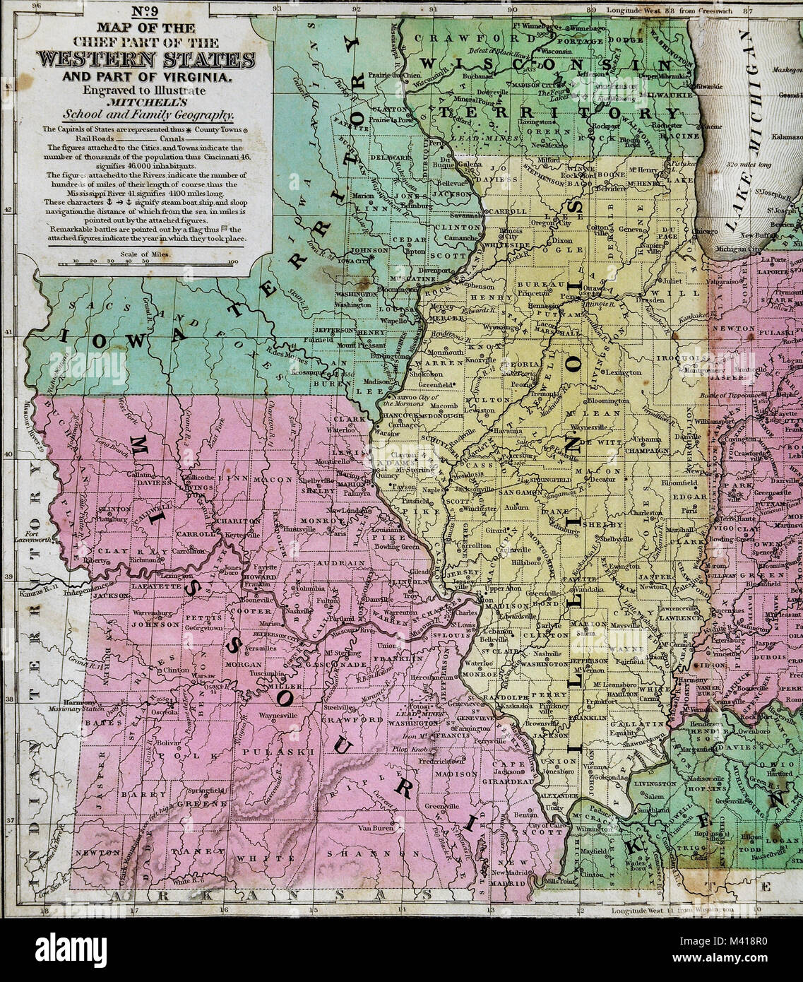 1839 Mitchell Map - Upper Midwest States - Missouri Illinois Indiana Ohio Kentucky Michigan - United States Stock Photohttps://www.alamy.com/image-license-details/?v=1https://www.alamy.com/stock-photo-1839-mitchell-map-upper-midwest-states-missouri-illinois-indiana-ohio-174591172.html
RFM418R0–1839 Mitchell Map - Upper Midwest States - Missouri Illinois Indiana Ohio Kentucky Michigan - United States
 Group of children standing on the northwest corner of Michigan Avenue and Courtois Street outside of F. Hochman Grocery Store Stock Photohttps://www.alamy.com/image-license-details/?v=1https://www.alamy.com/stock-image-group-of-children-standing-on-the-northwest-corner-of-michigan-avenue-162785494.html
RMKCREFJ–Group of children standing on the northwest corner of Michigan Avenue and Courtois Street outside of F. Hochman Grocery Store
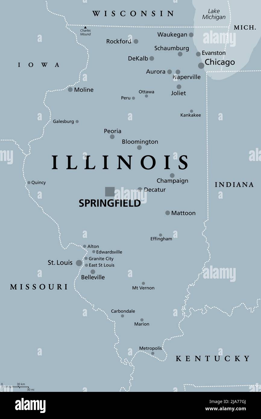 Illinois, IL, gray political map with capital Springfield and metropolitan area Chicago. State in Midwestern region of United States. Stock Photohttps://www.alamy.com/image-license-details/?v=1https://www.alamy.com/illinois-il-gray-political-map-with-capital-springfield-and-metropolitan-area-chicago-state-in-midwestern-region-of-united-states-image470986114.html
RF2JA77GJ–Illinois, IL, gray political map with capital Springfield and metropolitan area Chicago. State in Midwestern region of United States.
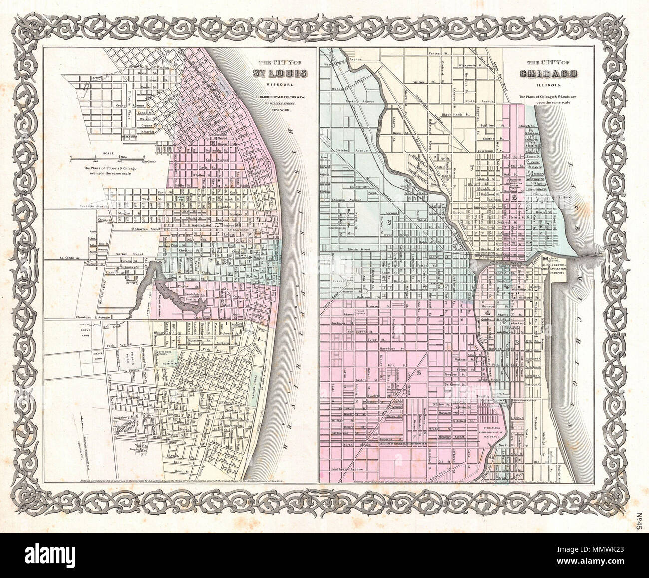 . English: A beautiful 1855 first edition example of Colton's rare two part map of Chicago, Illinois and St. Louis, Missouri. Sheet is divided into two sections. Both are hand colored in pink, green, yellow and blue pastels to identify city wards. Both maps also offer extraordinary detail at level of individual streets and buildings. Both maps are drawn to the same scale. Surrounded by Colton's typical spiral motif border. The right hand map, Chicago, Illinois, depicts from Reuben Street to Lake Michigan and from Center Street to Bridge Street. In addition to all major streets, this map ident Stock Photohttps://www.alamy.com/image-license-details/?v=1https://www.alamy.com/english-a-beautiful-1855-first-edition-example-of-coltons-rare-two-part-map-of-chicago-illinois-and-st-louis-missouri-sheet-is-divided-into-two-sections-both-are-hand-colored-in-pink-green-yellow-and-blue-pastels-to-identify-city-wards-both-maps-also-offer-extraordinary-detail-at-level-of-individual-streets-and-buildings-both-maps-are-drawn-to-the-same-scale-surrounded-by-coltons-typical-spiral-motif-border-the-right-hand-map-chicago-illinois-depicts-from-reuben-street-to-lake-michigan-and-from-center-street-to-bridge-street-in-addition-to-all-major-streets-this-map-ident-image184960555.html
RMMMWK23–. English: A beautiful 1855 first edition example of Colton's rare two part map of Chicago, Illinois and St. Louis, Missouri. Sheet is divided into two sections. Both are hand colored in pink, green, yellow and blue pastels to identify city wards. Both maps also offer extraordinary detail at level of individual streets and buildings. Both maps are drawn to the same scale. Surrounded by Colton's typical spiral motif border. The right hand map, Chicago, Illinois, depicts from Reuben Street to Lake Michigan and from Center Street to Bridge Street. In addition to all major streets, this map ident
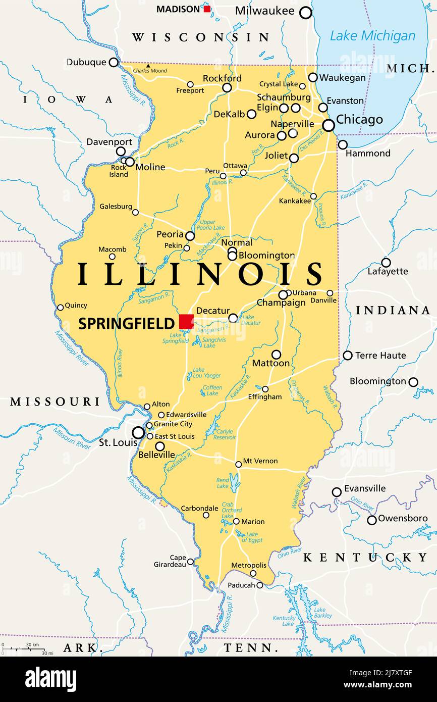 Illinois, IL, political map, with capital Springfield and metropolitan area Chicago. State in the Midwestern region of United States. Land of Lincoln. Stock Photohttps://www.alamy.com/image-license-details/?v=1https://www.alamy.com/illinois-il-political-map-with-capital-springfield-and-metropolitan-area-chicago-state-in-the-midwestern-region-of-united-states-land-of-lincoln-image469572559.html
RF2J7XTGF–Illinois, IL, political map, with capital Springfield and metropolitan area Chicago. State in the Midwestern region of United States. Land of Lincoln.
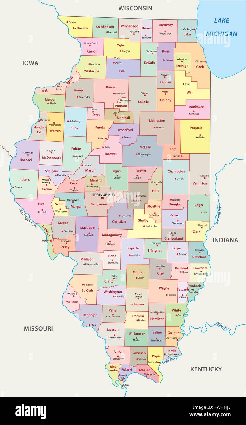 illinois administrative map Stock Vectorhttps://www.alamy.com/image-license-details/?v=1https://www.alamy.com/stock-photo-illinois-administrative-map-101808406.html
RFFWHNJE–illinois administrative map
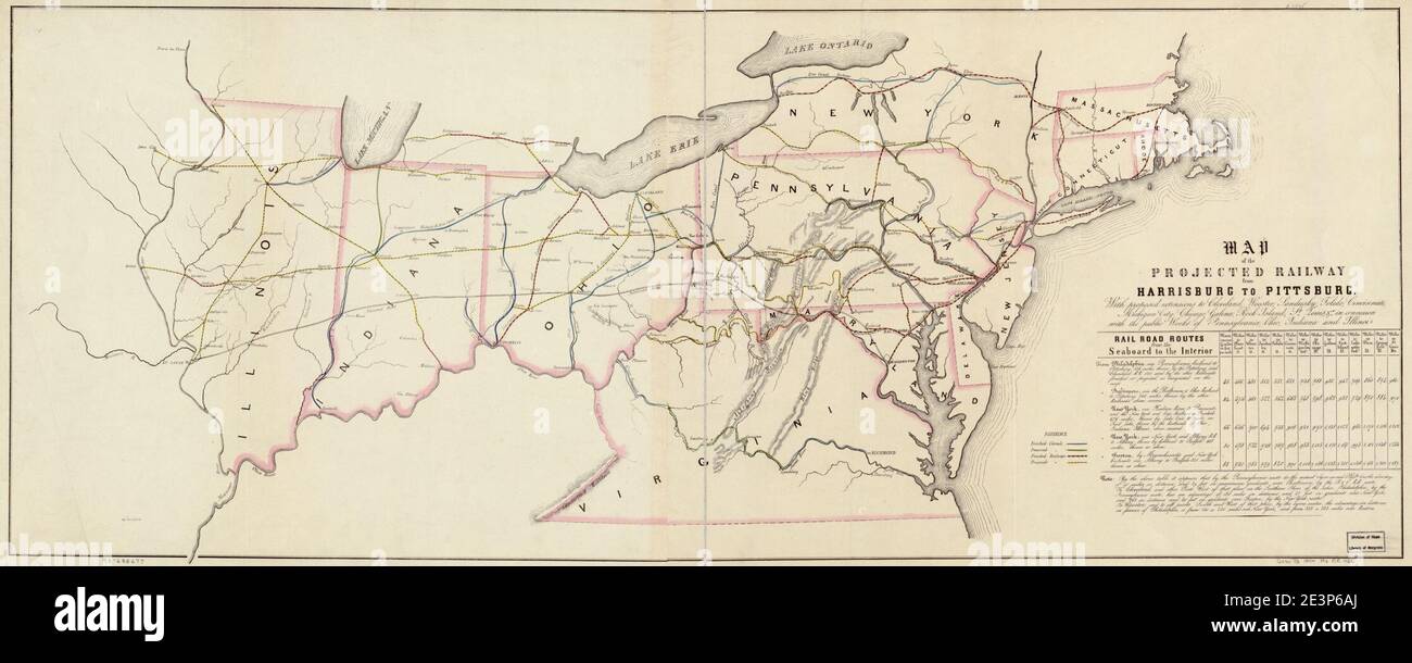 Map of the projected railway from Harrisburg to Pittsburg (sic), with proposed extension to Cleveland, Wooster, Sandusky, Toledo, Cincinnati; Michigan City, Chicago, Galena, Rock Island, St. Louis, Stock Photohttps://www.alamy.com/image-license-details/?v=1https://www.alamy.com/map-of-the-projected-railway-from-harrisburg-to-pittsburg-sic-with-proposed-extension-to-cleveland-wooster-sandusky-toledo-cincinnati-michigan-city-chicago-galena-rock-island-st-louis-image398170378.html
RM2E3P6AJ–Map of the projected railway from Harrisburg to Pittsburg (sic), with proposed extension to Cleveland, Wooster, Sandusky, Toledo, Cincinnati; Michigan City, Chicago, Galena, Rock Island, St. Louis,
 Alumnae Recorder . NEW YORK* <3 ^^ •» % < ? *? °-. Outline Map of the PENNSYLVANIA SHORT LINES. AN EASY LESSON IN GEOGRAPHY. Pennsylvania Lines. Are they the Shortest Route between Chicago andNew York ? Are they the Shortest Route between St.Louis and New York ? Are they the Shortest Routebetween Cincinnati and New York? Are they theShortest Route between Cincinnati and Chicago ? LOOK AT THE MAP.Pennsylvania Lines. Do they reach the Lake resorts of Michigan ? Dothey reach the Mountain resorts of the East? Dothey extend to the famous Ocean resorts of the NewJersey Coast ? Do they make Stock Photohttps://www.alamy.com/image-license-details/?v=1https://www.alamy.com/alumnae-recorder-new-york-lt3-lt-outline-map-of-the-pennsylvania-short-lines-an-easy-lesson-in-geography-pennsylvania-lines-are-they-the-shortest-route-between-chicago-andnew-york-are-they-the-shortest-route-between-stlouis-and-new-york-are-they-the-shortest-routebetween-cincinnati-and-new-york-are-they-theshortest-route-between-cincinnati-and-chicago-look-at-the-mappennsylvania-lines-do-they-reach-the-lake-resorts-of-michigan-dothey-reach-the-mountain-resorts-of-the-east-dothey-extend-to-the-famous-ocean-resorts-of-the-newjersey-coast-do-they-make-image339120493.html
RM2AKM7J5–Alumnae Recorder . NEW YORK* <3 ^^ •» % < ? *? °-. Outline Map of the PENNSYLVANIA SHORT LINES. AN EASY LESSON IN GEOGRAPHY. Pennsylvania Lines. Are they the Shortest Route between Chicago andNew York ? Are they the Shortest Route between St.Louis and New York ? Are they the Shortest Routebetween Cincinnati and New York? Are they theShortest Route between Cincinnati and Chicago ? LOOK AT THE MAP.Pennsylvania Lines. Do they reach the Lake resorts of Michigan ? Dothey reach the Mountain resorts of the East? Dothey extend to the famous Ocean resorts of the NewJersey Coast ? Do they make
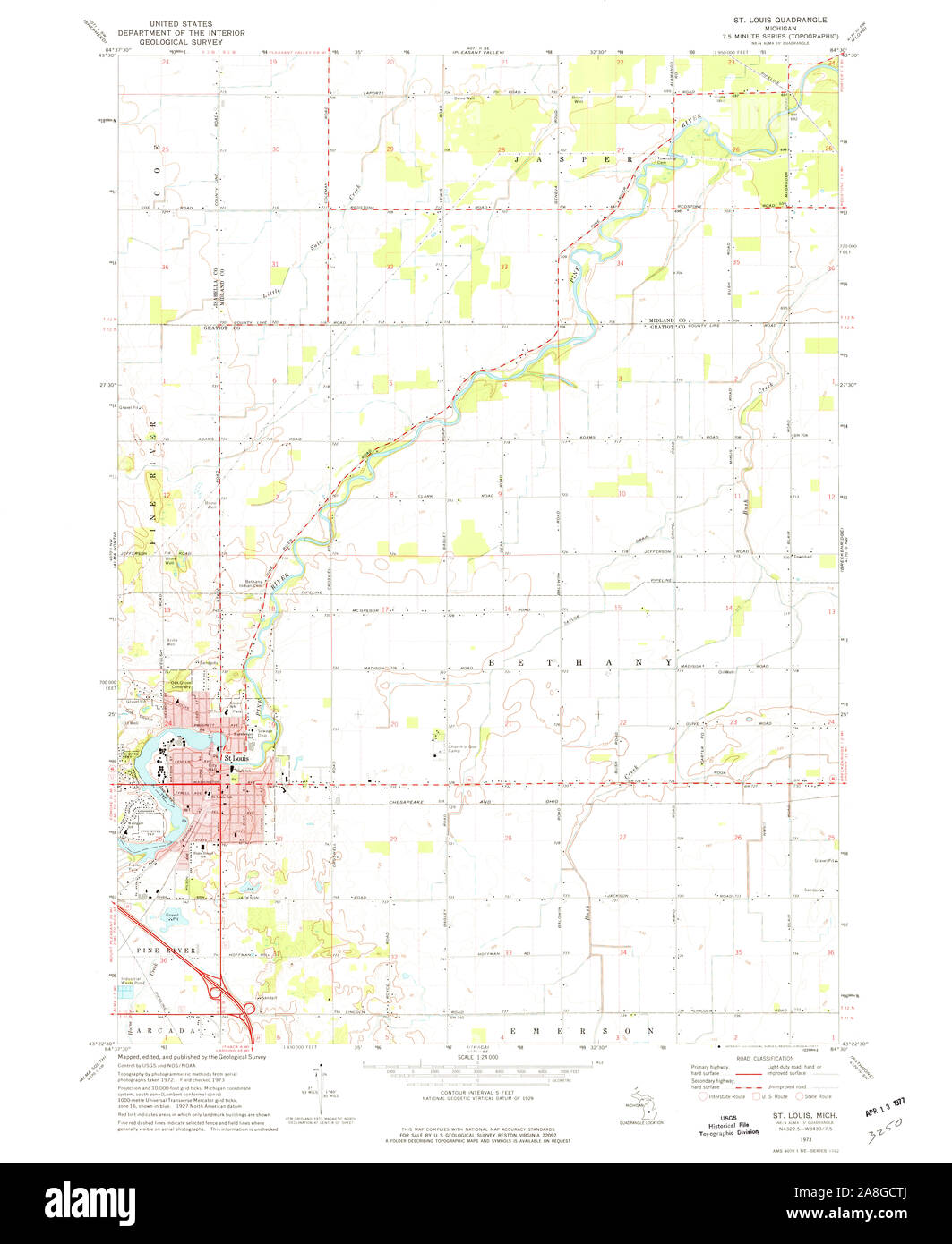 USGS TOPO Map Michigan MI St Louis 277303 1973 24000 Stock Photohttps://www.alamy.com/image-license-details/?v=1https://www.alamy.com/usgs-topo-map-michigan-mi-st-louis-277303-1973-24000-image332275570.html
RM2A8GCTJ–USGS TOPO Map Michigan MI St Louis 277303 1973 24000
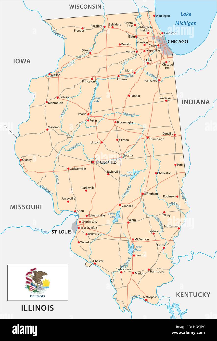 illinois road map with flag Stock Vectorhttps://www.alamy.com/image-license-details/?v=1https://www.alamy.com/stock-photo-illinois-road-map-with-flag-130914531.html
RFHGYJPY–illinois road map with flag
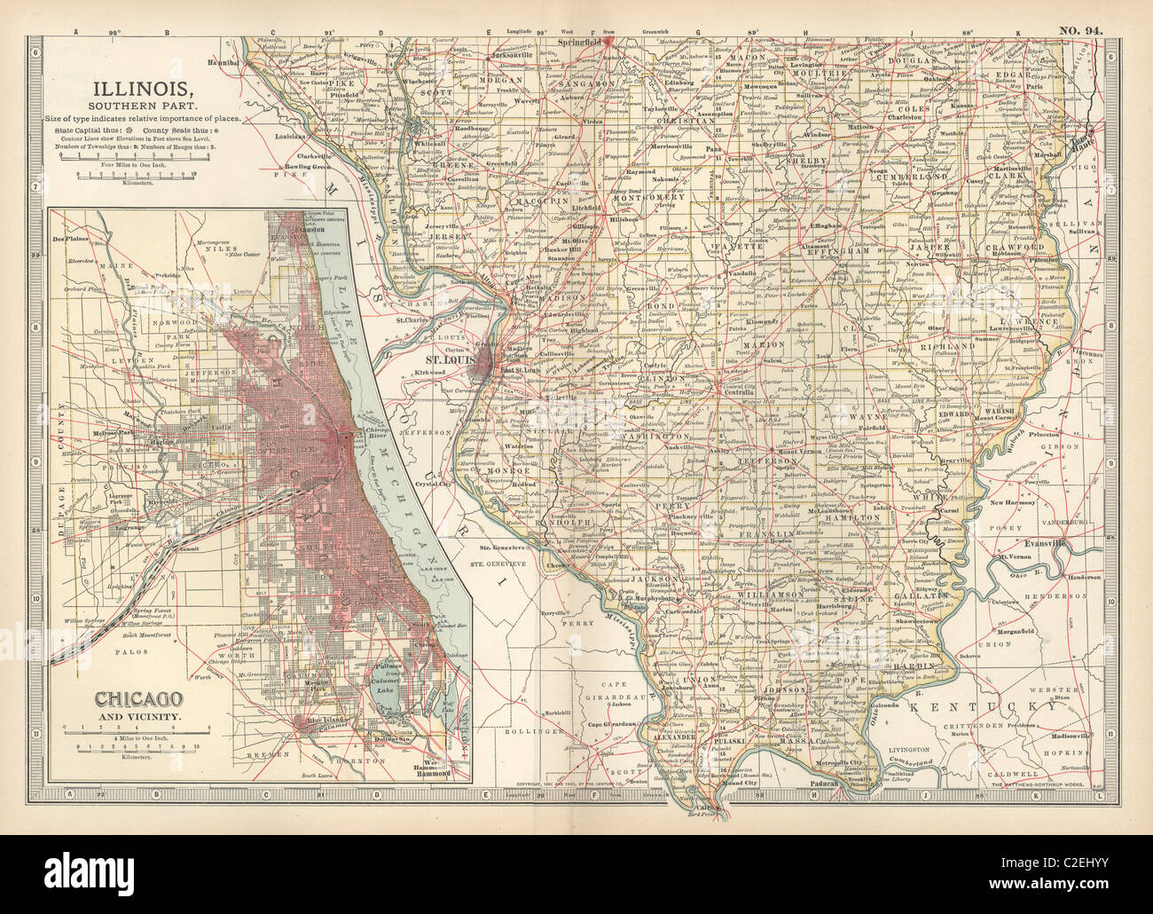 Map of southern Illinois Stock Photohttps://www.alamy.com/image-license-details/?v=1https://www.alamy.com/stock-photo-map-of-southern-illinois-35971487.html
RMC2EHYY–Map of southern Illinois
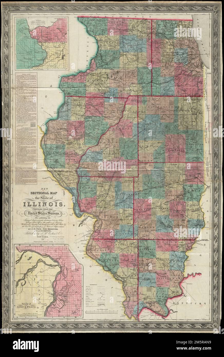 New sectional map of the state of Illinois : compiled from the United States surveys, also exhibiting the internal improvements, distances between towns, villages & post offices, the outlines of prairies, woodlands, marshes & the lands donated to the state by the genl govt. for the purpose of internal improvements. Prime meridian: Washington. Includes notes on public lands, land districts and Illinois & Michigan Canal. Insets: Vicinity of Galena, the lead region, and part of Wisconsin and Iowa -- Vicinity of Alton & St. Louis. Includes vertical profile of the Illinois & Michigan Canal. 'Entere Stock Photohttps://www.alamy.com/image-license-details/?v=1https://www.alamy.com/new-sectional-map-of-the-state-of-illinois-compiled-from-the-united-states-surveys-also-exhibiting-the-internal-improvements-distances-between-towns-villages-post-offices-the-outlines-of-prairies-woodlands-marshes-the-lands-donated-to-the-state-by-the-genl-govt-for-the-purpose-of-internal-improvements-prime-meridian-washington-includes-notes-on-public-lands-land-districts-and-illinois-michigan-canal-insets-vicinity-of-galena-the-lead-region-and-part-of-wisconsin-and-iowa-vicinity-of-alton-st-louis-includes-vertical-profile-of-the-illinois-michigan-canal-entere-image502687285.html
RM2M5RAN9–New sectional map of the state of Illinois : compiled from the United States surveys, also exhibiting the internal improvements, distances between towns, villages & post offices, the outlines of prairies, woodlands, marshes & the lands donated to the state by the genl govt. for the purpose of internal improvements. Prime meridian: Washington. Includes notes on public lands, land districts and Illinois & Michigan Canal. Insets: Vicinity of Galena, the lead region, and part of Wisconsin and Iowa -- Vicinity of Alton & St. Louis. Includes vertical profile of the Illinois & Michigan Canal. 'Entere
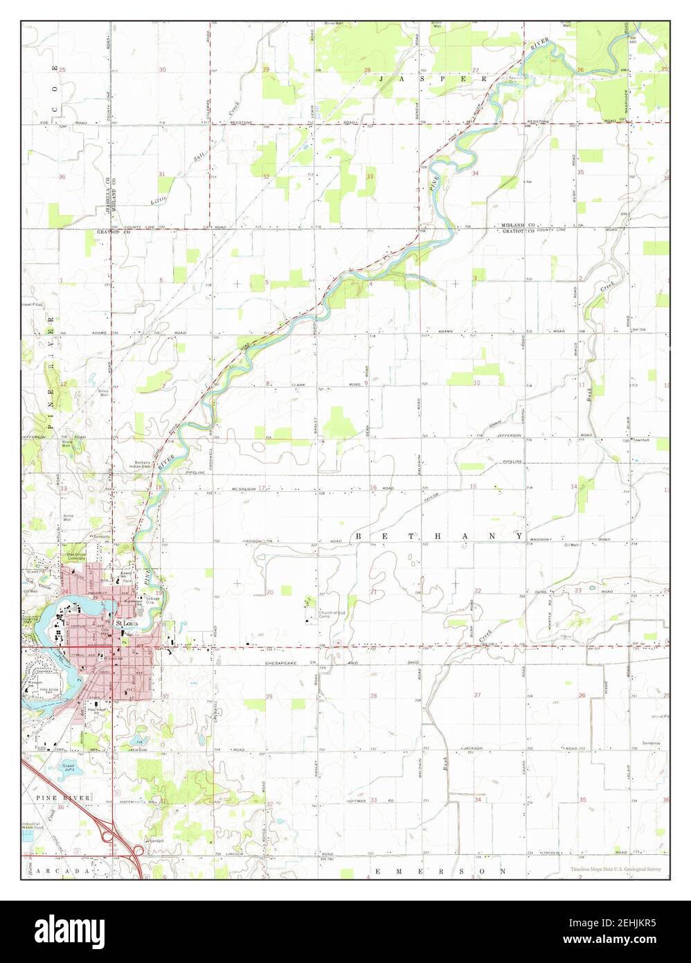 St Louis, Michigan, map 1973, 1:24000, United States of America by Timeless Maps, data U.S. Geological Survey Stock Photohttps://www.alamy.com/image-license-details/?v=1https://www.alamy.com/st-louis-michigan-map-1973-124000-united-states-of-america-by-timeless-maps-data-us-geological-survey-image406698297.html
RM2EHJKR5–St Louis, Michigan, map 1973, 1:24000, United States of America by Timeless Maps, data U.S. Geological Survey
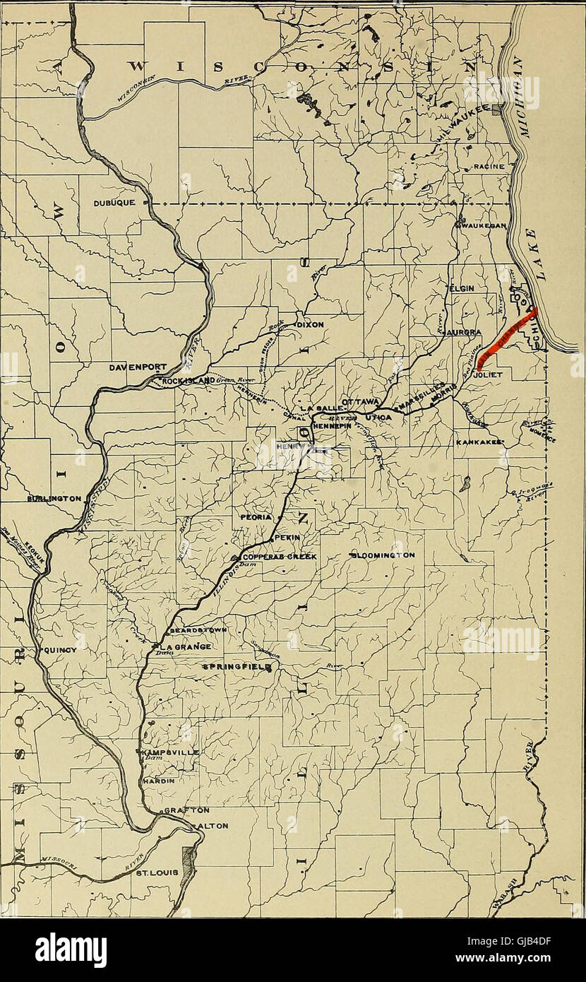 Memorial, presented by the Trustees of the Sanitary District of Chicago to the Congress of the United States - deep waterway from Lake Michigan to the Mississippi River at St. Louis (1904) Stock Photohttps://www.alamy.com/image-license-details/?v=1https://www.alamy.com/stock-photo-memorial-presented-by-the-trustees-of-the-sanitary-district-of-chicago-114571003.html
RMGJB4DF–Memorial, presented by the Trustees of the Sanitary District of Chicago to the Congress of the United States - deep waterway from Lake Michigan to the Mississippi River at St. Louis (1904)
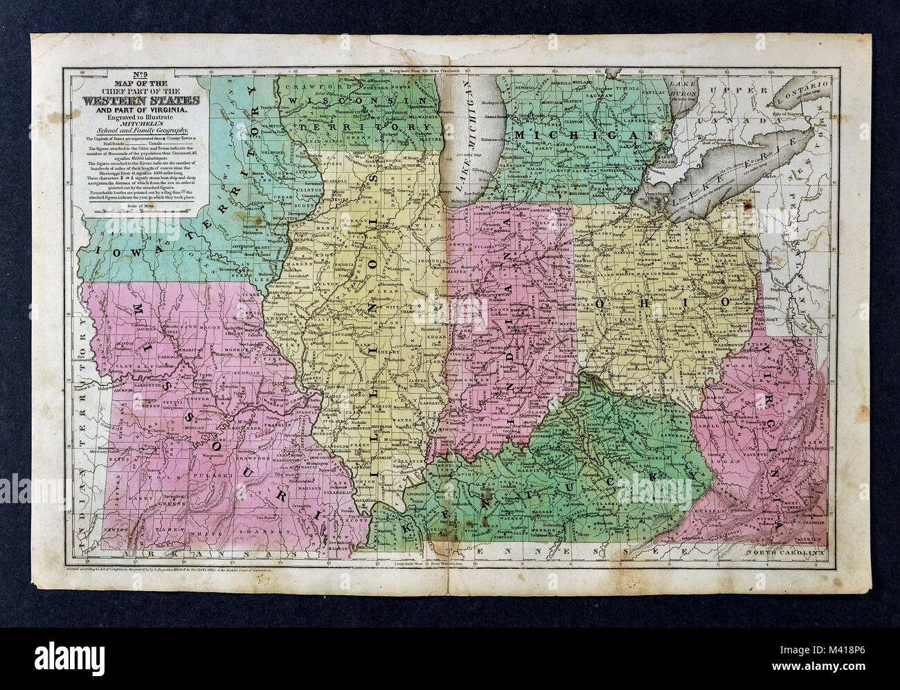 1839 Mitchell Map - Upper Midwest States - Missouri Illinois Indiana Ohio Kentucky Michigan - United States Stock Photohttps://www.alamy.com/image-license-details/?v=1https://www.alamy.com/stock-photo-1839-mitchell-map-upper-midwest-states-missouri-illinois-indiana-ohio-174591150.html
RFM418P6–1839 Mitchell Map - Upper Midwest States - Missouri Illinois Indiana Ohio Kentucky Michigan - United States
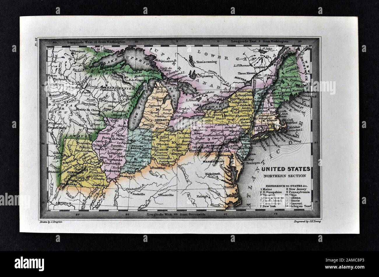 1834 Carey Map United States of America Northeastern and Midwestern States including Maine Massachusetts Connecticut Pennsylvania Ohio Indiana Illinois Missouri Michigan New York Stock Photohttps://www.alamy.com/image-license-details/?v=1https://www.alamy.com/1834-carey-map-united-states-of-america-northeastern-and-midwestern-states-including-maine-massachusetts-connecticut-pennsylvania-ohio-indiana-illinois-missouri-michigan-new-york-image339560427.html
RF2AMC8P3–1834 Carey Map United States of America Northeastern and Midwestern States including Maine Massachusetts Connecticut Pennsylvania Ohio Indiana Illinois Missouri Michigan New York
 . English: A fine and rare 1839 S. A. Mitchell pocket map depicting the states of Ohio, Indiana, Illinois, and Michigan. Insets include, 'Vicinity of Detroit,' 'Vicinity of Cincinnati,' 'Falls of Ohio,' 'Lead Region East of the Mississippi.' A chart on the left-hand side of the map details steamboat routes from: Pittsburg to New Orleans, Louisville to St. Louis, Louisville to Lafayette, St. Louis to Prairie du Chien, St. Louis to Peoria, Buffalo to Detroit, Detroit to Chicago. Dated and copyrighted “Entered according to Act of Congress in the year 1834 by S. Augustus Mitchell in the Clerk’s o Stock Photohttps://www.alamy.com/image-license-details/?v=1https://www.alamy.com/english-a-fine-and-rare-1839-s-a-mitchell-pocket-map-depicting-the-states-of-ohio-indiana-illinois-and-michigan-insets-include-vicinity-of-detroit-vicinity-of-cincinnati-falls-of-ohio-lead-region-east-of-the-mississippi-a-chart-on-the-left-hand-side-of-the-map-details-steamboat-routes-from-pittsburg-to-new-orleans-louisville-to-st-louis-louisville-to-lafayette-st-louis-to-prairie-du-chien-st-louis-to-peoria-buffalo-to-detroit-detroit-to-chicago-dated-and-copyrighted-entered-according-to-act-of-congress-in-the-year-1834-by-s-augustus-mitchell-in-the-clerks-o-image184941046.html
RMMMTP5A–. English: A fine and rare 1839 S. A. Mitchell pocket map depicting the states of Ohio, Indiana, Illinois, and Michigan. Insets include, 'Vicinity of Detroit,' 'Vicinity of Cincinnati,' 'Falls of Ohio,' 'Lead Region East of the Mississippi.' A chart on the left-hand side of the map details steamboat routes from: Pittsburg to New Orleans, Louisville to St. Louis, Louisville to Lafayette, St. Louis to Prairie du Chien, St. Louis to Peoria, Buffalo to Detroit, Detroit to Chicago. Dated and copyrighted “Entered according to Act of Congress in the year 1834 by S. Augustus Mitchell in the Clerk’s o
![. A plan for railroad consolidations, including a discussion of their purpose and practicability . figures are used in the Buffalo System. ;64] MAP 1 New York Central System NEW YORK CENTRAL SYSTEM COLOR NO. NAME ——^— 2 New York Central •■•• 12 Cleveland, Cincinnati, Chicago & St. Louis-^^■^-^—:—z- 13 Michigan Central————=—- 18 Pittsburgh & Lake Erie 40 Toledo & Ohio Central *** 60 Cincinnati Northern•♦♦ «■*»• 4 New York, New Haven & Hartford■• r» I » i« I* I ■ 41 Central New England Mapl. Trackage riglits are shown in the samecolor as the roads having the right, butin a broken line thus: ^^ Stock Photo . A plan for railroad consolidations, including a discussion of their purpose and practicability . figures are used in the Buffalo System. ;64] MAP 1 New York Central System NEW YORK CENTRAL SYSTEM COLOR NO. NAME ——^— 2 New York Central •■•• 12 Cleveland, Cincinnati, Chicago & St. Louis-^^■^-^—:—z- 13 Michigan Central————=—- 18 Pittsburgh & Lake Erie 40 Toledo & Ohio Central *** 60 Cincinnati Northern•♦♦ «■*»• 4 New York, New Haven & Hartford■• r» I » i« I* I ■ 41 Central New England Mapl. Trackage riglits are shown in the samecolor as the roads having the right, butin a broken line thus: ^^ Stock Photo](https://c8.alamy.com/comp/2CRAJCK/a-plan-for-railroad-consolidations-including-a-discussion-of-their-purpose-and-practicability-figures-are-used-in-the-buffalo-system-64-map-1-new-york-central-system-new-york-central-system-color-no-name-2-new-york-central-12-cleveland-cincinnati-chicago-st-louis-z-13-michigan-central=-18-pittsburgh-lake-erie-40-toledo-ohio-central-60-cincinnati-northern-4-new-york-new-haven-hartford-r-i-i-i-i-41-central-new-england-mapl-trackage-riglits-are-shown-in-the-samecolor-as-the-roads-having-the-right-butin-a-broken-line-thus-2CRAJCK.jpg) . A plan for railroad consolidations, including a discussion of their purpose and practicability . figures are used in the Buffalo System. ;64] MAP 1 New York Central System NEW YORK CENTRAL SYSTEM COLOR NO. NAME ——^— 2 New York Central •■•• 12 Cleveland, Cincinnati, Chicago & St. Louis-^^■^-^—:—z- 13 Michigan Central————=—- 18 Pittsburgh & Lake Erie 40 Toledo & Ohio Central *** 60 Cincinnati Northern•♦♦ «■*»• 4 New York, New Haven & Hartford■• r» I » i« I* I ■ 41 Central New England Mapl. Trackage riglits are shown in the samecolor as the roads having the right, butin a broken line thus: ^^ Stock Photohttps://www.alamy.com/image-license-details/?v=1https://www.alamy.com/a-plan-for-railroad-consolidations-including-a-discussion-of-their-purpose-and-practicability-figures-are-used-in-the-buffalo-system-64-map-1-new-york-central-system-new-york-central-system-color-no-name-2-new-york-central-12-cleveland-cincinnati-chicago-st-louis-z-13-michigan-central=-18-pittsburgh-lake-erie-40-toledo-ohio-central-60-cincinnati-northern-4-new-york-new-haven-hartford-r-i-i-i-i-41-central-new-england-mapl-trackage-riglits-are-shown-in-the-samecolor-as-the-roads-having-the-right-butin-a-broken-line-thus-image375788803.html
. A plan for railroad consolidations, including a discussion of their purpose and practicability . figures are used in the Buffalo System. ;64] MAP 1 New York Central System NEW YORK CENTRAL SYSTEM COLOR NO. NAME ——^— 2 New York Central •■•• 12 Cleveland, Cincinnati, Chicago & St. Louis-^^■^-^—:—z- 13 Michigan Central————=—- 18 Pittsburgh & Lake Erie 40 Toledo & Ohio Central *** 60 Cincinnati Northern•♦♦ «■*»• 4 New York, New Haven & Hartford■• r» I » i« I* I ■ 41 Central New England Mapl. Trackage riglits are shown in the samecolor as the roads having the right, butin a broken line thus: ^^ Stock Photohttps://www.alamy.com/image-license-details/?v=1https://www.alamy.com/a-plan-for-railroad-consolidations-including-a-discussion-of-their-purpose-and-practicability-figures-are-used-in-the-buffalo-system-64-map-1-new-york-central-system-new-york-central-system-color-no-name-2-new-york-central-12-cleveland-cincinnati-chicago-st-louis-z-13-michigan-central=-18-pittsburgh-lake-erie-40-toledo-ohio-central-60-cincinnati-northern-4-new-york-new-haven-hartford-r-i-i-i-i-41-central-new-england-mapl-trackage-riglits-are-shown-in-the-samecolor-as-the-roads-having-the-right-butin-a-broken-line-thus-image375788803.htmlRM2CRAJCK–. A plan for railroad consolidations, including a discussion of their purpose and practicability . figures are used in the Buffalo System. ;64] MAP 1 New York Central System NEW YORK CENTRAL SYSTEM COLOR NO. NAME ——^— 2 New York Central •■•• 12 Cleveland, Cincinnati, Chicago & St. Louis-^^■^-^—:—z- 13 Michigan Central————=—- 18 Pittsburgh & Lake Erie 40 Toledo & Ohio Central *** 60 Cincinnati Northern•♦♦ «■*»• 4 New York, New Haven & Hartford■• r» I » i« I* I ■ 41 Central New England Mapl. Trackage riglits are shown in the samecolor as the roads having the right, butin a broken line thus: ^^
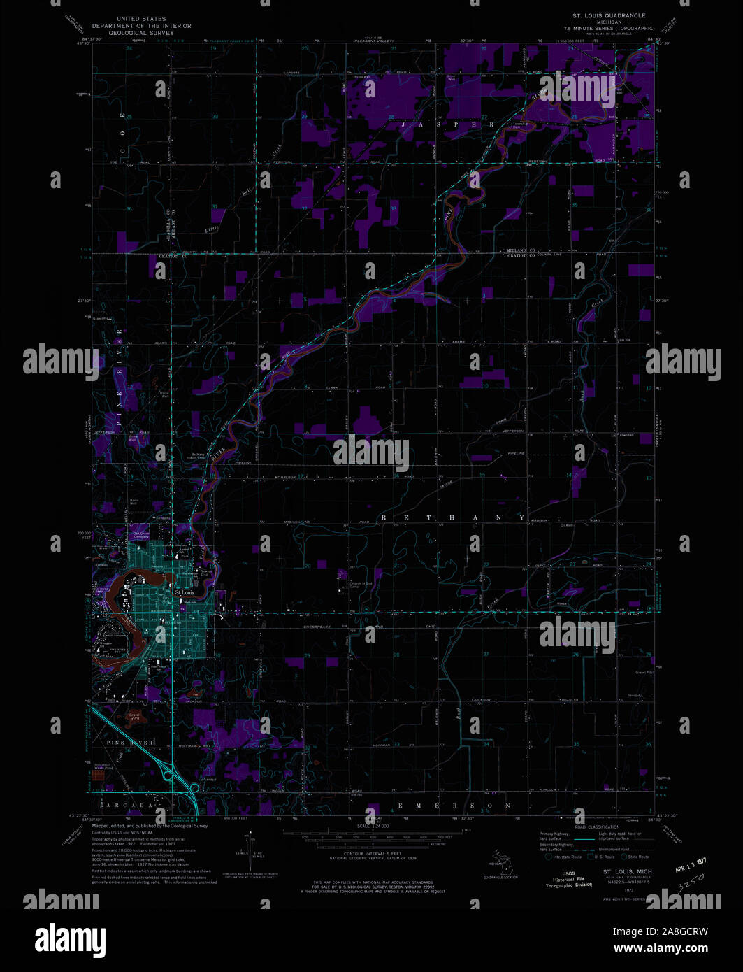 USGS TOPO Map Michigan MI St Louis 277303 1973 24000 Inverted Stock Photohttps://www.alamy.com/image-license-details/?v=1https://www.alamy.com/usgs-topo-map-michigan-mi-st-louis-277303-1973-24000-inverted-image332275549.html
RM2A8GCRW–USGS TOPO Map Michigan MI St Louis 277303 1973 24000 Inverted
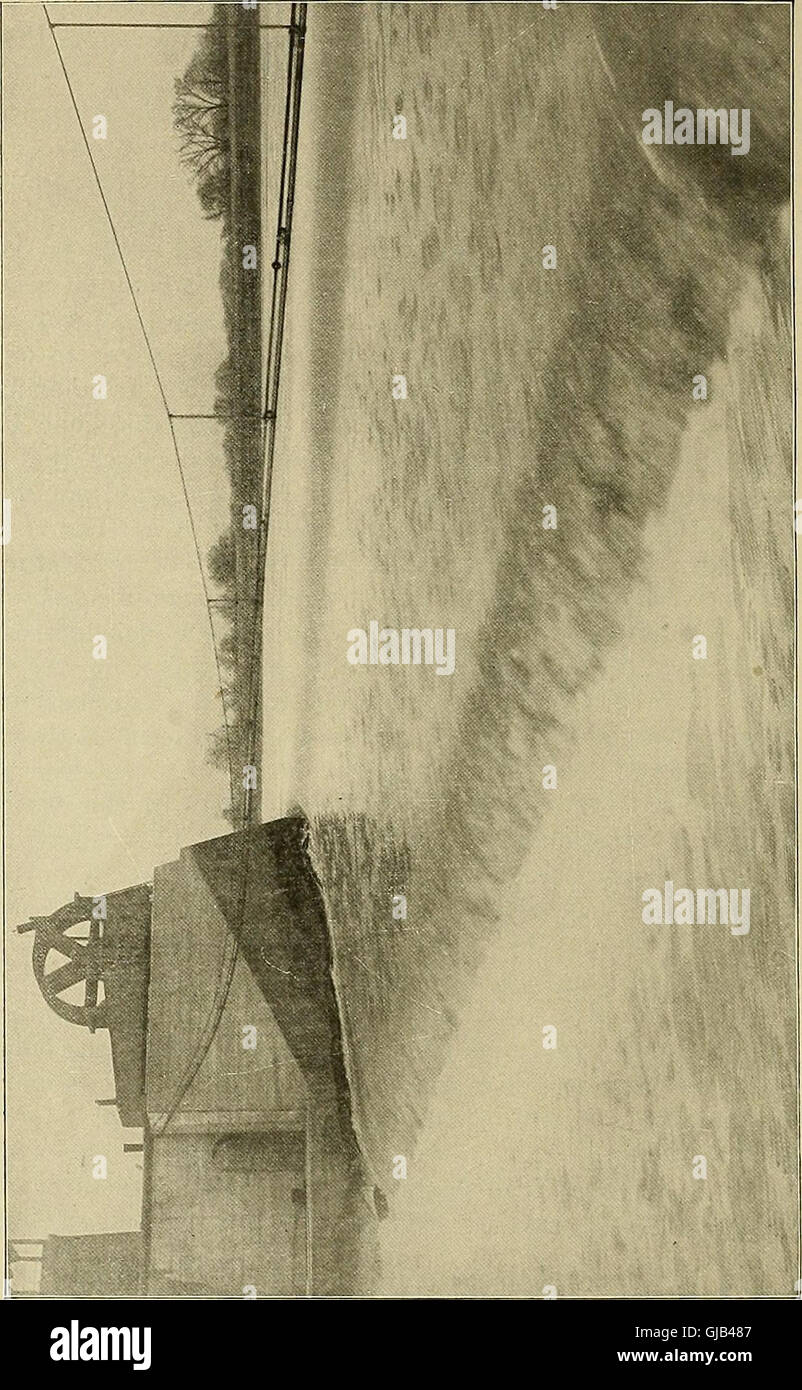 Memorial, presented by the Trustees of the Sanitary District of Chicago to the Congress of the United States - deep waterway from Lake Michigan to the Mississippi River at St. Louis (1904) Stock Photohttps://www.alamy.com/image-license-details/?v=1https://www.alamy.com/stock-photo-memorial-presented-by-the-trustees-of-the-sanitary-district-of-chicago-114570855.html
RMGJB487–Memorial, presented by the Trustees of the Sanitary District of Chicago to the Congress of the United States - deep waterway from Lake Michigan to the Mississippi River at St. Louis (1904)
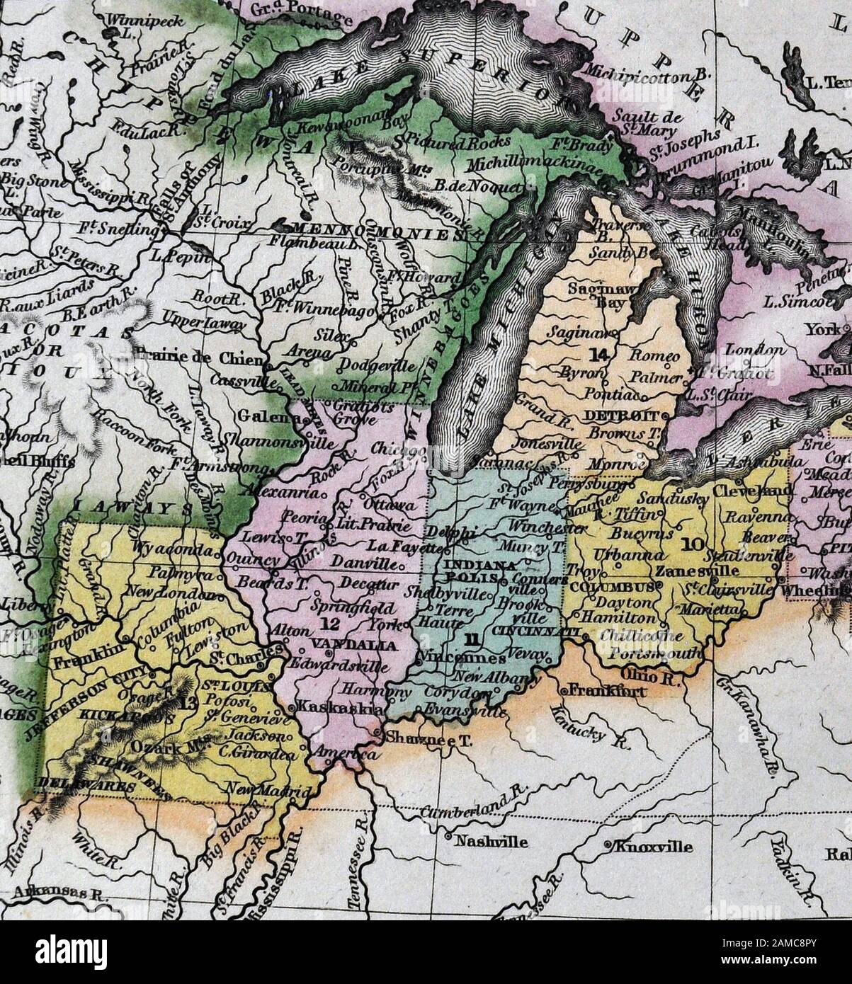 1834 Carey Map United States of America Northeastern and Midwestern States including Maine Massachusetts Connecticut Pennsylvania Ohio Indiana Illinois Missouri Michigan New York Stock Photohttps://www.alamy.com/image-license-details/?v=1https://www.alamy.com/1834-carey-map-united-states-of-america-northeastern-and-midwestern-states-including-maine-massachusetts-connecticut-pennsylvania-ohio-indiana-illinois-missouri-michigan-new-york-image339560451.html
RF2AMC8PY–1834 Carey Map United States of America Northeastern and Midwestern States including Maine Massachusetts Connecticut Pennsylvania Ohio Indiana Illinois Missouri Michigan New York
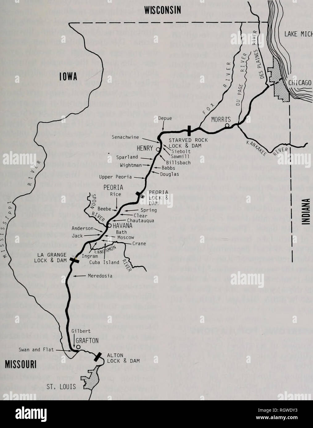 . Bulletin. Natural history; Natural history. Aug. 1979 Bellrose et al.: Waterfowl and the Changing Illinois Valley 7 wooded-vegetation line on the U.S. series of the Woemiann 1902-1904 Army Corps of Engineers 1933 revised maps. LAKE MICHIGAN. Swan and Flat MISSOURI ST, LOUIS 25 MILES 50 0 50 KILOMETERS Fig. 3.—Map of the Illinois River valley, showing many of the bottonnland lakes included in this study of wetland plants, sedimentation, and waterfowl abundance.. Please note that these images are extracted from scanned page images that may have been digitally enhanced for readability - colorat Stock Photohttps://www.alamy.com/image-license-details/?v=1https://www.alamy.com/bulletin-natural-history-natural-history-aug-1979-bellrose-et-al-waterfowl-and-the-changing-illinois-valley-7-wooded-vegetation-line-on-the-us-series-of-the-woemiann-1902-1904-army-corps-of-engineers-1933-revised-maps-lake-michigan-swan-and-flat-missouri-st-louis-25-miles-50-0-50-kilometers-fig-3map-of-the-illinois-river-valley-showing-many-of-the-bottonnland-lakes-included-in-this-study-of-wetland-plants-sedimentation-and-waterfowl-abundance-please-note-that-these-images-are-extracted-from-scanned-page-images-that-may-have-been-digitally-enhanced-for-readability-colorat-image234129031.html
RMRGWDY3–. Bulletin. Natural history; Natural history. Aug. 1979 Bellrose et al.: Waterfowl and the Changing Illinois Valley 7 wooded-vegetation line on the U.S. series of the Woemiann 1902-1904 Army Corps of Engineers 1933 revised maps. LAKE MICHIGAN. Swan and Flat MISSOURI ST, LOUIS 25 MILES 50 0 50 KILOMETERS Fig. 3.—Map of the Illinois River valley, showing many of the bottonnland lakes included in this study of wetland plants, sedimentation, and waterfowl abundance.. Please note that these images are extracted from scanned page images that may have been digitally enhanced for readability - colorat
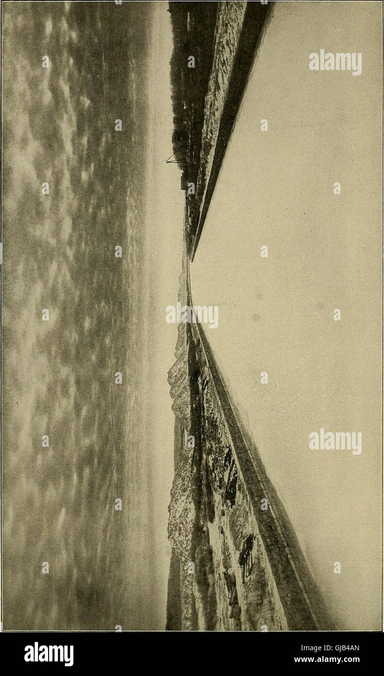 Memorial, presented by the Trustees of the Sanitary District of Chicago to the Congress of the United States - deep waterway from Lake Michigan to the Mississippi River at St. Louis (1904) Stock Photohttps://www.alamy.com/image-license-details/?v=1https://www.alamy.com/stock-photo-memorial-presented-by-the-trustees-of-the-sanitary-district-of-chicago-114570925.html
RMGJB4AN–Memorial, presented by the Trustees of the Sanitary District of Chicago to the Congress of the United States - deep waterway from Lake Michigan to the Mississippi River at St. Louis (1904)
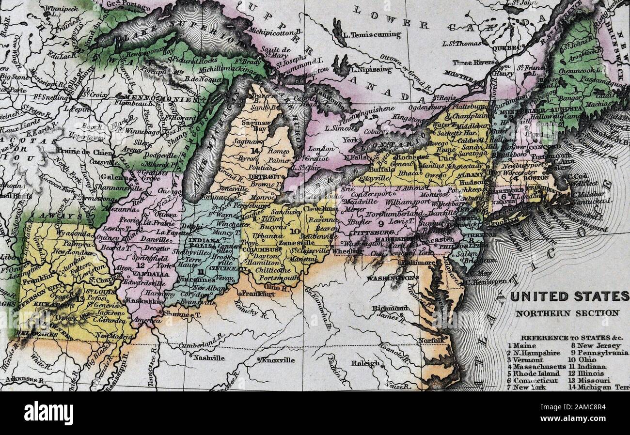 1834 Carey Map United States of America Northeastern and Midwestern States including Maine Massachusetts Connecticut Pennsylvania Ohio Indiana Illinois Missouri Michigan New York Stock Photohttps://www.alamy.com/image-license-details/?v=1https://www.alamy.com/1834-carey-map-united-states-of-america-northeastern-and-midwestern-states-including-maine-massachusetts-connecticut-pennsylvania-ohio-indiana-illinois-missouri-michigan-new-york-image339560456.html
RF2AMC8R4–1834 Carey Map United States of America Northeastern and Midwestern States including Maine Massachusetts Connecticut Pennsylvania Ohio Indiana Illinois Missouri Michigan New York
 . Canadian forest industries 1902-1904. Lumbering; Forests and forestry; Forest products; Wood-pulp industry; Wood-using industries. VI. Canada Lumberman Weekly Edition April 20, 1904 UNITED STATES MANUFACTURERS AND WHOLESALERS WORLD'S FAIR OPEN MAY TO DECEMBER. THE BONSACK LUMBER GO HARDWOODS MAIN ST. AND ST. LOUIS AVE., ST. LOUIS WILL BE OPEN BEFORE, THEN AND AFTER MAP OF FAIR with other, information 10c. WANTED: Ash. Basswood a^nd Elm — AND HAVE FOR SALE All Kinds of Michigan Hardwoods ENGEL LUMBER CO. 402 and 403 Houseman Bldg. - GRAND RAPIDS, MICH. CHARLOTTE HfEbBERLE Wholesale and' Reta Stock Photohttps://www.alamy.com/image-license-details/?v=1https://www.alamy.com/canadian-forest-industries-1902-1904-lumbering-forests-and-forestry-forest-products-wood-pulp-industry-wood-using-industries-vi-canada-lumberman-weekly-edition-april-20-1904-united-states-manufacturers-and-wholesalers-worlds-fair-open-may-to-december-the-bonsack-lumber-go-hardwoods-main-st-and-st-louis-ave-st-louis-will-be-open-before-then-and-after-map-of-fair-with-other-information-10c-wanted-ash-basswood-and-elm-and-have-for-sale-all-kinds-of-michigan-hardwoods-engel-lumber-co-402-and-403-houseman-bldg-grand-rapids-mich-charlotte-hfebberle-wholesale-and-reta-image233606368.html
RMRG1K8G–. Canadian forest industries 1902-1904. Lumbering; Forests and forestry; Forest products; Wood-pulp industry; Wood-using industries. VI. Canada Lumberman Weekly Edition April 20, 1904 UNITED STATES MANUFACTURERS AND WHOLESALERS WORLD'S FAIR OPEN MAY TO DECEMBER. THE BONSACK LUMBER GO HARDWOODS MAIN ST. AND ST. LOUIS AVE., ST. LOUIS WILL BE OPEN BEFORE, THEN AND AFTER MAP OF FAIR with other, information 10c. WANTED: Ash. Basswood a^nd Elm — AND HAVE FOR SALE All Kinds of Michigan Hardwoods ENGEL LUMBER CO. 402 and 403 Houseman Bldg. - GRAND RAPIDS, MICH. CHARLOTTE HfEbBERLE Wholesale and' Reta
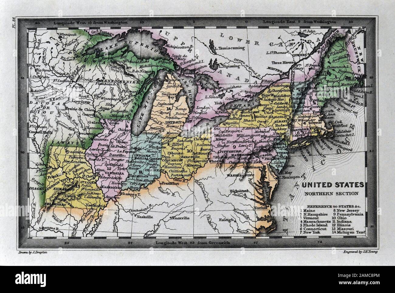 1834 Carey Map United States of America Northeastern and Midwestern States including Maine Massachusetts Connecticut Pennsylvania Ohio Indiana Illinois Missouri Michigan New York Stock Photohttps://www.alamy.com/image-license-details/?v=1https://www.alamy.com/1834-carey-map-united-states-of-america-northeastern-and-midwestern-states-including-maine-massachusetts-connecticut-pennsylvania-ohio-indiana-illinois-missouri-michigan-new-york-image339560444.html
RF2AMC8PM–1834 Carey Map United States of America Northeastern and Midwestern States including Maine Massachusetts Connecticut Pennsylvania Ohio Indiana Illinois Missouri Michigan New York
 . Canadian forest industries 1902-1904. Lumbering; Forests and forestry; Forest products; Wood-pulp industry; Wood-using industries. VI. Canada Lumberman Weekly Edition April 27, 1904 UNITED STATES MANUFACTURERS AND WHOLESALERS WORLD'S FAIR OPEN MAY TO DECEMBER. THE BONSACK LUMBER GO. HARDWOODS MAIN ST. AND ST LOUIS AVE., ST. LOUIS WILL BE OPEN BEFORE, THEN AND AFTER MAP OF FAIR with other, information 10c. WANTED: Ash, Basswood and Elm AND HAVE FOR SALE All Kinds of Michigan Hardwoods ENGEL LUMBER CO. 402 and 403 Houseman Bldg. - GRAND RAPIDS, MICH. GHfRLOTTE ttfE>BERLE Wholesale and Ret Stock Photohttps://www.alamy.com/image-license-details/?v=1https://www.alamy.com/canadian-forest-industries-1902-1904-lumbering-forests-and-forestry-forest-products-wood-pulp-industry-wood-using-industries-vi-canada-lumberman-weekly-edition-april-27-1904-united-states-manufacturers-and-wholesalers-worlds-fair-open-may-to-december-the-bonsack-lumber-go-hardwoods-main-st-and-st-louis-ave-st-louis-will-be-open-before-then-and-after-map-of-fair-with-other-information-10c-wanted-ash-basswood-and-elm-and-have-for-sale-all-kinds-of-michigan-hardwoods-engel-lumber-co-402-and-403-houseman-bldg-grand-rapids-mich-ghfrlotte-ttfegtberle-wholesale-and-ret-image233606303.html
RMRG1K67–. Canadian forest industries 1902-1904. Lumbering; Forests and forestry; Forest products; Wood-pulp industry; Wood-using industries. VI. Canada Lumberman Weekly Edition April 27, 1904 UNITED STATES MANUFACTURERS AND WHOLESALERS WORLD'S FAIR OPEN MAY TO DECEMBER. THE BONSACK LUMBER GO. HARDWOODS MAIN ST. AND ST LOUIS AVE., ST. LOUIS WILL BE OPEN BEFORE, THEN AND AFTER MAP OF FAIR with other, information 10c. WANTED: Ash, Basswood and Elm AND HAVE FOR SALE All Kinds of Michigan Hardwoods ENGEL LUMBER CO. 402 and 403 Houseman Bldg. - GRAND RAPIDS, MICH. GHfRLOTTE ttfE>BERLE Wholesale and Ret
 . The Crystal Falls iron-bearing district of Michigan. Iron ores; Geology; Geology, Stratigraphic; Geology, Stratigraphic. us GEOLOGICAL SURVEY MONOGRAPH XXXVI PL. GEOLOGIC MAP OF FART Ol'^ THl.; LAKE HUI'KRIOH REGKW Compilftd from Official maps of U. S.MiniiPsoUi.aiid Caiiadian Sui^'eys Scah.- Ah* The Afrnamuirr IrotvBrarirtfiSent^ . Ah5 Thf n'usconj>ui f'niliry Stntes Hi KONlA^ â , Ah6 T/tf fmokeelran-Bttifinff Series Ah 7 Hi/- St Louis Sfrifj Ahe The Chippewa VitUey QuartMitei: Ah 9 The Blaek River TrowBearin^ .Srfiwfj Ah 10 The Aiumikie Series Ah 11 TTie Fhlded SrJUata afOinadfU urn STA Stock Photohttps://www.alamy.com/image-license-details/?v=1https://www.alamy.com/the-crystal-falls-iron-bearing-district-of-michigan-iron-ores-geology-geology-stratigraphic-geology-stratigraphic-us-geological-survey-monograph-xxxvi-pl-geologic-map-of-fart-ol-thl-lake-huikrioh-regkw-compilftd-from-official-maps-of-u-sminiipsouiaiid-caiiadian-suieys-scah-ah-the-afrnamuirr-irotvbrarirtfisent-ah5-thf-nusconjgtui-fniliry-stntes-hi-konla-ah6-ttf-fmokeelran-bttifinff-series-ah-7-hi-st-louis-sfrifj-ahe-the-chippewa-vituey-quartmitei-ah-9-the-blaek-river-trowbearin-srfiwfj-ah-10-the-aiumikie-series-ah-11-ttie-fhlded-srjuata-afoinadfu-urn-sta-image232456724.html
RMRE58WT–. The Crystal Falls iron-bearing district of Michigan. Iron ores; Geology; Geology, Stratigraphic; Geology, Stratigraphic. us GEOLOGICAL SURVEY MONOGRAPH XXXVI PL. GEOLOGIC MAP OF FART Ol'^ THl.; LAKE HUI'KRIOH REGKW Compilftd from Official maps of U. S.MiniiPsoUi.aiid Caiiadian Sui^'eys Scah.- Ah* The Afrnamuirr IrotvBrarirtfiSent^ . Ah5 Thf n'usconj>ui f'niliry Stntes Hi KONlA^ â , Ah6 T/tf fmokeelran-Bttifinff Series Ah 7 Hi/- St Louis Sfrifj Ahe The Chippewa VitUey QuartMitei: Ah 9 The Blaek River TrowBearin^ .Srfiwfj Ah 10 The Aiumikie Series Ah 11 TTie Fhlded SrJUata afOinadfU urn STA