Quick filters:
Map of vaughan Stock Photos and Images
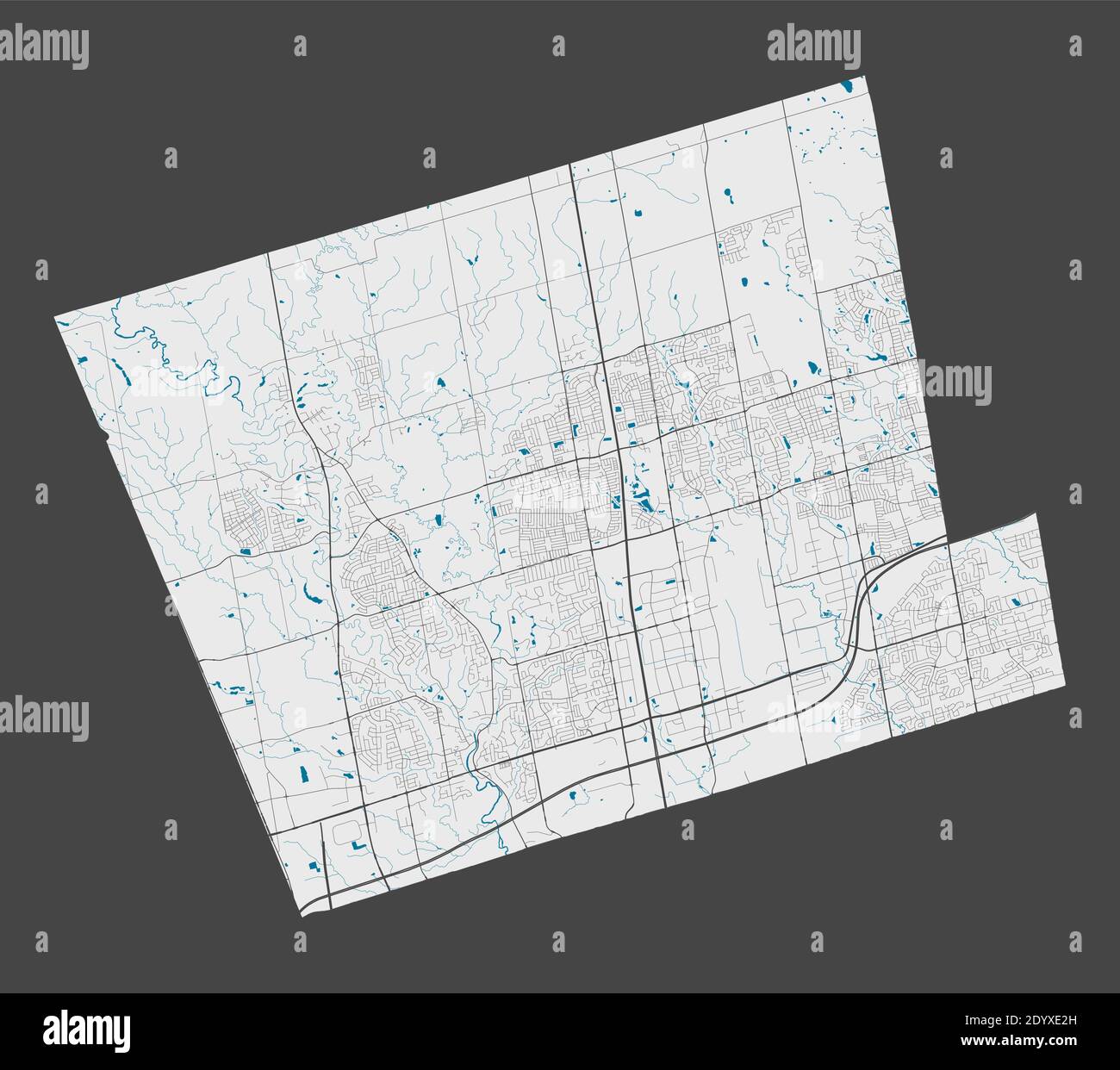 Vaughan map. Detailed map of Vaughan city administrative area. Cityscape panorama. Royalty free vector illustration. Outline map with highways, street Stock Vectorhttps://www.alamy.com/image-license-details/?v=1https://www.alamy.com/vaughan-map-detailed-map-of-vaughan-city-administrative-area-cityscape-panorama-royalty-free-vector-illustration-outline-map-with-highways-street-image395805609.html
RF2DYXE2H–Vaughan map. Detailed map of Vaughan city administrative area. Cityscape panorama. Royalty free vector illustration. Outline map with highways, street
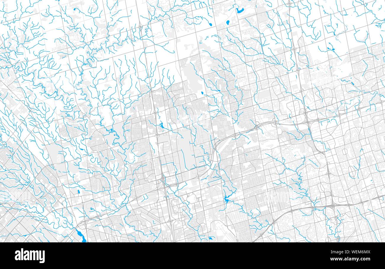 Rich detailed vector area map of Vaughan, Ontario, Canada. Map template for home decor. Stock Vectorhttps://www.alamy.com/image-license-details/?v=1https://www.alamy.com/rich-detailed-vector-area-map-of-vaughan-ontario-canada-map-template-for-home-decor-image267205034.html
RFWEM6MX–Rich detailed vector area map of Vaughan, Ontario, Canada. Map template for home decor.
 A chorographical map of the province of New York in North America, cartographic, Maps, 1849, Sauthier, Claude Joseph, Vaughan, David, active 1849-1864, Pease, Richard H., 1813-1869 Stock Photohttps://www.alamy.com/image-license-details/?v=1https://www.alamy.com/a-chorographical-map-of-the-province-of-new-york-in-north-america-cartographic-maps-1849-sauthier-claude-joseph-vaughan-david-active-1849-1864-pease-richard-h-1813-1869-image376515411.html
RM2CTFN6Y–A chorographical map of the province of New York in North America, cartographic, Maps, 1849, Sauthier, Claude Joseph, Vaughan, David, active 1849-1864, Pease, Richard H., 1813-1869
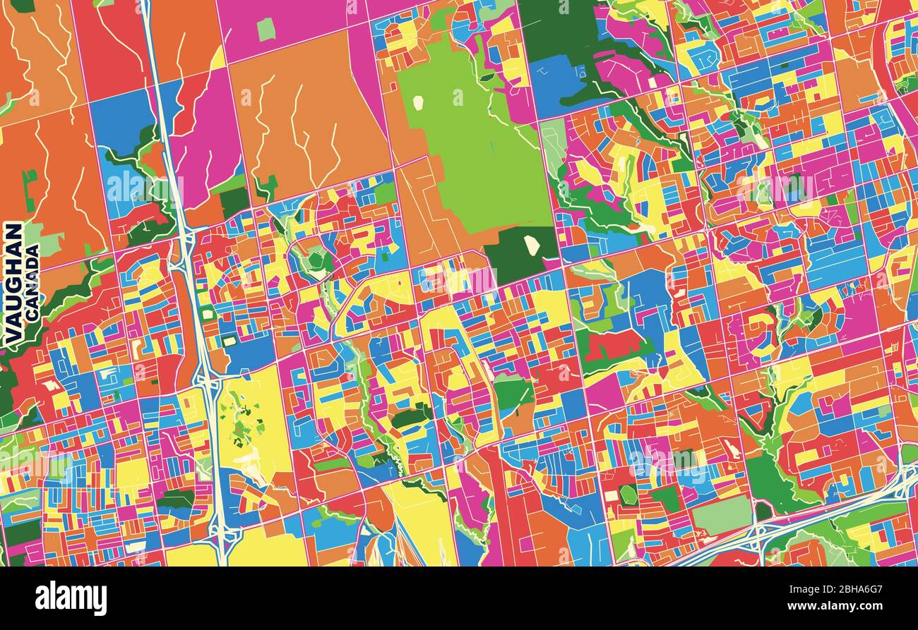 Colorful vector map of Vaughan, Ontario, Canada. Art Map template for selfprinting wall art in landscape format. Stock Vectorhttps://www.alamy.com/image-license-details/?v=1https://www.alamy.com/colorful-vector-map-of-vaughan-ontario-canada-art-map-template-for-selfprinting-wall-art-in-landscape-format-image354881191.html
RF2BHA6G7–Colorful vector map of Vaughan, Ontario, Canada. Art Map template for selfprinting wall art in landscape format.
 Vaughan Island, , AU, Australia, Victoria, S 38 16' 53'', N 143 25' 5'', map, Cartascapes Map published in 2024. Explore Cartascapes, a map revealing Earth's diverse landscapes, cultures, and ecosystems. Journey through time and space, discovering the interconnectedness of our planet's past, present, and future. Stock Photohttps://www.alamy.com/image-license-details/?v=1https://www.alamy.com/vaughan-island-au-australia-victoria-s-38-16-53-n-143-25-5-map-cartascapes-map-published-in-2024-explore-cartascapes-a-map-revealing-earths-diverse-landscapes-cultures-and-ecosystems-journey-through-time-and-space-discovering-the-interconnectedness-of-our-planets-past-present-and-future-image625671184.html
RM2Y9WNYC–Vaughan Island, , AU, Australia, Victoria, S 38 16' 53'', N 143 25' 5'', map, Cartascapes Map published in 2024. Explore Cartascapes, a map revealing Earth's diverse landscapes, cultures, and ecosystems. Journey through time and space, discovering the interconnectedness of our planet's past, present, and future.
 BRECKNOCKSHIRE. 'Brecknoc comitatus pars olim Silurum'. SAXTON/VAUGHAN, 1637 map Stock Photohttps://www.alamy.com/image-license-details/?v=1https://www.alamy.com/stock-photo-brecknockshire-brecknoc-comitatus-pars-olim-silurum-saxtonvaughan-93078138.html
RFFBC236–BRECKNOCKSHIRE. 'Brecknoc comitatus pars olim Silurum'. SAXTON/VAUGHAN, 1637 map
 Map of the Rail-Roads of the State of New York, Prepared under the Direction of Van Rensselaer Richmond, State Engineer and Surveyor, Drawn by David Vaughan, Lithograph by Weed, Parsons & Co., Albany, N.Y., 1861 Stock Photohttps://www.alamy.com/image-license-details/?v=1https://www.alamy.com/map-of-the-rail-roads-of-the-state-of-new-york-prepared-under-the-direction-of-van-rensselaer-richmond-state-engineer-and-surveyor-drawn-by-david-vaughan-lithograph-by-weed-parsons-co-albany-ny-1861-image245561240.html
RMT7E7T8–Map of the Rail-Roads of the State of New York, Prepared under the Direction of Van Rensselaer Richmond, State Engineer and Surveyor, Drawn by David Vaughan, Lithograph by Weed, Parsons & Co., Albany, N.Y., 1861
 Map of the rail-roads of the state of New York 1862 by Vaughan, David, active 1849-1864 Stock Photohttps://www.alamy.com/image-license-details/?v=1https://www.alamy.com/map-of-the-rail-roads-of-the-state-of-new-york-1862-by-vaughan-david-active-1849-1864-image633219005.html
RM2YP5H8D–Map of the rail-roads of the state of New York 1862 by Vaughan, David, active 1849-1864
 Wynford Vaughan-Thomas viewing point, mid-Wales. Stock Photohttps://www.alamy.com/image-license-details/?v=1https://www.alamy.com/stock-photo-wynford-vaughan-thomas-viewing-point-mid-wales-16589220.html
RMAWHY9W–Wynford Vaughan-Thomas viewing point, mid-Wales.
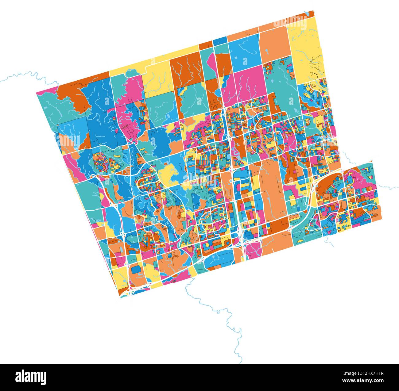 Maps Stock Vectorhttps://www.alamy.com/image-license-details/?v=1https://www.alamy.com/maps-image463617667.html
RF2HX7H1R–Maps
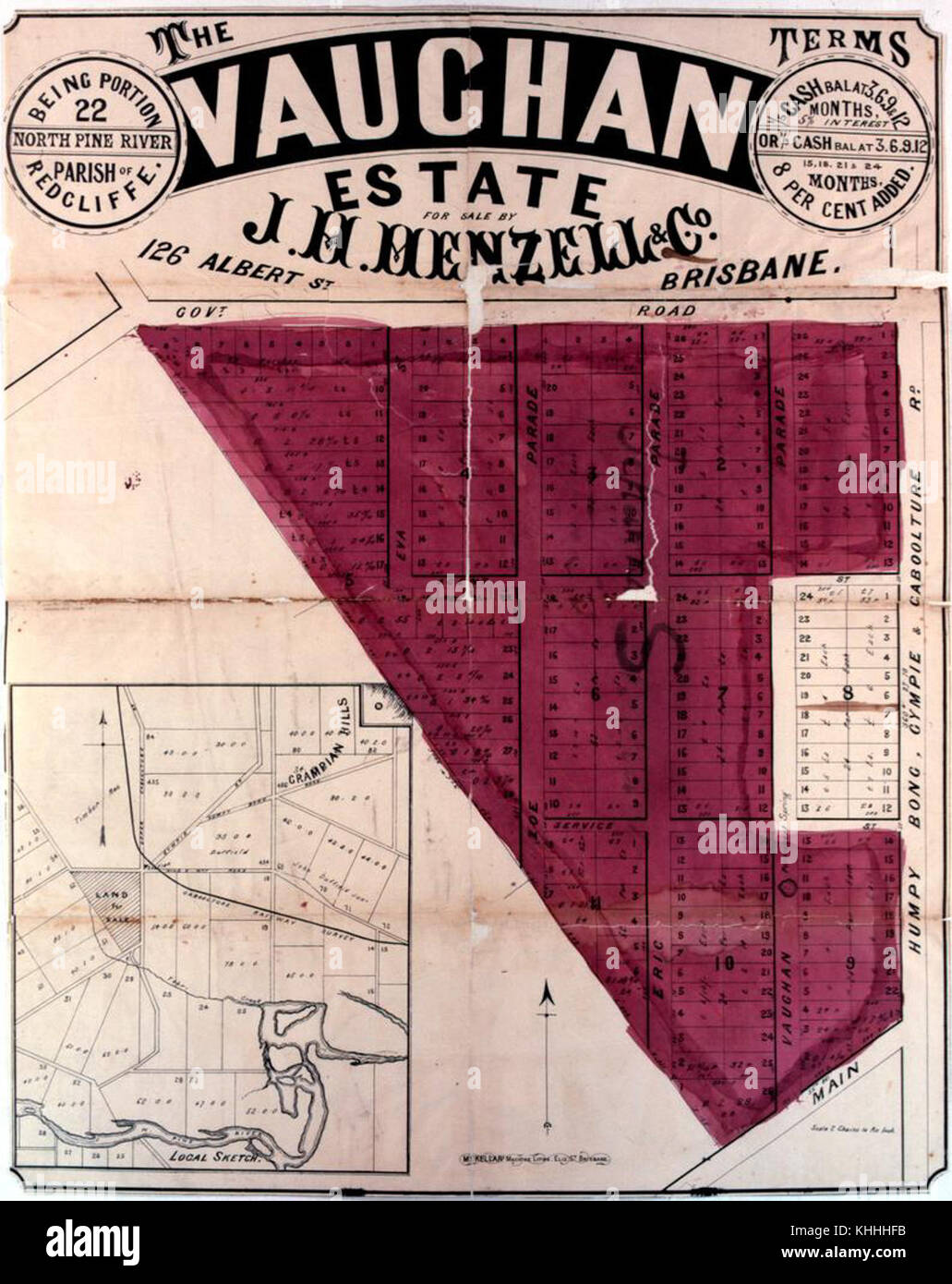 2 200851 Estate map of the Vaughan Estate, Redcliffe, 1890-1900 Stock Photohttps://www.alamy.com/image-license-details/?v=1https://www.alamy.com/stock-image-2-200851-estate-map-of-the-vaughan-estate-redcliffe-1890-1900-165729407.html
RMKHHHFB–2 200851 Estate map of the Vaughan Estate, Redcliffe, 1890-1900
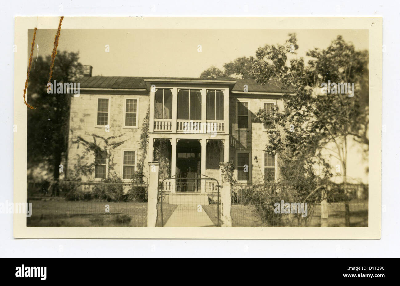 Fannie Ratchford 1970 101 1377 Stock Photohttps://www.alamy.com/image-license-details/?v=1https://www.alamy.com/fannie-ratchford-1970-101-1377-image68755496.html
RMDYT29C–Fannie Ratchford 1970 101 1377
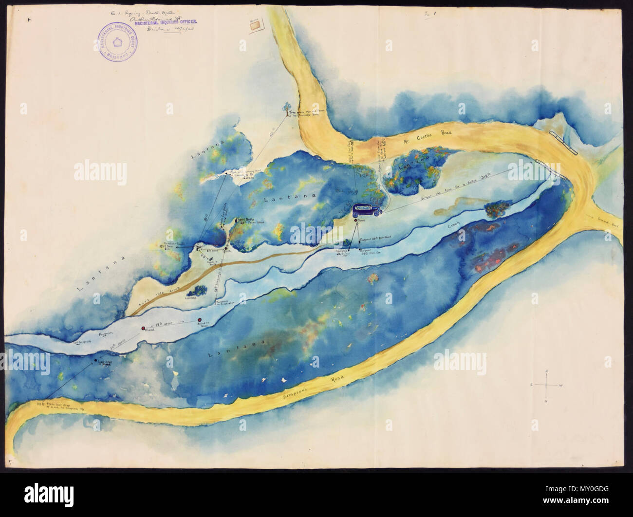 Watercolour Crime Scene Map, 1928. Truth, 28 February 1928 Pretty Girl Shot Dead - Man in Living Tomb It was a veritable sylvan glade in which the girl's murdered body was found, in surroundings dedicated to the elves, fairies and the spirits of the trees, with a rippling brook tricking past a sward of rich green fringed and touched with colour by flowering lantana bushes. It was here that Reginal Vaughan chose to end the life of the girl he loved - into this peaceful have he drove her in a motor car, his brain unbalanced. As the rays of the headlights shot across the sylvan landscape a clo Stock Photohttps://www.alamy.com/image-license-details/?v=1https://www.alamy.com/watercolour-crime-scene-map-1928-truth-28-february-1928-pretty-girl-shot-dead-man-in-living-tomb-it-was-a-veritable-sylvan-glade-in-which-the-girls-murdered-body-was-found-in-surroundings-dedicated-to-the-elves-fairies-and-the-spirits-of-the-trees-with-a-rippling-brook-tricking-past-a-sward-of-rich-green-fringed-and-touched-with-colour-by-flowering-lantana-bushes-it-was-here-that-reginal-vaughan-chose-to-end-the-life-of-the-girl-he-loved-into-this-peaceful-have-he-drove-her-in-a-motor-car-his-brain-unbalanced-as-the-rays-of-the-headlights-shot-across-the-sylvan-landscape-a-clo-image188712316.html
RMMY0GDG–Watercolour Crime Scene Map, 1928. Truth, 28 February 1928 Pretty Girl Shot Dead - Man in Living Tomb It was a veritable sylvan glade in which the girl's murdered body was found, in surroundings dedicated to the elves, fairies and the spirits of the trees, with a rippling brook tricking past a sward of rich green fringed and touched with colour by flowering lantana bushes. It was here that Reginal Vaughan chose to end the life of the girl he loved - into this peaceful have he drove her in a motor car, his brain unbalanced. As the rays of the headlights shot across the sylvan landscape a clo
 Mappe of the World, drawn in 1628. . A New and accurate Mappe of the World. London : Nicholas Bourne, 1628. Source: G.6519 (map). Language: English. Author: Vaughan, Ro. Stock Photohttps://www.alamy.com/image-license-details/?v=1https://www.alamy.com/mappe-of-the-world-drawn-in-1628-a-new-and-accurate-mappe-of-the-world-london-nicholas-bourne-1628-source-g6519-map-language-english-author-vaughan-ro-image226774732.html
RMR4XDDG–Mappe of the World, drawn in 1628. . A New and accurate Mappe of the World. London : Nicholas Bourne, 1628. Source: G.6519 (map). Language: English. Author: Vaughan, Ro.
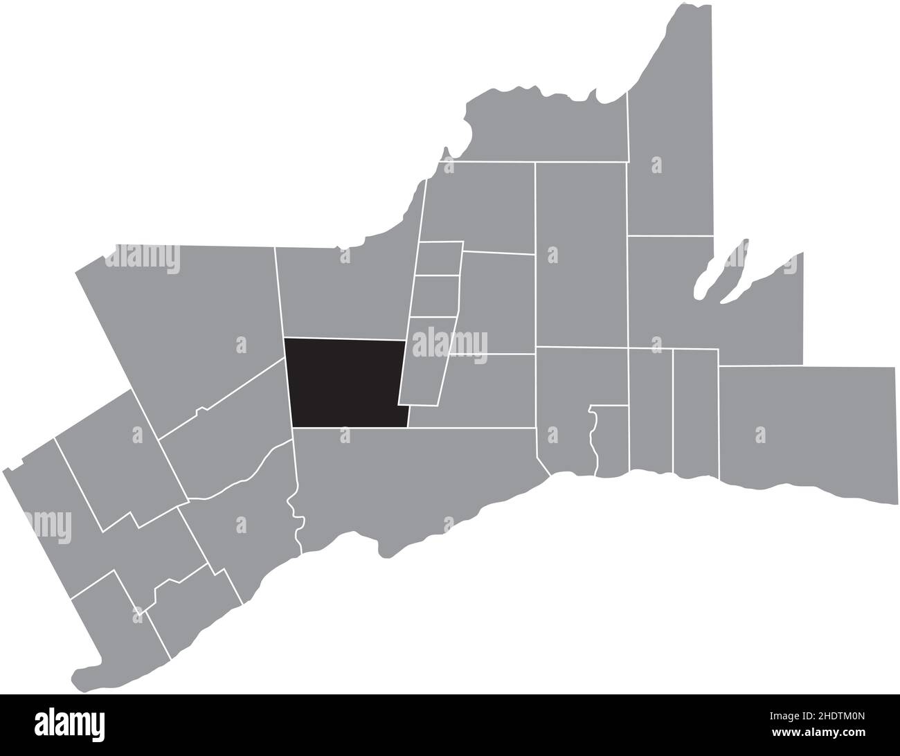 Black flat blank highlighted location map of the VAUGHAN MUNICIPALITY inside gray administrative map of Greater Toronto Area Stock Vectorhttps://www.alamy.com/image-license-details/?v=1https://www.alamy.com/black-flat-blank-highlighted-location-map-of-the-vaughan-municipality-inside-gray-administrative-map-of-greater-toronto-area-image456002645.html
RF2HDTM0N–Black flat blank highlighted location map of the VAUGHAN MUNICIPALITY inside gray administrative map of Greater Toronto Area
![Letter from John Stickney to William Vaughan about a proposed iron bridge at Datchet Author Stickney, John 8.28.e.2. Place of publication: [England] Publisher: John Stickney, Date of publication: 1799. Item type: 1 sheet Medium: manuscript Dimensions: 26 x 23 cm Former owner: George III, King of Great Britain, 1738-1820 Stock Photo Letter from John Stickney to William Vaughan about a proposed iron bridge at Datchet Author Stickney, John 8.28.e.2. Place of publication: [England] Publisher: John Stickney, Date of publication: 1799. Item type: 1 sheet Medium: manuscript Dimensions: 26 x 23 cm Former owner: George III, King of Great Britain, 1738-1820 Stock Photo](https://c8.alamy.com/comp/2E9FKT5/letter-from-john-stickney-to-william-vaughan-about-a-proposed-iron-bridge-at-datchet-author-stickney-john-828e2-place-of-publication-england-publisher-john-stickney-date-of-publication-1799-item-type-1-sheet-medium-manuscript-dimensions-26-x-23-cm-former-owner-george-iii-king-of-great-britain-1738-1820-2E9FKT5.jpg) Letter from John Stickney to William Vaughan about a proposed iron bridge at Datchet Author Stickney, John 8.28.e.2. Place of publication: [England] Publisher: John Stickney, Date of publication: 1799. Item type: 1 sheet Medium: manuscript Dimensions: 26 x 23 cm Former owner: George III, King of Great Britain, 1738-1820 Stock Photohttps://www.alamy.com/image-license-details/?v=1https://www.alamy.com/letter-from-john-stickney-to-william-vaughan-about-a-proposed-iron-bridge-at-datchet-author-stickney-john-828e2-place-of-publication-england-publisher-john-stickney-date-of-publication-1799-item-type-1-sheet-medium-manuscript-dimensions-26-x-23-cm-former-owner-george-iii-king-of-great-britain-1738-1820-image401715221.html
Letter from John Stickney to William Vaughan about a proposed iron bridge at Datchet Author Stickney, John 8.28.e.2. Place of publication: [England] Publisher: John Stickney, Date of publication: 1799. Item type: 1 sheet Medium: manuscript Dimensions: 26 x 23 cm Former owner: George III, King of Great Britain, 1738-1820 Stock Photohttps://www.alamy.com/image-license-details/?v=1https://www.alamy.com/letter-from-john-stickney-to-william-vaughan-about-a-proposed-iron-bridge-at-datchet-author-stickney-john-828e2-place-of-publication-england-publisher-john-stickney-date-of-publication-1799-item-type-1-sheet-medium-manuscript-dimensions-26-x-23-cm-former-owner-george-iii-king-of-great-britain-1738-1820-image401715221.htmlRM2E9FKT5–Letter from John Stickney to William Vaughan about a proposed iron bridge at Datchet Author Stickney, John 8.28.e.2. Place of publication: [England] Publisher: John Stickney, Date of publication: 1799. Item type: 1 sheet Medium: manuscript Dimensions: 26 x 23 cm Former owner: George III, King of Great Britain, 1738-1820
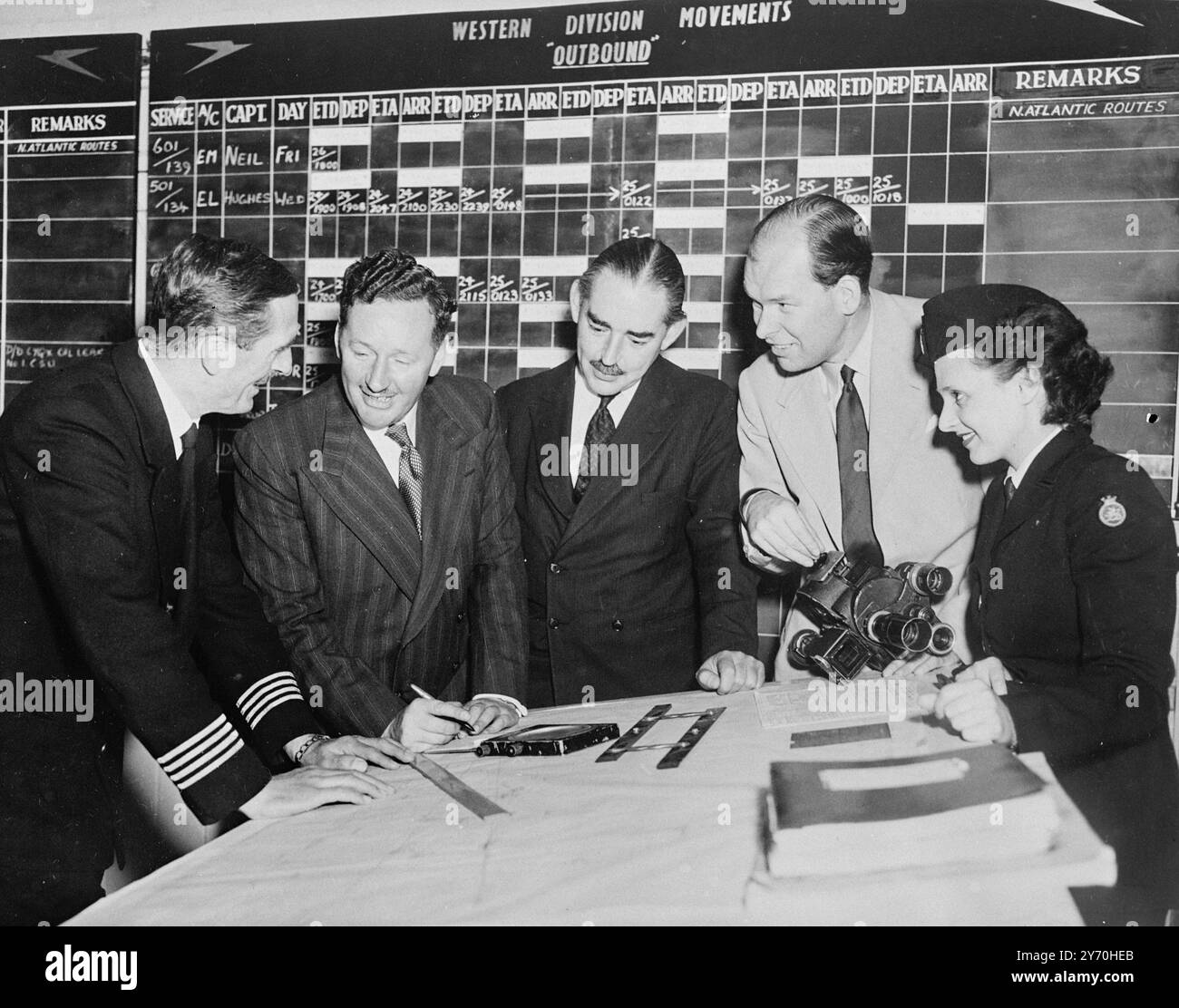 EIGHT -DAY TOUR - ROUND THE WORLD . Though he won't circle the globe as speedily as his voice , Wynford Vaughan Thomas , British Broadcasting Corporation Commentator , will do the next best - he will fly round the world in eight days by normal Commonwealth air transport lines . Accompanied by television cameraman Charles de Jaeger , he starts from London Airport on September 19 to Sydney on the B.O.A.C.- Quanta's service . from there they cross the pacific by British Commonwealth Pacific Airlines to Vancouver , Canada will be spanned by Trans- Canada Airlines and at Montreal the pair pick Stock Photohttps://www.alamy.com/image-license-details/?v=1https://www.alamy.com/eight-day-tour-round-the-world-though-he-wont-circle-the-globe-as-speedily-as-his-voice-wynford-vaughan-thomas-british-broadcasting-corporation-commentator-will-do-the-next-best-he-will-fly-round-the-world-in-eight-days-by-normal-commonwealth-air-transport-lines-accompanied-by-television-cameraman-charles-de-jaeger-he-starts-from-london-airport-on-september-19-to-sydney-on-the-boac-quantas-service-from-there-they-cross-the-pacific-by-british-commonwealth-pacific-airlines-to-vancouver-canada-will-be-spanned-by-trans-canada-airlines-and-at-montreal-the-pair-pick-image623889571.html
RM2Y70HEB–EIGHT -DAY TOUR - ROUND THE WORLD . Though he won't circle the globe as speedily as his voice , Wynford Vaughan Thomas , British Broadcasting Corporation Commentator , will do the next best - he will fly round the world in eight days by normal Commonwealth air transport lines . Accompanied by television cameraman Charles de Jaeger , he starts from London Airport on September 19 to Sydney on the B.O.A.C.- Quanta's service . from there they cross the pacific by British Commonwealth Pacific Airlines to Vancouver , Canada will be spanned by Trans- Canada Airlines and at Montreal the pair pick
 Whitby and Vaughan city (Canada, Ontario Province) map vector illustration, scribble sketch map Stock Vectorhttps://www.alamy.com/image-license-details/?v=1https://www.alamy.com/whitby-and-vaughan-city-canada-ontario-province-map-vector-illustration-scribble-sketch-map-image599834837.html
RF2WRTRCN–Whitby and Vaughan city (Canada, Ontario Province) map vector illustration, scribble sketch map
 . The Quarterly journal of the Geological Society of London. iff sheet of the 1-inch Geological-Survey map;and although the advisability of subdividing the Limestone anddetermining the horizon of the volcanic rocks had been discussed,no opportunity had arisen of carrying out the work. With theassistance of Mr. Vaughan, the Authors appeared to have provedthat the tuffs all occurred at the same horizon. He (the speaker)had suggested that the vent lay somewhere to the west, probablyunder the Bristol Channel. Whether tuffs could have been soevenly and widely distributed from one vent only was perh Stock Photohttps://www.alamy.com/image-license-details/?v=1https://www.alamy.com/the-quarterly-journal-of-the-geological-society-of-london-iff-sheet-of-the-1-inch-geological-survey-mapand-although-the-advisability-of-subdividing-the-limestone-anddetermining-the-horizon-of-the-volcanic-rocks-had-been-discussedno-opportunity-had-arisen-of-carrying-out-the-work-with-theassistance-of-mr-vaughan-the-authors-appeared-to-have-provedthat-the-tuffs-all-occurred-at-the-same-horizon-he-the-speakerhad-suggested-that-the-vent-lay-somewhere-to-the-west-probablyunder-the-bristol-channel-whether-tuffs-could-have-been-soevenly-and-widely-distributed-from-one-vent-only-was-perh-image336651033.html
RM2AFKNR5–. The Quarterly journal of the Geological Society of London. iff sheet of the 1-inch Geological-Survey map;and although the advisability of subdividing the Limestone anddetermining the horizon of the volcanic rocks had been discussed,no opportunity had arisen of carrying out the work. With theassistance of Mr. Vaughan, the Authors appeared to have provedthat the tuffs all occurred at the same horizon. He (the speaker)had suggested that the vent lay somewhere to the west, probablyunder the Bristol Channel. Whether tuffs could have been soevenly and widely distributed from one vent only was perh
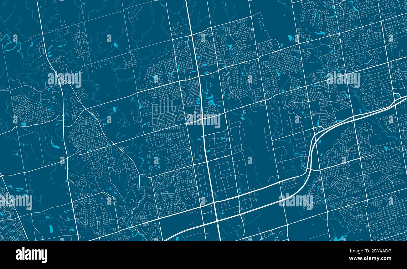 Detailed map of Vaughan city administrative area. Royalty free vector illustration. Cityscape panorama. Decorative graphic tourist map of Vaughan terr Stock Vectorhttps://www.alamy.com/image-license-details/?v=1https://www.alamy.com/detailed-map-of-vaughan-city-administrative-area-royalty-free-vector-illustration-cityscape-panorama-decorative-graphic-tourist-map-of-vaughan-terr-image395802780.html
RF2DYXADG–Detailed map of Vaughan city administrative area. Royalty free vector illustration. Cityscape panorama. Decorative graphic tourist map of Vaughan terr
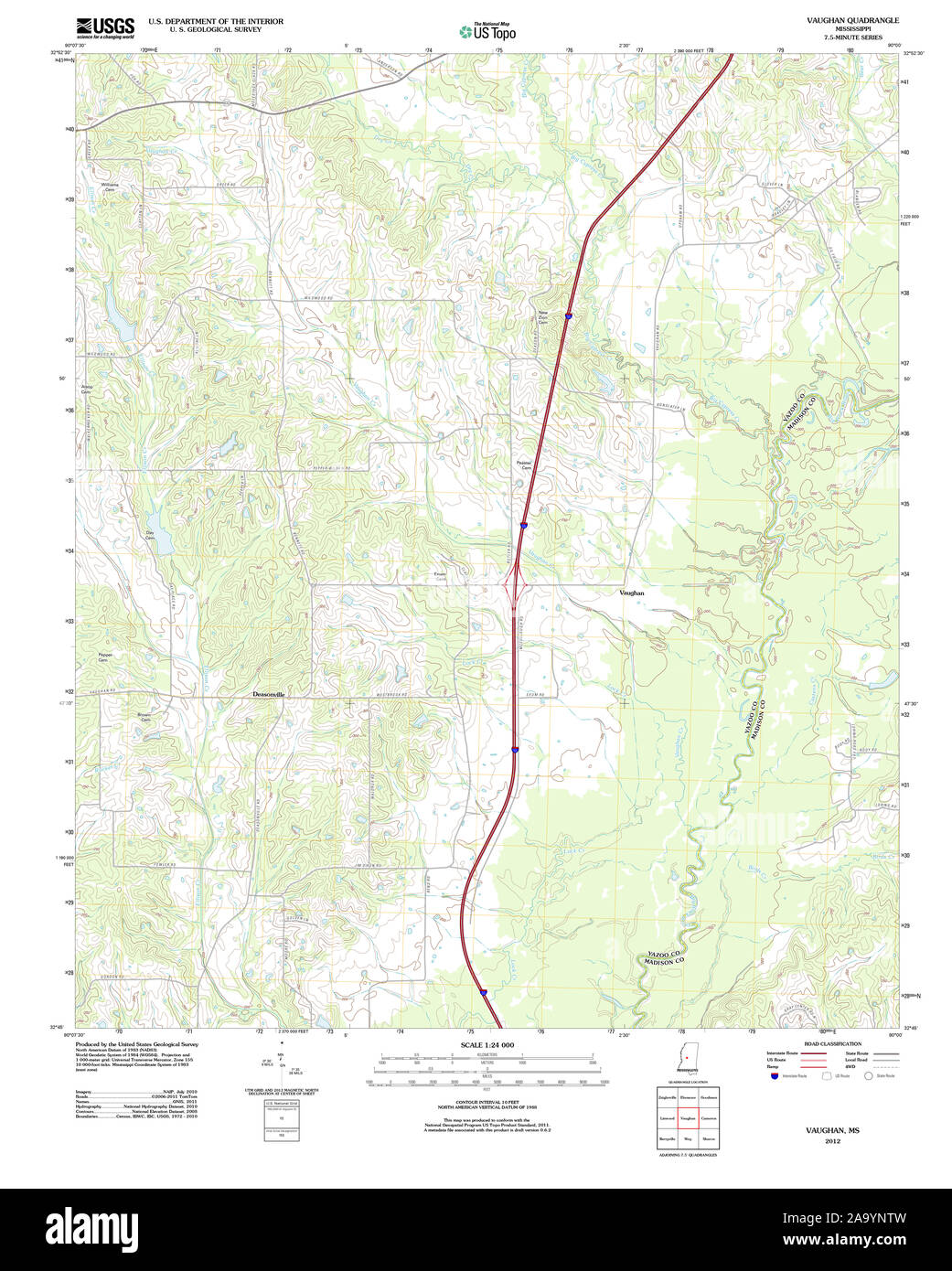 USGS TOPO Map Mississippi MS Vaughan 20120508 TM Restoration Stock Photohttps://www.alamy.com/image-license-details/?v=1https://www.alamy.com/usgs-topo-map-mississippi-ms-vaughan-20120508-tm-restoration-image333138761.html
RM2A9YNTW–USGS TOPO Map Mississippi MS Vaughan 20120508 TM Restoration
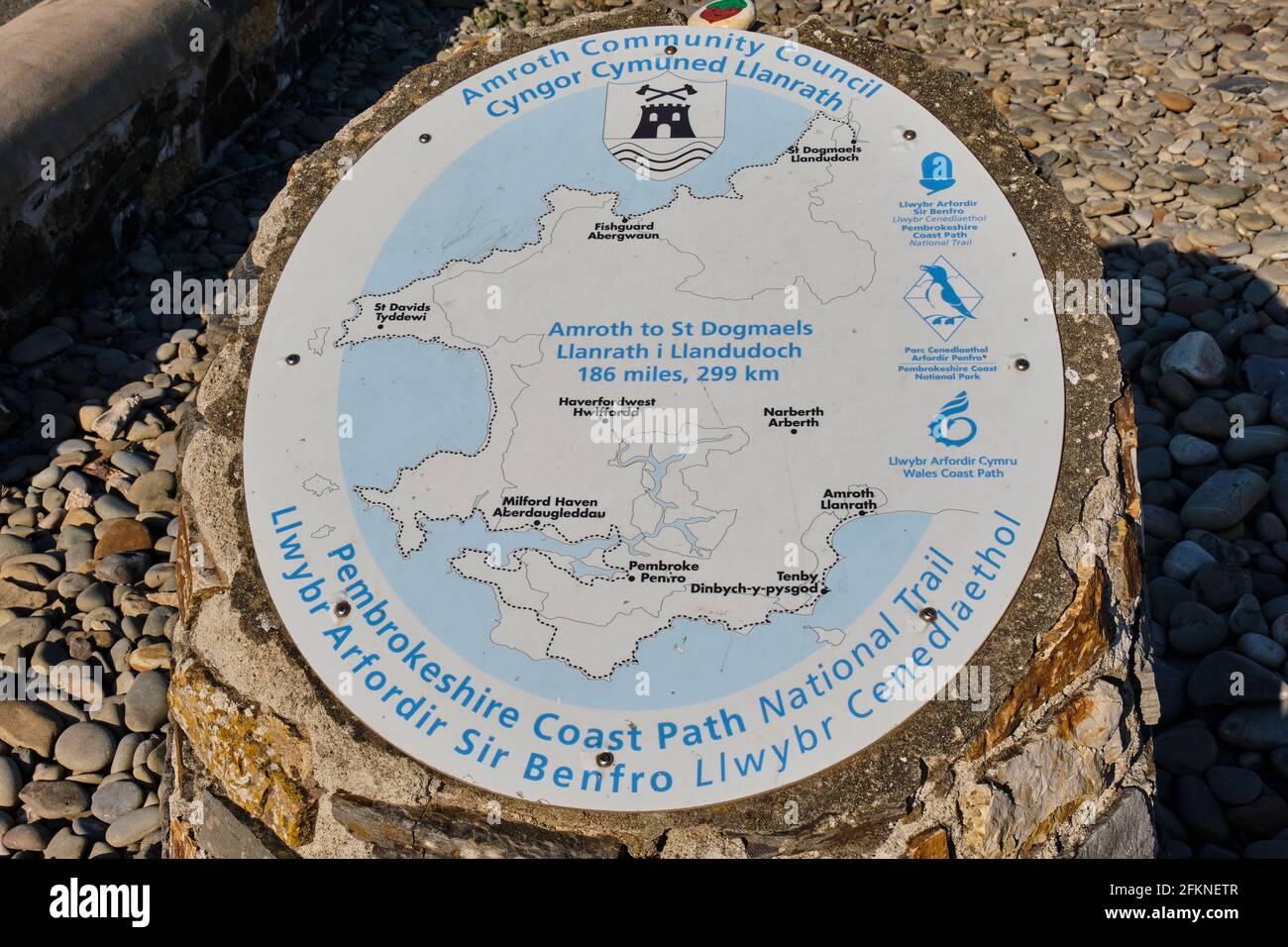 Plaque marking the start of the Pembrokeshire Coast Path, Amroth, Pembrokeshire Stock Photohttps://www.alamy.com/image-license-details/?v=1https://www.alamy.com/plaque-marking-the-start-of-the-pembrokeshire-coast-path-amroth-pembrokeshire-image425199959.html
RM2FKNETR–Plaque marking the start of the Pembrokeshire Coast Path, Amroth, Pembrokeshire
 Vaughan Hill, , AU, Australia, South Australia, S 26 56' 19'', N 134 3' 46'', map, Cartascapes Map published in 2024. Explore Cartascapes, a map revealing Earth's diverse landscapes, cultures, and ecosystems. Journey through time and space, discovering the interconnectedness of our planet's past, present, and future. Stock Photohttps://www.alamy.com/image-license-details/?v=1https://www.alamy.com/vaughan-hill-au-australia-south-australia-s-26-56-19-n-134-3-46-map-cartascapes-map-published-in-2024-explore-cartascapes-a-map-revealing-earths-diverse-landscapes-cultures-and-ecosystems-journey-through-time-and-space-discovering-the-interconnectedness-of-our-planets-past-present-and-future-image625433781.html
RM2Y9EY4N–Vaughan Hill, , AU, Australia, South Australia, S 26 56' 19'', N 134 3' 46'', map, Cartascapes Map published in 2024. Explore Cartascapes, a map revealing Earth's diverse landscapes, cultures, and ecosystems. Journey through time and space, discovering the interconnectedness of our planet's past, present, and future.
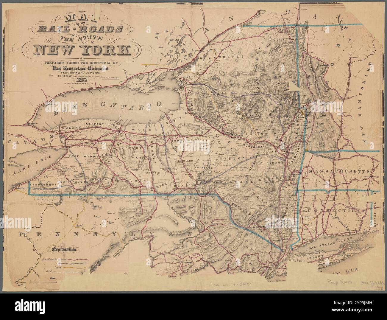 Map of the rail-roads of the State of New York 1858 by Vaughan, David, active 1849-1864 Stock Photohttps://www.alamy.com/image-license-details/?v=1https://www.alamy.com/map-of-the-rail-roads-of-the-state-of-new-york-1858-by-vaughan-david-active-1849-1864-image633220129.html
RM2YP5JMH–Map of the rail-roads of the State of New York 1858 by Vaughan, David, active 1849-1864
 Wynford Vaughan-Thomas viewing point, mid-Wales. Stock Photohttps://www.alamy.com/image-license-details/?v=1https://www.alamy.com/stock-photo-wynford-vaughan-thomas-viewing-point-mid-wales-16589216.html
RMAWHY9N–Wynford Vaughan-Thomas viewing point, mid-Wales.
 Vaughan Stock Photohttps://www.alamy.com/image-license-details/?v=1https://www.alamy.com/stock-photo-vaughan-140695063.html
RMJ4W5YK–Vaughan
 LONDON ILLUSTR(1882) p11.137 KATE VAUGHAN Stock Photohttps://www.alamy.com/image-license-details/?v=1https://www.alamy.com/stock-photo-london-illustr1882-p11137-kate-vaughan-77411667.html
RMEDXBAB–LONDON ILLUSTR(1882) p11.137 KATE VAUGHAN
 Sir John Vaughan Stock Photohttps://www.alamy.com/image-license-details/?v=1https://www.alamy.com/stock-photo-sir-john-vaughan-140520759.html
RMJ4H7JF–Sir John Vaughan
 Herbert Cardinal Vaughan Stock Photohttps://www.alamy.com/image-license-details/?v=1https://www.alamy.com/stock-photo-herbert-cardinal-vaughan-139969241.html
RMJ3M45D–Herbert Cardinal Vaughan
![A Lady at the Family of Goddard in the Window of St. Peters de Walpole Com. Norfolk. Author Vaughan, Robert 31.56.b. Place of publication: [London] Publisher: [Roger Dodsworth] Date of publication: [1655] Item type: 1 print Medium: etching Dimensions: sheet 17.4 X 12.3 cm [trimmed within platemark] Former owner: George III, King of Great Britain, 1738-1820 Stock Photo A Lady at the Family of Goddard in the Window of St. Peters de Walpole Com. Norfolk. Author Vaughan, Robert 31.56.b. Place of publication: [London] Publisher: [Roger Dodsworth] Date of publication: [1655] Item type: 1 print Medium: etching Dimensions: sheet 17.4 X 12.3 cm [trimmed within platemark] Former owner: George III, King of Great Britain, 1738-1820 Stock Photo](https://c8.alamy.com/comp/2E9HM0D/a-lady-at-the-family-of-goddard-in-the-window-of-st-peters-de-walpole-com-norfolk-author-vaughan-robert-3156b-place-of-publication-london-publisher-roger-dodsworth-date-of-publication-1655-item-type-1-print-medium-etching-dimensions-sheet-174-x-123-cm-trimmed-within-platemark-former-owner-george-iii-king-of-great-britain-1738-1820-2E9HM0D.jpg) A Lady at the Family of Goddard in the Window of St. Peters de Walpole Com. Norfolk. Author Vaughan, Robert 31.56.b. Place of publication: [London] Publisher: [Roger Dodsworth] Date of publication: [1655] Item type: 1 print Medium: etching Dimensions: sheet 17.4 X 12.3 cm [trimmed within platemark] Former owner: George III, King of Great Britain, 1738-1820 Stock Photohttps://www.alamy.com/image-license-details/?v=1https://www.alamy.com/a-lady-at-the-family-of-goddard-in-the-window-of-st-peters-de-walpole-com-norfolk-author-vaughan-robert-3156b-place-of-publication-london-publisher-roger-dodsworth-date-of-publication-1655-item-type-1-print-medium-etching-dimensions-sheet-174-x-123-cm-trimmed-within-platemark-former-owner-george-iii-king-of-great-britain-1738-1820-image401759245.html
A Lady at the Family of Goddard in the Window of St. Peters de Walpole Com. Norfolk. Author Vaughan, Robert 31.56.b. Place of publication: [London] Publisher: [Roger Dodsworth] Date of publication: [1655] Item type: 1 print Medium: etching Dimensions: sheet 17.4 X 12.3 cm [trimmed within platemark] Former owner: George III, King of Great Britain, 1738-1820 Stock Photohttps://www.alamy.com/image-license-details/?v=1https://www.alamy.com/a-lady-at-the-family-of-goddard-in-the-window-of-st-peters-de-walpole-com-norfolk-author-vaughan-robert-3156b-place-of-publication-london-publisher-roger-dodsworth-date-of-publication-1655-item-type-1-print-medium-etching-dimensions-sheet-174-x-123-cm-trimmed-within-platemark-former-owner-george-iii-king-of-great-britain-1738-1820-image401759245.htmlRM2E9HM0D–A Lady at the Family of Goddard in the Window of St. Peters de Walpole Com. Norfolk. Author Vaughan, Robert 31.56.b. Place of publication: [London] Publisher: [Roger Dodsworth] Date of publication: [1655] Item type: 1 print Medium: etching Dimensions: sheet 17.4 X 12.3 cm [trimmed within platemark] Former owner: George III, King of Great Britain, 1738-1820
 . A contribution to the geologic history of the Floridian plateau. Geology. PLATE 2. tCMC^T UTMO. MAP OF FLORIDA KEYS, ON WHICH ARE SHOWN THE STATION NUMBERS OF THE BOTTOM SAMPLES. Please note that these images are extracted from scanned page images that may have been digitally enhanced for readability - coloration and appearance of these illustrations may not perfectly resemble the original work.. Vaughan, Thomas Wayland, 1870-1952. [Washington, D. C. , Carnegie Institution of Washington Stock Photohttps://www.alamy.com/image-license-details/?v=1https://www.alamy.com/a-contribution-to-the-geologic-history-of-the-floridian-plateau-geology-plate-2-tcmct-utmo-map-of-florida-keys-on-which-are-shown-the-station-numbers-of-the-bottom-samples-please-note-that-these-images-are-extracted-from-scanned-page-images-that-may-have-been-digitally-enhanced-for-readability-coloration-and-appearance-of-these-illustrations-may-not-perfectly-resemble-the-original-work-vaughan-thomas-wayland-1870-1952-washington-d-c-carnegie-institution-of-washington-image232547687.html
RMRE9CXF–. A contribution to the geologic history of the Floridian plateau. Geology. PLATE 2. tCMC^T UTMO. MAP OF FLORIDA KEYS, ON WHICH ARE SHOWN THE STATION NUMBERS OF THE BOTTOM SAMPLES. Please note that these images are extracted from scanned page images that may have been digitally enhanced for readability - coloration and appearance of these illustrations may not perfectly resemble the original work.. Vaughan, Thomas Wayland, 1870-1952. [Washington, D. C. , Carnegie Institution of Washington
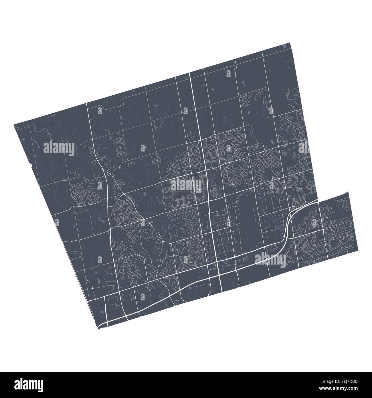 Vaughan map. Detailed vector map of Vaughan city administrative area. Cityscape poster metropolitan aria view. Dark land with white streets, roads and Stock Vectorhttps://www.alamy.com/image-license-details/?v=1https://www.alamy.com/vaughan-map-detailed-vector-map-of-vaughan-city-administrative-area-cityscape-poster-metropolitan-aria-view-dark-land-with-white-streets-roads-and-image407066449.html
RF2EJ7DBD–Vaughan map. Detailed vector map of Vaughan city administrative area. Cityscape poster metropolitan aria view. Dark land with white streets, roads and
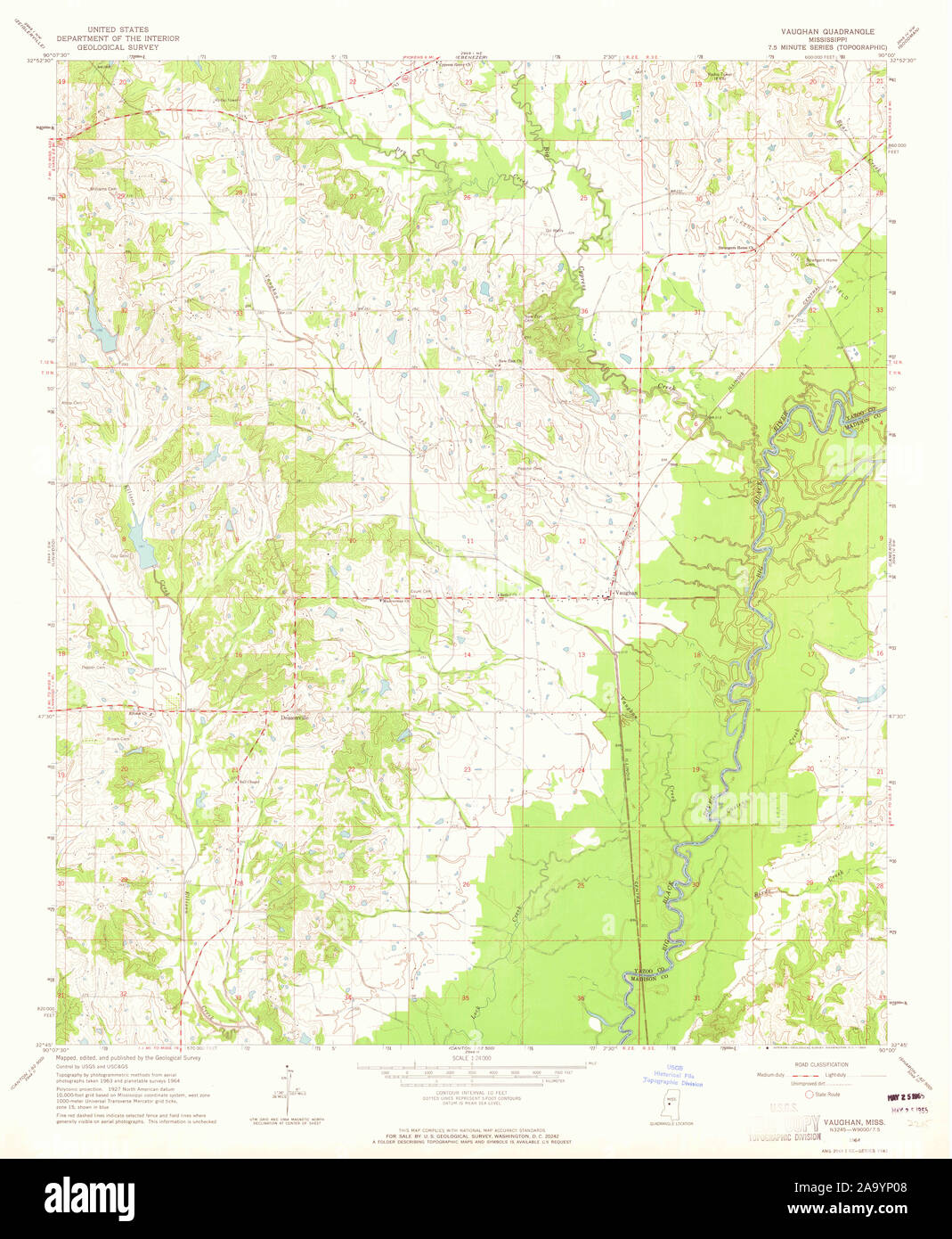 USGS TOPO Map Mississippi MS Vaughan 336636 1964 24000 Restoration Stock Photohttps://www.alamy.com/image-license-details/?v=1https://www.alamy.com/usgs-topo-map-mississippi-ms-vaughan-336636-1964-24000-restoration-image333138856.html
RM2A9YP08–USGS TOPO Map Mississippi MS Vaughan 336636 1964 24000 Restoration
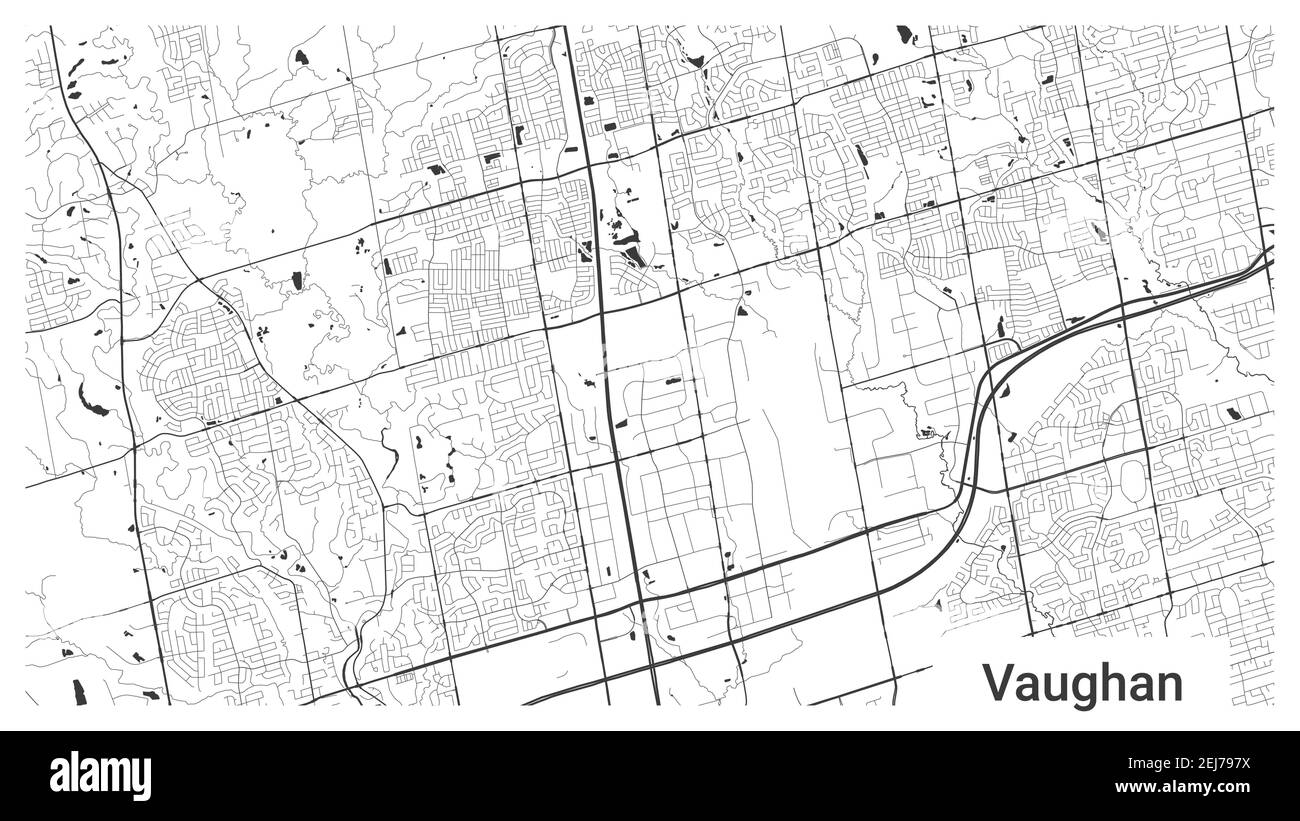 Map of Vaughan city, Ontario, Canada. Horizontal background map poster black and white land, streets and rivers. 1920 1080 proportions. Royalty free g Stock Vectorhttps://www.alamy.com/image-license-details/?v=1https://www.alamy.com/map-of-vaughan-city-ontario-canada-horizontal-background-map-poster-black-and-white-land-streets-and-rivers-1920-1080-proportions-royalty-free-g-image407063214.html
RF2EJ797X–Map of Vaughan city, Ontario, Canada. Horizontal background map poster black and white land, streets and rivers. 1920 1080 proportions. Royalty free g
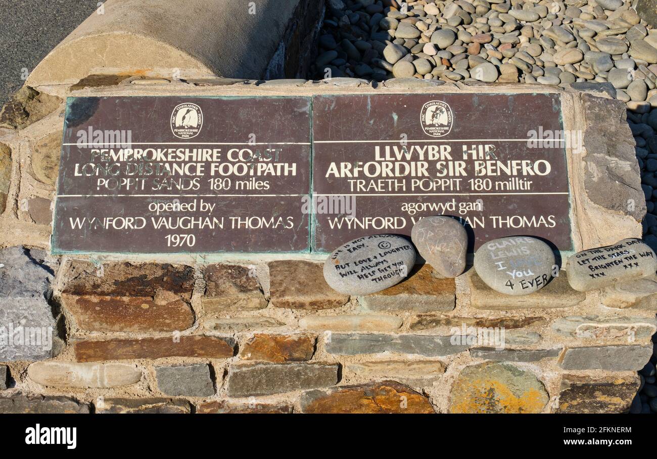 Plaque marking the start of the Pembrokeshire Coast Path, Amroth, Pembrokeshire Stock Photohttps://www.alamy.com/image-license-details/?v=1https://www.alamy.com/plaque-marking-the-start-of-the-pembrokeshire-coast-path-amroth-pembrokeshire-image425199928.html
RM2FKNERM–Plaque marking the start of the Pembrokeshire Coast Path, Amroth, Pembrokeshire
 Vaughan Hill, Ipswich, AU, Australia, Queensland, S 27 35' 9'', N 152 43' 43'', map, Cartascapes Map published in 2024. Explore Cartascapes, a map revealing Earth's diverse landscapes, cultures, and ecosystems. Journey through time and space, discovering the interconnectedness of our planet's past, present, and future. Stock Photohttps://www.alamy.com/image-license-details/?v=1https://www.alamy.com/vaughan-hill-ipswich-au-australia-queensland-s-27-35-9-n-152-43-43-map-cartascapes-map-published-in-2024-explore-cartascapes-a-map-revealing-earths-diverse-landscapes-cultures-and-ecosystems-journey-through-time-and-space-discovering-the-interconnectedness-of-our-planets-past-present-and-future-image625694457.html
RM2Y9XRJH–Vaughan Hill, Ipswich, AU, Australia, Queensland, S 27 35' 9'', N 152 43' 43'', map, Cartascapes Map published in 2024. Explore Cartascapes, a map revealing Earth's diverse landscapes, cultures, and ecosystems. Journey through time and space, discovering the interconnectedness of our planet's past, present, and future.
 Map of the various channels for conveying the trade of the north west to the Atlantic sea-board, exhibiting the tributaries & drainage of the trade into each and the effect of the enlargement of the Erie Canal: illustrating the position taken by William J. McAlpine, C.E., in his Annual Report as State Engineer and Surveyor of the State of New York, 1853 1853 by Vaughan, David, active 1849-1864 Stock Photohttps://www.alamy.com/image-license-details/?v=1https://www.alamy.com/map-of-the-various-channels-for-conveying-the-trade-of-the-north-west-to-the-atlantic-sea-board-exhibiting-the-tributaries-drainage-of-the-trade-into-each-and-the-effect-of-the-enlargement-of-the-erie-canal-illustrating-the-position-taken-by-william-j-mcalpine-ce-in-his-annual-report-as-state-engineer-and-surveyor-of-the-state-of-new-york-1853-1853-by-vaughan-david-active-1849-1864-image633123330.html
RM2YP177E–Map of the various channels for conveying the trade of the north west to the Atlantic sea-board, exhibiting the tributaries & drainage of the trade into each and the effect of the enlargement of the Erie Canal: illustrating the position taken by William J. McAlpine, C.E., in his Annual Report as State Engineer and Surveyor of the State of New York, 1853 1853 by Vaughan, David, active 1849-1864
 Wynford Vaughan-Thomas viewing point, mid-Wales. Stock Photohttps://www.alamy.com/image-license-details/?v=1https://www.alamy.com/stock-photo-wynford-vaughan-thomas-viewing-point-mid-wales-16589224.html
RMAWHYAH–Wynford Vaughan-Thomas viewing point, mid-Wales.
 Panoramic view - Dovey Valley, West Wales, UK. Stock Photohttps://www.alamy.com/image-license-details/?v=1https://www.alamy.com/stock-photo-panoramic-view-dovey-valley-west-wales-uk-15957095.html
RMAR6P0T–Panoramic view - Dovey Valley, West Wales, UK.
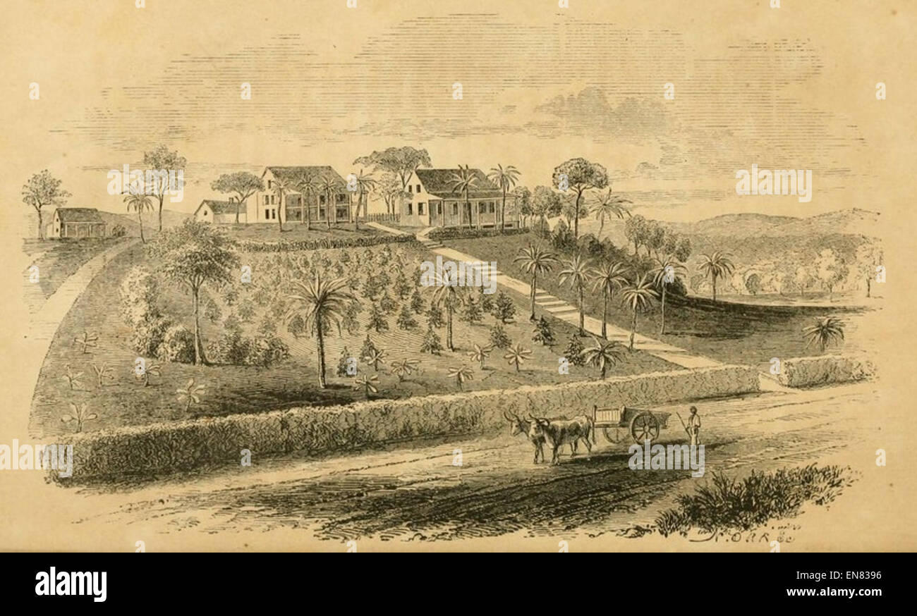 SCOTT(1858) The Mission at Mt. Vaughan, in 1838. From an early engraving Stock Photohttps://www.alamy.com/image-license-details/?v=1https://www.alamy.com/stock-photo-scott1858-the-mission-at-mt-vaughan-in-1838-from-an-early-engraving-81927474.html
RMEN8396–SCOTT(1858) The Mission at Mt. Vaughan, in 1838. From an early engraving
 Ernest Vaughan 1916 Stock Photohttps://www.alamy.com/image-license-details/?v=1https://www.alamy.com/stock-photo-ernest-vaughan-1916-139782937.html
RMJ3BJFN–Ernest Vaughan 1916
![Figura Scrinÿ S. Thomæ Cantuariensis ex M.S. in Bibliotheca Cottoniana desumpta. Author Vaughan, Robert 16.36.q. Place of publication: [London] Publisher: [J. Overton] Date of publication: [1672] Item type: 1 print Medium: etching Dimensions: sheet 26.5 x 15.4 [trimmed within platemark] Former owner: George III, King of Great Britain, 1738-1820 Stock Photo Figura Scrinÿ S. Thomæ Cantuariensis ex M.S. in Bibliotheca Cottoniana desumpta. Author Vaughan, Robert 16.36.q. Place of publication: [London] Publisher: [J. Overton] Date of publication: [1672] Item type: 1 print Medium: etching Dimensions: sheet 26.5 x 15.4 [trimmed within platemark] Former owner: George III, King of Great Britain, 1738-1820 Stock Photo](https://c8.alamy.com/comp/2E9H5H2/figura-scriny-s-thom-cantuariensis-ex-ms-in-bibliotheca-cottoniana-desumpta-author-vaughan-robert-1636q-place-of-publication-london-publisher-j-overton-date-of-publication-1672-item-type-1-print-medium-etching-dimensions-sheet-265-x-154-trimmed-within-platemark-former-owner-george-iii-king-of-great-britain-1738-1820-2E9H5H2.jpg) Figura Scrinÿ S. Thomæ Cantuariensis ex M.S. in Bibliotheca Cottoniana desumpta. Author Vaughan, Robert 16.36.q. Place of publication: [London] Publisher: [J. Overton] Date of publication: [1672] Item type: 1 print Medium: etching Dimensions: sheet 26.5 x 15.4 [trimmed within platemark] Former owner: George III, King of Great Britain, 1738-1820 Stock Photohttps://www.alamy.com/image-license-details/?v=1https://www.alamy.com/figura-scriny-s-thom-cantuariensis-ex-ms-in-bibliotheca-cottoniana-desumpta-author-vaughan-robert-1636q-place-of-publication-london-publisher-j-overton-date-of-publication-1672-item-type-1-print-medium-etching-dimensions-sheet-265-x-154-trimmed-within-platemark-former-owner-george-iii-king-of-great-britain-1738-1820-image401747950.html
Figura ScrinyÃà S. Thom√¶ Cantuariensis ex M.S. in Bibliotheca Cottoniana desumpta. Author Vaughan, Robert 16.36.q. Place of publication: [London] Publisher: [J. Overton] Date of publication: [1672] Item type: 1 print Medium: etching Dimensions: sheet 26.5 x 15.4 [trimmed within platemark] Former owner: George III, King of Great Britain, 1738-1820 Stock Photohttps://www.alamy.com/image-license-details/?v=1https://www.alamy.com/figura-scriny-s-thom-cantuariensis-ex-ms-in-bibliotheca-cottoniana-desumpta-author-vaughan-robert-1636q-place-of-publication-london-publisher-j-overton-date-of-publication-1672-item-type-1-print-medium-etching-dimensions-sheet-265-x-154-trimmed-within-platemark-former-owner-george-iii-king-of-great-britain-1738-1820-image401747950.htmlRM2E9H5H2–Figura ScrinyÃà S. Thom√¶ Cantuariensis ex M.S. in Bibliotheca Cottoniana desumpta. Author Vaughan, Robert 16.36.q. Place of publication: [London] Publisher: [J. Overton] Date of publication: [1672] Item type: 1 print Medium: etching Dimensions: sheet 26.5 x 15.4 [trimmed within platemark] Former owner: George III, King of Great Britain, 1738-1820
 . A contribution to the geologic history of the Floridian plateau. Geology. 80 IS' 25 25' :^. ^^ "- 80 15' MAP SHOWING CAESARS CR (From U. S. Coast and Ge. Please note that these images are extracted from scanned page images that may have been digitally enhanced for readability - coloration and appearance of these illustrations may not perfectly resemble the original work.. Vaughan, Thomas Wayland, 1870-1952. [Washington, D. C. , Carnegie Institution of Washington Stock Photohttps://www.alamy.com/image-license-details/?v=1https://www.alamy.com/a-contribution-to-the-geologic-history-of-the-floridian-plateau-geology-80-is-25-25-quot-80-15-map-showing-caesars-cr-from-u-s-coast-and-ge-please-note-that-these-images-are-extracted-from-scanned-page-images-that-may-have-been-digitally-enhanced-for-readability-coloration-and-appearance-of-these-illustrations-may-not-perfectly-resemble-the-original-work-vaughan-thomas-wayland-1870-1952-washington-d-c-carnegie-institution-of-washington-image232547676.html
RMRE9CX4–. A contribution to the geologic history of the Floridian plateau. Geology. 80 IS' 25 25' :^. ^^ "- 80 15' MAP SHOWING CAESARS CR (From U. S. Coast and Ge. Please note that these images are extracted from scanned page images that may have been digitally enhanced for readability - coloration and appearance of these illustrations may not perfectly resemble the original work.. Vaughan, Thomas Wayland, 1870-1952. [Washington, D. C. , Carnegie Institution of Washington
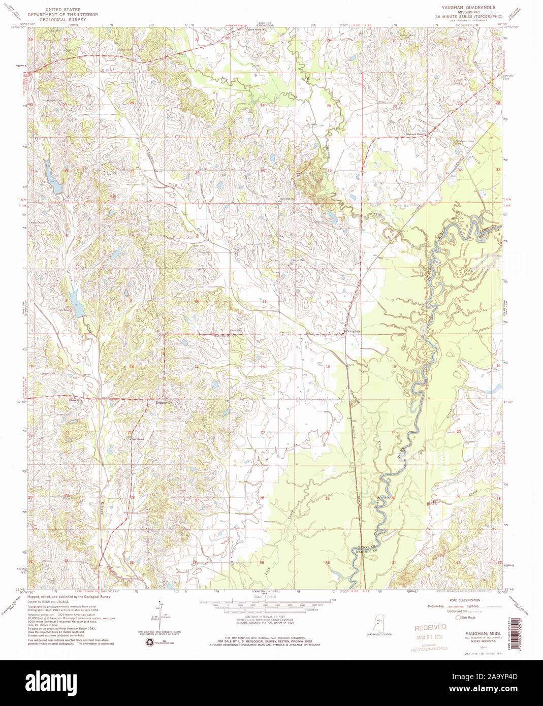 USGS TOPO Map Mississippi MS Vaughan 336637 1964 24000 Restoration Stock Photohttps://www.alamy.com/image-license-details/?v=1https://www.alamy.com/usgs-topo-map-mississippi-ms-vaughan-336637-1964-24000-restoration-image333138973.html
RM2A9YP4D–USGS TOPO Map Mississippi MS Vaughan 336637 1964 24000 Restoration
 Vaughan, Mount Alexander, AU, Australia, Victoria, S 37 9' 32'', N 144 12' 53'', map, Cartascapes Map published in 2024. Explore Cartascapes, a map revealing Earth's diverse landscapes, cultures, and ecosystems. Journey through time and space, discovering the interconnectedness of our planet's past, present, and future. Stock Photohttps://www.alamy.com/image-license-details/?v=1https://www.alamy.com/vaughan-mount-alexander-au-australia-victoria-s-37-9-32-n-144-12-53-map-cartascapes-map-published-in-2024-explore-cartascapes-a-map-revealing-earths-diverse-landscapes-cultures-and-ecosystems-journey-through-time-and-space-discovering-the-interconnectedness-of-our-planets-past-present-and-future-image625394823.html
RM2Y9D5DB–Vaughan, Mount Alexander, AU, Australia, Victoria, S 37 9' 32'', N 144 12' 53'', map, Cartascapes Map published in 2024. Explore Cartascapes, a map revealing Earth's diverse landscapes, cultures, and ecosystems. Journey through time and space, discovering the interconnectedness of our planet's past, present, and future.
 Erie Canal enlargement, middle division, extending from Oneida-Lake Canal to east boundary of Wayne County 1851 by Vaughan, David, active 1849-1864 Stock Photohttps://www.alamy.com/image-license-details/?v=1https://www.alamy.com/erie-canal-enlargement-middle-division-extending-from-oneida-lake-canal-to-east-boundary-of-wayne-county-1851-by-vaughan-david-active-1849-1864-image633233349.html
RM2YP67GN–Erie Canal enlargement, middle division, extending from Oneida-Lake Canal to east boundary of Wayne County 1851 by Vaughan, David, active 1849-1864
 Panoramic view - Dovey Valley, West Wales, UK. Stock Photohttps://www.alamy.com/image-license-details/?v=1https://www.alamy.com/stock-photo-panoramic-view-dovey-valley-west-wales-uk-16333540.html
RMATJPBH–Panoramic view - Dovey Valley, West Wales, UK.
 Manuscript Letter of Louise Michel to Ernest Vaughan from prison, 16534776958 o Stock Photohttps://www.alamy.com/image-license-details/?v=1https://www.alamy.com/stock-photo-manuscript-letter-of-louise-michel-to-ernest-vaughan-from-prison-16534776958-147113195.html
RMJF9GAK–Manuscript Letter of Louise Michel to Ernest Vaughan from prison, 16534776958 o
 La baronne Vaughan Stock Photohttps://www.alamy.com/image-license-details/?v=1https://www.alamy.com/stock-photo-la-baronne-vaughan-140186386.html
RMJ4214J–La baronne Vaughan
![PORTNEATH, VAUGHAN, GLAMORGANSHIRE. Author Jukes, Francis 46.29. Place of publication: [London] Publisher: Pubd by F. Jukes Howland St, Date of publication: Novr 1st 1795. Item type: 1 print Medium: aquatint and etching with hand-colouring Dimensions: platemark 15.4 x 22.3 cm, on sheet 22 x 30 cm Former owner: George III, King of Great Britain, 1738-1820 Stock Photo PORTNEATH, VAUGHAN, GLAMORGANSHIRE. Author Jukes, Francis 46.29. Place of publication: [London] Publisher: Pubd by F. Jukes Howland St, Date of publication: Novr 1st 1795. Item type: 1 print Medium: aquatint and etching with hand-colouring Dimensions: platemark 15.4 x 22.3 cm, on sheet 22 x 30 cm Former owner: George III, King of Great Britain, 1738-1820 Stock Photo](https://c8.alamy.com/comp/2E9EY9T/portneath-vaughan-glamorganshire-author-jukes-francis-4629-place-of-publication-london-publisher-pubd-by-f-jukes-howland-st-date-of-publication-novr-1st-1795-item-type-1-print-medium-aquatint-and-etching-with-hand-colouring-dimensions-platemark-154-x-223-cm-on-sheet-22-x-30-cm-former-owner-george-iii-king-of-great-britain-1738-1820-2E9EY9T.jpg) PORTNEATH, VAUGHAN, GLAMORGANSHIRE. Author Jukes, Francis 46.29. Place of publication: [London] Publisher: Pubd by F. Jukes Howland St, Date of publication: Novr 1st 1795. Item type: 1 print Medium: aquatint and etching with hand-colouring Dimensions: platemark 15.4 x 22.3 cm, on sheet 22 x 30 cm Former owner: George III, King of Great Britain, 1738-1820 Stock Photohttps://www.alamy.com/image-license-details/?v=1https://www.alamy.com/portneath-vaughan-glamorganshire-author-jukes-francis-4629-place-of-publication-london-publisher-pubd-by-f-jukes-howland-st-date-of-publication-novr-1st-1795-item-type-1-print-medium-aquatint-and-etching-with-hand-colouring-dimensions-platemark-154-x-223-cm-on-sheet-22-x-30-cm-former-owner-george-iii-king-of-great-britain-1738-1820-image401699140.html
PORTNEATH, VAUGHAN, GLAMORGANSHIRE. Author Jukes, Francis 46.29. Place of publication: [London] Publisher: Pubd by F. Jukes Howland St, Date of publication: Novr 1st 1795. Item type: 1 print Medium: aquatint and etching with hand-colouring Dimensions: platemark 15.4 x 22.3 cm, on sheet 22 x 30 cm Former owner: George III, King of Great Britain, 1738-1820 Stock Photohttps://www.alamy.com/image-license-details/?v=1https://www.alamy.com/portneath-vaughan-glamorganshire-author-jukes-francis-4629-place-of-publication-london-publisher-pubd-by-f-jukes-howland-st-date-of-publication-novr-1st-1795-item-type-1-print-medium-aquatint-and-etching-with-hand-colouring-dimensions-platemark-154-x-223-cm-on-sheet-22-x-30-cm-former-owner-george-iii-king-of-great-britain-1738-1820-image401699140.htmlRM2E9EY9T–PORTNEATH, VAUGHAN, GLAMORGANSHIRE. Author Jukes, Francis 46.29. Place of publication: [London] Publisher: Pubd by F. Jukes Howland St, Date of publication: Novr 1st 1795. Item type: 1 print Medium: aquatint and etching with hand-colouring Dimensions: platemark 15.4 x 22.3 cm, on sheet 22 x 30 cm Former owner: George III, King of Great Britain, 1738-1820
 . Contributions to the geology and paleontology of the Canal Zone, Panama, and geologically related areas in Central America and the West Indies.. Paleontology; Paleontology; Paleontology. BULLETIN 103 PLATE 154. MAP LOCATION C From IT. Please note that these images are extracted from scanned page images that may have been digitally enhanced for readability - coloration and appearance of these illustrations may not perfectly resemble the original work.. Vaughan, Thomas Wayland, 1870-1952; United States National Museum. Washington : Govt. Print. Off. Stock Photohttps://www.alamy.com/image-license-details/?v=1https://www.alamy.com/contributions-to-the-geology-and-paleontology-of-the-canal-zone-panama-and-geologically-related-areas-in-central-america-and-the-west-indies-paleontology-paleontology-paleontology-bulletin-103-plate-154-map-location-c-from-it-please-note-that-these-images-are-extracted-from-scanned-page-images-that-may-have-been-digitally-enhanced-for-readability-coloration-and-appearance-of-these-illustrations-may-not-perfectly-resemble-the-original-work-vaughan-thomas-wayland-1870-1952-united-states-national-museum-washington-govt-print-off-image232548520.html
RMRE9E08–. Contributions to the geology and paleontology of the Canal Zone, Panama, and geologically related areas in Central America and the West Indies.. Paleontology; Paleontology; Paleontology. BULLETIN 103 PLATE 154. MAP LOCATION C From IT. Please note that these images are extracted from scanned page images that may have been digitally enhanced for readability - coloration and appearance of these illustrations may not perfectly resemble the original work.. Vaughan, Thomas Wayland, 1870-1952; United States National Museum. Washington : Govt. Print. Off.
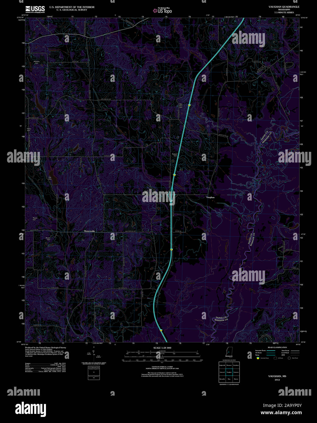 USGS TOPO Map Mississippi MS Vaughan 20120508 TM Inverted Restoration Stock Photohttps://www.alamy.com/image-license-details/?v=1https://www.alamy.com/usgs-topo-map-mississippi-ms-vaughan-20120508-tm-inverted-restoration-image333138875.html
RM2A9YP0Y–USGS TOPO Map Mississippi MS Vaughan 20120508 TM Inverted Restoration
 Vaughan Spring, , AU, Australia, Northern Territory, S 22 15' 49'', N 130 50' 18'', map, Cartascapes Map published in 2024. Explore Cartascapes, a map revealing Earth's diverse landscapes, cultures, and ecosystems. Journey through time and space, discovering the interconnectedness of our planet's past, present, and future. Stock Photohttps://www.alamy.com/image-license-details/?v=1https://www.alamy.com/vaughan-spring-au-australia-northern-territory-s-22-15-49-n-130-50-18-map-cartascapes-map-published-in-2024-explore-cartascapes-a-map-revealing-earths-diverse-landscapes-cultures-and-ecosystems-journey-through-time-and-space-discovering-the-interconnectedness-of-our-planets-past-present-and-future-image625741250.html
RM2YA0Y9P–Vaughan Spring, , AU, Australia, Northern Territory, S 22 15' 49'', N 130 50' 18'', map, Cartascapes Map published in 2024. Explore Cartascapes, a map revealing Earth's diverse landscapes, cultures, and ecosystems. Journey through time and space, discovering the interconnectedness of our planet's past, present, and future.
 Statistical profile of Erie Canal shewing the enlargement on Western Division: being from east boundary of Wayne County to Lake Erie 1851 - 1851 by Vaughan, David, active 1849-1864 Stock Photohttps://www.alamy.com/image-license-details/?v=1https://www.alamy.com/statistical-profile-of-erie-canal-shewing-the-enlargement-on-western-division-being-from-east-boundary-of-wayne-county-to-lake-erie-1851-1851-by-vaughan-david-active-1849-1864-image633219802.html
RM2YP5J8X–Statistical profile of Erie Canal shewing the enlargement on Western Division: being from east boundary of Wayne County to Lake Erie 1851 - 1851 by Vaughan, David, active 1849-1864
 Manuscript Letter of Louise Michel to Ernest Vaughan from prison, 16536225299 o Stock Photohttps://www.alamy.com/image-license-details/?v=1https://www.alamy.com/stock-photo-manuscript-letter-of-louise-michel-to-ernest-vaughan-from-prison-16536225299-147113196.html
RMJF9GAM–Manuscript Letter of Louise Michel to Ernest Vaughan from prison, 16536225299 o
 Identified! Vaughan Ave near the intersection of Bayers Rd 33449784880 o Stock Photohttps://www.alamy.com/image-license-details/?v=1https://www.alamy.com/stock-photo-identified!-vaughan-ave-near-the-intersection-of-bayers-rd-33449784880-147098001.html
RMJF8W01–Identified! Vaughan Ave near the intersection of Bayers Rd 33449784880 o
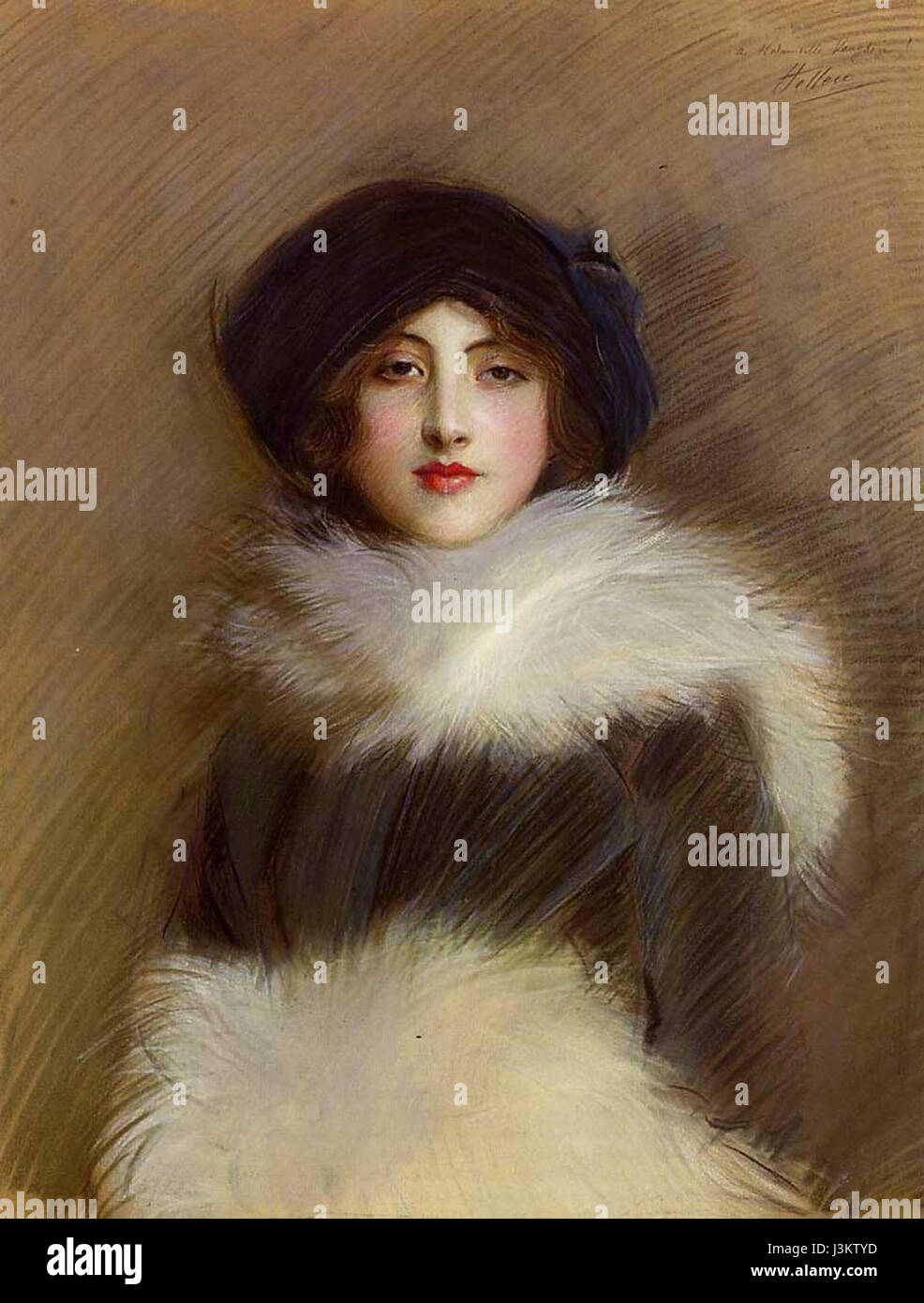 Helleu Mademoiselle Vaughan Stock Photohttps://www.alamy.com/image-license-details/?v=1https://www.alamy.com/stock-photo-helleu-mademoiselle-vaughan-139963585.html
RMJ3KTYD–Helleu Mademoiselle Vaughan
![To Edw.d Williams Vaughan Salesbury Esq.r This View of Corwen Bridge, Author Jukes, Francis 47.60.a. Place of publication: London Publisher: Pub.d by F. Jukes, No. 10. Howland Street., Date of publication: [1792 c.] Item type: 1 print Medium: etching and aquatint Dimensions: platemark 34.6 x 44.2 cm. Former owner: George III, King of Great Britain, 1738-1820 Stock Photo To Edw.d Williams Vaughan Salesbury Esq.r This View of Corwen Bridge, Author Jukes, Francis 47.60.a. Place of publication: London Publisher: Pub.d by F. Jukes, No. 10. Howland Street., Date of publication: [1792 c.] Item type: 1 print Medium: etching and aquatint Dimensions: platemark 34.6 x 44.2 cm. Former owner: George III, King of Great Britain, 1738-1820 Stock Photo](https://c8.alamy.com/comp/2E9F17R/to-edwd-williams-vaughan-salesbury-esqr-this-view-of-corwen-bridge-author-jukes-francis-4760a-place-of-publication-london-publisher-pubd-by-f-jukes-no-10-howland-street-date-of-publication-1792-c-item-type-1-print-medium-etching-and-aquatint-dimensions-platemark-346-x-442-cm-former-owner-george-iii-king-of-great-britain-1738-1820-2E9F17R.jpg) To Edw.d Williams Vaughan Salesbury Esq.r This View of Corwen Bridge, Author Jukes, Francis 47.60.a. Place of publication: London Publisher: Pub.d by F. Jukes, No. 10. Howland Street., Date of publication: [1792 c.] Item type: 1 print Medium: etching and aquatint Dimensions: platemark 34.6 x 44.2 cm. Former owner: George III, King of Great Britain, 1738-1820 Stock Photohttps://www.alamy.com/image-license-details/?v=1https://www.alamy.com/to-edwd-williams-vaughan-salesbury-esqr-this-view-of-corwen-bridge-author-jukes-francis-4760a-place-of-publication-london-publisher-pubd-by-f-jukes-no-10-howland-street-date-of-publication-1792-c-item-type-1-print-medium-etching-and-aquatint-dimensions-platemark-346-x-442-cm-former-owner-george-iii-king-of-great-britain-1738-1820-image401700651.html
To Edw.d Williams Vaughan Salesbury Esq.r This View of Corwen Bridge, Author Jukes, Francis 47.60.a. Place of publication: London Publisher: Pub.d by F. Jukes, No. 10. Howland Street., Date of publication: [1792 c.] Item type: 1 print Medium: etching and aquatint Dimensions: platemark 34.6 x 44.2 cm. Former owner: George III, King of Great Britain, 1738-1820 Stock Photohttps://www.alamy.com/image-license-details/?v=1https://www.alamy.com/to-edwd-williams-vaughan-salesbury-esqr-this-view-of-corwen-bridge-author-jukes-francis-4760a-place-of-publication-london-publisher-pubd-by-f-jukes-no-10-howland-street-date-of-publication-1792-c-item-type-1-print-medium-etching-and-aquatint-dimensions-platemark-346-x-442-cm-former-owner-george-iii-king-of-great-britain-1738-1820-image401700651.htmlRM2E9F17R–To Edw.d Williams Vaughan Salesbury Esq.r This View of Corwen Bridge, Author Jukes, Francis 47.60.a. Place of publication: London Publisher: Pub.d by F. Jukes, No. 10. Howland Street., Date of publication: [1792 c.] Item type: 1 print Medium: etching and aquatint Dimensions: platemark 34.6 x 44.2 cm. Former owner: George III, King of Great Britain, 1738-1820
 . A contribution to the geologic history of the Floridian plateau. Geology. 144 Papers from ihe Marine Biological Laboralory at Tortugas.. Fig. 6.—Map of Cape Canaveral. (From U. S. Coast Surv. Chart, No. i6i.). Please note that these images are extracted from scanned page images that may have been digitally enhanced for readability - coloration and appearance of these illustrations may not perfectly resemble the original work.. Vaughan, Thomas Wayland, 1870-1952. [Washington, D. C. , Carnegie Institution of Washington Stock Photohttps://www.alamy.com/image-license-details/?v=1https://www.alamy.com/a-contribution-to-the-geologic-history-of-the-floridian-plateau-geology-144-papers-from-ihe-marine-biological-laboralory-at-tortugas-fig-6map-of-cape-canaveral-from-u-s-coast-surv-chart-no-i6i-please-note-that-these-images-are-extracted-from-scanned-page-images-that-may-have-been-digitally-enhanced-for-readability-coloration-and-appearance-of-these-illustrations-may-not-perfectly-resemble-the-original-work-vaughan-thomas-wayland-1870-1952-washington-d-c-carnegie-institution-of-washington-image232547679.html
RMRE9CX7–. A contribution to the geologic history of the Floridian plateau. Geology. 144 Papers from ihe Marine Biological Laboralory at Tortugas.. Fig. 6.—Map of Cape Canaveral. (From U. S. Coast Surv. Chart, No. i6i.). Please note that these images are extracted from scanned page images that may have been digitally enhanced for readability - coloration and appearance of these illustrations may not perfectly resemble the original work.. Vaughan, Thomas Wayland, 1870-1952. [Washington, D. C. , Carnegie Institution of Washington
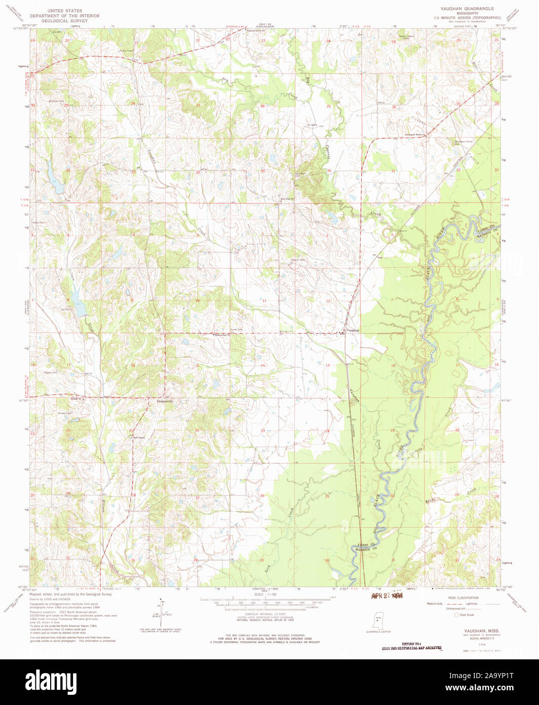 USGS TOPO Map Mississippi MS Vaughan 336635 1964 24000 Restoration Stock Photohttps://www.alamy.com/image-license-details/?v=1https://www.alamy.com/usgs-topo-map-mississippi-ms-vaughan-336635-1964-24000-restoration-image333138900.html
RM2A9YP1T–USGS TOPO Map Mississippi MS Vaughan 336635 1964 24000 Restoration
 Vaughan, Mount Alexander, AU, Australia, Victoria, S 37 9' 32'', N 144 12' 53'', map, Cartascapes Map published in 2024. Explore Cartascapes, a map revealing Earth's diverse landscapes, cultures, and ecosystems. Journey through time and space, discovering the interconnectedness of our planet's past, present, and future. Stock Photohttps://www.alamy.com/image-license-details/?v=1https://www.alamy.com/vaughan-mount-alexander-au-australia-victoria-s-37-9-32-n-144-12-53-map-cartascapes-map-published-in-2024-explore-cartascapes-a-map-revealing-earths-diverse-landscapes-cultures-and-ecosystems-journey-through-time-and-space-discovering-the-interconnectedness-of-our-planets-past-present-and-future-image625531610.html
RM2Y9KBXJ–Vaughan, Mount Alexander, AU, Australia, Victoria, S 37 9' 32'', N 144 12' 53'', map, Cartascapes Map published in 2024. Explore Cartascapes, a map revealing Earth's diverse landscapes, cultures, and ecosystems. Journey through time and space, discovering the interconnectedness of our planet's past, present, and future.
 A chorographical map of the province of New York in North America: divided into counties, manors, patents and townships : exhibiting likewise all the private grants of land made and located in that Province 1849 by Sauthier, Claude Joseph Stock Photohttps://www.alamy.com/image-license-details/?v=1https://www.alamy.com/a-chorographical-map-of-the-province-of-new-york-in-north-america-divided-into-counties-manors-patents-and-townships-exhibiting-likewise-all-the-private-grants-of-land-made-and-located-in-that-province-1849-by-sauthier-claude-joseph-image633233128.html
RM2YP678T–A chorographical map of the province of New York in North America: divided into counties, manors, patents and townships : exhibiting likewise all the private grants of land made and located in that Province 1849 by Sauthier, Claude Joseph
 Identified! Vaughan Ave looking toward Bayers Rd 33793514846 o Stock Photohttps://www.alamy.com/image-license-details/?v=1https://www.alamy.com/stock-photo-identified!-vaughan-ave-looking-toward-bayers-rd-33793514846-o-147098002.html
RMJF8W02–Identified! Vaughan Ave looking toward Bayers Rd 33793514846 o
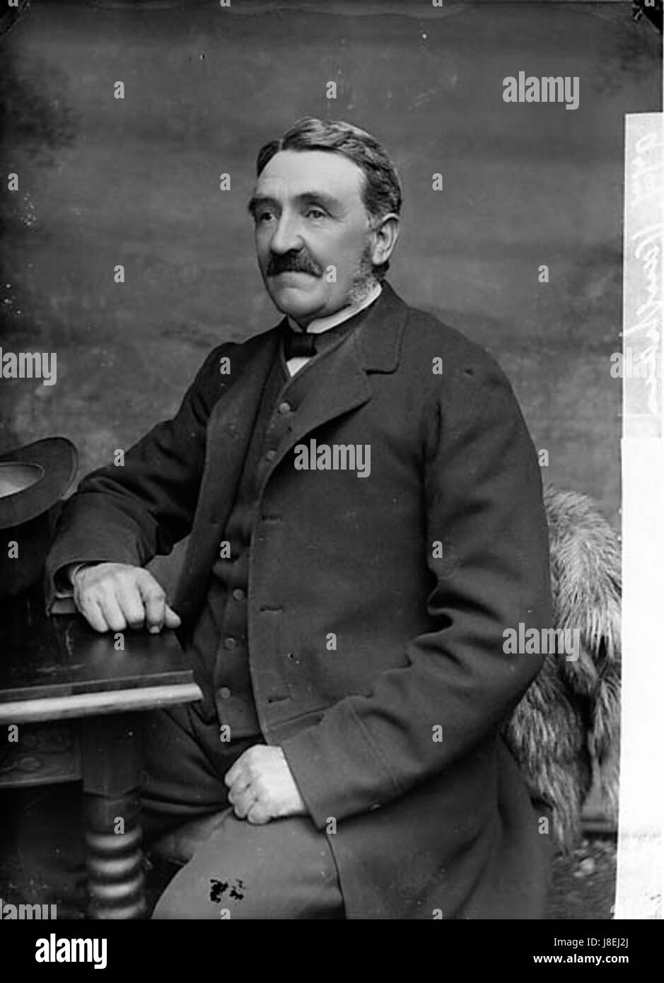 Mr Vaughan NLW3364128 Stock Photohttps://www.alamy.com/image-license-details/?v=1https://www.alamy.com/stock-photo-mr-vaughan-nlw3364128-142921706.html
RMJ8EJ2J–Mr Vaughan NLW3364128
![Ecclesiæ Cœnobialis S. Benedicti de Hulmo in Agro Norfolciensi, cœnobio nondum everso delineatæ et in quondam codice MS in Bibliotheca Cottoniana repertæ Figura. Author Vaughan, Robert 31.52.a. Place of publication: [London] Publisher: [Roger Dodsworth] Date of publication: [1655] Item type: 1 print Medium: etching Dimensions: sheet 16.2 x 16.1 cm [trimmed within platemark] Former owner: George III, King of Great Britain, 1738-1820 Stock Photo Ecclesiæ Cœnobialis S. Benedicti de Hulmo in Agro Norfolciensi, cœnobio nondum everso delineatæ et in quondam codice MS in Bibliotheca Cottoniana repertæ Figura. Author Vaughan, Robert 31.52.a. Place of publication: [London] Publisher: [Roger Dodsworth] Date of publication: [1655] Item type: 1 print Medium: etching Dimensions: sheet 16.2 x 16.1 cm [trimmed within platemark] Former owner: George III, King of Great Britain, 1738-1820 Stock Photo](https://c8.alamy.com/comp/2E9HM0N/ecclesi-cnobialis-s-benedicti-de-hulmo-in-agro-norfolciensi-cnobio-nondum-everso-delineat-et-in-quondam-codice-ms-in-bibliotheca-cottoniana-repert-figura-author-vaughan-robert-3152a-place-of-publication-london-publisher-roger-dodsworth-date-of-publication-1655-item-type-1-print-medium-etching-dimensions-sheet-162-x-161-cm-trimmed-within-platemark-former-owner-george-iii-king-of-great-britain-1738-1820-2E9HM0N.jpg) Ecclesiæ Cœnobialis S. Benedicti de Hulmo in Agro Norfolciensi, cœnobio nondum everso delineatæ et in quondam codice MS in Bibliotheca Cottoniana repertæ Figura. Author Vaughan, Robert 31.52.a. Place of publication: [London] Publisher: [Roger Dodsworth] Date of publication: [1655] Item type: 1 print Medium: etching Dimensions: sheet 16.2 x 16.1 cm [trimmed within platemark] Former owner: George III, King of Great Britain, 1738-1820 Stock Photohttps://www.alamy.com/image-license-details/?v=1https://www.alamy.com/ecclesi-cnobialis-s-benedicti-de-hulmo-in-agro-norfolciensi-cnobio-nondum-everso-delineat-et-in-quondam-codice-ms-in-bibliotheca-cottoniana-repert-figura-author-vaughan-robert-3152a-place-of-publication-london-publisher-roger-dodsworth-date-of-publication-1655-item-type-1-print-medium-etching-dimensions-sheet-162-x-161-cm-trimmed-within-platemark-former-owner-george-iii-king-of-great-britain-1738-1820-image401759253.html
Ecclesi√¶ C≈ìnobialis S. Benedicti de Hulmo in Agro Norfolciensi, c≈ìnobio nondum everso delineat√¶ et in quondam codice MS in Bibliotheca Cottoniana repert√¶ Figura. Author Vaughan, Robert 31.52.a. Place of publication: [London] Publisher: [Roger Dodsworth] Date of publication: [1655] Item type: 1 print Medium: etching Dimensions: sheet 16.2 x 16.1 cm [trimmed within platemark] Former owner: George III, King of Great Britain, 1738-1820 Stock Photohttps://www.alamy.com/image-license-details/?v=1https://www.alamy.com/ecclesi-cnobialis-s-benedicti-de-hulmo-in-agro-norfolciensi-cnobio-nondum-everso-delineat-et-in-quondam-codice-ms-in-bibliotheca-cottoniana-repert-figura-author-vaughan-robert-3152a-place-of-publication-london-publisher-roger-dodsworth-date-of-publication-1655-item-type-1-print-medium-etching-dimensions-sheet-162-x-161-cm-trimmed-within-platemark-former-owner-george-iii-king-of-great-britain-1738-1820-image401759253.htmlRM2E9HM0N–Ecclesi√¶ C≈ìnobialis S. Benedicti de Hulmo in Agro Norfolciensi, c≈ìnobio nondum everso delineat√¶ et in quondam codice MS in Bibliotheca Cottoniana repert√¶ Figura. Author Vaughan, Robert 31.52.a. Place of publication: [London] Publisher: [Roger Dodsworth] Date of publication: [1655] Item type: 1 print Medium: etching Dimensions: sheet 16.2 x 16.1 cm [trimmed within platemark] Former owner: George III, King of Great Britain, 1738-1820
 . A contribution to the geologic history of the Floridian plateau. Geology. ? f- *" . <!•• ftjft»i WS 80 IS MAP SHOWING CAESARS CREEK AND OLD RHODES BANKS (From U. S. Coast and Geodetic Survey Chart No. 166). Please note that these images are extracted from scanned page images that may have been digitally enhanced for readability - coloration and appearance of these illustrations may not perfectly resemble the original work.. Vaughan, Thomas Wayland, 1870-1952. [Washington, D. C. , Carnegie Institution of Washington Stock Photohttps://www.alamy.com/image-license-details/?v=1https://www.alamy.com/a-contribution-to-the-geologic-history-of-the-floridian-plateau-geology-f-quot-lt!-ftjfti-ws-80-is-map-showing-caesars-creek-and-old-rhodes-banks-from-u-s-coast-and-geodetic-survey-chart-no-166-please-note-that-these-images-are-extracted-from-scanned-page-images-that-may-have-been-digitally-enhanced-for-readability-coloration-and-appearance-of-these-illustrations-may-not-perfectly-resemble-the-original-work-vaughan-thomas-wayland-1870-1952-washington-d-c-carnegie-institution-of-washington-image232547670.html
RMRE9CWX–. A contribution to the geologic history of the Floridian plateau. Geology. ? f- *" . <!•• ftjft»i WS 80 IS MAP SHOWING CAESARS CREEK AND OLD RHODES BANKS (From U. S. Coast and Geodetic Survey Chart No. 166). Please note that these images are extracted from scanned page images that may have been digitally enhanced for readability - coloration and appearance of these illustrations may not perfectly resemble the original work.. Vaughan, Thomas Wayland, 1870-1952. [Washington, D. C. , Carnegie Institution of Washington
 USGS TOPO Map Mississippi MS Vaughan 337150 1966 62500 Restoration Stock Photohttps://www.alamy.com/image-license-details/?v=1https://www.alamy.com/usgs-topo-map-mississippi-ms-vaughan-337150-1966-62500-restoration-image333138992.html
RM2A9YP54–USGS TOPO Map Mississippi MS Vaughan 337150 1966 62500 Restoration
 Vaughan Shoal, , AU, Australia, Western Australia, S 22 1' 49'', N 114 24' 4'', map, Cartascapes Map published in 2024. Explore Cartascapes, a map revealing Earth's diverse landscapes, cultures, and ecosystems. Journey through time and space, discovering the interconnectedness of our planet's past, present, and future. Stock Photohttps://www.alamy.com/image-license-details/?v=1https://www.alamy.com/vaughan-shoal-au-australia-western-australia-s-22-1-49-n-114-24-4-map-cartascapes-map-published-in-2024-explore-cartascapes-a-map-revealing-earths-diverse-landscapes-cultures-and-ecosystems-journey-through-time-and-space-discovering-the-interconnectedness-of-our-planets-past-present-and-future-image625824354.html
RM2YA4N9P–Vaughan Shoal, , AU, Australia, Western Australia, S 22 1' 49'', N 114 24' 4'', map, Cartascapes Map published in 2024. Explore Cartascapes, a map revealing Earth's diverse landscapes, cultures, and ecosystems. Journey through time and space, discovering the interconnectedness of our planet's past, present, and future.
 A chorographical map of the province of New York in North America: divided into counties, manors, patents and townships : exhibiting likewise all the private grants of land made and located in that Province 1849 by Sauthier, Claude Joseph Stock Photohttps://www.alamy.com/image-license-details/?v=1https://www.alamy.com/a-chorographical-map-of-the-province-of-new-york-in-north-america-divided-into-counties-manors-patents-and-townships-exhibiting-likewise-all-the-private-grants-of-land-made-and-located-in-that-province-1849-by-sauthier-claude-joseph-image633415172.html
RM2YPEFEC–A chorographical map of the province of New York in North America: divided into counties, manors, patents and townships : exhibiting likewise all the private grants of land made and located in that Province 1849 by Sauthier, Claude Joseph
 Identified! Looking north on Vaughan Ave near the intersection of 33449784620 o Stock Photohttps://www.alamy.com/image-license-details/?v=1https://www.alamy.com/stock-photo-identified!-looking-north-on-vaughan-ave-near-the-intersection-of-147098003.html
RMJF8W03–Identified! Looking north on Vaughan Ave near the intersection of 33449784620 o
 Edward Vaughan Hyde Kenealy Stock Photohttps://www.alamy.com/image-license-details/?v=1https://www.alamy.com/stock-photo-edward-vaughan-hyde-kenealy-139786045.html
RMJ3BPEN–Edward Vaughan Hyde Kenealy
![To the Honble Sir John Vaughan K.B., and the Hon.ble C. Carpenter, This View of the TOWN AND BRIDGE OR BERWICK. is with the greatest respect inscribed by their most obedient Servants, J. Stuart and F. Jukes. Author Jukes, Francis 32.47.d. Place of publication: London Publisher: Pub.d March. 20. 1793, by F. Jukes, Howland Street., Date of publication: [1793.] Item type: 1 print Medium: aquatint and etching Dimensions: platemark 46.0 x 63.4 cm. Former owner: George III, King of Great Britain, 1738-1820 Stock Photo To the Honble Sir John Vaughan K.B., and the Hon.ble C. Carpenter, This View of the TOWN AND BRIDGE OR BERWICK. is with the greatest respect inscribed by their most obedient Servants, J. Stuart and F. Jukes. Author Jukes, Francis 32.47.d. Place of publication: London Publisher: Pub.d March. 20. 1793, by F. Jukes, Howland Street., Date of publication: [1793.] Item type: 1 print Medium: aquatint and etching Dimensions: platemark 46.0 x 63.4 cm. Former owner: George III, King of Great Britain, 1738-1820 Stock Photo](https://c8.alamy.com/comp/2E9HM5H/to-the-honble-sir-john-vaughan-kb-and-the-honble-c-carpenter-this-view-of-the-town-and-bridge-or-berwick-is-with-the-greatest-respect-inscribed-by-their-most-obedient-servants-j-stuart-and-f-jukes-author-jukes-francis-3247d-place-of-publication-london-publisher-pubd-march-20-1793-by-f-jukes-howland-street-date-of-publication-1793-item-type-1-print-medium-aquatint-and-etching-dimensions-platemark-460-x-634-cm-former-owner-george-iii-king-of-great-britain-1738-1820-2E9HM5H.jpg) To the Honble Sir John Vaughan K.B., and the Hon.ble C. Carpenter, This View of the TOWN AND BRIDGE OR BERWICK. is with the greatest respect inscribed by their most obedient Servants, J. Stuart and F. Jukes. Author Jukes, Francis 32.47.d. Place of publication: London Publisher: Pub.d March. 20. 1793, by F. Jukes, Howland Street., Date of publication: [1793.] Item type: 1 print Medium: aquatint and etching Dimensions: platemark 46.0 x 63.4 cm. Former owner: George III, King of Great Britain, 1738-1820 Stock Photohttps://www.alamy.com/image-license-details/?v=1https://www.alamy.com/to-the-honble-sir-john-vaughan-kb-and-the-honble-c-carpenter-this-view-of-the-town-and-bridge-or-berwick-is-with-the-greatest-respect-inscribed-by-their-most-obedient-servants-j-stuart-and-f-jukes-author-jukes-francis-3247d-place-of-publication-london-publisher-pubd-march-20-1793-by-f-jukes-howland-street-date-of-publication-1793-item-type-1-print-medium-aquatint-and-etching-dimensions-platemark-460-x-634-cm-former-owner-george-iii-king-of-great-britain-1738-1820-image401759389.html
To the Honble Sir John Vaughan K.B., and the Hon.ble C. Carpenter, This View of the TOWN AND BRIDGE OR BERWICK. is with the greatest respect inscribed by their most obedient Servants, J. Stuart and F. Jukes. Author Jukes, Francis 32.47.d. Place of publication: London Publisher: Pub.d March. 20. 1793, by F. Jukes, Howland Street., Date of publication: [1793.] Item type: 1 print Medium: aquatint and etching Dimensions: platemark 46.0 x 63.4 cm. Former owner: George III, King of Great Britain, 1738-1820 Stock Photohttps://www.alamy.com/image-license-details/?v=1https://www.alamy.com/to-the-honble-sir-john-vaughan-kb-and-the-honble-c-carpenter-this-view-of-the-town-and-bridge-or-berwick-is-with-the-greatest-respect-inscribed-by-their-most-obedient-servants-j-stuart-and-f-jukes-author-jukes-francis-3247d-place-of-publication-london-publisher-pubd-march-20-1793-by-f-jukes-howland-street-date-of-publication-1793-item-type-1-print-medium-aquatint-and-etching-dimensions-platemark-460-x-634-cm-former-owner-george-iii-king-of-great-britain-1738-1820-image401759389.htmlRM2E9HM5H–To the Honble Sir John Vaughan K.B., and the Hon.ble C. Carpenter, This View of the TOWN AND BRIDGE OR BERWICK. is with the greatest respect inscribed by their most obedient Servants, J. Stuart and F. Jukes. Author Jukes, Francis 32.47.d. Place of publication: London Publisher: Pub.d March. 20. 1793, by F. Jukes, Howland Street., Date of publication: [1793.] Item type: 1 print Medium: aquatint and etching Dimensions: platemark 46.0 x 63.4 cm. Former owner: George III, King of Great Britain, 1738-1820
 Facing death; or, The hero of the Vaughan pit; a tale of the coal mines (1882) Stock Photohttps://www.alamy.com/image-license-details/?v=1https://www.alamy.com/stock-photo-facing-death-or-the-hero-of-the-vaughan-pit-a-tale-of-the-coal-mines-101159427.html
RMFTG5TK–Facing death; or, The hero of the Vaughan pit; a tale of the coal mines (1882)
 . A contribution to the geologic history of the Floridian plateau. Geology. BaM from rha mapol Flonde preporM Bij lti« U.S.Gooloqical Survey. 1909 Subajral Conrourj bi/ G C Malson and FG.CIapp S.ibmannu Contours from Coast aM GeoOohc SuA«a «»« HijOrographc Ollice charts TOPOGRAPHIC MAP OF THE FLORIDIAN PLATEAU S. .1.. jnn*„. Please note that these images are extracted from scanned page images that may have been digitally enhanced for readability - coloration and appearance of these illustrations may not perfectly resemble the original work.. Vaughan, Thomas Wayland, 1870-1952. [Washington, D. Stock Photohttps://www.alamy.com/image-license-details/?v=1https://www.alamy.com/a-contribution-to-the-geologic-history-of-the-floridian-plateau-geology-bam-from-rha-mapol-flonde-preporm-bij-lti-usgooloqical-survey-1909-subajral-conrourj-bi-g-c-malson-and-fgciapp-sibmannu-contours-from-coast-am-geooohc-suaa-hijorographc-ollice-charts-topographic-map-of-the-floridian-plateau-s-1-jnn-please-note-that-these-images-are-extracted-from-scanned-page-images-that-may-have-been-digitally-enhanced-for-readability-coloration-and-appearance-of-these-illustrations-may-not-perfectly-resemble-the-original-work-vaughan-thomas-wayland-1870-1952-washington-d-image232547693.html
RMRE9CXN–. A contribution to the geologic history of the Floridian plateau. Geology. BaM from rha mapol Flonde preporM Bij lti« U.S.Gooloqical Survey. 1909 Subajral Conrourj bi/ G C Malson and FG.CIapp S.ibmannu Contours from Coast aM GeoOohc SuA«a «»« HijOrographc Ollice charts TOPOGRAPHIC MAP OF THE FLORIDIAN PLATEAU S. .1.. jnn*„. Please note that these images are extracted from scanned page images that may have been digitally enhanced for readability - coloration and appearance of these illustrations may not perfectly resemble the original work.. Vaughan, Thomas Wayland, 1870-1952. [Washington, D.
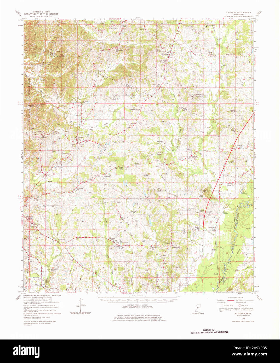 USGS TOPO Map Mississippi MS Vaughan 337151 1966 62500 Restoration Stock Photohttps://www.alamy.com/image-license-details/?v=1https://www.alamy.com/usgs-topo-map-mississippi-ms-vaughan-337151-1966-62500-restoration-image333139161.html
RM2A9YPB5–USGS TOPO Map Mississippi MS Vaughan 337151 1966 62500 Restoration
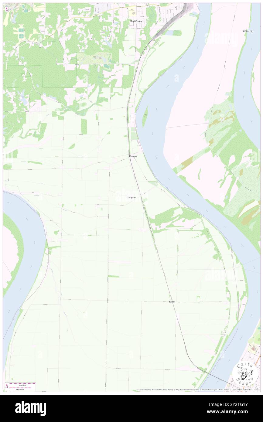 Vaughan, Vanderburgh County, US, United States, Indiana, N 37 54' 5'', S 87 37' 49'', map, Cartascapes Map published in 2024. Explore Cartascapes, a map revealing Earth's diverse landscapes, cultures, and ecosystems. Journey through time and space, discovering the interconnectedness of our planet's past, present, and future. Stock Photohttps://www.alamy.com/image-license-details/?v=1https://www.alamy.com/vaughan-vanderburgh-county-us-united-states-indiana-n-37-54-5-s-87-37-49-map-cartascapes-map-published-in-2024-explore-cartascapes-a-map-revealing-earths-diverse-landscapes-cultures-and-ecosystems-journey-through-time-and-space-discovering-the-interconnectedness-of-our-planets-past-present-and-future-image621342007.html
RM2Y2TG1Y–Vaughan, Vanderburgh County, US, United States, Indiana, N 37 54' 5'', S 87 37' 49'', map, Cartascapes Map published in 2024. Explore Cartascapes, a map revealing Earth's diverse landscapes, cultures, and ecosystems. Journey through time and space, discovering the interconnectedness of our planet's past, present, and future.
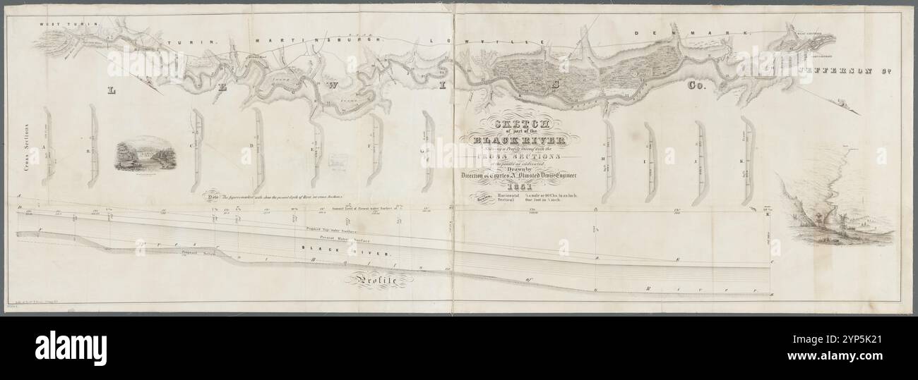 Sketch of part of the Black River: shewing a profile thereof with the cross sections at the points as indicated 1851 - 1851 by Olmsted, Charles A. Stock Photohttps://www.alamy.com/image-license-details/?v=1https://www.alamy.com/sketch-of-part-of-the-black-river-shewing-a-profile-thereof-with-the-cross-sections-at-the-points-as-indicated-1851-1851-by-olmsted-charles-a-image633220393.html
RM2YP5K21–Sketch of part of the Black River: shewing a profile thereof with the cross sections at the points as indicated 1851 - 1851 by Olmsted, Charles A.
 John Vaughan 1799 1868 Stock Photohttps://www.alamy.com/image-license-details/?v=1https://www.alamy.com/stock-photo-john-vaughan-1799-1868-142857644.html
RMJ8BMAM–John Vaughan 1799 1868
![To the Honble Sir John Vaughan K.B. and the Honble C. Carpenter This View of the TOWN AND BRIDGE OF BERWICK is with the greatest respect inscribed by their most obedient servants J. Stuart and F. Jukes. Author Jukes, Francis 32.47.e. Place of publication: London Publisher: Pubd March 20 1793 by F. Jukes No10 Howland Street., Date of publication: [March 20 1793] Item type: 1 print Medium: aquatint and etching with hand-colouring Dimensions: platemark 46 x 64 cm, on sheet 74.3 cm Former owner: George III, King of Great Britain, 1738-1820 Stock Photo To the Honble Sir John Vaughan K.B. and the Honble C. Carpenter This View of the TOWN AND BRIDGE OF BERWICK is with the greatest respect inscribed by their most obedient servants J. Stuart and F. Jukes. Author Jukes, Francis 32.47.e. Place of publication: London Publisher: Pubd March 20 1793 by F. Jukes No10 Howland Street., Date of publication: [March 20 1793] Item type: 1 print Medium: aquatint and etching with hand-colouring Dimensions: platemark 46 x 64 cm, on sheet 74.3 cm Former owner: George III, King of Great Britain, 1738-1820 Stock Photo](https://c8.alamy.com/comp/2E9HM5T/to-the-honble-sir-john-vaughan-kb-and-the-honble-c-carpenter-this-view-of-the-town-and-bridge-of-berwick-is-with-the-greatest-respect-inscribed-by-their-most-obedient-servants-j-stuart-and-f-jukes-author-jukes-francis-3247e-place-of-publication-london-publisher-pubd-march-20-1793-by-f-jukes-no10-howland-street-date-of-publication-march-20-1793-item-type-1-print-medium-aquatint-and-etching-with-hand-colouring-dimensions-platemark-46-x-64-cm-on-sheet-743-cm-former-owner-george-iii-king-of-great-britain-1738-1820-2E9HM5T.jpg) To the Honble Sir John Vaughan K.B. and the Honble C. Carpenter This View of the TOWN AND BRIDGE OF BERWICK is with the greatest respect inscribed by their most obedient servants J. Stuart and F. Jukes. Author Jukes, Francis 32.47.e. Place of publication: London Publisher: Pubd March 20 1793 by F. Jukes No10 Howland Street., Date of publication: [March 20 1793] Item type: 1 print Medium: aquatint and etching with hand-colouring Dimensions: platemark 46 x 64 cm, on sheet 74.3 cm Former owner: George III, King of Great Britain, 1738-1820 Stock Photohttps://www.alamy.com/image-license-details/?v=1https://www.alamy.com/to-the-honble-sir-john-vaughan-kb-and-the-honble-c-carpenter-this-view-of-the-town-and-bridge-of-berwick-is-with-the-greatest-respect-inscribed-by-their-most-obedient-servants-j-stuart-and-f-jukes-author-jukes-francis-3247e-place-of-publication-london-publisher-pubd-march-20-1793-by-f-jukes-no10-howland-street-date-of-publication-march-20-1793-item-type-1-print-medium-aquatint-and-etching-with-hand-colouring-dimensions-platemark-46-x-64-cm-on-sheet-743-cm-former-owner-george-iii-king-of-great-britain-1738-1820-image401759396.html
To the Honble Sir John Vaughan K.B. and the Honble C. Carpenter This View of the TOWN AND BRIDGE OF BERWICK is with the greatest respect inscribed by their most obedient servants J. Stuart and F. Jukes. Author Jukes, Francis 32.47.e. Place of publication: London Publisher: Pubd March 20 1793 by F. Jukes No10 Howland Street., Date of publication: [March 20 1793] Item type: 1 print Medium: aquatint and etching with hand-colouring Dimensions: platemark 46 x 64 cm, on sheet 74.3 cm Former owner: George III, King of Great Britain, 1738-1820 Stock Photohttps://www.alamy.com/image-license-details/?v=1https://www.alamy.com/to-the-honble-sir-john-vaughan-kb-and-the-honble-c-carpenter-this-view-of-the-town-and-bridge-of-berwick-is-with-the-greatest-respect-inscribed-by-their-most-obedient-servants-j-stuart-and-f-jukes-author-jukes-francis-3247e-place-of-publication-london-publisher-pubd-march-20-1793-by-f-jukes-no10-howland-street-date-of-publication-march-20-1793-item-type-1-print-medium-aquatint-and-etching-with-hand-colouring-dimensions-platemark-46-x-64-cm-on-sheet-743-cm-former-owner-george-iii-king-of-great-britain-1738-1820-image401759396.htmlRM2E9HM5T–To the Honble Sir John Vaughan K.B. and the Honble C. Carpenter This View of the TOWN AND BRIDGE OF BERWICK is with the greatest respect inscribed by their most obedient servants J. Stuart and F. Jukes. Author Jukes, Francis 32.47.e. Place of publication: London Publisher: Pubd March 20 1793 by F. Jukes No10 Howland Street., Date of publication: [March 20 1793] Item type: 1 print Medium: aquatint and etching with hand-colouring Dimensions: platemark 46 x 64 cm, on sheet 74.3 cm Former owner: George III, King of Great Britain, 1738-1820
![5 of '[Facing Death; or, the Hero of the Vaughan Pit. A tale of the coal mines.]' Stock Photo 5 of '[Facing Death; or, the Hero of the Vaughan Pit. A tale of the coal mines.]' Stock Photo](https://c8.alamy.com/comp/FG57CB/5-of-facing-death-or-the-hero-of-the-vaughan-pit-a-tale-of-the-coal-FG57CB.jpg) 5 of '[Facing Death; or, the Hero of the Vaughan Pit. A tale of the coal mines.]' Stock Photohttps://www.alamy.com/image-license-details/?v=1https://www.alamy.com/stock-photo-5-of-facing-death-or-the-hero-of-the-vaughan-pit-a-tale-of-the-coal-96001931.html
5 of '[Facing Death; or, the Hero of the Vaughan Pit. A tale of the coal mines.]' Stock Photohttps://www.alamy.com/image-license-details/?v=1https://www.alamy.com/stock-photo-5-of-facing-death-or-the-hero-of-the-vaughan-pit-a-tale-of-the-coal-96001931.htmlRFFG57CB–5 of '[Facing Death; or, the Hero of the Vaughan Pit. A tale of the coal mines.]'
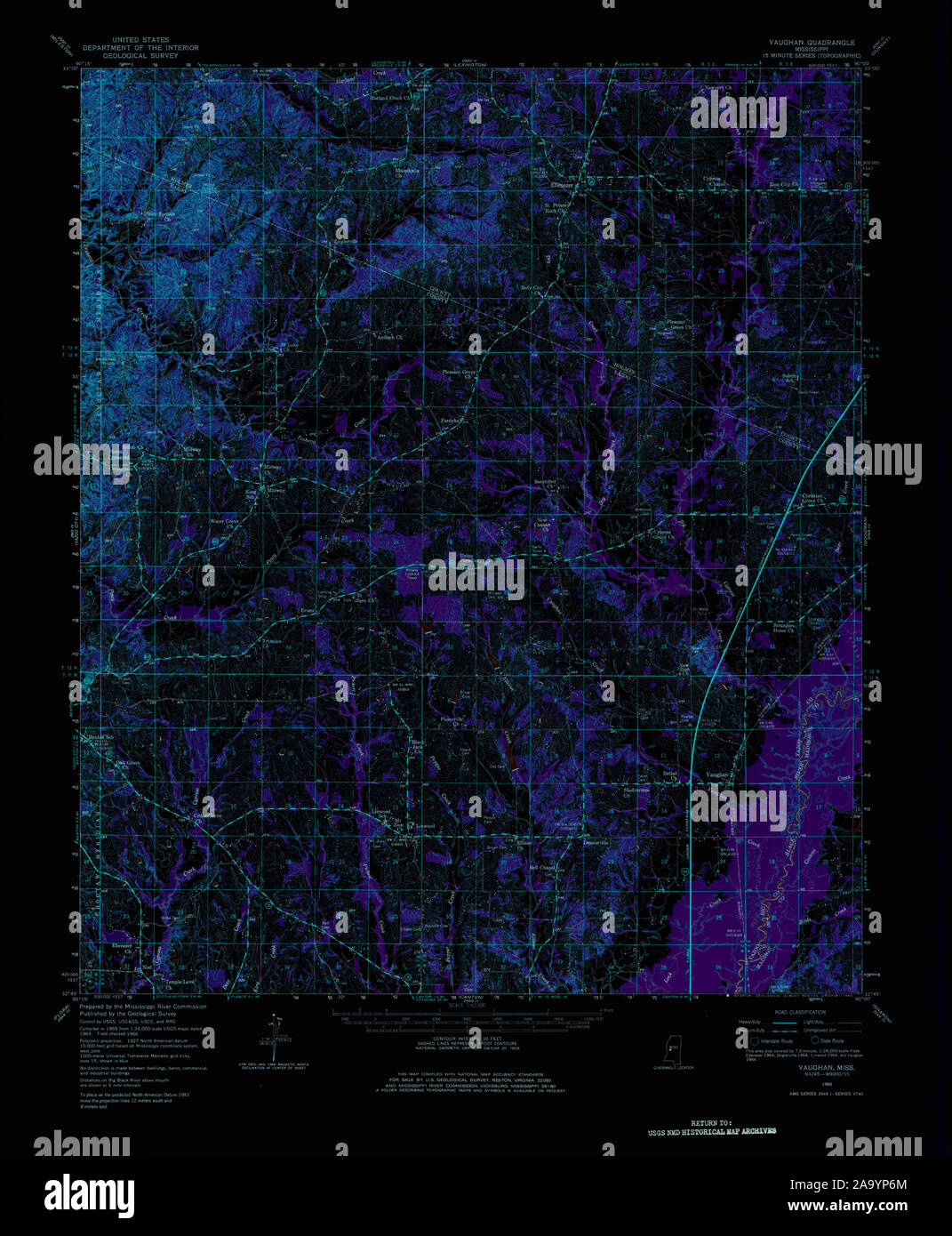 USGS TOPO Map Mississippi MS Vaughan 337151 1966 62500 Inverted Restoration Stock Photohttps://www.alamy.com/image-license-details/?v=1https://www.alamy.com/usgs-topo-map-mississippi-ms-vaughan-337151-1966-62500-inverted-restoration-image333139036.html
RM2A9YP6M–USGS TOPO Map Mississippi MS Vaughan 337151 1966 62500 Inverted Restoration
 Vaughan, Hill County, US, United States, Texas, N 31 54' 52'', S 97 10' 25'', map, Cartascapes Map published in 2024. Explore Cartascapes, a map revealing Earth's diverse landscapes, cultures, and ecosystems. Journey through time and space, discovering the interconnectedness of our planet's past, present, and future. Stock Photohttps://www.alamy.com/image-license-details/?v=1https://www.alamy.com/vaughan-hill-county-us-united-states-texas-n-31-54-52-s-97-10-25-map-cartascapes-map-published-in-2024-explore-cartascapes-a-map-revealing-earths-diverse-landscapes-cultures-and-ecosystems-journey-through-time-and-space-discovering-the-interconnectedness-of-our-planets-past-present-and-future-image621438643.html
RM2Y30Y97–Vaughan, Hill County, US, United States, Texas, N 31 54' 52'', S 97 10' 25'', map, Cartascapes Map published in 2024. Explore Cartascapes, a map revealing Earth's diverse landscapes, cultures, and ecosystems. Journey through time and space, discovering the interconnectedness of our planet's past, present, and future.
 Major John Vaughan, C. 1808 Stock Photohttps://www.alamy.com/image-license-details/?v=1https://www.alamy.com/stock-photo-major-john-vaughan-c-1808-142896310.html
RMJ8DDKJ–Major John Vaughan, C. 1808
 Charles John Vaughan, by Walter William Ouless Stock Photohttps://www.alamy.com/image-license-details/?v=1https://www.alamy.com/stock-photo-charles-john-vaughan-by-walter-william-ouless-139730204.html
RMJ3978C–Charles John Vaughan, by Walter William Ouless
![[Facing Death: or, the Hero of the Vaughan Pit. A tale of the coal mines.] Image taken from page 55 of '[Facing Death or, the Stock Photo [Facing Death: or, the Hero of the Vaughan Pit. A tale of the coal mines.] Image taken from page 55 of '[Facing Death or, the Stock Photo](https://c8.alamy.com/comp/HBP1CM/facing-death-or-the-hero-of-the-vaughan-pit-a-tale-of-the-coal-mines-HBP1CM.jpg) [Facing Death: or, the Hero of the Vaughan Pit. A tale of the coal mines.] Image taken from page 55 of '[Facing Death or, the Stock Photohttps://www.alamy.com/image-license-details/?v=1https://www.alamy.com/stock-photo-facing-death-or-the-hero-of-the-vaughan-pit-a-tale-of-the-coal-mines-127717876.html
[Facing Death: or, the Hero of the Vaughan Pit. A tale of the coal mines.] Image taken from page 55 of '[Facing Death or, the Stock Photohttps://www.alamy.com/image-license-details/?v=1https://www.alamy.com/stock-photo-facing-death-or-the-hero-of-the-vaughan-pit-a-tale-of-the-coal-mines-127717876.htmlRMHBP1CM–[Facing Death: or, the Hero of the Vaughan Pit. A tale of the coal mines.] Image taken from page 55 of '[Facing Death or, the
 Leo XIII to William Vaughan bishop of Plymouth Stock Photohttps://www.alamy.com/image-license-details/?v=1https://www.alamy.com/stock-photo-leo-xiii-to-william-vaughan-bishop-of-plymouth-140471567.html
RMJ4F0WK–Leo XIII to William Vaughan bishop of Plymouth
 Crossroad at Terenure (Eagle House), including a tram, Terenure, Co 32221105564 o Stock Photohttps://www.alamy.com/image-license-details/?v=1https://www.alamy.com/stock-photo-crossroad-at-terenure-eagle-house-including-a-tram-terenure-co-32221105564-147097637.html
RMJF8TF1–Crossroad at Terenure (Eagle House), including a tram, Terenure, Co 32221105564 o
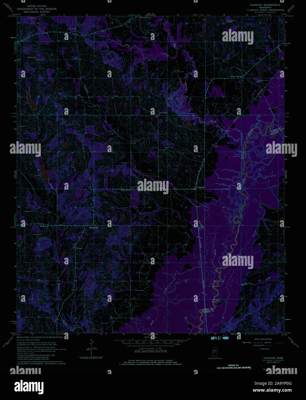 USGS TOPO Map Mississippi MS Vaughan 336635 1964 24000 Inverted Restoration Stock Photohttps://www.alamy.com/image-license-details/?v=1https://www.alamy.com/usgs-topo-map-mississippi-ms-vaughan-336635-1964-24000-inverted-restoration-image333138864.html
RM2A9YP0G–USGS TOPO Map Mississippi MS Vaughan 336635 1964 24000 Inverted Restoration
![[Facing Death: or, the Hero of the Vaughan Pit. A tale of the coal mines.] Image taken from page 232 of '[Facing D Stock Photo [Facing Death: or, the Hero of the Vaughan Pit. A tale of the coal mines.] Image taken from page 232 of '[Facing D Stock Photo](https://c8.alamy.com/comp/HK681P/facing-death-or-the-hero-of-the-vaughan-pit-a-tale-of-the-coal-mines-HK681P.jpg) [Facing Death: or, the Hero of the Vaughan Pit. A tale of the coal mines.] Image taken from page 232 of '[Facing D Stock Photohttps://www.alamy.com/image-license-details/?v=1https://www.alamy.com/stock-photo-facing-death-or-the-hero-of-the-vaughan-pit-a-tale-of-the-coal-mines-132289074.html
[Facing Death: or, the Hero of the Vaughan Pit. A tale of the coal mines.] Image taken from page 232 of '[Facing D Stock Photohttps://www.alamy.com/image-license-details/?v=1https://www.alamy.com/stock-photo-facing-death-or-the-hero-of-the-vaughan-pit-a-tale-of-the-coal-mines-132289074.htmlRMHK681P–[Facing Death: or, the Hero of the Vaughan Pit. A tale of the coal mines.] Image taken from page 232 of '[Facing D
 Vaughan, Yazoo County, US, United States, Mississippi, N 32 48' 23'', S 90 2' 30'', map, Cartascapes Map published in 2024. Explore Cartascapes, a map revealing Earth's diverse landscapes, cultures, and ecosystems. Journey through time and space, discovering the interconnectedness of our planet's past, present, and future. Stock Photohttps://www.alamy.com/image-license-details/?v=1https://www.alamy.com/vaughan-yazoo-county-us-united-states-mississippi-n-32-48-23-s-90-2-30-map-cartascapes-map-published-in-2024-explore-cartascapes-a-map-revealing-earths-diverse-landscapes-cultures-and-ecosystems-journey-through-time-and-space-discovering-the-interconnectedness-of-our-planets-past-present-and-future-image621197489.html
RM2Y2HYMH–Vaughan, Yazoo County, US, United States, Mississippi, N 32 48' 23'', S 90 2' 30'', map, Cartascapes Map published in 2024. Explore Cartascapes, a map revealing Earth's diverse landscapes, cultures, and ecosystems. Journey through time and space, discovering the interconnectedness of our planet's past, present, and future.
 Allers Father Bernard Vaughan S.J. Stock Photohttps://www.alamy.com/image-license-details/?v=1https://www.alamy.com/stock-photo-allers-father-bernard-vaughan-sj-139482680.html
RMJ2WYG8–Allers Father Bernard Vaughan S.J.
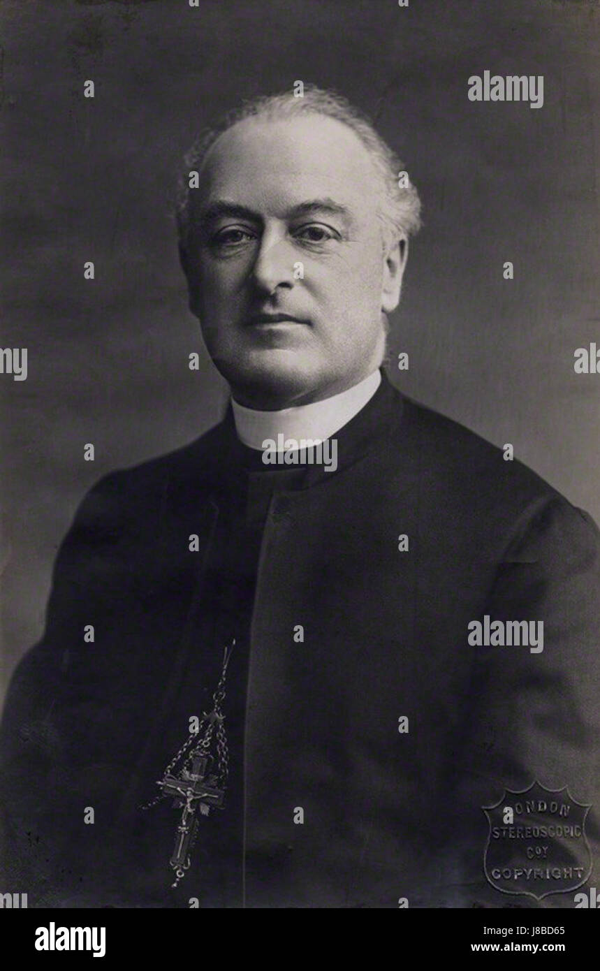 Herbert Alfred Henry Joseph Thomas Vaughan Stock Photohttps://www.alamy.com/image-license-details/?v=1https://www.alamy.com/stock-photo-herbert-alfred-henry-joseph-thomas-vaughan-142852029.html
RMJ8BD65–Herbert Alfred Henry Joseph Thomas Vaughan
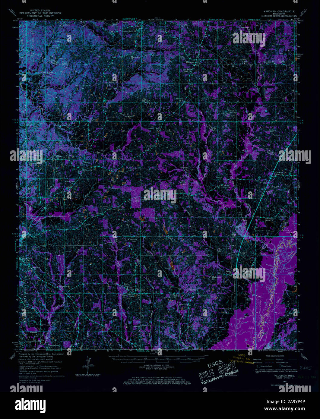 USGS TOPO Map Mississippi MS Vaughan 337150 1966 62500 Inverted Restoration Stock Photohttps://www.alamy.com/image-license-details/?v=1https://www.alamy.com/usgs-topo-map-mississippi-ms-vaughan-337150-1966-62500-inverted-restoration-image333138982.html
RM2A9YP4P–USGS TOPO Map Mississippi MS Vaughan 337150 1966 62500 Inverted Restoration
 John Vaughan (1603 1674), follower of John Michael Wright Stock Photohttps://www.alamy.com/image-license-details/?v=1https://www.alamy.com/stock-photo-john-vaughan-1603-1674-follower-of-john-michael-wright-140058073.html
RMJ3T5E1–John Vaughan (1603 1674), follower of John Michael Wright
 Vaughan Springs, Central Desert, AU, Australia, Northern Territory, S 22 18' 7'', N 130 50' 49'', map, Cartascapes Map published in 2024. Explore Cartascapes, a map revealing Earth's diverse landscapes, cultures, and ecosystems. Journey through time and space, discovering the interconnectedness of our planet's past, present, and future. Stock Photohttps://www.alamy.com/image-license-details/?v=1https://www.alamy.com/vaughan-springs-central-desert-au-australia-northern-territory-s-22-18-7-n-130-50-49-map-cartascapes-map-published-in-2024-explore-cartascapes-a-map-revealing-earths-diverse-landscapes-cultures-and-ecosystems-journey-through-time-and-space-discovering-the-interconnectedness-of-our-planets-past-present-and-future-image625575104.html
RM2Y9NBC0–Vaughan Springs, Central Desert, AU, Australia, Northern Territory, S 22 18' 7'', N 130 50' 49'', map, Cartascapes Map published in 2024. Explore Cartascapes, a map revealing Earth's diverse landscapes, cultures, and ecosystems. Journey through time and space, discovering the interconnectedness of our planet's past, present, and future.
![[Facing Death: or, the Hero of the Vaughan Pit. A tale of the coal mines.] Image taken from page 8 of '[Facing D Stock Photo [Facing Death: or, the Hero of the Vaughan Pit. A tale of the coal mines.] Image taken from page 8 of '[Facing D Stock Photo](https://c8.alamy.com/comp/HK9RTB/facing-death-or-the-hero-of-the-vaughan-pit-a-tale-of-the-coal-mines-HK9RTB.jpg) [Facing Death: or, the Hero of the Vaughan Pit. A tale of the coal mines.] Image taken from page 8 of '[Facing D Stock Photohttps://www.alamy.com/image-license-details/?v=1https://www.alamy.com/stock-photo-facing-death-or-the-hero-of-the-vaughan-pit-a-tale-of-the-coal-mines-132367323.html
[Facing Death: or, the Hero of the Vaughan Pit. A tale of the coal mines.] Image taken from page 8 of '[Facing D Stock Photohttps://www.alamy.com/image-license-details/?v=1https://www.alamy.com/stock-photo-facing-death-or-the-hero-of-the-vaughan-pit-a-tale-of-the-coal-mines-132367323.htmlRMHK9RTB–[Facing Death: or, the Hero of the Vaughan Pit. A tale of the coal mines.] Image taken from page 8 of '[Facing D
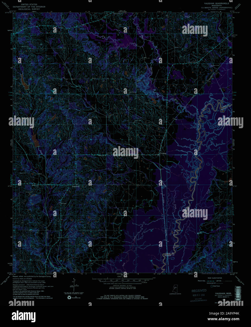 USGS TOPO Map Mississippi MS Vaughan 336637 1964 24000 Inverted Restoration Stock Photohttps://www.alamy.com/image-license-details/?v=1https://www.alamy.com/usgs-topo-map-mississippi-ms-vaughan-336637-1964-24000-inverted-restoration-image333138979.html
RM2A9YP4K–USGS TOPO Map Mississippi MS Vaughan 336637 1964 24000 Inverted Restoration
 Charles John Vaughan, Vanity Fair, 1872 08 24 Stock Photohttps://www.alamy.com/image-license-details/?v=1https://www.alamy.com/stock-photo-charles-john-vaughan-vanity-fair-1872-08-24-139725613.html
RMJ391CD–Charles John Vaughan, Vanity Fair, 1872 08 24
 Vaughan Meadows, Montgomery County, US, United States, Alabama, N 32 20' 47'', S 86 15' 7'', map, Cartascapes Map published in 2024. Explore Cartascapes, a map revealing Earth's diverse landscapes, cultures, and ecosystems. Journey through time and space, discovering the interconnectedness of our planet's past, present, and future. Stock Photohttps://www.alamy.com/image-license-details/?v=1https://www.alamy.com/vaughan-meadows-montgomery-county-us-united-states-alabama-n-32-20-47-s-86-15-7-map-cartascapes-map-published-in-2024-explore-cartascapes-a-map-revealing-earths-diverse-landscapes-cultures-and-ecosystems-journey-through-time-and-space-discovering-the-interconnectedness-of-our-planets-past-present-and-future-image621192361.html
RM2Y2HN5D–Vaughan Meadows, Montgomery County, US, United States, Alabama, N 32 20' 47'', S 86 15' 7'', map, Cartascapes Map published in 2024. Explore Cartascapes, a map revealing Earth's diverse landscapes, cultures, and ecosystems. Journey through time and space, discovering the interconnectedness of our planet's past, present, and future.
 Vaughan Richardson The Lord hear thee. (BL Add MS 42065 f. 14r) Stock Photohttps://www.alamy.com/image-license-details/?v=1https://www.alamy.com/stock-photo-vaughan-richardson-the-lord-hear-thee-bl-add-ms-42065-f-14r-140690160.html
RMJ4TYMG–Vaughan Richardson The Lord hear thee. (BL Add MS 42065 f. 14r)