Quick filters:
Map of westphalia Stock Photos and Images
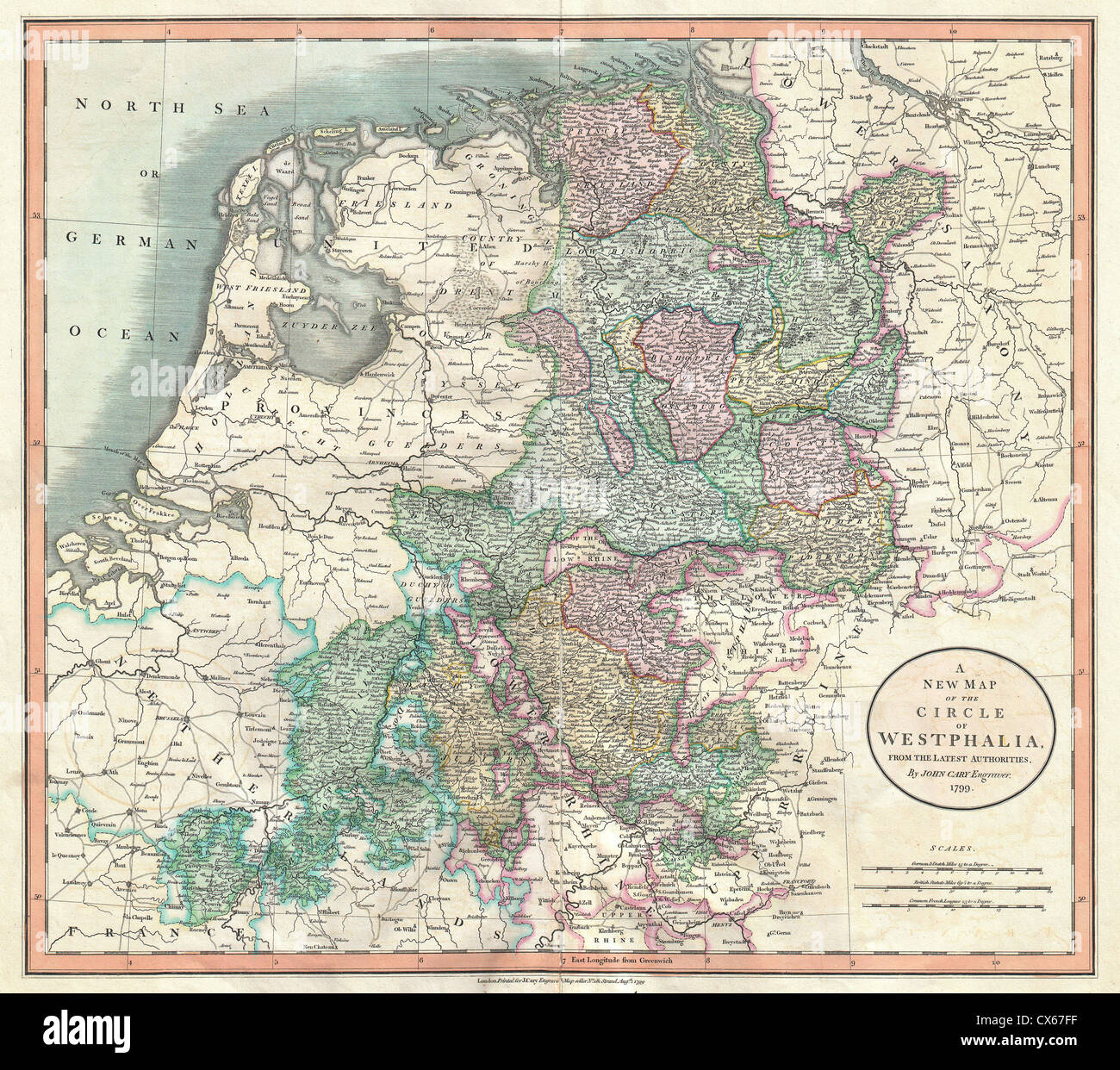 1801 Cary Map of Westphalia, Germany Stock Photohttps://www.alamy.com/image-license-details/?v=1https://www.alamy.com/stock-photo-1801-cary-map-of-westphalia-germany-50539427.html
RMCX67FF–1801 Cary Map of Westphalia, Germany
 1761, Homann Heirs Map of Westphalia, Bremen, Hamburg, Cologne, Bonn, etc Stock Photohttps://www.alamy.com/image-license-details/?v=1https://www.alamy.com/stock-image-1761-homann-heirs-map-of-westphalia-bremen-hamburg-cologne-bonn-etc-162567691.html
RMKCDGMY–1761, Homann Heirs Map of Westphalia, Bremen, Hamburg, Cologne, Bonn, etc
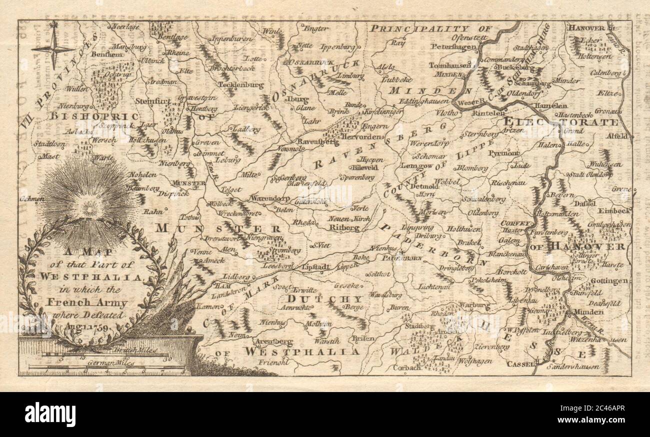 A map of that part of Westphalia… Kassel Munster Hanover. GENTS MAG 1759 Stock Photohttps://www.alamy.com/image-license-details/?v=1https://www.alamy.com/a-map-of-that-part-of-westphalia-kassel-munster-hanover-gents-mag-1759-image364016543.html
RF2C46APR–A map of that part of Westphalia… Kassel Munster Hanover. GENTS MAG 1759
 Westphalia Indiana USA shown on a geography map or road map Stock Photohttps://www.alamy.com/image-license-details/?v=1https://www.alamy.com/westphalia-indiana-usa-shown-on-a-geography-map-or-road-map-image425286005.html
RM2FKWCHW–Westphalia Indiana USA shown on a geography map or road map
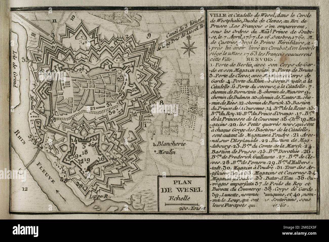 Map of Wesel and its citadel, 1763. North Rhine-Westphalia, Germany. Published in 1765 by the cartographer Jean de Beaurain (1696-1771) as an illustration of his Great Map of Germany, with the events that took place during the War of the Seven Years. Engraving. French edition, 1765. Military Historical Library of Barcelona (Biblioteca Histórico Militar de Barcelona). Catalonia. Spain. Stock Photohttps://www.alamy.com/image-license-details/?v=1https://www.alamy.com/map-of-wesel-and-its-citadel-1763-north-rhine-westphalia-germany-published-in-1765-by-the-cartographer-jean-de-beaurain-1696-1771-as-an-illustration-of-his-great-map-of-germany-with-the-events-that-took-place-during-the-war-of-the-seven-years-engraving-french-edition-1765-military-historical-library-of-barcelona-biblioteca-histrico-militar-de-barcelona-catalonia-spain-image499165059.html
RM2M02X3F–Map of Wesel and its citadel, 1763. North Rhine-Westphalia, Germany. Published in 1765 by the cartographer Jean de Beaurain (1696-1771) as an illustration of his Great Map of Germany, with the events that took place during the War of the Seven Years. Engraving. French edition, 1765. Military Historical Library of Barcelona (Biblioteca Histórico Militar de Barcelona). Catalonia. Spain.
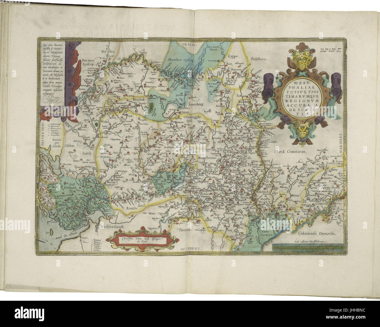 Map of Westphalia by Abraham Ortelius Stock Photohttps://www.alamy.com/image-license-details/?v=1https://www.alamy.com/stock-photo-map-of-westphalia-by-abraham-ortelius-148514504.html
RMJHHBNC–Map of Westphalia by Abraham Ortelius
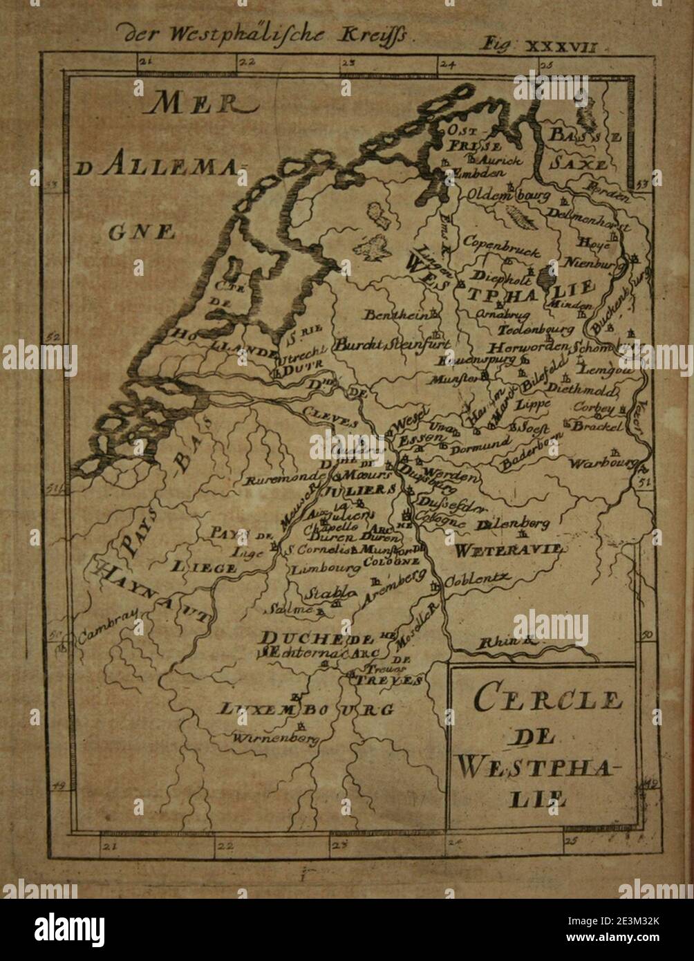 Map of Westphalia, 1685. Stock Photohttps://www.alamy.com/image-license-details/?v=1https://www.alamy.com/map-of-westphalia-1685-image398123899.html
RM2E3M32K–Map of Westphalia, 1685.
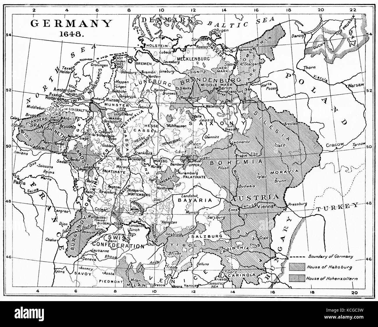 Map of Germany in 1648 after the Peace of Westphalia. From Hutchinson's History of the Nations, published 1915. Stock Photohttps://www.alamy.com/image-license-details/?v=1https://www.alamy.com/stock-image-map-of-germany-in-1648-after-the-peace-of-westphalia-from-hutchinsons-162629933.html
RMKCGC3W–Map of Germany in 1648 after the Peace of Westphalia. From Hutchinson's History of the Nations, published 1915.
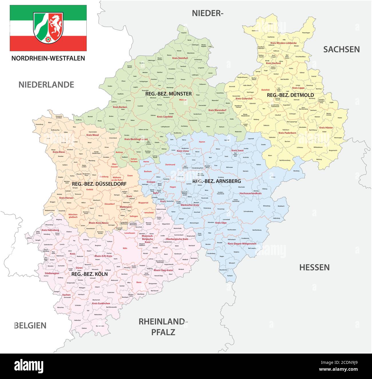 administrative vector map of the state of North Rhine-Westphalia with flag in German language, Germany Stock Vectorhttps://www.alamy.com/image-license-details/?v=1https://www.alamy.com/administrative-vector-map-of-the-state-of-north-rhine-westphalia-with-flag-in-german-language-germany-image369876817.html
RF2CDN9J9–administrative vector map of the state of North Rhine-Westphalia with flag in German language, Germany
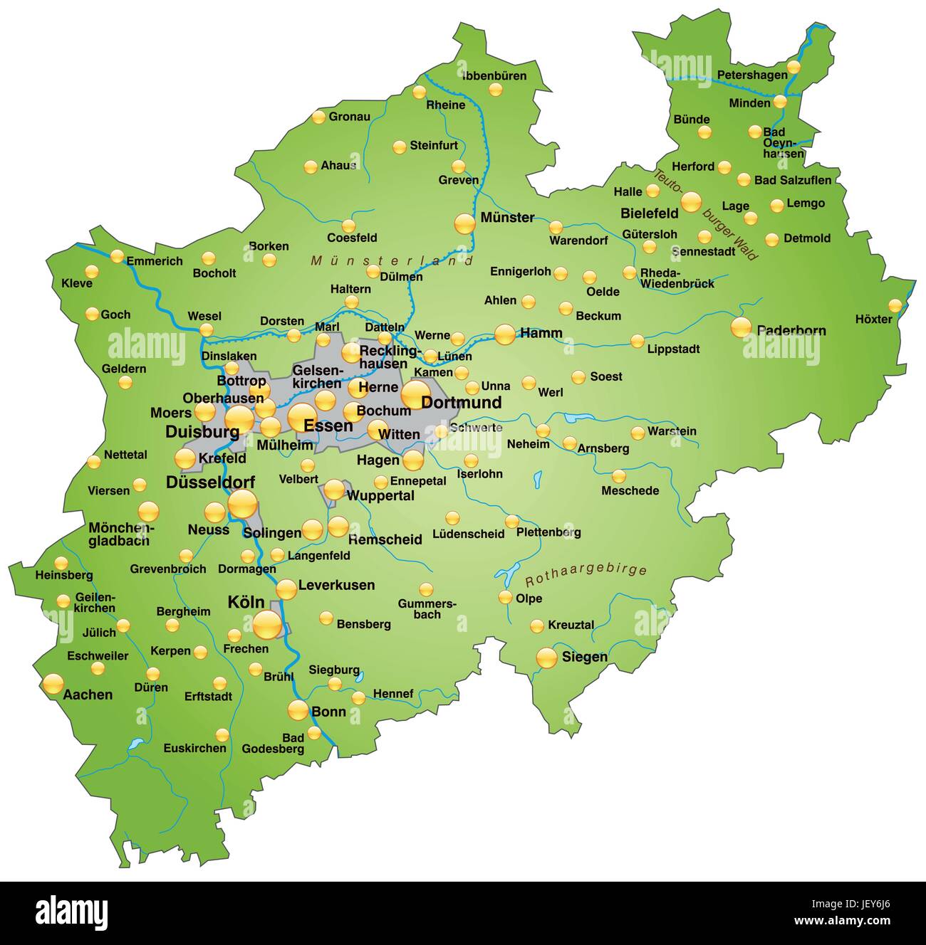 map of north rhine-westphalia as an overview map in green Stock Vectorhttps://www.alamy.com/image-license-details/?v=1https://www.alamy.com/stock-photo-map-of-north-rhine-westphalia-as-an-overview-map-in-green-146886046.html
RFJEY6J6–map of north rhine-westphalia as an overview map in green
 State of North Rhine-Westphalia, Germany, Relief Map Stock Photohttps://www.alamy.com/image-license-details/?v=1https://www.alamy.com/stock-photo-state-of-north-rhine-westphalia-germany-relief-map-71602971.html
RME4DP8Y–State of North Rhine-Westphalia, Germany, Relief Map
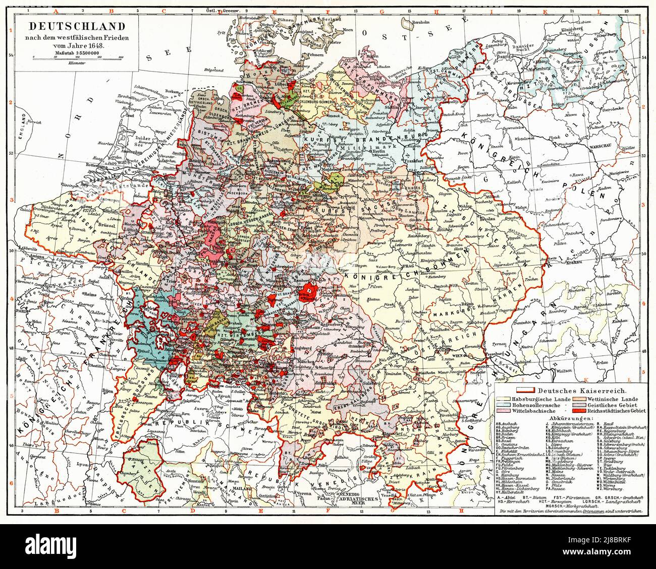 Map of Germany after the Peace of Westphalia of 1648. Publication of the book 'Meyers Konversations-Lexikon', Volume 2, Leipzig, Germany, 1910 Stock Photohttps://www.alamy.com/image-license-details/?v=1https://www.alamy.com/map-of-germany-after-the-peace-of-westphalia-of-1648-publication-of-the-book-meyers-konversations-lexikon-volume-2-leipzig-germany-1910-image469857235.html
RF2J8BRKF–Map of Germany after the Peace of Westphalia of 1648. Publication of the book 'Meyers Konversations-Lexikon', Volume 2, Leipzig, Germany, 1910
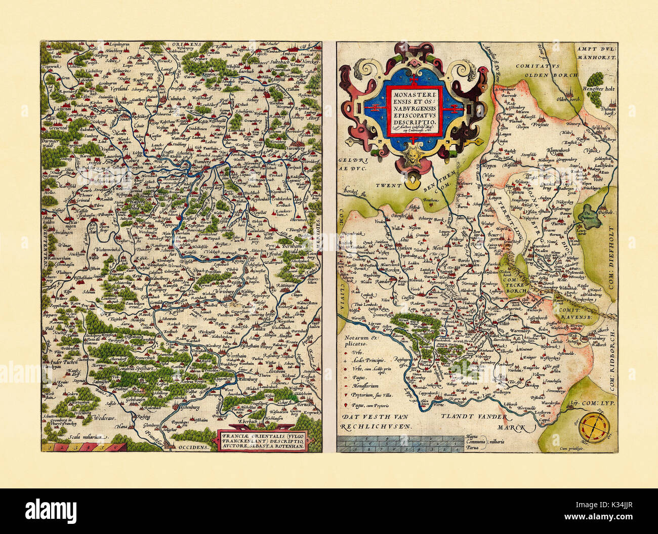 Old maps of Westphalia and Bavaria. Excellent state of preservation realized in ancient style. Side by side graphic composition. By Ortelius, Theatrum Orbis Terrarum, Antwerp, 1570 Stock Photohttps://www.alamy.com/image-license-details/?v=1https://www.alamy.com/old-maps-of-westphalia-and-bavaria-excellent-state-of-preservation-image156839727.html
RFK34JJR–Old maps of Westphalia and Bavaria. Excellent state of preservation realized in ancient style. Side by side graphic composition. By Ortelius, Theatrum Orbis Terrarum, Antwerp, 1570
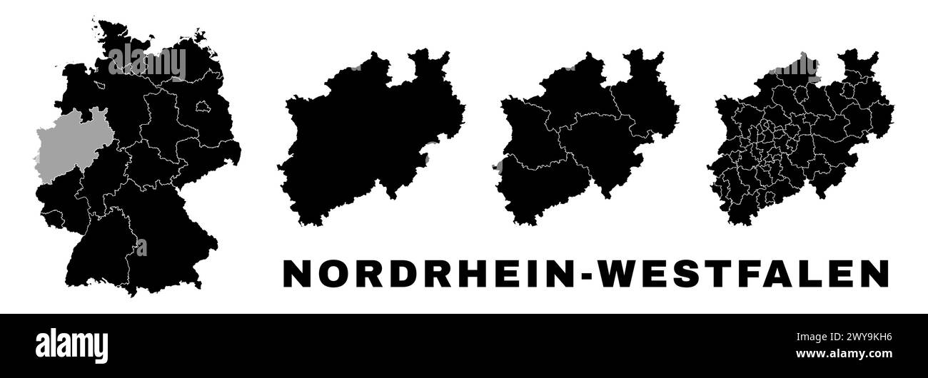 North Rhine-Westphalia map, German state. Germany administrative division, regions and boroughs, amt and municipalities. Stock Vectorhttps://www.alamy.com/image-license-details/?v=1https://www.alamy.com/north-rhine-westphalia-map-german-state-germany-administrative-division-regions-and-boroughs-amt-and-municipalities-image601961170.html
RF2WY9KH6–North Rhine-Westphalia map, German state. Germany administrative division, regions and boroughs, amt and municipalities.
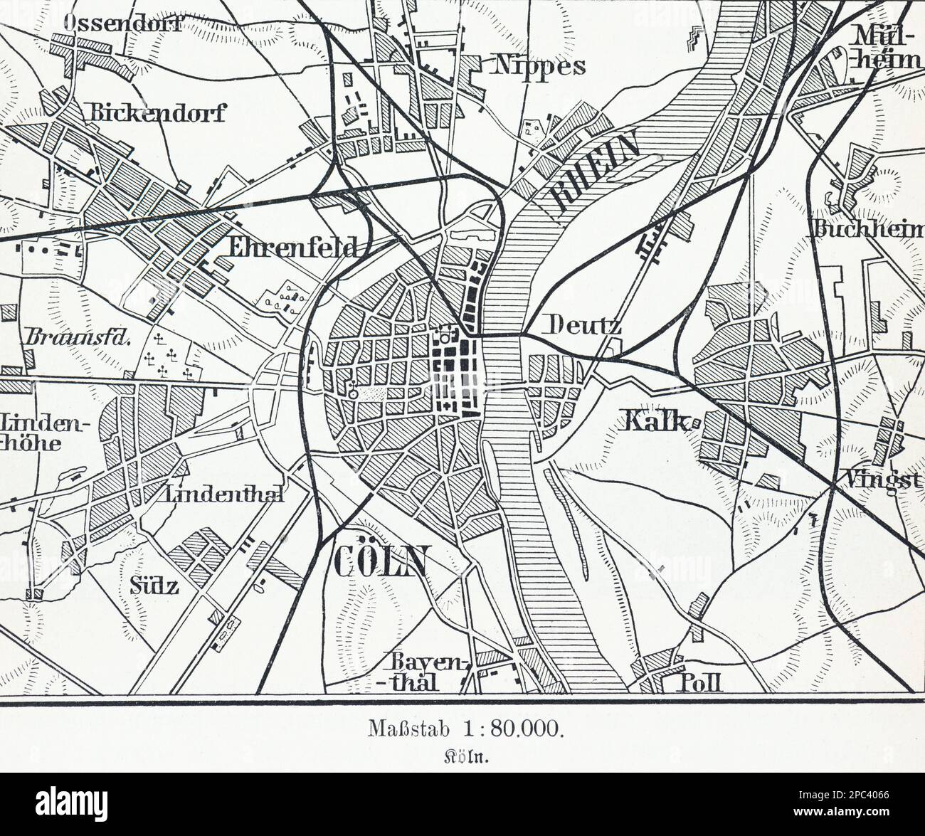 City map of Cologne on the Rhine and its surroundings, Cologne, North Rhein-Westphalia, Germany, Central Europe Stock Photohttps://www.alamy.com/image-license-details/?v=1https://www.alamy.com/city-map-of-cologne-on-the-rhine-and-its-surroundings-cologne-north-rhein-westphalia-germany-central-europe-image540985262.html
RM2PC4066–City map of Cologne on the Rhine and its surroundings, Cologne, North Rhein-Westphalia, Germany, Central Europe
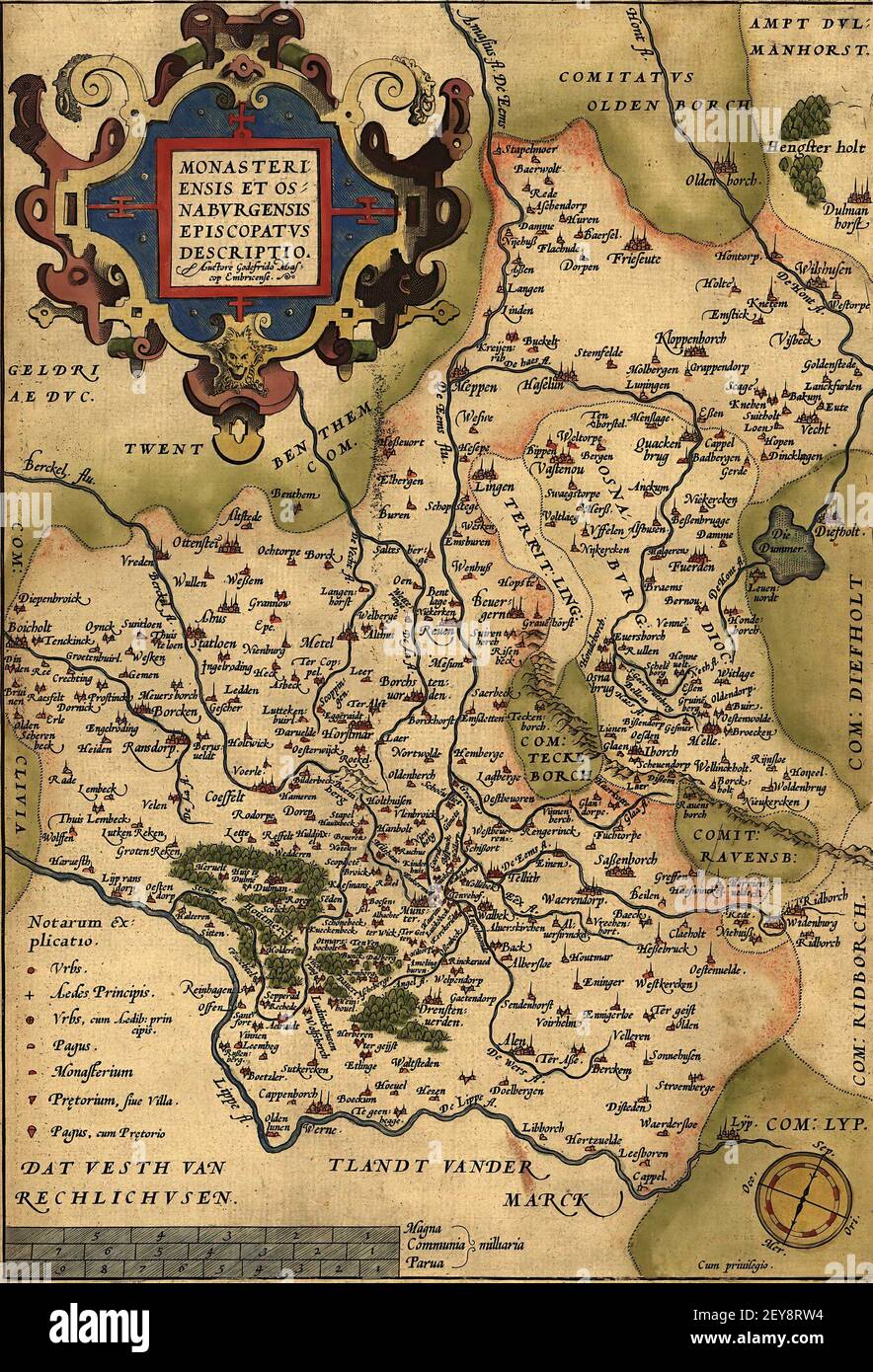 A vertical old map of Westphalia and Bavaria, a 17th-century map Stock Photohttps://www.alamy.com/image-license-details/?v=1https://www.alamy.com/a-vertical-old-map-of-westphalia-and-bavaria-a-17th-century-map-image412628528.html
RF2EY8RW4–A vertical old map of Westphalia and Bavaria, a 17th-century map
 north rhine westphalia, north rhine-westphalias Stock Photohttps://www.alamy.com/image-license-details/?v=1https://www.alamy.com/north-rhine-westphalia-north-rhine-westphalias-image455915112.html
RF2HDMMAG–north rhine westphalia, north rhine-westphalias
 North Rhine-Westphalia blank outline map set Stock Vectorhttps://www.alamy.com/image-license-details/?v=1https://www.alamy.com/north-rhine-westphalia-blank-outline-map-set-image177775827.html
RFM96ATK–North Rhine-Westphalia blank outline map set
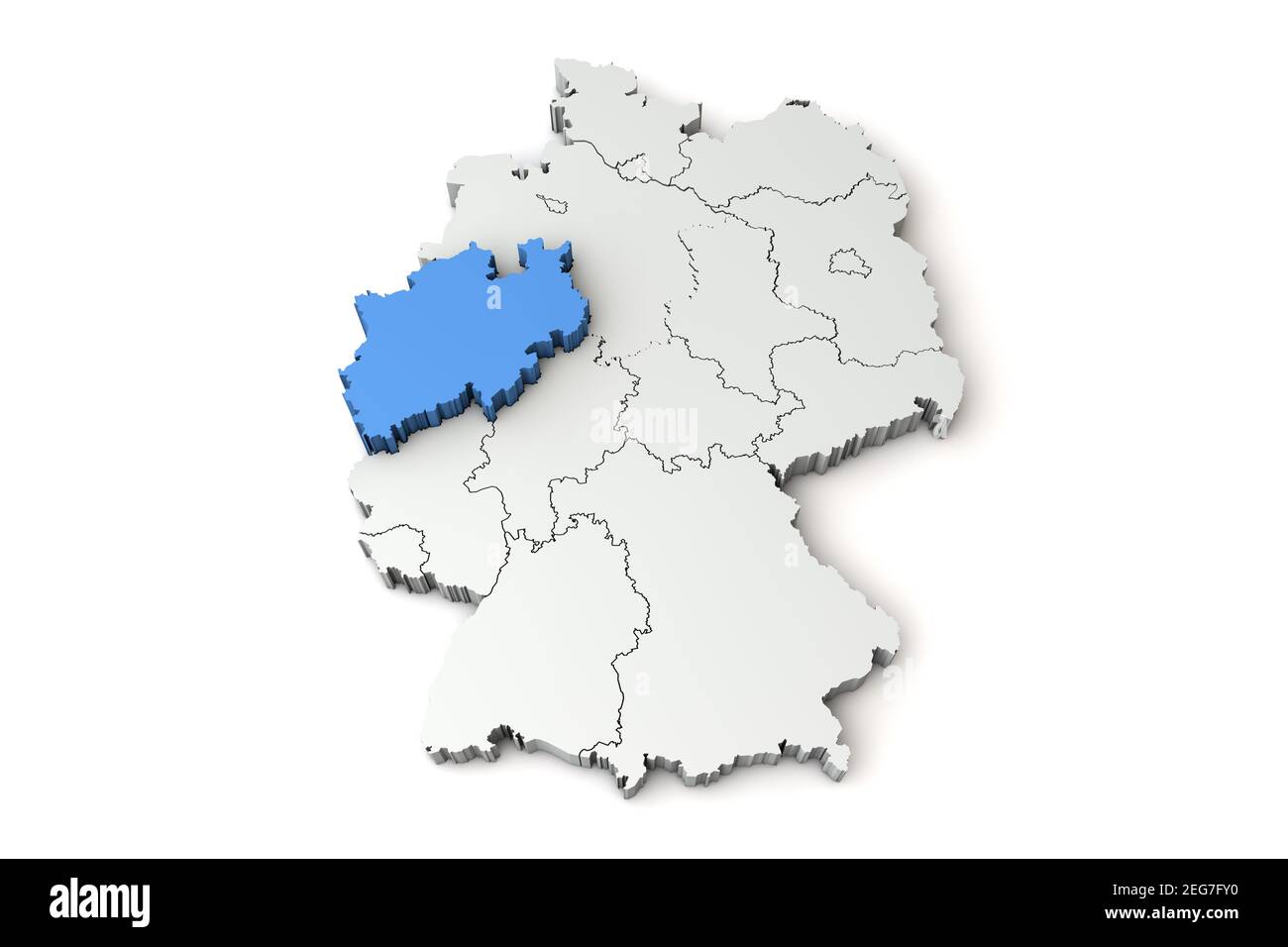 Map of Germany showing North Rhine Westphalia region. 3D Rendering Stock Photohttps://www.alamy.com/image-license-details/?v=1https://www.alamy.com/map-of-germany-showing-north-rhine-westphalia-region-3d-rendering-image405839140.html
RF2EG7FY0–Map of Germany showing North Rhine Westphalia region. 3D Rendering
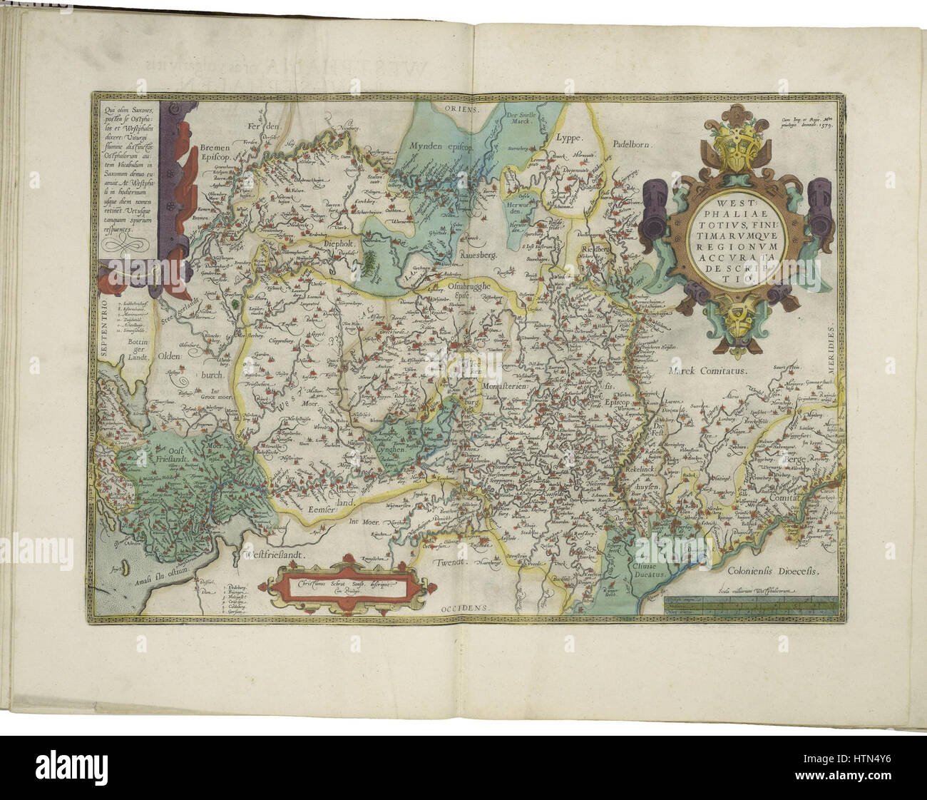 Map of Westphalia by Abraham Ortelius Stock Photohttps://www.alamy.com/image-license-details/?v=1https://www.alamy.com/stock-photo-map-of-westphalia-by-abraham-ortelius-135689210.html
RMHTN4Y6–Map of Westphalia by Abraham Ortelius
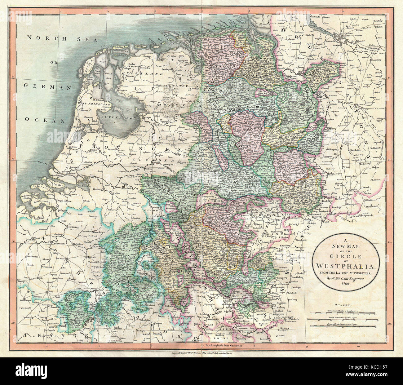 1801, Cary Map of Westphalia, Germany, John Cary, 1754 – 1835, English cartographer Stock Photohttps://www.alamy.com/image-license-details/?v=1https://www.alamy.com/stock-image-1801-cary-map-of-westphalia-germany-john-cary-1754-1835-english-cartographer-162568035.html
RMKCDH57–1801, Cary Map of Westphalia, Germany, John Cary, 1754 – 1835, English cartographer
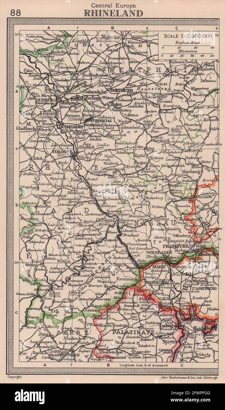 Rhineland. Westphalia. Germany. BARTHOLOMEW 1949 old vintage map plan chart Stock Photohttps://www.alamy.com/image-license-details/?v=1https://www.alamy.com/rhineland-westphalia-germany-bartholomew-1949-old-vintage-map-plan-chart-image428910400.html
RF2FWPFGG–Rhineland. Westphalia. Germany. BARTHOLOMEW 1949 old vintage map plan chart
 Else, DE, Germany, North Rhine-Westphalia, N 51 25' 59'', N 7 34' 0'', map, Cartascapes Map published in 2024. Explore Cartascapes, a map revealing Earth's diverse landscapes, cultures, and ecosystems. Journey through time and space, discovering the interconnectedness of our planet's past, present, and future. Stock Photohttps://www.alamy.com/image-license-details/?v=1https://www.alamy.com/else-de-germany-north-rhine-westphalia-n-51-25-59-n-7-34-0-map-cartascapes-map-published-in-2024-explore-cartascapes-a-map-revealing-earths-diverse-landscapes-cultures-and-ecosystems-journey-through-time-and-space-discovering-the-interconnectedness-of-our-planets-past-present-and-future-image629478617.html
RM2YG36B5–Else, DE, Germany, North Rhine-Westphalia, N 51 25' 59'', N 7 34' 0'', map, Cartascapes Map published in 2024. Explore Cartascapes, a map revealing Earth's diverse landscapes, cultures, and ecosystems. Journey through time and space, discovering the interconnectedness of our planet's past, present, and future.
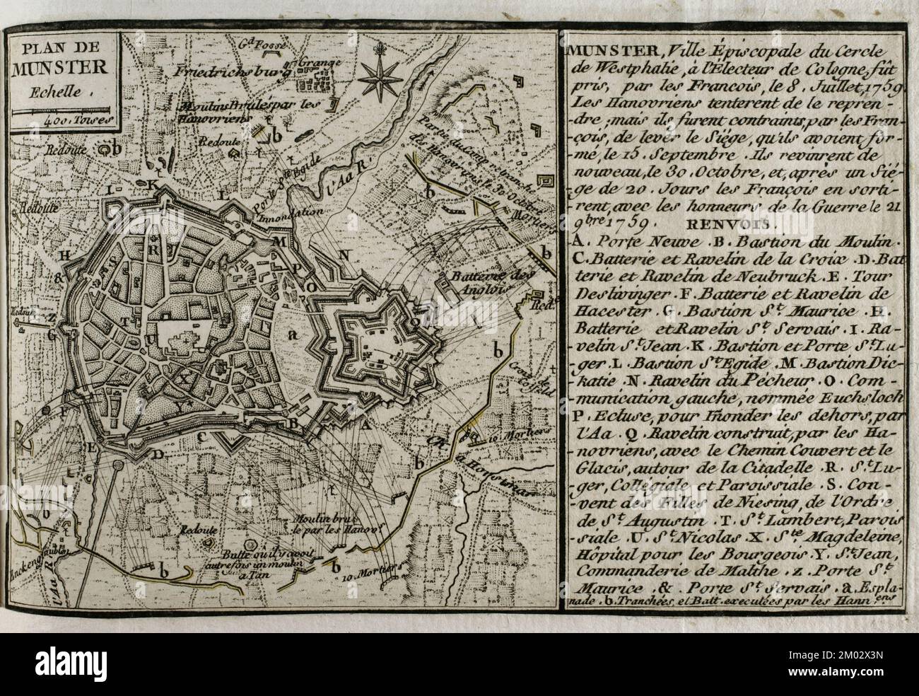 War of the Seven Years (1756-1763). Plan of Münster, 1759. Episcopal city of the imperial circle of Westphalia. It was taken by the French on 8 July 1759. The Hanoverians tried to retake Munster, but on 15 September the French succeeded in lifting the siege of the town. The Hanoverians returned again on 30 October, and after a 20-day siege, the French had to abandon it, leaving with the honours of war on 21 November 1759. Published in 1765 by the cartographer Jean de Beaurain (1696-1771) as an illustration of his Great Map of Germany, with the events that took place during the Seven Years War. Stock Photohttps://www.alamy.com/image-license-details/?v=1https://www.alamy.com/war-of-the-seven-years-1756-1763-plan-of-mnster-1759-episcopal-city-of-the-imperial-circle-of-westphalia-it-was-taken-by-the-french-on-8-july-1759-the-hanoverians-tried-to-retake-munster-but-on-15-september-the-french-succeeded-in-lifting-the-siege-of-the-town-the-hanoverians-returned-again-on-30-october-and-after-a-20-day-siege-the-french-had-to-abandon-it-leaving-with-the-honours-of-war-on-21-november-1759-published-in-1765-by-the-cartographer-jean-de-beaurain-1696-1771-as-an-illustration-of-his-great-map-of-germany-with-the-events-that-took-place-during-the-seven-years-war-image499165065.html
RM2M02X3N–War of the Seven Years (1756-1763). Plan of Münster, 1759. Episcopal city of the imperial circle of Westphalia. It was taken by the French on 8 July 1759. The Hanoverians tried to retake Munster, but on 15 September the French succeeded in lifting the siege of the town. The Hanoverians returned again on 30 October, and after a 20-day siege, the French had to abandon it, leaving with the honours of war on 21 November 1759. Published in 1765 by the cartographer Jean de Beaurain (1696-1771) as an illustration of his Great Map of Germany, with the events that took place during the Seven Years War.
 1801 Cary Map of Westphalia, Germany - Geographicus - Westphalia-cary-1799. Stock Photohttps://www.alamy.com/image-license-details/?v=1https://www.alamy.com/1801-cary-map-of-westphalia-germany-geographicus-westphalia-cary-1799-image209806917.html
RMP59ET5–1801 Cary Map of Westphalia, Germany - Geographicus - Westphalia-cary-1799.
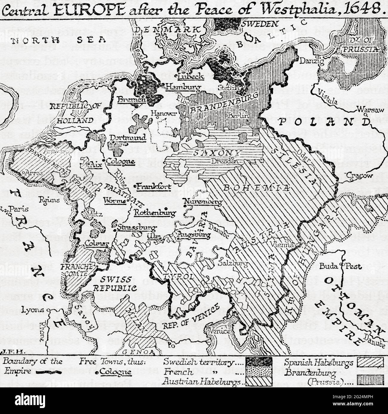 Map of Central Europe after the Peace of Westphalia, 1648. From A Short History of the World, published c.1936 Stock Photohttps://www.alamy.com/image-license-details/?v=1https://www.alamy.com/map-of-central-europe-after-the-peace-of-westphalia-1648-from-a-short-history-of-the-world-published-c1936-image431592633.html
RM2G24MPH–Map of Central Europe after the Peace of Westphalia, 1648. From A Short History of the World, published c.1936
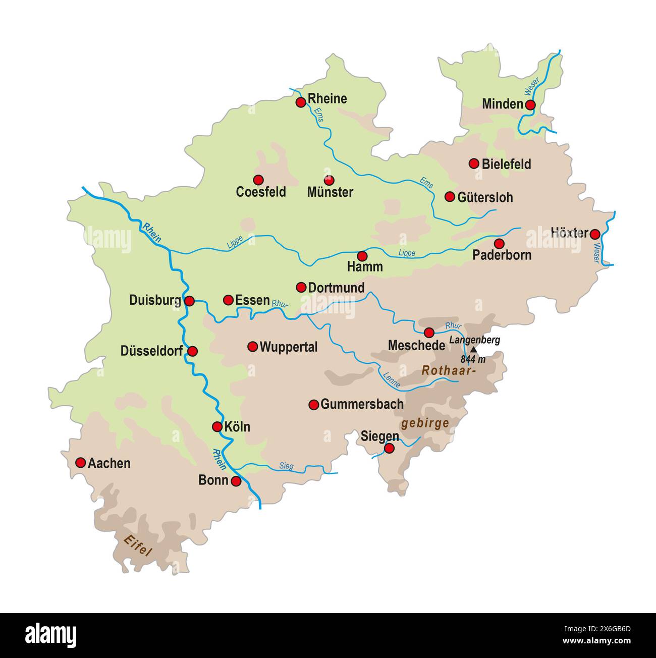 Simple overview map of North Rhine-Westphalia, Germany Stock Photohttps://www.alamy.com/image-license-details/?v=1https://www.alamy.com/simple-overview-map-of-north-rhine-westphalia-germany-image606410853.html
RF2X6GB6D–Simple overview map of North Rhine-Westphalia, Germany
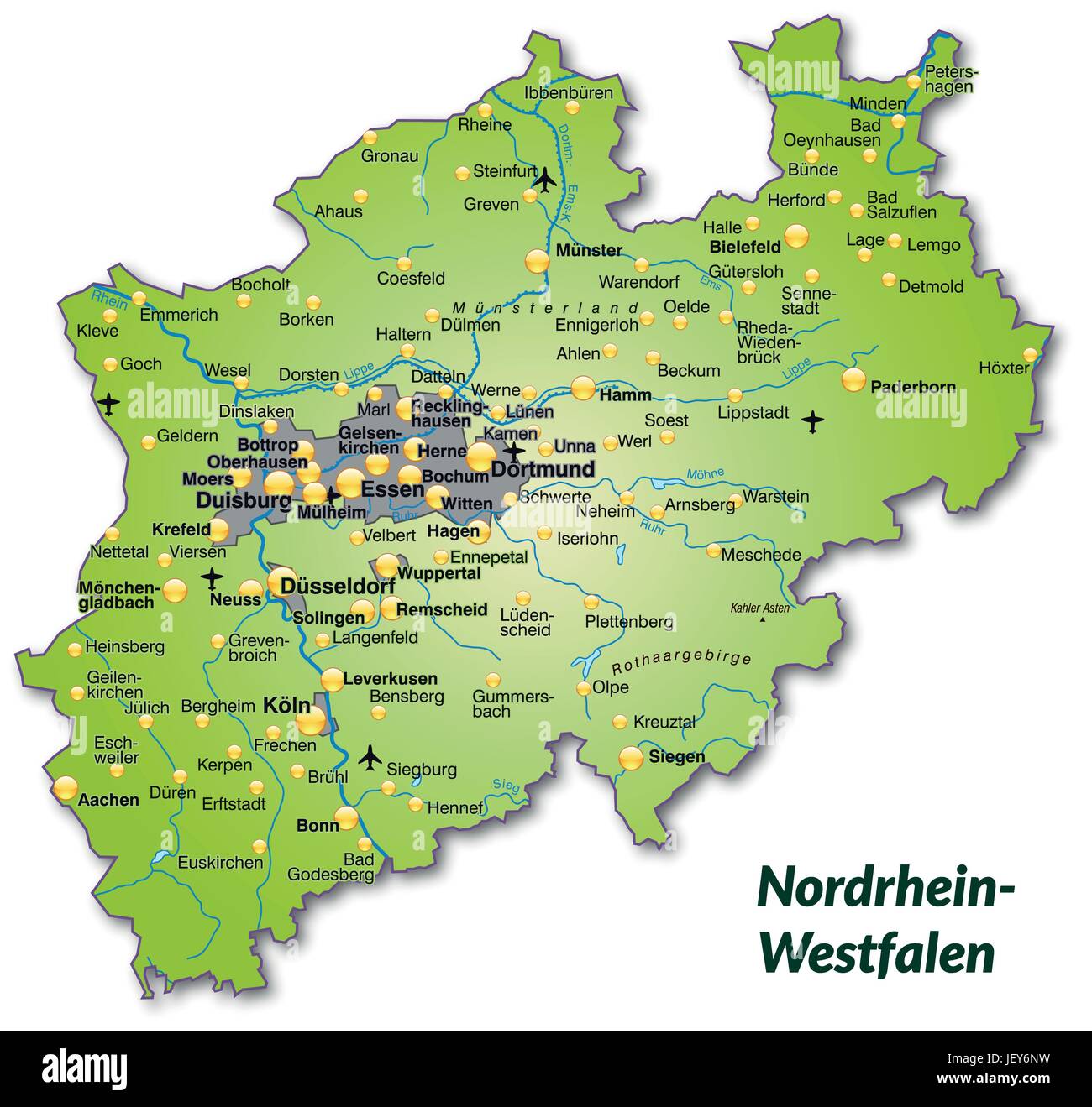 map of north rhine-westphalia as an overview map in green Stock Vectorhttps://www.alamy.com/image-license-details/?v=1https://www.alamy.com/stock-photo-map-of-north-rhine-westphalia-as-an-overview-map-in-green-146886149.html
RFJEY6NW–map of north rhine-westphalia as an overview map in green
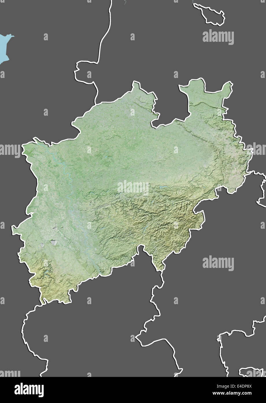 State of North Rhine-Westphalia, Germany, Relief Map Stock Photohttps://www.alamy.com/image-license-details/?v=1https://www.alamy.com/stock-photo-state-of-north-rhine-westphalia-germany-relief-map-71602970.html
RME4DP8X–State of North Rhine-Westphalia, Germany, Relief Map
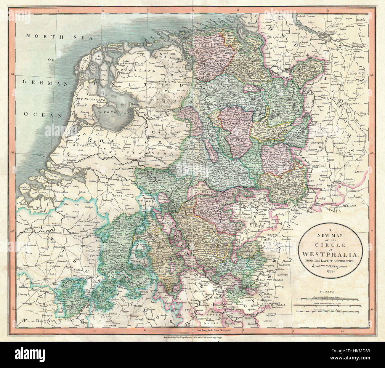 1801 Cary Map of Westphalia, Germany - Geographicus - Westphalia-cary-1799 Stock Photohttps://www.alamy.com/image-license-details/?v=1https://www.alamy.com/stock-photo-1801-cary-map-of-westphalia-germany-geographicus-westphalia-cary-1799-132600499.html
RMHKMD83–1801 Cary Map of Westphalia, Germany - Geographicus - Westphalia-cary-1799
![Map of Westphalia and Hesse, Map of Westphalia, created for the French army 1756-1762 and 1792, Pl. III, Antoine Henri de Jomini: Traité des grandes operations militaires. Atlas. [S.l.]: [s.n.], [18 Stock Photo Map of Westphalia and Hesse, Map of Westphalia, created for the French army 1756-1762 and 1792, Pl. III, Antoine Henri de Jomini: Traité des grandes operations militaires. Atlas. [S.l.]: [s.n.], [18 Stock Photo](https://c8.alamy.com/comp/2A2T79T/map-of-westphalia-and-hesse-map-of-westphalia-created-for-the-french-army-1756-1762-and-1792-pl-iii-antoine-henri-de-jomini-trait-des-grandes-operations-militaires-atlas-sl-sn-18-2A2T79T.jpg) Map of Westphalia and Hesse, Map of Westphalia, created for the French army 1756-1762 and 1792, Pl. III, Antoine Henri de Jomini: Traité des grandes operations militaires. Atlas. [S.l.]: [s.n.], [18 Stock Photohttps://www.alamy.com/image-license-details/?v=1https://www.alamy.com/map-of-westphalia-and-hesse-map-of-westphalia-created-for-the-french-army-1756-1762-and-1792-pl-iii-antoine-henri-de-jomini-trait-des-grandes-operations-militaires-atlas-sl-sn-18-image328758916.html
Map of Westphalia and Hesse, Map of Westphalia, created for the French army 1756-1762 and 1792, Pl. III, Antoine Henri de Jomini: Traité des grandes operations militaires. Atlas. [S.l.]: [s.n.], [18 Stock Photohttps://www.alamy.com/image-license-details/?v=1https://www.alamy.com/map-of-westphalia-and-hesse-map-of-westphalia-created-for-the-french-army-1756-1762-and-1792-pl-iii-antoine-henri-de-jomini-trait-des-grandes-operations-militaires-atlas-sl-sn-18-image328758916.htmlRM2A2T79T–Map of Westphalia and Hesse, Map of Westphalia, created for the French army 1756-1762 and 1792, Pl. III, Antoine Henri de Jomini: Traité des grandes operations militaires. Atlas. [S.l.]: [s.n.], [18
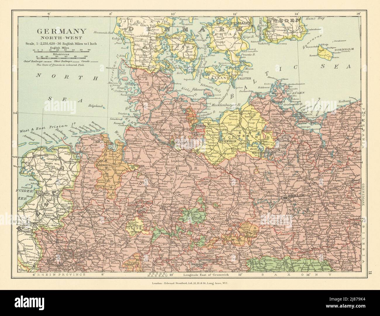 North-west Germany Hanover Brandenburg Westphalia Mecklenburg STANFORD c1925 map Stock Photohttps://www.alamy.com/image-license-details/?v=1https://www.alamy.com/north-west-germany-hanover-brandenburg-westphalia-mecklenburg-stanford-c1925-map-image469758440.html
RF2J879K4–North-west Germany Hanover Brandenburg Westphalia Mecklenburg STANFORD c1925 map
 Else, DE, Germany, North Rhine-Westphalia, N 51 13' 42'', N 7 52' 7'', map, Cartascapes Map published in 2024. Explore Cartascapes, a map revealing Earth's diverse landscapes, cultures, and ecosystems. Journey through time and space, discovering the interconnectedness of our planet's past, present, and future. Stock Photohttps://www.alamy.com/image-license-details/?v=1https://www.alamy.com/else-de-germany-north-rhine-westphalia-n-51-13-42-n-7-52-7-map-cartascapes-map-published-in-2024-explore-cartascapes-a-map-revealing-earths-diverse-landscapes-cultures-and-ecosystems-journey-through-time-and-space-discovering-the-interconnectedness-of-our-planets-past-present-and-future-image629588120.html
RM2YG8620–Else, DE, Germany, North Rhine-Westphalia, N 51 13' 42'', N 7 52' 7'', map, Cartascapes Map published in 2024. Explore Cartascapes, a map revealing Earth's diverse landscapes, cultures, and ecosystems. Journey through time and space, discovering the interconnectedness of our planet's past, present, and future.
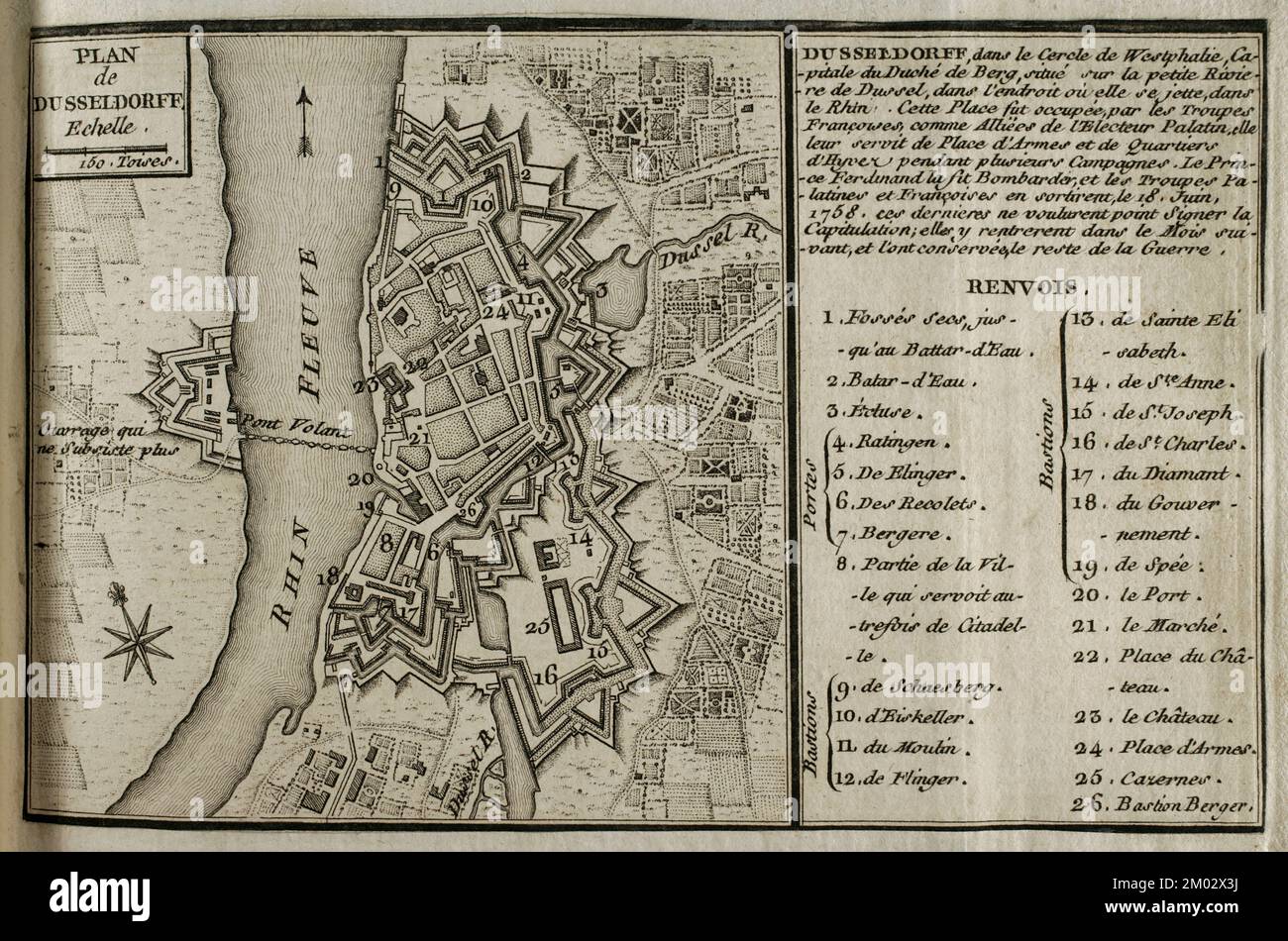 Map of Dusseldorf, 1758. Published in 1765 by the cartographer Jean de Beaurain (1696-1771) as an illustration of his Great Map of Germany, with the events that took place during the War of the Seven Years. French edition, 1765. Military Historical Library of Barcelona (Biblioteca Histórico Militar de Barcelona). Catalonia. Spain. Stock Photohttps://www.alamy.com/image-license-details/?v=1https://www.alamy.com/map-of-dusseldorf-1758-published-in-1765-by-the-cartographer-jean-de-beaurain-1696-1771-as-an-illustration-of-his-great-map-of-germany-with-the-events-that-took-place-during-the-war-of-the-seven-years-french-edition-1765-military-historical-library-of-barcelona-biblioteca-histrico-militar-de-barcelona-catalonia-spain-image499165062.html
RM2M02X3J–Map of Dusseldorf, 1758. Published in 1765 by the cartographer Jean de Beaurain (1696-1771) as an illustration of his Great Map of Germany, with the events that took place during the War of the Seven Years. French edition, 1765. Military Historical Library of Barcelona (Biblioteca Histórico Militar de Barcelona). Catalonia. Spain.
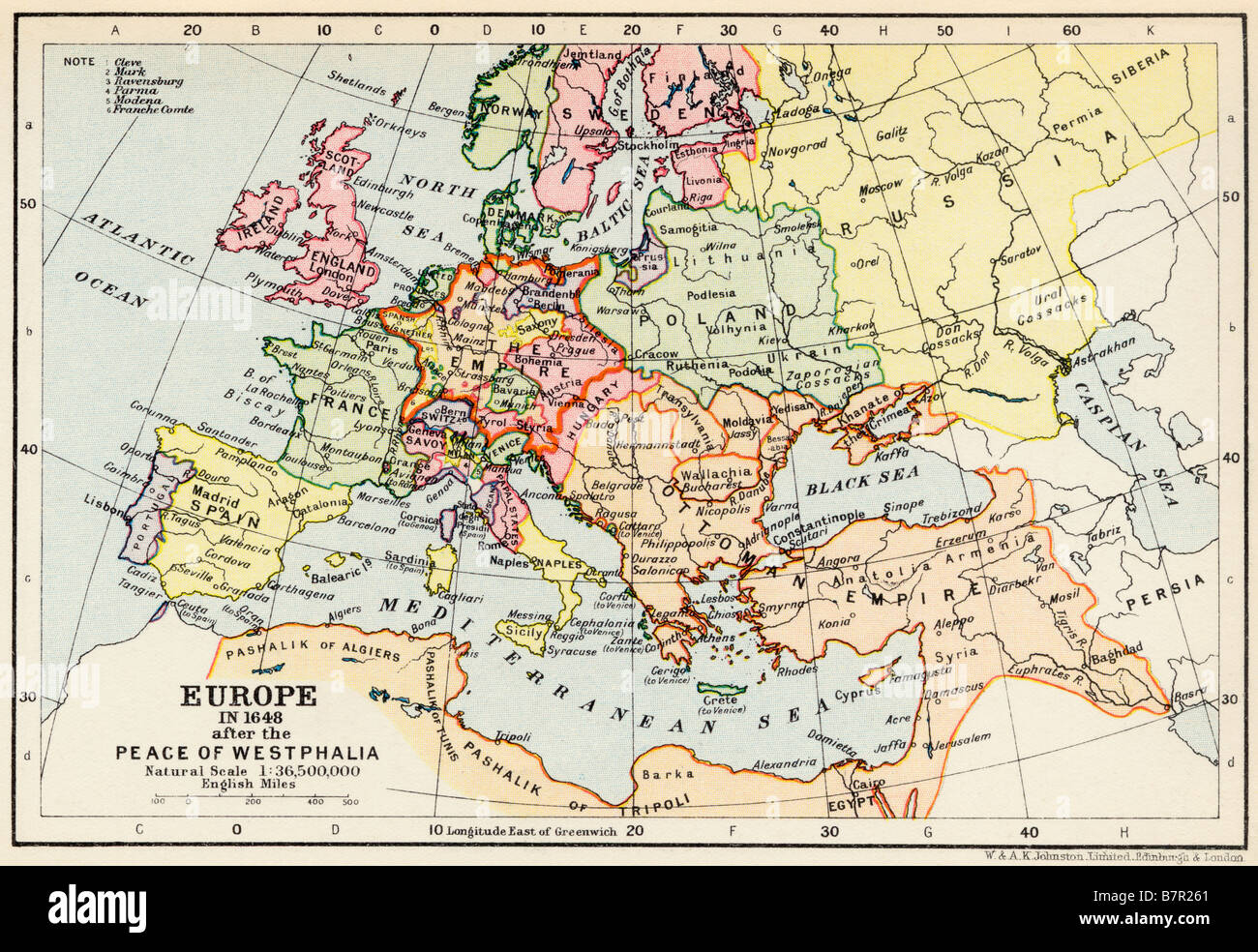 Map of Europe in 1648 after the Peace of Westphalia Stock Photohttps://www.alamy.com/image-license-details/?v=1https://www.alamy.com/stock-photo-map-of-europe-in-1648-after-the-peace-of-westphalia-22019593.html
RMB7R261–Map of Europe in 1648 after the Peace of Westphalia
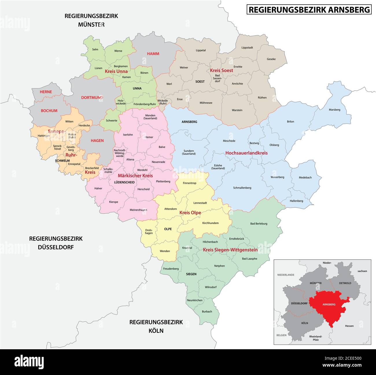 administrative vector map of the Arnsberg region in German language, North Rhine-Westphalia, Germany Stock Vectorhttps://www.alamy.com/image-license-details/?v=1https://www.alamy.com/administrative-vector-map-of-the-arnsberg-region-in-german-language-north-rhine-westphalia-germany-image370334160.html
RF2CEE500–administrative vector map of the Arnsberg region in German language, North Rhine-Westphalia, Germany
 map of north rhine-westphalia as an overview map in chrome Stock Vectorhttps://www.alamy.com/image-license-details/?v=1https://www.alamy.com/stock-photo-map-of-north-rhine-westphalia-as-an-overview-map-in-chrome-146886805.html
RFJEY7H9–map of north rhine-westphalia as an overview map in chrome
 Germany and the State of North Rhine-Westphalia, Relief Map Stock Photohttps://www.alamy.com/image-license-details/?v=1https://www.alamy.com/stock-photo-germany-and-the-state-of-north-rhine-westphalia-relief-map-71607697.html
RME4E09N–Germany and the State of North Rhine-Westphalia, Relief Map
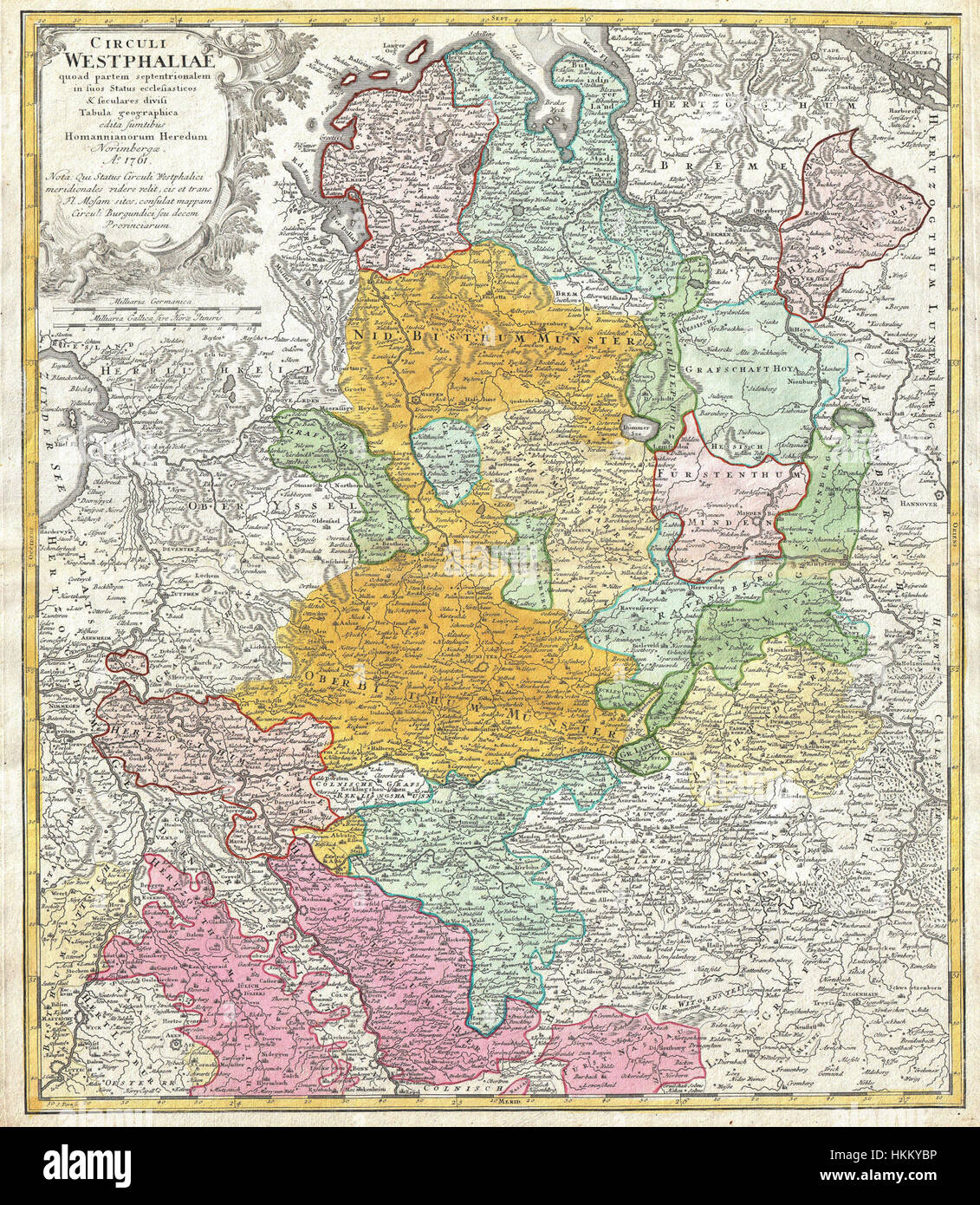 1761 Homann Heirs Map of Westphalia ( Bremen, Hamburg, Cologne, Bonn, etc. ) - Geographicus - Westphaliae-hmhr-1761 Stock Photohttps://www.alamy.com/image-license-details/?v=1https://www.alamy.com/stock-photo-1761-homann-heirs-map-of-westphalia-bremen-hamburg-cologne-bonn-etc-132589626.html
RMHKKYBP–1761 Homann Heirs Map of Westphalia ( Bremen, Hamburg, Cologne, Bonn, etc. ) - Geographicus - Westphaliae-hmhr-1761
 Map of Westphalia Dioecesis Paderbornensis and locorum adiacentium descriptio novissima, print maker: Jan Matthysz., Amsterdam, 1672, paper, engraving, h 183 mm - w 267 mm Stock Photohttps://www.alamy.com/image-license-details/?v=1https://www.alamy.com/map-of-westphalia-dioecesis-paderbornensis-and-locorum-adiacentium-descriptio-novissima-print-maker-jan-matthysz-amsterdam-1672-paper-engraving-h-183-mm-w-267-mm-image473390707.html
RM2JE4PJY–Map of Westphalia Dioecesis Paderbornensis and locorum adiacentium descriptio novissima, print maker: Jan Matthysz., Amsterdam, 1672, paper, engraving, h 183 mm - w 267 mm
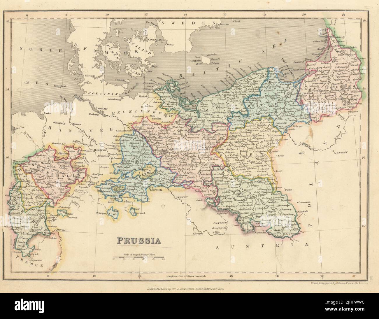 Prussia by John Dower. Germany Poland Pomerania Brandenburg Westphalia 1845 map Stock Photohttps://www.alamy.com/image-license-details/?v=1https://www.alamy.com/prussia-by-john-dower-germany-poland-pomerania-brandenburg-westphalia-1845-map-image475478680.html
RF2JHFWWC–Prussia by John Dower. Germany Poland Pomerania Brandenburg Westphalia 1845 map
 Else, DE, Germany, North Rhine-Westphalia, N 52 11' 51'', N 8 40' 34'', map, Cartascapes Map published in 2024. Explore Cartascapes, a map revealing Earth's diverse landscapes, cultures, and ecosystems. Journey through time and space, discovering the interconnectedness of our planet's past, present, and future. Stock Photohttps://www.alamy.com/image-license-details/?v=1https://www.alamy.com/else-de-germany-north-rhine-westphalia-n-52-11-51-n-8-40-34-map-cartascapes-map-published-in-2024-explore-cartascapes-a-map-revealing-earths-diverse-landscapes-cultures-and-ecosystems-journey-through-time-and-space-discovering-the-interconnectedness-of-our-planets-past-present-and-future-image629675203.html
RM2YGC543–Else, DE, Germany, North Rhine-Westphalia, N 52 11' 51'', N 8 40' 34'', map, Cartascapes Map published in 2024. Explore Cartascapes, a map revealing Earth's diverse landscapes, cultures, and ecosystems. Journey through time and space, discovering the interconnectedness of our planet's past, present, and future.
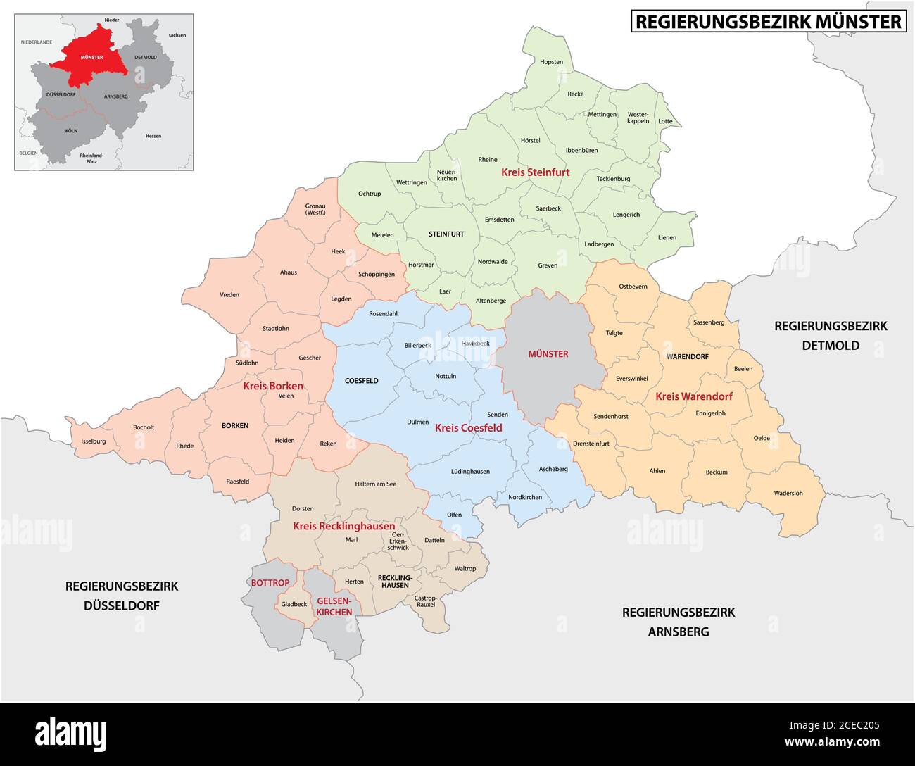 administrative vector map of the Munster region in German language, North Rhine-Westphalia, Germany Stock Vectorhttps://www.alamy.com/image-license-details/?v=1https://www.alamy.com/administrative-vector-map-of-the-munster-region-in-german-language-north-rhine-westphalia-germany-image370287909.html
RF2CEC205–administrative vector map of the Munster region in German language, North Rhine-Westphalia, Germany
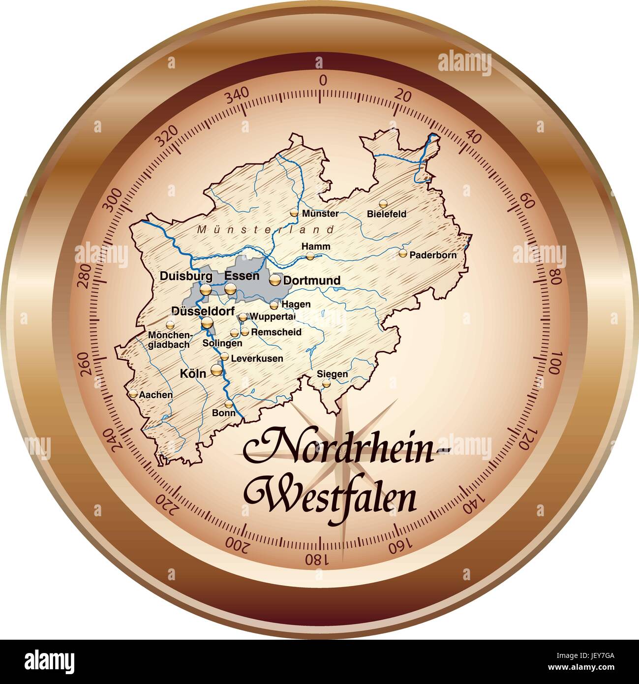 map of north rhine-westphalia as an overview map in bronze Stock Vectorhttps://www.alamy.com/image-license-details/?v=1https://www.alamy.com/stock-photo-map-of-north-rhine-westphalia-as-an-overview-map-in-bronze-146886778.html
RFJEY7GA–map of north rhine-westphalia as an overview map in bronze
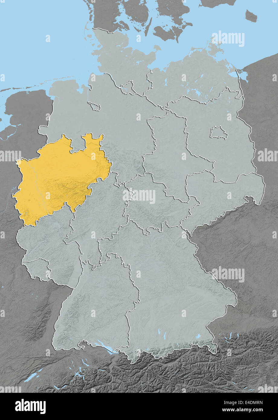 State of North Rhine-Westphalia, Germany, Relief Map Stock Photohttps://www.alamy.com/image-license-details/?v=1https://www.alamy.com/stock-photo-state-of-north-rhine-westphalia-germany-relief-map-71601817.html
RME4DMRN–State of North Rhine-Westphalia, Germany, Relief Map
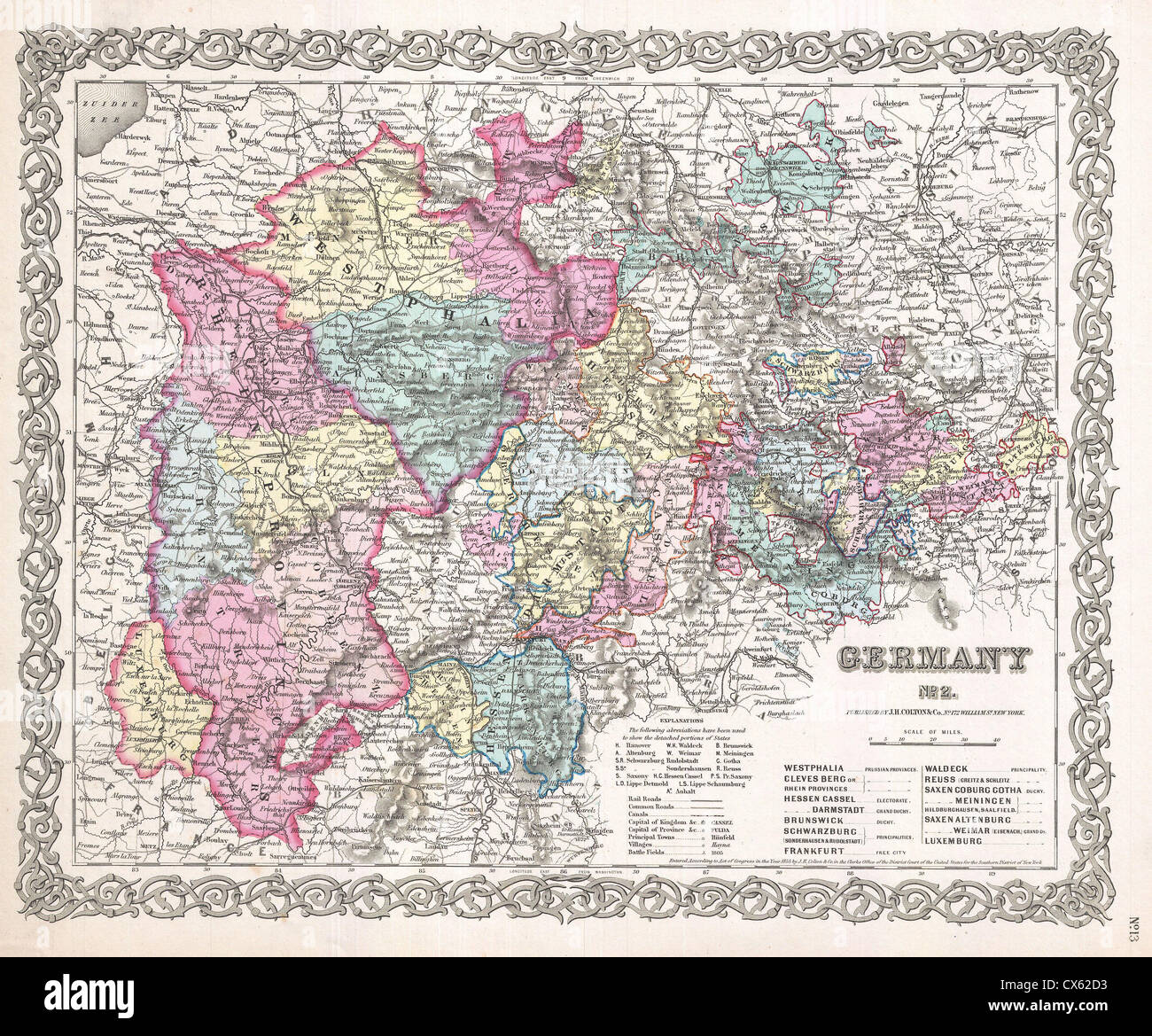 1855 Colton Map of Western Germany, Westphalia, Rheinland Stock Photohttps://www.alamy.com/image-license-details/?v=1https://www.alamy.com/stock-photo-1855-colton-map-of-western-germany-westphalia-rheinland-50535439.html
RMCX62D3–1855 Colton Map of Western Germany, Westphalia, Rheinland
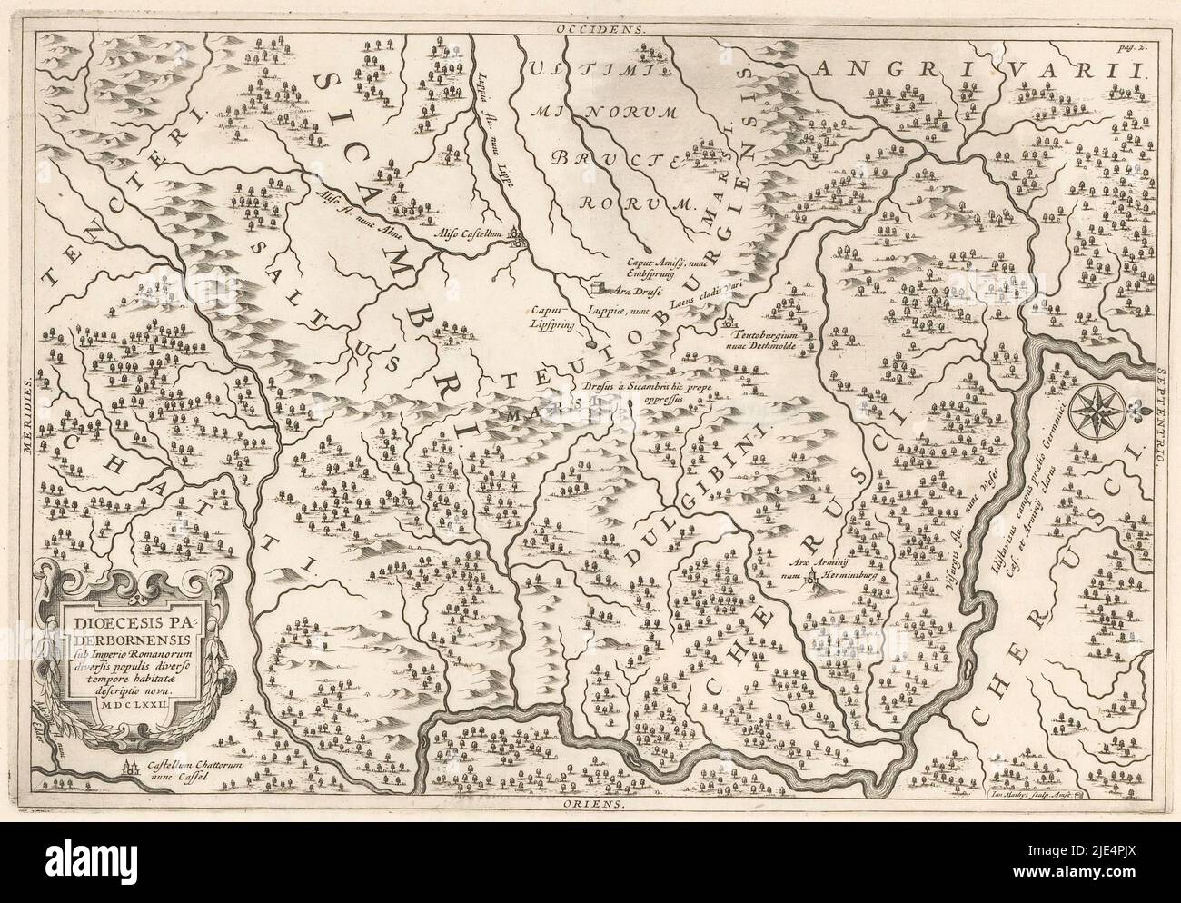 Map of Westphalia Diocesis Paderbornensis sub Imperio Francorum et Saxonum descriptio nova, print maker: Jan Matthysz., Amsterdam, 1672, paper, engraving, h 183 mm - w 265 mm Stock Photohttps://www.alamy.com/image-license-details/?v=1https://www.alamy.com/map-of-westphalia-diocesis-paderbornensis-sub-imperio-francorum-et-saxonum-descriptio-nova-print-maker-jan-matthysz-amsterdam-1672-paper-engraving-h-183-mm-w-265-mm-image473390706.html
RM2JE4PJX–Map of Westphalia Diocesis Paderbornensis sub Imperio Francorum et Saxonum descriptio nova, print maker: Jan Matthysz., Amsterdam, 1672, paper, engraving, h 183 mm - w 265 mm
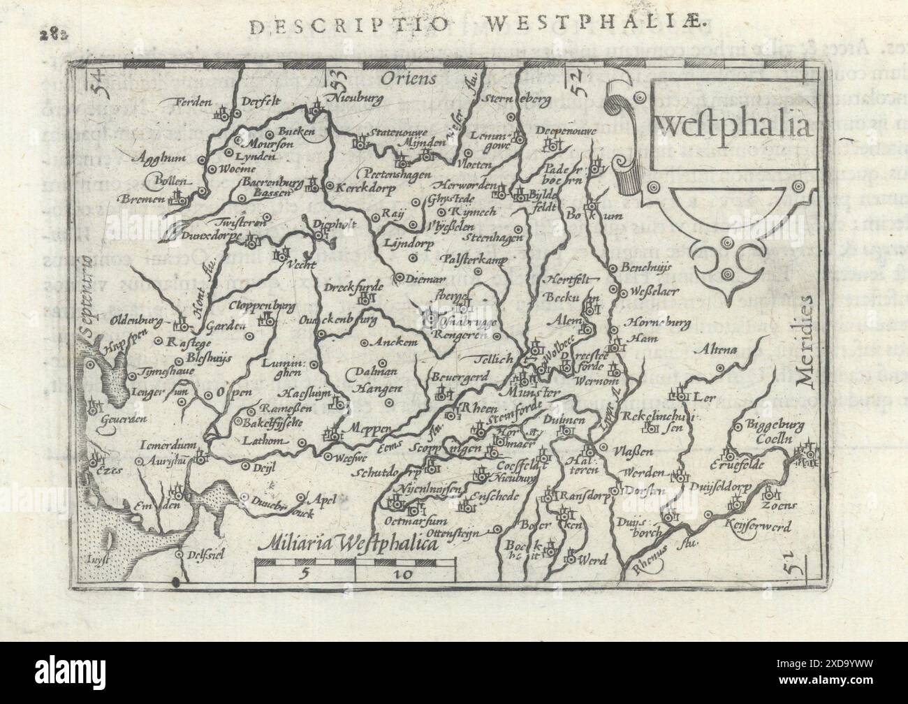 Westphaliae / Westphalia by Bertius/Langenes. Westphalia & Lower Saxony 1603 map Stock Photohttps://www.alamy.com/image-license-details/?v=1https://www.alamy.com/westphaliae-westphalia-by-bertiuslangenes-westphalia-lower-saxony-1603-map-image610572869.html
RF2XD9YWW–Westphaliae / Westphalia by Bertius/Langenes. Westphalia & Lower Saxony 1603 map
 Westphalia Creek, , AU, Australia, Queensland, S 25 28' 0'', N 145 41' 59'', map, Cartascapes Map published in 2024. Explore Cartascapes, a map revealing Earth's diverse landscapes, cultures, and ecosystems. Journey through time and space, discovering the interconnectedness of our planet's past, present, and future. Stock Photohttps://www.alamy.com/image-license-details/?v=1https://www.alamy.com/westphalia-creek-au-australia-queensland-s-25-28-0-n-145-41-59-map-cartascapes-map-published-in-2024-explore-cartascapes-a-map-revealing-earths-diverse-landscapes-cultures-and-ecosystems-journey-through-time-and-space-discovering-the-interconnectedness-of-our-planets-past-present-and-future-image625561085.html
RM2Y9MNF9–Westphalia Creek, , AU, Australia, Queensland, S 25 28' 0'', N 145 41' 59'', map, Cartascapes Map published in 2024. Explore Cartascapes, a map revealing Earth's diverse landscapes, cultures, and ecosystems. Journey through time and space, discovering the interconnectedness of our planet's past, present, and future.
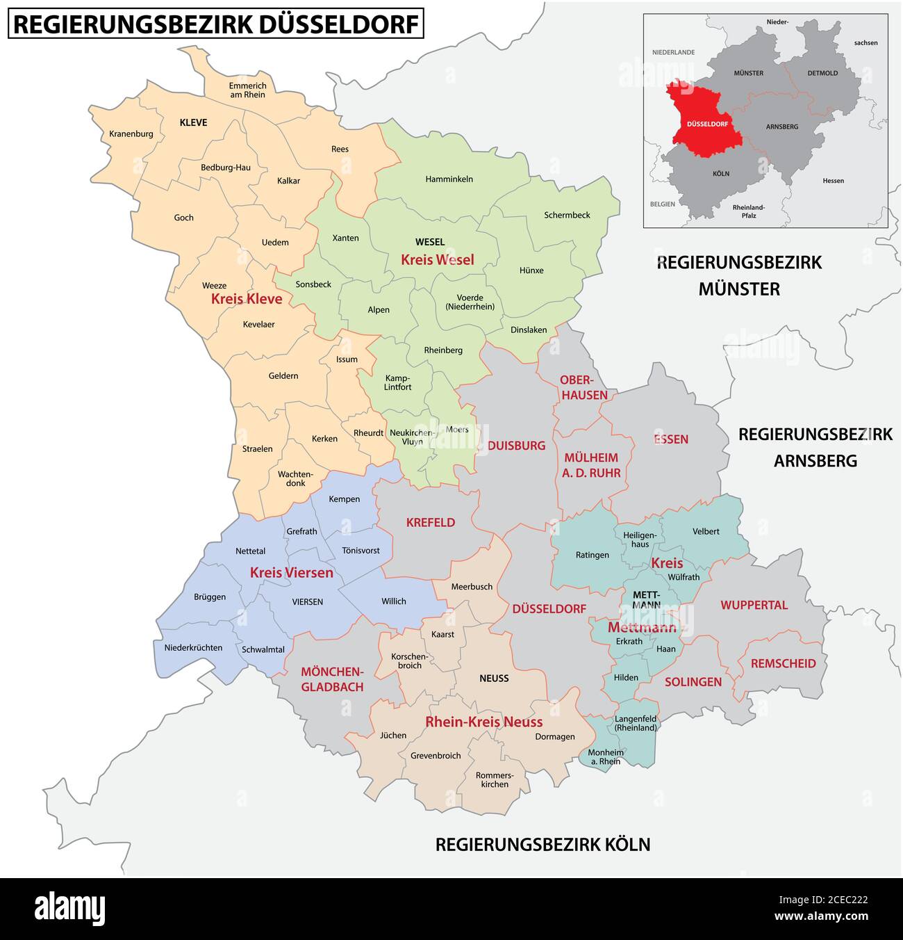 administrative vector map of the Dusseldorf region in German language, North Rhine-Westphalia, Germany.jpg Stock Vectorhttps://www.alamy.com/image-license-details/?v=1https://www.alamy.com/administrative-vector-map-of-the-dusseldorf-region-in-german-language-north-rhine-westphalia-germanyjpg-image370287962.html
RF2CEC222–administrative vector map of the Dusseldorf region in German language, North Rhine-Westphalia, Germany.jpg
 map of north rhine-westphalia as a navigation device Stock Vectorhttps://www.alamy.com/image-license-details/?v=1https://www.alamy.com/stock-photo-map-of-north-rhine-westphalia-as-a-navigation-device-146910047.html
RFJF097B–map of north rhine-westphalia as a navigation device
 Map of Westphalia Diocesis Paderbornensis sub imperio Romanorum diversis populis (...), print maker: Jan Matthysz., (mentioned on object), Amsterdam, 1672, paper, engraving, h 183 mm - w 265 mm Stock Photohttps://www.alamy.com/image-license-details/?v=1https://www.alamy.com/map-of-westphalia-diocesis-paderbornensis-sub-imperio-romanorum-diversis-populis-print-maker-jan-matthysz-mentioned-on-object-amsterdam-1672-paper-engraving-h-183-mm-w-265-mm-image473390701.html
RM2JE4PJN–Map of Westphalia Diocesis Paderbornensis sub imperio Romanorum diversis populis (...), print maker: Jan Matthysz., (mentioned on object), Amsterdam, 1672, paper, engraving, h 183 mm - w 265 mm
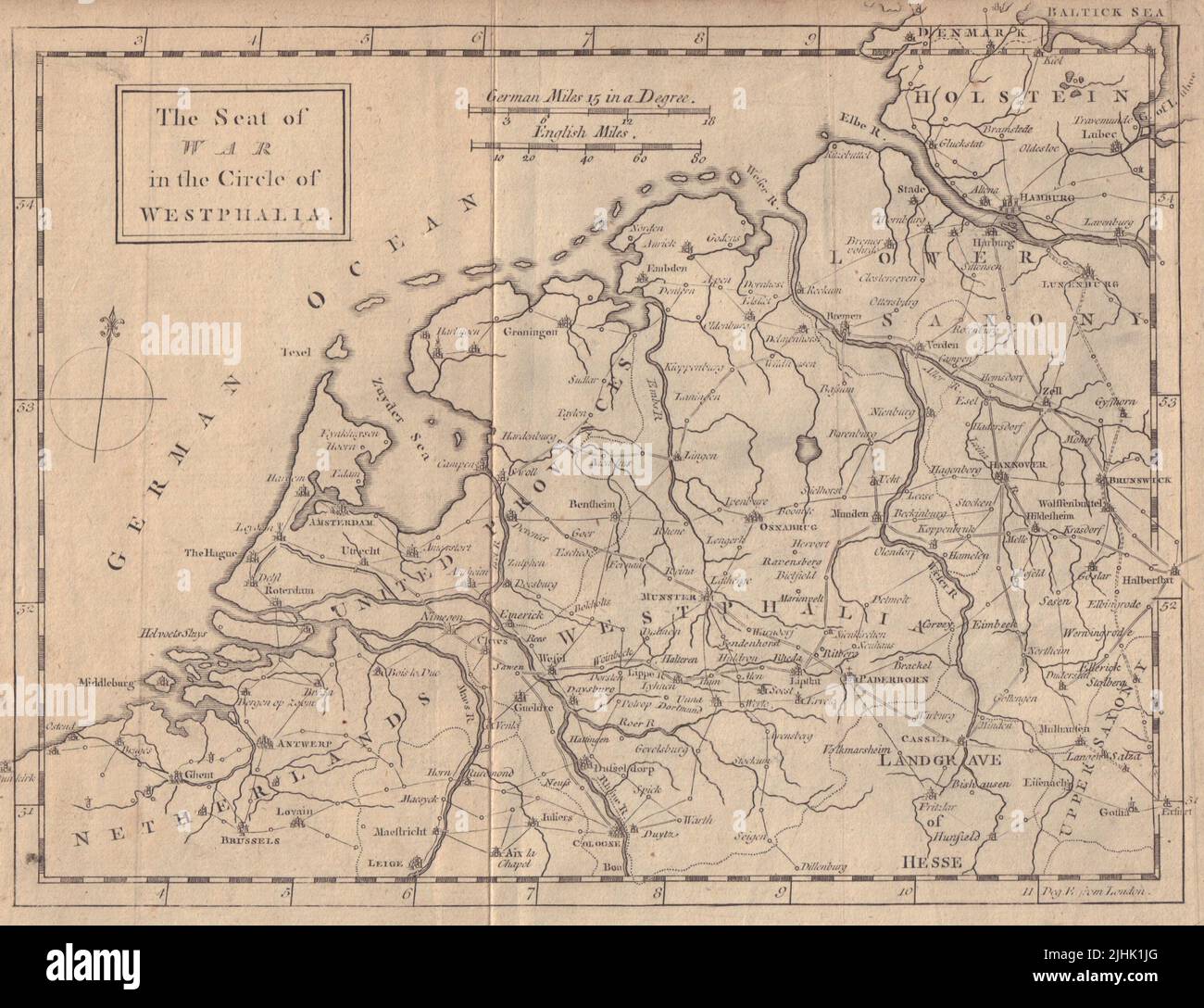 Seat of War in the Circle of Westphalia. Netherlands Germany. GENTS MAG 1757 map Stock Photohttps://www.alamy.com/image-license-details/?v=1https://www.alamy.com/seat-of-war-in-the-circle-of-westphalia-netherlands-germany-gents-mag-1757-map-image475547480.html
RF2JHK1JG–Seat of War in the Circle of Westphalia. Netherlands Germany. GENTS MAG 1757 map
 Oesterbach, DE, Germany, North Rhine-Westphalia, N 51 12' 36'', N 7 52' 51'', map, Cartascapes Map published in 2024. Explore Cartascapes, a map revealing Earth's diverse landscapes, cultures, and ecosystems. Journey through time and space, discovering the interconnectedness of our planet's past, present, and future. Stock Photohttps://www.alamy.com/image-license-details/?v=1https://www.alamy.com/oesterbach-de-germany-north-rhine-westphalia-n-51-12-36-n-7-52-51-map-cartascapes-map-published-in-2024-explore-cartascapes-a-map-revealing-earths-diverse-landscapes-cultures-and-ecosystems-journey-through-time-and-space-discovering-the-interconnectedness-of-our-planets-past-present-and-future-image629347291.html
RM2YFW6TY–Oesterbach, DE, Germany, North Rhine-Westphalia, N 51 12' 36'', N 7 52' 51'', map, Cartascapes Map published in 2024. Explore Cartascapes, a map revealing Earth's diverse landscapes, cultures, and ecosystems. Journey through time and space, discovering the interconnectedness of our planet's past, present, and future.
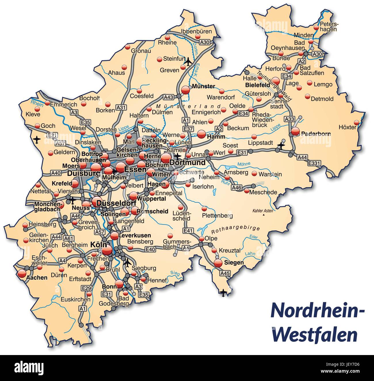 map of north rhine-westphalia with transport network in pastel orange Stock Vectorhttps://www.alamy.com/image-license-details/?v=1https://www.alamy.com/stock-photo-map-of-north-rhine-westphalia-with-transport-network-in-pastel-orange-146886690.html
RFJEY7D6–map of north rhine-westphalia with transport network in pastel orange
 Map of Westphalia, Nova et exacta mappa geographica exhibens Circulum Westphalicum (...) (title on object), print maker: Tobias Conrad Lotter, (mentioned on object), publisher: Tobias Conrad Lotter, (mentioned on object), Augsburg, 1758, paper, engraving, height 586 mm × width 506 mm Stock Photohttps://www.alamy.com/image-license-details/?v=1https://www.alamy.com/map-of-westphalia-nova-et-exacta-mappa-geographica-exhibens-circulum-westphalicum-title-on-object-print-maker-tobias-conrad-lotter-mentioned-on-object-publisher-tobias-conrad-lotter-mentioned-on-object-augsburg-1758-paper-engraving-height-586-mm-width-506-mm-image473367751.html
RM2JE3NB3–Map of Westphalia, Nova et exacta mappa geographica exhibens Circulum Westphalicum (...) (title on object), print maker: Tobias Conrad Lotter, (mentioned on object), publisher: Tobias Conrad Lotter, (mentioned on object), Augsburg, 1758, paper, engraving, height 586 mm × width 506 mm
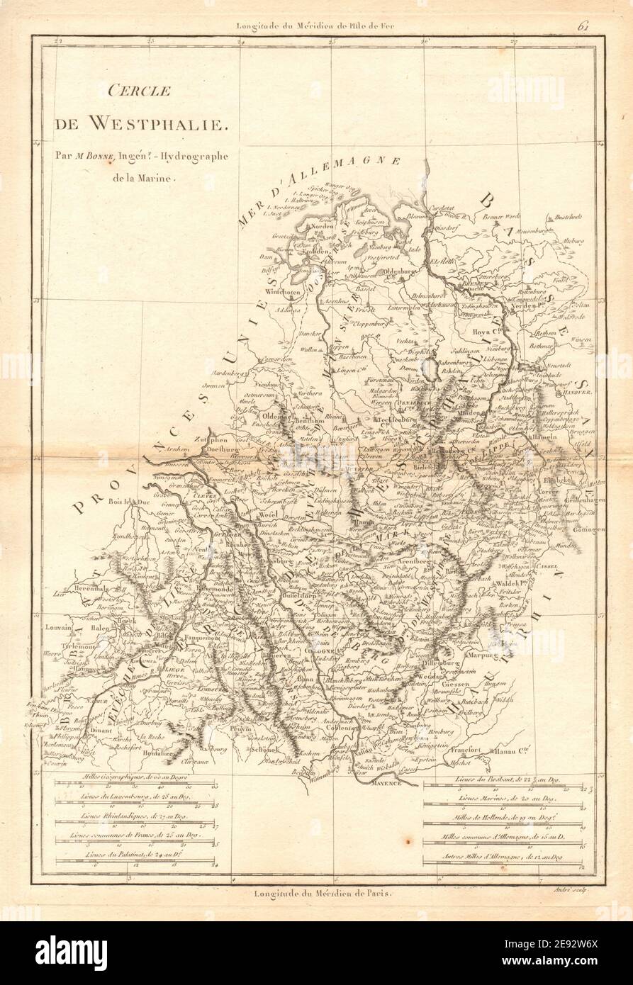 Cercle de Westphalie. Circle of Westphalia. North-west Germany. BONNE 1787 map Stock Photohttps://www.alamy.com/image-license-details/?v=1https://www.alamy.com/cercle-de-westphalie-circle-of-westphalia-north-west-germany-bonne-1787-map-image401434066.html
RF2E92W6X–Cercle de Westphalie. Circle of Westphalia. North-west Germany. BONNE 1787 map
 Blumenheide, DE, Germany, North Rhine-Westphalia, N 51 32' 52'', N 6 15' 37'', map, Cartascapes Map published in 2024. Explore Cartascapes, a map revealing Earth's diverse landscapes, cultures, and ecosystems. Journey through time and space, discovering the interconnectedness of our planet's past, present, and future. Stock Photohttps://www.alamy.com/image-license-details/?v=1https://www.alamy.com/blumenheide-de-germany-north-rhine-westphalia-n-51-32-52-n-6-15-37-map-cartascapes-map-published-in-2024-explore-cartascapes-a-map-revealing-earths-diverse-landscapes-cultures-and-ecosystems-journey-through-time-and-space-discovering-the-interconnectedness-of-our-planets-past-present-and-future-image629426549.html
RM2YG0RYH–Blumenheide, DE, Germany, North Rhine-Westphalia, N 51 32' 52'', N 6 15' 37'', map, Cartascapes Map published in 2024. Explore Cartascapes, a map revealing Earth's diverse landscapes, cultures, and ecosystems. Journey through time and space, discovering the interconnectedness of our planet's past, present, and future.
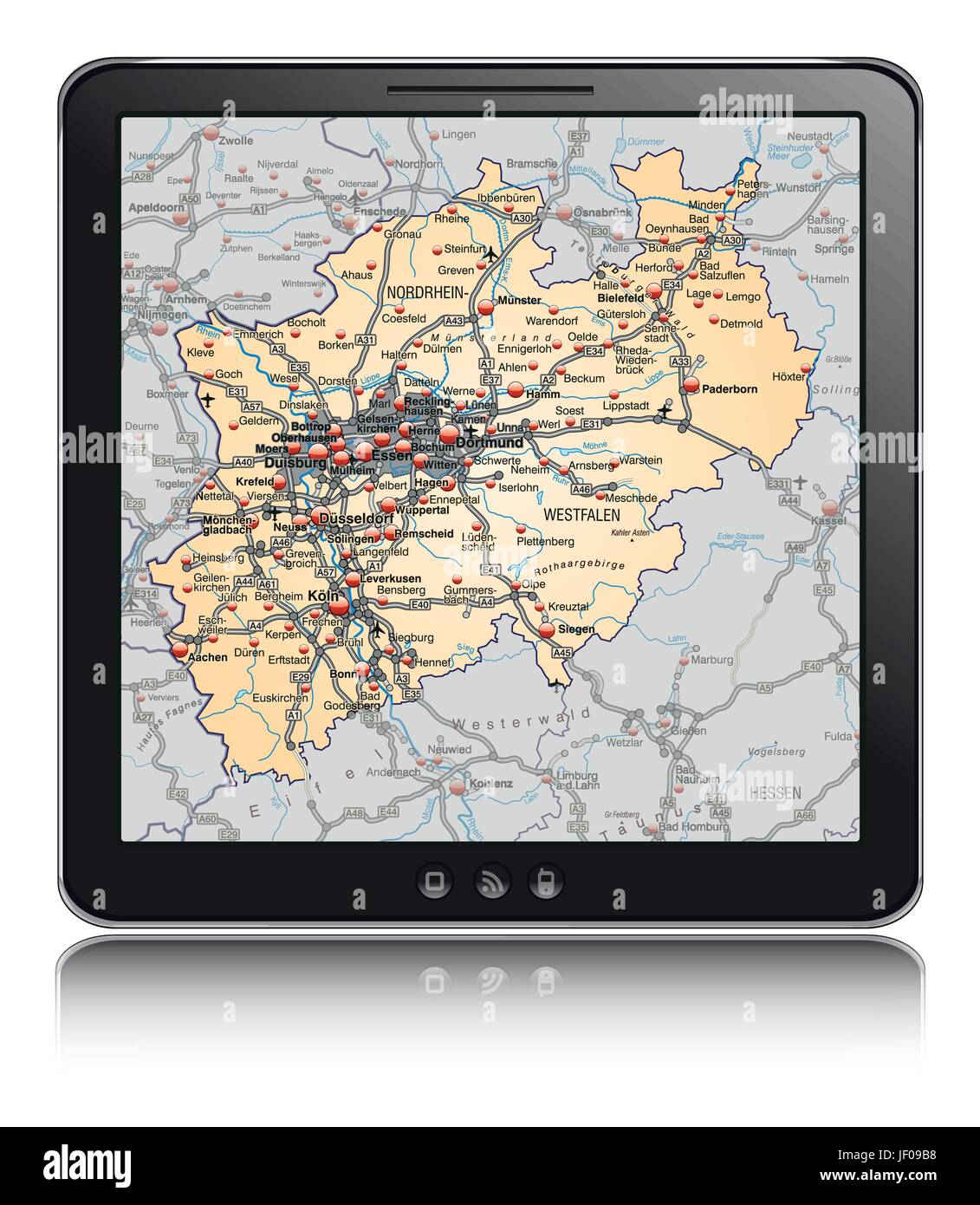 map of north rhine-westphalia as a navigation device in pastel orange Stock Vectorhttps://www.alamy.com/image-license-details/?v=1https://www.alamy.com/stock-photo-map-of-north-rhine-westphalia-as-a-navigation-device-in-pastel-orange-146910156.html
RFJF09B8–map of north rhine-westphalia as a navigation device in pastel orange
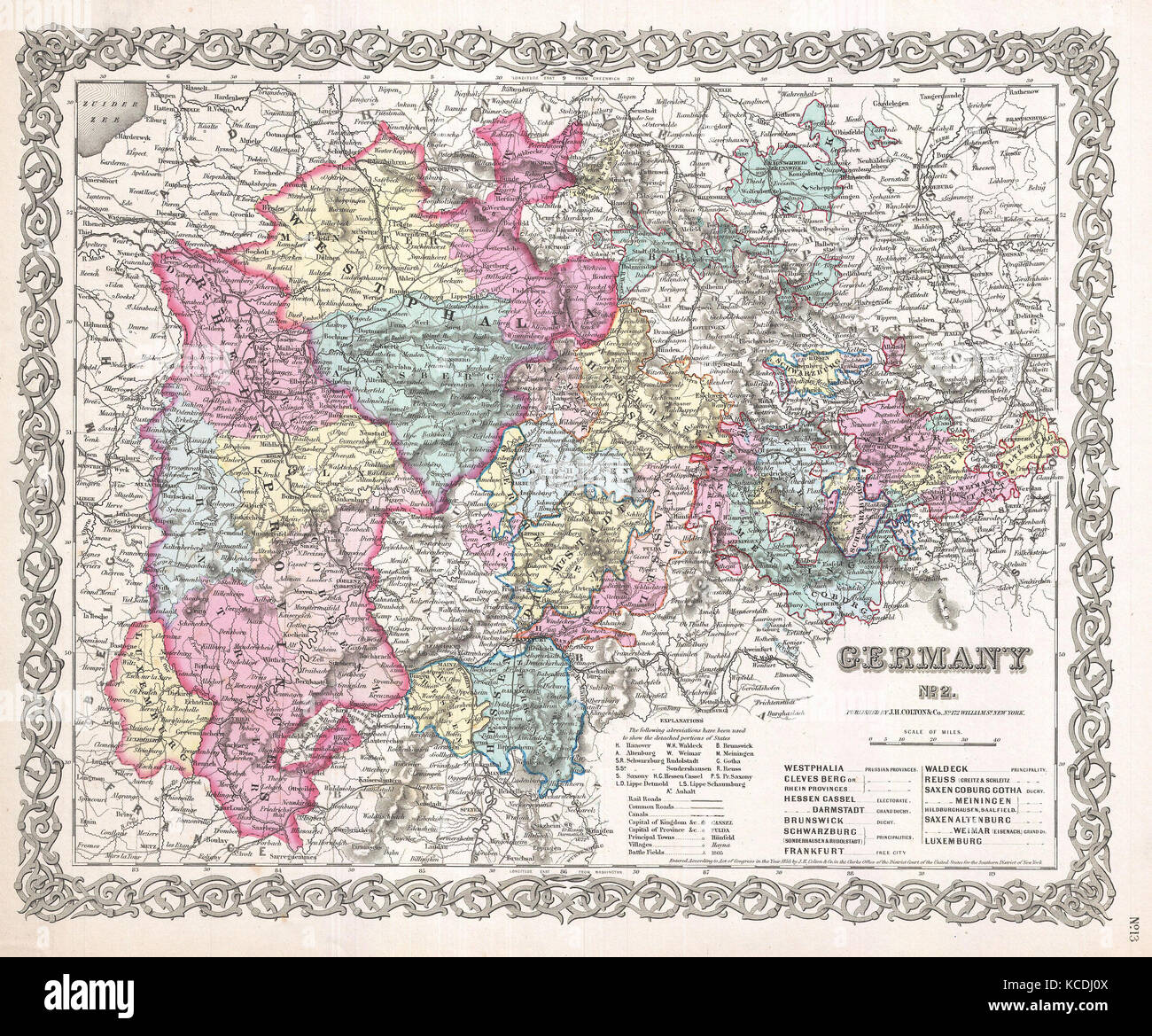 1855, Colton Map of Western Germany, Westphalia, Rheinland Stock Photohttps://www.alamy.com/image-license-details/?v=1https://www.alamy.com/stock-image-1855-colton-map-of-western-germany-westphalia-rheinland-162568698.html
RMKCDJ0X–1855, Colton Map of Western Germany, Westphalia, Rheinland
 'Cercle de Westphalie divisé…' Westphalia. NW Germany. VAUGONDY 1751 old map Stock Photohttps://www.alamy.com/image-license-details/?v=1https://www.alamy.com/cercle-de-westphalie-divis-westphalia-nw-germany-vaugondy-1751-old-map-image401432502.html
RF2E92R72–'Cercle de Westphalie divisé…' Westphalia. NW Germany. VAUGONDY 1751 old map
 Sand, DE, Germany, North Rhine-Westphalia, N 52 8' 43'', N 7 45' 16'', map, Cartascapes Map published in 2024. Explore Cartascapes, a map revealing Earth's diverse landscapes, cultures, and ecosystems. Journey through time and space, discovering the interconnectedness of our planet's past, present, and future. Stock Photohttps://www.alamy.com/image-license-details/?v=1https://www.alamy.com/sand-de-germany-north-rhine-westphalia-n-52-8-43-n-7-45-16-map-cartascapes-map-published-in-2024-explore-cartascapes-a-map-revealing-earths-diverse-landscapes-cultures-and-ecosystems-journey-through-time-and-space-discovering-the-interconnectedness-of-our-planets-past-present-and-future-image629678430.html
RM2YGC97A–Sand, DE, Germany, North Rhine-Westphalia, N 52 8' 43'', N 7 45' 16'', map, Cartascapes Map published in 2024. Explore Cartascapes, a map revealing Earth's diverse landscapes, cultures, and ecosystems. Journey through time and space, discovering the interconnectedness of our planet's past, present, and future.
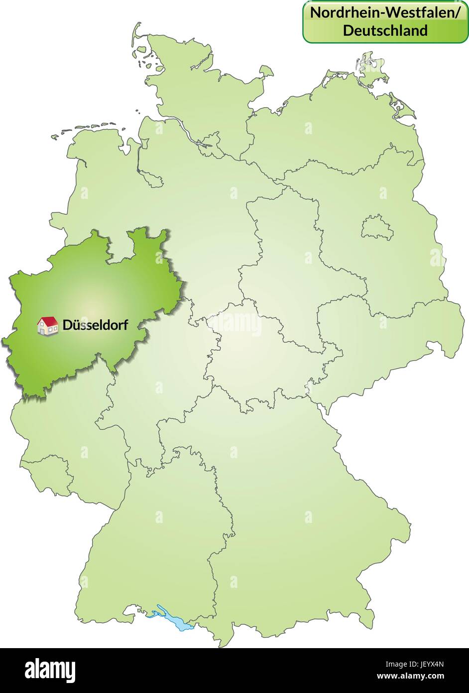 map of north rhine-westphalia with capitals in green Stock Vectorhttps://www.alamy.com/image-license-details/?v=1https://www.alamy.com/stock-photo-map-of-north-rhine-westphalia-with-capitals-in-green-146901349.html
RFJEYX4N–map of north rhine-westphalia with capitals in green
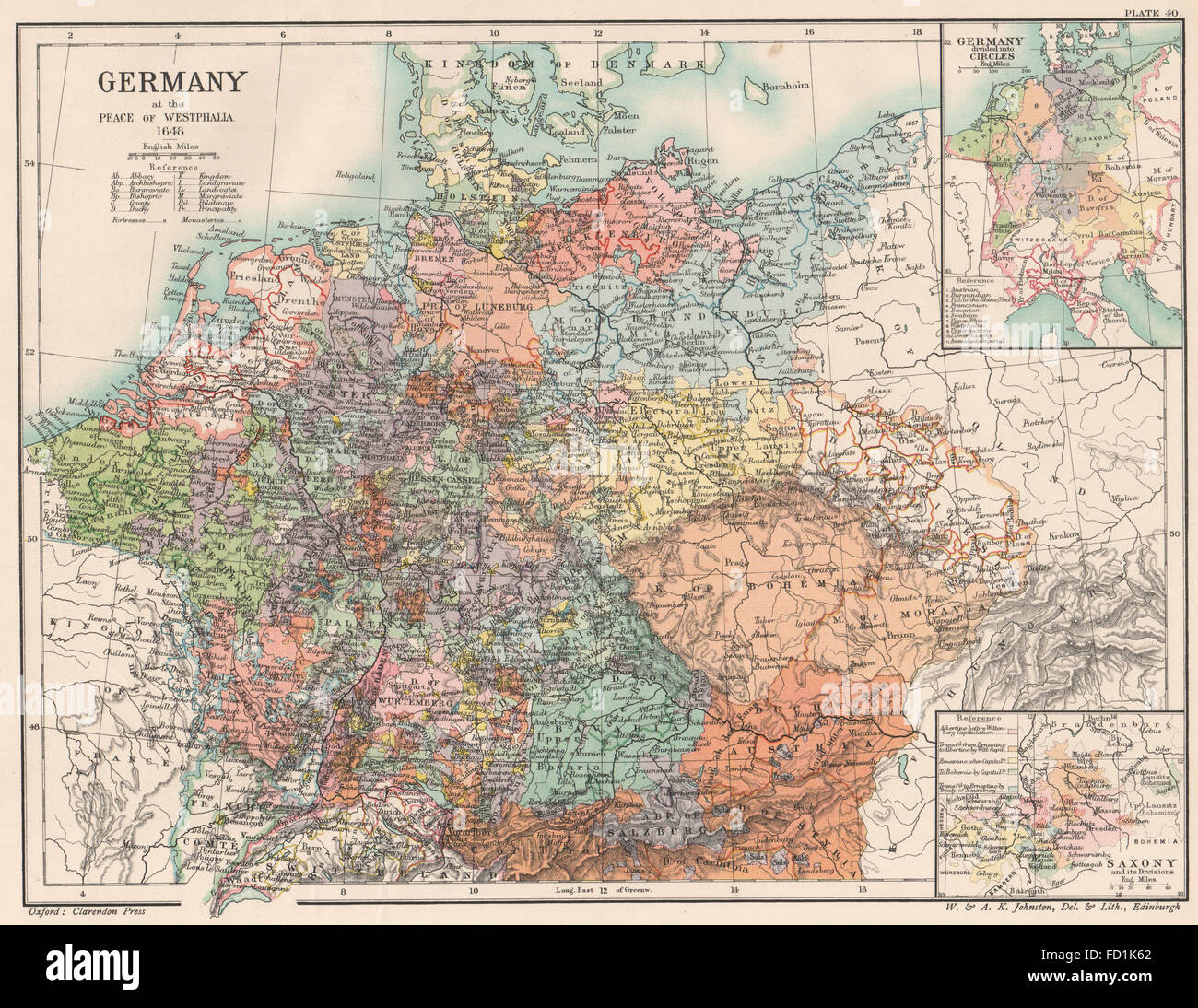 GERMANY 1648: Peace Westphalia. Circles. Saxony its divisions, 1902 old map Stock Photohttps://www.alamy.com/image-license-details/?v=1https://www.alamy.com/stock-photo-germany-1648-peace-westphalia-circles-saxony-its-divisions-1902-old-94079386.html
RFFD1K62–GERMANY 1648: Peace Westphalia. Circles. Saxony its divisions, 1902 old map
 Lausbach, DE, Germany, North Rhine-Westphalia, N 51 41' 0'', N 7 43' 13'', map, Cartascapes Map published in 2024. Explore Cartascapes, a map revealing Earth's diverse landscapes, cultures, and ecosystems. Journey through time and space, discovering the interconnectedness of our planet's past, present, and future. Stock Photohttps://www.alamy.com/image-license-details/?v=1https://www.alamy.com/lausbach-de-germany-north-rhine-westphalia-n-51-41-0-n-7-43-13-map-cartascapes-map-published-in-2024-explore-cartascapes-a-map-revealing-earths-diverse-landscapes-cultures-and-ecosystems-journey-through-time-and-space-discovering-the-interconnectedness-of-our-planets-past-present-and-future-image629569574.html
RM2YG7ABJ–Lausbach, DE, Germany, North Rhine-Westphalia, N 51 41' 0'', N 7 43' 13'', map, Cartascapes Map published in 2024. Explore Cartascapes, a map revealing Earth's diverse landscapes, cultures, and ecosystems. Journey through time and space, discovering the interconnectedness of our planet's past, present, and future.
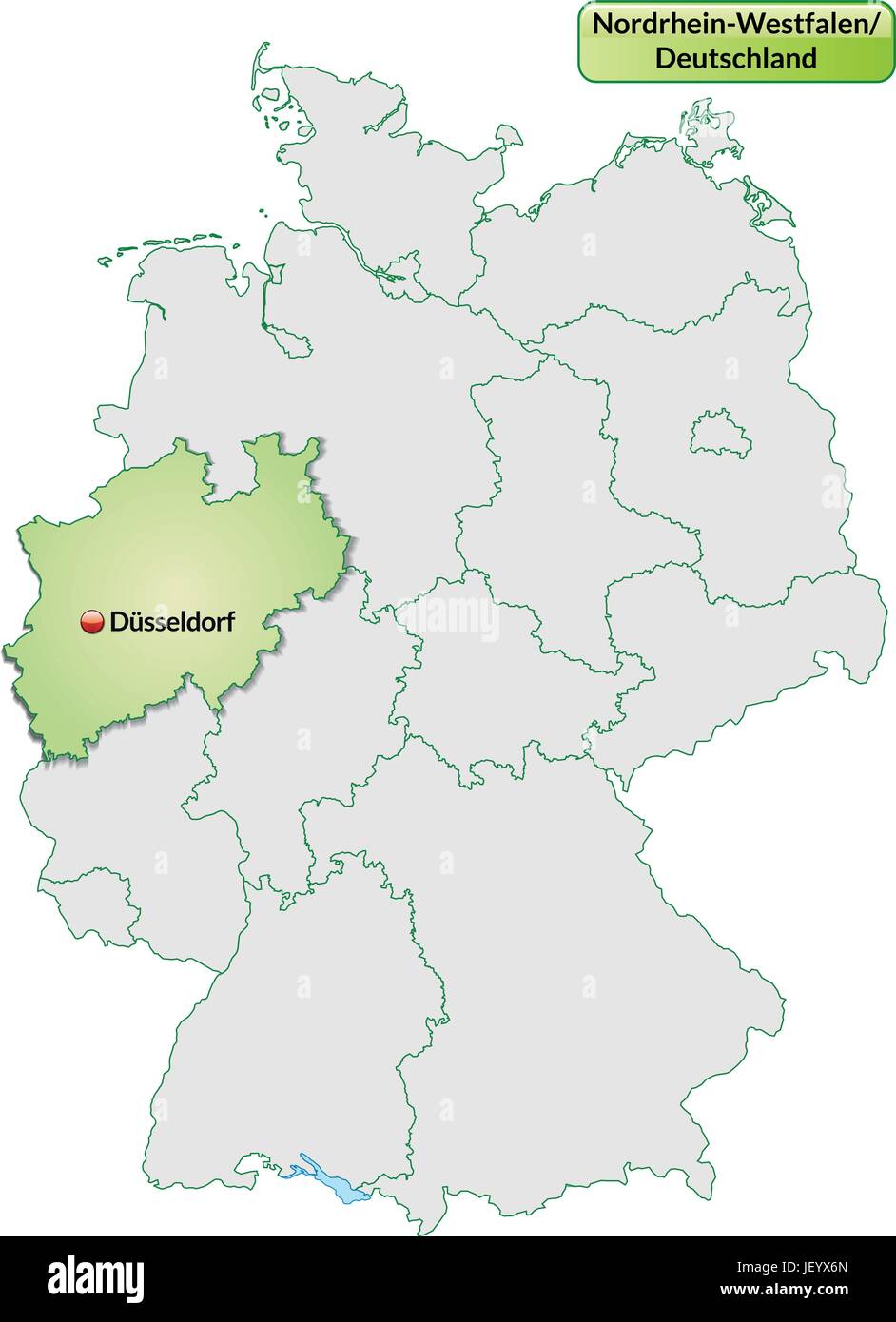 map of north rhine-westphalia with capitals in pastel green Stock Vectorhttps://www.alamy.com/image-license-details/?v=1https://www.alamy.com/stock-photo-map-of-north-rhine-westphalia-with-capitals-in-pastel-green-146901405.html
RFJEYX6N–map of north rhine-westphalia with capitals in pastel green
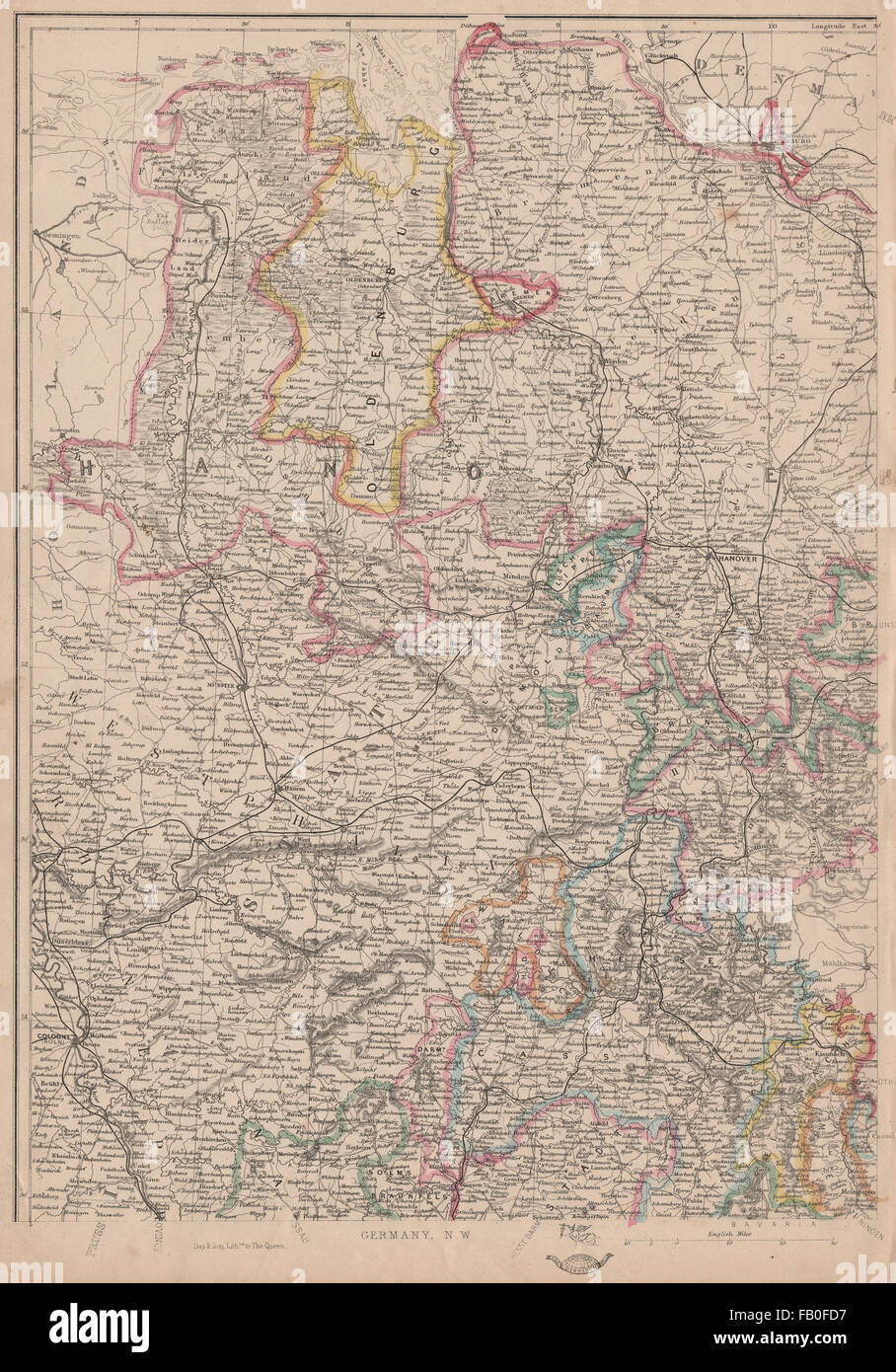 GERMANY NORTH WEST. Hanover Westphalia Oldenburg. Railways. JW LOWRY, 1862 map Stock Photohttps://www.alamy.com/image-license-details/?v=1https://www.alamy.com/stock-photo-germany-north-west-hanover-westphalia-oldenburg-railways-jw-lowry-92825187.html
RFFB0FD7–GERMANY NORTH WEST. Hanover Westphalia Oldenburg. Railways. JW LOWRY, 1862 map
 Egge, DE, Germany, North Rhine-Westphalia, N 51 10' 8'', N 8 5' 46'', map, Cartascapes Map published in 2024. Explore Cartascapes, a map revealing Earth's diverse landscapes, cultures, and ecosystems. Journey through time and space, discovering the interconnectedness of our planet's past, present, and future. Stock Photohttps://www.alamy.com/image-license-details/?v=1https://www.alamy.com/egge-de-germany-north-rhine-westphalia-n-51-10-8-n-8-5-46-map-cartascapes-map-published-in-2024-explore-cartascapes-a-map-revealing-earths-diverse-landscapes-cultures-and-ecosystems-journey-through-time-and-space-discovering-the-interconnectedness-of-our-planets-past-present-and-future-image629627109.html
RM2YG9YPD–Egge, DE, Germany, North Rhine-Westphalia, N 51 10' 8'', N 8 5' 46'', map, Cartascapes Map published in 2024. Explore Cartascapes, a map revealing Earth's diverse landscapes, cultures, and ecosystems. Journey through time and space, discovering the interconnectedness of our planet's past, present, and future.
 map of north rhine-westphalia with capitals in pastel green Stock Vectorhttps://www.alamy.com/image-license-details/?v=1https://www.alamy.com/stock-photo-map-of-north-rhine-westphalia-with-capitals-in-pastel-green-146901376.html
RFJEYX5M–map of north rhine-westphalia with capitals in pastel green
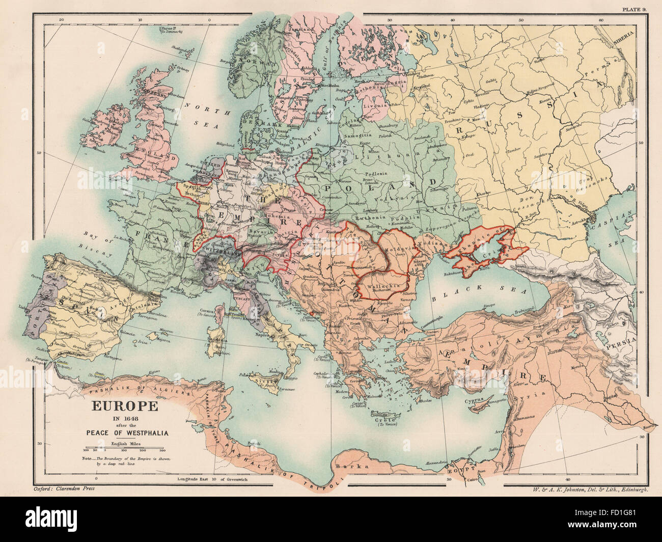 EUROPE IN 1648: After the Peace of Westphalia. Holy Roman Empire, 1902 old map Stock Photohttps://www.alamy.com/image-license-details/?v=1https://www.alamy.com/stock-photo-europe-in-1648-after-the-peace-of-westphalia-holy-roman-empire-1902-94077089.html
RFFD1G81–EUROPE IN 1648: After the Peace of Westphalia. Holy Roman Empire, 1902 old map
 Hassbach, DE, Germany, North Rhine-Westphalia, N 51 28' 18'', N 7 55' 39'', map, Cartascapes Map published in 2024. Explore Cartascapes, a map revealing Earth's diverse landscapes, cultures, and ecosystems. Journey through time and space, discovering the interconnectedness of our planet's past, present, and future. Stock Photohttps://www.alamy.com/image-license-details/?v=1https://www.alamy.com/hassbach-de-germany-north-rhine-westphalia-n-51-28-18-n-7-55-39-map-cartascapes-map-published-in-2024-explore-cartascapes-a-map-revealing-earths-diverse-landscapes-cultures-and-ecosystems-journey-through-time-and-space-discovering-the-interconnectedness-of-our-planets-past-present-and-future-image629749333.html
RM2YGFFKH–Hassbach, DE, Germany, North Rhine-Westphalia, N 51 28' 18'', N 7 55' 39'', map, Cartascapes Map published in 2024. Explore Cartascapes, a map revealing Earth's diverse landscapes, cultures, and ecosystems. Journey through time and space, discovering the interconnectedness of our planet's past, present, and future.
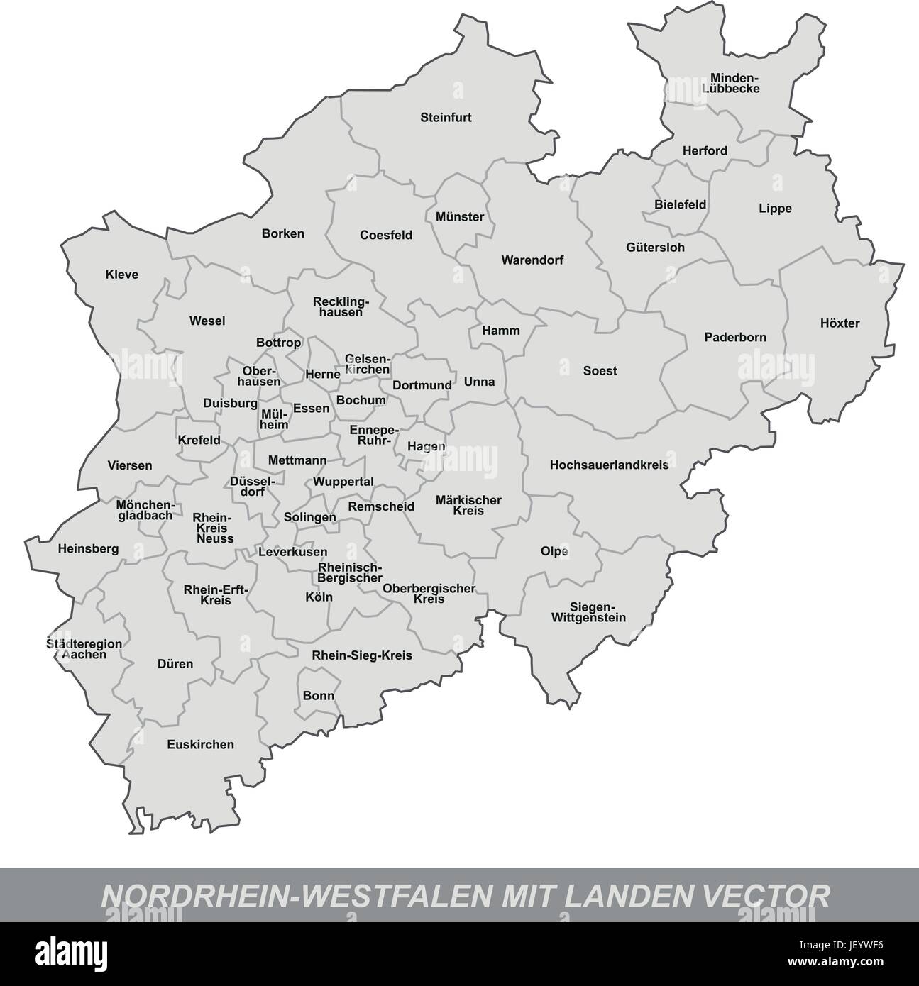 island map of north rhine-westphalia with borders in gray Stock Vectorhttps://www.alamy.com/image-license-details/?v=1https://www.alamy.com/stock-photo-island-map-of-north-rhine-westphalia-with-borders-in-gray-146900858.html
RFJEYWF6–island map of north rhine-westphalia with borders in gray
 Schlingenbach, DE, Germany, North Rhine-Westphalia, N 50 57' 33'', N 7 19' 34'', map, Cartascapes Map published in 2024. Explore Cartascapes, a map revealing Earth's diverse landscapes, cultures, and ecosystems. Journey through time and space, discovering the interconnectedness of our planet's past, present, and future. Stock Photohttps://www.alamy.com/image-license-details/?v=1https://www.alamy.com/schlingenbach-de-germany-north-rhine-westphalia-n-50-57-33-n-7-19-34-map-cartascapes-map-published-in-2024-explore-cartascapes-a-map-revealing-earths-diverse-landscapes-cultures-and-ecosystems-journey-through-time-and-space-discovering-the-interconnectedness-of-our-planets-past-present-and-future-image629754751.html
RM2YGFPH3–Schlingenbach, DE, Germany, North Rhine-Westphalia, N 50 57' 33'', N 7 19' 34'', map, Cartascapes Map published in 2024. Explore Cartascapes, a map revealing Earth's diverse landscapes, cultures, and ecosystems. Journey through time and space, discovering the interconnectedness of our planet's past, present, and future.
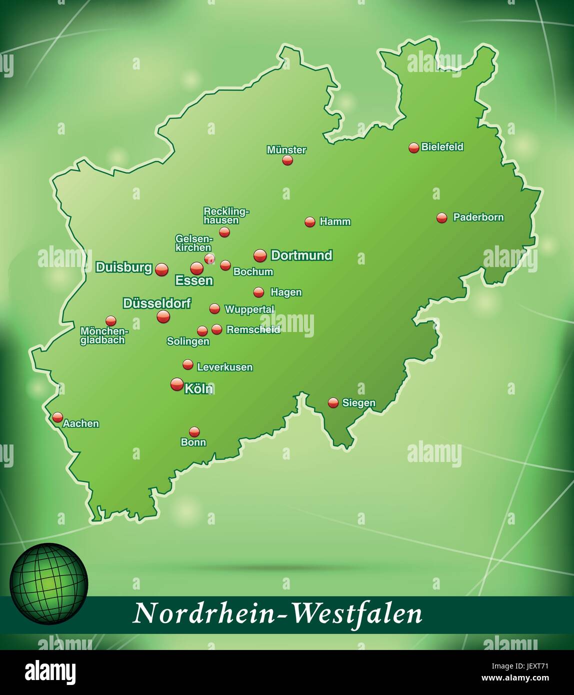 island map of north rhine-westphalia abstract background in green Stock Vectorhttps://www.alamy.com/image-license-details/?v=1https://www.alamy.com/stock-photo-island-map-of-north-rhine-westphalia-abstract-background-in-green-146877893.html
RFJEXT71–island map of north rhine-westphalia abstract background in green
 Buchwald, DE, Germany, North Rhine-Westphalia, N 51 26' 21'', N 8 11' 17'', map, Cartascapes Map published in 2024. Explore Cartascapes, a map revealing Earth's diverse landscapes, cultures, and ecosystems. Journey through time and space, discovering the interconnectedness of our planet's past, present, and future. Stock Photohttps://www.alamy.com/image-license-details/?v=1https://www.alamy.com/buchwald-de-germany-north-rhine-westphalia-n-51-26-21-n-8-11-17-map-cartascapes-map-published-in-2024-explore-cartascapes-a-map-revealing-earths-diverse-landscapes-cultures-and-ecosystems-journey-through-time-and-space-discovering-the-interconnectedness-of-our-planets-past-present-and-future-image629480780.html
RM2YG394C–Buchwald, DE, Germany, North Rhine-Westphalia, N 51 26' 21'', N 8 11' 17'', map, Cartascapes Map published in 2024. Explore Cartascapes, a map revealing Earth's diverse landscapes, cultures, and ecosystems. Journey through time and space, discovering the interconnectedness of our planet's past, present, and future.
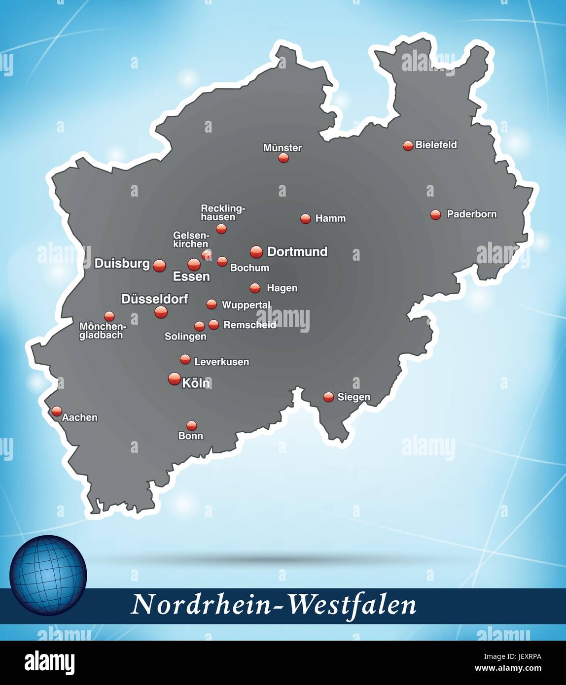 island map of north rhine-westphalia abstract background in blue Stock Vectorhttps://www.alamy.com/image-license-details/?v=1https://www.alamy.com/stock-photo-island-map-of-north-rhine-westphalia-abstract-background-in-blue-146877538.html
RFJEXRPA–island map of north rhine-westphalia abstract background in blue
 Werde, DE, Germany, North Rhine-Westphalia, N 51 11' 1'', N 8 13' 47'', map, Cartascapes Map published in 2024. Explore Cartascapes, a map revealing Earth's diverse landscapes, cultures, and ecosystems. Journey through time and space, discovering the interconnectedness of our planet's past, present, and future. Stock Photohttps://www.alamy.com/image-license-details/?v=1https://www.alamy.com/werde-de-germany-north-rhine-westphalia-n-51-11-1-n-8-13-47-map-cartascapes-map-published-in-2024-explore-cartascapes-a-map-revealing-earths-diverse-landscapes-cultures-and-ecosystems-journey-through-time-and-space-discovering-the-interconnectedness-of-our-planets-past-present-and-future-image629473571.html
RM2YG2YXY–Werde, DE, Germany, North Rhine-Westphalia, N 51 11' 1'', N 8 13' 47'', map, Cartascapes Map published in 2024. Explore Cartascapes, a map revealing Earth's diverse landscapes, cultures, and ecosystems. Journey through time and space, discovering the interconnectedness of our planet's past, present, and future.
 map of north rhine-westphalia Stock Photohttps://www.alamy.com/image-license-details/?v=1https://www.alamy.com/stock-photo-map-of-north-rhine-westphalia-143322423.html
RFJ94W5Y–map of north rhine-westphalia
 Zinse, DE, Germany, North Rhine-Westphalia, N 51 2' 1'', N 8 14' 36'', map, Cartascapes Map published in 2024. Explore Cartascapes, a map revealing Earth's diverse landscapes, cultures, and ecosystems. Journey through time and space, discovering the interconnectedness of our planet's past, present, and future. Stock Photohttps://www.alamy.com/image-license-details/?v=1https://www.alamy.com/zinse-de-germany-north-rhine-westphalia-n-51-2-1-n-8-14-36-map-cartascapes-map-published-in-2024-explore-cartascapes-a-map-revealing-earths-diverse-landscapes-cultures-and-ecosystems-journey-through-time-and-space-discovering-the-interconnectedness-of-our-planets-past-present-and-future-image629342630.html
RM2YFW0XE–Zinse, DE, Germany, North Rhine-Westphalia, N 51 2' 1'', N 8 14' 36'', map, Cartascapes Map published in 2024. Explore Cartascapes, a map revealing Earth's diverse landscapes, cultures, and ecosystems. Journey through time and space, discovering the interconnectedness of our planet's past, present, and future.
 map of north rhine-westphalia Stock Photohttps://www.alamy.com/image-license-details/?v=1https://www.alamy.com/stock-photo-map-of-north-rhine-westphalia-142846633.html
RFJ8B69D–map of north rhine-westphalia
 Nonnenbach, DE, Germany, North Rhine-Westphalia, N 50 24' 56'', N 6 37' 18'', map, Cartascapes Map published in 2024. Explore Cartascapes, a map revealing Earth's diverse landscapes, cultures, and ecosystems. Journey through time and space, discovering the interconnectedness of our planet's past, present, and future. Stock Photohttps://www.alamy.com/image-license-details/?v=1https://www.alamy.com/nonnenbach-de-germany-north-rhine-westphalia-n-50-24-56-n-6-37-18-map-cartascapes-map-published-in-2024-explore-cartascapes-a-map-revealing-earths-diverse-landscapes-cultures-and-ecosystems-journey-through-time-and-space-discovering-the-interconnectedness-of-our-planets-past-present-and-future-image629395793.html
RM2YFYCN5–Nonnenbach, DE, Germany, North Rhine-Westphalia, N 50 24' 56'', N 6 37' 18'', map, Cartascapes Map published in 2024. Explore Cartascapes, a map revealing Earth's diverse landscapes, cultures, and ecosystems. Journey through time and space, discovering the interconnectedness of our planet's past, present, and future.
 map of north rhine-westphalia Stock Photohttps://www.alamy.com/image-license-details/?v=1https://www.alamy.com/stock-photo-map-of-north-rhine-westphalia-131299262.html
RFHHH5FA–map of north rhine-westphalia
 Wallenlienen, DE, Germany, North Rhine-Westphalia, N 52 13' 0'', N 7 46' 6'', map, Cartascapes Map published in 2024. Explore Cartascapes, a map revealing Earth's diverse landscapes, cultures, and ecosystems. Journey through time and space, discovering the interconnectedness of our planet's past, present, and future. Stock Photohttps://www.alamy.com/image-license-details/?v=1https://www.alamy.com/wallenlienen-de-germany-north-rhine-westphalia-n-52-13-0-n-7-46-6-map-cartascapes-map-published-in-2024-explore-cartascapes-a-map-revealing-earths-diverse-landscapes-cultures-and-ecosystems-journey-through-time-and-space-discovering-the-interconnectedness-of-our-planets-past-present-and-future-image629414430.html
RM2YG08EP–Wallenlienen, DE, Germany, North Rhine-Westphalia, N 52 13' 0'', N 7 46' 6'', map, Cartascapes Map published in 2024. Explore Cartascapes, a map revealing Earth's diverse landscapes, cultures, and ecosystems. Journey through time and space, discovering the interconnectedness of our planet's past, present, and future.
 map of north rhine-westphalia Stock Photohttps://www.alamy.com/image-license-details/?v=1https://www.alamy.com/stock-photo-map-of-north-rhine-westphalia-143190596.html
RFJ8XW1T–map of north rhine-westphalia
 Gauxbach, DE, Germany, North Rhine-Westphalia, N 52 11' 13'', N 7 14' 53'', map, Cartascapes Map published in 2024. Explore Cartascapes, a map revealing Earth's diverse landscapes, cultures, and ecosystems. Journey through time and space, discovering the interconnectedness of our planet's past, present, and future. Stock Photohttps://www.alamy.com/image-license-details/?v=1https://www.alamy.com/gauxbach-de-germany-north-rhine-westphalia-n-52-11-13-n-7-14-53-map-cartascapes-map-published-in-2024-explore-cartascapes-a-map-revealing-earths-diverse-landscapes-cultures-and-ecosystems-journey-through-time-and-space-discovering-the-interconnectedness-of-our-planets-past-present-and-future-image629677572.html
RM2YGC84M–Gauxbach, DE, Germany, North Rhine-Westphalia, N 52 11' 13'', N 7 14' 53'', map, Cartascapes Map published in 2024. Explore Cartascapes, a map revealing Earth's diverse landscapes, cultures, and ecosystems. Journey through time and space, discovering the interconnectedness of our planet's past, present, and future.
 map of north rhine-westphalia Stock Photohttps://www.alamy.com/image-license-details/?v=1https://www.alamy.com/stock-photo-map-of-north-rhine-westphalia-143810296.html
RFJ9Y3E0–map of north rhine-westphalia
 Immental, DE, Germany, North Rhine-Westphalia, N 51 26' 21'', N 8 39' 5'', map, Cartascapes Map published in 2024. Explore Cartascapes, a map revealing Earth's diverse landscapes, cultures, and ecosystems. Journey through time and space, discovering the interconnectedness of our planet's past, present, and future. Stock Photohttps://www.alamy.com/image-license-details/?v=1https://www.alamy.com/immental-de-germany-north-rhine-westphalia-n-51-26-21-n-8-39-5-map-cartascapes-map-published-in-2024-explore-cartascapes-a-map-revealing-earths-diverse-landscapes-cultures-and-ecosystems-journey-through-time-and-space-discovering-the-interconnectedness-of-our-planets-past-present-and-future-image629598483.html
RM2YG8K83–Immental, DE, Germany, North Rhine-Westphalia, N 51 26' 21'', N 8 39' 5'', map, Cartascapes Map published in 2024. Explore Cartascapes, a map revealing Earth's diverse landscapes, cultures, and ecosystems. Journey through time and space, discovering the interconnectedness of our planet's past, present, and future.
 map of north rhine-westphalia Stock Photohttps://www.alamy.com/image-license-details/?v=1https://www.alamy.com/stock-photo-map-of-north-rhine-westphalia-131228610.html
RFHHDYC2–map of north rhine-westphalia
 Palenberg, DE, Germany, North Rhine-Westphalia, N 50 55' 0'', N 6 4' 59'', map, Cartascapes Map published in 2024. Explore Cartascapes, a map revealing Earth's diverse landscapes, cultures, and ecosystems. Journey through time and space, discovering the interconnectedness of our planet's past, present, and future. Stock Photohttps://www.alamy.com/image-license-details/?v=1https://www.alamy.com/palenberg-de-germany-north-rhine-westphalia-n-50-55-0-n-6-4-59-map-cartascapes-map-published-in-2024-explore-cartascapes-a-map-revealing-earths-diverse-landscapes-cultures-and-ecosystems-journey-through-time-and-space-discovering-the-interconnectedness-of-our-planets-past-present-and-future-image629450887.html
RM2YG1Y0R–Palenberg, DE, Germany, North Rhine-Westphalia, N 50 55' 0'', N 6 4' 59'', map, Cartascapes Map published in 2024. Explore Cartascapes, a map revealing Earth's diverse landscapes, cultures, and ecosystems. Journey through time and space, discovering the interconnectedness of our planet's past, present, and future.
 map of north rhine-westphalia Stock Photohttps://www.alamy.com/image-license-details/?v=1https://www.alamy.com/stock-photo-map-of-north-rhine-westphalia-143260528.html
RFJ9227C–map of north rhine-westphalia
 Hurtgenbach, DE, Germany, North Rhine-Westphalia, N 50 43' 38'', N 6 20' 47'', map, Cartascapes Map published in 2024. Explore Cartascapes, a map revealing Earth's diverse landscapes, cultures, and ecosystems. Journey through time and space, discovering the interconnectedness of our planet's past, present, and future. Stock Photohttps://www.alamy.com/image-license-details/?v=1https://www.alamy.com/hurtgenbach-de-germany-north-rhine-westphalia-n-50-43-38-n-6-20-47-map-cartascapes-map-published-in-2024-explore-cartascapes-a-map-revealing-earths-diverse-landscapes-cultures-and-ecosystems-journey-through-time-and-space-discovering-the-interconnectedness-of-our-planets-past-present-and-future-image629601495.html
RM2YG8R3K–Hurtgenbach, DE, Germany, North Rhine-Westphalia, N 50 43' 38'', N 6 20' 47'', map, Cartascapes Map published in 2024. Explore Cartascapes, a map revealing Earth's diverse landscapes, cultures, and ecosystems. Journey through time and space, discovering the interconnectedness of our planet's past, present, and future.
 map of north rhine-westphalia Stock Photohttps://www.alamy.com/image-license-details/?v=1https://www.alamy.com/stock-photo-map-of-north-rhine-westphalia-131292746.html
RFHHGW6J–map of north rhine-westphalia
 Schwarzbach, DE, Germany, North Rhine-Westphalia, N 51 2' 17'', N 8 13' 34'', map, Cartascapes Map published in 2024. Explore Cartascapes, a map revealing Earth's diverse landscapes, cultures, and ecosystems. Journey through time and space, discovering the interconnectedness of our planet's past, present, and future. Stock Photohttps://www.alamy.com/image-license-details/?v=1https://www.alamy.com/schwarzbach-de-germany-north-rhine-westphalia-n-51-2-17-n-8-13-34-map-cartascapes-map-published-in-2024-explore-cartascapes-a-map-revealing-earths-diverse-landscapes-cultures-and-ecosystems-journey-through-time-and-space-discovering-the-interconnectedness-of-our-planets-past-present-and-future-image629509430.html
RM2YG4HKJ–Schwarzbach, DE, Germany, North Rhine-Westphalia, N 51 2' 17'', N 8 13' 34'', map, Cartascapes Map published in 2024. Explore Cartascapes, a map revealing Earth's diverse landscapes, cultures, and ecosystems. Journey through time and space, discovering the interconnectedness of our planet's past, present, and future.
 map of north rhine-westphalia Stock Photohttps://www.alamy.com/image-license-details/?v=1https://www.alamy.com/stock-photo-map-of-north-rhine-westphalia-142731517.html
RFJ85YE5–map of north rhine-westphalia
 Rheinbach, DE, Germany, North Rhine-Westphalia, N 50 37' 0'', N 6 57' 0'', map, Cartascapes Map published in 2024. Explore Cartascapes, a map revealing Earth's diverse landscapes, cultures, and ecosystems. Journey through time and space, discovering the interconnectedness of our planet's past, present, and future. Stock Photohttps://www.alamy.com/image-license-details/?v=1https://www.alamy.com/rheinbach-de-germany-north-rhine-westphalia-n-50-37-0-n-6-57-0-map-cartascapes-map-published-in-2024-explore-cartascapes-a-map-revealing-earths-diverse-landscapes-cultures-and-ecosystems-journey-through-time-and-space-discovering-the-interconnectedness-of-our-planets-past-present-and-future-image629370801.html
RM2YFX8TH–Rheinbach, DE, Germany, North Rhine-Westphalia, N 50 37' 0'', N 6 57' 0'', map, Cartascapes Map published in 2024. Explore Cartascapes, a map revealing Earth's diverse landscapes, cultures, and ecosystems. Journey through time and space, discovering the interconnectedness of our planet's past, present, and future.
 map of north rhine-westphalia Stock Photohttps://www.alamy.com/image-license-details/?v=1https://www.alamy.com/stock-photo-map-of-north-rhine-westphalia-142867190.html
RFJ8C4FJ–map of north rhine-westphalia
 Schwienebach, DE, Germany, North Rhine-Westphalia, N 52 7' 59'', N 7 31' 0'', map, Cartascapes Map published in 2024. Explore Cartascapes, a map revealing Earth's diverse landscapes, cultures, and ecosystems. Journey through time and space, discovering the interconnectedness of our planet's past, present, and future. Stock Photohttps://www.alamy.com/image-license-details/?v=1https://www.alamy.com/schwienebach-de-germany-north-rhine-westphalia-n-52-7-59-n-7-31-0-map-cartascapes-map-published-in-2024-explore-cartascapes-a-map-revealing-earths-diverse-landscapes-cultures-and-ecosystems-journey-through-time-and-space-discovering-the-interconnectedness-of-our-planets-past-present-and-future-image629431289.html
RM2YG120W–Schwienebach, DE, Germany, North Rhine-Westphalia, N 52 7' 59'', N 7 31' 0'', map, Cartascapes Map published in 2024. Explore Cartascapes, a map revealing Earth's diverse landscapes, cultures, and ecosystems. Journey through time and space, discovering the interconnectedness of our planet's past, present, and future.
 map of north rhine-westphalia Stock Photohttps://www.alamy.com/image-license-details/?v=1https://www.alamy.com/stock-photo-map-of-north-rhine-westphalia-131305112.html
RFHHHD08–map of north rhine-westphalia
 Muhlenbach, DE, Germany, North Rhine-Westphalia, N 52 3' 58'', N 8 30' 17'', map, Cartascapes Map published in 2024. Explore Cartascapes, a map revealing Earth's diverse landscapes, cultures, and ecosystems. Journey through time and space, discovering the interconnectedness of our planet's past, present, and future. Stock Photohttps://www.alamy.com/image-license-details/?v=1https://www.alamy.com/muhlenbach-de-germany-north-rhine-westphalia-n-52-3-58-n-8-30-17-map-cartascapes-map-published-in-2024-explore-cartascapes-a-map-revealing-earths-diverse-landscapes-cultures-and-ecosystems-journey-through-time-and-space-discovering-the-interconnectedness-of-our-planets-past-present-and-future-image629550325.html
RM2YG6DT5–Muhlenbach, DE, Germany, North Rhine-Westphalia, N 52 3' 58'', N 8 30' 17'', map, Cartascapes Map published in 2024. Explore Cartascapes, a map revealing Earth's diverse landscapes, cultures, and ecosystems. Journey through time and space, discovering the interconnectedness of our planet's past, present, and future.
