Quick filters:
Map of woodruff Stock Photos and Images
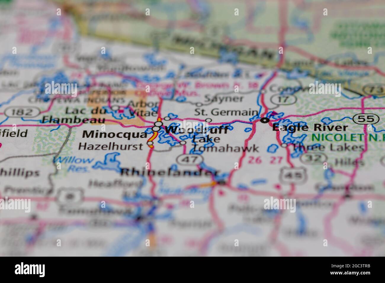 Woodruff Wisconsin USA shown on a road map or Geography map Stock Photohttps://www.alamy.com/image-license-details/?v=1https://www.alamy.com/woodruff-wisconsin-usa-shown-on-a-road-map-or-geography-map-image437720399.html
RM2GC3TRB–Woodruff Wisconsin USA shown on a road map or Geography map
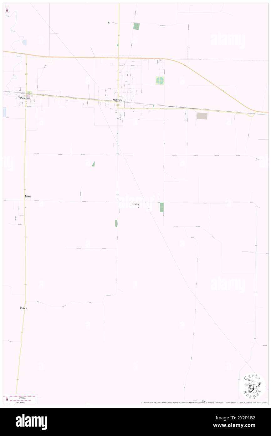 DeView, Woodruff County, US, United States, Arkansas, N 35 13' 26'', S 91 11' 35'', map, Cartascapes Map published in 2024. Explore Cartascapes, a map revealing Earth's diverse landscapes, cultures, and ecosystems. Journey through time and space, discovering the interconnectedness of our planet's past, present, and future. Stock Photohttps://www.alamy.com/image-license-details/?v=1https://www.alamy.com/deview-woodruff-county-us-united-states-arkansas-n-35-13-26-s-91-11-35-map-cartascapes-map-published-in-2024-explore-cartascapes-a-map-revealing-earths-diverse-landscapes-cultures-and-ecosystems-journey-through-time-and-space-discovering-the-interconnectedness-of-our-planets-past-present-and-future-image621286598.html
RM2Y2P1B2–DeView, Woodruff County, US, United States, Arkansas, N 35 13' 26'', S 91 11' 35'', map, Cartascapes Map published in 2024. Explore Cartascapes, a map revealing Earth's diverse landscapes, cultures, and ecosystems. Journey through time and space, discovering the interconnectedness of our planet's past, present, and future.
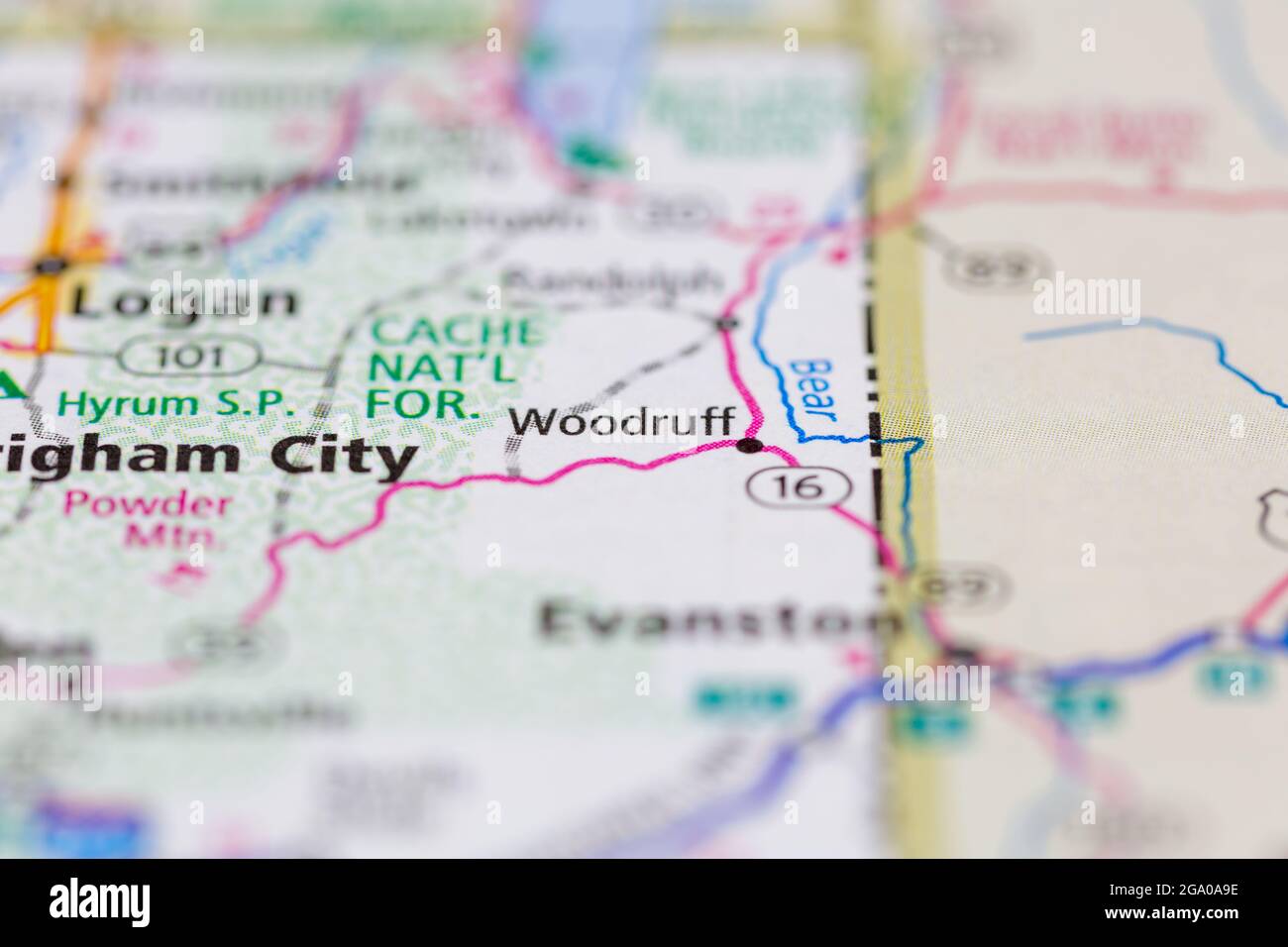 Woodruff Utah USA shown on a road map or Geography map Stock Photohttps://www.alamy.com/image-license-details/?v=1https://www.alamy.com/woodruff-utah-usa-shown-on-a-road-map-or-geography-map-image436413866.html
RM2GA0A9E–Woodruff Utah USA shown on a road map or Geography map
 Map of Woodruff in Arkansas Stock Photohttps://www.alamy.com/image-license-details/?v=1https://www.alamy.com/map-of-woodruff-in-arkansas-image443904390.html
RF2GP5GG6–Map of Woodruff in Arkansas
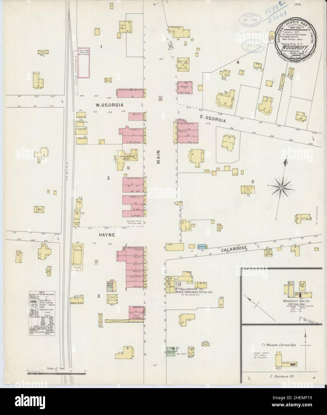 Sanborn Fire Insurance Map from Woodruff, Spartanburg County, South Carolina. Stock Photohttps://www.alamy.com/image-license-details/?v=1https://www.alamy.com/sanborn-fire-insurance-map-from-woodruff-spartanburg-county-south-carolina-image456525589.html
RM2HEMF19–Sanborn Fire Insurance Map from Woodruff, Spartanburg County, South Carolina.
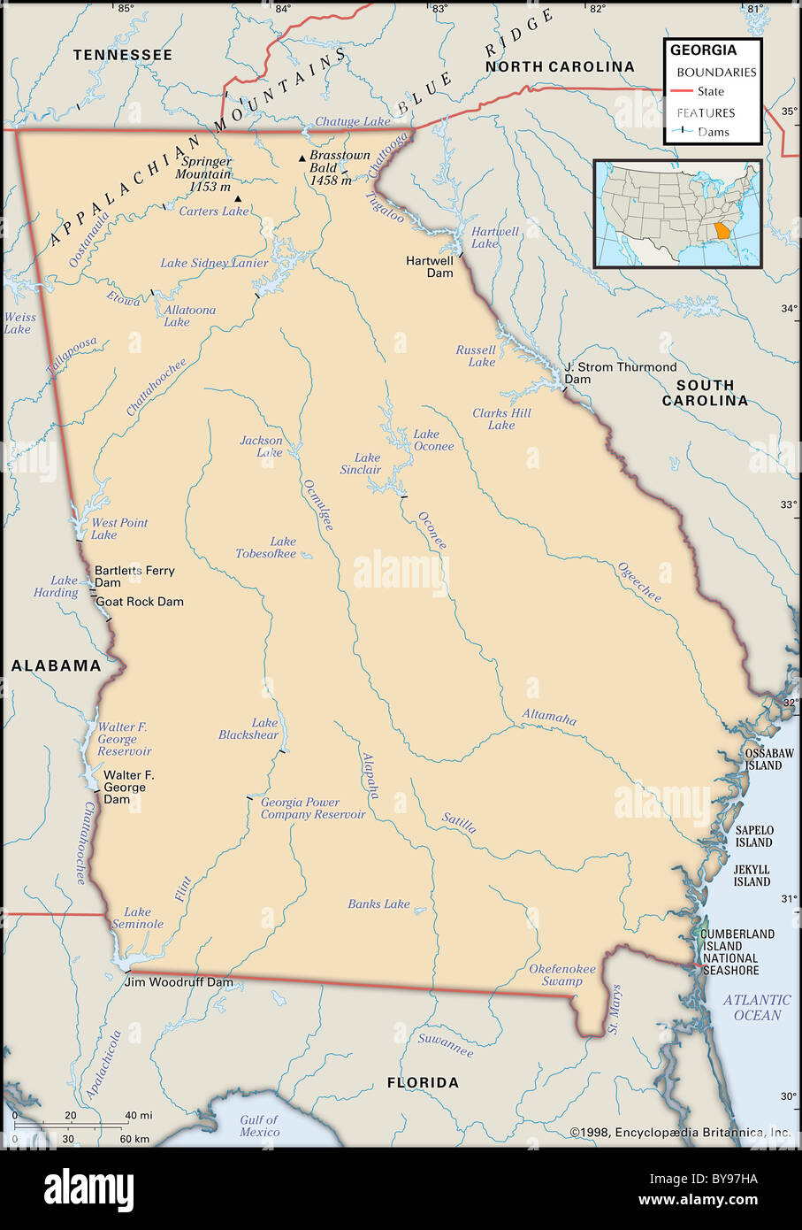 Physical map of Georgia Stock Photohttps://www.alamy.com/image-license-details/?v=1https://www.alamy.com/stock-photo-physical-map-of-georgia-34009622.html
RMBY97HA–Physical map of Georgia
![Staten Island, V. 1, Plate No. 48 [Map bounded by Kill Van Kull, Woodruff Lane, Barker, Trinity Pl., Taylor] 1884 - 1936 Stock Photo Staten Island, V. 1, Plate No. 48 [Map bounded by Kill Van Kull, Woodruff Lane, Barker, Trinity Pl., Taylor] 1884 - 1936 Stock Photo](https://c8.alamy.com/comp/2YP96P1/staten-island-v-1-plate-no-48-map-bounded-by-kill-van-kull-woodruff-lane-barker-trinity-pl-taylor-1884-1936-2YP96P1.jpg) Staten Island, V. 1, Plate No. 48 [Map bounded by Kill Van Kull, Woodruff Lane, Barker, Trinity Pl., Taylor] 1884 - 1936 Stock Photohttps://www.alamy.com/image-license-details/?v=1https://www.alamy.com/staten-island-v-1-plate-no-48-map-bounded-by-kill-van-kull-woodruff-lane-barker-trinity-pl-taylor-1884-1936-image633298569.html
Staten Island, V. 1, Plate No. 48 [Map bounded by Kill Van Kull, Woodruff Lane, Barker, Trinity Pl., Taylor] 1884 - 1936 Stock Photohttps://www.alamy.com/image-license-details/?v=1https://www.alamy.com/staten-island-v-1-plate-no-48-map-bounded-by-kill-van-kull-woodruff-lane-barker-trinity-pl-taylor-1884-1936-image633298569.htmlRM2YP96P1–Staten Island, V. 1, Plate No. 48 [Map bounded by Kill Van Kull, Woodruff Lane, Barker, Trinity Pl., Taylor] 1884 - 1936
 A command element from the Arkansas Army National Guard's 142nd Fires Brigade looks over a map of Woodruff County in eastern Arkansas in an effort to deploy troops in support of evacuation operations due to record flooding. Arkansas National Guard Flood Response 399512 Stock Photohttps://www.alamy.com/image-license-details/?v=1https://www.alamy.com/stock-photo-a-command-element-from-the-arkansas-army-national-guards-142nd-fires-129582930.html
RMHER09P–A command element from the Arkansas Army National Guard's 142nd Fires Brigade looks over a map of Woodruff County in eastern Arkansas in an effort to deploy troops in support of evacuation operations due to record flooding. Arkansas National Guard Flood Response 399512
 Map of Woodruff in Arkansas Stock Photohttps://www.alamy.com/image-license-details/?v=1https://www.alamy.com/map-of-woodruff-in-arkansas-image366741603.html
RF2C8JEJB–Map of Woodruff in Arkansas
 A command element from the Arkansas Army National Guard's 142nd Fires Brigade looks over a map of Woodruff County in eastern Arkansas in an effort to deploy troops in support of evacuation operations due to record flooding. Defense.gov photo essay 110506-A-XXXX-052 Stock Photohttps://www.alamy.com/image-license-details/?v=1https://www.alamy.com/stock-photo-a-command-element-from-the-arkansas-army-national-guards-142nd-fires-129502768.html
RMHEKA2T–A command element from the Arkansas Army National Guard's 142nd Fires Brigade looks over a map of Woodruff County in eastern Arkansas in an effort to deploy troops in support of evacuation operations due to record flooding. Defense.gov photo essay 110506-A-XXXX-052
 Woodruff County (Arkansas) outline map set Stock Vectorhttps://www.alamy.com/image-license-details/?v=1https://www.alamy.com/woodruff-county-arkansas-outline-map-set-image620805202.html
RF2Y203AA–Woodruff County (Arkansas) outline map set
 AmCyc Woodruff Stock Photohttps://www.alamy.com/image-license-details/?v=1https://www.alamy.com/stock-image-amcyc-woodruff-162717517.html
RMKCMBRW–AmCyc Woodruff
 Cartographic, Maps. 1898. Lionel Pincus and Princess Firyal Map Division. Brooklyn (New York, N.Y.), Real property , New York (State) , New York Index to Streets. Adams Street - Woodruff Avenue (Clarakson Avenue.) Volume Two - Index to Streets. Stock Photohttps://www.alamy.com/image-license-details/?v=1https://www.alamy.com/cartographic-maps-1898-lionel-pincus-and-princess-firyal-map-division-brooklyn-new-york-ny-real-property-new-york-state-new-york-index-to-streets-adams-street-woodruff-avenue-clarakson-avenue-volume-two-index-to-streets-image483579591.html
RM2K2MXKK–Cartographic, Maps. 1898. Lionel Pincus and Princess Firyal Map Division. Brooklyn (New York, N.Y.), Real property , New York (State) , New York Index to Streets. Adams Street - Woodruff Avenue (Clarakson Avenue.) Volume Two - Index to Streets.
 Brooklyn, Vol. 5, Double Page Plate No. 1; Part of Wards 29, Section 16; Map bounded by Lincoln Road, Rogers Ave., Clarkson Ave. Stock Photohttps://www.alamy.com/image-license-details/?v=1https://www.alamy.com/stock-photo-brooklyn-vol-5-double-page-plate-no-1-part-of-wards-29-section-16-123331411.html
RMH4J6D7–Brooklyn, Vol. 5, Double Page Plate No. 1; Part of Wards 29, Section 16; Map bounded by Lincoln Road, Rogers Ave., Clarkson Ave.
 35596 Oyster-Dredge, by J N Woodruff, no284,15660 Stock Photohttps://www.alamy.com/image-license-details/?v=1https://www.alamy.com/stock-photo-35596-oyster-dredge-by-j-n-woodruff-no28415660-115083020.html
RMGK6DFT–35596 Oyster-Dredge, by J N Woodruff, no284,15660
 Woodruff County, Arkansas (U.S. county, United States of America,USA, U.S., US) map vector illustration, scribble sketch Woodruff map Stock Vectorhttps://www.alamy.com/image-license-details/?v=1https://www.alamy.com/woodruff-county-arkansas-us-county-united-states-of-americausa-us-us-map-vector-illustration-scribble-sketch-woodruff-map-image341386354.html
RF2ARBDNP–Woodruff County, Arkansas (U.S. county, United States of America,USA, U.S., US) map vector illustration, scribble sketch Woodruff map
 USGS TOPO Map Kansas KS Woodruff 20091116 TM Restoration Stock Photohttps://www.alamy.com/image-license-details/?v=1https://www.alamy.com/usgs-topo-map-kansas-ks-woodruff-20091116-tm-restoration-image260446954.html
RMW3MAMX–USGS TOPO Map Kansas KS Woodruff 20091116 TM Restoration
 Brooklyn, Vol. 5, Double Page Plate No. 1, Part of Wards 29, Section 16, Map bounded by Lincoln Road, Rogers Ave reimagined Stock Photohttps://www.alamy.com/image-license-details/?v=1https://www.alamy.com/brooklyn-vol-5-double-page-plate-no-1-part-of-wards-29-section-16-map-bounded-by-lincoln-road-rogers-ave-reimagined-image230162914.html
RFRACR42–Brooklyn, Vol. 5, Double Page Plate No. 1, Part of Wards 29, Section 16, Map bounded by Lincoln Road, Rogers Ave reimagined
 . Bulletin. Ethnology. 320 BUREAU OF AMERICAN ETHNOLOGY [Bull. 169 Kemps Landing. FLINT RIVER 'R G I A JIM WOODRUFF 0AM 60 < UJ oo V.I20 80 100 I MILES Map 9.—^Jim Woodruff Dam area showing location of sitet.. Please note that these images are extracted from scanned page images that may have been digitally enhanced for readability - coloration and appearance of these illustrations may not perfectly resemble the original work.. Smithsonian Institution. Bureau of American Ethnology. Washington : G. P. O. Stock Photohttps://www.alamy.com/image-license-details/?v=1https://www.alamy.com/bulletin-ethnology-320-bureau-of-american-ethnology-bull-169-kemps-landing-flint-river-r-g-i-a-jim-woodruff-0am-60-lt-uj-oo-vi20-80-100-i-miles-map-9jim-woodruff-dam-area-showing-location-of-sitet-please-note-that-these-images-are-extracted-from-scanned-page-images-that-may-have-been-digitally-enhanced-for-readability-coloration-and-appearance-of-these-illustrations-may-not-perfectly-resemble-the-original-work-smithsonian-institution-bureau-of-american-ethnology-washington-g-p-o-image234156267.html
RMRGXMKR–. Bulletin. Ethnology. 320 BUREAU OF AMERICAN ETHNOLOGY [Bull. 169 Kemps Landing. FLINT RIVER 'R G I A JIM WOODRUFF 0AM 60 < UJ oo V.I20 80 100 I MILES Map 9.—^Jim Woodruff Dam area showing location of sitet.. Please note that these images are extracted from scanned page images that may have been digitally enhanced for readability - coloration and appearance of these illustrations may not perfectly resemble the original work.. Smithsonian Institution. Bureau of American Ethnology. Washington : G. P. O.
 Barson, Woodruff County, US, United States, Arkansas, N 35 9' 5'', S 91 4' 23'', map, Cartascapes Map published in 2024. Explore Cartascapes, a map revealing Earth's diverse landscapes, cultures, and ecosystems. Journey through time and space, discovering the interconnectedness of our planet's past, present, and future. Stock Photohttps://www.alamy.com/image-license-details/?v=1https://www.alamy.com/barson-woodruff-county-us-united-states-arkansas-n-35-9-5-s-91-4-23-map-cartascapes-map-published-in-2024-explore-cartascapes-a-map-revealing-earths-diverse-landscapes-cultures-and-ecosystems-journey-through-time-and-space-discovering-the-interconnectedness-of-our-planets-past-present-and-future-image621363406.html
RM2Y2WFA6–Barson, Woodruff County, US, United States, Arkansas, N 35 9' 5'', S 91 4' 23'', map, Cartascapes Map published in 2024. Explore Cartascapes, a map revealing Earth's diverse landscapes, cultures, and ecosystems. Journey through time and space, discovering the interconnectedness of our planet's past, present, and future.
 Map of Woodruff in Arkansas Stock Photohttps://www.alamy.com/image-license-details/?v=1https://www.alamy.com/map-of-woodruff-in-arkansas-image443920418.html
RF2GP690J–Map of Woodruff in Arkansas
 General soil map, Woodruff County, Arkansas Stock Photohttps://www.alamy.com/image-license-details/?v=1https://www.alamy.com/general-soil-map-woodruff-county-arkansas-image346072122.html
RM2B30XEJ–General soil map, Woodruff County, Arkansas
![Staten Island, V. 1, Plate No. 52 [Map bounded by Trinity Pl., Woodruff Lane, Henderson Ave., Broadway, Cary Ave., Taylor] 1884 - 1936 Stock Photo Staten Island, V. 1, Plate No. 52 [Map bounded by Trinity Pl., Woodruff Lane, Henderson Ave., Broadway, Cary Ave., Taylor] 1884 - 1936 Stock Photo](https://c8.alamy.com/comp/2YP96P5/staten-island-v-1-plate-no-52-map-bounded-by-trinity-pl-woodruff-lane-henderson-ave-broadway-cary-ave-taylor-1884-1936-2YP96P5.jpg) Staten Island, V. 1, Plate No. 52 [Map bounded by Trinity Pl., Woodruff Lane, Henderson Ave., Broadway, Cary Ave., Taylor] 1884 - 1936 Stock Photohttps://www.alamy.com/image-license-details/?v=1https://www.alamy.com/staten-island-v-1-plate-no-52-map-bounded-by-trinity-pl-woodruff-lane-henderson-ave-broadway-cary-ave-taylor-1884-1936-image633298573.html
Staten Island, V. 1, Plate No. 52 [Map bounded by Trinity Pl., Woodruff Lane, Henderson Ave., Broadway, Cary Ave., Taylor] 1884 - 1936 Stock Photohttps://www.alamy.com/image-license-details/?v=1https://www.alamy.com/staten-island-v-1-plate-no-52-map-bounded-by-trinity-pl-woodruff-lane-henderson-ave-broadway-cary-ave-taylor-1884-1936-image633298573.htmlRM2YP96P5–Staten Island, V. 1, Plate No. 52 [Map bounded by Trinity Pl., Woodruff Lane, Henderson Ave., Broadway, Cary Ave., Taylor] 1884 - 1936
 Map of Woodruff in Arkansas Stock Photohttps://www.alamy.com/image-license-details/?v=1https://www.alamy.com/map-of-woodruff-in-arkansas-image367543944.html
RF2C9Y21C–Map of Woodruff in Arkansas
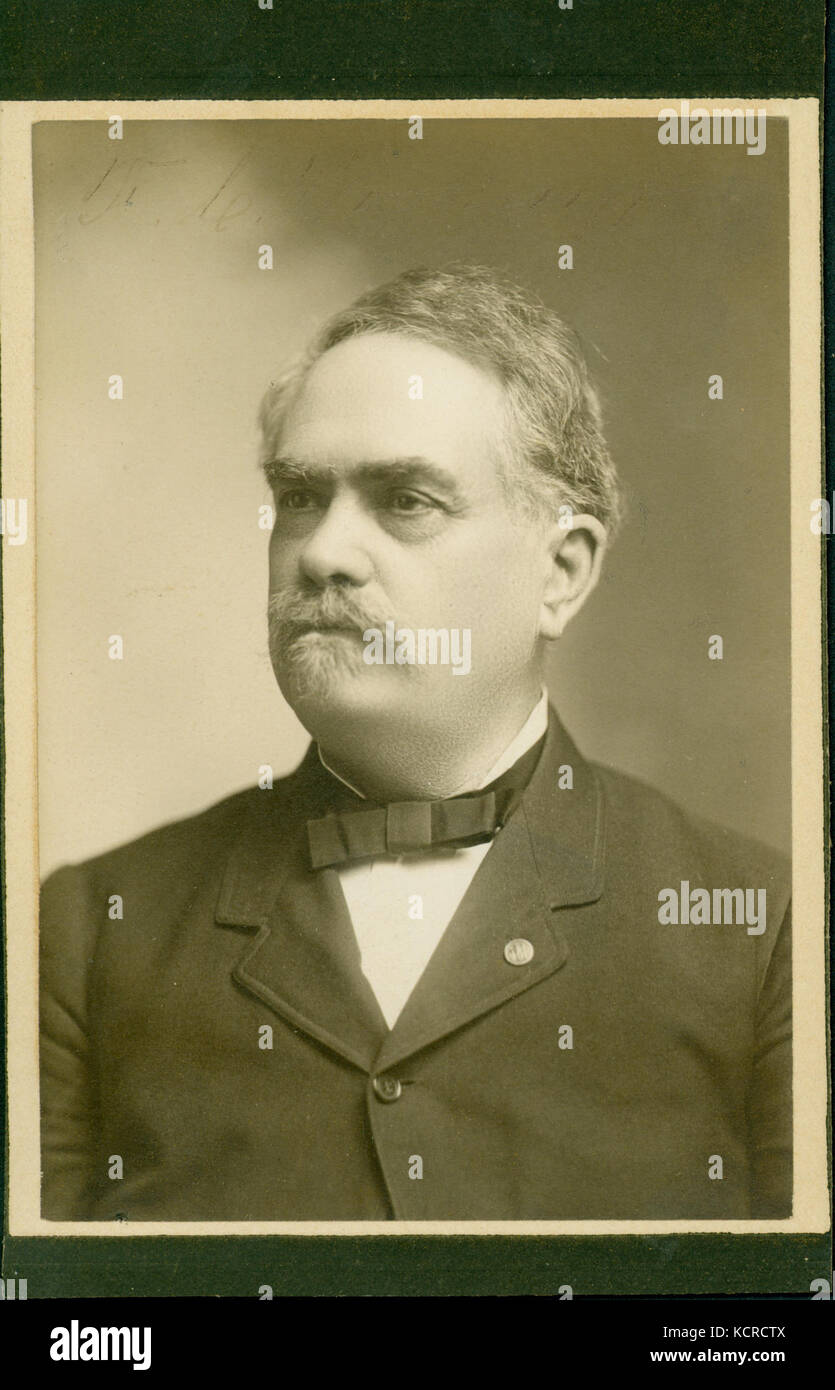 F. C. Woodruff (Union veteran) Stock Photohttps://www.alamy.com/image-license-details/?v=1https://www.alamy.com/stock-image-f-c-woodruff-union-veteran-162784186.html
RMKCRCTX–F. C. Woodruff (Union veteran)
 Cartographic, Maps. 1884 - 1936. Lionel Pincus and Princess Firyal Map Division. Fire insurance , New York (State), Real property , New York (State), Cities & towns , New York (State) Staten Island, V. 1, Plate No. 48 Map bounded by Kill Van Kull, Woodruff Lane, Barker, Trinity Pl., Taylor Stock Photohttps://www.alamy.com/image-license-details/?v=1https://www.alamy.com/cartographic-maps-1884-1936-lionel-pincus-and-princess-firyal-map-division-fire-insurance-new-york-state-real-property-new-york-state-cities-towns-new-york-state-staten-island-v-1-plate-no-48-map-bounded-by-kill-van-kull-woodruff-lane-barker-trinity-pl-taylor-image483563054.html
RM2K2M5H2–Cartographic, Maps. 1884 - 1936. Lionel Pincus and Princess Firyal Map Division. Fire insurance , New York (State), Real property , New York (State), Cities & towns , New York (State) Staten Island, V. 1, Plate No. 48 Map bounded by Kill Van Kull, Woodruff Lane, Barker, Trinity Pl., Taylor
 Varick, Richard. Headquarters. To Lewis Woodruff (NYPL b11868620-5378050) Stock Photohttps://www.alamy.com/image-license-details/?v=1https://www.alamy.com/stock-photo-varick-richard-headquarters-to-lewis-woodruff-nypl-b11868620-5378050-148490582.html
RMJHG972–Varick, Richard. Headquarters. To Lewis Woodruff (NYPL b11868620-5378050)
 Brooklyn, Vol. 5, Double Page Plate No. 21; Part of Ward 29, Section 16; Map bounded by Flatbush Ave., Albemarle Road Avenue A Stock Photohttps://www.alamy.com/image-license-details/?v=1https://www.alamy.com/stock-photo-brooklyn-vol-5-double-page-plate-no-21-part-of-ward-29-section-16-123331363.html
RMH4J6BF–Brooklyn, Vol. 5, Double Page Plate No. 21; Part of Ward 29, Section 16; Map bounded by Flatbush Ave., Albemarle Road Avenue A
 Woodruff County, Arkansas (U.S. county, United States of America,USA, U.S., US) map vector illustration, scribble sketch Woodruff map Stock Vectorhttps://www.alamy.com/image-license-details/?v=1https://www.alamy.com/woodruff-county-arkansas-us-county-united-states-of-americausa-us-us-map-vector-illustration-scribble-sketch-woodruff-map-image337840804.html
RF2AHHYB0–Woodruff County, Arkansas (U.S. county, United States of America,USA, U.S., US) map vector illustration, scribble sketch Woodruff map
 USGS TOPO Map Kansas KS Woodruff 20120905 TM Restoration Stock Photohttps://www.alamy.com/image-license-details/?v=1https://www.alamy.com/usgs-topo-map-kansas-ks-woodruff-20120905-tm-restoration-image260447071.html
RMW3MAW3–USGS TOPO Map Kansas KS Woodruff 20120905 TM Restoration
![The history of Will County, Illinois, containing a history of the County [by G. H. Woodruff], its Cities, Towns, etc. [by W. H. Perrin and H. H. Hill]. ... Illustrated Image taken from page 92 of 'The history of Will Stock Photo The history of Will County, Illinois, containing a history of the County [by G. H. Woodruff], its Cities, Towns, etc. [by W. H. Perrin and H. H. Hill]. ... Illustrated Image taken from page 92 of 'The history of Will Stock Photo](https://c8.alamy.com/comp/HFKK0K/the-history-of-will-county-illinois-containing-a-history-of-the-county-HFKK0K.jpg) The history of Will County, Illinois, containing a history of the County [by G. H. Woodruff], its Cities, Towns, etc. [by W. H. Perrin and H. H. Hill]. ... Illustrated Image taken from page 92 of 'The history of Will Stock Photohttps://www.alamy.com/image-license-details/?v=1https://www.alamy.com/stock-photo-the-history-of-will-county-illinois-containing-a-history-of-the-county-130124419.html
The history of Will County, Illinois, containing a history of the County [by G. H. Woodruff], its Cities, Towns, etc. [by W. H. Perrin and H. H. Hill]. ... Illustrated Image taken from page 92 of 'The history of Will Stock Photohttps://www.alamy.com/image-license-details/?v=1https://www.alamy.com/stock-photo-the-history-of-will-county-illinois-containing-a-history-of-the-county-130124419.htmlRMHFKK0K–The history of Will County, Illinois, containing a history of the County [by G. H. Woodruff], its Cities, Towns, etc. [by W. H. Perrin and H. H. Hill]. ... Illustrated Image taken from page 92 of 'The history of Will
 Brooklyn, Vol. 5, Double Page Plate No. 1, Part of Wards 29, Section 16, Map bounded by Lincoln Road, Rogers Ave reimagined Stock Photohttps://www.alamy.com/image-license-details/?v=1https://www.alamy.com/brooklyn-vol-5-double-page-plate-no-1-part-of-wards-29-section-16-map-bounded-by-lincoln-road-rogers-ave-reimagined-image230354488.html
RFRANFE0–Brooklyn, Vol. 5, Double Page Plate No. 1, Part of Wards 29, Section 16, Map bounded by Lincoln Road, Rogers Ave reimagined
![. Bulletin. Ethnology. Wedel] AN INTRODUCTION TO KANSAS ARCHEOLOGY 211. Figure 34.—Map showing location of certain archeological sites in central Kansas. Num- bered sites include: /, Malone site, 14RC5; 2, Tobias site, 14RC8; 3, Thompson site, HRC9; 4, Paint Creek site, 14MP1; 5, Arkansas City Country Club site, 14C03. Other sites shown include: 14JW1, Warne or White Rock site, Jewell County; 14ML1, Glen Elder, Mitchell County; 14RP1, Kansas Monument site. Republic County; 14PH4, Woodruff ossuary, Phillips County; 14PT1, Pratt site, Pratt County. THE TOBIAS SITE (14RC8) The Tobias site, 4 mile Stock Photo . Bulletin. Ethnology. Wedel] AN INTRODUCTION TO KANSAS ARCHEOLOGY 211. Figure 34.—Map showing location of certain archeological sites in central Kansas. Num- bered sites include: /, Malone site, 14RC5; 2, Tobias site, 14RC8; 3, Thompson site, HRC9; 4, Paint Creek site, 14MP1; 5, Arkansas City Country Club site, 14C03. Other sites shown include: 14JW1, Warne or White Rock site, Jewell County; 14ML1, Glen Elder, Mitchell County; 14RP1, Kansas Monument site. Republic County; 14PH4, Woodruff ossuary, Phillips County; 14PT1, Pratt site, Pratt County. THE TOBIAS SITE (14RC8) The Tobias site, 4 mile Stock Photo](https://c8.alamy.com/comp/RGX303/bulletin-ethnology-wedel-an-introduction-to-kansas-archeology-211-figure-34map-showing-location-of-certain-archeological-sites-in-central-kansas-num-bered-sites-include-malone-site-14rc5-2-tobias-site-14rc8-3-thompson-site-hrc9-4-paint-creek-site-14mp1-5-arkansas-city-country-club-site-14c03-other-sites-shown-include-14jw1-warne-or-white-rock-site-jewell-county-14ml1-glen-elder-mitchell-county-14rp1-kansas-monument-site-republic-county-14ph4-woodruff-ossuary-phillips-county-14pt1-pratt-site-pratt-county-the-tobias-site-14rc8-the-tobias-site-4-mile-RGX303.jpg) . Bulletin. Ethnology. Wedel] AN INTRODUCTION TO KANSAS ARCHEOLOGY 211. Figure 34.—Map showing location of certain archeological sites in central Kansas. Num- bered sites include: /, Malone site, 14RC5; 2, Tobias site, 14RC8; 3, Thompson site, HRC9; 4, Paint Creek site, 14MP1; 5, Arkansas City Country Club site, 14C03. Other sites shown include: 14JW1, Warne or White Rock site, Jewell County; 14ML1, Glen Elder, Mitchell County; 14RP1, Kansas Monument site. Republic County; 14PH4, Woodruff ossuary, Phillips County; 14PT1, Pratt site, Pratt County. THE TOBIAS SITE (14RC8) The Tobias site, 4 mile Stock Photohttps://www.alamy.com/image-license-details/?v=1https://www.alamy.com/bulletin-ethnology-wedel-an-introduction-to-kansas-archeology-211-figure-34map-showing-location-of-certain-archeological-sites-in-central-kansas-num-bered-sites-include-malone-site-14rc5-2-tobias-site-14rc8-3-thompson-site-hrc9-4-paint-creek-site-14mp1-5-arkansas-city-country-club-site-14c03-other-sites-shown-include-14jw1-warne-or-white-rock-site-jewell-county-14ml1-glen-elder-mitchell-county-14rp1-kansas-monument-site-republic-county-14ph4-woodruff-ossuary-phillips-county-14pt1-pratt-site-pratt-county-the-tobias-site-14rc8-the-tobias-site-4-mile-image234142387.html
. Bulletin. Ethnology. Wedel] AN INTRODUCTION TO KANSAS ARCHEOLOGY 211. Figure 34.—Map showing location of certain archeological sites in central Kansas. Num- bered sites include: /, Malone site, 14RC5; 2, Tobias site, 14RC8; 3, Thompson site, HRC9; 4, Paint Creek site, 14MP1; 5, Arkansas City Country Club site, 14C03. Other sites shown include: 14JW1, Warne or White Rock site, Jewell County; 14ML1, Glen Elder, Mitchell County; 14RP1, Kansas Monument site. Republic County; 14PH4, Woodruff ossuary, Phillips County; 14PT1, Pratt site, Pratt County. THE TOBIAS SITE (14RC8) The Tobias site, 4 mile Stock Photohttps://www.alamy.com/image-license-details/?v=1https://www.alamy.com/bulletin-ethnology-wedel-an-introduction-to-kansas-archeology-211-figure-34map-showing-location-of-certain-archeological-sites-in-central-kansas-num-bered-sites-include-malone-site-14rc5-2-tobias-site-14rc8-3-thompson-site-hrc9-4-paint-creek-site-14mp1-5-arkansas-city-country-club-site-14c03-other-sites-shown-include-14jw1-warne-or-white-rock-site-jewell-county-14ml1-glen-elder-mitchell-county-14rp1-kansas-monument-site-republic-county-14ph4-woodruff-ossuary-phillips-county-14pt1-pratt-site-pratt-county-the-tobias-site-14rc8-the-tobias-site-4-mile-image234142387.htmlRMRGX303–. Bulletin. Ethnology. Wedel] AN INTRODUCTION TO KANSAS ARCHEOLOGY 211. Figure 34.—Map showing location of certain archeological sites in central Kansas. Num- bered sites include: /, Malone site, 14RC5; 2, Tobias site, 14RC8; 3, Thompson site, HRC9; 4, Paint Creek site, 14MP1; 5, Arkansas City Country Club site, 14C03. Other sites shown include: 14JW1, Warne or White Rock site, Jewell County; 14ML1, Glen Elder, Mitchell County; 14RP1, Kansas Monument site. Republic County; 14PH4, Woodruff ossuary, Phillips County; 14PT1, Pratt site, Pratt County. THE TOBIAS SITE (14RC8) The Tobias site, 4 mile
 Cavell, Woodruff County, US, United States, Arkansas, N 35 15' 36'', S 91 15' 39'', map, Cartascapes Map published in 2024. Explore Cartascapes, a map revealing Earth's diverse landscapes, cultures, and ecosystems. Journey through time and space, discovering the interconnectedness of our planet's past, present, and future. Stock Photohttps://www.alamy.com/image-license-details/?v=1https://www.alamy.com/cavell-woodruff-county-us-united-states-arkansas-n-35-15-36-s-91-15-39-map-cartascapes-map-published-in-2024-explore-cartascapes-a-map-revealing-earths-diverse-landscapes-cultures-and-ecosystems-journey-through-time-and-space-discovering-the-interconnectedness-of-our-planets-past-present-and-future-image621170326.html
RM2Y2GN2E–Cavell, Woodruff County, US, United States, Arkansas, N 35 15' 36'', S 91 15' 39'', map, Cartascapes Map published in 2024. Explore Cartascapes, a map revealing Earth's diverse landscapes, cultures, and ecosystems. Journey through time and space, discovering the interconnectedness of our planet's past, present, and future.
 Map of Woodruff in Arkansas Stock Photohttps://www.alamy.com/image-license-details/?v=1https://www.alamy.com/map-of-woodruff-in-arkansas-image443795528.html
RF2GP0HM8–Map of Woodruff in Arkansas
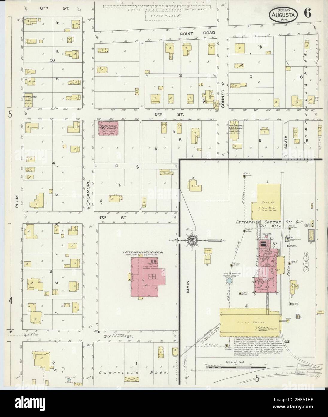 Sanborn Fire Insurance Map from Augusta, Woodruff County, Arkansas. Stock Photohttps://www.alamy.com/image-license-details/?v=1https://www.alamy.com/sanborn-fire-insurance-map-from-augusta-woodruff-county-arkansas-image456295546.html
RM2HEA1HE–Sanborn Fire Insurance Map from Augusta, Woodruff County, Arkansas.
![Brooklyn V. 10, Plate No. 55 [Map bounded by Ocean Ave., Woodruff Ave., Clarkson St., Bedford Ave., Linden Ave., Caton Ave.] 1884 - 1936 Stock Photo Brooklyn V. 10, Plate No. 55 [Map bounded by Ocean Ave., Woodruff Ave., Clarkson St., Bedford Ave., Linden Ave., Caton Ave.] 1884 - 1936 Stock Photo](https://c8.alamy.com/comp/2YPEK4D/brooklyn-v-10-plate-no-55-map-bounded-by-ocean-ave-woodruff-ave-clarkson-st-bedford-ave-linden-ave-caton-ave-1884-1936-2YPEK4D.jpg) Brooklyn V. 10, Plate No. 55 [Map bounded by Ocean Ave., Woodruff Ave., Clarkson St., Bedford Ave., Linden Ave., Caton Ave.] 1884 - 1936 Stock Photohttps://www.alamy.com/image-license-details/?v=1https://www.alamy.com/brooklyn-v-10-plate-no-55-map-bounded-by-ocean-ave-woodruff-ave-clarkson-st-bedford-ave-linden-ave-caton-ave-1884-1936-image633418029.html
Brooklyn V. 10, Plate No. 55 [Map bounded by Ocean Ave., Woodruff Ave., Clarkson St., Bedford Ave., Linden Ave., Caton Ave.] 1884 - 1936 Stock Photohttps://www.alamy.com/image-license-details/?v=1https://www.alamy.com/brooklyn-v-10-plate-no-55-map-bounded-by-ocean-ave-woodruff-ave-clarkson-st-bedford-ave-linden-ave-caton-ave-1884-1936-image633418029.htmlRM2YPEK4D–Brooklyn V. 10, Plate No. 55 [Map bounded by Ocean Ave., Woodruff Ave., Clarkson St., Bedford Ave., Linden Ave., Caton Ave.] 1884 - 1936
 Map of Woodruff in Arkansas Stock Photohttps://www.alamy.com/image-license-details/?v=1https://www.alamy.com/map-of-woodruff-in-arkansas-image366164325.html
RF2C7M699–Map of Woodruff in Arkansas
 Cartographic, Maps. 1884 - 1936. Lionel Pincus and Princess Firyal Map Division. Fire insurance , New York (State), Real property , New York (State), Cities & towns , New York (State) Staten Island, V. 1, Plate No. 52 Map bounded by Trinity Pl., Woodruff Lane, Henderson Ave., Broadway, Cary Ave., Taylor Stock Photohttps://www.alamy.com/image-license-details/?v=1https://www.alamy.com/cartographic-maps-1884-1936-lionel-pincus-and-princess-firyal-map-division-fire-insurance-new-york-state-real-property-new-york-state-cities-towns-new-york-state-staten-island-v-1-plate-no-52-map-bounded-by-trinity-pl-woodruff-lane-henderson-ave-broadway-cary-ave-taylor-image483728003.html
RM2K2YM03–Cartographic, Maps. 1884 - 1936. Lionel Pincus and Princess Firyal Map Division. Fire insurance , New York (State), Real property , New York (State), Cities & towns , New York (State) Staten Island, V. 1, Plate No. 52 Map bounded by Trinity Pl., Woodruff Lane, Henderson Ave., Broadway, Cary Ave., Taylor
 Varick, Richard. Headquarters. To Lewis Woodruff (NYPL b11868620-5378051) Stock Photohttps://www.alamy.com/image-license-details/?v=1https://www.alamy.com/stock-photo-varick-richard-headquarters-to-lewis-woodruff-nypl-b11868620-5378051-148490583.html
RMJHG973–Varick, Richard. Headquarters. To Lewis Woodruff (NYPL b11868620-5378051)
 Woodruff County, Arkansas (U.S. county, United States of America,USA, U.S., US) map vector illustration, scribble sketch Woodruff map Stock Vectorhttps://www.alamy.com/image-license-details/?v=1https://www.alamy.com/woodruff-county-arkansas-us-county-united-states-of-americausa-us-us-map-vector-illustration-scribble-sketch-woodruff-map-image342010262.html
RF2ATBWG6–Woodruff County, Arkansas (U.S. county, United States of America,USA, U.S., US) map vector illustration, scribble sketch Woodruff map
 Carle Augustus Woodruff Stock Photohttps://www.alamy.com/image-license-details/?v=1https://www.alamy.com/stock-photo-carle-augustus-woodruff-142519286.html
RMJ7T8PE–Carle Augustus Woodruff
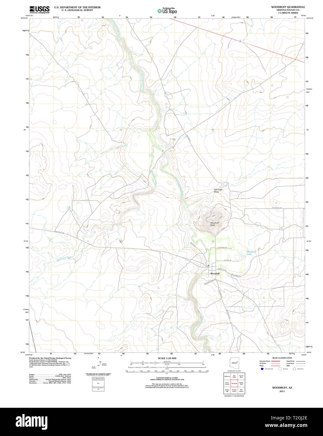 USGS TOPO Map Arizona AZ Woodruff 20111130 TM Restoration Stock Photohttps://www.alamy.com/image-license-details/?v=1https://www.alamy.com/usgs-topo-map-arizona-az-woodruff-20111130-tm-restoration-image242539878.html
RMT2GJ2E–USGS TOPO Map Arizona AZ Woodruff 20111130 TM Restoration
![The history of Will County, Illinois, containing a history of the County [by G. H. Woodruff], its Cities, Towns, etc. [by W. H. Perrin and H. H. Hill]. ... Illustrated Image taken from page 656 of 'The history of Will Stock Photo The history of Will County, Illinois, containing a history of the County [by G. H. Woodruff], its Cities, Towns, etc. [by W. H. Perrin and H. H. Hill]. ... Illustrated Image taken from page 656 of 'The history of Will Stock Photo](https://c8.alamy.com/comp/HFP20T/the-history-of-will-county-illinois-containing-a-history-of-the-county-HFP20T.jpg) The history of Will County, Illinois, containing a history of the County [by G. H. Woodruff], its Cities, Towns, etc. [by W. H. Perrin and H. H. Hill]. ... Illustrated Image taken from page 656 of 'The history of Will Stock Photohttps://www.alamy.com/image-license-details/?v=1https://www.alamy.com/stock-photo-the-history-of-will-county-illinois-containing-a-history-of-the-county-130176952.html
The history of Will County, Illinois, containing a history of the County [by G. H. Woodruff], its Cities, Towns, etc. [by W. H. Perrin and H. H. Hill]. ... Illustrated Image taken from page 656 of 'The history of Will Stock Photohttps://www.alamy.com/image-license-details/?v=1https://www.alamy.com/stock-photo-the-history-of-will-county-illinois-containing-a-history-of-the-county-130176952.htmlRMHFP20T–The history of Will County, Illinois, containing a history of the County [by G. H. Woodruff], its Cities, Towns, etc. [by W. H. Perrin and H. H. Hill]. ... Illustrated Image taken from page 656 of 'The history of Will
 USGS TOPO Map Florida FL Lake Woodruff 20120709 TM Restoration Stock Photohttps://www.alamy.com/image-license-details/?v=1https://www.alamy.com/usgs-topo-map-florida-fl-lake-woodruff-20120709-tm-restoration-image244440781.html
RMT5K6KW–USGS TOPO Map Florida FL Lake Woodruff 20120709 TM Restoration
 Woodruff, Navajo County, US, United States, Arizona, N 34 46' 53'', S 110 2' 36'', map, Cartascapes Map published in 2024. Explore Cartascapes, a map revealing Earth's diverse landscapes, cultures, and ecosystems. Journey through time and space, discovering the interconnectedness of our planet's past, present, and future. Stock Photohttps://www.alamy.com/image-license-details/?v=1https://www.alamy.com/woodruff-navajo-county-us-united-states-arizona-n-34-46-53-s-110-2-36-map-cartascapes-map-published-in-2024-explore-cartascapes-a-map-revealing-earths-diverse-landscapes-cultures-and-ecosystems-journey-through-time-and-space-discovering-the-interconnectedness-of-our-planets-past-present-and-future-image621481477.html
RM2Y32WY1–Woodruff, Navajo County, US, United States, Arizona, N 34 46' 53'', S 110 2' 36'', map, Cartascapes Map published in 2024. Explore Cartascapes, a map revealing Earth's diverse landscapes, cultures, and ecosystems. Journey through time and space, discovering the interconnectedness of our planet's past, present, and future.
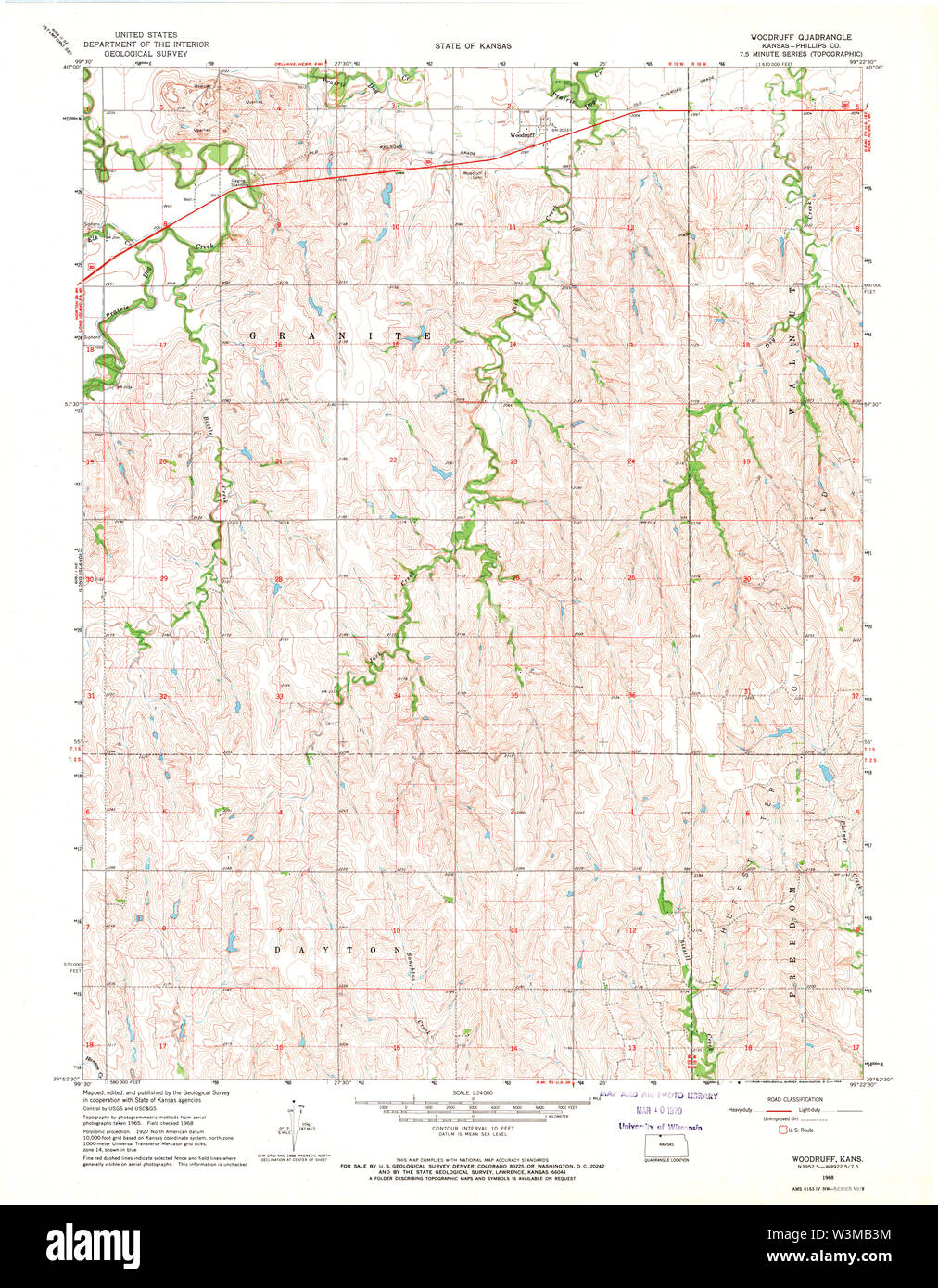 USGS TOPO Map Kansas KS Woodruff 512863 1968 24000 Restoration Stock Photohttps://www.alamy.com/image-license-details/?v=1https://www.alamy.com/usgs-topo-map-kansas-ks-woodruff-512863-1968-24000-restoration-image260447256.html
RMW3MB3M–USGS TOPO Map Kansas KS Woodruff 512863 1968 24000 Restoration
 Brooklyn, Vol. 5, Double Page Plate No. 21, Part of Ward 29, Section 16, Map bounded by Flatbush Ave., Albemarle Road reimagined Stock Photohttps://www.alamy.com/image-license-details/?v=1https://www.alamy.com/brooklyn-vol-5-double-page-plate-no-21-part-of-ward-29-section-16-map-bounded-by-flatbush-ave-albemarle-road-reimagined-image230183560.html
RFRADNDC–Brooklyn, Vol. 5, Double Page Plate No. 21, Part of Ward 29, Section 16, Map bounded by Flatbush Ave., Albemarle Road reimagined
 Sanborn Fire Insurance Map from McCrory, Woodruff County, Arkansas. Stock Photohttps://www.alamy.com/image-license-details/?v=1https://www.alamy.com/sanborn-fire-insurance-map-from-mccrory-woodruff-county-arkansas-image456437987.html
RM2HEGF8K–Sanborn Fire Insurance Map from McCrory, Woodruff County, Arkansas.
![Bronx, V. 12, Double Page Plate No. 260 1/2 [Map bounded by Prospect Ave., Woodruff St., Bronx River, W. Farms Rd.] 1896 Stock Photo Bronx, V. 12, Double Page Plate No. 260 1/2 [Map bounded by Prospect Ave., Woodruff St., Bronx River, W. Farms Rd.] 1896 Stock Photo](https://c8.alamy.com/comp/2YP4N81/bronx-v-12-double-page-plate-no-260-12-map-bounded-by-prospect-ave-woodruff-st-bronx-river-w-farms-rd-1896-2YP4N81.jpg) Bronx, V. 12, Double Page Plate No. 260 1/2 [Map bounded by Prospect Ave., Woodruff St., Bronx River, W. Farms Rd.] 1896 Stock Photohttps://www.alamy.com/image-license-details/?v=1https://www.alamy.com/bronx-v-12-double-page-plate-no-260-12-map-bounded-by-prospect-ave-woodruff-st-bronx-river-w-farms-rd-1896-image633200177.html
Bronx, V. 12, Double Page Plate No. 260 1/2 [Map bounded by Prospect Ave., Woodruff St., Bronx River, W. Farms Rd.] 1896 Stock Photohttps://www.alamy.com/image-license-details/?v=1https://www.alamy.com/bronx-v-12-double-page-plate-no-260-12-map-bounded-by-prospect-ave-woodruff-st-bronx-river-w-farms-rd-1896-image633200177.htmlRM2YP4N81–Bronx, V. 12, Double Page Plate No. 260 1/2 [Map bounded by Prospect Ave., Woodruff St., Bronx River, W. Farms Rd.] 1896
 Cartographic, Maps. 1896. Lionel Pincus and Princess Firyal Map Division. Fire insurance , New York (State), Real property , New York (State), Cities & towns , New York (State) Bronx, V. 12, Double Page Plate No. 260 1/2 Map bounded by Prospect Ave., Woodruff St., Bronx River, W. Farms Rd. Stock Photohttps://www.alamy.com/image-license-details/?v=1https://www.alamy.com/cartographic-maps-1896-lionel-pincus-and-princess-firyal-map-division-fire-insurance-new-york-state-real-property-new-york-state-cities-towns-new-york-state-bronx-v-12-double-page-plate-no-260-12-map-bounded-by-prospect-ave-woodruff-st-bronx-river-w-farms-rd-image483720439.html
RM2K2YA9Y–Cartographic, Maps. 1896. Lionel Pincus and Princess Firyal Map Division. Fire insurance , New York (State), Real property , New York (State), Cities & towns , New York (State) Bronx, V. 12, Double Page Plate No. 260 1/2 Map bounded by Prospect Ave., Woodruff St., Bronx River, W. Farms Rd.
 Abraham O. Woodruff Stock Photohttps://www.alamy.com/image-license-details/?v=1https://www.alamy.com/stock-photo-abraham-o-woodruff-142491935.html
RMJ7R1WK–Abraham O. Woodruff
![The history of Will County, Illinois, containing a history of the County [by G. H. Woodruff], its Cities, Towns, etc. [by W. H. Perrin and H. H. Hill]. ... Illustrated Image taken from page 131 of 'The history of Will Stock Photo The history of Will County, Illinois, containing a history of the County [by G. H. Woodruff], its Cities, Towns, etc. [by W. H. Perrin and H. H. Hill]. ... Illustrated Image taken from page 131 of 'The history of Will Stock Photo](https://c8.alamy.com/comp/HFKH5T/the-history-of-will-county-illinois-containing-a-history-of-the-county-HFKH5T.jpg) The history of Will County, Illinois, containing a history of the County [by G. H. Woodruff], its Cities, Towns, etc. [by W. H. Perrin and H. H. Hill]. ... Illustrated Image taken from page 131 of 'The history of Will Stock Photohttps://www.alamy.com/image-license-details/?v=1https://www.alamy.com/stock-photo-the-history-of-will-county-illinois-containing-a-history-of-the-county-130122996.html
The history of Will County, Illinois, containing a history of the County [by G. H. Woodruff], its Cities, Towns, etc. [by W. H. Perrin and H. H. Hill]. ... Illustrated Image taken from page 131 of 'The history of Will Stock Photohttps://www.alamy.com/image-license-details/?v=1https://www.alamy.com/stock-photo-the-history-of-will-county-illinois-containing-a-history-of-the-county-130122996.htmlRMHFKH5T–The history of Will County, Illinois, containing a history of the County [by G. H. Woodruff], its Cities, Towns, etc. [by W. H. Perrin and H. H. Hill]. ... Illustrated Image taken from page 131 of 'The history of Will
 Tip, Woodruff County, US, United States, Arkansas, N 35 9' 46'', S 91 10' 2'', map, Cartascapes Map published in 2024. Explore Cartascapes, a map revealing Earth's diverse landscapes, cultures, and ecosystems. Journey through time and space, discovering the interconnectedness of our planet's past, present, and future. Stock Photohttps://www.alamy.com/image-license-details/?v=1https://www.alamy.com/tip-woodruff-county-us-united-states-arkansas-n-35-9-46-s-91-10-2-map-cartascapes-map-published-in-2024-explore-cartascapes-a-map-revealing-earths-diverse-landscapes-cultures-and-ecosystems-journey-through-time-and-space-discovering-the-interconnectedness-of-our-planets-past-present-and-future-image621383746.html
RM2Y2XD8J–Tip, Woodruff County, US, United States, Arkansas, N 35 9' 46'', S 91 10' 2'', map, Cartascapes Map published in 2024. Explore Cartascapes, a map revealing Earth's diverse landscapes, cultures, and ecosystems. Journey through time and space, discovering the interconnectedness of our planet's past, present, and future.
 USGS TOPO Map Kansas KS Woodruff 20120905 TM Inverted Restoration Stock Photohttps://www.alamy.com/image-license-details/?v=1https://www.alamy.com/usgs-topo-map-kansas-ks-woodruff-20120905-tm-inverted-restoration-image260447035.html
RMW3MARR–USGS TOPO Map Kansas KS Woodruff 20120905 TM Inverted Restoration
 Brooklyn, Vol. 5, Double Page Plate No. 21, Part of Ward 29, Section 16, Map bounded by Flatbush Ave., Albemarle Road reimagined Stock Photohttps://www.alamy.com/image-license-details/?v=1https://www.alamy.com/brooklyn-vol-5-double-page-plate-no-21-part-of-ward-29-section-16-map-bounded-by-flatbush-ave-albemarle-road-reimagined-image230354453.html
RFRANFCN–Brooklyn, Vol. 5, Double Page Plate No. 21, Part of Ward 29, Section 16, Map bounded by Flatbush Ave., Albemarle Road reimagined
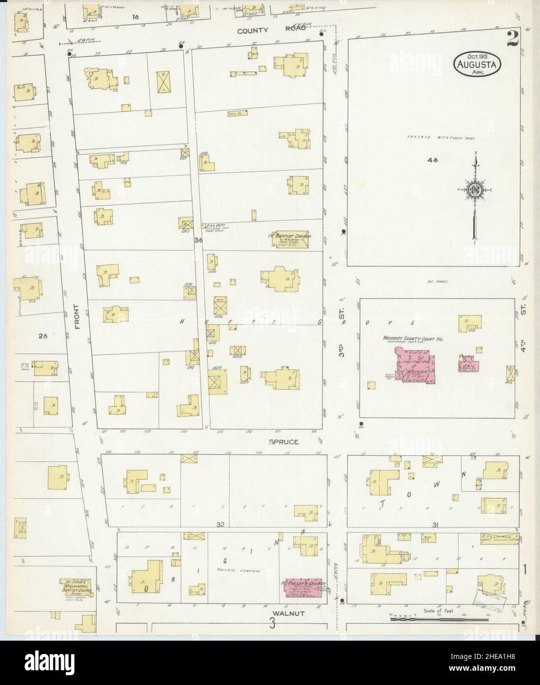 Sanborn Fire Insurance Map from Augusta, Woodruff County, Arkansas. Stock Photohttps://www.alamy.com/image-license-details/?v=1https://www.alamy.com/sanborn-fire-insurance-map-from-augusta-woodruff-county-arkansas-image456295540.html
RM2HEA1H8–Sanborn Fire Insurance Map from Augusta, Woodruff County, Arkansas.
![Brooklyn V. 10, Plate No. 56 [Map bounded by Ocean Ave., Parkside Ave., Flatbush Ave., Hawthorne St., Bedford Ave., Clarkson St., Woodruff Ave.] 1884 - 1936 Stock Photo Brooklyn V. 10, Plate No. 56 [Map bounded by Ocean Ave., Parkside Ave., Flatbush Ave., Hawthorne St., Bedford Ave., Clarkson St., Woodruff Ave.] 1884 - 1936 Stock Photo](https://c8.alamy.com/comp/2YPEK4E/brooklyn-v-10-plate-no-56-map-bounded-by-ocean-ave-parkside-ave-flatbush-ave-hawthorne-st-bedford-ave-clarkson-st-woodruff-ave-1884-1936-2YPEK4E.jpg) Brooklyn V. 10, Plate No. 56 [Map bounded by Ocean Ave., Parkside Ave., Flatbush Ave., Hawthorne St., Bedford Ave., Clarkson St., Woodruff Ave.] 1884 - 1936 Stock Photohttps://www.alamy.com/image-license-details/?v=1https://www.alamy.com/brooklyn-v-10-plate-no-56-map-bounded-by-ocean-ave-parkside-ave-flatbush-ave-hawthorne-st-bedford-ave-clarkson-st-woodruff-ave-1884-1936-image633418030.html
Brooklyn V. 10, Plate No. 56 [Map bounded by Ocean Ave., Parkside Ave., Flatbush Ave., Hawthorne St., Bedford Ave., Clarkson St., Woodruff Ave.] 1884 - 1936 Stock Photohttps://www.alamy.com/image-license-details/?v=1https://www.alamy.com/brooklyn-v-10-plate-no-56-map-bounded-by-ocean-ave-parkside-ave-flatbush-ave-hawthorne-st-bedford-ave-clarkson-st-woodruff-ave-1884-1936-image633418030.htmlRM2YPEK4E–Brooklyn V. 10, Plate No. 56 [Map bounded by Ocean Ave., Parkside Ave., Flatbush Ave., Hawthorne St., Bedford Ave., Clarkson St., Woodruff Ave.] 1884 - 1936
 Cartographic, Maps. 1884 - 1936. Lionel Pincus and Princess Firyal Map Division. Fire insurance , New York (State), Real property , New York (State), Cities & towns , New York (State) Brooklyn V. 10, Plate No. 55 Map bounded by Ocean Ave., Woodruff Ave., Clarkson St., Bedford Ave., Linden Ave., Caton Ave. Stock Photohttps://www.alamy.com/image-license-details/?v=1https://www.alamy.com/cartographic-maps-1884-1936-lionel-pincus-and-princess-firyal-map-division-fire-insurance-new-york-state-real-property-new-york-state-cities-towns-new-york-state-brooklyn-v-10-plate-no-55-map-bounded-by-ocean-ave-woodruff-ave-clarkson-st-bedford-ave-linden-ave-caton-ave-image483533827.html
RM2K2JT97–Cartographic, Maps. 1884 - 1936. Lionel Pincus and Princess Firyal Map Division. Fire insurance , New York (State), Real property , New York (State), Cities & towns , New York (State) Brooklyn V. 10, Plate No. 55 Map bounded by Ocean Ave., Woodruff Ave., Clarkson St., Bedford Ave., Linden Ave., Caton Ave.
 Wilford Woodruff by CR Savage 1861 Stock Photohttps://www.alamy.com/image-license-details/?v=1https://www.alamy.com/stock-photo-wilford-woodruff-by-cr-savage-1861-147714455.html
RMJG8Y87–Wilford Woodruff by CR Savage 1861
![The history of Will County, Illinois, containing a history of the County [by G. H. Woodruff], its Cities, Towns, etc. [by W. H. Perrin and H. H. Hill]. ... Illustrated Image taken from page 597 of 'The history of Will Stock Photo The history of Will County, Illinois, containing a history of the County [by G. H. Woodruff], its Cities, Towns, etc. [by W. H. Perrin and H. H. Hill]. ... Illustrated Image taken from page 597 of 'The history of Will Stock Photo](https://c8.alamy.com/comp/HFNT98/the-history-of-will-county-illinois-containing-a-history-of-the-county-HFNT98.jpg) The history of Will County, Illinois, containing a history of the County [by G. H. Woodruff], its Cities, Towns, etc. [by W. H. Perrin and H. H. Hill]. ... Illustrated Image taken from page 597 of 'The history of Will Stock Photohttps://www.alamy.com/image-license-details/?v=1https://www.alamy.com/stock-photo-the-history-of-will-county-illinois-containing-a-history-of-the-county-130172484.html
The history of Will County, Illinois, containing a history of the County [by G. H. Woodruff], its Cities, Towns, etc. [by W. H. Perrin and H. H. Hill]. ... Illustrated Image taken from page 597 of 'The history of Will Stock Photohttps://www.alamy.com/image-license-details/?v=1https://www.alamy.com/stock-photo-the-history-of-will-county-illinois-containing-a-history-of-the-county-130172484.htmlRMHFNT98–The history of Will County, Illinois, containing a history of the County [by G. H. Woodruff], its Cities, Towns, etc. [by W. H. Perrin and H. H. Hill]. ... Illustrated Image taken from page 597 of 'The history of Will
 Goodrich, Woodruff County, US, United States, Arkansas, N 35 19' 54'', S 91 13' 49'', map, Cartascapes Map published in 2024. Explore Cartascapes, a map revealing Earth's diverse landscapes, cultures, and ecosystems. Journey through time and space, discovering the interconnectedness of our planet's past, present, and future. Stock Photohttps://www.alamy.com/image-license-details/?v=1https://www.alamy.com/goodrich-woodruff-county-us-united-states-arkansas-n-35-19-54-s-91-13-49-map-cartascapes-map-published-in-2024-explore-cartascapes-a-map-revealing-earths-diverse-landscapes-cultures-and-ecosystems-journey-through-time-and-space-discovering-the-interconnectedness-of-our-planets-past-present-and-future-image621342847.html
RM2Y2TH3Y–Goodrich, Woodruff County, US, United States, Arkansas, N 35 19' 54'', S 91 13' 49'', map, Cartascapes Map published in 2024. Explore Cartascapes, a map revealing Earth's diverse landscapes, cultures, and ecosystems. Journey through time and space, discovering the interconnectedness of our planet's past, present, and future.
 USGS TOPO Map Arizona AZ Woodruff 20111130 TM Inverted Restoration Stock Photohttps://www.alamy.com/image-license-details/?v=1https://www.alamy.com/usgs-topo-map-arizona-az-woodruff-20111130-tm-inverted-restoration-image242539875.html
RMT2GJ2B–USGS TOPO Map Arizona AZ Woodruff 20111130 TM Inverted Restoration
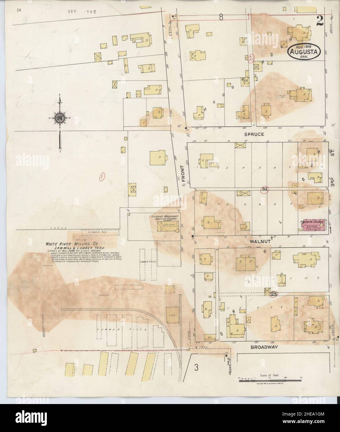 Sanborn Fire Insurance Map from Augusta, Woodruff County, Arkansas. Stock Photohttps://www.alamy.com/image-license-details/?v=1https://www.alamy.com/sanborn-fire-insurance-map-from-augusta-woodruff-county-arkansas-image456295524.html
RM2HEA1GM–Sanborn Fire Insurance Map from Augusta, Woodruff County, Arkansas.
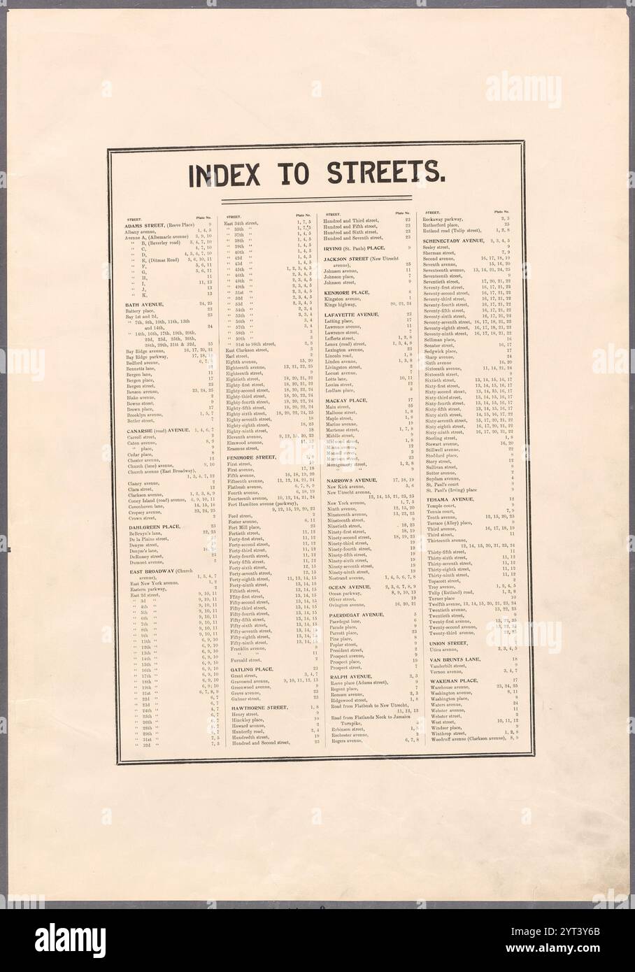 Index to Streets. Adams Street - Woodruff Avenue (Clarakson Avenue.) 1898 by Ullitz, Hugo. Stock Photohttps://www.alamy.com/image-license-details/?v=1https://www.alamy.com/index-to-streets-adams-street-woodruff-avenue-clarakson-avenue-1898-by-ullitz-hugo-image634412195.html
RM2YT3Y6B–Index to Streets. Adams Street - Woodruff Avenue (Clarakson Avenue.) 1898 by Ullitz, Hugo.
 Cartographic, Maps. 1884 - 1936. Lionel Pincus and Princess Firyal Map Division. Fire insurance , New York (State), Real property , New York (State), Cities & towns , New York (State) Brooklyn V. 10, Plate No. 56 Map bounded by Ocean Ave., Parkside Ave., Flatbush Ave., Hawthorne St., Bedford Ave., Clarkson St., Woodruff Ave. Stock Photohttps://www.alamy.com/image-license-details/?v=1https://www.alamy.com/cartographic-maps-1884-1936-lionel-pincus-and-princess-firyal-map-division-fire-insurance-new-york-state-real-property-new-york-state-cities-towns-new-york-state-brooklyn-v-10-plate-no-56-map-bounded-by-ocean-ave-parkside-ave-flatbush-ave-hawthorne-st-bedford-ave-clarkson-st-woodruff-ave-image483564392.html
RM2K2M78T–Cartographic, Maps. 1884 - 1936. Lionel Pincus and Princess Firyal Map Division. Fire insurance , New York (State), Real property , New York (State), Cities & towns , New York (State) Brooklyn V. 10, Plate No. 56 Map bounded by Ocean Ave., Parkside Ave., Flatbush Ave., Hawthorne St., Bedford Ave., Clarkson St., Woodruff Ave.
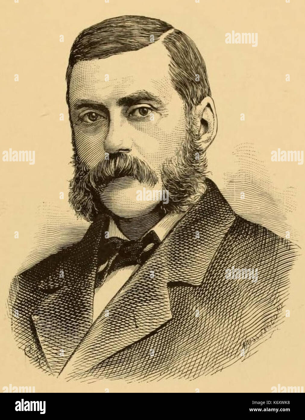 Edward Woodruff Seymour (Connecticut Congressman) Stock Photohttps://www.alamy.com/image-license-details/?v=1https://www.alamy.com/edward-woodruff-seymour-connecticut-congressman-image159172140.html
RMK6XWK8–Edward Woodruff Seymour (Connecticut Congressman)
![The history of Will County, Illinois, containing a history of the County [by G. H. Woodruff], its Cities, Towns, etc. [by W. H. Perrin and H. H. Hill]. ... Illustrated Image taken from page 57 of 'The history of Will Stock Photo The history of Will County, Illinois, containing a history of the County [by G. H. Woodruff], its Cities, Towns, etc. [by W. H. Perrin and H. H. Hill]. ... Illustrated Image taken from page 57 of 'The history of Will Stock Photo](https://c8.alamy.com/comp/HFNNFM/the-history-of-will-county-illinois-containing-a-history-of-the-county-HFNNFM.jpg) The history of Will County, Illinois, containing a history of the County [by G. H. Woodruff], its Cities, Towns, etc. [by W. H. Perrin and H. H. Hill]. ... Illustrated Image taken from page 57 of 'The history of Will Stock Photohttps://www.alamy.com/image-license-details/?v=1https://www.alamy.com/stock-photo-the-history-of-will-county-illinois-containing-a-history-of-the-county-130170312.html
The history of Will County, Illinois, containing a history of the County [by G. H. Woodruff], its Cities, Towns, etc. [by W. H. Perrin and H. H. Hill]. ... Illustrated Image taken from page 57 of 'The history of Will Stock Photohttps://www.alamy.com/image-license-details/?v=1https://www.alamy.com/stock-photo-the-history-of-will-county-illinois-containing-a-history-of-the-county-130170312.htmlRMHFNNFM–The history of Will County, Illinois, containing a history of the County [by G. H. Woodruff], its Cities, Towns, etc. [by W. H. Perrin and H. H. Hill]. ... Illustrated Image taken from page 57 of 'The history of Will
 Casey, Woodruff County, US, United States, Arkansas, N 35 2' 46'', S 91 11' 50'', map, Cartascapes Map published in 2024. Explore Cartascapes, a map revealing Earth's diverse landscapes, cultures, and ecosystems. Journey through time and space, discovering the interconnectedness of our planet's past, present, and future. Stock Photohttps://www.alamy.com/image-license-details/?v=1https://www.alamy.com/casey-woodruff-county-us-united-states-arkansas-n-35-2-46-s-91-11-50-map-cartascapes-map-published-in-2024-explore-cartascapes-a-map-revealing-earths-diverse-landscapes-cultures-and-ecosystems-journey-through-time-and-space-discovering-the-interconnectedness-of-our-planets-past-present-and-future-image621363731.html
RM2Y2WFNR–Casey, Woodruff County, US, United States, Arkansas, N 35 2' 46'', S 91 11' 50'', map, Cartascapes Map published in 2024. Explore Cartascapes, a map revealing Earth's diverse landscapes, cultures, and ecosystems. Journey through time and space, discovering the interconnectedness of our planet's past, present, and future.
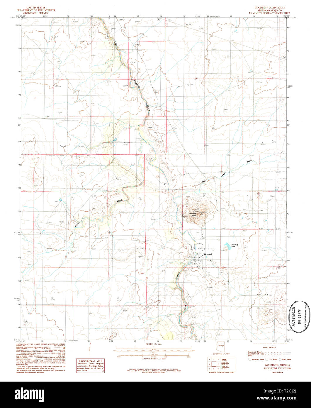 USGS TOPO Map Arizona AZ Woodruff 314187 1986 24000 Restoration Stock Photohttps://www.alamy.com/image-license-details/?v=1https://www.alamy.com/usgs-topo-map-arizona-az-woodruff-314187-1986-24000-restoration-image242539882.html
RMT2GJ2J–USGS TOPO Map Arizona AZ Woodruff 314187 1986 24000 Restoration
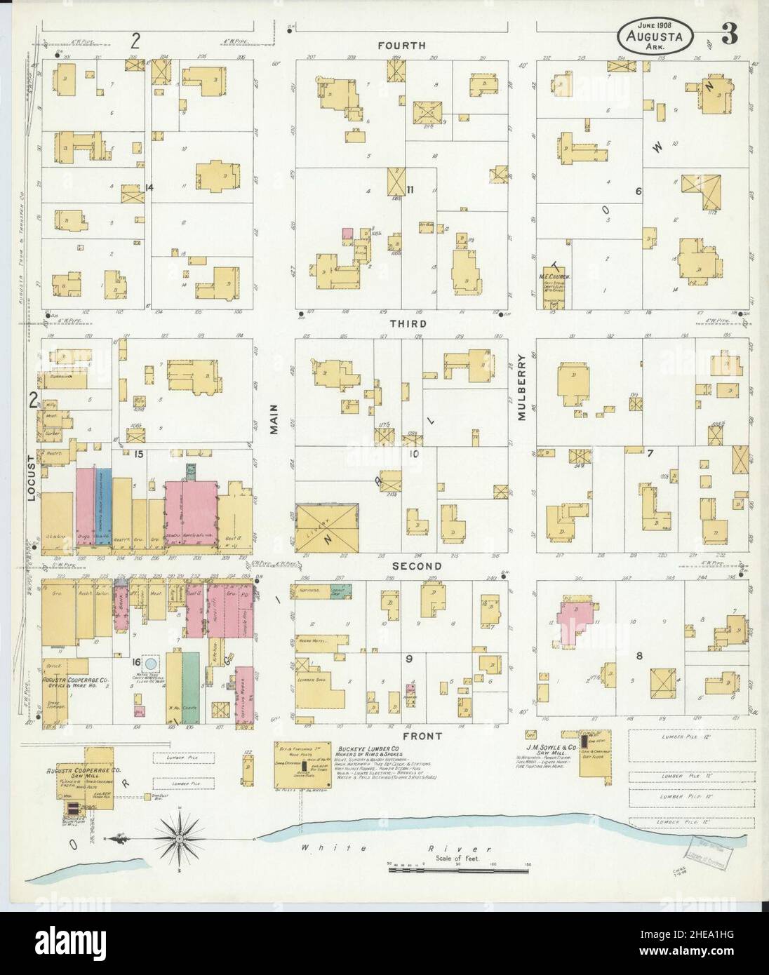 Sanborn Fire Insurance Map from Augusta, Woodruff County, Arkansas. Stock Photohttps://www.alamy.com/image-license-details/?v=1https://www.alamy.com/sanborn-fire-insurance-map-from-augusta-woodruff-county-arkansas-image456295548.html
RM2HEA1HG–Sanborn Fire Insurance Map from Augusta, Woodruff County, Arkansas.
 Residence of Dr. W. H. Woodruff, Pine Bush, Orange Co., N.Y.; Residence of T. Helms, Farmer, Town of Wallkill, Orange Co., N.Y.; Residence of G. O. Lain, West Town, Orange Co., N.Y.; Front of Barns 1875 Stock Photohttps://www.alamy.com/image-license-details/?v=1https://www.alamy.com/residence-of-dr-w-h-woodruff-pine-bush-orange-co-ny-residence-of-t-helms-farmer-town-of-wallkill-orange-co-ny-residence-of-g-o-lain-west-town-orange-co-ny-front-of-barns-1875-image633413792.html
RM2YPEDN4–Residence of Dr. W. H. Woodruff, Pine Bush, Orange Co., N.Y.; Residence of T. Helms, Farmer, Town of Wallkill, Orange Co., N.Y.; Residence of G. O. Lain, West Town, Orange Co., N.Y.; Front of Barns 1875
 Residence of Dr. W. H. Woodruff, Pine Bush, Orange Co., N.Y.; Residence of T. Helms, Farmer, Town of Wallkill, Orange Co., N.Y.; Residence of G. O. Lain, West Town, Orange Co., N.Y.; Front of Barns Cartographic. Atlases, Prints. 1875. Lionel Pincus and Princess Firyal Map Division. Orange County (N.Y.), Real property , New York (State) , Orange County, Orange County (N.Y.) , History, Business enterprises , New York (State) , Orange County Stock Photohttps://www.alamy.com/image-license-details/?v=1https://www.alamy.com/residence-of-dr-w-h-woodruff-pine-bush-orange-co-ny-residence-of-t-helms-farmer-town-of-wallkill-orange-co-ny-residence-of-g-o-lain-west-town-orange-co-ny-front-of-barns-cartographic-atlases-prints-1875-lionel-pincus-and-princess-firyal-map-division-orange-county-ny-real-property-new-york-state-orange-county-orange-county-ny-history-business-enterprises-new-york-state-orange-county-image484323110.html
RM2K3XR1X–Residence of Dr. W. H. Woodruff, Pine Bush, Orange Co., N.Y.; Residence of T. Helms, Farmer, Town of Wallkill, Orange Co., N.Y.; Residence of G. O. Lain, West Town, Orange Co., N.Y.; Front of Barns Cartographic. Atlases, Prints. 1875. Lionel Pincus and Princess Firyal Map Division. Orange County (N.Y.), Real property , New York (State) , Orange County, Orange County (N.Y.) , History, Business enterprises , New York (State) , Orange County
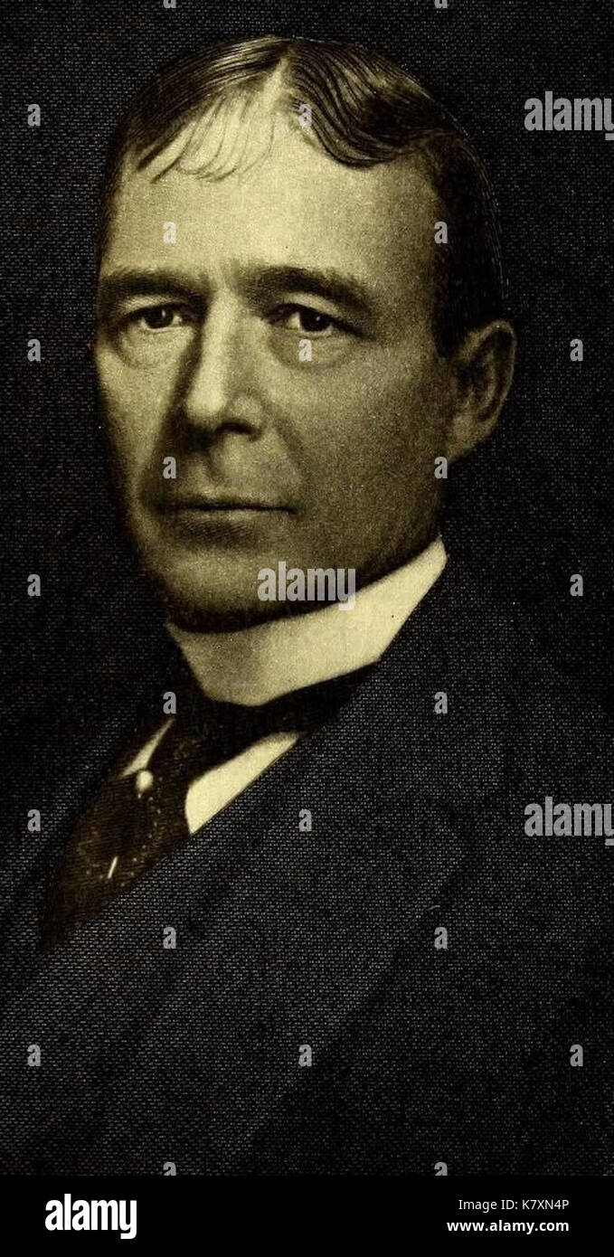 John Woodruff Simpson (New York City lawyer) Stock Photohttps://www.alamy.com/image-license-details/?v=1https://www.alamy.com/john-woodruff-simpson-new-york-city-lawyer-image159783254.html
RMK7XN4P–John Woodruff Simpson (New York City lawyer)
![The history of Will County, Illinois, containing a history of the County [by G. H. Woodruff], its Cities, Towns, etc. [by W. H. Perrin and H. H. Hill]. ... Illustrated Image taken from page 543 of 'The history of Will Stock Photo The history of Will County, Illinois, containing a history of the County [by G. H. Woodruff], its Cities, Towns, etc. [by W. H. Perrin and H. H. Hill]. ... Illustrated Image taken from page 543 of 'The history of Will Stock Photo](https://c8.alamy.com/comp/HFNJ7Y/the-history-of-will-county-illinois-containing-a-history-of-the-county-HFNJ7Y.jpg) The history of Will County, Illinois, containing a history of the County [by G. H. Woodruff], its Cities, Towns, etc. [by W. H. Perrin and H. H. Hill]. ... Illustrated Image taken from page 543 of 'The history of Will Stock Photohttps://www.alamy.com/image-license-details/?v=1https://www.alamy.com/stock-photo-the-history-of-will-county-illinois-containing-a-history-of-the-county-130167743.html
The history of Will County, Illinois, containing a history of the County [by G. H. Woodruff], its Cities, Towns, etc. [by W. H. Perrin and H. H. Hill]. ... Illustrated Image taken from page 543 of 'The history of Will Stock Photohttps://www.alamy.com/image-license-details/?v=1https://www.alamy.com/stock-photo-the-history-of-will-county-illinois-containing-a-history-of-the-county-130167743.htmlRMHFNJ7Y–The history of Will County, Illinois, containing a history of the County [by G. H. Woodruff], its Cities, Towns, etc. [by W. H. Perrin and H. H. Hill]. ... Illustrated Image taken from page 543 of 'The history of Will
 Bemis, Woodruff County, US, United States, Arkansas, N 35 9' 45'', S 91 4' 3'', map, Cartascapes Map published in 2024. Explore Cartascapes, a map revealing Earth's diverse landscapes, cultures, and ecosystems. Journey through time and space, discovering the interconnectedness of our planet's past, present, and future. Stock Photohttps://www.alamy.com/image-license-details/?v=1https://www.alamy.com/bemis-woodruff-county-us-united-states-arkansas-n-35-9-45-s-91-4-3-map-cartascapes-map-published-in-2024-explore-cartascapes-a-map-revealing-earths-diverse-landscapes-cultures-and-ecosystems-journey-through-time-and-space-discovering-the-interconnectedness-of-our-planets-past-present-and-future-image621341956.html
RM2Y2TG04–Bemis, Woodruff County, US, United States, Arkansas, N 35 9' 45'', S 91 4' 3'', map, Cartascapes Map published in 2024. Explore Cartascapes, a map revealing Earth's diverse landscapes, cultures, and ecosystems. Journey through time and space, discovering the interconnectedness of our planet's past, present, and future.
 USGS TOPO Map Kansas KS Woodruff 20091116 TM Inverted Restoration Stock Photohttps://www.alamy.com/image-license-details/?v=1https://www.alamy.com/usgs-topo-map-kansas-ks-woodruff-20091116-tm-inverted-restoration-image260446943.html
RMW3MAMF–USGS TOPO Map Kansas KS Woodruff 20091116 TM Inverted Restoration
 Sanborn Fire Insurance Map from Augusta, Woodruff County, Arkansas. Stock Photohttps://www.alamy.com/image-license-details/?v=1https://www.alamy.com/sanborn-fire-insurance-map-from-augusta-woodruff-county-arkansas-image456295555.html
RM2HEA1HR–Sanborn Fire Insurance Map from Augusta, Woodruff County, Arkansas.
![Plate 22: Map No. 443 [Bounded by Railroad Ave., Washington Ave. and Fletcher St.] - Vol. 4 of Maps, Page 12: [Bounded by Sherigan Ave., Grant Ave., N.Y. & Harlem, & N.Y. & New Haven R.R., Morrist St., Waverly St. and Slocum Ave.] - Map No. 442: [Bounded by Tallmadge St., Land of the New York and Harlem Railroad Company, Quarry Road, Valentine Ave. and Slocum Ave.] - Vol. 4 of Maps, Page 27: [Bounded by Southern Blvd., Locust Ave., Catherine St., Chestnut St. and Woodruff Ave.] - Vol. 4 of Maps, Page 28: [Bounded by Wilkens pond, Bathgate, Boston Post Road, and Broadway.] 1888 - 1897 Stock Photo Plate 22: Map No. 443 [Bounded by Railroad Ave., Washington Ave. and Fletcher St.] - Vol. 4 of Maps, Page 12: [Bounded by Sherigan Ave., Grant Ave., N.Y. & Harlem, & N.Y. & New Haven R.R., Morrist St., Waverly St. and Slocum Ave.] - Map No. 442: [Bounded by Tallmadge St., Land of the New York and Harlem Railroad Company, Quarry Road, Valentine Ave. and Slocum Ave.] - Vol. 4 of Maps, Page 27: [Bounded by Southern Blvd., Locust Ave., Catherine St., Chestnut St. and Woodruff Ave.] - Vol. 4 of Maps, Page 28: [Bounded by Wilkens pond, Bathgate, Boston Post Road, and Broadway.] 1888 - 1897 Stock Photo](https://c8.alamy.com/comp/2YP9GGR/plate-22-map-no-443-bounded-by-railroad-ave-washington-ave-and-fletcher-st-vol-4-of-maps-page-12-bounded-by-sherigan-ave-grant-ave-ny-harlem-ny-new-haven-rr-morrist-st-waverly-st-and-slocum-ave-map-no-442-bounded-by-tallmadge-st-land-of-the-new-york-and-harlem-railroad-company-quarry-road-valentine-ave-and-slocum-ave-vol-4-of-maps-page-27-bounded-by-southern-blvd-locust-ave-catherine-st-chestnut-st-and-woodruff-ave-vol-4-of-maps-page-28-bounded-by-wilkens-pond-bathgate-boston-post-road-and-broadway-1888-1897-2YP9GGR.jpg) Plate 22: Map No. 443 [Bounded by Railroad Ave., Washington Ave. and Fletcher St.] - Vol. 4 of Maps, Page 12: [Bounded by Sherigan Ave., Grant Ave., N.Y. & Harlem, & N.Y. & New Haven R.R., Morrist St., Waverly St. and Slocum Ave.] - Map No. 442: [Bounded by Tallmadge St., Land of the New York and Harlem Railroad Company, Quarry Road, Valentine Ave. and Slocum Ave.] - Vol. 4 of Maps, Page 27: [Bounded by Southern Blvd., Locust Ave., Catherine St., Chestnut St. and Woodruff Ave.] - Vol. 4 of Maps, Page 28: [Bounded by Wilkens pond, Bathgate, Boston Post Road, and Broadway.] 1888 - 1897 Stock Photohttps://www.alamy.com/image-license-details/?v=1https://www.alamy.com/plate-22-map-no-443-bounded-by-railroad-ave-washington-ave-and-fletcher-st-vol-4-of-maps-page-12-bounded-by-sherigan-ave-grant-ave-ny-harlem-ny-new-haven-rr-morrist-st-waverly-st-and-slocum-ave-map-no-442-bounded-by-tallmadge-st-land-of-the-new-york-and-harlem-railroad-company-quarry-road-valentine-ave-and-slocum-ave-vol-4-of-maps-page-27-bounded-by-southern-blvd-locust-ave-catherine-st-chestnut-st-and-woodruff-ave-vol-4-of-maps-page-28-bounded-by-wilkens-pond-bathgate-boston-post-road-and-broadway-1888-1897-image633306263.html
Plate 22: Map No. 443 [Bounded by Railroad Ave., Washington Ave. and Fletcher St.] - Vol. 4 of Maps, Page 12: [Bounded by Sherigan Ave., Grant Ave., N.Y. & Harlem, & N.Y. & New Haven R.R., Morrist St., Waverly St. and Slocum Ave.] - Map No. 442: [Bounded by Tallmadge St., Land of the New York and Harlem Railroad Company, Quarry Road, Valentine Ave. and Slocum Ave.] - Vol. 4 of Maps, Page 27: [Bounded by Southern Blvd., Locust Ave., Catherine St., Chestnut St. and Woodruff Ave.] - Vol. 4 of Maps, Page 28: [Bounded by Wilkens pond, Bathgate, Boston Post Road, and Broadway.] 1888 - 1897 Stock Photohttps://www.alamy.com/image-license-details/?v=1https://www.alamy.com/plate-22-map-no-443-bounded-by-railroad-ave-washington-ave-and-fletcher-st-vol-4-of-maps-page-12-bounded-by-sherigan-ave-grant-ave-ny-harlem-ny-new-haven-rr-morrist-st-waverly-st-and-slocum-ave-map-no-442-bounded-by-tallmadge-st-land-of-the-new-york-and-harlem-railroad-company-quarry-road-valentine-ave-and-slocum-ave-vol-4-of-maps-page-27-bounded-by-southern-blvd-locust-ave-catherine-st-chestnut-st-and-woodruff-ave-vol-4-of-maps-page-28-bounded-by-wilkens-pond-bathgate-boston-post-road-and-broadway-1888-1897-image633306263.htmlRM2YP9GGR–Plate 22: Map No. 443 [Bounded by Railroad Ave., Washington Ave. and Fletcher St.] - Vol. 4 of Maps, Page 12: [Bounded by Sherigan Ave., Grant Ave., N.Y. & Harlem, & N.Y. & New Haven R.R., Morrist St., Waverly St. and Slocum Ave.] - Map No. 442: [Bounded by Tallmadge St., Land of the New York and Harlem Railroad Company, Quarry Road, Valentine Ave. and Slocum Ave.] - Vol. 4 of Maps, Page 27: [Bounded by Southern Blvd., Locust Ave., Catherine St., Chestnut St. and Woodruff Ave.] - Vol. 4 of Maps, Page 28: [Bounded by Wilkens pond, Bathgate, Boston Post Road, and Broadway.] 1888 - 1897
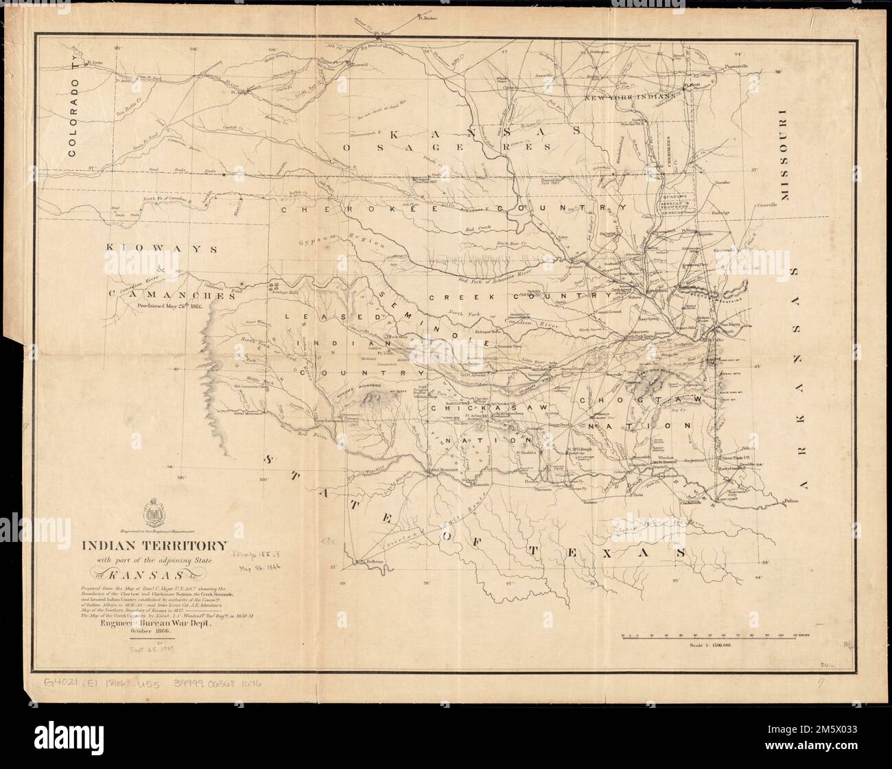 Indian Territory, with part of the adjoining state of Kansas, &c. Relief shown by hachures. 'Prepared from the Map of Danl. C. Major, U.S. Astt. showing the boundaries of the Choctaw and Chickasaw Nations, the Creek, Seminole, and Leased Indian Country established by authority of the Commrs. of Indian Affairs in 1858-59. and from Lieut. Col. J.E. Johnston's Map of the Southern Boundary of Kansas in 1857. The Map of the Creek Country by Lieut. L. C. Woodruff, Topl. Engrs., in 1850-51.' Described in LC Many nations.... , Oklahoma Stock Photohttps://www.alamy.com/image-license-details/?v=1https://www.alamy.com/indian-territory-with-part-of-the-adjoining-state-of-kansas-c-relief-shown-by-hachures-prepared-from-the-map-of-danl-c-major-us-astt-showing-the-boundaries-of-the-choctaw-and-chickasaw-nations-the-creek-seminole-and-leased-indian-country-established-by-authority-of-the-commrs-of-indian-affairs-in-1858-59-and-from-lieut-col-je-johnstons-map-of-the-southern-boundary-of-kansas-in-1857-the-map-of-the-creek-country-by-lieut-l-c-woodruff-topl-engrs-in-1850-51-described-in-lc-many-nations-oklahoma-image502744791.html
RM2M5X033–Indian Territory, with part of the adjoining state of Kansas, &c. Relief shown by hachures. 'Prepared from the Map of Danl. C. Major, U.S. Astt. showing the boundaries of the Choctaw and Chickasaw Nations, the Creek, Seminole, and Leased Indian Country established by authority of the Commrs. of Indian Affairs in 1858-59. and from Lieut. Col. J.E. Johnston's Map of the Southern Boundary of Kansas in 1857. The Map of the Creek Country by Lieut. L. C. Woodruff, Topl. Engrs., in 1850-51.' Described in LC Many nations.... , Oklahoma
![The history of Will County, Illinois, containing a history of the County [by G. H. Woodruff], its Cities, Towns, etc. [by W. H. Perrin and H. H. Hill]. ... Illustrated Image taken from page 55 of 'The history of Will Stock Photo The history of Will County, Illinois, containing a history of the County [by G. H. Woodruff], its Cities, Towns, etc. [by W. H. Perrin and H. H. Hill]. ... Illustrated Image taken from page 55 of 'The history of Will Stock Photo](https://c8.alamy.com/comp/HFNK44/the-history-of-will-county-illinois-containing-a-history-of-the-county-HFNK44.jpg) The history of Will County, Illinois, containing a history of the County [by G. H. Woodruff], its Cities, Towns, etc. [by W. H. Perrin and H. H. Hill]. ... Illustrated Image taken from page 55 of 'The history of Will Stock Photohttps://www.alamy.com/image-license-details/?v=1https://www.alamy.com/stock-photo-the-history-of-will-county-illinois-containing-a-history-of-the-county-130168420.html
The history of Will County, Illinois, containing a history of the County [by G. H. Woodruff], its Cities, Towns, etc. [by W. H. Perrin and H. H. Hill]. ... Illustrated Image taken from page 55 of 'The history of Will Stock Photohttps://www.alamy.com/image-license-details/?v=1https://www.alamy.com/stock-photo-the-history-of-will-county-illinois-containing-a-history-of-the-county-130168420.htmlRMHFNK44–The history of Will County, Illinois, containing a history of the County [by G. H. Woodruff], its Cities, Towns, etc. [by W. H. Perrin and H. H. Hill]. ... Illustrated Image taken from page 55 of 'The history of Will
 Woodruff, Oneida County, US, United States, Wisconsin, N 45 53' 46'', S 89 41' 56'', map, Cartascapes Map published in 2024. Explore Cartascapes, a map revealing Earth's diverse landscapes, cultures, and ecosystems. Journey through time and space, discovering the interconnectedness of our planet's past, present, and future. Stock Photohttps://www.alamy.com/image-license-details/?v=1https://www.alamy.com/woodruff-oneida-county-us-united-states-wisconsin-n-45-53-46-s-89-41-56-map-cartascapes-map-published-in-2024-explore-cartascapes-a-map-revealing-earths-diverse-landscapes-cultures-and-ecosystems-journey-through-time-and-space-discovering-the-interconnectedness-of-our-planets-past-present-and-future-image621164147.html
RM2Y2GD5R–Woodruff, Oneida County, US, United States, Wisconsin, N 45 53' 46'', S 89 41' 56'', map, Cartascapes Map published in 2024. Explore Cartascapes, a map revealing Earth's diverse landscapes, cultures, and ecosystems. Journey through time and space, discovering the interconnectedness of our planet's past, present, and future.
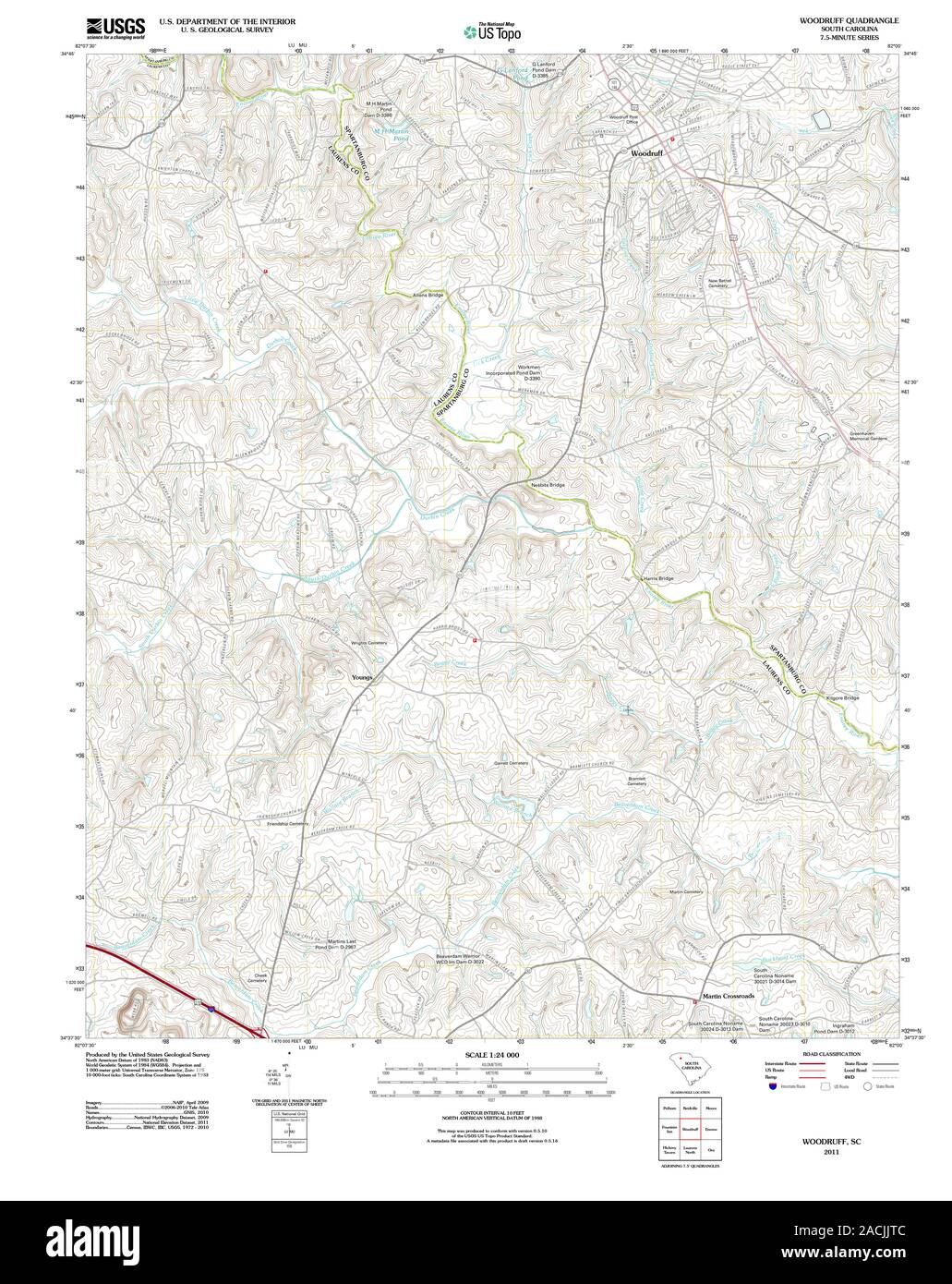 USGS TOPO Map South Carolina SC Woodruff 20110819 TM Restoration Stock Photohttps://www.alamy.com/image-license-details/?v=1https://www.alamy.com/usgs-topo-map-south-carolina-sc-woodruff-20110819-tm-restoration-image334782796.html
RM2ACJJTC–USGS TOPO Map South Carolina SC Woodruff 20110819 TM Restoration
 Sanborn Fire Insurance Map from Augusta, Woodruff County, Arkansas. Stock Photohttps://www.alamy.com/image-license-details/?v=1https://www.alamy.com/sanborn-fire-insurance-map-from-augusta-woodruff-county-arkansas-image456295533.html
RM2HEA1H1–Sanborn Fire Insurance Map from Augusta, Woodruff County, Arkansas.
 USGS TOPO Map Florida FL Lake Woodruff 20120709 TM Inverted Restoration Stock Photohttps://www.alamy.com/image-license-details/?v=1https://www.alamy.com/usgs-topo-map-florida-fl-lake-woodruff-20120709-tm-inverted-restoration-image244440773.html
RMT5K6KH–USGS TOPO Map Florida FL Lake Woodruff 20120709 TM Inverted Restoration
 Woodruff and Rathbone, Dealers in Hardware, Stoves, Tin Ware, Bar Iron, Paints, Oil & c. Established 1849. Oakfield, N.Y. Office of A. B. Rathbone & Co's Nurseries. ; F. S. Hackley, Dealer in Boots & Shoes, Rubber Goods & c. Custom work to order. Oakfield, N.Y. ; Res. of Norman Drake, Oakfield, Genesee Co., N.Y. 1876 by Everts, Ensign & Everts Stock Photohttps://www.alamy.com/image-license-details/?v=1https://www.alamy.com/woodruff-and-rathbone-dealers-in-hardware-stoves-tin-ware-bar-iron-paints-oil-c-established-1849-oakfield-ny-office-of-a-b-rathbone-cos-nurseries-f-s-hackley-dealer-in-boots-shoes-rubber-goods-c-custom-work-to-order-oakfield-ny-res-of-norman-drake-oakfield-genesee-co-ny-1876-by-everts-ensign-everts-image633412084.html
RM2YPEBG4–Woodruff and Rathbone, Dealers in Hardware, Stoves, Tin Ware, Bar Iron, Paints, Oil & c. Established 1849. Oakfield, N.Y. Office of A. B. Rathbone & Co's Nurseries. ; F. S. Hackley, Dealer in Boots & Shoes, Rubber Goods & c. Custom work to order. Oakfield, N.Y. ; Res. of Norman Drake, Oakfield, Genesee Co., N.Y. 1876 by Everts, Ensign & Everts
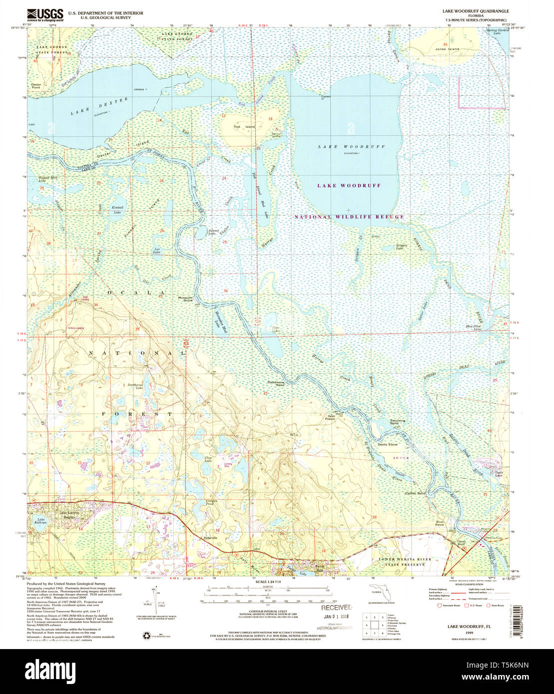 USGS TOPO Map Florida FL Lake Woodruff 347153 1999 24000 Restoration Stock Photohttps://www.alamy.com/image-license-details/?v=1https://www.alamy.com/usgs-topo-map-florida-fl-lake-woodruff-347153-1999-24000-restoration-image244440833.html
RMT5K6NN–USGS TOPO Map Florida FL Lake Woodruff 347153 1999 24000 Restoration
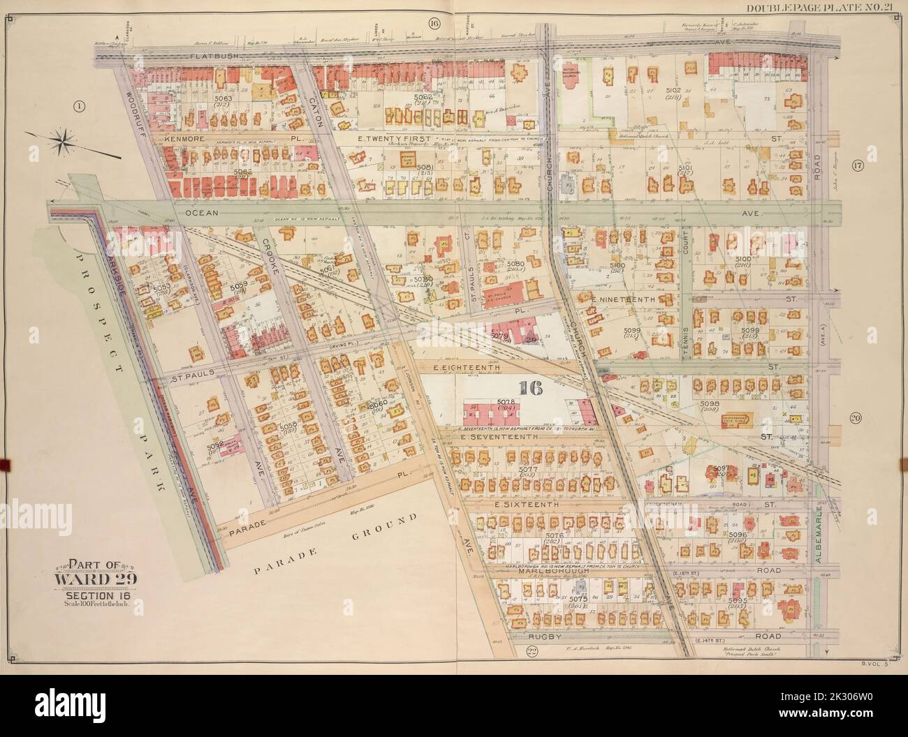 E.B. Hyde & Co.. Cartographic, Maps. 1906. Lionel Pincus and Princess Firyal Map Division. Brooklyn (New York, N.Y.) , Maps, Real property , New York (State) , New York Brooklyn, Vol. 5, Double Page Plate No. 21; Part of Ward 29, Section 16; Map bounded by Flatbush Ave., Albemarle Road (Avenue A), Rugby Road (E. 14th St.); Including Caton Ave. (Johnson Ave.), Parade Pl., Parkside Ave., Woodruff Ave. Stock Photohttps://www.alamy.com/image-license-details/?v=1https://www.alamy.com/eb-hyde-co-cartographic-maps-1906-lionel-pincus-and-princess-firyal-map-division-brooklyn-new-york-ny-maps-real-property-new-york-state-new-york-brooklyn-vol-5-double-page-plate-no-21-part-of-ward-29-section-16-map-bounded-by-flatbush-ave-albemarle-road-avenue-a-rugby-road-e-14th-st-including-caton-ave-johnson-ave-parade-pl-parkside-ave-woodruff-ave-image483739676.html
RM2K306W0–E.B. Hyde & Co.. Cartographic, Maps. 1906. Lionel Pincus and Princess Firyal Map Division. Brooklyn (New York, N.Y.) , Maps, Real property , New York (State) , New York Brooklyn, Vol. 5, Double Page Plate No. 21; Part of Ward 29, Section 16; Map bounded by Flatbush Ave., Albemarle Road (Avenue A), Rugby Road (E. 14th St.); Including Caton Ave. (Johnson Ave.), Parade Pl., Parkside Ave., Woodruff Ave.
![The history of Will County, Illinois, containing a history of the County [by G. H. Woodruff], its Cities, Towns, etc. [by W. H. Perrin and H. H. Hill]. ... Illustrated Image taken from page 417 of 'The history of Will Stock Photo The history of Will County, Illinois, containing a history of the County [by G. H. Woodruff], its Cities, Towns, etc. [by W. H. Perrin and H. H. Hill]. ... Illustrated Image taken from page 417 of 'The history of Will Stock Photo](https://c8.alamy.com/comp/HFN08C/the-history-of-will-county-illinois-containing-a-history-of-the-county-HFN08C.jpg) The history of Will County, Illinois, containing a history of the County [by G. H. Woodruff], its Cities, Towns, etc. [by W. H. Perrin and H. H. Hill]. ... Illustrated Image taken from page 417 of 'The history of Will Stock Photohttps://www.alamy.com/image-license-details/?v=1https://www.alamy.com/stock-photo-the-history-of-will-county-illinois-containing-a-history-of-the-county-130153644.html
The history of Will County, Illinois, containing a history of the County [by G. H. Woodruff], its Cities, Towns, etc. [by W. H. Perrin and H. H. Hill]. ... Illustrated Image taken from page 417 of 'The history of Will Stock Photohttps://www.alamy.com/image-license-details/?v=1https://www.alamy.com/stock-photo-the-history-of-will-county-illinois-containing-a-history-of-the-county-130153644.htmlRMHFN08C–The history of Will County, Illinois, containing a history of the County [by G. H. Woodruff], its Cities, Towns, etc. [by W. H. Perrin and H. H. Hill]. ... Illustrated Image taken from page 417 of 'The history of Will
 Wiville, Woodruff County, US, United States, Arkansas, N 35 8' 53'', S 91 14' 27'', map, Cartascapes Map published in 2024. Explore Cartascapes, a map revealing Earth's diverse landscapes, cultures, and ecosystems. Journey through time and space, discovering the interconnectedness of our planet's past, present, and future. Stock Photohttps://www.alamy.com/image-license-details/?v=1https://www.alamy.com/wiville-woodruff-county-us-united-states-arkansas-n-35-8-53-s-91-14-27-map-cartascapes-map-published-in-2024-explore-cartascapes-a-map-revealing-earths-diverse-landscapes-cultures-and-ecosystems-journey-through-time-and-space-discovering-the-interconnectedness-of-our-planets-past-present-and-future-image621165079.html
RM2Y2GEB3–Wiville, Woodruff County, US, United States, Arkansas, N 35 8' 53'', S 91 14' 27'', map, Cartascapes Map published in 2024. Explore Cartascapes, a map revealing Earth's diverse landscapes, cultures, and ecosystems. Journey through time and space, discovering the interconnectedness of our planet's past, present, and future.
 Sanborn Fire Insurance Map from Augusta, Woodruff County, Arkansas. Stock Photohttps://www.alamy.com/image-license-details/?v=1https://www.alamy.com/sanborn-fire-insurance-map-from-augusta-woodruff-county-arkansas-image456295551.html
RM2HEA1HK–Sanborn Fire Insurance Map from Augusta, Woodruff County, Arkansas.
 Res. & Farm of Henry Ives, Batavia, N.Y. ; Res. of I. H. Woodruff, Batavia, N.Y. ; Res. of Jonathan Greene, Esq., Batavia, N.Y. ; Res. & Farm of Thomas Yates, Batavia, N.Y. ; Res. of W. H. G. Post, Esq., Batavia, N.Y. ; W. W. Whitcomb, manufacturer of Suction Pump, Iron Cylinder, both Boxes Draw from the top, New Buffalo Road, 3 miles west of Batavia, N.Y. 1876 by Everts, Ensign & Everts Stock Photohttps://www.alamy.com/image-license-details/?v=1https://www.alamy.com/res-farm-of-henry-ives-batavia-ny-res-of-i-h-woodruff-batavia-ny-res-of-jonathan-greene-esq-batavia-ny-res-farm-of-thomas-yates-batavia-ny-res-of-w-h-g-post-esq-batavia-ny-w-w-whitcomb-manufacturer-of-suction-pump-iron-cylinder-both-boxes-draw-from-the-top-new-buffalo-road-3-miles-west-of-batavia-ny-1876-by-everts-ensign-everts-image633411951.html
RM2YPEBBB–Res. & Farm of Henry Ives, Batavia, N.Y. ; Res. of I. H. Woodruff, Batavia, N.Y. ; Res. of Jonathan Greene, Esq., Batavia, N.Y. ; Res. & Farm of Thomas Yates, Batavia, N.Y. ; Res. of W. H. G. Post, Esq., Batavia, N.Y. ; W. W. Whitcomb, manufacturer of Suction Pump, Iron Cylinder, both Boxes Draw from the top, New Buffalo Road, 3 miles west of Batavia, N.Y. 1876 by Everts, Ensign & Everts
 USGS TOPO Map Florida FL Lake Woodruff 347154 1962 24000 Restoration Stock Photohttps://www.alamy.com/image-license-details/?v=1https://www.alamy.com/usgs-topo-map-florida-fl-lake-woodruff-347154-1962-24000-restoration-image244440849.html
RMT5K6P9–USGS TOPO Map Florida FL Lake Woodruff 347154 1962 24000 Restoration
 E.B. Hyde & Co.. Cartographic, Maps. 1906. Lionel Pincus and Princess Firyal Map Division. Brooklyn (New York, N.Y.) , Maps, Real property , New York (State) , New York Brooklyn, Vol. 5, Double Page Plate No. 1; Part of Wards 29, Section 16; Map bounded by Lincoln Road, Rogers Ave., Clarkson Ave.; Including Woodruff Ave., Ocean Ave.; Sub Plan; Map bounded by Flatbush Ave., Lincoln Road, Ocean Ave.; Including Malbone St., Washington Ave. Stock Photohttps://www.alamy.com/image-license-details/?v=1https://www.alamy.com/eb-hyde-co-cartographic-maps-1906-lionel-pincus-and-princess-firyal-map-division-brooklyn-new-york-ny-maps-real-property-new-york-state-new-york-brooklyn-vol-5-double-page-plate-no-1-part-of-wards-29-section-16-map-bounded-by-lincoln-road-rogers-ave-clarkson-ave-including-woodruff-ave-ocean-ave-sub-plan-map-bounded-by-flatbush-ave-lincoln-road-ocean-ave-including-malbone-st-washington-ave-image483741976.html
RM2K309R4–E.B. Hyde & Co.. Cartographic, Maps. 1906. Lionel Pincus and Princess Firyal Map Division. Brooklyn (New York, N.Y.) , Maps, Real property , New York (State) , New York Brooklyn, Vol. 5, Double Page Plate No. 1; Part of Wards 29, Section 16; Map bounded by Lincoln Road, Rogers Ave., Clarkson Ave.; Including Woodruff Ave., Ocean Ave.; Sub Plan; Map bounded by Flatbush Ave., Lincoln Road, Ocean Ave.; Including Malbone St., Washington Ave.
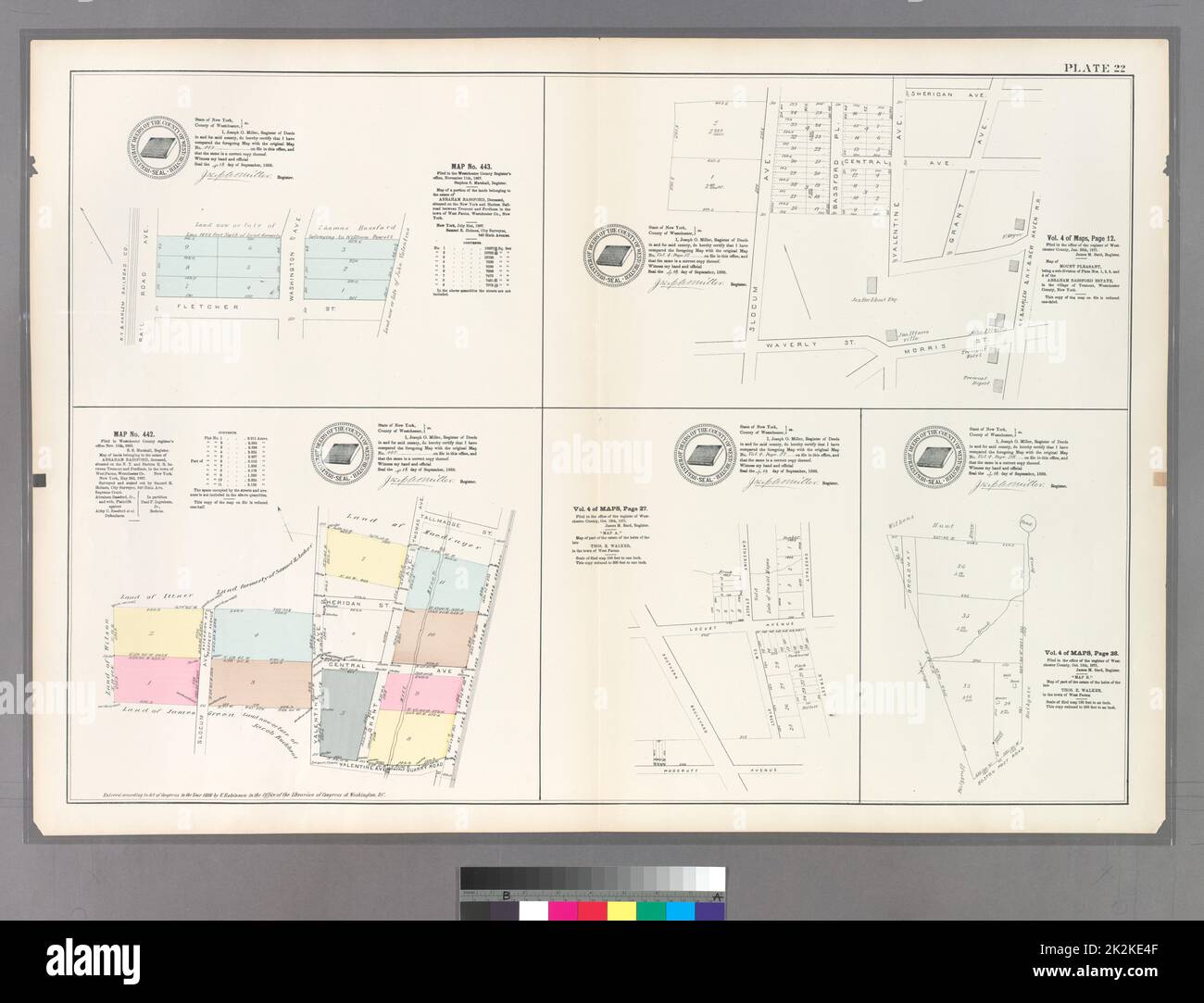 Cartographic, Maps. 1888 - 1897. Lionel Pincus and Princess Firyal Map Division. Bronx (New York, N.Y.) Plate 22: Map No. 443 Bounded by Railroad Ave., Washington Ave. and Fletcher St. - Vol. 4 of Maps, Page 12: Bounded by Sherigan Ave., Grant Ave., N.Y. & Harlem, & N.Y. & New Haven R.R., Morrist St., Waverly St. and Slocum Ave. - Map No. 442: Bounded by Tallmadge St., Land of the New York and Harlem Railroad Company, Quarry Road, Valentine Ave. and Slocum Ave. - Vol. 4 of Maps, Page 27: Bounded by Southern Blvd., Locust Ave., Catherine St., Chestnut St. and Woodruff Ave. - Vol. 4 of Maps, Pag Stock Photohttps://www.alamy.com/image-license-details/?v=1https://www.alamy.com/cartographic-maps-1888-1897-lionel-pincus-and-princess-firyal-map-division-bronx-new-york-ny-plate-22-map-no-443-bounded-by-railroad-ave-washington-ave-and-fletcher-st-vol-4-of-maps-page-12-bounded-by-sherigan-ave-grant-ave-ny-harlem-ny-new-haven-rr-morrist-st-waverly-st-and-slocum-ave-map-no-442-bounded-by-tallmadge-st-land-of-the-new-york-and-harlem-railroad-company-quarry-road-valentine-ave-and-slocum-ave-vol-4-of-maps-page-27-bounded-by-southern-blvd-locust-ave-catherine-st-chestnut-st-and-woodruff-ave-vol-4-of-maps-pag-image483547807.html
RM2K2KE4F–Cartographic, Maps. 1888 - 1897. Lionel Pincus and Princess Firyal Map Division. Bronx (New York, N.Y.) Plate 22: Map No. 443 Bounded by Railroad Ave., Washington Ave. and Fletcher St. - Vol. 4 of Maps, Page 12: Bounded by Sherigan Ave., Grant Ave., N.Y. & Harlem, & N.Y. & New Haven R.R., Morrist St., Waverly St. and Slocum Ave. - Map No. 442: Bounded by Tallmadge St., Land of the New York and Harlem Railroad Company, Quarry Road, Valentine Ave. and Slocum Ave. - Vol. 4 of Maps, Page 27: Bounded by Southern Blvd., Locust Ave., Catherine St., Chestnut St. and Woodruff Ave. - Vol. 4 of Maps, Pag
 Lieutenant General Lewis W. Walt, Commanding General of the Third Marine Division, seen at the Dong Ha Orphanage in Vietnam on April 4, 1969. He is accompanied by General Davis and Father Paul, who runs the orphanage. Father Paul requested that no pictures be released in Vietnam. This image was captured by C.E. Woodruff. (Caption based on image information) Stock Photohttps://www.alamy.com/image-license-details/?v=1https://www.alamy.com/lieutenant-general-lewis-w-walt-commanding-general-of-the-third-marine-division-seen-at-the-dong-ha-orphanage-in-vietnam-on-april-4-1969-he-is-accompanied-by-general-davis-and-father-paul-who-runs-the-orphanage-father-paul-requested-that-no-pictures-be-released-in-vietnam-this-image-was-captured-by-ce-woodruff-caption-based-on-image-information-image574158838.html
RM2TA35CP–Lieutenant General Lewis W. Walt, Commanding General of the Third Marine Division, seen at the Dong Ha Orphanage in Vietnam on April 4, 1969. He is accompanied by General Davis and Father Paul, who runs the orphanage. Father Paul requested that no pictures be released in Vietnam. This image was captured by C.E. Woodruff. (Caption based on image information)
![The history of Will County, Illinois, containing a history of the County [by G. H. Woodruff], its Cities, Towns, etc. [by W. H. Perrin and H. H. Hill]. ... Illustrated Image taken from page 83 of 'The history of Will Stock Photo The history of Will County, Illinois, containing a history of the County [by G. H. Woodruff], its Cities, Towns, etc. [by W. H. Perrin and H. H. Hill]. ... Illustrated Image taken from page 83 of 'The history of Will Stock Photo](https://c8.alamy.com/comp/HFPF04/the-history-of-will-county-illinois-containing-a-history-of-the-county-HFPF04.jpg) The history of Will County, Illinois, containing a history of the County [by G. H. Woodruff], its Cities, Towns, etc. [by W. H. Perrin and H. H. Hill]. ... Illustrated Image taken from page 83 of 'The history of Will Stock Photohttps://www.alamy.com/image-license-details/?v=1https://www.alamy.com/stock-photo-the-history-of-will-county-illinois-containing-a-history-of-the-county-130187124.html
The history of Will County, Illinois, containing a history of the County [by G. H. Woodruff], its Cities, Towns, etc. [by W. H. Perrin and H. H. Hill]. ... Illustrated Image taken from page 83 of 'The history of Will Stock Photohttps://www.alamy.com/image-license-details/?v=1https://www.alamy.com/stock-photo-the-history-of-will-county-illinois-containing-a-history-of-the-county-130187124.htmlRMHFPF04–The history of Will County, Illinois, containing a history of the County [by G. H. Woodruff], its Cities, Towns, etc. [by W. H. Perrin and H. H. Hill]. ... Illustrated Image taken from page 83 of 'The history of Will
 Woodruff, LaGrange County, US, United States, Indiana, N 41 34' 24'', S 85 19' 43'', map, Cartascapes Map published in 2024. Explore Cartascapes, a map revealing Earth's diverse landscapes, cultures, and ecosystems. Journey through time and space, discovering the interconnectedness of our planet's past, present, and future. Stock Photohttps://www.alamy.com/image-license-details/?v=1https://www.alamy.com/woodruff-lagrange-county-us-united-states-indiana-n-41-34-24-s-85-19-43-map-cartascapes-map-published-in-2024-explore-cartascapes-a-map-revealing-earths-diverse-landscapes-cultures-and-ecosystems-journey-through-time-and-space-discovering-the-interconnectedness-of-our-planets-past-present-and-future-image621220198.html
RM2Y2K0KJ–Woodruff, LaGrange County, US, United States, Indiana, N 41 34' 24'', S 85 19' 43'', map, Cartascapes Map published in 2024. Explore Cartascapes, a map revealing Earth's diverse landscapes, cultures, and ecosystems. Journey through time and space, discovering the interconnectedness of our planet's past, present, and future.
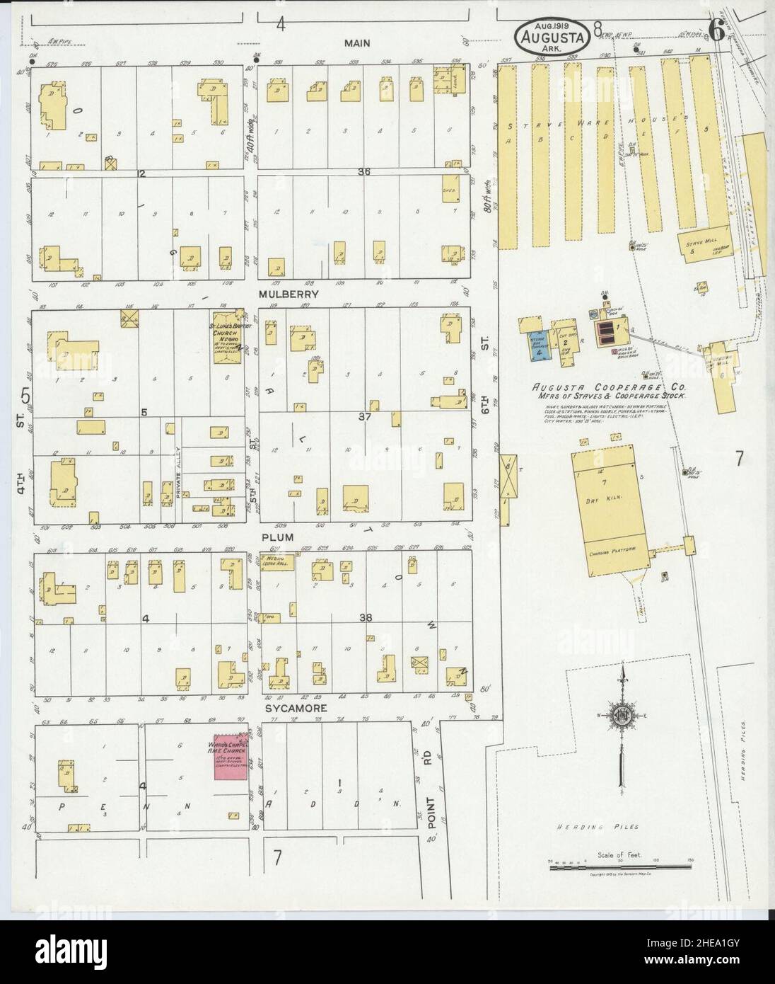 Sanborn Fire Insurance Map from Augusta, Woodruff County, Arkansas. Stock Photohttps://www.alamy.com/image-license-details/?v=1https://www.alamy.com/sanborn-fire-insurance-map-from-augusta-woodruff-county-arkansas-image456295531.html
RM2HEA1GY–Sanborn Fire Insurance Map from Augusta, Woodruff County, Arkansas.
 USGS TOPO Map Florida FL Lake Woodruff 347152 1962 24000 Restoration Stock Photohttps://www.alamy.com/image-license-details/?v=1https://www.alamy.com/usgs-topo-map-florida-fl-lake-woodruff-347152-1962-24000-restoration-image244440813.html
RMT5K6N1–USGS TOPO Map Florida FL Lake Woodruff 347152 1962 24000 Restoration