Map territoire de belfort france Stock Photos and Images
(257)See map territoire de belfort france stock video clipsQuick filters:
Map territoire de belfort france Stock Photos and Images
 Printable map of Belfort, France with main and secondary roads and larger railways. This map is carefully designed for routing and placing individual Stock Vectorhttps://www.alamy.com/image-license-details/?v=1https://www.alamy.com/printable-map-of-belfort-france-with-main-and-secondary-roads-and-larger-railways-this-map-is-carefully-designed-for-routing-and-placing-individual-image243753474.html
RFT4FX16–Printable map of Belfort, France with main and secondary roads and larger railways. This map is carefully designed for routing and placing individual
 Territoire de Belfort, Franche-Comte outline map set Stock Vectorhttps://www.alamy.com/image-license-details/?v=1https://www.alamy.com/territoire-de-belfort-franche-comte-outline-map-set-image179585313.html
RFMC4PW5–Territoire de Belfort, Franche-Comte outline map set
 Symbol Map of the Département Territoire de Belfort (France) showing the state/province with a pattern of black circles Stock Vectorhttps://www.alamy.com/image-license-details/?v=1https://www.alamy.com/symbol-map-of-the-dpartement-territoire-de-belfort-france-showing-the-stateprovince-with-a-pattern-of-black-circles-image612051855.html
RF2XFNAAR–Symbol Map of the Département Territoire de Belfort (France) showing the state/province with a pattern of black circles
 Territoire de Belfort, Franche-Comte outline map set Stock Vectorhttps://www.alamy.com/image-license-details/?v=1https://www.alamy.com/stock-photo-territoire-de-belfort-franche-comte-outline-map-set-116141783.html
RFGMXM0R–Territoire de Belfort, Franche-Comte outline map set
 MAP OF TERRITOIRE DE BELFORT FRANCE Stock Photohttps://www.alamy.com/image-license-details/?v=1https://www.alamy.com/stock-photo-map-of-territoire-de-belfort-france-53470444.html
RMD2YP2M–MAP OF TERRITOIRE DE BELFORT FRANCE
 France, Territoire de Belfort, Belfort, Etang des Forges, reed bed trail panel Stock Photohttps://www.alamy.com/image-license-details/?v=1https://www.alamy.com/france-territoire-de-belfort-belfort-etang-des-forges-reed-bed-trail-panel-image545997453.html
RM2PM8991–France, Territoire de Belfort, Belfort, Etang des Forges, reed bed trail panel
 Map of Territoire De Belfort France Stock Photohttps://www.alamy.com/image-license-details/?v=1https://www.alamy.com/map-of-territoire-de-belfort-france-image240551264.html
RMRYA1GG–Map of Territoire De Belfort France
 France, Territoire de Belfort, Belfort, citadel, from the castle, overlooking the city, the Salbert, the Vosges Stock Photohttps://www.alamy.com/image-license-details/?v=1https://www.alamy.com/stock-photo-france-territoire-de-belfort-belfort-citadel-from-the-castle-overlooking-136130307.html
RMHWD7GK–France, Territoire de Belfort, Belfort, citadel, from the castle, overlooking the city, the Salbert, the Vosges
 MAP OF TERRITOIRE DE BELFORT 1896 FRANCE Stock Photohttps://www.alamy.com/image-license-details/?v=1https://www.alamy.com/stock-photo-map-of-territoire-de-belfort-1896-france-53395973.html
RMD2TB31–MAP OF TERRITOIRE DE BELFORT 1896 FRANCE
 France, Territoire de Belfort, Belfort, citadel, castle, History Museum, model, the city after the fortifications of Vauban, 1705 Stock Photohttps://www.alamy.com/image-license-details/?v=1https://www.alamy.com/france-territoire-de-belfort-belfort-citadel-castle-history-museum-model-the-city-after-the-fortifications-of-vauban-1705-image367680280.html
RM2CA57XG–France, Territoire de Belfort, Belfort, citadel, castle, History Museum, model, the city after the fortifications of Vauban, 1705
 Map of Territoire De Belfort 1896 France Stock Photohttps://www.alamy.com/image-license-details/?v=1https://www.alamy.com/map-of-territoire-de-belfort-1896-france-image240553018.html
RMRYA3R6–Map of Territoire De Belfort 1896 France
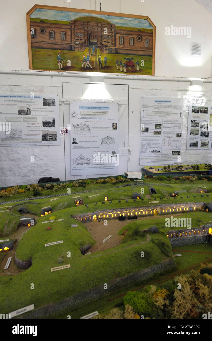 France, Territoire de Belfort, Bessoncourt, Fort Senarmont erected between 1883 and 1886, barracks, during Heritage Days, exhibition, model of the fort Stock Photohttps://www.alamy.com/image-license-details/?v=1https://www.alamy.com/france-territoire-de-belfort-bessoncourt-fort-senarmont-erected-between-1883-and-1886-barracks-during-heritage-days-exhibition-model-of-the-fort-image570156004.html
RM2T3GRPC–France, Territoire de Belfort, Bessoncourt, Fort Senarmont erected between 1883 and 1886, barracks, during Heritage Days, exhibition, model of the fort
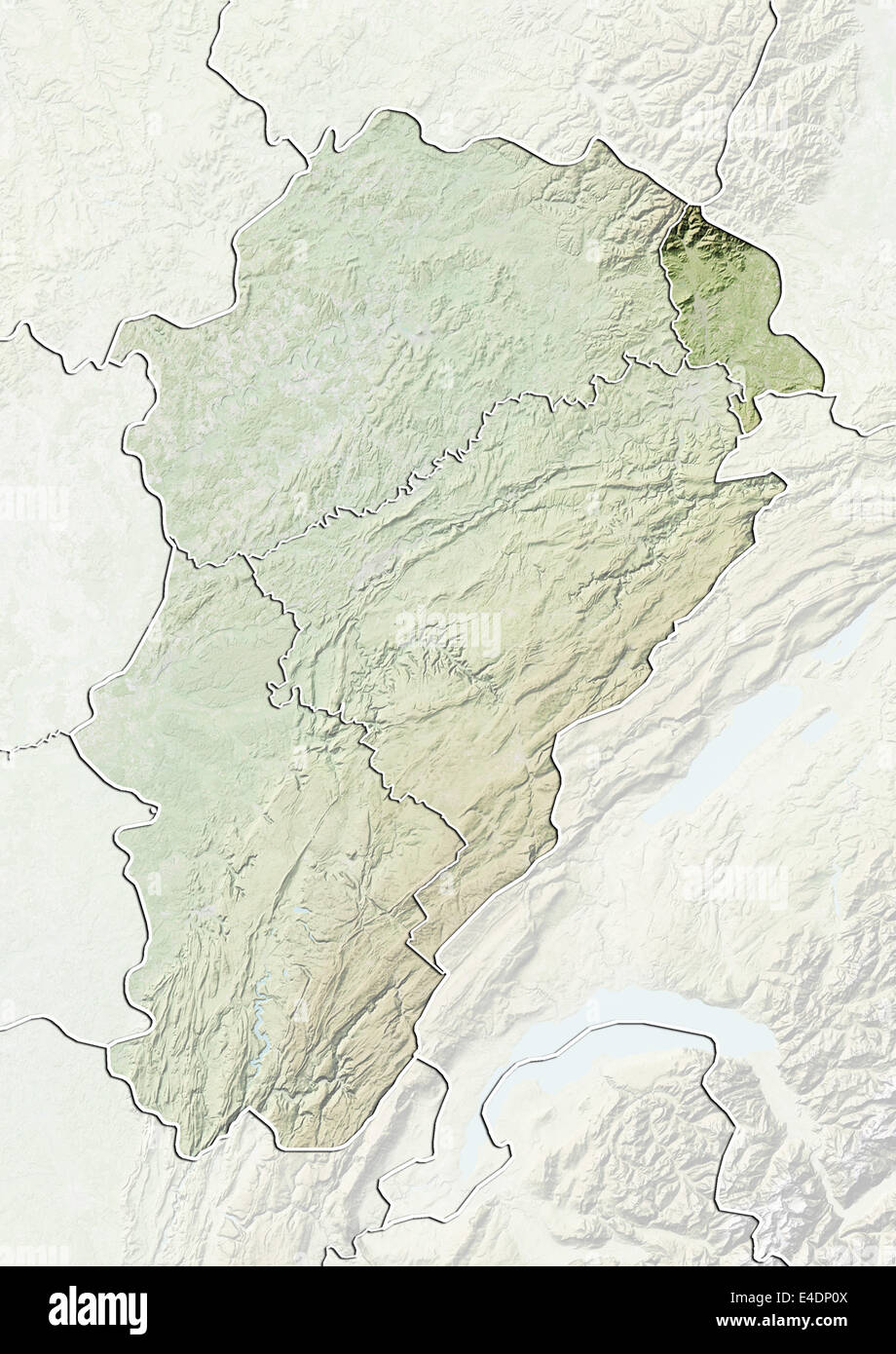 Departement of Territoire de Belfort, France, Relief Map Stock Photohttps://www.alamy.com/image-license-details/?v=1https://www.alamy.com/stock-photo-departement-of-territoire-de-belfort-france-relief-map-71602746.html
RME4DP0X–Departement of Territoire de Belfort, France, Relief Map
 3d isometric map of Territoire de Belfort is a department in France, vector illustration Stock Vectorhttps://www.alamy.com/image-license-details/?v=1https://www.alamy.com/3d-isometric-map-of-territoire-de-belfort-is-a-department-in-france-vector-illustration-image449732648.html
RF2H3K2G8–3d isometric map of Territoire de Belfort is a department in France, vector illustration
 Map of Territoire de Belfort in France Stock Photohttps://www.alamy.com/image-license-details/?v=1https://www.alamy.com/map-of-territoire-de-belfort-in-france-image460960899.html
RF2HNXG97–Map of Territoire de Belfort in France
 Map of Territoire de Belfort in France Stock Photohttps://www.alamy.com/image-license-details/?v=1https://www.alamy.com/map-of-territoire-de-belfort-in-france-image450425268.html
RF2H4PJ0M–Map of Territoire de Belfort in France
 Morvillars, Territoire de Belfort, FR, France, Bourgogne-Franche-Comté, N 47 32' 48'', N 6 55' 59'', map, Cartascapes Map published in 2024. Explore Cartascapes, a map revealing Earth's diverse landscapes, cultures, and ecosystems. Journey through time and space, discovering the interconnectedness of our planet's past, present, and future. Stock Photohttps://www.alamy.com/image-license-details/?v=1https://www.alamy.com/morvillars-territoire-de-belfort-fr-france-bourgogne-franche-comt-n-47-32-48-n-6-55-59-map-cartascapes-map-published-in-2024-explore-cartascapes-a-map-revealing-earths-diverse-landscapes-cultures-and-ecosystems-journey-through-time-and-space-discovering-the-interconnectedness-of-our-planets-past-present-and-future-image614311363.html
RM2XKC8BF–Morvillars, Territoire de Belfort, FR, France, Bourgogne-Franche-Comté, N 47 32' 48'', N 6 55' 59'', map, Cartascapes Map published in 2024. Explore Cartascapes, a map revealing Earth's diverse landscapes, cultures, and ecosystems. Journey through time and space, discovering the interconnectedness of our planet's past, present, and future.
 Territoire de Belfort Department (France, French Republic, Bourgogne-Franche-Comte region, BFC) map vector illustration, scribble sketch Territoire de Stock Vectorhttps://www.alamy.com/image-license-details/?v=1https://www.alamy.com/territoire-de-belfort-department-france-french-republic-bourgogne-franche-comte-region-bfc-map-vector-illustration-scribble-sketch-territoire-de-image364687893.html
RF2C58Y3H–Territoire de Belfort Department (France, French Republic, Bourgogne-Franche-Comte region, BFC) map vector illustration, scribble sketch Territoire de
 TERRITOIRE DE BELFORT: Camp Retranché de Belfort, 1900 antique map Stock Photohttps://www.alamy.com/image-license-details/?v=1https://www.alamy.com/stock-photo-territoire-de-belfort-camp-retranch-de-belfort-1900-antique-map-109933339.html
RFGARW2K–TERRITOIRE DE BELFORT: Camp Retranché de Belfort, 1900 antique map
 HAUT-RHIN: Departement du-Territoire de Belfort, 1883 antique map Stock Photohttps://www.alamy.com/image-license-details/?v=1https://www.alamy.com/stock-photo-haut-rhin-departement-du-territoire-de-belfort-1883-antique-map-103382688.html
RFG05DJT–HAUT-RHIN: Departement du-Territoire de Belfort, 1883 antique map
 TERRITOIRE DE BELFORT: département. Belfort vignette.Vuillemin, 1903 old map Stock Photohttps://www.alamy.com/image-license-details/?v=1https://www.alamy.com/stock-photo-territoire-de-belfort-dpartement-belfort-vignettevuillemin-1903-old-93810998.html
RFFCHCTP–TERRITOIRE DE BELFORT: département. Belfort vignette.Vuillemin, 1903 old map
 HAUT-RHIN & TERRITOIRE DE BELFORT departments. Resources. LE VASSEUR, 1876 map Stock Photohttps://www.alamy.com/image-license-details/?v=1https://www.alamy.com/stock-photo-haut-rhin-territoire-de-belfort-departments-resources-le-vasseur-1876-93301971.html
RFFBP7H7–HAUT-RHIN & TERRITOIRE DE BELFORT departments. Resources. LE VASSEUR, 1876 map
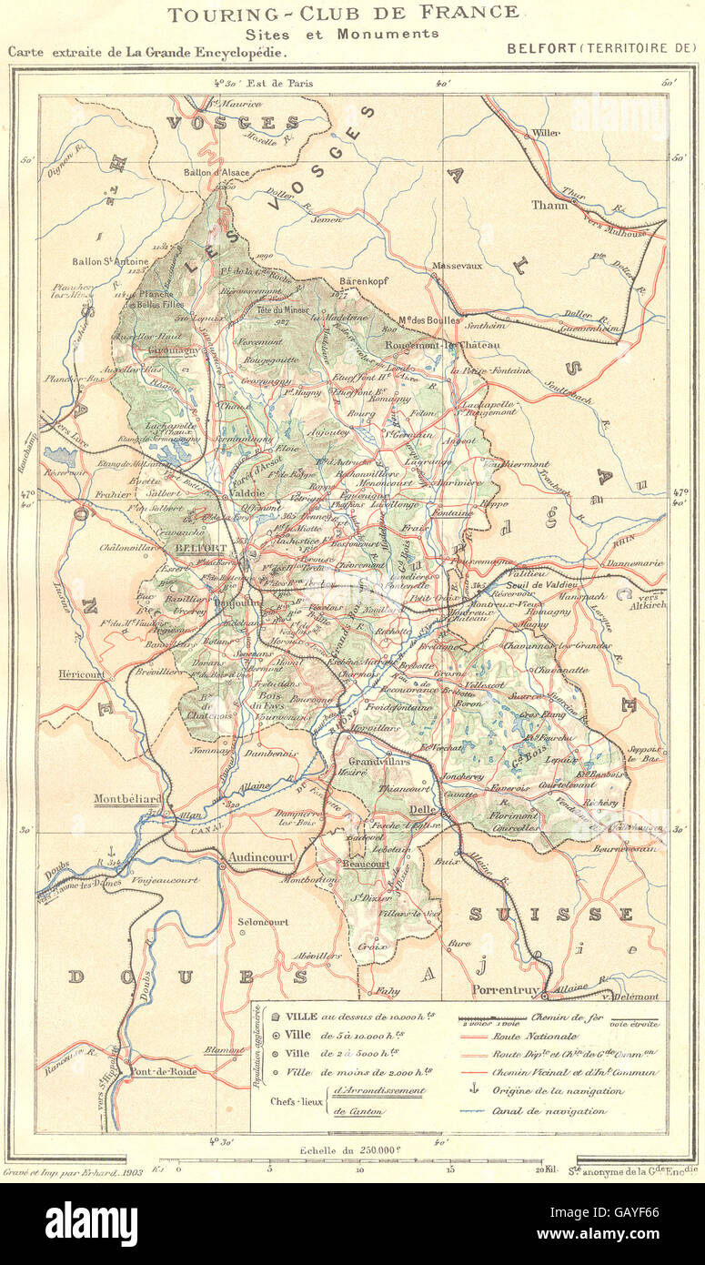 TERRITOIRE DE BELFORT: Département. Belfort (Territoire de) , 1906 antique map Stock Photohttps://www.alamy.com/image-license-details/?v=1https://www.alamy.com/stock-photo-territoire-de-belfort-dpartement-belfort-territoire-de-1906-antique-110013406.html
RFGAYF66–TERRITOIRE DE BELFORT: Département. Belfort (Territoire de) , 1906 antique map
 BELFORT. Vintage town city ville map plan carte. Territoire de Belfort, 1930 Stock Photohttps://www.alamy.com/image-license-details/?v=1https://www.alamy.com/stock-photo-belfort-vintage-town-city-ville-map-plan-carte-territoire-de-belfort-114971666.html
RFGK1BEX–BELFORT. Vintage town city ville map plan carte. Territoire de Belfort, 1930
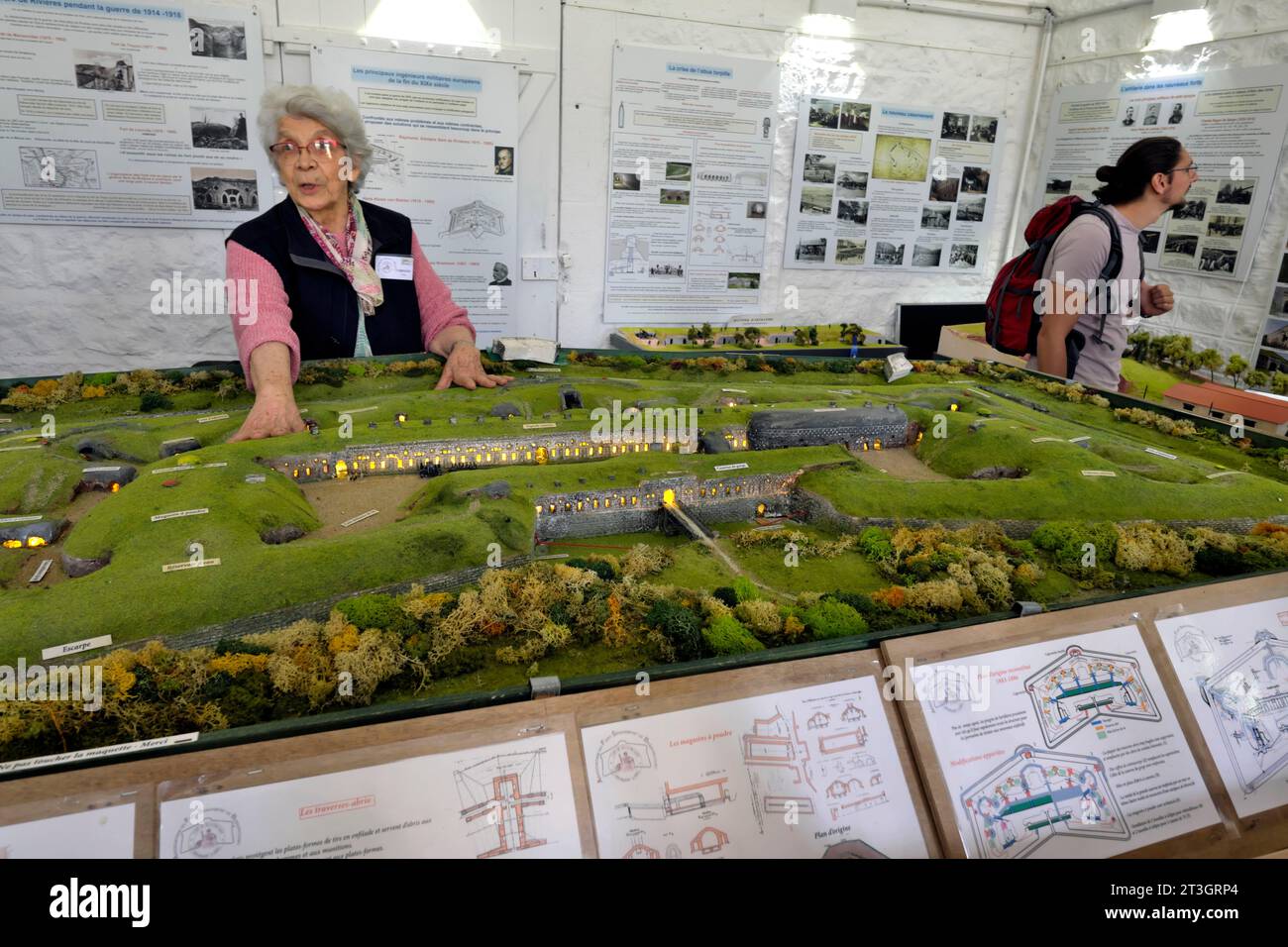 France, Territoire de Belfort, Bessoncourt, Fort Senarmont erected between 1883 and 1886, barracks, during Heritage Days, exhibition, model of the fort Stock Photohttps://www.alamy.com/image-license-details/?v=1https://www.alamy.com/france-territoire-de-belfort-bessoncourt-fort-senarmont-erected-between-1883-and-1886-barracks-during-heritage-days-exhibition-model-of-the-fort-image570155996.html
RM2T3GRP4–France, Territoire de Belfort, Bessoncourt, Fort Senarmont erected between 1883 and 1886, barracks, during Heritage Days, exhibition, model of the fort
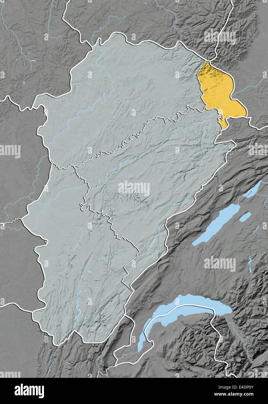 Departement of Territoire de Belfort, France, Relief Map Stock Photohttps://www.alamy.com/image-license-details/?v=1https://www.alamy.com/stock-photo-departement-of-territoire-de-belfort-france-relief-map-71602747.html
RME4DP0Y–Departement of Territoire de Belfort, France, Relief Map
 France, Territoire de Belfort, Belfort, Rue Jean Pierre Melville, mosaic representing the fortifications of the city, view of the Brisach Gate, the citadel Stock Photohttps://www.alamy.com/image-license-details/?v=1https://www.alamy.com/france-territoire-de-belfort-belfort-rue-jean-pierre-melville-mosaic-representing-the-fortifications-of-the-city-view-of-the-brisach-gate-the-citadel-image208255064.html
RMP2PRCT–France, Territoire de Belfort, Belfort, Rue Jean Pierre Melville, mosaic representing the fortifications of the city, view of the Brisach Gate, the citadel
 Departement of Territoire de Belfort, France, True Colour Satellite Image Stock Photohttps://www.alamy.com/image-license-details/?v=1https://www.alamy.com/stock-photo-departement-of-territoire-de-belfort-france-true-colour-satellite-71601454.html
RME4DMAP–Departement of Territoire de Belfort, France, True Colour Satellite Image
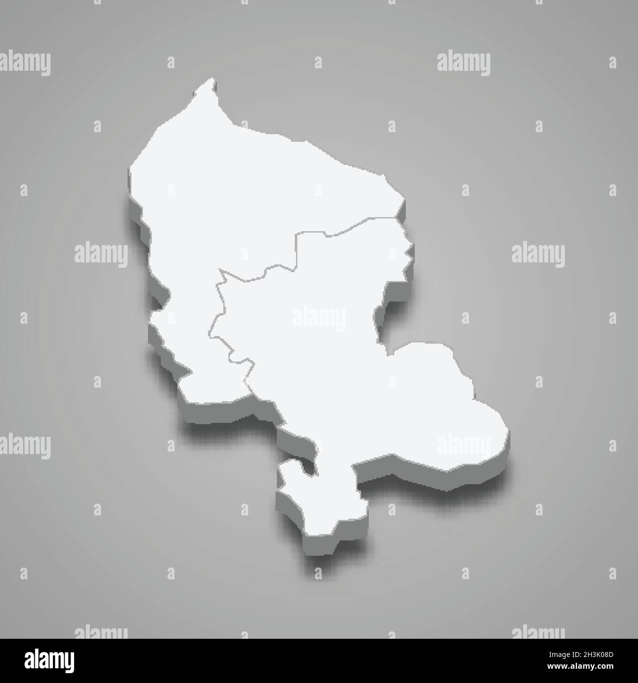 3d isometric map of Territoire de Belfort is a department in France, vector illustration Stock Vectorhttps://www.alamy.com/image-license-details/?v=1https://www.alamy.com/3d-isometric-map-of-territoire-de-belfort-is-a-department-in-france-vector-illustration-image449730861.html
RF2H3K08D–3d isometric map of Territoire de Belfort is a department in France, vector illustration
 Departement of Territoire de Belfort, France, True Colour Satellite Image Stock Photohttps://www.alamy.com/image-license-details/?v=1https://www.alamy.com/stock-photo-departement-of-territoire-de-belfort-france-true-colour-satellite-71602748.html
RME4DP10–Departement of Territoire de Belfort, France, True Colour Satellite Image
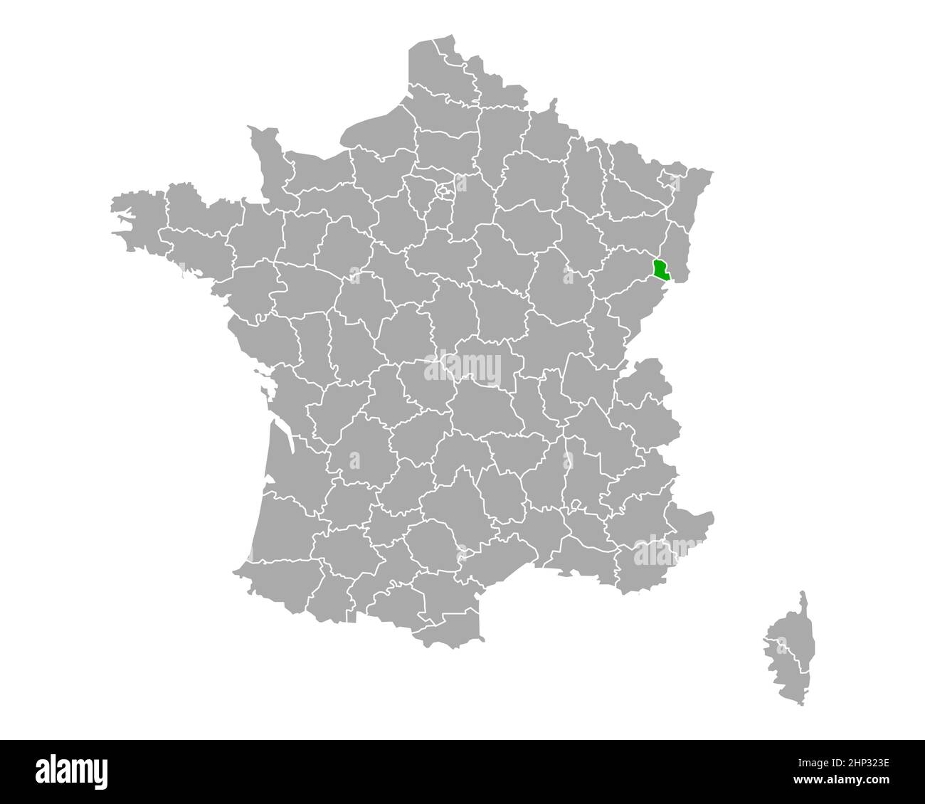 Map of Territoire de Belfort in France Stock Photohttps://www.alamy.com/image-license-details/?v=1https://www.alamy.com/map-of-territoire-de-belfort-in-france-image461059522.html
RF2HP323E–Map of Territoire de Belfort in France
 Region of Franche-Comte, France, Relief Map Stock Photohttps://www.alamy.com/image-license-details/?v=1https://www.alamy.com/stock-photo-region-of-franche-comte-france-relief-map-71602700.html
RME4DNY8–Region of Franche-Comte, France, Relief Map
 Map of Territoire de Belfort in France Stock Photohttps://www.alamy.com/image-license-details/?v=1https://www.alamy.com/map-of-territoire-de-belfort-in-france-image451656428.html
RF2H6PMAM–Map of Territoire de Belfort in France
 Courtelevant, Territoire de Belfort, FR, France, Bourgogne-Franche-Comté, N 47 31' 1'', N 7 4' 48'', map, Cartascapes Map published in 2024. Explore Cartascapes, a map revealing Earth's diverse landscapes, cultures, and ecosystems. Journey through time and space, discovering the interconnectedness of our planet's past, present, and future. Stock Photohttps://www.alamy.com/image-license-details/?v=1https://www.alamy.com/courtelevant-territoire-de-belfort-fr-france-bourgogne-franche-comt-n-47-31-1-n-7-4-48-map-cartascapes-map-published-in-2024-explore-cartascapes-a-map-revealing-earths-diverse-landscapes-cultures-and-ecosystems-journey-through-time-and-space-discovering-the-interconnectedness-of-our-planets-past-present-and-future-image614284079.html
RM2XKB1H3–Courtelevant, Territoire de Belfort, FR, France, Bourgogne-Franche-Comté, N 47 31' 1'', N 7 4' 48'', map, Cartascapes Map published in 2024. Explore Cartascapes, a map revealing Earth's diverse landscapes, cultures, and ecosystems. Journey through time and space, discovering the interconnectedness of our planet's past, present, and future.
 Territoire de Belfort Department (France, French Republic, Bourgogne-Franche-Comte region, BFC) map vector illustration, scribble sketch Territoire de Stock Vectorhttps://www.alamy.com/image-license-details/?v=1https://www.alamy.com/territoire-de-belfort-department-france-french-republic-bourgogne-franche-comte-region-bfc-map-vector-illustration-scribble-sketch-territoire-de-image357950986.html
RF2BPA23P–Territoire de Belfort Department (France, French Republic, Bourgogne-Franche-Comte region, BFC) map vector illustration, scribble sketch Territoire de
 BELFORT. Vintage town city ville map plan carte. Territoire de Belfort, 1922 Stock Photohttps://www.alamy.com/image-license-details/?v=1https://www.alamy.com/stock-photo-belfort-vintage-town-city-ville-map-plan-carte-territoire-de-belfort-111301613.html
RFGD269H–BELFORT. Vintage town city ville map plan carte. Territoire de Belfort, 1922
 'Beffort'. Belfort. Fortified town/city plan. France. DE FER, 1705 antique map Stock Photohttps://www.alamy.com/image-license-details/?v=1https://www.alamy.com/stock-photo-beffort-belfort-fortified-towncity-plan-france-de-fer-1705-antique-115453055.html
RFGKR9FB–'Beffort'. Belfort. Fortified town/city plan. France. DE FER, 1705 antique map
 BELFORT town city plan de la ville. Territoire de Belfort carte, 1909 old map Stock Photohttps://www.alamy.com/image-license-details/?v=1https://www.alamy.com/stock-photo-belfort-town-city-plan-de-la-ville-territoire-de-belfort-carte-1909-109089155.html
RFG9DC97–BELFORT town city plan de la ville. Territoire de Belfort carte, 1909 old map
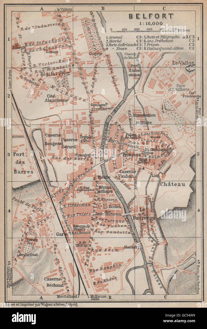 BELFORT town city plan de la ville. Territoire de Belfort carte, 1905 old map Stock Photohttps://www.alamy.com/image-license-details/?v=1https://www.alamy.com/stock-photo-belfort-town-city-plan-de-la-ville-territoire-de-belfort-carte-1905-110751685.html
RFGC54W9–BELFORT town city plan de la ville. Territoire de Belfort carte, 1905 old map
 VOSGES HAUTE-SAÔNE DOUBS HAUT-RHIN TERRITOIRE DE BELFORT Besançon Basle 1930 map Stock Photohttps://www.alamy.com/image-license-details/?v=1https://www.alamy.com/stock-photo-vosges-haute-sane-doubs-haut-rhin-territoire-de-belfort-besanon-basle-114971985.html
RFGK1BX9–VOSGES HAUTE-SAÔNE DOUBS HAUT-RHIN TERRITOIRE DE BELFORT Besançon Basle 1930 map
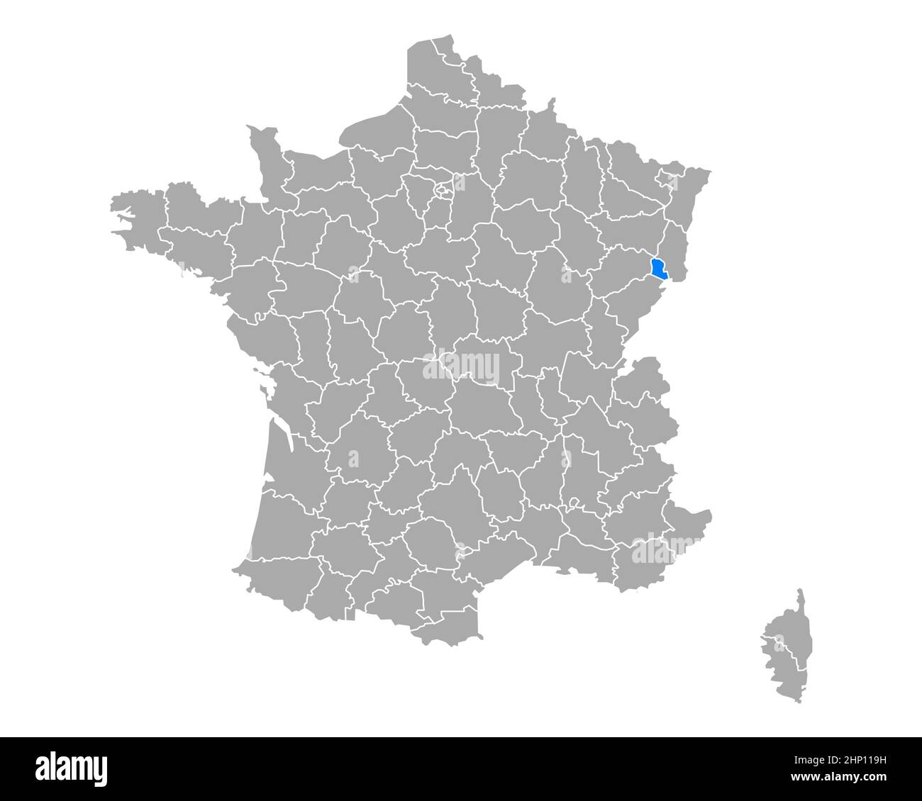 Map of Territoire de Belfort in France Stock Photohttps://www.alamy.com/image-license-details/?v=1https://www.alamy.com/map-of-territoire-de-belfort-in-france-image461015005.html
RF2HP119H–Map of Territoire de Belfort in France
 Region of Franche-Comte, France, Relief Map Stock Photohttps://www.alamy.com/image-license-details/?v=1https://www.alamy.com/stock-photo-region-of-franche-comte-france-relief-map-71602701.html
RME4DNY9–Region of Franche-Comte, France, Relief Map
 Map of Territoire de Belfort in France Stock Photohttps://www.alamy.com/image-license-details/?v=1https://www.alamy.com/map-of-territoire-de-belfort-in-france-image454062908.html
RF2HAM9TC–Map of Territoire de Belfort in France
 France and the Region of Franche-Comte, Relief Map Stock Photohttps://www.alamy.com/image-license-details/?v=1https://www.alamy.com/stock-photo-france-and-the-region-of-franche-comte-relief-map-71607432.html
RME4E008–France and the Region of Franche-Comte, Relief Map
 Offemont, Territoire de Belfort, FR, France, Bourgogne-Franche-Comté, N 47 39' 47'', N 6 52' 39'', map, Cartascapes Map published in 2024. Explore Cartascapes, a map revealing Earth's diverse landscapes, cultures, and ecosystems. Journey through time and space, discovering the interconnectedness of our planet's past, present, and future. Stock Photohttps://www.alamy.com/image-license-details/?v=1https://www.alamy.com/offemont-territoire-de-belfort-fr-france-bourgogne-franche-comt-n-47-39-47-n-6-52-39-map-cartascapes-map-published-in-2024-explore-cartascapes-a-map-revealing-earths-diverse-landscapes-cultures-and-ecosystems-journey-through-time-and-space-discovering-the-interconnectedness-of-our-planets-past-present-and-future-image614350033.html
RM2XKE1MH–Offemont, Territoire de Belfort, FR, France, Bourgogne-Franche-Comté, N 47 39' 47'', N 6 52' 39'', map, Cartascapes Map published in 2024. Explore Cartascapes, a map revealing Earth's diverse landscapes, cultures, and ecosystems. Journey through time and space, discovering the interconnectedness of our planet's past, present, and future.
 Region of Franche-Comte, France, True Colour Satellite Image Stock Photohttps://www.alamy.com/image-license-details/?v=1https://www.alamy.com/stock-photo-region-of-franche-comte-france-true-colour-satellite-image-71602702.html
RME4DNYA–Region of Franche-Comte, France, True Colour Satellite Image
 Territoire de Belfort Department (France, French Republic, Bourgogne-Franche-Comte region, BFC) map vector illustration, scribble sketch Territoire de Stock Vectorhttps://www.alamy.com/image-license-details/?v=1https://www.alamy.com/territoire-de-belfort-department-france-french-republic-bourgogne-franche-comte-region-bfc-map-vector-illustration-scribble-sketch-territoire-de-image368423643.html
RF2CBB437–Territoire de Belfort Department (France, French Republic, Bourgogne-Franche-Comte region, BFC) map vector illustration, scribble sketch Territoire de
 France and the Region of Franche-Comte, Satellite Image With Bump Effect Stock Photohttps://www.alamy.com/image-license-details/?v=1https://www.alamy.com/stock-photo-france-and-the-region-of-franche-comte-satellite-image-with-bump-effect-71607433.html
RME4E009–France and the Region of Franche-Comte, Satellite Image With Bump Effect
 graphic, modern, modernity, france, card, region, vector, department, atlas, Stock Vectorhttps://www.alamy.com/image-license-details/?v=1https://www.alamy.com/stock-photo-graphic-modern-modernity-france-card-region-vector-department-atlas-147024549.html
RFJF5F8N–graphic, modern, modernity, france, card, region, vector, department, atlas,
 Florimont, Territoire de Belfort, FR, France, Bourgogne-Franche-Comté, N 47 30' 39'', N 7 4' 6'', map, Cartascapes Map published in 2024. Explore Cartascapes, a map revealing Earth's diverse landscapes, cultures, and ecosystems. Journey through time and space, discovering the interconnectedness of our planet's past, present, and future. Stock Photohttps://www.alamy.com/image-license-details/?v=1https://www.alamy.com/florimont-territoire-de-belfort-fr-france-bourgogne-franche-comt-n-47-30-39-n-7-4-6-map-cartascapes-map-published-in-2024-explore-cartascapes-a-map-revealing-earths-diverse-landscapes-cultures-and-ecosystems-journey-through-time-and-space-discovering-the-interconnectedness-of-our-planets-past-present-and-future-image614294971.html
RM2XKBFE3–Florimont, Territoire de Belfort, FR, France, Bourgogne-Franche-Comté, N 47 30' 39'', N 7 4' 6'', map, Cartascapes Map published in 2024. Explore Cartascapes, a map revealing Earth's diverse landscapes, cultures, and ecosystems. Journey through time and space, discovering the interconnectedness of our planet's past, present, and future.
 France and the Region of Franche-Comte, True Colour Satellite Image Stock Photohttps://www.alamy.com/image-license-details/?v=1https://www.alamy.com/stock-photo-france-and-the-region-of-franche-comte-true-colour-satellite-image-71607434.html
RME4E00A–France and the Region of Franche-Comte, True Colour Satellite Image
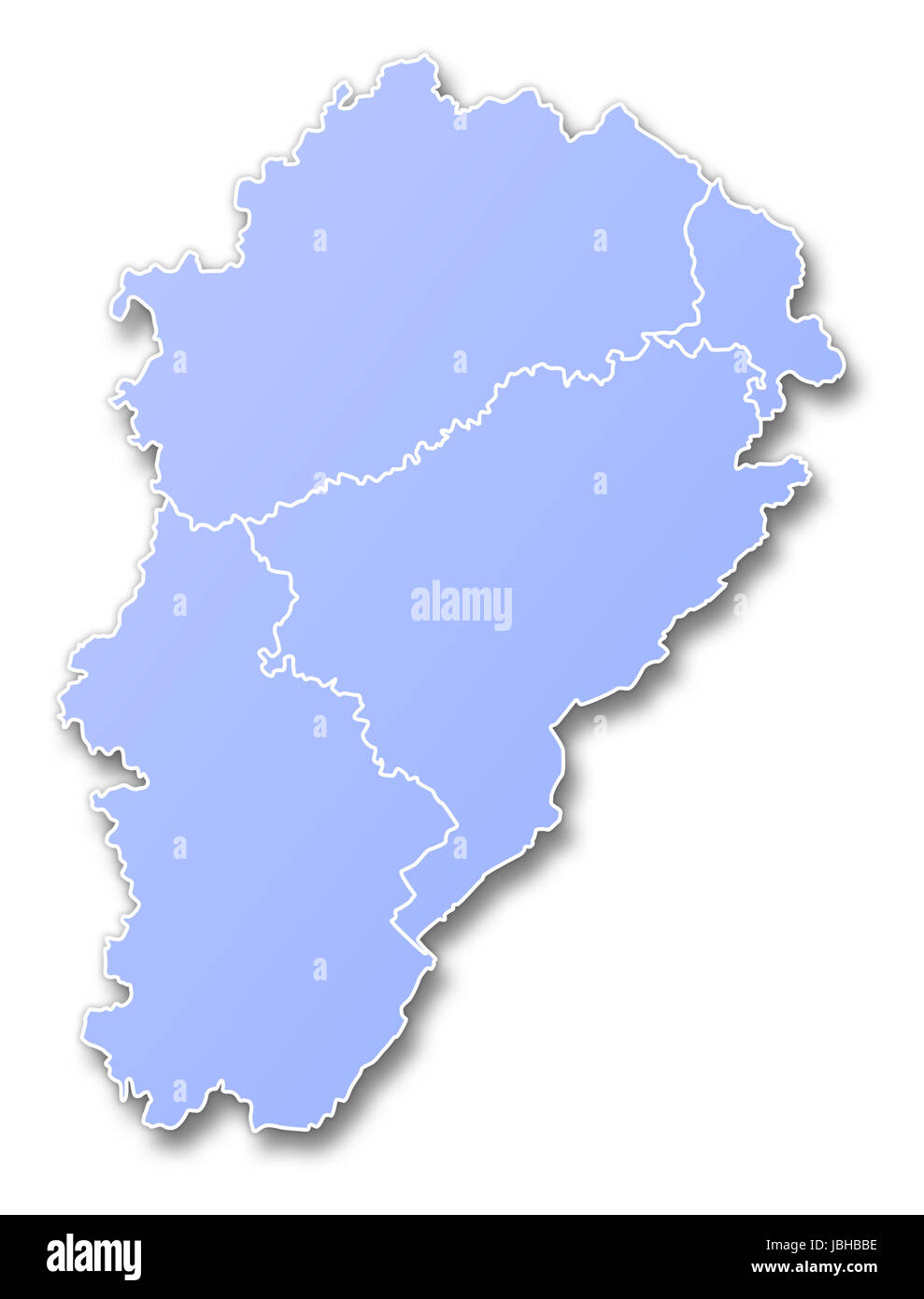 france geographic Stock Photohttps://www.alamy.com/image-license-details/?v=1https://www.alamy.com/stock-photo-france-geographic-144826290.html
RFJBHBBE–france geographic
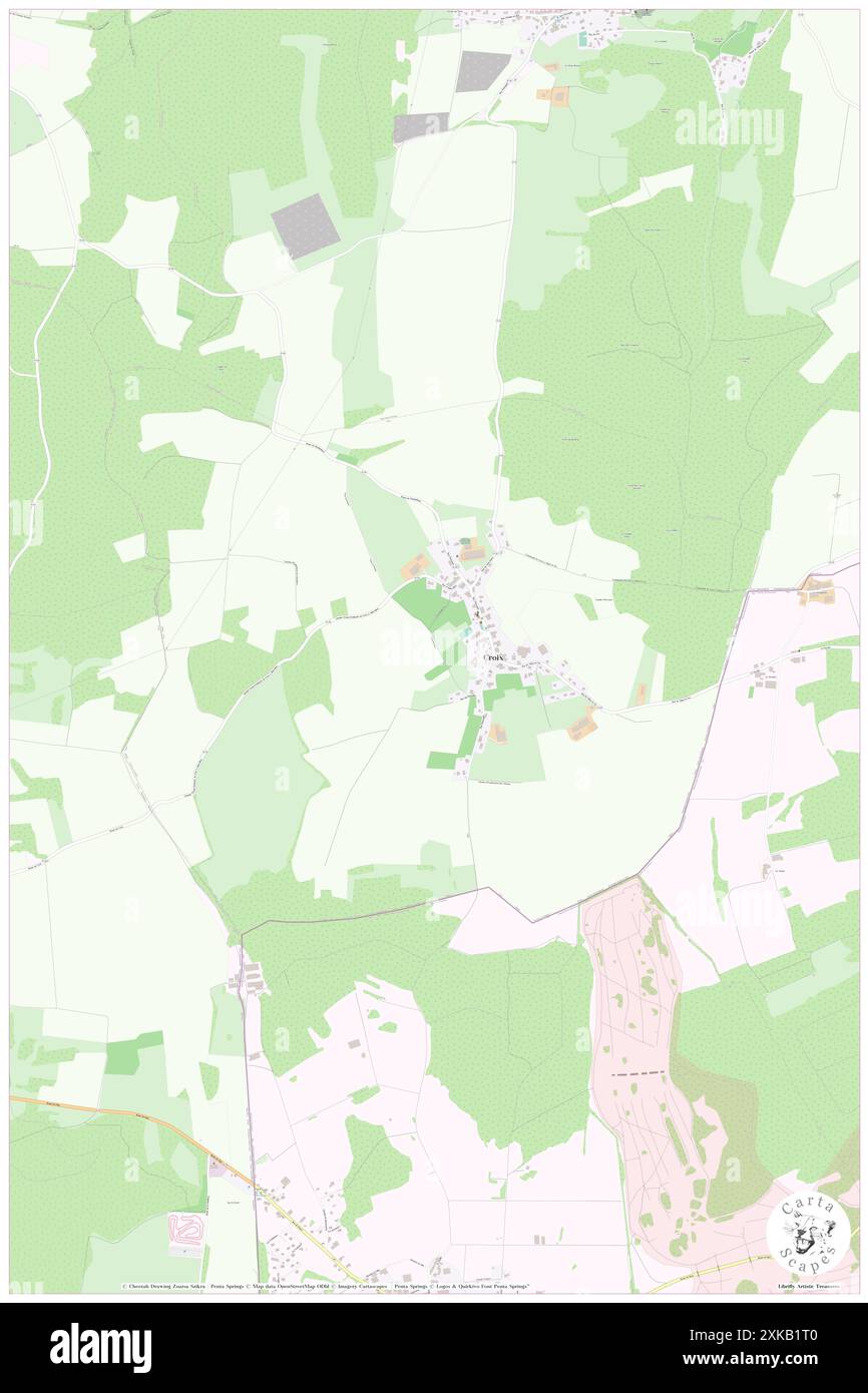 Croix, Territoire de Belfort, FR, France, Bourgogne-Franche-Comté, N 47 26' 43'', N 6 57' 16'', map, Cartascapes Map published in 2024. Explore Cartascapes, a map revealing Earth's diverse landscapes, cultures, and ecosystems. Journey through time and space, discovering the interconnectedness of our planet's past, present, and future. Stock Photohttps://www.alamy.com/image-license-details/?v=1https://www.alamy.com/croix-territoire-de-belfort-fr-france-bourgogne-franche-comt-n-47-26-43-n-6-57-16-map-cartascapes-map-published-in-2024-explore-cartascapes-a-map-revealing-earths-diverse-landscapes-cultures-and-ecosystems-journey-through-time-and-space-discovering-the-interconnectedness-of-our-planets-past-present-and-future-image614284272.html
RM2XKB1T0–Croix, Territoire de Belfort, FR, France, Bourgogne-Franche-Comté, N 47 26' 43'', N 6 57' 16'', map, Cartascapes Map published in 2024. Explore Cartascapes, a map revealing Earth's diverse landscapes, cultures, and ecosystems. Journey through time and space, discovering the interconnectedness of our planet's past, present, and future.
 Frais, Territoire de Belfort, FR, France, Bourgogne-Franche-Comté, N 47 38' 48'', N 6 59' 12'', map, Cartascapes Map published in 2024. Explore Cartascapes, a map revealing Earth's diverse landscapes, cultures, and ecosystems. Journey through time and space, discovering the interconnectedness of our planet's past, present, and future. Stock Photohttps://www.alamy.com/image-license-details/?v=1https://www.alamy.com/frais-territoire-de-belfort-fr-france-bourgogne-franche-comt-n-47-38-48-n-6-59-12-map-cartascapes-map-published-in-2024-explore-cartascapes-a-map-revealing-earths-diverse-landscapes-cultures-and-ecosystems-journey-through-time-and-space-discovering-the-interconnectedness-of-our-planets-past-present-and-future-image614319373.html
RM2XKCJHH–Frais, Territoire de Belfort, FR, France, Bourgogne-Franche-Comté, N 47 38' 48'', N 6 59' 12'', map, Cartascapes Map published in 2024. Explore Cartascapes, a map revealing Earth's diverse landscapes, cultures, and ecosystems. Journey through time and space, discovering the interconnectedness of our planet's past, present, and future.
 Rougegoutte, Territoire de Belfort, FR, France, Bourgogne-Franche-Comté, N 47 43' 55'', N 6 51' 3'', map, Cartascapes Map published in 2024. Explore Cartascapes, a map revealing Earth's diverse landscapes, cultures, and ecosystems. Journey through time and space, discovering the interconnectedness of our planet's past, present, and future. Stock Photohttps://www.alamy.com/image-license-details/?v=1https://www.alamy.com/rougegoutte-territoire-de-belfort-fr-france-bourgogne-franche-comt-n-47-43-55-n-6-51-3-map-cartascapes-map-published-in-2024-explore-cartascapes-a-map-revealing-earths-diverse-landscapes-cultures-and-ecosystems-journey-through-time-and-space-discovering-the-interconnectedness-of-our-planets-past-present-and-future-image614329978.html
RM2XKD44A–Rougegoutte, Territoire de Belfort, FR, France, Bourgogne-Franche-Comté, N 47 43' 55'', N 6 51' 3'', map, Cartascapes Map published in 2024. Explore Cartascapes, a map revealing Earth's diverse landscapes, cultures, and ecosystems. Journey through time and space, discovering the interconnectedness of our planet's past, present, and future.
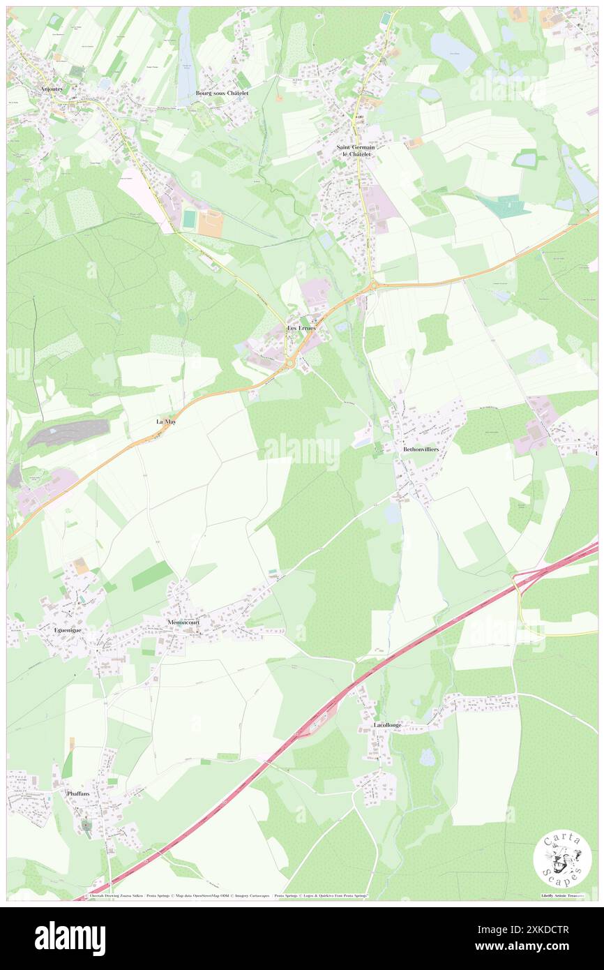 Menoncourt, Territoire de Belfort, FR, France, Bourgogne-Franche-Comté, N 47 40' 14'', N 6 56' 38'', map, Cartascapes Map published in 2024. Explore Cartascapes, a map revealing Earth's diverse landscapes, cultures, and ecosystems. Journey through time and space, discovering the interconnectedness of our planet's past, present, and future. Stock Photohttps://www.alamy.com/image-license-details/?v=1https://www.alamy.com/menoncourt-territoire-de-belfort-fr-france-bourgogne-franche-comt-n-47-40-14-n-6-56-38-map-cartascapes-map-published-in-2024-explore-cartascapes-a-map-revealing-earths-diverse-landscapes-cultures-and-ecosystems-journey-through-time-and-space-discovering-the-interconnectedness-of-our-planets-past-present-and-future-image614336823.html
RM2XKDCTR–Menoncourt, Territoire de Belfort, FR, France, Bourgogne-Franche-Comté, N 47 40' 14'', N 6 56' 38'', map, Cartascapes Map published in 2024. Explore Cartascapes, a map revealing Earth's diverse landscapes, cultures, and ecosystems. Journey through time and space, discovering the interconnectedness of our planet's past, present, and future.
 Charmois, Territoire de Belfort, FR, France, Bourgogne-Franche-Comté, N 47 34' 26'', N 6 56' 17'', map, Cartascapes Map published in 2024. Explore Cartascapes, a map revealing Earth's diverse landscapes, cultures, and ecosystems. Journey through time and space, discovering the interconnectedness of our planet's past, present, and future. Stock Photohttps://www.alamy.com/image-license-details/?v=1https://www.alamy.com/charmois-territoire-de-belfort-fr-france-bourgogne-franche-comt-n-47-34-26-n-6-56-17-map-cartascapes-map-published-in-2024-explore-cartascapes-a-map-revealing-earths-diverse-landscapes-cultures-and-ecosystems-journey-through-time-and-space-discovering-the-interconnectedness-of-our-planets-past-present-and-future-image614296836.html
RM2XKBHTM–Charmois, Territoire de Belfort, FR, France, Bourgogne-Franche-Comté, N 47 34' 26'', N 6 56' 17'', map, Cartascapes Map published in 2024. Explore Cartascapes, a map revealing Earth's diverse landscapes, cultures, and ecosystems. Journey through time and space, discovering the interconnectedness of our planet's past, present, and future.
 Chavanatte, Territoire de Belfort, FR, France, Bourgogne-Franche-Comté, N 47 34' 46'', N 7 4' 0'', map, Cartascapes Map published in 2024. Explore Cartascapes, a map revealing Earth's diverse landscapes, cultures, and ecosystems. Journey through time and space, discovering the interconnectedness of our planet's past, present, and future. Stock Photohttps://www.alamy.com/image-license-details/?v=1https://www.alamy.com/chavanatte-territoire-de-belfort-fr-france-bourgogne-franche-comt-n-47-34-46-n-7-4-0-map-cartascapes-map-published-in-2024-explore-cartascapes-a-map-revealing-earths-diverse-landscapes-cultures-and-ecosystems-journey-through-time-and-space-discovering-the-interconnectedness-of-our-planets-past-present-and-future-image614345527.html
RM2XKDRYK–Chavanatte, Territoire de Belfort, FR, France, Bourgogne-Franche-Comté, N 47 34' 46'', N 7 4' 0'', map, Cartascapes Map published in 2024. Explore Cartascapes, a map revealing Earth's diverse landscapes, cultures, and ecosystems. Journey through time and space, discovering the interconnectedness of our planet's past, present, and future.
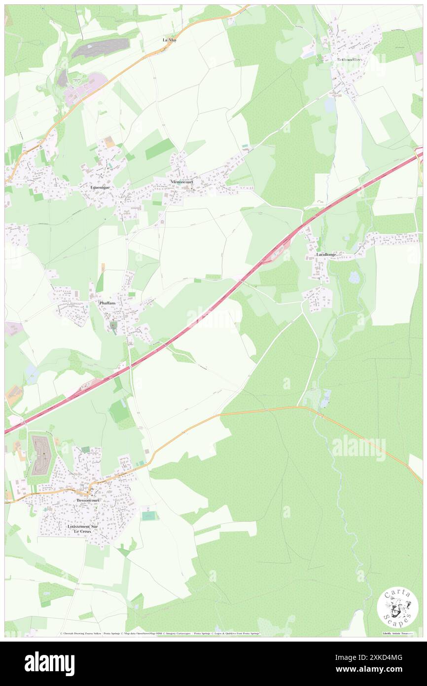 Phaffans, Territoire de Belfort, FR, France, Bourgogne-Franche-Comté, N 47 39' 37'', N 6 56' 3'', map, Cartascapes Map published in 2024. Explore Cartascapes, a map revealing Earth's diverse landscapes, cultures, and ecosystems. Journey through time and space, discovering the interconnectedness of our planet's past, present, and future. Stock Photohttps://www.alamy.com/image-license-details/?v=1https://www.alamy.com/phaffans-territoire-de-belfort-fr-france-bourgogne-franche-comt-n-47-39-37-n-6-56-3-map-cartascapes-map-published-in-2024-explore-cartascapes-a-map-revealing-earths-diverse-landscapes-cultures-and-ecosystems-journey-through-time-and-space-discovering-the-interconnectedness-of-our-planets-past-present-and-future-image614330432.html
RM2XKD4MG–Phaffans, Territoire de Belfort, FR, France, Bourgogne-Franche-Comté, N 47 39' 37'', N 6 56' 3'', map, Cartascapes Map published in 2024. Explore Cartascapes, a map revealing Earth's diverse landscapes, cultures, and ecosystems. Journey through time and space, discovering the interconnectedness of our planet's past, present, and future.
 Sermamagny, Territoire de Belfort, FR, France, Bourgogne-Franche-Comté, N 47 41' 31'', N 6 50' 8'', map, Cartascapes Map published in 2024. Explore Cartascapes, a map revealing Earth's diverse landscapes, cultures, and ecosystems. Journey through time and space, discovering the interconnectedness of our planet's past, present, and future. Stock Photohttps://www.alamy.com/image-license-details/?v=1https://www.alamy.com/sermamagny-territoire-de-belfort-fr-france-bourgogne-franche-comt-n-47-41-31-n-6-50-8-map-cartascapes-map-published-in-2024-explore-cartascapes-a-map-revealing-earths-diverse-landscapes-cultures-and-ecosystems-journey-through-time-and-space-discovering-the-interconnectedness-of-our-planets-past-present-and-future-image614328823.html
RM2XKD2K3–Sermamagny, Territoire de Belfort, FR, France, Bourgogne-Franche-Comté, N 47 41' 31'', N 6 50' 8'', map, Cartascapes Map published in 2024. Explore Cartascapes, a map revealing Earth's diverse landscapes, cultures, and ecosystems. Journey through time and space, discovering the interconnectedness of our planet's past, present, and future.
 Fontenelle, Territoire de Belfort, FR, France, Bourgogne-Franche-Comté, N 47 37' 18'', N 6 57' 23'', map, Cartascapes Map published in 2024. Explore Cartascapes, a map revealing Earth's diverse landscapes, cultures, and ecosystems. Journey through time and space, discovering the interconnectedness of our planet's past, present, and future. Stock Photohttps://www.alamy.com/image-license-details/?v=1https://www.alamy.com/fontenelle-territoire-de-belfort-fr-france-bourgogne-franche-comt-n-47-37-18-n-6-57-23-map-cartascapes-map-published-in-2024-explore-cartascapes-a-map-revealing-earths-diverse-landscapes-cultures-and-ecosystems-journey-through-time-and-space-discovering-the-interconnectedness-of-our-planets-past-present-and-future-image614321747.html
RM2XKCNJB–Fontenelle, Territoire de Belfort, FR, France, Bourgogne-Franche-Comté, N 47 37' 18'', N 6 57' 23'', map, Cartascapes Map published in 2024. Explore Cartascapes, a map revealing Earth's diverse landscapes, cultures, and ecosystems. Journey through time and space, discovering the interconnectedness of our planet's past, present, and future.
 Trevenans, Territoire de Belfort, FR, France, Bourgogne-Franche-Comté, N 47 34' 16'', N 6 51' 44'', map, Cartascapes Map published in 2024. Explore Cartascapes, a map revealing Earth's diverse landscapes, cultures, and ecosystems. Journey through time and space, discovering the interconnectedness of our planet's past, present, and future. Stock Photohttps://www.alamy.com/image-license-details/?v=1https://www.alamy.com/trevenans-territoire-de-belfort-fr-france-bourgogne-franche-comt-n-47-34-16-n-6-51-44-map-cartascapes-map-published-in-2024-explore-cartascapes-a-map-revealing-earths-diverse-landscapes-cultures-and-ecosystems-journey-through-time-and-space-discovering-the-interconnectedness-of-our-planets-past-present-and-future-image614353054.html
RM2XKE5GE–Trevenans, Territoire de Belfort, FR, France, Bourgogne-Franche-Comté, N 47 34' 16'', N 6 51' 44'', map, Cartascapes Map published in 2024. Explore Cartascapes, a map revealing Earth's diverse landscapes, cultures, and ecosystems. Journey through time and space, discovering the interconnectedness of our planet's past, present, and future.
 Foussemagne, Territoire de Belfort, FR, France, Bourgogne-Franche-Comté, N 47 38' 3'', N 7 0' 20'', map, Cartascapes Map published in 2024. Explore Cartascapes, a map revealing Earth's diverse landscapes, cultures, and ecosystems. Journey through time and space, discovering the interconnectedness of our planet's past, present, and future. Stock Photohttps://www.alamy.com/image-license-details/?v=1https://www.alamy.com/foussemagne-territoire-de-belfort-fr-france-bourgogne-franche-comt-n-47-38-3-n-7-0-20-map-cartascapes-map-published-in-2024-explore-cartascapes-a-map-revealing-earths-diverse-landscapes-cultures-and-ecosystems-journey-through-time-and-space-discovering-the-interconnectedness-of-our-planets-past-present-and-future-image614350834.html
RM2XKE2N6–Foussemagne, Territoire de Belfort, FR, France, Bourgogne-Franche-Comté, N 47 38' 3'', N 7 0' 20'', map, Cartascapes Map published in 2024. Explore Cartascapes, a map revealing Earth's diverse landscapes, cultures, and ecosystems. Journey through time and space, discovering the interconnectedness of our planet's past, present, and future.
 Lagrange, Territoire de Belfort, FR, France, Bourgogne-Franche-Comté, N 47 40' 50'', N 6 58' 45'', map, Cartascapes Map published in 2024. Explore Cartascapes, a map revealing Earth's diverse landscapes, cultures, and ecosystems. Journey through time and space, discovering the interconnectedness of our planet's past, present, and future. Stock Photohttps://www.alamy.com/image-license-details/?v=1https://www.alamy.com/lagrange-territoire-de-belfort-fr-france-bourgogne-franche-comt-n-47-40-50-n-6-58-45-map-cartascapes-map-published-in-2024-explore-cartascapes-a-map-revealing-earths-diverse-landscapes-cultures-and-ecosystems-journey-through-time-and-space-discovering-the-interconnectedness-of-our-planets-past-present-and-future-image614316189.html
RM2XKCEFW–Lagrange, Territoire de Belfort, FR, France, Bourgogne-Franche-Comté, N 47 40' 50'', N 6 58' 45'', map, Cartascapes Map published in 2024. Explore Cartascapes, a map revealing Earth's diverse landscapes, cultures, and ecosystems. Journey through time and space, discovering the interconnectedness of our planet's past, present, and future.
 Bretagne, Territoire de Belfort, FR, France, Bourgogne-Franche-Comté, N 47 35' 43'', N 6 59' 52'', map, Cartascapes Map published in 2024. Explore Cartascapes, a map revealing Earth's diverse landscapes, cultures, and ecosystems. Journey through time and space, discovering the interconnectedness of our planet's past, present, and future. Stock Photohttps://www.alamy.com/image-license-details/?v=1https://www.alamy.com/bretagne-territoire-de-belfort-fr-france-bourgogne-franche-comt-n-47-35-43-n-6-59-52-map-cartascapes-map-published-in-2024-explore-cartascapes-a-map-revealing-earths-diverse-landscapes-cultures-and-ecosystems-journey-through-time-and-space-discovering-the-interconnectedness-of-our-planets-past-present-and-future-image614351058.html
RM2XKE316–Bretagne, Territoire de Belfort, FR, France, Bourgogne-Franche-Comté, N 47 35' 43'', N 6 59' 52'', map, Cartascapes Map published in 2024. Explore Cartascapes, a map revealing Earth's diverse landscapes, cultures, and ecosystems. Journey through time and space, discovering the interconnectedness of our planet's past, present, and future.
 Giromagny, Territoire de Belfort, FR, France, Bourgogne-Franche-Comté, N 47 44' 31'', N 6 49' 32'', map, Cartascapes Map published in 2024. Explore Cartascapes, a map revealing Earth's diverse landscapes, cultures, and ecosystems. Journey through time and space, discovering the interconnectedness of our planet's past, present, and future. Stock Photohttps://www.alamy.com/image-license-details/?v=1https://www.alamy.com/giromagny-territoire-de-belfort-fr-france-bourgogne-franche-comt-n-47-44-31-n-6-49-32-map-cartascapes-map-published-in-2024-explore-cartascapes-a-map-revealing-earths-diverse-landscapes-cultures-and-ecosystems-journey-through-time-and-space-discovering-the-interconnectedness-of-our-planets-past-present-and-future-image614311682.html
RM2XKC8PX–Giromagny, Territoire de Belfort, FR, France, Bourgogne-Franche-Comté, N 47 44' 31'', N 6 49' 32'', map, Cartascapes Map published in 2024. Explore Cartascapes, a map revealing Earth's diverse landscapes, cultures, and ecosystems. Journey through time and space, discovering the interconnectedness of our planet's past, present, and future.
 Banvillars, Territoire de Belfort, FR, France, Bourgogne-Franche-Comté, N 47 35' 31'', N 6 48' 52'', map, Cartascapes Map published in 2024. Explore Cartascapes, a map revealing Earth's diverse landscapes, cultures, and ecosystems. Journey through time and space, discovering the interconnectedness of our planet's past, present, and future. Stock Photohttps://www.alamy.com/image-license-details/?v=1https://www.alamy.com/banvillars-territoire-de-belfort-fr-france-bourgogne-franche-comt-n-47-35-31-n-6-48-52-map-cartascapes-map-published-in-2024-explore-cartascapes-a-map-revealing-earths-diverse-landscapes-cultures-and-ecosystems-journey-through-time-and-space-discovering-the-interconnectedness-of-our-planets-past-present-and-future-image614326524.html
RM2XKCYN0–Banvillars, Territoire de Belfort, FR, France, Bourgogne-Franche-Comté, N 47 35' 31'', N 6 48' 52'', map, Cartascapes Map published in 2024. Explore Cartascapes, a map revealing Earth's diverse landscapes, cultures, and ecosystems. Journey through time and space, discovering the interconnectedness of our planet's past, present, and future.
 Autrechene, Territoire de Belfort, FR, France, Bourgogne-Franche-Comté, N 47 35' 40'', N 6 57' 34'', map, Cartascapes Map published in 2024. Explore Cartascapes, a map revealing Earth's diverse landscapes, cultures, and ecosystems. Journey through time and space, discovering the interconnectedness of our planet's past, present, and future. Stock Photohttps://www.alamy.com/image-license-details/?v=1https://www.alamy.com/autrechene-territoire-de-belfort-fr-france-bourgogne-franche-comt-n-47-35-40-n-6-57-34-map-cartascapes-map-published-in-2024-explore-cartascapes-a-map-revealing-earths-diverse-landscapes-cultures-and-ecosystems-journey-through-time-and-space-discovering-the-interconnectedness-of-our-planets-past-present-and-future-image614355608.html
RM2XKE8RM–Autrechene, Territoire de Belfort, FR, France, Bourgogne-Franche-Comté, N 47 35' 40'', N 6 57' 34'', map, Cartascapes Map published in 2024. Explore Cartascapes, a map revealing Earth's diverse landscapes, cultures, and ecosystems. Journey through time and space, discovering the interconnectedness of our planet's past, present, and future.
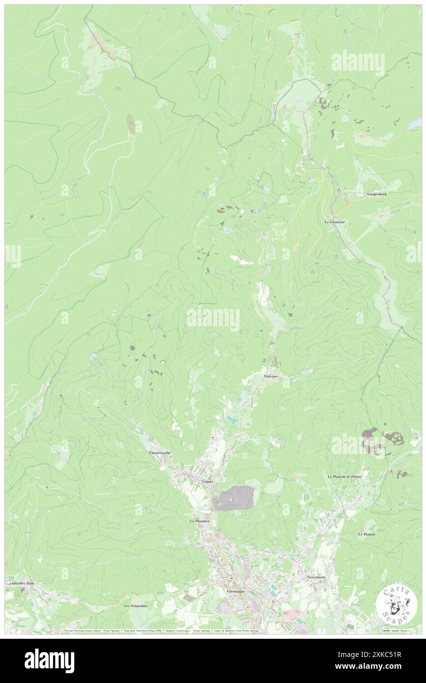 Lepuix, Territoire de Belfort, FR, France, Bourgogne-Franche-Comté, N 47 45' 38'', N 6 48' 50'', map, Cartascapes Map published in 2024. Explore Cartascapes, a map revealing Earth's diverse landscapes, cultures, and ecosystems. Journey through time and space, discovering the interconnectedness of our planet's past, present, and future. Stock Photohttps://www.alamy.com/image-license-details/?v=1https://www.alamy.com/lepuix-territoire-de-belfort-fr-france-bourgogne-franche-comt-n-47-45-38-n-6-48-50-map-cartascapes-map-published-in-2024-explore-cartascapes-a-map-revealing-earths-diverse-landscapes-cultures-and-ecosystems-journey-through-time-and-space-discovering-the-interconnectedness-of-our-planets-past-present-and-future-image614308739.html
RM2XKC51R–Lepuix, Territoire de Belfort, FR, France, Bourgogne-Franche-Comté, N 47 45' 38'', N 6 48' 50'', map, Cartascapes Map published in 2024. Explore Cartascapes, a map revealing Earth's diverse landscapes, cultures, and ecosystems. Journey through time and space, discovering the interconnectedness of our planet's past, present, and future.
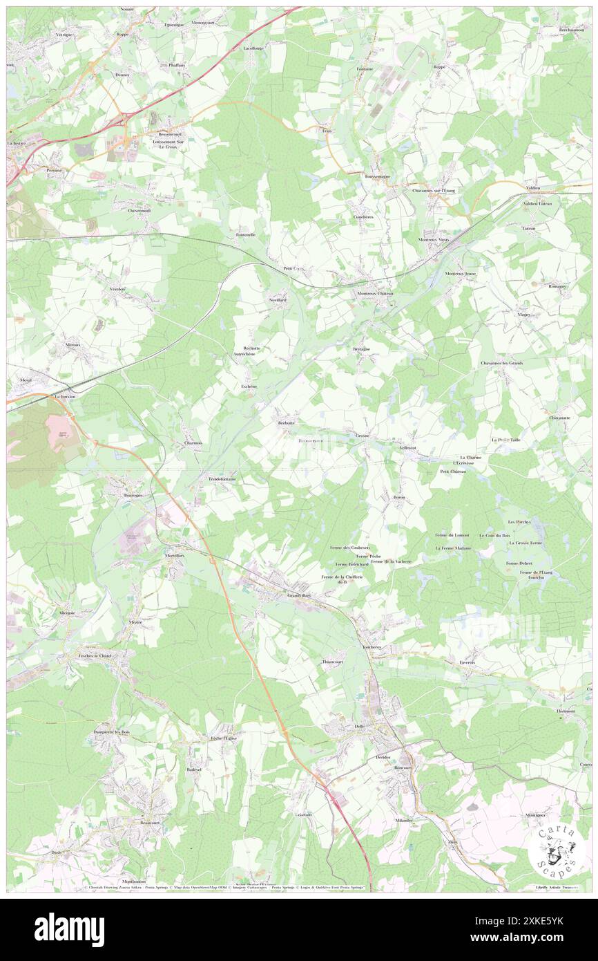 Recouvrance, Territoire de Belfort, FR, France, Bourgogne-Franche-Comté, N 47 34' 27'', N 6 58' 51'', map, Cartascapes Map published in 2024. Explore Cartascapes, a map revealing Earth's diverse landscapes, cultures, and ecosystems. Journey through time and space, discovering the interconnectedness of our planet's past, present, and future. Stock Photohttps://www.alamy.com/image-license-details/?v=1https://www.alamy.com/recouvrance-territoire-de-belfort-fr-france-bourgogne-franche-comt-n-47-34-27-n-6-58-51-map-cartascapes-map-published-in-2024-explore-cartascapes-a-map-revealing-earths-diverse-landscapes-cultures-and-ecosystems-journey-through-time-and-space-discovering-the-interconnectedness-of-our-planets-past-present-and-future-image614353367.html
RM2XKE5YK–Recouvrance, Territoire de Belfort, FR, France, Bourgogne-Franche-Comté, N 47 34' 27'', N 6 58' 51'', map, Cartascapes Map published in 2024. Explore Cartascapes, a map revealing Earth's diverse landscapes, cultures, and ecosystems. Journey through time and space, discovering the interconnectedness of our planet's past, present, and future.
 Grandvillars, Territoire de Belfort, FR, France, Bourgogne-Franche-Comté, N 47 32' 20'', N 6 58' 26'', map, Cartascapes Map published in 2024. Explore Cartascapes, a map revealing Earth's diverse landscapes, cultures, and ecosystems. Journey through time and space, discovering the interconnectedness of our planet's past, present, and future. Stock Photohttps://www.alamy.com/image-license-details/?v=1https://www.alamy.com/grandvillars-territoire-de-belfort-fr-france-bourgogne-franche-comt-n-47-32-20-n-6-58-26-map-cartascapes-map-published-in-2024-explore-cartascapes-a-map-revealing-earths-diverse-landscapes-cultures-and-ecosystems-journey-through-time-and-space-discovering-the-interconnectedness-of-our-planets-past-present-and-future-image614333475.html
RM2XKD8H7–Grandvillars, Territoire de Belfort, FR, France, Bourgogne-Franche-Comté, N 47 32' 20'', N 6 58' 26'', map, Cartascapes Map published in 2024. Explore Cartascapes, a map revealing Earth's diverse landscapes, cultures, and ecosystems. Journey through time and space, discovering the interconnectedness of our planet's past, present, and future.
 Bavilliers, Territoire de Belfort, FR, France, Bourgogne-Franche-Comté, N 47 37' 9'', N 6 49' 50'', map, Cartascapes Map published in 2024. Explore Cartascapes, a map revealing Earth's diverse landscapes, cultures, and ecosystems. Journey through time and space, discovering the interconnectedness of our planet's past, present, and future. Stock Photohttps://www.alamy.com/image-license-details/?v=1https://www.alamy.com/bavilliers-territoire-de-belfort-fr-france-bourgogne-franche-comt-n-47-37-9-n-6-49-50-map-cartascapes-map-published-in-2024-explore-cartascapes-a-map-revealing-earths-diverse-landscapes-cultures-and-ecosystems-journey-through-time-and-space-discovering-the-interconnectedness-of-our-planets-past-present-and-future-image614333956.html
RM2XKD96C–Bavilliers, Territoire de Belfort, FR, France, Bourgogne-Franche-Comté, N 47 37' 9'', N 6 49' 50'', map, Cartascapes Map published in 2024. Explore Cartascapes, a map revealing Earth's diverse landscapes, cultures, and ecosystems. Journey through time and space, discovering the interconnectedness of our planet's past, present, and future.
 Bessoncourt, Territoire de Belfort, FR, France, Bourgogne-Franche-Comté, N 47 38' 44'', N 6 55' 55'', map, Cartascapes Map published in 2024. Explore Cartascapes, a map revealing Earth's diverse landscapes, cultures, and ecosystems. Journey through time and space, discovering the interconnectedness of our planet's past, present, and future. Stock Photohttps://www.alamy.com/image-license-details/?v=1https://www.alamy.com/bessoncourt-territoire-de-belfort-fr-france-bourgogne-franche-comt-n-47-38-44-n-6-55-55-map-cartascapes-map-published-in-2024-explore-cartascapes-a-map-revealing-earths-diverse-landscapes-cultures-and-ecosystems-journey-through-time-and-space-discovering-the-interconnectedness-of-our-planets-past-present-and-future-image614337668.html
RM2XKDDY0–Bessoncourt, Territoire de Belfort, FR, France, Bourgogne-Franche-Comté, N 47 38' 44'', N 6 55' 55'', map, Cartascapes Map published in 2024. Explore Cartascapes, a map revealing Earth's diverse landscapes, cultures, and ecosystems. Journey through time and space, discovering the interconnectedness of our planet's past, present, and future.
 Novillard, Territoire de Belfort, FR, France, Bourgogne-Franche-Comté, N 47 36' 24'', N 6 58' 14'', map, Cartascapes Map published in 2024. Explore Cartascapes, a map revealing Earth's diverse landscapes, cultures, and ecosystems. Journey through time and space, discovering the interconnectedness of our planet's past, present, and future. Stock Photohttps://www.alamy.com/image-license-details/?v=1https://www.alamy.com/novillard-territoire-de-belfort-fr-france-bourgogne-franche-comt-n-47-36-24-n-6-58-14-map-cartascapes-map-published-in-2024-explore-cartascapes-a-map-revealing-earths-diverse-landscapes-cultures-and-ecosystems-journey-through-time-and-space-discovering-the-interconnectedness-of-our-planets-past-present-and-future-image614307050.html
RM2XKC2WE–Novillard, Territoire de Belfort, FR, France, Bourgogne-Franche-Comté, N 47 36' 24'', N 6 58' 14'', map, Cartascapes Map published in 2024. Explore Cartascapes, a map revealing Earth's diverse landscapes, cultures, and ecosystems. Journey through time and space, discovering the interconnectedness of our planet's past, present, and future.
 Grosmagny, Territoire de Belfort, FR, France, Bourgogne-Franche-Comté, N 47 43' 19'', N 6 53' 2'', map, Cartascapes Map published in 2024. Explore Cartascapes, a map revealing Earth's diverse landscapes, cultures, and ecosystems. Journey through time and space, discovering the interconnectedness of our planet's past, present, and future. Stock Photohttps://www.alamy.com/image-license-details/?v=1https://www.alamy.com/grosmagny-territoire-de-belfort-fr-france-bourgogne-franche-comt-n-47-43-19-n-6-53-2-map-cartascapes-map-published-in-2024-explore-cartascapes-a-map-revealing-earths-diverse-landscapes-cultures-and-ecosystems-journey-through-time-and-space-discovering-the-interconnectedness-of-our-planets-past-present-and-future-image614327746.html
RM2XKD18J–Grosmagny, Territoire de Belfort, FR, France, Bourgogne-Franche-Comté, N 47 43' 19'', N 6 53' 2'', map, Cartascapes Map published in 2024. Explore Cartascapes, a map revealing Earth's diverse landscapes, cultures, and ecosystems. Journey through time and space, discovering the interconnectedness of our planet's past, present, and future.
 Reppe, Territoire de Belfort, FR, France, Bourgogne-Franche-Comté, N 47 39' 42'', N 7 1' 33'', map, Cartascapes Map published in 2024. Explore Cartascapes, a map revealing Earth's diverse landscapes, cultures, and ecosystems. Journey through time and space, discovering the interconnectedness of our planet's past, present, and future. Stock Photohttps://www.alamy.com/image-license-details/?v=1https://www.alamy.com/reppe-territoire-de-belfort-fr-france-bourgogne-franche-comt-n-47-39-42-n-7-1-33-map-cartascapes-map-published-in-2024-explore-cartascapes-a-map-revealing-earths-diverse-landscapes-cultures-and-ecosystems-journey-through-time-and-space-discovering-the-interconnectedness-of-our-planets-past-present-and-future-image614355499.html
RM2XKE8KR–Reppe, Territoire de Belfort, FR, France, Bourgogne-Franche-Comté, N 47 39' 42'', N 7 1' 33'', map, Cartascapes Map published in 2024. Explore Cartascapes, a map revealing Earth's diverse landscapes, cultures, and ecosystems. Journey through time and space, discovering the interconnectedness of our planet's past, present, and future.
 Lebetain, Territoire de Belfort, FR, France, Bourgogne-Franche-Comté, N 47 29' 12'', N 6 58' 36'', map, Cartascapes Map published in 2024. Explore Cartascapes, a map revealing Earth's diverse landscapes, cultures, and ecosystems. Journey through time and space, discovering the interconnectedness of our planet's past, present, and future. Stock Photohttps://www.alamy.com/image-license-details/?v=1https://www.alamy.com/lebetain-territoire-de-belfort-fr-france-bourgogne-franche-comt-n-47-29-12-n-6-58-36-map-cartascapes-map-published-in-2024-explore-cartascapes-a-map-revealing-earths-diverse-landscapes-cultures-and-ecosystems-journey-through-time-and-space-discovering-the-interconnectedness-of-our-planets-past-present-and-future-image614302273.html
RM2XKBTPW–Lebetain, Territoire de Belfort, FR, France, Bourgogne-Franche-Comté, N 47 29' 12'', N 6 58' 36'', map, Cartascapes Map published in 2024. Explore Cartascapes, a map revealing Earth's diverse landscapes, cultures, and ecosystems. Journey through time and space, discovering the interconnectedness of our planet's past, present, and future.
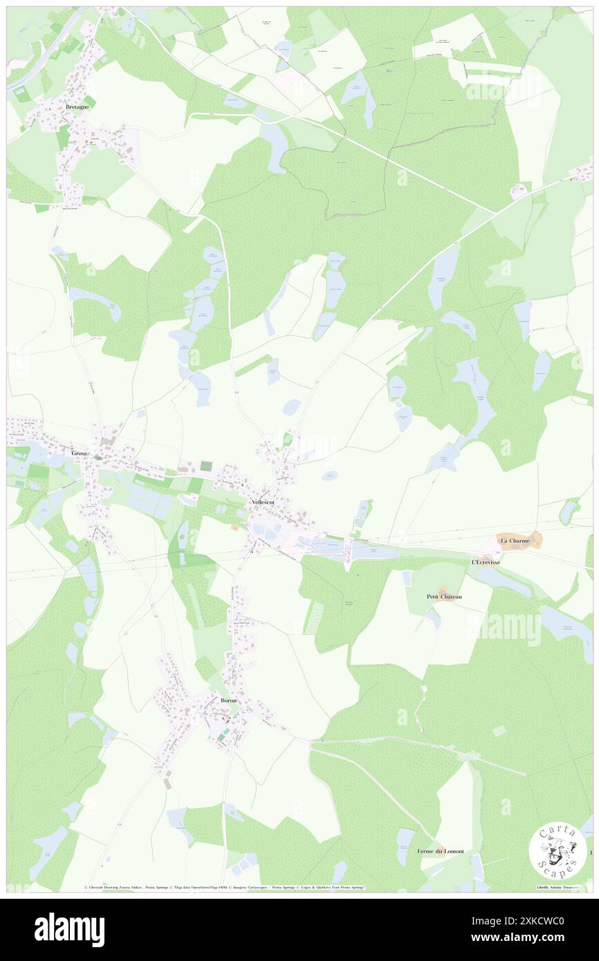 Vellescot, Territoire de Belfort, FR, France, Bourgogne-Franche-Comté, N 47 34' 20'', N 7 0' 50'', map, Cartascapes Map published in 2024. Explore Cartascapes, a map revealing Earth's diverse landscapes, cultures, and ecosystems. Journey through time and space, discovering the interconnectedness of our planet's past, present, and future. Stock Photohttps://www.alamy.com/image-license-details/?v=1https://www.alamy.com/vellescot-territoire-de-belfort-fr-france-bourgogne-franche-comt-n-47-34-20-n-7-0-50-map-cartascapes-map-published-in-2024-explore-cartascapes-a-map-revealing-earths-diverse-landscapes-cultures-and-ecosystems-journey-through-time-and-space-discovering-the-interconnectedness-of-our-planets-past-present-and-future-image614324704.html
RM2XKCWC0–Vellescot, Territoire de Belfort, FR, France, Bourgogne-Franche-Comté, N 47 34' 20'', N 7 0' 50'', map, Cartascapes Map published in 2024. Explore Cartascapes, a map revealing Earth's diverse landscapes, cultures, and ecosystems. Journey through time and space, discovering the interconnectedness of our planet's past, present, and future.
 Danjoutin, Territoire de Belfort, FR, France, Bourgogne-Franche-Comté, N 47 37' 4'', N 6 51' 50'', map, Cartascapes Map published in 2024. Explore Cartascapes, a map revealing Earth's diverse landscapes, cultures, and ecosystems. Journey through time and space, discovering the interconnectedness of our planet's past, present, and future. Stock Photohttps://www.alamy.com/image-license-details/?v=1https://www.alamy.com/danjoutin-territoire-de-belfort-fr-france-bourgogne-franche-comt-n-47-37-4-n-6-51-50-map-cartascapes-map-published-in-2024-explore-cartascapes-a-map-revealing-earths-diverse-landscapes-cultures-and-ecosystems-journey-through-time-and-space-discovering-the-interconnectedness-of-our-planets-past-present-and-future-image614339895.html
RM2XKDGPF–Danjoutin, Territoire de Belfort, FR, France, Bourgogne-Franche-Comté, N 47 37' 4'', N 6 51' 50'', map, Cartascapes Map published in 2024. Explore Cartascapes, a map revealing Earth's diverse landscapes, cultures, and ecosystems. Journey through time and space, discovering the interconnectedness of our planet's past, present, and future.
 Eloie, Territoire de Belfort, FR, France, Bourgogne-Franche-Comté, N 47 41' 26'', N 6 52' 24'', map, Cartascapes Map published in 2024. Explore Cartascapes, a map revealing Earth's diverse landscapes, cultures, and ecosystems. Journey through time and space, discovering the interconnectedness of our planet's past, present, and future. Stock Photohttps://www.alamy.com/image-license-details/?v=1https://www.alamy.com/eloie-territoire-de-belfort-fr-france-bourgogne-franche-comt-n-47-41-26-n-6-52-24-map-cartascapes-map-published-in-2024-explore-cartascapes-a-map-revealing-earths-diverse-landscapes-cultures-and-ecosystems-journey-through-time-and-space-discovering-the-interconnectedness-of-our-planets-past-present-and-future-image614340835.html
RM2XKDJ03–Eloie, Territoire de Belfort, FR, France, Bourgogne-Franche-Comté, N 47 41' 26'', N 6 52' 24'', map, Cartascapes Map published in 2024. Explore Cartascapes, a map revealing Earth's diverse landscapes, cultures, and ecosystems. Journey through time and space, discovering the interconnectedness of our planet's past, present, and future.
 Belfort, Territoire de Belfort, FR, France, Bourgogne-Franche-Comté, N 47 38' 27'', N 6 50' 57'', map, Cartascapes Map published in 2024. Explore Cartascapes, a map revealing Earth's diverse landscapes, cultures, and ecosystems. Journey through time and space, discovering the interconnectedness of our planet's past, present, and future. Stock Photohttps://www.alamy.com/image-license-details/?v=1https://www.alamy.com/belfort-territoire-de-belfort-fr-france-bourgogne-franche-comt-n-47-38-27-n-6-50-57-map-cartascapes-map-published-in-2024-explore-cartascapes-a-map-revealing-earths-diverse-landscapes-cultures-and-ecosystems-journey-through-time-and-space-discovering-the-interconnectedness-of-our-planets-past-present-and-future-image614346236.html
RM2XKDTW0–Belfort, Territoire de Belfort, FR, France, Bourgogne-Franche-Comté, N 47 38' 27'', N 6 50' 57'', map, Cartascapes Map published in 2024. Explore Cartascapes, a map revealing Earth's diverse landscapes, cultures, and ecosystems. Journey through time and space, discovering the interconnectedness of our planet's past, present, and future.
 Petitefontaine, Territoire de Belfort, FR, France, Bourgogne-Franche-Comté, N 47 43' 17'', N 7 0' 29'', map, Cartascapes Map published in 2024. Explore Cartascapes, a map revealing Earth's diverse landscapes, cultures, and ecosystems. Journey through time and space, discovering the interconnectedness of our planet's past, present, and future. Stock Photohttps://www.alamy.com/image-license-details/?v=1https://www.alamy.com/petitefontaine-territoire-de-belfort-fr-france-bourgogne-franche-comt-n-47-43-17-n-7-0-29-map-cartascapes-map-published-in-2024-explore-cartascapes-a-map-revealing-earths-diverse-landscapes-cultures-and-ecosystems-journey-through-time-and-space-discovering-the-interconnectedness-of-our-planets-past-present-and-future-image614316225.html
RM2XKCEH5–Petitefontaine, Territoire de Belfort, FR, France, Bourgogne-Franche-Comté, N 47 43' 17'', N 7 0' 29'', map, Cartascapes Map published in 2024. Explore Cartascapes, a map revealing Earth's diverse landscapes, cultures, and ecosystems. Journey through time and space, discovering the interconnectedness of our planet's past, present, and future.
 Delle, Territoire de Belfort, FR, France, Bourgogne-Franche-Comté, N 47 30' 24'', N 6 59' 53'', map, Cartascapes Map published in 2024. Explore Cartascapes, a map revealing Earth's diverse landscapes, cultures, and ecosystems. Journey through time and space, discovering the interconnectedness of our planet's past, present, and future. Stock Photohttps://www.alamy.com/image-license-details/?v=1https://www.alamy.com/delle-territoire-de-belfort-fr-france-bourgogne-franche-comt-n-47-30-24-n-6-59-53-map-cartascapes-map-published-in-2024-explore-cartascapes-a-map-revealing-earths-diverse-landscapes-cultures-and-ecosystems-journey-through-time-and-space-discovering-the-interconnectedness-of-our-planets-past-present-and-future-image614356354.html
RM2XKE9PA–Delle, Territoire de Belfort, FR, France, Bourgogne-Franche-Comté, N 47 30' 24'', N 6 59' 53'', map, Cartascapes Map published in 2024. Explore Cartascapes, a map revealing Earth's diverse landscapes, cultures, and ecosystems. Journey through time and space, discovering the interconnectedness of our planet's past, present, and future.
 Dorans, Territoire de Belfort, FR, France, Bourgogne-Franche-Comté, N 47 35' 16'', N 6 50' 18'', map, Cartascapes Map published in 2024. Explore Cartascapes, a map revealing Earth's diverse landscapes, cultures, and ecosystems. Journey through time and space, discovering the interconnectedness of our planet's past, present, and future. Stock Photohttps://www.alamy.com/image-license-details/?v=1https://www.alamy.com/dorans-territoire-de-belfort-fr-france-bourgogne-franche-comt-n-47-35-16-n-6-50-18-map-cartascapes-map-published-in-2024-explore-cartascapes-a-map-revealing-earths-diverse-landscapes-cultures-and-ecosystems-journey-through-time-and-space-discovering-the-interconnectedness-of-our-planets-past-present-and-future-image614333142.html
RM2XKD85A–Dorans, Territoire de Belfort, FR, France, Bourgogne-Franche-Comté, N 47 35' 16'', N 6 50' 18'', map, Cartascapes Map published in 2024. Explore Cartascapes, a map revealing Earth's diverse landscapes, cultures, and ecosystems. Journey through time and space, discovering the interconnectedness of our planet's past, present, and future.
 Urcerey, Territoire de Belfort, FR, France, Bourgogne-Franche-Comté, N 47 36' 29'', N 6 48' 33'', map, Cartascapes Map published in 2024. Explore Cartascapes, a map revealing Earth's diverse landscapes, cultures, and ecosystems. Journey through time and space, discovering the interconnectedness of our planet's past, present, and future. Stock Photohttps://www.alamy.com/image-license-details/?v=1https://www.alamy.com/urcerey-territoire-de-belfort-fr-france-bourgogne-franche-comt-n-47-36-29-n-6-48-33-map-cartascapes-map-published-in-2024-explore-cartascapes-a-map-revealing-earths-diverse-landscapes-cultures-and-ecosystems-journey-through-time-and-space-discovering-the-interconnectedness-of-our-planets-past-present-and-future-image614338333.html
RM2XKDEPN–Urcerey, Territoire de Belfort, FR, France, Bourgogne-Franche-Comté, N 47 36' 29'', N 6 48' 33'', map, Cartascapes Map published in 2024. Explore Cartascapes, a map revealing Earth's diverse landscapes, cultures, and ecosystems. Journey through time and space, discovering the interconnectedness of our planet's past, present, and future.
 Rechesy, Territoire de Belfort, FR, France, Bourgogne-Franche-Comté, N 47 30' 29'', N 7 6' 47'', map, Cartascapes Map published in 2024. Explore Cartascapes, a map revealing Earth's diverse landscapes, cultures, and ecosystems. Journey through time and space, discovering the interconnectedness of our planet's past, present, and future. Stock Photohttps://www.alamy.com/image-license-details/?v=1https://www.alamy.com/rechesy-territoire-de-belfort-fr-france-bourgogne-franche-comt-n-47-30-29-n-7-6-47-map-cartascapes-map-published-in-2024-explore-cartascapes-a-map-revealing-earths-diverse-landscapes-cultures-and-ecosystems-journey-through-time-and-space-discovering-the-interconnectedness-of-our-planets-past-present-and-future-image614317255.html
RM2XKCFWY–Rechesy, Territoire de Belfort, FR, France, Bourgogne-Franche-Comté, N 47 30' 29'', N 7 6' 47'', map, Cartascapes Map published in 2024. Explore Cartascapes, a map revealing Earth's diverse landscapes, cultures, and ecosystems. Journey through time and space, discovering the interconnectedness of our planet's past, present, and future.
 Vauthiermont, Territoire de Belfort, FR, France, Bourgogne-Franche-Comté, N 47 41' 6'', N 7 1' 56'', map, Cartascapes Map published in 2024. Explore Cartascapes, a map revealing Earth's diverse landscapes, cultures, and ecosystems. Journey through time and space, discovering the interconnectedness of our planet's past, present, and future. Stock Photohttps://www.alamy.com/image-license-details/?v=1https://www.alamy.com/vauthiermont-territoire-de-belfort-fr-france-bourgogne-franche-comt-n-47-41-6-n-7-1-56-map-cartascapes-map-published-in-2024-explore-cartascapes-a-map-revealing-earths-diverse-landscapes-cultures-and-ecosystems-journey-through-time-and-space-discovering-the-interconnectedness-of-our-planets-past-present-and-future-image614351901.html
RM2XKE439–Vauthiermont, Territoire de Belfort, FR, France, Bourgogne-Franche-Comté, N 47 41' 6'', N 7 1' 56'', map, Cartascapes Map published in 2024. Explore Cartascapes, a map revealing Earth's diverse landscapes, cultures, and ecosystems. Journey through time and space, discovering the interconnectedness of our planet's past, present, and future.
 Beaucourt, Territoire de Belfort, FR, France, Bourgogne-Franche-Comté, N 47 29' 9'', N 6 55' 31'', map, Cartascapes Map published in 2024. Explore Cartascapes, a map revealing Earth's diverse landscapes, cultures, and ecosystems. Journey through time and space, discovering the interconnectedness of our planet's past, present, and future. Stock Photohttps://www.alamy.com/image-license-details/?v=1https://www.alamy.com/beaucourt-territoire-de-belfort-fr-france-bourgogne-franche-comt-n-47-29-9-n-6-55-31-map-cartascapes-map-published-in-2024-explore-cartascapes-a-map-revealing-earths-diverse-landscapes-cultures-and-ecosystems-journey-through-time-and-space-discovering-the-interconnectedness-of-our-planets-past-present-and-future-image614285278.html
RM2XKB33X–Beaucourt, Territoire de Belfort, FR, France, Bourgogne-Franche-Comté, N 47 29' 9'', N 6 55' 31'', map, Cartascapes Map published in 2024. Explore Cartascapes, a map revealing Earth's diverse landscapes, cultures, and ecosystems. Journey through time and space, discovering the interconnectedness of our planet's past, present, and future.
 Perouse, Territoire de Belfort, FR, France, Bourgogne-Franche-Comté, N 47 38' 12'', N 6 53' 26'', map, Cartascapes Map published in 2024. Explore Cartascapes, a map revealing Earth's diverse landscapes, cultures, and ecosystems. Journey through time and space, discovering the interconnectedness of our planet's past, present, and future. Stock Photohttps://www.alamy.com/image-license-details/?v=1https://www.alamy.com/perouse-territoire-de-belfort-fr-france-bourgogne-franche-comt-n-47-38-12-n-6-53-26-map-cartascapes-map-published-in-2024-explore-cartascapes-a-map-revealing-earths-diverse-landscapes-cultures-and-ecosystems-journey-through-time-and-space-discovering-the-interconnectedness-of-our-planets-past-present-and-future-image614324206.html
RM2XKCTP6–Perouse, Territoire de Belfort, FR, France, Bourgogne-Franche-Comté, N 47 38' 12'', N 6 53' 26'', map, Cartascapes Map published in 2024. Explore Cartascapes, a map revealing Earth's diverse landscapes, cultures, and ecosystems. Journey through time and space, discovering the interconnectedness of our planet's past, present, and future.
 Riervescemont, Territoire de Belfort, FR, France, Bourgogne-Franche-Comté, N 47 45' 56'', N 6 52' 52'', map, Cartascapes Map published in 2024. Explore Cartascapes, a map revealing Earth's diverse landscapes, cultures, and ecosystems. Journey through time and space, discovering the interconnectedness of our planet's past, present, and future. Stock Photohttps://www.alamy.com/image-license-details/?v=1https://www.alamy.com/riervescemont-territoire-de-belfort-fr-france-bourgogne-franche-comt-n-47-45-56-n-6-52-52-map-cartascapes-map-published-in-2024-explore-cartascapes-a-map-revealing-earths-diverse-landscapes-cultures-and-ecosystems-journey-through-time-and-space-discovering-the-interconnectedness-of-our-planets-past-present-and-future-image614335608.html
RM2XKDB9C–Riervescemont, Territoire de Belfort, FR, France, Bourgogne-Franche-Comté, N 47 45' 56'', N 6 52' 52'', map, Cartascapes Map published in 2024. Explore Cartascapes, a map revealing Earth's diverse landscapes, cultures, and ecosystems. Journey through time and space, discovering the interconnectedness of our planet's past, present, and future.
 Roppe, Territoire de Belfort, FR, France, Bourgogne-Franche-Comté, N 47 40' 14'', N 6 55' 9'', map, Cartascapes Map published in 2024. Explore Cartascapes, a map revealing Earth's diverse landscapes, cultures, and ecosystems. Journey through time and space, discovering the interconnectedness of our planet's past, present, and future. Stock Photohttps://www.alamy.com/image-license-details/?v=1https://www.alamy.com/roppe-territoire-de-belfort-fr-france-bourgogne-franche-comt-n-47-40-14-n-6-55-9-map-cartascapes-map-published-in-2024-explore-cartascapes-a-map-revealing-earths-diverse-landscapes-cultures-and-ecosystems-journey-through-time-and-space-discovering-the-interconnectedness-of-our-planets-past-present-and-future-image614292530.html
RM2XKBCAX–Roppe, Territoire de Belfort, FR, France, Bourgogne-Franche-Comté, N 47 40' 14'', N 6 55' 9'', map, Cartascapes Map published in 2024. Explore Cartascapes, a map revealing Earth's diverse landscapes, cultures, and ecosystems. Journey through time and space, discovering the interconnectedness of our planet's past, present, and future.
 Argiesans, Territoire de Belfort, FR, France, Bourgogne-Franche-Comté, N 47 36' 14'', N 6 49' 22'', map, Cartascapes Map published in 2024. Explore Cartascapes, a map revealing Earth's diverse landscapes, cultures, and ecosystems. Journey through time and space, discovering the interconnectedness of our planet's past, present, and future. Stock Photohttps://www.alamy.com/image-license-details/?v=1https://www.alamy.com/argiesans-territoire-de-belfort-fr-france-bourgogne-franche-comt-n-47-36-14-n-6-49-22-map-cartascapes-map-published-in-2024-explore-cartascapes-a-map-revealing-earths-diverse-landscapes-cultures-and-ecosystems-journey-through-time-and-space-discovering-the-interconnectedness-of-our-planets-past-present-and-future-image614325785.html
RM2XKCXPH–Argiesans, Territoire de Belfort, FR, France, Bourgogne-Franche-Comté, N 47 36' 14'', N 6 49' 22'', map, Cartascapes Map published in 2024. Explore Cartascapes, a map revealing Earth's diverse landscapes, cultures, and ecosystems. Journey through time and space, discovering the interconnectedness of our planet's past, present, and future.
 Valdoie, Territoire de Belfort, FR, France, Bourgogne-Franche-Comté, N 47 40' 1'', N 6 50' 30'', map, Cartascapes Map published in 2024. Explore Cartascapes, a map revealing Earth's diverse landscapes, cultures, and ecosystems. Journey through time and space, discovering the interconnectedness of our planet's past, present, and future. Stock Photohttps://www.alamy.com/image-license-details/?v=1https://www.alamy.com/valdoie-territoire-de-belfort-fr-france-bourgogne-franche-comt-n-47-40-1-n-6-50-30-map-cartascapes-map-published-in-2024-explore-cartascapes-a-map-revealing-earths-diverse-landscapes-cultures-and-ecosystems-journey-through-time-and-space-discovering-the-interconnectedness-of-our-planets-past-present-and-future-image614339023.html
RM2XKDFKB–Valdoie, Territoire de Belfort, FR, France, Bourgogne-Franche-Comté, N 47 40' 1'', N 6 50' 30'', map, Cartascapes Map published in 2024. Explore Cartascapes, a map revealing Earth's diverse landscapes, cultures, and ecosystems. Journey through time and space, discovering the interconnectedness of our planet's past, present, and future.
 Vezelois, Territoire de Belfort, FR, France, Bourgogne-Franche-Comté, N 47 36' 28'', N 6 54' 59'', map, Cartascapes Map published in 2024. Explore Cartascapes, a map revealing Earth's diverse landscapes, cultures, and ecosystems. Journey through time and space, discovering the interconnectedness of our planet's past, present, and future. Stock Photohttps://www.alamy.com/image-license-details/?v=1https://www.alamy.com/vezelois-territoire-de-belfort-fr-france-bourgogne-franche-comt-n-47-36-28-n-6-54-59-map-cartascapes-map-published-in-2024-explore-cartascapes-a-map-revealing-earths-diverse-landscapes-cultures-and-ecosystems-journey-through-time-and-space-discovering-the-interconnectedness-of-our-planets-past-present-and-future-image614289200.html
RM2XKB840–Vezelois, Territoire de Belfort, FR, France, Bourgogne-Franche-Comté, N 47 36' 28'', N 6 54' 59'', map, Cartascapes Map published in 2024. Explore Cartascapes, a map revealing Earth's diverse landscapes, cultures, and ecosystems. Journey through time and space, discovering the interconnectedness of our planet's past, present, and future.
 Etueffont, Territoire de Belfort, FR, France, Bourgogne-Franche-Comté, N 47 43' 8'', N 6 55' 21'', map, Cartascapes Map published in 2024. Explore Cartascapes, a map revealing Earth's diverse landscapes, cultures, and ecosystems. Journey through time and space, discovering the interconnectedness of our planet's past, present, and future. Stock Photohttps://www.alamy.com/image-license-details/?v=1https://www.alamy.com/etueffont-territoire-de-belfort-fr-france-bourgogne-franche-comt-n-47-43-8-n-6-55-21-map-cartascapes-map-published-in-2024-explore-cartascapes-a-map-revealing-earths-diverse-landscapes-cultures-and-ecosystems-journey-through-time-and-space-discovering-the-interconnectedness-of-our-planets-past-present-and-future-image614311161.html
RM2XKC849–Etueffont, Territoire de Belfort, FR, France, Bourgogne-Franche-Comté, N 47 43' 8'', N 6 55' 21'', map, Cartascapes Map published in 2024. Explore Cartascapes, a map revealing Earth's diverse landscapes, cultures, and ecosystems. Journey through time and space, discovering the interconnectedness of our planet's past, present, and future.
 Lariviere, Territoire de Belfort, FR, France, Bourgogne-Franche-Comté, N 47 40' 35'', N 6 59' 52'', map, Cartascapes Map published in 2024. Explore Cartascapes, a map revealing Earth's diverse landscapes, cultures, and ecosystems. Journey through time and space, discovering the interconnectedness of our planet's past, present, and future. Stock Photohttps://www.alamy.com/image-license-details/?v=1https://www.alamy.com/lariviere-territoire-de-belfort-fr-france-bourgogne-franche-comt-n-47-40-35-n-6-59-52-map-cartascapes-map-published-in-2024-explore-cartascapes-a-map-revealing-earths-diverse-landscapes-cultures-and-ecosystems-journey-through-time-and-space-discovering-the-interconnectedness-of-our-planets-past-present-and-future-image614313297.html
RM2XKCATH–Lariviere, Territoire de Belfort, FR, France, Bourgogne-Franche-Comté, N 47 40' 35'', N 6 59' 52'', map, Cartascapes Map published in 2024. Explore Cartascapes, a map revealing Earth's diverse landscapes, cultures, and ecosystems. Journey through time and space, discovering the interconnectedness of our planet's past, present, and future.
 Faverois, Territoire de Belfort, FR, France, Bourgogne-Franche-Comté, N 47 31' 19'', N 7 2' 8'', map, Cartascapes Map published in 2024. Explore Cartascapes, a map revealing Earth's diverse landscapes, cultures, and ecosystems. Journey through time and space, discovering the interconnectedness of our planet's past, present, and future. Stock Photohttps://www.alamy.com/image-license-details/?v=1https://www.alamy.com/faverois-territoire-de-belfort-fr-france-bourgogne-franche-comt-n-47-31-19-n-7-2-8-map-cartascapes-map-published-in-2024-explore-cartascapes-a-map-revealing-earths-diverse-landscapes-cultures-and-ecosystems-journey-through-time-and-space-discovering-the-interconnectedness-of-our-planets-past-present-and-future-image614350740.html
RM2XKE2HT–Faverois, Territoire de Belfort, FR, France, Bourgogne-Franche-Comté, N 47 31' 19'', N 7 2' 8'', map, Cartascapes Map published in 2024. Explore Cartascapes, a map revealing Earth's diverse landscapes, cultures, and ecosystems. Journey through time and space, discovering the interconnectedness of our planet's past, present, and future.
 Grosne, Territoire de Belfort, FR, France, Bourgogne-Franche-Comté, N 47 34' 28'', N 6 59' 57'', map, Cartascapes Map published in 2024. Explore Cartascapes, a map revealing Earth's diverse landscapes, cultures, and ecosystems. Journey through time and space, discovering the interconnectedness of our planet's past, present, and future. Stock Photohttps://www.alamy.com/image-license-details/?v=1https://www.alamy.com/grosne-territoire-de-belfort-fr-france-bourgogne-franche-comt-n-47-34-28-n-6-59-57-map-cartascapes-map-published-in-2024-explore-cartascapes-a-map-revealing-earths-diverse-landscapes-cultures-and-ecosystems-journey-through-time-and-space-discovering-the-interconnectedness-of-our-planets-past-present-and-future-image614293130.html
RM2XKBD4A–Grosne, Territoire de Belfort, FR, France, Bourgogne-Franche-Comté, N 47 34' 28'', N 6 59' 57'', map, Cartascapes Map published in 2024. Explore Cartascapes, a map revealing Earth's diverse landscapes, cultures, and ecosystems. Journey through time and space, discovering the interconnectedness of our planet's past, present, and future.
 Montbouton, Territoire de Belfort, FR, France, Bourgogne-Franche-Comté, N 47 28' 22'', N 6 55' 9'', map, Cartascapes Map published in 2024. Explore Cartascapes, a map revealing Earth's diverse landscapes, cultures, and ecosystems. Journey through time and space, discovering the interconnectedness of our planet's past, present, and future. Stock Photohttps://www.alamy.com/image-license-details/?v=1https://www.alamy.com/montbouton-territoire-de-belfort-fr-france-bourgogne-franche-comt-n-47-28-22-n-6-55-9-map-cartascapes-map-published-in-2024-explore-cartascapes-a-map-revealing-earths-diverse-landscapes-cultures-and-ecosystems-journey-through-time-and-space-discovering-the-interconnectedness-of-our-planets-past-present-and-future-image614346580.html
RM2XKDW98–Montbouton, Territoire de Belfort, FR, France, Bourgogne-Franche-Comté, N 47 28' 22'', N 6 55' 9'', map, Cartascapes Map published in 2024. Explore Cartascapes, a map revealing Earth's diverse landscapes, cultures, and ecosystems. Journey through time and space, discovering the interconnectedness of our planet's past, present, and future.
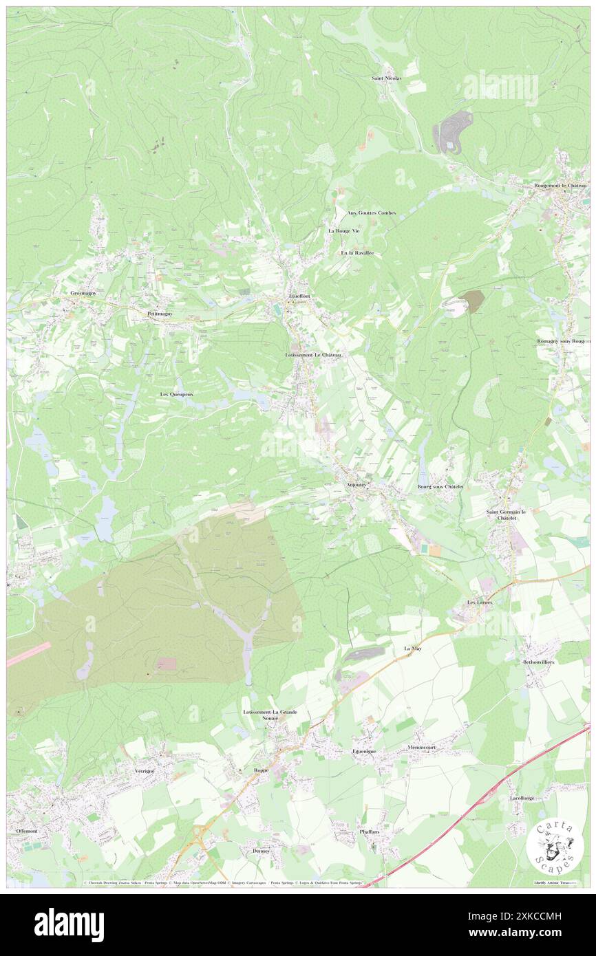 Anjoutey, Territoire de Belfort, FR, France, Bourgogne-Franche-Comté, N 47 42' 3'', N 6 55' 57'', map, Cartascapes Map published in 2024. Explore Cartascapes, a map revealing Earth's diverse landscapes, cultures, and ecosystems. Journey through time and space, discovering the interconnectedness of our planet's past, present, and future. Stock Photohttps://www.alamy.com/image-license-details/?v=1https://www.alamy.com/anjoutey-territoire-de-belfort-fr-france-bourgogne-franche-comt-n-47-42-3-n-6-55-57-map-cartascapes-map-published-in-2024-explore-cartascapes-a-map-revealing-earths-diverse-landscapes-cultures-and-ecosystems-journey-through-time-and-space-discovering-the-interconnectedness-of-our-planets-past-present-and-future-image614314753.html
RM2XKCCMH–Anjoutey, Territoire de Belfort, FR, France, Bourgogne-Franche-Comté, N 47 42' 3'', N 6 55' 57'', map, Cartascapes Map published in 2024. Explore Cartascapes, a map revealing Earth's diverse landscapes, cultures, and ecosystems. Journey through time and space, discovering the interconnectedness of our planet's past, present, and future.