Map the cotton kingdom Cut Out Stock Images
 Cotton, Staffordshire, GB, United Kingdom, England, N 53 1' 52'', S 1 54' 24'', map, Cartascapes Map published in 2024. Explore Cartascapes, a map revealing Earth's diverse landscapes, cultures, and ecosystems. Journey through time and space, discovering the interconnectedness of our planet's past, present, and future. Stock Photohttps://www.alamy.com/image-license-details/?v=1https://www.alamy.com/cotton-staffordshire-gb-united-kingdom-england-n-53-1-52-s-1-54-24-map-cartascapes-map-published-in-2024-explore-cartascapes-a-map-revealing-earths-diverse-landscapes-cultures-and-ecosystems-journey-through-time-and-space-discovering-the-interconnectedness-of-our-planets-past-present-and-future-image604232446.html
RM2X314J6–Cotton, Staffordshire, GB, United Kingdom, England, N 53 1' 52'', S 1 54' 24'', map, Cartascapes Map published in 2024. Explore Cartascapes, a map revealing Earth's diverse landscapes, cultures, and ecosystems. Journey through time and space, discovering the interconnectedness of our planet's past, present, and future.
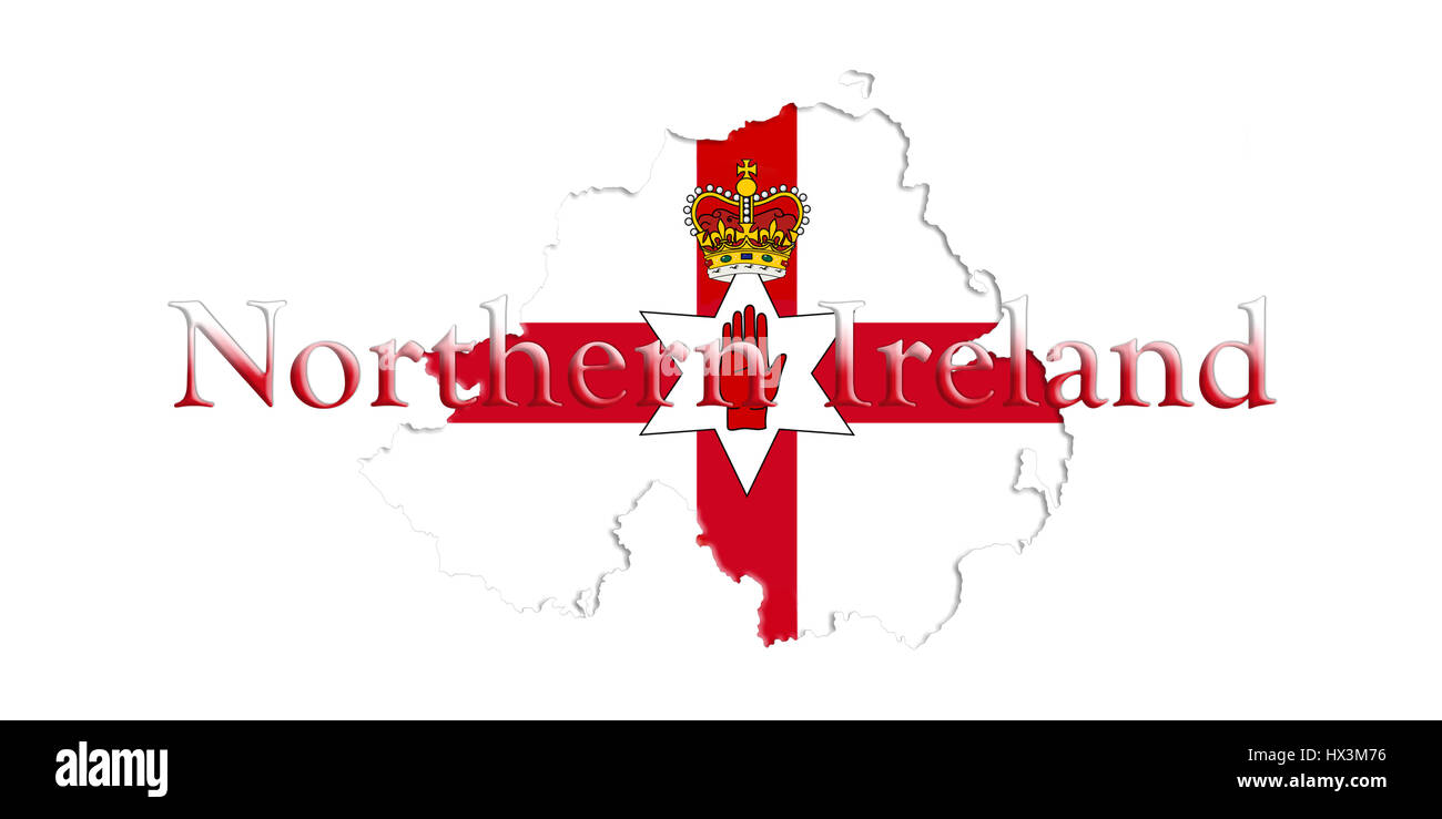
 Northern Ireland Ulster Banner. Map With Flag And Country Name On It 3D illustration Stock Photohttps://www.alamy.com/image-license-details/?v=1https://www.alamy.com/stock-photo-northern-ireland-ulster-banner-map-with-flag-and-country-name-on-it-136535370.html
RFHX3M76–Northern Ireland Ulster Banner. Map With Flag And Country Name On It 3D illustration
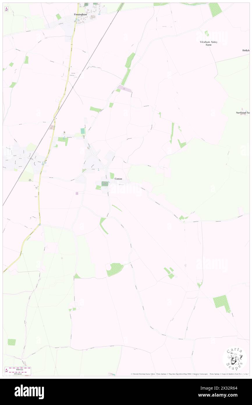
 Cotton, Suffolk, GB, United Kingdom, England, N 52 15' 38'', N 1 2' 11'', map, Cartascapes Map published in 2024. Explore Cartascapes, a map revealing Earth's diverse landscapes, cultures, and ecosystems. Journey through time and space, discovering the interconnectedness of our planet's past, present, and future. Stock Photohttps://www.alamy.com/image-license-details/?v=1https://www.alamy.com/cotton-suffolk-gb-united-kingdom-england-n-52-15-38-n-1-2-11-map-cartascapes-map-published-in-2024-explore-cartascapes-a-map-revealing-earths-diverse-landscapes-cultures-and-ecosystems-journey-through-time-and-space-discovering-the-interconnectedness-of-our-planets-past-present-and-future-image604268957.html
RM2X32R65–Cotton, Suffolk, GB, United Kingdom, England, N 52 15' 38'', N 1 2' 11'', map, Cartascapes Map published in 2024. Explore Cartascapes, a map revealing Earth's diverse landscapes, cultures, and ecosystems. Journey through time and space, discovering the interconnectedness of our planet's past, present, and future.
 Northern Ireland Ulster Banner. Map With Flag And Country Name On It 3D illustration Stock Photohttps://www.alamy.com/image-license-details/?v=1https://www.alamy.com/stock-photo-northern-ireland-ulster-banner-map-with-flag-and-country-name-on-it-136535367.html
RFHX3M73–Northern Ireland Ulster Banner. Map With Flag And Country Name On It 3D illustration
 Cotton, Suffolk, GB, United Kingdom, England, N 52 15' 38'', N 1 2' 11'', map, Cartascapes Map published in 2024. Explore Cartascapes, a map revealing Earth's diverse landscapes, cultures, and ecosystems. Journey through time and space, discovering the interconnectedness of our planet's past, present, and future. Stock Photohttps://www.alamy.com/image-license-details/?v=1https://www.alamy.com/cotton-suffolk-gb-united-kingdom-england-n-52-15-38-n-1-2-11-map-cartascapes-map-published-in-2024-explore-cartascapes-a-map-revealing-earths-diverse-landscapes-cultures-and-ecosystems-journey-through-time-and-space-discovering-the-interconnectedness-of-our-planets-past-present-and-future-image604268956.html
RM2X32R64–Cotton, Suffolk, GB, United Kingdom, England, N 52 15' 38'', N 1 2' 11'', map, Cartascapes Map published in 2024. Explore Cartascapes, a map revealing Earth's diverse landscapes, cultures, and ecosystems. Journey through time and space, discovering the interconnectedness of our planet's past, present, and future.
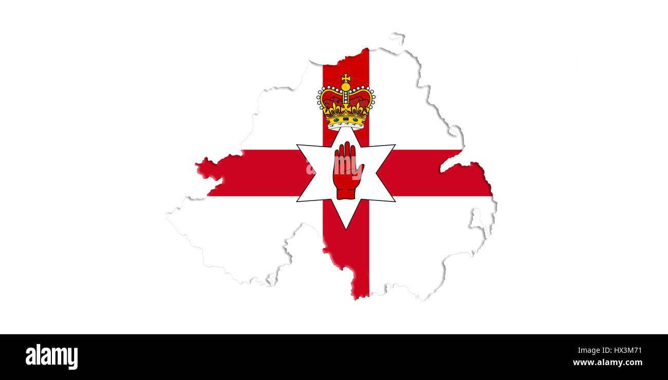
 Northern Ireland Ulster Banner. Map With Flag On It Isolated On White Background 3D illustration Stock Photohttps://www.alamy.com/image-license-details/?v=1https://www.alamy.com/stock-photo-northern-ireland-ulster-banner-map-with-flag-on-it-isolated-on-white-136535365.html
RFHX3M71–Northern Ireland Ulster Banner. Map With Flag On It Isolated On White Background 3D illustration
 Cotton Edmunds, Cheshire West and Chester, GB, United Kingdom, England, N 53 11' 12'', S 2 47' 40'', map, Cartascapes Map published in 2024. Explore Cartascapes, a map revealing Earth's diverse landscapes, cultures, and ecosystems. Journey through time and space, discovering the interconnectedness of our planet's past, present, and future. Stock Photohttps://www.alamy.com/image-license-details/?v=1https://www.alamy.com/cotton-edmunds-cheshire-west-and-chester-gb-united-kingdom-england-n-53-11-12-s-2-47-40-map-cartascapes-map-published-in-2024-explore-cartascapes-a-map-revealing-earths-diverse-landscapes-cultures-and-ecosystems-journey-through-time-and-space-discovering-the-interconnectedness-of-our-planets-past-present-and-future-image604249598.html
RM2X31XEP–Cotton Edmunds, Cheshire West and Chester, GB, United Kingdom, England, N 53 11' 12'', S 2 47' 40'', map, Cartascapes Map published in 2024. Explore Cartascapes, a map revealing Earth's diverse landscapes, cultures, and ecosystems. Journey through time and space, discovering the interconnectedness of our planet's past, present, and future.
 Northern Ireland Flag and Map. Saint Patrick's Saltire Isolated On White Background 3D illustration Stock Photohttps://www.alamy.com/image-license-details/?v=1https://www.alamy.com/stock-photo-northern-ireland-flag-and-map-saint-patricks-saltire-isolated-on-white-136535378.html
RFHX3M7E–Northern Ireland Flag and Map. Saint Patrick's Saltire Isolated On White Background 3D illustration
 Cotton Abbotts, Cheshire West and Chester, GB, United Kingdom, England, N 53 10' 43'', S 2 47' 56'', map, Cartascapes Map published in 2024. Explore Cartascapes, a map revealing Earth's diverse landscapes, cultures, and ecosystems. Journey through time and space, discovering the interconnectedness of our planet's past, present, and future. Stock Photohttps://www.alamy.com/image-license-details/?v=1https://www.alamy.com/cotton-abbotts-cheshire-west-and-chester-gb-united-kingdom-england-n-53-10-43-s-2-47-56-map-cartascapes-map-published-in-2024-explore-cartascapes-a-map-revealing-earths-diverse-landscapes-cultures-and-ecosystems-journey-through-time-and-space-discovering-the-interconnectedness-of-our-planets-past-present-and-future-image604274257.html
RM2X331YD–Cotton Abbotts, Cheshire West and Chester, GB, United Kingdom, England, N 53 10' 43'', S 2 47' 56'', map, Cartascapes Map published in 2024. Explore Cartascapes, a map revealing Earth's diverse landscapes, cultures, and ecosystems. Journey through time and space, discovering the interconnectedness of our planet's past, present, and future.
 Northern Ireland Flag and Map. Saint Patrick's Saltire Isolated On White Background 3D illustration Stock Photohttps://www.alamy.com/image-license-details/?v=1https://www.alamy.com/stock-photo-northern-ireland-flag-and-map-saint-patricks-saltire-isolated-on-white-136535377.html
RFHX3M7D–Northern Ireland Flag and Map. Saint Patrick's Saltire Isolated On White Background 3D illustration
 Cotton, Suffolk, GB, United Kingdom, England, N 52 15' 47'', N 1 1' 54'', map, Cartascapes Map published in 2024. Explore Cartascapes, a map revealing Earth's diverse landscapes, cultures, and ecosystems. Journey through time and space, discovering the interconnectedness of our planet's past, present, and future. Stock Photohttps://www.alamy.com/image-license-details/?v=1https://www.alamy.com/cotton-suffolk-gb-united-kingdom-england-n-52-15-47-n-1-1-54-map-cartascapes-map-published-in-2024-explore-cartascapes-a-map-revealing-earths-diverse-landscapes-cultures-and-ecosystems-journey-through-time-and-space-discovering-the-interconnectedness-of-our-planets-past-present-and-future-image604176933.html
RM2X2XHRH–Cotton, Suffolk, GB, United Kingdom, England, N 52 15' 47'', N 1 1' 54'', map, Cartascapes Map published in 2024. Explore Cartascapes, a map revealing Earth's diverse landscapes, cultures, and ecosystems. Journey through time and space, discovering the interconnectedness of our planet's past, present, and future.
 Cotton, Staffordshire, GB, United Kingdom, England, N 53 0' 27'', S 1 54' 15'', map, Cartascapes Map published in 2024. Explore Cartascapes, a map revealing Earth's diverse landscapes, cultures, and ecosystems. Journey through time and space, discovering the interconnectedness of our planet's past, present, and future. Stock Photohttps://www.alamy.com/image-license-details/?v=1https://www.alamy.com/cotton-staffordshire-gb-united-kingdom-england-n-53-0-27-s-1-54-15-map-cartascapes-map-published-in-2024-explore-cartascapes-a-map-revealing-earths-diverse-landscapes-cultures-and-ecosystems-journey-through-time-and-space-discovering-the-interconnectedness-of-our-planets-past-present-and-future-image604100327.html
RM2X2R43K–Cotton, Staffordshire, GB, United Kingdom, England, N 53 0' 27'', S 1 54' 15'', map, Cartascapes Map published in 2024. Explore Cartascapes, a map revealing Earth's diverse landscapes, cultures, and ecosystems. Journey through time and space, discovering the interconnectedness of our planet's past, present, and future.
 Cotton, Suffolk, GB, United Kingdom, England, N 52 15' 38'', N 1 2' 11'', map, Cartascapes Map published in 2024. Explore Cartascapes, a map revealing Earth's diverse landscapes, cultures, and ecosystems. Journey through time and space, discovering the interconnectedness of our planet's past, present, and future. Stock Photohttps://www.alamy.com/image-license-details/?v=1https://www.alamy.com/cotton-suffolk-gb-united-kingdom-england-n-52-15-38-n-1-2-11-map-cartascapes-map-published-in-2024-explore-cartascapes-a-map-revealing-earths-diverse-landscapes-cultures-and-ecosystems-journey-through-time-and-space-discovering-the-interconnectedness-of-our-planets-past-present-and-future-image604176936.html
RM2X2XHRM–Cotton, Suffolk, GB, United Kingdom, England, N 52 15' 38'', N 1 2' 11'', map, Cartascapes Map published in 2024. Explore Cartascapes, a map revealing Earth's diverse landscapes, cultures, and ecosystems. Journey through time and space, discovering the interconnectedness of our planet's past, present, and future.
 Cotton Hill, Moray, GB, United Kingdom, Scotland, N 57 38' 46'', S 2 47' 50'', map, Cartascapes Map published in 2024. Explore Cartascapes, a map revealing Earth's diverse landscapes, cultures, and ecosystems. Journey through time and space, discovering the interconnectedness of our planet's past, present, and future. Stock Photohttps://www.alamy.com/image-license-details/?v=1https://www.alamy.com/cotton-hill-moray-gb-united-kingdom-scotland-n-57-38-46-s-2-47-50-map-cartascapes-map-published-in-2024-explore-cartascapes-a-map-revealing-earths-diverse-landscapes-cultures-and-ecosystems-journey-through-time-and-space-discovering-the-interconnectedness-of-our-planets-past-present-and-future-image604131313.html
RM2X2TFJ9–Cotton Hill, Moray, GB, United Kingdom, Scotland, N 57 38' 46'', S 2 47' 50'', map, Cartascapes Map published in 2024. Explore Cartascapes, a map revealing Earth's diverse landscapes, cultures, and ecosystems. Journey through time and space, discovering the interconnectedness of our planet's past, present, and future.
 BS Cotton, Greater London, GB, United Kingdom, England, N 51 36' 44'', S 0 7' 4'', map, Cartascapes Map published in 2024. Explore Cartascapes, a map revealing Earth's diverse landscapes, cultures, and ecosystems. Journey through time and space, discovering the interconnectedness of our planet's past, present, and future. Stock Photohttps://www.alamy.com/image-license-details/?v=1https://www.alamy.com/bs-cotton-greater-london-gb-united-kingdom-england-n-51-36-44-s-0-7-4-map-cartascapes-map-published-in-2024-explore-cartascapes-a-map-revealing-earths-diverse-landscapes-cultures-and-ecosystems-journey-through-time-and-space-discovering-the-interconnectedness-of-our-planets-past-present-and-future-image604075760.html
RM2X2P0P8–BS Cotton, Greater London, GB, United Kingdom, England, N 51 36' 44'', S 0 7' 4'', map, Cartascapes Map published in 2024. Explore Cartascapes, a map revealing Earth's diverse landscapes, cultures, and ecosystems. Journey through time and space, discovering the interconnectedness of our planet's past, present, and future.
 Phillips Wood & Lee Cotton Twist Mill, Chapel Street Salford, City and Borough of Salford, GB, United Kingdom, England, N 53 29' 2'', S 2 15' 1'', map, Cartascapes Map published in 2024. Explore Cartascapes, a map revealing Earth's diverse landscapes, cultures, and ecosystems. Journey through time and space, discovering the interconnectedness of our planet's past, present, and future. Stock Photohttps://www.alamy.com/image-license-details/?v=1https://www.alamy.com/phillips-wood-lee-cotton-twist-mill-chapel-street-salford-city-and-borough-of-salford-gb-united-kingdom-england-n-53-29-2-s-2-15-1-map-cartascapes-map-published-in-2024-explore-cartascapes-a-map-revealing-earths-diverse-landscapes-cultures-and-ecosystems-journey-through-time-and-space-discovering-the-interconnectedness-of-our-planets-past-present-and-future-image604108202.html
RM2X2RE4X–Phillips Wood & Lee Cotton Twist Mill, Chapel Street Salford, City and Borough of Salford, GB, United Kingdom, England, N 53 29' 2'', S 2 15' 1'', map, Cartascapes Map published in 2024. Explore Cartascapes, a map revealing Earth's diverse landscapes, cultures, and ecosystems. Journey through time and space, discovering the interconnectedness of our planet's past, present, and future.
 Cotton End, Bedford, GB, United Kingdom, England, N 52 5' 44'', S 0 25' 2'', map, Cartascapes Map published in 2024. Explore Cartascapes, a map revealing Earth's diverse landscapes, cultures, and ecosystems. Journey through time and space, discovering the interconnectedness of our planet's past, present, and future. Stock Photohttps://www.alamy.com/image-license-details/?v=1https://www.alamy.com/cotton-end-bedford-gb-united-kingdom-england-n-52-5-44-s-0-25-2-map-cartascapes-map-published-in-2024-explore-cartascapes-a-map-revealing-earths-diverse-landscapes-cultures-and-ecosystems-journey-through-time-and-space-discovering-the-interconnectedness-of-our-planets-past-present-and-future-image604086100.html
RM2X2PDYG–Cotton End, Bedford, GB, United Kingdom, England, N 52 5' 44'', S 0 25' 2'', map, Cartascapes Map published in 2024. Explore Cartascapes, a map revealing Earth's diverse landscapes, cultures, and ecosystems. Journey through time and space, discovering the interconnectedness of our planet's past, present, and future.
 Cotton End, Bedford, GB, United Kingdom, England, N 52 5' 44'', S 0 25' 2'', map, Cartascapes Map published in 2024. Explore Cartascapes, a map revealing Earth's diverse landscapes, cultures, and ecosystems. Journey through time and space, discovering the interconnectedness of our planet's past, present, and future. Stock Photohttps://www.alamy.com/image-license-details/?v=1https://www.alamy.com/cotton-end-bedford-gb-united-kingdom-england-n-52-5-44-s-0-25-2-map-cartascapes-map-published-in-2024-explore-cartascapes-a-map-revealing-earths-diverse-landscapes-cultures-and-ecosystems-journey-through-time-and-space-discovering-the-interconnectedness-of-our-planets-past-present-and-future-image604086112.html
RM2X2PE00–Cotton End, Bedford, GB, United Kingdom, England, N 52 5' 44'', S 0 25' 2'', map, Cartascapes Map published in 2024. Explore Cartascapes, a map revealing Earth's diverse landscapes, cultures, and ecosystems. Journey through time and space, discovering the interconnectedness of our planet's past, present, and future.
 Cotton End, Bedford, United Kingdom, England, N 52 5' 44'', W 0 25' 2'', map, Timeless Map published in 2021. Travelers, explorers and adventurers like Florence Nightingale, David Livingstone, Ernest Shackleton, Lewis and Clark and Sherlock Holmes relied on maps to plan travels to the world's most remote corners, Timeless Maps is mapping most locations on the globe, showing the achievement of great dreams Stock Photohttps://www.alamy.com/image-license-details/?v=1https://www.alamy.com/cotton-end-bedford-united-kingdom-england-n-52-5-44-w-0-25-2-map-timeless-map-published-in-2021-travelers-explorers-and-adventurers-like-florence-nightingale-david-livingstone-ernest-shackleton-lewis-and-clark-and-sherlock-holmes-relied-on-maps-to-plan-travels-to-the-worlds-most-remote-corners-timeless-maps-is-mapping-most-locations-on-the-globe-showing-the-achievement-of-great-dreams-image439407697.html
RM2GETN01–Cotton End, Bedford, United Kingdom, England, N 52 5' 44'', W 0 25' 2'', map, Timeless Map published in 2021. Travelers, explorers and adventurers like Florence Nightingale, David Livingstone, Ernest Shackleton, Lewis and Clark and Sherlock Holmes relied on maps to plan travels to the world's most remote corners, Timeless Maps is mapping most locations on the globe, showing the achievement of great dreams