Quick filters:
Maui map Stock Photos and Images
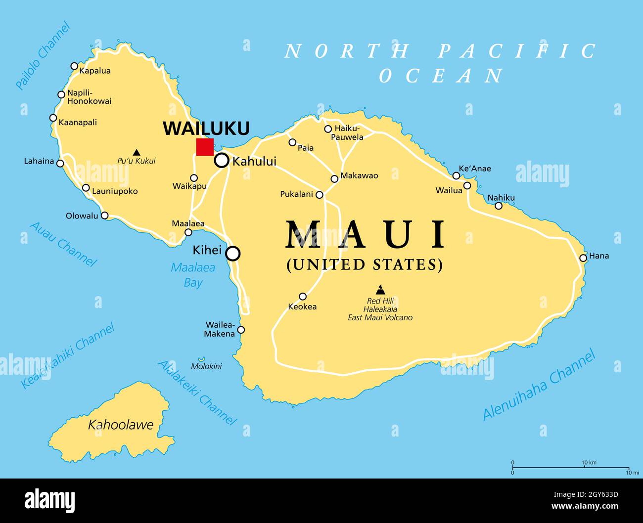 Maui, Hawaii, political map with capital Wailuku. Part of Hawaiian Islands and Hawaii, a state of the United States in the North Pacific Ocean. Stock Photohttps://www.alamy.com/image-license-details/?v=1https://www.alamy.com/maui-hawaii-political-map-with-capital-wailuku-part-of-hawaiian-islands-and-hawaii-a-state-of-the-united-states-in-the-north-pacific-ocean-image446989073.html
RF2GY633D–Maui, Hawaii, political map with capital Wailuku. Part of Hawaiian Islands and Hawaii, a state of the United States in the North Pacific Ocean.
 Hawaiian Islands. Maui Oahu Kauai. BARTHOLOMEW 1949 old vintage map plan chart Stock Photohttps://www.alamy.com/image-license-details/?v=1https://www.alamy.com/hawaiian-islands-maui-oahu-kauai-bartholomew-1949-old-vintage-map-plan-chart-image428910769.html
RF2FWPG1N–Hawaiian Islands. Maui Oahu Kauai. BARTHOLOMEW 1949 old vintage map plan chart
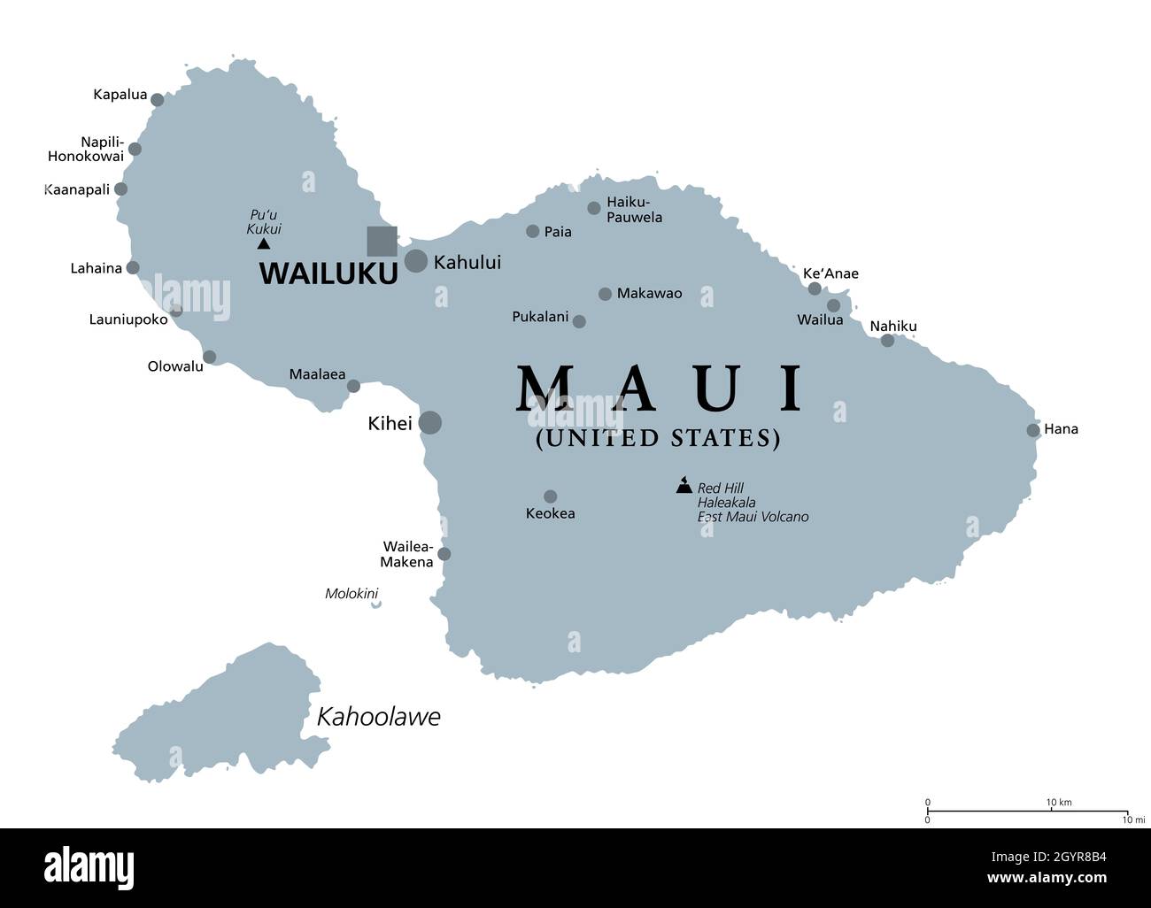 Maui, Hawaii, gray political map with capital Wailuku. Part of Hawaiian Islands and Hawaii, a state of the United States in North Pacific Ocean. Stock Photohttps://www.alamy.com/image-license-details/?v=1https://www.alamy.com/maui-hawaii-gray-political-map-with-capital-wailuku-part-of-hawaiian-islands-and-hawaii-a-state-of-the-united-states-in-north-pacific-ocean-image447366392.html
RF2GYR8B4–Maui, Hawaii, gray political map with capital Wailuku. Part of Hawaiian Islands and Hawaii, a state of the United States in North Pacific Ocean.
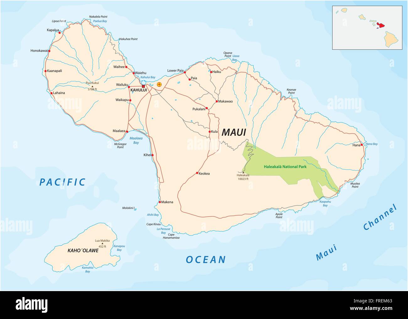 maui and Kahoolawe road map Stock Vectorhttps://www.alamy.com/image-license-details/?v=1https://www.alamy.com/stock-photo-maui-and-kahoolawe-road-map-100512107.html
RFFREM63–maui and Kahoolawe road map
 1885, De Witt Alexander Wall Map of Maui, Hawaii Stock Photohttps://www.alamy.com/image-license-details/?v=1https://www.alamy.com/stock-image-1885-de-witt-alexander-wall-map-of-maui-hawaii-162575050.html
RMKCDX3P–1885, De Witt Alexander Wall Map of Maui, Hawaii
 Map of Maui on green felt Stock Photohttps://www.alamy.com/image-license-details/?v=1https://www.alamy.com/map-of-maui-on-green-felt-image402462596.html
RF2EANN44–Map of Maui on green felt
 A person holding a map of Maui in a convertible while in a car on road to Hana. Stock Photohttps://www.alamy.com/image-license-details/?v=1https://www.alamy.com/stock-photo-a-person-holding-a-map-of-maui-in-a-convertible-while-in-a-car-on-49615152.html
RFCTM4HM–A person holding a map of Maui in a convertible while in a car on road to Hana.
 Map of Maui on weathered concrete Stock Photohttps://www.alamy.com/image-license-details/?v=1https://www.alamy.com/map-of-maui-on-weathered-concrete-image402531291.html
RF2EATTNF–Map of Maui on weathered concrete
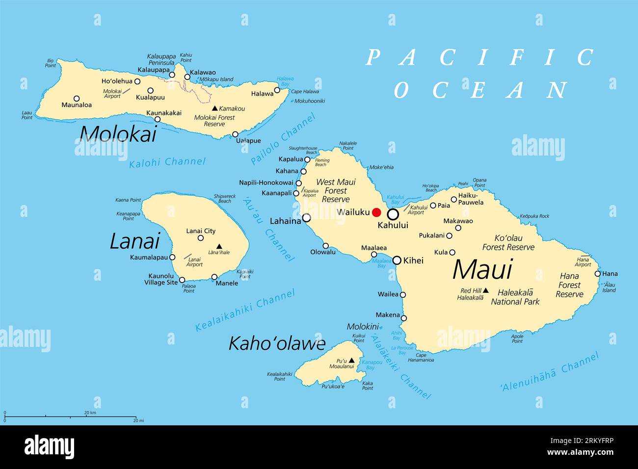 Maui County in the U.S. state Hawaii, political map, with Wailuku as seat. Consisting of the islands of Maui, Lanai, Molokai, Kahoolawe and Molokini. Stock Photohttps://www.alamy.com/image-license-details/?v=1https://www.alamy.com/maui-county-in-the-us-state-hawaii-political-map-with-wailuku-as-seat-consisting-of-the-islands-of-maui-lanai-molokai-kahoolawe-and-molokini-image563015370.html
RF2RKYFRP–Maui County in the U.S. state Hawaii, political map, with Wailuku as seat. Consisting of the islands of Maui, Lanai, Molokai, Kahoolawe and Molokini.
RF2RT0KKE–Maui Map icon. Maui island Clipart. Maui Flag Map Svg. Outline. flat style.
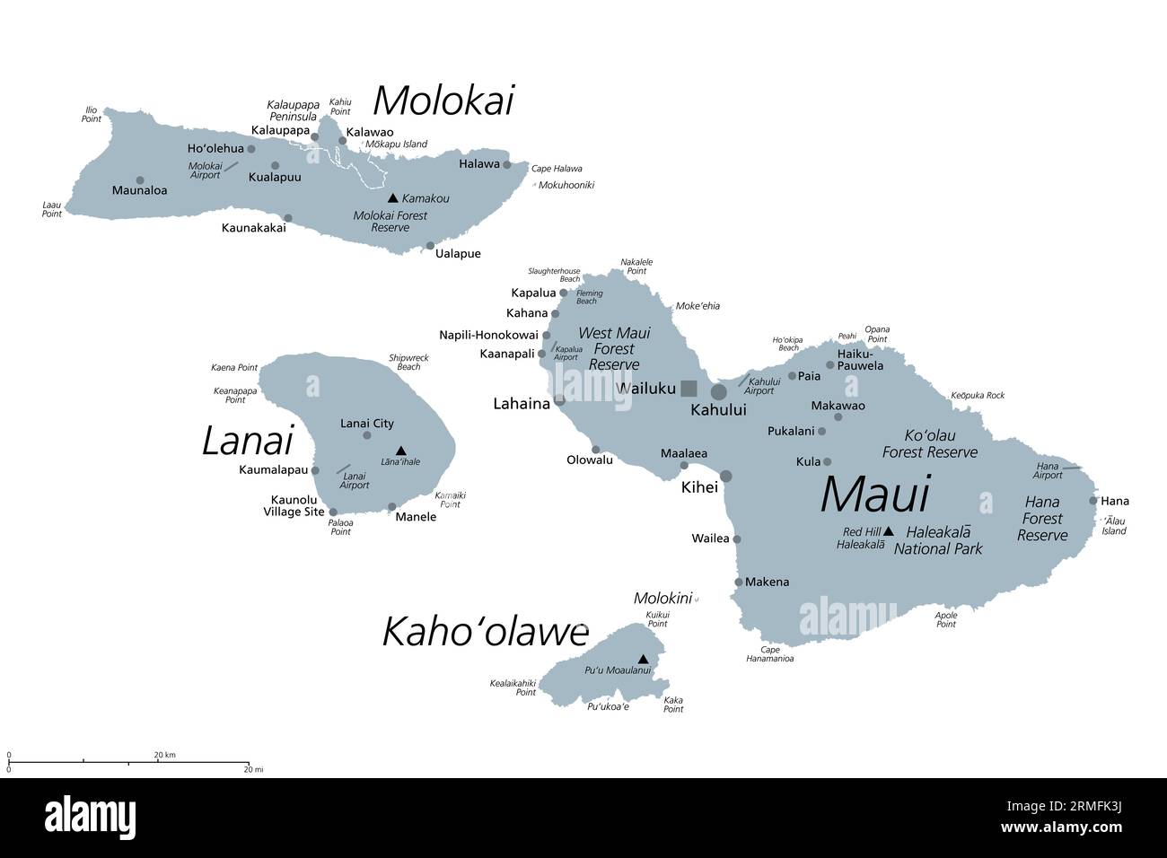 Maui County in the U.S. state Hawaii, gray political map with Wailuku as seat. Consisting of islands of Maui, Lanai, Molokai, Kahoolawe and Molokini. Stock Photohttps://www.alamy.com/image-license-details/?v=1https://www.alamy.com/maui-county-in-the-us-state-hawaii-gray-political-map-with-wailuku-as-seat-consisting-of-islands-of-maui-lanai-molokai-kahoolawe-and-molokini-image563369174.html
RF2RMFK3J–Maui County in the U.S. state Hawaii, gray political map with Wailuku as seat. Consisting of islands of Maui, Lanai, Molokai, Kahoolawe and Molokini.
 Road map of the Hawaiian Islands of Maui, Molokai, Lanai and Kahoolawe Stock Photohttps://www.alamy.com/image-license-details/?v=1https://www.alamy.com/road-map-of-the-hawaiian-islands-of-maui-molokai-lanai-and-kahoolawe-image524109744.html
RF2NCK794–Road map of the Hawaiian Islands of Maui, Molokai, Lanai and Kahoolawe
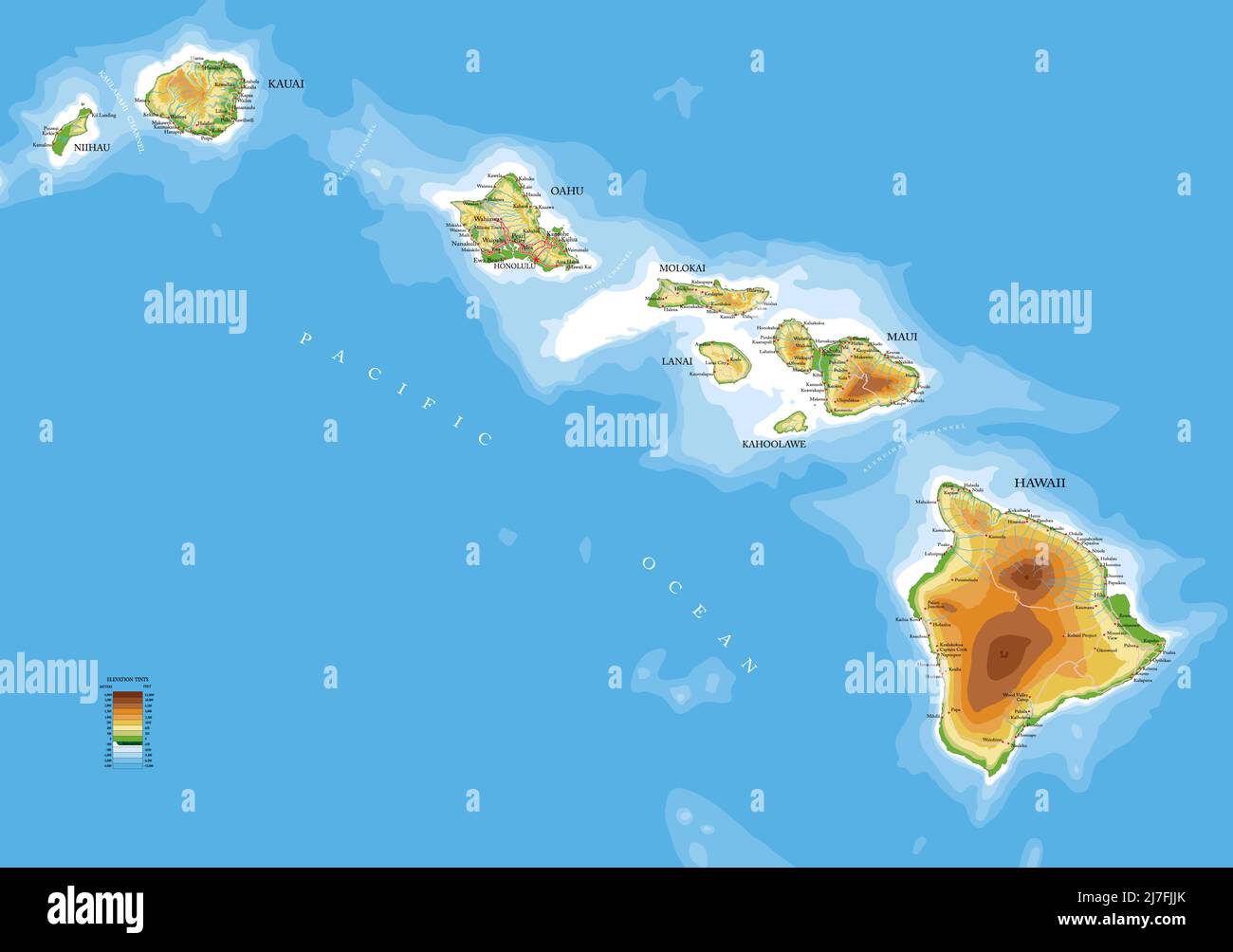 Highly detailed physical map of the Hawaii islands,in vector format,with all the relief forms,roads,regions and big cities. Stock Vectorhttps://www.alamy.com/image-license-details/?v=1https://www.alamy.com/highly-detailed-physical-map-of-the-hawaii-islandsin-vector-formatwith-all-the-relief-formsroadsregions-and-big-cities-image469326443.html
RF2J7FJJK–Highly detailed physical map of the Hawaii islands,in vector format,with all the relief forms,roads,regions and big cities.
 Océanique. Iles Sandwich #3. Hawaii Oahu Kauai Maui. VANDERMAELEN 1827 old map Stock Photohttps://www.alamy.com/image-license-details/?v=1https://www.alamy.com/ocanique-iles-sandwich-3-hawaii-oahu-kauai-maui-vandermaelen-1827-old-map-image446969578.html
RF2GY5676–Océanique. Iles Sandwich #3. Hawaii Oahu Kauai Maui. VANDERMAELEN 1827 old map
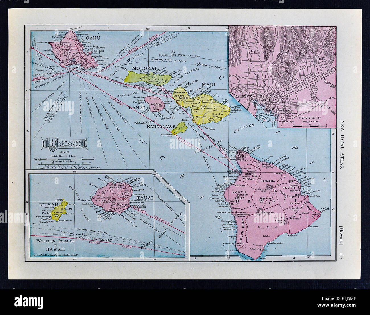 1911 McNally Map - Hawaii Islands - Oahu Honolulu Maui Stock Photohttps://www.alamy.com/image-license-details/?v=1https://www.alamy.com/stock-image-1911-mcnally-map-hawaii-islands-oahu-honolulu-maui-163898127.html
RFKEJ5MF–1911 McNally Map - Hawaii Islands - Oahu Honolulu Maui
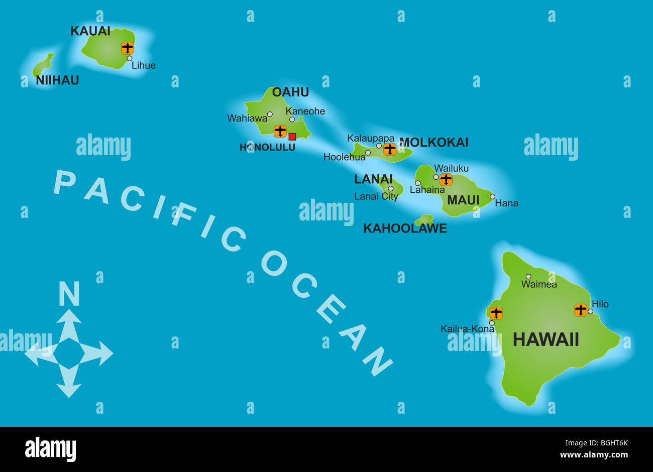 A stylized mapof the island of Hawaii and all adjacent islands. Stock Photohttps://www.alamy.com/image-license-details/?v=1https://www.alamy.com/stock-photo-a-stylized-mapof-the-island-of-hawaii-and-all-adjacent-islands-27437051.html
RFBGHT6K–A stylized mapof the island of Hawaii and all adjacent islands.
 Maui map. Map of Maui in dotted style. Borders of the island filled with rectangles for your design. Vector illustration. Stock Vectorhttps://www.alamy.com/image-license-details/?v=1https://www.alamy.com/maui-map-map-of-maui-in-dotted-style-borders-of-the-island-filled-with-rectangles-for-your-design-vector-illustration-image557121086.html
RF2RAB1HJ–Maui map. Map of Maui in dotted style. Borders of the island filled with rectangles for your design. Vector illustration.
 Lahainaluna, Maui County, US, United States, Hawaii, N 20 53' 19'', S 156 39' 33'', map, Cartascapes Map published in 2024. Explore Cartascapes, a map revealing Earth's diverse landscapes, cultures, and ecosystems. Journey through time and space, discovering the interconnectedness of our planet's past, present, and future. Stock Photohttps://www.alamy.com/image-license-details/?v=1https://www.alamy.com/lahainaluna-maui-county-us-united-states-hawaii-n-20-53-19-s-156-39-33-map-cartascapes-map-published-in-2024-explore-cartascapes-a-map-revealing-earths-diverse-landscapes-cultures-and-ecosystems-journey-through-time-and-space-discovering-the-interconnectedness-of-our-planets-past-present-and-future-image621430504.html
RM2Y30GXG–Lahainaluna, Maui County, US, United States, Hawaii, N 20 53' 19'', S 156 39' 33'', map, Cartascapes Map published in 2024. Explore Cartascapes, a map revealing Earth's diverse landscapes, cultures, and ecosystems. Journey through time and space, discovering the interconnectedness of our planet's past, present, and future.
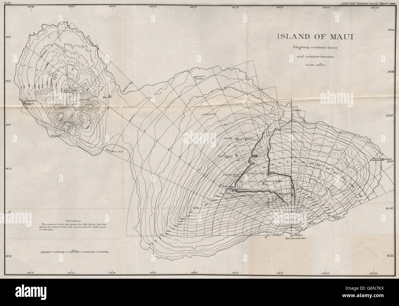 ISLAND OF MAUI: showing contour lines and compartments. Hawaii. USCGS, 1889 map Stock Photohttps://www.alamy.com/image-license-details/?v=1https://www.alamy.com/stock-photo-island-of-maui-showing-contour-lines-and-compartments-hawaii-uscgs-107417182.html
RFG6N7KX–ISLAND OF MAUI: showing contour lines and compartments. Hawaii. USCGS, 1889 map
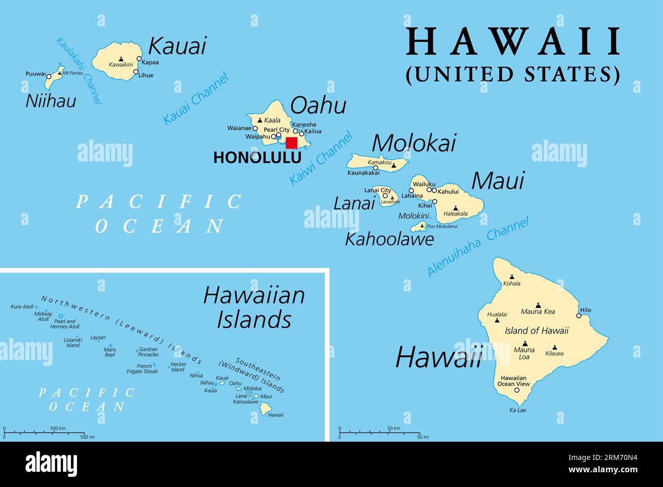 Hawaiian Islands, political map. Archipelago of eight major volcanic islands, several atolls and numerous smaller islets in the North Pacific Ocean. Stock Photohttps://www.alamy.com/image-license-details/?v=1https://www.alamy.com/hawaiian-islands-political-map-archipelago-of-eight-major-volcanic-islands-several-atolls-and-numerous-smaller-islets-in-the-north-pacific-ocean-image563179152.html
RF2RM70N4–Hawaiian Islands, political map. Archipelago of eight major volcanic islands, several atolls and numerous smaller islets in the North Pacific Ocean.
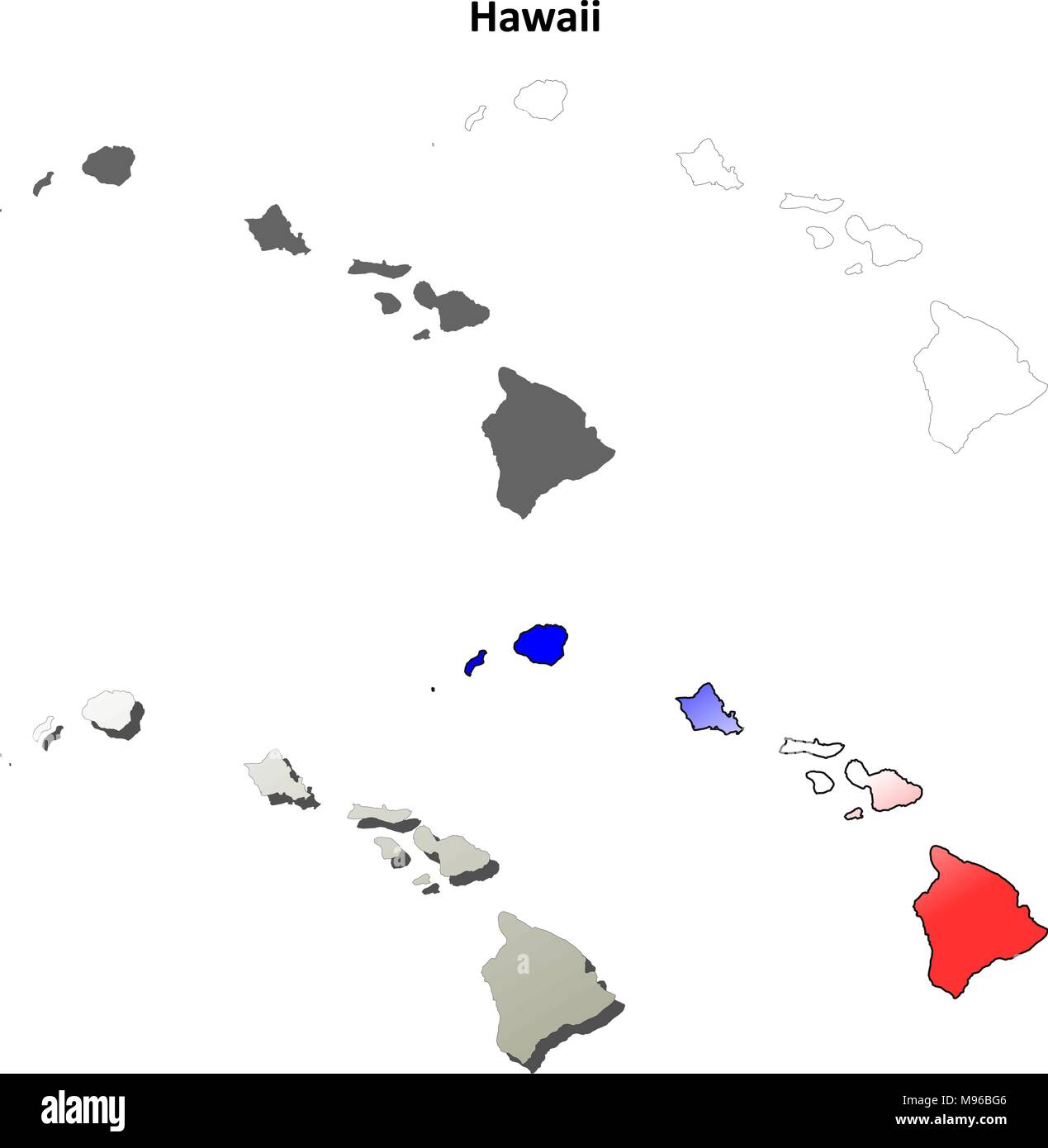 Hawaii outline map set Stock Vectorhttps://www.alamy.com/image-license-details/?v=1https://www.alamy.com/hawaii-outline-map-set-image177776374.html
RFM96BG6–Hawaii outline map set
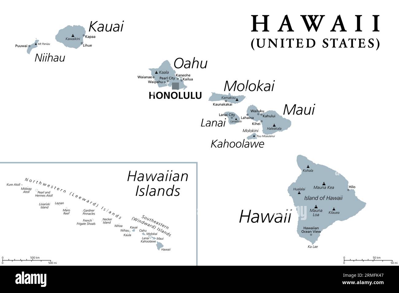 Hawaiian Islands, gray political map. Archipelago of 8 major volcanic islands, several atolls and numerous smaller islets in the North Pacific Ocean. Stock Photohttps://www.alamy.com/image-license-details/?v=1https://www.alamy.com/hawaiian-islands-gray-political-map-archipelago-of-8-major-volcanic-islands-several-atolls-and-numerous-smaller-islets-in-the-north-pacific-ocean-image563369191.html
RF2RMFK47–Hawaiian Islands, gray political map. Archipelago of 8 major volcanic islands, several atolls and numerous smaller islets in the North Pacific Ocean.
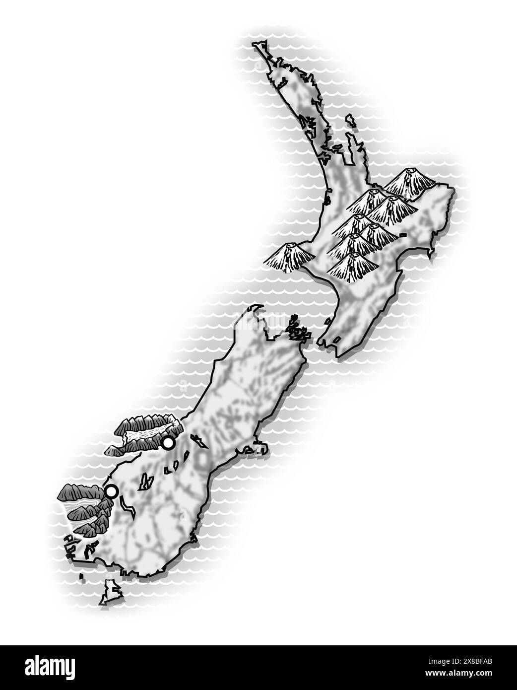 Art illustration map of New Zealand coastline showing the two main landmasses — the North Island (Te Ika-a-Māui) and the South Island (Te Waipounamu) Stock Photohttps://www.alamy.com/image-license-details/?v=1https://www.alamy.com/art-illustration-map-of-new-zealand-coastline-showing-the-two-main-landmasses-the-north-island-te-ika-a-mui-and-the-south-island-te-waipounamu-image607533651.html
RF2X8BFAB–Art illustration map of New Zealand coastline showing the two main landmasses — the North Island (Te Ika-a-Māui) and the South Island (Te Waipounamu)
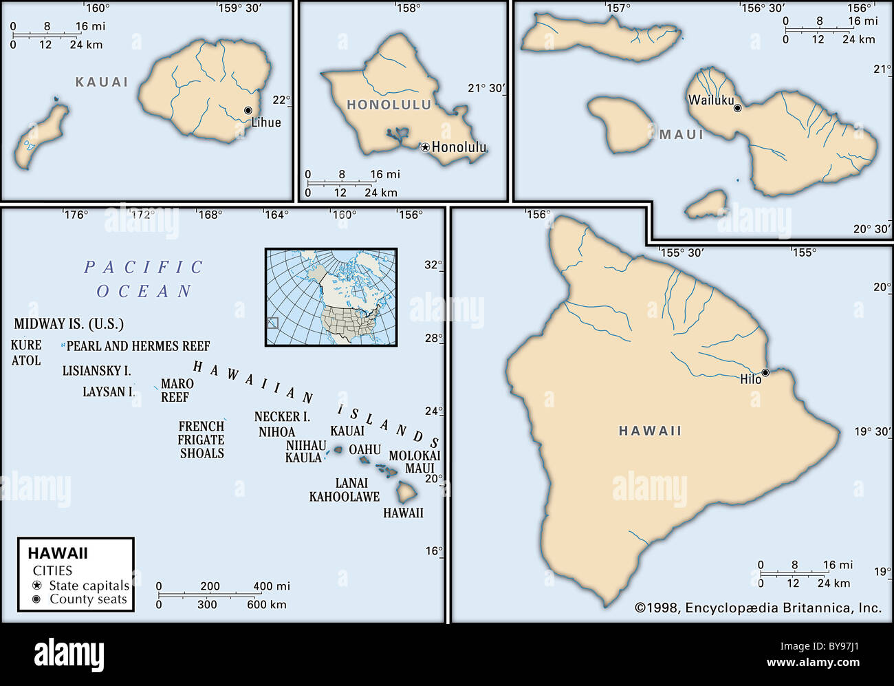 Political map of Hawaii Stock Photohttps://www.alamy.com/image-license-details/?v=1https://www.alamy.com/stock-photo-political-map-of-hawaii-34009641.html
RMBY97J1–Political map of Hawaii
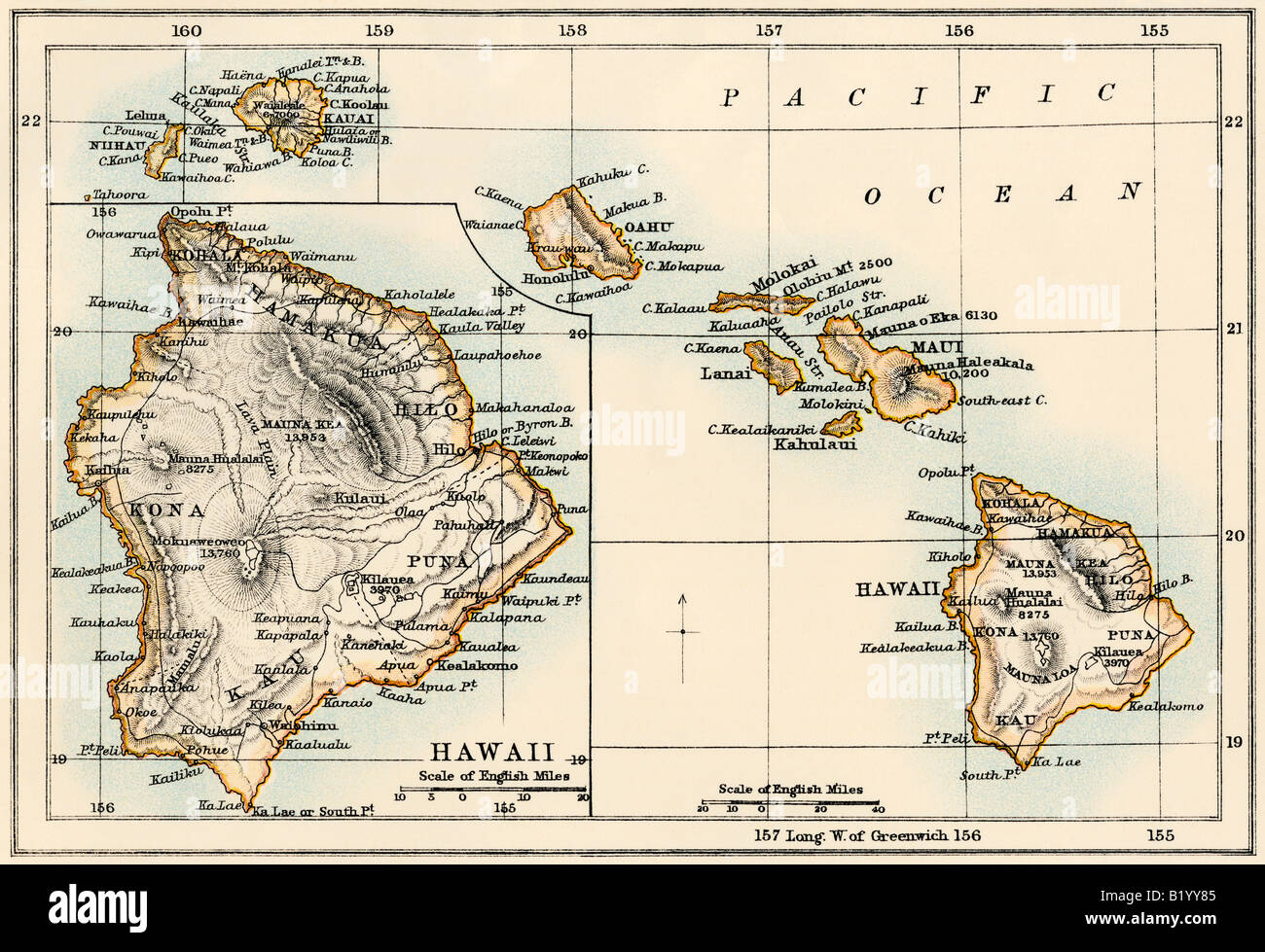 Map of the Hawaiian islands 1870s. Color lithograph Stock Photohttps://www.alamy.com/image-license-details/?v=1https://www.alamy.com/stock-photo-map-of-the-hawaiian-islands-1870s-color-lithograph-18439125.html
RMB1YY85–Map of the Hawaiian islands 1870s. Color lithograph
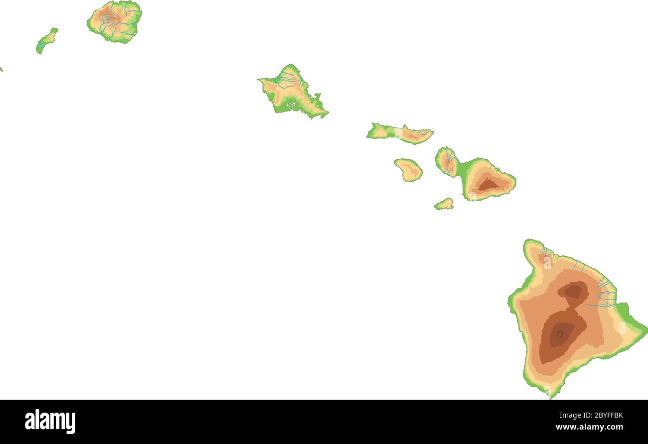 High detailed Hawaii physical map. Stock Vectorhttps://www.alamy.com/image-license-details/?v=1https://www.alamy.com/high-detailed-hawaii-physical-map-image361144439.html
RF2BYFFBK–High detailed Hawaii physical map.
 Map and flag of Maui on weathered concrete Stock Photohttps://www.alamy.com/image-license-details/?v=1https://www.alamy.com/map-and-flag-of-maui-on-weathered-concrete-image402405425.html
RF2EAK469–Map and flag of Maui on weathered concrete
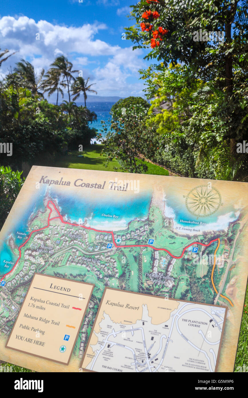 Interpretive sign with map for the Kapalua Coastal Trail in Kapalua, Maui, with Oneloa Beach in distance Stock Photohttps://www.alamy.com/image-license-details/?v=1https://www.alamy.com/stock-photo-interpretive-sign-with-map-for-the-kapalua-coastal-trail-in-kapalua-106782206.html
RMG5M9P6–Interpretive sign with map for the Kapalua Coastal Trail in Kapalua, Maui, with Oneloa Beach in distance
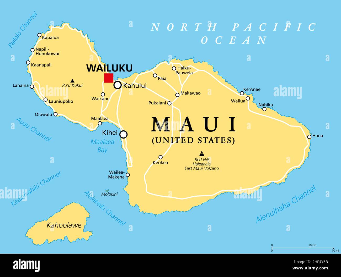 Maui, Hawaii, United States, political map, with capital Wailuku Stock Vectorhttps://www.alamy.com/image-license-details/?v=1https://www.alamy.com/maui-hawaii-united-states-political-map-with-capital-wailuku-image461101155.html
RF2HP4Y6B–Maui, Hawaii, United States, political map, with capital Wailuku
 Hawaii political map with capital Honolulu. State of the USA, located in Oceania, composed entirely of Islands. Stock Photohttps://www.alamy.com/image-license-details/?v=1https://www.alamy.com/stock-photo-hawaii-political-map-with-capital-honolulu-state-of-the-usa-located-129047701.html
RFHDXHJD–Hawaii political map with capital Honolulu. State of the USA, located in Oceania, composed entirely of Islands.
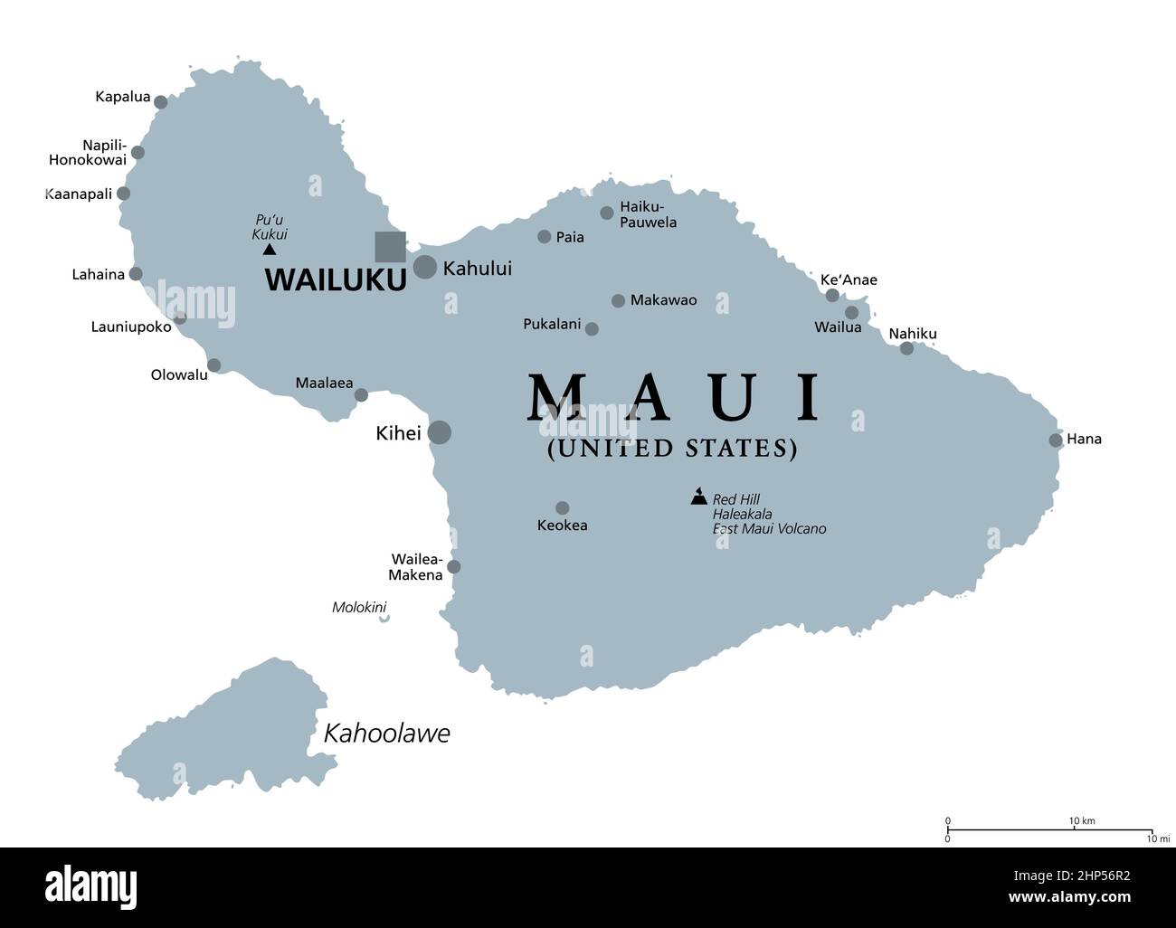 Maui, Hawaii, United States, gray political map, capital Wailuku Stock Vectorhttps://www.alamy.com/image-license-details/?v=1https://www.alamy.com/maui-hawaii-united-states-gray-political-map-capital-wailuku-image461107110.html
RF2HP56R2–Maui, Hawaii, United States, gray political map, capital Wailuku
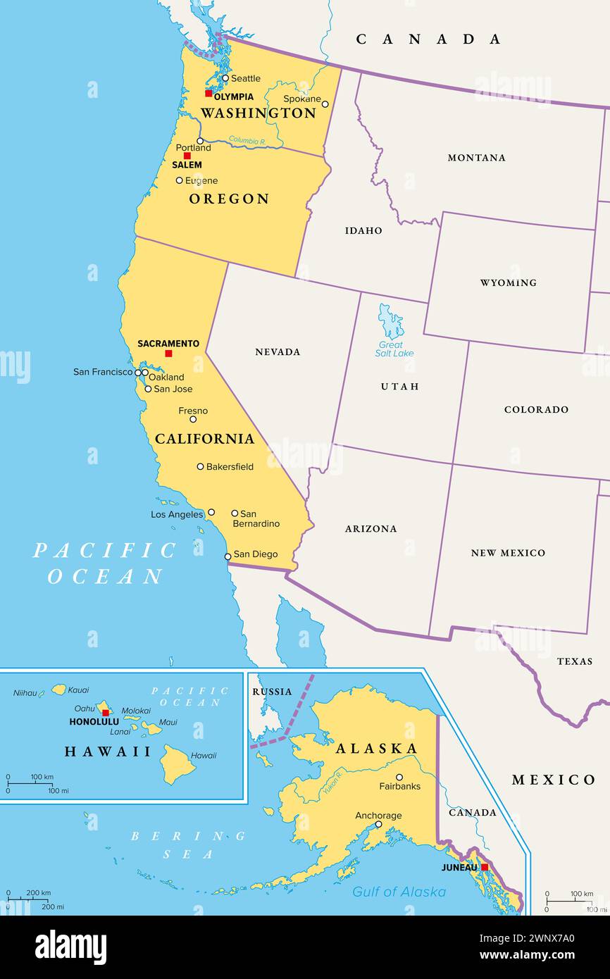 West Coast region of the United States, with Alaska and Hawaii, political map. Also known as Pacific Coast, Pacific Seaboard and Western Seaboard. Stock Photohttps://www.alamy.com/image-license-details/?v=1https://www.alamy.com/west-coast-region-of-the-united-states-with-alaska-and-hawaii-political-map-also-known-as-pacific-coast-pacific-seaboard-and-western-seaboard-image598636808.html
RF2WNX7A0–West Coast region of the United States, with Alaska and Hawaii, political map. Also known as Pacific Coast, Pacific Seaboard and Western Seaboard.
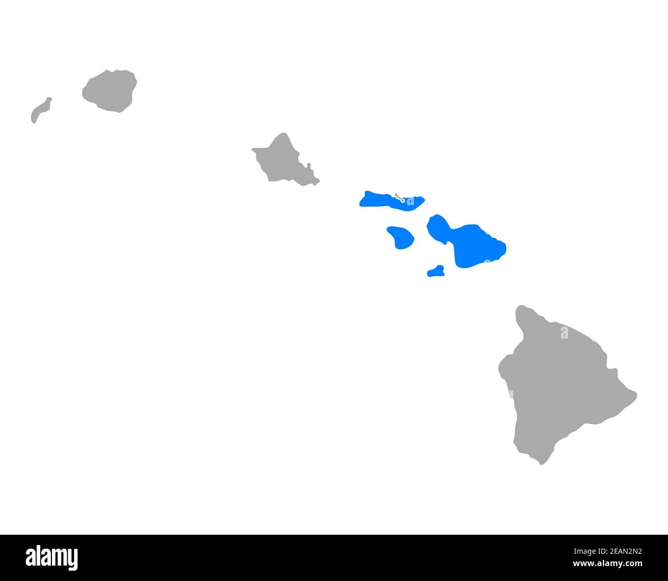 Map of Maui in Hawaii Stock Photohttps://www.alamy.com/image-license-details/?v=1https://www.alamy.com/map-of-maui-in-hawaii-image402448174.html
RF2EAN2N2–Map of Maui in Hawaii
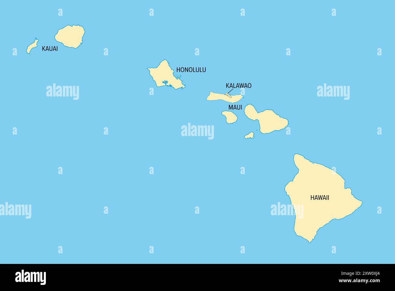 Hawaii, U.S. state, political map county names. Island state of the United States in the Pacific Ocean, subdivided into 5 counties. Stock Photohttps://www.alamy.com/image-license-details/?v=1https://www.alamy.com/hawaii-us-state-political-map-county-names-island-state-of-the-united-states-in-the-pacific-ocean-subdivided-into-5-counties-image617750172.html
RF2XW0XJ4–Hawaii, U.S. state, political map county names. Island state of the United States in the Pacific Ocean, subdivided into 5 counties.
 Maui, Hawaiian islands Stock Photohttps://www.alamy.com/image-license-details/?v=1https://www.alamy.com/maui-hawaiian-islands-image446681393.html
RM2GXM2JW–Maui, Hawaiian islands
 Maui map. Collection of map of Maui in dotted style. Borders of the island filled with rectangles for your design. Vector illustration. Stock Vectorhttps://www.alamy.com/image-license-details/?v=1https://www.alamy.com/maui-map-collection-of-map-of-maui-in-dotted-style-borders-of-the-island-filled-with-rectangles-for-your-design-vector-illustration-image556873550.html
RF2R9YNW2–Maui map. Collection of map of Maui in dotted style. Borders of the island filled with rectangles for your design. Vector illustration.
 Hana, Maui County, US, United States, Hawaii, N 20 45' 29'', S 155 59' 25'', map, Cartascapes Map published in 2024. Explore Cartascapes, a map revealing Earth's diverse landscapes, cultures, and ecosystems. Journey through time and space, discovering the interconnectedness of our planet's past, present, and future. Stock Photohttps://www.alamy.com/image-license-details/?v=1https://www.alamy.com/hana-maui-county-us-united-states-hawaii-n-20-45-29-s-155-59-25-map-cartascapes-map-published-in-2024-explore-cartascapes-a-map-revealing-earths-diverse-landscapes-cultures-and-ecosystems-journey-through-time-and-space-discovering-the-interconnectedness-of-our-planets-past-present-and-future-image621411680.html
RM2Y2YMX8–Hana, Maui County, US, United States, Hawaii, N 20 45' 29'', S 155 59' 25'', map, Cartascapes Map published in 2024. Explore Cartascapes, a map revealing Earth's diverse landscapes, cultures, and ecosystems. Journey through time and space, discovering the interconnectedness of our planet's past, present, and future.
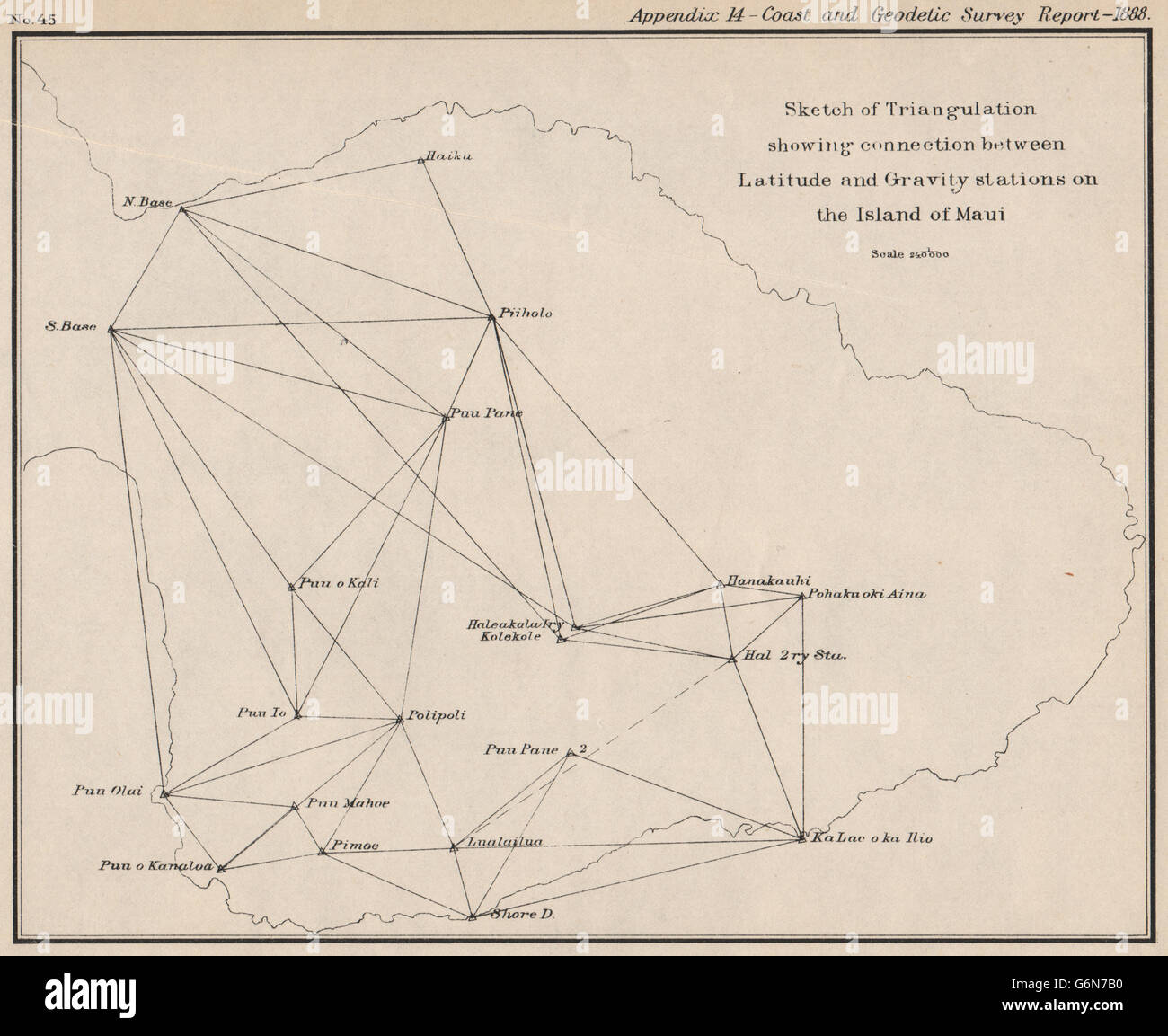 MAUI: Triangulation. Latitude & Gravity stations. Hawaii. USCGS, 1889 old map Stock Photohttps://www.alamy.com/image-license-details/?v=1https://www.alamy.com/stock-photo-maui-triangulation-latitude-gravity-stations-hawaii-uscgs-1889-old-107416932.html
RFG6N7B0–MAUI: Triangulation. Latitude & Gravity stations. Hawaii. USCGS, 1889 old map
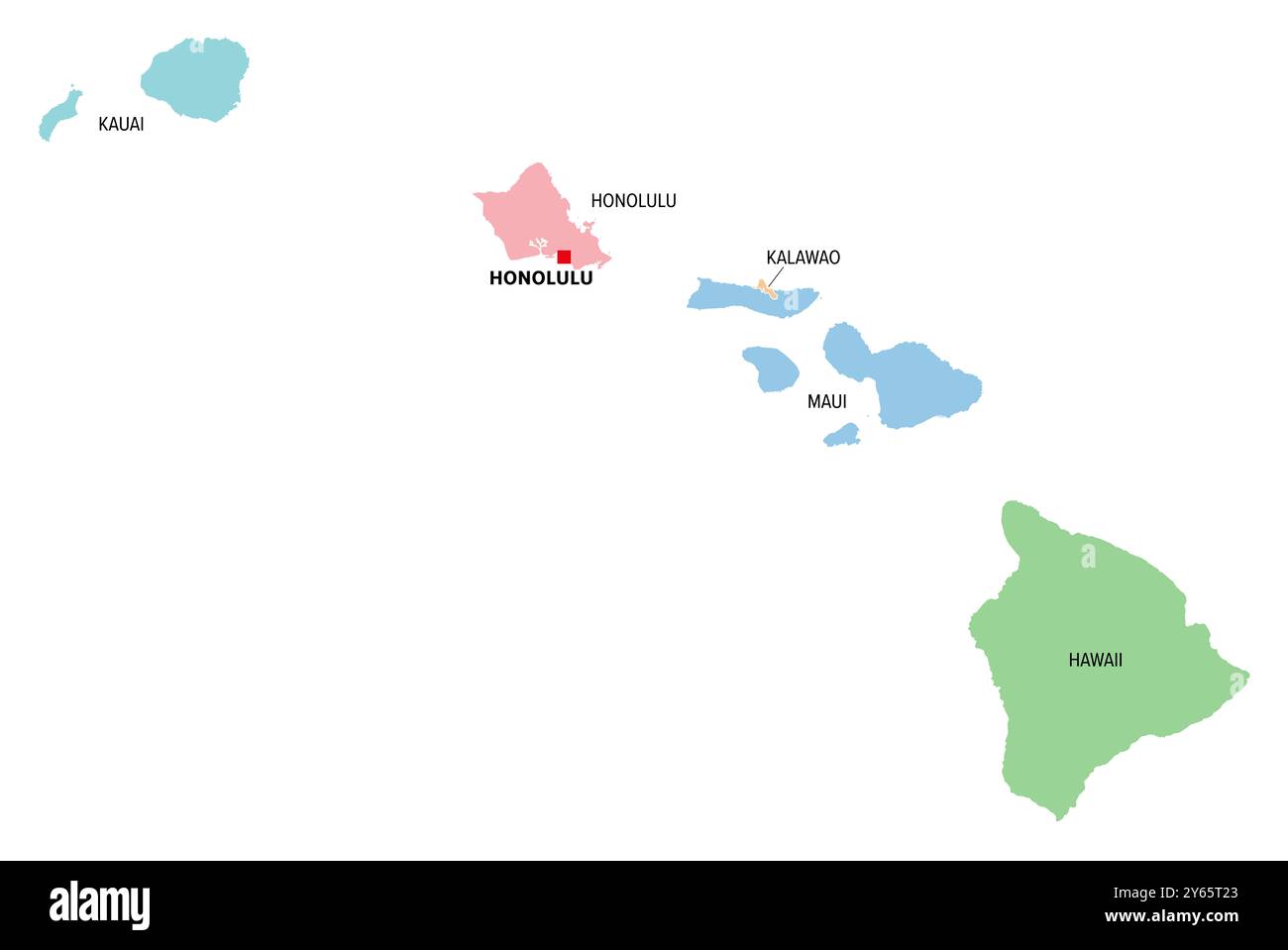 Hawaii, U.S. state, multi colored political map with capital Honolulu. Island state of the USA in the Pacific, subdivided into 5 counties. Stock Photohttps://www.alamy.com/image-license-details/?v=1https://www.alamy.com/hawaii-us-state-multi-colored-political-map-with-capital-honolulu-island-state-of-the-usa-in-the-pacific-subdivided-into-5-counties-image623389819.html
RF2Y65T23–Hawaii, U.S. state, multi colored political map with capital Honolulu. Island state of the USA in the Pacific, subdivided into 5 counties.
 HAWAIIAN ISLANDS. Oahu Molokai Maui Kahoolawe Niihau Kauai Honolulu, 1907 map Stock Photohttps://www.alamy.com/image-license-details/?v=1https://www.alamy.com/stock-photo-hawaiian-islands-oahu-molokai-maui-kahoolawe-niihau-kauai-honolulu-105597296.html
RFG3PAC0–HAWAIIAN ISLANDS. Oahu Molokai Maui Kahoolawe Niihau Kauai Honolulu, 1907 map
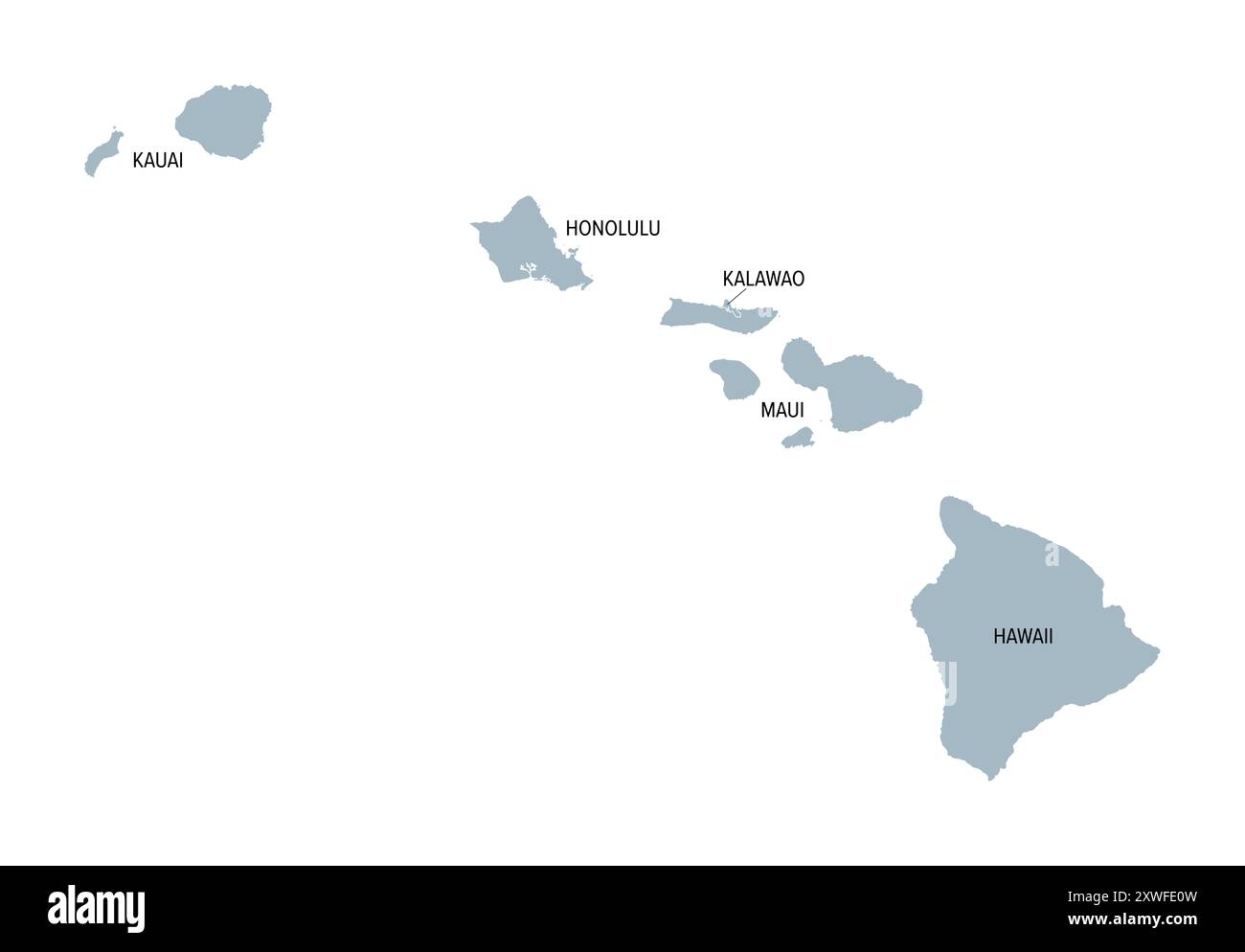 Hawaii, U.S. state, gray political map with county names. Island state of the United States in the Pacific Ocean, subdivided into 5 counties. Stock Photohttps://www.alamy.com/image-license-details/?v=1https://www.alamy.com/hawaii-us-state-gray-political-map-with-county-names-island-state-of-the-united-states-in-the-pacific-ocean-subdivided-into-5-counties-image618069561.html
RF2XWFE0W–Hawaii, U.S. state, gray political map with county names. Island state of the United States in the Pacific Ocean, subdivided into 5 counties.
 HAWAIIAN ISLANDS. Oahu Lanai Niihau Kauai Maui. Honolulu. RAND MCNALLY 1912 map Stock Photohttps://www.alamy.com/image-license-details/?v=1https://www.alamy.com/stock-photo-hawaiian-islands-oahu-lanai-niihau-kauai-maui-honolulu-rand-mcnally-123115103.html
RFH48AFY–HAWAIIAN ISLANDS. Oahu Lanai Niihau Kauai Maui. Honolulu. RAND MCNALLY 1912 map
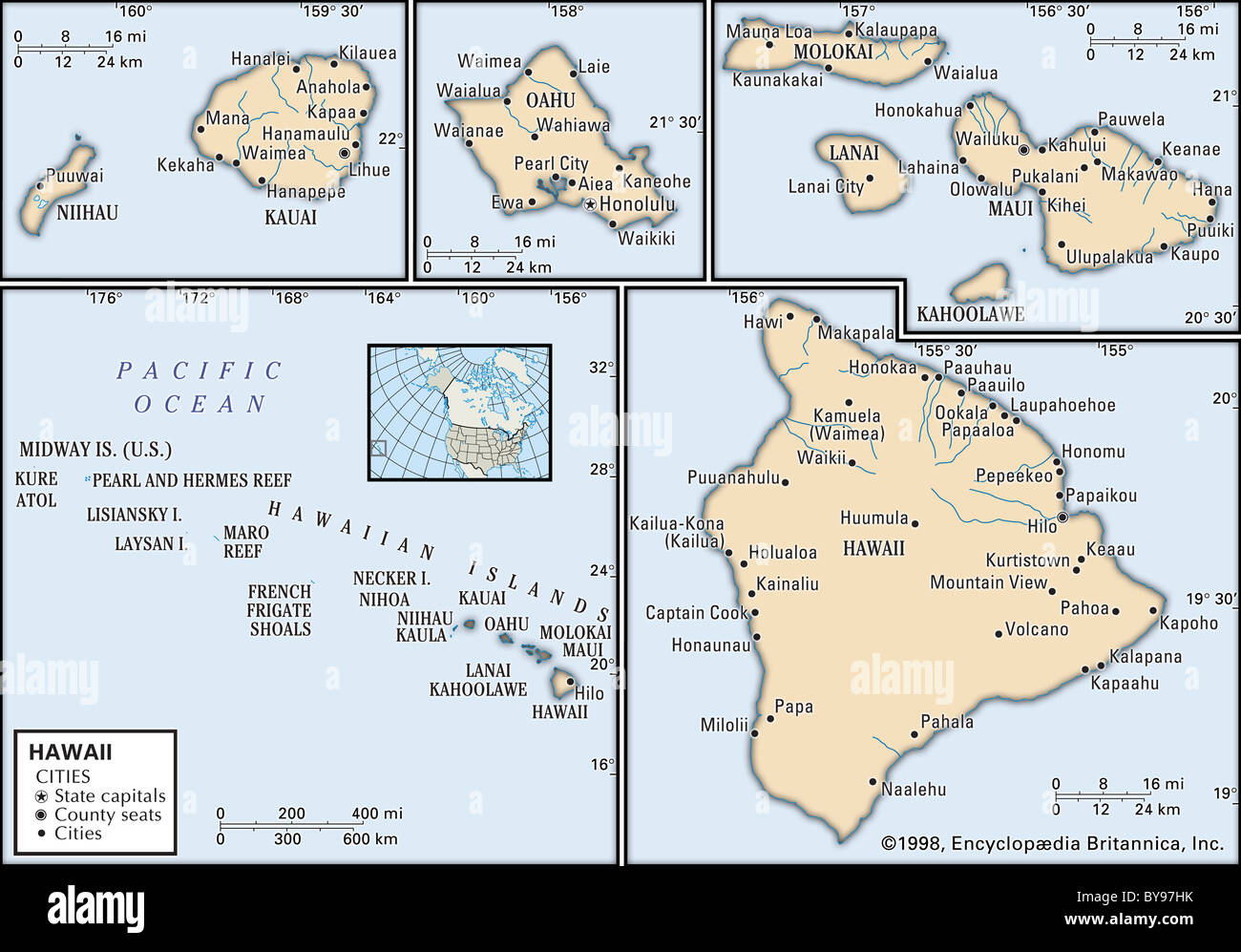 Political map of Hawaii Stock Photohttps://www.alamy.com/image-license-details/?v=1https://www.alamy.com/stock-photo-political-map-of-hawaii-34009631.html
RMBY97HK–Political map of Hawaii
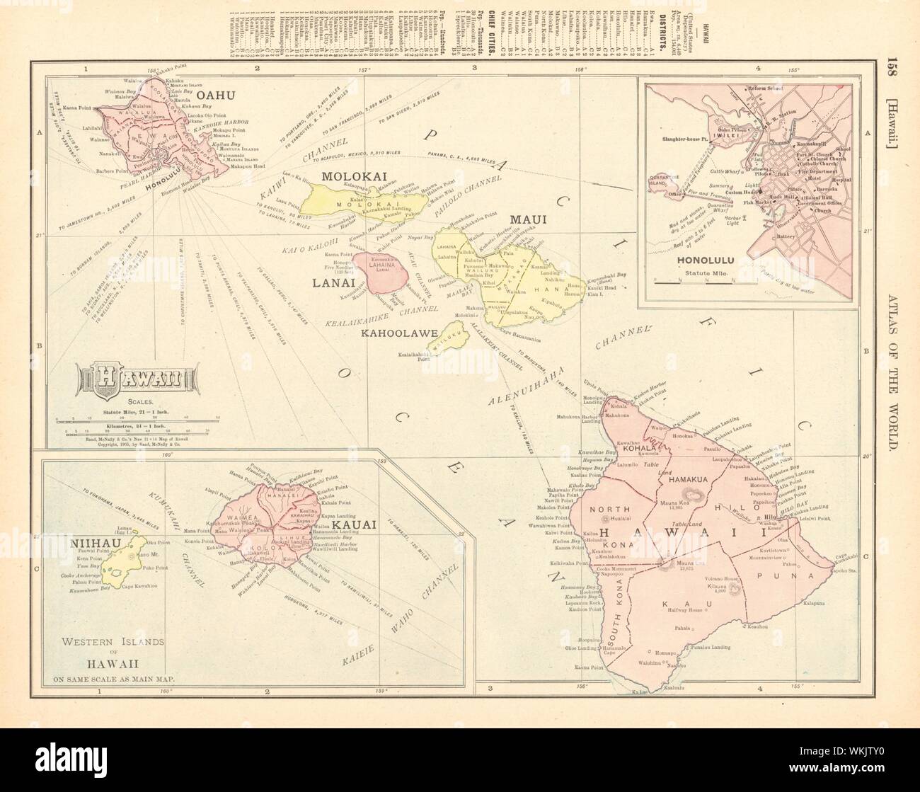 HAWAIIAN ISLANDS. Oahu Lanai Niihau Kauai Maui. Honolulu. RAND MCNALLY 1906 map Stock Photohttps://www.alamy.com/image-license-details/?v=1https://www.alamy.com/hawaiian-islands-oahu-lanai-niihau-kauai-maui-honolulu-rand-mcnally-1906-map-image270248692.html
RFWKJTY0–HAWAIIAN ISLANDS. Oahu Lanai Niihau Kauai Maui. Honolulu. RAND MCNALLY 1906 map
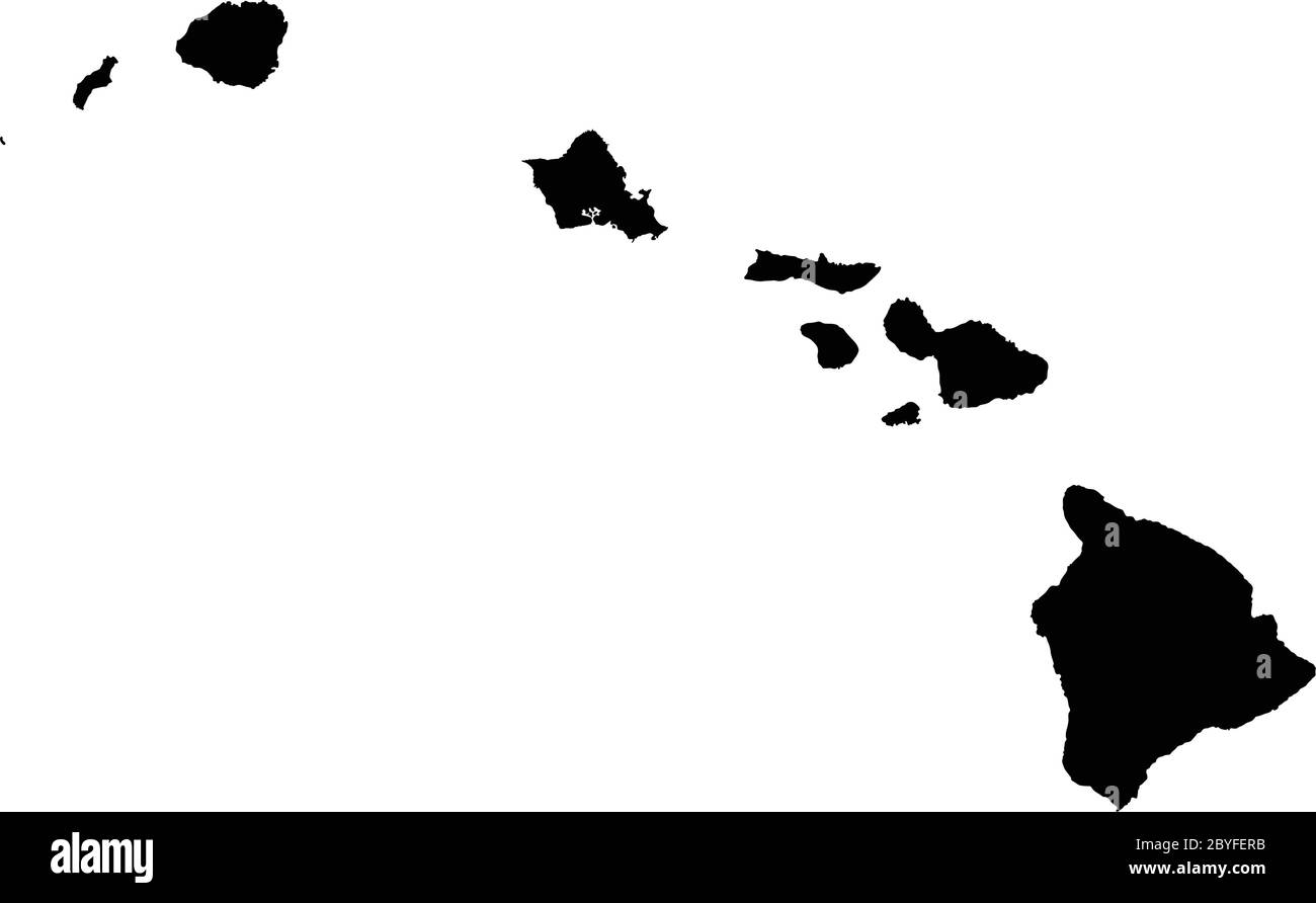 Highly Detailed Hawaii Silhouette map. Stock Vectorhttps://www.alamy.com/image-license-details/?v=1https://www.alamy.com/highly-detailed-hawaii-silhouette-map-image361143983.html
RF2BYFERB–Highly Detailed Hawaii Silhouette map.
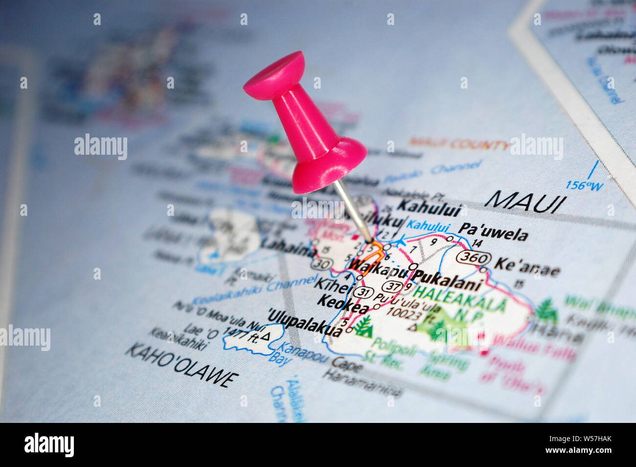 A map of Maui, Hawaii marked with a push pin. Stock Photohttps://www.alamy.com/image-license-details/?v=1https://www.alamy.com/a-map-of-maui-hawaii-marked-with-a-push-pin-image261396091.html
RFW57HAK–A map of Maui, Hawaii marked with a push pin.
 Maui, United States. 08th Aug, 2023. Wildfires glowing orange across the Hawaiian island of Maui as seen at night from the Operational Land Imager on the Landsat 8 satellite, August 8, 2023 on Maui, Hawaii, USA. The historic town of Lahaina shown to the left was devastated by the fires killing at least 56 people. The fires are considered the worst disaster to have struck Hawaii. Credit: Wanmei Liang/NASA/Alamy Live News Stock Photohttps://www.alamy.com/image-license-details/?v=1https://www.alamy.com/maui-united-states-08th-aug-2023-wildfires-glowing-orange-across-the-hawaiian-island-of-maui-as-seen-at-night-from-the-operational-land-imager-on-the-landsat-8-satellite-august-8-2023-on-maui-hawaii-usa-the-historic-town-of-lahaina-shown-to-the-left-was-devastated-by-the-fires-killing-at-least-56-people-the-fires-are-considered-the-worst-disaster-to-have-struck-hawaii-credit-wanmei-liangnasaalamy-live-news-image561100082.html
RM2RGT8TJ–Maui, United States. 08th Aug, 2023. Wildfires glowing orange across the Hawaiian island of Maui as seen at night from the Operational Land Imager on the Landsat 8 satellite, August 8, 2023 on Maui, Hawaii, USA. The historic town of Lahaina shown to the left was devastated by the fires killing at least 56 people. The fires are considered the worst disaster to have struck Hawaii. Credit: Wanmei Liang/NASA/Alamy Live News
 Hawaii map Stock Vectorhttps://www.alamy.com/image-license-details/?v=1https://www.alamy.com/stock-photo-hawaii-map-99734542.html
RFFP78BX–Hawaii map
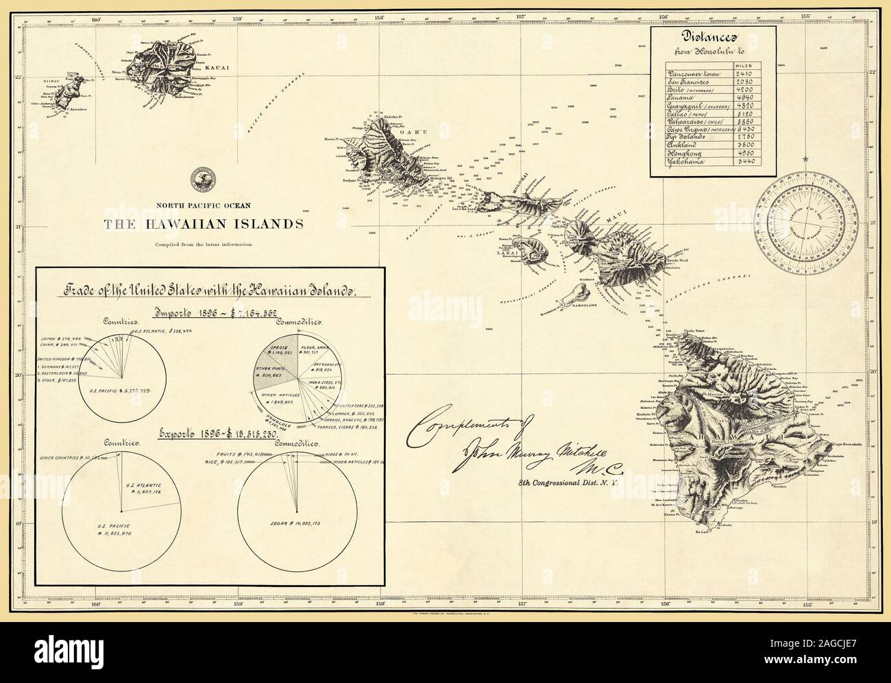 Hawaiian Islands 1896 Map produced by the Navy Hydrographic Office as a navigational aide. Stock Photohttps://www.alamy.com/image-license-details/?v=1https://www.alamy.com/hawaiian-islands-1896-map-produced-by-the-navy-hydrographic-office-as-a-navigational-aide-image337109423.html
RF2AGCJE7–Hawaiian Islands 1896 Map produced by the Navy Hydrographic Office as a navigational aide.
 map of maui Stock Photohttps://www.alamy.com/image-license-details/?v=1https://www.alamy.com/map-of-maui-image227616885.html
RFR68RJD–map of maui
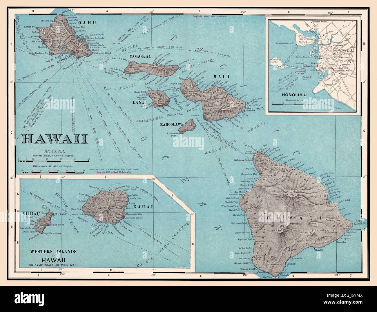 A restored, enhanced, reproduction of an 1898 antique map of the Hawaiian Islands with distances to various destinations shown. The upper right hand corner features an insert map of the city of Honolulu. Stock Photohttps://www.alamy.com/image-license-details/?v=1https://www.alamy.com/a-restored-enhanced-reproduction-of-an-1898-antique-map-of-the-hawaiian-islands-with-distances-to-various-destinations-shown-the-upper-right-hand-corner-features-an-insert-map-of-the-city-of-honolulu-image475897210.html
RM2JJ6YMX–A restored, enhanced, reproduction of an 1898 antique map of the Hawaiian Islands with distances to various destinations shown. The upper right hand corner features an insert map of the city of Honolulu.
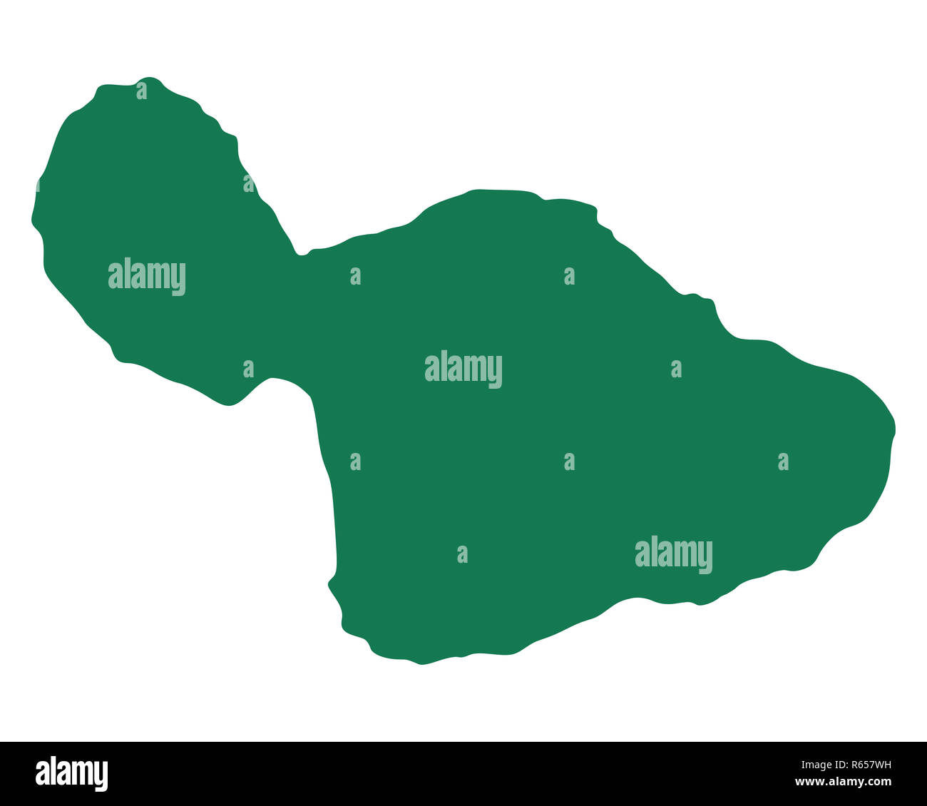 map of maui Stock Photohttps://www.alamy.com/image-license-details/?v=1https://www.alamy.com/map-of-maui-image227538685.html
RFR657WH–map of maui
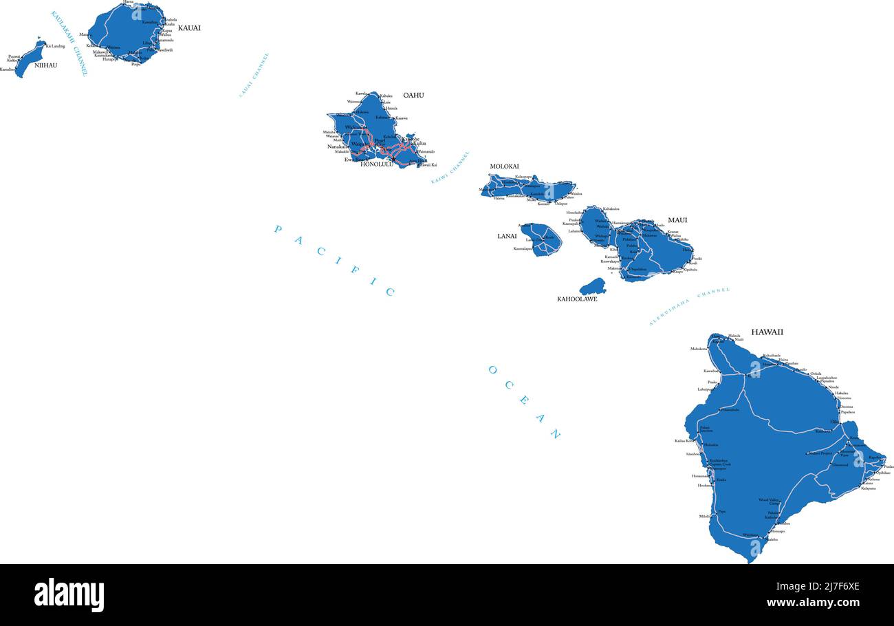 Highly detailed vector map of Hawaii with administrative regions,main cities and roads. Stock Vectorhttps://www.alamy.com/image-license-details/?v=1https://www.alamy.com/highly-detailed-vector-map-of-hawaii-with-administrative-regionsmain-cities-and-roads-image469317254.html
RF2J7F6XE–Highly detailed vector map of Hawaii with administrative regions,main cities and roads.
 map of maui Stock Photohttps://www.alamy.com/image-license-details/?v=1https://www.alamy.com/map-of-maui-image227596108.html
RFR67W4C–map of maui
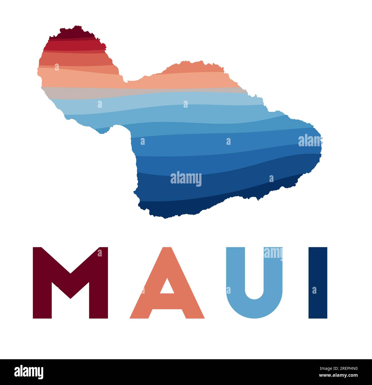 Maui map. Map of the island with beautiful geometric waves in red blue colors. Vivid Maui shape. Vector illustration. Stock Vectorhttps://www.alamy.com/image-license-details/?v=1https://www.alamy.com/maui-map-map-of-the-island-with-beautiful-geometric-waves-in-red-blue-colors-vivid-maui-shape-vector-illustration-image559833820.html
RF2REPHN0–Maui map. Map of the island with beautiful geometric waves in red blue colors. Vivid Maui shape. Vector illustration.
 Paukukalo, Maui County, US, United States, Hawaii, N 20 54' 19'', S 156 29' 5'', map, Cartascapes Map published in 2024. Explore Cartascapes, a map revealing Earth's diverse landscapes, cultures, and ecosystems. Journey through time and space, discovering the interconnectedness of our planet's past, present, and future. Stock Photohttps://www.alamy.com/image-license-details/?v=1https://www.alamy.com/paukukalo-maui-county-us-united-states-hawaii-n-20-54-19-s-156-29-5-map-cartascapes-map-published-in-2024-explore-cartascapes-a-map-revealing-earths-diverse-landscapes-cultures-and-ecosystems-journey-through-time-and-space-discovering-the-interconnectedness-of-our-planets-past-present-and-future-image621250496.html
RM2Y2MB9M–Paukukalo, Maui County, US, United States, Hawaii, N 20 54' 19'', S 156 29' 5'', map, Cartascapes Map published in 2024. Explore Cartascapes, a map revealing Earth's diverse landscapes, cultures, and ecosystems. Journey through time and space, discovering the interconnectedness of our planet's past, present, and future.
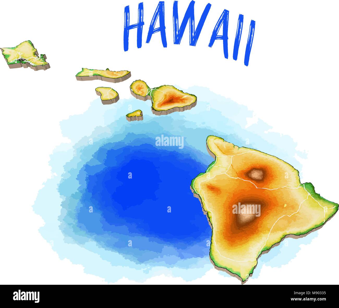 3D Map of Hawaii - Topographic Vector Illustration. Use for Travel Marketing and Print Production. Stock Vectorhttps://www.alamy.com/image-license-details/?v=1https://www.alamy.com/stock-photo-3d-map-of-hawaii-topographic-vector-illustration-use-for-travel-marketing-177638025.html
RFM90335–3D Map of Hawaii - Topographic Vector Illustration. Use for Travel Marketing and Print Production.
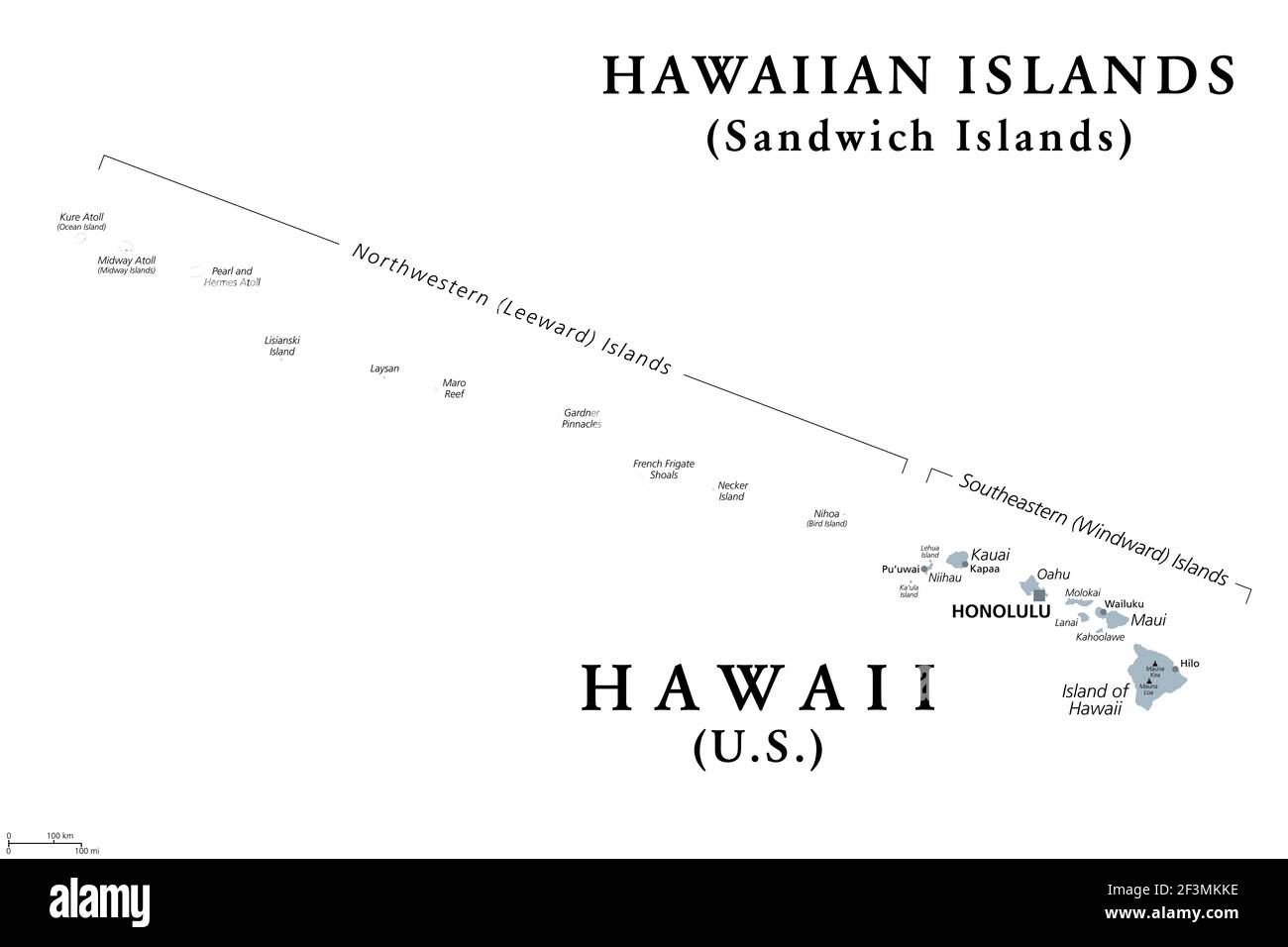 Hawaiian Islands, Sandwich Islands, gray political map. U.S. state of Hawaii with capital Honolulu, and unincorporated territory Midway Atoll. Stock Photohttps://www.alamy.com/image-license-details/?v=1https://www.alamy.com/hawaiian-islands-sandwich-islands-gray-political-map-us-state-of-hawaii-with-capital-honolulu-and-unincorporated-territory-midway-atoll-image415347282.html
RF2F3MKKE–Hawaiian Islands, Sandwich Islands, gray political map. U.S. state of Hawaii with capital Honolulu, and unincorporated territory Midway Atoll.
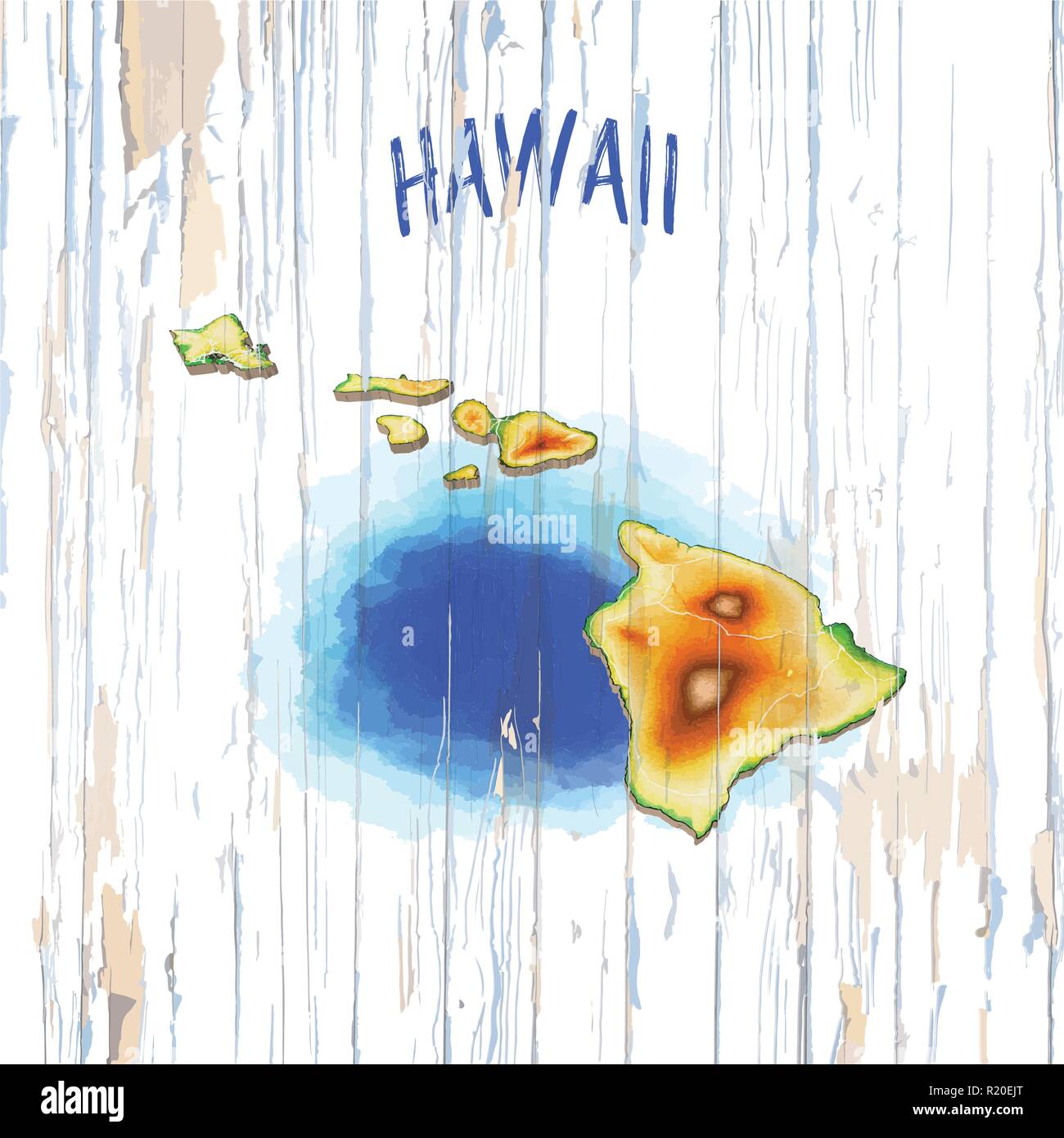 Vintage map of Hawaii. Vector illustration template for wall art and marketing in square format. Stock Vectorhttps://www.alamy.com/image-license-details/?v=1https://www.alamy.com/vintage-map-of-hawaii-vector-illustration-template-for-wall-art-and-marketing-in-square-format-image224975600.html
RFR20EJT–Vintage map of Hawaii. Vector illustration template for wall art and marketing in square format.
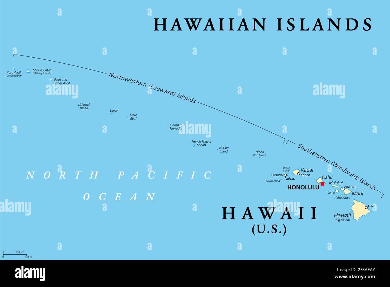 Hawaiian Islands, political map. U.S. state of Hawaii with capital Honolulu and the unincorporated territory Midway Island. Archipelago in the Pacific Stock Photohttps://www.alamy.com/image-license-details/?v=1https://www.alamy.com/hawaiian-islands-political-map-us-state-of-hawaii-with-capital-honolulu-and-the-unincorporated-territory-midway-island-archipelago-in-the-pacific-image415123603.html
RF2F3AEAY–Hawaiian Islands, political map. U.S. state of Hawaii with capital Honolulu and the unincorporated territory Midway Island. Archipelago in the Pacific
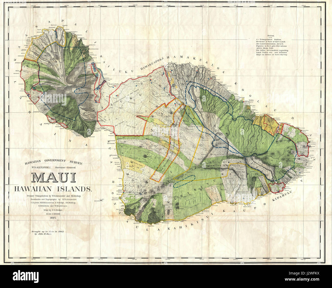 1885 De Witt Alexander Wall Map of Maui, Hawaii - Geographicus - Maui-lo-1885 Stock Photohttps://www.alamy.com/image-license-details/?v=1https://www.alamy.com/stock-photo-1885-de-witt-alexander-wall-map-of-maui-hawaii-geographicus-maui-lo-139473374.html
RMJ2WFKX–1885 De Witt Alexander Wall Map of Maui, Hawaii - Geographicus - Maui-lo-1885
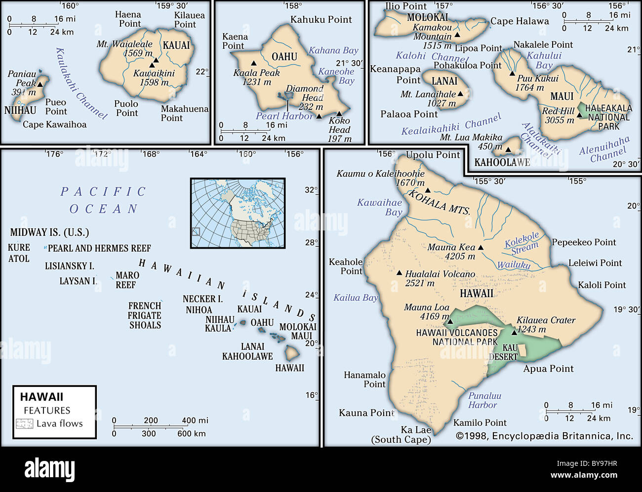 Physical map of Hawaii Stock Photohttps://www.alamy.com/image-license-details/?v=1https://www.alamy.com/stock-photo-physical-map-of-hawaii-34009635.html
RMBY97HR–Physical map of Hawaii
 Closeup of Hawaiian Islands on a world globe. Deliberate Shallow depth of field Stock Photohttps://www.alamy.com/image-license-details/?v=1https://www.alamy.com/closeup-of-hawaiian-islands-on-a-world-globe-deliberate-shallow-depth-of-field-image546451309.html
RF2PN1065–Closeup of Hawaiian Islands on a world globe. Deliberate Shallow depth of field
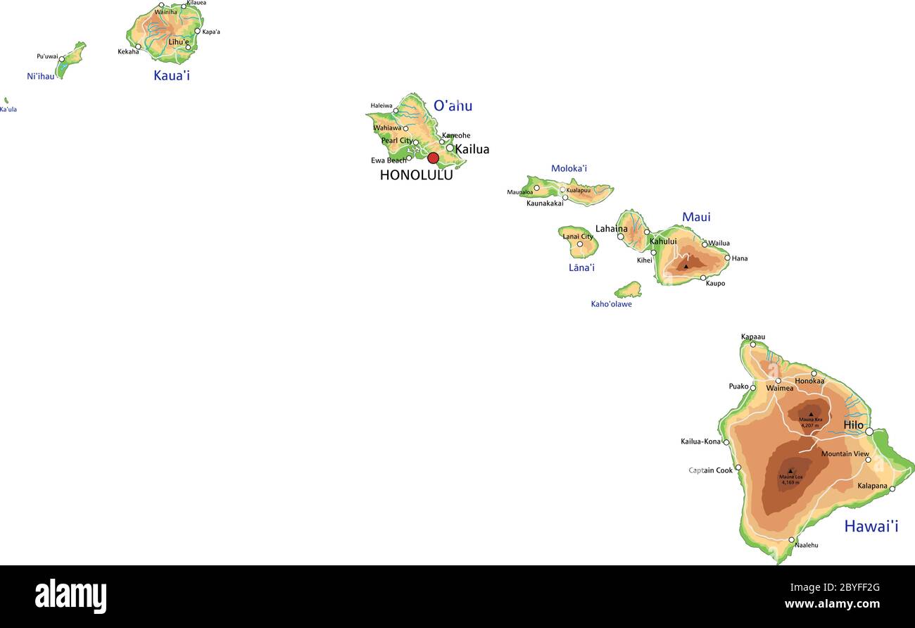 High detailed Hawaii physical map with labeling. Stock Vectorhttps://www.alamy.com/image-license-details/?v=1https://www.alamy.com/high-detailed-hawaii-physical-map-with-labeling-image361144184.html
RF2BYFF2G–High detailed Hawaii physical map with labeling.
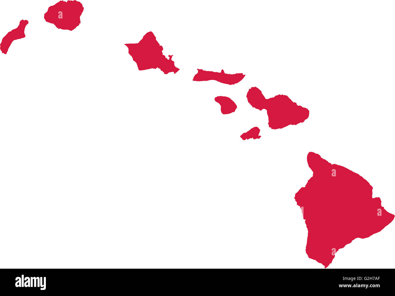 Hawaii map Stock Photohttps://www.alamy.com/image-license-details/?v=1https://www.alamy.com/stock-photo-hawaii-map-104870487.html
RFG2H7AF–Hawaii map
 Map and flag of Maui on felt Stock Photohttps://www.alamy.com/image-license-details/?v=1https://www.alamy.com/map-and-flag-of-maui-on-felt-image385956858.html
RF2DBWRWE–Map and flag of Maui on felt
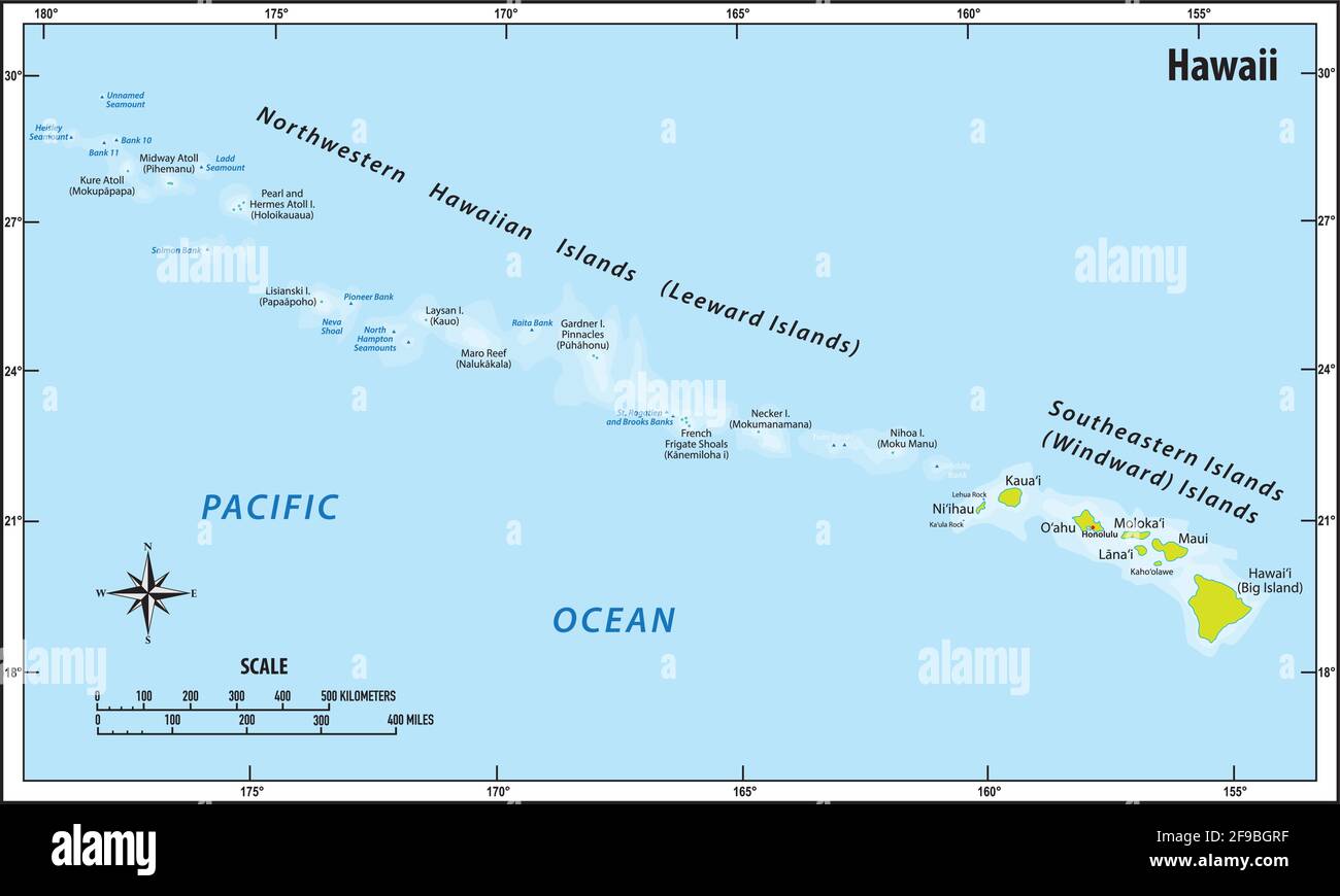 vector map of the pacific hawaii archipelago Stock Vectorhttps://www.alamy.com/image-license-details/?v=1https://www.alamy.com/vector-map-of-the-pacific-hawaii-archipelago-image418835411.html
RF2F9BGRF–vector map of the pacific hawaii archipelago
 Maui Island in the North Pacific Ocean on a colored elevation map Stock Photohttps://www.alamy.com/image-license-details/?v=1https://www.alamy.com/maui-island-in-the-north-pacific-ocean-on-a-colored-elevation-map-image619520313.html
RF2XYWGDD–Maui Island in the North Pacific Ocean on a colored elevation map
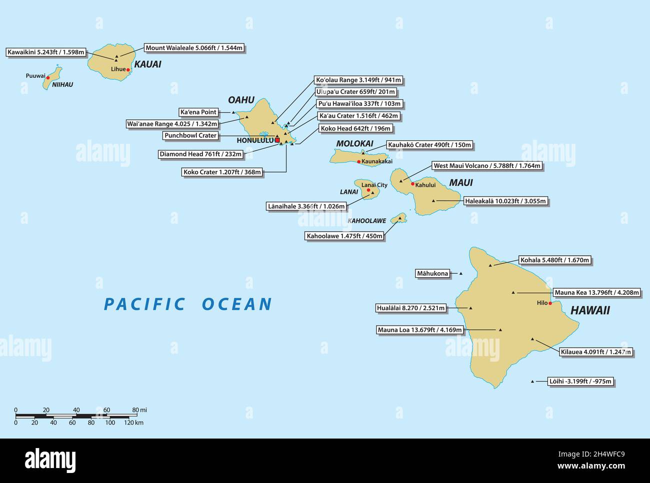 vector map of the Hawaii archipelago with the most important volcanoes Stock Vectorhttps://www.alamy.com/image-license-details/?v=1https://www.alamy.com/vector-map-of-the-hawaii-archipelago-with-the-most-important-volcanoes-image450489097.html
RF2H4WFC9–vector map of the Hawaii archipelago with the most important volcanoes
 High quality map of Maui is the island of United States Stock Vectorhttps://www.alamy.com/image-license-details/?v=1https://www.alamy.com/high-quality-map-of-maui-is-the-island-of-united-states-image223920609.html
RFR08D0H–High quality map of Maui is the island of United States
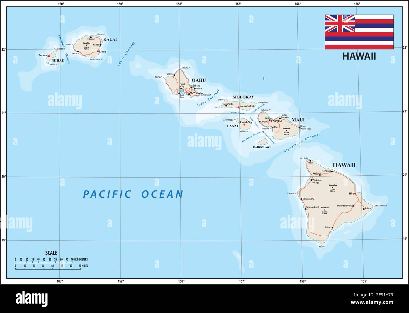 Vector map of the U.S. state of Hawaii with Flag. jpg Stock Vectorhttps://www.alamy.com/image-license-details/?v=1https://www.alamy.com/vector-map-of-the-us-state-of-hawaii-with-flag-jpg-image418009405.html
RF2F81Y79–Vector map of the U.S. state of Hawaii with Flag. jpg
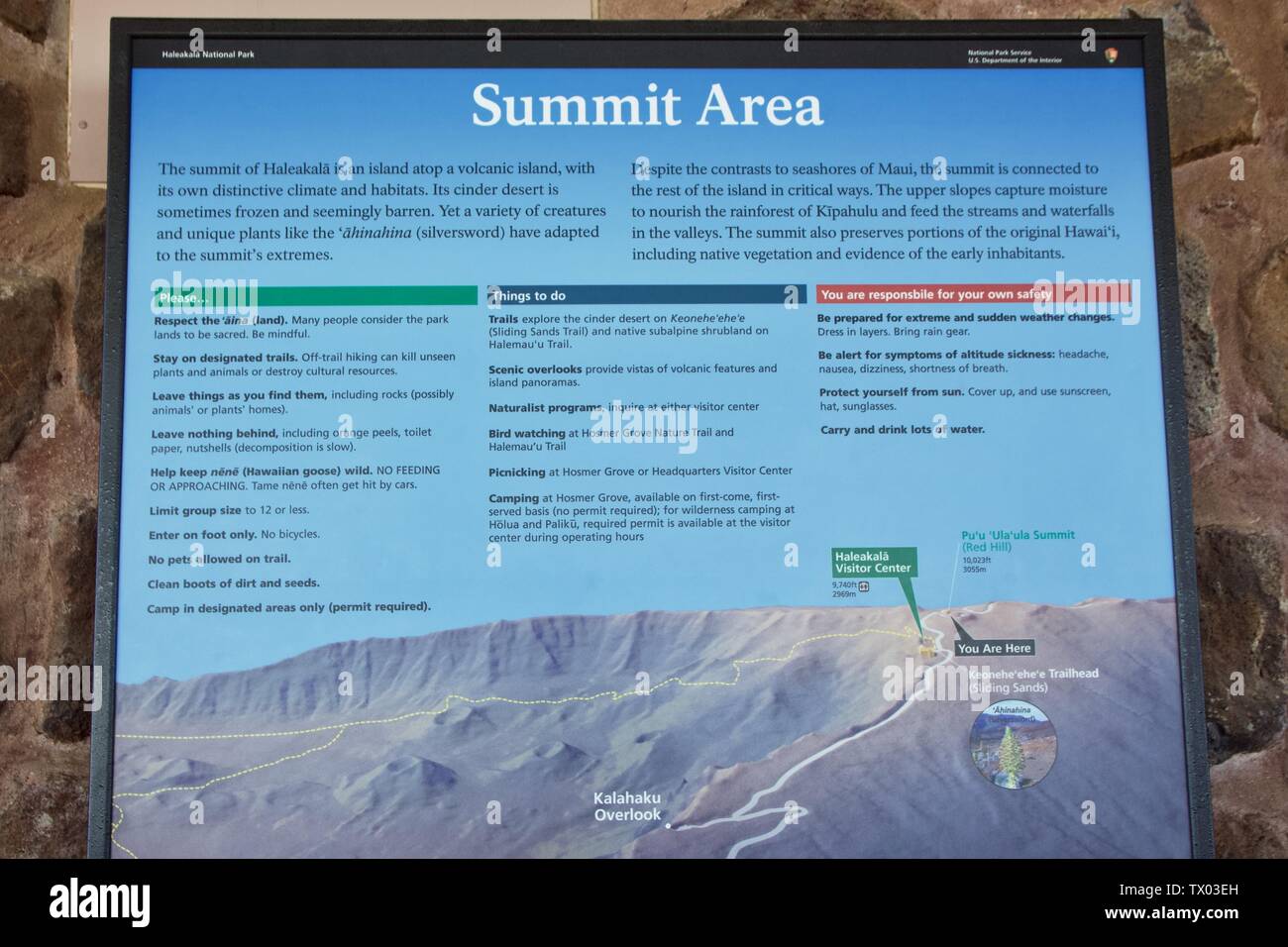 Haleakala National Park map and summit information in Maui, Hawaii Stock Photohttps://www.alamy.com/image-license-details/?v=1https://www.alamy.com/haleakala-national-park-map-and-summit-information-in-maui-hawaii-image256928969.html
RFTX03EH–Haleakala National Park map and summit information in Maui, Hawaii
 Map of Maui Stock Photohttps://www.alamy.com/image-license-details/?v=1https://www.alamy.com/stock-photo-map-of-maui-126061701.html
RFH92GYH–Map of Maui
 Vector polygonal Maui map. Vibrant geometric island in low poly style. Neat illustration for your infographics. Technology, internet, network concept. Stock Vectorhttps://www.alamy.com/image-license-details/?v=1https://www.alamy.com/vector-polygonal-maui-map-vibrant-geometric-island-in-low-poly-style-neat-illustration-for-your-infographics-technology-internet-network-concept-image561941636.html
RF2RJ6J84–Vector polygonal Maui map. Vibrant geometric island in low poly style. Neat illustration for your infographics. Technology, internet, network concept.
 Kahana, Maui County, US, United States, Hawaii, N 20 58' 34'', S 156 40' 39'', map, Cartascapes Map published in 2024. Explore Cartascapes, a map revealing Earth's diverse landscapes, cultures, and ecosystems. Journey through time and space, discovering the interconnectedness of our planet's past, present, and future. Stock Photohttps://www.alamy.com/image-license-details/?v=1https://www.alamy.com/kahana-maui-county-us-united-states-hawaii-n-20-58-34-s-156-40-39-map-cartascapes-map-published-in-2024-explore-cartascapes-a-map-revealing-earths-diverse-landscapes-cultures-and-ecosystems-journey-through-time-and-space-discovering-the-interconnectedness-of-our-planets-past-present-and-future-image621233319.html
RM2Y2KHC7–Kahana, Maui County, US, United States, Hawaii, N 20 58' 34'', S 156 40' 39'', map, Cartascapes Map published in 2024. Explore Cartascapes, a map revealing Earth's diverse landscapes, cultures, and ecosystems. Journey through time and space, discovering the interconnectedness of our planet's past, present, and future.
 Research divers from the MOC Marine Institute map out coral damage at Molokini Marine Preserve off the island of Maui, Hawaii. In the future, data fr Stock Photohttps://www.alamy.com/image-license-details/?v=1https://www.alamy.com/research-divers-from-the-moc-marine-institute-map-out-coral-damage-at-molokini-marine-preserve-off-the-island-of-maui-hawaii-in-the-future-data-fr-image335269705.html
RM2ADCRX1–Research divers from the MOC Marine Institute map out coral damage at Molokini Marine Preserve off the island of Maui, Hawaii. In the future, data fr
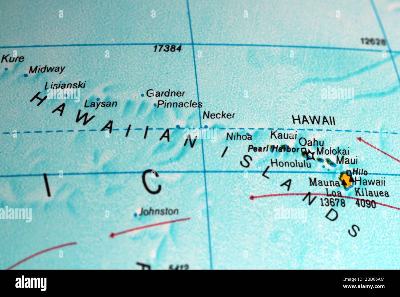 Hawaiian Islands map on old atlas Stock Photohttps://www.alamy.com/image-license-details/?v=1https://www.alamy.com/hawaiian-islands-map-on-old-atlas-image351105292.html
RF2BB66AM–Hawaiian Islands map on old atlas
 10 1885 De Witt Alexander Wall Map of Maui, Hawaii - Geographicus - Maui-lo-1885 Stock Photohttps://www.alamy.com/image-license-details/?v=1https://www.alamy.com/10-1885-de-witt-alexander-wall-map-of-maui-hawaii-geographicus-maui-lo-1885-image214210974.html
RMPCE47X–10 1885 De Witt Alexander Wall Map of Maui, Hawaii - Geographicus - Maui-lo-1885
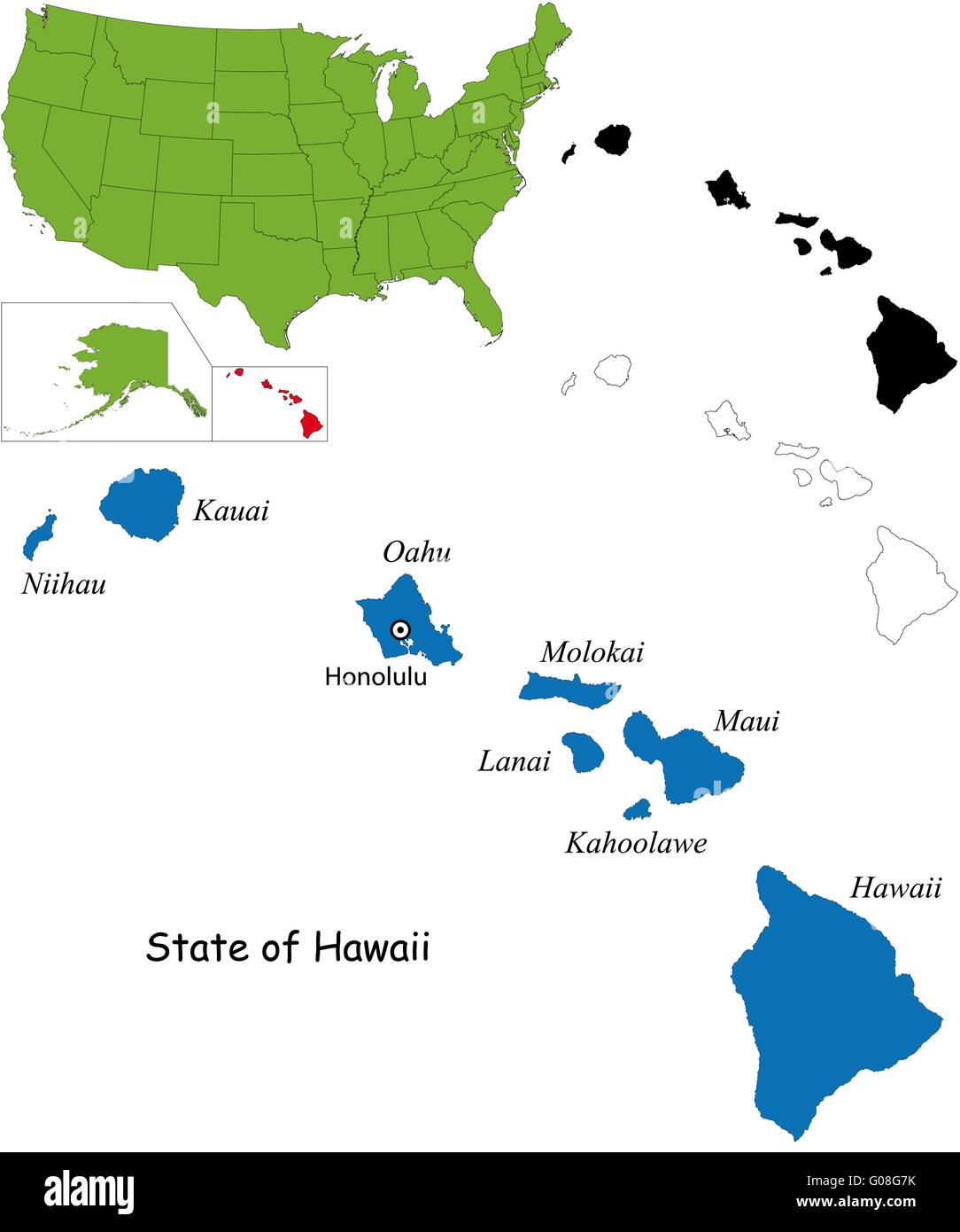 Hawaii map Stock Photohttps://www.alamy.com/image-license-details/?v=1https://www.alamy.com/stock-photo-hawaii-map-103450583.html
RMG08G7K–Hawaii map
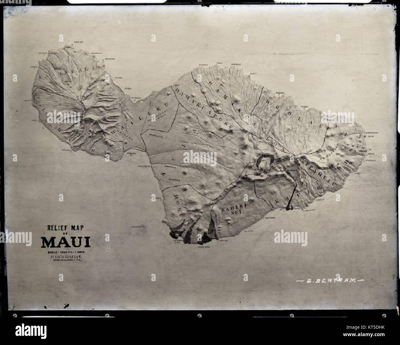 Relief Map of Maui (b) photograph by Brother Bertram Stock Photohttps://www.alamy.com/image-license-details/?v=1https://www.alamy.com/stock-image-relief-map-of-maui-b-photograph-by-brother-bertram-169765503.html
RMKT5DHK–Relief Map of Maui (b) photograph by Brother Bertram
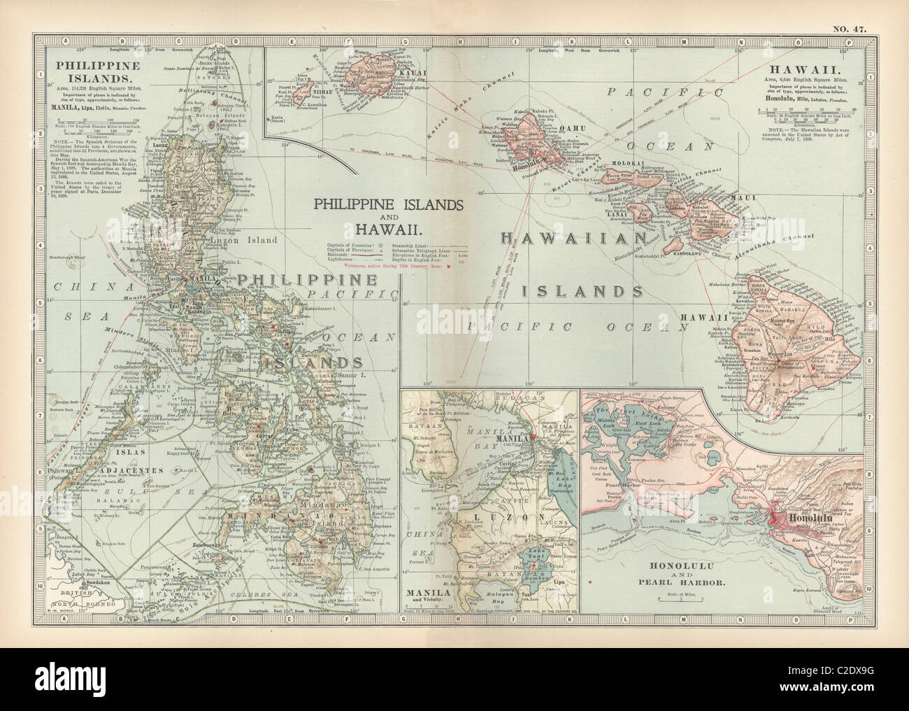 Map of Philippine Islands with Hawaii Stock Photohttps://www.alamy.com/image-license-details/?v=1https://www.alamy.com/stock-photo-map-of-philippine-islands-with-hawaii-35956076.html
RMC2DX9G–Map of Philippine Islands with Hawaii
 Hawaii line art map Stock Vectorhttps://www.alamy.com/image-license-details/?v=1https://www.alamy.com/hawaii-line-art-map-image245524339.html
RFT7CGPB–Hawaii line art map
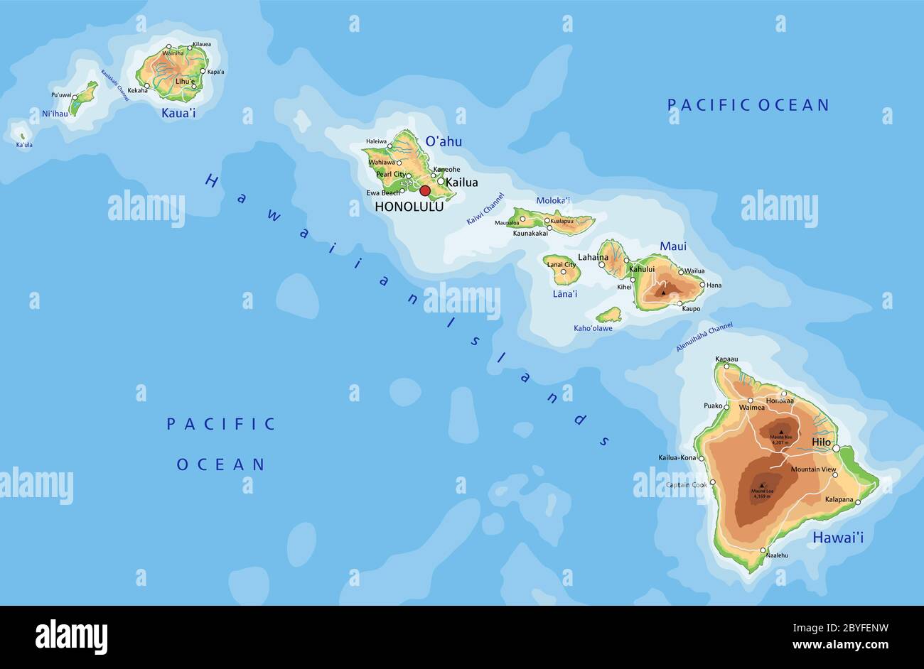 High detailed Hawaii physical map with labeling. Stock Vectorhttps://www.alamy.com/image-license-details/?v=1https://www.alamy.com/high-detailed-hawaii-physical-map-with-labeling-image361143941.html
RF2BYFENW–High detailed Hawaii physical map with labeling.
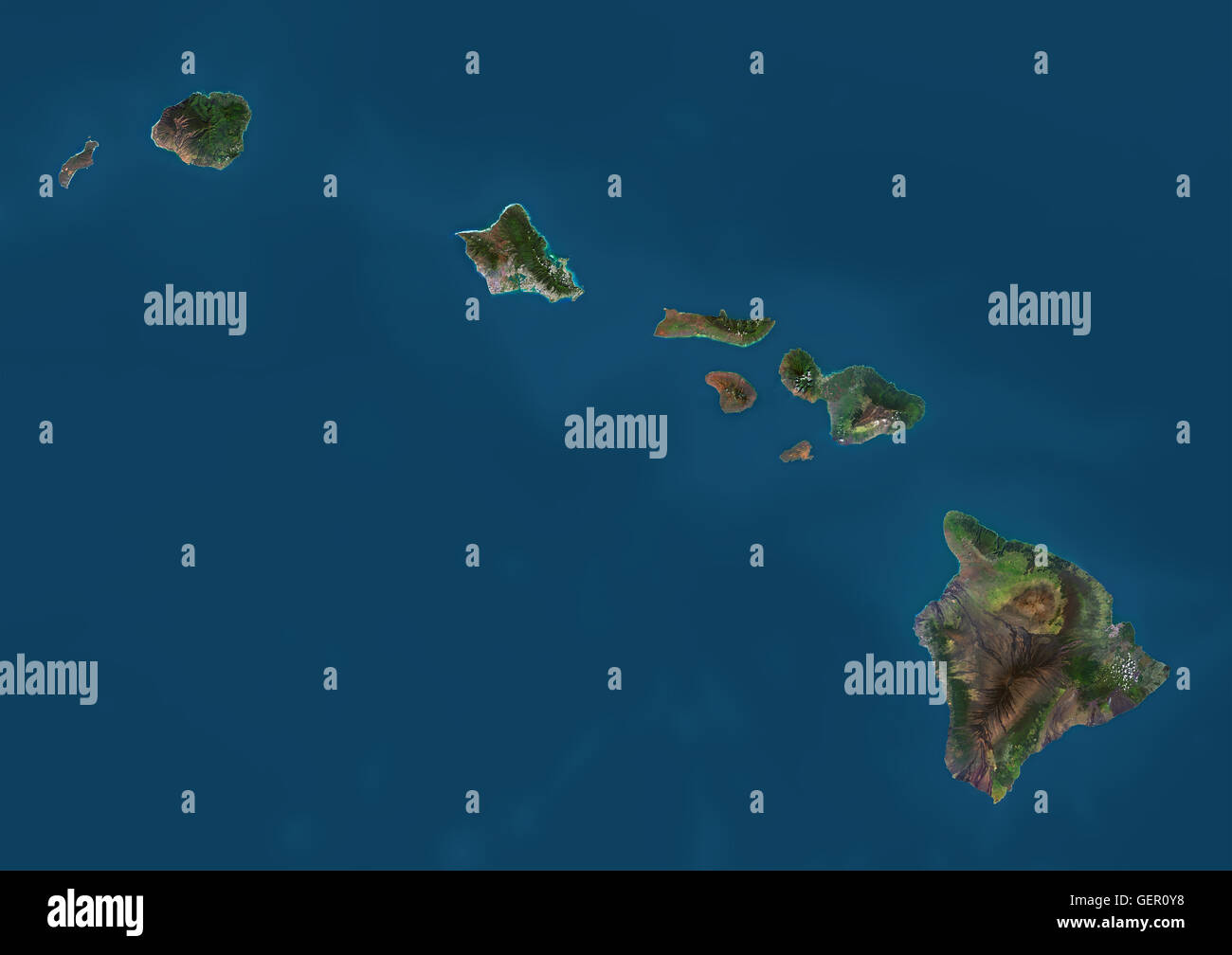 Satellite view of the State of Hawaii, USA. The main islands are Kauai, Oahu, Maui and the Island of Hawaii. This image was compiled from data acquired by Landsat 8 satellite in 2014. Stock Photohttps://www.alamy.com/image-license-details/?v=1https://www.alamy.com/stock-photo-satellite-view-of-the-state-of-hawaii-usa-the-main-islands-are-kauai-112373052.html
RMGER0Y8–Satellite view of the State of Hawaii, USA. The main islands are Kauai, Oahu, Maui and the Island of Hawaii. This image was compiled from data acquired by Landsat 8 satellite in 2014.
 Map of Maui on dark slate Stock Photohttps://www.alamy.com/image-license-details/?v=1https://www.alamy.com/map-of-maui-on-dark-slate-image443920497.html
RF2GP693D–Map of Maui on dark slate
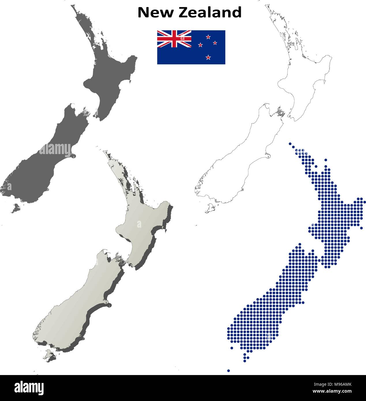 New Zealand outline map set Stock Vectorhttps://www.alamy.com/image-license-details/?v=1https://www.alamy.com/new-zealand-outline-map-set-image177775715.html
RFM96AMK–New Zealand outline map set
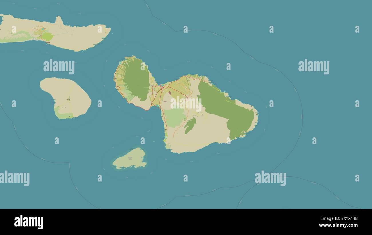 Maui Island in the North Pacific Ocean on a topographic, OSM Humanitarian style map Stock Photohttps://www.alamy.com/image-license-details/?v=1https://www.alamy.com/maui-island-in-the-north-pacific-ocean-on-a-topographic-osm-humanitarian-style-map-image619532603.html
RF2XYX44B–Maui Island in the North Pacific Ocean on a topographic, OSM Humanitarian style map
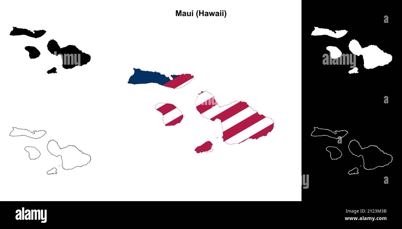 Maui County (Hawaii) outline map set Stock Vectorhttps://www.alamy.com/image-license-details/?v=1https://www.alamy.com/maui-county-hawaii-outline-map-set-image620884191.html
RF2Y23M3B–Maui County (Hawaii) outline map set
 3d isometric map of Maui is an island in Hawaiian Islands, isolaated vector illustration Stock Vectorhttps://www.alamy.com/image-license-details/?v=1https://www.alamy.com/3d-isometric-map-of-maui-is-an-island-in-hawaiian-islands-isolaated-vector-illustration-image425130321.html
RF2FKJA1N–3d isometric map of Maui is an island in Hawaiian Islands, isolaated vector illustration
 1885 De Witt Alexander Wall Map of Maui, Hawaii Geographicus Maui lo 1885 Stock Photohttps://www.alamy.com/image-license-details/?v=1https://www.alamy.com/stock-photo-1885-de-witt-alexander-wall-map-of-maui-hawaii-geographicus-maui-lo-132432777.html
RMHKCRA1–1885 De Witt Alexander Wall Map of Maui, Hawaii Geographicus Maui lo 1885
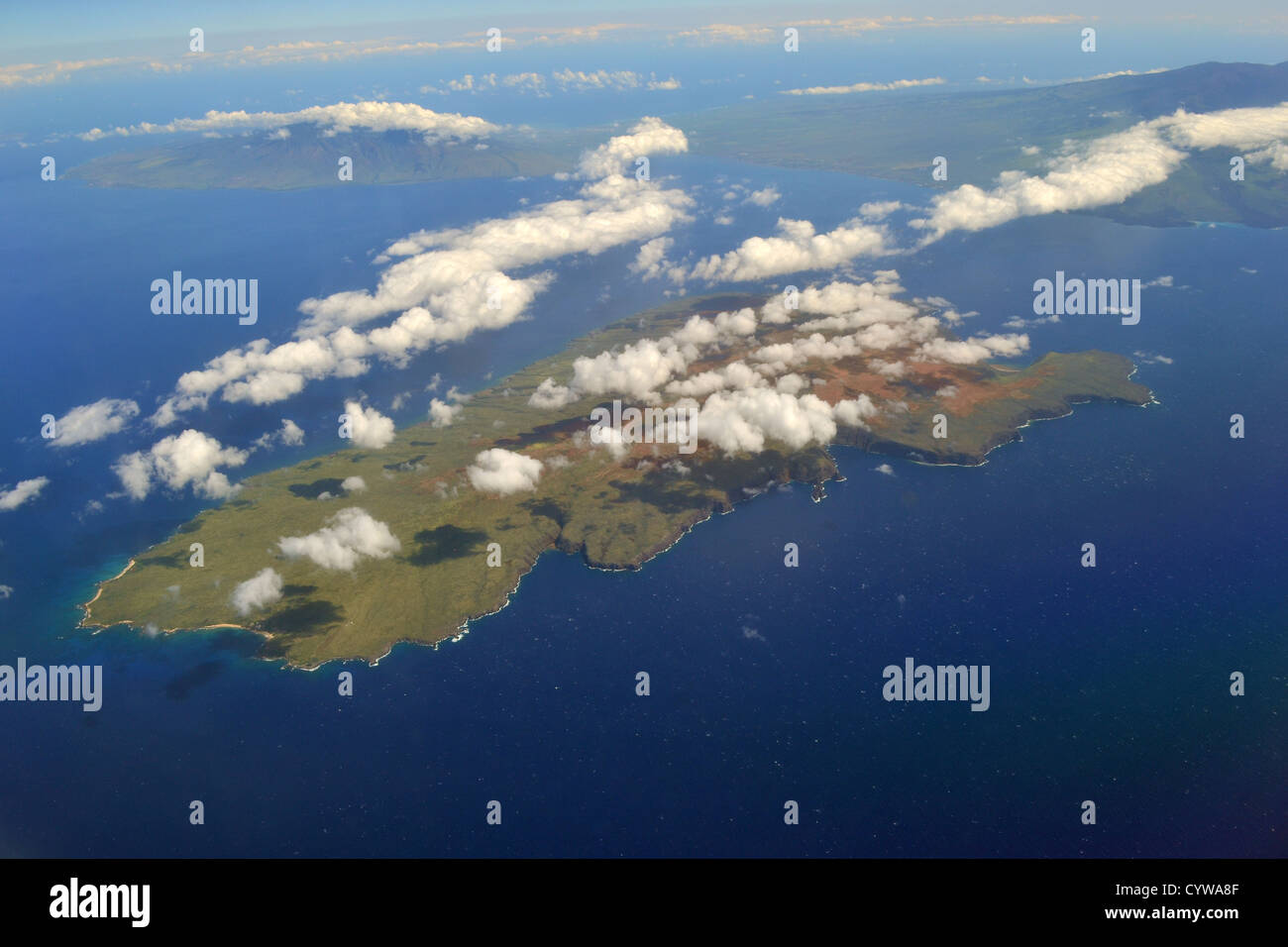 Aerial view of Kaho'olawe island, Maui county, Hawaii, USA Stock Photohttps://www.alamy.com/image-license-details/?v=1https://www.alamy.com/stock-photo-aerial-view-of-kahoolawe-island-maui-county-hawaii-usa-51573327.html
RMCYWA8F–Aerial view of Kaho'olawe island, Maui county, Hawaii, USA
 Map of Maui Stock Photohttps://www.alamy.com/image-license-details/?v=1https://www.alamy.com/stock-photo-map-of-maui-97346059.html
RFFJADTY–Map of Maui
 Polygonal map of Maui. Geometric illustration of the island in emerald amethyst colors. Maui map in low poly style. Technology, internet, network conc Stock Vectorhttps://www.alamy.com/image-license-details/?v=1https://www.alamy.com/polygonal-map-of-maui-geometric-illustration-of-the-island-in-emerald-amethyst-colors-maui-map-in-low-poly-style-technology-internet-network-conc-image557121631.html
RF2RAB293–Polygonal map of Maui. Geometric illustration of the island in emerald amethyst colors. Maui map in low poly style. Technology, internet, network conc
 Haliimaile, Maui County, US, United States, Hawaii, N 20 52' 17'', S 156 20' 44'', map, Cartascapes Map published in 2024. Explore Cartascapes, a map revealing Earth's diverse landscapes, cultures, and ecosystems. Journey through time and space, discovering the interconnectedness of our planet's past, present, and future. Stock Photohttps://www.alamy.com/image-license-details/?v=1https://www.alamy.com/haliimaile-maui-county-us-united-states-hawaii-n-20-52-17-s-156-20-44-map-cartascapes-map-published-in-2024-explore-cartascapes-a-map-revealing-earths-diverse-landscapes-cultures-and-ecosystems-journey-through-time-and-space-discovering-the-interconnectedness-of-our-planets-past-present-and-future-image621143614.html
RM2Y2FF0E–Haliimaile, Maui County, US, United States, Hawaii, N 20 52' 17'', S 156 20' 44'', map, Cartascapes Map published in 2024. Explore Cartascapes, a map revealing Earth's diverse landscapes, cultures, and ecosystems. Journey through time and space, discovering the interconnectedness of our planet's past, present, and future.
 Research divers from the MOC Marine Institute map out coral damage at Molokini Marine Preserve off the island of Maui, Hawaii. In the future, data fr Stock Photohttps://www.alamy.com/image-license-details/?v=1https://www.alamy.com/research-divers-from-the-moc-marine-institute-map-out-coral-damage-at-molokini-marine-preserve-off-the-island-of-maui-hawaii-in-the-future-data-fr-image469376854.html
RM2J7HXY2–Research divers from the MOC Marine Institute map out coral damage at Molokini Marine Preserve off the island of Maui, Hawaii. In the future, data fr
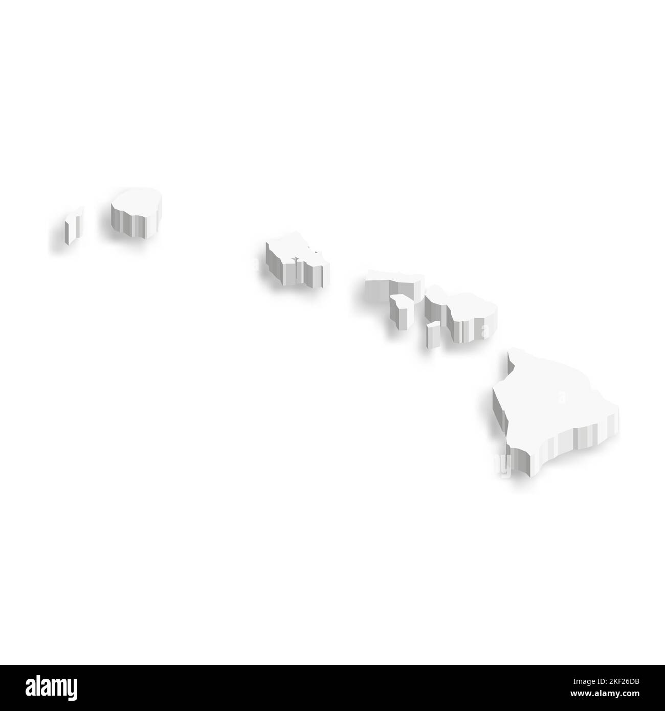 Hawaii, state of USA - white vector 3D map of country area. Stock Vectorhttps://www.alamy.com/image-license-details/?v=1https://www.alamy.com/hawaii-state-of-usa-white-vector-3d-map-of-country-area-image491159127.html
RF2KF26DB–Hawaii, state of USA - white vector 3D map of country area.
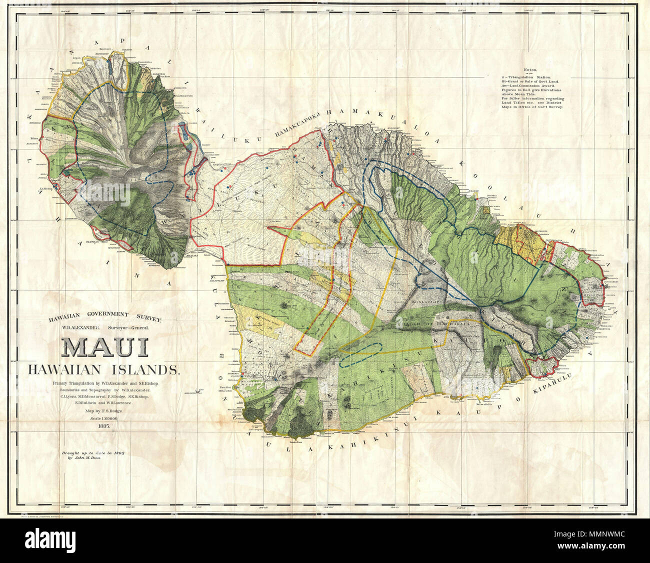 . English: This very large, rare, and extraordinary 1885 map of the island of Maui, Hawaii, was prepared for the 1906 Report of the Governor of the Territory of Hawaii to the Secretary of the Interior. Covers the entire island in stupendous detail. Though the cartographic work that produced this map was started in 1885, during the Hawaiian Monarchy, the map itself, and the report that contained it, was issued following the U.S. Government’s 1898 annexation of the Hawaiian Republic. The Report was an attempt to assess and examine the newly created Hawaiian Territory’s potential for proper admi Stock Photohttps://www.alamy.com/image-license-details/?v=1https://www.alamy.com/english-this-very-large-rare-and-extraordinary-1885-map-of-the-island-of-maui-hawaii-was-prepared-for-the-1906-report-of-the-governor-of-the-territory-of-hawaii-to-the-secretary-of-the-interior-covers-the-entire-island-in-stupendous-detail-though-the-cartographic-work-that-produced-this-map-was-started-in-1885-during-the-hawaiian-monarchy-the-map-itself-and-the-report-that-contained-it-was-issued-following-the-us-governments-1898-annexation-of-the-hawaiian-republic-the-report-was-an-attempt-to-assess-and-examine-the-newly-created-hawaiian-territorys-potential-for-proper-admi-image184877964.html
RMMMNWMC–. English: This very large, rare, and extraordinary 1885 map of the island of Maui, Hawaii, was prepared for the 1906 Report of the Governor of the Territory of Hawaii to the Secretary of the Interior. Covers the entire island in stupendous detail. Though the cartographic work that produced this map was started in 1885, during the Hawaiian Monarchy, the map itself, and the report that contained it, was issued following the U.S. Government’s 1898 annexation of the Hawaiian Republic. The Report was an attempt to assess and examine the newly created Hawaiian Territory’s potential for proper admi
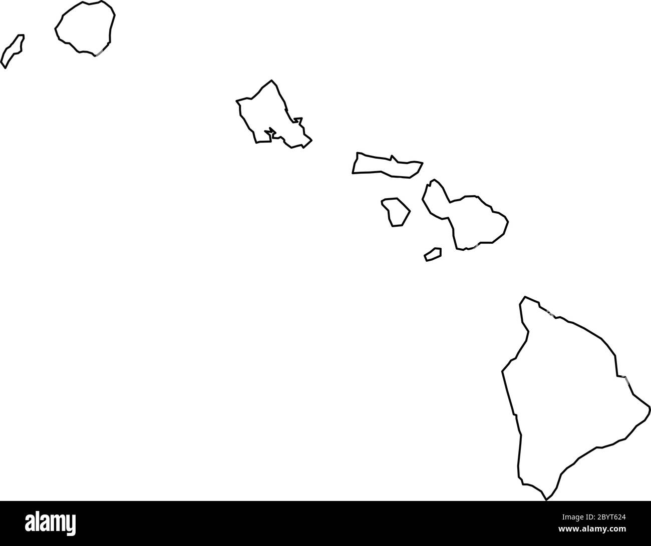 Hawaii, state of USA - solid black outline map of country area. Simple flat vector illustration. Stock Vectorhttps://www.alamy.com/image-license-details/?v=1https://www.alamy.com/hawaii-state-of-usa-solid-black-outline-map-of-country-area-simple-flat-vector-illustration-image361334684.html
RF2BYT624–Hawaii, state of USA - solid black outline map of country area. Simple flat vector illustration.
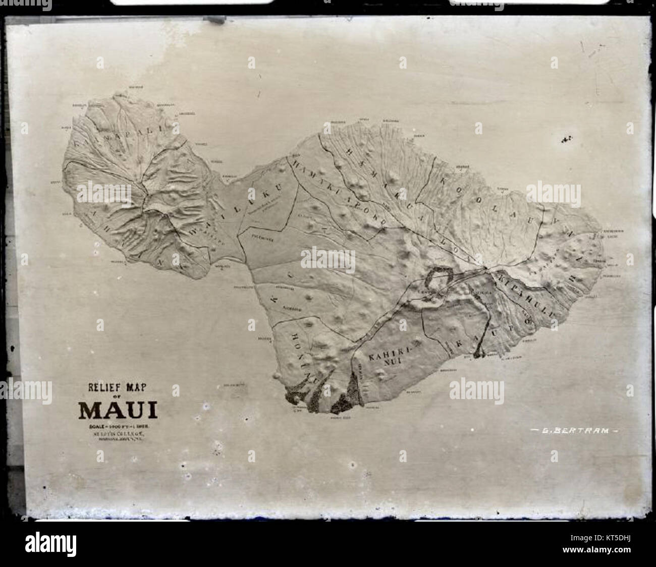 Relief Map of Maui (a) photograph by Brother Bertram Stock Photohttps://www.alamy.com/image-license-details/?v=1https://www.alamy.com/stock-image-relief-map-of-maui-a-photograph-by-brother-bertram-169765502.html
RMKT5DHJ–Relief Map of Maui (a) photograph by Brother Bertram
 Hawaii, state of USA - solid black silhouette map of country area. Simple flat vector illustration. Stock Vectorhttps://www.alamy.com/image-license-details/?v=1https://www.alamy.com/hawaii-state-of-usa-solid-black-silhouette-map-of-country-area-simple-flat-vector-illustration-image369096014.html
RF2CCDNME–Hawaii, state of USA - solid black silhouette map of country area. Simple flat vector illustration.