Murchison glacier new zealand Stock Photos and Images
(21)See murchison glacier new zealand stock video clipsQuick filters:
Murchison glacier new zealand Stock Photos and Images
 The 18 km long Murchison Glacier with 3105m Mt Elie De Beaumont Mt Cook National Park Southern Alps South Island New Zealand Stock Photohttps://www.alamy.com/image-license-details/?v=1https://www.alamy.com/stock-photo-the-18-km-long-murchison-glacier-with-3105m-mt-elie-de-beaumont-mt-10495966.html
RMA2E8JR–The 18 km long Murchison Glacier with 3105m Mt Elie De Beaumont Mt Cook National Park Southern Alps South Island New Zealand
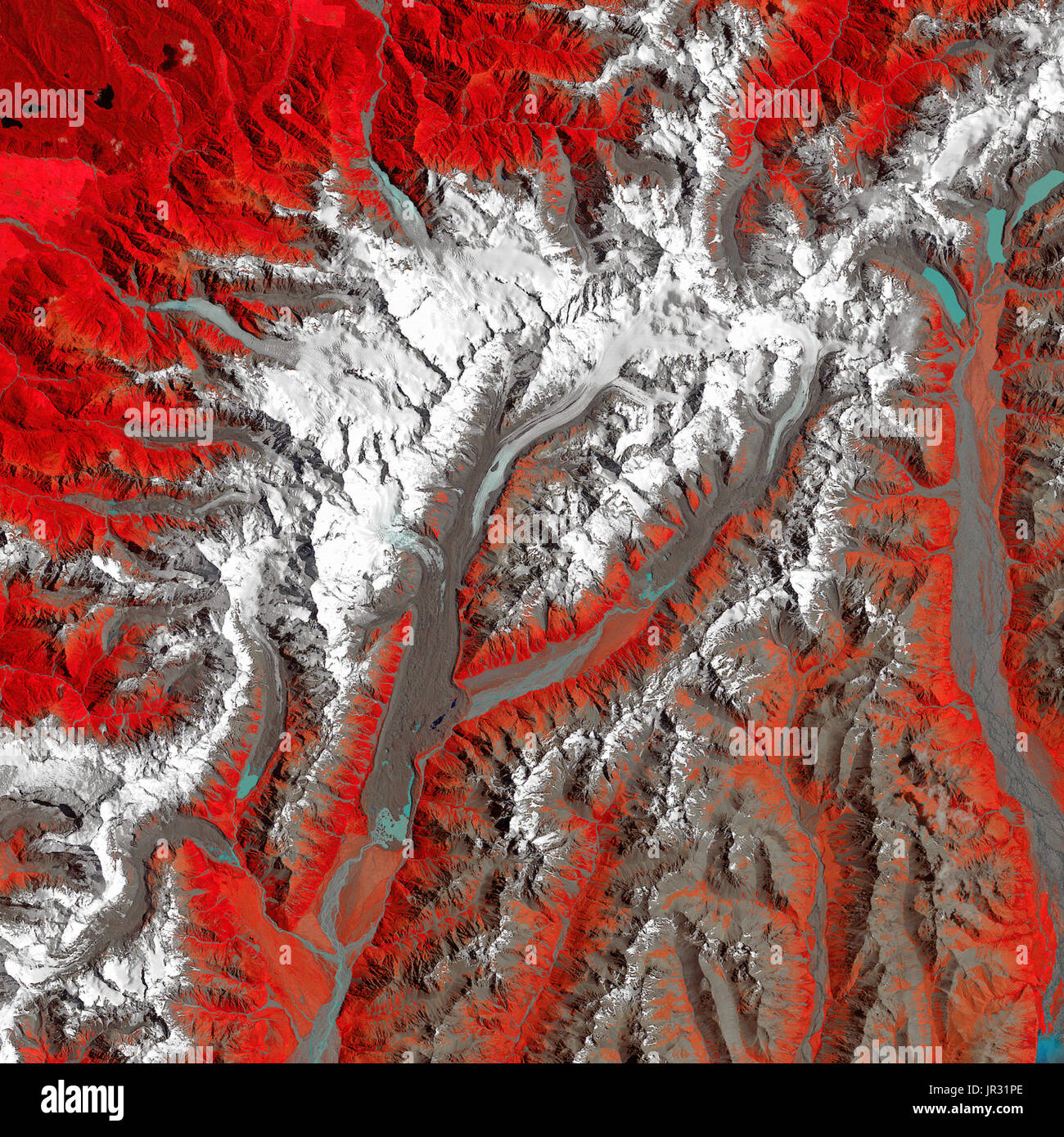 New Zealand's Tasman Glacier on December 30, 1990, taken by the Thematic Mapper on Landsat 4. Compare with JG5749 from 2017, to see how the glacier is receding. In this false-color image, white is snow and ice, red is vegetation, blue is water, and brown is soil (including moraines and sediment-covered glaciers). Stock Photohttps://www.alamy.com/image-license-details/?v=1https://www.alamy.com/new-zealands-tasman-glacier-on-december-30-1990-taken-by-the-thematic-image151887302.html
RMJR31PE–New Zealand's Tasman Glacier on December 30, 1990, taken by the Thematic Mapper on Landsat 4. Compare with JG5749 from 2017, to see how the glacier is receding. In this false-color image, white is snow and ice, red is vegetation, blue is water, and brown is soil (including moraines and sediment-covered glaciers).
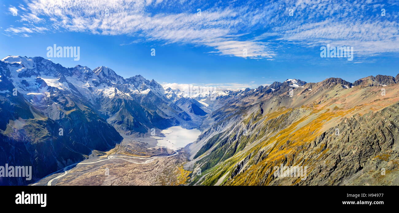 Murchison Glacier in Mount Cook National Park, Aoraki, New Zealand Alps, South Island, New Zealand Stock Photohttps://www.alamy.com/image-license-details/?v=1https://www.alamy.com/stock-photo-murchison-glacier-in-mount-cook-national-park-aoraki-new-zealand-alps-126099547.html
RFH94977–Murchison Glacier in Mount Cook National Park, Aoraki, New Zealand Alps, South Island, New Zealand
 Tasman Glacier and Tasman Lake. Aoraki/Mount Cook National Park. South Island. New Zealand Stock Photohttps://www.alamy.com/image-license-details/?v=1https://www.alamy.com/stock-photo-tasman-glacier-and-tasman-lake-aorakimount-cook-national-park-south-30872771.html
RMBP6AEY–Tasman Glacier and Tasman Lake. Aoraki/Mount Cook National Park. South Island. New Zealand
 Murchison Glacier, , NZ, New Zealand, , S 43 34' 59'', N 170 22' 0'', map, Cartascapes Map published in 2024. Explore Cartascapes, a map revealing Earth's diverse landscapes, cultures, and ecosystems. Journey through time and space, discovering the interconnectedness of our planet's past, present, and future. Stock Photohttps://www.alamy.com/image-license-details/?v=1https://www.alamy.com/murchison-glacier-nz-new-zealand-s-43-34-59-n-170-22-0-map-cartascapes-map-published-in-2024-explore-cartascapes-a-map-revealing-earths-diverse-landscapes-cultures-and-ecosystems-journey-through-time-and-space-discovering-the-interconnectedness-of-our-planets-past-present-and-future-image634071032.html
RM2YRGC20–Murchison Glacier, , NZ, New Zealand, , S 43 34' 59'', N 170 22' 0'', map, Cartascapes Map published in 2024. Explore Cartascapes, a map revealing Earth's diverse landscapes, cultures, and ecosystems. Journey through time and space, discovering the interconnectedness of our planet's past, present, and future.
 Glacier, Malte Brun ist der höchste Gipfel der Malte Brun Range, die zwischen dem Tasman- und dem Murchison-Gletscher in den neuseeländischen Südalpen liegt, 1890, Historische, digital restaurierte Reproduktion nach einem Original aus dem 19th Jahrhundert / Glacier, Malte Brun is the highest peak in the Malte Brun Range, which lies between the Tasman and Murchison Glaciers within New Zealand Southern Alps, 1890, Historic, digitally restored reproduction from a 19th century original Stock Photohttps://www.alamy.com/image-license-details/?v=1https://www.alamy.com/glacier-malte-brun-ist-der-hchste-gipfel-der-malte-brun-range-die-zwischen-dem-tasman-und-dem-murchison-gletscher-in-den-neuseelndischen-sdalpen-liegt-1890-historische-digital-restaurierte-reproduktion-nach-einem-original-aus-dem-19th-jahrhundert-glacier-malte-brun-is-the-highest-peak-in-the-malte-brun-range-which-lies-between-the-tasman-and-murchison-glaciers-within-new-zealand-southern-alps-1890-historic-digitally-restored-reproduction-from-a-19th-century-original-image611402666.html
RF2XEKP9E–Glacier, Malte Brun ist der höchste Gipfel der Malte Brun Range, die zwischen dem Tasman- und dem Murchison-Gletscher in den neuseeländischen Südalpen liegt, 1890, Historische, digital restaurierte Reproduktion nach einem Original aus dem 19th Jahrhundert / Glacier, Malte Brun is the highest peak in the Malte Brun Range, which lies between the Tasman and Murchison Glaciers within New Zealand Southern Alps, 1890, Historic, digitally restored reproduction from a 19th century original
 New Zealand South Island Arthurs Pass National Park. Stock Photohttps://www.alamy.com/image-license-details/?v=1https://www.alamy.com/stock-photo-new-zealand-south-island-arthurs-pass-national-park-31446263.html
RMBR4E0R–New Zealand South Island Arthurs Pass National Park.
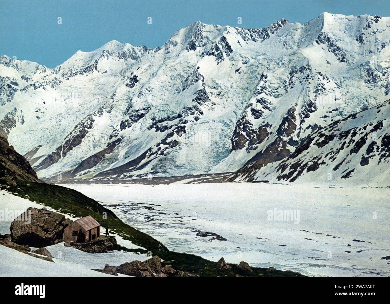 Glacier, Malte Brun ist der höchste Gipfel der Malte Brun Range, die zwischen dem Tasman- und dem Murchison-Gletscher in den neuseeländischen Südalpen liegt, 1890, Historische, digital restaurierte Reproduktion nach einem Original aus dem 19th Jahrhundert / Glacier, Malte Brun is the highest peak in the Malte Brun Range, which lies between the Tasman and Murchison Glaciers within New Zealand Southern Alps, 1890, Historic, digitally restored reproduction from a 19th century original Stock Photohttps://www.alamy.com/image-license-details/?v=1https://www.alamy.com/glacier-malte-brun-ist-der-hchste-gipfel-der-malte-brun-range-die-zwischen-dem-tasman-und-dem-murchison-gletscher-in-den-neuseelndischen-sdalpen-liegt-1890-historische-digital-restaurierte-reproduktion-nach-einem-original-aus-dem-19th-jahrhundert-glacier-malte-brun-is-the-highest-peak-in-the-malte-brun-range-which-lies-between-the-tasman-and-murchison-glaciers-within-new-zealand-southern-alps-1890-historic-digitally-restored-reproduction-from-a-19th-century-original-image591461132.html
RF2WA7AKT–Glacier, Malte Brun ist der höchste Gipfel der Malte Brun Range, die zwischen dem Tasman- und dem Murchison-Gletscher in den neuseeländischen Südalpen liegt, 1890, Historische, digital restaurierte Reproduktion nach einem Original aus dem 19th Jahrhundert / Glacier, Malte Brun is the highest peak in the Malte Brun Range, which lies between the Tasman and Murchison Glaciers within New Zealand Southern Alps, 1890, Historic, digitally restored reproduction from a 19th century original
 Aerial view of Mt Cook/Aoraki, Hooker Glacier, Tasman Glacier, and Murchison River Valley Stock Photohttps://www.alamy.com/image-license-details/?v=1https://www.alamy.com/stock-photo-aerial-view-of-mt-cookaoraki-hooker-glacier-tasman-glacier-and-murchison-136575235.html
RMHX5F2Y–Aerial view of Mt Cook/Aoraki, Hooker Glacier, Tasman Glacier, and Murchison River Valley
 Tasman Glacier, New Zealand Stock Photohttps://www.alamy.com/image-license-details/?v=1https://www.alamy.com/tasman-glacier-new-zealand-image6306476.html
RMA4FMXD–Tasman Glacier, New Zealand
 Murchison valley in Mt Aoraki/Cook Park. Beautiful but almost forgotten valley in Mt Cook park. Stock Photohttps://www.alamy.com/image-license-details/?v=1https://www.alamy.com/murchison-valley-in-mt-aorakicook-park-beautiful-but-almost-forgotten-valley-in-mt-cook-park-image470711650.html
RF2J9PNEA–Murchison valley in Mt Aoraki/Cook Park. Beautiful but almost forgotten valley in Mt Cook park.
 . Geology of the provinces of Canterbury and Westland, New Zealand, a report comprising the results of official explorations. now wider and deeper,and gave us considerable trouble before we reached this lateral valleyabout a mile broad. The Tasman glacier expands here consider-ably, advancing a few hundred yards into this valley, below which itnarrows again to its former breadth, being washed by the large outletof the Murchison glacier, which now flows along its eastern side to itstermination, producing the same effects as I observed along theterminal face of the Grodley glacier. Some five mil Stock Photohttps://www.alamy.com/image-license-details/?v=1https://www.alamy.com/geology-of-the-provinces-of-canterbury-and-westland-new-zealand-a-report-comprising-the-results-of-official-explorations-now-wider-and-deeperand-gave-us-considerable-trouble-before-we-reached-this-lateral-valleyabout-a-mile-broad-the-tasman-glacier-expands-here-consider-ably-advancing-a-few-hundred-yards-into-this-valley-below-which-itnarrows-again-to-its-former-breadth-being-washed-by-the-large-outletof-the-murchison-glacier-which-now-flows-along-its-eastern-side-to-itstermination-producing-the-same-effects-as-i-observed-along-theterminal-face-of-the-grodley-glacier-some-five-mil-image336926947.html
RM2AG49N7–. Geology of the provinces of Canterbury and Westland, New Zealand, a report comprising the results of official explorations. now wider and deeper,and gave us considerable trouble before we reached this lateral valleyabout a mile broad. The Tasman glacier expands here consider-ably, advancing a few hundred yards into this valley, below which itnarrows again to its former breadth, being washed by the large outletof the Murchison glacier, which now flows along its eastern side to itstermination, producing the same effects as I observed along theterminal face of the Grodley glacier. Some five mil
 Aerial views nof the Mout Cook Range in South Island, New Zealand. aka The Southern Alps. Stock Photohttps://www.alamy.com/image-license-details/?v=1https://www.alamy.com/aerial-views-nof-the-mout-cook-range-in-south-island-new-zealand-aka-the-southern-alps-image393329124.html
RF2DRWK8M–Aerial views nof the Mout Cook Range in South Island, New Zealand. aka The Southern Alps.
 The 18 km long Murchison Glacier with 3105m Mt Elie De Beaumont Mt Cook National Park Southern Alps South Island New Zealand Stock Photohttps://www.alamy.com/image-license-details/?v=1https://www.alamy.com/stock-photo-the-18-km-long-murchison-glacier-with-3105m-mt-elie-de-beaumont-mt-10495969.html
RMA2E8JX–The 18 km long Murchison Glacier with 3105m Mt Elie De Beaumont Mt Cook National Park Southern Alps South Island New Zealand
 New Zealand's Tasman Glacier on January 29, 2017, taken by the Advanced Spaceborne Thermal Emission and Reflection Radiometer on NASA's Terra satellite. Compare with JG5750 from 1990, to see how the glacier is receding. In this false-color image, white is snow and ice, red is vegetation, blue is water, and brown is soil (including moraines and sediment-covered glaciers). Stock Photohttps://www.alamy.com/image-license-details/?v=1https://www.alamy.com/new-zealands-tasman-glacier-on-january-29-2017-taken-by-the-advanced-image151887301.html
RMJR31PD–New Zealand's Tasman Glacier on January 29, 2017, taken by the Advanced Spaceborne Thermal Emission and Reflection Radiometer on NASA's Terra satellite. Compare with JG5750 from 1990, to see how the glacier is receding. In this false-color image, white is snow and ice, red is vegetation, blue is water, and brown is soil (including moraines and sediment-covered glaciers).
 Murchison Glacier, , NZ, New Zealand, Canterbury, S 43 30' 29'', N 170 23' 24'', map, Cartascapes Map published in 2024. Explore Cartascapes, a map revealing Earth's diverse landscapes, cultures, and ecosystems. Journey through time and space, discovering the interconnectedness of our planet's past, present, and future. Stock Photohttps://www.alamy.com/image-license-details/?v=1https://www.alamy.com/murchison-glacier-nz-new-zealand-canterbury-s-43-30-29-n-170-23-24-map-cartascapes-map-published-in-2024-explore-cartascapes-a-map-revealing-earths-diverse-landscapes-cultures-and-ecosystems-journey-through-time-and-space-discovering-the-interconnectedness-of-our-planets-past-present-and-future-image634010054.html
RM2YRDJ86–Murchison Glacier, , NZ, New Zealand, Canterbury, S 43 30' 29'', N 170 23' 24'', map, Cartascapes Map published in 2024. Explore Cartascapes, a map revealing Earth's diverse landscapes, cultures, and ecosystems. Journey through time and space, discovering the interconnectedness of our planet's past, present, and future.
 New Zealand South Island Arthurs Pass National Park. Stock Photohttps://www.alamy.com/image-license-details/?v=1https://www.alamy.com/stock-photo-new-zealand-south-island-arthurs-pass-national-park-31454772.html
RMBR4TTM–New Zealand South Island Arthurs Pass National Park.
![. The geography of New Zealand. Historical, physical, political, and commercial . e on the east.The precipitation of snow is heavier, and the slopeof the mountain range much steeper on the west.The glaciers therefore flow more rapidly, are muchrougher, and more crevassed, and reach to a lowerlevel on the west side. On the eastern slopes are the Tasman, Murchison,Godley, ]Iueller, and Hooker Glaciers. They are allin the immediate neighbourhood of IMount Cookwith the exception of the Godley Glacier, which israther further north. The ice from Mount Cookitself flows on the north-east side to the Stock Photo . The geography of New Zealand. Historical, physical, political, and commercial . e on the east.The precipitation of snow is heavier, and the slopeof the mountain range much steeper on the west.The glaciers therefore flow more rapidly, are muchrougher, and more crevassed, and reach to a lowerlevel on the west side. On the eastern slopes are the Tasman, Murchison,Godley, ]Iueller, and Hooker Glaciers. They are allin the immediate neighbourhood of IMount Cookwith the exception of the Godley Glacier, which israther further north. The ice from Mount Cookitself flows on the north-east side to the Stock Photo](https://c8.alamy.com/comp/2CDFEE8/the-geography-of-new-zealand-historical-physical-political-and-commercial-e-on-the-eastthe-precipitation-of-snow-is-heavier-and-the-slopeof-the-mountain-range-much-steeper-on-the-westthe-glaciers-therefore-flow-more-rapidly-are-muchrougher-and-more-crevassed-and-reach-to-a-lowerlevel-on-the-west-side-on-the-eastern-slopes-are-the-tasman-murchisongodley-iueller-and-hooker-glaciers-they-are-allin-the-immediate-neighbourhood-of-imount-cookwith-the-exception-of-the-godley-glacier-which-israther-further-north-the-ice-from-mount-cookitself-flows-on-the-north-east-side-to-the-2CDFEE8.jpg) . The geography of New Zealand. Historical, physical, political, and commercial . e on the east.The precipitation of snow is heavier, and the slopeof the mountain range much steeper on the west.The glaciers therefore flow more rapidly, are muchrougher, and more crevassed, and reach to a lowerlevel on the west side. On the eastern slopes are the Tasman, Murchison,Godley, ]Iueller, and Hooker Glaciers. They are allin the immediate neighbourhood of IMount Cookwith the exception of the Godley Glacier, which israther further north. The ice from Mount Cookitself flows on the north-east side to the Stock Photohttps://www.alamy.com/image-license-details/?v=1https://www.alamy.com/the-geography-of-new-zealand-historical-physical-political-and-commercial-e-on-the-eastthe-precipitation-of-snow-is-heavier-and-the-slopeof-the-mountain-range-much-steeper-on-the-westthe-glaciers-therefore-flow-more-rapidly-are-muchrougher-and-more-crevassed-and-reach-to-a-lowerlevel-on-the-west-side-on-the-eastern-slopes-are-the-tasman-murchisongodley-iueller-and-hooker-glaciers-they-are-allin-the-immediate-neighbourhood-of-imount-cookwith-the-exception-of-the-godley-glacier-which-israther-further-north-the-ice-from-mount-cookitself-flows-on-the-north-east-side-to-the-image369748912.html
. The geography of New Zealand. Historical, physical, political, and commercial . e on the east.The precipitation of snow is heavier, and the slopeof the mountain range much steeper on the west.The glaciers therefore flow more rapidly, are muchrougher, and more crevassed, and reach to a lowerlevel on the west side. On the eastern slopes are the Tasman, Murchison,Godley, ]Iueller, and Hooker Glaciers. They are allin the immediate neighbourhood of IMount Cookwith the exception of the Godley Glacier, which israther further north. The ice from Mount Cookitself flows on the north-east side to the Stock Photohttps://www.alamy.com/image-license-details/?v=1https://www.alamy.com/the-geography-of-new-zealand-historical-physical-political-and-commercial-e-on-the-eastthe-precipitation-of-snow-is-heavier-and-the-slopeof-the-mountain-range-much-steeper-on-the-westthe-glaciers-therefore-flow-more-rapidly-are-muchrougher-and-more-crevassed-and-reach-to-a-lowerlevel-on-the-west-side-on-the-eastern-slopes-are-the-tasman-murchisongodley-iueller-and-hooker-glaciers-they-are-allin-the-immediate-neighbourhood-of-imount-cookwith-the-exception-of-the-godley-glacier-which-israther-further-north-the-ice-from-mount-cookitself-flows-on-the-north-east-side-to-the-image369748912.htmlRM2CDFEE8–. The geography of New Zealand. Historical, physical, political, and commercial . e on the east.The precipitation of snow is heavier, and the slopeof the mountain range much steeper on the west.The glaciers therefore flow more rapidly, are muchrougher, and more crevassed, and reach to a lowerlevel on the west side. On the eastern slopes are the Tasman, Murchison,Godley, ]Iueller, and Hooker Glaciers. They are allin the immediate neighbourhood of IMount Cookwith the exception of the Godley Glacier, which israther further north. The ice from Mount Cookitself flows on the north-east side to the
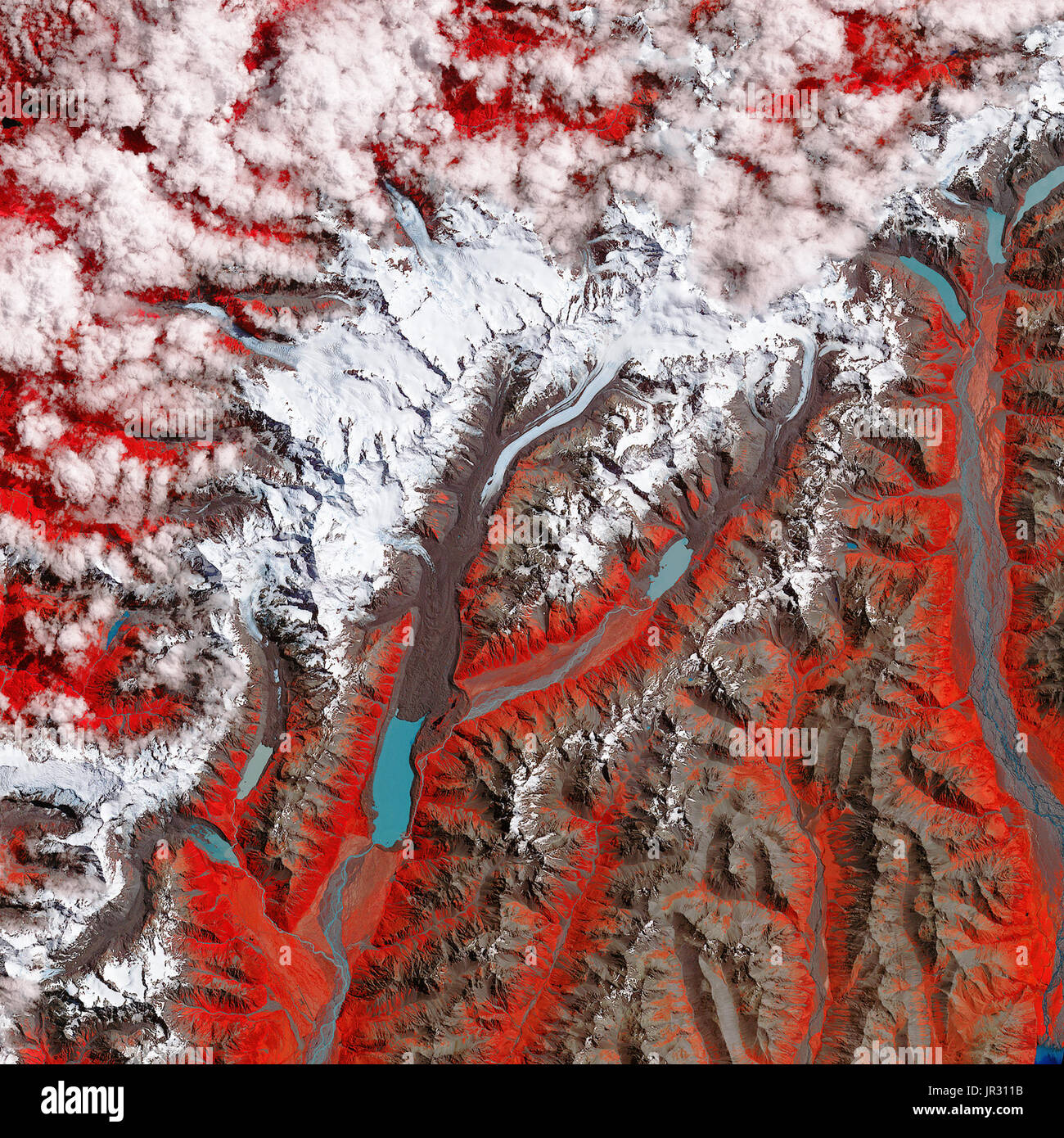
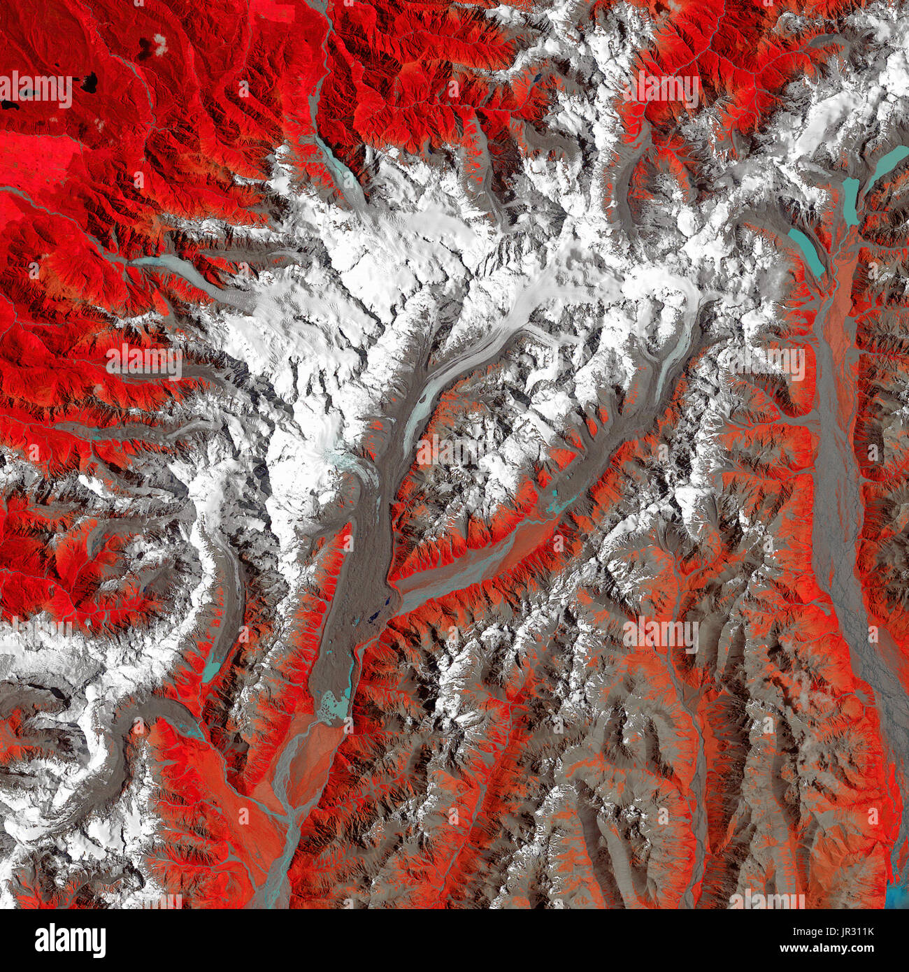 Tasman Glacier 1990 Stock Photohttps://www.alamy.com/image-license-details/?v=1https://www.alamy.com/tasman-glacier-1990-image151886719.html
RMJR311K–Tasman Glacier 1990
 Murchison Glacier, , NZ, New Zealand, Canterbury, S 43 31' 41'', N 170 24' 0'', map, Cartascapes Map published in 2024. Explore Cartascapes, a map revealing Earth's diverse landscapes, cultures, and ecosystems. Journey through time and space, discovering the interconnectedness of our planet's past, present, and future. Stock Photohttps://www.alamy.com/image-license-details/?v=1https://www.alamy.com/murchison-glacier-nz-new-zealand-canterbury-s-43-31-41-n-170-24-0-map-cartascapes-map-published-in-2024-explore-cartascapes-a-map-revealing-earths-diverse-landscapes-cultures-and-ecosystems-journey-through-time-and-space-discovering-the-interconnectedness-of-our-planets-past-present-and-future-image633988165.html
RM2YRCJAD–Murchison Glacier, , NZ, New Zealand, Canterbury, S 43 31' 41'', N 170 24' 0'', map, Cartascapes Map published in 2024. Explore Cartascapes, a map revealing Earth's diverse landscapes, cultures, and ecosystems. Journey through time and space, discovering the interconnectedness of our planet's past, present, and future.
