Quick filters:
Norman island map Stock Photos and Images
 Information kiosk at the start of the Mt. Norman trail, South Pender Island, British Columbia, Canada Stock Photohttps://www.alamy.com/image-license-details/?v=1https://www.alamy.com/information-kiosk-at-the-start-of-the-mt-norman-trail-south-pender-island-british-columbia-canada-image438134611.html
RF2GCPN4K–Information kiosk at the start of the Mt. Norman trail, South Pender Island, British Columbia, Canada
 The sea seen from the Norman tower of Briatico,Calabria Stock Photohttps://www.alamy.com/image-license-details/?v=1https://www.alamy.com/stock-photo-the-sea-seen-from-the-norman-tower-of-briaticocalabria-57732901.html
RFD9WXW9–The sea seen from the Norman tower of Briatico,Calabria
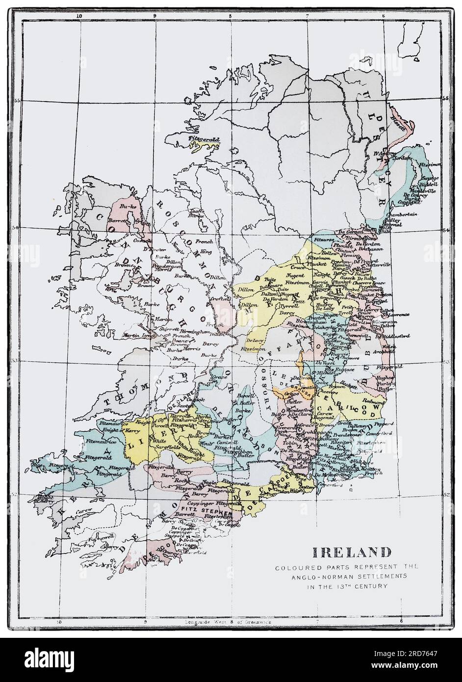 A map of Ireland showing 13th century Anglo Norman settlements (in colour) following invasion in the previous century. Stock Photohttps://www.alamy.com/image-license-details/?v=1https://www.alamy.com/a-map-of-ireland-showing-13th-century-anglo-norman-settlements-in-colour-following-invasion-in-the-previous-century-image558880791.html
RM2RD7647–A map of Ireland showing 13th century Anglo Norman settlements (in colour) following invasion in the previous century.
 Erice, Italy - September 18, 2017: Senior man reading touristic map in Erice, Sicily island, Italy. Scenery of Trapani on the background Stock Photohttps://www.alamy.com/image-license-details/?v=1https://www.alamy.com/stock-photo-erice-italy-september-18-2017-senior-man-reading-touristic-map-in-176855620.html
RFM7MD44–Erice, Italy - September 18, 2017: Senior man reading touristic map in Erice, Sicily island, Italy. Scenery of Trapani on the background
 Norman Island, , AU, Australia, Victoria, S 39 1' 16'', N 146 14' 28'', map, Cartascapes Map published in 2024. Explore Cartascapes, a map revealing Earth's diverse landscapes, cultures, and ecosystems. Journey through time and space, discovering the interconnectedness of our planet's past, present, and future. Stock Photohttps://www.alamy.com/image-license-details/?v=1https://www.alamy.com/norman-island-au-australia-victoria-s-39-1-16-n-146-14-28-map-cartascapes-map-published-in-2024-explore-cartascapes-a-map-revealing-earths-diverse-landscapes-cultures-and-ecosystems-journey-through-time-and-space-discovering-the-interconnectedness-of-our-planets-past-present-and-future-image625557679.html
RM2Y9MH5K–Norman Island, , AU, Australia, Victoria, S 39 1' 16'', N 146 14' 28'', map, Cartascapes Map published in 2024. Explore Cartascapes, a map revealing Earth's diverse landscapes, cultures, and ecosystems. Journey through time and space, discovering the interconnectedness of our planet's past, present, and future.
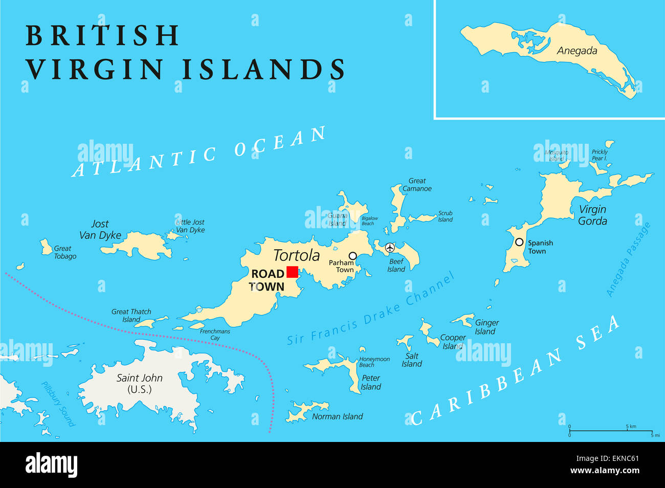 British Virgin Islands Political Map Stock Photohttps://www.alamy.com/image-license-details/?v=1https://www.alamy.com/stock-photo-british-virgin-islands-political-map-80990505.html
RFEKNC61–British Virgin Islands Political Map
 Island of St kildA, J Norman Heathcote, 1900 Stock Photohttps://www.alamy.com/image-license-details/?v=1https://www.alamy.com/island-of-st-kilda-j-norman-heathcote-1900-image159782742.html
RMK7XMEE–Island of St kildA, J Norman Heathcote, 1900
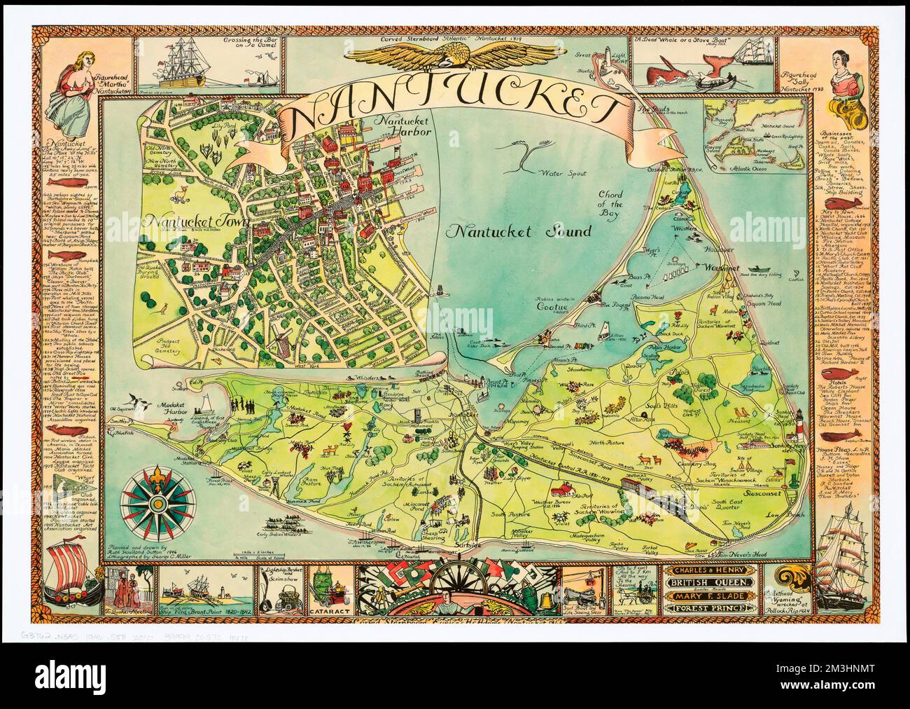 Nantucket , Nantucket Island Mass., Maps Norman B. Leventhal Map Center Collection Stock Photohttps://www.alamy.com/image-license-details/?v=1https://www.alamy.com/nantucket-nantucket-island-mass-maps-norman-b-leventhal-map-center-collection-image501334872.html
RM2M3HNMT–Nantucket , Nantucket Island Mass., Maps Norman B. Leventhal Map Center Collection
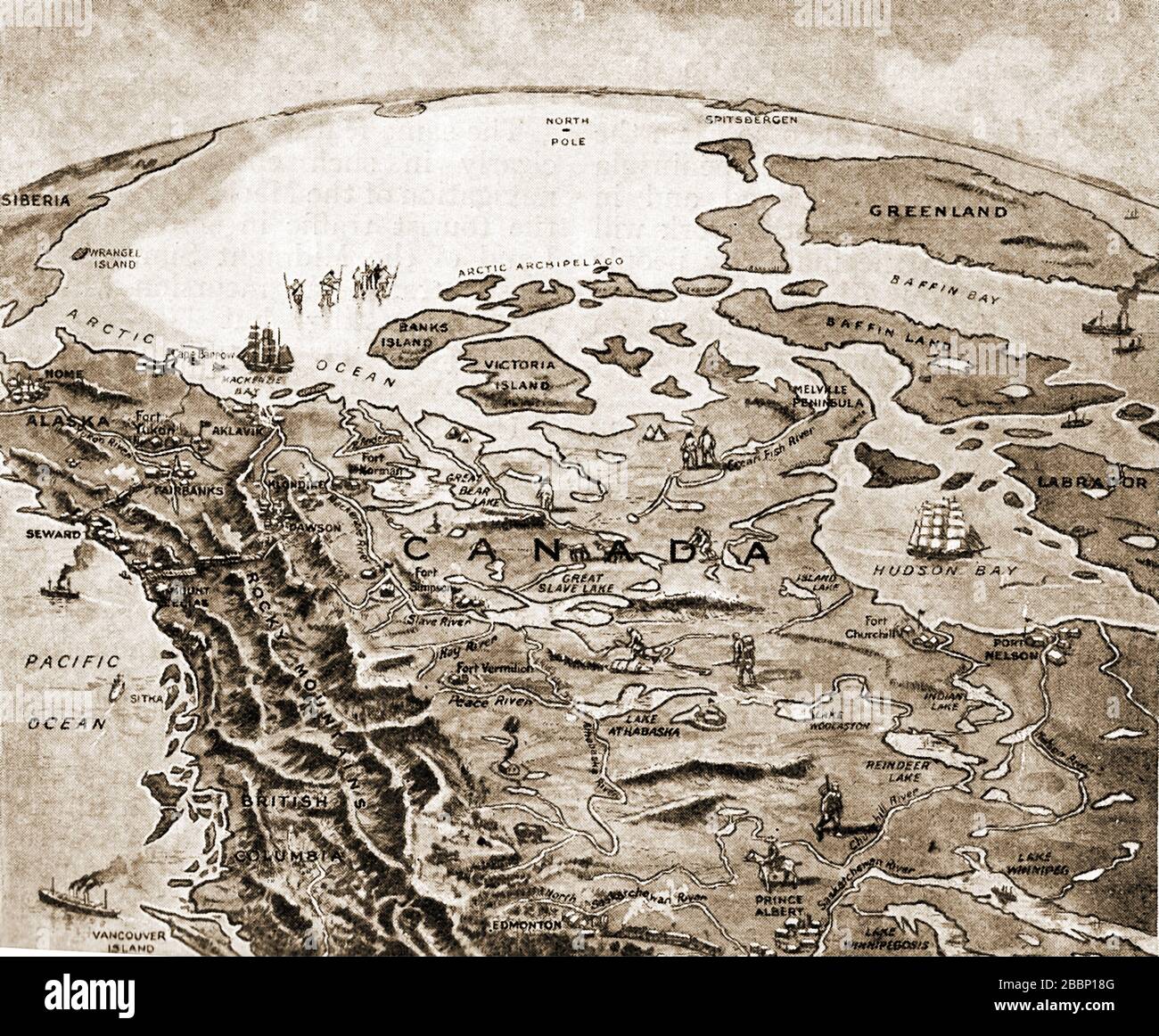 A 1920 printed map showing how civilization was slowly creeping north in Canada at that time Stock Photohttps://www.alamy.com/image-license-details/?v=1https://www.alamy.com/a-1920-printed-map-showing-how-civilization-was-slowly-creeping-north-in-canada-at-that-time-image351452544.html
RM2BBP18G–A 1920 printed map showing how civilization was slowly creeping north in Canada at that time
 Norman Island map. Map of the island with beautiful geometric waves in red blue colors. Vivid Norman shape. Vector illustration. Stock Vectorhttps://www.alamy.com/image-license-details/?v=1https://www.alamy.com/norman-island-map-map-of-the-island-with-beautiful-geometric-waves-in-red-blue-colors-vivid-norman-shape-vector-illustration-image549672473.html
RF2PX7MRN–Norman Island map. Map of the island with beautiful geometric waves in red blue colors. Vivid Norman shape. Vector illustration.
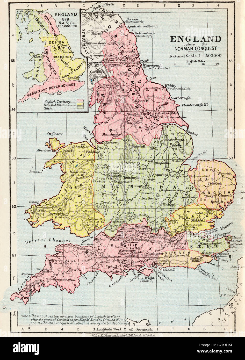 Map of England before the Norman Conquest Stock Photohttps://www.alamy.com/image-license-details/?v=1https://www.alamy.com/stock-photo-map-of-england-before-the-norman-conquest-22020704.html
RMB7R3HM–Map of England before the Norman Conquest
 The discovery of America . Sketch of part of the Cantino map, 1502. simply as Indies, here appear for the first time asAntilles (^has Antilhas). Portuguese sailors were prompt in availing them-selves of the treasures of the Newfoundland fish-eries. By 1525 a short-lived Portuguese colonyhad been established on Cape Breton island.^ But, ^ Souza, Tratado das Ilhas Novas, p. 5; Harrisse, Jean et SSiaatien Cabot, p. 76. 22 THE DISCOVERY OF AMERICA. as the name of that island reminds us, the Portu-guese had sturdy rivals in this work. As early a»1504 that spot was visited by Breton, Norman,and Basq Stock Photohttps://www.alamy.com/image-license-details/?v=1https://www.alamy.com/the-discovery-of-america-sketch-of-part-of-the-cantino-map-1502-simply-as-indies-here-appear-for-the-first-time-asantilles-has-antilhas-portuguese-sailors-were-prompt-in-availing-them-selves-of-the-treasures-of-the-newfoundland-fish-eries-by-1525-a-short-lived-portuguese-colonyhad-been-established-on-cape-breton-island-but-souza-tratado-das-ilhas-novas-p-5-harrisse-jean-et-ssiaatien-cabot-p-76-22-the-discovery-of-america-as-the-name-of-that-island-reminds-us-the-portu-guese-had-sturdy-rivals-in-this-work-as-early-a1504-that-spot-was-visited-by-breton-normanand-basq-image343083278.html
RM2AX4P66–The discovery of America . Sketch of part of the Cantino map, 1502. simply as Indies, here appear for the first time asAntilles (^has Antilhas). Portuguese sailors were prompt in availing them-selves of the treasures of the Newfoundland fish-eries. By 1525 a short-lived Portuguese colonyhad been established on Cape Breton island.^ But, ^ Souza, Tratado das Ilhas Novas, p. 5; Harrisse, Jean et SSiaatien Cabot, p. 76. 22 THE DISCOVERY OF AMERICA. as the name of that island reminds us, the Portu-guese had sturdy rivals in this work. As early a»1504 that spot was visited by Breton, Norman,and Basq
 islands, antilles, british, map, atlas, map of the world, virgin, travel, Stock Vectorhttps://www.alamy.com/image-license-details/?v=1https://www.alamy.com/stock-photo-islands-antilles-british-map-atlas-map-of-the-world-virgin-travel-147064017.html
RFJF79J9–islands, antilles, british, map, atlas, map of the world, virgin, travel,
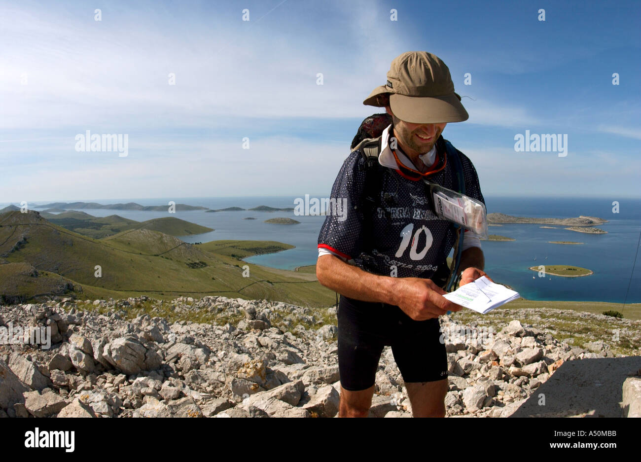 Adventure race athlete Norman Dunroy taking map bearing on island mountain Stock Photohttps://www.alamy.com/image-license-details/?v=1https://www.alamy.com/adventure-race-athlete-norman-dunroy-taking-map-bearing-on-island-image3642554.html
RMA50MBB–Adventure race athlete Norman Dunroy taking map bearing on island mountain
 Isometric map and flag of Jersey. 3D isometric shape of Jersey. Vector Illustration. Stock Vectorhttps://www.alamy.com/image-license-details/?v=1https://www.alamy.com/isometric-map-and-flag-of-jersey-3d-isometric-shape-of-jersey-vector-illustration-image381577582.html
RF2D4PA2P–Isometric map and flag of Jersey. 3D isometric shape of Jersey. Vector Illustration.
 Lake Norman Reservoir (United States of America, North America, us, usa, North Carolina) map vector illustration, scribble sketch Cowans Ford Dam map Stock Vectorhttps://www.alamy.com/image-license-details/?v=1https://www.alamy.com/lake-norman-reservoir-united-states-of-america-north-america-us-usa-north-carolina-map-vector-illustration-scribble-sketch-cowans-ford-dam-map-image572777780.html
RF2T7T7W8–Lake Norman Reservoir (United States of America, North America, us, usa, North Carolina) map vector illustration, scribble sketch Cowans Ford Dam map
![Image taken from page 287 of 'From Edenvale to the Plains of York: or, A thousand miles in the valleys of the Nidd and Yore, etc. [With illustrations, including a portrait.]' Image taken from page 287 of 'From Edenvale to the Stock Photo Image taken from page 287 of 'From Edenvale to the Plains of York: or, A thousand miles in the valleys of the Nidd and Yore, etc. [With illustrations, including a portrait.]' Image taken from page 287 of 'From Edenvale to the Stock Photo](https://c8.alamy.com/comp/HBYN39/image-taken-from-page-287-of-from-edenvale-to-the-plains-of-york-or-HBYN39.jpg) Image taken from page 287 of 'From Edenvale to the Plains of York: or, A thousand miles in the valleys of the Nidd and Yore, etc. [With illustrations, including a portrait.]' Image taken from page 287 of 'From Edenvale to the Stock Photohttps://www.alamy.com/image-license-details/?v=1https://www.alamy.com/stock-photo-image-taken-from-page-287-of-from-edenvale-to-the-plains-of-york-or-127843053.html
Image taken from page 287 of 'From Edenvale to the Plains of York: or, A thousand miles in the valleys of the Nidd and Yore, etc. [With illustrations, including a portrait.]' Image taken from page 287 of 'From Edenvale to the Stock Photohttps://www.alamy.com/image-license-details/?v=1https://www.alamy.com/stock-photo-image-taken-from-page-287-of-from-edenvale-to-the-plains-of-york-or-127843053.htmlRMHBYN39–Image taken from page 287 of 'From Edenvale to the Plains of York: or, A thousand miles in the valleys of the Nidd and Yore, etc. [With illustrations, including a portrait.]' Image taken from page 287 of 'From Edenvale to the
 Seascape, Briatico, Calabria Stock Photohttps://www.alamy.com/image-license-details/?v=1https://www.alamy.com/stock-photo-seascape-briatico-calabria-57732833.html
RFD9WXPW–Seascape, Briatico, Calabria
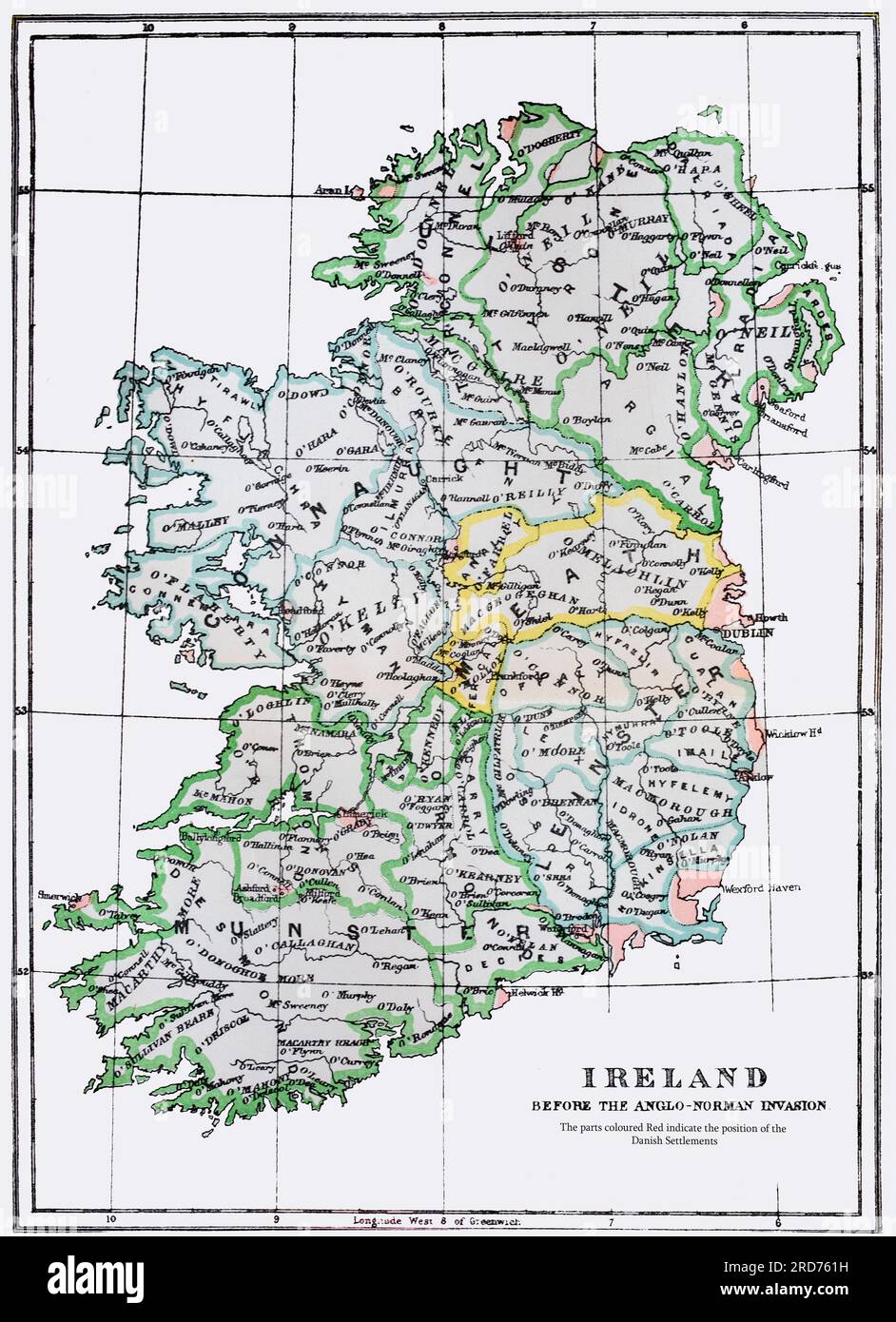 A map of Ireland showing the tribal names prior to the 12th Century Anglo Norman invasion. The areas in red indicates the positions of Danish (Viking) settlements. Stock Photohttps://www.alamy.com/image-license-details/?v=1https://www.alamy.com/a-map-of-ireland-showing-the-tribal-names-prior-to-the-12th-century-anglo-norman-invasion-the-areas-in-red-indicates-the-positions-of-danish-viking-settlements-image558880717.html
RM2RD761H–A map of Ireland showing the tribal names prior to the 12th Century Anglo Norman invasion. The areas in red indicates the positions of Danish (Viking) settlements.
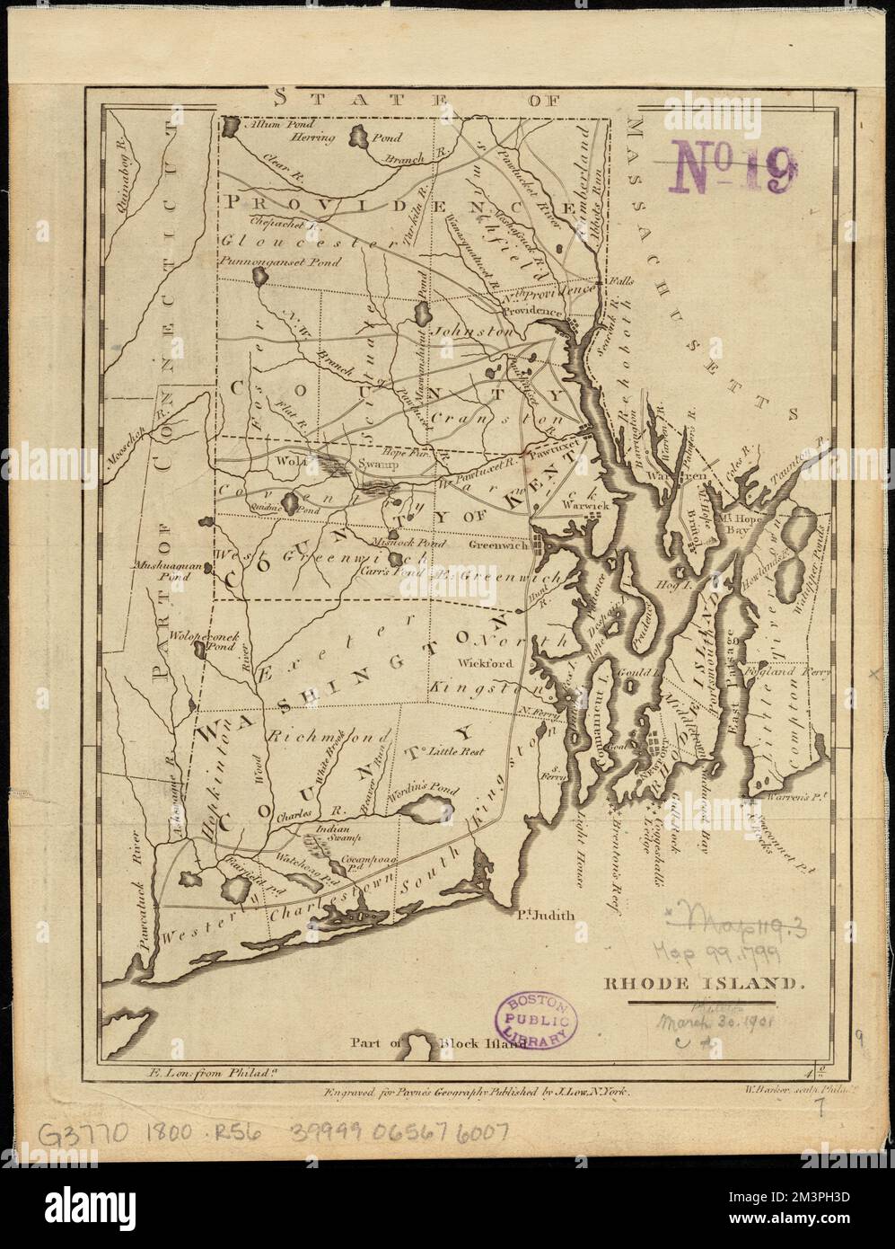 Rhode Island , Rhode Island, Maps Norman B. Leventhal Map Center Collection Stock Photohttps://www.alamy.com/image-license-details/?v=1https://www.alamy.com/rhode-island-rhode-island-maps-norman-b-leventhal-map-center-collection-image501441009.html
RM2M3PH3D–Rhode Island , Rhode Island, Maps Norman B. Leventhal Map Center Collection
 Norman Island map. Borders of Norman Island for your infographic. Vector illustration. Stock Vectorhttps://www.alamy.com/image-license-details/?v=1https://www.alamy.com/norman-island-map-borders-of-norman-island-for-your-infographic-vector-illustration-image545828847.html
RF2PM0J7B–Norman Island map. Borders of Norman Island for your infographic. Vector illustration.
 . Cranberries; : the national cranberry magazine. Cranberries. Messrs. Thomas, Shaw and Holmes (left to right) studying map of Lulu Island area. Standard-Times photo) By F. B. Chandler "Go west, young man, go west" is an adage which has challenged many young men in the past and this year and in 1955 three cran- berry growers from Massachusetts will be going to the Pacific Coast. Norman Holmes, Frederick Shaw and Jam'ss Thomas with their families are moving from Carver, Massachusetts to British Columbia to grow cranberries. For a number of years these men have worked together, having Stock Photohttps://www.alamy.com/image-license-details/?v=1https://www.alamy.com/cranberries-the-national-cranberry-magazine-cranberries-messrs-thomas-shaw-and-holmes-left-to-right-studying-map-of-lulu-island-area-standard-times-photo-by-f-b-chandler-quotgo-west-young-man-go-westquot-is-an-adage-which-has-challenged-many-young-men-in-the-past-and-this-year-and-in-1955-three-cran-berry-growers-from-massachusetts-will-be-going-to-the-pacific-coast-norman-holmes-frederick-shaw-and-jamss-thomas-with-their-families-are-moving-from-carver-massachusetts-to-british-columbia-to-grow-cranberries-for-a-number-of-years-these-men-have-worked-together-having-image232491293.html
RMRE6W0D–. Cranberries; : the national cranberry magazine. Cranberries. Messrs. Thomas, Shaw and Holmes (left to right) studying map of Lulu Island area. Standard-Times photo) By F. B. Chandler "Go west, young man, go west" is an adage which has challenged many young men in the past and this year and in 1955 three cran- berry growers from Massachusetts will be going to the Pacific Coast. Norman Holmes, Frederick Shaw and Jam'ss Thomas with their families are moving from Carver, Massachusetts to British Columbia to grow cranberries. For a number of years these men have worked together, having
 Isometric map and flag of Guernsey. 3D isometric shape of Guernsey. Vector Illustration. Stock Vectorhttps://www.alamy.com/image-license-details/?v=1https://www.alamy.com/isometric-map-and-flag-of-guernsey-3d-isometric-shape-of-guernsey-vector-illustration-image381577738.html
RF2D4PA8A–Isometric map and flag of Guernsey. 3D isometric shape of Guernsey. Vector Illustration.
 Lake Norman Reservoir (United States of America, North America, us, usa, North Carolina) map vector illustration, scribble sketch Cowans Ford Dam map Stock Vectorhttps://www.alamy.com/image-license-details/?v=1https://www.alamy.com/lake-norman-reservoir-united-states-of-america-north-america-us-usa-north-carolina-map-vector-illustration-scribble-sketch-cowans-ford-dam-map-image557942907.html
RF2RBMDTB–Lake Norman Reservoir (United States of America, North America, us, usa, North Carolina) map vector illustration, scribble sketch Cowans Ford Dam map
 Image taken from page 553 of 'The Great Salt Lake Trail' Image taken from page 553 of 'The Gre Stock Photohttps://www.alamy.com/image-license-details/?v=1https://www.alamy.com/stock-photo-image-taken-from-page-553-of-the-great-salt-lake-trail-image-taken-132345048.html
RMHK8RCT–Image taken from page 553 of 'The Great Salt Lake Trail' Image taken from page 553 of 'The Gre
 Rhode Island , Rhode Island, Maps Norman B. Leventhal Map Center Collection Stock Photohttps://www.alamy.com/image-license-details/?v=1https://www.alamy.com/rhode-island-rhode-island-maps-norman-b-leventhal-map-center-collection-image501441013.html
RM2M3PH3H–Rhode Island , Rhode Island, Maps Norman B. Leventhal Map Center Collection
 Norman Island map. Collection of map of Norman Island in dotted style. Vector illustration. Stock Vectorhttps://www.alamy.com/image-license-details/?v=1https://www.alamy.com/norman-island-map-collection-of-map-of-norman-island-in-dotted-style-vector-illustration-image551879941.html
RF2R1T8DW–Norman Island map. Collection of map of Norman Island in dotted style. Vector illustration.
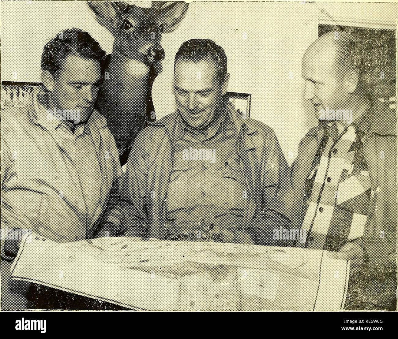 . Cranberries; : the national cranberry magazine. Cranberries. Three Massachusetts Men Going To British Columbia To Grow Cranberries. Messrs. Thomas, Shaw and Holmes (left to right) studying map of Lulu Island area. Standard-Times photo) By F. B. Chandler "Go west, young man, go west" is an adage which has challenged many young men in the past and this year and in 1955 three cran- berry growers from Massachusetts will be going to the Pacific Coast. Norman Holmes, Frederick Shaw and Jam'ss Thomas with their families are moving from Carver, Massachusetts to British Columbia to grow cra Stock Photohttps://www.alamy.com/image-license-details/?v=1https://www.alamy.com/cranberries-the-national-cranberry-magazine-cranberries-three-massachusetts-men-going-to-british-columbia-to-grow-cranberries-messrs-thomas-shaw-and-holmes-left-to-right-studying-map-of-lulu-island-area-standard-times-photo-by-f-b-chandler-quotgo-west-young-man-go-westquot-is-an-adage-which-has-challenged-many-young-men-in-the-past-and-this-year-and-in-1955-three-cran-berry-growers-from-massachusetts-will-be-going-to-the-pacific-coast-norman-holmes-frederick-shaw-and-jamss-thomas-with-their-families-are-moving-from-carver-massachusetts-to-british-columbia-to-grow-cra-image232491296.html
RMRE6W0G–. Cranberries; : the national cranberry magazine. Cranberries. Three Massachusetts Men Going To British Columbia To Grow Cranberries. Messrs. Thomas, Shaw and Holmes (left to right) studying map of Lulu Island area. Standard-Times photo) By F. B. Chandler "Go west, young man, go west" is an adage which has challenged many young men in the past and this year and in 1955 three cran- berry growers from Massachusetts will be going to the Pacific Coast. Norman Holmes, Frederick Shaw and Jam'ss Thomas with their families are moving from Carver, Massachusetts to British Columbia to grow cra
 Lake Norman Reservoir (United States of America, North America, us, usa, North Carolina) map vector illustration, scribble sketch Cowans Ford Dam map Stock Vectorhttps://www.alamy.com/image-license-details/?v=1https://www.alamy.com/lake-norman-reservoir-united-states-of-america-north-america-us-usa-north-carolina-map-vector-illustration-scribble-sketch-cowans-ford-dam-map-image526828778.html
RF2NH33DE–Lake Norman Reservoir (United States of America, North America, us, usa, North Carolina) map vector illustration, scribble sketch Cowans Ford Dam map
 Image taken from page 65 of 'A Girl in the Karpathians. Fourth Edition' Image taken from page 65 of 'A Girl in the Stock Photohttps://www.alamy.com/image-license-details/?v=1https://www.alamy.com/stock-photo-image-taken-from-page-65-of-a-girl-in-the-karpathians-fourth-edition-130176358.html
RMHFP17J–Image taken from page 65 of 'A Girl in the Karpathians. Fourth Edition' Image taken from page 65 of 'A Girl in the
 Rhode Island , Rhode Island, Maps Norman B. Leventhal Map Center Collection Stock Photohttps://www.alamy.com/image-license-details/?v=1https://www.alamy.com/rhode-island-rhode-island-maps-norman-b-leventhal-map-center-collection-image501441005.html
RM2M3PH39–Rhode Island , Rhode Island, Maps Norman B. Leventhal Map Center Collection
 Norman Island map design. Shape of the island with beautiful geometric waves and grunge texture. Attractive vector illustration. Stock Vectorhttps://www.alamy.com/image-license-details/?v=1https://www.alamy.com/norman-island-map-design-shape-of-the-island-with-beautiful-geometric-waves-and-grunge-texture-attractive-vector-illustration-image549586235.html
RF2PX3PRR–Norman Island map design. Shape of the island with beautiful geometric waves and grunge texture. Attractive vector illustration.
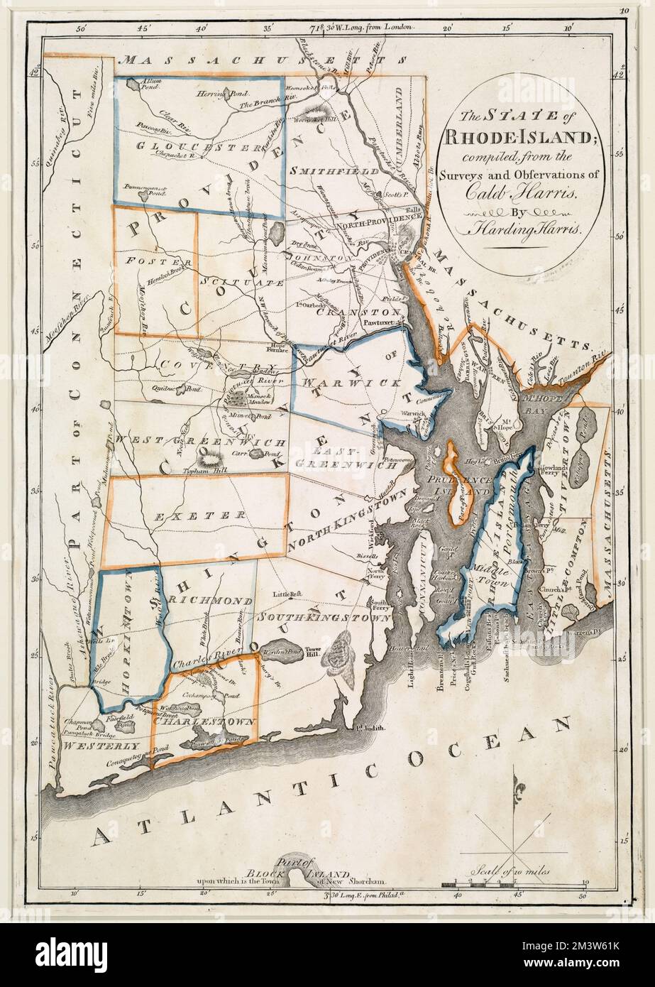 The state of Rhode Island , Rhode Island, Maps Norman B. Leventhal Map Center Collection Stock Photohttps://www.alamy.com/image-license-details/?v=1https://www.alamy.com/the-state-of-rhode-island-rhode-island-maps-norman-b-leventhal-map-center-collection-image501498191.html
RM2M3W61K–The state of Rhode Island , Rhode Island, Maps Norman B. Leventhal Map Center Collection
 Norman Island map filled with concentric circles. Sketch style circles in shape of the island. Vector Illustration. Stock Vectorhttps://www.alamy.com/image-license-details/?v=1https://www.alamy.com/norman-island-map-filled-with-concentric-circles-sketch-style-circles-in-shape-of-the-island-vector-illustration-image550716302.html
RF2PYY87A–Norman Island map filled with concentric circles. Sketch style circles in shape of the island. Vector Illustration.
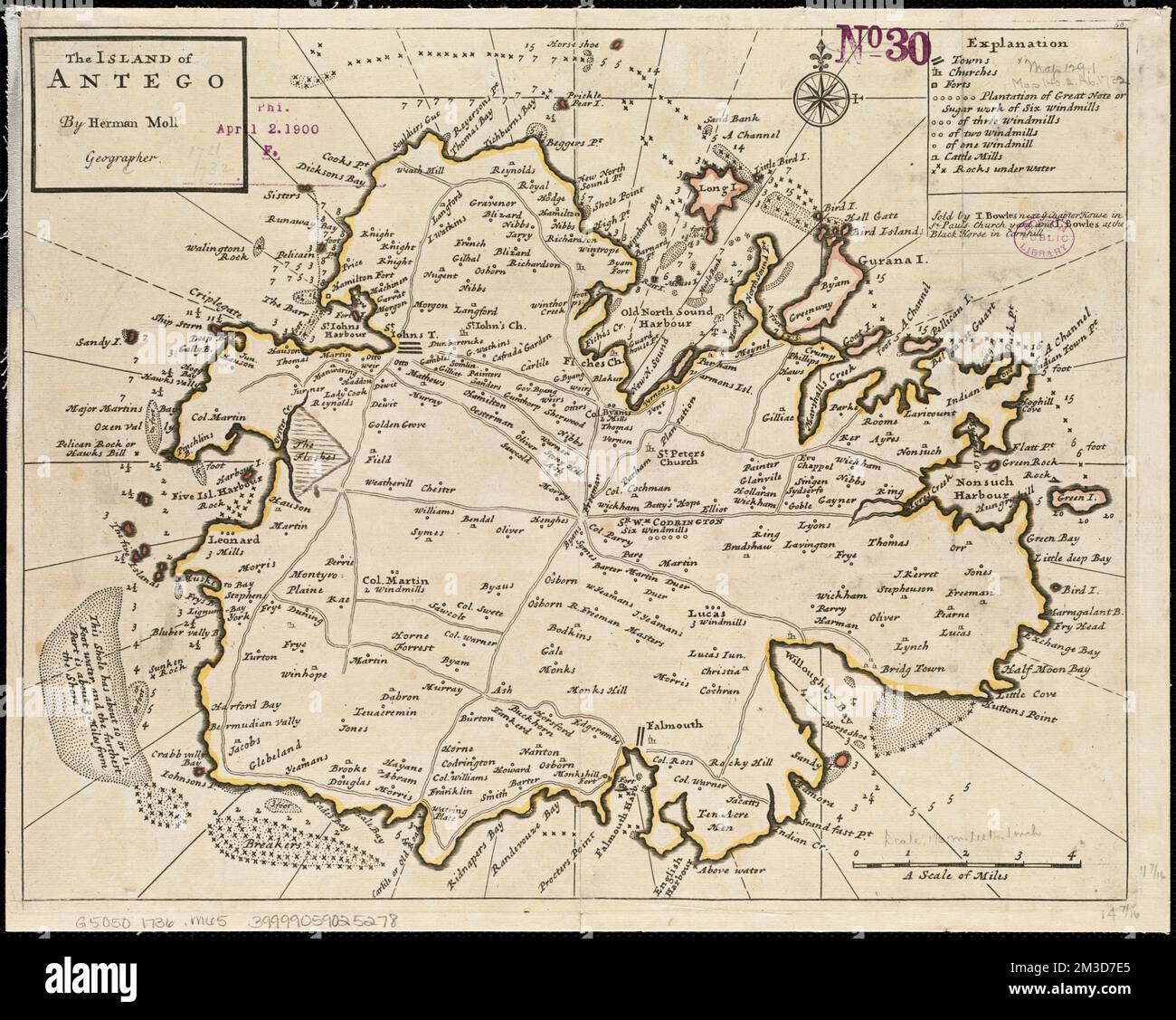 The island of Antego , Antigua, Maps, Early works to 1800 Norman B. Leventhal Map Center Collection Stock Photohttps://www.alamy.com/image-license-details/?v=1https://www.alamy.com/the-island-of-antego-antigua-maps-early-works-to-1800-norman-b-leventhal-map-center-collection-image501235901.html
RM2M3D7E5–The island of Antego , Antigua, Maps, Early works to 1800 Norman B. Leventhal Map Center Collection
 Norman Island map. Map of Norman Island in dotted style. Borders of the island filled with rectangles for your design. Vector illustration. Stock Vectorhttps://www.alamy.com/image-license-details/?v=1https://www.alamy.com/norman-island-map-map-of-norman-island-in-dotted-style-borders-of-the-island-filled-with-rectangles-for-your-design-vector-illustration-image551887151.html
RF2R1THKB–Norman Island map. Map of Norman Island in dotted style. Borders of the island filled with rectangles for your design. Vector illustration.
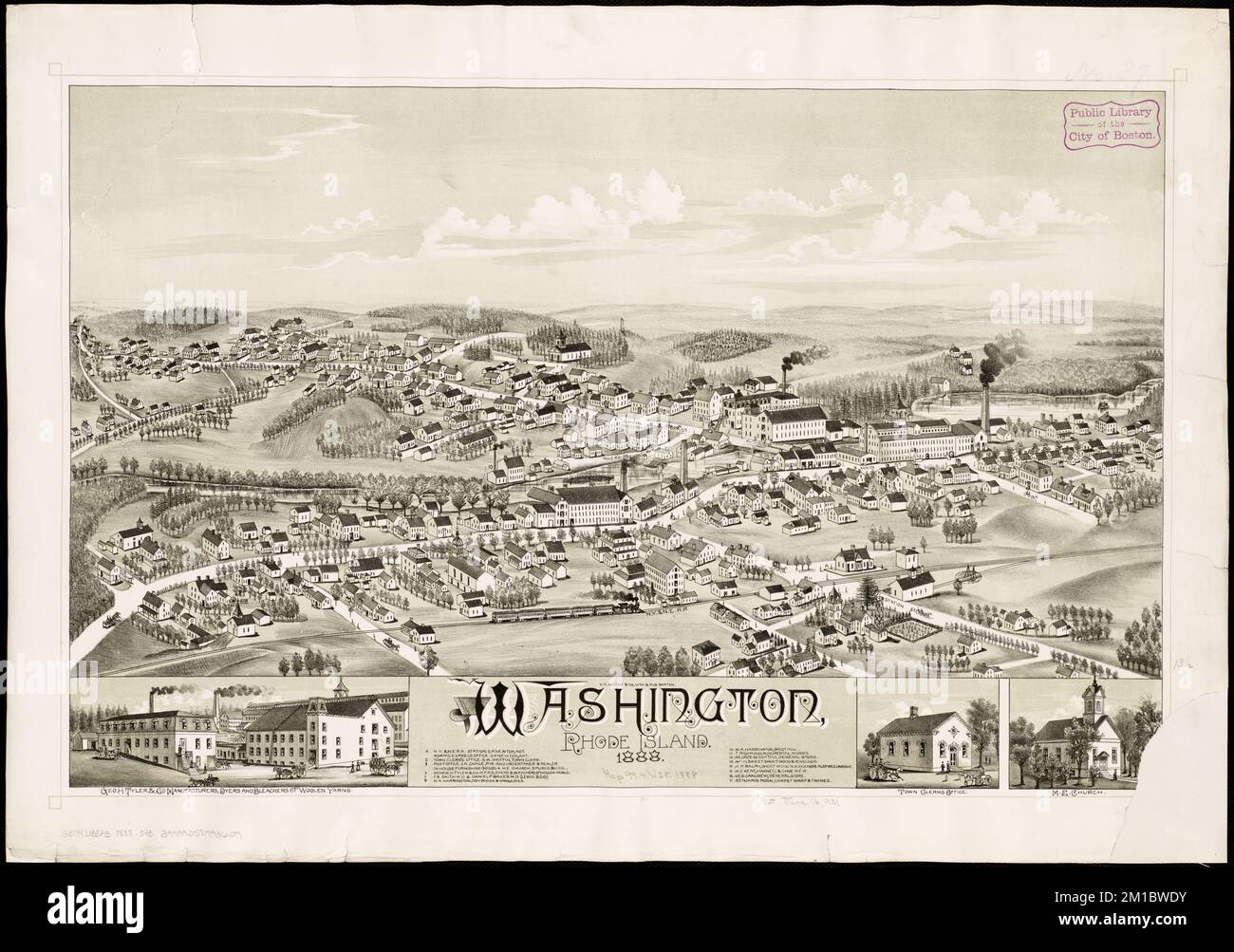 Washington, Rhode Island : 1888 , Coventry R.I. Norman B. Leventhal Map Center Collection Stock Photohttps://www.alamy.com/image-license-details/?v=1https://www.alamy.com/washington-rhode-island-1888-coventry-ri-norman-b-leventhal-map-center-collection-image499976791.html
RM2M1BWDY–Washington, Rhode Island : 1888 , Coventry R.I. Norman B. Leventhal Map Center Collection
 Vector polygonal Norman Island map. Vibrant geometric island in low poly style. Attractive illustration for your infographics. Technology, internet, n Stock Vectorhttps://www.alamy.com/image-license-details/?v=1https://www.alamy.com/vector-polygonal-norman-island-map-vibrant-geometric-island-in-low-poly-style-attractive-illustration-for-your-infographics-technology-internet-n-image555743680.html
RF2R848MG–Vector polygonal Norman Island map. Vibrant geometric island in low poly style. Attractive illustration for your infographics. Technology, internet, n
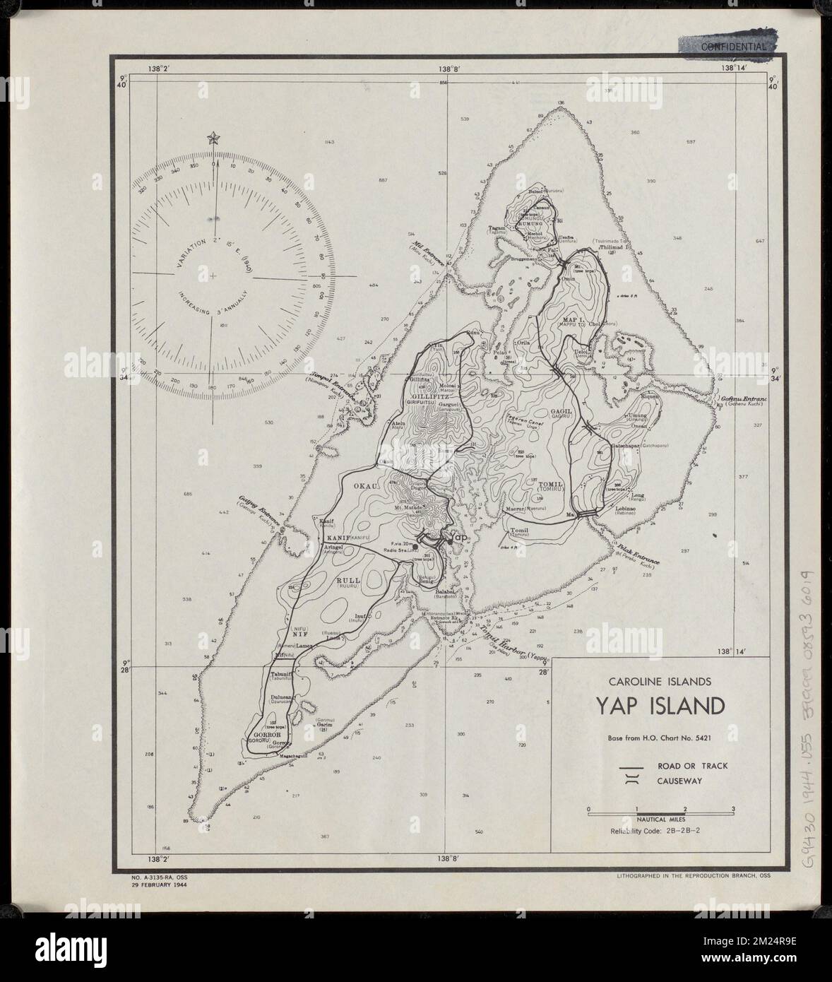 Caroline Islands, Yap Island , Yap Micronesia, Maps Norman B. Leventhal Map Center Collection Stock Photohttps://www.alamy.com/image-license-details/?v=1https://www.alamy.com/caroline-islands-yap-island-yap-micronesia-maps-norman-b-leventhal-map-center-collection-image500436090.html
RM2M24R9E–Caroline Islands, Yap Island , Yap Micronesia, Maps Norman B. Leventhal Map Center Collection
RF2PEDRP2–Norman Island icon. Map on dark background. Stylish Norman Island map with name. Vector illustration.
![[Chart of Maldonado and the Island of Gorriti] , Maldonado Uruguay, Maps, Manuscript Norman B. Leventhal Map Center Collection Stock Photo [Chart of Maldonado and the Island of Gorriti] , Maldonado Uruguay, Maps, Manuscript Norman B. Leventhal Map Center Collection Stock Photo](https://c8.alamy.com/comp/2M27NRG/chart-of-maldonado-and-the-island-of-gorriti-maldonado-uruguay-maps-manuscript-norman-b-leventhal-map-center-collection-2M27NRG.jpg) [Chart of Maldonado and the Island of Gorriti] , Maldonado Uruguay, Maps, Manuscript Norman B. Leventhal Map Center Collection Stock Photohttps://www.alamy.com/image-license-details/?v=1https://www.alamy.com/chart-of-maldonado-and-the-island-of-gorriti-maldonado-uruguay-maps-manuscript-norman-b-leventhal-map-center-collection-image500500772.html
[Chart of Maldonado and the Island of Gorriti] , Maldonado Uruguay, Maps, Manuscript Norman B. Leventhal Map Center Collection Stock Photohttps://www.alamy.com/image-license-details/?v=1https://www.alamy.com/chart-of-maldonado-and-the-island-of-gorriti-maldonado-uruguay-maps-manuscript-norman-b-leventhal-map-center-collection-image500500772.htmlRM2M27NRG–[Chart of Maldonado and the Island of Gorriti] , Maldonado Uruguay, Maps, Manuscript Norman B. Leventhal Map Center Collection
 Set of vector polygonal maps of Norman Island. Bright gradient border map in low poly style. Multicolored Norman Island map in geometric style for you Stock Vectorhttps://www.alamy.com/image-license-details/?v=1https://www.alamy.com/set-of-vector-polygonal-maps-of-norman-island-bright-gradient-border-map-in-low-poly-style-multicolored-norman-island-map-in-geometric-style-for-you-image546542270.html
RF2PN546P–Set of vector polygonal maps of Norman Island. Bright gradient border map in low poly style. Multicolored Norman Island map in geometric style for you
 Newport, Rhode Island , Newport R.I., Aerial views Norman B. Leventhal Map Center Collection Stock Photohttps://www.alamy.com/image-license-details/?v=1https://www.alamy.com/newport-rhode-island-newport-ri-aerial-views-norman-b-leventhal-map-center-collection-image501346160.html
RM2M3J840–Newport, Rhode Island , Newport R.I., Aerial views Norman B. Leventhal Map Center Collection
RF2NDBX7B–Norman Island icon. Network map of the island. Round Norman sign with gradient ring. Technology, internet, network, telecommunication concept. Vector
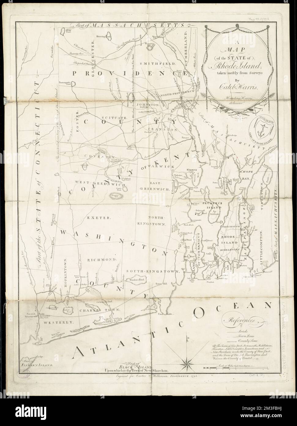 A map of the State of Rhode Island , Rhode Island, Maps Norman B. Leventhal Map Center Collection Stock Photohttps://www.alamy.com/image-license-details/?v=1https://www.alamy.com/a-map-of-the-state-of-rhode-island-rhode-island-maps-norman-b-leventhal-map-center-collection-image501283038.html
RM2M3FBHJ–A map of the State of Rhode Island , Rhode Island, Maps Norman B. Leventhal Map Center Collection
 Norman Island badge. Map of the island with beautiful geometric waves and vibrant red blue frame. Vivid round Norman logo. Vector illustration. Stock Vectorhttps://www.alamy.com/image-license-details/?v=1https://www.alamy.com/norman-island-badge-map-of-the-island-with-beautiful-geometric-waves-and-vibrant-red-blue-frame-vivid-round-norman-logo-vector-illustration-image553511767.html
RF2R4EHWB–Norman Island badge. Map of the island with beautiful geometric waves and vibrant red blue frame. Vivid round Norman logo. Vector illustration.
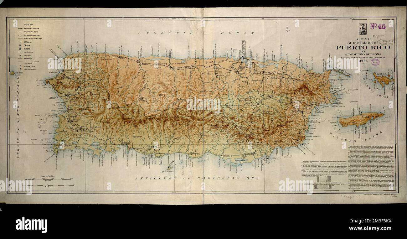 A map of the island of Puerto Rico , Puerto Rico, Maps Norman B. Leventhal Map Center Collection Stock Photohttps://www.alamy.com/image-license-details/?v=1https://www.alamy.com/a-map-of-the-island-of-puerto-rico-puerto-rico-maps-norman-b-leventhal-map-center-collection-image501280750.html
RM2M3F8KX–A map of the island of Puerto Rico , Puerto Rico, Maps Norman B. Leventhal Map Center Collection
 Shape of Norman Island, polygonal sunburst. Map of the island with colorful star rays. Norman illustration in digital, technology, internet, network s Stock Vectorhttps://www.alamy.com/image-license-details/?v=1https://www.alamy.com/shape-of-norman-island-polygonal-sunburst-map-of-the-island-with-colorful-star-rays-norman-illustration-in-digital-technology-internet-network-s-image562465681.html
RF2RK2EM1–Shape of Norman Island, polygonal sunburst. Map of the island with colorful star rays. Norman illustration in digital, technology, internet, network s
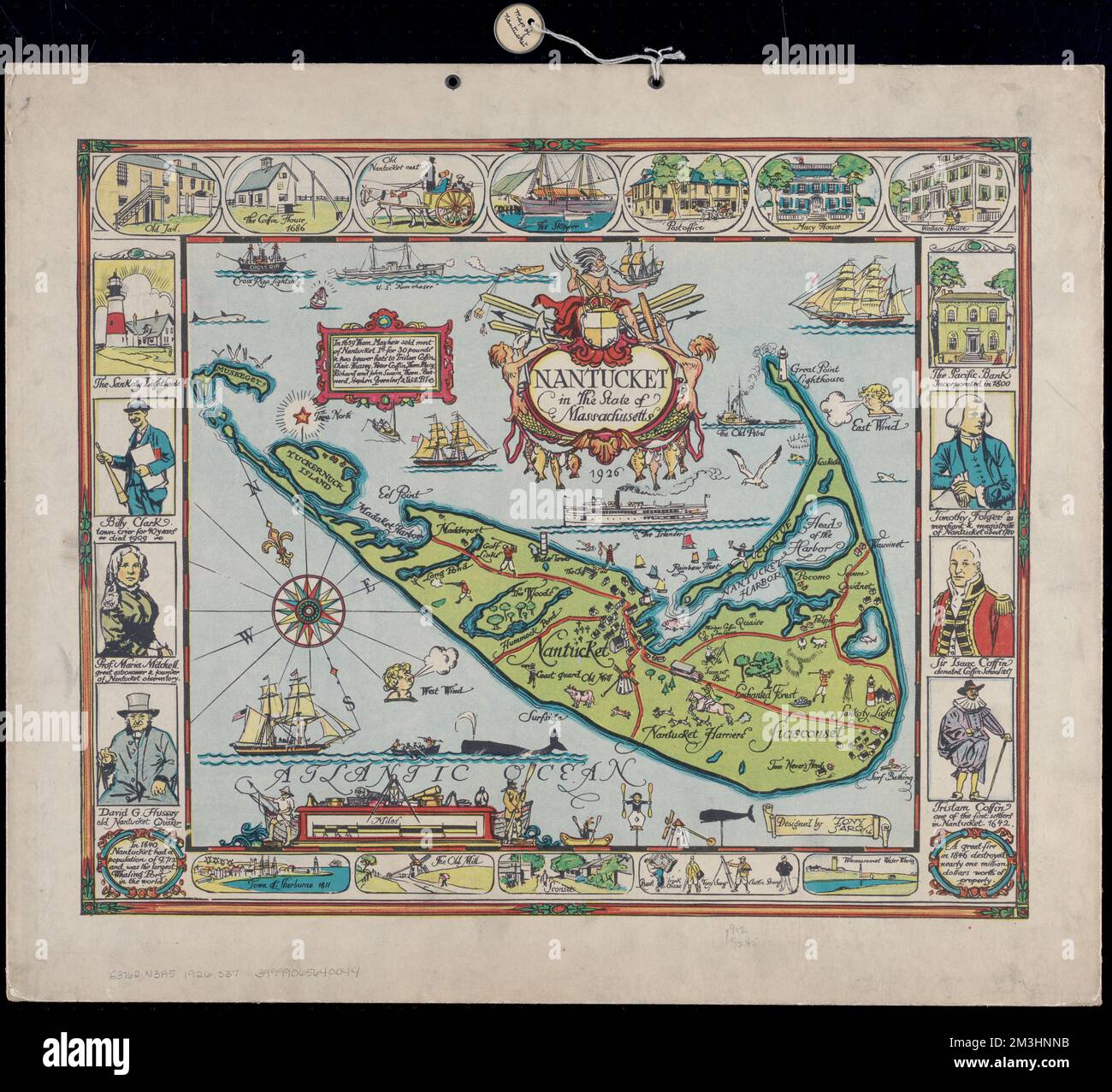 Nantucket in the state of Massachusetts , Nantucket Island Mass., Maps Norman B. Leventhal Map Center Collection Stock Photohttps://www.alamy.com/image-license-details/?v=1https://www.alamy.com/nantucket-in-the-state-of-massachusetts-nantucket-island-mass-maps-norman-b-leventhal-map-center-collection-image501334887.html
RM2M3HNNB–Nantucket in the state of Massachusetts , Nantucket Island Mass., Maps Norman B. Leventhal Map Center Collection
RF2R22A09–Norman Island icon. Vector polygonal map. Norman icon in geometric style. The island map with purple low poly gradient on dark background.
 Auburn, Rhode Island : 1890 , Cranston R.I., Aerial views Norman B. Leventhal Map Center Collection Stock Photohttps://www.alamy.com/image-license-details/?v=1https://www.alamy.com/auburn-rhode-island-1890-cranston-ri-aerial-views-norman-b-leventhal-map-center-collection-image500178525.html
RM2M1N2PN–Auburn, Rhode Island : 1890 , Cranston R.I., Aerial views Norman B. Leventhal Map Center Collection
 Polygonal map of Norman Island. Geometric illustration of the island in emerald amethyst colors. Norman map in low poly style. Technology, internet, n Stock Vectorhttps://www.alamy.com/image-license-details/?v=1https://www.alamy.com/polygonal-map-of-norman-island-geometric-illustration-of-the-island-in-emerald-amethyst-colors-norman-map-in-low-poly-style-technology-internet-n-image553889633.html
RF2R53RTH–Polygonal map of Norman Island. Geometric illustration of the island in emerald amethyst colors. Norman map in low poly style. Technology, internet, n
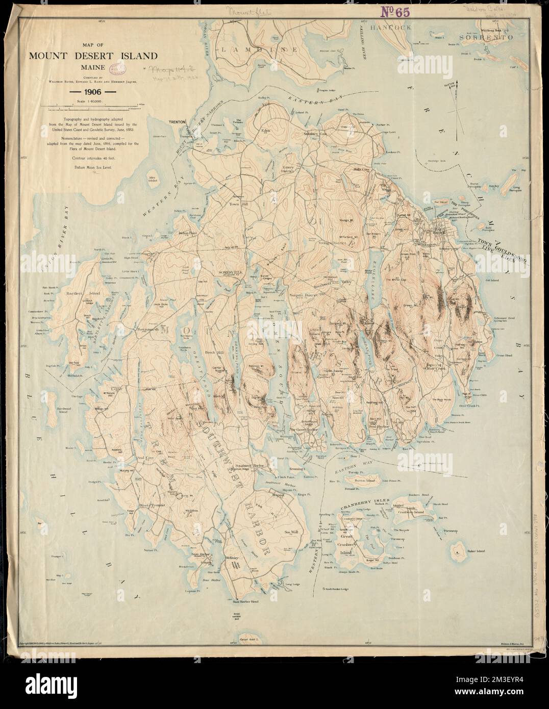 Map of Mount Desert Island, Maine , Mount Desert Island Me., Maps Norman B. Leventhal Map Center Collection Stock Photohttps://www.alamy.com/image-license-details/?v=1https://www.alamy.com/map-of-mount-desert-island-maine-mount-desert-island-me-maps-norman-b-leventhal-map-center-collection-image501273784.html
RM2M3EYR4–Map of Mount Desert Island, Maine , Mount Desert Island Me., Maps Norman B. Leventhal Map Center Collection
 Norman Island sunburst. Low poly striped rays and map of the island. Vibrant vector illustration. Stock Vectorhttps://www.alamy.com/image-license-details/?v=1https://www.alamy.com/norman-island-sunburst-low-poly-striped-rays-and-map-of-the-island-vibrant-vector-illustration-image513200746.html
RF2MPX8P2–Norman Island sunburst. Low poly striped rays and map of the island. Vibrant vector illustration.
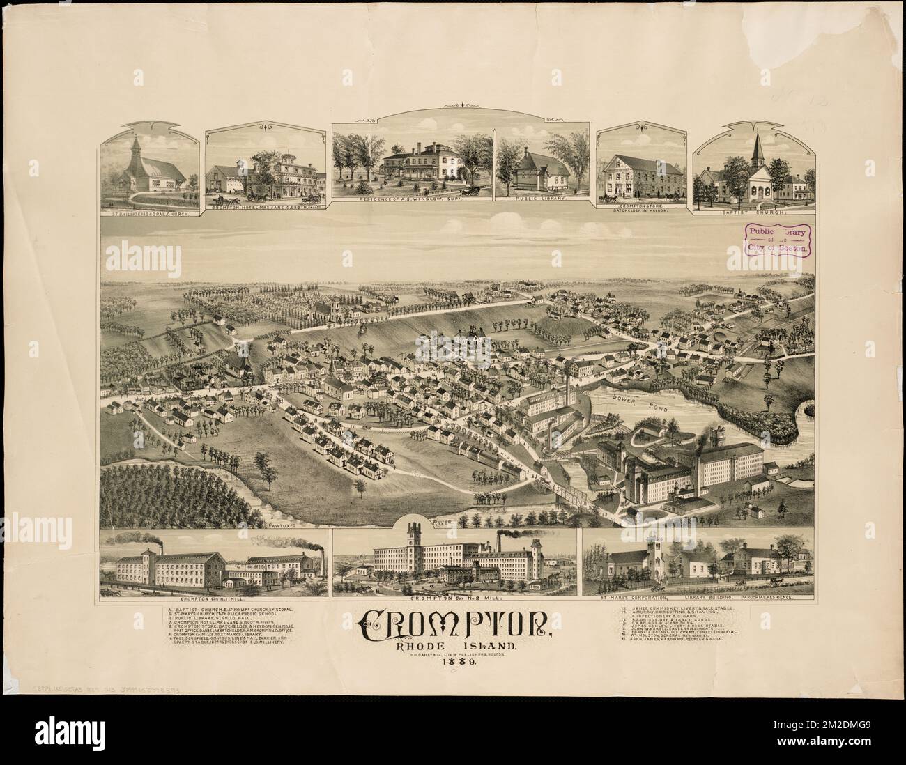 Crompton, Rhode Island : 1889 , Warwick R.I., Aerial views Norman B. Leventhal Map Center Collection Stock Photohttps://www.alamy.com/image-license-details/?v=1https://www.alamy.com/crompton-rhode-island-1889-warwick-ri-aerial-views-norman-b-leventhal-map-center-collection-image500631497.html
RM2M2DMG9–Crompton, Rhode Island : 1889 , Warwick R.I., Aerial views Norman B. Leventhal Map Center Collection
 Norman Island vintage map. Grunge map with distressed texture. Norman Island poster. Vector illustration. Stock Vectorhttps://www.alamy.com/image-license-details/?v=1https://www.alamy.com/norman-island-vintage-map-grunge-map-with-distressed-texture-norman-island-poster-vector-illustration-image550631730.html
RF2PYRCAX–Norman Island vintage map. Grunge map with distressed texture. Norman Island poster. Vector illustration.
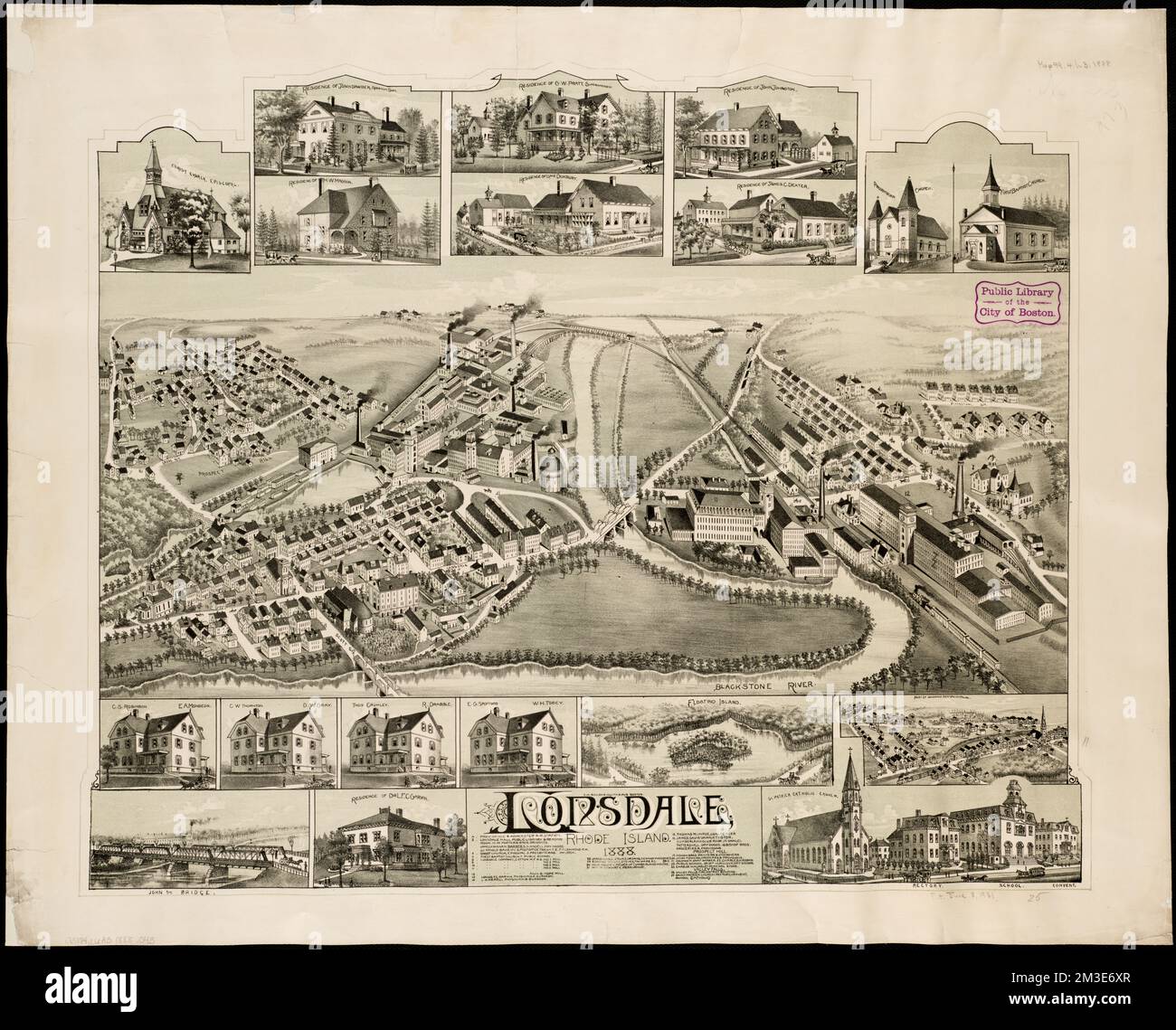 Lonsdale, Rhode Island : 1888 , Pawtucket R.I., Aerial views Norman B. Leventhal Map Center Collection Stock Photohttps://www.alamy.com/image-license-details/?v=1https://www.alamy.com/lonsdale-rhode-island-1888-pawtucket-ri-aerial-views-norman-b-leventhal-map-center-collection-image501257423.html
RM2M3E6XR–Lonsdale, Rhode Island : 1888 , Pawtucket R.I., Aerial views Norman B. Leventhal Map Center Collection
 Kid style map of Norman Island. Hand drawn polygons in the shape of Norman Island. Vector illustration. Stock Vectorhttps://www.alamy.com/image-license-details/?v=1https://www.alamy.com/kid-style-map-of-norman-island-hand-drawn-polygons-in-the-shape-of-norman-island-vector-illustration-image560146783.html
RF2RF8TX7–Kid style map of Norman Island. Hand drawn polygons in the shape of Norman Island. Vector illustration.
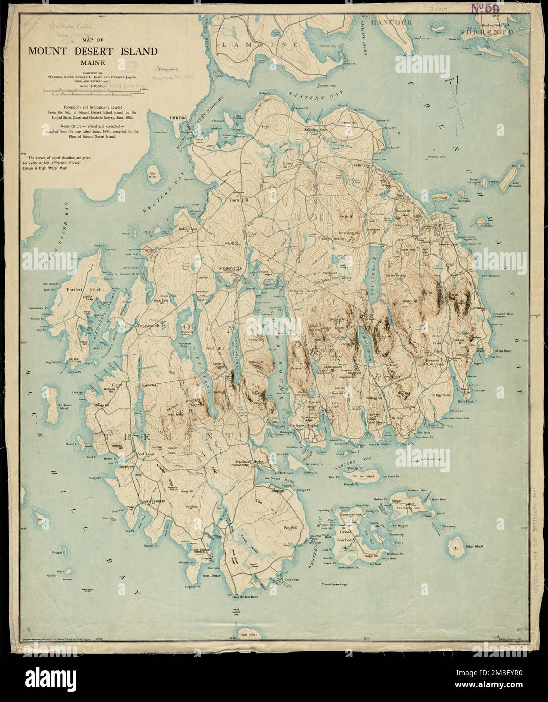 Map of Mount Desert Island, Maine , Mount Desert Island Me., Maps Norman B. Leventhal Map Center Collection Stock Photohttps://www.alamy.com/image-license-details/?v=1https://www.alamy.com/map-of-mount-desert-island-maine-mount-desert-island-me-maps-norman-b-leventhal-map-center-collection-image501273780.html
RM2M3EYR0–Map of Mount Desert Island, Maine , Mount Desert Island Me., Maps Norman B. Leventhal Map Center Collection
RF2R53P37–Norman Island icon. Polygonal map in gradient ring. Round low poly Norman Island sign. Vector illustration.
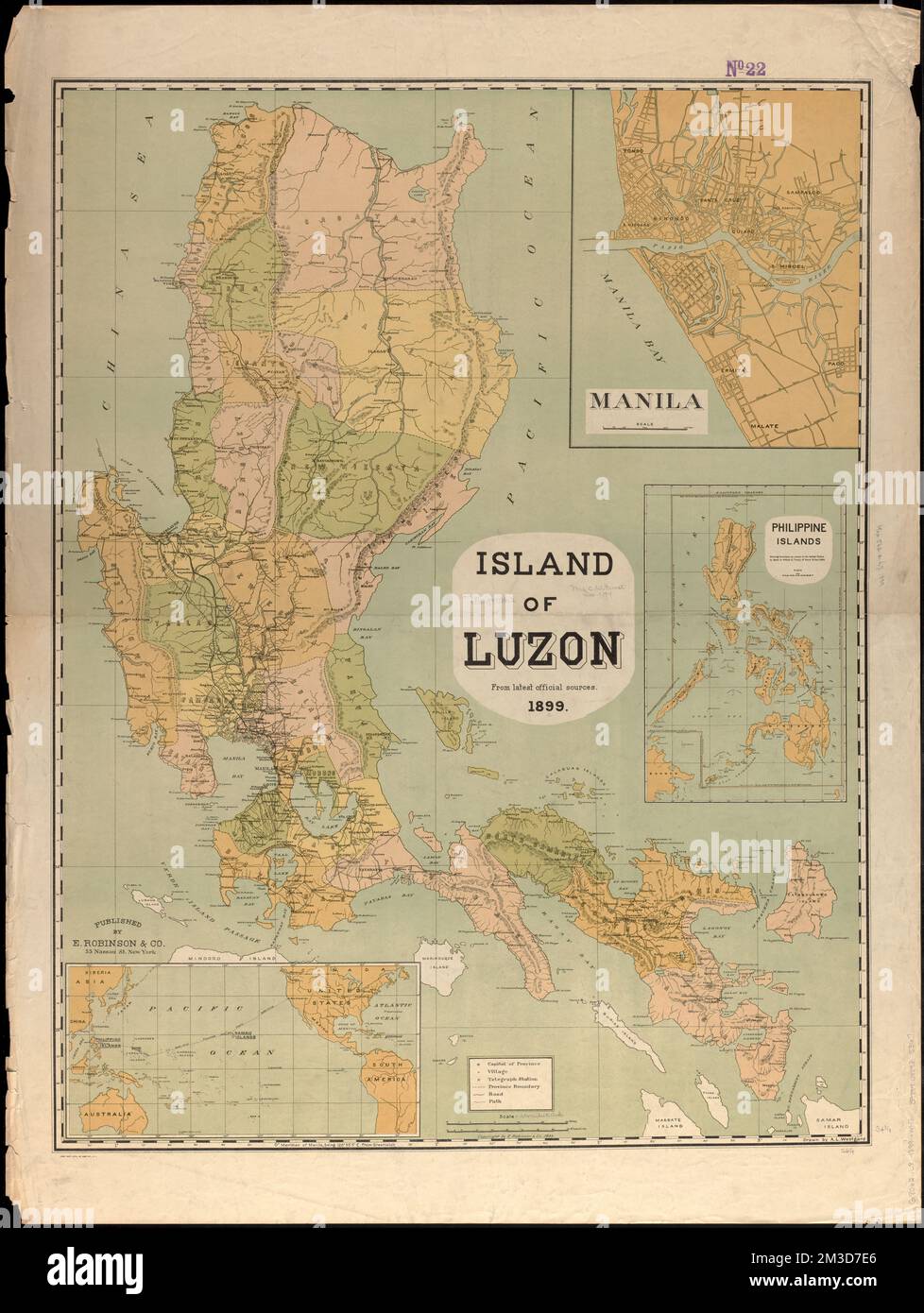 Island of Luzon : from the latest official sources , Luzon Philippines, Maps Norman B. Leventhal Map Center Collection Stock Photohttps://www.alamy.com/image-license-details/?v=1https://www.alamy.com/island-of-luzon-from-the-latest-official-sources-luzon-philippines-maps-norman-b-leventhal-map-center-collection-image501235902.html
RM2M3D7E6–Island of Luzon : from the latest official sources , Luzon Philippines, Maps Norman B. Leventhal Map Center Collection
RF2M518N9–Norman Island dotted map. Digital style shape of Norman Island. Tech icon of the island with gradiented dots. Attractive vector illustration.
 Plan of Deer Island , Deer Island Mass. : Cape, Maps, Manuscript Norman B. Leventhal Map Center Collection Stock Photohttps://www.alamy.com/image-license-details/?v=1https://www.alamy.com/plan-of-deer-island-deer-island-mass-cape-maps-manuscript-norman-b-leventhal-map-center-collection-image501392495.html
RM2M3MB6R–Plan of Deer Island , Deer Island Mass. : Cape, Maps, Manuscript Norman B. Leventhal Map Center Collection
 Norman Island Logo. Grunge sunburst poster with border map. Shape of Norman Island filled with hex digits with sunburst rays around. Attractive vector Stock Vectorhttps://www.alamy.com/image-license-details/?v=1https://www.alamy.com/norman-island-logo-grunge-sunburst-poster-with-border-map-shape-of-norman-island-filled-with-hex-digits-with-sunburst-rays-around-attractive-vector-image563519036.html
RF2RMPE7T–Norman Island Logo. Grunge sunburst poster with border map. Shape of Norman Island filled with hex digits with sunburst rays around. Attractive vector
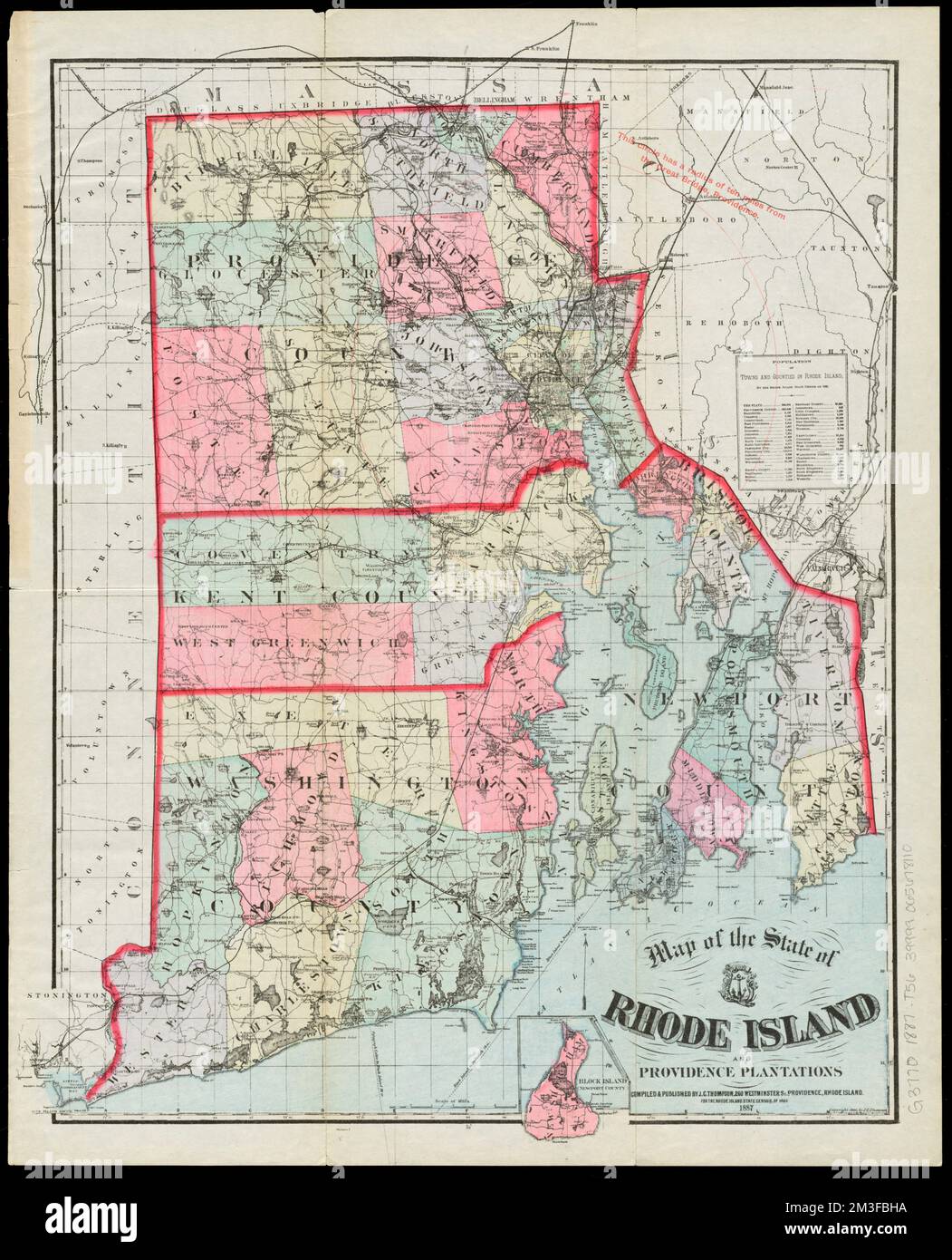 Map of the State of Rhode Island and Providence Plantations , Rhode Island, Maps Norman B. Leventhal Map Center Collection Stock Photohttps://www.alamy.com/image-license-details/?v=1https://www.alamy.com/map-of-the-state-of-rhode-island-and-providence-plantations-rhode-island-maps-norman-b-leventhal-map-center-collection-image501283030.html
RM2M3FBHA–Map of the State of Rhode Island and Providence Plantations , Rhode Island, Maps Norman B. Leventhal Map Center Collection
 Norman Island gradiented sunburst. Border map with colorful star rays. Norman Island illustration in digital, technology, internet, network style. Vec Stock Vectorhttps://www.alamy.com/image-license-details/?v=1https://www.alamy.com/norman-island-gradiented-sunburst-border-map-with-colorful-star-rays-norman-island-illustration-in-digital-technology-internet-network-style-vec-image546425490.html
RF2PMYR82–Norman Island gradiented sunburst. Border map with colorful star rays. Norman Island illustration in digital, technology, internet, network style. Vec
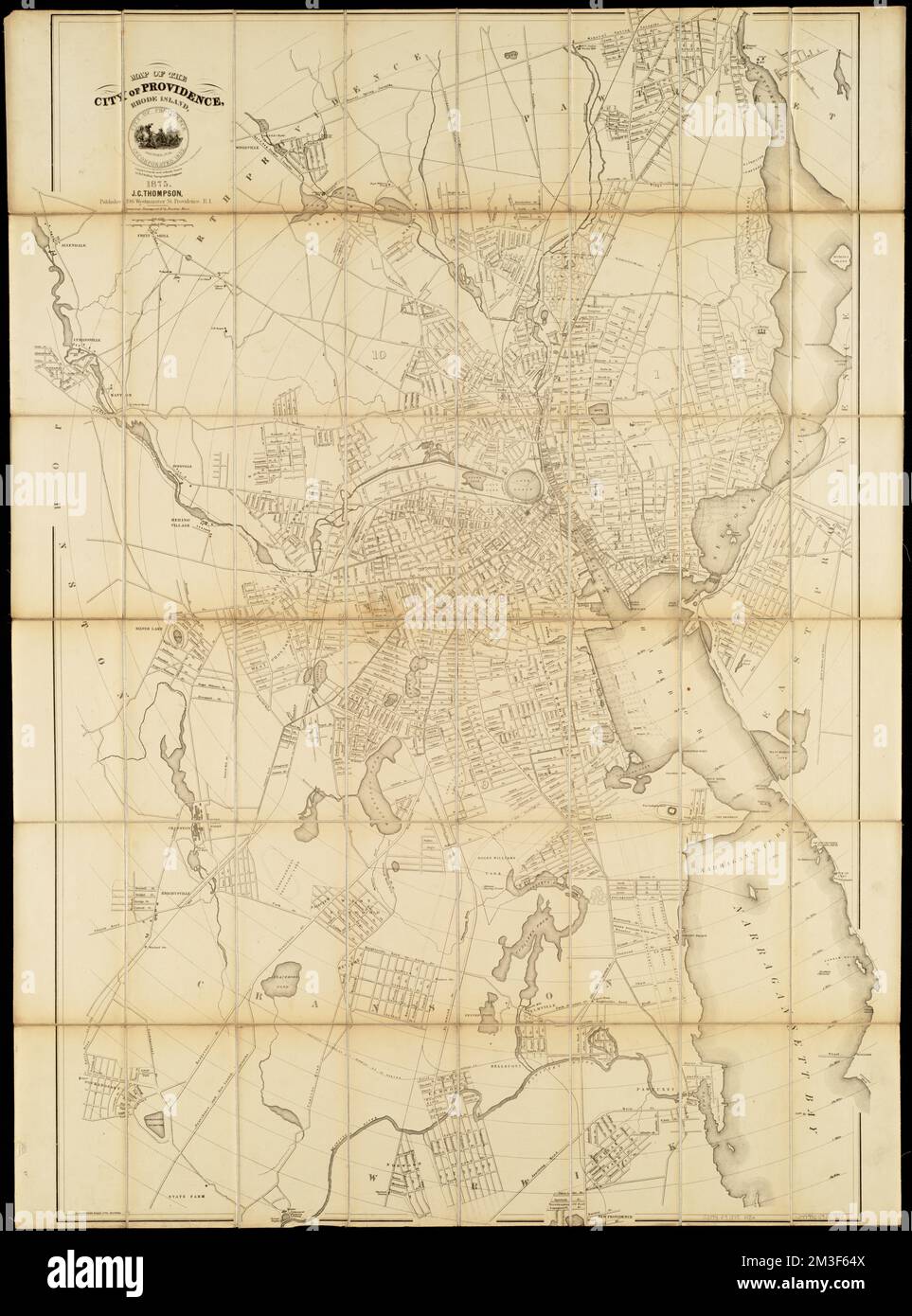 Map of the city of Providence, Rhode Island , Providence R.I., Maps Norman B. Leventhal Map Center Collection Stock Photohttps://www.alamy.com/image-license-details/?v=1https://www.alamy.com/map-of-the-city-of-providence-rhode-island-providence-ri-maps-norman-b-leventhal-map-center-collection-image501278762.html
RM2M3F64X–Map of the city of Providence, Rhode Island , Providence R.I., Maps Norman B. Leventhal Map Center Collection
 Map of Norman Island. Low poly illustration of the island. Purple geometric design. Polygonal vector illustration. Stock Vectorhttps://www.alamy.com/image-license-details/?v=1https://www.alamy.com/map-of-norman-island-low-poly-illustration-of-the-island-purple-geometric-design-polygonal-vector-illustration-image553675868.html
RF2R4P364–Map of Norman Island. Low poly illustration of the island. Purple geometric design. Polygonal vector illustration.
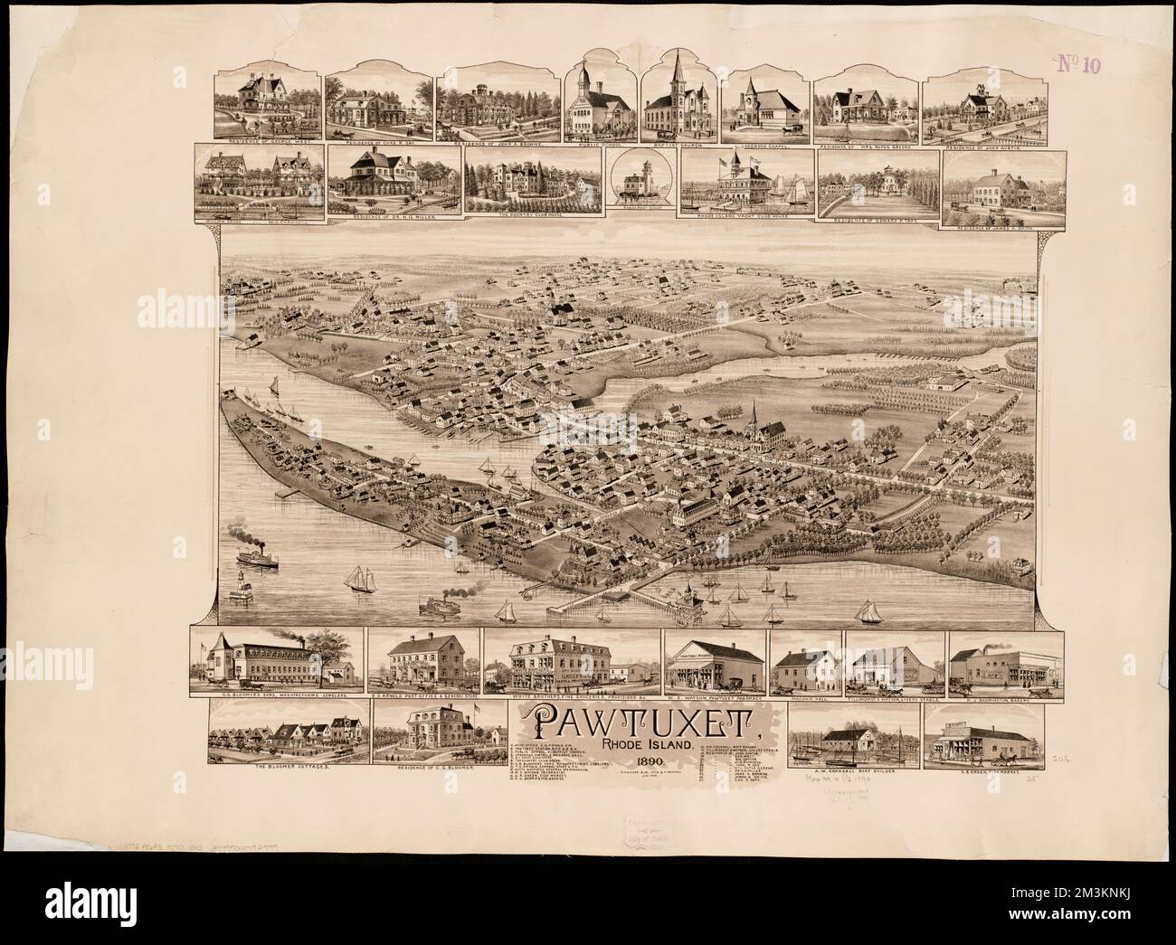 Pawtuxet, Rhode Island : 1890 , Pawtuxet R.I., Aerial views Norman B. Leventhal Map Center Collection Stock Photohttps://www.alamy.com/image-license-details/?v=1https://www.alamy.com/pawtuxet-rhode-island-1890-pawtuxet-ri-aerial-views-norman-b-leventhal-map-center-collection-image501378742.html
RM2M3KNKJ–Pawtuxet, Rhode Island : 1890 , Pawtuxet R.I., Aerial views Norman B. Leventhal Map Center Collection
 Network map of Norman Island. Island digital connections map. Technology, internet, network, telecommunication concept. Vector illustration. Stock Vectorhttps://www.alamy.com/image-license-details/?v=1https://www.alamy.com/network-map-of-norman-island-island-digital-connections-map-technology-internet-network-telecommunication-concept-vector-illustration-image553517645.html
RF2R4EWB9–Network map of Norman Island. Island digital connections map. Technology, internet, network, telecommunication concept. Vector illustration.
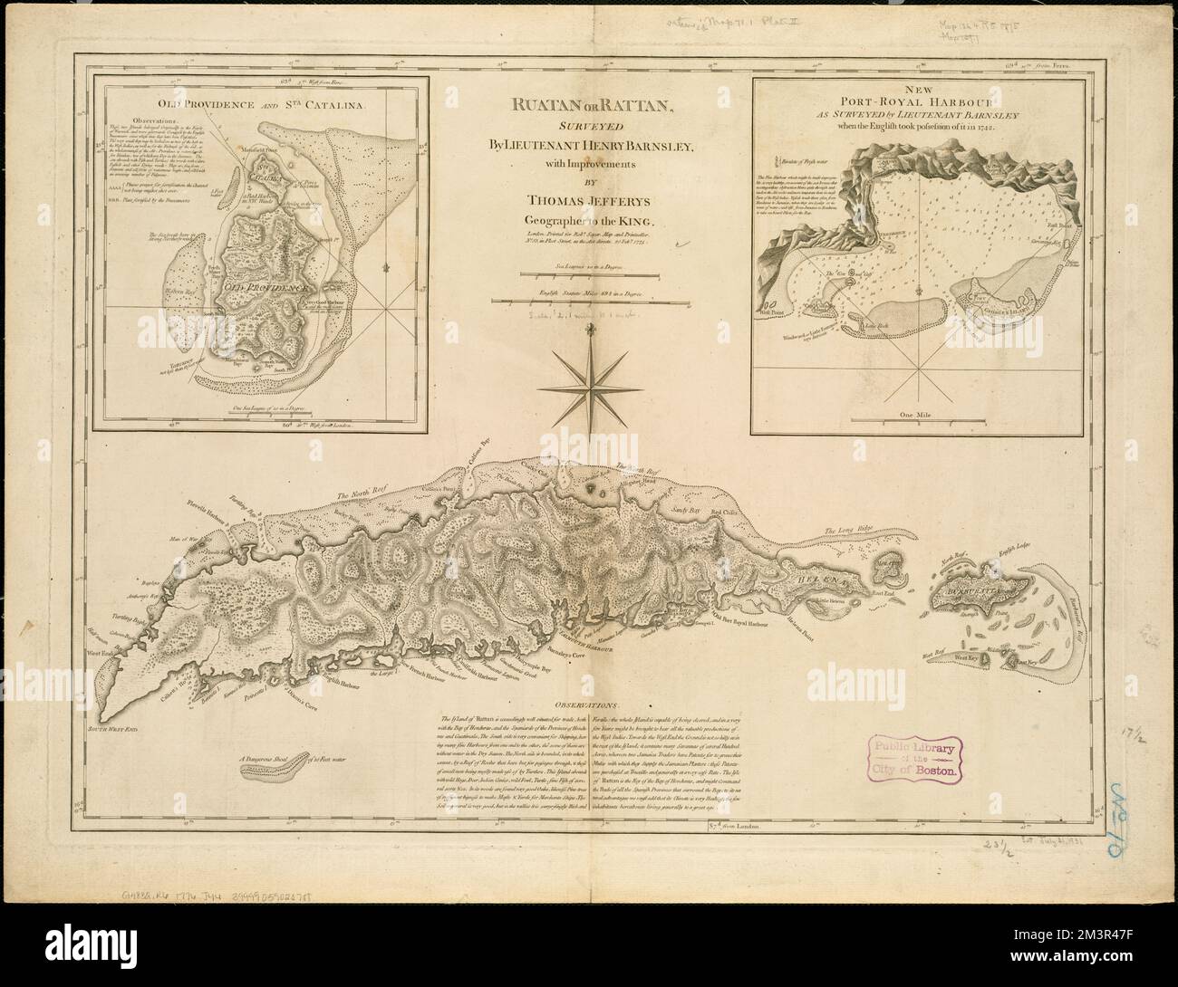 Ruatan or Rattan , Roatán Island Honduras, Maps, Early works to 1800 Norman B. Leventhal Map Center Collection Stock Photohttps://www.alamy.com/image-license-details/?v=1https://www.alamy.com/ruatan-or-rattan-roatan-island-honduras-maps-early-works-to-1800-norman-b-leventhal-map-center-collection-image501452883.html
RM2M3R47F–Ruatan or Rattan , Roatán Island Honduras, Maps, Early works to 1800 Norman B. Leventhal Map Center Collection
 Low poly map of Norman Island. Norman Island polygonal map. Technology, internet, network concept. Vector illustration. Stock Vectorhttps://www.alamy.com/image-license-details/?v=1https://www.alamy.com/low-poly-map-of-norman-island-norman-island-polygonal-map-technology-internet-network-concept-vector-illustration-image555113457.html
RF2R73GTH–Low poly map of Norman Island. Norman Island polygonal map. Technology, internet, network concept. Vector illustration.
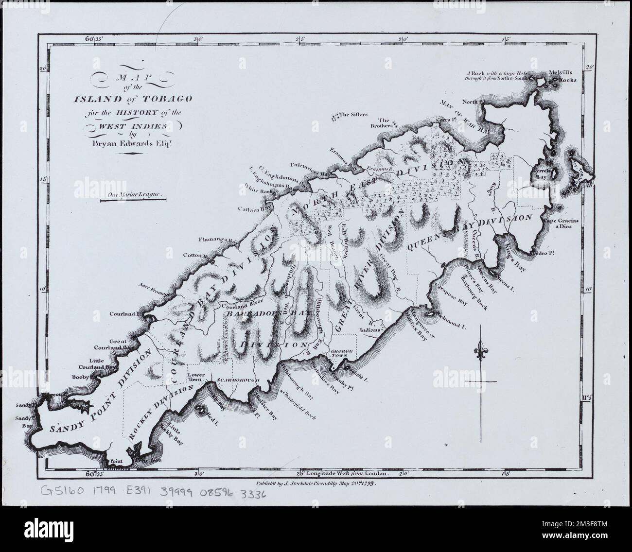 Map of the island of Tobago for the History of the West Indies , Tobago Colony, Maps Norman B. Leventhal Map Center Collection Stock Photohttps://www.alamy.com/image-license-details/?v=1https://www.alamy.com/map-of-the-island-of-tobago-for-the-history-of-the-west-indies-tobago-colony-maps-norman-b-leventhal-map-center-collection-image501280884.html
RM2M3F8TM–Map of the island of Tobago for the History of the West Indies , Tobago Colony, Maps Norman B. Leventhal Map Center Collection
 Norman Island - communication network map. Norman Island trendy geometric design on dark background. Technology, internet, network, telecommunication Stock Vectorhttps://www.alamy.com/image-license-details/?v=1https://www.alamy.com/norman-island-communication-network-map-norman-island-trendy-geometric-design-on-dark-background-technology-internet-network-telecommunication-image525341215.html
RF2NEKA27–Norman Island - communication network map. Norman Island trendy geometric design on dark background. Technology, internet, network, telecommunication
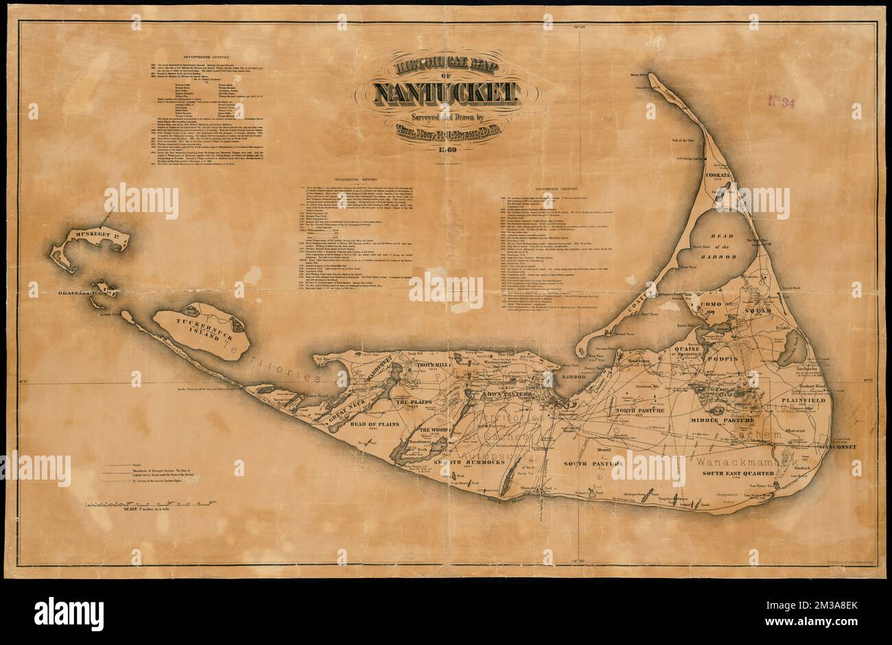 Historical map of Nantucket , Nantucket Mass., Maps, Nantucket Island Mass., Maps Norman B. Leventhal Map Center Collection Stock Photohttps://www.alamy.com/image-license-details/?v=1https://www.alamy.com/historical-map-of-nantucket-nantucket-mass-maps-nantucket-island-mass-maps-norman-b-leventhal-map-center-collection-image501170843.html
RM2M3A8EK–Historical map of Nantucket , Nantucket Mass., Maps, Nantucket Island Mass., Maps Norman B. Leventhal Map Center Collection
 Map of Norman Island. Low poly illustration of the island. Geometric design with stripes. Technology, internet, network concept. Vector illustration. Stock Vectorhttps://www.alamy.com/image-license-details/?v=1https://www.alamy.com/map-of-norman-island-low-poly-illustration-of-the-island-geometric-design-with-stripes-technology-internet-network-concept-vector-illustration-image558034561.html
RF2RBTJNN–Map of Norman Island. Low poly illustration of the island. Geometric design with stripes. Technology, internet, network concept. Vector illustration.
 A map of the island of St. Domingo , Hispaniola, Maps, Early works to 1800 Norman B. Leventhal Map Center Collection Stock Photohttps://www.alamy.com/image-license-details/?v=1https://www.alamy.com/a-map-of-the-island-of-st-domingo-hispaniola-maps-early-works-to-1800-norman-b-leventhal-map-center-collection-image501280888.html
RM2M3F8TT–A map of the island of St. Domingo , Hispaniola, Maps, Early works to 1800 Norman B. Leventhal Map Center Collection
 Vintage map of Norman Island. Grunge sunburst around the island. Black Norman border shape with sun rays on white background. Vector illustration. Stock Vectorhttps://www.alamy.com/image-license-details/?v=1https://www.alamy.com/vintage-map-of-norman-island-grunge-sunburst-around-the-island-black-norman-border-shape-with-sun-rays-on-white-background-vector-illustration-image558034542.html
RF2RBTJN2–Vintage map of Norman Island. Grunge sunburst around the island. Black Norman border shape with sun rays on white background. Vector illustration.
 A map of the island of Corsica , Corsica France, Maps, Early works to 1800 Norman B. Leventhal Map Center Collection Stock Photohttps://www.alamy.com/image-license-details/?v=1https://www.alamy.com/a-map-of-the-island-of-corsica-corsica-france-maps-early-works-to-1800-norman-b-leventhal-map-center-collection-image501280746.html
RM2M3F8KP–A map of the island of Corsica , Corsica France, Maps, Early works to 1800 Norman B. Leventhal Map Center Collection
 Norman Island geometric map. Stencil shape of Norman in low poly style. Attractive island vector illustration. Stock Vectorhttps://www.alamy.com/image-license-details/?v=1https://www.alamy.com/norman-island-geometric-map-stencil-shape-of-norman-in-low-poly-style-attractive-island-vector-illustration-image561629770.html
RF2RHMCE2–Norman Island geometric map. Stencil shape of Norman in low poly style. Attractive island vector illustration.
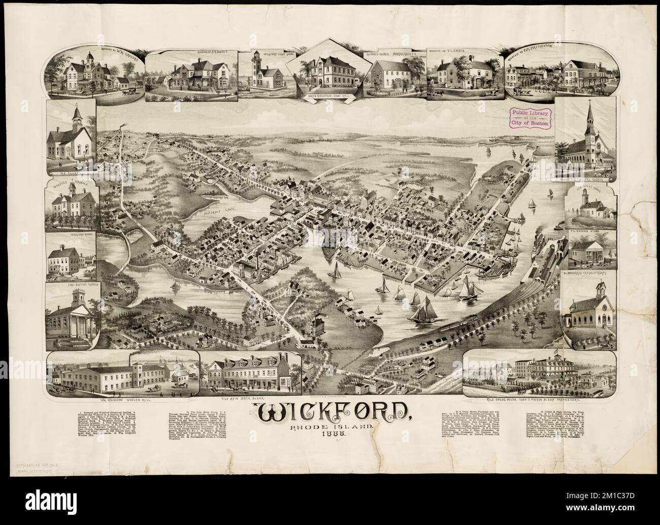 Wickford, Rhode Island : 1888 , North Kingstown R.I., Aerial views Norman B. Leventhal Map Center Collection Stock Photohttps://www.alamy.com/image-license-details/?v=1https://www.alamy.com/wickford-rhode-island-1888-north-kingstown-ri-aerial-views-norman-b-leventhal-map-center-collection-image499981313.html
RM2M1C37D–Wickford, Rhode Island : 1888 , North Kingstown R.I., Aerial views Norman B. Leventhal Map Center Collection
 Corona virus in Norman Island sign. Round badge with shape of virus and Norman map. Yellow island epidemy lock down stamp. Vector illustration. Stock Vectorhttps://www.alamy.com/image-license-details/?v=1https://www.alamy.com/corona-virus-in-norman-island-sign-round-badge-with-shape-of-virus-and-norman-map-yellow-island-epidemy-lock-down-stamp-vector-illustration-image545558982.html
RF2PKGA1A–Corona virus in Norman Island sign. Round badge with shape of virus and Norman map. Yellow island epidemy lock down stamp. Vector illustration.
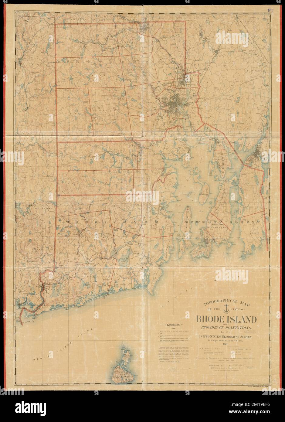 Topographical map of the state of Rhode Island and Providence plantations , Rhode Island, Maps Norman B. Leventhal Map Center Collection Stock Photohttps://www.alamy.com/image-license-details/?v=1https://www.alamy.com/topographical-map-of-the-state-of-rhode-island-and-providence-plantations-rhode-island-maps-norman-b-leventhal-map-center-collection-image499924298.html
RM2M19EF6–Topographical map of the state of Rhode Island and Providence plantations , Rhode Island, Maps Norman B. Leventhal Map Center Collection
 Norman Island logo. Sign with the map and colored stripes, vector illustration. Can be used as insignia, logotype, label, sticker or badge of the Norm Stock Vectorhttps://www.alamy.com/image-license-details/?v=1https://www.alamy.com/norman-island-logo-sign-with-the-map-and-colored-stripes-vector-illustration-can-be-used-as-insignia-logotype-label-sticker-or-badge-of-the-norm-image514846625.html
RF2MWH83D–Norman Island logo. Sign with the map and colored stripes, vector illustration. Can be used as insignia, logotype, label, sticker or badge of the Norm
 Topographic map of the Island of Niihau, Kauai County, Hawaii , Niihau Hawaii, Maps Norman B. Leventhal Map Center Collection Stock Photohttps://www.alamy.com/image-license-details/?v=1https://www.alamy.com/topographic-map-of-the-island-of-niihau-kauai-county-hawaii-niihau-hawaii-maps-norman-b-leventhal-map-center-collection-image499923232.html
RM2M19D54–Topographic map of the Island of Niihau, Kauai County, Hawaii , Niihau Hawaii, Maps Norman B. Leventhal Map Center Collection
 Norman Island vector illustration. Norman Island design on gradient stripes background. Technology, internet, network, telecommunication concept. Attr Stock Vectorhttps://www.alamy.com/image-license-details/?v=1https://www.alamy.com/norman-island-vector-illustration-norman-island-design-on-gradient-stripes-background-technology-internet-network-telecommunication-concept-attr-image557243348.html
RF2RAGHG4–Norman Island vector illustration. Norman Island design on gradient stripes background. Technology, internet, network, telecommunication concept. Attr
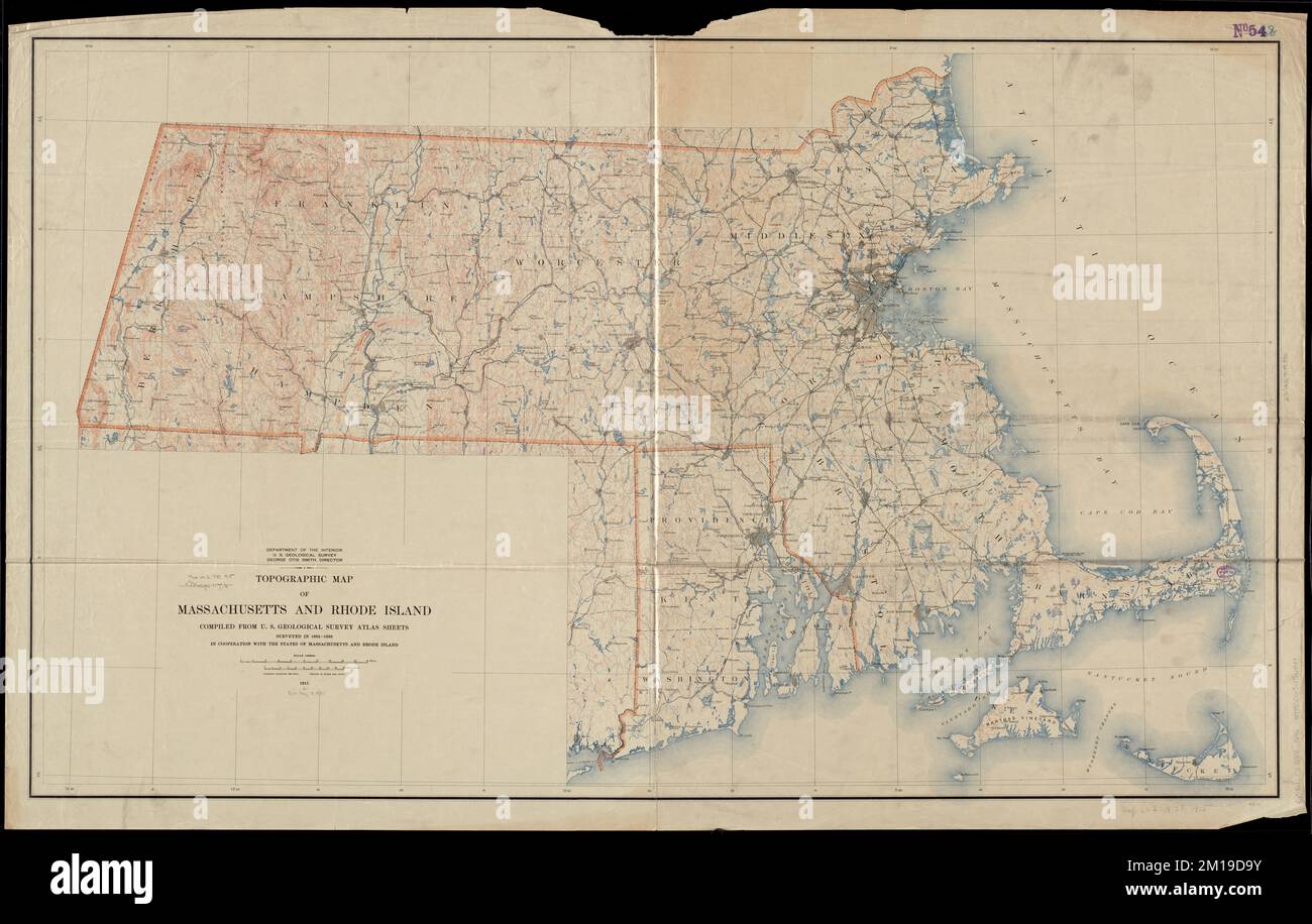 Topographic map of Massachusetts and Rhode Island , Massachusetts, Maps, Rhode Island, Maps Norman B. Leventhal Map Center Collection Stock Photohttps://www.alamy.com/image-license-details/?v=1https://www.alamy.com/topographic-map-of-massachusetts-and-rhode-island-massachusetts-maps-rhode-island-maps-norman-b-leventhal-map-center-collection-image499923367.html
RM2M19D9Y–Topographic map of Massachusetts and Rhode Island , Massachusetts, Maps, Rhode Island, Maps Norman B. Leventhal Map Center Collection
RF2R9YRKX–Norman Island icon. Trendy tech logo of the island. Geometric mesh round design. Technology, internet, network, telecommunication concept. Vector illu
 Narragansett Pier, Rhode Island : 1888 , Narragansett R.I., Aerial views Norman B. Leventhal Map Center Collection Stock Photohttps://www.alamy.com/image-license-details/?v=1https://www.alamy.com/narragansett-pier-rhode-island-1888-narragansett-ri-aerial-views-norman-b-leventhal-map-center-collection-image501335363.html
RM2M3HPAB–Narragansett Pier, Rhode Island : 1888 , Narragansett R.I., Aerial views Norman B. Leventhal Map Center Collection
 Bright colored Norman Island shape. Multicolor geometric style island logo. Modern trendy design. Amazing vector illustration. Stock Vectorhttps://www.alamy.com/image-license-details/?v=1https://www.alamy.com/bright-colored-norman-island-shape-multicolor-geometric-style-island-logo-modern-trendy-design-amazing-vector-illustration-image561348131.html
RF2RH7H7F–Bright colored Norman Island shape. Multicolor geometric style island logo. Modern trendy design. Amazing vector illustration.
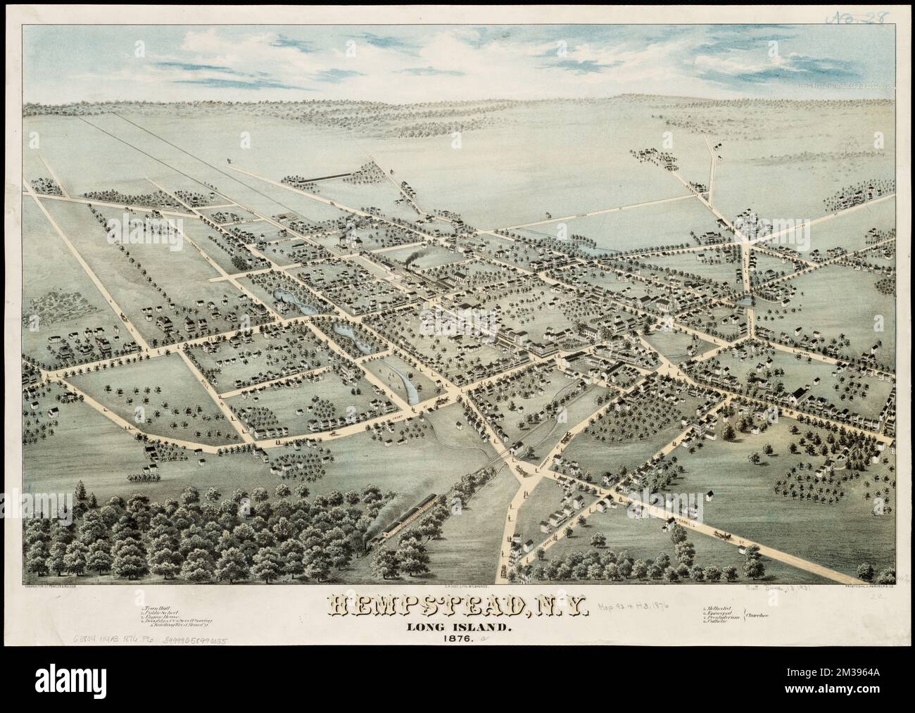 Hempstead, N.Y : Long Island, 1876 , Hempstead N.Y., Aerial views Norman B. Leventhal Map Center Collection Stock Photohttps://www.alamy.com/image-license-details/?v=1https://www.alamy.com/hempstead-ny-long-island-1876-hempstead-ny-aerial-views-norman-b-leventhal-map-center-collection-image501147034.html
RM2M3964A–Hempstead, N.Y : Long Island, 1876 , Hempstead N.Y., Aerial views Norman B. Leventhal Map Center Collection
RF2RCWB1E–Norman Island icon. Round logo with map and title. Stylish Norman Island badge with map. Vector illustration.
 A plan of a survey of Noddles Island , East Boston Boston, Mass., Maps Norman B. Leventhal Map Center Collection Stock Photohttps://www.alamy.com/image-license-details/?v=1https://www.alamy.com/a-plan-of-a-survey-of-noddles-island-east-boston-boston-mass-maps-norman-b-leventhal-map-center-collection-image501390148.html
RM2M3M870–A plan of a survey of Noddles Island , East Boston Boston, Mass., Maps Norman B. Leventhal Map Center Collection
RF2R8638F–Norman Island icons collection. Bright colourful trendy map icons. Modern Norman Island badge. Vector illustration.
 Sectional map of the northern portion of Vancouver Island , Vancouver Island B.C., Maps Norman B. Leventhal Map Center Collection Stock Photohttps://www.alamy.com/image-license-details/?v=1https://www.alamy.com/sectional-map-of-the-northern-portion-of-vancouver-island-vancouver-island-bc-maps-norman-b-leventhal-map-center-collection-image501480876.html
RM2M3TBY8–Sectional map of the northern portion of Vancouver Island , Vancouver Island B.C., Maps Norman B. Leventhal Map Center Collection
 Norman Island network map. Abstract geometric map of the island. Digital connections and telecommunication design. Glowing internet network. Attractiv Stock Vectorhttps://www.alamy.com/image-license-details/?v=1https://www.alamy.com/norman-island-network-map-abstract-geometric-map-of-the-island-digital-connections-and-telecommunication-design-glowing-internet-network-attractiv-image563305451.html
RF2RMCNRR–Norman Island network map. Abstract geometric map of the island. Digital connections and telecommunication design. Glowing internet network. Attractiv
![[Island of St. Peters] , Nautical charts, Saint Pierre and Miquelon, Early works to 1800 Norman B. Leventhal Map Center Collection Stock Photo [Island of St. Peters] , Nautical charts, Saint Pierre and Miquelon, Early works to 1800 Norman B. Leventhal Map Center Collection Stock Photo](https://c8.alamy.com/comp/2M3D7E8/island-of-st-peters-nautical-charts-saint-pierre-and-miquelon-early-works-to-1800-norman-b-leventhal-map-center-collection-2M3D7E8.jpg) [Island of St. Peters] , Nautical charts, Saint Pierre and Miquelon, Early works to 1800 Norman B. Leventhal Map Center Collection Stock Photohttps://www.alamy.com/image-license-details/?v=1https://www.alamy.com/island-of-st-peters-nautical-charts-saint-pierre-and-miquelon-early-works-to-1800-norman-b-leventhal-map-center-collection-image501235904.html
[Island of St. Peters] , Nautical charts, Saint Pierre and Miquelon, Early works to 1800 Norman B. Leventhal Map Center Collection Stock Photohttps://www.alamy.com/image-license-details/?v=1https://www.alamy.com/island-of-st-peters-nautical-charts-saint-pierre-and-miquelon-early-works-to-1800-norman-b-leventhal-map-center-collection-image501235904.htmlRM2M3D7E8–[Island of St. Peters] , Nautical charts, Saint Pierre and Miquelon, Early works to 1800 Norman B. Leventhal Map Center Collection
 Norman Island round stamp. Round logo with map and title. Stylish minimal Norman Island badge with map. Vector illustration. Stock Vectorhttps://www.alamy.com/image-license-details/?v=1https://www.alamy.com/norman-island-round-stamp-round-logo-with-map-and-title-stylish-minimal-norman-island-badge-with-map-vector-illustration-image526864642.html
RF2NH4N6A–Norman Island round stamp. Round logo with map and title. Stylish minimal Norman Island badge with map. Vector illustration.
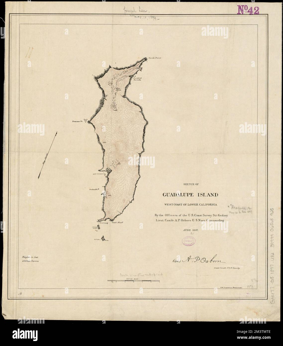 Sketch of Guadalupe Island : west coast of Lower California , Guadalupe Island Mexico, Maps Norman B. Leventhal Map Center Collection Stock Photohttps://www.alamy.com/image-license-details/?v=1https://www.alamy.com/sketch-of-guadalupe-island-west-coast-of-lower-california-guadalupe-island-mexico-maps-norman-b-leventhal-map-center-collection-image501487854.html
RM2M3TMTE–Sketch of Guadalupe Island : west coast of Lower California , Guadalupe Island Mexico, Maps Norman B. Leventhal Map Center Collection
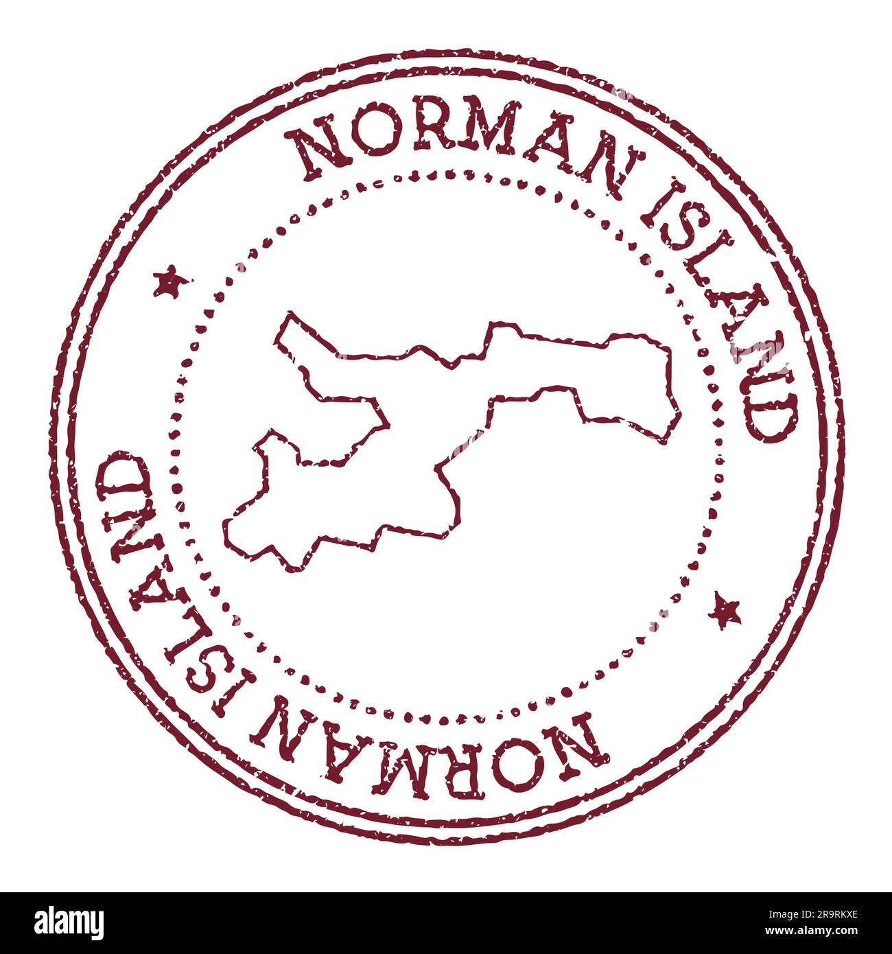 Norman Island round rubber stamp with island map. Vintage red passport stamp with circular text and stars, vector illustration. Stock Vectorhttps://www.alamy.com/image-license-details/?v=1https://www.alamy.com/norman-island-round-rubber-stamp-with-island-map-vintage-red-passport-stamp-with-circular-text-and-stars-vector-illustration-image556784214.html
RF2R9RKXE–Norman Island round rubber stamp with island map. Vintage red passport stamp with circular text and stars, vector illustration.