Northern southern hemisphere map Stock Photos and Images
(116)See northern southern hemisphere map stock video clipsQuick filters:
Northern southern hemisphere map Stock Photos and Images
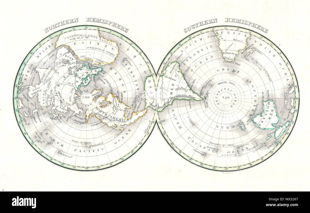 . Northern Hemisphere - Southern Hemisphere . English: An unusual and attractive map of the world on a hemisphere projection. Depicts the world as seen from the North Pole and south pole. Antarctica is mysteriously absent. Divided according to continents. In Africa the Mountains of the Moon are shown, as are the Andes in South America, the Rockies in North America, and the Altaian Mountains of Asia. Prepared by Thomas Bradford for the 1838 issue of his small format atlas of the world. . 1838 (undated) 7 1838 Bradford Map of the World on Polar Projection ( Northern and Southern Hemispheres ) - Stock Photohttps://www.alamy.com/image-license-details/?v=1https://www.alamy.com/northern-hemisphere-southern-hemisphere-english-an-unusual-and-attractive-map-of-the-world-on-a-hemisphere-projection-depicts-the-world-as-seen-from-the-north-pole-and-south-pole-antarctica-is-mysteriously-absent-divided-according-to-continents-in-africa-the-mountains-of-the-moon-are-shown-as-are-the-andes-in-south-america-the-rockies-in-north-america-and-the-altaian-mountains-of-asia-prepared-by-thomas-bradford-for-the-1838-issue-of-his-small-format-atlas-of-the-world-1838-undated-7-1838-bradford-map-of-the-world-on-polar-projection-northern-and-southern-hemispheres-image188152335.html
RMMX3267–. Northern Hemisphere - Southern Hemisphere . English: An unusual and attractive map of the world on a hemisphere projection. Depicts the world as seen from the North Pole and south pole. Antarctica is mysteriously absent. Divided according to continents. In Africa the Mountains of the Moon are shown, as are the Andes in South America, the Rockies in North America, and the Altaian Mountains of Asia. Prepared by Thomas Bradford for the 1838 issue of his small format atlas of the world. . 1838 (undated) 7 1838 Bradford Map of the World on Polar Projection ( Northern and Southern Hemispheres ) -
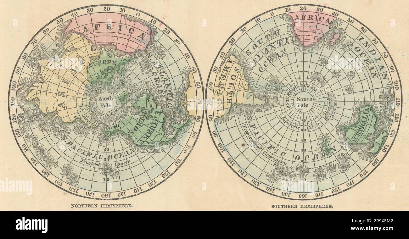 World. Northern Hemisphere & Southern Hemispheres. JOHNSON 1866 old map Stock Photohttps://www.alamy.com/image-license-details/?v=1https://www.alamy.com/world-northern-hemisphere-southern-hemispheres-johnson-1866-old-map-image556845970.html
RF2R9XEM2–World. Northern Hemisphere & Southern Hemispheres. JOHNSON 1866 old map
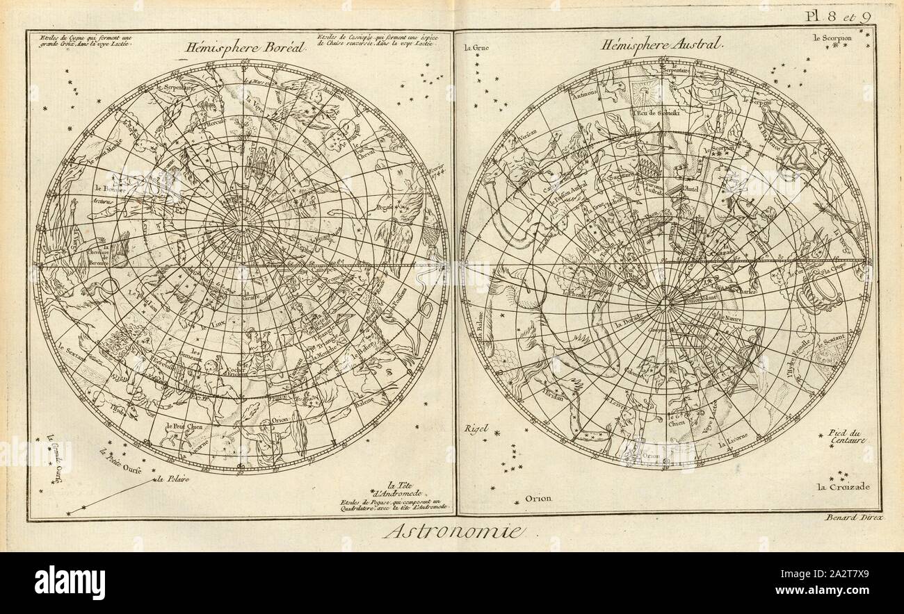 Astronomy 7, Star map of the Northern and Southern Hemisphere, Signed: Benard Direx, Pl. 8 et 9, after p. 14, Benard (dir.), Denis Diderot; M. d'Alembert: Encyclopédie, ou dictionnaire raisonné des sciences, des arts et des métierss, des arts et des métiers. Genève: chez Pellet, MDCCLXXVIII [1778 Stock Photohttps://www.alamy.com/image-license-details/?v=1https://www.alamy.com/astronomy-7-star-map-of-the-northern-and-southern-hemisphere-signed-benard-direx-pl-8-et-9-after-p-14-benard-dir-denis-diderot-m-dalembert-encyclopdie-ou-dictionnaire-raisonn-des-sciences-des-arts-et-des-mtierss-des-arts-et-des-mtiers-genve-chez-pellet-mdcclxxviii-1778-image328759377.html
RM2A2T7X9–Astronomy 7, Star map of the Northern and Southern Hemisphere, Signed: Benard Direx, Pl. 8 et 9, after p. 14, Benard (dir.), Denis Diderot; M. d'Alembert: Encyclopédie, ou dictionnaire raisonné des sciences, des arts et des métierss, des arts et des métiers. Genève: chez Pellet, MDCCLXXVIII [1778
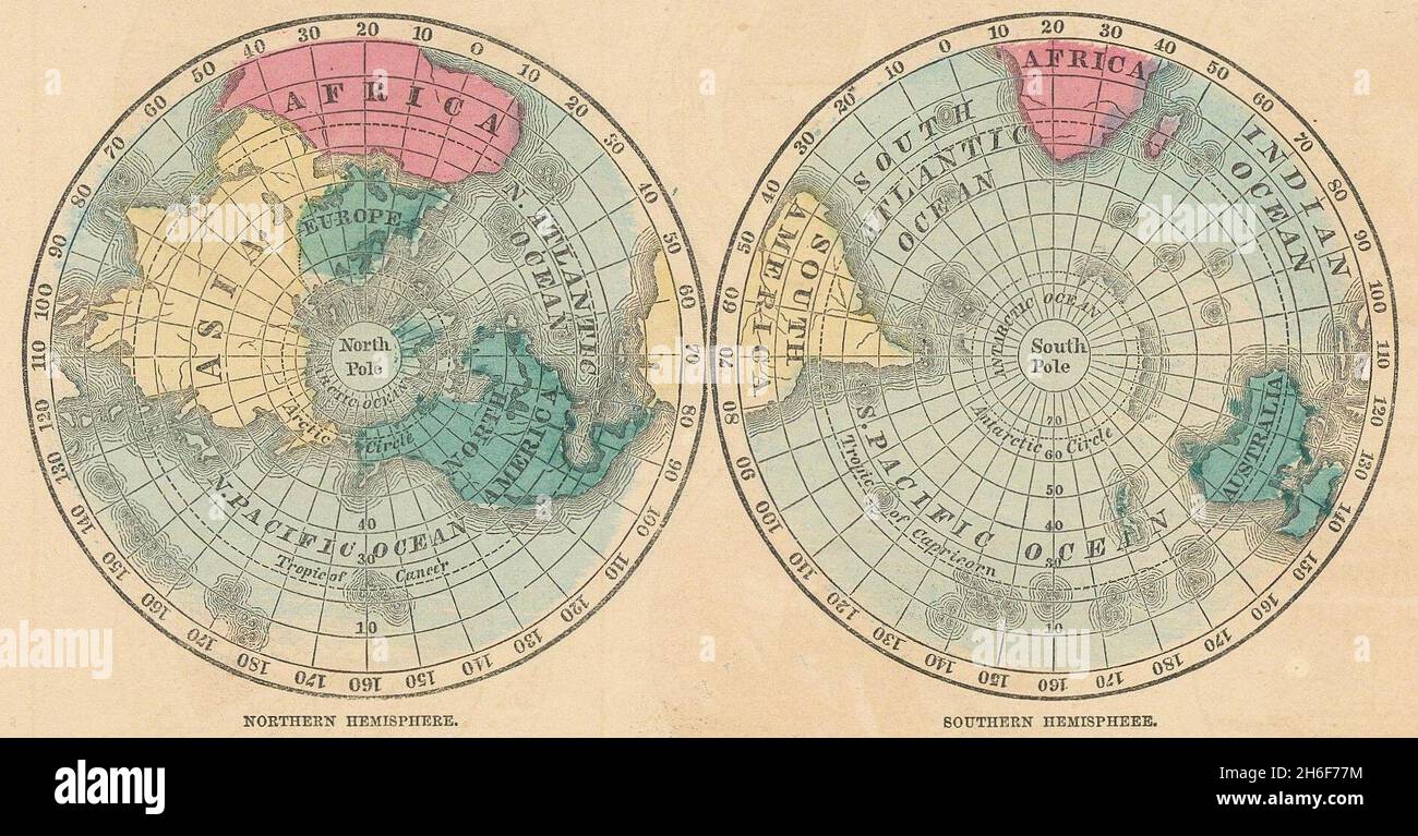 World. Northern Hemisphere & Southern Hemispheres. JOHNSON 1865 old map Stock Photohttps://www.alamy.com/image-license-details/?v=1https://www.alamy.com/world-northern-hemisphere-southern-hemispheres-johnson-1865-old-map-image451492488.html
RF2H6F77M–World. Northern Hemisphere & Southern Hemispheres. JOHNSON 1865 old map
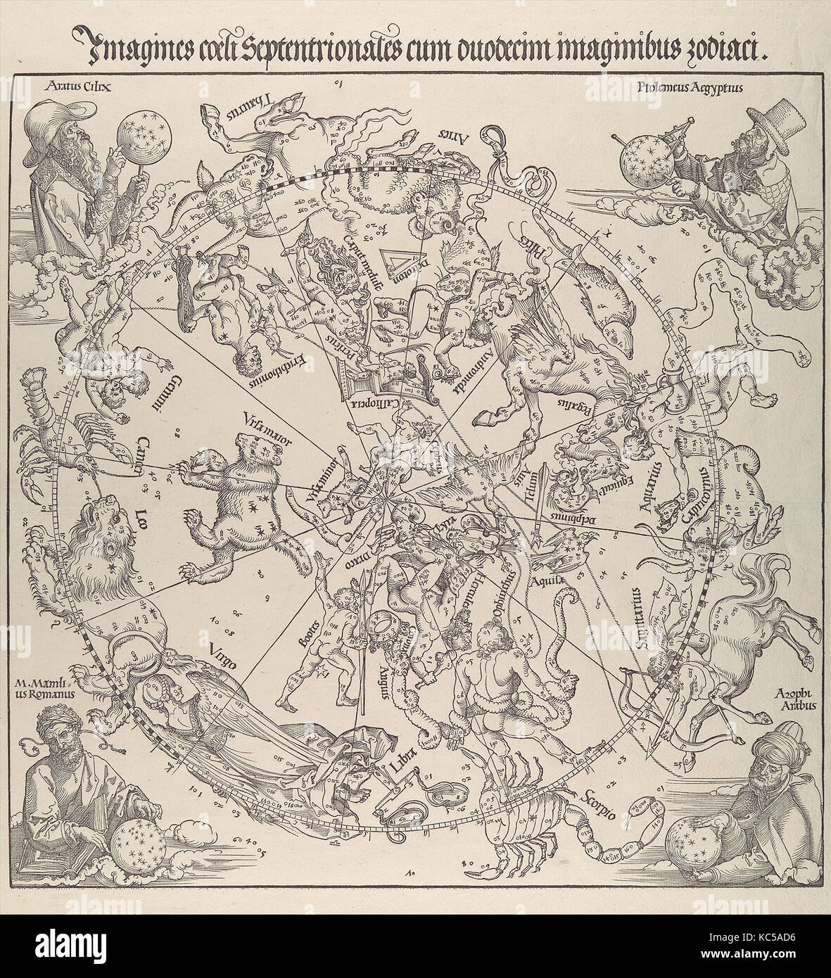 The Celestial Map- Northern Hemisphere, Albrecht Dürer, 1515 Stock Photohttps://www.alamy.com/image-license-details/?v=1https://www.alamy.com/stock-image-the-celestial-map-northern-hemisphere-albrecht-drer-1515-162387154.html
RMKC5AD6–The Celestial Map- Northern Hemisphere, Albrecht Dürer, 1515
 World. Northern Hemisphere & Southern Hemispheres. JOHNSON 1861 old map Stock Photohttps://www.alamy.com/image-license-details/?v=1https://www.alamy.com/world-northern-hemisphere-southern-hemispheres-johnson-1861-old-map-image556847259.html
RF2R9XGA3–World. Northern Hemisphere & Southern Hemispheres. JOHNSON 1861 old map
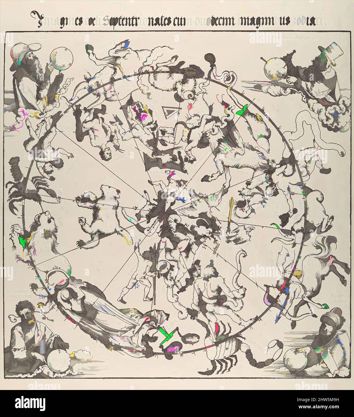 Art inspired by The Celestial Map- Northern Hemisphere, 1515, Woodcut, Sheet: 24 1/8 x 17 15/16 in. (61.3 x 45.6 cm), Prints, Albrecht Dürer (German, Nuremberg 1471–1528 Nuremberg), The ancient tradition of making celestial maps can be traced back, by way of Arabic sources, to, Classic works modernized by Artotop with a splash of modernity. Shapes, color and value, eye-catching visual impact on art. Emotions through freedom of artworks in a contemporary way. A timeless message pursuing a wildly creative new direction. Artists turning to the digital medium and creating the Artotop NFT Stock Photohttps://www.alamy.com/image-license-details/?v=1https://www.alamy.com/art-inspired-by-the-celestial-map-northern-hemisphere-1515-woodcut-sheet-24-18-x-17-1516-in-613-x-456-cm-prints-albrecht-drer-german-nuremberg-14711528-nuremberg-the-ancient-tradition-of-making-celestial-maps-can-be-traced-back-by-way-of-arabic-sources-to-classic-works-modernized-by-artotop-with-a-splash-of-modernity-shapes-color-and-value-eye-catching-visual-impact-on-art-emotions-through-freedom-of-artworks-in-a-contemporary-way-a-timeless-message-pursuing-a-wildly-creative-new-direction-artists-turning-to-the-digital-medium-and-creating-the-artotop-nft-image462961677.html
RF2HW5M9H–Art inspired by The Celestial Map- Northern Hemisphere, 1515, Woodcut, Sheet: 24 1/8 x 17 15/16 in. (61.3 x 45.6 cm), Prints, Albrecht Dürer (German, Nuremberg 1471–1528 Nuremberg), The ancient tradition of making celestial maps can be traced back, by way of Arabic sources, to, Classic works modernized by Artotop with a splash of modernity. Shapes, color and value, eye-catching visual impact on art. Emotions through freedom of artworks in a contemporary way. A timeless message pursuing a wildly creative new direction. Artists turning to the digital medium and creating the Artotop NFT
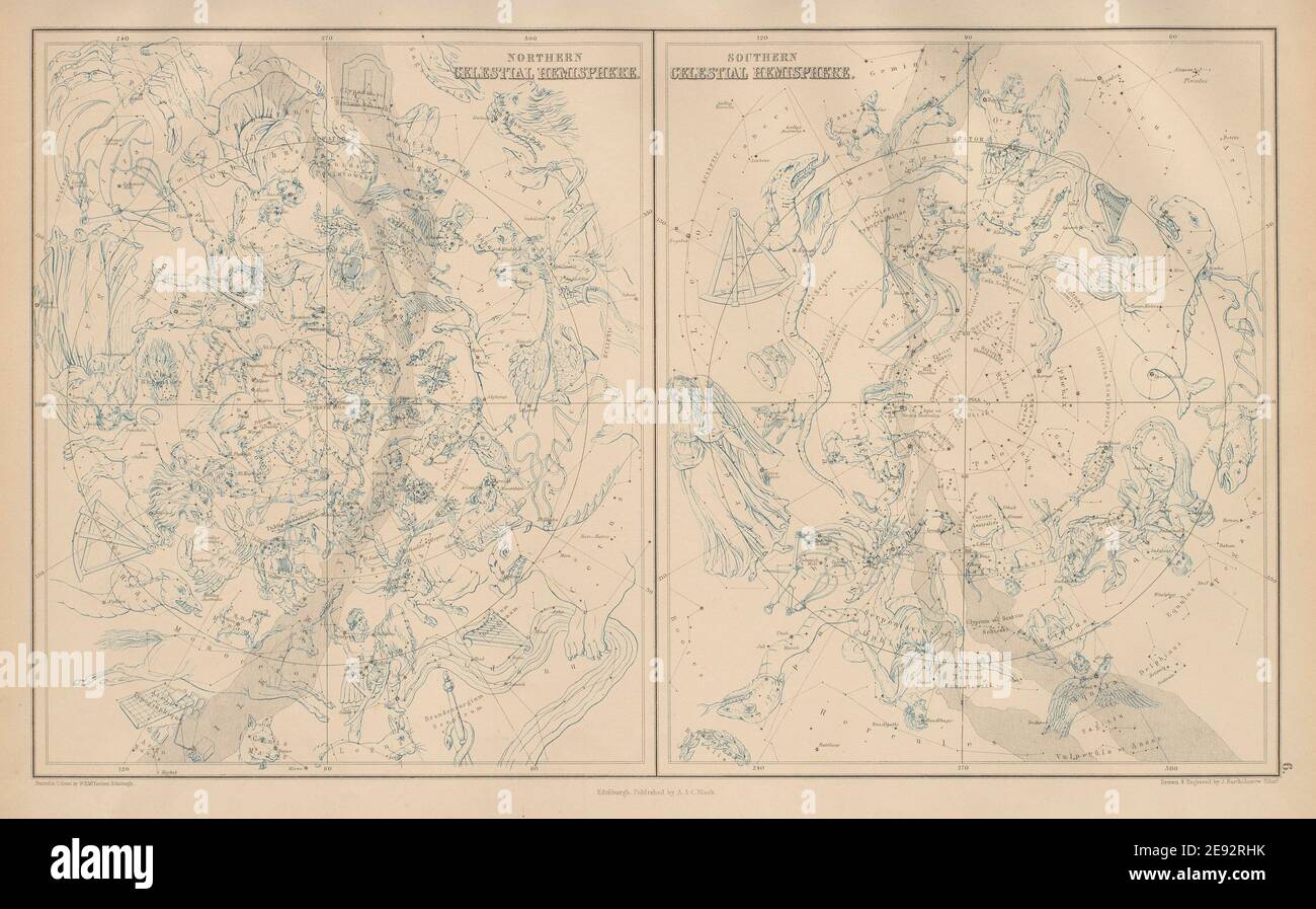 Northern & Southern Celestial Hemispheres. Star charts. BARTHOLOMEW 1870 map Stock Photohttps://www.alamy.com/image-license-details/?v=1https://www.alamy.com/northern-southern-celestial-hemispheres-star-charts-bartholomew-1870-map-image401432799.html
RF2E92RHK–Northern & Southern Celestial Hemispheres. Star charts. BARTHOLOMEW 1870 map
 Big green world map. Expanded Planet Earth. Globe scan. Southern and Northern Hemisphere on one map. Wide isolated vector illustration on white Stock Vectorhttps://www.alamy.com/image-license-details/?v=1https://www.alamy.com/big-green-world-map-expanded-planet-earth-globe-scan-southern-and-northern-hemisphere-on-one-map-wide-isolated-vector-illustration-on-white-image257466351.html
RFTXTGXR–Big green world map. Expanded Planet Earth. Globe scan. Southern and Northern Hemisphere on one map. Wide isolated vector illustration on white
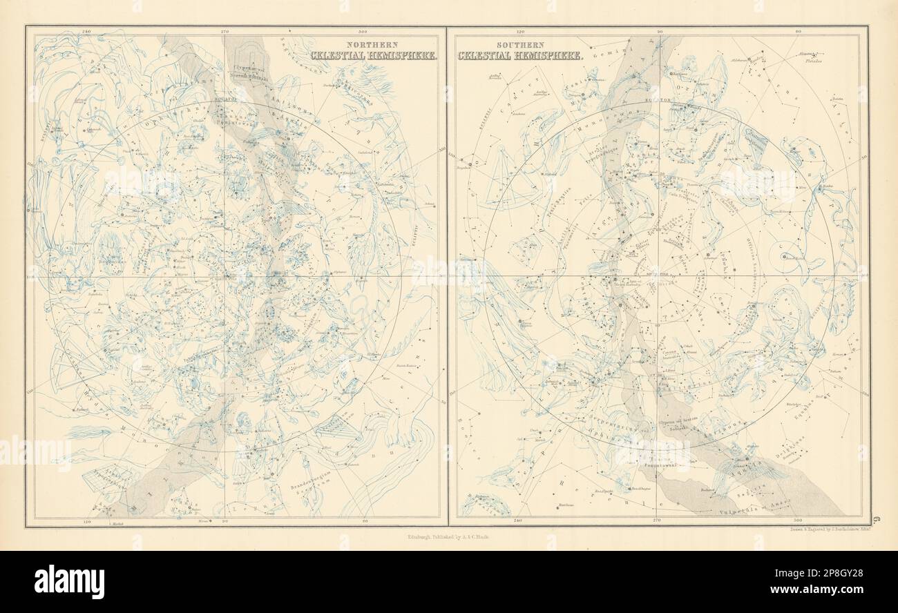 Star maps. Northern & Southern Celestial Hemispheres. JOHN BARTHOLOMEW 1862 Stock Photohttps://www.alamy.com/image-license-details/?v=1https://www.alamy.com/star-maps-northern-southern-celestial-hemispheres-john-bartholomew-1862-image538811120.html
RF2P8GY28–Star maps. Northern & Southern Celestial Hemispheres. JOHN BARTHOLOMEW 1862
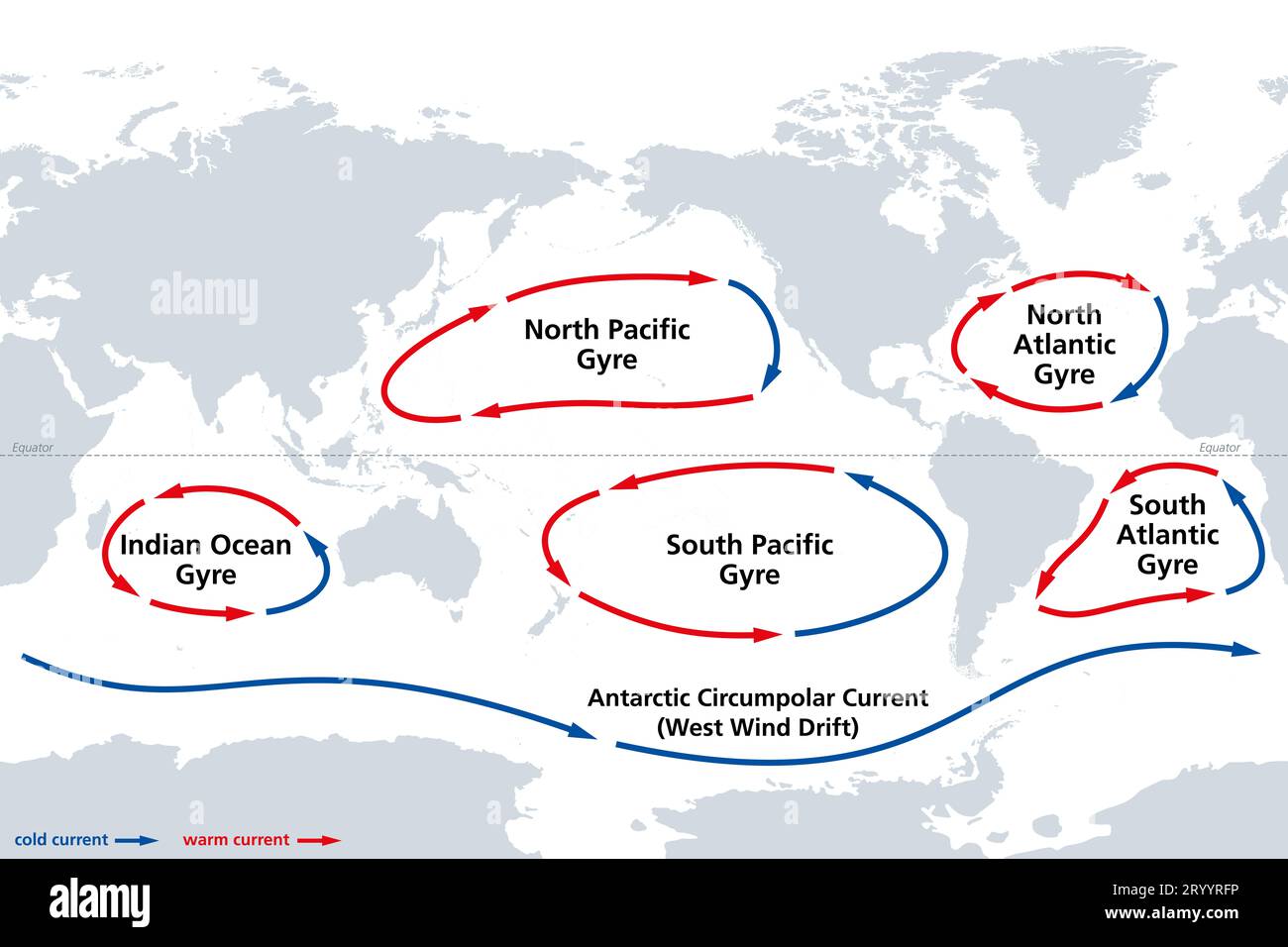 The major ocean gyres, world map. The most notable ocean gyres, flowing clockwise in the Northern and counterclockwise in the Southern hemisphere. Stock Photohttps://www.alamy.com/image-license-details/?v=1https://www.alamy.com/the-major-ocean-gyres-world-map-the-most-notable-ocean-gyres-flowing-clockwise-in-the-northern-and-counterclockwise-in-the-southern-hemisphere-image567938666.html
RF2RYYRFP–The major ocean gyres, world map. The most notable ocean gyres, flowing clockwise in the Northern and counterclockwise in the Southern hemisphere.
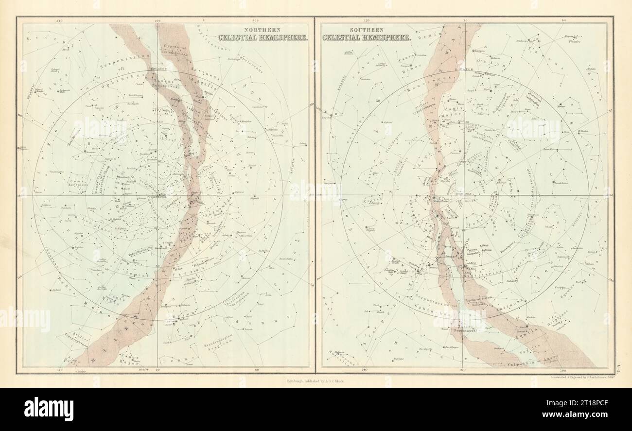 Star maps. Northern & Southern Celestial Hemispheres. JOHN BARTHOLOMEW 1854 Stock Photohttps://www.alamy.com/image-license-details/?v=1https://www.alamy.com/star-maps-northern-southern-celestial-hemispheres-john-bartholomew-1854-image568750015.html
RF2T18PCF–Star maps. Northern & Southern Celestial Hemispheres. JOHN BARTHOLOMEW 1854
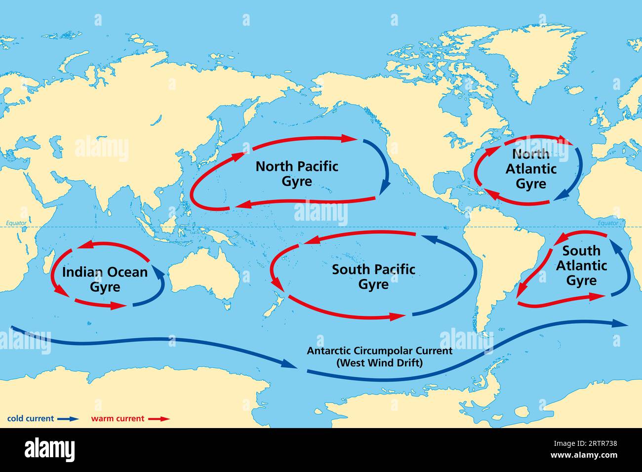 Major ocean gyres, world map. The five most notable ocean gyres, flowing clockwise in the Northern and counterclockwise in the Southern hemisphere. Stock Photohttps://www.alamy.com/image-license-details/?v=1https://www.alamy.com/major-ocean-gyres-world-map-the-five-most-notable-ocean-gyres-flowing-clockwise-in-the-northern-and-counterclockwise-in-the-southern-hemisphere-image565993996.html
RF2RTR738–Major ocean gyres, world map. The five most notable ocean gyres, flowing clockwise in the Northern and counterclockwise in the Southern hemisphere.
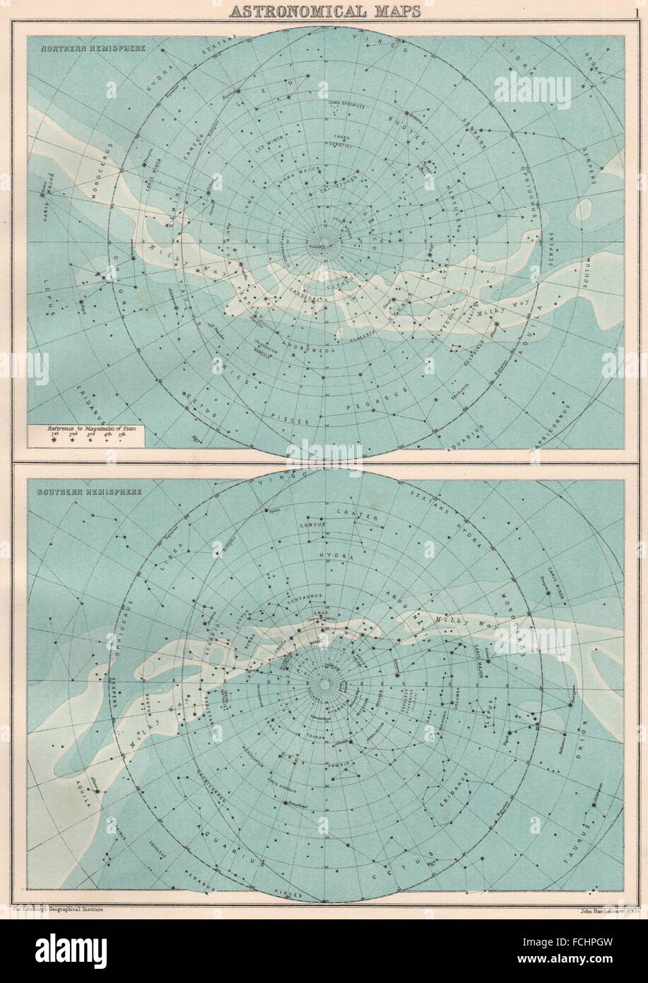 ASTRONOMICAL MAPS: Northern & Southern Hemispheres. BARTHOLOMEW, 1891 Stock Photohttps://www.alamy.com/image-license-details/?v=1https://www.alamy.com/stock-photo-astronomical-maps-northern-southern-hemispheres-bartholomew-1891-93818617.html
RFFCHPGW–ASTRONOMICAL MAPS: Northern & Southern Hemispheres. BARTHOLOMEW, 1891
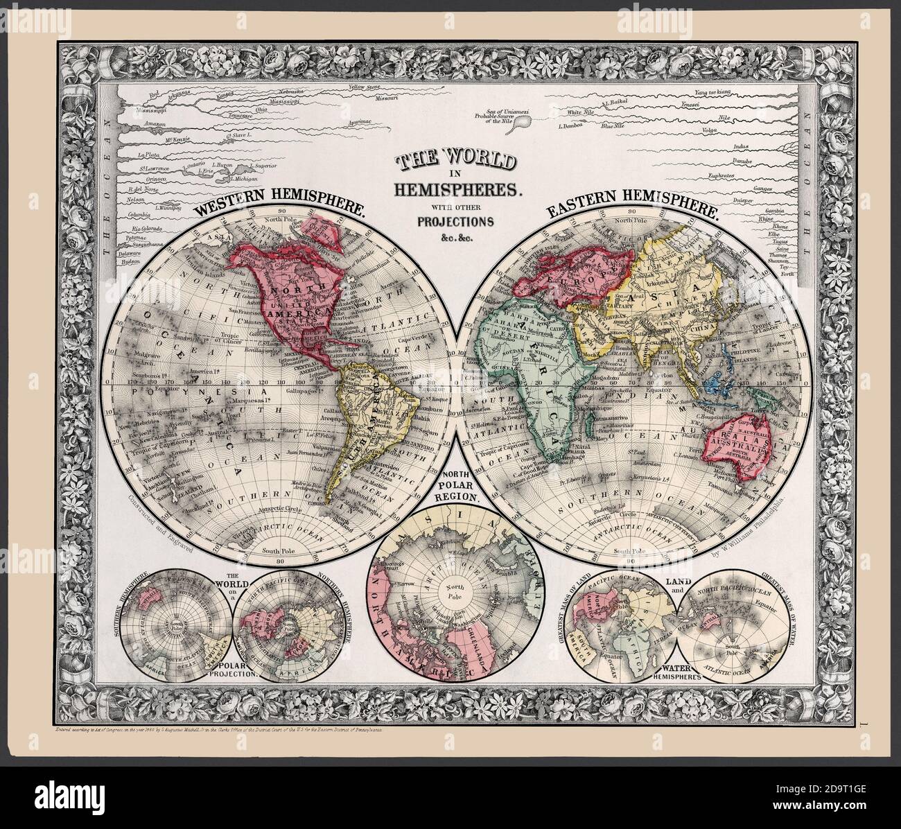 The world -- Eastern and Western hemispheres. An 1863 issued double hemisphere map with additional hemisphere projections and chart comparing major river lengths. Stock Photohttps://www.alamy.com/image-license-details/?v=1https://www.alamy.com/the-world-eastern-and-western-hemispheres-an-1863-issued-double-hemisphere-map-with-additional-hemisphere-projections-and-chart-comparing-major-river-lengths-image384688094.html
RM2D9T1GE–The world -- Eastern and Western hemispheres. An 1863 issued double hemisphere map with additional hemisphere projections and chart comparing major river lengths.
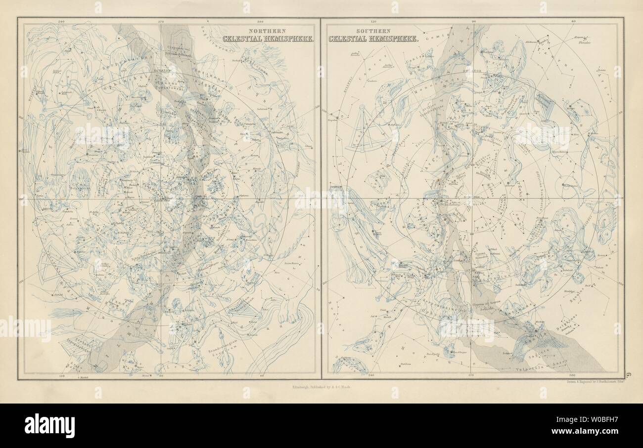 Northern & Southern Celestial Hemispheres. Star charts. BARTHOLOMEW 1882 map Stock Photohttps://www.alamy.com/image-license-details/?v=1https://www.alamy.com/northern-southern-celestial-hemispheres-star-charts-bartholomew-1882-map-image258409235.html
RFW0BFH7–Northern & Southern Celestial Hemispheres. Star charts. BARTHOLOMEW 1882 map
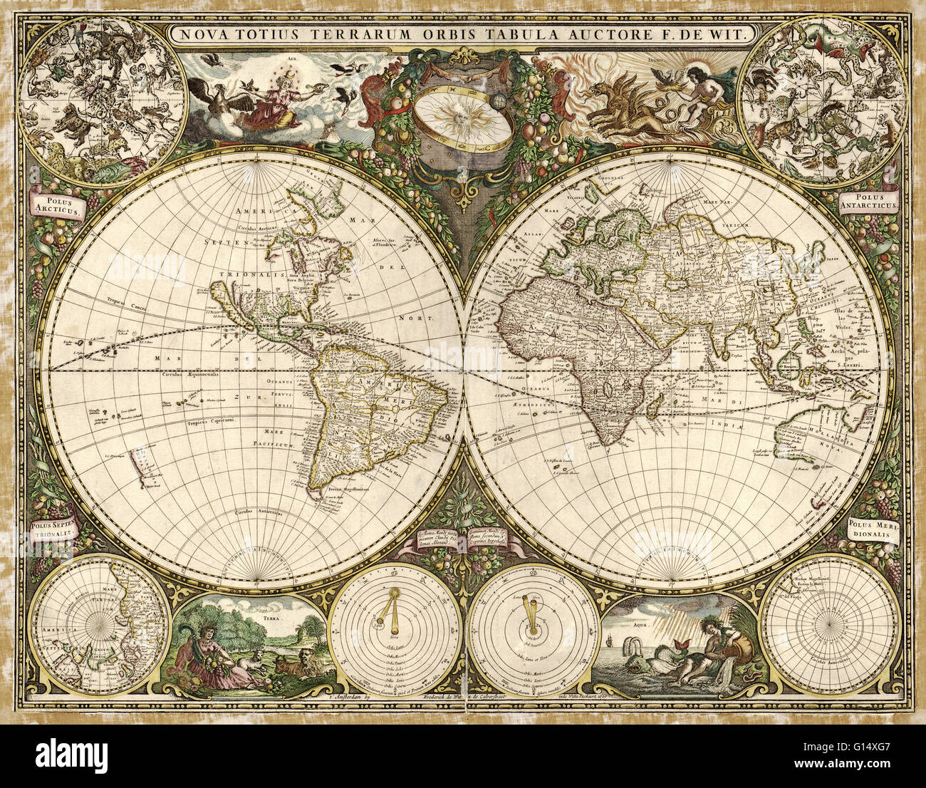 17th century map of the world. Published in Amsterdam in 1660, this map by the Dutch cartographer Frederick de Wit (c.1630-1706) shows the expanding exploration of the known world. The map divides the Earth into a western and eastern hemisphere. In the up Stock Photohttps://www.alamy.com/image-license-details/?v=1https://www.alamy.com/stock-photo-17th-century-map-of-the-world-published-in-amsterdam-in-1660-this-103985511.html
RMG14XG7–17th century map of the world. Published in Amsterdam in 1660, this map by the Dutch cartographer Frederick de Wit (c.1630-1706) shows the expanding exploration of the known world. The map divides the Earth into a western and eastern hemisphere. In the up
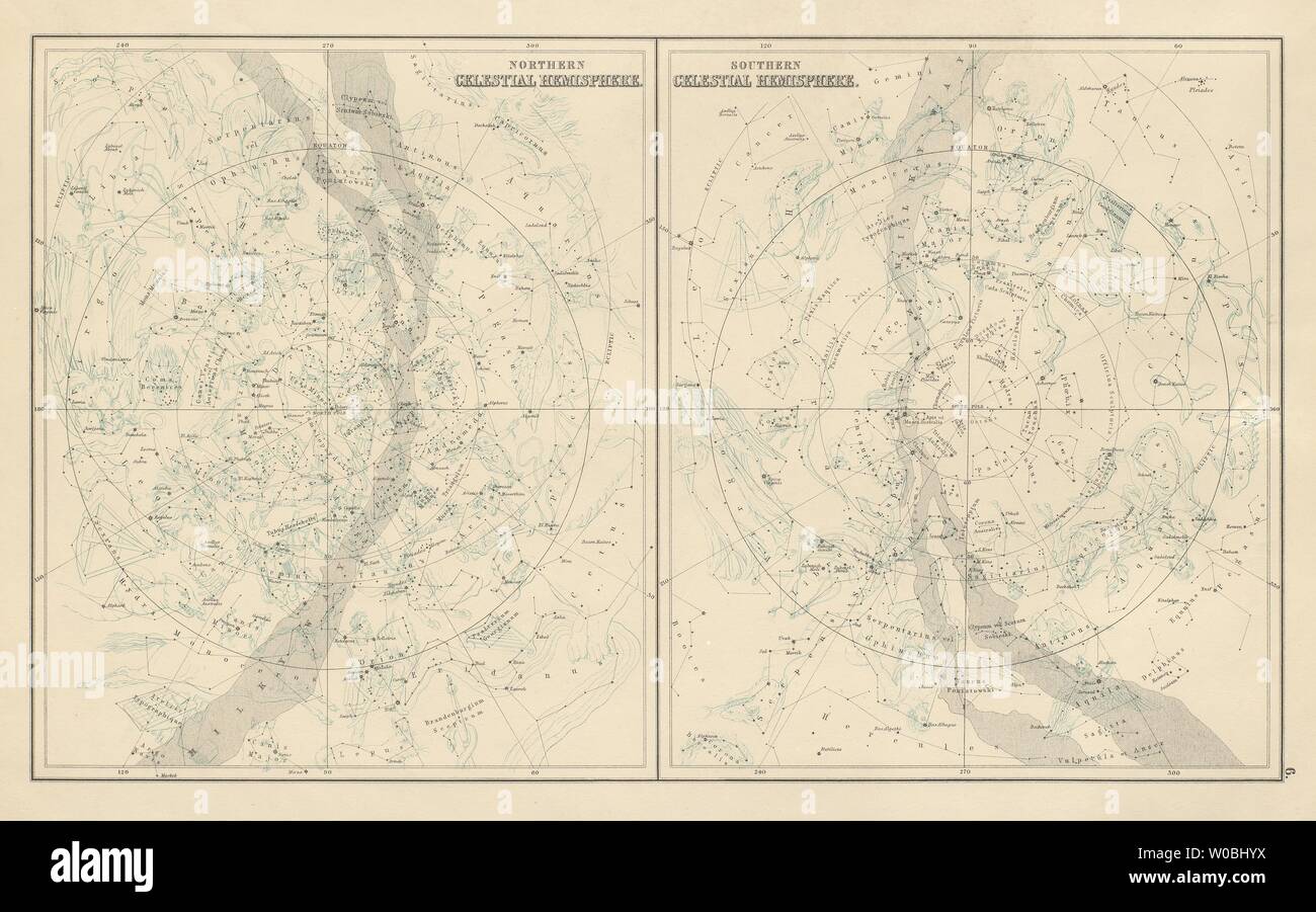 Northern & Southern Celestial Hemispheres. Star charts. BARTHOLOMEW 1898 map Stock Photohttps://www.alamy.com/image-license-details/?v=1https://www.alamy.com/northern-southern-celestial-hemispheres-star-charts-bartholomew-1898-map-image258411102.html
RFW0BHYX–Northern & Southern Celestial Hemispheres. Star charts. BARTHOLOMEW 1898 map
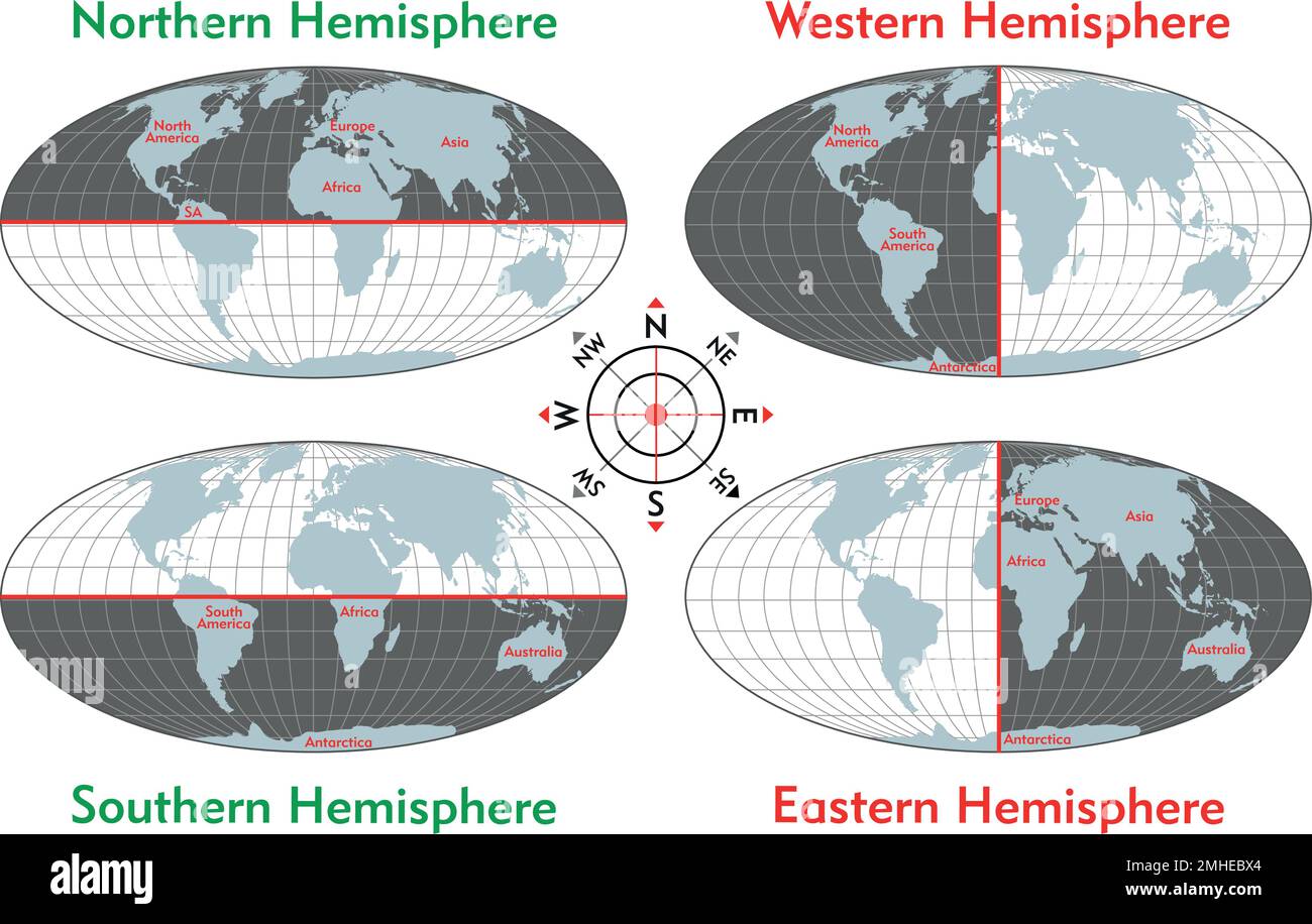 Northern, Southern, Eastern, Western, Hemisphere, science Stock Vectorhttps://www.alamy.com/image-license-details/?v=1https://www.alamy.com/northern-southern-eastern-western-hemisphere-science-image509866508.html
RF2MHEBX4–Northern, Southern, Eastern, Western, Hemisphere, science
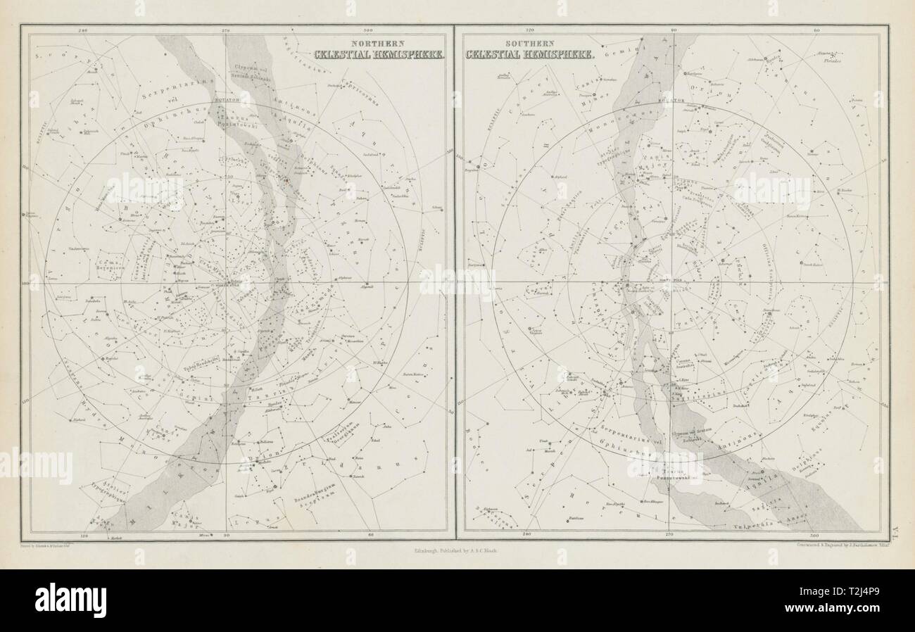 Star maps. Northern & Southern Celestial Hemispheres. JOHN BARTHOLOMEW 1856 Stock Photohttps://www.alamy.com/image-license-details/?v=1https://www.alamy.com/star-maps-northern-southern-celestial-hemispheres-john-bartholomew-1856-image242573361.html
RFT2J4P9–Star maps. Northern & Southern Celestial Hemispheres. JOHN BARTHOLOMEW 1856
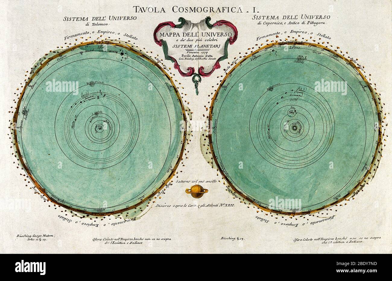 Star Map, 1777 Stock Photohttps://www.alamy.com/image-license-details/?v=1https://www.alamy.com/star-map-1777-image352796681.html
RM2BDY7ND–Star Map, 1777
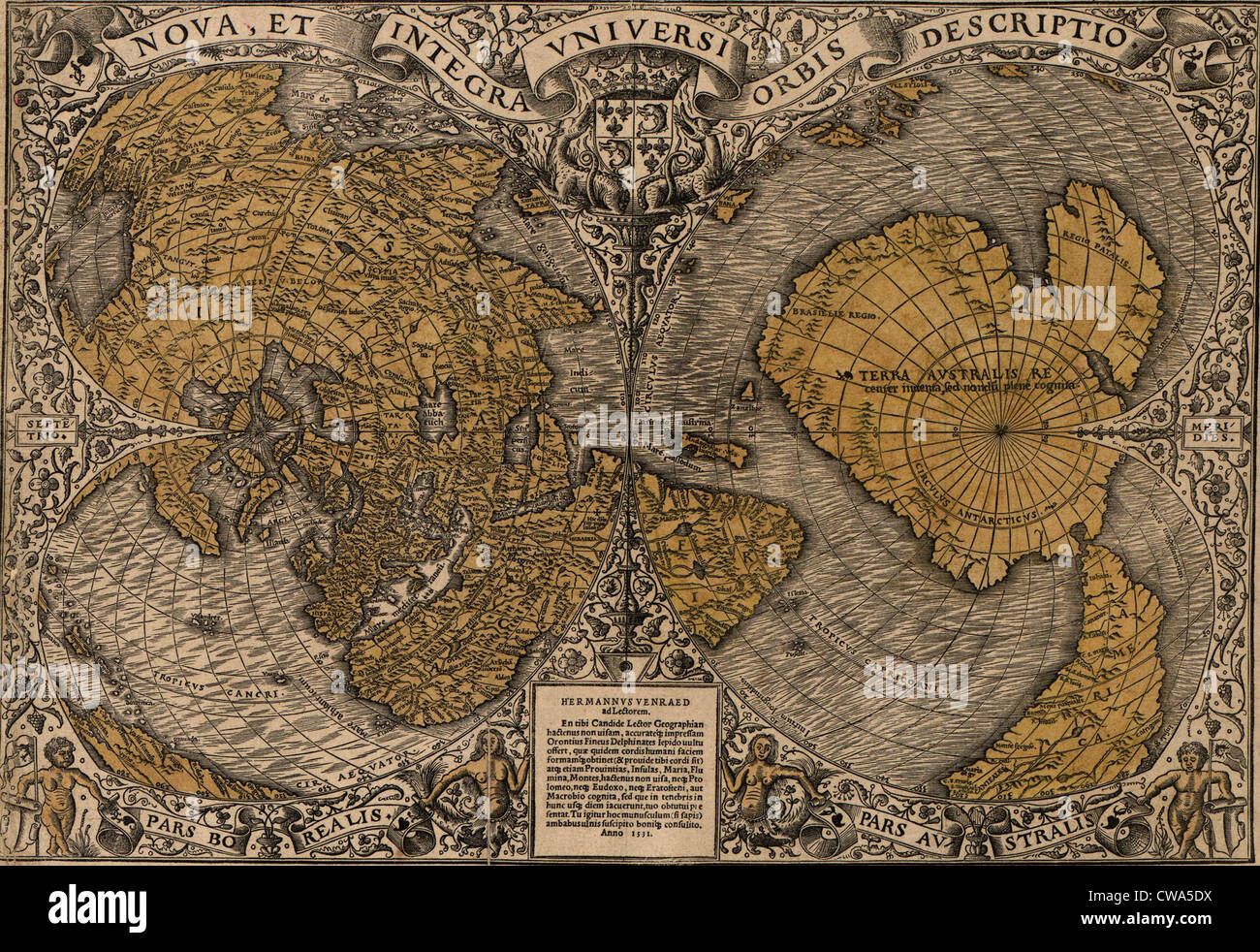 1531 world map showing Northern and Southern Hemispheres by Frenchman Oronce Fine (1494-1555). The map combines Ptolemaic Stock Photohttps://www.alamy.com/image-license-details/?v=1https://www.alamy.com/stock-photo-1531-world-map-showing-northern-and-southern-hemispheres-by-frenchman-50010966.html
RMCWA5DX–1531 world map showing Northern and Southern Hemispheres by Frenchman Oronce Fine (1494-1555). The map combines Ptolemaic
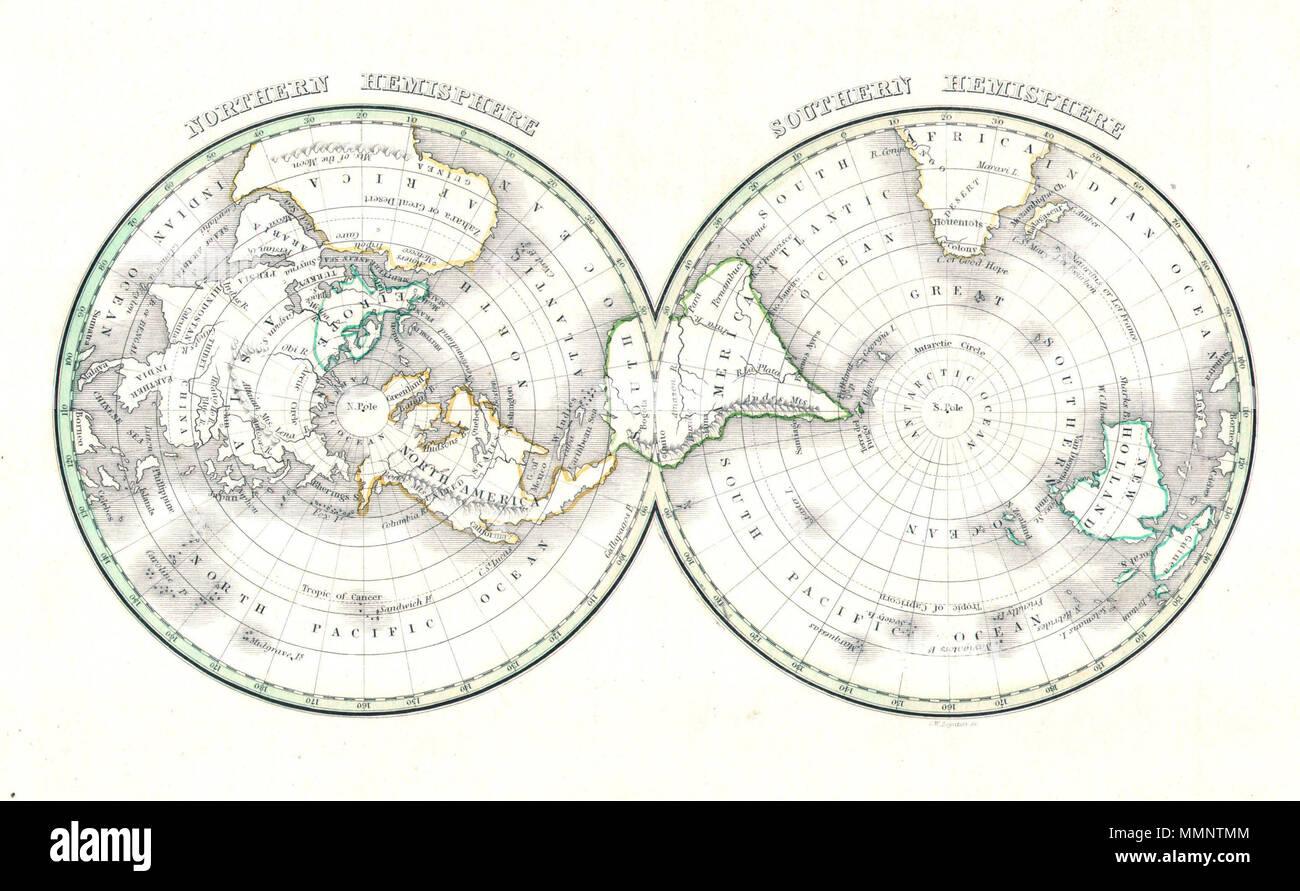 . English: An unusual and attractive map of the world on a hemisphere projection. Depicts the world as seen from the North Pole and south pole. Antarctica is mysteriously absent. Divided according to continents. In Africa the Mountains of the Moon are shown, as are the Andes in South America, the Rockies in North America, and the Altaian Mountains of Asia. Prepared by Thomas Bradford for the 1838 issue of his small format atlas of the world. Northern Hemisphere - Southern Hemisphere. 1838 (undated). 7 1838 Bradford Map of the World on Polar Projection ( Northern and Southern Hemispheres ) - Stock Photohttps://www.alamy.com/image-license-details/?v=1https://www.alamy.com/english-an-unusual-and-attractive-map-of-the-world-on-a-hemisphere-projection-depicts-the-world-as-seen-from-the-north-pole-and-south-pole-antarctica-is-mysteriously-absent-divided-according-to-continents-in-africa-the-mountains-of-the-moon-are-shown-as-are-the-andes-in-south-america-the-rockies-in-north-america-and-the-altaian-mountains-of-asia-prepared-by-thomas-bradford-for-the-1838-issue-of-his-small-format-atlas-of-the-world-northern-hemisphere-southern-hemisphere-1838-undated-7-1838-bradford-map-of-the-world-on-polar-projection-northern-and-southern-hemispheres-image184877188.html
RMMMNTMM–. English: An unusual and attractive map of the world on a hemisphere projection. Depicts the world as seen from the North Pole and south pole. Antarctica is mysteriously absent. Divided according to continents. In Africa the Mountains of the Moon are shown, as are the Andes in South America, the Rockies in North America, and the Altaian Mountains of Asia. Prepared by Thomas Bradford for the 1838 issue of his small format atlas of the world. Northern Hemisphere - Southern Hemisphere. 1838 (undated). 7 1838 Bradford Map of the World on Polar Projection ( Northern and Southern Hemispheres ) -
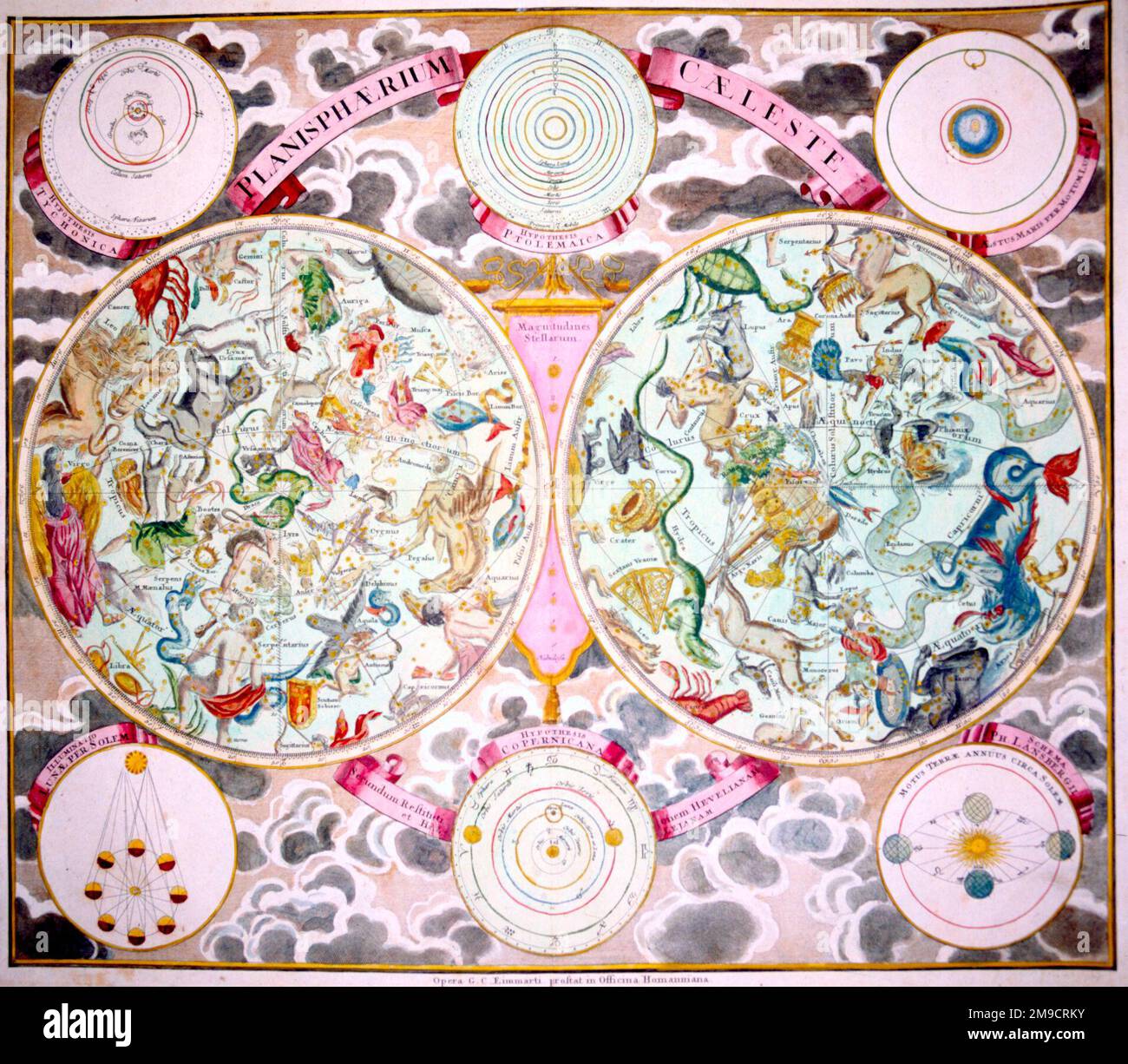 Planispherium Celeste - Celestial Star Map of constellations Stock Photohttps://www.alamy.com/image-license-details/?v=1https://www.alamy.com/planispherium-celeste-celestial-star-map-of-constellations-image504914591.html
RM2M9CRKY–Planispherium Celeste - Celestial Star Map of constellations
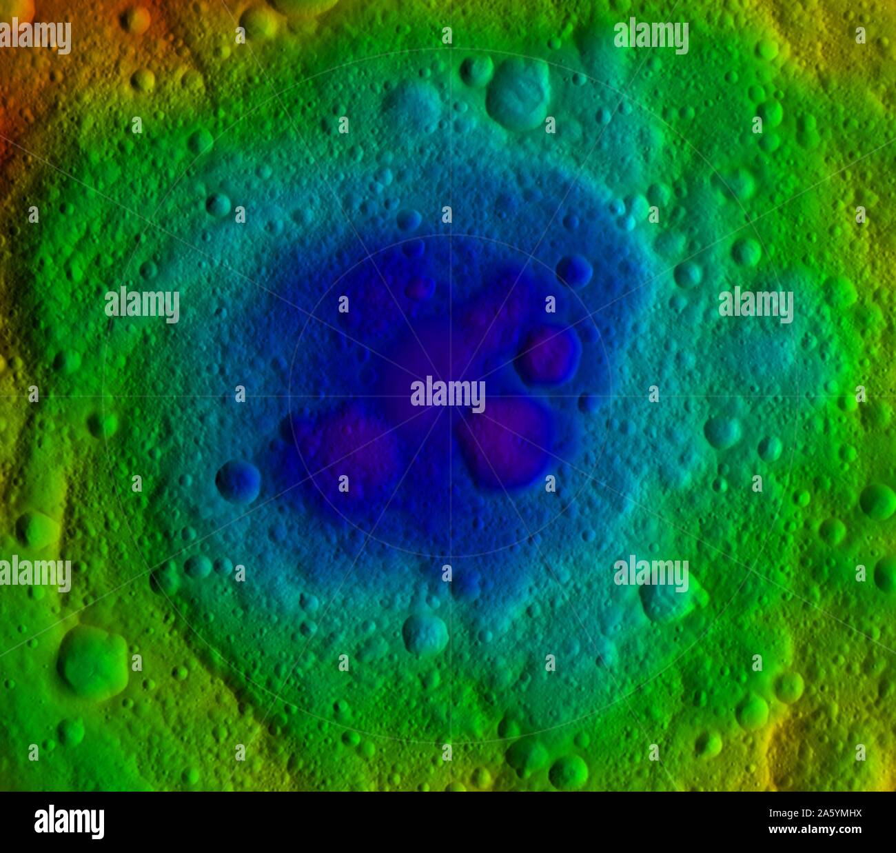 NASA's Dawn mission: topography of the northern and southern hemispheres of the giant asteroid Vesta, updated with pictures obtained during Dawn's last look back. Around the time of Dawn's departure from Vesta in the late summer of 2012, dawn was beginning to creep over the high northern latitudes, which were dark when Dawn arrived in the summer of 2011. The three craters that make up Dawn's 'snowman' feature can be seen at the top of the northern hemisphere map on the left. A mountain more than twice the height of Mount Everest can be seen near the center. Stock Photohttps://www.alamy.com/image-license-details/?v=1https://www.alamy.com/nasas-dawn-mission-topography-of-the-northern-and-southern-hemispheres-of-the-giant-asteroid-vesta-updated-with-pictures-obtained-during-dawns-last-look-back-around-the-time-of-dawns-departure-from-vesta-in-the-late-summer-of-2012-dawn-was-beginning-to-creep-over-the-high-northern-latitudes-which-were-dark-when-dawn-arrived-in-the-summer-of-2011-the-three-craters-that-make-up-dawns-snowman-feature-can-be-seen-at-the-top-of-the-northern-hemisphere-map-on-the-left-a-mountain-more-than-twice-the-height-of-mount-everest-can-be-seen-near-the-center-image330679158.html
RM2A5YMHX–NASA's Dawn mission: topography of the northern and southern hemispheres of the giant asteroid Vesta, updated with pictures obtained during Dawn's last look back. Around the time of Dawn's departure from Vesta in the late summer of 2012, dawn was beginning to creep over the high northern latitudes, which were dark when Dawn arrived in the summer of 2011. The three craters that make up Dawn's 'snowman' feature can be seen at the top of the northern hemisphere map on the left. A mountain more than twice the height of Mount Everest can be seen near the center.
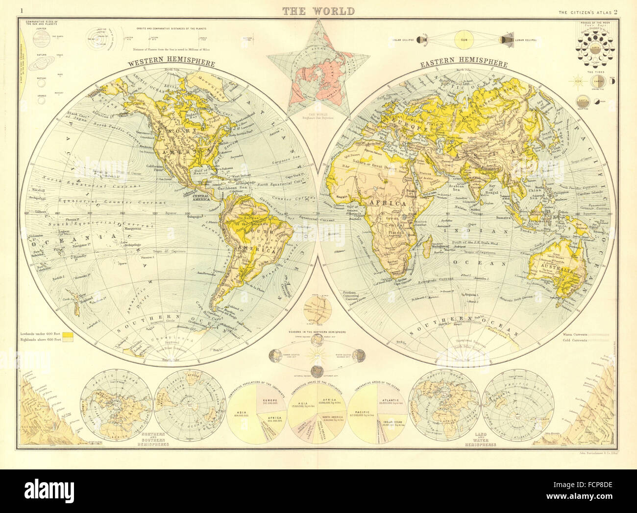 WORLD IN HEMISPHERES: Seasons Populations areas planets. BARTHOLOMEW, 1898 map Stock Photohttps://www.alamy.com/image-license-details/?v=1https://www.alamy.com/stock-photo-world-in-hemispheres-seasons-populations-areas-planets-bartholomew-93917306.html
RFFCP8DE–WORLD IN HEMISPHERES: Seasons Populations areas planets. BARTHOLOMEW, 1898 map
 World map with circles of latitudes and longitudes, showing Equator, Greenwich meridian, Arctic and Antarctic Circle, Tropic of Cancer and Capricorn. Stock Photohttps://www.alamy.com/image-license-details/?v=1https://www.alamy.com/world-map-with-circles-of-latitudes-and-longitudes-showing-equator-greenwich-meridian-arctic-and-antarctic-circle-tropic-of-cancer-and-capricorn-image356631743.html
RF2BM5YBY–World map with circles of latitudes and longitudes, showing Equator, Greenwich meridian, Arctic and Antarctic Circle, Tropic of Cancer and Capricorn.
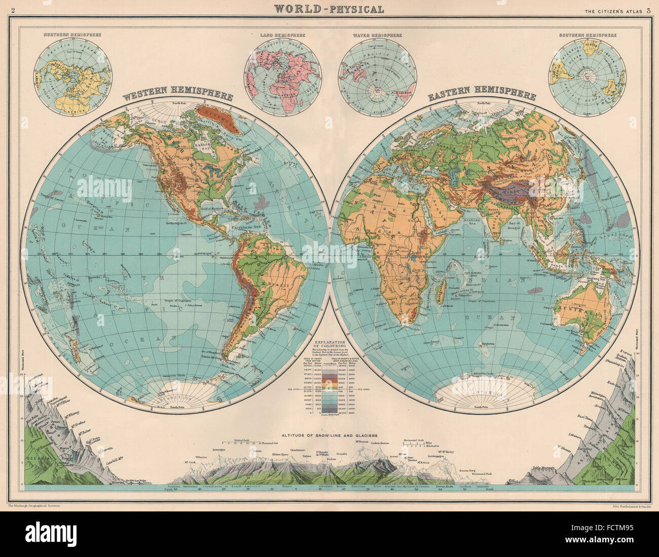 WORLD-PHYSICAL: Hemispheres. Mountain heights. Snowline. Glacier line, 1924 map Stock Photohttps://www.alamy.com/image-license-details/?v=1https://www.alamy.com/stock-photo-world-physical-hemispheres-mountain-heights-snowline-glacier-line-93970497.html
RFFCTM95–WORLD-PHYSICAL: Hemispheres. Mountain heights. Snowline. Glacier line, 1924 map
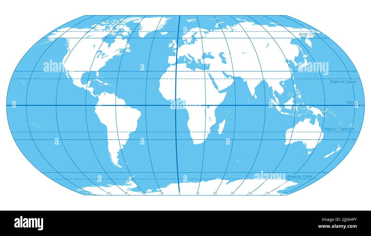 The World, important circles of latitudes and longitudes, blue colored political map. Equator, Greenwich meridian, Arctic and Antarctic Circle, etc. Stock Photohttps://www.alamy.com/image-license-details/?v=1https://www.alamy.com/the-world-important-circles-of-latitudes-and-longitudes-blue-colored-political-map-equator-greenwich-meridian-arctic-and-antarctic-circle-etc-image476108947.html
RF2JJGHPY–The World, important circles of latitudes and longitudes, blue colored political map. Equator, Greenwich meridian, Arctic and Antarctic Circle, etc.
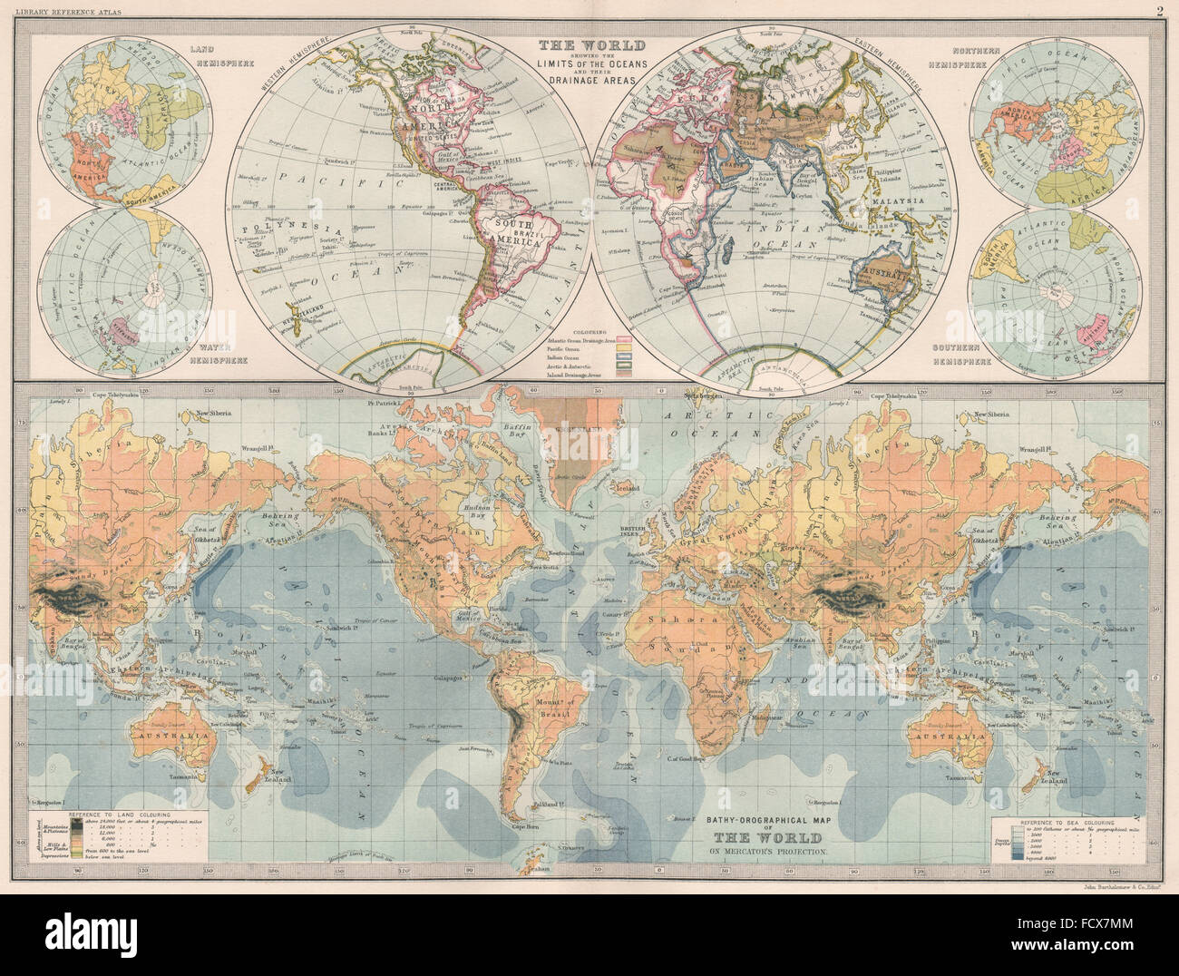 WORLD: Ocean drainage-watersheds. Relief. BARTHOLOMEW, 1890 antique map Stock Photohttps://www.alamy.com/image-license-details/?v=1https://www.alamy.com/stock-photo-world-ocean-drainage-watersheds-relief-bartholomew-1890-antique-map-94004532.html
RFFCX7MM–WORLD: Ocean drainage-watersheds. Relief. BARTHOLOMEW, 1890 antique map
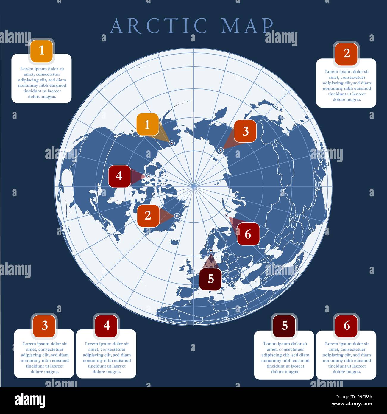 Antarctida, Antarctic region Map of region around the Earth s South Pole Stock Vectorhttps://www.alamy.com/image-license-details/?v=1https://www.alamy.com/antarctida-antarctic-region-map-of-region-around-the-earth-s-south-pole-image229542106.html
RFR9CF8A–Antarctida, Antarctic region Map of region around the Earth s South Pole
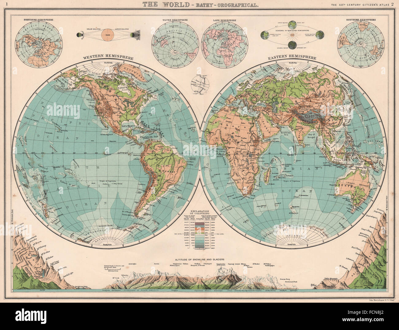 WORLD TWIN HEMISPHERES: Relief map. Mountains eclipses snowline seasons 1901 Stock Photohttps://www.alamy.com/image-license-details/?v=1https://www.alamy.com/stock-photo-world-twin-hemispheres-relief-map-mountains-eclipses-snowline-seasons-93895482.html
RFFCN8J2–WORLD TWIN HEMISPHERES: Relief map. Mountains eclipses snowline seasons 1901
 The Celestial Globe-Southern Hemisphere, 1515. Stock Photohttps://www.alamy.com/image-license-details/?v=1https://www.alamy.com/the-celestial-globe-southern-hemisphere-1515-image348996461.html
RM2B7P4F9–The Celestial Globe-Southern Hemisphere, 1515.
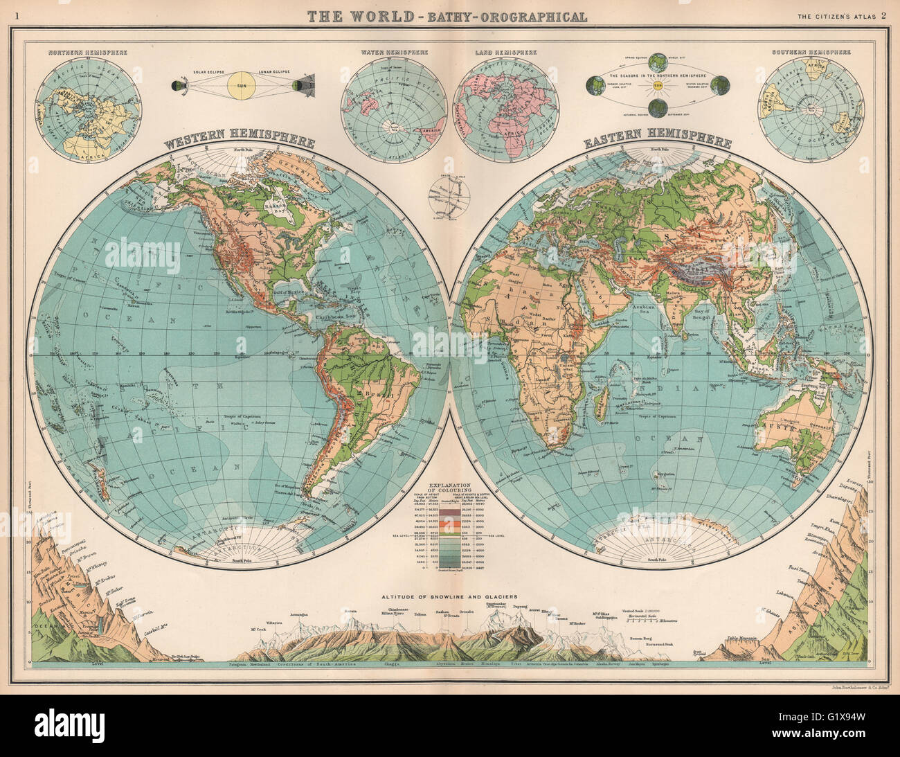 WORLD TWIN HEMISPHERES. Relief map. Mountains eclipses snowline seasons 1912 Stock Photohttps://www.alamy.com/image-license-details/?v=1https://www.alamy.com/stock-photo-world-twin-hemispheres-relief-map-mountains-eclipses-snowline-seasons-104454809.html
RFG1X94W–WORLD TWIN HEMISPHERES. Relief map. Mountains eclipses snowline seasons 1912
 Northern (Southern) Celestial Hemisphere on the Plane of the Equator, on which is ... defined the boundaries of the Constellations, and all the stars to the sixth magnitude inclusive from the astronomical Catalogu Book information: Title: Northern (Southern) Celestial Hemisphere on the Plane of the Equator, on which is ... defined the boundaries of the Constellations, and all the stars to the sixth magnitude inclusive; from the astronomical Catalogue of the Rev. Mr Wollaston. 1.67. Place of publication: London Publisher: J. Cary, Date of publication: 1809 Stock Photohttps://www.alamy.com/image-license-details/?v=1https://www.alamy.com/northern-southern-celestial-hemisphere-on-the-plane-of-the-equator-on-which-is-defined-the-boundaries-of-the-constellations-and-all-the-stars-to-the-sixth-magnitude-inclusive-from-the-astronomical-catalogu-book-information-title-northern-southern-celestial-hemisphere-on-the-plane-of-the-equator-on-which-is-defined-the-boundaries-of-the-constellations-and-all-the-stars-to-the-sixth-magnitude-inclusive-from-the-astronomical-catalogue-of-the-rev-mr-wollaston-167-place-of-publication-london-publisher-j-cary-date-of-publication-1809-image401722390.html
RM2E9G106–Northern (Southern) Celestial Hemisphere on the Plane of the Equator, on which is ... defined the boundaries of the Constellations, and all the stars to the sixth magnitude inclusive from the astronomical Catalogu Book information: Title: Northern (Southern) Celestial Hemisphere on the Plane of the Equator, on which is ... defined the boundaries of the Constellations, and all the stars to the sixth magnitude inclusive; from the astronomical Catalogue of the Rev. Mr Wollaston. 1.67. Place of publication: London Publisher: J. Cary, Date of publication: 1809
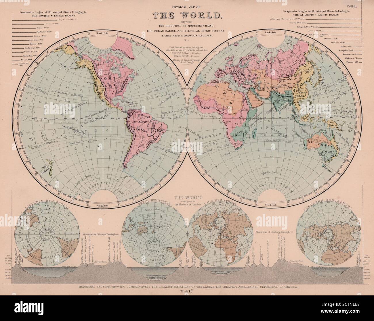 Physical Map of The World. Mountain Chains. Watersheds. HUGHES 1876 old Stock Photohttps://www.alamy.com/image-license-details/?v=1https://www.alamy.com/physical-map-of-the-world-mountain-chains-watersheds-hughes-1876-old-image376641840.html
RF2CTNEE8–Physical Map of The World. Mountain Chains. Watersheds. HUGHES 1876 old
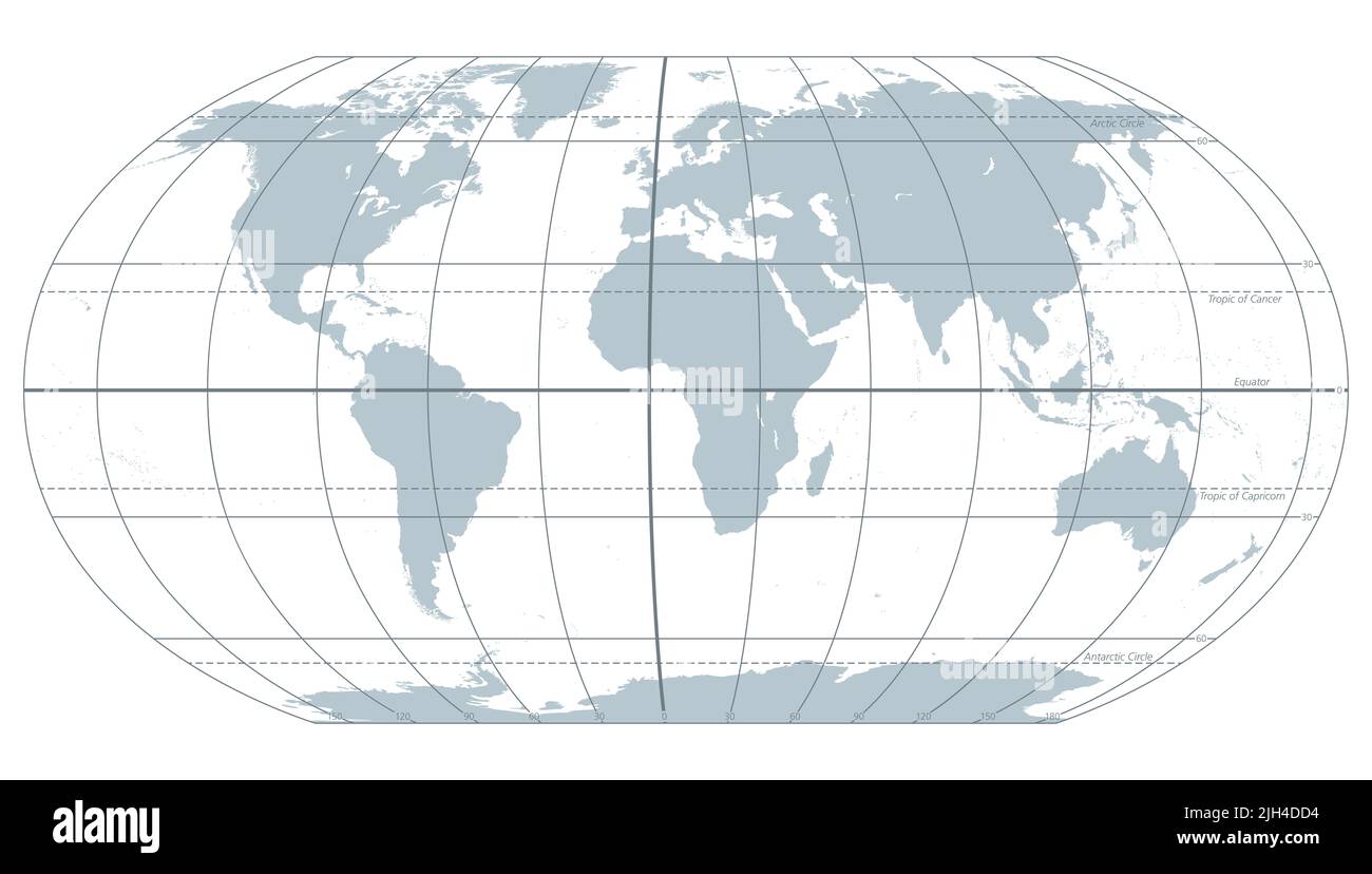 The world with most important circles of latitudes and longitudes, gray political map. Equator, Greenwich meridian, Arctic and Antarctic Circle ... Stock Photohttps://www.alamy.com/image-license-details/?v=1https://www.alamy.com/the-world-with-most-important-circles-of-latitudes-and-longitudes-gray-political-map-equator-greenwich-meridian-arctic-and-antarctic-circle-image475227456.html
RF2JH4DD4–The world with most important circles of latitudes and longitudes, gray political map. Equator, Greenwich meridian, Arctic and Antarctic Circle ...
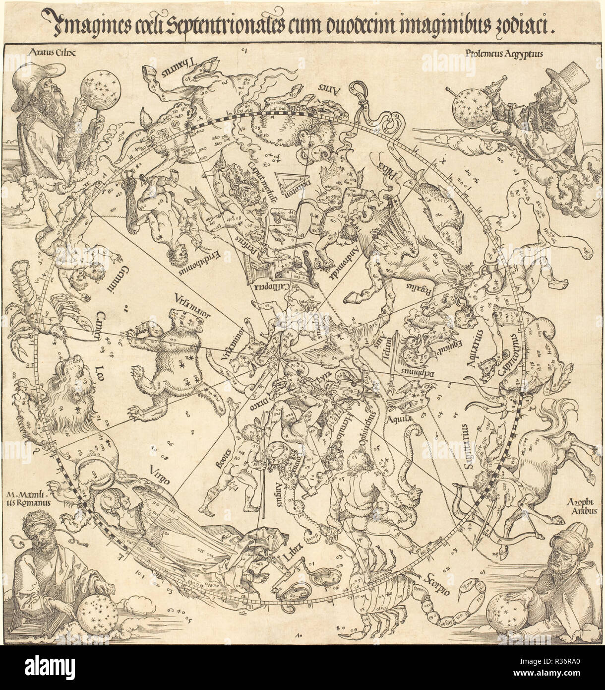 The Northern Celestial Hemisphere. Dated: 1515. Medium: woodcut. Museum: National Gallery of Art, Washington DC. Author: Dürer, Albrecht. ALBRECHT DUERER. Stock Photohttps://www.alamy.com/image-license-details/?v=1https://www.alamy.com/the-northern-celestial-hemisphere-dated-1515-medium-woodcut-museum-national-gallery-of-art-washington-dc-author-drer-albrecht-albrecht-duerer-image225728776.html
RMR36RA0–The Northern Celestial Hemisphere. Dated: 1515. Medium: woodcut. Museum: National Gallery of Art, Washington DC. Author: Dürer, Albrecht. ALBRECHT DUERER.
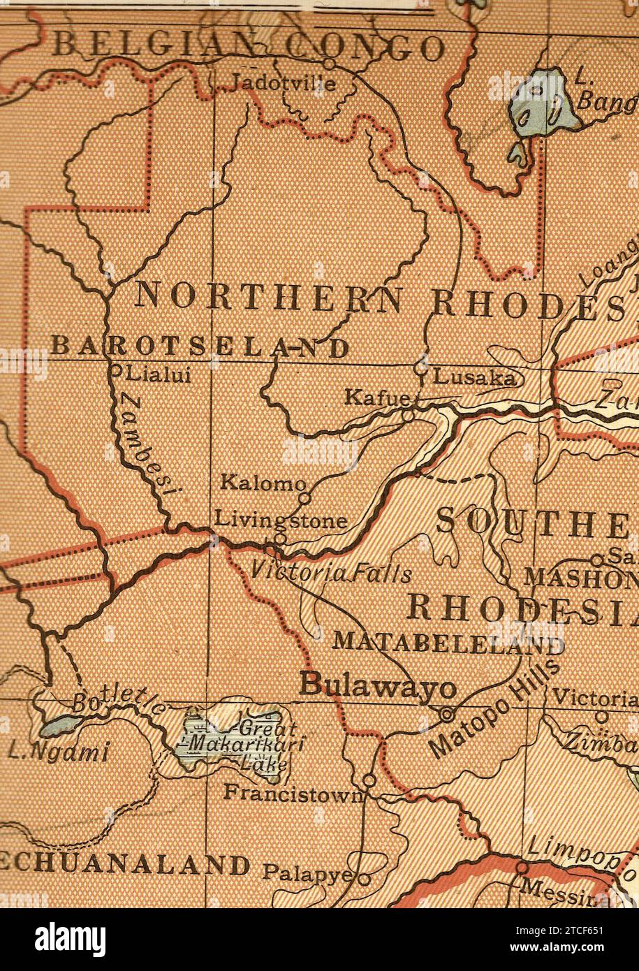 A vintage/antique geographical map of Africa in sepia showing Northern and Southern Rhodesia. Stock Photohttps://www.alamy.com/image-license-details/?v=1https://www.alamy.com/a-vintageantique-geographical-map-of-africa-in-sepia-showing-northern-and-southern-rhodesia-image575652141.html
RF2TCF651–A vintage/antique geographical map of Africa in sepia showing Northern and Southern Rhodesia.
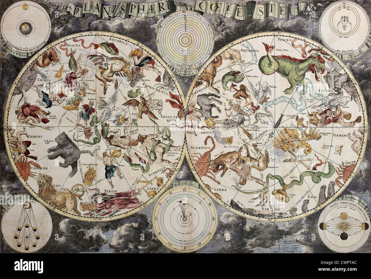 Boreal and austral hemispheres old map Stock Photohttps://www.alamy.com/image-license-details/?v=1https://www.alamy.com/stock-photo-boreal-and-austral-hemispheres-old-map-50289188.html
RFCWPTAC–Boreal and austral hemispheres old map
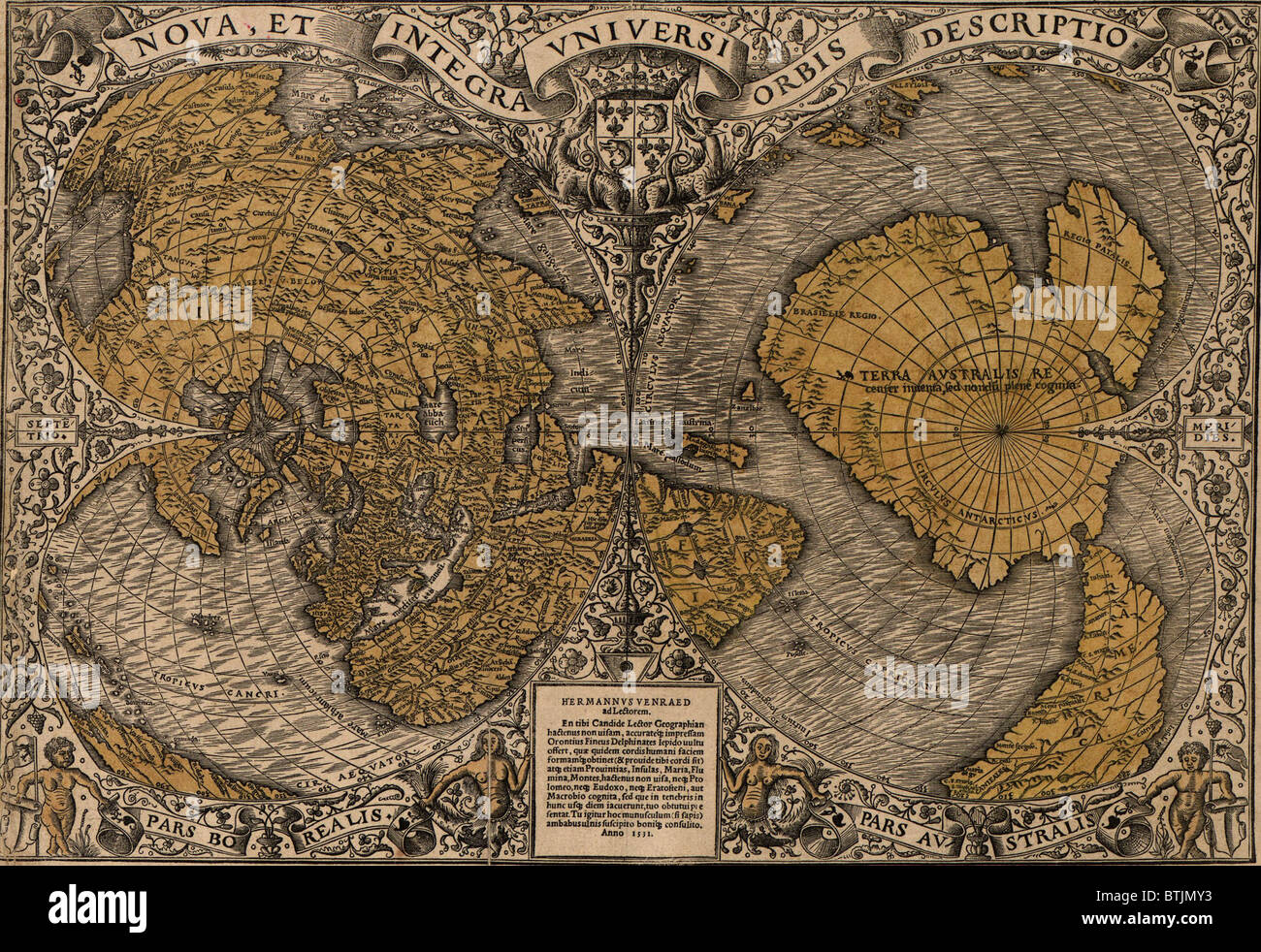 1531 world map showing Northern and Southern Hemispheres by Frenchman Oronce Fine (1494-1555). The map combines Ptolemaic concepts with new discoveries; Asia and North America are represented as one landmass, 'Terra Australis' combines Australia and Antarctica. Stock Photohttps://www.alamy.com/image-license-details/?v=1https://www.alamy.com/stock-photo-1531-world-map-showing-northern-and-southern-hemispheres-by-frenchman-32373687.html
RMBTJMY3–1531 world map showing Northern and Southern Hemispheres by Frenchman Oronce Fine (1494-1555). The map combines Ptolemaic concepts with new discoveries; Asia and North America are represented as one landmass, 'Terra Australis' combines Australia and Antarctica.
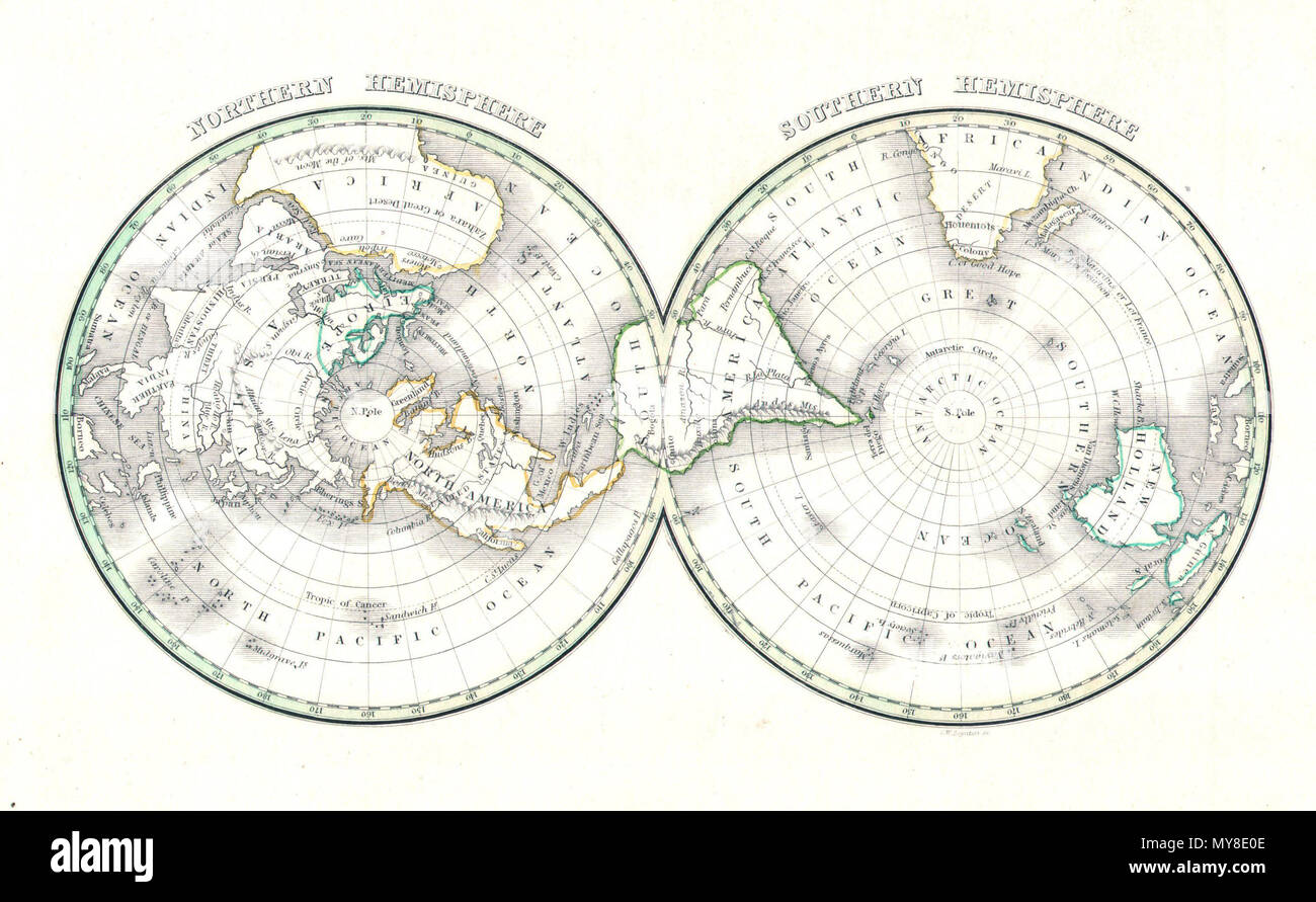 . Northern Hemisphere - Southern Hemisphere . English: An unusual and attractive map of the world on a hemisphere projection. Depicts the world as seen from the North Pole and south pole. Antarctica is mysteriously absent. Divided according to continents. In Africa the Mountains of the Moon are shown, as are the Andes in South America, the Rockies in North America, and the Altaian Mountains of Asia. Prepared by Thomas Bradford for the 1838 issue of his small format atlas of the world. . 1838 (undated) 6 1838 Bradford Map of the World on Polar Projection ( Northern and Southern Hemispheres ) - Stock Photohttps://www.alamy.com/image-license-details/?v=1https://www.alamy.com/northern-hemisphere-southern-hemisphere-english-an-unusual-and-attractive-map-of-the-world-on-a-hemisphere-projection-depicts-the-world-as-seen-from-the-north-pole-and-south-pole-antarctica-is-mysteriously-absent-divided-according-to-continents-in-africa-the-mountains-of-the-moon-are-shown-as-are-the-andes-in-south-america-the-rockies-in-north-america-and-the-altaian-mountains-of-asia-prepared-by-thomas-bradford-for-the-1838-issue-of-his-small-format-atlas-of-the-world-1838-undated-6-1838-bradford-map-of-the-world-on-polar-projection-northern-and-southern-hemispheres-image188885998.html
RMMY8E0E–. Northern Hemisphere - Southern Hemisphere . English: An unusual and attractive map of the world on a hemisphere projection. Depicts the world as seen from the North Pole and south pole. Antarctica is mysteriously absent. Divided according to continents. In Africa the Mountains of the Moon are shown, as are the Andes in South America, the Rockies in North America, and the Altaian Mountains of Asia. Prepared by Thomas Bradford for the 1838 issue of his small format atlas of the world. . 1838 (undated) 6 1838 Bradford Map of the World on Polar Projection ( Northern and Southern Hemispheres ) -
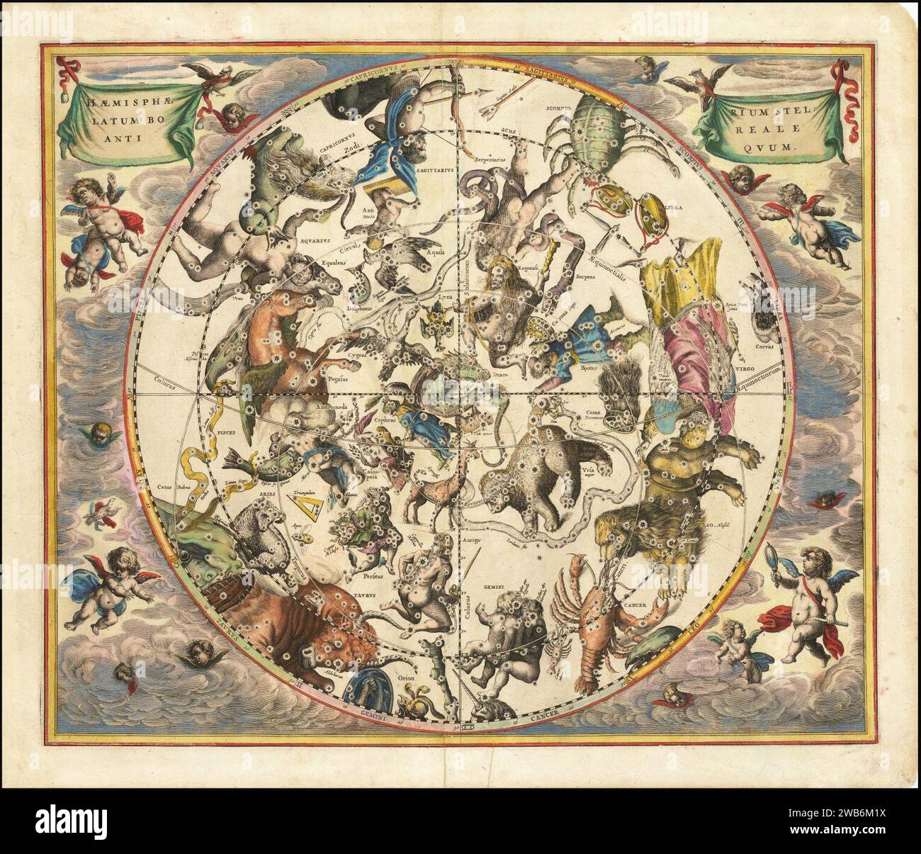 1660 celestial map illustrating the constellations of the Northern Hemisphere superimposed over the earth's Southern Hemisphere. Stock Photohttps://www.alamy.com/image-license-details/?v=1https://www.alamy.com/1660-celestial-map-illustrating-the-constellations-of-the-northern-hemisphere-superimposed-over-the-earths-southern-hemisphere-image592061174.html
RM2WB6M1X–1660 celestial map illustrating the constellations of the Northern Hemisphere superimposed over the earth's Southern Hemisphere.
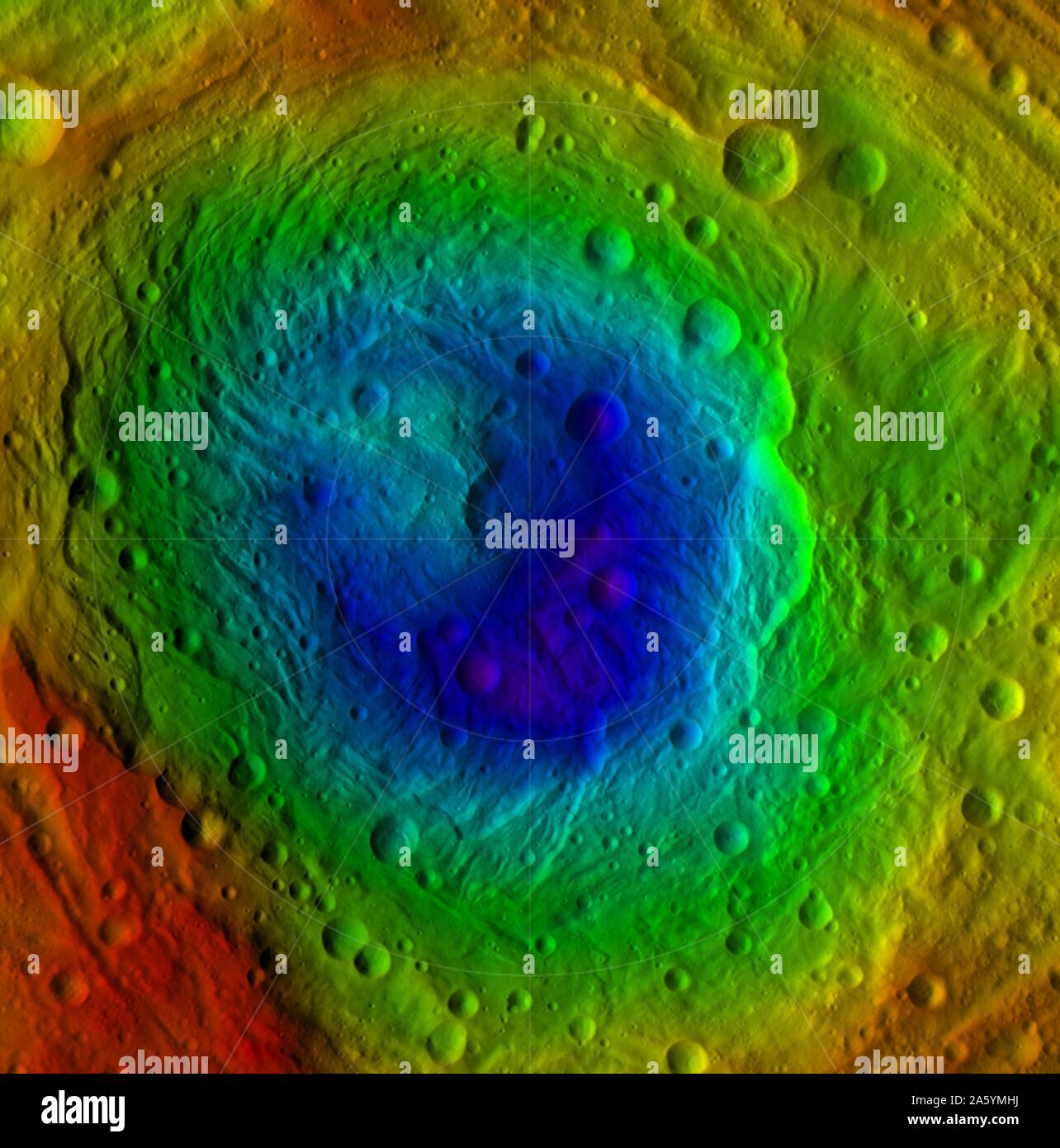 NASA's Dawn mission: topography of the northern and southern hemispheres of the giant asteroid Vesta, updated with pictures obtained during Dawn's last look back. Around the time of Dawn's departure from Vesta in the late summer of 2012, dawn was beginning to creep over the high northern latitudes, which were dark when Dawn arrived in the summer of 2011. The three craters that make up Dawn's 'snowman' feature can be seen at the top of the northern hemisphere map on the left. A mountain more than twice the height of Mount Everest can be seen near the center. Stock Photohttps://www.alamy.com/image-license-details/?v=1https://www.alamy.com/nasas-dawn-mission-topography-of-the-northern-and-southern-hemispheres-of-the-giant-asteroid-vesta-updated-with-pictures-obtained-during-dawns-last-look-back-around-the-time-of-dawns-departure-from-vesta-in-the-late-summer-of-2012-dawn-was-beginning-to-creep-over-the-high-northern-latitudes-which-were-dark-when-dawn-arrived-in-the-summer-of-2011-the-three-craters-that-make-up-dawns-snowman-feature-can-be-seen-at-the-top-of-the-northern-hemisphere-map-on-the-left-a-mountain-more-than-twice-the-height-of-mount-everest-can-be-seen-near-the-center-image330679150.html
RM2A5YMHJ–NASA's Dawn mission: topography of the northern and southern hemispheres of the giant asteroid Vesta, updated with pictures obtained during Dawn's last look back. Around the time of Dawn's departure from Vesta in the late summer of 2012, dawn was beginning to creep over the high northern latitudes, which were dark when Dawn arrived in the summer of 2011. The three craters that make up Dawn's 'snowman' feature can be seen at the top of the northern hemisphere map on the left. A mountain more than twice the height of Mount Everest can be seen near the center.
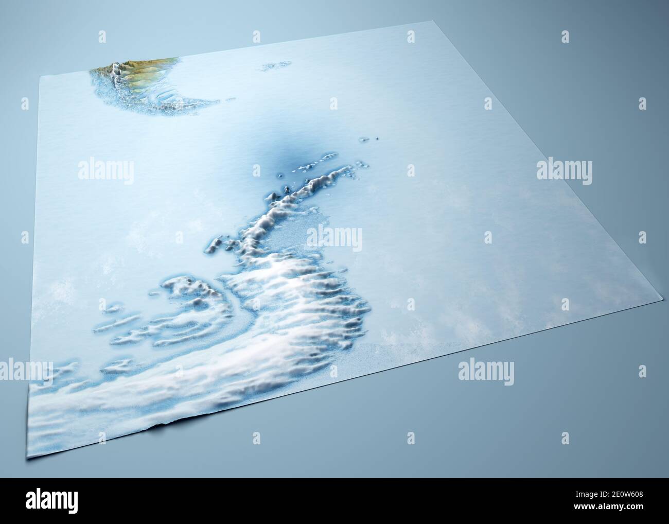 Antarctic Peninsula, climate change. Continent Antarctica. Geographical map, orography of the terrain. Argentina and Chile. Melting ice, Iceberg Stock Photohttps://www.alamy.com/image-license-details/?v=1https://www.alamy.com/antarctic-peninsula-climate-change-continent-antarctica-geographical-map-orography-of-the-terrain-argentina-and-chile-melting-ice-iceberg-image396391976.html
RF2E0W608–Antarctic Peninsula, climate change. Continent Antarctica. Geographical map, orography of the terrain. Argentina and Chile. Melting ice, Iceberg
![Astronomy 7, Star map of the Northern and Southern Hemisphere, Signed: Benard Direx, Pl. 8 et 9, after p. 14, Benard (dir.), Denis Diderot, M. d'Alembert: Encyclopédie, ou dictionnaire raisonné des sciences, des arts et des métierss, des arts et des métiers. Genève: chez Pellet, MDCCLXXVIII [1778], Reimagined by Gibon, design of warm cheerful glowing of brightness and light rays radiance. Classic art reinvented with a modern twist. Photography inspired by futurism, embracing dynamic energy of modern technology, movement, speed and revolutionize culture. Stock Photo Astronomy 7, Star map of the Northern and Southern Hemisphere, Signed: Benard Direx, Pl. 8 et 9, after p. 14, Benard (dir.), Denis Diderot, M. d'Alembert: Encyclopédie, ou dictionnaire raisonné des sciences, des arts et des métierss, des arts et des métiers. Genève: chez Pellet, MDCCLXXVIII [1778], Reimagined by Gibon, design of warm cheerful glowing of brightness and light rays radiance. Classic art reinvented with a modern twist. Photography inspired by futurism, embracing dynamic energy of modern technology, movement, speed and revolutionize culture. Stock Photo](https://c8.alamy.com/comp/2B93KC4/astronomy-7-star-map-of-the-northern-and-southern-hemisphere-signed-benard-direx-pl-8-et-9-after-p-14-benard-dir-denis-diderot-m-dalembert-encyclopdie-ou-dictionnaire-raisonn-des-sciences-des-arts-et-des-mtierss-des-arts-et-des-mtiers-genve-chez-pellet-mdcclxxviii-1778-reimagined-by-gibon-design-of-warm-cheerful-glowing-of-brightness-and-light-rays-radiance-classic-art-reinvented-with-a-modern-twist-photography-inspired-by-futurism-embracing-dynamic-energy-of-modern-technology-movement-speed-and-revolutionize-culture-2B93KC4.jpg) Astronomy 7, Star map of the Northern and Southern Hemisphere, Signed: Benard Direx, Pl. 8 et 9, after p. 14, Benard (dir.), Denis Diderot, M. d'Alembert: Encyclopédie, ou dictionnaire raisonné des sciences, des arts et des métierss, des arts et des métiers. Genève: chez Pellet, MDCCLXXVIII [1778], Reimagined by Gibon, design of warm cheerful glowing of brightness and light rays radiance. Classic art reinvented with a modern twist. Photography inspired by futurism, embracing dynamic energy of modern technology, movement, speed and revolutionize culture. Stock Photohttps://www.alamy.com/image-license-details/?v=1https://www.alamy.com/astronomy-7-star-map-of-the-northern-and-southern-hemisphere-signed-benard-direx-pl-8-et-9-after-p-14-benard-dir-denis-diderot-m-dalembert-encyclopdie-ou-dictionnaire-raisonn-des-sciences-des-arts-et-des-mtierss-des-arts-et-des-mtiers-genve-chez-pellet-mdcclxxviii-1778-reimagined-by-gibon-design-of-warm-cheerful-glowing-of-brightness-and-light-rays-radiance-classic-art-reinvented-with-a-modern-twist-photography-inspired-by-futurism-embracing-dynamic-energy-of-modern-technology-movement-speed-and-revolutionize-culture-image349820356.html
Astronomy 7, Star map of the Northern and Southern Hemisphere, Signed: Benard Direx, Pl. 8 et 9, after p. 14, Benard (dir.), Denis Diderot, M. d'Alembert: Encyclopédie, ou dictionnaire raisonné des sciences, des arts et des métierss, des arts et des métiers. Genève: chez Pellet, MDCCLXXVIII [1778], Reimagined by Gibon, design of warm cheerful glowing of brightness and light rays radiance. Classic art reinvented with a modern twist. Photography inspired by futurism, embracing dynamic energy of modern technology, movement, speed and revolutionize culture. Stock Photohttps://www.alamy.com/image-license-details/?v=1https://www.alamy.com/astronomy-7-star-map-of-the-northern-and-southern-hemisphere-signed-benard-direx-pl-8-et-9-after-p-14-benard-dir-denis-diderot-m-dalembert-encyclopdie-ou-dictionnaire-raisonn-des-sciences-des-arts-et-des-mtierss-des-arts-et-des-mtiers-genve-chez-pellet-mdcclxxviii-1778-reimagined-by-gibon-design-of-warm-cheerful-glowing-of-brightness-and-light-rays-radiance-classic-art-reinvented-with-a-modern-twist-photography-inspired-by-futurism-embracing-dynamic-energy-of-modern-technology-movement-speed-and-revolutionize-culture-image349820356.htmlRF2B93KC4–Astronomy 7, Star map of the Northern and Southern Hemisphere, Signed: Benard Direx, Pl. 8 et 9, after p. 14, Benard (dir.), Denis Diderot, M. d'Alembert: Encyclopédie, ou dictionnaire raisonné des sciences, des arts et des métierss, des arts et des métiers. Genève: chez Pellet, MDCCLXXVIII [1778], Reimagined by Gibon, design of warm cheerful glowing of brightness and light rays radiance. Classic art reinvented with a modern twist. Photography inspired by futurism, embracing dynamic energy of modern technology, movement, speed and revolutionize culture.
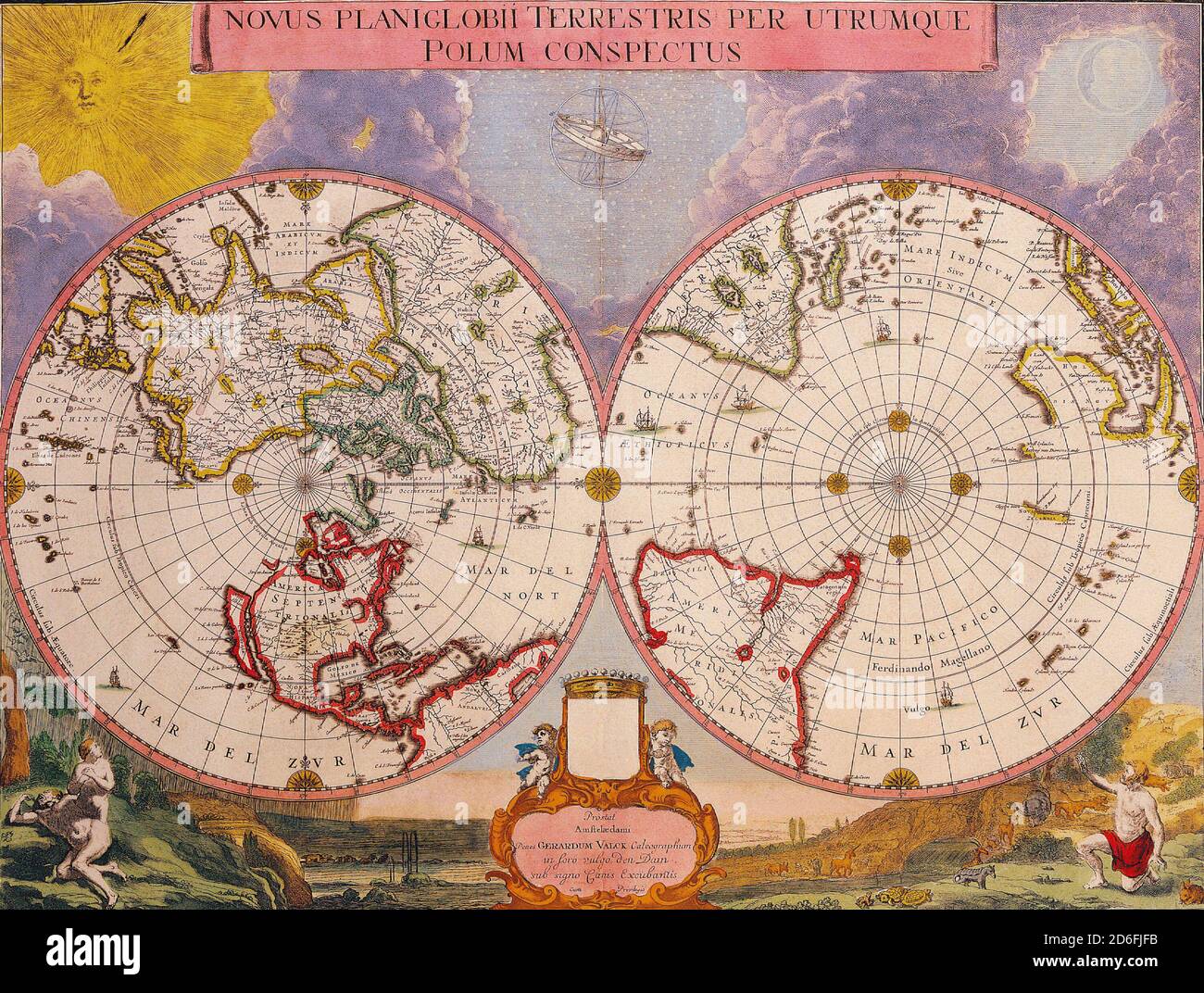 Antique Maps of the World Double Hemisphere Polar Map Joan Blaeu c 1695 Stock Photohttps://www.alamy.com/image-license-details/?v=1https://www.alamy.com/antique-maps-of-the-world-double-hemisphere-polar-map-joan-blaeu-c-1695-image382659855.html
RM2D6FJFB–Antique Maps of the World Double Hemisphere Polar Map Joan Blaeu c 1695
RM2JPJJAG–1953: Vintage advertising poster. 1953 Lucien Boucher Air France Double Hemisphere Celestial (surrealist). The finest of Lucien Bucher's iconic comic maps drawn for Air France. Boucher's work for Air France is considered an embodiment of the golden age of air travel. This map, a double hemisphere celestial, was drawn and published in 1953. In a surrealistic style, Boucher illustrates the constellations from the northern and southern hemispheres. The constellations of the Zodiac in gold and orange. Taurus is missing, as it is obscured by the Earth, within which is a spider work of Air France ro
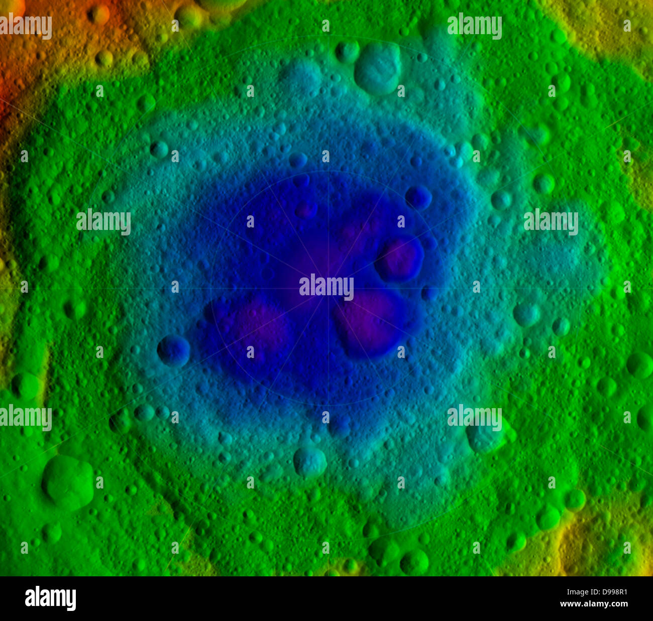 This image from NASA's Dawn mission shows the topography of the northern and southern hemispheres of the giant asteroid Vesta, Stock Photohttps://www.alamy.com/image-license-details/?v=1https://www.alamy.com/stock-photo-this-image-from-nasas-dawn-mission-shows-the-topography-of-the-northern-57367493.html
RMD998R1–This image from NASA's Dawn mission shows the topography of the northern and southern hemispheres of the giant asteroid Vesta,
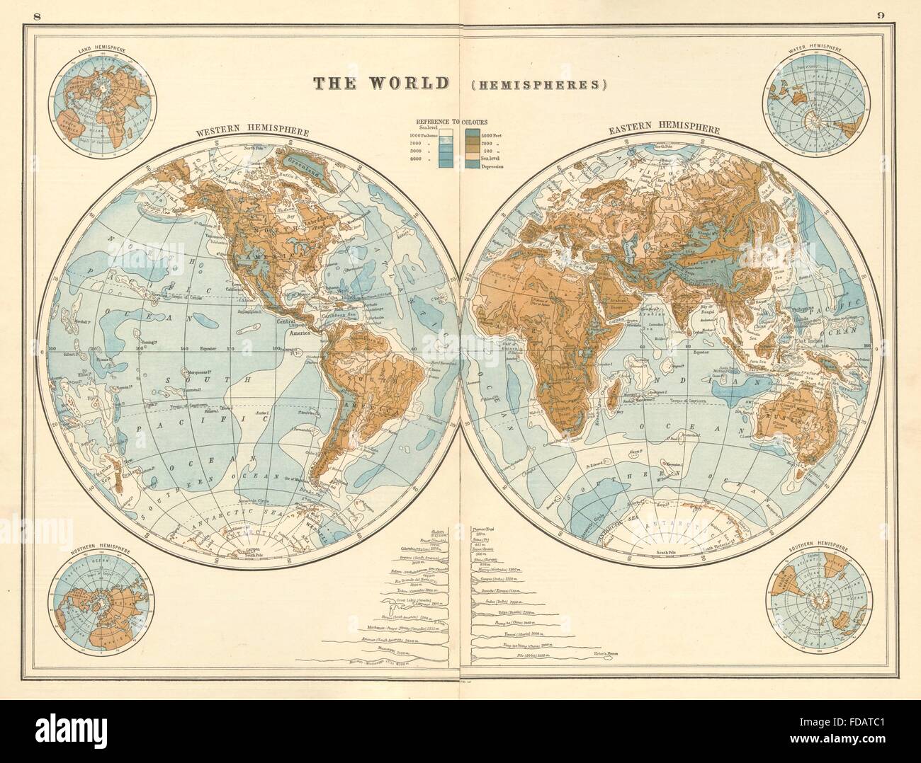 WORLD IN HEMISPHERES: Relief. NSEW. Land & Water. River lengths, 1920 old map Stock Photohttps://www.alamy.com/image-license-details/?v=1https://www.alamy.com/stock-photo-world-in-hemispheres-relief-nsew-land-water-river-lengths-1920-old-94281041.html
RFFDATC1–WORLD IN HEMISPHERES: Relief. NSEW. Land & Water. River lengths, 1920 old map
 Binery Code and World Map Global Stock Photohttps://www.alamy.com/image-license-details/?v=1https://www.alamy.com/stock-photo-binery-code-and-world-map-global-19263181.html
RFB39EAN–Binery Code and World Map Global
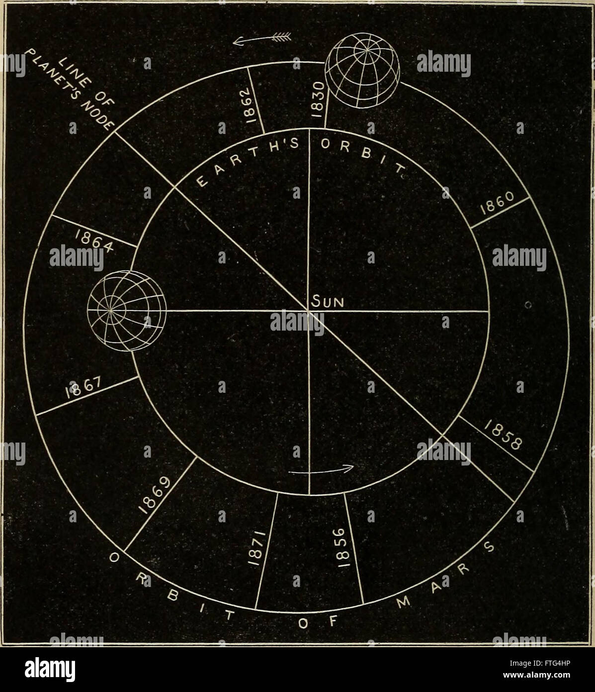 Elements of astronomy- accompanied with numerous illustrations, a colored representation of the solar, stellar, and nebular spectra, and celestial charts of the northern and the southern hemisphere Stock Photohttps://www.alamy.com/image-license-details/?v=1https://www.alamy.com/stock-photo-elements-of-astronomy-accompanied-with-numerous-illustrations-a-colored-101158450.html
RMFTG4HP–Elements of astronomy- accompanied with numerous illustrations, a colored representation of the solar, stellar, and nebular spectra, and celestial charts of the northern and the southern hemisphere
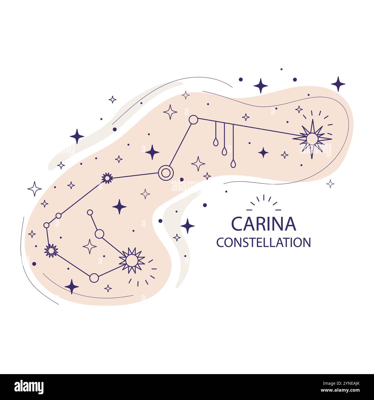 Carina constellation of stars of the southern hemisphere on a white background. Mystical esoteric boho design for fabric design, tarot, astrology, wra Stock Vectorhttps://www.alamy.com/image-license-details/?v=1https://www.alamy.com/carina-constellation-of-stars-of-the-southern-hemisphere-on-a-white-background-mystical-esoteric-boho-design-for-fabric-design-tarot-astrology-wra-image632796715.html
RF2YNEAJK–Carina constellation of stars of the southern hemisphere on a white background. Mystical esoteric boho design for fabric design, tarot, astrology, wra
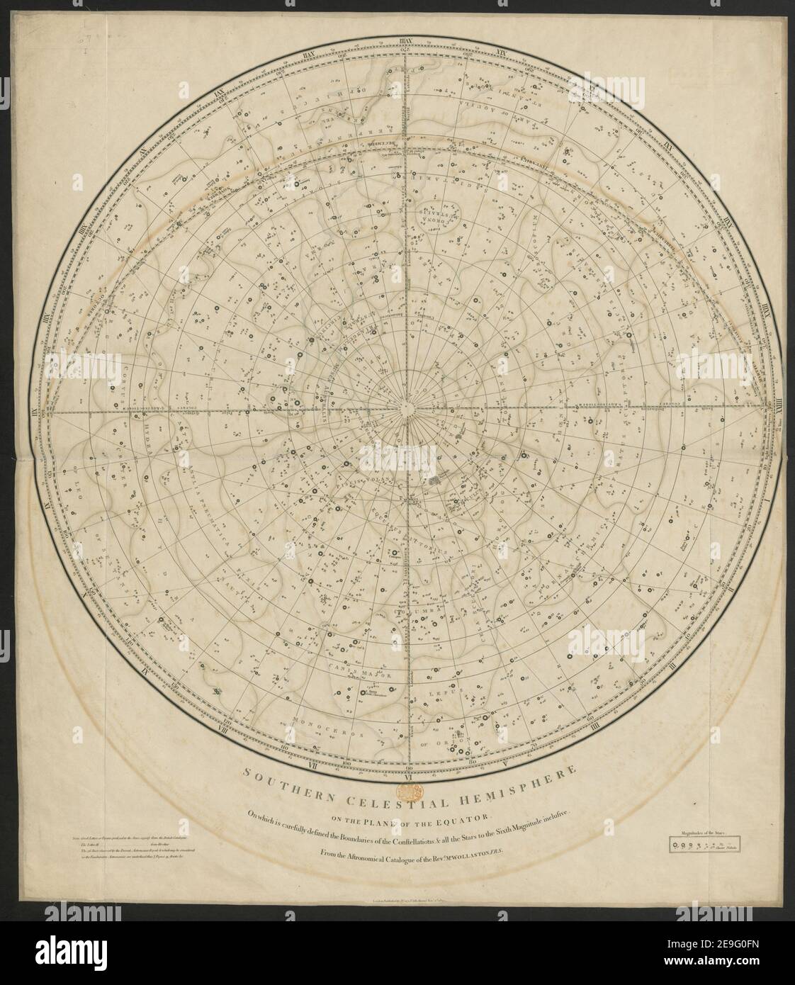 Northern (Southern) Celestial Hemisphere on the Plane of the Equator, on which is ... defined the boundaries of the Constellations, and all the stars to the sixth magnitude inclusive from the astronomical Catalogu Book information: Title: Northern (Southern) Celestial Hemisphere on the Plane of the Equator, on which is ... defined the boundaries of the Constellations, and all the stars to the sixth magnitude inclusive; from the astronomical Catalogue of the Rev. Mr Wollaston. 1.67. Place of publication: London Publisher: J. Cary, Date of publication: 1809 Stock Photohttps://www.alamy.com/image-license-details/?v=1https://www.alamy.com/northern-southern-celestial-hemisphere-on-the-plane-of-the-equator-on-which-is-defined-the-boundaries-of-the-constellations-and-all-the-stars-to-the-sixth-magnitude-inclusive-from-the-astronomical-catalogu-book-information-title-northern-southern-celestial-hemisphere-on-the-plane-of-the-equator-on-which-is-defined-the-boundaries-of-the-constellations-and-all-the-stars-to-the-sixth-magnitude-inclusive-from-the-astronomical-catalogue-of-the-rev-mr-wollaston-167-place-of-publication-london-publisher-j-cary-date-of-publication-1809-image401722041.html
RM2E9G0FN–Northern (Southern) Celestial Hemisphere on the Plane of the Equator, on which is ... defined the boundaries of the Constellations, and all the stars to the sixth magnitude inclusive from the astronomical Catalogu Book information: Title: Northern (Southern) Celestial Hemisphere on the Plane of the Equator, on which is ... defined the boundaries of the Constellations, and all the stars to the sixth magnitude inclusive; from the astronomical Catalogue of the Rev. Mr Wollaston. 1.67. Place of publication: London Publisher: J. Cary, Date of publication: 1809
 Northern Territory flag, state and territory, Australia, oceanian country, vector illustration Stock Vectorhttps://www.alamy.com/image-license-details/?v=1https://www.alamy.com/northern-territory-flag-state-and-territory-australia-oceanian-country-vector-illustration-image418581071.html
RF2F900BY–Northern Territory flag, state and territory, Australia, oceanian country, vector illustration
 Globe on desktop with shadows from vertical blinds Stock Photohttps://www.alamy.com/image-license-details/?v=1https://www.alamy.com/globe-on-desktop-with-shadows-from-vertical-blinds-image1520626.html
RFAR33F3–Globe on desktop with shadows from vertical blinds
 Celestial Map of the Northern Sky (Imagines coeli septentrionalis). Albrecht Dürer; German, 1471-1528. Date: 1515. Dimensions: 432 x 430 mm (image); 584 x 463 mm (sheet). Woodcut in black on ivory laid paper. Origin: Germany. Museum: The Chicago Art Institute. Stock Photohttps://www.alamy.com/image-license-details/?v=1https://www.alamy.com/celestial-map-of-the-northern-sky-imagines-coeli-septentrionalis-albrecht-drer-german-1471-1528-date-1515-dimensions-432-x-430-mm-image-584-x-463-mm-sheet-woodcut-in-black-on-ivory-laid-paper-origin-germany-museum-the-chicago-art-institute-image239740748.html
RMRX13NG–Celestial Map of the Northern Sky (Imagines coeli septentrionalis). Albrecht Dürer; German, 1471-1528. Date: 1515. Dimensions: 432 x 430 mm (image); 584 x 463 mm (sheet). Woodcut in black on ivory laid paper. Origin: Germany. Museum: The Chicago Art Institute.
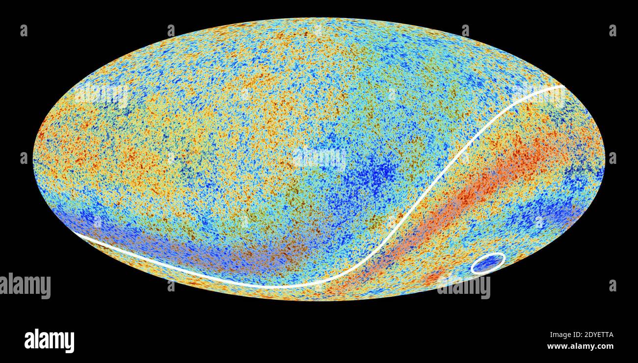 Handout photo just released by the European Space Agency of a spectacular new map of the 'oldest light' in the sky. Two CMB anomalous features hinted at by Planck’s predecessor, NASA’s WMAP, are confirmed in the new high-precision data. One is an asymmetry in the average temperatures on opposite hemispheres of the sky (indicated by the curved line), with slightly higher average temperatures in the southern ecliptic hemisphere and slightly lower average temperatures in the northern ecliptic hemisphere. This runs counter to the prediction made by the standard model that the Universe should be br Stock Photohttps://www.alamy.com/image-license-details/?v=1https://www.alamy.com/handout-photo-just-released-by-the-european-space-agency-of-a-spectacular-new-map-of-the-oldest-light-in-the-sky-two-cmb-anomalous-features-hinted-at-by-plancks-predecessor-nasas-wmap-are-confirmed-in-the-new-high-precision-data-one-is-an-asymmetry-in-the-average-temperatures-on-opposite-hemispheres-of-the-sky-indicated-by-the-curved-line-with-slightly-higher-average-temperatures-in-the-southern-ecliptic-hemisphere-and-slightly-lower-average-temperatures-in-the-northern-ecliptic-hemisphere-this-runs-counter-to-the-prediction-made-by-the-standard-model-that-the-universe-should-be-br-image395550634.html
RM2DYETTA–Handout photo just released by the European Space Agency of a spectacular new map of the 'oldest light' in the sky. Two CMB anomalous features hinted at by Planck’s predecessor, NASA’s WMAP, are confirmed in the new high-precision data. One is an asymmetry in the average temperatures on opposite hemispheres of the sky (indicated by the curved line), with slightly higher average temperatures in the southern ecliptic hemisphere and slightly lower average temperatures in the northern ecliptic hemisphere. This runs counter to the prediction made by the standard model that the Universe should be br
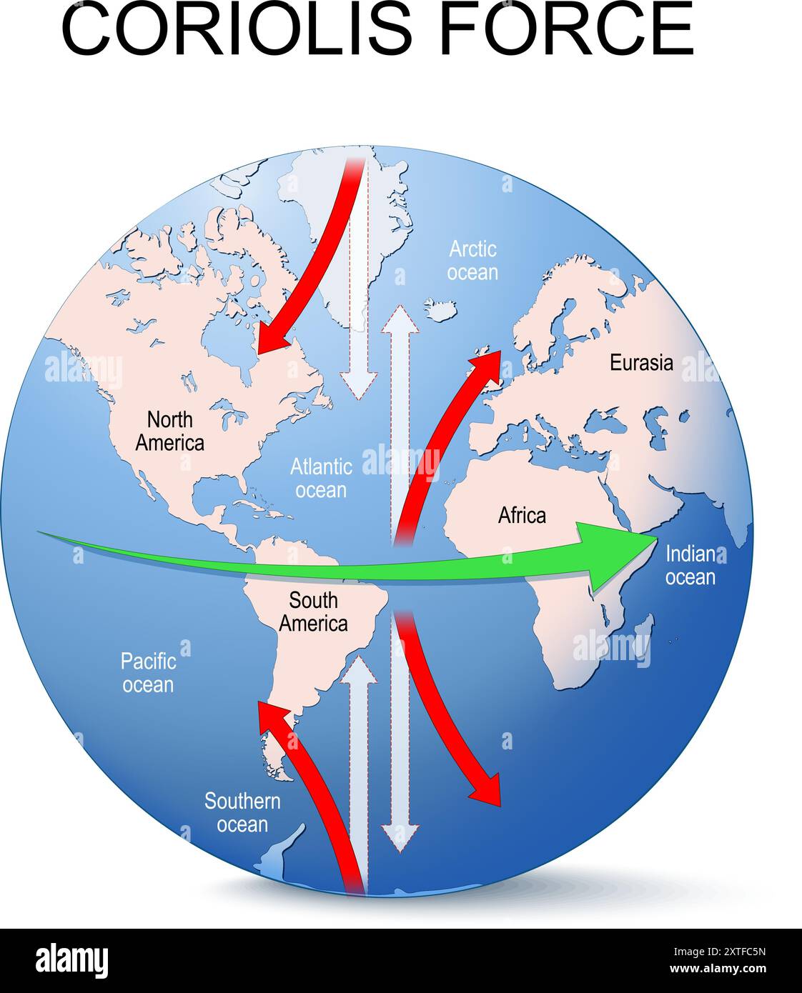 Coriolis force. Coriolis effect. Globe of planet Earth with continents and arrows that show direction of rotation. vector illustration Stock Vectorhttps://www.alamy.com/image-license-details/?v=1https://www.alamy.com/coriolis-force-coriolis-effect-globe-of-planet-earth-with-continents-and-arrows-that-show-direction-of-rotation-vector-illustration-image617453473.html
RF2XTFC5N–Coriolis force. Coriolis effect. Globe of planet Earth with continents and arrows that show direction of rotation. vector illustration
RF2RG4T3K–The volume of Sphere. math teaching pictures. 3d shape symbol icon. Geometric shapes. isolated on white background Vector illustration.
 . Northern Hemisphere - Southern Hemisphere . English: An unusual and attractive map of the world on a hemisphere projection. Depicts the world as seen from the North Pole and south pole. Antarctica is mysteriously absent. Divided according to continents. In Africa the Mountains of the Moon are shown, as are the Andes in South America, the Rockies in North America, and the Altaian Mountains of Asia. Prepared by Thomas Bradford for the 1838 issue of his small format atlas of the world. . 1838 (undated) 7 1838 Bradford Map of the World on Polar Projection ( Northern and Southern Hemispheres ) Stock Photohttps://www.alamy.com/image-license-details/?v=1https://www.alamy.com/northern-hemisphere-southern-hemisphere-english-an-unusual-and-attractive-map-of-the-world-on-a-hemisphere-projection-depicts-the-world-as-seen-from-the-north-pole-and-south-pole-antarctica-is-mysteriously-absent-divided-according-to-continents-in-africa-the-mountains-of-the-moon-are-shown-as-are-the-andes-in-south-america-the-rockies-in-north-america-and-the-altaian-mountains-of-asia-prepared-by-thomas-bradford-for-the-1838-issue-of-his-small-format-atlas-of-the-world-1838-undated-7-1838-bradford-map-of-the-world-on-polar-projection-northern-and-southern-hemispheres-image187621469.html
RMMW6W2N–. Northern Hemisphere - Southern Hemisphere . English: An unusual and attractive map of the world on a hemisphere projection. Depicts the world as seen from the North Pole and south pole. Antarctica is mysteriously absent. Divided according to continents. In Africa the Mountains of the Moon are shown, as are the Andes in South America, the Rockies in North America, and the Altaian Mountains of Asia. Prepared by Thomas Bradford for the 1838 issue of his small format atlas of the world. . 1838 (undated) 7 1838 Bradford Map of the World on Polar Projection ( Northern and Southern Hemispheres )
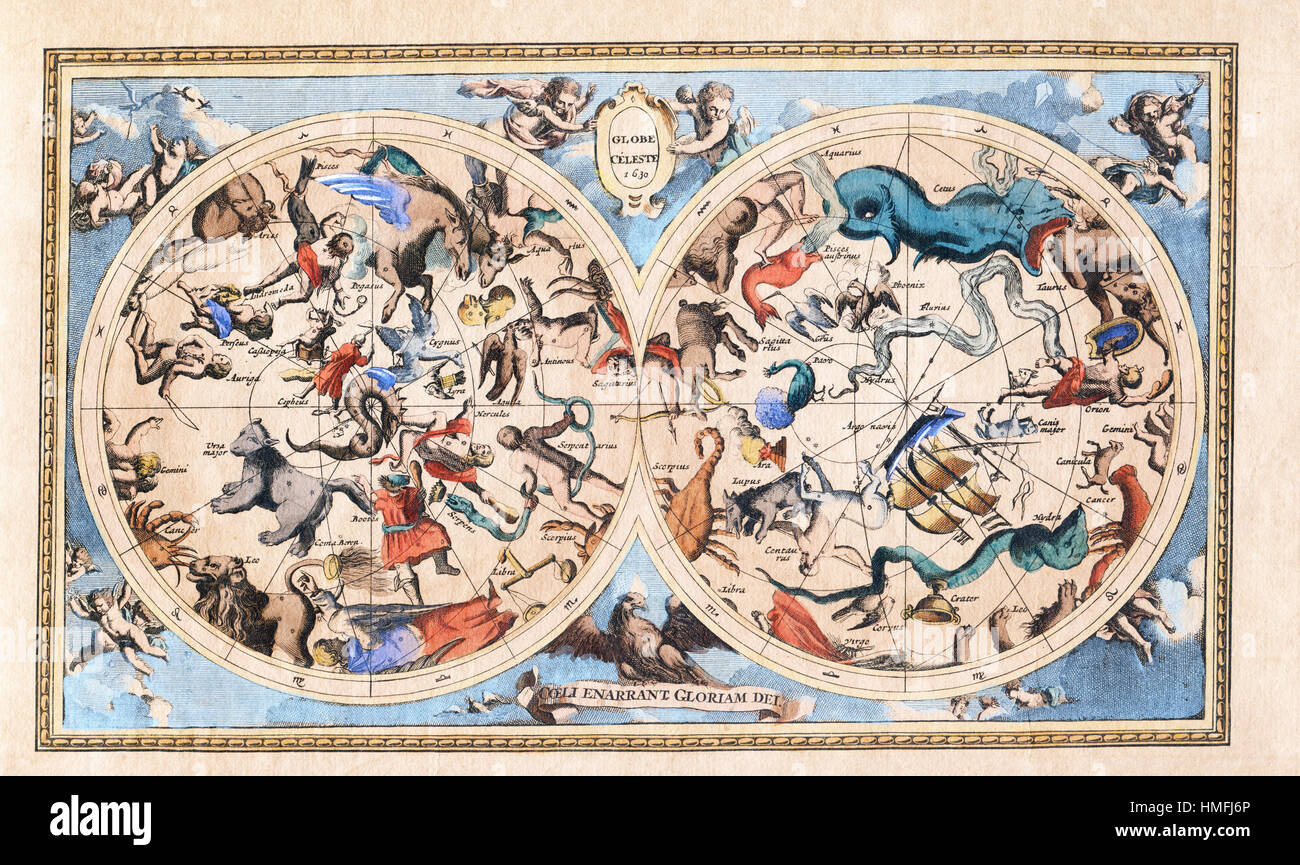 Antique Vintage Constellation Celestial Hemisphere Stock Photohttps://www.alamy.com/image-license-details/?v=1https://www.alamy.com/stock-photo-antique-vintage-constellation-celestial-hemisphere-133109278.html
RFHMFJ6P–Antique Vintage Constellation Celestial Hemisphere
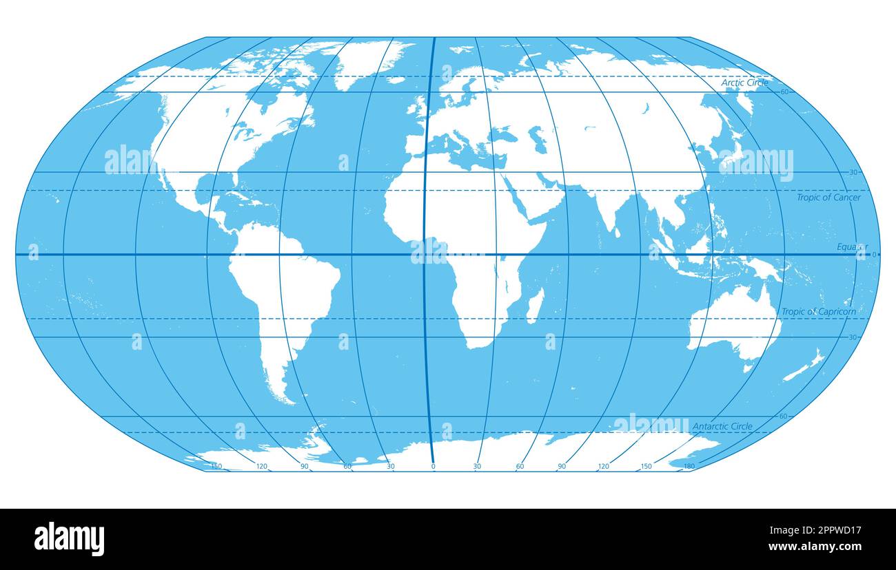 The World, important circles of latitudes and longitudes, political map Stock Vectorhttps://www.alamy.com/image-license-details/?v=1https://www.alamy.com/the-world-important-circles-of-latitudes-and-longitudes-political-map-image547602867.html
RF2PPWD17–The World, important circles of latitudes and longitudes, political map
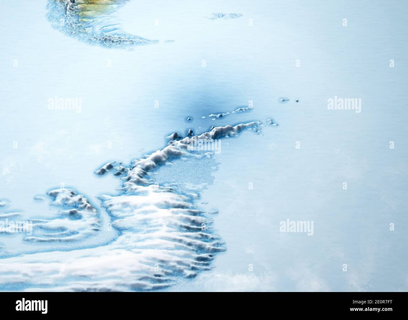 Antarctic Peninsula, climate change. Continent Antarctica. Geographical map, orography of the terrain. Argentina and Chile. Melting ice, Iceberg Stock Photohttps://www.alamy.com/image-license-details/?v=1https://www.alamy.com/antarctic-peninsula-climate-change-continent-antarctica-geographical-map-orography-of-the-terrain-argentina-and-chile-melting-ice-iceberg-image396349292.html
RF2E0R7FT–Antarctic Peninsula, climate change. Continent Antarctica. Geographical map, orography of the terrain. Argentina and Chile. Melting ice, Iceberg
 Isolated world globe with black stand on a white background. Focusing on Europe & North Africa. Stock Photohttps://www.alamy.com/image-license-details/?v=1https://www.alamy.com/isolated-world-globe-with-black-stand-on-a-white-background-focusing-on-europe-north-africa-image626048987.html
RF2YAEYTB–Isolated world globe with black stand on a white background. Focusing on Europe & North Africa.
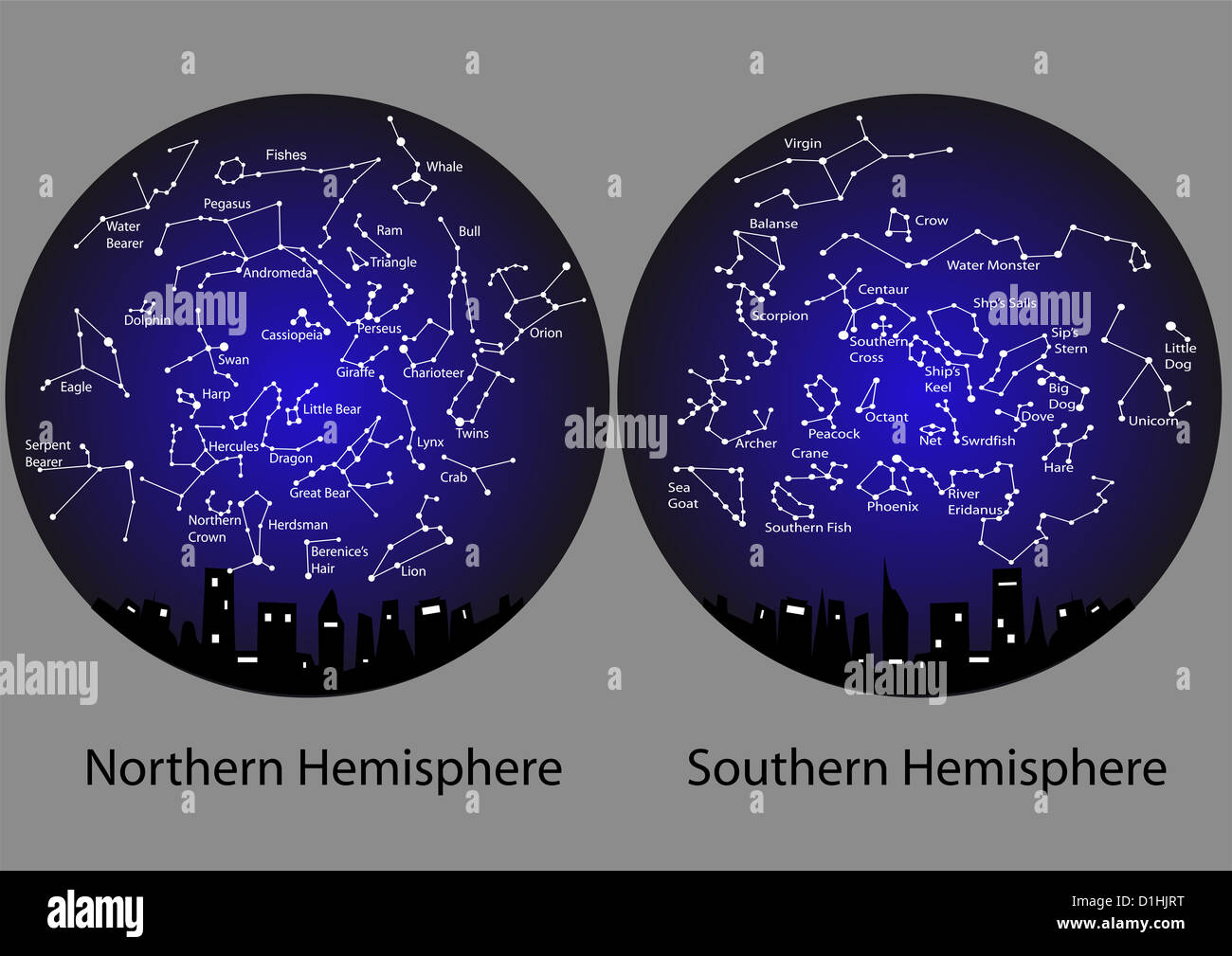 constellations of the northern and southern hemisphere Stock Photohttps://www.alamy.com/image-license-details/?v=1https://www.alamy.com/stock-photo-constellations-of-the-northern-and-southern-hemisphere-52633724.html
RFD1HJRT–constellations of the northern and southern hemisphere
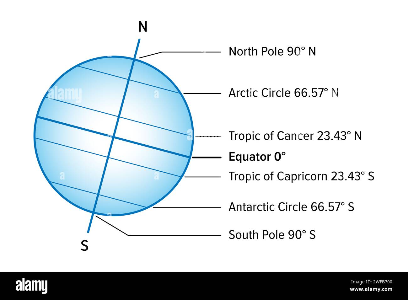 Named latitudes on the Earth. The five parallels of significance are the Equator, Arctic and Antarctic Circle, and Tropic of Cancer and of Capricorn. Stock Photohttps://www.alamy.com/image-license-details/?v=1https://www.alamy.com/named-latitudes-on-the-earth-the-five-parallels-of-significance-are-the-equator-arctic-and-antarctic-circle-and-tropic-of-cancer-and-of-capricorn-image594619312.html
RF2WFB700–Named latitudes on the Earth. The five parallels of significance are the Equator, Arctic and Antarctic Circle, and Tropic of Cancer and of Capricorn.
 This image from NASA's Dawn mission shows the topography of the northern and southern hemispheres of the giant asteroid Vesta, Stock Photohttps://www.alamy.com/image-license-details/?v=1https://www.alamy.com/stock-photo-this-image-from-nasas-dawn-mission-shows-the-topography-of-the-northern-57367496.html
RMD998R4–This image from NASA's Dawn mission shows the topography of the northern and southern hemispheres of the giant asteroid Vesta,
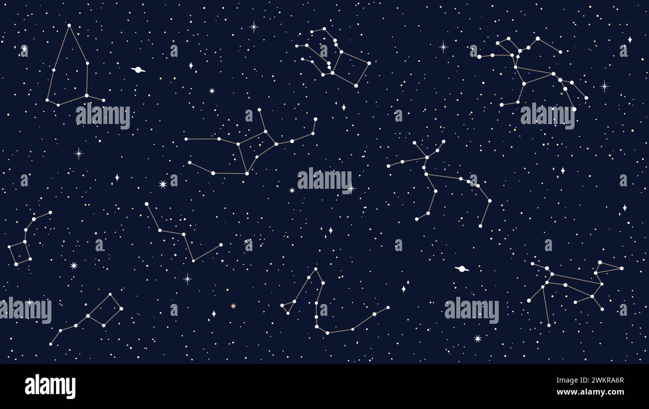 Space sky celestial seamless pattern with vector map of star constellations, sparks and planets. Dark night sky background with silhouettes of cassiopeia, andromeda, delphinus, pegasus constellations Stock Vectorhttps://www.alamy.com/image-license-details/?v=1https://www.alamy.com/space-sky-celestial-seamless-pattern-with-vector-map-of-star-constellations-sparks-and-planets-dark-night-sky-background-with-silhouettes-of-cassiopeia-andromeda-delphinus-pegasus-constellations-image597343903.html
RF2WKRA6R–Space sky celestial seamless pattern with vector map of star constellations, sparks and planets. Dark night sky background with silhouettes of cassiopeia, andromeda, delphinus, pegasus constellations
 World Map and Binary Code Stock Photohttps://www.alamy.com/image-license-details/?v=1https://www.alamy.com/stock-photo-world-map-and-binary-code-19264137.html
RFB39FGW–World Map and Binary Code
 Elements of astronomy- accompanied with numerous illustrations, a colored representation of the solar, stellar, and nebular spectra, and celestial charts of the northern and the southern hemisphere Stock Photohttps://www.alamy.com/image-license-details/?v=1https://www.alamy.com/stock-photo-elements-of-astronomy-accompanied-with-numerous-illustrations-a-colored-101158448.html
RMFTG4HM–Elements of astronomy- accompanied with numerous illustrations, a colored representation of the solar, stellar, and nebular spectra, and celestial charts of the northern and the southern hemisphere
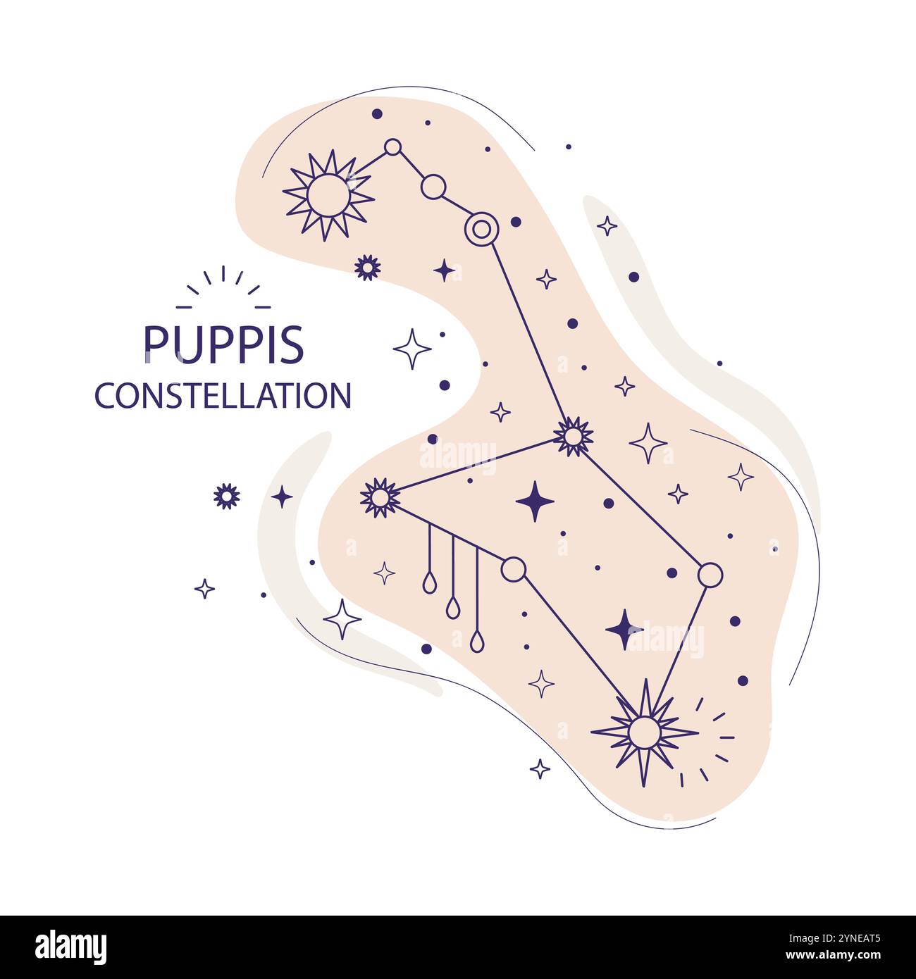 Puppis or stern constellation of stars of the southern hemisphere on a white background. Mystical esoteric boho design for fabric design, tarot, astro Stock Vectorhttps://www.alamy.com/image-license-details/?v=1https://www.alamy.com/puppis-or-stern-constellation-of-stars-of-the-southern-hemisphere-on-a-white-background-mystical-esoteric-boho-design-for-fabric-design-tarot-astro-image632796869.html
RF2YNEAT5–Puppis or stern constellation of stars of the southern hemisphere on a white background. Mystical esoteric boho design for fabric design, tarot, astro
 Northern Hemisphere ; Southern Hemisphere Cartographic. Maps, World maps. 1790. Lionel Pincus and Princess Firyal Map Division. Northern Hemisphere, Southern Hemisphere Stock Photohttps://www.alamy.com/image-license-details/?v=1https://www.alamy.com/northern-hemisphere-southern-hemisphere-cartographic-maps-world-maps-1790-lionel-pincus-and-princess-firyal-map-division-northern-hemisphere-southern-hemisphere-image484373580.html
RM2K413CC–Northern Hemisphere ; Southern Hemisphere Cartographic. Maps, World maps. 1790. Lionel Pincus and Princess Firyal Map Division. Northern Hemisphere, Southern Hemisphere
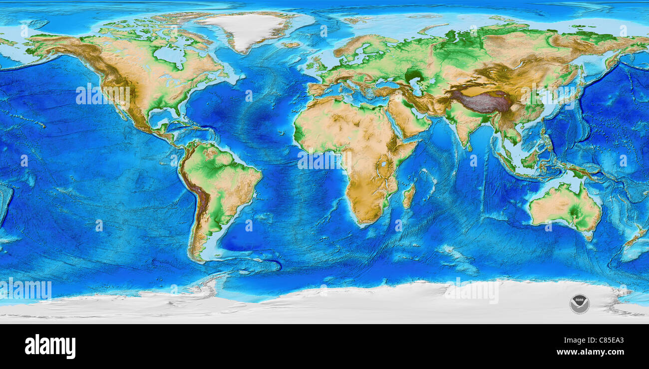 ETOPO1 is a 1 arc-minute global relief model of Earth's surface that integrates land topography and ocean bathymetry. Stock Photohttps://www.alamy.com/image-license-details/?v=1https://www.alamy.com/stock-photo-etopo1-is-a-1-arc-minute-global-relief-model-of-earths-surface-that-39459003.html
RMC85EA3–ETOPO1 is a 1 arc-minute global relief model of Earth's surface that integrates land topography and ocean bathymetry.
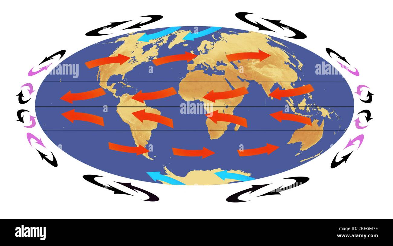 Global Air Circulation Stock Photohttps://www.alamy.com/image-license-details/?v=1https://www.alamy.com/global-air-circulation-image353179666.html
RM2BEGM7E–Global Air Circulation
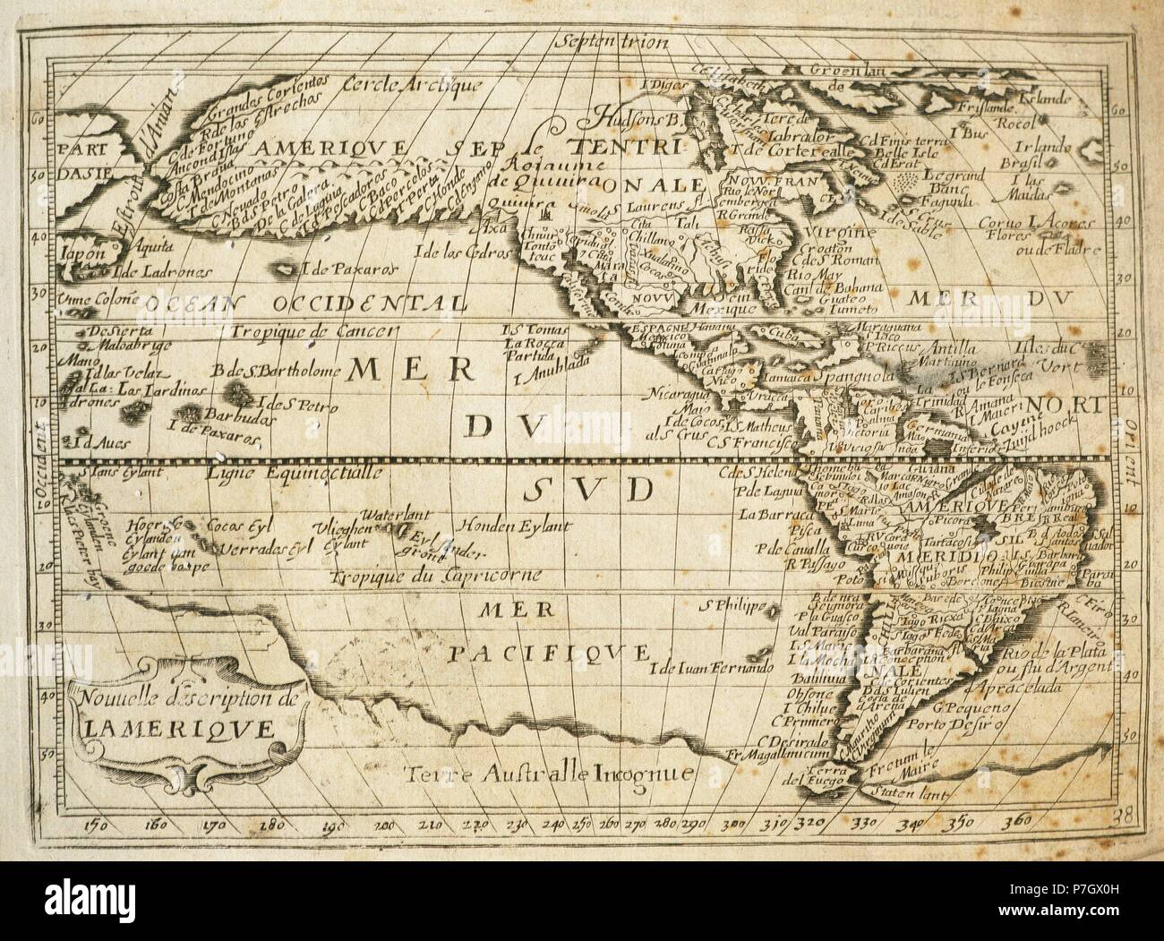 The Americas. Map. 17th century. Engraving. Stock Photohttps://www.alamy.com/image-license-details/?v=1https://www.alamy.com/the-americas-map-17th-century-engraving-image211198641.html
RMP7GX0H–The Americas. Map. 17th century. Engraving.
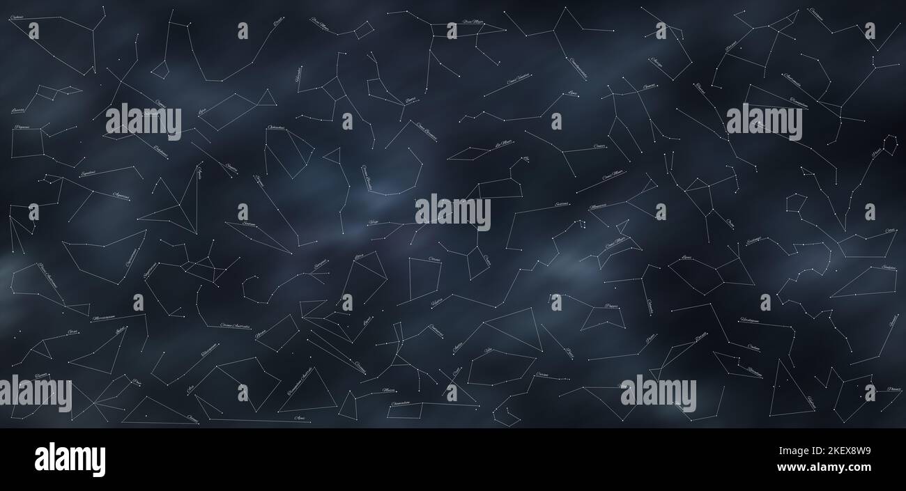 Star Constellations Map With All 88 Star Constellations Stock Photohttps://www.alamy.com/image-license-details/?v=1https://www.alamy.com/star-constellations-map-with-all-88-star-constellations-image491073221.html
RF2KEX8W9–Star Constellations Map With All 88 Star Constellations
 2014 North Korea stamp set. The Milky Way Galaxy Stock Photohttps://www.alamy.com/image-license-details/?v=1https://www.alamy.com/2014-north-korea-stamp-set-the-milky-way-galaxy-image503953860.html
RM2M7W284–2014 North Korea stamp set. The Milky Way Galaxy
 Maginfied Globe Stock Photohttps://www.alamy.com/image-license-details/?v=1https://www.alamy.com/stock-photo-maginfied-globe-82323545.html
RFENX4EH–Maginfied Globe
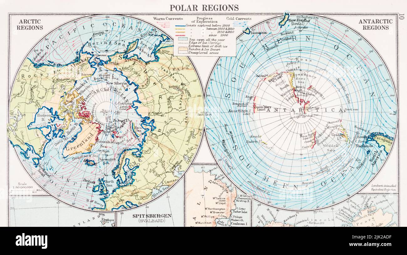 Old atlas map of North & South Poles in 1930 (See Notes). Increased militarization and commercial exploitation of the Polar regions is of concern. Stock Photohttps://www.alamy.com/image-license-details/?v=1https://www.alamy.com/old-atlas-map-of-north-south-poles-in-1930-see-notes-increased-militarization-and-commercial-exploitation-of-the-polar-regions-is-of-concern-image476410523.html
RM2JK2ADF–Old atlas map of North & South Poles in 1930 (See Notes). Increased militarization and commercial exploitation of the Polar regions is of concern.
 Stellar tracks on a moonlit night above church of Bom Jardim - Nobres - MT - Brazil Stock Photohttps://www.alamy.com/image-license-details/?v=1https://www.alamy.com/stellar-tracks-on-a-moonlit-night-above-church-of-bom-jardim-nobres-mt-brazil-image367941095.html
RF2CAH4HB–Stellar tracks on a moonlit night above church of Bom Jardim - Nobres - MT - Brazil
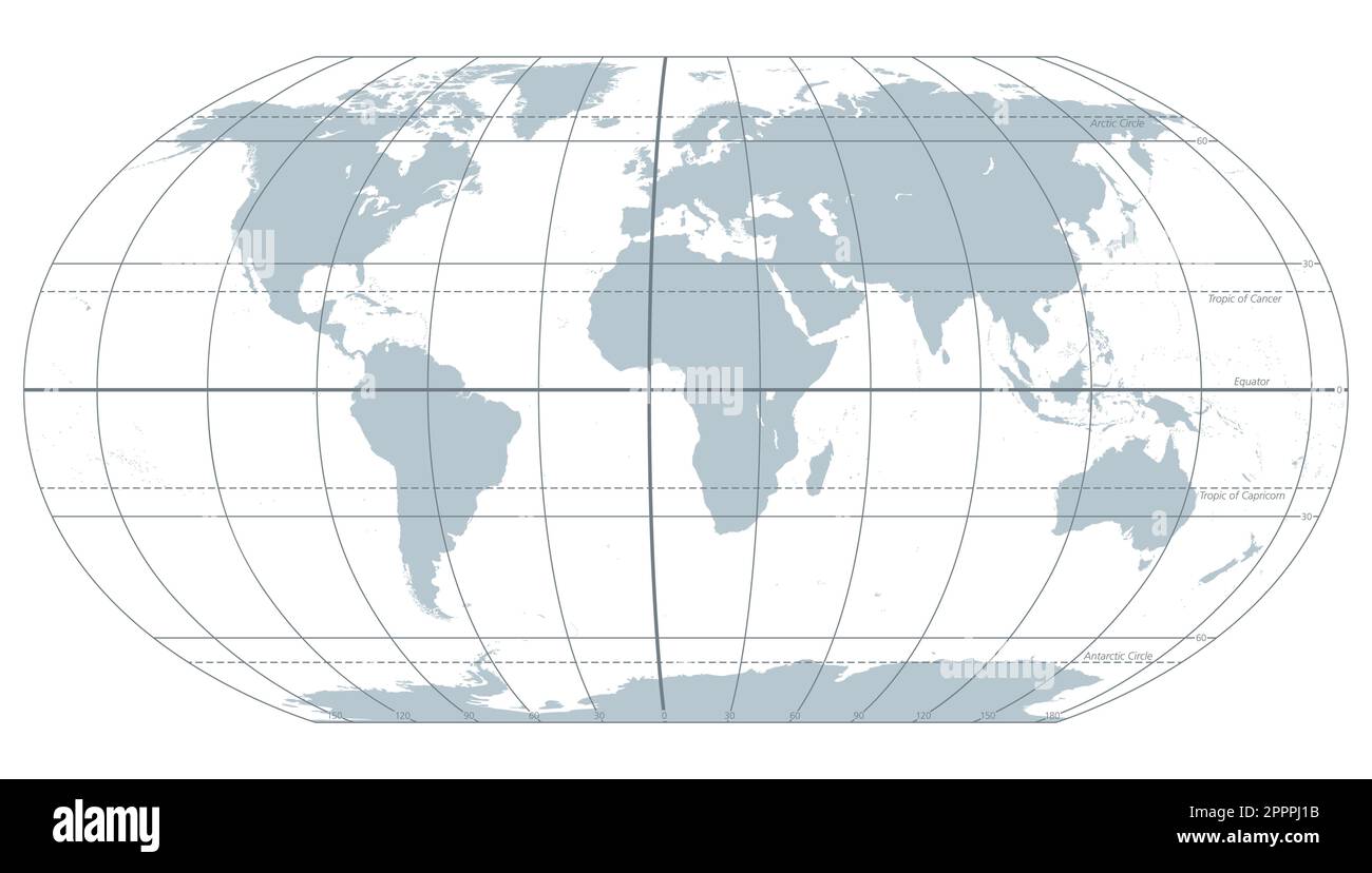 World most important circles of latitudes and longitudes, gray map Stock Vectorhttps://www.alamy.com/image-license-details/?v=1https://www.alamy.com/world-most-important-circles-of-latitudes-and-longitudes-gray-map-image547540935.html
RF2PPPJ1B–World most important circles of latitudes and longitudes, gray map
 Antarctic Peninsula, climate change. Continent Antarctica. Geographical map, orography of the terrain. Argentina and Chile. Melting ice, Iceberg Stock Photohttps://www.alamy.com/image-license-details/?v=1https://www.alamy.com/antarctic-peninsula-climate-change-continent-antarctica-geographical-map-orography-of-the-terrain-argentina-and-chile-melting-ice-iceberg-image396347621.html
RF2E0R5C5–Antarctic Peninsula, climate change. Continent Antarctica. Geographical map, orography of the terrain. Argentina and Chile. Melting ice, Iceberg
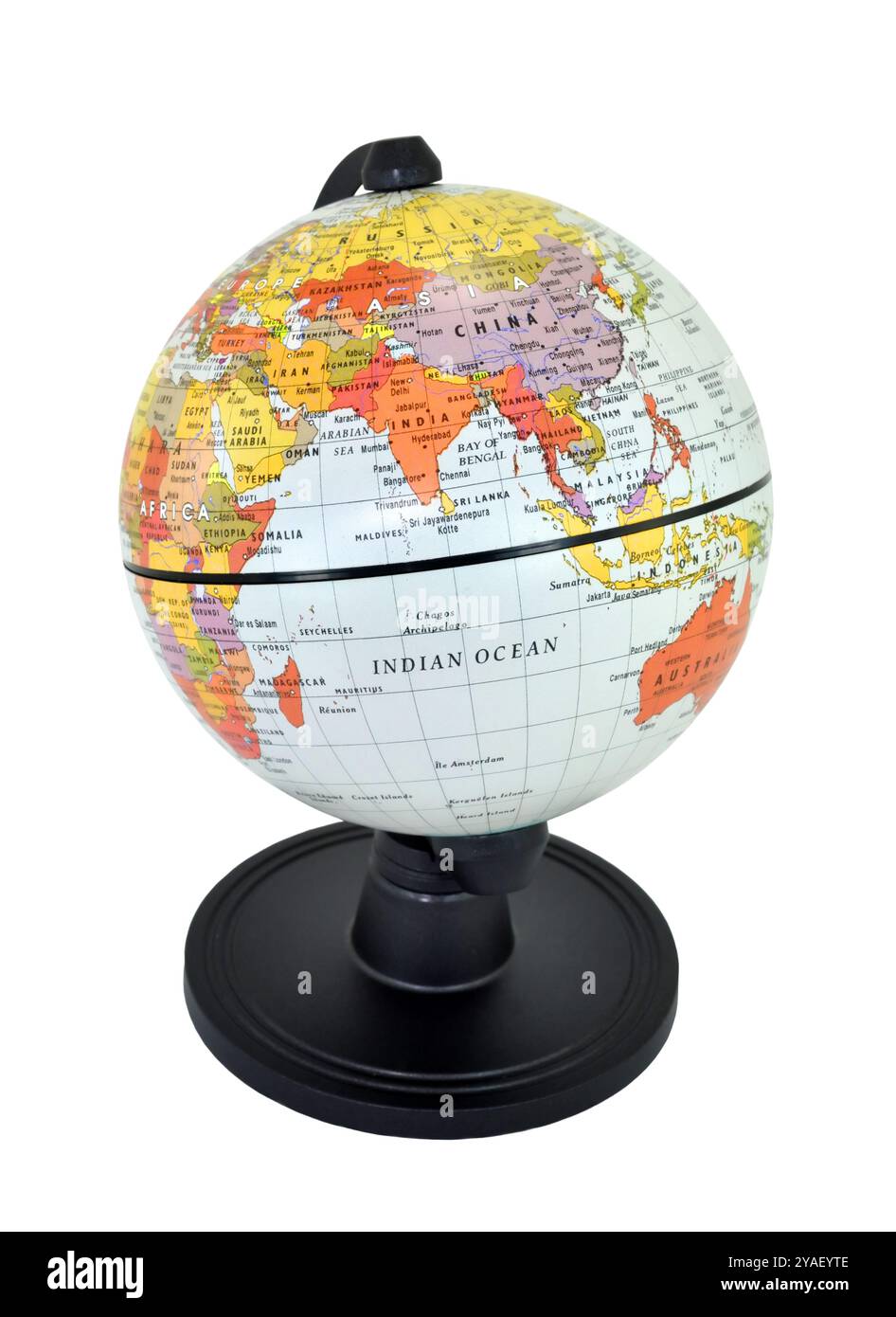 Isolated world globe with black stand on a white background, Focusing on India. Stock Photohttps://www.alamy.com/image-license-details/?v=1https://www.alamy.com/isolated-world-globe-with-black-stand-on-a-white-background-focusing-on-india-image626048990.html
RF2YAEYTE–Isolated world globe with black stand on a white background, Focusing on India.
 paper map of america on white background vector illustration design Stock Vectorhttps://www.alamy.com/image-license-details/?v=1https://www.alamy.com/paper-map-of-america-on-white-background-vector-illustration-design-image372932061.html
RF2CJMEJ5–paper map of america on white background vector illustration design
 Night sky map, star constellation border. Mystic astrology, magic, astronomy, esoteric horoscope or zodiac vector banner. Celestial sphere shapes of shining stars and lines on black sky background Stock Vectorhttps://www.alamy.com/image-license-details/?v=1https://www.alamy.com/night-sky-map-star-constellation-border-mystic-astrology-magic-astronomy-esoteric-horoscope-or-zodiac-vector-banner-celestial-sphere-shapes-of-shining-stars-and-lines-on-black-sky-background-image576209343.html
RF2TDCGW3–Night sky map, star constellation border. Mystic astrology, magic, astronomy, esoteric horoscope or zodiac vector banner. Celestial sphere shapes of shining stars and lines on black sky background
 Elements of astronomy- accompanied with numerous illustrations, a colored representation of the solar, stellar, and nebular spectra, and celestial charts of the northern and the southern hemisphere Stock Photohttps://www.alamy.com/image-license-details/?v=1https://www.alamy.com/stock-photo-elements-of-astronomy-accompanied-with-numerous-illustrations-a-colored-114472562.html
RMGJ6JWP–Elements of astronomy- accompanied with numerous illustrations, a colored representation of the solar, stellar, and nebular spectra, and celestial charts of the northern and the southern hemisphere
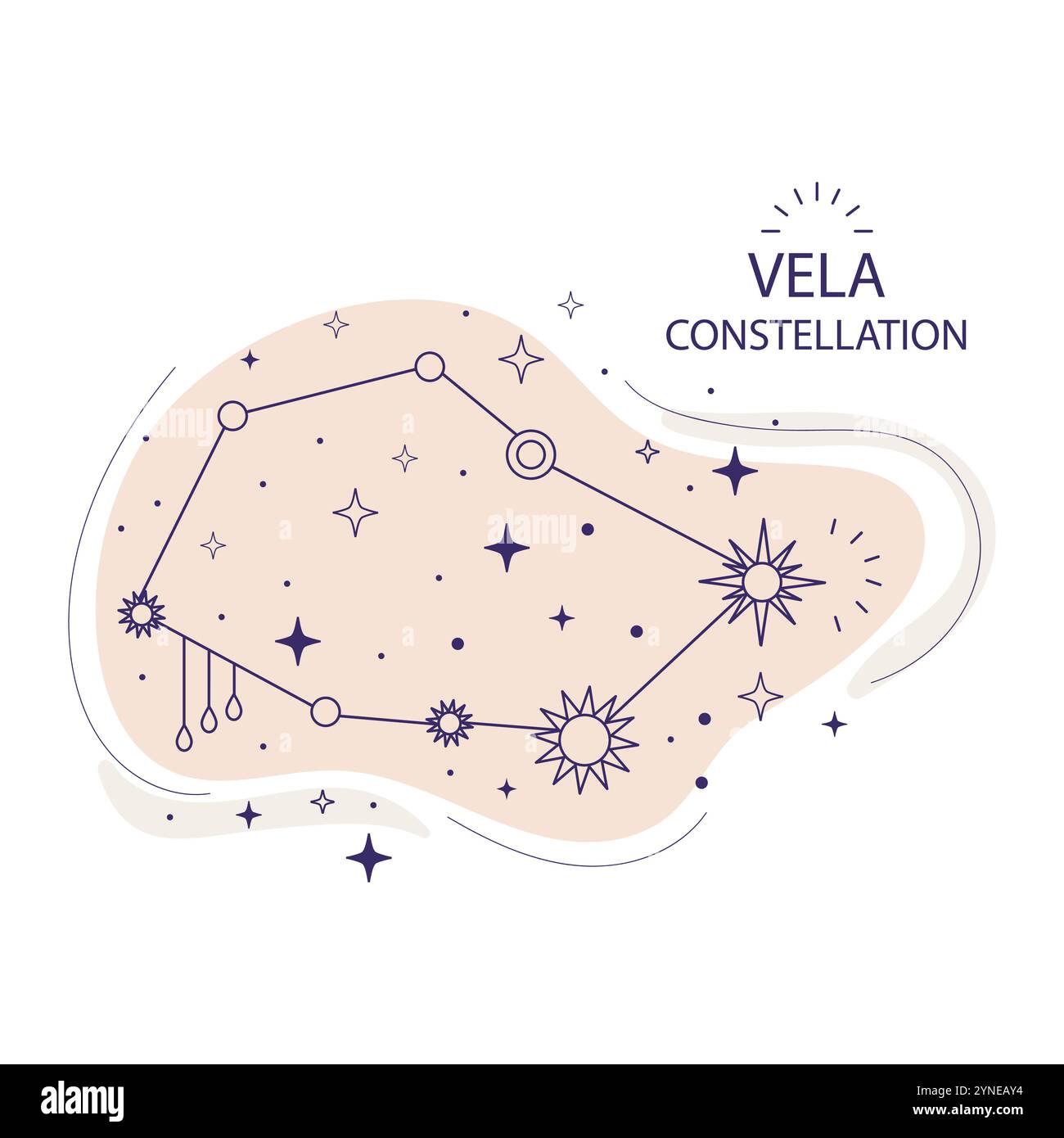 Vela or sails constellation of stars of the southern hemisphere on a white background. Mystical esoteric boho design for fabric design, tarot, astrolo Stock Vectorhttps://www.alamy.com/image-license-details/?v=1https://www.alamy.com/vela-or-sails-constellation-of-stars-of-the-southern-hemisphere-on-a-white-background-mystical-esoteric-boho-design-for-fabric-design-tarot-astrolo-image632796952.html
RF2YNEAY4–Vela or sails constellation of stars of the southern hemisphere on a white background. Mystical esoteric boho design for fabric design, tarot, astrolo
![The map of the world. Relief shown by shading. Prime meridian: [Ferro]. Includes illustrations of the United States coat of arms above the map and flowers in the corners.. Manuscript map in ink, watercolor and pencil. Drawn by a schoolboy attending the Wesleyan Seminary in Wilbraham, Massachusetts. Double hemisphere map of the eastern and western hemispheres, with a smaller double hemisphere map of the southern and northern hemispheres... , World Stock Photo The map of the world. Relief shown by shading. Prime meridian: [Ferro]. Includes illustrations of the United States coat of arms above the map and flowers in the corners.. Manuscript map in ink, watercolor and pencil. Drawn by a schoolboy attending the Wesleyan Seminary in Wilbraham, Massachusetts. Double hemisphere map of the eastern and western hemispheres, with a smaller double hemisphere map of the southern and northern hemispheres... , World Stock Photo](https://c8.alamy.com/comp/2M5W67T/the-map-of-the-world-relief-shown-by-shading-prime-meridian-ferro-includes-illustrations-of-the-united-states-coat-of-arms-above-the-map-and-flowers-in-the-corners-manuscript-map-in-ink-watercolor-and-pencil-drawn-by-a-schoolboy-attending-the-wesleyan-seminary-in-wilbraham-massachusetts-double-hemisphere-map-of-the-eastern-and-western-hemispheres-with-a-smaller-double-hemisphere-map-of-the-southern-and-northern-hemispheres-world-2M5W67T.jpg) The map of the world. Relief shown by shading. Prime meridian: [Ferro]. Includes illustrations of the United States coat of arms above the map and flowers in the corners.. Manuscript map in ink, watercolor and pencil. Drawn by a schoolboy attending the Wesleyan Seminary in Wilbraham, Massachusetts. Double hemisphere map of the eastern and western hemispheres, with a smaller double hemisphere map of the southern and northern hemispheres... , World Stock Photohttps://www.alamy.com/image-license-details/?v=1https://www.alamy.com/the-map-of-the-world-relief-shown-by-shading-prime-meridian-ferro-includes-illustrations-of-the-united-states-coat-of-arms-above-the-map-and-flowers-in-the-corners-manuscript-map-in-ink-watercolor-and-pencil-drawn-by-a-schoolboy-attending-the-wesleyan-seminary-in-wilbraham-massachusetts-double-hemisphere-map-of-the-eastern-and-western-hemispheres-with-a-smaller-double-hemisphere-map-of-the-southern-and-northern-hemispheres-world-image502727676.html
The map of the world. Relief shown by shading. Prime meridian: [Ferro]. Includes illustrations of the United States coat of arms above the map and flowers in the corners.. Manuscript map in ink, watercolor and pencil. Drawn by a schoolboy attending the Wesleyan Seminary in Wilbraham, Massachusetts. Double hemisphere map of the eastern and western hemispheres, with a smaller double hemisphere map of the southern and northern hemispheres... , World Stock Photohttps://www.alamy.com/image-license-details/?v=1https://www.alamy.com/the-map-of-the-world-relief-shown-by-shading-prime-meridian-ferro-includes-illustrations-of-the-united-states-coat-of-arms-above-the-map-and-flowers-in-the-corners-manuscript-map-in-ink-watercolor-and-pencil-drawn-by-a-schoolboy-attending-the-wesleyan-seminary-in-wilbraham-massachusetts-double-hemisphere-map-of-the-eastern-and-western-hemispheres-with-a-smaller-double-hemisphere-map-of-the-southern-and-northern-hemispheres-world-image502727676.htmlRM2M5W67T–The map of the world. Relief shown by shading. Prime meridian: [Ferro]. Includes illustrations of the United States coat of arms above the map and flowers in the corners.. Manuscript map in ink, watercolor and pencil. Drawn by a schoolboy attending the Wesleyan Seminary in Wilbraham, Massachusetts. Double hemisphere map of the eastern and western hemispheres, with a smaller double hemisphere map of the southern and northern hemispheres... , World
RMPPEY7H–Earth's Sphere according the author. Engraving in Poeticon Astronomicon, by Gaius Julius Hyginus (ca.64 BC-17 AD). Edited in Venice, 1485. Incunable.
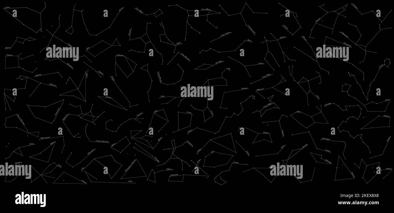 Star Constellations Map With All 88 Star Constellations Stock Photohttps://www.alamy.com/image-license-details/?v=1https://www.alamy.com/star-constellations-map-with-all-88-star-constellations-image491073248.html
RF2KEX8X8–Star Constellations Map With All 88 Star Constellations
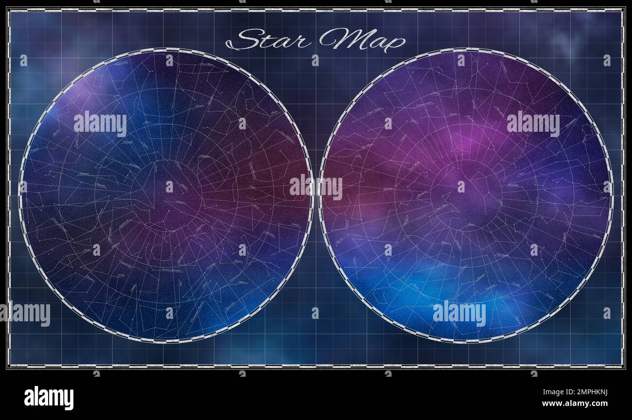 High detailed Star Map with names of constellations Stock Photohttps://www.alamy.com/image-license-details/?v=1https://www.alamy.com/high-detailed-star-map-with-names-of-constellations-image513011790.html
RF2MPHKNJ–High detailed Star Map with names of constellations
 Baseball World Stock Photohttps://www.alamy.com/image-license-details/?v=1https://www.alamy.com/stock-photo-baseball-world-82323736.html
RFENX4NC–Baseball World
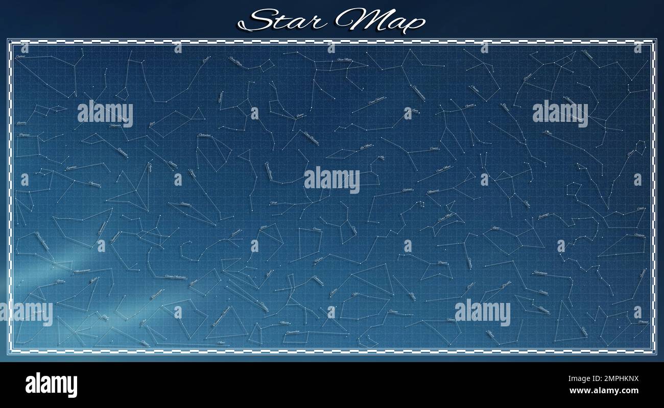 High detailed Star Map with names of constellations Stock Photohttps://www.alamy.com/image-license-details/?v=1https://www.alamy.com/high-detailed-star-map-with-names-of-constellations-image513011798.html
RF2MPHKNX–High detailed Star Map with names of constellations
 Stellar tracks on a moonlit night above church of Bom Jardim - Nobres - MT - Brazil Stock Photohttps://www.alamy.com/image-license-details/?v=1https://www.alamy.com/stellar-tracks-on-a-moonlit-night-above-church-of-bom-jardim-nobres-mt-brazil-image367941101.html
RF2CAH4HH–Stellar tracks on a moonlit night above church of Bom Jardim - Nobres - MT - Brazil
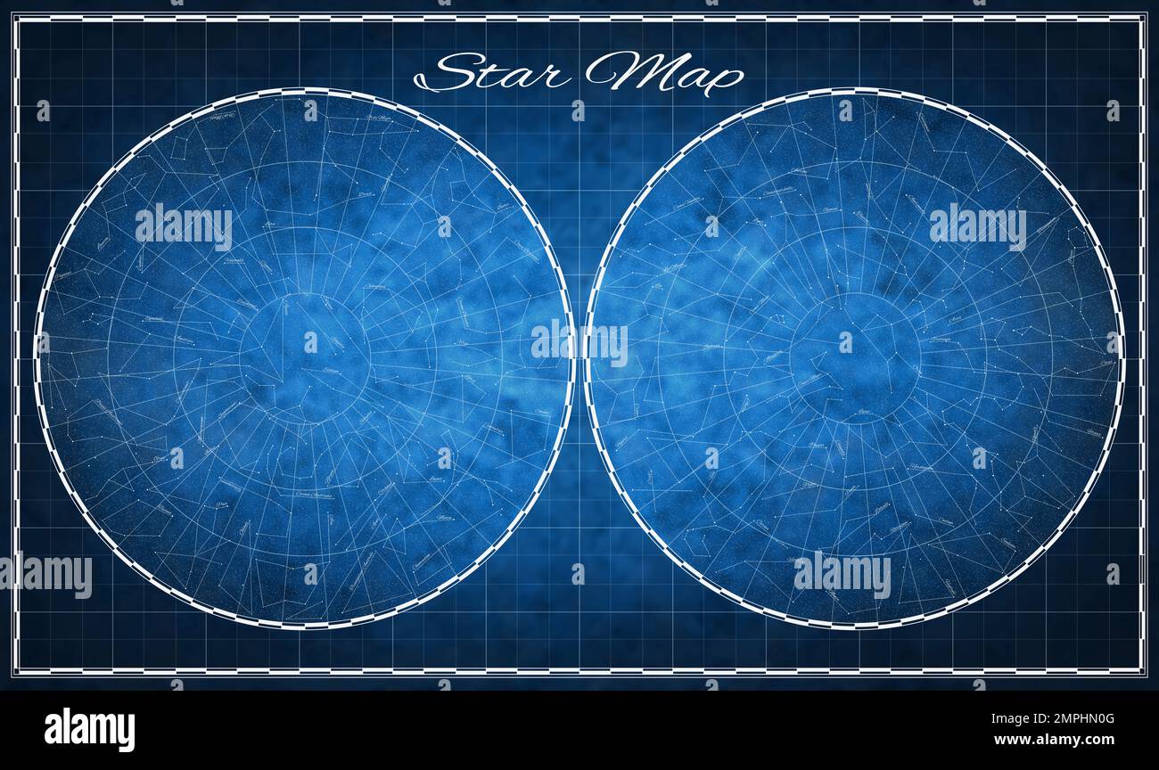 High detailed Star Map with names of constellations Stock Photohttps://www.alamy.com/image-license-details/?v=1https://www.alamy.com/high-detailed-star-map-with-names-of-constellations-image513012768.html
RF2MPHN0G–High detailed Star Map with names of constellations
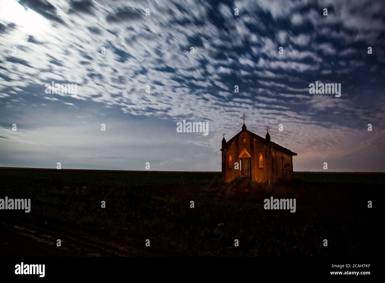 A night view scene of an abandoned old church in Ibirarema - SP - Brazil Stock Photohttps://www.alamy.com/image-license-details/?v=1https://www.alamy.com/a-night-view-scene-of-an-abandoned-old-church-in-ibirarema-sp-brazil-image367943507.html
RF2CAH7KF–A night view scene of an abandoned old church in Ibirarema - SP - Brazil
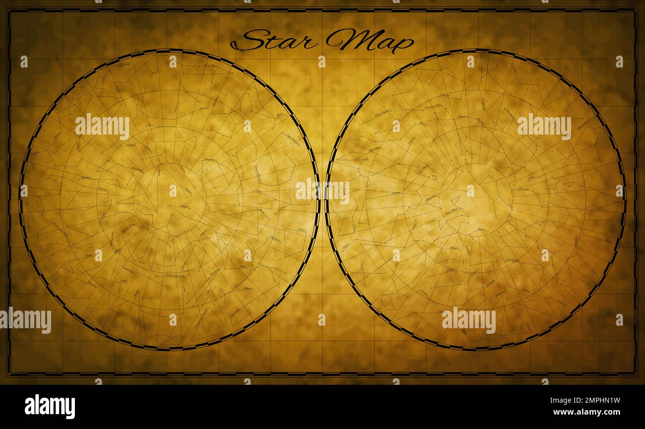 High detailed Star Map with names of constellations Stock Photohttps://www.alamy.com/image-license-details/?v=1https://www.alamy.com/high-detailed-star-map-with-names-of-constellations-image513012805.html
RF2MPHN1W–High detailed Star Map with names of constellations
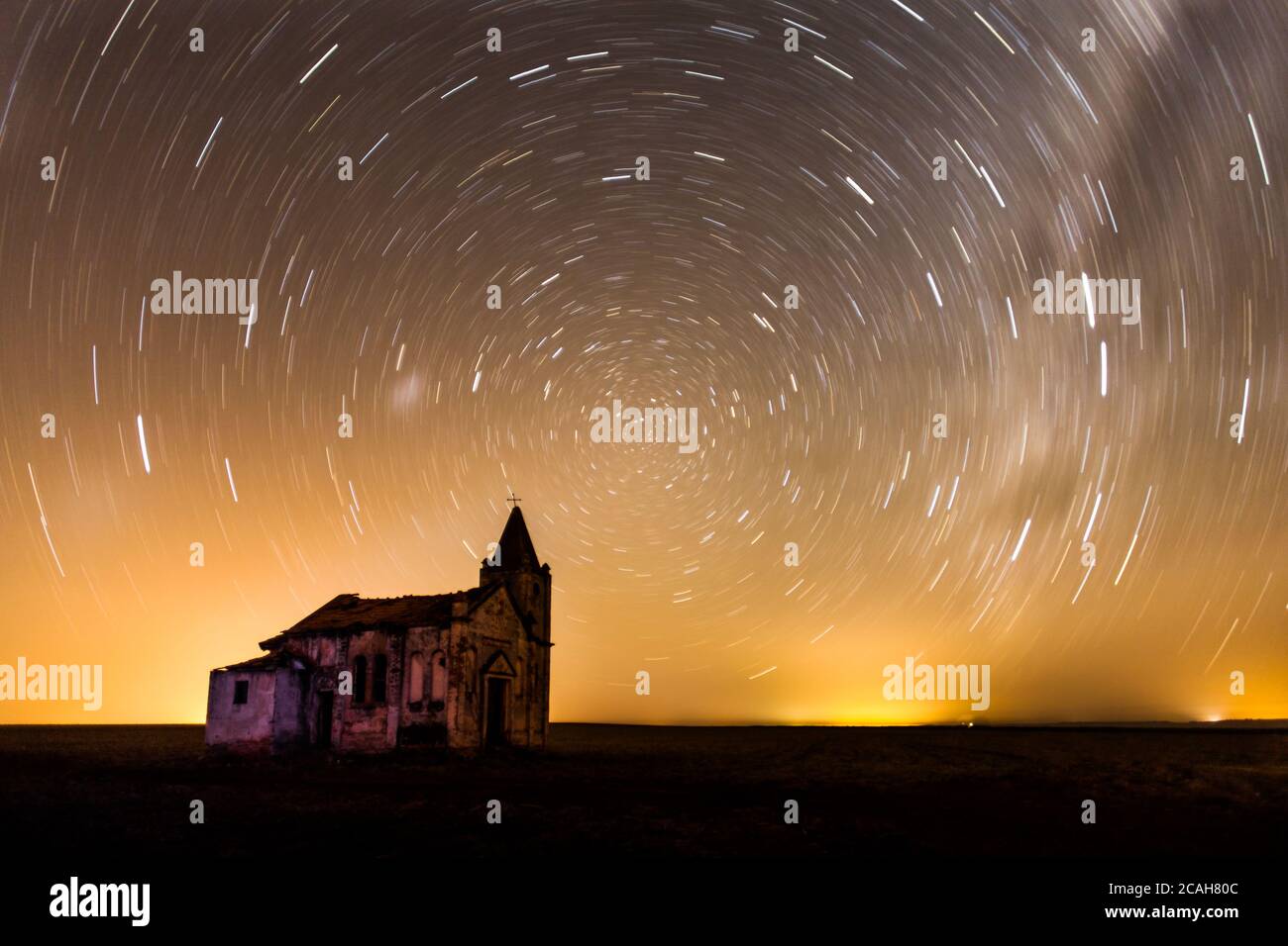 A night view scene of an abandoned old church in Palmital - SP - Brazil Stock Photohttps://www.alamy.com/image-license-details/?v=1https://www.alamy.com/a-night-view-scene-of-an-abandoned-old-church-in-palmital-sp-brazil-image367943756.html
RF2CAH80C–A night view scene of an abandoned old church in Palmital - SP - Brazil
 terrestrial globe on white background vector illustration design Stock Vectorhttps://www.alamy.com/image-license-details/?v=1https://www.alamy.com/terrestrial-globe-on-white-background-vector-illustration-design-image376262955.html
RF2CT476K–terrestrial globe on white background vector illustration design