Old bahama channel Stock Photos and Images
 AS09-22-3469 - Apollo 9 - Apollo 9 Mission image - Earth Observations - Cuba; Scope and content: The original database describes this as: Description: Vertical Earth Observation taken by the Apollo 9 crew. View is of Cuba, Moron, Cayo Romano, Old Bahama Channel. Film magazine was C,film type was SO-368 Ektachrome with 0.460 - 0.710 micrometers film / filter transmittance response and haze filter,80mm lens. Latitude was 22.06 N by Longitude 78.10 W, Overlap was 50%%, Altitude miles were 101 and cloud cover was 36%%. Subject Terms: Apollo 9 Flight, Earth Observations (From Space) Categories: Stock Photohttps://www.alamy.com/image-license-details/?v=1https://www.alamy.com/as09-22-3469-apollo-9-apollo-9-mission-image-earth-observations-cuba-scope-and-content-the-original-database-describes-this-as-description-vertical-earth-observation-taken-by-the-apollo-9-crew-view-is-of-cuba-moron-cayo-romano-old-bahama-channel-film-magazine-was-cfilm-type-was-so-368-ektachrome-with-0460-0710-micrometers-film-filter-transmittance-response-and-haze-filter80mm-lens-latitude-was-2206-n-by-longitude-7810-w-overlap-was-50-altitude-miles-were-101-and-cloud-cover-was-36-subject-terms-apollo-9-flight-earth-observations-from-space-categories-image360669206.html
RM2BXNW72–AS09-22-3469 - Apollo 9 - Apollo 9 Mission image - Earth Observations - Cuba; Scope and content: The original database describes this as: Description: Vertical Earth Observation taken by the Apollo 9 crew. View is of Cuba, Moron, Cayo Romano, Old Bahama Channel. Film magazine was C,film type was SO-368 Ektachrome with 0.460 - 0.710 micrometers film / filter transmittance response and haze filter,80mm lens. Latitude was 22.06 N by Longitude 78.10 W, Overlap was 50%%, Altitude miles were 101 and cloud cover was 36%%. Subject Terms: Apollo 9 Flight, Earth Observations (From Space) Categories:
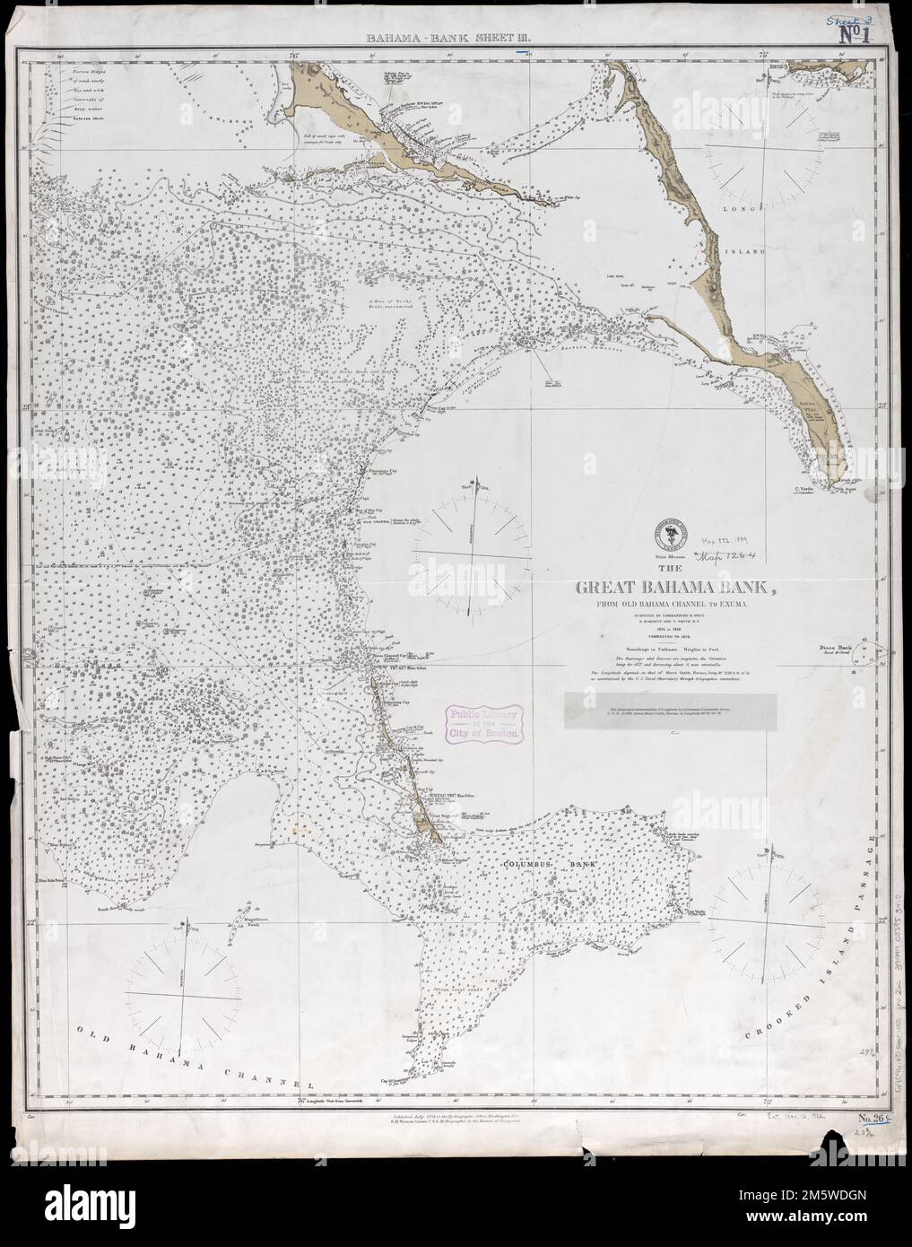
 The Great Bahama Bank, from Old Bahama Channel to Exuma , Great Bahama Bank Bahamas, Maps, Navigation, Bahamas, Great Bahama Bank Norman B. Leventhal Map Center Collection Stock Photohttps://www.alamy.com/image-license-details/?v=1https://www.alamy.com/the-great-bahama-bank-from-old-bahama-channel-to-exuma-great-bahama-bank-bahamas-maps-navigation-bahamas-great-bahama-bank-norman-b-leventhal-map-center-collection-image501068591.html
RM2M35J2R–The Great Bahama Bank, from Old Bahama Channel to Exuma , Great Bahama Bank Bahamas, Maps, Navigation, Bahamas, Great Bahama Bank Norman B. Leventhal Map Center Collection
 AS09-22-3344 - Apollo 9 - Apollo 9 Mission image - Earth Observations - Cuba and Great Bahama Bank; Scope and content: The original database describes this as: Description: Vertical Earth Observation taken by the Apollo 9 crew. View is of Cuba,Great Bahama Bank,Old Bahama Channel and Cayo Bay. Film magazine was C,film type was SO-368 Ektachrome with 0.460 - 0.710 micrometers film / filter transmittance response and haze filter,80mm lens. Latitude was 22.33 N by Longitude 78.11 W, Overlap was 90%%, Altitude miles were 105 and cloud cover was 10%%. Subject Terms: Apollo 9 Flight, Earth Obse Stock Photohttps://www.alamy.com/image-license-details/?v=1https://www.alamy.com/as09-22-3344-apollo-9-apollo-9-mission-image-earth-observations-cuba-and-great-bahama-bank-scope-and-content-the-original-database-describes-this-as-description-vertical-earth-observation-taken-by-the-apollo-9-crew-view-is-of-cubagreat-bahama-bankold-bahama-channel-and-cayo-bay-film-magazine-was-cfilm-type-was-so-368-ektachrome-with-0460-0710-micrometers-film-filter-transmittance-response-and-haze-filter80mm-lens-latitude-was-2233-n-by-longitude-7811-w-overlap-was-90-altitude-miles-were-105-and-cloud-cover-was-10-subject-terms-apollo-9-flight-earth-obse-image360708110.html
RM2BXRJTE–AS09-22-3344 - Apollo 9 - Apollo 9 Mission image - Earth Observations - Cuba and Great Bahama Bank; Scope and content: The original database describes this as: Description: Vertical Earth Observation taken by the Apollo 9 crew. View is of Cuba,Great Bahama Bank,Old Bahama Channel and Cayo Bay. Film magazine was C,film type was SO-368 Ektachrome with 0.460 - 0.710 micrometers film / filter transmittance response and haze filter,80mm lens. Latitude was 22.33 N by Longitude 78.11 W, Overlap was 90%%, Altitude miles were 105 and cloud cover was 10%%. Subject Terms: Apollo 9 Flight, Earth Obse
![. Explorations of the United States Coast and Geodetic Survey steamer 'Bache' in the western Atlantic, January-March, 1914, under the direction of the United States, Bureau of Fisheries : oceanography. a coast from southwest to east and north. J- D] , 7 7 197 .^ ^ ^ r:^ r ^ 1^8 ^^ ^^ ^ r F ./ ^ ^^ - ^^ .-/ ^ ^^ .x^* ^ / // Joo .^ ^ ^^ ^201 / / f f fs; / 1 /^ f/^ y I / / / y / / r / EXPLOEATIONS, WESTERN ATLANTIC, STEAMER BACHE, 1914. 27 Water warmer than 24° was confined to the southern and westernpart of the channel, and the water in the Old Bahama Channel wasprobably as warm as 24°, while Stock Photo . Explorations of the United States Coast and Geodetic Survey steamer 'Bache' in the western Atlantic, January-March, 1914, under the direction of the United States, Bureau of Fisheries : oceanography. a coast from southwest to east and north. J- D] , 7 7 197 .^ ^ ^ r:^ r ^ 1^8 ^^ ^^ ^ r F ./ ^ ^^ - ^^ .-/ ^ ^^ .x^* ^ / // Joo .^ ^ ^^ ^201 / / f f fs; / 1 /^ f/^ y I / / / y / / r / EXPLOEATIONS, WESTERN ATLANTIC, STEAMER BACHE, 1914. 27 Water warmer than 24° was confined to the southern and westernpart of the channel, and the water in the Old Bahama Channel wasprobably as warm as 24°, while Stock Photo](https://c8.alamy.com/comp/2CEN0D5/explorations-of-the-united-states-coast-and-geodetic-survey-steamer-bache-in-the-western-atlantic-january-march-1914-under-the-direction-of-the-united-states-bureau-of-fisheries-oceanography-a-coast-from-southwest-to-east-and-north-j-d-7-7-197-r-r-18-r-f-x-joo-201-f-f-fs-1-f-y-i-y-r-exploeations-western-atlantic-steamer-bache-1914-27-water-warmer-than-24-was-confined-to-the-southern-and-westernpart-of-the-channel-and-the-water-in-the-old-bahama-channel-wasprobably-as-warm-as-24-while-2CEN0D5.jpg) . Explorations of the United States Coast and Geodetic Survey steamer 'Bache' in the western Atlantic, January-March, 1914, under the direction of the United States, Bureau of Fisheries : oceanography. a coast from southwest to east and north. J- D] , 7 7 197 .^ ^ ^ r:^ r ^ 1^8 ^^ ^^ ^ r F ./ ^ ^^ - ^^ .-/ ^ ^^ .x^* ^ / // Joo .^ ^ ^^ ^201 / / f f fs; / 1 /^ f/^ y I / / / y / / r / EXPLOEATIONS, WESTERN ATLANTIC, STEAMER BACHE, 1914. 27 Water warmer than 24° was confined to the southern and westernpart of the channel, and the water in the Old Bahama Channel wasprobably as warm as 24°, while Stock Photohttps://www.alamy.com/image-license-details/?v=1https://www.alamy.com/explorations-of-the-united-states-coast-and-geodetic-survey-steamer-bache-in-the-western-atlantic-january-march-1914-under-the-direction-of-the-united-states-bureau-of-fisheries-oceanography-a-coast-from-southwest-to-east-and-north-j-d-7-7-197-r-r-18-r-f-x-joo-201-f-f-fs-1-f-y-i-y-r-exploeations-western-atlantic-steamer-bache-1914-27-water-warmer-than-24-was-confined-to-the-southern-and-westernpart-of-the-channel-and-the-water-in-the-old-bahama-channel-wasprobably-as-warm-as-24-while-image370484273.html
. Explorations of the United States Coast and Geodetic Survey steamer 'Bache' in the western Atlantic, January-March, 1914, under the direction of the United States, Bureau of Fisheries : oceanography. a coast from southwest to east and north. J- D] , 7 7 197 .^ ^ ^ r:^ r ^ 1^8 ^^ ^^ ^ r F ./ ^ ^^ - ^^ .-/ ^ ^^ .x^* ^ / // Joo .^ ^ ^^ ^201 / / f f fs; / 1 /^ f/^ y I / / / y / / r / EXPLOEATIONS, WESTERN ATLANTIC, STEAMER BACHE, 1914. 27 Water warmer than 24° was confined to the southern and westernpart of the channel, and the water in the Old Bahama Channel wasprobably as warm as 24°, while Stock Photohttps://www.alamy.com/image-license-details/?v=1https://www.alamy.com/explorations-of-the-united-states-coast-and-geodetic-survey-steamer-bache-in-the-western-atlantic-january-march-1914-under-the-direction-of-the-united-states-bureau-of-fisheries-oceanography-a-coast-from-southwest-to-east-and-north-j-d-7-7-197-r-r-18-r-f-x-joo-201-f-f-fs-1-f-y-i-y-r-exploeations-western-atlantic-steamer-bache-1914-27-water-warmer-than-24-was-confined-to-the-southern-and-westernpart-of-the-channel-and-the-water-in-the-old-bahama-channel-wasprobably-as-warm-as-24-while-image370484273.htmlRM2CEN0D5–. Explorations of the United States Coast and Geodetic Survey steamer 'Bache' in the western Atlantic, January-March, 1914, under the direction of the United States, Bureau of Fisheries : oceanography. a coast from southwest to east and north. J- D] , 7 7 197 .^ ^ ^ r:^ r ^ 1^8 ^^ ^^ ^ r F ./ ^ ^^ - ^^ .-/ ^ ^^ .x^* ^ / // Joo .^ ^ ^^ ^201 / / f f fs; / 1 /^ f/^ y I / / / y / / r / EXPLOEATIONS, WESTERN ATLANTIC, STEAMER BACHE, 1914. 27 Water warmer than 24° was confined to the southern and westernpart of the channel, and the water in the Old Bahama Channel wasprobably as warm as 24°, while
 AS09-22-3343 - Apollo 9 - Apollo 9 Mission image - Earth Observations - Cuba and Great Bahama Bank; Scope and content: The original database describes this as: Description: Vertical Earth Observation taken by the Apollo 9 crew. View is of Cuba, Great Bahama Bank, Old Bahama Channel and Cayo Bay. Film magazine was C,film type was SO-368 Ektachrome with 0.460 - 0.710 micrometers film / filter transmittance response and haze filter,80mm lens. Latitude was 22.37 N by Longitude 78.10 W, Overlap was 0%%,Altitude miles were 105 and cloud cover was 0%%. Subject Terms: Apollo 9 Flight, Earth Observ Stock Photohttps://www.alamy.com/image-license-details/?v=1https://www.alamy.com/as09-22-3343-apollo-9-apollo-9-mission-image-earth-observations-cuba-and-great-bahama-bank-scope-and-content-the-original-database-describes-this-as-description-vertical-earth-observation-taken-by-the-apollo-9-crew-view-is-of-cuba-great-bahama-bank-old-bahama-channel-and-cayo-bay-film-magazine-was-cfilm-type-was-so-368-ektachrome-with-0460-0710-micrometers-film-filter-transmittance-response-and-haze-filter80mm-lens-latitude-was-2237-n-by-longitude-7810-w-overlap-was-0altitude-miles-were-105-and-cloud-cover-was-0-subject-terms-apollo-9-flight-earth-observ-image360673358.html
RM2BXP2FA–AS09-22-3343 - Apollo 9 - Apollo 9 Mission image - Earth Observations - Cuba and Great Bahama Bank; Scope and content: The original database describes this as: Description: Vertical Earth Observation taken by the Apollo 9 crew. View is of Cuba, Great Bahama Bank, Old Bahama Channel and Cayo Bay. Film magazine was C,film type was SO-368 Ektachrome with 0.460 - 0.710 micrometers film / filter transmittance response and haze filter,80mm lens. Latitude was 22.37 N by Longitude 78.10 W, Overlap was 0%%,Altitude miles were 105 and cloud cover was 0%%. Subject Terms: Apollo 9 Flight, Earth Observ
 Great Bahama Bank. Jardines del Rey. Cuba. ADMIRALTY sea chart 1850 (1912) map Stock Photohttps://www.alamy.com/image-license-details/?v=1https://www.alamy.com/great-bahama-bank-jardines-del-rey-cuba-admiralty-sea-chart-1850-1912-map-image442264518.html
RF2GKETWA–Great Bahama Bank. Jardines del Rey. Cuba. ADMIRALTY sea chart 1850 (1912) map
 . The earth and its inhabitants .. . 0 to 250 Fathoms. 250 to 500 Fathoms. Depths. 500 to 1,000 Fathoms. 1,000 to 1,750 Fathoms. 300 Miles. 1,750 Fathoms and upwards. been made many startling discoveries, which open marvellous vistas into the past evolution of life on the globe. The outer basin between Cuba, the Bahamas, and Florida, through which the Gulf Stream escapes northwards, is comparatively shallow, being almost entirely occupied by banks, with intervening channels 200 to 300 fathoms deep. South- eastwards, however, the deeper Old Bahama Channel skirts the north side of Cuba to a grea Stock Photohttps://www.alamy.com/image-license-details/?v=1https://www.alamy.com/the-earth-and-its-inhabitants-0-to-250-fathoms-250-to-500-fathoms-depths-500-to-1000-fathoms-1000-to-1750-fathoms-300-miles-1750-fathoms-and-upwards-been-made-many-startling-discoveries-which-open-marvellous-vistas-into-the-past-evolution-of-life-on-the-globe-the-outer-basin-between-cuba-the-bahamas-and-florida-through-which-the-gulf-stream-escapes-northwards-is-comparatively-shallow-being-almost-entirely-occupied-by-banks-with-intervening-channels-200-to-300-fathoms-deep-south-eastwards-however-the-deeper-old-bahama-channel-skirts-the-north-side-of-cuba-to-a-grea-image178487175.html
RMMAAP5Y–. The earth and its inhabitants .. . 0 to 250 Fathoms. 250 to 500 Fathoms. Depths. 500 to 1,000 Fathoms. 1,000 to 1,750 Fathoms. 300 Miles. 1,750 Fathoms and upwards. been made many startling discoveries, which open marvellous vistas into the past evolution of life on the globe. The outer basin between Cuba, the Bahamas, and Florida, through which the Gulf Stream escapes northwards, is comparatively shallow, being almost entirely occupied by banks, with intervening channels 200 to 300 fathoms deep. South- eastwards, however, the deeper Old Bahama Channel skirts the north side of Cuba to a grea
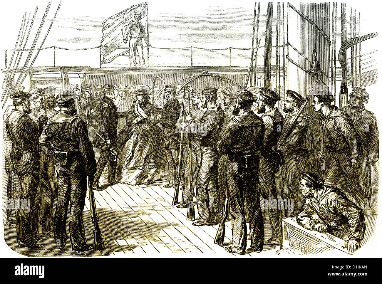
 Trent Affair, Mason and Slidell Affair, 1861, the USS San Jacinto stopping the British mail steamer Trent in the Bahama Channel Stock Photohttps://www.alamy.com/image-license-details/?v=1https://www.alamy.com/stock-photo-trent-affair-mason-and-slidell-affair-1861-the-uss-san-jacinto-stopping-52656093.html
RMD1JKAN–Trent Affair, Mason and Slidell Affair, 1861, the USS San Jacinto stopping the British mail steamer Trent in the Bahama Channel
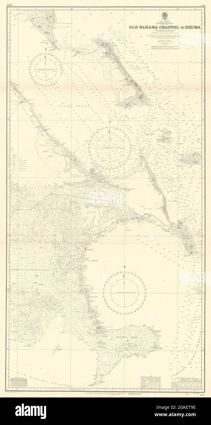
 Bahamas Cat Long Islands Great Exuma Eleuthera ADMIRALTY chart 1851 (1955) map Stock Photohttps://www.alamy.com/image-license-details/?v=1https://www.alamy.com/bahamas-cat-long-islands-great-exuma-eleuthera-admiralty-chart-1851-1955-map-image442264074.html
RF2GKET9E–Bahamas Cat Long Islands Great Exuma Eleuthera ADMIRALTY chart 1851 (1955) map
 The Great Bahama Bank, from Old Bahama Channel to Exuma. Relief shown by hachures and spot heights. Depths shown by soundings and isolines. Note pasted below title: The telegraphic determination of longitude by Lieutenant Commander Green, U.S.N., in 1876, places Morro Castle, Havana, in longitude 82°21'30' W... Bahama-Bank sheet III. Bahama-Bank sheet III, Bahamas Great Bahama Bank Stock Photohttps://www.alamy.com/image-license-details/?v=1https://www.alamy.com/the-great-bahama-bank-from-old-bahama-channel-to-exuma-relief-shown-by-hachures-and-spot-heights-depths-shown-by-soundings-and-isolines-note-pasted-below-title-the-telegraphic-determination-of-longitude-by-lieutenant-commander-green-usn-in-1876-places-morro-castle-havana-in-longitude-822130-w-bahama-bank-sheet-iii-bahama-bank-sheet-iii-bahamas-great-bahama-bank-image502733413.html
RM2M5WDGN–The Great Bahama Bank, from Old Bahama Channel to Exuma. Relief shown by hachures and spot heights. Depths shown by soundings and isolines. Note pasted below title: The telegraphic determination of longitude by Lieutenant Commander Green, U.S.N., in 1876, places Morro Castle, Havana, in longitude 82°21'30' W... Bahama-Bank sheet III. Bahama-Bank sheet III, Bahamas Great Bahama Bank
 . Bulletin of the Museum of Comparative Zoology at Harvard College. Zoology; Zoology. a ita Old Bahama Channel ,t. £- .Mi-nolns = ,tt Channel £ ' I HA •y ;'— Fig. 13 Straita of Florida Sail GayBanh /„. Fi?.l5. . Please note that these images are extracted from scanned page images that may have been digitally enhanced for readability - coloration and appearance of these illustrations may not perfectly resemble the original work.. Harvard University. Museum of Comparative Zoology. Cambridge, Mass. : The Museum Stock Photohttps://www.alamy.com/image-license-details/?v=1https://www.alamy.com/bulletin-of-the-museum-of-comparative-zoology-at-harvard-college-zoology-zoology-a-ita-old-bahama-channel-t-mi-nolns-=-tt-channel-i-ha-y-fig-13-straita-of-florida-sail-gaybanh-fil5-please-note-that-these-images-are-extracted-from-scanned-page-images-that-may-have-been-digitally-enhanced-for-readability-coloration-and-appearance-of-these-illustrations-may-not-perfectly-resemble-the-original-work-harvard-university-museum-of-comparative-zoology-cambridge-mass-the-museum-image233935186.html
RMRGGJM2–. Bulletin of the Museum of Comparative Zoology at Harvard College. Zoology; Zoology. a ita Old Bahama Channel ,t. £- .Mi-nolns = ,tt Channel £ ' I HA •y ;'— Fig. 13 Straita of Florida Sail GayBanh /„. Fi?.l5. . Please note that these images are extracted from scanned page images that may have been digitally enhanced for readability - coloration and appearance of these illustrations may not perfectly resemble the original work.. Harvard University. Museum of Comparative Zoology. Cambridge, Mass. : The Museum
 AS09-22-3468 - Apollo 9 - Apollo 9 Mission image - Earth Observations - Cuba; Scope and content: The original database describes this as: Description: Vertical Earth Observation taken by the Apollo 9 crew. View is of Cuba, Moron, Cayo Coco Island, Old Bahama Channel. Film magazine was C,film type was SO-368 Ektachrome with 0.460 - 0.710 micrometers film / filter transmittance response and haze filter,80mm lens. Latitude was 22.25 N by Longitude 79.00 W, Overlap was 0%%, Altitude miles were 101 and cloud cover was 38%%. Subject Terms: Apollo 9 Flight, Earth Observations (From Space) Categorie Stock Photohttps://www.alamy.com/image-license-details/?v=1https://www.alamy.com/as09-22-3468-apollo-9-apollo-9-mission-image-earth-observations-cuba-scope-and-content-the-original-database-describes-this-as-description-vertical-earth-observation-taken-by-the-apollo-9-crew-view-is-of-cuba-moron-cayo-coco-island-old-bahama-channel-film-magazine-was-cfilm-type-was-so-368-ektachrome-with-0460-0710-micrometers-film-filter-transmittance-response-and-haze-filter80mm-lens-latitude-was-2225-n-by-longitude-7900-w-overlap-was-0-altitude-miles-were-101-and-cloud-cover-was-38-subject-terms-apollo-9-flight-earth-observations-from-space-categorie-image360672368.html
RM2BXP180–AS09-22-3468 - Apollo 9 - Apollo 9 Mission image - Earth Observations - Cuba; Scope and content: The original database describes this as: Description: Vertical Earth Observation taken by the Apollo 9 crew. View is of Cuba, Moron, Cayo Coco Island, Old Bahama Channel. Film magazine was C,film type was SO-368 Ektachrome with 0.460 - 0.710 micrometers film / filter transmittance response and haze filter,80mm lens. Latitude was 22.25 N by Longitude 79.00 W, Overlap was 0%%, Altitude miles were 101 and cloud cover was 38%%. Subject Terms: Apollo 9 Flight, Earth Observations (From Space) Categorie
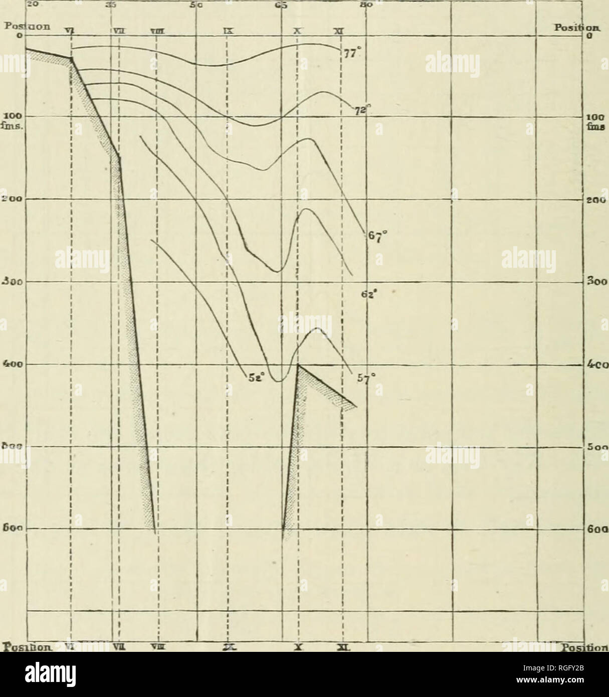
 . Bulletin of the Museum of Comparative Zoology at Harvard College. Zoology; Zoology. 234 THREE CRUISES OF THE " BLAKE Avarmer water which joins the Florida Gulf Stream is driven into it through the Old Bahama Channel, the temjjerature of which seems to be very warm, being higher than we find it at equal depths to the eastward nearer the Windward Passage. The variable cold bauds which have been traced in the course of the Gulf Stream may also be due not wholly to cold water Oistanoex froin, Ca/ie Canxlveral in JFiztUicaZ Miies. Fig. 162. from an arctic current, but in part to the cold wat Stock Photohttps://www.alamy.com/image-license-details/?v=1https://www.alamy.com/bulletin-of-the-museum-of-comparative-zoology-at-harvard-college-zoology-zoology-234-three-cruises-of-the-quot-blake-avarmer-water-which-joins-the-florida-gulf-stream-is-driven-into-it-through-the-old-bahama-channel-the-temjjerature-of-which-seems-to-be-very-warm-being-higher-than-we-find-it-at-equal-depths-to-the-eastward-nearer-the-windward-passage-the-variable-cold-bauds-which-have-been-traced-in-the-course-of-the-gulf-stream-may-also-be-due-not-wholly-to-cold-water-oistanoex-froin-caie-canxlveral-in-jfiztuicaz-miies-fig-162-from-an-arctic-current-but-in-part-to-the-cold-wat-image233919795.html
RMRGFY2B–. Bulletin of the Museum of Comparative Zoology at Harvard College. Zoology; Zoology. 234 THREE CRUISES OF THE " BLAKE Avarmer water which joins the Florida Gulf Stream is driven into it through the Old Bahama Channel, the temjjerature of which seems to be very warm, being higher than we find it at equal depths to the eastward nearer the Windward Passage. The variable cold bauds which have been traced in the course of the Gulf Stream may also be due not wholly to cold water Oistanoex froin, Ca/ie Canxlveral in JFiztUicaZ Miies. Fig. 162. from an arctic current, but in part to the cold wat