Quick filters:
Old empire map Stock Photos and Images
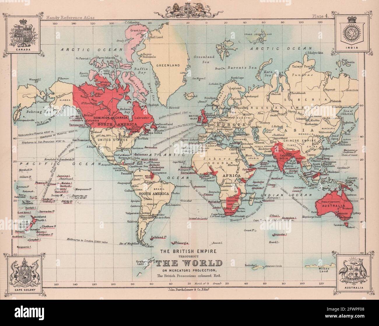 The British Empire throughout The World. BARTHOLOMEW 1893 old antique map Stock Photohttps://www.alamy.com/image-license-details/?v=1https://www.alamy.com/the-british-empire-throughout-the-world-bartholomew-1893-old-antique-map-image428909944.html
RF2FWPF08–The British Empire throughout The World. BARTHOLOMEW 1893 old antique map
 TURKISH EMPIRE - An old map of Türkiye (Turkey) and her neighbours 1914-1939. -TÜRK İMPARATORLUĞU - Türkiye ve komşularının 1914-1939 yılları arasındaki eski haritası. - Stock Photohttps://www.alamy.com/image-license-details/?v=1https://www.alamy.com/turkish-empire-an-old-map-of-trkiye-turkey-and-her-neighbours-1914-1939-trk-mparatorluu-trkiye-ve-komularnn-1914-1939-yllar-arasndaki-eski-haritas-image635710539.html
RM2YX737R–TURKISH EMPIRE - An old map of Türkiye (Turkey) and her neighbours 1914-1939. -TÜRK İMPARATORLUĞU - Türkiye ve komşularının 1914-1939 yılları arasındaki eski haritası. -
RM2ABB0PB–Vintage 1930’s London Underground Map Poster icons to associated places of interest by tube rail travel artist design by EM Dinkel 'The Wealth Romance and Beauty of The Empire'
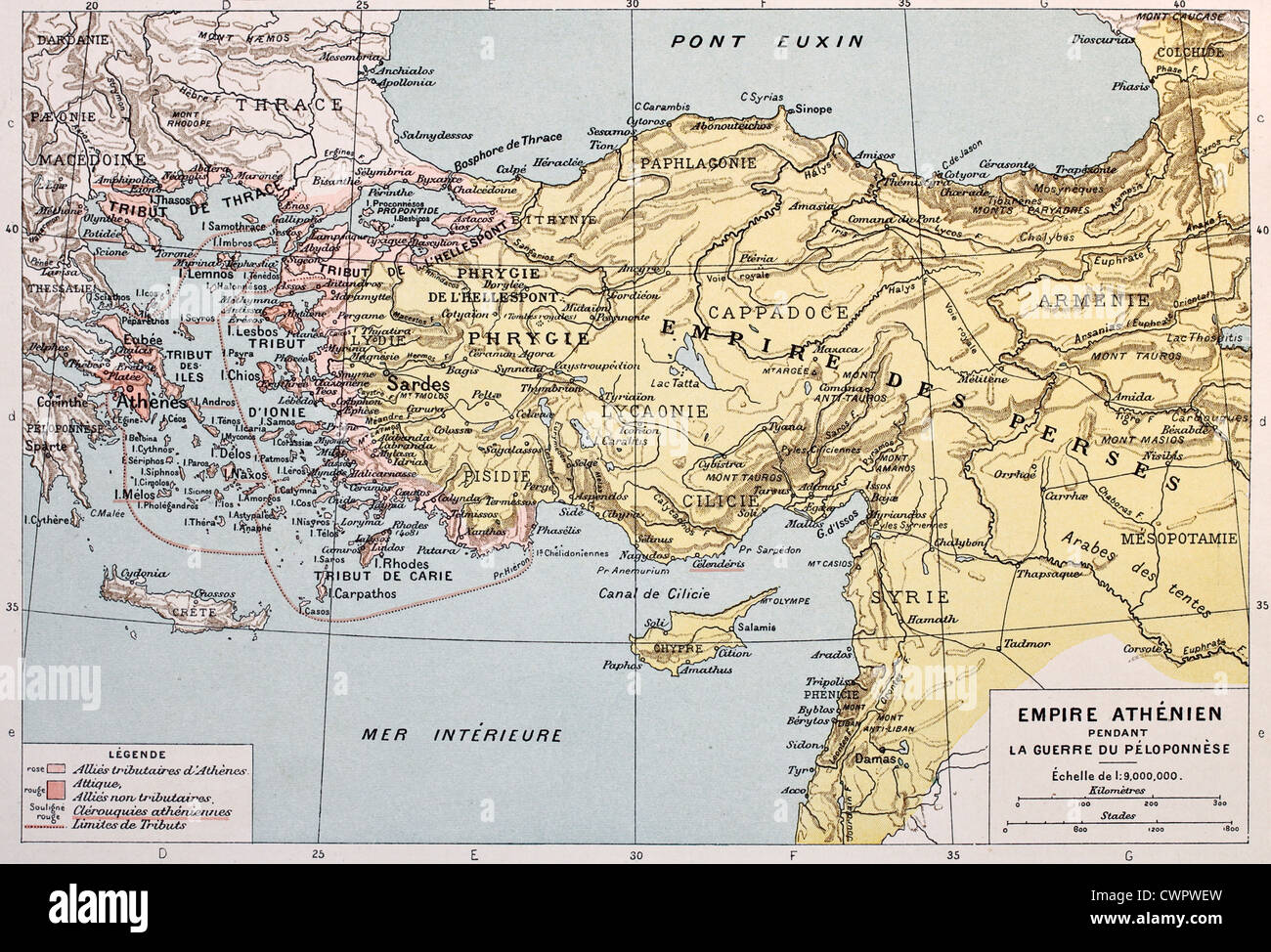 Athenian empire old map Stock Photohttps://www.alamy.com/image-license-details/?v=1https://www.alamy.com/stock-photo-athenian-empire-old-map-50290097.html
RFCWPWEW–Athenian empire old map
 French invasion of the Rhine area and breaking of the 20-year-old Regensburg stock, Silver Medal. Obverse: map of the German empire within an outline. Reverse: Dauphin with purse in hands on triumphal cart pulled by tiger and fox inscription, Regensburg, France's dauphin Louis, Jan Schmeltzing (I), Leiden, 1688, silver (metal), striking (metalworking), d 5.9 cm × w 79.55 Stock Photohttps://www.alamy.com/image-license-details/?v=1https://www.alamy.com/french-invasion-of-the-rhine-area-and-breaking-of-the-20-year-old-regensburg-stock-silver-medal-obverse-map-of-the-german-empire-within-an-outline-reverse-dauphin-with-purse-in-hands-on-triumphal-cart-pulled-by-tiger-and-fox-inscription-regensburg-frances-dauphin-louis-jan-schmeltzing-i-leiden-1688-silver-metal-striking-metalworking-d-59-cm-w-7955-image261384958.html
RMW57352–French invasion of the Rhine area and breaking of the 20-year-old Regensburg stock, Silver Medal. Obverse: map of the German empire within an outline. Reverse: Dauphin with purse in hands on triumphal cart pulled by tiger and fox inscription, Regensburg, France's dauphin Louis, Jan Schmeltzing (I), Leiden, 1688, silver (metal), striking (metalworking), d 5.9 cm × w 79.55
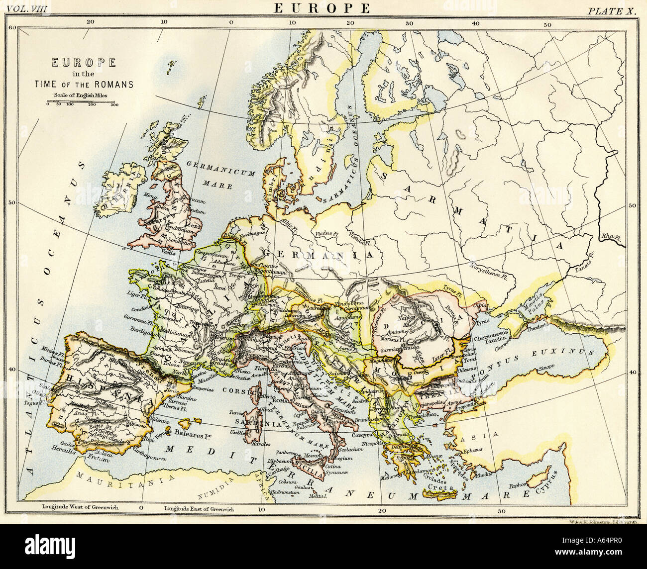 Map of Europe in the time of the Roman Empire. Color lithograph Stock Photohttps://www.alamy.com/image-license-details/?v=1https://www.alamy.com/map-of-europe-in-the-time-of-the-roman-empire-color-lithograph-image6548719.html
RMA64PR0–Map of Europe in the time of the Roman Empire. Color lithograph
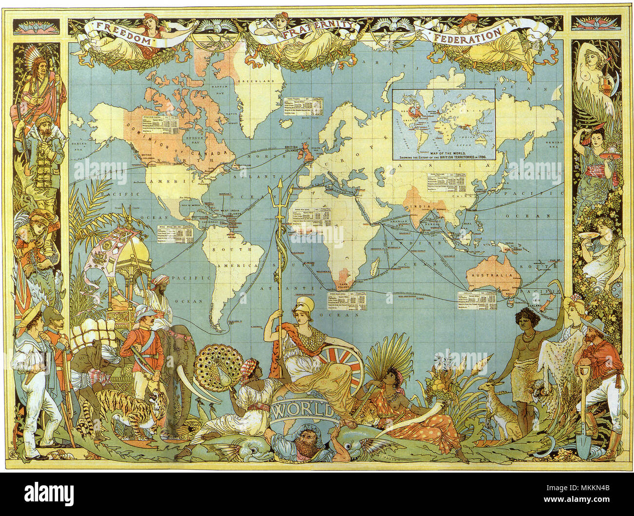 Map of the British Empire in 1886 Stock Photohttps://www.alamy.com/image-license-details/?v=1https://www.alamy.com/map-of-the-british-empire-in-1886-image184215819.html
RMMKKN4B–Map of the British Empire in 1886
 Map Of The British Empire 1886 Stock Photohttps://www.alamy.com/image-license-details/?v=1https://www.alamy.com/stock-photo-map-of-the-british-empire-1886-130842239.html
RFHGTAH3–Map Of The British Empire 1886
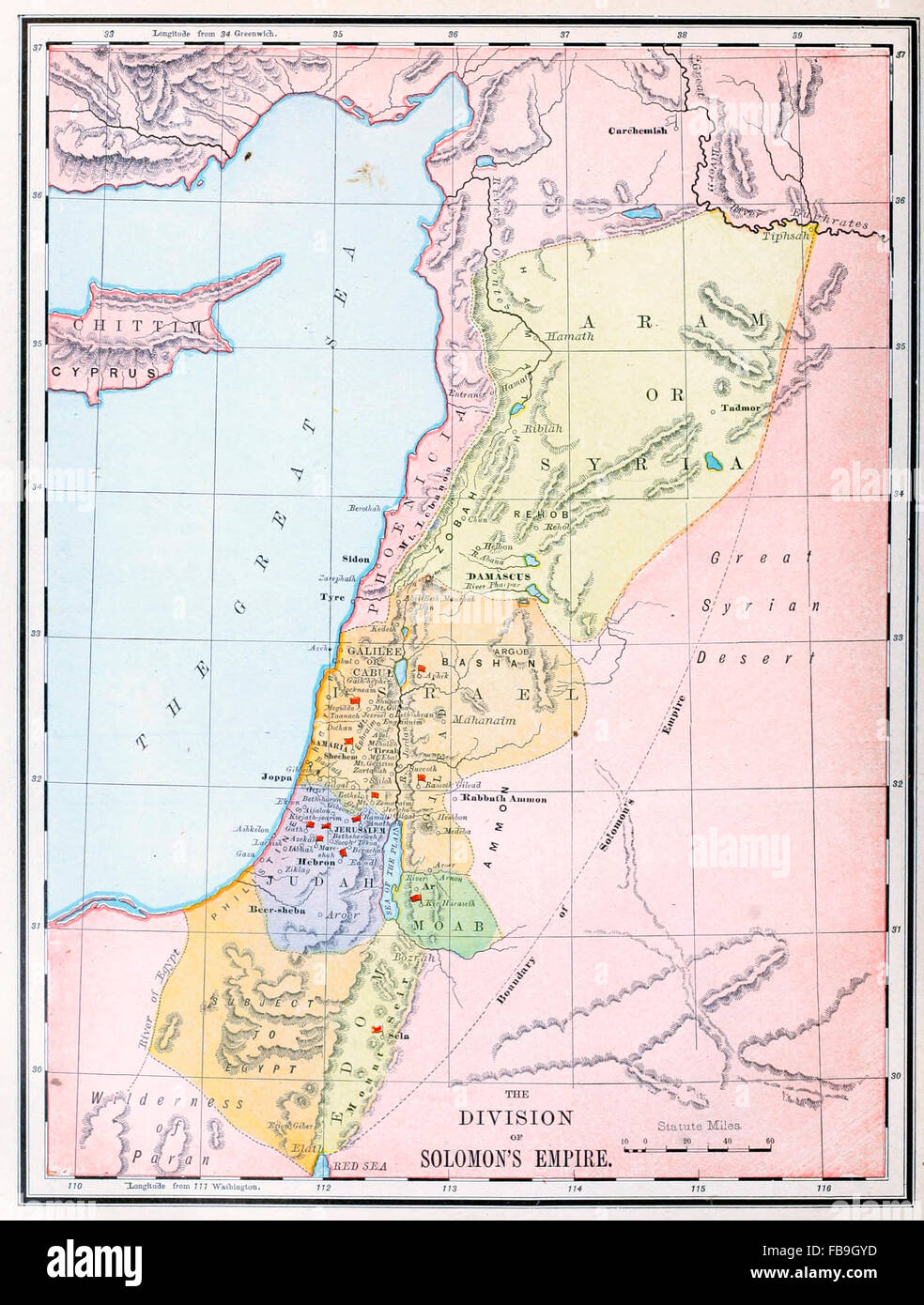 Map of the Division of Solomon's Empire - Old Testament Stock Photohttps://www.alamy.com/image-license-details/?v=1https://www.alamy.com/stock-photo-map-of-the-division-of-solomons-empire-old-testament-93023937.html
RMFB9GYD–Map of the Division of Solomon's Empire - Old Testament
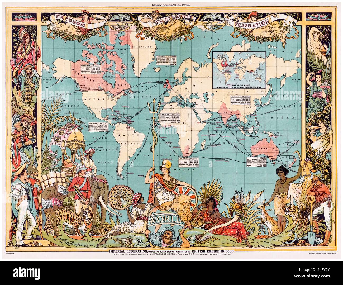 19th Century Vintage World Map of the Colonial British Empire in 1886 by Walter Crane Stock Photohttps://www.alamy.com/image-license-details/?v=1https://www.alamy.com/19th-century-vintage-world-map-of-the-colonial-british-empire-in-1886-by-walter-crane-image476094471.html
RM2JJFY9Y–19th Century Vintage World Map of the Colonial British Empire in 1886 by Walter Crane
 Map of the Mughal Empire in India, 1700, old vintage maps Stock Photohttps://www.alamy.com/image-license-details/?v=1https://www.alamy.com/map-of-the-mughal-empire-in-india-1700-old-vintage-maps-image241326901.html
RMT0HAWW–Map of the Mughal Empire in India, 1700, old vintage maps
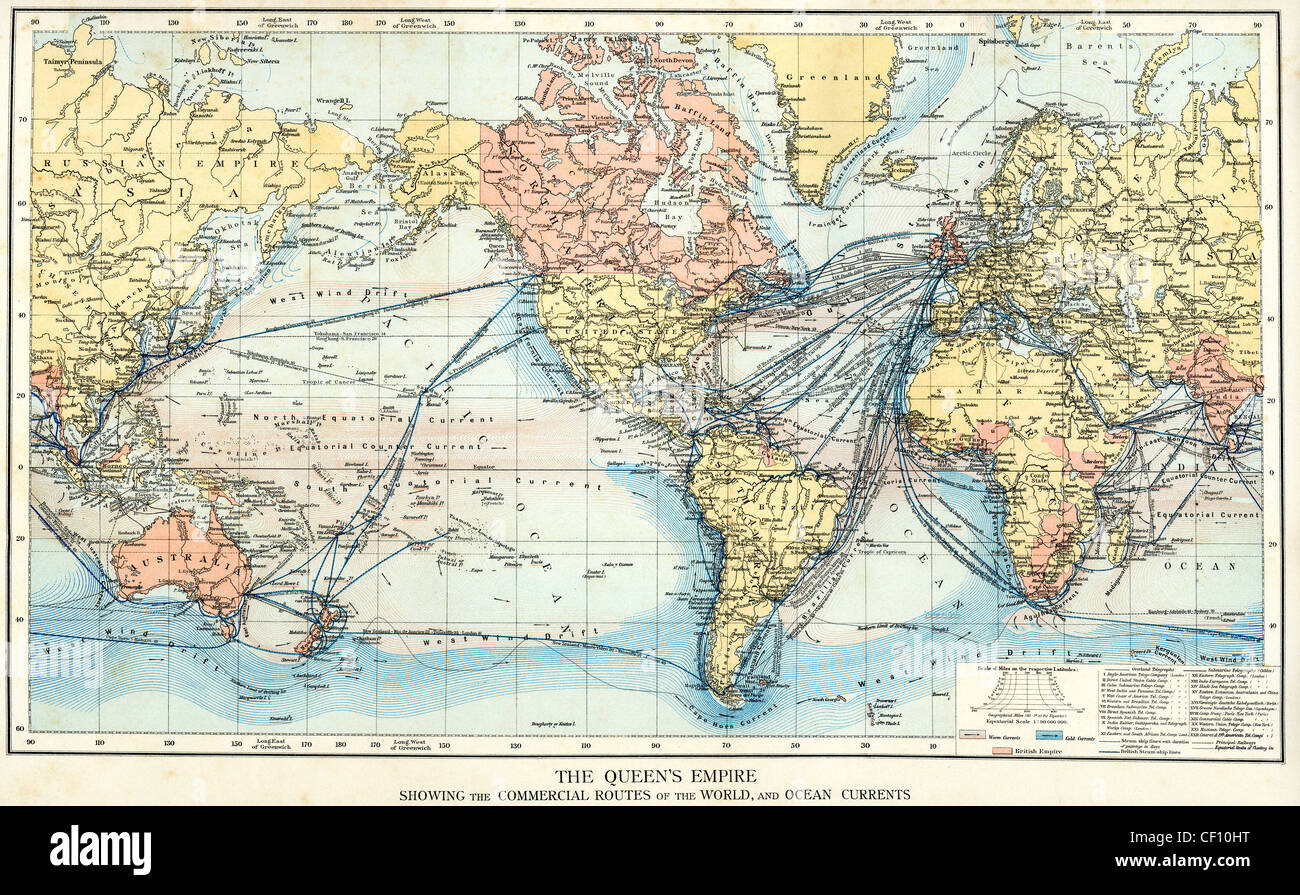 Vintage map of the British Empire showing the commercial trade routes of the world and ocean currents c.1890 Stock Photohttps://www.alamy.com/image-license-details/?v=1https://www.alamy.com/stock-photo-vintage-map-of-the-british-empire-showing-the-commercial-trade-routes-43663028.html
RMCF10HT–Vintage map of the British Empire showing the commercial trade routes of the world and ocean currents c.1890
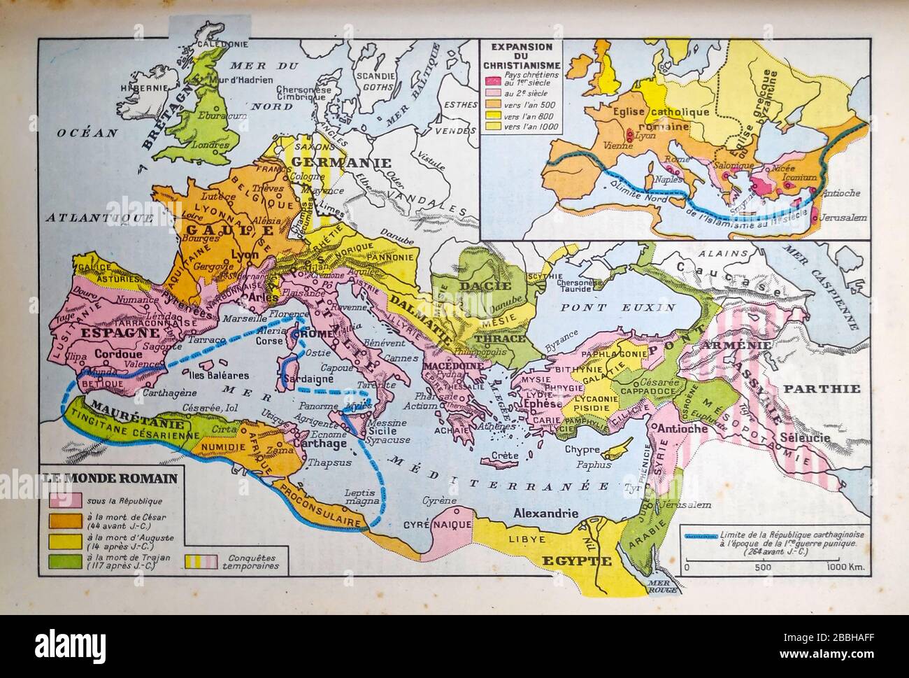 Old map of the Roman Empire printed in the late 19th century. Stock Photohttps://www.alamy.com/image-license-details/?v=1https://www.alamy.com/old-map-of-the-roman-empire-printed-in-the-late-19th-century-image351350035.html
RF2BBHAFF–Old map of the Roman Empire printed in the late 19th century.
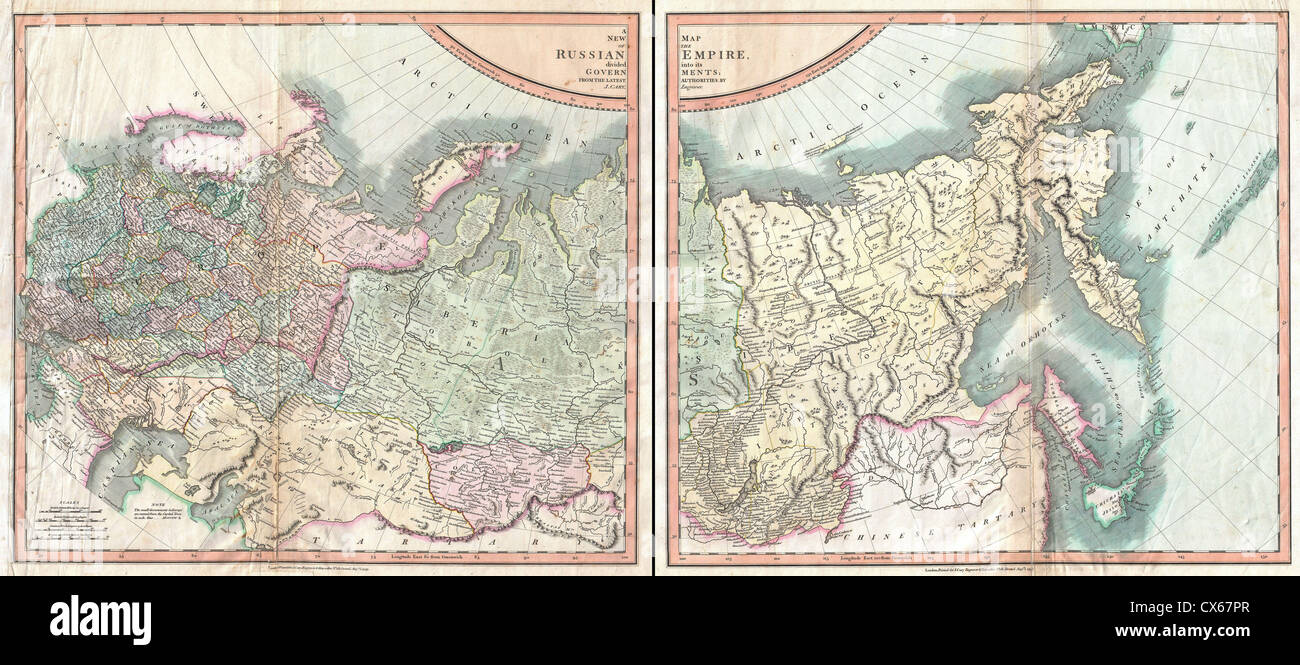
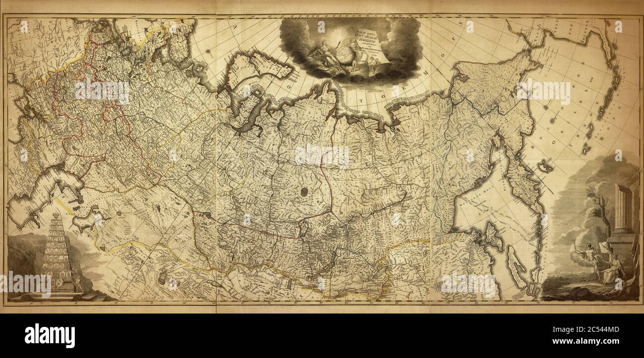 Old map of the Russian Empire, printed in 1786 Stock Photohttps://www.alamy.com/image-license-details/?v=1https://www.alamy.com/old-map-of-the-russian-empire-printed-in-1786-image364582525.html
RF2C544MD–Old map of the Russian Empire, printed in 1786
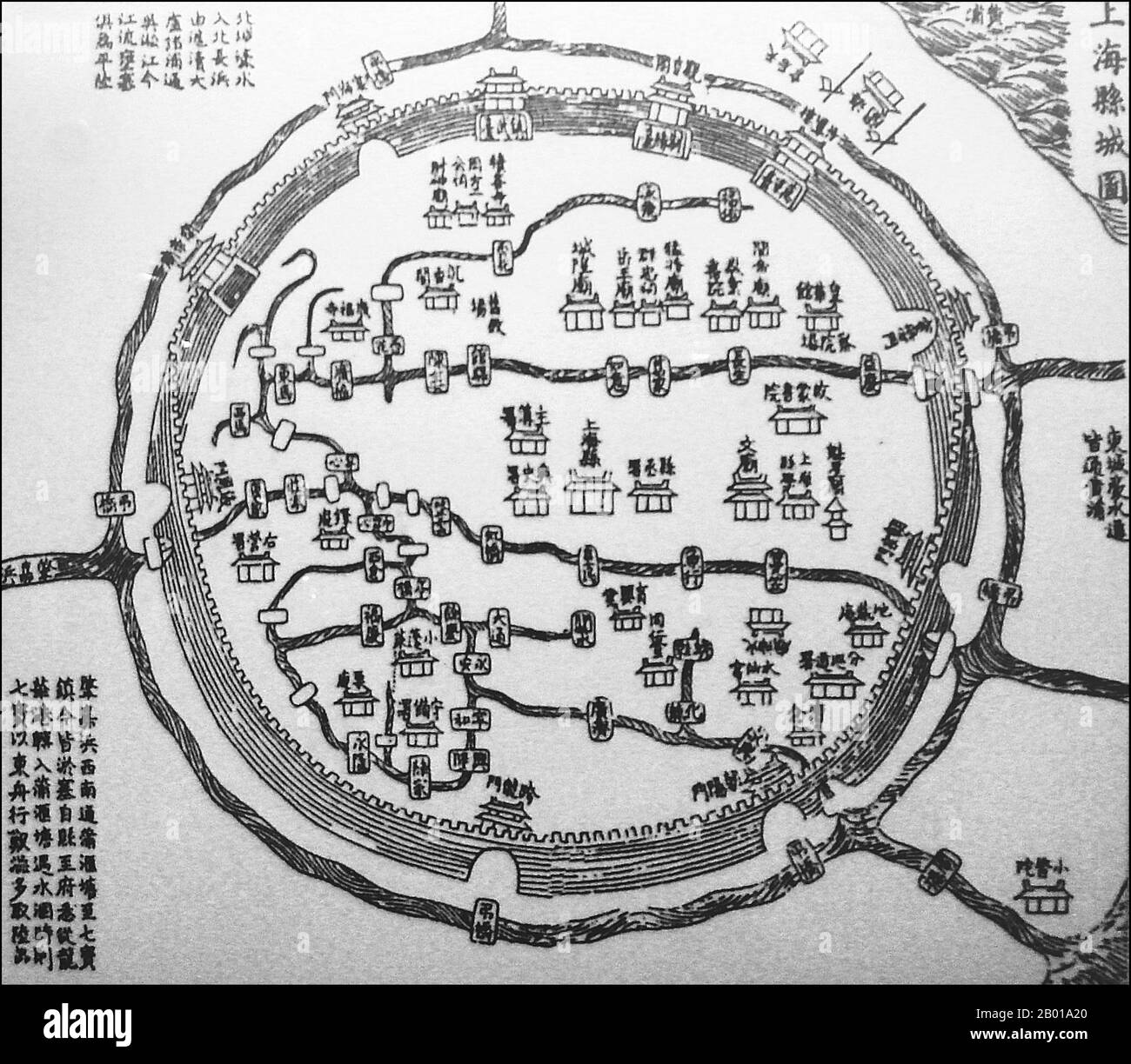 China: A Chinese map of the old city of Shanghai, 1553. The Old City of Shanghai (Shànghăi Gùchéng) refers to the most ancient area of Shanghai, more often referred to simply as Nanshi, 'Southern City', as it lay to the south of the old International Settlements. It is circular in shape, and used to be surrounded by a defensive wall. Notable features include the City God Temple which is located in the center of the Old City and is connected to the Yuyuan Garden. Today, most of the walls have been replaced by broad circular avenues, the Renmin Lu to the North and Zhonghua Lu to the South. Stock Photohttps://www.alamy.com/image-license-details/?v=1https://www.alamy.com/china-a-chinese-map-of-the-old-city-of-shanghai-1553-the-old-city-of-shanghai-shnghi-gchng-refers-to-the-most-ancient-area-of-shanghai-more-often-referred-to-simply-as-nanshi-southern-city-as-it-lay-to-the-south-of-the-old-international-settlements-it-is-circular-in-shape-and-used-to-be-surrounded-by-a-defensive-wall-notable-features-include-the-city-god-temple-which-is-located-in-the-center-of-the-old-city-and-is-connected-to-the-yuyuan-garden-today-most-of-the-walls-have-been-replaced-by-broad-circular-avenues-the-renmin-lu-to-the-north-and-zhonghua-lu-to-the-south-image344237208.html
RM2B01A20–China: A Chinese map of the old city of Shanghai, 1553. The Old City of Shanghai (Shànghăi Gùchéng) refers to the most ancient area of Shanghai, more often referred to simply as Nanshi, 'Southern City', as it lay to the south of the old International Settlements. It is circular in shape, and used to be surrounded by a defensive wall. Notable features include the City God Temple which is located in the center of the Old City and is connected to the Yuyuan Garden. Today, most of the walls have been replaced by broad circular avenues, the Renmin Lu to the North and Zhonghua Lu to the South.
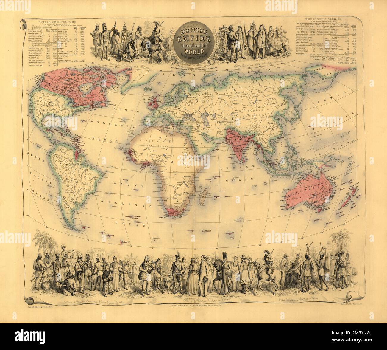 Vintage 19th-century illustrated map of the British Empire with tables showing population and area of countries, engraved by John Bartholomew c.1850-1860 Stock Photohttps://www.alamy.com/image-license-details/?v=1https://www.alamy.com/vintage-19th-century-illustrated-map-of-the-british-empire-with-tables-showing-population-and-area-of-countries-engraved-by-john-bartholomew-c1850-1860-image502783569.html
RM2M5YNG1–Vintage 19th-century illustrated map of the British Empire with tables showing population and area of countries, engraved by John Bartholomew c.1850-1860
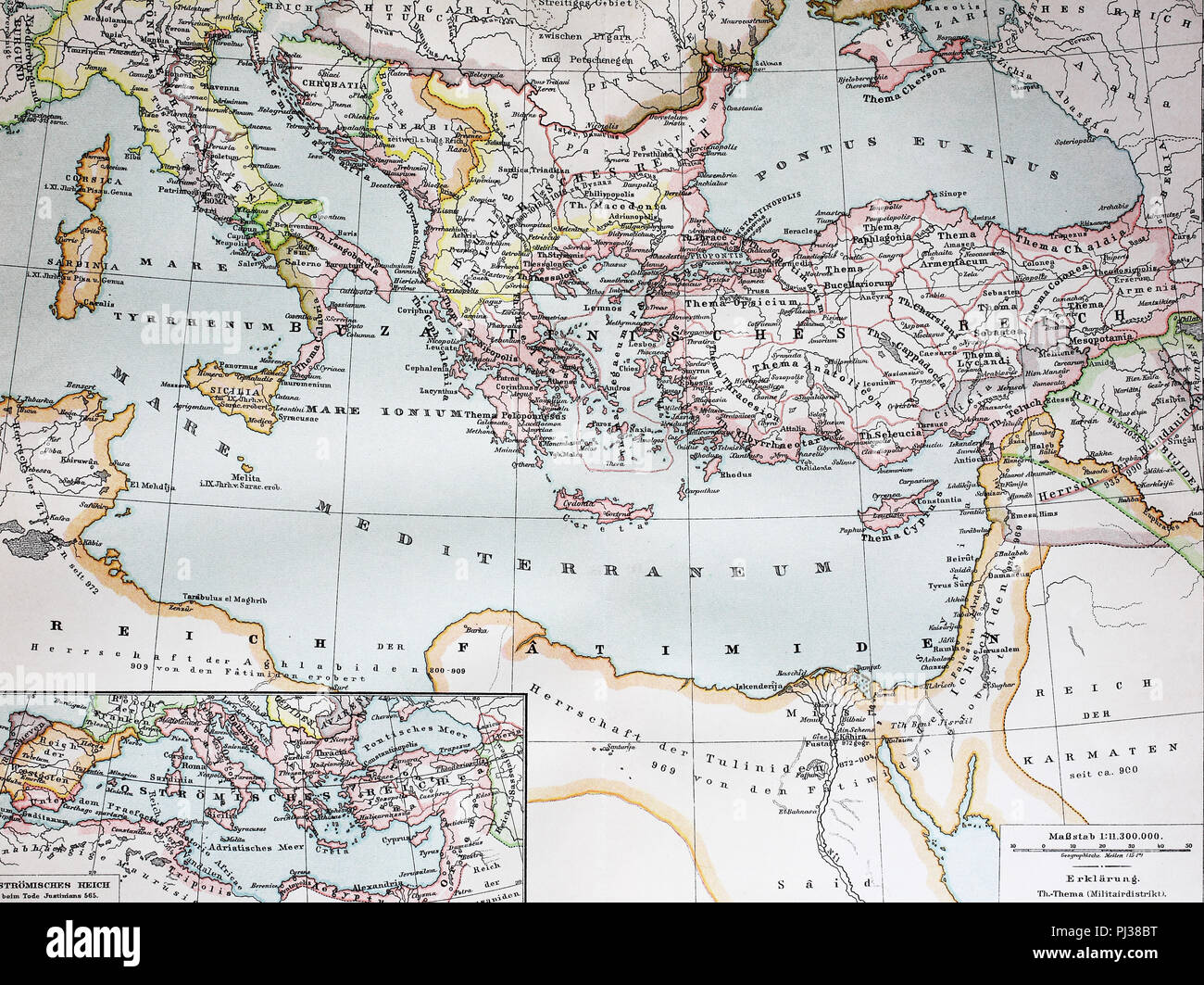 a historical map of the Byzantine Empire in the year 1000, digital improved reproduction of an original from the year 1895 Stock Photohttps://www.alamy.com/image-license-details/?v=1https://www.alamy.com/a-historical-map-of-the-byzantine-empire-in-the-year-1000-digital-improved-reproduction-of-an-original-from-the-year-1895-image217660684.html
RFPJ38BT–a historical map of the Byzantine Empire in the year 1000, digital improved reproduction of an original from the year 1895
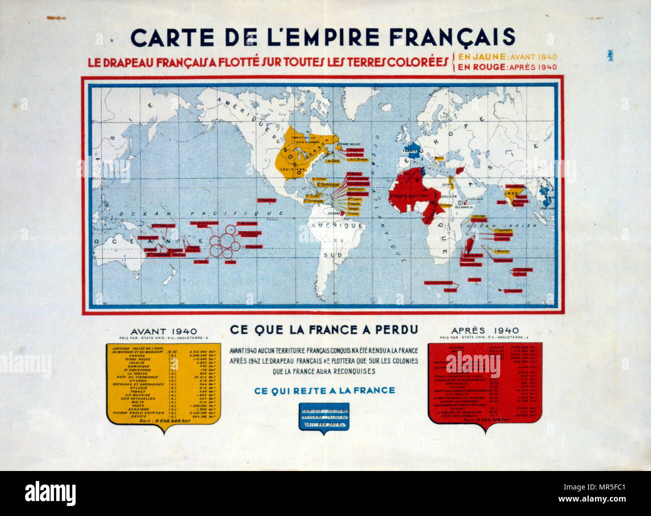 Propaganda poster issued by the Vichy French government comparing the old empire of France with the empire of 1940 Stock Photohttps://www.alamy.com/image-license-details/?v=1https://www.alamy.com/propaganda-poster-issued-by-the-vichy-french-government-comparing-the-old-empire-of-france-with-the-empire-of-1940-image186362625.html
RMMR5FC1–Propaganda poster issued by the Vichy French government comparing the old empire of France with the empire of 1940
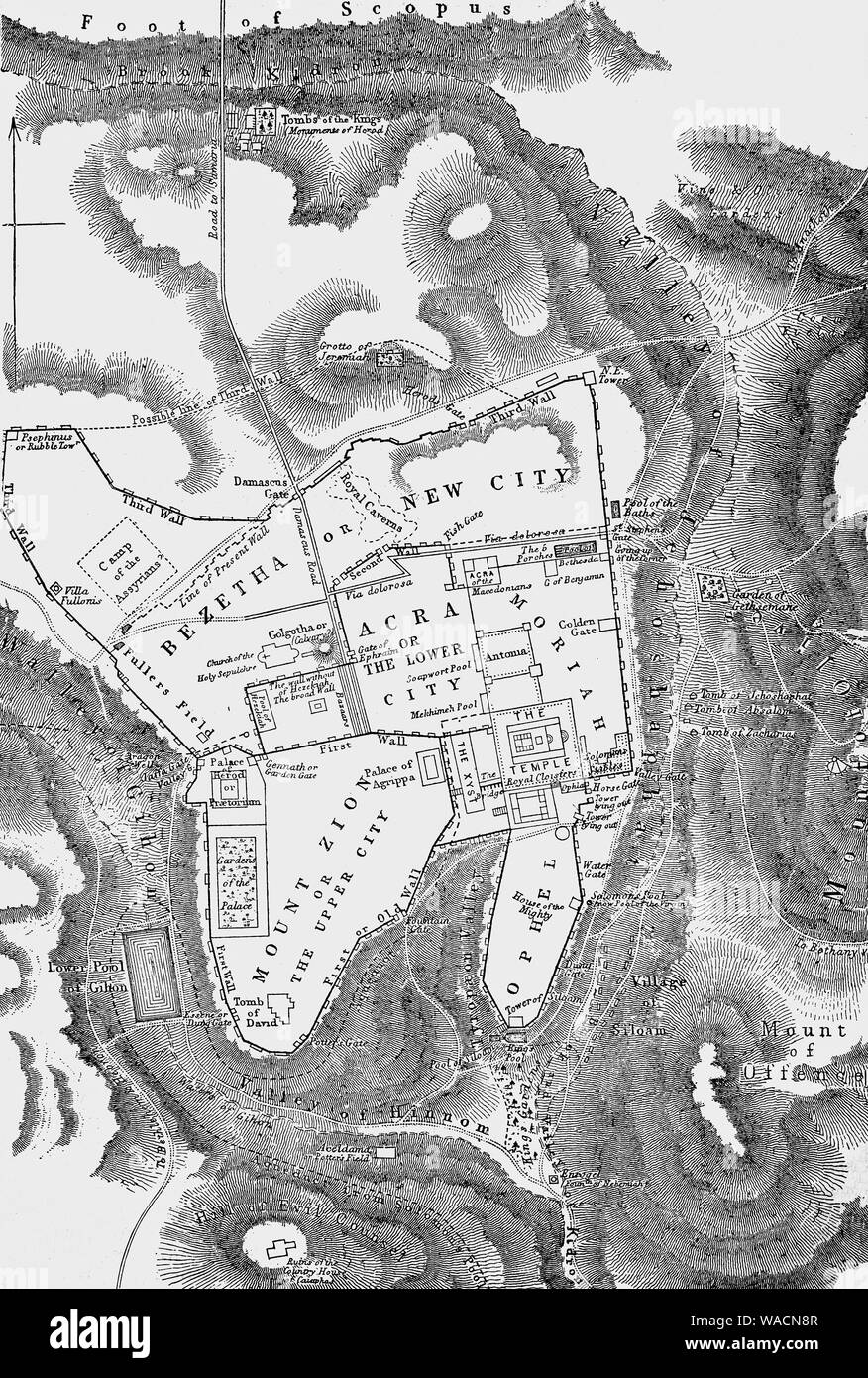 A map of Jerusalem following the death of Jesus Christ. King Herod the Great, (73 – 4 BCE) ruled over the Jews in Israel following his appointment by the Roman conquerers. Once he was king, Herod launched an ambitious building program, both in Jerusalem and the spectacular port city of Caesarea, named after the emperor. He restored the magnificent Jerusalem temple, which was later destroyed by the Romans following a rebellion in A.D. 70. Stock Photohttps://www.alamy.com/image-license-details/?v=1https://www.alamy.com/a-map-of-jerusalem-following-the-death-of-jesus-christ-king-herod-the-great-73-4-bce-ruled-over-the-jews-in-israel-following-his-appointment-by-the-roman-conquerers-once-he-was-king-herod-launched-an-ambitious-building-program-both-in-jerusalem-and-the-spectacular-port-city-of-caesarea-named-after-the-emperor-he-restored-the-magnificent-jerusalem-temple-which-was-later-destroyed-by-the-romans-following-a-rebellion-in-ad-70-image264582215.html
RMWACN8R–A map of Jerusalem following the death of Jesus Christ. King Herod the Great, (73 – 4 BCE) ruled over the Jews in Israel following his appointment by the Roman conquerers. Once he was king, Herod launched an ambitious building program, both in Jerusalem and the spectacular port city of Caesarea, named after the emperor. He restored the magnificent Jerusalem temple, which was later destroyed by the Romans following a rebellion in A.D. 70.
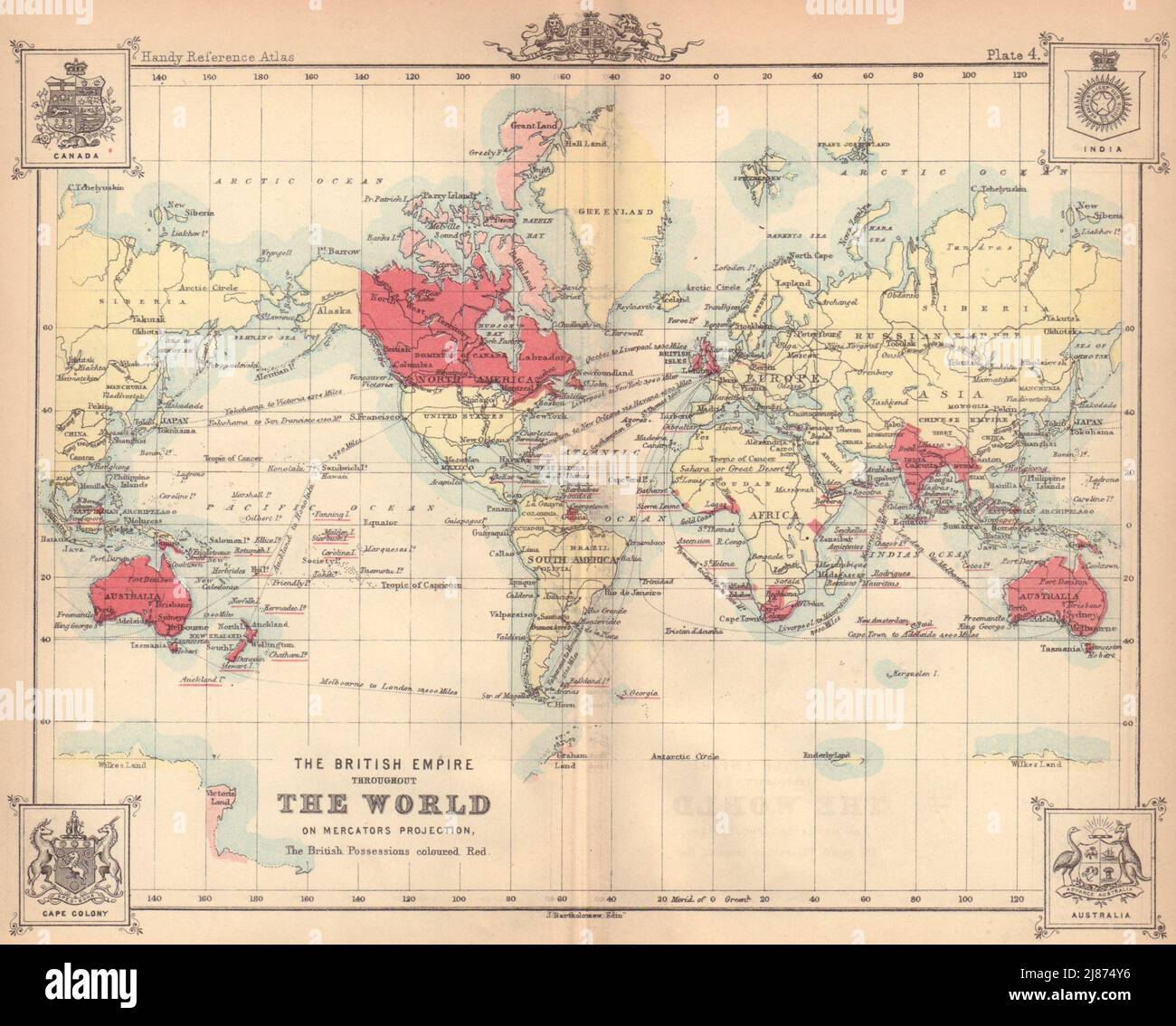 The British Empire throughout The World. BARTHOLOMEW 1888 old antique map Stock Photohttps://www.alamy.com/image-license-details/?v=1https://www.alamy.com/the-british-empire-throughout-the-world-bartholomew-1888-old-antique-map-image469754746.html
RF2J874Y6–The British Empire throughout The World. BARTHOLOMEW 1888 old antique map
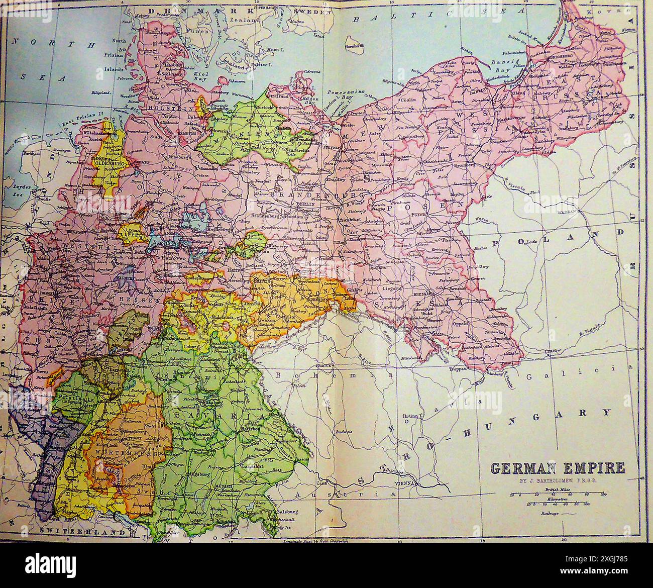 A late 19th century coloured map of the German Empire. - Eine kolorierte Karte des Deutschen Reichs aus dem späten 19. Stock Photohttps://www.alamy.com/image-license-details/?v=1https://www.alamy.com/a-late-19th-century-coloured-map-of-the-german-empire-eine-kolorierte-karte-des-deutschen-reichs-aus-dem-spten-19-image612598229.html
RM2XGJ785–A late 19th century coloured map of the German Empire. - Eine kolorierte Karte des Deutschen Reichs aus dem späten 19.
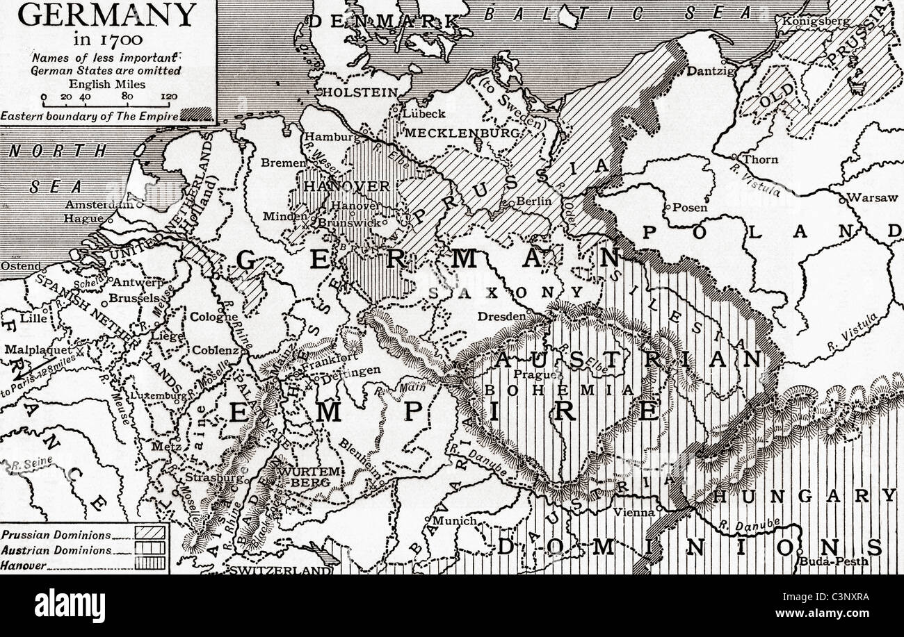 Map of Germany in 1700. From The Story of England, published 1930. Stock Photohttps://www.alamy.com/image-license-details/?v=1https://www.alamy.com/stock-photo-map-of-germany-in-1700-from-the-story-of-england-published-1930-36746734.html
RMC3NXRA–Map of Germany in 1700. From The Story of England, published 1930.
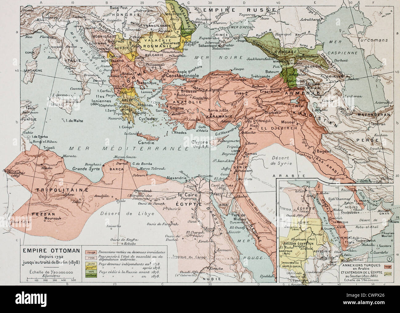 Ottoman Empire historical development old map Stock Photohttps://www.alamy.com/image-license-details/?v=1https://www.alamy.com/stock-photo-ottoman-empire-historical-development-old-map-50290526.html
RFCWPX26–Ottoman Empire historical development old map
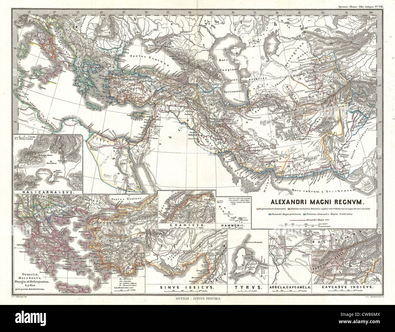 1854 Spruner Map of the Empire of Alexander the Great Stock Photohttps://www.alamy.com/image-license-details/?v=1https://www.alamy.com/stock-photo-1854-spruner-map-of-the-empire-of-alexander-the-great-49968042.html
RMCW86MX–1854 Spruner Map of the Empire of Alexander the Great
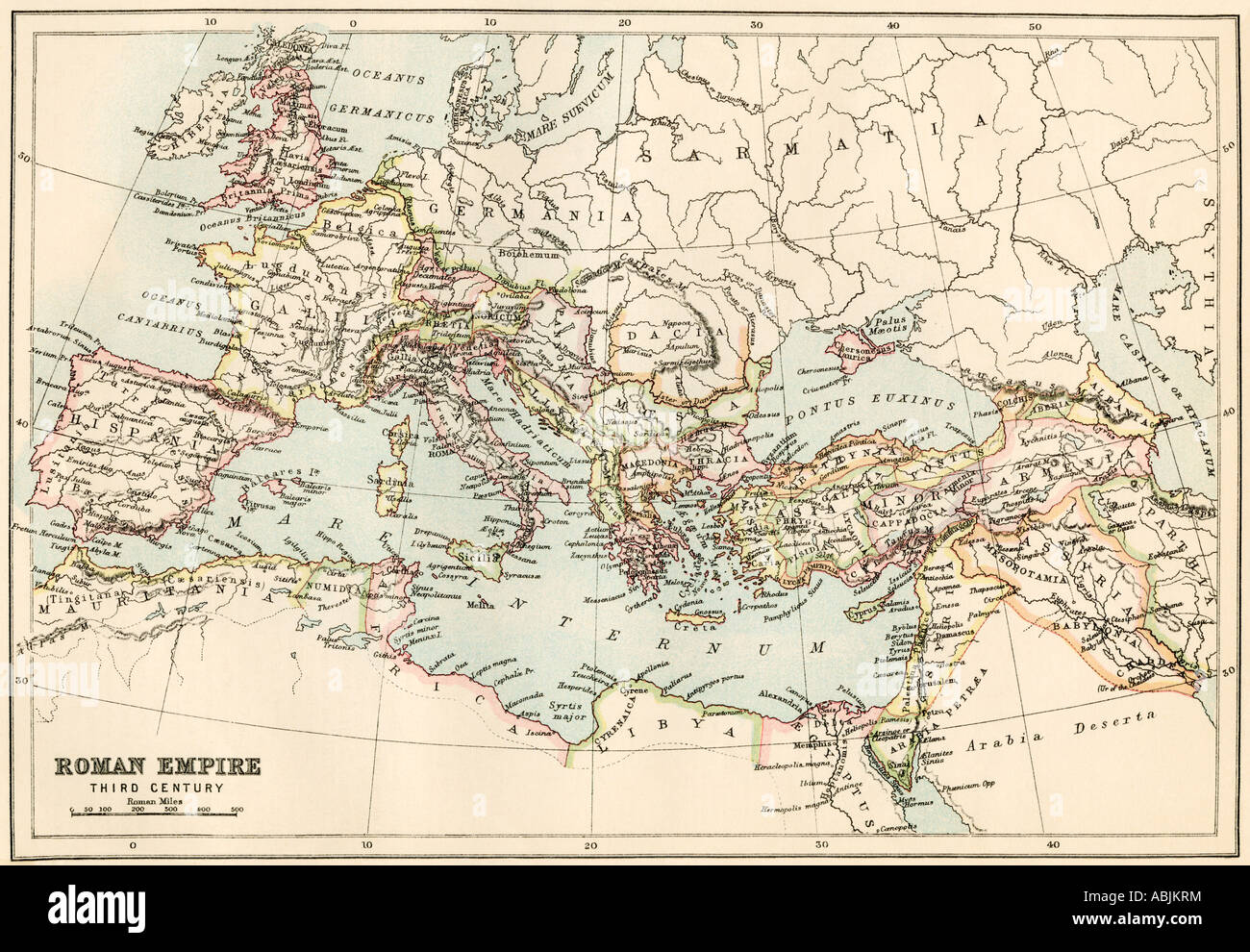 Map of the Roman Empire in the third century AD. Color lithograph Stock Photohttps://www.alamy.com/image-license-details/?v=1https://www.alamy.com/stock-photo-map-of-the-roman-empire-in-the-third-century-ad-color-lithograph-12908167.html
RMABJKRM–Map of the Roman Empire in the third century AD. Color lithograph
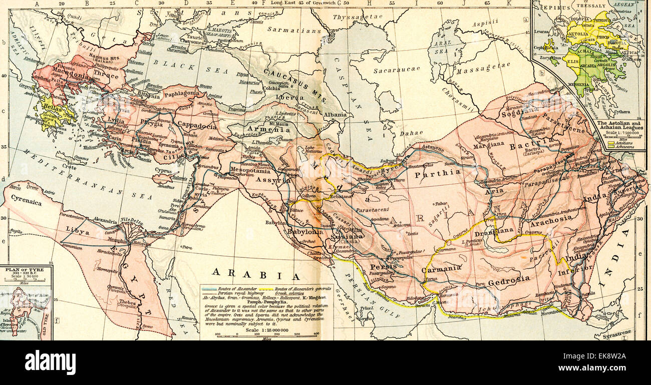 Map of the Macedonian Empire, 336 - 323 B.C. Stock Photohttps://www.alamy.com/image-license-details/?v=1https://www.alamy.com/stock-photo-map-of-the-macedonian-empire-336-323-bc-80715218.html
RMEK8W2A–Map of the Macedonian Empire, 336 - 323 B.C.
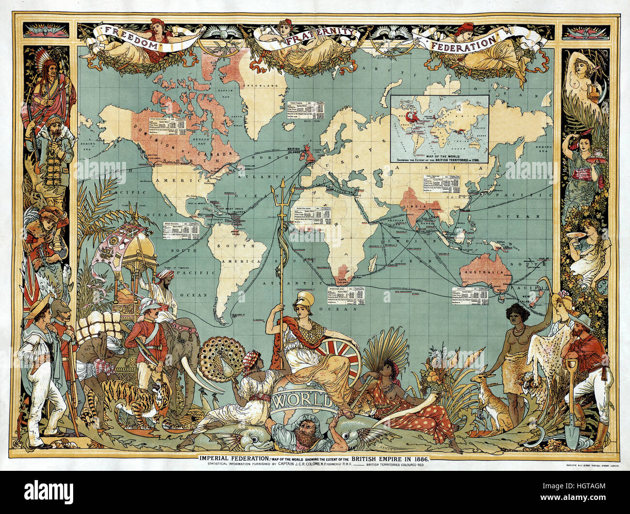 Map of British Empire Stock Photohttps://www.alamy.com/image-license-details/?v=1https://www.alamy.com/stock-photo-map-of-british-empire-130842228.html
RFHGTAGM–Map of British Empire
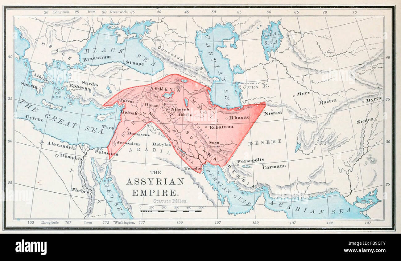 Map of the Assyrian Empire, Old Testament Stock Photohttps://www.alamy.com/image-license-details/?v=1https://www.alamy.com/stock-photo-map-of-the-assyrian-empire-old-testament-93023867.html
RMFB9GTY–Map of the Assyrian Empire, Old Testament
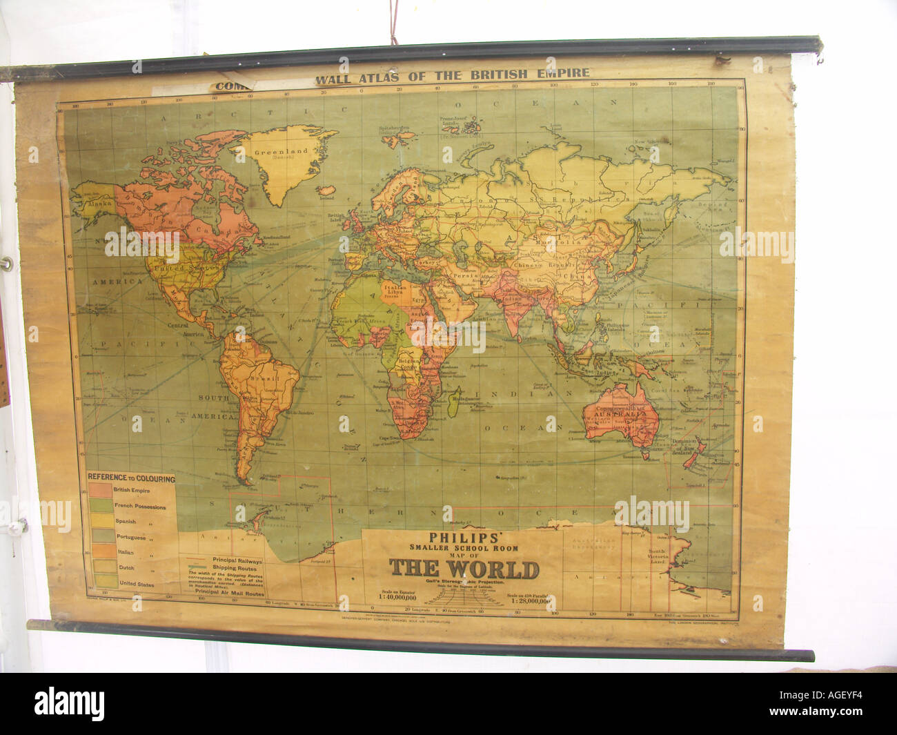 Old school wall map showing British Empire in red Stock Photohttps://www.alamy.com/image-license-details/?v=1https://www.alamy.com/old-school-wall-map-showing-british-empire-in-red-image4633587.html
RMAGEYF4–Old school wall map showing British Empire in red
 Map of Muhammadan India, beginning of Mughal Empire, Indian map, 1490 Stock Photohttps://www.alamy.com/image-license-details/?v=1https://www.alamy.com/map-of-muhammadan-india-beginning-of-mughal-empire-indian-map-1490-image241326909.html
RMT0HAX5–Map of Muhammadan India, beginning of Mughal Empire, Indian map, 1490
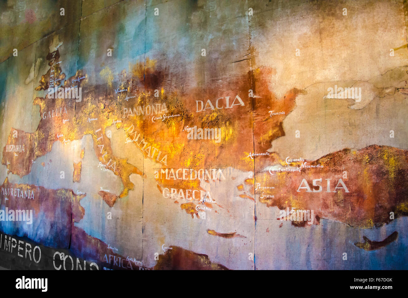 Old Map of roman empire painted on the wall of roman Colosseum Stock Photohttps://www.alamy.com/image-license-details/?v=1https://www.alamy.com/stock-photo-old-map-of-roman-empire-painted-on-the-wall-of-roman-colosseum-89904099.html
RFF67DGK–Old Map of roman empire painted on the wall of roman Colosseum
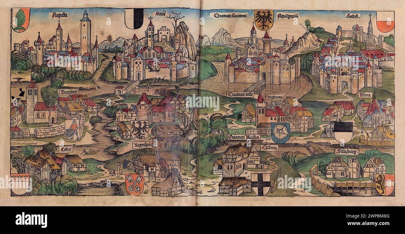 A beautiful woodcut from 1493 of the towns of the Holy Roman Empire, including Bamberg, Koblenz, Ulm and Salzberg. This illustration comes from the Nuremberg Chronicle, which is an enyclodpedia of world events, mythology and christian history. This extra-ordinary work was one of the earliest books ever printed and the first to successfully integrate text and images. Stock Photohttps://www.alamy.com/image-license-details/?v=1https://www.alamy.com/a-beautiful-woodcut-from-1493-of-the-towns-of-the-holy-roman-empire-including-bamberg-koblenz-ulm-and-salzberg-this-illustration-comes-from-the-nuremberg-chronicle-which-is-an-enyclodpedia-of-world-events-mythology-and-christian-history-this-extra-ordinary-work-was-one-of-the-earliest-books-ever-printed-and-the-first-to-successfully-integrate-text-and-images-image598932336.html
RM2WPBM8G–A beautiful woodcut from 1493 of the towns of the Holy Roman Empire, including Bamberg, Koblenz, Ulm and Salzberg. This illustration comes from the Nuremberg Chronicle, which is an enyclodpedia of world events, mythology and christian history. This extra-ordinary work was one of the earliest books ever printed and the first to successfully integrate text and images.
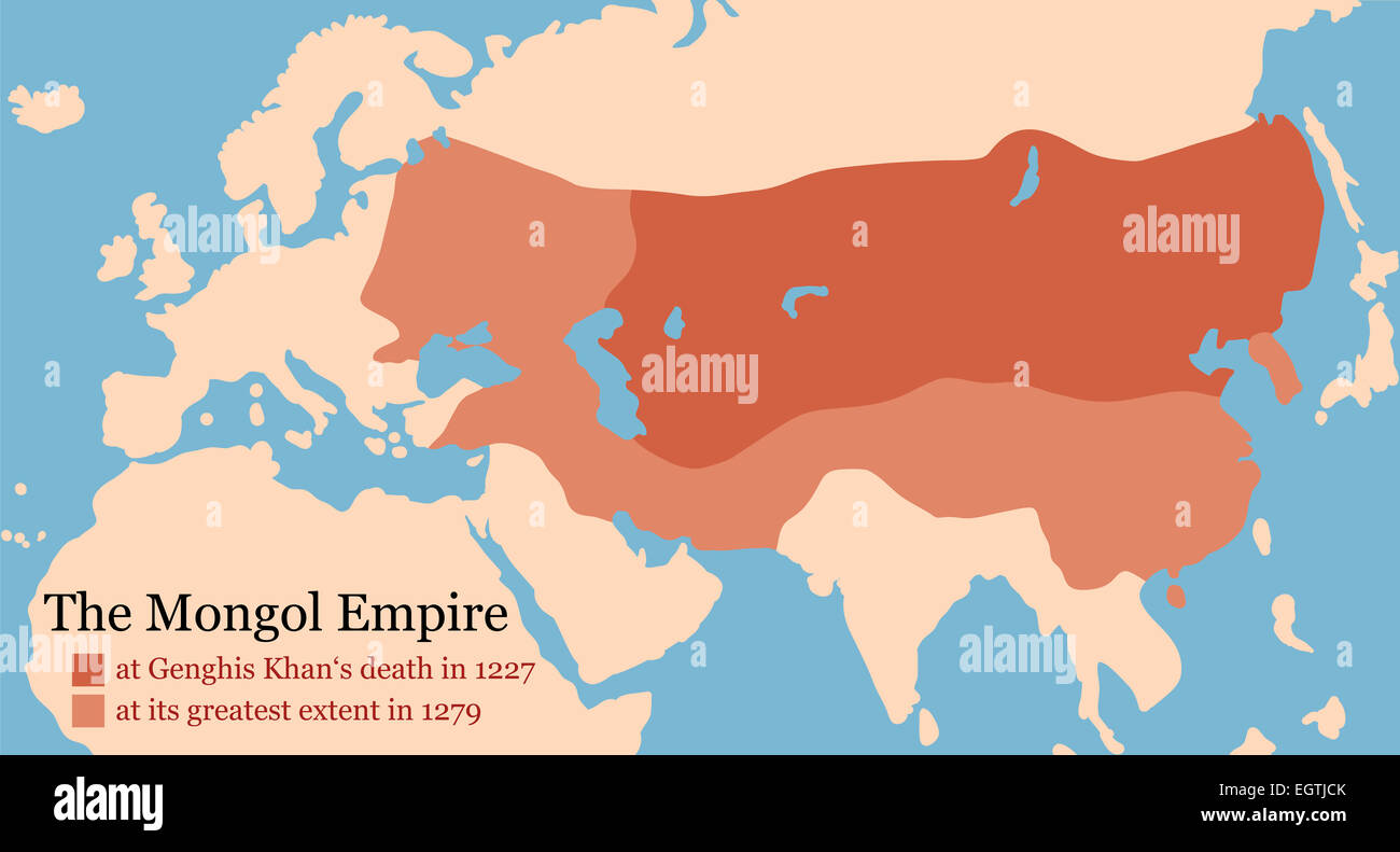 Mongol Empire map at Genghis Khan's death in 1227 and at its greatest extent in 1279. Stock Photohttps://www.alamy.com/image-license-details/?v=1https://www.alamy.com/stock-photo-mongol-empire-map-at-genghis-khans-death-in-1227-and-at-its-greatest-79217283.html
RFEGTJCK–Mongol Empire map at Genghis Khan's death in 1227 and at its greatest extent in 1279.
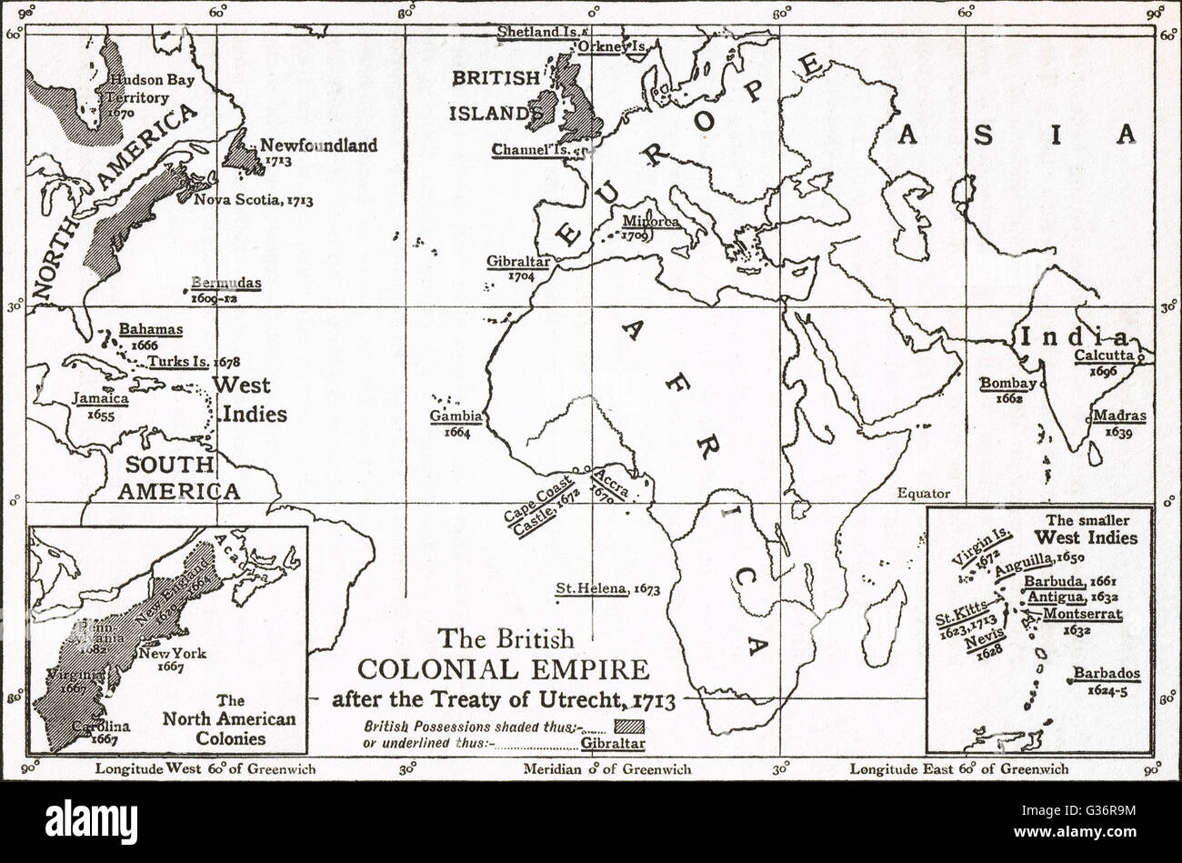 Map of The British Colonial Empire after The Treaty of Utrecht of 1713 Stock Photohttps://www.alamy.com/image-license-details/?v=1https://www.alamy.com/stock-photo-map-of-the-british-colonial-empire-after-the-treaty-of-utrecht-of-105256192.html
RMG36R9M–Map of The British Colonial Empire after The Treaty of Utrecht of 1713
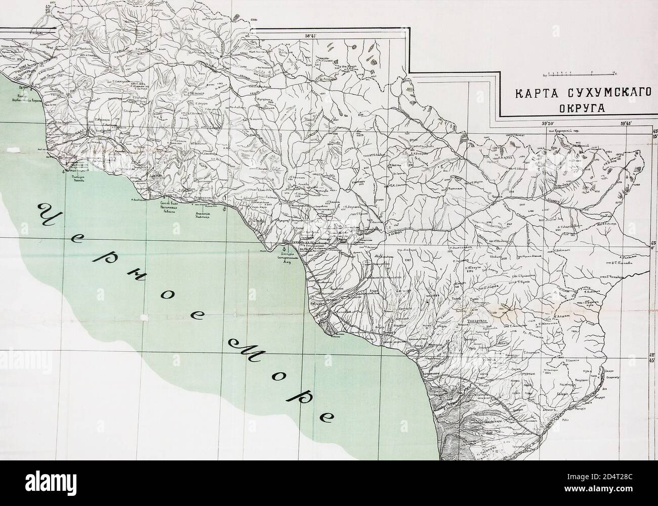 Map of the Sukhumi District in the 19th century. Stock Photohttps://www.alamy.com/image-license-details/?v=1https://www.alamy.com/map-of-the-sukhumi-district-in-the-19th-century-image381615372.html
RM2D4T28C–Map of the Sukhumi District in the 19th century.
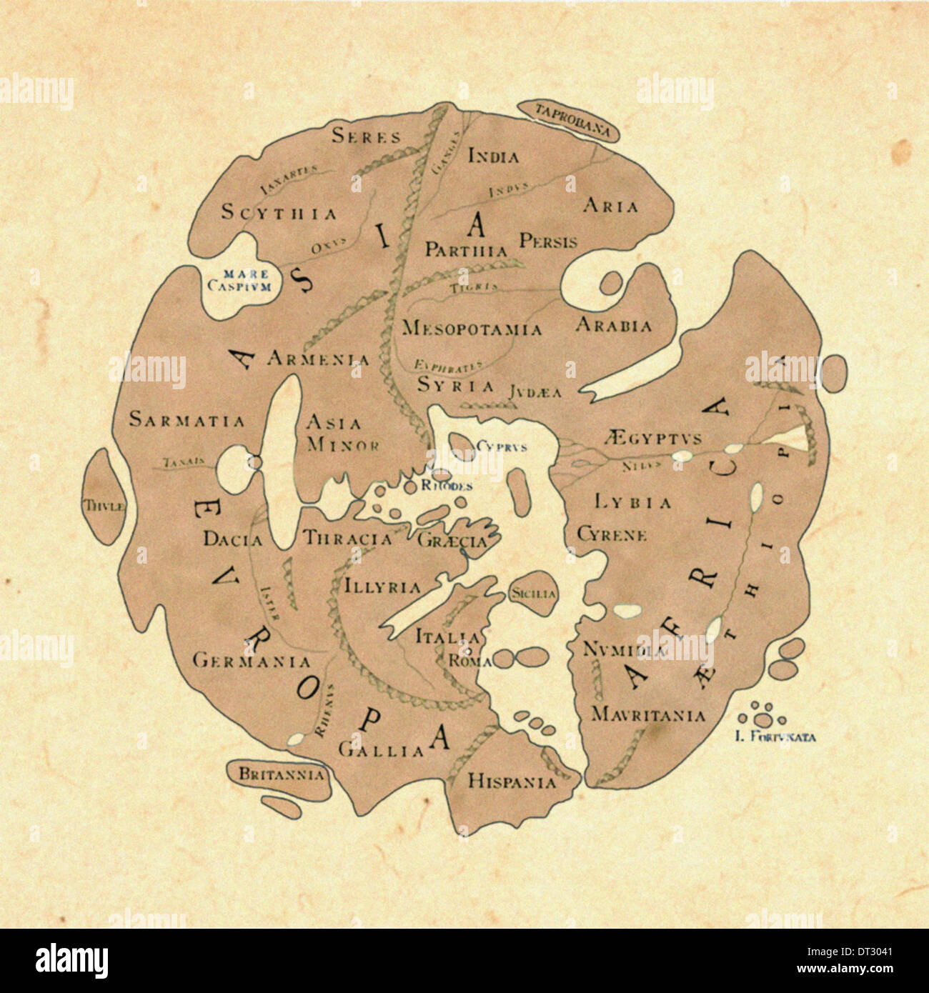 Reconstructed Roman World Map 'Orbis Terrarum' circa 20AD as commissioned by Marcus Vipsanius Agrippa Stock Photohttps://www.alamy.com/image-license-details/?v=1https://www.alamy.com/reconstructed-roman-world-map-orbis-terrarum-circa-20ad-as-commissioned-image66448817.html
RMDT3041–Reconstructed Roman World Map 'Orbis Terrarum' circa 20AD as commissioned by Marcus Vipsanius Agrippa
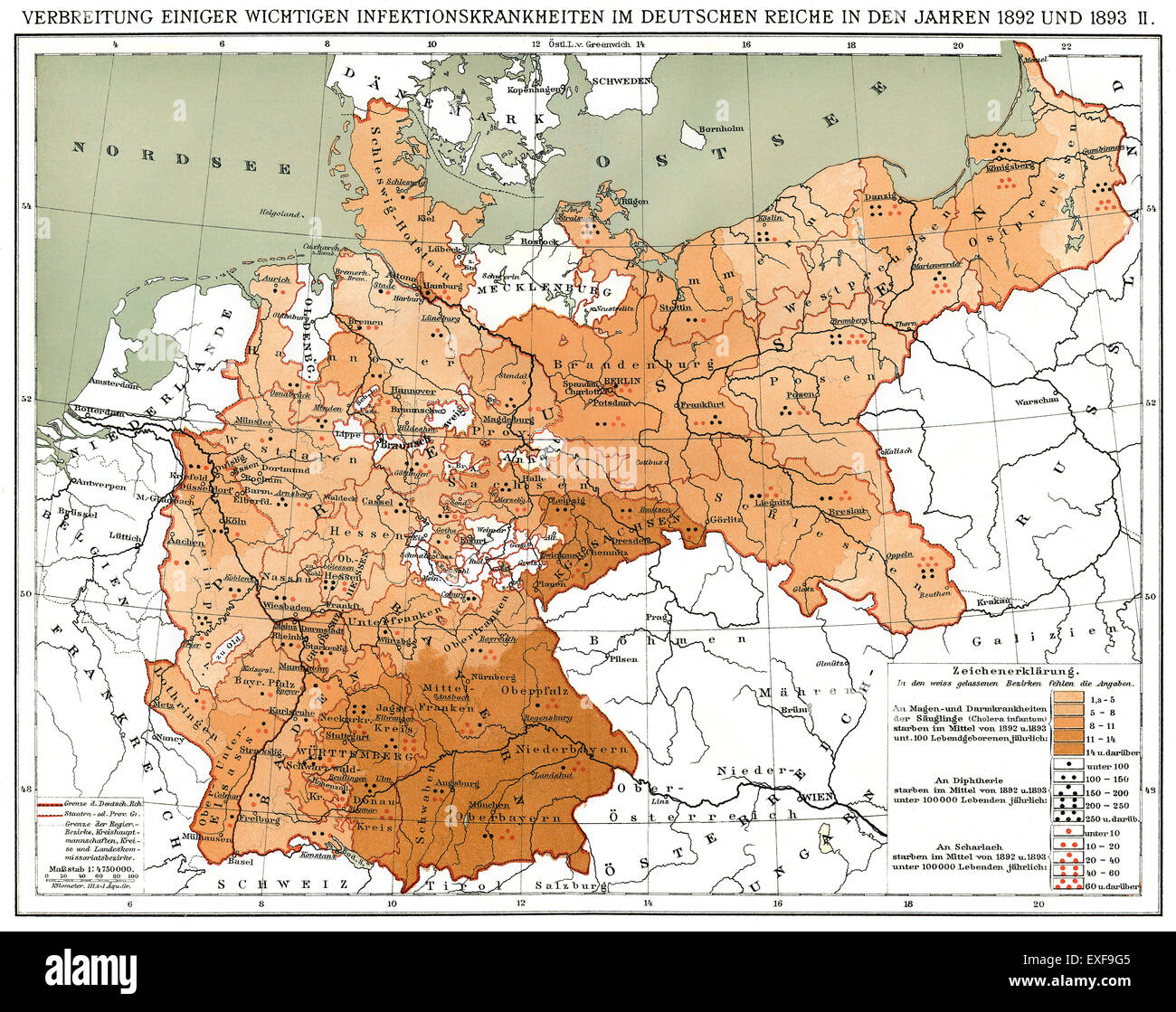 Historical map, spread of infectious diseases in the German Empire in 1892 and 1893 Stock Photohttps://www.alamy.com/image-license-details/?v=1https://www.alamy.com/stock-photo-historical-map-spread-of-infectious-diseases-in-the-german-empire-85159317.html
RMEXF9G5–Historical map, spread of infectious diseases in the German Empire in 1892 and 1893
 A late 19th Century map of the world, showing the Roman Empire during the Apostolic Age: i.e. the period from the start of the ministry of Jesus (c. 27–29 AD) to the death of the last of the Twelve Apostles (c. 100) (known as the Apostolic Age). Stock Photohttps://www.alamy.com/image-license-details/?v=1https://www.alamy.com/a-late-19th-century-map-of-the-world-showing-the-roman-empire-during-the-apostolic-age-ie-the-period-from-the-start-of-the-ministry-of-jesus-c-2729-ad-to-the-death-of-the-last-of-the-twelve-apostles-c-100-known-as-the-apostolic-age-image379268900.html
RM2D1159T–A late 19th Century map of the world, showing the Roman Empire during the Apostolic Age: i.e. the period from the start of the ministry of Jesus (c. 27–29 AD) to the death of the last of the Twelve Apostles (c. 100) (known as the Apostolic Age).
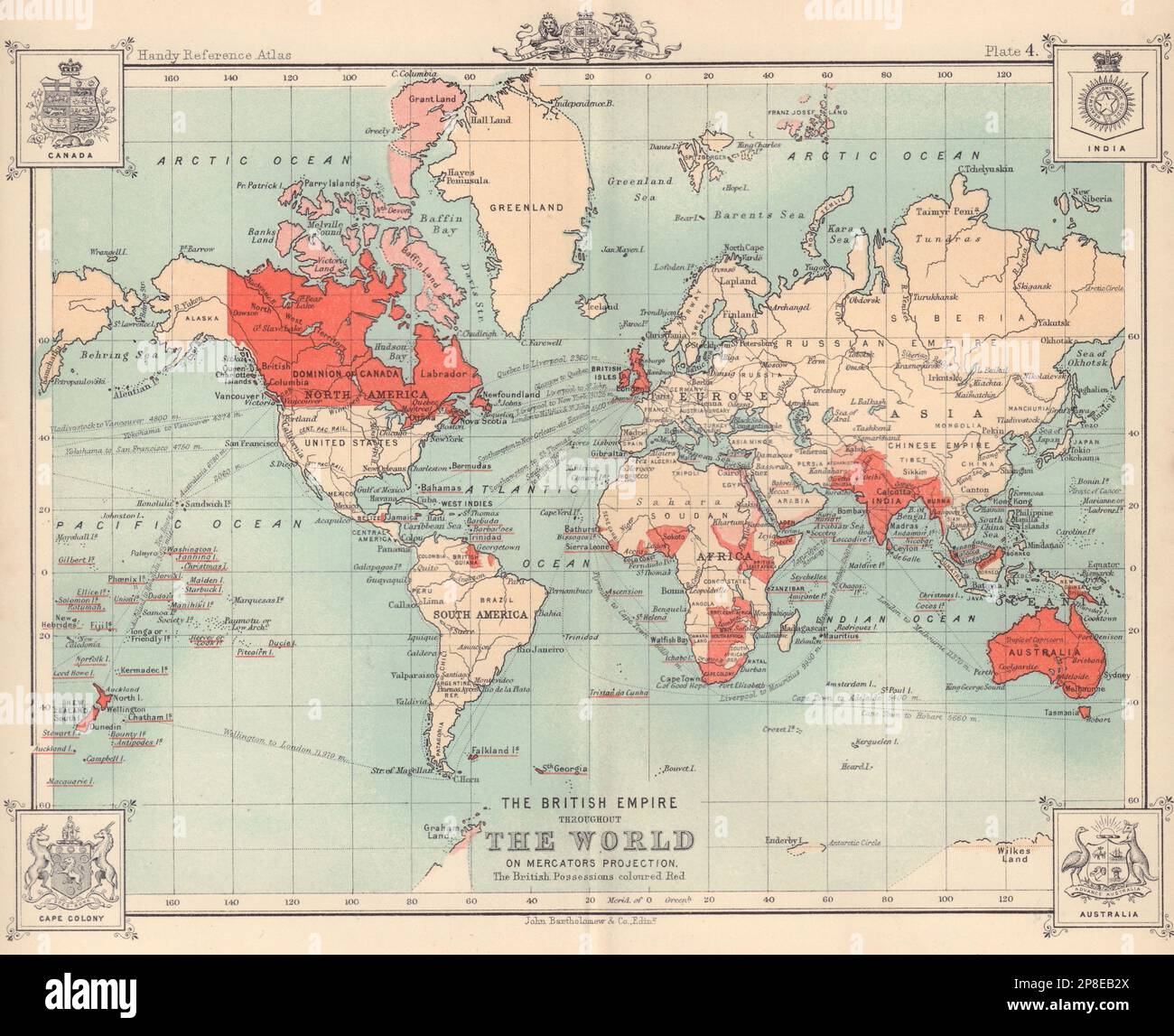 The British Empire Throughout The World. BARTHOLOMEW 1898 old antique map Stock Photohttps://www.alamy.com/image-license-details/?v=1https://www.alamy.com/the-british-empire-throughout-the-world-bartholomew-1898-old-antique-map-image538754690.html
RF2P8EB2X–The British Empire Throughout The World. BARTHOLOMEW 1898 old antique map
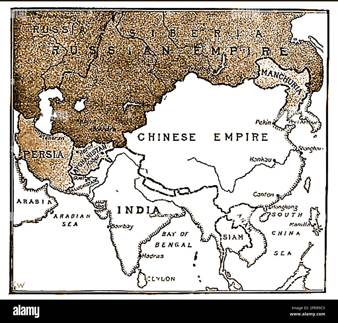 An 1892 map showing the advance of Russian forces on India. (In the 19th century Russia wanted to take India from British control?, a pan only defeated following the assassination of Russian Emperor Paul I -- Карта 1892 года, показывающая продвижение русских войск на Индию. (В 19-м веке Россия хотела отвести Индию из-под британского контроля?, пан побежден только по1892 ----का एक नक्शा जो भारत पर रूसी सेना की प्रगति को दर्शाता है। उल आई -сле убийства российского -- императора Павла I..-----1892 کا ایک نقشہ جس میں ہندوستان پر روسی افواج کی پیش قدمی کو دکھایا گیا ہے۔ میں -- Stock Photohttps://www.alamy.com/image-license-details/?v=1https://www.alamy.com/an-1892-map-showing-the-advance-of-russian-forces-on-india-in-the-19th-century-russia-wanted-to-take-india-from-british-control-a-pan-only-defeated-following-the-assassination-of-russian-emperor-paul-i-1892-19-1892-i-1892-image542638885.html
RM2PER9C5–An 1892 map showing the advance of Russian forces on India. (In the 19th century Russia wanted to take India from British control?, a pan only defeated following the assassination of Russian Emperor Paul I -- Карта 1892 года, показывающая продвижение русских войск на Индию. (В 19-м веке Россия хотела отвести Индию из-под британского контроля?, пан побежден только по1892 ----का एक नक्शा जो भारत पर रूसी सेना की प्रगति को दर्शाता है। उल आई -сле убийства российского -- императора Павла I..-----1892 کا ایک نقشہ جس میں ہندوستان پر روسی افواج کی پیش قدمی کو دکھایا گیا ہے۔ میں --
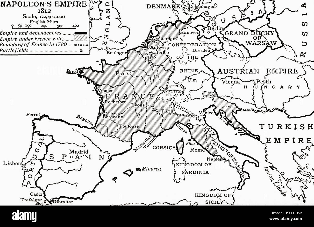 Map of Napoleon's Empire in 1812. From The Story of England, published 1930. Stock Photohttps://www.alamy.com/image-license-details/?v=1https://www.alamy.com/stock-photo-map-of-napoleons-empire-in-1812-from-the-story-of-england-published-43390643.html
RMCEGH5R–Map of Napoleon's Empire in 1812. From The Story of England, published 1930.
 General Map of the Russian Empire and the Neighboring Polish Empire and Grand Duchy of Finland. Pi︠a︡dyshev, Vasiliĭ Petrovich, created 1827. Stock Photohttps://www.alamy.com/image-license-details/?v=1https://www.alamy.com/general-map-of-the-russian-empire-and-the-neighboring-polish-empire-and-grand-duchy-of-finland-piadyshev-vasili-petrovich-created-1827-image463611628.html
RM2HX79A4–General Map of the Russian Empire and the Neighboring Polish Empire and Grand Duchy of Finland. Pi︠a︡dyshev, Vasiliĭ Petrovich, created 1827.
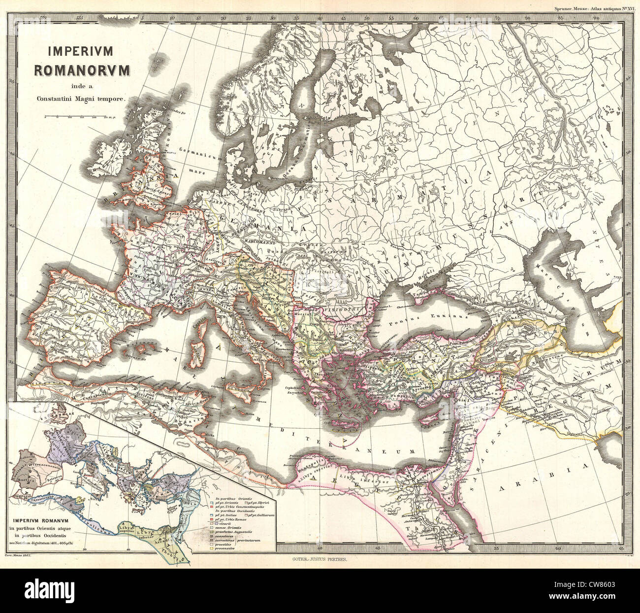 1865 Spruner Map of the Roman Empire under Constantine Stock Photohttps://www.alamy.com/image-license-details/?v=1https://www.alamy.com/stock-photo-1865-spruner-map-of-the-roman-empire-under-constantine-49967459.html
RMCW8603–1865 Spruner Map of the Roman Empire under Constantine
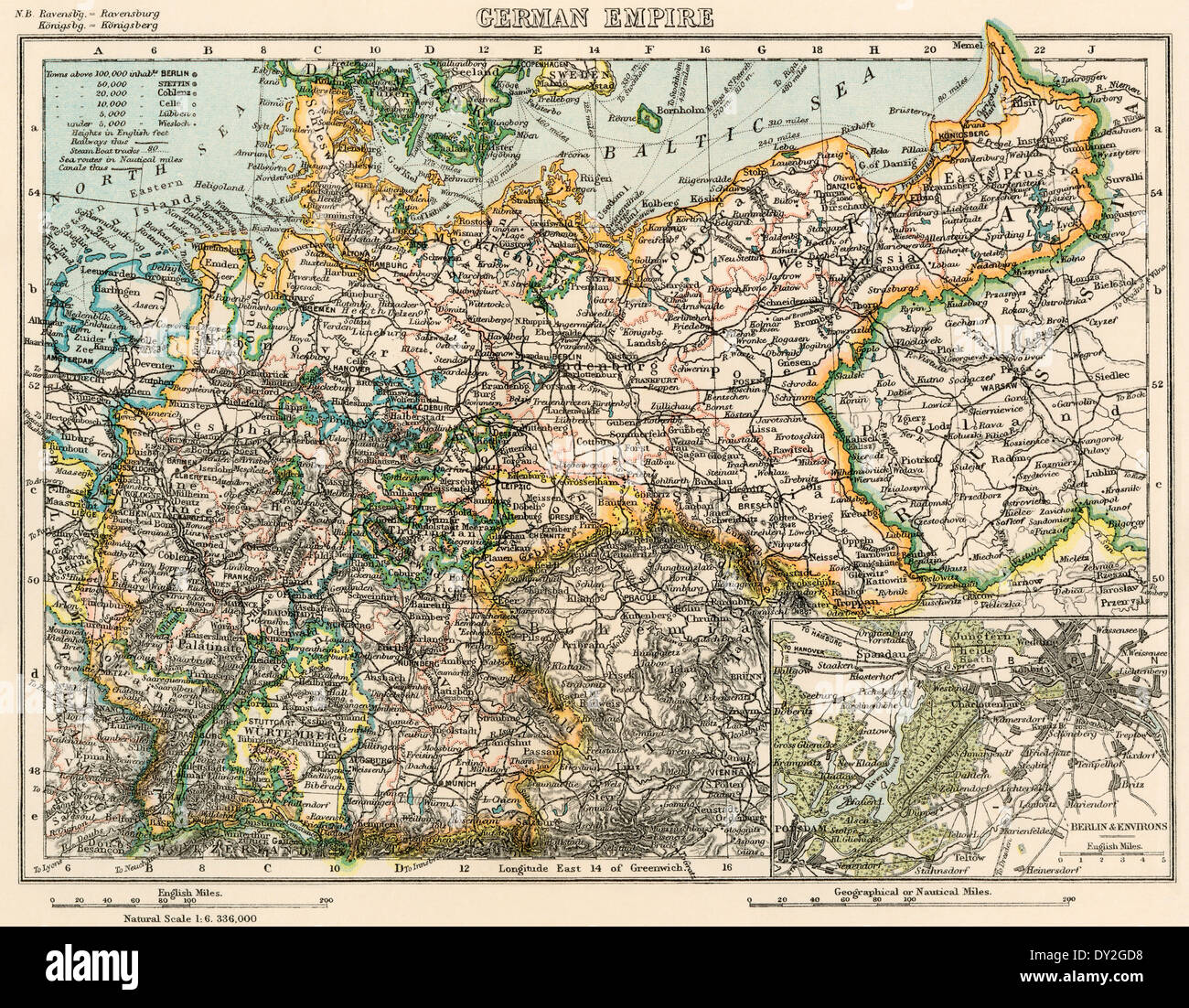 Map of the German Empire, late 1800s. Printed color lithograph Stock Photohttps://www.alamy.com/image-license-details/?v=1https://www.alamy.com/map-of-the-german-empire-late-1800s-printed-color-lithograph-image68283636.html
RMDY2GD8–Map of the German Empire, late 1800s. Printed color lithograph
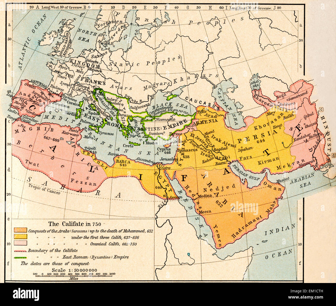 Map of the Muslim expansion and the Byzantine Empire at the end of the Umayyad Caliphate, in 750. Stock Photohttps://www.alamy.com/image-license-details/?v=1https://www.alamy.com/stock-photo-map-of-the-muslim-expansion-and-the-byzantine-empire-at-the-end-of-81166641.html
RMEM1CTH–Map of the Muslim expansion and the Byzantine Empire at the end of the Umayyad Caliphate, in 750.
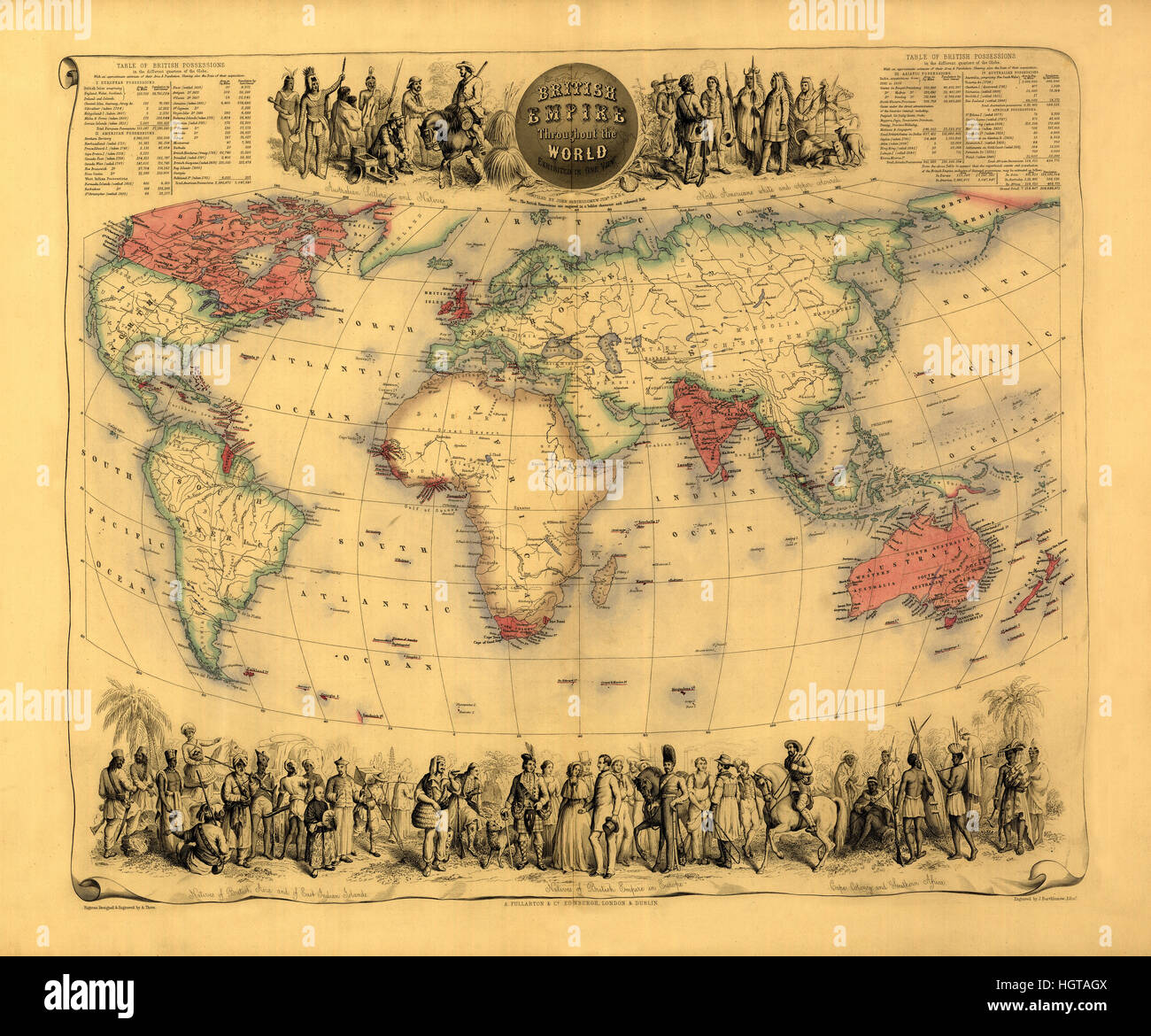 Map Of The British Empire 1850 Stock Photohttps://www.alamy.com/image-license-details/?v=1https://www.alamy.com/stock-photo-map-of-the-british-empire-1850-130842234.html
RFHGTAGX–Map Of The British Empire 1850
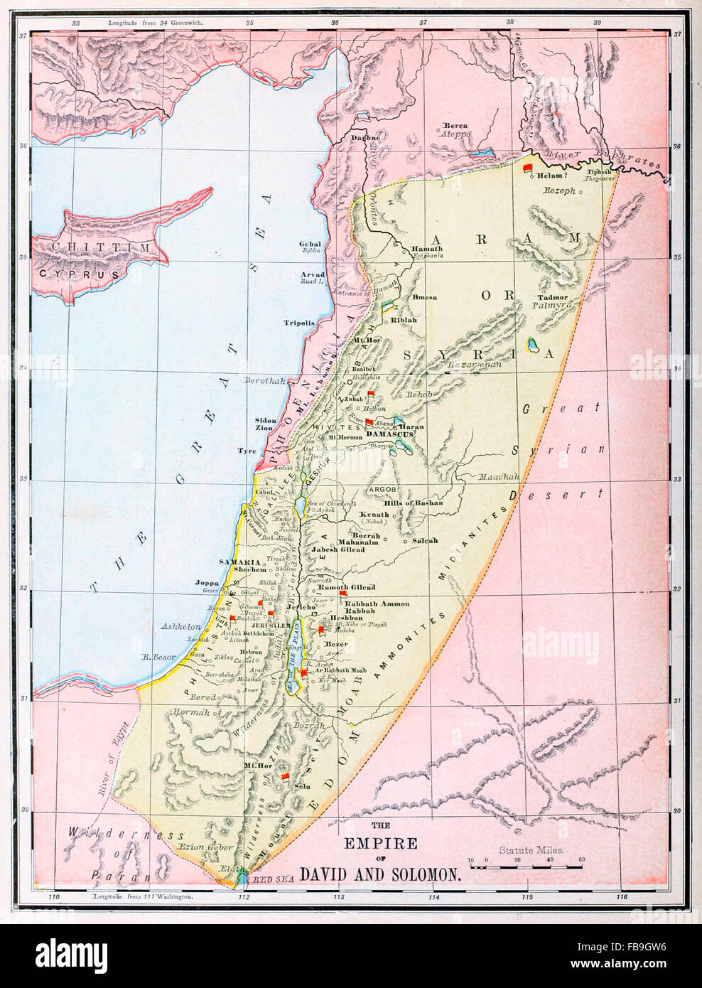 Map of The Empire of David and Solomon - Old Testament Stock Photohttps://www.alamy.com/image-license-details/?v=1https://www.alamy.com/stock-photo-map-of-the-empire-of-david-and-solomon-old-testament-93023874.html
RMFB9GW6–Map of The Empire of David and Solomon - Old Testament
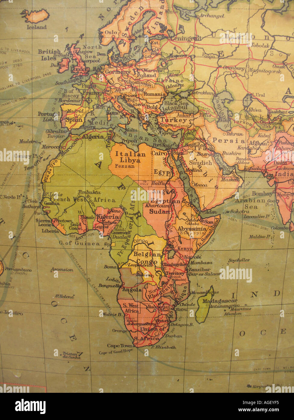 Old school wall map showing British Empire in red Stock Photohttps://www.alamy.com/image-license-details/?v=1https://www.alamy.com/old-school-wall-map-showing-british-empire-in-red-image4633588.html
RMAGEYF5–Old school wall map showing British Empire in red
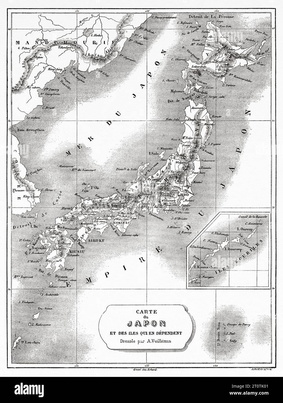 Old map of Japan and its dependent islands, Japan, Asia. Travels in China and Japan by the Marquis Alfred de Moges 1857 - 1858. Old 19th century engraving from Le Tour du Monde 1860 Stock Photohttps://www.alamy.com/image-license-details/?v=1https://www.alamy.com/old-map-of-japan-and-its-dependent-islands-japan-asia-travels-in-china-and-japan-by-the-marquis-alfred-de-moges-1857-1858-old-19th-century-engraving-from-le-tour-du-monde-1860-image568483889.html
RM2T0TK01–Old map of Japan and its dependent islands, Japan, Asia. Travels in China and Japan by the Marquis Alfred de Moges 1857 - 1858. Old 19th century engraving from Le Tour du Monde 1860
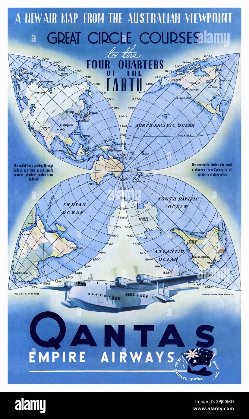 Qantas Empire Airways. A new map from the Australian viewpoint by Rhys Williams (1894-1976). Poster published in the 1950s. Stock Photohttps://www.alamy.com/image-license-details/?v=1https://www.alamy.com/qantas-empire-airways-a-new-map-from-the-australian-viewpoint-by-rhys-williams-1894-1976-poster-published-in-the-1950s-image544585789.html
RM2PJ00MD–Qantas Empire Airways. A new map from the Australian viewpoint by Rhys Williams (1894-1976). Poster published in the 1950s.
 vintage, route, retro, yellowed, old, map, atlas, map of the world, sheet of Stock Photohttps://www.alamy.com/image-license-details/?v=1https://www.alamy.com/stock-photo-vintage-route-retro-yellowed-old-map-atlas-map-of-the-world-sheet-143216660.html
RFJ9028M–vintage, route, retro, yellowed, old, map, atlas, map of the world, sheet of
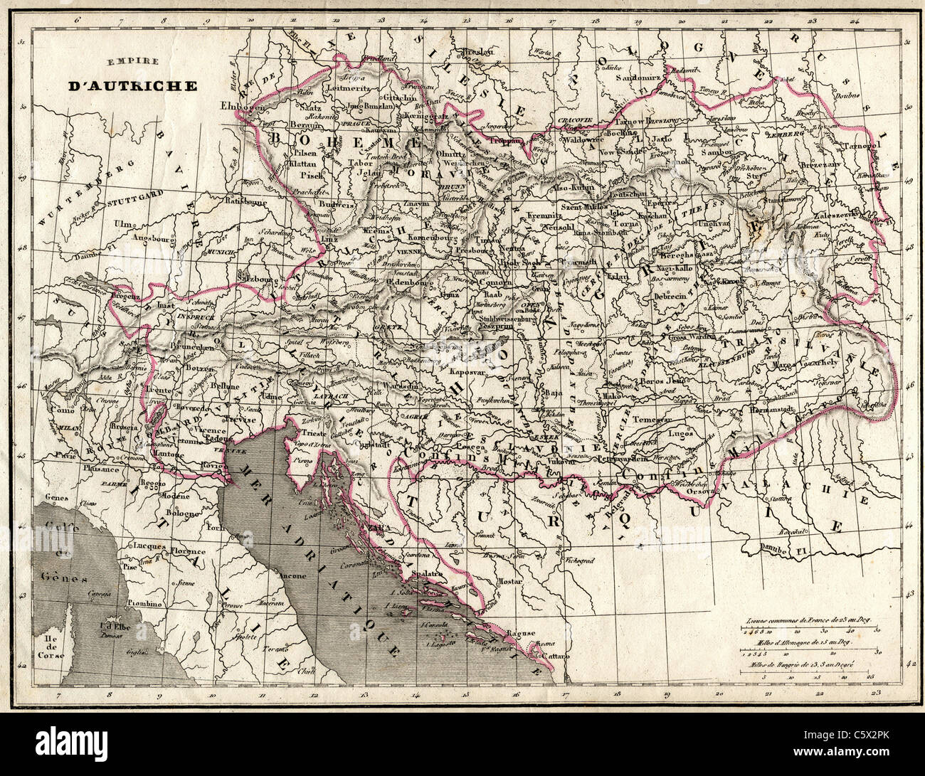 Empire D'Autriche (Austrian Empire) Antiquarian Map from 'Atlas Universel de Geographie Ancienne and Moderne' by cartographer C. V. Monin Stock Photohttps://www.alamy.com/image-license-details/?v=1https://www.alamy.com/stock-photo-empire-dautriche-austrian-empire-antiquarian-map-from-atlas-universel-38066971.html
RFC5X2PK–Empire D'Autriche (Austrian Empire) Antiquarian Map from 'Atlas Universel de Geographie Ancienne and Moderne' by cartographer C. V. Monin
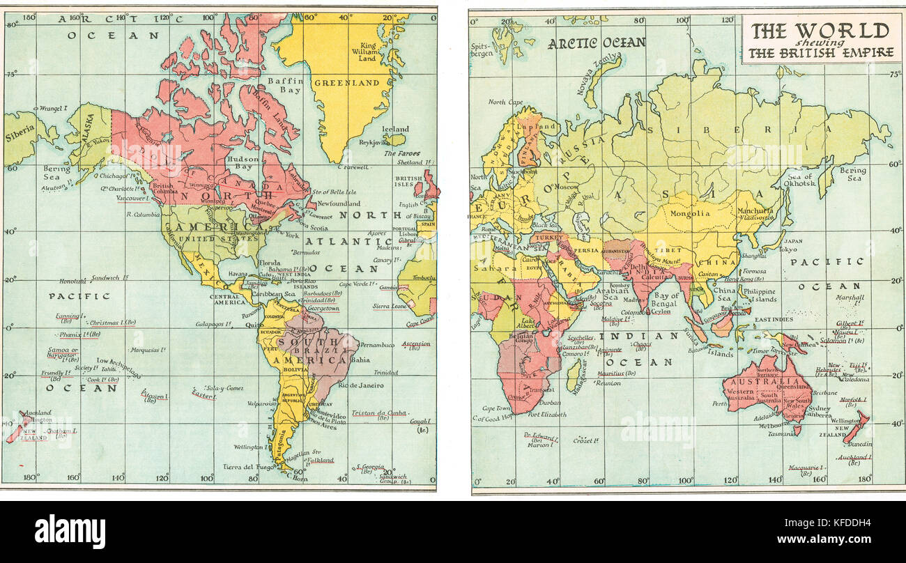 Pre World War 2 Map of the British Empire in 1935 Stock Photohttps://www.alamy.com/image-license-details/?v=1https://www.alamy.com/stock-image-pre-world-war-2-map-of-the-british-empire-in-1935-164409200.html
RMKFDDH4–Pre World War 2 Map of the British Empire in 1935
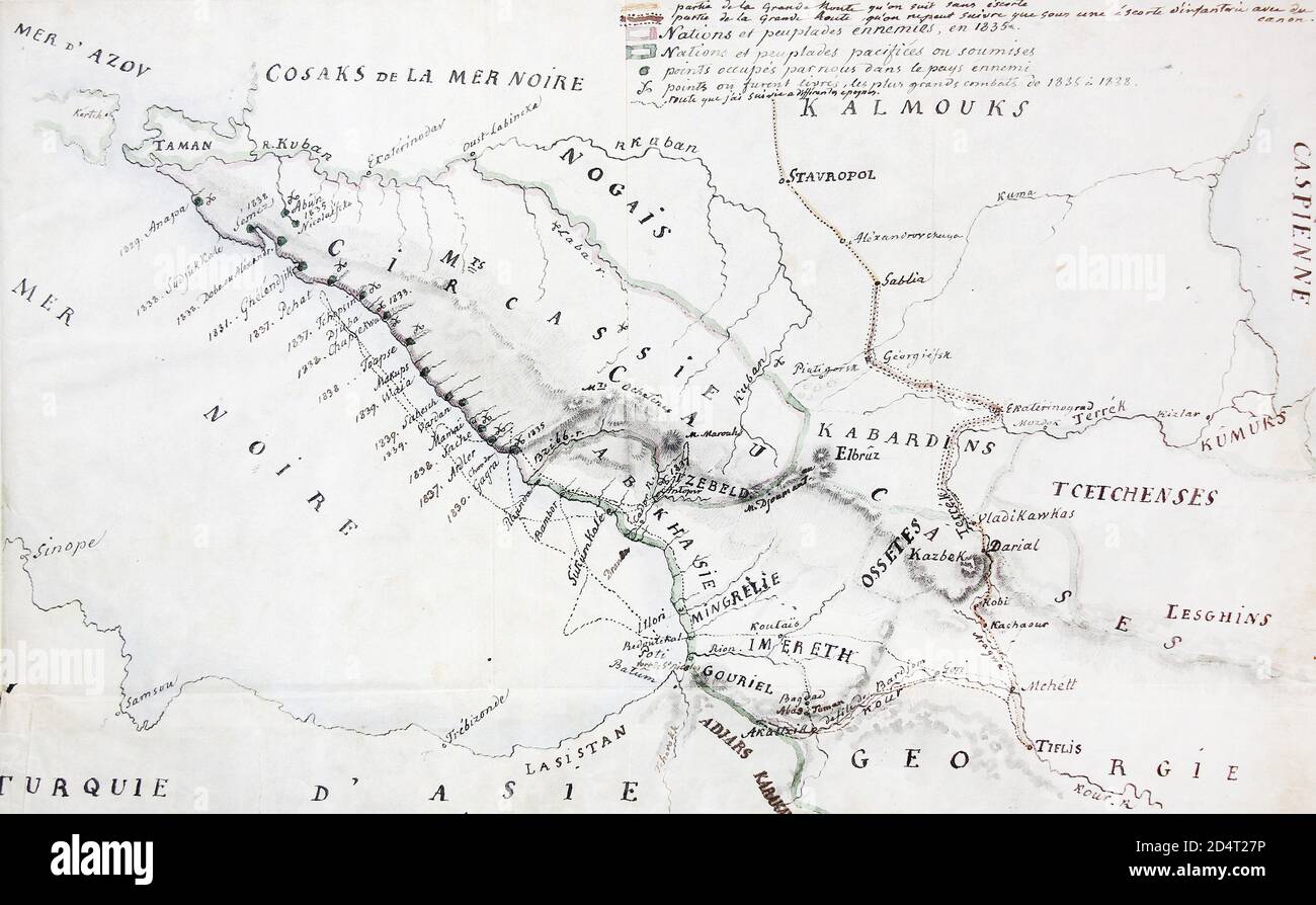 Map of the Black Sea coast of the Caucasus in 1842 Stock Photohttps://www.alamy.com/image-license-details/?v=1https://www.alamy.com/map-of-the-black-sea-coast-of-the-caucasus-in-1842-image381615354.html
RM2D4T27P–Map of the Black Sea coast of the Caucasus in 1842
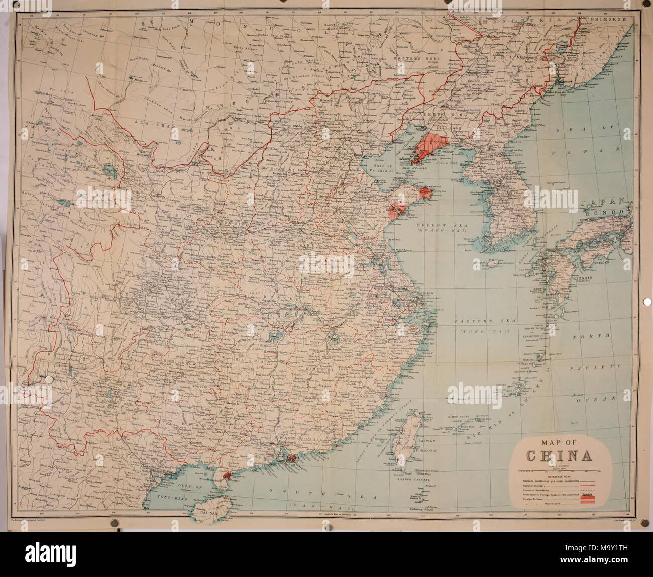 Political map of China, in color, with a scale, and notations to indicate railways, national and provincial boundaries, ports open to foreign trade, and foreign enclaves, from the volume 'The International Relations of the Chinese Empire, ' authored by Hosea Ballou Morse, 1900. Courtesy Internet Archive. () Stock Photohttps://www.alamy.com/image-license-details/?v=1https://www.alamy.com/political-map-of-china-in-color-with-a-scale-and-notations-to-indicate-railways-national-and-provincial-boundaries-ports-open-to-foreign-trade-and-foreign-enclaves-from-the-volume-the-international-relations-of-the-chinese-empire-authored-by-hosea-ballou-morse-1900-courtesy-internet-archive-image178229761.html
RMM9Y1TH–Political map of China, in color, with a scale, and notations to indicate railways, national and provincial boundaries, ports open to foreign trade, and foreign enclaves, from the volume 'The International Relations of the Chinese Empire, ' authored by Hosea Ballou Morse, 1900. Courtesy Internet Archive. ()
 Historical map, spread of infectious diseases in the German Empire in 1892 and 1893, Stock Photohttps://www.alamy.com/image-license-details/?v=1https://www.alamy.com/stock-photo-historical-map-spread-of-infectious-diseases-in-the-german-empire-85159157.html
RMEXF9AD–Historical map, spread of infectious diseases in the German Empire in 1892 and 1893,
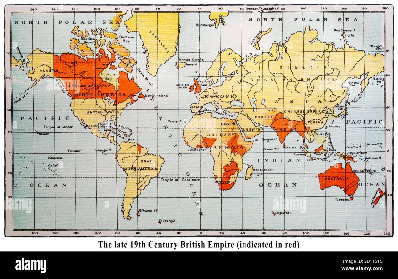 A late 19th Century map of the world, with the British Empire marked in red. The British Empire comprised the dominions, colonies, protectorates, mandates, and other territories ruled or administered by the United Kingdom and its predecessor states. Note: the names of some locations are no longer in use. Stock Photohttps://www.alamy.com/image-license-details/?v=1https://www.alamy.com/a-late-19th-century-map-of-the-world-with-the-british-empire-marked-in-red-the-british-empire-comprised-the-dominions-colonies-protectorates-mandates-and-other-territories-ruled-or-administered-by-the-united-kingdom-and-its-predecessor-states-note-the-names-of-some-locations-are-no-longer-in-use-image379268668.html
RM2D1151G–A late 19th Century map of the world, with the British Empire marked in red. The British Empire comprised the dominions, colonies, protectorates, mandates, and other territories ruled or administered by the United Kingdom and its predecessor states. Note: the names of some locations are no longer in use.
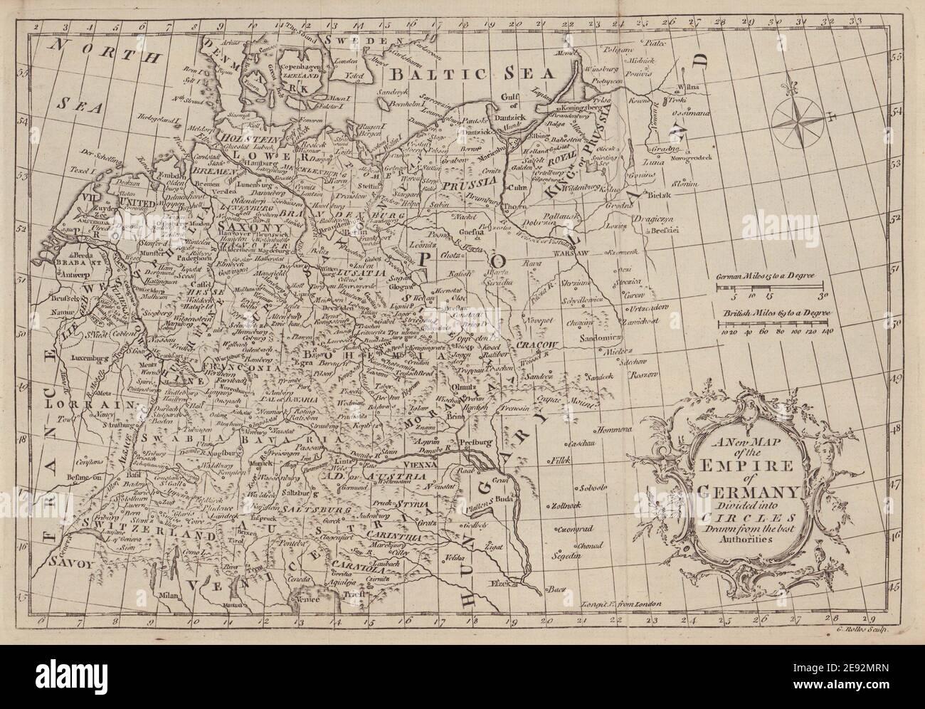 A new map of the Empire of Germany divided into Circles… ROLLOS 1766 old Stock Photohttps://www.alamy.com/image-license-details/?v=1https://www.alamy.com/a-new-map-of-the-empire-of-germany-divided-into-circles-rollos-1766-old-image401430617.html
RF2E92MRN–A new map of the Empire of Germany divided into Circles… ROLLOS 1766 old
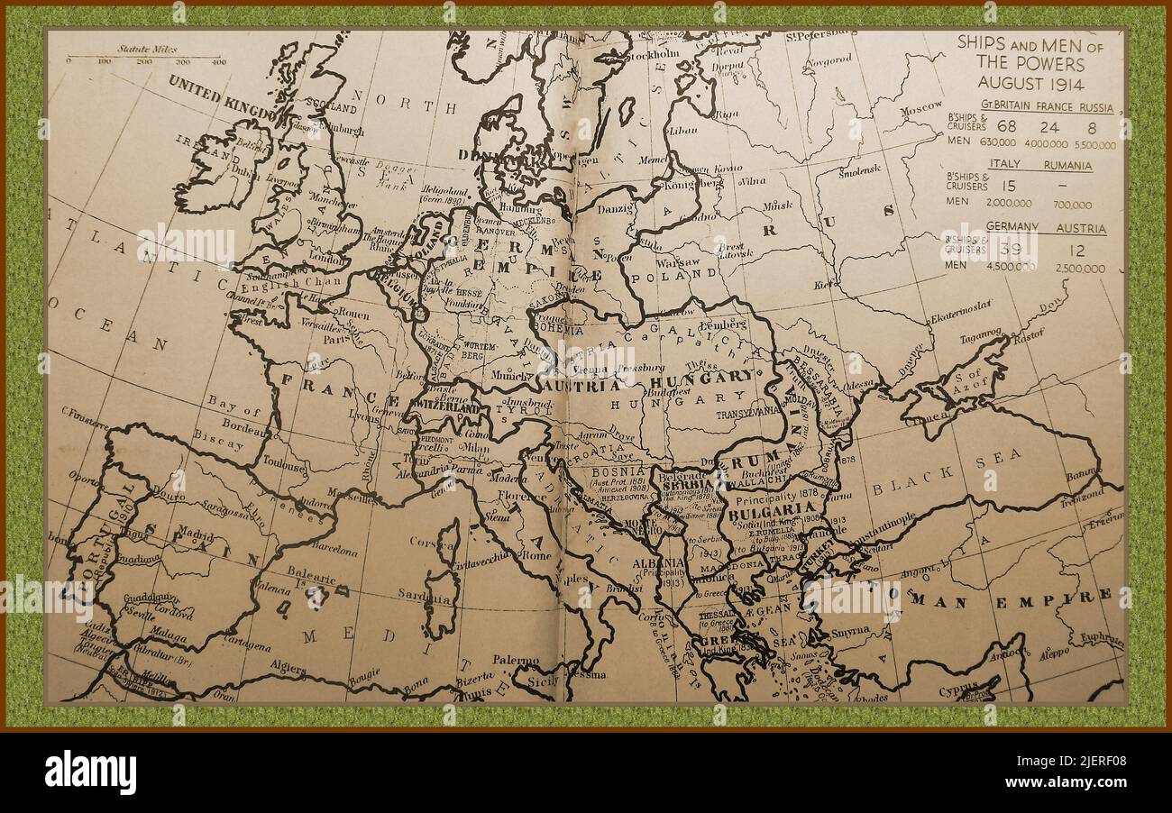 WWI - An historical map of Europe showing borders, regions, countries, place names and military details of ships and fighting manpower with distances in English miles - WWI - Eine historische Karte von Europa mit Grenzen, Regionen, Ländern, Ortsnamen und militärischen Details von Schiffen und Kampfpersonal mit Entfernungen in englischen Meilen - Première Guerre mondiale - Une carte historique de l’Europe montrant les frontières, les régions, les pays, les noms de lieux et les détails militaires des navires et de la main-d’œuvre combattante avec des distances en miles anglais. Stock Photohttps://www.alamy.com/image-license-details/?v=1https://www.alamy.com/wwi-an-historical-map-of-europe-showing-borders-regions-countries-place-names-and-military-details-of-ships-and-fighting-manpower-with-distances-in-english-miles-wwi-eine-historische-karte-von-europa-mit-grenzen-regionen-lndern-ortsnamen-und-militrischen-details-von-schiffen-und-kampfpersonal-mit-entfernungen-in-englischen-meilen-premire-guerre-mondiale-une-carte-historique-de-leurope-montrant-les-frontires-les-rgions-les-pays-les-noms-de-lieux-et-les-dtails-militaires-des-navires-et-de-la-main-duvre-combattante-avec-des-distances-en-miles-anglais-image473801784.html
RM2JERF08–WWI - An historical map of Europe showing borders, regions, countries, place names and military details of ships and fighting manpower with distances in English miles - WWI - Eine historische Karte von Europa mit Grenzen, Regionen, Ländern, Ortsnamen und militärischen Details von Schiffen und Kampfpersonal mit Entfernungen in englischen Meilen - Première Guerre mondiale - Une carte historique de l’Europe montrant les frontières, les régions, les pays, les noms de lieux et les détails militaires des navires et de la main-d’œuvre combattante avec des distances en miles anglais.
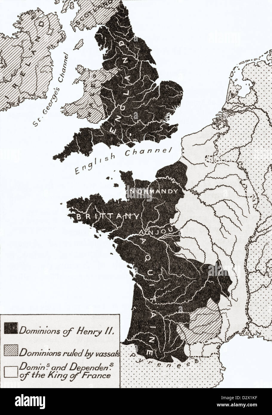 A map showing the Empire of king Henry II of England in the twelfth century Stock Photohttps://www.alamy.com/image-license-details/?v=1https://www.alamy.com/stock-photo-a-map-showing-the-empire-of-king-henry-ii-of-england-in-the-twelfth-53432499.html
RMD2X1KF–A map showing the Empire of king Henry II of England in the twelfth century
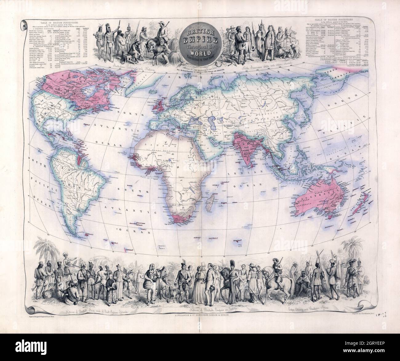 Vintage World Map - British Empire throughout the world exhibited in one view. Bartholomew, John, 1831-1893. Stock Photohttps://www.alamy.com/image-license-details/?v=1https://www.alamy.com/vintage-world-map-british-empire-throughout-the-world-exhibited-in-one-view-bartholomew-john-1831-1893-image445000382.html
RM2GRYEEP–Vintage World Map - British Empire throughout the world exhibited in one view. Bartholomew, John, 1831-1893.
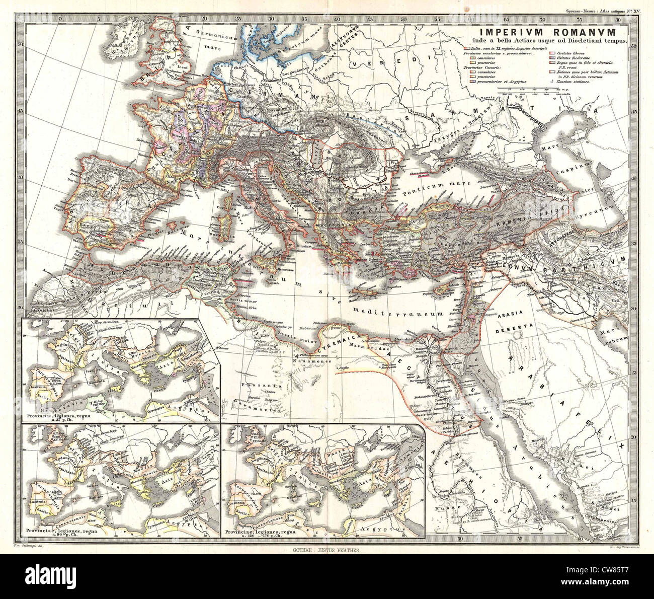 1865 Spruner Map of the Roman Empire under Diocletian Stock Photohttps://www.alamy.com/image-license-details/?v=1https://www.alamy.com/stock-photo-1865-spruner-map-of-the-roman-empire-under-diocletian-49967351.html
RMCW85T7–1865 Spruner Map of the Roman Empire under Diocletian
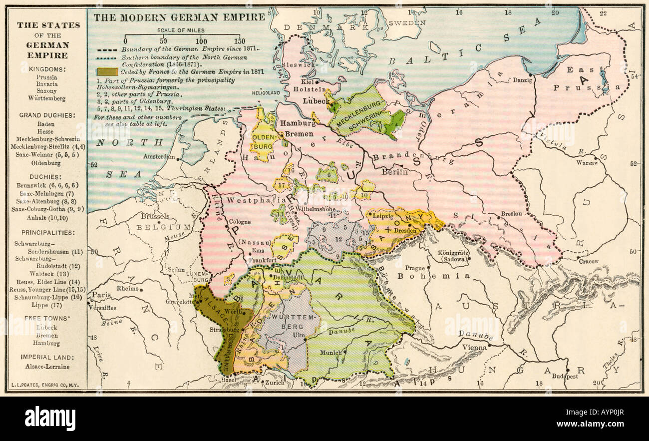 Map of the German Empire before World War I circa 1912. Color lithograph Stock Photohttps://www.alamy.com/image-license-details/?v=1https://www.alamy.com/stock-photo-map-of-the-german-empire-before-world-war-i-circa-1912-color-lithograph-17154142.html
RMAYP0JR–Map of the German Empire before World War I circa 1912. Color lithograph
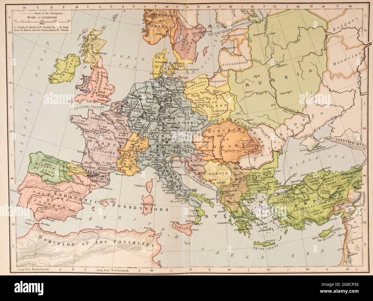 Map of Europe and the Byzantine Empire, c.1000. From Historical Atlas, published 1923. Stock Photohttps://www.alamy.com/image-license-details/?v=1https://www.alamy.com/map-of-europe-and-the-byzantine-empire-c1000-from-historical-atlas-published-1923-image435457210.html
RM2G8CP36–Map of Europe and the Byzantine Empire, c.1000. From Historical Atlas, published 1923.
 Map Of China 1900 Stock Photohttps://www.alamy.com/image-license-details/?v=1https://www.alamy.com/stock-photo-map-of-china-1900-131794667.html
RFHJBNCB–Map Of China 1900
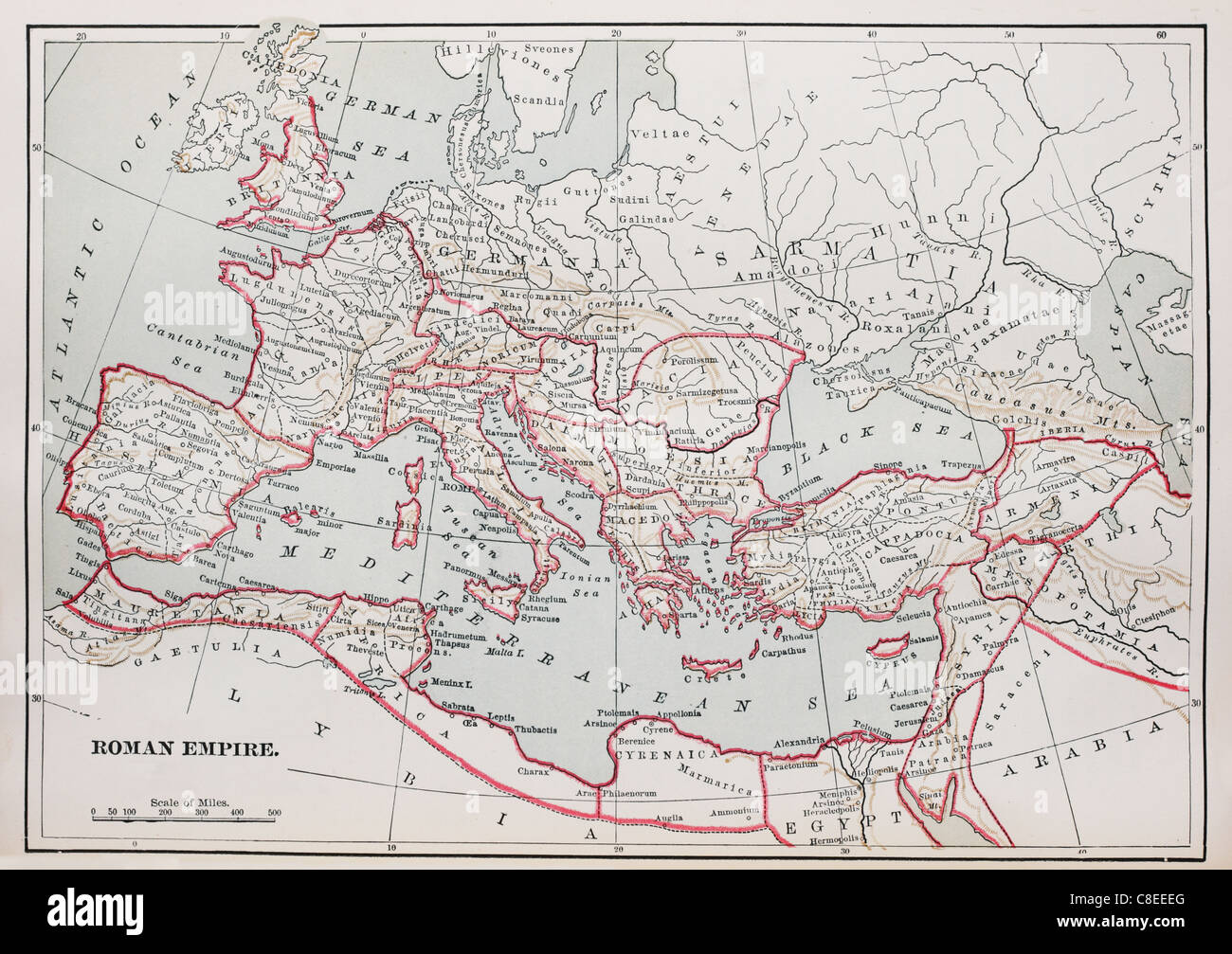 historic Roman Empire Map from 1894 book Stock Photohttps://www.alamy.com/image-license-details/?v=1https://www.alamy.com/stock-photo-historic-roman-empire-map-from-1894-book-39656696.html
RFC8EEEG–historic Roman Empire Map from 1894 book
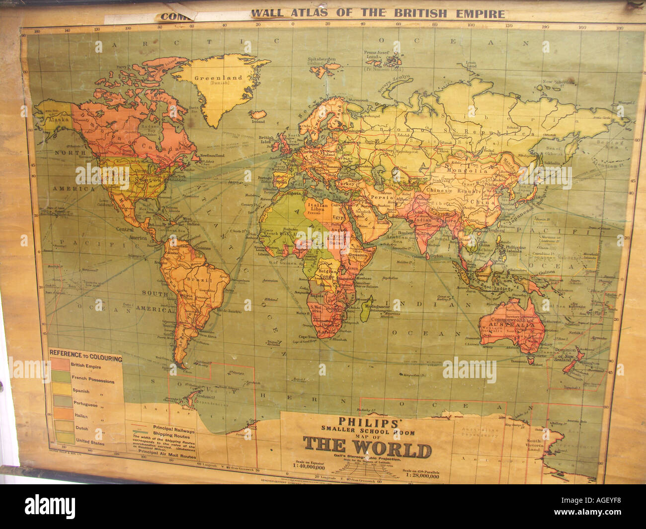 Old school world wall map showing British Empire in red Stock Photohttps://www.alamy.com/image-license-details/?v=1https://www.alamy.com/old-school-world-wall-map-showing-british-empire-in-red-image4633591.html
RMAGEYF8–Old school world wall map showing British Empire in red
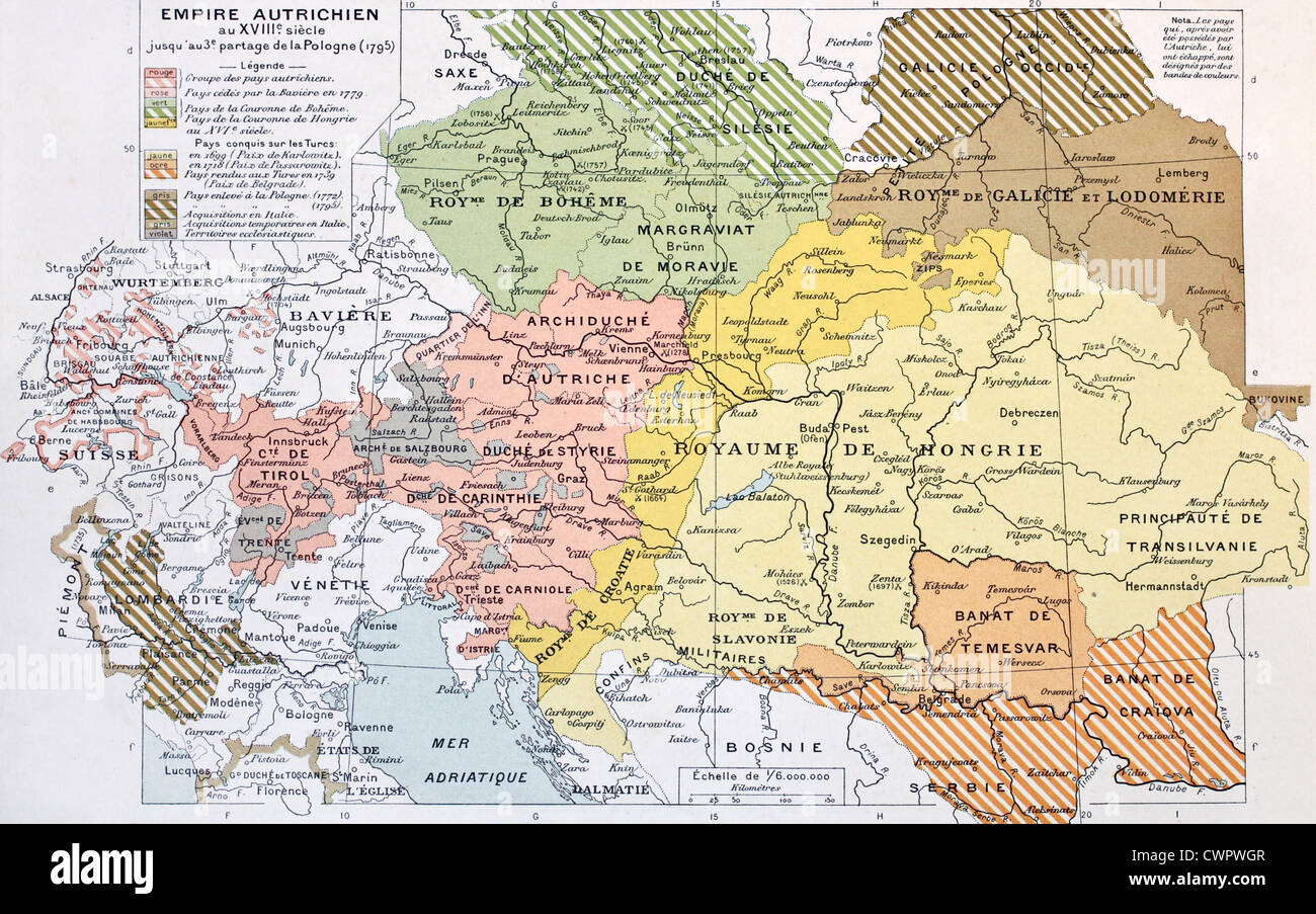 Austrian Empire historical development map Stock Photohttps://www.alamy.com/image-license-details/?v=1https://www.alamy.com/stock-photo-austrian-empire-historical-development-map-50290151.html
RFCWPWGR–Austrian Empire historical development map
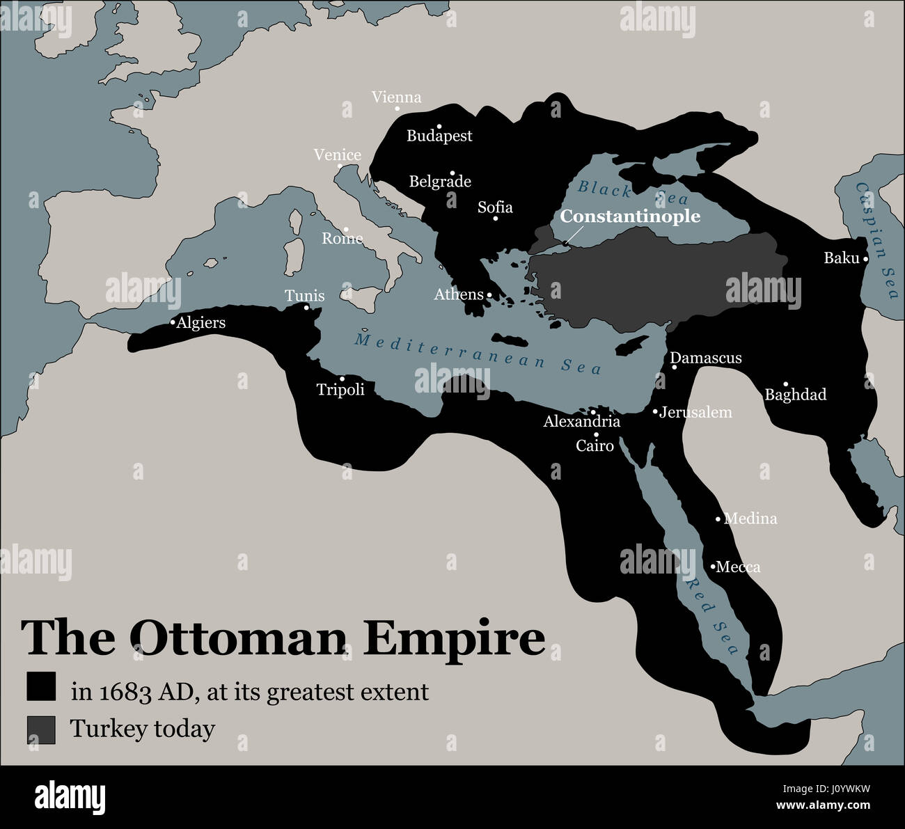 Turkey today and the Ottoman Empire at its greatest extent in 1683 - history map of its territory expansion and military acquisition. Stock Photohttps://www.alamy.com/image-license-details/?v=1https://www.alamy.com/stock-photo-turkey-today-and-the-ottoman-empire-at-its-greatest-extent-in-1683-138295805.html
RFJ0YWKW–Turkey today and the Ottoman Empire at its greatest extent in 1683 - history map of its territory expansion and military acquisition.
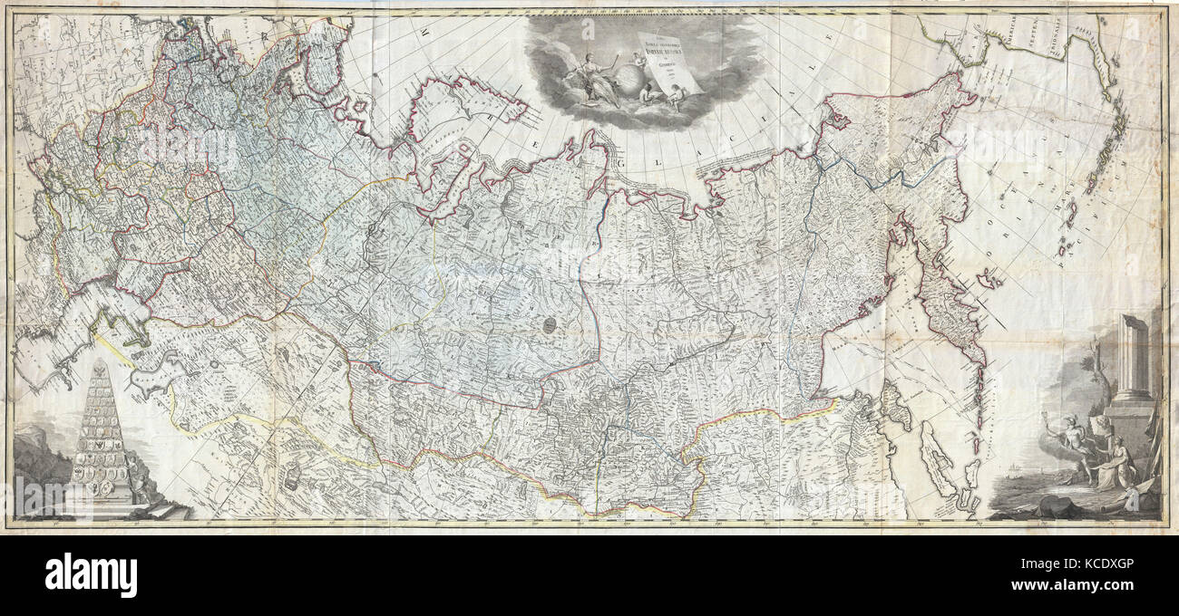 1787, Wall Map of the Russian Empire Stock Photohttps://www.alamy.com/image-license-details/?v=1https://www.alamy.com/stock-image-1787-wall-map-of-the-russian-empire-162575414.html
RMKCDXGP–1787, Wall Map of the Russian Empire
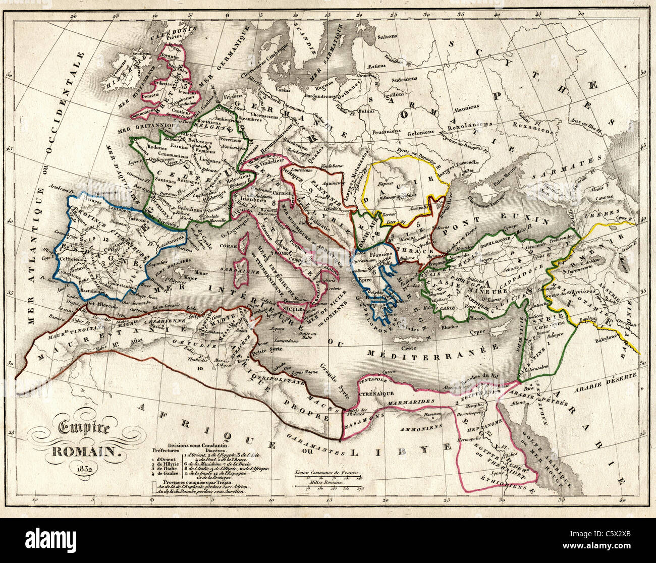 Empire Romain (Roman Empire) Antiquarian Map from 'Atlas Universel de Geographie Ancienne and Moderne' by cartographer C. V. Monin Stock Photohttps://www.alamy.com/image-license-details/?v=1https://www.alamy.com/stock-photo-empire-romain-roman-empire-antiquarian-map-from-atlas-universel-de-38067075.html
RFC5X2XB–Empire Romain (Roman Empire) Antiquarian Map from 'Atlas Universel de Geographie Ancienne and Moderne' by cartographer C. V. Monin
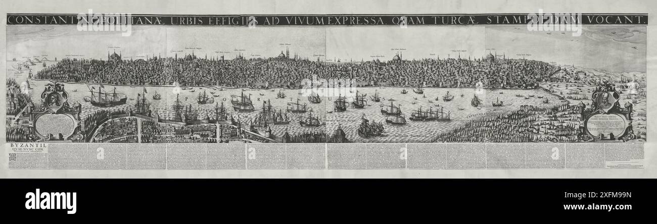 Ottoman Empire. Late medieval map of Constantinople. The end of 16th century. Stock Photohttps://www.alamy.com/image-license-details/?v=1https://www.alamy.com/ottoman-empire-late-medieval-map-of-constantinople-the-end-of-16th-century-image612029089.html
RM2XFM99N–Ottoman Empire. Late medieval map of Constantinople. The end of 16th century.
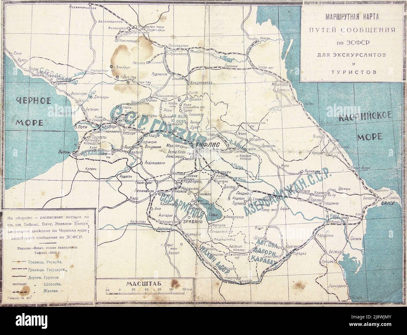 Route map of communications in the Transcaucasian Soviet Federated Socialist Republic for sightseers and tourists. Stock Photohttps://www.alamy.com/image-license-details/?v=1https://www.alamy.com/route-map-of-communications-in-the-transcaucasian-soviet-federated-socialist-republic-for-sightseers-and-tourists-image470160683.html
RM2J8WJMY–Route map of communications in the Transcaucasian Soviet Federated Socialist Republic for sightseers and tourists.
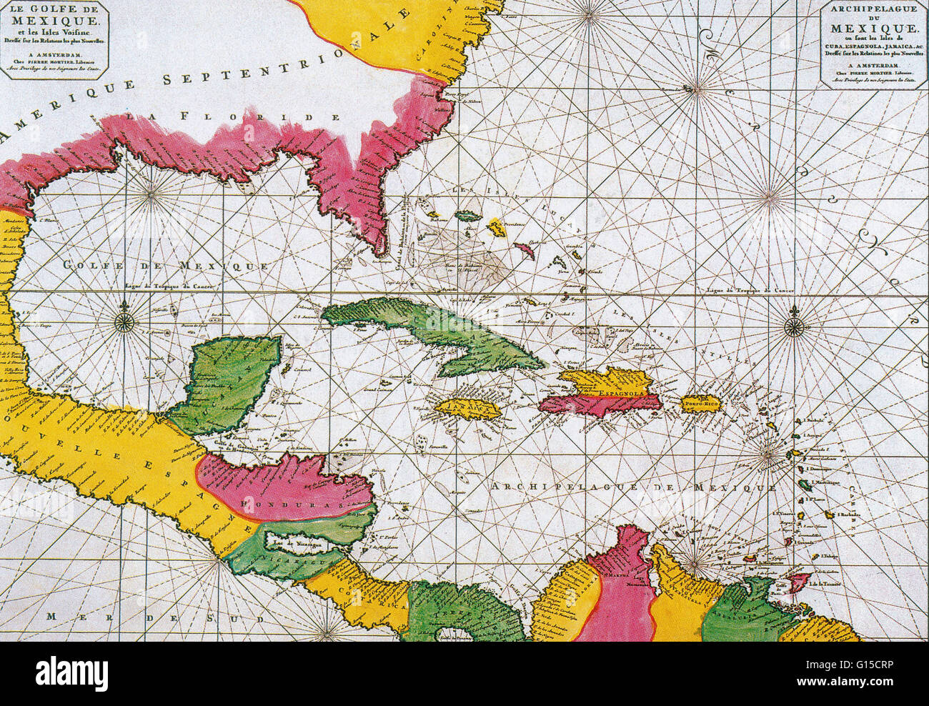 A Dutch map of 1708 showing the Spanish Main, the mainland coast of the Spanish Empire, toward the end of the great era of Spanish treasure fleets. Stock Photohttps://www.alamy.com/image-license-details/?v=1https://www.alamy.com/stock-photo-a-dutch-map-of-1708-showing-the-spanish-main-the-mainland-coast-of-103996698.html
RMG15CRP–A Dutch map of 1708 showing the Spanish Main, the mainland coast of the Spanish Empire, toward the end of the great era of Spanish treasure fleets.
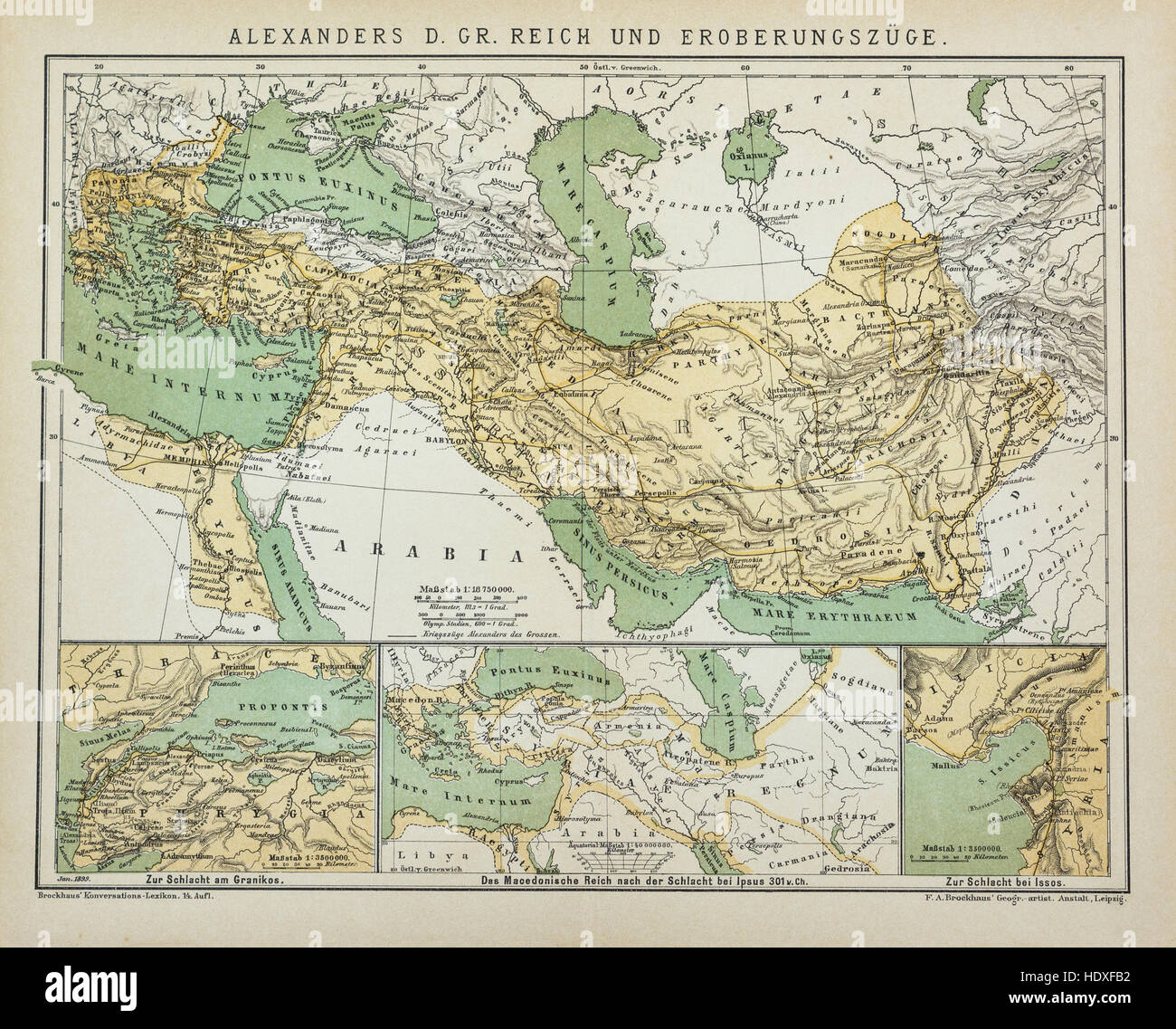 Antique map of Alexander's the Great Empire Stock Photohttps://www.alamy.com/image-license-details/?v=1https://www.alamy.com/stock-photo-antique-map-of-alexanders-the-great-empire-129045926.html
RFHDXFB2–Antique map of Alexander's the Great Empire
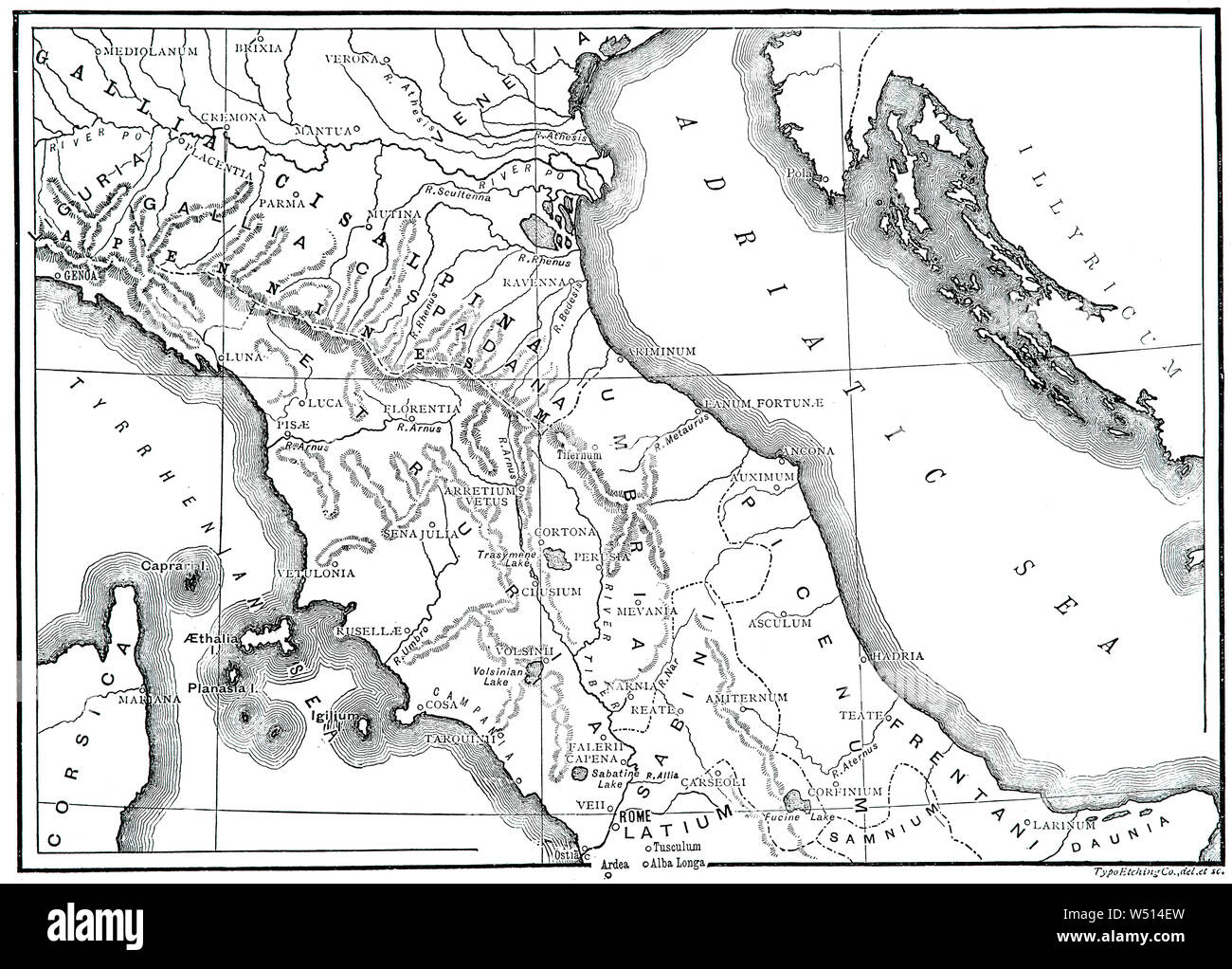 A 19th Century map of Ancient Northern and central Italia (Latin and Italian name for the Italian Peninsula), illustrating the homeland of the Romans and metropole of Rome's empire in classical antiquity. Rome was an Italian city-state that changed its form of government from kingdom to republic and when the consolidation of Italy into a single entity occurred during the Roman expansion in the peninsula, when Rome formed a permanent association with most of the local tribes and cities. Stock Photohttps://www.alamy.com/image-license-details/?v=1https://www.alamy.com/a-19th-century-map-of-ancient-northern-and-central-italia-latin-and-italian-name-for-the-italian-peninsula-illustrating-the-homeland-of-the-romans-and-metropole-of-romes-empire-in-classical-antiquity-rome-was-an-italian-city-state-that-changed-its-form-of-government-from-kingdom-to-republic-and-when-the-consolidation-of-italy-into-a-single-entity-occurred-during-the-roman-expansion-in-the-peninsula-when-rome-formed-a-permanent-association-with-most-of-the-local-tribes-and-cities-image261254305.html
RMW514EW–A 19th Century map of Ancient Northern and central Italia (Latin and Italian name for the Italian Peninsula), illustrating the homeland of the Romans and metropole of Rome's empire in classical antiquity. Rome was an Italian city-state that changed its form of government from kingdom to republic and when the consolidation of Italy into a single entity occurred during the Roman expansion in the peninsula, when Rome formed a permanent association with most of the local tribes and cities.
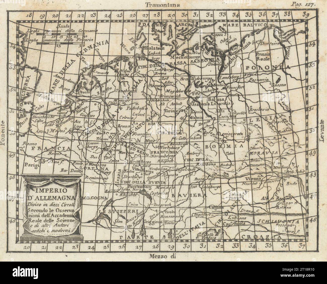 'Imperio d'Allemagna'. Germany. Holy Roman Empire. BUFFIER 1788 old map Stock Photohttps://www.alamy.com/image-license-details/?v=1https://www.alamy.com/imperio-dallemagna-germany-holy-roman-empire-buffier-1788-old-map-image568750476.html
RF2T18R10–'Imperio d'Allemagna'. Germany. Holy Roman Empire. BUFFIER 1788 old map
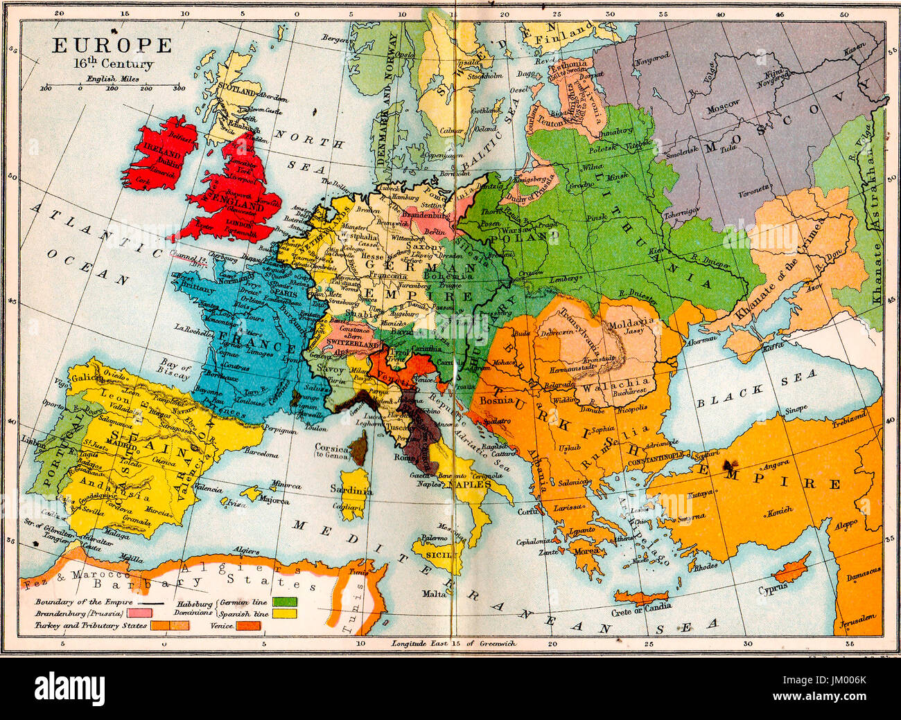 Old school atlas map- Europe in 16th century Stock Photohttps://www.alamy.com/image-license-details/?v=1https://www.alamy.com/stock-photo-old-school-atlas-map-europe-in-16th-century-149976251.html
RMJM006K–Old school atlas map- Europe in 16th century
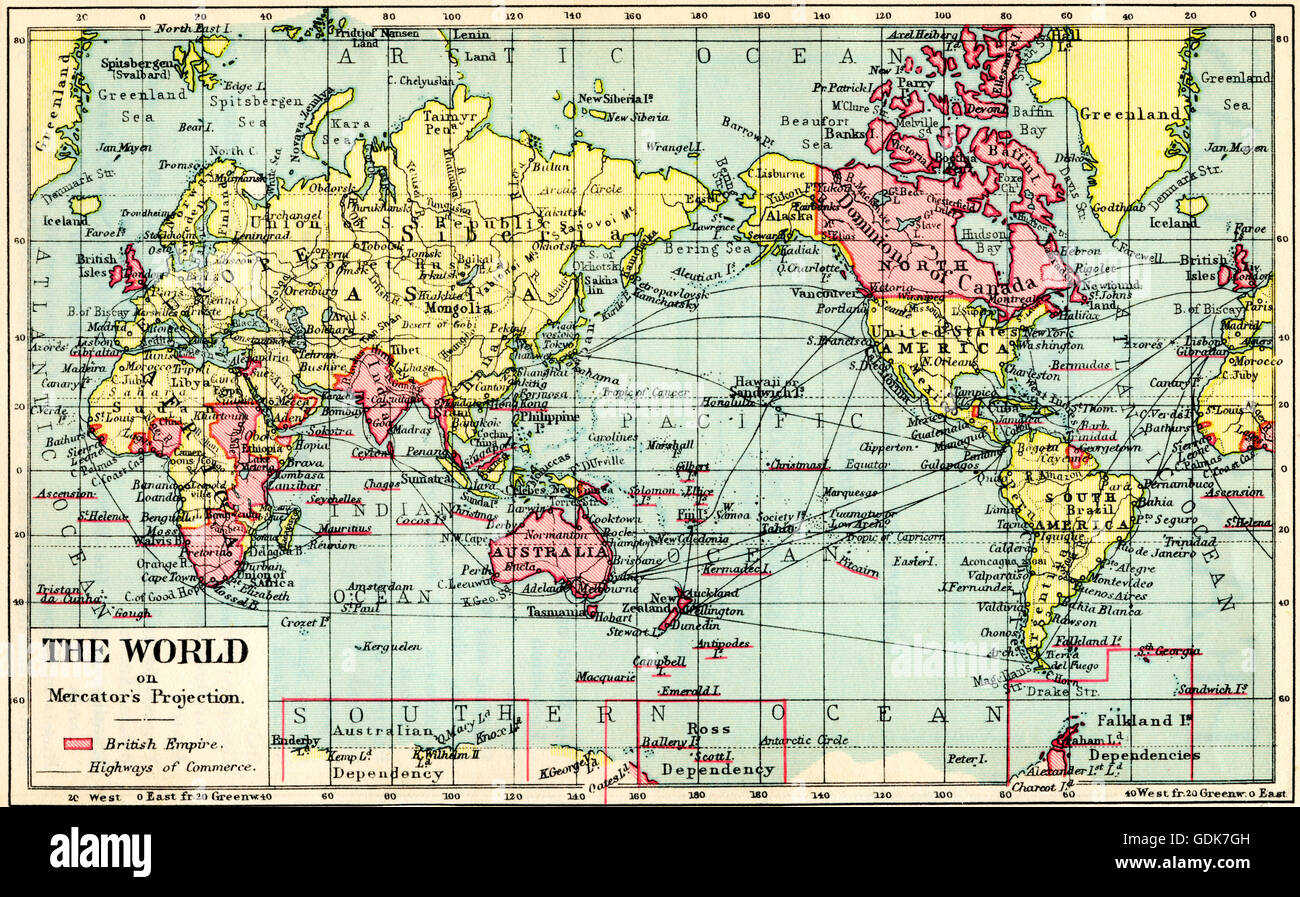 A 1930's map of the world on Mercator's projection. The British Empire shown in red. Stock Photohttps://www.alamy.com/image-license-details/?v=1https://www.alamy.com/stock-photo-a-1930s-map-of-the-world-on-mercators-projection-the-british-empire-111675777.html
RMGDK7GH–A 1930's map of the world on Mercator's projection. The British Empire shown in red.
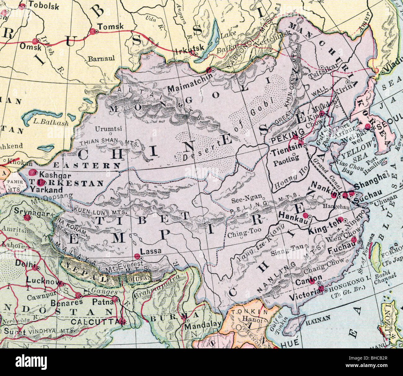 Original old map of China Empire from 1903 geography textbook Stock Photohttps://www.alamy.com/image-license-details/?v=1https://www.alamy.com/stock-photo-original-old-map-of-china-empire-from-1903-geography-textbook-27931647.html
RMBHCB2R–Original old map of China Empire from 1903 geography textbook
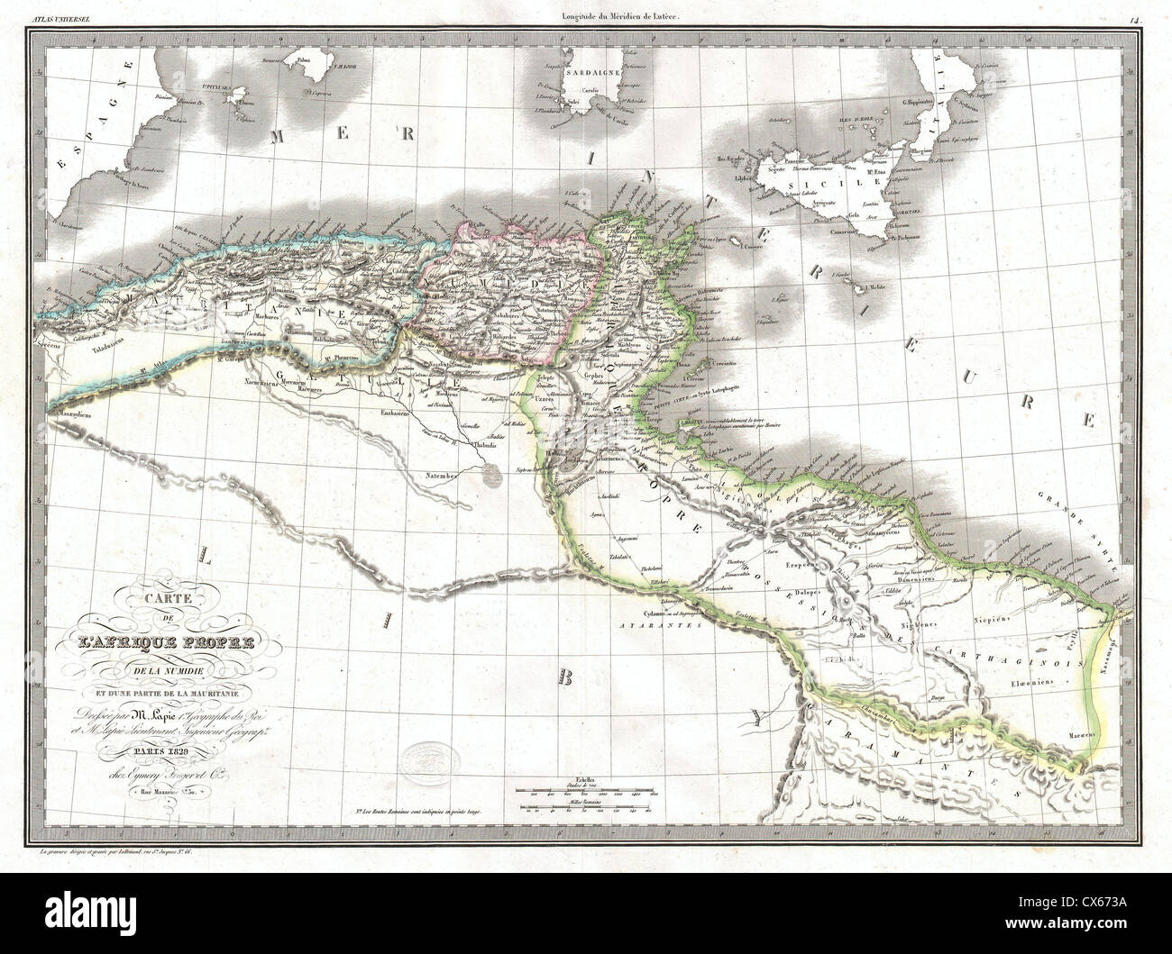 1829 Lapie Historical Map of Empire of Carthage ( Modern Tunisia ) Stock Photohttps://www.alamy.com/image-license-details/?v=1https://www.alamy.com/stock-photo-1829-lapie-historical-map-of-empire-of-carthage-modern-tunisia-50539086.html
RMCX673A–1829 Lapie Historical Map of Empire of Carthage ( Modern Tunisia )
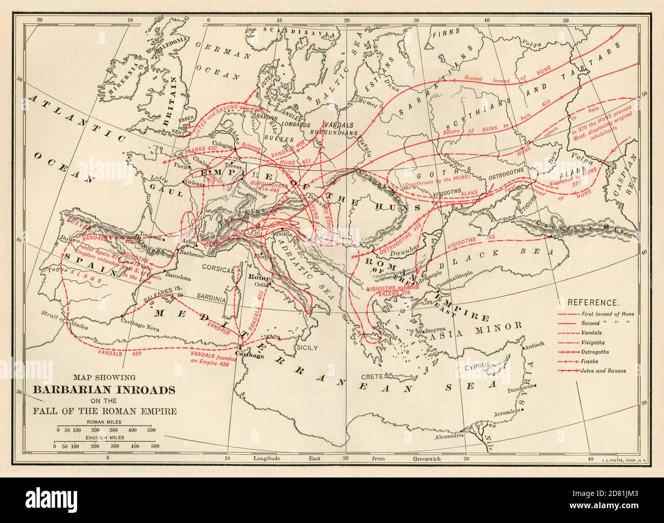 Map of Barbarian routes into the Roman Empire. Color lithograph Stock Photohttps://www.alamy.com/image-license-details/?v=1https://www.alamy.com/map-of-barbarian-routes-into-the-roman-empire-color-lithograph-image383581971.html
RM2D81JM3–Map of Barbarian routes into the Roman Empire. Color lithograph
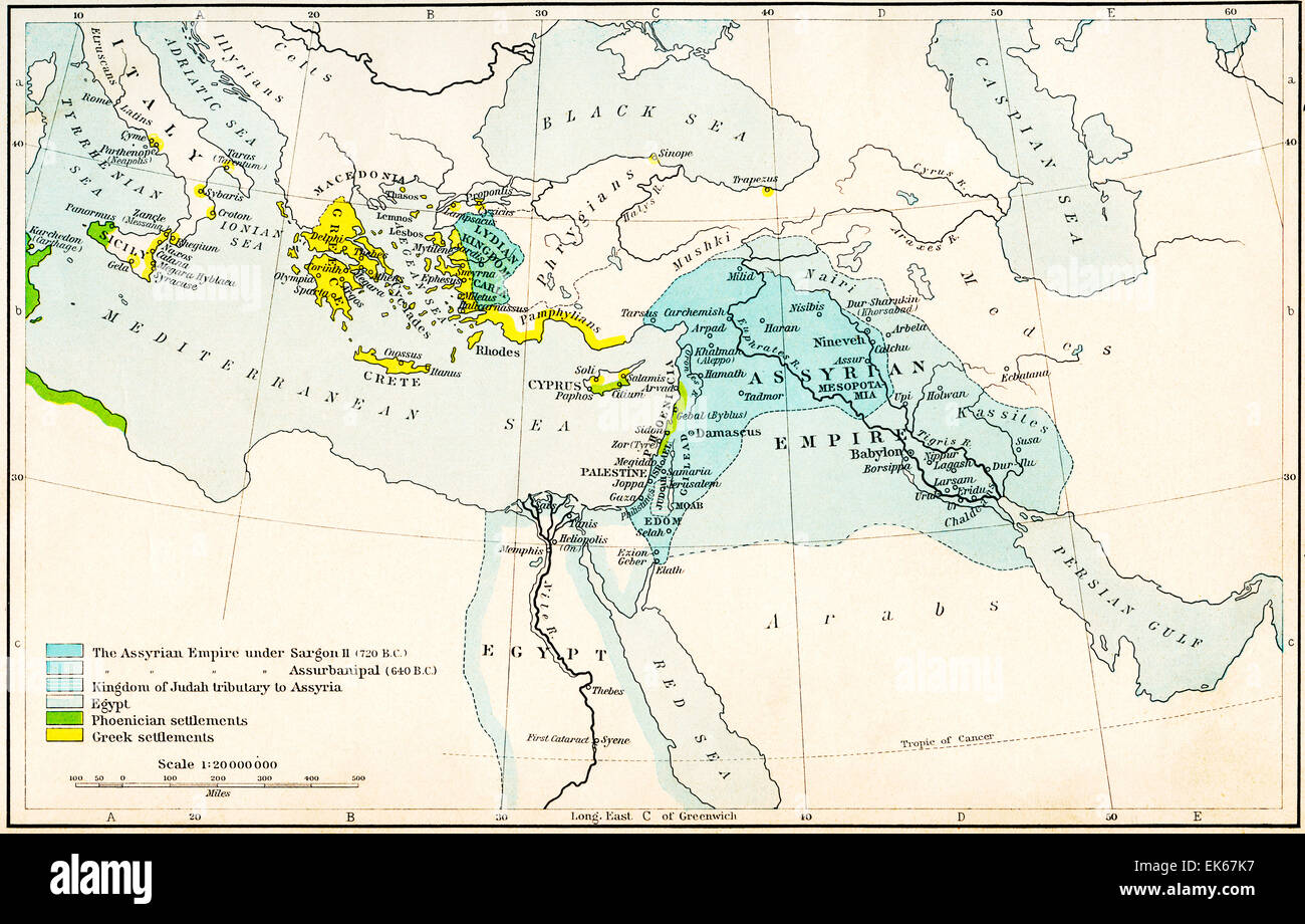 Map of the Assyrian Empire and the region around the eastern Mediterranean, 750 - 625 B.C. Stock Photohttps://www.alamy.com/image-license-details/?v=1https://www.alamy.com/stock-photo-map-of-the-assyrian-empire-and-the-region-around-the-eastern-mediterranean-80657675.html
RMEK67K7–Map of the Assyrian Empire and the region around the eastern Mediterranean, 750 - 625 B.C.
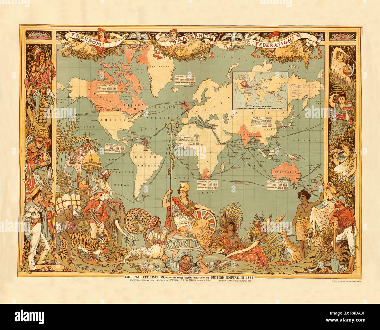 British Empire 1886d Stock Photohttps://www.alamy.com/image-license-details/?v=1https://www.alamy.com/british-empire-1886d-image226486730.html
RFR4DA3P–British Empire 1886d
 Map of the Roman Empire in the Apostolic age from a nineteenth century Bible Stock Photohttps://www.alamy.com/image-license-details/?v=1https://www.alamy.com/stock-photo-map-of-the-roman-empire-in-the-apostolic-age-from-a-nineteenth-century-34468733.html
RFC02565–Map of the Roman Empire in the Apostolic age from a nineteenth century Bible
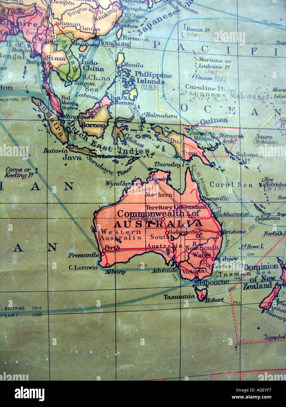 Old school wall map showing British Empire in red - focus on Australia, New Guinea, Indonesia, Borneo, south east Asia Stock Photohttps://www.alamy.com/image-license-details/?v=1https://www.alamy.com/old-school-wall-map-showing-british-empire-in-red-focus-on-australia-image4633590.html
RMAGEYF7–Old school wall map showing British Empire in red - focus on Australia, New Guinea, Indonesia, Borneo, south east Asia
 Europe in 1270 old map Stock Photohttps://www.alamy.com/image-license-details/?v=1https://www.alamy.com/stock-photo-europe-in-1270-old-map-50290223.html
RFCWPWKB–Europe in 1270 old map
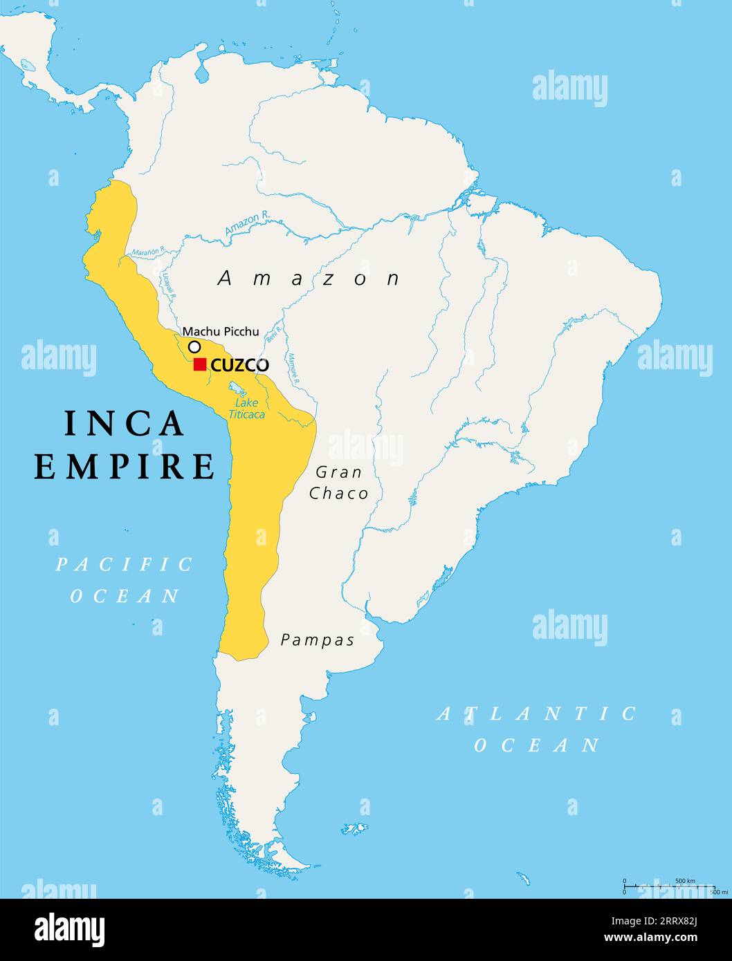 The Inca Empire at its greatest extent, about 1525, political map. Also known as Incan or Inka Empire, with capital Cusco. Also called Tawantinsuyu. Stock Photohttps://www.alamy.com/image-license-details/?v=1https://www.alamy.com/the-inca-empire-at-its-greatest-extent-about-1525-political-map-also-known-as-incan-or-inka-empire-with-capital-cusco-also-called-tawantinsuyu-image565445962.html
RF2RRX82J–The Inca Empire at its greatest extent, about 1525, political map. Also known as Incan or Inka Empire, with capital Cusco. Also called Tawantinsuyu.
 1864, Johnson Map of the Roman Empire Stock Photohttps://www.alamy.com/image-license-details/?v=1https://www.alamy.com/stock-image-1864-johnson-map-of-the-roman-empire-162576406.html
RMKCDYT6–1864, Johnson Map of the Roman Empire
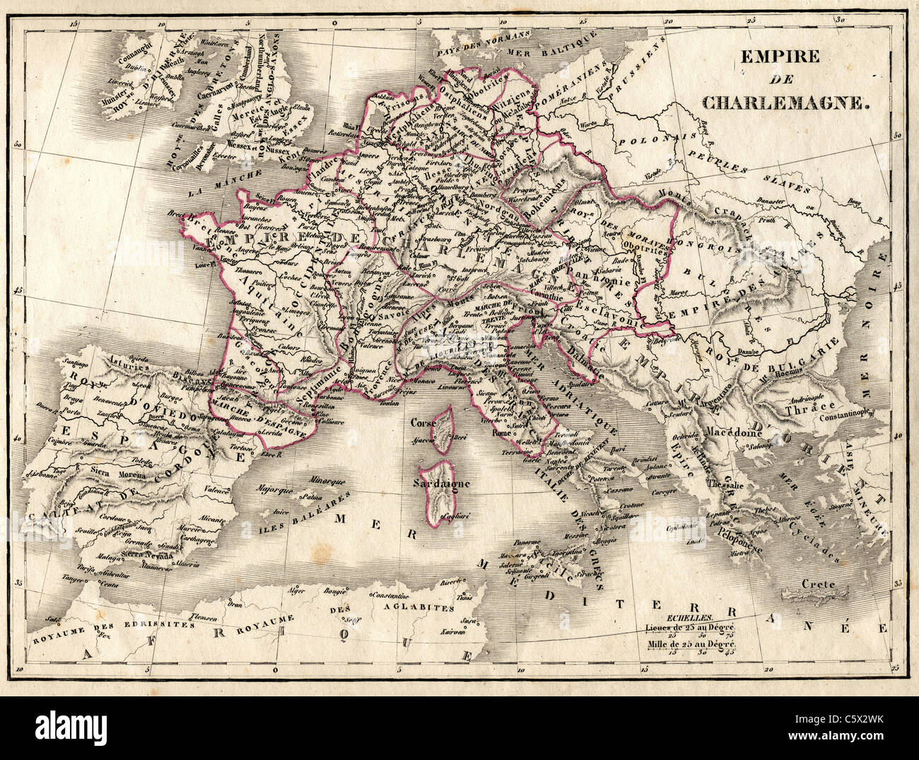 Empire de Charlemagne (Empire of Charlemagne) Antiquarian Map from 'Atlas Universel de Geographie Ancienne and Moderne' by cartographer C. V. Monin Stock Photohttps://www.alamy.com/image-license-details/?v=1https://www.alamy.com/stock-photo-empire-de-charlemagne-empire-of-charlemagne-antiquarian-map-from-atlas-38067055.html
RFC5X2WK–Empire de Charlemagne (Empire of Charlemagne) Antiquarian Map from 'Atlas Universel de Geographie Ancienne and Moderne' by cartographer C. V. Monin
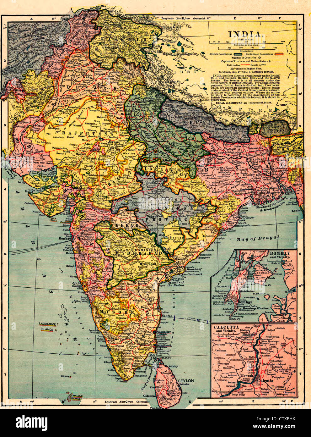 India - vintage map circa 1903 Stock Photohttps://www.alamy.com/image-license-details/?v=1https://www.alamy.com/stock-photo-india-vintage-map-circa-1903-49754703.html
RMCTXEHK–India - vintage map circa 1903
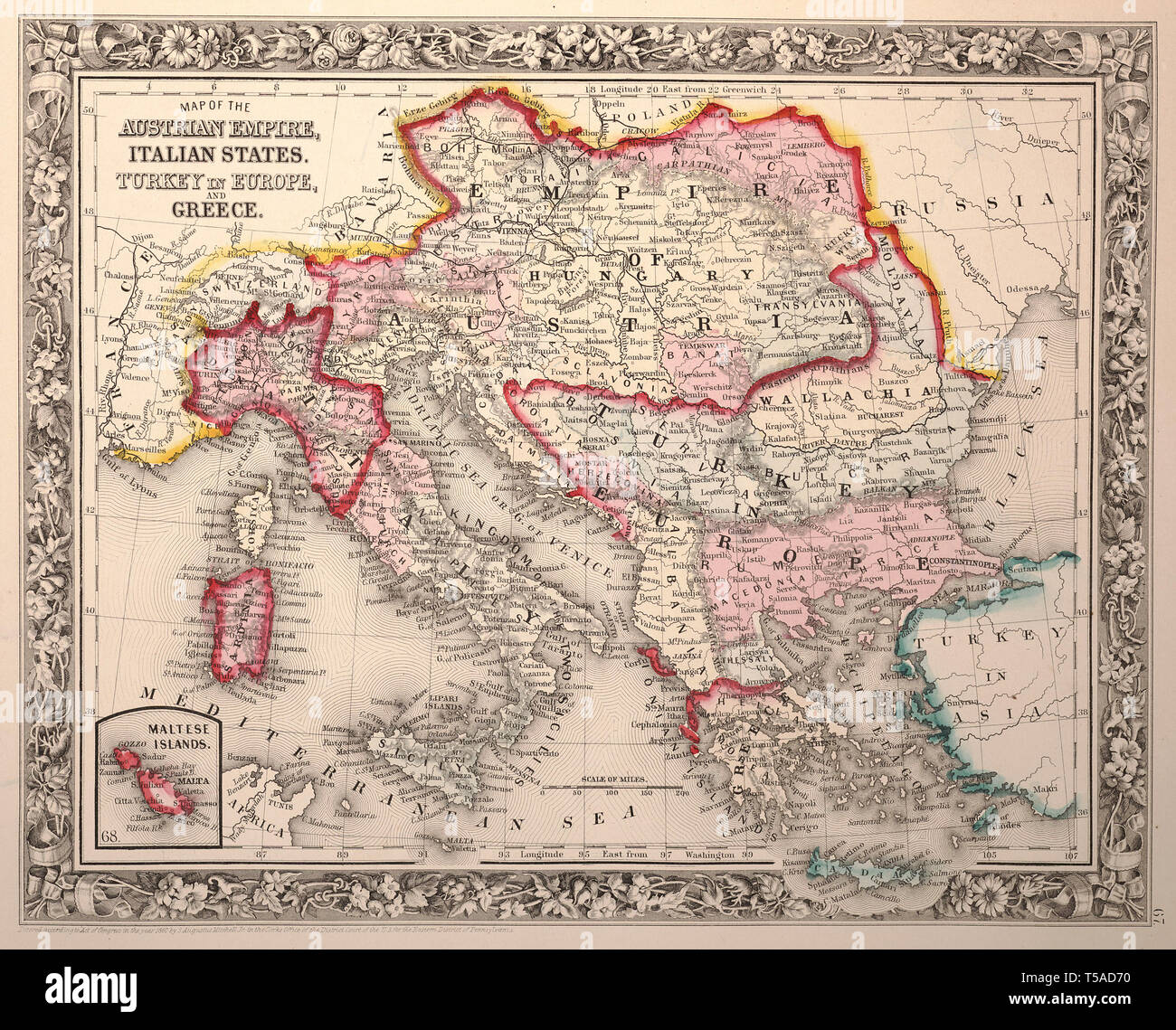 Beautiful vintage hand drawn map illustrations of Austria-Hungary from old book. Can be used as poster or decorative element for interior design. Stock Photohttps://www.alamy.com/image-license-details/?v=1https://www.alamy.com/beautiful-vintage-hand-drawn-map-illustrations-of-austria-hungary-from-old-book-can-be-used-as-poster-or-decorative-element-for-interior-design-image244248340.html
RFT5AD70–Beautiful vintage hand drawn map illustrations of Austria-Hungary from old book. Can be used as poster or decorative element for interior design.
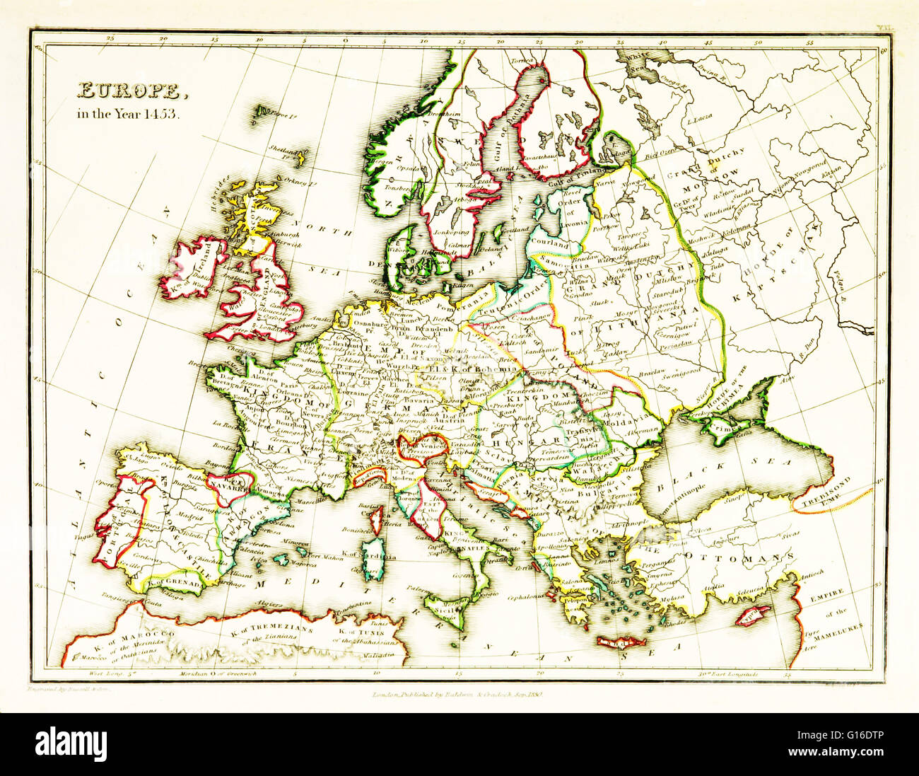 A map of Europe, showing territorial borders existing in the 15th century, specifically 1453. The Fall of Constantinople, capital of the Byzantine Empire, to the invading army of the Ottoman Empire occurred on 29 May, 1453. Map published in 1831. Stock Photohttps://www.alamy.com/image-license-details/?v=1https://www.alamy.com/stock-photo-a-map-of-europe-showing-territorial-borders-existing-in-the-15th-century-104019462.html
RMG16DTP–A map of Europe, showing territorial borders existing in the 15th century, specifically 1453. The Fall of Constantinople, capital of the Byzantine Empire, to the invading army of the Ottoman Empire occurred on 29 May, 1453. Map published in 1831.
 1830 Nathan Hale Map - Austrian Empire - Austria Hungary Bohemia Moravia Galicia Transylvania Croatia Venice Stock Photohttps://www.alamy.com/image-license-details/?v=1https://www.alamy.com/stock-image-1830-nathan-hale-map-austrian-empire-austria-hungary-bohemia-moravia-169530067.html
RFKRPN97–1830 Nathan Hale Map - Austrian Empire - Austria Hungary Bohemia Moravia Galicia Transylvania Croatia Venice
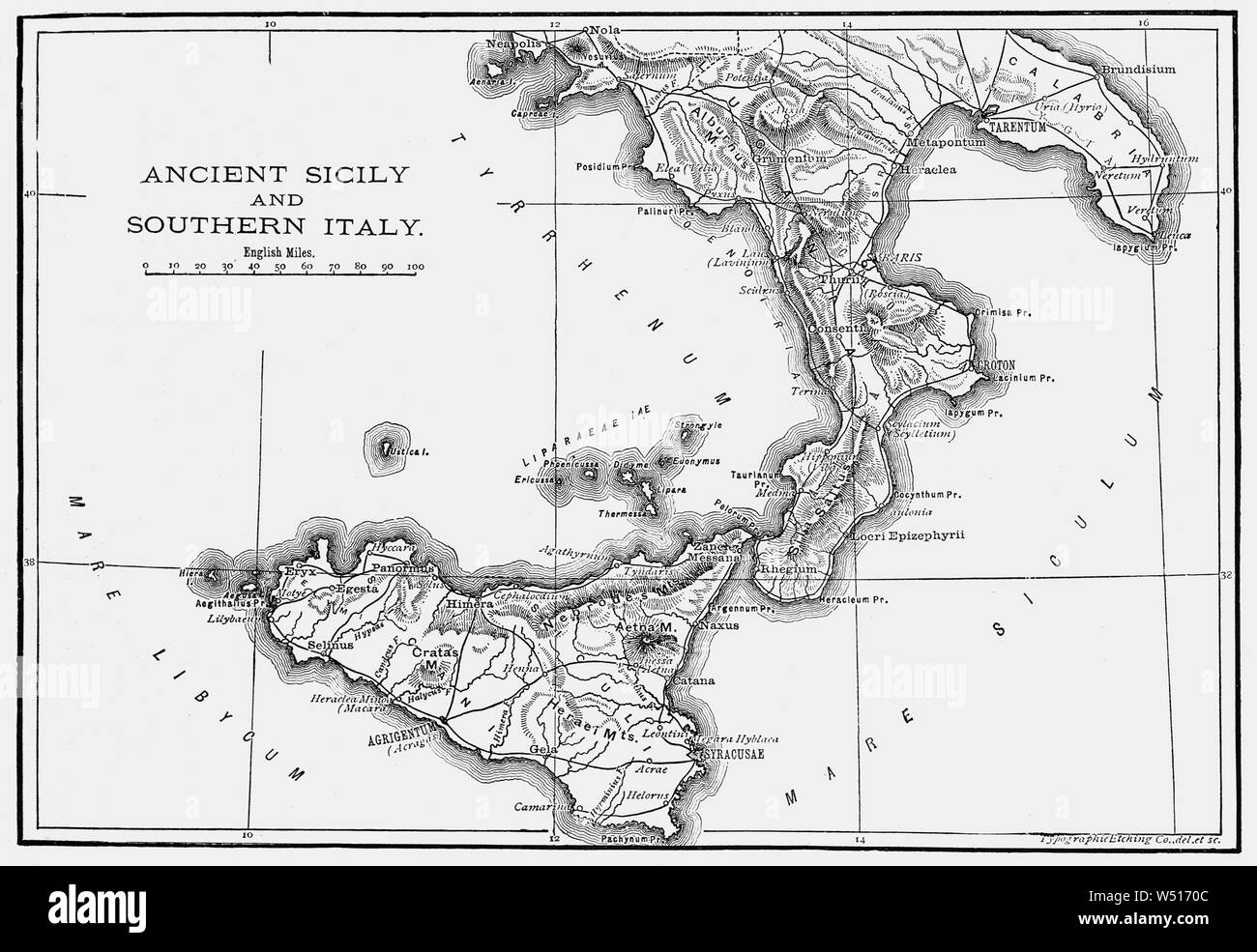 A 19th Century map of Ancient Sicily and Southern Italia (Latin and Italian name for the Italian Peninsula), illustrating the homeland of the Romans and metropole of Rome's empire in classical antiquity. Rome was an Italian city-state that changed its form of government from kingdom to republic and when the consolidation of Italy into a single entity occurred during the Roman expansion in the peninsula, when Rome formed a permanent association with most of the local tribes and cities. Stock Photohttps://www.alamy.com/image-license-details/?v=1https://www.alamy.com/a-19th-century-map-of-ancient-sicily-and-southern-italia-latin-and-italian-name-for-the-italian-peninsula-illustrating-the-homeland-of-the-romans-and-metropole-of-romes-empire-in-classical-antiquity-rome-was-an-italian-city-state-that-changed-its-form-of-government-from-kingdom-to-republic-and-when-the-consolidation-of-italy-into-a-single-entity-occurred-during-the-roman-expansion-in-the-peninsula-when-rome-formed-a-permanent-association-with-most-of-the-local-tribes-and-cities-image261256252.html
RMW5170C–A 19th Century map of Ancient Sicily and Southern Italia (Latin and Italian name for the Italian Peninsula), illustrating the homeland of the Romans and metropole of Rome's empire in classical antiquity. Rome was an Italian city-state that changed its form of government from kingdom to republic and when the consolidation of Italy into a single entity occurred during the Roman expansion in the peninsula, when Rome formed a permanent association with most of the local tribes and cities.
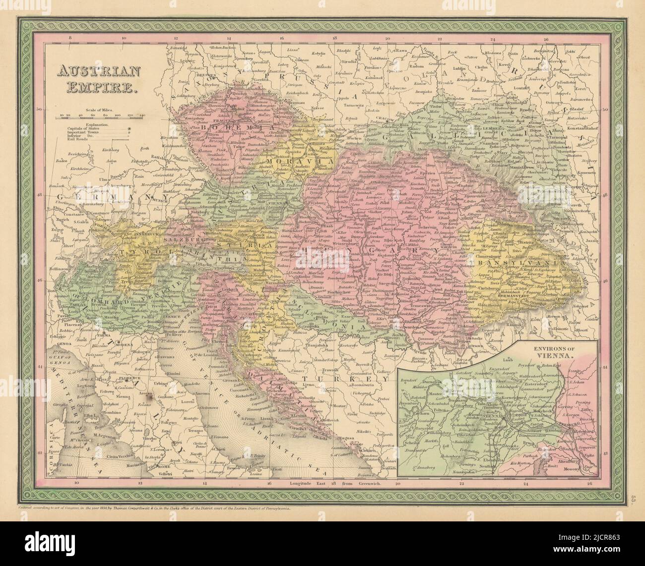 Austrian Empire. Austria Hungary. Lombardy Gallicia. COWPERTHWAIT 1852 old map Stock Photohttps://www.alamy.com/image-license-details/?v=1https://www.alamy.com/austrian-empire-austria-hungary-lombardy-gallicia-cowperthwait-1852-old-map-image472567147.html
RF2JCR863–Austrian Empire. Austria Hungary. Lombardy Gallicia. COWPERTHWAIT 1852 old map
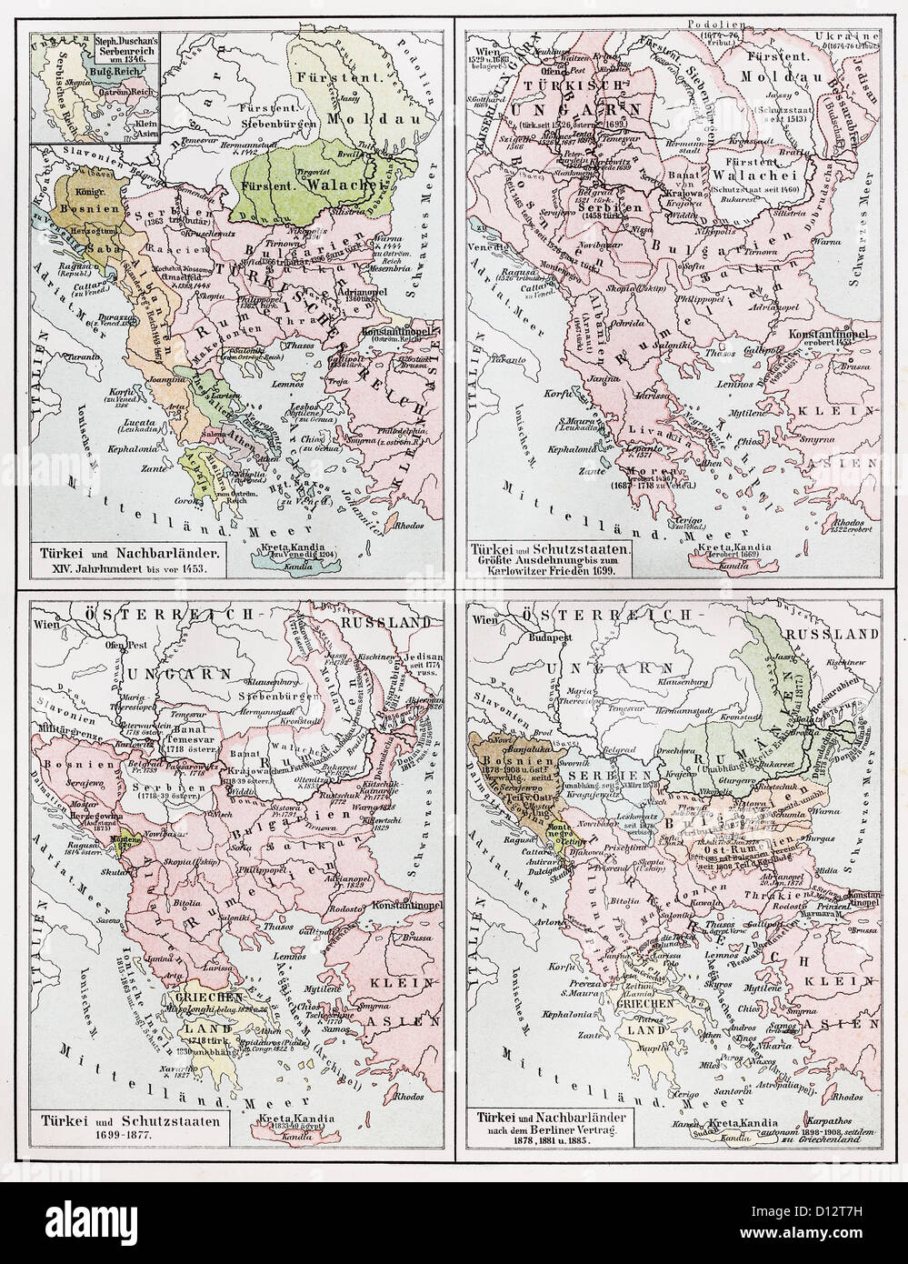 Vintage map representing the Turkish Empire European territories between 1453 and 1885 Stock Photohttps://www.alamy.com/image-license-details/?v=1https://www.alamy.com/stock-photo-vintage-map-representing-the-turkish-empire-european-territories-between-52308693.html
RFD12T7H–Vintage map representing the Turkish Empire European territories between 1453 and 1885
 Map of the British Empire in 1901. From A First Book of British History published 1925. Stock Photohttps://www.alamy.com/image-license-details/?v=1https://www.alamy.com/stock-photo-map-of-the-british-empire-in-1901-from-a-first-book-of-british-history-56870619.html
RMD8EK1F–Map of the British Empire in 1901. From A First Book of British History published 1925.
 Original old map of China Empire from 1903 geography textbook Stock Photohttps://www.alamy.com/image-license-details/?v=1https://www.alamy.com/stock-photo-original-old-map-of-china-empire-from-1903-geography-textbook-27935047.html
RMBHCFC7–Original old map of China Empire from 1903 geography textbook
